Making Data Work for You: Free Mapping Tools for Prioritization and Property Research
|
|
|
- June Fitzgerald
- 5 years ago
- Views:
Transcription

 and the Lookout")
1 Making Data Work for You: Free Mapping Tools for Prioritization and Property Research Ariel Maiorano Abby Hardy-Moss Essex County Open Space Conference March 25, Development of MAPPR supported by Open Space Institute Land Trust (OSILT) and the Lookout Foundation.


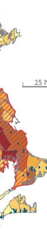

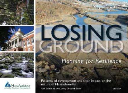
2 Losing Ground

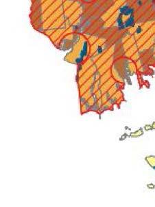
3 Losing Ground

4 Shaping the Future of Your Community Created in response to Losing Ground Works with communities to implement sustainable development and increase conservation efforts especially in sprawl frontier Facilitation: supports local stakeholders with tools and information

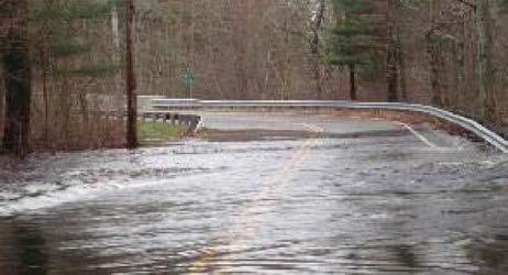
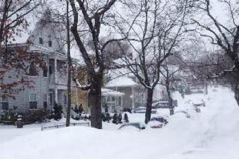
5 Climate Change

6 Climate and Land Use Connection Climate change Sprawli ng Developm ent increased precipitation increased temperature impervious surfaces stormwater & WQ issues flooding & infrastructure damage heat-related illnes s es more cooling shelters

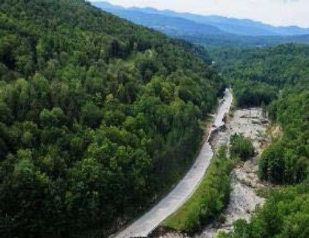
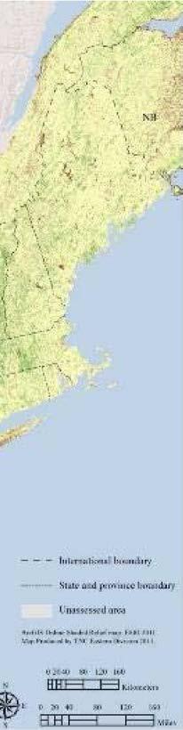
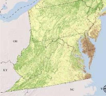
7 Climate Change Adaptation How do we help ecosystems and species cope with and adapt to these changes? How do we avoid or reduce impacts to infrastructure? Conserve resilient places and restore resilience where it s lost Where are these resilient places?


8 MAPPR: Mapping And Prioritizing Parcels for Resilience BioMap2: Habitat, Biodiversity TNC Resilience: Climate Adaptation Critical Linkages: Ecological Connectivity Parcel Size Block Size Adjacent to Protected Land Under-protected Settings


9 Resilience: The capacity to absorb disturbance and reorganize while retaining the same basic function, structure and identity. Landscape Complexity Number of microclimates are found in the area Landscape Connectivity Possibility for individuals and populations to move among these microclimates James C. Engberg
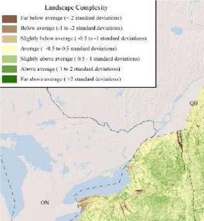
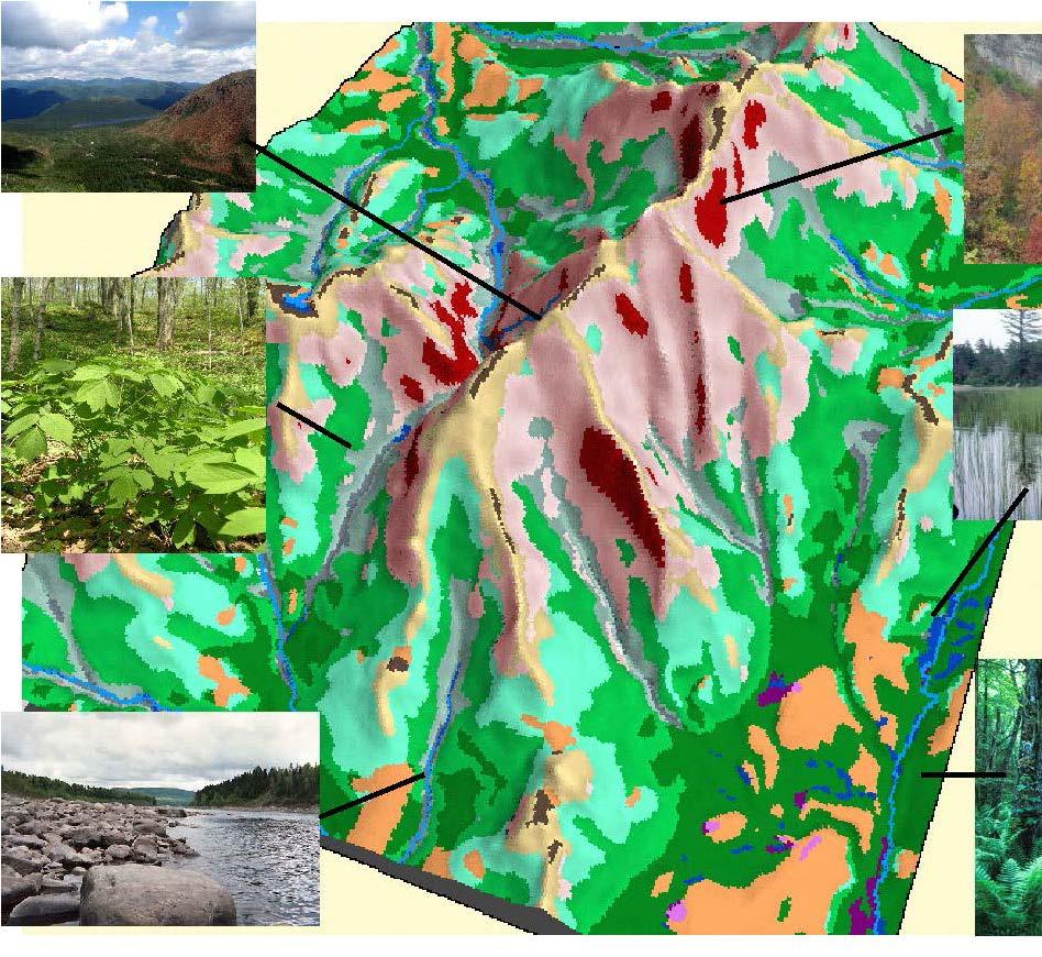
10 Landscape Complexity


11 Landscape Connectivity The degree to which the landscape supports movement


12 Complexity + Connectivity: Resilient Network that Represent a Full Suite of Biodiversity 30 Settings: Geology & Elevation Resilience = Com plexity + Connectivity within each setting High elevation sandstone Goal: Protect the stage, not the actors Mid-elevation limestone Low elevation sand


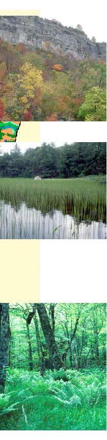
13 BioMap2 Includes: Rare & Vulnerable Plants & Animals Intact Forests Intact Wetlands Intact Rivers Vernal Pools Intact Landscape long-term persistence of species and their habitats, natural communities, and a diversity of ecosystems


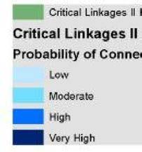

14 Critical Linkages II Conservation Nodes Conservation Areas Conductance Probability of animals moving
15
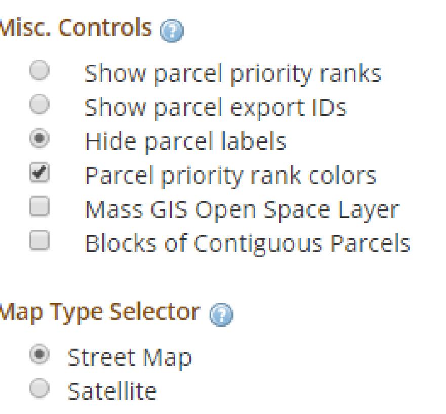
16 MAPPR: 3 Steps Select a study area Choose model Run & Review Results Town, county, or watershed Choose a precalculated model (balanced, resilience, aquatic, or biological) Choose specific model values Review results, including priority scoring and parcel ownership Adjust optional filters and constraints Values: Resilient Sites for Conservation, Critical Linkages Priorities, BioMap2 Core Habitat, Parcel Size, Block Size, Adjacent to Protection
17 Instructions & Examples


18 1. WHERE Choose a study area Coming soon: Regional Land Trusts and Mass DFW Districts

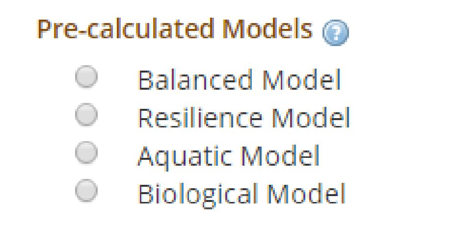
19 2. WHAT Choose a pre-calculated model

20 2. WHAT Or choose your own adventure Coming soon: Prime Farmland, Surface Water Protection Zones, and Wellhead Protection Areas
21 3. RUN Run model and view results


22 Let s Try An Example Merrimac Town Forest We re going to run the 4 pre-calculated models Balanced Resilience Aquatic Biological


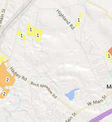
23 The different models Merrimac Town Forest Balanced Aquatic Resilience Biological
24 Parcel Labels: Numbers vs. Colors Each parcel has both a color and a number The COLOR is relative Parcels are shown as yellow (low level priority), orange (medium), or red (high). Note: parcels with no color may be existing protected areas (which will show up if MassGIS Open Space Layer is turned on), under one acre in size (not considered in this analysis), or did not shown up for protection value. Depending on the region you re searching within (town, county, watershed, DFW District, or Land Trust region), parcels may show as low, medium, or high priority. The NUMBER is absolute Each parcel that was included in the search will also show a number. The parcel is given a ranking of 0-3 for each input such as Critical Linkages or Resilient Sites for Conservation. There is no goal number to achieve it depends on which inputs you ve included. If you re only searching for parcels with Critical Linkages, you can only get a score of 3 since there s only one input. If you search for the balanced model, there are numerous inputs and the score could be higher, depending on which resources are present. Regardless of the search area (town, county, etc.), the parcel number stays


25 Additional considerations
 and the Lookout")
26 Thank you! massaudubon.org/mappr For more information, contact Ariel Maiorano Development of MAPPR supported by Open Space Institute Land Trust (OSILT) and the Lookout Foundation.
Landscape Conservation Design June, 2014
 Designing Sustainable Landscapes in the Northeast A project of the North Atlantic Landscape Conservation Cooperative & Northeast Climate Science Center June, 2014 Adaptive Establish Conservation Goals
Green Infrastructure. by Karen Engel, NYS DEC. NYS Department of Environmental Conservation
 Green Infrastructure by Karen Engel, NYS DEC What is Green Infrastructure? For some it s all about water Green Infrastructure techniques use soils and vegetation to infiltrate, evapotranspirate, and/or
What Is Linking Landscapes?
 What Is Linking Landscapes? Viable habitat is critical to the survival of all organisms. As forests, wetlands, open spaces and other habitats are converted to human uses, such as housing, industrial development,
Key Elements of Successful Conservation Planning. John Paskus October 17, 2013 Pierce Cedar Creek Institute Michigan Natural Features Inventory
 Key Elements of Successful Conservation Planning John Paskus October 17, 2013 Pierce Cedar Creek Institute Michigan Natural Features Inventory What is Conservation Planning? Pressey et al (2008): The process
TOWN OF BETHLEHEM OPEN SPACE CONSERVATION PLAN PUBLIC MEETING: OCTOBER 12, 2017
 TOWN OF BETHLEHEM OPEN SPACE CONSERVATION PLAN PUBLIC MEETING: OCTOBER 12, 2017 Welcome and Agenda 6:00 6:45: Open House, Part One 6:45 7:15: Presentation and Questions 7:15 8:00: Open House, Part Two
Great Lakes Conservation Blueprint for Terrestrial Biodiversity on the Canadian Shield
 Great Lakes Conservation Blueprint for Terrestrial Biodiversity on the Canadian Shield Bonnie L. Henson 1, Kara E. Brodribb 2 and John L. Riley 3 1 Ontario Ministry of Natural Resources 2,3 The Nature
Map Development 5/15/2012. New Virginia Modeling Tools
 Regional Green Infrastructure Base Map Development 5/15/2012 RRRC Land Use & Environment Committee New Virginia Modeling Tools VA Natural Landscape Assessment Forest Habitats Cultural Model Historic Resources
PUBLIC NOTICE. us Anny Corps CENAE-R-A FILE NO. NAE
 CENAE-R-A FILE NO. NAE-2007-02926 PUBLIC NOTICE us Anny Corps of Engineers s. New England District 696 Virginia Road Concord, MA 01742-2751 Comment Period Begins: January 15, 2019 Comment Period Ends:
Brockton. Produced in This report and associated map provide information about important sites for biodiversity conservation in your area.
 CONSERVING THE BIODIVERSITY OF MASSACHUSETTS IN A CHANGING WORLD Brockton Produced in 2012 This report and associated map provide information about important sites for biodiversity conservation in your
Town of Washington Master Plan & Regulatory Audit: Interim Results
 Town of Washington Master Plan & Regulatory Audit: Interim Results May 20, 2008 Presented by: 30 Bank Street Lebanon, NH 03766 www.uvlsrpc.org Introduction & Purpose Compare the Master Plan to the regulations
Virginia DCR- Natural Heritage Program. Tools for Linking Conservation and Transportation Planning
 Virginia DCR- Natural Heritage Program Tools for Linking Conservation and Transportation Planning November 9, 2009 MISSION: to conserve Virginia's biodiversity through statewide biological inventory, protection,
Landscape Conservation Design April, 2014
 Designing Sustainable Landscapes in the Northeast A project of the North Atlantic Landscape Conservation Cooperative & Northeast Climate Science Center Landscape Conservation Design April, 2014 Conceptual
5 TH ANNUAL CAPE COASTAL CONFERENCE COONAMESSETT RIVER RESTORATION PROJECT. Elizabeth H. Gladfelter, Ph.D. Conservation Commission Town of Falmouth
 5 TH ANNUAL CAPE COASTAL CONFERENCE COONAMESSETT RIVER RESTORATION PROJECT Elizabeth H. Gladfelter, Ph.D. Conservation Commission Town of Falmouth Mural by Teaticket Elementary School 2 nd graders, Spring
Blue/Green Infrastructure Study Accomack County, VA
 Blue/Green Infrastructure Study Accomack County, VA Draft Asset Maps March 8-9, 2010 Green Infrastructure Center, Inc. 2 Overview What is Green and Blue Infrastructure Project Timeline & Tasks Literature
Figure 1. Proposed Strategic Habitat Conservation Areas for Florida
 Figure 1. Proposed Strategic Habitat Conservation Areas for Florida Critical Lands and Waters Identification Project (CLIP) Cooperative Effort Century Commission for Sustainable Florida Florida Natural
Aquatic, Terrestrial and Landscape Conservation Design Tools and Products of the North Atlantic LCC
 Aquatic, Terrestrial and Landscape Conservation Design Tools and Products of the North Atlantic LCC Scott Schwenk Science Coordinator, North Atlantic LCC Chesapeake Bay FWS Partners Meeting Annapolis,
Community Conservation Workshop. Saranac River Basin Communities
 Community Conservation Workshop Saranac River Basin Communities 2 Community Conservation Program Welcome! We have designed a Community Conservation Program that listens to the needs of community members.
Green Infrastructure Policies and Ordinances
 Green Infrastructure Policies and Ordinances October 23, 2013 By Karen Firehock, Green Infrastructure Center 2013 Georgia Urban Forest Council s 23 rd Annual Conference The mission of the nonprofit Green
I ll be talking about the Designing Sustainable Landscapes project today. This is a large integrated modeling effort our group at UMass has been
 1 I ll be talking about the Designing Sustainable Landscapes project today. This is a large integrated modeling effort our group at UMass has been working on for the past 5 years, in close collaboration
Community Conservation Workshop. Lake Placid
 Community Conservation Workshop Lake Placid 2 Community Conservation Program Welcome! We have designed a Community Conservation Program that listens to the needs of community members. We are conducting
Regional Open Space Conservation Plan. Regional Staff Committee January 18, 2018
 Regional Open Space Conservation Plan Regional Staff Committee January 18, 2018 Schedule We are here Task 1 - Stakeholder Input & Work Plan Dev. v z 2016 2017 2018 Oct Nov Dec Jan Feb Mar Apr May Jun Jul
Dedham. Produced in This report and associated map provide information about important sites for biodiversity conservation in your area.
 CONSERVING THE BIODIVERSITY OF MASSACHUSETTS IN A CHANGING WORLD Dedham Produced in 2012 This report and associated map provide information about important sites for biodiversity conservation in your area.
SUSTAINABILITY PLAN OTTAWA COUNTY PARKS AND RECREATION COMMISSION FALL 2017
 SUSTAINABILITY PLAN OTTAWA COUNTY PARKS AND RECREATION COMMISSION FALL 2017 Table of Contents Introduction Natural Resources Quality of Life Community Continuing the Mission Sustainability Measuring Sustainability
ROSS Appendix F Land Conversion. Ecosystem Services Value Lost from Land Conversion in the Central Puget Sound Region ( )
") Ecosystem Services Value Lost from Land Conversion in the Central Puget Sound Region (1992-2011) 1 Purpose The purpose of this study is to estimate, in dollars, the value of annual ecosystem services in
Ecosystem Services Value Lost from Land Conversion in the Central Puget Sound Region (1992-2011) 1 Purpose The purpose of this study is to estimate, in dollars, the value of annual ecosystem services in
CONSERVATION STRATEGIES WORKBOOK
 Booklet #4 January 2, 2017 4 CONSERVATION STRATEGIES WORKBOOK Overview This booklet has been prepared for the Willington Planning and Zoning Commission to use as part of the formulation of the 2018 Plan
Citywide Integrated Stormwater Management Plan (ISMP) DRAFT ACTION PLAN REVIEW Public Consultation November 16 th, 2016
 DRAFT ACTION PLAN REVIEW Public Consultation November 16 th, 2016") Citywide Integrated Stormwater Management Plan (ISMP) DRAFT ACTION PLAN REVIEW Public Consultation November 16 th, 2016 1 Agenda DRAFT ACTION PLAN REVIEW Public Consultation Time 6:00 6:05 6:05 6:20 6:20
Citywide Integrated Stormwater Management Plan (ISMP) DRAFT ACTION PLAN REVIEW Public Consultation November 16 th, 2016 1 Agenda DRAFT ACTION PLAN REVIEW Public Consultation Time 6:00 6:05 6:05 6:20 6:20
One County s Success in Linking Watershed Protection and Land Use Planning
 One County s Success in Linking Watershed Protection and Land Use Planning Bob Thompson Porter County Plan Commission March 28, 2012 Indiana Watershed Leadership Academy Population 160,000 Approximately
Countywide Green Infrastructure
 Montgomery County s Countywide Green Infrastructure F U N C T I O N A L M A S T E R P L A N The Maryland National Capital Park and Planning Commission INFRASTRUCTURE An underlying base or foundation especially
Southwest Fleetwood Enclave
 Southwest Fleetwood Enclave Development Concept Plan Southwest Fleetwood Enclave 1 st Land Owners Meeting April 30 th, 2012 Presentation Overview Why the Plan? ; Overview & Purpose of Study; Constraints
LAMPREY RIVER SUBWATERSHED
 LAMPREY RIVER SUBWATERSHED PISCATAQUA REGION ENVIRONMENTAL PLANNING ASSESSMENT 05 Lamprey River Subwatershed, including: Candia, Deerfield, Epping, Newmarket, Northwood, Nottingham, Raymond www.prepestuaries.org
Incorporating climate change and connectivity into the Mpumalanga Biodiversity Sector Plan
 Incorporating climate change and connectivity into the Mpumalanga Biodiversity Sector Plan Mervyn Lotter Scientific Services Mpumalanga Tourism & Parks Agency Date: 15 May 2014 Introduction 1. Actively
GIS to Estimate Archaeological Site Loss and Develop Conservation Strategies
 GIS to Estimate Archaeological Site Loss and Develop Conservation Strategies Terry Jackson Office of Decision Support Systems Planning and Environmental Management Division Georgia Department of Community
GREEN INFRASTRUCTURE for the U.S.
 GREEN INFRASTRUCTURE for the U.S. Maps and Apps to connect the most valuable landscapes in the nation By Arancha Munoz-Criado Green Infrastructure for the U.S. 1 2 Green Infrastructure for the U.S. What
Road Ecology in Practice: Building Resiliency of Urban Ecosystems through Informed Road Network Planning
 Road Ecology in Practice: Building Resiliency of Urban Ecosystems through Informed Road Network Planning Outline What is road ecology? Why is road ecology important? TRCA and road ecology application Peel
FINDING WAYS TO CONNECT
 FINDING WAYS TO CONNECT Linking habitat together to function as an ecological whole The Green Leap: A Primer for Conserving Biodiversity in Subdivision Development. Mark E. Hostetler. University of California
THE CORPORATION OF THE CITY OF WINDSOR Office of the City Solicitor Planning Department
 THE CORPORATION OF THE CITY OF WINDSOR Office of the City Solicitor Planning Department REPORT TO THE CITY OF WINDSOR PLANNING ADVISORY COMMITTEE DATE OF REPORT: August 19, 2010 SUBJECT: Official Plan
Why the workshop, why the cases?
 Green Infrastructure in Central and Eastern Europe Cases from the Czech Republic, Poland and Romania Kristijan Civic, ECNC and Agnes Zolyomi, Zolyomi, CEEweb Workshop on redesigning the landscape, connecting
Connecticut River Watershed Initiative
 Connecticut River Watershed Initiative How it came about UMASS Amherst What is the concept? What is the near-term process? How it came about 1992-2002 University of Oregon CLAMS 1998 UMass proposal to
Planning for Staten. Habitat Restoration and Green Infrastructure. Island s North Shore
 Habitat Restoration and Green Infrastructure Planning for Staten Island s North Shore Community Board 1 March 1, 2018 NYC Parks Forestry, Horticulture, and Natural Resources Funded by the NYS Department
Climate Smart Communities Green Infrastructure Case Studies
 New York State Water Resources Institute Climate Smart Communities Green Infrastructure Case Studies Emily Vail Hudson River Estuary Program NYS Department of Environmental Conservation Cornell University
Introduction. Integrating Ecological Restoration of Estuarine Shorelines with Urban Community Revitalization Efforts. Ed Morgereth Biohabitats, Inc.
 Introduction Integrating Ecological Restoration of Estuarine Shorelines with Urban Community Revitalization Efforts Ed Morgereth Biohabitats, Inc. 5 th National Conference & Expo on Coastal and Estuarine
Ecosystem Restoration Business Line Budgeting A Systems Approach
 Ecosystem Restoration Business Line Budgeting A Systems Approach Laura Orr (NWS), Shawn Phillips (MVM), Greg Steele (NAO) Introduction Chesapeake Bay Bridge Mouth of Mississippi River Bonneville Dam Fish
Oakland County s Green Infrastructure Vision. L. Brooks Patterson Oakland County Executive
 Oakland County s Green Infrastructure Vision L. Brooks Patterson Oakland County Executive Southeast Michigan 20 miles northwest of Detroit Consists of 910 square miles Population of 1.2 million More than
Middle Mississippi River. Regional Corridor
 Middle Mississippi River St. Louis District Regional Corridor Lessons Learned from a Collaborative Planning Study Brian Johnson US Army Corps of Engineers 12 th Biennial Governor s Conference on the Management
Goleta Community Plan Update
 Goleta Community Plan Update Ecology, Biology, and Habitats GVPAC Meeting Agenda [Wednesday, December 17, 2008, 6:00PM] Pledge of Allegiance and Roll Call Public Comment Period Administrative December
Chapter 5: Natural Resources and Environment
 NATURAL RESOURCES AND ENVIRONMENT 5-1 5 Chapter 5: Natural Resources and Environment BACKGROUND AND INTENT Urban expansion represents the greatest risk for the future degradation of existing natural areas,
DRAFT Open Space Technical Bulletin
 DRAFT Open Space Technical Bulletin This guidance is intended to clarify how the Open Space Goal and Objectives of the Regional Policy Plan (RPP) are to be applied and interpreted in Cape Cod Commission
3-2 Environmental Systems
 3-2 Environmental Systems 3.0 ENVIRONMENTAL SYSTEMS CONTENTS 3.1 GREENWAY SYSTEM 3.1.1 General Policies 3.1.2 Natural Heritage Network 3.1.3 Natural Heritage Network Enhancement Lands 3.1.4 Rouge Watershed
Prioritizing Tidal Wetlands: A Landscape Approach
 Prioritizing Tidal Wetlands: A Landscape Approach Laura Brophy Director, Estuary Technical Group Institute for Applied Ecology Corvallis, OR College of Earth, Ocean and Atmospheric Sciences, Oregon State
Ecosystem Services beyond Flood Mitigation
 Sustainable Urban Drainage Systems Ecosystem Services beyond Flood Mitigation Professor Tony Wong Chief Executive & Director Centre for Water Sensitive Cities Monash University Effective Drainage & Flood
Green Infrastructure Planning for Sustainability and Resiliency
 Green Infrastructure Planning for Sustainability and Resiliency Linking Lands and Communities in the Land-of-Sky Region SAMAB Conference - November 18, 2010 www.linkinglands.org Linda Giltz, AICP, Regional
Madrid+Natural. Susana Saiz Madrid. Nature Based Solutions for Sustainable and Resilient Cities 2017
 Susana Saiz Madrid Key City Challenges Nature Nature Based Based Solutions Solutions for Sustainable for Sustainable Nature Based Solutions in -NBS NBS improve livability, health and sense of wellbeing
OPEN SPACE CHAPTER 7: OVERVIEW. Preserve open space to protect natural resources, enhance character and provide passive recreation opportunities
 CHAPTER 7: OPEN SPACE OVERVIEW Ridgefield has made tremendous progress permanently preserving areas of town as open space. Open space preservation can serve many important purposes, including: protect
Call for Artists for: Design and Construction of Environmental Art Activation Story Mill Community Park, Bozeman, MT
 Call for Artists for: Design and Construction of Environmental Art Activation Story Mill Community Park, Bozeman, MT Seeking artists to design, fabricate and install art elements in the nature sanctuary
Urban Development Mathew Plourde
 Urban Development Mathew Plourde Introduction The purpose of this analysis is to select an appropriate area in Middlesex County of Massachusetts, to develop a small urban community Urban Planning is a
Resiliency Initiative (based on TNC Terrestrial Resilience) Open Space Institute - - March; webinar
 Open Space Institute - - March; webinar") HOUSEKEEPING Notes Recent/upcoming meetings related to connectivity: DEP Commissioner update - - March Division of Fish and Wildlife regional meetings - - March NJ Land Conservation Rally --March Resiliency
HOUSEKEEPING Notes Recent/upcoming meetings related to connectivity: DEP Commissioner update - - March Division of Fish and Wildlife regional meetings - - March NJ Land Conservation Rally --March Resiliency
March 14, Will Allen Director of Strategic Conservation Planning
 New Frontiers in Land Conservation: Green Infrastructure for Urban Vacant and Underutilized Lands 23 rd Annual RMLUI Conference March 14, 2014 Will Allen Director of Strategic Conservation Planning Special
Toronto Complete Streets Guidelines
 Toronto Complete Streets Guidelines 108 110 7.1 Green Infrastructure Design Principles 112 7.2 Context-Sensitive Green Streets 114 7.3 Key Green Street Elements Green infrastructure refers to natural and
National Association of Conservation Districts. Kris Hoellen Vice President, Sustainable Programs The Conservation Fund September 19, 2013
 National Association of Conservation Districts Kris Hoellen Vice President, Sustainable Programs The Conservation Fund September 19, 2013 Our Mission The Conservation Fund forges partnerships to conserve
Executive Summary Purpose of the Plan Defining Open Space and Greenways
 Executive Summary Bucks County possesses a vast array of open space resources including natural areas, parks, farmland and historic and cultural resources that contribute to a high quality of life valued
CALGARY: City of Animals Edited by Jim Ellis
 CALGARY: City of Animals Edited by Jim Ellis ISBN 978-1-55238-968-3 THIS BOOK IS AN OPEN ACCESS E-BOOK. It is an electronic version of a book that can be purchased in physical form through any bookseller
Libby Zemaitis October 18, 2017 Climate Outreach Specialist, NYS DEC Hudson River Estuary Program
 1 Supporting Hudson Riverfront communities as Climate-Adaptive Leaders Libby Zemaitis October 18, 2017 Climate Outreach Specialist, NYS DEC Hudson River Estuary Program The Hudson River Estuary Program
Smart Growth for Dallas
 Smart Growth for Dallas Data-driven decisions for the future of Dallas parks, open spaces, and green infrastructure Dallas Park and Recreation Board March 10, 2016 Agenda I. Welcome and Introductions II.
Building a green infrastructure concept and process in the Gauteng City Region, South Africa. Kerry Bobbins Researcher GCRO
 Building a green infrastructure concept and process in the Gauteng City Region, South Africa Kerry Bobbins Researcher GCRO kerry.bobbins@gcro.ac.za IGU Regional Conference Krakow, Poland 1 18 22 August
FISH RESTORATION PROGRAM AGREEMENT Implementing Habitat Restoration Requirements Of The Biological Opinions
 FISH RESTORATION PROGRAM AGREEMENT Implementing Habitat Restoration Requirements Of The Biological Opinions Dennis McEwan Department of Water Resources waterways tidal wetlands Whipple et al. 2012: Sacramento-San
The Salt Marsh Advancement Zone Assessment of Connecticut
 The Salt Marsh Advancement Zone Assessment of Connecticut Front cover image: Salt marsh advancement zones in Stratford, CT from the Comprehensive Map Book of Stratford, CT. Table of Contents Introduction...
The need for ecoagriculture. What do we mean by ecoagriculture? The role and workplan of Ecoagriculture Partners
 Ecoagriculture Partners: Progress towards linking conservation, production and rural livelihoods Mobilizing PES at Landscape Seth Scale: Shames, Ecoagriculture Partners UN CSD, Partnership Fair May 8,
Green Infrastructure Mapping Exercise
 Green Infrastructure Mapping Exercise One Water Summit March 3, 2017 Mead Mier Sustainability Coordinator, Watershed Planning Lead Josh Pope GIS Manager Pima Association of Governments Outline What is
Shared History, Shared Future
 Open Space is Shared History, Shared Future Builds upon past and current regional planning: PSP Action Agenda, Vision 2040, the Cascade Agenda, and Mountains to Sound Greenway The ROSS Approach Building
Town of Peru Comprehensive Plan Executive Summary
 Town of Peru Comprehensive Plan Executive Communities that plan grow by choice, not by chance. A plan makes growth thoughtful, understandable, and predictable. A plan shows that a community is managing
Conserving Illinois North Shore Ravines
 Conserving Illinois North Shore Ravines Rebecca Grill, Natural Areas Manager, Park District of Highland Park, rgrill@pdhp.org Jeff Boeckler, Principal Water Resource Specialist, Northwater Consulting,
Design Around Waterways and Wetlands
 Design Around Waterways and Wetlands NL Green Economy Conference Newleef-2014 NEIA, St. John s, NL October 9-10 th, 2014 Wade Lewis Amherst, Nova Scotia, w_lewis@ducks.ca DUC conserves, restores and manages
GREEN BELTS, GREEN WEDGES OR DISPUTED GROUND
 GREEN BELTS, GREEN WEDGES OR DISPUTED GROUND John Ginivan Department of Planning and Community Development State Government of Victoria Melbourne Australia Greenbelts: Local Solutions for Global Challenges
Scott A. Jordan Executive Vice President for Administration and Chief Financial Officer
 June 27, 2018 TO: FROM: Members of the Board of Trustees Scott A. Jordan Executive Vice President for Administration and Chief Financial Officer Craig H. Kennedy Provost and Executive Vice President for
Natural Environment White Paper & new partnerships to deliver green infrastructure. Henry Smith, Project and Policy Assistant, TCPA
 Natural Environment White Paper & new partnerships to deliver green infrastructure Henry Smith, Project and Policy Assistant, TCPA Presentation outline 1) Green Infrastructure introduction The TCPA s work
Chapter 1 Vision Statement & Goals
 Chapter 1 Section 1.1 Section 1.2 Section 1.3 Section 1.4 Section 1.5 Introduction Vision Statement Visioning Exercise Prioritization of Land Use Issues Goals of the Comprehensive Plan CHAPTER 1 SECTION
Preface. Erie. Scranton. Allentown. Pittsburgh. Harrisburg. Philadelphia
 The Southern Alleghenies Region The Southern Alleghenies Region spans the Laurel Highlands and Allegheny Front in the west across the Appalachians to the east. It is comprised of Blair, Bedford, Cambria,
Conservation Corridor Planning and Green Infrastructure Themes
 Conservation Corridor Planning and Green Infrastructure Themes Prepared by the Green Infrastructure Center Inc. and the Northern Virginia Regional Commission February 22, 2011 Brief Overview Project Background
Biodiversity and Urban Streets
 Biodiversity and Urban Streets Urban Street Design for Engineers CPD Session 3 Constituent Elements Engineers Ireland Maryann Harris BSLA MSc Dip Law Past-President, Irish Landscape Institute Parks Services
This program has been registered with LA CES by the New York Upstate This program has been registered with LA CES by the New York Upstate Chapter of
 This program has been registered with LA CES by the New York Upstate This program has been registered with LA CES by the New York Upstate Chapter of the American Society of Landscape Architects. Chapter
4. What are the goals of the Kawarthas, Naturally Connected project? 7. What are watersheds and why are they being used as the project boundaries?
 Frequently Asked Questions (FAQs) 1. What are Natural Heritage Systems (NHS)? 2. Why are they important? 3. Which areas of the province have undertaken NHS projects? 4. What are the goals of the Kawarthas,
MAYFIELD WEST SECONDARY PLAN PHASE 2
 MAYFIELD WEST SECONDARY PLAN PHASE 2 Public Open House #3 February 25, 2010 Draft Preferred Land Use Scenario TOWN OF CALEDON PLANNING & DEVELOPMENT DEPARTMENT Open House Agenda TOWN OF CALEDON 1. Welcome
Terra Nova Rural Park Plan
 Terra Nova Rural Park Plan Part 1 Getting to know the land The Surrounding Area North Side Airport, River, Trail East Side - Residential West Side- Sturgeon Banks, West Dyke Trail South Side:Terra Nova
Site Option 3: Te Matai
 Site Option 3: Te Matai Location Napier Drain looking south east Description The Te Matai growth option is located between the existing residential boundary (Ruamahanga Crescent) Napier Road (State Highway
Best Management Practices
 Best Management Practices Urban Areas Aquatic Areas Natural Areas Best Management Practices Urban Areas Green Industry Best Management Practices Fertilizer Label Nitrogen Applications Phosphorous Applications
Increasing Storm Resiliency in Urban Areas Through Ecological Restoration and Design
 Increasing Storm Resiliency in Urban Areas Through Ecological Restoration and Design Rutgers Cooperative Extension Brooke Maslo, Ph.D. Wildlife Extension Specialist Jeremiah Bergstrom, LLA Senior Project
HELPING SMALL TOWNS AND RURAL AREAS THRIVE
 EPA Office of Sustainable Communities HELPING SMALL TOWNS AND RURAL AREAS THRIVE Village of Vinton, Texas May 30, 2013 Katharine Ange, AICP Renaissance Planning Group Overview of Workshop Discussion of
Green Infrastructure. NYS Department of Environmental Conservation
 Green Infrastructure Green infrastructure is an interconnected network of natural areas and open spaces that sustains ecosystems. Benedict, M.A. and E.T. McMahon. 2006. Green Infrastructure Linking Landscapes
Integrating Transportation Planning with Land Use and Conservation Through Decision Support Tools
 Integrating Transportation Planning with Land Use and Conservation Through Decision Support Tools Patrick J. Crist, PhD Manager, Conservation Planning Services NatureServe A conceptual framework to integrate
MAYFIELD WEST SECONDARY PLAN PHASE 2
 MAYFIELD WEST SECONDARY PLAN PHASE 2 Council Information Workshop February 16, 2010 Draft Preferred Land Use Plan TOWN OF CALEDON PLANNING & DEVELOPMENT DEPARTMENT Workshop Agenda TOWN OF CALEDON 1. Welcome
Case Study: Kavango- Zambezi Transfrontier Conservation Area
 Case Study: Kavango- Zambezi Transfrontier Conservation Area Presented by: Keith Lawrence, CI Report Author: Prof. David Cumming Project Contact: Leo Braack, CI Presentation Outline Background: KAZA TFCA
RECREATION, OPEN SPACE AND GREENWAYS ELEMENT GOALS, OBJECTIVES, AND POLICIES
 RECREATION, OPEN SPACE AND GREENWAYS ELEMENT GOALS, OBJECTIVES, AND POLICIES GOAL R-1: DEVELOP A RECREATION, OPEN SPACE AND GREENWAYS SYSTEM AS AN INTEGRAL COMPONENT OF AN OVERALL, COUNTY-WIDE ECONOMIC
ARISE: The Rock Renaissance Area Redevelopment & Implementation Strategy
 2014 Professional Awards 1 ARISE: The Rock Renaissance Area Redevelopment & Implementation Strategy Janesville, WI Completed December 2014 Analysis & Planning Purpose of Project 2 The purpose of the Rock
NRCS webinar TOPIC: How and What Social Media is Being Used in Natural Resource Outreach March 13, 2013; 2-3pm
 HOUSEKEEPING Zotero Notes Upcoming meetings related to connectivity: NJ Land Conservation Rally March 9, 2013; NJIT in Newark, NJ One-day educational conference about preserving New Jersey s open space
Green infrastructure: the urban dimension Chantal van Ham EU Programme Officer IUCN - International Union for Conservation of Nature
 Green infrastructure: the urban dimension Chantal van Ham EU Programme Officer IUCN - International Union for Conservation of Nature Network of more than 1,200 member organizations (including 200+ government
Making Space for Nature A Leicester Case Study. Dr Helen O Brien Leicester City Council
 Making Space for Nature A Leicester Case Study Dr Helen O Brien Leicester City Council Helen.Obrien@Leicester.gov.uk Definitions Biodiversity (biological diversity) The variety of plant and animal life
INTEGRATING PROTECTED AREAS INTO THE WIDER LANDSCAPE, SEASCAPE AND RELATED SECTORS. An Overview
 INTEGRATING PROTECTED AREAS INTO THE WIDER LANDSCAPE, SEASCAPE AND RELATED SECTORS An Overview USING AN EXAMPLE FROM NORTHEAST US Relationship of IPAWLS guide to other planning and assessment processes
Chapter XV Maps. The map is not the territory ~Alfred Korzybski
 Chapter XV Maps The map is not the territory ~Alfred Korzybski Chapter XV Maps 15.1 DISCLAIMER These maps are intended for use with the Tamworth Master Plan. The information presented is to be used for
NJ Habitat Connectivity Initiative
 NJ Habitat Connectivity Initiative Full Working Group Update #1 Spotted Salamander Crossing Road in Northern NJ Wildlife Habitat Connectivity Initiative A strategic plan to reconnect New Jersey s landscape
DEVELOPMENT PERMIT SENSITIVE ECOSYSTEMS
 DEVELOPMENT PERMIT SENSITIVE ECOSYSTEMS What is the Sensitive Ecosystem Development Permit Area (SEDPA)? Surrey s SEDPA is made up of two distinct classifications of the natural environment: Streamside