Halswell Quarry Park Management Plan (2009) Halswell Quarry Park Management Plan
|
|
|
- Randell Ball
- 5 years ago
- Views:
Transcription


1 Halswell Quarry Park Management Plan Christchurch City Council 12 November
2 Foreword This Management Plan is the third plan for the Halswell Quarry Park. The park was established in 1990 from the site of mid nineteenth century industrial quarry and farm land. A Management Plan was adopted in 1991 under the Local Government Act and reviewed in These management plans were development focused, converting the land from a working landscape to a recreational landscape. This Management Plan reflects that the park has matured. Many of the original policies have been implemented, and are therefore no longer needed. Others have been made more specific to strengthen the structure of the park. Using the Council s new template for reserve management plans, this draft Plan incorporates the intention and direction of the Sister Cities Garden Park proposal and sets the framework for future management of the park in its role as a fundamental part of Christchurch s regional parks network. Whilst this Management Plan has been prepared under the Local Government Act 2002, the previous Management Plan required that any review or modification be undertaken in accordance with the procedures outlined in the Reserves Act This has been done. Public submissions on the draft reviewed plan were received in March and April A Special Committee of the Council then considered the submissions and approved the final plan under the delegation given to it by the full Council. The new management plan was approved on 12 November
3 Table of Contents Introduction 5 Purpose of the Park 5 Landscape Character 6 Vision 10 Objectives and Policies 10 Landscape Character 10 Tangata whenua 11 Open Space 11 Sister City Gardens 12 Habitat Restoration 12 Amenity Planting 13 Structures 14 Sister City Structures 14 Structures other than Sister City Structures 14 Public Use 15 Recreation 15 Access 16 Transport 16 Information 17 Park Operations 17 Environmental Monitoring and Maintenance 17 Management 18 Issues 19 Implementation 24 Resource Information 29 Policy Framework 33 Management Plan History 34 Bibliography 37 Appendix 1: Recommended Plant Lists 38 Appendix 2: Criteria for new and altered Sister City structures 40 Appendix 3: Existing artwork & structures Sister City gardens 42 Appendix 4: Dog Exercise Area (Map 18-Halswell Quarry, Dog Control By-law 2008) 45 Figure 1: Site Map 9 Figure 2: Indicative Development Plan 27 Figure 3: Park Location 29 Figure 4: Heritage Area and archaeological sites 29 3
4 4 Halswell Quarry Park Management Plan (2009)
5 Introduction This Management Plan relates to the Council-owned land known as Halswell Quarry Park ( the park ). The park is located approximately 10.5 kilometres from Cathedral Square, at the base of the Port Hills near the city s south-west urban boundary. The park is an important open space for Christchurch, and particularly the new urban growth areas of the south-west, and is much supported by the local community. Halswell Quarry Park is managed within the regional park network, with characteristics that are unique and distinctive from other parks and reserves within the city. The park has four distinct environments: Rural pasture and open space Halswell Quarry heritage area Gardens of each of Christchurch s six Sister Cities 1 Habitat restoration Previous land uses, combined with the park s physical characteristics and resources (staff and funding) have determined, and continue to determine, the rate with which the park s environments mature and develop. This plan provides a framework within which management of the park will be carried out. It sits within the Council s wider strategic directions and legislative responsibilities. The plan has been prepared in response to changes that have occurred within the park, the desires of the wider community and staff operational needs. Development of Halswell Quarry Park continues to be a medium to long term project undertaken as funding and other resources allow. An indicative development plan identifies key projects to be undertaken to achieve the objectives in this plan. Section one of this plan introduces the park, its metropolitan significance within the regional park network and current landscape character. Section 2 sets out the Council s vision for the park, and the objectives and policies to achieve the vision. Section 3 discusses the main issues that this draft Management Plan seeks to resolve. Section 4 outlines an indicative development plan with key projects. The plan concludes with resource information, the wider policy framework within which this plan sits, and changes between this and earlier Halswell Quarry management plans. Purpose of the Park The Halswell Quarry Park has metropolitan significance and serves a recreation function within Christchurch s regional parks network. Regional Parks are large reserves, located near the City s current urban edge, with high conservation and scenic values. Located in the rural south-west, the Halswell Quarry Park is somewhat isolated from other open space areas. While a relatively small community currently live near it, the park is used by the greater Christchurch community for walking and running, walking dogs, cycling, horse riding, and picnics in the summer. 1 Christchurch s six Sister Cities are Adelaide (Australia), Christchurch, (England), Gansu province (China), Kurashiki (Japan), Seattle (United States of America) and Songpa-Gu (Korea). 5


6 As Christchurch s south-west becomes more urbanised, the park will serve greater numbers of people and hold a key position within the south-west s developing open space network. Future connections are planned to link the park with the Halswell River, Halswell Domain and Council owned land known as Henderson s Basin. Stronger links are also envisaged between the park and the upper Port Hills. With these developments, awareness of the park and interest in its development will continue to broaden across the City. Within the Regional Park framework, and acknowledging its significance to the local community, the purpose of Halswell Quarry Park is to: Conserve the heritage features and values of the historic Halswell Quarry, its heritage buildings and its setting as a unique heritage resource; Retain rural pasture and open space representative of Christchurch s rural south-west landscape; Provide a location for informal botanical collections and associated artwork and structures of Christchurch s Sister Cities; Promote biodiversity through habitat restoration and amenity planting; Provide a community gathering point and a special environment for recreation and learning; Provide for local community needs in the metropolitan context; Provide for adaptive re-use of heritage buildings Landscape Character The Halswell Quarry Park was established in 1990 from a mid nineteenth century industrial quarry and farm land. These intensive land uses and working landscapes form the basis of the parks character. With the landform and land cover virtually completely modified, the park s landscape character is predominantly one of social and cultural heritage. The historic quarry is central to the landscape character, with the hollowed out canyon and exposed rock faces presenting an imposing image. The open pasture on either side of the quarry is grazed; a continued landscape management practice from the working period of the quarry. Historic buildings within the park provide an insight into the time period, the former 6


7 workings of the quarry and associated people. Quarry stone and other natural materials are used for structures throughout the park to reflect the geology and industrial activity on the site. The rural pasture and open space areas are retained in recognition of Christchurch s rural cultural heritage. This expansive pastoral character is becoming less evident as land in the south-west becomes urbanised. Open fields of pasture grass and stands of exotic trees such as macrocarpa and poplar, planted by early farmers for shelter, are included as part of this rural cultural landscape. Historic references are made through grazed areas, hay making and stock fencing. The rural setting and informal appearance of the park creates a quiet ambience and restful atmosphere. Most people enjoy the park on foot, taking the opportunity to escape the noise and pace of the city in a public countryside. There are numerous places to take pleasure in picnicking safely away from vehicles and road noise. The quiet, peaceful, restful aspects of the park s character is be retained through the recreation opportunities and activities that are encouraged within the park. Concession is given, from time to time, for special events that benefit from the varied terrain and quarry amphitheatre. Sister City Gardens The concept of creating a Sister City botanical collection was a Millennium project from Turning Point Extensive investigation was undertaken to identify a suitable location for the collections from around the city. Halswell Quarry Park was selected because of the park s special physical characteristics and micro-climates. At the time, the park was also relatively undeveloped and the proposed low maintenance collections were considered appropriate to the rural setting. The Sister City Garden Park concept became part of the Halswell Quarry Park Management Plan when it was reviewed in Initial landscape concept designs included a mix of evergreen and deciduous species, indigenous to the respective Sister City regions, concentrated around six or seven small focal points of cultural significance. Each collection was allocated approximately one hectare, selected to suit the plant types from each region s natural environment. In addition to the six Sister City gardens, the Christchurch (New Zealand) collection, depicting wetland dwelling Kahikatea forest, was located around a stormwater basin. Large specimen trees have been planted and focal points established in most collections. The Gansu collection had to be relocated from behind the historic Workmen s Quarters as that original site selection failed to consider the collections within the wider context of the park s layout and significant heritage features and values. 7
8 Natural Environment Despite modification of the natural environment, opportunities do exist for the creation of habitats. The three distinctive habitat types at Halswell Quarry Park are wetland, forest and rock. It is likely that parts of the flat areas at the site once contained wetland and, around the stormwater basins at the main entrances, kahikatea forest with flax and cabbage tree is being restored. Many of the gullies have been planted in forest species and some of the older plantings have become well-established. The area surrounding Halswell Quarry contains many rock outcrops and quarrying has left vast areas of open rockface, crevices, talus slopes and shelves that provide ideal habitat for rock plants and fauna. 8

9 To Halswell To Cashmere Cashmere Road Horse arena Car park A NORTH wetlands B Under effective control dog exercising area Concrete ponds Kennedys Bush Road Main entrance Christchurch (NZ) garden 1 2 Picnic area Car park 3 Picnic area C D Findlays picnic area E F Quarry floor 4 5 Grazing Quarry faces Grazing KEY Park boundary Stream and pond Shared use track Walking track Protected archaeological and heritage areas (approx) are marked with cross-hatching Sister City Gardens A Seattle B Gansu C Songpa-Gu D Kurashiki E Adelaide F Christchurch (UK) Buildings located in the heritage quarry setting 1 Heritage manager s house 2 Heritage workmen s quarters 3 Heritage crusher plant buildings 4 Residential dwelling (189 Kennedy s Bush Road) 5 Residential dwelling (201 Kennedy s Bush Road) Locations of the six Sister City Gardens and the Christchurch (NZ) garden are shown on the site map above. The general extent of protected archaeological and heritage areas is marked with cross-hatching. The map also shows the picnic areas and the main car parks. The extent of the under effective control dog exercising area, the area prohibited to dogs, and where dogs are permitted on a leash are determined through the Dog Control bylaw and policy. Appendix 4 has a map of these areas as at Figure 1 Halswell Quarry Park Site map showing features Not to scale 9
10 Vision A regional park that promotes rural character and pastoral landscapes, celebrates special heritage, botanical and multicultural environments and where people enjoy recreation and learning experiences. Objectives and Policies LANDSCAPE CHARACTER Heritage Conservation Objective 1. Conserve the heritage features and values of the historic Halswell Quarry, its heritage buildings and its setting as a unique heritage resource. NOTE: The Halswell Quarry, and associated buildings, are a listed heritage place. Conservation and maintenance of heritage places and values must be undertaken in accordance with Heritage Conservation Plans and the ICOMOS Charter, to which Christchurch City Council is a signatory. In the absence of Heritage Conservation Plans, direction should be sought from Council s heritage and resource consent staff. The Council must also comply with the Historic Places Act Policies 1.1. Protect the exposed rock of the quarry face. Remove woody and unwanted invasive plants Protect views from within the park to and from the quarry rim. Planting on the inside of the rim track and western flank of the quarry has largely been completed and existing trees and shrubs will be managed so that they continue to articulate and frame views to the quarry from the rim track. Areas of long pasture grass around the quarry rim will be managed as necessary Establish and maintain landscape treatments appropriate to the character and values of the heritage area. Retain the western flank of the quarry to the rim in open, grazed pasture. Restore the gardens around the former Manager s House The long-term use of all heritage buildings will be determined through a process of needs assessment and planning to provide facilities for the operation and enjoyment of the park in ways that enable the adaptive re-use of the buildings and public access to them, without compromising their heritage values Ensure any new structures or buildings within the heritage area are designed and constructed in a style (material, scale and form) that is sympathetic to the heritage values of the heritage area. 10
11 1.6. Reflect and reconstruct historic connections between heritage places that reflect the historic quarry activity, for example by constructing a trail along the historic tramway route to the quarry rim, and a path from Kennedys Bush Road at the park s main entrance to the former Manager s House Support, and be guided by, Heritage Conservation Plans for the quarry, associated heritage buildings and historic landscape through implementation projects and the development plan Before further modifying any of the recorded archaeological sites in the Park, commission an archaeological assessment to inform and assess the sites and their features, identify risks, and make recommendations to ensure compliance with the Historic Places Act Use this assessment to support any applications for authority to modify those sites, as required by s11 of the Historic Places Act During any programmes of work in Halswell Quarry Park, including excavation, fencing, planting, and building of walkways, if anything of an archaeological nature is encountered (for example, shells, charcoal-stained soil, fire-cracked stones, artefacts or human remains), implement the NZ Historic Places Trust s Accidental Discovery Protocol by immediately contacting the NZ Historic Places Trust and relevant Ngāi Tahu rūnanga. Tangata Whenua Objective 2. Acknowledge the manawhenua status of Ngāi Tahu Policies 2.1. Protect and restore values significant to tangata whenua Consult with relevant Ngāi Tahu rūnanga about appropriate ways of recognising the manawhenua status and cultural heritage of Ngai Tahu in relation to the park, including use of appropriate Maori names. Open Space Objective 3. Retain rural pasture and open space representative of Christchurch s rural south-west landscape. Policies 3.1. Retain extensive areas of open pasture on the valley floor and slopes, free from structures, formed paths and amenity planting. Restrict the inclusion of picnic tables and signs to around the perimeter of picnic areas and inner Quarry floor. Exclude all amenity plantings across the pasture on the valley floor and inner Quarry floor Manage the pasture on the valley floor through a programme of hay making and mowing. 11
12 3.3. Regularly mow high amenity areas, including the picnic areas, inner quarry floor and viewing areas Maintain sheep grazing on the slopes either side of the quarry. Public access through grazed areas is to be retained (excluding lambing season, if necessary). Sister City Gardens Objective 4. Provide a location for informal gardens of Christchurch s Sister Cities. Policies 4.1. Develop gardens to represent the natural ecosystem and plant associations of Christchurch and its Sister City regions, using a mixture of tall, woody species and shrubs that are suitable to the site and require a minimum of maintenance Prepare a new landscape concept plan and planting plan for each of the Sister City gardens, in consultation with the Sister City Committees. Obtain formal endorsement of the plans by the Sister City Committees. Use the plans to guide and control the future planting and development of each garden. Planting programmes should give priority to the relocated Gansu collection Show on each landscape concept plan how existing and future Sister City structures might be incorporated into the garden (see Policy 7.3 below). Habitat Restoration Objective 5. Promote biodiversity through habitat restoration. Policies 5.1. Develop a planting programme to progress the establishment of the wetland habitats. Include large semi-swamp forest species, including kahikatea, into the Christchurch (New Zealand) garden Establish a dense forest of native and exotic plant species along the northern slope. Exotic species on this slope will be limited to within the boundaries of the Seattle and Gansu gardens. Exotics will be removed from the remainder of the slope, and broom and gorse managed to enable native species to be planted into it. This may require an exemption from Environment Canterbury under the Regional Pest Management Strategy Support seasonal bird migration between the upper Port Hills and urban environment by retaining and planting a variety of plant species that provide nectar, seeds and/or fruit for birds throughout the year Investigate planting of low growing divaricate shrubs along selected quarry ledges and around the quarry rim where, due to soil depth, cocksfoot and tall oat grass have 12

13 established. Shrubs should only be planted if they assist with management of the grasses and do not grow to a height greater than the pasture grass (see Appendix 1). Amenity Planting Objective 6. Use amenity planting to give the park a logical form and layout, and to provide screening and shade. Policies 6.1. Use native plant species appropriate to the site, giving preference to species indigenous to Christchurch and Banks Peninsula, to form the perimeter and inner structure of the park. Along the southern boundary of the park plant only to a height and depth necessary to create a visually attractive boundary and to mitigate the extent of residential development Manage vegetation, and a programme of trimming and thinning, to protect views and sight lines from within the park to the quarry, upper Port Hills and Southern Alps, and from the vehicle entrances to the former Manager s House Review, trim, remove and augment existing shrubs and ground cover vegetation, as necessary, to improve visibility along paths and improve definition of open spaces Maintain and develop stands of large trees, typical of rural landscapes and giving preference to species indigenous to Christchurch and Banks Peninsula, around the perimeter of the open pasture valley floor and picnic areas. Assess the pest potential of tree species prior to planting Enhance the entry points into the quarry and the botanical collections. Amenity planting at the main entrance to the quarry should not screen rock walls Accompany any significant change to the park s structures or buildings, parking areas, or facilities with a planting programme to integrate the changes into the park s landscape. 13
14 STRUCTURES Sister City Structures Objective 7. Ensure that new structures associated with the six Sister City gardens reflect the cultures of the Sister Cities without compromising the heritage values, rural character and restored habitats of the park. Policies 7.1 Accommodate the existing Sister City structures and a limited number of additional Sister City structures within the six areas designated for the Sister City gardens. 7.2 For the purpose of this Objective, Sister City structures (structures) include anything constructed that has a distinct character which is associated with the culture of the sister city more than the historic character or general recreational use of the Halswell Quarry Park. Such structures include artworks, as well as buildings, shelters, gateways, viewing platforms, culturally significant focal points, bridges, courtyards, fences, walls, signs, formed paths, and seats. 7.3 All proposals for new structures and alterations to existing structures must be consistent with the landscape concept plan for the garden, and must be accompanied by detailed plans that demonstrate how the structures would sit in their landscape context. 7.4 The Christchurch City Council officer responsible for the park s management (currently the Transport and Greenspace Manager) will assess all proposals for the alteration, repair, and/or replacement of Sister City structures, including temporary installations such as flags and banners, on a case-by-case basis, by applying the criteria outlined in Appendix 2 (Criteria for new and altered Sister City structures) in a consistent manner. Structures which do not comply with the criteria will not be accepted. 7.5 Any irreconcilable disagreement about the suitability of a structure shall be mediated by an independent arbiter to be appointed by agreement between the Council officer and the relevant Sister City committee. The recommendations of the arbiter shall be final. 7.6 All structures must comply with the Building Act All artworks are subject to the Council s Artworks in Public Places Policy 2002, including its Appendix 8: Gifts Policy. Structures other than Sister City Structures Objective 8. Limit the visual impact of structures other than Sister City Structures. 14
15 Policies 8.1. Coordinate the provision of all other structures throughout the park to ensure they conform with the park s landscape character through the principal use of: natural materials, for example Halswell Quarry stone, grit, gravel or timber; neutral colours and low reflective surfaces that visually recede into the landscape; and robust construction that is low maintenance Design and locate new structures so they do not visually detract from heritage values within the park and they are not silhouetted against the skyline in any view from elsewhere within the park Take care with the positioning of hillside tracks to ensure that they do not form lines or patterns that contrast with the natural lines of the landform, and design them so that they have no prominent cut or fill batters Erect signs and information boards in a style and manner that complies with the Halswell Quarry Interpretation Strategy and Council standards When considering installation of any fences, walls and gates, give preference to alternative approaches that do not require them. Those that are needed must complement the park s existing landscape character. Remove gates and fences that are obsolete, particularly around the operational area of the quarry buildings. Use rock bollards, rather than timber rails, to prevent unauthorised vehicle entry to areas within the park For the Christchurch (New Zealand) garden, seek the help of mana whenua Ngāi Tahu to establish a programme to install artwork and structures that reflect the varied cultural heritage of the Halswell area and greater Christchurch. PUBLIC USE Recreation Objective 9. Provide for recreation experiences that are compatible and sympathetic to the park s rural character. Policies 9.1. Encourage passive recreation, such as picnicking, and physical activity that benefits from the varied terrain including mountain biking, cross country running, horse riding and orienteering events. Events are permitted where it is considered they do not conflict with or contradict existing uses of the park Develop and maintain single and shared use tracks and areas that provide a range of recreational experiences Avoid activities that require the permanent, semi-permanent or exclusive allocation of land, except for the horse arena and petanque surface which will be retained. 15
16 Temporary activities, requiring the exclusive use of any part of the park, must have prior approval of an authorised officer of the Christchurch City Council Allow for the future establishment of mountain bike tracks and horse trails along the northern slope to the eastern boundary of the park Investigate siting old farm machines in several locations around the perimeter of the picnic areas to complement the natural play of children, for example a tractor, wagon. Access Objective 10. Maintain and facilitate access to the park for a range of recreation users. Policies Provide public access to all parts of the park, except in areas where or when: restrictions are necessary for public safety; the flora and fauna require conservation and protection; the fire risk is high; and/or bookings require restricted access Dogs will be allowed in the park in accordance with the Dog Control Bylaw 2008 or later amendments (see Appendix 4 Dog Exercise Area) Design access points into the park, particularly along the eastern boundary, in consideration of a range of recreation opportunities and future connections to the upper Port Hills and greater Halswell area Develop external access points into the park from Kennedys Bush Road to enable visitors to readily identify the park Investigate opportunities for land acquisition to improve recreation, ecological and heritage connections across the open space network of Christchurch, and particularly the Halswell district. Transport Objective 11. Create a pedestrian friendly environment with limited motor vehicle access within the park. Policies Encourage visitors to choose sustainable transport to and from the park. Provide bicycle stands within parking areas. Support installation of bus stops outside the main entrance on Kennedys Bush Road (any shelters should be constructed from Quarry stone) Design and develop a parking area around 201 Kennedys Bush Road to a standard consistent with existing parking areas. Support pedestrian movement from this parking area with a well formed track to the former Manager s House and along the historic tramway route to the quarry rim. 16
17 11.3. Re-design the parking area near Findlays picnic area to improve vehicle circulation and use, having particular regard to the main entrance to the floor of the historic quarry, to a standard consistent with the main vehicle area Investigate the addition of informal parking bays along the park side of public roads between the main entrance on Kennedys Bush Road and parking area on Cashmere Road. Any parking bays to be supported by convenient pedestrian access to encourage people to enter the park on foot Manage vehicle access onto grassed areas Emergency and maintenance vehicle access will be permitted throughout the park. Information Objective 12. Increase knowledge and understanding of the values and uses of the park. Policies Inform and educate visitors on the appropriate uses, and the historic, botanical and multicultural significance of the park. Review the Halswell Quarry Park Interpretation Strategy. Strategy to include an interpretation plan for the historic Quarry, landscape and heritage buildings, and acknowledge any significance of the site to tangata whenua Use a variety of media to promote and encourage use of the park Support education programmes that encourage an appreciation of the park s rural character, pastoral landscapes and special historic, botanical and multicultural environments. PARK OPERATIONS Environmental Monitoring and Maintenance Objective 13. Improve the quality of the environment and ecosystem function. Policies Develop a weed removal programme, particularly for each habitat type. The programme should provide for the removal and eradication of grey willow (Salix cinerea), white poplar (Populus alba), karo (Pittosporum crassifolium) and wilding pines (Pinus radiata). Monitor and manage the growth of the Marlborough rock daisy that has self established on the quarry face Manage surface water through a naturalised stormwater management system. Replace concrete ponds with a more natural-looking feature designed to limit downstream scouring of the streambed during storms. 17
18 13.3. Monitor the health and safety of large trees. Where, in the Council s opinion, any tree is in a condition that poses an immediate safety risk, the Council will exercise its right to have the tree removed as soon as possible. This may include dead, dying or diseased trees. The historic, scientific or aesthetic contribution of the tree shall be assessed prior to any decision being made to remove it Monitor and manage areas prone to surface erosion Manage vertebrate pest species in accordance with Environment Canterbury s Regional Pest Management Strategy. Management Objective 14. Ensure the smooth, efficient and safe operation of the park. Polices Declare the land to be a reserve under the Reserves Act Identify those parts of the park which will continue to be used primarily for recreation and those where other uses will predominate. Classify those areas used primarily for recreation as recreation reserve. Classify those parts of the park which are not to be used primarily for recreation as local purpose and/or historic reserves, as appropriate Regulate and manage the park in accordance with Council by-laws and Council policy Ensure the Council has full control over the use and appearance of all parts of the park at all times Continue to seek community input on the operational management of the park. Encourage the voluntary assistance of individuals and community groups that align with maintenance and planting programmes. Any work is to be undertaken under the supervision of the ranger Assess the current uses of all existing buildings and their ability to cater for future needs, including the provision of adequate staff and operational facilities on-site. Prepare and implement a comprehensive plan for adaptation of the buildings to the needed future uses, within the constraints of Objective 1 (Heritage Conservation) Make provision for relocating maintenance material from the base of the quarry. Use vegetation for screening Manage park boundaries to ensure the safety of stock and to maintain the reasonable privacy, sunlight and views of existing adjoining residential properties Provide adequate space between planted areas and adjoining land uses to lessen the risk of fire spread and provide access for fire fighting Monitor use of the park, and particularly the shared use environments, and manage areas accordingly. 18


19 Issues Many of the objectives and policies have been written to deal with particular issues. Others are simply tools to guide good management of the park. Issues arise from the need to refine distinct environments within the park, from increases in the use of the park and associated operational needs of staff. This section discusses the main issues that the draft Management Plan seeks to resolve. Heritage Areas Almost half of the park is listed in the Christchurch City Plan as a protected heritage place, and the Workmen s quarters and former Manager s House are listed heritage buildings. The Halswell Quarry is unique and one of the few industrial heritage landscapes in Christchurch. Its preservation is essential for future generations, along with the associated heritage buildings and historic landscape. Heritage Conservation Plans guide the preservation of heritage places, however many of the heritage places in the park do not have an operative Conservation Plan. While the heritage places must be conserved, they must also function as an integrated part of the recreational reserve. It is important that heritage places are available and accessible for the enjoyment and education of visitors. In the absence of Heritage Conservation Plans, the draft management plan must manage the balance between integration and preservation. The quarry is recorded by the NZ Archaeological Association (NZAA) as an archaeological site. The NZAA also records a Maori archaeological site, where discovery of an oven and a basalt adze (toki) were recorded in 1965, in the general location of the Songpa-Gu garden. While the site was recorded as practically destroyed by cultivation, the presence of Maori cultural/archaeological material indicates occupation and there is therefore potential for further, not yet identified, archaeological remains to be disturbed during any earthworks in that vicinity. Section 11 of the Historic Places Act requires that the Council must obtain an authority from the NZ Historic Places Trust before modifying any part of these archaeological sites. The application must include an assessment, prepared by an archaeologist, of any archaeological, Maori, or other relevant values and the effect of the proposal on those values. 19


20 Open Space One of the defining landscape features of the park is the expanse of open space. The different environments, managed through various mowing regimes and grazing arrangements, are fundamental to the park s landscape character. Sometimes open space is considered empty and, therefore, available for alternative uses. Open space is a use to be valued in its own right. The ongoing preservation of large areas of open space is necessary to maintain the rural farm character of the park. Open space also provides an important contrast to vegetated areas. The 1998 landscape concept plan showed extensive areas of native bush over, more or less, the entire park. There is a risk, however, that more plantings could compromise the open space experiences within the park. Native plantings to date give a strong framework to the park and provide a closed canopy for the establishment of larger trees. Sister City Gardens The six Sister City gardens have been developed by the respective Sister City Committees to varying degrees. Original designs involved, predominantly, large trees with feature artwork and supporting structures such as viewing platforms and shade houses. Over time the designs have incorporated more substantial structures. The 1998 Management Plan included the Sister City Garden Park as a Park Development Priority. The concept s initial timeline estimated that construction and planting would be completed by Without additional staff resources, this raised an unrealistic expectation on a site as undeveloped and exposed to the elements as Halswell Quarry Park. It also did not take account of incorporating design aspirations for focal points and structures of cultural significance into the park. Aspirations for the areas allocated for the Sister City botanical collections have gone beyond those originally anticipated by the 1998 Management Plan. That Plan does not provide for or contemplate the types of structures proposed in plans recently put forward. Reconciliation of the Sister City Committee aspirations with the park s objectives is essential, and assessment of designs against current Council policy and existing designs within the park necessary, to progress the Sister City Garden Park to completion. Habitats Attempts to regenerate areas of habitat have achieved varying success. Habitat plantings are designed to eventually be self-sustaining, and vegetation allowed to develop as a functioning ecosystem driven by environmental factors. Habitat planting can involve a mix of non-local natives and exotic species provided they do not become a nuisance. Getting the right match between plant species and habitat is essential. There are some species that have the potential to deflect ecosystem processes, and getting this wrong has costly consequences. 20


21 A weed management plan is essential for each habitat type, and for the various amenity areas that interact with habitats. Ranger and Staff Operational Area Development of the park has not included adequate provision for staff operational needs. Staff are currently using the historic Quarry buildings to store equipment, and storing construction material at the base of the quarry. These areas are not suitable, given their historic nature, and provide insufficient room for the operational activities of staff. Ideally, the rangers office would be in a prominent position and easily accessible. The rangers office is currently located amongst the operational area near the historic Quarry buildings. Mixed with operational activities, the office is not easy to get to so Park users do not have ready access to a ranger office for Park information. A new workshop is needed on-site in a location that does not compromise values, existing uses and landscapes of the park. Use of existing buildings There are a number of buildings within the park that are empty or becoming rundown. The historic former Manager s House holds a commanding position at the entrance of the park, but is currently predominantly used for storage. Two residential dwellings, located within the boundary of the park along Kennedys Bush Road, are subject to rental agreements (but not Council s social housing). The Halswell Quarry Station, Manager's residence and Workmans Quarters together are a Group 2 listed heritage place under the City Plan and subject to the rules in its Part 10 (Heritage and Amenities). Any alteration or removal of a Group 1 or Group 2 building, place or object, or the erection of any additional building (temporary or permanent, movable or immovable) on a site containing a Group 1 or Group 2 building, place or object, is a discretionary activity. The Workmen s Quarters has a conservation plan. Two other conservation plans are in preparation. One is a revised plan for the former Manager s House, including recommendations for future use of the building. The other is a new plan for the crusher plant area and associated buildings. 21
22 The Council considers the best use for the former Manager s House in the short to medium term would be for display purposes and ranger offices. This use would only require minor works to be done (a disabled access and upgrade to bathrooms). It would solve the immediate issue of the location of the ranger without precluding any future commercial use of the former Managers House. However, the options should be kept open for a wider range of uses to be considered for the longer term. One such is for a commercial café or restaurant. At present such an operation is unlikely to be financially viable, but the Council does not wish to rule out any opportunity such as this in the future. To that end it is recommended that this building and its grounds become a historic reserve, which would give them protection under the Reserves Act 1977, while allowing a greater variety of uses and lease arrangements than if they were in a recreation reserve. The two residential dwellings on Kennedys Bush Road contribute to the understanding of the history of the quarry, but they have lesser significance than other features. This management plan has policies for the site of one be used for the new park workshop and the other be turned into a new public carpark. Existing structures and landscaping should be recorded in the records of the quarry s history before they are removed or significantly altered. It may be possible to retain some landscape features that would give a visual clue to their history, such as boundary hedges. Motor Vehicle Circulation There have been some issues with motor vehicles and pedestrian safety beyond the main parking area and more are anticipated as park use increases. The internal road beyond the main parking area is very narrow and unable to be sufficiently widened. It leads to a small parking area, at the entrance to the quarry, that is insufficient to construct a turning circle. While a path provides pedestrian access through native bush alongside the road, groups of pedestrians use this internal road to make their way to the botanical collections, Findlay picnic area and main entrance to the quarry. The internal road also provides a good surface for the mobility impaired, children s bikes/scooters and push-chairs. Restricting motor vehicles beyond the main parking area will improve safety for pedestrians. It will also enable the main entrance to the quarry to be enhanced with landscaping. The loss of parking will be compensated for by a new parking area off Kennedys Bush Road. Motor vehicle access to the southern edge of the main picnic area will continue. Shared Use Areas Most recreational uses of the park are currently managed on shared tracks or in a shared use area. The major use of the shared use area is walking dogs and requests have been made for a fenced Dog Park. Mountain bikes pass through the shared use area generally from the eastern boundary after completing a downhill section through the adjoining pine plantation on private land. A model aircraft club land and takeoff their craft from the southern boundary of the dog exercise area. A horse-riding arena is provided in the north-western corner. Opportunities for passive recreation and picnicking are available throughout the park. The boundary of the shared use area could be better defined to avoid activities straying into parts of the park set aside for passive recreation and picnicking. However, extensive fencing and exclusive use areas are not desirable in an environment preserved for its open space character. Opportunities for horse riding and more extensive mountain biking within the park are limited until land or access between the eastern boundary of the park and Kennedys Bush Track is secured. 22
23 Use of the park is expected to dramatically increase as the south-west area continues to urbanise. It will be necessary to monitor the shared use environments within the park and manage areas accordingly. Reserve Status The 1998 management plan had a policy that the park be classified Passive Recreation Reserve. This has not been done. The Council considers that the park should become a recreation reserve, as are most of the city s parks. Recreation reserves must be managed for recreation and sporting activities and the physical welfare and enjoyment of the public, and for the protection of the natural environment and beauty of the countryside, with emphasis on the retention of open spaces and on outdoor recreational activities, including recreational tracks in the countryside. However, this classification can restrict the ability of the Council to make best use of those parts of the park where outdoor recreation is not the priority. It could prevent the leasing of the two rental properties on Kennedys Bush Road. It could also make it difficult to introduce a new use to the former Manager s House, for which a historic reserve classification would be more appropriate, as discussed above. The water supply reservoir in the south-west corner of the park would best sit within its own local purpose (utility) reserve. By declaring the whole park to be a reserve and classifying the various parts as recreation, local purpose and/or historic reserves, the protection of the Reserves Act would be achieved without undue restrictions on the existing and future uses. 23
24 Implementation This section outlines how the objectives and policies for on-going management and future development of the reserve will be implemented. The indicative development plan shows the types of projects that would achieve the objectives and policies. The indicative development plan will be used to identify the significant expenditure items for which Council may choose to make provision in future Long Term Council Community Plans. Long-Term Council Community Plan (LTCCP) disclaimer No project recommended on the indicative development plan will be implemented unless the expenditure is provided for through the Long Tem Council Community Plan. Some of the recommendations may be funded through bulk sums allocated for generic park operational and capital expenditure items within the LTCCP. INDICATIVE DEVELOPMENT PLAN KEY PROJECTS CAPITAL EXPENDITURE Project Description Total Estimate Staff and Operational Facilities Renovate the interior of the Manager's House to accommodate a rangers' office, park information and community rooms, within the constraints of the Conservation Plan. Alterations should include an accessibility ramp and toilets. Keep the option open for possible future use of part of the building for a commercial cafe. (Oct 2009 prices) $400, part funded see below Remove the existing house and garden at 189 Kennedys Bush Road, but keep some hedges for screening. Build a new workshop and secure storage yard in this locality, or on the site of the former workshop near the manager's house. Relocate stored maintenance material from the base of the quarry to the new yard. Form a new service vehicle access track between the yard and the rangers' office, on the west side of the Christchurch (UK) garden and the manager's house. $500, Quarry Buildings Restore the crusher buildings and machinery within the constraints of the Conservation Plan, and display them to park visitors. Prepare and implement a landscape plan to improve $150,
25 Sister City gardens Tracks Transport the quality of the setting for the buildings and the walking linkages to the car park and the quarry floor. Prepare a detailed Landscape Concept Plan for the Gansu Sister City garden and update the landscape plans for the five other Sister City gardens. Relocate the Chinese plants from the old Gansu Sister City garden site to the new site. The respective Sister City Committees fund the design and installation of artwork and structures within the botanical collections, with Council assuming the ongoing costs of maintenance Planting programme and tree management, including planting the northern slope, tree planting around the valley floor, second-stage planting in the Christchurch NZ garden, and low growing divaricate shrubs on quarry ledges. Construct a path from Kennedys Bush Road at the park's main entrance to the manager's house, following the historic path, and restore the historic garden fence. Construct walking tracks through the pasture to link 201 Kennedys Bush Road to the manager's house and to the quarry rim. Form the track to the rim as an accessible heritage trail along the historic tramway route, based on documentary and physical evidence of the original track, and using such historic tramway material as may be available. Should the existing and proposed car parks elsewhere in the park regularly become overcrowded, remove the house at 201 Kennedys Bush Road, and form an overflow public car park in this locality.. Investigate the addition of informal parking bays along the park side of public roads between the main entrance on Kennedys Bush Road and parking area on Cashmere Road. Form new pedestrian access points into the park from these parking bays and roadways $120, $30, $15, $70, $10, Provide bicycle stands at the car parks. $5, Long-Term Council Community Plan (LTCCP) disclaimer No project recommended on the indicative development plan will be implemented unless the expenditure is provided for through the Long Tem Council Community Plan. Some of the recommendations may be funded through bulk sums allocated for generic park operational and capital expenditure items within the LTCCP. 25
26 Amenity Establish a dense band of native plant species along the southern and eastern boundary of the grazing land. Take care not to plant species or in locations that could block views across the plains from the surrounding residential housing. Prepare and implement a landscape plan to reorganise the space between Findlays picnic area, the Sister City gardens and the quarry floor. Include a sealed parking area for about 50 cars, plus a grassed overflow parking area, in the northern part of the quarry floor. Include design considerations to discourage anti-social use by 'boy racers' and to emphasise the entrances to the various recreation areasand views into the inner quarry pit area. $30, $120, Waterways Replace the concrete ponds with a more natural-looking feature designed to limit downstream scouring of the streambed during storms. $40, KEY PROJECTS NEW OPERATIONAL EXPENDITURE Resources Additional resources (staff and operational costs) to manage Sister City gardens and associated artwork and structures. $150, Tree replacement Removal and eradication of grey willow (Salix cinerea) $40, and white poplar (Populus alba) for restoration of wetland environment. Information Review the Halswell Quarry Park Interpretation Strategy. $10, Former Manager s House Workmen s quarters Commission and implement a conservation plan for the Manager s House garden. $150, Revise the Workmen s quarters conservation plan. $5, There is currently $45, available, per year to the 2012 financial year, for minor development. This is insufficient for major development works or an increase in maintenance standards. The sum of $150, will be carried over from the 2010 financial year for the former Manager s House and new workshop. At present, no other specific funding is identified for major development works. This indicative Development Plan constitutes part of the Management Plan. Review will coincide with review of the Management Plan. Long-Term Council Community Plan (LTCCP) disclaimer No project recommended on the indicative development plan will be implemented unless the expenditure is provided for through the Long Tem Council Community Plan. Some of the recommendations may be funded through bulk sums allocated for generic park operational and capital expenditure items within the LTCCP. 26

27 Maintain and develop stands of large trees, typical of rural landscapes and giving preference to species indigenous to Christchurch and Banks Peninsula, around the perimeter of the open pasture valley floor and picnic areas, but keeping viewshafts into the park from Cashmere Road and Kennedys Bush Road Investigate the addition of informal parking bays along the park side of public roads between the main entrance on Kennedys Bush Road and parking area on Cashmere Road. Form new pedestrian access points into the park from these parking bays and roadways Undertake a second-stage planting programme to progress the establishment of wetland bush habitats in the Christchurch NZ garden, by interplanting with species such as kahikatea which will grow to form tall mature forest stands. Construct a path from Kennedys Bush Road at the park s main entrance to the manager s house, following the historic path, and restore the historic garden fence. Commission and implement a conservation plan and restoration programme for the garden of the manager s house Renovate the interior of the Manager s House to accommodate a rangers office, park information and community rooms, within the constraints of the Conservation Plan. Alterations should include an accessibility ramp and toilets. Keep the option open for possible future use of part of the building for a commercial cafe. Remove the existing house and garden, but keep some hedges for screening. Build a new workshop and secure storage yard in this locality, or on the site of the former workshop near the manager s house. Form a new service vehicle access track between the yard and the rangers office, on the west side of the Christchurch (UK) garden and the manager s house Should the existing and proposed car parks elsewhere in the park regularly become overcrowded, remove the house at 201 Kennedys Bush Road, and form an overflow public car park in this locality. Construct walking tracks through the pasture to link it to the manager s house and to the quarry rim. Form the track to the rim as a heritage trail along the historic tramway route, based on documentary and physical evidence of the original track, and using such historic tramway material as may be available Protected archaeological and heritage areas are marked with cross-hatching. Ensure that all necessary authorities and consents are obtained before disturbing existing ground and heritage features in these areas. Remove grey willow (Salix cinerea) and white poplar (Populus alba) and replace them with indigenous wetland plants Provide bicycle stands at the car parks To Halswell To Cashmere Car park Horse arena wetland wetland Seattle Sister City garden Gansu Sister City garden Concrete ponds Main entrance 1 Christchurch (NZ) garden 2 Petanque Picnic area Car park 3 Songpa-Gu Sister City garden Picnic area Kurashiki Sister City garden Findlays picnic area Adelaide Sister City garden Christchurch (UK) Sister City garden Quarry floor 4 Grazing Grazing 5 Quarry faces Relocate the Chinese plants from the old Gansu Sister City garden site to the new site Restore the crusher buildings and machinery within the constraints of the Conservation Plan, and display them to park visitors. Prepare and implement a landscape plan to improve the quality of the setting for the buildings and the walking linkages to the car park and the quarry floor Relocate stored maintenance material to a new yard located away from the base of the quarry KEY Park boundary Shared use walking/cycling track Pond and stream Walking track Contours (5m intervals) Buildings located in the heritage quarry setting 1 Heritage manager s house 2 Heritage workmen s quarters 3 Heritage crusher plant buildings 4 Residential dwelling (189 Kennedys Bush Road) 5 Residential dwelling (201 Kennedys Bush Road) Establish a dense stands of native and exotic plants along the northern slope. Locate the exotic species within the Seattle and Gansu botanical collections and remove them from the remainder of the slope. Locate the stands so as to keep viewshafts from walking tracks to the rest of the quarry Replace the concrete ponds with a more naturallooking feature designed to limit downstream scouring of the streambed during storms Prepare and implement a landscape plan to reorganise the space between Findlays picnic area, the Sister City gardens and the quarry floor. Include a sealed parking area for about 50 cars, plus a grassed overflow parking area, in the northern part of the quarry floor. Include design considerations to discourage anti-social use by boy racers and to emphasise the entrances to the various recreation areas and views into the inner quarry pit area. Investigate planting of low growing divaricate shrubs along selected quarry ledges and around the quarry rim where, due to soil depth, cocksfoot and tall oat grass have established. Use species indigenous to Banks Peninsula Establish a dense band of native plant species along the the southern and eastern boundary of the grazing land. Take care not to plant species or in locations that could block views across the plains from the surrounding residential housing NORTH metres Figure 2 Halswell Quarry Park Indicative Development Plan 12 November
28 28 Halswell Quarry Park Management Plan (2009)

29 Resource Information Land Tenure The area known as Halswell Quarry Park is owned by the Christchurch City Council. Responsibility for the management of the park currently rests with the Transport & Greenspace Unit Manager. Location The park is located approximately 10.5 kilometres from Cathedral Square, on the corner of Kennedys Bush and Cashmere Roads in Halswell, at the base of the Port Hills and near the city s south-west urban boundary. To Halswell To Cashmere Cashmere Road Kennedys Bush Road NORTH 1 2 Quarry floor Quarry faces KEY Park boundary Halswell Quarry Station Protected heritage area M36/97 (Historic Places Act & City Plan) Protected archaeological site M36/29 in this vicinity (Historic Places Act) Heritage Buildings (City Plan) 1 Manager s house 2 Workmen s quarters Figure 3: Park Location Figure 4: Heritage Area and archaeological sites Legal Status The park is comprised in three Certificates of Title and described as: 1. An estate in fee simple being hectares more or less described as Part Rural Section on Certificate of Title CB10A/ An estate in fee simple being hectares more or less described as Part Rural Section 297C, Part Rural Section 4543, Part Rural Section and Part Rural Section on Certificate of Title CB27A/168 29
30 3. An estate in fee simple for the purpose of recreation reserve being 3942 square metres more or less described as Lot 23 Deposited Plan on Certificate of Title CB46C/977 Council zoning of the park is Conservation 2 (historic and garden city parks) and Living HA (Hills - Boundary). The quarry, and a number of important heritage buildings, are listed under the Christchurch City Plan (Volume 3, Part 10 Heritage and Amenities, Appendix 1 - List of Protected Buildings, Places and Objects). Two recorded archaeological sites/features are present within the boundaries of Halswell Quarry Park to which the archaeological provisions of the Historic Places Act 1993 apply. The quarry itself is one of the sites, and the other is a pre-european site where an oven and a basalt adze were recorded in The adze is held at the Canterbury Museum. Quarrying has ceased and stone is no longer available to the public. Stone may be used within, and in relation to, the park by Christchurch City Council staff and only removed from the park by an authorised officer of the Christchurch City Council. Classification It is Council s intention to classify, at a future date, all the land parcels that comprise the park as reserve under the Reserves Act Under Section 16, the Minister of Conservation, in consultation with the administering body, classifies all reserves held pursuant to the Act. Reserves are classified into one or more of seven categories; recreation, historic, scenic, nature, scientific, government purpose, and local purpose. The appropriate reserve classification for the bulk of Halswell Quarry Park is recreation reserve as it is generally considered the broadest, most flexible reserve category that typically provides for the widest range of activities and, consequently, would appear likely to be the best fit for the wide range of existing and potential future uses and values of the park (Opus, 2008). A recreation reserve provides areas for the recreation and sporting activities and the physical welfare and enjoyment of the public, and for the protection of the natural environment and beauty of the countryside, with emphasis on the retention of open spaces and on outdoor recreational activities, including recreational tracks in the countryside. (S.41 Reserves Act 1977). Physical Description The Port Hills are part of the western side of the extinct volcano that formed Banks Peninsula. The park takes in an isolated area of dark grey lavas that, when quarried, provided a decorative facing stone. The basalts of the ridge and spurs are particularly hard. The valley floor, like most of the Canterbury Plains, is underlain by uncemented river gravels. The quarry s geological exposures show a wide variety of volcanic material, and offers an excellent opportunity for illustrating volcanism. The park is centred on an east-west valley of the Port Hills. The park has an amphitheatretype shape, contained by spurs running west from the Port Hills and gradually dropping from approximately 100m above sea level to 20 m. There is a triangle of flatter land in the valley 30
31 floor. Quarrying activity has removed the central third of this area leaving a series of near vertical faces and terracing. The five soil types vary across the park. The deep sandy loam soils that cover the floor of the valley are prone to waterlogging in winter. Silt loam found on the slopes of the upper valley are free draining and liable to tunnel gully erosion. There are many micro-climates within the park. The site faces north to north-west and is open to prevailing hot, dry winds in late spring and summer, and prone to drought. Some areas of the site are exposed to easterlies which funnel down the valley. Most of the site is sheltered from southerly winds and that sheltering leads to high surface temperatures inside the quarry itself during summer. In addition, the reflective nature of the rocks leads to a warmer, drier micro-climate than other parts of the Port Hills. Rainfall levels vary by season and elevation, with most rain falling in winter and on the highest parts of the site due to the influence of mists and low cloud. Water is sourced from runoff and seepage to the quarry floor. In wet weather, a surface stream forms through the centre of the valley floor and creates extensive surface ponding. A number of retention and detention basins have been developed within Halswell Quarry Park to contain and control the speed of water flowing off the upper slopes, through the site and into the Heathcote River catchment and to improve water quality. Land has been set aside to develop additional retention and detention basins as required due to increased residential development. Surrounding Area Halswell Quarry Park is situated at the base of the Port Hills, below the native vegetation reserve of Kennedys Bush. The park is connected to the upper Port Hills by Kennedys Bush Track, a 4 km paper road (approximately) which travels from the urban edge through grazing and farmland to the Summit Road. This track is a very important recreation link, providing access for a range of uses. Land acquisition above the original Quarry park has, and will continue to, improve these links. Recreation and heritage links are also planned between the park and Halswell River, Halswell Domain and Council owned land known as Henderson s Basin. Much of the land immediately surrounding the park is rural. The principal use is grazing for sheep, cattle and horses. This rural setting is special and gives the park a distinctive isolation and peacefulness. The parks visual similarity to the surrounding farm land provides users with the opportunity to access a public countryside. From within the park there are extensive views to the Southern Alps and undeveloped spurs leading to the upper Port Hills. Housing development has started to increase around the park, and particularly on the hill above. A number of large residential dwellings are now highly visible from within the park. The south-west of Christchurch is a key growth area for the city, set to accommodate an additional 12,000 households over the next 35 years. Future urban development will continue to significantly alter the landscape surrounding the park and place pressure on its form and development. Flora and Fauna The park s character is maintained with a predominance of open space and diverse, informally presented vegetation. The original land cover has long since gone, but indigenous revegetation, carried out over the past ten years, has begun to create a framework for the site. 31
32 Blocks of native plants have established and prospered despite the harsh growing conditions. Mature rows of pines and eucalyptus, as well as deciduous trees such as poplar and large walnut trees, are scattered around the park and make a valuable contribution to the park s diverse character. Vegetation provides screening, shelter, shade and habitat. A number of bird species, lizards and frogs inhabit the variety of open pasture, rock crevices, boulders and scree, mature trees and gardens, regenerating bush and wetland habitats. There are also a number of pest species, including feral cats, hedgehogs, rabbits and possums. Social History Prior to European settlement, Ngāi Tahu, and before them Ngāti Mamoe and Waitaha, maintained both permanent and temporary habitation sites across south-west Christchurch, gathering natural resources from the network of springs, waterways, swamps, grasslands and lowland podocarp forests that made up the wider Christchurch area, including the upper Heathcote/Ōpāwaho and Halswell/Huritini rivers. The south-west provided a significant link between the Ngai Tahu settlements of Kaiapoi, Rapaki, Wairewa and Taumutu and the resources of Te Ihutai (Avon-Heathcote Estuary), Te Waihora (Lake Ellesmere), Wairewa (lake Forsyth) and Te Whakaraupo (Lyttelton Harbour). In the vicinity of Halswell Quarry Park are sites of Maori occupation and use, including remanant ovens, pits and artifacts. Sites of significance also include Ō-Tū-matua, a prominent hillock that sits upon the spur running from Cass Peak down to the Halswell Quarry area, and dividing the Hoon Hay Valley from Kennedys Bush. The site provided a clear outlook north to Kaiapoi Pa and south to Taumutu village. Ōtūmatua features often in oral traditions as wāhi tapu and as a boundary marker. Rapid changes commenced with the arrival of European settlers. Timber from the area helped to build and fuel much of Christchurch. Situated at the junction of hill and swamp, the area of the quarry was close to the favoured transport route south from Christchurch. The quarry was opened in the late 1850s. The significance of Halswell Quarry s finely shaped basalt stone is evident in the number of early buildings that used the fine blue-grey stone, including the Provincial Chambers, Durham Street Methodist Church, Sign of the Takahe and the Canterbury Museum. The quarry also supplied rubble and roading material for the rapidly expanding Canterbury community and in 1925 the Christchurch City Council purchased the quarry company to secure a supply of high quality roading material and large stones for river protection work. The historic tramway was used to transport stone from the quarry to the city. The hills above the quarry were first privately subdivided during the First World War, and the Council made quarry land available for housing in Residents of Kennedys Bush Road started objecting to quarry operations as early as A 1987 report confirmed that the rock resource was almost worked out and the following year the Kennedys Bush Road Residents Association made proposals to the Council that the quarry become a reserve once crushing ceased. The Council adopted this concept and widened it to include surrounding Councilowned land. The quarry, believed to have been the oldest continuously operated quarry in Australasia, finally closed in December
33 Policy Framework Management of the park is determined by Council s responsibilities under the Local Government Act If classified as recreation reserve, the park will then be managed under the Reserves Act Section 41 of the Reserves Act 1977 states: The Management Plan shall provide for and ensure the use, enjoyment, maintenance, protection and preservation, as the case may require, and, to the extent that the administering body s resources permit, the development, as appropriate, of the reserve for which it is classified. The Council s responsibilities under the Resource Management Act 1991 and Building Act 2004 also play a key role in the management and development of the park. In addition, consideration must be given to the Council s strategic directions, articulated in key strategic and policy documents including: Artworks in Public Places Policy Biodiversity Strategy 2008 Christchurch City Council Constructions Standards Specifications 2002 Christchurch City Council Bylaws 2008 (specifically the Parks and Reserves Bylaw and Dog Control Bylaw) Christchurch City Council International Relations policy statement 2005 Christchurch City Plan Crime Prevention Through Environmental Design (CPTED) Heritage Conservation Policy (ICOMOS), and respective Heritage Conservation Plans Open Space Strategy (in development) Operational Procedures for Artworks in Public Places, 2003, McCormick, D (Christchurch City Council) Parks and Waterways Access Policy 2002 Physical Recreation and Sport Strategy 2002 Port Hills Recreation Strategy 2003 Regional Pest Management Strategy (Environment Canterbury s) Rubbish Free Parks Policy Stream-side planting guide (CCC) South West Area Plan (draft) Technical specification for the commissioning, design, installation, maintenance and decommissioning of plaques (draft) Technical guidelines on the commissioning, design, installation, maintenance and decommissioning of plaques (draft) Waterways, Wetlands and Drainage Guide 33
34 Management Plan History This draft Management Plan is the third for the Halswell Quarry Park prepared under the Local Government Act. The first Management Plan was adopted in 1991 and reviewed in This review reflects that the park has matured. Many of the original policies have been implemented, making some redundant, and others need to be reinforced to give strength to the structure of the park. This section should be read in conjunction with the Issues section to help clarify any policy changes. This Draft has been produced using the Christchurch City Council s new template for reserve management plans. The objectives and policies have been reordered and reorganised within the new document structure, and a number of the policies amalgamated. The below table sets out the degree to which relevant sections 2 of the 1998 Plan has been amalgamated into the new draft plan Policy Sections 2009 Policy Sections and/or Explanation Administration and Development Farm Development and Quarry Restoration Landscape Character Resource Information land tenure Implementation; Resource Information classification Resource information land tenure Implementation Consultation with key stakeholders such as local residents and voluntary groups and organisations, is covered by the legislative requirements the Local Government Act 2002, under which this plan is prepared It is no longer Council s policy to have a ranger or similar Council employee living on or adjacent to the site Implementation Policy 4.1; 6.1; Policy Resource information legal status The Workmen s Quarters display interpretation information. Further archiving, storing and collecting of historical material is managed by Council s archivist Implementation; Policy Implementation It is no longer Council s policy to locate a new rangers house near the entranceway Policy 3.1; 3.3; Objective 1; Policy Objective Policy Introduction landscape character; Vision; Objective Objective 3; Policy 3.1; 3.3; Objective 3; Objective 5; Policy Policy 1.3; 6.4; 6.5; Viewpoints around the quarry to the quarry and surrounding 2 The 1998 Plan contained a detailed history that was beyond that needed to understand the significance of the quarry and creation of the Quarry Park. For a detailed history of the quarry see Halswell Management Plan
35 Public Use Vehicle Access and Parking Paths and Tracks Recreation Commercial landscape have been developed. Policy 1.2; Policies 1.3, Policy Policy Policy Policy 9.1; Policy 10.1; 10.2; Policy 13.4; Policy Policy Policy Objective Policy Policy CCC Parks and Reserves Bylaw Policy 6.6; Policy 11.2; Policy Policy 9.2; 9.4; 10.3; Policy Policy 10.3; Policy Major tracks have been formed Policy 9.2; 11.2; Policy 6.1; Major tracks have been formed Policy See CCC Parks & Waterways Access Policy Major tracks have been formed Viewpoints around the quarry to the quarry and surrounding landscape have been developed Policy 6.1; Policy 6.1; 6.3; 13.5; Policy 8.5, 9.2 & Policy Major tracks have been formed Policy Consultation with key stakeholders such as local residents and voluntary groups and organisations, is covered by the legislative requirements the Local Government Act 2002, under which this plan is prepared Policy Objective 9; Policy 3.1; Policy Policy 9.3; 9.4; Policy 9.2, 9.4, 10.3 & Policy 9.1, 9.2, Policy Commercial activities are managed through an alternative Council process Commercial activities are managed through an alternative Council process Grazing licenses are managed through an alternative Council process 35
36 Vegetation and Fauna Buildings and Historic Features Fencing, Furniture and Signs Adjacent Land Areas Education and Interpretation Environmental Controls Objective 4; 5; Policy 3.1; Objective 4; 5; 6; Indicative Development Plan Policy Policy Objective 5, Policy 13.1; Indicative Development Plan Policy 5.1; Indicative Development Plan Objective 4; Policy 5.2; 5.3; 5.4; Policy 6.1; Policy 4.1; Implementation Policy Policy 67.1; 6.3; 13.1; Objective Policy 4.2; Policy Objective 1; Policy Council has a system of assessment for heritage buildings. Historic Places Trust are consulted regarding works which require resource consent. Council shares information with HPT, and HPT have the opportunity to comment on conservation plans Policy At present, there is insufficient budget for quarry machinery to be kept in safe working order Archiving, storing and collecting of historical material is managed by Council s archivist Policy 1.5; 8.1; Policy Policy Policy Policy Policy 8.1; Policy Policy 8.4; 10.1 A number of interpretation panels have been established along the rim track Policy Consultation with key stakeholders such as local residents and voluntary groups and organisations, is covered by the legislative requirements the Local Government Act 2002, under which this plan is prepared Policy 9.2; 12.1 Major tracks have been formed Policy Policy 8.4; 12.1; Implementation Policy Policy Policy 8.4; 12.1; Implementation Policy Policy
37 Bibliography Christchurch City Plan, 1995 Halswell Quarry Park Design Guidelines, 2002, Christchurch City Council Halswell Quarry Park Interpretation Strategy (Draft), 2001, Christchurch City Council Halswell Quarry Park Management Plan, 1998, Christchurch City Council Halswell Quarry Park Proposed Classification under Reserves Act 1977, 2008, Opus International Consultants Limited Halswell Quarry Park Sister City Gardens Interpretation Concept Plan (Draft), 2003, Christchurch City Council Halswell Quarry Park A Strategy for Planting, 2009, Partridge, T. R. Sister Cities Garden Park Proposal, 2000, Turning Point 2000 South-West Christchurch Area Plan Phase 1 Report: Tangata Whenua Values, February
38 Appendix 1: RECOMMENDED PLANT LISTS A. Refer Policy Large trees indicative of rural landscape:- Lawson s cypress macrocarpa oak horse chestnut necklace poplar Lombardy poplar (Chamaecyparis lawsoniana) (Cupressus macrocarpa) (Quercus robur) (Aesculus hippocastanum) (Populus deltoids) (Populus nigra cv Italica ) B. Refer Policy Low growing divaricate shrubs suitable to replace areas of cocksfoot and tall oat grass along selected quarry ledges and around the quarry rim:- prostrate kowhai porcupine shrub Banks Peninsula sun hebe (Sophora prostrata) (Melicytus alpinus) (Heliohebe lavaudiana) C. Refer Policy Native plant species appropriate to the site, with preference to species indigenous to Christchurch and Banks Peninsula, to form the perimeter and inner structure of the park:- Note: This list contains a range of species for different conditions and those conditions need to be taken into account when planting. It also contains frost-sensitive species that will need shelter before they are planted. Therefore, good planting practices need to be used to establish such species. The list does not contain low-growing margin species that can be planted around the margins of the taller trees and shrubs. totara matai fivefinger lancewood fierce lancewood mangrove-leaved olearia mountain holly, hakeke golden akeake, akiraho tauhinu korokio broadleaf makomako, wineberry hinau pokaka marbleleaf, putaputaweta kowhai red beech kaikomako (Podocarpus totara) (Prumnopitys taxifolia) (Pseudopanax arboreus) (Pseudopanax crassifolius) (Pseudopanax ferox) (Olearia avicenniifolia) (Olearia ilicifolia) (Olearia paniculata) (Ozothamnus leptophyllus) (Corokia cotoneaster) (Griselinia littoralis) (Aristotelia serrata) (Elaeocarpus dentatus) (Elaeocarpus hookerianus (Carpodetus serratus) (Sophora microphylla) (Nothofagus fusca) (Pennantia corymbosa) 38
39 narrow-leaved houhere manatu pigeonwood mapou kanuka rohutu tarata, lemonwood kohuhu mikimiki akeake koromiko Banks Peninsula koromiko mahoe ti kouka harakeke matagouri NZ linen flax Banks peninsula fescue Selected coprosma species Hot rock ferns (Hoheria angustifolia) (Plagianthus regius) (Hedycarya arborea) (Myrsine australis) (Kunzea ericoides) (Lophomyrtus obcordata) (Pittosporum eugenioides) (Pittosporum tenuifolium) (Coprosma propinqua) (Dodonaea viscose) (Hebe salicifolia) (Hebe strictissima) (Melicytus ramiflorus) (Cordyline australis) (Phormium tenax) Discaria toumatou (Linum monogynum) (Festuca actae) (Coprosma spp) 39
40 Appendix 2: CRITERIA FOR NEW AND ALTERED SISTER CITY STRUCTURES A. All new and altered structures must be located within the vegetated boundaries of the individual Sister City gardens, to ensure that the built elements as seen from the rest of the park are subservient to and enclosed by their vegetation framework. They will not be permitted in locations assessed as being prominent in comparison to the surrounding vegetation. If the vegetation is assessed to be insufficient to enclose the proposed structure at the time of assessment, then the application will be put on hold until the vegetation has grown to sufficient height and bulk. B. All new and altered structures must be integrated into the overall layout and character of the garden so that they are seen to contribute seamlessly to the whole composition. C. The need to comply with the City Plan rules places controls on the size of structures. Any proposal that would require a resource consent will be assessed as being unsuitable. The park is in the Conservation 2 zone, and a resource consent would be required if the structure was more than 5m tall or had more than 40 sq m gross floor area. D. Each garden may have one main feature. This may comprise one structure or a group of associated structures. Only one of these structures may have a roof. The roof shall have a plan area of no more than 25 sq m. E. All other structures in the garden, including existing structures, must be designed and located to be minor features that complement the main feature without dominating or competing with it for visitors attention. F. The bulk of the main feature must be softened by associated vegetation, such as climbing plants or tree branches. There must be at least two plants that are either more than 1.5 times the height of the main feature and growing healthily within 4 metres of it, or more than 3 times the height of the main feature and growing healthily within 8 metres of it. The height of the feature is to be measured as the vertical distance from the lowest point of the group to the highest point of the group. G. Care is to be taken not to create risks to personal safety such as half-hidden loitering areas and potential entrapment spots. Good lines of sight shall be maintained through the gardens, by careful placement of features, see-through design of all features higher than 1.2m, and vegetation maintenance so that there is a network of eye-level views through and between trees and shrubs. H. Structures should be arranged to entice visitors through and around each garden, but no features may be fenced, walled or designed in a way that obstructs visitors movement around the garden, and there shall be no doors (solid gates) capable of being closed. I. Structures must be finished in neutral colours and low reflective surfaces that visually recede into the landscape, to ensure that the form of the structures, not the colour, is what draws the eye, including in cases where there might be cultural reasons for choosing bright colours. 40
41 J. The selection of visible materials shall be limited to stone, timber, concrete, copper/bronze/iron/steel, fired and unfired clay (bricks and tiles), and thatch. All materials used in permanent structures must have a design life of at least 60 years. K. The design, materials and workmanship must be such that there is little need for regular maintenance (cleaning, repainting, etc). L. Expanses of plain surfacing that might be attractive canvasses for taggers must be avoided. M. In order to protect the rural character, the ground surface shall be predominantly mown grass. While the lawns may be broken up by paths, there must be no paved courtyards or other areas of paving greater than 2.5 metres across, except under roofed structures. N. Plaques and signs explaining artworks or other installations, or commemorating people or events, must be avoided. Relevant information may be grouped on one information panel in the garden or on a central register in the Quarry office. 41


42 Appendix 3: EXISTING ARTWORK AND STRUCTURES SISTER CITY GARDENS Songpa-Gu (Korea) 42
")


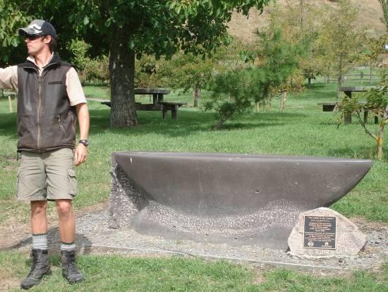
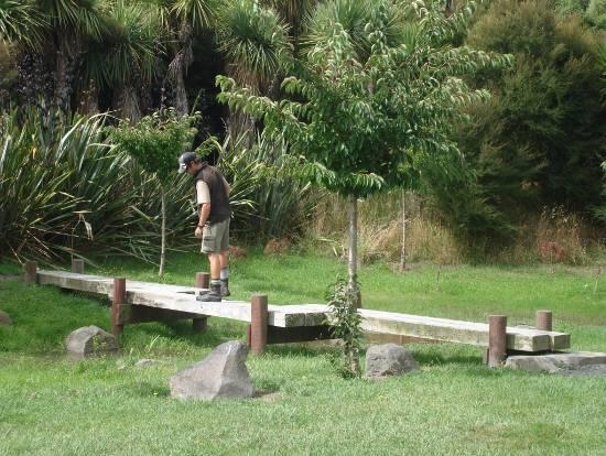
43 Kurashiki (Japan) 43

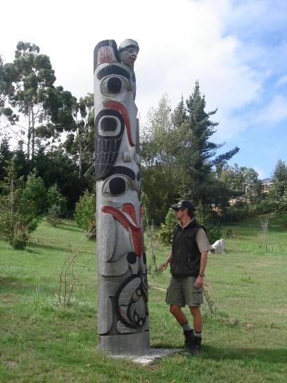


44 Adelaide (Australia) Seattle (United States) Christchurch (England) 44

45 Appendix 4: DOG EXERCISE AREA in (Map 18 Halswell Quarry, Dog Control By-law and Policy 2008) Dogs prohibited in wetland area and must be on a leash in rest of park. Dogs may be exercised in the under effective control area. Refer Map 18 (Page 32 of Dog Control Policy Map 18 45
H7 Open Space zones. (a) provide for the needs of the wider community as well as the needs of the community in which they are located;
 provide for the needs of the wider community as well as the needs of the community in which they are located;") H7. Open Space zones H7.1. Background The majority of land zoned as open space is vested in the Council or is owned by the Crown. However some areas zoned open space are privately owned. While the open
H7. Open Space zones H7.1. Background The majority of land zoned as open space is vested in the Council or is owned by the Crown. However some areas zoned open space are privately owned. While the open
Historic Heritage Historic Heritage Explanatory Statement Significant Issues Objectives and Policies...
 Section Contents Historic Heritage... 2 7. Historic Heritage... 2 Explanatory Statement... 2 7.1 Significant Issues... 3 7.2 Objectives and Policies... 3 7.3 Activity Lists... 4 7.4 Matters of Control
Section 3b: Objectives and Policies Rural Environment Updated 19 November 2010
 Page 1 of Section 3b 3b RURAL ENVIRONMENT 3b.1 Introduction The Rural Environment comprises all the land outside of the Residential, Town Centre and Industrial Environments. Most land within the District
Proposed Southland District Plan 2012 Appeal Version October 2016
 S e c t i o n 3. 5 - F i o r d l a n d / R a k i u r a Z o n e The Fiordland/Rakiura Zone encompasses the Fiordland and Rakiura National Parks and part of Mt Aspiring National Park. It also includes areas
4 RESIDENTIAL ZONE. 4.1 Background
 4 RESIDENTIAL ZONE 4.1 Background The residential areas within the City are characterised by mainly lowrise dwellings sited on individual allotments. Past architectural styles, settlement patterns and
SECTION ONE North East Industrial Zone Design Guide Palmerston North City Council June 2004
 SECTION ONE North East Industrial Zone Design Guide Palmerston North City Council June 2004 young heart easy living 1 Preface Industrial areas are a very important component of the economic well-being
Section 12C Subdivision in the Rural Residential Zone
 Section 12C 12C Subdivision in the Rural Residential Zone The Rural Residential Zone provides part of the range of residential opportunities within the City. Land zoned rural residential is considered
LANDSCAPE GUIDELINES. Countryside & Coastal Countryside Environments. Landscape, Natural Character & Amenity Values Guide
 Landscape, Natural Character & Amenity Values Guide Copyright WDC 2009 Version A2 18May09 Environmental Services Group Publication Countryside & Coastal Countryside Environments START HERE Quality Land
Rural (Urban Expansion) Environment
 Environment") RUEE.1 Rural (Urban Expansion) Environment Subsequent to the receipt of appeals, a 'marked up' version of the Proposed District Plan was prepared. The provisions of the Proposed Version of the Plan subject
RUEE.1 Rural (Urban Expansion) Environment Subsequent to the receipt of appeals, a 'marked up' version of the Proposed District Plan was prepared. The provisions of the Proposed Version of the Plan subject
I615. Westgate Precinct
 I615. Westgate Precinct I615.1. Precinct Description The Westgate Precinct is located approximately 18km west of the Auckland city centre. There are seven Sub-precincts in the Westgate Precinct: Sub-precinct
Exhibit A. 8:9 Scuffletown Rural Conservation District
 Exhibit A 8:9 Scuffletown Rural Conservation District 8:9.1 Intent and Purpose The Scuffletown Rural Conservation (SRC) District is intended to provide for residential development that supports the development
PART AOTEA PRECINCT
 CONTENTS... PAGE AOTEA PRECINCT...4 14.5.1 INTRODUCTION...4 14.5.2 RESOURCE MANAGEMENT ISSUES...4 14.5.3 RESOURCE MANAGEMENT OBJECTIVES AND POLICIES... 4 14.5.4 RESOURCE MANAGEMENT STRATEGY...5 14.5.5
CANOPY AT AMSTEL (THE AMSTEL GOLF COURSE REDEVELOPMENT)
") CANOPY AT AMSTEL (THE AMSTEL GOLF COURSE REDEVELOPMENT) 1000 CRANBOURNE FRANKSTON ROAD, CRANBOURNE The former Amstel Golf Course was rezoned to a General Residential Zone in 2015 to facilitate its redevelopment
CANOPY AT AMSTEL (THE AMSTEL GOLF COURSE REDEVELOPMENT) 1000 CRANBOURNE FRANKSTON ROAD, CRANBOURNE The former Amstel Golf Course was rezoned to a General Residential Zone in 2015 to facilitate its redevelopment
Section 6A 6A Purpose of the Natural Features and Landscapes Provisions
 Section 6A 6A Purpose of the Natural Features and Landscapes Provisions This Chapter addresses the protection and management of natural features and landscapes within the City. The City has a number of
Hidden Pointe Landscape Master Plan. June, archi terra
 Hidden Pointe Landscape Master Plan June, 2006 t h e archi terra g r o u p 1 Table of Contents Background Purpose and Goals of the Master Plan Master Plan Process Existing Conditions Entrance Hidden Pointe
3. STATEMENTS OF DESIRED CHARACTER FOR PLANNING AREAS AND PRECINCTS
 3.30 Planning Area No. 30 Mary River Valley 3.30.1 Location and Role This Planning Area encompasses rural lands in the western part of the Shire. These lands are located within the catchment area of the
STRATEGIC DIRECTION. QLDC PROPOSED DISTRICT PLAN [PART TWO] DECISIONS VERSION 3 strategic direction
![STRATEGIC DIRECTION. QLDC PROPOSED DISTRICT PLAN [PART TWO] DECISIONS VERSION 3 strategic direction](/thumbs/79/79711764.jpg "STRATEGIC DIRECTION. QLDC PROPOSED DISTRICT PLAN [PART TWO] DECISIONS VERSION 3 strategic direction") 3 STRATEGIC DIRECTION QLDC PROPOSED DISTRICT PLAN [PART TWO] DECISIONS VERSION 3 strategic direction QLDC DISTRICT PLAN [PART TWO] AUGUST 2015 3 strategic direction 3.1 Purpose This chapter sets out the
3 STRATEGIC DIRECTION QLDC PROPOSED DISTRICT PLAN [PART TWO] DECISIONS VERSION 3 strategic direction QLDC DISTRICT PLAN [PART TWO] AUGUST 2015 3 strategic direction 3.1 Purpose This chapter sets out the
WELLINGTON CITY DISTRICT PLAN
 Section 32 Report WELLINGTON CITY DISTRICT PLAN PROPOSED DISTRICT PLAN CHANGE 54 REZONING 178 AND 180 OWHIRO BAY PARADE 1 Introduction Before a Proposed District Plan change is publicly notified the Council
North Oakville East Parks Facilities Distribution Plan. November, 2009
 North Oakville East November, 2009 POLICY CONTEXT 1) Purpose a) The purpose of this document is to be a guide for the location, configuration, design and development of the parks system for the North Oakville
4.3 Dudley Area Plan. Introduction. History and Existing Character. Desired Future Character for Dudley
 4.3 Dudley Area Plan Introduction The suburb of Dudley has developed as a result of various circumstances including its topography, history and mineral resources. Dudley development has been identified
RURAL ZONE - POLICY. Rural Zone Policy. Issue: Rural Environment. Ruapehu District Plan Page 1 of 8
 Rural Zone Policy RU2 RURAL ZONE - POLICY RU2.1 Introduction The natural resources of the rural environment in the Ruapehu District provide the basis for the existing and potential character, intensity
Rural (Urban Expansion) Environment
 Environment") RUEE.1 Rural (Urban Expansion) Environment Index RUEE.1 RUEE.1.1 RUEE.1.2 RUEE.1.3 RUEE.1.4 RUEE.2 RUEE.2.1 RUEE.2.2 RUEE.2.3 RUEE.2.4 RUEE.3 Rural (Urban Expansion) Environment Description and Expectations
RUEE.1 Rural (Urban Expansion) Environment Index RUEE.1 RUEE.1.1 RUEE.1.2 RUEE.1.3 RUEE.1.4 RUEE.2 RUEE.2.1 RUEE.2.2 RUEE.2.3 RUEE.2.4 RUEE.3 Rural (Urban Expansion) Environment Description and Expectations
CA.1 Coastal Area. Index. CA.1.1 Description and Expectations
 Index.1.2.3.4 CA.2 CA.2.1 CA.2.2 CA.2.3 CA.3 CA.3.1 CA.3.2 CA.3.1 CA.4 CA.4.1 CA.4.2 CA.4.3 CA.4.4 CA.5 CA.5.1 CA.5.2 Description and Expectations Objectives Policies Guidance Note Landuse Eligibility
2A District-wide Policies
 2A Introduction This Chapter contains policies which are relevant to subdivision, use and development activities occurring across all zones and areas of the District. The policies in this Chapter implement
Cotswolds AONB Landscape Strategy and Guidelines. June 2016
 Cotswolds AONB Landscape Strategy and Guidelines June 2016 Cotswolds AONB Landscape Strategy and Guidelines Introduction The evolution of the landscape of the Cotswolds AONB is a result of the interaction
3. VISION AND GOALS. Vision Statement. Goals, Objectives and Policies
 Vision Statement Queen Creek s interconnected network of parks, trails, open spaces and recreation opportunities provide safe and diverse activities and programs that sustain its unique, small town, equestrian
open space environment
 This section updated August 09 GUIDELINE TO THE RULES The Open Space Environment Rules apply to activities on sites within the Open Space Environment as shown on the Human Environments Maps. Most of the
I539. Smales 2 Precinct
 I539. Smales 2 Precinct I539.1. Precinct Description The Smales 2 Precinct applies to a 4.8 hectare block of land located on the southern side of Northcote Road and fronting Lake Pupuke, Takapuna. The
I611. Swanson North Precinct
 I611. Swanson North Precinct I611.1. Precinct Description Swanson North is located in the north eastern foothills of the Waitakere Ranges. It is outside the Waitakere Ranges Heritage Area Act and the Waitakere
GIBBSTON CHARACTER ZONE. QLDC PROPOSED DISTRICT PLAN [PART FOUR] AUGUST gibbston character zone
![GIBBSTON CHARACTER ZONE. QLDC PROPOSED DISTRICT PLAN [PART FOUR] AUGUST gibbston character zone](/thumbs/75/72573993.jpg "GIBBSTON CHARACTER ZONE. QLDC PROPOSED DISTRICT PLAN [PART FOUR] AUGUST gibbston character zone") 23 GIBBSTON CHARACTER ZONE QLDC PROPOSED DISTRICT PLAN [PART FOUR] AUGUST 2015 23 gibbston character zone QLDC PROPOSED DISTRICT PLAN [PART FOUR] AUGUST 2015 23 gibbston character zone 23.1 Zone Purpose
23 GIBBSTON CHARACTER ZONE QLDC PROPOSED DISTRICT PLAN [PART FOUR] AUGUST 2015 23 gibbston character zone QLDC PROPOSED DISTRICT PLAN [PART FOUR] AUGUST 2015 23 gibbston character zone 23.1 Zone Purpose
doyle + o troithigh landscape - architecture
 doyle + o troithigh landscape - architecture REPORT: PROJECT: LANDSCAPE DESIGN REPORT. STUDENT HOUSING DEVELOPMENT AT WESTWOOD HOTEL SITE. DATE: MAY 2018. www.doyle-otroithigh.com Landscape design report,
Overview Report. Proposed Development
 Overview Report Proposed Development the construction of a 1km cycle/pedestrian trail including a new footbridge, new car park and entrance road at Drumshanbo Lock and a new pedestrian/cycle road crossing,
Tāhuhu whakaruruhau ā-taone The sheltering ridge pole
 B2. Tāhuhu whakaruruhau ā-taone - Urban growth and form B2.1. Issues Tāhuhu whakaruruhau ā-taone The sheltering ridge pole Auckland s growing population increases demand for housing, employment, business,
SECTION 2.4 URBAN DEVELOPMENT AND STRATEGIC URBAN DIRECTIONS
 SECTION 2.4 URBAN DEVELOPMENT AND STRATEGIC URBAN DIRECTIONS 2.4.1 INTRODUCTION In 1993/94 the Hastings District Council completed the Hastings Urban Development Strategy. The purpose of this study was:
UNIVERSITY TOWN NEIGHBOURHOODS 5.2 ECO-CORRIDOR MELBOURNE CAMPUS MASTER PLAN 2014
 5.2 ECO-CORRIDOR 37 ECO-CORRIDOR EXISTING CONDITIONS & VISION NEIGHBOURHOOD VISION Investment in the Eco-corridor Neighbourhood will signify the University s commitment to supporting local ecology and
Regional Context Statement
 Regional Context Statement REGIONAL CONTEXT STATEMENT 3. REGIONAL CONTEXT STATEMENT In 1995, the Provincial Government passed into law the Growth Strategies Act. The purpose of this provincial initiative
8.2 Sector 2 Kelburn Park
 8.2 Sector 2 Kelburn Park Kelburn Park, near Victoria University 8.2.1 Character and use Kelburn Park is a sector of the Town Belt, of a scale and character more like a suburban park. However, the woodland
I602. Birdwood Precinct
 I602. Birdwood Precinct I602.1. Precinct description The Birdwood Precinct applies to an area west of Don Buck Road and south of Red Hills Road in west Auckland. It incorporates subdivision and development
COMMUNITY DESIGN. GOAL: Create livable and attractive communities. Intent
 COMMUNITY DESIGN Intent An attractive, well-designed County will attract quality development, instill civic pride, improve the visual character of the community, and create a strong, positive image for
B4. Te tiaki taonga tuku iho - Natural heritage
 B4. Te tiaki taonga tuku iho - Natural heritage Tuia I runga, tuia i raro, tuia ki te waonui a Tiriwa Bind the life forces of heaven and earth to the great realm of Tiriwa B4.1. Issues Auckland s distinctive
Christchurch City Parks
 Christchurch City Parks Christchurch is known for its gorgeous parks and gardens, which helped lead it to win an International Garden City Award. Take full advantage of being in the Garden City and visit
Chapter 3: Natural Environment. Proposed Waikato District Plan Stage 1. (Notified version)
") Chapter 3: Natural Environment Proposed Waikato District Plan Stage 1 Page 2 of 7 Contents Chapter 3: Natural Environment... 3 3.1 Indigenous Vegetation and Habitats... 3 3.1.1 Objective Biodiversity and
Chapter 3: Natural Environment Proposed Waikato District Plan Stage 1 Page 2 of 7 Contents Chapter 3: Natural Environment... 3 3.1 Indigenous Vegetation and Habitats... 3 3.1.1 Objective Biodiversity and
A new park will be delivered as part of the Elephant Park regeneration.
 A new park will be delivered as part of the Elephant Park regeneration. The exhibition boards presented here introduce the first phase of the new park that is scheduled to open in spring 2017 that has
WELCOME. Land North of STEVENAGE. We would like to thank you for attending our public exhibition today.
 WELCOME We would like to thank you for attending our public exhibition today. The purpose of this event is to share our proposals and hear your thoughts on our ideas. Members of the project team are on
Section Three, Appendix 17C Multiple Unit Housing Design Assessment Criteria
 APPENDIX 17C MULTIPLE UNIT HOUSING DESIGN ASSESSMENT CRITERIA Purpose of Appendix 17C In the Residential 9 Zone the construction and use of multiple household units located within the Multiple Household
Appendix A. Planning Processes. Introduction
 1 Planning Processes Introduction This appendix outlines a number of planning processes which are used in the Auckland Region to support the effective management of development in the region s rural and
STANLEY PARK. Draft Management Plan. Christchurch City Council
 STANLEY PARK Draft Management Plan Christchurch City Council July 2010 Preface Stanley Park is classified as a Recreation Reserve, subject to Section 17 (1) of the Reserves Act 1977. Therefore, the Park
Types of Reserves. Recreational activities
 VALLEY FLOOR AND EASTERN HILLS Physical and ecological features Large, flat valley floor and river plain with intensive urban development Hutt River / Te Awa Kairangi and tributaries Waiwhetu Stream Eastern
Parks and Open Spaces
 Christchurch has a reputation as the Garden City. It would be disappointing if we lost the general greenness of the place. It was great when the Council decided to make a full basketball court at Rowley
24. ARCHAEOLOGY & BUILT HERITAGE
 24. ARCHAEOLOGY & BUILT HERITAGE Overview There are no known archaeological or built heritage sites within or adjacent to the Project designation boundaries. There is a history of both Māori and European
BYLAW C A Bylaw of Rocky View County to amend Land Use Bylaw C
 BYLAW C-7720-2017 A Bylaw of Rocky View County to amend Land Use Bylaw C-4841-97. The Council of Rocky View County enacts as follows: PART 1 TITLE This Bylaw shall be known as Bylaw C-7720-2017. PART 2
QLDC PROPOSED DISTRICT PLAN [PART SIX] DECISIONS VERSION 42 waterfall park
![QLDC PROPOSED DISTRICT PLAN [PART SIX] DECISIONS VERSION 42 waterfall park](/thumbs/96/126991214.jpg "QLDC PROPOSED DISTRICT PLAN [PART SIX] DECISIONS VERSION 42 waterfall park") 42 WATERFALL PARK 42.1 Purpose The purpose of the Waterfall Park Zone is to provide for the development of a visitor resort comprising a range of visitor, residential and recreational facilities, sympathetic
42 WATERFALL PARK 42.1 Purpose The purpose of the Waterfall Park Zone is to provide for the development of a visitor resort comprising a range of visitor, residential and recreational facilities, sympathetic
Plan Modification to Chapter B2 of the Auckland Unitary Plan(AUP) Operative in part (15 November 2016)
 Operative in part (15 November 2016)") UNITARY PLAN UPDATE REQUEST MEMORANDUM TO FROM Phill Reid Linley Wilkinson DATE 25 September 2018 SUBJECT Plan Modification to Chapter B2 of the Auckland Unitary Plan(AUP) Operative in part (15 November
UNITARY PLAN UPDATE REQUEST MEMORANDUM TO FROM Phill Reid Linley Wilkinson DATE 25 September 2018 SUBJECT Plan Modification to Chapter B2 of the Auckland Unitary Plan(AUP) Operative in part (15 November
PCAL Case Study Open Spaces: Blayney Heritage Park
 PCAL Case Study Open Spaces: Blayney Heritage Park Introduction Blayney Heritage Park is an area of high quality open space that offers a range of active and passive recreation facilities. The multi-purpose
Draft Ada Street Cardiff Area Plan
 Draft Ada Street Cardiff Area Plan (Draft Amendment to Lake Macquarie Development Control Plan 2014) Exhibition: The draft Area Plan is on public exhibition from 29 February 2016 to 29 March 2016. Submissions:
32.1 General Industrial, Aviation Commercial and Rural Industrial B zones:
 APPENDIX 32 RULES FOR LANDSCAPING 32.1 General Industrial, Aviation Commercial and Rural Industrial B zones: Yard All yards adjoining a reserve, rural or residential zone or a road adjacent to a reserve,
11.3 SPECIAL CHARACTER ZONE HAWKE S BAY REGIONAL SPORTS PARK
 11.3 SPECIAL CHARACTER ZONE HAWKE S BAY REGIONAL SPORTS PARK 11.3.1 INTRODUCTION The availability of sports and recreation activities and facilities is important for the maintenance and enhancement of
Appendix 1 Structure plan guidelines
 Appendix 1 Structure plan guidelines This appendix forms part of the regional policy statement [rps]. 1.1. Introduction Structure plans are an important method for establishing the pattern of land use
The Vision. Photo provided by The Minervini Group. 46 Vision, Objectives & Strategies
 Vision, Objectives & Strategies The is the public framework and guide for future development of the Grand Traverse Commons. The establishes public polices for infrastructure, the preservation of natural
8.3 Sector 4 Brooklyn Hills
 8.3 Sector 4 Brooklyn Hills Wellington Town Belt on the Brooklyn Hills between Mt Cook and Brooklyn 8.4.1 Character and use This sector extends around the city-facing slopes below Brooklyn, from Mortimer
Town of Cobourg Heritage Master Plan. Statutory Public Meeting
 Town of Cobourg Heritage Master Plan Statutory Public Meeting April 25 th 2016 Presentation Overview 1. Introduction 2. Project background and schedule overview 3. Review of strategic direction content
Issue 1 Protection of the special environmental qualities of the Hanmer Basin.
 Environments of special concern Issue 19 Hanmer Basin The Hanmer Basin is a special area, being a popular retirement and holiday destination as well as having considerable environmental and conservation
8.8 Sector 8 Hataitai Park
 8.8 Sector 8 Hataitai Park The recreation hub at Hataitai Park Note Badminton Hall at the top of picture and Velodrome at bottom centre. 8.8.1 Character and use The sector occupies the east face of the
Neighbourhood Planning Local Green Spaces
 Neighbourhood Planning Local Green Spaces Introduction... 2 1. Why green space is important... 4 2. Neighbourhood plans and green space... 6 3. Evidence... 8 Statutory designations... 9 Green space audit...
Appendix A - Relief sought
 Appendix A - Relief sought Chapter 2 Definitions Definitions Tourism Activity (new) and Visitor Industry (new) The plan does not provide specific definition for tourism. The plan does introduce a new strategic
About 10% of the Borough's population lives in the seven rural parishes. Population figures from the 1991 census are given below:-
 8. THE DISTRICT VILLAGES 8.1 Population About 10% of the Borough's population lives in the seven rural parishes. Population figures from the 1991 census are given below:- Village No. of Persons Cottingham
Newcourt Masterplan. November Exeter Local Development Framework
 Newcourt Masterplan November 2010 Exeter Local Development Framework Background The Exeter Core Strategy Proposed Submission sets out the vision, objectives and strategy for the development of Exeter up
PLANNING COMMITTEE DATE: 07/09/2015 REPORT OF THE SENIOR MANAGER PLANNING AND ENVIRONMENT SERVICE CAERNARFON. Number: 4
 Number: 4 Application Number: C15/0034/37/LL Date Registered: 21/05/2015 Application Type: Full - Planning Community: Llanaelhaearn Ward: Llanaelhaearn Proposal: Location: Summary of the Recommendation:
Chapter 5: Natural Resources and Environment
 NATURAL RESOURCES AND ENVIRONMENT 5-1 5 Chapter 5: Natural Resources and Environment BACKGROUND AND INTENT Urban expansion represents the greatest risk for the future degradation of existing natural areas,
Master Plan Objectives and Policies
 Master Plan Objectives and Policies Introduction This chapter identifies the Park issues and recommended policies established by this Master Plan. The issues were identified through meetings with staff,
INCREMENTAL CHANGE AREA REVIEW March 2015 Page 1
 INCREMENTAL CHANGE AREA REVIEW March 2015 Page 1 Table of Contents Introduction... 3 Background to Review... 3 Comparison of the Schedules to the General Residential Zone... 7 Methodology... 7 Policy Context...
2.4 FUTURE LAND USE ELEMENT Goals, Objectives and Policies
 GOAL 1: To create developmental patterns that direct future growth to appropriate areas on campus, in a manner that promotes the educational mission of the University, the protection of environmentally
Wide asphalt driveway abutting school property. garage built with incompatible materials, too close to park. incompatible fencing materials
 Wide asphalt driveway abutting school property incompatible fencing materials garage built with incompatible materials, too close to park Lack of plantings as a buffer between private property and open
Toddington Central Bedfordshire Stage 3 Green Belt Study December 2017
 Toddington Central Bedfordshire Stage 3 Green Belt Study December 2017 Site: ALP086 - Middle Lakes, Toddington Site size (ha): 2.83 Site: ALP086 - Middle Lakes, Toddington Site size (ha): 2.83 Site description
QLDC PROPOSED DISTRICT PLAN [PART FIVE] NOVEMBER 2017 OPEN SPACE & RECREATION
![QLDC PROPOSED DISTRICT PLAN [PART FIVE] NOVEMBER 2017 OPEN SPACE & RECREATION](/thumbs/89/100753530.jpg "QLDC PROPOSED DISTRICT PLAN [PART FIVE] NOVEMBER 2017 OPEN SPACE & RECREATION") 38 QLDC PROPOSED DISTRICT PLAN [PART FIVE] NOVEMBER 2017 38 O P E N S PA C E & R E C R E AT I O N OPEN SPACE & RECREATION QLDC PROPOSED DISTRICT PLAN [PART FIVE] NOVEMBER 2017 38 OPEN SPACE & RECREATION
38 QLDC PROPOSED DISTRICT PLAN [PART FIVE] NOVEMBER 2017 38 O P E N S PA C E & R E C R E AT I O N OPEN SPACE & RECREATION QLDC PROPOSED DISTRICT PLAN [PART FIVE] NOVEMBER 2017 38 OPEN SPACE & RECREATION
FORMER CANADIAN FORCES BASE (CFB) ROCKCLIFFE SECONDARY PLAN. Official Plan Amendment XX to the Official Plan for the City of Ottawa
 ROCKCLIFFE SECONDARY PLAN. Official Plan Amendment XX to the Official Plan for the City of Ottawa") FORMER CANADIAN FORCES BASE (CFB) ROCKCLIFFE SECONDARY PLAN Official Plan Amendment XX to the Official Plan for the City of Ottawa 1 INDEX THE STATEMENT OF COMPONENTS PART A THE PREAMBLE PAGE Purpose...
FORMER CANADIAN FORCES BASE (CFB) ROCKCLIFFE SECONDARY PLAN Official Plan Amendment XX to the Official Plan for the City of Ottawa 1 INDEX THE STATEMENT OF COMPONENTS PART A THE PREAMBLE PAGE Purpose...
Christine Toner, Consultation Leader
 9. FAIRVIEW STREET FOOTBRIDGE REBUILD General Manager responsible: General Manager, City Environment Group, DDI 941-8608 Officer responsible: Unit Manager, Transport and Greenspace Author: Christine Toner,
D10. Outstanding Natural Features Overlay and Outstanding Natural Landscapes Overlay
 D10. Outstanding Natural Features Overlay and Outstanding Natural Landscapes Overlay D10.1. Background These provisions give effect to Policy 15(a) of the New Zealand Coastal Policy Statement 2010, and
D10. Outstanding Natural Features Overlay and Outstanding Natural Landscapes Overlay
 D10. Outstanding Natural Features Overlay and Outstanding Natural Landscapes Overlay D10.1. Background These provisions give effect to Policy 15(a) of the New Zealand Coastal Policy Statement 2010, and
Appendix H: Easement cross sections
 Appendix H: Easement cross sections SHARED PATH 1.5m FOOTPATH NATURE STRIP 7.3m CARRIAGEWAY 2.7m NATURE STRIP EXISTING PIPELINE 150mm DIA 5.0m (approx.) LOCAL ACCESS ROAD EXISTING PIPELINE 500mm DIA 2.7m
Part 7 Heritage. Diagrams and tables
 Part 7 Heritage Contents Page 7.1 Introduction... 3 7.2 Resource management issues... 3 7.3 Objective... 5 7.4 Resource management strategy... 5 7.5 Roles and responsibilities... 6 7.6 Notification requirements
Rannoch 132 / 33 kv Substation Extension
 Who we are Scottish and Southern Energy Power Distribution is part of the SSE plc group of companies. We own, maintain and invest in the networks in the north of Scotland the electricity transmission network
Eastern Golf Course, Doncaster Road, Doncaster
 , 463-535 Road, Heritage Assessment in accordance with Schedule to the Development Plan Overlay July 2013 bryce raworth conservation urban design 19 Victoria Street St Kilda Vic 3182 , 463-535 Road, Heritage
10.0 Open Space and Public Realm
 10.0 Open Space and Public Realm 10.0 Open Space and Public Realm The Public Open Space System is comprised of: outdoor spaces available for public use that are either publicly owned (e.g., parks and
SOUTH CAMBRIDGESHIRE DISTRICT COUNCIL. Planning and New Communities Director
 SOUTH CAMBRIDGESHIRE DISTRICT COUNCIL REPORT TO: Planning Committee 9 January 2013 AUTHOR/S: Planning and New Communities Director S/2270/12/FL FEN DRAYTON 850m long flood defence embankment ranging in
SPG 1. * the northern and western sections which are open fields used for pasture and grazing;
 SPG 1 1.0 INTRODUCTION This development brief is based on the allocation of the Priors Hall site for employment and countryside recreational purposes in the Corby Borough Local Plan. The brief is intended
Gold Line Bus Rapid Transit Transit Oriented Development (BRTOD) Helmo Station Area Plan
 Helmo Station Area Plan") Appendix F Gold Line Bus Rapid Transit Transit Oriented Development (BRTOD) Helmo Station Area Plan Introduction and Purpose of the Plan The Gold Line Bus Rapid Transit facility is an eleven-mile dedicated
Appendix F Gold Line Bus Rapid Transit Transit Oriented Development (BRTOD) Helmo Station Area Plan Introduction and Purpose of the Plan The Gold Line Bus Rapid Transit facility is an eleven-mile dedicated
97 Lea Bridge Road, Leyton, E10 7QL London Borough of Waltham Forest December 2015
 97 Lea Bridge Road, Leyton, E10 7QL London Borough of Waltham Forest December 2015 Public Realm and Landscape Proposals LEA BRIDGE ROAD, WALTHAMSTOW Public Realm & Landscape Proposals BDP(90)RPT001 December
CHAPTER 5: GUIDING PRINCIPLES
 CHAPTER 5: GUIDING PRINCIPLES The following 10 principles were developed based on public consultation, planning policy and the background analysis conducted during Phase 1. The Guiding Principles significantly
RECREATION AND OPEN SPACE ELEMENT GOALS, OBJECTIVES, AND POLICIES
 RECREATION AND OPEN SPACE ELEMENT GOALS, OBJECTIVES, AND POLICIES Goal 7 To provide park facilities, recreation programs, and open space resources that are safe, adequate, and accessible to all City residents,
SAN RAFAEL GENERAL PLAN 2040 INTRODUCTION AND OVERVIEW
 SAN RAFAEL GENERAL PLAN 2040 INTRODUCTION AND OVERVIEW Steering Committee Presentation February 14, 2018 Purpose of General Plan Guide land use and development decisions Coordinate transportation, infrastructure,
TAKANINI STRUCTURE PLAN AREAS 6A & 6B: ARCHAEOLOGICAL ASSESSMENT
 TAKANINI STRUCTURE PLAN AREAS 6A & 6B: ARCHAEOLOGICAL ASSESSMENT Report prepared for Hosken & Associates Ltd By Barry Baquie (MA) Rod Clough (PhD) April 2006 Clough & Associates Ltd heritage@clough.co.nz
F. Driveways. Driveways which provide access to off-street parking or loading from public streets shall comply with the following:
 Section 20.945.040 General Design Standards for Surface Parking Areas. A. Review Authority. Parking lot design and drainage shall be subject to review and approval of the City Transportation Manager. B.
The Proposed Auckland Unitary Plan (notified 30 September 2013)
") 3 Business zones Introduction There are 10 business zones in the Unitary Plan: City Centre Metropolitan Centre Town Centre Local Centre Neighbourhood Centre Mixed Use General Business Business Park Light
3 Business zones Introduction There are 10 business zones in the Unitary Plan: City Centre Metropolitan Centre Town Centre Local Centre Neighbourhood Centre Mixed Use General Business Business Park Light
SUSTAINABLE MANAGEMENT
 . Sustainable Management.1 The Concept of Sustainable Management The concept of sustainable management recognises there are limits to the use of natural and physical resources and there is a need to balance
I511. Hatfields Precinct
 I511. Hatfields Precinct I511.1. Precinct Description The Hatfields Precinct is a contiguous 183.8 hectare block of rural land held in 8 freehold titles, located immediately to the north of Hatfields Beach.
4 Residential and Urban Living Zones
 4 Residential and Urban Living Zones Refer to Chapters 11 to 20 for additional rules that may apply to these zones. 4.1 OBJECTIVES AND POLICIES Objective Res1 Policy 1 Policy 2 Policy 3 Policy 4 Policy
WELCOME GYPSY LANE. Wider Site Location plan. Proposals for the development of LAND OFF FOXLYDIATE LANE WEBHEATH. Proposals for the development of
 WELCOME The developers are preparing an outline planning application for a residential led development and need the community s views in order to develop the proposals further WHAT IS PROPOSED? A high
H14. Business General Business Zone
 H14. Business General Business Zone H14.1. Zone description The Business General Business Zone provides for business activities from light industrial to limited office, large format retail and trade suppliers.
Derry City and Strabane District Council Planning Committee Report
 Derry City and Strabane District Council Planning Committee Report COMMITTEE DATE: 23 rd March 2016 APPLICATION No: APPLICATION TYPE: PROPOSAL: LOCATION: APPLICANT: LA11/2015/0395/F Residential Development