Centerville SGA. virginia beach, va. Prepared for the City of Virginia Beach February,
|
|
|
- Joel Phillips
- 5 years ago
- Views:
Transcription
1 Centerville SGA virginia beach, va Phase 3 presentation Prepared for the City of February, urban design associates miles agency, rclco, urs, vhb & wpl
2 A Three Phase Process Understanding: Figuring out what is going on. Exploring: Trying out some ideas. Deciding: Choosing what to do. (All with broad based participation)
3 Where We ve Been May Phase 1 Initial analysis, focus group meetings and Kick off Public Meeting 4-8 June Phase 2 Design Charrette, Open House, and Public Meeting September Phase 3 Presentation of the Master Plan 30 November revised Draft Submitted to City Planning December Follow-Up Public and Steering Committee Meetings

4
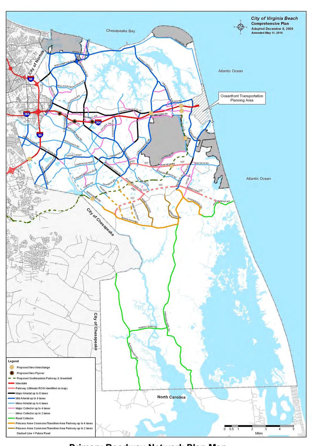
5 Northhamton Boulevard Great Neck Road Broad Bay Atlantic Ocean Burton Station SGA Lynnhaven Bay Boulevard Diamond Springs Road Newtown SGA Haygood Road North Witchduck Road Independence Boulevard Pembroke SGA North Witchduck Road Rosemont SGA Little Neck Road Lynnhaven SGA First Colonial Road Hilltop SGA Laskin Road Boulevard Pacific Avenue Resort Area SGA I-264 I-64 Rosemont Road Oceana Boulevard Indian River Road Princess Anne Road Providence Road S. Independence Blvd. Holland Road Lynnhaven Parkway London Bridge Road General Booth Boulevard Centerville SGA Kempsville Road Lynnhaven Parkway Princess Anne Road Dam Neck Road

6 Northhamton Boulevard Great Neck Road Broad Bay Atlantic Ocean Burton Station SGA Lynnhaven Bay Boulevard Diamond Springs Road Newtown SGA Haygood Road North Witchduck Road Independence Boulevard Pembroke SGA North Witchduck Road Rosemont SGA Little Neck Road Lynnhaven SGA First Colonial Road Hilltop SGA Laskin Road Boulevard Pacific Avenue Resort Area SGA I-264 I-64 Rosemont Road Oceana Boulevard Indian River Road Princess Anne Road Providence Road S. Independence Blvd. Holland Road Lynnhaven Parkway London Bridge Road General Booth Boulevard Centerville SGA Kempsville Road Lynnhaven Parkway Princess Anne Road Dam Neck Road

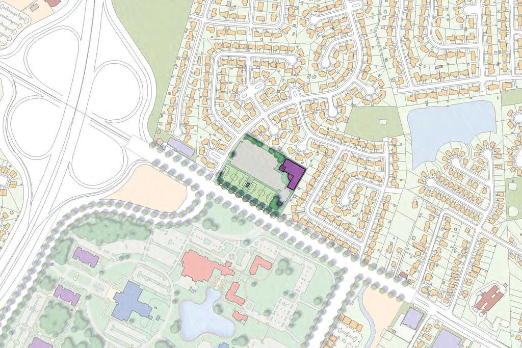
7 Shoppes Regent & CBN Headquarters Kemps River Crossing CBN Property Lake James and Brandon CBN Property City Landfill Private Landfill Greenbrier Mall City View Park Woods Corner and Kempsville Crossing

8 Indian River Park Woodstock Providence Road Military Highway Whitehurst Landing Road Indian River Road Shoppes College Park Founder's Inn CBN Headquarters Level Green Boulevard Regent CBN Corporate Support Kemps River Shopping Center Amerigroup Regent Drive Lake James Brandon Middle School I-64 Brandon Boulevard Kempsville Road Albright Drive Greenbrier Intermediate School HRRC Private Landfill Landfill Tallwood High School Tallwood Elementary School City View Park Woods Corner Shopping Center Lynnhaven Parkway
9 Indian River Park Woodstock Providence Road Military Highway Whitehurst Landing Road Indian River Road Shoppes College Park Founder's Inn CBN Headquarters Level Green Boulevard Regent CBN Corporate Support Kemps River Shopping Center Amerigroup Regent Drive Lake James Brandon Middle School I-64 Brandon Boulevard Kempsville Road Albright Drive Greenbrier Intermediate School HRRC Private Landfill Landfill Tallwood High School Tallwood Elementary School City View Park Woods Corner Shopping Center Lynnhaven Parkway
10 Indian River Park Woodstock Providence Road Military Highway Whitehurst Landing Road Indian River Road Shoppes College Park Founder's Inn CBN Headquarters Level Green Boulevard Regent CBN Corporate Support Kemps River Shopping Center Amerigroup Regent Drive Lake James Brandon Middle School I-64 Brandon Boulevard Kempsville Road Albright Drive Greenbrier Intermediate School HRRC Private Landfill Landfill Tallwood High School Tallwood Elementary School City View Park Woods Corner Shopping Center Lynnhaven Parkway
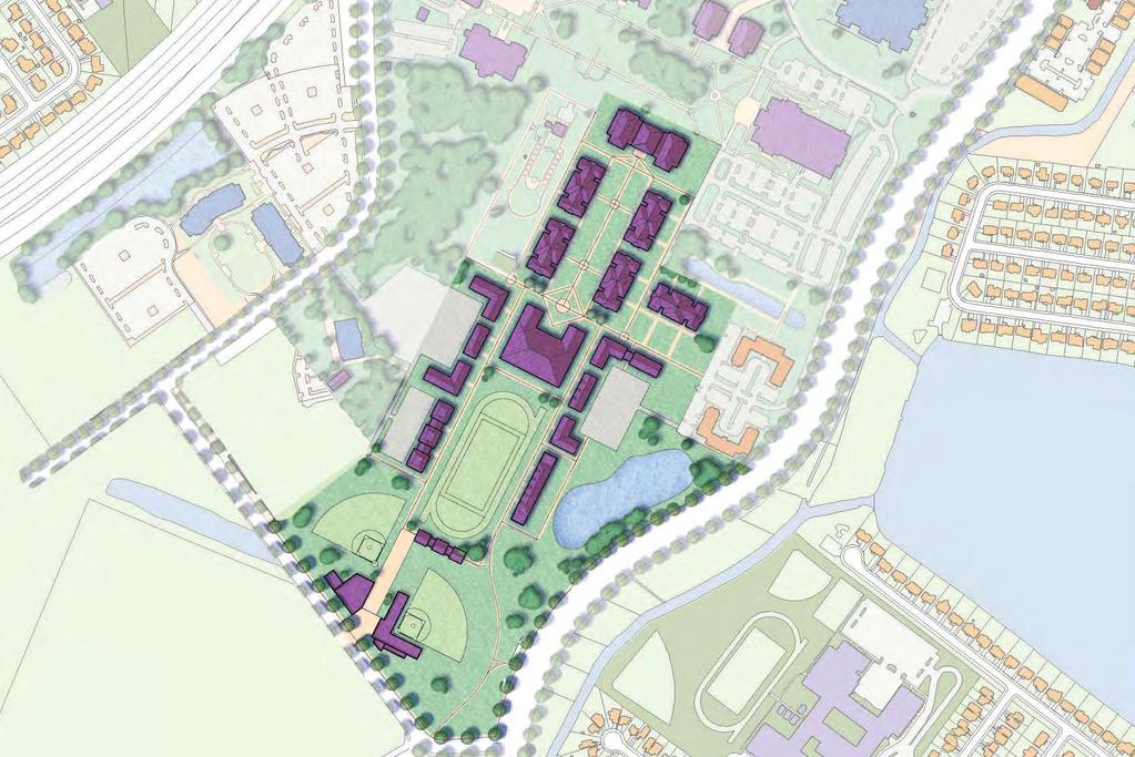
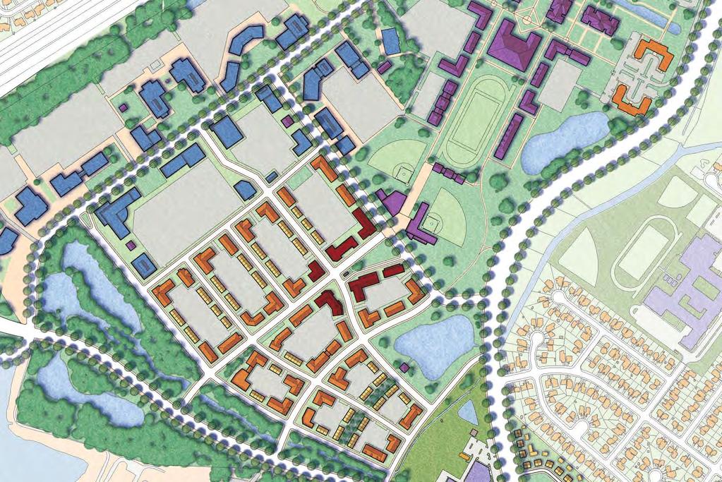
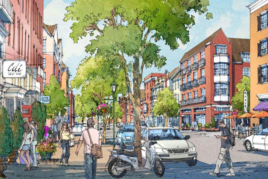
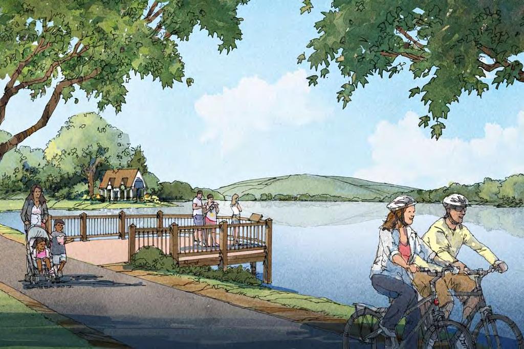
11 Centerville SGA Design Principles Regenerate existing developed areas to capitalize on existing public infrastructure investments. Build a mixed-use center for Centerville. Better connect to existing parks and the Regent Campus through expanded trail networks. Mitigate impacts to the Elizabeth River through stormwater best management practices. Continue to diversify housing choice including workforce housing. Improve the jobs/housing balance to increase capture rate and decrease traffic congestion.
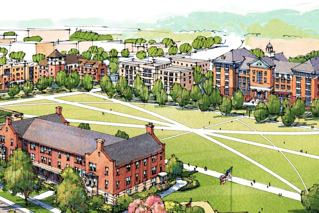
12 Centerville SGA Design Principles Identify immediate and interim actions for landfills to effectively mitigate against adverse impacts Pursue a joint planning strategy with City of. Build a transportation infrastructure network that provides for safety, equity, choice, and economy. Create an education-oriented master-planned community as a unique identity for the Centerville SGA.
13 Total Estimated Development in the Centerville SGA Product Type Total Units/SF Average Capture of Citywide Demand Commercial Office 270,000 13% Medical Office 24,000 2% Retail 350,000 n/a For-Sale Townhouses 250 4% For-Sale Multifamily 95 4% For-Rent Apartments 300 4% (RCLCo)
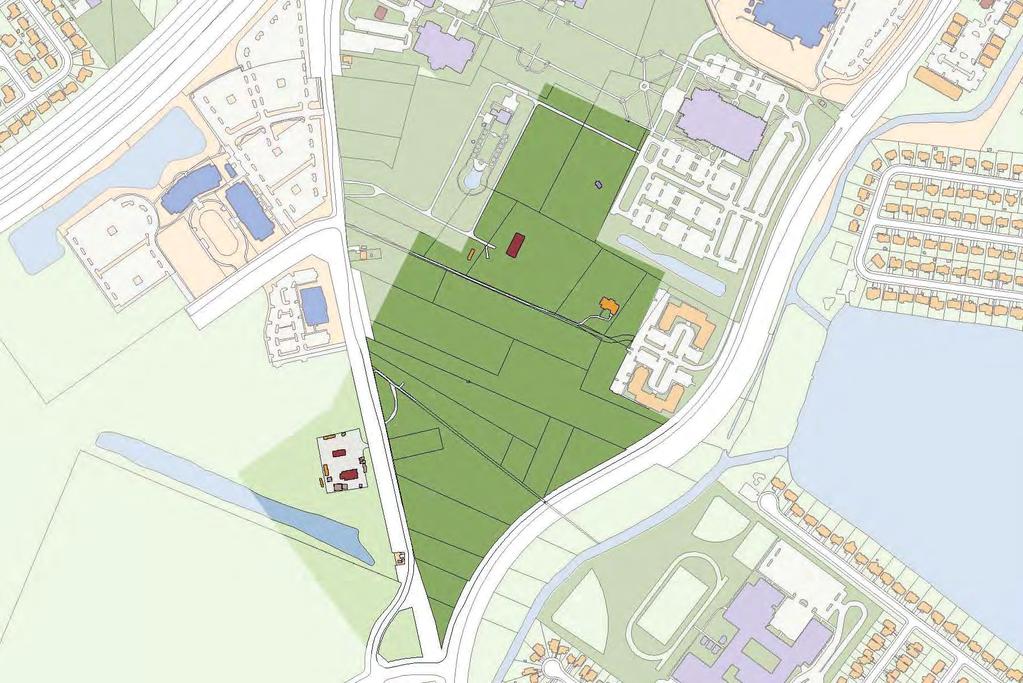
14 waste management strategy
15
16

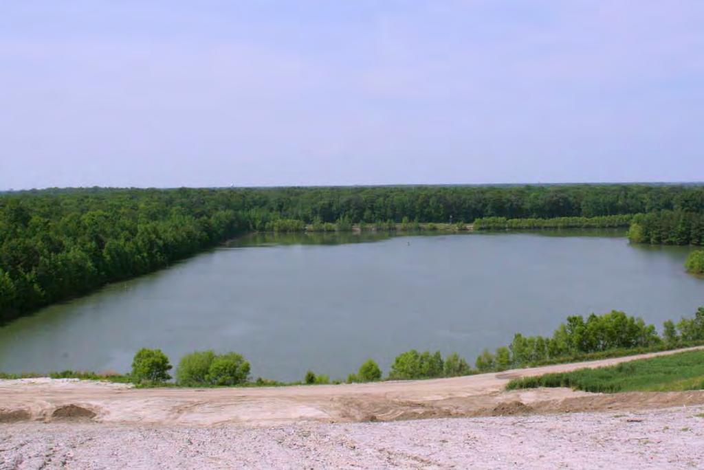
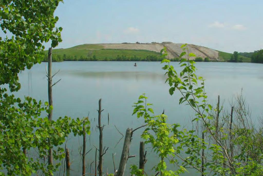
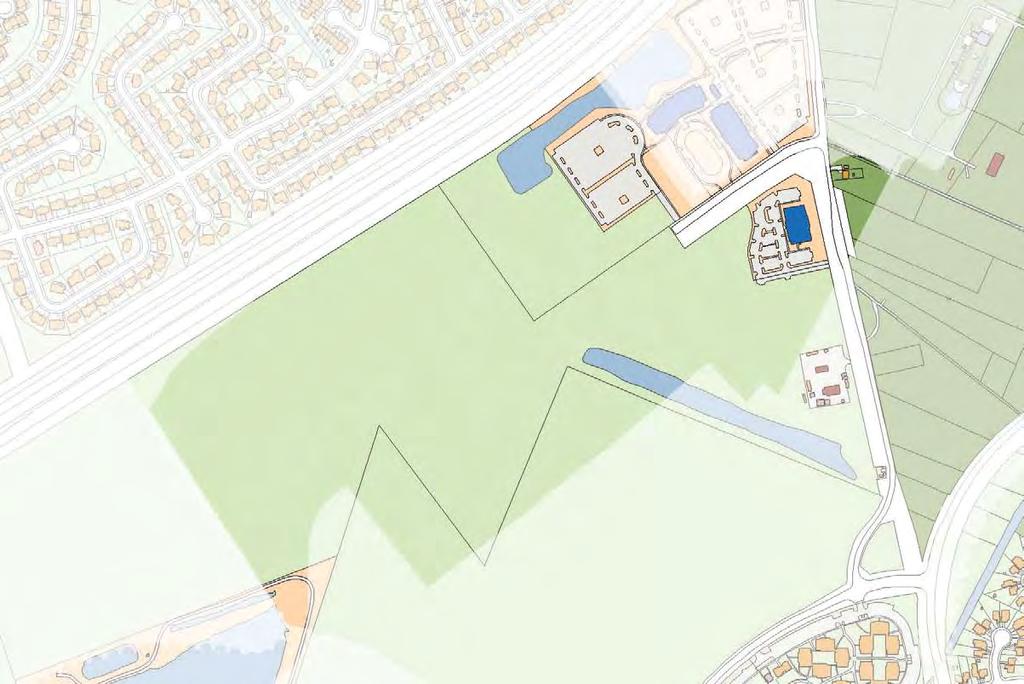
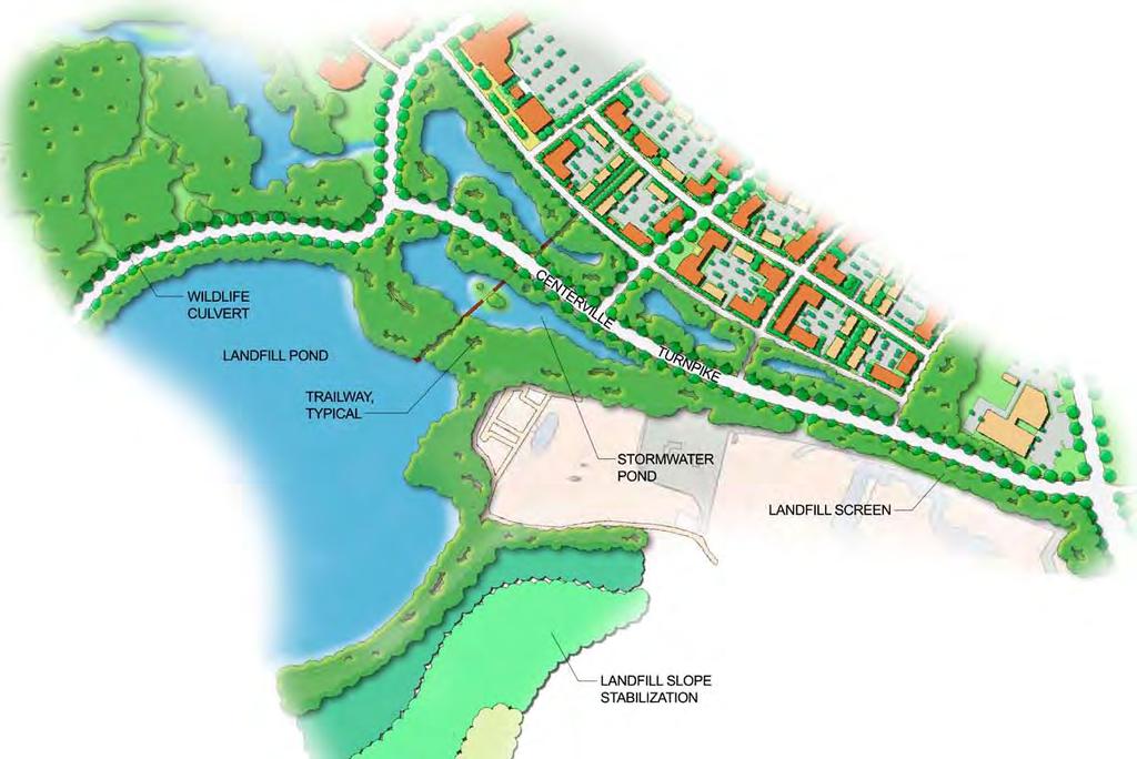
17 existing conditions Two waste management facilities in the Centerville SGA: City Landfill is a public facility HRRC is privately owned Future phases of the City Landfill are south of the current site Existing Road Proposed SGA Street Network Preferred potential interior road alternative potential interior road

18 mitigated conditions NEW CONSOLIDATED ENTRANCE Slope stabilization Additional tree buffers Interior roads Shared, consolidated entrance Traffic calming along Centerville Minimize windblown sediment & odor Improve views into the site Existing Road Proposed SGA Street Network Preferred potential interior road alternative potential interior road
19 urban design associates, miles agency, rclco, urs, vhb & wpl centerville sga
20 stormwater management strategies strategies applied at 4 levels: City-wide Policies (wet ponds and low-impact design) Regional and Sub-watershed Facilities Centerville Community Stormwater Facilities On-Site Treatment for Quality and Quantity
21 stormwater management strategies city-wide challenges: Flat land with poor flow High groundwater table Poor soil infiltration Tides and storms Big rainstorms
22 stormwater management strategies management techniques: Reduction of impervious surfaces Localized storage and infiltration Native plants and marshes help clean the water Treatment trains gradually cleanse the water
23 stormwater management strategies sga strategies: Reduce impervious surfaces Capture rainwater for irrigation and water features Maximize use of bioretention and vegetated water collection Build localized facilities Interconnected linear stormwater conveyance systems

24 Cedar Hill Canal Lake James Drainage Shed HRRC Drainage Shed City Landfill Drainage Shed
25 city efforts to prevent negative impact on water quality of lake james: Weirs divert drainage from the private landfill and bypass Lake James, except during high-flow events The City s landfill drains completely to the landfill lake & northward to another outlet Water quality tests confirm that drainage from the landfill is not the cause of Lake James water quality problems Excess nutrients from lawn fertilizers are a typical cause of algal blooms Lack of fresh water flushing into and out of the lake can also exacerbate this problem.
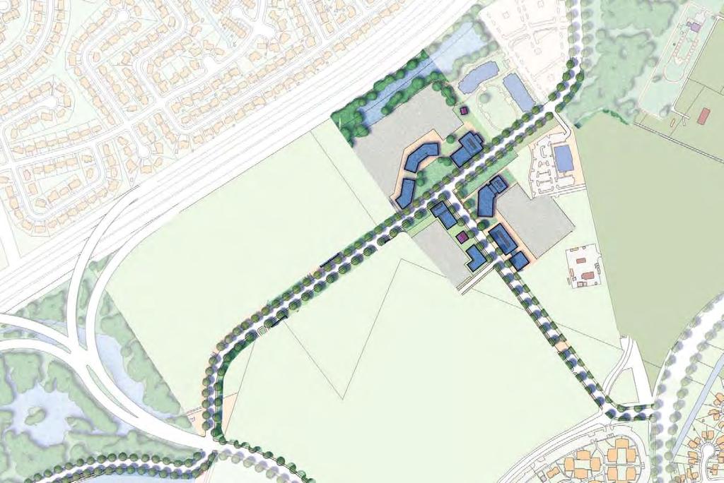
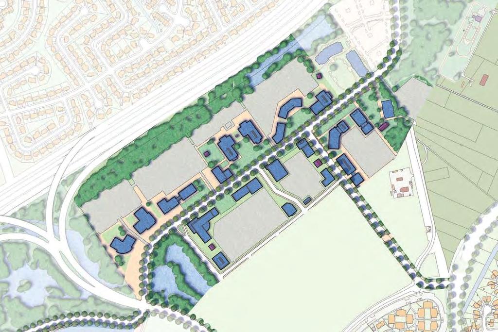
 centerville expansion (Phases 1-2) indian river/kempsville intersection Lynnhaven parkway phase")
26 planned and funded cip projects Indian River/Kempsville Intersection Improvements (fully funded, 2014) Centerville Expansion Lynnhaven Parkway Phase XI Improvements (Road widening to 4 lanes, new connector piece, fully funded, 2014) centerville expansion (Phases 1-2) indian river/kempsville intersection Lynnhaven parkway phase xi

27 proposed street network New interchange river birch run: Phase 1 river birch run: Phase 2 centerville turnpike phase 2 centerville turnpike Phase 3 indian river road Kempsville Indian River Road Intersection Lynnhaven Parkway Regent drive Publicly Funded Primary neighborhood Streets Privately Funded Primary neighborhood Streets local neighborhood streets
28 Indian River Road Providence Road Providence Road Military Highway Indian River Road Indian Lakes Boulevard Ferrell Parkway I-64 Battlefield Blvd Kempsville Road Lynnhaven Parkway Greenbrier Road urban design associates, miles agency, rclco, urs, vhb & wpl centerville sga
29 Indian River Road Providence Road Providence Road Military Highway Indian River Road Indian Lakes Boulevard Ferrell Parkway I-64 Battlefield Blvd Kempsville Road Lynnhaven Parkway Greenbrier Road

30 Indian River Park Woodstock Providence Road Military Highway Whitehurst Landing Road Indian River Road Shoppes College Park Founder's Inn CBN Headquarters Level Green Boulevard Regent CBN Corporate Support Kemps River Shopping Center Amerigroup Regent Drive Lake James Brandon Middle School I-64 Brandon Boulevard Kempsville Road Albright Drive Greenbrier Intermediate School HRRC Private Landfill Landfill Tallwood High School Tallwood Elementary School City View Park Woods Corner Shopping Center Lynnhaven Parkway

31 Indian River Park Woodstock Providence Road existing conditions Military Highway Two lanes with centralized median near Whitehurst Landing Road Indian River Road College Park Indian River Road Founder's Inn Shoppes River Birch Run & Midtowne Way are Level Green Boulevard CBN Headquarters CBN Corporate Regent Support Kemps River Shopping Center dead-ends Amerigroup Regent Drive Lake James Brandon Middle School I-64 Brandon Boulevard Kempsville Road Albright Drive Greenbrier Intermediate School HRRC Private Landfill Landfill Tallwood High School Tallwood Elementary School City View Park Woods Corner Shopping Center Lynnhaven Parkway
32 Indian River Park Woodstock Providence Road interim improvements Military Highway Widen to 4 lanes Whitehurst Landing Road with a centralized median (from Indian College Park Level Green Boulevard Amerigroup Regent Drive Indian River Road Shoppes Founder's Inn CBN Headquarters CBN Corporate Regent Support Lake James Kemps River Shopping Center River Road to Kempsville Road, and eventually to the City line) Extend River Birch Run and Regent Drive to connect to a tempo- Brandon Middle School rary road that connects to Centerville I-64 Kempsville Road Turnpike. Brandon Boulevard Albright Drive Greenbrier Intermediate School HRRC Private Landfill Landfill Tallwood High School Tallwood Elementary School City View Park Woods Corner Shopping Center Lynnhaven Parkway

33 Indian River Park Woodstock Providence Road proposed realignment Military Highway If interchange is approved and con- Whitehurst Landing Road structed, extend River Birch Run to College Park Level Green Boulevard Amerigroup Regent Drive Indian River Road Shoppes Founder's Inn CBN Headquarters CBN Corporate Regent Support Lake James Kemps River Shopping Center align with the southern portion of Form a single road that leads to the I-64 ramp I-64 Brandon Middle School Kempsville Road Albright Drive HRRC Private Landfill Landfill Tallwood Elementary School City View Park Brandon Boulevard Widened to six lanes, if necessary Realign northern section of Centerville Greenbrier Intermediate School to intersect with the newly aligned Tallwood High School at a signalized Woods Corner Shopping Center Lynnhaven Parkway intersection Potential future widening south of Kempsville Road to Lynnhaven Parkway

34 : Existing Section ' R.O.W.

35 : Proposed expansion to four lanes 130'-170 R.O.W.
36
37 Proposed I-64 interchange Shown as preferred alternative When interchange is developed, River Birch Run Phase II will flow continuously into Centerville Turnpike South to reduce congestion The existing will T- into the new alignment adjacent to Azalea Garden Church No anticipated impact to houses north of I-64

38 Proposed I-64 interchange
39

40 Indian River Park Woodstock Providence Road Military Highway Whitehurst Landing Road Indian River Road Shoppes College Park Level Green Boulevard Regent Drive Founder's Inn CBN Headquarters CBN Corporate Regent Support Kemps River Shopping Center Amerigroup Lake James Brandon Middle School I-64 Brandon Boulevard Kempsville Road Albright Drive Greenbrier Intermediate School HRRC Private Landfill Landfill Tallwood High School Tallwood Elementary School City View Park Woods Corner Shopping Center Lynnhaven Parkway e x is t ing hrt Route 12 e x is t ing hrt max route 922

41 Indian River Park Woodstock Providence Road Military Highway Whitehurst Landing Road Indian River Road Shoppes College Park Level Green Boulevard Regent Drive Founder's Inn CBN Headquarters CBN Corporate Regent Support Kemps River Shopping Center Amerigroup Lake James Brandon Middle School I-64 Brandon Boulevard Kempsville Road Albright Drive e x is t ing hrt Route 12 Proposed bus Transit route Greenbrier Intermediate School HRRC Private Landfill Proposed bus Transit Route Landfill Tallwood High School Proposed LRT Alignment Tallwood Elementary School City View Park Woods Corner Shopping Center Lynnhaven Parkway Proposed Bus Stop Proposed LRT Stop study area City Boundary e x is t ing hrt max route 922

42 Indian River Park Woodstock Providence Road Military Highway Whitehurst Landing Road Indian River Road Shoppes College Park Level Green Boulevard Regent Drive Founder's Inn CBN Headquarters CBN Corporate Regent Support Kemps River Shopping Center Amerigroup Lake James Brandon Middle School I-64 Brandon Boulevard Kempsville Road Albright Drive Greenbrier Intermediate School HRRC Private Landfill Landfill Tallwood High School shared-use path Tallwood Elementary School City View Park Woods Corner Shopping Center Lynnhaven Parkway on-road bike lane signed shared roadway on-road bike lane with shared use path on-road bike lane with widened sidewalks

43 : With LRT 130'-170 R.O.W.
44 Land Use and development
45 Indian River Park Woodstock Providence Road Military Highway Whitehurst Landing Road Indian River Road Shoppes College Park Level Green Boulevard Regent Drive Founder's Inn CBN Headquarters CBN Corporate Regent Support Kemps River Shopping Center Amerigroup Lake James Brandon Middle School I-64 Brandon Boulevard Kempsville Road Albright Drive Greenbrier Intermediate School HRRC Private Landfill Landfill Tallwood High School Tallwood Elementary School City View Park Woods Corner Shopping Center Lynnhaven Parkway

46 Indian River Park Woodstock Providence Road Military Highway Whitehurst Landing Road Indian River Road Shoppes College Park Level Green Boulevard Regent Drive Founder's Inn CBN Headquarters CBN Corporate Regent Support Kemps River Shopping Center Amerigroup Lake James Brandon Middle School I-64 Brandon Boulevard Kempsville Road Albright Drive Landfill HRRC Private Landfill university shoppes Greenbrier Intermediate School Tallwood High School regent university expansion Tallwood Elementary School City View Park Woods Corner Shopping Center Lynnhaven Parkway regent village corporate office brandon neighborhood expansion woods corner
47 Indian River Park Woodstock Providence Road Military Highway Whitehurst Landing Road Indian River Road Shoppes College Park Level Green Boulevard Regent Drive Founder's Inn CBN Headquarters CBN Corporate Regent Support Kemps River Shopping Center Amerigroup Lake James Brandon Middle School I-64 Brandon Boulevard Kempsville Road Albright Drive Greenbrier Intermediate School HRRC Private Landfill Landfill Tallwood High School Tallwood Elementary School City View Park Woods Corner Shopping Center Lynnhaven Parkway
48
49
50 Indian River Park Woodstock Providence Road Military Highway Whitehurst Landing Road Indian River Road Shoppes College Park Level Green Boulevard Regent Drive Founder's Inn CBN Headquarters CBN Corporate Regent Support Kemps River Shopping Center Amerigroup Lake James Brandon Middle School I-64 Brandon Boulevard Kempsville Road Albright Drive Greenbrier Intermediate School HRRC Private Landfill Landfill Tallwood High School Tallwood Elementary School City View Park Woods Corner Shopping Center Lynnhaven Parkway
51
52
53
54 Indian River Park Woodstock Providence Road Military Highway Whitehurst Landing Road Indian River Road Shoppes College Park Level Green Boulevard Regent Drive Founder's Inn CBN Headquarters CBN Corporate Regent Support Kemps River Shopping Center Amerigroup Lake James Brandon Middle School I-64 Brandon Boulevard Kempsville Road Albright Drive Greenbrier Intermediate School HRRC Private Landfill Landfill Tallwood High School Tallwood Elementary School City View Park Woods Corner Shopping Center Lynnhaven Parkway
55
56
57 Indian River Park Woodstock Providence Road Military Highway Whitehurst Landing Road Indian River Road Shoppes College Park Level Green Boulevard Regent Drive Founder's Inn CBN Headquarters CBN Corporate Regent Support Kemps River Shopping Center Amerigroup Lake James Brandon Middle School I-64 Brandon Boulevard Kempsville Road Albright Drive Greenbrier Intermediate School HRRC Private Landfill Landfill Tallwood High School Tallwood Elementary School City View Park Woods Corner Shopping Center Lynnhaven Parkway
58
59
60
61 Indian River Park Woodstock Providence Road Military Highway Whitehurst Landing Road Indian River Road Shoppes College Park Level Green Boulevard Regent Drive Founder's Inn CBN Headquarters CBN Corporate Regent Support Kemps River Shopping Center Amerigroup Lake James Brandon Middle School I-64 Brandon Boulevard Kempsville Road Albright Drive Greenbrier Intermediate School HRRC Private Landfill Landfill Tallwood High School Tallwood Elementary School City View Park Woods Corner Shopping Center Lynnhaven Parkway
62 Indian River Park Woodstock Providence Road Military Highway Whitehurst Landing Road Indian River Road Shoppes College Park Level Green Boulevard Regent Drive Founder's Inn CBN Headquarters CBN Corporate Regent Support Kemps River Shopping Center Amerigroup Lake James Brandon Middle School I-64 Brandon Boulevard Kempsville Road Albright Drive Greenbrier Intermediate School HRRC Private Landfill Landfill Tallwood High School Tallwood Elementary School City View Park Woods Corner Shopping Center Lynnhaven Parkway
63
64
65 Indian River Park Woodstock Providence Road Military Highway Whitehurst Landing Road Indian River Road Shoppes College Park Level Green Boulevard Regent Drive Founder's Inn CBN Headquarters CBN Corporate Regent Support Kemps River Shopping Center Amerigroup Lake James Brandon Middle School I-64 Brandon Boulevard Kempsville Road Albright Drive Greenbrier Intermediate School HRRC Private Landfill Landfill Tallwood High School Tallwood Elementary School City View Park Woods Corner Shopping Center Lynnhaven Parkway
66
67
68 Indian River Park Woodstock Providence Road Military Highway Whitehurst Landing Road Indian River Road Shoppes College Park Level Green Boulevard Regent Drive Founder's Inn CBN Headquarters CBN Corporate Regent Support Kemps River Shopping Center Amerigroup Lake James Brandon Middle School I-64 Brandon Boulevard Kempsville Road Albright Drive Greenbrier Intermediate School HRRC Private Landfill Landfill Tallwood High School Tallwood Elementary School City View Park Woods Corner Shopping Center Lynnhaven Parkway

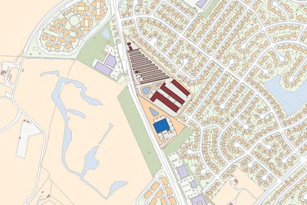
69 existing conditions and interim improvements Uses: retail and self-storage Improve access with new curb cuts along Kempsville & Centerville Improve pedestrian circulation Improve aesthetics Encourage facade renovations and plantings Increase amenities for people with open space and outdoor cafes.

70 phase i framework improvements Without removing buildings, convert access drives into a network of internal streets Invest in street infrastructure, lighting, furniture, pedestrian sidewalks, and a central green Create a block structure that can receive incremental redevelopment as individual owners decide to reinvest

71 phase 2 framework improvements As buildings and properties reach their natural economic lifespans, complete the street framework Connect to neighborhood streets, making it easier for residents to walk Commercial uses such as entertainment, shops, cafes, restaurants, and offices are appropriate
72 Indian River Park Woodstock Providence Road Military Highway Whitehurst Landing Road Indian River Road Beth Sholom Home College Park Founder's Inn CBN Headquarters Office Development Level Green Boulevard Amerigroup Regent Drive Regent CBN Corporate Support New Life Providence Church Regent Expansion Kemps River Shopping Center Lake James I-64 Brandon Middle School Village Kempsville Road Brandon Boulevard Albright Drive Landfill Greenbrier Intermediate Academy Area Tallwood Wood s High School Corner + Kempsville Crossing Parks and Lakes City View Park Lynnhaven Parkway
73 Development Summary (excluding Woods Corner) Zone Acreage Housing Retail Office Institutional Shoppes Regent Expansion , ,631,200 Regent Village ,565,500 81,800 Corporate Office ,404,900 13,300 Brandon Neighborhood Expansion ,400 16,400 Total ac 1,723,900 sf 98,200 sf 2,404,900 sf 1,748,900 sf
74
75
76
77 Indian River Park Woodstock Providence Road Military Highway Whitehurst Landing Road Indian River Road Shoppes College Park Level Green Boulevard Regent Drive Founder's Inn CBN Headquarters CBN Corporate Regent Support Kemps River Shopping Center Amerigroup Lake James Brandon Middle School I-64 Brandon Boulevard Kempsville Road Albright Drive Greenbrier Intermediate School HRRC Private Landfill Landfill Tallwood High School Tallwood Elementary School City View Park Woods Corner Shopping Center Lynnhaven Parkway
78
Rosemont SGA virginia beach, va
 Rosemont SGA virginia beach, va Prepared for the City of Virginia Beach 14 March, 2011 urban design associates miles agency, rclco, urs, vhb & wpl urban design associates, miles agency, rclco, urs, vhb
Rosemont SGA virginia beach, va
 Rosemont SGA virginia beach, va phase 3 PUBLIC Presentation Prepared for the City of Virginia Beach 14 June, 2011 urban design associates miles agency, rclco, urs, vhb & wpl Slide Title A Three Phase Process
Strategic Growth Area #1 Northampton Boulevard Corridor Area
 Strategic Growth Area #1 Northampton Boulevard Corridor Area Description Strategic Growth Area #1 has established itself as a major employment center in Southside Hampton Roads. Opportunities exist to
Kempsville Planning Area
 Kempsville Planning Area Current Reality The Kempsville Planning Area is by far the most populated planning area in the City. The preservation of the 1,422 Stumpy Lake Natural Area, the largest City-owned
ITA and Vicinity Master Plan Update
 1 ITA and Vicinity Master Plan Update PHASE 3 SEPTEMBER 27, 2017 Three Phase Process 2 Phase 1 - Understanding October 13th Public Meeting Phase 2A - Exploring Ideas November 17th Public Meeting Phase
1.2 - URBAN AREAS (STRATEGIC GROWTH AREAS)
") 1.2 - URBAN AREAS (STRATEGIC GROWTH AREAS) INTRODUCTION The vision of the Strategic Growth Areas (SGAs) embodies a vertical mix of urban uses, great streets and well-designed pedestrian connectivity, mobility
1.2 - URBAN AREAS (STRATEGIC GROWTH AREAS) INTRODUCTION The vision of the Strategic Growth Areas (SGAs) embodies a vertical mix of urban uses, great streets and well-designed pedestrian connectivity, mobility
Descriptive Summary of the Comprehensive Plan Amendment
 Applicant City of Virginia Beach Public Hearing October 12, 2016 2016 Comprehensive Plan Amendment Establishing the Historic Seatack & Vicinity Suburban Focus Area (SFA) in Chapter 1, Section 1.3 Agenda
Section4 Design Vision & Implementation Plan
 Section4 Design Vision & Implementation Plan W Woodschurch Rd 4.1 Design Focus Areas The Framework Plan is simply the starting point for directing the design and implementation of a wide range of transportation
QUESTIONS AND ANSWERS Windsor Woods, Princess Anne Plaza & The Lakes Combined Drainage Project
 QUESTIONS AND ANSWERS Windsor Woods, Princess Anne Plaza & The Lakes Combined Drainage Project Project Overview... 2 Thalia Creek (Windsor Woods) Tide Gate... 6 Club House Road Drainage Project... 9 Updated
Seneca Meadows. Block 4 Locate office, technology, and medical development adjacent to I Screen views of garage structures from I-270.
 Seneca Meadows Seneca Meadows has an industrial park in its southern end and a mixed-use employment area planned for the north end. The district benefits from extensive I-270 visibility, stream valley
Description of Preferred Alternative
 Chapter 2 Description of Preferred Alternative 2.1 Introduction This chapter of the programmatic Sammamish Town Center Sub-area Plan Final EIS provides a more detailed description of the Preferred Alternative
Review of Opportunity Area C Draft Comprehensive Plan and Draft BOS Follow-On Motions. Special Working Group Meeting March 4, 2015
 Review of Opportunity Area C Draft Comprehensive Plan and Draft BOS Follow-On Motions Special Working Group Meeting March 4, 2015 The slides that follow identify where the draft Comprehensive Plan has
East Whiteland Township Current Land Development Projects
 Current Land Development Projects A. Lincoln Court (Lancaster Avenue / Malin Road) Demolish existing 2 story brick and stucco structure Build onto existing 1 story masonry shopping center to add 8 new
Secrest Short Cut and Monroe Expressway Small Area Plan AUGUST 29, 2018
 Secrest Short Cut and Monroe Expressway Small Area Plan AUGUST 29, 2018 Background and Process Monroe Expressway will be open by the end of 2018 Union County and Indian Trail identified a need to revisit
SH 199 Corridor Master Plan. Community Meeting No. 2 May 31, 2017
 Community Meeting No. 2 May 31, 2017 Transportation Projects On or Near SH 199 SH 199 from 0.3 miles south of FM 1886 to south end of Lake Worth bridge Construct freeway mainlanes and frontage roads 10-Year
Planning Districts INTRODUCTION
 INTRODUCTION To facilitate detailed examination of development prospects for all areas of the community, Delano has been divided into 14 planning districts. The location of these planning districts is
ARLINGTON COUNTY, VIRGINIA. County Board Agenda Item Meeting of January 28, 2017 SUPPLEMENTAL REPORT
 ARLINGTON COUNTY, VIRGINIA County Board Agenda Item Meeting of January 28, 2017 SUPPLEMENTAL REPORT DATE: January 26, 2017 SUBJECT: The Virginia Department of Transportation s Transform I-66 Inside the
Town Center. Block 5 Existing multifamily residential units are expected to remain.
 Area Guidelines Germantown s districts should be developed as distinct communities with unique features that are supported through the guidelines. The guidelines not only help distinguish these districts
2040 Long Range Transportation Plan
 2040 Long Range Transportation Plan Adopted: April 15, 2013 APPENDIX D HIGHWAY NEEDS PLAN PROJECTS FREDERICKSBURG Existing and Committed Projects Fall Hill Avenue/Mary Washington Blvd. (Fredericksburg)
Courthouse Planning Area
 Courthouse Planning Area Current Reality The Courthouse Planning Area is the characterized by expansive suburbanscale residential areas as well as the community resource planned area of athletic, educational,
Potential Green Infrastructure Strategies May 6, 2015 Workshop
 Potential Green Infrastructure Strategies May 6, 2015 Workshop Background The City of Cortland is developing the Tioughnioga Urban Headwaters Green Infrastructure Action Plan with funding from the National
Preliminary Recommendations Tk Takoma/Langley Crossroads Sector Plan
 Preliminary Recommendations Tk Takoma/Langley Crossroads Sector Plan Vision is to achieve a Transit Oriented, pedestrian friendly Community that Celebrates and builds upon the cultural Diversity of the
SHEFFIELD PARK Paulding County, GA DRI #588
 SHEFFIELD PARK Paulding County, GA DRI #588 Supplemental Information for RDC s DRI (Form 2) Review August 16, 2004 Prepared for: Mr. David Howerin Coosa Valley RDC 1 Jackson Hill Drive Rome, GA 30161 P.O.
Gold Line Bus Rapid Transit Transit Oriented Development (BRTOD) Helmo Station Area Plan
 Helmo Station Area Plan") Appendix F Gold Line Bus Rapid Transit Transit Oriented Development (BRTOD) Helmo Station Area Plan Introduction and Purpose of the Plan The Gold Line Bus Rapid Transit facility is an eleven-mile dedicated
Appendix F Gold Line Bus Rapid Transit Transit Oriented Development (BRTOD) Helmo Station Area Plan Introduction and Purpose of the Plan The Gold Line Bus Rapid Transit facility is an eleven-mile dedicated
ARLINGTON COUNTY, VIRGINIA. County Board Agenda Item Meeting of January 28, 2017 SUPPLEMENTAL REPORT-2
 ARLINGTON COUNTY, VIRGINIA County Board Agenda Item Meeting of January 28, 2017 SUPPLEMENTAL REPORT-2 DATE: January 27, 2017 SUBJECT: The Virginia Department of Transportation s Transform I-66 Inside the
Transportation. Strategies for Action
 Transportation A major priority for the Overlake Neighborhood is to develop a multimodal transportation system. To achieve this system, a balance has to be found among travel, circulation and access needs;
SECTION TWO: Urban Design Concepts
 SECTION TWO: Urban Design Concepts The Gardnerville Plan for Prosperity shapes economic opportunities presented by regional growth. The Urban Design Concepts provide policies and concepts for land use,
DOMINION BOULEVARD CORRIDOR STUDY AND ECONOMIC DEVELOPMENT STRATEGIC PLAN A MODEL FOR CHESAPEAKE S FUTURE
 DOMINION BOULEVARD CORRIDOR STUDY AND ECONOMIC DEVELOPMENT STRATEGIC PLAN A MODEL FOR CHESAPEAKE S FUTURE Overview I. Draft Plan Process II. Draft Plan Overview a. Market Analysis b. Master Land Use Plan
CHARLES PUTMAN CHARLES PUTMAN AND ASSOCIATES, INC
 MEMORANDUM CHARLES PUTMAN & ASSOCIATES, INC. LAND DEVELOPMENT CONSULTANTS PLANNING ZONING PERMITTING 4722 NW Boca Raton Boulevard, Suite C-106 Boca Raton, Florida 33431 Phone: 561/994-6411 FAX: 561/994-0447
Burton Station Village Community Meeting February 26, 2014
 February 26, 2014 SGA Plan Overview Recent announcements by the City of Norfolk regarding the closure of Lake Wright Golf Course and retail development proposals Update on infrastructure improvement plans
Today Land & People. Northeast Nampa Gateway District. Employment. Land Use Characteristics. Demographics. Current Zoning
 Today Land & People Employment Major employers include Saint Alphonsus, the College of Western Idaho, the Auto Mall, Sorrento Lactalis and Walmart. 3,004 jobs in 2010 (COMPASS-CIM 2040 TAZ data) 4,345
TIRZ 17/Redevelopment Authority Capital Improvements Plan Projects
 Gessner Widening: T-1701 What: Widen the road from a six-lane divided boulevard to an eight-lane divided boulevard street section, increase turn lanes, update traffic signal system, improve drainage by
Long Branch-Wayne Local Park Renovation Project
 Montgomery Parks Long Branch-Wayne Local Park Renovation Project Community Meeting #2 September 20, 2016 Oak View Elementary School 7:00-9:00 PM Welcome / Team Introductions M-NCPPC (Montgomery Parks)
Capital Projects in and near Odenton Town Center
 Capital Projects in and near Odenton Town Center Map ID Anne Arundel County Department of Public Works This project provides for the design, right of way acquisition, and construction of approximately
8 October 14, 2015 Public Hearing
 8 October 14, 2015 Public Hearing APPLICANT & PROPERTY OWNER: PRICE S HOLDINGS, LLC STAFF PLANNER: Karen Lasley REQUEST: A. Conditional Use Permit (Automobile Repair Garage) B. Change in Nonconforming
Small Area Plan. South Gateway
 Small Area Plan Adopted May 12, 2008 South Gateway Purpose. The South Gateway Small Area Plan defines the City s expectations for the future of the southern entrance to the City at Interstate 85 and Highway
The transportation system in a community is an
 7 TRANSPORTATION The transportation system in a community is an important factor contributing to the quality of life of the residents. Without a sound transportation system to bring both goods and patrons
ARGENTA TRAIL (CSAH 28/63) REALIGNMENT SOUTH PROJECT (CP 63-25)
 REALIGNMENT SOUTH PROJECT (CP 63-25)") ARGENTA TRAIL (CSAH 28/63) REALIGNMENT SOUTH PROJECT (CP 63-25) Preliminary Design Report February 2015 Prepared For: City of Inver Grove Heights Dakota County Prepared By: Kimley-Horn and Associates,
ARGENTA TRAIL (CSAH 28/63) REALIGNMENT SOUTH PROJECT (CP 63-25) Preliminary Design Report February 2015 Prepared For: City of Inver Grove Heights Dakota County Prepared By: Kimley-Horn and Associates,
Inventory of Existing Bikeways and Trails. Appendix A. Inventory of Existing Bikeways and Trails Appendix A
 Inventory of Existing Bikeways and Trails Virginia Beach Bikeways and Trails Plan 2011 Page A-1 This chart lists the bikeways and trails that are NOT in City parks. The chart is based on the GIS map of
Municipality of Anchorage. Community Council Survey Capital Projects Needs Ranking Survey (ALPHABETICAL) Airport Heights
 Airport Heights") ANCHORAGE PARKS & RECREATION Nichols Park Design and improve neighborhood park 2008 Challenge Grant applicant. 2008 $500K State Grant for Neighborhood Parks. Tikishla Park Lighting, paved parking, hockey
ANCHORAGE PARKS & RECREATION Nichols Park Design and improve neighborhood park 2008 Challenge Grant applicant. 2008 $500K State Grant for Neighborhood Parks. Tikishla Park Lighting, paved parking, hockey
Establish a network of streetscaped vehicle and pedestrian routes that connect within and outside the Plan area.
 This Plan s urban design goals are to create an urban scale, walkable community with connections to transit, parks, and services and with amenities and facilities for residents and employees. The 1992
Great Neck Planning Area
 Great Neck Planning Area Current Reality The Great Neck Planning area is characterized primarily by large lot/lowdensity residential development with the majority of recreational opportunity existing as
This Review Is Divided Into Two Phases:
 Semiahmoo Town Centre Review The purpose of this review: To review the Semiahmoo Town Centre Concept Plan, originally approved in 1993, to ensure that this centre will continue to serve the needs of South
Capital Projects impacting Odenton Town Center
 Capital Projects impacting Odenton Town Center 1 2 E549700 W801600/ W801602 Anne Arundel County Department of Public Works Manor View Elementary School Transmission Main - MD 32 @ Meade Phase 2 $34,399,000
BROOKHILL NEIGHBORHOOD MODEL ZONING MAP AMENDMENT PREFACE TO APPLICATION
 BROOKHILL NEIGHBORHOOD MODEL ZONING MAP AMENDMENT PREFACE TO APPLICATION June 15, 2015 Revised: August 1, 2016 I. VISION Brookhill is a proposed community based upon the principles of Albemarle County
Cobb County Design Guidelines Mableton Parkway & Veterans Memorial Highway Community Design Workshop January 12, 2017
 Community Design Workshop January 12, 2017 Agenda Opening Remarks / Introductions Scope of Work Existing Conditions Key Issues / Opportunities VPS Summary Draft Vision & Goal Statement Implementation Concepts
City of Farmington. Downtown Plan. Amendment to the 1998 Master Plan Adopted October 11, 2004
 City of Farmington Amendment to the 1998 Master Plan Adopted October 11, 2004 Introduction Planning Background 1 Scope and Components of the Plan Amendment 2 Concept Introduction 3 Plan Concepts 3 Conceptual
14 October 10, 2012 Public Hearing APPLICANT: MPB, INC
 14 October 10, 2012 Public Hearing APPLICANT: MPB, INC PROPERTY OWNER: MUNDEN & ASSOCIATES, LP STAFF PLANNER: Karen Prochilo REQUEST: Conditional Change of Zoning (AG-1 & AG-2 to Conditional O-2) ADDRESS
Request Conditional Use Permit (Automobile Service Station) Staff Recommendation Approval. Staff Planner Bill Landfair
 Staff Recommendation Approval. Staff Planner Bill Landfair") Applicant Property Owner RTR Real Estate Associates, Tidewater Investments, LLC, Bruce Ranomski Public Hearing December 12, 2018 City Council Election District Centerville Agenda Item 7 Request Conditional
Applicant Property Owner RTR Real Estate Associates, Tidewater Investments, LLC, Bruce Ranomski Public Hearing December 12, 2018 City Council Election District Centerville Agenda Item 7 Request Conditional
Status Update (2006 vs. Now) Citizen s Advisory Committee February Plan for Prosperity
 Citizen s Advisory Committee February Plan for Prosperity") Status Update (2006 vs. Now) Citizen s Advisory Committee February 2018 Plan for Prosperity 2000 2017 2000 2017 Gardnerville Population 6,000 5,760 5746 5,500 5,000 5,067 5,550 5,165 5,394 5,412 5,250
Status Update (2006 vs. Now) Citizen s Advisory Committee February 2018 Plan for Prosperity 2000 2017 2000 2017 Gardnerville Population 6,000 5,760 5746 5,500 5,000 5,067 5,550 5,165 5,394 5,412 5,250
Princess Anne Road. Phase VII (CIP 2-195) Citizens Information Meeting
 Citizens Information Meeting") Citizens Information Meeting Princess Anne Road Phase VII (CIP 2-195) Wednesday, May 5, 2004 4:30 PM to 7:00 PM Red Mill Elementary School 1860 Sandbridge Road Virginia Beach, VA Welcome to the Citizens
Citizens Information Meeting Princess Anne Road Phase VII (CIP 2-195) Wednesday, May 5, 2004 4:30 PM to 7:00 PM Red Mill Elementary School 1860 Sandbridge Road Virginia Beach, VA Welcome to the Citizens
QUESTIONS AND ANSWERS Windsor Woods, Princess Anne Plaza & The Lakes Combined Drainage Project
 QUESTIONS AND ANSWERS Windsor Woods, Princess Anne Plaza & The Lakes Combined Drainage Project PROJECT OVERVIEW Windsor Woods, Princess Anne Plaza and The Lakes are neighborhoods located in what was once
Virginia Beach, Virginia u r b a n
 i n t e r fac i l i t y t ra f f i c a re a a n d v i c i n i t y m as t e r p l a n : Virginia Beach, Virginia u r b a n d e s i g n a s s o c i a t e s october 2010 Adopted by reference as part of the
Panama City Beach Community Redevelopment Agency Condo Con Property Owner Conference & Expo November 14, 2014
 Panama City Beach Community Redevelopment Agency Condo Con Property Owner Conference & Expo November 14, 2014 Front Beach Road CRA On November 30, 2000, the City created the Panama City Beach Community
Executive Summary. NY 7 / NY 2 Corridor
 Executive Summary NY 7 / NY 2 Corridor Transportation and Land Use Study December 2005 Prepared for: Town of Colonie Capital District Transportation Committee Prepared by: Introduction: Land use decisions
Mitchell Ranch South MPUD Application for Master Planned Unit Development Approval Project Narrative. Introduction
 Mitchell Ranch South MPUD Application for Master Planned Unit Development Approval Project Narrative Introduction Mitchell Ranch South is a proposed single family (detached) residential development on
Stakeholders Advisory Working Groups (SAWGs) Smart Growth and TOD Land Use (#11) SAWG Meeting
 Smart Growth and TOD Land Use (#11) SAWG Meeting") Presentation - Part II Tappan Zee Bridge/I-287 Corridor Project July 21, 2010 Slide 1. David Kooris (Regional Plan Association) welcomed members of the Land Use Stakeholders Advisory Working Groups (SAWGs)
Presentation - Part II Tappan Zee Bridge/I-287 Corridor Project July 21, 2010 Slide 1. David Kooris (Regional Plan Association) welcomed members of the Land Use Stakeholders Advisory Working Groups (SAWGs)
4 January 11, 2012 Public Hearing APPLICANT:
 . 4 January 11, 2012 Public Hearing APPLICANT: MID-ATLANTIC AUTO PROPERTY OWNER: DZR, LLC STAFF PLANNER: Leslie Bonilla REQUEST: Conditional Use Permit (truck rental, automobile service, and automotive/bulk
Request Conditional Use Permit (Automobile Repair Garage) Staff Planner Kevin Kemp
 Staff Planner Kevin Kemp") Request Conditional Use Permit (Automobile Repair Garage) Staff Planner Kevin Kemp Location 845 Lynnhaven Parkway GPIN 14963473030000 Election District Rose Hall Site Size 0.40 acre portion of a 6.35 acre
Request Conditional Use Permit (Automobile Repair Garage) Staff Planner Kevin Kemp Location 845 Lynnhaven Parkway GPIN 14963473030000 Election District Rose Hall Site Size 0.40 acre portion of a 6.35 acre
Indian River Town Meeting Held June 6, 2017 The following are responses to issues, grouped under headings, raised at the Indian River Town Meeting.
 Indian River Town Meeting Held June 6, 2017 The following are responses to issues, grouped under headings, raised at the Indian River Town Meeting. Atlantic Coastal Pipeline/Southside Connector Distribution
Development Agreement Public Meeting. June 26, 2013
 Development Agreement Public Meeting June 26, 2013 Process 2007 2008 2009 2010 2011 2012 2013 Neighborhood Conservation District Petition Process Original Master Plan presented Community Forum Glen Lennox
COMPLETE GREEN STREET CHECKLIST
 COMPLETE GREEN STREET CHECKLIST This document was developed to dissect the structure of an urban street and explore opportunities to make our streets more complete while also integrating green street strategies.
Scope of Services. River Oaks Boulevard (SH 183) Corridor Master Plan
 Corridor Master Plan") Scope of Services River Oaks Boulevard (SH 183) Corridor Master Plan PROJECT AREA The project area consists of the River Oaks Boulevard (SH 183) corridor bounded by SH 199 at the northern end and the Trinity
Scope of Services River Oaks Boulevard (SH 183) Corridor Master Plan PROJECT AREA The project area consists of the River Oaks Boulevard (SH 183) corridor bounded by SH 199 at the northern end and the Trinity
INDEPENDENCE BOULEVARD AREA PLAN
 INDEPENDENCE BOULEVARD AREA PLAN Public Meeting October 28, 2008 Tonight s Agenda Introduction 4:00 4:05 Tom Warshauer Presentation 4:05 5:00 Blake Drury Group Exercises 5:00 5:50 All Wrap Up & Next Steps
Sustainable Development Call for Projects Western Infrastructure Project Submissions
 2009-2010 Sustainable Development Call for Projects Western Infrastructure Project Submissions January 20, 2010 2009-2010 SDCFP Summary of Infrastructure Funding Infrastructure Projects Number of Projects
At first Work Session on October 22, At second Work Session on November 19, At third Work Session on December 3, 2015
 At first Work Session on October 22, 2015 Staff Reviewed Infrastructure: Transportation Capacity School Capacity Willett Branch Proposed Staging Language At second Work Session on November 19, 2015 Land
SPRINGHILL LAKE TRANSIT VILLAGE
 Greenbelt Metro Area Sector Plan - Subarea Design Policies and Guidelines - Springhill Lake Transit Village 113 SPRINGHILL LAKE TRANSIT VILLAGE Residential Neighborhood and Village Center CONCEPT Springhill
include playgrounds, sports fields, community gardens and picnic areas.
 DEVELOPMENT PLAN OPEN SPACE SYSTEM OPEN SPACE SYSTEM The neighborhood provides for a range of open space types. The Village Square is an important open space in the neighborhood. It serves as a gathering
City of Virginia Beach Comprehensive Plan It s Our Future: A Choice City May 17, 2016
 1.3 - SUBURBAN AREA INTRODUCTION City of Virginia Beach Comprehensive Plan It s Our Future: A Choice City Much of the area located north of the Green Line possesses a suburban land use pattern, meaning
Hopkins. Development Guidelines May Overview. Sponsored by: Blake Road Corridor Collaborative City of Hopkins
 Hopkins Blake Road LRT Station Area Development Guidelines May 2015 Sponsored by: Blake Road Corridor Collaborative City of Hopkins Overview Hopkins is a dynamic community of over 17,000 residents located
Virginia Beach, Virginia
 lynnhaven strategic growth area master plan Virginia Beach, Virginia u r b a n d e s i g n a s s o c i a t e s february 2012 Adopted by reference as an amendment to Virginia Beach Comprehensive Plan MMMM
New Orleans East District 9, 10 & 11. St. Martin Brown & Associates
 New Orleans East District 9, 10 & 11 Work with neighborhoods to develop revitalization plans that are rational, thoughtful, can be implemented, and formed into a citywide recovery plan for submission
Lower Merion Commercial Districts Issues and Characteristics Handbook November 2013
 Lower Merion Commercial Districts Issues and Characteristics Handbook November 2013 DRAFT TOWNSHIP-WIDE VISION: To maintain and enhance commercial areas to complement the surrounding high-quality residential
University Parkway Corridor Plan. Public Workshop Sept. 18, 2017
 University Parkway Corridor Plan Public Workshop Sept. 18, 2017 AGENDA 1. Overview of Process 2. Study Area 3. Components of the Plan 4. What We Know 5. What We Have Heard 6. Tonight s Input 7. Next Steps
Proposed FY 2004 TRANSPORTATION CAPITAL PROGRAM New Jersey Department of Transportation Projects
 Carteret Industrial Road 98547 This project will address the upgrade of Carteret Industrial Road. The federal Transportation Equity Act for the 21st Century (TEA-21) provided funding for this project under
9 th Street Sub Area Plan
 9 th Street Sub Area Plan In the 1990 s, when the Township prepared the last Master Plan, the 9 th Street corridor was studied as part of a larger 9 th Street Focus Area that included the West Main Street
Silver Line CPAM UPDATE. Transportation and Land Use Committee October 14, 2016
 Silver Line CPAM UPDATE Transportation and Land Use Committee October 14, 2016 Purpose Recap Project History and Map Changes Provide Overview of CPAM Components Discuss Transportation Impacts Discuss Fiscal
GREENING THE BOULEVARD Master Plan Concepts for Venice Boulevard between Lincoln and Sawtelle
 GREENING THE BOULEVARD Katherine Spitz Associates Inc. 4212½ Glencoe Avenue Marina Del Rey, CA 90292 310 574 4460 Fax 574 4462 January 2008 Table of Contents Overview Proposed Design Improvements Illustration
PINE CURVE REZONING. Property does not meet criteria for open space preservation and is not a candidate for a park
 PINE CURVE REZONING BACKGROUND Purchased as two parcels in 2001 and 2002 Annexed and Zoned Greater Downtown District Historic Center September 25, 2002 and October 7, 2002 WHAT THE PROJECT IS AND IS NOT
Public may provide comments on the GDP within the next two weeks (December 24)
") 25/70 General Development Plan (GDP) Public Meeting Wednesday, December 10, 2014 6:00 8:00 P.M. District 1 Police Station Community Room 1311 W 46th Ave, Denver, CO 80211 Council Woman Montero: This particular
25/70 General Development Plan (GDP) Public Meeting Wednesday, December 10, 2014 6:00 8:00 P.M. District 1 Police Station Community Room 1311 W 46th Ave, Denver, CO 80211 Council Woman Montero: This particular
LUNDY S LANE COMMUNITY IMPROVEMENT PLAN STUDY
 PUBLIC INFORMATION MEETING #2 October 12, 2016 LUNDY S LANE COMMUNITY IMPROVEMENT PLAN STUDY AGENDA 5:00 to 5:30pm: Open House 5:30 to 6:15pm: Presentation 6:15 to 7:00pm: Individual paced workshop with
IMPLEMENTATION STRATEGIES. In This Chapter. Goals & Strategies 182 Project List 183 Future Land Use 186 CHAPTER 11 IMPLEMENTATION STRATEGIES
 In This Chapter Goals & Strategies 182 Project List 183 Future Land Use 186 11 IMPLEMENTATION STRATEGIES NORTH AUGUSTA, SC 2017 COMPREHENSIVE PLAN 179 Individual commitment to a group effort that is what
CHAPTER 8. Mrs. Zimman s Class - Central Elementary
 SUSTAINABILITY CHAPTER 8 Mrs. Zimman s Class - Central Elementary 8.1 OVERVIEW Green infrastructure also known as low impact development (LID) and environmental or sustainable site design is an environmentally
Southeast Michigan Council of Governments
 Southeast Michigan Council of Governments SEMCOG Green Infrastructure Activities Regional Green Infrastructure Vision GLRI Green Streets EPA Technical Assistance MDOT Grants Green Infrastructure Vision
BURTON STATION STRATEGIC GROWTH AREA PLAN UPDATE PUBLIC MEETING 3/26/18
 BURTON STATION STRATEGIC GROWTH AREA PLAN UPDATE PUBLIC MEETING 3/26/18 1 WHERE WE ARE? 2 PRIMARY OBJECTIVES OF THE PLAN UPDATE 1. Update the land use designation for Burton Station Village to reflect
COLLIER BOULEVARD (CR 951) CORRIDOR
 CORRIDOR") Project(s) Goals Improve Traffic Circulation, Capacity & Safety Focus on Safety During Design & Construction Address Public Concerns Design an Aesthetically Pleasing Project Limit Environmental Impacts
Project(s) Goals Improve Traffic Circulation, Capacity & Safety Focus on Safety During Design & Construction Address Public Concerns Design an Aesthetically Pleasing Project Limit Environmental Impacts
McDonald s Restaurant - Purcellville Town of Purcellville Special Use Permit Statement of Justification July 24, 2014
 Introduction / Written Statement McDonald s Restaurant - Purcellville McDonald s Corporation is proposing to redevelop the existing McDonald s eating establishment with a drive-through located at 121 N
St. Louis Park Wooddale LRT Station Site development guidelines
 St. Louis Park Wooddale LRT Station Site development guidelines November 2013 OVERVIEW St. Louis Park s convenient location as a neighbor to Minneapolis means you re only minutes away from some of the
Courthouse Square Planning & Urban Design Study. Courthouse Square Working Group #13 October 15, 2014
 Courthouse Square Planning & Urban Design Study Courthouse Square Working Group #13 October 15, 2014 1 Courthouse Square Process Working Group Community Courthouse Square Advisory Groups & Civic Associations
Comprehensive Plan Advisory Panel Meeting #3
 Comprehensive Plan Advisory Panel Meeting #3 November 7, 2016 Agenda 1. September 19 th Meeting Notes 2. Summary of Focus Areas Charrette 3. Heart of the City Focus Area a. HOC2/Station Areas Concept &
FY STATEWIDE TRANSPORTATION IMPROVEMENT PROGRAM New Jersey Department of Transportation Projects
 ROUTE/ Project ID No. TIP No. Burlington County Computerized Signal Control, IV D9911 D9911 This ITS project will be a traffic responsive signal system, consisting of 24 intersections--9 on CR 607, 4 on
Kenilworth Avenue and Town of Cheverly Industrial Study Briefing
 Kenilworth Avenue and Town of Cheverly Industrial Study Briefing The Maryland-National Capital Park and Planning Commission Prince George s County Planning Department www.pgplanning.org Vanasse Hangen
ATTACHMENT A. SILVERDALE DESIGN STANDARDS Amendments to the Waaga Way Town Center Chapter
 ATTACHMENT A SILVERDALE DESIGN STANDARDS Amendments to the Waaga Way Town Center Chapter Chapter 10. Waaga Way Town Center 10.1 Physical Identity Elements & Opportunities The Waaga Way Town Center includes
Subarea 5 Southern Gateway. Vision. Mobility The proposed street network will create developable blocks that are scaled appropriately for the area.
 southern gateway 194 Southern Gateway extends south of I-435 to 123 rd Street and includes the area past the Blue Valley Parkway division. This area is adjacent to major office centers such as the College
MPRD s Keith Mione (Community) Park Midlothian Road Entrance Traffic Signals
 Park Midlothian Road Entrance Traffic Signals") MPRD s Keith Mione (Community) Park Midlothian Road Entrance Traffic Signals Purpose: The Midlothian Road entrance to Mundelein Park & Recreation District s (MPRD s) Keith Mione (Community) Park would
MPRD s Keith Mione (Community) Park Midlothian Road Entrance Traffic Signals Purpose: The Midlothian Road entrance to Mundelein Park & Recreation District s (MPRD s) Keith Mione (Community) Park would
SQUAMISH 2010 AND BEYOND COMMUNITY VISION
 Our plan has been imagined and created to be both pragmatic and visionary. At the core of the strategy is a consideration of the highway s role and its impact on the community. First and foremost in creating
TOWN COUNCIL / PLANNING COMMISSION
 Workshop #3 TOWN COUNCIL / PLANNING COMMISSION January 20, 2011 Consultant Team In Attendance Tonight BMS Design Group Nevada City and San Francisco Michael Smiley, AICP, ASLA Partner-in-Charge Nancy L.
[Leveraging & Improving Neighborhood Connections] Area C Lamar Levee
![[Leveraging & Improving Neighborhood Connections] Area C Lamar Levee](/thumbs/78/78438669.jpg "[Leveraging & Improving Neighborhood Connections] Area C Lamar Levee") Community Charrette LINC Dallas [Leveraging & Improving Neighborhood Connections] Area C Lamar Levee 06.02.12 LINC Workshop Area C Schematic design has been completed on plans to extend the east levee
Community Charrette LINC Dallas [Leveraging & Improving Neighborhood Connections] Area C Lamar Levee 06.02.12 LINC Workshop Area C Schematic design has been completed on plans to extend the east levee
Issues Requiring Future Study
 Issues Requiring Future Study Transportation planning is an ongoing process that tends to identify new issues as it finds solutions for others. Some issues are so complex that a solution to one problem
Guiding Principles for the SR 520 Replacement Project
 Guiding Principles for the SR 520 Replacement Project Presentation to the Board of Regents Theresa Doherty Assistant Vice President for Regional Affairs May 18, 2006 F-14 The University of Washington is