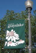
Village center & Downtown Plan
|
|
|
- Jeffry Sherman
- 5 years ago
- Views:
Transcription

1 Village center & Downtown Plan
2

3 I. The Village Center A. The Future B. Village Center Action Plan C. Village Center Subarea Plan Plan Overview II. The Downtown Area A. Historic Downtown B. Downtown Action Plan III. Future Land Use A. Downtown Subarea Plan B. Downtown Illustrative Plan IV. Downtown Design Controls and Guidelines- Architectural Guidelines V. Grayslake Area Chamber of Commerce / Economic Development Commission Business Services VI. Grayslake at a Glance
4
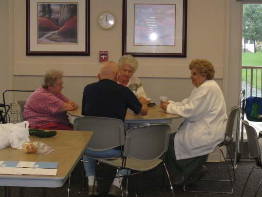
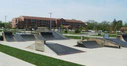
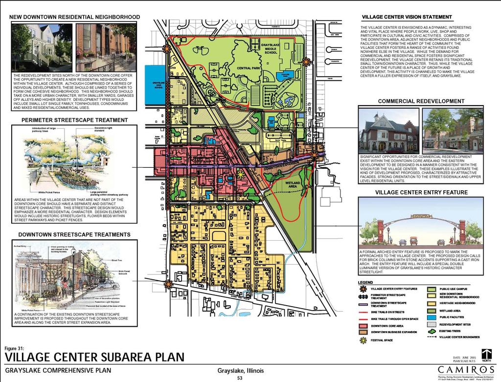
5 The Village Center The Comprehensive Plan of 1989 envisioned development of a Village Center in the downtown business district. Pursuant to this concept, the Village took steps toward revitalization of this business district, including infrastructure investments, public facility expansions in the area, and economic development programs designed to encourage business investment and restore the area s historic character. An EDC/ Chamber contract resulted in community events and activities in the downtown that encourage business while reinforcing the area s role as a Village Center. The result is a revitalized downtown business district with low vacancy rates. As the Village has grown, a broader concept of a Village Center, as included in the Comprehensive Plan of 2005, has evolved covering a larger geographic area and includes a mix of residential, non-residential, open space, and institutional uses. Strong cooperation among various organizations has resulted in the creation of amenities that are increasingly a focus of community activity, including Central Park with its various recreation and open space areas, public library, skate park, Esper A. Petersen Foundation Family Aquatic Center, Grayslake High and Middle Schools, Village Hall, Municipal Historical Museum, Millennium Veteran s Memorial, historic downtown district, senior housing opportunities, and the Heritage neighborhood. The Future... Various community organizations plan to continue to work on enhancing the offerings in the Village Center. Toward this end, the following goal has been established with respect to the Village Center: Build a multi-faceted Village Center as a community focal point and as a unique amenity that enhances property values and raises community spirit.
, Grayslake Middle School/Central Park (north), Lake Street (west), and Belvidere Road (south) by.")


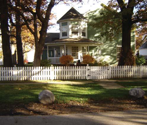
6 Village Center Action Plan... Rendering of the future Village Heritage Center, located on the site of the current Village Historical Museum. Continue the development of the Grayslake Village Center in the area bounded by Route 83 (east), Grayslake Middle School/Central Park (north), Lake Street (west), and Belvidere Road (south) by... Adding community amenities in the Village Center. Encouraging residential development of higher density and high quality within the Center. Creating programs to encourage the restoration and/or preservation of historic architecture in the Heritage Area. The Heritage Area being located roughly south of Center Street to Route 120 and Lake Street east to the railroad tracks. Encouraging the organizing of events and activities designed to attract residents and customers to the Village Center. Creating a continuous program to market on an ongoing basis the Village Center, its activities, and its amenities as a community focal point and a destination for tourists and customers. Implementing a redevelopment plan for the Gelatin Company property on Railroad Avenue, including, in part, residential uses. Adopting appropriate tear down regulations for the Heritage Area to preserve the area s historical character while allowing reinvestment. One of the many hot summer days at the Esper A. Petersen Foundation Family Aquatic Center, located in the heart of the Village Center. Completing any needed pedestrian linkages between the Village Center and the community s neighborhoods. Completing appropriate rezoning in the Heritage Area to eliminate multi-family zones. A r estored home in the Village Center s historic Heritage Area.
7 (2005)

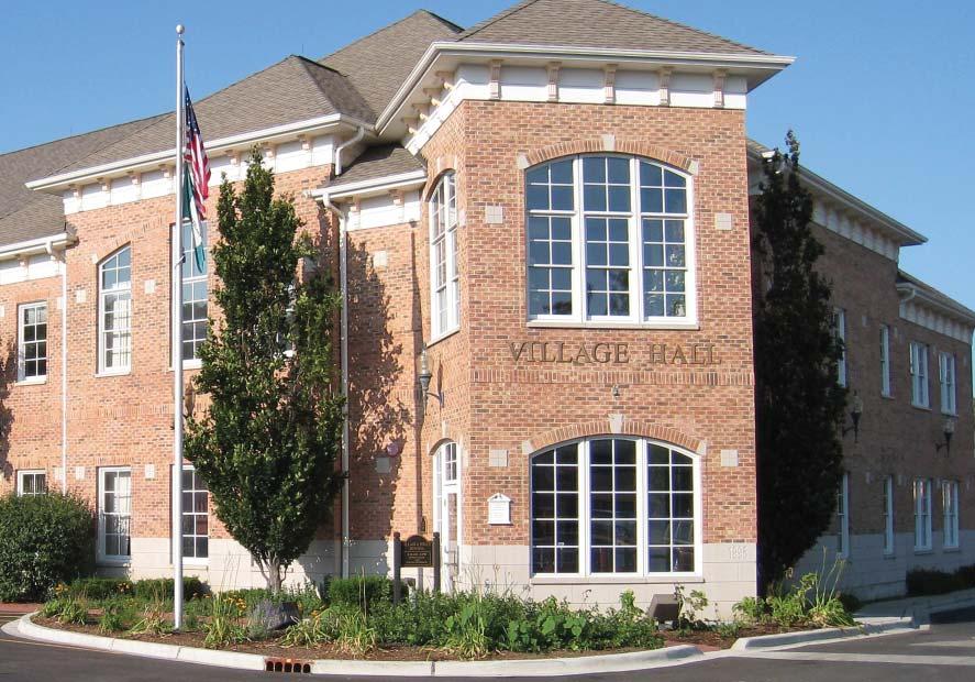
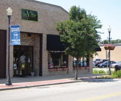
8 The Downtown Area The downtown area is a part of the larger Village Center; however, the downtown area has particular issues that merit individual discussion. The key issues associated with the downtown are the preservation of the downtown s unique character, fostering compatible infill redevelopment, and renovation of existing buildings. By adopting a regulatory structure and incentive program the Village hopes to encourage restoration of building facades along Center Street to their original design as depicted in the records of the Grayslake Historical Society. Historic Downtown... The Village has also experienced revitalization in its historic downtown business district. This included a substantial amount of private investment in building renovations and greatly reduced building vacancies in the downtown area. The municipality encouraged this revitalization through investment in public improvements that consist of streetscaping, road improvements, and retention of municipal facilities within the downtown area, including the construction of the expanded village hall and police facilities. The Village also entered into a long-term arrangement providing for the opening of a Municipal Historical Museum within the downtown. In order to encourage facade improvements designed to reflect the downtown s history, the Economic Development Commission (EDC) implemented numerous facade grants and low-interest loan programs, which were utilized by many downtown businesses for facade renovations. Currently, the Economic Development Commission is working toward implementation of the Downtown Action Plan and the Downtown Subarea Plan, which were adopted by the Village Board as a guide for further downtown progress.
, Hawley Avenue (north), Lake Street (west), and Park Avenue (south) by.")

9 Downtown Action Plan... Mixed use development at 201 Center Street. Continue the development of the Downtown Business District in the area bounded by Route 83 (east), Hawley Avenue (north), Lake Street (west), and Park Avenue (south) by... Extending Downtown Streetscape Concepts throughout the area and developing a multi-year financial plan to construct the improvements. Continuing revitalization of the downtown business district as an integral part of the Village Center. Adopt a regulatory structure and incentive program to encourage restoration of building facades along Center Street to their original designs as depicted in the records of the Grayslake Historical Society. A building facade along Center Street, restored to its original design.

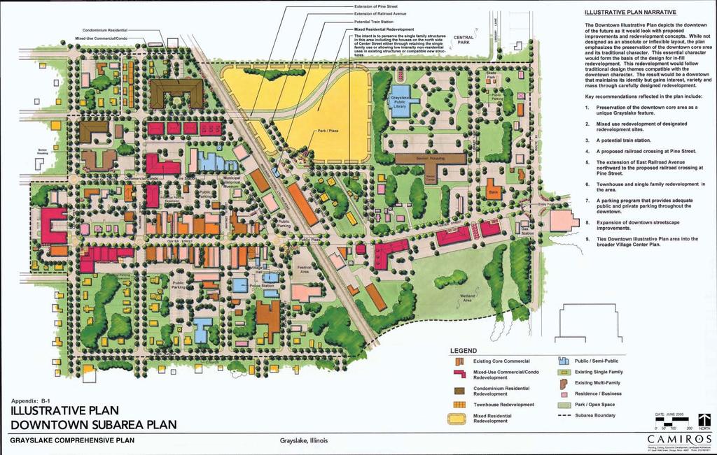
10 Future Land Use The intent of plans for the downtown area is to preserve the heritage and unique character of the downtown while allowing it to evolve to meet the current needs of the community and reach its full development potential. Accordingly, some of the historical uses in the downtown, such as small manufacturing and agricultural support services, are no longer viable and appropriate. The Future Land Use Plan: Downtown Subarea Plan illustrates the potential land use policy for the downtown area. The overall direction of land use policy in the downtown is to preserve the traditional commercial core and public/semi-public service uses while encouraging mixed commercial/residential infill development as well as residential development on the downtown s periphery. This policy is expected to result in the expansion of primary commercial use from the traditional core area eastward along Center Street to the Route 83 intersection. This land use policy is also expected to foster the creation of new residential neighborhoods on the northern fringes of the downtown, replacing obsolete industrial uses. A proposal to extend Pine Street eastward via an at-grade railroad crossing would help connect emerging residential areas together and provide improved access to key public services such as Central Park and the library. (Right) As adopted in the Grayslake Comprehensive Plan, the Future Land Use: Downtown Subarea Plan describes the planned uses for each specifi c area in the downtown district. These planned uses consist of: primary commercial, residence/ business, secondary commercial, public/semi-public, mixed use, single family residential, multi-family/mixed residential, and park/open space.

11 (2005)

12 (Left) The future project at 33 South Whitney is one example of the mixed-use developments the Downtown area is hoping to attract. This fi ve story complex will consist of approximately 50 residential units and over 4,000 square feet of store front on the ground level. Downtown Illustrative Plan The Downtown Illustrative Plan depicts the downtown of the future as it would look with proposed improvements and redevelopment concepts. While not designed as an absolute or inflexible layout, the plan emphasizes the preservation of the downtown core area and its traditional character. This essential character would form the basis of the design for in-fill redevelopment. This redevelopment would follow traditional design themes compatible with the downtown character. The result would be a downtown that maintains its identity and gains interest, variety, and mass through carefully designed redevelopment. Preservation of the downtown core area as a unique Grayslake feature Mixed use redevelopment of designated redevelopment sites A potential train station A proposed railroad crossing at Pine Street, plus an additional connection to Route 83 through Central Park The extension of East Railroad Avenue northward to the proposed railroad crossing at Pine Street Key recommendations refl ected in the plan include: Townhouse and single family redevelopment in the area A parking program that provides adequate public and private parking throughout the downtown Expansion of downtown streetscape improvements Ties Downtown Illustrative Plan into the broader Village Center Plan
13 (2005)

14 Downtown Design Controls and Guidelines The design quality of new development, renovations of existing buildings, and public improvement is particularly important in the downtown area. The downtown area is the focal point of community heritage and civic activity. The character and quality of the area must be protected through village review and guidance of development proposals and infrastructure improvements. The quality of design for future redevelopment projects within the downtown area is crucial to the preservation of Grayslake s community character, as well as its vitality and appeal. New construction should draw upon the design elements of existing historic buildings. While not expressly duplicating them, new infill development should respect the historic character of the area. The overall redevelopment strategy in the downtown is to preserve the four-block core area and support redevelopment on the periphery that is sympathetic and consistent with the core area. The core area consists of the three blocks radiating from the corner of Center Street and Whitney Street. Clearly, the closer a redevelopment project is to the core area, the more critical the compatibility of the design will be.
15 Downtown Architectural Guidelines Based on the existing character elements of the downtown, the following guidelines have been formulated to provide quality control for redevelopment projects... Restrict the Size of Infi ll Buildings in the Downtown: In order to maintain the small-town character of downtown Grayslake, new infill buildings should be designed to fit in with the scale of the area. Accordingly, new buildings should meet the following guidelines: -New buildings along Center Street should have a maximum frontage of 100 feet. -New buildings along side streets should have a maximum frontage of 125 feet. -New buildings exceeding the above limits must be designed as separate exterior facades such that each façade looks like a separate and distinct building. Interior space may be fully integrated. Larger buildings could be constructed to provide facades that convey a multiple unit appearance. Exterior Building Materials: Exterior building materials in new buildings should be compatible with the historic/traditional character of the downtown. To achieve this compatibility, exterior building materials shall be restricted to material types in existence at the time of original construction of the downtown, which ended in the 1920 s. The following represents exterior materials to be used along any façade facing a public street: - Brick, of a size and finish compatible with older brick - Natural stone, including a variety of surface textures and stone types - Wood, including wood siding and trim - Glass, as part of windows and doors only and of sizes, light divisions, and color consistent with older architecture - Polystyrene, used only for architectural moldings and only as accents - Copper sheathing used on bays, oriels, and similar architectural accents (Left) This rendering illustrates a case study of the redevelopment site at the southeast corner of Center Street and Lake Street. This fi gure illustrates how a larger site can be designed to maintain compatibility with the scale and character of the downtown by dividing the building into three separate facades and incorporating historically sympathetic details. - Roofing materials are not restricted, except as prohibited below The following materials are expressly prohibited from use on any façade facing a public street: - Concrete block - Cultured stone - Dryvit - Prefabricated panels - Metal roofs Exterior Renovation of Existing Buildings: It is important to preserve the character of existing buildings in the downtown. To ensure this, the renovation/rehabilitation of existing older buildings should be done in a manner consistent with their original design. To fulfill this objective, any exterior renovation/ rehabilitation of older buildings shall be carried out based on existing records of downtown buildings on file with the Grayslake Historical Society. Proposed exterior renovations/rehabilitations that seek to follow other design direction will need to obtain a special use permit before the Village will issue a building permit. Building Setbacks: Buildings should be sited to reinforce the existing building wall and the pedestrian orientation of the downtown. For this reason, front and corner side yard setbacks shall not be greater than two feet. Building Heights and Roof Designs: Building heights should be in scale with the existing buildings in the downtown. Two- and three-story buildings should be the norm. A small number of four-story buildings may be permitted by special use. The construction of new one-story buildings in the core area should also be discouraged. Variety in roof design is encouraged, with flat, gable, and hip roofs being the most common roof designs. Special design elements within roofs are also encouraged such as gable dormers, towers, and cupolas. Exterior Colors: The color palette used on buildings, both new infill buildings and renovated/ rehabilitated older buildings, have a strong influence on the aesthetic character and harmony of the downtown. However, colors are difficult to regulate without constraining creativity. Common sense principles should be used to guide the selection of exterior colors. Chief among these is to use strong colors only as accents within an otherwise monochromatic color palette. Parking: The downtown area needs parking in order to maintain its vitality. However, it is essential that parking within the downtown be designed and located in a manner that will promote synergy. Large areas of surface parking must be avoided in order to make the downtown a pedestrian-oriented environment. For this reason, underground parking is strongly encouraged in new redevelopment projects as a means of providing a large component of required parking. Design Review: The preservation of downtown Grayslake s unique character will not be achieved without the active involvement of the Village. It is recommended that the Village establish a Building Department design review committee comprised of one Village staff member, one Village Trustee, and a Village Architect. This committee would review and act on proposals for new development and renovation of existing buildings as part of the building permit process for the Center Street core area. The design review committee s actions would be binding, with the right of appeal to the Village Board.


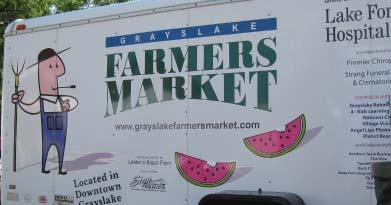
16 Grayslake Area Chamber of Commerce / Economic Development Commission Business Services The contract between the Grayslake Chamber of Commerce and the Village of Grayslake s Economic Development Commission is designed to provide support services that promote economic development in the Grayslake area. Some of the services provided by the chamber under the contract include administrative/clerical support, a minimum of four business promotional events per year, advertising programs for existing businesses, and marketing efforts for economic development in the community. These economic development services have provided local businesses advertising, cable TV commercials promoting the community and its businesses, downtown business promoting events, an annual business media fair, and seminars on new business practices open to the business community. Annual Downtown Business Trick or Treat event. Chamber of Commerce / EDC Annual Events: Annual Downtown Arts Festival along Center Street. Arts Festival Taste of Grayslake / Fireworks 5K Family Fun Run Summer Days Business Trick or Treat Holiday Tree Lighting
17 Grayslake at a Glance Grayslake Demographics: Grayslake Population: 20,330 1 Number of Households: 7,739 1 Median Household Income: $84,149 2 Average Household Size: Median Age: Downtown Statistics: Over 120 businesses are located in the downtown business district, including restaurants, specialty shops, offices, government, financial, and grocery 3 zoning classifications in the Village Center: 1) Central Business 2) Residential 3) General Business Daily Traffic Volume on Center Street: 9,800 vehicles Total Number of Parking Spaces in Downtown ~ Street Spaces: 281 ~ Municipal Lot Spaces: 200 ~ 2009 Parking Expansion: Special Census Grayslake Demographics Report Grayslake Area Demographic Trends:* (Grayslake area consists of communities within 10 driving minutes) 2000 Census: Population- 92,678 Households- 31,846 Avg. Household Size Median Household Income- $73,623 Per Capita Income- $30, Estimate: Population- 106,572 Households- 36,156 Avg. Household Size Median Household Income- $84,969 Per Capita Income- $35, Projection: Population- 120,326 Households- 40,307 Avg. Household Size Median Household Income- $95,573 Per Capita Income- $39,676 *Data courtesy of 2006 S.B. Friedman & Company Retail Market Analysis Report
18 For information, Contact: Karl Warwick Director of Economic Development Village of Grayslake 10 S. Seymour Avenue Grayslake, IL phone fax
19
20 Village of Grayslake ~ 10 South Seymour Avenue ~ Grayslake, IL ~ p ~ f ~
EXISTING COMPREHENSIVE PLAN
 EXISTING COMPREHENSIVE PLAN Town Center Land Use Element: V. LAND USE POLICIES Town Center Mercer Island's business district vision as described in "Your Mercer Island Citizen-Designed Downtown" was an
Planning Districts INTRODUCTION
 INTRODUCTION To facilitate detailed examination of development prospects for all areas of the community, Delano has been divided into 14 planning districts. The location of these planning districts is
13. New Construction. Context & Character
 13. New Construction Context & Character While historic districts convey a sense of time and place which is retained through the preservation of historic buildings and relationships, these areas continue
Community Design Plan
 Gardena General Plan 2006 Authority While the is not a required element of a General Plan, it is included because improving the community appearance and image is paramount to the overall quality of life
Policies and Code Intent Sections Related to Town Center
 Policies and Code Intent Sections Related to Town Center The Town Center Vision is scattered throughout the Comprehensive Plan, development code and the 1994 Town Center Plan. What follows are sections
Mark-up of the effect of the proposed Bronte Village Growth Area OPA No.18 on the text of section 24, Bronte Village, of the Livable Oakville Plan
 Mark-up of the effect of the proposed Bronte Village Growth Area OPA No.18 on the text of section 24, Bronte Village, of the Livable Oakville Plan Notes: This document is provided for information purposes
Market Demand and Land Use
 Market Demand and Land Use Summary 57 Challenges 60-61 Guiding Principles 62 Strategy and Implementation 63-69 Establish a mix of uses that contribute to a vibrant downtown. 58 Summary Historically, downtown
Downtown Streetscape Manual & Built Form Standards
 City of Guelph Downtown Streetscape Manual & Built Form Standards July 2014 Prepared by Brook McIlroy Inc. in association with Unterman McPhail Associates and McCormick Rankin Inc. City of Guelph Downtown
Official Plan Review: Draft Built Form Policies
 PG.30.1 REPORT FOR ACTION Official Plan Review: Draft Built Form Policies Date: May 15, 2018 To: Planning and Growth Management Committee From: Chief Planner and Executive Director, City Planning Division
Table of Contents. Elm Avenue Improvement Plan City of Waco, Texas. Introduction 1. Existing Context 1 Figure 1 2.
 Table of Contents Introduction 1 Existing Context 1 Figure 1 2 Plan Guidelines 3 Future Urban Form 4 The West-End 4 Main Street 6 The East-End 7 Figure 2 9 Public Improvement Recommendations 7 General
4- PA - LD - LIVELY DOWNTOWN. LD - Background
 4- PA - LD - LIVELY DOWNTOWN LD - Background The downtown has been the service centre for the community since the city s inception and the area continues to supply people with their personal services,
SECTION II SECTION II STATEMENT OF GOALS, OBJECTIVES, PRINCIPLES, ASSUMPTIONS, POLICIES AND STANDARDS
 STATEMENT OF GOALS, OBJECTIVES, PRINCIPLES, ASSUMPTIONS, POLICIES AND STANDARDS 1 2 STATEMENT OF GOALS, OBJECTIVES, PRINCIPLES, ASSUMPTIONS, POLICIES AND STANDARDS INTRODUCTION The New Jersey Municipal
Hockessin Community Redevelopment Plan
 Hockessin Community Redevelopment Plan 3.1 Introduction The Community Redevelopment Plan for the Village of Hockessin is the result of the people s vision for a distinct village center that serves as the
EXHIBIT A. Tax Increment Reinvestment Zone No. 1 (Town Center) First Amended Project Plan 1
 First Amended Project Plan 1") EXHIBIT A Tax Increment Reinvestment Zone No. 1 (Town Center) First Amended Project Plan 1 1 As amended by Resolution No. 2008-02-001(TR1R) of the Tax Increment Reinvestment Zone No.1, and approved to
EXHIBIT A Tax Increment Reinvestment Zone No. 1 (Town Center) First Amended Project Plan 1 1 As amended by Resolution No. 2008-02-001(TR1R) of the Tax Increment Reinvestment Zone No.1, and approved to
Long Branch Neighbourhood Character Guidelines Final Report
 STAFF REPORT ACTION REQUIRED Long Branch Neighbourhood Character Guidelines Final Report Date: October 26, 2017 To: From: Wards: Reference Number: Etobicoke York Community Council Director, Community Planning,
Town Center (part of the Comprehensive Plan)
") Town Center (part of the Comprehensive Plan) Mercer Island Town Center Looking North (2014) In 1994, a year-long process culminated in a set of design guidelines and code requirements for the Town Center
Town Center (part of the Comprehensive Plan) Mercer Island Town Center Looking North (2014) In 1994, a year-long process culminated in a set of design guidelines and code requirements for the Town Center
WATERFORD Plan of Preservation, Conservation and Development Supplement Part 1 - Policy Element
 WATERFORD 2012 Plan of Preservation, Conservation and Development 2015 Supplement Part 1 - Policy Element Effective June 11, 2015 2015 Plan Update GOAL To respond to the evolving land use needs and continually
THE CIVIC DISTRICT DEVELOPMENT OPPORTUNITIES
 1 THE CIVIC DISTRICT DEVELOPMENT OPPORTUNITIES The Civic District is the physical and emotional heart of the downtown. It is also a major gateway into the central core, establishing the image and identity
Civic Center District
 Civic Center District The Civic Center district is the civic and social heart of Warrenville, containing such public buildings as the City Hall, Warrenville Public Library, Police Station, Park District
Draft Cary Community Plan Review Part 3: Shop, Engage, Serve, Special Area Plans, Other Updates. October 27, 2015 Police Department Training Room
 Draft Cary Community Plan Review Part 3: Shop, Engage, Serve, Special Area Plans, Other Updates Committee for the Future October 27, 2015 Police Department Training Room AGENDA 1. Welcome and Call to Order
June 21, North. Spring Angeles. On behalf. other large. of new, high-rise. distinctive
 June 21, 2016 Submitted electronically Gabriela Juarez City of Los Angeles Department of City Planning, City Hall 200 North Spring Street Los Angeles, CA 90012 Email: gabriela.juarez@ @lacity.org Re: Beacon
Status Update (2006 vs. Now) Citizen s Advisory Committee February Plan for Prosperity
 Citizen s Advisory Committee February Plan for Prosperity") Status Update (2006 vs. Now) Citizen s Advisory Committee February 2018 Plan for Prosperity 2000 2017 2000 2017 Gardnerville Population 6,000 5,760 5746 5,500 5,000 5,067 5,550 5,165 5,394 5,412 5,250
Status Update (2006 vs. Now) Citizen s Advisory Committee February 2018 Plan for Prosperity 2000 2017 2000 2017 Gardnerville Population 6,000 5,760 5746 5,500 5,000 5,067 5,550 5,165 5,394 5,412 5,250
Land Use. Hardware Street Vendor Mixed-Use
 Land Use Definition Land Use is the way a piece of real estate is utilized. Existing, proposed, and adopted land uses all play a role in the planning process. Once a land use plan is adopted, the next
MIDTOWN MIXED-USE VILLAGE. TECHNICAL DATA SHEET COMPONENT C-1 FOR PUBLIC HEARING - PETITION NUMBER Project No RZ1.1. Issued.
 N MIDTOWN MIXED-USE VILLAGE TECHNICAL DATA SHEET COMPONENT C- FOR PUBLIC HEARING - PETITION NUMBER 04-00 Project No. 496 Issued Revised SCALE: " = 0' N 0 0 0 40 RZ. c GENERAL PROVISIONS: a. SITE LOCATION.
Living in Albemarle County s Urban Places
 Living in Albemarle County s Urban Places ALBEMARLE COUNTY, VIRGINIA A Closer Look at Albemarle s Approach to Managing Growth and Creating Quality Urban Environments www.albemarle.org Page 2 Living in
ARLINGTON COUNTY, VIRGINIA
 ARLINGTON COUNTY, VIRGINIA County Board Agenda Item Meeting October 15, 2005 DATE: September 28, 2005 SUBJECT: Request to Advertise the adoption of the 2005 Clarendon Sector Plan C. M. RECOMMENDATION:
II. SINGLE FAMILY RESIDENTIAL
 II. SINGLE FAMILY RESIDENTIAL Castle Rock is made up of numerous individually built houses and subdivision tracts that have been developed during the past century. Some of the tracts are diverse in architectural
VICTORIA DOWNTOWN DEVELOPMENT PLANNING
 VICTORIA DOWNTOWN DEVELOPMENT PLANNING A Vision & Guide for the Future Downtown Victoria thrives as a center for the community, offering a great mix of entertainment, culture, business, and recreational
CHAPTER 6: Community Design and Appearance
 AGLE AREA COMMUNITY Plan CHAPTER 6 CHAPTER 6: Community Design and Appearance Community Design and Appearance How a community is designed and what a community looks like are attributes fundamental to the
HE VISION. Building a Better Connected Place
 HE VISION Building a Better Connected Place WALK INTO THE FUTURE. Life in Cranberry, 2030 Here s what our residents told us they wanted to see in their community by 2030: The Cranberry of 2030 is a place
ARTICLE 6: Special and Planned Development Districts
 ARTICLE 6: Special and Planned Development Districts 6-10 Traditional Neighborhood Development (TND) District 6-10.10 Purpose and Intent The Traditional Neighborhood Development (TND) District provides
CHAPTER 2: HISTORIC BACKGROUND
 CHAPTER 2: HISTORIC BACKGROUND The historic town of Eastlake was created on June 22, 1911 when the Eastlake Subdivision was recorded at the Adams County Clerk and Recorder s Office. The Eastlake Investment
5 TOWN OF MARKHAM OFFICIAL PLAN AMENDMENT NO. 144 MILLIKEN MAIN STREET SECONDARY PLAN
 5 TOWN OF MARKHAM OFFICIAL PLAN AMENDMENT NO. 144 MILLIKEN MAIN STREET SECONDARY PLAN The Planning and Economic Development Committee recommends the following: 1. The communication from Brendan O Callaghan,
Comprehensive Plan. Faribault, Minnesota. Hoisington Koegler Group Inc. Claybaugh Preservation Architecture Inc. Howard R. Green Company Bonz/REA
 Comprehensive Plan Faribault, Minnesota Adopted by the Faribault City Council July 8, 2003 prepared for: prepared by: Hoisington Koegler Group Inc. Claybaugh Preservation Architecture Inc. Howard R. Green
Infill Residential Design Guidelines
 Infill Residential Design Guidelines Adopted March 23, 2004 Amended September 10, 2013 City of Orange Community Development Department Planning Division Phone: (714) 744-7220 Fax: (714) 744-7222 www.cityoforange.org
hermitage town center
 hermitage town center A Community Vision prepared by Strada for The City of Hermitage and The Mercer County Regional Planning Commission January 2007 table of contents introduction 3 design principles
Preliminary Plan Framework: Vision and Goals
 Preliminary Plan Framework: Vision and Goals Draft: May 2015 Introduction Since the Town of Milliken s comprehensive plan was last updated in 2010, the community was heavily impacted by the 2013 flood,
CHAPTER 3 VISION, GOALS, & PLANNING PRINCIPLES. City of Greensburg Comprehensive Plan. Introduction. Vision Statement. Growth Management Goals.
 CHAPTER 3 VISION, GOALS, & PLANNING PRINCIPLES Introduction The Greensburg Comprehensive Plan is intended as a working community document. A combination of long and short-term goals, this document is intended
City of Farmington. Downtown Plan. Amendment to the 1998 Master Plan Adopted October 11, 2004
 City of Farmington Amendment to the 1998 Master Plan Adopted October 11, 2004 Introduction Planning Background 1 Scope and Components of the Plan Amendment 2 Concept Introduction 3 Plan Concepts 3 Conceptual
SECTION TWO: Overall Design Guidelines
 SECTION TWO: Overall Design Guidelines This section provides overall design principles and guidelines for the Gardnerville Mixed-use Overlay. They provide criteria for mixed-use places consisting of residential,
Review of Opportunity Area C Draft Comprehensive Plan and Draft BOS Follow-On Motions. Special Working Group Meeting March 4, 2015
 Review of Opportunity Area C Draft Comprehensive Plan and Draft BOS Follow-On Motions Special Working Group Meeting March 4, 2015 The slides that follow identify where the draft Comprehensive Plan has
Downtown. Design Review. City of Bartlesville Bartlesville welcomes and encourages Special Events. Special Events build a sense of
 City of Bartlesville 8.2015 Downtown Design Review Bartlesville welcomes and encourages Special Events. Special Events build a sense of community Contents and create an environment that fosters civic pride.
Appendix D North Road/N. Leroy Street Subarea Plan
 North Road/N. Leroy Street Subarea Plan INTRODUCTION The City of Fenton Master Plan was updated in 1996 and included a subarea plan for the North Leroy Street area of the City. It was recognized at that
Village of Fair Haven Goals & Objectives
 Village of Fair Haven Goals & Objectives 1 Natural Environmental Quality & Aesthetics Embrace policies and programs that preserve and enhance the Village s natural resources, environment, water quality,
SECTION ONE: INTRODUCTION. introduction
 introduction 1 INTRODUCTION Since it was first established in 1843 as a trading post for the Hudson s Bay Company, Victoria has evolved into a Provincial capital city that is recognized across Canada and
13 THORNHILL YONGE STREET STUDY IMPLEMENTATION CITY OF VAUGHAN OPA 669 AND TOWN OF MARKHAM OPA 154
 13 THORNHILL YONGE STREET STUDY IMPLEMENTATION CITY OF VAUGHAN OPA 669 AND TOWN OF MARKHAM OPA 154 The Planning and Economic Development Committee recommends the adoption of the recommendations contained
Corridors. Re-vitalize our Corridors and Gateways
 Corridors Re-vitalize our Corridors and Gateways Artist s rendering from the 287 Strategic Plan, 2015 Corridors are the major throughways of Loveland but they also provide important commercial, community
Anatomy of A Vibrant Downtown. Anatomy of a Vibrant Downtown
 Anatomy of A Vibrant Downtown The goal of MAIN ST. REVITALIZATION PLANNING is to provide a framework that will help transform your downtown into a VIBRANT DOWNTOWN a place where people love to LIVE, WORK,
NEIGHBORHOOD DESIGN ELEMENT
 NEIGHBORHOOD DESIGN ELEMENT INTRODUCTION The following recommendations constitute an urban design oriented "neighborhood analysis" of Plantation. It is an optional Comprehensive Plan Element. The five
and services The protection and conservation of environmentally significant and sensitive natural heritage features and functions.
 6. Land Use 6.0 Preamble A healthy and livable city is one in which people can enjoy a vibrant economy and a sustainable healthy environment in safe, caring and diverse neighbourhoods. In order to ensure
5.1 Site Plan Guidelines
 5. Community Core Guidelines Development of the Community Core will take place by plan of subdivision and site plan approval. It will occur in a phased manner that will reflect the timing of residential
CONTENTS 8.0 LAND USE 8.1 GENERAL LAND USE 8.2 RESIDENTIAL 8.3 MIXED USE 8.4 COMMERCIAL 8.5 EMPLOYMENT LANDS
 8-2 Land Use 8.0 LAND USE CONTENTS 8.1 GENERAL LAND USE 8.1.1 Uses provided for in all Land Use Designations 8.1.2 Uses prohibited in Hazardous Lands, Hazardous Sites and Special Policy Areas 8.1.3 Uses
Draft Memorandum #1: Goals and Vision for Revitalization
 Keizer Revitalization Plan Draft Memorandum #1: Goals and Vision for Revitalization Submitted to: City of Keizer April 12, 2018 (revised) Prepared By: Angelo Planning Group and Otak, Inc. Project No. 17482.A
NWI Wetland Public Waters Inventory Low Density Residential Medium Density Residential. High Density Residential. Public or Institutional
 Map 1.1 Future Land Use Jennings Bay West Arm Dutch Lake Harrisons Bay Lake Langdon Seton Lake Emerald Lake Black Lake Cooks Bay Halstead Bay Priest Bay Phelps Bay NWI Wetland Public Waters Inventory Low
REZONING POLICY FOR CHINATOWN SOUTH (HA-1A) Adopted by City Council on April 19, April 2011
 Adopted by City Council on April 19, April 2011") $1 City of Vancouver Land Use and Development Policies and Guidelines Community Services, 453 W. 12th Ave Vancouver, BC V5Y 1V4 F 604.873.7000 fax 604.873.7060 planning@vancouver.ca REZONING POLICY FOR
$1 City of Vancouver Land Use and Development Policies and Guidelines Community Services, 453 W. 12th Ave Vancouver, BC V5Y 1V4 F 604.873.7000 fax 604.873.7060 planning@vancouver.ca REZONING POLICY FOR
TEMPLE MEDICAL & EDUCATION DISTRICT
 City of Temple, Texas TEMPLE MEDICAL & EDUCATION DISTRICT 1 Description. The City of Temple joined in partnership with key public and private entities to jointly promote education and medical activities
Future Five. Design/ Development Guidelines. January 2008 Amended June 08 per City Council motion
 Future Five Design/ Development Guidelines January 2008 Amended June 08 per City Council motion 5-Points Design Guidelines Table of Contents I. Introduction 3 II. Area boundaries 4 III. Review Process
Implementation Guide Comprehensive Plan City of Allen
 Implementation Guide 2030 Comprehensive Plan City of Allen DRAFT 2015 Implementation Guide Allen 2030 Comprehensive Plan INTRODUCTION The Comprehensive Plan serves as a guide for the growth and development
PORT WHITBY COMMUNITY
 PORT WHITBY COMMUNITY SECONDARY PLAN UPDATE COMMUNITY IMPROVEMENT PLAN URBAN DESIGN GUIDELINES September 2015 DRAFT PROPOSED AMENDMENT NUMBER # to the Whitby Official Plan PURPOSE: The intent of this Amendment
178 Carruthers Properties Inc.
 178 Carruthers Properties Inc. Planning Rationale for 178 Carruthers Avenue Site Plan Control Application June 2014 Table of Contents 1.0 Introduction 2.0 Overview of Subject Property 3.0 Current Zoning
Welcome to Our Open House
 Welcome to Our Councillor Gerbasi & the Planning, Property, & Development Department welcome you to tonight s open house The open house outlines the proposed Osborne Village Neighbourhood Plan a secondary
Tacoma Mall Neighborhood Subarea Plan & EIS. Planning Commission February15, 2017
 Tacoma Mall Neighborhood Subarea Plan & EIS Planning Commission February15, 2017 1 Meeting objectives Commission direction on: Medium and Long-term visions Residential, neighborhood and housing topics
DRAFT ROOSEVELT ROAD. District Recommendations. Figure 5.23 The Roosevelt Road Corridor
 CHAPTER 5 Figure 5.23 The Road Corridor Road will develop as a mixed-use corridor, emphasizing regional retail, west of the river and mixed-use development east of the river. KEY RECOMMENDATIONS 1. High
LAND USE OVERVIEW WHAT YOU WILL FIND IN THIS CHAPTER
 LAND USE WHAT YOU WILL FIND IN THIS CHAPTER Information about the City s expected population and employment growth. Description and capacity of existing and future land use designations. Policies that
BUILDING SCALE AND SETBACKS 5 ELEMENTS:... 5 FAÇADES (COMMERCIAL/RESIDENTIAL) 5
 5") VISION STATEMENT 3 UTILIZATION OF THE GUIDELINES 3 IMPLEMENTATION 3 PROCEDURES FOR DESIGN REVIEW 3 LAND USE AND ZONING 4 LAND USE 4 ELEMENTS:... 4 ZONING 4 ELEMENTS:... 4 BUILDING SCALE AND SETBACKS 5
VISION STATEMENT 3 UTILIZATION OF THE GUIDELINES 3 IMPLEMENTATION 3 PROCEDURES FOR DESIGN REVIEW 3 LAND USE AND ZONING 4 LAND USE 4 ELEMENTS:... 4 ZONING 4 ELEMENTS:... 4 BUILDING SCALE AND SETBACKS 5
Downtown Whitby Action Plan
 Downtown Whitby Action Plan Final Report October 2016 Table of Contents Introduction 1 Public Consultation 2 Walkability 3 Downtown Whitby Walkability Map 4 Vision 5 Goal & Objectives 6 Objective 1 7 Objective
Regency Developments. Urban Design Brief. Holyrood DC2 Rezoning
 Regency Developments Urban Design Brief Holyrood DC2 Rezoning Stantec Consulting Ltd. 7-31-2017 1. Overview Regency Developments intends to rezone the lands located at 8510 and 8511 93 Avenue, within the
THE POLICY FRAMEWORK FOR WALKABLE COMMUNITIES. Community Technical Assistance Program Building Active Communities Institute March 2016
 THE POLICY FRAMEWORK FOR WALKABLE COMMUNITIES Community Technical Assistance Program Building Active Communities Institute March 2016 ACTIVE COMMUNITIES BACK THEN ACTIVE COMMUNITIES BACK THEN Lifestyle
7Page 91 CLEMMONS COMMUNITY COMPASS 7 COMMUNITY CHARACTER
 7 Community Character The beauty of Clemmons won t necessarily be a reflection of our past, but our future. This quote from Comprehensive Plan Steering Committee member Wayne Dodson captures the essence
Welcome. Comprehensive Plan & Transportation Plan Open House November 7, 2012
 Welcome Comprehensive Plan & Transportation Plan Open House November 7, 2012 Agenda Proposed future land use plan Comprehensive Plan strategies Traffic forecasts Future traffic operations Possible future
Beachside Redevelopment Committee
 Beachside Redevelopment Committee DRAFT FINAL RECOMMENDATIONS MARCH 22, 2018 This is a new slide 2 This is a new slide Table of Contents I. Introduction and Overview II. III. Community Improvements and
THEMES, VISION, + PRINCIPLES
 CHAPTER 2: THEMES, VISION, + PRINCIPLES This page intentionally left blank. 20 VISION DRAFT AUGUST 2018 2 2 THEMES, VISION, + GUIDING PRINCIPLES The Key Themes, Vision, and Guiding Principles presented
Carlsbad Village Redevelopment Concept Summary of Features
 Carlsbad Village Redevelopment Concept Summary of Features Calthorpe Associates November 5, 2003 The Redevelopment Concept illustrates a vision for the future of Carlsbad Village. The overall vision of
Steering Committee Meeting
 Neighborhood Planning Initiative NPI EAST CENTRAL AREA PLAN Steering Committee Meeting November 9, 2017 6:00PM 8:00PM Tears McFarlane House East Central Area Plan Steering Committee Meeting 11/9/17 AGENDA
Section 9 NEIGHBORHOOD DESIGN
 Section 9 NEIGHBORHOOD DESIGN City of Lancaster Comprehensive Plan D u n k i n, S e f k o & A s s o c i a t e s, I n c. NEIGHBORHOOD DESIGN INTRODUCTION There are many ways in which a neighborhood can
TOWN CENTER. Origins of a Crossroads Community
 TOWN CENTER Origins of a Crossroads Community Town Commons 1973 - Courtesy of the Burlington Archives, No. 81 Unlike other New England towns with iconic town centers, Burlington evolved as a dispersed
ARCHITECTURAL DESIGN REVIEW ORDINANCE DESIGN GUIDELINES DECEMBER 2000 PREPARED FOR THE MEREDITH PLANNING BOARD BY CHRISTOPHER P. WILLIAMS, ARCHITECTS
 DESIGN GUIDELINES DECEMBER 2000 PREPARED FOR THE BY CHRISTOPHER P. WILLIAMS, ARCHITECTS PURPOSE STATEMENT Architectural Design Review Design Guidelines provides architectural guidance intended to support
SUMMERSIDE / MT. CARMEL REINVESTMENT CORRIDOR COMMUNITY DEVELOPMENT STRATEGY
 SUMMERSIDE / MT. CARMEL REINVESTMENT CORRIDOR COMMUNITY DEVELOPMENT STRATEGY FEBRUARY 2013 I. Location of the Summerside/Mt. Carmel Reinvestment Corridor The Summerside/Mt. Carmel Reinvestment Corridor
P A I N E S V I L L E D O W N T O W N P L A N
 DEVELOPMENT YIELDS In addition to the qualitative aspects of the plan, it is important to understand the redevelopment concepts from a quantitative standpoint. How many new homes are being proposed p in
KEY MAP DEVELOPMENT PERMIT AREA MAP. Sunnymede North Sub-Area Plan
 Richmond Official Community Plan BROADMOOR AREA SUNNYMEDE NORTH SUB-AREA PLAN Bylaw 7100 Schedule 2.6C SUNNYMEDE NORTH SUB-AREA PLAN SUNNYMEDE NORTH SUB-AREA PLAN SUNNYMEDE NORTH SUB-AREA PLAN KEY MAP
1.0 Purpose of a Secondary Plan for the Masonville Transit Village
 Report to Planning and Environment Committee To: Chair and Members Planning & Environment Committee From: John M. Fleming Managing Director, Planning and City Planner Subject: Masonville Transit Village
burlington mobility hubs study Downtown Burlington Mobility Hub
 burlington mobility hubs study Downtown Burlington Mobility Hub Draft Precinct Plan Workbook PIC #3, September 7, 2017 downtown mobility hub objectives City staff and their consultants are proposing an
New Street Proposed Redevelopment Architecture & Urban Design Brief
 2130 2136 New Street Proposed Redevelopment Architecture & Urban Design Brief Prepared By: Cynthia Zahoruk Architect Inc. 3077 New Street, Burlington, ON, L7N 1M6 TABLE OF CONTENTS Background and Objective
16. KING-SPADINA SECONDARY PLAN
 16. KING-SPADINA SECONDARY PLAN 1. INERPREAION 1.1 he lands affected by this Secondary Plan for the King-Spadina Area are shown on Map 16-1. 1.2 Where a building within a Regeneration Areas designation
The Auburn Plan Designing the Future of Auburn February 28, 2005
 The Auburn Plan Designing the Future of Auburn February 28, 2005 Block-by-Block Bicycle Tour Aerial survey Focus Group Meetings September 7 and 8 Design Workshops October 11, 14, and 21 Revitalization
Guiding Principles, Objectives, Strategies and Policies
 Guiding Principles, Objectives, Strategies and Policies Section 1 Introduction These Guiding Principles were adopted as part of the 1999 Athens-Clarke County Comprehensive Plan and are carried over, in
Visioning Statement and Guiding Principles
 Visioning Statement and Guiding Principles Planning for the Future The General Plan The General Plan represents Woodland's shared vision of the future and defines a path to lead the community toward its
In surveys, Dallas residents say what they want to change most
 NEIGHBORHOODS ELEMENT In surveys, Dallas residents say what they want to change most in the city is its appearance they want it to look beautiful, with trees and pedestrian-friendly neighborhoods. The
3.1 Existing Land Use
 3.0 Land Use This strategy has been developed taking into account the position of the Town of Sidney as the economic center of the Saanich Peninsula. It acknowledges existing land use patterns in the downtown
BORRISOKANE SETTLEMENT PLAN
 BORRISOKANE SETTLEMENT PLAN 1.0 General Introduction and Development Context Location Borrisokane is located 15km north of Nenagh on the N52. While the town is primarily residential, it acts as a market
Derry Green Corporate Business Park
 Town of Milton Derry Green Corporate Business Park Urban Design Guidelines BMI/Pace - June 2010 Draft 3 Prepared by: Brook McIlroy Planning + Urban Design / Pace Architects Suite 300-51 Camden Street Toronto,
6 PORT SYDNEY SETTLEMENT AREA
 Section 6 Port Sydney Page 61 6 PORT SYDNEY SETTLEMENT AREA 6.1 Basis and Principles Village of Port Sydney Waterfront Community Existing Services 6.1.1 Port Sydney is an historic settlement that has developed
[PLANNING RATIONALE] For Site Plan Control and Lifting of Holding Zone By-Law 101 Champagne Avenue. May 23, 2014
![[PLANNING RATIONALE] For Site Plan Control and Lifting of Holding Zone By-Law 101 Champagne Avenue. May 23, 2014](/thumbs/75/71599615.jpg "[PLANNING RATIONALE] For Site Plan Control and Lifting of Holding Zone By-Law 101 Champagne Avenue. May 23, 2014") [PLANNING RATIONALE] For Site Plan Control and Lifting of Holding Zone By-Law 101 Champagne Avenue May 23, 2014 Contents 1.0 Introduction... 2 2.0 Site Context... 2 2.1 Adjacent Uses... 2 Figure 1: Site
[PLANNING RATIONALE] For Site Plan Control and Lifting of Holding Zone By-Law 101 Champagne Avenue May 23, 2014 Contents 1.0 Introduction... 2 2.0 Site Context... 2 2.1 Adjacent Uses... 2 Figure 1: Site
Resolution : Exhibit A. Downtown District Design Guidelines March 2003
 Resolution 03-011: Exhibit A Downtown District Design Guidelines March 2003 DOWNTOWN DISTRICT DESIGN GUIDELINES CITY OF SOUTHLAKE, TEXAS Adopted March 2003 1 DOWNTOWN DISTRICT DESIGN GUIDELINES Adopted
8 October 14, 2015 Public Hearing
 8 October 14, 2015 Public Hearing APPLICANT & PROPERTY OWNER: PRICE S HOLDINGS, LLC STAFF PLANNER: Karen Lasley REQUEST: A. Conditional Use Permit (Automobile Repair Garage) B. Change in Nonconforming
DOWNTOWN TRANSCONA URBAN DESIGN GUIDELINES
 DOWNTOWN TRANSCONA URBAN DESIGN GUIDELINES May 18, 2010 Introduction DOWNTOWN TRANSCONA URBAN DESIGN GUIDELINES The Downtown Transcona Urban Design Guidelines ("the Guidelines") establish criteria for
SECTION V: DESIGN GUIDELINE EXAMPLES
 SECTION V: DESIGN GUIDELINE EXAMPLES Introduction The Syracuse Town Center is envisioned as an area that creates a sense of place, a community downtown. As such, the Town Center Committee recommended the
4. INDUSTRIAL 53 CASTLE ROCK DESIGN
 4. INDUSTRIAL 53 CASTLE ROCK DESIGN CASTLE ROCK DESIGN 54 4. INDUSTRIAL Overview Well-designed and attractive industrial centers are the product of blending economic realities with both functional and
3.0 LAND USE PLAN. 3.1 Regional Location. 3.2 Existing Conditions Existing Uses. Exhibit Regional Location Map
 3.0 LAND USE PLAN 3.1 Regional Location The Anaheim Resort Specific Plan (ARSP) area is located in the City of Anaheim, which is 35 miles southeast of downtown Los Angeles and 7 miles northwest of Santa
V. Vision and Guiding Principles
 V. Vision and Guiding Principles The Master Plan for the Powers Ferry Corridor seeks a foundation in the desires of the community. At times, various elements of the community offered opposing viewpoints,