ENVIRONMENTAL SETTING
|
|
|
- Myles Paul
- 6 years ago
- Views:
Transcription
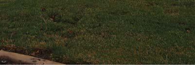
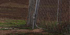
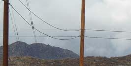
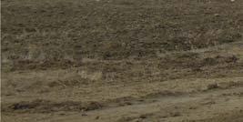
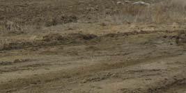
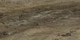
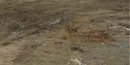
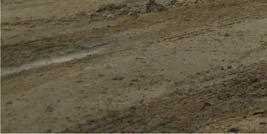
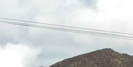
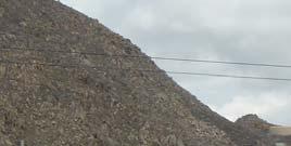
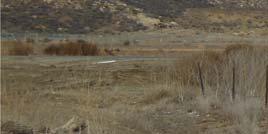
1 II. ENVIRONMENTAL SETTING EXISTING CONDITIONS The acre Project site is located in the western portion of the City (refer to Figures II-1 and II-2). The Project site comprises Assessor s Parcel Number (APN) The City of San Jacinto is to the north of the City of Hemet (the City ) and unincorporated Riverside County territory surrounds the City on the south, west, and east. Diamond Valley Lake and the Santa Rosa Hills lie south of the City. California State Routes 74 and 79 (SR-74 and SR-79) provide regional access to the Project area. The Project site is approximately three miles west of downtown Hemet and one-half mile northwest of the Hemet-Ryan Airport. The Project site is bounded by Florida Avenue (SR-74) on the south, Celeste Road on the north, and Myers Street on the east (refer to Figure II-3). Warren Road is west of the site, and Devonshire Avenue bisects the northern portion of the Project site from east to west. Project Site Conditions The Project site is undeveloped and contains highly disturbed ruderal land (refer to Figure II-3). Historically, the majority of the site primarily has been used for growing field crops. There are no structures within the confines of the Project site. A portion of the southeast corner of the site is fenced in and currently used for storage. This storage area comprises several mature eucalyptus trees, wooden boxes and plastic barrels/containers, and inoperable agricultural vehicles and equipment. Utility lines on wooden poles run east west through the northern portion of the site, along the northeastern boundary, and in the adjacent roadways. A water pump and its associated aboveground pipes, which were used for agriculture, are located in the northwestern portion of the Project site near the Devonshire Avenue/Old Warren Road intersection. The San Diego Aqueduct traverses the site approximately 14 feet below ground in a southwesterly northeasterly direction along a 160-foot-wide easement for public utilities. The aqueduct is owned and operated by Metropolitan Water District of Southern California. A portion of the southwest corner of the Project site contains an isolated, highly disturbed vernal pool. The Project site is generally flat and ranges in elevation from approximately 1,502 feet above mean sea level in the northern portion of the project site to 1,507 feet above mean sea level in the southern portion. Photographs of the Project site are shown on Figures II-4 through II-5. The existing zoning of the Project site is Heavy Agriculture (A-5), (R-1-6), General Commercial (C2), and Heavy Manufacturing (M2) (refer to Figure II-6). The General Plan land use designation for the portion of the Project site between Florida and Devonshire Avenues is Mixed-Use #1, which allows a mixture (vertical or horizontal mixture) of residential, commercial, and office uses that provides opportunities to live, work, and shop within a compact area (refer to Figure II-7). The portion of the Project site between Devonshire Avenue and Celeste Road is designated Low-Density Residential (LDR), which allows 2.1 to 5.0 dwelling units per acre. Ramona Creek Specific Plan Draft Environmental Impact Report II. Environmental Setting Page II-1

2 PROJECT SITE Source: The Planning Center, Figure II-1 Regional Location Map


3 Tres Cerritos Foothills Peppertree Tres Cerritos Hemet Valley Country Club MWD E asement Art Hoffer Heartland Village PROJECT SITE S an Diego C anal Hemet Marketplace Hemet Automall Florida Promenade Sanderson Square Stetson Crossing Page Plaza Source: The Planning Center, Figure II-2 Local Vicinity Map


4 Tres Cerritos F oothills Peppertree Hemet Valley Country Club Tres Cerritos West Tres Cerritos East Montero Celeste Road Art Hoffer Devonshire Avenue San Diego Canal Warren Road PROJECT SITE MWD E asement Myers Street Florida Avenue Florida Promenade Hemet Marketplace Hemet Automall Hemet-Ryan airport Stetson Crossing Page Plaza Source: The Planning Center, Figure II-3 Aerial Photograph


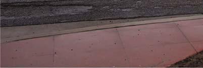


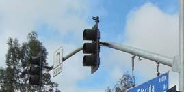


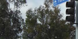

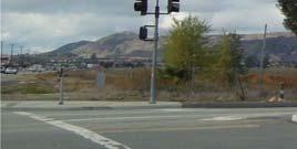

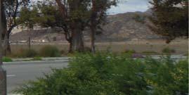


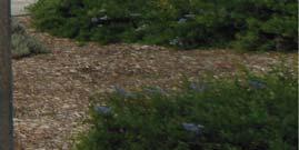


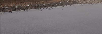
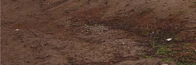
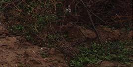
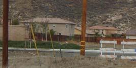
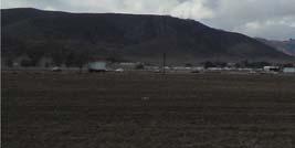
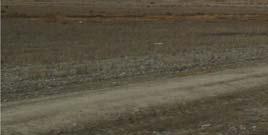
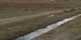
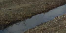
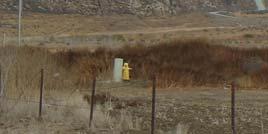
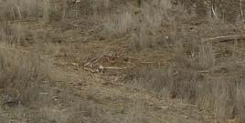
5 View 1: View toward the northeast of the Project site from near Florida Avenue. View 2: View toward the northeast of the Project site from near Florida Avenue. CELESTE ROAD DENVONSHIRE AVENUE WARREN ROAD PROJECT SITE MYERS STREET W FLORIDA AVENUE View 3: View toward the northwest of the Project site. Location Map Source: CAJA Environmental Services, LLC, Figure II-4 Onsite Views Views 1-3


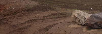
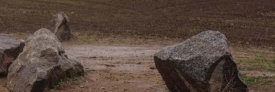

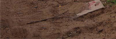
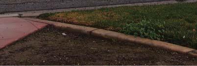
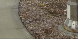
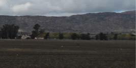
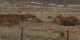
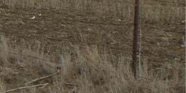
6 View 4: View toward the southeast of the Project site View 5: View of the Project site toward the southeast. CELESTE ROAD DENVONSHIRE AVENUE WARREN ROAD 4 PROJECT SITE 5 MYERS STREET W FLORIDA AVENUE Location Map Source: CAJA Environmental Services, LLC, Figure II-5 Onsite Views Views 4-5

7 Source: The Planning Center, Figure II-6 Existing Zoning


 CC COMMUNITY")
 LMDR LOW MEDIUM DENSITY")
 RC REGIONAL 50) HDR")

 OS MU")

8 WARREN ROAD CELESTE ROAD DENVONSHIRE AVENUE PROJECT SITE MYERS STREET FLORIDA AVENUE Note: This graphic shows General Plan designations as they existed prior to adoption of the Ramona Creek Specific Plan. LDR LOW DENSITY RESIDENTIAL ( DU/AC) CC COMMUNITY COMMERCIAL (FAR 0.40) LMDR LOW MEDIUM DENSITY RESIDENTIAL ( DU/AC) RC REGIONAL COMMERCIAL (FAR 0.50) HDR VHDR HIGH DENSITY RESIDENTIAL ( DU/AC) VERY HIGH DENSITY RESIDENTIAL ( DU/AC) OS MU OPEN SPACE AREAS SUBJECT TO MSHCP CRITERIA MIXED USE Source: The Planning Center, Figure II-7 Existing General Plan Land Use Designations
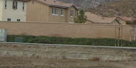
9 City of Hemet March 2014 Surrounding Land Uses The Project site is surrounded by a variety of land uses. South of the site, across Florida Avenue, are vacant land, the Hemet West Mobile Home Park, the Hemet Auto Mall, and a gas station. The Hemet- Ryan Airport is located one-half mile southeast of the site. East of the Project site, across Myers Street, land uses include vacant land consisting of open space and previously tilled agricultural land and the Florida Promenade Shopping Center. North of the Project site, across Celeste Road, are the Tres Cerritos Foothills, and the future residential communities of Tres Cerritos West and Tres Cerritos East. The residential community of Montero is located northwest of the Project site, across Old Warren Road. West of the site, across Old Warren Road, is vacant land consisting of previously tilled agricultural land. Devonshire Avenue traverses the northwestern and northeastern portions of the Project site. Photographs of the area surrounding the Project site are shown on Figures II-8 through II-10. The zoning of properties surrounding the Project site include Tres Cerritos Specific Plan (SP ) to the north; Heavy Agricultural (A-5) and Florida Promenade (SP 06-4) to the east; General Commercial (C-2), Hemet Auto Mall (SP 87-28) and Hemet Marketplace (SP 89-19) to the south; and General Commercial (C-2), Heavy Agricultural (A-5), and (R-1-7) to the west. The General Plan designates the areas directly north of the site for Low Density Residential (LDR) uses; High Density Residential (HDR), Very High Density Residential (VHDR), and Community Commercial (CC) uses to the east; Low Density Residential (LDR) and Regional Commercial (RC) land uses with one parcel (currently a gas station and carwash) designated for CC uses to the south; and Mixed Use (MU) with a Multi-Species Habitat Conservation Plan (MSHCP) overlay designation to the west. CUMULATIVE DEVELOPMENT Section of the CEQA Guidelines requires that an environmental impact report (EIR) consider the significant environmental effects of a proposed project as well as cumulative impacts when the project's incremental effect is cumulatively considerable, as defined in Section 15065(a)(3) of the CEQA Guidelines. 1 Section of the CEQA Guidelines defines "cumulative impacts" as "two or more individual effects which, when considered together, are considerable or which compound or increase other impacts." The cumulative impact "from several projects in the change in the environment which results from the incremental impact of the project when added to other closely related past, present, and reasonable foreseeable probable by as an impact that is created as a result of the combination of the project evaluated in the EIR together with other projects causing related impacts (CEQA Guidelines 1 Guidelines for the California Environmental Quality Act, California Code of Regulations Title 14, Chapter Ramona Creek Specific Plan Draft Environmental Impact Report II. Environmental Setting Page II-9


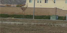
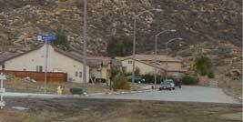


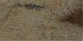


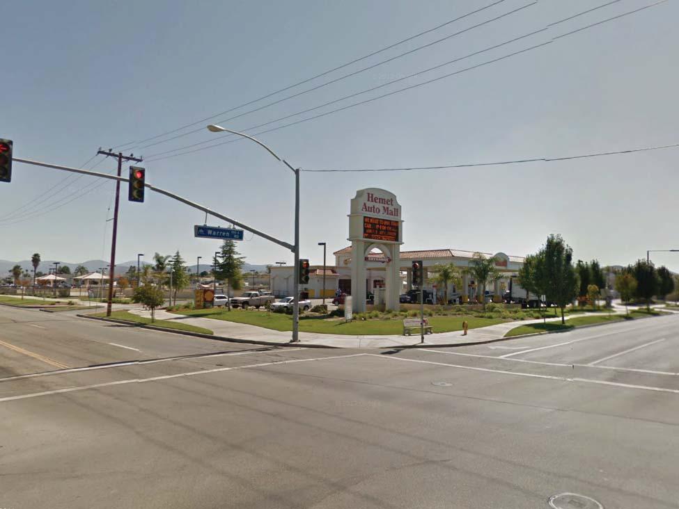
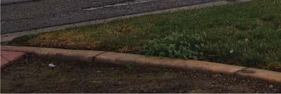
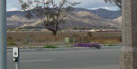
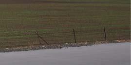
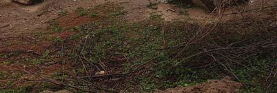
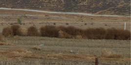
10 View 1: View toward the northeast of the Hemet Auto Mall located to the south of the Project site. View 2: View toward the west from the western edge of the Project site. CELESTE ROAD DENVONSHIRE AVENUE 3 WARREN ROAD 2 PROJECT SITE MYERS STREET W FLORIDA AVENUE 1 View 3: View toward the north of the residential land uses located to the northwest of the Project site. Location Map Source: CAJA Environmental Services, LLC, Figure II-8 Offsite Views Views 1-3


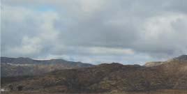
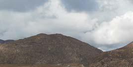


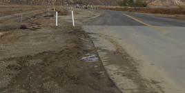
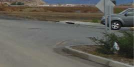


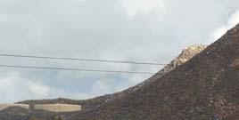

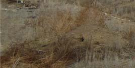


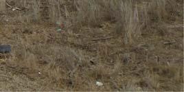
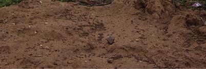
11 View 4: View toward the north of the hills just north of the Project site View 5: View toward the north from the eastern edge of the Project site. CELESTE ROAD DENVONSHIRE AVENUE WARREN ROAD 4 PROJECT SITE MYERS STREET 5 W FLORIDA AVENUE 6 View 6: View toward the southwest of the land uses located to the south of the Project site. Location Map Source: CAJA Environmental Services, LLC, Figure II-9 Offsite Views Views 4-6


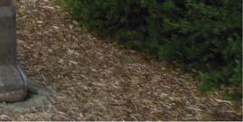
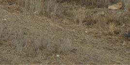
12 View 7: View toward the northeast of the land uses located to the east of the Project site. View 8: View toward the southwest along Florida Avenue. Land uses associated with the Hemet Auto Mall are shown in the left site of the photo, and a protion of the Project site is visable in the right site of the photo. CELESTE ROAD DENVONSHIRE AVENUE WARREN ROAD PROJECT SITE MYERS STREET W FLORIDA AVENUE 8 7 Location Map Source: CAJA Environmental Services, LLC, Figure II-10 Onsite Views Views 7-8
13 City of Hemet March 2014 Section 15355). As stated in the CEQA Guidelines Section 15130(a)[1], the cumulative impacts discussion in an EIR need not discuss impacts that do not result in part from the project evaluated in the EIR. All projects that are proposed (i.e., with pending applications), recently approved, under construction, or otherwise reasonably foreseeable that could produce a cumulative impact on the local environment when considered in conjunction with a proposed project are required to be evaluated in an EIR. These projects can include, if necessary, projects outside of the control of the lead agency. If a concise list of related projects is not available, cumulative impacts may be analyzed using the regional or area-wide growth projections contained in an adopted or certified general plan or related planning document. In this EIR, cumulative impact analyses are provided for each environmental issue discussed in Section IV (Environmental Impact Analysis), and can be found in each respective subsection (e.g., Air Quality and Transportation/Traffic). Table II-1 lists 73 reasonably foreseeable related projects within the Project area that were considered in the cumulative impact analyses. A map of these related projects is included as Figure IV.O-22 in Section IV.O (Transportation/Traffic). In addition to these related projects, some of the cumulative analyses in this EIR (such as in Section IV.O [Transportation/Traffic]) consider a regional growth factor. Ramona Creek Specific Plan Draft Environmental Impact Report II. Environmental Setting Page II-13
14 City of Hemet March 2014 Table II-1 Related Projects # Project Name Land Use Size City of Hemet 1 Florida Promenade Marriot Townplace Commercial Hotel 200,000 sf (100,000 sf built) 105 Rooms 2 Florida Promenade Residential Senior Residential (attached) 440 du 145 du 3 Hemet Medicity Complex Medical Office Hospital 233,300 sf 49 beds 4 Rancho Diamante SFDR 994 du 5 Pulte Del Web Senior Residential 599 du (205 Built) 6 Hemet Auto Mall Retail Expansion Commercial 108,000 sf 7 Tres Cerritos West 178 du 8 Montero Neighborhood Park 86 du (70 built) 0.76 acre 9 Peppertree Ranch Senior Residential (detached) Parks/Open Space 465 du (7 built) acres 10 The Boardwalk (CUP 06-04) Commercial 94,000 sf (20,000 built) 11 Tentative Tract Map du 12 Tentative Tract Map du 13 Stoney Mountain Ranch 405 du (300 built) 14 Tentative Tract Map du (25 built) 15 Winston Capital Senior Residential (attached) 240 du (CUP 05-02) 16 Tres Cerritos East 775 du 17 Page Ranch Elementary School Elementary School 750 students 18 Freedom Middle School Middle School 1,500 students 19 North Hemet Revitalization Plan Senior Housing Assisted Living Office Commercial Apartments Condos/Townhomes Commercial 96 du 137 beds 16,340 sf 38,120 sf 252 du 81 du 80,800 sf 20 Saint Deminia Center Commercial 33,480 sf (CUP 05-1) 21 Stetson Crossing Commercial 189,000 sf (SP 07-4) 22 Nelson Industrial 16,200 sf Ramona Creek Specific Plan Draft Environmental Impact Report II. Environmental Setting Page II-14
15 City of Hemet March 2014 Table II-1 Related Projects # Project Name Land Use Size 23 Vesting Tentative Tract Map 213 du McSweeny Tentative Tract Map 238 du McSweeny Tentative Tract Map 259 du McSweeny Tentative Tract Map 396 du McSweeny Tentative Tract Map 427 du McSweeny Tentative Tract Map 11 du McSweeny Tentative Tract Map 310 du Acacia Gardens Multi-Family Residential 50 du 31 Cawston Plaza Commercial 21,000 sf 32 Scripps West Commercial 5,300 sf 33 Hemet Medical Medical Office 126,000 sf (50,000 built) 34 Hemet 63 Commercial 260,000 sf 35 JAKS LLC Commercial 170,000 sf 36 Sanderson Square Commercial Office/Industrial 243,000 sf 186,70 sf County of Riverside 37 Emerald Acres Specific Plan 432 du 38 TR du City of San Jacinto 39 TR du 40 TR30033 TR30034 TR30035 TR30036 TR30084 TR du 50 du 74 du 104 du 111 du 5 du 41 TR du 42 TR du 43 TR du 44 TR du 45 TR du 46 TR du 47 TR du 48 TR du 49 TR du Ramona Creek Specific Plan Draft Environmental Impact Report II. Environmental Setting Page II-15
16 City of Hemet March 2014 Table II-1 Related Projects # Project Name Land Use Size 50 TR du 51 TR du 52 Vesting TR du 53 TR du 54 TR du 55 TR du 56 TR du 57 TR du 58 TR du 59 TR du 60 TR TR du 62 TR du 63 TR32809 Condominiums 272 du 64 TR du 65 TR du 66 TR du 67 TR33420A1 161 du 68 TR du 69 TR du 70 TR33644 Condominiums 62 du 71 PM35626 Shopping Center Apartments 195,740 sf 150 du 72 TR , PM33196 General Retail Drive-In Bank Fast-Food w/drive Thru 24,000 sf 4,700 sf 3,450 sf sf = square feet du = dwelling unit Source: Urban Crossroads, 2012; City of Hemet Planning Department, Ramona Creek Specific Plan Draft Environmental Impact Report II. Environmental Setting Page II-16
III. PROJECT DESCRIPTION
 III. PROJECT DESCRIPTION A. PROJECT LOCATION Regional Setting The project site is located in the southeast quadrant of the City of Chico in Butte County, California and is comprised of four parcels totaling
4.8 LAND USE AND PLANNING
 4.8 LAND USE AND PLANNING 4.8.1 INTRODUCTION This section describes existing and planned land uses at the Hayward campus and analyzes the impact of implementation of the proposed Master Plan on land uses
CHAPTER 4 COMMUNITY DEVELOPMENT AND DESIGN
 CHAPTER 4 COMMUNITY DEVELOPMENT AND DESIGN The Community Development and Design Chapter is extremely important because it, together with the Transportation and Circulation Chapter, provides the foundation
A. OVERVIEW OF ENVIRONMENTAL SETTING
 IV. A. OVERVIEW OF The proposed site is comprised of three parcels totaling approximately 4.24 acres, situated southwesterly of the intersection of Weyburn and Tiverton Avenues. Parcel A is 2.72 acres
3.0 Cumulative Scenario and Methodology. 3.0 Cumulative Scenario and Methodology
 3.0 Cumulative Scenario and Methodology Under the CEQA Guidelines, a cumulative impact consists of an impact which is created as a result of the combination of the project evaluated in the environmental
2. INTRODUCTION 2.1 AUTHORITY 2.2 PURPOSE AND INTENT 2.3 SITE LOCATION
 2. INTRODUCTION 2.1 AUTHORITY The City of Gardena initiated and prepared the Artesia Corridor Specific Plan pursuant to the provisions of California Government Code, Title 7, Division 1, Chapter 3, Article
NOTICE OF PREPARATION
 NOTICE OF PREPARATION DATE: January 6, 2016 TO: LEAD AGENCY: Responsible Agencies, Organizations, and Interested Parties Contact: Tyler Barrington, Principal Planner Planning Department Community Development
NEWBRIDGE SPECIFIC PLAN PROJECT DESCRIPTION SEPTEMBER 24, 2012
 PROJECT DESCRIPTION SEPTEMBER 24, 2012 Project Location The NewBridge Specific Plan project area consists of 1,095.3 acres south of Mather Airport between Kiefer Boulevard and Jackson Road, west of Sunrise
Section 2 Study Area
 Study Area Section 2 Study Area 2-1 Purpose This section describes the study area of the Update and discusses the existing and future land uses within the study area. 2-2 Location The study area, as shown
III. ENVIRONMENTAL SETTING
 III. ENVIRONMENTAL SETTING A. OVERVIEW OF ENVIRONMENTAL SETTING Regional Setting The project site is located in Los Angeles County in the northeastern San Fernando Valley, approximately 18 miles north
3.10 LAND USE SETTING PROJECT SITE EXISTING LAND USE DESIGNATIONS AND ZONING. General Plan Land Use Designations.
 This section of the Draft EIR addresses the existing land uses on and adjacent to the project site and discusses the potential impacts of the proposed project on existing land uses. Key issues addressed
PLANNING COMMISSION. Submitted
 PLANNING COMMISSION City Hall 1275 Main Street El Centro, CA 92243 Submitted PLANNING COMMISSION ACTION ITEM (1844) Meeting: 05/10/16 12:00 AM Department: Community Development Category: Public Hearing
CHAPTER 2 SUMMARY 1. PROJECT SUMMARY DATA
 CHAPTER 2 SUMMARY This is an Initial Study format used to determine, pursuant to CEQA Guidelines Section 15177, whether a project 1) is within the scope of a Master EIR (MEIR), 2) may result in additional
Nob Hill Pipeline Improvements Project EIR
 Section 3.1 Aesthetics This section addresses the visual aspects that may affect the views experienced by the public, including the potential to impact the existing character of each area that comprises
SYRINGA VALLEY SPECIFIC PLAN NARRATIVE
 SYRINGA VALLEY SPECIFIC PLAN NARRATIVE Introduction With this application, Pleasant Valley South LLC ( Pleasant Valley ) seeks the City of Boise s approval of a new Specific Plan Ordinance to be added
COMMUNITY DEVELOPMENT SERVICES PLANNING AND BUILDING DEPARTMENT
 COMMUNITY DEVELOPMENT SERVICES PLANNING AND BUILDING DEPARTMENT http://www.edcgov.us/devservices/ PLACERVILLE OFFICE: 2850 Fairlane Court, Placerville, CA 95667 BUILDING (530) 621-5315 / (530) 622-1708
SECTION 2.0 INTRODUCTION
 SECTION 2.0 INTRODUCTION 2.1 PURPOSE AND SCOPE OF THE EIR Environmental Impact Reports (EIR) are informational documents which wil inform public agency decision-makers and the public generally of the significant
The impacts examined herein take into account two attributes of aesthetic values:
 IV. ENVIRONMENTAL IMPACT ANALYSIS This section addresses the potential impacts to views and aesthetics as a result of the proposed Project at the Project Site and the development scenarios analyzed for
IV.B. VISUAL RESOURCES
 IV.B. VISUAL RESOURCES ENVIRONMENTAL SETTING Existing Visual Character Project Site The project site is located at 17331-17333 Tramonto Drive in the Pacific Palisades community of the City of Los Angeles
3.0 PROJECT DESCRIPTION
 3.0 PROJECT DESCRIPTION 3.1 BACKGROUND Under California law (Government Code Section 65300 et seq.), every city and county is required to have a general plan. The general plan is to be comprehensive and
PROJECT DESCRIPTION ENVIRONMENTAL SETTING. Project Site Location FIGURE 1 - REGIONAL LOCATION MAP
 PROJECT DESCRIPTION ENVIRONMENTAL SETTING Project Site Location The proposed project site is located within the City of Camarillo in Ventura County. As shown in Figure 1, the City of Camarillo is located
City of Del Mar. Del Mar Resort Specific Plan Environmental Impact Report Notice of Preparation
 City of Del Mar Del Mar Resort Specific Plan Environmental Impact Report Notice of Preparation Date: September 9, 07 To: From: Subject: State Clearinghouse, Responsible Agencies, Trustee Agencies, Interested
2.0 PROJECT DESCRIPTION
 2.0 PROJECT DESCRIPTION The proposed project involves the redevelopment of an approximately 6.3-acre site in the City of Long Beach with a mixed-use village center project. This section describes the project
Notice of Preparation and Notice of Public Scoping Meeting. At Dublin Project
 Notice of Preparation and Notice of Public Scoping Meeting Date January 17, 2018 To Project Title Project Application Number Project Location Project Applicant Contact For questions or submitting comments.
12.0 LAND USE AND PLANNING
 This section describes the existing and proposed land uses and land use designations on each of the project sites and surrounding properties, and analyzes the potential for the project to conflict with
4. ENVIRONMENTAL IMPACT ANALYSIS 7. LAND USE AND PLANNING
 4. ENVIRONMENTAL IMPACT ANALYSIS 7. LAND USE AND PLANNING 4.7.1 INTRODUCTION The following analysis discusses the consistency of the Proposed Project with the corresponding land use and zoning designations
NOTICE OF PREPARATION ENVIRONMENTAL IMPACT REPORT AND PUBLIC SCOPING MEETING
 City of Alhambra October 10, 2017 Development Services Department 111 South First Street Alhambra, CA 91801 NOTICE OF PREPARATION ENVIRONMENTAL IMPACT REPORT AND PUBLIC SCOPING MEETING CASE NO.: Residential
2 Project Description
 Project Description 2 Project Description The proposed project would involve the demolition of the existing church and the construction of 40 twostory single family residences. The residential lots would
Land Use LAND USE. Major Findings. Town of Windsor General Plan Update
 Land Use Town of Windsor General Plan Update LAND USE This chapter reviews the present (2014) context for land use planning in the Town of Windsor. It provides a comprehensive overview of how land resources
THE PLANNING AREA 2.1 PLANNING AREA LOCATION
 2. The Planning Area Brisbane Baylands Specific Plan 21 2 THE PLANNING AREA 2.1 PLANNING AREA LOCATION The Baylands is located approximately midway between San Francisco s central business district and
4.0 INTRODUCTION TO THE ENVIRONMENTAL ANALYSIS AND ASSUMPTIONS USED
 The following is an introduction to the environmental analysis of project-specific and cumulative impacts and general assumptions used in the analysis. The reader is referred to the individual technical
CHAPTER 4 PROJECT DESCRIPTION
 CHAPTER 4 All Chapter 4 figures are located at the end of this chapter, not immediately following their reference in the text. 4.1 INTRODUCTION This chapter contains a detailed description of the Colinas
5.13 RECREATION / OPEN SPACE
 5.13 RECREATION / OPEN SPACE The project includes the development of two 5+ acre public parks, four pocket parks and various trails. This complies with the Board of Supervisors established minimum standard
Department of Community Development. Planning and Environmental Review Division Revised Notice of Preparation
 Department of Community Development Michael J. Penrose, Acting Director Divisions Building Permits & Inspection Code Enforcement County Engineering Economic Development & Marketing Planning & Environmental
5.9 LAND USE Existing Conditions Historic Land Use Trends Existing Land Use Distribution
 5.9 LAND USE This section describes the existing land use pattern and land use planning/regulatory framework in the City of Fontana. It also evaluates potential long-term land use impacts such as physically
LAND USE MEADOWS PLANNING AREA
 LAND USE MEADOWS PLANNING AREA I. Profile of Meadows Planning Area A. Location Meadows Planning Area is delineated by I-5 on the north, the Nisqually Bluffs representing the growth boundary on the east,
AVANTI SOUTH. SPECIFIC PLAN June Prepared for: Applicant: Royal Investors Group, LLC
 AVANTI SOUTH SPECIFIC PLAN June 2018 Prepared for: Applicant: Royal Investors Group, LLC DRAFT AVANTI SOUTH SPECIFIC PLAN Applicant ROYAL INVESTORS GROUP, LLC 15821 Ventura Boulevard, Suite 460 Encino,
SECTION 3.0 Project Description
 SECTION 3.0 3.0 PROJECT DESCRIPTION 3.1 PROJECT LOCATION AND SETTING PROJECT LOCATION The proposed Perris Downtown Specific Plan (DTSP) project (project) is located in the City of Perris, California. The
01 PROJECT DESCRIPTION
 01 PROJECT DESCRIPTION PROJECT LOCATION The proposed Barrett Ranch East project (the Project) site is in northern Sacramento County in the Antelope community, north of the intersection of Don Julio Boulevard
3.0 PROJECT DESCRIPTION
 3.0 PROJECT DESCRIPTION THE PROJECT California state law requires each City to adopt a comprehensive, long-term general plan to guide the physical development of the incorporated city and any land outside
4.8 Land Use and Planning Environmental Setting Impacts and Mitigation Measures References...4.
 TABLE OF CONTENTS 4.8 Land Use and Planning...4.8-1 4.8.1 Environmental Setting...4.8-1 4.8.2 Impacts and Mitigation Measures...4.8-5 4.8.3 References...4.8-11 FIGURES Figure 4.8-1 Figure 4.8-2 Figure
This section describes the existing conditions in the project area and identifies the resources that could be affected by the project.
 4.4 VISUAL RESOURCES The following analysis identifies changes in the visual environment experienced by existing offsite viewers with exposure to the site of the Mitchell Farms Subdivision (project). In
Ten Mile Creek Planning Area
 PLANNING AREA POLICIES TEN MILE CREEK Ten Mile Creek Planning Area Location and Context The Ten Mile Creek Planning Area ( Ten Mile Creek area ) is located south of the current Boise AOCI, generally south
General Location Annex, Rezone & Preliminary Plat Lansdowne Addition, Unit Three
 NEWFOUNDLAND I-5 Agricultural District Subject Site SUNDANCE ANDERSON Single Family Residential CHRISTY PUD Agricultural District Highway Business General Location Annex, Rezone & Preliminary Plat Lansdowne
NOTICE OF PREPARATION OF ENVIRONMENTAL IMPACT REPORT
 NOTICE OF PREPARATION OF ENVIRONMENTAL IMPACT REPORT TO: State Clearinghouse, Responsible and Trustee Agencies, and Other Interested Parties DATE: May 18, 2017 SUBJECT: Notice of Preparation of Environmental
A P P E N D I X B - O P P O R T U N I T Y S I T E S
 A P P E N D I X B - O P P O R T U N I T Y S I T E S OPPORTUNITY SITES As listed in the Land Use Element, the City has identified 15 Opportunity Sites expected to be the focus of change and revitalization
Notice of Preparation (NOP) of an Environmental Impact Report and Public Scoping Meeting for the Alameda Shipways Residential Project
 of an Environmental Impact Report and Public Scoping Meeting for the Alameda Shipways Residential Project") Notice of Preparation (NOP) of an Environmental Impact Report and Public Scoping Meeting for the Notice is hereby given that the City of Alameda, Lead Agency, will prepare an Environmental Impact Report
Notice of Preparation (NOP) of an Environmental Impact Report and Public Scoping Meeting for the Notice is hereby given that the City of Alameda, Lead Agency, will prepare an Environmental Impact Report
ADDENDUM TO THE LOS ANGELES TRADE-TECHNICAL COLLEGE THIRTY YEAR MASTER PLAN EIR (SCH NO )
") ADDENDUM TO THE LOS ANGELES TRADE-TECHNICAL COLLEGE THIRTY YEAR MASTER PLAN EIR (SCH NO. 2004121007) Prepared for: LOS ANGELES COMMUNITY COLLEGE DISTRICT Prepared by: 25031 W. Avenue Stanford Suite 50
ADDENDUM TO THE LOS ANGELES TRADE-TECHNICAL COLLEGE THIRTY YEAR MASTER PLAN EIR (SCH NO. 2004121007) Prepared for: LOS ANGELES COMMUNITY COLLEGE DISTRICT Prepared by: 25031 W. Avenue Stanford Suite 50
LAND USE CATEGORIES. City of Sparks Comprehensive Plan Chapter Two: Pathway to the Future - Draft 1
 LAND USE CATEGORIES The following tables summarize the land use categories identified on the Map, describing the s designation shown on the Map. The tables summarize the primary uses and other uses, residential
5. Environmental Analysis
 5.1 This section of the Draft Environmental Impact Report (DEIR) describes the existing landform and aesthetic character of the project area and discusses the potential impacts to the visual character
5.1 AESTHETICS, LIGHT, AND GLARE
 This section describes the existing aesthetic resources in the Project area and discusses potential impacts associated with implementation of the proposed Project. The analysis focuses on the anticipated
Table of Contents G.1.a Water Resources - Surface Water - Drainage
 Table of Contents G.1.a Water Resources - Surface Water - Drainage 1. INTRODUCTION... 1335 2. ENVIRONMENTAL SETTING... 1335 a. Regional Hydrology... 1335 b. Local Hydrology... 1337 c. On-site Hydrology...
3.0 Project Description
 3.0 Project Description 3.0 PROJECT DESCRIPTION 3.1 PROJECT LOCATION AND SETTING PROJECT LOCATION The proposed Downtown Lancaster Specific Plan Project (project) is located in the City of Lancaster, California.
M E M O R A N D U M November 9, 2018
 M E M O R A N D U M November 9, 2018 To: Southlake 2035 Corridor Planning Committee From: Kenneth Baker, Sr. Director of Planning and Development Services Subject: Item #8 Up to thirteen (13) residential
1.1 EXECUTIVE SUMMARY
 SECTION 1 INTRODUCTION 1.1 EXECUTIVE SUMMARY The La Entrada Specific Plan is a comprehensive amendment to, and expansion of, the approved McNaughton Plan, located in the City of Coachella, within the Coachella
4 LAND USE DESIGNATIONS
 4 LAND USE DESIGNATIONS Chapter 4 describes the land use designations and densities that will implement the development vision for North Burlingame outlined in Chapter 3. Land use densities are described
2. Form and Character. 2.1 Introduction. 2.2 The Downtown Addition Plan. 2.1 Introduction
 2.1 Introduction 2.1 Introduction This section of the Specific Plan describes and illustrates the desired form, character and uses of the Downtown Addition and explains the underlying design principles.
OFF LEASE ONLY PLANNED DEVELOPMENT APPLICATION PROJECT DESCRIPTION
 OFF LEASE ONLY PLANNED DEVELOPMENT APPLICATION PROJECT DESCRIPTION CITY OF ORLANDO, FLORIDA JULY 20, 205 PROJECT OVERVIEW The subject property is located at the northwest corner of Narcoossee Road and
NOTICE OF PREPARATION OF A DRAFT ENVIRONMENTAL IMPACT REPORT AND NOTICE OF PUBLIC SCOPING MEETING: VERMONT CORRIDOR PROJECT
 NOTICE OF PREPARATION OF A DRAFT ENVIRONMENTAL IMPACT REPORT AND NOTICE OF PUBLIC SCOPING MEETING: VERMONT CORRIDOR PROJECT DATE: May 4, 2017 TO: FROM: PROJECT TITLE: PROJECT ADDRESS: All Interested Agencies,
IV. ENVIRONMENTAL IMPACT ANALYSIS B. AESTHETICS 1. VIEWS
 IV. ENVIRONMENTAL IMPACT ANALYSIS B. AESTHETICS 1. VIEWS ENVIRONMENTAL SETTING Existing Visual Character Project Site The project site is located at 10250 Wilshire Boulevard in the Westwood community of
County of Riverside General Plan Harvest Valley/Winchester Area Plan
 COUNTY OF RIVERSIDE Transportation and Land Management Agency 4080 Lemon Street, 9 th Floor Riverside, CA 92502-1409 Phone: (909) 955-3161, Fax: (909) 955-3157 October 2003 [GPA 617; BOS RSLN 2004-290;
EXHIBIT B PROJECT NARRATIVE POULSBO MEADOWS
 EXHIBIT B PROJECT NARRATIVE POULSBO MEADOWS Name of Project: Poulsbo Meadows; A Planned Residential Development (PRD)/Plat Applicants Name: PBH Group LLC/Byron Harris PO Box 1010 Silverdale, WA 98038 Description
Prepared by: Casey Kempenaar, Senior Planner
 CITY OF CITRUS HEIGHTS PLANNING DIVISION STAFF REPORT PLANNING COMMISSION MEETING September 13, 2017 Prepared by: Casey Kempenaar, Senior Planner REQUEST The applicant requests a Design Review Permit Modification
Jackson Highway Master Plans
 Jackson Highway Master Plans West Jackson Highway Master Plan (PLNP2008-00240) Jackson Township Specific Plan (PLNP2011-00095) NewBridge Specific Plan (PLNP2010-00081) Mather South Community Master Plan
LAND USE CATEGORIES. City of Sparks Comprehensive Plan Land Use Categories - Draft
 LAND USE CATEGORIES The following tables summarize the land use categories identified on the Map, describing the s designation shown on the Map. The tables summarize the primary uses and other uses, residential
Urban Sustainability Area Designation
 Urban Sustainability Area Designation City of Santa Cruz October 2013 The City of Santa Cruz Urban Sustainability Area (USA) encompasses the City s business centers and primary transportation corridors
APPENDIX C SPECIAL PLANNING AREAS
 SPECIAL PLANNING AREAS There are five Special Planning Areas (SPAs) on the Land Use Diagram (Figure LU-2). The SPAs are areas with significant new growth potential that require more detailed subsequent
ENVIRONMENTAL SETTING
 III. ENVIRONMENTAL SETTING A. OVERVIEW OF ENVIRONMENTAL SETTING PHYSICAL SETTING Geographic Characteristics The project site is located in the Chatsworth community of the City of Los Angeles, approximately
March 30, Keyes Van Nuys Honda Dealership Keyes Motor, Inc.
 March 30, 08 ENVIRONMENTAL CASE NO.: ENV-07-77-EIR PROJECT NAME: PROJECT APPLICANT: Keyes Van Nuys Honda Dealership Keyes Motor, Inc. PROJECT ADDRESS: 600, 6007, 605, 6053, and 6059 N. Van Nuys Boulevard;
Land Use and Community Design Element
 Land Use and Community Design Element 2.1 Introduction The Land Use and Community Design Element describes the desired future physical composition of the planning area and the planned relationship of uses.
1. INTRODUCTION COMMUNITY PLAN OVERVIEW PURPOSE. A Community Plan serves as. a blueprint for future growth. and development within a
 1. INTRODUCTION COMMUNITY PLAN OVERVIEW PURPOSE The Bellevue Community Plan (BCP or Plan) provides policy direction to the decision making process for development within a defined geographic portion of
Planning Commission Staff Report Agenda Item No. 4 March 7, 2019
 DEPARTMENT OF PUBLIC WORKS AND PLANNING STEEN E. WHITE, DIRECTOR Planning Commission Staff Report Agenda Item No. 4 March 7, 2019 SUBJECT: General Plan Conformity Application Clovis Unified School District
NOTICE OF PREPARATION
 Date: June 30, 2017 CITY OF CITRUS HEIGHTS COMMUNITY & ECONOMIC DEVELOPMENT DEPARTMENT, PLANNING DIVISION 6360 Fountain Square Drive, Citrus Heights, CA 95621 (916) 727-4740 NOTICE OF PREPARATION To: Subject:
Riverside County Flood Control and Water Conservation District LAKELAND VILLAGE MDP LINE H, STAGE 1
 Riverside Flood Control and Water Conservation District Riverside, California LAKELAND VILLAGE MDP LINE H, STAGE 1 CEQA ADDENDUM TO THE FINAL PROGRAM ENVIRONMENTAL IMPACT REPORT FOR THE LAKELAND VILLAGE
4.1 AESTHETICS AND VISUAL QUALITY
 SCOPE AND METHODOLOGY 4.1 AESTHETICS AND VISUAL QUALITY This section evaluates the potential impacts to aesthetics and visual quality. Aesthetics refers to visual resources and the quality of what can
Subject: 30 Otis Street, Evaluation of Shadow on Proposed 11th and Natoma Park
 Date: September 5, 2018 To: Recreation and Park Commission Capital Committee Through: Philip A. Ginsburg, General Manager Toks Ajike, Director, Capital & Planning Division From: Brian Stokle, Planner,
3.5 - Land Use and Planning
 City of Irvine - William Lyon Homes: Vista Verde Land Use and Planning 3.5 - Land Use and Planning 3.5.1 - Introduction This section describes existing land uses, applicable land use plans, policies or
Central and East Neighbourhoods - Hermitage Outline Plan
 Central and East Neighbourhoods - Hermitage Outline Plan Office Consolidation September 2013 Prepared by: Planning and Policy Services Branch Planning and Development Department City of Edmonton The Central
5.2 LAND USE AND ZONING
 5.2 LAND USE AND ZONING This section describes the land use and zoning of the project site and surrounding area, followed by an analysis of the potential for incompatibility or adverse impact on prevailing
Notice of Preparation of an Environmental Impact Report and Scoping Meeting for the Canyon Lane Roadway Improvements Development Project
 of an Environmental Impact Report and Scoping Meeting for the As the Lead Agency, the County of San Mateo (County) will prepare an Environmental Impact Report (EIR) for the (project), and would like your
4.1 LAND USE AND PLANNING EXISTING CONDITIONS REGULATORY BACKGROUND LAND USES IN THE PLAN AREA SURROUNDING LAND USES
 4.1 LAND USE AND PLANNING This section includes a description of the existing land use plans that apply to the Plan area and a description of existing land uses in the vicinity. It also includes an analysis
Obey Creek July 17, Vicinity Map. Concept Plan Submittal. No
 15/501 Fordham Blvd. 15/501 By-Pass To Downtown Chapel Hill Vicinity Map 0 1000 2000 FT Arlen Park DR. Bennett Road Mt. Carmel Church Rd. Southern Village Parkside Circle Market St. 15/501 Founder's Ridge
LA COSTA MASTER PLAN Amendment MP 149(R) Prepared by
 Prepared by") LA COSTA MASTER PLAN Amendment MP 149(R) Prepared by Planning Department City of Carlsbad 1635 Faraday Avenue Carlsbad, California 92008 Planning Department Staff: Michael Holzmiller, Planning Director
LA COSTA MASTER PLAN Amendment MP 149(R) Prepared by Planning Department City of Carlsbad 1635 Faraday Avenue Carlsbad, California 92008 Planning Department Staff: Michael Holzmiller, Planning Director
PLANNED UNIT DEVELOPMENT & SUBDIVISION STAFF REPORT Date: May 18, 2017
 & PUD-0000102-2017 PLANNED UNIT DEVELOPMENT & SUBDIVISION STAFF REPORT Date: May 18, 2017 NAME SUBDIVISION NAME Dauphin Creek Estates Subdivision Dauphin Creek Estates Subdivision LOCATION CITY COUNCIL
2.0 PROJECT DESCRIPTION
 2.0 PROJECT DESCRIPTION 2.1 PROJECT LOCATION The proposed Arboretum project (hereafter referred to as the proposed project ) is located on 1,349 acres within the Grant Line North Planning Area of the City
DRAFT ETC Master Plan. Appendix D Land Uses and Demographics
 DRAFT ETC Master Plan Appendix D Land Uses and Demographics DRAFT ETC Master Plan Figure D 1. Existing Land Uses... D 3 Figure D 2. Future Land Uses... D 5 Figure D 3. Transportation Analysis Zones...
COMMUNITY DEVELOPMENT SERVICES PLANNING AND BUILDING DEPARTMENT PLACERVILLE OFFICE:
 COMMUNITY DEVELOPMENT SERVICES PLANNING AND BUILDING DEPARTMENT http://www.edcgov.us/devservices/ PLACERVILLE OFFICE: LAKE TAHOE OFFICE: 2850 Fair Lane Court, Placerville, CA 95667 924 B Emerald Bay Rd.
CITY OF VACAVILLE PLANNING COMMISSION Item No. 8.A STAFF REPORT July 18, 2016 STAFF CONTACT: Amy Feagans, Contract Planner (707)
") CITY OF VACAVILLE PLANNING COMMISSION Item No. 8.A STAFF REPORT July 18, 2016 STAFF CONTACT: Amy Feagans, Contract Planner (707) 449-5140 TITLE: THE FARM AT ALAMO CREEK ENVIRONMENTAL IMPACT REPORT (EIR)
CITY OF VACAVILLE PLANNING COMMISSION Item No. 8.A STAFF REPORT July 18, 2016 STAFF CONTACT: Amy Feagans, Contract Planner (707) 449-5140 TITLE: THE FARM AT ALAMO CREEK ENVIRONMENTAL IMPACT REPORT (EIR)
The subject site plan amendment proposes the following revisions to the approved site plan:
 PROPOSED AMENDMENT The subject site plan amendment proposes the following revisions to the approved site plan: 1. The building footprint was modified to accommodate the revised architectural design. 2.
PUBLIC OPEN HOUSE SEPTEMBER 8 TH, 2010 CITY OF LETHBRIDGE DEVELOPMENT SERVICES
 PUBLIC OPEN HOUSE SEPTEMBER 8 TH, 2010 CITY OF LETHBRIDGE DEVELOPMENT SERVICES INTRODUCTION Why is the City creating the West Lethbridge Employment Centre Area Structure Plan? West Lethbridge Urbanization
4 C OMMUNITY D ISTRICTS
 4 C OMMUNITY D ISTRICTS N ew development in the Area will include many different types of land uses, including a destination retail area that attracts people from all over the region; recreation opportunities
TREASURE COAST REGIONAL PLANNING COUNCIL M E M O R A N D U M. To: Council Members AGENDA ITEM 4B3
 Revision: 3-15-19 TREASURE COAST REGIONAL PLANNING COUNCIL M E M O R A N D U M To: Council Members AGENDA ITEM 4B3 From: Staff Date: March 8, 2019 Subject: Local Government Comprehensive Plan Review Draft
UNIVERSITY OF MICHIGAN:
 Chapter Eight UNIVERSITY OF MICHIGAN: North Campus I. Introduction The University of Michigan currently owns approximately 800 acres of land in the northeast section of Ann Arbor. North Campus refers to
Urban Development Areas Bedford County
 5 Urban Development Areas Bedford County UDA Needs Profile: All UDAs Bedford County has designated two UDAs: areas just outside the Bedford City Limits (generally to the south and east of the city) and
2 PLANNING AREA DESCRIPTION
 2 PLANNING AREA DESCRIPTION 2.1 LOCATION Hecker Pass is located within the City of Gilroy near the western city limit. Figure 2-1 illustrates the regional location of the Hecker Pass Area. Figure 2-1:
NOTICE OF AVAILABILITY (NOA) OF A DRAFT ENVIRONMENTAL IMPACT REPORT AND NOTICE OF PUBLIC HEARING 2190 Shattuck Avenue Mixed-Use Project
 OF A DRAFT ENVIRONMENTAL IMPACT REPORT AND NOTICE OF PUBLIC HEARING 2190 Shattuck Avenue Mixed-Use Project") Planning and Development Department Land Use Planning Division NOTICE OF AVAILABILITY (NOA) OF A DRAFT ENVIRONMENTAL IMPACT REPORT AND NOTICE OF PUBLIC HEARING 2190 Shattuck Avenue Mixed-Use Project Notice
Planning and Development Department Land Use Planning Division NOTICE OF AVAILABILITY (NOA) OF A DRAFT ENVIRONMENTAL IMPACT REPORT AND NOTICE OF PUBLIC HEARING 2190 Shattuck Avenue Mixed-Use Project Notice
2.0 Hi s t o r y & Existing Co n d i t i o n s
 2.0 Hi s t o r y & Existing Co n d i t i o n s 2.1 Plan Area History The Lincoln East Specific Plan (Specific Plan) area is a significant part of the history of Sutter County. A 48,000 acre land grant
Gold Line Bus Rapid Transit Transit Oriented Development (BRTOD) Helmo Station Area Plan
 Helmo Station Area Plan") Appendix F Gold Line Bus Rapid Transit Transit Oriented Development (BRTOD) Helmo Station Area Plan Introduction and Purpose of the Plan The Gold Line Bus Rapid Transit facility is an eleven-mile dedicated
Appendix F Gold Line Bus Rapid Transit Transit Oriented Development (BRTOD) Helmo Station Area Plan Introduction and Purpose of the Plan The Gold Line Bus Rapid Transit facility is an eleven-mile dedicated
City of Fontana Notice of Preparation and Notice of Public Scoping Meeting Fontana North Walmart Project
 Notice of Preparation and Notice of Public Scoping Meeting Fontana North Walmart Project Date: Monday, February 22, 2016 To: From: Subject: Public Agencies and Interested Parties Orlando Hernandez, Senior
DESIGN REVIEW COMMITTEE AGENDA ITEM
 DESIGN REVIEW COMMITTEE AGENDA ITEM AGENDA DATE: AUGUST 2, 2017 TO: THRU: FROM: SUBJECT: Chair Imboden and Members of the Design Review Committee Anna Pehoushek, Assistant Community Development Director