Jackson Highway Master Plans
|
|
|
- Eric Milo Simmons
- 5 years ago
- Views:
Transcription
1 Jackson Highway Master Plans West Jackson Highway Master Plan (PLNP ) Jackson Township Specific Plan (PLNP ) NewBridge Specific Plan (PLNP ) Mather South Community Master Plan (PLNP ) Department of Community Development Planning and Environmental Review Todd Smith
2 Overview Purpose of Workshop: Provide current status of four adjacent master plans along the Jackson Highway Corridor and continue discussion of technical issues No action requested on projects Background 2030 General Plan Jackson Highway Visioning Study Project-Specific Information Introduction of transportation policy issues 2
3 Background: 2030 General Plan 2030 General Plan New policy framework for acceptance and approval of private applications to expand the Urban Policy Area (UPA) and creation of a master plan for the area. Intent reduction of VMT and GHG emissions by promoting smart growth principles, including a mix of residential densities and complementary land uses that support transit and other transportation modes Balance development with the need for habitat preservation that supports the proposed South Sacramento Habitat Conservation Plan (SSHCP) 3


4 Background: Visioning Study Jackson Highway Visioning Study (2008) o Town Centers o Mixed Use Activity Centers o Employment Areas o Open Space trails, parks, habitat preserves Significant outreach o 26 stakeholder interviews o Four large community workshops o Planning Commission workshop o Two Board workshops 4

5 Background: Visioning Study 5

6 Master Plan Locations Approved Master Plans 1. Vineyard Springs 2. North Vineyard Station 3. Florin Vineyard Gap 11. Cordova Hills Pending Master Plans 7. NewBridge 8. Jackson Township 9. West Jackson 12. Mather South 6

7 Master Plan Locations 7

8 Location 8
9 Land Use Summary Four Master Plans totaling 9,284 acres 28,421 housing units of varying density Commercial: 3,955,556 SF Employment: 14,382,641 SF Office: 911,800 SF Mixed Use: 1,630,318 SF Schools: 278 acres, 12 schools Parks: 324 acres of neighborhood and community parks Long-term buildout over decades Market conditions to drive phasing 9
10 Issues of Common Interest Transportation Joint Transportation Impact Study, involving Caltrans, adjacent jurisdictions Transit coordination between SacDOT and RT to create appropriate transit routes Trails combined effort of Regional Parks, SacDOT, PER staff Open Space variety of open space types involving Regional Parks, Cordova Recreation and Park District, Southgate Recreation and Park District 10
11 Issues of Common Interest Schools Elk Grove Unified School District Water Supply Sacramento County Water Agency and California American Water District Sewer Technical Studies reviewed by Sacramento Area Sewer District Drainage Drainage studies reviewed by Dept. of Water Resources 11

12 West Jackson Highway Master Plan 12
13 West Jackson Land Use Summary Residential Designations Acres Target Density Density Range (DU/acre) VLDR Very Low Density Residential LDR Low Density Residential MDR Medium Density Residential HDR High Density Residential , D.U. s 810 8, ,601 Subtotal 2, ,186 Commercial, Office, Industrial & Acres F.A.R. Square Footage D.U. s Institutional Designations C Commercial ,835,756 n/a E Employment MU Mixed Use I Industrial INS Institutional (existing use) 1, / ,382,641 1,073, ,516 n/a 2,464 Subtotal 1, ,775,231 2,464 Schools Acres ES/MS/HS Elementary School/Middle School/High School Subtotal Park & Open Space Designations Acres P Park OS Open Space OS/UF Open Space/Urban Farm , Subtotal 1,704.6 Arterial/Collector Roads Acres Square Footage D.U. s Entire Project TOTAL 5, ,775,231 15,650 n/a 13

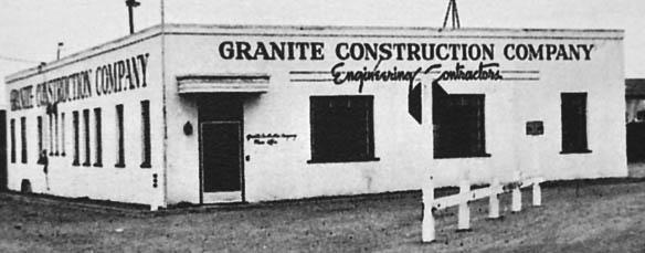

14 West Jackson Applicants Incorporated 1922 Est Contractor License #8 14
: 1,834 Acres 15 Community Development Department Making It")
15 West Jackson Property Ownership 5,913 Acres Total Stonebridge (blue): 3,016 Acres Granite (green): 1,063 Acres Other Owners (no color): 1,834 Acres 15 Community Development Department Making It Happen!


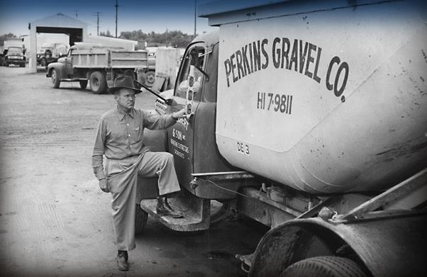
16 West Jackson Attributes As a result of the aggregate mining which occurred in the area over the last century, development has steadily encroached upon these properties and leapt across its borders. The project area now presents itself as a significant opportunity for infill development along a major transportation corridor and in close proximity to regional job centers. 16

17 West Jackson Attributes West Jackson Highway Master Plan Jackson Highway Vision Context Map 17


18 West Jackson Key Features Parkway Corridor Parkway Corridor Nodes Employment Node Urban Farm Locations
19 West Jackson Key Features Activity centers comprised of commercial, park and/or civic uses connected to linear parkways with transit and off-street trails Higher density residential areas clustered around activity centers and gradual reduction in densities toward the project area s eastern and southern border A variety of regional, community and neighborhood retail centers, office uses, research facilities, and employment centers Urban farms for community-based agriculture and education Abundant open space and recreational amenities 19

20 Jackson Township Specific Plan 20
21 Jackson Township Land Use Summary Land Use Designations Acres Ave. Density Density Range D.U. s % of D.U. s Residential LD- Low Density Residential MD-Medium Density Residential HD- High Density Residential Subtotal , % Commercial + Office Zones f.a.r. Approx. s.f. GC-General Commercial CC-Community Commercial MU-Mixed Use , , ,000 n/a n/a % O- Office ,800 n/a Subtotal ,996, % Public/Quasi Public Zones PQP-Fire Station/CommCtr/Tank Site PQP-High School/Middle School PQP-Elementary School Subtotal Park + Open Space Zones P- Community Park 23.6 P- Neighborhood Park 49.7 OS- Wetland Preserve OS- Greenbelt/Drainage Corridor 57.7 OS- Landscape Corridor 14.5 OS- Detention Basin 3.2 Subtotal AG-Agriculture RW- Primary Roadways % 28.9% 34.8% TOTAL 1, , % 21
22 Jackson Township Property Ownership 1,391 Acres Total Applicant owned: 862 acres Non-applicant owned: 529 acres 22 Community Development Department Making It Happen!
23 Jackson Township Key Features Commercial and civic amenities within walking distance of every residence Mixed-use nodes along Kiefer Boulevard, Excelsior Road and Jackson Highway Balanced mix of residential densities Three elementary schools and one middle/high school 225-acre wetland preserve in support of SSHCP Expansive greenway/drainage corridor including a trail to provide non-vehicular linkage throughout the project Connectivity to the greater Sacramento community through the use of public transit 23


24 Jackson Township Key Features 24


25 Jackson Township Key Features Town Center Vision 25


26 Jackson Township Key Features Low Density Residential High Density Residential Medium Density Residential Mixed Use 26

27 Jackson Township Key Features Mobility Master Plan 27

28 NewBridge Specific Plan 28
29 NewBridge Land Use Summary NewBridge North NewBridge South NewBridge West NewBridge Specific Plan Total DU AC SF DU AC SF DU AC SF DU AC SF Residential LDR Low Density Residential , (<7 du/ac) MDR Medium Density Residential ( du/ac) HDR High Density Residential (23-40 du/ac) Subtotal 2, , Commercial & Office C Commercial , , ,000 MU Mixed Use , ,000 O Office , ,000 Subtotal , , ,000 Open Space & Park OS Open Space - Preserve OS Open Space Multi-Use Area OS Open Space Folsom South Canal OS Open Space Community Garden OS Open Space Landscape Parkway P Park Subtotal Public/Quasi-Public P/QP Elementary School Site P/QP Sewer Lift Station P/QP Electric Facility P/QP Fire Station Site Subtotal Roadway RW Major Roadway Agriculture AG Agriculture Total 2, , , ,075 1, ,000 29
30 NewBridge Property Ownership East Sacramento Ranch, LLC (Sacramento Rendering Company) acres Triangle Rock Products, Inc./Vulcan Materials Co acres AG-80 uses west of Eagles Nest Road (existing) acres Bureau of Reclamation (Folsom South Canal) 58.9 acres SMUD 0.4 acres 30

31 NewBridge Illustrative Land Use Plan 31
32 NewBridge Key Features A robust circulation system designed to encourage pedestrian and bicycle activity, integrated with public transit Connectivity to existing Folsom South Canal regional Class 1 trail A 4.5-acre community garden Vernal pool preserves east and west of Eagles Nest Road totaling approximately 331 acres within critical habitat for fairy shrimp to mitigate impacts to 4.5 acres of wetlands and vernal pool habitat Low Impact Development (LID) to reduce water usage by reducing impervious surfaces, reducing turf in public parks and frontages, disconnected roof drains, and similar features 32

33 Mather South Community Master Plan 33
34 Mather South Land Use Summary Land Use Designation Approx. Acres Approx. Residential Units Approx. Commercial Sq. Feet Open Space / Detention Basins East Side Trail Creek Corridor Parks Schools Sports Complex University Public Streets Landscape Corridors Mixed Use Area: Neighborhood Commercial Component Multi-Family Residential Component (RD-30) ,068 92, RD RD RD RD RD RD RD Totals ,545 92,500

35 Mather South Illustrative Land Use Plan 35
36 Mather South Key Features A 47-acre mixed use area consisting of 10 acres of commercial uses integrated with 37 acres of multiple family uses at up to RD-30 densities (approximately 1,068 units of the project s 3,545 residential units) Proximity to existing infrastructure and amenities 43 acres of neighborhood parks and trails, including connectivity to the existing trail along the Folsom South Canal Two elementary school sites A 126-acre Sports Complex A 152-acre site for a university 36
37 Identified Key Issues Provision of Infrastructure Infrastructure Master Plan to identify necessary public facilities and infrastructure Public Facilities Financing Plan must include an infrastructure phasing analysis Backbone infrastructure may be shared by master plans Unknown timing of development for each project 37
38 Identified Key Issues Urban Services Plan (PC-7 of LU-120) Urban Services Plan required for each master plan to demonstrate: 1. Services are cost neutral to County s General Fund and existing ratepayers 2. Public facilities and infrastructure O&M costs are cost neutral 3. Existing levels of municipal services will not be negatively impacted Coordinated effort between CFO s office, DCD s Special Districts staff, PER staff, and consultants Base fiscal model completed 38
39 Identified Key Issues Fiscal Impact Analysis Base Fiscal Model New General Plan requirement Thorough analysis involving CFO, peer review process Long-term growth projections Revenue assumptions by land use type Review of County budget by function and expenditure Timing - early in process rather than later Common foundation for project-specific FIA 39
40 Identified Key Issues Water Supply SCWA and Cal Am are water purveyors Three projects require amendments to current Zone 40 Water Supply Master Plan Project-specific Water Supply Assessments will determine water supply availability in normal year, dry year, and multiple dry years scenarios Water purveyors must demonstrate sufficiency of water supplies to satisfy the projects water demands while still meeting the current and projected water demands of existing customers 40
41 Identified Key Issues Water Supply Water conservation efforts regionally and in master plans Conjunctive use provides flexibility in dry years Sustainable groundwater management policy Long-term water supply planning process SB 221 water provision verification 41
42 Identified Key Issues Transportation Joint Transportation Impact Study to analyze impacts associated with all modes of transportation Coordinated effort involving four adjacent cities, Capital Southeast Connector JPA, and Caltrans Study area included over 250 roadway segments and 160 intersections Ongoing effort to refine analysis and cost estimates for roadway infrastructure Potential for SR 16 relinquishment 42
43 Identified Key Issues Transportation Second Workshop Jackson Corridor Mitigation Strategy Dynamic Implementation Tool Functional Improvements to Rural Roadways Jackson Corridor Transit Network and Service Jackson Corridor Trail Network Evaluation of financing strategy Evaluation of appropriate metric for transportation impact analysis Evaluation of appropriate roadway sizing 43
44 Next Steps Workshop #2 Transportation Workshop #3 Infrastructure (Water Supply, Drainage, Sewer) and Public Facilities Financing Plans, Fiscal Impact Analyses 44
NEWBRIDGE SPECIFIC PLAN PROJECT DESCRIPTION SEPTEMBER 24, 2012
 PROJECT DESCRIPTION SEPTEMBER 24, 2012 Project Location The NewBridge Specific Plan project area consists of 1,095.3 acres south of Mather Airport between Kiefer Boulevard and Jackson Road, west of Sunrise
COUNTY OF SACRAMENTO CALIFORNIA. PLNP Jackson Township Specific Plan. Workshop And Initiation of Environmental Review Process
 COUNTY OF SACRAMENTO CALIFORNIA #102 For the Agenda of: June 18, 2013 Timed: 2:00 PM To: From: Subject: Supervisorial District(s): Board of Supervisors Department of Community Development PLNP2011-00095.
Jackson Township Specific Plan Applicant Prepared Project Description Revised
 Jackson Township Specific Plan Applicant Prepared Project Description Revised 4-11-13 Project Location The proposed Plan Area, approximately 1391 acres, is located in southeastern Sacramento County, lying
COUNTY OF SACRAMENTO CALIFORNIA
 COUNTY OF SACRAMENTO CALIFORNIA For the Agenda of: December 11, 2012 Timed: 10:15 a.m. To: From: Subject: Supervisorial District: Contact: Board of Supervisors Department of Community Development PLNP2010-00081
COUNTY OF SACRAMENTO CALIFORNIA PLANNING COMMISSION REPORT
 COUNTY OF SACRAMENTO CALIFORNIA PLANNING COMMISSION REPORT TO: FROM: SUBJECT: COUNTY PLANNING COMMISSION DEPARTMENT OF COMMUNITY DEVELOPMENT GROWTH AREA PLANS UPDATE CONTACT: Cindy Storelli, Principal
Natomas Vision Plan and PLNP
 Natomas Vision Plan 20030171 and PLNP2014-00172 Department of Community Development Planning and Environmental Review Leighann Moffitt Sub-Agenda 1. Staff Presentation Leighann Moffitt, County Planning
Department of Community Development. Planning and Environmental Review Division Revised Notice of Preparation
 Department of Community Development Michael J. Penrose, Acting Director Divisions Building Permits & Inspection Code Enforcement County Engineering Economic Development & Marketing Planning & Environmental
DEPARTMENT OF COMMUNITY DEVELOPMENT Planning and Environmental Review Division NOTICE OF PREPARATION
 Department of Community Development Lori A. Moss, Director Divisions Building Permits & Inspection Code Enforcement County Engineering Economic Development & Marketing Planning & Environmental Review SEPTEMBER
4.0 INTRODUCTION TO THE ENVIRONMENTAL ANALYSIS AND ASSUMPTIONS USED
 The following is an introduction to the environmental analysis of project-specific and cumulative impacts and general assumptions used in the analysis. The reader is referred to the individual technical
2.0 PROJECT DESCRIPTION
 2.0 PROJECT DESCRIPTION 2.1 PROJECT LOCATION The proposed Arboretum project (hereafter referred to as the proposed project ) is located on 1,349 acres within the Grant Line North Planning Area of the City
Glenborough at Easton Land Use Master Plan
 Land Use Framework November 30, 2007 2.0 LAND USE FRAME- WORK 2.1 LAND USE HISTORY and Setting Glenborough at Easton is located on property that was used for mining in the 19th and 20th centuries and rocket
SAN RAFAEL GENERAL PLAN 2040 INTRODUCTION AND OVERVIEW
 SAN RAFAEL GENERAL PLAN 2040 INTRODUCTION AND OVERVIEW Steering Committee Presentation February 14, 2018 Purpose of General Plan Guide land use and development decisions Coordinate transportation, infrastructure,
01 PROJECT DESCRIPTION
 01 PROJECT DESCRIPTION PROJECT LOCATION The proposed Barrett Ranch East project (the Project) site is in northern Sacramento County in the Antelope community, north of the intersection of Don Julio Boulevard
SHEFFIELD PARK Paulding County, GA DRI #588
 SHEFFIELD PARK Paulding County, GA DRI #588 Supplemental Information for RDC s DRI (Form 2) Review August 16, 2004 Prepared for: Mr. David Howerin Coosa Valley RDC 1 Jackson Hill Drive Rome, GA 30161 P.O.
APPENDIX C SPECIAL PLANNING AREAS
 SPECIAL PLANNING AREAS There are five Special Planning Areas (SPAs) on the Land Use Diagram (Figure LU-2). The SPAs are areas with significant new growth potential that require more detailed subsequent
Joint Study Session of the Sutter County. March 2, 2009
 Joint Study Session of the Sutter County Board of Supervisors and Planning Commission March 2, 2009 CURRENT APPLICATION General Plan Amendment Specific Plan Specific Plan Appendices Utility Plans Transit/AQ
CORDOVA HILLS COMPLIANCE WITH THE SACRAMENTO COUNTY GROWTH MANAGEMENT STRATEGY CRITERIA NOVEMBER 2011
 CORDOVA HILLS COMPLIANCE WITH THE SACRAMENTO COUNTY GROWTH MANAGEMENT STRATEGY CRITERIA NOVEMBER 2011 I. ACCEPTANCE OF CORDOVA HILLS APPLICATION TO EXPAND THE UPA: The application for the processing of
DOMINION BOULEVARD CORRIDOR STUDY AND ECONOMIC DEVELOPMENT STRATEGIC PLAN A MODEL FOR CHESAPEAKE S FUTURE
 DOMINION BOULEVARD CORRIDOR STUDY AND ECONOMIC DEVELOPMENT STRATEGIC PLAN A MODEL FOR CHESAPEAKE S FUTURE Overview I. Draft Plan Process II. Draft Plan Overview a. Market Analysis b. Master Land Use Plan
DEPARTMENT OF COMMUNITY DEVELOPMENT Planning and Environmental Review Division DRAFT NOTICE OF PREPARATION
 Department of Community Development Lori A. Moss, Director Divisions Building Permits & Inspection Code Enforcement County Engineering Economic Development & Marketing Planning & Environmental Review [CLICK
CHAPTER 1. Ms. Guajardo s Class - Central Elementary CH 1 1
 INTRODUCTION CHAPTER 1 Ms. Guajardo s Class - Central Elementary CH 1 1 1.1 SETTING South Centre City is a linear corridor south of Downtown Escondido paralleling Centre City Parkway and South Escondido
Land Use element LAND USE POLICY AREAS ESTATE AND RURAL RESIDENTIAL AREAS/RURAL SHELDON AREA OLD TOWN ELK GROVE
 Land Use element Land Use is often considered the heart of the General Plan. The statement of future land uses describes how the City believes it should develop in the future where housing, shopping, open
Glenborough at Easton Land Use Master Plan
 Vision Statement Sunrise Blvd. Hazel Ave. Prairie City Rd. Gencorp Property Lincoln Regional Airport 1.0 VISION STATEMENT The identifies City of the principles, goals, policies, and standards Lincoln that
Southeast Policy Area Community Plan
 Southeast Policy Area Community Plan In November 2003, the City Council adopted the General Plan for the City of Elk Grove. The General Plan is the City s overarching policy document indicating how the
Secrest Short Cut and Monroe Expressway Small Area Plan AUGUST 29, 2018
 Secrest Short Cut and Monroe Expressway Small Area Plan AUGUST 29, 2018 Background and Process Monroe Expressway will be open by the end of 2018 Union County and Indian Trail identified a need to revisit
Development Guidelines - Florin-Vineyard Community Plan Administrative Draft
 TABLE OF CONTENTS 1.0 INTRODUCTION... 1-1 1.1 Purpose and Intent... 1-1 1.2 Setting... 1-1 1.3 Land Use Summary... 1-3 2.0 RESIDENTIAL LAND USES... 2-1 2.1 Residential Densities... 2-1 2.2 Existing Neighborhood
Staff Report and Recommendation
 Community Planning and Development Planning Services 201 W. Colfax Ave., Dept. 205 Denver, CO 80202 p: 720.865.2915 f: 720.865.3052 www.denvergov.org/cpd TO: City Council Neighborhoods and Planning Committee
III. PROJECT DESCRIPTION
 III. PROJECT DESCRIPTION A. PROJECT LOCATION Regional Setting The project site is located in the southeast quadrant of the City of Chico in Butte County, California and is comprised of four parcels totaling
D-O LRT Zoning Discussion. Chapel Hill Boards & Commissions October 16, 2017
 D-O LRT Zoning Discussion Chapel Hill Boards & Commissions October 16, 2017 Update on Overall D-O LRT Station Area Initiative Objectives Design and educate on principles of Good Transit-Oriented Development
Land Use Element. policy areas are discussed in this Element:
 Land Use Element Land Use is often considered the heart of the General Plan. The statement of future land uses describes how the City believes it should develop in the future where housing, shopping, open
ACTION SUMMARY VINEYARD CPAC Smedberg Middle School Library 8239 Kingsbridge Drive Sacramento, CA 95829
 ACTION SUMMARY VINEYARD CPAC Smedberg Middle School Library 8239 Kingsbridge Drive Sacramento, CA 95829 TUESDAY August 7, 2018 7:00 PM MEMBERS: JOHN COSTA(CHAIR), BARTLEY BAER(VICE-CHAIR), SOPHIA TROTTER-GOETZE(SECRETARY),
Easton. Smart Growth Through Innovation. Easton
 Hazel Ave. Sunrise Blvd. Prairie City Rd. Smart Growth Through Innovation offers a unique opportunity to meet the region s future need for jobs and housing. It embodies smart growth principles advocated
ELK GROVE GENERAL PLAN VISION
 2-1 CHAPTER 2: 2-2 CREATING OUR The Community Vision for Elk Grove, expressed through a Vision Statement and a series of Supporting Principles, is a declaration of the kind of community that Elk Grove
SECTION IV: DEVELOPMENT CONCEPT
 80 SECTION IV: DEVELOPMENT CONCEPT Section IV: DEVELOPMENT CONEPT This section provides an overall understanding and rationale for what is envisioned in The Preserve, the intended quality and character
Planning Commission Staff Report March 15, 2007
 Planning Commission Staff Report Project: Request: Madeira East Tentative Subdivision Map, Design Review for Subdivision Layout & Abandonment of Easements Location: Phase IV of the Laguna Ridge Specific
Southeast Policy Area Community Plan
 City of Southeast Policy Area Community Plan Planning Department July 9, 2014 In November 2003, the City Council adopted the General Plan for the City of. The General Plan is the City s overarching policy
7 PUBLIC SERVICES ELEMENT
 7 PUBLIC SERVICES ELEMENT 7.1 PURPOSE The (RDOSP) will provide public services necessary to meet the needs of the Plan Area residents, in accordance with the policies of the City of Rancho Cordova s General
Ten Mile Creek Planning Area
 PLANNING AREA POLICIES TEN MILE CREEK Ten Mile Creek Planning Area Location and Context The Ten Mile Creek Planning Area ( Ten Mile Creek area ) is located south of the current Boise AOCI, generally south
Dwelling Units Max 12 dwelling units per acre/min 8 dwelling units per acre. Development Mix 80% non residential/20% residential
 13. OSTEEN LOCAL PLAN Background: The Osteen Local Plan area is located in southwest Volusia County along the SR 415 corridor between Lemon Bluff Road and Acorn Lake Road and includes 3,990 acres. The
IMPLEMENTING SOMERSET COUNTY S INVESTMENT FRAMEWORK
 IMPLEMENTING SOMERSET COUNTY S INVESTMENT FRAMEWORK SMART CONSERVATION THROUGH SMART GROWTH NJ LAND CONSERVATION RALLY March 22, 2014 Laurette Kratina, PP, AICP, Supervising Planner Somerset County Planning
An Amendment to the Hewlett- Packard Roseville Campus Master Plan
 An Amendment to the Hewlett- Packard Roseville Campus Master Plan CITY OF ROSEVI LLE Adopted August 5, 2015 Amended August 17, 2016 A BLUEPRINT COMMUNITY An Amendment to the Hewlett- Packard Roseville
& 035; ; ;
 County of Sacramento Community Planning & Development Department 827 7 th Street, Room 230 Sacramento, CA 95814 (916) 874-6141 Planning Application Form This application form is required as part of any
7,600 Residential Units 1,700,000 SF Non-Res 300-Room ALF 300-Room Hotel University School, Park, Civic parcels 1,889 ac flow-way/preservation
 4,763 ac undeveloped long-term AG use Over 75% characterized by non-native & invasive species Has severely degraded habitat functions 11,565 of frontage along Northlake Blvd. 1,687 of frontage along Beeline
3. VISION AND GOALS. Vision Statement. Goals, Objectives and Policies
 Vision Statement Queen Creek s interconnected network of parks, trails, open spaces and recreation opportunities provide safe and diverse activities and programs that sustain its unique, small town, equestrian
COUNTY OF SACRAMENTO CALIFORNIA
 COUNTY OF SACRAMENTO CALIFORNIA Control No.: 20040096 Type: GPB-CPB TO: FROM: SUBJECT: BOARD OF SUPERVISORS - COUNTY PLANNING COMMISSION PLANNING AND COMMUNITY DEVELOPMENT DEPARTMENT FLORIN VINEYARD GAP
Appendix PD-1. Mather South Community Master Plan
 Appendix PD-1 Mather South Community Master Plan DRAFT Diverse Housing Environmental Education Campus Healthy Lifestyle, Active Recreation Natural Resources In the Community Mather South Community Master
S A C R A M E N T O C O U N T Y JACKSON HIGHWAY & GRANT LINE EAST VISIONING STUDY
 JACKSON HIGHWAY & GRANT LINE EAST S A C R A M E N T O C O U N T Y P L A N N I N G D E P A R T M E N T SUMMARY AND WORKBOOK November 19, 2008 History of the Visioning Study Sacramento County has two growth
Parks, Trails, and Open space Element
 Parks, Trails, and Open space Element Parks, Trails, and Open Space element Parks, Recreation, and Open Space are important components of the quality of life desired by the residents of Elk Grove. This
4.1 LAND USE AND PLANNING EXISTING CONDITIONS REGULATORY BACKGROUND LAND USES IN THE PLAN AREA SURROUNDING LAND USES
 4.1 LAND USE AND PLANNING This section includes a description of the existing land use plans that apply to the Plan area and a description of existing land uses in the vicinity. It also includes an analysis
Visioning Statement and Guiding Principles
 Visioning Statement and Guiding Principles Planning for the Future The General Plan The General Plan represents Woodland's shared vision of the future and defines a path to lead the community toward its
A. WHAT IS A GENERAL PLAN?
 I. Introduction A. WHAT IS A GENERAL PLAN? A general plan is the planning guideline for the future of a city. It contains goals and policies which regulate urban development, the protection of the natural
SOUTHEAST AREA SPECIFIC PLAN. Planning Commission Study Session August 18, 2016
 SOUTHEAST AREA SPECIFIC PLAN Planning Commission Study Session August 18, 2016 Background: How did we get here? Directed by City Council to prepare Specific Plan (2012) Sustainability focused grant from
Pine Island Road Corridor Master Plan
 RECOMMENDED DEVELOPMENT PLAN Figure 9: Del Prado Village District Conceptual Framework The Conceptual Framework (Figure 8) for development of the Pine Island Corridor is to encourage mixed-use development
Union City General Plan Update. City Council Meeting Item VII.a July 28, 2015 Land Use Concepts and Evaluation Criteria
 Union City General Plan Update City Council Meeting Item VII.a July 28, 2015 Land Use Concepts and Evaluation Criteria Meeting Outline The Update Process Overview and Purpose Draft Focus Area Concepts
Standards (R-3) Figure B-11: R-3 Residential Standards Exhibit
 Figure B-11: R-3 Residential Standards Exhibit") Avila Ranch Avila Ranch Specific Plan Development Standards High Medium Density - High Residential Density Residential Lot and Building Lot and Standards Building (R-3) Standards (R-3) EXAMPLES These sketches
Avila Ranch Avila Ranch Specific Plan Development Standards High Medium Density - High Residential Density Residential Lot and Building Lot and Standards Building (R-3) Standards (R-3) EXAMPLES These sketches
1. INTRODUCTION COMMUNITY PLAN OVERVIEW PURPOSE. A Community Plan serves as. a blueprint for future growth. and development within a
 1. INTRODUCTION COMMUNITY PLAN OVERVIEW PURPOSE The Bellevue Community Plan (BCP or Plan) provides policy direction to the decision making process for development within a defined geographic portion of
S C O P E O F W O R K A P R I L
 white flint 2 sector plan S C O P E O F W O R K A P R I L 2 0 1 2 MONTGOMERY COUNTY PLANNING DEPARTMENT M-NCPPC MontgomeryPlanning.org 1 white flint 2 sector plan Scope of Work abstract This scope of work
MONTGOMERY COUNTY METRO STATION AREA DESIGN CHARRETTE
 MONTGOMERY COUNTY METRO STATION AREA DESIGN CHARRETTE Shady Grove Metro Station Area Charrette Closing Presentation October 25-28, 2000 MONTGOMERY COUNTY, MD M-NCPPC Design Collective, Inc. Architects
Report to: Development Services Committee Report Date: April 24, 2017
 SUBJECT: Cornell Rouge National Urban Park Gateway - Report on Design Charrette and Next Steps PREPARED BY: Lilli Duoba, MES, MCIP, RPP, Manager, Natural Heritage (ext. 7925) REVIEWED BY: Marg Wouters,
APPENDIX X. Analysis of Project Consistency with City Policies
 APPENDIX X Analysis of with City Policies Land Use Policy LU.1.3 Maintain a strong jobs-housing ratio, with a diverse job base and corresponding housing stock, within the Planning Area. Improve the relationship
GENERAL PLAN AND ENVIRONMENTAL IMPACT REPORT
 City of Menifee HEARING DRAFT GENERAL PLAN AND ENVIRONMENTAL IMPACT REPORT City Council November 2013 PURPOSE OF MEETING Overview of GP Process Overview of required and optional GP elements Receive direction
DRAFT PLAN PRESENTATION
 DRAFT PLAN PRESENTATION 1.23.2018 AGENDA Process Project Schedule Results from Visioning Workshop Draft Plan Highlights Concept Plans Feedback Next Steps PROJECT SCHEDULE KICK-OFF WORKSHOP August 29 th
Westbound: A One-day Exploration of Growth
 Westbound: A One-day Exploration of Growth Frog Pond Area 2018 UGB Expansion Proposal June 13, 2018 Growing Out: UGB Asks Four cities submitted proposals to expand greater Portland s urban footprint by
open public hearing and allow public comment request to continue LPA public hearing to January 16, 2014 at 10:30 am
 TODAY S AGENDA Work Session LPA Transmittal Public Hearing open public hearing and allow public comment request to continue LPA public hearing to January 16, 2014 at 10:30 am staff will issue a recommendation
CITY OF SACRAMENTO GENERAL PLAN. UC Davis ESP 171 Urban and Regional Planning April 21, 2011
 CITY OF SACRAMENTO GENERAL PLAN UC Davis ESP 171 Urban and Regional Planning April 21, 2011 1 OUTLINE Background Growth and Change Placemaking Sustainability and Climate Change Economic Development 2 City
COUNTY OF SACRAMENTO Inter-Departmental Correspondence
 COUNTY OF SACRAMENTO Inter-Departmental Correspondence For the Agenda of December 10, 2003 To: From: BOARD OF SUPERVISORS PLANNING AND COMMUNITY DEVELOPMENT DEPARTMENT Subject: WORKSHOP ON THE FLORIN-VINEYARD
Northwest Rail Corridor and US 36 BRT Development Oriented Transit Analysis 4.4 STATION AREA FINDINGS
 4.4 STATION AREA FINDINGS Each station is different, and each one requires a separate set of recommendations based on the vision for the site. This section outlines an initial TOD strategy and recommendations
Property Profile 2954 WEST FRANKLIN ROAD MERIDIAN, ID
 082614 FOR SALE > MIXED-USE LAND Franklin & Ten Mile Land 2954 WEST FRANKLIN ROAD MERIDIAN, ID Property Profile > ~38 acres for sale, located on the NE corner of Franklin and Ten Mile > Power and gas running
The transportation system in a community is an
 7 TRANSPORTATION The transportation system in a community is an important factor contributing to the quality of life of the residents. Without a sound transportation system to bring both goods and patrons
LAND USE DESIGNATIONS AND ZONING CLASSIFICATIONS
 LAND USE DESIGNATIONS AND ZONING CLASSIFICATIONS One of the most significant issues addressed within the community plan process is land use. How land is utilized within a community directly affects the
Municipal Plan*Assessment
 Municipal Plan*Assessment This tool was developed to assist in reviewing municipal master plans and in determining if these plans are consistent with smart growth principles, neighboring municipal plans,
3.0 PROJECT DESCRIPTION
 3.0 PROJECT DESCRIPTION This section of the Draft Environmental Impact Report (Draft EIR) is the Project Description of the proposed General Plan. The purpose of the Project Description is to describe
CITY OF ROHNERT PARK CITY COUNCIL AGENDA REPORT
 Mission Statement We Care for Our Residents by Working Together to Build a Better Community for Today and Tomorrow. CITY OF ROHNERT PARK CITY COUNCIL AGENDA REPORT ITEM NO. 5 Meeting Date: July 23, 2013
Applicant Name Phone / Fax / Address City State Zip Code . Property Owner Phone / Fax / Address City State Zip Code
 Master Development Plan Application Community Development Department City of Redmond 411 SW 9 th Street Redmond, Oregon 97756 541-923-7721 541-548-0706 FAX Master Development Plan Fee $38,862.52 File Number
2035 General Plan Update and Belmont Village Specific Plan. Joint Study Session with the City Council and Planning Commission April 12, 2016
 2035 General Plan Update and Belmont Village Specific Plan Joint Study with the City Council and Planning Commission April 12, 2016 Agenda 1. Welcome and Introductions 2. General Plan Update Status of
9 th Street Sub Area Plan
 9 th Street Sub Area Plan In the 1990 s, when the Township prepared the last Master Plan, the 9 th Street corridor was studied as part of a larger 9 th Street Focus Area that included the West Main Street
Chapter 5: Natural Resources and Environment
 NATURAL RESOURCES AND ENVIRONMENT 5-1 5 Chapter 5: Natural Resources and Environment BACKGROUND AND INTENT Urban expansion represents the greatest risk for the future degradation of existing natural areas,
Gold Line Bus Rapid Transit Transit Oriented Development (BRTOD) Helmo Station Area Plan
 Helmo Station Area Plan") Appendix F Gold Line Bus Rapid Transit Transit Oriented Development (BRTOD) Helmo Station Area Plan Introduction and Purpose of the Plan The Gold Line Bus Rapid Transit facility is an eleven-mile dedicated
Appendix F Gold Line Bus Rapid Transit Transit Oriented Development (BRTOD) Helmo Station Area Plan Introduction and Purpose of the Plan The Gold Line Bus Rapid Transit facility is an eleven-mile dedicated
Selected Area Study. Vision Plan Draft
 East Polk County Selected Area Study Draft 10.30.08 Contents Guiding Principles...4 Context Conclusions...5 Current Context...8 Scenarios...9 Scenario: Status Quo...10 Scenario: Connected & Directed Growth...12
1.0 VISION STATEMENT. December 6, PRINCIPLES
 Vision Statement Lincoln Regional Airport 1.0 VISION STATEMENT 1.1 City LOCATION of AND OVERVIEW The Easton Lincoln Place Land Use Master Plan identifies the principles, goals, policies, and standards
Overview of the Plan. The Building Blocks of Centers, Neighborhoods and Network INTERNAL DRAFT
 Overview of the Plan 4 East Davidson Ramah Church Rd June Washam Rd Bradford District Park Bradford Shearer Rd Campus District NC 73 Davidson-Concord North Rocky River This Master Plan projects an approximate
Silver Line CPAM UPDATE. Transportation and Land Use Committee October 14, 2016
 Silver Line CPAM UPDATE Transportation and Land Use Committee October 14, 2016 Purpose Recap Project History and Map Changes Provide Overview of CPAM Components Discuss Transportation Impacts Discuss Fiscal
Chapter 3 l a N D U S e
 L a nd U s e Chapter 3 L a n d Use 3.1 Introduction The Land Use Chapter is the cornerstone of the Master Plan. The Land Use Chapter defines the type, nature, and intensity of land use for Cordova Hills.
CHAPTER 7: Transportation, Mobility and Circulation
 AGLE AREA COMMUNITY Plan CHAPTER 7 CHAPTER 7: Transportation, Mobility and Circulation Transportation, Mobility and Circulation The purpose of the Transportation, Mobility and Circulation Chapter is to
KASPER. City of Georgetown, Texas PUD Planned Unit Development. December 30, 2015 Revised January 27, 2016
 KASPER City of Georgetown, Texas PUD Planned Unit Development December 30, 2015 Revised January 27, 2016 Applicant: Sentinel Land Company, LLC 4910 Campus Drive Newport Beach, CA Prepared by: SEC Planning
Conservation Development
 Acknowledgements RIDEM: Scott Millar Anthony Lachowicz-Planning and Zoning Consultant Director of Planning 1 : a creative land use technique that allows a community to guide growth to the most appropriate
Prepared by: Casey Kempenaar, Senior Planner
 CITY OF CITRUS HEIGHTS PLANNING DIVISION STAFF REPORT PLANNING COMMISSION MEETING September 13, 2017 Prepared by: Casey Kempenaar, Senior Planner REQUEST The applicant requests a Design Review Permit Modification
LAND USE MODEL UPDATE. Planning and Land Use Advisory Committee Meeting #2 September 4, 2014
 1 LAND USE MODEL UPDATE Planning and Land Use Advisory Committee Meeting #2 September 4, 2014 2 Presentation Outline Introduction and Recap Model Process Study Design Place Types Suitability Factors 3
Description of Preferred Alternative
 Chapter 2 Description of Preferred Alternative 2.1 Introduction This chapter of the programmatic Sammamish Town Center Sub-area Plan Final EIS provides a more detailed description of the Preferred Alternative
Planning, Property and Development Department Report. To the Riel Community Committee
 Planning, Property and Development Department Report To the Riel Community Committee Date: October 30, 2006 File: SP 5/2006 Subject: Waverley West Northeast Neighbourhood Area Structure Plan Location:
Introduction and Overview
 Introduction and Overview Articulate local values and priorities Guide land use and development decisions Coordinate transportation, infrastructure, and City services with expected growth and available
MAYFIELD WEST SECONDARY PLAN PHASE 2
 MAYFIELD WEST SECONDARY PLAN PHASE 2 Public Open House #3 February 25, 2010 Draft Preferred Land Use Scenario TOWN OF CALEDON PLANNING & DEVELOPMENT DEPARTMENT Open House Agenda TOWN OF CALEDON 1. Welcome
2. Form and Character. 2.1 Introduction. 2.2 The Downtown Addition Plan. 2.1 Introduction
 2.1 Introduction 2.1 Introduction This section of the Specific Plan describes and illustrates the desired form, character and uses of the Downtown Addition and explains the underlying design principles.
Germantown Forward Status Report to the Planning Board M NCPPC
 Germantown Forward Status Report to the Planning Board Germantown Forward March 27, 2008 What s new? CCT alignment Capital Improvement Program Agency partners Water quality conditions Sustainability Design
BROOKHILL NEIGHBORHOOD MODEL ZONING MAP AMENDMENT PREFACE TO APPLICATION
 BROOKHILL NEIGHBORHOOD MODEL ZONING MAP AMENDMENT PREFACE TO APPLICATION June 15, 2015 Revised: August 1, 2016 I. VISION Brookhill is a proposed community based upon the principles of Albemarle County
Executive Summary. NY 7 / NY 2 Corridor
 Executive Summary NY 7 / NY 2 Corridor Transportation and Land Use Study December 2005 Prepared for: Town of Colonie Capital District Transportation Committee Prepared by: Introduction: Land use decisions
New Partners for Smart Growth Conference February 5, 2010
 Dan Stroh, Planning Director City of Bellevue Planning and Community Development Bellevue, WA New Partners for Smart Growth Conference February 5, 2010 Summary of Project Long-range plan update for Bel-Red
495/MetroWest Development Compact Plan Citizen Planner Training Collaborative Conference. March 17, 2012
 495/MetroWest Development Compact Plan Citizen Planner Training Collaborative Conference March 17, 2012 Project Process Local and Regional Priority Areas Growth Scenarios Transportation Investment Categories
3. Project Description
 3.1 PROJECT LOCATION The Platinum Triangle (herein after also referred to as the Project Area ) is located at the confluence of the Interstate 5 (I-5 Freeway) and the State Route 57 (SR-57 Freeway), in
Implementation Guide Comprehensive Plan City of Allen
 Implementation Guide 2030 Comprehensive Plan City of Allen DRAFT 2015 Implementation Guide Allen 2030 Comprehensive Plan INTRODUCTION The Comprehensive Plan serves as a guide for the growth and development
Planning Commission Staff Report June 5, 2008
 Owner/Applicant Taylor Village Sacramento Investments Partners, LP c/o Kim Whitney 1792 Tribute Road #270 Sacramento, CA 95815 Staff Recommendation Planning Commission Staff Report Project: File: Request: