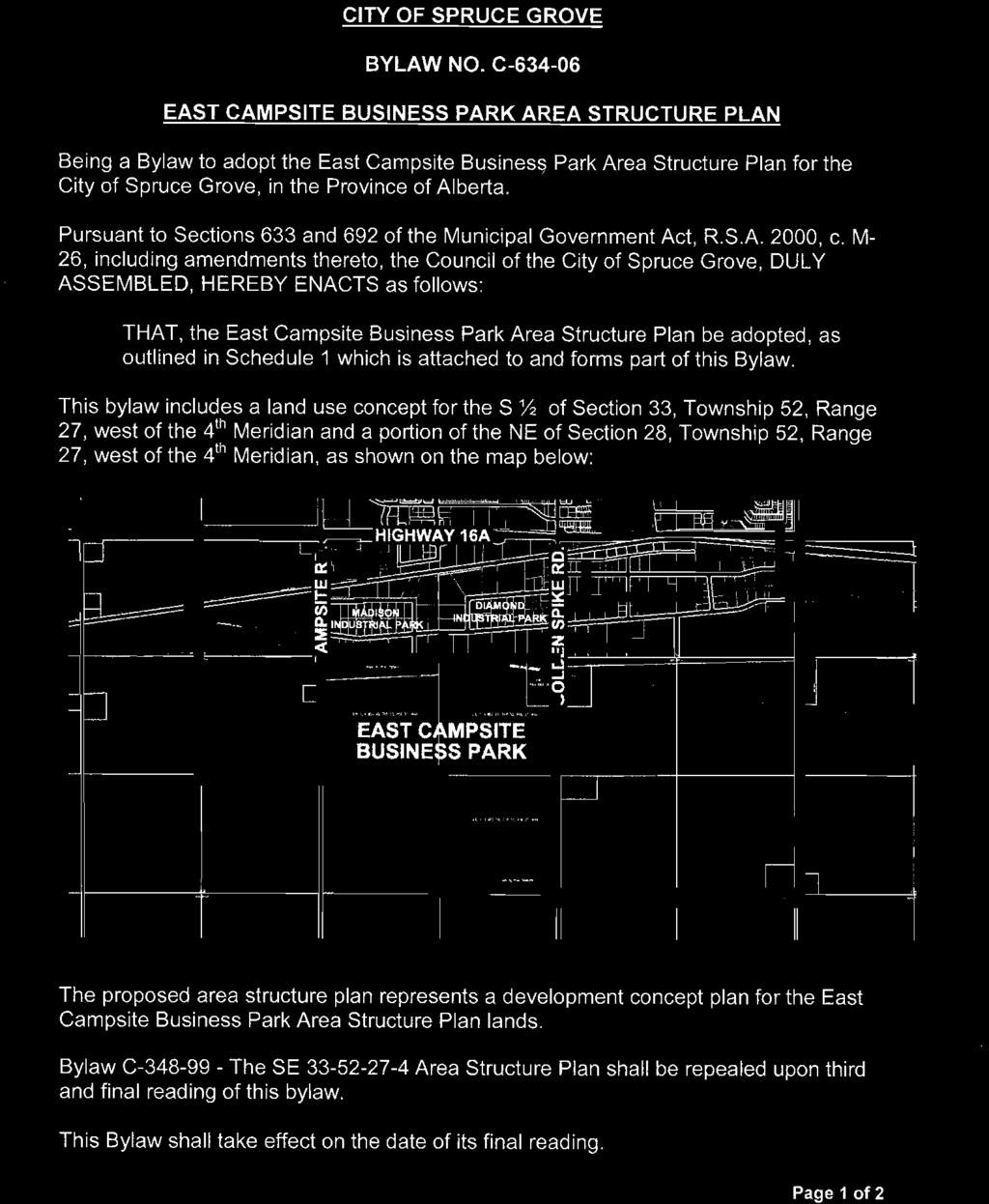
City of Spruce Grove East Campsite Business Park Area Structure Plan
|
|
|
- Virgil Stevenson
- 6 years ago
- Views:
Transcription
1
2
3 City of Spruce Grove East Campsite Business Park Area Structure Plan Prepared by: UMA Engineering Ltd Avenue Edmonton, AB T5S 1G3 T F Job No February 2007
4 Disclaimer This Report (the Report ) has been prepared by UMA Engineering Ltd. ( UMA ) for the benefit of City of Spruce Grove / Melcor Developments Ltd. ( Client ) in accordance with UMA s agreement with Client (the Agreement ), and is subject to the budgetary, time and other constraints set forth in the Agreement. The information and data contained in the Report, including without limitation the results of any inspections, sampling, testing and analyses and any conclusions or recommendations of UMA (the Information ), represent UMA s professional judgement in light of the knowledge and information available to it at the time of preparation of the Report (including any information provided to it by Client, which UMA has assumed to be accurate). UMA makes no guarantees or warranties whatsoever, whether express or implied, with respect to the Report, the Information or any part thereof and UMA shall not, by the act of preparing or issuing the Report and the Information, be deemed to have represented that the Report or the Information is accurate, exhaustive, complete or applicable to any specific use. Except as required by law, the Report and the Information are to be treated as confidential and, unless otherwise agreed to by UMA and Client, may be used and relied upon only by Client and its officers and employees, subject to the foregoing limitations. UMA accepts no responsibility, and denies any liability whatsoever, to parties other than Client who may obtain access to the Report or the Information for any injury, loss or damage suffered by such parties arising from their use of, reliance upon, or decisions or actions based on the Report or any of the Information unless those parties, prior to using or relying on the Report or the Information, have obtained the express written consent of UMA and Client to use and rely on the Report and the Information, and signed a Reliance Letter in a form provided or agreed to by UMA. " 2007 UMA ENGINEERING LTD. ALL RIGHTS RESERVED THIS DOCUMENT IS PROTECTED BY COPYRIGHT LAW AND MAY NOT BE REPRODUCED IN ANY MANNER, OR FOR ANY PURPOSE, EXCEPT BY WRITTEN PERMISSION OF UMA ENGINEERING LTD."
5 Table of Contents 1.0 Introduction Purpose Boundaries and Land Description Property Ownership Statutory Context Municipal Government Act Spruce Grove Municipal Development Plan Existing Area Structure Plans Spruce Grove Land Use Bylaw Plan Area Natural Features Topography and Drainage Soils Environmental Resources Existing Land Use Existing Access and Municipal Services Land Use Concept Plan Objective Land Use Concept General Industrial Land Use Open Space Transportation Servicing Concepts Sanitary Sewer Water Distribution Shallow Utilities Implementation and Staging... 2 List of Tables Table 4 1 Land Allocation in East Campsite Business Park ASP... 2 List of Figures Figure 1 Location Figure 2 Ownership Figure 3 Topography and Drainage Figure 4 Existing Land Use Figure 5 Land Use Concept Figure 6 Transportation Figure 7 Sanitary Service Figure 8 Water Distribution Figure 9 Figure 10 Development Staging RPT EASTCAMPSITEASP DOC TABLE OF CONTENTS i EAST CAMPSITE BUSINESS PARK AREA STRUCTURE PLAN CITY OF SPRUCE GROVE
6 1.0 Introduction 1.1 Purpose The purpose of this East Campsite Business Park Area Structure Plan (ASP) is to establish a land use and servicing framework for the development of business industrial uses within the East Campsite Business Park. This ASP prescribes: the distribution of land uses, major roadways and utility servicing, and development phasing. 1.2 Boundaries and Land Description East Campsite Business Park contains approximately 183 hectares of land in southwestern Spruce Grove, and it forms a southward expansion of industrial uses currently located south of Highway 16A. Specifically, the ASP s north boundary is approximately 800 metres south of Highway 16A and it is otherwise bounded on the west by Campsite Road, on the east by Golden Spike Road, and on the south by the City boundary (see Figure 1). The ASP comprises most of three quarter sections of land legally described by the Alberta Township Survey System as within the South ½ of Section W4M and the Northeast ¼ of Section W4M. 1.3 Property Ownership The largest landowner within the ASP boundary is Melcor Developments Ltd. with title, or registered agreement to purchase, to over ninety percent of the total area. All individual property owners and holdings are identified in Figure 2. RPT EASTCAMPSITEASP DOC INTRODUCTION 1 CITY OF SPRUCE GROVE EAST CAMPSITE BUSINESS PARK AREA STRUCTURE PLAN
7 2.0 Statutory Context 2.1 Municipal Government Act An Area Structure Plan is a Statutory Plan authorized by Section 633 of the Municipal Government Act (MGA), Statues of Alberta, 1994, Chapter M 26.1, for the purpose of providing a framework for the future subdivision and development of lands within a municipality. The MGA further requires that all statutory planning documents be consistent with each other and that an ASP must describe: sequencing of development; proposed land uses, either generally or specifically; population density; the general location of major transportation and public utilities; and any other planning matters that Council may consider necessary. 2.2 Spruce Grove Municipal Development Plan As a statutory plan this ASP must maintain consistency with the Spruce Grove Municipal Development Plan Bylaw C (MDP), as amended, that establishes the City s planning goals, land use, and land use policies for orderly growth and development. This ASP implements industrial land uses, and those areas appropriate for industrial development are shown on MDP Figure 2 Future Land Use Map. This MDP map identifies the future use of the ASP lands for Future Industrial, Urban Expansion, and Environmental Area. The Urban Expansion classification refers to lands not likely required for near term urban development which may be feasible for either residential or industrial use. This determination of use would be established by a future MDP or area structure plan. The City s goals and objectives for industrial lands are stated in MDP Part II, Section 2.4 Industrial Development, with the Community s goals being the designation of sufficient industrial lands for local employment opportunities and in support of a balanced local economy. Objectives for industrial land development seek to maintain high standards of subdivision and development, provide separation from residential development, and encourages industrial uses be compatible with current and future development. These goals and objectives are further articulated in MDP Part III, Section 5.0 Industrial Development Policies, as the following policies: 5.1 The City will encourage the development of light industry. 5.2 All industrial development in the built up area of the City will be provided with full urban utility services. 5.3 The City will encourage high standards of industrial subdivision and site design, especially where such development is adjacent to major access roads. 5.4 The City will discourage open storage on industrial sites and endeavour to prevent or eliminate unsightly premises should they occur. RPT EASTCAMPSITEASP DOC STATUTORY CONTEXT 2 CITY OF SPRUCE GROVE EAST CAMPSITE BUSINESS PARK AREA STRUCTURE PLAN
8 As a portion of the ASP lands are identified in MDP Figure 2 Future Land Use Map as an Environmental Area, and the MDP in Part III Land Use Plan and Policies, Section 2.8 Open Space / Environmental Policies requires that an area structure plan specifically address the future management of these environmental areas. The policy requires that these areas remain viable, retain their environmental amenity value, and must be provided appropriate buffering from development. 2.3 Existing Area Structure Plans A portion of the ASP area is currently defined by Bylaw No. C , which is an area structure plan titled Area Structure Plan for Southeast Section W4M. This existing area structure plan will be rescinded and replaced by this ASP which identifies the most current development objectives. 2.4 Spruce Grove Land Use Bylaw The City of Spruce Grove s Land Use Bylaw No. C , as amended, classifies the subject ASP lands as U R Urban Reserve Holding District. The purpose of this district is to maintain undeveloped lands for future urban development, and that they would be reclassified to another land use district in conformance with an area structure plan adopted by City Council. RPT EASTCAMPSITEASP DOC STATUTORY CONTEXT 3 CITY OF SPRUCE GROVE EAST CAMPSITE BUSINESS PARK AREA STRUCTURE PLAN
9 3.0 Plan Area 3.1 Natural Features The development of the ASP lands is influenced by the natural and man made environment. Existing site conditions are discussed below as context for the land use concept presented in Section Topography and Drainage Topography of the ASP lands consists of gently rolling to rolling terrain with an overall gentle downward gradient from the south to north (Figure 3). The highest elevation is approximately m above sea level in the southeast corner, and the lowest area is 701 m in the ASP s northwest corner. Overall, the difference in elevation between the highest and lowest lands is approximately 9.0 m. The existing drainage pattern generally follows the major topographical trend that descends from south to north. Surface water drains into the lower lying lands in the central ASP area Soils A geotechnical investigation consisting of 21 test holes indicated area soils are generally composed of surficial topsoil underlain by lacustrine clay. These soils vary from medium to high plastic, and they become wetter with depth Environmental Resources The lands within the ASP consist primarily of cleared fields, a large tree stand, and some low lying wet areas. The north centrally located trees are defined on MDP Figure 1 Development Factors as being Environmental Area F, and they consist of approximately 25 ha of mixed native upland forest. Assessment of these trees provided in the MDP identifies them as being disturbed due to past and present cattle grazing, and that the potential environmental value is as a locally significant area useful for maintaining landscape and wildlife diversity within the Spruce Grove urban environment. The MDP did not identify the forest as a critical environmental, but it is a significant vegetation stand with parts suitable for preservation and as a possible node in the City trail system. Areas of poorly drained low lying lands exist within the ASP and these are typically without surface water but provide for the intermittent collection of excess water runoff. 3.2 Existing Land Use Existing area land uses include a home and associated out buildings in the northwest corner and a commercial site in the northeast corner (see Figure 4). Crossing the ASPs northeast corner is a crude oil pipeline (plan 3625HW), and a natural gas pipeline (plan ) exists along the west, south, and east perimeter of the South ½ of Section W4M. A telecommunications right of way (plan ) is located along the east and south of the Southeast ¼ of Section W4M and in the corner of the Southwest ¼ of Section W4M. Finally, an abandoned electrical transmission line right of way (plan 2149 EO) is noted where it had formerly crossed through the South ½ of Section W4M. RPT EASTCAMPSITEASP DOC PLAN AREA 4 CITY OF SPRUCE GROVE EAST CAMPSITE BUSINESS PARK AREA STRUCTURE PLAN
10 The remainder of the plan area is predominantly cultivated agricultural land. None of these existing land uses would conflict with the future development of these lands. Land uses surrounding the area to the west, south and east are primarily agricultural with a few dispersed farmsteads. Some commercial/industrial land uses exist east of Golden Spike Road in the Golden Spike Industrial Business Park. Lands to the north in the Madison Industrial Park and the Diamond Industrial Park are developed commercial/industrial uses. 3.3 Existing Access and Municipal Services The ASP area may be accessed from the west by Campsite Road, from the east along Golden Spike Road, and from the north by Madison Crescent which connects to Diamond Avenue. Both Campsite Road and Golden Spike Road are currently rural cross section roadways, and each connects northward to Highway 16A at a controlled intersection. Utilities and municipal services to the standard required for servicing the ASP do not currently exist on site, but these are nearby and may be readily extended for new developments. RPT EASTCAMPSITEASP DOC PLAN AREA 5 CITY OF SPRUCE GROVE EAST CAMPSITE BUSINESS PARK AREA STRUCTURE PLAN
11 4.0 Land Use Concept 4.1 Plan Objective The objective of the East Campsite Business Park ASP is to create an attractive area of serviced business industrial land that provides local employment opportunities and contribute to a balanced local economy. 4.2 Land Use Concept General The Land Use Concept for the East Campsite Business Park ASP illustrated in Figure 5 defines a predominant pattern of industrial land use with supportive park space, stormwater management facilities, and transportation systems. The north central park space retains a major portion of the existing tree stand and protects this locally significant environmental feature. The allocation of land use within the ASP is identified in Table 4 1. The ultimate configuration of the east west roadway that separates the East Campsite Business Park into north and south development modules is undetermined at this time as to its ultimate status as either a collector or arterial road. The City of Spruce Grove transportation plan currently identifies the roadway as an arterial road and as such access restrictions are imposed on this central roadway. In discussions with the City of Spruce Grove it has been agreed to acknowledge the uncertainty related to the status this roadway by designating it as arterial/minor collector (see Section 4.2.4). Industrial development generally prefers a linear pattern of local roadways, and the designation of east/west roadways through the areas north and south modules sets a distinct linear road pattern that will optimise future opportunity for industrial roads. It is envisioned that these east/west roads would be connected north/south by local roads to allow variety in parcels for light industrial and commercial uses. Table 4 1 Land Allocation in East Campsite Business Park ASP Land Use Hectares % of Area Gross Area Campsite & Golden Spike Road Widening 1.19 Arterial Roadway (40.0 m) 3.20 Service Road (Oswald Dr.) 0.50 Subtotal 4.89 Gross Developable Area Land Uses Industrial % Park / Open Space % / PUL % Transportation % Total Land Uses % RPT EASTCAMPSITEASP DOC LAND USE CONCEPT 6 CITY OF SPRUCE GROVE EAST CAMPSITE BUSINESS PARK AREA STRUCTURE PLAN
12 4.2.2 Industrial Land Use The ASP area proposes predominantly light industrial land uses that total hectares, or 75.2%, of the total gross developable area. Industrial land uses are well suited here adjacent to existing industrial development and distant from potential conflicts with residential areas. Future subdivisions in the Plan area can be varied in size and shape to provide the flexibility required to meet the diverse needs of future business owners. The parcel sizes will be developed using the subdivision and development standards for light industrial land uses in the Land Use Bylaw Open Space A series of three stormwater management facilities (SWMF) and one park form the open space for the ASP area. The SWMFs have been located and sized to take advantage of low lying topography and also provide some amenity in this industrial area. A park of approximately 9.0 hectares designated in the north central Plan area preserves a significant portion of the trees identified as Environment Area F in the Municipal Development Plan. The park boundary has been identified in consultation with City administration and the area will be dedicated as Municipal Reserve lands. The Municipal Government Act and the City s Municipal Development Plan provide that up to ten percent of each titled area within the ASP lands be provided upon subdivision as Municipal Reserve (MR) dedication for use as parks, school, or separating areas of differing land use. As this ASP is for industrial land use the need of MR lands for parks and recreation activities is greatly reduced, and the City will accept cash in lieu of land for the balance of the required ten percent MR not provided as parkland Transportation Industrial development is dependent on efficient road networks for the movement of goods and people, and a transportation concept supportive of this need is shown in Figure 6. The ASP boundary abuts Campsite Road to the west and Golden Spike Road to the east. These arterial roadways provide good access to the Highway 16A which is located 800 m northward. A road widening is identified for both Campsite Road and Golden Spike Road to match the boundary of the existing pipeline right of way. The area transportation concept defines two arterial access/egress points west to Campsite Road, three eastward onto Golden Spike Road, and one northward tying to Diamond Road located within the abutting industrial lands. These accesses are then logically connected with roads that form the ASP s major internal circulation pattern characterized by three primary east/west roadways. A future system of north/south local connections will be defined between these primary east/west roadways with future subdivision. These local roads will be greatly influenced by the parcel sizes required to meet the diverse needs of area business users and the access constraints of the central arterial roadway discussed below. All internal ASP roadways consist of rural cross sections with gravel surface. RPT EASTCAMPSITEASP DOC LAND USE CONCEPT 7 CITY OF SPRUCE GROVE EAST CAMPSITE BUSINESS PARK AREA STRUCTURE PLAN
13 The 2000 Spruce Grove Transportation Study (SGTS) identified a two lane arterial roadway link between Campsite Road and Golden Spike Road for the future needs of area industrial development. This South Industrial Arterial is incorporated in this transportation plan as the middle of the three defined east/west area roads. Being an arterial roadway, future access points have been identified with a minimum 300 m separation for local road network connections. The concept also identifies right in/right out accesses approximately 200 m west of Golden Spike Road, on both north and south sides, for shared access to abutting large parcel developments. As the SGTS indicates this South Industrial Arterial roadway requirement is to be confirmed through subsequent updates, it is therefore identified on the concept as an Arterial/Collector to reflect this undetermined status. Should it be later determined by study or policy that this arterial roadway is not required this ASP anticipates it would operate as a collector road (minor or major); and, as such the 300 m intersection separation requirements and other access restrictions may be eliminated without amendment to this ASP. RPT EASTCAMPSITEASP DOC LAND USE CONCEPT 8 CITY OF SPRUCE GROVE EAST CAMPSITE BUSINESS PARK AREA STRUCTURE PLAN
14 5.0 Servicing Concepts 5.1 Sanitary Sewer The sanitary sewer system concept for the ASP is shown on Figure 7. Sanitary servicing for the area requires the southward extension of an existing 675 mm sanitary trunk located north of the ASP s northwest boundary. Extending this trunk main to the ASP boundary is the responsibility of the City, and where sections are installed by a Developer it will be credited to their respective local area assessment. The 675 mm trunk main will provide the capacity necessary to internally service the ASP lands through the defined sanitary servicing concept. As well, this trunk main will provide for off site service connections to the south and east, and includes a 450 mm sanitary stub to provide service to the development east of East Campsite Business Park with some additional servicing capacity. 5.2 Water Distribution The East Campsite Business Park water distribution system is shown on Figure 8, and it identifies the network of water mains to provide for the needs of this planned development. Water main sizes and extensions to the ASP boundary should be confirmed and established to suit ongoing development needs through detailed engineering design. The water main network consists of four planned connections to the existing 250 mm water main along Diamond Avenue. These connections are: 1. a 300 mm connection at Campsite Road and Diamond Avenue; 2. a 300 mm connection approximately midway between Campsite Road and the local road south of Madison Crescent; 3. a 300 mm connection at the local road south of Madison Crescent; and 4. a 400 mm connection at Golden Spike Road and Diamond Avenue. Stage 1 development requires installation of the three 300 mm connections listed above, and provision of a 300 mm water main running east/west through the northern two quarter sections. This east/west main has been upgraded to 400 mm based on the City s global assessment of the area water network needs. This extra water capacity may be installed by the Developer with the costs being offset by a corresponding reduction in local area contributions. A 400 mm water main along Golden Spike Road is included on the servicing concept, but is not required to support area development. As such, the timing of its installation can be established by the City or may coincide with other development requiring this additional water capacity. RPT EASTCAMPSITEASP DOC SERVICING CONCEPTS 9 CITY OF SPRUCE GROVE EAST CAMPSITE BUSINESS PARK AREA STRUCTURE PLAN
15 5.3 The area stormwater management concept is shown on Figure 9, and is based on the Dog Creek Basin Plan Report (DCSMP). This report included the following recommendations pertinent to the ASP service basin: 1. all drainage basins upstream (south) of Highway 16A are to be controlled to 1.8 l/s/ha; 2. the CN Railway culvert is to be upgraded by adding a 1,200 mm pipe; 3. the channel upstream (south) of the CN Railway will be upgraded; 4. culverts at Madison Crescent and Diamond Avenue will be upgraded to 1,200 mm pipes; and 5. new stormwater management facilities shall be provided within the ASP lands, the existing industrial area, Mobile City Estates, and upstream basins. Based on the DCSMP recommendations this stormwater management concept includes the ASP lands and other local areas that form part of, or are associated with, the overall area stormwater basin. The concept identifies three Facilities (SWMF), and these have been located based on the existing drainage patterns and low lying areas. Internal ASP overland drainage will be conveyed to these SWMFs by ditches within a rural road cross section. Alternatively, the area may use an urban road cross section design with a piped minor drainage system. It is recommended, but not a requirement, that an interconnecting pipe be used between individual SWMFs where appropriate to assist in grading, ditch depths and sediment and erosion control. The storage requirement for the ASP lands is approximately 161,000 cubic metres, which is distributed between the three SWMFs. An additional 35,800 cubic metres of storage is also added to account for upstream lands due to the reduced release rate from 2.5 l/s to 1.8 l/s (south) identified in the DCSMP. The majority of this extra volume will be stored in the southern and north central SWMFs, but this may be adjusted to suit the actual pond areas and available storage volumes. The location of this volume can be manipulated by the orifice controls at the SWMFs. Serving boundary conditions may apply for any further over sizing costs for the benefit of adjacent lands and these may be reviewed during detailed design and subsequent subdivision applications. The north central SWMF is unique as it is an expansion of an existing wetland that exists north of the area tree stand. A Value and Function Assessment of this water body and a Water Act application have been submitted to Alberta Environment for their review and approval of this SWMF design. The submission has been received but a formal response / approval will not be forthcoming until the detailed engineering drawings are completed and submitted for approval. Preliminary discussions with Alberta Environment are favourable but are still subject to further review and mitigation requirements. 5.4 Shallow Utilities Franchise utilities including power, natural gas and telephone service are available from extension of existing nearby facilities. These utilities will be located within the area road rights of way. RPT EASTCAMPSITEASP DOC SERVICING CONCEPTS 10 CITY OF SPRUCE GROVE EAST CAMPSITE BUSINESS PARK AREA STRUCTURE PLAN
16 6.0 Implementation and Staging The implementation of this ASP will be dictated by market conditions, the logical extension of roadways and infrastructure, and the City s subdivision and development processes. Development staging shall commence in the ASP s northwest corner and then proceed to the east and south as depicted in Figure 10. RPT EASTCAMPSITEASP DOC IMPLEMENTATION AND STAGING 11 CITY OF SPRUCE GROVE EAST CAMPSITE BUSINESS PARK AREA STRUCTURE PLAN
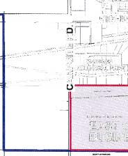
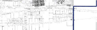
17 _01 CP4001_RX.dwg Saved By: brulottem Block B, Plan 795NY S.W. 1/4 SEC 33, TWP 52, RGE 27, W4M Lot 1 Plan S.E. 1/4 SEC 33, TWP 52, RGE 27, W4M N.E. 1/4 SEC 28, TWP 52, RGE 27, W4M Lot A, Plan 2481RS Lot B Plan O SWALD DR. UMA FILE NAME: Melcor Developments East Campsite Business Park Area Structure Plan Location m SCALE 1:30000 Figure 1
18 DIAMOND AVE. OSWALD DR _01 CP4002_RX.dwg Saved By: brulottem UMA FILE NAME: LEGEND AREA STRUCTURE PLAN BOUNDARY CITY BOUNDARY Melcor Developments East Campsite Business Park Area Structure Plan Ownership m SCALE 1:10000 Figure 2
19 DIAMOND AVE _01 CP4003_RX.dwg Saved By: brulottem UMA FILE NAME: OSWALD DR. LEGEND AREA STRUCTURE PLAN BOUNDARY CITY BOUNDARY 0.5 M CONTOURS DRAINAGE AREA F HIGH POINT: m LOW POINT: m Melcor Developments East Campsite Business Park Area Structure Plan Topography and Drainage m SCALE 1:10000 Figure 3

20 UMA FILE NAME: _01 CP4004_RX.dwg Saved By: brulottem LEGEND AREA STRUCTURE PLAN BOUNDARY CITY BOUNDARY EXISTING FARMSTEAD Melcor Developments East Campsite Business Park Area Structure Plan Existing Land Use m SCALE 1:10000 Figure 4
21 DIAMOND AVE. OSWALD DR. Park Tree Stand Service Road Plan Arterial / Minor Collector _01 CP4005_RX.dwg Saved By: brulottem UMA FILE NAME: LEGEND AREA STRUCTURE PLAN BOUNDARY CITY BOUNDARY INDUSTRIAL PARK (MR) STORMWATER MANAGEMENT FACILITY Melcor Developments East Campsite Business Park Area Structure Plan Land Use Concept m SCALE 1:10000 Figure 5
22 DIAMOND AVE. OSWALD DR. SWMF Park Tree Stand Road Widening Road Widening Right In/ Right Out Arterial / Minor Collector Right In/ Right Out _01 CP4006_RX.dwg Saved By: brulottem UMA FILE NAME: LEGEND AREA STRUCTURE PLAN BOUNDARY CITY BOUNDARY Melcor Developments East Campsite Business Park Area Structure Plan Transportation m SCALE 1:10000 Figure 6
23 SWMF SWMF DIAMOND AVE. OSWALD DR. SWMF Park Tree Stand _01 CP4007_RX.dwg Saved By: brulottem UMA FILE NAME: LEGEND AREA STRUCTURE PLAN BOUNDARY CITY BOUNDARY PROPOSED SANITARY SEWERS Melcor Developments East Campsite Business Park Area Structure Plan Sanitary Servicing m SCALE 1:10000 Figure 7
24 SWMF SWMF DIAMOND AVE. OSWALD DR. SWMF Park Tree Stand _01 CP4008_RX.dwg Saved By: brulottem UMA FILE NAME: LEGEND AREA STRUCTURE PLAN BOUNDARY CITY BOUNDARY PROPOSED WATER MAINS EXISTING WATER MAINS Melcor Developments East Campsite Business Park Area Structure Plan Water Distribution m SCALE 1:10000 Figure 8
25 SWMF SWMF DIAMOND AVE. OSWALD DR. SWMF Park Tree Stand _01 CP4009_RX.dwg Saved By: brulottem UMA FILE NAME: LEGEND AREA STRUCTURE PLAN BOUNDARY CITY BOUNDARY INTER CONNECTING PIPE SYSTEM OVERLOAD DRAINAGE SYSTEM Melcor Developments East Campsite Business Park Area Structure Plan m SCALE 1:10000 Figure 9
26 DIAMOND AVE. OSWALD DR. Park Tree Stand Arterial / Minor Collector _01 CP4010_RX.dwg Saved By: brulottem UMA FILE NAME: LEGEND AREA STRUCTURE PLAN BOUNDARY CITY BOUNDARY INDUSTRIAL PARK (MR) STORMWATER MANAGEMENT FACILITY Melcor Developments East Campsite Business Park Area Structure Plan Development Phasing m SCALE 1:10000 Figure 10
Leduc Industrial Outline Plan SE W4
 Leduc Industrial Outline Plan SE 1-50-25-W4 Within the North Leduc Industrial ASP Prepared for: Leduc Energy Park Ltd. Prepared by: Stantec Consulting Ltd. File No. 1161 104655 V5 Table of Contents 1.0
S o u t h C e n t r a l O u t l i n e P l a n. Leduc Business Park. North Leduc Industrial Area Structure Plan C it y of Led u c.
 Leduc Business Park North Leduc Industrial Area Structure Plan C it y of Led u c Prepared for Farm Air Properties Inc. January, 2007 Table of Contents Page Number 1.0 Purpose of Plan and Definition of
City of Grande Prairie Development Services Department
 City of Grande Prairie Development Services Department ROYAL OAKS NORTH OUTLINE PLAN OP-07-03 NW 35-71-6 W6M May 7, 2007 Royal Oaks North Outline Plan TABLE OF CONTENTS 1.0 INTRODUCTION........ 3 1.1 Purpose
City of Grande Prairie Development Services Department KENNEDY DEVELOPMENTS LTD. OUTLINE PLAN OP-09-01
 City of Grande Prairie Development Services Department KENNEDY DEVELOPMENTS LTD. OUTLINE PLAN OP-09-01 July 27, 2009 TABLE OF CONTENTS 1.0 Introduction... 1 1.1 Plan Area Location & Context... 1 1.2 Ownership
OP Council Resolution June 16, Planning and Development Services
 OP-08-01 Council Resolution June 16, 2008 Planning and Development Services Kingsgate Landing Outline Plan Table of Contents 1.0 Introduction 1 1.1 Purpose of Plan 1 1.2 Plan Area Location 1 1.3 Ownership
Bylaw C-1186 Adopted November 5, Planning and Development Services
 Bylaw C-1186 Adopted November 5, 2007 Planning and Development Services CITY OF GRANDE PRAIRIE OFFICE CONSOLIDATION BYLAW C-1186 A Bylaw to adopt the Westgate Area Structure Plan (As Amended by Bylaw C-1186-1,
Palisades Outline Plan
 NE ¼ 25 36 28 W4 Town of Penhold Approved August 13, 2012 Contents Figures & Tables... 2 Introduction... 1 Overview... 1 Purpose... 1 Development Area... 3 Ownership... 3 Topography... 3 Existing & Surrounding
WEST HILL BUSINESS PARK AREA STRUCTURE PLAN
 MUNICIPAL DISTRICT OF PEACE NO. 135 WEST HILL BUSINESS PARK AREA STRUCTURE PLAN Prepared by: TABLE OF CONTENTS 1.0 Introduction... 1 1.1 Purpose of Plan........ 1 1.2 Plan Area..... 1 1.3 Existing Conditions...
Bylaw C-1262 Adopted February 6, Planning and Development Department
 Bylaw C-1262 Adopted February 6, 2012 Planning and Development Department CITY OF GRANDE PRAIRIE BYLAW C-1262 A Bylaw to adopt the Brookfield Neighbourhood Outline Plan THE MUNICIPAL COUNCIL OF THE CITY
The Uplands Area Structure Plan. City of Cold Lake, NE & SE W4
 City of Cold Lake, NE & SE 13-63-2-W4 July 2009 1 Contents 1 Background information... 1 1.1 Foreword... 1 1.2 Purpose... 1 1.3 Plan Area and Location... 1 1.4 Ownership... 2 2 Factors Influencing Development...
TABLE OF CONTENTS. Sierra Springs Outline Plan
 Sierra Springs Outline Plan TABLE OF CONTENTS 1. Introduction...3 1.1. Purpose of the Plan... 3 1.2. The Approval Process... 3 1.3. Policy and Legislative Framework... 3 2. Development Area...6 2.1. Location
C ity of Grande Prairie Development Services Department
 C ity of Grande Prairie Development Services Department FAIRWAY DEVELOPMENT OUTLINE PLAN OP 08 09 Approved April 6, 2009 Prepared by: Focus Corporation Table of Contents 1.0. Introduction 2 3 1.1. Plan
Red Fox Commercial Outline Plan
 Red Fox Commercial Outline Plan City of Cold Lake, Alberta Prepared by Durrance Projects Ltd and Ross W. Sharp & Associates Ltd October 2014 Rupert 1 Table of Contents 1. PURPOSE...3 1.1. Location...4
HAMPTONS Area Structure Plan Medicine Hat, Alberta
 HAMPTONS Medicine Hat, Alberta Prepared for: Lansdowne Equity Ventures Ltd. Prepared by: UMA Engineering Ltd. May 2005 Table of Contents Page No. 1. INTRODUCTION...1 1.1 Purpose...1 1.2 Location & Existing
BYLAW NO. 3549/2015. Being a Bylaw of The City of Red Deer to provide a uniform levy of off-site costs in respect of previously undeveloped land.
 BYLAW NO. 3549/2015 Being a Bylaw of The City of Red Deer to provide a uniform levy of off-site costs in respect of previously undeveloped land. 1 WHEREAS pursuant to provisions of Section 648 of the Municipal
WINTERBURN INDUSTRIAL AREA STRUCTURE PLAN
 OCTOBER 2009 Winterburn Industrial Area Structure Plan Office Consolidation November 2012 Prepared by: Current Planning Branch Sustainable Development City of Edmonton Bylaw 15356, was adopted by Council
ADMINISTRATION RECOMMENDATION(S) 2017 February 09. That Calgary Planning Commission recommends APPROVAL of the proposed Land Use Amendment.
 2017 February 09. That Calgary Planning Commission recommends APPROVAL of the proposed Land Use Amendment.") Page 1 of 10 EXECUTIVE SUMMARY This land use amendment application is to accommodate changes to the location of a stormwater retention pond and land use boundaries adjacent to Environmental Reserve in
Page 1 of 10 EXECUTIVE SUMMARY This land use amendment application is to accommodate changes to the location of a stormwater retention pond and land use boundaries adjacent to Environmental Reserve in
Bylaw No Page 1
 Bylaw No. 876-2014 Page 1 A BYLAW OF THE CITY OF LEDUC IN THE PROVINCE OF ALBERTA, TO ADOPT THE AREA STRUCTURE PLAN FOR THE: SOUTH WEST QUARTER OF 31-49-25-W4M The Municipal Government Act, R.S.A. 2000,
Section 28, Township 52, Range 26, West of the 4th Meridian
 Section 28, Township 52, Range 26, West of the 4th Meridian Outline Plan Including the Highlands Business Park Study Area Parkland County February 2017 Prepared by: Highlands Business Park LP Stantec Consulting
Schonsee Neighbourhood Structure Plan of the Edmonton North Area Structure Plan
 Schonsee Neighbourhood Structure Plan of the Edmonton North Area Structure Plan Office Consolidation September 2010 Prepared by: Planning and Policy Services Branch Planning and Development Department
CONCEPTUAL SCHEME FULTON INDUSTRIAL
 CONCEPTUAL SCHEME FULTON INDUSTRIAL Bylaw C-6919-2010 Adopted June 22, 2010 ROCKY VIEW COUNTY BYLAW C-6919-2010 A Bylaw of Rocky View County to adopt a Conceptual Scheme known as the Fulton Industrial
SUMMER VILLAGE OF SUNRISE BEACH
 SUMMER VILLAGE OF SUNRISE BEACH Municipal Development Plan Bylaw No. 132-13 ~ 2 ~ Summer Village of Sunrise Beach Municipal Development Plan 1 INTRODUCTION 1.1 SETTING The Summer Village of Sunrise Beach
Outline Plan in Belvedere (Ward 9) at Street SE, LOC (OP)
 at Street SE, LOC (OP)") 2018 October 04 Page 1 of 12 EXECUTIVE SUMMARY This outline plan application was submitted by B&A Planning Group on 2016 July 15, on behalf of Tristar Communities Inc. for 50.14 hectares (123.89 acres)
2018 October 04 Page 1 of 12 EXECUTIVE SUMMARY This outline plan application was submitted by B&A Planning Group on 2016 July 15, on behalf of Tristar Communities Inc. for 50.14 hectares (123.89 acres)
Bylaw No. B-03/2011 Adopted by Airdrie City Council February 21, 2012
 COOPER S CROSSING STAGE 4 Neighbourhood Structure Plan City of Airdrie WESTMARK HOLDINGS LTD. Bylaw No. B-03/2011 Adopted by Airdrie City Council February 21, 2012 CONSULTANTS: LAND USE PLANNING: Southwell
LAND USE AMENDMENT CORNERSTONE (WARD 3) 60 STREET NE AND COUNTRY HILLS BOULEVARD NE MAP 26NE BYLAW 22D2017
 60 STREET NE AND COUNTRY HILLS BOULEVARD NE MAP 26NE BYLAW 22D2017") Page 1 of 14 EXECUTIVE SUMMARY This Land Use Amendment application covers an area of 43.76 hectares ± (108.14 acres ±) located in northeast Calgary, bound by Country Hills Boulevard NE to the south and
Page 1 of 14 EXECUTIVE SUMMARY This Land Use Amendment application covers an area of 43.76 hectares ± (108.14 acres ±) located in northeast Calgary, bound by Country Hills Boulevard NE to the south and
Bylaw 884/13 Schedule A. Town of Rimbey. June 2008.
 Bylaw 884/13 Schedule A Town of Rimbey June 2008. Revised April 2013 Bylaw 884/13 Schedule A Johnson Estates Table of Contents 1. Introduction... 11 1.1 Purpose... 11 1.2 Location Context... 11 1.3 Land
LAND USE AMENDMENT CORNERSTONE (WARD 3) COUNTRY HILLS BOULEVARD AND STONEY TRAIL NE BYLAW 9D2017
 COUNTRY HILLS BOULEVARD AND STONEY TRAIL NE BYLAW 9D2017") Page 1 of 12 EXECUTIVE SUMMARY This Land Use Amendment application covers an area of 54.92 hectares ± (135.71 acres ±) located in northeast Calgary, bound by Country Hills Boulevard NE to the north and
Page 1 of 12 EXECUTIVE SUMMARY This Land Use Amendment application covers an area of 54.92 hectares ± (135.71 acres ±) located in northeast Calgary, bound by Country Hills Boulevard NE to the north and
Prepared for: Prepared by: Revised November 2013 by Stantec Consulting Ltd. 200, th Street Se Calgary, AB, T2A 7H8
 Prepared for: Prepared by: PLANNING PROTOCOL INC. 3916 1 ST STREET N.E. CALGARY, AB. T2E 3E3 Revised November 2013 by Stantec Consulting Ltd. 200, 325 25 th Street Se Calgary, AB, T2A 7H8 Table of Contents
CENTRAL PARK MAJOR AREA STRUCTURE PLAN. Bylaw No. 2017/30, Adopted February 20, P a g e
 CENTRAL PARK MAJOR AREA STRUCTURE PLAN Bylaw No. 2017/30, Adopted February 20, 2018 1 P a g e Table of Contents 1.0 Introduction 4 1.1 Background 4 1.2 Purpose 4 1.3 Location 4 1.4 Planning Process 4
ADMINISTRATION RECOMMENDATION 2016 November 03. That Calgary Planning Commission recommends APPROVAL of the proposed Land Use Amendment.
 Page 1 of 12 EXECUTIVE SUMMARY This Land Use Amendment application covers an area of 75.76 hectares ± (187.20 acres ±) located in northeast Calgary, bound by Stoney Trail NE to the north, 128 Avenue NE
Mayliewan Neighbourhood Structure Plan Neighbourhood 7 of the Edmonton North Area Structure Plan
 Mayliewan Neighbourhood Structure Plan Neighbourhood 7 of the Edmonton North Area Structure Plan Office Consolidation November 2008 Prepared by: Planning and Policy Services Branch Planning and Development
Aurum Industrial Business Park Area Structure Plan
 Aurum Industrial Business Park Area Structure Plan Office Consolidation September 2017 Prepared by: Planning and Policy Services Branch Planning and Development Department City of Edmonton Bylaw 9809 was
Westwind Developments Ltd. PIONEER LANDS AREA STRUCTURE PLAN - PROPOSED AMENDMENT
 FEBRUARY 2013 TABLE OF CONTENTS 1.0 BACKGROUND... 1 1.1 Amendment... 1 2.0 LOCATION & CONTEXT... 2 2.1 Land Ownership... 2 3.0 POLICY CONTEXT... 3 3.1 Municipal Development Plan... 3 3.2 Capital Region
Clearview North. Neighborhood Area Structure Plan. Reference# Ross Stre I Red Deer AB T4N 1X5. March 2009
 Clearview North Neighborhood Area Structure Plan Reference# 112870942 SLlr I _ Cv... ulhr.g l..v 600 4808 Ross Stre I Red Deer AB T4N 1X5 March 2009 Amended on March 23, 2009 Bylaw 3217/B-2009 Clearview
SANDSTONE SPRINGS AREA STRUCTURE PLAN
 Sandstone Springs Development Corp. AREA STRUCTURE PLAN This report is prepared for the sole use of Sandstone Springs Development Corp. No representations of any kind are made by Urban Systems Ltd. or
ELLERSLIE AREA STRUCTURE PLAN
 ELLERSLIE AREA STRUCTURE PLAN Office Consolidation January 2017 Prepared by: City Planning Sustainable Development City of Edmonton Bylaw 11870, as amended, was adopted by Council in January 1999. In January
AREA STRUCTURE PLAN NE W5M. Adopted by Council September 27, 2010 Bylaw
 AREA STRUCTURE PLAN NE 5-33-1 W5M Adopted by Council September 27, 2010 Bylaw 2010-14 CONTENTS 1.0 Introduction... 3 1.1 Purpose... 3 1.2 Objectives... 3 1.3 Discovery Plains Community Vision... 3 1.3.1
Central and East Neighbourhoods - Hermitage Outline Plan
 Central and East Neighbourhoods - Hermitage Outline Plan Office Consolidation September 2013 Prepared by: Planning and Policy Services Branch Planning and Development Department City of Edmonton The Central
BEAU VAL PARK/ BEAUMONT LAKES SOUTH Area Structure Plan
 BEAU VAL PARK/ BEAUMONT LAKES SOUTH (Parcels A/B/C/D, Plan 1912 EO, Plan 1025 KS) Prepared For: 1871368 AB Ltd. Presented By: DGE Civil Engineering Consultants 221, 9223-28 Avenue Edmonton, AB T6N 1N1
ADMINISTRATION RECOMMENDATION(S) 2017 June 15. That Calgary Planning Commission recommends APPROVAL of the proposed Land Use Amendment.
 2017 June 15. That Calgary Planning Commission recommends APPROVAL of the proposed Land Use Amendment.") Page 1 of 7 EXECUTIVE SUMMARY The proposed land use amendment seeks to redesignate a Special Purpose Future Urban Development (S-FUD) District parcel in Residual Ward 3 Sub Area 3H to Industrial Outdoor
Page 1 of 7 EXECUTIVE SUMMARY The proposed land use amendment seeks to redesignate a Special Purpose Future Urban Development (S-FUD) District parcel in Residual Ward 3 Sub Area 3H to Industrial Outdoor
Wolf Creek Crossing / Lacombe Market Square Outline Plan
 Wolf Creek Crossing / Square Outline Plan Prepared For: Square (C1C) Ltd. Presented By: DGE Civil Engineering Consultants Adopted June 2012 221, 9223-28 Ave NW Edmonton, AB T6N 1N1 P: 780.577.0073 F: 780.577.0074
ADMINISTRATION RECOMMENDATION(S) 2016 November 03. That Calgary Planning Commission recommends APPROVAL of the proposed Land Use Amendment.
 2016 November 03. That Calgary Planning Commission recommends APPROVAL of the proposed Land Use Amendment.") Page 1 of 7 EXECUTIVE SUMMARY This Land Use Amendment application seeks to redesignate a portion of the parcel from Industrial General (I-G) District to Special Purpose City and Regional Infrastructure
Page 1 of 7 EXECUTIVE SUMMARY This Land Use Amendment application seeks to redesignate a portion of the parcel from Industrial General (I-G) District to Special Purpose City and Regional Infrastructure
CITY OF ST. ALBERT BYLAW 1/2014. Being a bylaw to establish the Jensen Lakes Area Structure Plan
 CITY OF ST. ALBERT BYLAW 1/2014 Being a bylaw to establish the Jensen Lakes Area Structure Plan NOW THEREFORE the Municipal Council of the City of St. Albert pursuant to the provisions of the Municipal
Ten Mile Creek Planning Area
 PLANNING AREA POLICIES TEN MILE CREEK Ten Mile Creek Planning Area Location and Context The Ten Mile Creek Planning Area ( Ten Mile Creek area ) is located south of the current Boise AOCI, generally south
WESTMINSTER GLEN CONCEPTUAL SCHEME
 WESTMINSTER GLEN CONCEPTUAL SCHEME Bylaw C-5379-2001, Adopted July 31, 2001 MUNICIPAL DISTRICT OF ROCKY VIEW NO. 44 Department of Planning and Development MUNICIPAL DISTRICT OF ROCKY VIEW NO. 44 BYLAW
ROAD CLOSURE AND LAND USE AMENDMENT SILVER SPRINGS (WARD 1) NORTHEAST OF NOSEHILL DRIVE NW AND SILVER SPRINGS ROAD NW BYLAWS 2C2018 AND 29D2018
 NORTHEAST OF NOSEHILL DRIVE NW AND SILVER SPRINGS ROAD NW BYLAWS 2C2018 AND 29D2018") Page 1 of 19 EXECUTIVE SUMMARY This application proposes redesignating two parcels in the community of Silver Springs from Special Purpose Future Urban Development (S-FUD) District and undesignated road
Page 1 of 19 EXECUTIVE SUMMARY This application proposes redesignating two parcels in the community of Silver Springs from Special Purpose Future Urban Development (S-FUD) District and undesignated road
Drexel, Barrell & Co.
 Drexel, Barrell & Co. June 18, 2018 Engineers/Surveyors Boulder Colorado Springs Greeley 3 South 7 th Street Colorado Springs, Colorado 80905-1501 719 260-0887 719 260-8352 Fax El Paso County Planning
BRIDGES OF LANGDON CONCEPTUAL SCHEME
 BRIDGES OF LANGDON CONCEPTUAL SCHEME Office Consolidation This page contains the history of relevant bylaws affecting this office consolidation. A copy of the original Bylaw and all amending Bylaws can
Stewart Greens Neighbourhood Structure Plan
 Stewart Greens Neighbourhood Structure Plan Office Consolidation June 2017 Prepared by: Planning and Policy Services Branch Planning and Development Department City of Edmonton Bylaw 14674, as amended,
Land Use Amendment in Southwood (Ward 11) at and Elbow Drive SW, LOC
 at and Elbow Drive SW, LOC") 2018 November 15 Page 1 of 10 EXECUTIVE SUMMARY This land use amendment application was submitted by Rick Balbi Architect on 2017 August 31 on behalf of Sable Developments Ltd, and with authorization from
2018 November 15 Page 1 of 10 EXECUTIVE SUMMARY This land use amendment application was submitted by Rick Balbi Architect on 2017 August 31 on behalf of Sable Developments Ltd, and with authorization from
COLVER ROAD INDUSTRIAL CONCEPT PLAN
 COLVER ROAD INDUSTRIAL CONCEPT PLAN A CONCEPTUAL LAND USE AND TRANSPORTATION PLAN FOR TA-4 AN URBAN RESERVE AREA OF THE CITY TALENT City of Talent Adopted by City Council Resolution No., June, 2015 PART
TO: Mayor & Council DATE: April 12, The Planning and Development Department and the Engineering Department recommend that Council:
 CORPORATE REPORT NO: R080 COUNCIL DATE: April 12, 2010 REGULAR COUNCIL TO: Mayor & Council DATE: April 12, 2010 FROM: SUBJECT: General Manager, Planning and Development General Manager, Engineering Neighbourhood
THE CITY OF SPRUCE GROVE BYLAW C PIONEER LANDS AREA STRUCTURE PLAN AMENDMENT
 THE CITY OF SPRUCE GROVE BYLAW C-932-15 PIONEER LANDS AREA STRUCTURE PLAN AMENDMENT WHEREAS, pursuant to the Municipal Government Act, R.S.A. 2000, c. M-26, including amendments, a municipality may adopt
Area Structure Plan. South East Leduc Area Structure Plan. In the City of Leduc, Alberta. August Prepared for: Report No.
 Area Structure Plan In the City of Leduc, Alberta August 2014 Prepared for: Report No. 6162-03 5307 47 Street, Edmonton, Alberta T6B 3T4 Phone: (780) 440-4411 Fax: (780) 440-2585 August 2014 TABLE OF CONTENTS
Drexel, Barrell & Co.
 Drexel, Barrell & Co. December 21, 2018 Engineers/Surveyors Boulder Colorado Springs Greeley 3 South 7 th Street Colorado Springs, Colorado 80905-1501 719 260-0887 719 260-8352 Fax El Paso County Planning
Cypress County Dunmore Master Area Structure Plan
 Cypress County Dunmore Master March 21, 2013 1 Contents 1 Introduction... 1 1.1 Purpose of the Plan... 1 1.2 Vision... 1 1.3 Objectives... 1 2 Policy Context... 3 2.1 Municipal Government Act... 3 2.2
Hollick Kenyon Neighbourhood Structure Plan
 Hollick Kenyon Neighbourhood Structure Plan Office Consolidation June 2010 Prepared by: Planning and Policy Services Branch Planning and Development Department City of Edmonton Bylaw 9744 was adopted by
6 Growth Management Challenges and Opportunities
 6 Growth Management Challenges and Opportunities The Town has established a goal of attaining a 50% participation rate with respect to employment opportunities versus residential population. The Town s
AREASTRUCTURE PLAN AMENDMENT COCHRANE NORTH
 AREASTRUCTURE PLAN AMENDMENT COCHRANE NORTH In order to implement the vision outlined in the Conceptual Scheme, the following three amendments to the Cochrane North ASP are proposed: 1. Allow commercial
NEIGHBOURHOOD STRUCTURE PLAN
 NEIGHBOURHOOD STRUCTURE PLAN December 2012 2437.0023.06 This report is prepared for the sole use of Vesta Properties Ltd. No representations of any kind are made by Urban Systems Ltd. or its employees
HAMLET OF KINGMAN AREA STRUCTURE PLAN
 HAMLET OF KINGMAN AREA STRUCTURE PLAN Prepared by: Austrom Consulting Ltd. Page 1 of 19 Table of Contents TABLE OF CONTENTS... 2 1. BACKGROUND... 3 1.1 PLAN AREA... 3 1.2 PLAN PURPOSE... 3 1.3 LEGISLATIVE
Range Road 260 Area Structure Plan
 Schedule A Range Road 260 Area Structure Plan (Avenir & Elysian Fields) As Amended February 2, 2015 Bylaw 8/2015 Part 1 Introduction TABLE OF CONTENTS Page 1.0 INTRODUCTION... 1 1.1 Purpose... 1 1.2 Authority
Ebbers Neighbourhood Area Structure Plan
 Ebbers Neighbourhood Area Structure Plan Office Consolidation November 2016 Prepared by: City Planning Branch Sustainable Development City of Edmonton Bylaw 14079, was adopted by Council in February 2006.
APPENDIX G. Historical Resources Overview Documentation
 APPENDIX G Historical Resources Overview Documentation Statement of Justification for Historical Resources Act Requirements for projects other than small-scale oil and gas This document contains sensitive
OFFICE CONSOLIDATION SECONDARY PLAN AREA 22 THE BRAMALEA SOUTH INDUSTRIAL SECONDARY PLAN
 OFFICE CONSOLIDATION SECONDARY PLAN AREA 22 THE BRAMALEA SOUTH INDUSTRIAL SECONDARY PLAN November 2010 EXPLANATORY NOTES (Secondary Plan Area 22) General (pertaining to all secondary plan office consolidations)
THE CITY OF WINNIPEG BY-LAW NO. 4/2013. A By-law of THE CITY OF WINNIPEG to adopt a Secondary Plan for the Waverley West Southwest Neighbourhood.
 THE CITY OF WINNIPEG BY-LAW NO. 4/2013 A By-law of THE CITY OF WINNIPEG to adopt a Secondary Plan for the Waverley West Southwest Neighbourhood. THE CITY OF WINNIPEG, in Council assembled, enacts as follows:
Poplar Ridge Area Structure Plan. Poplar Ridge. Area Structure Plan
 Poplar Ridge Area Structure Plan Bylaw 899 16 Adopted August 15, 2017 1 Contents 1 Introduction... 3 2 Background... 3 2.1 Purpose of the Plan... 3 2.2 Vision... 4 3 Description of the Plan Area... 5 3.1
Oxford Neighbourhood Structure Plan
 Oxford Neighbourhood Structure Plan Office Consolidation November 2010 Prepared by: Planning and Policy Services Branch Planning and Development Department City of Edmonton Bylaw 7963, was adopted by Council
AWH REPORT OF THE PLANNING AND DEVELOPMENT DEPARTMENT FOR APPLICATION FOR REZONING ORDINANCE TO PLANNED UNIT DEVELOPMENT
 AWH REPORT OF THE PLANNING AND DEVELOPMENT DEPARTMENT FOR APPLICATION FOR REZONING ORDINANCE TO PLANNED UNIT DEVELOPMENT MAY 8, 2014 The Planning and Development Department hereby forwards to the Planning
TOWN OF COALDALE WEST COALDALE AREA STRUCTURE PLAN BYLAW NO. 512 P MAY 2003 (NW W4M)
") TOWN OF COALDALE WEST COALDALE AREA STRUCTURE PLAN 2003 (NW 10 9 20 W4M) BYLAW NO. 512 P 04 03 MAY 2003 TABLE OF CONTENTS West Coaldale Area Structure Plan Page 1.0 INTRODUCTION... 1 1.1 Background...
TOWN OF COALDALE WEST COALDALE AREA STRUCTURE PLAN 2003 (NW 10 9 20 W4M) BYLAW NO. 512 P 04 03 MAY 2003 TABLE OF CONTENTS West Coaldale Area Structure Plan Page 1.0 INTRODUCTION... 1 1.1 Background...
EXHIBIT B PROJECT NARRATIVE POULSBO MEADOWS
 EXHIBIT B PROJECT NARRATIVE POULSBO MEADOWS Name of Project: Poulsbo Meadows; A Planned Residential Development (PRD)/Plat Applicants Name: PBH Group LLC/Byron Harris PO Box 1010 Silverdale, WA 98038 Description
Mitchell Ranch South MPUD Application for Master Planned Unit Development Approval Project Narrative. Introduction
 Mitchell Ranch South MPUD Application for Master Planned Unit Development Approval Project Narrative Introduction Mitchell Ranch South is a proposed single family (detached) residential development on
TABLE OF CONTENTS 1.0 INTRODUCTION GENERAL OBJECTIVES LAND USE DESIGNATIONS, OBJECTIVES AND POLICIES 4
 Schedule I- Redstone Golf Course Resort Area Sector Plan 1 TABLE OF CONTENTS 1.0 INTRODUCTION 3 2.0 GENERAL OBJECTIVES 3 3.0 LAND USE DESIGNATIONS, OBJECTIVES AND POLICIES 4 4.0 TRANSPORTATION AND ROAD
9 th Street Sub Area Plan
 9 th Street Sub Area Plan In the 1990 s, when the Township prepared the last Master Plan, the 9 th Street corridor was studied as part of a larger 9 th Street Focus Area that included the West Main Street
CITY COUNCIL AGENDA REPORT
 CITY COUNCIL AGENDA REPORT Subject: BYLAW 29/2015 BEING AMENDMENT 1 TO BYLAW 27/2015 - AND BYLAW 30/2015 AMENDMENT 126 TO LAND USE BYLAW 9/2005 - REDISTRICTING (GREAT WEST LIFE AMENDMENTS) Recommendation(s)
When planning stormwater management facilities, the following principles shall be applied where possible.
 2.0 Principles When planning stormwater management facilities, the following principles shall be applied where possible. 2.0.1 Drainage is a regional phenomenon that does not respect the boundaries between
The Corporation of the TOWN OF MILTON
 Report to: From: Chair & Members of the Administration & Planning Standing Committee W.F. Mann, Director of Planning and Development Date: April 16, 2012 PD 022-12 (Z19/11) Subject: Technical Report Proposed
PRELIMINARY PLAT DESIGN REQUIREMENTS Updated 4/8/2016
 PRELIMINARY PLAT DESIGN REQUIREMENTS Updated 4/8/2016 The following items are required for the preliminary plat. Numbers correspond with those on the example preliminary plat. RENO COUNTY SUBDIVISION REQUIREMENTS
Town of Portola Valley General Plan. Nathhorst Triangle Area Plan
 Town of Portola Valley General Plan Amended December 10, 1997 Table of Contents Introduction... 1 Planning Area... 1 Objectives... 2 Principles... 2 Standards... 4 Description... 4 Community Commercial...
GRAYSTONE ESTATES CONCEPTUAL SCHEME
 GRAYSTONE ESTATES CONCEPTUAL SCHEME Bylaw C-5438-2001, Adopted November 6, 2001 MUNICIPAL DISTRICT OF ROCKY VIEW NO. 44 Department of Planning and Development TABLE OF CONTENTS 1.0 INTRODUCTION 5 1.1 Conceptual
Summerside Neighbourhood Structure Plan
 Summerside Neighbourhood Structure Plan Office Consolidation July 2012 Prepared by: Current Planning Branch Sustainable Development City of Edmonton Bylaw 12112 (as amended) was adopted by Council on September
THE CITY OF WINNIPEG BY-LAW NO. 97/2014
 THE CITY OF WINNIPEG BY-LAW NO. 97/2014 A By-law of THE CITY OF WINNIPEG to adopt a secondary plan for Precinct E of the Complete Communities Direction Strategy By-law No. 68/2010. THE CITY OF WINNIPEG,
THE CITY OF SPRUCE GROVE BYLAW C PIONEER LANDS AREA STRUCTURE PLAN AMENDMENT
 THE CITY OF SPRUCE GROVE BYLAW C-797-11 PIONEER LANDS AREA STRUCTURE PLAN AMENDMENT WHEREAS, pursuant to the Municipal Government Act, R.S.A., 2000, c.m-26, a municipality shall adopt Area Structure Plans
Selected Area Study. Vision Plan Draft
 East Polk County Selected Area Study Draft 10.30.08 Contents Guiding Principles...4 Context Conclusions...5 Current Context...8 Scenarios...9 Scenario: Status Quo...10 Scenario: Connected & Directed Growth...12
The South Macleod Trail Community and Employment Centre
 The South Macleod Trail Community and Employment Centre Community and Neighbourhood Planning Module Context During the 1950s, the movement of people away from urban centres led to the evolution of the
Mistatim Area Structure Plan
 Mistatim Area Structure Plan Office Consolidation September 2013 Prepared by: Current Planning Branch Sustainable Development City of Edmonton Amended by Editor Bylaw 7205 adopted by Council in July 1983.
Canossa NSP. Office Consolidation August Prepared by: Planning and Policy Services Branch Planning and Development Department City of Edmonton
 Canossa NSP Office Consolidation August 2004 Prepared by: Planning and Policy Services Branch Planning and Development Department City of Edmonton Bylaw 7613 (as amended) was adopted by Council October
Municipal Development Plan. Summer Village of ROCHON SANDS. Bylaw #241-18
 Municipal Development Plan Summer Village of ROCHON SANDS Bylaw #241-18 TABLE OF CONTENTS PART ONE: BACKGROUND AND PURPOSE 3 SECTION 1: BACKGROUND 3 SECTION 2: GOALS AND POLICIES 3 PART TWO: PHYSICAL ENVIRONMENT
Area Structure Plan. A Community for All Seasons. Prepared for the Town of Strathmore. Consolidated September 28, 2015
 Area Structure Plan Prepared for the Town of Strathmore A Community for All Seasons Lakewood Meadows Area Structure Plan Prepared for the Town of Strathmore And Lakewood Meadows Inc. i Table of Contents
Watertown City Council
 City of Watertown Watertown City Council April 14 th, 2015 Agenda Item: City Comment on Sun Share CUP Application Request for Action: Motion to Approve City Comments regarding CUP Application Department:
NORTHEAST AIRDRIE COMMUNITY AREA STRUCTURE PLAN
 Engineering Your Future NORTHEAST AIRDRIE COMMUNITY AREA STRUCTURE PLAN SE-13-27-1-W5M SE-15-27-29-W4M SW-14-27-29-W4M NORTHEAST AIRDRIE COMMUNITY AREA STRUCTURE PLAN Bylaw No. B-10/2005 Adopted by City
DAMKAR LANDS An Amendment to Bylaw C being the Watermark Conceptual Scheme
 APPENDIX 8 DAMKAR LANDS An Amendment to Bylaw C-6798-009 being the Watermark Conceptual Scheme Table of Contents 1.0 Introduction 1.0 Development Objectives 1 3.0 History, Vision and Guiding Principles
ARTICLE IV: DEVELOPMENT STANDARDS 404 MASTER PLANNING
 IV 13 404 MASTER PLANNING Master Planning through the Site Analysis (Master Planning Site Analysis) or Planned Development (Master Planning Planned Development) is provided to encourage development which
Hawks Ridge Neighbourhood Structure Plan
 Hawks Ridge Neighbourhood Structure Plan Office Consolidation June 2014 Prepared by: Current Planning Branch Sustainable Development City of Edmonton Bylaw 15547 was adopted by Council in September 13,
Starling Neighbourhood Structure Plan
 Starling Neighbourhood Structure Plan Office Consolidation April 2017 PREPARED BY: CURRENT PLANNING BRANCH SUSTAINABLE DEVELOPMENT DEPARTMENT CITY OF EDMONTON Bylaw 15461 was adopted by Council in August
Gold Line Bus Rapid Transit Transit Oriented Development (BRTOD) Helmo Station Area Plan
 Helmo Station Area Plan") Appendix F Gold Line Bus Rapid Transit Transit Oriented Development (BRTOD) Helmo Station Area Plan Introduction and Purpose of the Plan The Gold Line Bus Rapid Transit facility is an eleven-mile dedicated
Appendix F Gold Line Bus Rapid Transit Transit Oriented Development (BRTOD) Helmo Station Area Plan Introduction and Purpose of the Plan The Gold Line Bus Rapid Transit facility is an eleven-mile dedicated
ARTICLE 17 SITE PLAN REVIEW
 ARTICLE 17 SITE PLAN REVIEW 17.01 INTENT AND PURPOSE The intent of this section is to provide for consultation and cooperation between the applicant and the township planning commission so that the applicant
MAGRATH HEIGHTS NEIGHBOURHOOD AREA STRUCTURE PLAN AMENDMENT
 Attachment 2E MAGRATH HEIGHTS NEIGHBOURHOOD AREA STRUCTURE PLAN AMENDMENT NASP JUNE 2008 TABLE OF CONTENTS 1.0 INTRODUCTION...1 1.1 Purpose of Amendment... 1 1.2 Local Setting & Access... 1 1.3 Proposed
TOWN OF BRUDERHEIM Report to the capital region board
 TOWN OF BRUDERHEIM Report to the capital region board Introduction to the Town of Bruderheim Municipal Development Plan amendment and Relation to the CRB Evaluation Criteria 02 march 2017 1 Introduction
CITY OF SCANDIA ORDINANCE NO. 174
 CITY OF SCANDIA ORDINANCE NO. 174 AN ORDINANCE AMENDING ORDINANCE NO. 122, THE SCANDIA DEVELOPMENT CODE, CHAPTER 2, SECTION 4.34, REGARDING SOLAR FARMS AND COMMUNITY SOLAR GARDENS The City Council of the