COMMUNITY DEVELOPMENT DEPARTMENT
|
|
|
- Adam Welch
- 5 years ago
- Views:
Transcription
 463-6591 FAX: (775) 463-5305 34 LAKE S BOULE VA RD DAYT ON, NE VADA 89403 (775) 246-6135 FAX: (775) 246-6147 REPORT OF PLANING COMMISSION HEARING &")
1 LYON COUNTY COMMUNITY DEVELOPMENT DEPARTMENT B U I L D I N G D E V E L O P M E N T E N G I N E E R I N G P L A N N I N G 27 S. MAIN ST RE E T YERINGT ON, NEVADA (775) FAX: (775) LAKE S BOULE VA RD DAYT ON, NE VADA (775) FAX: (775) REPORT OF PLANING COMMISSION HEARING & ACTION PLZ Master Plan Amendment to Change the Character Designation from Rural Character to Suburban Character Meeting Date: April 5, 2018 Owners: Applicant: Area Location: Schaller Development, LLC Project One Stagecoach Parcel Number: (APN) /-002/-003/-004; /-006/-007/-008; and Existing Master Plan: Specific Plan Proposed Master Plan: Specific Plan Existing Zoning: RR-5 (Fifth Rural Residential 20 acre minimum), RR-2 (Second Rural Residential 2 acres minimum) and (C-2 (General Commercial) Proposed Zoning: SCMU (Suburban Commercial Mixed Use), NR-1 (Nonrural Residential 6,000 square foot minimum), NR-3 (Nonrural Residential 9,000 square foot minimum), E-2 (Second Estates Residential - ½ acre minimum), RR-1 (First Rural Residential 1 acre minimum) and RR-3 (Third Rural Residential 5 acre minimum) Case Planner: REQUEST: Rob Pyzel The applicant has submitted a master plan amendment application in order to change the current master plan character district designation from Rural Character to Suburban Character on approximately acres generally located on the south side of Highway 50 between Caroline Way and Blackhawk Road in Stagecoach. The applicant has submitted the following applications that are being processed concurrently with the master plan amendment application: A specific plan application as required by the master plan (PLZ ): A zone change application to change the zoning from RR-5 (Fifth Rural Residential 20 acre minimum), RR-2 (Second Rural Residential 2 acre minimum) and C-2 (General Commercial) to SCMU (Suburban Commercial Mixed Use), NR-1 (Nonrural Residential 6,000 square foot minimum), NR-3 (Nonrural Residential 9,000 square foot minimum), E-2 (Second Estates Residential - - ½ acre minimum), RR-1 (First Rural Residential 1 acre minimum) and RR-3 (Third Rural Residential 5 acre minimum) (PLZ ); and A tentative subdivision map to allow 943 single family residential lots (PLZ ). Page 1 of 18 BOC Public Hearing April 5, 2018 Schaller Development, LLC/Project One Master Plan Amendment Planning-rp
2 Staff Recommendation: Staff recommends that the Planning Commission forward a recommendation of denial for the master plan character district designation amendment application from Rural to Suburban. Staff recommends denial of the master plan amendment based on the Findings as listed in the staff report. Planning Commission Recommendation: The Planning Commission voted to forward a recommendation of denial (6 ayes, 0 nay and 1 recusal (Betty Retzer)) to amend the 2010 County-Wide Master Plan Character District from Rural Character to Suburban Character on approximately acres generally located on the south side of Highway 50 between Caroline Way and Blackhawk Road in Stagecoach based on the recommended Findings A through E as listed in the staff report. RECOMMENDED FINDINGS AND MOTION: If the Board of Commissioners determines that denial of the Master Plan Amendment to change the current master plan character district designation from Rural Character to Suburban Character for Schaller Development, LLC/Project One on approximately acres generally located on the south side of Highway 50 between Caroline Way and Blackhawk Road in Stagecoach is in the best interests of the public, the Board must consider Findings and make a motion to deny the Master Plan Amendment. The Board may wish to consider a motion similar to the following: The Lyon County Board of Commissioners finds that: Findings: A. The applicant has not demonstrated that the amendment is in substantial compliance with and promotes the Master Plan goals, objectives and actions. B. The proposed amendment is not compatible with the actual and planned adjacent land uses, and reflects a logical change in land uses. C. The proposed amendment has not demonstrated that the proposed amendment is necessary to respond to changed conditions or that further studies have occurred since the Master Plan was adopted by the Board that support the amendment, and that the requested amendment represents a more desirable utilization of land. D. The proposed amendment would adversely affect the implementation of the Master Plan goals, objectives and actions, and could lead to development that may potentially adversely impact the public health, safety or welfare. E. The proposed amendment would not promote the desired pattern for the orderly physical growth of the County, would require infrastructure to be extended in inefficient increments and patterns, would create relatively compact development patterns in an area designated as rural character district in the current Master Plan, and could guide development of the County based on a significant amount of natural resource impairment and the inefficient expenditure of funds for public services. Based on the aforementioned Findings, The Lyon County Board of Commissioners denies the Master Plan Amendment request for Schaller Development, LLC/Project One to amend the Character District designation from Rural to Suburban on an approximately acres; located on the south side of the Highway 50 between Caroline Way and Page 2 of 18 BOC Public Hearing April 5, 2018 Schaller Development, LLC/Project One Master Plan Amendment Planning-rp
3 Blackhawk Road, Stagecoach, NV (APNs /-002/-003/-004; /-006/- 007/-008; and ) PLZ Page 3 of 18 BOC Public Hearing April 5, 2018 Schaller Development, LLC/Project One Master Plan Amendment Planning-rp


4 PROPERTY INFORMATION: Location: The subject site is located in the western portion of Stagecoach. The subject site is generally located on the south side of Highway 50 between Caroline Way and Blackhawk Road. The subject site consists of nine parcels that make up the former Dayton Turf Farm holdings and operations. Page 4 of 18 BOC Public Hearing April 5, 2018 Schaller Development, LLC/Project One Master Plan Amendment Planning-rp
5 Size: The subject site is approximately acres in size. Flood Zone: The subject site is located within the X Unshaded Flood Zone. This flood zone designation indicates that the subject site is in an area of minimal flood hazard. Public Facilities and Services: Access: Access is currently through Caroline Way, Leegard Avenue, Blackhawk Road and the access from Highway 50 directly into the center of the former turf farm operations that is not a County-maintained road and has no official name. Water: Stagecoach General Improvement District currently has an 8-inch water line that passes through the western portion of the subject site. Page 5 of 18 BOC Public Hearing April 5, 2018 Schaller Development, LLC/Project One Master Plan Amendment Planning-rp


6 Sewer: The nearest available sewer facility in the area is a domestic sewer line located approximately 2.23 miles west of the subject site generally located at the entrance into the Copper Canyon single family residential development in the eastern portion of Dayton Valley. Land Use: The subject parcel were formerly under operation as the Dayton Turf Farm. Page 6 of 18 BOC Public Hearing April 5, 2018 Schaller Development, LLC/Project One Master Plan Amendment Planning-rp

7 Staff Review and Comments: Character Districts: In the 2010 Comprehensive Master Plan ( Master Plan ), Chapter 5 discusses the diverse characteristics of the communities that comprise Lyon County, going on to state that those characteristics are to be considered when reviewing new development applications. This section of the Master Plan goes on to state: Lyon County features a rich mosaic of communities, residents, and physical attributes. Residents and property owners have expressed considerable interest in maintaining their many diverse communities and improving community aesthetics. A community s character is defined by its design, its viewsheds, its gathering places, and its historic and cultural resources, as well as by environmental characteristics such as natural quiet and dark night skies. Maintaining this character is important not only for promoting economic development and diversification, but also for protecting our living spaces, quality of life and open lands. In addition, preserving rural character is a core value of a majority of Lyon County residents. This Chapter describes the factors that combine to create community character in our county. It also discusses the Guiding Principle, goals, policies and other mechanisms that help us to protect the community characteristics we value. This Community Character and Design Chapter seeks to define, preserve, and enhance the quality of the places where we live, work, and enjoy our leisure time. Its goals include protecting the unique characteristics of our communities. Each community has distinct features that contribute to its physical character. Many of these features reflect common values for preserving a community s rural character, appearance, natural resources, open spaces, recreation areas, scenic views, vegetation, historic architecture, development patterns, and activity centers. These features promote quality of life and economic well-being. Preserving them should not prohibit development; however, the County needs to consider them to ensure that new development fits into the existing community fabric. County residents have expressed a desire for well-designed communities through their participation and comments throughout the preparation of this Plan. Stagecoach currently is designated as having Rural Character District with a Local Mixed Use Center (the red dashed circle designation located north of Misfit Flat). Page 7 of 18 BOC Public Hearing April 5, 2018 Schaller Development, LLC/Project One Master Plan Amendment Planning-rp

.")
8 The applicant seeks to amend the Character District designation from Rural Character to Suburban Character. The subject site currently has the Master Plan land use designation of Specific Plan and Rural Residential. The subject site has current zoning consisting of RR-5 (Fifth Rural Residential 20 acre minimum) and RR-2 (Second Rural Residential 2 acre minimum). Page 8 of 18 BOC Public Hearing April 5, 2018 Schaller Development, LLC/Project One Master Plan Amendment Planning-rp
9 The applicant has submitted concurrently a Specific Plan for adoption, a rezoning application and a tentative subdivision map that all reflect Suburban Character District densities. As such, the Master Plan amendment to alter the Character District from Rural to Suburban is the first application necessary in order to alter the current density allowed per the Master Plan. Master Plan Amendment Rural Character to Suburban Character The Master Plan states at the forward of the document the purpose of the Master Plan: The County s purpose is not to restrict future growth but to direct it in a way that minimizes negative impacts while offering residents a range of choices and promoting job creation. The County seeks to successfully accommodate growth and consciously decide how development should occur to achieve a more efficient pattern for future development. Lyon County intends to ensure the county s long-term viability by using methods to guide new development to locations where adequate public infrastructure such as roads, water, sewer, schools, and related facilities, is available or can be provided most efficiently and cost effectively, promoting infill development, and providing incentives for quality development. Staff would note that the Master Plan currently only designates all of the Stagecoach Community and all of the Smith Valley Community as Rural Character District with each community containing Local Mixed Use Centers. Each of the other communities contain areas designated as Suburban Character District. The Master Plan amendment application seeks to convert the current Character District designation of the subject site from Rural Character District to Suburban Character District in order to allow for adoption of a Specific Plan, rezoning and tentative subdivision map applications to allow for a acres subject site to be developed into a suburban-density development. The applicants have listed the following findings as identified in Lyon County Code that are being addressed in support of the Master Plan Amendment to change the Character district of the Desert Wells Preserve project from Rural to Suburban. The individual findings are listed below in bold type and is addressed in italic type immediately following each finding. Staff s responses are listed beneath in standard type. A. Consistency with The Master Plan: The applicant has demonstrated that the amendment is in substantial compliance with and promotes the master plan goals, objectives and actions. The proposed amendment to the character district is consistent and promotes the following goals and policies in the Master Plan. Goal LU 1: Orderly Growth Patterns. Direct and management development so that it is orderly and fiscally responsible. Policy LU 1.2: Residential Development Patterns in Neighborhoods Policy LU 1.3: Commercial and Mixed Use Development located in Centers The Desert Wells Specific Plan that is supported by the change in Character District provides for residential development in neighborhood patterns with added amenities for community members to enjoy. Commercial uses proposed are proposed within a mixed use zone and envisioned to be planned in centers through development standards set forth in the Specific Plan handbook. Page 9 of 18 BOC Public Hearing April 5, 2018 Schaller Development, LLC/Project One Master Plan Amendment Planning-rp
10 Goal LU 2: Services Coordinated with Growth. Future residential development will be coordinated with development of schools, parks, libraries and other public services so as to maintain or improve per resident service levels. Policy LU 2.1: Residential development in areas with services. Desert Wells Preserve provides for residential development that also proposed a school, regional park and additional public facility property that may be used in the future for community services. These services are intended to be enjoyed by all of the Stagecoach Community, not just the future residents and businesses of Desert Wells Preserve. Goal LU 3: Diverse Economy. The economy will continue to be strong and diverse; attracting businesses that employ residents in primary jobs, as well as service jobs that meet the needs of local residents. Policy LU 3.1: Diverse Economic Base Providing a diverse economic base helps to ensure the success of a community. Desert Wells Preserve proposes to provide employment and commercial land uses to support local employment in primary and service industry jobs. It will also provide a variety of housing options that will support growing employment centers close to Desert Wells Preserve such as the Tahoe Reno Industrial Center in Storey County, and the recently approved Highlands Industrial Specific Plan near the Tahoe Reno Industrial Center, but within Lyon County s borders. Goal LU 5: Encourage Resource Sensitive Growth. Development will be designed to reduce energy and minimize environmental impacts. Policy LU 5.1: Encourage Resource Sensitive Growth and Sustainable Design The Desert Wells Preserve Specific Plan includes goals, policies and development standards to ensure that valuable resources are responsibly used. Xeriscape landscaping and low water usage through the community are a top priority, as is development that compact and efficient. Goal TR 2: County Roads. Local roads will offer alternatives to primary highways. The Desert Wells Preserve Specific Plan provides a local road network that allows vehicle circulation to occur within the project without entering the highway. Goal CC 1: Quality Design. New communities in Lyon County will improve the appearance and function of our communities. Policy CC 1.1: Quality New Development Policy CC 1.2: Pedestrian Friendly Communities Policy CC 1.3: Design Tailored Communities The Desert Wells Preserve Specific Plan establishes extensive development standards that will ensure quality development, a pedestrian friendly atmosphere with an open space and trail network, and a community that has specific design and theme. Goal NR 3: Adequate, Clean Water. Adequate water supply will be available for current and future needs in Lyon County, including safe, healthy drinking water for all Lyon County residents. Policy NR 3.1: Water Supply and Quality Desert Wells Preserve presents an opportunity to provide additional and higher quality water supply to the Stagecoach Community. As a part of the proposed improvements, a water line will be constructed that will intertie the Stagecoach General Improvement District (GID) water system with the Lyon County Utilities water system. This intertie is design to send water one way into the Stagecoach Community. It will provide water supply to the Desert Wells Preserve project but it will also provide emergency backup supply for the existing Stagecoach GID system in the event of a system failure and will boost fire flows for better fire suppression. Page 10 of 18 BOC Public Hearing April 5, 2018 Schaller Development, LLC/Project One Master Plan Amendment Planning-rp
11 Goal PR 1: Recreation in Communities. Parks, sports fields and playgrounds will be available for recreation in communities and areas of higher density development. Policy PR 1.1: Recreation Facilities in Communities The Stagecoach Community currently has few facilities that offer recreation, sports fields and playgrounds. Rather than including a series of smaller parks intended to serve only the future residents of Desert Wells Preserve, a 15 acre regional park is proposed that will include sports fields and playground areas that all of Stagecoach will be able to enjoy. In addition, a five acre equestrian facility is proposed that is also intended to serve the Stagecoach Community. Staff would note that the project as submitted includes a design that promotes neighborhood patterns and includes amenities for the community members to enjoy as well as commercial in the form of mixed use along the Highway 50 frontage. The project would include provisions for an elementary school site as well as a 15-acre park site. The project s residential street system design would create what in effect is a frontage road to reduce the number of access onto Highway 50. The project design would create a pedestrian-friendly trails and open space system that functions as recreational uses as well as storm drainage infrastructure. The project would also provide for over-sizing of the water pipeline intertie that was recently approved to connect Lyon County Utilities Department s water system. This intertie was originally approved to provide emergency backup water supply to the existing Stagecoach General Improvement District ( Stagecoach GID ) water system in emergency situations. Staff would also note that Master Plan documents are not plans that are cast in stone but rather are dynamic in nature and need to be amended to address changes that occur over time and events that were not foreseen when the Master Plan was adopted. However, staff believes that the proposed Character amendment from Rural to Suburban would not implement the current Policy LU 1.1 in its entirety: Policy LU 1.1: Follow Development Patterns as Established on Countywide Land Use Plan or a More Specific Community Plan Future development of Lyon County will be consistent with the Countywide Land Use Plan or a more specific Community Plan, if one has been adopted. The Countywide Land Use Plan will guide future growth and development by defining appropriate land use types, densities, and character in different locations including cities and towns, suburbanizing areas, rural areas, farm and ranch land, hillsides, and public lands. The county s future urban and suburban growth will develop largely around existing communities. Policy LU 1.1 s key phrase is the last sentence: The County s future urban and suburban growth will develop largely around existing communities. While one could argue that the Stagecoach community is defined as that area within the County Wide - Character Districts map and the proposed development should be allowed to around that existing community, staff is of the opinion that the language in Policy LU 2.1 would advocate such suburban development densities to areas where domestic water and sewer services are either immediately or readily available to the development site. Staff also believes that the proposal would not comply with Policy LU 2.1: Policy LU 2.1: Residential Development in Areas with Services Urban and suburban development will only locate in Suburbanizing Districts where municipal water and sewer can serve it and that are close to other municipal services and not leapfrog into rural areas. Conversely, low-density rural development should not occur in existing or planned suburbanizing areas. Page 11 of 18 BOC Public Hearing April 5, 2018 Schaller Development, LLC/Project One Master Plan Amendment Planning-rp
12 Strategies: Adopt a policy of not approving rezoning of land for urban/suburban-level uses in rural areas (i.e., Rural Districts and General County). Ensure that plans are in place for required services to occur concurrently with all proposed development. Do not approve new development if it will result in an unacceptable reduction of service levels for infrastructure. Appropriate mitigation may be provided with construction or through proportionately levied impact fees or other such mechanisms to prevent or offset a reduction of service levels. Staff also believes that the proposal would not comply with Policy LU 2.1: Policy LU 2.2: Service Levels to Vary by Character Areas Service levels in the county will vary, with rural and other outlying areas generally being located further from services than urban and suburban development. Strategies: Consider adopting level-of-service standards that vary by character area, recognizing that it is less cost effective to serve rural and outlying areas. Staff believes that the proposed development would effectively be considered leap-frog development due to the need to extend necessary sewer lines and increase in size the emergency water intertie in order to provide the necessary level-of-service required by the amount of residential density being proposed. Staff would also note that Goal CC2 and Policy CC 2.1 also require consideration: Goal CC2: Rural Character Outside of the community core and urbanizing areas, Lyon County will be primarily rural in appearance and function. Policy CC 2.1: Rural Land Uses and Structure Lyon County will maintain rural, lowdensity land use patterns outside of community core areas. The subject site is not located within a designated community core area. Staff is of the opinion that the separation between Dayton and the subject site is too significant to be considered adjacent to an urbanizing area. Staff believes the project is one that is well-planned if looked at in a vacuum of just the site itself, But the project cannot be considered in a vacuum, Part of the consideration of the project and its ramifications has to include looking at the potential impacts to the existing character and developments and residents in the Stagecoach community as identified in the Master Plan. When looked at in comparison to the surrounding land uses and the community as a whole, staff believes the request to change the Character designation from Rural to Suburban would significantly alter the remaining Rural character of the Stagecoach area. Page 12 of 18 BOC Public Hearing April 5, 2018 Schaller Development, LLC/Project One Master Plan Amendment Planning-rp
13 B. Compatible Land Uses: The proposed amendment is compatible with the actual and planned adjacent land uses, and reflects a logical change in land uses. The proposed amendment to change the Desert Wells Preserve property to a Suburban Character District reflects a logical change in land uses in the area. While the Stagecoach Community has previously been designated as a rural area due to existing development patterns, these patterns are not consistent throughout the entire Stagecoach Valley. The western side of Stagecoach has substantial vacant land with soils that are suitable for development, and has the capability to reach public water and sewer systems in Dayton. As this region of Lyon County continues to grow and change, an expansion to the east to continue suburban development from Dayton is a logical next step, where land conditions allow. As shown on Figure 9, the Dayton Suburban Character District is separated from the Desert Wells Preserve property by only vacant Bureau of Land Management property, which Lyon County has not designated as either Rural or Suburban in character. Changing the Desert Wells Preserve property to the Suburban Character District represents a natural progressing of suburban development in a location appropriate to accommodate it. Additionally, the proposed Desert Wells Preserve Specific Plan allows for compatibility with properties that are directly adjacent to the project by implementing buffers and performance standards that will transition higher densities to lower densities. Finally, the overall density proposed for the Suburban Residential area is identified as three units per acre in the Specific Plan, which is significantly lower than what would typically be allowed in this Master Plan land use category. The application materials support a belief that the project is the next logical extension of the type of Suburban density development encouraged in the Dayton Valley through the Master Plan. That belief is based on the more intensive investigations conducted as a part of the tentative subdivision map application materials in regard to the soils, water, sewer, storm drainage and traffic. Staff certainly applauds the design of the project in light of the existing surrounding development and trying to address compatibility concerns in regard to abutting residential developments (matching lot sizes and property lines, buffering open space and walls/fencing to address and reduce the potential impacts to their immediate neighbors and transitioning in to higher density as approaching the center of the subject site). However while the western portion of the Stagecoach Valley may be suitable for suburban density development given its proximity to existing water and sewer service systems located in the Dayton Valley, staff believes that the Rural Character designation is still appropriate. The area between the Dayton and Stagecoach community boundaries is vacant on the master Plan s Character District Map. To staff, this gap indicates there was an intent to maintain a gap between development across Ten Mile Hill between Dayton and Stagecoach. The area between the subject site and the Dayton community boundary is designated as Low Density Residential (Churchill Rancho Estates), Rural Residential (Iron Mountain Ranch Phase 1), Resource (Southwest Gas), Open Space (BLM) and Specific Plan (Stan Lucas) on the Master Plan land use designations map. Staff also believes there is still sufficient additional planned, but not built development located within the Dayton Valley. These areas within Dayton are currently designated as Suburban Character in the Master Plan largely due to the location of existing and planned water and sewer infrastructure. As such, staff believes that the need to look over the hill into the Stagecoach community is not yet necessary to address future anticipated growth in the Northwestern Nevada area. As such staff believes the Rural Character designation for the subject site should remain in place at this point in time. Page 13 of 18 BOC Public Hearing April 5, 2018 Schaller Development, LLC/Project One Master Plan Amendment Planning-rp
14 C. Response to Change Conditions: The proposed amendment has demonstrated and responds to changed conditions or further studies that have occurred since the master plan was adopted by the board, and the requested amendment represents a more desirable utilization of land. When the Lyon County Comprehensive Master Plan process began with initial public input in 2006, and then was ultimately approved in 2010, the Tahoe Reno Industrial Center (TRI Center) was a known development and included the future connection of USA Parkway. However, the extent to which the TRI Center and the timeframe in which USA Parkway would be finished, if ever, were relatively unknown. It wasn t until the introduction of large scale international employers such as Switch, Tesla and Google, that the region really began to experience what growth because of the TRI Center would actually look like. This scenario is much like the I 580 Freeway that, after more than 40 years in various planning stages, was finally completed in 2017 around Carson City. It was a known project for years, but as it finally came to fruition, swift action was needed to address challenges in Carson City that would arise. As the TRI Center has experienced great success in recent years, so have surrounding communities as a result. This success comes with growing pains in every community and, as more population comes into the region, cities like Reno and Sparks because unaffordable for those commuting to employment in the TRI Center. This has been recently demonstrated by the surge in the Reno/Sparks area median home price to $355,000 as of November Additionally, as the TRI Center becomes more popular for the relocation, expansion or start up of large companies, land prices within the center will also rise. This will lead to those supporting industries that need to be close to the TRI Center but can no longer afford to be within it to look elsewhere. This isn t unexpected, but likely anticipated, given the December 7, 2017 approval by the Lyon County Board of Commissioners for a 12,000 acre industrial Specific Plan on the Highlands property near the TRI Center. This is a perfect example of changing conditions. During the Master Plan process, it was discussed at length that the Highlands property would become residential development at some point in the future. The growth anticipated for the Stagecoach Community because of these changed conditions is no different. Stagecoach is strategically located on Highway 50, now a four lane highway through the western half of the community, it is closely located to an existing suburban community in Dayton, and is only approximately nine mines from USA Parkway. The housing prices in Reno, Sparks and Carson City are driving the workforce to seek more affordable, quality development in other places, as is the unanticipated gridlock that occurs on I 80 during certain times of the day, making commute times into Reno/Sparks incredibly long. Residential, commercial and industrial development in Dayton, Stagecoach and Silver Springs offers a better alternative to those challenges outlined above. This is already being demonstrated by the increase in activity along the corridor including the increase in new housing starts, existing housing sales and new commercial and industrial development interest in the area. The Dayton, Stagecoach and Silver Springs corridor will emerge as an affordable alternative to constraints placed upon the Reno/Sparks area. According to The Whitney Group, this corridor should anticipate residential construction growth of residential units starting between 2019 and The Whitney Group expects to see even greater employment impacts during the next five years. The Economic Development Agency for Western Nevada (EDAWN) commissioned an economic study by RDG Economics, this report is commonly referenced as the EDAWN EPIC report. The report summarizes a low, medium and high employment scenario for the Northern Nevada region. The medium employment growth estimates for the region forecast 52,400 new Page 14 of 18 BOC Public Hearing April 5, 2018 Schaller Development, LLC/Project One Master Plan Amendment Planning-rp
15 direct and indirect jobs generated during the five year period employment figures are running well ahead of the EDAWN EPIC forecast. Lyon County is well positioned to benefit from the anticipated employment and housing growth in the region. The conversion of vacant, unused land along the Highway 50 corridor in Stagecoach to a quality mixed use development that will attract a range of residents, employers and commercial operators represents a better utilization of the land and an appropriate expansion of the Suburban Character District. Staff acknowledges that the current demand for housing is outstripping the supply in Lyon County as well as the Truckee Meadows, Eagle Valley, and Carson Valley due to a combination of circumstances including the industrial and commercial development occurring in the Tahoe Reno Industrial Center as well as the residential construction industry s slow recovery from impacts of the devastating recent recession. Additional housing will be necessary if the Northern Nevada Industrial Center ( NNIC ), the 12,127 acre industrial/commercial development located in Lyon County at the Storey County/Lyon County border along the USA Parkway comes to fruition. However as noted above, staff believes that there is sufficient amount of land within the Dayton community boundary designated as Suburban character with existing or planned water and sewer infrastructure that should be developed prior to converting areas within the Stagecoach boundary from Rural Character District to Suburban Character District. D. No Adverse Effects: The proposed amendment will not adversely affect the implementation of the master plan goals, objectives and actions, and will not adversely impact the public health, safety or welfare. The proposed amendment will positively affect the implementation of the master plan as is demonstrated by the number of goals and policies Desert Wells Preserve is meeting. It will responsibly expand the Suburban Character District into an area adjacent to an existing Suburban Character District, will provide services that will benefit the public health, safety and welfare of Stagecoach by ensuring adequate and quality water supply, and has incorporated development standards that are intended to mitigate impacts of higher density development that is new to a historically rural area. These standards include land use transitions, buffers and extensive community amenities. The project would create a suburban development within a community that is currently designated as Rural Character District in the Master Plan. The area between the Dayton community boundary and the Stagecoach community boundary has what staff believes is a designated gap between the closest adjacent existing Suburban Character District and the subject site. Staff is of the opinion that the designation of the subject site as Suburban Character located within the Stagecoach community would adversely affect the implementation of the Master Plan Goals and Policies as noted under Finding A in the staff report. On the positive side, the project would provide services that will benefit the public health, safety and welfare of Stagecoach by ensuring adequate quality water supply via an expanded intertie pipeline. The project proposes development standards including land use transitions, buffers and extensive community amenities that are intended to mitigate impacts of higher density development that would be new to a historically rural area. But staff does not believe that these amenities would outweigh the impacts to a community that has the Rural Character designation. Page 15 of 18 BOC Public Hearing April 5, 2018 Schaller Development, LLC/Project One Master Plan Amendment Planning-rp
16 E. Desired Pattern of Growth: The proposed amendment will promote the desired pattern for the orderly physical growth of the county, allows infrastructure to be extended in efficient increments and patterns, maintains relatively compact development patterns, and guides development of the county based on the least amount of natural resource impairment and the efficient expenditure of funds for public services. The proposed amendment promotes orderly growth along the Highway 50 corridor by allowing the expansion of the Suburban Character District immediately beyond its current border in Dayton to the western edge of the Stagecoach Community. It will allow water and sewer infrastructure to be extended in manageable increments that support quality development regulated by the standards outlined in the Desert Wells Preserve Specific Plan. It maintains relatively compact development patterns by avoiding a leap frog effect into portions of Stagecoach that are much further away from suburban development, and it benefits existing residents in Stagecoach by providing them with reliable water resources through the intertie of the Stagecoach General Improvement District water system with the Lyon County Utilities water system. Staff applauds the amount of design work included in the applications. The applications would promote orderly growth along the Highway 50 corridor. The project would allow for water infrastructure to be extended in efficient increments to the Stagecoach community from Dayton, allowing water to be sent from underground water rights held in wells in Dayton Valley to supplement water from Stagecoach GID wells in the Stagecoach community. The project would allow for sewer infrastructure that would send sewage from the project to be directed to lift stations that would pump the sewage over Ten Mile Hill into the Lyon County Utilities Department Rolling A Wastewater Treatment Plant. The design would promote compatibility with adjacent residential development (through property line matching, placing larger lots comparable to those surrounding the project, open space and trails along certain edges of the development and buffering including walls). However staff does believe that the change in character designation would allow for what is referred to as leap-frog development as opposed to adjacent or in-fill development. Staff believes that there is sufficient developable sites within the Dayton community with water and sewer infrastructure available or readily available that already have the Suburban character designation and Suburban Residential land use designation that should be developed prior to looking into changing the character designation for a portion of the Stagecoach community at this point in time. Staff does not make this statement lightly. Staff is fully aware that there is significant pressure for Suburban, Commercial and Employment development in the Silver Springs community. The State Division of Water Resources, Lyon County and Churchill County as well as individual property owners utilizing residential wells have significant concerns regarding surface and underground water resources within Churchill Valley Basin 102 where the Silver Springs community is located. One potential; option for providing water that would allow for development in the Silver Springs community would be developing a pipeline as well as creating interbasin transfers of water and water rights. While all potential scenarios seeking to address the water quantity issues involving Churchill Valley Basin 102 would require approval of the Division of Water Resources as well as Lyon County, this project would provide for the oversizing of the first segment of pipeline in order to provide for development of the project (in addition to the primary objective of providing a safety net for the Stagecoach GID in the event of an emergency situation). Page 16 of 18 BOC Public Hearing April 5, 2018 Schaller Development, LLC/Project One Master Plan Amendment Planning-rp
17 Page 17 of 18 BOC Public Hearing April 5, 2018 Schaller Development, LLC/Project One Master Plan Amendment Planning-rp
18 ALTERNATIVES TO THE RECOMMENDED FINDINGS AND MOTION: The alternative motions suggested below are offered for Board of Commissioners consideration. ALTERNATIVE FOR CONTINUANCE If the Board determines that additional information, discussion and public review are necessary for a more thorough review of the proposed master plan map amendment, then the Board should make appropriate finding listed below and move to continue the Public Hearing with a specific time period for the applicant to provide additional specific information necessary to complete a thorough analysis of the request, then the Board may wish to consider a motion similar to the following: I move that the Lyon County Board of Commissioners continue the Master Plan Amendment for Schaller Development, LLC/Project One to amend the Character District designation from Rural to Suburban on an approximately acres; located on the south side of the Highway 50 between Caroline Way and Blackhawk Road, Stagecoach, NV (APNs /-002/-003/-004; /-006/-007/-008; and ) PLZ for days based on the following finding and with the applicant s concurrence: Finding: A. Additional information, discussion and public review are necessary for a more thorough review of the proposed master plan map amendment application. ALTERNATIVE FOR APPROVAL If the Board of Commissioners determines that they should approve the master plan amendment for Schaller Development, LLC/Project One to amend the land use designation from Rural to Suburban, the Board may take the following action: I move that the Lyon County Board of Commissioners approve the Master Plan Amendment for Schaller Development, LLC/Project One to amend the Character District designation from Rural to Suburban on an approximately acres; located on the south side of the Highway 50 between Caroline Way and Blackhawk Road, Stagecoach, NV (APNs /-002/-003/-004; /-006/-007/-008; and ) PLZ based on the following findings: Findings: A. The proposed amendment is in substantial compliance with and promotes the Master Plan goals, objectives and actions. B. The proposed amendment would not result in land uses which are incompatible with the actual and planned adjacent land uses, and does reflect a logical change in land uses. C. The proposed amendment does identify and responds to changed conditions or further studies that have occurred since the Master Plan was adopted by the Board, and the requested amendment does represent a more desirable utilization of land. D. The proposed amendment will not adversely affect the implementation of the Master Plan goals, objectives and actions, and would not adversely impact the public health, safety or welfare. E. The proposed amendment would promote the desired pattern for the orderly physical growth of the County. The proposed amendment would allow infrastructure to be extended in efficient increments and patterns, would maintain relatively compact development patterns, and would guide development of the County based on the least amount of natural resource impairment and the efficient expenditure of funds for public services. Page 18 of 18 BOC Public Hearing April 5, 2018 Schaller Development, LLC/Project One Master Plan Amendment Planning-rp


19 DESERT WELLS PRESERVE APPLICATION FOR: MASTER PLAN AMENDMENT SPECIFIC PLAN ZONING MAP AMENDMENTS TENTATIVE SUBDIVISION MAP PREPARED BY: PREPARED FOR: SCHALLER DEVELOPMENT 490 HOT SPRINGS ROAD CARSON CITY, NEVADA December 18, 2017
20 INTRODUCTION AND REQUEST Desert Wells Preserve is a new suburban mixed use community located at the western edge of Stagecoach, Nevada. It is proposed to contain 1,453 residential units and a variety of commercial, employment, public facility, open space and recreational land uses. To support this development, approval of the following applications is requested and addressed in detail within this report and supporting documentation: 1. A Master Plan Amendment to change the project area from the Rural Character District to the Suburban Character District; 2. A Specific Plan Handbook to create 1,453 residential dwelling units and Minimum Development Standards for the entire Desert Wells Preserve project area; 3. A Zoning Map Amendment to change the project area zoning from General Commercial (C 2), Second Rural Residential 2 Acres (RR 2) and Fifth Rural Residential 20 acres (RR 5) to Suburban Commercial Mixed Use (SCMU), Single Family Nonrural Residential 6,000 (NR 1), Single Family Nonrural Residential 9,000 (NR 3), Second Estates Residential ½ acre (E 2), First Rural Residential 1 acre (RR 1) and Fifth Rural Residential 20 acres (RR 5); and 4. A Tentative Subdivision Map to create 943 residential dwelling units and associated future mixed use commercial and supportive parcels within the project area. A completed Lyon County Development Application with notarized applicant and owner affidavits is included with this report as Appendix A. It also includes a letter waiving the timeframe for the Zoning Map Amendment and Tentative Subdivision Map to be heard so that all requests for this project may be considered by the Neighborhood Advisory Board, Planning Commission and Board of Commissioners at the same time. All figures identified within this report and included as separate exhibits in Appendix B. PROJECT LOCATION Desert Wells Preserve consists of acres located on the south side of U.S. Highway 50, generally between Caroline Way and Blackhawk Road. It contains nine separate parcels, identified as the Assessor s Parcel Numbers (APNs) listed in Table 1 (below). A legal description is included with this report as Appendix C. Figures 1 and 2 (Page 2) depict the project location with immediate surroundings as well as its location within Stagecoach. Table 1: Existing Parcels and Acreages APN ACRES PAGE 1


21 N Figure 1 General Vicinity Map N Figure 2 Location within Stagecoach Community PAGE 2


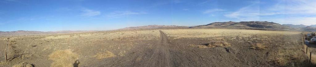
22 EXISTING CONDITIONS The Desert Wells Preserve site is located mostly vacant, with a few buildings in the southeast corner of the property that currently support the remaining operation of the Dayton Valley Turf Farm, which is operated through a lease agreement with the owner of the property, Schaller Development, LLC. It is adjacent to single family residential uses to the north and east, adjacent to Bureau of Land Management (BLM) property and single family residential properties in the Churchill Ranchero Estates subdivision to the west, and adjacent to vacant land to the south. It is also immediately adjacent to Highway 50 to the north. Figure 3 (below) includes a Site Photo Location Map that coincides with photos of the project site taken in December These seven photos are also included in Figure 3 (below and Page 3) and have corresponding numbers to the location map provided. Figure 3 Site Photo Location Map N Figure 3 Site Photo 1 PAGE 3


23 Figure 3 Site Photo 2 Figure 3 Site Photo 3 Figure 3 Site Photo 4 Figure 3 Site Photo 5 PAGE 4


24 Figure 3 Site Photo 6 Figure 3 Site Photo 7 The property is relatively flat and contains no ridgelines. Drainage patterns flow generally from north to south, with some flows moving from west to east. The geotechnical report completed for this project determined the native soils to generally consist of silty sand, gravel, elastic silt and dense clayey sand. No active or potentially active faults were discovered. The geotechnical report is included with this report as Appendix D. The property is located in FEMA Flood Zone X as shown on FEMA Maps 32019C0305E and 32019C0310E. The Desert Wells Preserve site is located in the Stagecoach Community and within a Rural Character District as defined by the 2010 Lyon County Comprehensive Master Plan. The Master Plan designation for all of the property except a small portion on the eastern side is Specific Plan. The small eastern side portion has a Master Plan designation of Rural Residential. Figure 4 (Page 6) shows the current Master Plan designation for the property and its surrounding parcels. Figure 5 (Page 6) shows the current Character District for the property and its surrounding parcels. The Desert Wells Preserve property is currently zoned General Commercial (C 2), Second Rural Residential 2 Acres (RR 2) and Fifth Rural Residential 20 acres (RR 5). Figure 6 (Page 7) shows the current zoning of the subject parcels as well as the zoning of surrounding parcels. Table 2 (Page 7) identifies the adjacent parcels and includes current legal ownership, present use and zoning for each parcel. PAGE 5


25 Figure 4 Existing Master Plan Designation Figure 5 Existing Character District PAGE 6

26 Figure 6 Existing Zoning Table 2: Adjacent Parcel Ownership, Zoning and Land Use Parcel Legal Ownership South Properties Immediately Adjacent Chiechi, Michele A & Janice C T Moriondo, Edward Moriondo, Edward Corbo, Ida Pitruzzello, Vincent Et Al Palmieri, Frank Et Al Stagecoach Land & Livestock LLC Stagecoach Land & Livestock LLC Stagecoach Land & Livestock LLC Golbek, Leslie & Janet East Properties Immediately Adjacent Ruppert, Jack L Roets, Earl G & Penny M Faria, Gregory Alan Trs Et Al Retzer, Betty Lamm, Willis & Sharon North Properties Immediately Adjacent Zoning RR 5 RR 5 RR 5 RR 5 RR 5 RR 5 RR 5 RR 5 RR 5 RR 5 & M 1 RR3 T RR 3T RR 3 RR 3 RR 3T Land Use Vacant Vacant Vacant Vacant Vacant Vacant Vacant Vacant Vacant Vacant Residential Residential Residential Vacant Residential PAGE 7
27 Parcel Legal Ownership Zoning Land Use Lamm, Willis & Sharon RR 5T Residential Foose, Joyce K RR 5T Residential Mount Joy, Michael D RR 5T Residential Retzer, Betty L Tr RR 3 Residential Motamenpour, Bahram Et Al RR 3 Residential Mau Loa Properties LLC C 2 Vacant North Properties Across Highway I 50 Plaza LLC C 1 & RR 3 Vacant Stevenson, Marilyn E Tr VCMU Vacant Stevenson, Marilyn E Tr RR 5 Vacant Stevenson, Marilyn E Tr RR 5 Vacant West Properties Immediately Adjacent Lurvey, Lynda L & Dale G RR 2T Residential Garrett, Heather & Kevin RR 2T Residential Conlon, Michael F & Claudia M RR 2T Residential Parks, Nile E Jr RR 2T Residential Lassen, Cinda RR 2T Residential Marek, Michael D & Linda R RR 2T Residential Howard, Daniel M & Joyce E RR 2T Residential Abbott, Warren W & Caren J RR 2T Residential Rios, Ricardo E Et Al RR 2T Residential Alcorta, Ruth M RR 2T Residential Williams, Linda Angelee RR 2T Residential Marshall, Wendell K & Merri Lin RR 2T Residential Smith, Gary D RR 2T Residential Goodenough, Jack J Et Al RR 2T Residential Stressman, Roger K Jr Et Al RR 2T Residential Frady, Larry Robert RR 2T Residential Reeves, Charles R II & Sandra L RR 2T Residential Carrico, David H & Peggy J RR 2T Residential Davis, William G Jr & Karen T RR 2T Residential Yeater, Clifford & Ok Yon RR 2T Residential State of Nevada RR 5 Gravel Pit Bureau of Land Management RR 5 Vacant PAGE 8

28 PROJECT SUMMARY The Desert Wells Preserve project is a new suburban community in Stagecoach proposed to serve the growing residential, employment and commercial service needs of Lyon County. It s proximity to existing suburban centers such as Dayton and Carson City, and its location close to the newly construction USA Parkway that connects Lyon County to the Tahoe Reno Industrial Center and to Interstate 80 makes Desert Wells Preserve ideally situated to accommodate additional suburban development. As shown on the regional aerial depicting in Figure 7 (below), Desert Wells Preserve is located very near the Tahoe Reno Industrial Center, and is approximately nine miles west of the where USA Parkway intersects with Highway 50. It is situated on an important leg (Highway 50) of what is increasingly becoming known as the regional loop that ties our entire Northern Nevada Region together, both physically and economically. Desert Wells Preserve Figure 7 Regional Location and Proximity to Suburban and Employment Centers PAGE 9

29 Desert Wells Preserve is proposed to include 1,453 residential units on approximately 497 acres that includes close to 280 acres of single family residential uses and more than 100 acres of mixed commercial uses including a variety of multi family and high density residential uses. The land plan provided as Figure 8 (below) shows the layout of Desert Wells Preserve and provides a break down of the various uses proposed. Table 3 (Page 11) further outlines these uses. The type of residential uses within the project are expected to vary greatly, with lot sizes ranging from those small enough to accommodate uses such apartments or townhomes, to lots that are one acre in size. Because of this range in housing and lot sizes, the densities throughout the project are broken down into two sections density of residential uses allowed in the mixed commercial areas at 16 units per acre, and densities of residential uses allowed in the suburban residential area at three units per acre. In addition to commercial and residential uses, Desert Wells Preserve creates an extensive open space and trail network, provides a 15 acre regional park site, an equestrian center, a future elementary school site and a fiveacre future public facility site that could be used for a variety of services dependent on the community s need. These amenities are intended to serve not only the residents of Desert Wells Preserve, but the entire Stagecoach Community as a whole. Figure 8 Desert Wells Preserve Land Plan PAGE 10
30 Table 3: Land Plan Specific Use Breakdown Proposed Use Acres + % of Total Area Residential Units + 6,000 SF Lots % 314 9,000 SF Lots % 562 ½ Acre Lots % 55 One Acre Lots % 12 Mixed Use (including 5 acres of Public % 510 Facility) Open Space % Equestrian Center % Regional Park % School % Backbone Roadway % Total The sections that follow will briefly discuss proposed infrastructure to serve the project and impacts/mitigations for storm water and traffic. These summaries are discussed in more detail within the Desert Wells Preserve Specific Plan document, as well as in supporting technical reports that accompany both the Specific Plan and this report. Water Infrastructure and Water Rights An integral part of the Desert Wells Preserve project involves the availability and quality of water in the Stagecoach Community. For those properties that are served by a municipal system, challenges such as lack of emergency water supply in the event of system failure, inadequate fire flows for fire suppression and periodic water quality issues face the Stagecoach General Improvement District in their effort to provide quality service to their customers, both existing and future. The development of Desert Wells Preserve includes the construction of a water main approximately 3.4 miles long that will connect and intertie the Stagecoach General Improvement District water system with the Lyon County Utilities water system in Dayton. The system is designed to flow one direction into Stagecoach to ensure water does not flow out of Stagecoach back to Dayton. This will vastly improve the water concerns for Stagecoach that are outlined above, while also allowing Desert Wells Preserve to serve its future residents. The details of this water system intertie and associated improvements are discussed in more detail in the Desert Wells Preserve Specific Plan document and in the Water Facility Plan contained in the is report as Appendix E. Water rights are also an important part of any development within Lyon County. To serve the Desert Wells Preserve project, the developer has secured more than 900 acre feet of water rights to be used at the Desert Wells Preserve site. The majority of this water (700 acre feet) will be imported from outside the Stagecoach area as a part of the water line intertie project discussed above. As development progresses within Desert Wells Preserve, the amount of required water rights will be continually evaluated, and additional water rights will be acquired to serve the various uses planned within the community. PAGE 11
31 Sewer Infrastructure Desert Wells Preserve will connect to the municipal sewer system to serve its future development. Because there is no sewer system in Stagecoach currently, a sewer main will be constructed approximately 3.4 miles west to tie into the Lyon County Utilities sewer system in Dayton. This will allow the sewage from Desert Wells Preserve to then continue to the Rolling A Wastewater Treatment Facility in Dayton. Desert Wells Preserve is estimated to generate approximately 254,000 gallons per day of sewage at build out. Lyon County has indicated that, depending on when development occurs, the Rolling A Wastewater Treatment Plant will either have existing capacity for Desert Wells Preserve or will require expansion. If expansion is required, the Rolling A property is sufficient to support expansion. Capacity at Rolling A will likely need to be offset with commensurate effluent reuse or disposal as a condition of discharging to the plant. A complete Sewer Facility Plan providing is included in the Desert Wells Preserve Specific Plan document as well as attached to this report as Appendix F. Drainage Impacts and Mitigation There are four Nevada Department of Transportation (NDOT) culverts that cross Highway 50 from north to south and discharge onto or adjacent to Desert Wells Preserve. Proposed onsite drainage channels within Desert Wells Preserve will typically begin at the NDOT culvert outlets and end in one of three onsite detention basins. They are designed to accommodate the 100 year peak drainage flows. The detention basins are modeled with broad crested weir overflows. Overflows will generally discharge to flat areas that correspond with the existing drainage conditions leaving the site. Accordingly, the detention facilities will mitigate peak flow drainage conditions produced by development within Desert Wells Preserve to existing conditions or less, in accordance with Lyon County requirements. The performance of proposed project improvements, roadways, and storm water conveyance facilities, once constructed, will not adversely impact upstream or downstream properties adjacent to this site. The development of Desert Wells Preserve will not significantly increase upstream or downstream storm flow runoff rates, volumes, velocities or depths, and will not influence floodplain boundaries due to the mitigation of the proposed development to the existing conditions. A complete Preliminary Drainage Study is included in the Desert Wells Preserve Specific Plan document and is attached to this report as Appendix G. Traffic Impacts and Mitigation Desert Wells Preserve is estimated to generate approximately 25,959 average weekday trips, 1,766 total AM peak hour trips and 2,138 total PM peak hour trips. These totals include internal trips, pass by trips, diverted trips and external trips. The recent widening of Highway 50 across the frontage of the property to four lanes can handle this additional traffic capacity. To accommodate the traffic impacts at the various existing and future intersections, various improvement recommendations are made that are outlined in detail in the Traffic Study attached to this report as Appendix H. These recommendations have been made with input received from consultation with the Nevada Department of Transportation and Lyon County. In summary, the improvements include elimination of existing intersections at Leegard Avenue/Highway 50 and at Turn Farm Road/Highway 50, the creation of a new full access intersection at the approximate mid point of the project s Highway 50 frontage with a future signal, and expansion of the existing full access intersections at Caroline Way and Blackhawk Road. PAGE 12


32 REQUEST SUMMARIES AND FINDINGS The sections that follow will discuss the various requests and required findings included for the Desert Wells Preserve project, and are further supported by the Desert Wells Preserve Specific Plan handbook that is included with this application submittal. Master Plan Amendment This application includes the request to change the Desert Wells Preserve property s character district from its existing designation of a Rural Character District to a Suburban Character District. As the region grows and development patterns and regional connections emerge, it is becoming clear where the most logical next growth areas are within Lyon County. Communities that once seemed appropriate for rural development are now positioned to contribute to the growth and development of the region as a whole. Stagecoach is the perfect example of this situation. Stagecoach is positioned between a growing suburban community in Dayton, and a booming industrial economic and employment driver with the Tahoe Reno Industrial Center. Further, the recent approval of the Highlands Specific Plan for 12,000 acres of industrial office park will drive additional industrial and employment growth into Lyon County. Development patterns and the lack of water infrastructure have made it difficult to envision urban growth in Stagecoach. However, as growth continues in adjacent communities, it s important to recognize the opportunity Lyon County has to ensurea gap in growth along a major transportation corridor in this region is not created. Desert Wells Preserve proposes to connect water and sewer infrastructure to support suburban development on the western side of Stagecoach. The abundance of vacant land on in this area of Stagecoach and its immediate proximity to the Dayton Suburban Character District makes it ideal for expansion. Figure 9 Proposed Suburban Character District PAGE 13
33 The following findings as identified in Lyon County Code are addressed in support of the Master Plan Amendment to change the character district of Desert Wells Preserve. Each finding is listed in italic type below and is addressed in bold type immediately following each finding. a. Consistency With The Master Plan: The applicant has demonstrated that the amendment is in substantial compliance with and promotes the master plan goals, objectives and actions. The proposed amendment to the character district is consistent and promotes the following goals and policies in the Master Plan. Goal LU 1: Orderly Growth Patterns. Direct and management development so that it is orderly and fiscally responsible. Policy LU 1.2: Residential Development Patterns in Neighborhoods Policy LU 1.3: Commercial and Mixed Use Development located in Centers The Desert Wells Specific Plan that is supported by the change in Character District provides for residential development in neighborhood patterns with added amenities for community members to enjoy. Commercial uses proposed are proposed within a mixed use zone and envisioned to be planned in centers through development standards set forth in the Specific Plan handbook. Goal LU 2: Services Coordinated with Growth. Future residential development will be coordinated with development of schools, parks, libraries and other public services so as to maintain or improve per resident service levels. Policy LU 2.1: Residential development in areas with services. Desert Wells Preserve provides for residential development that also proposed a school, regional park and additional public facility property that may be used in the future for community services. These services are intended to be enjoyed by all of the Stagecoach Community, not just the future residents and businesses of Desert Wells Preserve. Goal LU 3: Diverse Economy. The economy will continue to be strong and diverse; attracting businesses that employ residents in primary jobs, as well as service jobs that meet the needs of local residents. Policy LU 3.1: Diverse Economic Base Providing a diverse economic base helps to ensure the success of a community. Desert Wells Preserve proposes to provide employment and commercial land uses to support local employment in primary and service industry jobs. It will also provide a variety of housing options that will support growing employment centers close to Desert Wells Preserve such as the Tahoe Reno Industrial Center in Storey County, and the recently approved Highlands Industrial Specific Plan near the Tahoe Reno Industrial Center, but within Lyon County s borders. Goal LU 5: Encourage Resource Sensitive Growth. Development will be designed to reduce energy and minimize environmental impacts. Policy LU 5.1: Encourage Resource Sensitive Growth and Sustainable Design PAGE 14
34 The Desert Wells Preserve Specific Plan includes goals, policies and development standards to ensure that valuable resources are responsibly used. Xeriscape landscaping and low water usage through the community are a top priority, as is development that compact and efficient. Goal TR 2: County Roads. Local roads will offer alternatives to primary highways. The Desert Wells Preserve Specific Plan provides a local road network that allows vehicle circulation to occur within the project without entering the highway. Goal CC 1: Quality Design. New communities in Lyon County will improve the appearance and function of our communities. Policy CC 1.1: Quality New Development Policy CC 1.2: Pedestrian Friendly Communities Policy CC 1.3: Design Tailored Communities The Desert Wells Preserve Specific Plan establishes extensive development standards that will ensure quality development, a pedestrian friendly atmosphere with an open space and trail network, and a community that has specific design and theme. Goal NR 3: Adequate, Clean Water. Adequate water supply will be available for current and future needs in Lyon County, including safe, healthy drinking water for all Lyon County residents. Policy NR 3.1: Water Supply and Quality Desert Wells Preserve presents an opportunity to provide additional and higher quality water supply to the Stagecoach Community. As a part of the proposed improvements, a water line will be constructed that will intertie the Stagecoach General Improvement District (GID) water system with the Lyon County Utilities water system. This intertie is design to send water one way into the Stagecoach Community. It will provide water supply to the Desert Wells Preserve project but it will also provide emergency backup supply for the existing Stagecoach GID system in the event of a system failure and will boost fire flows for better fire suppression. Goal PR 1: Recreation in Communities. Parks, sports fields and playgrounds will be available for recreation in communities and areas of higher density development. Policy PR 1.1: Recreation Facilities in Communities The Stagecoach Community currently has few facilities that offer recreation, sports fields and playgrounds. Rather than including a series of smaller parks intended to serve only the future residents of Desert Wells Preserve, a 15 acre regional park is proposed that will include sports fields and playground areas that all of Stagecoach will be able to enjoy. In addition, a five acre equestrian facility is proposed that is also intended to serve the Stagecoach Community. b. Compatible Land Uses: The proposed amendment is compatible with the actual and planned adjacent land uses, and reflects a logical change in land uses. The proposed amendment to change the Desert Wells Preserve property to a Suburban Character District reflects a logical change in land uses in the area. While the Stagecoach Community has previously been designated as a rural area due to existing development patterns, these patterns are not consistent PAGE 15
35 throughout the entire Stagecoach Valley. The western side of Stagecoach has substantial vacant land with soils that are suitable for development, and has the capability to reach public water and sewer systems in Dayton. As this region of Lyon County continues to grow and change, an expansion to the east to continue suburban development from Dayton is a logical next step, where land conditions allow. As shown on Figure 9, the Dayton Suburban Character District is separated from the Desert Wells Preserve property by only vacant Bureau of Land Management property, which Lyon County has not designated as either Rural or Suburban in character. Changing the Desert Wells Preserve property to the Suburban Character District represents a natural progressing of suburban development in a location appropriate to accommodate it. Additionally, the proposed Desert Wells Preserve Specific Plan allows for compatibility with properties that are directly adjacent to the project by implementing buffers and performance standards that will transition higher densities to lower densities. Finally, the overall density proposed for the Suburban Residential area is identified as three units per acre in the Specific Plan, which is significantly lower than what would typically be allowed in this Master Plan land use category. c. Response To Change Conditions: The proposed amendment has demonstrated and responds to changed conditions or further studies that have occurred since the master plan was adopted by the board, and the requested amendment represents a more desirable utilization of land. When the Lyon County Comprehensive Master Plan process began with initial public input in 2006, and then was ultimately approved in 2010, the Tahoe Reno Industrial Center (TRI Center) was a known development and included the future connection of USA Parkway. However, the extent to which the TRI Center and the timeframe in which USA Parkway would be finished, if ever, were relatively unknown. It wasn t until the introduction of large scale international employers such as Switch, Tesla and Google, that the region really began to experience what growth because of the TRI Center would actually look like. This scenario is much like the I 580 Freeway that, after more than 40 years in various planning stages, was finally completed in 2017 around Carson City. It was a known project for years, but as it finally came to fruition, swift action was needed to address challenges in Carson City that would arise. As the TRI Center has experienced great success in recent years, so have surrounding communities as a result. This success comes with growing pains in every community and, as more population comes into the region, cities like Reno and Sparks because unaffordable for those commuting to employment in the TRI Center. This has been recently demonstrated by the surge in the Reno/Sparks area median home price to $355,000 as of November Additionally, as the TRI Center becomes more popular for the relocation, expansion or start up of large companies, land prices within the center will also rise. This will lead to those supporting industries that need to be close to the TRI Center but can no longer afford to be within it to look elsewhere. This isn t unexpected, but likely anticipated, given the December 7, 2017 approval by the Lyon County Board of Commissioners for a 12,000 acre industrial Specific Plan on the Highlands property near the TRI Center. This is a perfect example of changing conditions. During the Master Plan process, it was discussed at length that the Highlands property would become residential development at some point in the future. The growth anticipated for the Stagecoach Community because of these changed conditions is no different. Stagecoach is strategically located on Highway 50, now a four lane highway through the western half of the community, it is closely located to an existing suburban community in Dayton, and is only approximately nine mines from USA Parkway. The housing prices in Reno, Sparks and Carson City are driving the workforce PAGE 16
36 to seek more affordable, quality development in other places, as is the unanticipated gridlock that occurs on I 80 during certain times of the day, making commute times into Reno/Sparks incredibly long. Residential, commercial and industrial development in Dayton, Stagecoach and Silver Springs offers a better alternative to those challenges outlined above. This is already being demonstrated by the increase in activity along the corridor including the increase in new housing starts, existing housing sales and new commercial and industrial development interest in the area. The Dayton, Stagecoach and Silver Springs corridor will emerge as an affordable alternative to constraints placed upon the Reno/Sparks area. According to The Whitney Group, this corridor should anticipate residential construction growth of residential units starting between 2019 and The Whitney Group expects to see even greater employment impacts during the next five years. The Economic Development Agency for Western Nevada (EDAWN) commissioned an economic study by RDG Economics, this report is commonly referenced as the EDAWN EPIC report. The report summarizes a low, medium and high employment scenario for the Northern Nevada region. The medium employment growth estimates for the region forecast 52,400 new direct and indirect jobs generated during the five year period employment figures are running well ahead of the EDAWN EPIC forecast. Lyon County is well positioned to benefit from the anticipated employment and housing growth in the region. The conversion of vacant, unused land along the Highway 50 corridor in Stagecoach to a quality mixed use development that will attract a range of residents, employers and commercial operators represents a better utilization of the land and an appropriate expansion of the Suburban Character District. d. No Adverse Effects: The proposed amendment will not adversely affect the implementation of the master plan goals, objectives and actions, and will not adversely impact the public health, safety or welfare. The proposed amendment will positively affect the implementation of the master plan as is demonstrated by the number of goals and policies Desert Wells Preserve is meeting. It will responsibly expand the Suburban Character District into an area adjacent to an existing Suburban Character District, will provide services that will benefit the public health, safety and welfare of Stagecoach by ensuring adequate and quality water supply, and has incorporated development standards that are intended to mitigate impacts of higher density development that is new to a historically rural area. These standards include land use transitions, buffers and extensive community amenities. e. Desired Pattern Of Growth: The proposed amendment will promote the desired pattern for the orderly physical growth of the county, allows infrastructure to be extended in efficient increments and patterns, maintains relatively compact development patterns, and guides development of the county based on the least amount of natural resource impairment and the efficient expenditure of funds for public services. The proposed amendment promotes orderly growth along the Highway 50 corridor by allowing the expansion of the Suburban Character District immediately beyond its current border in Dayton to the western edge of the Stagecoach Community. It will allow water and sewer infrastructure to be extended in manageable increments that support quality development regulated by the standards outlined in the Desert Wells Preserve Specific Plan. It maintains relatively compact development patterns by avoiding a leap frog effect into portions of Stagecoach that are much further away from suburban development, and it benefits existing residents in Stagecoach by providing them with reliable water resources through the PAGE 17

37 intertie of the Stagecoach General Improvement District water system with the Lyon County Utilities water system. Specific Plan As is indicated in the Desert Wells Preserve Specific Plan, the vision of this project is to create a vibrant and sustainable suburban mixed use community in the western portion of Stagecoach. It has been thoughtfully planned to utilize the Highway 50 transportation corridor to provide Stagecoach with diverse commercial, employment and housing opportunities that will also support growing economic centers in the region. Desert Wells Preserve is designed to remain sensitive and respectful of the nearby rural lifestyle by providing land use transitions, incorporating equestrian uses and an extensive open space/trail network, and creating hardscape and landscape buffers within its boundaries. It will further enhance the livability of the Stagecoach Community by providing a center for regional recreation, additional education facilities and improved utility infrastructure, most notably in support of more abundant and higher quality water resources. The Specific Plan identifies goals and policies that are intended to ensure the quality of development with Desert Wells Preserve, and sets forth land use designations that are consistent with the Lyon County Comprehensive Master Plan. These land use designations are shown in Figure 10 (below). The Specific Plan also establishes development standards for the development that are intended to enhance the existing Lyon County Zoning Code (Title 10), as well as complement the proposed Lyon County Zoning Code (Title 15). A separate handbook entitled the Desert Wells Preserve Specific Plan is included with this application. Figure 10 Proposed Master Plan Designations PAGE 18
38 The following findings as identified in Lyon County Code are addressed in support of the Specific Plan for Desert Wells Preserve. Each finding is listed in italic type below and is addressed in bold type immediately following each finding. 1. That the proposed location of the development and the proposed conditions under which it will be operated or maintained is consistent with the goals, objectives and actions embodied in the master plan; The Desert Wells Preserve Specific Plan location and proposed conditions is consistent with the Lyon County Comprehensive Master Plan as demonstrated in Finding A for a Master Plan Amendment beginning on Page 14 of this document. 2. That the proposed development is in accordance with the purposes and objectives of this title and, in particular, will further the purposes stated for each zoning district; and With the proposed Master Plan Amendment, Specific Plan and Zoning Map Amendment, Desert Wells Preserve meets the purposes and objectives of Lyon County Title 10 and proposed Title 15, as well as the objectives for each zoning district that is proposed. 3. That the development will not be detrimental to the public health, safety or welfare of persons residing or working in or adjacent to such a development; and will not be detrimental to the properties or improvements in the vicinity or to the general welfare of the county. The proposed Specific Plan will positively impact the Stagecoach Community. It will responsibly expand the Suburban Character District into an area adjacent to an existing Suburban Character District, will provide services that will benefit the public health, safety and welfare of Stagecoach by ensuring adequate and quality water supply, and has incorporated development standards that are intended to mitigate impacts of higher density development that is new to a historically rural area. These standards include land use transitions, buffers and extensive community amenities. Zoning Map Amendment To support the development proposed for Desert Wells Preserve, a Zoning Map Amendment is included with the application for the project. This amendment requests that the underlying zoning of the property be changed to zoning districts that directly correlate with the Master Plan designations proposed in the Specific Plan,. These zoning districts are listed below in Table 4 and further depicted on Figure 11. The zoning districts and their proposed locations are intended to also conform with Title 15 upon its adoption. This is discussed in detail in the Desert Wells Preserve Specific Plan. Table 4: Proposed Zoning Districts Zoning District Abbreviation Zoning District Description SCMU Suburban Commercial Mixed Use NR 1 Single Family Nonrural Residential 6,000 Sq. Ft Lots NR 3 Single Family Nonrural Residential 9,000 Sq. Ft. Lots E 2 Second Estates Residential ½ Acre Lots RR 1 First Rural Residential 1 Acre Lots RR 5 Fifth Rural Residential 20 Acres PAGE 19

39 Figure 11 Proposed Zoning The following findings as identified in Lyon County Code are addressed in support of the Zoning Map Amendment for Desert Wells Preserve. Each finding is listed in italic type below and is addressed in bold type immediately following each finding. a. The zone change is in substantial compliance with and promotes the Master Plan goals, objectives and actions. With the approval of the associated Master Plan Amendment and Specific Plan for Desert Wells Preserve, the proposed zoning map amendment will be in substantial compliance with and will promote the Master Plan goals, objectives and actions. This is further detailed in the Master Plan Amendment findings starting on Page 14. b. The proposed zoning promotes development that is commensurate with the character and current use of the surrounding land and will not have detrimental impacts to other properties in the vicinity. The proposed zoning promotes development that corresponds to the growing need for diverse housing options in the region. It represents a reasonable expansion of the adjacent Dayton suburban area that is closer to employment centers in Storey and Lyon County. It will not have detrimental impacts to other properties in the vicinity, but instead will contribute to the overall quality of life and will benefit these properties by providing new commercial services, community and recreational facilities. PAGE 20
City Of Sparks Planning Commission Item
 Page 1 of 12 City Of Sparks Planning Commission Item Meeting Date: May17, 2012 Subject: PCN12009, Public Hearing, Consideration and possible action on a Master Plan Amendment and Rezoning request to change
Staff Report and Recommendation
 Community Planning and Development Planning Services 201 W. Colfax Ave., Dept. 205 Denver, CO 80202 p: 720.865.2915 f: 720.865.3052 www.denvergov.org/cpd TO: City Council Neighborhoods and Planning Committee
CITY OF SPARKS, NV COMMUNITY SERVICES DEPARTMENT
 CITY OF SPARKS, NV COMMUNITY SERVICES DEPARTMENT To: From: Subject: Mayor and City Council Janet Stout, Administrative Secretary Report of Planning Commission Action PCN12028 Date: October 24, 2012 RE:
RRW Stonebrook, LLC Tentative Map Findings
 RRW Stonebrook, LLC Tentative Map Findings FINDING T1: The request conforms to the Master Plan and zoning ordinances. RELATIONSHIP TO THE MASTER PLAN 1. The respective development is located within an
BUILDER LOTS FOR SALE
 BUILDER LOTS FOR SALE NORTHERN CULPEPER - 135 ACRES RESIDENTIAL DEVELOPMENT 1256 Old Bridge Road, Amissville, VA 20106 SALE PRICE: $995,000 LOT SIZE: 135+ Acres APN #: Tax Map 2 Parcel 23 ZONING: R-1 ACCESS:
DISCUSSION ON VACAVILLE S2 INVESTORS PROPERTY IN URBAN RESERVE
 Agenda Item No. 9C April 25, 2017 TO: FROM: SUBJECT: Honorable Mayor and City Council Attention: Jeremy Craig, Interim City Manager Barton Brierley, AICP, Community Development Director (Staff Contact:
AWH REPORT OF THE PLANNING AND DEVELOPMENT DEPARTMENT FOR APPLICATION FOR REZONING ORDINANCE TO PLANNED UNIT DEVELOPMENT
 AWH REPORT OF THE PLANNING AND DEVELOPMENT DEPARTMENT FOR APPLICATION FOR REZONING ORDINANCE TO PLANNED UNIT DEVELOPMENT MAY 8, 2014 The Planning and Development Department hereby forwards to the Planning
This chapter describes the purpose of the Plan, introduces how the Plan is organized and provides contextual background for the Plan.
 Chapter 1: INTRODUCTION Purpose of a Comprehensive Plan The 2040 Comprehensive Plan establishes Medina s vision as a community and sets goals and objectives which guide future decisions and policies. The
EXECUTIVE SUMMARY DRAFT CHAPTER 1 INTRODUCTION EXECUTIVE SUMMARY
 CHAPTER 1 EXECUTIVE SUMMARY INTRODUCTION Through the joint efforts of the City of Tulsa planning staff and the Land Services division of Indian Nations Council of Governments (INCOG), the Berryhill Land
Woodburn Comprehensive Plan Growth Management Goals and Policies
 Goal Woodburn Comprehensive Plan Growth Management Goals and Policies G-1. The City's goal is to manage growth in a balanced, orderly and efficient manner, consistent with the City s coordinated population
3.10 LAND USE SETTING PROJECT SITE EXISTING LAND USE DESIGNATIONS AND ZONING. General Plan Land Use Designations.
 This section of the Draft EIR addresses the existing land uses on and adjacent to the project site and discusses the potential impacts of the proposed project on existing land uses. Key issues addressed
A. WHAT IS A GENERAL PLAN?
 I. Introduction A. WHAT IS A GENERAL PLAN? A general plan is the planning guideline for the future of a city. It contains goals and policies which regulate urban development, the protection of the natural
Planning & Zoning Commission Staff Report
 Planning & Zoning Commission Staff Report Meeting Date: May 26, 2015 Drafted by: Katherine Harrison-Rogers CASE # Z2886 PROJECT NAME: APPLICANT/ REPRESENTATIVE: Shawna Runyan PROPERTY OWNER: 1840 (previously
Applicant Name Phone / Fax / Address City State Zip Code . Property Owner Phone / Fax / Address City State Zip Code
 Master Development Plan Application Community Development Department City of Redmond 411 SW 9 th Street Redmond, Oregon 97756 541-923-7721 541-548-0706 FAX Master Development Plan Fee $38,862.52 File Number
CITY OF COLWICH COMPREHENSIVE PLAN LAND USE LAND USE 1
 LAND USE LAND USE 1 WHAT YOU WILL FIND IN THIS CHAPTER: Discussion of today s conditions and tomorrow s projections Discussion of challenges and opportunities Discussion of the environmental quality goals,
Town of Portola Valley General Plan. Nathhorst Triangle Area Plan
 Town of Portola Valley General Plan Amended December 10, 1997 Table of Contents Introduction... 1 Planning Area... 1 Objectives... 2 Principles... 2 Standards... 4 Description... 4 Community Commercial...
2040 LUP is a part of the Comprehensive Plan and carries the same legal authority. Economic Challenges
 1.1. Guiding Anchorage s Growth Where will new residents settle over the next two decades? Where will people work, shop, and play? Will there be enough room to grow? How will Anchorage look? Will growth
PLANNING COMMISSION. Submitted
 PLANNING COMMISSION City Hall 1275 Main Street El Centro, CA 92243 Submitted PLANNING COMMISSION ACTION ITEM (1844) Meeting: 05/10/16 12:00 AM Department: Community Development Category: Public Hearing
LAND USE AMENDMENT CORNERSTONE (WARD 3) 60 STREET NE AND COUNTRY HILLS BOULEVARD NE MAP 26NE BYLAW 22D2017
 60 STREET NE AND COUNTRY HILLS BOULEVARD NE MAP 26NE BYLAW 22D2017") Page 1 of 14 EXECUTIVE SUMMARY This Land Use Amendment application covers an area of 43.76 hectares ± (108.14 acres ±) located in northeast Calgary, bound by Country Hills Boulevard NE to the south and
Page 1 of 14 EXECUTIVE SUMMARY This Land Use Amendment application covers an area of 43.76 hectares ± (108.14 acres ±) located in northeast Calgary, bound by Country Hills Boulevard NE to the south and
6 PORT SYDNEY SETTLEMENT AREA
 Section 6 Port Sydney Page 61 6 PORT SYDNEY SETTLEMENT AREA 6.1 Basis and Principles Village of Port Sydney Waterfront Community Existing Services 6.1.1 Port Sydney is an historic settlement that has developed
PSRC REVIEW REPORT & CERTIFICATION RECOMMENDATION
 PSRC REVIEW REPORT & CERTIFICATION RECOMMENDATION KITSAP COUNTY COUNTYWIDE PLANNING POLICIES July 2, 2012 BACKGROUND A major emphasis of the Washington State Growth Management Act (GMA) is the need to
9 th Street Sub Area Plan
 9 th Street Sub Area Plan In the 1990 s, when the Township prepared the last Master Plan, the 9 th Street corridor was studied as part of a larger 9 th Street Focus Area that included the West Main Street
Appendix C: Interim Mixed-Use Evaluation Criteria
 Appendix C: Interim Mixed-Use Evaluation Criteria C-1 Appendix C: Interim Mixed-Use Evaluation Criteria PURPOSE: The implementation of numerous policies contained within the Master Plan hinges on the creation
Planned Development Review Revisions (Project No. PLNPCM )
") Planned Development Review Revisions (Project No. PLNPCM2014-00139) Standard residential development Planned Development Example: Smaller lot sizes than what is allowed to create open space amenity. What
Planned Development Review Revisions (Project No. PLNPCM2014-00139) Standard residential development Planned Development Example: Smaller lot sizes than what is allowed to create open space amenity. What
6 Growth Management Challenges and Opportunities
 6 Growth Management Challenges and Opportunities The Town has established a goal of attaining a 50% participation rate with respect to employment opportunities versus residential population. The Town s
Chapter 10 IMPLEMENTATION RECOMMENDATIONS
 Chapter 10 IMPLEMENTATION RECOMMENDATIONS The recommended land use plan presented in the previous chapter provides a design for the attainment of the urban and rural development and open space preservation
COMMISSION ACTION FORM
 ITEM #: 6 DATE: 09-06-17 COMMISSION ACTION FORM REQUEST: Introduction and Initial Review of Proposed Amendments to the Ames Urban Fringe Future Land Map for the North Growth Gap Area BACKGROUND INFORMATION:
Planning Commission Staff Report June 5, 2008
 Owner/Applicant Taylor Village Sacramento Investments Partners, LP c/o Kim Whitney 1792 Tribute Road #270 Sacramento, CA 95815 Staff Recommendation Planning Commission Staff Report Project: File: Request:
GENERAL PLAN CONSISTENCY ANALYSIS
 GENERAL PLAN CONSISTENCY ANALYSIS Prepared by Planning Staff 10/28/2013 APPLICABLE GOALS, POLICIES AND PROGRAMS FROM the LAND USE CHAPTER Goal LU-1 Policy LU-1.1 Policy LU-1.2 Goal LU-2 Protect the character
LU Encourage schools, institutions, and other community facilities that serve rural residents to locate in neighboring cities and towns.
 Application No. 891627: Comprehensive Plan Text Amendment - Rural School Policies - Amend policies consistent with State Legislation allowing schools in the rural area and extension of sewer service to
Urban Planning and Land Use
 Urban Planning and Land Use 701 North 7 th Street, Room 423 Phone: (913) 573-5750 Kansas City, Kansas 66101 Fax: (913) 573-5796 Email: planninginfo@wycokck.org www.wycokck.org/planning To: From: City Planning
Glenborough at Easton Land Use Master Plan
 Implementation 114 9.0 IMPLEMENTATION 9.1 OVERVIEW This chapter summarizes the administrative procedures necessary to implement the proposed land use plan, infrastructure improvements, development standards,
Chapter Master Planned Communities (MPC) District
 District") Sections 14.53.010 Purpose and Intent 14.53.020 Applicability 14.53.030 Procedure 14.53.040 MPC Standards 14.53.050 Required Findings 14.53.010 Purpose and Intent Chapter 14.53 Master Planned Communities
Sections 14.53.010 Purpose and Intent 14.53.020 Applicability 14.53.030 Procedure 14.53.040 MPC Standards 14.53.050 Required Findings 14.53.010 Purpose and Intent Chapter 14.53 Master Planned Communities
Baumgarten MPUD. Exhibit 3 Evaluation Criteria
 Pursuant to LDC subsections 10.02.13 B, 10.02.08 F and Chapter 3 G. of the Administrative Code, staff s analysis and recommendation to the Planning Commission, and the Planning Commission s recommendation
Vintage at Kings Canyon Conceptual PUD. Prepared by:
 Vintage at Kings Canyon Conceptual PUD Prepared by: June 7, 2016 Vintage at Kings Canyon Conceptual PUD Prepared for: Vintage at Kings Canyon, LP Prepared by: Rubicon Design Group, LLC 100 California Avenue,
Osceola County Board of County Commissioners 1 Courthouse Square, Suite 1100 Kissimmee, FL
 1/10/11 Item Number DRI08-0006 Osceola County Board of County Commissioners 1 Courthouse Square, Suite 1100 Kissimmee, FL 34741 407-742-0200 Applicant & Owner Center Lake Properties, LLLP and Formally
CITY CLERK. Parkland Acquisition Strategic Directions Report (All Wards)
") CITY CLERK Clause embodied in Report No. 10 of the, as adopted by the Council of the City of Toronto at its meeting held on November 6, 7 and 8, 2001. 10 Parkland Acquisition Strategic Directions Report
CITY CLERK Clause embodied in Report No. 10 of the, as adopted by the Council of the City of Toronto at its meeting held on November 6, 7 and 8, 2001. 10 Parkland Acquisition Strategic Directions Report
COLVER ROAD INDUSTRIAL CONCEPT PLAN
 COLVER ROAD INDUSTRIAL CONCEPT PLAN A CONCEPTUAL LAND USE AND TRANSPORTATION PLAN FOR TA-4 AN URBAN RESERVE AREA OF THE CITY TALENT City of Talent Adopted by City Council Resolution No., June, 2015 PART
COUNTY OF SACRAMENTO CALIFORNIA PLANNING COMMISSION REPORT
 COUNTY OF SACRAMENTO CALIFORNIA PLANNING COMMISSION REPORT TO: FROM: SUBJECT: COUNTY PLANNING COMMISSION DEPARTMENT OF COMMUNITY DEVELOPMENT GROWTH AREA PLANS UPDATE CONTACT: Cindy Storelli, Principal
Official Plan Review
 Official Plan Review Summary Report - The Built Environment August 2014 Part 1: Introduction Planning for a healthy, prosperous and sustainable community is an important goal for our municipality. From
ROAD CLOSURE AND LAND USE AMENDMENT SILVER SPRINGS (WARD 1) NORTHEAST OF NOSEHILL DRIVE NW AND SILVER SPRINGS ROAD NW BYLAWS 2C2018 AND 29D2018
 NORTHEAST OF NOSEHILL DRIVE NW AND SILVER SPRINGS ROAD NW BYLAWS 2C2018 AND 29D2018") Page 1 of 19 EXECUTIVE SUMMARY This application proposes redesignating two parcels in the community of Silver Springs from Special Purpose Future Urban Development (S-FUD) District and undesignated road
Page 1 of 19 EXECUTIVE SUMMARY This application proposes redesignating two parcels in the community of Silver Springs from Special Purpose Future Urban Development (S-FUD) District and undesignated road
TOWN OF BRUDERHEIM Report to the capital region board
 TOWN OF BRUDERHEIM Report to the capital region board Introduction to the Town of Bruderheim Municipal Development Plan amendment and Relation to the CRB Evaluation Criteria 02 march 2017 1 Introduction
VANDEN MEADOWS SPECIFIC PLAN TABLE OF CONTENTS Page 1.0 INTRODUCTION SUMMARY Schools Foxboro Parkway
 0 VANDEN MEADOWS SPECIFIC PLAN TABLE OF CONTENTS Page 1.0 INTRODUCTION 6 1.1. SUMMARY 6 1.1.1. Schools 11 1.1.2. Foxboro Parkway 11 1.1.3. Improvements to Leisure Town Road 11 1.1.4. New Neighborhood Park
NEW CASTLE COUNTY S ZONING DISTRICTS
 NEW CASTLE COUNTY S ZONING DISTRICTS This is general information about New Castle County s zoning districts. The information included is by no means exhaustive or complete. Before designing plans to develop
2.0 AREA PLANS. Lakeside Business District. Lakeside Business District Land Use Categories:
 Lakeside Business District Lakeside Business District Land Use Categories: Campus Commercial Campus Commercial means a mixture of uses which includes corporate offices, office parks, hotels, commercial,
Goal 14 Urbanization
 Urbanization The residents of Benton County value the rural character that still exists in much of the County, the distinction that has been maintained between settlement areas and resource lands and open
REZONING GUIDE. Zone Map Amendment (Rezoning) - Application. Rezoning Application Page 1 of 3. Return completed form to
 - Application. Rezoning Application Page 1 of 3. Return completed form to") Zone Map Amendment (Rezoning) - Application COMMUNITY PLANNING & DEVELOPMENT REZONING GUIDE Rezoning Application Page 1 of 3 PROPERTY OWNER INFORMATION* CHECK IF POINT OF CONTACT FOR APPLICATION Property
Zone Map Amendment (Rezoning) - Application COMMUNITY PLANNING & DEVELOPMENT REZONING GUIDE Rezoning Application Page 1 of 3 PROPERTY OWNER INFORMATION* CHECK IF POINT OF CONTACT FOR APPLICATION Property
CHAPTER 12 IMPLEMENTATION
 CHAPTER 12 IMPLEMENTATION The 2010 Town of Denton Comprehensive Plan is intended to capture a vision of the future of Denton. As such, it provides a basis for a wide variety of public and private actions
A Growing Community Rural Settlement Areas
 Town of Huntsville Official Plan Review - POLICY BACKGROUND PAPER A Growing Community Rural Settlement Areas BACKGROUND: In addition to the fully municipally-serviced Urban Settlement Area and the Hidden
Dwelling Units Max 12 dwelling units per acre/min 8 dwelling units per acre. Development Mix 80% non residential/20% residential
 13. OSTEEN LOCAL PLAN Background: The Osteen Local Plan area is located in southwest Volusia County along the SR 415 corridor between Lemon Bluff Road and Acorn Lake Road and includes 3,990 acres. The
Living in Albemarle County s Urban Places
 Living in Albemarle County s Urban Places ALBEMARLE COUNTY, VIRGINIA A Closer Look at Albemarle s Approach to Managing Growth and Creating Quality Urban Environments www.albemarle.org Page 2 Living in
9 CITY OF VAUGHAN OFFICIAL PLAN AMENDMENT NO BOCA EAST INVESTMENTS LIMITED
 9 CITY OF VAUGHAN OFFICIAL PLAN AMENDMENT NO. 631 - BOCA EAST INVESTMENTS LIMITED The Planning and Economic Development Committee recommends the adoption of the recommendations contained in the following
City of Royalton Comprehensive Land Use Plan 2005 to Revision February 8, 2011
 City of Royalton Comprehensive Land Use Plan 2005 to 2015 2011 Revision February 8, 2011 PART ONE: INTRODUCTION TO THE COMPREHENSIVE PLAN 1.0 Purpose and Introduction The Comprehensive Land Use Plan provides
ARTICLE 6: Special and Planned Development Districts
 ARTICLE 6: Special and Planned Development Districts 6-10 Traditional Neighborhood Development (TND) District 6-10.10 Purpose and Intent The Traditional Neighborhood Development (TND) District provides
Mill Woods Town Centre Proposed Rezoning LDA
 Mill Woods Town Centre Proposed Rezoning LDA15 0649 The City of Edmonton has received an application for rezoning and an amendment to the Mill Woods Station Area Redevelopment Plan (ARP) for the Mill Woods
The Estates at Marango Springs Master Plan Amendment & Regulatory Zone Amendment. Prepared by:
 The Estates at Marango Springs Master Plan Amendment & Regulatory Zone Amendment Prepared by: May 15, 2018 THE ESTATES AT MARANGO SPRINGS The Estates at Marango Springs MPA / RZA Prepared for: Dr. Harry
COMMUNITY DESIGN. GOAL: Create livable and attractive communities. Intent
 COMMUNITY DESIGN Intent An attractive, well-designed County will attract quality development, instill civic pride, improve the visual character of the community, and create a strong, positive image for
SAN RAFAEL GENERAL PLAN 2040 INTRODUCTION AND OVERVIEW
 SAN RAFAEL GENERAL PLAN 2040 INTRODUCTION AND OVERVIEW Steering Committee Presentation February 14, 2018 Purpose of General Plan Guide land use and development decisions Coordinate transportation, infrastructure,
TREASURE COAST REGIONAL PLANNING COUNCIL M E M O R A N D U M. To: Council Members AGENDA ITEM 5I
 TREASURE COAST REGIONAL PLANNING COUNCIL M E M O R A N D U M To: Council Members AGENDA ITEM 5I From: Date: Subject: Staff December 12, 2008 Council Meeting Local Government Comprehensive Plan Review Town
Chapter 5: Natural Resources and Environment
 NATURAL RESOURCES AND ENVIRONMENT 5-1 5 Chapter 5: Natural Resources and Environment BACKGROUND AND INTENT Urban expansion represents the greatest risk for the future degradation of existing natural areas,
CITY OF PUYALLUP. Background. Development Services
 CITY OF PUYALLUP Development Services 333 South Meridian Puyallup WA 98371 To: City Council From: Katie Baker, AICP, Planning Division Re: South Hill Neighborhood Plan Adoption Date: (Meeting date: February
Purpose of the Master Plan
 Purpose of the Master Plan 4 Master Plan Purpose The Master Plan is a policy framework for decisions that affect the physical, social and economic environment of the Town. The Parker 2035: Master Plan
COMMISSION ACTION FORM
 ITEM #: 6 DATE: 10-18-17 COMMISSION ACTION FORM REQUEST: Public Hearing on Proposed Amendments to the Ames Urban Fringe Future Land Map and Land Use Policy Plan for the North Growth Gap Area BACKGROUND
VANDEN MEADOWS SPECIFIC PLAN TABLE OF CONTENTS Page 1.0 INTRODUCTION SUMMARY Schools Foxboro Parkway
 VANDEN MEADOWS SPECIFIC PLAN TABLE OF CONTENTS Page 1.0 INTRODUCTION 6 1.1. SUMMARY 6 1.1.1. Schools 11 1.1.2. Foxboro Parkway 11 1.1.3. Improvements to Leisure Town Road 11 1.1.4. New Neighborhood Park
Growing Community Urban Settlement Area and Hidden Valley Settlement Area
 Town of Huntsville Official Plan Review - POLICY BACKGROUND PAPER Growing Community Urban Settlement Area and Hidden Valley Settlement Area BACKGROUND: Through the Provincial Policy Statement (PPS), the
Further input invited as Colchester Growth Strategy nears final phase
 IUE 3 / NOVEMBER 2015 Further input invited as Colchester Growth trategy nears final phase trathcona County is seeking public feedback as it enters the final phase of work on a Growth Management trategy
2010 Plan of Conservation and Development
 2010 Plan of Conservation and Development Wilton Planning and Zoning Commission Adopted November 2, 2009 Effective January 1, 2010 WILTON 2010 PLAN OF CONSERVATION & DEVELOPMENT PARTICIPANTS Planning &
Purpose of the Master Plan
 Purpose of the Master Plan 4 Master Plan Purpose The Master Plan is a policy framework for decisions that affect the physical, social and economic environment of the Town. The Parker 2035: Master Plan
C. Westerly Creek Village & The Montview Corridor
 C. Westerly Creek Village & The VISION Community Vision When the goals of the city are achieved Westerly Creek Village, a distinctive community defined by Montview Boulevard and Westerly Creek, is a strong
Tāhuhu whakaruruhau ā-taone The sheltering ridge pole
 B2. Tāhuhu whakaruruhau ā-taone - Urban growth and form B2.1. Issues Tāhuhu whakaruruhau ā-taone The sheltering ridge pole Auckland s growing population increases demand for housing, employment, business,
Hockessin Community Redevelopment Plan
 Hockessin Community Redevelopment Plan 3.1 Introduction The Community Redevelopment Plan for the Village of Hockessin is the result of the people s vision for a distinct village center that serves as the
Asbury Chapel Subdivision Sketch Plan
 Asbury Chapel Subdivision Sketch Plan PART 1: PROJECT SUMMARY Applicant: NVR Inc. Project Size: +/- 76.13 acres Parcel Numbers: 02101112,02116101,02116112, 02116113 Current Zoning: Transitional Residential
Land Use element LAND USE POLICY AREAS ESTATE AND RURAL RESIDENTIAL AREAS/RURAL SHELDON AREA OLD TOWN ELK GROVE
 Land Use element Land Use is often considered the heart of the General Plan. The statement of future land uses describes how the City believes it should develop in the future where housing, shopping, open
DRAFT SCOPE FOR THE DRAFT ENVIRONMENTAL IMPACT STATEMENT FOR HUDSON HIGHLANDS RESERVE TOWN OF PHILIPSTOWN, NEW YORK June 5, 2018
 DRAFT SCOPE FOR THE DRAFT ENVIRONMENTAL IMPACT STATEMENT FOR HUDSON HIGHLANDS RESERVE TOWN OF PHILIPSTOWN, NEW YORK June 5, 2018 Project Name: Project Location SEQRA Classification of Project: Lead Agency:
PORT WHITBY COMMUNITY
 PORT WHITBY COMMUNITY SECONDARY PLAN UPDATE COMMUNITY IMPROVEMENT PLAN URBAN DESIGN GUIDELINES September 2015 DRAFT PROPOSED AMENDMENT NUMBER # to the Whitby Official Plan PURPOSE: The intent of this Amendment
ADMINISTRATION RECOMMENDATION 2016 November 03. That Calgary Planning Commission recommends APPROVAL of the proposed Land Use Amendment.
 Page 1 of 12 EXECUTIVE SUMMARY This Land Use Amendment application covers an area of 75.76 hectares ± (187.20 acres ±) located in northeast Calgary, bound by Stoney Trail NE to the north, 128 Avenue NE
Land Use Amendment in Southwood (Ward 11) at and Elbow Drive SW, LOC
 at and Elbow Drive SW, LOC") 2018 November 15 Page 1 of 10 EXECUTIVE SUMMARY This land use amendment application was submitted by Rick Balbi Architect on 2017 August 31 on behalf of Sable Developments Ltd, and with authorization from
2018 November 15 Page 1 of 10 EXECUTIVE SUMMARY This land use amendment application was submitted by Rick Balbi Architect on 2017 August 31 on behalf of Sable Developments Ltd, and with authorization from
Secrest Short Cut and Monroe Expressway Small Area Plan AUGUST 29, 2018
 Secrest Short Cut and Monroe Expressway Small Area Plan AUGUST 29, 2018 Background and Process Monroe Expressway will be open by the end of 2018 Union County and Indian Trail identified a need to revisit
The Corporation of the Town of Milton
 Report To: From: Council Barbara Koopmans, Commissioner, Planning and Development Date: May 7, 2018 Report No: Subject: Making it Possible Positioning the Town s Strategy for Growth and Economic Development
Local Growth Planning in North Central Green Line Communities
 2018 April 30 Page 1 of 6 EXECUTIVE SUMMARY This report outlines a high-level scope for local growth planning for north central Green Line communities. The catalyst for this review is the significant investments
Special Use Permit for Sun Valley Middle School
 Special Use Permit for Sun Valley Middle School June 15, 2017 Submitted in partnership with: 9222 Prototype Drive Reno, Nevada 89521 Tel. 775.827.6111 Fax 775.827.6122 www.lumosinc.com 1 SUN VALLEY MIDDLE
The transportation system in a community is an
 7 TRANSPORTATION The transportation system in a community is an important factor contributing to the quality of life of the residents. Without a sound transportation system to bring both goods and patrons
3.0 PROJECT DESCRIPTION
 3.0 PROJECT DESCRIPTION 3.1 BACKGROUND Under California law (Government Code Section 65300 et seq.), every city and county is required to have a general plan. The general plan is to be comprehensive and
Clackamas County Comprehensive Plan. Chapter 4: LAND USE
 Chapter 4: LAND USE When the pioneers settled Clackamas County, the land resource appeared infinite. They cleared forest, carved towns from the wilderness, and used waterways as the arterials of commerce.
Planning Commission Staff Report Agenda Item No. 4 March 7, 2019
 DEPARTMENT OF PUBLIC WORKS AND PLANNING STEEN E. WHITE, DIRECTOR Planning Commission Staff Report Agenda Item No. 4 March 7, 2019 SUBJECT: General Plan Conformity Application Clovis Unified School District
CONCLUSION AND IMPLEMENTATION
 Lisbon s Vision CONCLUSION AND IMPLEMENTATION 7 Lisbon residents clearly appreciate the character, amenities, and opportunities that define our community. This Plan of Conservation and Development identifies
Regional Context Statement
 Regional Context Statement REGIONAL CONTEXT STATEMENT 3. REGIONAL CONTEXT STATEMENT In 1995, the Provincial Government passed into law the Growth Strategies Act. The purpose of this provincial initiative
SPECIFIC PLAN Requirements
 CITY OF LANCASTER PLANNING DEPARTMENT 44933 Fern Avenue, Lancaster, California 93534 (661) 723-6100 SPECIFIC PLAN Requirements Purpose The purpose of a specific plan is to provide for the logical development
Drexel, Barrell & Co.
 Drexel, Barrell & Co. December 21, 2018 Engineers/Surveyors Boulder Colorado Springs Greeley 3 South 7 th Street Colorado Springs, Colorado 80905-1501 719 260-0887 719 260-8352 Fax El Paso County Planning
Plan Modification to Chapter B2 of the Auckland Unitary Plan(AUP) Operative in part (15 November 2016)
 Operative in part (15 November 2016)") UNITARY PLAN UPDATE REQUEST MEMORANDUM TO FROM Phill Reid Linley Wilkinson DATE 25 September 2018 SUBJECT Plan Modification to Chapter B2 of the Auckland Unitary Plan(AUP) Operative in part (15 November
UNITARY PLAN UPDATE REQUEST MEMORANDUM TO FROM Phill Reid Linley Wilkinson DATE 25 September 2018 SUBJECT Plan Modification to Chapter B2 of the Auckland Unitary Plan(AUP) Operative in part (15 November
EXHIBIT A. Tax Increment Reinvestment Zone No. 1 (Town Center) First Amended Project Plan 1
 First Amended Project Plan 1") EXHIBIT A Tax Increment Reinvestment Zone No. 1 (Town Center) First Amended Project Plan 1 1 As amended by Resolution No. 2008-02-001(TR1R) of the Tax Increment Reinvestment Zone No.1, and approved to
EXHIBIT A Tax Increment Reinvestment Zone No. 1 (Town Center) First Amended Project Plan 1 1 As amended by Resolution No. 2008-02-001(TR1R) of the Tax Increment Reinvestment Zone No.1, and approved to
KANATA CENTRUM 255 KANATA AVENUE OFFICIAL PLAN AMENDMENT ZONING BY-LAW AMENDMENT
 KANATA CENTRUM 255 KANATA AVENUE OFFICIAL PLAN AMENDMENT ZONING BY-LAW AMENDMENT JUNE 2015 PREPARED BY: FOTENN Consultants Inc. 223 Mcleod Street Ottawa, ON K2P OZ8 (613) 730-5709 PREPARED FOR: Kanata
LAND USE AMENDMENT CORNERSTONE (WARD 3) COUNTRY HILLS BOULEVARD AND STONEY TRAIL NE BYLAW 9D2017
 COUNTRY HILLS BOULEVARD AND STONEY TRAIL NE BYLAW 9D2017") Page 1 of 12 EXECUTIVE SUMMARY This Land Use Amendment application covers an area of 54.92 hectares ± (135.71 acres ±) located in northeast Calgary, bound by Country Hills Boulevard NE to the north and
Page 1 of 12 EXECUTIVE SUMMARY This Land Use Amendment application covers an area of 54.92 hectares ± (135.71 acres ±) located in northeast Calgary, bound by Country Hills Boulevard NE to the north and
Town Center (part of the Comprehensive Plan)
") Town Center (part of the Comprehensive Plan) Mercer Island Town Center Looking North (2014) In 1994, a year-long process culminated in a set of design guidelines and code requirements for the Town Center
Town Center (part of the Comprehensive Plan) Mercer Island Town Center Looking North (2014) In 1994, a year-long process culminated in a set of design guidelines and code requirements for the Town Center
SONOMA LOCAL AGENCY FORMATION COMMISSION
 For accessibility assistance with any of the following documents, please contact Sonoma LAFCO at (707) 565-2577 or email us at cynthia.olson@sonoma-county.org. SONOMA LOCAL AGENCY FORMATION COMMISSION
Rapid City Planning Commission Rezoning Project Report
 Rapid City Planning Commission Rezoning Project Report April 5, 2018 Item # 4 Applicant Request(s) Case # 18RZ008 Rezoning request from General Agricultural District to Low Density Residential District
CHAPTER 1. Ms. Guajardo s Class - Central Elementary CH 1 1
 INTRODUCTION CHAPTER 1 Ms. Guajardo s Class - Central Elementary CH 1 1 1.1 SETTING South Centre City is a linear corridor south of Downtown Escondido paralleling Centre City Parkway and South Escondido
4.1.3 LAND USE CATEGORIES
 4.1.3 LAND USE CATEGORIES a. City Center District The City Center District incorporates the existing character and mix of uses in downtown Belmont to encourage redevelopment and new development in keeping
LAND USE DESIGNATIONS AND ZONING CLASSIFICATIONS
 LAND USE DESIGNATIONS AND ZONING CLASSIFICATIONS One of the most significant issues addressed within the community plan process is land use. How land is utilized within a community directly affects the
General Location Annex, Rezone & Preliminary Plat Lansdowne Addition, Unit Three
 NEWFOUNDLAND I-5 Agricultural District Subject Site SUNDANCE ANDERSON Single Family Residential CHRISTY PUD Agricultural District Highway Business General Location Annex, Rezone & Preliminary Plat Lansdowne