Integrating LEED ND & SITES Into Your Design Approach
|
|
|
- Laureen Cook
- 5 years ago
- Views:
Transcription
1 Integrating LEED ND & SITES Into Your Design Approach Joshua C. Sloan, RLA, ASLA, AICP, LEED AP ND, SITES AP Stephen K. Cook, RLA, ASLA, LEED AP O+M VIKA MD, LLC Planning Landscape Architecture Engineering Surveying Geomatics

2 Agenda Introductions LEED ND & SITES Intro Design Process Sustainability Framework 4 Credit Comparisons Comments/Questions
3 What professional green credentials do you have? LEED AP ND SITES AP Both LEED AP ND & SITES AP Other LEED/Green certification None
4 What is your profession? Landscape Architect Planner Architect Engineer Other

5 LEED ND Overview

6 LEED ND Goals Climate change Human health and wellbeing Water resources Biodiversity and ecosystem services Material resources Green economy Equity/Justice/Quality of life

7 LEED ND Benefits Scale Comprehensiveness & Synergies Longevity

8 LEED ND Program Req s Permanent Location on Existing Land Reasonable LEED Boundaries Project Size Requirements

9 ND Plan v ND Built Project LEED ND: Plan in the planning stage or < 75% GFA constructed LEED ND: Built Project at or after full buildout [Image: MoCo Planning Department]

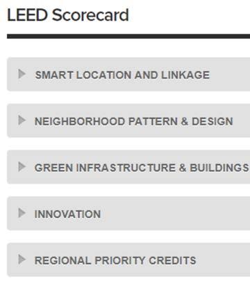
10 LEED ND Categories

11 SITES Overview


12 SITES Goals Regenerative Systems & Resiliency Resource Supply & Climate Change Market Transformation Individual & Community Well-Being

13 SITES Benefits Best Practices Health/Safety/Welfare Standards Marketability Ethics

14 SITES Program Requirements New Projects & Major Renovations No Max Area; 2,000sf Min Area

15 SITES Categories Site Context Pre-Design Assessment & Planning Site Design Water Site Design Soil + Vegetation Site Design Material Selections Site Design Human Health + Well-Being

16 SITES Categories Construction Operations + Maintenance (Education + Performance Monitoring Innovation or Exemplary Performance)

17 LEED ND & SITES Credit Crosswalk
18 Have you worked on a LEED ND or SITES project? LEED ND SITES Both Neither Other LEED

19 SITES Boundaries Land that supports all normal site operations Typically a contiguous property Non-contiguous if only separated by ROW Held under one ownership, management, developer, or maintenance body

20 LEED ND Boundaries One or more parcels May include adjacent ROW If including a ROW, must include entire width Pick carefully to meet pre-req s & credits


21 Measuring Location Criteria Radial measurements Walking distances Project entrances Geographic center Adjacent Within site
22 Draft Crosswalk: Potential Full Substitution SITES v2 CREDIT Site Context P1.1: Limit development on farmland, Case 1: Sites without farmland soils Site Context P1.2: Protect Floodplain Functions Case 1: Sites without Floodplains Site Context C1.5: Redevelop Degraded Sites, Case 1 Previously developed sites Site Context C1.5: Redevelop Degraded Sites, Case 2 Brownfield Sites LEED ND v2009 CREDIT SLLp4 Agricultural Land Conservation, Option 1: Sites Without Affect Soils SLLp5 Floodplain Avoidance - Option 1: Sites Without Floodplains SLLc1 Preferred Locations Option 1: Location Type (a) SLLc2 Brownfields Redevelopment: Option 1 Brownfield Sites
23 Draft Crosswalk: Potential Full Substitution SITES v2 CREDIT Pre-design C2.4: Engage Users and Stakeholders Water P3.2: Reduce Water Use for Landscape Irrigation (only Design the Landscape for no Permanent Irrigation) Human Health + Well Being C6.1: Protect and maintain cultural and historic places, Option 2: Historic or cultural landscapes Construction P7.2: Control and Retain Construction Pollutants LEED ND v2009 CREDIT NPDc12: Community Outreach and Involvement, Option 1 GIBc4 Water-Efficient Landscaping (Projects with no new or existing irrigation) GIBc6: Historic Resource Preservation and Adaptive Reuse (Projects with cultural or historical landscapes that are not altered) GIBp4 Construction activity pollution prevention
24 Draft Crosswalk: LEED ND Earns SITES SITES v2 CREDIT Site Context P1.2: Protect floodplain functions, Case 2: Previously developed and brownfield sites within floodplain Site Context P1.3: Conserve aquatic ecosystems, Case 1: Sites without aquatic ecosystems Site Context P1.4: Conserve habitats for threatened and endangered species, Case 1: Brownfields and previously developed sites LEED ND v2009 CREDIT SLLp5 Floodplain Avoidance - Option 2: Infill or Previously Developed Sites with Floodplains SLLp3 Wetland and Water Body Conservation - Option 1: Sites with No Wetlands, Water Bodies, Land within 50ft of Wetlands or Land within 100 ft of Water Bodies SLLp2 Imperiled Species and Ecological Communities Conservation, Option 1: Sites without Affected Species or Ecological Community
25 Draft Crosswalk: LEED ND Earns SITES SITES v2 CREDIT Site Context P1.4: Conserve habitats for threatened and endangered species, Case 2: Greenfield sites Site Context C1.7: Connect to multimodal transit networks, Option 2: Transit Network Pre-design C2.4: Engage users and stakeholders P3.1: Manage Precipitation On Site C6.1: Protect and Maintain Cultural and Historic Places, Option 1: Historic buildings, structures, or objects LEED ND v2009 CREDIT SLLp2 Imperiled Species and Ecological Communities Conservation, Option 1: Sites without Affected Species or Ecological Community SLLc3 Reduced Automobile Dependence, Option 1 Transit-Served Location NPDc12: Community Outreach and Involvement, Option 1: Community Outreach, Option 2: Charrette, or Option 3: Local Endorsement GIBc8 Stormwater Management, All thresholds GIBc6: Historic Resource Preservation and Adaptive Reuse (Projects reusing historical buildings)
26 Draft Crosswalk: LEED ND Earns SITES SITES v2 CREDIT Site Context P1.1: Limit development on farmland, Case 2: Sites with farmland soils VSPZs Site Context P1.1: Limit development on farmland, Case 3: Sites with farmland soils - Mitigation Site Context P1.3: Conserve aquatic ecosystems, Case 2: Sites with naturally occurring aquatic ecosystems LEED ND v2009 CREDIT SLLp4 Agricultural Land Conservation - Option 1: Sites Without Affected Soils SLLp4 Agricultural Land Conservation - Option 5: Sites With Impacted Soils SLLp3 Wetland and Water Body Conservation- Option 2: Sites with Wetlands, Water Bodies, Land within 50ft of Wetlands or within 100ft of Water Bodies.
27 Draft Crosswalk: LEED ND Earns SITES SITES v2 CREDIT Water C3.4: Reduce outdoor water use, Option 1: Reduce outdoor water use Water C3.4: Reduce outdoor water use, Option 2, Significantly reduce outdoor water use Water C3.4: Reduce outdoor water use, Option 3, Eliminate outdoor water use Soil + Vegetation C4.9: Reduce urban heat island effects LEED ND v2009 CREDIT GIBc4 Water Efficient Landscaping GIBc4 Water Efficient Landscaping GIBc4 Water Efficient Landscaping GIBc9: Heat Island Reduction, Option 3: Mixed Nonroof and Roof Measures

28 Design Process
29 Who is at the typical kick-off meeting? Client and Design Professionals Sustainability Professionals Natural Scientists Health/Well- Being Specialists

30 Standard Design Process Siloed Iterative Consultants added when problems need solving Subsequent steps considered when reached

31 Integrative Design Process SITES P2.1 Integrated Team Collaborative Communication Based on Sustainability Principles Performance Goals

32 Integrative Design Process Stakeholder/User-Driven Construction & Maintenance Considered Early
33 Sustainability Framework
34 Do you set sustainability goals? Yes, for all projects Yes, for some projects No, but I d like to No, we can t justify the time/ money


35 Pre-Design Existing Conditions Team Assembly Analysis Rating System Opportunities & Constraints


36 Design Parameters Finalize Boundary & Development Program Test Scorecard Charette Credit Solutions


37 Performance Goals Water Soils & Vegetation Social Materials Operations & Management Construction Energy


38 Performance Metrics Spaces Common Open Space Recreation Areas Road & Parking Etc. Components Play Features Furnishings Plantings Etc. Systems Circulation Stormwater & Drainage Forest Area Etc.

39 Performance Criteria Siting & Location Experience & Aesthetic Qualities Size/Capacity Materials Functional Relationships Coordination Between Disciplines Infrastructure Needs

40 Design Management Assign Roles & Responsibilities Establish Design Process Hold Regular Working Sessions Check Progress Against Goals & Risks/Constraints

41 4 Credit Comparisons


42 Location LEED ND v4 Preferred Locations SITES v2 Locate Projects Within Existing Developed Area


43 Location Comparison LEED ND 1 of 3 options, up to 5 pts Infill/Pre-developed site Connectivity High-Priority Location & Affordability SITES all criteria must be met, 4 pts Infill site Within 500 of water & sewer service Within 0.5 miles of 7 basic services


44 Determining Location Credits Early mapping & site visits are key Ensure walking distance doesn t have walkable gaps Locate basic service entrances & buildings Map infill (same for LEED ND & SITES) percent areas Map previously developed area LEED ND entire site must be previously developed; SITES 75% of site must be previously developed


45 Trees LEED ND v4 NPD Credit: Tree-Lined and Shaded Streetscapes SITES v2 Credit 4.9: Reduce Urban Heat Island Effects


46 Trees Comparison LEED ND, up to 2 pts 50 spacing over 60% of block lengths Provide shade over 40% of sidewalks SITES, 4 pts Shade trees add to area of non-roof measures in formula
 Species canopy calculations Species restrictions")

47 Trees Decisions & Conflicts Local Ordinances & Guidelines Required tree spacing (> or <) Species canopy calculations Species restrictions Utilities Underground conflicts Overhead restrictions Easement restrictions Soils Volumes to support canopy Remediation/replacement for soil health


48 Community Outreach LEED ND v4 Community Outreach and Involvement SITES v2 Engage Users and Stakeholders


49 Outreach Comparisons LEED ND 3 options, up to 2 pts 3 steps, similar to SITES Option 1 plus charrette Option 1 plus endorsement SITES v2 3 steps, 3 pts Identify Goals, Program & Function Goals; Integrate Outreach into P2.1 & P2.2; Provide Alternatives DD Presentation & Review Two forms of design presentation


50 Outreach Tools Visioning Session Questionnaire Project Website Charette Open Houses HOA/COA Presentations Engage Local Groups


51 Habitat Restoration LEED ND v4 Restoration of Habitat or Wetlands and Water Bodies Sites v2 Restore Aquatic Ecosystems
 Protect via")

52 Habitat Restoration Comparison LEED ND Restoration of pre-development ecological community 10% of development footprint (1 point) Protect via easement & maintenance program SITES Prepare plan based on 9 Attributes of Restored Ecosystems Create maintenance program under O+M P8.1 30% - 90% restored (4 6 points)
")

53 Habitat Restoration Team Members Ecologists Arborists Conservation/Wildlife Biologists (required for LEED ND) Soil Scientists Civil Engineers Horticulturalists Landscape Architects Natural Resource Managers Construction/Maintenance Managers

54 Contact Info Joshua Sloan Vice President/Director of Planning & Landscape Architecture Steve Cook Senior Landscape Architect
Using AutoCAD Civil 3D and ESRI ArcGIS to meet LEED-ND (Neighborhood Development) Requirements NDIA O Brien & Gere. All Rights Reserved.
 Requirements NDIA O Brien & Gere. All Rights Reserved.") Using AutoCAD Civil 3D and ESRI ArcGIS to meet LEED-ND (Neighborhood Development) Requirements NDIA 12457 1 Using AutoCAD Civil 3D and ESRI ArcGIS to meet LEED-ND (Neighborhood Development) Requirements
Using AutoCAD Civil 3D and ESRI ArcGIS to meet LEED-ND (Neighborhood Development) Requirements NDIA 12457 1 Using AutoCAD Civil 3D and ESRI ArcGIS to meet LEED-ND (Neighborhood Development) Requirements
This presentation has been developed by the Sustainable Sites Initiative for general audiences
 This presentation has been developed by the Sustainable Sites Initiative for general audiences Copyright 2011 by the Sustainable Sites Initiative. All rights reserved. 2011 2010 Sustainable Sites Initiative
BRISTOL PLACE MASTER PLAN. Prepared for the City of Champaign
 BRISTOL PLACE MASTER PLAN Prepared for the City of Champaign TABLE of CONTENTS 4 Bristol Place Master Plan Introduction 5 Current Aerial 6 Master Plan 9 Building Types 10 Dimensional Plan 11 LEED-ND Scorecard
Green Infrastructure Mapping Exercise
 Green Infrastructure Mapping Exercise One Water Summit March 3, 2017 Mead Mier Sustainability Coordinator, Watershed Planning Lead Josh Pope GIS Manager Pima Association of Governments Outline What is
FOUR MILE RUN VALLEY WORKING GROUP AND CHARGE
 FOUR MILE RUN VALLEY WORKING GROUP AND CHARGE Adopted April 16, 2016 Amended July 19, 2016 Overview of Integrated Effort The overall goal of the Four Mile Run Valley (4MRV) initiative is to develop a comprehensive
ICLEI Webinar Sustainability in the Master Plan and Zoning Code
 ICLEI Webinar Sustainability in the Master Plan and Zoning Code Sustainability in Grand Rapids 2000 2002 New Master Plan 2004 2005 Neighborhood Pattern Workbook 2006 2007 Form-Based Zoning Ordinance 2007
SAN RAFAEL GENERAL PLAN 2040 INTRODUCTION AND OVERVIEW
 SAN RAFAEL GENERAL PLAN 2040 INTRODUCTION AND OVERVIEW Steering Committee Presentation February 14, 2018 Purpose of General Plan Guide land use and development decisions Coordinate transportation, infrastructure,
Working Group Meeting
 April 4,, 2017 Parks Operations Bldg Working Group Meeting Arts Districts Overview Stormwater/RPA/Stream Considerations First Principles Agenda 7:00pm 7:05pm 7:10pm 7:40pm 8:30pm 9:40pm 9:45pm Welcome
STEWARDSHIP OF LONG ISLAND SOUND S ECOLOGICAL AND RECREATIONAL RESOURCES
 STEWARDSHIP OF LONG ISLAND SOUND S ECOLOGICAL AND RECREATIONAL RESOURCES Robin Kriesberg, Save the Sound, Inc. Thomas Halavik, US Fish and Wildlife Service Coastal Program An Initiative to Identify, Protect
Template for Restoration in a Lake Superior Area of Concern. Template for Restoration in a Lake Superior Area of Concern
 Keith Bowers, Principal Ivette Bolender, Great Lake Bioregion Team Leader Presentation outline: Project background Master planning process Habitat restoration approach Lessons learned Hog Island and Newton
DRAFT FOR PUBLIC REVIEW. Game Plan for a Healthy City
 DRAFT FOR PUBLIC REVIEW 2018 Game Plan for a Healthy City 2 Denveright. Parks & Recreation Game Plan Draft for Public Review Draft for Public Review Executive Summary Game Plan Overview Executive Summary
Green Infrastructure. by Karen Engel, NYS DEC. NYS Department of Environmental Conservation
 Green Infrastructure by Karen Engel, NYS DEC What is Green Infrastructure? For some it s all about water Green Infrastructure techniques use soils and vegetation to infiltrate, evapotranspirate, and/or
A BLUEPRINT FOR BROCKTON A CITY-WIDE COMPREHENSIVE PLAN
 A BLUEPRINT FOR BROCKTON A CITY-WIDE COMPREHENSIVE PLAN Public Meeting October 2016 1 Plan Summary and Discussion Public Meeting May 4 2017 City of Brockton Bill Carpenter, Mayor Department of Planning
Municipal Plan*Assessment
 Municipal Plan*Assessment This tool was developed to assist in reviewing municipal master plans and in determining if these plans are consistent with smart growth principles, neighboring municipal plans,
Regional Open Space Conservation Plan. Regional Staff Committee January 18, 2018
 Regional Open Space Conservation Plan Regional Staff Committee January 18, 2018 Schedule We are here Task 1 - Stakeholder Input & Work Plan Dev. v z 2016 2017 2018 Oct Nov Dec Jan Feb Mar Apr May Jun Jul
Toronto Complete Streets Guidelines
 Toronto Complete Streets Guidelines 108 110 7.1 Green Infrastructure Design Principles 112 7.2 Context-Sensitive Green Streets 114 7.3 Key Green Street Elements Green infrastructure refers to natural and
FOUR MILE RUN VALLEY WORKING GROUP AND CHARGE Adopted April 16, 2016 Amended July 19, 2016
 FOUR MILE RUN VALLEY WORKING GROUP AND CHARGE Adopted April 16, 2016 Amended July 19, 2016 Working Group Charge The Working Group is charged by the County Board to collaborate with staff to provide commission,
Danvers High Street I-1 District Study
 Danvers High Street I-1 District Study Presentation of Final Recommendations Planning Board Presentation June 26 th, 2018 1 Introductions Metropolitan Area Planning Council Sam Cleaves AICP, Principal
FUNDING CORRIDOR REVITALIZATION
 FUNDING CORRIDOR REVITALIZATION Integrated corridor planning for the 21 st Century America Planning Association Annual Conference Atlanta, GA April 27, 2014 Mariia Zimmerman, MZ Strategies, LLC mariia@mzstrategies.com
Downtown by Design: The Bradenton CRA Master Plan. Glatting Jackson, Inc Robert Charles Lesser & Co. Downtown Bradenton Development Authority
 Downtown by Design: The Bradenton CRA Master Plan Glatting Jackson, Inc Robert Charles Lesser & Co. Downtown Bradenton Development Authority October 3, 2006 Our Goal for Today: Introduce Project Introduce
Scope of Services. River Oaks Boulevard (SH 183) Corridor Master Plan
 Corridor Master Plan") Scope of Services River Oaks Boulevard (SH 183) Corridor Master Plan PROJECT AREA The project area consists of the River Oaks Boulevard (SH 183) corridor bounded by SH 199 at the northern end and the Trinity
Scope of Services River Oaks Boulevard (SH 183) Corridor Master Plan PROJECT AREA The project area consists of the River Oaks Boulevard (SH 183) corridor bounded by SH 199 at the northern end and the Trinity
implementation r expression in landscape
 6 ubc okanagan implementation campus plan r expression in landscape 68 6 implementation campus plan sections The Campus Plan supports the academic mission, values and commitments of the University by providing
City of Langford Green Development Checklist
 City of Langford Green Development Checklist The following Green Development Checklist creates a sustainability standard for all comprehensive development within the City of Langford. The commitments made
MONTGOMERY COUNTY PLANNING DEPARTMENT THE MARYLAND-NATIONAL CAPITAL PARK AND PLANNING COMMISSION
 MONTGOMERY COUNTY PLANNING DEPARTMENT THE MARYLAND-NATIONAL CAPITAL PARK AND PLANNING COMMISSION MCPB Item No. Date: 1/26/12 Hanover Shady Grove, Sketch Plan 320120020 Joshua Sloan, Coordinator, Joshua.Sloan@MontgomeryPlanning.org,
Envision Sustainable Infrastructure
 Envision Sustainable Infrastructure Marshview Park Allyson Monsour, PE, ENV SP, LEED Green Associate What Is Sustainability? Social Sustainability Fair and beneficial labor practices Community involvement
Sustainability. Chapter 5. The Loring Park Neighborhood Master Plan. This chapter addresses one of the five major strategic goals of
 Chapter 5 Sustainability This chapter addresses one of the five major strategic goals of The Loring Park Neighborhood Master Plan. This chapter of the Loring Park Neighborhood Small Area Plan addresses
2011 ASLA Design Awards. Westside Creeks Restoration Plan Merit Award AECOM, Fort Collins. Planning & Urban Design
 2011 ASLA Design Awards Westside Creeks Restoration Plan Merit Award AECOM, Fort Collins Planning & Urban Design Project Fact Sheet Category of Entry: Rotating Specialty Award: 2011 2011 ASLA Colorado
APPENDIX 1 - STEERING COMMITTEE ISSUES RESPONSE SUMMARY (WORKSHOP N'p. 1)
") APPENDIX 1 - STEERING COMMITTEE ISSUES RESPONSE SUMMARY (WORKSHOP N'p. 1) Warren County Strategic Growth Plan Stakeholders Meeting Warren County Technical School Gymnasium October 29,2002 7:00 PM During,
APPENDIX 1 - STEERING COMMITTEE ISSUES RESPONSE SUMMARY (WORKSHOP N'p. 1) Warren County Strategic Growth Plan Stakeholders Meeting Warren County Technical School Gymnasium October 29,2002 7:00 PM During,
Steering Committee Meeting
 Neighborhood Planning Initiative NPI EAST CENTRAL AREA PLAN Steering Committee Meeting November 9, 2017 6:00PM 8:00PM Tears McFarlane House East Central Area Plan Steering Committee Meeting 11/9/17 AGENDA
BOISE HP Inc. CAMPUS PROJECT OVERVIEW
 PROJECT OVERVIEW: ALREADY RECOGNIZED AS A LEADER IN REDUCING THE ENVIRONMENTAL FOOTPRINT AND ENSURING STRONG SOCIOLOGICAL ETHICS; HP INC CONTINUES TO IMPROVE PRACTICES WHICH ALIGN WITH THE COMPANY S CORE
Arkansas River Corridor
 Planning for Access Welcome to the Access Project. This project is a recreational planning effort in response to an interest by regional communities along the Arkansas River corridor. The project plan
2040 LUP is a part of the Comprehensive Plan and carries the same legal authority. Economic Challenges
 1.1. Guiding Anchorage s Growth Where will new residents settle over the next two decades? Where will people work, shop, and play? Will there be enough room to grow? How will Anchorage look? Will growth
Why Science is Important to Landscape Architecture
 Why Science is Important to Landscape Architecture How science & landscape architecture relate in 5 minutes. (Hah! No small task!) Take home message: Many different strategies and interventions can enhance
Phase I Redevelopment Plan. First Community Meeting
 Hoboken Terminal and Yard Phase I Redevelopment Plan First Community Meeting May 31, 2011 One Hudson Place Phase I Redevelopment Plan Redevelopment Plan First Community Meeting Agenda 1. Redevelopment
open public hearing and allow public comment request to continue LPA public hearing to January 16, 2014 at 10:30 am
 TODAY S AGENDA Work Session LPA Transmittal Public Hearing open public hearing and allow public comment request to continue LPA public hearing to January 16, 2014 at 10:30 am staff will issue a recommendation
T H A T E V E R Y O N E
 B R I N G I N G C H A N G E T H A T E V E R Y O N E C A N F E E L. AT CHW, we survey, plan, design, engineer, administer and inspect with a purpose: to positively transform the communities we serve. From
building with nature - a new benchmark for green infrastructure
 building with nature - a new benchmark for green infrastructure Danielle Sinnett, Gemma Jerome, Sarah Burgess, Nick Smith and Roger Mortlock outline the aims, development and proposed operation of Building
Countywide Green Infrastructure
 Montgomery County s Countywide Green Infrastructure F U N C T I O N A L M A S T E R P L A N The Maryland National Capital Park and Planning Commission INFRASTRUCTURE An underlying base or foundation especially
Broken Arrow Comprehensive Plan Update Public Workshop Meeting #3 January 23,
 Broken Arrow Comprehensive Plan Update Public Workshop Meeting #3 January 23, September 25,2018 2018 26 April 2016 AGENDA 1. Status Presentation - Charrette Recap - Proposed Vision Framework - Preliminary
IMPLEMENTING SOMERSET COUNTY S INVESTMENT FRAMEWORK
 IMPLEMENTING SOMERSET COUNTY S INVESTMENT FRAMEWORK SMART CONSERVATION THROUGH SMART GROWTH NJ LAND CONSERVATION RALLY March 22, 2014 Laurette Kratina, PP, AICP, Supervising Planner Somerset County Planning
Overview of Southwestern Pennsylvania Commission s (SPC) 2040 Long Range Transportation Plan (LRTP)
 2040 Long Range Transportation Plan (LRTP)") Overview of Southwestern Pennsylvania Commission s (SPC) 2040 Long Range Transportation Plan (LRTP) Presented to Pennsylvania Agency Coordination Meeting May 27, 2015 Doug Smith & Ryan Gordon 1 Southwestern
Overview of Southwestern Pennsylvania Commission s (SPC) 2040 Long Range Transportation Plan (LRTP) Presented to Pennsylvania Agency Coordination Meeting May 27, 2015 Doug Smith & Ryan Gordon 1 Southwestern
NASSAU COUNTY TOWN HALL NEW YORK & CONNECTICUT SUSTAINABLE COMMUNITIES. A Unique Bi-State Partnership to Improve Jobs, Housing and Transportation
 NASSAU COUNTY TOWN HALL NEW YORK & CONNECTICUT SUSTAINABLE COMMUNITIES A Unique Bi-State Partnership to Improve Jobs, Housing and Transportation Police Headquarters Auditorium Mineola, NY December 9 th,
Regional Open Space Conservation Plan Putting the Plan into Action
 Regional Open Space Conservation Plan Putting the Plan into Action Growth Management Policy Board July 5, 2018 Study area Regional Open Space Network Regional Trails: 339 miles Conservation Needs Not in
Today s Agenda. Introduction to Camiros. Introduction to Zoning. Overview of Project Process Current understandings What we ve heard so far
 Today s Agenda Introduction to Camiros Introduction to Zoning Overview of Project Process Current understandings What we ve heard so far Public Comment Camiros Key Personnel Arista Strungys, AICP, PP Principal
BRE Strategic Ecological Framework LI Technical Information Note 03/2016
 BRE Strategic Ecological Framework Technical Information Note 03/2016 September 2016 Contents 1. Introduction 2. Aims of BRE s Strategic Ecological Framework 3. How SEF is different from previous approaches
The Hadean-Creation studio.
 Residential Designing Spring 2016 The Hadean-Creation studio. We provide sustainable and ethical responses to the client s brief by adding value and empowering a sense of pride and ownership. Hadean-Creation
One County s Success in Linking Watershed Protection and Land Use Planning
 One County s Success in Linking Watershed Protection and Land Use Planning Bob Thompson Porter County Plan Commission March 28, 2012 Indiana Watershed Leadership Academy Population 160,000 Approximately
Atlanta BeltLine Subarea 3 Master Plan Update
 Atlanta BeltLine Subarea 3 Master Plan Update April 14, 2018 Workshop Meeting 1 22 miles, connecting 45 neighborhoods 22 MILES of transit 46 MILES of streetscapes and complete streets 33 MILES of urban
PUBLIC WORKSHOP. Re-use of the Josiah Smith Tavern and Old Library. December 14, 2010
 PUBLIC WORKSHOP Re-use of the Josiah Smith Tavern and Old Library Professional Team: The Cecil Group, Inc Peter W. Smith, Inc. Howard/Stein-Hudson Associates December 14, 2010 AGENDA Introductions The
Planning for Staten. Habitat Restoration and Green Infrastructure. Island s North Shore
 Habitat Restoration and Green Infrastructure Planning for Staten Island s North Shore Community Board 1 March 1, 2018 NYC Parks Forestry, Horticulture, and Natural Resources Funded by the NYS Department
Municipal Development Plan Update Urban Service Area and Hamlets
 ENCLOSURE 1 Municipal Development Plan Update Urban Service Area and Hamlets Priorities Committee January 24, 2017 MUNICIPAL DEVELOPMENT PLAN UPDATE SHAPING OUR FUTURE MDP Update - Agenda MDP Update Public
3-2 Environmental Systems
 3-2 Environmental Systems 3.0 ENVIRONMENTAL SYSTEMS CONTENTS 3.1 GREENWAY SYSTEM 3.1.1 General Policies 3.1.2 Natural Heritage Network 3.1.3 Natural Heritage Network Enhancement Lands 3.1.4 Rouge Watershed
Appendix E: Illustrative Green Infrastructure Examples
 Appendix E: Illustrative Green Infrastructure Examples Integrating LID into San Francisco s Urban Landscape Figure E. High-density Residential Figure E. Low-density Residential Figure E. Mixed Use 7 Figure
PDS June 1, 2016 Page 1. Planning and Development Committee. MEETING DATE: Wednesday, June 01, 2016
 Page 1 REPORT TO: Planning and Development Committee MEETING DATE: Wednesday, June 01, 2016 SUBJECT: ROPA 12: Project Initiation Report Regional Official Plan Amendment (ROPA # 12) Watercourse Policies
Surrey Ecosystem Management Study
 Surrey Ecosystem Management Study Green Infrastructure Network Opportunities Public Open House & Information Session June 24 th, 2010 EMS Process Ecological Inventory Ecological Assessment Management Policy
Regional Open Space Conservation Plan Putting the Plan into Action
 Regional Staff Committee June 21, 2018 Regional Open Space Conservation Plan Putting the Plan into Action Comments on the draft Include more discussion of urban open space Benefits, challenges to maintaining/increasing
PSRC REVIEW REPORT & CERTIFICATION RECOMMENDATION
 PSRC REVIEW REPORT & CERTIFICATION RECOMMENDATION KITSAP COUNTY COUNTYWIDE PLANNING POLICIES July 2, 2012 BACKGROUND A major emphasis of the Washington State Growth Management Act (GMA) is the need to
Chair and Members of the Planning, Public Works and Transportation Committee. Tara Buonpensiero, Senior Planner Policy, MCIP, RPP
 REPORT TO: REPORT FROM: Chair and Members of the Planning, Public Works and Transportation Committee Tara Buonpensiero, Senior Planner Policy, MCIP, RPP DATE: April 9, 2018 REPORT NO.: RE: PLS-2018-0027
CONSERVATION ELEMENT GOALS, OBJECTIVES, AND POLICIES
 CONSERVATION ELEMENT GOALS, OBJECTIVES, AND POLICIES Goal 4 To conserve, manage, appropriately use and protect the natural resources of the City ensuring continued resource availability and environmental
NACCED/NACo CONFERENCE JULY 10, 2015
 NACCED/NACo CONFERENCE JULY 10, 2015 Regional Growth Framework 2 Regional Growth Framework Regional Priorities Preferred Growth Concept Tools to Support Local Governments 3 Top Priorities for the CONNECT
Revolutionizing Green Roof and Green Wall Performance: The Living Architecture Performance Tool
 Revolutionizing Green Roof and Green Wall Performance: The Living Architecture Performance Tool April 23, 1-2pm EST Professional Development Hours: 1.0 LA CES/HSW LANDSCAPE ARCHITECTURE FOUNDATION 501(c)(3)
A Landscape Scale Approach to Habitat Conservation
 A Landscape Scale Approach to Habitat Conservation Sara Vickerman December 2012 Why this session? Disconnect between landscape level assessments and planning, and transactions on-the-ground focused on
Bethesda Downtown Plan
 Bethesda Downtown Plan Planning Board Update Connecticut Avenue Location Economic Sustainability Social Environmental Scope Coming Soon! Team Listening, Twitter Outreach We Are Here Engagement Challenge
Green Infrastructure and Adaptive Management
 Green Infrastructure and Adaptive Management A New Synergy One Water August 27, 2014 Tina Wolff, PE Imagine 1 23 September the result 2014 Prepared by the Green Infrastructure Implementation Task Force
Town of Oakville Streetscape Strategy
 Town of Oakville Streetscape Strategy Endorsed by PDC on February 10, 2014 (PD-011-14) Town of Oakville Streetscape Strategy [endorsed by PDC February 10, 2014] 0 Town of Oakville Streetscape Strategy
What does LEED characterize?
 LEED Certification What does LEED characterize? Leadership in Energy and Environmental Development How was it created? Created by United States Green Building Council (USGBC) in 1998 Developed by architects
INTEGRATING PROTECTED AREAS INTO THE WIDER LANDSCAPE, SEASCAPE AND RELATED SECTORS. An Overview
 INTEGRATING PROTECTED AREAS INTO THE WIDER LANDSCAPE, SEASCAPE AND RELATED SECTORS An Overview USING AN EXAMPLE FROM NORTHEAST US Relationship of IPAWLS guide to other planning and assessment processes
Introduction. Introduction
 Introduction Introduction I MAGINE that in the next 10 to 20 years, we can begin to reshape Grounds to reflect the civic intent and environs created by Thomas Jefferson s Academical Village. Through a
IV. Development in the Rural Overlay District
 Intracoastal Waterway Route 17 Route 168 Great Dismal Swamp VIRGINIA NORTH CAROLINA IV. Development in the Rural Overlay District IV-1 Route 17 in Chesapeake s Rural Overlay District affords distant views
MONTHLY MEETING AGENDA
 Officers Jack Kooyoomjian, President Vice President - Vacant Kathleen Harding, Secretary Tom Burrell, Acting Treasurer Others Tom Burrell, PELT Committee Chairman Jan Cunard, LOCCA Historian MONTHLY MEETING
RECREATION AND OPEN SPACE ELEMENT GOALS, OBJECTIVES, AND POLICIES
 RECREATION AND OPEN SPACE ELEMENT GOALS, OBJECTIVES, AND POLICIES Goal 7 To provide park facilities, recreation programs, and open space resources that are safe, adequate, and accessible to all City residents,
Describing the Integrated Land Management Approach
 Describing the Integrated Land Management Approach ISBN No. 978-0-7785-8902-0 (Online Edition) Pub No. I/422 What is Integrated Land Management? Integrated land management (ILM) is the strategic, planned
Green Infrastructure Planning for Sustainability and Resiliency
 Green Infrastructure Planning for Sustainability and Resiliency Linking Lands and Communities in the Land-of-Sky Region SAMAB Conference - November 18, 2010 www.linkinglands.org Linda Giltz, AICP, Regional
Sustainability and the Campus Long Range Master Plan
 Sustainability and the Campus Long Range Master Plan Hawai i Sustainability in Higher Education Summit Presenters: Grant Murakami, AICP, LEED BD+C Roy Takemoto PBR HAWAII and Associates, Inc. Overview
2035 General Plan Update and Belmont Village Specific Plan. Joint Study Session with the City Council and Planning Commission April 12, 2016
 2035 General Plan Update and Belmont Village Specific Plan Joint Study with the City Council and Planning Commission April 12, 2016 Agenda 1. Welcome and Introductions 2. General Plan Update Status of
Land Use Regional Planning in Alberta Collaborating with Stakeholders
 Land Use Regional Planning in Alberta Collaborating with Stakeholders Trevor Lema, Land & Integrated Management Planner September 2018 Overview Why Regional Planning? An Integrated Perspective Integrated
Sustainability Criteria for Planning, Constructing, and Operating Contingency Bases
 Sustainability Criteria for Planning, Constructing, and Operating Contingency Bases Giselle Rodriguez, P.E. Civil and Environmental Engineer Construction Engineering Research Laboratory Engineer Research
Gold Line Bus Rapid Transit Transit Oriented Development (BRTOD) Helmo Station Area Plan
 Helmo Station Area Plan") Appendix F Gold Line Bus Rapid Transit Transit Oriented Development (BRTOD) Helmo Station Area Plan Introduction and Purpose of the Plan The Gold Line Bus Rapid Transit facility is an eleven-mile dedicated
Appendix F Gold Line Bus Rapid Transit Transit Oriented Development (BRTOD) Helmo Station Area Plan Introduction and Purpose of the Plan The Gold Line Bus Rapid Transit facility is an eleven-mile dedicated
Master Environmental Servicing Plan & Secondary Plan
 East Side Lands Stage 2 1 Master Environmental Servicing Plan & Secondary Plan Public Information Centre #1 June 16, 2016 Welcome! Today s Agenda Please sign in at the front desk. 5:30 pm 6:30 pm: Open
ARTICLE 6: Special and Planned Development Districts
 ARTICLE 6: Special and Planned Development Districts 6-10 Traditional Neighborhood Development (TND) District 6-10.10 Purpose and Intent The Traditional Neighborhood Development (TND) District provides
CHAPTER 12 IMPLEMENTATION
 CHAPTER 12 IMPLEMENTATION The 2010 Town of Denton Comprehensive Plan is intended to capture a vision of the future of Denton. As such, it provides a basis for a wide variety of public and private actions
Presentation Item C Annotated Model Outline for a Framework for a Green Infrastructure Plan
 Date: August 17, 2016 To: From: Subject: Management Committee Dan Cloak, Consultant Presentation Item C Annotated Model Outline for a Framework for a Green Infrastructure Plan Recommendation: Receive the
Realizing District Ecological Infrastructure: From Vision to Site Implementation in Cities SUN-A04
 Realizing District Ecological Infrastructure: From Vision to Site Implementation in Cities SUN-A04 Session Marketing Statement Implementing district scale ecological infrastructure continues to be a difficult
APWA Expo August 27, Ground Water Recharge With Storm Management: A Sustainable Development
 APWA Expo August 27, 2013 Ground Water Recharge With Storm Management: A Sustainable Development Presented by: Joel S. Koenig, P.E. Andrew J. Hawkins Chris P. Dagiantis, P.E., CFM Bios Joel S. Koenig,
Growth Management Planning in the Central Puget Sound Region. Today s Presentation. Puget Sound Region. New Partners for Smart Growth
 Growth Management Planning in the Central Puget Sound Region New Partners for Smart Growth Denver, CO January 2006 Today s Presentation Regional growth management in central Puget Sound, WA Regional geographies
Gratigny Parkway East Extension Project Development & Environment (PD&E) Study
 Study") Gratigny Parkway East Extension Project Development & Environment (PD&E) Study Session 4: Presentation of Charrette Results December 8, 2010 MDX Work Program #: 92407 ETDM#: 11500 Project Location & Description
Gratigny Parkway East Extension Project Development & Environment (PD&E) Study Session 4: Presentation of Charrette Results December 8, 2010 MDX Work Program #: 92407 ETDM#: 11500 Project Location & Description
CHAPTER 2: PLANNING PRINCIPLES
 CHAPTER 2: PLANNING PRINCIPLES 2 Comprehensive Principles The following overarching Principles provide the basis for the goals and policies included in the Mendocino County General Plan. These Principles
Stormwater in a Liveable City Towards an Evidence Based Policy Framework. Associate Professor Phillip Johnstone
 Stormwater in a Liveable City Towards an Evidence Based Policy Framework Associate Professor Phillip Johnstone Stormwater in a Liveable City Define the stormwater system Stormwater impacts and their mitigation
LANDSCAPE SCALE PLANNING AND SITING FOR SHALE DEVELOPMENT
 LANDSCAPE SCALE PLANNING AND SITING FOR SHALE DEVELOPMENT An Energy by Design approach to reducing the overall environmental footprint. MICHELLE MCGREGOR SR. OIL & GAS DEVELOPMENT ADVISOR Agenda Introduction
Improve Neighborhood Design and Reduce Non Point Source Water Pollution
 HOW TO Planning Guide Improve Neighborhood Design and Reduce Non Point Source Water Pollution This document was funded by a grant from the New Hampshire Coastal Program with funding from the National Oceanic
Scorecard. WaterQuality. Appendix B USEPA WATER QUALITY SCORECARD APPENDIX B
 Appendix B USEPA WATER QUALITY SCORECARD EPA 231B09001 October 2009 http://www.epa.gov WaterQuality Scorecard Incorporating Green Infrastructure Practices at the Municipal, Neighborhood, and Site Scales
Are healthy and attractive for people and their communities, and protect and enhance our environment.
 Are healthy and attractive for people and their communities, and protect and enhance our environment. LIVING WATERWAYS IS A BEST PRACTICE ENVIRONMENTAL MANAGEMENT APPROACH TO DELIVER ENDURING, ENGAGING
Design Alternatives Workshop. Hilfiker Park Master Plan Workshop #2
 Design Alternatives Workshop Hilfiker Park Master Plan Workshop #2 Agenda for Tonight Staff Presentation (40 min) Introduction Master Plan Process Planning Context What We ve Heard So Far Design Alternatives
Rainfall Capture and Green Subdivision Design:
 Rainfall Capture and Green Subdivision Design: Applying the Water Balance Model Kim Stephens, MEng, PEng, Project Coordinator Inter-Governmental Partnership from Stormwater Management to Rainwater Management
CITY OF CHARLOTTESVILLE, VIRGINIA CITY COUNCIL AGENDA
 CITY OF CHARLOTTESVILLE, VIRGINIA CITY COUNCIL AGENDA Agenda Date: December 16, 2013 Action Required: Adoption of Resolution Presenter: Staff Contacts: Title: James E. Tolbert, AICP, Director of NDS James
McDonald s Restaurant - Purcellville Town of Purcellville Special Use Permit Statement of Justification July 24, 2014
 Introduction / Written Statement McDonald s Restaurant - Purcellville McDonald s Corporation is proposing to redevelop the existing McDonald s eating establishment with a drive-through located at 121 N
3.10 LAND USE SETTING PROJECT SITE EXISTING LAND USE DESIGNATIONS AND ZONING. General Plan Land Use Designations.
 This section of the Draft EIR addresses the existing land uses on and adjacent to the project site and discusses the potential impacts of the proposed project on existing land uses. Key issues addressed
CONTENTS 8.0 LAND USE 8.1 GENERAL LAND USE 8.2 RESIDENTIAL 8.3 MIXED USE 8.4 COMMERCIAL 8.5 EMPLOYMENT LANDS
 8-2 Land Use 8.0 LAND USE CONTENTS 8.1 GENERAL LAND USE 8.1.1 Uses provided for in all Land Use Designations 8.1.2 Uses prohibited in Hazardous Lands, Hazardous Sites and Special Policy Areas 8.1.3 Uses
COMMUNITY MEETING: ROUND 3. Ill' PUBLIC WORKS outreach systems study Planning Design»Action
 l.,,.l DENVER COMMUNITY MEETING: ROUND 3 10 resiliency planning Iupper montclair education J stormwater Ill' PUBLIC WORKS Planning Design»Action TONIGHT'S AGENDA 10 resiliency planning Iupper montclair
Chapter 2: Vision, Goals and Strategies
 Chapter 2: Vision, Goals and Lake Elmo Today & Tomorrow Comprehensive Plan 2040 2 VISION, GOALS & STRATEGIES - DRAFT 4-6-2018 INTRODUCTION Comprehensive Plan Purpose Perhapse the most important objective