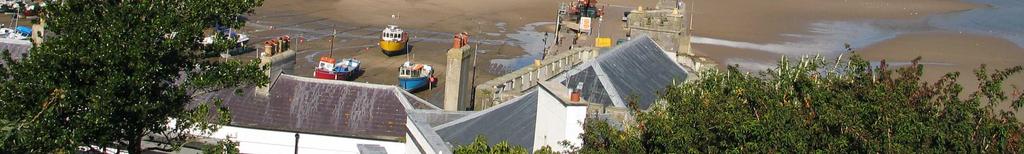
New Approaches to Coastal Development Gary Taylor Chairman Environmental Defence Society
|
|
|
- Conrad Nelson Robinson
- 5 years ago
- Views:
Transcription


1 New Approaches to Coastal Development Gary Taylor Chairman Environmental Defence Society Public interest ENGO Founded in 1971 Professionally based Went into recess in 1990s Reformed in 1999 after Arrigato decision 1
2 STRATEGIC IMPERATIVES Focus areas Biodiversity conservation, landscape conservation, pollution prevention (including climate change) Process guardian role Litigation where nationally significant resource and/or important legal principle at stake Policy role Research, preparation of guidelines, seminars and conferences GENESIS OF COASTAL CAMPAIGN Long history of interest (e.g. Karikari Resort in 1970s) Largely litigation focus until recently Contributed to jurisprudence on coast (e.g. meaning of unnecessary ) Support for NZ Coastal Policy Statement principles 2

 Appeals (Hot Water Beach) Plan submissions (Far")
3 RECENT COASTAL INITIATIVES NZ Landscape Conference 2003 Landscape Report Landscape Planning Guidelines Coastal Development Guidelines RECENT COASTAL INITIATIVES Support for Crown purchase (Waikawau Bay, Kaikoura Island) Support for local initiatives (Taupo District) Appeals (Hot Water Beach) Plan submissions (Far North, Rodney) 3
4 RMA REVIEW Replace inappropriate with unnecessary in section 6 Insert definition of natural character Provide special protection for headlands Strengthen the NZCPS Toughen non-complying activity test Reassert strategic planning THE CHALLENGE NZ an island nation located in South Pacific Ocean Consists of more than 330 islands Has over 15,000 km of coastline Much of it is outstanding in landscape terms People like to live on the coast Enormous, unprecedented development boom Need to accommodate those needs 4


5 THE APPROACH Tailor management approaches to three different types of coastal areas: Intensively developed Partly developed Undeveloped INTENSIVELY DEVELOPED COASTLINE Variable quality Built environment dominates Encourage further development where spare capacity 5


6 MANAGEMENT APPROACH Retrofit old infrastructure Adapt to sea level rise and effects of climate change Implement higher design standards Simplify rules and speed up consent processes PARTLY DEVELOPED COASTLINE Some built structures but not dominant Biodiversity and landscape often degraded Suitable for low intensity, well designed development 6


7 MANAGEMENT APPROACH Avoid impacts on important landscapes, high natural character, significant habitats and cultural values Ensure real land restoration benefits Ongoing weed and pest management Secure public access to the coast Lock in subdivision as a oncer UNDEVELOPED COASTLINE Few visible buildings and structures Outstanding natural character, landscape and/or cultural values Not suitable for orthodox development 7


8 MANAGEMENT APPROACH Retain low intensity, very large lots Use prohibited activity status to exclude inappropriate development Provide landowner support for fencing areas of indigenous vegetation, restoration planting and weed and pest control WELSH COASTLINE They can do it Strong development controls Much of coast in public ownership 8
9 EDS ENVIRONMENTAL TICK New initiative aimed at well-motivated landowners Born out of frustration with limits to litigation Also concern that government not taking issue seriously Aimed at raising the performance bar EDS ENVIRONMENTAL TICK PROCESS Higher standards than RMA test Careful procedure to avoid greenmail EDS reviews project against criteria Recommendations made to landowner If accepted, may award EDS Environmental Tick Signifies EDS support for the project 9
10 EDS ENVIRONMENTAL TICK CRITERIA Conformity with statutory instruments Avoidance of impacts on outstanding landscapes, ridgelines, significant habitats Where can t avoid, significant environmental compensation elsewhere Highest standards of building design and impacts minimised EDS ENVIRONMENTAL TICK CRITERIA Restoration planting Avoidance of adverse cumulative effects Careful earthworks Effective stormwater management Covenants against future subdivision Example of best practice 10


11 AWARDING ENVIRONMENTAL TICK New area for EDS and approaching with care Comprehensive assessment process Mountain Landing development awarded inaugural EDS Environmental Tick Full report on EDS website CAPE KIDNAPPERS Lodge-style development on the coast near gannet colonies Part of 2000 hectare Cape Kidnappers Station 11


12 CAPE KIDNAPPERS DEVELOPMENT Great care in design and location of structures Earth roofs, low profile, mound screening, small scale Sunset room views across bay CAPE KIDNAPPERS ASSESSMENT Team of Stephen Brown, Alan Bradbourne, Raewyn Peart and me Thorough review of documents plus site visit Project met RMA tests Then evaluated against Environmental Tick criteria 12


13 CAPE KIDNAPPERS AWARD Delighted to announce CKS recipient of EDS Environmental Tick Landowner has agreed to our recommendations Looked at wider property context CAPE KIDNAPPERS AWARD Strategic plan will consider for implementation: Protecting RAPs with QEII covenants Retiring areas from farming and covenanting Extensive restoration planting Weed and pest management Predator proof fence across Peninsula Identifying sensitive coastal areas for protection Sustainable management objectives for all activities 13


14 CONCLUSIONS - WHAT WE NEED Strategic planning to guide the coastal development market Robust criteria to raise the performance bar in areas where development is appropriate Clearly defined areas which are no go for development A willingness to say no more often A strengthened RMA to ensure that that no sticks WATCH THIS SPACE 14
Raewyn Peart. Policy Director Environmental Defence Society
 1 Raewyn Peart Policy Director Environmental Defence Society www.eds.org.nz Coastal Environment Where the sea impacts on the land and the land impacts on the sea 2 www.eds.org.nz Section 6 RMA matters
CA.1 Coastal Area. Index. CA.1.1 Description and Expectations
 Index.1.2.3.4 CA.2 CA.2.1 CA.2.2 CA.2.3 CA.3 CA.3.1 CA.3.2 CA.3.1 CA.4 CA.4.1 CA.4.2 CA.4.3 CA.4.4 CA.5 CA.5.1 CA.5.2 Description and Expectations Objectives Policies Guidance Note Landuse Eligibility
Chapter 3: Natural Environment. Proposed Waikato District Plan Stage 1. (Notified version)
") Chapter 3: Natural Environment Proposed Waikato District Plan Stage 1 Page 2 of 7 Contents Chapter 3: Natural Environment... 3 3.1 Indigenous Vegetation and Habitats... 3 3.1.1 Objective Biodiversity and
Chapter 3: Natural Environment Proposed Waikato District Plan Stage 1 Page 2 of 7 Contents Chapter 3: Natural Environment... 3 3.1 Indigenous Vegetation and Habitats... 3 3.1.1 Objective Biodiversity and
I541. Te Arai North Precinct
 I541. Te Arai North Precinct I541.1. Precinct Description The Te Arai North Precinct contains approximately 616ha of coastal land north of Te Arai Point, generally known as Mangawhai North Forest. The
I511. Hatfields Precinct
 I511. Hatfields Precinct I511.1. Precinct Description The Hatfields Precinct is a contiguous 183.8 hectare block of rural land held in 8 freehold titles, located immediately to the north of Hatfields Beach.
Parish of Repton NEIGHBOURHOOD DEVELOPMENT PLAN
 Parish of Repton NEIGHBOURHOOD DEVELOPMENT PLAN BASIC CONDITIONS STATEMENT December 2018 CEF 4 Legal Requirements This statement has been produced by the NDP Working Group on behalf of Repton Parish Council
H7 Open Space zones. (a) provide for the needs of the wider community as well as the needs of the community in which they are located;
 provide for the needs of the wider community as well as the needs of the community in which they are located;") H7. Open Space zones H7.1. Background The majority of land zoned as open space is vested in the Council or is owned by the Crown. However some areas zoned open space are privately owned. While the open
H7. Open Space zones H7.1. Background The majority of land zoned as open space is vested in the Council or is owned by the Crown. However some areas zoned open space are privately owned. While the open
B4. Te tiaki taonga tuku iho - Natural heritage
 B4. Te tiaki taonga tuku iho - Natural heritage Tuia I runga, tuia i raro, tuia ki te waonui a Tiriwa Bind the life forces of heaven and earth to the great realm of Tiriwa B4.1. Issues Auckland s distinctive
7. Landscape. Introduction
 Introduction Our landscapes provide us with a Marlborough identity and are an integral part of the Marlborough environment. Landscapes are distinct spatial areas influenced by location-specific processes
1 INTRODUCTION TO NATURAL ENVIRONMENT
 Kāpiti Coast District Plan Review Section 32 Analysis Summary Report 1 INTRODUCTION TO NATURAL ENVIRONMENT Diverse landscapes, plants and animals make up the natural environment of the District. Much has
In the Environment Court of New Zealand Christchurch Registry ENV-2016-CHC- Appellants. Otago Regional Council. Respondent
 In the Environment Court of New Zealand Christchurch Registry ENV-2016-CHC- Under In the matter of Between the Resource Management Act 1991 (RMA) an appeal under Clause 14(1), First Schedule of the RMA
Section 6A 6A Purpose of the Natural Features and Landscapes Provisions
 Section 6A 6A Purpose of the Natural Features and Landscapes Provisions This Chapter addresses the protection and management of natural features and landscapes within the City. The City has a number of
LANDSCAPE GUIDELINES. Countryside & Coastal Countryside Environments. Landscape, Natural Character & Amenity Values Guide
 Landscape, Natural Character & Amenity Values Guide Copyright WDC 2009 Version A2 18May09 Environmental Services Group Publication Countryside & Coastal Countryside Environments START HERE Quality Land
Section 3b: Objectives and Policies Rural Environment Updated 19 November 2010
 Page 1 of Section 3b 3b RURAL ENVIRONMENT 3b.1 Introduction The Rural Environment comprises all the land outside of the Residential, Town Centre and Industrial Environments. Most land within the District
Appendix A - Relief sought
 Appendix A - Relief sought Chapter 2 Definitions Definitions Tourism Activity (new) and Visitor Industry (new) The plan does not provide specific definition for tourism. The plan does introduce a new strategic
STATEMENT OF EVIDENCE OF DONALD ALAN SANGSTER
 AT THAMES-COROMANDEL DISTRICT COUNCIL: IN THE MATTER AND IN THE MATTER of the Resource Management Act 1991 of submissions by Pohutukawa Slopes Limited to the Proposed District Plan. STATEMENT OF EVIDENCE
RLE.1 Rural Living Environment
 Index.1 Description and Expectations.2 Objectives.3 Policies.4 Guidance RLE.2 Landuse RLE.2.1 Eligibility Rules RLE.2.2 Notification Rules RLE.2.3 Discretionary Activities RLE.3 Subdivision RLE.3.1 Eligibility
E15. Vegetation management and biodiversity
 E15. management and biodiversity E15.1. Background contributes to a range of ecosystem services such as erosion and sediment control, reducing stormwater flows, protecting or enhancing water quality, amenity
GIBBSTON CHARACTER ZONE. QLDC PROPOSED DISTRICT PLAN [PART FOUR] AUGUST gibbston character zone
![GIBBSTON CHARACTER ZONE. QLDC PROPOSED DISTRICT PLAN [PART FOUR] AUGUST gibbston character zone](/thumbs/75/72573993.jpg "GIBBSTON CHARACTER ZONE. QLDC PROPOSED DISTRICT PLAN [PART FOUR] AUGUST gibbston character zone") 23 GIBBSTON CHARACTER ZONE QLDC PROPOSED DISTRICT PLAN [PART FOUR] AUGUST 2015 23 gibbston character zone QLDC PROPOSED DISTRICT PLAN [PART FOUR] AUGUST 2015 23 gibbston character zone 23.1 Zone Purpose
23 GIBBSTON CHARACTER ZONE QLDC PROPOSED DISTRICT PLAN [PART FOUR] AUGUST 2015 23 gibbston character zone QLDC PROPOSED DISTRICT PLAN [PART FOUR] AUGUST 2015 23 gibbston character zone 23.1 Zone Purpose
D10. Outstanding Natural Features Overlay and Outstanding Natural Landscapes Overlay
 D10. Outstanding Natural Features Overlay and Outstanding Natural Landscapes Overlay D10.1. Background These provisions give effect to Policy 15(a) of the New Zealand Coastal Policy Statement 2010, and
D10. Outstanding Natural Features Overlay and Outstanding Natural Landscapes Overlay
 D10. Outstanding Natural Features Overlay and Outstanding Natural Landscapes Overlay D10.1. Background These provisions give effect to Policy 15(a) of the New Zealand Coastal Policy Statement 2010, and
Proposed Plan Change 55: District Wide Rules. Hearing Report
 Proposed Plan Change 55: District Wide Rules Hearing Report Appendix 5 BEFORE THE HEARINGS PANEL In the Matter of: The Resource Management Act 1991 And Proposed Plan Change 55: Chapter 3 District Wide
Section 32 report: Natural heritage for the Proposed Natural Resources Plan for the Wellington Region
 Section 32 report: Natural heritage for the Proposed Natural Resources Plan for the Wellington Region Issues and Evaluation Report Section 32 report: Natural heritage for the Proposed Natural Resources
I542. Te Arai South Precinct
 I542. Te Arai South Precinct I542.1. Precinct Description The Te Arai South Precinct contains approximately 750ha of coastal land south of Te Arai Point, known as Mangawhai South Forest. The land within
Landowners Coalition Incorporated. Whangarei District Council
 IN THE ENVIRONMENT COURT ENV-2018-AKL- AT AUCKLAND IN THE MATTER of the Whangarei District Plan and the Resource Management Act 1991 (RMA) AND IN THE MATTER of an appeal under Clause 14(1) of Schedule
6 Landsc apes and rur al char ac
 LANDSCAPES AND RURAL CHARACTER QLDC PROPOSED DISTRICT PLAN [PART TWO] DECISION VERSION ter 6 Landsc apes and rur al char ac 6.1 Purpose Appendix C QLDC DISTRICT PLAN [PART TWO] DECISION VERSION 6 Landsc
Settlement Boundaries Methodology North Northumberland Coast Neighbourhood Plan (August 2016)
") Introduction This background paper sets out a methodology for the definition of settlement boundaries in the North Northumberland Coast Neighbourhood Plan. The neighbourhood plan is planning positively
Introduction This background paper sets out a methodology for the definition of settlement boundaries in the North Northumberland Coast Neighbourhood Plan. The neighbourhood plan is planning positively
Proposed Southland District Plan 2012 Appeal Version October 2016
 S e c t i o n 3. 5 - F i o r d l a n d / R a k i u r a Z o n e The Fiordland/Rakiura Zone encompasses the Fiordland and Rakiura National Parks and part of Mt Aspiring National Park. It also includes areas
Statutory and Non-Statutory Designated Sites and Ecology
 Statutory and Non-Statutory Designated Sites and Ecology The National Planning Policy Framework considers the conservation and enhancement of the natural environment in chapter 11 paragraphs 109-119, where
Development in the setting of the Cotswolds AONB
 COTSWOLDS CONSERVATION BOARD POSITION STATEMENT Development in the setting of the Cotswolds AONB.1. Introduction Areas of Outstanding Natural Beauty (AONBs) are designated by the Government for the purpose
open space environment
 This section updated August 09 GUIDELINE TO THE RULES The Open Space Environment Rules apply to activities on sites within the Open Space Environment as shown on the Human Environments Maps. Most of the
Tāhuhu whakaruruhau ā-taone The sheltering ridge pole
 B2. Tāhuhu whakaruruhau ā-taone - Urban growth and form B2.1. Issues Tāhuhu whakaruruhau ā-taone The sheltering ridge pole Auckland s growing population increases demand for housing, employment, business,
4 Residential and Urban Living Zones
 4 Residential and Urban Living Zones Refer to Chapters 11 to 20 for additional rules that may apply to these zones. 4.1 OBJECTIVES AND POLICIES Objective Res1 Policy 1 Policy 2 Policy 3 Policy 4 Policy
Appendix A- A - Relief sought
 Appendix A- A - Relief sought Chapters 3 Strategic Direction 3.2.5 The retention of the District s distinctive landscapes. (addresses Issues 2 and 4) It is unclear whether provision 3.2.5 is a heading
ROCHFORD LOCAL DEVELOPMENT FRAMEWORK: Sustainability Appraisal/ Strategic Environmental Assessment. Rochford Core Strategy Preferred Options Document
 ROCHFORD LOCAL DEVELOPMENT FRAMEWORK: Sustainability Appraisal/ Strategic Environmental Assessment Non Technical Summary Rochford Core Strategy Preferred Options Document October 2008 SUSTAINABILITY APPRAISAL
PART 5 - NATURAL AND PHYSICAL ENVIRONMENT
 CONTENTS...PAGE 5.1 INTRODUCTION...3 5.2 NATURAL RESOURCES...4 5.3 PHYSICAL RESOURCES...4 5.4 COASTAL ENVIRONMENT...4 5.5 HERITAGE FEATURES...4 5.6 HAZARDS...4 5.7 SUMMARY...4 ISTHMUS SECTION - OPERATIVE
Coastal Environment Overlay and Coastal Zone - District Plan Direction Setting Document (Draft to Proposed)
") Coastal Environment Overlay and Coastal Zone - District Plan Direction Setting Document (Draft to Proposed) 1.0 Background Coastal Zone The Coastal Zone was originally defined in 1975 following the release
Coastal Environment Overlay and Coastal Zone - District Plan Direction Setting Document (Draft to Proposed) 1.0 Background Coastal Zone The Coastal Zone was originally defined in 1975 following the release
I403 Beachlands 1 Precinct
 I403. Beachlands 1 I403.1. Precinct Description Beachlands is a rural and coastal village located on the eastern side of Auckland, adjoining the Tamaki Strait coastline. The original Beachlands village
Appendix A. Planning Processes. Introduction
 1 Planning Processes Introduction This appendix outlines a number of planning processes which are used in the Auckland Region to support the effective management of development in the region s rural and
CITY VIEW OBJECTIVES
 SECTION 2: CITY VIEW OBJECTIVES CONTENTS 2.1 Introduction 1 2.2 Strategic Direction 1 2.3 The City View Resource Management Issues for the City 1 2.4 The Goal 3 2.5 The City View Objectives 3 Palmerston
I602. Birdwood Precinct
 I602. Birdwood Precinct I602.1. Precinct description The Birdwood Precinct applies to an area west of Don Buck Road and south of Red Hills Road in west Auckland. It incorporates subdivision and development
Strategic Environmental Assessment Screening Report. Dublin Port Masterplan Review 2017
 Strategic Environmental Assessment Screening Report Dublin Port Masterplan Review 2017 Table of Contents 1 Introduction... 1 2 Purpose of the Masterplan... 2 3 Task 1.1 Pre-Screening Check... 5 4 Task
SH1 - Causeway, Auckland, 2014 (Source: NZ Transport Agency)
") SH1 - Causeway, Auckland, 2014 (Source: NZ Transport Agency) Coastal effects assessment guide Environmental and social responsibility policy State highway environmental plan Transport Agency statement
SH1 - Causeway, Auckland, 2014 (Source: NZ Transport Agency) Coastal effects assessment guide Environmental and social responsibility policy State highway environmental plan Transport Agency statement
Bill Stockman PROPOSED SHED PLANNER S REPORT & ASSESSMENT OF ENVIRONMENTAL EFFECTS
 Thomson Survey Limited Shed Land Use Proposal January-19 Bill Stockman PROPOSED SHED 798D Taupo Bay Road PLANNER S REPORT & ASSESSMENT OF ENVIRONMENTAL EFFECTS Thomson Survey Ltd Kerikeri 1.0 INTRODUCTION
Rhode Island Shoreline Change Special Area Management Plan
 Rhode Island Shoreline Change Special Area Management Plan Draft Document Outline REVISED 10/12/2017 VOLUME 1 Executive Summary & How to Use this Document (Draft by Dec 2017) 1. Introduction (Revised draft
SH1 link to Matakana Road
 Future transport network for Warkworth Warkworth is expected to grow to a substantial satellite town of more than 20,000 people over the next few decades. To meet this anticipated growth, around 1,000
5 LEGISLATIVE FRAMEWORK FOR LANDSCAPE PROTECTION
 5 LEGISLATIVE FRAMEWORK FOR LANDSCAPE PROTECTION The RMA acknowledges that landscapes are important but provides that we should only protect them if they are outstanding and in the absence of other competing
Effingham Neighbourhood Plan 1. Basic Conditions Statement
 Effingham Neighbourhood Plan 1 Basic Conditions Statement Effingham Neighbourhood Plan 2016: Basic Conditions Statement 2 Contents This statement has been prepared by Effingham Parish Council to accompany
STATEMENT OF OBJECTION TO THE PROPOSED DEVELOPMENT OF LAND AT CHURCH CLIFF DRIVE FILEY
 STATEMENT OF OBJECTION TO THE PROPOSED DEVELOPMENT OF LAND AT CHURCH CLIFF DRIVE FILEY You will be aware that Scarborough borough council have adopted a new local plan that includes land at Church Cliff
RPE. Rural Production Environment. Index. RPE.1.1 Description and Expectations
 RPE.1 Rural Production Environment Index RPE.1 Rural Production Environment RCE.1.1 RCE.1.2 RCE.1.3 RCE.1.4 RPE.2 RCE.2.1 RCE.2.2 RCE.2.3 Landuse Description and Expectations Objectives Policies Guidance
Assessment of Landscape, Visual and Natural Character Effects
 Assessment of Landscape, Visual and Natural Character Effects Consent Footprint Amendments Mangamaunu Half Moon Bay Okiwi Bay South Report prepared for: New Zealand Transport Agency and KiwiRail Holdings
Stock-Taking on Integrated Coastal Zone Management (ICZM) in the Black Sea IMPLEMENTATION AUDIT QUESTIONNAIRE 2010
 in the Black Sea IMPLEMENTATION AUDIT QUESTIONNAIRE 2010") Stock-Taking on Integrated Coastal Zone Management (ICZM) in the Black Sea IMPLEMENTATION AUDIT QUESTIONNAIRE 2010 PURPOSE The purposes of this questionnaire are: (a) to perform the policy, legal and institutional
Stock-Taking on Integrated Coastal Zone Management (ICZM) in the Black Sea IMPLEMENTATION AUDIT QUESTIONNAIRE 2010 PURPOSE The purposes of this questionnaire are: (a) to perform the policy, legal and institutional
RURAL ZONE - POLICY. Rural Zone Policy. Issue: Rural Environment. Ruapehu District Plan Page 1 of 8
 Rural Zone Policy RU2 RURAL ZONE - POLICY RU2.1 Introduction The natural resources of the rural environment in the Ruapehu District provide the basis for the existing and potential character, intensity
Legal implications of failing to
 Legal implications of failing to plan for sea level rise Gavin Leydon, Partner 30 April 2010 Outline Relevance to local l government & developers assessment & policy Developments in case law Climate change
Rural (Urban Expansion) Environment
 Environment") RUEE.1 Rural (Urban Expansion) Environment Subsequent to the receipt of appeals, a 'marked up' version of the Proposed District Plan was prepared. The provisions of the Proposed Version of the Plan subject
RUEE.1 Rural (Urban Expansion) Environment Subsequent to the receipt of appeals, a 'marked up' version of the Proposed District Plan was prepared. The provisions of the Proposed Version of the Plan subject
Plan Modification to Chapter B2 of the Auckland Unitary Plan(AUP) Operative in part (15 November 2016)
 Operative in part (15 November 2016)") UNITARY PLAN UPDATE REQUEST MEMORANDUM TO FROM Phill Reid Linley Wilkinson DATE 25 September 2018 SUBJECT Plan Modification to Chapter B2 of the Auckland Unitary Plan(AUP) Operative in part (15 November
UNITARY PLAN UPDATE REQUEST MEMORANDUM TO FROM Phill Reid Linley Wilkinson DATE 25 September 2018 SUBJECT Plan Modification to Chapter B2 of the Auckland Unitary Plan(AUP) Operative in part (15 November
SECTION 2.4 URBAN DEVELOPMENT AND STRATEGIC URBAN DIRECTIONS
 SECTION 2.4 URBAN DEVELOPMENT AND STRATEGIC URBAN DIRECTIONS 2.4.1 INTRODUCTION In 1993/94 the Hastings District Council completed the Hastings Urban Development Strategy. The purpose of this study was:
6 HIGHLY VALUED NATURAL RESOURCES
 6 HIGHLY VALUED NATURAL RESOURCES Contents 6.1 Introduction 6.1.1 Highly Valued Natural Resources 6.1.2 Significant Natural Areas 6.1.3 Highly Valued Landscapes 6.1.4 Geologically Significant Sites 6.2
10.0 Open Space and Public Realm
 10.0 Open Space and Public Realm 10.0 Open Space and Public Realm The Public Open Space System is comprised of: outdoor spaces available for public use that are either publicly owned (e.g., parks and
I209 Quay Park Precinct
 I209. Quay Park I209.1. Precinct description The Quay Park Precinct is located on reclaimed land at the eastern end of the city centre and along the City Centre waterfront. It is dissected to the east
I615. Westgate Precinct
 I615. Westgate Precinct I615.1. Precinct Description The Westgate Precinct is located approximately 18km west of the Auckland city centre. There are seven Sub-precincts in the Westgate Precinct: Sub-precinct
I539. Smales 2 Precinct
 I539. Smales 2 Precinct I539.1. Precinct Description The Smales 2 Precinct applies to a 4.8 hectare block of land located on the southern side of Northcote Road and fronting Lake Pupuke, Takapuna. The
I611. Swanson North Precinct
 I611. Swanson North Precinct I611.1. Precinct Description Swanson North is located in the north eastern foothills of the Waitakere Ranges. It is outside the Waitakere Ranges Heritage Area Act and the Waitakere
SECTION ONE North East Industrial Zone Design Guide Palmerston North City Council June 2004
 SECTION ONE North East Industrial Zone Design Guide Palmerston North City Council June 2004 young heart easy living 1 Preface Industrial areas are a very important component of the economic well-being
OVERVIEW (Updated November 2010)
") OVERVIEW (Updated November 2010) The Rural Zone covers most of the peninsula. It extends from the elevated and deeply dissected inland parts of the District to the coastline. Much of it is also part of
OVERVIEW (Updated November 2010) The Rural Zone covers most of the peninsula. It extends from the elevated and deeply dissected inland parts of the District to the coastline. Much of it is also part of
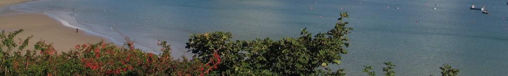
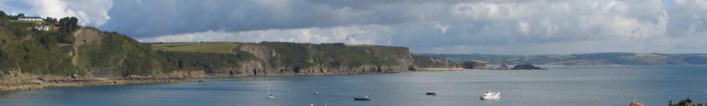
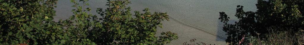
Waipohutukawa Bay, Bay of Islands Visual, Natural Character and Landscape Effects
 Photograph 20: View of Waipohutukawa Bay from the water (Thornton property to the left of view, Collie property to the right of view) Photograph 21: Closer range view from the water (Thornton property
SHORELINE, FLOOD AND COASTAL DEFENCE MANAGEMENT PLANS
 These plans may provide opportunities as well as concern for recreational boating. They are currently being revised and consulted on. This document explains how we can engage in the process. Shoreline,
AOTEA SUPERMARKET ZONE. Zone Introduction
 C18 AOTEA SUPERMARKET ZONE Zone Introduction C18.1 Objective This zone identifies a specific area in Aotea for a stand alone supermarket. The zone is site specific and has a range of objectives, policies
3. Highway Landscaping Assessment
 Guidelines for Highway Landscaping 3-1 3. Highway Landscaping Assessment 3.1 Introduction This section outlines the steps necessary to assess the highway landscaping component of a state highway construction
I505. Chelsea Precinct
 I505. Chelsea Precinct I505.1. Precinct Description This precinct covers land and water areas owned and/or formerly used by the Chelsea Sugar Refinery at Birkenhead. Chelsea Estate Heritage Park is owned
Point Spaniard to Land s End MA23 PDZ9
 Location reference: Management Area reference: Policy Development Zone: Point Spaniard to Land s End MA23 PDZ9 Chapter 4 PDZ9 10 February 2011 DISCUSSION AND DETAILED POLICY DEVELOPMENT Management Area
IUCN World Heritage Advice Note Environmental Assessment & World Heritage
 FINAL DRAFT, 07 June 2013 1 IUCN World Heritage Advice Note Environmental Assessment & World Heritage This Advice Note is intended to provide States Parties and other stakeholders with guidance on integrating
AUCKLAND UNITARY PLAN
 AUCKLAND UNITARY PLAN Report To: Report Name: Executive summary Unitary Plan Political Working Party Issues and approaches for rural and coastal areas There are 12 key issues facing rural and coastal areas
STRATEGIC DIRECTION. QLDC PROPOSED DISTRICT PLAN [PART TWO] DECISIONS VERSION 3 strategic direction
![STRATEGIC DIRECTION. QLDC PROPOSED DISTRICT PLAN [PART TWO] DECISIONS VERSION 3 strategic direction](/thumbs/79/79711764.jpg "STRATEGIC DIRECTION. QLDC PROPOSED DISTRICT PLAN [PART TWO] DECISIONS VERSION 3 strategic direction") 3 STRATEGIC DIRECTION QLDC PROPOSED DISTRICT PLAN [PART TWO] DECISIONS VERSION 3 strategic direction QLDC DISTRICT PLAN [PART TWO] AUGUST 2015 3 strategic direction 3.1 Purpose This chapter sets out the
3 STRATEGIC DIRECTION QLDC PROPOSED DISTRICT PLAN [PART TWO] DECISIONS VERSION 3 strategic direction QLDC DISTRICT PLAN [PART TWO] AUGUST 2015 3 strategic direction 3.1 Purpose This chapter sets out the
SUSTAINABLE MANAGEMENT
 . Sustainable Management.1 The Concept of Sustainable Management The concept of sustainable management recognises there are limits to the use of natural and physical resources and there is a need to balance
The WAPC publications summarised in this report are (in order of policy importance):
:") Summary of WAPC Publications Relevant to Local Biodiversity Planning As part of the delivery of the land use planning component of the Western Australian Natural Resource Management (NRM) program in 2011/12,
Summary of WAPC Publications Relevant to Local Biodiversity Planning As part of the delivery of the land use planning component of the Western Australian Natural Resource Management (NRM) program in 2011/12,
QLDC PROPOSED DISTRICT PLAN [PART FIVE] AUGUST 2015 SUBDIVISION & DEVELOPMENT
![QLDC PROPOSED DISTRICT PLAN [PART FIVE] AUGUST 2015 SUBDIVISION & DEVELOPMENT](/thumbs/96/128451269.jpg "QLDC PROPOSED DISTRICT PLAN [PART FIVE] AUGUST 2015 SUBDIVISION & DEVELOPMENT") 27 QLDC PROPOSED DISTRICT PLAN [PART FIVE] AUGUST 2015 27 S ub division & D evelopment SUBDIVISION & DEVELOPMENT 27.1 Purpose Subdivision and the resultant development enables the creation of new housing
27 QLDC PROPOSED DISTRICT PLAN [PART FIVE] AUGUST 2015 27 S ub division & D evelopment SUBDIVISION & DEVELOPMENT 27.1 Purpose Subdivision and the resultant development enables the creation of new housing
INCREMENTAL CHANGE AREA REVIEW March 2015 Page 1
 INCREMENTAL CHANGE AREA REVIEW March 2015 Page 1 Table of Contents Introduction... 3 Background to Review... 3 Comparison of the Schedules to the General Residential Zone... 7 Methodology... 7 Policy Context...
SECTION 32 SUBDIVISION, DEVELOPMENT AND EARTHWORKS
 SECTION 32 SUBDIVISION, DEVELOPMENT AND EARTHWORKS 1 Section 32 Report Publicly Notified on 27 August 2014 CONTENTS 1. STRATEGIC CONTEXT... 3 2. RESOURCE MANAGEMENT ISSUES... 6 3. SCALE AND SIGNIFICANCE
REE.5.7. Ruakaka Equine Environment. Index. 7 December 2016 Page 1 of 34. Description and Expectations Eligibility Rules
 REE.1 Index REE.1 REE.1 REE.1.2 REE.1.3 REE.1.4 REE.1.5 REE.1.6 REE.1.7 REE.2 REE.2.1 REE.2.2 REE.2.3 REE.2.4 REE.2.5 REE.2.6 REE.2.7 REE.3 REE.3.1 REE.3.2 REE.3.3 REE.3.4 REE.3.5 REE.3.6 REE.3.7 REE.4
Urban Growth Boundaries
 Urban Growth Boundaries Discussion Document July 2008 Contents page Introduction... 3 What are urban growth boundaries?... 3 The need to manage growth... 3 Purpose of urban growth boundaries... 4 How will
Rural (Urban Expansion) Environment
 Environment") RUEE.1 Rural (Urban Expansion) Environment Index RUEE.1 RUEE.1.1 RUEE.1.2 RUEE.1.3 RUEE.1.4 RUEE.2 RUEE.2.1 RUEE.2.2 RUEE.2.3 RUEE.2.4 RUEE.3 Rural (Urban Expansion) Environment Description and Expectations
RUEE.1 Rural (Urban Expansion) Environment Index RUEE.1 RUEE.1.1 RUEE.1.2 RUEE.1.3 RUEE.1.4 RUEE.2 RUEE.2.1 RUEE.2.2 RUEE.2.3 RUEE.2.4 RUEE.3 Rural (Urban Expansion) Environment Description and Expectations
Governance and master planning in the NSW planning system
 Governance and master planning in the NSW planning system 27 August 2014 Lecture University of NSW Built Environment Alice Spizzo Director, Planning & Environment aspizzo@landerer.com.au Ref: NSW Department
Written Representation by the National Trust Interested Party No:
 Written Representation by the National Trust Interested Party No: 10028761 Introduction The National Trust, established over 115 years ago, is a leading conservation charity with over 4 million members.
Severn Estuary Shoreline Management Plan What does it mean for planning in North Somerset?
 Severn Estuary Shoreline Management Plan What does it mean for planning in North Somerset? Coastal planning The National Planning Policy Framework sets out the Government s planning policies for England.
Outline. + Standards processes + Objectives + Key transport changes + Submission feedback + The proposed Standard
 Outline + Standards processes + Objectives + Key transport changes + Submission feedback + The proposed Standard NZS 4404 What is it? A standard for New Zealand Subdivision and development design What
The Moors at Arne Project, Managing Coastal Change
 General Questions What are we doing? The Environment Agency, RSPB and Natural England are working together to adapt approximately 150ha of The Moors at Arne into a diverse wetland habitat. With the sea
Grantham Southern Quadrant Link Road Environmental Statement
 Grantham Southern Quadrant Link Road Environmental Statement Non Technical Summary Introduction Lincolnshire County Council (LCC) is submitting a planning application for the proposed implementation of
Saltmarsh Conference. 8 October in the Suffolk Coast & Heaths Area of Outstanding Natural Beauty
 Saltmarsh Conference 8 October 2015 in the Suffolk Coast & Heaths Area of Outstanding Natural Beauty Conference organised by Haidee Stephens, Suffolk Estuaries Officer Suffolk Coast & Heaths AONB t: 01394
Planning Primer Legislative Background, Policy Documents and Development Review Processes. Presented by: Planning Services Date: April 6, 2017
 Planning Primer Legislative Background, Policy Documents and Development Review Processes Presented by: Planning Services Date: April 6, 2017 Agenda Legislative Background 7:30 to 8:00 pm Questions 8:00
Coast Protection, Development and Coastal Biodiversity. Brian Caton Member CEMAC, AMLR NRM Former Chair & Member, Coast Protection Board
 Coast Protection, Development and Coastal Biodiversity Brian Caton Member CEMAC, AMLR NRM Former Chair & Member, Coast Protection Board Saltmarsh: an extensive problem for Biodiversity and Planning Law
Connecting Nature and People
 Comhairle Contae Fhine Gall Connecting Nature and People Fingal: An Irish Local Authority s experience Gerry Clabby Europarc Conference, Killarney, Ireland, 28 September 1 October 2014 Planning and Strategic
QLDC PROPOSED DISTRICT PLAN [PART FIVE] NOVEMBER 2017 OPEN SPACE & RECREATION
![QLDC PROPOSED DISTRICT PLAN [PART FIVE] NOVEMBER 2017 OPEN SPACE & RECREATION](/thumbs/89/100753530.jpg "QLDC PROPOSED DISTRICT PLAN [PART FIVE] NOVEMBER 2017 OPEN SPACE & RECREATION") 38 QLDC PROPOSED DISTRICT PLAN [PART FIVE] NOVEMBER 2017 38 O P E N S PA C E & R E C R E AT I O N OPEN SPACE & RECREATION QLDC PROPOSED DISTRICT PLAN [PART FIVE] NOVEMBER 2017 38 OPEN SPACE & RECREATION
38 QLDC PROPOSED DISTRICT PLAN [PART FIVE] NOVEMBER 2017 38 O P E N S PA C E & R E C R E AT I O N OPEN SPACE & RECREATION QLDC PROPOSED DISTRICT PLAN [PART FIVE] NOVEMBER 2017 38 OPEN SPACE & RECREATION
4.3 Dudley Area Plan. Introduction. History and Existing Character. Desired Future Character for Dudley
 4.3 Dudley Area Plan Introduction The suburb of Dudley has developed as a result of various circumstances including its topography, history and mineral resources. Dudley development has been identified
Tall Buildings Strategy
 Chapter 8 Tall Building Strategy Mayor of London 115 existing & consented tall buildings effect on views of palace of westminster Chapter 8 Tall Buildings Strategy tall building cluster upto 150m with
Subdivision and Development
 Subdivision and Development 8.0 Introduction - Subdivision and Development The principle purpose of subdivision is to provide a framework for land ownership so that development and activities can take
QUEENSTOWN LAKES DISTRICT COUNCIL Hearing of Submissions on the Proposed District Plan
 QUEENSTOWN LAKES DISTRICT COUNCIL Hearing of Submissions on the Proposed District Plan Report 16.4 Report and Recommendations of Independent Commissioners Regarding Upper Clutha Planning Maps Glen Dene
5. Initiating a restoration project
 5. Initiating a restoration project CONTRIBUTING TO CONSERVATION In many parts of the country, restoration planting is your last and only option for repairing or rebuilding damaged native communities so
Appendix 1 Structure plan guidelines
 Appendix 1 Structure plan guidelines This appendix forms part of the regional policy statement [rps]. 1.1. Introduction Structure plans are an important method for establishing the pattern of land use
Great Easton Neighbourhood Plan Statement of Basic Conditions
 Great Easton Neighbourhood Plan 2017-2031 Statement of Basic Conditions OCTOBER 2016 GREAT EASTON PARISH COUNCIL Contents 1.0 Introduction....Page 2 2.0 Summary of Submission Documents and Supporting Evidence..