North Christchurch Urban Extension 01 Masterplan Context Report (September )
|
|
|
- Lewis Byrd
- 5 years ago
- Views:
Transcription
")
1 NORTH CHRISTCHURCH URBAN EXTENSION Whiteleaf North Christchurch Urban Extension 01 Masterplan Context Report (September )


2 2 Broadway Malyan
3 3 NORTH CHRISTCHURCH URBAN EXTENSION 01 Introduction PAGE Background Context PAGE The Site and its Context PAGE Spatial Policy and Research Analysis PAGE Existing Development Proposals and Promotions PAGE Constraints and Opportunities Analysis PAGE Transportation Analysis PAGE Urban Character Study PAGE Identified Land for Consideration PAGE Land Use and Infrastructure Requirements PAGE Development Issues and Choices PAGE Key Drivers Affecting Financial Deliverability PAGE Summary and Conclusions PAGE 200 Appendices PAGE 206
4 4 NORTH CHRISTCHURCH URBAN EXTENSION 01 Introduction This section provides an introduction to the brief and study area and outlines the document structure.
5 5
 to be provided in Christchurch.")
6 6 NORTH CHRISTCHURCH URBAN EXTENSION 01 Introduction THE BRIEF The draft Regional Spatial Strategy (RSS) for the South West of England has been revoked by the incoming coalition Government. The RSS had required a total of 3,450 homes (in the period ) to be provided in Christchurch. The RSS also stated that of this total requirement 600 new homes were to be provided in an urban extension to the North of the Christchurch urban area. Although the RSS has been revoked Christchurch Borough Council (CBC) has supported the principle of an urban extension but considers there is evidence to suggest this should be limited to the land to the south of the railway to the east of Burton to the Borough boundary at Roeshot Hill. The Council has taken the initiative to prepare a masterplan in order to provide a policy framework for any future development proposals that may be brought forward on the site. CBC recognises the benefits that could be offered by the urban extension, including increasing the provision of affordable housing in the Borough, which will go some way to address the problems of affordability in the area. CBC are also keen to explore the possiblity of a housing figure in excess of 600 dwellings in order to address local housing need. In January 2010, CBC appointed a consultancy team, led by planning and design practice Broadway Malyan, to prepare a masterplan for the urban extension to the north of the Christchurch urban area. This masterplan will inform the emerging Core Strategy (being prepared jointly by CBC and East Dorset District Council) and will subsequently inform a Supplementary Planning Document (SPD) that will guide development control decisions and form the basis for negotiations with prospective developers of the site. In addition, the masterplan for north Christchurch will be supported by an Implementation Plan, which will address delivery issues including the timing and phasing of the development, the potential costs, sources of funding and likely delivery partners. THE STUDY AREA The starting point for the study area for the urban extension is Key Diagram Inset 7 of the former draft RSS. The relevant area of search is 7C which comprises land to the north of the Christchurch urban area. CBC has provided a clearer definition of the area of search, based on the RSS plan. Both this and the RSS plan are shown (right and opposite). RSS - Key Diagram Inset 7

7 7 Refined area of search The Study Team The study team comprised the following: Broadway Malyan: Lead consultant, planners, masterplanners and landscape architects WSP: Transport, infrastructure and environment Whiteleaf Consulting: Market valuation and implementation The Study Document Structure This study comprises two key stages: Part 01: Masterplan Context Report Part 02: Masterplan This report comprises the Part 01 Masterplan Context Report. Its main purpose is to: Provide a detailed site analysis, including key constraints and opportunities Review the site s potential to broadly accommodate new homes and estimate whether or not greater potential exists Suggest broad infrastructure requirements Overall, the Part 01 report will help support and inform the general policy for the urban extension in the emerging Core Strategy. To meet these objectives, the report covers the following sections: Background Context The Site & its Context Spatial Policy & Research Analysis Existing Development Proposals & Promotions Constraints & Opportunities Analysis Transportation Analysis Urban Character Study Identified Land for Consideration Land Use & Infrastructure Requirements Development Issues & Choices Key Drivers Affecting Financial Deliverability Summary and Conclusions The next stage of the report Part 02 Masterplan will provide a detailed masterplan for the site, including a potential layout and mix of uses as well as density guidance that will help support a future Supplementary Planning Document (SPD) for the site.
8 8 NORTH CHRISTCHURCH URBAN EXTENSION 02 Background Context This section provides a brief background to the work undertaken to date and the decisions that led to the identification of the area of search and subsequent refinement of the masterplan area by Christchurch Borough Council (CBC).
9 9
10 10 NORTH CHRISTCHURCH URBAN EXTENSION 02 Background Context This section provides a brief background to the work undertaken to date and the decisions that led to the identification of the area of search in the RSS and subsequent refinement of the masterplan area by Christchurch Borough Council (CBC). It does not seek to cover background policy as this is covered later in the report. INITIAL BACKGROUND WORK Prior to the production of the draft South West Regional Spatial Strategy (RSS), the Joint Strategic Planning Authority (JSPA) - comprising Dorset County Council, Bournemouth Borough Council and the Borough of Poole - used their right to put forward First Detailed Proposals for the South East Dorset sub-region to the body preparing the RSS the South West Regional Assembly (SWRA). In considering possible growth in the sub-region, consideration was given to a number of background factors. The South East Dorset sub-region is located in the South West Region and the region as a whole is renowned for its high environmental quality. It is also the fastest growing region in terms of population, with high in-migration levels. The South West Regional Spatial Strategy (RSS) now revoked by the Coalition Government focused new housing development in the larger urban areas to create a better balance between jobs and homes. Christchurch, together with Bournemouth and Poole formed part of the South East Dorset Strategical Significant City or Town (SSCT) to which RSS Settlement Policy A applied. The RSS strategy (in line with the Regional Economic Strategy) was to promote further economic growth in the region and population growth was seen as a major driver of this. SWRA required JSPAs to test the implications of different levels of growth, including the existing Regional Planning Guidance (RPG10) levels; RPG10+25% and RPG10 +50%. SWRA required the JSPA s to demonstrate why they could not achieve the higher levels, including the consideration of revised Green Belt boundaries. The possibility of increased levels of growth raised a number of issues, including how this growth could be accommodated in an area which is particularly environmentally sensitive and matters relating to transport infrastructure. However, the JSPAs were required to examine this and sought, in accordance with SWRA s advice, to focus development on the major urban areas of Bournemouth, Poole and Christchurch as well as the outer commuter towns in East Dorset and Purbeck. The approach of solely targeting the urban areas has raised concerns that large amounts of development could damage the existing urban environments. Furthermore, a brownfield land only approach would not deliver the levels of affordable housing that the area so desperately requires (indeed, parts of the area comprise some of the least affordable areas in England). Land values on brownfield land are high and, therefore, the added cost burden associated with affordable housing often makes such sites unviable, particularly in the current economic climate. The situation has been further exacerbated by the recent international protection given to the Dorset Heathlands which has meant that developments have to provide large areas of open land or financial contribution towards the provision of open land to mitigate against the effects of extra walkers on the heaths, again impacting on the provision of affordable homes. It is, therefore, commonly accepted that the most effective way of providing significant affordable housing numbers is through the delivery of larger housing schemes. The above issues led to the JSPA considering minimal release of Green Belt land around certain towns on sites that had no overriding constraints and were well related to the existing service centres. The process to
11 11 identify these is explained in the following paragraphs. This approach led to the JSPA proposing 40,400 dwellings ( ) in South East Dorset. From this it was considered that in Christchurch 2,600 dwellings could be accommodated on urban sites and a further 600 as part of an urban extension to the north of the town. THE FIRST DETAILED PROPOSALS To identify the potential urban extension locations, the JSPA undertook an in depth analysis which initially led to the identification of broad areas of search. These were then refined through the identification of key constraints and a rigorous assessment examining, among other matters, factors relating to environment, function, location etc. This led to a number of the areas of search being discounted or refined. To ensure further rigour, the area was checked again to ensure that no sites had been overlooked. At the end of this process, the information was fed into a report entitled The South East Dorset Strategy, which was published in November The study indicated the potential capacity and proposed development area, for the proposed urban extensions. In the Borough of Christchurch, one urban extension was identified, this being: Land at Roeshot Hill, Christchurch - Up to 600 dwellings The report also identified the following sites in East Dorset District: Pardy s Hill, Corfe Mullen - Up to 700 dw s Wimborne North - Up to 600 dw s Cuthbury, Wimborne - Up to 200 dw s Parley Cross, West Parley - Up to 900 dw s In total, the five urban extensions could potentially accommodate around 3,000 new dwellings across the south east Dorset area. THE RSS PROCESS The Proposed Modifications to the draft South West Regional Spatial Strategy (RSS), produced in July 2008 following the RSS Panel Report, set a housing requirement for Christchurch of 3,450 ( ). Of this total, 600 dwellings were to be located in the area of search to the North of Christchurch at Roeshot Hill (area of search 7C). The RSS has now been revoked by the Goverment. The Secretary of State for Communities and Local Government wrote to all local authority Chief Planning Officers on 27th May to highlight the Government s intention to rapidly abolish Regional Spatial Strategies and return decision making powers on housing and planning to local councils. LOCAL DEVELOPMENT FRAMEWORK Despite the revocation of the RSS, Christchurch Borough Council (CBC) is continuing to prepare its Joint Core Strategy with East Dorset District Council as advised by the Government. Issues and Options Consultation was undertaken in March At the time of writing this report, CBC are preparing the next stage of the Core Strategy (Preferred Options Report). This report will be consulted on in the autumn of Alongside this, CBC are also continuing to plan to meet housing need, as failure to plan for the North Christchurch urban extension, could lead (under the existing planning rules) to the Council losing control of where development happens in the Borough as a result of developers potentially submitting planning applications and winning on appeal based on a lack of a 5 year housing land supply. CBC have appointed Broadway Malyan to prepare a masterplan for the urban extension to the north of the town to ensure that local housing need is met and allow CBC to have influence over the form, function and quality of the development.
12 12 NORTH CHRISTCHURCH URBAN EXTENSION 03 The Site and its Context This section provides a broad introduction to the settlement of Christchurch. It describes its strategic context within the County of Dorset and its location, role, function and character. It also identifies the urban extension area of search that forms the basis of the study and provides a description.
13 13

14 14 NORTH CHRISTCHURCH URBAN EXTENSION 03 The Site and its Context This section provides a broad introduction to the settlement of Christchurch. It describes its strategic context within the County of Dorset and its location, role, function and character. It also identifies the urban extension area of search that forms the basis of the study and provides a description. STRATEGIC CONTEXT The starting point for the urban extension was the area of search identified in the Regional Spatial Strategy (RSS) for the South West region. The RSS identified an area of search within Christchurch Borough, to the north of the town around the railway line. The diagram in the RSS was very schematic and provided little detail. In setting out the brief for this commission, Christchurch Borough Council (CBC) defined the area of search more specifically. This area is shown on the diagram (left). It should be noted that the area of search shown represents a relatively large area potentially in excess of the land required to accommodate the development. Area of Search - as defined by CBC

15 THE BOROUGH OF CHRISTCHURCH Location Christchurch an attractive coastal town located on the south coast of England in the County of Dorset and forms part of the south East Dorset conurbation. It is the most easterly town within the County and lies close to the County boundary with Hampshire. The Borough is contiguous with the east of Bournemouth, 8 miles to the west of Lymington and 18 miles to the west of Southampton. Road connections are provided by the A35, which links the town to Bournemouth and Poole in the west and Lyndhurst and Southampton in the east. The A338 runs north from Christchurch up to the A31 which subsequently links into the M27 and the national motorway network. Christchurch also benefits from a mainline railway station which provides direct services to London, Poole and Weymouth. The Borough is also home to Bournemouth International Airport, located in the north west of the Borough. The airport serves locations in the UK, Europe and north Africa. The town also lies close to the New Forest National Park and on both the rivers Stour and Avon. Wider location plan
16 16 NORTH CHRISTCHURCH URBAN EXTENSION History The town of Christchurch was originally a Saxon settlement that grew up between the rivers Avon and Stour. In 1094 the construction of the town s most significant landmark - the Christchurch Priory - began and it was this that ultimately gave the town its name. At its beginning, the town grew slowly in a linear form (along the High Street), until the mid 20th century when it started to expand rapidly with the creation of low rise council housing spreading out from the centre in the 1940 s and 1950 s. This was followed by further low density residential development from the 1960 s onwards. Through this growth a number of previously distinct settlements, such as Mudeford and Purewell have been amalgamated into the Christchurch urban area. The village of Burton to the north of the town has, however, maintained a feeling of separation and is today partly designated as a Conservation Area. The historic Christchurch town centre still contains many of its original buildings and is also designated as a Conservation Area. The Town Today Today, the Borough has a relatively small population of just over 45,000 (Dorset County Council). By population it is the 9th smallest Borough in England but has the largest proportion of people over retirement age (33.1%) in the UK. It provides a large number of key services and facilities serving both Christchurch Borough as well as the wider area. Indeed, the town contains a number of national multiples, including Waitrose, Sainsbury s, Marks and Spencer and Co-Op. It also contains a number of independent retail units giving the town a special character. There is also a large element of manufacturing in the area, and a thriving leisure and tourism industry based around the historic Priory beeches and harbour. The main business park and employment facilities are located outside of the town centre, at Bournemouth Airport, which is a strategic site serving the needs of South East Dorset. A number of the town s key facilities and services are mapped opposite. This list is not exhausted and additional small scale services (e.g. playgroups) could exist elsewhere in the Borough. The town also offers a range of sports, open space and recreational provision, which is also mapped (overleaf). Education 01. St. Joseph s Catholic Primary School 02. Mudeford Wood Playgroup 03. Mudeford Junior School 04. The Grange School 05. Somerford Early Excellence Centre and Junior School 06. Burton Pre-School Playgroup 07. Burton Day Nursery 08. Burton Church of England Primary School 09. Highcliffe School 10. Mudeford Community Infant s School 11. Christchurch Infants and Junior School 12. Poppets Pre-School 13. Priory church of England Primary School 14. Twynham School 15. Christchurch Learning Centre Sports Provision 01. Watermans Park, Grass Pitches, Skate Park and Adventure play area 02. East Christchurch Sports and Social Club, Grass Pitches 03. The Grange School, Swimming Pool, Grass Pitches, Sports Hall 04. Somerford Junior School, Grass Pitches 05. Mudeford Wood Community Centre, Grass Pitches and Sports Hall 06. Highcliffe School, Health and Fitness Suite, Grass Pitches, Sports Hall 07. Burton Recreation Ground, Grass Pitches 08. Two Riversmeet Leisure Centre, Golf Club, Swimming Pool, Sports Hall Health and Fitness Suite, Indoor Bowls including the Arena BMX and Skate Park and synthetic pitches. 09. Burton Church of England Primary, Grass Pitches 10. Winkton Fields, Grass Pitches 11. Highcliffe Castle, Golf Club 12. St Marks Church Hall, Sports Hall 13. Priory church of England Primary School 14. Twynham School Healthcare 01. Barn Practice 02. Stour Surgery 03. Burton Surgery 04. Christchurch Hospital 05. Stephen house Dental Practice 06. Priory Dental Practice 07. Cheriton Dental Practice 08. Wessex Pharmacy 09. Rowlands Pharmacy 10. Boots Pharamcy


17 Key Facilities in Christchurch 17


18 18 Sports, recreation and open space facilities in Christchurch


19 19 Quay at the River Stour Clock on the High Street Unique buildings in town centre
20 20 NORTH CHRISTCHURCH URBAN EXTENSION THE URBAN EXTENSION AREA OF SEARCH The identified area of search for the urban extension lies to the north of Christchurch. It comprises two distinct parts land to the south of the railway line and land to the north of the railway line. The land to the south of the railway line covers the area between Hawthorn Road in the west and the crossing point of the railway and the A35 in the east. The northern boundary is defined by the railway line (which runs in an east-west direction on an embankment) and the southern boundary by the A35 and the retail development (comprising a Sainsbury s supermarket and Stewart s Garden Centre). The area comprises open, undeveloped and relatively flat agricultural land. The only exceptions to this are the Roeshot Hill allotment site which lies adjacent to the garden centre and fronts onto the A35 and a major overhead power line running in an east-west direction which dissects the site in two. A gas pipe line runs beneath the site at its eastern extremity. The land to the north of the railway line comprises open agricultural and cattle grazing land which extends from the railway line in the south up to Preston Lane/ Waterditch Road in the north. Its eastern boundary is defined by the Borough/ County boundary, whilst its western boundary comprises the edge of the village of Burton. This land is also relatively flat and offers some longer distance views towards the New Forest in the north east. In terms of other key notable features, the River Mude runs through the centre of the southern part of the area of search and forms the eastern boundary of the northern part. Ambury Lane runs east-west across the western half of the southern part of the site and meets the River Mude at a Ford at the junction with Watery Lane. Watery Lane runs in a north-south direction (though does not connect to the A35) and connects both the north and south parts of the site, via a tunnel under the railway line. This connection is one of a limited number of crossing points across the railway line with the other point being a tunnel at the western end of the site for Salisbury Road. A further bridge link does exist to the east of the site, but does not link directly into the site itself. Other notable features comprise a Scheduled Ancient Monument to the west of the southern part of the site known as Staple Cross which is thought to date back to medieval times. There is also a small Grade II Listed farmhouse adjacent to the site on Sailsbury Road. Both these structures are included within the Burton Conservation Area. A further small conservation area containing only a few properties exists adjacent to the site. This is located to the south of the A35 and east of Verno Lane.

21 NORTH CHRISTCHURCH URBAN EXTENSION 21
22 22 NORTH CHRISTCHURCH URBAN EXTENSION 04 Spatial Policy and Research Analysis This section of the document summarises relevant planning policy at a national, regional and local level. It also includes a review of a recently published best practice document produced by the Town and Country Planning Association (TCPA) relating to urban extensions and introduces a regional checklist against which the masterplanning proposals in the next stage of the process could be tested.
23 23
24 24 NORTH CHRISTCHURCH URBAN EXTENSION 04 Spatial Policy and Research Analysis This section of the document summarises relevant planning policy at a national, regional and local level. It also includes a review of a recently published best practice document produced by the TCPA relating to urban extensions and introduces a regional checklist against which the masterplanning proposals in the next stage of the process could be tested. KEY NATIONAL PLANNING POLICIES AND GUIDANCE: Planning Policy Statement 1 (PPS1)(2005) Delivering Sustainable Development PPS1 establishes the overarching national planning policies for the delivery of sustainable development through the UK planning system. It states that sustainable development is the core principle underpinning planning. More specifically it identifies that planning should facilitate and promote sustainable and inclusive patterns of urban and rural development by, inter alia, ensuring that development supports existing communities and contributes to the creation of safe, sustainable, liveable and mixed communities with good access to jobs and key services for all members of the community. (paragraph 5). PPS1 adds that planning has a key role to play in the creation of sustainable communities which will stand the test of time, where people want to live and which will enable people to meet their aspirations and potential. Planning Policy Statement 3 (PPS3) Housing (2010) The Government s housing policy is set out in PPS3. PPS3 sets the policy context to ensure that everyone has the opportunity of living in a decent home, which they can afford, in a community where they want to live. To achieve this, the Government is seeking: To achieve a wide choice of high quality homes, both affordable and market housing, to address the requirements of the community. To widen opportunities for home ownership and ensure high quality housing for those who cannot afford market housing, in particular those who are vulnerable or in need. To improve affordability across the housing market, including by increasing the supply of housing. To create sustainable, inclusive, mixed communities in all areas, both urban and rural. More specifically, PPS3 sets out policy objectives to provide the context for planning for housing through development plans and planning decisions. The specific outcomes that the planning system should deliver are: High quality housing that is well designed and built to a high standard. A mix of housing, both market and affordable, particularly in terms of tenure and price, to support a wide variety of households in all areas, both urban and rural. A sufficient quantity of housing taking into account need and demand and seeking to improve choice. Housing developments in suitable locations, which offer a good range of community facilities and with good access to jobs, key services and infrastructure. A flexible, responsive supply of land managed in a way that makes efficient and effective use of land, including reuse of previously-developed land, where appropriate.
 and objectives set")
25 25 PPS3 also sets out the strategy for the planned location of new housing which contributes to the achievement of sustainable development. This should take into account a number of factors including: The spatial vision for the local area (having regard to relevant documents such as the Sustainable Community Strategy) and objectives set out in the relevant Regional Spatial Strategy. Evidence of current and future levels of need and demand for housing as well as the availability of suitable, viable sites for housing development. The contribution to be made to cutting carbon emissions from focusing new development in locations with good public transport accessibility and/or by means other than the private car and where it can readily and viably draw its energy supply from decentralised energy supply systems based on renewable and low-carbon forms of energy supply, or where there is clear potential for this to be realised. Any physical, environmental, land ownership, land-use, investment constraints or risks associated with broad locations or specific sites, such as physical access restrictions, contamination, stability, flood risk, the need to protect natural resources e.g. water and biodiversity and complex land ownership issues. Options for accommodating new housing growth (or renewal of existing housing stock), taking into account opportunities for, and constraints on, development. Options may include, for example, re-use of vacant and derelict sites or industrial and commercial sites for providing housing as part of mixed-use town centre development, additional housing in established residential areas, large scale redevelopment and re-design of existing areas, expansion of existing settlements through urban extensions and creation of new freestanding settlements. Accessibility of proposed development to existing local community facilities, infrastructure and services, including public transport. The location of housing should facilitate the creation of communities of sufficient size and mix to justify the development of, and sustain, community facilities, infrastructure and services. PPS 1 South West RSS (Proposed Modification)
26 26 NORTH CHRISTCHURCH URBAN EXTENSION Planning for Sustainable Economic Growth (PPS4) (2009) PPS4 sets out the Government s comprehensive policy framework for planning sustainable economic development in urban and rural areas. The Government s overarching objective is sustainable economic growth, and to help achieve this the Government s planning objectives are: build prosperous communities by improving the economic performance of cities, towns, regions, sub-regions and local areas, both urban and rural; reduce the gap in economic growth rates between regions, promoting regeneration and tackling deprivation; deliver more sustainable patterns of development, reduce the need to travel, especially by car and respond to climate change; promote the vitality and viability of town and other centres as important places for communities; and raise the quality of life and the environment in rural areas by promoting thriving, inclusive and locally distinctive rural communities whilst continuing to protect the open countryside for the benefit of all. KEY REGIONAL POLICY The South West Plan: Regional Spatial Strategy (RSS) Prior to the new coalition Government s intention to abolish the RSS the South West Plan was the document that would set the regional policy context for growth in the South West until The RSS adopted a strategy to focus the majority of development at the key locations in the region, known as Strategically Significant Cities and Towns (SSCTs). Christchurch was included within the South East Dorset SSCT. Strategic development policies included: Development Policy A states that provision will be made at the SSCT s to maintain and enhance their regionally and sub-regionally significant roles and functions for housing, employment, cultural, education, retail, health and other services and facilities and as strategic hubs for public transport. Development Policy C related to development at small towns and villages, stating that in these areas greater self-containment and stronger local communities will be promoted by making provision that supports economic activity appropriate to the scale of the settlement, extends the range of services to better meet the needs of the settlement and its surrounding area and better meets identified housing needs. Development Policy D related to infrastructure, stating that the planning and delivery of development should ensure efficient and effective use of existing infrastructure and should provide for the delivery of new or improved transport, education, health, culture, sport and recreation and green infrastructure in step with development. Development Policy E covered high quality design requiring all development to deliver the highest possible standards of design, both in terms of urban form and sustainability criteria. Development Policy F stated that major development, including urban extensions and regeneration, should be planned on a comprehensive and integrated basis to ensure that they contribute to the delivery of sustainable communities and a high quality of living. The more detailed policies relating to housing numbers have already been covered earlier in this report. Regional Economic Strategy (2006) The Regional Economic Strategy (RES), produced by the South West of England Regional Development Agency (SWRDA), provides a shared vision for the development of the region s economy. It concentrates on those issues which are directly related to improving the economy and ensuring that more people can participate in that economy. Working in conjunction with the Regional Spatial Strategy, the RES supports the delivery of clear and agreed visions for communities. The RES refers to the importance of the aerospace and defence industries to the economies in cities and counties within the South West region, including Dorset, and the critical need to maintain competitive advantage through application of new technologies and highly advanced engineering through the supply chain.

27 27 Regional Housing Strategy (2005) PPS 3 Local Plan Core Strategy The Regional Housing Strategy (RHS) states that the main agencies will work together to improve the quality of the monitoring information available on the provision of affordable housing, and will expect authorities which have consistently under-delivered against agreed overall planning totals from RPG10 to improve their performance. Its main priorities include improving the balance of housing markets and reducing homelessness through increasing the provision of homes, tackling affordability concerns and a spatial distribution that seeks to deliver sustainable communities in both urban and rural areas. The RHS and the RES are closely linked throughout as the link between lower than average wage rates in the South West, and much higher than average house prices, greatly exacerbates the lack of market access opportunities for low to moderate income households in the region. RES
28 28 NORTH CHRISTCHURCH URBAN EXTENSION Regional Environmental Strategy (2004) Our Environment: Our Future; is a document produced by the South West Regional Assembly (SWRA), it sets out what is important about the region s environment and discusses some of its key characteristics. The heathlands of Dorset are recognised as both nationally and internationally important, providing high quality environments for a number of rare species, in particular Sand Lizards that were once at home throughout the South West but are now only found on the fragmented heathland within South East Dorset. The document also recognises the work being done to protect and enhance these areas. LOCAL POLICY Draft Hampshire Minerals Plan (2008) The draft Hampshire Minerals Plan (July 2008) identifies a site directly to the north of the railway line on the Dorset-Hampshire border as a preferred site for the extraction of gravel. This is identified on the Proposals Map supported by Policy M1 which states that the (Hampshire) Minerals Planning Authorities support the extraction of sand and gravel from the Roeshot Hill area, Christchurch. Although the area of search falls outside of this gravel extraction site, its proximity will undoubtedly have an effect on any residential development. The expected production from the Proposed Mineral Area to 2020 is 3,000,000 tonnes. Work on the plan has been delayed since its approval in 2008 as the County Council is awaiting a decision on the review of policy M3 (Primary Aggregates) as part of the Examination in Public of the South East Plan, determining the apportionment of sand and gravel extraction that Hampshire has to plan for. Consultation as this will close on 1 June Dorset, Bournemouth and Poole Minerals Site Allocations Document Discussions Paper (2008) This document has identified land at Roeshot Hill (north of the railway line), as a potential site for inclusion. If the Hampshire site goes ahead then this site would be run as an extension to it, including proposals to progressively extract and restore the site over a rolling 15 year period. This area of land is included within the search area and would impact upon the ability to provide any development to the north of the railway line for the next years. It could also impact on any open space requirements suitable for this area e.g. formal sports, SANGs etc. The Dorset, Bournemouth and Poole Minerals Core Strategy is currently at the Issues and Options stage. Local Plan (2001) The Christchurch Local Plan was adopted in March 2001 and provides planning policy for the whole Borough up to the year It will be partially replaced by a new Joint Core Strategy as part of the Local Development Framework (LDF). The Local Plan contains general policies that aim to protect and minimise the adverse impacts arising from new developments on landscape and environmentally sensitive areas, particularly the heathlands and local nature reserves. There is also a policy presumption in favour of protecting the Green Belt and the designated Conservation Areas within the Borough. In addition to the Local Plan there are a range of other policy documents which provide guidance to developments in the Borough such as the Borough Wide Character Assessment, the Heathland Mitigation Policy and Interim Transport Contribution Policy. Emerging LDF Joint Core Strategy The Core Strategy is the key document in relation to the LDF. Christchurch Borough Council (CBC) is working in partnership with its neighbouring authority, East Dorset District Council, to produce a Joint Core Strategy. Issues and option consultation was undertaken on the core strategy in spring (Preferred options) Consultation will be undertaken in autumn This stage set out to understand opinions on the general planning principles for growth in Christchurch. The timetable for the production of the Core Strategy is set out in the Local Development Scheme (LDS) which was adopted in March The timeline has slipped somewhat due to the delay in the RSS. In the context of the impending abolition of RSS s, Christchurch Borough Council must continue to plan to meet local housing need and decide where new housing is best located. We have now been asked to consider the potential of the urban extension to accommodate a range of between 600 and 950 dwellings capacity towards the
29 29 upper end of this range is an alternative to increased infill housing within the urban area which could lead to the loss of other valuable urban land uses or excessive concentration of development. LDF Evidence Base A number of documents have been produced as part of the LDF evidence base to establish the identified need for housing and more specifically affordable housing in the Borough as well as the potential to accomodate it. The Dorset Survey of Housing Need and Demand (June 2008) concludes that there is considerable demand for 3 and 4 bedroom family housing as well as more affordable 1 and 2 bedroom dwellings. The Strategic Housing Land Availability Assessment (SHLAA) identifies potential locations for future housing. BEST PRACTICE IN URBAN EXTENSIONS AND NEW SETTLEMENTS There are a large number of best practice documents covering issues such as design and sustainability and this report does not seek to list or repeat these. However, one document is of particular importance. In 2007, the Town and Country Planning Association (TCPA) produced a document entitled Best Practice in Urban Extensions and New Settlements. This study seeks to establish good practice in developing new settlements and urban extensions in the UK by drawing lessons from recently developed examples which have been successfully brought through the planning system and which have used innovative approaches to providing good quality development. The report highlighted that: major new urban extensions should be identified at the regional or subregional level, not nationally; there is a long lead-time for developments of strategic scale, with time horizons often extending over 20 years and therefore beyond development plan periods; urban extensions or new towns are best achieved by comprehensive land assembly and by capture of a major proportion of the land values created in the grant of planning permission; the project needs cross-party support as implementation will last longer than several electoral cycles; significant investment is required early on to prepare and plan the location and to create the infrastructure. SUSTAINABILITY CHECKLIST This report sets the baseline for the creation of a masterplan for the north of Christchurch. It is likely that at least two masterplanning options will be tested. In order to assess these options it is considered that an established checklist should be used. In this case, it is considered that such a checklist might comprise the South West Sustainability Checklist, which is an assessment tool developed by Future Foundations and the Building Research Establishment (BRE) to guide the design of new developments by making sense of current policy. The Checklist highlights best practice, complementing Ecohomes and the Code for Sustainable Homes. The Checklist covers regionally specific sustainability and planning issues, emphasising those of higher priority. The tool identifies a range of sustainability issues enabling users to assess the extent to which a design proposal will deliver on each issue. The questions are organised in logical, topic-based categories, linked to local authority departments. The Checklist has been specifically tailored for use in the South West, making some questions differ slightly from sustainability checklists adopted and used in other regions. Accordingly, we consider that it is appropriate to use the Checklist as part of the masterplanning process, to ensure that the emerging proposals at north Christchurch achieve the highest reasonable and achievable levels of sustainability. Although referenced in the now revoked RSS, the Checklist has been developed independently of the regional bodies and the principles are highly relevant. Alternatively an amended/ tailored version could be applied.
30 30 NORTH CHRISTCHURCH URBAN EXTENSION South West Sustainability Checklist COMMUNITY PLACEMAKING BUSINESS TRANSPORT & MOVEMENTS To ensure that the development supports a vibrant, diverse and inclusive community which integrates with surrounding communities. To ensure that the most sustainable sites are used for development and that the design process, layout structure and form provide a development that is appropriate to the local context and supports a sustainable community. To ensure that the development contributes to the sustainable economic vitality of the local area and region. To ensure people can reach facilities they need by appropriate transport modes, encouraging walking and public transport use and reducing the use of private cars for shorter journeys. CLIMATE CHANGE & ENERGY To ensure that new developments are appropriately adapted to the impacts of present and future climate change and to minimise their own impact on flooding, heat gain, water resources and water quality. ECOLOGY To promote the more sustainable use of resources related to both the construction and the operation of new developments. RESOURCES To ensure that the ecological value of the site is conserved and enhanced maintaining biodiversity and protecting existing natural habitats. BUILDINGS To ensure that the design of individual buildings does not undermine the sustainability of the overall development. South West Sustainability Checklist

31 31 SUMMARY TCPA Report There is a significant number of planning policies, documents and strategies at a national, regional and local level, relevant to Christchurch and the urban extension and this report has merely highlighted the key documents and due regard will be paid to them and the principles that they establish. Furthermore, there has already been a significant amount of work and stakeholder consultation undertaken by Christchurch Borough Council (CBC). In addition, as part of this report, we have held meetings with technical officers at CBC and the relevant Parish Councils, Residents Associations and other key stakeholders (e.g. Allotment Holders Association). A key outcome of these meetings was that there is no straightforward solution to accommodating the housing requirement identified in the emerging RSS, and that all the potential configurations of land uses on the site have their own particular opportunities and constraints. However, there was consensus between most parties, that if the development is to come forward, then it will be in the interest of the local communities to ensure that new development is masterplanned holistically to allow the necessary infrastructure to be provided rather than allowing piecemeal ad-hoc development which could compromise people s livelihoods and the local environment and put strain on local infrastructure. One of the key aims of the Core Strategy is to ensure that the urban extensions are planned in the right way. This report forms a vital component of the evidence base underpinning the Core Strategy s long term plan for Christchurch. This approach to urban extensions is supported by best practice guidance produced by the Government and organisations such as TCPA. We do not seek to re-test this in too much further detail in this study. In addition to accommodating the need for housing, our brief is also to ensure the creation of a high quality sustainable community. To ensure that the emerging masterplan meets this fundamental objective we have employed the South West Sustainability Checklist as a means to assess and inform future masterplan iterations. This provides an independent but regionally specific method of ensuring that the proposals satisfy the identified requirements for the creation of a new sustainable community in north Christchurch.
32 32 NORTH CHRISTCHURCH URBAN EXTENSION 05 Existing Development Proposals and Promotions Within the area of search there are a number of different parcels of land which are being promoted for development. These sites were included within Christchurch Borough Council s Strategic Housing Land Availability Assessment (SHLAA) where land owners and developers have suggested their land as possible future suitable housing locations that they consider are deliverable and developable. This section provides a brief overview to help understand those parts of the area of search that actively being promoted for development.
33 33
34 34 NORTH CHRISTCHURCH URBAN EXTENSION 05 Existing Development Proposals and Promotions Within the area of search there are a number of different parcels of land which are being promoted for development. These sites were included within Christchurch Borough Council s Strategic Housing Land Availability Assessment (SHLAA) where land owners and developers have suggested their land as possible future suitable housing locations that they consider are deliverable and developable. This section provides a brief overview to help understand those parts of the area of search that actively being promoted for development. However, whilst land that is actively being promoted is an important consideration, locations for future development must also be balanced alongside other considerations including constraints, transport etc. which are analysed in the following sections. SITES IDENTIFIED IN THE SHLAA The following sites, identified within the SHLAA, fall within the urban extension area of search. Land north of the A35, to the south of the railway line (SHLAA Reference: 8/01/0340 and 8/02/2101) A large area of land located in between the A35 and the railway line, immediately to the north of the settlement boundary as defined in the Local Plan is being promoted. This area of land totals around 11.6 ha and is divided north/south by Ambury Lane. According to the SHLAA the northern part of the site could accommodate 250 units and the southern part of the site a further 90 units (if developed at an average residential density of 45 dwellings per hectare). There are a number of electricity pylons stretching across the site, and the southern part of the site is at some risk of flooding. Land south of the railway line at Roeshot Hill (SHLAA Reference: 8/11/0452) A large area of land located to the north of the A35, to the east of Watery Lane and to the south of the railway line is being promoted for development. Land to the southern side of the site comprises statutory allotments. According to the SHLAA the whole site could accommodate 600 units if developed at an average residential density of 45 dwellings per hectare. As with the previous site, there are electricity pylons running across the site. The site is 19.9 ha in total. Land to the south of Burton, to the west of Salisbury Road (SHLAA reference: 8/01/0335) This area of land was put forward for consideration as part of the Issues and Options stage engagement relating to the RSS Area of Search. The site is located outside of the area of search and was assessed in the SHLAA as having no housing potential, it will therefore not be considered further within this document. Although the RSS area of search stretches to the north of the railway line, there are no large sites identified in the SHLAA in this area, and the Council do not support development in this location. It would appear that the two sites identified in the SHLAA have the potential to easily accommodate the RSS requirement of 600 homes and possibly more. However, it is considered (by the consultant team) that the original assumptions used in the SHLAA were based on a high average residential density which may lead to over intensification of the site, and a lower average residential density may be more achievable and in keeping with the character of the area. Overall, an understanding of the land that is potentially coming forward for development is a useful starting point, but it must be tested against a number of criteria, including: Constraints, including: Physical and environmental constraints Accessibility Townscape The following sections of this report examine the above in more detail. This culminates in a section entitled Identified land for consideration which defines the areas we consider are suitable to accommodate development. This section will not only summarise the constraints identified above but also advise on the need for place-making, which helps focus on the areas that are best suited to the creation of sustainable communities.

35 Land identified in the SHLAA
36 36 NORTH CHRISTCHURCH URBAN EXTENSION 06 Constraints & Opportunities Analysis This section of the report examines a number of key technical constraints and opportunities associated with the area of search. This section will help towards identifing potential land for development consideration later in this report.
37 37
38 38 NORTH CHRISTCHURCH URBAN EXTENSION 06 Constraints & Opportunities Analysis This section of the report examines a number of key technical constraints and opportunities associated with the area of search. This will help towards identifing potential land for development consideration later in this report. The analysis in this section includes the following: Landscape Ecology Archaeology and cultural heritage Flooding and surface water drainage Ground conditions and contamination Noise Utilities Renewable energy Green belt review LANDSCAPE Broad Landscape Character A Borough-wide Landscape Character Assessment was prepared for Christchurch in 2003 which aims to help identify and protect the identity of the Borough through a comprehensive assessment of urban and landscape character areas. Guidance is set out regarding the capacity of areas to accommodate new development and their unique sensitivity to change. The Character Assessment shows that the study area broadly falls within The River Terraces Landscape Type. At the Landscape Character Area (LCA) level, the northern part of the study area falls within the Avon River Terrace LCA whilst the southern section, south of the railway line, falls within the Urban Edge and Enclave LCA. Avon River Terrace The Avon River Terrace is described within the document as follows; This flat tract of land sits between Burton and the eastern boundary of the Borough. As an alluvial terrace the area within the Borough boundary ranges between 7 and 15m AOD, over distances of 2km this change in level is almost imperceptible. Beyond the boundary the landform becomes distinctly steeper as the landscape rises into the edge of the New Forest. The area is visually enclosed by the dominant railway embankment to the south and the rising ground and woodland to the east. To the west St Catherine s Hill provides a low horizon above the village of Burton. To the north the landscape character continues up the Avon Valley beyond the Borough boundary. The landscape consists of medium scale regular fields typical of 19th century Parliamentary enclosures. Field boundaries being generally low flail cut native hedges with occasional hedgerow trees. A pattern of narrow pine shelterbelts run north south through the landscape, a characteristic noted in other sections of the Avon Valley. A network of minor lanes link a number of individual farmsteads to the settlements of Burton and Winkton within Christchurch and Bransgore outside the Borough to the north east. This is complemented by a number of footpaths and bridleway links giving a good degree of recreational access to the area Main Characteristics (identified within the report) are listed as follows: Wide expanse of flat landscape across deep alluvial soils. Mixed agricultural production of arable and livestock. Medium scale enclosure landscape of low hedged/fenced fields and occasional shelter belt plantations. Overall area enclosed by rising ground to the east and rail embankment to the south. Low horizon and limited views across and out of the landscape. Principal trees are oak and field maple, within hedge lines. Scotts pine within shelterbelts. Farmsteads and settlements sit low, often tightly grouped, in the landscape with few visually dominant buildings. Occasional large modern barn constructions are also contained within landscape.
39 39 The landscape is not heavily populated or developed. With quiet minor roads and footpaths, it is possible to feel some isolation (relative to the other parts of the Borough) within parts of the area. Glimpsed views of urban development, general noise intrusion, and intrusion of the railway result in a degree of connection to the modern townscape. This is not a totally unspoilt landscape. It is however accessible and reasonably well connected as a recreational resource. Historic development pattern remains evident as the boundary to Burton and the footprint of Winkton. Informal linear patterns of agricultural cottages and farm buildings reflect rural setting. Expanded area of Burton has compromised the isolated entirely rural character of the village. The older area provides a valuable contrast to more recent expansion. Character of original village strongly related to general density of buildings and spaces around and between plots. The Christchurch Landscape Character Assessment also describes the sensitivity to change for this area as follows Sensitivity to Change This area represents one of the more extensive areas of agricultural landscape within the Borough. The basic perception of this area depends on the predominance of agricultural land use being maintained. It is also one of the more open and accessible areas and thus sensitive in terms of visual intrusion. As one of the more tranquil areas in terms of separation from the built up areas, it should be seen as highly sensitive to increased noise. The area is not heavily populated outside of the existing village envelopes. As an essentially empty landscape the area is sensitive to even individual developments as these would reduce the spatial separation of existing villages and farmsteads. The sense of space between the built up areas of the town and the contrasting enclosed landscapes of the forest make this area a buffer zone between the populated town areas and heavily used recreational landscapes of the Forest. The landscape of the terrace is not one with a strong sense of place or positive identity. However, within the context of Christchurch Borough, the open and essentially empty space is an asset as this provides an area of agricultural countryside as a contrast to the suburban townscapes and enclosed coniferous forests elsewhere in the Borough. There is also a value in the spatial separation the terrace provides between Christchurch and the New Forest. The continued protection of this area by Green Belt designation is relevant. Future development essential to the agricultural management of the land ought to be directed to the least visible locations and new buildings only allowed with appropriate landscape mitigation. Urban infrastructure, telecommunication masts, and intensive recreational developments could cause significant harm within the landscape and should therefore be resisted. Urban Edge & Enclave Roeshot Hill to Staple Cross/Purehill Roundabout This character area is described within the document as follows; General Description This is a section of the Avon River Terrace contained against the edge of the town by a dominant railway embankment. The built up area has expanded out to the southern sides of the A35 Lyndhurst Road and A35 Christchurch Boundary. A supermarket, garden centre, and some allotments occupy a corner site on the north side of the roadway. The undeveloped area is predominantly arable farmland. A small farm is located at Staple Cross. The building is Grade II listed. This area forms part of the Salisbury Road (Burton) Conservation Area. A single rough paddock separates the farm from a major sewage treatment works. Minor roads tee off the A35 bypass at Staple Cross. Two pass under the railway to Burton and out into the wider countryside. A third, Ambury Lane, runs parallel with the A35 to connect with a footpath bridleway route. This lane and the rights of way, provide a well-used connection between Burton, Somerford, and Purewell. The link acts as a functional connection between residential areas and facilities. In addition the links act as recreational links into the rural enclave and out to the wider countryside to the north of the railway.
40 40 NORTH CHRISTCHURCH URBAN EXTENSION Landscape Character The area has some of the basic characteristics of the open River Terrace to the north. It is flat, sub-divided by regular field boundaries, and is in positive agricultural management. The area encompassed by the Conservation Area around Staple Cross is also a clear continuation of the linear agricultural village that extends away to the north of the railway. This area presents a stark contrast with the built-up area across the A35. Staple Cross itself is a Scheduled Ancient Monument. There are obvious urbanizing influences of the A35, the allotments, views of developments, a power line and sewage works. In terms of the intrinsic quality of the landscape these influences have a significant impact. Conversely the area is of significant importance in the perception of the built up area of Christchurch. A large part of the managed farmland is in open view to users of the A35 entering the Borough at Roeshot Hill. The area is also in clear view from the railway for rail passengers as the foreground to the built up area. Views from the railway include the landmark of the ancient Priory. These views, from both rail and road ways, confirm the role of the countryside as part of the overall Borough environment. If developed out to the railway embankment the town would be effectively divorced from the rural landscape by the railway embankments. In terms of the perceived character of the landscape from the key route of Ambury Lane, the A35 is shielded by a dominant tree line and bank and the lane has retained an informal rural character. From the lane the area has retained a clear countryside character. Main Characteristics are listed as follows: River Terrace landscape of flat topography alluvial soils, mixed farmland within enclosure field pattern. Some field amalgamation has occurred. Area enclosed by dominant rail embankment, A35 roadways, and tree line alongside the A35 bypass. Listed Staple Cross farm buildings and minor road junctions form a connection with the linear agricultural village along Salisbury Road. Numerous elements of urban intrusion confirm proximity to built up area. Positive agricultural management and tree cover present an agricultural landscape to key views. Area acts as accessible landscape on the edge of built up area and as an alternative link to wider countryside beyond the railway. The Christchurch Landscape Character Assessment also describes the sensitivity to change for this area as follows; Sensitivity to Change This area provides a key part of the urban setting to the northern side of the built up area. Although the area has already absorbed significant intrusions of urban infrastructure, there remains a strong connection to the agricultural land use within the enclave and beyond the railway embankment. The area is of particular significance because of the continuity of views along the length of the area, and by virtue of the links this area provides to the town and wider countryside. The area should be seen as sensitive to loss of agricultural land uses, visual intrusion or severance of the recreational access links. LOCAL LANDSCAPE The study area may be divided into two broad areas separated by the railway line and its embankments which form a conspicuous feature in the local landscape. Land to the north The landscape of the study area north of the railway line is open, flat and rural in character. The landscape is essentially part of the open countryside that lies to the east of Burton and north of Christchurch. To the east of the study areas lies woodland at Burton Rough and Burton Common, whilst the western edge of the study area is contained by the settlement edge of Burton. Fields are large scale and divided by hedges with occasional post and wire enclosure. Fields were mostly farmed for arable crop production at the time of the appraisal.


41 41 Area south of the railway line Area north of the railway line

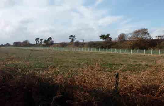
42 42 NORTH CHRISTCHURCH URBAN EXTENSION A stream which drains land southwards to the River Mude and Christchurch Harbour, forms the eastern edge of the study area. This is a vegetated stream with native thorn and willows and forms an attractive landscape feature alongside the public footpath and cycleway. The topography of the study area lies at approximately 10m AOD shelving very gently towards the stream in an easterly direction from the village of Burton and in a westerly direction from Burton Common. Within the western part of the study area, linear pine tree belts, which appear to have been planted as shelterbelts, are prominent features in the open landscape. Preston Lane, lies on the northern boundary of the study area. This is bounded by hedges and grass verges and is wide enough for one vehicle only in most places, having the character of a country lane. This has a junction with Hawthorn Road which accesses Burton to the west and Staple Cross, south of the railway line, through a railway tunnel. Land to the south The landscape south of the railway line is a relatively narrow area, sandwiched between the railway line and the A35, which both run in an east-west direction. It is flat and open but, unlike the area to the north described above, is more urbanised in character, particularly along the central section adjacent to the Sainsbury s store. The land is well contained by the high railway embankment and although trees and shrubs on the railway embankment help to integrate the embankment into the landscape, it is nonetheless quite prominent due to its height above the level fields. A line of tall prominent electricity pylons also run east west and emphasise the direction of the railway embankment. Long distance views across the site can be seen when approaching the site from the east on Roeshot Hill (as shown in the image opposite/below). Watercourse in northern part of study area


43 43 View along Preston Lane in the north of the study area Land to the south of the railway line, viewed from the east

44 44 NORTH CHRISTCHURCH URBAN EXTENSION Within the central section of the site lies the Sainsbury s store and a large garden nursery centre and allotments. West of the supermarket there is a wooded cycle lane and bridleway, which runs under the railway line, to the countryside to the north. At western end of the study area lies Staple Cross which is a Scheduled Ancient Monument, It is located near the junction of the A35, Hawthorn Road and Ambury Lane. Ambury Lane is a well-used cycle lane separated from the A35 by pine trees. At the eastern end of the study area lies the Verno Lane Conservation Area. This area is screened from the A35 and consists of a range of detached houses set amongst trees and woodland down Verno lane. The boundary to the A35 is varied over its length; west alongside Ambury Lane a fine avenue of tall pine trees encloses the site whilst further east this changes to a native tall hedgerow. East of the A337 roundabout the filed boundary is formed from a clipped hedgerow. Overall consideration of development potential The landscape north of the railway line represents part of an extensive area of open rural landscape within the Borough. It is accessible through a number of footpaths and bridleways, tranquil in character and has high sensitivity to change. Positive landscape features include the existing pine shelterbelts, the character of the country lanes and the vegetated stream, which combine to create an attractive rural landscape of some value. In contrast the area south of the railway line is of less landscape value due to the existing urbanised intrusions such as the supermarket and the narrow nature of the land, sandwiched between the busy A35 and the railway line. The strip of land has some value as part of the setting to the northern side of the built up area and there is a connection to the wider countryside beyond the railway embankment by virtue of the existing road and footpath links. However, development could be accommodated sensitively without loss or severance of the recreational access links. Ambury Lane viewed from the west

45 45 Land to the north of the railway, looking south Verno Lane
, a review of ecological designations (both statutory and nonstatutory), a")

46 46 NORTH CHRISTCHURCH URBAN EXTENSION ECOLOGY Introduction and methodology The approach to ecological constraints and opportunities analysis is primarily high level and is based on site visits, a desk study of existing ecological reports prepared for the site (CSa, 2006 and Fieldwork Ecological Services Ltd, 2007), a review of ecological designations (both statutory and nonstatutory), a review of the Dorset Heathlands Interim Planning Framework ( ) and the latest position of the emerging Core Strategy Habitats Regulations Assessment work being undertaken by Land Use Consultants with respect to the Dorset Heaths SPA, and a review of other available information concerning the study area. The HRA will be used to undertake an assessment of the housing distribution/ infrastructure options. Based on the information available, it has been intended to guide development to the most suitable locations with respect to ecology, as well as identify a framework for green infrastructure retention/enhancement and Suitable Alternative Natural Greenspace (SANGS) provision either on-site or off-site (or a combination thereof). This approach will minimise ecological risk in the future. Further ecological baseline assessments will be required in order to inform more detailed designs. At this stage it seems likely that such work will include an updated Phase I Habitat Survey, protected species surveys, vegetation, hedgerow and tree surveys, identification of UK and local Biodiversity Action Plan (BAP) priority habitats, a detailed SANGS strategy etc. Statutory Designations There are no statutory ecological designations within the North Christchurch Urban Extension area of search ( the site ). Several designated sites exist within 2km of the site as follows; The Avon Valley SPA/Ramsar lies approximately 800m to the west of the site and the River Avon SAC lies approximately 950m west of the site. The various parcels of land that comprise the Dorset Heatland SPA/Ramsar and Dorset Heaths SAC are located to the north west of the site and the nearest parcel is 2.2km to the west. Burton Common SSSI lies 500m east, Purewell Meadows SSSI lies 300m west and Christchurch Harbour SSSI 1.5km to the south. The New Forest SPA and SAC is located c. 3km from the site. Local Non-Statutory Designations There are no local non-statutory wildlife designations within the site. Somerford Site of Nature Conservation Interest (SNCI) lies less than 30m to the south and is connected to the site by the River Mude (the SNCI is downstream of the site). As such it is vulnerable to potential upstream changes in hydrology and pollution runoff. Important Features There are a number of important ecological features within the site, including some mature trees and hedgerows (a number of which have been identified by Fieldwork Ecological Services Ltd (2007) as important under the Hedgerow Regulations). With the exception of two small woodlands and several ecologically poor conifer shelter belts the site is intensive mixed farmland. Overall, the pasture and arable habitat is not considered to of significant ecological value (Fieldwork Ecological Services Ltd, 2007) although there is the potential for certain protected species to be present (see below). Two habitats on site that are considered to be of potential ecological significance are the paddocks south of Ambury Lane which contain several nests of meadow ant Lasius flavus, good indicators of unimproved grassland, and the River Mude, which flows through the site. The River Mude is a UK Christchurch Harbour and Dorset BAP priority habitat and provides an important green link for the support and movement of rare and protected species. Protected Species The Fieldwork Ecological Services Ltd, 2007 report has identified that the site has the potential to support notable species such as farmland birds (including skylarks and linnets) and common reptiles. The report also identifies the likely use of hedges by feeding bats. The River Mude may also support a number of protected species, such as water vole and otter. Further survey work will be required to determine the location and distribution, and where appropriate, population estimates of protected species. Dorset Heathland

47 Ecology Plan 47
48 48 NORTH CHRISTCHURCH URBAN EXTENSION Implications for the masterplan and the need for Suitable Alternative Natural Greenspaces (SANGs) Natura 2000 sites: legal protection Special Protection Areas (SPAs) and Special Areas of Conservation (SACs) are statutory designations and are of European importance (called European sites or Natura 2000 sites). Their protection stems from the Birds Directive and Habitats Directive, implemented in the UK under the Conservation of Habitats and Species Regulations 2010 which recently replaced the Conservation (Natural Habitats &c.) Regulations 1994 (as amended). The Habitat Regulations make it clear that where development is likely to significantly affect the integrity of a SPA or SAC, development may only be permitted if there are no alternative solutions and there are reasons of overriding public interest, including those of a social or economic nature and that the conservation status of the sites can be maintained. Generally speaking, developers are required to deliver avoidance measures in order to satisfy the requirements of the Habitats Regulations. The Dorset Heaths are designated for their ground nesting birds, which are vulnerable to impacts typically associated with urban encroachment on heaths: recreational pressure, dog walking, cat predation and fires. Because of the potential effects of development on nearby heathlands together with the dependence of some heathland species on habitats outside the designated sites and the rigorous statutory tests of the Habitat Regulations, the Dorset heathlands (amongst other factors) constitute a significant constraint to the outward spread of the conurbation. A series of public inquiry decisions, in which housing development proposals of various scales have been rejected because of its proximity to heathlands, has re-enforced the significance of this issue. The New Forest SPA is located c. 3km from the site and are also designated for their ground nesting birds, as such the issues are similar to that suffered by the Dorset Heaths. The Avon Valley SPA/Ramsar and the River Avon SAC are within 1km of the study area and the birds for which the SPA is designated will also be vulnerable to increased recreational pressure, by users of the Avon Valley Path. The Avon is not hydrologically connected to the River Mude and drainage impacts are considered unlikely. In the case of the Dorset Heaths, measures considered suitable to manage potential effects include: provision for long term financial support to address urban pressures; policies and financial support for the provision of alternative green infrastructure; policies to direct housing development (including infill) away from key areas adjacent to heathland sites. Where residential development is proposed near to the Dorset Heaths (and also the New Forest SPA), careful consideration must be given to the location and quality of SANGS, such that it offers a genuine attractive alternative to the nearby area of the Dorset Heaths. It is considered that SANGS are also required to offset recreational impacts on the Avon Valley SPA/Ramsar and the River Avon SAC. SANGS requirements are discussed further below. SANGs Although no part of the study area is located on any designated site, it will need to be demonstrated that impacts can be avoided in accordance with the Habitats Regulations Habitats Regulations Assessment of the Christchurch & East Dorset Core Strategy is being undertaken by Land Use Consultants, and it is likely that specific policies will be written in the Core Strategy aimed at impact avoidance and mitigation. The Core Strategy HRA is also likely to identify enhancements to and new sources of natural greenspace and will build upon mitigation mechanisms established under the Dorset Heathlands Interim Planning Framework and the emerging Heathlands DPD. The North Christchurch urban extension will be responsible for demonstrating no effect on the Dorset Heaths SPA, the New Forest SPA and the Avon Valley SPA/Ramsar and the River Avon SAC. The primary means of achieving this is for development within 5km of the Dorset Heaths to provide: (a) SANGs within the study area and/or (b) offsite SANGs / enhancements, although (a) is likely to constitute a major part of the impact avoidance package for the urban extension. As stated in the Interim Planning Framework, Large scale developments will be expected to explore ways of mitigating its adverse impacts. This may be through on site measures or more likely off site measures to facilitate the implementation of alternative natural greenspace. Recourse to financial payments in line with the IPF should be the fallback position only after exploration with Natural England and the relevant local planning authority of potential mitigation measures. To guarantee the delivery of (b), financial contributions as part of S106 or similar agreements are likely to be entered into, in accordance with the requirements of the Interim Planning Framework. It is recommended that the SANGs analysis for the North Christchurch urban extension masterplan is steered by the emerging Heathlands DPD and the Core Strategy HRA work. It is recognised that developers need to be given the flexibility to come up with their own SANGs solutions and, therefore, potential locations have been identified for the delivery of SANGs within the study area. The masterplanning approach to this issue will, therefore, need to be mobile and cannot be fixed at this time. Provisional SANGs Solutions Provisional SANGs options have been identified as follows, which would be drawn up in greater detail by prospective developers in consultation with Natural England to include how the SANGs would be delivered and managed. This is illustrated in the figure (right).


49 Provisional SANGs Strategy 49
50 50 NORTH CHRISTCHURCH URBAN EXTENSION The plan shows: Circular route options around the railway line, using existing underpasses and bridges. Other existing linkages could be enhanced e.g. connections to Burton could be strengthened via existing footpaths. Agricultural fields north of the railway line. This environment could be enhanced to connect to the existing public right of way which passes beneath the railway, with excellent opportunities for a circular walk with the village of Burton, the River Mude and landscape enhancements as focal points. This route should be a minimum of 2.5km but options for longer or shorter walks should be provided. In the event that this area is extracted for minerals, the remediation strategy should be designed with SANGS in mind, although it is understood that water features would not be permitted due to the proximity to Bournemouth Hurn Airport and the risk of bird collision. The Avon Valley Path also runs along the eastern side of Burton and there are opportunities to connect to this path. In addition to these potential areas of SANGs within the study area, developers may be required to contribute toward enhancements off-site in consultation with Natural England. This could include improvements to the Avon Valley Path or to coastal sites, in order to manage recreational impact. Access management and other measures to reduce impact on Burton Common SSSI may also be required, should SANGs provision be deemed insufficient to avoid impact on the SSSI. Generic SANGs mitigation In terms of mitigation, the main type of measure recommended by Natural England is the provision of SANGs for residential developments and/or improvements to existing sites to increase their visitor capacity and manage/avoid potential negative effects. With respect to the accessible natural green space guidance, Natural England advocates that local communities should have access to an appropriate mix of green-spaces providing for a range of recreational needs, of at least 2 hectares of accessible natural green-space per 1,000 population. This can be broken down by the following system: no person should live more than 300 metres from their nearest area of natural green-space; at least one hectare of Local Nature Reserve should be provided per 1,000 population; there should be at least one accessible 20 hectare site within 2 kilometres; there should be one accessible 100 hectare site within 5 kilometres; there should be one accessible 500 hectare site within 10 kilometres. However, where sites are particularly susceptible to recreational impact, such as that which may be caused by development in the vicinity of the Dorset Heaths and the Thames Basin Heaths, Natural England guidance stipulates that SANGs provision should aim to provide at least 8 hectares per 1,000 population. Consultation with Natural England has confirmed that up to 16 hectares may actually be required for the Dorset Heaths given their bespoke requirements. Therefore it can be concluded that between 8-16ha of SANGS will be needed per 1,000 population. Natural England has provided guidance towards the characteristics that SANGs should have (it relates to the Thames Basin Heaths and we understand the guidance is currently under review). The Guidance provides some important pointers on the location of SANGs, the facilities that are needed and the type of visitor that should be catered for. Key considerations include; Ensure provision of adequate car parking and signpost it. Where large populations are close to a European site, the provision of SANGs should be attractive to visitors on foot. Sites should be capable of providing routes of 2.5 to 5 kilometres, people may require longer routes. Where long routes cannot be accommodated within individual SANGs it may be possible to provide them through a network of sites, provided the connecting areas are rural in nature. Paths do not have to be of any particular width, and both vehicularsized tracks and narrow Public Rights of Way (PRoW) type paths are acceptable to visitors. Safety is one of the primary concerns of female visitors. Paths should be routed so that they are perceived as safe by the users, with some routes being through relatively open (visible) terrain (with no trees or scrub, or well spaced mature trees, or wide rides with vegetation back from the path), especially those routes which are 1-3 km long. The routing of tracks along hill tops and ridges where there are views is valued by the majority of visitors. A substantial number of visitors like to have surfaced but not tarmac paths, particularly where these blend in well with the landscape. This is not necessary for all paths but there should be some more visitor-friendly routes built into the structure of a SANGs, particularly those routes which are 1-3 km long. People value the naturalness of sites and artificial infrastructure should be avoided where possible. However, SANGs would be expected to have adequate car parking with good information about the site and the routes available. Some subtle waymarking would also be expected for those visitors not acquainted with the layout of the site. Other infrastructure would not be expected and should generally be restricted to the vicinity of car parking areas where good information and signs of welcome should be the norm, though discretely placed benches or information boards along some routes would be acceptable.

51 51 Hills do not put people off visiting a site, particularly where these are associated with good views, but steep hills are not appreciated. An undulating landscape is preferred to a flat one. Water features, particularly ponds and lakes, act as a focus for visitors for their visit, but are not essential. It is imperative that SANGs allows for pet owners to let dogs run freely over a significant part of the walk. Access on SANGs should be largely unrestricted, with both people and their pets being able to freely roam along the majority of routes. This means that sites where freely roaming dogs will cause a nuisance or where they might be in danger (from traffic or such like) should not be considered for SANGs. Dog bins should be provided to attract dog walkers. green areas. The Green Flag Award could be another way of ensuring that high quality sites are provided (see greenflagaward.org.uk/award/). Only with the above measures in place can it be reasonably concluded that there will be no likely net significant effect on the Natura 2000 sites arising from development within the study area. Further advice will be contained in the Core Strategy HRA which will include local requirements identified under the Dorset Heaths Interim Planning Framework and Heathlands DPD. Further advice should also be sought from Natural England as the masterplan progresses and as the evidence base concerning SANGS and ground nesting birds evolves. Statutory and Non-Statutory Sites Important Features Where important features are to be lost they should be compensated through habitat creation, in order to assist in demonstrating biodiversity gain as part of the development (required under Planning Policy Statement 9) and to support rare and protected species. The opportunity to create new green corridors and enhance existing green links formed by the railway embankment, hedgerows and the River Mude should be a principle aim of the masterplan.the requirement for SANGs provision will also directly contribute to green infrastructure, ecological corridors and in demonstrating biodiversity gain. Protected Species The retention and enhancement of some of the better features (the important hedgerows, mature trees, the River Mude corridor including buffer and areas of grassland) will greatly enhance this area and will improve the wildlife potential of the land for common species (including bats) above its current state. There could be considerably more benefits to wildlife from well designed housing schemes and new species could be attracted to the area. The only exception to this is the skylark that cannot survive in a developed landscape. The guidance also provides comments on the enhancement of existing sites, including ensuring that candidate sites do not have any competing uses that would make them unsuitable as SANGs. The Green Flag Award is the national standard for parks and green spaces in England and Wales. The award scheme began in 1996 as a means of recognising and rewarding the best green spaces in the country. It was also seen as a way of encouraging others to achieve the same high environmental standards, creating a benchmark of excellence in recreational The River Mude corridor should be enhanced for its ecology, and natural vegetation strips of at least 8m from top of bank (this may be up to 15m if otters are found to be present) to safeguard a green corridor that will maintain the value of this habitat and avoid impacts on the Somerford SNCI downstream of the study area. A sensitive drainage design that integrates pollution prevention measures such as sustainable drainage systems (SUDS) and pollution interceptors will also be required. River Mude

52 52 NORTH CHRISTCHURCH URBAN EXTENSION ARCHAEOLOGY AND CULTURAL HERITAGE Method The approach to archaeological and cultural heritage constraints and opportunities analysis is primarily high level and is based on consultation with the Dorset Historic Environment Record Office at Dorset County Council, a desk study of relevant designations and archaeological information, including the listed buildings information, and a review of other available information concerning the study area. No archaeological reports are available for the study area. On this basis the findings set out in this document should be viewed as preliminary and have aimed to guide development to the most suitable locations with respect to known archaeology and cultural heritage. This approach will minimise planning risk in the future. Records of prehistoric activity exist at Hengistbury Head, located approximately 3km to the south. Whilst there is no existing evidence to suggest that that the remains at Hengistbury Head interconnect with potential remains within the study area, unknown resources of significance may yet be discovered. Further, more detailed, desk based and survey work will be required in order to inform more detailed designs at later stages. Scheduled Ancient Monuments There is one Scheduled Ancient Monument (SAM) within the study area known as Staple Cross. This is located in close proximity to the south western boundary of the area of search and is a roadside cross located at the junction of five roads and on a parish boundary. The location of the SAM is shown on the plan (opposite). Conservation Areas There are two Conservation Areas in close proximity to the site, the Burton Conservation Area and the smaller Verno Lane Conservation Area. The site adjoins the Burton Conservation Area at the western edge, where a number of listed buildings look out towards the site. Burton is a long linear settlement focused around The Green at the centre of the village. It is thought that the village originated as a series of farmsteads developed along the Salisbury to Christchurch Road. Four different character areas have been identified with in the Conservation Area, however, the predominant material used throughout is the local red brick, which gives a sense of cohesion between all four areas. One of the most dominant buildings is Burton Hall which lies at the northern end of the village, built in the mideighteenth century, it is thought to have replaced an earlier farmhouse. Verno Lane is a small self-contained Conservation Area located to the south of Roeshot Hill. It is made up of a collection of notable buildings accessible via a narrow track and well masked from Roeshot Hill and the surrounding area by dense vegetation. The location of the Conservation Areas are shown on the plan (opposite). Any development adjacent to these areas should seek to preserve and enhance those aspects of character and appearance that define the conservation area s special character. Listed Buildings Key listed buildings within the Conservation Area in the vicinity of the site are shown on the plan (opposite). Buildings that are deemed to make a positive contribution to the Burton Conservation Area are also shown. Staple Cross SAM


53 53 Burton Conservation Area Verno Lane Conservation Area Local Archaeology Plan
54 54 NORTH CHRISTCHURCH URBAN EXTENSION Historic Parks and Gardens There are no historic parks and gardens within the study area or within close proximity of the study area. Prehistoric Palaeolithic Mesolithic Neolithic Bronze Age Iron Age Roman Post-Roman Saxon Statutory Designations Gravel and Sand Extraction Proposals Buried Features Archaeological Assets Whilst there are no records of archaeological assets within the study area, there are several records within 1km. A summary of known archaeological assets within 1km is shown in the table below: Spot Finds Surface Features Medieval R R Post-Medieval R R R Modern It should be noted that should proposals to extract gravels and sand within the study area north of the railway line proceed, that loss of archaeological resources would occur. R R Summary and implication for the masterplan Within the surrounding vicinity of the study area there are examples of a SAM and a listed structure (a milestone located in a roadside verge at the northern boundary of The Roeshot Hotel) which may limit development in their vicinity where their setting may be affected; this is particularly the case for the south west of the site where Staple Cross SAM exists on the boundary of the site. In general, the main area of archaeological interest within the surrounding area is Medieval to Post Medieval, with examples including Staple Cross (a SAM), Somerford Manor and the site of associated fishponds. Within 200 metres to the south of the site there is spot find evidence of Bronze Age activity. Whilst there is no recorded evidence of prehistoric activity within proximity to the study area, there are records to the south at Hengistbury Head. Within the wider region there would appear to be a propensity for archaeological remains to follow favourable geology (as providing raw materials for stone working etc.) and also the route of watercourses (such as the River Mude or the River Avon) which have been shown to attract both seasonal and permanent human activity potentially for the benefit of ready access to a food source and also transport. The activity in the historic periods is evidenced by both standing structures in proximity to the site, earthworks and a spot find. Scheduled Ancient Monuments and listed buildings should not be directly affected by development, however, consideration should be given to sensitive development to retain or improve the existing setting to archaeological and built heritage assets (i.e. visual impact). Development has the potential to destroy any archaeological remains and mitigation of these impacts, where it has been deemed that any specific archaeological resources cannot be preserved in situ, will be required. This also applies for any minerals extraction works that may take place north of the railway line. It is important to note that there will be a need for further, more detailed archaeological assessment as the masterplan develops and as developers bring forward planning applications. Further archaeological assessment would also be required for any minerals extraction works. The findings set out in this document should be viewed as preliminary and have aimed to guide development to the most suitable locations with respect to archaeology and cultural heritage. This approach will minimise planning risk in the future (particularly with respect to statutorily protected features), although it is important to note unknown resources of significance may yet be discovered. Further work, including formal desk based assessment, geophysical survey, intrusive investigation etc. may be required in order to inform more detailed designs to define if archaeological resources may be required to be preserved in situ, thereby potentially directly affecting the layout of future development.


55 55 FLOODING AND SURFACE WATER DRAINAGE Flood Zones The Christchurch Borough Level 2 Strategic Flood Risk Assessment (SFRA), involving extensive hydraulic modelling of the watercourses in the vicinity of the site, was undertaken in early Subsequent to the Environment Agency s (EA) acceptance of the output of the SFRA, the status of the Flood Zone in which the site is located was altered between November 2009 and March The extent of the flood plain has significantly reduced. Both the 2009 and 2010 flood plans are shown below. The EA s updated flood mapping shows that the majority of the site falls within Flood Zone 1 (low probability of flooding), with areas of Flood Zone 2 (medium probability of flooding) adjacent to the River Mude, the majority of which is to the east of the river, north of the existing supermarket. EA Indicative flood risk mapping November 2009 EA Indicative flood risk mapping March 2010
, taken from the SFRA, shows the predicted future extent of the floodplain 100 years from the current planning horizon of 2026, i.e. in 2126.")
 and the main rail line, the extent of Flood Zone 2 as shown in 2010 and 2126 appears very similar.")
56 56 NORTH CHRISTCHURCH URBAN EXTENSION The SFRA includes a series of maps showing the output of the hydraulic modeling. The figure (right), taken from the SFRA, shows the predicted future extent of the floodplain 100 years from the current planning horizon of 2026, i.e. in This takes into account the predicted impact of 100 years of climate change, with 100 years being the accepted design life for a new residential development. For the site in question, bounded by the A337, Lyndhurst Road (A35) and the main rail line, the extent of Flood Zone 2 as shown in 2010 and 2126 appears very similar. The 2126 figure shows that some small areas of Flood Zone 2 increase to Flood Zone 3 in the future scenario. SRFA predicted flood risk mapping for 2126
57 57 Site - specific requirements A desktop, net-based Soilscape assessment has been undertaken and has focused on developable land (as set out in Section 09). It indicates that the nature of the underlying ground varies. To the western end (Parcel 01), the site is freely draining, whereas land to the eastern end of the site (other parcels) is naturally wet. Part of the site may, therefore, be suitable to be drained by soakaways. However, as the masterplan develops it is important to allow sufficient space to accommodate any surface water storage ponds that may be required. Development Area ref. Gross site area Developable site area PIMP* Future site impermeable area Area requiring attenuation TOTAL Schedule of development areas * Percentage Impermeability Plan of development areas
58 58 NORTH CHRISTCHURCH URBAN EXTENSION It has been assumed for the purposes of this assessment that development will take place to the south of the railway line (see Section 09). Areas not designated as possible development land have not been included within the storage calculations. It is assumed that future development percentage impermeability (PIMP) for parcels 01 to 04, and 06, is 60%, on the basis of residential land use. It is assumed that PIMP for parcel 05 is 95%, on the basis of land used for parking. It is not anticipated that parcels 01 and 05 will require attenuation storage. Parcel 01 is understood to be underlain by freely draining ground suitable for soakaways, and it is, therefore, assumed that it will discharge via infiltration. Parcel 05 is impermeable in the pre-development scenario; storage is not, therefore, required to limit discharge to pre-development rates. It is assumed that surface water runoff from all other parcels will be attenuated to greenfield runoff rates, prior to discharge into existing watercourses. DEFRA guidance W5-074 Preliminary Rainfall Runoff Management for Developments has been used to estimate the Greenfield runoff rates for the site. 1 year runoff 1.81l/s/ha 30 year runoff 3.84l/s/ha 100 year runoff 5.11 l/s/ha DEFRA guidance W5-074 Preliminary Rainfall Runoff Management for Developments has been used to estimate the required storage volume to attenuate the rate of surface water runoff from the site to greenfield runoff rates, and to provide long term and water quality storage, as required by the Environment Agency for greenfield sites. Development Area ref. 100 year attenuation volume (m 3 ) This total storage volume will require a land take of approximately 0.6 to 0.9ha, depending on the form in which it is provided, the number of storage areas (e.g. ponds) and depth. This represents approximately 2.5% to 3.75% of the developable site area, and is likely to be an over-estimation (as indicated in plan shown opposite). The sequential approach required by PPS 25 (Planning Policy Statement 25: Development & Flood Risk) indicates that development should be directed toward areas of lower risk, i.e. Flood Zone 1. It is considered that the most appropriate area for surface water storage is in Long term storage volume (m 3 ) Treatment volume (m 3 ) TOTAL Required surface water storage volumes Total volume (m 3 ) the southern area of the site, currently designated as Flood Zone 2, to the east of the River Mude and the north of the existing supermarket. However, the 2126 figure identifies that in the future scenario a proportion of this area will become Flood Zone 3, which precludes both residential development and use of the area for surface water storage. It is therefore considered that storage should be located within the area which is Flood Zone 2 in both the existing and future scenarios. An alternative scenario would be for storage to be located within the future Flood Zone 3 area, with compensatory flood storage provided elsewhere within the site, subject to Environment Agency consent.

59 59
60 60 NORTH CHRISTCHURCH URBAN EXTENSION The precise areas required would need to be confirmed by detailed analyses following site investigations to establish underlying ground conditions, and topographical surveys, as part of site specific Flood Risk Assessments for each phase of the development. The Environment Agency has previously advised (August 2006) that: The River Mude, which bisects the site, is classified as a Main River under the EA s control. An 8 metre wide buffer zone either side of the river must therefore be maintained. No development must compromise conveyance or storage within Flood Zone 3 (1 in 100 year flood plain) after allowance has been made for climate change. Post development, surface water runoff should be restricted to current peak flows. The EA would expect to see sustainable urban drainage systems (SuDS) utilised within the development, with suitable areas being set aside during the conceptual phase of the proposals to maximise the benefits of such systems. A number of ditches and drains surround the site. The EA would object to the culverting of any watercourse and suggest that access should be maintained along these features to allow for future maintenance or improvements. A Flood Risk Assessment will be required, which should consider surface water drainage and finished floor levels. EA recommendations at the time were for finished floor levels to be set a minimum of 600mm above the future 1 in 100 year flood level. Generalised land raising is not recommended, as it fails to accommodate surface water ponding in safe locations. As part of any Flood Risk Assessment, the above information should be verified with the EA, due to the time which has elapsed since the advice was issued, and the change in flood plain status of the site. Although no access arrangements have been agreed at this stage, it is considered likely that it will be possible to provide safe access and egress totally outside of Flood Zones 2 and 3 (medium and high risk flood zones). GROUND CONDITIONS AND CONTAMINATION Ground Conditions Published geological mapping (British Geological Survey map sheet 329, Bournemouth, 1991) indicates that the majority of the site is underlain by quaternary River Terrace Deposits of sand and gravel. Site specific information indicates that these deposits are present to a depth of at least metres below ground level. Some alluvium, comprising clay, silt, sand and gravel, is present in the vicinity of the eastern site boundary associated with the surface water body. The solid geology underlying the site comprises the Boscombe Sand Formation. Hydrogeology The site is underlain by a Secondary (formerly Minor) aquifer, with soils of intermediate leaching potential in the western part of the site and high leaching potential in the east of the site. Groundwater is anticipated to be present at a depth of approximately 2 metres below ground level (m bgl). The site is not located within an Environment Agency designated Source Protection Zone (SPZ), with no licensed groundwater abstractions within 500m of the site. Landfill and Made Ground Available information, including Environment Agency records, do not record the presence of any current or historical areas of landfill within 2km of the site s approximate centre point. It is considered unlikely that significant deposits of Made Ground material (artificially created ground e.g. with hard rubble such as broken brick, concrete, etc) shall be present on site given the historical use of the site. Mineral Extraction Proposals Part of the site, located to the north of the existing railway land, along with adjoining land located to the east, has been identified as a potential site for the extraction of mineral resources, comprising sand and gravel (River Terrace deposits). An estimated reserve of 3.5 million tonnes has been identified, capable of producing up to 250,000 tonnes per annum. Reject material, including overburden (i.e. material lying above the targeted mineral resource such as topsoil) and fines materials, would be used to backfill the excavation and allow its return to an agricultural land use. Any proposed development of the proposed mineral extraction area for urban expansion would effectively sterilise the identified resource for an indeterminate
 that would need to be overcome.")

61 61 period of time. Future development of the area of mineral extraction following backfilling following restoration may present a number of geotechnical constraints (e..g heterogeneous ground conditions) that would need to be overcome. The minerals extraction area does not conflict with the potential for SANGS north of the railway line as set out in the Ecology section of this report. The restoration strategy for any minerals extraction can be ideal for SANGS. Site History and Potential Sources of Contamination The site has historically comprised agricultural land and no potentially significant sources of contamination have been identified either on, or in proximity to the subject site. A railway line traverses the site area in an east-west direction but no significant infrastructure (e.g. sidings, goods yards, maintenance depots) is present associated with the line. A small electricity sub-station has been located immediately to the south of the railway line from the mid-1970s but given the size and location of this feature it is not considered to represent a significant constraint to future development because of the presence of contamination. Geotechnical Considerations The superficial sand and gravel deposits that underlie the majority of the site area are likely to comprise suitable founding strata for traditional two to three storey residential dwellings and associated infrastructure (e.g. roadways). These deposits may also allow the use of soakaway drainage solutions, depending upon the proportion of fine/cohesive material within the deposits and the depth to groundwater. Further site specific investigation and assessment will be required, however, before any specific ground engineering design recommendations can be provided for an identified development scheme. Overhead Power Lines It has been indicated that consideration is being give to the burying of overhead power lines that traverse the site in an east-west direction. It is considered likely that the underlying ground conditions would be suitable for the construction of a stable corridor, although shallow groundwater may constrain the laying of the cables and require the use of appropriate de-watering techniques. Where variable ground conditions are identified then ground improvement may be required to maintain the integrity of the cables. A stand-off zone is also likely to be associated with buried cables that would affect the extent of the site s developable area. Planned mineral extraction area in Dorset Planned mineral extraction area in Hampshire
62 62 NORTH CHRISTCHURCH URBAN EXTENSION NOISE AND VIBRATION Method This section sets out a summary of the initial advice on the likely noise and vibration constraints associated with the proposed North Christchurch urban extension. The advice is based on a review of the site plan and internet searches. No site visit has been undertaken nor noise/vibration measurements made, although guidance has been sought from the local planning authority regarding the application of Planning Policy Guidance Note 24 Planning and Noise (PPG 24) within the Christchurch area. On this basis, the findings set out in this document should be viewed as preliminary. Broadly constraints can take two forms: existing sources of noise and vibration that may influence the type and location of uses within the proposed urban extension; the effect that the development itself might have on existing noise sensitive uses surrounding the extension. The Government s policies on noise related planning issues are set out in PPG 24. PPG 24 recommends the use of four Noise Exposure Category (NEC) bands, which are designed to assist local planning authorities in evaluating applications for residential development in noisy areas. The definition of each NEC band depends on the noise source in question. The table (right) presents the NECs for various noise sources and the associated advice to local authorities. NEC A B C D Source Day time L Aeq,16h db Noise Levels Night-time L Aeq,8h db Planning Advice Road traffic / mixed <55 <45 Noise need not be considered as a Aircraft <57 <48 determining factor in granting planning permission, although noise at the high Rail <55 <45 end of the category should not be regarded as a desirable level. Road traffic / mixed Noise should be taken into account Aircraft when determining planning applications and, where appropriate, conditions Rail imposed to ensure an adequate level of protection against noise. Road traffic / mixed Planning permission should not Aircraft normally be granted. Where it is considered that permission should be given, for example because there are no quieter sites available, conditions Rail should be imposed to ensure a commensurate level of protection against noise. Road traffic / mixed >72 >66 Aircraft >72 >66 Rail >74 >66 Planning permission should normally be refused. Note: Night-time noise levels ( ): sites where individual noise events regularly exceed 82 db LAmax (S time weighting) several times in any hour should be treated as being in NEC C, regardless of the LAeq,8h (except where the LAeq, 8h already puts the site in NEC D). Noise Exposure Categories for New Dwellings near Existing Transport Related Noise Sources and Advice to Local Planning Authorities
63 63 The local planning authority was consulted in March 2010 regarding the local application of guidance contained within PPG 24. Although not ideal, consideration would be given to the development of noisier sites, provided that a commensurate level of protection against noise is included in the scheme design. Nonetheless, given that there is a general presumption against residential development within NEC C (as stated in PPG 24), it seems prudent to develop any masterplan on the basis that residential and other noise sensitive development would be located in areas falling within NEC A and NEC B. It should be noted that the advice within PPG 24 is that conditions should be imposed, where appropriate, to ensure an adequate level of protection against noise for development within NEC B and that noise levels at the high end of NEC A would not be regarded as desirable. Constraints affecting the proposed urban extension There are a number of noise constraints affecting the proposed urban extension. The development area to the south of the railway is likely to be affected, to a greater or lesser extent, by noise from: road traffic on the A35; specific aspects of the retail units located north of the A35 and close to the Somerford roundabout; corona discharge associated with the electricity pylons which run broadly parallel to the railway on its south side. Noise and vibration from trains passing between Hinton Admiral and Christchurch stations would affect areas to the north and south of the railway as might aircraft arriving and departing Bournemouth Airport, a little over five kilometres to the north-west. Each of these sources is considered in turn below. Road Traffic In order to determine the constraints posed by vehicles on the A35, the Department for Transport website ( has been interrogated to determine the likely volumes of traffic. The table (top right) presents the two-way Annual Average Daily Traffic (AADT) 1 on the A35 to the west and east of the Somerford roundabout. Road link Year Two-way vehicle flow % heavy vehicles A35, west of Somerford roundabout (Christchurch Bypass) A35, east of Somerford roundabout (Lyndhurst Road) Existing Traffic Data (24-hour AADT) 1 By undertaking a simple calculation in accordance with the Calculation of Road Traffic Noise (which is the UK method for predicting noise from road traffic) it is possible to determine the approximate distance at which the NEC B/C threshold may be exceeded. The NEC B/C boundary has been selected to identify likely constraints on the basis of the guidance in PPG 24 relating to NEC C where the fundamental advice is that planning permission should not normally be granted. The calculations necessarily make a number of assumptions which influence the Basic Noise Level as set out as follows: , , the 24-hour AADT flows are indicative of the 18-hourAnnual Average Weekday Traffic (AAWT) flows ( ); light goods vehicle (lgv) movements have been divided equally between heavy and light vehicle categories before deriving the proportion of heavy vehicles; the notional speed on the Christchurch Bypass and Lyndhurst Road is taken to be 97 kph (c 60 mph) and 88 kph (c 55 mph) respectively; all roads have a notional hot rolled asphalt (HRA) surface (with 2 mm texture depth); and a notional road gradient of 0% has been universally applied. 1 The AADT flow is not typically used as a basis for road traffic noise assessments, however, it is considered adequate at this stage.
64 64 NORTH CHRISTCHURCH URBAN EXTENSION In addition, the calculations assume a full view of the road, without screening but with a predominantly absorbent ground cover (in the acoustic sense) between the road and calculation point. The results of this exercise are presented in the table below. It should be remembered that these calculations have been based on a number of assumptions and so are very approximate, but nonetheless they are considered indicative of the likely constraints from road traffic. Road link A35, west of Somerford roundabout (Christchurch Bypass) A35, east of Somerford roundabout (Lyndhurst Road) Indicative PPG 24 NEC B/C Boundary Distance (in metres) from the kerb to NEC B/C boundary It should be noted that the constraints relate to the NEC B/C boundary. Whilst it is possible that noise sensitive uses could be located closer to the road with appropriate mitigation (see above), noise levels at the NEC B/C boundary should not be considered ideal and indeed some degree of acoustic treatment may still be required at noise sensitive buildings located at the specified set-back distances. Similarly for external areas considered sensitive to noise (e.g. private gardens), it is unlikely that relevant noise limits would be met unless these areas are screened, either by locating them behind buildings or by the inclusion of appropriately designed acoustic fences. It should also be borne in mind that constraints might be greater near junctions where noise from more than one road can combine, resulting in higher noise levels. It will be necessary to give careful consideration to the design, orientation and location of dwellings within the development areas to ensure that road traffic impacts are minimised and appropriate internal and external levels are met. There are a number of generic options (individually or in combination) available to control external noise: The location of buildings on site. The primary control factor is distance the greater the distance from the source, the lower the noise level. The type of intervening ground cover (acoustically absorbent or reflecting) and the height of the receptor will also influence the received noise level. Screening. Barriers or screens can reduce noise on site. They can take the form of an existing feature (for example a cutting), a purpose-designed feature (for example, a solid boundary fence or an earth mound) or a purpose-designed building (for example, a linear barrier block). Building form and orientation. Limiting the view of the source by building orientation can reduce the received noise level. Measures include turning a building through 90 to be perpendicular to the road and staggered terraced housing can be arranged to shield noise-sensitive windows. Internal planning. Single aspect designs can be employed whereby noise sensitive rooms face into the development, with the outward facing façade either being windowless or incorporating windows to non-noise sensitive rooms. Building envelope. The final line of defence against external noise is the building envelope and in particular the glazing / ventilation package. It should be noted, however, that many of these measures do not align with best practice urban design principles for site design and a careful balance should be struck. Industrial and Commercial Activities Industrial and commercial sites have the potential to cause disturbance, partly as a result of the activities that are being conducted (and the resultant noise levels) and partly because of the time at which activities might be undertaken (i.e. at unsocial hours or at weekends). Sometimes it is a combination of the two. It is clear from an initial examination of the area using maps and aerial photography that the Sainsbury s store located on the north side of the A35 close to the Somerford roundabout could pose a significant constraint to residential development.
65 65 There are a number of different activities or processes associated with this (and indeed any other) store, which could generate unwelcome noise: recycling facilities noted to be located close to boundary with the proposed development site; fixed plant (such as heating, ventilation and air-conditioning) most of which appears to be located along the northern edge of the store roof, closest to the proposed development site; customer parking (including vehicle movements and customer trolleys) the nearest parking bays are located adjacent to the proposed development site; and service yard again located adjacent to the proposed development site, at the north-east corner of the store. It is often the case that noise from fixed plant and more particularly the service yard have the greatest potential to disturb as these will almost certainly operate 24 hours a day seven days a week, even though the store does not. The service yard itself has a number of aspects that need to be considered: delivery vehicles arriving / departing (including engine noise and air brakes); vehicle manoeuvring onto the unloading dock (including engine noise, air brakes and reversing alarms); unloading goods (cages, especially when empty, being pushed through the main body of the lorry can generate a quite distinctive rumbling noise); and waste compactor. It might be the case that the Sainsbury s operating procedures for deliveries reduce, or even remove, some of these concerns (for example, reversing bleepers and lorry mounted refrigeration units may be switched-off before the lorry approaches the store). However, it is inevitable that sufficient sources of noise will be present for disturbance to any new residents to remain a distinct possibility. The actual constraints will depend on site specific circumstances concerning the number and timing of delivery lorries, the configuration of the yard and the screening that might be afforded by existing structures, however, a considerable buffer zone may be required to protect residential amenity if other mitigation measures cannot be incorporated. Noise measurements made at other similar stores indicate that maximum noise levels (LAFmax) within the service yard of 87 db at a distance of 5m could be generated during a vehicle delivery. Without any mitigation measures in place the residential build line would need to be some 160m from the source in order for the internal LAFmax level not to exceed the relevant night-time target value with windows open for ventilation. If an effective acoustic barrier could be placed between the source and receiver which totally obscures the line of sight (assumed attenuation 10 db) then the set back distance would reduce to 50m. Of course, a number of other generic measures exist (see above) and each of these should be given careful consideration. These rudimentary calculations provide only a cursory examination of the possible maximum noise levels at night, nonetheless they do support the view that the Sainsbury s store is likely to pose a significant constraint to residential development. It is recommended that a more detailed assessment should be undertaken at the appropriate time of all the sources likely to influence the noise climate in the area. The adjacent garden centre (Stewarts) is considered less likely to pose a constraint to residential development on the adjacent site. Many of the sources associated with a large supermarket do not exist with this type of retail outlet and the land use nearest the proposed development site appears to be over-flow parking. Nevertheless, the potential for noise disturbance should not be dismissed without a detailed assessment of this operation. In summary, the presence of residential (and other noise sensitive uses) adjacent to industrial and commercial sites (whether noise sensitive development is introduced within an established industrial area or the reverse scenario) can lead to significant issues in terms of noise (and sometimes vibration as well) and consequently this should be avoided if at all possible.
66 66 NORTH CHRISTCHURCH URBAN EXTENSION Corona Discharge The comments and advice contained in the following section is drawn in the main from information displayed on the National Grid website ( property/). High voltage overhead lines can generate noise. Sometimes a crackling sound accompanied by a low frequency hum can be heard. The level of this noise depends on the voltage. Noise from an overhead power line is produced by a phenomenon known as corona discharge. Overhead lines are built to minimise this, but surface irregularities caused by damage, insects, raindrops or pollution may locally enhance the electric field strength sufficient for corona discharges to occur. The noise levels associated with an overhead power line are weather related higher noise levels are likely to occur during damp weather conditions and long dry spells when airborne debris sticks to the lines (but this is washed away by a heavy rain shower). National Grid has always sought to route new power lines away from residential property on grounds of general amenity and believes that the amenity considerations which are applied in the routing of new overhead lines should also be applied in respect of development proposed in the vicinity of overhead lines. To minimise disturbance and to facilitate maintenance, National Grid prefers that built development does not take place beneath power lines. However, what constitutes an acceptable noise level is usually a highly subjective decision, and can vary depending on the other background noises, climate and the surrounding ground cover within the area. Consequently, National Grid does not prescribe a minimum distance between properties and overhead power lines; with each case being dealt with on its merits. National Grid has produced design advice which demonstrates that land beneath and adjacent to overhead power lines can be efficiently used in many practical and profitable ways other than residential development. The following are some potential land uses beneath power lines: public open space passive; public open space active; allotments and community orchards; nature and conservation; structural landscape; parking; non-residential storage uses; water bodies, drainage and flood attenuation; and movement roads, cycleways and paths etc. Services Railways Scheduled Passenger Train Movements (Weekday) between Hinton Admiral and Christchurch* The twin track rail line between Hinton Admiral and Christchurch runs straight through the proposed development area. The table below identifies the current level of passenger rail traffic scheduled on the section of line between Hinton Admiral and Christchurch on a typical weekday Towards London From London All * from the national rail timetable sheet 158 valid from 13 December 2009 to 22 May 2010
67 67 The figures indicate that this line is moderately busy with 134 timetabled passenger movements in the 24-hour period. The first train in the morning (towards London) is scheduled to pass the site between 0520 and 0525, whilst the last train in the evening (from London) is scheduled to pass the site between 0205 and The National Railfreight Timetable Freightmaster 2 identifies up to six freight movements each week on this line, four between Wool and Neasden (in London) and two between Hamworthy (near Poole) and Whatley in Somerset. On Mondays and Wednesdays a freight train carrying sand is scheduled from Wool to Neasden with the empty train returning on Tuesdays and Thursdays. All these movements are timetabled to pass the site between about 1500 and 1700 hours. On either Wednesday or Thursday a freight train carrying stone is scheduled from Whatley to Hamworthy with the empty train also returning on the Wednesday or Thursday. The full train is timetabled to pass the site between about 1230 and 1330 hours and the empty train between about 1800 and 1900 hours. It would, therefore, be prudent to assume that some freight traffic does use this line, although maybe not in large numbers. Despite the number of train movements being relatively high, the average noise levels determined over the daytime (16-hour) and night-time (8-hour) periods are likely to be less of a constraint than maximum noise levels and possibly also vibration. This is because the energy generated by individual train events tends to be diluted by the relatively longer periods of quiet between each event. Maximum noise levels from train events are a particular concern at night as they can cause sleep disturbance. The previous table indicated that there are some 17 train events in the night-time period (23:00 to 07:00 hours) period. In most circumstances the internal noise levels can be controlled through the design of the building envelope. However, in certain situations, the external noise level impinging on the façade of interest may be of such magnitude that a bespoke and potentially costly glazing and ventilation strategy may be required to achieve the required internal noise levels. A noise survey was undertaken previously on this site in May Train noise measurements were made in Watery Lane 20m from the site boundary and at the bottom of the railway embankment. 17 trains were measured with the highest noise level being 81 db L Amax. The report concluded that railway noise would be acceptable at 20m from the site boundary, although noise levels above the relevant internal night-time target level of 45 db were reported even with closed windows. Furthermore, it is entirely possible that higher noise levels might prevail at raised microphone locations, as the measurements may have been screened to an extent by the railway embankment. Consequently, as some guard against the likelihood of sleep disturbance, it is recommended that no residential buildings are constructed within 30 metres of the railway boundary. Even then up-rated glazing and/or an alternative means of ventilation (other than opening windows) may still be required to ensure appropriate internal standards are met at proposed dwellings closest to the railway line. The actual sound insulation requirements would need to be investigated further as the masterplan develops. The 30 metre exclusion zone would also guard against the possibility of vibration disturbance, particularly that which might be generated by any freight traffic. 2 Volume No.52. Dec. 08 Feb. 09.
 and night-time 8-hour (2300-0700). In July 2009 the airport published a draft noise action plan in accordance with the Environmental Noise (England) Regulations 2006.")
68 68 NORTH CHRISTCHURCH URBAN EXTENSION Bournemouth Airport The Bournemouth Airport Masterplan dated May 2007 includes aircraft noise contours relating to 2004 and 2015 (projected). Daytime 16-hour ( ) and night-time 8-hour ( ). In July 2009 the airport published a draft noise action plan in accordance with the Environmental Noise (England) Regulations These regulations transposed the EU Environment Noise Directive (2002/49/EC), relating to the assessment and management of environmental noise into UK legislation. The draft noise action plan includes aircraft noise contours for However, given the likely timescales under-pinning the development of the urban extension, it is considered more appropriate to consider the projected aircraft noise contours for 2015 as presented in the Bournemouth Airport Masterplan. These noise contours are reproduced in the plans (right). Daytime Aircraft Noise Contours for Bournemouth Airport, 2015 Night-time aircraft noise contours at Bournemouth Airport, 2004 and 2015
69 69 By reference to these contours, it can clearly be seen that none of the contours encroach anywhere near to the proposed development site, the western edge of which is located in the bottom right hand corner of the plan (as shown by the red-coloured marker). The average noise levels over the night-time period are only one concern. A potentially greater constraint would be the maximum noise levels generated by arrivals and departures. This is because the energy generated by individual aircraft over-flights tends to be diluted by the relatively longer periods of quiet between each event. Maximum noise levels from aircraft events are a particular concern at night as they can cause sleep disturbance. However, given the location of the proposed development site to the published noise contours (the 48 db low noise level night-time contour lies nearly 4km away) it seems unlikely that maximum noise levels from aircraft would be a significant constraint in this situation. Constraints Posed by the Development The preceding section considered the constraints posed by existing sources of noise and vibration on the proposed development. However, during the evolution of the concept masterplan, due consideration should also be given to the likely impact the proposals might have on nearby sensitive locations. Construction phase and operational impacts should both be addressed. Construction Phase Noise and Vibration Demolition and construction phase activities and the noise and vibration they are likely to generate should be given due consideration. This includes both site based activities and off-site construction traffic. Whilst the demolition/construction phase impacts are by their very nature temporary, the scale of the urban extensions and their proximity to the neighbouring communities is such that it will be important that these impacts are properly controlled and managed through the generation and implementation of a construction environmental management plan (CEMP) or similar, drawn-up in consultation with the local authority. Road Traffic Noise The development of the urban extension would obviously have an affect on traffic flows on existing roads in the vicinity. This impact cannot be quantified until much later in the evolution of the scheme. Nonetheless, consideration should be given at an early stage to how vehicles will access the development. Access should be designed such that adverse impacts are minimised at existing properties. The impact of road traffic noise will be possible following the completion of the South East Dorset Multi Modal Study modelling work. Industrial and Commercial Noise As noted previously, the location of industrial and commercial uses in close proximity to noise sensitive receptors (whether existing or proposed) inevitably introduces the potential for noise (and possibly vibration) disturbance. Care should be taken when locating noise generating uses, avoiding, wherever possible, placing these in close proximity to adjacent noise sensitive areas. Fixed plant such as that associated with building services would need to adhere to performance criteria (set in line with local authority requirements) to minimise the risk of subsequent complaints from new and existing residents alike. Power Generation It is assumed that the urban extension is likely to include the use of green sources of energy. Some of these, notably wind power and biomass boilers, are known to generate noise which can disturb those living nearby. It is imperative therefore that the potential for noise disturbance is properly assessed at the relevant time and that appropriate mitigation is included in the scheme design. Summary This report sets out some initial advice on the likely noise and vibration constraints associated with the proposed urban extension at North Christchurch. These views are based on a review of available plans and internet searches. Some initial and generic good practice guidance has also been provided with respect to the mitigation of these constraints. Key constraints likely to be posed by the development have been identified, although more detail is required before these can be quantified and assessed. It is important to note that there will be a need for further, more detailed noise and vibration assessments as the masterplan develops.
70 70 NORTH CHRISTCHURCH URBAN EXTENSION UTILITIES Method Initial data searches have been undertaken to establish the presence of primary utilities infrastructure in the vicinity of the site. The location and size of primary infrastructure has been identified where it affects the area of search and initial confirmation of availability of infrastructure to service the prospective development demands has been obtained where necessary. The de-regulation of the utilities market provides greater flexibility than before in planning for development as the potential infrastructure investment costs must be weighed against the potential supply income for a utility. Common masterplan implications Gas Gas supplies to a development area will typically be provided by a gas shipper or infrastructure provider with a network extension to the nearest point of capacity. Those linkages are typically provided along the public highway network both off site and through a development masterplan area. There may be small land requirements (say 3mx3m) for on site gas governor plant where changes in pressure are required on site. High pressure gas mains are operated on a grid around the country and have large exclusion zones within which development is strictly controlled. There are no high pressure gas transmission mains present within the site. Electricity Electricity supplies to a development area will typically be provided by an energy provider with a network extension to the nearest point of capacity. Those linkages are typically provided underground along the public highway network both off site and through a development masterplan area. Overhead power lines carry a variety of voltages with varying implications on masterplans. All overhead cables can potentially be relocated but those carrying voltages above 11Kv can incur significant abnormal costs unless covered by a landowners lift and shift arrangement. Lower voltage overhead cables (below 11KV) are typically routed through a development masterplan with no implications on the masterplan save for a requirements for substations. These are typically 3mx3m blocks and are usually accommodated with no major implications. Water Water utilities have an obligation to provide potable water to planned development. Asset management plans implemented by water companies support this obligation. Telephone Telecoms infrastructure takes the form of small wire networks either overhead or underground and primary fibre optic networks in public highway. Diversions of low grade overhead cables in development areas are usually accommodated into the development masterplan as part of the new infrastructure provision. Where required diversions of fibre optic cables can be very costly with long lead in times. Mobile Mobile telecommunications base stations are now part of the infrastructure network and network providers have rights following granting of a license and planning permission for a base station. The health issues previously thought to be associated with mobile phone mast have now been technically resolved although there remains some negative public perception regarding this. Foul Drainage Drainage undertakers have an obligation to provide a sewerage system to planned development. Asset management plans implemented by sewerage undertakers support this obligation. Development areas have a right to connect whilst the costs associated with required network reinforcement can be re-charged to development. However, the revenue benefits to the undertaker are also taken into account. Existing sewerage infrastructure on a masterplan area is typically designed into the masterplan and utilised to serve the proposed development area. Site Specific Comments Gas The area surrounding the site is served by a comprehensive local low pressure gas network, with a medium pressure main running along the A35 (Lyndhurst Road). There is medium and low pressure gas infrastructure present at the western edge of the site, consisting of a medium pressure main entering from the south to a gas governor located just within the site boundary, from which an intermediate pressure main exits the site northwards. Its position on the edge of the site means that it is not considered likely to pose a significant constraint on development. It is, therefore, anticipated that the network will be able to supply the proposed new development, although this is to be confirmed by the gas distributor. A network of gas governors would be required for the development to boost supplies as required. Oil The BP Purbeck- Southampton oil pipeline passes to the north of the site, but does not cross the site, neither does its easement infringe upon the site.
.")
71 Electricity The site is bisected by a number of high voltage electricity lines. The major constraint is posed by an overhead 132kV cable on pylons, running west-east across the site. The areas within which development is restricted is complex (and described in Section 9 of this report). In general, buildings of between 4-6m or more in height are not allowed within a safety clearance zone of between 10-17m of the centre of the power line. 71 A budget cost for the diversion and undergrounding of the 132kV line is expected to be in the region of 8 million. In addition, 33kV underground plant is present within the site, approximately following the line of the River Mude, with 11kV underground cables present in the western part of the site. It is anticipated that these could be accommodated by the masterplan, or diverted as required. The area surrounding the site is served by a comprehensive low voltage network. The electricity provider has indicated that there is likely to be sufficient capacity within the network to support the proposed development, subject to a new connection from the primary substation. This is to be confirmed by the supplier. A network of substations would be required for the development to boost supplies as required, although land take implications (approximately 3m x 3m each) are not usually significant. Power cable route across the site
72 72 NORTH CHRISTCHURCH URBAN EXTENSION Sewerage Surface Water The sewerage undertaker has confirmed that it is not aware of any public sewer easements affecting the proposed development area. There are no public surface water sewers in the vicinity of the site, and a new surface water sewer would be required to discharge to the River Mude. On-site flow control and attenuation would be likely to be required. Sewerage Foul The sewerage undertaker has confirmed that the existing foul sewer in Lyndhurst Road (225mm diameter) adjacent to the development site does not have the capacity to accommodate potential foul flows from the development. Off-site improvements would be required, including gravity sewer upsizing and improvements at the Somerford Road Sewage Pumping Station. A full engineering appraisal would be required to ascertain whether any spare capacity exists to support a phased approach to development. Potable Water A trunk water main is present within the site, approximately following the line of the River Mude. It is anticipated that this could be accommodated within the masterplan. The water supplier has indicated that it anticipates that the existing distribution network has sufficient capacity to supply the proposed development. Telecoms Overhead telecoms infrastructure for the major providers has been identified within the site in the vicinity of the existing supermarket, however, this is subject to a comprehensive search of all providers. It is anticipated that this could be diverted or accommodated by the masterplan as required. Strategic networks may also include fibre optic supplies and these are normally only located within the public highway, and so would only be affected by development masterplans where significant highway works are proposed. Mobile Ofcom records indicate that there is a mobile telecommunications base station located within or close to the existing supermarket site.
73 73 RENEWABLE ENERGY This section examines a range of renewable energy supply technologies together with energy efficiency and low carbon technologies that could be utilised in the North Christchurch urban extension. Policy & Targets The UK Renewable Energy Strategy (2009) The strategy is one of the most recently published Government documents on renewable energy and is partly a response to legally binding targets set by the EU Renewable Energy Directive, which includes a UK target of 15% of energy from renewables by The 15% overall target is broken down into targets for electricity (30% generation by 2020), heat (12% by 2020) and transport (10% by 2020). The planning system is cited as key to successful delivery of the targets and local authorities are encouraged to seek ambitious solutions through a robust evidence-based approach. Dorset, Bournemouth & Poole Renewable Energy Strategy (2005) Targets reviewed by the study have largely now been superseded. However, many of the actions and recommendations are still current and of relevance to local planning policies. The strategy identifies that landscape character is likely to be the most significant constraint to large scale renewable energy provision in Dorset. The most relevant priority areas that the Core Strategy should respond to are: developing positive planning policies for renewable energy; developing biomass energy and renewable energy from waste; and increasing application of sustainable energy in buildings. Target Summary The figure below indicates the targets that are required to be met with in the North Christchurch urban extension. Baseline CO 2 Emissions Minimum 25% CO 2 reduction (for CfSH Level 3) 10% Energy reduction through on site renewable energy Code for Sustainable Homes Rating (National Targets)
 Carbon Emissions (Tonnes CO2/year) Gas 5,022 974 Electricity 1,944 820 Total 6,966 1,794 Energy & CO2 Figures Benchmarks for dwellings kwh/m 2 /yr Gas 86")
74 74 NORTH CHRISTCHURCH URBAN EXTENSION The following tables indicate the energy demand based on 600 dwellings and therefore CO2 emissions for the North Christchurch urban extension. Energy Source Delivered Energy in (MWh/year) Carbon Emissions (Tonnes CO2/year) Gas 5, Electricity 1, Total 6,966 1,794 Energy & CO2 Figures Benchmarks for dwellings kwh/m 2 /yr Gas 86 Electricity 34 Benchmarks & CO2 Emission Factors
75 75 Generic energy efficiency & passive measures To reduce the energy consumption of a building below Building Regulation requirements, the developer may wish to consider employing the following example methodology which is consistent with the energy hierarchy. The following points list the energy measures that may be considered by the developer in order to limit the energy consumption and, therefore, the carbon footprint of the building. Step One Initial energy demand reduction via passive measures to the building envelopes: Optimise the U-Values of the external fabric. This may be realised by improving on the requirements of Part L of the Building Regulations for dwellings or for example seek a local authority approved relaxation of U values for material construction to retail units to benefit from mid season free cooling. Reduced thermal bridging. Reduce the air permeability of the building envelope and Space dwellings at least twice their height apart (north to south). Arrange dwellings so that main living areas and bedroom windows are within 45 o of south. Orientate house so that their main glazed elevation faces with 30o south. Avoid over shading within 30o of south. Use garages to shelter north elevations. Increase the proportion of the total glazed area that is south facing, and aim for a window area approximately 15% of total south facing window area. Avoid large ventilated entrances and stairs in block of flats which can introduce cold areas into the middle of the block. Use materials such as exposed concrete, ceramic tiles and stone to build in thermal mass. This allows buildings to absorb excess heat during the day and release it slowly during the night when the ambient temperature is cooler. Step Two Initial energy demand reduction via systems by implementation of low-cost energyefficient measures such as: Selecting boilers with high efficiency e.g. SEDBUK A rated. Specify heating and ventilation systems and controls which respond well to solar gain. Areas subject to high solar gain should have their own zone temperature control (e.g. thermostatic radiator valves or TRV s). Delayed-start controls including optimisation and compensation heating controls. Controlled ventilation. Step Three Robust supply strategy by combining efficient delivery of energy with low and zero carbon technologies: Installation of on-site renewable energy sources where viable. Step Four It should be recognised that the points raised in this report are strictly applicable to parts of the development under the direct control of the Developer.
76 76 NORTH CHRISTCHURCH URBAN EXTENSION Low and zero carbon technologies review The following reviews the relevant specified low and zero carbon technologies in terms of site wide and also dwelling level installation scenarios. For each technology a table is produced detailing the information for each of the two scenarios. For each dwelling, the calculations have been based on a house area of 90m 2 and using the benchmarks detailed in the Benchmark & CO 2 emission factors table earlier. For the site wide calculations the benchmarks have been applied to 600 houses with an average area of 90m 2 per unit. Some of the technologies can only be applied at dwelling or site level, where this is the case it has been highlighted in the table. Low Carbon CHP CHP has the potential to be provided at both district level and dwelling level. There is currently a gas main across the site and is assumed that this could be utilised if necessary to provide the natural gas for a CHP. The following two tables detail the use of a district heating network supplied from a natural gas CHP and a gas CHP in a single dwelling. Renewable Energy Summary: CHP (Site wide) Description Additional annual gas energy consumed Annual electrical energy provided by this source Energy burden CHP as part of a district heating system to all dwellings. Approximate ratings for the CHP is 201kW th and 127kW elec 1,092,000 kwh/yr 812,000 kwh/yr 280,000 (No energy saving) kwh pa CO 2 saving 697,000 CO 2 pa 64% Notes System is required to run for at least 4,500 5,000 hours per year to be commercially viable. Should be used to support the site base heat load to maximise the potential of the technology and therefore availability. Space constraints related to the plant size when considering an energy centre. There is a natural gas supply on the site and it is possible that a district network scheme could be installed to supply heating to all or part of the site. Where possible the heat network could be extended to other parts of the locality where there was sufficient heat demand. However, Christchurch Borough Council have stated that the location of the Christchurch urban extension means that cross border heat or power supply to adjacent local authority areas is unlikely given the large distances to neighbouring development. Further more the level of housing is quite low for the Urban Extension and a district network CHP would not be viable with the level of dwelling numbers only.
77 77 Renewable Energy Summary: CHP (Dwelling) Renewable Energy Summary: Ground Source Heat pumps (Dwelling) Description Micro CHP systems per dwelling to provide thermal energy for heating and hot water as well as electricity. Description A typical GSHP will comprise a ground heat exchanger (for extracting heat from the ground), the heat pump itself and a heat distribution system. Additional annual gas energy consumed Annual electrical energy provided by this source 1,824 kwh/yr 1,430 kwh/yr Annual electrical energy provided by this source Energy consumed 6,000 kwh/yr 2,000 kwh/yr Energy burden 1,142 (No energy saving) kwh pa Energy saving 5,000 kwh pa 75% CO 2 saving (Due to application of CHP) 1,236 pa 70% CO 2 saving 1,000 CO 2 pa 28% Notes Systems to run as many hours as possible however this may not be possible in new thermal efficient dwellings. The technology is still relatively new to the market and yet to become fully proven. Notes The heating system for the dwelling can be determined by this technology i.e. it is recommend that under floor heating is used. To achieve the required efficiency the heating system should be under floor. Typical Coefficient of Performances are in the range of 3.5 depending upon operating conditions. Heat Pumps The two most applicable types of heat pumps to domestic properties are Ground Source and Air Source. This technology is applicable at dwelling level only. The two examples given (in the tables above and overleaf) detail the energy and CO2 savings assuming the technology is installed per dwelling. The technology has the potential to meet the required target.
78 78 NORTH CHRISTCHURCH URBAN EXTENSION Renewable Energy Summary: Air Source Heat pumps (Dwelling) Renewable Energy Summary: Wind Turbines (Site Wide) Description Air Source Heat Pumps absorb heat from the outside air and can be used to heat radiators, underfloor heating systems, or warm air convectors and hot water. Description The average wind speed at 25m height is 6.0m/s. A 600kW wind turbine sited within the boundary of the proposed development. Annual electrical energy provided by this source Energy consumed 6,000 kwh/yr 3,000 kwh/yr Energy saving 4,000 kwh pa 58% CO 2 saving 352 CO 2 pa 13% Annual electrical energy provided by this source 1,009,000 kwh pa Energy saving 1,009,000 kwh pa 17% CO 2 saving 573,000 CO 2 pa 42% Notes The heating system for the dwelling can be determined by this technology. To achieve the required efficiency the heating system should be under floor. Typical COPs are in the range of 2.5 depending upon operating conditions. Notes Intermittent throughout year. Zero Carbon Wind The Numerical Objective Analysis of Boundary Layer (NOABL) database gives an annual average wind speed of 6m/s at 25m for the site area. Whilst this is relatively high, the site would need monitoring for at least one year to verify this figure, however, Christchurch Borough Council does not however, favour this technology where others may exist to meet the required targets 3. Nevertheless, both site wide wind turbines and dwelling based wind turbines have been assessed in the tables above. 3 From correspondence with a representative from Christchurch Borough Council
79 79 Renewable Energy Summary: Wind Turbines (Dwelling) Renewable Energy Summary: Solar PV (Dwelling) Description A building mounted small scale wind turbine with a 600kW rating Description Solar PV installed on a single domestic property. Solar PV has a number of different designs available. For the example given a mono crystalline PV array of 12m 2 ( kWp) would meet the required target. Annual electrical energy provided by this source 266 kwh pa Annual electrical energy provided by this source 1000 kwh pa Energy saving 266 kwh pa 2% CO 2 saving 112 CO 2 pa 5% Energy saving 1000 kwh pa 10% CO 2 saving 1000 CO 2 pa 25% Notes Intermittent throughout year. At present building mounted wind turbines is an unproven technology with recent reports detailing particular low capacity factors. This is due to a number of factors including turbulence around buildings and wind turbine siting. Notes Intermittent throughout year. Systems need to be designed to the correct size to meet any relevant targets. Optimum angle and orientation are required to optimise performance (32o for UK and facing directly southward). Feed-intariffs should be considered when assessing the viability of this technology. Solar PV Solar PV systems can be sized to meet a range of requirements, but to meet 10% across the development, some houses can be excluded from PV installation. PV will have to be sized accordingly to meet the relevant requirements. Solar PV is covered in the table above.
80 80 NORTH CHRISTCHURCH URBAN EXTENSION Renewable Energy Summary: Solar Thermal (Dwelling) Description Annual electrical energy provided by this source Solar thermal panels on a single domestic dwelling providing domestic hot water. Approximately 4m2 is a typical size of solar thermal system kwh pa Energy saving 2000 kwh pa 20% CO 2 saving 390 CO 2 pa 14% Renewable Energy Summary: Biomass (Site Wide) Description Annual electrical energy provided by this source A district heating network supplied by biomass boilers. The approximate size of the boiler for the development in question is 3,000kW th. The sizing has been based on the plant meeting the base demand with gas fired boilers meeting the remainder of the demand. 2,340,000 kwh pa Energy saving 3,119,000 kwh pa 55% CO 2 saving 463,000 CO 2 pa 35% Notes Intermittent throughout year. Optimum angle and orientation are required to optimise performance (32 o for UK and facing directly south). The Renewable Heat Incentive 2011 should be considered when assessing the viability of the technology. Notes In this example, the plant is sized to meet 60 % of the development demand. Biomass plants require constant heat load as they can not react as quickly to more conventional boiler technology. Depending on the plant size there are significant space constraints associated with plant and fuel storage. Solar Thermal Solar thermal systems can work effectively in the UK and can provide approximately 60% of domestic hot water to a single domestic property. Details are contained in the table above. Biomass Biomass boilers could serve a district wide heating network which would offer a low carbon energy supply to the development. However, particular attention needs to be given to the supply, sustainability of fuel sources as well as the storage of the fuel on the site. It should be noted that Christchurch Borough Council do not favour large scale biomass technology. 4 Nevertheless details are conatined in the tables above. 4 From correspondence with a representative from Christchurch Borough Council
81 81 Renewable Energy Summary: Biomass (Dwelling) Description A single wood burning stove or pellet boiler installed per dwelling. The details below have assumed that the biomass boiler would be meeting all of the heating and hot water demands of the dwelling. Annual electrical energy provided by this source 6,499 kwh pa Energy saving 6,499 kwh pa 60% CO 2 saving 1,290 CO 2 pa 75% Notes On a large scale development it is unlikely that there will be broad acceptance of this technology. Application of this technology will prevent compliance with standards such as Lifetime Homes.
82 82 NORTH CHRISTCHURCH URBAN EXTENSION Conclusions, Recommendations and Implications for the Masterplan Conclusions This section examined a range of renewable energy supply technologies together with energy efficiency and low carbon technologies such as combined heat and power. The most sustainable form of energy is that which is not required in the first place. Consequently the energy demand reduction achieved by energy efficiency measures and good design standards is even more sustainable than renewable energy. The energy efficiency measures should be incorporated where they are cost effective as this reduces the burden of the absolute energy supplied by renewable sources and is expected to achieve a 10% energy reduction for planning requirements. This is identified as the most practical way forward. The accepted benchmark data used was derived before the current Building Regulations came into force and consequently modern constructions are likely to be more efficient than the benchmarking data used. Any changes in the data could reduce the energy demand and, therefore, make compliance easier to achieve. Also the energy demand is based on conceptual information at this stage. Individual tenants will have their own requirements and specifications that could impact on the final energy demand of the site. Until these factors are understood and a detailed design is available the data can only be outline. The following technologies have been assessed at both site wide and dwelling level, where applicable. The table below details the technologies that have been assessed and also whether they should be considered for the development: Technology Site Wide Dwelling CHP Heat Pumps Wind Solar PV Solar Thermal Biomass Recommendations It is not recommend that any site wide technologies should be considered. It is recommended that the technologies that should be considered at dwelling level are: Heat Pumps These technologies offer a flexible solution to dwellings as a number of different types of technologies exist. Air source, ground source and exhaust air heat pumps all work on the same principle but the supply of the heat to the heat pump differs. Solar PV Solar PV offers a flexible solution to the dwellings in that various installations can be used to meet the required energy reduction targets. This can be done over a number of dwellings or as a site wide reduction. It should be installed in optimum conditions to ensure maximum performance and therefore energy saving potential. Financial incentives such as feed-in-tariffs should be considered. Solar Thermal Solar thermal technology has the potential to meet the energy reduction target. It will work best on dwellings that have been designed to accommodate thus enabling the technology to fully integrate with the building. Discounted technologies The technologies that have been discounted are large and small scale wind turbines, large scale biomass systems and site wide/ small scale CHP. In communications with Christchurch Borough Council they have referred to the South West Renewable Energy Atlas (2006) findings that show that large scale wind or biomass are very unlikely to be appropriate in Christchurch due to landscape sensitivity. The large areas of protected habitats across the Borough are also highly sensitive to large scale renewable or decentralised energy. Furthermore, and in particular for small scale CHP and wind turbines, the technical viability of the technologies is low.
83 83 GREEN BELT REVIEW Introduction This section examines the Green Belt issues that relate to the area of search. It covers national and regional policy, the Green Belt Review undertaken as part of the South East Dorset Development Options Study and considers the particular Green Belt issues affecting this location. Current National and Regional policy Current national policy for Green Belts is set out in PPG2 which states the fundamental aim of Green Belt Policy is to prevent urban sprawl by keeping land permanently open; the most important attribute of Green Belts is their openness It sets out five purposes of including land in Green Belts: To check the unrestricted sprawl of large built-up areas. To prevent neighbouring towns from merging into one another. To assist in safeguarding the countryside from encroachment. To preserve the setting and special character of historic towns. To assist in urban regeneration, by encouraging the recycling of derelict and other urban land. The South East Dorset Green Belt was established by the South East Dorset Structure Plan (1980) which determined its general extent. Detailed boundaries were defined in subsequent local plans. In approving the policy, the Secretary of State modified the Green Belt policy to set out its purposes as being: a. To protect the separate physical identity of individual settlements in the area by maintaining wedges and corridors of open land between them. b. To maintain an area of open land around the conurbation. The supporting text suggested that the Green Belt would also provide for the development of suitable forms of countryside recreation easily accessible to a large number of people. Green Belt Review A Green Belt Review was conducted as part of the South East Dorset Joint Study Area Report SED 04 Development Options. (the Green Belt review). This review identified the town of Christchurch and the village of Burton as settlements whose separate physical identity is protected by the Green Belt. Figure 10 of the Green Belt review identifies the key gaps that provide this separate physical identity and which form a strategic element of the South East Dorset Green Belt. A key gap is identified south and south east of Burton which provides separation from Christchurch to the south. Further, the area immediately south of Burton is identified as a Key Edge. Such key edges were defined by the Green Belt Review as those places where the width of the key gaps separating settlement s areas is 1km or less and where prevention of further erosion of the separating gap will be critical. The diagrams do not provide a precise definition of the location or width of these key gaps and key edges but their purpose is clear.
84 84 NORTH CHRISTCHURCH URBAN EXTENSION The Green Belt review also broadly identifies areas of land important to the setting of historic towns. These include the Avon valley north of Christchurch (outside the area of search and not affected by potential development) and land to the east of Burton (within the area of search and a key consideration / constraint on development within the section north of the railway line). The South East Dorset Joint Study Green Belt Review specifically assessed the impact of Green Belt release at the Christchurch Area of Search. It concluded that the key gap maintaining the separate identity of Christchurch and Burton would be retained. It acknowledged there would be some encroachment into countryside but the setting of the historic town of Christchurch would not be compromised. We consider below the characteristics of the area of search against each of the five Green Belt purposes as set out in PPG2. Safeguarding the countryside from encroachment and checking the unrestricted sprawl of large built-up areas The land south of the railway is well contained by the railway embankment and this could be regarded as a natural limit to the outward spread of the Christchurch urban area. This effectively prevents the development encroaching into the wider countryside and restricts urban sprawl to a limited and defined area of urban expansion. Development of this area of land would not therefore conflict with these Green Belt purposes However, the land within the area of search north of the railway has no definite physical limits and lacks clear separation from the wider area of countryside north of Christchurch. Development north of the railway could be regarded as a significant incursion into the open countryside surrounding the conurbation whose protection is one of the purposes of the South East Dorset Green Belt. Development in this location is also more likely to be perceived as unrestricted sprawl of the Christchurch urban area. Development north of the railway could therefore conflict with both these Green Belt purposes. Preserving the Setting and Special Character of Historic Towns An area of land to the east of Burton (north of the railway) is identified in Diagram 14 of the Green Belt review as being of importance to the village setting. The impact of development in this location on the setting of the village (as a conservation area) would require further assessment but there is a clear indication of conflict with this Green Belt purpose. Land south of the railway has no relationship to the setting, character or views into /from the village and could not be said to conflict with this Green Belt purpose. Preventing neighbouring towns from merging into one another Visual separation of Burton and Christchurch is, to some extent, afforded by the railway embankment which provides a demarcation line between the two settlements. However, land immediately west of the area of search and south of the railway has a Green Belt purpose in maintaining a narrow zone of separation between Christchurch and Burton. The area of land which functions in these terms may extend as far east as the triangle of land between Salisbury Road and Hawthorn Road, the latter forming the western boundary of the area of search. Development south of the railway, at the westernmost limits of the area of search, could therefore impact on the land which forms a key gap between Burton and Christchurch. This might suggest that the western limits of the site should be kept free of development or, perhaps that the masterplan should allow for a buffer zone or other form of mitigation. The purpose here would be to reduce the visual impact of the development upon land which forms the key gap or key edge to the south of Burton. A buffer zone here may tie in well with the need to keep a buffer around the Scheduled Ancient Monument, located here. If development were to extend north of the railway, it would be difficult to avoid the impression of coalescence between Christchurch and Burton unless a very substantial gap was maintained between the new development and the village.
85 85 Assisting urban regeneration, by encouraging recycling of urban land The area of search has been identified largely because there are very limited opportunities for development within the urban area of Christchurch. It could not be said therefore that the urban extension would damage the prospects for urban regeneration. Plans, taken from the Green Belt Review, are shown over the next two pages. They illustrate the points made in relation to the South East Dorset Green Belt, Green Gaps, Key Edges and Historic Setting. Conclusion There is a clear distinction between land north and south of the railway in terms of impact upon the Green Belt. Land north of the railway is likely to conflict with four of the five purposes of including land within the Green Belt. Land south of the railway and in the west of the area of search, although separated from Burton by the railway embankment, has a Green Belt purpose in maintaining the gap between Christchurch and Burton. Although land within the area of search does not form part of this gap, development at the western extremes of the area could impact on the perception of the separate identity of the two settlements and this should be considered in the masterplanning process.

86 86 Green Belt SE Dorset Green Belt
87 Green Gaps 87

88 88 Key Edges
89 Historic Setting 89
90 90 NORTH CHRISTCHURCH URBAN EXTENSION 07 Transportation Analysis This section of the report provides an analysis of the transport situation in relation to the North Christchurch urban extension. It provides a brief policy background before examining the existing situation in the wider area. It also covers the transport implications relating to the site and the proposed development.
91 91
92 92 NORTH CHRISTCHURCH URBAN EXTENSION 07 Transportation Analysis This section of the report provides an analysis of the transport situation in relation to the North Christchurch urban extension. It provides a brief policy background before examining the existing situation in the wider area. It also covers the transport implications relating to the site and the proposed development. TRANSPORT POLICY OBJECTIVES Transport and movement are essential to quality of life in terms of access to a range of services, facilities and opportunities. However, movement demands can have a range of localised and wider impacts. These can include social exclusion (where access to opportunities for certain groups of the population is low), noise, air quality, pollution, severance and the emission of greenhouse gases (a significant contributor to climate change). Government transport policy broadly focuses on the following overarching objectives for transport: Tackle Climate Change Support economic growth Promote equality of opportunity Contribute to better safety, security and health Improve quality of life Source: Simplified from Delivering a Sustainable Transport System (DfT 2009). PLANNING POLICY GUIDANCE 13 (PPG13) PPG13 focuses on considering land use, transport and movement considerations and implications from an early stage in the development planning process. A key policy aim is to reduce the need to travel, particularly by car. The aim is to assist in a reduction in private vehicle impacts, including congestion. Allied with this, PPG13 also indicates the need for planning for new developments which encourages and supports access by foot, cycle and public transport to and from a range of day to day services and facilities. It highlights the importance of placing development that generates the greatest amount of travel demand in the most accessible locations, for example close to town centres or transport interchanges. Indeed, areas that are already well served by non-car travel alternatives (or with realistic opportunities to be so) should typically be favoured. PPG13 identifies the need for strategies to influence travel behaviour, namely travel plans. However, it highlights that poorly located development should not be accepted on the basis of a travel plan. SOUTH EAST DORSET LOCAL TRANSPORT PLAN The South East Dorset Local Transport Plan sets out the transportation policies for the area in which the North Christchurch urban extension will be located. It was prepared in partnership by Dorset County Council and the Unitary Authorities of the Borough of Poole and the Borough of Bournemouth and spans the period 2006 to It sets out a strategy for meeting the Government s shared priorities for transport that were set out at the time of its publication (namely, reducing congestion, increasing accessibility, improving road safety and safeguarding air quality). It highlights the challenges of accommodating housing growth in the area, as well as noting that: This Local Transport Plan concentrates on making better use of the existing transport network, improving access to essential services, promoting public transport, cycling and walking, and more sensible use of the car. Information technology has already altered our lives significantly and we know it can replace the need for some journeys. We are committed to innovative solutions to transport problems and, by providing services in different ways, we can often reduce or eliminate the need to travel
93 93 More specific objectives include reducing the impact of traffic in more sensitive locations and developing sustainable communities, to reduce the need to travel. Thus, while the urban extension will be required to meet traditional transport planning requirements such as safe and satisfactory vehicle access, it will also be expected to improve accessibility, reduce the need to travel (overall and by car) and propose innovative solutions to reduce travel demands and impacts. PLANNING POLICY STATEMENT 1 & 3 (PPS1 AND PPS3) PPS1 (Delivering a Sustainable Development) and PPS3 (Housing) re-iterate the importance of accessibility to jobs, health, education, shops, leisure, community facilities, open space, sport and recreation, without the need for use of a private car. PPS1 also reiterates the importance of travel planning for new development in accordance with PPG13. The Highways Agency Circular 02/2007 (Planning and the Strategic Road Network) outlines how the Highways Agency will participate in all stages of the planning process with Government offices, regional / local planning authorities, local highways / transport authorities, public transport providers and developers to ensure national and regional aims and objectives can be met. Paragraph 33 of the document highlights the requirement for Travel Plans to support development proposals liable to impact on the Strategic Road Network. Initial discussions with the Highways Agency suggest that the location of the proposed urban extension is considered able to avoid significant impacts upon the A31(T). Nonetheless, this should be demonstrated through transport submissions associated with any development proposals for the urban extension. DORSET MINERALS PLAN The Dorset, Bournemouth and Poole Mineral Site Allocations Discussion Document has identified land at Roeshot Hill (north of the railway line) as a potential site for minerals extraction. Proposals would include extraction and restoration over a 15 year period. Such a proposal would not only compromise the ability to deliver development north of the railway line but would also potentially impact on any development south of the railway line in terms of how access to the extraction site will be achieved and the impact of additional daily heavy vehicle movements on the local road network. DEVELOPMENT LOCATION Important considerations in planning new residential developments include: Scale and mix of development (and thereby scope to reduce the need to travel and to support the provision of non-car alternatives) Proximity to existing jobs, services and facilities Proximity to existing public transport services, pedestrian and cycle routes Match between destinations and routes/ services Nature and quality (relative attractiveness) of routes and services Development that is well related to the main urban areas (in this case on its fringe) is considered likely to have lower and more localised impacts than urban extensions at smaller settlements in the area, particularly those located north of the A31(T). All urban extensions should be developed to be as sustainable as possible, taking account of their potential for trips to be localised and for journeys to be made by alternatives to driving a car alone (e.g. by walking, cycling, public transport or car sharing). As part of the background work to the now revoked Regional Spatial Strategy, Dorset County Council has considered the self containment of Christchurch, which is discussed later. In addition to the above, it is necessary for developers to demonstrate that the residual impact of vehicular trips that would be generated by the urban extension can be accommodated on the existing local road network (perhaps by proposing junction or other network improvements). In terms of wider network impacts, work is being undertaken for Dorset County Council to model the transport network within South East Dorset and to identify the most appropriate package of measures to reduce the impacts of both background traffic growth and proposed developments in the area. However, it is acknowledged that transport improvements may not be deliverable in advance of development and it is not possible at present, to assess precise transport inputs as there are gaps in the evidence base.
94 94 NORTH CHRISTCHURCH URBAN EXTENSION DEVELOPMENT DESIGN TRAVEL PLANS The design and layout of a development can have significant implications on the propensity of residents and other site users to travel to, from and through it by sustainable modes of transport, reducing car based trips. Development layout, design details and management strategies are important in supporting a reduced reliance on the private car. Indeed, the South East Dorset Local Transport Plan highlights that new development should support and provide facilities to enable sustainable travel, such as secure, covered cycle parking. Furthermore, both Dorset County Council and the Highways Agency require that urban extensions are developed with travel planning approaches and principles at the forefront. In practice this means selecting the locations with the best potential for sustainable travel, designing the development to support and facilitate use of these options and requiring the use of travel plans to actively promote the local destinations and non-car travel options available. Street layouts should be permeable and well connected to adjacent land uses with the focus on direct links to key destinations (e.g. shops, schools, healthcare, employment destinations and public transport services). Other considerations for street design and layout include pedestrian and cyclist safety. Measures such as 20mph zones within developments can help to promote this. Crime prevention and the creation of overlooked active frontages will further act to encourage travel by sustainable modes of transport. Dorset County Council (as the applicable highway authority for the area) promotes the adoption of Manual for Streets principles for new residential developments, including the prioritisation of pedestrian and cycle movements initially, the approach of fitting roads around buildings insofar as possible and of avoiding the promotion of overengineered solutions to road layouts. Travel plans should be prepared, implemented and monitored for new developments exceeding the indicative thresholds set out within Annex B of Guidance on Transport Assessment (CLG and DfT, 2007). This includes residential developments of greater than 80 units. These should provide arrangements to manage (where applicable) and promote travel options to new residents prior to and following occupation of a development. Travel Plans for larger sites sometimes introduce and manage additional travel opportunities such as car sharing schemes, car clubs or shuttle bus services. Residential travel planning measures should be considered at an early stage, in order to ensure that appropriate provisions are incorporated into the development design. PREVIOUS TRAFFIC MODELLING OF THE NORTH CHRISTCHURCH URBAN EXTENSION Modelling work undertaken for Dorset County Council using its previous SATURN highway network model for the County suggests that key junctions near Christchurch are forecast to experience congestion by 2016 even without additional development. These include the Stony Lane and Fountain Way roundabouts on the A35 either side of the River Avon and the Stony Lane/ Bridge Street Junction. More positively, the Roundabout between the A35 and the A337 is forecast to operate within 85% of its capacity. Modelling work was also undertaken based on various development scenarios. Each scenario assumed approximately 760 units in the North Christchurch urban extension area of search (580 in the Roeshot Hill Area and 180 adjacent to the settlement of Burton). It was, however, identified that a new Multi- Modal Strategic Transport Model would be required to further model the detail of the nature and scale of impacts. The Local Transport Plan identifies the following as being of particular relevance to an urban extension to the north east of Christchurch: An urban extension on Greenfield Land to the East of Christchurch shown within plans discussing future development; Recognition that up to 600 dwellings are expected to be developed at the Roeshot Hill Site (between the railway line and the A35); The A35 corridor in the vicinity of the site designated by the LTP as a Priority Public Transport Corridor; Prioritisation of bus routes between Bournemouth and Christchurch for the implementation of Real Time Passenger Information (RTPI); The Strategy for LTP2 is focussed on better management of the existing road network, a reduction in the need to travel by car and a widening of travel choice;
95 95 Traffic flows along the A35 reduced during the period from 1990 to 2004 (c.12% across a day and c. 28% during the AM peak period); A priority for cycle links to the National Cycle Network and town centres, including, in particular, Christchurch; Proposals for the period 2006 to 2011 to deliver: A new cycle route over the river Stour at Tuckton between Christchurch and Bournemouth; Completion of a cycleway along the B3073 linking Christchurch town centre to the airport and on to Parley Cross. Beyond LTP2 (e.g. post 2011) the need to explore options for a park and ride site on the A35 to the east of Christchurch; New junction improvements to include priority for cyclists and bus users over private vehicles in the following locations: A35/B3073 Fountains Roundabout (Christchurch town centre); A35/A3060 Iford Junction; A35/ B3059 Barrack Road/ Stour Road Junction; and Implementation of a traffic management scheme for Christchurch town centre (Castle Street/ Bridge Street). 64% of residents who live within the Borough also work there, with key external destinations within the PUA being Bournemouth (c. 1/3) and Poole (<10%). Previous work, undertaken by Atkins prior to the South East Dorset Multi-Modal Study in 2008 which informed the now revoked RSS, considered the potential impact of development at Burton (c180 dwellings) and Roeshot Hill (c. 580 dwellings) in Christchurch. Although the work is now largely superseded, it offers some insights into potential development impacts and constraints (as identified at that time). Most specifically, the south western approach arm to the Stony lane roundabout was expected to suffer from congestion by 2031 (as a result of general traffic growth and not due to new development in the area). In addition, the assessment noted that: The railway poses constraints to movements to and from Burton; It is questionable whether sustainable development can be delivered at Burton; and Travel demand to / from Hampshire will exist as well as to / from South East Dorset. SOUTH EAST DORSET MULTI-MODAL TRANSPORT STUDY The South East Dorset Multi-Modal Transport Study Model has been prepared by consultants for Dorset County Council. The base year models have been completed and fully calibrated, the future year models are approaching completion. In addition, the SEDMMTS team, in consultation with the project stakeholders (including Dorset County Council), is currently working up potential packages of transport schemes to be tested through the study. Consultation on the proposed SEDMMTS will occur in September 2010 and will feed into DCC s development of the 3rd Local Transport Plan. This situation means that the model can be used to test the general strategic highway and public transport impacts of the proposed urban extension, including on the Somerford Roundabout and more widely across the study area. The SEDMMTS model will not, however, enable the localised traffic impacts, including interaction between the Somerford junctions (and the adjacent Toucan crossing) to be fully assessed. Therefore, in order to demonstrate the acceptability of the urban extension, it will be necessary for additional modelling to be undertaken to assess the interaction between the Somerford Roundabout, the Sainsbury s access roundabout, the existing Toucan crossing and any other new junctions along the A35. This would enable any issues such as blocking back between junctions to be fully explored and will inform access solutions. INFRASTRUCTURE FUNDING In advance of any national move towards a Community Infrastructure Levy (CIL) type approach to securing developer funding or to the adoption of specific Development Plan Documents or Supplementary Planning Documents by the Councils in South East Dorset, the South East Dorset Transport Contributions Scheme Supplementary Planning Guidance (SPG) has been adopted by the authorities. The SPG sets out the level of contribution required by new developments in the relevant district towards strategic infrastructure provisions. A list of the types of schemes upon which the money may be spent is identified. The actual schemes to be funded from the contributions will be derived from the Transport Strategy reached through SEDMMTS (awaited). The contributions are likely to supplement other funding sources for strategic transport that will come forward from the DfT as a replacement to the regional funding allocation process, including the possibility of CIL or other relevant tariff mechanism introduced by the new Coalition Government. The SPG will be used to determine the level of strategic highway contribution attached to the planning permission for the urban extension.
.")
96 96 NORTH CHRISTCHURCH URBAN EXTENSION TRAVEL IN SOUTH EAST DORSET The South East Dorset area comprises the urban areas of Bournemouth, Poole and Christchurch, along with a number of surrounding settlements. The location of the North Christchurch urban extension area of search in relation to the strategic road and rail networks can be seen in the figure (right). A31 The main east-west strategic road route through the area is the A31(T). This links to the A35 and A350 to the west and the M27 (and onward to the M3 and the M25) to the east. A more localised plan showing the location of the North Christchurch urban extension area can be seen in the figure (far right). This plan also provides road and junction names for reference. In terms of movement patterns, SED08 (a transport background paper to the Regional Spatial Strategy that was prepared in 2006) notes that the Principal Urban Area of Poole/ Bournemouth/Christchurch has a dispersed pattern of residential development, shopping and employment locations, making it more difficult to implement the kinds of urban transport strategies used in other similar sized conurbations. A35 It highlights that the River Avon Valley is a barrier to movement in Christchurch. It, therefore, notes that blockages on the A35 through Christchurch, either due to this pinch point or more specifically any incidents or road works can have a substantial impact over a wide area, including long lasting delays. The report stated that the A35 carries around 48,000 vehicles a day. Site Location (wider) Plan
 Plan")
97 Site Location (local) Plan 97
98 98 NORTH CHRISTCHURCH URBAN EXTENSION TRAVEL TO WORK Balanced development in more selfcontained settlements may enable residential developments with less impact than those in areas that are more dependent on external destinations. The 2001 Census Travel to Work data provides some indication of travel to work destinations and behaviour of residents of each of the settlements at that time. Key findings from the 2001 census data obtained from the LTP, SED09 (prepared by Dorset County Council and Poole and Bournemouth Borough Councils to inform the RSS) or extracted from other sources are as follows: South East Dorset as a whole is relatively self-contained. The LTP reports that 94% of employed residents live within the area. SED 09 supports this contention by reporting a self containment index 1 for the area of 0.3. As would be expected for smaller geographic areas, the individual settlements are less self contained. Almost two thirds of the working population of Christchurch Borough also work in the Borough. Data on mode of travel to work is also available from the 2001 Census. This is now somewhat dated, but offers some indication of the relative availability and attractiveness of different modes of travel (and of car dependence) at that time. The table (on the opposite page) summarises this information. The data is based on the three closest wards to the areas of search at Burton and Roeshot Hill. The Roeshot Hill site is located in the West Highcliffe Ward and the Burton area within the Burton and Winkton Ward. The table suggests that all of the wards, though to a lesser extent Grange (likely due to socio-economic factors and different levels of service availability), were relatively car dependent, compared to the Borough as a whole. Levels of bus use in Grange appear to have been higher than the Borough level or for other wards (at 8.5% of those who travelled to work). Levels in Burton and Winkton were broadly close to average (although lower than levels for the Borough as a whole) and those for West Highcliffe were particularly low. Conversely, levels of rail use for commuting are low in Grange, higher than the borough level in West Highcliffe and slightly short of it in Burton. Levels of cycling in Christchurch are higher than those in South East Dorset as a whole, with relatively higher levels in Grange and Burton and Winkton. Levels for West Highcliffe appear to slightly exceed the national average, but fall short of levels in the Borough. Conversely there are low levels of walking to work from the Burton area, relatively high levels for Grange (exceeding the Borough level) and relatively low levels for West Highcliffe (falling short of the Borough level). Data on travel to work distances suggests that these differences correlate with higher level of longer distance travel for West Highcliffe and lower levels of local working (e.g. within 5km of home). A higher proportion of residents in this area (over 50%) than the other wards either commuted over 5km to their place of work or reported that they had no fixed place of work. Conversely, however, there were higher levels of residents who worked mainly at home. In 2001, Christchurch had lower car ownership than the County Average (only 17% of households across the County had no access to a car, compared to 19% in Christchurch). Levels of non-car ownership varied between the wards, from the extremely low 11.2% in West Highcliffe, to slightly higher in Burton and Winkton and particularly high at 33.3% in Grange. Average car ownership was 1.2 cars per household in the Borough, compared to 1.3 across the County as a whole, but ranged from 0.9 to 1.4 vehicles per household for the wards (with the highest cars per household in Burton and Winkton). These results partly reflect the socio-economic differences between the wards (e.g. Grange) and their location. As noted above, the 2001 Census information is now somewhat out of date. New strategic models are being built for the area at present, including the South East Dorset Multi Modal Transport Study Model (SEDMMTS Model). This model will comprise the following: A SATURN traffic model; An EMME2 public transport model; and A spreadsheet based demand model. The model will include growth assumptions linked to different development options. It will be used to test the Draft RSS levels of development across the area and the Secretary of State s proposed higher levels of development, offering insights on a range of outcomes between the two. Other developments included within the Regional Spatial Strategy (RSS), such as employment growth at the airport, as well as other committed developments (e.g. those with planning permission or included in the Local Plans or Local Development Frameworks for the various parts of South East Dorset) will also be included. A model will be prepared for a base year of 2008 and future years of 2016 and 2026, to correspond with the timescale of the RSS. The model might provide a better indication of potential travel destinations from the proposed North Christchurch urban extension (comprising all trips, not just those for work purposes). The SEDMMTS model will also provide more up to date information on likely mode shares of vehicle and public transport trips. The timescales for the completion of the SEDMMTS model and availability of data is currently believed to be as follows:
99 base year model is complete and fully validated. Following the withdrawal of the Regional Spatial Strategy by the Government, the future year models are currently being revisited based upon the most likely development scenarios identified in consultation with the five local planning authorities. The future year model will not be complete until at least September Following sign-off of the future year model, further technical work is planned to appraise the whole range of transport schemes and policies under consideration, in order to identify the final preferred strategy. The project manager envisages a future round of public consultation prior to the final study report to inform LTP3, by the end of March Travel to Work Mode Share for the wards closest to the potential Urban Extension (including and excluding home workers) Usual Mode of Travel to Work Works mainly at or from home Ward or Area West Highcliffe Grange Burton and Winkton Christchurch (Borough) No % Inc* % Exc** No % Inc* % Exc** No % Inc* % Exc** No % Inc* % Exc** % % % % Train % 1.8% 9 0.5% 0.5% % 1.5% % 1.7% Bus, minibus or coach % 2.3% % 8.5% % 3.8% % 4.5% Taxi or minicab 0 0.0% 0.0% 9 0.5% 0.5% 6 0.3% 0.3% % 0.3% Driving a car or van % 77.9% % 60.2% % 75.8% % 71.7% Passenger in a car or van Motorcycle, scooter or moped % 4.5% % 7.2% % 6.0% % 5.8% % 1.2% % 1.9% % 1.8% % 1.6% Bicycle % 3.8% % 8.0% % 6.3% % 5.0% On foot % 7.9% % 12.7% % 3.9% % 8.9% Other % 0.5% 7 0.4% 0.4% % 0.6% % 0.5% Source: 2001 Census data based on 2004 released version of the data. * Percentage including home workers. ** Percentage excluding home workers. 1 A product of dividing the number of those of working age and in employment who live and work in an area by the total number of in and out commuters to the area. The higher the index score the more self-contained the settlement is. SED09 notes that scores under one indicate a settlement is more self-contained, that is fewer people commute to and from the town than commute within it. In addition, because the index takes account of inward commuters, using this methodology the towns which have the highest proportions living and working within their boundaries are not necessarily the most self-contained. When considering new residential developments, however, the locations with higher internalisation and more local jobs can be expected to offer most sustainable travel to work opportunities for new occupants.

100 100 NORTH CHRISTCHURCH URBAN EXTENSION PROPOSED HIGHWAY IMPROVEMENTS There are a few currently proposed highway improvements in the SED area that have direct relevance to the North Christchurch urban extension. Additional proposals can also be expected to come forward through the A35 Route Management Strategy and might possible also arise through the SEDMMTS. Bournemouth Airport Access and Parley to Cooper Dean This scheme will include a range of improvements along the B3073 corridor, including a third (possibly High Occupancy Vehicle) lane, a new junction arrangement at Parley Cross and at Chapel Gate and at the A338 Blackwater Junction, along with a southern bypass to Hurn and an additional lane in each direction on A338 between Blackwater interchange and Cooper Dean. The scheme has previously formed part of the regional funding allocation although to date no Major Scheme Bid has yet been submitted. Due to the revocation of the RSS and associated RFA funding process the implementation of the scheme will be dependent on funding streams emerging from the DfT in replacement to the RFA and other develop contributions and money already accrued by the County Council. While the scheme is programmed for 2016 to 2021, DCC consider that some elements may come forward earlier than Improvements to Junctions on the A35 Christchurch Bypass Improvements have recently been made to a number of the junctions to the north of the town centre, to the western end of the A35 Christchurch Bypass, as proposed through LTP2 (see earlier). Improvements have been implemented at the Fountains and the Stour Road/ Barrack Road junctions, including, for example, changes to markings and priorities. Due to space constraints and the built form, these have not made them easier for cyclists to navigate. CAR PARKING Dorset County Council has recently published new residential car parking guidance and standards for the Country. These do not prescribe the number or nature of spaces to be incorporated into a specific development. This is because the most suitable number of spaces will depend on the levels of allocated as compared to unallocated parking (reflecting different efficiencies of use). Instead, the guidance and calculator tool allows a number of acceptable options to be derived depending on site location (the North Christchurch Urban Extension is defined as suburban ) and the number of spaces that will be allocated to specific dwellings. This allows flexibility to a developer on the number of allocated spaces, but adjusted the unallocated number accordingly, such that an optimum level of spaces for the types of provision proposed is reached. The output of the Fountains Junction
 and size (number of bedrooms) of dwellings.")
101 101 tool is based on research since 2006, including on car ownership data and demand forecasts to The approach will allow the generation and consideration of different options. The generation of parking provision options using the tool requires reference to the number, type (house or flat) and size (number of bedrooms) of dwellings. As far as is possible and applicable at each stage in the development planning process, the guidance and tool should be used to inform master planning for the North Christchurch Urban Extension and to justify the resultant mix and number of spaces incorporated within any development application. EXISTING ROAD AND TRAFFIC CONDITIONS The North Christchurch urban extension area of search is located south of the A31 trunk route and on a Priority Prime Transport Corridor towards the conurbations further west. It is located north of the A35 both north and south of the Southampton to Poole Railway line. The Highways Agency does not envisage that impacts on the A31 will, therefore, be significant in relation to this site. The urban extension site is located north east of the town centre, some distance from the railway station and shops. Nonetheless, there are a number of more local facilities and amenities within walking distance of the Urban Extension, such as Hinton Admiral Station, schools, shops and other facilities. The potential cycling catchment will also encompass destinations such as the town centre and rail stations. Improvements such as at grade crossings, shared use footways and cycleways must be provided to reduce road severance between the site and surrounding areas to improve accessibility (see later). The development area is located adjacent to the A35, which is expected to experience congestion in future years, especially at junctions on the A35 Christchurch Bypass that lie east and west of the River Stour. The main routes out of Christchurch are the A35 eastwards towards Hampshire, through the New Forest National Park via Lyndhurst and Ashurst on to Southampton; the A35 westwards towards Parkstone and Bournemouth or to join either the A338 towards Bournemouth (westbound) or the A31 and Ringwood (northbound). At present the A35 is subject to the national speed limit from a point just east of the public house (where the tree belt that screens the Buttercup Drive and Burdock Close residential cul-de-sacs is located). The road is currently inter-urban in nature north of this point and functions as a high speed A-class road. There is no pavement or cycleway on the northern side (although there is substantial width of highway boundary). Further north there is a northbound climber lane, with adjacent A35 northbound layby up the hill which enables the road to cross the railway (which runs east-west at a raised level through urban extension area of search). Compared to Lyndhurst Road, the A35 to the west of the Somerford Roundabouts is a higher speed dual carriageway link, without development frontage. It forms part of the Christchurch bypass. A bund and ditch run along the Northern edge of the A35 between Ambury Lane and the carriageway. Grade Separated pedestrian and cycle crossings exist across the A35 at the Somerford Roundabout and just west of Salisbury Road. These already support notable numbers of pedestrian and cycle movements to/from Burton Village and the Sainsbury s superstore ACCESS AND HIGHWAY IMPACT ISSUES AND CONSIDERATIONS Dorset County Council does not consider the retention of the climber lane on the A35 to be necessary based on traffic volumes in this location. The Council would support significant changes to the nature of the road, to have a more urban feel and to be designed for lower speed usage than at present. The Council would favour a reduction in the speed limit on the road to a point beyond the brow of the hill (which may require discussion and negotiation

102 102 NORTH CHRISTCHURCH URBAN EXTENSION with Hampshire County Council to implement, given that this would extend the 40mph limit into Hampshire). The County Council s transportation and development management officers consider that the change should be accompanied by new frontage development to the A35, along with geometric changes to the design speed of the road to match the new speed limit. The changes should allow provision of wider pedestrian and cycleways (to a minimum of 3m and ideally wider) on both sides of the A35 and would support the use of one or more new signalised access junctions to the new development along this stretch of road. This would help to encourage lower driver speeds and improve safety along Lyndhurst Road, whilst also providing valuable crossing facilities and opportunities for pedestrians and cyclists, better integrating the urban extension with the existing built up area. Given the potential scale of urban extension at Christchurch, a number of new accesses should be provided along Lyndhurst Road. As noted above, the favoured form of junction would be likely to be signal controlled accesses that would increase connectivity for sustainable mode users and could enable bus priority for public transport vehicles exiting the site now or in the future. Nevertheless, consideration must be given to opportunities for increasing accessibility over the A35 dual carriageway (at or west of Somerford Roundabout) where desire lines to and from the proposed urban extension will exist. These desire lines will depend upon the proposed layout of the urban extension. An increased demand to cross the A35 at the Somerford Roundabout can be expected regardless of layout. Any proposals must take account of the objective of maximizing pedestrian and cycle accessibility to/from the development. The degree to which proposals would achieve it will inform the determination of any planning application. Further assessment is certainly required. In principle, the provision of at-grade controlled crossings would be favored by Sainsbury s Access Road
103 103 DCC to meet increased pedestrian and cycle movement demands along desire lines, recognizing the need to balance a range of objectives. The proposed form of linkage over the A35 dual carriageway for pedestrians and cyclists should be informed by viability, safety and capacity considerations and implications. Options for a junction improvement at the Salisbury Road/ A35 Junction (Staple Cross) to improve accessibility and enable secondary site access will be explored as an integral part of the A35 Route Management Strategy. The proposed layout of the urban extension (taking account of all constraints) will determine where the key desire lines for movement to and from the site lie. In turn, these desire lines are liable to have a significant impact upon the potential to and desirability of replacing one or both of the existing A35 dual carriageway bridges with signalized at-grade crossings. A brief review of some of the potential benefits and issues is presented in the walking and cycling section. Dorset County Council s development management officer would have concerns about use of the Sainsbury s access junction for access to general residential development within the area of search, without improvements to the existing layout and form of the Sainsbury s car park access. Whilst the bus stops are ideally placed for convenient pedestrian access to the main entrance for the store, their location and the nature of the existing car park entry route lead to the observation of traffic blocking the access roundabout and beyond. Without improvements to this situation, the addition of any new residential traffic could lead to a worsening of this problem, particularly at weekends and evening peak periods. Solutions to these issues might be possible in negotiation with Sainsburys. The accident plot is shown on the plan overleaf, shows accidents recorded during the five year period from 2004 to 2008 to the east of Watery Lane. Dorset County Council have highlighted that there are existing accident issues at the A35 Somerford Roundabout that would be exacerbated by any additional traffic associated with the North Christchurch Urban Extension and that these would need to be addressed. It can be seen that there are clusters of accidents on all approach and exit arms to the roundabout, with the exception of the eastern exit and south western approach and exit arms to the roundabout. Dorset County Council officers suggest that these accidents are largely speed related and that treatments (e.g. particularly on the northern approach arm, or through signalisation of the junction, where this could be satisfactorily achieved in capacity terms) would be beneficial to address them. Any alterations to the roundabout might, potentially, enable replacement of the existing grade separated pedestrian and cycle facilities with those at grade with the carriageway, with aesthetic and accessibility benefits. In addition to the accident clusters around the roundabout, there is also a smaller cluster in the vicinity of the allotment access, as well as a number of more serious and fatal accidents further north on the A35, where the national speed limit is currently in force. The serious and fatal accidents include two in the vicinity of the access road to dwellings that exist north of Verno Lane, as well as a fatal and a slight accident where Verno Lane meets the A35. There is a local PARAMICS model for part of the A35 Christchurch Bypass. However, this does not extend east of the Stony Lane junction at present and is focussed on junctions closer to the town centre. The model will be extended during the second half of 2010, with the necessary surveys undertaken in September 2010 and the changes made to the model before the end of December The findings of this work will be used to inform the master planning process. The key junction assessments presented within the LTP suggest that in the vicinity of the urban extension, the main congestion issues are likely to be at junctions of the A35 and within Christchurch town centre.

104 104 NORTH CHRISTCHURCH URBAN EXTENSION A35

105 Accident Plot Map 105

106 106 NORTH CHRISTCHURCH URBAN EXTENSION Nonetheless, as noted previously, testing of the forecast impacts at a strategic level will be necessary using the SEDMMTS model, to inform the master planning process. Satisfactory operation of the existing junctions and any new site accesses will need to be demonstrated through a Transport Assessment to accompany any planning application for the site. The area of search to the north of the railway line, in the vicinity of Burton, is also within the modelled area. Burton is accessed via Salisbury Road or the B3347 (Stony Lane). Salisbury Road is accessed from the A35 Christchurch bypass via a leftin/ left-out only arrangement. Dorset County Council would be uncomfortable with any development that would significantly increase the use of the junction in its current form, as it could lead to an increased number of accidents. Should the masterplan incorporate any development proposals for land to the south of the railway line and to the east of Salisbury Road, then Dorset County Council s development management officer considers that to satisfactorily accommodate increased vehicle flows to /from Salisbury road, a new signalised, all movements junction might be required in this location. The decision regarding inclusion of land adjacent of Burton, alongside wider accessibility and non-transport considerations, must therefore be made with reference to the viability of this necessary improvement, also taking account of any proposals for development to the north of Ambury Lane that could also affect movement desire lines and viability. There are two main routes northwards from Burton to the A31, either: The B3347 to Ringwood; or The A338 (parallel), via the A35 and either the B3073 or the A3060. As the higher speed, higher grade and higher quality route, a greater quantity of trips could be expected to use the second of these routes. It is considered possible to achieve a satisfactory vehicular access to land within the areas of search to the East of Salisbury Road, Burton, probably via a simple priority junction. Conversely, access via Preston Lane or Summers Lane for vehicles is considered unsuitable. Both roads are narrow and lacking footways along all or part of their length. The junction between Summers Lane and Salisbury Lane is also considered unsuitable for accommodating additional traffic, for reasons of layout, visibility and safety. The establishing of new access to land east of Burton via either Summers Lane or Preston Lane is considered unsuitable, given their width (beyond Vicarage Way, in the case of Preston Lane). Neither road has footways (beyond Vicarage Way, in the case of Preston Lane). In addition, the junction between Summers Lane and Salisbury Road is considered unsuitable for accommodating additional traffic. A full Transport Assessment and Travel Plan will be required by DCC to support any planning application for the urban extension site. EXISTING PUBLIC TRANSPORT Rail There are two railway stations in proximity of the area of search, as follows: Christchurch (approximately 2km to the west of the area of search, as the crow flies); and Hinton Admiral (approximately 1.5km to the east of the area of search, as the crow flies). Dorset County Council requires that improved connectivity on foot and by cycle to Hinton Admiral Station is delivered in association with the North Christchurch urban extension. Available cycle routes to Hinton Admiral Station and Christchurch Station (and thereby access to these stations) are discussed later in this section. Hinton Admiral Railway Station Christchurch Railway Station is considered too far away from the development area to attract any residents to walk there. Walking to Hinton Admiral is likely to be limited, but could be possible for a few residents, subject to suitable crossing facilities being established across the A35. This should be provided for and encouraged. Christchurch Station is located on the rail line between Bournemouth and Brockenhurst. The line runs south westwards toward Weymouth, via Bournemouth, Poole and Wareham. It runs northwards towards Basingstoke and Reading or north eastwards towards London Waterloo, via Southampton. The table (right) summarises the rail services from Christchurch and Hinton Admiral Stations. LTP2 suggested that a Park and Ride site would be considered during the LTP3 period (in preparation) on land adjacent to the railway line to the north east of Christchurch.
107 107 Summary of rail services Station Hinton Admiral Christchurch Approximate distance from Christchurch UE Area of Search 1.5km [From the South East of the Area of Search] 2km [From the South West of the Area of Search] Destination Brockenhurst London Waterloo Reading [Not Direct] Birmingham New Street Journey Time (approximate) 14 to 15 minutes 2hr to 2h 16 mins 1hr 25 mins to 1 hr 46 mins 3hr 09 to 3hr 30 mins Poole 26 mins 1 per hour Wareham 38 mins to an hour Frequency (approximate weekday) 2 per hour at peak times, 1 per hour inter peak 1 per hour direct (Plus options changing at Brockenhurst or Southampton) 1 per hour (Changing at Brockenhurst or Southampton) 1 per hour (Changing at Brockenhurst or Southampton) 1 per hour, some changing at Bournemouth (two between 8am and 9am) Weymouth 1 hr 5 mins to 1 hr 32 mins 1 per hour (changing at Bournemouth) Brockenhurst 14 to 19 mins 2 per hour London Waterloo 1 hr 54 mins to 2 hr 21 mins 2 per hour Reading 1 hr to 1hr 34 mins 1 per hour (Changing at Brockenhurst). Birmingham New Street 3hr 14 mins to 3hr 30 mins Poole 21 mins 2 to 3 per hour 1 per hour (Changing at Brockenhurst or Southampton Central) Wareham 33 mins to 39 mins 3 per hour, reducing to 1 per hour Weymouth 1 hr 5 mins to 1hr 10 mins 3 per hour, reducing to 1 per hour Source: National Rail Enquiries Pocket Timetables for March and April 2010 (Monday to Friday services that run every day between the hours 8am to 12pm). Note: Tabulated frequencies are approximate levels of service to the specific stations listed. It is initially considered (by WSP and Dorset County Council) that there could be significant issues precluding a new station in this location, including: proximity to Hinton Admiral Station; Network Rail s requirements for assessing investment in stations (new or improved stations, as set out within Investment in Stations, June 2008), including the need to first assess alternatives including improved access to existing stations; and the level difference between Roeshot Hill and the existing railway line, including accessibility requirements and other deliverability issues and costs this would raise. WSP has consulted Network Rail s Route Planners for the western region. Their initial view is that a new station within the North Christchurch urban extension area would be unlikely to be a viable proposition, but would not dismiss the possibility outright. They highlight the need to consult the advice within Investment in Stations and to consider matters such as the potential impact on route capacity and journey times.
108 108 NORTH CHRISTCHURCH URBAN EXTENSION Bus The table (right) summarises key bus services to/from and in the vicinity of the Sainsbury s at Somerford and through the village of Burton. The number 1a service runs between Bournemouth and Somerford, via Boscombe, Iford and Christchurch. The service calls at Pokesdown Railway Station and Boscombe Bus Station. Operating hours are similar on Saturdays to those for Mondays to Fridays. Approximate frequency of key bus services to/from the North Christchurch Urban Extension Area of Search Route Closest stop(s) Operator Time Monday to Friday Saturday Sunday 1a 1c Somerford Sainsbury s Somerford Sainsbury s Transdev Yellow Buses Transdev Yellow Buses Daytime Evening Daytime Evening C every 15 mins until c 8:20 am. Every 10 minutes daytimes Half hourly from c 8pm until gone midnight Every 20 minutes C every 15 mins increasing to every 10 minutes daytimes Half hourly from c 7.30pm until gone midnight Serves the Civic Offices after the Town Centre instead of Somerford Hourly until around 10am and then half hourly. Half hourly No service as far as Somerford The number 1C service runs between Somerford and Poole, via Southbourne, Boscombe, Bournemouth and Upper Parkstone. The service calls at Christchurch Railway Station and Boscombe Bus Station, as well as Poole Hospital and Poole Bus Station. Operating hours are similar on Saturdays to those for Mondays to Fridays. On Sundays the service does not run to Somerford, instead terminating at the Civic offices after the town centre. 21 Burton Transdev Yellow Buses 175/176 Burton Wilts and Dorset Less significant local services: Daytime Half hourly at peak times, hourly outside them 4 in each direction (every 2 to 3 hours) Evening Hourly until c. 9pm Hourly until c. 9pm No Service Daytime Evening Approximately two hourly No service Four services (3 during the am period and 1 during the pm) No service Daytime Half hourly Two hourly It is noted that the routes towards Somerford form part of a Prime Public Transport Corridor and that provisions such as real time passenger information displays are already available at the Sainsbury s bus terminus, with information also available online or via mobile telephone for the 1a and 1c routes. X1/X2 Holburne Road Wilts and Dorset Evening 111 Sainsbury s Shamrock Daytime Service 111 replaces C2 from 29 July 2010 Two hourly Friday and between Bournemouth and Highcliffe only Two hourly between Bournemouth and Highcliffe only Service combined with school route, operates between Hurn and Highcliffe five services to Highcliffe/four back, all services pass through Christchurch Town Centre at 1.5 hour frquency No Service No Service Source: Wilts and Dorset/ Transdev Yellow Buses/ Shamrock / Traveline South West. March 2010.

109
 route. The 21 route currently runs approximately half-hourly from Monday to Saturday at peak times.")
110 110 NORTH CHRISTCHURCH URBAN EXTENSION Dorset County Council report that a good level of service used to be available to/ from Burton (e.g. at least three buses per hour). However, there is now a lower level of provision, via the 21 (Yellow Buses) route. The 21 route currently runs approximately half-hourly from Monday to Saturday at peak times. The 21 route links Bournemouth, Christchurch, Burton, Boscombe bus station and the Royal Bournemouth Hospital. The route offers a basic but acceptable level of service to the settlement, but can expected to be insufficient to encourage as favourable public transport mode shares as could be achieved via development in proximity of the 1a and 1c routes to and from Somerford. Dorset County Council is currently looking to make some changes to its procurement arrangements for the 21 route. The Council is seeking a solution that would reduce the level of subsidy that is required to maintain the service, without significant reductions in its attractiveness, frequency or commercial potential. Future arrangements have not yet been resolved to the satisfaction of DCC. Nonetheless, it appears likely, given the historic reductions in service levels to/from Burton, that the future viability of routes are less certain than those to/from Somerford. 1a Bus The number 175 and 176 services are run by Wilts and Dorset. They are a low frequency rural services linking Christchurch to Ringwood, via villages such as Burton, Winkton, Burley and Bransgore. Some buses only run on Hampshire school days and there are no evening or Sunday services. Saturday services are extremely limited. It is likely that the services might provide for some school journeys, but the operating hours and timetables mean they would not be suitable for commuting trips and would offer inadequate public transport accessibility to any proposed development. The X1/X2 service is run by Wilts and Dorset, linking Bournemouth, Bournemouth Royal Hospital, Christchurch Town Centre, Christchurch Hospital, Mudeford, Highcliffe, Hinton Admiral, New Milton and Lymington. The service is of moderate frequency (every 30 minutes) on weekday daytimes. Evening services only operate on Fridays and Saturdays (every two hours). Sunday services are limited (every two hours) to four return journeys. The service is not conveniently located for access from the development site, with the closest stops being on Hoburne Lane, Highcliffe (approximately 1km from Sainsburys). The distance to these bus stops would be likely to make the service unattractive to residents and usage could be expected to be minimal. Nonetheless, it is possible that a few trips might be made using this service. In addition to these services, there are two local circular routes that operate within the Christchurch area, which are presently operated by Shamrock Buses. These routes are called the C1/C2 and low floor buses operate on them. The C1 route operates between Christchurch High Street and River Way, also serving Christchurch Hospital. The C2 route operates via Aston Mead, Christchurch Hospital, Stanpit, Mudeford, Bure Road, Somerford (Sainsburys), Highcliffe Castle and Woodhayes Avenue. Although the C2 service is a low frequency service (three services per day in each direction, at approximately a 1.5 hour frequency in each direction), it may provide for some local shopping and personal business trips by residents to and from Highcliffe and serves the existing bus terminus at Sainsburys. The service runs from around 10.19am until 13.19am, making it unsuitable for many daily journeys.
111 The plan on the previous page shows the routes of these regular bus services in the vicinity of the area of search. It also shows the areas that fall within approximately 400m (as the crow flies) from the closest existing bus stops. It is considered that it would be most appropriate for the highest density residential development to be located within these 400m buffers, or within 400m of any extension to the 1a or 1c routes. It is noted that because there are currently no roads/ routes through the potential development sites, these buffers have been used instead of route isochrones. This is because the route isochrones do not show the area that would be accessible if sites were developed with permeable internal layouts for pedestrians (e.g. direct pedestrian routes on key desire lines to bus stops). It can be seen that there is an area around the existing Sainsbury s bus terminus that falls within 400m of existing high frequency services and could be considered most favourable for development in public transport accessibility terms. The most suitable means of serving development in the Roeshot Hill area of Somerford would be through extension of some of the bus 1a and/or 1c bus services to terminate within the heart of the new development. It is considered that whilst the route could certainly enter and leave the site via the Sainsbury s Roundabout, alternatives could be considered for an alternative routing through the site and back onto the A35 Lyndhurst Road. One element of transport sustainability is allowing for future changes in public transport provision arrangements (e.g. routes) and, therefore, it would certainly be preferable to allow for two entrances (a through route) for buses to/from the site. It might be beneficial to provide a public transport link into the site on a bus only basis via the Sainsbury s superstore. Commercial viability will be an important issue in determining the level and availability of service possible and, therefore, the sustainability of the North Christchurch urban extension. Service levels to approach the level of those to Sainsbury s should be sought. Additional vehicles might be needed to enable extension of the route(s) without requiring amendments to the existing timetables. Park and Ride There is no park and ride site serving Christchurch. There are proposals within the LTP2 for a new park and ride site to be explored during the LTP3 period for North East Christchurch (e.g. for delivery within the area of search). It would be necessary to demonstrate that there would be sufficient demand to use this route, given the limited number of origins for trips to the conurbation from the east via the A35. Dorset County Council has advised that it is not necessarily seeking this in association with the proposed North Christchurch urban extension. However, this option will be looked at by the SEDMMTS team. Public Transport Improvements As noted above, re-procurements of the 21 route via Burton is currently being considered by DCC and its operator. There are no other known public transport improvements proposed in close vicinity to the urban extension. WALKING AND CYCLING Walking is typically considered a viable mode of travel for trips of up to 2km (IHT guidelines), although propensity to walk varies by journey purpose. Walking offers health benefits and enables moderate levels of exercise to be built into people s daily routines. Walking forms a portion of many trips, either to/from bus stops or car parks. An accessible walking environment, offering direct and attractive routes is important for all new developments. Routes to/from key destinations should be prioritised. The plan (overleaf) shows the public rights of way within and adjacent to the proposed urban extension. It can be seen that there are a few public rights of way within the wider area of search. These appear to be beyond the main developable areas, however, and appear straightforward to retain within the master plan, without the need for diversion.

112 112
113 113 NORTH CHRISTCHURCH URBAN EXTENSION The subsequent figures show the location of the proposed urban extension to Christchurch town centre and the centre of Highcliffe. The figure shows distance buffers (as the crow flies) at 400, 800, 1200, 1600 and 2km distances. 2km is generally considered to be the maximum walking distance for purposes such as sightseeing and travel to work (PPG13 and IHT Providing for Journeys on Foot). However, 1.2km is generally considered to be the maximum distance for a range of other trips and 800m for trips to town centres (IHT Providing for Journeys on Foot). It can be seen that the majority of the urban extension area of search falls beyond a reasonable walking distance of either Christchurch or Highcliffe, with the exception of a small area to the south west of the area of search. This highlights the importance of access to more localised facilities, either within or close to the sites (e.g. at Sainsburys). Dorset County Council officers consider that a key challenge in this respect will be the establishment of true sense of community within the urban extension. It should be noted that actual walking distances can typically be up to 1.6 times as far as crow flies distances, as a result of the need to follow available routes.

114 114

115 115

116 116
117 117 NORTH CHRISTCHURCH URBAN EXTENSION The following figures show the parts of the areas of search that fall within established walking distances of key facilities in the Christchurch and Highcliffe area, as follows: Primary/ Lower school 600m (RPG10); 1000m (SEEDA checklist); Middle/ Upper/ Secondary school 1.2km (Barton) and 2km (IHT Guidelines for Providing for Journeys on Foot); Dentist m (SEEDA checklist, Barton); Doctor s Surgery m (SEEDA checklist, Barton).

118 118

119 NORTH CHRISTCHURCH URBAN EXTENSION 119
120 120

121 NORTH CHRISTCHURCH URBAN EXTENSION 121

122 122
123 123 NORTH CHRISTCHURCH URBAN EXTENSION The table (right) summarises which parts of the urban extension fall within established walking distances of key facilities. The Table suggests that: No parts of the area search are within a recommended 800m walking distance of a town centre. The Roeshot Hill site is well located for access to existing or extended bus services that currently run at a very high frequency and benefit from realtime information. Area to the east of Salisbury Road in Burton falls within 400m of a regular (daily) bus service, with reasonable peak hour frequencies but general relatively low frequency. Land to the East of Burton is well located for access to nursery schools and a Doctor s surgery on foot. Much of the area of search, particularly south of the Railway line is well located for sustainable access to secondary schools. The Roeshot Hill site is poorly located for walking or cycling to an NHS doctor, but located within easy walking distance of Hoburne Dental Practice. Existing walking accessibility Facility or Destination Public Transport Childcare Education Primary/ Middle Education Secondary Name of facility Bus stop(s) Nursery Various Various Rec max walking distance 400m 600m preferred. 1km maximum. 600m preferred. 1km maximum. 1.2km preferred. 2km maximum. Parts of area of search that fall within these thresholds Roeshot Hill, West of Sainsburys Roeshot Hill, East of Sainsburys Parts of area are within 400m of bus terminus at Somerford or adjacent to Salisbury Road in Burton. Access to existing or extended 1a or 1c route will be most beneficial in terms of good public transport choices for new residents. Parts of the site fall within 1km. Parts of the site fall within 600m of the St Joseph s Catholic primary school. Other parts fall within 1km of this school or the Somerford Community Primary School. Much of the area is within 1.2km of the Grange School, remainder within 2km. Health GP Various 1km maximum No Doctor s surgery within 1km. Health Dentist Retail/ Personal Business Town Centre Employment Various Christchurch town centre/ Highcliffe Centre Somerford Industrial Estate 1km maximum 800m preferred. 1.2km Maximum. 2km maximum Much of the area is within 1.2km of the Highcliffe Comprehensive School, remainder within 2km. Large part of the site is within easy walking distance of Hoburne Dental Practice. A small part of the area falls within 2km of Christchurch Town Centre. East of Burton Parts of site are within 400m of 175/ 176 route. Land off of Salisbury Road is within 600m of nursery care Land to the East of Salisbury Road falls within 1km of the Burton Cof E Primary school (but beyond 600m). Part of the area is within approximately 1.2km of the Grange School and the remainder within 2km. Land to the East of Salisbury Road falls within 1km of the Doctor s surgery in Burton. Beyond 2km. The majority of the area of search falls within 2km of the Somerford Industrial area and within a very comfortable cycling distance.
124 124 NORTH CHRISTCHURCH URBAN EXTENSION Both sites are in proximity to the Somerford Industrial area and the Roeshot Hill area offers opportunities to access employment in the town centres via high frequency public transport services. Bournemouth Airport Business Park is a major strategic employment location, but is not accessible by public transport. The walking environment in the vicinity of the area of search is reasonable, subject to the provision of suitable connections and new facilities for people to cross the A35 further north than the existing Toucan crossing (see later). At present the A35 is subject to the national speed limit from a point just east of the public house (where the tree belt that screens the Buttercup Drive and Burdock Close residential cul-de-sacs is located). It is noted that there is a new residential development proposed to the south of the A35. This has an extant planning permission and, therefore, it is not possible for Dorset County Council to request provisions such as new pedestrian and cycle routes through the site into existing residential routes in the area, which could increase the quality of provisions and permeability from parts of the urban extension (e.g. towards Highcliffe and the Highcliffe Comprehensive School). Works will be required by DCC at the Somerford Roundabout to mitigate observed safety issues (accident levels). These would otherwise be exacerbated by the increase in traffic using the junction as a result of the Urban Extension. There might be opportunities for new at-grade crossing provisions to form an element of those improvements. Potential benefits of at-grade crossing provision: More direct, attractive and inclusive links over the A35. Although the bridges also offer unhindered movement for most users, they will be less accessible to the mobility impaired and are likely to add to a perception of severance between the existing and new areas of development. Careful consideration of the pros and cons of each type of provision is required. Shorter crossing distance, although consideration is also needed of phasing delays and crossing time. Increased perception that the urban extension is an integral part of the urban area and that the needs of pedestrians and cyclists are prioritized. Release of land previously taken by the bridge structure. The implication of this will depend upon whether there is any beneficial alternative use for the land within the Master plan which can be enabled by it. For example, increased capacity for pedestrian and cycle movements along desire lines to and from the site). Issues and considerations: The nature and extent of remodeling required to sufficiently reduce accident risks. Whether signalization would lead to unacceptable reductions in junction capacity (to be explored through extension of the local PARAMICS model, with work to be led by Dorset County Council during the second half of 2010). Whether there are sufficient accessibility benefits (of signalization and the provision of additional at-grade crossings) to outweigh additional costs and delays. The time pedestrians and cyclists must wait for their green phase must be weighed against the perceived and actual time and effort of using an overbridge. Whether accident risks can be sufficiently reduced without signalization. Risk to pedestrians and cyclists on the rare occasion signal failure occurs. Physical separation between traffic, pedestrians and cyclists (where a bridge is provided) offers very low accident risk for the non-vehicular users. However, the difference in risk to an at-grade crossing is reduced but not removed completely where: The at-grade crossing is well designed (e.g. meets design requirements and incorporates supporting provisions that encourage reduced vehicle speeds on the approach to the junction). Pedestrians and cyclists decide to increase their risk-taking behaviour by choosing to cross the main carriageway unassisted rather than using the bridge, trading the increased risk against the time and energy savings. Consequential benefits of integrating pedestrian and cycle provisions into the junction itself (e.g. improved appearance of the urban environment, increased perception that pedestrian and cycle movements are important and accommodated). It is noted that signal control at the junction might enable priority provisions for public transport vehicles. The provision of at-grade crossings is not, however, a pre-requisite for signalization. Where such improvements would be beneficial but could not be viably delivered in association with the North Christchurch Urban Extension, the scope to provide them via other funding sources may be relevant. For example, from the wider pool of developer contributions in the area or via SEDMMTS/ LTP3 budgets. As noted previously, DCC has explored options for undertaking modeling analysis of the implications of the North Christchurch Urban Extension. The development will be explored through SEDMMTS (awaited) and also assessed at the more localized level via
125 125 extension of the existing A35 PARAMICS model to incorporate the Somerford Junctions. This work will ideally be undertaken during the second half of 2010, with surveys in September 2010 and model development by the end of December The results should therefore be available early enough to inform the masterplan process and to offer greater certainty on the best form of access. Prior to permitting any development in this location, DCC will require such assessments to have been undertaken. Given the range of influences on the preferred solution, the master planning process should not prejudice the agreement of an amended but justified solution with DCC, once that analysis is complete. Similarly, cycling can typically replace journeys of up to 8km in length (IHT guidelines) and even beyond, subject to the availability of suitable routes. Routes typically need to be direct, well surfaced, well overlooked, lit and where possible avoid steep gradients or sudden changes in direction. As noted previously, the propensity for people to walk or cycle is not only determined by the distances involved, but by other factors linked to the quality, connectivity, perceptions of personal security and gradients of the routes involved. The availability of cycle parking and associated facilities at destinations are also important. There are a number of points to note in relation to North Christchurch. The area in the vicinity of the Roeshot Hill site is undulating, with some relatively steep hills for cyclists to negotiate. For example, the A35 rises eastwards away from Christchurch. A few parts of the residential areas to the south of the A35 are also relatively hilly. Conversely, routes along and west of the A337 are reasonably flat, but the cycle environment is often less attractive and interesting for cyclists. There is a cycle route located along the northern side of the A35 Christchurch bypass, which runs as far as the Fountains Roundabout and Waitrose store located there. Unfortunately, there are currently no convenient linkages onwards from this point towards the town centre or Christchuch Railway Station. There is an existing cycle and pedestrian bridge over the A35 Christchurch Bypass in the vicinity of Salisbury Road. This links to Burton Road and the residential area of Somerford (the Grange Ward) to the south of it. It is reported by DCC that this facility is reaching the end of its lifespan and will require replacement at some point. There could be some accessibility benefits in its replacement being associated with a new at grade facility and all movements signalised junction with the A35. As noted in the vehicular access section, DCC supports the principle of new atgrade crossings to increase pedestrian and cycle accessibility to and from the Urban Extension. Provision of an at-grade crossing to replace the bridge adjacent to Salisbury Road would be subject to provision of a signalised junction. Whether a new signalised junction could be incorporated as part of the master plan proposals would be dependent on cost and viability issues. An important factor would be whether and how much development is proposed to the West of Sainsbury s or in Burton (influenced by nontransport factors and constraints). Another key consideration would be capacity impacts on the Christchurch Bypass. The A35 Route Management Strategy will explore options for improved access in this location. Possible benefits of a new signalized junction between Salisbury Road and the Bypass: Could replace the existing Burton Road/ Salisbury Road pedestrian and cycle bridge which is nearing the end of its lifespan. Could provide for a more convenient and inclusive crossing facility (easier for those with reduced mobility). Could accommodate at-grade pedestrian and cycle movements, reducing perceived severance. Could provide for additional (albeit possibly limited) access to the West of the urban extension (of greater benefit if development West of Sainsbury s is proposed). Might remove one barrier to small scale expansion of Burton village, namely DCC s concerns about increased use of the A35/ Salisbury Road junction in its current form. Would accommodate additional turning movements and enable public transport priority within signal arrangements. This would in turn offer flexibility for future public transport routing through the site. The actual benefit of this is again expected to be greatly influenced by extent of development to the west of Sainsbury s. Potential issues (to be explored by the A35 Route Management Strategy): Cost and viability of the junction. Feasibility of any secondary vehicular link into the site from Salisbury Road via Ambury Lane or Hawthorn Road. Capacity and delay implications to the Christchurch bypass. Might generate additional vehicular traffic in this location (for access). Implications of thisupon cycle movements to/from the Urban Extension, Burton or the National Cycle Network would need to be considered. Must be designed to the highest safety standards. Introduces vehicular conflict with pedestrian and cyclists that currently does not exist.
126 126 NORTH CHRISTCHURCH URBAN EXTENSION Would require expensive speed control measures on the A35 Christchurch By Pass to help ensure pedestrian \ cyclist safety at crossing point. At grade crossing facilities would result in loss of the ability to immediately cross the bypass that is currently enjoyed by cyclists and pedestrians. A number of cycle improvements have previously been implemented in the vicinity of the urban extension site. These include a new Toucan crossing to the east of the Sainsbury access roundabout, which provides an at-grade north-south link over the A35 and onwards to residential areas. In addition, a new shared use pedestrian and cycletrack have been provided to the eastern side of the A337 to Highcliffe and another Toucan Crossing installed just west of the Somerford roundabout (on Somerford Road). This is reported to provide a valuable facility for pupils journeys to/from the St Joseph s Catholic Primary School. It also provides a connection from Sainsbury s and the urban extension, via the existing grade separated pedestrian and cycle bridge over the A35 Christchurch Bypass to the off-road cycle route to the Mudeford area of Christchurch. The off road cycle route runs along a green corridor alongside the Somerford Industrial area south of Somerford Road and links to Mudeford. The National Cycle Network 2 circular route north towards Hinton Woods travels through the area of search, along Ambury Lane and Watery Lane and continues North beneath the railway line. The 2009/2010 cycle route map for Bournemouth, Poole and the surrounding area (overleaf) shows the network in the vicinity of the North Christchurch Urban Extension.

127 127
128 128 NORTH CHRISTCHURCH URBAN EXTENSION The recent improvements discussed earlier have also been indicated on the plan. The plan identifies 20mph zones, some local cycle parking facilities and local routes recommended by cyclists, as well as cycle stores and the National Cycle Network Routes. There is an existing designated shared pedestrian and cycle route along the southern side of the A35 up to the Hampshire Border. However, this is narrow in places and would greatly benefit from widening and improvement in association with the urban extension. It would also be beneficial to provide a parallel route to the west of the site and new crossing opportunities, further north on the A35, in order to provide improved connections for site residents to Hinton Admiral Station, Highcliffe School, Highcliffe and residential areas of Highcliffe, by foot or cycle. Dorset County Council transportation officers consider this to be an essential improvement in association with the urban extension and have suggested that it should be allied with more significant changes to the nature and geometry of the A35 in this location (see section on site access). The residential areas to the south of the A35 are typically relatively lightly trafficked and whilst the topography is undulating in places, provide a generally good environment for cycling. There are several linkages from the A35 into these areas, including cycle and pedestrian only links to Sorrell Way and Westfield Gardens. Further north, there is a link for non motorised users (and on into various residential roads such as Hazel Close) via Verno Lane. Verno Lane, however, is not a well surfaced route for cyclists and so would be unlikely to be attractive without improvements, as least as far as Hazel Close, providing a valuable link for cyclists towards the Highcliffe Comprehensive School. There is an existing connection from the end of the shared cycle and footway to the north western end of the Meadway for pedestrians. The route includes a number of steps. It would be beneficial, in association with the development of the urban extension for this route to be improved such that it can be used by pedestrians and cyclists. This would be subject to matters of land ownership and the necessary permissions and orders being obtained. Nonetheless, it would provide a valuable link onwards towards the back entrance to Hinton Admiral Station via the Link from Clive Road. Whilst the link from Clive Road is narrow, it might reasonably be made more useable by cyclists (riding or walking their cycles) through the provision of dropped kerbs and removal of on path barriers, although it is recognised that the route is fairly narrow and incorporates bends with tighter radii than would be recommended for cyclists. Therefore, it might be necessary to encourage cyclists to dismount for this final section of the route, particularly at peak hours, to reduce conflicts with pedestrians. There are existing cycle storage facilities at Hinton Admiral Station, including 4 lockable cycle bins and 4 covered Sheffield stands on the southern platform. Similarly, there is a pedestrian link from the Lyndhurst Road pedestrian and cycleway into Treeside. Where possible, work associated with the urban extension should also improve this link to a standard where it can also be used by cyclists. The route is not of ideal width for shared use, but could provide a valuable direct route for cyclists heading towards Highcliffe. GENERAL MASTER PLANNING PRINCIPLES The urban extensions should benefit from: Sustainability and accessibility by a choice of types of transport (not just by private car) as a core consideration in the choice of development location(s) within the area of search. Prioritisation of development locations that best offer: Accessibility to existing commercially viable public transport services that link the site to key destinations (such as employment) that residents will need to travel to (thereby strengthening their viability and being available from day one); Where access to existing commercial bus services is not possible, sites should be favoured that are reasonably able to offer such services in the short to medium term; Good existing connection to (or can be practically connected with) existing pedestrian and cycle networks; Access to a choice of key day to day facilities and services on foot; Access to a choice of key day to day facilities and services within cycling distance; and Access to good quality cycle routes to/from these facilities and/or routes that could reasonably be upgraded (e.g. barriers such as gradients or impermeable adjacent developments can be less readily rectified than some other types of qualitative issues). Travel planning principles and requirements considered and designed into urban extensions early in the process, with a residential travel plan required to support any development application(s) to include: Delivery and management strategy (including staff and financial resource); Clear site-specific objectives and targets; Measures to be provided, agreed with DCC following consideration of the full range of potential measures, such as car clubs, car sharing, travel information provision to new residents, incentives to trial and use non-car modes, physical facilities such as cycle parking etc; Implementation process; Funding and delivery mechanism; Monitoring, evaluation and review arrangements. Internal layout that offers: Master plan Design User Hierarchy (reference Manual for Streets): Pedestrians
129 129 Cyclists Public Transport Use Service Vehicles Other motor traffic Permeable layout for pedestrians and cyclists, offering direct linkages to onsite facilities and bus stops, as well as connections to direct off-site routes to other services; Where possible, layouts that offer Filtered Permeability (speed, distance, convenience advantage for sustainable modes); Maintain or improve the attractiveness of National Cycle Network 2 through the site and provide linkages from the site onto this for residents opening up opportunities for recreational walking and cycling; Provide shared cycle and footways through the site and along both sides of the A35 Lyndhurst Road and improve cycle connectivity to Hinton Admiral Station and Highcliffe Comprehensive School by improving connections into linking residential areas for cyclists; Provide a direct and suitably designed route through into the Roeshot site for public transport vehicles from Sainsbury s (possibly with bus only access), where possible offering priority for public transport vehicles. To the eastern part of the Roeshot Hill at least, the design should offer flexibility for a full through route in future to allow for service changes; Consider whether land (particularly land that is not suitable for residential development) can be safeguarded for a future Park and Ride site; and Layout accessible for all. Vehicular Access Vehicular access principles for the urban extension are as follows: Site layout and design that meets the guidance set out within Manual for Streets (Dorset County Council is supportive of these principles); Design in accordance with Manual for Streets Guidance. When road safety is not compromised, DCC will embrace creativity and innovation wherever possible; Several vehicular access points to the Roeshot Hill site (2+) from the A35, East of the Somerford Roundabout; Consideration of suitable access via the Sainsbury s superstore (e.g. bus only might be most applicable here, unless existing issues with access can be addressed); Changes to the character, speed and design of Lyndhurst Road to reflect its new, more urban nature, including extension of the 40mph speed limit to beyond the brow of Roeshot Hill; Use of signalised access junctions that accommodate pedestrian and cyclist facilities to improve connectivity to the existing built up area and locations such as the school and railway station; Improvements to the Somerford Roundabout to address existing accident issues by reducing speeds through appropriate treatments (e.g. rumble strips on the northern approach arm or signalisation of the junction); Internal layout roads that safely accommodate the movements of vehicles and other road users that will need to use them (e.g. buses, refuse vehicles); and Parking provision that meets the requirements of DCC s recently published parking standards, offering a suitable mix of allocated and unallocated parking spaces. Potentially acceptable points of vehicular access (subject to layout of the site, other constraints and viability) are shown on the figure (overleaf). Important pedestrian and cycle connections that are needed are also highlighted. These have been informed by initial site visits and in consultation with the highway authority, Dorset County Council. Although it is considered at this stage that there is a good chance of identifying an acceptable access junction solution in the vicinity of the identified locations, it is noted that proposed access arrangements must be subject to further assessment of their safety and capacity, including consideration of their linked operation (using the local PARAMICS model). This will be important given the potential for blocking back between junctions on the A35 Lyndhurst Road that would be unlikely to be identified by the SEDMMTS. Pedestrian Access Given the location of local facilities and schools, it is also important to improve accessibility across the A35 dual carriageway where desire lines exist. These desire lines will depend upon the layout of the urban extension. A desire line is likely to exist across the northern and western arms of the Somerford Roundabout. A new Toucan crossing has recently been provided across Somerford Road (Western Arm). Provision across the Northern Arm (the dual carriageway) is currently via a grade separated pedestrian and cycle bridge. Opportunities for replacement of this link with at-grade crossings (typically preferred by and more convenient for pedestrians) should be explored in association with any improvements to the Somerford Roundabout. Consideration will need to be given to the relative safety and attractiveness of different options for providing for this pedestrian and cycle movement, taking account of the speed and nature of the dual carriageway approach (and scope to alter this satisfactorily). Pedestrian access principles for the master plans should be as follows: In accordance with Manual for Streets principles, urban extensions should be designed according to a hierarchy of users, with the needs of pedestrians and cyclists considered prior to vehicular access. Direct pedestrian routes should be provided within and through the urban
130 130 Legend B3347 Salisbury Road Wider Search Area Potential Vehicle Access Areas where improvements to function or safety would be sought by DCC. B3055 A35 Preston Lane Potential extension of 40mph speed limit. Burton Lyndhurst Road A35 Lyndhurst Road Hinton Admiral B3347 Stony Lane Summers Lane The Meadway Clive Road Salisbury Road Hawthorne Road Watery Lane Verno Lane Treeside Ambury Lane Hazel Close Buttercup Drive A35 Christchurch By Pass A35 Christchurch By Pass Somerford Roundabout A35 A35 A 337 Highcliffe Road Westfield Gardens Sorrell Way A337 Highcliffe Road A35 Christchurch By Pass Stony Lane Roundabout Burton Road B3059 Purewell Cross Road B3059 Somerford Road A337 Lymington Road TITLE: The Fountains Junction RESIDENTIAL VEHICULAR ACCESS FIGURE No: Reproduced from Ordnance Survey data by permission of the Controller of Her Majesty's Stationary Office Crown copyright (2008). All rights reserved. License No NAVTEQ Kilometres FIGURE
131 131 NORTH CHRISTCHURCH URBAN EXTENSION extension, regardless of the precise form of these. Layouts should not only be permeable (to provide direct pedestrian and cycle linkages), but should also be well connected to existing facilities and routes. Pedestrian routes should be Conspicuous (benefit from natural surveillance/overlooking); Connected (form part of a network of routes and go to the places residents will want to walk to), Comfortable (e.g. with well finished surfaces), Convenient (e.g. direct) and Convivial (attractive and/or interesting to walk along) 2. The majority and ideally all dwellings within the urban extension should be within 400m walk of a bus stop for a regular service. All development should, if possible, fall within 700m of a bus stop on a regular bus route. Development benefitting from an existing commercial bus service that would be consolidated by the development should be favoured. Following these locations, development parcels should then be favoured that either: Require a slightly longer (but attractive) walk to an existing regular commercial bus service (the more frequent the better); or Can be made accessible by a new or extended bus service in association with the development (e.g. can support a commercially viable service in the short to medium term). An attractive pedestrian and cycle route should be provided from the urban extension to the Sainsbury s superstore and bus interchange, especially if frequencies here will be higher than within the urban extension itself. High quality bus stops and waiting environments should be provided on bus routes within the urban extension and real time information provided at key stops (e.g. new terminus). Design should meet DCC s requirements for new developments and accord to the requirements set out within Manual for Streets, ensuring that safety is maintained. Key pedestrian and cycle routes should be clearly signed or made obvious through other aspects of the design and layout to assist way finding. The needs of different users should be considered in the design of pedestrian routes or facilities, to ensure Disability Discrimination Act Compliance. Internal design should encourage low vehicle speeds to create an environment that is safer, more comfortable and more attractive for pedestrians and cyclists (e.g. 20mph zones). Cycle Access Cycle access principles for the master plans should be as follows: Developments should be permeable to cycle movements and ideally more permeable for pedestrians and cyclists than they are to private vehicles (offering filtered permeability). The master plans should offer excellent levels of connectivity to the existing cycle networks shown on the plans within this report and its appendices. Cycle routes should be suitably surfaced (to ensure a comfortable ride for cyclists), well connected to existing networks and avoid excessive gradients or sharp changes in direction. Where paths are shared with pedestrians they should be suitably wide to facilitate this safely (e.g. the path to the South of the A35 Lyndhurst Road should be widened). Cycle parking should be provided within or for all new residences and should be covered, lit and secure. It should be as convenient for residents to access and take out their cycles as their vehicles. Cycle parking should be provided at key destinations within the urban extensions (e.g. to provide for any onsite facilities that existing and nearby residents may wish to cycle to) and should be conveniently located for access to the buildings. Public Transport Access Public Transport Access principles for the master plans should be as follows: The majority of new residents should live within 400m of a regular daily bus service (e.g. to an extension to the 1a or 1c route or within this distance of new stops on the existing 21 route). Development design should provide a through route for buses to the east of the urban extension at Roeshot Hill to offer a choice of return route to operators (e.g. back via Sainsburys or out onto Lyndhurst Road). This will offer greatest flexibility for future provision. Public transport accessibility to/ from sites should be promoted from the outset when marketing any new dwellings or the urban extension more generally. Services should ideally be available from the outset of occupation (e.g. by commencing development closest to the existing bus terminus at Somerford) unless DCC agrees to a separate timescale on a case specific basis. 2 Tolley 2003.
132 132 NORTH CHRISTCHURCH URBAN EXTENSION 08 Urban Character Study This section analysises the existing urban character in Christchurch. It examines six different areas within the town, but also close to the area of search, in order to understand local character, density, streetscape and built form. This will help inform the masterplanning of the North Christchurch urban extension and, in particular, the density assumptions.
133 133
134 134 NORTH CHRISTCHURCH URBAN EXTENSION 08 Urban Character This section analysises the existing urban character in Christchurch. It examines six different areas within the town, but also close to the area of search, in order to understand local character, density, streetscape and built form. This will help inform the masterplanning of the North Christchurch urban extension and, in particular, the density assumptions. DENSITY There is currently no national guidelines on minimum housing density. However, PPS3 states that developments should compliment the local area generally in terms of scale, density, layout and access, (2010, p.8), and that local planning authorities should develop housing density policies (2010 p16). PPS 3 defines net dwelling density as calculated by including only those sites which will be developed for housing and directly associated uses, including access roads within the site, private garden space, car parking areas, incidental open space and landscaping and children s play areas, where these are provided (2010, p.26). The density of six character areas in Christchurch have been analysed using this definition of net dwelling density. These character areas illustrate a variety of average densities ranging from 9 dwellings per hectare to 41 dwellings per hectare. URBAN FABRIC Layout patterns include the rectilinear grid, concentric grid and irregular layouts such as the broken grid with the occasional cul-desac. Straight streets are efficient in the use of land, maximising connections but can lead to high speeds. Irregular street patterns contribute to variety and sense of place, but should be used in a way which still enables permeability and legibility for cyclists and pedestrians. Cul-de-sacs are a solution used on awkward sites where topography or boundary constraints are present. Although cul-de-sacs reduce car traffic and speeds permeability is reduced and turning heads are not land efficient. Street networks should in general be connected. Connected or permeable networks encourage walking and cycling and make places easier to navigate through (Manual for Streets 2007, p. 46).

135 Location of Case Studies 135
136 136 NORTH CHRISTCHURCH URBAN EXTENSION Development 1 - Chestnut Way SITE LOCATION Chestnut Way is located within the northern residential area of Burton Village, which lies north of Christchurch. This development benefits from a local bus route which runs along Campbell Road, with services north to the village of Winkton and south towards Christchurch. Chestnut Way is surrounded by residential development and is within walking distance of Burton Church of England Primary School. DENSITY STUDY Chestnut Way has an overall density of 32 dwellings per hectare, giving this area a medium average density due to the terraced housing typology on site. This character area meets policy guidelines set out in PPS 3 where 30 dwellings per hectare is set as the national indicative minimum density for developments. Plots are small whilst properties have long and thin front and rear gardens. Built form covers 15% of the site. STREETSCAPE The boundary between private space and the public realm is blurred in the character area of Chestnut Way. The grass verge between the public footpath and the private front garden is in need of planting and formality giving a sparse feel and a lack of definition. The boundaries surrounding front gardens tend to be more well defined using a mix of picket fencing and shrubbery. However, active frontages onto the road are lacking in places where end gables and garages back onto the road. Within the block there is an internal network of public footpaths providing access to the properties and a shared green space in the centre. This internal core of green space acts as a buffer between the private space of the home and the public realm of the street and surrounding developments. Although each dwelling has a garage and a designated parking space the majority of cars are parked on the street. BUILT FORM This style of terraced housing is typical of the 1970 s. This area comprises twostorey yellow brick dwellings, with white or dark washed wood panelling and grey slate roof tiles. Block Name Block Area (Ha) Dwelling No. Built Form (Ha) Non-built Area (Ha) Built Form / Block Area (%) BA TOTAL Density (Units/Ha)


137 137 32/ha MEDIUM DENSITY PLOT AREA 1.60 Hectares/ 3.95 Acres COVERED AREA 15%

138 138 NORTH CHRISTCHURCH URBAN EXTENSION Development 2 - Martins Hill Lane SITE LOCATION Martins Hill Lane is located to the south of the village of Burton, 2.5km from the centre of Christchurch. This development enjoys the amenity of Burton Recreation Ground opposite and has rural aspects over agricultural land to the south. This site lies on the edge of Burton Conservation Area which contains many listed buildings and buildings which are noted for their contribution to the local character. There is parking provision on plot and in allocated driveways. BUILT FORM The dwellings in this area are 1980 s in style, all of which are two-storey detached red brick dwellings with grey slate roofs. Although this residential development is on the village settlement edge the repetitive housing types give a suburban feel to this character area. DENSITY STUDY This area has an overall density of 20 dwellings per hectare, a low average density. Plots are medium sized, with built form only covering 13% of the site area. Two-storey detached homes are set within small front gardens and larger gardens to the rear. STREETSCAPE This study area comprises two cul-desacs adjoining Martins Hill Lane. Boundary treatments along the footpath edge include small hedgerows and garden shrubbery. The cul-de-sacs overlook agricultural land giving a settlement edge and rural feel. Block Name Block Area (Ha) Dwelling No. Built Form (Ha) Non-built Area (Ha) Built Form / Block Area (%) BA TOTAL Density (Units/Ha)


139 139 20/ha MEDIUM DENSITY PLOT AREA 1.40 Hectares/ 3.46 Acres COVERED AREA 13%
140 140 NORTH CHRISTCHURCH URBAN EXTENSION Development 3 - Haking Road SITE LOCATION Haking Road is 1.7km from the centre of Christchurch, located to the east of Christchurch Bypass Roundabout. This street is on the edge of the residential development to the south of the A35. Haking Road and Millar Road enjoy rural aspects as they are surrounded by agricultural fields which adjoin the Christchurch Bypass. DENSITY STUDY This area has an overall density of 37 dwellings per hectare, which is a high average density. Plots are relatively small and 20% of the developable area is covered with built form. There are a variety of garden sizes ranging from large for detached dwellings to small for terraced blocks. All homes are two-storey dwellings. hedgerows. Parking is available on plot and cars can be found parked along the footpath. BUILT FORM Haking Road comprises modern detached housing built around the 1990 s, with terraced housing located to the rear on Millar Road built more recently around There is a mixture of housing typologies including detached, semidetached and terraces all of which are two-storey dwellings. Architectural style and materials used are coherent; red brick and white painted render are prominent used with red roof tiles, windows and doors are white UPVC. STREETSCAPE Haking Road and Millar Road are quiet residential streets where the footpaths are bordered by small informal property gardens which are open to the footpath, few having border planting and small Block Name Block Area (Ha) Dwelling No. Built Form (Ha) Non-built Area (Ha) Built Form / Block Area (%) BA TOTAL Density (Units/Ha)


141 141 37/ha HIGH DENSITY PLOT AREA 2.30 Hectares/ 5.68 Acres COVERED AREA 20%
142 142 NORTH CHRISTCHURCH URBAN EXTENSION Development 4 - Everest Road SITE LOCATION Everest Road is a crescent located just south of the A35 in east Christchurch, 2km from the town centre. This development is served by the bus route running along Hunt Road providing transport links into the centre of Christchurch. Everest Road benefits from the amenities of the local shop and is a short walk from The Grange School and Somerford School and Children s Centre. DENSITY STUDY This study area has a high average density of 38 dwellings per hectare, the highest of all character areas. Parcel B actually reaches a density of 78dph. Terraced housing is set within medium sized plots with long thin gardens to the rear. Small front gardens abut the footpath along the property boundaries. The average density is increased due to the development of a block of three-storey flats comprising 26 dwellings on the corner of Hunt Road and Dorset Road. STREETSCAPE The streetscape in this area varies; along Hunt Road private front gardens abut the footpath with no boundary treatment creating an open feel. Along the northern side of Everest Road there is a green verge acting as a buffer between the footpath and the road, at this point bay parking is provided off the road between the road and housing. In the north-west corner of the crescent there is a small green open space with a mature tree giving a leafy feel to this development. Elsewhere housing boundaries are treated with picket fencing or garden shrubbery along the edge. BUILT FORM The crescent of Everest Road comprises two-storey 1960 s style terraced housing. Dwellings facing onto Hunt Road are built in red brick whilst those along the crescent of Everest Road are yellow brick. The roofs are built with grey tiling and generally homes have white UPVC windows and doors. A modern style apartment block has just been completed on Somerford Estate comprising, in total, 26 apartments. These blocks are three-storey buildings clad in a mix of yellow brick and white painted render, with grey slate roofing. Although materials have been matched between the old and new developments the typologies and styles contrast significantly; giving two distinct characters within this density area.
 Dwelling No.")
 BA 1.50 36 0.17 1.33 11.3 24.0 BB 0.50 39 0.14 0.36 28.0 78.")
143 143 38/ha HIGH DENSITY PLOT AREA 2.30 Hectares/ 5.68 Acres COVERED AREA 20% Block Name Block Area (Ha) Dwelling No. Built Form (Ha) Non-built Area (Ha) Built Form / Block Area (%) Density (Units/Ha) BA BB TOTAL
144 144 NORTH CHRISTCHURCH URBAN EXTENSION Development 5 - Sorrell Way SITE LOCATION Located 3.5km from the centre of Christchurch, Sorrell Way is part of the Hoburne Farm development to the east of the town. This study area is within the residential area to the south of the A35, and is urban in character with several large open spaces. This development is within close proximity to Sainsbury s, Broomhill Garden Buildings and the Allotments located to the north of the A35. DENSITY STUDY Sorrell Way has an overall density of 18 dwellings per hectare, a low average density. Plots are medium sized with small front gardens and larger gardens to the rear. Built form covers 14% of the developable area; therefore, a large proportion of the site is unbuilt open space. STREETSCAPE This development is situated on a quiet cul-de-sac with a very open feel as gardens border footpaths with no formal hedgerow or boundary wall. Parking is provided both on plot and on private driveways. BUILT FORM Sorrell Way is comprised primarily of 2 bedroom 1980 s bungalows; there are also four two-storey semi-detached properties on the entrance to the street which date from the 1990 s. The adjacent Bellflower Close is made up of 1980 s two-storey semi-detached homes. The bungalows are one-storey red brick properties with red tiled roofs whilst the semi-detached properties consist of brick on the first storey and cream render on the second level with grey tiling on the roofs. Block Name Block Area (Ha) Dwelling No. Built Form (Ha) Non-built Area (Ha) Built Form / Block Area (%) Density (Units/Ha) BA TOTAL


145 145 18/ha MEDIUM DENSITY PLOT AREA 2.10 Hectares/ 5.19 Acres COVERED AREA 14%
146 146 NORTH CHRISTCHURCH URBAN EXTENSION Development 6 - Hinton Wood Avenue SITE LOCATION Hinton Wood Avenue is located on the eastern suburban periphery of Christchurch. This residential road adjoins the A35, the main route into Christchurch. The study area is adjacent to Hinton Admiral Railway station which provides easily accessible transport links west towards Christchurch and Bournemouth. DENSITY STUDY Hinton Wood Avenue has an overall density of 9 dwellings per hectare, the lowest of all character areas. This area has large detached homes with large front gardens set back from the road and screened by mature trees. Plots are extremely large, with only 10% of the developable area covered in built form. Homes benefit from generous rear gardens with one property possessing a tennis court. STREETSCAPE The tree lined nature of the road gives a rural character. Homes are well screened behind mature trees and hedgerows which give privacy. A footpath runs along the eastern side of the road whilst the western edge has a rural verge as vegetation screens the adjacent housing development to the east. BUILT FORM Homes on Hinton Wood Avenue include a mixture of architectural styles; the most established homes date from the s to modern refurbishments. All homes are two-storey detached family houses with 3-4 bedrooms. Facades are either red brick or white/cream render with red or grey tiled roofs. Block Name Block Area (Ha) Dwelling No. Built Form (Ha) Non-built Area (Ha) Built Form / Block Area (%) Density (Units/Ha) BA TOTAL


147 147 09/ha LOW DENSITY PLOT AREA 1.70 Hectares/ 4.20 Acres COVERED AREA 10%

148 148 NORTH CHRISTCHURCH URBAN EXTENSION Development 7 - Priory Quay SITE LOCATION Priory Quay is located to the south of Christchuch Priory and the town centre. The development is located at the confluence of the Rivers Stour and Avon and is constructed around a central yacht basin. DENSITY STUDY This area has an overall density of 41 dwellings per hectare - a high average density. Built development covers 27% of the site. Plots are small and there is very little private amenity space, however, they do benefit from a small decked area. There is a large communal facility in the form of a central yachting basin. STREETSCAPE This study area comprises an outward facing square of development accessed via a private road. Each property has vehicular parking to the front and a mooring to the rear. The majority of properties have river views while some have views over Christchurch Priory. BUILT FORM The development was constructed between 1990 and 1997 and has won numerous awards including The Civic Trust Award in The dwellings are all threestorey terraced white rendered buildings with red tile roofs. The dwellings do not have private gardens other than a small decked area. Block Name Block Area (Ha) Dwelling No. Built Form (Ha) Non-built Area (Ha) Built Form / Block Area (%) Density (Units/Ha) BA TOTAL


149 149 41/ha HIGH DENSITY PLOT AREA 0.90 Hectares/ 2.22 Acres COVERED AREA 27.7%
150 150 NORTH CHRISTCHURCH URBAN EXTENSION URBAN CHARACTER CONCLUSIONS The analysis of the character areas has shown a range of average residential densities between 41 dph (Priory Quay) to 9 dph (Hinton Wood Avenue). Parts of Everest Road, however, have densities of 78 dph. The majority of the character areas studied were organised in perimeter blocks with a clear delineation between public fronts and private backs. However, some of the examples also comprised cul-de-sac courtyards (Sorrell Way, Haking Road, Martins Hill Lane). The character areas included a range of typologies from flats and terraces to suburban housing and detached villas. They also provided a mix of tenures (affordable housing on Chestnut Way to higher end market housing along Hinton Wood Avenue). One of the key lessons learnt is that a range of densities and typologies is likely to be appropriate on the North Christchurch site. Higher density flats, such as those in Everest Road, could be used to help re-structure the area around the existing local centre, whilst villas are likely to be appropriate in calibrating sensitive landscape edges, such as those to the east and west of the site. It is considered that although the range of densities on the site are unlikely to vary quite as radically as those in the surrounding character areas, there will still be a broad range. The lower end is likely to be around 30 dwellings per hectare whilst the upper end is likely to be around 50 dwellings per hectare and include an element of flats. Densities are, therefore, likely to average around 40 dwellings per hectare.
151 151
152 152 NORTH CHRISTCHURCH URBAN EXTENSION 09 Identified Land for Consideration Having undertaken an analysis of site promotions, constraints and transportation in sections 5, 6 and 7 respectively, this section examines land that we consider is potentially suitable for development within the area of search.
153 153
154 154 NORTH CHRISTCHURCH URBAN EXTENSION 09 Identified Land for Consideration Having undertaken an analysis of site promotions, constraints and transportation in sections 5, 6 and 7 respectively, this section examines land that we consider is potentially suitable for development within the area of search. It is clear that some preliminary work by the joint Strategic Authorities (Dorset County Council, Poole Borough Council and Bournemouth Borough Council) has already been undertaken on this matter through the First Detailed Proposals study. However, it is important that this report draws its own conclusions from the analysis work undertaken. SELECTING LAND Guidance for the selection of land for development is contained in a number of planning guidance documents. Planning Policy Statement: Planning and Climate Change Supplement to Planning Policy Statement 1, provides a useful checklist against which to select land for development. In deciding which areas and sites are suitable, and for what type and intensity of development, the PPS states that planning authorities should take account of a number of factors which are listed in paragraph 24. These include: Whether there is, or the potential for, a realistic choice of access by means other than the private car and for opportunities to service the site through sustainable transport The capacity of existing and potential infrastructure to service the site or area The ability to build and sustain socially cohesive communities with appropriate community infrastructure The effect of development on biodiversity Known physical and environmental constraints on the development of land In addition to the above, it is considered necessary to consider further factors which are locally significant. As most of the land under consideration is designated Green Belt land, consideration must be given to Planning Policy Guidance 2 (Green Belts). Although development in these locations will comprise a review of the Green Belt boundary, certain points set out in PPG2 should still be considered, such as the prevention of neighbouring towns from merging into each other. Based on the above, we have devised a two stage process to identify land that could be suitable for development within the area of search. Stage 1 of the process will examine the two parts of the area of search which are: Land to the north of the railway line Land to the south of the railway line These areas will be assessed against a range of strategic factors and unsuitable areas will then be discounted. Stage 2 will seek to refine the remaining area of land further through the identification of more site specific factors such as infrastructure and environmental constraints. This process will lead to the identification of land parcels that we consider are suitable for development. Stage 1: Refining the area of search In order to refine the area of search down to more suitable areas for consideration, we have assessed it against the following criteria: Location in relation to existing services, facilities and community infrastructure Transport accessibility Wider environmental, landscape and conservation designations and other constraints Coalescence The land areas being assessed are shown in the figure (right).

155 Northern and southern area within Area of Search 155
156 156 NORTH CHRISTCHURCH URBAN EXTENSION Criteria Northern site Southern site Location in relation to existing services, facilities and community infrastructure Town centre Parts of the area lie within 2km of Christchurch town centre, though this is limited to the south western extremes. The local shopping centre on the A35 is in close proximity, though access to this is limited to the two railway tunnels on Watery Lane and Salisbury Road. Education Parts of the site lie within 600m- 1km of Burton Primary School, Somerford Primary School and St Joseph s Catholic Primary School. However, the central part of this site is outside such a catchment. All but the northern extremes lie within a Secondary School catchment. Healthcare Most of the site lies within 1 km of a doctor s surgery (Burton). Only the eastern extremes are outwith this catchment. Employment Area is remote from employment sites to the south and access is limited to the tunnel under the railway line. Town centre Parts of the western edge of the site lie within 2km of Christchurch town centre, though as with the northern site, this area is limited. However, the southern site lies immediately adjacent to the local shopping centre on the A35. Education All of the site lies within 1km of St Joseph s Catholic Primary School and part of the site within 1km of Somerford Priimary School. The whole site falls within a secondary school catchment. Healthcare Only the western extremes lie within a 1km catchment of a doctor s surgery. Employment The site lies in close proximity to the employment locations to the south of the A35. Transport accessibility Roads The area is not well connected to the strategic road network and access to the A35 is via Salisbury Road (via the tunnel under the railway line). Public transport Buses do serve the village of Burton on the western side of the site. However, the existing bus stop catchments do not extend far into the site. Most of the site is beyond 400m of the existing bus stops. No part of the site is within 800m of the railway station. Walking Public rights of way link into the site from the north. Potential for further connections, though routes to the town are limited by the restricted number of railway crossing points. Cycling A National Cycle Network route connects the site with the town centre. The land here is relatively flat and good for cycling. Roads The site is well served by the A35 strategic road which connects the site to the wider area. This also offers a number of potential access points. Public transport The site is well served by existing public transport and is largely all (apart from the eastern extremities) within 400m of the nearby bus stops and bus terminus at Sainsbury s. No part of the site is within 800m of the railway station though this site is relatively close to Hinton Admiral Station. Walking One public right of way links into the site from the east. There is potential for improved footpath connections in the area and to the town centre. Cycling A National Cycle Network route connects the site with the town centre. The land here is relatively flat and good for cycling. Wider environmental, landscape and conservation designations and other constraints Heathland There is no heathland within this site and it is not within any 400m buffer zone. However, development in this location could increase recreational pressure on Burton Common SSSI There are no SSSIs within the site SNCI There are no SNCIs within the site. AONB There are no areas of AONB within the site AGLV There are no areas of AGLV within the site. Watercourses The River Mude runs along the eastern boundary of the site and results in areas of both flood zone 2 and 3 within the site. Conservation The Burton Conservation Area lies to the west of the site. There are several listed buildings included within this area, but no SAMs. Other The site has been identified as a potential minerals extraction site by Dorset County Council. Land to the east has also been identified for this use by Hampshire County Council Pylons Smaller pylons run close to the railway - these are not considered to be a constraint to development Heathland There is no heathland within this site and it is not within any 400m buffer zone. SSSI There are no SSSIs within the site SNCI There are no SNCIs within the site AONB There are no areas of AONB within the site AGLV There are no areas of AGLV within the site. Watercourses The River Mude runs through the site and results in some small pockets of flood zone 2 to the east of Watery Lane. Conservation A small conservation area exists to the south of the A35 close to the eastern edge of the site. However, this is set back from the road and development of the site would have minimal impact on this area.. There is also a SAM located on the western edge of the site Staple Cross. Pylons 132kv overhead pylons run across this area Allotments The site includes the Roeshot Hill allotments (a statutory allotments site) Coalescence There are potential coalescence issues relating to this site. The village of Burton lies immediately to the west of the site and development here could potentially create an issue. Building onto the edge of Burton could affect the character and appearance of this area. Furthermore, there are no clear defensible boundaries to this site and the introduction of development here could set a precedent for future urban sprawl. There are no major coalescence issue in relation to this site. Furthermore, the site lies immediately adjacent to the urban area with the railway line providing a clear, strong and defendable boundary. Only the western extremes raise an issue of coalescence, but could be mitigated through appropriate buffer areas around the SAM. Conclusions and recommendations Whilst the site offers a large area of flat land, it suffers from the following issues: Poor/ limited connectivity to the town centre/ local centre Poor connectivity to other community and social facilities Poor road access Poor public transport access Large areas subject to flood risk Possible impact on the Burton Conservation Area Potential minerals extraction location Potential coalescence issues relating to Burton A lack of a defensible boundary to prevent future urban sprawl Sensitive landscape With the above in mind, it is not considered suitable for development, but could help contribute towards open space/ SANG provision This area should NOT be considered for built form, but could be considered for open space, SANG, allotments or the re-location of the pylons. The site offers a large area of flat land considered suitable for development for the following reasons: Located closer to the local shopping centre at Sainsbury s Better connectivity (generally) to community and social facilities Good road access Good public transport access Little impact on any conservation areas Clear defensible boundaries to the site no coalescence issues Less sensitive landscape With the above in mind, the southern site is considered suitable for development The site should be considered for development
157 157 Stage 2 - site specific constraints Having identified that the southern site is the most suitable for built development, this second stage of the sieving process seeks to define land parcels that are suitable for development within this site. To do this, we have mapped the main features that will influence this, taking into account the following: Environmental Archaeology and cultural heritage Infrastructure Land use Noise Environmental 1. The ecology section of this report identified that the River Mude corridor, which runs through the heart of the southern site, should be enhanced for its ecology and that natural vegetation strips of at least 8m (from the top of the bank) should be safeguarded. It added that this buffer could be up to 15m if otters are found to be present. We have erred on the side of caution in this instance and have assumed a 15m buffer each side of the river. 2. The River Mude also has associated areas of floodplain, as set out in the flooding and surface water drainage section of this report. The majority of this is to the east of the river and to the north of the Sainsbury s store and comprises flood zone 2. Although certain land uses can be built within flood zone 2, we have again erred on the side of caution and omitted this area from being considered for development. Archaeology and cultural heritage 3. A Scheduled Ancient Monument (SAM) is present on the western edge of the site. Its setting has already been spoilt by the presence of 20th century highways development and today has little context. However, any masterplan should ensure that development is stepped back from the SAM to ensure that no further adverse impacts are created. Infrastructure 4. One of the main constraints comprises the overhead electricity cables, which run in an east-west direction across the site. We have consulted with SSE Power Distribution on the Safety Clearance Zones (SCZ) to be applied to these 132 kv overhead power lines. The SCZ is not as straightforward as with some utilities, due to the effects of sag of the wires, topography of the ground, allowances for wind etc. The SCZ corridor comprises a strip of land adjacent to the power line within which there are restrictions on the vertical height of both proposed buildings and construction equipment. The vertical restriction varies from section to section from 4.2m (i.e. nothing taller than 4.2 m permitted within the corridor) to 6.2 m. The width of the SCZ corridor within which these restrictions apply also varies. It ranges from 10.9 m either side of the centre line adjacent to the towers, to approximately 16 or 17 m either side of the centre line at points furthest from the towers. For the purpose of this study, it is assumed that no buildings will be within the SCZ as most of the land uses on the site are likely to be residential units which are likely to be over 6m in height. Furthermore, the construction of housing is likely to involve machinery/ equipment above this height. It should be noted that the SCZ is a technical restriction. Developers are likely to want a larger buffer zone between new housing and the power cables as a result of the visual and perceived health issues relating to such infrastructure. However, this is a matter for the Part 02 report to examine in preparing a masterplan for the site and, of course, any future developer. Options for moving the cables or undergrounding them are considered in section 11. Land use 5. The site contains the Roeshot Hill allotments site, located to the east of Stewart s Garden Centre. These are statutory allotments covering an area of approximately 6ha. There is the possibility of re-locating the allotments north of the railway and this would greatly assist the objective of maximising housing potential (up to 950 dwellings). Options to achieve this are considered in Section 11. Whilst there is the potential to relocate the allotments, the allotment holders will require compensation. If they were to be moved then the Roeshot Hill Allotment Association have requested that the new site is located above the flood plain, with enriched soils, water, electricity and sewerage, parking facilities and a storage area for composts. They would require a permanent building to serve as a shop/store/meeting place. The new site would need to be properly screened and secure. The plot holders would also require help with moving between the two sites (sheds, cold frames, greenhouses, livestock etc). They would also seek compensation for time spent enriching their existing plots and for existing site infrastructure that may not survive the move such as fences, fruit bushes and compost bins.
158 158 NORTH CHRISTCHURCH URBAN EXTENSION Noise 6. The railway line, running east-west across the northern edge of the southern site, creates noise and vibration issues. The noise section of this report stated that as some guard against the likelihood of sleep disturbance, it is recommended that no residential buildings are constructed within 30 metres of the railway boundary. This 30 metre noise buffer area would also guard against the possibility of vibration disturbance, particularly that which might be generated by any freight traffic. with windows open for ventilation. However, if an effective acoustic barrier could be placed between the source and receiver which totally obscures the line of sight (assumed attenuation 10 db) then the set back distance would reduce to 50m. We have, for the purposes of this study, assumed the latter scenario and that a suitable buffer zone should be 50m. This buffer area broadly overlaps with the flood zone 2 area. These constraints are illustrated on the plan (right). 7. The noise section of this report also identified potential noise issues relating to the Sainsbury s store, in particular noise relating to the number and timing of delivery lorries. It stated that a considerable buffer zone may be required to protect residential amenity if other mitigation measures cannot be incorporated. Without any mitigation measures in place the residential build line would need to be some 160m from the source in order for the internal LAFmax level not to exceed the relevant night-time target value

159 Site Constraint 159
160 160 NORTH CHRISTCHURCH URBAN EXTENSION Land considered suitable for development Based on the conclusions of this section, it is considered that the land shown in the figure (right) is suitable for development. The plan also removes land that is north of the overhead power lines and south of the railway line. This is due to the fact that this land will be disconnected from the rest of the site by the overhead power cables SCZ. This land is more suitable for open space than built development. Total development areas The total development area with the constraints as they stand today is 20ha.
161 Land Suitable for Development (without action to address constraints) 161 Land considered suitable for development
162 162 NORTH CHRISTCHURCH URBAN EXTENSION 10 Land Use and Infrastructure Requirements This section examines the main land uses that have been identified for the site. It aims to provide a justification for the types of use and their scale and where appropriate gives guidance regarding their possible location. This section concludes with a summary land use budget for the site. The inputs to this section have been informed by meetings with the key stakeholders and experience of masterplanning urban extensions elsewhere in the UK.
163 163

164 164 NORTH CHRISTCHURCH URBAN EXTENSION 10 Land Use and Infrastructure Requirements This section examines the main land uses that have been identified for the site. It aims to provide a justification for the types of use and their scale and where appropriate gives guidance regarding their possible location. This section concludes with a summary land use budget for the site. The inputs to this section have been informed by meetings with the key stakeholders and experience of masterplanning urban extensions elsewhere in the UK. HOUSING Quantum Despite the revocation of the Regional Spatial Strategy for the South West, Christchurch Borough Council (CBC) recognise the benefits that could be offered through additional housing in the Borough, and that they must continue to plan to meet local housing need and decide where new housing is best located. We have been asked to consider the potential of the urban extension to accommodate a range of between 600 and 950 dwellings. Capacity towards the upper end of this range is an alternative to increased infill housing within the urban area which could lead to the loss of other valuable urban land uses or excessive concentration of development. Our assessment of the scale of required supporting land uses (the land use budget) reflects the baseline requirement for 600 dwellings and will be scaled up if the quantum of housing increases significantly within the range. We have tried to broadly identify any key thresholds which would indicate a significantly greater requirement (such as an additional school) which could be triggered once a certain quantum of housing is reached. Density On 9th June 2010 the Government announced that it would scrap the minimum density target (of 30 dph) in PPS3 so that local authorities will be able to decide what level of density is appropriate for their area. The townscape work, undertaken in Section 08 of this report, provides a local basis for the density of development on this site. Using this work, we consider that the appropriate residential densities across the site should range between 30 dwellings per hectare and 50 dwellings per hectare, with an overall average of around 40 dwellings per hectare. Land area requirements The land area requirement for 600 dwellings, based on an average residential density of 40 dwellings per hectare is 15ha.

165 165 EMPLOYMENT In order to understand the local economy, the existing economic situation in the area and future requirements, we held a meeting with the Economic Development Officer at Christchurch Borough Council. Existing situation Historically, the area is one of relatively low unemployment. The unemployment rate has been around 1-1.5% for the past few years, though this has climbed to 2.9% as a result of the recent economic conditions. The Borough has a strong manufacturing base which has traditionally been related to the aerospace industry. Tourism is also a strong sector of the local economy (accounting for 95 million in 2007) and there has been a strong influx of investment by hotels with 100 new rooms planned. However, unlike a number of similar coastal locations, the town is not overly reliant on tourism. The area does, however, suffer from having a low wage economy, thus affecting affordability in the area as house prices are high. One of the largest employers in the Borough is Bournemouth Airport which offers flights to the UK, Europe and north Africa. The airport currently employs between 2,500 and 3,000 people, though airport related jobs in the area amounts to a figure closer to 5,000. However, the airport is planning to expand from its current passenger figure of 1 million per annum to 3 million per annum over the next few years. There are also plans to develop a large business park (approximately 60 hectares) close to the airport (for B class uses), which will cater for both airport related and non airport related businesses. Plans to date have been held back due to inadequate roads and infrastructure. The airport is a particularly important location in the area as there are generally few other business park site opportunities, largely as a result of the environmental constraints around the main urban areas. However, the airport location does not satisfy those who wish to work in Christchurch town centre. There are a couple of industrial locations close to the area of search in Somerford. However, one of these sites comprises the former BAe site which is currently being redeveloped. There is a general lack of employment sites in the Borough which the site could potentially help address. However, additional employment in this location could put further pressure on the road network, particularly the A35. Another difficulty that the area faces is the retention of young people. Many leave to seek employment in larger conurbations with better salary prospects. Officers considered that there could be the potential for incubator units, tying up with the University of Bournemouth. However, there was very little demand for live/ work units Requirements for the masterplan Overall, whilst it is considered that the site could provide some employment development, the priority is for housing. It is considered that any employment would be small scale, thus not helping to meet the Borough s requirement for further major employment sites. It is considered that future employment opportunities in the town should be focussed on the nearby existing employment sites at Somerford and Purewell and the airport location, rather than the North Christchurch urban extension site. Furthermore, certain employment uses may not be compatible with residential development. Incubator units could be provided, but we understand that such facilities have already been provided in Bournemouth and this location is not considered appropriate. There also appears to be little demand for live/ work units. Land area requirements It is considered that 0ha of employment are provided on the site.


166 166 NORTH CHRISTCHURCH URBAN EXTENSION RETAIL/ COMMERCIAL CENTRES An important factor in the creation of sustainable communities is the provision of local facilities and services that are close to where people live, thus enabling them to be able to walk to such areas and serve their day-to-day needs in a sustainable way. Urban extensions, such as North Christchurch, will need to provide a level of services to achieve this objective. It is important to note that such services should be relatively small scale and should not seek to compete with Christchurch town centre, or any other local retail location. Existing situation The existing retail provision in Christchurch is considered to be relatively good. There is a low vacancy rate within the Borough and a good mix of independent and chain stores coupled with a relatively high footfall within the town centre. The town has a number of events and tourist attractions (including the harbour, coastline, Christchurch Priory and the historic town centre) which help pull visitors to the area and support the shops and restaurants. The main location is Christchurch town centre, but Highcliffe also has an important local centre serving the surrounding population to the east of the Borough. Burton also has a small village store located on the Green. Christchurch has a number of supermarkets including Waitrose, Sainsbury s, Co-Op and M&S Simply Food. Asda and Morrisons are also looking for sites, although it is understood that there is no requirement for an additional large food store. There is, however, capacity for further comparison floorspace and deep discount food stores (e.g. Lidl, Aldi). Requirements for the masterplan The North Christchurch urban extension benefits from having the Sainsbury s store adjacent to it. It also has Stewarts Garden Centre (which contains a number of smaller units within selling clothing etc.) Furthermore, there are a number of large retail warehouses and a fast food restaurant to the south of the A35. The location, therefore, benefits greatly from the existing levels of retail provision. However, it is considered that the area still lacks a number of smaller day to day services such as a hairdresser, dry cleaners, pub etc. that would serve the site and provide more character and a sense of place for the development. With this in mind, we consider that some small scale shops should be provided and make the following assumptions: Land area requirements Units: 3 Size of units: Total area: 7.5m x 15m = sqm sqm Landscaping: Equivalent area to shopping Total: sqm Overall total: 675 sqm or 0.07ha This number could be increased if development towards the upper end of the range is envisaged.

167 167 EDUCATION In order to understand the existing education situation in the Borough we consulted with the relevant Education Authority officer at Dorset County Council. Existing situation The Borough has five primary schools. It also has infant and junior schools at Mudeford and Christchurch. One of the primary schools: St Joseph s is a Catholic School. The closest schools to the site are Burton, St Joseph s and Somerford. The Borough is also home to three secondary schools, these being: Highcliffe, The Grange and Tywnham with the closest to the site being The Grange. Requirements for the masterplan Discussions with the Education Authority have suggested that there is a real issue in relation to school places in the Borough. Whilst no new schools are required as a result of this development, additional spaces will need to be provided in the existing schools. It was suggested that extensions to Highcliffe and Somerford could help provide the extra capacity required. Land area requirements It is considered that 0ha of land are required for a school on the site.

 Purewell: Stour (9,500) Grove (9,500) Burton (9,500) (25,000 comprising three merged practices) Whilst it was considered that the population generated from the North Christchurch")
168 168 NORTH CHRISTCHURCH URBAN EXTENSION HEALTH In order to understand the existing healthcare situation and future requirements needed as a result of the additional population housed in the urban extension, we spoke to Dorset Primary Care Trust, a number of GPs and other healthcare specialists. Existing situation There are five health centres in the Borough at present. These are listed below (with their catchment population numbers shown in brackets). Highcliffe: (10,000) Purewell: Stour (9,500) Grove (9,500) Burton (9,500) (25,000 comprising three merged practices) Whilst it was considered that the population generated from the North Christchurch urban extension development alone would probably not be large enough to justify a new health centre, it does potentially offer the opportunity for the relocation of the surgery at Purewell which is not considered fit for purpose at present as there are a number of poor quality buildings being utilised and limited space for expansion. The PCT considered that the new facility could provide integrated health and social care. Requirements for the masterplan The relocation of the three surgeries at Purewell would require a new building with a Gross Internal Area (GIA) of 1,474 sqm. Allowing the same area again for car parking and landscaping would result in an area of around 3,000 sqm, or 0.3ha. Land area requirements It is considered that 0.3ha of land are required for a health centre on the site

169 169 COMMUNITY/ VILLAGE HALLS Community halls play an important role in providing a focal point for club activities, local group events and social interaction. In order to understand the community hall requirements within the urban extension, we reviewed the Council s PPG17 assessment and discussed the issue with officers at Christchurch Borough Council. Existing situation There is a number of existing community halls in the Borough. However, discussions with Burton Parish Council revealed that there is no such facility available for the village. Instead, they generally have to rent out accommodation elsewhere in the area. The nearest community centre in relation to the site is Mudeford Wood. Requirements for the masterplan The PPG 17 assessment has examined standards that can be applied to community buildings and village halls. It states that there is no one size fits all solution to providing such facilities and that communities as small as 500 people can sustain simple and attractive venues. In the case of the North Christchurch urban extension 600 homes will generate more than 500 people and, therefore, a community centre should be provided. Such a facility could also serve the wider area, including the village of Burton. However, we consider that despite the fact that the future population is likely to be considerably more than 500 people, only one centre is provided. More than this would almost certainly result in underused facilities and higher maintenance costs. A general rule of thumb also requires a much larger population to support a community centre than just 500 people. The PPG 17 assessment states that in terms of accessibility, such a facility should be within 450 m straight-line distance of the population. Therefore, the location on the site should be central (potentially close to the Sainsbury s site). The assessment also provides an indication of the facilities that such a centre should provide. These include: A hall sufficiently large to be used for a variety of recreation and social activities A small meeting/committee room Kitchen Storage Toilets Provision for disabled access and use Car parking It also suggests that as a guide, overall total floor space should equate to around 400 sqm, equating to 0.04ha. Land area requirements It is considered that 0.04ha of land are required for a community centre on the site


170 170 NORTH CHRISTCHURCH URBAN EXTENSION OPEN SPACE, SPORT AND RECREATION Overview Open space, sport and recreation provision are key ingredients of any community. In developing new communities, such provision needs to provide the opportunity for both formal and informal recreation throughout the year. It must also provide for all ages. Furthermore, it should be of a high quality to encourage people to use it as well as be in locations that are easily accessible and safe. Such provision also helps in terms of placemaking with open space, in particular, helping to shape the character of a development. Open space, sport and recreation will be an important feature of the North Christchurch urban extension. In May 2007, Inspace Planning Ltd produced a Planning Policy Guidance 17 (PPG17) compliant study jointly for Christchurch Borough Council and East Dorset District Council. The study examined existing provision and set standards for future development in the Borough. It provided standards in terms of quantum, as set out in the table (right). Type of open space provision Recreation grounds and public gardens 0.5 Natural and semi-natural green space 1 Amenity green space 0.5 Children and young people s space 0.25 Allotments 0.25 Outdoor active sports space 1.25 Total 3.75 Type of open space provision Standard (ha/ 1,000 people) It also provided ideal accessibility standards for such provision, as set out in the table below. Recreation grounds and public gardens Natural and semi-natural green space Amenity green space Children and young people s space Allotments Outdoor active sports space Access Standard 450m 600m 450m 450m N/A 600m Finally, it looked at the quality of the existing provision, classifying it under the headings of: excellent, very good, good, reasonable, variable, poor and very poor.
171 171 Existing situation As shown in section 3 of this report, the area is surrounded by varied open space provision. At a regional/national level, Christchurch is located close to two major assets: the New Forest National Park and the coast. There are also a number of river corridors and other natural open space areas. At a local and more formal level, the area does have a supply of recreation grounds, allotments and education space. Informal amenity green spaces are present, but the plans show that this appears to be piecemeal and small scale. The site itself contains allotments and is close to natural and semi-natural green space near Verno Lane. There is also a large recreation ground with children s play space to the south of the A35. However, all of these areas are separated from the site by the A35 which will act as a major barrier, particularly for young children. Key issues for the settlements It is considered that the masterplan for the North Christchurch urban extension should seek to consume its own smoke. It cannot provide for existing deficiencies elsewhere in the town. However, new provision here can potentially help readdress the balance where certain uses are under represented. At the very least it should not exacerbate any problems. Furthermore, it should provide a full range of provision, particularly for children, due to the A35 providing a potential barrier to other sites in the town. Suitable Accessible Natural Greenspaces (SANGs) In addition to the above standards, there will be, as set out earlier in this report, a need to provide for Suitable Accessible Natural Greenspaces (SANG) close to the site. SANGs will be required in order to allow the residents from the new development to use them for recreational purposes e.g. dog walking and to prevent them from going to the nearby heathlands which are designated as Special Protection Areas (SPAs). A general standard used by Natural England is for 8-16ha of SANG per 1,000 people. Some of this provision could potentially be included under the natural and semi-natural green space provision. Requirements for the masterplan The PPG17 assessment sets out clear guidance for new sports, recreation and open space provision in the Borough that can be used as a benchmark for the masterplan. The accessibility standards (highlighted earlier) should be considered when producing the masterplan layout and all new open space provision should aim to achieve good excellent standards in terms of quality. Quantity is the other issue. In order to calculate this, an understanding of the population of the development is required. The starting point is the housing figure for the site which is a baseline requirement for 600 new homes. The population generated from these housing figures is dependant on the assumptions made in relation to future household population size. There are many schools of thought on this matter, including: CLG (Household Projections to 2031): This assumes that household sizes will fall over the next 20 years as a result of an increase in one person households, driven by people moving out of home but not into a family home, higher divorce rates etc. This assumption assumes an average household size of 2.16 by Existing household size: Assumes that household size will remain the same as it is at present. Christchurch has a very low average household size of 2.15 people (2001 Census). This could be largely as a result of the town having a large proportion of retired people, as opposed to young growing families. New development: This takes the view that large scale new development tends to attract families, which move there and grow in size. Examples of household sizes in such developments is generally between people. It is important that the right level of provision is established. Too little provision will result in sub-standard open spaces and recreation facilities and place pressure on other existing spaces. Too much provision could result in a maintenance and cost burden issue for the Council. The development is likely to help encourage young families to the area. However, it will also need to offer choice to those who already live in the area. Therefore, we have assumed an average household size for the site as a mid-point: 2.3 people per household. Land area requirements Using an average household size of 2.3 people per household results in a total population of 1,380 people. Using this as a base, we have calculated (using the PPG17 assessment standards) the following open space provision for the North Christchurch urban extension: Parks and gardens: 0.69ha Informal green space: 0.69ha Natural green space: 1.38ha Outdoor active sports space: 1.73ha Children and young people s space: 0.35ha Allotments and community gardens: 0.35ha Total: 5.19ha SANGs requirement would be between 11.04ha and 22.08ha (based on 8ha/ 1,000 people and 16ha/ 1,000 people respectively). These levels of provision will increase if a higher level of housing (and therefore a higher population) is proposed within the range 600-1,000 dwellings. This will depend on the choice of option from those set out in Section 11 which sets out different ranges of land availability.
 as opposed to site wide technologies (e.g. CHP).")
172 172 NORTH CHRISTCHURCH URBAN EXTENSION ENERGY Energy is covered in section 6 of this report. This section recommends that future energy requirements for the site are provided by dwelling based sources (e.g. heat pumps, solar PV and solar thermal) as opposed to site wide technologies (e.g. CHP). Therefore, there is no requirement for a large energy facility on the site. Land area requirements It is considered that 0ha of land are required for energy HIGHWAYS AND STRATEGIC TRANSPORT It is difficult to apply a land use budget to transport infrastructure at this stage. However, it is clear that the development is likely to comprise some form of road route or public transport (bus) corridor which can take up a relatively large amount of land. Furthermore, section 7 of the report stated that the site has been considered for a park and ride facility. This proposal was put forward for consideration in LTP2 for further examination in LTP3. However, from a masterplanning point of view, a park and ride facility in this location would create a poor environment for a new sustainable community and coupled with all other land requirements and constraints would have major implications for the site. We have, therefore, taken the view that this site is not suitable for such a use and have discounted it from our land use assumptions. The exact land take for highways and strategic transport will be identified at the masterplanning stage. However, for the purposes of this land use budget we have applied a proportion of the development area for roads, equating to 2% of the total area. Land area requirements It is considered that 0.64ha of land are required for highways and strategic transport.
173 173 FLOOD/ WATER ATTENUATION Flood/ water attenuation measures were outlined earlier in the report. For this site the measures comprised a water attenuation pond the size of which was based on the calculations set out in Section 6 of this report. We have taken the upper end of the scale for the purposes of this land use budget which totals 0.9ha. Land area requirements It is considered that 0.9ha of land are required for flood/ water attenuation Land use budget table A summary land use budget for the North Christchurch urban extension is set out in the table (right). The total land use budget is 33.17ha. It should be noted that should the SANGs requirement be 16ha/ 1,000 population, then the land use budget total rises to 44.21ha. Land Use Totals (ha) Housing 15.0 Employment 0.00 Retail (local centre) 0.07 Primary School 0.00 Healthcare (based on 2 health centres) 0.30 Community centres 0.04 Sports, recreation and open space Parks and gardens 0.69 Informal green space 0.69 Natural green space 1.38 Outdoor active sports space 1.73 Children and young people's space 0.35 Allotments and community gardens 0.35 Energy 0.00 Strategic transport 0.64 Flood attenuation 0.90 SANGs (@ 8ha/ 1,000 population) Total (ha) ALTERNATIVE SCENARIO DWELLINGS Christchurch Borough Council also wishes to examine the potential for up to 1000 dwellings. The approximate land required for a development of 1,000 dwellings on this site would be 54 hectares. This figure was arrived at using an average density of 40 dwellings per hectare (approximately 25 ha) and including the open space and SANGs provision for a development of this size. It is still unlikely that this size of development would require an onsite school, however it may require some sort of pre-school/nursery facilities and these could well be accommodated within the proposed community centre and therefore may not require any additional land.
174 174 NORTH CHRISTCHURCH URBAN EXTENSION 11 Development issues and choices The report has identified a potential development area and land use budget for the North Christchurch urban extension. This section now examines the key issues which stem from this, which fundamentally come down to development fit i.e. can the required development actually be accommodated on the site given the constraints that exist and if not what options and choices should be considered.
175 175
176 176 NORTH CHRISTCHURCH URBAN EXTENSION 11 Development issues and choices The report has identified a potential development area and land use budget (based on 600 homes) for the North Christchurch urban extension. This section now examines the key issues which stem from this, which fundamentally come down to development fit i.e. can the required development actually be accommodated on the site given the constraints that exist and if not what options and choices should be considered. Development issues The land use budget The land use budget for 600 dwellings, set out in section 10, requires a land area of: 44.21ha (assuming that SANGs are provided at a ratio of 16ha/ 1,000 people) 33.17ha (assuming that SANGs are provided at a ratio of 8ha/ 1,000 people) Land available The site to the south of the railway line totals 46.4ha. However, part of the site comprises an existing allotment/ nursery (6ha) which is currently being used. Therefore, the starting point is to assume a site totalling 40.4ha. The site also has a number of physical and environmental constraints (as identified in section 9) that impact on its ability to accommodate development. The constraints are: River Mude ecological buffer zone River Mude floodplain Buffer zone around the Staple Cross Scheduled Ancient Monument (SAM) Safety Clearance Zone (SCZ) either side of the overhead power cables Railway line noise buffer zone Sainsbury s store noise buffer zone These constraints cover a land area of 12.4ha. Removing these areas of land from the site reduce the area down to 28ha. Finally, the overhead power cables dissect the site in two, particularly towards the western end and result in a large, disconnected triangular shaped parcel of land which, due to its isolation, cannot sensibly be considered for development. This area of land totals 8ha and reduces the land available for development down to 20ha. The site s constraints (including the allotment site), therefore, cover an area of 26.4ha. However, these constraints primarily restrict to built form and not open space, SANGs etc.
177 177 An examination of the land use budget for 600 dwellings shows that the following comprise built form: Housing (40dph): Retail: Healthcare: Community centre: Strategic transport (needs to relate to the built form): Total: 15ha 0.07ha 0.3ha 0.04ha 0.64ha 16.05ha Ideally, certain forms of open space should be knitted into the urban fabric of the new development to create a high quality, attractive and safe environment. These include: Parks and gardens: Informal green space: Children and young people s play space: Total: 0.69ha 0.69ha 0.35ha 1.73ha Therefore, the total land requirement for uses within the developable area amounts to 17.78ha. Land uses that could be accommodated in the constrained area include: Natural green space: Outdoor active sports space: Allotments and community gardens: Flood attenuation measures: SANGs: Total: 1.38ha 1.73ha 0.35ha 0.9ha 11.04ha-22.08ha 15.40ha ha It can be assumed, therefore, that the land use budget could fit within the site as shown on the table (right). Built form within unconstrained areas Open space within constrained areas Land use budget (ha) (for 600 dwellings) This scenario (Scenario 1 - Baseline) assumes that the SANGs requirement is 8ha/ 1,000 people. If the requirement was 16ha/ 1,000 people, then there would be an additional 11.04ha required. It would then become essential to utilise land to the north of the railway line to achieve this. However, as there is currently no clear set guidance for the area, we have no firm basis to plan SANGs provision on. Indeed, in reality it could be a figure anywhere within this range, subject to agreement with Natural England. For the purposes of this study we have had to decide on a figure and have selected the lower end of the range (8ha/ 1,000 people). Land available (ha) Total Surplus land? (ha) Despite the fact that this baseline scenario fits within the site, it does have a number of issues, these being: The allotments are maintained in their current location, thus creating a potentially narrow parcel of land to the north which cannot accommodate development and results in a relatively disconnected parcel of land to the east of the site. This potentially creates an urban design issue. The power cables remain on the site. This not only prevents development from taking place in proximity, but could also have an amenity impact on the residential properties, thus affecting residential values.
178 178 NORTH CHRISTCHURCH URBAN EXTENSION The SANGs are located entirely within the land to the south of the railway line. Natural England has clearly stated that SANGs should be provided north of the railway line to offer a site of sufficient size and attractiveness. Natural England s requirements, set out in section 6, refer to people valuing the naturalness of sites and that artificial infrastructure should be avoided where possible. Furthermore, an undulating landscape is preferred to a flat one. The southern site does not meet these criteria in the way that land to the north of the railway line does. Our SANGs strategy set out in Section 6 certainly considers land to the north of the railwayline as the desired location. With these issues in mind, a number of alternative land use scenarios have been considered. Development scenarios The scenarios considered are as follows: Scenario 1: Baseline (as described previously) Scenario 2: As baseline but move underground powerlines Scenario 3: move powerlines, relocate allotments north of railway and locate SANG north of railway Scenario 4: Retain powerlines, relocate allotments north of railway and locate SANG north of railway Scenario 5: Retain powerlines and allotments. Locate SANG north of railway
179 Each of the following options will provide at for at least 600 dwellings, as set out in the brief. Where there is excess developable land we have provided a range of figures which shows the number of units that may be achievable if the excess developable land is built out at between dwellings per hectare. 179
180 180 NORTH CHRISTCHURCH URBAN EXTENSION Option 1 Baseline (Retain allotments and powerlines) In this scenario the allotments stay in the same location as they are now, as do the overhead pylons. This prevents a series of complex and costly negotiations with both parties. This, however, does limit development to the south of the power cables, and the retention of the allotments result in a disjointed area for the masterplan. The location of the SANGs entirely to the south of the railway does not meet Natural England s requirements. This option could deliver between 640 and 690 dwellings.
181 Option 1 Baseline (Retain allotments and powerlines)
182 182 NORTH CHRISTCHURCH URBAN EXTENSION Option 2 As baseline, but move/underground powerlines In this option the overhead power cables would be removed, but the allotments would be retained in their original position. The SANG s provision is also provided to the south of the railway line. Although this does not meet Natural England s requirements it does stop any requirement for land to the north of the railway line which is in third party ownership. The retention of the allotments on their current site also reduces the extent of negotiation needed to deliver the site. However undergrounding power cables is complex and costly. Nevertheless, the removal of the overhead power cables results in a developable area that is less disjointed than in the previous scenario, and future property values should not be adversely affected. This scenario could accommodate between 740 and 890 dwellings.
183 Option 2 As baseline, but move/underground powerlines 183
184 184 NORTH CHRISTCHURCH URBAN EXTENSION Option 3 Move powerlines, relocate allotments north of the railway and locate SANG north of railway This option moves the allotments and SANGs provision to the north of the railway and undergrounds the power cables. This option is likely to have the highest cost implications as it would require negotiation to move the allotments and underground the power cables, as well as with third party land owners to the north of the railway line. However this does create the most developable space of all the five options and could create between 1,030 and 1,460 dwellings.
185 Option 3 Move powerlines, relocate allotments north of the railway and locate SANG north of railway 185
186 186 NORTH CHRISTCHURCH URBAN EXTENSION Option 4 Retain powerlines, relocate allotments north of the railway and locate SANG north of the railway Option 4 is to retain the existing power cables but to move the allotments and SANGs provision to the north of the railway line. This should satisfy the Natural England requirements but could be in conflict with proposed mineral extraction, and may also require negotiation with third party land owners. As the existing power cables do not have to be moved, the time and costs associated with this option are far less. However, negotiation will still be required with the allotment holders, and the retention of the pylons may lead to reduced house sale values on the site. This option could create between 760 and 930 dwellings.
187 Option 4 Retain powerlines, relocate allotments north of the railway and locate SANG north of the railway 187
188 188 NORTH CHRISTCHURCH URBAN EXTENSION Option 5 Retain allotments and powerlines. Locate SANG north of the railway line The final option retains the existing power cables on the site, as well as the allotments, and just moves the SANGs provision to the north of the railway line. Due to the noise buffer zone along the railway line and the buffer surrounding the overhead cables, this option does not increase the amount of developable land from the base line option. However the provision of SANGs north of the railway line should satisfy the Natural England requirements but could be in conflict with proposed mineral extraction, and may also require negotiation with third party land owners. This may produce between 640 and 690 dwellings.
189 Option 5 Retain powerlines and allotments. Locate SANG north of the railway line 189
190 190 NORTH CHRISTCHURCH URBAN EXTENSION Scenario Pros Cons 1. Baseline (as described above) Retains allotment site in existing location, avoiding complex relocation negotiation Avoids expensive undergrounding of power cables and complex negotiations Has just over 2ha of additional land suitable for development that could increase housing capacity to between 640 and 690 dwellings The retention of the allotments results in a disjointed site. The retention of the power cables could have an amenity impact on the residential properties, thus affecting values The SANG is located entirely within the land to the south of the railway line and may not meet Natural England s requirements - the precise location would be determined through the masterplanning process 2. As baseline but move / underground powerlines Retains allotment site in existing location, avoiding complex relocation negotiations Removes overhead power cables (realigned underground and within railway buffer zone), thus improving residential amenity and values Has over 7ha of additional land suitable for development that could increase housing capacity to between 740 and 890 dwellings The retention of the allotments results in a disjointed site. The undergrounding of the power cables could be expensive and involve complex negotiations with the service provider The SANGs are located entirely within the land to the south of the railway line and may not meet Natural England s requirements - the precise location would be determined through the masterplanning process 3. Move powerlines, relocate allotments north of the railway and locate SANG north of the railway Moves allotments north of the railway so improving the shape of the development area Removes SANG requirement from the south site and utilises land that could potentially meet Natural England s requirements Removes overhead power cables (realigned underground and within railway buffer zone), thus improving residential amenity and values Has over 21 ha of additional land suitable for development that could increase housing capacity to between 1,030 and 1,460 dwellings Involves identifying a suitable allotment site with required facilities. Development involves land to the north of the railway for SANG. This could conflict with mineral extraction proposals and also involves land that is likely to be in the control / ownership of different parties, thus resulting in potential deliverability / ransom issues The undergrounding of the power cables could be expensive and involve complex negotiations with the service provider 4. Retain powerlines, relocate allotments north of the railway and locate SANG north of the railway Moves allotments north of the railway so improving the shape of the development area Avoids expensive undergrounding of power cables and complex negotiations Removes SANG requirement from the south site and utilises land that could potentially meet Natural England s requirements Has just over 8 ha of additional land suitable for development that could increase housing capacity to between 760 and 930 dwellings Involves identifying a suitable allotment site with required facilities. The retention of the power cables could have an amenity impact on the residential properties, thus affecting values and reduces the developable area Development involves land to the north of the railway for SANG. This could conflict with mineral extraction proposals and also involves land that is likely to be in the control / ownership of different parties, thus resulting in potential deliverability / ransom issues 5. Retain powerlines and allotments. Locate SANG north of the railway Avoids expensive undergrounding of power cables and complex negotiations Retains allotment site in existing location, avoiding complex relocation negotiations Removes SANG requirement from the south site and utilises land that could potentially meet Natural England s requirements Has just over 2ha of additional land suitable for development that could increase housing capacity to between 640 and 690 dwellings The retention of the allotments results in a disjointed site. The retention of the power cables could have an amenity impact on the residential properties, thus affecting values Development involves land to the north of the railway for SANG. This could conflict with mineral extraction proposals and also involves land that is likely to be in the control / ownership of different parties, thus resulting in potential deliverability / ransom issues
191 191 Summary The assessment of the scenarios shows that each has a number of pros and cons. Some relate to design issues whilst others concern deliverability and valuation. What is important to note is that all are capable of delivering the baseline requirement for 600 homes and the ancillary uses that help create a sustainable and mixed use development. Indeed, the scenarios show a surplus of land of between 2 and 21 hectares. At an average residential density of 20 dwellings per hectare (dph), this surplus land could help to accommodate between 40 and 430 additional homes (or 640-1,030 homes in total). At a higher average residential density of 40 dph, the site may be able to accommodate between 90 and 860 additional homes (or 690-1,460 homes in total).
192 192 NORTH CHRISTCHURCH URBAN EXTENSION 12 Key Drivers Affecting Financial Deliverability This section examines the key drivers affecting the financial deliverability of the scheme. This will help form the basis of an Implementation Plan which will accompany the final masterplan and demonstrate that the scheme is viable.
193 193

194 194 NORTH CHRISTCHURCH URBAN EXTENSION 12 Key Drivers Affecting Financial Deliverability This section examines the key drivers affecting the financial deliverability of the scheme. This will help form the basis of an Implementation Plan which will accompany the final masterplan and demonstrate that the scheme is viable. The implementation Plan will provide details of overall development costs, phasing and potential funding sources. REVENUE (SALES AND RENTAL INCOME) As this is the single largest driver in determining site viability (or non-viability), it is important that decisions on density, mix and accommodation types/design etc are based upon best available indications of likely local demand or need. Without at this early stage having started the process of making specific inquiries of local agents, our initial view of the likely current market in this edge of town location is that we would expect demand to be predominantly for a wide range of family housing. Although there is usually also a significant need to provide accommodation for those wishing to enter the market, this has been badly affected in recent economic circumstances. To assist in satisfying first time buyer demand, small numbers of flats, carefully designed to fit within what is likely to be predominantly housing based street scene in scale and form, may be appropriate, especially where they can be located within walking distances from local facilities, but we would expect small (predominantly 2 bed) houses to be the main target for this sector of the market. Research will also show whether there is
 development use will impact directly on land value.")
195 195 likely to be a significant demand for flats with lifts and other good facilities suitable for the older population within easy reach of local centres, targeted at the retirement sector. RESIDUAL LAND VALUES AND THE COSTS OF REGENERATION/SERVICING: The abnormal costs involved in bringing land forward into (serviced) development use will impact directly on land value. From a delivery perspective the main issue here is ensuring that the net realisable value of land is sufficient to entice land owners to release it for development or re-development. Clearly, individual circumstances and requirements will apply in reality, but as a rule of thumb at this early and high level stage of assessment, we would normally need to see greenfield (i.e. say agricultural, dormant etc) land generating a minimum net value of 250,000 to 370,000 per gross hectare ( 100,000 to 150,000 per gross acre) for it to stand a reasonable chance of delivery. For urban brownfield sites currently in higher value use, the equivalent guideline would be Existing Use Value (EUV) plus a minimum premium of say 25% to 30%, provided EUV is reasonably significant in the first place. THE COSTS OF S106 OBLIGATIONS AND OTHER REGULATORY BURDENS: As with regeneration and servicing costs, these will similarly affect realisable land price and hence likelihood of delivery, especially when taken in combination. It is critical to delivery that the sum total of the burden of regeneration, servicing, s106 and regulation is, in total, controlled at a level that will not cause development proposals to switch from being viable to being non-viable, i.e. that the total costs impact of these elements is not disproportionate to either the actual demands or the scale of proposed development. The viability of larger scale development can be particularly sensitive to adjustments in these costs. CASH FLOW CONSIDERATIONS: Just as important, especially where viability may be marginal, is the impact on deliverability of adverse cash flow. It is crucial, wherever possible, to allow for sensible staging of major infrastructure requirements and collection of s106 costs throughout the course of development rather than assuming a large proportion of such costs can be incurred at or near the start of development.

196 196 NORTH CHRISTCHURCH URBAN EXTENSION THIRD PARTY LAND AND CONTROL ISSUES: It is extremely important that any potential land control issues and strategies for dealing with these are identified at the earliest possible stage. This will, at least, help to ensure that the real deliverability of the project is known as early as possible and should also provide more time to identify and agree the most cost efficient solutions available. Examples would be where land required for key access solutions, or indeed for other required elements such as amenity facilities, open space etc., is in control of third parties (i.e. parties who are not otherwise likely to share in the financial benefits of the development), whether these are on or off site. OVERHEAD ELECTRICITY CABLES: We have placed this under a separate heading, but this category is an extension of point 5. above, since in reality these are normally covered by easements and, depending on the specific wording, are likely to present land control and impact considerations. Typically, the actual problems involved with re-siting or removal depend primarily upon: a) Line capacity. b) Means of support and resulting cable swing zone. c) Other development and land use factors. If the landowner and Regional Electricity Company (REC) cannot agree terms, the legal processes involved in removal or re-siting can be complex and protracted and would, briefly, include notices and counter-notices, possible application by the REC to the Secretary of State for the grant of a permanent wayleave etc. While much of this can be to some extent posturing, if the parties cannot agree
197 197 by negotiation the steps are nevertheless necessary. Clearly, a negotiated solution is usually likely to be the preferred route. There is usually the potential for significant argument over: a) the adequacy of steps taken by the landowner/developer to mitigate the impact of retained lines; b) the widths of corridors within which development is i) impossible and ii) blighted in value terms; and, of course c) what this value diminution is likely to be. The REC is likely to argue based upon (quite old) legal precedent to try to show that this impact is relatively small, whereas the landowner is likely to refer to more recent evidence of blight as a result of more recent media speculation on possible wider health effects of proximity to such lines. Since no formal application for removal or resiting can normally be made until an alternative development use requiring such changes has been confirmed by a planning permission, the preferred route for the landowner is the obtaining of a planning permission for a no overhead line scenario and then to demonstrate the impact (on total land value and any other amenity disbenefit) of retaining the lines. The latter would normally need to demonstrate that any adverse impacts had been mitigated as far as reasonably possible by land use and design solutions. We understand there is precedent for the granting of a staged consent with the final version to be implemented dependant upon the outcome of the attempt to re-site cables. In practical terms in this case, complete removal is probably unlikely to be a viable option because of the inevitably high cost, land ownership issues and other potential constraints. The most likely option from a preliminary consideration of this case, would appear to be re-siting, possibly underground if feasible, as close as is technically possible to the south side of the existing railway line, thus at least in part potentially combining some part of the two separate adverse impact sources. In practice, the zone of influence from the cables, if overhead, is likely to be somewhat more far-reaching than that of the railway. Removal of the visual impact by undergrounding could, however, reduce this very considerably. OPTIMISING ECONOMIC LAND USE After taking account of the above issues and bearing in mind that at a number of points the shape of the land area south of the railway is a potential constraint, it will be important to ensure that the areas of the land available for economic development are as conducive to efficient development as is realistically possible. For example, given the likelihood that a significant corridor of land is likely to be required as potential open space, environmental buffer to the railway and probably the power lines, we would suggest that a high priority is given to the relocation of the existing allotments, within the study area.
198 198 NORTH CHRISTCHURCH URBAN EXTENSION RELATIVE POTENTIAL VIABILITY ISSUES OF THE FIVE OPTIONS Note: Value and costs impacts cannot be quantified at this stage until a) a layout masterplan with indicative dwelling mix is available and b) at least high level cost assessments have been undertaken. Even then, attempting to estimate the costs of reaching agreement (or other resolution) with the electricity company in respect of cable relocation prior to initiating the process itself is likely to provide at best a very broad indication (range). Option 1 (Baseline) Retain allotments; retain power lines; SANGS south of railway. Pros: Retaining allotments avoids potentially time consuming and politically sensitive issues involved in relocation and potentially expensive acquisition of third party land. Retaining power cables avoids potentially very time-consuming and expensive negotiation and resolution processes. Although site capacity is restricted, if it can still accommodate 600 dwellings, subject to detailed layout and mix solutions minimising adverse value impacts in proximity to power lines, this may still be the most efficient option. SANGS location has no significant viability impact if, in combination with the above, it utilises only sterilised land. If not there will be further capacity reduction. Avoids need to acquire third party land for SANGS. Cons: Existing allotment location utilises land otherwise suitable for economic development and so reduces net development area. Existing allotments create pinch-point in remaining land thus reducing its potential development efficiency. Overhead lines sterilise land otherwise suitable for economic development, thus reducing capacity. Land loss unlikely to be limited to the minimum official safety zone due to additional adverse visual impact of nearby cables. Further loss in value likely in development areas closest to cables due to visual presence, perceived potential health issues and consequent fears over possible resale values/lack of saleability. Option 2 As Option 1, but remove or underground cables. Pros: Increases site capacity, especially linked to the retention of existing allotments and consequent easing of the pinch-point. Removes potential further value diminution due to blight (visual, health, resale etc). As Option 1 in respect of allotments and SANGS. Cons: Costs, timing and uncertainty of cable removal (as detailed in pros under Option 1 above). See Option 1 for allotments and SANGS issues. Option 3 Relocate allotments and SANGS north of railway and relocate cables. Pros: Maximises site capacity and efficiency, constrained only by railway line buffer. Removes adverse visual and other impacts of allotments, overhead lines etc. Minimises any significant adverse impact on property, and thus land, values. Cons: For cables as Option 2 above. Relocating allotments involves potentially time consuming and politically sensitive issues involved in relocation and potentially expensive acquisition of third party land. SANGS located north of railway may involve dealing with potentially expensive and time-consuming third party land control issues. However, this approach accords with Natural England s requirements.
199 199 Option 4 Retain cables; relocate SANGS and allotments north of railway. Pros: Improves (but does not maximise) potential site capacity and efficiency. Avoids potentially protracted and expensive removal of cables. Cons: Whilst overall site capacity is increased (through increased developable area and potentially improved layout efficiency), there remains what could be a significant adverse impact on values and a significant area of land sterilisation/blight due to retention of overhead cables (as detailed in previous Options above). Land control time and cost issues in respect of SANGS and allotment relocation as highlighted in Option 3 above. Option 5 Retain cables and allotments; SANGS north of railway. Pros: As Option 1 for cables and allotments. No significant viability impact from locating SANGS off site, but may be seen as more attractive local amenity compared to locating under power lines etc (but difficult to assume hard value enhancement). Cons: As Option 1 for cables and allotments. Leaves a potentially large area of land south of railway incapable of economic development yet not required for other non-economic uses, such as SANGS. Land control issues as in Options 3 and 4 above regarding location of SANGS north of railway, while land remains sterilised/ blighted for development purposes south of the railway. No significant viability benefit assuming SANGS could otherwise be accommodated within sterilised buffer zones.
200 200 NORTH CHRISTCHURCH URBAN EXTENSION 13 Summary and Conclusions
201 201
202 202 NORTH CHRISTCHURCH URBAN EXTENSION 13 Summary and Conclusions Background The draft Regional Spatial Strategy (RSS) for the South West of England (now revoked by the Government), required that Christchurch Borough provided a total of 3,450 homes in the period to The RSS also stated that of this total requirement 600 new homes were to be provided in an urban extension to the North of the Christchurch urban area. Although it is no longer bound by these proposals Christchurch Borough Council (CBC) has supported the principle of an urban extension but considers there is evidence to suggest this should be limited to the land at Roeshot Hill to the south of the main railway line, and has taken the initiative to prepare a masterplan in order to provide a policy framework for any future development proposals that may be brought forward on the site. CBC recognises the benefits that could be offered by the urban extension, including increasing the provision of affordable housing in the Borough, which will go some way to address the problems of affordability in the area. In January 2010, CBC appointed a consultancy team, led by planning and design practice Broadway Malyan, to prepare a masterplan for the urban extension to the north of the Christchurch urban area. This masterplan will inform the emerging Core Strategy (being prepared jointly by CBC and East Dorset District Council) and will subsequently be used as the basis for a Supplementary Planning Document (SPD). The SPD will guide development control decisions and form the basis for negotiations with prospective developers on the site. The masterplan will also be supported by an Implementation Plan, which will address delivery issues including the timing and phasing of the development, the potential costs, sources of funding and likely delivery partners. Report structure This document, the Part 01 Masterplan Context Report, comprised the first of a two stage process. Its purpose was to: Provide a detailed site analysis, including key constraints and opportunities Review the site s potential to broadly accommodate at least 600 new homes and estimate whether or not greater potential exists Suggest broad infrastructure requirements The next stage of the report Part 02 Masterplan will provide a detailed masterplan for the site, including a potential layout and mix of uses as well as density guidance. It will also contain the Implementation Plan. The study area The starting point for the study area for the urban extension was Key Diagram Inset 7 of the draft RSS. The relevant area of search is 7C which comprises land to the north of the Christchurch urban area. CBC has provided a clearer definition of the area of search, based on the RSS plan. This area of search lies to the north of Christchurch, which lies to the west of Southampton, east of Bournemouth and to the south west of the New Forest National Park. The town, which was originally a Saxon settlement, is popular for tourists with its Priory and impressive harbour area. However, although the town centre has a rich history with many fine examples of architectural quality, most of its subsequent expansion has resulted in low rise, low density housing, with little reference to its past. The Borough today is well catered for in terms of services and facilities, with a good range of national and independent retailers and a thriving tourist industry. However, its main employment locations are outside the
203 203 town centre. It has a range of social and community facilities including schools, sports and recreation provision and healthcare. The site itself lies to the north of the Borough on land either side of the London-Poole- Weymouth railway line. Land to the south of the railway line is generally flat and comprises open fields. Its southern borders comprise the A35 and a local shopping centre including a Sainsbury s and a garden centre. This area of land also includes an allotment area, a section of the River Mude and a line of overhead power cables. Large parts of the southern site are being promoted for residential development by a developer. Land to the north of the railway comprises open agricultural fields. The River Mude forms its eastern boundary, whilst the village of Burton sits immediately adjacent to the west. Burton is a historic village and its eastern parts are designated a Conservation Area. In terms of constraints, the area of search does not include any major ecological attributes that need protecting, although a buffer should be safeguarded along the River Mude. However, the site lies within the catchment of the Dorset Heaths which are designated as a Special Protection Area (SPA) and mitigation measures comprising the provision of Suitable Alternative Natural Greenspace (SANG) will be required as a result of any residential development on the site. Natural England s guidance suggests that SANGs provision should be on land to the north of the railway line. Other constraints include flooding (there is an area of floodplain around the River Mude) and noise (relating to both the railway line and the Sainsbury s store). As referred to earlier, the site also has an overhead power cable cris-crossing it and this will require a Safety Clearance Zone which precludes certain developments. The south west corner of the site contains a Scheduled Ancient Monument (SAM). In terms of transport, the southern parts of the site offer good public transport opportunities and is generally within the catchment of a number of services and facilities. The north site, less so. Vehicular access is also considered better to/ from the southern site. In terms of local character, the surrounding area largely comprises development from the late 20th century and ranges from 9-41 dwellings per hectare. Identified land for consideration Based on the constraints and opportunities analysis, a two stage sieving exercise was undertaken to first, refine the area of search and second to identify specific development parcels. The first stage involved an analysis of the land both to the north and south of the railway line, assessing both areas against a range of high level criteria. This analysis clearly identified that land to the south of the railway line was more suitable as it was closer to existing services and facilities, had better transport accessibility, had few ecological, archaeological and physical constraints and did not result in any major coalescence issues. It also preserved an important Green Belt buffer/ gap. It concluded that the northern site should not accommodate development, though this area could make suitable provision for SANG and possibly for the relocation of allotments. The second stage examined the southern site in more detail and assessed its specific constraints including: Environmental Archaeological Infrastructure Land use Noise It concluded that the unconstrained land (suitable for built development) totalled 20ha. The remainder of the site that had constraints totalled 26.4ha Land use and infrastructure requirements An assessment of the land requirements associated with the site was also undertaken. This assessed not only housing requirements (600 homes) but also other uses that could help make the site a sustainable community and a place in its own right. Such uses included: retail, health centres, community halls and sports and recreation space. It also assessed the SANGs requirements for two different levels of provision (8ha/ 1,000 people and 16ha/ 1,000 people). Depending on the SANGs requirement, the land use budgets totalled: 33.17ha (with a SANGs ratio of 8ha/ 1,000 people) and 44.21ha (with a SANGs ratio of 16ha/ 1,000 people).
204 204 NORTH CHRISTCHURCH URBAN EXTENSION Development issues and choices It was clear from the above that the land use budget could not be accommodated within the unconstrained area. However, a large proportion of the land use budget comprised open space and SANGs which could, in theory, go into the constrained areas. With this in mind, a number of different options were identified, these being: Scenario 1: Baseline (as described previously). Scenario 2: As baseline but move underground powerlines. Scenario 3: move powerlines, relocate allotments north of railway and locate SANG north of railway. Scenario 4: Retain powerlines, relocate allotments north of railway and locate SANG north of railway. Scenario 5: Retain powerlines and allotments. Locate SANG north of railway. All 5 options could, in theory, work, but all have various issues such as deliverability, impact on residential amenity and urban design/ place-making. The options also show the potential for between 40 and 860 additional dwellings, over and above the 600 figure. Next steps This report has set out the foundations for the masterplanning exercise. It has provided: The background context, including historical location decisions, the site and its context and the planning policy framework. An analysis of the environmental and physical constraints to development, including landscape, ecology, archaeology, noise and infrastructure. An analysis of the transport situation. An analysis of the surrounding urban character. Areas for development consideration. Land use and infrastructure requirements. Initial thoughts on the options available to accommodate development. This report provides the technical information to help inform the Core Strategy. The next stage of the process will be to produce a masterplan for the site. This will be undertaken in the Part 02 Masterplan Report. The masterplan will also be supported by an Implementation Plan to show how the development could be delivered. The Part 02 report will help inform a Supplementary Planning Document for the site.
205 205
206 206 NORTH CHRISTCHURCH URBAN EXTENSION Appendices

207 207

208 Appendix Study Area of the South East Dorset Transport Study
Newcourt Masterplan. November Exeter Local Development Framework
 Newcourt Masterplan November 2010 Exeter Local Development Framework Background The Exeter Core Strategy Proposed Submission sets out the vision, objectives and strategy for the development of Exeter up
Cotswolds AONB Landscape Strategy and Guidelines. June 2016
 Cotswolds AONB Landscape Strategy and Guidelines June 2016 Cotswolds AONB Landscape Strategy and Guidelines Introduction The evolution of the landscape of the Cotswolds AONB is a result of the interaction
Great Easton Neighbourhood Plan Statement of Basic Conditions
 Great Easton Neighbourhood Plan 2017-2031 Statement of Basic Conditions OCTOBER 2016 GREAT EASTON PARISH COUNCIL Contents 1.0 Introduction....Page 2 2.0 Summary of Submission Documents and Supporting Evidence..
Neighbourhood Planning Local Green Spaces
 Neighbourhood Planning Local Green Spaces Introduction... 2 1. Why green space is important... 4 2. Neighbourhood plans and green space... 6 3. Evidence... 8 Statutory designations... 9 Green space audit...
ROCHFORD LOCAL DEVELOPMENT FRAMEWORK: Sustainability Appraisal/ Strategic Environmental Assessment. Rochford Core Strategy Preferred Options Document
 ROCHFORD LOCAL DEVELOPMENT FRAMEWORK: Sustainability Appraisal/ Strategic Environmental Assessment Non Technical Summary Rochford Core Strategy Preferred Options Document October 2008 SUSTAINABILITY APPRAISAL
Rochford District Council Allocations Development Plan Document: Discussion and Consultation Document Sustainability Appraisal
 Option SWH1 Balanced Communities Option SWH1 1 To ensure the delivery of high quality sustainable communities where people want to live and work Will it ensure the phasing of infrastructure, including
INTRODUCTION NORTH HEYBRIDGE GARDEN SUBURB
 INTRODUCTION This event is being hosted by the promoters of the proposed North Heybridge Garden Suburb who are working with Maldon District Council and other key stakeholders on the preparation of a comprehensive
Site ref: AS06 Site Name or Address: Murreys Court, Agates Lane
 Site ref: AS06 Site Name or Address: Murreys Court, Agates Lane Proposed Land Use: Total Site Area (Ha): Housing 1.85 Ha Description: It is understood that the owner has no plans to dispose of the site
Sustainability Statement. Whitby Business Park Area Action Plan
 Sustainability Statement Whitby Business Park Area Action Plan November 2014 Contents Page 1. Introduction 1 2. Scoping 3 3. Sustainability Appraisal of Options 6 4. Assessment of Draft Area Action Plan
Longbridge Town Centre Phase 2 Planning Application
 Longbridge Town Centre Phase 2 Planning Application Non-Technical Summary of the Environmental Statement December 2013 Introduction A full application for Planning Permission has been submitted to Birmingham
Appendix A: Retail Planning Assessment
 Rotherham Town Centre Masterplan Appendix A: Retail Planning Assessment 139 Appendix A Rotherham Town Centre Masterplan Retail Planning Background and Policy Context 1. Introduction 1.1 The Masterplan
LONGDEN VILLAGE DEVELOPMENT STATEMENT
 LONGDEN VILLAGE DEVELOPMENT STATEMENT 2017-2027 1 Longden Development Statement 2017-2027 15/01/18 1. Background 1.1 Longden Village Longden village is a very rural and traditional community first mentioned
WELCOME. Land North of STEVENAGE. We would like to thank you for attending our public exhibition today.
 WELCOME We would like to thank you for attending our public exhibition today. The purpose of this event is to share our proposals and hear your thoughts on our ideas. Members of the project team are on
OKEFORD FITZPAINE NEIGHBOURHOOD PLAN
 OKEFORD FITZPAINE NEIGHBOURHOOD PLAN Dear Parishioner, The Neighbourhood Plan Project Team have prepared this leaflet to summarise the full Neighbourhood Plan document. It provides a summary of the Vision,
Settlement Boundaries Methodology North Northumberland Coast Neighbourhood Plan (August 2016)
") Introduction This background paper sets out a methodology for the definition of settlement boundaries in the North Northumberland Coast Neighbourhood Plan. The neighbourhood plan is planning positively
Introduction This background paper sets out a methodology for the definition of settlement boundaries in the North Northumberland Coast Neighbourhood Plan. The neighbourhood plan is planning positively
Chapter 2: OUTLINE PLANNING APPLICATION PROPOSALS. A New Garden Neighbourhood Matford Barton 17
 Chapter 2: OUTLINE PLANNING APPLICATION PROPOSALS A New Garden Neighbourhood Matford Barton 17 2.1. SUMMARY AND STATUS OF THE PROPOSALS 2.1.1. The parameter plans and associated wording in this chapter
Briefing Document of CNP. June 2017
 Cholsey Parish Council Cholsey Neighbourhood Plan Briefing Document of CNP June 2017 Cholsey Neighbourhood Plan Page! 1 of! 8 Cholsey Plan Briefing v1.4 Page Left Intentionally Blank Cholsey Neighbourhood
Schedule of Planning Applications Committee Date: 23 May Reference: 06/17/0726/F Parish: Hemsby Officer: Mr J Beck Expiry Date:
 Schedule of Planning Applications Committee Date: 23 May 2018 Reference: 06/17/0726/F Parish: Hemsby Officer: Mr J Beck Expiry Date: 22-05-2018 Applicant: Proposal: Site: Mr Gillett Change of use to the
Droitwich Spa 6. Reasoned Justification
 87 Droitwich Spa 6 Reasoned Justification 6.1 Droitwich Spa is identified in the settlement hierarchy (Policy SWDP1) as a main town being the largest settlement in Wychavon District with an estimated population
Roeshot & Burton SANG. Hinton Admiral Estate
 Who we are? The Hinton Admiral is the home of the Meyrick family and the Estate today is a 300-year old organisation. The Estate enjoys very diverse land types which range from heathland and river valley
Evesham 7. Reasoned Justification
 95 Reasoned Justification 7.1 Evesham is situated within the Vale of Evesham and has an estimated population of 22,800 (2009 Mid-Term Population Estimates). As a main town it provides a wide range of services
Welcome to our exhibition
 Welcome to our exhibition The Homes & Communities Agency (HCA) welcomes you to this public exhibition explaining our proposals for the redevelopment of the former Lea Castle Hospital site. About the Homes
UPDATED PLANNING STATEMENT TO ACCOMPANY AN APPLICATION FOR;
 UPDATED PLANNING STATEMENT TO ACCOMPANY AN APPLICATION FOR; URBAN EXTENSION COMPRISING UP TO 1000 NEW HOMES. INCLUDING HIGHWAY ACCESS ARRANGEMENTS FROM HALSE ROAD AND RADSTONE ROAD; LOCAL CENTRE, INCLUDING
Ebbsfleet Development Corporation
 Title of Paper Planning and Housing Delivery Report September 2018 Presented by Sub-Committee Mark Pullin, Chief Planning Officer Planning Committee Purpose of Paper and Executive Summary This paper provides
Planning and Sustainability Statement
 Land adjacent to Manor Farm, Catterick Village Pallett Hill Sand and Gravel Co Ltd Proposed 10 new dwellings, (6 No market dwellings and 4 No affordable dwellings) with access, associated car parking and
WHITELEY TOWN COUNCIL NORTH WHITELEY DEVELOPMENT SEPTEMBER 2014
 WHITELEY TOWN COUNCIL NORTH WHITELEY DEVELOPMENT SEPTEMBER 2014 Dear Resident This Special Edition of the Whiteley Voice which has been prepared in conjunction with the North Whiteley Consortium is to
Scottish Natural Heritage. Better places for people and nature
 Scottish Natural Heritage Better places for people and nature Contents Summary... 3 SNH approach... 5 Place-making in policy and practice... 6 Developing the contribution of the natural heritage to place-making...
Ipswich Issues and Options for the Ipswich Local Plan Review, August 2017, Public Consultation
 Ipswich Issues and Options for the Ipswich Local Plan Review, August 2017, Public Consultation Having reviewed the issues and options documents, the Society has made the following response: Part 1 Strategic
3. Neighbourhood Plans and Strategic Environmental Assessment
 1. Introduction This report sets out a draft Screening Determination for the Preston Parish Council s Neighbourhood Plan and has been prepared by rth Hertfordshire District Council. The purpose of the
SOUTH EAST LINCOLNSHIRE LOCAL PLAN: HOUSING PAPER DONINGTON (JUNE 2016)
") SOUTH EAST LINCOLNSHIRE LOCAL PLAN: HOUSING PAPER DONINGTON (JUNE 2016) 1 DONINGTON S PLACE IN THE SPATIAL STRATEGY 1.1 Policy 2 of the South East Lincolnshire Local Plan 2011-2036 Draft for Public Consultation
SOUTH EAST LINCOLNSHIRE LOCAL PLAN: HOUSING PAPER DONINGTON (JUNE 2016) 1 DONINGTON S PLACE IN THE SPATIAL STRATEGY 1.1 Policy 2 of the South East Lincolnshire Local Plan 2011-2036 Draft for Public Consultation
Copyright Nigel Deeley and licensed for reuse under this Creative Commons Licence
 1 Copyright Nigel Deeley and licensed for reuse under this Creative Commons Licence Prepared by the Neighbourhood Plan Steering Group on behalf of Garway Parish Council with assistance from 2 Table of
Site Assessment Technical Document Appendix A: Glossary
 Central Bedfordshire Council www.centralbedfordshire.gov.uk Site Assessment Technical Document Appendix A: Glossary July 2017 1.1.11-1 - ii Appendix A: Glossary Term Agricultural Land Classification AONB
Our City Centre is a vibrant, creative and welcoming destination, with a modern business, cultural, shopping, leisure and residential offer
 3. Sheffield in 2034 Our City sits at the heart of a strong, distinctive and internationally successful City Region economy which supports innovation and enterprise Our City Centre is a vibrant, creative
Oxford Green Belt Study. Summary of Final Report Prepared by LUC October 2015
 Oxford Green Belt Study Summary of Final Report Prepared by LUC October 2015 Project Title: Oxford Green Belt Study Client: Oxfordshire County Council Version Date Version Details Prepared by Checked by
Public Consultation. Land at Monks Farm, North Grove. Welcome
 Welcome Welcome to our public exhibition for development on Land at Monks Farm, orth Grove. Gallagher Estates and Gleeson Strategic Land are preparing an outline planning application for new homes, open
Variation No 1: Dundalk & Environs Development Plan Core Strategy
 Variation No 1: Dundalk & Environs Development Plan 2009-2015 Core Strategy Adopted on 29 th August 2011 CONTENTS Page Section 1 1.0 Synopsis 1 1.1 Background Document 1 1.2 Variation of Dundalk and Environs
WELCOME GYPSY LANE. Wider Site Location plan. Proposals for the development of LAND OFF FOXLYDIATE LANE WEBHEATH. Proposals for the development of
 WELCOME The developers are preparing an outline planning application for a residential led development and need the community s views in order to develop the proposals further WHAT IS PROPOSED? A high
9 Pershore. Introduction. Pershore Abbey
 118 Introduction 9.1 The historic town of Pershore lies on the River Avon and has a population of 7,000 (2009 Mid-Term Population Estimates). The main areas of the town are centred on the Abbey, the bustling
SPG 1. * the northern and western sections which are open fields used for pasture and grazing;
 SPG 1 1.0 INTRODUCTION This development brief is based on the allocation of the Priors Hall site for employment and countryside recreational purposes in the Corby Borough Local Plan. The brief is intended
Land at Fiddington Hill Nursery, Market Lavington
 Land at Fiddington Hill Nursery, Market Lavington Briefing Report for Market Lavington Parish Council Persimmon Homes (Wessex) April 2016 Background This brief report has been prepared following the Market
Wallingford Neighbourhood Plan
 Wallingford Neighbourhood Plan Introduction What is neighbourhood planning? Neighbourhood planning was introduced by the Localism Act 2011 to give local people more influence over how development comes
Land at Rampton Road. Cottenham
 Land at Rampton Road Cottenham Introduction TEP is preparing an outline planning application for 54 dwellings on 6.9 hectares of land adjacent to Rampton Road, Cottenham on behalf of the owners Cambridgeshire
WINCHESTER TOWN 3.1 LOCATION, CHARACTERISTICS & SETTING
 WINCHESTER TOWN 3.1 LOCATION, CHARACTERISTICS & SETTING 3.1.1 The area referred to by the City Council, as Winchester Town, consists of the Winchester Wards plus the adjoining built up areas of Badger
Plumpton Neighbourhood Development Plan Revised Pre Submission Document - Regulation 14 Consultation
 REPRESENTATIONS... Plumpton Parish Council Plumpton Neighbourhood Development Plan Revised Pre Submission Document - Regulation 14 Consultation Representations submitted on behalf of: Cala Homes (South
Test Valley Borough Council Southern Area Planning Committee 8 January 2019
 ITEM 11 APPLICATION NO. 18/02218/FULLS APPLICATION TYPE FULL APPLICATION - SOUTH REGISTERED 23.08.2018 APPLICANT Rugby Football Union SITE The Trojans Club, Stoneham Lane, Eastleigh, SO50 9HT, CHILWORTH
HS2 Hybrid Bill Petitioning. Summary of SMBC Asks 23/09/13. Background
 Summary of SMBC Asks 23/09/13 Background The Council has a developed a significant number of asks and propositions for consideration by HS2 Ltd and Government throughout further development of the HS2
Perth and Kinross Council Development Management Committee 8 June Pre-Application Report by Development Quality Manager
 Perth and Kinross Council Development Management Committee 8 June 2016 5(3)(i) 16/259 Pre-Application Report by Development Quality Manager Residential development at St Martins Road, Land 120 metres West
Rochford District Council. Adopted 16 December Local Development Framework. Development Management Plan LDF.
 Rochford District Council Adopted 16 December 2014 Local Development Framework Development Management LDF www.rochford.gov.uk Contents Page 1 Introduction... 3 The Role of the Development Management...
Ashtead Neighbourhood Forum Site Assessment AS07 Old Chalk Pit, Pleasure Pit Road. Site ref: AS07 Site address: Old Chalk Pit, Pleasure Pit Road
 Site ref: AS07 Site address: Old Chalk Pit, Pleasure Pit Road Proposed Land Use: Total Site Area (Ha): Housing 0.7ha Description: The site was formally an old chalk pit that has been partially filled and
A VISION FOR BLAIRGOWRIE
 Welcome to the Westpark Partnership and Lidl UK GmbH Community Presentation. The purpose of this presentation is for you to view and comment upon the revised and updated proposals for the allocated development
8.0 Design and Form of Development 43/
 42/ 8.0 Design and Form of Development 43/ Rothwells Farm, Golborne/ Development Statement Figure 7. Site Constraints Key 44/ Site Boundary 360 Bus Route/Stops Existing Trees Underground Water Pipe Sensitive
DUNSFOLD NEIGHBOURHOOD PLAN Site Selection Policies
 DUNSFOLD NEIGHBOURHOOD PLAN Site Selection Policies The criteria for assessing sites for future housing and business development in Dunsfold are set out below. (Development criteria, covering what it is
The Bigger Picture: the case for strategic planning A briefing by the Campaign to Protect Rural England
 The Bigger Picture: the case for strategic planning A briefing by the Campaign to Protect Rural England September 2010 Introduction The creation of regional government has been described by the Conservative
2. Spatial Portrait, Vision and Objectives
 VISION & OBJECTIVES 2. Spatial Portrait, Vision and Objectives Introduction 2.1 This section sets out the spatial portrait of Uttlesford, the vision we have for the future of the area and the objectives
EXTRACT FROM THE CUDDINGTON NEIGHBOURHOOD PLAN The Policies
 EXTRACT FROM THE CUDDINGTON NEIGHBOURHOOD PLAN The Policies Environment and Landscape Policy 1 - Landscape Setting Development should respect and wherever possible enhance the landscape setting of Cuddington
Welcome to our public exhibition
 About our scheme Welcome to our public exhibition Taylor Wimpey East Anglia intends to submit a detailed planning application for a new residential development of 39 high-quality homes at the B&M Concrete
To secure a Green Belt around Cambridge whose boundaries are clearly defined and which will endure for the plan period and beyond.
 4. GREEN BELT OBJECTIVES GB/a GB/b GB/c GB/d To secure a Green Belt around Cambridge whose boundaries are clearly defined and which will endure for the plan period and beyond. To maintain the purposes
A Growing Community Rural Settlement Areas
 Town of Huntsville Official Plan Review - POLICY BACKGROUND PAPER A Growing Community Rural Settlement Areas BACKGROUND: In addition to the fully municipally-serviced Urban Settlement Area and the Hidden
Welcome to our exhibition
 Welcome to our exhibition housing development A46 Wildmoor Alcester Road Canal Quarter A422 Town Centre housing development Warwickshire-based IM Properties, one of the UK s largest privately owned property
Kibworth Harcourt. Introduction. Introduction
 Introduction Introduction Welcome to this public exhibition on the proposals for the delivery of new homes on land at The Kibworths. The purpose of today s exhibition is to give you the opportunity to
Welcome to our Public Consultation
 About our development This exhibition gives you the chance to view and comment on our emerging plans for a proposed residential development located on land to the West of Alwyn Road, Rugby. Welcome to
Statement of Community Involvement LAND OFF SOUTHDOWN ROAD HORNDEAN, HAMPSHIRE
 LAND OFF SOUTHDOWN ROAD HORNDEAN, HAMPSHIRE CONTENTS Page 1. Introduction 3 2. Pre-application Discussions 4 3. The Consultation Process 5 4. Consultation Feedback 7 5. Responses to Consultation Feedback
Welcome. Proposals for land at Smug Oak Lane BRICKET WOOD
 Proposals for land at Smug Oak Lane BRICKET WOOD Previous Linden Homes and Wates Developments scheme Welcome Welcome to Linden Homes and Wates Developments public exhibition. Working together as joint
Change Paper / Date CAIRNGORMS NATIONAL PARK AUTHORITY
 Change Paper / Date CAIRNGORMS NATIONAL PARK AUTHORITY Title: Prepared by: REPORT ON CALLED-IN PLANNING APPLICATION FIONA MURPHY (PLANNING OFFICER DEVELOPMENT MANAGEMENT) DEVELOPMENT PROPOSED: REFERENCE:
Parish of Repton NEIGHBOURHOOD DEVELOPMENT PLAN
 Parish of Repton NEIGHBOURHOOD DEVELOPMENT PLAN BASIC CONDITIONS STATEMENT December 2018 CEF 4 Legal Requirements This statement has been produced by the NDP Working Group on behalf of Repton Parish Council
BEDFORD BOROUGH COUNCIL PLAN IMPLEMENTATION MONITORING REPORT
 BEDFORD BOROUGH COUNCIL PLAN IMPLEMENTATION MONITORING REPORT 2017-18 Summary 1 Progress on local development documents 1 Local development documents adopted in the monitoring period 1st April 2017 31st
Draft Hailey Neighbourhood Plan
 Persimmon Homes (Wessex) Draft Hailey Neighbourhood Plan Representations to West Oxfordshire District Council s Regulation 16 Consultation December 2018 2 Copyright 2018 Persimmon Homes Ltd. All rights
STATEMENT OF OBJECTION TO THE PROPOSED DEVELOPMENT OF LAND AT CHURCH CLIFF DRIVE FILEY
 STATEMENT OF OBJECTION TO THE PROPOSED DEVELOPMENT OF LAND AT CHURCH CLIFF DRIVE FILEY You will be aware that Scarborough borough council have adopted a new local plan that includes land at Church Cliff
2.0 Strategic Context 4
 2.0 Strategic Context 4 2.1 The Area Action Plan is a non-statutory plan, which forms a corporate policy document, expressing particular issues and areas of concern while also providing a vision for the
Policy and Resources Committee 10 th October Green Infrastructure Supplementary Planning Document (SPD) Summary. Title
 Summary. Title") Policy and Resources Committee 10 th October 2017 Title Report of Wards Status Urgent Key Enclosures Officer Contact Details Green Infrastructure Supplementary Planning Document (SPD) Deputy Chief Executive
Policy and Resources Committee 10 th October 2017 Title Report of Wards Status Urgent Key Enclosures Officer Contact Details Green Infrastructure Supplementary Planning Document (SPD) Deputy Chief Executive
Draft Island Development Plan
 Draft Island Development Plan February 2015 Written Statement Contents Part One 1 About the Island Development Plan What is the Island Development Plan? What is the Island Development Plan used for? Structure
DEVELOPMENT MANAGEMENT REPORT
 ITEM A08-1 DEVELOPMENT MANAGEMENT REPORT TO: BY: DATE: DEVELOPMENT: SITE: WARD: APPLICATION: APPLICANT: Development Management Committee Development Manager Proposed live/work unit in connection with existing
Vigo Neighbourhood Plan Basic Conditions Statement
 Vigo Neighbourhood Plan Basic Conditions Statement Plan Period: 2016 to 2028 Status: Submission Version Qualifying Body: Vigo Parish Council Glossary of Some Terms & Abbreviations Used in this Document
Effingham Neighbourhood Plan 1. Basic Conditions Statement
 Effingham Neighbourhood Plan 1 Basic Conditions Statement Effingham Neighbourhood Plan 2016: Basic Conditions Statement 2 Contents This statement has been prepared by Effingham Parish Council to accompany
Plumpton Neighbourhood Plan Site Assessment Report
 Plumpton Neighbourhood Plan Site Assessment Report May 2016 1 Contents 1. Introduction 3 2. Methodology 4 2.1 Identification of Potential Sites 4 2.2 Assessment Process 5 2.3 Assessment Criteria 6 2.4
Strategic Environmental Assessment Screening Report. Dublin Port Masterplan Review 2017
 Strategic Environmental Assessment Screening Report Dublin Port Masterplan Review 2017 Table of Contents 1 Introduction... 1 2 Purpose of the Masterplan... 2 3 Task 1.1 Pre-Screening Check... 5 4 Task
Site ref: AS11 Site Name or Address: Land South of Ermyn Way
 Site ref: AS11 Site Name or Address: Land South of Ermyn Way Proposed Land Use: Total Site Area (Ha): Residential 11.4 Ha Description: The site comprises an area to the south of Green Lane and Ermyn Way,
The targets do not adhere to the government projections or methodology, being aspirational rather than achievable.
 Question 1: Preferred Growth Option (see pages 7-9 of the consultation document) Do you agree with the preferred growth option for the Joint Local Plan? The targets do not adhere to the government projections
1.0 INTRODUCTION. Brantham Industrial Area Regeneration - Factory Lane - Brantham
 1.0 INTRODUCTION Welcome to this exhibition of our proposals for the regeneration of the Brantham Industrial Area located off Factory Lane in Brantham. This presentation will give you an opportunity to
1.3 The following table presents a Statement of Compliance demonstrating how the Standish Neighbourhood Plan meets those requirements.
 1. Introduction 1.1 This Basic Condition Statement was prepared to accompany the draft Standish Neighbourhood Plan (2018). 1.2 Paragraph 8 of Schedule 4B of the Town and Country Planning Act 1990 requires
CENTRAL BEDFORDSHIRE COMMITTED TO WORKING TOGETHER WITH LOCAL COMMUNITIES
 WELCOME Thank you for coming to our consultation event to find out more about our emerging proposals for Hayfield Park, a residential development jointly promoted by the Hayfield Consortium: Martin Grant
Neighbourhood Planning Guidance Local Green Spaces
 Neighbourhood Planning Guidance Local Green Spaces Introduction This guidance note has been produced for communities preparing neighbourhood plans in North Dorset to help them to identify, assess and designate
WOKING DESIGN SUPPLEMENTARY PLANNING DOCUMENT (SPD)
") Agenda Item No. 5 EECUTIVE - 15 JANUARY 2015 Executive Summary WOKING DESIGN SUPPLEMENTARY PLANNING DOCUMENT (SPD) The report outlines the various responses to the consultation on the Design Supplementary
Agenda Item No. 5 EECUTIVE - 15 JANUARY 2015 Executive Summary WOKING DESIGN SUPPLEMENTARY PLANNING DOCUMENT (SPD) The report outlines the various responses to the consultation on the Design Supplementary
The Gwennap Parish Vision Statement
 QUICK GUIDE What is a Neighbourhood Development Plan? Ultimately it is a document used by developers or anyone wishing to submit a planning application that describes the vision, strategy, plans, regeneration,
Suffolk Coastal Local Plan Review Issues and Options, August 2017, Public Consultation
 Suffolk Coastal Local Plan Review Issues and Options, August 2017, Public Consultation Having reviewed the issues and options documents, the Society has made the following response: Part 1 - Strategic
2A District-wide Policies
 2A Introduction This Chapter contains policies which are relevant to subdivision, use and development activities occurring across all zones and areas of the District. The policies in this Chapter implement
The Fairfield Partnership Vision for North-East Elsenham
 The Fairfield Partnership Vision for North-East Elsenham August 2009 Frequently Asked Questions Who is The Fairfield Partnership? The Fairfield Partnership is a joint venture between Marchfield Developments
an Inspector appointed by the Secretary of State for Communities and Local Government
 Appeal Decision Site visit made on 6 November 2017 by Rachel Walmsley BSc MSc MA MRTPI an Inspector appointed by the Secretary of State for Communities and Local Government Decision date: 19 th January
Local Development Scheme
 Local Development Scheme 2012 2016 The Local Development Scheme (LDS) is a project plan that outlines how and when the Authority will update its planning policies and other associated documents. It ensures
Green Networks in Planning Policy and Management
 Promoting green networks in the Lothians & Fife delivering economic, social & ecological benefits in partnership, as part of the Central Scotland Green Network funded by: Green Networks in Planning Policy
Has there been interest in the site from other parties since St. Modwen owned it? No
 Wolverton Works Q&A from November Public Meeting January 2016 1. General Proposals Can you explain the phases and why they have been timed in the way they have? The discount foodstore will be delivered
Paignton Neighbourhood Plan (Submission version 2017)
") Paignton Neighbourhood Plan (Submission version 2017) Introduction This brief statement covers the views of the TDA, only in relation to its role as adviser to the Council on delivery of town centre regeneration.
Paignton Neighbourhood Plan (Submission version 2017) Introduction This brief statement covers the views of the TDA, only in relation to its role as adviser to the Council on delivery of town centre regeneration.
Ashtead Neighbourhood Forum Site Assessment AS03 Lime Tree Lodge, Farm Lane. Site address: Lime Tree Lodge, Farm Lane. Proposed Land Use:
 Site ref: AS03 Site address: Lime Tree Lodge, Farm Lane Proposed Land Use: Total Site Area (Ha): Housing 1.25ha Description The site is located off Farm Lane at the junction with Park Lane. To the north
Newcastle upon Tyne. Ub Urban development perspectives: Innovative strategies for sustainable planning
 Newcastle upon Tyne Ub Urban development perspectives: Innovative strategies for sustainable planning Nicola Woodward Head of Planning and Housing Strategy, Newcastle City Council UK Planning Policy Context
INTRODUCTION. Land south of Bishopswood Lane, Tadley
 0 INTRODUCTION THE SITE Introduction Gladman Developments Ltd. has successfully invested in communities throughout the UK over the past 0 years, developing high quality and sustainable residential, commercial
Welcome. Land adjacent Sandy Lane WALTHAM CHASE THE PROPOSED SITE
 Land adjacent Sandy Lane WALTHAM CHASE Existing Linden Homes developments Welcome Welcome to Linden Homes Southern s ( Linden ) public exhibition about its proposals for a range of high-quality homes for
Reporter: Section 3 Place, Drymen, pp reference: Body or person(s) submitting a representation raising the issue (including reference number):
 submitting a representation raising the issue (including reference number):") Issue 10 Drymen Development plan Reporter: Section 3 Place, Drymen, pp.66-69 reference: Body or person(s) submitting a representation raising the issue (including reference number): Nadja Ray (85) Stuart
Issue 10 Drymen Development plan Reporter: Section 3 Place, Drymen, pp.66-69 reference: Body or person(s) submitting a representation raising the issue (including reference number): Nadja Ray (85) Stuart
Former North Works, Lickey Road, Longbridge, Birmingham
 Committee Date: 14/11/2013 Application Number: 2013/06431/PA Accepted: 27/08/2013 Application Type: Full Planning Target Date: 26/11/2013 Ward: Longbridge Former North Works, Lickey Road, Longbridge, Birmingham
Welcome to our public exhibition
 About Our Scheme Welcome to our public exhibition This exhibition gives you the chance to view and comment upon our emerging proposals for a new residential development of 68 new homes on the site of the
Stantonbury Neighbourhood Plan
 Stantonbury Neighbourhood Plan 2018-2031 Basic Conditions Statement October 2018 Intentionally blank 1.0 Basic Conditions Statement Introduction 1.1 This statement has been prepared by Stantonbury Parish