|
|
|
- Spencer Dalton
- 5 years ago
- Views:
Transcription


1
2
3
4
5
6
7
8
9
10
11


12
13
14
15
16
17
18
19
20
21
22
23
24 Formal_Informal Planned, Unplanned LEV1_DESCR Other Planned Un-builtup Unplanned_Informal Kilometers
25 Jan Feb Mar Apr May Jun Jul Aug Sep Oct Nov Dec
26
27
28


29
30
31
32
33
34
35
36
37


38
39
40
41
42


43
44
45
46 Exis ng Poten als in Kawe Ukwamani - People are severely affected and Inhabitats are interested in alterna ve coping strategies/resilience towards excessive stormwater and ood water - People are mo vated for the Tree planta on idea - Small exis ng crop and fruit cul va on Future Opportuni es with GI and LSM - Flood protec on - Management of storm water - Upgrading of green and blue infrastructure in the se lement - Increased nature and biodiversity - Ground water recharge - Be er resistance - In ltra on of water - Preven on and stabiliza on of the soil - Be er microclimate in the area (lowering of temp. and provision of shade) - Water harves ng - Poten al income generator - Mul -bene t solu on - Poten al educa on and employment of inhabitants. Exis ng Challenges in Kawe Ukwamani - Serious ooding problems and excessive storm water run-o - Severe erosion of the riverbank/along river - Dense se lement, li le space for interven on - Few exis ng green areas for interven on - Many people living along the river, against evic on - Unmanaged waste - Salt water intrusions in some areas - High amount of clay in the lower soil layers - High percentage of unemployment Future Limita ons of GI and LSM - Space dependent - Requires removal of houses Requires some kind of knowledge or -
47
48
49
50
51
52
53
54
55
56
57
58


59


60
61
62


63


64
65
66


67
68
69
70 20 20


71
72
73
74
75
76
77
78
79
80
81
82
83 (2009
84
85
86 WATER RESILIENT GREEN CITIES FOR AFRICA Catchment and Pilot Area Selection for Dar es Salaam City The following report presents the methodology and criteria used to identify catchment areas for the two pilot sites for storm water management in the city of Dar es Salaam. As indicated in the Project updates; an upstream and a downstream site are selected in order to study ways in which the flood water can be retained or managed in downstream areas to protect people and their assets from the impacts of floods. In order to verify the relevancy of the criteria identified, site visits were made and preliminary discussions held with Ward leaders were made. The discussions with the latter focused on the lived experiences regarding the problem and nature of floods in the settlement including patterns and sources. Included also were coping strategies. The city of Dar es Salaam has three major perennial rivers - Msimbazi, Mzinga and Kizinga; and one seasonal river Mpiji. There are other smaller rivers which include Mbezi, Kijitonyama, Sinza and Tegeta some of which serve as natural drainage networks and/or outfalls for the city and have importance in terms of flooding in the drainage basins- such as that of Mbezi and Kijitonyama rivers. Site Selection Approach Rivers and their catchment were first shortlisted for consideration. Thereafter they were subjected to the criteria outlined below in order to select ariver/catchment area for the two pilot sites. The identified criteria were assigned weights on a scale of 1-3, with 1 rated as Low in fitting the descriptions; the score 2 rated as Medium, and 3 as High. Criteria i. Area without multiple outlets This refers to areas where the inflow of water from up stream is long and largely contained and channeled to discharge body through a preferably single outlet. ii. Area with mixed land use - Preferably residential (planned and unplanned) more or less with continuing activities especially urban agriculture but without significant industrial activities. 1

87 iii. A motivated local community An area where local leaders and community members in general are willing and ready to work closely with the research team. iv. Area where there are local concerns about flooding and storm water management This relates to information rich cases as well as potential case for piloting i.e. pilot test sites. v. River site with permanent water flow (albeit with fluctuations) and where flooding is reported to have increased in recent years. This is important so as to provide possibilities for conducting studies throughout the year. Map 1: Dar es Salaam Rivers Source: Modified from CLUVA project data
88 Table 1: Selection Criteria Selection Criteria 1 Catchment Area Permanent water flow Without Multiple outlets Mixed land use Motivated local community Local concerns Total Weights 2 Msimbazi River Mbezi River Tegeta River Bunju River Mlalakuwa River Remarks Has experienced several interventions related to flood water management Few open spaces - Multiple outlets - Planned residential along the river banks especially downstream, but not much developed. - Moderate to severe flooding problems. Planned residential downstream. Sparsely populated. Informal residential areas upstream. No severe flooding experienced. Agriculture dominant upstream No flooding problems Highly polluted Several residential investments up and downstream. 4
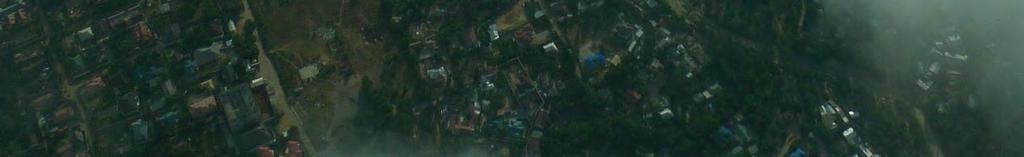
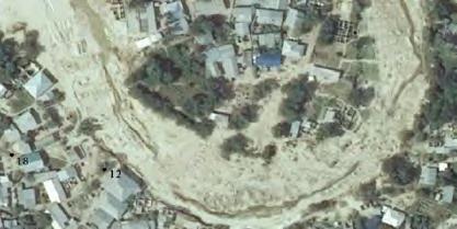
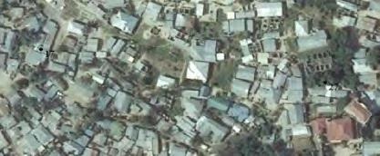
89 Selection of Site From the analysis in Table 1, Msimbazi, Mbezi and Mlalakuwa Catchment areas provide possible sites for the study. However, since Mlalakuwa is highly polluted and thus poses additional challenges to storm water management; particularly with regard to the re-use of water, it was dropped from the list. Msimbazi River has experienced a number of interventions in the downstream community which may pose a challenge to participation due to research fatigue (?). Hence Mbezi Catchment area was selected as the project site. Mbezi River Catchment Mbezi river is about 20km long and covers a catchment area of about 56 sq.km. The river flows from Mbezi Juu to Kawe. The main land use upstream consists of low density residential; development and urban agriculture activities. The terrain is undulating posing a challenge in terms of infrastructure development. Downstream the main activities are residential particularly unplanned residential areas that extende into the river banks. Flooding problems are experienced in Kawe Ukwamani and Mkwajuni. Along the stream are several open spaces which are designated as hazard lands in the city plans. Maps 2 and 3 below show the selected upstream and downstream sites. 5


.")

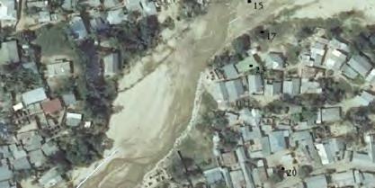
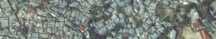
90 Map 4: Kawe Ukwamani - Downstream Source: Satellite Images, 2012 Msimbazi River Catchment Msimbazi River has a total length of about 35 km and the catchment area is about 289 square kilometers (Ngana et al, 2010). The river flows from the Pugu forest To the west towards the east to the Indian Ocean. 8

 while downstream in")
, light industries as well as the")

91 Map 5: Msimbazi River Source: Modified from CLUVA project data 2012 The general landuse upstream is mixed residential and urban agriculture in the proposed site (Kimara Mavurunza) while downstream in Kigogo Kisiwani the land use is mixed residential (unplanned), light industries as well as the existence of major trunk roads. Along the catchment area the river is a source of water for urban agriculture activities. 9
92 Interview with Ten-cell leader (Wajumbe) Aisha Anton _ Informal interview. How many people/families are you leader for? Aproximately 40 families, divided on 14 houses (apr. 200 people) How many Wajumbe leaders are there in whole of Kawe Ukwamani? Around 40 leaders What is your job as a wajumbe leader? I deal with family issues/problems within the 14 houses. And I have the responsibility to report the subward leader if there are any problems. I have tried to sures. -
93 Interview with Ten cell leader (Wajumbe) Ally Mwatano 5. February Has lived here since Is leader for 16 houses 40 families Where does the water come from? - From the upper area and further upstream - We can t access the area (decreased accessibility)
94 How do you cope with it? Have you experienced any water scarcity? - Do you collect rain water/harvest rain water? - How is the ownership of the houses? - parts of their houses. It varies.
95 Interview with Ten cell leader Bernadetha Masawe 5. Feb the houses - They have electricity - Fresh water supply a permission. The reasons why the municipality hesitate with the permissions is be- - Yes picture 1) in 1997, 2002 and 2012 (December) Where does the water come from? - - -
96 - - - People have to stay at home - How do you cope with this? -
97
98
99
100
101
102
103
104 Comments from the workshop participants on the 5 strategies Workshop group 1. Workshop group Extension of flood plain: - If you enlarge the river, you will increase the flood prone area. - What about the houses near to the river? They will have to be removed so what about the people. - This idea doesn't have any use. - Impossible - Water is very dirty (No stars) - Bridges would have to be implemented and this will provide a new infrastructure issue. - Very expensive solution - Water and floodplain will increase - You will have to cut down trees - Water is to polluted to use for anything (No stars) 2. Bringing water into the settlement - It is very possible to implement if no houses in the area - Houses in the area in the middle would have to be removed - Resettlement issues (1 star) - The river will erode naturally due to the soil sand material - This will cause a huge plain of water - Water will occur more places than before - Impossible in the areas (No stars) 3. Green infrastructure Forest/plantation - Good idea as you will earn money - Good investment - Where will the people have to live? - Resettlement issues - It takes a long time to see any results of the implementation (4 stars)
105 4. Retaining water 5. Green infrastructure Agriculture/Crop production

. Of the detailed UMT classes, mixed farming covers the largest area (35.")


106 Green infrastructure in Dar es Salaam Urban morphology types A total of 11 high level urban morphology types (UMTs) and 43 detailed UMTs were mapped for 2008 and 2002, for an area covering a total of 1,502 km 2 and encompassing the city of Dar es Salaam as well as surrounding settlements and rural areas. The key findings presented in this section relate to the 2008 mapping (figure DS.1). The residential UMTs are the main high level UMTs, covering 46.5% of Dar es Salaam, followed by the agricultural UMTs (40.4%). Of the detailed UMT classes, mixed farming covers the largest area (35.6% of Dar es Salaam), followed by scattered settlements (24.9%), mixed residential (13.1%) and villa and single storey stone / concrete (7.8%). The vegetation UMTs account for 5.1% of Dar es Salaam. Bushland constitutes just over half of this category (51.5% of the vegetation UMT category), followed by riverine (22.5%), marsh/swamp (18.0%), mangrove (6.0%), and mixed forest (2.3%). The recreation UMTs account for only 0.7% of Dar es Salaam. This category includes a mixture of detailed classes, but notably parks (which account for 6.1% of the category), and other open space (which accounts for 32.5%). Figure DS.1: High level (and some of the detailed) UMTs in Dar es Salaam for
107 Focus group interviews _ Experience of flooding in settlement, Kawe Ukwamani persons (2 groups, gender based if possible) Agenda: Short presentation (who am I, explanation of why I am doing the survey) Presentations of participants, name, age and amount of years they have lived in the settlement. Mapping exercise in groups. Drawings of Maps: o Hotspots of flooding in the settlement. o Water flow o Open spaces etc. Group presentations of maps. Questions in Plenum Thank you for today. Mapping Participants in the focus group interview should draw their own map of how they see the situation of flooding in their neighborhood (where does flooding occur?) And also point out on a orthophoto where they see the problems. - Please map out where you experience most flooding in your neighborhood. - Please map out where flooding occurs and is most severe. - Where are green areas and open spaces located? And what are they used for? (Not answered, difficult to locate open spaces/green spaces.)
108 Answers from group 1 Participants: Rafael - has lived in the settlement for 10 years Bakary has lived in the area for 9 years Kombo - has lived in the settlement for 10 years Hussein - has lived in the settlement for 12 years Lusajo has lived in the settlement for 2 years Questions: Flooding: 1. How have you experienced flooding in your neighboorhood? Yes they have experienced severe flooding in 1998 April (El nino) 2008, 2010, January years ago they experienced flush flooding, heavy rainfall in 3 days, water went into the streets. Flooding from both ocean and river.
109 a. Have you experienced flooding on your own ground/home? Yes, some has experienced flooding on their own house. b. How big was the volume/amount of water? 1 meter inside the house. c. How did you manage/cope? They tried to find the source and found out that it was the river. They removed belongings up in the house and borrowed a waterpump to get rid of the water. d. Does the community cooperate together in managing water? Yes people try to cooperate and help each other with removing things and belongings. They try to convey water with plastic sandbags. If it is really bad people also try to rescue each other. 2. How often do you experience flooding? 1 time every 5 years. a. When? (season, months?) Heavy rainfall normally occur in December. In 1998 it occurred in april. b. When was the last incident of severe flooding in the neighborhood? How? In 2011, the rainfall wasn t that heavy but precipitation repeated constantly with few hours pause between each rainfall incident. Flooding was most severe along the river. 3. How does flooding affect your livelihood, everyday life? Floods destroy their houses. It affects their everyday life as there is little space left to live in. Sometimes it causes death (people trying to rescue other people) How does Heavy rainfall affect your everyday life? Soil erosion, thunderstorm. a. What are the biggest challenges connected to flooding? People losing their houses. 4. What different coping strategies do you use when you experience flooding? No coping strategies. (Only religion) 5. Does the community take any premeasures in prevention of flooding? E.g. build structures, plant vegetation etc.
110 Yes the community plant vegetation along the affected areas/settlements. E.g. Magugu 6. Have you experienced any interventions from the government, ward leader or other institutions in the matter of handling storm water/flooding? Yes the ward and the government help to remove people when flooding occurs. a. Which institutions? When? How? Government, 2011, Removed people b. Have you experienced any other interventions on upgrading of your neighborhood? No 7. Do you experience any difference in the amount of flooding in some areas compared to others in the neighborhood/subward? E.g. green areas? The settlements are most affected. a. Which areas? Landuse? Topography/terrain? Build environments. 8. Has the riverbed increased in size the recent years? Yes, but don t know how much. a. If yes? Do you do any interventions in preventing flooding from the river? E.g. plant vegetation, build structures etc. Yes people plant vegetation in order to avoid erosion. E.g. Magugu, Matete, Miyanzi. It is the experienced people who plant, not structured cooperation. 9. Are there any good outcomes from the flooding/storm water? E.g. harvesting of water? a. If yes, what is the water used for? Yes they harvest storm water in buckets nearby their house, the water is used for washing clothes and for cleaning purposes. They don t drink the water. 10. What do you think causes the flooding in your neighborhood? E.g. storm water from higher areas, bad drainage? Buildings? Etc. Cutting down of trees, around the river trees are cut for firewood. Bad infrastructure. Bad toilets/latrines 11. Has flooding become more severe during the recent years? How? Examples? Yes, and people who are affected are being removed by the government, but the problem is that other people move in in the vacant houses afterwards.
111 12. Have you thought of moving away from the neighborhood? Why? Where? Yes, and people now move further uphill. Waste: 1. Do you experience any problems with waste during rainy seasons? Yes, waste is catched by the stormwater and is carried down to the river. 2. How do you manage waste? Some use holes on their own ground and burn it. Some use collective dumps. Others pay other people to take it away. On the other side of old bagamoyo road the municipality comes and removes waste it costs tsh/month, but local people will maybe do it for tsh. 3. How often is waste removed? Who removes it? The municipality removes the waste in the planned settlements 1 time a week. Local people more often. 4. What kind of interventions of waste removal are there during the rainy seasons? Who? No interventions Waste water/sanitation: 2. Where do you normally discharge waste water from toilets/latrines? Some use open spaces Some use the river Some use their own latrine 3. Do you have any experience with flooding of latrines/toilets? a. Open or closed latrines? Yes flooding of open latrines/holes b. How do you cope? No coping, if it happens they will receive fines from the government. 4. How many inhabitants in the settlement have access to a proper latrine? (percentage) 7-8 % have closed latrines the rest don t. 5. Do you experience any illness or diseases in periods of flooding/rainy season? (Do the flooding cause any diseases?) Yes Malaria, Cholera, Diarrhea a. Do you experience that children get sick? No not so often.
112 Upgrading 1. Have you experienced any kinds of upgrading of your neighborhood? E.g infrastructure, drainage, waste management, upgrading of houses. No a. If yes, who was responsible for the upgrading? Landscape based storm water management systems 1. If a greenspace or LBS system was implemented in your neighborhood, would you be willing to volunteer on the maintenance of the system? Yes, but people should have a proper education on how to maintain it. 2. Can you give some examples on what kind of benefits the system should provide, beside managing storm water? The system should help reduce diseases and should not destroy houses.
113 Focus group interviews _ Experience of flooding in settlement, Kawe Ukwamani persons (2 groups, gender based if possible) Agenda: Short presentation (who am I, explanation of why I am doing the survey) Presentations of participants, name, age and amount of years they have lived in the settlement. Mapping exercise in groups. Drawings of Maps: o Hotspots of flooding in the settlement. o Water flow o Open spaces etc. Group presentations of maps. Questions in Plenum Thank you for today. Mapping Participants in the focus group interview should draw their own map of how they see the situation of flooding in their neighborhood (where does flooding occur?) And also point out on a orthophoto where they see the problems. - Please map out where you experience most flooding in your neighborhood. - Please map out where flooding occurs and is most severe. - Where are green areas and open spaces located? And what are they used for?
114 Answers from group 2 Participants: Neema, 29 yr - has lived in the settlement 14 years Jane 28 yr has lived in the area for 5 years Martha 46 yr, has lived in the settlement all her life Questions: Flooding: 1. How have you experienced flooding in your neighboorhood? Yes they have experienced severe flooding in 1998 April (El nino) 2008, 2010, January years ago they experienced flush flooding, heavy rainfall in 3 days, water went into the streets. a. Have you experienced flooding on your own ground/home? Yes, 2011
115 b. How big was the volume/amount of water? The water covered the roof of the house. c. How did you manage/cope? Had to move out for some hours, and could then return after some hours. d. Does the community cooperate together in managing water? Some times, but not any structured cooperation 2. How often do you experience flooding? Severe flooding every 10 years. a. When? (season, months?) Heavy rainfall normally occur in December, January, march and april. b. When was the last incident of severe flooding in the neighborhood? How? In 2011 (see above) 3. How does flooding affect your livelihood, everyday life? Floods pollute the environment and sometimes fills up latrines/toilets. Also causes deaths of people. How does Heavy rainfall affect your everyday life? Soil erosion, thunderstorm. a. What are the biggest challenges connected to flooding? Losses of houses, diseases, death of animals 4. What different coping strategies do you use when you experience flooding? As a lot of people are renting houses/rooms they don t use coping strategies, as they don t feel responsible for the houses. If heavy flooding occurs they just move. 5. Does the community take any premeasures in prevention of flooding? E.g. build structures, plant vegetation etc. No 6. Have you experienced any interventions from the government, ward leader or other institutions in the matter of handling storm water/flooding? Discussion: Participant A says no they don t experience any help from the government, only some people. Participant B says that everybocy receives help from the government when flooding occurs, but only help for removing people. a. Which institutions? When? How?
116 Political parties b. Have you experienced any other interventions on upgrading of your neighborhood? No 7. Do you experience any difference in the amount of flooding in some areas compared to others in the neighborhood/subward? E.g. green areas? The settlements are most affected. a. Which areas? Landuse? Topography/terrain? Water just runs through! 8. Has the riverbed increased in size the recent years? The riverbed has not increased in size, but the direction of the river has been changed. Started in 1998 when people began to build houses on where the river ran through. a. If yes? Do you do any interventions in preventing flooding from the river? E.g. plant vegetation, build structures etc. Yes people plant vegetation in order to avoid erosion. 9. Are there any good outcomes from the flooding/storm water? E.g. harvesting of water? a. If yes, what is the water used for? Not any good outcomes from flooding. But they collect water during heavy/rainfall. They use it for drinking, cooking food and housekeeping. 10. What do you think causes the flooding in your neighborhood? E.g. storm water from higher areas, bad drainage? Buildings? Etc. The development of houses in the hazard areas of the river. 11. Has flooding become more severe during the recent years? How? Examples? No Has heavy rainfall become more severe the recent years? No 12. Have you thought of moving away from the neighborhood? Why? Where? Some participants answer yes, they would like to move as soon as possible because of flooding, want to move to Bagamoyo. Waste: 1. Do you experience any problems with waste during rainy seasons? Yes during flooding, waste flows up to the houses.
117 2. How do you manage waste? Waste is thrown into the river 3. How often is waste removed? Who removes it? People removes it themselves, down to the river. 4. What kind of interventions of waste removal are there during the rainy seasons? Who? Waste water/sanitation: 2. Where do you normally discharge waste water from toilets/latrines? Waste water is discharged to the river. 3. Do you have any experience with flooding of latrines/toilets? a. Open or closed latrines? Not so often b. How do you cope? No coping, if it happens they will receive fines from the government. 4. How many inhabitants in the settlement have access to a proper latrine? (percentage) A high percentage have closed latrines. Don t know how many. 5. Do you experience any illness or diseases in periods of flooding/rainy season? (Do the flooding cause any diseases?) Yes eruption diseases, Malaria, Cholera. a. Do you experience that children get sick? Yes Upgrading 1. Have you experienced any kinds of upgrading of your neighborhood? E.g infrastructure, drainage, waste management, upgrading of houses. No a. If yes, who was responsible for the upgrading?
118
119
Water Resilient Green Cities in Africa Project Update 4, June 2015
 2 nd Project Conference held in Addis Ababa The 2 nd Project Conference was held in Addis Ababa January 25-28, 2015. We had some really good days, where all project members gathered together and discussed
Green Urban design for Can Tho city: Where to start?
 GREEN DESIGNS FOR INTEGRATED URBAN WATER CYCLE MANAGEMENT SOLUTIONS FOR SECONDARY CITIES IN GLOBAL SOUTH TO COPE WITH CLIMATE CHANGE Can Tho city, 8 10th December, 2015 Green Urban design for Can Tho city:
Madrid+Natural. Susana Saiz Madrid. Nature Based Solutions for Sustainable and Resilient Cities 2017
 Susana Saiz Madrid Key City Challenges Nature Nature Based Based Solutions Solutions for Sustainable for Sustainable Nature Based Solutions in -NBS NBS improve livability, health and sense of wellbeing
MASTER PLAN KICK-OFF Open House #1A, April 28, 2015
 "The beginning is the most important part of the work." Plato, The Republic MASTER PLAN KICK-OFF Open House #1A, April 28, 2015 YOUR CAMPUS PLANNING TEAM Campus Planners Landscape Architects Urban Designers
QUESTIONS AND ANSWERS Windsor Woods, Princess Anne Plaza & The Lakes Combined Drainage Project
 QUESTIONS AND ANSWERS Windsor Woods, Princess Anne Plaza & The Lakes Combined Drainage Project PROJECT OVERVIEW Windsor Woods, Princess Anne Plaza and The Lakes are neighborhoods located in what was once
Living on contour. The art of land shaping for natural rainfall catchment, a practical guide to water harvesting and management.
 Living on contour The art of land shaping for natural rainfall catchment, a practical guide to water harvesting and management Olmec Sinclair Deserts are dry and dead, water is the foundation of life Desert
Green Roofs and Stormwater Management Virginia Stovin
 Green Roofs and Stormwater Management Virginia Stovin Department of Civil and Structural Engineering Pennine Water Group University of Sheffield Outline Urban stormwater management Conventional solutions,
Swatara Township Stormwater Program. 1. There are no storm sewers on or near my property. Why should I pay a fee?
 1. There are no storm sewers on or near my property. Why should I pay a fee? All properties produce stormwater runoff that must be managed by the Township. Even if your property has never flooded and there
City of Petersburg, VA Stormwater Utility Frequently Asked Questions
 Q. What is stormwater runoff? A. Stormwater runoff is the water that flows off roofs, driveways, parking lots, streets and other hard surfaces during rain storms. Stormwater runoff is also the rain that
Regional Open Space Conservation Plan. Regional Staff Committee January 18, 2018
 Regional Open Space Conservation Plan Regional Staff Committee January 18, 2018 Schedule We are here Task 1 - Stakeholder Input & Work Plan Dev. v z 2016 2017 2018 Oct Nov Dec Jan Feb Mar Apr May Jun Jul
LAND EAST OF SUDBURY ROAD, HALSTEAD PUBLIC CONSULTATION. Proposed Residential Development
 LAND EAST OF SUDBURY ROAD, HALSTEAD PUBLIC CONSULTATION Proposed Residential Development YOUR VIEW MATTERS TO US PROPOSED RESIDENTIAL DEVELOPMENT AREA Thank you for taking the time to read this information
MONTCO 2040: A SHARED VISION The New Comprehensive Plan for Montgomery County. Dra Themes and Goals March, 2014
 MONTCO 2040: A SHARED VISION The New Comprehensive Plan for Montgomery County Dra Themes and Goals March, 2014 INTRODUCTION 2 WHAT IS A COMPREHENSIVE PLAN? A comprehensive plan is a long-range plan required
Weston s Wetlands, Stormwater, & Open Space
 Weston s Wetlands, Stormwater, & Open Space Weston s Wetlands, Stormwater, & Open Space Conservation Commission Role and Responsibilities Laws that protect wetlands What residents can do to protect wetlands
LOUISIANA STATE UNIVERSITY COMPREHENSIVE & STRATEGIC CAMPUS MASTER PLAN. APPENDIX G - Stormwater Study Findings & Stormwater Solutions
 LOUISIANA STATE UNIVERSITY COMPREHENSIVE & STRATEGIC CAMPUS MASTER PLAN APPENDIX G - Stormwater Study Findings & Stormwater Solutions LSU: MP Narrative July 2017 3.5 Open Space Existing Conditions The
EXCERPTS. Sep City and County of Denver (CCD) Storm Drainage Master Plan
 Storm Drainage Master Plan") EXCERPTS Acronyms in Document: CCD- City and County of Denver (the City, the Mayor and his Administration) CDOT- Colorado Department of Transportation CPGC- City Park Golf Course (Detention, part of P2PH)
EXCERPTS Acronyms in Document: CCD- City and County of Denver (the City, the Mayor and his Administration) CDOT- Colorado Department of Transportation CPGC- City Park Golf Course (Detention, part of P2PH)
CTB3300WCx Introduction to Water and Climate
 CTB3300WCx Introduction to Water and Climate IN4 Urban Engineering Marie-Claire ten Veldhuis Welcome to urban engineering. My name is Marie Claire ten Veldhuis, and I work as an assistant professor for
What Are Some Ways Erosion Can Be Managed?
 Learning Set 3 The Basketball-Court Challenge 3.5 Case Studies What Are Some Ways Erosion Can Be Managed? Name: Case name Case description (include problem) Case solution (describe and sketch) You are
LOW IMPACT DEVELOPMENT GUIDANCE MANUAL AND LID WORKING GROUP ACTIVITIES. Powerpoint Templates. MS4 Statewide Stormwater Summit June 18, 2013
 LOW IMPACT DEVELOPMENT GUIDANCE MANUAL AND LID WORKING GROUP ACTIVITIES MS4 Statewide Stormwater Summit June 18, 2013 Powerpoint Templates Evan Canfield, Ph.D, P.E. Pima County Regional Flood Control Outline
Appendix B: Workshop Exercise Results
 Appendix B: Workshop Exercise Results Day One Exercise Results This I believe about potential in the Lafitte Corridor Values drive and motivate people to implement change and make progress. Values provide
Application of GIS and Remote Sensing for Identifying Flood Risk in Ho Chi Minh City, Vietnam
 Application of GIS and Remote Sensing for Identifying Flood Risk in Ho Chi Minh City, Vietnam Vo Le Phu and Luu Dinh Hiep Faculty of Environment Ho Chi Minh City University of Technology volephu@hcmut.edu.vn
Lower Meramec Multi-Jurisdictional Floodplain Management Plan Public Involvement (Results of Early Public Engagement) 27 June 2018
 27 June 2018") Lower Meramec Multi-Jurisdictional Floodplain Management Plan Public Involvement (Results of Early Public Engagement) 27 June 2018 Public Involvement Summary: The planning process includes opportunities
Lower Meramec Multi-Jurisdictional Floodplain Management Plan Public Involvement (Results of Early Public Engagement) 27 June 2018 Public Involvement Summary: The planning process includes opportunities
Sustainable Stormwater Management through Green Infrastructure. Jersey City Public School #5
 Green Infrastructure Site Evaluation Friday, October 25 th, 2013 Sustainable Stormwater Management through Green Infrastructure Jersey City Public School #5 FORMAT: (15 minutes) An Introduction to Stormwater
1.0 INTRODUCTION 1.1 TH 14 WEST STUDY AREA Project Description Functional Classification Purpose of the Project
 1.0 INTRODUCTION 1.1 TH 14 WEST STUDY AREA 1.1.1 Project Description The Trunk Highway (TH) 14 West Corridor is a two-lane roadway approximately 22 miles in length. Located in Nicollet County, the corridor
The Role of the Landscape Contractor to Conserve Water
 The Role of the Landscape Contractor to Conserve Water By Richard Restuccia, Sales Leader Western U.S. ValleyCrest Landscape Maintenance rrestuccia@valleycrest.com Abstract Opportunities abound for property
City of Waco Stormwater Management Regulations
 1.0 Applicability: City of Waco Stormwater Management Regulations These regulations apply to all development within the limits of the City of Waco as well as to any subdivisions within the extra territorial
Lake Nokomis Shoreline Enhancement Project
 Lake Nokomis Shoreline Enhancement Project Community Meeting 2 February 13, 2018 Agenda Current Problems Project Goals Project Status Existing Conditions Community Input Draft Schematic Design Long-term
Methods to Simulate the Impact of BMPs
 LA221 Project Ortega Watershed Demonstration Area, Quito Ecuador Ricardo da Cruz e Sousa Master of Landscape Architecture & Environmental Planning University of California, Berkeley December 2011 Ortega
The Great Pond Clean-Up
 The Great Pond Clean-Up Written and Illustrated by Jaclin DuRant Livability Educator, City of Greenville, SC Connections for Sustainability This book was developed by the City of Greenville s Livability
Hydrologic Assessment of using Low Impact Development to Mitigate the Impacts of Climate Change. Chris Jensen, AScT Master of Science Thesis
 Hydrologic Assessment of using Low Impact Development to Mitigate the Impacts of Climate Change Chris Jensen, AScT Master of Science Thesis Bowker Creek Initiative April 12, 2012 Outline 1. Future Impacts
INEEL (1500) [45] 5.6 C 217 mm 60. Precipitation (mm) Temperature (oc) Month
![INEEL (1500) [45] 5.6 C 217 mm 60. Precipitation (mm) Temperature (oc) Month](/thumbs/91/105194910.jpg "INEEL (1500) [45] 5.6 C 217 mm 60. Precipitation (mm) Temperature (oc) Month") Figure 1. Water balance of a vegetated plot. Plants extract water from throughout the soil profile, to depths that may exceed 2 m in deep soils. In contrast, most water lost by direct evaporation comes
Figure 1. Water balance of a vegetated plot. Plants extract water from throughout the soil profile, to depths that may exceed 2 m in deep soils. In contrast, most water lost by direct evaporation comes
Vu Kim Chi Nguyen Thi Thuy Hang
 Vu Kim Chi Nguyen Thi Thuy Hang Tokyo, Dec 7, 2015 Introduction Data and methods Results and discussions Conclusion The city of Quy Nhon Urban planning in Quy Nhon Climate change and sea level rise Natural
Welcome. Tannery and Waterworks Parks Shoreline Improvements Environmental Assessment. Public Information Centre #1 November 27, pm to 8 pm
 Welcome Tannery and Waterworks Parks Shoreline Improvements, Environmental Assessment Tannery and Waterworks Parks Shoreline Improvements Environmental Assessment #1 6 pm to 8 pm Why We Are Here Tannery
Tri-County Transportation & Land Use Study. Steering Committee Meeting May 14, 2009
 Tri-County Transportation & Land Use Study Steering Committee Meeting May 14, 2009 Agenda Recap of Study Goals and Objectives Update on CV Land Use Model: Business as Usual (BAU) Growth Scenario Pros vs
Stormwater Manuals - The Good, the Bad and the Ugly. David J. Hirschman Center for Watershed Protection Getting in Step with Phase II Charleston, WV
 Stormwater Manuals - The Good, the Bad and the Ugly David J. Hirschman Center for Watershed Protection Getting in Step with Phase II Charleston, WV Manual Overview Overview Review of State & Local Manuals
Implementing sustainable water strategy through development industry engagement
 Implementing sustainable water strategy through development industry engagement Ian Director, Organica Engineering, Melbourne, Australia E-mail: iadams@organicaeng.com.au Edward Cotter Sustainability Leader,
Analogue to Digital Telecare. Technical Advisory Board. 21 st June 2017 Work Stream 3 Procurement
 Analogue to Digital Telecare Technical Advisory Board 21 st June 2017 Work Stream 3 Procurement Euan Kidd Senior Procurement Specialist Euan.kidd@scotland-excel.org.uk 1 Purpose of Work stream 3 - procurement
Lesson 1- Trees are Important
 Potomac Headwaters Leaders of Watersheds: Plant-a-Tree Lesson Outcomes: Students will understand Lesson 1- Trees are Important Upper Elementary Tree structure and their function within the tree that trees
TOWN OF BEDFORD CONSERVATION COMMISSION
 PUBLIC NOTICE DRAFT Work Plan The is in the process of forming a subcommittee that will be studying the of Exceptional Value and their importance to the Town of Bedford. This document will serve as the
Rainwater Management
 Rainwater Management Treatment / Detention Options An evening with EMCO Presented by: Rick Lloyd, P.Eng RCL Consulting Ltd June 8, 2006 Confucius said: Balance is the perfect state of still water. Let
Adaptation and Resilience at the City of Fort Lauderdale
 Adaptation and Resilience at the City of Fort Lauderdale Carlos Acosta, P.E. Assistant City Engineer City of Fort Lauderdale Overview Climate challenges and limitations Sea Level Rise Projections King
WHERE DO WE GROW FROM HERE?
 WHERE DO WE GROW FROM HERE? Have your say. HAVE YOUR SAY ON THE NELSON TASMAN FUTURE DEVELOPMENT STRATEGY Nelson and Tasman are growing fast and we continue to need more houses for people to live in, places
A New Plan For The Calgary Region June calgary.ca call 3-1-1
 A New Plan For The Calgary Region June 2009 calgary.ca call 3-1-1 Introduction Since January 2006, The City of Calgary has been actively participating with the member municipalities of the Calgary Regional
Camden SMART Initiative Stormwater Management and Resource Training
 Camden SMART Initiative Stormwater Management and Resource Training www.camdensmart.com Camden s Struggle with Stormwater 1 The City of Camden is served by a combined sewer system, which uses the same
Low Impact Development Calculations using the Source Loading and Management Model (WinSLAMM)
") Low Impact Development Calculations using the Source Loading and Management Model (WinSLAMM) Robert Pitt Department of Civil, Construction, and Environmental Engineering The University of Alabama, Tuscaloosa,
Low Impact Development Calculations using the Source Loading and Management Model (WinSLAMM) Robert Pitt Department of Civil, Construction, and Environmental Engineering The University of Alabama, Tuscaloosa,
Microirrigation of Young Blueberries in Florida 1
 BULLETIN 301 Microirrigation of Young Blueberries in Florida 1 Dorota Z. Haman, Allen G. Smajstrla, Fedro S. Zazueta, Paul M. Lyrene, Robert T. Pritchard 2 Blueberry production shows great promise as a
Mapping and the 2013 Colorado Floods. Mapping before, during, and after
 Mapping and the 2013 Colorado Floods Mapping before, during, and after Presented by Outline 2013 Floods Floodplain Mapping Before During After 20 counties 21,000 households 6000 sq. mi. 2,132 NFIP claims
Stormwater Retrofitting: The Art of Opportunity. Presented by the Center for Watershed Protection
 Stormwater Retrofitting: The Art of Opportunity Presented by the Center for Watershed Protection What Are Stormwater Retrofits? Retrofits are stormwater management measures inserted in an urban or ultra-urban
Keele Campus Storm Drainage. Presented by Mark Hagesteijn September 24, 2013
 Keele Campus Storm Drainage Presented by Mark Hagesteijn September 24, 2013 1 Presentation Overview Urbanization Impact on the Hydrologic Cycle Why Do We Manage Stormwater? Typical Stormwater Management
QUESTIONS AND ANSWERS Windsor Woods, Princess Anne Plaza & The Lakes Combined Drainage Project
 QUESTIONS AND ANSWERS Windsor Woods, Princess Anne Plaza & The Lakes Combined Drainage Project Project Overview... 2 Thalia Creek (Windsor Woods) Tide Gate... 6 Club House Road Drainage Project... 9 Updated
ions nts July 1, 2019 The utility answers to some increase: Q: A: rainwater Q: A: areas any the total by
 Frequently Asked Quest ions Stormwater Rate Adjustmen nts The Fort Wayne Board of Stormwater Management and Fort Wayne City Council have approved an increasee stormwaterr utility fees to address neighborhood
Bench Top Production Hydroponic Production
 Brian A. Krug Bench Top Production Hydroponic Production Bench Top Production January February March April May June July August September October November December Does it make money? Media Fort Vee mix
Post Construction BMPs
 Post Construction BMPs Why are Post Construction BMPs important? With increased development brings the increase of impervious cover Parking lots, rooftops, driveways Storm water runoff volume increases
Marion Street Green Infrastructure Project. Whittier Neighborhood Community Meeting April 18, 2018
 Marion Street Green Infrastructure Project Whittier Neighborhood Community Meeting April 18, 2018 Agenda Water quality and green infrastructure Overview: Marion Street stormwater project Green infrastructure
River Kleine Nete : Creating ecological flooding zones at recreation areas
 Stoffel Moeskops Lange Kievitstraat 111-113 bus 64 B-2018 ANTWERPEN T +32 3 205 81 25 s.moeskops@vmm.be River Kleine Nete : Creating ecological flooding zones at recreation areas \\\\\\\\\\\\\\\\\\\\\\\\\\\\\\\\\\\\\\\\\\\\\\\\\\\\\\\\\\\\\\\\\\\\\\\\\\\\\\\\\\\\\\\\\\\\\\\\\\\\\\\
Roof Runoff Harvesting Benefits for Regional Conditions in Low Density and Medium Density Residential Areas. Leila Talebi 1 and Robert Pitt 2
 Roof Runoff Harvesting Benefits for Regional Conditions in Low Density and Medium Density Residential Areas Leila Talebi 1 and Robert Pitt 2 1Graduate Student, Department of Civil, Construction, and Environmental
Citywide Integrated Stormwater Management Plan (ISMP) DRAFT ACTION PLAN REVIEW Public Consultation November 16 th, 2016
 DRAFT ACTION PLAN REVIEW Public Consultation November 16 th, 2016") Citywide Integrated Stormwater Management Plan (ISMP) DRAFT ACTION PLAN REVIEW Public Consultation November 16 th, 2016 1 Agenda DRAFT ACTION PLAN REVIEW Public Consultation Time 6:00 6:05 6:05 6:20 6:20
Citywide Integrated Stormwater Management Plan (ISMP) DRAFT ACTION PLAN REVIEW Public Consultation November 16 th, 2016 1 Agenda DRAFT ACTION PLAN REVIEW Public Consultation Time 6:00 6:05 6:05 6:20 6:20
Beyond Runoff Reduction: Thorough Green Infrastructure Design. Zach Sample, PE Innovyze
 Beyond Runoff Reduction: Thorough Green Infrastructure Design Zach Sample, PE Innovyze Presenter Zach Sample, PE Stormwater Products Manager Innovyze Agenda Modern stormwater design (HINT: Runoff Reduction)
Is a Riparian Restoration Still Viable After 100-year Storm Events Alter the Original Design?
 Is a Riparian Restoration Still Viable After 100-year Storm Events Alter the Original Design? Sarah Spear Cooke, Ph.D. Seattle, Washington Presentation Outline Introduction The site pre-restoration Restoration
STATION RISK PROFILE 2018 EWYAS HAROLD
 COMMUNITY RISK MANAGEMENT PLAN 2014-2020 Mid-Point Review 2017-18 STATION RISK PROFILE 2018 EWYAS HAROLD Station Risk Profile 2018 Contents 1 Introduction 3 2 Fire Station Overview 4 3 Incident Overview
Stormwater Management at The University of New Orleans
 University of New Orleans ScholarWorks@UNO DRU Workshop 2013 Presentations Disaster Resistant University Workshop: Linking Mitigation and Resilience Conferences and Workshops 3-1-2013 Stormwater Management
Sustainably Repositioning Greyfield Sites. Greyfield Sites Anywhere
 Sustainably Repositioning Greyfield Sites Jim Constantine Looney Ricks Kiss Architects Todd Poole 4ward Planning Greyfield Sites Anywhere Pennsylvania Chapter American Planning Association Conference 2009
Getting and Giving the Most
 Getting and Giving the Most It s OUR meeting participate enthusiastically Focus on the future Terminology expertise is secondary There is such a thing as a bad idea! Respect (for each other and the process)
STORM TACOMA 02. Potential permitting requirements STANDARD DETAILS FOR RAIN GARDEN CONSTRUCTION. How to use this document
 R R G R P 02 STORM TACOMA 02 STANDARD DETAILS FOR RAIN GARDEN CONSTRUCTION Updated October 23, 2013 How to use this document Your rain garden will need to be designed and constructed in accordance with
Stormwater Regulations & Considerations Morse Study Area. Pam Fortun, P.E. CFM Senior Stormwater Treatment Engineer Engineering Services Division
 Stormwater Regulations & Considerations Morse Study Area Pam Fortun, P.E. CFM Senior Stormwater Treatment Engineer Engineering Services Division Stormwater Regulations Development Considerations Floodplain
SF REC & PARK MOSCONE RECREATION CENTER: EAST SITE. Supervisor Mark Farrell District 2. Project Manager Dan Mauer Recreation and Parks Department
 SF REC & PARK MOSCONE RECREATION CENTER: EAST SITE COMMUNITY WORKSHOP: MEETING #3 WEDNESDAY, FEBRUARY 10, 2016 Supervisor Mark Farrell District 2 Project Manager Dan Mauer Recreation and Parks Department
Initial OPW Designation APSR AFRR IRR Co-ordinates Easting: Northing: Fluvial non-tidal Fluvial tidal Coastal
 Location: Athlone, Co. Westmeath (including townland in Roscommon) Unique ID: 260448 (from PFRA database) Initial OPW Designation APSR AFRR IRR Co-ordinates Easting: 205000 Northing: 239999 River / Catchment
BE WATER WISE. Managing Your Onlot Stormwater. Sept. 23, 2006 Watershed Weekend
 BE WATER WISE Managing Your Onlot Stormwater Sept. 23, 2006 Watershed Weekend 2006 1 All water resources are interrelated through the Hydrologic Cycle Sept. 23, 2006 Watershed Weekend 2006 2 What is Storm
2.6 Pawtucket. Pawtucket Impervious Cover Map (61.4% Impervious)
") 2.6 Pawtucket Pawtucket Impervious Cover Map (61.4% Impervious) The City of Pawtucket is approximately 8.7 square miles and is heavily residential with some commercial and industrial land. Table 2.14 below
2.6 Pawtucket Pawtucket Impervious Cover Map (61.4% Impervious) The City of Pawtucket is approximately 8.7 square miles and is heavily residential with some commercial and industrial land. Table 2.14 below
Increasing the Market Share for New Zealand Olive Oil
 SFF Project 404831 Interim Project Status Report Increasing the Market Share for New Zealand Olive Oil February 2017 Introduction The purpose of the Sustainable Farming Fund project is: To increase the
Watershed Planning Workshop
 Watershed Planning Workshop Upper Four Mile Run, Gulf Branch and Donaldson Run March 18, 2010 Langston Brown Community Center Outline Overview of Arlington s s Watersheds Watershed Management in Arlington
Cost Effective Low Impact Development
 Cost Effective Low Impact Development An Introductory Guide to Conserve Land, Restore Resources, Protect Water, and Save Money in Massachusetts Stefanie Covino Shaping the Future of Your Community Program
URBAN DESIGN LONDON TRAINING PROGRAMME UDL are pleased to present our programme for April 2013 to March 2014.
 URBAN DESIGN LONDON TRAINING PROGRAMME UDL are pleased to present our programme for April 2013 to March 2014. To help us decide what to focus on we asked our members which subjects they most wanted help
Why conserve and manage the trees?
 Why conserve and manage the trees? Why use a fuel efficient Changu Changu Moto cookstove? 1) Why Conserve? - Conservation of the Forests In most parts of Malawi the forests have disappeared - Mainly the
Paul Vossen University of California Cooperative Extension Farm Advisor. Dealing with Drought
 Paul Vossen University of California Cooperative Extension Farm Advisor Dealing with Drought Value of Water Yield Fruit Size Fruit Quality Cover Crop Mgmt. Erosion Control Frost Control Pest Mgmt. Nutrition
PROPOSED RESIDENTIAL DEVELOPMENT LAND AT GREEN LANE, YARM
 PROPOSED RESIDENTIAL DEVELOPMENT LAND AT GREEN LANE, YARM PUBLIC CONSULTATION YOUR VIEW MATTERS TO US LOCATION PLAN Thank you for taking the time to read this information leaflet regarding a proposed residential
Edgeley Pond + Park Public Meeting
 Edgeley Pond + Park Public Meeting February 21, 2017 Purpose of the meeting This Public Meeting is an opportunity for you to review the project background, process and provide input. City of Vaughan staff
Jill Stachura STORMWATER BMP AND STREAM RESTORATION IN A CITY PARK. October 2013 Southeast Stormwater Association Annual Conference, Charlotte, NC
 Jill Stachura STORMWATER BMP AND STREAM RESTORATION IN A CITY PARK October 2013 Southeast Stormwater Association Annual Conference, Charlotte, NC Project Location Gwinnett County, GA: Population: 825,000
Cooperative Research in Water Management
 Proceedings of the 8 th International Conference on Applied Informatics Eger, Hungary, January 27 30, 2010. Vol. 1. pp. 273 281. Cooperative Research in Water Management Margit Horosz-Gulyás, Katalin Katonáné
RAIN WATER HARVESTING TROPICAL CLIMATIC CONDITIONS, INDIA
 BEST: International Journal of Management, Information Technology and Engineering (BEST: IJMITE) ISSN 2348-0513 Vol. 2, Issue 11, Nov 2014, 19-24 BEST Journals RAIN WATER HARVESTING TROPICAL CLIMATIC CONDITIONS,
4/8/2015 Item #10D Page 1
 MEETING DATE: April 8, 2015 PREPARED BY: Christy Villa, Associate Civil Engineer DEPT. DIRECTOR: Glenn Pruim DEPARTMENT: Public Works CITY MANAGER: Larry Watt SUBJECT: NORTH COAST HIGHWAY 101 STREETSCAPE
Pre-Event Activities. Capture that Rain! Pre-Field Trip Suggestions
 Capture that Rain! When it rains, it pours, creating storm water runoff and water quality problems in our region. Students will assist Ontario Municipal Utilities Company s Water Resources Coordinator
Non-Residential&Multi-Family PropertyCreditManual
 CityofRichmond DepartmentofPublicUtilities StormwaterManagementProgram Non-Residential&Multi-Family PropertyCreditManual ApprovedFebruary2011 City of Richmond Stormwater Non-Residential & Multi-Family
Design & Practical Application
 WHO European Healthy Cities Network Workshop and Masterclass: Healthy People and Healthy Places in the WHO European Region Design & Practical Application Etive Currie NHS Health Scotland & GCC Senior Planner
Homeowners Guide to Stormwater BMP Maintenance
 Homeowners Guide to Stormwater BMP Maintenance What You Need to Know to Take Care of Your Property Rain Barrel Dry Well Rain Garden Pervious Asphalt Porous Pavers City of El Monte Stormwater BMP Management
Washington County, Maryland Division of Public Works Policy Manual
 Washington County, Maryland Division of Public Works Policy Manual Subject: Downstream Drainage Easement Category: Land Development Engineering Number: 7-4.1 Date: June 1, 2009 (effective) PURPOSE: The
New Westminster Downtown Parking Strategy Public Open House #1 September 13, 2012
 New Westminster Downtown Parking Strategy Public Open House #1 September 13, 2012 The City is preparing a strategy for parking in Downtown New Westminster. The study team and a group of key stakeholders
Focused Evaluation of Rainwater Harvesting: A Case Study in Sandakan, Sabah, Malaysia
 Focused Evaluation of Rainwater Harvesting: A Case Study in Sandakan, Sabah, Malaysia A. I. Che-Ani 1, N. Shaari 1, H. Yahaya, M. Jamil 1, N. Mohd-Tawil 1, M.F.M. Zain 1 1 Department of Architecture, Faculty
Blue/Green Infrastructure Study Accomack County, VA
 Blue/Green Infrastructure Study Accomack County, VA Draft Asset Maps March 8-9, 2010 Green Infrastructure Center, Inc. 2 Overview What is Green and Blue Infrastructure Project Timeline & Tasks Literature
Putting a LID on Stormwater Pollution. Michele Loudenback, RPES Stormwater Enforcement Water Quality Division
 Putting a LID on Stormwater Pollution Michele Loudenback, RPES Stormwater Enforcement Water Quality Division Outline Brief Regulatory History Conventional vs. Green Practices LID/GI Controls in Use Clean
Checklists. Project Name: Location: File Number: Date of Submittal: Reviewer: Date: Applicant: Contact Name: Phone Number:
 Applicant: Contact Name: Phone Number: Email: Project Name: Location: File Number: Date of Submittal: Reviewer: Date: Concept Plan Requirements: I. General Project Information 1. Address or parcel number
INTRODUCTION TO GREEN INFRASTRUCTURE HOW WE CAN PROTECT OUR COMMUNITIES AND OUR WATERS Maywood Public Library Bergen County, New Jersey
 INTRODUCTION TO GREEN INFRASTRUCTURE HOW WE CAN PROTECT OUR COMMUNITIES AND OUR WATERS Maywood Public Library Bergen County, New Jersey Jeremiah D. Bergstrom, LLA, ASLA Rutgers Cooperative Extension Water
MUNICIPAL SEPARATE STORM SEWER SYSTEM 2008 ANNUAL REPORT
 MUNICIPAL SEPARATE STORM SEWER SYSTEM 2008 ANNUAL REPORT Permit Number 85-03-0-04 March 2009 Prepared by: Iowa State University Department of Environmental Health and Safety 2809 Daley Drive Ames, Iowa
Map Reading 201: Where Does the Water Go?? Map Reading Map Reading 201. Interconnected Systems
 Map Reading 201: Where Does the Water Go?? Today s Presenters: John Rozum, NEMO Program Paula Stahl, Green Valley Institute A Key Skill for Land Use Commissioners As the map is rolled out at the P&Z meeting...
CITY OF HOLLY SPRINGS STORMWATER UTILITY FREQUENTLY ASKED QUESTIONS
 CITY OF HOLLY SPRINGS STORMWATER UTILITY FREQUENTLY ASKED QUESTIONS GENERAL What is a Stormwater Utility and why is it needed in Holly Springs? A Stormwater Utility is an entity responsible for the daily
Permeable Interlocking Concrete Pavement A Low Impact Development Tool Training for Developers
 Permeable Interlocking Concrete Pavement A Low Impact Development Tool Training for Developers Presented by: Interlocking Concrete Pavement Institute The Low Impact Development Center, Inc. North Carolina
PUBLIC NOTIFICATION PLAN
 VILLAGE OF LA GRANGE, ILLINOIS NPDES PERMIT NO. ILM580009 COMBINED SEWER OVERFLOW PUBLIC NOTIFICATION PLAN NATIONAL POLLUTANT DISCHARGE ELIMINATION SYSTEM PROGRAM ILLINOIS ENVIRONMENTAL PROTECTION AGENCY
Boulder County Comprehensive Drilling Plan Surface Owner Meeting. Thursday, Nov. 2, 2017
 Boulder County Comprehensive Drilling Plan Surface Owner Meeting Thursday, Nov. 2, 2017 Contact Crestone Crestone Peak Resources Quick Facts www.crestonepeakresources.com cdpboulder@crestonepr.com (720)
This material is part of the collection of the Philadelphia Water Department and was downloaded from the website Please contact the
 This material is part of the collection of the Philadelphia Water Department and was downloaded from the website www.phillyh2o.org Please contact the PhillyH2O webmaster for more information about this
Welcome to Proper Maintenance of
 Welcome to Proper Maintenance of Stormwater Management Facilities [SMF] May 17, 2006 Repp Glaettli This presentation was designed for owners and maintainers of stormwater management facilities. The background
2016 WORKSHOP LVR Field Trip
 2016 WORKSHOP LVR Field Trip ***Note*** Many of the sites on this tour were NOT related to, or funded by, the DGLVR program. They are being shown to encourage discussion about the kinds of projects that