PARISH LOGO ETC. Beech Landscape Character Assessment DRAFT
|
|
|
- Jack Tate
- 5 years ago
- Views:
Transcription


1 DRAFT

2 Introduction Objectives This Landscape Character Assessment sits within the framework of the national, county and district character assessments and will form part of the evidence base for the emerging Beech Neighbourhood Development Plan and provide robust evidence to help guide and assist in spatial planning and development management within the Parish. This is intended to aid in ensuring that the distinctive character of the Parish is retained and change is accommodated in a positive way. Methodology Landscape classification is central to landscape character assessment and is concerned with dividing the landscape into areas of distinct, recognisable and consistent common character, grouping areas of similar character together. For this assessment the Parish was divided into six Landscape Character Types (LCT) which share broadly similar combinations of geology, topography, drainage patterns, vegetation, historical land use and settlement pattern. This study aims to guide users towards an understanding of the relative sensitivity of the individual LCT. This sensitivity is established by combining judgements on value with those on its ability to withstand change. Landscape value can be understood through relevant landscape designations, the use of available landscape character assessments (as a starting point) and information on status of features (such as conservation areas and tree preservation orders). A range of other factors can also help in the identification of value: Landscape quality (condition) of physical state: includes extent to which typical character is represented, intactness and condition of individual elements Scenic quality: level of appeal primarily to the senses (not wholly visual) Rarity: presence of individual elements or features, or rare Landscape Character Type Representativeness: where a particular character, or element / feature is considered particularly important example Conservation interests: where features of interest add value to landscapes such as wildlife, archaeological, or historical / cultural interest. These can have value in their own right Society: the relative value attached to the landscape by society, either formally or informally. In the case of this study an understanding of the value attributed by the local community has been informed by the findings of the Neighbourhood Plan Questionnaire Perception: recognition of perceptual aspects such as scenic beauty or tranquillity Associations: connections to art, literature or events that contribute to perception of value and material available on local or community interests Contents To follow... Lorem ipsum dolor Integer in odio Integer aliquam Etiam sagittis vulputate risus vel vulputate. Pellentesque ex arcu, blandit eget turpis et, facilisis iaculis nibh. Duis dignissim tempor diam id porttitor. Vestibulum venenatis id dui ac vulputate. Suspendisse et faucibus nulla. Sed cursus arcu ac erat aliquet, vitae tincidunt mauris ullamcorper. Nam urna est, aliquam non bibendum et, finibus congue nunc. Fusce vulputate eleifend justo, eu vestibulum felis vestibulum eget. Cras venenatis interdum magna ornare molestie. Aliquam tempor et lectus at viverra. Etiam orci tortor, hendrerit eu libero a, euismod euismod ex. Sed in pharetra massa. Forces for change have been broadly identified subjectively through anecdotal evidence and professional judgement. 1

3 Landscape Character Types KEY Parish boundary LCT 1: Settlement 1A: Medstead Road 1B: Wellhouse Road 1C: Kings Hill Note: the use of the term settlement does not imply a planning designation but reflects landscape character LCT 2: Woodlands 6 LCT 3: Large-scale fieldscape 5 LCT 4: Small-scale fieldscape 1B LCT 5: Parkland 4 LCT 6: Downland hangers and linear fieldscape 1A Notes: 1C 1. LCT 1-5 lie within EHDC Character Area 2b Four Marks Clay Plateau 2 LCT 6 lies within EHDC Character Area 3d Lasham Downland Mosaic 2.The graphic representation of mapped boundaries may infer that there is a sharp change from one landscape character type to another; however, on the ground these boundary lines represent a zone of transition from one landscape character type to another. 3 2


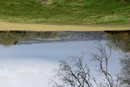
4 Landscape Character Type 1: Settlement Overall Character The settlement of Beech as it appears today dates mainly from the 1890's onwards and comprises a wide variety of individual detached dwellings set within a wooded valley. Medstead Road (LCT 1A) forms the main road through the village, Wellhouse Road (LCT 1B) includes the older buildings which pre-date the late-victorian expansion and King s Hill (LCT 1C) located on higher ground somewhat apart from the rest of the village has a less valley-like character. NOTE:The use of the term settlement does not imply a planning designation but reflects landscape character Relevant key characteristics drawn from East Hampshire Landscape Character Assessment 2006 Varying enclosure - open and exposed in higher plateau areas with occasional long views, with a more enclosed landscape in relation to woodland cover Survival of original pre-1800 woodland and presence of oak as a key species in hedgerows and woodland Limited settlement comprising dispersed farmsteads and occasional small nucleated villages/hamlets Narrow, little used lanes bordered by wide verges and ditches and limited rights of way network Tree cover creates a secluded and enclosed landscape contrasting with the openness of the arable fields and hedgerows help integrate built development This is a peaceful and in places a tranquil and rural landscape Local key characteristics supplementing those above Individual properties within linear plots along Medstead and Wellhouse Roads (as shown on William Carter s 1893 Plan) Built form of very varied style, materials, scale, mass and alignment mostly dating from late 19th Century onwards No visible evidence of business uses Variety of boundary treatments including native deciduous and high proportion of evergreen laurel hedges Village core backed by woodlands with significant conifer content Medstead Road (1A) is aligned along a contained wooded valley. The wooded skyline increases the sense of enclosure. Wellhouse Road (1B) is within a woodland with an accompanying sense of enclosure. Kings Hill(1C) is a hilltop settlement on one of Hampshire s highest points forming a distinct satellite settlement with a perceived sense of elevation and relevant openess. Cluster of historic listed buildings on Wellhouse Road including remaining prefabricated Norton Bavant and St Peter s Church (unlisted) and Donkey Wheel House. Village hall and recreation ground Garden boundaries comprising hedges with grass verges reinforce the rural character of Medstead Road. Bushly Leaze Wood forms a dramatic backdrop. Listed buildings on Wellhouse Road Landform rises up to King s Hill which is separated from main village Rural character of Wellhouse Road with less influence of traffic. Brick and flint walls and cleft post and rail fencing with hedges form appropriate rural boundaries. St Peter s Church dating from 1902 one of few remaining pre-fabricated buildings within the village The guidelines should be read in conjunction with East Hampshire Landscape Character Assessment (2006) 3
 and prefabricated")
 Linear settlement Detracting features Proliferation of mis-matched street furniture adjacent to village")

5 Landscape Character Type 1: Settlement Valued characteristics Separation from urban expansion of Alton and Four Marks and from Medstead Quality varied housing within a wooded valley creates visual interest Tranquility Village Hall and recreation ground Historic listed buildings including The Old Farmhouse, Donkey Wheel House, Norton Bavant, Wellhouse Cottages (all Grade II) and prefabricated buildings which formed part of original settlement including St Peter s Church Hedges, tree cover and well-vegetated front gardens which create seclusion and enclosure, helps integrate built form and creates habitat for wildlife Large number of trees subject to Tree Preservation Orders (TPO) Linear settlement Detracting features Proliferation of mis-matched street furniture adjacent to village hall Evidence of rear garden activities within front gardens including sheds and greenhouses which erodes the rural character Properties which do not reflect characteristic orientation of built form, with rear gardens facing onto highways Introduction of modern building materials of an uncharacteristic and unsympathetic colour-palette Kerb encroachment and damage to roadside verges. Forces for change Threat of coalescence with neighbouring settlements of Alton and Medstead Pressure for infill development including building within front gardens of existing properties leading to increased housing density, loss of vegetation and loss of semi-rural streetscape Inappropriate and oversized suburbanising boundary treatments including close-board fencing and large gates leading to a loss of predominantly rural character Pressure to redevelop and extend existing properties creating small estates of unified house styles or properties which are out of scale with their plot and dominate neighbouring properties Use of inappropriate and suburbanising building materials Broad management objective To retain and enhance the valued, wooded character of the village with its mix of individual properties whilst allowing for appropriate and sensitive development. Landscape management and development considerations Retain and enhance the valued characteristics listed above and: Seek opportunities to plant trees and hedgerows which reflect the local character Avoid road improvements and addition of signage that would alter the rural character of the quiet lanes All new and replacement dwellings and extensions to be sensitively integrated within the existing settlement through the careful use of characteristic materials and boundary treatments Consider opportunities to introduce smaller-sized dwellings to provide opportunities to enable first-time buyers and downsizers to remain within the village Conserve the current density of settlement (in line with EHDC policy H10), quiet roads and consequently peaceful and in places rural character of the landscape. Maintain individual settlement identity and limit linear expansion and infilling between neighbouring settlements The existing form of settlement should be perpetuated by limiting development within garden spaces and peripheral plots, by emphasising the existing rhythm of building frontages as a reflection of plot size and by maintaining the relationship this pattern has to the settlement as a whole Seek to avoid redevelopment of plots with buildings of greater size/massing and incongruous (sub)urban style 4 Kerb encroachment and damage to verge Closeboard fencing and evidence of rear garden activities influence the semi-rural character of Medstead Road Mis-matched signage and street furniture erodes the rural character around the village hall


 woodland provides evidence of medieval and early post-medieval woodland exploitation, e.g.")
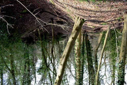
6 Landscape Character Type 2: Woodlands Overall Character Bushy Leaze Wood, Theddon Copse and North Wood comprise mostly areas of ancient replanted woodland some of which is managed for commercial forestry or country sports with a high percentage of non-native coniferous planting. Smaller areas of ancient and semi-natural woodland exist on the edges of these areas with a greater biodiversity. There is some evidence of former chalk pits. These areas are characterised by few formal public rights of way but are used informally for recreation. Relevant key characteristics drawn from East Hampshire Landscape Character Assessment 2006 Chalk overlain by shallow continuous clay capping resulting in poorer heavier soils Large tracts of elevated gently undulating countryside Varying enclosure - open and exposed in higher plateau areas with occasional long views, with a more enclosed landscape in relation to woodland cover Survival of original pre-1800 woodland and presence of oak as a key species in hedgerows and woodland A peaceful and in places a still and empty landscape Ancient woodlands have been replanted, and often comprise a mix of broadleaved and coniferous tree species. The majority are relatively small, although occasional large blocks such as Bushy Lease Wood occur Tree cover creates a secluded and enclosed landscape contrasting with the openness of the arable fields Survival of significant blocks of pre-1800 (ancient) woodland provides evidence of medieval and early post-medieval woodland exploitation, e.g. coppicing and charcoal burning Areas of original pre-1800 woodland (Bushy Leaze Wood) provide enclosure, biodiversity interest and textural contrast Local key characteristics supplementing those above Historic Park Pale at Bushy Leaze Wood Network of formal and informal footpaths Areas of plantation woodland Absence of built form Bushy Leaze Wood and Thedden Copse designated Site of Important Nature Conservation (SINC) Park Pale at Bushy Leaze Wood Replanted woodland at Thedden Copse The guidelines should be read in conjunction with East Hampshire Landscape Character Assessment (2006) 5


7 Landscape Character Type 2: Woodlands Valued characteristics Absence of development Habitat value to local wildlife Tranquility Sense of enclosure Contains and forms distinctive backdrop to settlement, prevents coalescence and acts as buffer to transport infrastructure Valued for informal recreation Detracting features Proliferation of non-native coniferous species Heavy machinery associated with commercial forestry Lack of more traditional, less intensive woodland management including coppicing Forces for change Greater pressure for recreational use More intensive mechanised forestry operations Potential threat of new pests and diseases and of climate change Bushy Leaze and Ackender Woods form backdrop to housing south of Medstead Road Broad management objective Retain and enhance the existing woodland through appropriate traditional management techniques and encourage replanting of non-native coniferous species with native broadleaved species to increase biodiversity. Ensure woodlands remain connected to wider landscape and thus contribute to the wider green infrastructure network. Landscape management and development considerations Retain and enhance the valued characteristics listed above and: Encourage planting native broadleaved species to replace coniferous species Conserve the original pre-1800 woodland tree cover, hedgerows and hedgerow trees which provide enclosure in this landscape and form a strong landscape pattern and important wildlife network Seek to reinstate active management of ancient woodlands traditionally managed under a coppice with standards regime Manage woodland to ensure a diverse indigenous species and age structure to minimise risk of damage as a result of increased incidence of extreme weather. Promote interest in, and marketing of, local wood products, including wood for fuel Theddon Copse and North Wood help buffer the parish from busy A339 6

8 Landscape Character Type 3: Large-scale fieldscape Overall Character Whilst this LCT is shown as two distinct areas within this study it represents one continuous fieldscape which is interrupted by the presence of the settlements at Thedden Park and King s Hill and bisected by the parish boundary. It is characterised by large arable fields to the north and west of the settlement and an elevated position which offers far-reaching views. Relevant key characteristics drawn from East Hampshire Landscape Character Assessment 2006 Elevated undulating plateau with an almost continuous clay cap overlying the chalk bedrock A landscape of dominated by pasture but also with some arable fields, reflecting variations in soil type Some fields of late medieval origin Occasional areas of neutral grassland and ponds and a relatively intact hedgerow network contribute to the ecological value of the landscape Tree cover creates a secluded and enclosed landscape contrasting with the openness of the arable fields Settlement includes isolated farmsteads of 18-19th century and of medieval origin Local key characteristics supplementing those above Elevated position allows far-reaching views Alton Abbey forms a distinct cluster of buildings between the settlements of Beech and Medstead Wooded skyline Generally arable fieldscape Far-reaching views across the fieldscape towards Alton The gatehouse of Alton Abbey which falls between the settlement of King s Hill and Medstead Large arable fields divided by tree belts and hedgerows Gently undulating elevated landform Far-reaching views across the fieldscape The guidelines should be read in conjunction with East Hampshire Landscape Character Assessment (2006) 7

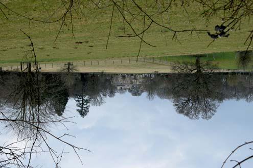
9 Landscape Character Type 3: Large-scale fieldscape Valued characteristics Separation from urban expansion of Alton and Four Marks and from Medstead. Historic Abbey Sense of remoteness Openess with opportunities for far-reaching views Views of skyline Forms part of setting of Thedden Park Generally quiet and tranquil Forms part of gap between Beech and Medstead/Thedden Park Detracting features Medstead Road can be busy and dangerous for pedestrians and cyclists Industrial buildings at Alton visible in some views Forces for change Pressure to remove hedgerows and increase field sizes further Rural lanes bounded by hedges and (to the left) the parkland railings of Thedden Park. Broad management objective Retain and enhance the agricultural landscape whilst resisting further field amalgamation and enhancing biodiversity. Landscape management and development considerations Retain and enhance the valued characteristics listed above and: Manage the agricultural landscapes for biodiversity such as incorporating hedgerows or grass field margins Monitor regeneration of hedgerow trees and consider opportunities for replanting Ensure oak standards grow up to form hedgerow trees Encourage replanting of hedgerows and hedgerow trees Conserve areas of pasture and seek to ensure good management of horse grazing, including retention of hedgerow boundaries, management of the sward and avoiding proliferation of buildings/sheds etc. Ensure that new farm buildings and associated storage structures and working areas are sensitively sited and screened to reduce their impact in the landscape Avoid road improvements and addition of signage that would alter the rural character of the quiet lanes Encourage sensitive integration of fencing, tracks, hardstanding, jumps and other paraphernalia that are associated with hobby farms or private stables and that fall outside planning control Far-reaching views across the fieldscape towards Alton 8


.")
10 Landscape Character Type 4: Small-scale fieldscape Overall Character This LCT comprises an area of smaller, more intimate fields on relatively low-lying land to the south and east of the village core, primarily used as pasture and for horsegrazing. Relevant key characteristics drawn from East Hampshire Landscape Character Assessment 2006 Elevated undulating plateau with an almost continuous clay cap overlying the chalk bedrock. A more rolling landform is evident to the north around Bentworth indicating the transition to the chalk downland A landscape of dominated by pasture but also with some arable fields, reflecting variations in soil type and including considerable areas of pasture managed by horse grazing Occasional areas of neutral grassland and ponds and a relatively intact hedgerow network contribute to the ecological value of the landscape Settlement includes isolated farmsteads of 18-19th century and of medieval origin and small nucleated villages of medieval origin Local key characteristics supplementing those above Small-scale, intimate fieldscape used for pasture and horse-grazing Wyards Farm Granary (Grade II listed), Wyards Farm House (Grade II*), Milestone (Grade II) Wyards Farm locally listed garden (Hampshire Gardens Trust). Association with Jane Austen Parliamentary fields Paddocks enclosed by non-native conifers Far-reaching views from higher ground through gaps in tree belts Wyards Farm painted by Jane Austen s niece, Anna Lefroy (1815) (Copyright?) Equestrian fencing Neglected fields with ruderal vegetation abutting Medstead Road The guidelines should be read in conjunction with East Hampshire Landscape Character Assessment (2006) 9

 and woodland (LCT3) of Bushy Leaze and Ackender")

11 Landscape Character Type 4: Small-scale fieldscape Valued characteristics Forms key part of the gap between Alton and Beech Habitat for wildlife Views of skyline Intimate scale Associated with Jane Austen Opportunities for far-reaching views Some good hedgerows Detracting features Medstead Road can be busy and dangerous for pedestrians and cyclists Negative influence of busy A339 which erodes tranquillity Use of non-native coniferous hedging and shelterbelts Additional images required Forces for change Threat of coalescence with neighbouring settlement of Alton Increased equestrian activity with associated fencing and paraphernalia Threat of development which would truncate visual relationship between existing settlement (LCT1A) and woodland (LCT3) of Bushy Leaze and Ackender Woods Broad management objective To retain and enhance the existing landscape of small-scale pasture fields which contribute to the setting of Beech Landscape management and development considerations Retain and enhance the valued characteristics listed above and: Maintain individual settlement identity and limit linear expansion and infilling between existing settlements e.g. Beech and Alton. Retain an undeveloped rural road corridor along the A339 and important open gaps, for example between Alton and Four Marks Ensure that new farm buildings and associated storage structures and working areas are sensitively sited and screened to reduce their impact in the landscape Avoid road improvements and addition of signage that would alter the rural character of the quiet lanes Encourage sensitive integration of fencing, tracks, hardstanding, jumps and other paraphernalia that are associated with hobby farms or private stables and that fall outside planning control Monitor regeneration of hedgerow trees and consider opportunities for replanting Conserve areas of pasture and seek to ensure good management of horse grazing, including retention of hedgerow boundaries, management of the sward and avoiding proliferation of buildings/sheds etc. Manage the agricultural landscapes for biodiversity such as incorporating hedgerows or grass field margins Ensure oak standards grow up to form hedgerow trees Encourage replanting of hedgerows and hedgerow trees with suitable, native species Preserve feeling of spaciousness and views to wooded skyline from properties on Medstead Road. Additional images required Well-maintained hedgerow with hedgerow trees and grass verge 10


12 Landscape Character Type 5: Parkland Overall Character This LCT comprises the parkland setting of Thedden Grange which features individual trees set amongst areas of rough grassland. Nearer to the house the landscape is more managed and ornamental. Relevant key characteristics drawn from East Hampshire Landscape Character Assessment 2006 Elevated undulating plateau with an almost continuous clay cap overlying the chalk bedrock A landscape of dominated by pasture but also with some arable fields, reflecting variations in soil type and including considerable areas of pasture managed by horse grazing Occasional areas of neutral grassland and ponds and a relatively intact hedgerow network contribute to the ecological value of the landscape Tree cover creates a secluded and enclosed landscape contrasting with the openness of the arable fields Parkland as at Bentworth, Medstead and Thedden is of local importance (Hampshire Register) Settlement includes isolated farmsteads of 18-19th century and of medieval origin Local key characteristics supplementing those above Elevated landscape with frequent far-reaching views Boundaries comprising parkland railings Semi-improved grassland used as grazing Individual mature parkland trees often with protective fencing to trunks Thedden Grange is a focal point for the landscape Imposing flint wall alongside Wivelrod Road Thedden Grange is the focal point of the parkland landscape of mature trees set in semi-improved grassland. Semi-imrpved grassland with estate railings form setting to Thedden Grange Mature tree and parkland railings to LCA boundary Flint wall on Wivelrod Road with conifers behind. Additional image required The guidelines should be read in conjunction with East Hampshire Landscape Character Assessment (2006) 11


13 Landscape Character Type 5: Parkland Valued characteristics Historic buildings and their setting Valued for wildlife Tranquility and remoteness Far-reaching views Mature trees and small copses Part of small hamlet with separation from settlement of Beech Traditional boundaries including estate railings and flint walls Detracting features Encroachment of industrial buildings in Alton into long-distance views Some parkland trees are over-mature and in deteriorating condition Use of non-native conifers as hedging Trees of mixed ages and traditional parkland railings Forces for change Pressure to remove veteran trees. Deterioration of boundaries Broad management objective To retain and protect the parkland landscape and its boundaries and ensure succession through planting appropriate trees Landscape management and development considerations Retain and enhance the valued characteristics listed above and: Manage the agricultural landscapes for biodiversity such as sowing wildflowers to the edges of open spaces and in smaller left-over spaces Encourage replanting of coniferous hedge with native broad species Maintain the existing parkland character including estate railing boundaries and plant appropriate trees species to ensure succession Actively manage small woodlands and copses to ensure their long-term success Far-reaching views Close-mown grass adjacent to the house with parkland beyond, separated by parkland railings 12


14 Landscape Character Type 6: Hangers and linear fieldscape Overall Character This LCT comprises the only part of the parish to lie east of the A339 and within EHDC LCA 3d: Lasham Downland Mosaic and consists of a series of linear arable fields backed by an area of steep woodland. Relevant key characteristics drawn from East Hampshire Landscape Character Assessment 2006 Large-scale rolling landform characteristic of chalk, incised by linear dry valleys and forming strong bluffs above, and a dramatic contrast with, the Wey valley A mixture of 18th and 19th century arable fields and early post medieval pasture fields, with pockets of older medieval assarts surrounded by woodland. This mosaic of habitats supports arable weeds and farmland birds Varying extents of clay capping resulting in varying soils and land cover, including areas of open arable fields revealing the distinctive curves and undulations of the chalk landform, as well as more enclosed wooded areas on the clay capped summits A mosaic of arable fields interlocked with woodland to create a unified landscape of both openness and enclosure Long views are across open fields to a wooded or open skyline. In more enclosed areas views are short and contained by woodland Ancient woodland corresponds to areas of clay capping and steeper slopes Sparsely populated with a small number of villages nucleated around rural lane crossroads as at Shalden and Lasham. Some settlements have extended along roads and have a more linear form, notably extension of Alton along the lane towards Golden Pot. Dispersed farmsteads occur throughout the area. Local key characteristics supplementing those above Evidence of remains of route of Basingstoke and Alton Light Railway on western edge of Great Wood Great Wood and Hungry Copse designated Site of Important Nature Conservation (SINC) Linear fieldscape bounded by A339 to the west and Great Wood/Hungry Copse to the east Lack of built form Warren Farm forms a distinct isolated cluster of buildings outside but adjacent to the LCT and parish boundaries Warren Farm (which lies just outside parish boundary), backed by North Wood Undulating linear fieldscape Undulating linear fieldscape bounded by Hungry Copse Approximate route of former Basingstoke and Alton Light Railway on western edge of Great Wood. Linear fieldscape with landform emphasised by woodland The guidelines should be read in conjunction with East Hampshire Landscape Character Assessment (2006) 13

15 Landscape Character Type 6: Hangers and linear fieldscape Valued characteristics Forms part of the separation between Alton and Beech Ancient and semi-natural woodland at Hungry Copse Linear, undulating landform with long views to skyline Detracting features Influence of busy A339 on tranquillity Apparent lack of woodland management Forces for change Removal of hedgerows and fragmentation of green infrastructure Increased traffic on A339 leading to further loss of tranquillity Broad management objective To retain the sinuous, linear fieldscape bounded by well-managed native woodland Traffic and signage on A339 Landscape management and development considerations Retain and enhance the valued characteristics listed above and: Manage the agricultural landscapes for biodiversity such as incorporating hedgerows or grass field margins Reintroduce appropriate woodland management with replanting, where required Encourage replanting of non-native coniferous woodland with native species 14
Rolling Wooded Pasture Lulworth Wooded Pasture Rempstone Wooded Pasture
 Landscape type: Character areas: Rolling Wooded Pasture Lulworth Wooded Pasture Rempstone Wooded Pasture The rolling wooded pasture landscape type is found around the margins of the Dorset Heaths. Although
Landscape Guidelines. Landscape type: Valley Pasture Character areas: Frome Valley Pasture Stour Valley Pasture. Landscape change
 Landscape type: Valley Pasture Character areas: Frome Valley Pasture Stour Valley Pasture The valley pasture landscape type is found along the lower reaches of the Stour and Frome, formed from alluvial
Environmental and Landscape Mapping
 Environmental and Landscape Mapping In support of the Calveley Neighbourhood Plan November 2016 Project Name and Number: Calveley Neighbourhood Plan 16-025 Document Name and Revision: Environmental and
ENVIRONMENTAL AND LANDSCAPE MAPPING
 APPENDIX IV : Environmental and Landscape Mapping ENVIRONMENTAL AND LANDSCAPE MAPPING Calveley Neighbourhood Plan November 2016 ENVIRONMENTAL AND LANDSCAPE MAPPING Calveley Neighbourhood Plan Calveley
Warwickshire County Council. Upper and Lower Brailes. Landscape Study
 Warwickshire County Council Upper and Lower Brailes Landscape Study Produced by WCC Landscape Architects March 2016 Landscape Assessment of Potential Development Sites within the parish of Brailes 1.0
Toddington Central Bedfordshire Stage 3 Green Belt Study December 2017
 Toddington Central Bedfordshire Stage 3 Green Belt Study December 2017 Site: ALP086 - Middle Lakes, Toddington Site size (ha): 2.83 Site: ALP086 - Middle Lakes, Toddington Site size (ha): 2.83 Site description
tributary farmland tributary farmland
 NORFOLK O R F O L K COAST C O A SAONB T A O NIntegrated B I n t elandscape g r a t e d L Guidance a n d s c a p e G u i d a n c e 1 Integrated landscape character MAP 23a - Landscape Character Type - Tributary
SETTLEMENT ASSESSMENT PROFORMA
 SETTLEMENT ASSESSMENT PROFORMA Surveyors(s):Clare Sheridan Character Area: Park Estate = Midland Rd, Severn Rd, Festival Rd, Park Rd, Willow Rd, Rylands Rd. Date: Feb Weather: cloudy Look through all the
Marble Arch, Chandigarh
 Marble Arch, Chandigarh an illustrated monograph with detailed drawings photography: andre j fanthome edmund sumner dave ten hoope a education publication 2013 Published by education All rights reserved.
Landscape Guidelines. Landscape type: Wooded Hills Character areas: Landscape change. Planning guidelines
 Landscape type: Wooded Hills Character areas: Axe Valley Hills Wootton Hills Chideock Hills Powerstock Hills Powerstock Woods Landscape change Policy driven farming changes over the last sixty years, resulting
CHAPTER 18 - Strategy Area: Dundry and River Valleys
 This south-eastern part of the Community Forest is a complex area with a wide variety of different landscapes close together, including the Chew Valley, the southern part of the Avon Valley and the eastern
National Character Area 70 Melbourne Parklands
 Summary The are a landscape of rolling farmland, parkland and woodland on the northern flanks of the ridge between Burton upon Trent and Swadlincote. The land slopes down to the River Trent, which borders
East Harptree Landscape & Character Assessment
 East Harptree Landscape & Character Assessment Produced by East Harptree Parish Council in consultation with local residents September 2014 Contents The Parish of East Harptree: Objective Introduction
Landscape Guidelines. Landscape type: Chalk Ridge/Escarpment Character areas:
 Landscape type: Chalk Ridge/Escarpment Character areas: Purbeck Ridge North Dorset Escarpment South Dorset Escarpment West Dorset Escarpment Landscape change Policy driven farming changes over the last
Welcome to our Public Consultation
 About our development This exhibition gives you the chance to view and comment on our emerging plans for a proposed residential development located on land to the West of Alwyn Road, Rugby. Welcome to
Strip Enclosure. Summary of Dominant Character
 Strip Enclosure Summary of Dominant Character This zone is characterised by long thin curving fields, sometimes all running in the same direction and sometimes forming a patchwork pattern across the landscape.
APPENDIX 4. 5 ST AGNES LOCAL LANDSCAPE CHARACTER ASSESSMENT TABLE ST AGNES BEACON
 APPENDIX 4. 5 ST AGNES LOCAL LANDSCAPE CHARACTER ASSESSMENT TABLE ST AGNES BEACON CHARACTER AREA: ST AGNES BEACON DATE OF ASSESSMENT May 2016 Character Attribute Landscape reference guide ST AGNES BEACON
CORNWALL AND ISLES OF SCILLY LANDSCAPE CHARACTER STUDY
 LCA - East Cornwall and Tamar Moorland Fringe LCA No CA26 JCA Constituent LDUs Total 10: 211, 217U, 233U, 310, 312, 311, 313, 413, 420U, 421U Crown copyright. All rights reserved. Cornwall County Council
8.0 Design and Form of Development 43/
 42/ 8.0 Design and Form of Development 43/ Rothwells Farm, Golborne/ Development Statement Figure 7. Site Constraints Key 44/ Site Boundary 360 Bus Route/Stops Existing Trees Underground Water Pipe Sensitive
KJB103 Media Design and Layout. Kelvin Grove Urban Village Festival
 KJB103 Media Design and Layout Assessment 3: Design Folio Kelvin Grove Urban Village Festival Student: Mathew Cenita Student no. n8577587 Tutor: Steve Fox Project Plan Project Subject/Topic: The Kelvin
4.3 Dudley Area Plan. Introduction. History and Existing Character. Desired Future Character for Dudley
 4.3 Dudley Area Plan Introduction The suburb of Dudley has developed as a result of various circumstances including its topography, history and mineral resources. Dudley development has been identified
The analysis of key visual characteristics and attributes that contribute to variations in the
 15.0 CHIGWELL/CHIGWELL ROW 15.1 Overview 15.1.1 Chigwell and Chigwell Row settlements are situated in the south of Epping Forest District, to the south of Abridge and southwest of Stapleford Abbotts. Both
HIGH LITTLETON AND HALLATROW COMMUNITY PLACEMAKING PLAN
 HIGH LITTLETON AND HALLATROW COMMUNITY PLACEMAKING PLAN DOCUMENT 3 of 4 SNAPSHOT CHARACTER SUMMARY HALLATROW Context B&NES Landscape type: Area 6 Farrington Gurney Farmland/ Area 12 Cam and Wellow Brook
B - Coalfield River Corridor Landscape Character Type
 B - Coalfield River Corridor Landscape Character Type Landscape Character Type - Coalfield River Corridor The Coalfield River Corridors Landscape Character Type is located in the two converging valleys
Lower Sensitivity. VS Classification Level 2: Hills, Lower Plateau & Scarp Slopes (74%)/ Lowland Valleys (17%) / Exposed Upland/Plateau (7%)
/ Lowland Valleys (17%) / Exposed Upland/Plateau (7%)") S06 Coedwig Gwydyr Reproduced from the Ordnance Survey map with the permission of Ordnance Survey on behalf of the Controller of Her Majesty s Stationery Office, Crown copyright Licence No. 100023387 Location
S06 Coedwig Gwydyr Reproduced from the Ordnance Survey map with the permission of Ordnance Survey on behalf of the Controller of Her Majesty s Stationery Office, Crown copyright Licence No. 100023387 Location
coastal plain coastal plain
 NORFOLK O R F O L K COAST C O A SAONB T A O NIntegrated B I n t elandscape g r a t e d L Guidance a n d s c a p e G u i d a n c e 1 Integrated landscape character MAP 23a - Coastal Plain Key Plan This
Viewpoint 1. Location: View from Murch Road on the north eastern boundary of Application Site. Viewing south / southwest.
 Application Site (eastern field) Former site of St. Cyres Lower School Murch Road 1 Location: View from Murch Road on the north eastern boundary of Application Site. Viewing south / southwest. Baseline
Ashtead Neighbourhood Forum Site Assessment AS03 Lime Tree Lodge, Farm Lane. Site address: Lime Tree Lodge, Farm Lane. Proposed Land Use:
 Site ref: AS03 Site address: Lime Tree Lodge, Farm Lane Proposed Land Use: Total Site Area (Ha): Housing 1.25ha Description The site is located off Farm Lane at the junction with Park Lane. To the north
Settlement Boundaries Methodology North Northumberland Coast Neighbourhood Plan (August 2016)
") Introduction This background paper sets out a methodology for the definition of settlement boundaries in the North Northumberland Coast Neighbourhood Plan. The neighbourhood plan is planning positively
Introduction This background paper sets out a methodology for the definition of settlement boundaries in the North Northumberland Coast Neighbourhood Plan. The neighbourhood plan is planning positively
INTRODUCTION. Land south of Bishopswood Lane, Tadley
 0 INTRODUCTION THE SITE Introduction Gladman Developments Ltd. has successfully invested in communities throughout the UK over the past 0 years, developing high quality and sustainable residential, commercial
Longhorsley Neighbourhood Plan
 Site Assessment 1. The availability of the site 1.1 Is the land owner willing for their site to be made available for development? 1.2 If yes, do you have any written evidence to back this up? Planning
ENVIRONMENTAL INVENTORY
 Hungarton Neighbourhood Plan ENVIRONMENTAL INVENTORY Sites scoring 25/36 or more (70%) are judged to be the most important environmental and community sites and are proposed as Local Green Space. Other
LONGDEN VILLAGE DEVELOPMENT STATEMENT
 LONGDEN VILLAGE DEVELOPMENT STATEMENT 2017-2027 1 Longden Development Statement 2017-2027 15/01/18 1. Background 1.1 Longden Village Longden village is a very rural and traditional community first mentioned
Guidance for Wind Turbine Development in the Dorset Area of Outstanding Natural Beauty
 DRAFT January 2012 Guidance for Wind Turbine Development in the Dorset Area of Outstanding Natural Beauty Photo 1: Rew Manor Farm, West Dorset, chalk downland landscape (Planning application ref: 1/D/09/001280
MATURE SUBURBS RESIDENTIAL DEVELOPMENT GUIDELINES
 MATURE SUBURBS RESIDENTIAL DEVELOPMENT GUIDELINES DRAFT FEBRUARY 2005 BIRMINGHAM CITY COUNCIL 1 Introduction Mature Suburbs Residential Development Guidelines - Interim Supplementary Planning Advice -
LANDSCAPE CHARACTER ASSESSMENT
 THE COUNTY DURHAM LANDSCAPE CHARACTER ASSESSMENT FOREWORD The landscape of County Durham is one of great contrast and diversity. From the North Pennines in the west to the Durham Coast in the east it contains
14. Cornbrash Pastoral Lowlands
 Character Areas Key Features 14A Biddestone Lowland Farmland 14B West Malmesbury Lowland Farmland Flat or very gently undulating landform with occasional low hills comprising the western limits of a more
Guidance for Wind Turbine Development in the Dorset AONB
 Photo 1: Rew Manor Farm, West Dorset, chalk downland landscape (Planning application ref: 1/D/09/001280 1 ) Scale & siting: 12m to hub / 16m to blade tip. A well sited small scale turbine, grouped with
Landscape Assessment CEUGP/SR9B
 Landscape Assessment CEUGP/SR9B TABLE OF CONTENTS 1 STUDY PHILOSOPHY... 3 2 GENERAL DESCRIPTION OF SITE... 4 3 LANDSCAPE THEMES... 8 TABLE OF FIGURES Table 1: Landscape... 5 Table 2: Landscape Themes...
6 THE LECHT AND STRATHDON
 6 THE LECHT AND STRATHDON This section of the LCA includes the Lecht and Strathdon. This character assessment is presented, working from west to east, as follows: 40. The Lecht 41. Strathdon: Corgarff
Smooth gentle landform on lower slopes and sense of exposure on some upper slopes with views across wide areas of the Pastoral Lowland Vales.
 Character Areas 15A Vale of Bourton Farmed Slopes 15B Vale of Moreton Farmed Slopes Key Features Transitional landscape between the large fields and exposed nature of the High Wold and High Wold Dip-Slope
Welcome. Land adjacent Sandy Lane WALTHAM CHASE THE PROPOSED SITE
 Land adjacent Sandy Lane WALTHAM CHASE Existing Linden Homes developments Welcome Welcome to Linden Homes Southern s ( Linden ) public exhibition about its proposals for a range of high-quality homes for
- - - Key Characteristics
 S23 Dyffryn Dysynni Reproduced from the Ordnance Survey map with the permission of Ordnance Survey on behalf of the Controller of Her Majesty s Stationery Office, Crown copyright Licence No. 100023387
S08 Dyffryn Y Ddwyryd
 S08 Dyffryn Y Ddwyryd Reproduced from the Ordnance Survey map with the permission of Ordnance Survey on behalf of the Controller of Her Majesty s Stationery Office, Crown copyright Licence No. 100023387
To secure a Green Belt around Cambridge whose boundaries are clearly defined and which will endure for the plan period and beyond.
 4. GREEN BELT OBJECTIVES GB/a GB/b GB/c GB/d To secure a Green Belt around Cambridge whose boundaries are clearly defined and which will endure for the plan period and beyond. To maintain the purposes
Our brand This document is a guide to the brand communication style for Kew. It explains what our brand stands for, how it s expressed, and how the
 Brand Guidelines Our brand This document is a guide to the brand communication style for Kew. It explains what our brand stands for, how it s expressed, and how the creative elements fit together in all
Oxford Green Belt Study. Summary of Final Report Prepared by LUC October 2015
 Oxford Green Belt Study Summary of Final Report Prepared by LUC October 2015 Project Title: Oxford Green Belt Study Client: Oxfordshire County Council Version Date Version Details Prepared by Checked by
an Inspector appointed by the Secretary of State for Communities and Local Government
 Appeal Decision Site visit made on 6 November 2017 by Rachel Walmsley BSc MSc MA MRTPI an Inspector appointed by the Secretary of State for Communities and Local Government Decision date: 19 th January
Brought To You Exclusively By:
 Brought To You Exclusively By: 1998 Hawker 800XP Ser No 258390, N850HS, Operated Part 135 Price Reduced $155,000.Owner Motivated to Sell. Wants gone ASAP! FEATURES & EXTRAS Aircell Axxess EZ Iridium SATCOM
PONTELAND NEIGHBOURHOOD PLAN LANDSCAPE QUALITY ASSESSMENT
 PONTELAND NEIGHBOURHOOD PLAN LANDSCAPE QUALITY ASSESSMENT UPDATED CONSULTATION ISSUE NOVEMBER 2016 CONTENTS 2 Introduction 2 Methodology 4 Landscape Quality Areas Plan 5 Landscape Quality Area 1 SMALLBURN
Warwickshire County Council. Wellesbourne & Walton Parish. Landscape Study
 Warwickshire County Council Wellesbourne & Walton Parish Landscape Study Produced by WCC Landscape Architects January 2016 Contents LANDSCAPE ASSESSMENT FOR THE PARISH OF WELLESBOURNE & WALTON 1.0 The
Landscape Character Assessment
 Landscape Character Assessment What Is It? Survey of the county landscapes For what purpose? To analyse and define character Says Who? Planning and Development Act 2000 Applications To provide a basis
Case Studies; Meitheal Clusters Applied to Villages and Rural Settlements
 Case Studies; Meitheal Clusters Applied to Villages and Rural Settlements 23.3.9 (ii) Case Studies, Meitheal Clusters applied to villages and rural settlments Fig 22.3.12 Cluster site plan; church opposite
Public Consultation. Land at Monks Farm, North Grove. Welcome
 Welcome Welcome to our public exhibition for development on Land at Monks Farm, orth Grove. Gallagher Estates and Gleeson Strategic Land are preparing an outline planning application for new homes, open
2015 ANNUAL MEETING HIGHLIGHTS
 Fff Picture courtesy of Theda Payne 2015 ANNUAL MEETING HIGHLIGHTS Congratulations to Bob Hawkins and Michelle Patterson for being elected to the 2015 Board of Directors. The Chatham Village annual meeting
Central Bedfordshire and Luton Green Belt Study Appendix 1
 Central Bedfordshire Council www.centralbedfordshire.gov.uk Central Bedfordshire and Luton Green Belt Study Appendix 1 July 2017-1 - Appendix 1 Stage 1 assessments Central Bedfordshire and Luton Green
Neighbourhood Planning Guidance Local Green Spaces
 Neighbourhood Planning Guidance Local Green Spaces Introduction This guidance note has been produced for communities preparing neighbourhood plans in North Dorset to help them to identify, assess and designate
LANDSCAPE AND VISUAL IMPACT ASSESSMENT
 TANGIER HOUSE TANGIER PARK WOOTTON ST. LAWRENCE RG23 8PH Regeneration & Restoration of Outbuildings LANDSCAPE AND VISUAL IMPACT ASSESSMENT Prepared by: ACLA Ltd For: Mr & Mrs T O'Donohoe Ref: ACLA/BEO
ALLERTHORPE NEIGHBOURHOOD PLAN
 Allerthorpe s Neighbourhood Plan sets out a vision for the Parish for the next 15 years (2018 2033) that builds on and reflects the opinions and views of parish residents. VISION In 2033 Allerthorpe will
Royal Victoria Dock. John Long. by igloo, for People, Place and Planet
 Royal Victoria Dock John Long About Us igloo: - a purpose driven developer, funder and partner - a responsible real estate business Guided by Footprint - protecting the things we value - People, Place
PDP DESIGN & ACCESS STATEMENT
 PDP The Planning & Design Partnership Planning.. Architecture.. Interiors.. Landscape The Chicory Barn Studio, The Old Brickyards, Moor Lane, Stamford Bridge York, The East Riding Of Yorkshire, YO41 1HU.
SITE ASSESSMENT FORM
 Appendix 2 SITE ASSESSMENT FORM 1. Site information Settlement: Colwall Main Village Site name: SITE 1 Part of vacated Colwall school site and adjacent area Site address: Walwyn Road Site area (hectares):
Neighbourhood Planning Local Green Spaces
 Neighbourhood Planning Local Green Spaces Introduction... 2 1. Why green space is important... 4 2. Neighbourhood plans and green space... 6 3. Evidence... 8 Statutory designations... 9 Green space audit...
RIGID & BOW SPRING CENTRALIZERS
 RIGID & BOW SPRING CENTRALIZERS for centralizing casing piped in vertical, deviated and horizontal wells TRUSTED INNOVATION Spring Centralizers Standard Spring Centralizer By using the spring steel plates,
Appendix H: Easement cross sections
 Appendix H: Easement cross sections SHARED PATH 1.5m FOOTPATH NATURE STRIP 7.3m CARRIAGEWAY 2.7m NATURE STRIP EXISTING PIPELINE 150mm DIA 5.0m (approx.) LOCAL ACCESS ROAD EXISTING PIPELINE 500mm DIA 2.7m
B4. Te tiaki taonga tuku iho - Natural heritage
 B4. Te tiaki taonga tuku iho - Natural heritage Tuia I runga, tuia i raro, tuia ki te waonui a Tiriwa Bind the life forces of heaven and earth to the great realm of Tiriwa B4.1. Issues Auckland s distinctive
DUNSFOLD NEIGHBOURHOOD PLAN Site Selection Policies
 DUNSFOLD NEIGHBOURHOOD PLAN Site Selection Policies The criteria for assessing sites for future housing and business development in Dunsfold are set out below. (Development criteria, covering what it is
visual identity toolkit September, 2012 NATIONAL CONSERVATION LANDS: BRAND TOOLKIT SECTION NAME PAGE 1
 visual identity toolkit September, 2012 NATIONAL CONSERVATION LANDS: BRAND TOOLKIT SECTION NAME PAGE 1 introduction and contents on the cover: Red Cliffs National Conservation Area, Utah We believe that
4 RESIDENTIAL ZONE. 4.1 Background
 4 RESIDENTIAL ZONE 4.1 Background The residential areas within the City are characterised by mainly lowrise dwellings sited on individual allotments. Past architectural styles, settlement patterns and
WELCOME GYPSY LANE. Wider Site Location plan. Proposals for the development of LAND OFF FOXLYDIATE LANE WEBHEATH. Proposals for the development of
 WELCOME The developers are preparing an outline planning application for a residential led development and need the community s views in order to develop the proposals further WHAT IS PROPOSED? A high
Introduction. Welcome to this consultation regarding the draft redevelopment proposals for the former CeramTec factory on Sidmouth Road, Colyton.
 Introduction Welcome to this consultation regarding the draft redevelopment proposals for the former CeramTec factory on Sidmouth Road, Colyton. We are currently considering options for the mixed-use redevelopment
Lower Sensitivity. VS Classification Level 2: Exposed Upland/Plateau
 S04 Moel Hebog Reproduced from the Ordnance Survey map with the permission of Ordnance Survey on behalf of the Controller of Her Majesty s Stationery Office, Crown copyright Licence No. 100023387 Location
vision & process willowburn, tarves community engagement 04/18
 vision & process Historic Conservation area Scotia intend to create a high quality residential development based upon best practice urban design principles. This will include a contemporary reinterpretation
The key to life was rearranging the furniture. - Robert Ferro
 2015 BOOK The key to life was rearranging the furniture. - Robert Ferro 10 03 06 08 About POLaRT The POLaRT Team 09 The Sessions: Real de 14 09 05 16 22 The Sessions: Chacala The Sessions: Fair Grounds
Ashtead Neighbourhood Forum Site Assessment AS07 Old Chalk Pit, Pleasure Pit Road. Site ref: AS07 Site address: Old Chalk Pit, Pleasure Pit Road
 Site ref: AS07 Site address: Old Chalk Pit, Pleasure Pit Road Proposed Land Use: Total Site Area (Ha): Housing 0.7ha Description: The site was formally an old chalk pit that has been partially filled and
Appendix 4 - Character Assessment and Design Code. Character Assessment
 Appendix 4 - Character Assessment and Design Code Character Assessment To gain a deeper understanding of the Parish for the Neighbourhood Plan, a Character Assessment of the parish was carried out with
18 South of St Pegas Rd including west of Foxcovert Rd, south of Werrington parkway and east to the Car Dyke
 18 South of St Pegas Rd including west of Foxcovert Rd, south of Werrington parkway and east to the Car Dyke Information reviewed Historical background: SAJ ver2 June 2016 Classification Comments NCA 75
Appendix B Figures L1 and L2 - Townscape Analysis
 The Derriford Transport Scheme WEBTag Townscape and Visual Impact Appraisal (WTVA) Appendix B Figures L1 and L2 - Townscape Analysis J:\29210 Plymouth City Modelling\Technical\Landscape\Reports\29210_De
Northumberland Key Land Use Impact Study PART B. Proposed Extension of the Green Belt Around Morpeth
 Northumberland Key Land Use Impact Study PART B Proposed Extension of the Green Belt Around Morpeth 1. INTRODUCTION 1.1. The study brief requires that an assessment is carried out of the landscape qualities
Landscape Appraisal at Cattishall, Bury St Edmunds
 Great Barton Parish Council Landscape Appraisal at Cattishall, Bury St Edmunds Strategic landscape proposals to protect settlement identity March 2012 LSDP Chartered Landscape Architects OCTAGON HOUSE
 DHA ENVIRONMENT LAND TO THE REAR OF WARDSDOWN HOUSE, FLIMWELL LANDSCAPE AND VISUAL ASSESSMENT JE/11291 Peer Group plc Contents 1 INTRODUCTION AND METHODOLOGY... 4 1.1 General... 4 1.2 Methodology... 4
A payment of 1080 is due in this instance, for a meeting and follow up written response, and will be made by card over the phone.
 JPPC ref: AG/6002 18 th September 2014 Planning Services Vale of White Horse District Council Benson Lane Crowmarsh Gifford Wallingford OX10 8ED Dear Sir/Madam REQUEST FOR PRE-APPLICATION ADVICE RE: RESIDENTIAL
Landscape considerations in Forests & Woodlands. Jill Bullen, Senior Landscape Specialist
 Landscape considerations in Forests & Woodlands Jill Bullen, Senior Landscape Specialist UK Forestry Standard (UKFS) Sustainable forest management Landscape sub-section (S6.4, page 96) Standards and requirements
WELCOME. Land North of STEVENAGE. We would like to thank you for attending our public exhibition today.
 WELCOME We would like to thank you for attending our public exhibition today. The purpose of this event is to share our proposals and hear your thoughts on our ideas. Members of the project team are on
COMMUNITY DESIGN. GOAL: Create livable and attractive communities. Intent
 COMMUNITY DESIGN Intent An attractive, well-designed County will attract quality development, instill civic pride, improve the visual character of the community, and create a strong, positive image for
RURAL ZONE - POLICY. Rural Zone Policy. Issue: Rural Environment. Ruapehu District Plan Page 1 of 8
 Rural Zone Policy RU2 RURAL ZONE - POLICY RU2.1 Introduction The natural resources of the rural environment in the Ruapehu District provide the basis for the existing and potential character, intensity
Greenbelt Fund Brand Applications Manual 2013
 Introduction In 2008, Ontario s Greenbelt introduced a new brand platform. This brand idea aims to reinforce Ontario s Greenbelt as a place that s both good a place where sustainable values and practices
DRAFT CONSERVATION AREA APPRAISAL CHAILEY GREEN DESIGNATED
 DRAFT CONSERVATION AREA APPRAISAL CHAILEY GREEN DESIGNATED 16.06.76 DRAFT CHAILEY GREEN CONSERVATION AREA APPRAISAL 1 SUMMARY 1.1 Key Positive Characteristics 1.2 Recommendations 2 INTRODUCTION 2.1 The
Rudy Parish Neighbourhood Plan Steering Group Meeting 6/8/2018. Proposed Green Spaces (Continued from SG meeting of 2/7/18)
") Rudy Parish Neighbourhood Plan Steering Group Meeting 6/8/2018 Proposed Green Spaces (Continued from SG meeting of 2/7/18) NPPF: Green Space Designation The Local Green Space designation will not be appropriate
Rudy Parish Neighbourhood Plan Steering Group Meeting 6/8/2018 Proposed Green Spaces (Continued from SG meeting of 2/7/18) NPPF: Green Space Designation The Local Green Space designation will not be appropriate
Lower Sensitivity. VS Classification Level 2: Exposed Upland/Plateau
 S05 Y Moelwynion Reproduced from the Ordnance Survey map with the permission of Ordnance Survey on behalf of the Controller of Her Majesty s Stationery Office, Crown copyright Licence No. 100023387 Location
Warren Farm, Ampthill
 1 Welcome The developers of the Warren Farm site, Bloor Homes and Connolly Homes, are holding this exhibition on the emerging Design Codes for the development prior to their formal submission to Central
E. RURAL COMMERCIAL/INDUSTRIAL PARK MODEL
 E. RURAL COMMERCIAL/INDUSTRIAL PARK MODEL 1. PURPOSE The purpose of the Rural Commerce/Industrial Park Model is to provide parameters within which a grouping of business buildings with parking, loading
Copyright Nigel Deeley and licensed for reuse under this Creative Commons Licence
 1 Copyright Nigel Deeley and licensed for reuse under this Creative Commons Licence Prepared by the Neighbourhood Plan Steering Group on behalf of Garway Parish Council with assistance from 2 Table of
Extract from Whitehorse Planning Scheme - LOCAL PLANNING POLICIES - CLAUSE Preferred Character Statements
 Extract from Whitehorse Planning Scheme - LOCAL PLANNING POLICIES - CLAUSE 22.03 22.03-5 Preferred Character Statements Bush Environment The streetscapes will be dominated by vegetation with subservient
DESIGN AND MANAGEMENT PART 3 HA 57/92 NEW ROADS INTEGRATION WITH RURAL LANDSCAPES SUMMARY
 DESIGN MANUAL FOR ROADS AND BRIDGES VOLUME 10 SECTION 1 ENVIRONMENTAL DESIGN AND MANAGEMENT NEW ROADS PART 3 HA 57/92 NEW ROADS INTEGRATION WITH RURAL LANDSCAPES SUMMARY This Advice Note gives guidance
Management Plan
 Kent Downs Area of Outstanding Natural Beauty Management Plan 2014-2019 Second revision April 2014 1 Ministerial Foreword Areas of Outstanding Natural Beauty (AONBs) are some of our finest landscapes.
Section 4 - Public Realm & Landscape proposals Landscape Masterplan. Section 4 52
 - Public Realm & Landscape proposals Landscape Masterplan 52 Proposed Masterplan - Green Infrastructure Strategy District Park 4.33 Ha to provide Passive and active recreation with a large play area which
About the land. Alfred Williams. North Wessex Downs AONB Geodiversity Resource 11
 The slopes of the downs, if they have general form, are continually changing and interchanging in localities, assuming new and strange shapes, charming and surprising with their grace and exquisiteness,
Ashtead Neighbourhood Forum Site Assessment AS14 Land at The Pines, Farm Lane. Site ref: AS14 Site address: Land at The Pines, Farm Lane
 Site ref: AS14 Site address: Land at The Pines, Farm Lane Proposed Land Use: Total Site Area (Ha): Housing 2.1ha Description: The site is located to the east of Ashtead off Farm Lane and is currently grassed.
Chapter 2: OUTLINE PLANNING APPLICATION PROPOSALS. A New Garden Neighbourhood Matford Barton 17
 Chapter 2: OUTLINE PLANNING APPLICATION PROPOSALS A New Garden Neighbourhood Matford Barton 17 2.1. SUMMARY AND STATUS OF THE PROPOSALS 2.1.1. The parameter plans and associated wording in this chapter