Master Planning Council Precinct Planning Office of the Architect for the University. September 16, 2009
|
|
|
- Roger Gerald Warren
- 5 years ago
- Views:
Transcription
1 Master Planning Council Precinct Planning Office of the Architect for the University David Neuman, Julia Monteith September 16, 2009


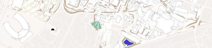
2 2008 Grounds Plan + Long-range plan, 2015, Directs projected growth into specific redevelopment zones + Focused on sustainability + Preservation + Context + Multi-Disciplinary Learning + Connectivity + Environment + Establishes the three precincts
3 Housing Based Mixed Use Academic Based Mixed Use Redevelopment Zones


4 Precincts + Campus comprised of 3 precincts + Central + West + North + Precincts include redevelopment + Precincts include redevelopment zones + Academic Mixed Use + Residential Mixed Use
5 districts precincts overall plan
6 Precinct Plan Purpose Two-fold + Detailed description of role, use and form + Holistic interpretation of place through: + Building form + Views + Circulation + Servicing + Parking + Other aspects of built form


7 Traditional Grounds Campus Planning Redevelopment Site Specific Zones Form-Based Zoning Form-based Codes + Departure from typical campus planning + Zoning for form, not use + Established as zones, not buildings + More responsive to changing needs + Flexibility of use with welldefined ed form


8 Existing Proposed Legend
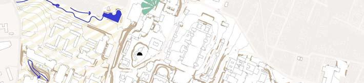
9 Final Product
10 Combined Maps


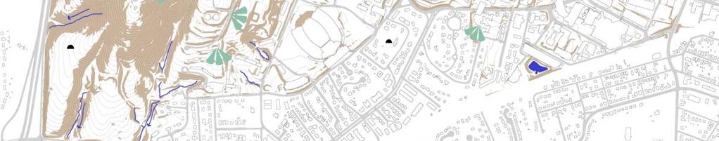

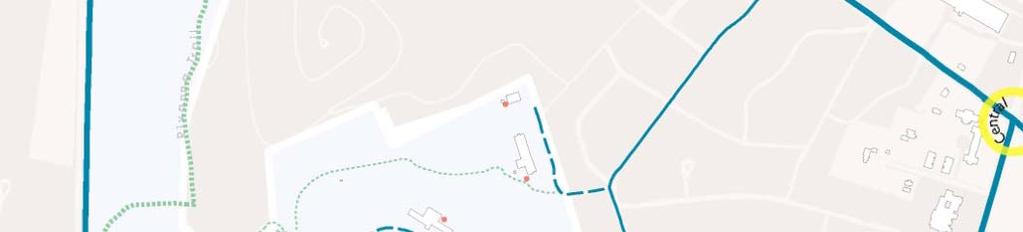
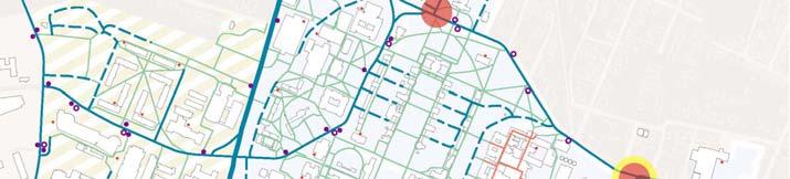
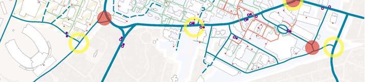
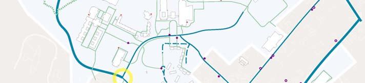
11 Natural Features + Characterized by hilly terrain to the west + Topography, drainages, vistas and views, riparian areas CO OMBINED MAPS

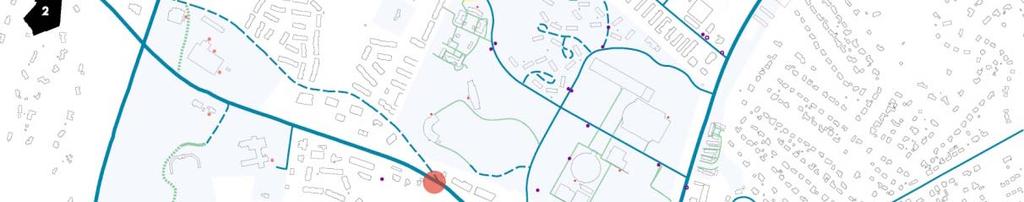


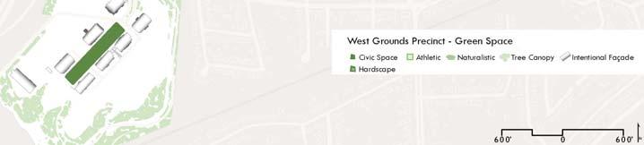
12 Linkages + Defines neighborhoods + Road and transit system + Pedestrian, bicycle and trail use + Service and gateways CO OMBINED MAPS


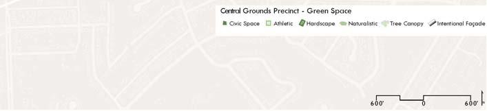
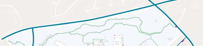
13 Green Space System + Heavily wooded, especially in west and north + Civic spaces, athletics and recreation, forested zones CO OMBINED MAPS


14 Proposed Green Space System + Expand tree canopy in riparian zones + Increase green space system and provide opportunities for circulation connections + Additional pedestrian/bicycles corridors connecting throughout Grounds CO OMBINED MAPS


 for future")

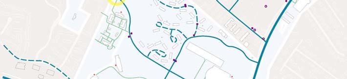
15 Development Volumes + Redevelopment zones to support growth of academic and residential facilities + Establishes heights and development volume (setbacks, build to) for future building sites + Addresses preservation and design landmarks CO OMBINED MAPS
16 West Grounds


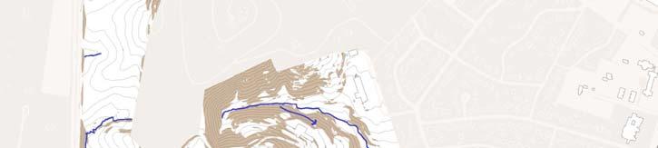


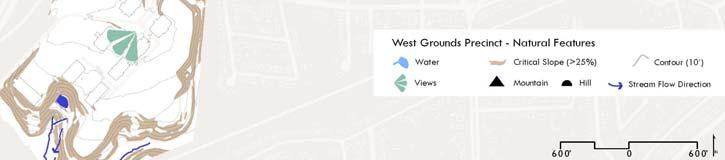
17 Natural Features + Characterized by hilly terrain to the west + Topography, drainages, vistas and views, riparian areas WEST GRO OUNDS


18 Linkages + Defines neighborhoods + Road and transit system + Pedestrian, bicycle and trail use + Service and gateways WEST GRO OUNDS


19 Green Space System + Heavily wooded, especially in west and north + Civic spaces, athletics and recreation, forested zones WEST GRO OUNDS


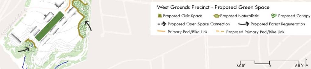
20 Proposed Green Space System + Expand tree canopy in riparian zones + Increase green space system and provide opportunities for circulation connections + Additional pedestrian/bicycles corridors connecting throughout Grounds WEST GRO OUNDS


21 Development Volumes + Redevelopment zones to support growth of academic and residential facilities + Establishes heights and development volume (setbacks, build to) for future building sites + Addresses preservation and design landmarks WEST GRO OUNDS
22 WHITEHEAD EXISTING CONDITIONS
23 WHITEHEAD PROPOSED CONDITIONS
24 ALDERMAN EXISTING CONDITIONS
25 ALDERMAN PROPOSED CONDITIONS
26 Central Grounds


27 Natural Features + Characterized by hilly terrain to the west + Topography, drainages, vistas and views, riparian areas CEN NTRAL GR ROUNDS


28 Linkages + Defines neighborhoods + Road and transit system + Pedestrian, bicycle and trail use + Service and gateways CEN NTRAL GR ROUNDS


29 Green Space System and north + Heavily wooded, especially in west + Civic spaces, athletics and recreation, forested zones NTRAL GR CEN ROUNDS


30 Proposed Green Space System + Expand tree canopy in riparian zones + Increase green space system and provide opportunities for circulation connections + Additional pedestrian/bicycles corridors connecting throughout Grounds CEN NTRAL GR ROUNDS


 for future")

31 Development Volumes + Redevelopment zones to support growth of academic and residential facilities + Establishes heights and NTRAL development volume (setbacks, GR build to) for future building sites + Addresses preservation and design landmarks CEN ROUNDS
32 HEALTH SYSTEM EXISTING CONDITIONS
33 HEALTH SYSTEM PROPOSED CONDITIONS
34 BRANDON EXISTING CONDITIONS
35 BRANDON PROPOSED CONDITIONS
36 North Grounds


37 Natural Features + Characterized by hilly terrain to the north and center + Topography, drainages, vistas and views, riparian areas NO ORTH GRO OUNDS


38 Linkages + Defines neighborhoods + Road and transit system + Pedestrian, bicycle and trail use + Service and gateways NO ORTH GRO OUNDS


39 Green Space System and north + Heavily wooded, especially in west + Civic spaces, athletics and ORTH recreation, forested zones GRO NO OUNDS


40 Proposed Green Space System + Expand tree canopy in riparian zones + Increase green space system and provide opportunities for circulation connections + Additional pedestrian/bicycles corridors connecting throughout Grounds NO ORTH GRO OUNDS


 for future")

41 Development Volumes + Redevelopment zones to support growth of academic and residential facilities ORTH + Establishes heights and development volume (setbacks, GRO build to) for future building sites + Addresses preservation and design landmarks NO OUNDS
42 NORTH GROUNDS EXISTING CONDITIONS
43 NORTH GROUNDS PROPOSED CONDITIONS
44 Next Steps: Final report includes: Description of precinct planning process Direction for use in the 3 precincts Visualization for example areas Report will be available on the Office of the Architect website, teamed with the Grounds Plan, October 2009 Follow-up worksession meetings will be held for the 3 precincts North Grounds worksession is being scheduled for November 2009
WASHINGTON COUNTY OREGON
 WASHINGTON COUNTY OREGON July 9, 2009 Revisions to Chapter 2 of the Bethany Community Plan The North Bethany Subarea Plan Exhibit pages 7 and 8 The sections for the Core and Flexible Streets were amended
Master Planning Council
 Master Planning Council Office of the Architect, University of Virginia March 6, 2006 Grounds Plan Process Grounds Plan Framework The Office of the Architect for the University will develop a comprehensive
CAMPUS MASTER PLAN DRAFT PLAN UPDATE JANUARY
 NEW MEXICO HIGHLANDS UNIVERSITY CAMPUS MASTER PLAN DRAFT PLAN UPDATE JANUARY 27 2010 MASTER PLANNING GOALS TO BALANCE THE STRATEGIC GOALS OF THE UNIVERSITY WITH THE PHYSICAL CAMPUS through the assessment
Presentation of the Staff Draft. July 17, 2014 SSRVP Team, Area 3
 Presentation of the Staff Draft July 17, 2014 SSRVP Team, Area 3 Presentation Overview Introduction Plan Framework Plan Recommendations Implementation Next Steps and Request for Public Hearing on September
University of Saskatchewan CAMPUS MASTER PLAN. Senate Meeting Preliminary Presentation. April 21, 2018 DIALOG ECS DA WATT
 University of Saskatchewan CAMPUS MASTER PLAN Senate Meeting Preliminary Presentation April 21, 2018 DIALOG ECS DA WATT project process presentation agenda Stakeholder Engagement Project Control phase1
NORTH DISTRICT. Description
 VI plan and major recommendations district plans north disrict NORTH DISTRICT Description The North District comprises approximately 105 acres and is bounded by two important bio-habitats and corridors
include playgrounds, sports fields, community gardens and picnic areas.
 DEVELOPMENT PLAN OPEN SPACE SYSTEM OPEN SPACE SYSTEM The neighborhood provides for a range of open space types. The Village Square is an important open space in the neighborhood. It serves as a gathering
URBAN DESIGN BRIEF. Terms of Reference. Purpose. When is an Urban Design Brief Required
 Purpose An Urban Design Brief (UDB) is intended to describe and illustrate proposed designs for new development projects and demonstrate how the City s Urban Design Guidelines and other City policies have
University of Virginia Grounds Plan Presentation
 University of Virginia Grounds Plan Presentation David J. Neuman, FAIA, Architect for the University Julia Monteith, AICP, Senior Land Use Planner September 26, 2007 Master Planning Council April: Introduction
The University of Vermont #AMPUSª-ASTERª0LAN. & Design Guidelines. May 2006
 The University of Vermont #AMPUSª-ASTERª0LAN & Design Guidelines May 2006 The University of Vermont Campus Master Plan & Design guidelines May 2006 The University of Vermont Campus Master Plan & Design
THE University Grounds comprise the lands and
 Section Planning Framework & Systems Planning Framework THE University Grounds comprise the lands and systems that support the physical activities of the institution: the organization of land use, natural
WELCOME and introduction
 1 WELCOME and introduction Mobility Hub Locations within Burlington STUDY OVERVIEW STUDY OBJECTIVES The City of Burlington is developing four Area Specific Plans, one for each of Burlington s Mobility
OPEN SPACE TYPES. SIZE 8 acres. SIZE 20 acres. SIZE 1 acre
 TYPICAL CHARACTERISTICS OPEN SPACE TYPES OPEN SPACE TYPES The neighborhood contains an extensive variety of open space types. Most of these spaces incorporate multiple uses and activities, so that each
CAL POLY MASTER PLAN UPDATE, March 2015
 Some Key Themes in the General Guiding Principles Academic Mission The plan must foremost advance the University s academic mission and student success. Foresight and Adaptability The plan should take
New-Cast Mixed-use Development Proposal King Street West, Newcastle, Ontario
 URBAN DESIGN BRIEF New-Cast Mixed-use Development Proposal King Street West, Newcastle, Ontario TABLE OF CONTENTS: 1.0 Executive Summary 2.0 Creating Vibrant and Sustainable Urban Places: Excerpts from
Part 2 Common Elements
 WHITE FLINT SECTOR PLAN Round Table Discussion: Part 2 Common Elements October 8, 2007 The M-NCPPC 1 Role Regional Marketplace North Bethesda s Downtown with a Conference Center District The M-NCPPC 2
City of Long Beach. creating vibrant and exciting places
 City of Long Beach creating vibrant and exciting places Land Use Element Urban Design Element Overview of the two draft General Plan elements Discuss areas of change Economic goals of the plans Case study
PINE CURVE REZONING. BACKGROUND Purchased as two parcels in 2001 and 2002
 BACKGROUND Purchased as two parcels in 2001 and 2002 WHAT THE PROJECT IS AND IS NOT A Rezoning establishes the land use standards for Annexed and Zoned Greater Downtown District Historic Center September
Preliminary Subdivision Plan
 Preliminary Subdivision Plan 704-525-8000 Suite 1200 Executive Summary the east huntersville area development plan provides a series of development initiatives and public improvements for land east of
URBAN DESIGN BRIEF. 2136&2148 Trafalgar Road. Town of Oakville
 URBAN DESIGN BRIEF 2136&2148 Trafalgar Road Town of Oakville Prepared By: METROPOLITAN CONSULTING INC For 2500674 Ontario Inc November 2016 TABLE OF CONTENTS Page No. 1.0 Introduction/Description of Subject
South Norfolk Municipal Facilities Study
 South Norfolk Municipal Facilities Study City of Chesapeake, VA P r e s e n t e d b y H B A A r c h i t e c t u r e & I n t e r i o r D e s i g n, I n c. 1 Purpose of the Study (Phase I) Identify potential
Seneca Meadows. Block 4 Locate office, technology, and medical development adjacent to I Screen views of garage structures from I-270.
 Seneca Meadows Seneca Meadows has an industrial park in its southern end and a mixed-use employment area planned for the north end. The district benefits from extensive I-270 visibility, stream valley
Table of Contents. Elm Avenue Improvement Plan City of Waco, Texas. Introduction 1. Existing Context 1 Figure 1 2.
 Table of Contents Introduction 1 Existing Context 1 Figure 1 2 Plan Guidelines 3 Future Urban Form 4 The West-End 4 Main Street 6 The East-End 7 Figure 2 9 Public Improvement Recommendations 7 General
CAMPUS MASTER PLAN, AMENDMENTS
 CAMPUS MASTER PLAN AMENDMENTS CAMPUS MASTER PLAN, 2015-2025 AMENDMENTS OCTOBER 2016 PLANNING, DESIGN & CONSTRUCTION DIVISION AMENDMENTS UNIVERSITY OF FLORIDA COMPREHENSIVE MASTER PLAN OCTOBER 2016 1. Acreage
Downtown Streetscape Manual & Built Form Standards
 City of Guelph Downtown Streetscape Manual & Built Form Standards July 2014 Prepared by Brook McIlroy Inc. in association with Unterman McPhail Associates and McCormick Rankin Inc. City of Guelph Downtown
NEC of Central Avenue and Indian School Road
 NEC of Central Avenue and Indian School Road For this location, there are two applicable plans that provide guidance on development. The two plans include the Indian School Specific Plan (1991) and the
City of Grande Prairie Development Services Department KENNEDY DEVELOPMENTS LTD. OUTLINE PLAN OP-09-01
 City of Grande Prairie Development Services Department KENNEDY DEVELOPMENTS LTD. OUTLINE PLAN OP-09-01 July 27, 2009 TABLE OF CONTENTS 1.0 Introduction... 1 1.1 Plan Area Location & Context... 1 1.2 Ownership
Corridor Planning Area
 Corridor Planning Area PLANNING AREA DESCRIPTION Planning Area Boundaries The Corridor planning area generally includes the areas of the Village south of Belleview Avenue, west of Yosemite Street, north
SH 199 Corridor Master Plan. Community Meeting No. 2 May 31, 2017
 Community Meeting No. 2 May 31, 2017 Transportation Projects On or Near SH 199 SH 199 from 0.3 miles south of FM 1886 to south end of Lake Worth bridge Construct freeway mainlanes and frontage roads 10-Year
Development Agreement Public Meeting. June 26, 2013
 Development Agreement Public Meeting June 26, 2013 Process 2007 2008 2009 2010 2011 2012 2013 Neighborhood Conservation District Petition Process Original Master Plan presented Community Forum Glen Lennox
2015 Campus Master Plan Update
 September 15, 2015 2015 Campus Master Plan Update Campus and Community Analysis Summary Presentation A G E N D A 1. Scope & Schedule of the Master Plan 2. Planning Principles & Draft Goals 3. Background
Allston Brighton Boston College Task Force Meeting. Brighton Marine Health Center March 27, 2013
 Allston Brighton Boston College Task Force Meeting Brighton Marine Health Center March 27, 2013 Presentation Overview 6:30-6:35 Introductions & Announcements 6:35-6:40 Overall Project and Review Schedule
Status Report: MD 355 Project
 Status Report: MD 355 Project OCTOBER 2006 M-NCPPC MONTGOMERY COUNTY PLANNING DEPARTMENT Summary of Community Comments, and break to the Results of the MD 355 Participation Session Brookside Gardens -
Courthouse Square Planning & Urban Design Study. Courthouse Square Working Group #13 October 15, 2014
 Courthouse Square Planning & Urban Design Study Courthouse Square Working Group #13 October 15, 2014 1 Courthouse Square Process Working Group Community Courthouse Square Advisory Groups & Civic Associations
Section4 Design Vision & Implementation Plan
 Section4 Design Vision & Implementation Plan W Woodschurch Rd 4.1 Design Focus Areas The Framework Plan is simply the starting point for directing the design and implementation of a wide range of transportation
Subarea 5 Southern Gateway. Vision. Mobility The proposed street network will create developable blocks that are scaled appropriately for the area.
 southern gateway 194 Southern Gateway extends south of I-435 to 123 rd Street and includes the area past the Blue Valley Parkway division. This area is adjacent to major office centers such as the College
District Facilities Master Plan
 W o r k s h o p B o a r d District Facilities Master Plan February 29, 2012 BACKGROUND + CONTEXT ANALYSIS OPTIONS RECOMMENDATIONS NEXT STEPS DFMP AGENDA BACKGROUND + CONTEXT ANALYSIS OPTIONS RECOMMENDATIONS
Vision & Land Use. Discussion. Historic Preservation Plan. Foggy Bottom Campus Plan:
 Vision & Land Use Foggy Bottom Campus Plan: 2006-2025 Historic Preservation Plan Discussion Community Meeting Presentation August 2, 2006 Presentation Format Overview Sherry Rutherford, GW Foggy Bottom
A. WHAT IS A GENERAL PLAN?
 I. Introduction A. WHAT IS A GENERAL PLAN? A general plan is the planning guideline for the future of a city. It contains goals and policies which regulate urban development, the protection of the natural
242 neighborhoods NEIGHBORHOOD 4: JORDAN AVENUE CORRIDOR
 NEIGHBORHOOD 4: JORDAN AVENUE CORRIDOR Aerial View of Jordan Avenue Corridor EXISTING CHARACTER The Jordan Avenue Corridor is the portion of North Jordan Avenue that extends north from East Third Street
Comprehensive Plan ADOPTED APRIL 2014
 Comprehensive Plan ADOPTED APRIL 2014 8 8. Outstanding Recreational & Cultural Opportunities We are proud of our community s parks and recreation system. Our community will ensure that the legacy of our
Rock Spring Master Plan Community Meeting #8: Preliminary Recommendations
 Rock Spring Master Plan Community Meeting #8: Preliminary Recommendations July 18, 2016 Ι Walter Johnson High School Andrea Gilles, andrea.gilles@montgomeryplanning.org Ι www.montgomeryplanning.org/community/rockspring/
Stafford County Strategic Plans
 Stafford County Strategic s Strategic Department Description Date Adopted Board of Supervisors Priorities Fiscal Responsibility Education Public Safety Infrastructure Economic Development Service Excellence
FUNDAMENTAL BUILDING BLOCKS
 FUNDAMENTAL BUILDING BLOCKS THE WEB OF GIBSONS - EXISTING Lacks Community Structure and Support Circulation, surface water flow and buildings are disjointed from the community Social neighbourhoods are
Planned Development Review Revisions (Project No. PLNPCM )
") Planned Development Review Revisions (Project No. PLNPCM2014-00139) Standard residential development Planned Development Example: Smaller lot sizes than what is allowed to create open space amenity. What
Planned Development Review Revisions (Project No. PLNPCM2014-00139) Standard residential development Planned Development Example: Smaller lot sizes than what is allowed to create open space amenity. What
Hilltop Town Garden City
 Page 1 of 14 4.1 CITY PLANNING PRECEDENTS Oakridge is a Hybrid of the positive aspects of these urban design strategies that integrate nature within the city: Hilltop Town Garden City Using topography
The Chinese University of Hong Kong Campus Master Plan Stage 3 Stakeholders' Engagement Report
 The Chinese University of Hong Kong Campus Master Plan Stage 3 Stakeholders' Engagement Report CONTENTS 1.0 OVERVIEW... 2 2.0 KEY FINDINGS... 3 2.1 Conserving Places of Value... 3 2.2 Places for Academic
Physical Structure. This historic image from 1882 emphasizes the dramatic topography that distinguishes Cornell s setting at the top of East Hill.
 Physical Structure The natural, agrarian and urban setting for Cornell s campus is a precious resource to protect and enhance. It has also shaped the physical structure of the campus. Buildings, roads
Introduction. Chapter 1. Purpose of the Comprehensive Plan Plan Organization Planning Process & Community Input 1-1
 Chapter 1 Introduction Lakewood 2025: Moving Forward Together Purpose of the Comprehensive Plan Plan Organization Planning Process & Community Input 1-1 Purpose of the Comprehensive Plan The Comprehensive
SCHEDULE THREE TO THE DEVELOPMENT PLAN OVERLAY EASTERN GOLF COURSE KEY REDEVELOPMENT SITE
 DD/MM/YY SCHEDULE THREE TO THE DEVELOPMENT PLAN OVERLAY Shown on the planning scheme map as DPO3 EASTERN GOLF COURSE KEY REDEVELOPMENT SITE 1.0 A permit may be granted before a development plan has been
University City Area Plan
 University City Area Plan Economic Development & Planning Committee June 6, 2007 Purpose of the Meeting Provide an overview of the plan Set a date for public comment with City Council Mallard Creek Church
BENJAMIN BANNEKER PARK FRAMEWORK PLAN (PLAN ADOPTION)
") BENJAMIN BANNEKER PARK FRAMEWORK PLAN (PLAN ADOPTION) COUNTY BOARD MEETING DECEMBER 16, 2017 County Board Consideration: Adopt the Benjamin Banneker Park Framework Plan and Design Guidelines Framework
BENJAMIN BANNEKER PARK FRAMEWORK PLAN (PLAN ADOPTION) COUNTY BOARD MEETING DECEMBER 16, 2017 County Board Consideration: Adopt the Benjamin Banneker Park Framework Plan and Design Guidelines Framework
2.0 AREA PLANS. Lakeside Business District. Lakeside Business District Land Use Categories:
 Lakeside Business District Lakeside Business District Land Use Categories: Campus Commercial Campus Commercial means a mixture of uses which includes corporate offices, office parks, hotels, commercial,
neighborhoods NEIGHBORHOOD 5: EAST OF JORDAN
 NEIGHBORHOOD 5: EAST OF JORDAN East of Jordan Neighborhood EXISTING CHARACTER East of Jordan is defined as the residential neighborhood east of North Jordan Avenue and south of the railroad tracks. This
Comprehensive Plan Advisory Panel Meeting #3
 Comprehensive Plan Advisory Panel Meeting #3 November 7, 2016 Agenda 1. September 19 th Meeting Notes 2. Summary of Focus Areas Charrette 3. Heart of the City Focus Area a. HOC2/Station Areas Concept &
PUBLIC OPEN HOUSE HURONTARIO-MAIN CORRIDOR SECONDARY PLAN
 PUBLIC OPEN HOUSE HURONTARIO-MAIN CORRIDOR SECONDARY PLAN Tuesday, February 28, 2012 6pm 9pm 1 st Floor Atrium, City Hall 2 Wellington Street West, Brampton 1 POLICY FRAMEWORK The 2006 Provincial Growth
University of Washington Burke Gilman Trail Corridor Study
 Civil Engineering Landscape Architecture Environmental Restoration Planning University of Washington Burke Gilman Trail Corridor Study Dave Rodgers, PE, LEED AP March 10, 2011 Guiding Principles Design
NEIGHBORHOOD 3: UNIVERSITY EDGE
 NEIGHBORHOOD 3: UNIVERSITY EDGE Aerial View of North Indiana Avenue EXISTING CHARACTER The University Edge neighborhood represents the primary town/gown interface between the campus and the city of Bloomington,
Chicago Ilinois, USA Noelle Higgins & Betsy Severtsen
 Chicago Ilinois, USA Noelle Higgins & Betsy Severtsen City in a Garden - City motto Millenium Park, opened in 2004 URSCorp. http://www.urscorp.com/ URS_Division/projectsDetail. Ogden Park Chicago, http://
Description of Preferred Alternative
 Chapter 2 Description of Preferred Alternative 2.1 Introduction This chapter of the programmatic Sammamish Town Center Sub-area Plan Final EIS provides a more detailed description of the Preferred Alternative
LAND USE AMENDMENT DOWNTOWN COMMERCIAL CORE (WARD 7) MACLEOD TRAIL SE AND 5 AVENUE SE BYLAW 254D2017
 MACLEOD TRAIL SE AND 5 AVENUE SE BYLAW 254D2017") Page 1 of 10 EXECUTIVE SUMMARY This Land Use Amendment application seeks to redesignate a full downtown block (currently the YWCA site) from a Direct Control based on the CM-2 District (Land Use Bylaw
Page 1 of 10 EXECUTIVE SUMMARY This Land Use Amendment application seeks to redesignate a full downtown block (currently the YWCA site) from a Direct Control based on the CM-2 District (Land Use Bylaw
Future Land Use SAMPLE RECOMMENDATIONS
 SAMPLE RECOMMENDATIONS Future Land Use The Future Land Use Chapter of the Master Plan builds upon prior chapters examining the existing conditions in their respective topic areas to present a comprehensive
The Auburn Plan Designing the Future of Auburn February 28, 2005
 The Auburn Plan Designing the Future of Auburn February 28, 2005 Block-by-Block Bicycle Tour Aerial survey Focus Group Meetings September 7 and 8 Design Workshops October 11, 14, and 21 Revitalization
UO North Campus Conditional Use Permit Project
 UO North Campus Conditional Use Permit Project Project Overview and Background November 2017 Campus Planning, CPFM Project Boundary Previous Conditional Use Permit: 1988 to 2012 Site History Statement
NEIGHBORHOOD 7: FEE LANE AREA. Aerial View of Briscoe and McNutt Dormitories
 NEIGHBORHOOD 7: FEE LANE AREA Aerial View of Briscoe and McNutt Dormitories Fee Lane Area Map Briscoe Dormitory 278 neighborhoods NEIGHBORHOOD 7: FEE LANE AREA EXISTING CHARACTER The Fee Lane Area neighborhood
6.3 Elyria-Swansea. Basin Snapshot
 6.3 Elyria-Swansea The Elyria-Swansea Map Unit is comprised of the I-70 & Colorado Blvd basin (0060-01) and the I-70 & York basin (0060-02) from the Denver Storm Drainage Master Plan (SDMP) and has a total
Draft Memorandum #1: Goals and Vision for Revitalization
 Keizer Revitalization Plan Draft Memorandum #1: Goals and Vision for Revitalization Submitted to: City of Keizer April 12, 2018 (revised) Prepared By: Angelo Planning Group and Otak, Inc. Project No. 17482.A
APPENDIX D: Visual and Aesthetic Conditions for NCCU Station Refinement. Durham-Orange Light Rail Transit Project
 APPENDIX D: Visual and Aesthetic Conditions for NCCU Station Refinement Durham-Orange Light Rail Transit Project October 2016 1. Introduction The Combined FEIS/ROD summarizes the effects of the D-O LRT
St. Kevin s Area Planning Collaborative
 Table of Contents page 2 EXECUTIVE SUMMARY 3 MISSION STATEMENT 4 NEIGHBORHOOD CONTEXT 6 STREET CHARACTER 7 SITE PARAMETERS 9 COMMUNITY CHARRETTE - VISIONING GROUP TABLE 1 11 GROUP TABLE 2 12 GROUP TABLE
Award Winners. Arlington City Center Winner Built Award
 Arlington City Center Built Award Great urban design catalyst project to spurn other similar developments within the context of downtown Arlington and UT Arlington Campus Great example project utilizing
Courthouse Square Planning & Urban Design Study Citizens Advisory Commission on Housing
 Courthouse Square Planning & Urban Design Study Citizens Advisory Commission on Housing September 11, 2014 Jason Beske, Principal Planner Urban Design and Research, CPHD 1 Study Area Context Area Courthouse
DP Hillcrest Drive Lakecrest Townhouse Development Permit Council Presentation. April 28, 2015
 DP1429 3075 Hillcrest Drive Lakecrest Townhouse Development Permit Council Presentation April 28, 2015 Background June 16, 2009 Council approved issuance of Development Permit No. 1055 with variances for
PINE CURVE REZONING. Property does not meet criteria for open space preservation and is not a candidate for a park
 PINE CURVE REZONING BACKGROUND Purchased as two parcels in 2001 and 2002 Annexed and Zoned Greater Downtown District Historic Center September 25, 2002 and October 7, 2002 WHAT THE PROJECT IS AND IS NOT
Town of Sahuarita Open Space Plan Element. University of Arizona Planning Program Projects Team
 Town of Sahuarita Open Space Plan Element University of Arizona Planning Program Projects Team Introduction Planning students in the Planning Program Project Class Overall Goal Potential uses of $1.5 Million
theme 4 : Penn connects...
 38TH STREET STREETSCAPE WALNUT STREET STREETSCAPE GENERATIONAL BRIDGE LOCUST WALK RESTORATION SHOEMAKER GREEN 34TH STREET STREETSCAPE LOCUST WALK RESTORATION penn park SPRUCE STREET PLAZA HAMILTON WALK
C AMPUS MASTER PLAN THE C AMPUS PLAN
 THE CAMPUS PLAN. the campus plan The Middlebury Campus Master Plan is intended as a framework within which carefully balanced, incremental decisions may be judiciously made within a long-term vision. It
Germantown Forward Status Report to the Planning Board M NCPPC
 Germantown Forward Status Report to the Planning Board Germantown Forward March 27, 2008 What s new? CCT alignment Capital Improvement Program Agency partners Water quality conditions Sustainability Design
ANC 2A Presentation. November 9, 2006
 ANC 2A Presentation November 9, 2006 Introduction & Overview Applicants Boston Properties and KSI Services (project developers) The George Washington University (land owner) 2.66 acre site (former GW hospital
Urban Design Review Panel Submission. The Ottawa Train Yards - Office Development. 405 Terminal Avenue. 17 April Table of Contents.
 Table of Contents PHOTOGRAPHS OF EXISTING SITE CONDITION URBAN DESIGN BRIEF PART A: Summary and Response to City Urban Design Guidelines and Policies PART B: Site Specific Urban Design Objectives PART
CAMPUS MASTER PLAN 2016/17 PROCESS
 AGENDA Welcome and Introductions General update/schedule update Review of existing campus master plan, planned unit development and general downtown corridor Initial discussion regarding development agreement/standards/conditions
UNIVERSITY OF VIRGINIA BOARD OF VISITORS MEETING OF THE BUILDINGS AND GROUNDS COMMITTEE DECEMBER 11, 2008
 UNIVERSITY OF VIRGINIA BOARD OF VISITORS MEETING OF THE BUILDINGS AND GROUNDS COMMITTEE DECEMBER 11, 2008 BUILDINGS AND GROUNDS COMMITTEE Thursday, December 11, 2008 2:00 4:00 p.m. Lower East Oval Room,
PROTECT AND PROMOTE QUALITY OF LIFE AND LIVABILITY FOR THE CITIZENS OF GAINESVILLE THROUGH QUALITY URBAN DESIGN.
 Goals, & Urban Design Element PROTECT AND PROMOTE QUALITY OF LIFE AND LIVABILITY FOR THE CITIZENS OF GAINESVILLE THROUGH QUALITY URBAN DESIGN. GOAL 1 By 2003, the City shall adopt urban design standards
ADOPTED AT NOVEMBER 15, 2012 PACC MEETING
 ADOPTED AT NOVEMBER 15, 2012 PACC MEETING STAFF MEMORANDUM TO PACC-TECH TO: PACC-Tech FROM: Elaine K. Echols, AICP, Missy Creasy, AICP, and Julia Monteith, AICP TOPIC: Review of Area B Recommendations
Natomas Vision Plan and PLNP
 Natomas Vision Plan 20030171 and PLNP2014-00172 Department of Community Development Planning and Environmental Review Leighann Moffitt Sub-Agenda 1. Staff Presentation Leighann Moffitt, County Planning
NORTH CLAYMONT AREA MASTER PLAN COMMUNITY WORKSHOP #1 FEBRUARY 3, 2016
 NORTH CLAYMONT AREA MASTER PLAN COMMUNITY WORKSHOP #1 FEBRUARY 3, 2016 1. Introduction To the team and to the Plan Planning Partners The Claymont Community WILMAPCO New Castle County Claymont Renaissance
1.0 Circulation Element
 5/9/18 1.0 Circulation Element 1.1 Introduction As growth and development occur in Apache County, enhancements to its circulation system will be necessary. With time, more roads will be paved and air and
Tennessee Stormwater Management Program. Stormwater Management Site Assessment and Inventory Checklist. Quick Check o Vicinity Map within Watershed
 Tennessee Stormwater Management Program Project Name: Location: File Number: Reviewer: Date of Submittal: Review Date: Project Meeting Chronology: Type of Meeting: Date: Stormwater Management Site Assessment
Neighborhood Districts
 NEIGHBORHOOD DISTRICTS SEVEN MAIN DISTRICTS Neighborhood Districts While the Development Plan provides a broad-scale overview of the neighborhood, this section focuses on uses and relationships at the
City Council Special Meeting AGENDA ITEM NO. C.
 City Council Special Meeting AGENDA ITEM NO. C. DATE: 01/04/2019 TO: Honorable Mayor and City Council Members SUBJECT: Transit Villages Specific Plan project Study Session (Development Services Director
Sub Area 2: Downtown Overland Park
 Downtown 132 2.12 encompasses over 600 acres and extends between 71st Street and 87 th Street including Downtown Overland Park. The area is home to several individual historic sites and structures, including
Toronto Waterfront Revitalization
 Toronto Waterfront Revitalization Toronto Waterfront Revitalization Corp. Established 2001 Tripartite - Government of Canada, Province of Ontario, City of Toronto Master developer, comprehensive integrated
Presenting a Vision for Thread Lake
 Presenting a Vision for Thread Lake FEBRUARY 20, 2014 SPECIAL THANKS TO: International Academy of Flint Flint River Watershed Coalition South Saginaw Business and Resident Association South Side Neighborhood
Subarea 4 Indian Creek. Vision The combination of park networks and transportation amenities make Subarea 4 the greenest hub in the Corridor.
 indian creek 180 extends south from 101st Street to I-435. The I-435 and Metcalf intersection is one of the primary intersections in the Kansas City Metro Area. The area includes several residential neighborhoods
GUIDELINES EXHIBITION PLACE LOCATION: OBJECTIVES. Structure Plan URBAN DESIGN GUIDELINES
 Development in the Exhibition Place lands will be consistent with the following urban design guidelines. They provide a framework for new development of the lands and are to be read in conjunction with
Chapter 5: Natural Resources and Environment
 NATURAL RESOURCES AND ENVIRONMENT 5-1 5 Chapter 5: Natural Resources and Environment BACKGROUND AND INTENT Urban expansion represents the greatest risk for the future degradation of existing natural areas,
CAMPUS MASTER PLAN UPATE
 19 MAY 2016 CAMPUS MASTER PLAN UPATE Metropolitan Planning Organization AGENDA Introductions Planning Scope Observation & Analysis: Mobility Systems Campus Development Plan Mobility Planning Scenarios
URBAN DESIGN BRIEF NORTHVIEW FUNERAL HOME HIGHBURY AVE N, LONDON, ON
 URBAN DESIGN BRIEF NORTHVIEW FUNERAL HOME - 1490 HIGHBURY AVE N, LONDON, ON 1.1Purpose The intent of the following report is to identify an opportunity for redevelopment of two residential properties within
CONTENTS 6.1 URBAN DESIGN
 6-2 Urban Design and Sustainable Development 6.0 URBAN DESIGN AND SUSTAINABLE DEVELOPMENT CONTENTS 6.1 URBAN DESIGN 6.1.1 General Policies 6.1.2 The Public Realm 6.1.3 Streets and Blocks 6.1.4 Streetscapes
City of Missoula and Missoula County Open Space Planning Open House
 City of Missoula and Missoula County Open Space Planning Open House FEBRUARY 6, 2018 The following slides contain the display board content from the open house. Please use boards to answer questions in
DRAFT ROOSEVELT ROAD. District Recommendations. Figure 5.23 The Roosevelt Road Corridor
 CHAPTER 5 Figure 5.23 The Road Corridor Road will develop as a mixed-use corridor, emphasizing regional retail, west of the river and mixed-use development east of the river. KEY RECOMMENDATIONS 1. High