DISTRICT OF LAKE COUNTRY
|
|
|
- Claude Day
- 5 years ago
- Views:
Transcription
1 DISTRICT OF LAKE COUNTRY REPORT TO COUNCIL MEETING TYPE AND DATE: REGULAR MEETING JUNE 17, 2014 FROM: JULIET VAN VLIET, PLANNER SUBJECT: REZONE LOT 61 & 62 PLAN B13454 TO RU1 SINGLE FAMILY HOUSING FILE #: Z PURPOSE: To request Lot 61 and 62 Plan B13454 be rezoned for single family housing and for conservation uses to allow for the safe future development of the land in accordance with the Official Community Plan. RECOMMENDATION(S): THAT Zoning Amendment ( BC Ltd) Bylaw 893, 2014 be read a first time; AND THAT prior to second reading for Zoning Amendment ( BC Ltd) Bylaw 893, 2014, the applicant provide a surveyed Geotechnical plan for the property from the last six months, showing: current safe build areas on the property; that all structures are proposed beyond 10m from the ridgeline; areas where land disturbance is safe without the addition of structures; and also areas where no building or land disturbance would be considered safe; AND THAT prior to second reading for Zoning Amendment ( BC Ltd) Bylaw 893, 2014, cross sections of the top of the slope on the property be prepared by the applicant demonstrating the rezoning proposal: where the top of slope, safe line, zoning lines and no disturb areas are proposed along the slope; AND THAT prior to adoption of Zoning Amendment ( BC Ltd) Bylaw 893, 2014, covenants be registered on those parts of the subjects lands where no building will occur and/or where there will be no land disturbances; AND FURTHER THAT staff be directed to prepare an amendment to Subdivision and Development Servicing Bylaw No for the addition of servicing standards for the proposed P5 Conservation Area zone. EXECUTIVE SUMMARY: The proponent seeks to rezone the subject lands in accordance with the Official Community Plan Urban Residential designation. Review of the proposal and of the directions of the Official Community Plan have highlighted several development questions (environmentally sensitive areas, stability hazards, erosion hazards, steep visible hillsides and wild land fire hazards) on the subject property. A geotechnical engineer s review of the property in 2003 identified a safe line, identifying an area to the east of the subject property, fronting Tyndall Road, as safe for single family housing. The 2003 Geotechnical Report recommends that if modifications to the area in front of the setback line occur in the future including by removal of trees or other vegetation, the effects of the changes should be assessed by a geotechnical engineer. As there has been tree removal on the site since 2009, staff is recommending that the safe build line be reassessed by a geotechnical engineer. The geotechnical review should specify if there are areas on the subject property that should not be disturbed (i.e. by backyards or other land disturbances that do not constitute a building). S:\Council meetings\2014 Council\June 17\Z Report Lewis.docx
2 The Hillside Development Permit Area specifies that ridgelines should remain unaltered and protected and that structures must be setback 10m from ridgelines. Additionally, the 1997 Fire assessment for the property recommended a 10 meter minimum setback from the slope is recommended to further reduce the impacts of a wildfire on the houses along the top of the slope. The area outside the safe line roughly corresponds with an area identified as a sensitive ecosystem in the Regional District of Central Okanagan sensitive ecosystem index as well as an area of important biodiversity in the Okanagan Biodiversity Conservation Strategy. It is proposed that a new zone be created for the area outside the safe line: P5 Conservation Area. Staff has discussed the proposed P5 Conservation Area zone with the applicant who has indicated that the sloped area would be best used as a conservation area. The purpose of the P5 Conservation Area zone is to provide a zone for lands unsuitable for residential or urban uses due to their physiographic characteristics and/or their ecological significance. The proposed P5 Conservation Area zone would permit facilities for biodiversity conservation, passive recreation, heritage, wildlife and scenery viewing purposes. The applicant is aware that there are subdivision and infrastructure requirements (sewer, water, roads and trails, parklands and other requirements) that will be required in order to proceed with the future development and subdivision of the land. It is recommended that the subject properties be rezoned to RU1 Single Family Housing and P5 Conservation Area in accordance with Zoning Amendment ( BC Ltd) Bylaw 893, Application Type Rezoning File Number: Z Folios: and Proponent: Bill Lewis Owner(s): BC LTD Legal Description: That Part of Lot 62 Shown on Plan B13454; Sec9 Twp20 ODYD Plan 521, except Plan H18660 That Part of Lot 61 Shown on Plan B13454; Sec9 Twp20 ODYD Plan 521, except Plan H18660 PID Civic Address: TYNDALL RD TYNDALL RD Parcel Size: 7.12ha (17.79 Acres) 11.76ha ( Acres) OCP Designation: Residential Urban Zoning Designation: RR1 Rural Residential 1 ALR: N/A DP Area(s): Erosion; GHG Reduction/Resource Conservation; Hillside; Natural Environment; Stability; Water Supply: Proposed Municipal Water Sewer: Proposed Municipal Sewer Site Summary: Zoning: Use: North: RR1 Rural Residential 1 Vacant East: DC3 Direct Control 3 (20/20 Development) Vacant South: DC3 Direct Control 3 (20/20 Development) Vacant West: RR2 Rural Residential 2 Mix of vacant & residential 2 S:\Council meetings\2014 Council\June 17\Z Report Lewis.docx

3 S:\Council meetings\2014 Council\June 17\Z Report Lewis.docx 3

4 4 BACKGROUND/HISTORY: The applicant would like the properties to be rezoned to allow future development in accordance with the Official Community Plan. From: RR1 Rural Residential 1 To: RU1 Single Family Housing and P5 Conservation Area The Official Community Plan identifies the subject lands as appropriate for Urban Residential purposes. Urban infrastructure is needed for the properties to fully develop; urban infrastructure (sewer, water, frontage improvements, parklands and other requirements) have not yet been extended to this area. If this rezoning application is successful, the applicant would be required to extend the urban infrastructure prior to subdivision or further development on the land (or wait for the infrastructure to be brought to the area by other nearby developments). Once the appropriate infrastructure is available, the applicant has stated that the intention is to develop the property with a 55+ retirement community. Staff have reviewed the application and due to several mapping indicators (topography, development permit & environmental mapping), it is being recommended that the property be zoned in accordance with the following: RU1 Single Family Housing, and P5 Conservation Area In accordance with the following figure: S:\Council meetings\2014 Council\June 17\Z Report Lewis.docx
5 5 From: RR1 Rural Residential 1 To: RU1 Single Family Housing Area From: RR1 Rural Residential 1 To: P5 Conservation Area S:\Council meetings\2014 Council\June 17\Z Report Lewis.docx
6 6 The P5 Conservation Area zone is a newly created zone. This zone has been developed to allow land that has ecological significance and/or land that has been identified as hazardous for residential or urban development due to the geographic characteristics to be classified and used appropriately. o Principle uses: conservation area, passive recreation. o Secondary uses: facilities for biodiversity conservation, passive recreation, heritage, wildlife and scenery viewing purposes. o o Land within the P5 Conservation Area may be publicly or privately used. It is recognized that there are some uses that can complement the conservation and passive recreation uses including facilities for biodiversity conservation, passive recreation, heritage, wildlife and scenery viewing purposes. At the time of subdivision, the requirements of subdivision will be considered including roads, frontage improvements, water, sewer, trails, parkland and other requirements. DISCUSSION/ANALYSIS: Site Description: The land is hectares (46.9 acres) in total (Lot 61 = ha; Lot 62 = 7.19 ha) The eastern boundary of the land fronts on Tyndall Road. The land slopes down from Tyndall road towards the west; the land is quite flat to the east and the western portion of the property is very steep (over 40%). Tree removal has occurred on the flat portion of the property over the last several years. Current Development Potential: With the current RR1 Rural Residential 1 zoning of the land, there is limited development potential (the two parcels may have potential to be subdivided into 4 lots). The land has been identified as Residential Urban within the OCP; this designation provides the owner with an opportunity to rezone the land to an urban classification. The RU1 Single Family Housing zone allows 500m 2 lots. Some areas on the subject lands are not suitable for development. If rezoned as outlined in this report, 9.6 hectares could be used for residential development and 9.35 could be used for conservation. This proposal could net between 50 and 150 lots once roads and other subdivision requirements are considered. Wild land fire hazards have been assessed for this site in previous years. Among other recommendations, building setbacks of 10m from the top of the slope were recommended in the 1997 Wildfire Suppression Assessment (Schedule H). Off Site Considerations: Infrastructure is an ongoing consideration in this part of Lake Country. o Road is currently gravel and would need to be upgraded. o Sewer & water are not currently in the area. o It is envisioned that other development in the area will be bringing the required infrastructure into the area prior to these lands being subdivided. APPLICABLE POLICIES AND LEGISLATION: Local Government Act Division 7 Zoning and Other Development Regulations provides the District with authority to zone land within the municipality. Official Community Plan: Growth through residential development is encouraged by the Plan (section 4.2). Aside from the constraints to growth identified in section 4.4, the Identified Growth Areas map (Map 4) indicates this to be an area identified for future growth. S:\Council meetings\2014 Council\June 17\Z Report Lewis.docx
7 The subject lands include significant constraints to growth on the subject properties including environmentally sensitive areas, steep slopes not well suited to accommodate new development and terrain stability concerns. The proposal intends to address these constraints to growth, including servicing potential in the future. Map 1 Future Land Use designates the site as Urban Residential (section 17). Map 6, Road Network Plan, identifies Tyndall Road as a Connector Road. Maps 17, 18, 19 and 20 identify this land as being within Natural Environment, Stability Hazard, Hillside, Erosion Hazard and Greenhouse Gas Reduction and Resource Conservation Development Permit Areas. Section 23.4 of the OCP, Relationship with Zoning Bylaw, includes a table which outlines how the OCP designations correspond with Zoning Bylaw Classifications; OCP Designation Corresponding Zoning Classification Urban Residential* RU1 Single Family Housing RU6 Two Dwelling Housing RU M Single Family Housing Mobile Home RM2 Low Density Row Housing DC5 Crystal Waters DC7 Cadence at the Lakes P1 Public Park & Open Space C2 Neighbourhood Commercial *Additional zones may be accommodated within these categories only if consistent with the intent of the Future Land Use Designation. o The RU1 Single Family Housing zone is consistent with the above table. o The proposed P5 Conservation Area zone is consistent with the intent of the Official Community Plan designation since areas hazardous to residential and urban development and important ecological areas are found throughout Lake Country. This is discussed in section 4.4, constraints to growth. o The OCP specifies that parks and conservation sites may be identified for heritage, environmental or recreational purposes (section 15.1). The Plan Infrastructure, Services and Utilities goals objectives and policies include expand and improve public infrastructure to meet all required servicing levels and requiring that developers to pay for all new or expanded infrastructure needed for development. The Plan Housing goals, objectives and policies support new residential development which is a mixture of housing types including multiple unit housing, affordable housing and rental housing. This proposal does not support these goals as single unit housing is proposed. The Plan Environment and Sustainability goals, objectives and policies seek to o Minimize the environmental impacts of new development, o Use Sensitive Ecosystem Inventory data to identify and maintain environmentally sensitive areas, species at risk and habitat linkages, o Ensure that development does not disrupt corridors between natural areas, o Encourage voluntary placement of conservation covenants, dedication of land or zoning changes to protect sensitive ecosystems, Allow developers who protect land through conservation covenants or land dedication to use the original site area to calculate density and floor area ratio for projects, Promote sustainable development with minimal environmental impact, Regulate development on known unstable or erodible terrain to ensure site safety, and Provide clear development guidelines for safe and environmentally sensitive development. 7 S:\Council meetings\2014 Council\June 17\Z Report Lewis.docx
8 8 Zoning Bylaw: The land is currently zoned RR1 Rural Residential 1. This zone would permit lots of a minimum of 4 ha. The RU1 Single Family Housing zone permits 500m 2 lots. The District zoning bylaw does not currently have a zone for the purposes of conservation. For the subject lands that are sensitive to development, the P5 Conservation Area zone is proposed. Subdivision and Development Servicing Bylaw: Upon subdivision and development of the lands, the applicant will be required to provide urban servicing for the areas zoned RU1 Single Family Housing: o highway and walkway improvements, o sidewalk, curb & gutter o water distribution system, o community sewer, storm drainage system, o drainage, sediment & erosion control o slope stability, o street lighting, o underground wiring. Staff is recommending that Council authorize a review of the Subdivision and Development Servicing Bylaw to ensure that appropriate servicing standards are provided for the P5 Conservation Area zone. Lakestone Master Plan Frontage improvements including a Trail network along Tyndall Road are illustrated in this policy. INTERGOVERNMENTAL IMPLICATIONS: Interior Health Authority Community Sanitary sewer would be required for this form of urban residential development. INTERDEPARTMENTAL IMPLICATIONS: The owner should be aware of the required Subdivision & Development Servicing Requirements. At subdivision stage, the Community and Customer Services Department would like to see park land dedication and multi modal trail link connection along Tyndall Road. Clearing of trees has occurred on site; the owner should become aware of DLC burning bylaw. Engineering Department: As indicated in the geotechnical report for the subject properties prepared by Calibre Geotechnical Engineering Ltd. dated December, , the properties contain significant slopes and gullies to the west. At the time of the report, the geotechnical engineer established a setback line for homes and other structures constructed above the slopes and gullies. Engineering has some concern regarding the basis used for establishing the setback line. It is unclear in the report how the setback line was established and what the relationship is to the top of slope. Given that modifications to the area may have occurred in the 11 years since the report was completed and the setback area established, Engineering and Operations supports a reassessment of the site and the effects of any changes with regard to potential for erosion to the slope and the definition of the setback area. Once established, the set back should form the basis of a no disturb zone that should be enforced. COMMUNITY IMPLICATIONS: New residential development in this area is supported by the Official Community Plan. New residential development supports community growth goals. S:\Council meetings\2014 Council\June 17\Z Report Lewis.docx
9 ENVIRONMENTAL IMPLICATIONS: The Sensitive Ecosystems Index has identified the entire land as a Core Conservation Zone that is primarily comprised of Coniferous Woodlands, Grasslands and sparsely vegetated areas. The Biodiversity Conservation Strategy has identified the western (steeper) portion of the property as having Moderate relative biodiversity, High Conservation Ranking Class and High Habitat connectivity. Development Permit Mapping has identified stability hazards, erosion hazards, and hillside considerations on the western (steeper) portion of the subject lands. Natural Environment Development Permit considerations are identified for the entire subject property and all surrounding areas. Any negative environmental implications of the proposed rezoning are largely addressed by the P5 Conservation Area zone. COST, BUDGET CONSIDERATIONS AND FINANCIAL IMPLICATIONS: If the proposed use is developed on the property, the increased use on the site will result in additional tax revenue. It is not anticipated that this application will have any negative financial implications for the District. IMPACT ON STAFF CAPACITY AND WORKLOAD: This application (and any resulting development) will be processed using regular staff time; it is not anticipated that this application will affect staff capacity. SUMMARY/CONCLUSION: The proponent seeks to rezone the subject lands in accordance with the Official Community Plan Urban Residential designation. Review of the proposal and directions of the Official Community Plan have highlighted several development questions (environmentally sensitive areas, stability hazards, erosion hazards, steep visible hillsides and wild land fire hazards) on the subject property. It is proposed that a new zone be created for the area outside the area of the subject properties that has been determined to be safe for the intended single family housing use: P5 Conservation Area. The purpose of the P5 Conservation Area zone is to provide a zone to protect lands unsuitable for development due to their physiographic characteristics and/or their ecological significance. The applicant is aware that there are subdivision and infrastructure requirements (sewer, water, roads and trails, parklands and other requirements) that will be required in order to proceed with the future development and subdivision of the land. It is recommended that the subject properties be rezoned to RU1 Single Family Housing and P5 Conservation Area in accordance with Zoning Amendment ( BC Ltd) Bylaw 893, Respectfully Submitted, 9 Juliet Van Vliet, M.A. Planning Planner Planning & Development Department This report has been prepared in consultation with the following listed departments: S:\Council meetings\2014 Council\June 17\Z Report Lewis.docx
10 10 CONCURRENCES Department CAO Director of Planning and Development Director of Engineering and Operations Name Alberto De Feo Mark Koch Michael J. Mercer ATTACHMENTS: Attachment A Zoning Amendment ( BC Ltd) Bylaw 893, Attachment B Site Plan Attachment C Lot Siting Example Attachment D Zoning Analysis Attachment E Referrals Attachment F Site Photos Attachment G Geotechnical Assessment for Setback Line Proposed Subdivision Lots 61 and 62, Plan 521 Tyndall Road Lake Country BC by Calibre Geotechnical Engineering on September 15, 2003 received by the District of Lake Country on May 27, Attachment H 1997 Fire Assessment and 1993 Fuel Management Plan S:\Council meetings\2014 Council\June 17\Z Report Lewis.docx
11 11 Attachment A DISTRICT OF LAKE COUNTRY BYLAW 893 A BYLAW TO AMEND ZONING BYLAW 561, 2007 WHEREAS the Council of the District of Lake Country deems it appropriate to amend District of Lake Country Zoning Bylaw 561, NOW THEREFORE, the Council of the District of Lake Country, in open meeting assembled, enacts Zoning Amendment ( BC Ltd) Bylaw 893, 2014 as follows: 1) Amend Section by adding the following into the table in order: P5 Conservation Area 2) Amend Section 3.3 by adding the following definitions in alphabetical order: CONSERVATION AREA means an area of public or privately used land unsuitable for residential and urban development due to hazardous geographic characteristics and/or ecological significance; typical examples include but are not limited to steep slopes left in a natural state to prevent hazardous development conditions or land left in a natural state for the purpose of conserving indigenous plant life and providing sanctuary, habitat and breeding grounds for wildlife or fish. RECREATION, PASSIVE means activities that involve recreational pursuits in the outdoors with minimal geographic and environmental impacts, such as walking, viewing, interpreting, sitting and picnicking. 3) Amend Section 8.6 Minimum Landscape Buffers by adding the following, in order, into Table 8.1: Minimum Landscape Buffer Treatment Levels Schedule: Table 8.1: Minimum Landscape Buffer Treatment Levels Schedule Location Front Rear Yard Side Yard Public and Institutional Zones P ) Insert the following as Section 18.5 and renumber the remainder of Section 18: 18.5 Conservation Area PURPOSE The purpose is to provide a zone for lands unsuitable for residential and urban development due to hazardous geographic characteristics and/or ecological significance. These lands are intended to be maintained in a natural state, with the exception of development which enhances the natural environment or provides recreation or educational opportunities based on the natural resources of the area PRINCIPAL USES (a) conservation area S:\Council meetings\2014 Council\June 17\Z Report Lewis.docx
12 (b) recreation, passive SECONDARY USES (a) Facilities for biodiversity conservation, passive recreation, heritage, wildlife and scenery viewing purposes SUBDIVISION REGULATIONS (a) WIDTH The minimum lot width is N/A (b) DEPTH The minimum lot depth is N/A 12 (c) AREA The minimum lot area is N/A DEVELOPMENT REGULATIONS (a) SITE COVERAGE The maximum site coverage of buildings, driveways, and parking areas is 20%. (b) HEIGHT The maximum height is the lesser of 8.0 m or 1 ½ storeys. (c) FRONT YARD The minimum front yard is 6.0 m. (d) SIDE YARD The minimum side yard is 3.0 m, except it is 6.0m to a flanking street (e) REAR YARD The minimum rear yard is 3.0 m, except it is 6.0m to a flanking street AMEND SECTION 9.5 GENERAL PROVISIONS BY ADDING THE FOLLOWING INTO TABLE 9.1: PARKING SCHEDULE: Table 9.2: Parking Schedule Community, Recreational and Cultural Conservation Areas 0.5 spaces per hectare, except that conservation areas identified as hazard lands by a qualified professional do not have a minimum parking requirement OTHER REGULATIONS (a) ADDITIONAL REGULATIONS In addition to the regulations listed above, all other parts and definitions of the District of Lake Country Zoning Bylaw 561, 2007, of which this forms a part, shall apply; where there are discrepancies between this zone and other parts of this bylaw, the provisions of this zone shall take precedence. S:\Council meetings\2014 Council\June 17\Z Report Lewis.docx
13 13 5) Amend Schedule A to Zoning Bylaw 561, 2007 by changing the zoning classification of: That Part of Lot 61 Shown on Plan B13454; Sec9 Twp20 ODYD Plan 521, except Plan H18660, AND That Part of Lot 62 Shown on Plan B13454; Sec9 Twp20 ODYD Plan 521, except Plan H18660 From: RR1 Rural Residential 1 To: RU1 Single Family Housing, AND P5 Conservation Area in accordance with Schedule A. 6) This bylaw may be cited as Zoning Amendment ( BC Ltd.) Bylaw 893, READ A FIRST and SECOND TIME this day of June ADVERTISED on the and days of, 2014 and a Public Hearing held pursuant to the provisions of Section 890 of the Local Government Act on the day of, READ A THIRD TIME this day of, ADOPTED this day of, Mayor Corporate Officer I hereby certify the foregoing to be a true and correct copy of the Bylaw cited as Zoning Amendment ( BC Ltd) Bylaw 893, 2014 as adopted by the Municipal Council on the day of, Dated at Lake Country, BC Corporate Officer S:\Council meetings\2014 Council\June 17\Z Report Lewis.docx
14 14 Schedule A From: RR1 Rural Residential 1 To: RU1 Single Family Housing Area From: RR1 Rural Residential 1 To: P5 Conservation Area S:\Council meetings\2014 Council\June 17\Z Report Lewis.docx
15 15 Attachment B Site Plan S:\Council meetings\2014 Council\June 17\Z Report Lewis.docx
16 16 Attachment C Lot Siting Example S:\Council meetings\2014 Council\June 17\Z Report Lewis.docx
17 17 Attachment D Zoning Analysis Criteria: Zoning: Proposal RU1: Proposal P5: Minimum Lot Area (m 2 ) 4 ha 500m 2 n/a Lot Width (m) n/a Lot Depth (m) n/a Site Coverage (%) 10% 40% and together with 20% together with parking and driveways 50% parking and driveways Floor Area Ratio n/a n/a n/a The lesser of 2.5 storeys or 9.5m except it is the The lesser of 2.5 storeys or Building Height (m) lesser of 1.5 storeys or 9.5m except it is the lesser The lesser of 1.5 storeys 8m for accessory of 5.5m for accessory or 8m buildings and 13m for buildings and structures accessory structures Front Yard Setback (m) 6m 4.5m, 6m to a garage door 6m Rear Yard Setback (m) 10m, 3m for accessory buildings 6m, 1.5m for accessory buildings where lot width exceeds to depth read yard is 4.5m where one side yard is 4.5m. 6m to garage. 2m. 4.5m from a flanking street. 6m to garage. 2m. 4.5m from a flanking street. 6m to garage 3m. 6m to flanking street Side Yard Setback, Left (m) 3m. 4m to flanking street 3m. 6m to flanking street Side Yard Setback, Right (m) 3m. 4m to flanking street 3m. 6m to flanking street Other Requirements Parking Requirements 2 per dwelling unit 2 per dwelling unit Maximum 6 Attachment E Referrals Internal Referrals: Building Division: The proponent should be aware of the required Subdivision and Development servicing requirements. Clearing of trees has taken place. The proponent should be aware of the District Burning Bylaw. Fire Department: The fire department finds its interests unaffected. Community and Customer Services: At the time of subdivision, parkland dedication will be considered. In addition, at the time of subdivision, Tyndall road improvements will be considered and connectivity with future District trail networks will be considered. Engineering Department: As indicated in the geotechnical report for the subject properties prepared by Calibre Geotechnical Engineering Ltd. dated December, , the properties contain significant slopes and gullies to the west. At the time of the report, the geotechnical engineer established a setback line for homes and other structures constructed above the slopes and gullies. Engineering has some concern regarding the basis used for establishing the setback line. It is unclear in the report how the setback line was established and what the relationship is to the top of slope. Given that modifications to the area may have occurred in the 11 years since the report was completed and the setback area established, Engineering and Operations supports a reassessment of the site and the effects of any changes with regard to potential for erosion to the slope and the definition of the setback area. Once established, the set back should form the basis of a no disturb zone that should be enforced. At the time of subdivision the applicant will be required to address storm drainage, drainage, and sedimentation and erosion control and slope stability in accordance with the District Subdivision and Development Servicing S:\Council meetings\2014 Council\June 17\Z Report Lewis.docx
18 Bylaw. Specifically, the applicant must ensure that no silt, gravel or debris resulting from construction activity in the subdivision or development is allowed to discharge into existing drainage systems, natural drainage courses, water courses or onto highways or adjoining properties. In addition to meeting the requirement of the District Subdivision and Development Bylaw for storm drainage, storm drainage must not be directed toward the slopes and gullies on the west. The Owner s Engineer must also address issues related to safety and slope stability. The requirements and recommendations of the Tyndall Road and Area Master Drainage Plan prepared by Urban Systems Ltd. in 1995 for the Regional District of Central Okanagan (RDCO) remain valid and should be reviewed and addressed in the context of the proposed development. Additionally, the proposed zoning of the subject properties requires highways and walkways, sidewalk, curb and gutter, water system, community sewer, storm drainage, street lighting and underground wiring. The grades and elevations of the site may require a private sanitary sewer lift station. Paving of Tyndall road south of the subject property may be required. Structural base, sub base and any geotextile materials required for all on site roads and walkways must be retained within the property and cannot be extended into the Tyndall Road right of way. Road dedication on the Tyndall Road frontage may also be required. 18 External Referrals Interior Health: Provided that at development stage the subject property will be serviced by community sanitary sewer and community water systems, this office has no concern or objection to the proposed rezoning. S:\Council meetings\2014 Council\June 17\Z Report Lewis.docx


19 19 Attachment F Site Photos From the North East of the property looking south west towards Okanagan Lake Grassy slope to the south west of the subject lands S:\Council meetings\2014 Council\June 17\Z Report Lewis.docx


20 20 Steep treed slope and ravines in the northwest of the subject lands Steep treed slopes and ravines in the northwest of the subject lands S:\Council meetings\2014 Council\June 17\Z Report Lewis.docx
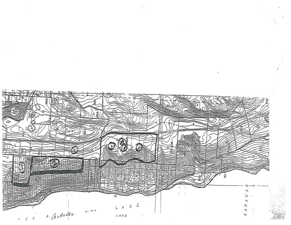
21 Attachment G CALIBRE GEOTECHNICAL ENGINEERING LTD. December 15, 2003 Calibre File No.: J Tyndall Properties Ltd Tyndall Road Winfield, B.C. V4V 1N8 Attention: Subject: Mr. Bill Lewis Geotechnical Assessment for Setback Line Proposed Subdivision, Lots 61 and 62, Plan 521 Tyndall Road, Lake Country, B.C. 1.0 Introduction At your request, Calibre Geotechnical Engineering Ltd., conducted a geotechnical assessment to establish a setback line along the crest of a large slope, on Lots 61 and 62, Plan 521, along Tyndall Road in Lake Country. This letter provides the results of our assessment and recommendations for the setback line. 2.0 Site Conditions and Geotechnical Assessment The following assessment is based on a site reconnaissance carried out on July 4, 2003, by the author of this letter. The site is situated in a rural setting in the Okanagan Centre area in the District of Lake Country. The property is vegetated with trees, scrub brush and grasses. The general location of the site is provided on the attached Site Plan. The east end of the site is essentially a plateau that slopes down slightly to the west, while the west end of the property slopes down to the west at angles of up to 35 degrees (70 percent). Several gullies have been cut into the natural plateau and slope area. These gullies have developed since the retreat of the glaciers from the last ice age, and trend in a general east-west direction. The site is underlain by soil deposits of glacial origin, consisting primarily of outwash sand and gravel, underlain by glacial till. No obvious signs of near surface groundwater features (i.e. springs) were observed in the gullies, or on the slope area, at the time of our assessment. CALiBRe 3835 Water Road, Kelowna, B.C. V1W 4G2 Phone: (250) Fax: (250) calibre@telus.net
22 Calibre File No.J Page 2 December 15, 2003 No evidence of flooding, mud flows, torrents of debris, land slip, rock falls, subsidence, tsunami or avalanche, or other potential geotechnical hazard features, were observed on the site. Based on our assessment, a setback line for homes and other building structures constructed above the slope and gullies has been established by Calibre Geotechnical Engineering Ltd. Points defining this setback line have been marked in the field with wooden stakes and orange flagging tape. We placed a total of 30 wooden stakes, and 1 piece of flagging on a fence, across the site. Straight lines drawn between the numbered stakes and flagging define a setback or safe line along the crest of the slope. Russell N. Shortt, British Columbia Land Surveyor, surveyed and plotted the locations of the stakes and flagging, and marked them on a Site Plan as: STK 1, STK 2, etc., up to STK 30 and FLAG 31 - see the attached Site Plan. 3.0 Discussion and Recommendations Calibre Geotechnical Engineering Ltd. has established a setback line for safe buildable areas as marked on the attached Site Plan. Recommendations for this setback line, as well as construction and drainage considerations for development, are outlined below. Based on our assessment, a setback line for homes and other building structures constructed above the slope and gullies has been established by Calibre Geotechnical Engineering Ltd. Points defining this setback line are shown on the attached survey plan by Russell Shortt. Water from drainage ditches, culverts, perimeter drains, or roof downspouts should not be directed onto the slope areas. They should be directed as far away from the slope as possible, and not be allowed to create distinct channels in the soils. Natural vegetation or ground cover in the form of grasses, bushes and trees should be maintained on the slope areas. Calibre Geotechnical Engineering Ltd. should be given the opportunity to review details of the proposed house locations, other structures, driveways, access roadways, and drainage plans during development and prior to construction to ensure that we have adequately communicated the intent of our recommendations. CALiBRe
23 Calibre File No.J Page 3 December 15, 2003 Should modifications to the area in front of the setback line occur in the future, either by filling, excavation or removal of trees or other vegetation, by human or natural causes, we should be notified so that we may assess the effects of the changes with regard to the potential for erosion of the slope. Calibre Geotechnical Engineering Ltd. should be given the opportunity to assess any changes in plans related to the geotechnical aspects of future development on the site. 3.0 Closure We trust this letter is sufficient for your present requirements. Should you require any additional information, please do not hesitate to contact our office. For: Calibre Geotechnical Engineering Ltd. A. H. Albert Losch, P.Eng. Geotechnical Engineer Attachments: Site Plan Geotechnical Report General Conditions CALiBRe
24
25 Attachment H
26
27
28
29
30
31
32
33
34
35
36

37
38
39
40
CITY OF KELOWNA MEMORANDUM. Date: June 20, 2001 File No.: Z City Manager Planning and Development Services Department
 CITY OF KELOWNA MEMORANDUM Date: June 20, 2001 File No.: Z00-1033 To: From: City Manager Planning and Development Services Department Subject: APPLICATION NO. Z00-1033 OWNER: ELDORADO RANCH LTD. AT: JIM
Request for Decision. Recommendation. Presented: Monday, Jul 07, Report Date Friday, Jun 20, Type: Public Hearings
 Presented To: Planning Committee Request for Decision Application for rezoning in order to permit a place of worship on a vacant lot zoned for C1, Local Commercial uses, Cam Street, Sudbury Sitiri Investments
REPORT TO: Council FOR: Regular Meeting. PRESENTED: April 1, 2008 FILE: , Byl 1932 & 1936
 DISTRICT OF SQUAMISH REPORT TO: Council FOR: Regular Meeting PRESENTED: April 1, 2008 FILE: 2006-08, Byl 1932 & 1936 DEPARTMENT: Planning Department SUBJECT: First and Second Readings for Bylaws 1932 (rezoning)
6Natural. Environment Development Permit Guidelines
 6Natural Bylaw 2600-2016, being "Official Community Plan Bylaw, 2016" Schedule "A" CITY OF ABBOTSFORD OFFICIAL COMMUNITY PLAN Environment Development Permit Guidelines Part V - 6-1 Area Subdivision or
A Guide to Open Space Design Development in Halifax Regional Municipality
 A uide to Open Space Design Development in Halifax Regional Municipality May 2007 1 Introduction Pursuant to Section 3.5 of the Regional Municipal Planning Strategy (RMPS), subdivision of land may proceed
TO BE COMPLETED BY APPLICANT
 Planning Division #200-2564 Shaughnessy Street Port Coquitlam BC V3C 3G4 Tel 604.927.5442 Fax 604.927.5404 Email planning@portcoquitlam.ca Application for Watercourse Development Permit Watercourse Development
AWH REPORT OF THE PLANNING AND DEVELOPMENT DEPARTMENT FOR APPLICATION FOR REZONING ORDINANCE TO PLANNED UNIT DEVELOPMENT
 AWH REPORT OF THE PLANNING AND DEVELOPMENT DEPARTMENT FOR APPLICATION FOR REZONING ORDINANCE TO PLANNED UNIT DEVELOPMENT MAY 8, 2014 The Planning and Development Department hereby forwards to the Planning
City of Kelowna Consolidated Zoning Bylaw No. 8000
 Section 7 Landscaping and Screening 7.1 Required Landscaping 7.1.1 The minimum level of landscaping required in each zone along all front, rear and side yards shall be determined from the Minimum Landscape
M E M O R A N D U M. Chair and Members of North West Planning Advisory Committee
 Item 9.1.1 PO Box 1749 Halifax, Nova Scotia B3J 3A5 Canada M E M O R A N D U M TO: FROM: Chair and Members of North West Planning Advisory Committee Stephanie Salloum, Planner II DATE: June 26, 2017 SUBJECT:
2.4 FUTURE LAND USE ELEMENT Goals, Objectives and Policies
 GOAL 1: To create developmental patterns that direct future growth to appropriate areas on campus, in a manner that promotes the educational mission of the University, the protection of environmentally
City of Surrey PLANNING & DEVELOPMENT REPORT File:
 City of Surrey PLANNING & DEVELOPMENT REPORT File: 7916-0362-00 Planning Report Date: July 10, 2017 PROPOSAL: Development Permit Development Variance Permit to allow a truck/trailer staging area and to
FORMER CANADIAN FORCES BASE (CFB) ROCKCLIFFE SECONDARY PLAN. Official Plan Amendment XX to the Official Plan for the City of Ottawa
 ROCKCLIFFE SECONDARY PLAN. Official Plan Amendment XX to the Official Plan for the City of Ottawa") FORMER CANADIAN FORCES BASE (CFB) ROCKCLIFFE SECONDARY PLAN Official Plan Amendment XX to the Official Plan for the City of Ottawa 1 INDEX THE STATEMENT OF COMPONENTS PART A THE PREAMBLE PAGE Purpose...
FORMER CANADIAN FORCES BASE (CFB) ROCKCLIFFE SECONDARY PLAN Official Plan Amendment XX to the Official Plan for the City of Ottawa 1 INDEX THE STATEMENT OF COMPONENTS PART A THE PREAMBLE PAGE Purpose...
Development Permit Application Form. Property Owner Information as Registered on Legal Title Property Owner Name: Phone:
 Development Application Requirements 1 1926 Tsawwassen Drive Tel: 604-943-2112 Tsawwassen, BC V4M 4G2 www.tsawwassenfirstnation.com Canada Development Permit Application Form Name of Applicant: Address:
REPORT TO THE CHIEF ADMINISTRATIVE OFFICER FROM THE DEVELOPMENT AND ENGINEERING SERVICES DEPARTMENT
 REPORT TO THE CHIEF ADMINISTRATIVE OFFICER FROM THE DEVELOPMENT AND ENGINEERING SERVICES DEPARTMENT ON DEVELOPMENT PERMIT APPLICATION NO. DPM00592 1393 9TH AVENUE/915 MCMURDO DRIVE OWNER/APPLICANT: 1393
City of Stoughton Erosion Control Permit Application (effective 2/6/2018)
") City of Stoughton Erosion Control Permit Application (effective 2/6/2018) Incomplete applications will not be accepted Project Name: Address of subject property: Landowner Name(s): Applicant Name: Landowner
City of Stoughton Erosion Control Permit Application (effective 2/6/2018) Incomplete applications will not be accepted Project Name: Address of subject property: Landowner Name(s): Applicant Name: Landowner
C ity of Grande Prairie Development Services Department
 C ity of Grande Prairie Development Services Department FAIRWAY DEVELOPMENT OUTLINE PLAN OP 08 09 Approved April 6, 2009 Prepared by: Focus Corporation Table of Contents 1.0. Introduction 2 3 1.1. Plan
ADMINISTRATIVE REPORT
 ADMINISTRATIVE REPORT TO: FROM: Board of Directors B. Newell, Chief Administrative Officer DATE: July 6, 2017 RE: Official Community Plan (OCP) Bylaw Amendment Electoral Area C Administrative Recommendation:
Bressa Developments Limited. Planning Justification Report. Revised Draft Plan of Subdivision and Zoning By-Law Amendment
 Bressa Developments Limited Revised Draft Plan of Subdivision and Zoning By-Law Amendment Planning Justification Report Part of Lots 7 & 8 Concession 1, North of Dundas Street Town of Oakville September,
6 PORT SYDNEY SETTLEMENT AREA
 Section 6 Port Sydney Page 61 6 PORT SYDNEY SETTLEMENT AREA 6.1 Basis and Principles Village of Port Sydney Waterfront Community Existing Services 6.1.1 Port Sydney is an historic settlement that has developed
APPLICATION BRIEFING Prepared For: Submitted by: Date: Subject:
 Planning & Development APPLICATION BRIEFING Prepared For: Submitted by: Date: Subject: Planning Advisory Committee Jason Fox, Director of Planning & Development Development Agreement application by Godfrey
EXHIBIT B PROJECT NARRATIVE POULSBO MEADOWS
 EXHIBIT B PROJECT NARRATIVE POULSBO MEADOWS Name of Project: Poulsbo Meadows; A Planned Residential Development (PRD)/Plat Applicants Name: PBH Group LLC/Byron Harris PO Box 1010 Silverdale, WA 98038 Description
Planning & Development. Background. Subject Lands
 Planning & Development APPLICATION BRIEFING Prepared For: Planning Advisory Committee Submitted by: Jason Fox, Director of Planning & Development Date: Subject: Development Agreement Application by Brentwood
TO: Mayor & Council DATE: April 12, The Planning and Development Department and the Engineering Department recommend that Council:
 CORPORATE REPORT NO: R080 COUNCIL DATE: April 12, 2010 REGULAR COUNCIL TO: Mayor & Council DATE: April 12, 2010 FROM: SUBJECT: General Manager, Planning and Development General Manager, Engineering Neighbourhood
ADMINISTRATION RECOMMENDATION(S) 2017 June 15. That Calgary Planning Commission recommends APPROVAL of the proposed Land Use Amendment.
 2017 June 15. That Calgary Planning Commission recommends APPROVAL of the proposed Land Use Amendment.") Page 1 of 7 EXECUTIVE SUMMARY The proposed land use amendment seeks to redesignate a Special Purpose Future Urban Development (S-FUD) District parcel in Residual Ward 3 Sub Area 3H to Industrial Outdoor
Page 1 of 7 EXECUTIVE SUMMARY The proposed land use amendment seeks to redesignate a Special Purpose Future Urban Development (S-FUD) District parcel in Residual Ward 3 Sub Area 3H to Industrial Outdoor
Rezoning. Rezone from C-4 and RA to RF-9C and RF-12C to allow subdivision into approximately 47 small single family lots in East Clayton.
 City of Surrey PLANNING & DEVELOPMENT REPORT File: 7903-0275-00 Rezoning Proposal: Rezone from C-4 and RA to RF-9C and RF-12C to allow subdivision into approximately 47 small single family lots in East
THE CITY OF VAUGHAN BY-LAW BY-LAW NUMBER
 THE CITY OF VAUGHAN BY-LAW BY-LAW NUMBER 123-2013 A By-law to designate the whole of the City of Vaughan as a Site Plan Control Area, and to adopt site development guidelines and rules of procedure for
Urban Planning and Land Use
 Urban Planning and Land Use 701 North 7 th Street, Room 423 Phone: (913) 573-5750 Kansas City, Kansas 66101 Fax: (913) 573-5796 Email: planninginfo@wycokck.org www.wycokck.org/planning To: From: City Planning
GENERAL INFORMATIONaaaaaaaaaaaaaaaaaaaaaaaaaaaaaaaa
 To: Planning and Zoning Commission From: City Staff Date: November 15, 2016 Re: Case #16026 Raymore Activity Center Site Plan GENERAL INFORMATIONaaaaaaaaaaaaaaaaaaaaaaaaaaaaaaaa Applicant/ Property Owner:
ROAD CLOSURE AND LAND USE AMENDMENT SILVER SPRINGS (WARD 1) NORTHEAST OF NOSEHILL DRIVE NW AND SILVER SPRINGS ROAD NW BYLAWS 2C2018 AND 29D2018
 NORTHEAST OF NOSEHILL DRIVE NW AND SILVER SPRINGS ROAD NW BYLAWS 2C2018 AND 29D2018") Page 1 of 19 EXECUTIVE SUMMARY This application proposes redesignating two parcels in the community of Silver Springs from Special Purpose Future Urban Development (S-FUD) District and undesignated road
Page 1 of 19 EXECUTIVE SUMMARY This application proposes redesignating two parcels in the community of Silver Springs from Special Purpose Future Urban Development (S-FUD) District and undesignated road
TOWNSHIP OF LOGAN SOIL & FILL IMPORTATION AND PLACEMENT APPLICATION SUBMITTAL CHECKLIST
 TOWNSHIP OF LOGAN SOIL & FILL IMPORTATION AND PLACEMENT APPLICATION SUBMITTAL CHECKLIST Applications: 5 copies of application - Applicant will reproduce the copies at his/her costs. The Township Clerk
Rezoning. Rezone from A-1 to RH to create 9 suburban single family residential lots. Approval to Proceed
 City of Surrey PLANNING & DEVELOPMENT REPORT Rezoning Proposal: Rezone from A-1 to RH to create 9 suburban single family residential lots. Recommendation: Approval to Proceed Location: 18712 and Portion
Exhibit A. 8:9 Scuffletown Rural Conservation District
 Exhibit A 8:9 Scuffletown Rural Conservation District 8:9.1 Intent and Purpose The Scuffletown Rural Conservation (SRC) District is intended to provide for residential development that supports the development
280 Manse Road - Official Plan Amendment, Zoning Amendment, Draft Plan of Subdivision Applications - Preliminary Report
 STAFF REPORT ACTION REQUIRED 280 Manse Road - Official Plan Amendment, Zoning Amendment, Draft Plan of Subdivision Applications - Preliminary Report Date: March 11, 2014 To: From: Wards: Reference Number:
Checklists. Project Name: Location: File Number: Date of Submittal: Reviewer: Date: Applicant: Contact Name: Phone Number:
 Applicant: Contact Name: Phone Number: Email: Project Name: Location: File Number: Date of Submittal: Reviewer: Date: Concept Plan Requirements: I. General Project Information 1. Address or parcel number
LAND USE ASSESSMENT REPORT (LUAR) PROPOSED AFFORDABLE HOUSING COMPLEX MAIN ROAD PDE FILE NUMBER: REZ
 PROPOSED AFFORDABLE HOUSING COMPLEX MAIN ROAD PDE FILE NUMBER: REZ") LAND USE ASSESSMENT REPORT (LUAR) PROPOSED AFFORDABLE HOUSING COMPLEX 560-564 MAIN ROAD PDE FILE NUMBER: REZ13-00008 PREPARED FOR P.O. BOX 908 ST. JOHN'S, NL CANADA A1B 4C4 PROPONENT BROOKSIDE DEVELOPMENTS
LAND USE ASSESSMENT REPORT (LUAR) PROPOSED AFFORDABLE HOUSING COMPLEX 560-564 MAIN ROAD PDE FILE NUMBER: REZ13-00008 PREPARED FOR P.O. BOX 908 ST. JOHN'S, NL CANADA A1B 4C4 PROPONENT BROOKSIDE DEVELOPMENTS
SITE PLAN REVIEW APPLICATION AND CHECKLIST
 SITE PLAN REVIEW APPLICATION AND CHECKLIST PROJECT SUMMARY: Project Name: City/ETA Location: City ETA (Application fee & number of copies needed are based on location) Property Location (Legal Description
City of Surrey PLANNING & DEVELOPMENT REPORT. OCP Amendment of a portion from Suburban to Urban
 City of Surrey PLANNING & DEVELOPMENT REPORT File: 7911-0119-00 Planning Report Date: November 7, 2011 PROPOSAL: OCP Amendment of a portion from Suburban to Urban Rezoning from RA to RH and RF in order
City of Langford Green Development Checklist
 City of Langford Green Development Checklist The following Green Development Checklist creates a sustainability standard for all comprehensive development within the City of Langford. The commitments made
LAND USE AMENDMENT CORNERSTONE (WARD 3) 60 STREET NE AND COUNTRY HILLS BOULEVARD NE MAP 26NE BYLAW 22D2017
 60 STREET NE AND COUNTRY HILLS BOULEVARD NE MAP 26NE BYLAW 22D2017") Page 1 of 14 EXECUTIVE SUMMARY This Land Use Amendment application covers an area of 43.76 hectares ± (108.14 acres ±) located in northeast Calgary, bound by Country Hills Boulevard NE to the south and
Page 1 of 14 EXECUTIVE SUMMARY This Land Use Amendment application covers an area of 43.76 hectares ± (108.14 acres ±) located in northeast Calgary, bound by Country Hills Boulevard NE to the south and
OP Council Resolution June 16, Planning and Development Services
 OP-08-01 Council Resolution June 16, 2008 Planning and Development Services Kingsgate Landing Outline Plan Table of Contents 1.0 Introduction 1 1.1 Purpose of Plan 1 1.2 Plan Area Location 1 1.3 Ownership
East Panorama Ridge Concept Plan Amendment
 Page 1 of 7 L003 : East Panorama Ridge Concept Plan Amendment Corporate NO: L003 Report COUNCIL DATE: March 4, 2002 REGULAR COUNCIL LAND USE TO: Mayor & Council DATE: February 27, 2002 FROM: General Manager,
SECTION E. Realizing the Plan
 SECTION E Realizing the Plan 60 DESIGN REGINA - OFFICIAL COMMUNITY PLAN SECTION E Realizing the Plan Design Regina has been an ambitious plan-making exercise, with a high level of community, stakeholder,
REPORT TO THE CHIEF ADMINISTRATIVE OFFICER FROM THE DEVELOPMENT AND ENGINEERING SERVICES DEPARTMENT
 REPORT TO THE CHIEF ADMINISTRATIVE OFFICER FROM THE DEVELOPMENT AND ENGINEERING SERVICES DEPARTMENT ON REZONING APPLICATION NO. REZ00587 DEVELOPMENT PERMIT APPLICATION NO. DPM00559 1430 SUMMIT DRIVE OWNER/APPLICANT:
TERRESTRIAL NATURAL HERITAGE SYSTEM STRATEGY APPENDIX F: MODEL POLICIES FOR THE IMPLEMENTATION OF THE TARGET TERRESTRIAL NATURAL HERITAGE SYSTEM
 TERRESTRIAL NATURAL HERITAGE SYSTEM STRATEGY APPENDIX F: MODEL POLICIES FOR THE IMPLEMENTATION OF THE TARGET TERRESTRIAL NATURAL HERITAGE SYSTEM C H A P T E R 1 M O D E L P O L I C I E S F O R I M P L
Bylaw C-1262 Adopted February 6, Planning and Development Department
 Bylaw C-1262 Adopted February 6, 2012 Planning and Development Department CITY OF GRANDE PRAIRIE BYLAW C-1262 A Bylaw to adopt the Brookfield Neighbourhood Outline Plan THE MUNICIPAL COUNCIL OF THE CITY
City of Surrey Ecosystem Management Study. Integration of ecological processes with land use
 City of Surrey Ecosystem Management Study Integration of ecological processes with land use Natural areas in Surrey are changing as the City grows and evolves. Many important natural areas remain or may
10 Park Lawn Rd - Zoning Amendment Application- Preliminary Report
 STAFF REPORT ACTION REQUIRED 10 Park Lawn Rd - Zoning Amendment Application- Preliminary Report Date: March 9, 2012 To: From: Wards: Reference Number: Etobicoke York Community Council Director, Community
City of Surrey Ecosystem Management Study. Integration of ecological processes with land use
 City of Surrey Ecosystem Management Study Integration of ecological processes with land use Natural areas in Surrey are changing as the City grows and evolves. Many important natural areas remain or may
City of Grande Prairie Development Services Department KENNEDY DEVELOPMENTS LTD. OUTLINE PLAN OP-09-01
 City of Grande Prairie Development Services Department KENNEDY DEVELOPMENTS LTD. OUTLINE PLAN OP-09-01 July 27, 2009 TABLE OF CONTENTS 1.0 Introduction... 1 1.1 Plan Area Location & Context... 1 1.2 Ownership
Simon Fraser University Official Community Plan
 Simon Fraser University Official Community Plan 1.0 Introduction Adopted 1996 September 9, Amended April 15, 2002 1.1 The Role of the S.F.U. Official Community Plan 1.1.1 The Simon Fraser University Official
13. VANDORF-PRESTON LAKE SECONDARY PLAN 13.1 INTRODUCTION
 13. VANDORF-PRESTON LAKE SECONDARY PLAN 13.1.1 Purpose 13.1 INTRODUCTION The Vandorf-Preston Lake Secondary Plan establishes the principles, objectives and general policies, as well as specific strategies
Town of Newmarket 395 Mulock Drive P.O. Box 328, Newmarket, Ontario, L3Y 4X7. Website: newmarket.ca Phone:
 Town of Newmarket 395 Mulock Drive P.O. Box 328, Newmarket, Ontario, L3Y 4X7 Email: info@newmarket.ca Website: newmarket.ca Phone: 905-895-5193 Natural Heritage System Boundary Refinement: Vacant Lot West
THE CORPORATION OF THE TOWN OF OAKVILLE BY-LAW NUMBER
 THE CORPORATION OF THE TOWN OF OAKVILLE BY-LAW NUMBER 20012-08530 A by-law to adopt an amendment to the Official Plan of the Oakville Planning Area (Official Plan Amendment 198) Land North of Dundas Street.
O l so n M e morial Highway, S t e , G o l d e n V a l l e y, MN Delano Laketown Homes Concept Plan
 N O R T H W E S T A S S O C I A T E D C O N S U L T A N T S, I N C. 4 1 5 0 O l so n M e morial Highway, S t e. 3 2 0, G o l d e n V a l l e y, MN 5 5 4 2 2 T e l e p h o n e : 7 6 3. 9 5 7. 1 1 0 0 W
11. BALLANTRAE-MUSSELMAN LAKE AND ENVIRONS SECONDARY PLAN
 11. BALLANTRAE-MUSSELMAN LAKE AND ENVIRONS SECONDARY PLAN 11.1 PURPOSE The Ballantrae-Musselman Lake and Environs Secondary Plan Area includes two small existing settlement areas, Ballantrae and Musselman
Red Fox Commercial Outline Plan
 Red Fox Commercial Outline Plan City of Cold Lake, Alberta Prepared by Durrance Projects Ltd and Ross W. Sharp & Associates Ltd October 2014 Rupert 1 Table of Contents 1. PURPOSE...3 1.1. Location...4
Director, Community Planning, Etobicoke York District
 STAFF REPORT April 25, 2006 To: From: Subject: Etobicoke York Community Council Director, Community Planning, Etobicoke York District Refusal Report Rezoning Application 04 203855 WET 07 OZ Plan of Subdivision
PORT WHITBY COMMUNITY
 PORT WHITBY COMMUNITY SECONDARY PLAN UPDATE COMMUNITY IMPROVEMENT PLAN URBAN DESIGN GUIDELINES September 2015 DRAFT PROPOSED AMENDMENT NUMBER # to the Whitby Official Plan PURPOSE: The intent of this Amendment
Zoning Ordinance Chapter 10
 CHAPTER 10 - WASHES SECTION 10.0 GENERAL: A. The purpose of this Ordinance is to establish standards for development in or near Major and Minor Washes as defined in Appendix A Glossary of Terms and Definitions
SECTION 7A: WHAKARONGO RESIDENTIAL AREA
 SECTION 7A: WHAKARONGO RESIDENTIAL AREA CONTENTS 7A.1 Introduction 1 7A.2 Resource Management Issues 1 7A.3 Objectives and Policies 1 7A.4 Methods 4 7A.5 Residential Zone 4 7A.5.1 Rules: Controlled Activities
City of Grande Prairie Development Services Department
 City of Grande Prairie Development Services Department ROYAL OAKS NORTH OUTLINE PLAN OP-07-03 NW 35-71-6 W6M May 7, 2007 Royal Oaks North Outline Plan TABLE OF CONTENTS 1.0 INTRODUCTION........ 3 1.1 Purpose
CITY OF ZEELAND PLANNING COMMISSION
 APPLICATION FOR SITE PLAN REVIEW AND SPECIAL LAND USE Date City Official App. Filing Fee Rec'd ($350) NOTE TO APPLICANT: Please submit this application for Site Plan Review along with twenty (20) copies
ARTICLE IV: DEVELOPMENT STANDARDS 404 MASTER PLANNING
 IV 13 404 MASTER PLANNING Master Planning through the Site Analysis (Master Planning Site Analysis) or Planned Development (Master Planning Planned Development) is provided to encourage development which
Leduc Industrial Outline Plan SE W4
 Leduc Industrial Outline Plan SE 1-50-25-W4 Within the North Leduc Industrial ASP Prepared for: Leduc Energy Park Ltd. Prepared by: Stantec Consulting Ltd. File No. 1161 104655 V5 Table of Contents 1.0
DEVELOPMENT PERMIT SENSITIVE ECOSYSTEMS
 DEVELOPMENT PERMIT SENSITIVE ECOSYSTEMS What is the Sensitive Ecosystem Development Permit Area (SEDPA)? Surrey s SEDPA is made up of two distinct classifications of the natural environment: Streamside
THREE-STEP DESIGN PROCESS FOR OPEN SPACE SUBDIVISIONS
 00216106.DOC NMA/RRK 1/30/14 THREE-STEP DESIGN PROCESS FOR OPEN SPACE SUBDIVISIONS Open space subdivisions, sometimes called cluster developments, maintain a significant portion of a development site in
Land Use Amendment in Southwood (Ward 11) at and Elbow Drive SW, LOC
 at and Elbow Drive SW, LOC") 2018 November 15 Page 1 of 10 EXECUTIVE SUMMARY This land use amendment application was submitted by Rick Balbi Architect on 2017 August 31 on behalf of Sable Developments Ltd, and with authorization from
2018 November 15 Page 1 of 10 EXECUTIVE SUMMARY This land use amendment application was submitted by Rick Balbi Architect on 2017 August 31 on behalf of Sable Developments Ltd, and with authorization from
Rowntree Mill Road Zoning and Plan of Subdivision Applications Final Report
 STAFF REPORT ACTION REQUIRED 148-156 Rowntree Mill Road Zoning and Plan of Subdivision Applications Final Report Date: March 13, 2007 To: From: Wards: Reference Number: Etobicoke York Community Council
A Growing Community Rural Settlement Areas
 Town of Huntsville Official Plan Review - POLICY BACKGROUND PAPER A Growing Community Rural Settlement Areas BACKGROUND: In addition to the fully municipally-serviced Urban Settlement Area and the Hidden
BYLAW C A Bylaw of Rocky View County to amend Land Use Bylaw C
 BYLAW C-7720-2017 A Bylaw of Rocky View County to amend Land Use Bylaw C-4841-97. The Council of Rocky View County enacts as follows: PART 1 TITLE This Bylaw shall be known as Bylaw C-7720-2017. PART 2
1407 Military Trail Zoning Amendment Application Final Report
 STAFF REPORT ACTION REQUIRED 1407 Military Trail Zoning Amendment Application Final Report Date: October 17, 2013 To: From: Wards: Reference Number: Scarborough Community Council Director, Community Planning,
TABLE OF CONTENTS 1.0 INTRODUCTION GENERAL OBJECTIVES LAND USE DESIGNATIONS, OBJECTIVES AND POLICIES 4
 Schedule I- Redstone Golf Course Resort Area Sector Plan 1 TABLE OF CONTENTS 1.0 INTRODUCTION 3 2.0 GENERAL OBJECTIVES 3 3.0 LAND USE DESIGNATIONS, OBJECTIVES AND POLICIES 4 4.0 TRANSPORTATION AND ROAD
Site Plan Review Residential Accessory Building
 COMMUNITY DEVELOPMENT DEPARTMENT Planning Division P.O. Box 490 333 Broadalbin Street SW Albany, OR 97321 Phone (541) 917-7550 Fax (541) 917-7598 www.cityofalbany.net Site Plan Review Residential Accessory
APPENDIX A 6 CONCEPTUAL PRELIMINARY PLAN GUIDE AND CHECKLIST FOR MAJOR SUBDIVISIONS CARRBORO DEVELOPMENT GUIDE APPENDIX A
 6 CONCEPTUAL PRELIMINARY PLAN GUIDE AND CHECKLIST FOR MAJOR SUBDIVISIONS Conceptual Preliminary Guide/Checklist for Major Subdivisions Page 1 FORM: REVIEW DATE: CONCEPTUAL PLAN REVIEW 2000 REVIEWED BY:
6 RURAL RESIDENTIAL. 6.1 Rural Use. Rural Use (RU) Goals and Objectives. Policy Goal
 Goals and Objectives. Policy Goal") 6 RURAL RESIDENTIAL The vast majority of East Hants 466,426 acres are considered rural in nature and are characterized by a great diversity of uses. Because of this, land use policies in rural areas of
6 RURAL RESIDENTIAL The vast majority of East Hants 466,426 acres are considered rural in nature and are characterized by a great diversity of uses. Because of this, land use policies in rural areas of
Town of Vershire Road Erosion Inventory Report
 Town of Vershire Road Erosion Inventory Report Taylor Valley Road. Photo taken by TRORC staff. Prepared by: 128 King Farm Road Woodstock, VT 05091 Inventory and report funded by the Vermont Agency of Transportation
1120 Haist Street - Pelham Arena Community Co-Design Recommendation Report Haist Street - Pelham Arena Community Co-Design Recommendation Report
 1120 Haist Street - Pelham Arena Community Co-Design Executive Summary: In May, 2017 the Town retained the services of The Planning Partnership to undertake a community design charrette process to determine
Prepared for: Ontario Limited
 Application for Zoning By-law Amendment and Plan of Subdivision 1353 Scharfgate Drive Planning Rationale Report Prepared for: 1384341 Ontario Limited November 28, 2014 Revised August 18, 2015 Planning
4155 Yonge Street Official Plan Amendment and Rezoning Application Preliminary Report
 STAFF REPORT ACTION REQUIRED 4155 Yonge Street Official Plan Amendment and Rezoning Application Preliminary Report Date: May 5, 2011 To: From: Wards: Reference Number: North York Community Council Director,
GUIDELINES BAYVIEW INSTITUTIONS CONTEXT PLAN LOCATION PLAN COMPONENTS URBAN DESIGN GUIDELINES
 Development in the Bayview Sunnybrook area will be consistent with the following urban design guidelines. They provide a framework for development in the area and are to be read in conjunction with the
APPENDIX A SIMPLIFIED APPROACH TO STORMWATER MANAGEMENT FOR SMALL PROJECTS. In West Sadsbury Township, Chester County, Pennsylvania
 APPENDIX A SIMPLIFIED APPROACH TO STORMWATER MANAGEMENT FOR SMALL PROJECTS In West Sadsbury Township, Chester County, Pennsylvania TABLE OF CONTENTS I. Introduction 3 II. Importance of Stormwater Management
Vaughan Metropolitan Centre (VMC) Black Creek Renewal CLASS ENVIRONMENTAL ASSESSMENT
 Black Creek Renewal CLASS ENVIRONMENTAL ASSESSMENT") PUBLIC INFORMATION CENTRE Vaughan Metropolitan Centre (VMC) Black Creek Renewal Wednesday, May 10, 2017 6:00 p.m. to 8:00 p.m. Add photo Project Management, Environmental Assessment, Stormwater Management
PUBLIC INFORMATION CENTRE Vaughan Metropolitan Centre (VMC) Black Creek Renewal Wednesday, May 10, 2017 6:00 p.m. to 8:00 p.m. Add photo Project Management, Environmental Assessment, Stormwater Management
Bylaw A Bylaw to amend Bylaw 12800, as amended, The Edmonton Zoning Bylaw Amendment No. 2239
 Bylaw 17672 A Bylaw to amend Bylaw 12800, as amended, The Edmonton Zoning Bylaw Amendment No. 2239 WHEREAS City Council at its meeting of February 22, 2001, gave third reading to Bylaw 12800, as amended;
Example Codes. City of Brentwood, Tennessee Brentwood Hillside Protection Overlay District Summary
 Example Codes City of Brentwood, Tennessee Brentwood Hillside Protection Overlay District Summary The City of Brentwood in July 2007 adopted a Hillside Protection (HP) Overlay District to address the problems
LAND USE AMENDMENT DOWNTOWN COMMERCIAL CORE (WARD 7) MACLEOD TRAIL SE AND 5 AVENUE SE BYLAW 254D2017
 MACLEOD TRAIL SE AND 5 AVENUE SE BYLAW 254D2017") Page 1 of 10 EXECUTIVE SUMMARY This Land Use Amendment application seeks to redesignate a full downtown block (currently the YWCA site) from a Direct Control based on the CM-2 District (Land Use Bylaw
Page 1 of 10 EXECUTIVE SUMMARY This Land Use Amendment application seeks to redesignate a full downtown block (currently the YWCA site) from a Direct Control based on the CM-2 District (Land Use Bylaw
SECTION II SECTION II STATEMENT OF GOALS, OBJECTIVES, PRINCIPLES, ASSUMPTIONS, POLICIES AND STANDARDS
 STATEMENT OF GOALS, OBJECTIVES, PRINCIPLES, ASSUMPTIONS, POLICIES AND STANDARDS 1 2 STATEMENT OF GOALS, OBJECTIVES, PRINCIPLES, ASSUMPTIONS, POLICIES AND STANDARDS INTRODUCTION The New Jersey Municipal
Michael D, Harvey, Current Planning Supervisor. This project was originally approved in 2012 by the BOCC and is summarized as follows:
 PLANNING & INSPECTIONS DEPARTMENT Craig N. Benedict, AICP, Director Current Planning (919) 245-2575 (919) 644-3002 (FAX) www.orangecountync.gov 131 W. Margaret Lane Suite 201 P. O. Box 8181 Hillsborough,
RESIDENTIAL PLANNED UNIT DEVELOPMENT / SUBDIVISION AND REZONING CONCEPT AND DEVELOPMENT STAGE PLAN SUBMITTAL NARRATIVE
 RESIDENTIAL PLANNED UNIT DEVELOPMENT / SUBDIVISION AND REZONING CONCEPT AND DEVELOPMENT STAGE PLAN SUBMITTAL NARRATIVE DEVELOPMENT TEAM DONEGAL SOUTH Maple Grove, Minnesota March 27, 2017 Applicant/Developer/Builder:
SECTION 1 CLEARING /GRADING PERMIT APPLICATION:
 PLEASE REFER TO THE CLEARING & GRADING PERMIT CHECKLIST BELOW FOR SUBMITTAL REQUIREMENTS. SECTION 1 CLEARING /GRADING PERMIT APPLICATION: PROJECT ADDRESS (Street, Suite #): Parcel(s) #: Total Site Area
Major Subdivision Sketch Plan Checklist
 This checklist provides specific requirements that are apart of the Sketch process. The entire process is described by the Huntersville Subdivision Review Process which details all the submittal and resubmittal
VILLAGE OF CLEMMONS PLANNING BOARD DRAFT STAFF REPORT
 VILLAGE OF CLEMMONS PLANNING BOARD DRAFT STAFF REPORT PETITION INFORMATION Docket # C-226 Staff Megan Ledbetter Petitioner(s) JBJH Properties, LLC Owner(s) JBJH Properties, LLC Subject Property 5892-49-1766
General Manager, Planning and Development; General Manager, Parks, Recreation and Culture. Proposed Mini-Park and Plaza Designations
 Corporate NO: R106 Report COUNCIL DATE: June 16, 2008 REGULAR COUNCIL TO: Mayor & Council DATE: June 12, 2008 FROM: SUBJECT: General Manager, Planning and Development; General Manager, Parks, Recreation
City of Lafayette Study Session Staff Report Design Review Commission
 City of Lafayette Study Session Staff Report Design Review Commission Meeting Date: April 24, 2017 Staff: Payal Bhagat, Senior Planner Subject: HDP18-15 & HDP31-15 Ramesh Patel & Melcor Development (Owners),
Edward R. Sajecki Commissioner of Planning and Building. Land Use Review- Former Parkway Belt West Lands- Fieldgate Drive and Audubon Boulevard
 Corporate Report Clerk s Files Originator s Files CD.04.FOR DATE: November 15, 2011 TO: FROM: SUBJECT: Chair and Members of Planning and Development Committee Meeting Date: December 5, 2011 Edward R. Sajecki
Gloucester County s Comprehensive Plan. The Community Connection
 Gloucester County s Comprehensive Plan The Community Connection Current Comp Plan Adopted in 1991 with a 20 year planning horizon Updated in 1995 with Part V- Implementation Recommendations and Appendix
North York Community Council. Director, Community Planning, North York District. Ward No. 26, Don Valley West
 STAFF REPORT ACTION REQUIRED 85 Laird Drive Zoning Application - Final Report Date: December 18, 2007 To: From: Wards: Reference Number: North York Community Council Director, Community Planning, North
City of Lafayette Study Session Staff Report Design Review Commission
 ++ City of Lafayette Study Session Staff Report Design Review Commission Meeting Date: January 08, 2018 Staff: Subject: Chris Juram, Planning Technician SS12-17 Miramar Homebuilders, R-20 Zoning: Request
Bylaw C-1186 Adopted November 5, Planning and Development Services
 Bylaw C-1186 Adopted November 5, 2007 Planning and Development Services CITY OF GRANDE PRAIRIE OFFICE CONSOLIDATION BYLAW C-1186 A Bylaw to adopt the Westgate Area Structure Plan (As Amended by Bylaw C-1186-1,
7.0 SOCIAL, ECONOMIC, AND ENVIRONMENTAL ISSUES
 7.0 SOCIAL, ECONOMIC, AND ENVIRONMENTAL ISSUES The following list of social, economic, and environmental issues have been identified based on a preliminary inventory of resources in the project area, an
Project phasing plan (if applicable) 12 copies of site plan
 12 copies of site plan") SITE PLAN REVIEW PERMIT APPLICATION City of Grand Haven, 11 N. Sixth Street, Grand Haven, MI 49417 Phone: (616) 847-3490 Fax: (616) 844-2051 Website: www.grandhaven.org 1. Project Information Address/location
SITE PLAN REVIEW PERMIT APPLICATION City of Grand Haven, 11 N. Sixth Street, Grand Haven, MI 49417 Phone: (616) 847-3490 Fax: (616) 844-2051 Website: www.grandhaven.org 1. Project Information Address/location