Dysart and Northern Commerce Center -- Military Compatibility Permit SWC Dysart Road and Northern Avenue Approved
|
|
|
- Dwain Hunt
- 5 years ago
- Views:
Transcription
1
2 2
3 I. TABLE OF CONTENTS I. TABLE OF CONTENTS...3 II. LIST OF EXHIBITS/FIGURES...4 III. DEVELOPMENT TEAM...5 IV. INTRODUCTION AND PURPOSE OF REQUEST...6 V. SITE ANALYSIS / EXISTING CONDITIONS...6 VI. DESCRIPTION OF PROPOSAL...7 VII. CONFORMANCE WITH AREA LAND USE PLANS VIII. RELATIONSHIP TO SURROUNDING PROPERTIES IX. LOCATION AND ACCESSIBILITY X. CIRCULATION SYSTEM XI. DEVELOPMENT SCHEDULE XII. COMMUNITY FACILITIES AND SERVICES XIII. PUBLIC UTILITIES AND SERVICES
4 II. LIST OF EXHIBITS/FIGURES Exhibits EXHIBIT A LEGAL DESCRIPTIONS EXHIBIT B LUKE AFB DETERMINATION OF COMPATIBILITY AND CONSISTENCY LETTER EXHIBIT C VALLEY UTILITIES WILL SERVE LETTER EXHIBIT D LPSCO/ALGONQUIN WILL SERVE LETTER EXHIBIT E NO OBJECTION FROM GLENDALE REGARDING PRIVATE SEWER EXHIBIT F CONDITIONS OF APPROVAL Figures FIGURE 1 - VICINITY MAP FIGURE 2 - AERIAL PHOTO FIGURE 3 - CONTEXT PHOTOS AND KEY MAP FIGURE 4 - EXISTING ZONING FIGURE 5 - PROPOSED ZONING FIGURE 6 - EXISTING WHITE TANKS/GRAND AVENUE AREA PLAN FIGURE 7 - CITY OF GLENDALE GENERAL PLAN 4
5 III. DEVELOPMENT TEAM Submitted to: Maricopa County Planning & Development Department 501 N 44 th Street, Suite 200 Phoenix, AZ Applicant: Paul Gilbert Beus Gilbert PLLC 4800 N. Scottsdale Rd. #6000 Scottsdale, AZ FAX Property Owner Dysart and Northern, LLC N 87th St, # 205 Scottsdale AZ Traffic Engineer: CivTech Inc E. Shea Blvd., Ste. 130 Scottsdale, AZ FAX Contact: Dawn Cartier Civil Engineer: DEI Professional Services, LLC 6225 N 24th Street, Suite 200 Phoenix, AZ FAX Contact: Peter Vesecky Prepared by: Andy Jochums, AICP Beus Gilbert PLLC 4800 N. Scottsdale Rd. #6000 Scottsdale, AZ FAX 5
6 IV. INTRODUCTION, HISTORY, AND PURPOSE OF REQUEST The southwest corner of Dysart Road and Northern Avenue is a proposed commercial and industrial development to be known as the Dysart and Northern Commerce Center. The property is bounded by Dysart Road on the east and Northern Avenue on the north and is located directly adjacent to Luke Air Force Base. Directly south is base housing and approximately one mile east is the nearest runway. This places the property within the 65-69ldn, 70-74ldn, and 75-79ldn high noise zones, but outside of any accident potential zones. A Rezoning case (Z ) was filed on this property in 2008; however, subsequent to that filing, Maricopa County was involved in a lawsuit with the State of Arizona regarding development of the land around Luke Air Force Base, which includes the subject property. As a part of the settlement in that lawsuit, the County adopted the Military Airport and Ancillary Military Facility Overlay which created the Military Compatibility Permit process to enforce zoning regulations around Luke Air Force Base in lieu of the traditional zoning applied for originally. As the traditional industrial and commercial zoning request was no longer valid, the Rezoning case was modified into the subject Military Compatibility Permit request. The purpose of this request is to obtain the necessary Military Compatibility Permit in order to develop the proposed project with the desired uses. The current zoning on the site is Rural-43 with the Military Airport and Ancillary Military Facility Zoning Overlay. This zoning allows only limited residential or agricultural uses without a Military Compatibility Permit, is generally incompatible with the County s Comprehensive Plan, Glendale s General Plan, and the continued operations of Luke Air Force Base. The property is within the White Tanks/Grand Avenue Area Plan, as well as the City of Glendale Planning area. The proposed development is in conformance with both the County s White Tanks Grand Avenue Area Plan designation of Military Compatible and the City of Glendale General Plan designation of Luke Compatible, as both require uses compatible with the adjacent Luke Air Force Base. Development of this site for non-residential uses in support the above plans and continued Luke operations will require approval of the requested Military Compatibility Permit. V. SITE ANALYSIS / EXISTING CONDITIONS A portion of the property was recently acquired by MCDOT for the Northern Parkway reducing the site from 163 acres to 132 acres. This explains the reduction in size from the originally filed Rezoning request. More specifically, the request concerns Assessor Parcel Number C. (See Figure 1, Vicinity Map and Figure 2, Aerial Photo) The subject property, as well as the much of the surrounding area is either developed as part of Luke Air Force Base, farmed for crop production, or developed with industrial uses. The site is adjacent to the existing roadways of Dysart Road and Northern Avenue. The southern 6
7 edge of the property is directly adjacent to the Dysart Drain, a Luke Air Force Base structure diverting water from the north side of the Base to the Agua Fria River. As the property is currently being farmed, there are several irrigation ditches and dirt roads dotting the site. Figure 3, Context Photos and Key map, provides a photographic view of the site and surrounding area. VI. DESCRIPTION OF PROPOSAL On behalf of Dysart and Northern, LLC, Beus Gilbert PLLC, is proposing this application for Military Compatibility Permit on approximately 132 net acres for the Dysart and Northern Commerce Center. The Commerce Center is planned to include a variety of employment and commercial uses consisting of a mix of manufacturing, warehousing, office, as well as retail and service commercial uses. Employment/industrial is the predominant use, covering roughly 112 net acres of the site. A commercial/retail parcel will be 20 net acres and located directly adjacent to the southwest corner of Dysart Road and Northern Avenue. Legal descriptions of the parcels are included as Exhibit A. The commercial/retail parcel has been strategically placed at the southwest corner of the major intersection of Northern Avenue and Dysart Road to provide for retail and service uses in support of the future employment both inside and outside the subject property. The proposed commercial/retail represents roughly only 15% of the Dysart and Northern Commerce Center and an even smaller percentage of the surrounding area designated in the County Comprehensive Plan for Military Compatible Uses and Mixed Use Employment. With a large amount of employment uses planned for the Dysart and Northern Commerce Center as well as the surrounding land under the Luke AFB noise contours, a significant number of employees and business patrons will be in the area surrounding Northern Avenue and Dysart Road. These employees and patrons will need retail and service uses that are neither permitted nor appropriate within an industrial district. By allowing for a small amount of land for retail and service uses within the Commerce Center, these uses can be provided for internally thereby creating a unified and sustainable employment area as well as potentially reducing the vehicular trips into and out of the employment area on the surrounding roadways. The commercial/retail parcel is expected to develop with a floor area ratio (FAR) of approximately.20, creating roughly 175,000 square feet of retail space. The 112 net acre employment/industrial parcel is expected to be developed with a variety of employment uses including manufacturing, warehousing, and distribution, along with offices and laboratories, which will become significant employers for the area. Given the majority of the site will be developed with employment and commerce uses, when a precise plan of development is submitted, the circulation system will take into account the potential for large trucks and will provide wider driveways and roadways where necessary in order to allow for efficient and safe movement of these large vehicles. 7
8 Military Compatible Uses As part of the Military Compatibility Permit request, a specific list of allowed uses is being presented for the Dysart and Northern Commerce Center, which spans the 65-69, 70-74, and LDN high noise zones. As a part of the requirements for the filing of this Military Compatibility Permit request, we submitted for a Use Compatibility and Consistency Determination (UCCD). The purpose of the UCCD is to allow Luke Air Force Base to review the requested uses and make a determination that this MCP application will be compatible and consistent with Luke operations. Attached as Exhibit B is a January 5, 2012 letter from Luke Air Force Base indicating that the requested list of uses, subject to the included special development standards have been determined to be compatible and consistent with the high noise and accident potential of a military airport. All uses on the property must conform to this list, unless specifically allowed by both the County and Luke Air Force Base. All development and/or operations of the uses on the following list must also conform to the following special development standards. Uses that do not meet these standards at the time of permitting, or as determined at a later date jointly by Maricopa County and Luke Air Force Base, are deemed incompatible and inconsistent with Luke operations and will not be allowed to initiate or continue operation. Existing operations that are determined to be in violation of these special development standards shall be placed in violation with enforcement proceedings pursuant to Chapter 15 (or as amended) of the Maricopa County Zoning Ordinance. Special Development Standards 1) No building or structure of any kind shall exceed 48 in height. 2) No use shall result in the release of any substance into the air the would impair visibility or otherwise interfere with operating aircraft, such as any of the following: a) Steam, dust, and smoke. b) Direct or indirect reflective light emissions. c) Electrical emissions that would interfere with aircraft and air force communications or navigational aid systems or aircraft navigational equipment. d) The attraction of birds or waterfowl. e) Explosive facilities or similar activities. Following are the permitted uses within the Dysart and Northern Commerce Center Military Compatibility Permit. This list does not include any uses that were not included within Luke s determination of compatibility and consistency attached as Exhibit B; however, in discussions with County Planning Staff and as a part of the conditions of approval from the Board of Supervisors, certain uses that were deemed compatible and consistent by Luke AFB have been removed. 8
9 Commercial/Retail Parcel Proposed Use 1. Accessory buildings and uses customarily incidental to any permitted use subject to Maricopa County and if necessary Luke Air Force Base. LDN 70 to Antique and second-hand sales X 3. Automobile, boat and golf cart sales, new, used and rentals provided all service, and repair activities are conducted within a X building. 4. Automobile laundries and car washes X 5. Automobile repair shops and garages, including an outside vehicle storage area to be used for vehicles under repair and further provided all repair operations are conducted within a building. 6. Bakery shops, including baking on the premises for on-site sales only. X 7. Banks and financial institutions X 8. Barber and beauty shops X 9. Bars, provided there is no entertainment or music audible offsite. X 10. Blueprint, photostat and reproduction (copy) services. X 11. Book, stationary and gift shops, excluding adult oriented facilities. X 12. Business support services X 13. Cleaning agencies, laundry agencies, pressing establishments and self-service laundries. X 14. Clock and watch repair X 15. Clothing and dry good shops, including clothing and costume rental X 16. Construction equipment, including sales, service, rental and storage. X 17. Craft and hobby shops X 18. Delicatessen shops X 19. Department stores. X 20. Drugstores X 21. Electrical fixtures and appliance sales, repair and service. X 22. Financial institutions X 23. Florist shops X 24. Furniture stores including: New, used, finished or unfinished merchandise; without manufacturing. X X X 9
10 Proposed Use 25. Gasoline service stations, including convenience store, provided all incidental repair work is conducted wholly within an enclosed building. 26. Grocery stores and meat markets, provided there is no slaughtering of animals or poultry on the premises. LDN 70 to Hardware shops X 28. Ice cream shops X 29. Jewelry shops X 30. Key, locksmith or gun shops X 31. Liquor stores. X 32. Medical and dental clinics X 33. Offices X 34. Paint and wallpaper stores. X 35. Pet shops, not involving the treatment or boarding of cats, dogs or other small animals. X 36. Plumbing shops. X 37. Pool halls/billiard centers including accessory bar and/or restaurant X 38. Public and semi-public utility buildings and facilities X 39. Radio and television shops, including repair (no broadcasting) X 40. Rental services: Household, lawn, garden, sickroom or office equipment. X 41. Restaurants, refreshment stands, and cafes, including patios, with or without drive-in/thru, provided there is no entertainment X or music audible off-site. 42. Shoe repair shops X 43. Tailor shops X 44. Veterinary hospitals and clinics for animals X 45. Videotape rental stores X 46. Wireless communication facilities X X X Employment/Industrial Parcel Proposed Use 1. Accessory buildings and uses customarily incidental to any permitted use subject to Maricopa County and if necessary Luke Air Force Base. LDN 65 to 69 LDN 70 to 74 LDN 75 to 79 X X X 2. Bakeries, wholesale X X X 10
11 Proposed Use LDN 65 to 69 LDN 70 to 74 LDN 75 to Billboards (max. of two along Northern Parkway only) X X 4. Bottling plants X X X 5. Construction equipment, including sales, service, rental and storage 6. Laboratories, experimental, photo or motion picture, research or testing, and medical or dental. 7. Manufacturing, compounding, assembling, processing, packaging or treatment of candy, cosmetics, food, pharmaceuticals, perfumed toilet soaps, toiletries, but not including the refining or rendering of fats and oils 8. Manufacturing, compounding, assembling or treatment of articles or merchandise from the following previously prepared materials: bone, cellophane, canvas, clay, cloth, cork, feathers, felt, fiber, fur, glass, hair, leather, metal, paper, plastics, precious or semiprecious metals or stones, light sheet metal, shell, textiles, tobacco, wire, yarns, wood not involving planing mills, and paint not employing a boiling process 9. Manufacturing or assembly of dental instruments, drafting instruments, electrical appliances, electronic instruments and devices, medical instruments, optical goods, precision instruments, radios and phonographs, including the manufacture of small parts only. 10. Manufacture of pottery and figurines or other similar ceramic products using only previously pulverized clay. X X X X X X X X X X X X X X X X X X 11. Offices X X X 12. Self storage warehouses X X X 13. Truck terminals, including service and storage X X X 14. Warehousing, storage and wholesale distribution facilities X X X 15. Wireless communication facilities X X X Site Layout Pursuant to Section of the Military Airport and Ancillary Military Facility Overlay District, with approval of a Military Compatibility Permit, a Plan of Development (POD) is required, but does not have to be processed concurrently. A POD for the Dysart and Northern Commerce Center will be submitted at a later date in accordance with Section 306 of the Maricopa County Zoning Ordinance when a final layout for the property has been determined. All Precise Plans of Development will be presented before the Planning 11
12 and Zoning Commission for a recommendation before being heard by the Board of Supervisors for their consideration. No subdivision of the land is proposed at this time. If in the future separate parcels are needed, the appropriate land division will be filed with the County. No specific users or tenants have been determined. Drainage and water retention within the project has yet to be determined at this time. It will likely be a mix of surface retention and underground retention. It has also been discussed that the existing Dysart Drain channel located along the properties southern boundary could be used for a first 1/2-inch or first flush runoff detention concept provided that use of the channel is approved by Luke Air Force Base who owns and regulates the channel. A preliminary Grading and Drainage Plan Report and Plan are provided as part of this submittal; however, the actual details of the drainage and water retention for the site will be finalized with the submittal of the first Precise Plan of Development. VII. CONFORMANCE WITH AREA LAND USE PLANS A. County Land Use Plans The subject property is within the White Tanks/Grand Avenue Area Plan. That Plan designates the property as Military Compatible (See Figure 6, Existing County Area Plan). Following is an excerpt from the Plan detailing the Military Compatible land use. While growth is expected in the planning area, existing state laws will constrain new growth in areas around Luke Air Force Base and the Auxiliary Airfield #1 in the city of Surprise. These laws establish that only certain uses are consistent and compatible with the high noise or accident potential generated by military airports (Luke Air Force Base) and ancillary military facilities (Auxiliary Airfield #1). Therefore, these areas are designated in Maricopa County s Comprehensive Plan and this area plan as Military Compatible. The Military Compatible designation includes areas located within the state statute defined High Noise or Accident Potential Zone of Luke Air Force Base and the Auxiliary Airfield #1. State statute defines this area as being within the noise contours that surround these facilities and the accident potential zones that extend off the ends of their runways. The purpose of this designation is to assure development is consistent and compatible with the high noise and accident potential generated by military airport and ancillary military facility operations that have or may have an adverse effect on public health and safety. This designation is established in compliance with Arizona Revised Statutes and and only those uses identified as consistent and compatible with the high noise or accident potential generated by these facilities are allowed. Other uses may also be permitted upon mutual consent of Luke Air Force Base and 12
13 Maricopa County. The consistent and compatible uses are identified in Chapter 10, Section 1010 of the Maricopa County Zoning Ordinance. The White Tanks/Grand Avenue Area Plan identifies several goals and policies that support the proposed development plan for the subject property, some of which are discussed below. Land Use Goal L1: Promote efficient land development that is compatible with adjacent land uses, is well integrated with the transportation system, and is sensitive to the natural environment. Objective L1.3: Encourage high quality commercial centers and well-designed office, business, and industrial parks that are properly located proximate to populated areas and transportation facilities. The requested Military Compatibility Permit includes uses that will allow the subject property to be developed with retail and service commercial as well as employment and industrial uses and not under the current residential zoning. The proposed non-residential is compatible with the adjacent Luke Air Force Base and is properly located between the population centers of Luke AFB and Surprise and directly adjacent to Northern Parkway. Goal L2: Protect the public health, safety, and welfare in areas around Luke Air Force Base and other noise generating centers. Objective L2.2: Encourage development patterns and standards compatible with the continuing operation of military and civilian airports, automotive proving grounds, and racetracks. If approved, the requested Military Compatibility Permit will remove the ability for residential to be developed under the Luke Air Force Base high noise contours. Goal L3: Define future policies for subareas Objective L3.6: Within the Luke Subarea, encourage development to be compatible with Luke Air Force Base and the Urban Service Area. The uses requested as a part of the Military Compatibility Permit have been deemed by Luke Air Force Base to be compatible and consistent with their continued operations. 13
14 Economic Development Goal ED1: Promote a growing, balanced, efficient, and diversified economy, consistent with available resources, that enhances quality employment opportunities, improves quality of life, and is sensitive to the natural and cultural environment. Objective ED1.3: Encourage a wide range of commercial activities at the intersections of roads of regional significance and where roads of regional significance intersect major freeways. The requested Military Compatibility Permit requests commercial and industrial uses at the prominent intersection of Dysart Road (an arterial) and Northern Parkway (an urban freeway). B. City of Glendale Land Use Plans The project falls within the City of Glendale s planning area. The City of Glendale General Plan Land Use designation for this site is Luke Compatible Land Uses (LUCU) as shown in Figure 7. The Luke Compatible Land Uses category is described in the General Plan as follows: The Luke Compatible Land Use Area category designation is adjacent to Luke Air Force Base and is delineated by the 1988 JLUS 65 ldn noise contour created by military flight operations. The General Plan recognizes and supports the state legislation related to the continued, viable operations of military installations. Residential and other noise sensitive land uses, particularly those which include large gatherings of people, are discouraged in the LUCU. Existing, approved noisesensitive uses are strongly encouraged to employ additional sound attenuation through select building materials and design. Retention of agricultural uses and future industrial development are supported by this category to afford viable, economic use of property, and as a protection of public health and safety. Based on the proposed land use mix of employment/industrial and commercial uses, Luke Air Force Base has indicated that the proposal is compatible and consistent with the high noise or accident potential of a military airport. They have agreed that the proposed mix of employment/industrial and commercial uses is compatible with Luke operations. The City of Glendale General Plan however, defines that any land use that allows for a large gathering of people is not compatible with Luke operations and Glendale has indicated that the requested uses could place large numbers of employees and patrons on the property; therefore, they interpret the request to not be in conformance with their General Plan. The proposed Military Compatibility Permit is in conformance with the White Tanks/Grand Avenue Area Plan as well as Arizona State Statutes, and most importantly it is supported by Luke Air Force Base. This proposal is being brought before Maricopa County and your plan 14
15 provisions, along with the no objection letter from Luke AFB, should supersede Glendale s opinions and plan provisions. VIII. RELATIONSHIP TO SURROUNDING PROPERTIES North: East: South: West: Agricultural Salt manufacturing Luke Air Force Base Housing and Luke Elementary School Wholesale Plant Nursery With the exception of Luke Air Force Base and the Luke Elementary School directly south of the subject property, there has been little lasting development in the surrounding area. The 160 acres to the immediate west of the project has been developed with a wholesale plant nursery. To the east across Dysart Road is a propane storage facility and drying ponds associated with the salt manufacturing operation located quarter mile southeast of the site. The land to the north remains as agriculture crop production. See Figure 2, Aerial Photo and Figure 3, Context Photos and Key Map. Luke Air Force Base The subject property is located directly adjacent to Luke Air Force Base. Directly south is base housing and approximately one mile east is the nearest runway. This places the property within the 65-69ldn, 70-74ldn, and 75-79ldn high noise zones, but outside of any accident potential zones. Pursuant to conformance with ARS retail, personal and business services and industrial/manufacturing would be allowed on the subject property as these uses are deemed compatible with Luke operations by both the State and Luke Air Force Base. If the requested Military Compatibility Permit is approved, the ability of the property to develop residentially will be removed and also pursuant to statutes, certain uses that are not compatible with Luke, such as schools, hotels, motels, and hospitals would not be permitted. As part of this Military Compatibility Permit Application, we have presented the request to the Luke Air Force Base Community Initiatives Team by way of a Use Compatibility and Consistency Determination (UCCD) request. The purpose of the UCCD is to allow Luke Air Force Base to review the requested uses and make a determination that this MCP application will be compatible and consistent with Luke operations. Attached as Exhibit B is a January 5, 2012 letter from Luke Air Force Base indicating that the requested list of uses and development standards are determined to be compatible and consistent with the high noise and accident potential of a military airport. As a part of the conditions of approval from the Board of Supervisors for this Military Compatibility Permit, certain uses that were deemed compatible and consistent by Luke AFB have been removed from this narrative as allowed uses.. 15
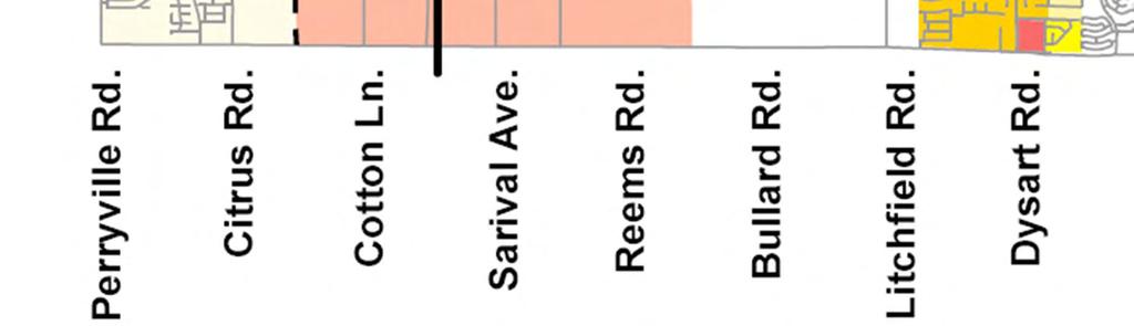
16 IX. LOCATION AND ACCESSIBILITY As discussed previously, the subject 132 net site is directly adjacent to Dysart Road and Northern Avenue. Four and a half miles to the west along Northern Avenue is the Planned Loop 303 freeway and four and a half miles to the east is the existing Loop 101 Freeway. Six miles to the south along Dysart Road is the existing I-10 Freeway. Northern Avenue in front of the property is currently under construction to become Northern Parkway. This high capacity parkway is a multi-jurisdictional roadway being designed and planned by the Cities of Glendale, Peoria, El Mirage, as well as Maricopa County. We have been told that while ultimately designed in front of the subject property as a full access control urban freeway with a grade-separated interchange at Dysart Road, the first phase of construction will consist of a four lane divided roadway utilizing an at-grade traffic signal at Dysart Road. The first phase of development with the interim roadway included right-ofway acquisition in front of the Dysart and Northern Commerce Center and is currently under construction. The subsequent phases of the parkway including the access controlled freeway in front of the property is dependent on several funding sources and a detailed timeline for construction is unknown. When finally completed, the parkway will link the Loop 303 freeway and the Loop 101 freeway with a full access control roadway. Although the construction of the roadway will be the responsibility of the various jurisdictions and not the property owner or developer, we have designed around the parkway design and support its construction. While the location of the parkway directly adjacent to the subject property supports its development as employment under the Comprehensive Plan, the actual development of the parkway does not affect this application nor is development of the Dysart and Northern Commerce Center linked directly to the development of the parkway. Only the Precise Plan of Development, which will need to be approved prior to any land development, is affected by any future designs changes of the Northern Parkway. The Precise Plan for the Dysart and Northern Commerce Center will come in the future as will the continued development of the plans and timeline for the Northern Parkway. X. CIRCULATION SYSTEM Off-site: The subject property is directly adjacent to Dysart Road and Northern Avenue. Both of these streets are dedicated as County Roadways and planned as Arterial Roadways within 55 halfstreet easements. Northern Avenue is currently developed to with a minimum roadway of a single lane in either direction on approximate 24 of pavement. Northern does flare out to 68 with two lanes in each direction and a left hand turn lane at its intersection with Dysart Road. Dysart Road is developed with two lanes in each direction and a center turn lane within 68 of pavement. 16
17 As part of development of this property, both arterial roadways will be developed to their full half street along the property s frontage. As noted previously, the Northern Parkway is planned generally along the Northern Avenue alignment and when built will run adjacent to the subject property. The current parkway alignment and right-of-way has been shown on our Military Compatibility Permit plan (Figure 6). The Northern Parkway will be a limited access freeway with no access serving the subject property unless by way of frontage roads. Development of the parkway and associated drainage improvements, along with acquisition of the right-of-way for those improvements, will be the responsibility of the appropriate governmental agencies. On-site: Development of the property will be subject to a Precise Plan of Development. More details will be available on the specific mix of industrial and commercial users at that time and their actual layout. Given that a majority of the site will be developed with employment uses, when a precise plan is submitted, the on-site circulation system will take into account the potential for large trucks and will provide wider driveways and roadways where necessary in order to allow for efficient and safe movement of these large vehicles. As shown in the Military Compatibility Permit exhibit (Figure 5), conceptually the Commerce Center will be designed around a central collector roadway which will serve as a continuation of the existing Northern Avenue when the planned Northern Parkway is constructed. This conceptual collector will head south from Northern Avenue at its half mile point between Dysart Road and Litchfield Road and will curve to an east/west alignment in the middle of the property and connect to Dysart Road on the eastern edge of the property. This central collector roadway will provide connections to secondary collector roadways that link the other areas of the property. XI. DEVELOPMENT SCHEDULE The property will be developed in multiple phases. Due to the conceptual nature, timing of the phases is not yet known. Approval of the commercial and employment/industrial uses by way of the requested Military Compatibility Permit will afford the property owner the ability to market the property and secure viable development not available with the current residential zoning. As the actual breakdown of users and the size and layout of those users is determined a detailed development schedule can be provided at the time of the submittal of the first Precise Plan of Development. No subdivision of the land is proposed at this time. If in the future separate parcels are needed, the appropriate land division will be filed with the County. 17
18 XII. COMMUNITY FACILITIES AND SERVICES School District The subject property is located within the Dysart Unified School District. As a commercial and industrial only project, no further demand will be placed on the school district with approval of this request. XIII. PUBLIC UTILITIES AND SERVICES Utility Infrastructure Currently the subject parcel lacks the needed utility infrastructure for development. Prior to submitting Precise Plans of Development the property owner will need to address the lack of infrastructure with the County and provide the necessary utilities. The property is located within the Certificate of Convenience and Necessity for the Valley Utilities Water Company, who has water lines in Dysart Road south of the property. We have begun dialogue with them regarding the infrastructure they will need to serve the site and they have provided a will serve letter (Exhibit C). The overall commerce center is currently located with the City of Glendale s MAG 208 service area however they do not have any infrastructure available to serve the property and do not object to sewer service by way of a private provider. We have been in discussions with LPSCO/Algonquin (now Liberty Water) in order to modify the MAG 208 plan as well as expand their service area to include the subject property. As a part of the discussions, they have provided a will serve letter (Exhibit D). In 2008 when this case was first being considered by way of a Rezoning, the City of Glendale indicated that they had no desire to serve as the sewer provider for the subject parcel and did not object to us working with LPSCO/Algonquin for sewer. By way of an dated March 27, 2012, from the City of Glendale Land Development Engineer, they continue to indicate that they do not object to a private company providing sewer service to the future development. A copy of this is included as Exhibit E.. Conceptual Water and Sewer Master Plans have been prepared and included as part of the previous Rezoning request submittal. These conceptual plans provide an idea of how water and sewer infrastructure will be included for the eventual development of the property and have been reviewed and approved by the Maricopa County Environmental Services Department. More detailed information for review will be provided with the first Precise Plan of Development submittal once an actual layout and users are determined. Utility Providers: Water: Valley Utilities (will serve letter provided) Wastewater disposal: LPSCO/ Algonquin (will serve letter provided) Fire Protection: Rural Metro 18
19 Police Protection: County Sheriff's Office Electric: APS Natural Gas: Southwest Gas Telephone: Century Link Refuse: Private Hauler (TBD before occupancy) 19
20 EXHIBIT A LEGAL DESCRIPTION A PORTION OF LAND LOCATED IN THE NORTHEAST QUARTER OF SECTION 3, TOWNSHIP 2 NORTH, RANGE 1 WEST OF THE GILA AND SALT RIVER BASE AND MERIDIAN, MARICOPA COUNTY, ARIZONA, MORE PARTICULARLY DESCRIBED AS FOLLOWS: COMMENCING AT THE NORTH QUARTER CORNER OF SECTION 3 MONUMENTED BY A BRASS CAP IN A HANDHOLE BEARING SOUTH 89 DEGREES 16 MINUTES 59 SECONDS EAST, A DISTANCE OF FEET FROM THE NORTH QUARTER CORNER OF SAID SECTION 3, MONUMENTED BY A BRASS CAP IN A HANDHOLE; THENCE SOUTH 02 DEGREES 00 MINUTES 30 SECONDS EAST, ALONG THE EAST LINE OF SAID SECTION 3, A DISTANCE OF FEET; THENCE DEPARTING SAID EAST LINE SOUTH 87 DEGREES 59 MINUTES 30 SECONDS WEST, A DISTANCE OF FEET TO A POINT ON THE WEST RIGHT OF WAY LINE OF DYSART ROAD, SAID POINT BEING THE POINT OF BEGINNING; THENCE DEPARTING SAID RIGHT-OF-WAY LINE, NORTH 89 DEGREES 16 MINUTES 59 SECONDS WEST, A DISTANCE OF FEET; THENCE NORTH 02 DEGREES 00 MINUTES 30 SECONDS WEST, FEET ALONG A LINE PARALLEL WITH AND FEET WEST OF SAID EAST LINE, A DISTANCE OF FEET; THENCE NORTH 45 DEGREES 38 MINUTES 44 SECONDS WEST, A DISTANCE OF FEET; THENCE NORTH 89 DEGREES 16 MINUTES 59 SECONDS WEST, ALONG A LINE PARALLEL WITH AND FEET SOUTH OF THE NORTH LINE OF SAID SECTION 3, A DISTANCE OF FEET; THENCE NORTH 67 DEGREES 13 MINUTES 17 SECONDS WEST, A DISTANCE OF FEET; THENCE NORTH 89 DEGREES 16 MINUTES 59 SECONDS WEST, ALONG A LINE PARALLEL WITH AND SOUTH OF SAID NORTH LINE, A DISTANCE OF FEET; THENCE SOUTH 44 DEGREES 20 MINUTES 17 SECONDS WEST, A DISTANCE OF FEET; THENCE SOUTH 02 DEGREES 04 MINUTES 38 SECONDS EAST, ALONG A LINE PARALLEL WITH AND FEET EAST OF THE NORTH-SOUTH MID-SECTION LINE OF SAID SECTION 3, A DISTANCE OF FEET; THENCE SOUTH 47 DEGREES 02 MINUTES 26 SECONDS EAST, A DISTANCE OF FEET; THENCE SOUTH 02 DEGREES 02 MINUTES 26 SECONDS EAST, A DISTANCE OF FEET; THENCE SOUTH 89 DEGREES 01 MINUTES 48 SECONDS EAST, ALONG A LINE PARALLEL WITH AND FEET NORTH OF THE EAST-WEST MID-SECTION LINE OF SAID SECTION 3, A DISTANCE OF 2, FEET; THENCE NORTH 64 DEGREES 00 MINUTES 50 SECONDS EAST, A DISTANCE OF 43.79; THENCE SOUTH 02 DEGREES 00 MINUTES 30 SECONDS EAST, ALONG A LINE PARALLEL WITH AND FEET WEST OF THE EAST LINE OF SAID SECTION 3, A DISTANCE OF 2, FEET OF THE POINT OF BEGINNING OF THE PARCEL DESCRIBED HEREIN. 20
21 EXHIBIT B LUKE AFB LETTER 21
22 EXHIBIT B LUKE AFB LETTER (continued) 22
23 EXHIBIT B LUKE AFB LETTER (continued) 23
24 EXHIBIT B LUKE AFB LETTER (continued) 24
25 EXHIBIT B LUKE AFB LETTER (continued) 25
26 EXHIBIT C VALLEY UTILITIES WILL SERVE LETTER 26
27 EXHIBIT C VALLEY UTILITIES WILL SERVE LETTER (continued) 27
")
28 EXHIBIT C VALLEY UTILITIES WILL SERVE LETTER (continued) 28
29 EXHIBIT C VALLEY UTILITIES WILL SERVE LETTER (continued) 29
30 EXHIBIT D LPSCO/ALGONQUIN WILL SERVE LETTER 30
31 EXHIBIT E NO OBJECTION FROM GLENDALE REGARDING PRIVATE SEWER 31
32 EXHIBIT E NO OBJECTION FROM GLENDALE REGARDING PRIVATE SEWER (continued) 32
33 EXHIBIT E NO OBJECTION FROM GLENDALE REGARDING PRIVATE SEWER (continued) 33
34 EXHIBIT F Conditions of Approval 34
35 EXHIBIT F Conditions of Approval (Continued) 35
36 EXHIBIT F Conditions of Approval (Continued) 36
37 EXHIBIT F Conditions of Approval (Continued) 37
38 EXHIBIT F Conditions of Approval (Continued) 38
39 1 N NTS Olive Ave Olive Ave Litchfield Olive Ave Olive Ave El Mirage Rd El Mirage Rd El Mirage Rd Proposed Dysart Rd Northern Parkway Northern A Litchfield Rd Dysart Rd Northern Ave Northern Ave Subject Property Dysart Rd Glendale Ave Glendale Ave Glendale A Litchfield Rd El Mirage Rd Dysart Rd Dysart Rd Litchfield Rd Bethany Home Rd sart Rd Litchfiel Bethany Home Rd


40 N NTS 1
41 Picture Picture Number Number and and Direction Direction N NTS FIGURE 3
42 Context Photos Figure 3
43 Context Photos Figure 3
44 Context Photos Figure 3
45 Context Photos Figure 3
46 Context Photos Figure 3
47 Context Photos Figure 3
48 Context Photos Figure 3
49 Context Photos Figure 3
50 Context Photos Figure 3

51 Context Photos Figure 3
52 City of El Mirage Northern Parkway IND-2 Military and Ancillary Military Facility Overlay Rural-43 Military and Ancillary Military Facility Overlay 1 Luke Air Force Base N NTS FIGURE 4
53 City of El Mirage Northern Parkway IND-2 Military Compatibility Permit Uses Allowed Per Narrative Commercial/ Retail Parcel LDN Potential Northern Avenue Extension Employment/Industrial Parcel LDN LDN Rural-43 N 1 Luke Air Force Base NTS FIGURE 5
54 City of El Mirage Northern Parkway Luke Compatible N 1 Luke Air Force Base NTS FIGURE 6


55 N NTS 1 FIGURE 7
CHAPTER 21 NC-PUD NEIGHBORHOOD COMMERCIAL PUD DISTRICT
 CHAPTER 21 NC-PUD NEIGHBORHOOD COMMERCIAL PUD DISTRICT Section 21.1. Title and Purpose. The Neighborhood Commercial Planned Unit Development District, designated the, is intended for commercial uses of
ARTICLE XVIII C 1 CENTRAL BUSINESS DISTRICT
 ARTICLE XVIII C 1 CENTRAL BUSINESS DISTRICT SECTION 1. INTENT AND PURPOSE OF DISTRICT: The C 1 Central Business District is intended for the purpose of grouping retail merchandising activities into a concentrated
3.5 C-I: Commercial - Industrial District
 3.5 Intent: The s are established to promote and maintain: gateway developments into the major industrial parks within the Town of Plainfield; and, the development of support facilities necessary for the
Antique shops. Aquariums. Art goods and bric-a-brac shops. Artists' studios. Auditoriums. Automobile hire.
 Sec. 62-1482. - General retail commercial, BU-1. The BU-1 general retail commercial zoning classification encompasses land devoted to general retail shopping, offices and personal services to serve the
Electric (208/120 v 3 phase), Natural Gas, Water & Sewer
, Natural Gas, Water & Sewer") FOR LEASE CALL FOR PRICING 2 East Patrick Street, Frederick, Maryland 21701 Exceptional Frederick Historic Location Located at the corner South Market and East Patrick Streets in Downtown Frederick, this
FOR LEASE CALL FOR PRICING 2 East Patrick Street, Frederick, Maryland 21701 Exceptional Frederick Historic Location Located at the corner South Market and East Patrick Streets in Downtown Frederick, this
FOR LEASE. Downtown Frederick Retail/Office Space for Lease. Property Details PRESENTING
 FOR LEASE $3,500/SF (Modified Gross Lease) 630 North Market Street, 1 st Floor, Frederick, Maryland 21701 PRESENTING Location: 630 North Market Street, 1 st Floor, Frederick, MD 21701 Downtown Frederick
FOR LEASE. Ideal Downtown Frederick Location for Retail, Restaurant or Fitness PRESENTING
 FOR LEASE CALL FOR PRICING 125 East All Saints Street, Frederick, Maryland 21701 Ideal Downtown Frederick Location for Retail, Restaurant or Fitness Here is where the downtown action is today and will
PLANNED UNIT DEVELOPMENT & SUBDIVISION STAFF REPORT Date: May 18, 2017
 & PUD-0000102-2017 PLANNED UNIT DEVELOPMENT & SUBDIVISION STAFF REPORT Date: May 18, 2017 NAME SUBDIVISION NAME Dauphin Creek Estates Subdivision Dauphin Creek Estates Subdivision LOCATION CITY COUNCIL
South Commercial and Rural Fringe Land Use East Rural Fringe Land Use West - Planned Community (Pace Island)
") Revised 11/2/2015 Owners Name: Agent: G & H International Investments LLC 1890 Kingsley Avenue Suite 102 Orange Park, FL 32073 Susan L. Fraser, SLF Consulting, Inc. 3517 Park Street Jacksonville, FL 32205
Revised 11/2/2015 Owners Name: Agent: G & H International Investments LLC 1890 Kingsley Avenue Suite 102 Orange Park, FL 32073 Susan L. Fraser, SLF Consulting, Inc. 3517 Park Street Jacksonville, FL 32205
Present. and. Future
 Present and Future July 1985 303 from MC 85 to I-17 included in the Regional Freeway System May 1989 State Transportation Board adopts Loop 303 1990 Revenues from Proposition 300 insufficient; 303 removed
4 January 11, 2012 Public Hearing APPLICANT:
 . 4 January 11, 2012 Public Hearing APPLICANT: MID-ATLANTIC AUTO PROPERTY OWNER: DZR, LLC STAFF PLANNER: Leslie Bonilla REQUEST: Conditional Use Permit (truck rental, automobile service, and automotive/bulk
OFFICE CONSOLIDATION SECONDARY PLAN AREA 22 THE BRAMALEA SOUTH INDUSTRIAL SECONDARY PLAN
 OFFICE CONSOLIDATION SECONDARY PLAN AREA 22 THE BRAMALEA SOUTH INDUSTRIAL SECONDARY PLAN November 2010 EXPLANATORY NOTES (Secondary Plan Area 22) General (pertaining to all secondary plan office consolidations)
KELLER WILLIAMS COMMERCIAL
 KELLER WILLIAMS COMMERCIAL BALLANTYNE AREA Uptown Land Opportunity +/- 1 acre Charlotte, NC Scott Greene 704.577.7344 scottgreene@kw.com Matthew Hagler 704.408.8867 mhagler@kwcommercial.com Scott Stevens
CITY COUNCIL STUDY SESSION MEMORANDUM
 City and County of Broomfield, Colorado CITY COUNCIL STUDY SESSION MEMORANDUM To: From: Prepared by: Mayor and City Council Charles Ozaki, City and County Manager Kevin Standbridge, Deputy City and County
RAMHIC Eligible SIC Codes: Wholesale and Retail 5012 Automobiles and other Motor Vehicles 5013 Motor Vehicle Supplies and New Parts 5014 Tires and
 RAMHIC Eligible SIC Codes: Wholesale and Retail 5012 Automobiles and other Motor Vehicles 5013 Motor Vehicle Supplies and New Parts 5014 Tires and Tubes 5015 Motor Vehicle Parts, Used 5021 Furniture 5023
2.11 GC - General Commercial
 2.11 GC - General Commercial Intent - GC: s are established to provide a location for higher volume and higher intensity commercial uses than the NR District. Activities in this District are often large
ARTICLE IX SPECIAL PERMIT USES
 ARTICLE IX SPECIAL PERMIT USES All special permit uses cited in Article IX and Attachment A of this Ordinance or any other Section of this Ordinance shall be subject to Site Plan Review. The procedures
PLANNING REPORT CITY OF EAGAN CASE: 02-CG
 PLANNING REPORT CITY OF EAGAN REPORT DATE: January 17, 2018 CASE: 02-CG-04-12-17 APPLICANT: TJ Design/Costco HEARING DATE: PROPERTY OWNER: MG Eagan LLC APPLICATION DATE: REQUEST: Comprehensive Guide Plan
14 October 10, 2012 Public Hearing APPLICANT: MPB, INC
 14 October 10, 2012 Public Hearing APPLICANT: MPB, INC PROPERTY OWNER: MUNDEN & ASSOCIATES, LP STAFF PLANNER: Karen Prochilo REQUEST: Conditional Change of Zoning (AG-1 & AG-2 to Conditional O-2) ADDRESS
ORDINANCE WHEREAS, this Ordinance is consistent with the City of Winter Garden Comprehensive Plan; and
 ORDINANCE 17-06 AN ORDINANCE OF THE CITY COMMISSION OF THE CITY OF WINTER GARDEN, FLORIDA, CREATING ARTICLE XIV OF CHAPTER 118 OF THE CITY OF WINTER GARDEN CODE OF ORDINANCES PROVIDING FOR THE EAST PLANT
AWH REPORT OF THE PLANNING AND DEVELOPMENT DEPARTMENT FOR APPLICATION FOR REZONING ORDINANCE TO PLANNED UNIT DEVELOPMENT
 AWH REPORT OF THE PLANNING AND DEVELOPMENT DEPARTMENT FOR APPLICATION FOR REZONING ORDINANCE TO PLANNED UNIT DEVELOPMENT MAY 8, 2014 The Planning and Development Department hereby forwards to the Planning
2.18 MU Mixed Use District.
 2.18. Intent - The is established to promote the development of an urban residential environment. The regulations are intended to encourage single family urban residential use and development while allowing
Mercantile Classifications
 Mercantile s Refer to the following table for a list of eligible Mercantile s. If the risk does not match one of the descriptions from the classification table but is similar to one of the classifications,
Planning Commission Staff Report June 5, 2008
 Owner/Applicant Taylor Village Sacramento Investments Partners, LP c/o Kim Whitney 1792 Tribute Road #270 Sacramento, CA 95815 Staff Recommendation Planning Commission Staff Report Project: File: Request:
12 January 12, 2011 Public Hearing APPLICANT: TAILWIND DEVELOPMENT GROUP,LLC PROPERTY OWNER: CITY OF VIRGINIA BEACH
 12 January 12, 2011 Public Hearing APPLICANT: TAILWIND DEVELOPMENT GROUP,LLC PROPERTY OWNER: CITY OF VIRGINIA BEACH STAFF PLANNER: Faith Christie REQUEST: Conditional Change of Zoning (from PD-H1 Planned
3. Project Description
 3.1 PROJECT LOCATION The Platinum Triangle (herein after also referred to as the Project Area ) is located at the confluence of the Interstate 5 (I-5 Freeway) and the State Route 57 (SR-57 Freeway), in
and services The protection and conservation of environmentally significant and sensitive natural heritage features and functions.
 6. Land Use 6.0 Preamble A healthy and livable city is one in which people can enjoy a vibrant economy and a sustainable healthy environment in safe, caring and diverse neighbourhoods. In order to ensure
Planning & Zoning Commission Meeting Date: June 04, 2012
 Meeting Date: June 04, 2012 Request Applicant Owner Zoning Preliminary/Final Plat of 24.114 acres of unplatted property into one lot with one reserve for landscape/open space. Extension of infrastructure
I. INTRODUCTION. Project Background and Study Area
 I. INTRODUCTION Project Background and Study Area Freedom Parkway is a key east-west corridor connecting I-25 on the west to the Town of Kersey on the east, running approximately one to two miles south
Russell Bond & Co., Inc. Pennsylvania Worker's Compensation Class Code Eligibility (by class code) 130 TEXTILE WASTE MFG.
 130 TEXTILE WASTE MFG.") Eligibility 130 TEXTILE WASTE MFG. 261 CORRUGATED BOX OR CONTAINER MFG. 285 PRINTING - SHEET-FED PROCESS 451 AUTOMOBILE BODY MFG. 471 PRINTED CIRCUIT BOARD ASSEMBLY OR ELECTRICAL WIRE HARNESS MFG. - CONTRACTOR
Eligibility 130 TEXTILE WASTE MFG. 261 CORRUGATED BOX OR CONTAINER MFG. 285 PRINTING - SHEET-FED PROCESS 451 AUTOMOBILE BODY MFG. 471 PRINTED CIRCUIT BOARD ASSEMBLY OR ELECTRICAL WIRE HARNESS MFG. - CONTRACTOR
PSec MCN Mahan Corridor Node District
 PSec. 10-269 MCN Mahan Corridor Node District 1. Purpose and Intent 2. Allowable District Location The Mahan Corridor Node (MCN) zoning district is intended to implement the Mahan Gateway Node Map (FLUM)
OP Council Resolution June 16, Planning and Development Services
 OP-08-01 Council Resolution June 16, 2008 Planning and Development Services Kingsgate Landing Outline Plan Table of Contents 1.0 Introduction 1 1.1 Purpose of Plan 1 1.2 Plan Area Location 1 1.3 Ownership
M E M O R A N D U M July 27, 2018
 M E M O R A N D U M July 27, 2018 To: Southlake 2035 Corridor Planning Committee From: Kenneth Baker, Sr. Director of Planning and Development Services Subject: Item #6 First National Bank Purpose Review,
Village of Itasca Business District Table of Uses
 Village of Itasca Business District Table of Uses Table of ermitted and pecial Uses ermitted C Conditional pecial Blank Not ermitted Commercial Uses B-1 B-2 B-3 B-4 B-5 B-6 Accessory uses Amusement establishments
REZONING GUIDE. Zone Map Amendment (Rezoning) - Application. Rezoning Application Page 1 of 3. Return completed form to
 - Application. Rezoning Application Page 1 of 3. Return completed form to") Zone Map Amendment (Rezoning) - Application COMMUNITY PLANNING & DEVELOPMENT REZONING GUIDE Rezoning Application Page 1 of 3 PROPERTY OWNER INFORMATION* CHECK IF POINT OF CONTACT FOR APPLICATION Property
Zone Map Amendment (Rezoning) - Application COMMUNITY PLANNING & DEVELOPMENT REZONING GUIDE Rezoning Application Page 1 of 3 PROPERTY OWNER INFORMATION* CHECK IF POINT OF CONTACT FOR APPLICATION Property
S o u t h C e n t r a l O u t l i n e P l a n. Leduc Business Park. North Leduc Industrial Area Structure Plan C it y of Led u c.
 Leduc Business Park North Leduc Industrial Area Structure Plan C it y of Led u c Prepared for Farm Air Properties Inc. January, 2007 Table of Contents Page Number 1.0 Purpose of Plan and Definition of
Mill Conversion Overlay District Zoning Bylaw Amendment
 Mill Conversion Overlay District Zoning Bylaw Amendment To see if the Town will vote to amend the Zoning By-Law by adding a new Section 13, Mill Conversion Overlay District, and by amending Sections 2.1,
Ten Mile Creek Planning Area
 PLANNING AREA POLICIES TEN MILE CREEK Ten Mile Creek Planning Area Location and Context The Ten Mile Creek Planning Area ( Ten Mile Creek area ) is located south of the current Boise AOCI, generally south
Urban Fringe Subarea Plan
 Urban Fringe Subarea Plan Updated February 27, 2018 Table of Contents Page I. Existing Goals and Policy Framework 2 A. Growth Management Act (GMA) B. County-wide Planning Policies C. Whatcom County Comprehensive
Planning & Zoning Commission Staff Report
 Planning & Zoning Commission Staff Report Meeting Date: May 26, 2015 Drafted by: Katherine Harrison-Rogers CASE # Z2886 PROJECT NAME: APPLICANT/ REPRESENTATIVE: Shawna Runyan PROPERTY OWNER: 1840 (previously
EAST LAKE TARPON COMMUNITY OVERLAY
 EAST LAKE TARPON COMMUNITY OVERLAY East Lake Tarpon in Pinellas County Florida physical area is defined by the boundaries of the as shown in the map below and legal description in Appendix A. VISION: East
Mycoskie McInnis Associates represented by Cliff Mycoskie. Rdw Rudy s Arlington and I-20/South Collins, Ltd represented by Robert Dorazil
 Case Information Applicant: Property Owner: Sector Plan: Mycoskie McInnis Associates represented by Cliff Mycoskie Rdw Rudy s Arlington and I-20/South Collins, Ltd represented by Robert Dorazil East Council
EMTAK code and name of service:
 EMTAK code and name of service: 14131 Manufacture of other outerwear, inc custom tailoring 1511 Tanning and dressing of leather; dressing and dyeing of fur 1623 Manufacture of builder s carpentry and joinery
13. PRELIMINARY PLAT NO MILLS FARM - Vicinity of the southeast corner of 159 th Street and Quivira Road
 13. corner of 159 th Street and Quivira Road 1. APPLICANT: HNTB Corporation is the applicant for this request. 2. REQUESTED ACTION: The applicant is requesting approval of a preliminary plat for a 383-lot
Regulations, of the Dallas City Code by creating a new Division S-105; establishing use
 140544 3-24-14 ORDiNANCE NO. 293 0 2 An ordinance changing the zoning classification on the following property: BEING Lots 1 and 2 in City Block E/2307 and Lot 1 and part of Lot 2 in City Block F/2309;
Project phasing plan (if applicable) 12 copies of site plan
 12 copies of site plan") SITE PLAN REVIEW PERMIT APPLICATION City of Grand Haven, 11 N. Sixth Street, Grand Haven, MI 49417 Phone: (616) 847-3490 Fax: (616) 844-2051 Website: www.grandhaven.org 1. Project Information Address/location
SITE PLAN REVIEW PERMIT APPLICATION City of Grand Haven, 11 N. Sixth Street, Grand Haven, MI 49417 Phone: (616) 847-3490 Fax: (616) 844-2051 Website: www.grandhaven.org 1. Project Information Address/location
Planned Development (PD) B0, C0 Deed Reference: Valley Township and West Caln Township
 B0, C0 Deed Reference: Valley Township and West Caln Township") For Sale 717.293.4477 Industrial Land for Sale Industrial/Commercial Realtors Phase II Industrial Land Highlands Corporate Center Highlands Boulevard Lots #36, #37, #38, #39 Coatesville, PA 19320 Available
For Sale 717.293.4477 Industrial Land for Sale Industrial/Commercial Realtors Phase II Industrial Land Highlands Corporate Center Highlands Boulevard Lots #36, #37, #38, #39 Coatesville, PA 19320 Available
2018 BEXAR APPRAISAL DISTRICT PERSONAL PROPERTY LIFE RESIDUALS - INDEX TO THE DCODES
 Property Use or Type 2018 BEXAR APPRAISAL DISTRICT PERSONAL PROPERTY LIFE RESIDUALS - INDEX TO THE DCODES GENERAL PERSONAL PROPERTY Aircraft Manufacturing 1030 Agricultural Implements and Machinery 0820
The transportation system in a community is an
 7 TRANSPORTATION The transportation system in a community is an important factor contributing to the quality of life of the residents. Without a sound transportation system to bring both goods and patrons
Land Use and Transportation Plan
 5 Land Use & Transportation Plan Figure 5.1 Construction at I 10 on ramp Land Use and Transportation Plan The Land Use and Transportation Plan represents the preferred land use, physical form, and circulation
CHAPTER 4: LAND USE & TRANSPORTATION PLAN
 CHAPTER 4: LAND USE & TRANSPORTATION PLAN Insert picture of Goodyear An awesome quote from someone saying something cool about Goodyear goes here. Katie Wilken, Goodyear Planner Land Use and Transportation
Tucson Koi & Water Gardens
 OV113-031 Tucson Koi & Water Gardens CONDITIONAL USE PERMIT SITE ANALYSIS 05.22.2014 Property Owners Walter & Jane Wong Family Investments, LLP 5437 East 3rd Street Tucson, Arizona 85711 Tucson Koi and
City Of Sparks Planning Commission Item
 Page 1 of 12 City Of Sparks Planning Commission Item Meeting Date: May17, 2012 Subject: PCN12009, Public Hearing, Consideration and possible action on a Master Plan Amendment and Rezoning request to change
I615. Westgate Precinct
 I615. Westgate Precinct I615.1. Precinct Description The Westgate Precinct is located approximately 18km west of the Auckland city centre. There are seven Sub-precincts in the Westgate Precinct: Sub-precinct
Development Review Application Fees
 Development Review Application Fees Application Type Historic District Commission (Requires zoning sign- $10) Certificate of Approval Certification of Non-Conforming Use- Residential Use for the property
1934 Commerce Lane Suite 1 Jupiter, Florida Ph Fax Lic # LC-C ATTACHMENT G.
 Landscape Architects I Land Planners I Environmental Consultants 1934 Commerce Lane Suite 1 Jupiter, Florida 33458 Ph 561.747.6336 Fax 561.747.1377 www.cotleurhearing.com Lic # LC-C000239 ATTACHMENT G
TABLE OF CONTENTS INTRODUCTION PLAN CONCEPT... 3
 TABLE OF CONTENTS BY-LAW NO. Z-1 INTRODUCTION... 1 1.0 PLAN CONCEPT... 3 1.1 Mission... 3 1.2 A Future Vision for Fredericton... 3 1.3 Growth Strategy Goals... 5 National Context... 5 Provincial Context...
EXHIBIT B PROJECT NARRATIVE POULSBO MEADOWS
 EXHIBIT B PROJECT NARRATIVE POULSBO MEADOWS Name of Project: Poulsbo Meadows; A Planned Residential Development (PRD)/Plat Applicants Name: PBH Group LLC/Byron Harris PO Box 1010 Silverdale, WA 98038 Description
REPORT TO: Council FOR: Regular Meeting. PRESENTED: April 1, 2008 FILE: , Byl 1932 & 1936
 DISTRICT OF SQUAMISH REPORT TO: Council FOR: Regular Meeting PRESENTED: April 1, 2008 FILE: 2006-08, Byl 1932 & 1936 DEPARTMENT: Planning Department SUBJECT: First and Second Readings for Bylaws 1932 (rezoning)
C ity of Grande Prairie Development Services Department
 C ity of Grande Prairie Development Services Department FAIRWAY DEVELOPMENT OUTLINE PLAN OP 08 09 Approved April 6, 2009 Prepared by: Focus Corporation Table of Contents 1.0. Introduction 2 3 1.1. Plan
9 CITY OF VAUGHAN OFFICIAL PLAN AMENDMENT NO BOCA EAST INVESTMENTS LIMITED
 9 CITY OF VAUGHAN OFFICIAL PLAN AMENDMENT NO. 631 - BOCA EAST INVESTMENTS LIMITED The Planning and Economic Development Committee recommends the adoption of the recommendations contained in the following
Regarding actual construction when development occurs, the following applicable guidelines are provided to address public safety issues:
 MIAMI-DADE COUNTY DEPARTMENT OF PLANNING AND ZONING General Comments 1. COMMENT: A careful review of the application provided shows that there is likely to be an impact on the Miami-Dade Police Department
City of Astoria Development Code ARTICLE 2 USE ZONES R-1: LOW DENSITY RESIDENTIAL ZONE
 ARTICLE 2 R-1 Zone USE ZONES R-1: LOW DENSITY RESIDENTIAL ZONE 2.015. PURPOSE. The purpose of the R-1 Zone is to provide an area of low density single-family dwellings, at an average density of eight (8)
ZONING AMENDMENT & PLANNED UNIT DEVELOPMENT STAFF REPORT Date: April 4, 2013
 ZONING AMENDMENT & PLANNED UNIT DEVELOPMENT STAFF REPORT Date: April 4, 2013 NAME DEVELOPMENT NAME LOCATION DIP Exchange, LLC DIP Exchange, LLC 93 Sidney Phillips Drive (West side of Sidney Phillips Drive,
September 25th, 2018 $2000 fee pd CC
 2.7267 acres 2018I-00075 September 25th, 2018 $2000 fee pd CC Rezoning Review Criteria Analysis - Map Amendment Application Number: 2018I-00075 805 W. 38 th Avenue October 19, 2018 (amd.) September 17,
Baumgarten MPUD. Exhibit 3 Evaluation Criteria
 Pursuant to LDC subsections 10.02.13 B, 10.02.08 F and Chapter 3 G. of the Administrative Code, staff s analysis and recommendation to the Planning Commission, and the Planning Commission s recommendation
Michael D, Harvey, Current Planning Supervisor. This project was originally approved in 2012 by the BOCC and is summarized as follows:
 PLANNING & INSPECTIONS DEPARTMENT Craig N. Benedict, AICP, Director Current Planning (919) 245-2575 (919) 644-3002 (FAX) www.orangecountync.gov 131 W. Margaret Lane Suite 201 P. O. Box 8181 Hillsborough,
City of Grande Prairie Development Services Department
 City of Grande Prairie Development Services Department ROYAL OAKS NORTH OUTLINE PLAN OP-07-03 NW 35-71-6 W6M May 7, 2007 Royal Oaks North Outline Plan TABLE OF CONTENTS 1.0 INTRODUCTION........ 3 1.1 Purpose
Urban Design Brief Fanshawe Park Road. Competition Toyota
 Urban Design Brief 1300 Fanshawe Park Road Competition Toyota May 2, 2014 TABLE OF CONTENTS Page No. INTRODUCTION... 1 SECTION 1 LAND USE PLANNING CONTEXT... 1 1.1 The Subject Lands... 1 1.2 The Proposal...
D3 January 14, 2015 Public Hearing
 D3 January 14, 2015 Public Hearing APPLICANT: DONALD J. BOUCHER, JR. PROPERTY OWNER: D.J.B. SERVICE CENTER, LLC STAFF PLANNER: Kristine Gay REQUEST: A. Conditional Change of Zoning (I-1 to B-2) B. Conditional
Staff Report and Recommendation
 Community Planning and Development Planning Services 201 W. Colfax Ave., Dept. 205 Denver, CO 80202 p: 720.865.2915 f: 720.865.3052 www.denvergov.org/cpd TO: City Council Neighborhoods and Planning Committee
Community Development Department Planning Division 1600 First Street + P.O. Box 660 Napa, CA (707)
") Community Development Department Planning Division 1600 First Street + P.O. Box 660 Napa, CA 94559-0660 (707) 257-9530 PLANNING COMMISSION STAFFREPORT December 4, 2014 AGENDA ITEM 8.A. 14-0138; ALTAMURA
Community Development Department Planning Division 1600 First Street + P.O. Box 660 Napa, CA 94559-0660 (707) 257-9530 PLANNING COMMISSION STAFFREPORT December 4, 2014 AGENDA ITEM 8.A. 14-0138; ALTAMURA
Definitions. Average Daily Traffic Demand (ADT): The actual number or projected number of cars that pass a point in a 24-hour period.
: The actual number or projected number of cars that pass a point in a 24-hour period.") Definitions Access Management: A combination of physical techniques and transportation policies used to control the flow of traffic between roads and the surrounding lands. Alternative City Form Scenarios:
Definitions Access Management: A combination of physical techniques and transportation policies used to control the flow of traffic between roads and the surrounding lands. Alternative City Form Scenarios:
Mitchell Ranch South MPUD Application for Master Planned Unit Development Approval Project Narrative. Introduction
 Mitchell Ranch South MPUD Application for Master Planned Unit Development Approval Project Narrative Introduction Mitchell Ranch South is a proposed single family (detached) residential development on
6. REGIONAL AND COMMUNITY FACILITIES DESIGNATIONS 6.1. OBJECTIVES FOR REGIONAL AND COMMUNITY FACILITIES LAND USE DESIGNATIONS
 6. REGIONAL AND COMMUNITY FACILITIES DESIGNATIONS INTRODUCTION The Regional and land use designations provide the primary locations for uses which satisfy the health, education and other service needs
Study Area Maps. Profile Tables. The CORE Shopping Centre Pitney Bowes 2018 Canada Business Summary
 Powered by Sitewise Page 1 Study Area Maps Profile Tables 2018 Canada Business Summary 2018 Canada Businesses By SIC Codes (1-49) 2018 Canada Businesses By SIC Codes (50-99) Prepared on: 4/20/2018 3:45:52
City of Grande Prairie Development Services Department KENNEDY DEVELOPMENTS LTD. OUTLINE PLAN OP-09-01
 City of Grande Prairie Development Services Department KENNEDY DEVELOPMENTS LTD. OUTLINE PLAN OP-09-01 July 27, 2009 TABLE OF CONTENTS 1.0 Introduction... 1 1.1 Plan Area Location & Context... 1 1.2 Ownership
CHAPTER 10 GC GENERAL COMMERCIAL DISTRICT
 CHAPTER 10 GC GENERAL COMMERCIAL DISTRICT SECTION 10.01 DESCRIPTION AND PURPOSE A. This District is intended for commercial development of a general nature near areas where greater concentrations of residential
FOR SALE 21 acres of Limited Industrial Land 6.4 acres of Commercial Land Baldwin Road West, Monrovia, Maryland 21770
 21 acres of Limited Industrial Land 6.4 acres of Commercial Land, I-70 Frontage and Visibility Established Industrial and Commercial Area PRESENTING LOCATION: Intersection of and Green Valley Road LEGAL:
Planning Commission Staff Report Agenda Item No. 4 March 7, 2019
 DEPARTMENT OF PUBLIC WORKS AND PLANNING STEEN E. WHITE, DIRECTOR Planning Commission Staff Report Agenda Item No. 4 March 7, 2019 SUBJECT: General Plan Conformity Application Clovis Unified School District
CHAPTER 11 HC HIGHWAY COMMERCIAL DISTRICT
 CHAPTER 11 HC HIGHWAY COMMERCIAL DISTRICT SECTION 11.01 DESCRIPTION AND PURPOSE This District is intended primarily for uses emphasizing highway related service, such as service stations, restaurants,
3.10 LAND USE SETTING PROJECT SITE EXISTING LAND USE DESIGNATIONS AND ZONING. General Plan Land Use Designations.
 This section of the Draft EIR addresses the existing land uses on and adjacent to the project site and discusses the potential impacts of the proposed project on existing land uses. Key issues addressed
McDonald s Restaurant - Purcellville Town of Purcellville Special Use Permit Statement of Justification July 24, 2014
 Introduction / Written Statement McDonald s Restaurant - Purcellville McDonald s Corporation is proposing to redevelop the existing McDonald s eating establishment with a drive-through located at 121 N
City of Reedley Community Development Department 1733 Ninth Street Reedley, CA (559) FAX
 FAX") City of Reedley SPECIAL PERMIT Submittal Requirements Conditional Use Permit (CUP), Site Plan Review (SPR) & Variance (VAR) Please use this information sheet as a checklist to assemble materials required
City of Reedley SPECIAL PERMIT Submittal Requirements Conditional Use Permit (CUP), Site Plan Review (SPR) & Variance (VAR) Please use this information sheet as a checklist to assemble materials required
STAFF REPORT DEVELOPMENT COMMISSION ZONING MEETING CITY OF COLUMBUS, OHIO JANUARY 10, 2019
 STAFF REPORT DEVELOPMENT COMMISSION ZONING MEETING CITY OF COLUMBUS, OHIO JANUARY 10, 2019 5. APPLICATION: Z18-063 Location: 4053 WEST BROAD STREET (43228), being 6.42± acres located at the southeast corner
SUSSEX COUNTY COMPREHENSIVE PLAN COUNTY PLANNING AND ZONING COMMISSION WORKSHOP
 SUSSEX COUNTY COMPREHENSIVE PLAN COUNTY PLANNING AND ZONING COMMISSION WORKSHOP August 21, 2017 TODAY S WORKSHOP Public Comment Utilities Update Economic Development Update Future Land Use Discussion Public
General Location Courtyard at LMH Final Development Plan and Final Plat
 R-1 LEYDEN RIDGE LOMA RIDGE LOBDELL R-3 MILLER PARKWAY LAUSSAC Subject Property R-3 LOCHENSHIRE LESMER R General Location Courtyard at LMH Final Development Plan and Final Plat ¹ 230 115 0 230 Feet Airport
C-2: HMR OVERLAY DISTRICT: DISTRICT REVIEW MANUAL FOR THE HUALAPAI MOUNTAIN ROAD AREA INTENT AND PURPOSE
 C-2: HMR 14.000 C-2: HMR OVERLAY DISTRICT: DISTRICT REVIEW MANUAL FOR THE HUALAPAI MOUNTAIN ROAD 14.100 INTENT AND PURPOSE This Design Review Manual is established to provide general development, design,
R-10 Medium Density Residential. R-8 Medium High Density Residential X X X X
 Accessory uses and structures (Notes 1, 2 and 7) High Adult uses Agricultural Uses (not regulated) (Note 6) Agritourism (Note 29) Alcoholic beverages stores, packaged, for retail sales Alteration, clothing
BILL NO. B ORDINANCE NO TOWNSHIP OF O HARA ALLEGHENY COUNTY, PENNSYLVANIA
 TOWNSHIP OF O HARA ALLEGHENY COUNTY, PENNSYLVANIA AN ORDINANCE OF THE TOWNSHIP OF O HARA AMENDING THE ZONING ORDINANCE TO PROVIDE A RIVERFRONT GREEN OVERLAY ZONING DISTRICT WHEREAS, the Township has undertaken
CITY OF CYPRESS 5275 Orange Avenue Cypress, California (714) DESIGN REVIEW COMMITTEE PERMIT PROCESS
 DESIGN REVIEW COMMITTEE PERMIT PROCESS") CITY OF CYPRESS 5275 Orange Avenue Cypress, California 90630 (714) 229-6720 DESIGN REVIEW COMMITTEE PERMIT PROCESS 1. Discuss project with Planning staff to determine zoning regulations, any unusual characteristics
CITY OF CYPRESS 5275 Orange Avenue Cypress, California 90630 (714) 229-6720 DESIGN REVIEW COMMITTEE PERMIT PROCESS 1. Discuss project with Planning staff to determine zoning regulations, any unusual characteristics
Watertown City Council
 City of Watertown Watertown City Council April 14 th, 2015 Agenda Item: City Comment on Sun Share CUP Application Request for Action: Motion to Approve City Comments regarding CUP Application Department:
VILLAGE OF CLEMMONS PLANNING BOARD DRAFT STAFF REPORT
 VILLAGE OF CLEMMONS PLANNING BOARD DRAFT STAFF REPORT PETITION INFORMATION Docket # C-226 Staff Megan Ledbetter Petitioner(s) JBJH Properties, LLC Owner(s) JBJH Properties, LLC Subject Property 5892-49-1766
Request Conditional Rezoning (R-15 Residential to Conditional B-2 Community Business) Staff Planner Kevin Kemp
 Staff Planner Kevin Kemp") Applicant Property Owner Three Five Ministries, Inc. Public Hearing May 11, 2016 City Council Election District Lynnhaven Agenda Item 4 Request Conditional Rezoning (R-15 Residential to Conditional B-2
Applicant Property Owner Three Five Ministries, Inc. Public Hearing May 11, 2016 City Council Election District Lynnhaven Agenda Item 4 Request Conditional Rezoning (R-15 Residential to Conditional B-2
The West Vaughan Employment Area Secondary Plan Policies
 Part 2: The West Vaughan Employment Area Secondary Plan Policies 2.1 General Policies It is the policy of Council: 2.1.1. That the West Vaughan Employment Area (the WVEA), identified on Schedule 1, will
THE MAY AVENUE OFFICE SUITES PLANNED UNIT DEVELOPMENT
 DESIGN STATEMENT OF THE PLANNED UNIT DEVELOPMENT OF: THE MAY AVENUE OFFICE SUITES THE VILLAGE, OKLAHOMA APPROVED: April 15, 2014 DEVELOPED BY: MARATHON CONSTRUCTION, LLC 10316 LAKESIDE DRIVE, THE VILLAGE,
Mark-up of the effect of the proposed Bronte Village Growth Area OPA No.18 on the text of section 24, Bronte Village, of the Livable Oakville Plan
 Mark-up of the effect of the proposed Bronte Village Growth Area OPA No.18 on the text of section 24, Bronte Village, of the Livable Oakville Plan Notes: This document is provided for information purposes
Chapter 7: Land Use Plan
 Chapter 7: Land Use Plan The intended purpose of the Land Use Plan is to guide the future physical development of Wall Township by designating proposed land use categories including proper location and
PRELIMINARY DEVELOPMENT PLAN REVIEW - CITY OF MARYLAND HEIGHTS
 APPLICATION NUMBER: PDP17-0007 APPLICATION (PROJECT) NAME: QuikTrip Store #644R APPLICANT: QuikTrip Corporation 2255 Bluestone, St. Charles, MO 63303 PROPERTY OWNER NAME: APPLICANT S REQUEST: Robert J.
Narcoossee Roadway Corridor
 Community Meeting Narcoossee Roadway Corridor April 5, 2012 Meeting Agenda Purpose of Meeting Continuation of Study Update Process (Previous Meetings Oct. & Nov., 2011) Tonight s Objective Review Proposals