Intentional blank page
|
|
|
- Molly Doyle
- 5 years ago
- Views:
Transcription
1 Intentional blank page
2 Intentional blank page
3 Contents 1.0 INTRODUCTION Name Date of Adoption Aim Land to Which This Plan Applies Relationship to Other Plans and Legislation How to Use This Plan Heritage Advisory Service Definitions Desired Outcomes and Area Characteristics SITE PLANNING Siting of Development Setbacks Garages, Carports and Sheds Private Open Space Landscaping Parking and Access Safer By Design Views Signage Footpath Trading SUBDIVISION Subdivision Pattern and Lot Layout BUILT FORM Building Bulk and Scale Street Frontage and Façade Treatment Style and Visual Amenity Building Materials Fences Roof Form and Roof Fixtures Alterations and Additions to Historic Buildings Colour Adaptable Housing AMENITY Visual Privacy Solar Access Streetscape SITE CONSIDERATIONS Tree Preservation SITE WORKS Sustainability Earthworks/excavation Stormwater Management Waste Management 29 SCHEDULES MAPS LIST OF AMENDMENTS ROOF FORMS NELLIGEN DESIGN GUIDELINE CODES APPLICABLE TO THIS PLAN 36
4 Intentional blank page
5 1.0 INTRODUCTION 1.1 Name This Plan is known as the Nelligen Development Control Plan and has been prepared in accordance with section 74C of the Environmental Planning and Assessment Act 1979 (EP&A Act). 1.2 Date of Adoption This Plan was adopted by Eurobodalla Shire Council (Council) on 7 February 2012 and came into operation on 30 March This Plan will be subject to amendment from time to time. Plan users should refer to the list of amendments in Schedule 2 of this Plan. 1.3 Aim The aim of the Plan is to further the aims of the Eurobodalla Local Environmental Plan 2012 (LEP) and to ensure that development in Nelligen respects its historic character and heritage value. 1.4 Land to Which This Plan Applies This Plan applies to the village of Nelligen as shown in Schedule 1 - Maps in this Plan. 1.5 Relationship to Other Plans and Legislation This Plan supports the LEP and provides guidance for applicants to achieve the aims and objectives of the LEP in relation to development in the applicable zones. Where there is an inconsistency between this Plan and any environmental planning instrument applying to the same land, the provisions of the environmental planning instrument shall prevail. In addition to the above and the provisions of this Plan, in assessing development proposals, Council must consider all those matters specified in section 79C of the EP&A Act. To the extent that they apply to land to which this Plan applies, this Plan repeals all other DCPs of the Eurobodalla Shire. This Plan should be read in conjunction with the Codes of Practice listed in Schedule 5 of this Plan. 1
6 1.6 How to Use This Plan This Plan is to be read in conjunction with the LEP and other relevant environmental planning instruments made under the Environmental Planning and Assessment Act The LEP provides the legal framework by which Council s decisions are made and sets out Council s objectives for development within the shire. It lists objectives, permissible uses and development standards for each zone, accompanied by maps to define areas where the controls apply. In addition, the Eurobodalla Settlement Strategy and the various structure plans also provide a broader vision for the future of the Eurobodalla. Applicants should also have regard to NSW Government legislation and policy, the requirements of the Building Code of Australia, the Roads and Traffic Authority Guide to Traffic Generating Developments and any relevant Australian Standard that may apply to all or part of the proposed development. Applicants should consult with Council to identify relevant legislation, policies and standards, and to ascertain whether any other Council policies or codes apply. The Development Controls The intent in each of the development controls state the desired outcome sought for the relevant aspect of the Plan. The controls are generally expressed as Acceptable Solutions and/or Performance Criteria. The acceptable solutions provide a simple measure by which a development may achieve the intent of a particular element of development control (deemed to comply). The performance criteria allow for flexibility and innovation for developers and designers who wish to depart from the listed acceptable solutions (merit assessment). The intent of the control and the Plan must always be met whichever course is chosen. These controls will provide guidance for owners, designers and Council staff in determining if a proposed development is appropriate. Important attributes of the village that warrant management through the use of these development controls include: Buildings and structures of individual heritage significance. Precincts, to ensure that their distinctive characters are not compromised by inappropriate development. This is particularly relevant to the historic precinct. Places and attributes that contribute to the historic precinct s character. Infill development that has the potential to impact on precinct character. Roads, in so far as they contribute to village character. This includes the treed median strip in Braidwood Street. Roadside and verge treatments (including kerbing, guttering and footpaths) that impact on character Remnant forest and individual stands of trees, both natural and introduced. Important views within, to and from the town. The impact of subdivision and development of large allotments. Colours on structures, to ensure that inappropriate colours are not used in a manner that could degrade the villages or conservation area s appearance. Signage, to ensure that it does not dominate nor detract from streetscape character, and Services and utilities. 2
7 1.7 Heritage Advisory Service People planning development within the village are encouraged to consult with Council s heritage advisor prior to developing and submitting their plans. Appointment may be made by contacting Council on Definitions Other than those listed below, terms in this Plan have the meanings found in the LEP dictionary. Adjacent heritage items are on allotments that touch, or are in close proximity, such as across a lane or road. Adjoining heritage items means heritage items that are on allotments that touch or join the subject property. Communal open space means open space that is shared by all residents of a development containing more than 2 dwellings. Detached (for the purpose of 2.2 Setbacks) means by more than 900mm from another building or structure. Buildings or structures closer than 900mm are deemed to be attached (for the purpose of 2.2 Setbacks). Foreshore reserves means areas of public land fronting water courses, lagoons, lakes, rivers, estuaries, bays, beaches and oceans, but do not include areas of land set aside for stormwater drainage that do not share a common boundary with the foreshore. Heritage Item has the same meaning as in the LEP 2012 and means a building, work, place, relic, tree, object or archaeological site the location and nature of which is described in Schedule 5 (in the LEP). Heritage significance has the same meaning as in the LEP 2012 and means historic, scientific, cultural, social, archaeological, architectural, natural or aesthetic value. In this Plan a place of heritage significance may refer to a heritage item as defined above, but may also refer to an item of heritage significance that has not been entered in the Eurobodalla heritage schedule. 1.9 Desired Outcomes and Area Characteristics Council s intention is that Nelligen develops in a manner that maintains and where possible enhances its individual historic character. Historic buildings on the north side of Braidwood Street shall be conserved and enhanced to retain their aesthetic and historic character. Development on the south side of Braidwood Street, between Runnyford Road and the Clyde River may be contemporary in style but sympathetic to the heritage buildings opposite. New development throughout Nelligen shall be of a high standard that utilises design elements suitable to the south coast of NSW, rather than buildings of a metropolitan or urban character. 3

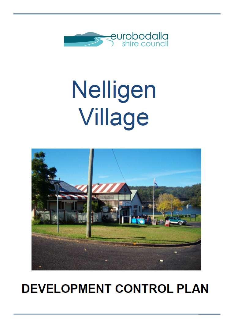
8 Nelligen Village Character Statement Nelligen Post Office (former) Nelligen developed as a port and river crossing in the mid 19 th century and a number of significant historic buildings have survived, particularly along the north side of Braidwood Street. Many of the buildings on the south side of Braidwood Street were destroyed in bushfires in 1939 and development there generally dates from the mid 20 th century. Residential development has increased considerably in the latter 20 th and early 21 st centuries with more recent houses in the curvilinear streets of Nelligen Place, Currowan Street and Runnyford Road. Development density on the larger lots in Reid Street is low with generous tree cover and open or partially cleared farmlets imparting a strong rural flavour to parts of the village. The steepness of the terrain is a dominant feature, as are the mature and exotic trees. A tree-planted median strip that divides Braidwood Street as it ascends the hill further enhances the town s historic and well vegetated character. The town, now by-passed by the highway, has become a very attractive residential location. Strategy for Managing Village Character For the purpose of this DCP Nelligen is considered as three precincts comprising: 1. The historic commercial precinct including the area opposite the former punt and extending up Braidwood Street to the former Catholic Church. This historic precinct contains the important remaining historic buildings. 2. The low density, large allotments along the west end of Braidwood and Reid streets, and 3. The modern residential area along Runnyford Rd, Clyde Boulevard, Currowan Street and Nelligen Place. This is a precinct of predominantly late 20th century residences. The controls below apply to each of the precincts. Where relevant, Specific Controls shall apply to the historic precinct so that new development respects its historic and aesthetic character. 4
9 2.0 SITE PLANNING 2.1 Siting of Development To minimise risk to human life and property from unstable land. Performance Criteria P1 The risk to human life and damage to property is minimised by avoiding steep and unstable land. Acceptable Solution A1.1 No development or land clearing shall occur on slopes equal to or greater than 1:4 (or 25 %). A1.2 Where slopes are greater than 1:6.5 (or 15 %) a report prepared by a qualified geotechnical engineer or soil conservationist is required to consider the suitability of the site for residential development having regard to the stability of the land. 2.2 Setbacks To minimise adverse impacts on the streetscape and surrounding properties and ensure that development does not obstruct important views or vistas to buildings and places of historic and aesthetic significance. Performance Criteria Acceptable Solution Front boundary setback P1 Buildings are setback to maintain the existing or desired character of the residential area as described in the Village Character Statements. A1.1 Buildings and all other structures must be setback from the road frontage to within 20% of the average front setbacks of adjoining buildings, but no less than the smaller of the existing setbacks. A1.2 In new subdivisions where a setback has not been established a setback of 5.5m applies. Up to 50% of the front façade of the dwelling (excluding garages or carports) may be setback 4.5m from the front boundary. A1.3 Garages that have the door facing the street frontage and all carports must be set back a minimum of 5.5 metres from the property boundary. Side boundary setbacks 5
10 P2 Buildings are setback to reduce overbearing and perceptions of building bulk on adjoining properties and minimises overshadowing impacts on adjoining properties. P3 Buildings are setback to contribute to the existing or proposed streetscape character, assist in the blending of new development into the streetscape, make efficient use of the site and provide amenity for residents. P4 Buildings are setback so that they do not reduce the use and enjoyment of public, private or communal open space provided at the rear of adjoining residential development by being in close proximity, overshadowing or overlooking the open space. A2 The minimum setback to a side boundary is: - For the first floor, or for a single storey building, 900mm (including a minimum of 600mm to the eaves or gutters, whichever is the closest); - For any part of the building higher than 4.5m, 1.5m (including a minimum of 1.2m to the eaves or gutters, whichever is the closest); - For any part of the building higher than 7.5m, 1.5m (including a minimum of 1.2m to the eaves or gutters, whichever is the closest); - For single storey (up to a height of 3.8m) sheds, detached garages and other detached ancillary buildings (eg. gazebos, aviaries, green houses, pool houses, etc), 450mm. Corner lots - secondary street frontage A3.1 The minimum setback to the secondary street frontage side boundary is 3m. A3.2 Where a dual occupancy contains a dwelling that is not adjacent to the front boundary and addresses the side street boundary, the setback for that dwelling from the road frontage must be within 20% of the average setbacks of 3m and the adjoining building on the side street. A3.3 Garages and carports must be set back behind the dwelling frontage, not forward of the building line and a minimum of 5.5m from the secondary property boundary. Rear boundary setback A4.1 A minimum rear boundary setback of 3m applies to all buildings except: sheds; detached garages; and other detached non-habitable ancillary buildings. up to a height of 3.8m. A4.2 A minimum rear boundary setback of 450mm applies to all: sheds; detached garages; and other detached not-habitable ancillary buildings, up to a height of 3.8m. The above minimum rear boundary setbacks also apply to allotments with a rear boundary 6
11 to a road. Front boundary setbacks for battle-axe allotments For the purpose of this section, the front boundary is that boundary of the battle axe lot that is also the rear boundary of the front lot adjoining the street. The minimum front boundary setbacks also apply to allotments with a rear boundary to a road or laneway. P5 Buildings are setback so that they do not reduce the use and enjoyment of public, private or communal open space provided at the rear of adjoining residential development by being in close proximity, overshadowing or overlooking the open space. A5.1 A minimum front boundary setback of 3m applies to all buildings except: sheds; detached garages; and other detached non-habitable ancillary buildings, up to a height of 3.8m. A5.2 A minimum front boundary setback of 450mm applies to all: sheds; detached garages; and other detached non-habitable ancillary buildings. up to a height of 3.8m. The above minimum front boundary setbacks also apply to allotments with a rear boundary to a road. Setbacks to reserves P6 Buildings are setback to minimise impacts on the public enjoyment of reserves and to minimise adverse impacts on the scenic qualities of reserves and cliffs when viewed from private land, public land, waterway or the ocean. A6.1 Where development is proposed on land which has a common boundary with a foreshore reserve: for infill development, the minimum setback for any building and all other structures from the reserve must be within 20% of the average setbacks of the adjoining lawfully erected buildings, but no less than the smaller of the existing setbacks; and where a building line has not been established, the minimum setback for any building and all other structures from the reserve must be 12m. where the common boundary is a side boundary, the main dwelling may be less than 12m if the dwelling is at the minimum setback on the opposite side boundary and all efforts have been made to achieve a satisfactory setback to the reserve. A8.2 Where development is proposed on 7
12 P7.2 Setbacks, including front and side setbacks, of development are consistent with setbacks elsewhere in the vicinity. land which has a common boundary with a public reserve other than a foreshore reserve, the minimum setback for any building from the reserve must be 3m. Additional controls for the historic precinct P7.1 Development is located such that it A7 Development, including alterations and does not diminish prominent views of a heritage place, whether from in front, from additions, must be set back behind the front building line of adjoining heritage places. the streetscape or from distant vantage points. 2.3 Garages, Carports and Sheds To ensure that garages, sheds and carports are of a suitable scale and style for the locality. Performance criteria Acceptable solution P1.1 The style, appearance, roof pitch and cladding material of garages, sheds and carports must complement the historic rural character of the village. P1.2 In the historic precinct, garages sheds and carports are of a sympathetic appearance and location relative to the main building. Additional controls for the non-historic precinct P2 Carports and garages: - are not a prominent feature of the development when viewed from the street; - are compatible with the design of the main building in terms of roof form, detailing, materials and colours; and - do not dominate the streetscape. Refer to Figure 1. P3 Carports and garages: - are compatible with the design of the main building in terms of building bulk and scale; and - do not have an unreasonably adverse impact on the amenity of A1.1 Modern square-ribbed sheet-metal cladding must not be used on garages, sheds or carports where readily visible from the public domain. A1.2 Metal clad sheds, such as old American barns and Quakers barns, are not suited to Nelligen as either garages or dwellings. A2 Carports and garages must: - be no further forward of the front facade of the building than 1.2m and for no more than 50% of that façade; - be treated in such a way as to reduce prominence when viewed from the street; - are to be compatible with the design of the main building in terms of roof form, detailing, materials and colours; and - not be a dominant element of the building nor dominate a streetscape. A3 The site coverage of sheds; carports; detached garages; and other detached non-habitable ancillary 8


13 adjoining residential properties nor dominate the streetscape. buildings. must not be greater than 60m 2 Poor relationship to street the garage dominates the streetscape Improved relationship to street - garages do not dominate the streetscape Figure 1: Garages in Street Frontage 2.4 Private Open Space To provide year round adequate open space for the private recreational use of occupants of a dwelling. Performance Criteria P1 Private open space is designed and located to: - enhance residential amenity; - be functional for private recreational activities; - allow for landscape design; - optimise solar access; and - increase visual privacy, to promote the enjoyment of outdoor living by residents. Acceptable Solution General requirements A1.1 Each dwelling must be provided with a minimum of 24m² of private open space at ground level and/or above ground level which must: - not be steeper than 1 in 50 in grade; - be of a predominantly northern exposure, that takes advantage of outlook and reduces adverse privacy and overshadowing impacts on adjacent buildings; - serve as an extension of the dwelling for 9
14 P2 Private open space for dwellings at ground level is functional and responsive to the environment to promote the enjoyment of outdoor living by residents. relaxation, entertainment and recreation purposes by being accessible to the living areas; and - be located behind the building line. A1.2 Where a secondary dwelling is proposed, it must share the private open space provided for the principal dwelling not be separated in any way. Dwellings with ground level POS only A2 Where the dwelling has direct access to the ground level or similar space on a structure such as a podium or car park, an individual entrance and is single storey in height, private open space must meet the general and: - not have a minimum dimension of less than 4m. Dwellings with combinations of ground and above level POS P3 Private open space at ground level or above ground level is functional and responsive to the environment to promote the enjoyment of outdoor living by residents. A3 Where the dwelling has direct access to the ground level or similar space on a structure such as a podium or carpark, an individual entrance and is two storeys in height, private open space must meet the general and following requirements: - either be a minimum area of 24 m² of private open space provided mainly at ground level, no part of which has a minimum dimension less than 4m and the balance on a balcony/deck or terrace (the exact area apportionment to be determined by design); or a minimum balcony area of 10m 2 and minimum dimension of 2m (greater area and dimension is encouraged where practical) if at above ground level and the balance (to achieve a total private open space area of 24m²) to be provided at ground level. - Where the balcony is adjacent to the main living area of the dwelling, the balance may be provided in the form of communal open space on the site. Dwellings with above ground level POS only P4 Private open space above ground level and communal open space at ground level is functional and responsive to the environment to promote the enjoyment of outdoor living by apartment residents. A4 For each dwelling that does not have an individual entrance at ground level or a ground level private open space area, private open space is to be provided in the form of a balcony and communal open space. The general and following requirements must be met in this regard: contain a balcony with a minimum area 10
15 of 10m² and minimum dimension of 2 metres (greater area and dimension is encouraged where practical); locate the balcony with direct access to the main living rooms of the dwelling; provide a communal open space area on site calculated by multiplying the number of units by the 24m² private open space area, minus the area provided as a balcony; For example 8 units each with balconies of 10m². The communal open space requirement is: 8 x (24 10) =8 x 14 = 112m² The minimum provision for communal open space is 25% of the site area or a figure determined by the above calculation: whichever is the greater. - Communal open space must be located on the northern or north-eastern side of the site, have a minimum dimension of 3 metres, be no steeper than 1 in 50 in grade and be regular in shape. 2.5 Landscaping To ensure sites are landscaped to improve the amenity and sustainability of development. A1 A2 All applicable development must comply with the Eurobodalla Landscaping Code. Landscaping must not include environmental or noxious weeds as defined in the Eurobodalla Tree Preservation Code. Performance Criteria P3 Sites are landscaped to complement and soften the built form of development, enhance the streetscape, provide amenity to occupants and reduce stormwater runoff. Acceptable Solution A3 The minimum landscaped area of the site must consist of: - 35% of the site area for residential developments. - 50% of the front setback for development other than neighbourhood shops; and - The minimum landscaped area must be provided in addition to the minimum private open space requirement. Calculation of minimum landscaped area must not include any area with a minimum dimension less than 1.0m. 11
16 2.6 Parking and Access For All Development: To ensure development provides safe and adequate access and on-site parking arrangements. For Development in the Historic Precinct: To reduce the visual impact of large areas of concrete. Performance Criteria P1 Development is designed to provide adequate, safe and well designed access and onsite parking to serve the needs of the occupants and visitors and to reduce adverse impacts on the road network and other development. P2 All development must provide parking and access sufficient to cater for the maximum demand for the development in accordance with a Traffic Study performed by a qualified professional and approved by Council. Acceptable Solution A1 Single dwelling houses must provide two parking spaces, at least one of which is located behind the building line, a driveway of maximum 3m width on the road reserve and satisfy all relevant design requirements of the Eurobodalla Parking and Access Code A2 All development must comply with the Eurobodalla Parking and Access Code. Additional controls for the historic precinct P3 Driveways, including their surface A3.1 Driveways in historic precincts must: material, are designed so that they do not have a significant visual impact on the consist of compacted gravel, crushed brick, rock or similar material; or streetscape or the rural character of the village. paired strips of concrete, brick etc with grass or other ground-cover between the strips and on either side. A3.2 Hard surfacing must not extend in width from the side of the house to the side boundary. A3.3 Reverse turning areas are not located in front of buildings. 12
17 2.7 Safer By Design To promote a safe environment for the community by minimising the risk of crime associated with new development. Performance Criteria P1 Developments are designed to ensure the security of residents and visitors and their property, and to enhance the perception of community safety. Acceptable Solution A1.1 For single dwelling houses and dual occupancies within 12m of the street frontage: The main entrance must be clearly visible from the street; and Windows must be located to allow casual surveillance of the street from the dwelling. A1.2 All development must comply with the Eurobodalla Safer By Design Code. 2.8 Views To provide opportunities for view sharing, where practical, for existing and future residents, by encouraging innovative design solutions and ensure that new development does not obstruct important views or vistas to buildings and places of historic and aesthetic significance. Performance Criteria P1 Development allows for the reasonable sharing of views through the siting, height and design of buildings. Refer to Figure 2. Acceptable Solution A1 The design of development minimises impacts on private views and shares views where necessary by: locating structures to provide or maintain view corridors; or adjusting rooflines, or modifying building bulk or scale; or demonstrating regard and consideration of views in the development design. Refer to Figure 2. 13

18 Figure 2: View Sharing Principles 2.9 Signage To promote a high standard of and prevent excessive signage. A1 All development must comply with the Eurobodalla Signage Code and where relevant State Environmental Planning Policy No 64 - Advertising and Signage Footpath Trading To provide opportunity for footpath trading that does not disrupt pedestrian or vehicular traffic within the road reserve. A1 All development must comply with the Eurobodalla Footpath Trading Code. 14
19 3.0 SUBDIVISION 3.1 Subdivision Pattern and Lot Layout To ensure that the size and layout of new lots serve the intent of the zone and do not have an adverse impact on buildings, streetscapes or other items of heritage significance including vegetation and views. Performance criteria P1.1 Lot size and shape: - is sufficient to serve the intent of the zone and accommodate the range of permissible uses; - provides sufficient area to accommodate all required services relevant to the uses permitted in the zone; - provides adequate separation between the different uses within the site and in relation to adjacent properties; - and design creates a walkable context that is stimulating, legible, comfortable and safe for pedestrians; - supports building types that locate parking at the rear of the sites accessible from laneways or secondary streets; and - does not deprive significant places of their curtilage, or have other adverse impacts on a heritage place or area. Acceptable solution A1 Where lot layout or shape is a significant component of a place, new lots must be consistent with the historic land subdivision pattern. P1.2 Subdivision and layout allows for development that is in sympathy with local heritage values such as the retention of mature trees. 4.0 BUILT FORM 4.1 Building Bulk and Scale For All Development: To ensure that buildings respond to the topography of the site and the existing and desired future character of the streetscape. 15
20 For Development in the Historic Precinct: To ensure that new development does not dominate a heritage place or conservation area and to retain the present scale and prominence of historical buildings. A1 Building bulk and scale must not result in uses or works appearing out of character with the desired streetscape as described by the Village Character Statements. Performance Criteria Acceptable Solution P2 Development responds to the topography of the site and is not of a bulk or scale that is out of character with the local area. additional contrls for the Historic Precinct P3.1 The bulk and scale of new development does not have an adverse impact on a heritage place, item, precinct or conservation area. P3.2 The bulk and scale of a new building relates to the scale of surrounding buildings. P3.3 Attic development may be acceptable if scale and bulk can satisfactorily meet other controls in this plan. A2 On sloping sites, buildings step down the block. A3 The bulk and scale of new development must not be greater than that of adjacent heritage buildings. 4.2 Street Frontage and Façade Treatment To provide attractive, interesting street frontages which make a positive contribution to the character of the area and to ensure that development to the front or publicly visible sides of a significant place does not diminish its heritage or streetscape value. Performance Criteria P1 The facades of buildings relate sympathetically to the existing buildings nearby and are designed to architecturally express the different functions of the building. P2 Retail and commercial uses are designed to provide active shop fronts to the street. Acceptable Solution A1.1 Development must be orientated toward the street with front entrances visible from the street in order to achieve the amenity objectives and to allow casual surveillance of entrance points. A1.2 Development on corner lots must address the street adjoining the nominated front boundary. This is to ensure consistency with the intent of Section Setbacks Side Boundary Setback. A2 Retail and commercial uses at ground level must have their entrance directly from the main street frontage. 16
21 P3 Building design enhances the streetscape through façade articulation, detailing and window and door proportions. A3.1 For residential development the façade must be articulated by doors, windows, balconies, decks or wall offsets such that no more than five horizontal metres of the facade is blank. A3.2 The building design must incorporate at least one of the following architectural features: - eaves and overhangs of roof structures; - verandahs and balconies (above ground level); - a variety of building materials and coordinated colours; - recesses and variation to built walls; or - windows and doors to the street frontages. A3.3 Buildings must not present blank facades to streets or public spaces. 4.3 Style and Visual Amenity To encourage development that reflects the rural setting of the village and is sympathetic to the historic building stock. Performance criteria P1.1 The building design is in the character of the area and visually compatible with the rural village character. P1.2 Development is not of a metropolitan suburban style. Acceptable solution A1 New development must be designed to be consistent with the existing development and sympathetic with surrounding development in terms of style and orientation of openings, roof pitch, materials, colours and general style. P1.3 The style of new development derives from good traditional local examples within the relevant precinct. P1.4 Development within the vicinity of heritage places (whether secondary buildings on the heritage site, or infill development on vacant land) has due regard to the character and significance of the heritage place and shall be sympathetic in terms of character, scale, form, siting, materials and colour, and detailing. 17
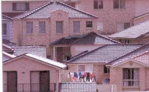
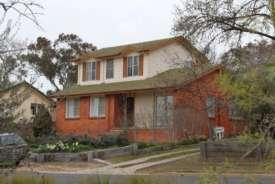
22 P1.5 Development in areas that have little or no heritage value is designed to respond to the topography and rural village character P1.6 New buildings may be of the time in which they are built and not reproductions of earlier historic building styles, providing they are in sympathy with heritage buildings in the vicinity. The Nelligen Design Guideline provides some useful guidance in determining the character of local designs. For more detail see the publication Design in Context Guidelines for Infill Development in the Historic Environment available free from the NSW Heritage Branch website P2 Shipping containers are located so that they are not visible from any road and adjoining property. A2 Shipping containers are not exempt development. To preserve the character of the area, any approved container must be located behind existing buildings, not be located in front of the established or proposed building line and be screened from view from any adjoining property. Controls for the provision of minimum boundary setbacks, private open space and landscaped area apply. 4.4 Building Materials To encourage development that compliments local character. A1 Zincalume must not be used as an external building material. A2 Building materials that have a BCA colour rating of Very Light must not be used as an external roofing material. However, unpainted galvanised iron is an acceptable roofing material in the historic precinct of Nelligen. Performance criteria P3 Materials and colour of new and existing buildings, including garages, carports and outbuildings, must be sympathetic with the rural character of the area. Acceptable solution A3.1 Buildings must not be constructed of brick walls and tiled roofs which have an urban character. Such materials are generally not appropriate, as they do not reinforce the rural historic character the villages. A3.2 External iron sheet wall cladding and 18
23 P4 Materials used on historic buildings are sympathetic with the original form of the building. roofing, if used, must be in custom-orb corrugated profile, not ribbed. A4 On historic buildings, building materials must match those used on the building, or in the vicinity, at the time of its initial construction. 4.5 Fences To ensure fences around individually significant buildings reflect the style of fence that was typical of the historic period. Performance criteria P1.1 Fences do not have an adverse visual impact on the place and are sympathetic with the village s historic and rural character. P1.2 Modern colourbond fences do not meet the objectives of this criterion, and are generally not appropriate in Nelligen. P2 Front fences higher than 1.0m may be spaced timber pickets or post and rail fencing in combination with vegetation. P3 The form, extent and materials of fencing are designed to minimise visual impact. Acceptable solution A1.1 Fencing is constructed from timber pickets, woven-wire on a frame or timber post and rail. A1.2 Fencing is consistent with traditional fencing evident in historic photographs of the place. A1.3 Ribbed metal-sheet fencing must not be used within the villages as it diminishes historic rural character. A2 The height of fences must be no greater than 1.0m forward of the building line and 1.8m behind the building line (as measured from the finished ground level on the lowest side of the fence). A3 Lengths of unmodulated fence (ie. Not broken up by the provision of gates or driveways): on a property boundary fronting a road reserve, and higher than 1.2m and greater than 15 metres long, must be provided with recessed indentations, at least 1m wide and 1m deep; located wholly within private property; not more than 10m apart; and containing planting that have a mature height at least that of the fence height. OR Fencing incorporates a combination of visually contrasting materials. 19
24 4.6 Roof Form and Roof Fixtures To ensure that new roof forms are compatible with the rural character of the village and contribute to the overall streetscape and or village aesthetic. Performance criteria P1.1 Roofs on infill development has regard to the aesthetic impact of the roof form and appearance within its vicinity and context. P1.2 Roofs on pavilion style additions (separate structures linked back to the parent building) may adopt a different form than the parent roof, providing the new remains aesthetically compatible with the historic. Acceptable solution A1.1 Roofs on alterations and additions must adopt the same form, pitch and type as prevails on the main roof. A1.2 Roof fixtures, including skylights, air vents, television antennas, satellite receiving dish, solar panel etc, must not be visible from the public domain. P1.3 Roof fixtures are located so as not to detract from the architectural design of the building, or visual amenity from the street. Where this cannot be achieved they are located and fixed to minimise visual impact, eg solar panels fixed flush to the roof-line, structures painted to blended with the building. P1.4 Corrugated iron is generally the appropriate roofing material in Nelligen. The use of modern clay or cement tiles is unlikely to be suitable as they are more typically associated with suburban development. P1.5 Roof sheeting in profiles other than corrugated custom orb may not meet the performance criteria. P2 If the acceptable solution cannot be achieved, then options for ground mounted systems must be demonstrated. A2 A serviceable amount of roof area must be orientated so as to be suitable for the location of solar energy systems and solar collectors. Additional controls for the non-historic precinct P3 The impact of rooftop terraces on the privacy and amenity of adjoining residential land is minimised. A3 Rooftop terraces that, if enclosed would form an additional floor outside the height and setback limit, must: be uncovered; be setback a minimum of 2m from the outer limits of the roof; and not include any structure that would exceed the height limit. 20
25 P4 Roof pitch is to contribute to the character of the area and promote consistency in form and materials. A4.1 No more than 50% of the total roof area (not including verandahs or skillion additions) may be at a pitch less than 10. P5 The roof form and pitch is in sympathy with surrounding heritage buildings. Additional controls for the historic precinct A4.2 Roof forms of one single expanse (i.e. large single skillion roof forms) are not permitted. A5.1 Within the historic commercial area (northern precinct), roof pitch must be in excess of 25 although shallower slopes are appropriate for skillions additions, verandas etc. A5.2 Rooftop terraces must not be included in the design of a building. 4.7 Alterations and Additions to Historic Buildings To ensure that development does not diminish heritage places. Performance criteria P1.1 Alterations and additions to historic buildings are stylistically in keeping with the form, detail, material and character of the parent or nearby structure. P1.2 Large additions to historically significant places are done as a separate structure or pavilion linked back to the parent building. In these circumstances the new pavilion may be modern in its style, providing it is sympathetic in other regards. P1.3 On historic buildings, modifications to windows, doors etc are consistent with the building s significant period, and use proportions and details relevant to that period. P1.4 Additions that increase the width of a front façade of a historic building are of a lesser scale and set back behind the adjacent front elevation such that the historic facade is clearly legible. Acceptable solution A1.1 Alterations to heritage items must retain significant detail including bargeboards, decorative trim etc, as these are often key components of a place s heritage value. A1.2 Small scale extensions to heritage items must adopt the original architectural styles, joinery and details, such as moulded boards, finials and the like. A1.3 Symmetrical facades on historic buildings must be retained by setting additions back from the front wall. A1.4 Chimneys that contribute to a place s significance must not be removed. Refer to Figure 3 P1.5 Additions that increase the height of a building in a way that compromises its aesthetic proportions and appearance are 21

26 not acceptable. P1.6 Development that fills-in or hides significant facades may not meet this objective. Refer to Figure 3 Figure 3: Modifications to the front facade of heritage places shall retain their traditional form, material and detail. 4.8 Colour To ensure that colours are suitable to the architectural style and character of places, precincts and streetscape. Performance criteria Acceptable solution P1 Colour is not used as a form of A1 Buildings must not be painted in advertising corporate colours. Overly bright colours or colour schemes are also not appropriate in the village. Additional controls for the historic precinct P2 Modern interpretations of period colour A2.1 Paint schemes on historically schemes may be appropriate where they blend with local historic character. significant buildings must be consistent with the colour scheme relevant to the significant phase of the particular building. A2.2 Previously unpainted surfaces must not be painted. 22
27 4.9 Adaptable Housing To design housing units that facilitates use by persons with a disability or progressive frailty. Performance Criteria P1 Residential development has the ability to cater for residents with a variety of physical abilities and is responsive to the changing lifestyle needs of residents. Acceptable Solution A1 Developers proposing multi-dwelling housing, shop top housing or residential flat buildings of 4 units or more must ensure that 25% of the dwellings are adaptable housing. The applicable dwellings must comply with Australian Standard AS4299 Adaptable Housing. Developers proposing access to heritage buildings should consult Improving Access to Heritage Buildings, a publication of the Australian Council of National Trusts, Australian Heritage Commission. 5.0 AMENITY 5.1 Visual Privacy To maximise the private enjoyment of residential development. Performance Criteria P1 Buildings are designed to minimise direct overlooking of main living areas and private open spaces of existing dwellings by sensitive building layout, location and design of windows and balconies and the use of screening devices and landscaping. Acceptable Solution A1.1 Balconies and transparent doors and windows of living rooms must be designed and located so they do not directly face transparent doors or windows of living rooms or the private open space areas of other residential accommodation within 9 metres. A1.2 Planter boxes, louvre screens, pergolas, landscaping and architectural design of balconies must be used to screen the ground floor private open space of dwelling units or dwelling units from upper level residential accommodation. Acceptable privacy measures include trees, awnings, screens, fences and planter boxes to minimise the ability to directly look into neighbouring homes and yards (see Figure 23
28 4). The view of the area overlooked must be restricted within 9m and beyond a 45 o angle from the plane of the wall containing the opening, measured from a height of 1.7m above floor level (see Figure 5). Figure 4: Acceptable Privacy Measures 24

29 Figure 5: Screening Views to Adjacent Private Open Spaces 25
30 5.2 Solar Access To maximise solar access to adjacent residential development. Performance Criteria Acceptable Solution Solar access to adjacent development P1.1 The use of natural light is maximised A1 Maintain solar access to existing and the need for artificial lighting is reduced. residential accommodation as follows. P1.2 Buildings are designed to ensure adjoining residential development maintains adequate daylight to living areas, (i.e. living, dining or family rooms, kitchens), private open space and solar panels. For all development except where an existing adjacent building has an eastwest orientation: - maintain solar access to the front or rear living room windows for a minimum period of 4 hours between 9.00am and 3.00pm at the winter solstice; and - where solar access already exists to the private open space of adjacent dwellings, ensure it is maintained over a minimum of 50% of the primary private open space for a minimum period of 3 hours between 9.00am and 3.00pm at the winter solstice. Solar panels P2 The total energy use in residential buildings is reduced. Where an existing adjacent building has an east - west orientation: - maintain solar access to the north facing living room windows for a minimum period of 2 hours between 9.00am and 3.00pm at the winter solstice; or - where less than 2 hours solar access is currently available to north facing living room windows of existing dwellings, no additional overshadowing shall be permitted. A2.1 Maintain solar access to existing solar panels throughout the day at all times of the year. A2.2 Maintain solar access to the north facing roofs of existing dwellings (45 West to 45 East variation is possible) to a fixed minimum area of 10m 2, capable of accommodating solar panels. 26
31 5.3 Streetscape To preserve and enhance the existing streetscape and contribute to the amenity of both public and private space through the use of street furniture and other public infrastructure that is in harmony with the streetscape. Performance criteria P1 Development on road reserves, (including paving, kerbing and street furniture) and works that impact on the streetscape shall reflect the historic and rural character of the village. Acceptable solution A1.1 Access ramps, railings and the like must be of timber (natural finish or painted) and modelled on traditional designs. A1.2 Seats within road reserves must be in the form of a simple bench or be a slatted seat of traditional design in durable hardwood. 6.0 SITE CONSIDERATIONS 6.1 Tree Preservation To minimise impacts on native flora and fauna, particularly threatened species. A1 All development must comply with the provisions of clause 5.9 of LEP 2012 and the Eurobodalla Tree Preservation Code. Performance Criteria P2 Tree removal is accompanied by appropriate tree replacement. It is appropriate to prune certain trees and hedges where this will enhance views to and from significant items, both within and beyond the study area. Acceptable Solution A2 Significant trees on private and public land must be retained. Exemptions to this acceptable solution may be found in the Eurobodalla Tree Preservation Code. 27
32 7.0 SITE WORKS 7.1 Sustainability To minimise the impact of new development on the natural environment. Performance Criteria P1 New development is designed to minimise the generation of greenhouse gases. P2 No performance criteria Acceptable Solution A1 New development must connect to reticulated electricity supply where available to enable any excess power created from alternative renewable resources to be fed back into the grid. A2 All dwellings in residential development must be provided with a separate water meter to comply with the State Government s Best Practice Management of Water Supply and Sewerage Guidelines. 7.2 Earthworks/excavation To retain the natural slope of the land and ensure that the bulk and scale of new development is responsive to site topography. Performance Criteria P1 Development is designed to ensure that excavation and earthworks are kept to the minimum required for the development without an unreasonable adverse visual impact on the site. Acceptable Solution A1 Beyond the external walls of the building, the maximum cut is to be 1m and the maximum fill is to be 1m. 7.3 Stormwater Management To ensure that stormwater runoff has no detrimental impacts on neighbouring properties, public spaces and Council infrastructure. Performance Criteria P1.1 Application of a site specific Stormwater Management Plan(SMP), approved by Council. The SMP will provide for the integrated management of Acceptable Solution A1.1 To avoid adverse impact on other development in the area, new development must connect to a lawful drainage system which has sufficient capacity to ensure that 28
33 stormwater in order to: minimise flooding; protect and enhance environmental values of receiving waters; maximise the use of water sensitive urban design principles; maximise the use of natural waterway corridors and natural channel design principles; maximise community benefit; and minimise public safety risk. P1.2 The stormwater management system or site works proposed by the SMP does not adversely impact on flooding or drainage of properties that are upstream, downstream or adjacent to the subject site. P1.3 The design provides for stormwater quality best management practices that are sufficient to treat the target pollutants. any overland stormwater runoff from the property after the completion of the development does not exceed the stormwater runoff level prior to the development. A1.2 Development must comply with the following where relevant: AS3500 Plumbing and Drainage Code; the Eurobodalla Development Specification Manual Section D5 Stormwater Drainage Design & D7 Erosion Control and Stormwater Management; and the Design Guidelines for Rainwater Tanks Where An Existing Reticulated Water Supply Exists. 7.4 Waste Management To further the objectives of the Site Waste Minimisation and Management Code. Performance Criteria P1 Application of a site specific Site Waste Minimisation and Management Plan, approved by council having regard to the objectives of the Code. The Plan must show that compliance with the Code is unreasonable or unnecessary in the circumstances of the case. Acceptable Solution A1 All development must comply with the Eurobodalla Site Waste Minimisation and Management Code. 29

34 SCHEDULES 1. MAPS Nelligen 30
35 2. LIST OF AMENDMENTS Intentionally blank 3. ROOF FORMS Typical roof forms on historic cottages 31


36 4. NELLIGEN DESIGN GUIDELINE Aim These guidelines seek to reinforce Nelligen s historic character, particularly in Braidwood and Wharf streets, and encourage a built form elsewhere in the village that reflects its coastal rural location. To this extent, the guidelines seek alternatives to the brick and tile type homes that are prevalent in large urban and metropolitan areas. Nelligen s character Nelligen s historic area is generally confined to Braidwood and Wharf Street, with most surviving historic structures located on the north side of Braidwood Street. The early buildings on the south side of the street were destroyed by fire in The western end of Braidwood and Reid streets compromise large vegetated allotments and the buildings are not dominant elements. The built environment along Runnyford Rd, Currowan Street and Nelligen Place is generally more modern. Most of the historic buildings in Nelligen are timber-framed, clad in weatherboard and roofed in corrugated iron. They are therefore lighter in feeling and appearance than the metropolitan style brick and tile building that are common in Canberra and Sydney. Roof forms on the 19 th century buildings are often steeply pitched with gabled ends and narrow eaves. The building, and hence the gabled roof ran at right angles to the slope of the land, thus reducing the amount of cut and fill and the height of piers. Federation styled buildings often had small gables in the hip, wider eaves, exposed rafters and the roof extending over the verandah. The Mechanics Institute displays a number of key characteristics of Nelligen s historic buildings including weatherboard walls, symmetrical façade, steeply pitched corrugated iron roof and vertically proportioned timber windows. The roof form, verandah details, shiplap weatherboards, exposed rafter ends and protruding chimney back demonstrate how form and detail have been used in traditional structures. The buildings addressed the street and the elevation was often symmetrical. Windows had vertical proportions and the chimney was a strong feature of the design. There was an attention to detail and architectural elements were used to enrich the overall appearance of the building. Like so many rural and coastal places, buildings were extended over time, with extensions often adopting a slightly different form. This tends to reduce the overall scale of the building. 32


37 The former court house was adapted as a church but still retains much of its architectural finery. This adapted federation style cottage shows the use of weatherboards below the windows with cement sheeting above. The new verandah is treated as a separate element and so reduces impact on the historic roofline. Landscape Most buildings are set back from the road, often behind a timber picket or timber and wire fence that is less than a metre in height. This provides a degree of privacy while allowing the building to contribute to the streetscape. Driveways are varied and are not dominant elements in the street. Similarly, garages are set back, or tucked under the building, or often designed as carports rather than solid structures. Simple picket fences in combination with vegetation can provide attractive screening and privacy Vegetation provides an effective screen to this recent cottage. The impact of the driveway has been reduced through the use of cement paving blocks set within bands of attractive river stones Design guidelines Nelligen s built character is varied and enriched by a variety of styles. The guidelines encourage the on-going evolution of styles in a manner that harmonises with the existing significant built form. Replication of period styles (eg neo Federation) is not encouraged. New buildings that draw on the key elements of the earlier styles and interpret them in a modern, contemporary way should achieve buildings that add to and continue to enrich Nelligen s built form. Such elements may include: 33


38 - Steeper pitched gabled roofs, but of a controlled scale and primarily at right angles to the slope of the land - Shallow pitched and sweeping roofs, possibly with a change of pitch over the verandah - Timber-framed or light-weight construction - Weatherboard or fibre-cement board walls - Sheet walling with battens over the joints - Combinations of weatherboards and battened sheet - Modulation of wall surface possibly associated with variations in cladding - Timber windows, or powdercoated aluminium windows with thicker frames - Front of building addressing the street while still allowing for views of the river - Reduced impact of undercrofts - Single-storey construction - Light weight attractive front fence - Minimal visual impact of driveway - Driveway character enriched with detailing - Appropriate landscaping This urban example shows how pitched roofs, varied wall materials and articulated forms can be combined in a modern way that expresses many of the design elements of historic buildings. The architectural massing reduces individual roof height and enables the building to step down the slope. Note that in Nelligen, a two storey building is not appropriate in the historic area, and that all buildings require a landscaped setback. Painted and or stained weatherboards in combination with painted sheeting can provide modern and attractive forms that harmonise with historic streetscapes and the rich vegetation occurring in and around the village. Note: Brick and tile homes such as these below are inconsistent with Nelligen s historic character 34
39 35
Intentional blank page
 Intentional blank page Intentional blank page Contents 1.0 INTRODUCTION... 1 1.1 Name... 1 1.2 Date of Adoption... 1 1.3 Aim... 1 1.4 Land to Which This Plan Applies... 1 1.5 Relationship to Other Plans,
Part 11 Heritage Area Plans West Wallsend / Holmesville
 TABLE OF CONTENTS: PART 1 WEST WALLSEND / HOLMESVILLE HERITAGE AREA PLAN... 3 1.1 INTRODUCTION... 3 1.2 BACKGROUND... 3 1.3 LAND TO WHICH THIS PLAN APPLIES... 3 PART 2 WEST WALLSEND / HOLMESVILLE HERITAGE
Part 9 Specific Land Uses - Housing on Small and Narrow Lots
 19 HOUSING ON SMALL AND NARROW LOTS This section of the DCP applies where development for the purpose of a dwelling house, attached dwellings, or semi-detached dwellings is or are proposed in the R2 Low
Draft Part 11 Heritage Area Plans West Wallsend / Holmesville
 TABLE OF CONTENTS: PART 1 WEST WALLSEND / HOLMESVILLE HERITAGE AREA PLAN... 3 1.1 INTRODUCTION... 3 1.2 BACKGROUND... 3 1.3 LAND TO WHICH THIS PLAN APPLIES... 3 PART 2 WEST WALLSEND / HOLMESVILLE HERITAGE
Cape Cabarita (Formerly known as the Wellcome Site) Development Control Plan. Date of Adoption: 4 September 2007 Effective Date: 7 March 2008
 Development Control Plan. Date of Adoption: 4 September 2007 Effective Date: 7 March 2008") Cape Cabarita (Formerly known as the Wellcome Site) Development Control Plan Date of Adoption: 4 September 2007 Effective Date: 7 March 2008 Development Control Plan Index 1 INTRODUCTION...3 1.1 LAND TO
Cape Cabarita (Formerly known as the Wellcome Site) Development Control Plan Date of Adoption: 4 September 2007 Effective Date: 7 March 2008 Development Control Plan Index 1 INTRODUCTION...3 1.1 LAND TO
4.3 Dudley Area Plan. Introduction. History and Existing Character. Desired Future Character for Dudley
 4.3 Dudley Area Plan Introduction The suburb of Dudley has developed as a result of various circumstances including its topography, history and mineral resources. Dudley development has been identified
Section Three, Appendix 16C Medium Density Housing, Design Assessment Criteria (Residential 8A zone)
") APPENDIX 16C MEDIUM DENSITY HOUSING, DESIGN ASSESSMENT CRITERIA (RESIDENTIAL 8A ZONE) PURPOSE OF APPENDIX 16C (RESIDENTIAL 8A ZONE) In the Residential 8A Zone the following are defined as restricted discretionary
APPENDIX 16C MEDIUM DENSITY HOUSING, DESIGN ASSESSMENT CRITERIA (RESIDENTIAL 8A ZONE) PURPOSE OF APPENDIX 16C (RESIDENTIAL 8A ZONE) In the Residential 8A Zone the following are defined as restricted discretionary
Development Control Plan
 Development Control Plan Liberty Grove Development Control Plan Date of Adoption: 4 September 2007 Effective Date: 7 March 2008 Index 1 INTRODUCTION... 3 1.1 NAME OF PLAN... 3 1.2 AREA TO WHICH THIS PLAN
Development Control Plan
 Development Control Plan Single Dwellings on Lots at Breakfast Point Development Control Plan Date of Adoption: 4 September 2007 Effective Date : 7 March 2008 Single dwellings on Lots at Breakfast Point
RESIDENTIAL ACTIVITY PERFORMANCE STANDARDS
 Preferred Options Consultation Q&A Sheet RESIDENTIAL ACTIVITY PERFORMANCE STANDARDS What are the key goals for managing the design of residential buildings in the Second Generation Plan (2GP)? The key
medium desnity housing
 This section updated September 2013 This part of the Plan sets out the assessment criteria for medium density housing. The criteria are designed to give designers and builders flexibility and to provide
Section Three, Appendix 17C Multiple Unit Housing Design Assessment Criteria
 APPENDIX 17C MULTIPLE UNIT HOUSING DESIGN ASSESSMENT CRITERIA Purpose of Appendix 17C In the Residential 9 Zone the construction and use of multiple household units located within the Multiple Household
APPENDIX MATAKANA COMMERCIAL URBAN DESIGN GUIDELINES
 APPENDIX MATAKANA COMMERCIAL URBAN DESIGN GUIDELINES 1.0 INTRODUCTION The following urban design guidelines are to be utilised by landowners, planners and other persons involved in development at early
22.15 OUTDOOR ADVERTISING SIGNAGE POLICY
 22.15 OUTDOOR ADVERTISING SIGNAGE POLICY This policy applies to all land where a planning permit is required to construct or display a sign under the provisions of the Kingston Planning Scheme. 22.15-1
Development Control Plan
 Development Control Plan Abbotsford Cove (Also known as the Former Nestle Site) Development Control Plan Date of Adoption: 4 September 2007 Effective Date: 7 March 2008 Index 1 INTRODUCTION... 3 1.1 ENVIRONMENTAL
4 Residential and Urban Living Zones
 4 Residential and Urban Living Zones Refer to Chapters 11 to 20 for additional rules that may apply to these zones. 4.1 OBJECTIVES AND POLICIES Objective Res1 Policy 1 Policy 2 Policy 3 Policy 4 Policy
MASTER PLAN NO. 62 (SITE DEVELOPMENT PLAN BIRTINYA VILLAGE CENTRE) 2009
 2009") Development Agreement, Development Control Plan 1 - Kawana Waters and Section 6.1.45A (Development Control Plans under Repealed Act) of the Integrated Planning Act 1997 MASTER PLAN NO. 62 (SITE DEVELOPMENT
Development Agreement, Development Control Plan 1 - Kawana Waters and Section 6.1.45A (Development Control Plans under Repealed Act) of the Integrated Planning Act 1997 MASTER PLAN NO. 62 (SITE DEVELOPMENT
SCHEDULE 12 TO THE DESIGN AND DEVELOPMENT OVERLAY GLEN WAVERLEY ACTIVITY CENTRE STRUCTURE PLAN
 DD/MM/YY Proposed C120 SCHEDULE 12 TO THE DESIGN AND DEVELOPMENT OVERLAY Shown on the planning scheme map as DDO12. GLEN WAVERLEY ACTIVITY CENTRE STRUCTURE PLAN 1.0 Design objectives DD/MM/YY Proposed
Design Guidelines - 1 -
 Design Guidelines REAR YARDS Rear yard decks and porches, attached to a garden or garage suite, should be permitted provided minimum rear yard setbacks, separation distances, and necessary site access
7.2.9 Eudlo local plan code
 7.2.9 local plan code 7.2.9.1 Application (1) This code applies to assessable development:- (a) within the local plan area as shown on Map ZM29 contained within Schedule 2 (Mapping); and (b) identified
DESIGN GUIDELINES. Oakdene Estate at Ocean Grove Grubb Road, Ocean Grove
 DESIGN GUIDELINES Oakdene Estate at Ocean Grove 162 240 Grubb Road, Ocean Grove TABLE OF CONTENTS INTRODUCTION... 3 1. HOUSE DESIGN APPROVAL PROCESS... 4 1.01 DESIGN PANEL FOR RESIDENTIAL DEVELOPMENT...
Housing and Coach House Guidelines - Ladner
 Housing and Coach House Guidelines - Ladner Policy D.8: Encourage Compatible Housing Design Encourage housing design that is sensitive to existing single family housing neighbourhoods by requiring a design
Division 7 Character Areas Housing Zone: Assessment Criteria and Assessment Tables
 Division 7 Character Areas Housing Zone: Assessment Criteria and Assessment Tables 4.7.1 Character Areas Housing Zone The provisions in this division relate to the Character Areas Housing Zone as follows
WINDSOR GLEN DESIGN GUIDELINES
 WINDSOR GLEN DESIGN GUIDELINES Adopted by Council, 2006 WINDSOR GLEN REDEVELOPMENT DESIGN GUIDELINES August 2006 1.0 Master Plan Organization For this area of the Coquitlam Town Centre, a mix of high,
APPENDIX 10 THE RESIDENTIAL DESIGN GUIDE FOR DEVELOPMENTS IN RESIDENTIAL ZONES IN SPECIFIED GROWTH AREAS
 THE RESIDENTIAL DESIGN GUIDE FOR DEVELOPMENTS IN RESIDENTIAL ZONES IN SPECIFIED GROWTH AREAS ISTHMUS SECTION - OPERATIVE 1999 Page 1 CONTENTS... PAGE 1.0 INTRODUCTION... 4 1.1 Growth Management Strategy...
open space environment
 This section updated August 09 GUIDELINE TO THE RULES The Open Space Environment Rules apply to activities on sites within the Open Space Environment as shown on the Human Environments Maps. Most of the
Ensure that development within the Arrowtown Urban Growth Boundary provides:
 URBAN DEVELOPMENT 4 4.2.5.2 Ensure that development within the Arrowtown Urban Growth Boundary provides: an urban form that is sympathetic to the character of Arrowtown, including its scale, density, layout
6.6.2 Emerging Community Zone Code Application Purpose and overall outcomes. s6 Zone Codes Emerging Community and Township Zone Codes
 6.6.2 Emerging Community Zone Code 6.6.2.1 Application This code applies to assessable development:- (1) within the Emerging Community Zone as identified on the zoning maps contained within Schedule 2
I615. Westgate Precinct
 I615. Westgate Precinct I615.1. Precinct Description The Westgate Precinct is located approximately 18km west of the Auckland city centre. There are seven Sub-precincts in the Westgate Precinct: Sub-precinct
CONTENTS 5. TOURIST ACCOMMODATION STRATEGIC LAND USE PLAN... 30
 MURRAY DEVELOPMENT CONTROL PLAN 2012 CONTENTS 1. INTRODUCTION... 1 1.1 Title... 1 1.2 Land to which this DCP applies... 1 1.3 Purpose... 1 1.4 Operation... 1 1.5 Relationship with other planning instruments...
MASTER PLAN NO. 60 (SITE DEVELOPMENT PLAN EASTBANK/REGATTA NORTH PRECINCTS 2 4) 2008
 2008") Page 2 TABLE OF CONTENTS PAGE 1 PRELIMINARY... 5 1.1 CITATION... 5 1.2 TYPE OF MASTER PLAN... 5 1.3 LEGAL REQUIREMENT FOR MASTER PLAN... 5 1.4 LEGAL EFFECT OF THE MASTER PLAN... 5 2 DESCRIPTION OF LAND...
Page 2 TABLE OF CONTENTS PAGE 1 PRELIMINARY... 5 1.1 CITATION... 5 1.2 TYPE OF MASTER PLAN... 5 1.3 LEGAL REQUIREMENT FOR MASTER PLAN... 5 1.4 LEGAL EFFECT OF THE MASTER PLAN... 5 2 DESCRIPTION OF LAND...
Division 13 Local Business and Industry Buffer Zone: Assessment Criteria and Assessment Tables
 Division 13 Local Business and Industry Buffer Zone: Assessment Criteria and Assessment Tables 4.13.1 Local Business and Industry Buffer Zone The provisions in this division relate to the Local Business
East Bayshore Road Neighbourhood
 East Bayshore Road Neighbourhood Northridge Property Management Urban Design Brief 3195 East Bayshore Road City of Owen Sound January 2016 East Bayshore Road Neighbourhood Northridge Property Management
Chapter 13 Residential Areas: Appendices APPENDIX 1 Residential Areas
 Chapter 13 Residential Areas: Appendices Page 1 Chapter 13 Residential Areas: Appendices APPENDIX 1 Residential Areas Design Code for Intensive Housing INTRODUCTION DESIGN ELEMENTS A NEIGHBOURHOOD DESIGN
I539. Smales 2 Precinct
 I539. Smales 2 Precinct I539.1. Precinct Description The Smales 2 Precinct applies to a 4.8 hectare block of land located on the southern side of Northcote Road and fronting Lake Pupuke, Takapuna. The
Duplex Design Guidelines
 Duplex Design Guidelines Adopted by Council May 29, 2006 Prepared By: Table of Contents 1.0 Application and Intent 1 2.0 Areas of Application 2 3.0 Design Principles 3 4.0 Design Guidelines 4 4.1 Site
UNITARY PLAN. Your Easy Guide to understanding the Residential Standards. Version 35. waste. outlook. landscapes. context. parking
 UNITARY PLAN Your Easy Guide to understanding the Residential Standards waste outlook landscapes height context fencing parking street interface daylight Version 35 June March 2017 2018 The Easy Guide
Urban Design Guidelines Townhouse and Apartment Built Form
 Urban Design Guidelines Townhouse and Apartment Built Form Town of Wasaga Beach Table of Contents 1. Introduction 1.1. Purpose 1.2. Urban Design Principles 1.3. Application of Guidelines 2. Site Design,
City of Vaughan Urban Design Guidelines for Infill Development in Established Low-Rise Residential Neighbourhoods
 City of Vaughan Urban Design Guidelines for Infill Development in Established Low-Rise Residential Neighbourhoods DRAFT - September 2016 Contents 1. Introduction 1 2. Policy Context 3 3. Characteristics
Sawtell Town Centre Development Control Plan
 Sawtell Town Centre Development Control Plan ABN 79 126 214 487 CONTENTS INTRODUCTION... 1 PREAMBLE... 1 HOW TO USE THIS DCP... 1 LAND TO WHICH THIS PLAN APPLIES... 1 MASTERPLAN... 2 VISION... 2 CHARACTER
Infill Residential Design Guidelines
 Infill Residential Design Guidelines Adopted March 23, 2004 Amended September 10, 2013 City of Orange Community Development Department Planning Division Phone: (714) 744-7220 Fax: (714) 744-7222 www.cityoforange.org
Design and siting guidelines
 Design and siting guidelines Enhance your lifestyle Callaway Park an development 1 These Guidelines deal with the planning and development of the vacant residential land lots at Callaway Park. 2 Introduction
Development Control Plan
 Development Control Plan Rhodes Corporate Park (Also known as the Digital Site) Development Control Plan Date of Adoption: 4 September 2007 Effective Date: 7 March 2008 Index 1 INTRODUCTION... 3 1.1 LAND
Derry City and Strabane District Council Planning Committee Report
 Derry City and Strabane District Council Planning Committee Report COMMITTEE DATE: 23 rd March 2016 APPLICATION No: APPLICATION TYPE: PROPOSAL: LOCATION: APPLICANT: LA11/2015/0395/F Residential Development
4 RESIDENTIAL ZONE. 4.1 Background
 4 RESIDENTIAL ZONE 4.1 Background The residential areas within the City are characterised by mainly lowrise dwellings sited on individual allotments. Past architectural styles, settlement patterns and
B L A C K D I A M O N D D E S I G N G U I D E L I N E S for Multi-family Development
 B L A C K D I A M O N D D E S I G N G U I D E L I N E S for Multi-family Development Adopted June 18, 2009 This section of the Design and focuses on site planning and design guidance for new multi-family
Subdivision Design Criteria. Penihana North GUIDELINES TO THE RULES
 Created September 2013 Penihana North Subdivision Design Criteria GUIDELINES TO THE RULES This part of the Plan sets out the design criteria for subdivision in Penihana North. The criteria will be considered
Celebrate the unexpected
 Celebrate the unexpected Design Guidelines September 2014 DESIGN GUIDELINES 3 Contents 1.0 Introduction 5 2.0 The purpose 7 2.1 The structure 8 2.2 The process 9 3.0 Jubilee the precinct 10 3.1 residential
I403 Beachlands 1 Precinct
 I403. Beachlands 1 I403.1. Precinct Description Beachlands is a rural and coastal village located on the eastern side of Auckland, adjoining the Tamaki Strait coastline. The original Beachlands village
QUEENSTOWN LAKES DISTRICT COUNCIL SUBDIVISION DESIGN GUIDELINES
 Attachment C: Draft QLDC Subdivision Design Guidelines QUEENSTOWN LAKES DISTRICT COUNCIL DESIGN GUIDELINES A DESIGN GUIDE FOR AND DEVELOPMENT IN THE URBAN ZONES QUEENSTOWN OFFICE 10 Gorge Road Queenstown
Design Guidelines 50 & DESIGN GUIDELINES 80 CARROLL LANE GREENVALE
 Design Guidelines J U N E 2 0 1 7 1 DESIGN GUIDELINES CONTENTS Vision 3 Introduction 4 Objectives 5 Application Process 6-7 Application Checklist 8 Built Form 9 Façade Articulation 10 Roof lines 11 Driveways
Wide asphalt driveway abutting school property. garage built with incompatible materials, too close to park. incompatible fencing materials
 Wide asphalt driveway abutting school property incompatible fencing materials garage built with incompatible materials, too close to park Lack of plantings as a buffer between private property and open
THE PURPOSE THE PROCESS THE GUIDELINES LIVING 1 SECTIONS YOUR HOME SITING BUILDING SIZE
 Design Guidelines Thank you for choosing to build your new home at Wigram Skies. As part of the building process, each house design at Wigram Skies will need to have been approved by Ngai Tahu Property
The Proposed Auckland Unitary Plan (notified 30 September 2013)
") 3 Business zones Introduction There are 10 business zones in the Unitary Plan: City Centre Metropolitan Centre Town Centre Local Centre Neighbourhood Centre Mixed Use General Business Business Park Light
3 Business zones Introduction There are 10 business zones in the Unitary Plan: City Centre Metropolitan Centre Town Centre Local Centre Neighbourhood Centre Mixed Use General Business Business Park Light
Hurstville DCP No. 1 (Amendment No.5) Table of Contents
 Table of Contents") Hurstville DCP No. 1 (Amendment No.5) Section Table of Contents 1.0 Introduction 1 2.0 Application Process 2.1 Exempt and Complying Development 15 2.2 Neighbour Notification and Advertising of Development
Hurstville DCP No. 1 (Amendment No.5) Section Table of Contents 1.0 Introduction 1 2.0 Application Process 2.1 Exempt and Complying Development 15 2.2 Neighbour Notification and Advertising of Development
Vision Statement for Point Lonsdale
 TOWNSHIP BROCHURE This Township Brochure applies to all of Point Lonsdale (CoGG). Please see overleaf for precinct map and refer to the individual Precinct Brochure for your area. Vision Statement for
PART TWO: URBAN DESIGN GUIDELINES 09 INTRODUCTION TO URBAN DESIGN GUIDELINES
 PART TWO: URBAN DESIGN GUIDELINES 09 INTRODUCTION TO URBAN DESIGN GUIDELINES 103 NORTH COAST URBAN DESIGN GUIDELINES 09 INTRODUCTION TO URBAN DESIGN GUIDELINES 9.0 INTRODUCTION The purpose of Part Two
4.0 Design Guidelines For The Village Centre. South fields Community Architectural Design Guidelines Town of Caledon
 4.0 Design Guidelines For The Village Centre 4.0 Design Guidelines for the Village Centre The Village Centre is the focal point of the entire South Fields Community and is designed as a traditional commercial
Proposed for Vic West Neighbourhood Plan. Design Guidelines for Intensive Residential Development - Townhouse and Attached Dwelling
 Proposed for Vic West Neighbourhood Plan Design Guidelines for Intensive Residential Development - Townhouse and Attached Dwelling Design Guidelines for Intensive Residential Development - Townhouse and
Advisory notes. Design and siting of buildings and structures. Purpose of these notes. Building setbacks and site coverage.
 Advisory notes Design and siting of buildings and structures Purpose of these notes The design and siting of buildings and structures within the City of Gold Coast (the City) is regulated by a combination
H10. Business Town Centre Zone
 H10. Business Town Centre Zone H10.1. Zone description The Business Town Centre Zone applies to suburban centres throughout Auckland, the satellite centres of Warkworth and Pukekohe, and the rural towns
KEY MAP DEVELOPMENT PERMIT AREA MAP. Sunnymede North Sub-Area Plan
 Richmond Official Community Plan BROADMOOR AREA SUNNYMEDE NORTH SUB-AREA PLAN Bylaw 7100 Schedule 2.6C SUNNYMEDE NORTH SUB-AREA PLAN SUNNYMEDE NORTH SUB-AREA PLAN SUNNYMEDE NORTH SUB-AREA PLAN KEY MAP
SOUTH CAMBRIDGESHIRE DISTRICT COUNCIL. Executive Director (Operational Services) Corporate Manager (Planning and New Communities)
 Corporate Manager (Planning and New Communities)") SOUTH CAMBRIDGESHIRE DISTRICT COUNCIL REPORT TO: Planning Committee 12 January 2011 AUTHOR/S: Executive Director (Operational Services) Corporate Manager (Planning and New Communities) Notes: S/1848/10
SOUTH CAMBRIDGESHIRE DISTRICT COUNCIL REPORT TO: Planning Committee 12 January 2011 AUTHOR/S: Executive Director (Operational Services) Corporate Manager (Planning and New Communities) Notes: S/1848/10
Nelson Residential Street Frontage Guideline
 DRAFT 22-06-2012 Nelson Residential Street Frontage Guideline June 2012 1317273 Contents and purpose Residential s are important Residential s are much more than corridors which move traffic. Streets allow
Next Steps / Development Process. Structure Plan. June submitted to City of Fremantle. Structure Plan. July supported for advertising
 overview What is today about? In July 0, the City of Fremantle resolved that the be advertised for public comment. Today is about: Understanding the history and context of the site Having your say on the
I602. Birdwood Precinct
 I602. Birdwood Precinct I602.1. Precinct description The Birdwood Precinct applies to an area west of Don Buck Road and south of Red Hills Road in west Auckland. It incorporates subdivision and development
PLANNING INSTITUTE OF AUSTRALIA, NSW DIVISION SUBMISSION ON THE NSW DRAFT HOUSING CODE AND NSW DRAFT COMMERCIAL CODE
 PLANNING INSTITUTE OF AUSTRALIA, NSW DIVISION SUBMISSION ON THE NSW DRAFT HOUSING CODE AND NSW DRAFT COMMERCIAL CODE This Submission provides detailed comment on draft Codes following feedback from PIA
DRAFT Northeast Quadrant of Kipling Avenue and Highway 7 DRAFT AUGUST 29, Goals Land Use. The goals of this Plan are to:
 AUGUST 29, 2017 12.15 Northeast Quadrant of Kipling Avenue and Highway 7 12.15.1 Goals 12.15.2 Land Use The goals of this Plan are to: 12.15.2.1 General Provisions: a) Ensure the development of a compact
URBAN DESIGN BRIEF URBAN DESIGN BRIEF 721 FRANKLIN BLVD, CAMBRIDGE August 2018
 URBAN DESIGN BRIEF URBAN DESIGN BRIEF 721 FRANKLIN BLVD, CAMBRIDGE August 2018 DESIGN BRIEF CONTENTS PART A 1.0 INTRODUCTION 2.0 DESCRIPTION & ANALYSIS OF SITE CONTEXT 3.0 DESIGN CONSTRAINTS AND OPPORTUNITIES
FORMER CANADIAN FORCES BASE (CFB) ROCKCLIFFE SECONDARY PLAN. Official Plan Amendment XX to the Official Plan for the City of Ottawa
 ROCKCLIFFE SECONDARY PLAN. Official Plan Amendment XX to the Official Plan for the City of Ottawa") FORMER CANADIAN FORCES BASE (CFB) ROCKCLIFFE SECONDARY PLAN Official Plan Amendment XX to the Official Plan for the City of Ottawa 1 INDEX THE STATEMENT OF COMPONENTS PART A THE PREAMBLE PAGE Purpose...
FORMER CANADIAN FORCES BASE (CFB) ROCKCLIFFE SECONDARY PLAN Official Plan Amendment XX to the Official Plan for the City of Ottawa 1 INDEX THE STATEMENT OF COMPONENTS PART A THE PREAMBLE PAGE Purpose...
KAHUKURA THE PURPOSE THE PROCESS THE GUIDELINES LIVING G (WIGRAM) DENSITY C SECTIONS YOUR HOME SITING BUILDING SIZE
 DENSITY C SECTIONS YOUR HOME SITING BUILDING SIZE") KAHUKURA Design Guidelines Thank you for choosing to build your new home at Wigram Skies. As part of the building process, each house design at Wigram Skies will need to have been approved by Ngai Tahu
KAHUKURA Design Guidelines Thank you for choosing to build your new home at Wigram Skies. As part of the building process, each house design at Wigram Skies will need to have been approved by Ngai Tahu
5.1 Site Plan Guidelines
 5. Community Core Guidelines Development of the Community Core will take place by plan of subdivision and site plan approval. It will occur in a phased manner that will reflect the timing of residential
AOTEA SUPERMARKET ZONE. Zone Introduction
 C18 AOTEA SUPERMARKET ZONE Zone Introduction C18.1 Objective This zone identifies a specific area in Aotea for a stand alone supermarket. The zone is site specific and has a range of objectives, policies
TABLE OF CONTENTS 1.0 INTRODUCTION... 3
 TABLE OF CONTENTS 1.0 INTRODUCTION... 3 1.1. BACKGROUND... 3 1.2. THE PROPOSAL... 5 2.0 EXISTING POLICY FRAMEWORK... 5 2.1. PROVINCIAL POLICY STATEMENT (PPS)... 5 2.2. CITY OF LONDON OFFICIAL PLAN (OP)...
DRAFT DESIGN GUIDELINES
 IHZ Booklet #7 May 6, 2010 DRAFT DESIGN GUIDELINES CANTERBURY 7 Overview During the recent planning process for the Plan of Conservation and Development community character was identified as an important
H13. Business Mixed Use Zone
 H13. Business Mixed Use Zone H13.1. Zone description The Business Mixed Use Zone is typically located around centres and along corridors served by public transport. It acts as a transition area, in terms
II. SINGLE FAMILY RESIDENTIAL
 II. SINGLE FAMILY RESIDENTIAL Castle Rock is made up of numerous individually built houses and subdivision tracts that have been developed during the past century. Some of the tracts are diverse in architectural
DESIGN GUIDELINES Building and Siting Requirements
 DESIGN GUIDELINES Building and Siting Requirements DESIGN GUIDELINES BUILDING AND SITING REQUIREMENTS // LEWIS LAND GROUP 2016 2 CONTENTS INTRODUCTION... 05 IMPORTANT CONSIDERATIONS... 06 YOUR HOUSE...
I331. St John s Theological College Precinct
 I331. St John s Theological College Precinct I331.1. Precinct Description The precinct contains the existing St John s Theological College which is a residential college for the Anglican Church in New
URBAN DESIGN BRIEF Gordon Street City of Guelph. Prepared on behalf of Ontario Inc. March 25, Project No. 1507
 URBAN DESIGN BRIEF 1131 Gordon Street City of Guelph Prepared on behalf of 1876698 Ontario Inc. March 25, 2016 Project No. 1507 423 Woolwich Street, Suite 201, Guelph, Ontario, N1H 3X3 Phone (519) 836-7526
H9. Business Metropolitan Centre Zone
 H9. Business Metropolitan Centre Zone H9.1. Zone description The Business Metropolitan Centre Zone applies to centres located in different subregional catchments of Auckland. These centres are second only
HERITAGE DESIGN GUIDELINES
 HERITGE DESIGN GUIDELINES July 2017 2 Table of Contents 1. Introduction 4 2. Conservation Works 5 3. Demolition and Relocation 7 4. dditions and lterations 10 5. New Buildings (ll reas) 16 6. Services
22.05 HERITAGE POLICYLACES OUTSIDE THE CAPITAL CITY ZONE
 22.05 HERITAGE POLICYLACES OUTSIDE THE CAPITAL CITY ZONE This policy applies to all places within the Heritage Overlay Area excluding the Capital City Zone Schedules 1, 2, 3 and 4 and the Docklands Zone.
DESIGN GUIDANCE NOTE NO: 5 EXTENSIONS TO HOUSES
 DESIGN GUIDANCE NOTE NO: 5 EXTENSIONS TO HOUSES This note is one of a series providing design guidance for development in the borough. It explains the criteria used by the council to decide planning applications
PLANNING COMMITTEE. 14 October 2014
 AGENDA ITEM NO 8 PLANNING COMMITTEE 14 October 2014 APPLICATION NUMBER : CA//14/01744/FUL PROPOSAL : Extension and conversion of roof space of an existing detached bungalow together with enhanced parking
2 Status of the Design Guidelines The Design Controls are to be applied to each of the residential titles by way of consent notices.
 6 October 2015 HARAKEKE 2015 LTD DESIGN CONTROLS 1 Introduction The Design s apply to all of the buildings to be erected in the Harakeke Subdivision on the sites 101-130, 201-232, 301-322, 401-426, and
Schedule of Planning Applications Committee Date: 23 May Reference: 06/17/0726/F Parish: Hemsby Officer: Mr J Beck Expiry Date:
 Schedule of Planning Applications Committee Date: 23 May 2018 Reference: 06/17/0726/F Parish: Hemsby Officer: Mr J Beck Expiry Date: 22-05-2018 Applicant: Proposal: Site: Mr Gillett Change of use to the
I609. Penihana North Precinct
 I609. Penihana North Precinct I609.1. Precinct description The Penihana North Precinct is located south of the Swanson Railway Station, adjacent to the Rural Urban Boundary (RUB) and Waitakere Ranges Heritage
Extract from Whitehorse Planning Scheme - LOCAL PLANNING POLICIES - CLAUSE Preferred Character Statements
 Extract from Whitehorse Planning Scheme - LOCAL PLANNING POLICIES - CLAUSE 22.03 22.03-5 Preferred Character Statements Bush Environment The streetscapes will be dominated by vegetation with subservient
Water Sensitive Urban Design Site Development Guidelines and Practice Notes. Appendix
 Water Sensitive Urban Design Site Development Guidelines and Practice Notes Appendix 108 Appendix A Water sensitive developments involve simple design and management practices that take natural site features
H14. Business General Business Zone
 H14. Business General Business Zone H14.1. Zone description The Business General Business Zone provides for business activities from light industrial to limited office, large format retail and trade suppliers.
Commercial Development Permit Area
 City of Kamloops KAMPLAN Commercial Development Permit Area PURPOSE The purpose of this Development Permit Area (DPA) is to establish objectives and provide guidelines for the form and character of commercial
Keystone Business Park Precinct Structure Plan North East Industrial Precinct. Part 2 Design Principles
 Keystone Business Park Precinct Structure Plan North East Industrial Precinct Part 2 Design Principles Context Issues Services Landform Issues Geotech and contamination Ecology Traffic and access Issues
Urban Design Brief Proposed Residential Development 5219 Upper Middle Road City of Burlington
 Urban Design Brief Proposed Residential Development 5219 Upper Middle Road City of Burlington Prepared by Weston Consulting Prepared for BLOOMFIELD DEVELOPMENT INC. Date: March 2017 Table of Contents 1.
URBAN DESIGN BRIEF. 2136&2148 Trafalgar Road. Town of Oakville
 URBAN DESIGN BRIEF 2136&2148 Trafalgar Road Town of Oakville Prepared By: METROPOLITAN CONSULTING INC For 2500674 Ontario Inc November 2016 TABLE OF CONTENTS Page No. 1.0 Introduction/Description of Subject
Rev John Withy, Sion House, 120 Melmount Road, Sion Mills
 Derry City and Strabane District Council Planning Committee Report COMMITTEE DATE: 4 th October 2017 APPLICATION No: APPLICATION TYPE: PROPOSAL: LOCATION: APPLICANT: AGENT: LA11/2016/0701/F Full Retrospective
13. New Construction. Context & Character
 13. New Construction Context & Character While historic districts convey a sense of time and place which is retained through the preservation of historic buildings and relationships, these areas continue
Draft Ada Street Cardiff Area Plan
 Draft Ada Street Cardiff Area Plan (Draft Amendment to Lake Macquarie Development Control Plan 2014) Exhibition: The draft Area Plan is on public exhibition from 29 February 2016 to 29 March 2016. Submissions:
Division 6 Residential Code
 Division 6 Residential Code 12.6.1 Residential Code The provisions in this division comprise the Residential Code. They are compliance with the Residential Code (section 12.6.2); overall outcomes for the
AIRPORT BUSINESS PARK
 PIER MAC PETROLEUM INSTALLATION LTD. AIRPORT BUSINESS PARK DEVELOPMENT APPLICATIONS March 2003 4.1 Airport Business Park Development Permit Area 4.1.1 Justification/Design Concept The design concept envisioned