City of Cape May. Cape May County, New Jersey. PLAN ENDORSEMENT ASSESSMENT REPORT October 5, 2010
|
|
|
- Griselda Stone
- 6 years ago
- Views:
Transcription


1 City of Cape May Cape May County, New Jersey PLAN ENDORSEMENT ASSESSMENT REPORT October 5, 2010
2 TABLE OF CONTENTS INTRODUCTION. 3 LOCATION AND REGIONAL CONTEXT 5 DEMOGRAPHICS...7 COMMUNITY INVENTORY COMMUNITY VISION & PUBLIC PARTICIPATION STATUS OF MASTER PLAN AND OTHER RELEVANT PLANNING ACTIVITIES STATEMENT OF PLANNING COORDINATION STATE, FEDERAL & NON-PROFIT PROGRAMS, GRANTS AND CAPITAL PROJECTS...49 INTERNAL CONSISTENCY IN LOCAL PLANNING 51 SUSTAINABILITY STATEMENT CONSISTENCY WITH STATE PLAN GOALS, POLICIES & INDICATORS 54 CONSISTENCY WITH STATE PLAN CENTER CRITERIA & POLICIES CONSISTENCY WITH STATE PLAN PLANNING AREA POLICY OBJECTIVES. 71 STATE AGENCY ASSISTANCE..74 CONCLUSION 75 Page 1

3 Plan Endorsement Assessment Report Prepared For: City of Cape May 643 Washington Street Cape May, NJ Prepared By: 6684 Washington Avenue Egg Harbor Township, NJ Phone Craig R. Hurless, PP New Jersey Professional Planner License No Page 2
4 INTRODUCTION The purpose of Plan Endorsement is to provide a process wherein a municipality s development and preservation plans are determined consistent with the goals and objectives of the State Development and Redevelopment Plan (SDRP). The purpose of the SDRP is to: Coordinate planning activities and establish Statewide planning objectives in the following areas: land use, housing, economic development, transportation, natural resource conservation, agriculture and farmland retention, recreation, urban and suburban redevelopment, historic preservation, public facilities and services, and intergovernmental coordination (N.J.S.A. 52:18A-200(f)). To achieve the purposes of The SDRP, the Plan creates a different planning area designation which provides areas for appropriate growth and preservation as follows: Areas for Growth: Metropolitan Planning areas (Planning Area 1), Suburban Planning Areas (Planning Area 2) and Designated Centers in any planning area. Areas for Limited Growth: Fringe Planning Areas (Planning Area 3), Rural Planning Areas (Planning Area 4), and Environmentally Sensitive Planning Areas (Planning Area 5). In these planning areas, planning should promote a balance of conservation and limited growth environmental constraints affect development and preservation is encouraged in large contiguous tracts. Areas for Conservation: Fringe Planning Area (Planning Area 3), Rural Planning Areas (Planning Area 4), and Environmentally Sensitive Planning Areas (Planning Area 5). The New Jersey State Planning Commission (SPC) approved the release of the Preliminary State Development and Redevelopment Plan (State Plan) and the Preliminary State Plan Policy Map On April 28, This action started the third round of Cross-acceptance. The State of New Jersey is currently in the cross-acceptance process for the 2004 Preliminary State Plan, a process that has been ongoing for several years. Through cross-acceptance local government is asked to participate in the shaping of the goals, strategies and policies of the State Plan. The City of Cape May has participated in this process through Cape May County and Cape May County Planning Department, which is the negotiating entity for the County. Cross-acceptance is a negotiating process between the state, counties, and municipalities and public that is meant to ensure that everyone has the opportunity to participate and shape the goals and policies of the State Plan. The State Plan and the State Plan Policy Map are intended to represent the input of these parties so that a State Plan can be created that makes sense for all of the state. Cross-acceptance concludes with written Statements of Agreements and Disagreements supported by each negotiating entity and the SPC and with the negotiated agreements being added to the Draft Final State Plan. The SPC updated the cross acceptance guidelines for plan endorsement in Plan Page 3
5 endorsement is a voluntary review process designed to ensure the coordination of the state, counties, and municipalities and public planning efforts for achieving the goals and objectives in the State Plan. These guidelines set the standards by which municipal petition will be evaluated for consistency with the State Plan. Upon endorsement, municipalities are entitled to financial and technical incentives that can assist in implementation of the endorsed plans. On September 8, 2009, the NJDEP published in the NJ Register notice of its acceptance of new and changed CAFRA center and core boundaries pursuant to N.J.A.C. 7:7E-5B.3. In 2004, the State Planning Commission adopted rules that set expiration dates for certain SPC designated centers and cores that were not approved through the plan endorsement process. These designations were set to expire on a specified schedule beginning on January 7, On September 6, 2008, the Permit Extension Act of 2008 was signed into law. In accordance with the Permit Extension Act of 2008, the boundaries of State Planning Commission designated centers and cores were extended, except for those portions of the centers and cores located in environmentally sensitive areas. Cape May City is located in an environmentally sensitive area. The expiration dates of designated centers and cores set forth by the State Planning Commission were modified by operation of law by enactment of the Permit Extension Act of The changes accepted by the NJDEP reflect the expiration of those State Planning Commission designated centers and cores that consisted entirely of environmentally sensitive areas. The changes also reflect the expiration of those portions of other centers that are environmentally sensitive area as defined by the Permit Extension Act. The NJDEP, for purposes of N.J.A.C. 7:7E-5B.3, is accepting the expiration of all or portions of these centers and the reversion of these areas to the underlying State Plan Planning Area designation. Accordingly, the Department has repealed all or portions of the CAFRA centers that correspond to these expired State Planning Commission centers. These areas have reverted to the Coastal Planning Area that corresponds to the underlying State Plan Planning Areas. In this case the former Cape May City CAFRA Town has reverted back to the Coastal Environmentally Sensitive Planning Area (PA5). This change has effectively hindered CAFRA type applications as coverage allowances have been drastically reduced by this change and it is not appropriate based on the current development characteristics and planning for the future. The City seeks to reestablish the Town center designation. The City previously received Center Designation from the NJ State Planning Commission which coincided with the CAFRA Centers which have recently expired. The majority of the City had been designated a Designated Town Center with some undeveloped areas designated PA5 Environmentally Sensitive Area. In order to reinstitute the Center previously approved and continue to promote growth in these approved and designated areas while protecting the environmentally sensitive areas of the municipality, The City of Cape May must submit for and achieve Plan Endorsement from the Office of Smart Growth. Page 4
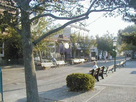
6 Efforts related to Plan Endorsement that have been recently completed by the City include Master Plan Reexamination, Affordable Housing Plan, and Floodplain Management Planning as well as many other planning efforts that are referenced within this document. A relevant planning issue that may be addressed is the future development of East Cape May. Several residential projects are proposed in this environmentally sensitive area of Cape May and planning for future development has been made a priority by the City. Assistance from state agencies includes the New Jersey Department of Environmental Protection (NJDEP) and New Jersey Department of Community Affairs Office of Smart Growth is anticipated to be necessary to implement the City s plans. LOCATION AND REGIONAL CONTEXT The City of Cape May is a 2.2 square mile community located at the southern end of New Jersey and Cape May County. Cape May s southern shoreline is formed by wide, white sand beaches that border the Atlantic Ocean and the City is influenced by sensitive environmental features that are described below. Wetlands occur throughout all sections of the city and limit development on vacant lands, particularly near Cape May Harbor in the east end and bordering Cape Island Creek on the north end. Protection of fragile dunes is essential to protection of the valuable beach resources. Cape May considers itself to be America s first resort community. Settlement occurred in the early nineteenth century but few structures remain from that period. However, it is Cape May s extraordinary collection of late-nineteenth century Victorian architecture that has led to the City s designation as a National Historic Landmark. This designation was bestowed on the City of Cape May by the U.S. Department of the Interior in Currently, the City has over 600 Victorian buildings which are in use as accommodations, offices, retail shops, restaurants, and private residences. Summer remains Cape May s busiest season, with vacationers being attracted by a combination of its historic ambiance and its beachfront location. Although most of the New Jersey coast is occupied by resort communities, Cape May receives the second largest number of visitors, after Atlantic City. Unlike many other beachfront towns, a wide-range of activities have led to Cape May s emergence as a year-round resort. Cape May benefits from its proximity to major population centers and visitor attractions in the Mid-Atlantic Region. It is approximately 50 miles south of Atlantic City, 80 miles southeast of Philadelphia,150 miles south of New York City, 160 miles north of Baltimore, 194 miles north of Washington, DC and 300 miles north of Richmond, Virginia. In terms of vehicular access, Cape May is within a tank full of gasoline for 25% of the American public. Both Route 9 and the Garden State Parkway terminate in Lower Township, near the Schellenger s Landing Bridge, which provides the main route for vehicular traffic approaching Cape May. A secondary street access is available via Seashore Road, through West Cape May. The Cape May-Lewes Ferry, which provides service between the southern end of New Jersey and Lewes, Delaware, is located at the western end of the Cape May Canal. Buses connect the Page 5
7 ferry with Cape May s Transportation Center, which is located near the City s main shopping district, the Washington Street Mall. The Transportation Center is also serviced by the Cape May Seashore Railroad, which provides service between the City and Cape May Court House, via the historic Cold Spring Village. In addition, the Transportation Center is also serviced by frequent daily bus service by New Jersey Transit on a year round basis. This bus service connects with Atlantic City, Philadelphia, North Jersey destinations, New York City, as well as coastal resort towns in Cape May and Atlantic Counties. Cape May is separated from the New Jersey mainland by Cape May Harbor and the Cape Canal, which is part of the Intracoastal Waterway. This island is shared by the City of Cape May, the Boroughs of West Cape May and Cape May Point, and a portion of Lower Township. Cape May City shares municipal borders with the Borough of West Cape May and Lower Township. The eastern end of the city is occupied by a U.S. Coast Guard base, which occupies approximately 20% of the land area in the City. Page 6
8 DEMOGRAPHICS This section has been prepared to provide a summary background of local demographics and comparison to county and state demographics. This information was prepared in the City of Cape May Master Plan Reexamination February 27, 2099 Revised March 13, Cape May s unique characteristics as a summer resort with a full time resident population of 4,034 residents that continues to decline as the housing stock becomes more non-primary vacation housing is evident in the demographics. Based on the 2000 census data, the following table illustrates a comparison of the City to both the County and State data: Cape May City Cape May New Jersey County Land Area (sq mi) ,417 Population 4, ,326 8,414,350 Households 1,821 42,148 3,064,645 Average Household Size Housing Units 4,064 91,047 3,310,275 Home Ownership Rate 56.8% 74.2% 66% Vacancy Rate 55.2% 53.7% 7.4% Median Household $33,462 $41,591 $55,146 Income Per Capita Income $29,902 $24,172 $27,006 Poverty Rate 9.1% 8.6% 8.5% Unemployment Rate 5.2% 6.9% 4.8% (NJDOL 2004) Page 7
9 Municipality Racial/Ethnic Breakdown 5% 4% 2% White Black Latino Other 89% County Racial/Ethnic Breakdown 5% 3% 2% White Black Latino Other 90% New Jersey Racial/Ethnic Breakdown 13% 13% 8% 66% White Black Latino Other Page 8
10 Municipality Age Distribution Male Female County Age Distribution Male Female New Jersey Age Distribution Male Female Page 9
11 Workers by Industry Municipality County New Jersey 0% 10% 20% 30% 40% 50% 60% 70% 80% 90% 100% Agriculture, forestry, fishing and hunting, and mining Construction Manufacturing Wholesale trade Retail trade Information Finance, insurance, real estate and rental and leasing Professional, scientific, management, administrative, and waste management services Other services (except public administration) Arts, entertainment, recreation, accommodation and food services Educational, health and social services Public administration Page 10
12 ANALYSIS OF CAPE MAY CITY DEMOGRAPHIC CHARACTERISTICS: Population Trends: Total population growth rates for Cape May City are depicted in Table No. 10 below. Total population for the municipality is 4,034 for the year 2000 which represents a reduction of 13.58% from the population of 4,668 in Cape May City s population shows a steady decrease which is most likely attributed to increased seasonal homeowner population and smaller household sizes. Preliminary population estimates as of July 1, 2009 have been released by the U.S. Census Bureau that indicates Cape May has a population of 3,699 which represents a loss of 9% from the 2000 population estimate. RATE OF POPULATION GROWTH CITY OF CAPE MAY, NEW JERSEY YEAR POPULATION CHANGE (NO.) CHANGE (%) , , , , , , Source: Household Size: Cape May City s average household size has decreased from 2.50 persons in 1990 to 2.02 persons in 2000 as summarized in Table No. 11 below. YEAR TABLE NO. 11 AVERAGE HOUSEHOLD SIZE CITY OF CAPE MAY, NEW JERSEY TOTAL POPULATION NUMBER OF OCCUPIED HOUSING UNITS HOUSEHOLD SIZE ,668 1, ,034 1, Source: US Census Bureau; 1990, 2000 Age & Race Characteristics: Page 11
13 As indicated in the 2003 Master Plan, the age distribution of the population can have important implications for the housing plan. Communities with a relatively large proportion of children have a need for larger family units while those with high proportions of senior citizens may have a need for smaller units. The population of Cape May has aged between 1990 and The percentage of each age group under age 35 has decreased, and the percentage of each age group over 35 has increased. In 1990, more than 47% of the population was under 35 years of age, while in 2000, that percentage had changed to just over 37% of the population. The median age in 1990 was 37.2, compared to 37.6 for the County as a whole. In 2000, the median age had risen to 47.4 compared to 42.3 for the County. Cape May City s age and gender characteristics are illustrated in Table No. 12 below. Racial composition of the municipality is summarized in Table No. 13. TABLE NO. 12 AGE AND GENDER CHARACTERISTICS, 2000 CITY OF CAPE MAY, NEW JERSEY AGE GROUP MALE FEMALE TOTAL PERCENT (%) Under Total 1,987 2,047 4, Median Age Source: US Census Bureau: 2000 Page 12
14 TABLE NO. 13 RACIAL COMPOSITION, 2000 CITY OF CAPE MAY, NEW JERSEY RACE NUMBER PERCENT (%) White 3, Black or African American Asian Two or more races Some other race Total 4, Source: US Census Bureau: 2000 Income Level: Household income levels are provided in Table No. 14. The median household income for 2000 is $33,462. It should be noted that approximately 34% of household income levels are below $25,000. TABLE NO. 14 HOUSEHOLD INCOME, 2000 CITY OF CAPE MAY, NEW JERSEY INCOME CATEGORY HOUSEHOLDS PERCENT (%) <$10, % $10,000 - $14, % $15,000 - $24, % $25,000 - $34, % $35,000 - $49, % $50,000 - $74, % $75,000 - $99, % $100,00 - $149, % $150,000 - $199, % $200, % Total 1, % Median Household Income $33,462 Source: US Census Bureau: 2000 Page 13
15 Employment Status, Trends & Characteristics of Residents: Table No. 15 indicates the New Jersey Department of Labor covered by unemployment insurance employment differences between year 1990 and The number of covered jobs has decreased 17.8% over the ten year period. TABLE NO. 15 COVERED EMPLOYMENT CITY OF CAPE MAY, NEW JERSEY YEAR NUMBER OF JOBS 1990 Private 985 Government 423 Total Private 882 Government 276 Total 1158 Source: State of New Jersey, Department of Labor, Office of Labor Planning & Analysis, Trends in Employment and Wages Covered by Unemployment Insurance ( ). Employment Characteristics and Occupation Patterns of the Community s Residents: Tables No. 16 and No. 17 provide a summary of employment status within the City by gender and occupation type. Approximately 96% of Cape May City s labor force was employed in TABLE NO. 16 EMPLOYMENT STATUS OF PERSONS 16 AND OVER BY GENDER CITY OF CAPE MAY, NEW JERSEY AGE GROUP MALE FEMALE TOTAL Armed Forces Civilian Labor Force ,494 Employed ,363 Unemployed Unemployment Rate: % Not in Labor Force ,468 Total 1,669 1,784 3,453 (Participation Rate:%) Source: US Census Bureau: 2000 Page 14
16 TABLE NO. 17 EMPLOYED PERSONS 16 AND OVER BY OCCUPATION CITY OF CAPE MAY, NEW JERSEY INDUSTRY NUMBER PERCENT Management, professional and relates occupations Service occupations Sales and office occupations Farming, fishing, and forestry occupations Construction, extraction and maintenance occupations Production, transportation, and material moving occupations Total 1, Source: US Census Bureau: 2000 Page 15
17 COAH PROJECTIONS Cape May City has recently prepared is Housing Element and Fair Share Plan during its 2009 Master Plan Re-examination and has received COAH substantive certification in March During this process the City utilized the COAH Projections. The following chart details the COAH petition projection data versus the State Plan Projections: Petition/COAH v. State Plan Projections Number Households (State) Households (Petition) Employment (State) Employment (Petition) Year FAIR SHARE ANALYSIS AND DETERMINATION: The following section is a summary of the fair share analysis and determination certified by COAH as found in the City s petition for substantive certification. As indicated in the 2003 Master plan, Cape May s Housing Plan received COAH certification on July 9, The housing obligation determined for the municipality was 33 units. The precredited need was 91 units, of which 33 units were rehabilitated and 58 were inclusionary. Due to the lack of available land in Cape May for new construction, a vacant land credit of 58 units was granted by COAH, leaving Cape May with an affordable housing obligation of 33 units. Cape May, through the rehabilitation of existing units since 1990, has met its prior round and rehabilitation affordable housing obligation and, in fact, has 25 units in excess of its obligation. These figures are based upon COAH s Round II allocation, which technically expired in The COAH certification of Cape May s Housing Element expired on July 9, Cape Page 16
18 May must address the Third Round growth share ( ) obligation and proposed the following: Existing & Planned Infrastructure: Cape May City is serviced by City wide public sewer and public water systems operated by Cape May City Sewer and Water Department. Public infrastructure services all existing development and has excess capacity to service all anticipated growth within the City. Cape May City has been proactive in dealing with potable water availability issues and also operates the first desalination water plant within New Jersey. Anticipated Land Use Patterns and Zoning Type Demand: There are no anticipated changes in zoning that would affect current land use patterns. It is estimated that the development patterns will continue similar to current rates and then slow as developable properties become scarce. Municipal Economic Development Policies: There are currently no existing or anticipated formal municipal policies that are directly impacting or constraining development within the City. Development Constraints: Cape May City is a seashore community bordered by the Atlantic Ocean, Cape Island Creek and Cape May Canal. State and Federal regulations pertaining to wetlands and waterfront development severely restrict potential development in many portions of the City. Much of the vacant land remaining is undeveloped for these reasons. As these restrictions have only become more restrictive, it is anticipated that most of the future development within the City will be infill or redevelopment of existing developed properties. The City has little or no control over environmental regulations that constrain growth within the municipality. Status of State Planning Commission Plan Endorsement: At the time of adoption of this plan, Cape May City is actively pursuing the re-establishment of the expired Cape May City Center Designation. A formal petition by the municipality is anticipated in the near future and is detailed in this document. Municipal Household Projections: The plan relies on the household projections for the municipality as provided in Appendix F of COAH s rules (NJAC 5:97). COAH s projections rely on the following assumptions: Housing growth of a municipality should slow down as the municipality s physical growth capacity is being reached. In other words, a municipality is unlikely to sustain its Page 17
19 historical growth rates as measured between the 1993 and 2002 period in the following 16 years if it has already approached a high build-out level. To capture this relationship between the anticipated housing growth rate between 2002 and 2018 and the 2002 build-out level, a regression model was developed to empirically estimate the implied historical growth rates that measure how build-out levels affect future growth rates. In this model, the dependent variable is the housing growth rate (a linear annual growth rate) between 1993 and 2006 for each of the 566 municipalities. The independent variable is the 1993 build-out level and was estimated by dividing the number of housing units in 1993 with the sum of the 2006 housing units and the number of potential housing units that could be built after This equation applies to municipalities that had a positive growth between 1993 and However, for a few declining communities, this equation may end up a build-out ratio over 100 percent when the amount of housing units lost between 1993 and 2006 is larger than the post-2002 growth capacity. In this case, the build-out level is estimated by changing the denominator in this equation to the sum of the 1993 housing units and the number of potential housing units that could be built after Table No. 18 represents a summary of COAH s Third Round allocated housing growth for Cape May City based on the methodology above: TABLE NO. 18 HOUSING ALLOCATION MODEL ALLOCATED GROWTH - HOUSING CITY OF CAPE MAY, NEW JERSEY UNITS IN 2002 UNITS IN UNITS BASED ON HISTORIC GROWTH 2018 UNITS BASED ON S CURVE UNITS ALLOCATED 2018 NET CHANGES ANNUAL RATE OF CHANGE (%) 4,092 4,129 4,274 4,145 4, % Source: Exhibit A, Appendix F, Chapter 5:97 The plan relies on the employment projections for the municipality as provided in Appendix F of COAH s rules (NJAC 5:97). COAH s projections rely on the following assumptions: Employment growth of a municipality should slow down as the municipality s nonresidential growth capacity (in terms of floor space) is being reached. In other words, a municipality is unlikely to sustain its historical growth rates as measured between the 1993 and 2002 period in the following 16 years if it is approaching 100 percent buildout. To capture this relationship between the anticipated employment growth rate between 2002 and 2018 and the 2006 build-out level, a regression model was developed to empirically estimate the implied historical growth rates that measure how build-out levels affect future growth rates. In this model, the dependent variable is the employment Page 18
20 growth rate (a linear annual growth rate) between 1993 and 2006 for each of the 566 municipalities. The independent variable is the 1993 build-out level and was estimated by dividing the number of employment in 1993 with the sum of the 2006 employment and the anticipated increase in employment after 2002 based on all nonresidential land being developed. This equation applies to municipalities that had a positive growth between 1993 and However, for a few declining communities, this equation may end up as a build-out ratio over 100 percent if more employment was lost between 1993 and 2006 than the potential employment growth after In this case, the build-out level is estimated by changing the denominator in this equation to the sum of the 1993 employment and post-2002 potential employment that could be accommodated by a full development of all nonresidential land. Table No. 19 is a summary of COAH s Third Round allocated employment growth for Cape May City: Employmen t in 2002 Employmen t in 2004 TABLE NO. 19 EMPLOYMENT ALLOCATION MODEL ALLOCATED GROWTH - EMPLOYMENT CITY OF CAPE MAY, NEW JERSEY 2018 Employmen t Based On Historic Growth 2018 Employmen t Based On "S" Curve Employmen t Allocated 2018 Net Changes Annual Rate of Change 2004 to ,337 5,848 5,899 7,098 5, % Source: Exhibit B, Appendix F, Chapter 5:97 Mechanisms for Addressing Growth Share: Mechanisms that a municipality may implement for addressing the fair share housing obligation are included in Chapter 5: Cape May proposes to address its growth share obligation as follows: Inclusionary Zoning: Inclusionary zoning is a municipality s zoning that provides sufficient incentives to produce affordable housing. Incentives include but are not limited to increased densities and reduced costs to the developer. Zoning must provide a realistic opportunity for the creation of affordable housing. Inclusionary zoning may apply to all or some zones or sites within the municipality. The City of Cape May had previously adopted an affordable housing ordinance (Ordinance 142A-2008 Adopted March 18, 2008) prior to the adoption of COAH s Revised Third Round rules and was not submitted to or approved by COAH. This ordinance provided for an Page 19
21 inclusionary compensatory benefit that includes a density bonus above that normally permitted as indicated in Section below: A. In order to provide a compensatory benefit for development that requires the construction of affordable housing units or a payment in lieu thereof pursuant to this article, the developer shall be permitted to construct one additional market-rate unit over what the Zoning Ordinance would otherwise permit for each affordable housing unit required and constructed by the developer; and one-half of a market-rate unit over what the Zoning Ordinance would otherwise permit for each whole affordable housing unit required in the case where the developer makes a payment in lieu of constructing the unit. B. For purposes of this section, the following shall apply: (1) The Zoning Ordinance for the zone in which the affordable housing units are to be constructed shall be relaxed so as to permit such additional units with as little deviation from the bulk regulations as possible. (2) For projects that span more than one zoning district, the affordable housing units may be concentrated in the district that allows the higher level of density. (3) Floor area ratio, building height and setback requirements must be satisfied, subject to the granting of variance relief. (4) The Planning Board shall have jurisdiction over all plans submitted which utilize the compensatory benefit provisions of this section, subject to the Board of Adjustment's jurisdiction with respect to variances requested under N.J.S.A. 40:55D-70(d), in which case the Board of Adjustment shall also have jurisdiction to approve the compensatory benefit plan. The City desired to utilize this mechanism to address its affordable housing obligation. The City proposed to utilize a City wide inclusionary zoning benefit to address it s growth share. The following Table No. 20 illustrates the projected affordable housing units that could be generated by the proposed mechanism: Page 20
22 TABLE NO. 20 INCLUSIONARY ZONING PROJECTED AFFORDABLE UNITS CITY OF CAPE MAY, NEW JERSEY ZONING DISTRICT BASE DENSITY (unit/acre) AVERAGE BASE DENSITY (unit/acre) BUILDABLE VACANT LAND ESTIMATE* (acres) MAX. BASE DENSITY UNITS UNITS IN PARCELS ABOVE THRESHOLD (<5 Units or 16 Jobs) COAH UNITS WITH INCLUSIONARY INCENTIVE (<5 Units or 16 Jobs) R1, R1A 4.65 (SF) R (SF) R (SF) 8.71 (SEMI) (TWO) (ATT./MULTI) R3A 6.97 (SF) R (SF) (SEMI) R (SF) (SEMI) (TWO) RS 6.97 (SF) (SEMI) (TWO) (ATT./MULTI) RC 4.36 (SF) C (AO) C (AO) EST C (SF) (SEMI) 7.26 (TWO) (MULTI) NC (MULTI) C C (SF) (SEMI) HO Total 7 Source: Cape May City Zoning, Chapter 525 & *Cape May City Tax Assessor Records, Nov. 2008, Excludes parcels with environmental constraints and undersized lots. Key: (SF) = Single family; (SEMI) = Semidetached Dwelling; (TWO) = Two family Dwelling; (ATT.) = Attached Dwelling; (MULTI) = Multifamily Dwelling; (AO) = Apartment Over Commercial The proposed mechanism includes a compensatory benefit for development that requires the construction of affordable housing units or a payment in lieu thereof. All residential development consisting of less than five (5) residential units shall be exempt from providing affordable units or making a payment in lieu of. Non-residential development that results in the creation of fewer than 16 jobs is also exempt from providing affordable units or making a payment in lieu of. Utilizing these thresholds, a vacant land analysis was performed for the City Page 21
23 to determine the projected affordable units generated by this mechanism. Parcels that could yield development that would be over the thresholds were considered and units totaled. This analysis is summarized in Table No. 20 above and the proposed affordable units are seven (7). Affordable Housing Trust Fund To better enable Cape May to meet the low and moderate income housing need in the municipality, an affordable housing trust fund is proposed in accordance with N.J.A.C. 5:97-8. A development fee ordinance will be created that establishes a fee of one and one half (1 ½) percent of equalized assessed value for residential development and non-residential fee of two and one half (2 ½) percent of equalized assessed value. Payments in lieu of constructing affordable units on site where eligible shall also be collected. Use of the funds shall be included in a spending plan and may consist of (but not limited to) the following: Rehabilitation Program New Construction of Affordable Units and development costs Roads and Infrastructure directly serving affordable units Purchase of existing market rate or affordable housing for the purpose of maintaining or implementing affordability controls. Accessory apartment, market to affordable or partnership programs. Green building strategies designed to be cost saving for low and moderate income households. Maintenance and repair of affordable housing units. Affordability Assistance Administrative expenses Market to Affordable Program A market to affordable program includes units that are purchased or subsidized through an agreement with the property owner and sold or rented to low- and moderate-income households. The municipality shall provide a minimum of $25,000 per unit to subsidize each moderate income unit and $30,000 per unit to subsidize each low income unit with additional subsidy depending on market prices and rent within the municipality. Funding shall be provided though the development fee ordinance. At the time they are offered for sale or rent, units may be new, pre-owned or vacant and must be in sound condition. The maximum rent for a moderate-income unit shall be affordable to households earning no more than 60 percent of median income and the maximum rent for a lowincome unit shall be affordable to households earning no more than 44 percent of median income. The maximum sales price for a moderate-income unit shall be affordable to households earning no more than 70 percent of median income and the maximum sales price for a lowincome unit shall be affordable to households earning no more than 40 percent of median income. No more than ten (10) for-sale and ten (10) rental units may be used to address the City s obligation at this time. Page 22
24 Accessory Apartment Program An accessory apartment program shall be established in accordance with N.J.A.C. 5: by ordinance to permit accessory apartments provided the units are affordable to low- and moderate-income households. The municipality shall provide a minimum of $20,000 per unit to subsidize the creation of each moderate-income accessory apartment or $25,000 to subsidize the creation of each low-income accessory apartment. Subsidy may be used to fund actual construction costs and/or to provide compensation for reduced rental rates. No more than 10, or an amount equal to 10 percent of the fair share obligation accessory apartments, whichever is greater, may be used to address the City s fair share obligation. The following additional information was provided to COAH on September 2, 2009 in response to the submission of the above referenced information and proposed mechanisms. This information requested by COAH in the RRAI and the City provided this information as follows: Rehabilitation Program: Cape May has proposed a rehabilitation program consistent with N.J.A.C. 5: An Operating Manual for the Rehabilitation of Rehabilitation Units was also provided. Cape May has provided for the required 2 nd round rehabilitation requirement of 33 units. In fact, Cape May provided rehabilitation of a total of 84 low income rental units. 55 units are family rentals and 29 units are for elderly residents. Because these units were rehabilitated between 1994 and 1997, credits for the 25 rehab units above the requirement are not permitted in accordance with NJAC 5: The City was not seeking credit for these units; however, it is important to note that the City has provided low income rental units over and above the second round requirement. Cay May City has a projected growth share rehab obligation component of eight units. Cape May has proposed a spending plan that allocates $80,000 in development fees for rehabilitation units. The funding and scheduling has been previously submitted as part of Cape May s application materials. This provides for municipal rehabilitation investment for hard costs averaging a minimum of $10,000 per unit. The spending plan provided funds more than half the rehab units required by the mid-point of substantive certification in accordance with NJAC 5:97-6.2(b)3. Cape May will also continue to seek grants from state and federal sources to fund or supplement funding of this program, as the City has been successful in the past. Cape May s third round program is a municipal wide program as provided for in Cape May s Operating Manual for Rehabilitation Units. It is anticipated that the units rehabilitated would be units contained within the existing 84 low income rentals operated under the Cape May Housing Authority. It is our understanding that roof repairs (qualified major system) are required in the Page 23
25 near future and may be eligible under this program. Other qualified property owners interested in the rehabilitation program may also be included should the rehab of the Cape May Housing Authority units not fulfill the eight unit obligation. Cape May will solicit applications for these properties prior to administering the program as provided for in the Operating Manual. Cape May City has contacted the Cape May City Housing Authority s administrator and has received a response indicating that he has no interest in serving as the City s Administrative Agent to administer the program. Cape May is actively seeking an Administrative Agent and anticipates contracting with an experienced administrator in the near future. Analysis of potential opportunities to address Unmet Need: Additional review and consideration of potential opportunities to address unmet need was requested. An analysis of further opportunities is detailed as follows: Accessory Garages Existing Cape May housing stock contains many dwellings with detached garages. Cape May has recognized that this development presents an opportunity for development of affordable units by converting these to accessory apartments and has included this mechanism to address the growth share. However, while this opportunity does exist to some extent, parking constraints on small lots severely limit the viability of adding units to further address unmet need. Cape May has proposed the maximum number of accessory apartments permitted. Apartments over Retail COAH has identified that there are existing retail and commercial establishments that are multistory and could be developed with accessory apartments above. Many of these establishments already contain apartments. The majority of these are located in the Mall area where parking problems are most prevalent. Providing parking to support any additional accessory units is problematic and unlikely based in the fact that there is little or no developable land left in this area and existing parking is substandard based on current zoning and existing uses. Cape May has little or no ability to provide additional opportunities to address unmet need for this type of development. Lafayette Street COAH has identified Lafayette Street as having underutilized lots that could accommodate redevelopment. The underutilized lots are all located on the west side of Lafayette Street and are within the R2(PW) and R3(PW) districts. The PW designation is Preserved Wetlands. These lots back up to Cape Island Creek. These lots are subject to wetlands and wetland buffers and although they appear underdeveloped, wetland buffer constraints may limit or prevent any further development. Vacant Lands PA has also performed a vacant land analysis of Cape May City owned land to verify there are no other opportunities to address unmet need. There are 140 total municipally owned lots. Seven are state, county or Board of Education owned. 74 are located in the S-1/S-2 Page 24
26 Beach Strand/Dune Stabilization district which are located south of Beach Avenue and comprise the beach and dune portion of the City where there is no development potential. Twelve lots are located in the PW (preserved wetlands) district where much of the development is restricted by wetlands and buffers. 15 parcels contain City s buildings, parking lots, public travel ways and public parks where there is no further development feasible. 24 additional lots are located in areas that contain wetlands associated with Cape Island Creek and Wetlands associated with east Cape May. The remaining lots are located in uplands areas that are not impacted by wetlands, dunes or other environmental concerns. Six are of insufficient width or depth ( ) and are undevelopable. One lots is 30 x 68 but landlocked with no street access and another is 39.5 x 90 irregularly shaped, located on a street curve and is unlikely to be able to be developed due to setback and clear sight issues. The City Master Plan details the City s plans and recommendations to acquire additional lands to accommodate existing City facilities that are deemed inadequate. Additional Units proposed to address unmet need: The City has proposed the following development and revised inclusionary development mechanism to address 58 units for second round unmet need: A. East Cape May-Sewell Tract The City has been involved in negotiations involving a new 85 unit development located at a site known as the Sewell Tract in East Cape May that includes 71 market rate units and 14 affordable units. This site is located in an environmentally sensitive area designated as PW or Preserved Wetlands on the zoning map. This development will have a 20% set-aside. Cape May proposes to address a portion of its unmet need with this development in accordance with NJAC 5:97-5.2(j). A copy of the settlement agreement resolution has been attached herewith. B. Inclusionary Zoning Overlay: The proposed amendment to inclusionary zoning provisions to address unmet need was addressed by the following adopted inclusionary zoning ordinance: Inclusionary Zoning E. Affordable Housing Density Incentive. 1. For the purposes of addressing unmet need from the Round 2 Fair Share Plan which was based upon a 58 unit vacant land adjustment and a zero realistic development potential, the City has established a higher density incentive in which developers of residential housing units are provided enhanced incentives to afford them the opportunity to construct additional affordable housing units to compensate for the Round 2 unmet need. 2. The affordable housing density incentive shall be permitted for any residential development with a total lot area equal to or greater than 2 acres. Page 25
27 3. In lieu of the requirements for the set aside and density bonus as set forth in subsection C.(1), a developer shall have the option of selecting a set aside requirement of 25 percent and a density bonus of 50 percent for any residential development regardless of the number of units. For example: Permitted Market Rate Units Under Existing Zoning Additional Lots With 50 Percent Density Increase (1) Total Maximum Number of Lots (1) 25 Percent Affordable Set- Aside Requirement Based on Total Maximum Number of Lots (2) (2) Notes: (1) If the density increase lot calculation or the total number of maximum lot calculation results in a fractional number - that number can be rounded up to the nearest whole number at 0.5 or greater and rounded down to the nearest whole number at 0.4 or less. (2) Fractional Affordable Share - See F 4. Residential units shall be permitted in the C-5 district under the affordable housing density incentive only and calculation of the number of permitted market rate residential units allowed for C-5 district shall be consistent with the R-3 district bulk and area requirements. An analysis of potential development opportunities and estimates of potential affordable units has been included herewith in the Affordable Housing Zoning Analysis For Density Incentive dated September 1, It should be noted that the previously proposed overlay zoning did not provide for any affordable units in the C-5 district as no residential units were permitted. Draft Inclusionary Zoning Ordinance: A draft zoning ordinance titled ORDINANCE OF THE CITY OF CAPE MAY AMENDING CHAPTER 59, ARTICLE V, ENTITLED AFFORDABLE HOUSING was provided to address previous inconsistencies with PL 2008 c.46. Additional zoning overlay information was also included. Page 26
28 Market to Affordable Program: A draft operating manual for the City s market to affordable mechanism titled City of Cape May Market to Affordable Program Guidelines and an affordable marketing plan (Region 6) developed consistent with UHAC was provided. Program allows for both for-sale and rental units. As detailed previously, Cape May is actively seeking an Administrative Agent and anticipates contracting with an experienced administrator for this and all other programs in the near future. Accessory Apartment Program: An operating manual for accessory apartments titled Operating Manual for the Administration of Accessory Apartments in the City of Cape May, NJ dated July 16, 2009 was provided. As detailed previously, Cape May is actively seeking an Administrative Agent and anticipates contracting with an experienced administrator for this and all other programs in the near future. Very Low Income Units: Two (2) very low income units have been previously proposed consistent with P.L c.46 and included in the spending plan. These two units are proposed to be addressed by the accessory apartment program. Fifty percent (one unit) of the very low income units will be provided as a family unit. Intent to Bond: The City has provided a Draft Resolution of Intent to Bond with its previous submission to COAH. As required, the City of Cape May will provide an adopted resolution of intent to bond within 45 days of substantive certification. Additional Information: COAH s Pre-Mediation Report indicates an actual growth share of 14.2 units based on residential units and 7.4 units for non-residential growth. Cape May contends that the actual growth share number may be lower based on residential demolitions and rebuilds. Residential Demolitions The City has previously submitted copies of building permits and corresponding demolition Page 27
29 permits to demonstrate that numerous residential structures are demolished every year to create modern residential units. Based on the New Jersey Department of Community Affairs Construction Reporter, the following table illustrates that this trend continues: Housing Units Demolished vs. New Housing Units Year * Total Housing Units Demolished Housing Units Authorized by Building permits Net *Thru March 31, This trend continues to be the norm within Cape May as existing residences are demolished to make way for new modern residential units. Between January 1, 2004 and March 31, 2009, a total of 83 housing units were constructed and 50 units were demolished for a total of 33 net units. While it is understood that all the demolitions and rebuilds will not qualify as an allowable exclusion, many of these cases will and the City will continue to compile data as demolitions of residential units are replaced with new residential units. Ownership patterns will be reviewed and exemptions in accordance with NJAC 5:97-2.5(a)1.v. will be computed on an ongoing basis. Cape May participated in the COAH mediation process as an objection was filed, and ultimately received Substantive Certification on October 6, The final accepted plan is detailed in the COAH Compliance Report dated September 25, 2009 provided in the Appendix. All necessary ordinances for implementation have been adopted. Page 28
30 COMMUNITY INVENTORY Maps have been included in the appendix to this report to detail community inventories. A complete listing of maps has been provided in the appendix. These maps, GIS data and all other relevant information will be presented during the Community Visioning stage of Plan Endorsement to engage citizens in an informed dialogue about the future of their community. The Community Inventory information summary is detailed below: General Information State Plan Policy Map Planning Area boundaries and area Environmentally Sensitive PA5 ( acres) Federal Park PA7 (408 acres) State Park PA8 (2.3 acres) Municipal boundaries and area 2.29 Square Miles ( acres) Regional boundaries (e.g. Pinelands, Highlands) and area CAFRA (100% Sq. Miles) Potential growth area designations, e.g. redevelopment areas, TDR receiving areas, Transit Village None Existing or Proposed Zoning A digital zoning map in.pdf format has been provided for use in the Opportunities & Constraints Analysis Municipal Tax Assessment Information provided by the City Tax Assesor s Office indicates the total value of commercial properties at $602,981,100, the number of households (class 2 properties) at 3,410 units and acreage of vacant lands per the municipal tax assessment is acres. Cape May City has a municipal boundary area of 2.29 square miles or acres not including waterways. All of Cape May City is located within the NJDEP Coastal Area Facilities Review Act area. Based on the State Plan Policy Planning Area Map, the city contains three different planning areas. The majority of the city ( acres) is located within the Environmentally Sensitive PA5 area. The Coast Guard base which is located at the northeasterly portion of the City nearest the Cape May Harbor is designated Federal Park PA7 and contains 408 acres. The remaining area comprised of several park areas are designated State Park PA8 Page 29
SECTION 1 Introduction...1. SECTION 2 Regional Context Criteria for Planning Districts Description of Planning District...
 Table of Contents SECTION 1 Introduction...1 SECTION 2 Regional Context...2 2.1 - Criteria for Planning Districts...2 2.2 - Description of Planning District...2 SECTION 3 Goals & Objectives...5 SECTION
TREASURE COAST REGIONAL PLANNING COUNCIL M E M O R A N D U M. To: Council Members AGENDA ITEM 5H
 TREASURE COAST REGIONAL PLANNING COUNCIL M E M O R A N D U M To: Council Members AGENDA ITEM 5H From: Date: Subject: Staff October 17, 2008 Council Meeting Local Government Comprehensive Plan Review Draft
INTRODUCTION. b. The extent to which such problems and objectives have been reduced or have increased subsequent to such date.
 INTRODUCTION INTRODUCTION The Municipal Land Use Law directs a Planning Board to prepare a Periodic Reexamination Report every six years that identifies and describes the following: a. The major problems
CHAPTER 12 IMPLEMENTATION
 CHAPTER 12 IMPLEMENTATION The 2010 Town of Denton Comprehensive Plan is intended to capture a vision of the future of Denton. As such, it provides a basis for a wide variety of public and private actions
Re: Application Type: Proposed Highlands Redevelopment Area Designation
 CHRIS CHRISTIE Governor KIM GUADAGNO Lt. Governor State of New Jersey Highlands Water Protection and Planning Council 100 North Road (Route 513) Chester, New Jersey 07930-2322 (908) 879-6737 (908) 879-4205
Joint Meeting City Council and the Plan Commission. September 1st, 2015
 Joint Meeting City Council and the Plan Commission September 1st, 2015 1 The City Plan Commission shall recommend a City Plan for the physical development of the City Article IX Section 2 of the City of
RECREATION AND OPEN SPACE ELEMENT GOALS, OBJECTIVES, AND POLICIES
 RECREATION AND OPEN SPACE ELEMENT GOALS, OBJECTIVES, AND POLICIES Goal 7 To provide park facilities, recreation programs, and open space resources that are safe, adequate, and accessible to all City residents,
WEST WESTFIELD AVENUE REDEVELOPMENT PLAN I BOROUGH OF ROSELLE PARK
 Prepared For: DRAFT Borough of Roselle Park 110 East Westfield Avenue Roselle Park, New Jersey 07204 2016 WEST WESTFIELD AVENUE REDEVELOPMENT PLAN I BOROUGH OF ROSELLE PARK Prepared By: Neglia Engineering
2.7 ac park. TOTAL 5,403 DU 1,297,900 sf 1,105,450 sf 3.87 ac 5,563 DU 1,121,200 sf 1,105,450 sf 3.87 ac
 PLAN AMENDMENT 2013-I-B1: SEVEN CORNERS SPECIAL STUDY Summary of Pre-staffing Comments Planner: Bernard Suchicital bsuchi@fairfaxcounty.gov (703) 324-1254 Background On October 29, 2013, the Board of Supervisors
Town of Clinton. New Jersey Highlands Water Protection and Planning Council. January Prepared for the Town of Clinton by:
 Clarke Caton Hintz Architecture Planning Landscape Architecture Town of Clinton Module 3: Addendum 100 Barrack Street Trenton NJ 08608 clarkecatonhintz.com Tel: 609 883 8383 Fax: 609 883 4044 New Jersey
TREASURE COAST REGIONAL PLANNING COUNCIL M E M O R A N D U M. To: Council Members AGENDA ITEM 5I
 TREASURE COAST REGIONAL PLANNING COUNCIL M E M O R A N D U M To: Council Members AGENDA ITEM 5I From: Date: Subject: Staff December 12, 2008 Council Meeting Local Government Comprehensive Plan Review Town
Baumgarten MPUD. Exhibit 3 Evaluation Criteria
 Pursuant to LDC subsections 10.02.13 B, 10.02.08 F and Chapter 3 G. of the Administrative Code, staff s analysis and recommendation to the Planning Commission, and the Planning Commission s recommendation
CHARLES PUTMAN CHARLES PUTMAN AND ASSOCIATES, INC
 MEMORANDUM CHARLES PUTMAN & ASSOCIATES, INC. LAND DEVELOPMENT CONSULTANTS PLANNING ZONING PERMITTING 4722 NW Boca Raton Boulevard, Suite C-106 Boca Raton, Florida 33431 Phone: 561/994-6411 FAX: 561/994-0447
3.10 LAND USE SETTING PROJECT SITE EXISTING LAND USE DESIGNATIONS AND ZONING. General Plan Land Use Designations.
 This section of the Draft EIR addresses the existing land uses on and adjacent to the project site and discusses the potential impacts of the proposed project on existing land uses. Key issues addressed
EXHIBIT A. Tax Increment Reinvestment Zone No. 1 (Town Center) First Amended Project Plan 1
 First Amended Project Plan 1") EXHIBIT A Tax Increment Reinvestment Zone No. 1 (Town Center) First Amended Project Plan 1 1 As amended by Resolution No. 2008-02-001(TR1R) of the Tax Increment Reinvestment Zone No.1, and approved to
EXHIBIT A Tax Increment Reinvestment Zone No. 1 (Town Center) First Amended Project Plan 1 1 As amended by Resolution No. 2008-02-001(TR1R) of the Tax Increment Reinvestment Zone No.1, and approved to
COLVER ROAD INDUSTRIAL CONCEPT PLAN
 COLVER ROAD INDUSTRIAL CONCEPT PLAN A CONCEPTUAL LAND USE AND TRANSPORTATION PLAN FOR TA-4 AN URBAN RESERVE AREA OF THE CITY TALENT City of Talent Adopted by City Council Resolution No., June, 2015 PART
150 Eighth Street Zoning By-law Amendment Application Preliminary Report
 REPORT FOR ACTION 150 Eighth Street Zoning By-law Amendment Application Preliminary Report Date: March 27, 2019 To: Etobicoke York Community Council From: Director, Community Planning, Etobicoke York District
IMPLEMENTING SOMERSET COUNTY S INVESTMENT FRAMEWORK
 IMPLEMENTING SOMERSET COUNTY S INVESTMENT FRAMEWORK SMART CONSERVATION THROUGH SMART GROWTH NJ LAND CONSERVATION RALLY March 22, 2014 Laurette Kratina, PP, AICP, Supervising Planner Somerset County Planning
Somers Point Master Plan
 Somers Point Master Plan Progress Report and Public Meeting August 20, 2014 Master Plan Reexamination Municipal Land Use Law require that all municipalities reexamine their master plan every ten years.
Chapter 10 IMPLEMENTATION RECOMMENDATIONS
 Chapter 10 IMPLEMENTATION RECOMMENDATIONS The recommended land use plan presented in the previous chapter provides a design for the attainment of the urban and rural development and open space preservation
ROAD CLOSURE AND LAND USE AMENDMENT SILVER SPRINGS (WARD 1) NORTHEAST OF NOSEHILL DRIVE NW AND SILVER SPRINGS ROAD NW BYLAWS 2C2018 AND 29D2018
 NORTHEAST OF NOSEHILL DRIVE NW AND SILVER SPRINGS ROAD NW BYLAWS 2C2018 AND 29D2018") Page 1 of 19 EXECUTIVE SUMMARY This application proposes redesignating two parcels in the community of Silver Springs from Special Purpose Future Urban Development (S-FUD) District and undesignated road
Page 1 of 19 EXECUTIVE SUMMARY This application proposes redesignating two parcels in the community of Silver Springs from Special Purpose Future Urban Development (S-FUD) District and undesignated road
The transportation system in a community is an
 7 TRANSPORTATION The transportation system in a community is an important factor contributing to the quality of life of the residents. Without a sound transportation system to bring both goods and patrons
Mill Conversion Overlay District Zoning Bylaw Amendment
 Mill Conversion Overlay District Zoning Bylaw Amendment To see if the Town will vote to amend the Zoning By-Law by adding a new Section 13, Mill Conversion Overlay District, and by amending Sections 2.1,
Official Plan Review
 Official Plan Review Summary Report - The Built Environment August 2014 Part 1: Introduction Planning for a healthy, prosperous and sustainable community is an important goal for our municipality. From
Transfer of Development Rights
 Transfer of Development Rights Chesterfield Township: A Case Study New Jersey Highlands Council March 5, 2009 Chesterfield Township s Old York Village Transfer of Development Rights and Traditional Neighborhood
TO: FROM: SUBJECT: Background
 TO: FROM: SUBJECT: Long Range Planning Committee and Zoning Committee of the Planning Commission Kellie Brown and Margaret Rhodes, Planning Division, CPHD DATE: June 8, 2017 Courthouse Square Implementation
AWH REPORT OF THE PLANNING AND DEVELOPMENT DEPARTMENT FOR APPLICATION FOR REZONING ORDINANCE TO PLANNED UNIT DEVELOPMENT
 AWH REPORT OF THE PLANNING AND DEVELOPMENT DEPARTMENT FOR APPLICATION FOR REZONING ORDINANCE TO PLANNED UNIT DEVELOPMENT MAY 8, 2014 The Planning and Development Department hereby forwards to the Planning
A Growing Community Rural Settlement Areas
 Town of Huntsville Official Plan Review - POLICY BACKGROUND PAPER A Growing Community Rural Settlement Areas BACKGROUND: In addition to the fully municipally-serviced Urban Settlement Area and the Hidden
12 January 12, 2011 Public Hearing APPLICANT: TAILWIND DEVELOPMENT GROUP,LLC PROPERTY OWNER: CITY OF VIRGINIA BEACH
 12 January 12, 2011 Public Hearing APPLICANT: TAILWIND DEVELOPMENT GROUP,LLC PROPERTY OWNER: CITY OF VIRGINIA BEACH STAFF PLANNER: Faith Christie REQUEST: Conditional Change of Zoning (from PD-H1 Planned
Request for Statement of Interest in Implementation of the Roosevelt Road Redevelopment Plan
 425 Hillside Avenue Request for Statement of Interest in Implementation of the Roosevelt Road Redevelopment Plan I. INTRODUCTION The is seeking the services of a qualified consulting firm to prepare plans
LAND USE TANGLEWILDE/THOMPSON PLACE PLANNING AREA. C. Identified Neighborhood Groups and Homeowner s Associations
 LAND USE TANGLEWILDE/THOMPSON PLACE PLANNING AREA I. Profile of Tanglewilde/Thompson Place Planning Area (Revised 3/5/02) A. Location The Tanglewilde/Thompson Place Planning Area is located just east of
NEW CASTLE COUNTY S ZONING DISTRICTS
 NEW CASTLE COUNTY S ZONING DISTRICTS This is general information about New Castle County s zoning districts. The information included is by no means exhaustive or complete. Before designing plans to develop
MIXED-USE VILLAGE OVERLAY FLOATING DISTRICT
 MIXED-USE VILLAGE OVERLAY FLOATING DISTRICT Zoning regulations developed by committee to the Planning Board for the Town of DeWitt, NY Issue date: 13 July 2017 revised 3/12/2018, revised 4/26/2018, 5/9/2018
MONTGOMERY COUNTY PLANNING DEPARTMENT
 MONTGOMERY COUNTY PLANNING DEPARTMENT THE MARYLAND-NATIONAL CAPITAL PARK AND PLANNING COMMISSION MCPB Item No.: Date: 5-03-18 Pike and Rose, Phase I: Site Plan Amendment No. 82012002D Rhoda Hersson-Ringskog,
COUNTY COUNCIL OF PRINCE GEORGE'S COUNTY, MARYLAND SITTING AS THE DISTRICT COUNCIL 2010 Legislative Session. Council Members Dernoga and Olson
 DR- COUNTY COUNCIL OF PRINCE GEORGE'S COUNTY, MARYLAND SITTING AS THE DISTRICT COUNCIL 00 Legislative Session Bill No. CB--00 Chapter No. Proposed and Presented by Introduced by Co-Sponsors The Chairman
City of Palm Coast 2035 Comprehensive Plan - Goals, Objectives, and Policies EXECUTIVE SUMMARY
 EXECUTIVE SUMMARY INTRODUCTION The original Comprehensive Plan, with two adopted planning timeframes, was adopted in 2004, following the City s incorporation in 1999. The first timeframe is five (5) years
5 TOWN OF MARKHAM OFFICIAL PLAN AMENDMENT NO. 144 MILLIKEN MAIN STREET SECONDARY PLAN
 5 TOWN OF MARKHAM OFFICIAL PLAN AMENDMENT NO. 144 MILLIKEN MAIN STREET SECONDARY PLAN The Planning and Economic Development Committee recommends the following: 1. The communication from Brendan O Callaghan,
DISCUSSION TOPIC: ST JOHNS RIVER & ITS TRIBUTARIES (BPII) 2030 COMPREHENSIVE PLAN POLICES AND REGULATORY FRAMEWORK
 2030 COMPREHENSIVE PLAN POLICES AND REGULATORY FRAMEWORK") DISCUSSION TOPIC: ST JOHNS RIVER & ITS TRIBUTARIES (BPII) 2030 COMPREHENSIVE PLAN POLICES AND REGULATORY FRAMEWORK St. John s River & Its Tributaries Issue Summary: The St. Johns River is an important
DISCUSSION TOPIC: ST JOHNS RIVER & ITS TRIBUTARIES (BPII) 2030 COMPREHENSIVE PLAN POLICES AND REGULATORY FRAMEWORK St. John s River & Its Tributaries Issue Summary: The St. Johns River is an important
ONTARIO MUNICIPAL BOARD
 PL 120483 ONTARIO MUNICIPAL BOARD Applicant/Appellant: 2124123 Ontario Limited Subject: OPA, Rezoning and Draft Plan of Subdivision Municipal Address: 3940 Highway 7 East Municipality: City of Markham
9 CITY OF VAUGHAN OFFICIAL PLAN AMENDMENT NO BOCA EAST INVESTMENTS LIMITED
 9 CITY OF VAUGHAN OFFICIAL PLAN AMENDMENT NO. 631 - BOCA EAST INVESTMENTS LIMITED The Planning and Economic Development Committee recommends the adoption of the recommendations contained in the following
6 Growth Management Challenges and Opportunities
 6 Growth Management Challenges and Opportunities The Town has established a goal of attaining a 50% participation rate with respect to employment opportunities versus residential population. The Town s
ORDINANCE NO. City of Bellingham City Attorney 210 Lottie Street Bellingham, Washington INFILL HOUSING ORDINANCE Page 1
 ORDINANCE NO. AN ORDINANCE RELATING TO LAND USE PLANNING AND ZONING, CREATING A NEW BMC CHAPTER 20.28 INFILL HOUSING, AND NEW SUBSECTION BMC 20.12.030.E, GREEN FACTOR LANDSCAPING STANDARDS, AND AMENDING
CITY OF LANGLEY OFFICIAL COMMUNITY PLAN BYLAW, 2005, NO APPENDIX II - REGIONAL CONTEXT MAP
 CITY OF LANGLEY OFFICIAL COMMUNITY PLAN BYLAW, 2005, NO. 2600 APPENDIX II - REGIONAL CONTEXT MAP ± Legend Agricultural Mixed Employment Industrial Conservation & Recreation Regional City Centre Urban Containment
This page intentionally blank.
 This page intentionally blank. Parks, Recreation, and Open Space Chapter Relationship to Vision Vision Parks, Recreation and Open Space Chapter Concepts County Government. County government that is accountable
SOUTH MAIN RIVER COMMUNITY REINVESTMENT PROJECT AREA PLAN DATED AUGUST 31, 2018
 SOUTH MAIN RIVER COMMUNITY REINVESTMENT PROJECT AREA PLAN DATED AUGUST 31, 2018 Redevelopment Agency of the City of Logan, Utah South Main River Community Reinvestment Project Area - 1 - INTRODUCTION 1.
6. Consistency with Local Plans
 6. Consistency with Local Plans 6.1. Chapter Overview 6.1.1. Introduction This section presents the goals, objectives and policies of municipal, county and state planning entities, as well as known development/redevelopment
Ridgefield and the Growth Management Act
 1 2 Ridgefield and the Growth Management Act 3 Why Do We Plan History of Planning in Ridgefield Washington experiences rapid growth in the late 1980 s that began to change the perceived quality of life.
Public Open House #1
 Public Open House #1 TONIGHT S AGENDA Welcome Project Overview The Big Picture The Station Area The Analysis Thoughts about Future Change Breakout Group Discussions Summation / Next Steps Project Overview
SECTION E. Realizing the Plan
 SECTION E Realizing the Plan 60 DESIGN REGINA - OFFICIAL COMMUNITY PLAN SECTION E Realizing the Plan Design Regina has been an ambitious plan-making exercise, with a high level of community, stakeholder,
Introduction. In the 1997 Master Plan, a strong emphasis was placed upon open space preservation and water quality protection.
 Township of Brick, Master Plan Introduction Introduction Brick Township s Master Plan is not only a road map for its future but a reflection of its past. Since 1955, when the Garden State Parkway made
City Center Neighborhood Plan
 [1] City Center Neighborhood Plan As adopted by Ordinance No. 2014-09-049 and amended by Ordinance Nos. Formerly CBD Neighborhood as adopted by Ordinance No. 8868 and amended by Ordinance Nos. 8946, 9693,
USA Addition of South & East Side Residential Parcels. USA Deletion of a Town of Christiana Parcel. Conversion from USA to Limited Service Area
 Village of Rockdale Village of Rockdale 148 Water Street Cambridge, WI 53523 Phone 608.423.1497 Fax 608.423.9694 Urban Service Area (USA) Amendment USA Addition of South & East Side Residential Parcels
Allen Street Civic District Redevelopment Area Plan Redevelopment Plan & Proposal State College Planning Commission State College Redevelopment
 Allen Street Civic District Redevelopment Area Plan Redevelopment Plan & Proposal State College Planning Commission State College Redevelopment Authority September 17, 2015 Discussion Points Overview of
Support the implementation of Cape Coral's Comprehensive Plan. Protect and utilize the unique natural resources in the City.
 7.0 OVERVIEW - RECOMMENDATIONS Chapter 7 The preparation of the Cape Coral Parks and Recreation Master Plan spanned a period of approximately 12 months. Plan preparation included the input of a wide range
I. STAFF POLICY RECOMMENDATIONS. The following RMP policy strategies are proposed by staff in support of a Scenic Resource Protection Program:
 Policy Consideration: Scenic Resource Protection Program Status: For Consideration by the Highlands Council at September 14, 2006 Work session Date: September 12, 2006 I. STAFF POLICY RECOMMENDATIONS The
ITS Concept Development Activity Descriptions
 ITS Concept Development Activity Descriptions October 2015 Procedures are subject to change without notice. Check the NJDOT website to ensure this is the current version. Table of Contents Concept Development
Shoreline Master Program Town of La Conner, Washington
 Shoreline Master Program Town of La Conner, Washington Department of Ecology approval effective Adopted September 24, 2013 by Town of La Conner Ordinance No.1106 Amended May 13, 2014 by Town of La Conner
2018 Northampton Township Comprehensive Plan
 2018 BUCKS COUNTY, PENNSYLVANIA What is a? A comprehensive plan is a municipality s main policy document that details the collective vision for the future, the historic, environmental, and cultural facilities
14 October 10, 2012 Public Hearing APPLICANT: MPB, INC
 14 October 10, 2012 Public Hearing APPLICANT: MPB, INC PROPERTY OWNER: MUNDEN & ASSOCIATES, LP STAFF PLANNER: Karen Prochilo REQUEST: Conditional Change of Zoning (AG-1 & AG-2 to Conditional O-2) ADDRESS
6 PORT SYDNEY SETTLEMENT AREA
 Section 6 Port Sydney Page 61 6 PORT SYDNEY SETTLEMENT AREA 6.1 Basis and Principles Village of Port Sydney Waterfront Community Existing Services 6.1.1 Port Sydney is an historic settlement that has developed
CITY OF PUYALLUP. Background. Development Services
 CITY OF PUYALLUP Development Services 333 South Meridian Puyallup WA 98371 To: City Council From: Katie Baker, AICP, Planning Division Re: South Hill Neighborhood Plan Adoption Date: (Meeting date: February
POLICY AMENDMENT AND LAND USE AMENDMENT KILLARNEY/GLENGARRY (WARD 8) NW CORNER OF RICHMOND ROAD AND 33 STREET SW BYLAWS 1P2015 AND 7D2015
 NW CORNER OF RICHMOND ROAD AND 33 STREET SW BYLAWS 1P2015 AND 7D2015") Page 1 of 13 EXECUTIVE SUMMARY This application seeks to redesignate an RC-2 (Residential Contextual One/Two Dwelling) parcel to MC-Gd72 (Multi-Residential Contextual Grade-Oriented) to allow for multi-residential
Page 1 of 13 EXECUTIVE SUMMARY This application seeks to redesignate an RC-2 (Residential Contextual One/Two Dwelling) parcel to MC-Gd72 (Multi-Residential Contextual Grade-Oriented) to allow for multi-residential
Town of Castle Rock DRCOG 2013 Annual Growth and Development Report. Introduction. Section 1 Metro Vision 2035
 Town of Castle Rock DRCOG 2013 Annual Growth and Development Report Introduction This is the Town of Castle Rock s sixth annual report to the Denver Regional Council of Governments (DRCOG) reporting on
Mill Woods Town Centre Proposed Rezoning LDA
 Mill Woods Town Centre Proposed Rezoning LDA15 0649 The City of Edmonton has received an application for rezoning and an amendment to the Mill Woods Station Area Redevelopment Plan (ARP) for the Mill Woods
2. Form and Character. 2.1 Introduction. 2.2 The Downtown Addition Plan. 2.1 Introduction
 2.1 Introduction 2.1 Introduction This section of the Specific Plan describes and illustrates the desired form, character and uses of the Downtown Addition and explains the underlying design principles.
ALBEMARLE COUNTY CODE CHAPTER 18 ZONING SECTION 20A NEIGHBORHOOD MODEL - NMD
 CHAPTER 18 ZONING SECTION 20A NEIGHBORHOOD MODEL - NMD Sections: 20A.1 PURPOSE AND INTENT 20A.2 STATUS AS A PLANNED DEVELOPMENT DISTRICT 20A.5 CODES OF DEVELOPMENT 20A.6 PERMITTED USES 20A.7 RESIDENTIAL
General Reexamination of the Master Plan
 General Reexamination of the Master Plan Remington & Vernick Engineers, Inc. 232 Kings Highway East Haddonfield, New Jersey 08033 March 17, 2004 Adopted by Harrison Township Planning Board on April 7,
PSRC REVIEW REPORT & CERTIFICATION RECOMMENDATION
 PSRC REVIEW REPORT & CERTIFICATION RECOMMENDATION KITSAP COUNTY COUNTYWIDE PLANNING POLICIES July 2, 2012 BACKGROUND A major emphasis of the Washington State Growth Management Act (GMA) is the need to
20 International Conference of The Coastal Society THE ROLE OF PLANNED UNIT DEVELOPMENTS IN ENVIRONMENTAL MANAGEMENT IN THE COASTAL ZONE
 th 20 International Conference of The Coastal Society THE ROLE OF PLANNED UNIT DEVELOPMENTS IN ENVIRONMENTAL MANAGEMENT IN THE COASTAL ZONE Kathleen E. Semon, University of South Carolina Braxton C. Davis,
Subject: Hendry County Evaluation and Appraisal Report Letter of Understanding - Identification of Major Issues
 HENDRY COUNTY PLANNING & ZONING DEPARTMENT POST OFFICE BOX 2340 165 S. LEE STREET LABELLE, FLORIDA 33975 (863) 675-5240 FAX: (863) 675-5317 SUNCOM 744-4750 November 16, 2007 Mr. Mike McDaniel, Chief Office
LAND USE ELEMENT. Purpose. General Goals & Policies
 LAND USE ELEMENT Purpose This Land Use Element contains the goals and policies necessary to support the City s responsibility for managing land resources and guiding development through implementing regulations,
Section XI RELATIONSHIP TO OTHER PLANS
 Section XI RELATIONSHIP TO OTHER PLANS INTRODUCTION The land development plans 1 for the municipalities bordering West Windsor were reviewed to determine their relative compatibility to the planning policies
Glenborough at Easton Land Use Master Plan
 Implementation 114 9.0 IMPLEMENTATION 9.1 OVERVIEW This chapter summarizes the administrative procedures necessary to implement the proposed land use plan, infrastructure improvements, development standards,
ARLINGTON COUNTY, VIRGINIA
 ARLINGTON COUNTY, VIRGINIA County Board Agenda Item Meeting of April 12, 2014 DATE: April 2, 2014 SUBJECT: to the Arlington County Zoning Ordinance, Article 11.1 "CP-FBC" Columbia Pike Form Based Code
Bloor St. W. Rezoning - Preliminary Report
 STAFF REPORT ACTION REQUIRED 1638-1644 Bloor St. W. Rezoning - Preliminary Report Date: April 1, 2008 To: From: Wards: Reference Number: Toronto and East York Community Council Acting Director, Community
Provide and maintain sufficient public parks, recreation facilities, and open space to meet the recreational needs of County residents and visitors.
 (ROS) Goal Provide and maintain sufficient public parks, recreation facilities, and open space to meet the recreational needs of County residents and visitors. OBJECTIVE ROS.01 The County shall acquire,
City of Toronto Official Plan Indicators
 City of Toronto Official Plan Indicators Attachment 1 2017 Gladki Planning Associates in association with Hemson Consulting & Studio Jaywall City of Toronto Official Plan Indicators 1 Introduction What
Illustration of Eastlake Farmer s Cooperative Grain Elevator. Chapter 5: implementation 5-1
 Illustration of Eastlake Farmer s Cooperative Grain Elevator Chapter 5: implementation 5-1 chapter 5: implementation Introduction The Eastlake Subarea Plan includes a wide range of recommendations intended
Recreation, Open Space, Greenway Plan & Smart Agriculture Initiative
 Recreation, Open Space, Greenway Plan & Smart Agriculture Initiative This portion of the Plan represents a follow-up to Section 2, which addressed the natural environment of the two townships. This portion
Outlawing Sprawl. Pennsylvania Chapter American Planning Association October 6, 2009
 Outlawing Sprawl Pennsylvania Chapter American Planning Association October 6, 2009 Presented by: Ronald T. Bailey, AICP Executive Director Chester County Planning Commission Location: 2009 PA Chapter
City Center Specific Plan Amendments And Background Report City of Richmond. PLANNING COMMISION FINAL DRAFT January, 2001
 City Center Specific Plan Amendments And Background Report City of Richmond PLANNING COMMISION FINAL DRAFT January, 2001 TABLE OF CONTENTS Page LIST OF TABLES... LIST OF FIGURES... INDEX... OVERVIEW...
City of Melissa Comprehensive Plan Update
 City of Melissa Draft: April 1, 2015 TABLE OF CONTENTS Chapter 1: Existing Conditions Analysis Introduction... 1.1 Demographic Characteristics... 1.3 Housing Characteristics... 1.22 Land Use Characteristics...
Quincy Court Redevelopment Plan
 Quincy Court Redevelopment Plan Township of Woodbridge Middlesex County, New Jersey April 2017 6/14/2017 6/27/2017 ENDORSED by Township of Woodbridge Planning Board ADOPTED by Township of Woodbridge Council
Urban Development Areas Frederick County
 18 Urban Development Areas Frederick County UDA Needs Profile: All UDAs Frederick County, Virginia's northernmost county has two UDA s, surrounded by the City of Winchester and located adjacent to the
Secrest Short Cut and Monroe Expressway Small Area Plan AUGUST 29, 2018
 Secrest Short Cut and Monroe Expressway Small Area Plan AUGUST 29, 2018 Background and Process Monroe Expressway will be open by the end of 2018 Union County and Indian Trail identified a need to revisit
Ottawa County Parks, Recreation & Open Space Plan. February, 2006
 2006 Ottawa County Parks, Recreation & Open Space Plan February, 2006 TABLE OF CONTENTS ACKNOWLEDGMENTS.................................................... v PLAN ADOPTION..........................................................vi
NASSAU COUNTY TOWN HALL NEW YORK & CONNECTICUT SUSTAINABLE COMMUNITIES. A Unique Bi-State Partnership to Improve Jobs, Housing and Transportation
 NASSAU COUNTY TOWN HALL NEW YORK & CONNECTICUT SUSTAINABLE COMMUNITIES A Unique Bi-State Partnership to Improve Jobs, Housing and Transportation Police Headquarters Auditorium Mineola, NY December 9 th,
Incentive Zoning Regulations Florida Municipal City of Orlando
 Topic: Resource Type: State: Jurisdiction Type: Municipality: Year (adopted, written, etc.): 2002 Community Type applicable to: Title: Incentive Zoning Regulations Florida Municipal City of Orlando Document
TABLE OF CONTENTS. Transportation Chapter 1 - Introduction and Purpose of Planning to 1-3. Utilities
 Chapter 1 - Introduction and Purpose of Planning... 1-1 to 1-3 Pennsylvania Municipalities Planning Code (Act 247)...1-1 Previous County Planning Activities...1-1 Objectives of the Plan...1-2 Elements
General Location Annex, Rezone & Preliminary Plat Lansdowne Addition, Unit Three
 NEWFOUNDLAND I-5 Agricultural District Subject Site SUNDANCE ANDERSON Single Family Residential CHRISTY PUD Agricultural District Highway Business General Location Annex, Rezone & Preliminary Plat Lansdowne
Northern Branch Corridor SDEIS March 2017
 Northern Branch Corridor SDEIS March 2017 15. 15.1. Chapter Overview 15.1.1. Introduction This chapter discusses changes to the Preferred Alternative resulting in the potential for project improvements
Planning Districts INTRODUCTION
 INTRODUCTION To facilitate detailed examination of development prospects for all areas of the community, Delano has been divided into 14 planning districts. The location of these planning districts is
EDC ADDENDUM to the INTERIM REPORT
 EDC ADDENDUM to the INTERIM REPORT Economic Impact Assessment of Mansfield Park November 2018 STEWARDSHIP STRATEGIES Design Planning Historic Preservation Economic Development INTERIM REPORT - Economic
Northeast Gateway Revitalization Plan
 Prepared by: Carrie Kruse, Office of Economic Development, 400 Robert D. Ray Drive, Des Moines, IA 50309 Phone: 515/283-4012 Return Address: City Clerk City Hall, 400 Robert D. Ray Drive, Des Moines, IA
Exhibit A Comprehensive Plan Amendments
 Exhibit A Comprehensive Plan Amendments May 2010 Draft Chapter One - Introduction Chapter One INTRODUCTION NOTE: For brevity and ease in viewing the proposed changes, portions of chapter one that are not
Gold Line Bus Rapid Transit Transit Oriented Development (BRTOD) Helmo Station Area Plan
 Helmo Station Area Plan") Appendix F Gold Line Bus Rapid Transit Transit Oriented Development (BRTOD) Helmo Station Area Plan Introduction and Purpose of the Plan The Gold Line Bus Rapid Transit facility is an eleven-mile dedicated
Appendix F Gold Line Bus Rapid Transit Transit Oriented Development (BRTOD) Helmo Station Area Plan Introduction and Purpose of the Plan The Gold Line Bus Rapid Transit facility is an eleven-mile dedicated
Woodburn Comprehensive Plan Growth Management Goals and Policies
 Goal Woodburn Comprehensive Plan Growth Management Goals and Policies G-1. The City's goal is to manage growth in a balanced, orderly and efficient manner, consistent with the City s coordinated population
LU Encourage schools, institutions, and other community facilities that serve rural residents to locate in neighboring cities and towns.
 Application No. 891627: Comprehensive Plan Text Amendment - Rural School Policies - Amend policies consistent with State Legislation allowing schools in the rural area and extension of sewer service to
INTRODUCTION... 1 MODEL CODE PROVISIONS FOR INFILL DEVELOPMENT INFILL DEVELOPMENT STANDARDS GENERAL... 2
 CONTENTS INTRODUCTION... 1 MODEL CODE PROVISIONS FOR INFILL DEVELOPMENT... 2 1.1. INFILL DEVELOPMENT STANDARDS GENERAL... 2 1.1.1. PURPOSE STATEMENT... 2 1.1.2. APPLICABILITY... 2 1.2. DEFINITIONS... 2
Chapter 2: Vision, Goals and Strategies
 Chapter 2: Vision, Goals and Lake Elmo Today & Tomorrow Comprehensive Plan 2040 2 VISION, GOALS & STRATEGIES - DRAFT 4-6-2018 INTRODUCTION Comprehensive Plan Purpose Perhapse the most important objective