City of Melissa Comprehensive Plan Update
|
|
|
- Myron Hart
- 6 years ago
- Views:
Transcription


1 City of Melissa Draft: April 1, 2015
2
3 TABLE OF CONTENTS Chapter 1: Existing Conditions Analysis Introduction Demographic Characteristics Housing Characteristics Land Use Characteristics Chapter 2: The Visioning Process Introduction Online Survey In Summary Chapter 3: Future Land Use Plan Introduction Recommended Pattern of Land Uses Projected Population and Ultimate Capacity Recommended Land Use Policies Chapter 4: Utilities Assessment Introduction Water & Wastewater Service Provision Recommended Utility Policies Chapter 5: Transportation Plan Introduction Roadway Types and Standards Alternative Transportation Options Recommended Transportation Policies Chapter 6: Parks and Trails Plan Introduction Park Concepts and Standards Current Park Inventory Standard-Based Needs Demand-Based Needs Recommended Parks and Trails Policies
4 Chapter 7: Public Services and Facilities Plan Introduction Existing and Future Services and Facilities Recommended Public Services and Facilities Policies Chapter 8: City Center Concept Plan Introduction The Concept Areas The Linkage Concepts Recommended City Center Policies Chapter 9: Implementation Plan Introduction The Roles of the Comprehensive Plan Proactive & Reactive Implementation Implementation Priorities


5 City of Melissa Chapter 1: Existing Conditions Analysis
6
7 Table of Contents Introduction Demographic Characteristics City Population Trends County Population Trends Comparative Populations of Melissa and Collin County Surrounding Cities Diversity of Race and Ethnicity Diversity of Age Groups Diversity of Education Level Household Income Levels Household Type Employment Industry Employment by Occupation Employment Status Travel Time to Work Summary of Demographic Characteristics Housing Characteristics Housing Value Housing Unit Type Year of House Constructed Year Moved Into Unit Housing Unit Condition Summary of Housing Characteristics Page 1.i Chapter 1 Existing Conditions Analysis
8 Land Use Characteristics Extraterritorial Jurisdiction Existing Land Use and Physical Constraints Land Use Types Residential Land Uses Nonresidential Land Uses Land Use Composition Current Land Use Densities within Melissa s Planning Area Land Use Analysis Developed and Vacant Acreages within Melissa Total Jurisdictional Area Physical Land Use Factors Summary of Land Use Characteristics Page 1.ii Chapter 1 Existing Conditions Analysis

9 Introduction A city s comprehensive plan can be defined as a long-range planning tool that is intended to be used by City staff, decision-makers and citizens to guide the growth and physical development of a community for 10 years, 20 years, or longer. The state of Texas has established laws with regard to the way in which incorporated communities can ensure the health, safety and welfare of their citizens. State law gives communities the power to regulate the use of land, but only if such regulations are based on a plan. Specifically, the law states: The governing body of a municipality may adopt a comprehensive plan for the long-range development of the municipality A municipality may define the relationship between a comprehensive plan and development regulations and may provide standards for determining the consistency required between a plan and development regulations. - Chapter 213 of the Texas Local Government Code In basic terms, the primary objectives of a comprehensive plan are to accomplish the following: Efficient delivery of public services, Coordination of public and private investment, Minimization of potential conflicts between land uses, Management of growth in an orderly manner, Cost-effective public investments, and A rational and reasonable basis for making decisions about the community. There are two interrelated purposes of a Comprehensive Plan: one, it allows the citizens of a community to create a shared vision of what they want the community to become, and two, it establishes ways in which a community can effectively realize this vision. This Comprehensive Plan is, therefore, a vision of what Melissa can become and is a long-range statement of the City s public policy. Page 1.1 Chapter 1 Existing Conditions Analysis

10 Gathering and analysis of information is essential; it is the explanation and the buttress of the various conclusions embodied in the master plan. Further, the inventory process has value in itself the data is a necessary antecedent and, occasionally, a supporting reference. Jay M. Stein Classic Readings in Urban Planning The City is fortunate in that this Comprehensive Plan process has been initiated early in the community s development. Although Melissa has a rich history and has been incorporated for many years, the City has just recently begun to experience strong population growth. So, while many communities must concentrate their efforts on correcting past mistakes, Melissa can concentrate its efforts on ensuring future successes. This Existing Conditions Analysis represents the initial step in developing a Comprehensive Plan for Melissa. It establishes a reference point from which decisions that represent the community s interests can be made. It also enables all people involved in the planning process to have a clear understanding of the City and its characteristics by providing a context of facts and documentation of the physical and socioeconomic (demographic) characteristics unique to Melissa and the surrounding area. There are three primary sections within this chapter that are designed to help formulate Comprehensive Plan policies and recommendations: Demographic Characteristics Housing Characteristics Land Use Characteristics These sections reveal the opportunities for, and potential limitations to, the growth and development of Melissa. Page 1.2 Chapter 1 Existing Conditions Analysis
11 Demographic Characteristics People are what make a community they are the reason for the existence of government, the need for homes and neighborhoods, the need for roads and parks, etc. Each community has a unique citizenry, and Plan recommendations should be geared toward meeting their specific needs. This section discusses the various characteristics of Melissa s citizens so that the Comprehensive Plan can be tailored to address the needs of the local population. City Population Trends Since the last 2006 Comprehensive Plan, Melissa has more than doubled in population size. Based on the existing number of active residential water meters in the City limits and 3.35 persons per household ( ACS), the current 2014 population within the City limits is estimated at 7,755. Compound Annual Growth Rate (CAGR) is a geometric progression ratio that provides a constant rate of return over a given period of time. It is useful to compare growth rates from different data sets such as company growth revenue or population. Table 1-1. Population Growth ( ) Year Population Population Change Percent Change Annual Average Compounded Growth Rate % -0.8% , % 9.3% , % 13.3% 2014* 7,755 3,060 65% 13.4% Source: U.S. Census 1980, 1990, 2000, 2010; *City estimate based on water meter data Figure 1-1. Population Growth 10,000 8,000 6,000 4,000 2,000 Source: U.S. Census 1980, 1990, 2000, 2010; *NCTCOG 2013 Estimates * Page 1.3 Chapter 1 Existing Conditions Analysis
12 Table 1-2. Collin County Population Growth ( ) Year Population Population Change Percent Change Annual Average Compound Growth Rate , , % 0.1% ,180-3, % -0.7% ,190 1, % 0.2% ,692-5, % -1.2% , % -0.1% ,920 25, % 5.0% ,576 77, % 8.0% , , % 6.2% , , % 6.4% , , % 4.8% ,390 22, % 1.4% Source: U.S. Census and North Central Texas Council of Governments (NCTCOG) County Population Trends Table 1-2 shows Collin County population changes from 1910 to 2013, including times of decline and times of growth over the century. The largest period of decline occurred between 1940 and 1950 with a decrease of 11.7 percent. However, the County s population had a significant increases beginning in The biggest change was a 116 percent increase between 1970 and The population continued to grow steadily into 2013 where the estimated population projection is over 800,000 people. Figure 1-2. Population Growth of Collin County 900, , , , , , , , , *Est Page 1.4 Source: U.S. Census 1980, 1990, 2000, 2010; *NCTCOG 2013 Estimates Chapter 1 Existing Conditions Analysis
13 Comparative Populations of Melissa and Collin County When the City of Melissa is compared to its larger regional area, the percentages of Collin County residents who reside within Melissa can be determined. The percentage of the County within the City was highest in 2013 at 0.65 percent. It was the lowest in 1990 but has been increasing since that time. Collin County continued to experience extreme population growth rates and those rates have been higher than Melissa s. Figure 1-3. Melissa as a Percentage of Collin County 0.70% 0.60% 0.50% 0.40% 0.30% 0.20% 0.10% 0.00% *Est Source: U.S. Census 1980, 1990, 2000, 2010; and NCTCOT 2013 Estimates Page 1.5 Chapter 1 Existing Conditions Analysis

14 Figure1-4.RelaonshiptotheRegion
15 Surrounding Cities There are six other Collin County cities that have also experienced high growth rates between 1980 and 2013 according to the Census and NCTCOG estimates: Anna, Celina, Fairview, McKinney, Princeton and Prosper. The City of Prosper experienced the highest rate of growth in the area at 1,706 percent, followed by Anna at 904 percent. Melissa grew at a rate of 761 percent since The City of Princeton experienced the lowest percentage increase during this time period and has stayed consistent in its population numbers. Table 1-3. Population Growth in Melissa and Surrounding Cities ( ) Year City Melissa Anna Celina Fairview McKinney Princeton Prosper , ,256 3, ,737 1,554 21,283 2,440 1, ,350 1,225 1,861 2,644 54,369 3,477 2, ,695 8,249 6,028 7, ,117 6,807 9, ,200 8,580 6,260 7, ,180 7,010 12,190 % Growth % 903.5% 311.8% 727.5% 737.7% 105.7% 1,705.9% CAGR 6.96% 7.47% 4.52% 6.83% 6.87% 2.28% 9.46% Source: U.S. Census 1980, 1990, 2000, NCTCOG 2013 estimates Page 1.7 Chapter 1 Existing Conditions Analysis
16 Diversity of Race and Ethnicity A continued look at the City s race and ethnicity composition can ensure that public input and public decision-making is representative. From 2000 to 2010, the percent of Caucasian has decreased five percent. Since 2000, there has been an increase in the percentage of African-American population. The percentage of Hispanic origins has decreased, but the number increased by 420 residents. Table 1-4. Race and Ethnicity Comparison (2000 and 2010) Race/Ethnicity Percentage Difference Number Percent Number Percent Caucasian 1, % 3, % -5.1% African-American 7 0.5% % 4.9% American Indian & Alaska Native 6 0.4% % 0.5% Asian 7 0.5% % 0.1% Native Hawaiian & Other Pacific Islander 0 0.0% 6 0.1% 0.1% Some Other Race % % -1.8% Two or More Races % % 1.3% Total 1, % 4, % - Hispanic Origin % % -0.6% Source: U.S. Census 2000, 2010 Figure 1-5. Race (2000 and 2010) 100% 90% 80% 70% 60% 50% 40% 30% 20% 10% 0% Caucasian African-American Other Source: U.S. Census 2000, 2010 Page 1.8 Chapter 1 Existing Conditions Analysis

17 Figure 1-6. Ethnicity (2000 and 2010) 13.3% 12.8% % 87.2% Hispanic or Latino Not Hispanic or Latino Hispanic or Latino Not Hispanic or Latino Source: U.S. Census 2000, 2010 Diversity of Age Groups The City has experienced significant growth primarily in two age groups the Young category, which is representative of children up to 14 years of age, and the Prime Labor Force, which is representative of adults from 25 to 44 years of age. These increases are consistent with indicators of growth in these age groups; such indicators include the significant rise in school enrollment in Melissa throughout the 2000s and the strong local housing market. It should be noted that the Percentage Difference category in Table 1-5 seems to indicate a decline in the High School, College, New Family, Older Labor Force, and Elderly age groups; however, this is not the case numerically. The number of people within these groups actually increased between 2000 and 2010, but their respective percentages of the City s total population declined because there was greater growth in other age categories. There were actually numerical increases in every age group during the 2000s. Page 1.9 Chapter 1 Existing Conditions Analysis
18 Table 1-5. Median Age Comparison (2000 and 2010) Difference 35.3 Years 32.4 Years 2.9 Years Figure 1-7. Age Distribution 2000 and % 30% 25% 20% 15% 10% 5% 0% Young (0-14) High School (15-19) College, New Family (20-24) Prime Labor Force (25-44) Older Labor Force (45-64) Elderly (65+) Source: U.S. Census 2000, Page 1.10 Chapter 1 Existing Conditions Analysis
19 Figure 1-8. Age and Gender Pyramid 85 years and over 80 to 84 years 75 to 79 years 70 to 74 years Texas Female Male 65 to 69 years 60 to 64 years 55 to 59 years 50 to 54 years 45 to 49 years 40 to 44 years 35 to 39 years 30 to 34 years 25 to 29 years 20 to 24 years 15 to 19 years 10 to 14 years 5 to 9 years Under 5 years 6% 4% 2% 0% 2% 4% 6% Source: US Census, American Community Survey 5-Year Estimates Another important aspect to examine is the age pyramid as reflected in Figure 1-8. This is a graphic representation of the percentage of the population within the different age groups, categorized by gender. The black line represents the Texas average for both male and female in order to draw comparisons. The most noticeable difference is those between ages newborn to 14 and ages 30 to 44, whose population is substantially larger than the state-wide average. People ages 15 to 24 years are well below the State average. It is also important to note that many of these people may have moved away from home to attend college. Page 1.11 Chapter 1 Existing Conditions Analysis
20 Diversity of Education Level The educational level of a population generally indicates the skills and abilities of the residents of the community, which then guides the City for which types of job should be provided. Between 2000 and , the percentage of High School graduate decreased by 13 percent while the percentages Some college or associate s degree and Graduate or professional degree are increasing. This is an indication that welleducated people are moving to Melissa. The type of degree with the highest number of holders belong in the Bachelor s degree or higher at just over 23 percent, followed by Some college, no degree at 21 percent, and Graduate or professional degree at 14 percent. Figure 1-9. Educational Attainment (2000 and ) Graduate 7.3% 14.2% Bachelor's 17.8% 23.1% Associate's 6.3% 13.7% Some College 19.8% 20.7% High School Graduate 18.9% 31.6% Some High School 6.3% 9.3% No High School 3.0% 7.9% 0% 5% 10% 15% 20% 25% 30% 35% Source: US Census, American Community Survey 5-Year Estimates Page 1.12 Chapter 1 Existing Conditions Analysis
21 Figure Educational Attainment of Population 25 years and Over ( ) 30% 25% 20% 15% 10% 5% 0% Melissa Texas Source: US Census, American Community Survey 5-Year Estimates Figure 1-10 indicates that Melissa s population is shifted toward higher educational attainment than the State of Texas. This is a positive attribute of the community, and may be helpful in attracting industries, educational facilities, and other sources of employment to the City. Page 1.13 Chapter 1 Existing Conditions Analysis
22 Household Income Levels Knowing local income levels in a particular area can guide the planning process to provide the right types of business and residential options. Income is also an indicator for the retail market; higher income levels generally mean more disposable income, therefore, more retail possibilities. In turn, this will mean a higher tax base for a community. Table 1-6 contains median household income levels for the City of Melissa from 1999 and Of the population, those making $100,000 to $149,999 experienced the largest increase at 12 percent. Those making $75,000 to $99,999 also experienced a significant increase at 6.7 percent. Table 1-6. Household Income Level Comparison (1999 and ) Income Level # % # % Percentage Difference Less than $10, % % 0.3% $10,000 to $14, % 9 0.6% -2.9% $15,000 to $24, % % -11.2% $25,000 to $34, % % -4.6% $35,000 to $49, % % -1.6% $50,000 to $74, % % -2.0% $75,000 to $99, % % 6.7% $100,000 to $149, % % 12.0% $150,000 to $199, % % 1.1% $200,000 or more % % 2.2% Total % 1, % - Median Household Income (Dollars) $60, $84, $23, (Adjusting for inflation* = $83,939.62) (Adjusting for inflation* = $ difference) Source: U.S. Census 2000; American Community Survey 5-Year Estimates, *Bureau of Labor Statistics Website, Inflation Calculator link, $1.00 in 1999 was worth $1.35 in 2012 Page 1.14 Chapter 1 Existing Conditions Analysis
23 Figure Household Income Levels ( ) $200,000 or more 4.5% 7.6% $150,000 to $199, % 4.6% $100,000 to $149, % 24.5% $75,000 to $99, % 19.5% $50,000 to $74, % 18.0% $35,000 to $49, % 13.9% $25,000 to $34, % 10.9% $15,000 to $24,999 $10,000 to $14,999 Less than $10, % 0.6% 11.0% 5.4% 4.7% 7.4% 0% 5% 10% 15% 20% 25% 30% Melissa Texas Melissa is significantly higher than the State in terms of household income. Those making less than $50,000 have a lower percentage than Texas while those making $50,000 or more have a higher percentage rate than Texas. Another interesting fact is how income levels in Melissa compare with those of surrounding cities. Figure 1-12 features this information graphically by comparing median income levels in Melissa and its surrounding cities according to the American Community Survey 5-Year Estimates. The town of Prosper had the highest median income of all of the cities at $111,128. Source: US Census, American Community Survey 5-Year Estimates Figure Median Household Income $120,000 $100,000 $80,000 $60,000 $40,000 $20,000 $0 Melissa Anna Celina Fairview McKinney Princeton Prosper Median Income $84,410 $65,370 $88,458 $92,639 $81,894 $51,612 $111,128 Source: American Community Survey 5-Year Estimates Page 1.15 Chapter 1 Existing Conditions Analysis
24 Household Type The phrase household type refers to how the people who live within a household are related, if they do not live alone. This section looks at what types of households are found within the City of Melissa, and whether those types have changed significantly between 2000 and The percentage of family households with own children who are under the age of 18 have the highest increase at 11 percent. Nonfamily households have actually decreased by over 7 percent. Of these non-family households, those who are living alone have also decreased by 6 percent and those who are ages 65 or over also decreased by 3 percent. This is an indication that Melissa primarily maintains a traditional nuclear family. Table 1-7. Household Type Comparison (2000 and 2010) Household Type Percentage Difference Number Percent Number Percent Family Households % 1, % 7.6% With Own Children Under 18 Years % % 11.3% Married Couple Family % 1, % 3.3% With Own Children Under 18 years % % 8.6% Female Householder, No Husband Present % % 2.2% With Own Children Under 18 Years % % 1.6% Non-Family Households % % -7.6% Householder Living Alone % % -6.1% 65 Years and Over % % -3.2% Total Households 472 1,512 - Average Household Size * - Source: U.S. Census 2000, 2010; *Information from the ACS Page 1.16 Chapter 1 Existing Conditions Analysis
25 Employment Industry Between 2008 and 2012, the majority of employment was in the Educational Services, and Health Care and Social Assistance sector, accounting for 31 percent of the total employment industry in Melissa, which is also an increase of 19 percent from The second largest employment industries belonged to the Retail Trade and Manufacturing at around 12 percent each. Manufacturing, however, experienced a 6 percent decrease from 2000, while the Retail Trade increased by a slight 0.7 percent. Figure Employment Industry (2000 and ) Public administration Other services, except public administration Arts, entertainment, and recreation, and accommodation and food services Educational services, and health care and social assistance Professional, scientific, and management, and administrative and waste management services Finance and insurance, and real estate and rental and leasing Information Transportation and warehousing, and utilities Retail trade Wholesale trade Manufacturing Construction Agriculture, forestry, fishing and hunting, and mining 2.3% 5.2% 6.0% 2.7% 8.5% 4.0% 12.2% 6.5% 9.2% 7.0% 8.6% 4.8% 0.5% 3.8% 6.4% 12.0% 12.7% 7.7% 2.8% 12.6% 8.2% 4.3% 2.2% 0.0% 18.8% 30.9% 0% 5% 10% 15% 20% 25% 30% 35% Source: US Census, American Community Survey 5-Year Estimates Page 1.17 Chapter 1 Existing Conditions Analysis
26 Employment by Occupation Table 1-8 contains information on the various occupations of Melissa s citizens compared to Texas (ages 16 and over) at the time of the American Community Survey 5-year estimates. It is evident that the Sales and Office Occupations continued to employ the largest portion of Melissa s work force at 35 percent, which is higher than that of Collin County and the State. The second largest occupational category is Management, Business, Science, and Arts, which is the largest in the County and State. Table 1-8. Employment by Occupation Comparison ( ) Occupation Melissa # % Collin County % Texas % Civilian employed ages 16 and over 2, Management, business, science, and arts occupations % 51.1% 34.3% Service occupations % 11.6% 17.5% Sales and office occupations % 26.2% 25.2% Natural resources, construction, and maintenance Production, transportation, and material moving % 5.5% 11.2% % 5.7% 11.8% Source: US Census, American Community Survey 5-Year Estimates Page 1.18 Chapter 1 Existing Conditions Analysis
27 Employment Status Based on Figure 1-14, two percent of Melissa s work force (ages 16 and above) was unemployed according to the American Community Survey 5-year estimates. Compared to the United States unemployment rate of six percent, Melissa is four percent below national unemployment rate. It is important to note that these rates fluctuate over time. Figure Unemployment Status ( ) 7% 6% 6% 5% 4% 4% 5% 3% 2% 2% 1% 0% Melissa Collin County Texas United States Source: US Census, American Community Survey 5-Year Estimates Page 1.19 Chapter 1 Existing Conditions Analysis
28 Travel Time to Work Focusing on the commuting time and methods of commute to work continues to be an important consideration that people make when purchasing a home. Dealing with increased commute times is a major challenge in the Dallas-Fort Worth Metroplex. As Melissa continues to grow in population, traffic volumes and commute times will likely increase. Figure 1-15 indicates that the largest percentage of people (18 percent) commutes the farthest, at 60 minutes or more, which is also significantly higher than the rate of the State of Texas. Only 10 percent commute less than 10 minutes. This suggests that the majority of Melissa s employed citizens are traveling to locations that are outside the City for work. Figure 1-15 displays the means of transportation that the citizens of Melissa take to work. More than 77 percent of the employed commute alone, either by a car, truck or van. Slightly over eight percent carpooled, one percent walked to work while almost six percent worked at home. Figure Travel Time to Work ( ) Melissa Texas 25.0% 20.0% 15.0% 10.0% 5.0% 0.0% Source: US Census, American Community Survey 5-Year Estimates Page 1.20 Chapter 1 Existing Conditions Analysis
29 Figure Means of Transportation to Work ( ) Car, truck, or van -- carpooled 7.4% Walked 1.0% Worked at home 5.6% Car, truck, or van -- drove alone 86% Source: US Census, American Community Survey 5-Year Estimates Summary of Demographic Characteristics The City of Melissa has experienced significant growth, as well as the rest of Collin County, and is on course to continue this growth. With this population growth will come more Extraterritorial Jurisdiction (ETJ) and land to annex in the future. With careful planning, the City can plan for housing and utility infrastructure to maintain a steady growth rate. In 2000, the City did not have wide-range of race or ethnicity. The Caucasian population was around 85 percent and there was minimal African American presence. There has been positive growth from 2000 to African Americans now make up five percent of the City s population. It is clear to see that because of the population growth, the City is growing in diversity. The growing population of Melissa has an unemployment rate of only four percent. Compared to the State and the County, this is low. As shown in Figure 1-15, the largest group of citizens (18 percent) are those who drive 60 or more minutes to work. Of everyone who commutes to the workplace, 86 percent drive alone. This is an indication that most of the population is leaving the city limits during the working hours. Overall, the City has seen a positive growth trend. This trend will continue overtime, and the importance of allowing citizens to stay inside the city limits for daily activities will become greater. Page 1.21 Chapter 1 Existing Conditions Analysis
30 Housing Characteristics It is important to understand the condition of existing homes and the quality of residential neighborhoods that the City has to offer. It also has a direct effect on the desirability of the City of Melissa as a place to not only live, but to continue to live, work and play. This section provides an outline of the City of Melissa s housing characteristics. Housing Value Housing values are important to examine because they indicate what the City can expect its future housing stock to contribute to the local economy and the aesthetic quality of Melissa. Table 1-9 reflects the total housing composition for both 2000 and In 2000, 16 percent of the housing stock was valued at less than $50,000. By , that number decreased to well below one percent. Another significant change can be seen for housing valued between $150,000 and $199,999. In 2000, there were less than two percent but by , that percentage increased to almost 20 percent of the housing stock. Homes valued between $200,000 and $499,999 has decreased in percentage, however, those valued $500,000 or more have increased. This is an indication of new homes are being built for the people of Melissa that reflect today s demand for increased square footage, while smaller homes are slowly disappearing off the housing market. Figure 1-17 graphically depicts the changing of housing stock in Melissa. Table 1-9. Housing Value of Owner-Occupied Units (2000 and ) House Values Melissa Texas Melissa Texas Owner-Occupied Units 299 3,849,585 1,319 5,609,007 Less than $50, % 875, % 6 0.5% 696, % $50,000-$99, % 1,561, % % 1,361, % $100,000-$149, % 700, % % 1,238, % $150,000-$199, % 335, % % 895, % $200,000-$299, % 223, % % 758, % $300,000-$499, % 104, % % 436, % $500,000-$999, % 37, % % 167, % $1,000,000 or more 0 0.0% 10, % 9 0.7% 52, % Median house value $218,800 $82,500 $191,100 $128,000 Source: U.S. Census 2000, American Community Survey 5-Year Estimates Page 1.22 Chapter 1 Existing Conditions Analysis
31 Figure Housing Value of Owner-Occupied Units (2000 and ) $1,000,000 or more 0.0% 0.7% $500,000 to $999, % 5.4% $300,000 to $499, % 18.4% $200,000 to $299, % 32.8% $150,000 to $199, % 19.8% $100,000 to $149, % 21.7% $50,000 to $99, % 19.1% Less than $50, % 15.7% 0% 5% 10% 15% 20% 25% 30% 35% 40% Source: US Census, American Community Survey 5-Year Estimates Page 1.23 Chapter 1 Existing Conditions Analysis
32 It is also interesting to compare the housing value of Melissa to the surrounding cities. Prospective homebuyers will likely search for a place that is most affordable to them and therefore it is important to know the housing market inside the City as well as surrounding areas. The median price for homes that are owner-occupied in Melissa is valued at $191,100. Among the listed cities, it ranks third after Fairview at $291,400 and the town of Prosper at $341,900. Figure Median Owner-Occupied Housing Value ( ) Prosper $341,900 Fairview $291,400 Melissa McKinney Celina $191,100 $186,400 $182,600 Anna Princeton $127,800 $116,800 $0 $50,000 $100,000 $150,000 $200,000 $250,000 $300,000 $350,000 $400,000 Source: US Census, American Community Survey 5-Year Estimates Housing Unit Type Table 1-10 shows the type of housing units within the City of Melissa in 2000 and Three primary housing unit categories existed on the market for Melissa. Figure 1-19 below graphically displays the changes from 2000 and As shown, the Single-Family units increased by 16 percent while the number of Manufactured Homes decreased by 14 percent. Table Housing Unit Type Comparison (2000 and ) Units Single-Family % 1, % Two-Family 5 1.1% 0 0.0% Manufactured Home % % Source: U.S. Census 2000; American Community Survey 5-Year Estimates Page 1.24 Chapter 1 Existing Conditions Analysis
33 Figure Housing Unit Type (2000 and ) Single-Family Two-Family Manufactured Home Single-Family Two-Family Manufactured Home 1% 17% 3% % 97% Source: US Census, American Community Survey 5-Year Estimates Year of House Constructed Melissa has older neighborhoods that are well-established in addition to a growing number of new neighborhoods. Figure 1-20 shows the percentage of housing units in Melissa and the time period each housing unit was constructed. Roughly 11 percent of the housing stock was built before Ten percent of the housing stock was constructed between 1990 and 1999, but three-quarters of the housing stock was constructed between 2000 and Figure Year of Home Constructed ( ) 80.0% 75.8% 70.0% 60.0% 50.0% 40.0% 30.0% 20.0% 10.0% 0.0% 0.0% Built 2010 or later Built 2000 to % Built 1990 to % 1.4% 1.9% Built 1980 to 1989 Built 1970 to 1979 Built 1960 to % Built 1950 to % Built 1940 to % Built 1939 or earlier Source: US Census, American Community Survey 5-Year Estimates Page 1.25 Chapter 1 Existing Conditions Analysis
34 Year Moved Into Unit Approximately 82 percent of households moved into their home between the year period 2000 and 2009, which also correlates to the same time period that new homes were constructed as shown in Figure Only two percent of existing households moved into their home between 1980 and Figure Year Householder Moved into Unit Moved in 1990 to % Moved in 1980 to % Moved in 2010 or later 6% Moved in 2000 to % Source: US Census, American Community Survey 5-Year Estimates Page 1.26 Chapter 1 Existing Conditions Analysis
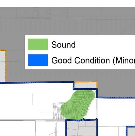

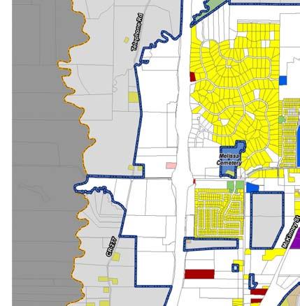
35 Figure1-22.GeneralizedHousingCondionsMapofthePlanningArea


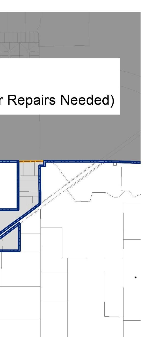
36 Housing Unit Condition In order to analyze the condition of the single-family housing units within Melissa, a Neighborhood Conditions Survey was performed. This is a general survey of Melissa s neighborhoods. The category used to identify the area refers to the overall character of the neighborhood and is not specific to each home within the area. As shown in the map, Type 1 refers to sound neighborhoods that appear to be very well maintained, which includes about 50 percent of the residential acreage within Melissa. For these areas, a Neighborhood Preservation strategy is appropriate to recognize areas in which the City should sustain and protect existing desirable conditions. Type 2 neighborhoods have a significant portion of homes that need repairs that could be performed by the homeowner, such as repainting or minor code enforcement issues. This category includes the majority of the City at 13 percent of the City s residential acreage. A Housing Maintenance strategy is appropriate to reduce the incidence of further deterioration of these housing units. If minor repairs are not accomplished on Type 2 units, such units may fall into the Type 3 category, making rehabilitation a challenge, if possible at all. Page 1.28 Chapter 1 Existing Conditions Analysis

37 Type 3 areas describe neighborhoods with many homes that require significant repairs that require a professional, such as replacing a roof, or are beyond repair and likely require demolition; however no significant areas of Melissa are considered Type 3. As previously stated, this is a broad survey intended to identify the different needs in the various residential neighborhoods of Melissa, and is not intended to apply to each individual property within the designated areas. For Type 3 areas, a Rehabilitation/Redevelopment strategy is appropriate. There are two primary purposes behind this strategy: 1) in cases of rehabilitation, to reduce the likelihood of further decline of units in the identified areas; and 2) in cases of redevelopment, to prevent further deterioration of the overall area. If the necessary repairs are not accomplished, these units may deteriorate further, making them virtually uninhabitable. The City should not allow such units to become a serious public safety concern. Therefore, action to improve the conditions of the Type 3 structures is extremely important to avoid having a negative impact on the neighboring Type 2 structures, as well as adjacent neighborhoods. Page 1.29 Chapter 1 Existing Conditions Analysis
38 Summary of Housing Characteristics The City experienced an influx of new single-family housing from This correlates with the population growth that was discussed in the previous section. The average home in Melissa is valued at $200,000 and over, which is high when compared to the State. From 2000 to the City saw a decrease in the percentage of manufactured homes from 17 percent to three percent which may have contributed to the growth in housing value. Multi-family housing also decreased. In 2000, there was two percent multi-family housing. In , there was zero percent. During this same time period, Melissa also experienced significant population growth and began to see changes in demographics. The housing options and availability in Melissa will play a large role in the future population growth and demographic changes. Page 1.30 Chapter 1 Existing Conditions Analysis
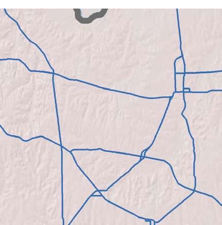
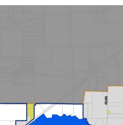
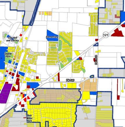
39 Land Use Characteristics Providing for the orderly and efficient use of land is a major planning consideration in Melissa. The pattern of land use that exists today has evolved to accommodate the City s past needs.. The activities of local residents create a need for various land uses, as well as for the supplemental systems that support the land uses (e.g., thoroughfare systems). The relationships of existing and future land uses will shape the character and quality of life of the community for many years to come. In order to accurately assess the City s future land use needs, an analysis for past land use trends and present land use patterns is of primary importance. Extraterritorial Jurisdiction The Texas Local Government Code states that cities with a The extraterritorial jurisdiction of a population of less than 5,000 people are granted an municipality is the unincorporated area that extraterritorial jurisdiction (ETJ) of one-half mile outside their is contiguous to the corporate boundaries of incorporated city limits. No community can incorporate to the municipality and that is located within become a city within this ETJ boundary, and no other one mile of those boundaries, in the case of a community can extend its city limits or ETJ boundary into this municipality with 5,000 to 24,999 inhabitants. area. Melissa may annex any area that is within its ETJ, but Chapter 42 of the Texas Local Government Code only if the area is contiguous with existing City limits. Melissa has exceeded 5,000 in population, and in accordance with the Texas Local Government Code, can extend the ETJ to one mile from the city limit boundary, however the City s growth is restricted by neighboring cities ETJs. In addition, Texas state law grants cities the right to enforce subdivision regulations and to require right-ofway in the ETJ according to an adopted plan. The way in which annexation, subdivision regulation, and rightof-way dedication in the ETJ relate to Melissa will be discussed further in later chapters of this Plan. Existing Land Use and Physical Constraints Growth and development occurring within Melissa in the future will require the conversion of vacant and agricultural land to more intensified urban uses. The conversion process and how it occurs will be very important to the City in that it is one of the factors that will determine the community s future urban form, and in turn, its attractiveness and desirability. The relationships of existing and future land uses will not only have an impact upon Melissa economically, but will also shape the character and livability of the community in the years to come. Likewise, these relationships will be reflected in the provision of services and facilities throughout the community. An orderly and compact land use arrangement can be served more easily and efficiently than a random and scattered association of unrelated uses In order to analyze the land use trends within Melissa, aerial photography supported by field verification was used to identify existing land uses in the preparation of this chapter. This survey occurred in January 2014, and each parcel of land was color-coded according to various land use types. The information obtained from the survey is used herein to create the Existing Land Use Map and discuss Melissa s current land use pattern. The following section provides an overview of the different types of land uses included within the survey. Page 1.31 Chapter 1 Existing Conditions Analysis
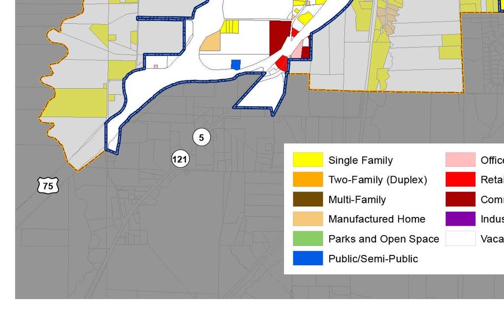
40 Figure1-23.ExisngLandUseMap


41 Land Use Types Residential Land Uses The following is an overview of land uses that are residential, including single-family, two family, multifamily, and manufactured homes. Single-Family A single dwelling unit that is detached from any other dwelling unit, is built on-site, and is designed to be occupied by only one family. Single-family homes are the most prevalent housing type and developed land use type. Two-Family A structure with two attached dwelling units that is designed to be occupied by two families (one in each unit). Two-family homes are also commonly referred to as duplex units. Multi-Family A structure with numerous attached dwelling units that is designed to be occupied by several families (one in each unit). This term can be used to describe a single structure or series of structures in a complex. Multifamily homes are also commonly referred to as apartments. Manufactured Home A single-family dwelling unit that is manufactured in a factory, rather than on-site. These homes are usually transportable (i.e., are not on permanent foundations). Manufactured homes are also commonly referred to as mobile homes, although the term mobile home is typically used for structures built prior to Page 1.33 Chapter 1 Existing Conditions Analysis


42 Nonresidential Land Uses Nonresidential land uses include areas in which people typically do not reside. Park & Open Space Public or private park land, open space, and/or recreation area that is outside. May include recreational facilities, such as tennis courts, public swimming pools, picnic pavilions, and basketball courts. Public/Semi-Public Uses that are generally accessible to the public, such as schools, churches, public buildings, cemeteries, and some medical facilities. Also includes some support services, such as a school bus storage lot. Office All types of professional and administrative offices, including those of doctors, lawyers, dentists, realtors, architects and accountants. Retail Businesses that primarily sell commodities or goods to consumers. Examples include restaurants, grocery stores, beauty salons, and shopping centers. Page 1.34 Chapter 1 Existing Conditions Analysis


43 Commercial Establishments that primarily provide a service to consumers. Examples include hotels, automobile services stations, automobile sales lots, selfstorage businesses, and welding shops. Industrial Allows for the processing, storage, assembly, and/or repairing of materials. Ranges from light industry with all activity occurring indoors, to heavy industry with activity occurring outside. Right-of-Way Land that is dedicated to public use for streets, utilities, alleys, and rail lines. Vacant/Agricultural Land that either has no readily visible or apparent use, or land that is used for growing crops or grazing animals. Page 1.35 Chapter 1 Existing Conditions Analysis
44 Land Use Composition Figure 1-23 shows a graphic representation of the existing land use pattern for the City and ETJ. Table 1-11 and the related Figure 1-24 show the results of the survey, reflecting the existing land use composition within Melissa. Approximately 31 percent of the City Limits and ETJ is developed, or 4,882 acres. This means that more than half of the City limits and ETJ is undeveloped and has the potential for future development. The Comprehensive Plan will help guide the City leader s decision-making process on how to develop this land. The online survey, found in Chapter 2, outlines what the community envisions for this undeveloped land. With strategic planning, a suitable land use for the undeveloped land can be achieved. Table Existing Land Use of City Limits and ETJ (2014) Existing Land Use City ETJ Planning Area Acres % Acres % Acres % Acres per 100 Persons Residential Single-Family % 746 8% 1,740 11% 19.7 Two-Family (Duplex) 2 0% - 0% 2 0% 0.0 Multiple-Family - 0% - 0% - 0% - Manufactured Home 56 1% 194 2% 250 2% 2.8 Nonresidential Parks and Open Space 61 1% 23 0% 83 1% 0.9 Public/Semi-Public 1,481 21% 95 1% 1,576 10% 17.9 Office 6 0% - 0% 6 0% 0.1 Retail 13 0% - 0% 13 0% 0.2 Commercial 88 1% 7 0% 95 1% 1.1 Industrial 60 1% 172 2% 232 1% 2.6 Right-of-Way % 220 2% 884 6% 10.0 Total Developed Acreage 3,426 49% 1,456 16% 4,882 31% 55.3 Vacant/Agricultural 3,549 51% 7,410 84% 10,959 69% Total Acreage 6, % 8, % 15, % *Based on a current planning area population of 6,197 Page 1.36 Chapter 1 Existing Conditions Analysis
45 Figure Existing Land Use - Developed Acreage in the Planning Area (2014) Right-of-Way Industrial Single-Family Commercial Retail Office Two-Family (Duplex) Public/Semi-Public Multiple-Family Manufactured Home Parks and Open Space Figure Developed and Vacant Land in ETJ Figure Developed and Vacant Land in City Limits Developed 16% Vacant 84% Developed 52% Vacant 48% Page 1.37 Chapter 1 Existing Conditions Analysis
46 Current Land Use Densities within Melissa s Planning Area The 2014 City population estimate of 7,755 along with the ETJ estimated population of 1,074 was used for these calculations, for a total current planning area population of 8,829. The density of single-family residential land use is 19.7 acres per 100 persons. This indicates a relatively low density development pattern for Single-Family uses. Another type of land use that is important to note in relation to population is the amount of land that is categorized as Parks and Open Space, which is discussed in further detail in Chapter 6. Calculating the acres per 100 persons is also an important measure for a city s retail base. A high ratio, between acres per 100 persons, is representative of a community that is capturing the retail demand generated by the local population, as well as that of other nearby communities or the county. A ratio of around 0.5 acres per 100 acres is considered average, meaning that a community is capturing most of the retail demand generated by the local population. A low ratio, between acres per 100 persons results when the local population is traveling elsewhere to patronize retail establishments. As shown in the far right column in Table 1-12, Melissa s retail ratio is 0.2 which is considered a very low ratio. Table Acres per 100 Persons in the Planning Area Land Use Category Residential Acres Acres/100 Persons Single-Family 1, Two-Family (Duplex) Multi-Family - - Manufactured Homes Non-Residential Parks and Open Space Public/Semi-Public 1, Office Retail Commercial Industrial Right-of-Way Total Developed Land 4, Vacant/Agricultural 10, Total 15, Based on 2014 planning area population estimate of 8,829 Page 1.38 Chapter 1 Existing Conditions Analysis

47 Land Use Analysis Developed and Vacant Acreages within Melissa As Figure 1-24 shows, single-family land consumes a large portion of the developed land within the planning area approximately 36 percent. In fact, of all types of land use within Melissa, Single-Family land use accounts for the highest amount of developed acreage at 1,740 acres. Public/Semi-Public space accounts for the second-highest amount of developed acreage in the City at 32 percent of the developed acreage in Melissa, largely due to the landfill. Nonresidential uses also account for a relatively small portion of the developed acreage within the City the total percentage of Office, Retail, Commercial and Industrial uses each account for fewer than five percent. Right-of-Way uses account for the third highest amount of developed acreage in the City at 18 percent. Park and Open Space is only two percent. About 69 percent of Melissa s total planning area acreage is considered vacant or agricultural use. This is also considered as undeveloped land. This percentage amounts to about 10,959 acres that have the potential to be developed in the future. The importance of the calculation of undeveloped land lies in the fact that it is this land that will allow the City to grow in population in the coming years. It is also the area where decisions will have to be made regarding service provision and roadway construction, because although this land is not currently developed, it is likely to be at some time in the future. Most communities do not develop such that 100 percent of the land is utilized. Generally, approximately 10 percent remains vacant. However, even given this fact, the existing percentage of vacant acreage of 69 percent within Melissa provides ample acreage to accommodate future population growth within the City limits. Total Jurisdictional Area Recommendations about the way in which currently vacant acreage should be developed in the City and ETJ that is, what type of land use is most appropriate to plan for will be contained within the Future Land Use Plan chapter of this Comprehensive Plan Update. Table Total Planning Area (2014) Jurisdiction Acres Percent Melissa s City Limits 6,974 44% Melissa's ETJ 8,866 56% Total Jurisdiction Area 15,840 Page 1.39 Chapter 1 Existing Conditions Analysis
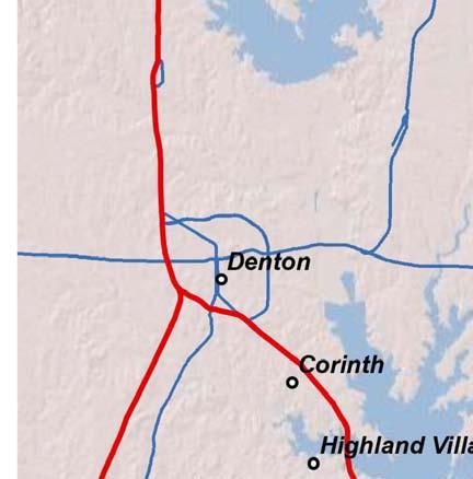
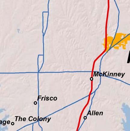
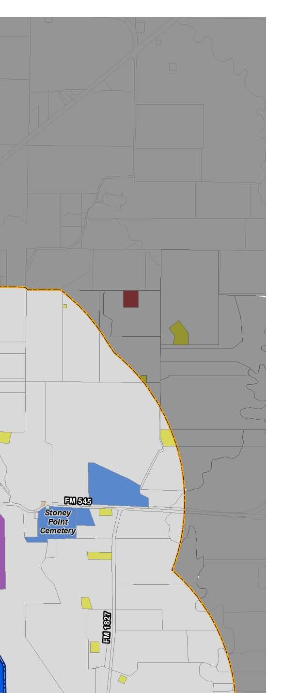
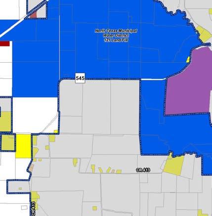
48 Table Total Planning Area (2014) shows Melissa s total jurisdiction area in acreage. Melissa is approximately 6,974 acres, or 11 square miles. The ETJ is approximately 8,866 acres, or 14 square miles. Melissa s total jurisdiction encompasses 15,840 acres, or 25 square miles. The City of Melissa could eventually include all of the current ETJ area and possibly beyond as the ETJ line to the growth boundaries in the future. This is a large amount of area in which Melissa can expand its boundaries and accommodate future population, as well as manage growth. In order to ensure successful growth, the City should establish boundary agreements with all surrounding jurisdictions. The City has currently started this process. It is important for the City to finish establishing boundary agreements with any remaining jurisdictions. Physical Land Use Factors There are numerous physical factors that will inherently influence development as the City continues to grow. Figure 1-27 shows some of these factors. These may pose potential limitations for the City, while others may provide opportunities. Many can actually be viewed in both ways. For example, some of the floodplain areas could be viewed as limitations, since they are undevelopable. They could, however, also be viewed as opportunities for parks, open space and trails. The various factors shown include: Existing developed areas, with related land uses generalized; The 100-year floodplain; The NTMWD landfill; The Melissa City limit line and ETJ line; The Melissa Independent School District line; and Creeks and major ridgelines. Page 1.40 Chapter 1 Existing Conditions Analysis

49 Figure1-27.PhysicalFeatures
50 Summary of Land Use Characteristics The land use characteristics for the City are tied in with the population and demographic characteristics. Due to the population growth, the City may able to extend the ETJ from one-half mile to one mile from the City limits, in accordance with existing boundary agreements and excluding the existing neighboring ETJs. The City s total planning area has about 69 percent vacant land. This is positive for growth and gives developers a wide range of options for housing locations. The Future Land Use Plan will determine which areas will be dedicated to residential uses and which areas will be dedicated to other uses. Strategically planning for land uses will help to spur growth in certain areas and will aid the City in achieving the goals of this Comprehensive Plan. Page 1.42 Chapter 1 Existing Conditions Analysis


51 City of Melissa 2015 Comprehensive ensive Plan Update Chapter 2: The Visioning Process
52
53 Table of Contents Introduction Online Survey Online Survey Results Question #1: How long have you lived in Melissa? Question #2: To which age group do you belong? Question #3: What service or facility would you like to have in Melissa that the City does not currently have, or that the City has but needs to expand? Question #4: Would you agree or disagree with the City taking action to address the following? Question #5: How strongly would you support or oppose the following development types within Melissa? Question #6: Where should the City focus development efforts and incentives? Question #7: How could the City improve the parks and trails to better meet your needs? Question #8: How important is it to you that trails and sidewalks are provided within Melissa? Question #9: How important is conservation of the natural feel/rural environment in Melissa? Question #10: How important is it to you that you can find a home in Melissa through every stage of your life? Question #11: Do you think that historic preservation should be a priority in the City? Question #12: Keeping in mind that quality development often takes longer to attract, do you think future retail development should focus on quality over quantity? Question #13: How important is it to you that major roadways have quality landscaping and appropriate hardscape elements? Question #14: Signs, both public and private, are important to the overall look and feel of the community. How important are the look and style of signs within the community? Question #15: How important is it to you that Melissa defines the entrances into the City to further establish a sense of identity and place? Question #16: What area (in Melissa or another community) do you think exemplifies desirable development for Melissa? Question #17: What do you like most about Melissa? What do you like the least? General Conclusions from Citizen Responses Page 2.i Chapter 2 The Visioning Process
54 In Summary Page 2.ii Chapter 2 The Visioning Process

55 Introduction The Existing Conditions Analysis, Chapter 1, provides a foundation for this 2015 Comprehensive Plan Update. It does this generally by outlining facts about Melissa that should be considered during the planning process. This chapter also provides a foundational element for this Plan, but in a very different way. Instead of facts and concepts, this Visioning Process chapter outlines the needs and desires of the citizens of Melissa. What does the future hold for Melissa? What should the City be like in the year 2020 or 2025? These are the key questions that this chapter addresses. The vision for Melissa that is described within this will help shape and direct growth and development for the next 10 years and beyond. In order to do this effectively, this Plan should be based on a shared vision of the citizenry and the stakeholders of what Melissa should and will become as it grows, attains its anticipated build-out configuration, and becomes a mature, sustainable City. In order to create this shared vision, a public participation process was undertaken to allow citizens an opportunity to provide their input into this comprehensive planning process. The first section of this chapter describes the Public Workshop that was held. The second section discusses the Community Survey that was posted online for the citizenry with much success in terms of response rate. Each of these opportunities for citizen input, as well as consistent participation from the Comprehensive Plan Advisory Committee (CPAC), has provided a strong basis for the policies and recommendations within this 2015 Comprehensive Plan Update. Page 2.1 Chapter 2 The Visioning Process
56 Online Survey The City posted a Community Survey online from April 21, 2014 through May 27, Approximately 450 citizens participated in the online survey. The online survey was not meant to be scientific, but rather attitudinal. The goal of the survey was to capture the feelings, emotions, and opinions of Melissa s citizens. This type of input is a key component of updating the. The following outline the various questions that were asked and responses that were given. The percentages shown are based on the number of actual responses to that particular question. For example, a total of 450 surveys were received, but a question may have been left blank (unanswered) by 12 respondents. Therefore, the percentages indicated in the answers to that question would be based on 438 responses. General conclusions regarding citizen responses are contained at the end of this section Table 2-1. Responses to Question #1 Answer Option Percentage a. Less than 1 year 15% 55% b. 1 to 5 years 40% c. 5 to 10 years 31% 41% d. 10 to 20 years 10% Online Survey Results Question #1: How long have you lived in Melissa? The majority of participants have lived in Melissa for less than five years, with the largest group of respondents in the 1-5 year range. Only 4 percent have been in Melissa more than 20 years. e. More than 20 years 4% Table 2-2. Responses to Question #2 Answer Option Percentage a. 18 to 24 years old 0.4% b. 25 to 44 years old 58.2% c. 45 to 64 years old 34.4% Question #2: To which age group do you belong? Question #2 was included to help determine demographically who was answering the survey based on age. The two largest were the age groups of 25 to 44 and 45 to 64. These two age groups accounted for 92.6 percent of the respondents to the survey. d. 65 or more years old 5.4% e. Prefer not to answer 1.6% Page 2.2 Chapter 2 The Visioning Process
57 Question #3: What service or facility would you like to have in Melissa that the City does not currently have, or that the City has but needs to expand? The purpose of Question #3 was to get a general idea of which community amenities are most important to citizens. Recreational/community center is the facility that citizens would want to have or expand. The second largest category was Other. Grocery store was written into the Other category 56 out of 101 times, although the City does not build or develop grocery stores. Table 2-3. Responses to Question #3 Answer Option Percentage a. Parks 12.9% b. Library services 1.9% c. Trails 18.5% d. Public transportation 2.8% e. Recreational/community center 39.1% f. Other (please specify) 24.8% Question #4: Would you agree or disagree with the City taking action to address the following? Citizens did not disagree with or oppose any of the statements in Question #4. Generally, citizens are in support of establishing sign standards for businesses and offering development incentives to attract more business to Melissa. Table 2-4. Responses to Question #4 Answer Option Strongly Agree Agree No Opinion Disagree Strongly Disagree Preserving open space 39.3% 39.7% 14.3% 5.8% 0.9% Having developers provide park land or funding for parks Regulating the number of signs a new business can establish Regulating the type of signs a new business can establish Having developers provide a variety of housing types within new developments Offering incentives for businesses to located within the City Establishing site development standards for retail/commercial development 43% 40.2% 10.5% 4.5% 1.8% 24.9% 39.5% 27.4% 6.1% 2% 27.9% 41.2% 23.6% 5% 2.3% 17.4% 29.6% 20.4% 19.2% 13.3% 46.2% 33.9% 10.6% 4.1% 5.2% 52.8% 34.6% 7.2% 3.8% 1.6% Strengthening code enforcement 31.2% 38% 24.1% 5.2% 1.4% Page 2.3 Chapter 2 The Visioning Process
58 Question #5: How strongly would you support or oppose the following development types within Melissa? The purpose of Question #5 was to break down the types of development that are possible in Melissa. A majority of citizens wants grocery stores and major retail development, but do not want apartments and duplexes. Table 2-5. Responses to Question #5 Answer Option Strongly Support Support No Opinion Oppose Strongly Oppose Office buildings (1- to 2-stories) Office buildings with more than 2 stories Corporate office development Neighborhood retail Major retail development 27.1% 53.9% 11.2% 4.8% 3% 13.8% 27.4% 15.2% 28.6% 15% 22.7% 42.9% 15.4% 12.2% 6.9% 50.5% 36.3% 5.3% 5.5% 2.5% 38.1% 33.6% 6.8% 13.7% 7.8% Grocery stores 73.8% 20.1% 2.3% 2% 1.8% Mixed use development 17.9% 29.1% 32.8% 13.5% 6.7% Townhouses 12.8% 37.4% 16.4% 19.2% 14.2% Apartments 5.2% 15.5% 12.1% 34.6% 32.6% Duplexes 6.6% 19.7% 14.4% 29.5% 29.7% Medical facilities 39.9% 46.3% 8.9% 2.5% 2.3% Sit down restaurants Fast food restaurants Entertainment venues Light industrial facilities 66.6% 29.3% 2% 1.1% 0.9% 31.8% 40.5% 11.4% 11.8% 4.5% 45.4% 34.5% 8.1% 9% 2.9% 13.7% 31.3% 25.1% 20.1% 10% Warehouses 9.9% 21.4% 26.7% 26.5% 15.4% Page 2.4 Chapter 2 The Visioning Process
59 Question #6: Where should the City focus development efforts and incentives? Only 7.3% of citizens feel that the City should not give development incentives. Overall, citizens indicated that development incentives should be given in areas around: SH 121 and US 75, SH 121 and Melissa Road, and the Town Center (City Hall area). Table 2-6. Responses to Question #6 Answer Option Percentage a. SH 121 and US % b. SH 121 and Melissa Road 17.2% c. Town Center (City Hall area) 21.1% d. US 75 and Melissa Road 11% e. In the older, historic area of Melissa f. Nowhere; the city should not provide incentives to private developers 12.6% 7.3% Question #7: How could the City improve the parks and trails to better meet your needs? Almost 50% of citizens said that an increased number of trails that connect people to destinations would better meet their needs. Improve the existing facilities was the next largest category. The Other responses included: swimming pool, safety features, dog park, bike trails and sports fields. Table 2-7. Responses to Question #7 Answer Option Percentage a. Increase the # of parks 18.9% b. Increase the # of parks that connect people to destinations c. Improve the existing facilities 47.6% 24.5% d. Other (please specify) 9% Question #8: How important is it to you that trails and sidewalks are provided within Melissa? Over 87% of citizens feel that trails and sidewalks are important. Table 2-8. Responses to Question #8 Answer Option Percentage a. Very important 52.5% b. Somewhat important 34.9% c. Not important 12.6% Page 2.5 Chapter 2 The Visioning Process
60 Table 2-9. Responses to Question #9 Answer Option Percentage a. Very important 59% Question #9: How important is conservation of the natural feel/rural environment in Melissa? Over 93% of citizens feel conservation of the natural feel/rural environment in Melissa is important. b. Somewhat important 34.1% c. Not important 9.5% Table Responses to Question #10 Answer Option Percentage a. Very important 41.3% b. Somewhat important 40.3% Question #10: How important is it to you that you can find a home in Melissa through every stage of your life? Over 81% of citizens feel it is important to be able to find a home in Melissa through every stage of life. c. Not important 18.4% Table Responses to Question #11 Answer Option Percentage a. Strongly agree 35.4% Question #11: Do you think that historic preservation should be a priority in the City? Over 80% of citizens feel historic preservation should be a priority. b. Somewhat agree 45.8% c. Somewhat disagree 13.3% d. Strongly disagree 5.6% Page 2.6 Chapter 2 The Visioning Process
61 Question #12: Keeping in mind that quality development often takes longer to attract, do you think future retail development should focus on quality over quantity? Over 93% of citizens would like quality over quantity in the future retail development of Melissa. Table Responses to Question #12 Answer Option Percentage a. Strongly agree 67.2% b. Somewhat agree 26% c. Somewhat disagree 4.9% d. Strongly disagree 1.9% Question #13: How important is it to you that major roadways have quality landscaping and appropriate hardscape elements? 91% of citizens feel that quality landscaping and appropriate hardscape elements are important. Table Responses to Question #13 Answer Option Percentage a. Very important 51.7% b. Somewhat important 39.3% c. Not important 9% Question #14: Signs, both public and private, are important to the overall look and feel of the community. How important are the look and style of signs within the community? Nearly 94% of citizens feel that signs, both public and private, are important to the overall look and feel of the community. Table Responses to Question #14 Answer Option Percentage a. Very important 50.6% b. Somewhat important 42.6% c. Not important 6.8% Page 2.7 Chapter 2 The Visioning Process
62 Table Responses to Question #15 Answer Option Percentage a. Very important 46.1% b. Somewhat important 36.2% Question #15: How important is it to you that Melissa defines the entrances into the City to further establish a sense of identity and place? Nearly 82% of citizens feel that it is important to define the entrances to Melissa to further establish a sense of identity and place. c. Not important 17.7% Table Responses to Question #16 Top Write-In Responses Number of Write-Ins Liberty subdivision 27 McKinney (Downtown and Stonebridge Ranch) 24 Area around Melissa City Hall 10 Fairview/Allen 10 Watters Creek 8 Southlake 6 Anna 4 Prosper 3 Celina 2 Murphy 2 Table Responses to Question #17 Number of Top Write-In Responses Write-Ins Small town/rural feel 164 Quality school district 40 Quiet community/friendly people 26 Sense of community 11 Question #16: What area (in Melissa or another community) do you think exemplifies desirable development for Melissa? Participants wrote-in a variety of responses from around the North Dallas region. Question #17: What do you like most about Melissa? Participants wrote-in a variety of responses that describe Melissa. Page 2.8 Chapter 2 The Visioning Process
63 General Conclusions from Citizen Responses The citizens of Melissa take pride in the community and want to see development that will serve their needs, while maintaining the rural feel of the City. The following statements can be concluded from the responses of the survey: The citizens of Melissa desire growth and amenities, but the quality of new developments is more important than the quantity or immediacy. The citizens want to maintain a particular look and feel for their City, and this can only be achieved by having patience during the stages of growth and development. Quality development does not come easily, but overall it is beneficial to the City s successful growth. The citizens would like to option to live and play in the City of Melissa. The need for a grocery store has been heavily expressed. Other retail needs expressed are: sit-down restaurants and clothing stores. Citizens want to spend their money in Melissa instead of driving to nearby cities. Citizens are in support of developer incentives and indicated these incentives should be given priority in the following areas: SH 121 and US 75, Town Center (near City Hall), and SH 121 and Melissa Road. It is important that the City provide a variety of housing types to allow residents to live in Melissa through all stages of life and accommodate all income ranges. Townhomes and mixed use developments are alternative housing types that are generally supported by citizens. Many citizens expressed they had moved to Melissa for the rural, small-town atmosphere; they want to keep this atmosphere in spite of anticipated growth. Citizens want to keep up with the development of surrounding cities/communities, while keeping the rural feel. Citizens want Melissa to be unique, and they recognize that quality-of-life elements such as parks, open space, and trails can be used to achieve this desired uniqueness. A City-wide trail system is highly supported. Citizens want a trail system that allows them to be active with their families and connects them to destinations. Page 2.9 Chapter 2 The Visioning Process
64 In Summary The following chapters of the will help Melissa address many of the issues raised from the Online Survey. Recommendations will set forth policy guidance on things like quality land uses, roads, parks, trails, public services and facilities, and historic preservation. City leaders should be able to utilize these recommendations and policies to meet the coming challenges of balancing anticipated growth with what is desired within Melissa quality, uniqueness, and a preserved small-town feel. Page 2.10 Chapter 2 The Visioning Process


65 City of Melissa ensive Chapter 3: Future Land Use Plan
66
67 Introduction Recommended Pattern of Land Uses Land Use Types Residential Estate Low Density Residential Medium Density Residential High Density Residential Public/Semi-Public Parks & Open Space Town Center Old Town Office Retail Commercial Industrial Mixed Use Transit-Oriented Development (TOD) Floodplain Future Land Use Calculations Projected Population and Ultimate Capacity Population Projections Ultimate Population Capacity Recommended Land Use Policies Policy 1: Provide for Varied Residential Development LU1.1 The City should encourage the development of housing types other than single-family LU1.2 The City should encourage the development of unique neighborhoods for maximum sustainability LU1.3 The City should provide for limited, traditional multiple-family development LU1.4 The City should provide for multiple-family uses in vertical mixed use development Policy 2: Encourage Retail Uses in Appropriate Locations LU2.1 The City should encourage unique retail development with sustainable characteristics Page 3.i Chapter 3 Future Land Use Plan
68 LU2.2 The City should carefully consider its retail development standards and related proposals, with the quality of the development being of primary importance Policy 3: Encourage Mixed Use Development LU3.1 The City should ensure that any mixed use development that occurs has special characteristics LU3.2 The City should consider horizontal as well as vertical mixed use development Policy 4: Preserve the Historic Properties LU4.1 The City should promote residential, public/semi-public, retail, and office land uses within the Old Town Melissa Policy 5: Continue to Pursue the Development of the Town Center LU5.1 The City should establish the planned public uses within the Town Center as soon as possible, to the highest level of quality possible Policy 6: Provide a Balance of Residential and Nonresidential Land Uses LU6.1 The City should generally only approve nonresidential proposals or mixed use proposals in areas designated for such uses on the Future Land Use Plan Map LU6.2 The City should pursue the development of quality retail uses LU6.3 The City should carefully consider any requested upzoning of property due to State law constraints on future rezoning Policy 7: Encourage Connectivity between Developments LU7.1 The City should require connectivity between all types of development LU7.2 The City should encourage off-street pedestrian and bicycle connections Policy 8: Plan Land Uses and Density to Support Mass Transit LU8.1 The City should ensure that the future transit station and TOD area are effectively connected to Old Town Melissa LU8.2 The City should allow high-density residential development and a mix of uses in the TOD area Policy 9: Integrate Sustainability Concepts into Land Use Decisions LU9.1 The City should consider the following questions related to Future Land Use Plan concepts prior to approving rezoning requests Policy 10: Develop a Marketing and Branding Plan to Promote the City of Melissa Page 3.ii Chapter 3 Future Land Use Plan
69 Introduction The right of a municipality to coordinate growth is rooted in its need to protect the health, safety and welfare of local citizens. An important part of establishing the guidelines for such responsibility is the Future Land Use Plan, which establishes an overall framework for the preferred pattern of development within Melissa. Specifically, the Future Land Use Plan designates various areas within the City for particular land uses, based principally on the specific land use policies outlined herein. The Future Land Use Plan is graphically depicted for use during the development plan review process with the Future Land Use Plan Map (Figure 3-1), and the map should ultimately depict the City s policy and development decisions. The Future Land Use Plan Map is not a zoning map that deals with specific development requirements on individual parcels. The zoning map and changes in zoning should, however, be based in part on the Future Land Use Plan Map and related text of this chapter. In general, the Future Land Use Plan is intended to be a comprehensive blueprint of Melissa s vision for its future land use pattern. From an agriculturally rich farming community to one of the fastest growth communities in the Dallas-Fort Worth Metroplex, Melissa is primed for growth. The City s land use pattern has experienced marked changes in the last five years, with much residential growth. The opportunity to make Melissa a unique and sustainable community is now enough population growth has occurred so that people are engaged in the process, and a significant amount of land is yet to be developed. This Future Land Use Plan chapter has been developed to achieve the following: Address the needs of the City as a whole Address the concerns and issues raised by the Comprehensive Plan Advisory Committee and the general public as part of this planning process Provide policy guidance in keeping with community ideals Ensure that Melissa is a unique and sustainable community that ages well and gracefully This Future Land Use Plan is divided into several sections. First is an explanation of the Future Land Use Plan Map. This map, shown in Figure 3-1, will help guide land use decisions within the City. The explanation of the Future Land Use Plan Map includes a description of each category used to establish the recommended pattern of land uses. Second is a discussion of the City s projected population growth, and its anticipated population at its buildout configuration, based on the Future Land Use Plan Map. Finally, the third section outlines land use policies, which should be used in conjunction with the Future Land Use Plan Map to guide land use decisions as the growth, development, and perhaps redevelopment, occur. Page 3.1 Chapter 3 Future Land Use Plan


70 Recommended Pattern of Land Uses The Future Land Use Plan Map (Figure 3-1) has been created as the result of numerous meetings with the Comprehensive Plan Advisory Committee (CPAC) and City staff. It is important to note that the Future Land Use Plan Map does not directly affect the regulation of land within Melissa or the ETJ because it is not a zoning map. The Future Land Use Plan Map is intended to provide a graphic depiction of Melissa s ideal land use pattern. It should be used by the City to guide decisions on proposed zoning/development and development standards in the future. It should be noted that while the Future Land Use Plan Map itself is an integral part of this Future Land Use Plan chapter, the land use policies that support the map and that relate to how land use development should occur are also important. These policies are contained in the following section of this Future Land Use Plan. The subsequent paragraphs, related map colors, and pictures are provided to clarify the various land use types shown on the Future Land Use Plan Map. Land Use Types Residential Estate This use is representative of traditional, single-family detached dwelling units at a density of approximately one house per acre. There are some developed areas of Melissa that are of this land use type, such as the subdivision of County Ridge and Berry Farms. Much of the ETJ is projected to develop at this level of density. Low Density Residential This use is also representative of traditional, single-family detached dwelling units, but at a higher density than the Residential Estate land use type. Many of the City s developed subdivisions fall within this Low Density Residential category. Future recommended areas designated for Low Density Residential development are generally not adjacent to major thoroughfares or incompatible land uses and are in proximity to existing single-family subdivisions. It should be noted that although this land use type is partly entitled low density, a range of lot sizes are envisioned, with an average density of 3.5 units per acre. Page 3.2 Chapter 3 Future Land Use Plan
 who may not want the maintenance of a larger-lot single-family home, and for young families who may find a")
.")

71 Medium Density Residential This use is representative of two-family, attached dwelling units, such as townhomes. Medium density land uses often provide areas for empty nesters (people with grown children) who may not want the maintenance of a larger-lot single-family home, and for young families who may find a townhome more affordable than a single-family home. This land use type should have an average density of 8 units per acre. It should also be noted that medium density residential development should be acceptable in Mixed Use areas (as discussed below within that sub-section). High Density Residential Traditional apartment-type units in attached living complexes characterize high density residential land use. Currently, there are no high density residential areas developed within Melissa. However, for residential diversity purposes, two areas for high density development are shown on the Future Land Use Plan Map one is consistent with the current zoning map and the other is in a high-traffic area, near the intersection of State Highway (SH) 5 and State Highway (SH) 121. It should also be noted that medium density uses should also be permitted in any area designated for high density use. The density of this land use type is recommended at 15 units per acre, which is the density permitted in the City s Multiple-Family Zoning District. Ensuring a high quality of development is critical to ensuring that High Density Residential areas remain viable and sustainable over a long period of time. This is discussed in detail in Land Use Policy 1 later within this chapter. Page 3.3 Chapter 3 Future Land Use Plan
 include the related uses that are currently in existence.")


72 Public/Semi-Public This land use designation is representative of uses that are educational, governmental or institutional in nature. Public/semi-public uses are generally permitted within any area; therefore, the areas shown on the Future Land Use Plan Map (Figure 3-1) include the related uses that are currently in existence. There will be considerable public space in the area designated as Town Center, as discussed in the description of that land use type. Although only existing public areas are shown on the Future Land Use Plan map, it is anticipated that there will be a need for additional public uses with future population growth. Based on such population growth, the Utilities Plan, Chapter 4, addresses public facilities such as water, wastewater, and drainage infrastructure, and the Public Facilities Plan, Chapter 7, addresses public service needs for services like police and fire. Land Fill The 121 Regional Disposal Facility is a land fill owned and operated by the North Texas Municipal Water District. Parks & Open Space This land use designation is provided to identify all public parks and open spaces within Melissa. A community s park system is key to a high quality of life. The City has recognized this not only through its current allocation of significant park/open space areas, but also by the fact that a Parks and Trails Plan (Chapter 6) for Melissa has been incorporated into this. The Parks and Trails Plan addresses specific future park locations, local park and open space needs, a trail system, and other recreationrelated issues, as well as funding mechanisms. It is intended to help Melissa meet the park and recreation needs of its citizens as it continues to grow in population. Page 3.4 Chapter 3 Future Land Use Plan


73 Town Center The Town Center area designated on the Future Land Use Plan Map represents the area of the City that is partially developed but is fully envisioned by City leaders. With the initial phase of construction complete, this area is the center of the City s governmental services, administrative services, and library services. The area is planned to be reminiscent of a downtown square in an old Texas town, with a large City Hall in the center, public plazas, and two-story office, retail and residential uses in surrounding blocks. Other areas of the Dallas-Fort Worth Metroplex that may resemble the new Town Center include the areas of Southlake, Plano, and Frisco that are shown in the illustrations on this page. The Town Center, Old Town, and Transit-Oriented Development (TOD) areas are all intended to blend into a cohesive City Center, so that in the future these areas together will have sufficient mass to represent a major, sustainable center of economic activity and community life. This concept is discussed in detail within the City Center Concept Plan, Chapter 8. Page 3.5 Chapter 3 Future Land Use Plan


74 Old Town The Old Town area designated on the Future Land Use Plan Map represents the oldest area of Melissa, the City s downtown core. Like many Texas towns, the City was originally settled in proximity to the railroad in the early 1900s when rail lines were vital to local and regional economies, as well as to population growth. According to the community survey, citizens of Melissa want to preserve this historical area of the City, and want it to be a place where people go to shop and work, as well as to live. Generally, land uses within Old Town should be residential, public/semi-public, retail, and office. Refer to Land Use Policy 4 for specific policy recommendations. Also, more detail about these and other concepts for Old Town, including effective ways to connect it to the new Town Center and the TOD area, are contained within the City Center Concept Plan, Chapter 8. Office This land use type is intended for businesses such as banks and places of work for doctors, lawyers, engineers, real estate professionals, architects, etc. Office uses in Melissa currently are very limited, but more have been anticipated for future development, as the Future Land Use Plan Map shows. Office land uses are generally compatible with residential areas, with the exception of high-rise office buildings. These would be more appropriate along U.S. Highway 75 and along the Collin County Outer Loop (refer to the Transportation Plan for more detail on the loop) in the Mixed Use areas. Office uses of two to three stories are also appropriate within the Town Center and Old Town areas. Page 3.6 Chapter 3 Future Land Use Plan
.")


75 Retail This land use type is intended to provide for a variety of restaurants, shops, grocery stores, and personal service establishments. Retail businesses generally require greater visibility than do other types of nonresidential land use (e.g., office, commercial). In response to this need, retail land uses have been designated in the hightraffic areas of Melissa, with concentrated retail uses recommended along SH 5 and SH 121, and at the intersection of Melissa Road and U.S. Highway 75. Retail uses are also appropriate within Mixed Use areas, in the Town Center, and in Old Town. Commercial Areas designated for commercial land use are intended for a variety of commercial uses and establishments with outside storage, display and sales. Examples of such uses include business establishments that primarily provide a service such as automobile service stations, automobile sales lots, self-storage businesses, and repair shops. Such uses are not significant contributors to a municipality s tax revenue, and, by their nature, commercial businesses can detract from positive aesthetics. Primarily for these reasons, commercial uses have generally only been recommended in locations consistent with where such uses currently exist. It should be noted that within recommended commercial areas, office and retail uses should be permitted as well; however, commercial uses should not be permitted within office or retail areas. Commercial uses should be permitted within industrial areas, provided that they are buffered from less-intense uses properly and they follow the guidelines previously recommended. Page 3.7 Chapter 3 Future Land Use Plan


76 Industrial The industrial land use designation is applied to areas intended for a range of heavy commercial, assembly, warehousing, and manufacturing uses. Large tracts of land with easy access to roadway and air transportation are becoming increasingly hard to find for the industrial business community. However, these businesses can be advantageous for a municipality in terms of providing employment and an increased tax base. Therefore, several large areas have been identified as Industrial, as shown on the Future Land Use Plan Map. Examples of desirable uses within these areas include company headquarters, computer technology businesses, and medical service companies. Mixed Use Areas with this land use designation are intended for a mixture of primarily nonresidential, but also some residential, land uses. They are referred to as Mixed Use because it is envisioned that these areas would be integrated developments of office and retail uses of approximately 80 percent (of the land area), with the residential component equaling approximately 20 percent. Mixed use areas are intended to provide flexibility for the City and the development community in order for innovative, unique, and sustainable development to occur. Mixed Use developments should be pedestrian-oriented and integrated with one another. Additionally, much of the Mixed Use designated is located along a creek; therefore development in this area should utilize a design that both preserves the floodplain area and takes advantage of the natural viewsheds. The specific concepts of the Mixed Use land use designation and the way in which it should be applied in recommended areas of Melissa are discussed in detail in Land Use Policy 3 later within this chapter. For the purposes of calculating the anticipated residential density in these areas, 20 units per acre has been assumed this would be comprised of various types of residential housing, including townhomes and multiple-family (above retail or office). Page 3.8 Chapter 3 Future Land Use Plan
. This location has been determined by the North Central Texas Council of Governments (NCTCOG) as part of their regional rail planning effort.")
77 Transit-Oriented Development (TOD) The TOD area shown on the Future Land Use Plan Map correlates to the anticipated location of a rail transit station (which could be on either side of the nearby railroad tracks). This location has been determined by the North Central Texas Council of Governments (NCTCOG) as part of their regional rail planning effort. Like the Mixed Use designation, the TOD area is intended for a mixture of nonresidential and residential uses, but this mixture should be a higher density such that it helps support a nearby transit station. The TOD area should have a minimum density of 25 units per acre in order to support transit as well as the anticipated non-residential uses within the Transit- Oriented Development. Land Use Policy 8 discusses this development type further, and the Transportation Plan, Chapter 5, provides additional discussion of Melissa s rail transit opportunities. Floodplain This land use designation reflects the 100-year flood areas in Melissa and the ETJ, as identified by the Federal Emergency Management Agency (FEMA). These areas generally cannot be developed. However, they provide opportunities for recreational uses, such as parks and trails. Melissa has a prime opportunity for trail development in that the local floodplains essentially frame the City to the east and west. The use of floodplain areas is discussed further in the Parks and Trails Plan, Chapter 6. Page 3.9 Chapter 3 Future Land Use Plan
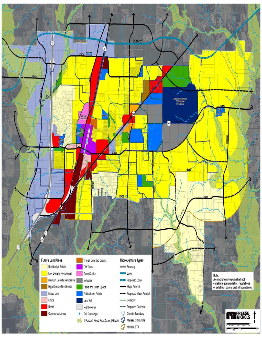
78 Figure3-1.FutureLandUsePlanMap
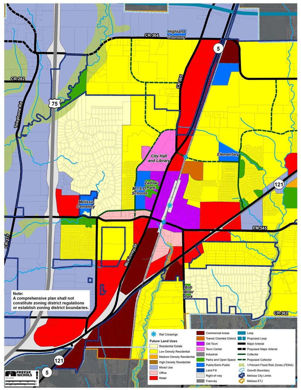
79 Figure3-2.FutureLandUsePlanMap(Core)
80 Future Land Use Calculations Table 3-1 lists the categories of land use by acreage for the City limits of Melissa and its ETJ. This information represents the calculations from the recommended, graphic pattern of land use shown in Figure 3-1. Future Land Use Plan Map. Figure 3-3 reflects the total percentages of land use within the City limits. Although municipalities in Texas do not have much land use control in the ETJ, land uses have been recommended therein for two principal purposes. One, if and when the City annexes an area, the recommended use of the land is known and it can be zoned accordingly. Second, it is important to know the intended land use when various types of studies are conducted by the City or other public entities. Examples of such studies include population projections, engineering studies, site location studies, and school enrollment projections. Table 3-1. Future Land Use Acreages Future Land Use City ETJ Planning Area Acres % Acres % Acres % Acres per 100 Persons Residential Estate Density Residential % 1,261 14% 1,963 11% 1.6 Low Density Residential 2,223 32% 3,929 44% 6,152 38% 5.2 Medium Density Residential 72 1% 4 0% 76 0% 0.1 High Density Residential 69 1% - 0% 69 0% 0.1 Nonresidential Parks and Open Space 360 5% 4 0% 364 2% 0.3 Public/Semi-Public 443 6% 59 1% 502 3% 0.4 Landfill 581 8% - 0% 581 3% 0.5 Office 70 1% - 0% 70 0% 0.1 Retail 513 7% 146 2% 659 4% 0.6 Old Town 148 2% - 0% 148 1% 0.1 Town Center 80 1% - 0% 80 0% 0.1 Mixed Use % 1,700 19% 2,422 16% 2.0 Transit-Oriented Development (TOD) 32 0% - 0% 32 0% 0.0 Commercial 171 2% 105 1% 276 2% 0.2 Industrial 116 2% 200 2% 316 2% 0.3 Floodplain 190 3% 1,358 15% 1,548 13% 1.3 Highway Right-of-Way Estimate 482 7% 100 1% 582 3% 0.5 Total Acreage 6, % 8, % 15, % 13.3 *Based on a build-out population of 119,072, see Table 3-5. Projected Ultimate Capacity within the Current City Limits, ETJ, and Total Planning Area Page 3.12 Chapter 3 Future Land Use Plan
81 Figure 3-3. Future Land Use Distribution in the Planning Area Highway Right-of- Way Estimate Industrial Floodplain Estate Density Residential Commercial Transit-Oriented Development (TOD) Town Center Mixed Use Low Density Residential Old Town Retail Office Landfill Public/Semi -Public Parks and Open Space High Density Residential Medium Density Residential Page 3.13 Chapter 3 Future Land Use Plan
82 Projected Population and Ultimate Capacity Melissa s rapid population growth is documented in detail in the Existing Conditions Analysis (Chapter 1). It is important to consider this rapid growth in the context of planning for future land uses for numerous reasons. The principal reason is that this Future Land Use Plan chapter provides a basis for decision-making regarding the optimal pattern of land uses this pattern inherently affects where population growth is likely to occur. Another reason is that the City will at some point reach its ultimate capacity for population growth given the fact that minimal (if any) geographic expansion beyond the existing ETJ area is possible. This section of the Future Land Use Plan explores the City s projected population growth in the next 30 to 50 years, as well as its ultimate population capacity and when that capacity might be reached. Population Projections Projecting what Melissa s population will be in the next 10 to 15 years is challenging, due to the fact that there are so many variables that may affect the rate of population growth. However, it is important to provide an analysis of what is most likely to occur. What has been determined to be most likely is based on two things the population growth of other cities in Melissa s region, and the number of lots that the City has already approved through a subdivision plat, concept plan, or site plan. Table 3-2 shows information about population growth in surrounding cities. Figure 3-4 shows the location and related lot count of the various approved subdivisions. Table 3-2. Population Growth in Melissa and Surrounding Communities ( ) Year City Melissa Anna Celina Fairview McKinney Princeton Prosper , ,256 3, ,737 1,554 21,283 2,440 1, ,350 1,225 1,861 2,644 54,369 3,477 2, ,695 8,249 6,028 7, ,117 6,807 9, ,200 8,580 6,260 7, ,180 7,010 12,190 % Growth % 903.5% 311.8% 727.5% 737.7% 105.7% 1,705.9% CAGR 6.96% 7.47% 4.52% 6.83% 6.87% 2.28% 9.46% Source: U.S. Census 1980, 1990, 2000, NCTCOG 2013 estimates Page 3.14 Chapter 3 Future Land Use Plan
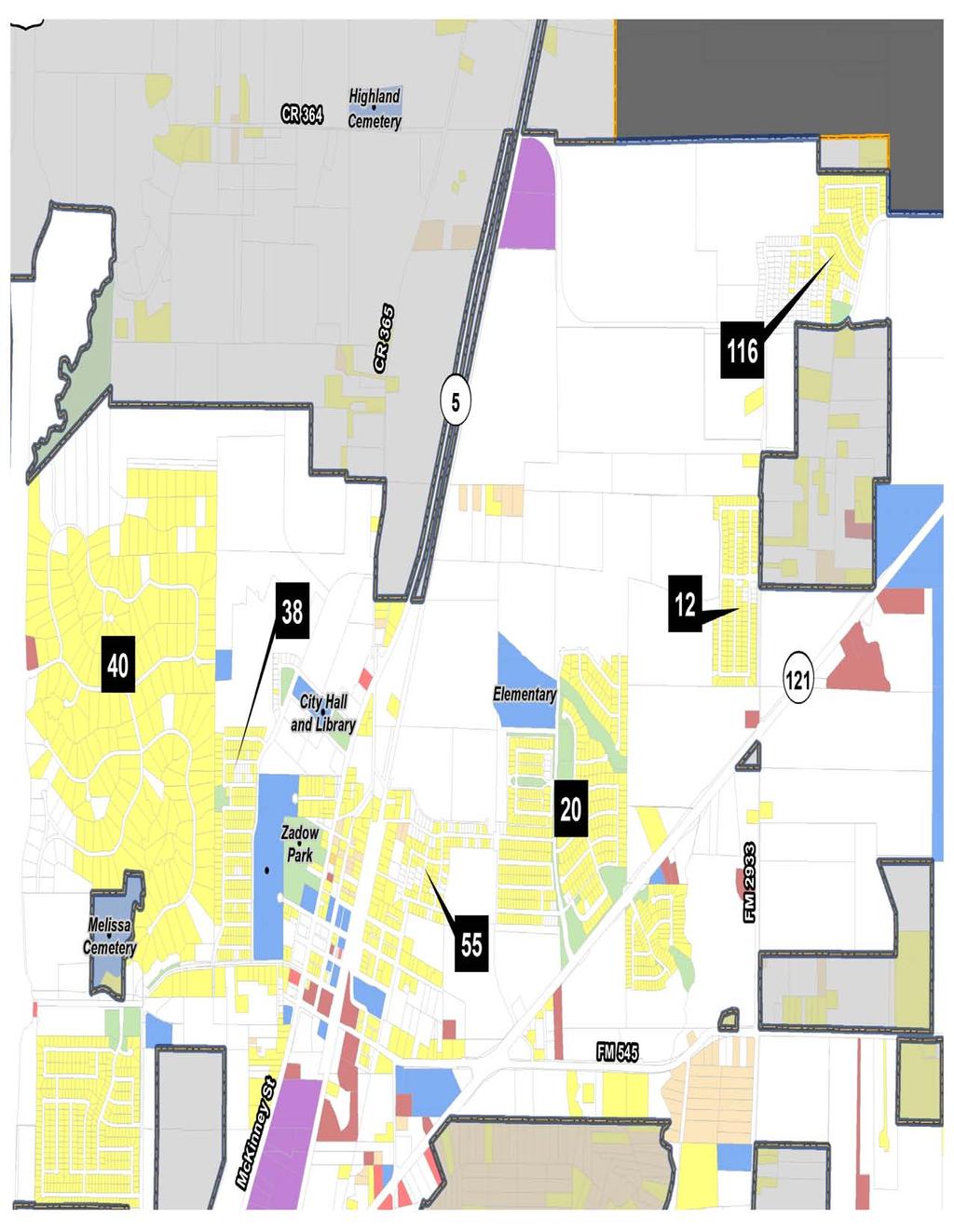
83 Figure3-4.PlannedandPlaedSubdivisionsinMelisa
84 The most recent projected population number for Melissa was calculated by the North Central Texas Council of Governments (NCTCOG), as of October This estimate of 7,755 people has been used here as a basis from which to project what the population is likely to be in future years. Table 3-3 shows the City s average annual compounded growth rates during various time periods since Table 3-3. Population Growth Rates for City of Melissa since 1980 Year Average Annual Compounded Growth Rates (AACGR) (-0.8%) 4.1% 9.3% 11.6% 13.3% 7.8% Table 3-4. Population Growth Projection Scenarios Year 6% 10% 15% ,755 7,755 7, ,221 8,531 8, ,714 9,384 10, ,237 10,322 11, ,791 11,354 13, ,378 12,490 15, ,001 13,739 17, ,661 15,113 20, ,361 16,624 23, ,102 18,286 27, ,888 20,115 31, ,722 22,127 36, ,605 24,339 41, ,541 26,773 47, ,534 29,451 54, ,586 32,396 63, ,701 35,635 72, ,883 39,199 83, ,136 43,119 95, ,464 47, ,371 Much consideration has been given to establishing a realistic population projection for Melissa that reflects its anticipated rapid growth, but also recognizes realities that may occur to curb growth, such as economical fluctuations, infrastructure challenges, etc. To help the City plan for various scenarios of population growth, three different scenarios have been provided: 6 percent, 10 percent, and 15 percent. Page 3.16 Chapter 3 Future Land Use Plan
85 Ultimate Population Capacity Melissa has a large amount of vacant land area (approximately 70 percent of the total planning area), much of which is designated for residential land use, or for a mix of land use that includes residential (refer to the Future Land Use Plan Map, Figure 3-1). The City also has some ETJ area within which the City can grow geographically. Therefore, both the vacant area within the City limits and the ETJ provide developable land for population growth. In order to guide the City in planning for how many people will ultimately have to be supported, an assessment of Melissa s ultimate population is provided. There are several factors considered in the calculation of ultimate population capacity, as well as several assumptions. Considerations include vacant/agricultural areas (shown on the Existing Land Use map in Chapter 1), and areas planned for residential, transit-oriented, and mixed use development (shown on the Future Land Use Plan Map). Assumptions include the following: Various densities for each type of lot these are listed under the Average Number of Dwelling Units per Acre column. Occupancy rates and average household size information this is from the latest U.S. Census (2010). Completion of platted and planned developments that have already been approved by the City. These assumptions have been used to calculate the projected population capacity for within the City limits and ETJ. Table 3-5 shows the calculation of ultimate population capacity within the City limits and the ETJ as they exist today. With additional population accommodated within vacant areas, and with the City s 2014 estimated population of about 7,755 people, Melissa s ultimate population capacity within the existing City limits is approximately 34,410 people. Including the ETJ population and land, the ultimate capacity, or build-out population, for Melissa s planning area is approximately 119,072 residents. Page 3.17 Chapter 3 Future Land Use Plan
86 Table 3-5. Projected Ultimate Capacity within the Current City Limits, ETJ, and Total Planning Area Type of Lot Vacant Acres or Number of Lots Average DUA City Limits Occupancy Rate Persons Per Household Estimated Future Population in Estate Density % Low Density 1, % ,589 Medium Density % ,482 High Density % ,836 Mixed Use* % ,417 Vacant Platted Lots % Future Population that can be Accommodated in the Existing City Limits Current Population in the Existing City Limits Capacity Population in the Existing City Limits 31,579 7,755 39,335 ETJ Estate Density 1, % ,014 Low Density 4, % ,549 Medium Density % High Density % Mixed Use* % ,058 Vacant Platted Lots % Future Population that can be Accommodated in the Existing ETJ Current Population in the Existing ETJ Capacity Population in the Existing ETJ 78,664 1,074 79,737 Total Planning Area Capacity in the Existing Planning Area 119,072 *Mixed Use assumes 20% of the acreage will be residential development. Page 3.18 Chapter 3 Future Land Use Plan
87 Recommended Land Use Policies Following are the land use policies. The Future Land Use Plan is intended to be used in conjunction with these policies. The Implementation Plan, Chapter 9, will outline specific ways in which the City can implement the land use policies, along with other recommended policies from within this 2015Comprehensive Plan. Policy 1: Provide for Varied Residential Development The residential development within Melissa generally consists of traditional single-family subdivisions. This is consistent with the composition of most cities in the Dallas-Fort Worth Metroplex. The single-family product is being constructed by the development community, and this product is selling rapidly. However, as a community ages, one way of ensuring its sustainability (i.e., its consistent or increased value) is to provide a variety of housing types to meet the various needs of the market place. This will enable the families with children who are currently moving into Melissa to grow with the community the children will be able to find housing locally when they graduate from college, and the parents will be able to move into a home that is easier to maintain, such as a townhome or patio home. Also, contrary to popular perception, other housing types can be quite expensive and exclusive, and they are often highly sought-after because there are usually not enough such units to meet the housing market needs. LU1.1 The City should encourage the development of housing types other than singlefamily. A variety of lot sizes, from multiple-acre lots to zero-lot-line lots, should be provided in new developments. The integration of townhomes in subdivisions should be considered as new developments are approved. The areas on the Future Land Use Plan Map (Figure 3-1) that are designated for Medium Density land use should be developed with townhomes or multi-unit homes designed to resemble large homes. Multiple-family housing is appropriate in Melissa where it is identified on the Future Land Use Plan Map. Page 3.19 Chapter 3 Future Land Use Plan


88 LU1.2 The City should encourage the development of unique neighborhoods for maximum sustainability Two townhomes (left image) integrate well with a large home (right image) The homogenous housing and subdivisions that are provided in numerous cities does not contribute to the sustainability of a community. If it can be easily recreated or replicated, it is likely that it can easily be found elsewhere. The location and mix of housing in Melissa should be provided such that properties generally have different characteristics such as view, proximity to open space, access to retail services, and house size and type. The uniqueness of each property will appeal to different needs and desires of the market, thereby creating neighborhoods that attract reinvestment. LU1.3 The City should provide for limited, traditional multiple-family development. Traditional multiple-family development should be permitted only in the areas shown on the Future Land Use Plan Map. Making these developments high quality is one of the ways to ensure their sustainability. Traditional multiple-family development should therefore have the following characteristics: o o All structures should be composed of high quality building materials. High quality is defined as materials that promote a generally pleasing aesthetic look and feel. High quality building materials enhance the value of the area and retain a desirable appearance over a long period of time. A minimum percentage of the site should be comprised of usable open space. This could include increased landscaping, a jogging trail, a water feature, or central green space. Page 3.20 Chapter 3 Future Land Use Plan

.")
89 A minimum number of amenities should be provided from a City-established list. Examples of amenities include: o o o o Swimming pools; Clubhouses; Exercise rooms; and, All units provided with garages. If Retail land uses are adjacent, pedestrian access via a trail to such uses should be provided. Preferably, such access would not be provided adjacent to a street (i.e., would be an off-street trail). Page 3.21 Chapter 3 Future Land Use Plan
.")


90 LU1.4 The City should provide for multiple-family uses in vertical mixed use development. The market for multiple-family housing in a mixed use concept has been increasing in market share 3-1. Not only does the research support this fact, but the various mixed use developments throughout the Metroplex support this as well (refer to Land Use Policy 3 for more detail). Further, the density provided by multiple-family development is needed to support transit-oriented development, and can support the sustainability of retail uses. Vertical multiple-family development in a variety of types, such as condominiums and large lofts, is also ideal in providing housing choices for young professionals, young married couples, and seniors. Therefore: Development proposals that include multiple-family units in a vertical, mixed use development should be encouraged. o Such development is appropriate within areas designated for Mixed Use, Transit-Oriented Development, Town Center, Old Town, and the Commercial Overlay District. o Such development may also be appropriate within areas designated for Medium Density and High Density on the Future Land Use Plan Map. 3-1 J. Thomas Black. Opportunity & Challenge: Multifamily Housing in Mixed Use Activity Centers. National Multi Housing Council (NMHC). ADDRESS: Page 3.22 Chapter 3 Future Land Use Plan

91 Policy 2: Encourage Retail Uses in Appropriate Locations Various types of retail require various types of locations for success. The following provide guidance for how Melissa can best provide sustainable retail development. In short, uniqueness, quality and location are key aspects of retail sustainability. LU2.1 The City should encourage unique retail development with sustainable characteristics. Strip retail development, for the purposes of the Future Land Use Plan, is defined as single-use (as opposed to mixed use), autonomous, and automobile-oriented retail centers. This type of retail development, which is illustrated on the following page (right-hand side), has proved to be unsustainable. This fact is evident from the challenges that first-ring suburban cities, such as Plano, Richardson, and Carrollton, have faced. We need to build a better mousetrap for shopping with real places, the authentic places where people want to shop and dine, with housing and offices, with schools and libraries, etc., and most importantly just being together. Places that people [care] about... Source: Retail shifts toward livability, says mixed-use expert. New Urban News, June 2005 Issue. Sustainable retail developments have certain characteristics, such as the following, which should be incorporated into retail developments in Melissa: o o o o o Pedestrian and roadway connections to adjacent neighborhood areas (also see Land Use Policy 7); Less visible parking this could be achieved with internalized parking with buildings out front (as opposed to large parking lots located adjacent to the street), or with wide setbacks; Separation of parking areas to minimize wide expanses of concrete; Minimized spacing between buildings to encourage walking instead of driving; and, Adjacent accessible land uses, such as residential and/or office, that provide a built-in market. The creation of strip retail autonomous and automobile-oriented retail along major corridors should be discouraged. Retail uses are more sustainable in the long-term if they are integrated with and connected to other types of development, such as office and residential. Retail development is appropriate within all areas designated for some type of mixed use development, including in the Mixed Use, Transit-Oriented Development, Town Center, and Old Page 3.23 Chapter 3 Future Land Use Plan


92 Town areas shown on the Future Land Use Plan Map. However, different types of retail will be appropriate in these different types of land use categories. As shown in Table 3-1, the Future Land Use Plan Map results in a retail ratio of 0.6 acres per 100 persons based on the ultimate capacity population of 119,072. This is a moderate ratio that indicates the City would be able to support its own residents as well as attract a small amount of consumers from outside of the City. Figure 5. Alternative Site Layouts Layout of retail site places buildings next to roadways, with parking internalized. Shared parking opportunities are increased due to placement. Residential areas are connected, not separated from the retail development. Central open space serves as a focal point and makes access from residential area more inviting than simply providing sidewalks and provides pedestrian interest. Layout of retail site places parking next to roadways, with buildings being secondary. Shared parking opportunities are reduced due to placement. Residential areas are separated with screening wall, not integrated with the retail development. Access from residential area is difficult and uninviting because of lack of pedestrian orientation. Source: Hall, Kenneth B. and Gerald A. Porterfield. Community By Design: New Urbanism for Suburbs and Small Cities. MacGraw-Hill, 2001, page 190. Page 3.24 Chapter 3 Future Land Use Plan


93 LU2.2 The City should carefully consider its retail development standards and related proposals, with the quality of the development being of primary importance. There are probably few, if any, communities that would desire local development to be of a lesser quality. Melissa has much to offer retail uses from a locational standpoint U.S. Highway 75, State Highway 121, and State Highway 5. Current retail development regulations should be reviewed, and amended (if needed) to ensure the highest quality of development. The previously outlined retail characteristics should be considered in any amendments. For Melissa to be a unique and sustainable community, the quality of any proposed retail development should be a primary consideration for whether the City approves the proposal. Quality of development can include: o Appropriate land uses that create desirable employment types for the community o Building materials that will maintain a desirable appearance over time o Aesthetically-pleasing look and feel o Building materials and design that allows Melissa to maintain a rural environment o Uniqueness of services and products offered to Melissa s community Page 3.25 Chapter 3 Future Land Use Plan
94 Policy 3: Encourage Mixed Use Development Autonomously developed land uses have become the norm since the 1950s, along with the increase in suburban development and focus on the automobile. However, studies have shown that great neighborhoods places where uses are mixed together such that people can easily access all types of uses to meet all of their needs are more sustainable over time, and more long-term value is created. This is the reason that various mixed use land use designations have been recommended within this Future Land Use Plan sustainable neighborhoods with a mixture of uses are what is desired for Melissa. The creation of such neighborhoods will make the City a unique place. National examples of such neighborhoods include the Dupont Circle area in Washington, D.C., Queen Anne in Seattle, and the Hyde Park area in Austin 3-2. In the DFW Metroplex, there are many new areas that show the promise of becoming great neighborhoods, including Addison Circle and West Village (in Dallas around Cole Avenue and McKinney Avenue). Older areas in the Metroplex that have managed to become great neighborhoods include the communities of Highland Park and University Park. All of these examples provide a diversity of land uses, housing types, open spaces, etc. in a concentrated area such that a cohesive neighborhood is created. LU3.1 The City should ensure that any mixed use development that occurs has special characteristics. Successful mixed use areas, old and new alike, have key elements that make them feel like special places. These elements, while they are not easy to define or outline, can be generally identified, and include the following. A Defined Character Consideration should be given to the type of atmosphere that is intended to be created, such as a village-like character. An Effective Mixture of Uses A mixture of both horizontal and vertical uses should be established, and should include uses such as retail, residential, and/or office uses. Buildings in mixed use areas should be at least two stories in height, and the ground floor should primarily meet retail standards (i.e., a minimum 16 feet in ceiling height, good visibility). Maximum Setbacks Maximum setbacks (build-to-lines) bring building facades closer to the street and to the pedestrian. Maximum setbacks in mixed use areas help to achieve internalized parking. (Most cities have minimum setback requirements for other types of development.) A Central Gathering Space or Focal Point This type of element not only creates an identity for the development, but often establishes an obvious pedestrian focus. A gathering space or focal point can be in many forms, including a private open space area, plaza, fountain, or civic building. A recognizable example is the central green space and gazebo in Southlake Town Center. 3-2 Richards, James, ASLA. Places to Flourish: Placemaking that Nourishes Ideas, Creativity and Commerce. Thesis for a Master of Landscape Architecture degree - University of Texas at Arlington. Page 3.26 Chapter 3 Future Land Use Plan


95 A Pedestrian Orientation The first consideration of circulation within the development should be toward the pedestrian experience in getting from one place to another, including access to the development from adjacent neighborhoods and areas. Elements such as wide, lighted sidewalks, benches, shade trees, canopies, and attractive views add to the pedestrian feel. Interesting Architecture Buildings in mixed use developments should appeal to the pedestrian; they should be varied and different enough to be inviting to make people want to stop and experience more. Such buildings should have elements such as moldings, canopies, and balconies, and should be tall enough to create a feeling of being in an outside room. Strategic Parking Solutions While the focus of mixed use areas should be on the pedestrian, the reality is that parking is still an important part of developed areas, and needs to be adequately provided. To address this need, but maintain the desired feel of a mixed use area, the following parking solutions should be considered: o Shared parking between uses, to lessen the overall amount needed. o On-street parking. o Where on-street parking is not possible, such as for retail directly facing an arterial roadway, one row of parking (approximately 60 feet) should be located in front of the retail. This is sometimes referred to as teaser parking, and then the remaining parking can be provided internally on the site. o If parking structures are needed, they should be lined with buildings to hide the parking, as well as to make the parking convenient for users/pedestrians. o Any parking lots that are created should be internal to the development, and should be broken up into small areas (as opposed to large expanses that are often part of shopping centers and malls). Page 3.27 Chapter 3 Future Land Use Plan
 Craig Ranch in McKinney is an example of a horizontal mixed use development.")

96 LU3.2 The City should consider horizontal as well as vertical mixed use development. A horizontal mix of uses on a single site should also be acceptable. (The previous discussion within LU3.1 above focused primarily on vertical mixed use.) Craig Ranch in McKinney is an example of a horizontal mixed use development. These developments should also have many of the characteristics discussed in LU3.1. Policy 4: Preserve the Historic Properties The Old Town area is a special part of Melissa it is representative of the City s history. Citizens have endorsed the preservation of this. The development of an Old Town Master Plan would help to coordinate these efforts and would aid in future planning efforts, which is described further in the City Center Plan, Chapter 8. LU4.1 The City should promote residential, public/semi-public, retail, and office land uses within the Old Town Melissa. Office uses should be permitted by right in renovated homes or homes that would fit the historic character of the area. Residential apartment-type units should also be permitted either in renovated homes, in new buildings constructed to resemble large homes, or on the upper floors of retail and office buildings. Restaurants and entertainment-based uses would also help create activity in the Old Town. More detail about these and other concepts for Old Town, including effective ways to connect it to the new Town Center, is contained within the City Center Concept Plan, Chapter 8. Page 3.28 Chapter 3 Future Land Use Plan


97 Policy 5: Continue to Pursue the Development of the Town Center People want to identify with their community. Through the creation of a Town Center, Melissa will provide a mechanism for its citizenry to interact with local government in a unique setting. LU5.1 The City should establish the planned public uses within the Town Center as soon as possible, to the highest level of quality possible. As population growth continues to occur, it will be increasingly important for the City to create a recognizable identity. The City Hall should contine to be the picture of Melissa that citizens and visitors carry with them it is the image of the City. Therefore, all other structures in the City Hall area should be completed to the highest quality and best design possible. The Town Center should contain a central outdoor space near the City Hall that citizens could use as a gathering space. Examples of this include the gazebo and central green space within Southlake Town Center and the large water feature in Legacy Town Center in Plano. These areas allow citizens to feel a sense of ownership in the development, which will be especially important to provide as part of Melissa s Town Center. More detail about these and other concepts for the Town Center, including effective ways to connect it to the Old Town area and the TOD, is contained within the City Center Concept Plan, Chapter 8. A Community Center would be a valuable asset to the Town Center area. By connecting the Old Town area to the Town Center, the Community Center would be more accessible and would be a centrally located public facility for the residents. Page 3.29 Chapter 3 Future Land Use Plan


. LU6.1 The City should generally only approve nonresidential proposals or mixed use proposals in areas designated for such uses on the Future Land Use Plan Map.")
98 Policy 6: Provide a Balance of Residential and Nonresidential Land Uses When communities begin to develop, it is usually residential uses that develop first. Nonresidential development needs residential development to serve in order to make a profit. Nonresidential development also needs people for employment. The concern with a community like Melissa that is experiencing such rapid growth is that much of the land will be consumed with residential uses before the market is mature enough for nonresidential development. This can create a fiscally unhealthy imbalance of residential-to-nonresidential uses. This Future Land Use Plan endorses a balance of residential and nonresidential uses, as do the citizens that attended the public workshop at the beginning of this planning process (refer to Chapter 2). LU6.1 The City should generally only approve nonresidential proposals or mixed use proposals in areas designated for such uses on the Future Land Use Plan Map. Prime nonresidential property should not be developed with residential uses, unless residential uses are provided in a mixed use concept. A large amount of prime nonresidential property exists within Melissa along U.S. Highway 75, State Highway 5, State Highway 121, and the Collin County Outer Loop (refer to the Transportation Plan). LU6.2 The City should pursue the development of quality retail uses. These retail uses should attract quality employers that supply jobs within Melissa. Not only is it important to attract business that use quality building materials and other physical aspects, but they should also provide a quality working environment and contribute to the community. Retail sales tax revenue can not only supplement ad valorem taxes, but it can be a major contributor to a community s overall budget. As previously stated, the City s location along several major highways provides prime locations for a variety of retail uses. For these reasons, retail uses should be the primary nonresidential type of land use that is pursued in the designated nonresidential and mixed use areas on the Future Land Use Plan Map. Page 3.30 Chapter 3 Future Land Use Plan
99 Retail uses, regardless of their desirability in terms of tax revenue, should be developed to a high quality, as described in Land Use Policy 1. The City should not settle for a lesser quality of development to obtain an immediate source of revenue, to the detriment of the long-term sustainability and attractiveness of Melissa. LU6.3 The City should carefully consider any requested upzoning of property due to State law constraints on future rezoning. Several bills introduced during recent legislative sessions proposed that Texas cities be required to compensate landowners if the city initiates a downzoning of their property. Downzoning refers to a decrease of the intensity of a zoning district; for instance, a downzoning occurs if a City initiated a zoning change from a multiple-family zoning district to a single-family zoning district. Although there are relatively few instances of City-initiated rezonings, as opposed to landowner-initiated rezonings, this could be a concern for Melissa if this type of law is eventually adopted by the State legislature. It will be easy to increase the rights related to a property at a property owner s request, but difficult for the City to affect any future changes related to the zoning of that property without the permission of the property owner. The Future Land Use Plan text and Map should be used as a guide to determine whether the requested rezoning is appropriate and consistent with the City s concepts of quality and sustainability. If immediate development of the property is intended to occur upon the rezoning, the City should be sure that the proposed development is of a type and quality that will be acceptable for the long-term. If the rezoning is requested on a speculative basis (i.e., immediate development of the property is not intended), the City should require a Planned Development or a Developers Agreement. This would allow Melissa to stipulate that future site plans or plats must conform to regulations in existence at the time the site plan or plat is submitted. Page 3.31 Chapter 3 Future Land Use Plan
.")
 LU7.")

100 Policy 7: Encourage Connectivity between Developments Development tends to occur autonomously, primarily due to the fact that areas develop at different times. The challenge is to connect these different developments to not only allow for access in between, but to actually encourage people to walk or bike in between (instead of driving). Such connections would not only further a positive neighborhood and community feel, but would also help to address future roadway transportation challenges that Melissa may face as its population continues to increase. (Also see the Parks and Trails Plan for more detail about these and other concepts for trail connectivity.) LU7.1 The City should require connectivity between all types of development. Connecting areas with roadways has become the norm. However, pedestrian and bicycle connectivity should also be required as development occurs within the development itself and to adjacent developed areas. Especially significant is the pedestrian and bicycle connectivity to schools, the Town Center, Old Town, retail areas, and parks. If adjacent areas are not yet developed, provisions for pedestrian, bicycle and automobile access should be established with consideration for future connections/access (similar to the way in which street stub-outs are often required). LU7.2 The City should encourage off-street pedestrian and bicycle connections. One of the simplest ways to provide pedestrian and bicycle connection is to establish them adjacent to roadways. Oftentimes, these simply become seldom-used sidewalks, and do not create real connectivity. Off-street trails should be the primary means of providing connections between developments, with on-street sidewalks as a secondary choice. Transportation needs will most likely change in the future, and the bike lanes could be utilized by golf carts or other small motorized modes of transportation not intended for highway travel. Page 3.32 Chapter 3 Future Land Use Plan


101 Policy 8: Plan Land Uses and Density to Support Mass Transit Although it may be decades in the future for transit serving Melissa to become a reality, this Future Land Use Plan supports the concept. To be cost-effective, a light-rail transit system such as the Dallas Area Rapid Transit must have significant residential and employment density. Therefore, the Future Land Use Plan Map shows Transit-Oriented Development (TOD) in the area surrounding the anticipated location of the transit station. LU8.1 The City should ensure that the future transit station and TOD area are effectively connected to Old Town Melissa. As described in Land Use Policy 4, Old Town Melissa is an important historical area of the City. It should not be left behind as future development occurs, but should become integrated with new development through pedestrian connections. Density in Old Town could also help support the future transit station. Proposals that allow for higher density in Old Town should be strongly considered (with the exception of traditional multiple-family). It is important to note that the exact site location for the transit station and TOD is flexible. LU8.2 The City should allow high-density residential development and a mix of uses in the TOD area. The TOD area is recommended to be the area of the City with the highest residential density in order to support a future transit station. Currently approved development proposals in this area should be considered for higher density and for more diversity of land uses, such as the addition of retail and or office. Page 3.33 Chapter 3 Future Land Use Plan
102 Policy 9: Integrate Sustainability Concepts into Land Use Decisions When a development proposal is submitted, and the tract of land is zoned for a type of land use that is consistent with the proposed development, the City only has the ability to ensure that the development is consistent with its subdivision standards. That is, the development must make provisions for water and wastewater supply, for adequate rights-of-way, for proper ingress and egress, etc. However, when a development proposal is submitted and involves a rezoning, Melissa has more discretion in whether to approve the rezoning. Therefore, the City has more of an ability to apply Future Land Use Plan concepts to the development proposal prior to approving the proposal. LU9.1 The City should consider the following questions related to Future Land Use Plan concepts prior to approving rezoning requests. Does the proposed use or development provide something unique for Melissa a diversity of housing types, lot sizes, land uses, amenities, etc.? Is the development within walking distance to retail areas, public uses, parks and open space, etc.? Does the development provide off-street pedestrian and bicycle connections to existing and future development? How does the development proposal impact the City fiscally tax revenue, employment, and public considerations? Does the development allow for the future integration of transit, when applicable? Does the proposed zoning reflect the Future Land Use Plan map s designation? If it does not reflect the FLUP map s designation, how does this proposal support the Comprehensive Plan s vision? Are all uses in the proposed zoning district appropriate for the existing development or natural features in the area? Does the proposed use or development offer something unique to Melissa? How would the proposed use or development impact the City s services and planning efforts? LU9.2 The City should implement water conservation policies to ensure an adequate water supply in the future. Practical water conservation policies should be explored by the City. Some type of policy should be implemented even in times of adequate water supply to ensure that there is enough water to serve the residents of Melissa in times of drought. Page 3.34 Chapter 3 Future Land Use Plan
103 The landscaping ordinance should require (rather than recommend) some amount of droughttolerant plants. Incentives should also be established for residents who go beyond the mandated amount (e.g., incorporating bioswales, graywater reuse, innovative landscaping design). Policy 10: Develop a Marketing and Branding Plan to Promote the City of Melissa The City should work with the 4A Board, and other organizations to develop marketing and branding strategies that establish a defined image for Melissa. At the time of this, a website is already being developed. It is recommended to continue that effort and plan to expand it in the future. The following are ideas that will contribute to a successful branding and marketing effort: Create a website that is actively monitored and maintained. Create social media accounts that are actively monitored and maintained. Twitter and Facebook are effective ways for the City to push information out to the residents. Proactively work with the Economic Development Department and Chamber of Commerce to ensure that all efforts are coordinated. Develop ideas for annual events that will bring tourists into the City, and ultimately brand Melissa. (Example: Plano s Balloon Festival, Grapevine s Grape Fest) Page 3.35 Chapter 3 Future Land Use Plan
104


105 City of Melissa Chapter 4: Utilities Assessment
106
107 Table of Contents Introduction Water & Wastewater Service Provision Water Services Wastewater Services Recommended Utility Policies Policy 1: Ensure City Services Are Adequate As Melissa Continues to Grow U1.1 The City should continue to monitor and increase water service availability U1.2 The City should continue to monitor and increase wastewater service availability Policy 2: Provide Services in the ETJ in Limited Instances U2.1 The City should ensure that services are provided in the ETJ (outside the City limits) only under the following circumstances U2.2 The City should ensure that its subdivision regulations are equally enforced within the ETJ, as they are in the City limits Policy 3: Investigate Increased Developer Participation in Utility Infrastructure U3.1 The City has adopted water and wastewater impact fees as a means to fund future expansion of the water and wastewater systems. The City should keep water and wastewater impact ordinances current within the guidelines of state law to ensure this revenue stream remains viable for expansion of the water and wastewater system Page 4.i Chapter 4 Utilities Assessment
108 Page 4.ii Chapter 4 Utilities Assessment
109 Introduction Planning for and providing infrastructure is perhaps one of the most important responsibilities of a city government. Citizens should be secure in the knowledge that they can rely on their local government to ensure that there is adequate water and wastewater capacity for the current population, as well as for future growth. Without these basic necessities, a community simply cannot accommodate growth. The City of Melissa has been diligent in reviewing its water and wastewater needs on a consistent basis. In an effort to predict future water and sewer demands and provide for anticipated growth, the City of Melissa has prepared and begun implementation of a long term capital improvement plan for water and wastewater system improvements. Expansion of both systems, water and wastewater, will be of the utmost importance as the City grows and must supply to an increasing number of citizens and non-residential customers. This Utilities Assessment is intended to provide an overview of Melissa s infrastructure system and the capacity of that system in relation to the current population and to the future population that is anticipated to be part of Melissa. Page 4.1 Chapter 4 Utilities Assessment
110 Water & Wastewater Service Provision Water Services Water service provision is an especially critical issue for all cities in North Central Texas. The availability of water has become an increasing concern throughout Texas. Not only is potable water a necessary commodity for drinking, it is presently being used for irrigation systems. Potable water supply has become a major challenge in Melissa, since the vast majority of new homes built within the City have in-ground sprinkler systems. The irrigation systems heavily tax the potable water supply during the dry summer months. Current information on Melissa s water service is as follows: Due to recent watering restrictions necessitated by the on-going regional drought, current water usage in the City is slightly lower than historical usage. Current water usage in the City ranges from approximately 110 gallons per day (gpd) per capita during winter months to approximately 200 to 250 gpd per capita in summer months. Water usage will likely trend back to historical usage levels when water restrictions are lifted. As a result, it is anticipated that future water usage in the City will range from approximately 125 gpd per capita during winter months to approximately 225 to 275 gpd per capita in summer months. The City is currently supplied with potable water from two groundwater wells with a total capacity of approximately 350 gallons per minute (gpm), a 12-inch water supply line through which potable water is purchased directly from the North Texas Municipal Water District with a contract limited capacity of 350 gpm, and a 30-inch water supply line through which potable water is purchased from Greater Texoma Utility Authority with a design capacity of 5,000 gpm. In total, the City has a contractual water supply of approximately 5,700 gpm, or 8.2 million gallons per day. Based on minimum state standards, this is a sufficient water supply to provide adequate service to approximately 9,500 customers. Given the mix of residential and commercial customers anticipated in the City of Melissa, this water supply is sufficient to meet typical suburban water supply demands for a population of approximately 17,500 to 22,500. The City currently has one 750,000 water tower and approximately 1 million gallons of ground storage capacity. Minimum state standards for water tower storage range from 100 to 200 gallons per connection, depending on the water system s pumping capacity. Based on the minimum state standards and given the anticipated mix of residential and commercial customers, the City of Melissa s water tower capacity can accommodate a population of 10,000 to 20,000 residents. The City currently has 1,750,000 of total storage capacity. Based on the minimum state standard of 200 gallons of total storage capacity per connection and given the anticipated mix of residential and commercial customers, the City of Melissa s total storage capacity can currently serve a population of approximately 20,000 residents. The City of Melissa s water distribution system currently has a total pumping capacity of approximately 3,300 gallons per minute. Minimum state standards for pumping capacity range from 0.6 to 2.0 gpm per Page 4.2 Chapter 4 Utilities Assessment
111 connection, depending on elevated storage capacity of the system. Given the anticipated mix of residential and commercial customers, the City of Melissa s water distribution pumping capacity can currently serve a population of up to approximately 15,000 to 20,000. Current City of Melissa water system capacities are summarized in the following table. Water System Component Current Capacity Population Allowed Water Supply 5,200 gpm (8.2 mgd) 17,500 to 22,500 Water Tower Capacity 750,000 gallons 10,000 to 20,000 Total Storage Capacity 1,750,000 gallons ~20,000 Distribution Pumping Capacity 3,300 gpm (4.8 mgd) 15,000 to 20,000 The City of Melissa s water supply and distribution system is currently able to support the population of approximately 10,000 to 17,500 residents. Future water system capacities needed to support the estimated ultimate population of approximately 119,072 (refer to Chapter 3, the Future Land Use Plan) are summarized in the following table. Various aspects of Melissa s water supply and distribution system have to be monitored in relation to each other and expanded as necessary to ensure the City of Melissa s water supply and distribution system can serve current residents and accommodate anticipated growth. It appears that additional water tower capacity and/or additional distribution pumping capacity will be necessary in the very near future to accommodate current growth trends in the City of Melissa. Water System Component Current Capacity Ultimate Capacity Water Supply 5,200 gpm (8.2 mgd) 55 to 65 mgd Water Tower Capacity 750,000 gallons 4.25 to 8.5 million gallons Total Storage Capacity 1,750,000 gallons ~8.5 million gallons Distribution Pumping Capacity 3,300 gpm (4.8 mgd) 36 to 84 mgd Page 4.3 Chapter 4 Utilities Assessment
112 Wastewater Services The City has adequate wastewater service and capacity. Current information on Melissa s wastewater service is follows: Current wastewater usage is estimated at 95 gallons per person per day, which calculates into approximately 700,000 gpd for the current population of Melissa. The current total wastewater system capacity is in excess of 5 million gallons per day. Wastewater treatment is provided to the City by the North Texas Municipal Water District at the Wilson Creek treatment plant south of McKinney, Texas. Future wastewater system capacity needed to support the ultimate population of approximately 119,072 will be approximately 11 mgd. Page 4.4 Chapter 4 Utilities Assessment
113 Recommended Utility Policies Following are the recommended utility-related policies. The Implementation Plan, Chapter 9, will outline specific ways in which the City can implement the utility policies, along with other recommended policies from within this 2015 Comprehensive Plan. Policy 1: Ensure City Services Are Adequate As Melissa Continues to Grow U1.1 The City should continue to monitor and increase water service availability. System expansion should be consistent in order to meet the needs of local population growth and to meet the State requirements for water supply related to population. Water conservation measures and related public awareness should continue, especially during highusage summer months. The Future Land Use Plan Map should be used to determine where and how water system expansion should be pursued (i.e., in relation to land use type and density). A water system master plan should be kept up-to-date, with planned water system expansion correlated to funding. U1.2 The City should continue to monitor and increase wastewater service availability. As with the water system, the wastewater system should also be consistently expanded to meet population growth and State requirements for wastewater supply. However, water system expansion is currently more of a critical issue than wastewater system expansion. The Future Land Use Plan Map should be used to determine where and how wastewater system expansion should be pursued (i.e., in relation to land use type and density). A wastewater system master plan should be kept up-to-date, with planned wastewater system expansion correlated to funding. Policy 2: Provide Services in the ETJ in Limited Instances Part of the challenge for Texas cities is that the State does not allow the application of consistent requirements within city limits and within ETJ areas. This often causes ETJ areas to grow more rapidly than areas within cities, and such growth is often of a lesser quality than that which occurs within cities. Melissa therefore needs to have a strong policy related to how service provision is extended to its ETJ areas. Such provision needs to be consistent with procedures and requirements within the City limits, so that a hidden incentive is not provided that in effect encourages development in Melissa s ETJ. Page 4.5 Chapter 4 Utilities Assessment
114 U2.1 The City should ensure that services are provided in the ETJ (outside the City limits) only under the following circumstances. As part of an agreement that provides for development consistent with the Comprehensive Plan; The City s ability to annex the property in the future; The quality of the development occurring is consistent in every way to City standards; That would otherwise be imposed if development was occurring within the City limits; For a use or development that offers significant public benefits (such as major employment, public services, education, etc.) to the entire Melissa community. U2.2 The City should ensure that its subdivision regulations are equally enforced within the ETJ, as they are in the City limits. If standards are reduced in the ETJ, the City could create economic advantages for developers to develop in the ETJ. It is in Melissa s interest to require the same standards in the ETJ, because it is likely that at some point in the future, the ETJ area will be within the City limits. The City does not need to have the financial responsibility for improving sub-standard development when such development is brought into the City. Policy 3: Investigate Increased Developer Participation in Utility Infrastructure U3.1 The City has adopted water and wastewater impact fees as a means to fund future expansion of the water and wastewater systems. The City should keep water and wastewater impact ordinances current within the guidelines of state law to ensure this revenue stream remains viable for expansion of the water and wastewater system. Chapter 395 of the Texas Local Government Code addresses the issue of developer participation in the construction of off-site facilities such as water, wastewater, and roadways. This state law allows cities in Texas to decide whether to assess fees for utility-related construction to new residential and nonresidential development. Impact fees can be described as fees charged to new development based on that development s impact on the infrastructure system. The primary advantage to having this funding source is that it provides cities with the increased ability to plan and construct capital facilities so that the needed infrastructure system capacity is available when the market warrants. Keeping an impact fee study current with regular updates as required by state law would help the City understand the extent of the expenditures that will have to be made for new development in the coming years. Page 4.6 Chapter 4 Utilities Assessment
115 With impact fees, the development community is responsible for paying its related share of the cost of growth and the impact of that growth on local infrastructure systems. Without impact fees, utility system expansions due to growth will likely be financed through taxes (e.g., ad valorem, sales tax, pro rata) and customer generated revenues, which are paid by existing as well as future residents. Impact fees are also a means by which proportionality (of what the developers should be required to contribute) can be established. Page 4.7 Chapter 4 Utilities Assessment
116

117 City of Melissa Chapter 5: Transportation Plan
118
119 Table of Contents Introduction Roadway Types and Standards The Functional Classification System Regional Roadways Highways Localized Roadways Arterials Collectors Local Streets Alternative Transportation Options Transit Opportunities Pedestrian and Bicycle Trail Opportunities Recommended Transportation Policies Policy 1: Design for Shared Access and Cross Access T1.1 The City should require new nonresidential developments along arterial and collector roadways to establish shared access driveways T1.2 The City should require new developments along arterial and collector roadways to establish cross access with adjacent developments Policy 2: Reduce Vehicular Trips by Offering Transportation Mode Choices T2.1 The City should actively pursue establishment of a City-wide trail system Policy 3: Ensure Coordination between Roadways and the Future Land Use Plan T3.1 The City should consider the placement of new developments in relation to roadway types T3.2 The City should secure rights-of-way as development occurs T3.3 The City should consider existing development as roadway improvements are made Policy 4: Use Positive Aesthetics along Roadways to Enhance Melissa s Character T4.1 The City should recognize the importance of its image along roadways, and should take proactive measures to ensure that this image is positive Policy 5: Investigate Increased Developer Participation in Roadway Infrastructure Page 5.1 Chapter 5 Transportation Plan
120 T5.1 The City should continue to monitor whether roadway impact fees are an appropriate funding mechanism for the roadway infrastructure that will be needed as development occurs T5.2 The City should continue to implement a traffic impact analysis, when necessary for determining the impact of a new development on the roadway system Policy 6: Continue to Work with State, County, and Regional Planning Agencies T6.1 The City should ensure that it has active participation and representation in making decisions about roadway infrastructure in the region Page 5.2 Chapter 5 Transportation Plan
121 Introduction A community s transportation system is vital to its ability to grow in a Streets and their sidewalks, positive manner. Transportation is inherently linked to land use. The type the main public places of a of roadway dictates the use of adjacent land, and conversely, the type of city, are its most vital organs. land use dictates the size, capacity and flow of the roadway. Many of the - Jane Jacobs, Life & Death of the decisions regarding land uses and roadways within Melissa have already Great American Cities been made; three major highways run through the City, and local rights-ofway in much of the City have been constructed or planned. A major challenge for Melissa now lies in the accommodation of population growth within the existing transportation system and in the accommodation of new land development through the expansion of that system. More specifically, the transportation system should: Provide mobility and accessibility at appropriate levels according to the type of roadway. Focus on multi-modal transportation options, including pedestrian/bicycle access and transit. Expand as needed to meet the needs of the City s growing population and additional development. Be economically feasible for the citizenry and the City. Be correlated with regional considerations, such as new/expanded highway systems and transit availability. It is important to note that the references made herein regarding the transportation system should not be viewed as references solely to roadways. Communities across Texas and the nation are becoming increasingly aware of the problems inherent in constructing a system for the automobile alone. Pedestrian and bicycle accommodation is important to creating a community that will be sustainable for decades to come. Therefore, another challenge for the City lies in the integration of pedestrian and bicycle facilities such that these facilities actually create alternative modes of transportation. This Transportation Plan is divided into several sections, as follows. First is a discussion of regional roadways. Next is an explanation of the various recommended types of localized roadways. Both regional and local roadways, existing and recommended, are shown on the Transportation Plan Map. This map, Figure 5-6, will help guide decisions within the City and its ETJ regarding right-of-way connections (i.e., how roadways will connect as development occurs) and allocation (i.e., how much right-of-way is needed to accommodate travel) as development occurs. Third is a discussion of the other modes of transportation that should be considered by Melissa as the City continues to expand its transportation system; these modes will become increasingly important as the City and the region continue to grow in population and development. Page 5.1 Chapter 5 Transportation Plan

122 Finally, the transportation policies are outlined. These policies should be used in conjunction with the Transportation Plan Map to guide transportation decisions as Melissa continues to grow in population and geographic area. Roadway Types and Standards The Functional Classification System The Transportation Plan (shown in Figure 5-6) for Melissa is based upon a road classification system that depicts the function of every roadway in the thoroughfare system. Roadway types, as discussed in the following sections, include highways, arterials, collectors, and local streets. Their functions can be differentiated by comparing their ability to provide mobility with their ability to provide access to various locations. These different functions of each roadway type are illustrated in Figure 5-1. Figure 5-1. Access and Mobility According to Roadway Type Local Streets Collectors Streets Arterials Highways Denotes Access Denotes Mobility Increasing Mobility Increasing Access As the illustration shows, access decreases as the thoroughfare type changes from local streets to freeways, while mobility increases. It also shows that roadways that are intended to provide mobility, such as arterials and freeways, should not be compromised by an abundance of separate access points for land uses. This will be addressed later within this Transportation Plan. Page 5.2 Chapter 5 Transportation Plan


123 Regional Roadways Highways are defined as high-capacity thoroughfares along which direct access to property is generally minimal or eliminated altogether, with ingress and egress controlled by access ramps, interchanges and frontage roads. Of Melissa s three identified highways, there are two to which this definition does not apply that is, there is direct access to the land uses along them. One of these highways is State Highway 5, locally known as McKinney Street. The other is State Highway 121. Construction and maintenance of highways is not usually the responsibility of municipalities. The Texas Department of Transportation (TxDOT) and federal monies generally fund improvements of this type of roadway facility. However, the local entities that are affected and impacted by improvements to highways often participate in decision-making and in the public input process. The three highways that currently traverse Melissa are discussed in the following sections. Another east/west highway proposed along the northern City limits is also discussed. Highways U.S. Highway 75 U.S. Highway 75 travels through the western part of Melissa in a north-south direction. It not only provides regional access to and from Melissa, but also state-wide access. At its southernmost point, this highway begins in Galveston, Texas, as Interstate Highway 45 and extends north across the state through Houston, the Dallas-Fort Worth Metroplex (and Melissa), and then into Oklahoma. The regional access that this highway provides allows citizens of Melissa easy connection to numerous employment centers, major retail areas, and other Metroplex cities. This highway provides opportunities for Melissa to expand its local tax base with retail uses. Visibility is one of the prime considerations for retail businesses, and locations within the City that are along U.S. Highway 75 afford such visibility. Therefore, retail uses in a mixed use scenario (i.e., with office and residential in a cohesive development) have been recommended for this corridor, as shown on the Future Land Use Plan Map. It is also important to note that this corridor is included within the Commercial Corridor Overlay zoning district, which is intended to ensure desirable development along U.S. Highway 75 while allowing for market flexibility. Page 5.3 Chapter 5 Transportation Plan


124 State Highway 121 State Highway 121 travels through Melissa in a northeastern direction. It provides regional access to and from Melissa from Fort Worth to Bonham (northeast of the City). This highway has become a major transportation route within the Metroplex in recent years. The accessibility of developments along State Highway 121 is largely dependent on its ultimate configuration through Melissa. Currently, it is an at-grade highway, but it may be raised to allow for more travel lanes in the future. This will affect future land development along it. Regardless, this highway provides good opportunities for nonresidential development. A variety of nonresidential uses have been recommended along State Highway 121, including retail, mixed use, and industrial. Some residential uses have also been recommended (with appropriate buffering elements). State Highway 5 State Highway 5 travels through Melissa in a northern direction parallel to the railroad line, and likely because of its association with the railroad, it is the roadway along which the City first developed. This highway provides for semi-regional access from the city of Howe (north of Melissa) to the city of Allen. Locally, this highway is known as McKinney Street. It is along this highway that Melissa s new Town Center is located. This is a good location that will allow for the Town Center to be both visible and accessible. Also significant in terms of land use is the fact that the City s Old Town area is adjacent to State Highway 5, which may provide a catalyst for the area s redevelopment (discussed in detail within the City Center Concept Plan, Chapter 8). Another important land use concept in relation to this highway is the recommended Transit-Oriented Development (TOD) that is envisioned adjacent to the planned light rail stop. Although the TOD is intended to be a pedestrian-oriented area, it will need the visibility and accessibility provided by State Highway 5 to truly become a dense urban environment. Other land uses recommended along State Highway 5 include retail, commercial, and industrial. Some residential uses (with buffering) have also been recommended. Page 5.4 Chapter 5 Transportation Plan

125 The Collin County Outer Loop The Collin County Outer Loop study began in 2002 as a proactive planning approach to the foreseeable need for another connection in the northern Collin County area an area that has experienced marked residential and nonresidential development in the past 15 to 20 years. The Outer Loop will be a major highway approximately 500 feet in right-of-way width. The portion of the highway nearest to Melissa is recently completed and open to traffic U.S. Highway 75 to SH 121. Figure 5-2. Collin County Thoroughfare Plan - Outer Loop (east-west Tollway shown in dark purple) Page 5.5 Chapter 5 Transportation Plan

126 Localized Roadways Arterials Roadways identified as arterials are designed to convey relatively heavy volumes of traffic. These roadways are primarily intended to provide mobility, and because of the speed and volume of traffic, access to properties should be minimal. It should be noted that both the major and minor arterials have been recommended as divided roadways with a center median. While the median could be a painted turnlane that allows for less controlled left turns, the recommendation is for a raised median. Not only has a raised median been proven to be the safer alternative 5-1, it provides for better access control to developments adjacent to the arterial roadway, thereby allowing for greater mobility. Raised medians also provide an area for streetscape enhancements such as lighting, landscaping, and special signage. Refer to the Transportation Plan Map, Figure 5-6, for the recommended locations of new arterial roadways. The recommended major and minor arterial roadway sections are shown in Figure 5-3 and Figure 5-4, respectively. These are generally consistent with the City s current Subdivision Ordinance requirements. Figure 5-3. Type A - Major Arterial Roadway (120' Total ROW) 5-1 TRIP: The Roadway Information System, National Information: Highway Safety Fact Sheet: How Road and Bridge Improvements Save Lives ; ADDRESS: Page 5.6 Chapter 5 Transportation Plan
.")
127 Figure 5-4. Type B - Minor Arterial Roadway (100' Total ROW) Collectors Collector streets are generally designed to distribute traffic from local access streets and funnel it to arterial roadways (i.e., from residential developments). Collectors should provide more access to adjacent land uses than do arterials, but access should still be controlled through the use of shared driveways and other techniques that minimize disturbance of the free-flow of traffic (see Transportation Policy 1). This type of roadway should provide an equal amount of mobility and access to land uses, and is intended to carry lighter volumes of traffic than arterials. Refer to the Transportation Plan Map, Figure 5-6, for the recommended locations of new collector roadways. The recommended major and minor collector roadway sections are shown in Figure 5- and Figure 5-, respectively. These are generally consistent with the City s current Subdivision Ordinance requirements. Page 5.7 Chapter 5 Transportation Plan


128 Figure 5-5. Type C - Major Collector Roadway (80' Total ROW) Figure 5-6. Type D - Minor Collector Roadway (60' Total ROW) Page 5.8 Chapter 5 Transportation Plan


129 Local Streets Whereas the principal objective of arterial roadways is to provide mobility, the principle objective of local streets is to provide access to adjacent properties. The mobility aspects of local streets are secondary to accessibility. Due to the fact that local streets are generally constructed within residential areas, safety is an important issue. To ensure that these roadways are not used a great deal for mobility purposes and to ensure that their ability to provide access safely, local streets should be configured to discourage throughtraffic movement by using traffic calming elements, such as offset intersections, curvilinear streets, discontinuous streets, and stop signs. Local streets are not shown on the Transportation Plan Map because decisions as to the locations of local streets are usually made as development occurs; such decisions are heavily dependent on the type of development that is occurring and the need for connectivity to/with adjacent developments. (Also refer to Transportation Policy 3.) The recommended local street section is shown in Figure 5-5. This section is consistent with the City s current Subdivision Ordinance requirements. Figure 5-5. Type E - Local Street (50' Total ROW) Page 5.9 Chapter 5 Transportation Plan
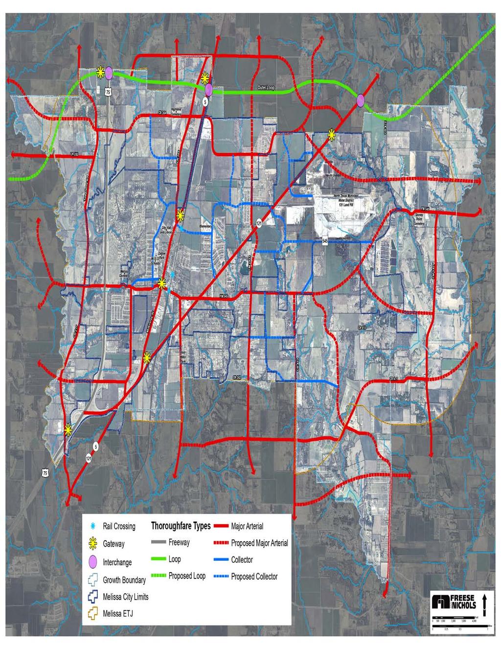
130 Figure5-8.TransportaonPlanMap

131 Alternative Transportation Options One of the objectives of this Transportation Plan is to put forth concepts of transportation options that will provide an alternative to the automobile, specifically transit and pedestrian/bicycle modes. The major challenge to meeting this objective is putting forth these concepts in a way that make such alternatives realistic and convenient for the citizens of Melissa to use. Transit and trail concepts, and why they should be proactively pursued by the City, are discussed below, and policies that support these concepts are outlined within Transportation Policy 2. Transit Opportunities The North Central Texas Council of Governments (NCTCOG) has completed a Regional Rail Corridor Study that examines how the current rail system (generally operated by Dallas Area Rapid Transit) could be expanded to meet the future anticipated travel demand in the Metroplex. The NCTCOG s study revealed that with the amount of ridership expected, a connected regional rail system could have the effect of adding on additional freeway lane in each direction to some of the most congested highways and tollways in North Central Texas. The DART rail has recently been expanded as far north as Plano, and there are plans to extend the line further north to address the increasing traffic along U.S. Highway 75. The fact that Melissa has a railroad line through the center of the City makes the eventual expansion of rail services to and through Melissa an increased possibility. The easements associated with these railroad lines can be used for light rail or commuter rail lines. In anticipation of an eventual light rail or commuter rail line through Melissa, a proposed location for a transit station has been established (refer to the Transportation Plan Map, Figure 5-6). One of the major factors in transit ridership is convenience, specifically in terms of 1) accessibility to and from the transit stop itself, 2) accessibility to other locations in the Metroplex, and 3) reliability of the transit system. Meaning that in order for people to use transit, it is not enough simply to establish the transit system and transit stop the transit mode must be as convenient or Admittedly, a transition to patterns in which walking, bicycling, and public transportation will be effective alternatives for large percentages of residents will take 20 to 30 years or more Communities need not be completely transformed before they begin to attract attention as more livable spaces. Simply getting the process in motion, backed up by long-term plans and firm public commitments, may encourage potential new residents to become pioneers. William H. Lucy & David L. Phillips. Suburban Decline: The Next Urban Crisis. Issues in Science and Technology Online website. The distance a person will walk and the mode of transport he or she will use are strongly affected by the walking environment. Real and even perceived delays and inconveniences such as lack of sidewalks, inadequate signage, dangerous walkways, poor appearance, and factors that create a sense of insecurity can cause potential riders to choose use of their personal automobiles Sean O Sullivan & John Morrall. Walking Distances to and from Light-Rail Transit Stations. Transportation Research Record Page 5.11 Chapter 5 Transportation Plan


132 more convenient for people to use than their private vehicle. Therefore, it will be extremely important for the transit stop in Melissa to be accessible by pedestrians and by automobile (i.e., a park-and-ride situation). It will also be important for the transit system to connect with other areas of the Metroplex that people desire to go on a daily/weekly basis, such as employment centers or concentrated shopping areas. And finally, the system itself must be reliable for people to use it transit must be available consistently at peak travel times, such as during morning and evening rush hours. Pedestrian and Bicycle Trail Opportunities Another method of reducing the number of automobiles on the roadways in Melissa is to provide pedestrian and bicycle connections. This would be more effective at reducing traffic locally than would a transit system, which is really focused on addressing regional transportation needs. The recommended system of trails is shown in in Chapter 6, the Parks & Trails Plan. Although some of the trails are more recreation-based, others are focused on providing connections between residential and nonresidential land uses. They are intended to provide an alternative form of transportation between neighborhoods and schools, retail areas, public areas, and the future transit station (and transit-oriented development area). These trails can be developed in a way that is both pleasant and practical, preferably off-street, but also along streets as part of the rightof-way. Chapter 3, the Future Land Use Plan, and Chapter 6, the Parks & Trails Plan, both discuss the importance of the integrating a trail system in Melissa these chapters have integrated trail concepts by locating land uses, parks and public uses to maximize the effect of the trails, and the connection between trails and recreation opportunities is discussed in detail. The City is currently experiencing a high level of development and related population growth. The time to consider the integration of a trail system throughout Melissa is now when the City still has ample developable land to make trails a viable transportation alternative as development occurs. Retroactive integration of trails is much more challenging and costly than if such trails are completed at the time the initial development occurs. Page 5.12 Chapter 5 Transportation Plan
133 Recommended Transportation Policies Following are the transportation policies. The Transportation Plan Map is intended to be used in conjunction with these policies. The Implementation Plan, Chapter 9, will outline specific ways in which the City can implement the transportation policies, along with other recommended policies from within this 2015 Comprehensive Plan. Policy 1: Design for Shared Access and Cross Access Roadways that are intended to provide mobility, such as arterials, should not be compromised by an abundance of separate access points for land uses. Collector roadways are intended to provide both mobility and access, but the former is much more effective if the latter is controlled. T1.1 The City should require new nonresidential developments along arterial and collector roadways to establish shared access driveways. New nonresidential developments should be required to share the driveway of the adjacent development, if possible (i.e., if the driveway is positioned near the lot line/setback line of the lot that is being developed). New nonresidential developments should be required to make provision for sharing their driveway with the adjacent development in the future, if the adjacent lot is not yet developed. New nonresidential developments that require more than one driveway (by current regulations) should construct at least one driveway such that it is or can be shared. These requirements should be added to the applicable ordinances to ensure the standards are enforced. Figure 7. Shared Access Driveway and Cross Access Internal Driveway Shared Driveway Cross Access Internal Driveway Page 5.13 Chapter 5 Transportation Plan
134 T1.2 The City should require new developments along arterial and collector roadways to establish cross access with adjacent developments. New developments should be required to provide access to adjacent development through an internal driveway. If adjacent development has not yet occurred, provision for future cross access should be made. The standards should be removed from the Engineering Design Manual and moved to the Subdivision Ordinance to ensure the standards are enforced. Policy 2: Reduce Vehicular Trips by Offering Transportation Mode Choices The only way to reduce the dependence on the automobile is to provide viable and realistic transportation alternatives. The specific means by which this Transportation Plan recommends reducing such dependence in Melissa are regional transit and local pedestrian/bicycle connections. Integration of these two elements within the City now, when the City has much room for population growth and land development will make Melissa a more sustainable and livable community in the long-term. T2.1 The City should actively pursue establishment of a City-wide trail system. New residential developments and nonresidential developments of all types should be required to make provision for pedestrians and bicyclists, including access to and through the development in accordance with the Trail Plan Map. All new roadways should have sidewalks constructed alongside them. However, these on-street trails should not be the only type of trails provided. Off-street trails should also be actively established. Every transportation agency has the responsibility and the opportunity to make a difference to the bicycle-friendliness and walkability of our communities. The design information to accommodate bicyclists and pedestrians is available, as is the funding. More detail about trail concepts is contained within the Parks & Trails Plan, Chapter 6. The on-street trail system could be utilized for golf carts and other types of small motorized transportation vehicles not intended for highway use. Design Guidance Accommodating Bicycle and Pedestrian Travel: A Recommended Approach. U.S. Department of Transportation Federal Highway Administration website. Page 5.14 Chapter 5 Transportation Plan
135 Policy 3: Ensure Coordination between Roadways and the Future Land Use Plan The recommended Transportation Plan is based primarily on the recommended Future Land Use Plan. As stated in the Introduction of this chapter, transportation is inherently linked to land use. Therefore, as changes are made to the Future Land Use Plan Map, changes may need to be reflectively changed in relation to the Transportation Plan Map. T3.1 The City should consider the placement of new developments in relation to roadway types. Ideally, neighborhoods should be developed between major thoroughfares and collector streets in the future so that traffic may be diverted from residential areas. Homes should only be oriented to front onto residential local streets, not collector streets. When homes back to collector streets, an alley should be provided so that access is not from a collector street. Page 5.15 Chapter 5 Transportation Plan

136 T3.2 The City should secure rights-of-way as development occurs. The Transportation Plan shows various areas of the City linked by arterial or collector roadways. These are not actually engineered locations for these roadways, these are simply locations that need to be connected with roadways as development takes place in relation to these locations. The appropriate amount of right-of-way should be secured at the time of development. If a development proposes to locate in an area that a roadway has been recommended, the roadway could be moved to allow for the development to take place. However, it is still important for a connection to be made with a roadway, and therefore, an alternative location for the roadway should be established (see the illustration at the right). Incorporating this right-of-way requirement into the Subdivision Ordinance would help to strengthen the requirement. T3.3 The City should consider existing development as roadway improvements are made. Wherever existing rights-of-way that have been identified as a different type of roadway than the type it is as it exists currently (e.g., an existing minor collector is shown as a major collector), this is a recommendation that the roadway be widened when and if development occurs. Existing residents and businesses should be disturbed to the least extent possible. A city s transportation plan shows that a connection needs to be made via a collector street in this area. A connection is still made when a development is approved by moving the collector street. Policy 4: Use Positive Aesthetics along Roadways to Enhance Melissa s Character The highest level of visibility that Melissa has is along its roadways. It is likely that more people will travel on a thoroughfare through the City than will live in Melissa, visit the Town Center, use a park facility, or use a trail. The image of Melissa that people encounter while traveling to and through the City is extremely important this image will affect whether the City is perceived as a quality place to live, shop, work, etc. Page 5.16 Chapter 5 Transportation Plan


137 T4.1 The City should recognize the importance of its image along roadways, and should take proactive measures to ensure that this image is positive. Corridor aesthetics are important to promote Melissa s community image. The City should identify strategies to enhance Melissa s character along the major corridors and City roadways. The major corridors play an important role in the ultimate perception and identity for the community. Streetscape enhancements should be considered as roadways are constructed or improved. o Examples include articulated pedestrian hike/bike facilities, pedestrian crosswalks, landscaped medians, and street trees. Each recommended roadway cross-section within this Transportation Plan includes these elements, as appropriate, within the rights-ofway. o o o The various highways that traverse Melissa, such as U.S. Highway 75 and State Highway 121, provide prime opportunities for a positive image of the City to be reflected. The Collin County Outer Loop also provides such opportunity. Special lighting elements, banner signs, and gateways are effective streetscape elements that would enhance these highway corridors. The gateway concept is described in more detail in Chapter 8, City Center Concept Plan. Page 5.17 Chapter 5 Transportation Plan
138 Many cities require easements along arterial roadways for streetscape enhancement. The City should consider requiring a 10-foot-wide landscape/access easement along arterials when subdivisions are platted. This easement would serve to open up the visual corridor, provide an enhanced image for the community, and provide space for trails. More detail about streetscape concepts is discussed in relation to the new Town Center, Old Town area, and the Transit-Oriented Development area within the City Center Concept Plan, Chapter 8. Policy 5: Investigate Increased Developer Participation in Roadway Infrastructure T5.1 The City should continue to monitor whether roadway impact fees are an appropriate funding mechanism for the roadway infrastructure that will be needed as development occurs. Chapter 395 of the Texas Local Government Code addresses the issue of developer participation in the construction of off-site facilities such as water, wastewater, and roadways. This state law allows cities in Texas to decide whether to assess fees for roadway construction to new residential and nonresidential development. Impact fees can be described as fees charged to new development based on that development s impact on the infrastructure system. The primary advantage to having this funding source is that it provides cities with the increased ability to plan and construct capital facilities so that the needed infrastructure system capacity is available when the market warrants. Conducting an impact fee study would help the City understand the extent of the expenditures that will have to be made for new development in the coming years. With impact fees, the development community is responsible for paying its related share of the cost of growth and the impact of that growth on local infrastructure systems. Without impact fees, new roadway facilities will likely be financed through taxes (e.g., ad valorem, sales tax), which are paid by existing as well as future residents. T5.2 The City should continue to implement a traffic impact analysis, when necessary for determining the impact of a new development on the roadway system. A Traffic Impact Analysis (TIA) is a way to evaluate the impact of large developments on a roadway system. For example, a residential development that is over 1,000 lots generates much more traffic than a development that is 500 lots. Assessing the impact of development on the roadway system would help the City plan for needed improvements in advance of development, thereby staying ahead of the curve. Incorporating a TIA requirement into the Subdivision Ordinance would help Melissa to assess the extent to which new development will affect local roadways. This information will be increasingly important as Melissa continues to develop and its roadways approach capacity in terms of traffic volume. Page 5.18 Chapter 5 Transportation Plan
139 Policy 6: Continue to Work with State, County, and Regional Planning Agencies T6.1 The City should ensure that it has active participation and representation in making decisions about roadway infrastructure in the region. Coordination with the Texas Department of Transportation (TxDOT) will continue to be needed to optimize access and circulation on State roadways within the City. Interaction with the North Texas Tollway Authority (NTTA) will continue to be needed to optimize access and circulation on State Highway 121, if it becomes a toll road in the future. Coordination with Dallas Area Rapid Transit (DART) mobility plans will continue to be needed to optimize the opportunity for Melissa to obtain rail service and a rail stop in the future. Communication with Collin County authorities will continue to be needed to ensure that Melissa s interests are reflected in any decisions regarding the Collin County Outer Loop, especially in terms of alignment and access. It is important to maintain coordination with the Collin County Transportation Plan effort. Participation in NCTCOG planning efforts, specifically the Mobility 2035 Plan, may also help Melissa foster relationships that would ultimately help with transportation planning as well as with funding transportation improvements. Page 5.19 Chapter 5 Transportation Plan
140

141 City of Melissa Chapter 6: Parks and Trails Plan
142
143 Table of Contents Introduction Goals and Objectives Plan Development Process Park Concepts and Standards Pocket Park Neighborhood Park Community Park Large/Regional Parks Special Recreation Areas Parkways and Ornamental Areas Open Space, Reservations, Preserves and Linear Parks/Greenbelts Current Park Inventory Standard-Based Needs Demand-Based Needs Additional Neighborhood Parks Community Parks Ornamental Parks Hike-and-Bike Trails Demand-Based Calculations Recommended Parks and Trails Policies Policy 1: Integrate Parks and Trails with Development Policy 2: Prioritize Trail Construction Policy 3: Investigate Increased Developer Participation in Parks and Trails Provision Policy 4: Require Small Parks to be Privately Maintained Policy 5: Provide Neighborhood and Community Parks to Meet Population Needs Policy 6: Use Floodplains and Creek Areas for Parks and Trails Policy 7: Work With Other Governmental Entities to Provide Cost-Effective, Quality Parks and Trails Page 6.i Chapter 6 Parks and Trails Plan
144 Policy 8: Prioritize Park and Trail Improvements Page 6.ii Chapter 6 Parks and Trails Plan
145 Introduction A vital component of an urban area is the space devoted to satisfying active and passive community recreational needs. The quantity of this space and its distribution within the population generally indicates the quality of the local park and recreation services. Furthermore, all these spaces collectively are considered to be elements that enhance and contribute to the quality of life found in the community. The purpose of this element of the Comprehensive Plan is to examine and analyze existing park and recreation spaces and facilities, to identify issues related to present and future community needs, and to make recommendations on how the City s park and recreation facilities can be integrated into a cohesive system. The service area for this Parks and Trails Plan is the entire City, and this chapter is supported by the demographic and socio-economic data within Chapter 1, Existing Conditions Analysis. This Parks and Trails Plan establishes criteria for park types, evaluates existing facilities, provides a comparative analysis of Melissa s park system to accepted park standards, and identifies demand-based needs that Melissa will need to address in the short-term (1 to 5 years), as well as in the long-term (5 to 10 years). Generally, the timeframe for this Parks and Trails Plan is 10 years. This Parks and Trails Plan should be considered an update of the City s Parks and Recreation Master Plan, which was prepared by the Parks Board in November of Goals and Objectives Frederick Law Olmstead, the man considered to be the father of landscape architecture in this country, advocated the concept that parks, recreation areas, and public open spaces should be planned as integrated systems so that the components could function in conjunction with one another. Source: Alexander Garvin, December 2000, Parks, Recreation, and Open Space: A Twenty-First Century Agenda, American Planning Association, Planning Advisory Service Report Number 497/498, p.13. This Parks and Trails Plan endorses the following goals and objectives from the previously adopted Parks and Recreation Master Plan. Goal #1. Provide parks and common open spaces adequate in size, distribution, and conditions to serve all citizens. Objectives: a. Include within the entire park system a combination of pocket parks, neighborhood parks, linear/greenbelt parks (i.e., trails), and community parks, some of which may be HOA parks. b. Utilize alternative sources of land such as school sites, other City departments vacant or underutilized land, existing street right-of-way, and joint City/County purchases or leases to lessen land acquisition costs. c. Develop a visible and accessible linear/greenbelt park system through layout and design of the surrounding roadway network. d. Work with the appropriate governmental and other organizations to coordinate parkland acquisition with long range growth and development planning. Page 6.1 Chapter 6 Parks and Trails Plan
146 Goal #2. Provide recreational facilities and activities to meet the leisure interests and health needs of Melissa citizens. Objectives: a. Encourage civic participation in the on-going development, implementation, and evaluation of recreational facilities and programming. b. Develop facilities in areas which are underserved and assure their equitable distribution with regard to population characteristics and density. c. Coordinate linear/greenbelt park (i.e., trail) development with other governmental organizations for comprehensive pedestrian and bicycle connectivity. Goal #3. Use the park system to preserve and protect environmentally significant areas for public enjoyment and education. Objectives: a. Enhance and expand the linear/greenbelt park system along creeks and streams in cooperation with Collin County and the Collin County Flood Control District. b. Limit use within environmentally sensitive areas to passive recreation. Goal #4. Maintain, secure and manage parks in a manner which encourages their appropriate use. Objectives: a. Continue restoration of existing parks. b. Ensure that Melissa s parks and recreational facilities are safe and accessible for all users. c. Redefine the neighborhood park to provide a more even balance of passive and active uses. d. Continue established public participation opportunities to assist in park and recreational facility redevelopment activities. e. Recognize that park and recreation needs evolve over time with changes in the population characteristics of surrounding service areas. f. Design parks that are durable, easily maintained and are not detrimental to surrounding uses. Page 6.2 Chapter 6 Parks and Trails Plan
147 Goal #5. Maximize public/private partnerships to assist in all aspects of park and recreation planning and development. Objectives: a. Utilize partnerships, wherever appropriate, to help develop, manage, and maintain parks and recreation facilities. b. Seek new ways to involve communities and organizations in public finance strategies to accelerate park system improvements. c. Encourage sharing of facilities owned by the City, County, school districts, other public agencies, and private institutions and organizations. Plan Development Process As part of the undertaking of the 2006 Comprehensive Plan for Melissa, it was determined that an update of the Park and Recreation Master Plan was needed. This chapter was fully updated at that time, with a minor update occurring in Immediate needs for Melissa s park, recreation and trails system were identified in three primary ways. One, a public workshop was held (in December 2005) during which local citizens expressed their viewpoints on what types of recreational facilities were most needed and/or lacking in Melissa. Two, a Citizen Questionnaire was sent out by the City to receive input on numerous issues, including parks, recreation, and trails. And three, Comprehensive Plan Advisory Committee (CPAC) members were invited to provide their input on local park needs. The policies and recommendations contained within this Parks and Trails Plan are intended to incorporate all of the input received. Public Workshop Input The Public Workshop held on December 15 th, 2005 was extremely well-attended, with approximately 65 interested citizens in attendance. The input that was received specifically on issues related to parks and trails is outlined in the following. When asked what they thought were the most important issues facing Melissa, citizens responded with the following: o o o Parks Open spaces, trails for walking/biking (recreation in general) Preservation of nature trees, natural areas Ordinances for development When asked what they thought the City had done well, citizens stated that Melissa has a good park system started. Zadow Park was named as a specific example. When asked what the City could do better, citizens responded with the following: Page 6.3 Chapter 6 Parks and Trails Plan
148 o o o o o Preserve open space Establish a trail system Preserve trees Create places for more community events Increase bike friendliness (need wide streets for bikers to have their own lane) When asked what citizens want in general, many responses involved parks, trails and recreation: o o o o Parks and trails should be integrated with development Development should be pedestrian-oriented (i.e., have trails) There should be things within Melissa for people to do; for example, culture and entertainment for adults, and a community center with activities for youth Open space should be preserved to the fullest extent possible Citizen Survey Input In order to receive additional public input and to supplement the input provided at the Public Workshop, the City conducted an online survey in early The overall results of the questionnaire are outlined in Chapter 2 of this Comprehensive Plan. For the purposes of this Parks and Trails Plan, it is important to outline results that relate to the provision of parks, recreation and trails within Melissa. It should be noted, therefore, that some questions did not relate to parks recreation or trails, so the answers to those questions are not discussed here. Page 6.4 Chapter 6 Parks and Trails Plan
149 Question #3: What service or facility would you like to have in Melissa that the City does not currently have or that the City has, but needs to expand? Three of the six answer choices to this question related to parks, recreation or trails, and gave citizens the opportunity to show that they feel that such services/facilities are very important for the City to provide. As can be seen in Table 6-1, Recreation/Community Center received a 39.1 percent response, Trails an 18.5 percent response, and Parks a 12.9 percent response. The Other category received 24.8 percent of votes; Grocery store was written into the Other category 56 out of 101 times. Table 6-1. Responses to Question #3 Answer Option Percentage a. Parks 12.9% b. Library services 1.9% c. Trails 18.5% d. Public transportation 2.8% e. Recreational/community center 39.1% f. Other (please specify) 24.8% Question #4: Would you agree or disagree with the City taking action to address the following? This question examined whether the City should take action on many different things, but only parkrelated items are relevant for the purposes of this chapter. Table 6-2 shows that there is strong agreement on the City taking action to preserve open space and to have developers participate in provision of park land or funding. Table 6-2. Responses to Question #4 (Park-Related Portion Only) Answer Option Strongly Agree Agree No Opinion Disagree Strongly Disagree Preserving open space 39.3% 39.7% 14.3% 5.8% 0.9% Having developers provide park land or funding for parks 43% 40.2% 10.5% 4.5% 1.8% Page 6.5 Chapter 6 Parks and Trails Plan
150 Table 6-3. Responses to Question #7 Answer Option Percentage a. Increase the # of parks 18.9% b. Increase the # of parks that connect people to destinations c. Improve the existing facilities 47.6% 24.5% Question #7: How could the City improve the parks and trails to better meet your needs? Nearly half of the participants said that an increased number of trails that connect people to destinations would better meet their needs. Improve the existing facilities was the next largest category. The Other responses included: swimming pool, safety features, dog park, bike trails and sports fields. d. Other (please specify) 9% Table 6-4. Responses to Question #8 Answer Option Percentage a. Very important 52.5% b. Somewhat important 34.9% Question #8: How important is it to you that trails and sidewalks are provided within Melissa? Over 87 percent of citizens feel that trails and sidewalks are important, with only 12.6 percent disagreeing. c. Not important 12.6% Table 6-5. Responses to Question #9 Answer Option Percentage a. Very important 59% b. Somewhat important 34.1% Question #9: How important is conservation of the natural feel/rural environment in Melissa? Over 93 percent of citizens feel conservation of the natural feel/rural environment in Melissa is important. c. Not important 9.5% Conclusions from the Online Survey Park-related issues were featured throughout the Online Survey. Citizens of Melissa seem to be very much in favor of the City expanding the local park system, but also preserving open space areas. Increasing walkability and providing trails also seem to be important to respondents. Page 6.6 Chapter 6 Parks and Trails Plan
 has developed such standards for parks, recreation, and open space development.")
151 Park Concepts and Standards In order to provide the parks, recreational, and open space facilities needed by the City s residents, a set of standards and design criteria should be followed. The National Recreation and Park Association (NRPA) has developed such standards for parks, recreation, and open space development. These standards are intended to guide communities in establishing a hierarchy of park areas. Recommended park acreage for each type of park is discussed in the following section of this chapter. This section describes a commonly used classification system that follows guidelines similar to those set forth by the NRPA. The park areas discussed are defined by the various types of activities that are to be furnished, and by their type, size, and service area. Each park type is discussed below in order to: Identify the function of each park type; Specify the recreational activities generally associated with each park type; and Define the general service area and the physical relationship of each type of park to the population residing within its service area. Pocket Park A pocket park is a small area generally used as a children's playground or as a passive or aesthetic area by senior citizens. Pocket parks are designed to serve a very small population area and are often owned or maintained by a property association. These parks normally serve a population base of 500 to 1,000 persons, and although they range in size, they are typically about one acre. The primary function and use of this type of park is to provide recreational space for preschool-age children and elementary school-age children near their residences. These parks, although they should be used to calculate the amount of park acreage a community has, are generally not conducive to ownership by municipalities due primarily to required maintenance costs. Currently, there are about ten parks composing about 19 acres in Melissa that could be classified as a pocket park. Page 6.7 Chapter 6 Parks and Trails Plan


152 Neighborhood Park NEIGHBORHOOD PARK The neighborhood park, sometimes referred to as a playground, is generally thought of as one of the most important features of a park system, and is often considered to be one of the major cohesive elements in neighborhood design. Its primary function is the provision of recreational space for the neighborhood that surrounds it. When it is possible to combine an elementary school with this type of park, the two features further enhance the identity of the neighborhood by providing a central location for recreation and education and by providing a significant open space feature within the neighborhood. Facilities normally provided at a neighborhood park consist of the following. Playground equipment for small children A multiple-purpose, surfaced play area An athletic area (non-lighted) for games such as baseball, football and soccer, and a surfaced area for such sports as volleyball, basketball, tennis, and similar activities Other desirable elements for neighborhood parks include Pavilions with tables and grills for picnics Restrooms Drinking fountains A passive area with landscaping, trees and natural elements. Neighborhood parks are designed to serve a small population area. An appropriate standard in relation to size and population for this type of park is 2.5 acres per 1,000 persons. These parks normally serve a population base of 1,000 to 2,500 persons, and they generally range in size from five to 10 acres. The park created as part of the Liberty subdivision is an example of a neighborhood park. Page 6.8 Chapter 6 Parks and Trails Plan

153 Community Park A community park is larger than a neighborhood park, and is oriented toward providing active recreational facilities for all ages. Community parks serve several neighborhood areas, and sometimes an entire city, depending on the size of the city. {Note: The City s previous Parks and Recreation Master Plan used the terms community park and city park separately; however, their definitions and descriptions within that document were very similar. Therefore, this Parks and Trails Plan does not distinguish between the two terms, and the discussion is concentrated on community parks as described herein.} Activities provided in community parks generally include: Game and practice fields for baseball, football, soccer and softball; A community building/recreation center; Tennis courts; A surfaced multiple-purpose play area; Playground structures; A passive area for picnicking; and, Other special facilities, such as Frisbee golf, if space is available. The service radius of a community park play field is one-half to two miles, and a location adjacent to, or as a part of, a junior high or high school is considered desirable. An appropriate size standard for these parks in relation to acreage and population is 5 acres per 1,000 persons. These parks normally serve a population base of 2,500 to 5,000 persons, and they generally range in size from 40 acres to 100 acres. Zadow Park, located along State Highway 5 in the central part of Melissa, is approximately 14 acres. Although it is less than the 40-acre minimum stated above, Zadow Park functions as a community park; it is therefore classified and discussed as a community park for park planning purposes. Page 6.9 Chapter 6 Parks and Trails Plan


154 Large/Regional Parks Areas that are 100 or more acres in size, which provide both passive and active recreational facilities, are considered to be large/regional parks. These parks can serve all age groups, and often have athletic fields. It is desirable that a balance of active and passive recreational facilities be provided in a large/regional park. Such facilities may include picnicking, fishing, water areas, and hiking and natural areas. Dependent upon location, need, and possibly topography, some community park features may be placed in a large/regional park. These parks are also often lighted and have multi-purpose functions. A standard of 7.5 acres per 1,000 persons is commonly recommended for large or regional parks, and they normally serve a population base of 5,000 to 7,500 persons. There are no large or regional parks within Melissa at this time. The citizens of Melissa do have access to several regional parks located in nearby cities for the purpose of little league or other types of team sports. Special Recreation Areas Golf courses, country clubs, school parks, botanical gardens, and special athletic and community centers, including youth centers (e.g., YMCA) and civic centers, are considered to be special types of recreational facilities. Standards for this type of facility are variable and dependent upon the extent of services provided by the particular facility. There are no special recreational areas within Melissa at this time. However, if a community center and/or YMCA facility are established within the new open space area that the City has recently acquired, these facilities would be considered special recreation areas when they are developed. Parkways and Ornamental Areas Plazas, street medians, scenic drives, grounds of public buildings (i.e., with benches, fountains, etc.), trailheads and trail rest areas, and similar facilities are within this park category. These types of areas can be important to the visual appeal of a community, and can provide passive recreation space. One area within Melissa that could be considered an ornamental area would be at the entrance to the Liberty subdivision (shown top left). There are no other areas within the City at this time that would be considered a parkway or ornamental area. If the City establishes an extensive trail system (as is recommended later within this chapter), the rest areas along these trails would fall within this category. Also, the public square that is planned as part of the new Town Center would be a park of this type. Page 6.10 Chapter 6 Parks and Trails Plan
155 Open Space, Reservations, Preserves and Linear Parks/Greenbelts These types of parks are generally areas that are natural and undisturbed. Although active recreation can be accommodated within these areas, they are primarily intended for passive recreational use. Floodplains are often made into this park type because of they are unable to be developed with other types of land use. Melissa has several undeveloped floodplain areas that are shown on Figure 6-1. Also, the City s tract of land adjacent to State Highway 121 at the northern City limits is currently within this park category, although active recreation is envisioned for this area in the future. It should be noted for the purposes of this Parks and Trails Plan, the term linear park/greenbelt is used interchangeably with trail. Page 6.11 Chapter 6 Parks and Trails Plan
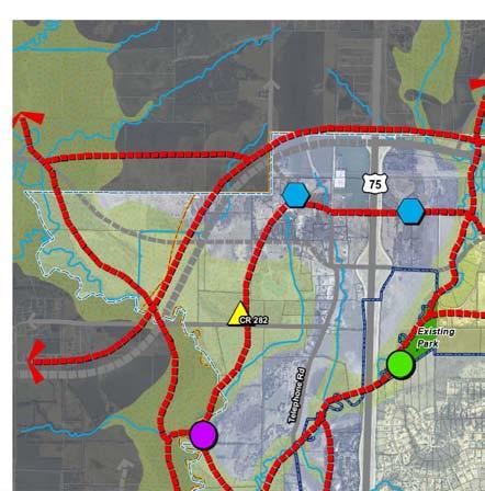
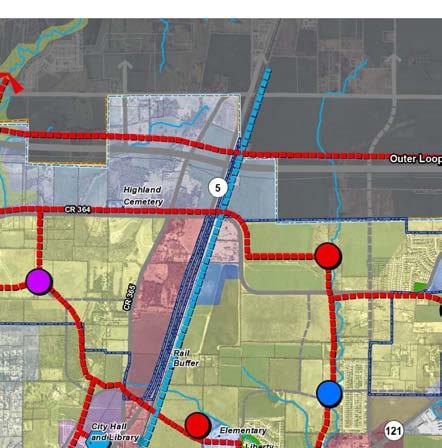
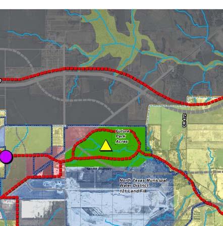
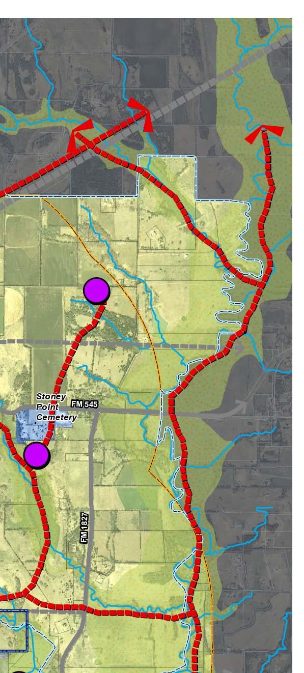
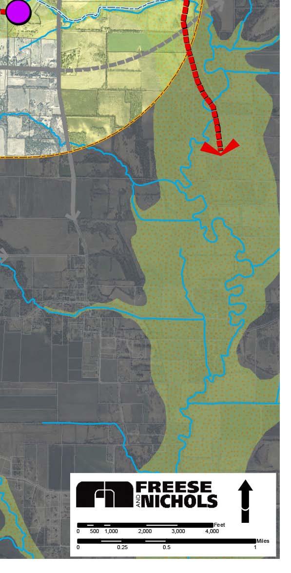
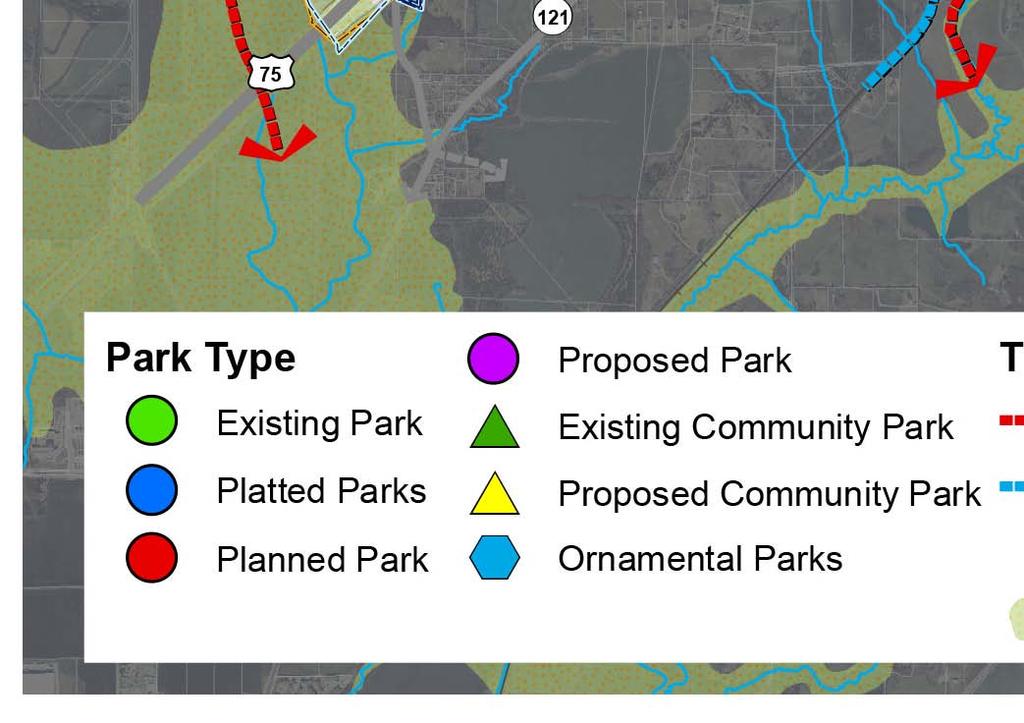
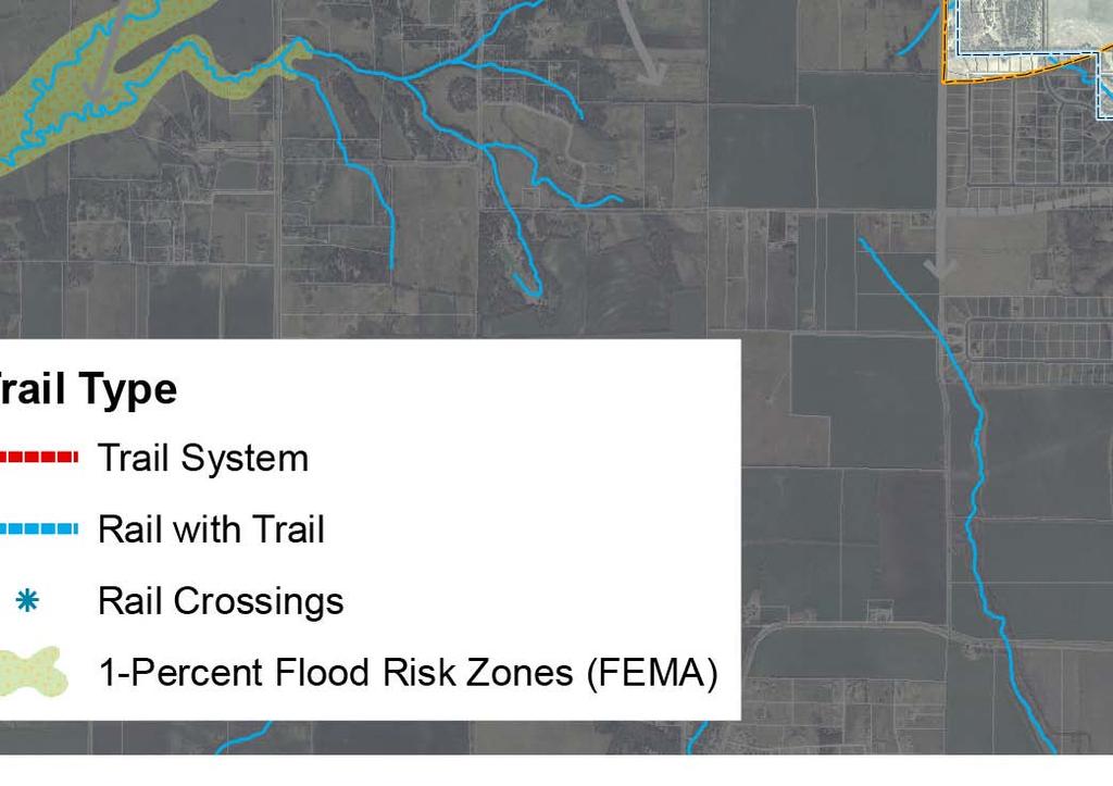
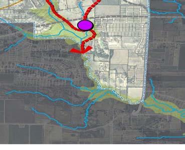

156 Figure6-1.ParksandTrailsPlanMap
157 Current Park Inventory Melissa has three park areas, along with a large open space tract of land. These areas are shown in Figure 6-1. Zadow Park is considered a community park, and Bob Miller, Hunter s Ridge, and Liberty parks are considered neighborhood parks. The following table describes the amenities provided in each park. Open space area is not included in the table because it is not yet developed, nor have its intended amenities been programmed. Pocket parks are also excluded from this inventory. Table 6-6. Existing Parks in Melissa Park Amenities Park Acres Shelter Restroom Picnic Tables Playground Athletic Fields Basketball Courts Volleyball Courts Tennis Courts Zadow Bob Miller Hunter s Ridge Liberty Park Park Amenities Park Pool Trail Miles Soccer Field Irrigation Nature Area Fishing Rec Center Parking Horseshoe Pits Zadow Yes Yes Bob Miller Partial Hunter s Ridge Partial Planned Yes Liberty Park No Source: Melissa Parks and Recreation Master Plan, page 31, prepared by the Parks Board, November Page 6.13 Chapter 6 Parks and Trails Plan
158 Standard-Based Needs The general standard established by the NRPA for park acreage per 1,000 people is approximately 15 to 17 acres. Table 6-7 shows current park acreage and standards related to the NRPA. Melissa currently has approximately 105 acres of parkland, including Zadow Park and the open space area that the City has purchased (refer to Figure 6-1. Parks and Trails Plan Map). This amount is slightly less than the NRPA s recommended 128 acres for a population of Melissa s size utilizing a standard-based assessment. Calculations for future park standard-based needs for the projected population of 22,127 in 2025; 35,635 in 2030; and 119,072 at ultimate capacity are shown in Table 6-8. It will be a challenge for the City to continue to be above NRPA standards, given the rapid population growth that is anticipated. In addition, in recent years, park and recreation experts have begun to rely more heavily on facilitybased park planning than on acreage-based. For example, a community may not have enough park acreage to meet NRPA standards, but may have an extensive trail system that is effectively meeting the needs of its citizenry. The demand-based discussion in the following section and the park policies at the end of this chapter address these considerations (see Parks and Trails Policy 5). Table 6-7. NRPA Standards Related to Melissa's Current Park Acreage Park Type NRPA Standard of Acres per 1,000 People NRPA Standard for Planning Area Current Population of 7,755 Existing Park Acreage Acres per 1,000 People for Current Population of 7,755 People Neighborhood Community Special/Pocket Open Space Total Table 6-8. NRPA Standards Related to Melissa's Projected Population Park Type NRPA Standard for Projected Population of 22,127 People in 2025 NRPA Standard for Projected Population of 35,635 People in 2030 NRPA Standard for Ultimate Population Capacity of 119,072 in the City and ETJ Neighborhood Community Special/Pocket Open Space Total ,965 Page 6.14 Chapter 6 Parks and Trails Plan
159 Demand-Based Needs The following discussion of Melissa s specific park and trail needs is based partly on traditional standards, as in the previous section, but also on what is truly desired from a local perspective. Principally discussed are neighborhood parks, community parks, ornamental parks, and trails. A description of how such parks should be developed and their related costs are also included. Additional Neighborhood Parks Platted and Planned Parks There are numerous platted and planned neighborhood parks within the subdivisions that the City as already approved (refer to the Future Land Use Plan). These parks are shown as blue and red circles, respectively, in Figure 6-1. These parks are anticipated to be developed in the short-term (five to 10 years), and would result in the City having an additional six neighborhood parks. At that point, the City would have a total of 10 neighborhood parks. Proposed Parks In addition to the platted and planned parks, other neighborhood parks have been proposed. The recommended locations of these other proposed parks, shown as purple circles on Figure 6-1, are related to ensuring that remaining areas are covered in terms of service area. (As previously mentioned, the service area of a neighborhood park is one-half to three-fourths of a mile.) In addition, the trail system has been recommended to link each of these parks with pedestrian access. It should be noted that Figure 6-1 shows the recommended location of these proposed neighborhood parks in a generalized manner; their specific locations should be determined as development occurs. With all of the neighborhood parks shown on Figure 6-1 built and located generally in accordance with the Parks and Trails Plan Map, they should serve Melissa s ultimate population needs in a convenient and equitable manner. Page 6.15 Chapter 6 Parks and Trails Plan
160 Neighborhood Park Cost Table 6-9 contains information on the cost for a typical neighborhood park, with various elements itemized that are often included as part of a neighborhood park. The total estimated cost for a neighborhood park, including a 10-foot wide trail, is approximately $679,000. It should be noted that the cost estimate does not include land acquisition costs. Table 6-9. Estimated Neighborhood Park Costs Facility-Type Estimated Cost Possible Funding Sources 10-Foot Wide Concrete Trail, ½ Mile Long (1) $105,000 Playground $100,000 Practice Backstop $10, Space Parking Lot $25,000 Multi-Purpose Court $35,000 Turf & Irrigation (10 acres) $315,000 Drinking Fountain $5,000 Picnic Shelter (5 Tables) $80,000 Park Bench (and Pad) $4,000 Total Estimated Cost $679,000 Texas Parks & Wildlife Department Grants, Donations, Park Dedication Ordinance Fees, Bonds, Tax Revenue (1) Based on $4 per square foot of trail. Note: Estimated cost does not include land acquisition. Page 6.16 Chapter 6 Parks and Trails Plan


161 Community Parks As stated previously, Zadow Park is currently serving the City s community park needs. However, several additional community parks will likely be needed to meet the needs of Melissa s ultimate population of approximately 119,072. Location, accessibility, and land use are prime considerations for these proposed community parks. One of the proposed community parks is shown on the City s recently acquired tract of land in the northeastern part of the City, adjacent to State Highway 121. In addition to the traditional elements of a community park being provided in this location, facilities such as a YMCA and/or community center would be appropriate. This community park would have direct access from State Highway 121, making these facilities easily accessible from a major roadway. In addition, the proposed trail system traverses this park location, ideally making it accessible to pedestrians and bicyclists as well as to automobiles. Another community park has been recommended in the southeast area of Melissa. This area of the City remains relatively undeveloped, and the City could proactively plan for its location (i.e., as development occurs). In addition, the presence of floodplain adjacent to the proposed location could be used to enhance the aesthetics of the park, for example with water features, view areas, special nature areas, etc. Page 6.17 Chapter 6 Parks and Trails Plan
162 Community Park Cost Table 6-10 contains information on the cost for a typical community park, with various elements itemized that are often included as part of a community park. The total estimated cost for a park of this type, including a 10-foot wide, one-mile in length trail, is likely over $4,000,000. It should be noted that the cost estimate does not include land acquisition costs. Table Estimated Community Park Cost Facility-Type Estimated Cost Possible Funding Sources 10-Foot Wide Concrete Trail, 1 Mile Long (1) $210,000 Playground $100,000 4 Lighted Soccer Fields $500,000 4 Lighted Little League Fields $800,000 4 Adult Softball Fields $1,000,000 1 Concession/Restroom Facility $250,000 Picnic Pavilion with 10 Tables $180,000 Grants, Donations, Park Dedication Ordinance Fees, Bonds, 50 Parking Spaces (Concrete) Per Field Total of 600 Parking Spaces Other Elements (Concrete Access Park Roads, Water & Sewer Lines, Electrical Services, Irrigation & Turf Establishment) $960,000 Dependent on Site General Budget Total Estimated Cost $4,000,000+ (1) Based on $4 per square foot of trail Note: Estimated cost does not include land acquisition. Ornamental Parks Ornamental areas are shown on the Parks and Trails Plan Map within some of the areas recommended for mixed use development. Policy 3 within the Future Land Use Plan discusses the various elements that should be included in a mixed use area. One such element is a central gathering space or focal point that helps create an identity for the development and that often establishes an obvious pedestrian focus. A gathering space or focal point can be in many forms, including a private open space area, plaza, gazebo, fountain, or civic building. It is this type of element that is envisioned for the ornamental areas recommended within this Parks and Trails Plan. Page 6.18 Chapter 6 Parks and Trails Plan

163 Hike-and-Bike Trails Both citizens and CPAC members expressed a strong interest in and need for hike-and-bike trails of at least 10 feet in width within Melissa. The integration of a trail system in Melissa is strongly supported by this Parks and Trails Plan. There are numerous reasons that such a system would be a positive element for the City. First, an integrated, cohesive hike-and-bike trail system would set Melissa apart from other communities in the area; no other city in the vicinity has such a system. Second, trails are a recreation amenity that can be used and enjoyed by all age groups, which is not true of a playground or ballpark; all citizens, young and old, benefit from the availability of trails. And third, it has been proven in recent studies that property values are positively affected by being in proximity to a trail; people are generally willing to pay an increased amount for such a residence. A recent survey 6-1 supports this. Urban trails are regarded as an amenity that helps to attract buyers and to sell property. For residents of single-family homes adjacent to a trail: o o o o o 29 percent believed that the existence of the trail would increase the selling price of their home (and 43 percent said it would have no effect); 57 percent of the residents felt that the trail would make the home easier to sell (with 36 percent saying no effect); 57 percent of these residents had lived in their homes prior to construction of the trail; 29 percent of those surveyed were positively influenced by the trail in their decision to buy the home. Results were similarly positive for residents who lived near but not adjacent to the trail. General Considerations Pedestrian access between parks, public spaces, and neighborhoods can enhance citizens sense of community. This type of access can also provide a means for residents to move through the community and meet their neighbors and can provide a safe way to increase the mobility of children and the elderly. A functional network of hike-and-bike trails will provide Melissa with a uniqueness, allowing the City to set 5-1 Suzanne Webel, Trail Effects on Neighborhoods: Home Value, Safety, Quality of Life, Boulder Area Trails Coalition, Resources and Library Directory; ADDRESS: Page 6.19 Chapter 6 Parks and Trails Plan


164 itself apart from other Metroplex communities. The City is well-positioned for such as system, given that it is bounded on the east and west by extensive floodplain areas and creeks. Figure 6-1 shows the recommended hikeand-bike trail system with a red dashed line. The general concept in laying out a trail system is to incorporate as many positive features of an area as possible. Elements to consider when making decisions regarding trail locations include the following 6-2 : Natural openings and scenic views Light brush Access to, and view of, waterways, such as creeks Safe crossings of roads, railroads, and waterways Existing platted or vested subdivisions Minimal conflict with existing land use Each of these elements was a consideration when determining the most appropriate layout for Melissa s trail system. Existing land uses were a primary consideration; in order to minimize conflicts, the trail was placed along existing road ways in developed areas. The recommended trail lengths in undeveloped areas are generally shown off-street and adjacent to creeks and within floodplain areas to the furthest extent possible. It should be noted that participation in the hike-and-bike trail system in developed areas will most likely be the responsibility of the City of Melissa, but developer participation can be solicited in areas that are currently vacant as they develop. Specific Considerations The primary concept for this trail system was to provide for a continuous pedestrian connection throughout the City. The need for continuity in Melissa s trail system was a suggestion made numerous times by CPAC members, and this Parks and Trails Plan supports that suggestion. Consideration was also given to providing continuous access between the following important features within the City: The extensive floodplain areas and creeks that create the east and west boundaries of the City 5-2 Trail Design, from the University of Florida School of Forest Resources and Conservation; ADDRESS: pubtxt/for5b.htm. Page 6.20 Chapter 6 Parks and Trails Plan

.")
165 Zadow Park The Old Town area The new Town Center The planned transit stop Existing schools and future school sites The City s recently purchased large open space area Trail Width and Integration Hike-and-bike trails should be no less than eight feet wide and should be ten feet wide wherever possible. Melissa will have opportunities in the future as development occurs to integrate the trail system in other ways, perhaps along a creek or through a park area. However, in previously developed areas, the City will have to decide the best way in which to establish trails (see Parks and Trails Policy 2). Opportunities within existing neighborhoods are more limited, and many will likely have to be on-street trails, depending primarily upon the amount of right-of-way available. Trail Construction Materials The materials used for trail construction vary widely, however some are better than others in terms of maintenance and impact on the pedestrian. Construction materials also must meet the requirements of the Americans with Disabilities Act (ADA), which is another important consideration. Concrete material is the best long-term for maintenance and meets ADA requirements. Although there are concerns about the adverse impacts that long-term walking and running on concrete can have on users, other materials sometimes used for trail construction have maintenance and cost issues. For instance, asphalt is less expensive than concrete but has proven to be more maintenance-intensive long-term. Another material that could be used is rubberized material (usually red or black in color), which is low-impact on users and requires only slightly more maintenance than concrete, but is cost-prohibitive for most cities. Page 6.21 Chapter 6 Parks and Trails Plan
 The Rails-With-Trails Concept The Rails-With-Trails idea evolved from the concept of Railsto-Trails, which is based on converting abandoned or")
166 Figure 6-2. Location for Possible Rail-with-Trail (blue dashed line) The Rails-With-Trails Concept The Rails-With-Trails idea evolved from the concept of Railsto-Trails, which is based on converting abandoned or unused rail corridors into public trails. The difference between these concepts is that Rails-With-Trails utilizes unused portions of railway rights-of-way along railroad lines that are still active. Melissa s rail line is anticipated to be active when the Dallas Area Rapid Transit line is extended north to provide light rail; therefore, the rails-with-trails concept is more applicable for the City. In considering the rails-with-trail concept, the most common concern is that establishing a trail within a railroad right-ofway, in close proximity to an active rail line, would be a dangerous proposition. In fact, the Rails-to-Trails Conservancy maintains that rails-with-trails can be safer than trails next to roads 6-3. Some factors to give special attention to in terms of safety are as follows 6-4 : Ensuring adequate distance between the trail and the railroad track the average separation distance is approximately 33 feet; Constructing and maintaining a barrier and/or grade separation between the trail and the railroad track; Designing safe railroad crossings, either at-grade or otherwise; Establishing adequate trail-user signage. 5-3 Rails-With-Trails: Design, Management, and Operating Characteristics of 61 Trails Along Active Rail Lines, from the Rails-to-Trails Conservancy, November 2000, p Ibid. Page 6.22 Chapter 6 Parks and Trails Plan
 Possible Funding Sources 8-Foot Wide, Concrete $170,000 10-Foot Wide, Concrete $210,000 Grants, Donations,")
167 Table Estimated Trail Length Cost for a Trail One Mile in Length Facility-Type Estimated Cost (1) Possible Funding Sources 8-Foot Wide, Concrete $170, Foot Wide, Concrete $210,000 Grants, Donations, Park Dedication Ordinance Fees, Bonds, Tax Revenue (1) Based on $4 per square foot of trail Note: Estimated cost does not include land acquisition. One long length of trail has been recommended to run along Melissa s rail line. It is along this length that the railswith-trails concept would be important to Melissa s trail system implementation. This has been shown in Figure 6-1 in a blue color and in the detail illustration at the right. This concept is also supported in Parks and Trails Policy 2 in the next section of this chapter. Example of a trail constructed according to Rails-With- Trails concept Trail Cost The cost of establishing lengths of trail can vary, depending on the construction materials, local labor costs, the cost of clearing land, and other related items. The width of the trail is also a primary consideration. Table 6-12 contains information on estimated costs for both an eight-foot wide and a ten-foot wide trail, one-mile in length and constructed with concrete materials. It should be noted that these cost estimates do not include land acquisition costs and are based on a material cost of four dollars per square foot. Possible funding sources have been outlined. As may be expected, it is less expensive to construct an eight-foot wide trail, but a ten-foot wide trail would allow for a greater number of users, and would likely be more beneficial to the City in the long-term. Page 6.23 Chapter 6 Parks and Trails Plan
168 Demand-Based Calculations Acreage calculations for various park types were previously provided within the Standard-Based Needs section of this chapter. The following table shows the calculations of the demand-based needs that have been discussed within this section. These calculations correlate to the Parks and Trails Plan Map, Figure 6-1. The total recommended is actually less than the total recommended on a standards basis by the NRPA. Because ultimate capacity or build-out will not be reached in the foreseeable future, this is a long term consideration for Melissa. The City should continue to identify additional site for possible parks in the ETJ as development occurs. This will ensure that the recreational amenities will adequately serve Melissa s ultimate population. Table Demand-Based Calculations Based on Plan Map Number of Park Types Proposed Acres Total Acres Parks Neighborhood Community Special - MU Plazas Greenbelts/Trails & Open Space (Major Trails) Greenbelts/Trails & Open Space (Feeder 30%)* Linear Feet Easement Width Square Feet 209, ,233,375 Linear Feet Easement Width Square Feet 62, ,130,409 Total Future** 623 Total Existing 105 Total Ultimate Parks and Trails 728 *Feeder trails are not specifically shown on the map, but are envivsioned to be narrower trails that provide for secondary connectivity within neighborhoods, developments, and along roadways. **Note that some of these parks have not been indicated on the Future Land Use Plan Map because the exact locations are conceptual Page 6.24 Chapter 6 Parks and Trails Plan
169 Recommended Parks and Trails Policies Following are the recommended policies related to future parks and trails in Melissa. The Parks and Trails Plan Map, Figure 6-1, is intended to be used in conjunction with these policies. The Implementation Plan, Chapter 9, will outline specific ways in which the City can implement the transportation policies, along with other recommended policies from within this. Policy 1: Integrate Parks and Trails with Development In many communities, parks and trails must be driven to; they cannot easily be accessed on foot. This is especially true in relation to community and regional parks. In Melissa, parks and trails should be designed such that they are an integral part of the community in all types of development residential, nonresidential, mixed use, etc. PT1.1 The City should consider the way in which developments are configured, with residential lots adjacent to parks and access to trails optimized. To ensure that the maximum value accrues to both parks and homes, adjacent homes should directly face park areas, whether or not there may be an intervening street. 6-5 All park areas should either be bounded by lots or bounded by streets with lots fronting onto the streets and adjacent park areas. In neighborhoods, smaller residential lots or more dense residential areas should be located in the closest proximity to any parks and open spaces provided. This will maximize the value of those lots and areas, and the parks and open spaces offset smaller lot sizes. Trails should be used as commonly as roadways in and between new developments. All new subdivisions should provide trails as well as access to trails adjacent to the subdivision. For example, at least two points of access to an adjacent trail length required for every 75 lots. PT1.2 The City should encourage unique park/open space areas that enhance the aesthetic appeal of Melissa. Park areas that are ornamental should also be part of Melissa s park system. Areas, such as large landscaped medians, water features, village greens, and plazas provide a uniqueness that will help set Melissa apart from other communities. 6-5 Miller, Andrew Ross. Valuing Open Space: Land Economics and Neighborhood Parks. Massachusetts Institute of Technology (MIT), February Page 6.25 Chapter 6 Parks and Trails Plan

170 Policy 2: Prioritize Trail Construction The provision of trails is strongly supported by the public input received as part of this planning process, from citizens in general and from the CPAC. An integrated trail system would be an element seldom found in other cities, thereby helping Melissa stay sustainable in the long-term, in the years following the anticipated population growth in the short-term. PT2.1 The City should continue to make the establishment of a City-wide trail system a priority. Figure 6-3. Examples of Integrating a Trail into a Roadway The hike-and-bike trail system, constructed in accordance with the Parks and Trails Plan Map (Figure 6-1), should connect homes, parks, schools, retail, mixed use areas, and other types of development. Funds should be allocated on a regular basis (e.g., annually) toward the construction of trail lengths. Trail connections should be primarily off-street trails, located adjacent to streets only where necessary for continuity. PT2.2 The City should have specific requirements for trail construction. Hike-and-bike trails should be no less than eight feet wide and should generally be 10 feet wide. In most areas this width would require an easement of approximately 25 feet. Concrete material should be used for construction of trails in Melissa. This will ensure that trails can be used for various modes of transportation (e.g., bicycles, in-line skates), will be as lowmaintenance as possible, and will be ADA-accessible. Page 6.26 Chapter 6 Parks and Trails Plan
171 On-street trails should be safe above all else. The illustrations at the right show three ways in which trails can be located safely along roadways. Roadway sections in the Transportation Plan (Chapter 5) are recommended such that enough right-of-way is available to accommodate trails. The trail construction requirements should be formalized, and dedication requirements should be added to the ordinance. PT2.3 The City should investigate how trails can be integrated into developed areas and tie to the existing system. Residents and neighborhood associations should be asked to provide input on how citizens would like trail construction to be accomplished in their areas. Oftentimes, existing easements or rights-of-way can be used to retrofit trails. The illustrations on the previous page should be used to guide the construction of new trails within existing street rights-ofway. PT2.4 The City should investigate the Rails-With-Trails concept. Using the railroad right-of-way for a trail would be advantageous for the City. It would mean that the City would not have to expend monies on land acquisition to establish a long length of trail through the heart of Melissa. Prime consideration should be: o o o The trail would in no way negatively impact the possibility of the City obtaining transit rail service and a transit rail stop. Transit provision should be the first priority, since trail lengths can be rerouted to areas outside of the railroad right-of-way. The current owner of the railroad right-of-way is amenable to the establishment of a trail in the railroad right-of-way Dallas Area Rapid Transit (DART) is amenable to the establishment of a trail in the railroad rightof-way. Page 6.27 Chapter 6 Parks and Trails Plan

172 Policy 3: Investigate Increased Developer Participation in Parks and Trails Provision It is very difficult for cities to provide enough parks and trails to meet population needs with only public funds. Developer participation in meeting these needs should therefore be considered. PT3.1 The City should investigate a park dedication ordinance requiring park and trail integration in Melissa. The primary advantage to having a park dedication requirement is it provides cities with the increased ability to provide parks and trails in accordance with the local level of population growth. If population growth is not occurring, then park dedication is not needed or required. With a community like Melissa, expecting rapid population growth, park dedication would be an effective way to meet increased park needs in accordance with increased population. Other cities park dedication ordinances should be examined to determine whether such requirements would be appropriate for Melissa. If determined to be appropriate, the City should draft a park dedication ordinance. Advice from an outside consultant or attorney may be needed to determine the appropriate fee for each type of facility, such as neighborhood parks, community parks, and trails. The City currently allows fees in lieu of dedication, which is a practice that should be continued. Policy 4: Require Small Parks to be Privately Maintained Small park areas that primarily provide play structures are commonly established as part of multiple-family or medium density developments. Such areas may also be provided in single-family developments. These areas are expensive to maintain. n. PT4.1 The City should require pocket parks or other small parks be maintained by the owner of the property or by an association of owners. A certain size area for requiring private maintenance should be established. For instance, parks areas equal to or less than two acres in size are likely cost-prohibitive for the City to maintain in the long-term. For developments with park areas of this size to be approved, a property owners association should be required. Page 6.28 Chapter 6 Parks and Trails Plan

173 Policy 5: Provide Neighborhood and Community Parks to Meet Population Needs PT5.1 The City should plan quality parks and trails for the ultimate population. Melissa should generally plan its park and trail system on the basis of its calculated build-out population. However, concentration should not be on simply providing park acreage, but on providing facilities that meet the specific needs of the local population. Providing quality facilities is more important than ensuring that the proper amount of acreage (in accordance with the NRPA) is available. Table 6-12 should be used to calculate demand-based needs. The City should also concentrate principally on the trail system, due to the fact that this trail system represents an opportunity for Melissa to provide a facility to its citizenry that is not commonly available in other communities. PT5.2 The City should provide neighborhood parks in appropriate locations and with appropriate facilities. Neighborhood parks should generally be located near the center of a neighborhood, within a walkable distance of homes (one-half mile to three-fourths of a mile). Safe and convenient pedestrian access (sidewalks/ trails) is important to a neighborhood park location, and parking should be minimal. Neighborhood parks should not be adjacent to an arterial roadway. The Parks and Trails Plan Map should be used as a guide for neighborhood park locations as developments are approved. PT5.3 The City should provide community parks in appropriate locations and with appropriate facilities. Community parks should be located to serve several neighborhoods, and should be within a walkable distance of as many homes as possible. Safe and convenient pedestrian access (sidewalks/ trails) is also important to a community park location. Off-street parking should be provided. Community parks should be adjacent to arterial or major collector roadways. Page 6.29 Chapter 6 Parks and Trails Plan


174 The Parks and Trails Plan Map should be used as a guide for community park locations as new locations are needed. The City s new tract of land along State Highway 121 should be the first new location for a community park. An in-depth examination of needs related to active league play should be conducted. Local citizens involved in various types of league play, including little league and adult sports, should be asked to provide specific input on needs. Such information should then be used to create a master plan for a community park on the new tract of land along State Highway 121. Policy 6: Use Floodplains and Creek Areas for Parks and Trails The City is fortunate to have many beautiful floodplain and creek areas that can be integrated into the local park and trail system. Melissa is bounded to the east and west with large floodplains and major creeks. These natural features can become key components of a City-wide framework of trails. PT6.1 The City should ensure that 100-year floodplains and creeks are protected by making them part of the park and trail system. This policy should apply to creeks and tributaries that drain 75 acres or more. 6-6 o o Drainages within Melissa are the Throckmorton Creek in the Northwest Sector, the East Fork of the Trinity River along the West boundary, the Fitzhugh Branch in the South Central Sector, the Clements Creek which drains the Central Sector, and Stiff creek located in the East Sector as well as Sister Grove Creek drainage area. Many of the creeks should be developed into future parks and open space for the City. All 100-year floodplains should be preserved with a minimum of fifty feet in width (see Figure 6-4). The floodplain area/drainage way just west of Interstate Highway 75 provides a major opportunity for a nature trail. This is a wide area, is heavily treed, and has much varying topography. A trail (at least 10 feet in width) in this location could also be 6-6 This policy from the previous Parks and Recreation Master Plan should be continued. Page 6.30 Chapter 6 Parks and Trails Plan


175 connected to McKinney s trail system, providing the possibility of a regional trail connection. This trail connection should be a priority. When a development is occurring adjacent to a creek area, lots should not be platted such that they back onto the creek. o o Backing lots to a creek often results in homeowners taking ownership of the creek by doing things such as building structures into the creek area, damming the creek, etc. It also often becomes difficult for cities to ensure proper maintenance of creeks. A better solution is to treat lots adjacent to creeks in the same way that has been recommended for lots adjacent to park areas lots should be configured to front onto creeks. A small street could be placed in between the lots and the creek. This solution allows more lots to have the increased value that is associated with lots near creeks. Figure 6-4. Example of Easement for Trail in Relation to Floodplain/Creek Area When a development is occurring adjacent to a floodplain or creek area, trails that are at least 10 feet in width should be required adjacent to the area (see Figure 6-4). o o o These areas provide prime opportunities for trails because they naturally extend across subdivisions and throughout the City. A trail along a floodplain or creek in one neighborhood can be easily connected to a continuing trail connection along the same floodplain or creek in an adjacent subdivision. In addition, these areas cannot be developed, so they make good locations for trails by not decreasing the amount of land that would otherwise be able to be developed if trails were not required. Page 6.31 Chapter 6 Parks and Trails Plan
176 o Easements for trails along floodplains and creeks should be provided on relatively flat land (see Figure 6-4). If the easement is provided on heavily sloped land, construction of a trail length may be cost prohibitive for the City, given that ADA requirements must be met. A specific, engineered cross section (much like an engineered street cross section) of how an easement should be provided along floodplains and creeks should be created using the figure above as a guide. This cross section should then be incorporated into the City s subdivision regulations. Policy 7: Work With Other Governmental Entities to Provide Cost-Effective, Quality Parks and Trails Inter-jurisdictional cooperation is strongly supported by this Parks and Trails Plan. The City has a proven ability to work with surrounding cities, such as Anna, as well as Collin County. PT7.1 The City should investigate ways in which it can work with Collin County to provide parks and trails. For example, Collin County has funding available to area cities for various types of projects including parks. Matching funds from the cities is often a requirement for Collin County funds. Melissa has been fortunate to receive some of these funds in the past, and should continue to try to procure aid from the County to provide local parks and trails. PT7.2 The City should work with the Melissa Independent School District to provide parks and trails. The school district has to provide recreational facilities on-site for its students. Therefore, it is a mutually beneficial situation financially for the City and the MISD to work together on the funding and utilization of parks that will provide facilities that both students and citizens-at-large can use. PT7.3 The City should investigate ways in which it can work with adjacent communities to provide parks and trails. Provision of park and trail facilities is not inexpensive, and community parks are especially costly given the common elements provided (e.g., sports fields). The development of a community park on the tract of land along State Highway 121 could be more economically feasible in a shorter period of time if the adjacent city of Anna participated. This would be a mutually beneficial situation, providing Anna with a community park nearby that it can use, and providing Melissa with a new community park in the short-term. The trail system that is part of the extensive floodplain on the western boundary of the City is adjacent to the City of McKinney. When this trail is specifically designed and engineered, Melissa should try to work with McKinney to achieve connections with McKinney s trail system. This would provide a regional trail connection between Melissa and McKinney, increasing the chances that this trail would provide an alternative to the automobile for users in both cities. Page 6.32 Chapter 6 Parks and Trails Plan
177 Policy 8: Prioritize Park and Trail Improvements The Five-Year Action Plan/Priority List outlined in Table 6-13 represents the culmination of this Parks and Trails Plan. Public input was an important factor in this priority listing. Input was received through the December 2005 public workshop, the Citizen Questionnaire, the 2014 Online Survey, and CPAC members. The service area for this Parks and Trails Plan and therefore the priority listing is the entire City, and the timeframe for this Plan is 10 years. PT8.1 The City should consistently utilize the priority listing in Table This listing will provide a solid basis with which to analyze needs and expenditures for land acquisition, improvements, and new facilities that will ultimately enhance Melissa s parks and trails system. Table Five-Year Action Plan/Priority List Priority Facility Timing Estimated Cost Possible Funding Sources 1 Multi-Use Trails $210,000 per mile 2 Picnic Tables $1,500 each 3 Playgrounds $100,000 per structure 4 Youth Soccer Field $175,000 Grants, Donations, Park Dedication Ordinance Fees, Bonds, Tax Revenue 5 Youth Baseball Field $175,000 Note: Estimated cost does not include land acquisition. Page 6.33 Chapter 6 Parks and Trails Plan
178


179 City of Melissa ensive Chapter 7: Public Services and Facilities Plan
180
181 Table of Contents Introduction Existing and Future Services and Facilities City Administration Library Services and Facilities Police Services and Facilities Police Officers Police Department Space Fire Services and Facilities Potential New Service Center Recommended Public Services and Facilities Policies Policy 1: Work Cooperatively with Other Entities to Provide Services & Facilities PS1.1 The City should investigate ways in which it can work with adjacent communities to provide public services and facilities PS1.2 The City should investigate ways in which it can work with other agencies and entities to provide public services and facilities PS1.2 The City should recognize the need for quality-of-life related services and plan for such services as funds become available Policy 2: Provide for Public Safety Services in Advance of Population Growth PS2.1 The City should proactively plan for police and fire service expansion, and a service center Policy 3: Project a Positive Image of the City through the Design of Public Facilities PS3.1 The City should ensure that future public facilities are designed to project a positive image of Melissa Policy 4: Ensure Educational Facilities Meet Local Needs PS4.1 The City should investigate the feasibility of cooperatively working with a local facility that would provide continuing/higher education opportunities PS4.2 The City should strive to attract other educational facilities, museums, and other types of cultural destinations Page 7.i Chapter 7 Public Services and Facilities Plan
182 {This page left intentionally blank for double-sided printing.} Page 7.ii Chapter 7 Public Services and Facilities Plan
183 Introduction Public buildings that house the various governmental and service functions of a municipality are generally of two types: (1) those requiring a nearly central or a common location and that serve the entire municipal area, and (2) those serving segments of the community on a service-area basis. Melissa s Municipal Center is an example of a governmental building that serves the entire community, while the local fire station represents a public building that has a service-area relationship with the community. The Public Services and Facilities Plan element of the Comprehensive Plan addresses the expectations that a community's residents have regarding public services and the facilities needed to provide these services. The Public Services and Facilities Plan is a general assessment of Melissa s services and related building space needed to provide such services. This assessment includes City administration, library, police, and fire services. Policies at the end of this chapter outline the way in which Melissa s leaders should address public service and facility needs in the years to come as the population continues to increase. Local governments face growing pressure and increased expectations with respect to promoting economic development, addressing social problems and improving the quality of life for all members of the community. At the same time, they are constrained by cost factors and limits to the ways in which they can generate revenue. Direct investment and program creation are key policy responses. Yet equally important is the ability of local governments to convene key players who can take concrete action on these problems. Local governments can harness resources from a wide range of sectors. They can engage a variety of groups and organizations to work collaboratively towards the achievement of their overall vision and specific goals. In short, local governments can play a central role in building safe, healthy and caring communities. Caledon Institute of Social Policy. Strategies for a Caring Community: The Local Government Role. Calendon website. Page 7.1 Chapter 7 Public Services and Facilities Plan
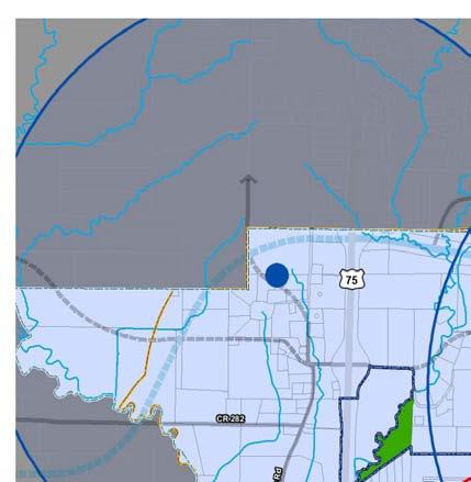
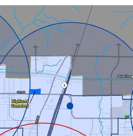
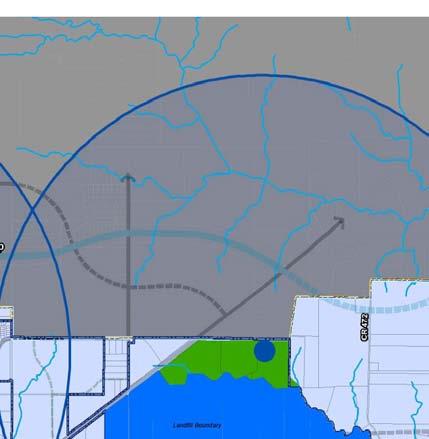
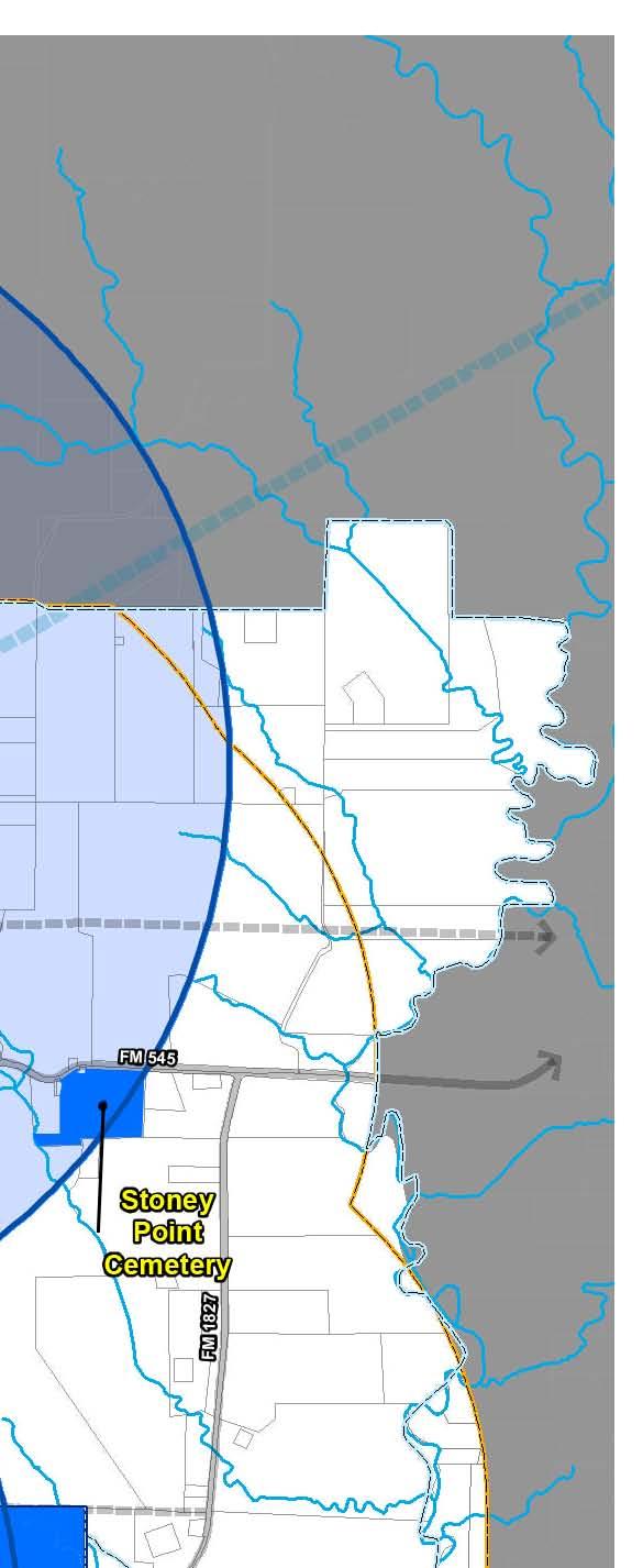
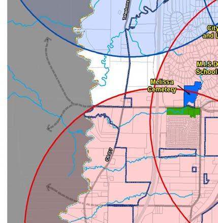
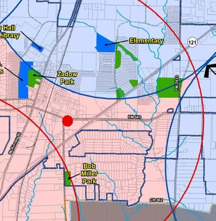
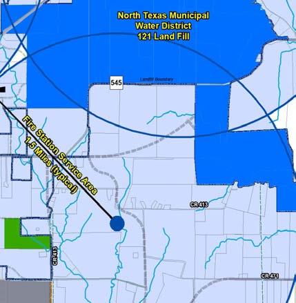
184 Figure7-1.PublicFaciliesandFireStaonLocaonPlanMap

185 Existing and Future Services and Facilities City Administration Melissa s City administration services are currently operated out of the new City Hall center, which is located along State Highway 5. The new City Hall center opened in 2010 upgraded the City s offices, addressed the need for more room, and contains room for future growth. The City has 29 total full-time employees of which 23 are housed at the City Hall. Library Services and Facilities Citizens of Melissa are provided library service through the Melissa Public Library. The library is centrally located within the City Hall area near Highway 5, as shown in Figure 7-1. The library currently has approximately 3,500 square feet of building space. The American Library Association (ALA) standard for library space in relation to population is 0.75 square feet per library patron, which is the standard used for many cities in Texas to make decisions regarding library service. Table 7-1 shows square footage projected for the anticipated future population based on a slightly decreased amount of square footage per library patron than what the ALA recommends. (Population projections are discussed within the Future Land Use Plan, Chapter 3.) This decreased ratio is likely more applicable because not every person in Melissa will ultimately use the library. Important to note in this discussion is that the phrase library service has changed in recent years. It is no longer adequate to provide only books and other traditional research materials. Libraries need to be more diverse, with computer and internet related services as well. So, when library services are discussed herein, the discussion is intended to encompass these newer technology-related services. Table 7-1. Library Square Footage Needs based on Population Basis and Needs Population Square Footage Needed Based on Revised ALA Standard of 0.5 Square Feet per Population Current Square Footage 2,000 square feet Ultimate 7,755 22,127 35, ,072 3,878 11,063 17,818 59,536 Page 7.3 Chapter 7 Public Services and Facilities Plan
186 Based upon the standard of 0.5 square feet per person, the current population requires approximately 3,900 square feet of library space. The City moved library services from a small building in the Old Town area to the new Town Center in a temporary space. This space is anticipated to be utilized for at least ten years. The temporary space is approximately 2,000 square feet. According to the standard in Table 7-1 of 0.5 square feet per citizen, 2,000 square feet does not the library services needs of a population of approximately 7,755 people. Increased library space should be considered in the City s future facility planning, even with the temporary space established within the new City Hall. Library needs could also be met with a satellite facility in another part of Melissa. For instance, a future community center could contain library space in addition to what is provided within the City Hall. This would allow for additional library facilities to be provided without having to relocate established library facilities. Another way to provide library services is not with additional building space, but with additional services that are not tied to traditional brick-and-mortar. These include outreach services, such as book service programs (i.e., delivery) for children and the elderly, tutoring programs, and cooperative-use programs with local school districts (i.e., for books, research materials, etc.). Other types of services which are becoming more common with the widespread use of the internet, include checking books and research materials out electronically with downloads, paying late fees online, or renewing books online. Establishing such programs would require some City investment, but would likely be less expensive than building additional facilities to meet short-term needs. Page 7.4 Chapter 7 Public Services and Facilities Plan
187 Police Services and Facilities Police service is an extremely important factor in assessing a community s quality of life. Safety is often a prime consideration for people when deciding where to establish a home. A high crime rate (or perception of crime) can cause people to decide not to locate in a particular area. Conversely, a low crime rate can be an attractor for population growth. Suburban communities like Melissa often experience population growth partly due to the feeling of safety that a low crime rate provides. As shown in Figure 7-2, Melissa has a low crime rate that is consistent with that of other cities in the area. Local areas all have much lower crime rates than those of Dallas, the state of Texas, and the nation. Figure 7-2. Number of Offenses in , , , Melissa Frisco Allen McKinney Fairview Anna Celina Prosper Source: Texas Crime by Jurisdiction 2013 Crime in Texas, Texas Department of Public Safety Website Page 7.5 Chapter 7 Public Services and Facilities Plan
188 Police Officers There are currently 10 full-time police officers, 1 reserve officer and 1 clerical/administrative worker within the Police Department. The ratio of police officers to population is commonly used to assess whether the police force can properly serve the citizenry. An accepted ratio of police officers to population is between 1.5 and 1.8 officers per 1,000 people. 7-1 However, consider the following: There is no consensus on staffing levels for local police departments. The ratio of both officers and total police employees per 1,000 is significantly related to crime rates Such standards have limited meaning because the actual number required will vary depending on the size of a city, geographic region and city type (central, suburban, free-standing rural). Even cities of the same population size and type may differ widely in staffing needs because of differences in demographics, socio-economic characteristics, climate or other unique conditions. Municipal Research & Services Center of Washington, Level of Service Standards - Measures for Maintaining the Quality of Community Life, MRSC Report 31,1994. The City currently has a ratio of about 1.4 officers per 1,000 people. This is slightly lower than recommended by the ratio. It is important to note that the generally accepted ratios are difficult to apply to small cities, given the fact that there has to be a certain number of officers for each shift, 24 hours per day and seven days per week. Other criteria for hiring police officers in smaller cities may be based on the number of calls received and the average response times. Table 7-2 also projects the number of police officers needed in the future correlated with future population projections in 2025, 2030, and at build-out capacity. More officers will be needed in the next 10 years if Melissa s population growth as quickly as is anticipated within this Comprehensive Plan. Table 7-2. Ratio Analysis of Existing and Future Police Service Needs Current # of Officers Ratios Current # of Officers Needed by Ratio 2014 Population 2025 Population Future # of Officers Needed 2030 Population Ultimate Capacity 7,755 22,127 35, , total (10 fulltime, 1 reserve) 1.5 Officers per 1, Officers per 1, U.S. Department of Justice (website). Page 7.6 Chapter 7 Public Services and Facilities Plan

189 Police Department Space Melissa s Police Department currently operates out of the new City Hall center, which is located along State Highway 5, along with the City s administrative services. The space has approximately 3,100 square feet, and is intended to be temporary. This new space alleviated space issues from the old Municipal Center building. Ultimately, a police headquarters facility will need to be established, given the number of officers that is projected to be needed by 2025 to serve the local population. Fire Services and Facilities Like police service, fire service is important to local quality of life. In addition to fighting fires, a community s fire personnel are often called on to provide emergency management service (EMS), alongside police and traditional ambulance services. Fire service and facilities are therefore a significant element in one of municipalities main functions ensuring the public s health, safety and welfare. Melissa s volunteer Fire Department currently has approximately 30 members. Paid staff includes the full-time Fire Chief, Assistant Chief, and 7 part-time firefighters. The Fire Department currently operates out of one fire station that is located in the Old Town area. This station can be seen on Figure 7-1. The existing fire station s service area radius generally encompasses the City s currently developed area. The fire department provides fire suppression, advanced life support, and rescue response. Additionally, the department is responsible for prevention and emergency management activities. The fire department received a Class 2 ISO designation in Many people moving to the City of Melissa are expecting similar or better level of emergency service delivery as where they came from. As more people make Melissa their home, the department has seen and will continue to see an increase in the number of emergency incidents as well as an increase in the level of complexity of incident types. The department must be capable of meeting the citizens needs in their time of distress to demonstrate to potential citizens and business the City of Melissa emergency services will be there for them as well. Advanced Life Support Transport Service The fire department s current first responder protocols enable department personnel to deliver more advanced interventions and pain control methods than the current transport service is able to offer. When private services are compared to fire-based EMS, overall patient care is improved and they tend have a higher patient satisfaction rating. Most of the fire departments operating in the DFW-Metroplex area provide Advanced Life Support Transport Services to its citizens. By implementing a plan to acquire needed Page 7.7 Chapter 7 Public Services and Facilities Plan
190 equipment and personnel over the next few years the department can begin providing Advanced Life Support First Response and Transport to all who live and work in the City of Melissa. A major factor in terms of fire protection service is the service-area of fire stations to the geographic area of the community. According to the National Fire Protection Agency (NFPA), the generally accepted fire service area for urban areas is 1.5 miles, while for rural areas, it is 2.5 miles. These distances correspond to the NFPA standard of a 4-minute maximum response time. For Melissa, the urban-area standard should be used because of the anticipated population growth in the coming years. Figure 7-1 shows the recommended locations for future fire stations based on the recommended service area consistent with a 1.5-mile radius. Fire stations can also be combined with other municipal uses such as water and wastewater facilities, park sites, and community centers. Fire stations can also be funded through cooperative efforts with other governmental entities. Refer to Policy 1 within this chapter for further discussion. Personnel If the City continues to grow the department will need more personnel to adequately meet the needs of the citizens and businesses in the City of Melissa. Below is a chart based on the city s current population and expected growth. Table 3. Analysis of Full-Time Firefighter Current and Projected Staffing Needs Current Staffing Level 2 Full-Time, 8 Part-Time, 25 Volunteers Current Need Population , Projected Population 22, Projected Population 35,635 Ultimate Capacity Projected Population 119, Potential New Service Center As the City continues to grow in population and expand its services, a specific location for operation and maintenance of certain services will likely be needed. For example, park and street maintenance will require large equipment that needs to be properly sited (i.e., for aesthetics) but also needs to be have accessibility for ease of use. Not only could a service center house Melissa s operational tools, but it could also allow for consolidation of services, such as police and fire, into one location. Components of a new service center could include: Page 7.8 Chapter 7 Public Services and Facilities Plan
191 Police Department headquarters this would need to have individual access to roadways and could possibly be combined with a municipal court facility. Second fire station this would also need to have individual access to roadways. Operation-and-maintenance area this would include gasoline facilities for City vehicles, equipment for park maintenance, storage for City vehicles when they are not in use, etc. Infrastructure facilities (such as water and wastewater). Although several of the listed services would need to have separate access to thoroughfares to ensure public safety needs are properly addressed, consolidation of services into one area can be very cost-effective and good for time management. For example, having gasoline services on-site with police vehicles would save police officers the time of having to drive to a separate site for such services. Recommended Public Services and Facilities Policies Following are recommended policies related to public services and facilities. Figure 7-1. Public Facilities and Fire Station Location Plan Map is intended to be used in conjunction with these policies. The Implementation Plan, Chapter 9, will outline specific ways in which the City can implement these policies, along with other recommended policies from within this 2015 Comprehensive Plan. Policy 1: Work Cooperatively with Other Entities to Provide Services & Facilities Similar to policies in the Parks & Trails Plan (Chapter 6), inter-jurisdictional cooperation is recommended for public services and facilities. Not only can the cost of constructing facilities be shared, but so can the operation and maintenance costs. Adjacent cities and Collin County are the most likely entities with which Melissa could partner. r. PS1.1 The City should investigate ways in which it can work with adjacent communities to provide public services and facilities. Both McKinney and Anna border Melissa, and both must provide adequate levels of services in terms of public safety. Fire station service areas provide a radius of service coverage, as shown on Figure 7-1. The service radii of several recommended station locations extend into McKinney and Anna. Shared coverage areas could result in the cost of new fire stations being shared between Melissa and Anna and/or McKinney (similar to the way in which water and wastewater facilities have been in the past). Support for a community center has grown in Melissa. This community center could be a shared asset for Melissa and surrounding communities. Page 7.9 Chapter 7 Public Services and Facilities Plan
192 PS1.2 The City should investigate ways in which it can work with other agencies and entities to provide public services and facilities. Other agencies and entities help fund various types of projects, including public facilities. Matching funds from the cities is often a requirement for Collin County funds. Melissa has been fortunate to receive some of these funds in the past for park facilities. The City should investigate the availability and opportunity for County funding for future public facilities and services such as library services, community buildings, and public safety needs (e.g., vehicles, materials). PS1.2 The City should recognize the need for quality-of-life related services and plan for such services as funds become available. Some services that the City should provide are not safety-related, but rather they are related to the local quality-of-life provided within Melissa. Funds for expanding library service, whether with additional space (above what is now provided in the City Hall), or with outreach programs, should be allocated as the City budget allows. There is support within the City for a community center. The center should be planned for an area that is accessible to a majority of residents, and should provide services for all age groups. Policy 2: Provide for Public Safety Services in Advance of Population Growth As stated previously within this Public Services & Facilities Plan, providing for public safety and meeting other citizen needs are the primary function of government. Therefore, the City needs to be ready to meet these objectives as population growth occurs. PS2.1 The City should proactively plan for police and fire service expansion, and a service center. As the City grows in population, new fire stations must be built to maintain adequate coverage. The next location needed should be decided upon in the next year to two years, and property should be purchased. General criteria that the City should use in assessing a piece of property as a potential fire station location are as follows: o o o The property should be at least one acre in size. The property should not be located along an arterial roadway, but should be within approximately 500 feet of an arterial roadway. The property should not be located along a major physical barrier, such as a rail line. o The property should be located with consideration to service areas, as shown on Figure 7-1. The relocation of police service to the City Hall has provided enough room for expansion of the police force for several years to come. Page 7.10 Chapter 7 Public Services and Facilities Plan
193 o o However, this will not likely be an appropriate long-term solution, given the number of personnel and police vehicles Melissa will require as the population continues to grow. A specific piece of property for a police headquarter location should be researched in the next few years. One possibility would be a joint site location with a new service center. Policy 3: Project a Positive Image of the City through the Design of Public Facilities This policy is one that in the past has been easily understood and embraced. A good example is the old, ornate county courthouses in Texas that were once the embodiment of county government. Although these old courthouses that still stand are now celebrated historic landmarks, in more recent times public buildings have become increasingly utilitarian. PS3.1 The City should ensure that future public facilities are designed to project a positive image of Melissa. City leaders have recognized that the City Hall needs to be a representation of the City itself. This policy supports that recognition, and endorses a continuation of this recognition in future facilities. Through the City leading by example, other types of development, such as retail uses, will be more amenable to providing sites, building designs, site amenities, etc. that also project a positive image of Melissa. For example, some cities choose to require all future municipal buildings meet LEED or require some type of sustainable design criteria. Policy 4: Ensure Educational Facilities Meet Local Needs The availability of educational resources is key to an educated citizenry. There are various facets that are involved in this such as the local school district, adult education programs, and higher education opportunities. Education is often mentioned as one of the primary reasons that people move into or out of a community. As one non-profit organization that is focused on factors related to livability asserts, without question, education is a critical component of a livable community. 7-2 Given the importance of education to a community s livability and sustainability, Melissa should continue to foster close relationships with local education providers and should strive to increase local educational opportunities. 7-2 Local Government Commission Website. Community Design link; Schools link, ADDRESS: schools.html. Page 7.11 Chapter 7 Public Services and Facilities Plan
194 PS4.1 The City should investigate the feasibility of cooperatively working with a local facility that would provide continuing/higher education opportunities. Providing continuing education and/or higher education opportunities locally would be advantageous for the senior citizen population, and well as for recent graduates of Melissa High School (and other area high schools). The City should continue discussions with Collin County Community College to encourage a local location. Other continuing education/higher education options should be explored. One option would be a local location of another institution, such as a technical college or small private college. Another option would be a facility within which various colleges or universities offer classes. This latter option is one that is becoming increasingly utilized. 7-3 PS4.2 The City should strive to attract other educational facilities, museums, and other types of cultural destinations. The addition of cultural destinations will give the residents more recreational options within the City limits of Melissa. The cultural destinations will also create a small tourism market for Melissa. These facilities would play a large role in the marketing and branding plan that is discussed in the Future Land Use Plan (Chapter 3). 7-3 Examples of cities in Texas with such a facility include Burnet, Fredericksburg, Junction, and Marble Falls. Page 7.12 Chapter 7 Public Services and Facilities Plan


195 City of Melissa Chapter 8: City Center Concept Plan
196
197 Table of Contents Introduction The Concept Areas Old Town Town Center Area Transit-Oriented Development Area The Linkage Concepts Gateways Streetscape Elements Trail System Ornamental Parks Walkability Recommended City Center Policies Policy 1: Consider Seed Projects to Create Private Interest C1.1 The City should prioritize capital investments in concentrated areas Policy 2: Encourage Development in Old Town C2.1 The City should investigate ways in which it can streamline the development and/or redevelopment process in Old Town Policy 3: Involve the Public in City Center Decisions C3.1 The City should encourage the creation of a City Center Association Policy 4: Consider Zoning Requirements and Standards C4.1 The City should review, and amend if necessary, current zoning regulations C4.2 The City should work with the development community to achieve higher density for the TOD area Page 8.i Chapter 8 City Center Concept Plan
198 {This page left intentionally blank for double-sided printing.} Page 8.ii Chapter 8 City Center Concept Plan

199 Introduction Numerous cities across Texas, both large and small, are trying to find ways in which to reinvigorate their downtown areas. At the same time, new areas for uses that once located in downtown areas uses such as public, retail, and residential are being encouraged to develop in other areas. There is therefore a need to balance both of these objectives. The purpose of this chapter of the Comprehensive Plan is to put forth concepts that will help Melissa create this balance in relation to similar local objectives. There is a strong desire, on the part of citizens and City leaders alike, to preserve Melissa s local history, which is represented by the Old Town area. This preservation, however, is a challenge given that the Old Town area has limited structure, footprint, and future direction.. Because of this, there was an aspiration to create a new Town Center area where citizens can visit their Town Hall, gather for events, shop, eat, work, etc. The Town Center area is still under development, but the City Hall is currently complete with approximately 40,000 square feet of facilities. Additionally, public and private efforts have already begun to shape this area, with homes constructed around the central retail/public area. Another facet to consider in this balancing act is the desire for a rail transit stop along the City s existing rail line, which may have the ability to bolster both the Old Town and Town Center areas. The City Center consists of three distinct areas the Town Center, Old Town, and the Transit-Oriented Development (TOD) area. The Villages of Melissa and Town Center Site The urban fabric is made up of lots of tiny things, including loft apartments in converted old warehouses, mixed-use retail and residential, artist studios, galleries, niche marketing, restored buildings, small boutiques, wide sidewalks, outdoor dining, eateries, pubs, live/work spaces, mom-and-pop businesses, churches, libraries, court houses, landmarks, lighting, public gathering places where people can connect, street furniture, flowers, interesting window displays, streetfront street-level store entrances, microbreweries, storefront facade improvements, farmers markets, theaters, public transportation. Don t small things like these bring diversity, density, vitality, exuberance, vibrancy, connectedness, liveliness, and disorganized complexity to a downtown and thus reinforce the urban fabric? Urban Land Institute Website Page 8.1 Chapter 8 City Center Concept Plan


200 The City Center Concept Plan is based on these three areas of Melissa the Old Town, the Town Center, and the Transit- Oriented Development (TOD) area and how to effectively link them so that they can be mutually beneficial. The entirety of the three areas encompasses approximately 450 acres. Making this large amount of land unique will set the stage for Melissa as a whole the City Center will become an area for which the City is known. One of the most challenging aspects in creating an integrated feel to the three individual areas will be the presence of State Highway 5, which tends to divide them physically and psychologically. However, with aesthetic elements to enhance them, pedestrian features to link them, and uses to create activity, these areas can become a cohesive City Center for Melissa. Vacant Land Surrounding City Hall in the Town Center Area Page 8.2 Chapter 8 City Center Concept Plan

, and in responses to the Community Questionnaire and Online Survey (see")

201 The Concept Areas Old Town Melissa s Old Town area represents the oldest area of the City, its downtown core. Like many Texas towns, the City was originally settled in proximity to the railroad in the early 1900s when rail lines were a catalyst for economic and population growth. In recent decades, however, the area has generally declined. Citizens have consistently expressed their desire to preserve Old Town, both at the Public Workshop (held in December 2005), and in responses to the Community Questionnaire and Online Survey (see Chapter 2). People want Old Town to be a place reminiscent of what it used to be a place where people go to shop and work, as well as to live. The following concepts should be used to reinvigorate Old Town. Image #1 Land Use Generally, land uses within Old Town should be residential, public/semi-public, retail, and office. Recommended land uses discussed in detail in Chapter 3, the Future Land Use Plan include: o o o o Single-family homes that have historic character or are designed to fit in with such character (Image #1). Residential apartment-type units should be permitted either in renovated homes, in new buildings constructed to resemble large homes, or on the upper floors of retail and office buildings (Image #2). Office uses should also be permitted by right in renovated homes or homes that would fit the historic character of the area (Image #3). Small boutique-type hotels and bed-and-breakfasts would help create people-activity (Image #4). Image #2 Image #3 Page 8.3 Chapter 8 City Center Concept Plan


.")

.")
 and antiques (like Fredericksburg).")
202 o Restaurants and entertainment-based uses would also create activity (Image #5). Image #4 Public Space One of the reasons citizens used to identify so strongly with their downtown areas was the presence of public space that they could feel ownership in it was theirs because it was public. A small, intimate public space or series of spaces would help foster Melissa s citizens sense of pride and ownership in the Old Town area (Image #6). An ornamental park is shown in Figure 8-1 in representation of a public space, which is currently underway. Cohesive Elements Creation of special elements such as murals and public art will help Old Town to be recognizable as a significant destination in the City (Image #7). Special Niche Many cities have created a niche for their old downtown areas. Examples include art galleries (like Denison) and antiques (like Fredericksburg). Creation of a niche for Old Town Melissa would help it thrive as a unique place, both regionally and locally. Image #5 Image #6 Page 8.4 Chapter 8 City Center Concept Plan Image #7 (all 3 pictures)


. Public Space As with Old Town, public space in the Town Center area will be important to its success.")
203 Town Center Area The Town Center represents an area of the City that is partially developed since the completion of the Town Hall. The Town Center is shown in Figure 8-1, and is supported by the Future Land Use Plan, Chapter 3. The Town Hall is the new hub of the City s governmental and administrative services, as well as the new home of the library. Completing the Town Hall was an important component in developing the Town Center area. Planned Public Space Town Hall Site Image #8 (Both pictures) Character and Landmark The area is designed in an old style, resembling a downtown square. The Town Hall is central to the area, which will be Image #9 surrounded by a public plaza area and two-story office, retail and residential uses. The Town Hall creates a landmark for Melissa, and serving as the embodiment of local government, much as the historic courthouses once were for county seats in Texas. It has been designed with this landmark ideal in mind (Image #7). Public Space As with Old Town, public space in the Town Center area will be important to its success. Such a space will make the citizens of Melissa feel that the Town Center belongs to their community, and will be more inclined to support it by living there, shopping there, and gathering there for events. o Central public space is an important aspect of the Town Center in relation to the Town Hall (Image #9). The City is considering moving forward with the development of an ornamental park behind City Hall. While this is not finalized, the goal is under consideration. Page 8.5 Chapter 8 City Center Concept Plan
. Source: glenwoodpark.com (top picture) Image #10 (Dupont Ci")
 Surrounding Density As one expert in urban design notes a satisfactory sense of enclosure occurs when the relationship of")
 form a comfortable feeling of containment akin to an outdoor room 8-1 (Image #11).")

204 o This public space creates a distinguishable focal point for the Town Center, to which other elements surrounding it should relate (Image #10). Source: glenwoodpark.com (top picture) Image #10 (Dupont Circle, Washington, D.C.) Surrounding Density As one expert in urban design notes a satisfactory sense of enclosure occurs when the relationship of the ground plane or floor of an exterior space and enclosing vertical walls (formed by building facades, rows of trees, or other vertical elements) form a comfortable feeling of containment akin to an outdoor room 8-1 (Image #11). o Therefore, buildings that are at least two stories in height should surround the public space within the Town Center. o Medium density housing and retail with office or living units above would be appropriate. o This will create a verticality surrounding the public space that will make it feel like an outdoor room. 8-1 Dennis Wilson, Townscape, Inc. Page 8.6 Chapter 8 City Center Concept Plan Image #11 (all 3 pictures)
205 Transit-Oriented Development Area The term transit-oriented development (TOD) describes a mixture of land use types in a density sufficient to support the cost and ridership needs of transit, typically some type of rail transit (e.g., light rail, commuter rail, traditional trains). This area is included in this City Center Concept Plan for three primary reasons. The first reason is because the mix of land uses envisioned for the TOD area is consistent with that envisioned for Old Town and the Town Center, although a higher density needs to occur to support transit. Secondly, it is included because of its proximity to both areas. This proximity will create a mutually beneficial relationship between each of these areas, making them stronger together and more of a destination than they would be on their own. Third, people may be more inclined to visit or live within the Town Center and Old Town if they can use transit to travel to other regional destinations. Location The location of the TOD area is ultimately dependent on the location of Melissa s transit rail station, which is flexible based on conditions such as property ownership, topography/environmental concerns, and transit entity s preferred location, among others. The chosen location shown in Figure 8-1 has been determined based on a regional rail planning effort by the North Central Texas Council of Governments (NCTCOG). If the location changes in the future, the TOD area should be located accordingly, adjacent to the transit stop. Planning for TODs is an important way for citizens, government officials and transit providers to protect their investment in the transit system. TODs help build and sustain demand for the transit system through users who live and work in the area. Marya Morris, AICP. Smart Communities: Zoning for Transit-Oriented Development. ideas@work, November 2002, Vol. 2, No.4. TOD districts are most successful when there is a critical mass of housing types and commercial uses that reinforce one another and generate demand for transit. Marya Morris, AICP. Smart Communities: Zoning for Transit-Oriented Development. ideas@work, November 2002, Vol. 2, No.4. Density The TOD area needs to be high density, both residential and non-residential, in order to help support the transit. The denser the TOD is, the more of a destination Melissa will become. Therefore, for residential uses, this area should have a minimum density of 25 units per acre, and it should be higher if possible. Character The TOD area needs to have a definable character. For example, Mockingbird Station in Dallas has a very modern feel, while Plano s Downtown Station has more of a Main Street feel (Image #12). The choice of character needs to be made, then followed through with the design of the station and related amenities (e.g., public art, paving, etc.). Page 8.7 Chapter 8 City Center Concept Plan
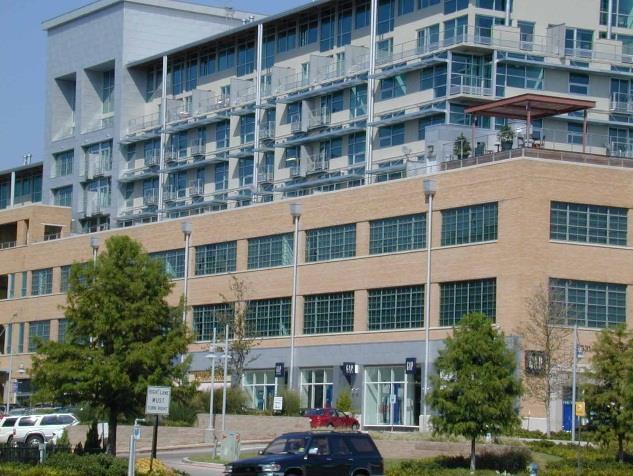
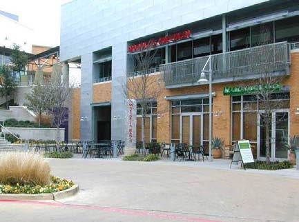
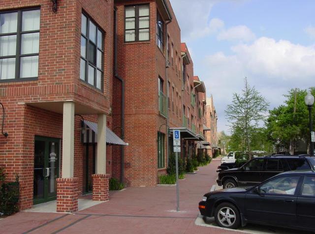
206 Image #12 (Mockingbird, left; Plano, right) Page 8.8 Chapter 8 City Center Concept Plan
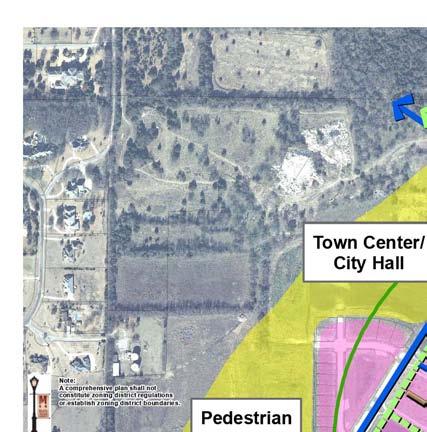
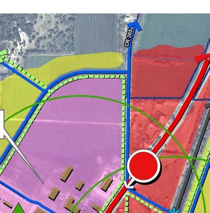
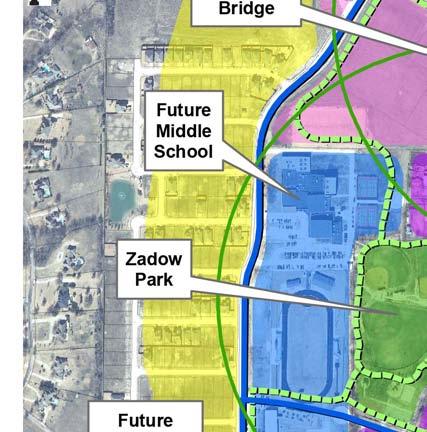
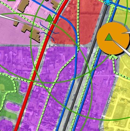
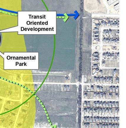
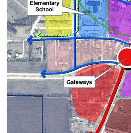
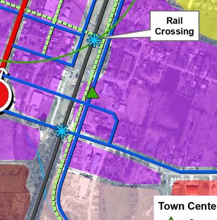
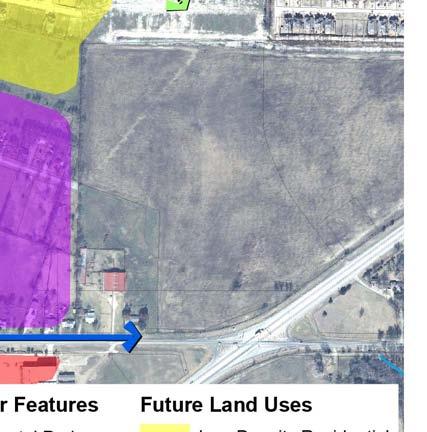
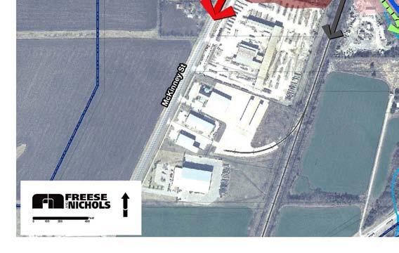
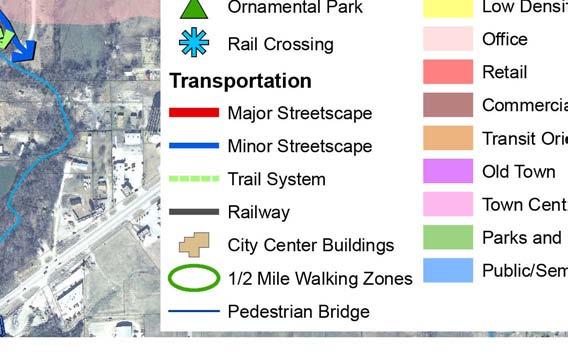
207 Figure8-1.CityCenterConceptPlanMap

 serve the purpose of announcing to residents and visitors that they have arrived in a special place.")


208 The Linkage Concepts The goal of the City Center Concept is to link each of these areas the Old Town, the Town Center, and the TOD to one another, thereby creating a mutually beneficial impact between them. The various elements that are recommended to help provide this link are discussed in the following paragraphs. Equally important to the text descriptions are the images provided, which give the reader a visual idea of what is envisioned for each of these linkage concepts. Gateways Gateway features (Image #13) serve the purpose of announcing to residents and visitors that they have arrived in a special place. Therefore, two gateway features have been shown on in Figure 8-1, both along State Highway 5. These gateways would allow for a demarcation of the City Center along one of the most heavily traveled roadways in Melissa. They could also contain some directional information as to how to get to each of the three areas. TOD area needs to have a definable character. Gateways should generally be simple in design and constructed of lowmaintenance materials. Both gateway features should be similar-looking, so that they begin to create a visual theme for the City Center. Gateways should be readable by both pedestrian and automobile traffic. Image #13 (All 4 pictures) Additional locations for gateway features should be established as the City Center areas become increasingly successful. For example, when the TOD area is created (when the rail stop is established), an additional gateway feature may need to be established at the intersection of State Highway 5 and North Central Street. Page 8.10 Chapter 8 City Center Concept Plan


, Cooper Street (east of SH 5), and Central Street,")
209 Streetscape Elements Streetscape elements include various types of visual amenities that can enhance the view from the road. For the purpose of this City Center Concept Plan, the streetscape elements deemed most important include street trees, landscaping, public art, special lighting, distinctive signage (e.g., banner signs), and unique paving patterns (Image #14). As part of this linkage concept, major streetscape elements have been shown in relation to State Highway 5 (SH 5), with all other roadways shown with minor streetscape. This is intended to project the extreme importance of Melissa s visual image along SH 5, and the fact that this highway should be the first priority when streetscape elements are funded. Also, because of the higher speed of the traffic, the streetscape elements established in relation to SH 5 may need to be sized differently than the elements are in relation to the other, lighter-trafficked roadways. Minor streetscape roadways include Melissa Road, Preston Avenue, Harrison Street (East and West), Cooper Street (east of SH 5), and Central Street, including North Central as it crosses SH 5 and enters the Town Center. Image #14 (All 8 pictures) Page 8.11 Chapter 8 City Center Concept Plan


210 Trail System The recommendation for an integrated trail system has been discussed in several locations within this Comprehensive Plan, including an in depth discussion within the Parks & Trails Plan, Chapter 6. However, in terms of the concept of linking the Old Town, Town Center and TOD area, the need for an easy and safe means for pedestrians to travel between them cannot be overstated. Locations for pedestrian and bicycle trails specific to the City Center are shown in Figure 8-1. In addition to the three areas that comprise the City Center, Zadow Park and Melissa Junior High and High School are also shown with pedestrian trail connections. One of the most challenging aspects in creating a linkage with a trail system within the City Center will be the presence of SH 5 and the rail line, neither of which people will generally want to cross. Special attention must be given to how a trail connection can be made effectively in relation to these physical barriers, so that they do not amount to psychological barriers. Other options for safe pedestrian passage in relation to SH 5 and the rail line include special paving to delineate crosswalks, pedestrian signage, and for SH 5, a stoplight with lightcontrolled pedestrian crossing. The preferred option is a grade-separated pedestrian crossing, examples of which are in Image #16. This type of pedestrian bridge may be cost-prohibitive at this time, however the City should continue to plan for a grade-separated crossing to ensure pedestrian safety, promote connectivity, and allow for Image #15 (All 4 pictures) unrestricted traffic flow. Such a crossing has been shown over SH 5 in Figure 8-1. Image #16 (Both pictures) Page 8.12 Chapter 8 City Center Concept Plan

.")
 Ten Principles for Creating Successful Squares 1.")
211 Ornamental Parks Ornamental areas are shown on the City Center Concept Plan Map (Figure 8-1) within each of the three areas. The importance of public space in relation to the population feeling ownership of an area has been previously discussed herein. The type of ornamental areas envisioned are those that help create an identity for the Town Center, Old Town, and the TOD, and that provide a special place for pedestrians. Ornamental areas can be any number of things, including a central green space, plaza, gazebo, fountain, or splash pad for children, etc. (Image #17). Creation of a series of ornamental parks that link the City Center areas will project the concept that each area is a special place in Melissa. Image #17 (All 3 pictures) Ten Principles for Creating Successful Squares 1. Image and Identity Creating a square that becomes the most significant place in a city--that gives identity to whole communities--is a huge challenge, but meeting this challenge is absolutely necessary if great civic squares are to return. 2. Attractions and Destinations Any great square has a variety of smaller "places" within it to appeal to various people. Creation of 10 good places, each with 10 things to do, offers a full program for a successful square. 3. Amenities A square should feature amenities that make it comfortable for people to use. Examples include benches, waste receptacles, lighting, public art. Amenities will help establish a convivial setting for social interaction. 4. Flexible Design The use of a square changes during the course of the day, week, and year. To respond to these natural fluctuations, flexibility needs to be built in to the design of the space. 5. Seasonal Strategy Great squares change with the seasons. Skating rinks, outdoor cafés, markets, art and sculpture help adapt the use of the space from one season to the next. 6. Access To be successful, a square needs to be easy to get to. The best squares are always easily accessible by foot: Surrounding streets are narrow; crosswalks are well marked; lights are timed for pedestrians, not vehicles; traffic moves slowly; and transit stops are located nearby. A square surrounded by lanes of fastmoving traffic will be cut off from pedestrians and deprived of its most essential element: people. 7. The Inner Square & the Outer Square (Frederick Law Olmsted's idea) The streets and sidewalks around a square greatly affect its accessibility and use, as do the buildings that surround it. Imagine a square fronted on each side by 15-foot blank walls versus that same square situated next to a public library: the library doors open right onto the square; people sit outside and read on the steps; maybe the children's reading hour is held outside on the square. An active, welcoming outer square is essential to the well-being of the inner square. 8. Reaching Out Like an Octopus Just as important as the edge of a square is the way that streets, sidewalks and ground floors of adjacent buildings lead into it. Like the tentacles of an octopus extending into the surrounding neighborhood, the influence of a good square starts at least a block away. 9. The Central Role of Management The best places are ones that people return to time and time again. The only way to achieve this is through a management plan that keeps the square safe and lively. 10. Diverse Funding Sources Sponsorships from private entities and partnerships can help manage these special areas. For example, property associations can supplement public funding. Adapted from an article of the same name on the Project for Public Spaces website. Page 8.13 Chapter 8 City Center Concept Plan


212 Walkability It is not enough to simply provide a trail linkage between the three areas. If the areas are separated by too great a distance, people will be inclined not to walk but to drive. However, the Old Town, Town Center, and TOD area are not too far from one another for people to walk between. A five- to ten-minute walk is about the amount of time that people are willing to spend getting somewhere on foot. This is equivalent to ¼ mile to ½-mile radius. Therefore, the ¼-mile radius for each of the three major areas has been shown in Figure 8-1. These areas are in fact within walkable distances of one another. Another aspect to walkability is enticing people to walk with an inviting atmosphere. One way to create this atmosphere is by providing pedestrian and bicycle amenities that are practical as well as attractive. For example, a bench that is provided as a rest stop needs to be one that looks inviting compare Image #18 to Image #19. Other examples include outdoor dining areas (Image #20), special lighting and signage scaled to pedestrians and bicyclists (Image #21), landscaping (Image #22 and Image #23), and interesting elements such as water and public art (Image #24). Image #20 Image #18 Image #19 Image #23 Image #22 Image #24 Image #21 Page 8.14 Chapter 8 City Center Concept Plan
213 Recommended City Center Policies Following are recommended policies related to the City Center area. The City Center Concept Plan Map, Figure 8-1, is intended to be used in conjunction with these policies. The Implementation Plan, Chapter 9, will outline specific ways in which the City can implement these policies, along with other recommended policies from within this. Policy 1: Consider Seed Projects to Create Private Interest Public investment in an area is often needed to spur private interest and related private investment. Cityfunded improvements signal to the private sector that an area is worth investing in the investment becomes a better bet because the public sector is doing its part. The City, therefore, needs to invest in the City Center in order to create a catalyst for private investment. C1.1 The City should prioritize capital investments in concentrated areas. The recent comprehensive plan survey indicated that there is strong support for development incentives in key area. The City should take advantage of this citizen support and strategically distribute incentives to developers that will benefit the City by building quality infrastructure that is in line with the City s vision. Concentrated public projects will have more impact than projects that are spread throughout the City Center. Such seed projects will help attract private development. Incorporating streetscape elements along SH 5 should be the first priority. Street trees, lighting, landscaping, and special signage are examples of effective streetscape elements. Improving aesthetics and announcing the City Center in this highly trafficked corridor will greatly impact how Melissa is perceived and improve the identity of the City Center. These streetscape elements should be coordinated with the future improvements of SH 5. The following are the recommended priority projects for each of the three areas. o o Town Center Melissa s leaders and citizens have shown a commitment to investing in the Town Center through the funding and construction of Town Hall. The next prioritized improvement should be the ornamental areas shown in Figure 8-1. These areas should be completed with the Ten Principles shown on page 13 in mind. Old Town Annual streetscape capital projects should be completed in the Old Town area. Such projects should be concentrated in one-block lengths along streets for maximum visual impact. Street trees, lighting, and cohesive signage are examples of projects that would enhance Old Town. An Old Town Master Plan is recommended to coordinate efforts and timeline in this key development area. The first street length prioritized should be East Harrison Street; improvements should be constructed around the SH 5 intersection for maximum visual impact from citizens and travelers using SH 5. Page 8.15 Chapter 8 City Center Concept Plan
214 When Central Street is realigned to provide entrance into the Town Center, it should become a top priority for improvements from SH 5 east and south into the Old Town area. This will create visual interest into Old Town from the Town Center. o TOD Area No priority projects are needed for the TOD at this time, because its establishment is likely many years in the future; funds are better spent in the short-term improving and enhance the Town Center and Old Town. However, the first improvements in the TOD (when the City has specific knowledge of when transit is going to be established) should be trails and an ornamental park area. Although no more than one or two substantial projects could be completed each year, a sustained and consistent effort over a five- or ten-year period will achieve a significant transformation, especially in Old Town, that would further the City Center as a whole. Policy 2: Encourage Development in Old Town The development of infill-type lots or redevelopment projects that involve one or more lots are often more difficult to complete than the development of a vacant land area. In addition to seed projects, development/redevelopment in Old Town should be encouraged by the City through procedural and costcutting measures. C2.1 The City should investigate ways in which it can streamline the development and/or redevelopment process in Old Town. Lot Consolidation Given the small size of lots that characterize Old Town, there may be a need to consolidate two or more lots into one lot for development purposes. This would require a replat, amending plat, or a minor plat. In order to encourage lot consolidation for development/redevelopment in Old Town, the City could waive fees and associated application costs, thereby saving the applicant money. Shortened Approval Process The less time it takes to get a development proposal approved and completed, the more profit is realized from the development. The City should investigate its approval procedures and should streamline such procedures, if possible. One way of streamlining is to allow administrative approval of some types of development applications. In many cases, replats, amending plats, and minor plats can be approved administratively. The City should consider revising the existing Subdivision Ordinance to allow administrative approval of certain plats as allowed by the Texas Local Government Code, and in agreement with the City Attorney. Another way is to place approvals on the consent agenda of the applicable government body. Page 8.16 Chapter 8 City Center Concept Plan
215 Policy 3: Involve the Public in City Center Decisions C3.1 The City should encourage the creation of a City Center Association. People that live, work, and own businesses or property in the City Center should have a voice in decisions that the City makes that affect this area of Melissa. The creation of an association that can represent the interests of the people with interest in the City Center would be mutually beneficial it would give City Center representatives the advantage of having their needs and concerns heard, and it would give City representatives a recognized group to which to listen. The creation of a City Center Association would also help people acknowledge the City Center as a whole, instead of the separate parts (e.g., Town Center, Old Town). The City Center Association could be surveyed for input on City expenditures (i.e., which seed projects would be most helpful to development efforts), City-sponsored area events, future regulatory efforts, and future planning efforts. Policy 4: Consider Zoning Requirements and Standards Zoning is perhaps the strongest regulatory tool a municipality has to implement its vision. The vision for the City Center put forth within this chapter will need support through zoning regulations. C4.1 The City should review, and amend if necessary, current zoning regulations. Development standards within the Zoning Ordinance should be reviewed in relation to the following: o o o o Building materials These requirements should likely be different for the Town Center and Old Town to reflect the unique character of each area. The Town Center buildings should be primarily masonry, have façade offsets, have a certain height requirement (e.g., minimum two-story adjacent to the Town Hall area), etc. Signage These requirements should consider attached signs, require only monument signs (no pole signs), require pedestrian-oriented signs, etc. Landscaping There should be a minimum requirement in the front yard, and then possibly a requirement in relation to pedestrian amenities. Outdoor dining A requirement for this for restaurants should be considered. o Setbacks Possibly minimal to no setback requirement for buildings, except along SH 5. o o Parking Require behind the building, or generally not where pedestrian access is provided. Pedestrian and bicycle considerations Requirements for amenities such as off-street trails through developments, sidewalks, connectivity to adjacent development, and bicycle racks. Current Historic Overlay District requirements should be reviewed, and amended if necessary, to reflect the concepts and policies for the Old Town area discussed herein. Page 8.17 Chapter 8 City Center Concept Plan
216 Zoning requirements and standards should be updated and implemented around Old Town, Town Center, and the TOD area to ensure that land uses are compatible and walkable. If land uses develop that discourage connectivity and walkability, the overall vision for the area will not be achieved. o When individual master plans are created for Old Town, Town Center, and the TOD area, the final plans should be reflected in the current Future Land Use Plan and zoning regulations to ensure successful implementation. C4.2 The City should work with the development community to achieve higher density for the TOD area. Achieving higher density development in the area identified for Transit-Oriented Development (TOD) would benefit both the City and the development community. o o Allowing higher density would benefit the development community by generally increasing the amount of profit to be made from developing within this area. Allowing higher density would benefit the City by generally increasing the likelihood and viability of transit through Melissa and a related transit stop within this area. Transit is only cost-effective with a certain amount of density to support it. Development plans for single-family and two-family residences have been previously approved for the land area partially within the proposed TOD area. The City should work with developers to achieve higher density in this area to support planned transit. Page 8.18 Chapter 8 City Center Concept Plan

217 City of Melissa Chapter 9: Implementation Plan
EDC ADDENDUM to the INTERIM REPORT
 EDC ADDENDUM to the INTERIM REPORT Economic Impact Assessment of Mansfield Park November 2018 STEWARDSHIP STRATEGIES Design Planning Historic Preservation Economic Development INTERIM REPORT - Economic
2018 Northampton Township Comprehensive Plan
 2018 BUCKS COUNTY, PENNSYLVANIA What is a? A comprehensive plan is a municipality s main policy document that details the collective vision for the future, the historic, environmental, and cultural facilities
Definitions. Average Daily Traffic Demand (ADT): The actual number or projected number of cars that pass a point in a 24-hour period.
: The actual number or projected number of cars that pass a point in a 24-hour period.") Definitions Access Management: A combination of physical techniques and transportation policies used to control the flow of traffic between roads and the surrounding lands. Alternative City Form Scenarios:
Definitions Access Management: A combination of physical techniques and transportation policies used to control the flow of traffic between roads and the surrounding lands. Alternative City Form Scenarios:
SECTION 1 Introduction...1. SECTION 2 Regional Context Criteria for Planning Districts Description of Planning District...
 Table of Contents SECTION 1 Introduction...1 SECTION 2 Regional Context...2 2.1 - Criteria for Planning Districts...2 2.2 - Description of Planning District...2 SECTION 3 Goals & Objectives...5 SECTION
Retail MarketPlace Profile
 Retail MarketPlace Profile Drive Time: 5 minute radius Longitude: -77.40323 Summary Demographics 2015 Population 8,394 2015 Households 3,199 2015 Median Disposable Income $38,578 2015 Per Capita Income
Demographic and Income Profile
 Demographic and Income Profile Summary Census 21 212 217 Population 3,718 3,985 4,362 Households 1,316 1,418 1,571 Families 1,128 1,212 1,336 Average Household Size 2.82 2.81 2.77 Owner Occupied Housing
Plano Tomorrow Vision and Policies
 Plano Tomorrow Vision and Policies PLANO TOMORROW PILLARS The Built Environment The Social Environment The Natural Environment The Economic Environment Land Use and Urban Design Transportation Housing
CITY OF COLWICH COMPREHENSIVE PLAN LAND USE LAND USE 1
 LAND USE LAND USE 1 WHAT YOU WILL FIND IN THIS CHAPTER: Discussion of today s conditions and tomorrow s projections Discussion of challenges and opportunities Discussion of the environmental quality goals,
CHAPTER 3 VISION, GOALS, & PLANNING PRINCIPLES. City of Greensburg Comprehensive Plan. Introduction. Vision Statement. Growth Management Goals.
 CHAPTER 3 VISION, GOALS, & PLANNING PRINCIPLES Introduction The Greensburg Comprehensive Plan is intended as a working community document. A combination of long and short-term goals, this document is intended
EXHIBIT A. Tax Increment Reinvestment Zone No. 1 (Town Center) First Amended Project Plan 1
 First Amended Project Plan 1") EXHIBIT A Tax Increment Reinvestment Zone No. 1 (Town Center) First Amended Project Plan 1 1 As amended by Resolution No. 2008-02-001(TR1R) of the Tax Increment Reinvestment Zone No.1, and approved to
EXHIBIT A Tax Increment Reinvestment Zone No. 1 (Town Center) First Amended Project Plan 1 1 As amended by Resolution No. 2008-02-001(TR1R) of the Tax Increment Reinvestment Zone No.1, and approved to
Port Lavaca Future Land Use
 Port Lavaca Future Land Use Introduction The City of Port Lavaca is beginning to see sustained growth, after many years of relative stable population. New single family homes, apartments, and businesses
U.S. Fire Department Profile 2015
 U.S. Fire Department Profile 2015 April 2017 Hylton J.G. Haynes Gary P. Stein April 2017 National Fire Protection Association Abstract NFPA estimates there were approximately 1,160,450 firefighters in
Fenkell Commercial Corridor Study
 Fenkell Commercial Corridor Study April 25, 2014 Michigan State University Planning Practicum Christian Savona Marguerite Novak Aaron Dawson Ken Hall Dawn Ceballos Andre Dompierre Project Introduction
Joint Meeting City Council and the Plan Commission. September 1st, 2015
 Joint Meeting City Council and the Plan Commission September 1st, 2015 1 The City Plan Commission shall recommend a City Plan for the physical development of the City Article IX Section 2 of the City of
City of Willow Park Comprehensive Plan
 2014 Table of Contents Acknowledgements... iii Purpose of Planning... 1 Community Snapshot... 3 History... 3 Regional Relationship... 4 Demographic Profile... 6 Growth Trends... 6 Age... 7 Income... 8
Comprehensive Plan. Faribault, Minnesota. Hoisington Koegler Group Inc. Claybaugh Preservation Architecture Inc. Howard R. Green Company Bonz/REA
 Comprehensive Plan Faribault, Minnesota Adopted by the Faribault City Council July 8, 2003 prepared for: prepared by: Hoisington Koegler Group Inc. Claybaugh Preservation Architecture Inc. Howard R. Green
Chapter 1: Introduction
 Chapter 1: Introduction The Penn Avenue Community Works Corridor Vision and Implementation Framework presents an integrated communitybased vision and a coordinated, long-term implementation framework for
LAND USE OVERVIEW WHAT YOU WILL FIND IN THIS CHAPTER
 LAND USE WHAT YOU WILL FIND IN THIS CHAPTER Information about the City s expected population and employment growth. Description and capacity of existing and future land use designations. Policies that
Site Map. Meadowlark Dr & Robinhood Rd, Winston Salem, NC, October 31, Esri
 Site Map Robinhood Village Meadowlark Dr & Robinhood Rd, Winston Salem, NC, 27106 Ring: 1, 3, 5 Miles Latitude: 36.120508 Longitude: -80.367204 October 31, 2011 2011 Esri Executive Summary Ring: 1, 3,
TRANSPORTATION AND LAND USE
 CHAPTER 10 TRANSPORTATION AND LAND USE Transportation and land use are intimately linked. The expansion of a highway typically spurs housing, employment growth and land development in the communities that
Cumberland Region Tomorrow is a private, non-profit, citizen based regional organization working with Greater Nashville Regional Council
 Cumberland Region Tomorrow is a private, non-profit, citizen based regional organization working with Greater Nashville Regional Council and others in the public and private sectors, dedicated to planning
LAND USE TANGLEWILDE/THOMPSON PLACE PLANNING AREA. C. Identified Neighborhood Groups and Homeowner s Associations
 LAND USE TANGLEWILDE/THOMPSON PLACE PLANNING AREA I. Profile of Tanglewilde/Thompson Place Planning Area (Revised 3/5/02) A. Location The Tanglewilde/Thompson Place Planning Area is located just east of
Implementation Guide Comprehensive Plan City of Allen
 Implementation Guide 2030 Comprehensive Plan City of Allen DRAFT 2015 Implementation Guide Allen 2030 Comprehensive Plan INTRODUCTION The Comprehensive Plan serves as a guide for the growth and development
Arlington, Virginia is a worldclass
 EXECUTIVE S U M M A RY Arlington maintains a rich variety of stable neighborhoods, quality schools and enlightened land use policies, and received the Environmental Protection Agency s highest award for
SECTION ONE: INTRODUCTION. introduction
 introduction 1 INTRODUCTION Since it was first established in 1843 as a trading post for the Hudson s Bay Company, Victoria has evolved into a Provincial capital city that is recognized across Canada and
TABLE OF CONTENTS. Transportation Chapter 1 - Introduction and Purpose of Planning to 1-3. Utilities
 Chapter 1 - Introduction and Purpose of Planning... 1-1 to 1-3 Pennsylvania Municipalities Planning Code (Act 247)...1-1 Previous County Planning Activities...1-1 Objectives of the Plan...1-2 Elements
Secrest Short Cut and Monroe Expressway Small Area Plan AUGUST 29, 2018
 Secrest Short Cut and Monroe Expressway Small Area Plan AUGUST 29, 2018 Background and Process Monroe Expressway will be open by the end of 2018 Union County and Indian Trail identified a need to revisit
3.0 PROJECT DESCRIPTION
 3.0 PROJECT DESCRIPTION 3.1 BACKGROUND Under California law (Government Code Section 65300 et seq.), every city and county is required to have a general plan. The general plan is to be comprehensive and
EXECUTIVE SUMMARY DRAFT CHAPTER 1 INTRODUCTION EXECUTIVE SUMMARY
 CHAPTER 1 EXECUTIVE SUMMARY INTRODUCTION Through the joint efforts of the City of Tulsa planning staff and the Land Services division of Indian Nations Council of Governments (INCOG), the Berryhill Land
5 Land Use Element49
 5 Land Use Element 49 City of Forney - Comprehensive Plan Land Use Introduction Forney s Comprehensive Plan is a guide for physical and economic development in the City of Forney over the next 20-years.
PSRC REVIEW REPORT & CERTIFICATION RECOMMENDATION
 PSRC REVIEW REPORT & CERTIFICATION RECOMMENDATION KITSAP COUNTY COUNTYWIDE PLANNING POLICIES July 2, 2012 BACKGROUND A major emphasis of the Washington State Growth Management Act (GMA) is the need to
Master Land Use Plan
 Master Land Use Plan 1 9 7 2 CITY OF GARDEN RIDGE DRAFT ORDINANCE # 204-102017 EFFECTIVE DATE: MARCH 1, 2018 Chapter 1, Introduction i Acknowledgments City Council: Larry Thompson, Mayor Nadine L. Knaus,
CITY OF GRIDLEY 2030 General Plan
 I TABLE OF CONTENTS Page INTRODUCTION... 1 Relationship to Other Elements... 1 Areas Covered by the... 2 Planned Growth Area... 5 BUILDOUT ESTIMATES... 9 Buildout in the Planned Growth Area... 10 Buildout
Living in Albemarle County s Urban Places
 Living in Albemarle County s Urban Places ALBEMARLE COUNTY, VIRGINIA A Closer Look at Albemarle s Approach to Managing Growth and Creating Quality Urban Environments www.albemarle.org Page 2 Living in
City of Toronto Official Plan Indicators
 City of Toronto Official Plan Indicators Attachment 1 2017 Gladki Planning Associates in association with Hemson Consulting & Studio Jaywall City of Toronto Official Plan Indicators 1 Introduction What
Trafalgar Road Corridor Planning Study Open House
 Trafalgar Road Corridor Planning Study Open House June 24, 2013 6:30-8:30 p.m. Oakville & Trafalgar Rooms Overview The Livable Oakville Plan identifies the lands along Trafalgar Road, between the QEW and
Economic Development & Housing Council Committee Comprehensive Plan Update September 20, 2005
 1 Economic Development & Housing Council Committee Comprehensive Plan Update September 20, 2005 Purpose To update the Committee on the ForwardDallas! Plan, including: Status Anticipated Products Public
CHAPTER 1. Ms. Guajardo s Class - Central Elementary CH 1 1
 INTRODUCTION CHAPTER 1 Ms. Guajardo s Class - Central Elementary CH 1 1 1.1 SETTING South Centre City is a linear corridor south of Downtown Escondido paralleling Centre City Parkway and South Escondido
Introduction. Chapter 1. Purpose of the Comprehensive Plan Plan Organization Planning Process & Community Input 1-1
 Chapter 1 Introduction Lakewood 2025: Moving Forward Together Purpose of the Comprehensive Plan Plan Organization Planning Process & Community Input 1-1 Purpose of the Comprehensive Plan The Comprehensive
Land Use. Chapter 8: Introduction. Land Use Vision. Section I: Current Land Use 8-1
 Introduction Land use is the defining element of the comprehensive plan. It will serve as a framework for decision makers, guiding future growth and development in the Town of Oconto Falls. This chapter
NEW CASTLE COUNTY S ZONING DISTRICTS
 NEW CASTLE COUNTY S ZONING DISTRICTS This is general information about New Castle County s zoning districts. The information included is by no means exhaustive or complete. Before designing plans to develop
International Blvd. TOD Plan Public Workshop #1
 International Blvd. TOD Plan Public Workshop #1 Add photos or project images September 21 and 22, 2010 Workshop Purpose Introduce the public to the Project Review and discuss the existing conditions analysis
Comprehensive Plan TOWN OF SPRING GREEN February 3, 2005
 Comprehensive Plan TOWN OF SPRING GREEN February 3, 2005 Prepared with the assistance of: RUDD & ASSOCIATES / STOCKHAM CONSULTING COMPREHENSIVE PLAN Town of Spring Green 1 COMPREHENSIVE PLAN Town of Spring
A citizen s guide to the. Comprehensive Plan. City of Lakeville, Minnesota 1
 A citizen s guide to the Comprehensive Plan 2008 City of Lakeville, Minnesota 1 Introduction The City of Lakeville completed an update of its Comprehensive Plan in 2008. A comprehensive plan is a tool
Woodburn Comprehensive Plan Growth Management Goals and Policies
 Goal Woodburn Comprehensive Plan Growth Management Goals and Policies G-1. The City's goal is to manage growth in a balanced, orderly and efficient manner, consistent with the City s coordinated population
REGIONAL ACTIVITY CENTER
 DRAFT REGIONAL ACTIVITY CENTER 70 EAST BENCH MASTER PLAN DRAFT 06 Introduction The East Bench Regional Activity center is comprised of large educational, research, medical, and employment centers. These
SMART Plan East-West Corridor Land Use Scenario & Visioning Planning
 SMART Plan East-West Corridor Land Use Scenario & Visioning Planning Implementation Plan Charrettes January 2018 Presentation Outline 1. SMART Plan and Land Use Visioning Study Overview 2. Live Polling
I-35 CORRIDOR VISION PLAN INTRODUCTION. Purpose. Background
 INTRODUCTION Purpose The Interstate 35-E Corridor Plan is intended to work conjunctively with the 2010 Red Oak Comprehensive Plan to promote positive and quality development and redevelopment along Interstate
TREASURE COAST REGIONAL PLANNING COUNCIL M E M O R A N D U M. To: Council Members AGENDA ITEM 5H
 TREASURE COAST REGIONAL PLANNING COUNCIL M E M O R A N D U M To: Council Members AGENDA ITEM 5H From: Date: Subject: Staff October 17, 2008 Council Meeting Local Government Comprehensive Plan Review Draft
Planning Districts INTRODUCTION
 INTRODUCTION To facilitate detailed examination of development prospects for all areas of the community, Delano has been divided into 14 planning districts. The location of these planning districts is
Appendix F PENNSYLVANIA LOCAL PARKS AND THE COMMUNITIES THEY SERVE
 Appendix F PENNSYLVANIA LOCAL PARKS AND THE COMMUNITIES THEY SERVE August 8, 2014 By The Center for Rural Pennsylvania Profile Data Profiles and Analysis Introduction To assist in the development of the
Section 7 FUTURE LAND USE PLAN
 Section 7 FUTURE LAND USE PLAN City of Lancaster Comprehensive Plan D u n k i n, S e f k o & A s s o c i a t e s, I n c. FUTURE LAND USE PLAN INTRODUCTION Land can be viewed as a shared natural resource,
KARNS, TENNESSEE 5.7 Acres Available Located on Oak Ridge Highway Excellent Development Opportunity!
 KARNS, TENNESSEE 5.7 Acres Available Located on Oak Ridge Highway Excellent Development Opportunity! DIXON GREENWOOD, CCIM Ball Realty & Auction, Inc. P.O. Box 237, Tazewell, TN 37879 423-626-9393 office
FUNDING CORRIDOR REVITALIZATION
 FUNDING CORRIDOR REVITALIZATION Integrated corridor planning for the 21 st Century America Planning Association Annual Conference Atlanta, GA April 27, 2014 Mariia Zimmerman, MZ Strategies, LLC mariia@mzstrategies.com
Land Use Amendment in Southwood (Ward 11) at and Elbow Drive SW, LOC
 at and Elbow Drive SW, LOC") 2018 November 15 Page 1 of 10 EXECUTIVE SUMMARY This land use amendment application was submitted by Rick Balbi Architect on 2017 August 31 on behalf of Sable Developments Ltd, and with authorization from
2018 November 15 Page 1 of 10 EXECUTIVE SUMMARY This land use amendment application was submitted by Rick Balbi Architect on 2017 August 31 on behalf of Sable Developments Ltd, and with authorization from
4. Shape Transitions. 4. Shape Transitions
 4. Shape Transitions 49 Zoning District Policies Overall Intent: Maintain neighborhood character by creating compatible transitions that minimize land use conflicts. Strategy: Define the character of zoning
DRAFT Land Use Chapter
 Stevens Creek Urban Village DRAFT 1 18 17 Land Use Chapter INTRODUCTION This Land Use Chapter describes how the Stevens Creek Urban Village will accommodate the growth that is planned for it in the Envision
Making Transit Oriented Development Work For Boonton, NJ
 Making Transit Oriented Development Work For Boonton, NJ Bloustein School of Planning and Public Policy Studio Dan Burton Loannie Dao Webster Slater Brandon Williams Ian Watson Maria Laham Nicola Mammes
Ten Mile Creek Planning Area
 PLANNING AREA POLICIES TEN MILE CREEK Ten Mile Creek Planning Area Location and Context The Ten Mile Creek Planning Area ( Ten Mile Creek area ) is located south of the current Boise AOCI, generally south
ALBEMARLE COUNTY CODE CHAPTER 18 ZONING SECTION 20A NEIGHBORHOOD MODEL - NMD
 CHAPTER 18 ZONING SECTION 20A NEIGHBORHOOD MODEL - NMD Sections: 20A.1 PURPOSE AND INTENT 20A.2 STATUS AS A PLANNED DEVELOPMENT DISTRICT 20A.5 CODES OF DEVELOPMENT 20A.6 PERMITTED USES 20A.7 RESIDENTIAL
INTRODUCTION PLANNING HISTORY
 INTRODUCTION The Upper Rock Creek Master Plan Area lies in the east central part of Montgomery County. The Master Plan Area is adjacent to the City of Rockville to the south, the Olney Planning Area to
Windsor, Connecticut Plan of Conservation & Development DRAFT PLAN SUMMARY
 Windsor, Connecticut 2015 Plan of Conservation & Development DRAFT PLAN SUMMARY Plan Overview What is a Plan? Visionary Advisory Implementable Maintainable What it is not! Regulatory Binding Static Passive
Zoning and Development Considerations in the Boothbay Harbor Maritime/Water Dependent District
 Zoning and Development Considerations in the Boothbay Harbor Maritime/Water Dependent District Bob Faunce Lincoln County Planner Lincoln County Regional Planning Commission Board of Selectmen and Planning
Visioning Statement and Guiding Principles
 Visioning Statement and Guiding Principles Planning for the Future The General Plan The General Plan represents Woodland's shared vision of the future and defines a path to lead the community toward its
CHAPTER 1: INTRODUCTION
 CHAPTER 1: INTRODUCTION MAP OF OUTAGAMIE COUNTY, WI N 1 = 6 miles INTRODUCTION The Town and Village of Black Creek are located in central Outagamie County, Wisconsin. The Village is located in the north
The transportation system in a community is an
 7 TRANSPORTATION The transportation system in a community is an important factor contributing to the quality of life of the residents. Without a sound transportation system to bring both goods and patrons
2040 LUP is a part of the Comprehensive Plan and carries the same legal authority. Economic Challenges
 1.1. Guiding Anchorage s Growth Where will new residents settle over the next two decades? Where will people work, shop, and play? Will there be enough room to grow? How will Anchorage look? Will growth
CHAPTER 7: Transportation, Mobility and Circulation
 AGLE AREA COMMUNITY Plan CHAPTER 7 CHAPTER 7: Transportation, Mobility and Circulation Transportation, Mobility and Circulation The purpose of the Transportation, Mobility and Circulation Chapter is to
1.0 PROJECT PURPOSE AND NEED
 1.0 PROJECT PURPOSE AND NEED The FasTracks Plan includes the extension of the Central Corridor from its current terminus at 30th/Downing to a connection to the East Corridor commuter rail service planned
City of Royalton Comprehensive Land Use Plan 2005 to Revision February 8, 2011
 City of Royalton Comprehensive Land Use Plan 2005 to 2015 2011 Revision February 8, 2011 PART ONE: INTRODUCTION TO THE COMPREHENSIVE PLAN 1.0 Purpose and Introduction The Comprehensive Land Use Plan provides
CHAPTER 12 IMPLEMENTATION
 CHAPTER 12 IMPLEMENTATION The 2010 Town of Denton Comprehensive Plan is intended to capture a vision of the future of Denton. As such, it provides a basis for a wide variety of public and private actions
Enhancing Community. Establishing Place.
 Enhancing Community. Establishing Place. Draft Version 12/27/2017 ii ENVISION OAK POINT DECEMBER 2017 ENVISION OAK POINT Table of Contents 01 1 02 Community Vision 11 03 Implementation 29 04 Recommendations
CITY OF RENO APRIL Progressive Urban Management Associates (P.U.M.A.) in association with. Economic and Planning Systems (EPS)
 in association with. Economic and Planning Systems (EPS)") CITY OF RENO APRIL 2017 City of Reno, Nevada Prepared By Progressive Urban Management Associates (P.U.M.A.) in association with Economic and Planning Systems (EPS) EXECUTIVE SUMMARY The City of Reno Downtown
CITY OF RENO APRIL 2017 City of Reno, Nevada Prepared By Progressive Urban Management Associates (P.U.M.A.) in association with Economic and Planning Systems (EPS) EXECUTIVE SUMMARY The City of Reno Downtown
Planning & Zoning Commission Staff Report
 Planning & Zoning Commission Staff Report Meeting Date: May 26, 2015 Drafted by: Katherine Harrison-Rogers CASE # Z2886 PROJECT NAME: APPLICANT/ REPRESENTATIVE: Shawna Runyan PROPERTY OWNER: 1840 (previously
Tri-County Transportation & Land Use Study. Steering Committee Meeting May 14, 2009
 Tri-County Transportation & Land Use Study Steering Committee Meeting May 14, 2009 Agenda Recap of Study Goals and Objectives Update on CV Land Use Model: Business as Usual (BAU) Growth Scenario Pros vs
SECOND QUARTER 2018 CHARLOTTE-MECKLENBURG GROWTH REPORT
 SECOND QUARTER HIGHLIGHTS SECOND QUARTER 2018 CHARLOTTE-MECKLENBURG GROWTH REPORT Manufacturing, Professional Services Investments Lead Strong Second Quarter CLT ranked No. 2 Best Airport for Business
POCKET COMMUNITY PLAN
 POCKET COMMUNITY PLAN Part Three : COMMUNITY PLAN AREAS AND SPECIAL STUDY AREAS CONTENTS Community Location... 3-P-3 Community Vision... 3-P-4 Community Profile... 3-P-4 Community Issues... 3-P-6 Land
DEVELOPMENT FRAMEWORK POST 2030 LAND USE PLAN INTRODUCTION
 INTRODUCTION Oak Grove s Comprehensive Plan identifies a future Metropolitan Urban Service Area (MUSA). The Metropolitan Council does not anticipate extending utilities to this area prior to 2030. The
TREASURE COAST REGIONAL PLANNING COUNCIL M E M O R A N D U M. To: Council Members AGENDA ITEM 5I
 TREASURE COAST REGIONAL PLANNING COUNCIL M E M O R A N D U M To: Council Members AGENDA ITEM 5I From: Date: Subject: Staff December 12, 2008 Council Meeting Local Government Comprehensive Plan Review Town
TOD 101 CREATING LIVABLE COMMUNITIES WITH TRANSIT
 1 CREATING LIVABLE COMMUNITIES WITH TRANSIT What are transit Centered Communities? Benefits of Partnerships to Support and Implement What You Will Learn Portland s Pearl District Your Trainers Today Catherine
Retail / Office - Available on Busy Florence Ave.
 Retail / Office - Available on Busy Florence Ave. 1931-1935 Florence Ave. Los Angeles, CA 90001 DEMOS 1 mile 3 mile 5 mile Population 62,398 489,568 1,146,128 Avg. HH Income $43,380 $44,533 $45,775 Daytime
City of Fredericksburg, Texas
 City of Fredericksburg Acknowledgements City of Fredericksburg, PARKS, Texas RECREATION & OPEN SPACE Master Plan Prepared by: Dunkin Sims Stoffels, Inc. Landscape Architects / Planners Acknowledgements
Mill Conversion Overlay District Zoning Bylaw Amendment
 Mill Conversion Overlay District Zoning Bylaw Amendment To see if the Town will vote to amend the Zoning By-Law by adding a new Section 13, Mill Conversion Overlay District, and by amending Sections 2.1,
Existing Conditions Summary (Draft for Review)
") Existing Conditions Summary (Draft for Review) Prepared by March 16, 2015 Bird s-eye-view of Norwalk in 1899 (Cropped) Existing Conditions Summary (Draft for Review) March 16, 2015 Table of Contents 1.
Existing Conditions Summary (Draft for Review) Prepared by March 16, 2015 Bird s-eye-view of Norwalk in 1899 (Cropped) Existing Conditions Summary (Draft for Review) March 16, 2015 Table of Contents 1.
Metro. Activity Center Design Guidelines. Recommendations For Developing Focused, Mixed-Use Commercial/Residential Centers
 Metro Activity Center Design Guidelines Recommendations For Developing Focused, Mixed-Use Commercial/Residential Centers Metro Activity Centers What is a MAC? Legacy, the adopted guide for the future growth
City of Chickasaw Land Use Comprehensive Plan 2030 Chapter5-Draft(2)Public review_
Public review_") Land Use Land Use refers to the activity or development characteristics of a given parcel of land. The Land Use Plan presented in the following pages, represents the City of Chickasaw s official position
Land Use Land Use refers to the activity or development characteristics of a given parcel of land. The Land Use Plan presented in the following pages, represents the City of Chickasaw s official position
Purpose of the Master Plan
 Purpose of the Master Plan 4 Master Plan Purpose The Master Plan is a policy framework for decisions that affect the physical, social and economic environment of the Town. The Parker 2035: Master Plan
Midtown Greenway PROJECT REPORT CARD
 Midtown Greenway PROJECT REPORT CARD Project Overview and History The Midtown Greenway is a 5.5-mile multi-use trail that connects the Mississippi River to the Minneapolis Chain of Lakes. The corridor,
A Growing Community Rural Settlement Areas
 Town of Huntsville Official Plan Review - POLICY BACKGROUND PAPER A Growing Community Rural Settlement Areas BACKGROUND: In addition to the fully municipally-serviced Urban Settlement Area and the Hidden
City of Heath. Town Center Concept
 In the give-and-take of getting projects designed, financed, and approved, the famous refrain from the film Field of Dreams is heard often: if you build it, they will come. From the perspective of the
40 Years of Smart Growth Arlington County s Experience with Transit Oriented Development in the Rosslyn-Ballston Metro Corridor
 40 Years of Smart Growth Arlington County s Experience with Transit Oriented Development in the Rosslyn-Ballston Metro Corridor A presentation by the Arlington County Department of Community Planning,
CHARACTERISTICS OF HOME FIRE VICTIMS
 CHARACTERISTICS OF HOME FIRE VICTIMS Marty Ahrens October 2014 National Fire Protection Association Fire Analysis and Research Division CHARACTERISTICS OF HOME FIRE VICTIMS Marty Ahrens October 2014 National
Purpose of the Master Plan
 Purpose of the Master Plan 4 Master Plan Purpose The Master Plan is a policy framework for decisions that affect the physical, social and economic environment of the Town. The Parker 2035: Master Plan
1.0 Future Land Use. 1.1 Introduction. 1.2 Future Land Use Objectives
 1.0 Future Land Use 1.1 Introduction Can Holly Springs continue to accommodate significant growth while retaining and enhancing a Village-like atmosphere? Can enough commercial land be set aside for business
SOUTH NATOMAS COMMUNITY PLAN
 SOUTH NATOMAS Community Plan Part Three : COMMUNITY PLAN AREAS AND SPECIAL STUDY AREAS SACRAMENTO 2030 GENERAL PLAN Contents Community Location... 3-SN-3 Community Vision... 3-SN-4 Community Profile...
Chapter 10 IMPLEMENTATION RECOMMENDATIONS
 Chapter 10 IMPLEMENTATION RECOMMENDATIONS The recommended land use plan presented in the previous chapter provides a design for the attainment of the urban and rural development and open space preservation
ForwardDallas! Comprehensive Plan. City Council Briefing February 15, 2006
 ForwardDallas! Comprehensive Plan City Council Briefing February 15, 2006 Purpose Brief City Council on the preliminary products of the Forward Dallas! Comprehensive Plan 2 Where we are in the process
Comprehensive Plan ADOPTED APRIL 2014
 Comprehensive Plan ADOPTED APRIL 2014 8 8. Outstanding Recreational & Cultural Opportunities We are proud of our community s parks and recreation system. Our community will ensure that the legacy of our
City Council March 27, Parks, Recreation, and Trails Master Plan
 City Council March 27, 2018 Parks, Recreation, and Trails Master Plan Planning Process Develop Goals and Objectives Inventory of Areas and Facilities Needs Assessment And Identification Public Participation
Comprehensive Parks and Recreation Master Plan. Executive Summary. Submitted To: City of Milton, GA October 2012
 Comprehensive Parks and Recreation Master Plan Executive Summary Submitted To: City of Milton, GA October 2012 Executive Summary The City of Milton envisioned the need for an effective Master Planning