PLANNING DEPARTMENT STAFF REPORT
|
|
|
- Ferdinand Potter
- 6 years ago
- Views:
Transcription
 Regional Plan Adoption [Class-A Major Comprehensive Plan Amendment] File No.")
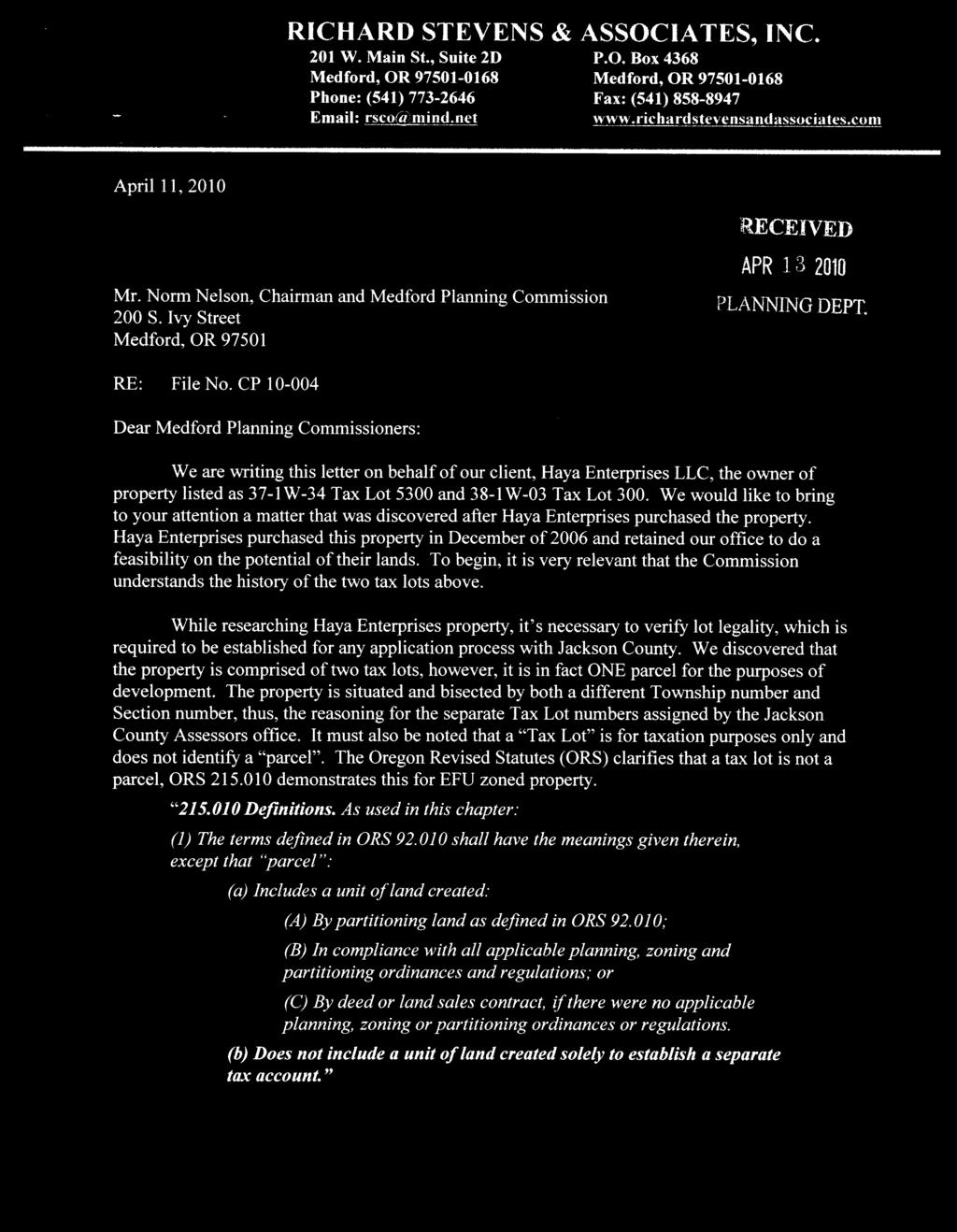
1 CITY OF MEDFORD PLANNING DEPARTMENT Date: 22 April 2010 STAFF REPORT To: Rev d by: By: Subject: Planning Commission Suzanne Myers, AICP, Principal Planner John Adam, AICP, Planner IV Regional Problem Solving (RPS) Regional Plan Adoption [Class-A Major Comprehensive Plan Amendment] File No. CP City of Medford, Applicant PROPOSAL General Consideration of a Class-A major legislative amendment of the Medford Comprehensive Plan to adopt a Regional Plan created by the Greater Bear Creek Valley Regional Problem Solving project (GBCV/RPS, or simply, RPS), the effect of which will be to join the City of Medford to a long-term regional planning agreement and to establish an urban reserve 1 almost 4,500 acres in extent plus nearly 1,900 acres of City-owned parkland. The reserve is intended to accommodate a doubling of Medford s population (almost 77 thousand people) within an area that is about a quarter of the current 18,000-acre urban growth boundary. The adoption process for this will be different from the norm for the City. Adopting an urban reserve requires agreement between a city and a county on the extent of the reserve and the management of the land; therefore, there has to be a jurisdiction that makes the first decision with which the other jurisdiction agrees or disagrees. In the process devised for this action Jackson County will be adopting the Regional Plan on the recommendations of the RPS cities, each of which will initially adopt a resolution outlining its support and suggested changes, if any. After the County adopts the Plan, each city will need to subsequently adopt the same Plan by ordinance or persuade the County to amend the Plan. 1 As defined in ORS (2): Urban Reserve means lands outside an urban growth boundary that will provide for: (a) future expansion over a long-term period; and (2) The cost-effective provision of public facilities and services within the area when the lands are included within the urban growth boundary. Lausmann Annex 200 South Ivy Street Medford, Oregon Tel. (541) Fax (541)
2 Proposed Amendment to Comprehensive Plan 3 The City will need to document the urban reserve in the Urbanization Element of the Comprehensive Plan, just as the urban growth boundary is. The attached Exhibit A contains the proposed revision to the Urbanization Element. BACKGROUND 6 The Regional Problem Solving project began in 2000 with the award of a grant from the Department of Land Conservation and Development. Procedures to Date The Regional Problem Solving (RPS) project has its antecedents in popular movements, city/county decisions, and regulatory conditions that arose in the 1990s: 1992 Newly adopted Oregon Administrative Rules requires Medford to establish urban reserves. (Urban Reserves are county lands designated by a city and county into which the city may expand its Urban Growth Boundary (UGB). A primary purpose of designating Urban Reserves is to preserve such land for future urban-level development.) 1995 The City of Medford and Jackson County do not agree on urban reserve areas and adoption fails to pass A popular initiative to institute regional planning, called Our Region, is administered by the Rogue Valley Council of Governments. Its goal is to address growth-related concerns. The state requires the County to establish a two-mile zone around the Medford UGB that prevents land from development patterns that could negatively affect eventual urbanization Legislature adopts ORS , entitled Collaborative Regional Problem Solving Medford City Council and the Jackson County Board of Commissioners appoint an ad hoc Multi-jurisdictional Committee on Urban Reserves (MCUR) to develop a work plan for resolving the urban reserve impasse. Other cities take part because growth decisions affecting the Medford area also affect them The MCUR adopts a work plan to establish a 30-year urban reserve for Medford, followed by the same for other cities. Although the other jurisdictions are not required to comply with the Urban Reserve Rule, they participate in order to coordinate urbanization patterns for the entire region over the long-range planning period. Page 2
3 2000 The Department of Land Conservation and Development (DLCD) awards a grant to the MCUR cities to begin an RPS process to establish the urban reserves RPS develops its products: Nomination, analysis, and selection of urban reserve area proposals. Development of common agricultural buffering standards Debate on methods to protect farmland (similar to the rural reserves process available to Metro). Nothing ultimately results from this. Development of collaborative regional planning procedures intended to implement the Regional Plan. The draft Plan and Participants Agreement are the result Adoption process begins. In order to have urban reserves, the City Council, County Board of Commissioners, and Oregon Land Conservation and Development Commission (LCDC) must all approve the same proposal. NOTE ON THE LEGISLATIVE PROCEDURE Unlike the typical legislative process, this one will have a pause in the middle. Usually, the Planning Commission holds hearings and makes a recommendation to the Council, which then makes a decision. In this case the Planning Commission will make a recommendation to Council, which will then adopt a Resolution (see Exhibit B) containing the City s recommendation to the County and continue the hearing to a specific date or indefinitely. After the County has adopted the Regional Plan, it falls to the City to follow suit. At that point the City Council will resume the hearing to finalize adoption, which may include remanding consideration of the Plan and urban reserve to the Planning Commission for any further recommendations before it adopts. Model of the Punctuated Process Typical: Hearings... Adoption This one: City Hearings; Resolution County Hearings; Adoption City Hearings; Adoption The reason for this model is to maintain continuity of the record throughout the process. Testimony that the City receives during the early hearings will inform the recommendation decision of the Council. After the hearing process resumes the door will still be open to additional testimony. Page 3
4 CRITERIA 3 6 The City of Medford will adopt the same findings as Jackson County 2 after the County has finished its legislative process. The findings will specifically relate to the urban reserve and the Regional Plan. The criteria the City will subsequently address are attached in Exhibit C and include the City s specific approval criteria for Comprehensive Plan amendments. The purpose of the current phase is to consider (1) the responsibilities Medford has as a regional participant and (2) the form of the proposed urban reserve. This report will cover the positive and negative consequences of each under the Analysis section. 9 COMMENTS RECEIVED and ANALYZED Comments from Agencies None received Request for Change The City received the following request for a change to a proposed urban reserve section (see Exhibit F). Please note that any change poses some risk to the process for Medford and its colleagues. Owner: Harry & David Map/taxlot: 38-1W-05/2400; 2600; 5400; 5500; 38-1W-06/100 Net change: 0 acres Zoning: EFU Soil Class: I III Location: MD Request: Rationale: Harry & David states that the inclusion of the northeast portion of map/lot 38-1W-06/100, a portion of 38-1W-05/2600, and the southern portion of 38-1W-2400 in the MD-6 area is previously unknown information for them and not what they desire (see Figure 1 in Exhibit F). They propose instead the inclusion of the southern portion of 38-1W-06/100, 38-1W-05/5500, and a portion of 38-1W-05/2600, and 38-1W-05/5400 (see Figure 2 in Exhibit F). The acreage exchange is reportedly one-to-one; staff has not calculated it. According to the letter from Harry & David: The present proposed urban reserve designation, as it applies to these parcels, includes property that is already urbanized and or planned for long term non urban operational uses. Retention of the current designation on these parcels is counter to the intent of the urban reserve process and creates a challenging agricultural configuration. 2 Joint adoption is required by OAR (5). Page 4
5 Evaluation: Harry & David s proposal creates complications for a future urban growth boundary and fails to solve an existing problem The proposed urban reserve line creates an intertwining of non-urbanizable farm land with urbanizable land (see Figure 3 in Exhibit F) that will make it impossible to extend infrastructure without having to take an exception. It is not necessary to create that troublesome scenario. The existing problem is the property on which the campus of Harry & David is built (38-1W-05/2400): the southern third and a northwestern triangular portion are outside the urban growth boundary; and one or more buildings sit astride the boundary line. The least urban reserve/urban growth boundary expansion the City should undertake is to correct those overlaps. Land that is already urbanized is not necessarily exempt from inclusion if there is a rational basis for including it such as correcting a boundary split. It is not obvious how the MD-6 proposal creates a challenging agricultural configuration without knowing what the company has in mind for the area. The answer to that will also determine whether or not the long-term, nonurban operational uses are appropriate for urban inclusion or, alternatively, if long term is less than or greater than the 50-year scope of the urban reserve. These are important considerations as their proposal creates a challenging urban configuration which is counter to a good urban reserve and eventual boundary. Conclusion: Staff recommends that the Planning Commission recommend rejection of the request to the Council Request for Inclusion The City received the following request for inclusion (see Exhibit F). Please note that any addition poses some risk to the process for Medford and its colleagues. Staff evaluation follows: Owner: Haya Enterprises Map/taxlot: 38-1W-03/300 Size: 20 acres Zoning: EFU Soil Class: III-B Location: adjacent to MD-5 on North Phoenix Road See map on following page Rationale: Desirability: The area designated MD-5 includes a lot owned by Haya Enterprises. A prior owner initiated a property line adjustment in 1996; the decision by Jackson County s required consolidation of this lot with another lot (38-1W-03/300) into a single parcel for planning purposes. However, taxlot 300 is outside the MD-5 area, a fact that was overlooked because the two appear to be separate lots but are separate only for assessment purposes. The current owner noticed the exclusion and requested consideration. Haya Enterprises states that this would not be the inclusion of a separate parcel, but instead the correction of a mapping error. The addition is inconsequential for Medford s future urban needs. Page 5

6 3 6 9 Evaluation: Conclusion: This is a medium-risk change to the urban reserve proposal. Positive arguments: it does not intrude on a community buffer; the size is insignificant in the context of the 6,300-acre urban reserve proposal (0.3% of total acreage); the separate taxlot lines could easily have led to an oversight; the reason derives from its unique situation and inclusion may therefore be regarded as corrective. Negative arguments: inclusion may encourage other attempts to add to the urban reserve because the City will be seen as being accommodating. Staff does not think the request is objectionable. Haya s MD-5 lot 37-1W-34 / 5300 Proposed Additional Lot 38-1W-03 / 300 ANALYSIS PART ONE REGIONAL RESPONSIBILITIES There are two sets of responsibilities for the City that stand out: common agricultural buffering standards and a set of performance indicators 3. These are listed in Chapter 5 of the Regional Plan. Agricultural Buffering The RPS Resource Lands Review Committee (RLRC) developed the handbook on common standards for farmland buffering years ago. The Policy Committee and the Technical Advisory Committee debated its provisions over several months and accepted the final form, 3 There are also voluntary community buffering standards. Because they are voluntary, they are not immediately important to the City s consideration of the Plan. Page 6
7 after cities review, in The handbook is Chapter 3 of Volume 2 of the Regional Plan. The objectives are: To ensure the continued use of farmland for farm uses. 2. To minimize potential conflict by developing, where possible, a well-defined boundary between rural agricultural and urban uses. The best boundary will be one that provides a sound transition in both directions, from rural to urban and urban to rural. 3. To minimize the impacts of urban development on rural agricultural production activities and land resources. 4. To minimize the potential for complaints about rural agricultural activities from urbanized areas. The nearly 60-page handbook describes the major potential sources of conflict chemical spray drift, noise, sediment and stormwater run-off, trespass and vandalism, odor, and dust, smoke & ash and prescribes buffering solutions for both sensitive (e.g., residences) and non-sensitive (e.g., industry) receptors. The toolkit includes distance separation, various foliage buffers, fence buffers, run-off control planning, and restrictive deed (right-to-farm) covenants. As a member jurisdiction of the Regional Plan, Medford will conduct hearings at a later date to consider adopting this handbook as a regulatory document applicable to development in the urban reserve after it is brought into the City. Where development is adjacent to agricultural land but not within the urban reserve, Medford will continue to apply its existing agricultural buffering standards. Performance Indicators A requirement of the RPS statute is a list of measurable indicators of performance toward achievement of the goals for each regional problem that is the subject of the process (ORS (2)(b)(C)). The indicators paraphrased below are from Chapter 5, Section 3 of the Plan: 1. Participate in joint periodic review every 10 years starting in Participate in Regional Plan review (check-in) every 5 years starting in Incorporate portions of the Regional Plan into comprehensive plans and development codes, as appropriate Comply with general conditions (agricultural buffering & transportation conditions) listed in the Participants Agreement and specific conditions for certain portions of the urban reserves. Medford has one specific condition related to a property line adjustment in MD-6 5. Adopt an urban reserve management agreement. Page 7
8 6. Urban reserves are first-priority land for UGB inclusion per Statute Achieve at least the higher land need-level residential densities described in the Plan. 8. Distribute land uses according to the general schema of distribution described in the Plan for each urban reserve area Develop conceptual plans for the urban reserve so intercity transportation routes can be identified and protected for future development. 10. County updates to its population project will be done in accordance with the Plan. A number of changes are recommended by staff and are found in Exhibit D along with rationales for the changes. Staff requests comments and suggestions on the changes. Staff will share these changes with the other jurisdictions at the next regular oversight committee meeting so that we may coordinate changes. Urban Reserve Proposal The Legislative Assembly finds that long-range planning for population and employment growth by local governments can offer greater certainty for Commerce, other industries, other private landowners and providers of public services, by determining the more [likely] and less likely locations of future expansion of urban growth boundaries and urban development. ORS The State legislature s findings in the bill creating urban reserves are succinct in stating their value. They are an Oregon planner s dream. They are boons for public works departments, city management, and the elected officials of the cities that have them. An urban reserve eliminates much of the research necessary to find lands suitable for urban growth boundary expansion and finding justifications for including farmland. Land in an urban reserve is uniformly suitable for inclusion in a UGB; what is left to a city is to determine which portions of it are most suitable for a given boundary amendment. The following paragraphs describe the candidate urban reserve by its component designations in the Regional Plan. Refer to the map in Exhibit D as a visual aid MD-1 This 568-acre area is situated north of the Medford Airport, east of Table Rock Road and west of Crater Lake Highway 62. To the south are Vilas Road and the north extent of the airport industrial district. The properties within MD-1are partially located in the Agate Desert. Directly north is the Denman Wildlife Reserve. The area includes mostly exception lands with low-density residential properties, some very low value agricultural lands, and some commercial lands along existing arterials. The Page 8
9 3 6 area s dispersed development pattern with large areas of undeveloped land and proximity to urban services means some redevelopment development potential exists. Its close proximity to the Rogue Valley International Medford Airport complex and other industrial lands make it a suitable location for some employment land needs. It may also provide for some residential development in a mixed-use configuration. The area may also include a portion of the corridor for a new route for the Highway 140-to-Interstate 5 connector and the Highway 62 bypass. Gross Acres: 568 MD-1 Urban Reserve By Existing and Potential Land-Use Type Reasonably Developable: 491 Residential Aggregate Resource Existing Plan Proposed Uses Open Space / Parks Employment Land 61% 0% 30% 0 9% 25% 6% 69% MD-2 This 358-acre area is located along and east of Crater Lake Highway between Medford and White City. A linear band of existing development is situated between MD-2 and Crater Lake Highway to the west. The existing City of Medford Urban Growth Boundary defines the southern boundary, a short distance north of Coker Butte Road, a Major Arterial. MD-2 is approximately 0.5 miles wide (east-west) by 1.3 miles long (north-south). The eastern boundary of MD-2 runs parallel to Highway 62. Medford recognizes MD-2 could be appropriately dedicated for mixed use development, and will likely adopt a master plan before the area is incorporated into the city limits. With exception lands in the southeastern corner on Coker Butte, the area contains lands that are generally flat and can accommodate the higher densities that Medford has planned for its new growth areas. MD-2 Urban Reserve By Existing and Potential Land-Use Type Gross Acres: Reasonably Open Space / Employment 358 Developable: 316 Residential Aggregate Resource Parks Land Existing Plan 0% 0% 99% 0 0% Proposed Uses 50% 11% 39% MD-3 This 961-acre area lies along Medford s northeastern edge. It contains rolling hills and lower quality agricultural soils, with sparse chaparral woodlands to the southeast. The area also includes orchards that will become adjacent to urban development on two sides within the current Urban Growth Boundary. MD-3 Urban Reserve By Existing and Potential Land-Use Type Gross Acres: Reasonably Open Space / Employment 961 Developable: 915 Residential Aggregate Resource Parks Land Existing Plan 5% 0% 95% 0 0% Proposed Uses 65% 16% 19% Page 9
10 MD-4 MD-4 is the site of the 271-acre Hillcrest Orchard property. The area is an Urban Growth Boundary enclave. Not only is the property completely surrounded by the City, it is bordered on three sides by regionally important arterials. North Phoenix Road, a major arterial borders the entire property to the west. East McAndrews a major arterial extends generally along its northeast corner. Hillcrest Road, also an arterial, extends along the entire southern border of the property. The lands directly to the east are master planned for mixed use development. At present, Hillcrest Orchard is an active agricultural enterprise, with orchards and vineyards. Medford envisions MD-4 as a master planned, mixed-use area with residential and commercial uses, including a town center to support higher densities. The 271 acres of MD-4 were recommended as part of the commercial agricultural resource base by the RLRC. However, the decision made at the first state agency review in March, 2007 was that the case for eventual urbanization of MD-4 was more compelling than the one for maintaining it in agricultural use. MD-4 Urban Reserve By Existing and Potential Land-Use Type Gross Acres: Reasonably Open Space / Employment 276 Developable: 271 Residential Aggregate Resource Parks Land Existing Plan 0% 0% 100% 0 0% Proposed Uses 63% 15% 22% MD-5 This irregularly shaped growth area of approximately 1,728 acres is located along the southeastern edge of Medford s Urban Growth Boundary. The area extends from the flat land adjacent to the golf course east of the Rogue Valley Manor to the rolling hills above the Larson Creek Reservoir. Despite a few minor streams and a few small pockets of wetlands scattered throughout and a few acres of steep slopes in the northeast corner, the vast majority of MD-5 is void of physical constraints. The Centennial Golf Course, situated between the UGB to the west and North Phoenix Road to the east, comprises approximately 425 acres of MD-5. The approximate 153 acres situated south of the golf course, west of Fern Valley Road, and east of I-5, are flat to gently sloped, are near the Fern Valley-Interstate-5 interchange, are immediately adjacent to the future South Stage east-west connector, and are situated central to the Bear Creek Valley. Two minor inclusions of low-density exception lands are situated in the center of MD-5, south of Coal Mine Road along Hidden Village Place and Oakmont Way and east of Coal Mine Road along Santa Barbara Place and Mitchellen Place. Most of MD-5 is designated Agricultural land and similar to all other agricultural-designated lands east of Interstate 5 and near the city they are of lower soil capability class than the soils west of the city. Page 10
11 MD-5 Urban Reserve By Existing and Potential Land-Use Type Gross Acres: Reasonably Open Space / Employment 1728 Developable: 1636 Residential Aggregate Resource Parks Land Existing Plan 5% 0% 95% 0 0% Proposed Uses 56% 19% 25% MD-6 This area of 143 acres abuts the west side of the Bear Creek Corporation s facility, south of the city limits. The area is south of Garfield Avenue, west of Highway 99 and north of South Stage Road. It is bordered on two sides by the current City limits. Approval of MD-6 as an urban reserve by the RPS Policy Committee was made contingent on the following condition of approval: The City and County shall require a lot line adjustment for Assessor s Parcels 381W and 381W so that parcel lines coincide with the urban reserve boundary prior to Medford s adoption of this Urban Reserve Area. MD-6 Urban Reserve By Existing and Potential Land-Use Type Gross Acres: Reasonably Open Space / Employment 143 Developable: 131 Residential Aggregate Resource Parks Land Existing Plan 23% 0% 57% 0 21% Proposed Uses 0% 0% 100% MD-7n This 37-acre area is surrounded by urban land on three sides. The RLRC recommended that all of MD-7n be considered commercial agricultural land. It contains class 3 and 4 soils. The property owners reported that the soil has lime-induced chlorosis which has made production problematic and often unprofitable. Bear Creek Corporation and KOGAP Enterprises have also submitted letters stating that their adjoining orchards are not in their long term plans for agricultural production. With the completion of the new South Medford Interchange, areas along Highway 99, Stewart Avenue, and Garfield Avenue are expected to experience continued commercial and industrial job growth. The KOGAP Stewart Village development, Wal-Mart, and Harry and David are examples of this expansion. Commercial Agricultural Resource Base Status: The 36 acres in MD-7n were recommended as part of the commercial agricultural base by the RLRC. However, the balanced Goal 14 decision made at the second state agency review in December 2007 was that the case for eventual urbanization of MD-7n was more compelling than the one for maintaining it in agricultural use. Page 11
12 MD-7n Urban Reserve By Existing and Potential Land-Use Type Gross Acres: Reasonably Open Space / Employment 37 Developable: 36 Residential Aggregate Resource Parks Land Existing Plan 0% 0% 100% 0 0% Proposed Uses 0% 0% 100% 3 6 MD-7 mid This 128-acre area is located north of South Stage Road, east of Kings Highway, and south of Garfield Avenue. The City of Medford borders this area on two sides. Medford plans for this area to become mostly residential, with complementary commercial uses. The City s Planning Commission and City Council deliberations identified these lands as part of its longterm growth strategy. MD-7mid Urban Reserve By Existing and Potential Land-Use Type Gross Acres: Reasonably Open Space / Employment 128 Developable: 125 Residential Aggregate Resource Parks Land Existing Plan 0% 0% 100% 0 0% Proposed Uses 49% 22% 29% MD-7s This 45-acre area is north of South Stage Road, east of Kings Highway, and south of MD- 7mid. Medford plans for this area to become commercial, with complimentary residential uses. The City s Planning Commission and City Council RPS planning deliberations identified these lands as part of its long-term growth strategy. Additionally, South Stage Road is a long-term boundary for the City. MD-7s is close to key employment centers, including South Gateway Center and an approved Wal-Mart. New residential uses will provide options for reduced commuter travel, and increased transit use. None of this area has been recommended as commercial agricultural land by the RLRC. MD-7s Urban Reserve By Existing and Potential Land-Use Type Gross Acres: 45 Reasonably Developable: 45 Residential Aggregate Resource Open Space / Parks Employment Land Existing Plan 0% 0% 100% 0 0% Proposed Uses 31% 13% 56% MD-8 This 32-acre area is north of South Stage Road, east of Kings Highway, and south of MD- 7mid. Medford plans for this area to become residential, with complimentary commercial uses. The City s Planning Commission and City Council deliberations identified these lands as part of its long-term growth strategy. Additionally, South Stage Road is a long-term boundary for the City. MD-8 is close to key employment centers, including the South Gateway Shopping Center and an approved Wal-Mart. New residential uses will provide options for reduced commuter travel, and increased transit use. None of this area was recommended as commercial agricultural land by the RLRC. Page 12
13 Gross Acres: 56 MD-8 Urban Reserve By Existing and Potential Land-Use Type Reasonably Developable: 53 Residential Aggregate Resource Open Space / Parks Existing Plan 56% 0% 44% 0 0% Proposed Uses 49% 29% 22% Employment Land MD-9 MD-9 comprises two sites in west Medford that are the only two exceptions to the general desire to avoid growth to the west. The larger site, at 103 acres, is roughly bound by Stewart Avenue and City UGB to the south, Oak Grove Road to the west, Prune Street and City UGB to the north, and Clover Lane and City UGB to the east. This property has been identified as a suitable growth area by the City because its former agricultural uses have been discontinued as a result of urbanization pressures from urban development and increases in resulting traffic. MD-9 already contains residential development, some urban services, and parcels that are undersized for significant agricultural operations. Unlike other lands along Medford s west border, this land is impacted on three sides by the existing Urban Growth Boundary, in addition to significant development along Oak Grove Road to the west. Oak Grove Road is the City s western-most north-south connection, tying West Main Street to South Stage Road, via connection with Stewart Avenue and Hull Road. As the city in-fills around MD-9, growth pressures are expected to continue to increase impacts on MD-9, making continued agricultural practices difficult, despite agricultural soils. The smaller 10-acre northerly portion of MD-9 is a narrow strip of land north of Finley Lane. This area has been identified as a growth area as a logical revision to the City s boundary. Similar to the portion of MD-9 described above, it is impacted on three sides by Medford s Urban Growth Boundary, and by urban development. MD-9 Urban Reserve By Existing and Potential Land-Use Type Gross Acres: 111 Reasonably Developable: 104 Residential Aggregate Resource Open Space / Parks Employment Land Existing Plan 17% 0% 83% 0 0% Proposed Uses 73% 18% 9% PRESCOTT and CHRISSY PARKS (MD-P) These areas of City-owned wildland parks comprise two major sites totaling 1,877 acres. Inclusion as Urban Reserve areas is a mechanism to eventually incorporate this City property into City boundaries. MD-P is not considered an area for future urban growth because of its classification as parkland. There is no residential, commercial, or industrial development planned for the MD-P acres. They present a tremendous recreational and open space asset to the City and the region, in addition to creating a buffer between the city and rural lands to the north and east. However, due to their location along the eastern periphery of the city and very steep topography, these lands satisfy little of the localized open space needs throughout the city and do not meet the land needs for traditional urban parkland. Page 13
14 MD-9 P Urban Reserve By Existing and Potential Land-Use Type Gross Acres: 1877 Reasonably Developable: 0 Residential Aggregate Resource Open Space / Parks Existing Plan Proposed Uses Employment Land 22% 78% 0% 100% 0% The vast majority of MD-P s acreage (78%) is currently designated Forestry/Open Space Land, with the remainder Agricultural Land. The larger of the two pieces of MD-P is Prescott Park, while the smaller is Chrissy Park. Prescott Park is located adjacent to the Medford Urban Growth Boundary; it includes the well-known Roxy Ann Peak. The peak, with an elevation of 3,571 ft, is a readily identifiable geographic feature that stands over 2,000 feet above the valley floor. Prescott Park totals 1,700 acres and consists of 200 acres donated to the City by the Lions Club in 1930 and 1,500 acres purchased by the City via the Federal Lands for Parks Act in The park was first established in 1933 and early development was completed primarily by the Civilian Conservation Corps (CCC) between 1933 and 1942 while stationed at Camp Prescott at the base of the park. Work included the initial roadbed, culverts for drainage, picnic shelters, trails, barbecues, bench overlooks and cisterns. The North Overlook structure is an example of their work. At Roxy Ann Peak there are also four structures which house radio towers owned by the City and various agencies including emergency services. Chrissy Park, still undeveloped, is 166 acres in size. There is a small gently sloping area on the Park s western edge that is proposed to be developed as a neighborhood park; the balance of the park will be devoted to special uses, such as equestrian and similar nontraditional urban park uses. It is proposed to include a paved, multi-use pathway that serves as a link to other proposed pathways along drainage corridors toward Prescott Park and the middle and north forks of Larson Creek. FINDINGS 24 Jackson County is preparing findings to meet State and Jackson County approval criteria. Supplemental findings needed by the City relative to the approval criteria identified in Exhibit B and addressing any public comment will be prepared following County adoption of the Regional Plan and prior to the City s adoption CONCLUSION The City of Medford has been an integral participant in the development of the Regional Plan over the past decade. The City s and the region s goals have been incorporated into the Plan and Medford s choices of growth areas (Exhibit E) have won acceptance from its colleagues and among State agencies. Jackson County is now working toward adoption and seeks the recommendations of the Plan participants so it may complete its findings and submit the Plan to final adoption by the cities. RECOMMENDED ACTION Page 14
15 3 6 Staff finds the draft Regional Plan accurately reflects the work of the participants and meets the goals of the City of Medford should the Planning Commission wish to forward a favorable recommendation to City Council for DCA , per the Staff Report dated 22 April 2010, including Exhibits A through E. In addition, staff recommends that the Planning Commission forward a recommendation to City Council supporting the addition of 20 acres to MD-5 requested by Haya Enterprises and rejecting the change to MD-6 requested by Harry & David. EXHIBITS 9 Exhibit A Draft Amendment dated 4/9/ Exhibit B Exhibit C Exhibit D Exhibit E Exhibit F Draft Resolution recommending County adoption of Regional Plan. Criteria for adoption of Regional Plan and Urban Reserves. Staff-recommended changes to proposed Performance Indicators found in Chapter 5 of the draft Regional Plan. Candidate Urban Reserve Area map. Comments Received PLANNING COMMISSION AGENDA: 22 APRIL 2010 Page 15
16 EXHIBIT A 3 DRAFT AMENDMENT OF URBANIZATION ELEMENT OF THE COMPREHENSIVE PLAN (4/9/2010) 3. URBAN RESERVE A city s urban reserve contains County land outside of its urban growth boundary that is protected from patterns of development that would impede eventual urbanization. The reserve is the first priority for inclusion when a city expands its urban growth boundary. Reserve land is not urbanizable until it is included in the growth boundary. Urban reserves are authorized by Oregon Revised Statutes (ORS) and regulated by Oregon Administrative Rules, Chapter 660, Division 21 (OAR ). Medford s urban reserves are shown on the City s General Land Use Plan Map as well as on Jackson County s applicable Comprehensive Plan and Zoning maps. 3.1 URBAN RESERVE AMENDMENT PROCEDURES 15 When a city considers bringing land into an urban reserve, the Goal 14 priority system applies. The procedures and limitations for establishing and amending urban reserves are in OAR URBAN RESERVE MANAGEMENT AGREEMENT Appendix 1 contains the Urban Reserve Management Agreement (URMA), an intergovernmental between the City of Medford and Jackson County that specifies the land use management of the reserves. 3.3 REGIONAL PLAN The Greater Bear Creek Valley Regional Plan is adopted by reference into this Urbanization Element of the Medford Comprehensive Plan. Obligations of the City as participants in the Greater Bear Creek Valley Regional Plan are described in Chapter 5, Section 3 of the Plan and reproduced here: Ongoing monitoring of progress following State acknowledgment of the Greater Bear Creek Valley Regional Plan will be measured against the following set of performance indicators to determine the level of compliance by participating jurisdictions with this Plan or the need to refine or amend it. The measurable performance indicators listed below are those identified as appropriate for monitoring compliance with the adopted Plan. Exhibit A Page 1
17 Coordinated Periodic Review. On a regular basis, every 10 years starting in 2022, the Plan s jurisdictions may, at their discretion, participate in a process of coordinated periodic review. Initiation: Starting in January 2022 and thenceforth every 10 years following the Jackson County Development Services Department, or successor department, will convene a meeting of the RPS technical advisory committee to discuss the option of beginning a phase of joint periodic review. 2. Five-Year Regional Plan Review. On a regular basis, every 5 years starting in 2015, all participating jurisdictions will participate in the regular Regional Plan review process. Jackson County shall initiate the Regional Plan review process by providing notice of the Regional Plan review to each city and requiring that each city submit a self-evaluation monitoring report addressing compliance with the performance indicators set out in this Section to the County within 60 days after the date of the notice. Jackson County will distribute these monitoring reports to all Signatories. The reports will include descriptions of the jurisdiction s activities pertinent to the Plan for the preceding five-year period, analysis as to whether and how well those activities meet performance indicators, and a projection of activities for the next five-year period. 3. Regional Plan Integration. Jackson County will adopt the Regional Plan into the County Comprehensive Plan. Participating cities will incorporate the portions of the Regional Plan that are applicable to each individual city into that city s comprehensive plan and implementing ordinances, and will reference the Plan as an adopted element of Jackson County s comprehensive plan. To incorporate applicable portions of the Regional Plan into their comprehensive plans and implementing codes, cities will adopt at least the following: a. urban reserves and urban reserve management agreements; b. target residential densities; c. agricultural buffering standards by 2015 or when areas of urban reserve are incorporated into an urban growth boundary, whichever comes first; d. implementing codes, as applicable. 4. Conditions for Specific Urban Reserves. Signatory jurisdictions will comply with the specific conditions of approval for selected urban reserves, as described in the adopted Plan. 5. Target Residential Densities. When applying urban general land use and zoning designations to urban reserve land at the time of UGB incorporation, cities will achieve, on average, the lower residential densities (so-called higher land need ) targets as described in Chapter 2 and depicted in Figure 2.10 of this Plan. Exhibit A Page 2
18 Average density will be calculated across all the urban reserve land included in each incorporation by applying general land use designations within the areas incorporated, by increasing density within the city to compensate for the shortfall in the incorporated area, or through a combination of both actions. 6. Land Uses Distribution. The general distribution of land uses proposed in this Plan shall guide cities when applying general land use and zoning designations to urban reserve land included in a UGB expansion, especially where a specific set of land uses were part of a compelling urban-based rationale for designating commercial agricultural base land as part of a city s set of urban reserves (refer to Chapter 1, Section 6.2 for explanation). 7. Transportation Policies. The adopted Plan shall include policies to: a. Identify a general network of locally owned regionally significant northsouth and east-west arterials and associated projects to provide mobility throughout the Region. b. Designate and protect corridors for locally owned regionally significant arterials and associated projects within the RVMPO to ensure adequate transportation connectivity, multimodal use, and minimize right of way costs. c. Establish a means of providing supplemental transportation funding to mitigate impacts arising from future growth. These policies shall be implemented by ordinance upon the adoption of the latest update of the Rogue Valley Metropolitan Planning Organization s Regional Transportation Plan and the local adoption of the RPS Plan through individual city and county Comprehensive Plan amendments. Implementing Signatory cities will incorporate the portions of the RPS Plan relative to transportation that are applicable to each individual city into that city s comprehensive plan and implementing ordinances, and will reference the larger regional plan as an adopted element of Jackson County s comprehensive plan. 8. Conceptual Plans. Conceptual plans for urban reserves will be developed in sufficient detail to allow the Region to determine the sizing and location of regionally significant transportation infrastructure. This information should be determined early enough in the planning and development cycle that the identified regionally significant transportation corridors (see Chapter 2, Section 6) can be protected as cost-effectively as possible by available strategies and funding. Conceptual plans for an urban reserve in the Regional Plan are required to be completed at the time of adoption of a comprehensive plan amendment incorporating urban reserves into a city or county comprehensive plan. 9. County Population Projections. The County s population projections will be updated per statute to be consistent with the gradual implementation of the adopted Plan. Exhibit A Page 3
19 EXHIBIT B 3 DRAFT RESOLUTION RECOMMENDING JACKSON COUNTY ADOPTION OF REGIONAL PLAN CITY OF MEDFORD RESOLUTION NO XXX A RESOLUTION ON BEHALF OF THE CITY OF MEDFORD RECOMMENDING JACKSON COUNTY ADOPTION OF THE GREATER BEAR CREEK VALLEY REGIONAL PROBLEM SOLVING PLAN. WHEREAS, pursuant to former ORS (1) [2001], Jackson County and the cities of Medford, Ashland, Central Point, Eagle Point, Phoenix, and Talent entered into a collaborative regional problem-solving (RPS) process; and WHEREAS the City of Medford (City), as a participant in RPS, having signed a Participants Agreement identifying a regional land use problem, establishing goals addressing the problem, creating mechanisms for achieving such goals, and a system for monitoring the implementation and effectiveness of the those goals; and WHEREAS the Greater Bear Creek Valley Regional Problem Solving Plan (the Regional Plan ) contemplated by the Participants Agreement has been proposed under the provisions of former ORS (1) and former (2), which remain applicable to this RPS process; and WHEREAS Jackson County is the local government charged with adopting the final RPS Plan; and WHEREAS the RPS process must include: (a) An opportunity for involvement by other stakeholders with an interest in the problem; and (b) Efforts among the collaborators to agree on goals, objectives and measures of success; and WHEREAS the City has been requested to make recommendation(s) to Jackson County concerning the contents and adoption of the final RPS Plan, including associated maps and Findings; and WHEREAS the City s Planning Commission conducted hearings on the RPS Plan on 2010, and the City Council conducted hearings on the RPS Plan on 2010; and WHEREAS, all requirements for legal notices and advertisements have been fulfilled and public testimony accepted and recorded; now, therefore, 33 THE CITY OF MEDFORD RESOLVES: Exhibit B Page 1
20 Section 1 RPS Plan. 3 6 The City Council of Medford hereby recommends Jackson County s adoption of the Greater Bear Creek Valley Regional Plan, attached as Exhibit A, including Plan Maps Nos. and associated Findings as presented (or amended under the following provisions: only if necessary.) 9 APPROVED by the City of Medford this 307th day of May Mayor Attest: 15 City Recorder 18 Exhibit B Page 2
21 EXHIBIT C CRITERIA FOR URBAN RESERVE ADOPTION City of Medford Medford Land Development Code, Legislative Amendments, Section : An amendment to either the Comprehensive Plan or this chapter, or any other action designated by the City Council as legislative based on findings that the issue involves such a substantial area and number of property owners or such broad public policy changes that administrative processing would be inappropriate, shall be processed as a Class A action as per Article II, Section , Class A Actions. Medford Land Development Code, Findings, Section : Amendments to the Comprehensive Plan or this chapter shall be accompanied by findings which shall include: (1) Identification of all applicable Statewide Goals, if any. (2) Identification and explanation of the goals and policies of the Comprehensive Plan considered relevant to the decision. (3) Statement of the facts relied upon in rendering the decision, if any (4) Explanation of the justification for the decision based on the criteria, standards, and facts. State Urban Reserves Under the authority of Oregon Revised Statutes, Chapter 197, Section 145(6), the Department of Land Conservation and Development created the procedure for adoption of urban reserves in Oregon Administrative Rules, Chapter 660, Division 21. The criteria are found under OAR , Determination of Urban Reserve : (1) Urban reserves shall include an amount of land estimated to be at least a 10- year supply and no more than a 30-year supply of developable land beyond the 20-year time frame used to establish the urban growth boundary. Local governments designating urban reserves shall adopt findings specifying the particular number of years over which designated urban reserves are intended to provide a supply of land. (2) Inclusion of land within an urban reserve shall be based upon the locational factors of Goal 14 and a demonstration that there are no reasonable alternatives that will require less, or have less effect upon, resource land. Cities and counties cooperatively...shall first study lands adjacent to, or nearby, the urban growth boundary for suitability for inclusion within urban reserves, as measured by the factors and criteria set forth in this section. Local governments shall then desig- Exhibit C Page 1
22 nate, for inclusion within urban reserves, that suitable land which satisfies the priorities in section (3) of this rule. 3 (3) Land found suitable for an urban reserve may be included within an urban reserve only according to the following priorities: (a) (b) (c) First priority goes to land adjacent to, or nearby, an urban growth boundary and identified in an acknowledged comprehensive plan as an exception area or nonresource land. First priority may include resource land that is completely surrounded by exception areas unless these are high value crop areas as defined in Goal 8 or prime or unique agricultural lands as defined by the United States Department of Agriculture; If land of higher priority is inadequate to accommodate the amount of land estimated in section (1) of this rule, second priority goes to land designated as marginal land pursuant to former ORS (1991 edition); If land of higher priority is inadequate to accommodate the amount of land estimated in section (1) of this rule, third priority goes to land designated in an acknowledged comprehensive plan for agriculture or forestry, or both. Higher priority shall be given to land of lower capability as measured by the capability classification system or by cubic foot site class, whichever is appropriate for the current use. 21 (4) Land of lower priority under section (3) of this rule may be included if land of higher priority is found to be inadequate to accommodate the amount of land estimated in section (1) of this rule for one or more of the following reasons: (a) (b) Future urban services could not reasonably be provided to the higher priority area due to topographical or other physical constraints; or Maximum efficiency of land uses within a proposed urban reserve requires inclusion of lower priority lands in order to include or to provide services to higher priority lands (5) Findings and conclusions concerning the results of the above consideration shall be adopted by the affected jurisdictions State Regional Problem Solving The Regional Plan was developed under the auspices of the former Statute establishing the collaborative regional problem solving process (ORS ). The requirements of participation and the comprehensive plan amendments resulting from participation are measured against the following: Regional problem solving; coordination. (1) Local governments and those special districts that provide urban services may Exhibit C Page 2
23 enter into a collaborative regional problem-solving process. A collaborative regional problem-solving process is a planning process directed toward resolution of land use problems in a region. The process must offer an opportunity to participate with appropriate state agencies and all local governments within the region affected by the problems that are the subject of the problem-solving process. The process must include: (a) (b) An opportunity for involvement by other stakeholders with an interest in the problem; and Efforts among the collaborators to agree on goals, objectives and measures of success for steps undertaken to implement the process as set forth in ORS (2) As used in ORS to , region means an area of one or more counties, together with the cities within the county, counties, or affected portion of the county. [1996 c.6 4] Commission acknowledgment of comprehensive plans not in compliance with goals; participation by state agencies; commission review of implementing regulations and plan amendments; use of resource lands. (1) Upon invitation by the local governments in a region, the Land Conservation and Development Commission and other state agencies may participate with the local governments in a collaborative regional problem-solving process. (2) Following the procedures set forth in this subsection, the commission may acknowledge amendments to comprehensive plans and land use regulations, or new land use regulations, that do not fully comply with the rules of the commission that implement the statewide planning goals, without taking an exception, upon a determination that: (a) (b) The amendments or new provisions are based upon agreements reached by all local participants, the commission and other participating state agencies, in the collaborative regional problem-solving process; The regional problem-solving process has included agreement among the participants on: (A) (B) (C) Regional goals for resolution of each regional problem that is the subject of the process; Optional techniques to achieve the goals for each regional problem that is the subject of the process; Measurable indicators of performance toward achievement of the goals for each regional problem that is the subject of the process; Exhibit C Page 3
24 3 6 (D) (E) (F) A system of incentives and disincentives to encourage successful implementation of the techniques chosen by the participants to achieve the goals; A system for monitoring progress toward achievement of the goals; and A process for correction of the techniques if monitoring indicates that the techniques are not achieving the goals; and 9 (c) The agreement reached by regional problem-solving process participants and the implementing plan amendments and land use regulations conform, on the whole, with the purposes of the statewide planning goals (3) A local government that amends an acknowledged comprehensive plan or land use regulation or adopts a new land use regulation in order to implement an agreement reached in a regional problem-solving process shall submit the amendment or new regulation to the commission in the manner set forth in ORS to for periodic review or set forth in ORS for acknowledgment. (4) The commission shall have exclusive jurisdiction for review of amendments or new regulations described in subsection (3) of this section. A participant or stakeholder in the collaborative regional problem-solving process shall not raise an issue before the commission on review that was not raised at the local level. (5) If the commission denies an amendment or new regulation submitted pursuant to subsection (3) of this section, the commission shall issue a written statement describing the reasons for the denial and suggesting alternative methods for accomplishing the goals on a timely basis. (6) If, in order to resolve regional land use problems, the participants in a collaborative regional problem-solving process decide to devote agricultural land or forestland, as defined in the statewide planning goals, to uses not authorized by those goals, the participants shall choose land that is not part of the region s commercial agricultural or forestland base, or take an exception to those goals pursuant to ORS To identify land that is not part of the region s commercial agricultural or forestland base, the participants shall consider the recommendation of a committee of persons appointed by the affected county, with expertise in appropriate fields, including but not limited to farmers, ranchers, foresters and soils scientists and representatives of the State Department of Agriculture, the State Department of Forestry and the Department of Land Conservation and Development. (7) The Governor shall require all appropriate state agencies to participate in the collaborative regional problem-solving process. [1996 c.6 5; 2001 c ] Exhibit C Page 4
25 EXHIBIT D STAFF-RECOMMENDED CHANGES TO THE PERFORMANCE INDICATORS FOUND IN CHAPTER 5 OF THE DRAFT REGIONAL PLAN Staff recommends the following changes: Ongoing monitoring of progress following the signingstate acknowledgment of the Participants AgreementGreater Bear Creek Valley Regional Plan will take place on a numberbe measured against the following set of performance indicators to determine the level of compliance by participating jurisdictions with this plan Plan or the need to refine or amend it. The measurable performance indicators listed below are those identified as appropriate for monitoring compliance with the adopted Plan. 1. Coordinated Periodic Review. On a regular basis, every 10 years starting in , the Plan s jurisdictions may, at their discretion, participate in a process of coordinated periodic review. Initiation: Starting in January 2022 and thenceforth every 10 years following the Jackson County Development Services Department, or successor department, will convene a meeting of the RPS technical advisory committee to discuss the option of beginning a phase of joint periodic review. 2. Five-Year Regional Plan Review. On a regular basis, every 5 years starting in 2015, all Signatories to the Agreementparticipating jurisdictions will participate in the regular Regional Plan review process. Jackson County shall initiate the Regional Plan review process by providing notice of the Regional Plan review to each Signatory to this Agreementcity and requiring that each Signatory city submit a self-evaluation monitoring report addressing compliance with the performance indicators set out in this Section to the County within 60 days after the date of the notice. Jackson County will distribute these monitoring reports to all Signatories. The reports will include descriptions of the jurisdiction s activities pertinent to the Plan for the preceding five-year period, analysis as to whether and how well those activities meet performance indicators, and a projection of activities for the next five-year period. 3. Regional Plan Integration. Jackson County will adopt the Regional Plan into the County Comprehensive Plan. Participating cities will incorporate the portions of the Regional Plan that are applicable to each individual city into that city s comprehensive plan and implementing ordinances, and will refer- Exhibit D Page 1
26 ence the Plan as an adopted element of Jackson County s comprehensive plan. To incorporate applicable portions of the Regional Plan into their comprehensive plans and implementing ordinancescodes, cities will adopt at least the following: a. urban reserves areasand urban reserve management agreements; b. target residential densities (for the urban reserve areas); c. agricultural buffering standards by 2015 or when areas of urban reserve are incorporated into an urban growth boundary, whichever comes first (for the urban reserve areas); d. implementing ordinances codes(for the urban reserve areas), as applicable. 4. Conditions for Specific Urban Reserves. Signatory jurisdictions will comply with the general conditions as listed in Section X of the Participants Agreement (found in Volume 2 of this Plan) and, as appropriate, the specific conditions of approval for selected urban reserves, as described in the adopted Plan. 5. Signatory jurisdictions serving or projected to serve a designated urban reserve will adopt an Urban Reserve Management Agreement (URMA). 6. Urban reserves identified in the adopted Plan are the first priority lands used for UGB expansions by participating cities. 7. Target Residential Densities. When applying urban general land use and zoning designations to urban reserve land at the time of UGB incorporation, cities will achieve, on average, the lower residential densities (so-called higher land need ) targets as described in Chapter 2 and depicted in Figure 2.10 of this Plan. Cities, when applying urban designations and zones to urban reserve land included in UGB expansions, will achieve, on average, at least the higher land need residential densities as described in the adopted Regional Plan. Average density will be calculated across all the urban reserve land included in each incorporation by applying general land use designations within the areas incorporated, by increasing density within the city to compensate for the shortfall in the incorporated area, or through a combination of both actions. Exhibit D Page 2
27 8. Land Uses Distribution. The general distribution of land uses proposed in this Plan shall guide cities Cities, when applying urban general land use and zoning designations and zones to urban reserve land included in a UGB expansion, will be guided by the general distribution of land uses proposed in the adopted Regional Plan, especially where a specific set of land uses were part of a compelling urban-based rationale for designating RLRC commercial agricultural base land as part of a city s set of urban reserves (refer to Chapter 1, Section 6.2 for explanation). n. Transportation Policies. The adopted Plan shall include policies to: a. Identify a general network of locally owned regionally significant northsouth and east-west arterials and associated projects to provide mobility throughout the Region. b. Designate and protect corridors for locally owned regionally significant arterials and associated projects within the RVMPO to ensure adequate transportation connectivity, multimodal use, and minimize right of way costs. c. Establish a means of providing supplemental transportation funding to mitigate impacts arising from future growth. These policies shall be implemented by ordinance upon the adoption of the latest update of the Rogue Valley Metropolitan Planning Organization s Regional Transportation Plan and the local adoption of the RPS Plan through individual city and county Comprehensive Plan amendments. Implementing Signatory cities will incorporate the portions of the RPS Plan relative to transportation that are applicable to each individual city into that city s comprehensive plan and implementing ordinances, and will reference the larger regional plan as an adopted element of Jackson County s comprehensive plan. 9. Conceptual Plans. Conceptual plans for urban reserves will be developed in sufficient detail to allow the Region to determine the sizing and location of regionally significant transportation infrastructure. This information should be determined early enough in the planning and development cycle that the identified regionally significant transportation corridors (see Chapter 2, Section 6) can be protected as cost-effectively as possible by available strategies and funding. Conceptual plans for an urban reserve in the Regional Plan are not required to be completed at the time of adoption of a comprehensive plan amendment incorporating urban reserves into a city or county comprehensive plan. Exhibit D Page 3
28 10. County Population Projections. The county s County s population element isprojections will be updated per statute to be consistent with the gradual implementation of the adopted Plan. In addition to the number of changes above that shift authority from the Participants Agreement to the Regional Plan, others require explanation: 1. Change first coordination year from 2020 to 2022 to take advantage of the data from the 2020 Census. An initiation procedure is also recommended. 2. Add a description of progress review based on self-reporting. 3. Clarification of integration schedules. 4. This change redirects authority from the Participants Agreement to the Plan. 5. Delete; the management agreement for an urban reserve is a State regulatory feature of urban reserves and negligible as an indicator of progress. 6. Delete for a reason similar to the preceding. To say that an urban reserve is first priority only restates ORS (1)(a) and OAR Describe the method of calculating how cities will meet their density targets. 8. Clarification changes only. n. Addition of transportation policies in full detail. They are too significant to leave out and they tie into Indicator no. 9 that follows them. 9. Clarification change only. 10. Clarification change only. Exhibit D Page 4
29 EXHIBIT E CANDIDATE URBAN RESERVE MAP (3/29/2010) [Next Page] Exhibit E Page 1
30 City of Medford Regional Problem Solving/UR Adoption Project CANDIDATE URBAN RESERVES B E GREGORY RD GIBBON RD MCLOUGHLIN DR 62 O P UPTON RD MD-1 CP-2B W VILAS RD HAMRICK R D E VILAS RD CP-3 Central Point D OT H IL LR -2 MD TABLE ROCK RD ST FREEMAN RD D 3R BIDDLE RD N FO N E PINE ST MD-2 MD-3 BEALL LN CR AT ER N CEN TR AL G SA O P E E MCANDREWS RD RD 238 MD-3 LA AV KE AV Prescott Park RD Medford EW S STEVENS ST MD-4 ND A W M C W MAIN ST N COLUMBUS AV R -9 MD E JACKSON ST E H 8T MD E MAIN ST ST -5 W 8TH ST MD-9 E BARNETT RD C GARFIELD ST MD-5 MD C A RP ENTER H PH-1 PH-3 PH-10 ILL RD Miles No guarantee or warranty is expressed or implied in terms of data accuracy or legitimacy. This product is intended for use as public information and precise interpretations of the official record should be solicited from the Medford Planning Department. ALL EY RD FERN V PH-2 Phoenix L E G E N D Freeway Urban Reserve candidates UGB Freeway Ramp CITY Critical Open Space Areas (COSA) State Highway!!! Other Public Road Central Point Medford Major Road!!!!!! PAYNE RD RD PH-5 BOLZ RD VOORHIES RD SOU TH STAGE RD EER N PHOENIX RD MD-6 MD-8 GRIFFIN CREEK RD MD-7 KINGS HW S COLUMBUS AV DR HULL RD R SOUTH STAGE RD 0 MD-5 TE EN STEWART AV PION Chrissy Park Phoenix Exhibit A File no. CP Prepared by: City of Medford Planning Department 29 March 2010
31 EXHIBIT F COMMENTS RECEIVED [Next Page] Exhibit F Page 1
32
33
34

35
36
37


38

39 Figures 1 3 regarding Harry & David s Request for Change to MD-6 Figure 1. MD-6 Current configuration WW WW WW Exhibit F Page 9

40 Figure 2. MD-6 Proposed configuration WW WW WW Exhibit F Page 10


41 Figure 3. Problems with Harry & David Request Prospective UGB H&D lot straddles current and future UGB An inlet of nonurbanizable land complicates extensions of infrastructure. H&D Campus Exhibit F Page 11
42 EXHIBIT F ADDENDUM The following letter requesting inclusion was received too late to be treated in the staff report. Staff will provide an analysis memo at the Planning Commission hearing. Exhibit F Page 12


43
44
45
46


47
COLVER ROAD INDUSTRIAL CONCEPT PLAN
 COLVER ROAD INDUSTRIAL CONCEPT PLAN A CONCEPTUAL LAND USE AND TRANSPORTATION PLAN FOR TA-4 AN URBAN RESERVE AREA OF THE CITY TALENT City of Talent Adopted by City Council Resolution No., June, 2015 PART
MEMORANDUM AGENDA ITEM #6c
 South Florida Regional Planning Council MEMORANDUM AGENDA ITEM #6c DATE: FEBRUARY 1, 2010 TO: FROM: SUBJECT: COUNCIL MEMBERS STAFF CITY OF PARKLAND PROPOSED COMPREHENSIVE PLAN AMENDMENT (ALTERNATIVE REVIEW)
Goal 14 Urbanization
 Urbanization The residents of Benton County value the rural character that still exists in much of the County, the distinction that has been maintained between settlement areas and resource lands and open
Woodburn Comprehensive Plan Growth Management Goals and Policies
 Goal Woodburn Comprehensive Plan Growth Management Goals and Policies G-1. The City's goal is to manage growth in a balanced, orderly and efficient manner, consistent with the City s coordinated population
Glenborough at Easton Land Use Master Plan
 Implementation 114 9.0 IMPLEMENTATION 9.1 OVERVIEW This chapter summarizes the administrative procedures necessary to implement the proposed land use plan, infrastructure improvements, development standards,
9 CITY OF VAUGHAN OFFICIAL PLAN AMENDMENT NO BOCA EAST INVESTMENTS LIMITED
 9 CITY OF VAUGHAN OFFICIAL PLAN AMENDMENT NO. 631 - BOCA EAST INVESTMENTS LIMITED The Planning and Economic Development Committee recommends the adoption of the recommendations contained in the following
AWH REPORT OF THE PLANNING AND DEVELOPMENT DEPARTMENT FOR APPLICATION FOR REZONING ORDINANCE TO PLANNED UNIT DEVELOPMENT
 AWH REPORT OF THE PLANNING AND DEVELOPMENT DEPARTMENT FOR APPLICATION FOR REZONING ORDINANCE TO PLANNED UNIT DEVELOPMENT MAY 8, 2014 The Planning and Development Department hereby forwards to the Planning
WASHINGTON COUNTY OREGON
 WASHINGTON COUNTY OREGON LONG RANGE PLANNING DIVISION North Bethany Subarea Stream Corridors: Existing Regulations In Oregon, there is a distinct difference between the land use rules that apply in rural
COUNTY OF SACRAMENTO CALIFORNIA PLANNING COMMISSION REPORT
 COUNTY OF SACRAMENTO CALIFORNIA PLANNING COMMISSION REPORT TO: FROM: SUBJECT: COUNTY PLANNING COMMISSION DEPARTMENT OF COMMUNITY DEVELOPMENT GROWTH AREA PLANS UPDATE CONTACT: Cindy Storelli, Principal
Department of Community Development. Planning and Environmental Review Division Revised Notice of Preparation
 Department of Community Development Michael J. Penrose, Acting Director Divisions Building Permits & Inspection Code Enforcement County Engineering Economic Development & Marketing Planning & Environmental
GENERAL LAND USE PLAN ELEMENT
 CITY OF Prepared by City of Medford Planning Department 200 South Ivy Street Medford, Oregon 97501 plnmed@ci.medford.or.us James E. Huber, AICP, Planning Director COMPREHENSIVE PLANNING SECTION John Adam,
RI~o~ st~~~~~.~~sso«;,~!~~~;~ci Medford, OR 9750 I Phone: (541) Website: rsaoregon.com r Fax: (541)
 Website: rsaoregon.com r Fax: (541)") RI~o~ st~~~~~.~~sso«;,~!~~~;~ci Medford, OR 9750 I Phone: (541) 773-2646 Website: rsaoregon.com r Fax: (541) 858-8947 ;;';'i- Medford City Council City ofmedford 411 W. Eighth Street Medford, OR 9750 I
RI~o~ st~~~~~.~~sso«;,~!~~~;~ci Medford, OR 9750 I Phone: (541) 773-2646 Website: rsaoregon.com r Fax: (541) 858-8947 ;;';'i- Medford City Council City ofmedford 411 W. Eighth Street Medford, OR 9750 I
Town of Portola Valley General Plan. Nathhorst Triangle Area Plan
 Town of Portola Valley General Plan Amended December 10, 1997 Table of Contents Introduction... 1 Planning Area... 1 Objectives... 2 Principles... 2 Standards... 4 Description... 4 Community Commercial...
This chapter describes the purpose of the Plan, introduces how the Plan is organized and provides contextual background for the Plan.
 Chapter 1: INTRODUCTION Purpose of a Comprehensive Plan The 2040 Comprehensive Plan establishes Medina s vision as a community and sets goals and objectives which guide future decisions and policies. The
TERRESTRIAL NATURAL HERITAGE SYSTEM STRATEGY APPENDIX F: MODEL POLICIES FOR THE IMPLEMENTATION OF THE TARGET TERRESTRIAL NATURAL HERITAGE SYSTEM
 TERRESTRIAL NATURAL HERITAGE SYSTEM STRATEGY APPENDIX F: MODEL POLICIES FOR THE IMPLEMENTATION OF THE TARGET TERRESTRIAL NATURAL HERITAGE SYSTEM C H A P T E R 1 M O D E L P O L I C I E S F O R I M P L
3.10 LAND USE SETTING PROJECT SITE EXISTING LAND USE DESIGNATIONS AND ZONING. General Plan Land Use Designations.
 This section of the Draft EIR addresses the existing land uses on and adjacent to the project site and discusses the potential impacts of the proposed project on existing land uses. Key issues addressed
COUNTY COUNCIL OF PRINCE GEORGE'S COUNTY, MARYLAND SITTING AS THE DISTRICT COUNCIL 2010 Legislative Session. Council Members Dernoga and Olson
 DR- COUNTY COUNCIL OF PRINCE GEORGE'S COUNTY, MARYLAND SITTING AS THE DISTRICT COUNCIL 00 Legislative Session Bill No. CB--00 Chapter No. Proposed and Presented by Introduced by Co-Sponsors The Chairman
East Panorama Ridge Concept Plan Amendment
 Page 1 of 7 L003 : East Panorama Ridge Concept Plan Amendment Corporate NO: L003 Report COUNCIL DATE: March 4, 2002 REGULAR COUNCIL LAND USE TO: Mayor & Council DATE: February 27, 2002 FROM: General Manager,
Planning & Zoning Commission Staff Report
 Planning & Zoning Commission Staff Report Meeting Date: May 26, 2015 Drafted by: Katherine Harrison-Rogers CASE # Z2886 PROJECT NAME: APPLICANT/ REPRESENTATIVE: Shawna Runyan PROPERTY OWNER: 1840 (previously
Clackamas County Responses to Questions from Stafford Hamlet Stafford Hamlet Community Meeting March 13, 2017, 7-8 p.m., Stafford Elementary School
 Clackamas County Responses to Questions from Stafford Hamlet Stafford Hamlet Community Meeting March 13, 2017, 7-8 p.m., Stafford Elementary School 1. In 2009 the PAC, Planning Commission, and the BCC
Chapter 10 IMPLEMENTATION RECOMMENDATIONS
 Chapter 10 IMPLEMENTATION RECOMMENDATIONS The recommended land use plan presented in the previous chapter provides a design for the attainment of the urban and rural development and open space preservation
CITY OF MERCED Planning & Permitting Division. STAFF REPORT: # Addendum AGENDA ITEM: 4.1
 CITY OF MERCED Planning & Permitting Division STAFF REPORT: #14-14 - Addendum AGENDA ITEM: 4.1 FROM: Kim Espinosa, PLANNING COMMISSION Planning Manager MEETING DATE: Dec. 3, 2014 PREPARED BY: Bill King,
Appendix G Response to Comments
 Appendix G Response to Comments This appendix contains the comments received during the public circulation and comment period (May 27, 2008 to July 11, 2008). The comments have been numbered (Comment Set
Subject: City of Richfield Cedar Avenue Corridor Plan Comprehensive Plan Amendment, Review File No
 Committee Report Business Item No. 2017-21 Community Development Committee For the Metropolitan Council meeting of January 25, 2017 Subject: City of Richfield Cedar Avenue Corridor Plan Comprehensive Plan
RESOLUTION NO. R Refining the route, profile and stations for the Downtown Redmond Link Extension
 RESOLUTION NO. R2018-32 Refining the route, profile and stations for the Downtown Redmond Link Extension MEETING: DATE: TYPE OF ACTION: STAFF CONTACT: Capital Committee Board PROPOSED ACTION 09/13/2018
WHEREAS, the current Comprehensive Plan was adopted in 2005; and
 RESOLUTION 2018-06 RESOLUTION TO AMEND THE CITY S COMPREHENSIVE PLAN TO (1) AMEND CHAPTER 4 TO ADD A SPECIAL REVITALIZATION DISTRICT FOR EDUCATION AND ECONOMIC DEVELOPMENT ; (2) DESIGNATE ON THE FUTURE
APPENDIX C SPECIAL PLANNING AREAS
 SPECIAL PLANNING AREAS There are five Special Planning Areas (SPAs) on the Land Use Diagram (Figure LU-2). The SPAs are areas with significant new growth potential that require more detailed subsequent
1.0 INTRODUCTION 1.1 TH 14 WEST STUDY AREA Project Description Functional Classification Purpose of the Project
 1.0 INTRODUCTION 1.1 TH 14 WEST STUDY AREA 1.1.1 Project Description The Trunk Highway (TH) 14 West Corridor is a two-lane roadway approximately 22 miles in length. Located in Nicollet County, the corridor
City of Redmond. Urban Holding Area Master Planning Requirements and Approval Process
 City of Redmond Urban Holding Area Master Planning Requirements and Approval Process June 21, 2006 City of Redmond: Urban Holding Area Master Planning Requirements and Approval Process Table of Contents
POCKET COMMUNITY PLAN
 POCKET COMMUNITY PLAN Part Three : COMMUNITY PLAN AREAS AND SPECIAL STUDY AREAS CONTENTS Community Location... 3-P-3 Community Vision... 3-P-4 Community Profile... 3-P-4 Community Issues... 3-P-6 Land
The West Vaughan Employment Area Secondary Plan Policies
 Part 2: The West Vaughan Employment Area Secondary Plan Policies 2.1 General Policies It is the policy of Council: 2.1.1. That the West Vaughan Employment Area (the WVEA), identified on Schedule 1, will
CHAPTER 7: VISION AND ACTION STATEMENTS. Noble 2025 Vision Statement
 CHAPTER 7: VISION AND ACTION STATEMENTS This chapter presents the vision, policy and action statements that transform the comprehensive planning study, an analysis of Noble s past, future trends and community
REQUEST FOR QUALIFICATIONS
 REQUEST FOR QUALIFICATIONS VILLAGE OF HAMBURG COMPREHENSIVE ZONING/LAND USE REGULATIONS UPDATE Prepared By: Village of Hamburg 100 Main Street Hamburg, New York 14075 Village of Hamburg RFQ Page 1 of 10
Staff Report and Recommendation
 Community Planning and Development Planning Services 201 W. Colfax Ave., Dept. 205 Denver, CO 80202 p: 720.865.2915 f: 720.865.3052 www.denvergov.org/cpd TO: City Council Neighborhoods and Planning Committee
Applicant Name Phone / Fax / Address City State Zip Code . Property Owner Phone / Fax / Address City State Zip Code
 Master Development Plan Application Community Development Department City of Redmond 411 SW 9 th Street Redmond, Oregon 97756 541-923-7721 541-548-0706 FAX Master Development Plan Fee $38,862.52 File Number
TREASURE COAST REGIONAL PLANNING COUNCIL M E M O R A N D U M. To: Council Members AGENDA ITEM 5I
 TREASURE COAST REGIONAL PLANNING COUNCIL M E M O R A N D U M To: Council Members AGENDA ITEM 5I From: Date: Subject: Staff December 12, 2008 Council Meeting Local Government Comprehensive Plan Review Town
The Illinois Department of Transportation and Lake County Division of Transportation. Route 173, including the Millburn Bypass
 The Illinois Department of Transportation and Lake County Division of Transportation welcome you to this Public Hearing for U.S. Route 45 from Illinois Route 132 to Illinois Route 173, including the Millburn
Watertown City Council
 City of Watertown Watertown City Council April 14 th, 2015 Agenda Item: City Comment on Sun Share CUP Application Request for Action: Motion to Approve City Comments regarding CUP Application Department:
RZC Public View Corridors and Gateways
 RZC 21.42 Public View Corridors and Gateways 21.42.010 Purpose 21.42.020 Scope and Authority 21.42.030 Administration 21.42.040 Gateways Design 21.42.050 Unidentified Public Views 21.42.060 Identification
ORDINANCE WHEREAS, this Ordinance is consistent with the City of Winter Garden Comprehensive Plan; and
 ORDINANCE 17-06 AN ORDINANCE OF THE CITY COMMISSION OF THE CITY OF WINTER GARDEN, FLORIDA, CREATING ARTICLE XIV OF CHAPTER 118 OF THE CITY OF WINTER GARDEN CODE OF ORDINANCES PROVIDING FOR THE EAST PLANT
DRAFT Amsterdam/Churchill Community Plan (4/17/08) Adopted By the Gallatin County Commission
 Adopted By the Gallatin County Commission") DRAFT Amsterdam/Churchill Community Plan (4/17/08) Adopted By the Gallatin County Commission Table of Contents Acknowledgements Chapter 1: Introduction A Brief History What s Next Authority Organization
DRAFT Amsterdam/Churchill Community Plan (4/17/08) Adopted By the Gallatin County Commission Table of Contents Acknowledgements Chapter 1: Introduction A Brief History What s Next Authority Organization
Exhibit A Comprehensive Plan Amendments
 Exhibit A Comprehensive Plan Amendments May 2010 Draft Chapter One - Introduction Chapter One INTRODUCTION NOTE: For brevity and ease in viewing the proposed changes, portions of chapter one that are not
ARLINGTON COUNTY, VIRGINIA
 ARLINGTON COUNTY, VIRGINIA County Board Agenda Item Meeting October 15, 2005 DATE: September 28, 2005 SUBJECT: Request to Advertise the adoption of the 2005 Clarendon Sector Plan C. M. RECOMMENDATION:
CHAIR AND MEMBERS PLANNING & ENVIRONMENT COMMITTEE JOHN M. FLEMING MANAGING DIRECTOR, PLANNING AND CITY PLANNER
 TO: FROM: SUBJECT: CHAIR AND MEMBERS PLANNING & ENVIRONMENT COMMITTEE JOHN M. FLEMING MANAGING DIRECTOR, PLANNING AND CITY PLANNER APPLICATION BY: THE CORPORATION OF THE CITY OF LONDON OUTDOOR PATIOS IN
Town of Castle Rock DRCOG 2013 Annual Growth and Development Report. Introduction. Section 1 Metro Vision 2035
 Town of Castle Rock DRCOG 2013 Annual Growth and Development Report Introduction This is the Town of Castle Rock s sixth annual report to the Denver Regional Council of Governments (DRCOG) reporting on
HAZARD MITIGATION GOALS AND OBJECTIVES
 SEWRPC Community Assistance Planning Report No. 282, 2nd Edition CITY OF MILWAUKEE ALL HAZARDS MITIGATION PLAN UPDATE Chapter IV HAZARD MITIGATION GOALS AND OBJECTIVES [NOTE: Throughout this plan update
USA Addition of South & East Side Residential Parcels. USA Deletion of a Town of Christiana Parcel. Conversion from USA to Limited Service Area
 Village of Rockdale Village of Rockdale 148 Water Street Cambridge, WI 53523 Phone 608.423.1497 Fax 608.423.9694 Urban Service Area (USA) Amendment USA Addition of South & East Side Residential Parcels
Dwelling Units Max 12 dwelling units per acre/min 8 dwelling units per acre. Development Mix 80% non residential/20% residential
 13. OSTEEN LOCAL PLAN Background: The Osteen Local Plan area is located in southwest Volusia County along the SR 415 corridor between Lemon Bluff Road and Acorn Lake Road and includes 3,990 acres. The
Location. Need GOAL 14 URBAN GROWTH BOUNDARY. Urban Planning in Oregon 7/8/2015
 Urban Planning in Oregon June 24, 2015 Redmond, Oregon Gordon Howard, DLCD Urban Planning Specialist GOAL 14 URBAN GROWTH BOUNDARY To provide for an orderly and efficient transition from rural to urban
6 Growth Management Challenges and Opportunities
 6 Growth Management Challenges and Opportunities The Town has established a goal of attaining a 50% participation rate with respect to employment opportunities versus residential population. The Town s
1.0 Introduction. Purpose and Basis for Updating the TMP. Introduction 1
 1.0 Introduction The Town of Castle Rock is situated between the metropolitan areas of Denver and Colorado Springs, amidst a unique terrain of rolling hills, mesas, ravines, and waterways. Like many Front
LAND USE AMENDMENT CORNERSTONE (WARD 3) 60 STREET NE AND COUNTRY HILLS BOULEVARD NE MAP 26NE BYLAW 22D2017
 60 STREET NE AND COUNTRY HILLS BOULEVARD NE MAP 26NE BYLAW 22D2017") Page 1 of 14 EXECUTIVE SUMMARY This Land Use Amendment application covers an area of 43.76 hectares ± (108.14 acres ±) located in northeast Calgary, bound by Country Hills Boulevard NE to the south and
Page 1 of 14 EXECUTIVE SUMMARY This Land Use Amendment application covers an area of 43.76 hectares ± (108.14 acres ±) located in northeast Calgary, bound by Country Hills Boulevard NE to the south and
REVISED FINDINGS FOR CLACKAMAS COUNTY URBAN AND RURAL RESERVES APRIL 21, 2011
 REVISED FINDINGS FOR CLACKAMAS COUNTY URBAN AND RURAL RESERVES APRIL 21, 2011 Revised Findings for Clackamas County Urban and Rural Reserves April 21, 2011 Page 1 I. REASONS FOR URBAN AND RURAL RESERVES
REPORT TO COUNCIL City of Sacramento
 Honorable Mayor and Members of the City Council REPORT TO COUNCIL City of Sacramento 915 I ' Street, Sacramento, CA 95814-2604 www. CityofSacramento.org Consent April 1, 2010 Title: Initiation of the Establishment
DRAFT MAP AMENDMENT FLU 04-4
 DRAFT MAP AMENDMENT FLU 04-4 SW 24 TH AVENUE ROADWAY CORRIDOR The University of Florida participates with the Metropolitan Transportation Planning Organization (MTPO) in its responsibilities for the continuing,
INTRODUCTION PLANNING HISTORY
 INTRODUCTION The Upper Rock Creek Master Plan Area lies in the east central part of Montgomery County. The Master Plan Area is adjacent to the City of Rockville to the south, the Olney Planning Area to
Appendix A. Planning Processes. Introduction
 1 Planning Processes Introduction This appendix outlines a number of planning processes which are used in the Auckland Region to support the effective management of development in the region s rural and
CITY OF TIGARD EXPECTED SERVICE AREA
 CITY OF TIGARD EXPECTED SERVICE AREA City overview / Background Incorporated in 1961, the has experienced rapid growth over the years. This growth can be attributed to many factors, primarily the close
ORDINANCE NO. WHEREAS, the Comprehensive Plan directs that master plans be developed for each proposed urban village (FLU-18), and
, and") ATTACHEMENT 1 ORDINANCE NO. AN ORDINANCE RELATED TO LAND USE PLANNING AND ZONING ESTABLISHING THE FOUNTAIN DISTRICT URBAN VILLAGE SUBAREA PLAN, AMENDING PORTIONS OF LAND USE AREAS 3 AND 8, AND ALL OF AREAS
ATTACHEMENT 1 ORDINANCE NO. AN ORDINANCE RELATED TO LAND USE PLANNING AND ZONING ESTABLISHING THE FOUNTAIN DISTRICT URBAN VILLAGE SUBAREA PLAN, AMENDING PORTIONS OF LAND USE AREAS 3 AND 8, AND ALL OF AREAS
BEFORE THE BOARD OF COMMISSIONERS OF LANE COUNTY, OREGON
 BEFORE THE BOARD OF COMMISSIONERS OF LANE COUNTY, OREGON ORDINANCE NO. PA 1 IN THE MATTER OF CO-ADOPTING THE FLORENCE TRANSPORTATION SYSTEM PLAN FOR APPLICATION WITHIN THE URBANIZABLE AREA OUTSIDE THE
TOWN OF BRUDERHEIM Report to the capital region board
 TOWN OF BRUDERHEIM Report to the capital region board Introduction to the Town of Bruderheim Municipal Development Plan amendment and Relation to the CRB Evaluation Criteria 02 march 2017 1 Introduction
TRANSPORTATION ELEMENT GOALS, OBJECTIVES, AND POLICIES
 TRANSPORTATION ELEMENT GOALS, OBJECTIVES, AND POLICIES GOAL 2 The City shall provide a safe, convenient, effective, and energy efficient multimodal transportation system which is coordinated with the Future
TO: Mayor & Council DATE: April 12, The Planning and Development Department and the Engineering Department recommend that Council:
 CORPORATE REPORT NO: R080 COUNCIL DATE: April 12, 2010 REGULAR COUNCIL TO: Mayor & Council DATE: April 12, 2010 FROM: SUBJECT: General Manager, Planning and Development General Manager, Engineering Neighbourhood
IMPLEMENTING SOMERSET COUNTY S INVESTMENT FRAMEWORK
 IMPLEMENTING SOMERSET COUNTY S INVESTMENT FRAMEWORK SMART CONSERVATION THROUGH SMART GROWTH NJ LAND CONSERVATION RALLY March 22, 2014 Laurette Kratina, PP, AICP, Supervising Planner Somerset County Planning
2. AGENCY COORDINATION AND PUBLIC INVOLVMENT
 2. AGENCY COORDINATION AND PUBLIC INVOLVMENT This chapter discusses the process carried out for conducting agency coordination and public involvement activities. TECHNICAL ADVISORY COMMITTEE A Technical
EXECUTIVE SUMMARY DRAFT CHAPTER 1 INTRODUCTION EXECUTIVE SUMMARY
 CHAPTER 1 EXECUTIVE SUMMARY INTRODUCTION Through the joint efforts of the City of Tulsa planning staff and the Land Services division of Indian Nations Council of Governments (INCOG), the Berryhill Land
Purpose of the Master Plan
 Purpose of the Master Plan 4 Master Plan Purpose The Master Plan is a policy framework for decisions that affect the physical, social and economic environment of the Town. The Parker 2035: Master Plan
Baumgarten MPUD. Exhibit 3 Evaluation Criteria
 Pursuant to LDC subsections 10.02.13 B, 10.02.08 F and Chapter 3 G. of the Administrative Code, staff s analysis and recommendation to the Planning Commission, and the Planning Commission s recommendation
Agricultural Buffering in Non-Urban Reserve Areas
 AGRICULTURAL BUFFERING. (10.801 10.802-10.805) 10.801 Agricultural Buffering in Non-Urban Reserve Areas A. Purpose. The following provisions of this Section related to agricultural buffering implement
CITY OF CHARLOTTESVILLE, VIRGINIA CITY COUNCIL AGENDA
 CITY OF CHARLOTTESVILLE, VIRGINIA CITY COUNCIL AGENDA Agenda Date: December 16, 2013 Action Required: Adoption of Resolution Presenter: Staff Contacts: Title: James E. Tolbert, AICP, Director of NDS James
MAYFIELD WEST SECONDARY PLAN PHASE 2
 MAYFIELD WEST SECONDARY PLAN PHASE 2 Public Open House #3 February 25, 2010 Draft Preferred Land Use Scenario TOWN OF CALEDON PLANNING & DEVELOPMENT DEPARTMENT Open House Agenda TOWN OF CALEDON 1. Welcome
PSRC REVIEW REPORT & CERTIFICATION RECOMMENDATION
 PSRC REVIEW REPORT & CERTIFICATION RECOMMENDATION KITSAP COUNTY COUNTYWIDE PLANNING POLICIES July 2, 2012 BACKGROUND A major emphasis of the Washington State Growth Management Act (GMA) is the need to
Land Use. Chapter 8: Introduction. Land Use Vision. Section I: Current Land Use 8-1
 Introduction Land use is the defining element of the comprehensive plan. It will serve as a framework for decision makers, guiding future growth and development in the Town of Oconto Falls. This chapter
IMPLEMENTATION STRATEGIES. In This Chapter. Goals & Strategies 182 Project List 183 Future Land Use 186 CHAPTER 11 IMPLEMENTATION STRATEGIES
 In This Chapter Goals & Strategies 182 Project List 183 Future Land Use 186 11 IMPLEMENTATION STRATEGIES NORTH AUGUSTA, SC 2017 COMPREHENSIVE PLAN 179 Individual commitment to a group effort that is what
PLANNED UNIT DEVELOPMENT & SUBDIVISION STAFF REPORT Date: March 15, 2012
 PLANNED UNIT DEVELOPMENT & SUBDIVISION STAFF REPORT Date: March 15, 2012 DEVELOPMENT NAME SUBDIVISION NAME LOCATION OSR Subdivision OSR Subdivision 5559 Old Shell Road (South side of Old Shell Road, 570
Oregon s Planning Program History. Oregon s Planning Program History. Oregon s Planning Program History. Oregon s Planning Program History
 Planning the Oregon Way: Planning 101 for Planners and Permit Technicians Central Oregon Planners Network Meeting June 29, 2016 There is a shameless threat to our environment and to the whole quality of
CITY OF ANN ARBOR MASTER PLAN. Land Use Element
 CTY OF ANN ARBOR MASTER PLAN Land Use Element June 15, 2009 Prepared by the Ann Arbor City Planning and Development Services Unit and the City of Ann Arbor Planning Commission City Master Plan: Land Use
2010 Plan of Conservation and Development
 2010 Plan of Conservation and Development Wilton Planning and Zoning Commission Adopted November 2, 2009 Effective January 1, 2010 WILTON 2010 PLAN OF CONSERVATION & DEVELOPMENT PARTICIPANTS Planning &
9 th Street Sub Area Plan
 9 th Street Sub Area Plan In the 1990 s, when the Township prepared the last Master Plan, the 9 th Street corridor was studied as part of a larger 9 th Street Focus Area that included the West Main Street
3. VISION AND GOALS. Vision Statement. Goals, Objectives and Policies
 Vision Statement Queen Creek s interconnected network of parks, trails, open spaces and recreation opportunities provide safe and diverse activities and programs that sustain its unique, small town, equestrian
Asbury Chapel Subdivision Sketch Plan
 Asbury Chapel Subdivision Sketch Plan PART 1: PROJECT SUMMARY Applicant: NVR Inc. Project Size: +/- 76.13 acres Parcel Numbers: 02101112,02116101,02116112, 02116113 Current Zoning: Transitional Residential
12 February 9, 2011 Public Hearing APPLICANT: WILDLIFE RESPONSE, INC.
 12 February 9, 2011 Public Hearing APPLICANT: WILDLIFE RESPONSE, INC. PROPERTY OWNER: CITY OF VIRGINIA BEACH REQUEST: Conditional Use Permit (Wildlife Rehabilitation Center) STAFF PLANNER: Karen Prochilo
CHAPTER 12 IMPLEMENTATION
 CHAPTER 12 IMPLEMENTATION The 2010 Town of Denton Comprehensive Plan is intended to capture a vision of the future of Denton. As such, it provides a basis for a wide variety of public and private actions
Purpose of the Master Plan
 Purpose of the Master Plan 4 Master Plan Purpose The Master Plan is a policy framework for decisions that affect the physical, social and economic environment of the Town. The Parker 2035: Master Plan
Clackamas County Comprehensive Plan. Chapter 4: LAND USE
 Chapter 4: LAND USE When the pioneers settled Clackamas County, the land resource appeared infinite. They cleared forest, carved towns from the wilderness, and used waterways as the arterials of commerce.
2.0 Hi s t o r y & Existing Co n d i t i o n s
 2.0 Hi s t o r y & Existing Co n d i t i o n s 2.1 Plan Area History The Lincoln East Specific Plan (Specific Plan) area is a significant part of the history of Sutter County. A 48,000 acre land grant
THE CORPORATION OF THE TOWN OF OAKVILLE BY-LAW NUMBER
 THE CORPORATION OF THE TOWN OF OAKVILLE BY-LAW NUMBER 20012-08530 A by-law to adopt an amendment to the Official Plan of the Oakville Planning Area (Official Plan Amendment 198) Land North of Dundas Street.
SUBJECT: Waterfront Hotel Planning Study Update TO: Planning and Development Committee FROM: Department of City Building. Recommendation: Purpose:
 Page 1 of Report PB-23-18 SUBJECT: Waterfront Hotel Planning Study Update TO: Planning and Development Committee FROM: Department of City Building Report Number: PB-23-18 Wards Affected: 2 File Numbers:
Community Development
 City of Cornelius - Planning - Comprehensive Plan Community Development Cornelius Comprehensive Plan Adopted July 1978 Acknowledged by LCDC July 1980 Revised June 1984 Revised January 1988 DRAFT Revisions
Land Use Amendment in Southwood (Ward 11) at and Elbow Drive SW, LOC
 at and Elbow Drive SW, LOC") 2018 November 15 Page 1 of 10 EXECUTIVE SUMMARY This land use amendment application was submitted by Rick Balbi Architect on 2017 August 31 on behalf of Sable Developments Ltd, and with authorization from
2018 November 15 Page 1 of 10 EXECUTIVE SUMMARY This land use amendment application was submitted by Rick Balbi Architect on 2017 August 31 on behalf of Sable Developments Ltd, and with authorization from
3.10 Land Use and Planning
 3.10 This section describes the regulatory and environmental setting for land use and planning in the program and individual project areas. It also describes impacts on land use and planning that could
Planning Commission Report
 Planning Commission Report To: From: Subject: Planning Commission Meeting: January 6, 2016 Agenda Item: 8-B Planning Commission David Martin, Planning & Community Development Director Introduction to the
GEORGE DERBY COMMUNITY PLAN
 Planning and Building Department GEORGE DERBY COMMUNITY PLAN The following Council Report constitutes the George Derby Community Plan as adopted by Council in 1989. TO: MUNICIPAL MANAGER 1989 OCTOBER 17
III. PROJECT DESCRIPTION
 III. PROJECT DESCRIPTION A. PROJECT LOCATION Regional Setting The project site is located in the southeast quadrant of the City of Chico in Butte County, California and is comprised of four parcels totaling
Ten Mile Creek Planning Area
 PLANNING AREA POLICIES TEN MILE CREEK Ten Mile Creek Planning Area Location and Context The Ten Mile Creek Planning Area ( Ten Mile Creek area ) is located south of the current Boise AOCI, generally south
NOTICE OF PREPARATION
 NOTICE OF PREPARATION DATE: January 6, 2016 TO: LEAD AGENCY: Responsible Agencies, Organizations, and Interested Parties Contact: Tyler Barrington, Principal Planner Planning Department Community Development
CLACKAMAS COUNTY BOARD OF COMMISSIONERS 2051 Kaen Road, Oregon City BCC Hearing Room - 4th Floor. LAND USE HEARING October 3, :30 AM
 CLACKAMAS COUNTY PLANNING AND ZONING DIVISION DEPARTMENT OF TRANSPORTATION AND DEVELOPMENT DEVELOPMENT SERVICES BUILDING 150 BEAVERCREEK ROAD OREGON CITY, OR 97045 503-742-4500 ZONINGINFO@CLACKAMAS.US
RESOLUTION NO R
 e e RESOLUTION NO R04 0054 BE IT RESOLVED by the Mayor and City Council ofthe City ofpapillion that The Papillion Comprehensive Plan is hereby amended to incorporate the Option A Future Land Use Map Transportation
Edward R. Sajecki Commissioner of Planning and Building
 Corporate Report Clerk s Files Originator s Files CD.03.POR DATE: TO: FROM: SUBJECT: Chair and Members of Planning and Development Committee Meeting Date: February 27, 2012 Edward R. Sajecki Commissioner
SONOMA LOCAL AGENCY FORMATION COMMISSION
 For accessibility assistance with any of the following documents, please contact Sonoma LAFCO at (707) 565-2577 or email us at cynthia.olson@sonoma-county.org. SONOMA LOCAL AGENCY FORMATION COMMISSION