MEMORANDUM. Application for Site Plan Review Goodwill at 1115 Weaver Dairy Road (Project No ) INTRODUCTION
|
|
|
- Lucas Ramsey
- 6 years ago
- Views:
Transcription
1 MEMORANDUM TO: FROM: SUBJECT: Chapel Hill Planning Board Gene Poveromo, Development Manager Kendal Brown, Principal Planner Application for Site Plan Review Goodwill at 1115 Weaver Dairy Road (Project No ) DATE: August 7, 2012 INTRODUCTION The Goodwill Community Foundation, Inc. has submitted an application for a 9,600 square foot donation and sales facility with 33 parking spaces on an outparcel of Timberlyne Shopping Center on Weaver Dairy Road. DESCRIPTION OF THE GOODWILL SITE PLAN REVIEW APPLICATION Address Location Description County Parcel Identifier Numbers Property Description Existing Zoning 1115 Weaver Dairy Road, Chapel Hill Lot 3, outparcel of Timberlyne Shopping Center on the south side of Weaver Dairy Road, between Banks Drive and Kingston Drive Orange County Parcel Identifier Number Vacant acre lot, no structures. Lot lines were recently adjusted to allow relocation of the Timberlyne Shopping Center entrance drive to align with the new median break on Weaver Dairy Road. Community Commercial (CC) RECOMMENDATION ON THE APPLICATION For a proposal of under 40,000 s.f. of land disturbance and floor area of less than 20,000 s.f., no Special Use Permit is required. Site Plan Review, with action by the Planning Board, is required for this application. Please see the attached staff report on the Goodwill application for more information. We recommend that the Planning Board adopt Resolution A approving an application for the Goodwill facility with conditions. 1. Staff Report with attachments. 2. Application with attachments. ATTACHMENTS
2 STAFF REPORT SUBJECT: Application for Site Plan Review Goodwill at Timberlyne 1115 Weaver Dairy Road (Project No ) DATE: August 7, 2012 INTRODUCTION The Goodwill Community Foundation, Inc. has submitted an application for a 9,600 square foot donation and sales facility on an outparcel of Timberlyne Shopping Center on Weaver Dairy Road. DESCRIPTION OF THE GOODWILL SITE PLAN REVIEW APPLICATION Address 1115 Weaver Dairy Road, Chapel Hill Location Description Lot 3 of Timberlyne Shopping Center an outparcel on the south side of Weaver Dairy Road, between Banks Drive and Kingston Drive County Parcel Identifier No. Orange County Parcel Identifier Number Property Description Vacant 1-acre lot, no structures. (Gross Land Area: 48,527 s.f.) Existing Zoning Community Commercial (CC) Land Use General business, permitted in CC zoning Surroundings General Development Pattern Weaver Dairy Road to the north; shopping center on all other sides. Shopping center entrance drive recently relocated from the east side of this property to the west side. Current Site Conditions Structures None. Vegetation Cleared. Access Shopping center interior drive. Utility Easements Water line easement. New sewer lateral and easement proposed. Impervious Surface None. Resource Conservation District N/A Watershed Protection District Site is outside the WPD. Jordan Riparian Buffer N/A Wetlands N/A Steep Slopes N/A The proposal entails construction of a 9,600 s.f. one-story building for General Business Use to include donation collection and sales. 33 parking spaces would be provided on the subject parcel, with additional parking available in the adjacent Timberlyne Shopping Center parking
3 2 areas to the south. Site Plan Review: The Planning Board has the authority to approve new developments if the proposal involves less than 20,000 square feet of floor area and less than 40,000 square feet of land disturbance, and if the proposed use is permitted in the zoning district. This application proposes 39,386 square feet of land disturbance. This preliminary calculation includes all land disturbance associated with project, located within the project site as well as off-site. We have included a stipulation in Resolution A that limits all associated on-site/off-site land disturbance to less than 40,000 square feet. We note that if 40,000 square feet or more of land disturbance is proposed, the application will require approval of a Special Use Permit by the Town Council. We have included this as a stipulation in Resolution A. STAFF ANALYSIS The Town staff has reviewed this application for compliance with Land Use Management Ordinance, the Design Manual, and the Northern Area Task Force Report (a component of the Comprehensive Plan) and offers the following evaluation: Development Use and Intensity: The following table provides details regarding proposed development intensity. Community Commercial Zoning Site Plan Review Application Floor Area Maximum 19,102 s.f. 9,600 s.f. Maximum Primary Height 34 ft. 20 ft. Maximum Secondary Height 60 ft. 20 ft. Minimum Setback (northern property line) 22 ft. 22 ft. Minimum Setback (all other property lines) 8 ft. 28+ ft. Maximum Impervious Surface (entire site) 33,969 s.f. (70%) 27,525 s.f. (56.7%) Parking Spaces Min/Max 32/48 33 Setbacks: The required setbacks for the Community Commercial (CC) zoning district are as indicated below. The proposed development meets the required setbacks. Northern property line 22 feet; and Interior property lines 8 feet. Northern Area Task Force Report: The 2008 Northern Area Task Force Report, a component of the Town s Comprehensive Plan, focused on several nodes of development potential along the Martin Luther King Jr. Boulevard and Weaver Dairy Road corridors. The Report encourages development/redevelopment of the shopping center area and its surroundings.
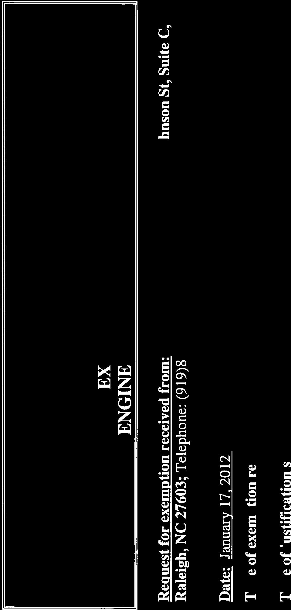
4 3 The Report included the following observations about Timberlyne Shopping Center: There is excess parking capacity at the shopping center; The center should remain a major commercial node and should redevelop over time; and Access to the center should be aligned to a realigned access at Old University Station Drive. We note the shopping center drive was recently realigned as described in the Report s recommendation. Transportation Traffic Impact: The proposed donation and re-sale building is expected to generate 277 daily trips, which is below the 500 ADT threshold for a Traffic Impact Analysis. The Town granted a TIA exemption for this project. We note that NCDOT is in the process of completing major improvements to Weaver Dairy Road which will result in a 4-lane cross-section with a median and sidewalks on both sides along the shopping center frontage. In front of the outparcel, the cross-section will be 5-lane. Access and Circulation Vehicular Access and Circulation: Access into the site s southern property line is proposed via a pair of two-way driveways from the shopping center s internal driveway network. Vehicular Parking: The Land Use Management Ordinance specifies a range of parking spaces for a retail facility. The applicant proposes 31 regular parking spaces and 2 handicap parking spaces for a total of 33 spaces. Generally 5-6% is the maximum recommended grade for surface parking. While the 6-7.1% grade proposed for the eastern portion of the lot may be ADA compliant for pedestrians, it can present difficulties (such as opening a open car door, securing/removing children from car seats), particularly for elderly customers or adults. During final plan review, we recommend adjustments to the grading plan to reduce the slope in the parking lot where it exceeds 6%. Timberlyne Shopping Center has provided a parking easement for the use of several parties, including Goodwill, just south of the Goodwill outparcel. Pedestrian Access and Improvements: Sidewalk exists along the Weaver Dairy Road frontage. The developer proposes pedestrian access along the Timberlyne entrance drive (western edge of this site) from the Weaver Dairy Road sidewalk to the southern edge of the site. From that point, a cross-walk will be striped across the shopping center internal drive to provide north-south pedestrian access to overflow parking on adjacent parking areas. A cross-walk will also be striped east-west across the shopping center drive which provides access to Weaver Dairy Road. A section of the sidewalk network would be constructed within the NCDOT right-of-way. Resolution A calls for obtaining NCDOT permission for sidewalk construction in this area.
5 4 We recommend that a standard ADA compliant curb ramp (3 wide) be provided at the curb near the southeastern corner of the building, and at the southwestern corner of the site to provide access to the north-south cross-walk. We have included our standard stipulation for submittal of a Transportation Management Plan in Resolution A. Bicycle Circulation and Parking: On the site, the developer proposes to provide 3 bicycle racks in order to meet the requirement for 4 or more bicycle parking spaces. The bicycle parking at the loading dock will be supervised, covered, and weather-protected to meet the Class I requirement. Transit: Approximately 75 feet to the east, there is a transit stop with pad, bench and shelter along the Weaver Dairy Road frontage, adjacent to the sidewalk. Landscape and Architecture Landscape Buffers: The required and proposed landscape buffers are as follows: Location Required Buffers Proposed Buffer Northern property line abutting Weaver Dairy Road right-of-way 30-foot wide Type B External Buffer 15-foot wide Type B Alternative Buffer Eastern property line 10-foot wide Type B 10-foot wide Type B Internal Buffer Internal Buffer Western Property Line 10-foot wide Type B 10-foot wide Type B Internal Buffer Internal Buffer Southern Property Line 10-foot wide Type B 10-foot wide Type B Internal Buffer Internal Buffer Along the Weaver Dairy Road frontage, a 30-foot Type B external landscape buffer is required. The developer requests a 15 foot wide alternative buffer with a retaining wall and fence. The developer cites spatial constraints of this 1-acre property, the need for parking, and a certain building size as reasons for a narrower landscape buffer. We believe the applicant has struck a balance between moving the building to the street front and providing a street side landscape buffer with canopy trees, two conflicting guidelines within the Northern Area Task Force Report. The locations for plants proposed in the alternative buffer on Weaver Dairy Road may need to be shifted in the Final Plans to avoid the stone channel proposed at the top of the retaining wall. All other proposed landscape buffers comply with Land Use Management Ordinance requirements. We have included a stipulation with detailed requirements in Resolution A. Other Landscaping: We are recommending minor adjustments to the parking lot shading plan to ensure 40% shading standard can be met at plant maturity. We also recommend amending the planting plan to eliminate a conflict between the electrical transformer at the northeast corner of the site and a proposed willow oak tree.
6 5 The developer is meeting the requirement for a 5-foot landscape strip between the building and the parking/loading areas. Environment /Stormwater Management Land Disturbance: The total area of land disturbance proposed by the applicant is 39,386 square feet or 81% of gross land area. For additional information see the Land Area /Proposed Development Table below. Impervious Surface: The site is currently cleared, and the soil is stabilized with weedy vegetation. There is no impervious surface. For additional information see the Land Area / Proposed Development Table and the Stormwater Management Section below. Land Area/Proposed Development Square Feet Acres Percentage of GLA Gross Land Area (GLA) 48, % Proposed Land Disturbance for new construction 39, % Proposed Land Disturbance in the Resource Conservation District N/A N/A N/A Proposed Land Disturbance in the Jordan Riparian Buffer N/A N/A N/A Proposed Impervious Surface 27, % We have included stipulations with detailed requirements in Resolution A. Stormwater Management Plan: Most stormwater runoff from this site will be routed to 2 bioretention ponds on the eastern edge of the site. Stormwater will also be captured in a sand filter chamber along the southern edge of the parking lot pavement. Prior to the issuance of a Zoning Compliance Permit, the applicant shall submit a Stormwater Management Plan for review and approval by the Town Manager. This project must comply with the stormwater management requirements of the Land Use Management Ordinance to provide for 85% total suspended solids removal from the increased impervious area, retention for 2-5 days of the increased volume of stormwater runoff from the 2-year, 24-hour storm, and control of the stormwater runoff rate for the 1-year, 2-year, and 25-year storms. We have included a stipulation with detailed requirements in Resolution A. Stormwater Facilities, Reservations, and Operations and Maintenance Plans: All stormwater facilities shall be within a reserved area or easement where no development would impede the facilities proper functioning. We have included a stipulation with detailed requirements in Resolution A.
7 6 Prior to building occupancy, a Stormwater Operations and Maintenance Plan, signed by the owner, shall be provided for the proposed stormwater management facilities and submitted to the Stormwater Management Engineer for approval. A schedule of inspection and maintenance tasks shall be included. We have included a stipulation with detailed requirements in Resolution A. Steep Slopes: Most of the site is in the 0-10% slope range. Currently there are no slopes of 25% or greater, though small pockets of slopes in this category will be created with this proposal along the northern property line (total of 685 s.f.). Energy Management Plan: In 2007, the Council adopted a resolution specifying the Council s expectations for energy efficiency and an energy management plan for applicants seeking approval of rezoning applications. No rezoning is proposed with this application. No Energy Management Plan is required. However, the applicant is encouraged, though not required, to create an energy management plan that addresses the items listed in the staff s suggested framework, as well as any relevant elements related to the following categories: Green Building Standard & Certification (e.g., LEED), Design for Performance (e.g., energy, water), Sustainable Energy (e.g., solar, wind, geothermal), Transportation (transit access), Urban Heat-Island Effect (e.g., green roof), Site Selection & Design (e.g., infill, xeriscaping, passive solar, solar orientation), Lighting (e.g., motion sensors, high efficiency fixtures), Building Envelope (e.g., low-e glazing, high R-value insulation), Building Materials (e.g., local, recycled, low VOC), Mechanical Equipment (e.g., highlyrated SEER unit, enthalpy wheel), Health and Safety (e.g., carbon dioxide monitors, access to natural light). Utilities and Services Utilities: Water and sewer mains exist near the site. To connect to public sewer, a private sewer lateral will be installed across nearby property. Discussions with OWASA are ongoing to provide the required water line loop system. Other utilities will be installed underground to serve this site. Resolution A calls for OWASA review and approval of final utility plans and easement plats. Prior to the issuance of a Zoning Compliance Permit, we recommend that the applicant provide final utility/lighting plans to be approved by Orange Water and Sewer Authority, Duke Energy Company, Time-Warner Cable, Public Service Company, telecom providers, and the Town Manager. The property owner will be responsible for assuring that these utilities, including cable television, are extended to serve the new building. We have included stipulations with detailed requirements in Resolution A. Fire/Emergency Access and Protection: There are two fire hydrants within 500 feet of the proposed building site. The Town and OWASA are requiring a fireflow report showing the Town s 2,500 gallons per minute standard can be met. Prior to issuance of a Zoning Compliance Permit, a fire flow report shall be submitted to the Town Manager for approval.
8 7 Refuse Collection: The loading and service area is off the northeast corner of the building. Baled cardboard will be picked up by a private recycling company. Other recyclables (paper, cans, bottles) will stored in an 18-gallon container indoors, for regular transport to Cedar Falls Convenience Center. Other solid waste will be placed in an on-site compactor serviced by a a private collector. Additional Stipulations in Resolution A (see resolution for detailed requirements) Accessibility Requirements Prior to issuance of the Certificate of Occupancy the applicant shall provide the minimum required handicapped facilities and infrastructure required Americans with Disabilities codes and standards. Engineering Construction Prior to initiation of work in the public right-of-way, the applicant Permit shall seek NCDOT permission. Final Site Design Prior to the issuance of a Zoning Compliance Permit the final design is subject to approval by the Town Manager. Vehicular Parking 33 parking spaces shall be provided on-site, with parking lot Landscape Protection, Screening and Shading Plan Canopy Trees Significant Tree Stands Building Elevation, Lighting Plans, and Alternative Buffer Plan Erosion Control Lighting Plan Utilities Fire dimensions and design meeting Town standards. We have included our standard stipulation regarding approval of a Landscape Plan, including screening of parking areas and buildings, a maintenance schedule and shading plan. The applicant has provided a landscape plan that proposes canopy tree planting to meet the Town s requirement for 40% canopy tree coverage to comply with the Town s Tree Ordinance N/A Prior to the issuance of a Zoning Compliance Permit, we recommend that detailed building elevations, lighting plans, and alternative buffer plan be approved by the Community Design Commission Prior to final authorization to begin land-disturbing activities the applicant shall be required to provide a performance guarantee in accordance with Section Bonds of the Town Code of Ordinances when one (1) acre or more is uncovered by landdisturbing activities. Prior to approval of a Zoning Compliance Permit, the applicant shall provide a copy of the approved erosion and sediment control permit from Orange County Erosion Control Division. Prior to issuance of a Zoning Compliance Permit, the applicant shall submit site plans and other required documents to satisfy the lighting requirements of Section 5.11 of the Land Use Management Ordinance, subject to approval by the Community Design Commission and the Town Manager. Prior to issuance of a Zoning Compliance Permit, the applicant shall provide documentation that all utility providers have approved the final plans and any necessary easement plats. Prior to the issuance of a Certificate of Occupancy, the applicant
9 8 Refuse Management Solid Waste Management Plan Schools Adequate Public Facilities Ordinance Construction Management Plan shall be required to obtain Fire Marshal approval for required fire safety features and infrastructure, such as fire hydrants and fire department connections, detailed fire access elements, fire protection devices, heavy-duty pavement and drive aisle design features. Prior to issuance of a Zoning Compliance Permit, design is subject to Fire Marshal approval Refuse compactor proposed on-site. Private service will be retained for refuse collection and cardboard recycling. Prior to issuance of a Zoning Compliance Permit the applicant must obtain approval of a Solid Waste Management Plan (SWMP) from Orange County Solid Waste Department N/A Prior to issuance of a Zoning Compliance Permit, a Construction Management Plan shall be approved by the Town Manager. CONCLUSION We believe the proposal, with the conditions in Resolution A, meets the requirements of the applicable sections of the Land Use Management Ordinance and the Design Manual. Resolution A would approve the application with conditions. Resolution B would deny the application. RECOMMENDATION Staff Recommendation: We recommend that the Planning Board adopt Resolution A, approving the Goodwill application with conditions. ATTACHMENTS 1. Checklist of Project Fact Sheet Requirements 2. Resolution A 3. Resolution B 4. Applicant s Combined Materials, including Developer s Statement, Project Fact Sheet, Reduced Plans, and Building Elevations. 5. Area Map
10 9 PROJECT FACT SHEET REQUIREMENTS Checklist of Regulations and Standards Goodwill at Timberlyne Site Plan Review Application Goodwill at Timberlyne STAFF EVALUATION COMPLIANCE Use Allowed Gross Land Area 1 acre Minimum Lot Width Maximum Floor Area Maximum # Dwelling Units N/A Minimum Recreation Space N/A Impervious Surface Limits Land Disturbance Minimized Land Disturbance in RCD Minimized N/A Maximum # Vehicular Parking Spaces Minimum # Bicycle Parking Spaces Minimum # Loading Spaces Minimum Street Setback Minimum Interior Setback Minimum Solar Setback Maximum Height Limit (with alternative buffer on Minimum Landscape Buffers northern side) Steep Slopes Compliance N/A Parking Lot Screening NON- COMPLIANCE Public Water and Sewer Adequate Public Schools Facilities N/A N/A = Not Applicable Prepared: July, 2012
11 RESOLUTION A (Approving the Site Plan Review Application) A RESOLUTION APPROVING AN APPLICATION FOR A SITE PLAN REVIEW FOR THE GOODWILL FACILITY AT TIMBERLYNE SHOPPING CENTER (FILE NO ) BE IT RESOLVED by the Planning Board of the Town of Chapel Hill that it finds that the Goodwill Facility proposed by the Goodwill Community Foundation, Inc. on property identified as Orange County Property Identifier Number , if developed according to the Site Plan dated January 18, 2012 (revised May 18, 2012) and the conditions listed below would comply with all required regulations and standards of the Land Use Management Ordinance and Design Manual This finding is conditioned on the following: Stipulations Specific to the Development 1. Construction Deadline: That construction begin by August 7, 2014, to be completed by August 7, Land Use Intensity: This Site Plan Review authorizes the following: Use: Collection and Resale Facility Floor Area Allowed 9,600 s.f. Vehicular Parking Spaces 33 on-site; additional off-site Bicycle Parking Spaces 4 outdoor Impervious Surface 27,525 s.f. Land Disturbance 39,386 s.f. Access 3. Off-Site Construction: Prior to any land disturbance on abutting properties, the applicant shall provide documentation of approval from the affected property owner(s). The applicant shall obtain permission from NCDOT prior to any work in the public right-of-way. 4. Accessibility Requirements: That prior to issuance of a Certificate of Occupancy, the applicant shall provide the minimum required handicapped parking spaces and design all handicapped parking spaces, ramps, and crosswalks, and associated infrastructure according to Americans With Disabilities Act standards, North Carolina Building Code, American National Standards Institute (ANSI) Code, and Town standard. Sidewalk ramps shall be provided near the southeast corner of the building and at the southwest corner of the site, subject to Town Manager approval. No sidewalk ramp shall be required on the off-site corner at the eastern terminus of the east-west crosswalk described in Stipulation #8. Transportation
12 5. Parking Lot Construction: That parking lots must be designed and constructed to Town standards for dimensions and pavement design. Prior to issuance of a Zoning Compliance Permit, the grading plan shall be revised to reduce the parking lot slope so it does not exceed 6% in grade, subject to Town Manager approval. 6. Bicycle Access and Parking: That prior to the issuance of a Zoning Compliance Permit, the applicant shall provide dimensioned details for 4 bicycle parking spaces that comply with Town parking standards. The bicycle parking design must comply with the spring 2002 Association of Pedestrian and Bicycle Professionals Guidelines, and the bicycle parking standards required by the Town Design Manual. 7. Sidewalk: The developer shall construct sidewalk along the western property line from the Weaver Dairy Road frontage to the southern property line. 8. Crosswalks: At the property s southwest corner, the developer shall stripe pedestrian crosswalks in the following locations: North-south crosswalk: across the shopping center internal drive from the Goodwill site s southern property line southward to the opposite curb, to improve pedestrian access and to provide access to the off-site vehicular parking; and East-west crosswalk: eastward across the shopping center drive which provides access to Weaver Dairy Road. 9. Transportation Management Plan: A Transportation Management Plan for the development shall be approved by the Town Manager prior to building occupancy. This plan shall be updated annually and approved by the Town Manager. The required components of the Transportation Management Plan shall include: a) A Transportation Coordinator to communicate and promote alternate modes of transportation. b) Submission of an Occupancy Survey due 90 days after building expansion occupancy. c) Submission of an updated annual Transportation Management Plan Report. d) Submission of Resident, Business and Employee Surveys during survey years. e) Measures to gradually attain the goals of the program. Landscaping and Elevations 10. Landscape Protection: That a detailed Landscape Protection Plan shall be approved prior to issuance of a Zoning Compliance Permit. The plan shall include critical root zones of all rare and specimen trees, and clearly indicate names and species. The Plan shall also include details showing tree protection fencing around construction limits, areas designated for construction parking, materials staging/storage areas, and shall include Town standard landscaping protection notes.
13 11. Tree Protection Fencing Prior to Construction: Prior to issuance of a Zoning Compliance Permit the applicant shall provide a note on the Final Plans indicating that tree protection fencing will be installed prior to land-disturbing activity on the site. 12. Landscape Planting Plan: Prior to issuance of a Zoning Compliance Permit the applicant shall provide a detailed Landscape Planting Plan with a detailed planting list and landscape maintenance plan, subject to Town Manager approval. The Plan shall include canopy trees to shade at least 40% of the parking lot, and shall show sufficient separation between the electrical transformer and the proposed trees in the northeast corner of the site. 13. Landscape Bufferyards: That the Landscape Planting Plan demonstrate compliance with the required buffers as described in the chart below: Location Northern property line abutting Weaver Dairy Road Eastern property line Western Property Line Southern Property Line Buffer Type 15-foot wide Type D Alternative Buffer 10-foot wide Type B 10-foot wide Type B 10-foot wide Type B Environment 14. Energy Management Plan: That the developer consider providing an energy management plan that addresses the items listed in the staff s suggested framework, as well as any relevant elements related to the following categories: Green Building Standard & Certification (e.g., LEED), Design for Performance (e.g., energy, water), Sustainable Energy (e.g., solar, wind, geothermal), Transportation (transit access), Urban Heat-Island Effect (e.g., green roof), Site Selection & Design (e.g., infill, xeriscaping, passive solar, solar orientation), Lighting (e.g., motion sensors, high efficiency fixtures), Building Envelope (e.g., low-e glazing, high R-value insulation), Building Materials (e.g., local, recycled, low VOC), Mechanical Equipment (e.g., highly-rated SEER unit, enthalpy wheel), Health and Safety (e.g., carbon dioxide monitors, access to natural light). Stormwater Management 15. Stormwater Management Plan: That prior to the issuance of a Zoning Compliance Permit, the applicant shall submit a Stormwater Management Plan for review and approval by the Town Manager. This project must comply with the stormwater management requirements of the Land Use Management Ordinance to provide for 85 percent total suspended solids removal from the increased impervious area, retention for 2-5 days of the increased volume of stormwater runoff from the 2-year, 24-hour storm, and control of the stormwater runoff rate for the 1-year, 2-year, and 25-year storms.
14 16. No stormwater management structures are permitted in the rights-of-way or building setbacks. This includes the outlet structure and stabilization, any underdrains, side slopes, and the downgradient toe of french drains. Further, the discharge must be in a sheet flow condition. 17. Stormwater Facilities, Easements, and Operations and Maintenance Plans: All stormwater detention, treatment and conveyance facilities located on and below the ground shall be wholly contained within an easement entitled: Reserved Stormwater Facility Easement Hereby Dedicated and shall be reserved from any development which would obstruct or constrict the effective management, control, and conveyance of stormwater from or across the property, other than the approved design and operation functions. A copy of the final plat or easement exhibit, signed and sealed by a North Carolina-registered Land Surveyor and recorded by the County Register of Deeds, and containing the following notes shall be submitted prior to issuance of the Certificate of Occupancy. All engineered stormwater management control, treatment, and conveyance structures on and below the ground shall be wholly located within an easement entitled: "Reserved Stormwater Facility Easement Hereby Dedicated" and shall be reserved from any development which would obstruct or constrict the effective management, control, and conveyance of stormwater from or across the property, other than the approved design and operation functions. A suitable maintenance access (minimum 20 wide) to accommodate heavy equipment from the nearest public right-of-way to the Reserved Stormwater Facility Easement must be provided and shown on the plans. The "Reserved Stormwater Facility Easement(s)" and the facilities it/they protect are considered to be private, with the sole responsibility of the owner to provide for all required maintenance and operations as approved by the Town Manager. The Reserved Stormwater Facility Easement and the Operations and Maintenance Plan are binding on the owner, heirs, successors, and assigns. 18. Stormwater Operations and Maintenance Plan Recordation: Prior to issuance of a Certificate of Occupancy (C/O), a Stormwater Operations and Maintenance Plan, signed by the owner and recorded at the Orange County Register of Deeds, shall be provided for the proposed stormwater management facilities and submitted to the Stormwater Management Engineer for approval. A schedule of inspection and maintenance tasks shall be included. 19. Steep Slopes: That prior to issuance of a Zoning Compliance Permit, the applicant shall include a map indicating how development and construction will comply with the steep slopes regulations in the Land Use Management Ordinance, subject to Town Manager review and approval. 20. Erosion Control Bond: If one (1) acre or more is uncovered by land-disturbing activities for this project, then a performance guarantee in accordance with Section Bonds of the Town Code of Ordinances shall be required prior to final authorization to begin landdisturbing activities. This financial guarantee is intended to cover the costs of restoration of
15 failed or failing soil erosion and sedimentation controls, and/or to remedy damages resulting from land-disturbing activities, should the responsible party or parties fail to provide prompt and effective remedies acceptable to the Town. 21. Erosion Control: The applicant shall provide a copy of the approved erosion and sediment control permit from Orange County Erosion Control Division prior to receiving a Zoning Compliance Permit. During the construction phase, additional erosion and sediment controls may be required if the proposed measures do not contain the sediment. Sediment leaving the property is a violation of the Town s Erosion and Sediment Control Ordinance. 22. Silt Control: That the applicant takes appropriate measures to prevent and remove the deposit of wet or dry silt on adjacent paved roadways. 23. Curb Inlets: The applicant shall provide pre-cast curb inlet hoods and covers stating, "Dump No Waste! Drains to Jordan Lake", in accordance with the specifications of the Town Standard Detail SD-5A, for all new curb inlets for private, Town and State rights-of-way. 24. State or Federal Approvals: That any required State or federal permits or encroachment agreements (e.g., 401 water quality certification, 404 permit) shall be approved and copies of the approved permits and agreements be submitted to the Town of Chapel Hill prior to the issuance of a Zoning Compliance Permit. 25. As-Built Plans: That prior to the issuance of a Certificate of Occupancy, the applicant shall provide certified as-built plans for building footprints, parking lots, street improvements, storm drainage systems and stormwater management structures, and all other impervious surfaces, and a tally of the constructed impervious area. The as-built plans should be in DXF binary format using State plane coordinates and NAVD P.E. Certification: That prior to the issuance of a Certificate of Occupancy for any phase, the applicant shall provide a certification, signed and sealed by a North Carolina-licensed Professional Engineer, that the stormwater management facility (ies) is (are) constructed in accordance with the approved plans and specifications. Water, Sewer, and Other Utilities 27. Utility/Lighting Plan Approval: That the final utility/lighting plan shall be approved by Orange Water and Sewer Authority, Duke Energy Company, Time Warner Cable, AT & T or GTE, and the Town Manager before issuance of a Zoning Compliance Permit. The property owner shall be responsible for assuring that these utilities can continue to serve the development. In addition, detailed construction drawings, and demonstration of adequate sewer capacity, or proposed upgrades to achieve capacity, shall be submitted to OWASA for review/approval prior to issuance of a Zoning Compliance Permit. 28. Water/Sewer Line Construction: That all public water and sewer plans be approved by OWASA and constructed according to OWASA standards. Where sewer lines are located beneath drive aisles and parking areas construction methods approved by OWASA shall be
16 employed, to ensure that sewer lines will not be damaged by heavy service vehicles. Prior to issuance of a Zoning Compliance Permit, final plans shall be approved by OWASA and the Town Manager. 29. OWASA Approval: That prior to issuance of a Zoning Compliance Permit, easement plats and documentation as required by OWASA and the Town Manager, shall be recorded. Fire Safety 30. Fire Sprinklers: Fire sprinklers shall be installed under the NCFC and Town Code prior to a Certificate of Occupancy. Prior to issuance of a Zoning Compliance Permit, the plans shall show all proposed fire department connections to such systems. 31. Hydrants Active: It will be necessary to have active fire hydrant coverage, acceptable to the Fire Department, for any areas where combustible construction materials will be stored or installed, prior to having such materials delivered to the site. All required fire hydrants must be installed, active, and accessible for the Fire Department use prior to the arrival of combustible materials on site. Fire protection systems shall be installed according to Town Ordinance, the NC Fire Code, and NFPA Fire Hydrant and FDC Locations: That the Final Plans indicate the locations of existing and proposed fire hydrants and Fire Department Connections (FDC). Fire Department Connections shall be located on the street side of the building within 100 feet of a hydrant. Hydrant spacing shall comply with the Town Design Manual. Design shall be reviewed and approved by the Town Manager prior to issuance of a Zoning Compliance Permit. 33. Firefighting Access During Construction: During demolition and/or construction, all aspects of Chapter 14 of the NC Fire Prevention shall be followed. The owner/developer shall designate one person to be the Fire Prevention Program Superintendent who shall be responsible for enforcing Chapter 14 of the NCFPC and the on-site fire prevention program and ensure that it is carried out through completion of the project. 34. Fire Flow Report: The fire protection and utility plan should include the Fire Flow Report: for a fire hydrant within 500 feet of each building, provide confirmation that the calculated gallons per minute of residual pressure is 20 pounds per square inch. The calculations shall be sealed by a licensed professional engineer in North Carolina and accompanied by a water supply flow test conducted within one year of the submittal (see Town of Chapel Hill Design Manual). 35. Fire Access: Any and all roads, driveways or dedicated fire lanes used for fire department access shall be all-weather and designed to support to carry the imposed load of fire apparatus weighing at least 75,000 lbs. Fire access roads shall have a minimum width of 20 feet with overhead clearance of 13ft. 6 in for structures not exceeding 30 feet in height and shall provide access to within 150 feet of all exterior portions of the building. Proximity to the building for aerial apparatus shall have at least one of the required access routes be located within 15 feet and a maximum of 30 feet from the building and shall be positioned parallel to one entire side of the building.
17 Fencing around projects shall include access gates with a 20 foot swing or slide motion. Any areas which will be inaccessible for firefighting or rescue operations shall be noted. Emergency access designation for apparatus shall be provided. FDC 's shall not be obstructed by landscaping or hindered by parking spaces. 36. Fire Lane Markings: Prior to building occupancy, the fire lane must be marked and signed in accordance with Town standards, with the associated plans approved by the Town Manager prior to issuance of a Zoning Compliance Permit. Solid Waste Management and Recycling 37. Solid Waste Management Plan: That prior to issuance of a Zoning Compliance Permit a detailed Solid Waste Management Plan, including a recycling plan and a plan for managing and minimizing construction debris, shall be approved by the Town Manager. The plan shall include dimensioned, scaled details of any proposed refuse/recycling collection areas, associated screening, and protective bollards, if applicable. Each bulk waste container shall be labeled as to type of material to be collected. Prior to issuance of a Zoning Compliance Permit, the developer shall provide documentation of an agreement for solid waste collection by a private provider. 38. Preconstruction Conference: Prior to any demolition or construction activity on the site the applicant will hold a pre-demolition/pre-construction conference with the County s Solid Waste staff. This may be the same meeting held with other development officials. 39. Construction Waste: By Orange County Ordinance, clean wood waste, scrap metal and corrugated cardboard, all present in construction waste, must be recycled. By Orange County Ordinance, all haulers of construction waste must be properly licensed. The developer shall provide the name of the permitted waste disposal facility to which any land clearing or demolition waste will be delivered. 40. Refuse Area Access: For the possible eventuality of Town on-site refuse pickup, the Solid Waste Plan shall show potential locations for solid waste dumpsters, and the following notes shall be included on the plans, prior to issuance of a Zoning Compliance Permit: a. any gate design will include gate retainers; b. the room for recycling carts shall not be locked on service days; c. the user will be responsible for opening gates to the refuse/recyclables area on collection days of any material(s) to be collected from this location; d. if any vehicles are parked in the refuse or recyclables collection vehicle access area, the containers will not receive service until the next scheduled collection day; e. adequate site lighting shall be provided in/around the solid waste storage shed and staging area; f. all recycling roll-carts shall remain in the storage shed on collection days and the collection truck operator will retrieve and replace the roll-carts from the room; and
18 g. solid waste containers shall be rolled out to the staging area on the designated pick-up day. 41. Cardboard Recycling: Prior to issuance of a Zoning Compliance Permit the applicant shall provide plans showing containers for corrugated cardboard recycling, addressing compliance with Town of Chapel Hill and Orange Regional Landfill cardboard recycling requirements. Alternatively, the applicant may propose an alternate method of cardboard recycling. State and Federal Approvals 42. State or Federal Approvals: That any required State or federal permits or encroachment agreements shall be approved and copies of the approved permits and agreements be submitted to the Town of Chapel Hill prior to the issuance of a Zoning Compliance Permit. Miscellaneous 43. Temporary Construction Access Agreements: Prior to issuance of a Zoning Compliance Permit the applicant shall provide construction agreements with adjacent property owners, where necessary, subject to Town Manager approval. If the abutting property is to be used a part of construction access, provide documentation of permission from the owner of said property. 44. Construction Management Plan: That a Construction Management Plan, be approved by the Town Manager prior to issuance of a Zoning Compliance Permit. The construction management plan shall: 1) indicate how construction vehicle traffic will be managed, 2) identify parking areas for on-site construction workers including plans to prohibit parking in residential neighborhoods, 3) indicate construction staging and material storage areas, 4) identify construction trailers and other associated temporary construction management structures, and 5) indicate how the project construction will comply with the Town s Noise Ordinance. 45. Traffic and Pedestrian Control Plan: That the applicant shall provide a Work Zone Traffic Control Plan for movement of motorized and non-motorized vehicles on any public street that will be disrupted during construction. The plan must include a pedestrian management plan indicating how pedestrian movements will be safely maintained. The plan must be reviewed and approved by the Town Manager prior to the issuance of a Zoning Compliance Permit. At least 5 working days prior to any proposed lane or street closure the applicant must apply to the Town Manager for a lane or street closure permit. 46. Community Design Commission Approval: That the developer obtain Community Design Commission approval of the alternative landscape buffer, building elevations and lighting, including the location and screening of all HVAC/Air Handling Units for this project, prior to issuance of a Zoning Compliance Permit. The Commission shall approve a lighting plan, sealed by a Professional Engineer, which meets lighting requirements of Section 5.11 of the Land Use Management Ordinance, taking additional care during review to ensure that the proposed lighting plan will minimize 1) upward light pollution and 2) offsite spillage of light.
19 47. Construction Sign Required: That the applicant shall post a construction sign at the development site that lists the property owner s representative and telephone number, the contractor s representative and telephone number, and a telephone number for regulatory information at the time of issuance of a Building Permit, prior to the commencement of any land disturbing activities. The construction sign may have a maximum of 32 square feet of display area and maximum height of 8 feet. ( (g) of LUMO). The sign shall be nonilluminated, and shall consist of light letters on a dark background. That prior to the issuance of a Zoning Compliance Permit a detail of the sign shall be reviewed and approved by the Town Manager. 48. Open Burning: That the open burning of trees, limbs, stumps, and construction debris associated with this development is prohibited. 49. Detailed Plans: That prior to the issuance of a Zoning Compliance Permit final detailed site plans, grading plans, utility/lighting plans, stormwater management plans (with hydrologic calculations), landscape plans, and landscape maintenance plans shall be approved by the Town Manager. Such plans shall conform to plans approved by this application and demonstrate compliance with all applicable regulations and the design standards of the Land Use Management Ordinance and the Design Manual. 50. Building Occupancy Phasing Plans: That the building shall not be occupied until all required public improvements are complete; and that a note to this effect shall be placed on the final plans and plats. If the Town Manager approves a phasing plan, occupancy shall not occur for a phase until all required public improvements for that phase are complete; and no construction for any phase shall begin until all public improvements required in previous phases are completed to a point adjacent to the new phase; and that a note to this effect shall be placed on the final plans and plats. 51. Continued Validity: That continued validity and effectiveness of this approval shall be expressly conditioned on the continued compliance with the plans and conditions listed above. 52. Non-Severability: That if any of the above conditions is held to be invalid, approval in its entirety shall be void. BE IT FURTHER RESOLVED that the Planning Board hereby approves the application for a Site Plan Review for Goodwill in accordance with the plans and conditions listed above. This the 7th day of August, 2012.
20 RESOLUTION B (Denying the Site Plan Review Application) A RESOLUTION DENYING AN APPLICATION FOR A SITE PLAN REVIEW FOR THE GOODWILL FACILITY AT TIMBERLYNE SHOPPING CENTER (FILE NO ) BE IT RESOLVED by the Planning Board of the Town of Chapel Hill that it finds that the Site Plan Review proposed BY THE Goodwill Community Foundation, Inc. on property identified as Orange County Property Identifier Number , if developed according to the Site Plan dated January 18, 2012 (revised May 18, 2012) and the conditions listed below would not: 1. Comply with all required regulations and standards of the Land Use Management Ordinance; and BE IT FURTHER RESOLVED that the Planning Board hereby denies the application for Site Plan Review for the Goodwill at Timberlyne. This the 7th day of August, 2012.
21
22
23

24


25
26
27

28
29
30
31
32
33
34
35
36
37
38
39
40
MEMORANDUM. The Arc Orange Apartments at Meadowmont, 150 West Barbee Chapel Road: Application for Special Use Permit (Case )
") MEMORANDUM TO: FROM: SUBJECT: DATE: Chapel Hill Planning Board Chapel Hill Transportation Board Chapel Hill Bicycle and Pedestrian Advisory Board Chapel Hill Community Design Commission Gene Poveromo,
MEMORANDUM TO: FROM: SUBJECT: DATE: Chapel Hill Planning Board Chapel Hill Transportation Board Chapel Hill Bicycle and Pedestrian Advisory Board Chapel Hill Community Design Commission Gene Poveromo,
MEMORANDUM. Gene Poveromo and Kay Pearlstein on behalf of the Town Review Team
 MEMORANDUM TO: FROM: Advisory Boards and Commissions Gene Poveromo and Kay Pearlstein on behalf of the Town Review Team SUBJECT: Application for Special Use Permit The Orange County ABC Retail Store, 251
ZONING COMPLIANCE PERMIT APPLICATION
 ZONING COMPLIANCE PERMIT APPLICATION 405 Martin Luther King Jr. Blvd phone (919) 968-2728 fax (919) 969-2014 www.townofchapelhill.org Parcel Identifier Number (PIN): Date: Section A: Project Information
GRACE CHURCH EXPANSION
 GRACE CHURCH EXPANSION REVIEW: NOVEMBER 24, 2014 200 SAGE ROAD, CHAPEL HILL NORTH CAROLINA PROJECT DATA OVERALL SITE MAP SITE INFORMATION OWNER PIN ACREAGE VICINITY MAP GRACE CHURCH 9890503171 271,600
UNIVERSITY PRESBYTERIAN CHURCH - RENOVATION & ADDITION 209 EAST FRANKLIN ST., CHAPEL HILL, NC 27514
 UNIVERSITY PRESBYTERIAN CHURCH - RENOVATION & ADDITION 209 EAST FRANKLIN ST., CHAPEL HILL, NC 27514 PROJECT DATA OVERALL SITE MAP HDC CONCEPT PLAN SUBMITTAL: OCT. 8, 2012 SUP SUBMITTAL: MAY 28, 2013 SUP
Net Land Area (NLA): Area within zoning lot boundaries NLA= sq. ft. a) Credited Street Area (total adjacent frontage) x ½ width of public rightof-way
: Area within zoning lot boundaries NLA= sq. ft. a) Credited Street Area (total adjacent frontage) x ½ width of public rightof-way") PROJECT FACT SHEET Section A: Project Information Application type: Date: Project Name: Use Type: (check/list all that apply) Office/Institutional Residential Mixed-Use Other: Overlay District: (check
PROJECT FACT SHEET Section A: Project Information Application type: Date: Project Name: Use Type: (check/list all that apply) Office/Institutional Residential Mixed-Use Other: Overlay District: (check
5. Would the proposed project require modifications to the existing regulations?
 TOWN OF CHAPEL HILL Planning and Sustainability Department 405 Martin Luther King Jr. Blvd. Chapel Hill, NC 27514 www.townofchapelhill.org phone (919) 968-2728 Concept Plans are intended to be an opportunity
2. Would the proposed project comply with the Land Use map? 3. Would the proposed project require a rezoning? 4. What is the proposed zoning district?
 TOWN OF CHAPEL HILL Planning and Sustainability Department 405 Martin Luther King Jr. Blvd. Chapel Hill, NC 27514 www.townofchapelhill.org phone (919) 9682728 Concept Plans are intended to be an opportunity
Net Land Area (NLA): Area within zoning lot boundaries NLA= 1,076,181 sq. ft.
: Area within zoning lot boundaries NLA= 1,076,181 sq. ft.") PROJECT FACT SHEET Section A: Project Information Application type: Project Name: Special Use Permit Date: June 29, 215 Merin Road Community Use Type: (check/list all that apply) Office/Institutional x
PROJECT FACT SHEET Section A: Project Information Application type: Project Name: Special Use Permit Date: June 29, 215 Merin Road Community Use Type: (check/list all that apply) Office/Institutional x
SITE PLAN REVIEW APPLICATION AND CHECKLIST
 SITE PLAN REVIEW APPLICATION AND CHECKLIST PROJECT SUMMARY: Project Name: City/ETA Location: City ETA (Application fee & number of copies needed are based on location) Property Location (Legal Description
CONCEPT PLAN APPLICATION
 CONCEPT PLAN APPLICATION TOWN OF CHAPEL HILL Planning Department 405 Martin Luther King Jr. Blvd phone (919) 968-2728 fa (919) 969-2014 www.townofchapelhill.org Parcel Identifier Number (PIN): 9880267455
2. Would the proposed project comply with the Land Use map? 3. Would the proposed project require a rezoning? 4. What is the proposed zoning district?
 TOWN OF CHAPEL HILL Planning and Sustainability Department 405 Martin Luther King Jr. Blvd. Chapel Hill, NC 27514 www.townofchapelhill.org phone (919) 968 2728 Concept Plans are intended to be an opportunity
SITE PLAN REVIEW ITEMS - REFERENCE CHECKLIST
 City of Seminole 9199 113 th Street N. Seminole, FL 33772 Ph: (727) 392-1966 Fx: (727) 319-6583 SITE PLAN REVIEW ITEMS - REFERENCE CHECKLIST Note: This checklist is designed to aid designers in the review
MONTGOMERY COUNTY PLANNING DEPARTMENT THE MARYLAND-NATIONAL CAPITAL PARK AND PLANNING COMMISSION
 MONTGOMERY COUNTY PLANNING DEPARTMENT THE MARYLAND-NATIONAL CAPITAL PARK AND PLANNING COMMISSION MCPB Item No. Date: 12-10-15 Leisure World Clubhouse II Addition Fitness Center, Limited Site Plan Amendment
Project phasing plan (if applicable) 12 copies of site plan
 12 copies of site plan") SITE PLAN REVIEW PERMIT APPLICATION City of Grand Haven, 11 N. Sixth Street, Grand Haven, MI 49417 Phone: (616) 847-3490 Fax: (616) 844-2051 Website: www.grandhaven.org 1. Project Information Address/location
SITE PLAN REVIEW PERMIT APPLICATION City of Grand Haven, 11 N. Sixth Street, Grand Haven, MI 49417 Phone: (616) 847-3490 Fax: (616) 844-2051 Website: www.grandhaven.org 1. Project Information Address/location
PLANNED UNIT DEVELOPMENT & SUBDIVISION STAFF REPORT Date: May 18, 2017
 & PUD-0000102-2017 PLANNED UNIT DEVELOPMENT & SUBDIVISION STAFF REPORT Date: May 18, 2017 NAME SUBDIVISION NAME Dauphin Creek Estates Subdivision Dauphin Creek Estates Subdivision LOCATION CITY COUNCIL
STAFF REPORT INTRODUCTION
 STAFF REPORT SUBJECT: DATE: Application for Master Land Use Plan Modification Southern Village Master Land Use Plan (Project No. 12-101) May 22, 2013 (Community Design Commission) May 23, 2013 (Transportation
FIRE PREVENTION OFFICE Placer Hills Fire Protection District NEW PROJECT GUIDELINES
 Established 1949 FIRE PREVENTION OFFICE Placer Hills Fire Protection District NEW PROJECT GUIDELINES The following are guidelines for new development. Any submitted plans must comply with these guidelines,
GENERAL INFORMATIONaaaaaaaaaaaaaaaaaaaaaaaaaaaaaaaa
 To: Planning and Zoning Commission From: City Staff Date: November 15, 2016 Re: Case #16026 Raymore Activity Center Site Plan GENERAL INFORMATIONaaaaaaaaaaaaaaaaaaaaaaaaaaaaaaaa Applicant/ Property Owner:
Town of Windham. Planning Department 8 School Road Windham, ME voice fax
 Town of Windham Planning Department 8 School Road Windham, ME 04062 voice 207.864-5960 fax 207.892.1916 MEMO DATE: TO: Staff Review Committee FROM: Amanda Lessard, Planner Cc: Ellen Rathbone, St. Germain
Appendix I. Checklists
 Appendix I Checklists Town of Greenwich Drainage Manual Department of Public Works - Engineering Division Town Hall - 101 Field Point Road, Greenwich, CT 06836-2540 Phone 203-622-7767 - Fax 203-622-7747
The subject site plan amendment proposes the following revisions to the approved site plan:
 PROPOSED AMENDMENT The subject site plan amendment proposes the following revisions to the approved site plan: 1. The building footprint was modified to accommodate the revised architectural design. 2.
AWH REPORT OF THE PLANNING AND DEVELOPMENT DEPARTMENT FOR APPLICATION FOR REZONING ORDINANCE TO PLANNED UNIT DEVELOPMENT
 AWH REPORT OF THE PLANNING AND DEVELOPMENT DEPARTMENT FOR APPLICATION FOR REZONING ORDINANCE TO PLANNED UNIT DEVELOPMENT MAY 8, 2014 The Planning and Development Department hereby forwards to the Planning
MONTGOMERY COUNTY PLANNING DEPARTMENT THE MARYLAND-NATIONAL CAPITAL PARK AND PLANNING COMMISSION
 MONTGOMERY COUNTY PLANNING DEPARTMENT THE MARYLAND-NATIONAL CAPITAL PARK AND PLANNING COMMISSION MCPB Item No. Date: 06-12-14 King of the Nations Christian Fellowship Church: Limited Site Plan Amendment
Application for Site Plan Review
 Application for Site Plan Review City of Pontiac Office of Land Use and Strategic Planning 47450 Woodward Ave, Pontiac, MI 48342 T: 248.758.2800 F: 248.758.2827 Property/Project Address: Sidwell Number:
Asbury Chapel Subdivision Sketch Plan
 Asbury Chapel Subdivision Sketch Plan PART 1: PROJECT SUMMARY Applicant: NVR Inc. Project Size: +/- 76.13 acres Parcel Numbers: 02101112,02116101,02116112, 02116113 Current Zoning: Transitional Residential
PLANNED UNIT DEVELOPMENT Date: April 5, 2018
 PLANNED UNIT DEVELOPMENT Date: April 5, 2018 DEVELOPMENT NAME SUBDIVISION NAME LOCATION Robert Myers Robert Myers 2955 and 2989 Dauphin Street (Southeast corner of Dauphin Street and Sage Avenue) CITY
6 August 11, 2010 Public Hearing APPLICANT AND PROPERTY OWNER: CAVALIER GOLF AND YACHT CLUB
 6 August 11, 2010 Public Hearing APPLICANT AND PROPERTY OWNER: CAVALIER GOLF AND YACHT CLUB REQUEST: Conditional Use Permit (outdoor recreational facility) STAFF PLANNER: Faith Christie ADDRESS / DESCRIPTION:
PRELIMINARY STAFF PLANNING REPORT TO THE WALWORTH COUNTY ZONING AGENCY X CONDITIONAL USE
 This report was prepared prior to the public hearing. This report may be supplemented or amended to reflect the review of additional information presented at the public hearing and written material submitted
Application Number: SD Project Name: Walton Farms Preliminary Subdivision (acting as Master Plan)
") STAFF REPORT Town of Clayton Planning Department 111 E. Second Street, Clayton, NC 27520 P.O. Box 879, Clayton, NC 27528 Phone: 919-553-5002 Fax: 919-553-1720 Planning Board May 22, 2017 Application Number:
STAFF REPORT Town of Clayton Planning Department 111 E. Second Street, Clayton, NC 27520 P.O. Box 879, Clayton, NC 27528 Phone: 919-553-5002 Fax: 919-553-1720 Planning Board May 22, 2017 Application Number:
PLANNED UNIT DEVELOPMENT APPLICATION
 PLANNED UNIT DEVELOPMENT APPLICATION CITY OF THE DALLES Community Development Department 313 Court Street The Dalles, OR 97058 (541) 296-5481, ext. 1125 Fax (541) 298-5490 www.ci.the-dalles.or.us Date
At Your Disposal CUP Amendment, Lot 20, Village Service Commercial, at 128 Bastille Dr. (PLN17-208)
") MEMORANDUM Archuleta County Development Services Planning Department 1122 HWY 84 P. O. Box 1507 Pagosa Springs, Colorado 81147 970-264-1390 Fax 970-264-3338 TO: Archuleta County Planning Commission FROM:
MEMORANDUM Archuleta County Development Services Planning Department 1122 HWY 84 P. O. Box 1507 Pagosa Springs, Colorado 81147 970-264-1390 Fax 970-264-3338 TO: Archuleta County Planning Commission FROM:
4 January 11, 2012 Public Hearing APPLICANT:
 . 4 January 11, 2012 Public Hearing APPLICANT: MID-ATLANTIC AUTO PROPERTY OWNER: DZR, LLC STAFF PLANNER: Leslie Bonilla REQUEST: Conditional Use Permit (truck rental, automobile service, and automotive/bulk
PLANNING COMMISSION. Agenda Item # 3.
 PLANNING COMMISSION Agenda Item # 3. CASE SUMMARY Conditional District Rezoning Planning Commission February 4, 2015 CD-9-215 Jeff Walton, 341-3260, jeff.walton@wilmingtonnc.gov Staff recommendation CONDITIONAL
VILLAGE OF CLEMMONS PLANNING BOARD DRAFT STAFF REPORT
 VILLAGE OF CLEMMONS PLANNING BOARD DRAFT STAFF REPORT PETITION INFORMATION Docket # C-226 Staff Megan Ledbetter Petitioner(s) JBJH Properties, LLC Owner(s) JBJH Properties, LLC Subject Property 5892-49-1766
Department of Planning & Development Planning Unit
 Department of Planning & Development Planning Unit Website: www.cityofmadison.com Madison Municipal Building 215 Martin Luther King, Jr. Boulevard P.O. Box 2985 Madison, Wisconsin 53701-2985 TDD 608 266
5.1.1 The streetscape along US Highway 64 (Brevard Road); and, The built environment within new residential developments; and,
; and, The built environment within new residential developments; and,") Article 5. Landscaping 5.1 Purpose The Town of Laurel Park s landscape standards are designed to create a beautiful, aesthetically pleasing built environment that will complement and enhance community
Article 5. Landscaping 5.1 Purpose The Town of Laurel Park s landscape standards are designed to create a beautiful, aesthetically pleasing built environment that will complement and enhance community
MONTGOMERY COUNTY PLANNING DEPARTMENT THE MARYLAND-NATIONAL CAPITAL PARK AND PLANNING COMMISSION
 MONTGOMERY COUNTY PLANNING DEPARTMENT THE MARYLAND-NATIONAL CAPITAL PARK AND PLANNING COMMISSION MCPB Item No. Date: 3.10.2016 Site Plan 820160040 Nora School Parker Smith, Planning Technician, Area 1,
D1 September 11, 2013 Public Hearing APPLICANT:
 D1 September 11, 2013 Public Hearing APPLICANT: BEACH MUNICIPAL FEDERAL CREDIT UNION PROPERTY OWNER: SISTERS II, LLC STAFF PLANNER: Karen Prochilo REQUEST: Conditional Change of Zoning (AG-2 Agriculture
PLANNING APPROVAL & PLANNED UNIT DEVELOPMENT Date: November 2, 2017
 PLANNING APPROVAL & PLANNED UNIT DEVELOPMENT Date: November 2, 2017 DEVELOPMENT NAME LOCATION Mobile Christian School 5900 Cottage Hill Road (North side of Cottage Hill Road, 230 ± West of Freemont Drive
Rezoning Petition Post-Hearing Staff Analysis July 31, 2018
 Rezoning Petition 2018-044 Post-Hearing Staff Analysis July 31, 2018 REQUEST Current Zoning: R-3 (single family residential) Proposed Zoning: UR-2(CD) (urban residential, conditional) LOCATION Approximately
F. Driveways. Driveways which provide access to off-street parking or loading from public streets shall comply with the following:
 Section 20.945.040 General Design Standards for Surface Parking Areas. A. Review Authority. Parking lot design and drainage shall be subject to review and approval of the City Transportation Manager. B.
Rezoning Transportation Analysis Petition Number: General Location Identifier:
 From: Kelsie Anderson, PE Kelsie.Anderson@charlottenc.gov 704-432-5492 Staff Reviewer: Kory Hedrick, PE, PMP Khedrick@charlottenc.gov 704-432-6511 CDOT s review of this rezoning petition is intended to
TOP TEN LIST OF COMMUNITY CONCERNS REGARDING PROPOSED AMENDMENTS TO CHAPTER 42
 TOP TEN LIST OF COMMUNITY CONCERNS REGARDING PROPOSED AMENDMENTS TO CHAPTER 42 1. Extend the urban area to Beltway 8 in stages, over say a three-year period, prioritizing development in transit and declining
CITY PLANNING COMMISSION AGENDA. ITEM NO(s): C.1 C.3 STAFF: STEVE TUCK
: C.1 C.3 STAFF: STEVE TUCK") Page 34 CITY PLANNING COMMISSION AGENDA ITEM NO(s): C.1 C.3 STAFF: STEVE TUCK FILE NOS: CPC ZC 12-00035 QUASI-JUDICIAL CPC NV 12-00036 QUASI-JUDICIAL AR DP 12-00039 QUASI-JUDICIAL PROJECT: APPLICANT: OWNER:
Page 34 CITY PLANNING COMMISSION AGENDA ITEM NO(s): C.1 C.3 STAFF: STEVE TUCK FILE NOS: CPC ZC 12-00035 QUASI-JUDICIAL CPC NV 12-00036 QUASI-JUDICIAL AR DP 12-00039 QUASI-JUDICIAL PROJECT: APPLICANT: OWNER:
PLANNED UNIT DEVELOPMENT STAFF REPORT Date: June 2, 2016
 # 9 ZON2016-01032 PLANNED UNIT DEVELOPMENT STAFF REPORT Date: June 2, 2016 DEVELOPMENT NAME JJT Properties LLC LOCATION 1147 & 1151 East I-65 Service Road South and 1180 Sledge Drive (Southeast corner
Planning & Development. Background. Subject Lands
 Planning & Development APPLICATION BRIEFING Prepared For: Planning Advisory Committee Submitted by: Jason Fox, Director of Planning & Development Date: Subject: Development Agreement Application by Brentwood
Department of Planning & Development Planning Unit
 May 20, 2005 Department of Planning & Development Planning Unit Website: www.cityofmadison.com Madison Municipal Building 215 Martin Luther King, Jr. Boulevard P.O. Box 2985 Madison, Wisconsin 53701-2985
Title 11 Streets and Sidewalks
 Chapter 11.01 - Definitions Title 11 Streets and Sidewalks Low Impact Development (LID) - A stormwater and land use management strategy that strives to mimic predisturbance hydrologic processes of infiltration,
Checklists. Project Name: Location: File Number: Date of Submittal: Reviewer: Date: Applicant: Contact Name: Phone Number:
 Applicant: Contact Name: Phone Number: Email: Project Name: Location: File Number: Date of Submittal: Reviewer: Date: Concept Plan Requirements: I. General Project Information 1. Address or parcel number
ARTICLE 6: Special and Planned Development Districts
 ARTICLE 6: Special and Planned Development Districts 6-10 Traditional Neighborhood Development (TND) District 6-10.10 Purpose and Intent The Traditional Neighborhood Development (TND) District provides
City of Mt. Juliet Planning & Zoning Department. Site Plan Checklist. Site plan cklist v1.18
 City of Mt. Juliet Planning & Zoning Department Site Plan Checklist Site Plan approval is required for all specified community facilities, all commercial, industrial, and multi-family residential activities
Chapter 4 - Preparation of Stormwater Site Plans
 Chapter 4 - Preparation of Stormwater Site Plans The Stormwater Site Plan is the comprehensive report containing all of the technical information and analysis necessary for the City to evaluate a proposed
City of Yelm. Tahoma Terra Final Master Plan Development Guidelines. Table of Contents
 City of Yelm Tahoma Terra Final Master Plan Development Guidelines Table of Contents Table of Contents... 1 Purpose... 2 Low Density Residential (R4-6)... 3 Moderate Density Residential (R6-10)... 5 Neighborhood
SITE PLAN REVIEW APPLICATION
 SITE PLAN REVIEW APPLICATION CITY OF THE DALLES Community Development Department 313 Court Street The Dalles, OR 97058 (541) 296-5481, ext. 1125 Fax (541) 298-5490 www.ci.the-dalles.or.us Date Filed File#
APPLICATION FOR REZONING PROPERTY CITY OF HOLLAND, MICHIGAN. Name of Applicant. Address, and Phone # of Applicant
 APPLICATION FOR REZONING PROPERTY CITY OF HOLLAND, MICHIGAN Name of Applicant Address, Email and Phone # of Applicant Name and Address of Owner (if other than applicant) Ownership Interest of Applicant
TOWNSHIP OF LOGAN SOIL & FILL IMPORTATION AND PLACEMENT APPLICATION SUBMITTAL CHECKLIST
 TOWNSHIP OF LOGAN SOIL & FILL IMPORTATION AND PLACEMENT APPLICATION SUBMITTAL CHECKLIST Applications: 5 copies of application - Applicant will reproduce the copies at his/her costs. The Township Clerk
Rezoning Transportation Analysis Petition Number: General Location Identifier: , ,
 From: Kelsie Anderson, PE Kelsie.Anderson@charlottenc.gov 704-432-5492 Staff Reviewer: Rick Grochoske, PE rgrochoske@charlottenc.gov 704-432-1556 CDOT s review of this rezoning petition is intended to
Prepared for: Central Coast Low Impact Development Initiative centralcoastlidi.org
 Page 1 of 37 USER GUIDE & TEMPLATE: Municipal Landscape Gap Analysis Tool for Planning & Development Review Standards and Procedures Prepared for: Central Coast Low Impact Development Initiative centralcoastlidi.org
COUNTY COUNCIL OF PRINCE GEORGE'S COUNTY, MARYLAND, SITTING AS THE DISTRICT COUNCIL ORDER AFFIRMING PLANNING BOARD DECISION, WITH AMENDED CONDITIONS
 Case No. Applicant: Dawn Limited Partnership COUNTY COUNCIL OF PRINCE GEORGE'S COUNTY, MARYLAND, SITTING AS THE DISTRICT COUNCIL ORDER AFFIRMING PLANNING BOARD DECISION, WITH AMENDED CONDITIONS IT IS HEREBY
SANTA CRUZ COUNTY REGULATORY IMPEDIMENT GAP ANALYSIS TOOL
 SANTA CRUZ COUNTY REGULATORY IMPEDIMENT GAP ANALYSIS TOOL BENCHMARK/OBJECTIVE Street Width Is the minimum pavement width allowed for streets in low density residential developments that have less than
12 January 12, 2011 Public Hearing APPLICANT: TAILWIND DEVELOPMENT GROUP,LLC PROPERTY OWNER: CITY OF VIRGINIA BEACH
 12 January 12, 2011 Public Hearing APPLICANT: TAILWIND DEVELOPMENT GROUP,LLC PROPERTY OWNER: CITY OF VIRGINIA BEACH STAFF PLANNER: Faith Christie REQUEST: Conditional Change of Zoning (from PD-H1 Planned
Rezoning Petition Pre-Hearing Staff Analysis July 16, 2018
 Rezoning Petition 2018-044 Pre-Hearing Staff Analysis July 16, 2018 REQUEST Current Zoning: R-3 (single family residential) Proposed Zoning: UR-2(CD) (urban residential, conditional) LOCATION Approximately
Commercial Site Plan Review Checklist
 Commercial Site Plan Review Checklist Updated 1/5/2015 Project Name: EPM #: _ Street: Contact: Phone: Date Submitted: _ Fax: Reviewer: Email: First Review: Second Review: _ Third Review: Reviews Required
CITY OF ZEELAND PLANNING COMMISSION
 APPLICATION FOR SITE PLAN REVIEW AND SPECIAL LAND USE Date City Official App. Filing Fee Rec'd ($350) NOTE TO APPLICANT: Please submit this application for Site Plan Review along with twenty (20) copies
ARTICLE 9: LANDSCAPING AND FENCING REQUIREMENTS
 ARTICLE 9: LANDSCAPING AND FENCING REQUIREMENTS Section 9.01 Intent The intent of the landscaping requirements are to improve the appearance of lot areas and soften paved areas and buildings; to provide
VILLAGE OF CLEMMONS PLANNING BOARD DRAFT STAFF REPORT. Single Family Residential, Townhomes
 VILLAGE OF CLEMMONS PLANNING BOARD DRAFT STAFF REPORT PETITION INFORMATION Docket # C-212 Staff Megan Ledbetter Petitioner(s) Peacehaven Development LLC Owner(s) Larry Jarvis, William Alexander and Peacehaven
6 May 14, 2014 Public Hearing
 6 May 14, 2014 Public Hearing APPLICANT: MICHAEL D. SIFEN, INC. PROPERTY OWNER: GEORGE STREET CORP. STAFF PLANNER: Stephen J. White REQUEST: Conditional Use Permit (Mini-Warehouse / Self Storage) ADDRESS
COMMERCIAL SITE PLAN SUMMARY & DEVELOPMENT GUIDE
 COMMERCIAL SITE PLAN SUMMARY & DEVELOPMENT GUIDE DEPARTMENT CONTACT: York County Development Coordinating Center (c/o Bea McCarter) 1070 Heckle Boulevard, Suite 107 Rock Hill, South Carolina 29732 Phone
REQUEST Current Zoning: O-15(CD) (office) Proposed Zoning: TOD-M(CD) (transit oriented development mixed-use, conditional)
 (office) Proposed Zoning: TOD-M(CD) (transit oriented development mixed-use, conditional)") Rezoning Petition 2016-117 Zoning Committee Recommendation January 4, 2017 REQUEST Current Zoning: O-15(CD) (office) Proposed Zoning: TOD-M(CD) (transit oriented development mixed-use, conditional) LOCATION
Rezoning Petition 2016-117 Zoning Committee Recommendation January 4, 2017 REQUEST Current Zoning: O-15(CD) (office) Proposed Zoning: TOD-M(CD) (transit oriented development mixed-use, conditional) LOCATION
STORMWATER MANAGEMENT CODES ANALYSIS RICHLAND COUNTY, SC SITE PLANNING ROUNDTABLE
 STORMWATER MANAGEMENT CODES ANALYSIS RICHLAND COUNTY, SC SITE PLANNING ROUNDTABLE Codes analyses for each subcommittee were completed to assist participants of the Richland County Site Planning Roundtable.
SUBMITTAL REQUIREMENTS
 WHEN PROCESS TYPE III IS USED References to Process Type III applications are found in several places in the Milton Municipal Code (MMC), indicating that the development, activity, or use, is permitted
CITY OF ST. AUGUSTA STEARNS COUNTY MINNESOTA ORDIANCE NO AN ORDINANCE ESTABLISHING REGULATIONS FOR STORMWATER MANAGEMENT
 CITY OF ST. AUGUSTA STEARNS COUNTY MINNESOTA ORDIANCE NO. 2017-05 AN ORDINANCE ESTABLISHING REGULATIONS FOR STORMWATER MANAGEMENT In the interest of the health, safety, and welfare of its citizens, the
THE CITY OF MOBILE, ALABAMA
 THE CITY OF MOBILE, ALABAMA LETTER OF DECISION Ark of Safety, Inc. Mobile, AL 36617 Re: (Northwest corner of Main Street and First Avenue, extending to the Southwest corner of Esau Avenue and Main Street.)
ARTICLE 17 SITE PLAN REVIEW
 ARTICLE 17 SITE PLAN REVIEW 17.01 INTENT AND PURPOSE The intent of this section is to provide for consultation and cooperation between the applicant and the township planning commission so that the applicant
REZONING APPLICATION MPD SUPPLEMENT
 REZONING APPLICATION MPD SUPPLEMENT For Staff Use Only: DATE/TIMESTAMP: ZA# RECEIVED BY: The intent of the Master Planned District (MPD) designation is to allow flexibility in the design and construction
Urban Planning and Land Use
 Urban Planning and Land Use 701 North 7 th Street, Room 423 Phone: (913) 573-5750 Kansas City, Kansas 66101 Fax: (913) 573-5796 Email: planninginfo@wycokck.org www.wycokck.org/planning To: From: City Planning
FORMER CANADIAN FORCES BASE (CFB) ROCKCLIFFE SECONDARY PLAN. Official Plan Amendment XX to the Official Plan for the City of Ottawa
 ROCKCLIFFE SECONDARY PLAN. Official Plan Amendment XX to the Official Plan for the City of Ottawa") FORMER CANADIAN FORCES BASE (CFB) ROCKCLIFFE SECONDARY PLAN Official Plan Amendment XX to the Official Plan for the City of Ottawa 1 INDEX THE STATEMENT OF COMPONENTS PART A THE PREAMBLE PAGE Purpose...
FORMER CANADIAN FORCES BASE (CFB) ROCKCLIFFE SECONDARY PLAN Official Plan Amendment XX to the Official Plan for the City of Ottawa 1 INDEX THE STATEMENT OF COMPONENTS PART A THE PREAMBLE PAGE Purpose...
DESIGN CRITERIA PACKAGE
 RFQ: 17-C-00003 DESIGN-BUILD SERVICES FOR THE DESIGN CRITERIA PACKAGE PREPARED BY: JAMES E. JACKSON, JR. AIA CITY ARCHITECT CONTRACT ADMINISTRATION DEPARTMENT and INTERFLOW ENGINEERING, L.L.C DESIGN CRITERIA
R E S O L U T I O N. 2. Development Data Summary:
 R E S O L U T I O N WHEREAS, the Prince George s County Planning Board has reviewed Departure from Design Standards DDS-631 requesting a departure to allow the loading space and the driveway to the loading
Major Subdivision Sketch Plan Checklist
 This checklist provides specific requirements that are apart of the Sketch process. The entire process is described by the Huntersville Subdivision Review Process which details all the submittal and resubmittal
STAFF SUMMARY FOR S17-02 SPECIAL USE PERMIT APPLICATION
 APPLICATION SUMMARY Case Number: S17-02 Request: STAFF SUMMARY FOR S17-02 SPECIAL USE PERMIT APPLICATION SUP application in order to develop a convenience food store. Applicant: Property Owner(s): Cindee
Request Conditional Rezoning (R-10 Residential & I-1 Light Industrial to Conditional I-1 Light Industrial) Staff Recommendation Approval
 Staff Recommendation Approval") Applicant & Property Owner Public Hearing January 9, 2019 City Council Election District Beach Agenda Item 1 Request Conditional Rezoning (R-10 Residential & I-1 Light Industrial to Conditional I-1 Light
Applicant & Property Owner Public Hearing January 9, 2019 City Council Election District Beach Agenda Item 1 Request Conditional Rezoning (R-10 Residential & I-1 Light Industrial to Conditional I-1 Light
Chapel Hill LUMO Topic Revisions
 Chapel Hill LUMO Topic Revisions Sec. 5.9. Parking and Loading... 022 5.9.9. Parking Landscaping cumulatively, landscaping is required for both the existing parking lot and the new parking area. A. General
F. The following uses in the HR District: attached single-family dwellings, condominiums, and institutional uses; and
 1102 DESIGN REVIEW 1102.01 PURPOSE AND APPLICABILITY Section 1102 is adopted to provide standards, criteria, and procedures under which design review may be approved. Design review is required for: A.
TAMARAC FIRE RESCUE DEPARTMENT FIRE PREVENTION BUREAU 6000 North Hiatus Road Tamarac, Florida Telephone: (954) , Fax: (954)
 , Fax: (954)") TAMARAC FIRE RESCUE DEPARTMENT FIRE PREVENTION BUREAU 6000 North Hiatus Road Tamarac, Florida 33321 Telephone: (954) 597-3800, Fax: (954) 597-3810 SITE PLAN REVIEW CHECKLIST A goal of the Tamarac Fire
TAMARAC FIRE RESCUE DEPARTMENT FIRE PREVENTION BUREAU 6000 North Hiatus Road Tamarac, Florida 33321 Telephone: (954) 597-3800, Fax: (954) 597-3810 SITE PLAN REVIEW CHECKLIST A goal of the Tamarac Fire
PLANNED UNIT DEVELOPMENT & SUBDIVISION STAFF REPORT Date: March 15, 2012
 PLANNED UNIT DEVELOPMENT & SUBDIVISION STAFF REPORT Date: March 15, 2012 DEVELOPMENT NAME SUBDIVISION NAME LOCATION OSR Subdivision OSR Subdivision 5559 Old Shell Road (South side of Old Shell Road, 570
Request Conditional Use Permit (Car Wash Facility) Staff Recommendation Approval. Staff Planner Jonathan Sanders
 Staff Recommendation Approval. Staff Planner Jonathan Sanders") Applicant Property Owner SunTrust Bank Public Hearing October 10, 2018 City Council Election District Princess Anne Agenda Item 2 Request Conditional Use Permit (Car Wash Facility) Staff Recommendation
Applicant Property Owner SunTrust Bank Public Hearing October 10, 2018 City Council Election District Princess Anne Agenda Item 2 Request Conditional Use Permit (Car Wash Facility) Staff Recommendation
MONTGOMERY COUNTY PLANNING DEPARTMENT THE MARYLAND-NATIONAL CAPITAL PARK AND PLANNING COMMISSION
 MONTGOMERY COUNTY PLANNING DEPARTMENT THE MARYLAND-NATIONAL CAPITAL PARK AND PLANNING COMMISSION The Goddard School in North Bethesda Preliminary Plan Amendment 11996015B and Site Plan Amendment 82006005A
14 October 10, 2012 Public Hearing APPLICANT: MPB, INC
 14 October 10, 2012 Public Hearing APPLICANT: MPB, INC PROPERTY OWNER: MUNDEN & ASSOCIATES, LP STAFF PLANNER: Karen Prochilo REQUEST: Conditional Change of Zoning (AG-1 & AG-2 to Conditional O-2) ADDRESS
McDonald s Restaurant - Purcellville Town of Purcellville Special Use Permit Statement of Justification July 24, 2014
 Introduction / Written Statement McDonald s Restaurant - Purcellville McDonald s Corporation is proposing to redevelop the existing McDonald s eating establishment with a drive-through located at 121 N
APPLICATION FORM SITE PLAN REVIEW REGULATIONS TOWN OF CONWAY, NH
 February 25, 2010 INSTRUCTIONS APPLICATION FORM SITE PLAN REVIEW REGULATIONS TOWN OF CONWAY, NH Please complete each section of this application from and submit it with all required application material
COMMUNITY DESIGN. GOAL: Create livable and attractive communities. Intent
 COMMUNITY DESIGN Intent An attractive, well-designed County will attract quality development, instill civic pride, improve the visual character of the community, and create a strong, positive image for
R E S O L U T I O N. Single-Family Residence/ Church. 2,488 sq. ft. 2,488 sq. ft. Area Parking Required: Church
 R E S O L U T I O N WHEREAS, the Prince George s County Planning Board is charged with the approval of Detailed Site Plans pursuant to Part 3, Division 9 of the Zoning Ordinance of the Prince George s
The West Vaughan Employment Area Secondary Plan Policies
 Part 2: The West Vaughan Employment Area Secondary Plan Policies 2.1 General Policies It is the policy of Council: 2.1.1. That the West Vaughan Employment Area (the WVEA), identified on Schedule 1, will
10 October 14, 2015 Public Hearing
 10 October 14, 2015 Public Hearing APPLICANT: PROPERTY OWNER: VIRGINIA BEACH BEACON BAPTIST CHURCH STAFF PLANNER: Stephen J. White REQUESTS: A. Change of Zoning (R-20 Residential District to Conditional
Thanksgiving Point Office Site Plan Approval Planning Commission Report
 Lehi City Planning Commission Staff Report Meeting Date: March 24, 2016 Thanksgiving Point Office Site Plan Approval Planning Commission Report Applicant: Sean Onyon VCBO Architecture Requested Action/Purpose:
SUBDIVISION PLANNED UNIT DEVELOPMENT & REZONING STAFF REPORT Date: May 5, 2016
 SUBDIVISION PLANNED UNIT DEVELOPMENT & REZONING STAFF REPORT Date: May 5, 2016 DEVELOPMENT NAME LOCATION LOCATION Midtown Mobile Subdivision IRC-Mobile Midtown, LLC 100 North Florida Street & 2518, 2524,
APPENDIX G: TOWN ORDINANCE REVIEW
 APPENDIX G: TOWN ORDINANCE REVIEW TYLin (225740) Woodard & Curran SWMP January 2013 Stormwater LID strategies, ranked for Zoning Bylaw and Site Plan Review Standards Dimensional Requirements Permit the
CHAPTER 22 Rural Open Space Community Developments
 CHAPTER 22 Rural Open Space Community Developments Section 22.1 Description and Purpose The intent of this Chapter is to offer property owners an alternative to traditional zoning requirements for rural