Waterway Corridors. Guidelines for greenfield development areas within the Port Phillip and Westernport Region
|
|
|
- Barbara Rogers
- 6 years ago
- Views:
Transcription

1 Waterway Corridors Guidelines for greenfield development areas within the Port Phillip and Westernport Region
2

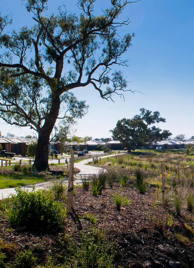
3 Contents 1 Introduction 2 2 Purpose of the guidelines 3 3 What is a waterway corridor? 3 4 Scope of the guidelines 4 5 Objectives for waterway corridors in greenfield development areas 5 6 Principles underlying the guidelines 6 7 Waterway corridors for existing waterways Minimum standard setback widths How do setbacks vary with position in the catchment? Setback sub-zones Determining waterway corridor width and extent in existing waterways 15 8 Waterway corridors for constructed waterways Constructed waterway corridor widths Determining waterway corridor width in constructed waterways 17 9 Incorporating site specific values and urban design elements into waterway corridors Site specific values Ownership and ongoing maintenance of the waterway corridor Waterway Corridor Guideline review process 21 Front Cover: Lower Werribee River; an example of the waterway values present on many of the waterways within the urban growth boundary that these guidelines will help to protect.

4 1 Introduction Melbourne Water is the caretaker of river health for the 8,400 kilometres of waterway in the Port Phillip and Westernport region. As part of its role, Melbourne Water has a duty of care to establish and maintain riparian zones along all our waterways to improve waterway health. The waterways of the Port Phillip and Westernport region are major environmental and social assets, which are highly valued by the community and hold particularly high levels of cultural heritage significance. Waterways are important reserves of biodiversity and provide valuable habitat and corridors for native fish, birds, amphibians and mammals such as platypus, and provide, in many cases, a setting for recreational activities. In combination, these attributes (and others) are referred to as river health. There has been significant improvement in river health in the Port Phillip and Westernport region over recent decades, and some waterways in the region are in excellent condition (in terms of river health). However, nearly half are in poor or very poor condition, and more than 200 kilometres of waterways need to be carefully managed as urban development spreads into currently undeveloped areas. Urban development represents both a great challenge and a great opportunity for river health. The preservation, rehabilitation and restoration of appropriate riparian zones 1 in urban developments is essential if the river health objectives as defined in the Healthy Waterways Strategy 2 are to be met. The size and condition of the riparian zone is important for channel bed and bank stability, water quality, and aquatic and riparian biodiversity, which are all cornerstones of a healthy waterway and catchment system. 1 The area immediately adjacent to the waterway is referred to as the riparian zone ; the waterway (bed and banks) and riparian zones on both banks are collectively defined as the waterway corridor. 2 Melbourne Water 2012, Healthy Waterways Strategy (draft). 2 / Melbourne Water / October 2013
5 2 Purpose of the guidelines These guidelines have been developed to provide a consistent, strategic approach to the management of riparian zones in greenfield developments. They define minimum standards for waterway corridor widths, vegetation quality, infrastructure and activities permitted within waterway corridors. As caretaker of waterway health in the Port Phillip and Westernport region, Melbourne Water has an obligation to ensure that appropriate provisions are made to ensure waterway resilience and function in the face of environmental pressures such as urban development. These guidelines will facilitate a consistent and strategic approach for government authorities, local government and developers to create environmentally and socially sustainable waterway corridors in new developments. These guidelines do not remove the need for detailed environmental assessment of waterways and their surrounding environs prior to development occurring. 3 What is a waterway corridor? A waterway corridor is defined (for the purposes of these guidelines) as the waterway channel and its associated riparian zones. Assigning a waterway corridor preserves areas of the riparian zone that protect or enhance native vegetation, river health and biodiversity in some cases, the waterway corridor may also be able to support a level of passive recreational use or some stormwater treatment elements. The waterway corridor is the area of land that is required to help ensure a resilient waterway system both ecologically and socially that can effectively absorb and/or recover from damaging processes without losing core functionality. In greenfield development sites waterway corridors are created through the modification of title boundaries during the subdivision process to preserve the waterway corridor for specified purposes. Melbourne Water is a statutory referral agency in this process and provides comment on planning permit applications as referred by the Responsible Authority and has the power under the Water Act 1989 to require reserves and/ or easements for the purpose of drainage and waterway management. Ultimately, the waterway corridor may be considered non-developable for either, or both, of these management requirements. The width of waterway corridor required to meet the objectives of the corridors varies depending on the type of waterway (physical morphology, vegetation type, geologic setting etc). You can find more detailed information in Sections 5 and 6. These corridors establish the optimum balance between river health, biodiversity, social amenity, asset protection and developable land requirements. The minimum waterway corridor widths specified in these guidelines are based on the best available science, are compatible with current legislation and comparable to waterway corridor management in other jurisdictions. The approach to calculating the waterway corridor width at a particular location depends on whether the waterway is an existing waterway or an artificial waterway that will be constructed as part of urban development, as well as considering any site specific factors such as environmental values, recreation uses or landscape characteristics. In existing waterways the waterway corridor is defined by setbacks from the waterway that specify the minimum distance from the waterway on each side of the channel to urban development features such as roads and subdivisional lots. For new or existing constructed channels the standard waterway corridor is defined as the sum of the width of the waterway channel and the setbacks on both banks, as described in Section 7. In constructed waterways, an alternative approach is used to define waterway corridor widths, as there is no pre-existing waterway channel from which to define setbacks. Waterway corridor widths in constructed waterways are scaled according to the hydraulic width of the constructed waterway. The hydraulic width concept (as described in detail in Section 8) is a well understood variable in constructed waterway design across the development industry. For both constructed and existing waterways there are a number of other factors (described in Section 6) that may require urban development to be located further from the waterway than specified by the minimum waterway corridor width (e.g. flood protection or the presence of highly sensitive flora and fauna). In addition to the width of waterway corridors, these guidelines also specify controlled activities and infrastructure within the waterway corridors, and riparian zone management requirements. These requirements are described for existing waterways (Section 7) and constructed waterways (Section 8). Waterway Corridors / 3

 Infill development, i.")
6 4 Scope of the guidelines The guidelines apply only to greenfield development areas, which are defined as areas identified for urban development (residential, commercial or industrial) by state and/or local government, located on or beyond the boundaries of existing urban development. Melbourne Water prepares Development Services Schemes or strategies for greenfield development areas that determine the surface water management infrastructure requirements within each catchment. The guidelines do not apply to: Redevelopment zones, i.e. sites that are being redeveloped from some previous development use (e.g. development of a factory into a housing estate) Infill development, i.e. sites that may not have been previously developed but are surrounded by existing development. Rural waterways in forested and agricultural catchments that are not subject to urban development. Wetland systems, both natural and man made. Protection and management of these systems require considerations in addition to those covered in these guidelines, especially when they are managed for biodiversity purposes. These guidelines focus on regional drainage assets, which can be perennial (always flowing) and ephemeral (flowing sometimes) rivers and/or creeks with catchments greater than 60 hectares. They also provide recommendations for local waterways/drainage lines that are commonly managed by organisations other than Melbourne Water. Please see section 7.2 for more information regarding smaller, local drainage assets. The guidelines apply to all subdivisions of two lots or more. Note: these guidelines do apply to parcels of land that may be surrounded by development within existing Development Services Schemes. 4 / Melbourne Water / October 2013
7 5 Objectives for waterway corridors in greenfield development areas The objectives for waterway corridors in greenfield development areas of the Port Phillip and Westernport are: To protect, enhance or restore river health and biodiversity To enable some complementary use of waterways for recreational purposes and infrastructure (if appropriate) while maintaining primary river health, flood protection and biodiversity functions To provide effective flood protection. Waterway corridors and associated riparian vegetation provide a range of river health functions, including: Provision of food and habitat for aquatic fauna Provision of breeding, feeding and habitat for terrestrial fauna Provision of corridors for fauna movement up and down the waterway Provision of fauna refugia in developed landscapes and enhancing links between remaining habitats that would otherwise remain fragmented Stabilisation of channel banks against erosion Shading and maintenance of natural temperatures within waterways Reducing sediments and pollutants that reach waterways through overland flow Maintenance and improved water quality through filtering and nutrient cycling within the riparian zone and vegetated buffer zone Allowance for inclusion of some stormwater treatment systems within vegetation buffer zones if appropriate Allow space for natural migration of the waterway channel, especially in areas with highly erosive soil types Recruiting large woody debris into the stream and for riparian habitat over the long term. Riparian zones differ from terrestrial lands in several ways: they often have more fertile soils, higher moisture levels and different plant species. Due to these factors, riparian zones provide the habitat features needed by a diverse range of wildlife species. Riparian zones may also provide space for recreation and social activities. They provide an interface between urban development and waterways and visual amenity. Although Melbourne Water is the caretaker of waterways and has a primary objective of protecting and enhancing the health of waterways, we recognise the benefits of healthy, accessible riparian zones to communities and the importance of engaging the community with waterways and river health. This document is intended to provide clarity for the creation of waterway corridors that will balance the needs of the environment and the community in urban developments. Waterways are also an extremely important component of the landscape in terms of indigenous cultural heritage as reflected in the Aboriginal Heritage Act 2006 and Regulations These list the land within 200m of a named waterway as being culturally significant. By protecting and enhancing riparian areas, we can assist in preserving and in some cases, enhancing, cultural heritage values. The objectives for waterway corridors were used to identify optimum waterway corridor widths, riparian vegetation zones, and permitted activities and infrastructure. Waterway Corridors / 5

8 6 Principles underlying the guidelines The development of the guidelines is underpinned by a number of principles: The minimum waterway corridor widths and riparian vegetation zoning required to meet the river health / biodiversity and social objectives described above are based on the best available science and riparian management practice in Australia and worldwide The minimum waterway corridor widths also take into account the scale of vegetation required to provide robust and self-sustaining riparian vegetation communities over the long-term. Narrow waterway corridors require high levels of maintenance and plant replacement to prevent weed invasion, and do not provide the minimum spacing requirements for riparian trees (which are generally required components of healthy riparian vegetation communities in urban developments) The minimum required waterway corridor width varies dependant on stream order, which increases with distance downstream of headwater streams. Smaller waterways in the headwaters of catchments will have smaller riparian zone widths and large waterways in the downstream area of a catchment will have wider riparian zones. This ensures that waterway corridors are at an appropriate spatial scale for the size of the waterway in any given location Waterways do not need to have permanent or flowing water to be considered waterways under the Water Act Therefore ephemeral waterways are also considered waterways for the purpose of these guidelines Two distinct riparian sub-zones are identified within the waterway corridor: a core riparian zone (CRZ) of high quality native vegetation immediately adjacent to the waterway to provide the greatest biodiversity benefit; and, a robust vegetated buffer (VB) between the core riparian zone and the edge of the waterway corridor to protect the high value vegetation in the core riparian zone from edge effects While Melbourne Water is supportive of community interaction and use of waterway corridors, infrastructure and recreational activities will be limited in the high value core riparian zone to protect river health and biodiversity values. There is more flexibility in locating public open space assets (such as shared pathways) in the vegetated buffer. It should be noted that a development s Public Open Space contribution is a council requirement and is determined/ approved separately to Melbourne Water s waterway corridor requirements. 6 / Melbourne Water / October 2013


9 The waterway corridor widths or setback widths in these guidelines are minimum widths, which may be increased to reflect site specific factors, as described below: Where high value species and/ or communities are present, especially those listed as key values in the Healthy Waterways Strategy, Waterway Corridor width may be increased to protect or enhance habitat for these species. High value species may be but are not limited to those listed under the Environment Protection and Biodiversity Conservation Act or Flora and Fauna Guarantee Act Where the site forms an important part of an existing, or potential high value habitat corridor Where a fuel break is required by relevant authorities to mitigate fire risk Where a site has been determined by Melbourne Water to contain significant local or regional waterway values Where a waterway reach requires greater levels of protection to ensure significant upstream or downstream values are protected Where the site contains high value geomorphic features or assemblages that may be negatively affected by adopting inadequate setbacks e.g. escarpments or chain of ponds If there is risk of significant channel migration in the future (presence of highly erodible soils) Where biodiversity conservation or stormwater quality assets are required within the waterway corridor Where substantial recreation based assets are proposed to be placed within the waterway corridor Natural wetlands that fall within a waterway corridor may have requirements beyond those listed in these guidelines. Likewise, waterway corridors may need to be expanded to include wetlands associated with the system or modified to provide an adequate connectivity between the wetland and the waterway corridor Where cultural heritage sites of significance have been identified. In situations where the standard waterway corridor width as specified in these guidelines is less than the width of the post development 1 in 100 year ARI flood 3 extent, the waterway corridor will be extended to include the entire 100 year ARI flood extent i.e. the 100 year ARI line becomes the waterway corridor boundary. Under these circumstances, the corridor width required in excess of the minimum setback width will be treated as vegetated buffer. It should be noted that in rare instances, the required waterway setback may be narrower than standard (minimum) width. Narrower setbacks will only be considered if it can be conclusively demonstrated that the objectives of waterway corridors (as outlined in these guidelines) will still be met. 3 Average Recurrence Interval is the expected time period between flood events of a given size. A 100 year ARI flood can also be thought of as a flood with a 1% chance of occurring in any year. Waterway Corridors / 7

10 Porero ilignis adi que nonseris sum, ut as veliam que con eumquiae quosant expe maio vitam, que quiatur? Qui dunto mi, sam, simet omnis ent quid quam rest restrum dolore sus velecatem. 8 / Melbourne Water / October 2013
11 7 Waterway corridors for existing waterways Existing waterways are typically well-defined channels, which may flow permanently or only during the wetter months of the year. They will generally require only localised modification such as bank re-profiling, strengthening and/or revegetation as part of urban development. The condition of existing waterways in greenfield development areas is variable, but they are important environmental and social assets. The approach to defining waterway corridor widths and riparian zones in existing waterways is based on the application of setback widths, as described in the following sections. 7.1 Minimum standard setback widths Three standard setback widths apply to existing waterways in the Port Phillip and Westernport region: 20 m, 30 m and 50 m. These setback widths have been defined following a comprehensive review of waterway management science in Australia and worldwide. They provide a balance between achieving river health and biodiversity objectives, providing for recreation and visual amenity and maximising developable land. The setback widths apply to both banks and are measured from a setback reference point as shown in Figure 1 (below). The reference point is generally the Top of Bank (break of slope from the river bank to surrounding land) of the waterway. In some cases top of bank may not be easily defined, and an alternative reference point such as a hydraulic measurement may be required instead. Melbourne Water will provide further direction on how to determine and locate the reference point at specific sites as required. Please contact Melbourne Water on to request this information. Figure 1. Schematic illustration of setback from waterway Reference point Reference point Setback CROSS-SECTION VIEW Setback PLAN VIEW Waterway Corridors / 9


12 7.2 How do setbacks vary with position in the catchment? The setback that applies to a waterway at a particular location depends on the position of the site in the stream channel network. The underlying principle is that smaller waterways require a smaller setback to meet waterway health objectives, larger streams require a larger setback and major waterways require the largest setback. The Strahler stream ordering system 4 is used to define a particular location in the stream channel network. The Strahler stream order is a simple method of defining stream size based on a hierarchy of tributaries. A small stream with no tributaries is defined as a first order stream. When two first order streams come together, they form a second order stream. When two second order streams come together, they form a third order stream. Streams of lower order joining a higher order stream do not change the order of the higher stream, so if a first order stream joins a second order stream, it remains a second order stream. The Strahler stream order concept is illustrated schematically in Figure 2. 4 Strahler, AN, 1953 Hypsometric (area altitude) analysis of erosional topology. Geological Society of America Bulletin, 63(11), / Melbourne Water / October 2013

13 Figure 2. Strahler stream order network The stream order is used to define the setback that applies to a development site in a particular location in the Port Phillip and Westernport stream channel network. The three categories of setback width are assigned to stream orders as follows: 1. First and second order streams have a minimum 20 m setback on both banks 2. Third order streams have a minimum 30 m setback on both banks 3. Fourth order and greater streams have a minimum 50 m setback on both banks. Once the setback width at a site has been determined from the stream order of the waterway at that site, the application and integration of the setbacks into the urban design process can be finalised, as described in the sections below. Please note: for the purpose of these guidelines the calculation of the stream order begins at the 60 hectare catchment size i.e. if a waterway/ stream of 60 hectare catchment size has one or more drainage lines flowing into it, its stream order is still classified as one. Streams less than 60ha catchment size Generally, local government has a lead role in management of waterways with catchments less than 60 hectares; however, Melbourne Water recognises the important role these smaller streams play in regulating the health of the broader waterway system and the implicit values they hold in their own right. For example, minor waterways: are key habitat for vast numbers of flora and fauna species have an important role in regulating flows can be major sources of sediment and nutrient inputs if not appropriately managed. The responsibility for managing these small, local waterways has traditionally fallen to local government. Under the Water Act 1989, Melbourne Water has the power to intervene with management of any waterway within the Port Phillip and Westernport region, regardless of its catchment size, provided that it fits the description of a waterway provided in the Act. In instances where a small local waterway (<60ha catchment size) is identified as important to the health of the waterway as a whole, or where the potential exists for degrading processes acting upon it to spread throughout the system, Melbourne Water may take a direct management role. The required setback/corridor width for such waterways will be determined on a case by case basis depending on specific values/threats. While Melbourne Water does not take direct management responsibility for streams with catchments less than 60ha, we strongly recommend they are retained in a natural state and encourage Councils to provide setbacks that will ensure the values listed above are protected. A recent report by the National Water Commission (The Importance of Headwater Streams 5 ) emphasises the difficulty in determining appropriate widths for these small streams, but does note that hydrology and nutrient/ sediment/pollutant input may be equally or more important than buffer widths in maintaining their condition. A 10-20m buffer width for each bank is cited as a recommended minimum in several studies listed in this document. 5 L.Barmuta, A.Watson, A.Clarke and A.Clapcott 2009 The Importance of Headwater Streams Waterlines Report Series No 25. Waterway Corridors / 11
14 7.3 Setback sub-zones As described earlier, there are two sub-zones within each of the setback widths. The sub-zones have different roles in meeting the overall setback objectives and different activities and infrastructure requirements. The two sub-zones are: the core riparian zone (CRZ) the vegetated buffer (VB). The relationship between these sub-zones is shown in Figure 3 The core riparian zone is fully vegetated with native vegetation selected in accordance with the vegetation component of the Healthy Waterways Visions 6. Depending on various factors such as geographic location, stream form and current condition, the required vegetation type may vary from Waterway corridor Setback Setback Vegetated buffer Core riparian zone CROSS-SECTION VIEW Core riparian zone Vegetated buffer Reference Point Reference Point PLAN VIEW Figure 3. Schematic illustrations of setback sub-zones in cross-section (top) and plan view (bottom). Core riparian zone is shown as CRZ and vegetated buffer as VB. Stream channel CRZ VB Road Stream channel CRZ VB Road 6 The Healthy Waterways Visions communicate Melbourne Water s longer term aims for the form and function of waterways in the Port Phillip and Westernport region. The visions provide one consistent Melbourne Water view of what the form and function of waterways could be in 20-years and articulate the levels of service that we need to apply to get there. 12 / Melbourne Water / October 2013

15 primarily trees and shrubs through to predominately native grass cover. The core riparian zone provides the main river health and biodiversity functions of the riparian setback. It is the area immediately adjacent to the waterway, and the vegetation in this zone provides the shading, nutrient and wood inputs to the stream required for healthy instream ecosystem function. The vegetated buffer protects the core riparian zone from edge effects that will impact on vegetation and fauna in the core riparian zone. These edge effects include: weed invasion from adjacent areas light penetration micro-climate changes litter/pollution trampling A 10 m wide vegetated buffer running immediately adjacent and parallel to the core riparian zone is required to protect the core riparian zone for all three standard widths. Therefore, although the width of the core riparian zone varies according to stream order, the width of the adjacent vegetated buffer remains constant at 10m (Table 1). The vegetated buffer vegetation type will vary from site to site, but will need to be designed in such a way that the integrity of the core riparian zone is protected. In many cases this will require this zone having similar vegetation to the core riparian zone. Melbourne Water will provide guidance on a site specific basis regarding the type of vegetation required. Table 1. Core riparian zone and vegetated buffer widths for different overall setback widths in existing channels Overall setback width (m) Core riparian zone width (m) 20 m 10 m 10 m 30 m 20 m 10 m 50 m 40 m 10 m Vegetated buffer width (m) In order to maintain the river health and biodiversity value of the riparian buffers in the waterway corridors it is necessary to limit the extent to which the vegetated buffer is impacted by services and infrastructure. As described above, riparian buffers provide a corridor through which fauna can travel across the landscape and habitat for fauna that do not migrate, hence optimisation of vegetation quality within this zone will greatly improve the ecological effectiveness of the waterway corridor. Every effort should be made to locate underground services such as power, water and sewerage outside the core riparian zone to maintain the integrity of waterway function. Similarly, sports ovals, playgrounds, and maintenance tracks should also be located outside the core riparian zone, as they may create a barrier to faunal movement, despite being vegetated. Wherever possible, shared pathways should also be located outside the core riparian zone and should meet the standards defined in Shared Path Guidelines 7 (available on the Melbourne Water website). While Melbourne Water has a strong preference for the assets and features listed above to be wholly located outside of the core riparian zone, partial placement of assets within this zone will be considered in situations where it is absolutely necessary or where a clear benefit to the community and/or environmental health can be demonstrated. In some instances, stormwater treatment systems such as constructed wetlands and bio-retention systems may be located within the core riparian zone subject to Melbourne Water approval but should form a relatively small proportion of the area of the core riparian zone so as not to degrade its ecological function or put the asset at undue risk from flooding and/or stream migration. Fire breaks may be required adjacent to areas of vegetation. The Core Riparian Zone and Vegetated Buffer Zone will usually consist of dense vegetation, and should not be included in any fire break. Fire breaks must meet the requirements of relevant public authorities, and will generally require space in addition to the waterway corridor. In some instances roads that are located adjacent to a waterway corridor may suffice as a fire break. Determining fire break requirements is a shared responsibility between all associated land owners and managers, therefore Melbourne Water recommends developers engage with these agencies early in waterway corridor design process, to determine what requirements will need to be met (both fire break and building design as outlined in AS ). 7 Melbourne Water, 2009, Shared Path Guidelines. Waterway Corridors / 13

16 7.4 Determining waterway corridor width and extent in existing waterways Three steps are required to determine the standard waterway corridor width at any given site: 1. determine the Strahler Order of the waterway and the associated standard setback 2. identify reference point lines for both sides of the waterway setbacks are measured from these lines. 3. Consider site specific values and land uses that may require the setbacks in excess of the minimum (see section 6 and section 9.1). Strahler orders Strahler orders have been determined and mapped for all designated waterways with catchment areas equal to or greater than 60Ha in the Port Phillip and Westernport. Developers should contact Melbourne Water at an early stage in the development process to ascertain the Strahler order and associated standard setback width for the site in question. Where necessary the developer may need to consult with other agencies such as the Department of Environment and Primary Industries, Parks Victoria and/or the relevant council to determine any further requirements associated with the waterway corridor zone (biodiversity protection, open space requirements, stormwater treatment etc). 14 / Melbourne Water / October 2013

17 8 Waterway corridors for constructed waterways Greenfield urban development often requires the construction of artificial waterways to effectively drain stormwater from urban areas. In recent years the approach to designing constructed waterways has moved from being solely or primarily concerned with efficient drainage to a more holistic approach that balances drainage requirements with the need to provide an environmental and social asset for new communities. Melbourne Water has a responsibility to establish and maintain healthy riparian zones along all its waterways, whether existing or constructed. There is therefore a need to provide waterway corridors for constructed waterways as well as existing natural waterways. However, to set the corridor width, an alternative approach is required because there are significant differences between existing and constructed waterways, the most important for the purpose of these guidelines being, that there is no natural top of bank point in a constructed waterway to use as a setback reference point The approach to defining constructed waterway corridor widths is founded on the principles outlined in Section 6, and based on the concept of hydraulic width, which is defined as the width of the water surface at the 1 in 100 year ARI flow level in the channel. 8.1 Constructed waterway corridor widths Constructed waterways are completely artificial waterways that have been created where either a small existing waterway/ drainage line has required expansion or there was no existing waterway/drainage line prior to development. Construction of a waterway may be required to: enhance channel capacity, provide flood conveyance/ protection and provide drainage outfall with a stable channel and an aesthetically pleasing landscape with some degree of habitat and ecological function. The waterway corridor width for constructed waterways is defined as a factor of the hydraulic width of the main channel of the waterway. Hydraulic width is defined as the width of the water surface in metres at the 1 in 100 year ARI post development flow level in the channel. By scaling the waterway corridor width to the hydraulic width, the resulting waterway corridor widths will be sized according to position in the catchment, which is consistent with the underlying principle that smaller waterways which carry smaller flows require a smaller setback to meet the objectives for setbacks, whilst larger streams carry more flow and will require a larger setback and major waterways require the largest setback in order to meet both hydraulic and ecological objectives. Constructed waterway corridor widths are also classified into the CRZ and VB subzones. The sub-zones have different roles in meeting the overall setback objectives and different activities and infrastructure requirements, as described for existing waterways in Section 7.3. Waterway Corridors / 15
 by a sliding scale, as shown")
18 8.2 Determining waterway corridor width in constructed waterways Table 2. Sliding scale for calculating constructed waterway corridor widths Constructed waterway corridor width is related to the hydraulic width (1 in 100 year ARI flood extent) by a sliding scale, as shown in Table 2. Criteria Hydraulic width 5m to 30m Hydraulic width 35m to 45m Hydraulic width > 50m Resulting Corridor Width Range 30m-55m 45m-60m 55m-70m The waterway corridor widths and sub-zone widths for a range of hydraulic widths in constructed waterways are shown in Table 3 and 4. When reading these tables, it should be noted that the Core Riparian Zone and Vegetated Buffer widths are total widths and are not applied as setbacks from the edge of the hydraulic width as is the case with natural channels. The Hydraulic Width falls within and forms a part of, the Core Riparian Zone as shown in Figure 4. Melbourne Water will require maintenance access to both sides of all waterways. This may be provided in two ways: by providing an active edge i.e. a road, that allows access for maintenance vehicles along the length of the waterway through the provision of maintenance tracks suitable for vehicular traffic where the waterway does not have an active edge. Our preference is for the provision of active edges, as this has the duel benefit of encouraging positive interaction with the waterway as well as providing continuous maintenance access. Where detailed information on road or other potential interfaces to the waterway is not available, Table 4 should be used as a starting point. Corridor width requirements can be refined as more detail is available.. Table 3. Sliding scale for calculating constructed waterway corridor widths assumes active edges (roads) that allow vehicle access along entire corridor length, on both sides of the corridor. Hydraulic width (m) CRZ width (m) VB width (m) Corridor width (m) Table 4. Sliding scale for calculating constructed waterway corridor widths addition of shared trail/maintenance track either side of channel (within vegetated buffer) Hydraulic width (m) CRZ width (m) VB width (m) Corridor width (m) / Melbourne Water / October 2013

19 While active edges need to allow vehicle access along the entire reach of the waterway, this does not mean a road needs to extend the whole length of the waterway. If sections of waterway cannot have active edges but still allow vehicular access to the waterway, the widths in Table 3 can be used as a guide for corridor width. This will ensure continuity of the riparian zone; while also providing a suitable buffer should channel erosion occur in the future. Likewise, the entire waterway corridor may meander if deemed functionally appropriate during the design phase. The pilot channel (conveys regular flows and is typically 3 month ARI capacity) of a constructed waterway may move across the waterway corridor width along its length, but the design should ensure that the channel does not come within 10m of the edge of the corridor. Active edge Vegetated buffer Core riparian zone Hydraulic width Core riparian zone Vegetated buffer Waterway corridor Figure 4. Example of setback subzones for constructed waterways Waterway Corridors / 17

20 18 / Melbourne Water / October 2013

21 9 Incorporating site specific values and urban design elements into waterway corridors 9.1 Site specific values As described in the Section 6, the waterways corridor widths presented in these guidelines are the standard widths to be adopted within greenfield urban developments. Following the definition of the minimum standard waterway corridors for a site (as described in the previous sections) specific investigations should be undertaken to identify factors that may lead to the variation in the waterway corridor widths, i.e. where the setback may need to be greater or narrower to locally account for site values and/or constraints. To recap from Section 6, these factors may include (but not be limited to): High value species and/or communities may require increased setbacks to protect habitat for these species Where the site forms an important part of an existing, or potential high value habitat corridor Where the site contains high value geomorphic features or assemblages that may be negatively affected by setting inadequate waterway corridor widths (e.g. backwaters, rocky outcrops or escarpments) Where a site has been determined by Melbourne Water to contain significant local or regional waterway values Where built assets require protection from potential future channel migration (especially important in areas with highly erodible soils) Where a waterway reach requires greater levels of protection to ensure significant upstream or downstream values are protected If the 100 year flood extent exceeds the standard waterway corridor width defined in these guidelines then the setback will be defined by the flood extent. Where other land uses such as recreation or fire buffers also lead to requirements for land near a waterway, other relevant planning mechanisms will be used to provide for those purposes as required. All expected land uses within and adjacent to the waterway corridor should be considered together as early as possible in the planning process to enable an integrated and efficient corridor plan. Depending on the shape of the line joining the setback reference points, the overall corridor width may not fit well with the intended subdivisional layout of the development site. It may be possible to adjust the setback line creating a variable setback width, or in some cases to fit better with the design of the development, provided built assets/infrastructure are not put at risk and there is no net loss in the total waterway corridor width and waterway functionality. It will always be Melbourne Water s preference for the corridor width to remain constant, avoiding narrow sections that barriers to fauna movement or negatively affect waterway function i.e. reduction of setbacks on one bank will be compensated with an equal increase in setback on the opposite bank. Allowing for these types of variations is intended to provide flexibility when fitting the subdivisional layout around the waterway corridor. The final configuration of the waterway corridor in a greenfield site (i.e. the width of the overall setback, core riparian zone and vegetated buffer) must be agreed with Melbourne Water during the planning phase for the development. Net Gain In some instances, vegetation Net Gain offsets may be allowed to be established on land within greenfield development areas that is to be transferred to Melbourne Water; this includes waterway corridors. Please contact the Melbourne Water on if you wish to explore options for placement of Net Gain offsets within waterway corridors. Waterway Corridors / 19
22 9.2 Ownership and ongoing maintenance of the waterway corridor Once a waterway corridor has been incorporated into the development plan, attention turns to the design and construction of civil and landscaping works that may be required and then to the ongoing maintenance responsibilities for the waterway, the riparian zones and any adjacent open space and associated infrastructure. Waterway corridors are nearly always vested as Reserves in favour of either the local Council or Melbourne Water (the party in whom the land is vested becomes the land owner). Typically, because of the multiple uses of the waterway corridor, the Reserve is vested in favour of Council with a Memorandum of Common Provisions easement created over the Reserve area in favour of Melbourne Water. That way, both parties interests are accounted for. Accompanying the creation of the Reserve and any easements is a Maintenance Agreement which details the areas and actions that Council and Melbourne Water are responsible for maintaining. Other options such as singular authority ownership with easements/maintenance agreements in the name of other concerned authorities may also be appropriate; so might involvement of private parties such as Owners Corporations (e.g. Golf Courses). Lastly, service/utility providers may also require an easement in their favour to be created within the waterway corridor Reserve for assets such as power lines, gas mains, water mains, sewerage pipelines, and telephone/internet cables etc. The following principles should be applied when developing arrangements for ownership and ongoing maintenance of various components of the waterway corridor: Ownership of the waterway corridor Where there are public use benefits, it is Melbourne Water preference that Council, or DEPI take ownership of the Reserve. Where the Reserve is to be managed for the singular purpose of waterway management, Melbourne Water will normally take ownership of the Reserve. Where the Reserve is in Council/DEPI ownership, Melbourne Water will require a Memorandum of Common Provisions easement in our favour to be created on the Plan of Subdivision to enable access to undertake the range of maintenance activities included in the Schedule to the Maintenance Agreement. Where there are private interests immediately adjacent to the waterway and it is not possible to create a Reserve for the waterway corridor for example, the waterway runs through a golf course, Melbourne Water will require a Memorandum of Common Provisions easement to be created over the waterway on the Plan of Subdivision. Maintenance of the waterway corridor Melbourne Water assumes responsibility for maintaining vegetation within the channel bed to the edge of ephemeral plantings on the banks, i.e. the regularly wetted areas usually associated with the lower banks and ongoing maintenance of the physical integrity of the bed and banks In the absence of public use benefits, Melbourne Water will take responsibility of maintaining vegetation on the bed, banks, core riparian zone and vegetated buffer if this land is to be managed purely for waterway health purposes. Council or DEPI/Parks Victoria will assume ongoing maintenance responsibility for any part of the waterway corridor where there is an intended recreational use. In most instances this will be part of, or the entire, vegetated buffer, but may include sections of the core riparian zone where recreational assets such as pedestrian bridges cross through this area. Such areas will be clearly marked on the plan that accompanies the schedule of maintenance activities each party is responsible for. Where Melbourne Water is responsible for maintaining the waterway corridor, we will do so to Melbourne Water standards; if a higher standard is required then the authority requiring the higher standard will be responsible for any additional works required. Involvement of third parties Involvement of a party other than, or in addition to, Council on freehold land where Melbourne Water has a waterway management interest, will require the creation of a Section 173 Agreement. The Section 173 Agreement is a legally binding agreement that ensures that the requirements of the accompanying Maintenance Agreement, and Schedule/ Plan of activities that each party is responsible for are maintained in perpetuity. The s173 Agreement is tied to the land upon which the waterway corridor has been created. In the case of multiple parties sharing management interests for land vested in the crown, a management agreement of some form (options would need to be explored as to the most appropriate for the particular situation) will need to be entered into to ensure effective delineation of maintenance responsibility. While Melbourne Water will work with key stakeholders to determine ongoing ownership and maintenance responsibilities as early in the planning process as possible (e.g. Precinct Structure Plans/Conservation Management Plans), it is expected that the ownership and maintenance responsibilities of many waterway corridor Reserves will need to be decided on a case by case basis later in the planning process as information required to assess against the guiding principles listed above become available. 20 / Melbourne Water / October 2013


23 10 Waterway Corridor Guideline review process Recognising the complex and continuously evolving nature of waterway science and town planning theory, Melbourne Water will undertake regular reviews of these guidelines with the intention of providing the very best service to all key customers and stakeholders. Melbourne Water will conduct an initial review of these guidelines 12 months from the initial launch date, and then conduct subsequent reviews every 24 months. Melbourne Water welcomes feedback on the guidelines and their implementation success at all times and will endeavour to involve all key stakeholders and customers in the review process. Feedback can be provided via telephone ( ) or via online submission. Waterway Corridors / 21
24 Melbourne Water 990 La Trobe Street Docklands VIC 3008 PO Box 4342 Melbourne Victoria 3001 Telephone melbournewater.com.au ISBN (print) ISBN (web) Copyright 2013 Version 1, October 2013 Melbourne Water Corporation. All rights reserved.
Wetland Design Manual. A1: Vision, core outcomes and aspirational outcomes
 Wetland Design Manual A1: Vision, core outcomes and aspirational outcomes Table of contents Introduction 5 Vision 6 Core outcomes 7 Effective pollutant removal and flow management... 7 Community safety...
Implementing sustainable water strategy through development industry engagement
 Implementing sustainable water strategy through development industry engagement Ian Director, Organica Engineering, Melbourne, Australia E-mail: iadams@organicaeng.com.au Edward Cotter Sustainability Leader,
7. Biodiversity & Conservation Areas
 7. & Conservation Areas 7.1. Objectives The objectives of biodiversity and conservation areas are founded on the need to recognise the importance of biodiversity and acknowledge the need to protect, restore
POLICY SRT/D4 STORMWATER MANAGEMENT
 POLICY SRT/D4 STORMWATER MANAGEMENT BACKGROUND Increasing population, decreasing rainfall and increasing community expectations regarding environmental issues have led to increasing recognition of the
When planning stormwater management facilities, the following principles shall be applied where possible.
 2.0 Principles When planning stormwater management facilities, the following principles shall be applied where possible. 2.0.1 Drainage is a regional phenomenon that does not respect the boundaries between
Policy DM19: Development and Nature Conservation
 Avonmouth Wetland Habitat Project October 2010 and December 2011 (the Cresswell study). Policy Links Bristol Local Plan Core Strategy Lead Policy BCS4: Avonmouth and Bristol Port BCS9: Green Infrastructure
I602. Birdwood Precinct
 I602. Birdwood Precinct I602.1. Precinct description The Birdwood Precinct applies to an area west of Don Buck Road and south of Red Hills Road in west Auckland. It incorporates subdivision and development
BRE Strategic Ecological Framework LI Technical Information Note 03/2016
 BRE Strategic Ecological Framework Technical Information Note 03/2016 September 2016 Contents 1. Introduction 2. Aims of BRE s Strategic Ecological Framework 3. How SEF is different from previous approaches
Appendix A. Planning Processes. Introduction
 1 Planning Processes Introduction This appendix outlines a number of planning processes which are used in the Auckland Region to support the effective management of development in the region s rural and
Northern Territory Compact Urban Growth Policy
 Northern Territory Compact Urban Growth Policy A Reference Policy Document to clause 2.7 (Reference to Policy) of the NT Planning Scheme May 2015 Table of Contents 1 Policy Setting... 3 1.1 Context for
AMENDMENT NO. 30 TO THE OFFICIAL PLAN OF THE TOWN OF MILTON
 AMENDMENT NO. 30 TO THE OFFICIAL PLAN OF THE TOWN OF MILTON Subject: Boyne Survey Secondary Plan and Related Official Plan Amendments The following text and schedules constitute Amendment No. 30 to the
UNIVERSITY TOWN NEIGHBOURHOODS 5.2 ECO-CORRIDOR MELBOURNE CAMPUS MASTER PLAN 2014
 5.2 ECO-CORRIDOR 37 ECO-CORRIDOR EXISTING CONDITIONS & VISION NEIGHBOURHOOD VISION Investment in the Eco-corridor Neighbourhood will signify the University s commitment to supporting local ecology and
SECTION 5: REACH RECOMMENDATIONS/MAPS
 SECTION 5: REACH RECOMMENDATIONS/MAPS This section describes areas of concern and provides specific recommendations for each project reach. Locations of stormwater drains were from GIS coverage supplied
Section 3b: Objectives and Policies Rural Environment Updated 19 November 2010
 Page 1 of Section 3b 3b RURAL ENVIRONMENT 3b.1 Introduction The Rural Environment comprises all the land outside of the Residential, Town Centre and Industrial Environments. Most land within the District
Site Assessment Technical Document Appendix A: Glossary
 Central Bedfordshire Council www.centralbedfordshire.gov.uk Site Assessment Technical Document Appendix A: Glossary July 2017 1.1.11-1 - ii Appendix A: Glossary Term Agricultural Land Classification AONB
SCHEDULE THREE TO THE DEVELOPMENT PLAN OVERLAY EASTERN GOLF COURSE KEY REDEVELOPMENT SITE
 DD/MM/YY SCHEDULE THREE TO THE DEVELOPMENT PLAN OVERLAY Shown on the planning scheme map as DPO3 EASTERN GOLF COURSE KEY REDEVELOPMENT SITE 1.0 A permit may be granted before a development plan has been
I611. Swanson North Precinct
 I611. Swanson North Precinct I611.1. Precinct Description Swanson North is located in the north eastern foothills of the Waitakere Ranges. It is outside the Waitakere Ranges Heritage Area Act and the Waitakere
City of Hume Planning Scheme Amendment C207. Statement of Expert Evidence Provided to Planning Panels Victoria
 14 August 2017 Revision: 1 Reference: 1702 City of Hume Planning Scheme Amendment C207 Statement of Expert Evidence Provided to Planning Panels Victoria Stormwater Management Evidence for 35 Buckland Way
Urban Stormwater: Best Practice Environmental Management Guidelines. CSIRO This electronic edition published by CSIRO PUBLISHING, 2006.
 Urban Stormwater: Best Practice Environmental Management Guidelines. Chapter 5 Water Sensitive Urban Design Key references Department of Planning, 1993, Better Drainage: Guidelines for the Multiple Use
A Joined-up Regional Landscape: A Roadmap to connect the parts
 Breaking the Barriers: Engineering Solutions to Ecological Problems A Joined-up Regional Landscape: A Roadmap to connect the parts Associate Professor Darryl Low Choy Urban Research Program Outline Nature
Stormwater in a Liveable City Towards an Evidence Based Policy Framework. Associate Professor Phillip Johnstone
 Stormwater in a Liveable City Towards an Evidence Based Policy Framework Associate Professor Phillip Johnstone Stormwater in a Liveable City Define the stormwater system Stormwater impacts and their mitigation
3-2 Environmental Systems
 3-2 Environmental Systems 3.0 ENVIRONMENTAL SYSTEMS CONTENTS 3.1 GREENWAY SYSTEM 3.1.1 General Policies 3.1.2 Natural Heritage Network 3.1.3 Natural Heritage Network Enhancement Lands 3.1.4 Rouge Watershed
TERRESTRIAL NATURAL HERITAGE SYSTEM STRATEGY APPENDIX F: MODEL POLICIES FOR THE IMPLEMENTATION OF THE TARGET TERRESTRIAL NATURAL HERITAGE SYSTEM
 TERRESTRIAL NATURAL HERITAGE SYSTEM STRATEGY APPENDIX F: MODEL POLICIES FOR THE IMPLEMENTATION OF THE TARGET TERRESTRIAL NATURAL HERITAGE SYSTEM C H A P T E R 1 M O D E L P O L I C I E S F O R I M P L
Strategic Environmental Assessment Screening Report. Dublin Port Masterplan Review 2017
 Strategic Environmental Assessment Screening Report Dublin Port Masterplan Review 2017 Table of Contents 1 Introduction... 1 2 Purpose of the Masterplan... 2 3 Task 1.1 Pre-Screening Check... 5 4 Task
Appendix 1 Structure plan guidelines
 Appendix 1 Structure plan guidelines This appendix forms part of the regional policy statement [rps]. 1.1. Introduction Structure plans are an important method for establishing the pattern of land use
Section 6A 6A Purpose of the Natural Features and Landscapes Provisions
 Section 6A 6A Purpose of the Natural Features and Landscapes Provisions This Chapter addresses the protection and management of natural features and landscapes within the City. The City has a number of
APPENDIX F: EXTERNAL APPROVALS
 1.0 RESPONSIBILITIES When the City is constructing the Park or Open Space Development lands (OPTION I), after the subdivision construction process is completed by the Developer, Open Space Development
A Growing Community Rural Settlement Areas
 Town of Huntsville Official Plan Review - POLICY BACKGROUND PAPER A Growing Community Rural Settlement Areas BACKGROUND: In addition to the fully municipally-serviced Urban Settlement Area and the Hidden
Water Sensitive Urban Design Site Development Guidelines and Practice Notes. Appendix
 Water Sensitive Urban Design Site Development Guidelines and Practice Notes Appendix 108 Appendix A Water sensitive developments involve simple design and management practices that take natural site features
The WAPC publications summarised in this report are (in order of policy importance):
:") Summary of WAPC Publications Relevant to Local Biodiversity Planning As part of the delivery of the land use planning component of the Western Australian Natural Resource Management (NRM) program in 2011/12,
Summary of WAPC Publications Relevant to Local Biodiversity Planning As part of the delivery of the land use planning component of the Western Australian Natural Resource Management (NRM) program in 2011/12,
10.0 Open Space and Public Realm
 10.0 Open Space and Public Realm 10.0 Open Space and Public Realm The Public Open Space System is comprised of: outdoor spaces available for public use that are either publicly owned (e.g., parks and
Cotswolds AONB Landscape Strategy and Guidelines. June 2016
 Cotswolds AONB Landscape Strategy and Guidelines June 2016 Cotswolds AONB Landscape Strategy and Guidelines Introduction The evolution of the landscape of the Cotswolds AONB is a result of the interaction
EVALUATION OF MASTER PLAN ALTERNATIVES
 7 The Environmental Report is required to identify, describe and evaluate reasonable alternatives, taking into account the objectives and geographical scope of the Master Plan 2008. Three plan alternatives
Chapter 3: Natural Environment. Proposed Waikato District Plan Stage 1. (Notified version)
") Chapter 3: Natural Environment Proposed Waikato District Plan Stage 1 Page 2 of 7 Contents Chapter 3: Natural Environment... 3 3.1 Indigenous Vegetation and Habitats... 3 3.1.1 Objective Biodiversity and
Chapter 3: Natural Environment Proposed Waikato District Plan Stage 1 Page 2 of 7 Contents Chapter 3: Natural Environment... 3 3.1 Indigenous Vegetation and Habitats... 3 3.1.1 Objective Biodiversity and
An Ambitious Plan: Transforming the blighted South Platte River and surrounding environment into Denver s greatest natural resource.
 CONNECTING THE PEOPLE TO THEIR RIVER SOUTH PLATTE RIVER VISION IMPLEMENTATION PROGRAM: GRANT-FRONTIER PARK TO OVERLAND POND PARK REACH The South Platte River Vision Implementation Program (River Vision)
STREAM BUFFERS
 88-415 STREAM BUFFERS 88-415-01 PURPOSE In the Kansas City region and throughout the nation, vegetated stream buffers have been clearly shown to protect stream stability and related infrastructure, improve
Toronto Complete Streets Guidelines
 Toronto Complete Streets Guidelines 108 110 7.1 Green Infrastructure Design Principles 112 7.2 Context-Sensitive Green Streets 114 7.3 Key Green Street Elements Green infrastructure refers to natural and
Leduc Industrial Outline Plan SE W4
 Leduc Industrial Outline Plan SE 1-50-25-W4 Within the North Leduc Industrial ASP Prepared for: Leduc Energy Park Ltd. Prepared by: Stantec Consulting Ltd. File No. 1161 104655 V5 Table of Contents 1.0
Implementing Water Sensitive Urban Design: Opportunities, Challenges and Limitations. The Case of Victoria
 Implementing Water Sensitive Urban Design: Opportunities, Challenges and Limitations The Case of Victoria Esther Kay* 1 and Dr Karen Hussey 2 *Presenting Author The Office of Living Victoria and Melbourne
Part 12 Precinct Area Plans - Wyee West
 TABLE OF CONTENTS 1 INTRODUCTION... 1 1.1 BACKGROUND... 1 1.2 EXTENT OF AREA PLAN... 1 1.3 EXISTING CHARACTER... 2 1.4 ENVIRONMENTAL ATTRIBUTES AND CONSTRAINTS... 2 1.5 DESIRED FUTURE CHARACTER... 3 1.6
Design Considerations for Open Channel and Detention Pond Design. Howard Redfearn, City of Mansfield
 Design Considerations for Open Channel and Detention Pond Design Howard Redfearn, City of Mansfield Previous Experience/Criteria/Maintenance Issues New Criteria Discussion Overview Where is Mansfield?
SCHEDULE 10 TO THE URBAN GROWTH ZONE. Shown on the planning scheme map as UGZ10. Truganina Precinct Structure Plan. 1.0 The Plan
 SCHEDULE 10 TO THE URBAN GROWTH ZONE Shown on the planning scheme map as UGZ10 Truganina Precinct Structure Plan 1.0 The Plan Map 1 shows the future urban structure proposed in the Truganina Precinct Structure
GREENBANK DEVELOPMENT MASTERPLAN
 DEVELOPMENT MASTERPLAN POTENTIAL TRAIN STATION COMMUNITY CENTRE Greenbank will be a connected masterplanned community providing easy access to local and surrounding amenity. Affordable quality homes, green
Chapter 131 GENERAL REFERENCES
 Chapter 131 STREAM CORRIDOR PROTECTION ZONE 131-1. Objectives. 131-2. Definitions. 131-3. Establishment of the Stream Corridor Protection Zone. 131-4. Uses permitted. 131-5. Uses expressly prohibited.
QUEENSTOWN LAKES DISTRICT COUNCIL SUBDIVISION DESIGN GUIDELINES
 Attachment C: Draft QLDC Subdivision Design Guidelines QUEENSTOWN LAKES DISTRICT COUNCIL DESIGN GUIDELINES A DESIGN GUIDE FOR AND DEVELOPMENT IN THE URBAN ZONES QUEENSTOWN OFFICE 10 Gorge Road Queenstown
6Natural. Environment Development Permit Guidelines
 6Natural Bylaw 2600-2016, being "Official Community Plan Bylaw, 2016" Schedule "A" CITY OF ABBOTSFORD OFFICIAL COMMUNITY PLAN Environment Development Permit Guidelines Part V - 6-1 Area Subdivision or
Tāhuhu whakaruruhau ā-taone The sheltering ridge pole
 B2. Tāhuhu whakaruruhau ā-taone - Urban growth and form B2.1. Issues Tāhuhu whakaruruhau ā-taone The sheltering ridge pole Auckland s growing population increases demand for housing, employment, business,
Re: Amendment C234 Cardinia Planning Scheme Pakenham East Precinct Submission by Earldean Pty Ltd and Auscare Commercial Pty Ltd
 23 February 2018 Victorian Planning Authority amendments@vpa.vic.gov.au Dear Sir / Madam Re: Amendment C234 Cardinia Planning Scheme Pakenham East Precinct Submission by Earldean Pty Ltd and Auscare Commercial
Stormwater Standards. Clackamas County Service District No. 1. Planting Guide for Buffers
 Stormwater Standards Clackamas County Service District No. 1 APPENDIX B Planting Guide for Buffers Table of Contents Appendix B - Planting Guide for Buffers... Page B.1 General... 1 B.1.1 Introduction...
North Oakville East Parks Facilities Distribution Plan. November, 2009
 North Oakville East November, 2009 POLICY CONTEXT 1) Purpose a) The purpose of this document is to be a guide for the location, configuration, design and development of the parks system for the North Oakville
B4. Te tiaki taonga tuku iho - Natural heritage
 B4. Te tiaki taonga tuku iho - Natural heritage Tuia I runga, tuia i raro, tuia ki te waonui a Tiriwa Bind the life forces of heaven and earth to the great realm of Tiriwa B4.1. Issues Auckland s distinctive
Working Group Meeting
 April 4,, 2017 Parks Operations Bldg Working Group Meeting Arts Districts Overview Stormwater/RPA/Stream Considerations First Principles Agenda 7:00pm 7:05pm 7:10pm 7:40pm 8:30pm 9:40pm 9:45pm Welcome
INCREMENTAL CHANGE AREA REVIEW March 2015 Page 1
 INCREMENTAL CHANGE AREA REVIEW March 2015 Page 1 Table of Contents Introduction... 3 Background to Review... 3 Comparison of the Schedules to the General Residential Zone... 7 Methodology... 7 Policy Context...
Central Lake Ontario Conservation Conservation Lands Master Plan
 Conservation Lands Master Plan Top 13 Frequently Asked Questions 1. What are conservation lands? Where are these conservation lands located in the Central Lake Ontario Conservation watershed? Conservation
PHASE ONE. A summary report: What the community told Alcoa during Phase One of the community engagement program for Point Henry 575.
 PHASE ONE A summary report: What the community told Alcoa during Phase One of the community engagement program for Point Henry 575. DECEMBER 2015 FEBRUARY 2016 INTRODUCTION In 2014 Alcoa closed its Point
RECREATION AND OPEN SPACE ELEMENT GOALS, OBJECTIVES, AND POLICIES
 RECREATION AND OPEN SPACE ELEMENT GOALS, OBJECTIVES, AND POLICIES Goal 7 To provide park facilities, recreation programs, and open space resources that are safe, adequate, and accessible to all City residents,
Stream Restoration: Working with Nature?
 Stream Restoration: Working with Nature? Greg Jennings, PhD, PE jenningsenv@gmail.com Ecosystem Restoration activities that initiate or accelerate the recovery of ecosystem health, integrity, and sustainability
Stream Restoration: Working with Nature? Greg Jennings, PhD, PE
 Stream Restoration: Working with Nature? Greg Jennings, PhD, PE jenningsenv@gmail.com Ecosystem Restoration activities that initiate or accelerate the recovery of ecosystem health, integrity, and sustainability
C176. Amendment C176 Riverdale Precinct Structure Plan List of Document Changes for Planning Panels Victoria. Version th November 2013
 C176 Amendment C176 Riverdale Precinct Structure Plan List of Document Changes for Planning Panels Victoria Version 1.0 18 th November 2013 Amendment C176 Riverdale Precinct Structure Plan List of Document
VCA Guidance Note. Contents
 Contents 1. Introduction... 2 2. Who can register a VCA?... 2 3. VCAs and sustainable development... 3 4. Verifying conservation performance... 4 4.1 Transparent, voluntary commitments... 4 4.2 Independent
E16: MAINTENANCE OF LANDSCAPED AREAS
 HIGH SPEED TWO INFORMATION PAPER E16: MAINTENANCE OF LANDSCAPED AREAS This paper outlines the proposed approach to the maintenance of landscaped areas created for HS2 Phase One. It will be of particular
Rule D Wetland and Creek Buffers
 Rule D Wetland and Creek Buffers 1 Policy It is the policy of the Board of Managers to ensure the preservation of the natural resources, recreational, habitat, water treatment and water storage functions
Checklists. Project Name: Location: File Number: Date of Submittal: Reviewer: Date: Applicant: Contact Name: Phone Number:
 Applicant: Contact Name: Phone Number: Email: Project Name: Location: File Number: Date of Submittal: Reviewer: Date: Concept Plan Requirements: I. General Project Information 1. Address or parcel number
3. STATEMENTS OF DESIRED CHARACTER FOR PLANNING AREAS AND PRECINCTS
 3.30 Planning Area No. 30 Mary River Valley 3.30.1 Location and Role This Planning Area encompasses rural lands in the western part of the Shire. These lands are located within the catchment area of the
APPENDIX I Presentations
 APPENDIX I Presentations Workshop Summary Report 11 Peel Region Official Plan Review May 5, 2010 Compatible Active Recreation Workshop July 29, 2010 Components of PROPR Sustainability Planning Tools/Updates
ADDENDUM TO BIOLOGICAL SCOPING SURVEY REPORT, BOTANICAL SURVEY AND WETLAND DELINEATION
 ADDENDUM TO BIOLOGICAL SCOPING SURVEY REPORT, BOTANICAL SURVEY AND WETLAND DELINEATION FOR AVALON INN (APN 069-241-27 & -04) 1201 & 1211 NORTH MAIN STREET FORT BRAGG, CA MENDOCINO COUNTY prepared for:
Actions for local government
 This note is one in a series that aims to assist people and organisations involved in implementing Better urban water management (BUWM), which was developed by the Western Australian Planning Commission
PLANNING AND DESIGN OF PUTRAJAYA STORMWATER MANAGEMENT SYSTEM
 PLANNING AND DESIGN OF PUTRAJAYA STORMWATER MANAGEMENT SYSTEM Khor Chai Huat, Chang Chan Yang & Lim Yek Lan Angkasa Consulting Services Sdn. Bhd. Abstract : Putrajaya is the new administrative centre of
Biodiversity Standard
 14 Sustainability Service + This is a controlled document whilst viewed at https://universityofleeds.myeqms.com/login/login.aspx. Once downloaded or printed it becomes an uncontrolled copy. Please check
SECTION 7A: WHAKARONGO RESIDENTIAL AREA
 SECTION 7A: WHAKARONGO RESIDENTIAL AREA CONTENTS 7A.1 Introduction 1 7A.2 Resource Management Issues 1 7A.3 Objectives and Policies 1 7A.4 Methods 4 7A.5 Residential Zone 4 7A.5.1 Rules: Controlled Activities
Yarra Strategic Plan community engagement summary
 Yarra Strategic Plan community engagement summary Between May and August 2018 Melbourne Water undertook community engagement to build the content of the draft Yarra Strategic Plan. This engagement included
Linden Homes Proposals for land off Ringwood Road, Verwood
 Welcome Welcome to Linden Homes first public exhibition displaying proposals for new homes on land off Ringwood Road in Verwood. Award-winning house builder Linden Homes, part of the Galliford Try Group,
KING CITY COMMUNITY PLAN
 KING CITY COMMUNITY PLAN TOWNSHIP OF KING JANUARY 27, 2000 AMENDMENT NO. 54 to the OFFICIAL PLAN for the TOWNSHIP OF KING PLANNING AREA THE COMMUNITY PLAN TABLE OF CONTENTS PAGE PART 1 INTRODUCTION 1.1
PRESENTATION ON JOHANNESBURG S BIODIVERSITY PROGRAMME
 PRESENTATION ON JOHANNESBURG S BIODIVERSITY PROGRAMME Member of Mayoral Committee: Cllr Prema Naidoo Environmental Management & Johannesburg City Parks PRESENTATION OVERVIEW Jo burg Overview & Context
The checklist can be used for a single filter strip or groups of filter strips with the same characteristics.
 Objectives This checklist can be used by the organisation approving the drainage scheme (drainage approving body) to help assess submissions for drainage approval. This checklist is aimed at providing
Chapter 5: Natural Resources and Environment
 NATURAL RESOURCES AND ENVIRONMENT 5-1 5 Chapter 5: Natural Resources and Environment BACKGROUND AND INTENT Urban expansion represents the greatest risk for the future degradation of existing natural areas,
TRCA Field Staking Protocol December 2016
 Page 1 of 6 TRCA Field Staking Protocol December 2016 This Protocol describes TRCA staff s current practice for field staking the physical top of bank, the physical toe of slope, and the limit of existing
Plan Modification to Chapter B2 of the Auckland Unitary Plan(AUP) Operative in part (15 November 2016)
 Operative in part (15 November 2016)") UNITARY PLAN UPDATE REQUEST MEMORANDUM TO FROM Phill Reid Linley Wilkinson DATE 25 September 2018 SUBJECT Plan Modification to Chapter B2 of the Auckland Unitary Plan(AUP) Operative in part (15 November
UNITARY PLAN UPDATE REQUEST MEMORANDUM TO FROM Phill Reid Linley Wilkinson DATE 25 September 2018 SUBJECT Plan Modification to Chapter B2 of the Auckland Unitary Plan(AUP) Operative in part (15 November
STILL CREEK CD-1 GUIDELINES (BY-LAW NO. 6654) Adopted by City Council April 24, 1990
 Adopted by City Council April 24, 1990") $2 City of Vancouver Land Use and Development Policies and Guidelines Community Services, 453 W. 12th Ave Vancouver, BC V5Y 1V4 F 604.873.7344 fax 873.7060 planning@city.vancouver.bc.ca STILL CREEK CD-1
$2 City of Vancouver Land Use and Development Policies and Guidelines Community Services, 453 W. 12th Ave Vancouver, BC V5Y 1V4 F 604.873.7344 fax 873.7060 planning@city.vancouver.bc.ca STILL CREEK CD-1
Design Specifications & Requirements Manual
 11 PARKS & OPEN SPACES 11.1 DEFINITIONS... 1 11.1.1 Neighbourhood Parks... 1 11.1.2 District Parks... 1 11.1.3. Sport Parks... 1 11.1.4 Urban Parks... 1 11.1.5 Civic Spaces... 1 11.1.6 Open Space System...
Wollondilly Resilience Network (WReN) Inc. Comments on the Draft South West District Plan
 Inc. Comments on the Draft South West District Plan") Wollondilly Resilience Network (WReN) Inc. Comments on the Draft South West District Plan March 2017 About WReN Wollondilly Resilience Network (WReN) Inc. is a not for profit community association based
Wollondilly Resilience Network (WReN) Inc. Comments on the Draft South West District Plan March 2017 About WReN Wollondilly Resilience Network (WReN) Inc. is a not for profit community association based
Part 10 Other plans
 Contents of Part 10 Part 10 Other plans... 10-1 10.1 Preliminary... 10-1 10.2 Palmview Structure Plan... 10-2 10.2.1 Preliminary... 10-2 10.2.2 Master Strategic Framework... 10-6 10.2.3 Master Precincts
Green Roofs and Stormwater Management Virginia Stovin
 Green Roofs and Stormwater Management Virginia Stovin Department of Civil and Structural Engineering Pennine Water Group University of Sheffield Outline Urban stormwater management Conventional solutions,
South Worcestershire Development Plan. South Worcestershire Design Guide Supplementary Planning Document
 South Worcestershire Development Plan South Worcestershire Design Guide Supplementary Planning Document Statement of Consultation: Early Engagement Scoping Paper February 2017 1. Introduction 1.1 This
MASTER PLAN N0. 76 (SITE DEVELOPMENT PLAN DETAILED PLANNING AREA 12 PRECINCT 13) 2013
 2013") MASTER PLAN N0. 76 (SITE DEVELOPMENT PLAN DETAILED PLANNING AREA 12 PRECINCT 13) 2013 TABLE OF CONTENTS 1.0 ADMINISTRATION... 5 1.1 Preliminary... 5 1.2 Location and Description... 6 1.3 Zoning Map Description...
MASTER PLAN N0. 76 (SITE DEVELOPMENT PLAN DETAILED PLANNING AREA 12 PRECINCT 13) 2013 TABLE OF CONTENTS 1.0 ADMINISTRATION... 5 1.1 Preliminary... 5 1.2 Location and Description... 6 1.3 Zoning Map Description...
SECTION 2.4 URBAN DEVELOPMENT AND STRATEGIC URBAN DIRECTIONS
 SECTION 2.4 URBAN DEVELOPMENT AND STRATEGIC URBAN DIRECTIONS 2.4.1 INTRODUCTION In 1993/94 the Hastings District Council completed the Hastings Urban Development Strategy. The purpose of this study was:
6 PORT SYDNEY SETTLEMENT AREA
 Section 6 Port Sydney Page 61 6 PORT SYDNEY SETTLEMENT AREA 6.1 Basis and Principles Village of Port Sydney Waterfront Community Existing Services 6.1.1 Port Sydney is an historic settlement that has developed
City of Grande Prairie Development Services Department KENNEDY DEVELOPMENTS LTD. OUTLINE PLAN OP-09-01
 City of Grande Prairie Development Services Department KENNEDY DEVELOPMENTS LTD. OUTLINE PLAN OP-09-01 July 27, 2009 TABLE OF CONTENTS 1.0 Introduction... 1 1.1 Plan Area Location & Context... 1 1.2 Ownership
New Brighton Park Shoreline Habitat Restoration Project
 Vancouver Board of Parks and Recreation and Port Metro Vancouver New Brighton Park Shoreline Habitat Restoration Project Conceptual Design Public Consultation August 26 September 9, 2015 Discussion Paper
Chapter 3 Site Planning and Low Impact Development
 CHAPTER 3 Site Planning and Low Impact Development Chapter 3 Site Planning and Low Impact Development 3.0 Introduction The City of Charleston requires that major residential, large commercial (>1 acre),
Draft Eastern District Plan
 Draft Eastern District Plan Submission_id: 31238 Date of Lodgment: 13 Dec 2017 Origin of Submission: Online Organisation name: Turrulla Gardens Pty Ltd C/- Mecone Organisation type: Industry First name:
APPENDIX K WINDSOR OFFICIAL PLAN
 CEAA ENVIRONMENTAL ENVIRONMENTAL IMPACT ASSESSMENT AMBASSADOR BRIDGE ENHANCEMENT PROJECT Replacement Span and Plaza Expansion APPENDIX K WINDSOR OFFICIAL PLAN Avalon Consulting Professionals of Ontario,
Slope Stability Management Framework
 Slope Stability Management Framework For the assessment, evaluation, prioritization and mitigation of slope stability concerns. 2013/06/19 The Slope Stability Management Framework provides guidance to
Complete Neighbourhood Guidelines Review Tool
 Complete Neighbourhood Guidelines Review Tool Prepared By: City of Regina Planning Department October 2014 Page 1 of 14 Community Development Review Checklist for Secondary Plans and Concept Plans The
3. Highway Landscaping Assessment
 Guidelines for Highway Landscaping 3-1 3. Highway Landscaping Assessment 3.1 Introduction This section outlines the steps necessary to assess the highway landscaping component of a state highway construction
Section 12C Subdivision in the Rural Residential Zone
 Section 12C 12C Subdivision in the Rural Residential Zone The Rural Residential Zone provides part of the range of residential opportunities within the City. Land zoned rural residential is considered
Lead Local Flood Authority SuDS Policy Statement
 Lead Local Flood Authority SuDS Policy Statement Meeting Sustainable Drainage System Standards in Hertfordshire Addendum to the Local Flood Risk Management Strategy for Hertfordshire March 2015 Contents
Authority. any changes required as a result of the approved CHMP.
 PLANNING PERMIT Permit No. Planning Scheme Responsible Authority../2013 Greater Geelong Planning Scheme Greater Geelong City Council ADDRESS OF THE LAND 5, 15, 21, 23, 1/23, 25, 33, 40 and 50 Caddys Road;
SECTION ONE North East Industrial Zone Design Guide Palmerston North City Council June 2004
 SECTION ONE North East Industrial Zone Design Guide Palmerston North City Council June 2004 young heart easy living 1 Preface Industrial areas are a very important component of the economic well-being
... on the draft Arden Vision & Framework
 April 2017 Integrated world-class urban renewal Feedback... on the draft Arden Vision & Framework On 1 September 2016 the Victorian Planning Authority (VPA) released the draft Arden Vision & Framework