Draft Eastern District Plan
|
|
|
- Charlene Anderson
- 6 years ago
- Views:
Transcription
1 Powered by TCPDF ( Draft Eastern District Plan Submission_id: Date of Lodgment: 15 Dec 2017 Origin of Submission: Organisation name: Perica & Associates Organisation type: Industry First name: Jason Last name: Perica Suburb: Submission content: Please find attached a submission to the draft Eastern City District Plan, requesting Brighton le Sands be nominated as an Investigation area for transformation, arising from the opportunities from the F6 and the many other opportunities outlined in the submission. Also attached is an analysis by GMU urban designers, with other Australian and international examples. We would welcome the opportunity to meet with you in person, and/or other team members to discuss the submission and opportunities. We look forward to your consideration and advice. Number of attachments: 2
2 Date: 15 December 2017 Ms Maria Atkinson District Commissioner Greater Sydney Commission PO Box 257 Parramatta NSW 2124 ABN: Dear Ms Atkinson Submission on Draft Eastern City District Plan Brighton le Sands Precinct Introduction and Context I write on behalf of my client, who have an interest in a block bounded by Bestic Street to the north, General Holmes Drive to the west and south and The Grand Parade to the east (a consortium represented by the legal firm Diamond Conway). A team of specialists have been engaged over recent previous months to investigate the potential for the block in the context of planning considerations, the draft Greater Sydney and District Plans and changes in urban renewal and infrastructure investment. The following team has undertaken a preliminary investigation: Urban Design: Project manager: Planning: Traffic and Transport: Landscape: Heritage: GMU Gabrielle Morrish and Liz Zhang (of consulting team), Architecture and Urban Design Joshua Farkash & Associates P/L Planning Ingenuity and Perica and Associates Urban Planning (in collaboration) Jeff Mead, Sophie Perry and Jason Perica Traffix Graham Pindar Site Image NBRS Architecture It is clear to the team that there is significant potential for the wider precinct (of which the block may be part), and this potential is transformative, for a number of reasons outlined in this submission. Submission on draft Eastern City District Plan Brighton le Sands Page 1 of 18
, Cairns (AUS) and Manly (AUS) to support a re-thinking and new vision for Brighton le Sands.")
3 This submission is supported by a strategic urban design review of the precinct by GMU, including national and international comparisons, such as renowned tourist precincts of Venice Beach (USA), Cannes (FRA), Cairns (AUS) and Manly (AUS) to support a re-thinking and new vision for Brighton le Sands. Vision To imagine Brighton-Le-Sands as a vibrant, attractive and sustainable world-class tourist and cultural destination that provides high-quality buildings, a focus on connecting people and places, as well as a successful mix of land uses and activities for local residents and visitors. To create a highly accessible urban waterfront precinct with enhanced major natural assets as the attractor and a focal point of the town and precinct for people to work, visit, play, stay, share and relax. Request The following two specific changes to the draft District Plan are requested, together with some commentary. Separate jpeg documents are also attached to this submission, in case of use in deliberations and to allow easier reading. 1. Page 8 and 9 amend the Structure Plan and associated Legend as follows Submission on draft Eastern City District Plan Brighton le Sands Page 2 of 18


4 Comment: This change seeks to identify the opportunity of Brighton le Sands in the Structure Plan Map. This may not be deemed necessary by the Greater Sydney Commission (GSC) if the changes to pgs below are inserted, although is still requested. 2. Amend the Map and text on pages 40 and 41 as follows: Submission on draft Eastern City District Plan Brighton le Sands Page 3 of 18
 and from new growth. These opportunities should be considered in an open way, and within a regional planning framework. One such opportunity occurs at Brighton le Sands.")
5 The associated suggested and requested wording for page 40 is: Comment: Investigating Opportunities Opportunities for the District will arise from changes and investment in infrastructure (such as the F6) and from new growth. These opportunities should be considered in an open way, and within a regional planning framework. One such opportunity occurs at Brighton le Sands. The Brighton le Sands Centre and surrounding blocks/precinct should be investigated and considered for its potential, given the opportunities that arise from the proposed F6 motorway, the adjoining regional recreation and foreshore assets, open space and regional habitat linkages between the foreshore, Cooks River and wetlands to the west and north, tourism opportunities proximate to the airport, potential public transport linkages and from the change arising from the adjoining Bayside West Precinct. Part of the precinct to the north of Brighton le Sands and along the foreshore is nominated as having potential urban renewal opportunities as Transit-Oriented Development, beyond the Bayside West area, within the Structure Plan Map (see below). This makes strategic sense as an extension of Bayside West, but also due to the linkages and opportunities created by the Kingsford Smith Airport, Cooks River and regional open space and recreational opportunities along the foreshore. However, it also makes strategic sense for this area to be expanded to the Brighton le Sands town centre and the associated foreshore area, for reasons outlined in this submission. Submission on draft Eastern City District Plan Brighton le Sands Page 4 of 18
6 At the same time, the focus is not solely on transit-oriented development, and the preliminary analysis undertaken needs further research, review, engagement and support if it is to proceed. There needs to be an openness to proceed, or not, following this process, which is expected to take some time. This could logically occur and be led by Council in collaboration with the State, local community, landowners and stakeholders as part of the LEP review and associated strategic studies ahead. The proposed text seeks to allow reasonable flexibility, while not locking in an outcome at this stage. The suggested wording is not sought to be presumptuous, but rather couch opportunities in a wider context, as an idea for appropriate wording. Of course, other wording may be appropriate to achieve a similar intent or outcome. Realising the Opportunities (a) Strategic Considerations The potential for complementary growth of the Brighton le Sands Precinct is consistent with both the draft Greater Sydney Plan ( Our Greater Sydney 2056, A Metropolis of Three Cities, Connecting People ) and the draft Eastern City District Plan. Broadly, balancing greater self-reliance of districts and regions, while providing greater connectivity, is at the heart of the proposal put forward. The potential of appropriate growth and re-thinking of the Brighton le Sands Precinct is consistent with many strategic directions, including: Supporting Centres; Supporting tourism; Greater jobs self-containment; Reducing need for wider travel and reducing travel times; Augmenting Strategic Centres (considering health and education-related assets nearby); Supporting existing street-life and cultural destinations; High quality place-making; Healthier living; Connecting open space and habitat corridors; Improving water quality and natural assets; Connections and augmentation of public transport and social infrastructure; A City for people; Greater productivity; Potential for increased tree cover; Housing diversity and choice; and Environmental Sustainability. Submission on draft Eastern City District Plan Brighton le Sands Page 5 of 18

7 In terms of infrastructure, the State Government commitment to the F6 Motorway (Stage 1) represents a real opportunity for the Brighton le Sands Precinct and foreshore area, due to the alleviation of north-south travel demand along General Holmes Drive and The Grand Parade. It may allow consideration of a light rail link to the airport and heavy rail nodes, and allow the foreshore and the Brighton le Sands Precinct to be reclaimed for people, through traffic management, linkages and design of public places. The proposal would also augment and be consistent with the strategic direction of the Bayside West Urban Renewal Area. The development of that adjoining precinct will affect the demographics of the area, demand for services, social/recreational facilities and cultural experiences for the area. There are some compelling reasons to consider a complementary Bayside East to support the linkages and opportunities from the Bayside West precinct, within the Eastern City District. Submission on draft Eastern City District Plan Brighton le Sands Page 6 of 18

8 (b) Infrastructure Investment (F6) As mentioned, the commitment to Stage 1 of the F6 extension represents a significant and seismic shift in considering the opportunities for the area. This is particularly the case for the Brighton le Sands Precinct, where a significant change and reduction in traffic is likely. Traffix are investigating opportunities for light rail and shuttle bus connections, with opportunities to link to the Airport (which may help in easing significant traffic issues), rail stations in the vicinity and surrounding hubs within an 8-10km loop (approximately). Such investigation would need to consider the following factors: Population thresholds Density of population and employment Right perception and attitudinal factors Major attractors and generators along alignment Adequate patronage Political will Submission on draft Eastern City District Plan Brighton le Sands Page 7 of 18
 Regional and State Assets i. Airport and Port The airport and Port Botany are not just State but nationally-important assets.")
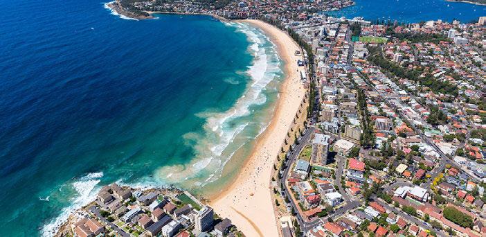
9 A new road hierarchy could be developed that included the downgrading of General Holmes Drive as a classified Main Road, creating opportunities for an enhanced streetscape and improved pedestrian and bicycle connectivity (c) Regional and State Assets i. Airport and Port The airport and Port Botany are not just State but nationally-important assets. The Kingsford-Smith Airport is crucial for the very significant tourism industry, while the port is essential for productivity and goods dispersal. The Brighton le Sands Precinct has the potential to augment the tourism, recreational assets of Sydney and the region, while planned and coordinated transport infrastructure has the potential to assist in the efficient operation of nearby crucial air and port hubs. ii. Recreation The Brighton le Sands foreshore is a significant and unique asset for the St George Area. The shallow and protected Botany Bay provides a safe swimming environment, while the water is popular with kite-surfers, boaters and recreational users. The length allows a variety of experiences, while to the north, the wide park provides cultural and active opportunities to support a new vibrant precinct. More broadly, the structure of the Bay, beach and foreshore reflects a dune and natural system, with adjoining Cooks River, which is a unique counter balance and different experience to the sandstone-cliff eastern beaches and the various protected and narrow rivers to the north and south. This uniqueness has the potential to create a truly different place and experience. Submission on draft Eastern City District Plan Brighton le Sands Page 8 of 18


10 iii. Open Space The Cooks River and wetland to the west of the dune system along Botany Bay foreshore provides a regionally import open space link. This is recognised and mapped in the draft District Plan, as below: It is apparent that further east-west linkages to the water and along the foreshore would augment, support and enhance the regional open space and habitat linkages. The potential linkages with the open space, bicycle and recreational network within the adjoining Bayside West Urban Renewal Area is shown below: Submission on draft Eastern City District Plan Brighton le Sands Page 9 of 18

11 The extended opportunities for open space (and habitat, recreational and biodiversity linkages) is shown in the diagram below from GMU: iv. Street life and Culture The Brighton le Sands town centre is a thriving area of restaurants and cultural activity, with historical linkages to the Greek community. This is somewhat compromised by the traffic and barriers to open space and water. In this regard, changed road and public transport infrastructure can markedly assist. Also, the northern part of the precinct has the benefit of General Holmes Drive being to the west, with more direct linkages to the waterfront and open space. This is not currently capitalised upon, either for the area itself, nor for linkages to the surrounding blocks to the west. The draft District Plan identifies and acknowledges the street life and vibrancy that exists at Brighton le Sands. Submission on draft Eastern City District Plan Brighton le Sands Page 10 of 18


12 As shown above and extracted from the draft District Plan, the Brighton le Sands Precinct provides a relatively unique confluence of social infrastructure, shared places, learning and street-life. The bones of a unique place are there to be capitalised upon. Submission on draft Eastern City District Plan Brighton le Sands Page 11 of 18


13 (v) Supporting Local Centres Clearly, the potential of the precinct needs to support the Brighton le Sands town centre, and not compete with it. However, this is not a reason to do nothing. Tourism uses, recreation, open space, affordable housing and some diverse forms of housing has the potential to provide suich support, while capitalising on the opportunities for the region. (vi) Traffic and Transport This is clearly an issue that needs both attention and a deliverable solution that does not perpetuate car-based travel behaviour, nor create the very conditions to be avoided in establishing a vibrant and attractive precinct. The F6 does create opportunities, as does the working and residing population within Bayside West and local centre close by. If a transport solution can also help address and support the traffic issues for the nearby airport, a truly lasting legacy would be created. The opportunity to complement the proposed F6 connection with public transport and a possible light rail or shuttle bus link is shown below (source: Traffix). This would obviously need detailed and ongoing discussion with Transport for NSW and Council, and also consider wider connections with the airport. It is put forward to stimulate ideas and see opportunity rather than problems Submission on draft Eastern City District Plan Brighton le Sands Page 12 of 18

14 A new road hierarchy could be developed that included the downgrading of General Holmes Drive as a classified Main Road, creating opportunities for an enhanced streetscape and improved pedestrian and bicycle connectivity Submission on draft Eastern City District Plan Brighton le Sands Page 13 of 18


15 (vii) Natural Environment There are three potential local and regional improvements to the natural environment: 1. Improvements to water quality of the Cooks River and Botany Bay, important to realise its recreational potential and to improve the existing situation for the natural environment and recreational users. This would see an ongoing improvement to past efforts to turn a very polluted waterway into a clean one; 2. Habitat for flora and fauna through improved linkages between open space, riparian corridors and more trees; 3. Ameliorating local flooding through the design of streets, lands, open space and stormwater infrastructure. As shown below, the foreshore reserve and the adjoining wetlands have mapped Biodiversity value in Rockdale LEP 2011: The corridor to the north of that mapped above is the significant former Chinese market gardens, which has significant potential to augment this natural ecosystem, and understanding of past historical uses through interpretation. (viii) Site and Statutory considerations The precinct has a number of features, including flat topography, vistas and corridors, adjoining significant infrastructure, traffic issues and a lack of built form homogeneity. Submission on draft Eastern City District Plan Brighton le Sands Page 14 of 18

16 The Norfolk Island palms and strong linear planting provides more cohesion in the landscape, although the precinct is generally lacking in tree cover. The blocks surrounding the existing Brighton-Le-Sands town centre include some with a direct connection/access to the foreshore area. The precinct adjoins significant infrastructure and open space including Cook Park and Cooks River to the north, the foreshore reserve and Botany Bay to the east and south as well as General Holmes Drive, a major collector road to the east. The precinct has a number of features that provide significant opportunities for future development, including flat topography, great views and vistas to the water and Sydney Airport. Areas of the precinct have and interface with the waterfront area that is less constrained by traffic than other areas (although this is expected to change). The waterfront area generally lacks built form homogeneity and landscape features. However, this opens a great opportunity for any future development to enhance the building design quality in the area and provide improvements to the public realm including new landscape features and improved accessibility to the waterfront. As shown below, there is a lack of built form heritage in the precinct, although the natural assets of the foreshore reserve and former Chinese Market gardens have heritage significance. There are localised flooding issues, associated with the hydrology created by flat land, a dune system and consequent former wetland area to the west. This creates opportunities for improvement through Water Sensitive Urban Design. Submission on draft Eastern City District Plan Brighton le Sands Page 15 of 18


17 The nearby wetlands to the south and north of the precinct are identified in Rockdale LEP The location of significant wetlands in an inner city environment is rare, and an opportunity for community appreciation and understanding of natural ecosystems in a sensitive water-borne environment. Submission on draft Eastern City District Plan Brighton le Sands Page 16 of 18

18 The northern part of the precinct is affected by the ANEF Noise contours for the Sydney Kingsford Smith Airport as shown below. This still allows buildings to a reasonable height, as reflected in the taller buildings in the existing Brighton le Sands Town Centre, and creation of a range of building heights. Any heights exceeding the current height limit will be subject to a Controlled Activity Permit process requiring concurrence from Sydney Airports and the Civic Aviation Authority. A Design Excellence Clause is within Rockdale LEP 2011 and currently applies to specific mapped areas. It would be reasonable to apply the concept of achieving design excellence to the Brighton le Sands precinct, as achieving high quality buildings and public domain is a key to achieving an attractive regional asset and place. Mechanisms for the funding and delivery of infrastructure, both local and State, would need to be established with any significant development of the area and in parallel to creating the vision sought. Submission on draft Eastern City District Plan Brighton le Sands Page 17 of 18
19 Conclusion As outlined, there are many sound planning reasons to support identifying the Brighton le Sands precinct as a potential transformative renewal area, to realise the many existing and future opportunities. This is able to be done without committing to a specific outcome, yet arise from the analysis, studies and strategies to be developed following finalisation of the District Plan, led by the local Council and in collaboration with the State, community, landowners and other stakeholders. We look forward to your open consideration. Representatives of the team would be delighted to meet with GSC representatives to discuss this submission. If there are any queries, please do not hesitate to call me on. Yours sincerely Jason Perica Director Submission on draft Eastern City District Plan Brighton le Sands Page 18 of 18
20 BRIGHTON-LE-SANDS PRECINCT MASTER PLAN PRELIMINARY FINDINGS AND OPPORTUNITIES 16 AUGUST, 2017
 The main study area is identified as part of the priority growth area/investigation areas.")

21 STRATEGIC CONTEXT STUDY AREA STUDY AREA Main study area Extended area of consideration Kyeemagh to Dolls Point Housing the city (source: Directions for a Greater Sydney ) A city in its landscape (source: Directions for a Greater Sydney ) The main study area is identified as part of the priority growth area/investigation areas. The Draft District Plan aims to support significant visitor economy between Kyeemagh and Dolls Point. The Grand Parade and existing wetland corridor to the west of the study area are identified as major Green Grid opportunities for the future development of the area. Brighton-Le-Sands is identified in the Rockdale City Plan as a destination for local and international visitors Brighton-Le-Sands 02
22 BROAD CONSTRAINTS AND OPPORTUNITIES Rockdale Rockdale Potential F6 extension Constraints Opportunities - Potential land uses Constraints Opportunities The majority of the main study area is located within ANEF zone according to Council s Destinations Rockdale report (2006). Opportunity to establish a tourist destination for location and international visitors in recognition of the existing natural assets within Brighton-Le-Sands and the proposed future extension of F6. The airspace obstacle limitation surface over the study area is 51 AHD. The current LEP height control allows for a max. 51m (approx. 16st) development in the centre area. Opportunity for the site (main study area) to be a catalyst guiding the future development. Heavy traffic along General Holmes Drive and The Grand Parade, segregating the town centre and waterfront area. Opportunity for increased height and density to the waterfront to support the future growth of the area. Limited pedestrian crossing points between the centre and waterfront area. Lady Robinsons Beach is a listed heritage item with local significance. It is also classified as a biodiversity land. Potential flooding issues. Opportunity for diverting existing heavy traffic along The Grand Parade and Bay Street to the proposed F6 extension, strengthening the connection between the town centre and waterfront area with increased permeability and links Brighton-Le-Sands 03


23 PRECEDENTS - CAIRNS ESPLANADE GMU has conducted a precedent study of a number of domestic and international examples of waterfront/promenade precincts to understand the key design elements that make a waterfront/promenade precinct successful. They are: Good public and visual access to the waterfront. A series of destinations/focal points allowing for various activities along the waterfront/promenade. Active frontages to main street/promenade with a good mix of commercial, recreational and residential uses. Increased density with a range of house types and facilities closer to the centre and waterfront area, providing renewed vitality to the area. Destinations Main street/promenade Active frontage Pedestrian/visual links Major traffic road Brighton-Le-Sands 04


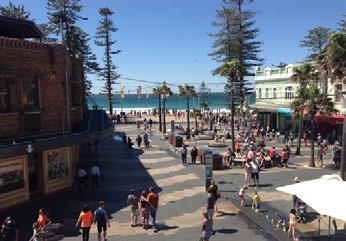
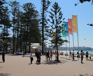
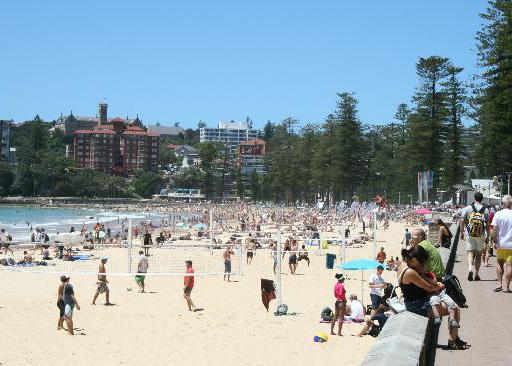
24 PRECEDENTS - MANLY BEACH Destinations Main street/promenade Active frontage Pedestrian/visual links Major traffic road Brighton-Le-Sands 05


25 PRECEDENTS - VENICE, LOS ANGELES Destinations Main street/promenade Active frontage Waterfront Park Pedestrian/visual links Major traffic road Commercial Main recreational precinct Residential Venice Pier/Car park Brighton-Le-Sands 06


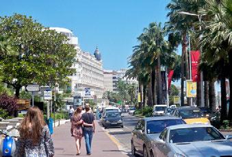
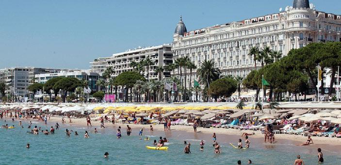
26 PRECEDENTS - CANNES, FRANCE Port Destinations Main street/promenade Port Active frontage Pedestrian/visual links Major traffic road Brighton-Le-Sands 07

27 PRECINCT OPPORTUNITY Precinct opportunity Ba ys Opportunity to provide higher density development with a range of house types and facilities closer to the centre and waterfront area, creating a well mixed and sustainable community to live, work and stay. Opportunity to provide increased public links to the waterfront, enhancing the connectivity and permeability of the waterfront area. Opportunity to provide an enhanced promenade along The Grand Parade with a series of destinations for water-oriented recreation and other activities, servicing the residents and visitors in Brighton-Le-Sands. Opportunity to create a local boulevard along General Holmes Drive/The Grand Parade by potentially diverting the heavy traffic to the proposed F6. tre et Main destinations Activity nodes Preside Potential for higher density development nt Ave The Grand Parade Shared Zone New pedestrian connections Brighton-Le-Sands 08
Draft Eastern District Plan
 Draft Eastern District Plan Submission_id: 31238 Date of Lodgment: 13 Dec 2017 Origin of Submission: Online Organisation name: Turrulla Gardens Pty Ltd C/- Mecone Organisation type: Industry First name:
Draft Western District Plan
 Powered by TCPDF (www.tcpdf.org) Draft Western District Plan Submission_id: 31440 Date of Lodgment: 15 Dec 2017 Origin of Submission: Online Organisation name: Goodman Property Services Australia Pty Ltd
Draft South West District Plan - Campbelltown City Council Submission Attachment 1
 Draft South West District Plan - Campbelltown City Council Submission Attachment 1 Campbelltown City Council Report and Resolution - Draft South West District Plan - Draft Submission Ordinary Meeting 28/03/17
Draft Western District Plan
 Powered by TCPDF (www.tcpdf.org) Draft Western District Plan Submission_id: 31356 Date of Lodgment: 14 Dec 2017 Origin of Submission: Online Organisation name: APP Corporation PTY LTD Organisation type:
South District Plan OVERVIEW
 OUR GREATER SYDNEY 2056 Revised Draft South District Plan OVERVIEW Canterbury-Bankstown Georges River Sutherland Snapshot of the South District today and into the future The Greater Sydney Commission acknowledges
DRAFT WESTERN CITY DISTRICT PLAN PLANNING PRIORITIES AND ACTIONS
 Greater Sydney Commission DRAFT WESTERN CITY DISTRICT PLAN PLANNING PRIORITIES AND ACTIONS Issued: 26 OCTOBER 2017 Version: 1 Subject: Greater Sydney Region and District Plans This information note is
DRAFT GREATER SYDNEY REGION PLAN OBJECTIVES, STRATEGIES AND ACTIONS
 Greater Sydney Commission DRAFT GREATER SYDNEY REGION PLAN OBJECTIVES, STRATEGIES AND ACTIONS Issued: 26 OCTOBER 2017 Version: 1 Subject: Greater Sydney Region and District Plans This information note
Northern Territory Compact Urban Growth Policy
 Northern Territory Compact Urban Growth Policy A Reference Policy Document to clause 2.7 (Reference to Policy) of the NT Planning Scheme May 2015 Table of Contents 1 Policy Setting... 3 1.1 Context for
Draft Western District Plan
 Powered by TCPDF (www.tcpdf.org) Draft Western District Plan Submission_id: 31371 Date of Lodgment: 14 Dec 2017 Origin of Submission: Online Organisation name: Mecone Pty Ltd Organisation type: Industry
REVISED DRAFT NORTH DISTRICT PLAN PLANNING PRIORITIES AND ACTIONS
 Greater Sydney Commission REVISED DRAFT NORTH DISTRICT PLAN PLANNING PRIORITIES AND ACTIONS Issued: 26 OCTOBER 2017 Version: 1 Subject: Greater Sydney Region and District Plans This information note is
South District What we heard
 What we heard Vision to 2056 and Priorities Governance and implementation Infrastructure and funding Feedback supported: The vision for a metropolis of three cities, but emphasised the importance of infrastructure
Eastern City District Plan
 OUR GREATER SYDNEY 2056 Revised Draft Eastern City District Plan OVERVIEW Bayside Burwood Canada Bay City of Sydney Inner West Randwick Strathfield Waverley Woollahra Snapshot of the Eastern City District
North District What we heard
 What we heard Vision to 2056 and Priorities Governance and implementation Infrastructure and funding The vision for a metropolis of three cities, and the 30 minute city. Feedback emphasised: That for the
Central City District What we heard
 What we heard Vision to 2056 and Priorities Governance and implementation Infrastructure and funding The vision for a metropolis of three cities, and the 30 minute city. Feedback requested: Clearer communication
MDP -- District Plan Webform Submissions Submission Details
 MDP -- District Plan Webform Submissions Submission Details Completed Time Represented By Who Title Age Bracket 03/31/2017-16:44 I am submitting my Mr 40-49 organisation's submission First Name Last Name
10.0 Open Space and Public Realm
 10.0 Open Space and Public Realm 10.0 Open Space and Public Realm The Public Open Space System is comprised of: outdoor spaces available for public use that are either publicly owned (e.g., parks and
OUR GREATER SYDNEY A metropolis of three cities. OVERVIEW. connecting people. DRAFT Greater Sydney Region Plan
 OUR GREATER SYDNEY 2056. A metropolis of three cities. OVERVIEW. connecting people. DRAFT Greater Sydney Region Plan October 2017 This document is an overview of the draft Greater Sydney Region Plan. To
I615. Westgate Precinct
 I615. Westgate Precinct I615.1. Precinct Description The Westgate Precinct is located approximately 18km west of the Auckland city centre. There are seven Sub-precincts in the Westgate Precinct: Sub-precinct
WATERLOO STATE SIGNIFICANT PRECINCT SUMMARY OF STUDIES
 WATERLOO STATE SIGNIFICANT PRECINCT SUMMARY OF STUDIES Technical studies will be undertaken to inform the master planning process for the Waterloo precinct to develop a Precinct Proposal to redevelop the
Draft Western District Plan
 Powered by TCPDF (www.tcpdf.org) Draft Western District Plan Submission_id: 31466 Date of Lodgment: 15 Dec 2017 Origin of Submission: Online Organisation name: Coronation Property Co Pty Ltd Organisation
Planning Proposal Concurrent DA/LEP Amendment for Belmont North Pharmacy Amendment No. 24 to Lake Macquarie Local Environmental Plan (LMLEP) 2014
 2014") Planning Proposal Concurrent DA/LEP Amendment for Belmont North Pharmacy Amendment No. 24 to Lake Macquarie Local Environmental Plan (LMLEP) 2014 Local Government Area: Name of Draft LEP: Subject Land:
Planning Proposal Concurrent DA/LEP Amendment for Belmont North Pharmacy Amendment No. 24 to Lake Macquarie Local Environmental Plan (LMLEP) 2014 Local Government Area: Name of Draft LEP: Subject Land:
As will be detailed, our site plays a strategic role in providing these opportunities.
 29 March 2017 Greater Sydney Commission PO Box 257 Parramatta NSW 2124 Email: info@gsc.nsw.gov.au Dear Sir/Madam, RE: DISTRICT PLAN-SOUTH WEST AREA. Woodward Park and Liverpool CBD. I have been requested
Christchurch City Council Civic Offices 53 Hereford Street Christchurch. Submission on: The Draft Annual Plan 2014/15
 City Council Civic Offices 53 Hereford Street Submission on: The Draft Annual Plan 2014/15 Response by: Avon-Ōtākaro Network 9 Stable Way Belfast The Avon-Ōtākaro Network [AvON], is a network of individuals
Town of Cobourg Heritage Master Plan. Statutory Public Meeting
 Town of Cobourg Heritage Master Plan Statutory Public Meeting April 25 th 2016 Presentation Overview 1. Introduction 2. Project background and schedule overview 3. Review of strategic direction content
Western City District What we heard
 What we heard Vision to 2056 and Priorities Governance and implementation Infrastructure and funding The protection of the natural landscape including biodiversity and the Metropolitan Rural Area for food
Mark-up of the effect of the proposed Bronte Village Growth Area OPA No.18 on the text of section 24, Bronte Village, of the Livable Oakville Plan
 Mark-up of the effect of the proposed Bronte Village Growth Area OPA No.18 on the text of section 24, Bronte Village, of the Livable Oakville Plan Notes: This document is provided for information purposes
To help in your review of these I have summarised our response into a top ten list of comments (not necessarily in order of importance).
.") Greater Sydney Commission PO Box 257 Parramatta 2124 info@gsc.nsw.gov.au March 31 st 2017 Dear Commissioners Comments on the District Plans As NSW President of the Australian Institute of Landscape Architects,
Greater Sydney Commission PO Box 257 Parramatta 2124 info@gsc.nsw.gov.au March 31 st 2017 Dear Commissioners Comments on the District Plans As NSW President of the Australian Institute of Landscape Architects,
Tāhuhu whakaruruhau ā-taone The sheltering ridge pole
 B2. Tāhuhu whakaruruhau ā-taone - Urban growth and form B2.1. Issues Tāhuhu whakaruruhau ā-taone The sheltering ridge pole Auckland s growing population increases demand for housing, employment, business,
Community Design Guidelines. Port Wallace DRAFT
 Community Design Guidelines Port Wallace DRAFT Energy 1 2 3 Nature Movement Connections Built Form DRAFT Layout Energy 1 Nature Community Design Guidelines GREAT COMMUNITIES PROTECT, CELEBRATE, AND CONSERVE
Planning Proposal Charlestown Swim and Leisure Centre LEP Amendment
 Planning Proposal Charlestown Swim and Leisure Centre LEP Amendment Amendment No. 4 to Lake Macquarie Local Environmental Plan 2014 (PP_2014_LAKEM_005_00) Local Government Area: Name of Draft LEP: Lake
SUSTAINABLE MANAGEMENT
 . Sustainable Management.1 The Concept of Sustainable Management The concept of sustainable management recognises there are limits to the use of natural and physical resources and there is a need to balance
Chairman and Members of the Planning and Development Committee. Thomas S. Mokrzycki, Commissioner of Planning and Building
 LA.09.TOR (Toronto) DATE: TO: FROM: SUBJECT: Chairman and Members of the Planning and Development Committee Thomas S. Mokrzycki, Commissioner of Planning and Building Central Waterfront Secondary Plan
University of Saskatchewan CAMPUS MASTER PLAN. Senate Meeting Preliminary Presentation. April 21, 2018 DIALOG ECS DA WATT
 University of Saskatchewan CAMPUS MASTER PLAN Senate Meeting Preliminary Presentation April 21, 2018 DIALOG ECS DA WATT project process presentation agenda Stakeholder Engagement Project Control phase1
Welcome to the Oakridge Centre Open House
 Welcome to the Oakridge Centre Open House Why is the City hosting this event? This open house is to inform you of a rezoning application submitted to the City of Vancouver to amend the existing CD-1 (Comprehensive
PART AOTEA PRECINCT
 CONTENTS... PAGE AOTEA PRECINCT...4 14.5.1 INTRODUCTION...4 14.5.2 RESOURCE MANAGEMENT ISSUES...4 14.5.3 RESOURCE MANAGEMENT OBJECTIVES AND POLICIES... 4 14.5.4 RESOURCE MANAGEMENT STRATEGY...5 14.5.5
Welcome. Walk Around. Talk to Us. Write Down Your Comments
 Welcome This is an information meeting introducing the applications for proposed redevelopment of the Yorkdale Shopping Centre site at 3401 Dufferin Street and 1 Yorkdale Road over the next 20+ years,
represented_by_who title age_bracket first_name last_name organisation position_in_organisation withhold_name address_1 suburb I am making a
 submission_details webform_serial webform_sid webform_time webform_completed_time webform_modified_time webform_draft webform_ip_address webform_uid webform_username 98 27841 03/19/2017-19:06 03/19/2017-19:06
The Proposed Auckland Unitary Plan (notified 30 September 2013)
") 3 Business zones Introduction There are 10 business zones in the Unitary Plan: City Centre Metropolitan Centre Town Centre Local Centre Neighbourhood Centre Mixed Use General Business Business Park Light
3 Business zones Introduction There are 10 business zones in the Unitary Plan: City Centre Metropolitan Centre Town Centre Local Centre Neighbourhood Centre Mixed Use General Business Business Park Light
3. Endorse the LRT vision in transforming Surrey into Connected-Complete-Livable communities, and more specifically, the official vision statement:
 CORPORATE REPORT NO: R038 COUNCIL DATE: February 20, 2017 REGULAR COUNCIL TO: Mayor & Council DATE: February 16, 2017 FROM: General Manager, Engineering FILE: 8740-01 SUBJECT: Surrey Light Rail Transit
Tauranga City Centre Spatial Framework
 Tauranga City Centre Spatial Framework Stakeholder Engagement Workshop 15 October 2015 Project Design Team Beca & LandLAB Our team Henry Crothers (LandLab) Landscape Architect/Urban Designer Urban and
Subdivision Design Criteria. Penihana North GUIDELINES TO THE RULES
 Created September 2013 Penihana North Subdivision Design Criteria GUIDELINES TO THE RULES This part of the Plan sets out the design criteria for subdivision in Penihana North. The criteria will be considered
Contents of Part 6. Part 6 Zones
 Contents of Part 6 Part 6 Zones... 6-1 6.1 Preliminary... 6-1 6.2 Zone codes... 6-3 6.2.1 Low density residential zone code... 6-3 6.2.1.1 Application... 6-3 6.2.1.2 Purpose and overall outcomes... 6-3
Response to the London Bridge Area Vision and Site Allocations within the New Southwark Plan
 1 Melior Place London SE1 3SZ 020 7407 4701 teamlondonbridge.co.uk info@teamlondonbridge.co.uk 28 April 2017 Response to the London Bridge Area Vision and Site Allocations within the New Southwark Plan
Western Sydney Parklands Australia s Largest Urban Park
 Western Sydney Parklands Australia s Largest Urban Park 37 WLA 1 MAGAZINE 21 38 WESTERN SYDNEY PARKLANDS AUSTRALIA S LARGEST URBAN PARK Large urban parks have dual roles to play in meeting the demands
CITY OF FREMANTLE LOCAL PLANNING SCHEME NO. 4 AMENDMENT NO. 68 SCHEME AMENDMENT REPORT
 CITY OF FREMANTLE LOCAL PLANNING SCHEME NO. 4 AMENDMENT NO. 68 SCHEME AMENDMENT REPORT CITY OF FREMANTLE PLANNING AND DEVELOPMENT SERVICES 8 WILLIAM STREET FREMANTLE WA 6160 PLANNING AND DEVELOPMENT ACT
Complete Neighbourhood Guidelines Review Tool
 Complete Neighbourhood Guidelines Review Tool Prepared By: City of Regina Planning Department October 2014 Page 1 of 14 Community Development Review Checklist for Secondary Plans and Concept Plans The
MACROC Submission on the Draft South West District Plan
 MACROC Submission on the Draft South West District Plan MACROC Cnr Queen & Broughton Streets CAMPBELLTOWN NSW 2560 MACROC Submission on the Draft South West District Plan. March 2017 Page 2 MACROC Submission
PART 1. Background to the Study. Avenue Study. The Danforth
 The Danforth 1.1/ Study Purpose & Key Municipal Goals 1.2/ The Local Advisory Committee 1.3/ The Project Team 1.4/ Study Process/Summary of Method 1.5/ Summary of Consultation 1.1 Study Purpose and Key
submission_details represented_by_who title age_bracket first_name last_name organisation position_in_organisation withhold_name address_1
 submission_details represented_by_who title age_bracket first_name last_name email organisation position_in_organisation withhold_name address_1 I am making a personal submission 20-29 X Targeting jobs
submission_details represented_by_who title age_bracket first_name last_name organisation position_in_organisation withhold_name address_1
 submission_details represented_by_who title age_bracket first_name last_name email organisation position_in_organisation withhold_name address_1 I am making a personal submission 50-59 X Targeting jobs
Fishermans Bend Recast Vision May 2016 Planning Institute of Australia submission June 2016
 8 July 2016 Fishermans Bend Taskforce Department of Environment, Land, Water and Planning Level 36, 2 Lonsdale St Melbourne 3000 fishermansbend@delwp.vic.gov.au Dear Sir/Madam, Fishermans Bend Recast Vision
Planning Proposal Toronto Road, Booragul. Amendment to Lake Macquarie Local Environmental Plan (LMLEP) 2014
 2014") Planning Proposal Toronto Road, Booragul Amendment to Lake Macquarie Local Environmental Plan (LMLEP) 2014 Local Government Area: Name of Draft LEP: Subject Land: Land Owner: Applicant: Folder Number:
Planning Proposal Toronto Road, Booragul Amendment to Lake Macquarie Local Environmental Plan (LMLEP) 2014 Local Government Area: Name of Draft LEP: Subject Land: Land Owner: Applicant: Folder Number:
APPENDIX K WINDSOR OFFICIAL PLAN
 CEAA ENVIRONMENTAL ENVIRONMENTAL IMPACT ASSESSMENT AMBASSADOR BRIDGE ENHANCEMENT PROJECT Replacement Span and Plaza Expansion APPENDIX K WINDSOR OFFICIAL PLAN Avalon Consulting Professionals of Ontario,
Implementing sustainable water strategy through development industry engagement
 Implementing sustainable water strategy through development industry engagement Ian Director, Organica Engineering, Melbourne, Australia E-mail: iadams@organicaeng.com.au Edward Cotter Sustainability Leader,
Fishermans Bend Draft Framework. Submission to public consultation
 Fishermans Bend Draft Framework Submission to public consultation 14 December 2017 An opportunity for a world class innovation precinct The University of Melbourne welcomes the release of the Draft Fishermans
A Growing Community Rural Settlement Areas
 Town of Huntsville Official Plan Review - POLICY BACKGROUND PAPER A Growing Community Rural Settlement Areas BACKGROUND: In addition to the fully municipally-serviced Urban Settlement Area and the Hidden
Plan Modification to Chapter B2 of the Auckland Unitary Plan(AUP) Operative in part (15 November 2016)
 Operative in part (15 November 2016)") UNITARY PLAN UPDATE REQUEST MEMORANDUM TO FROM Phill Reid Linley Wilkinson DATE 25 September 2018 SUBJECT Plan Modification to Chapter B2 of the Auckland Unitary Plan(AUP) Operative in part (15 November
UNITARY PLAN UPDATE REQUEST MEMORANDUM TO FROM Phill Reid Linley Wilkinson DATE 25 September 2018 SUBJECT Plan Modification to Chapter B2 of the Auckland Unitary Plan(AUP) Operative in part (15 November
SQUAMISH 2010 AND BEYOND COMMUNITY VISION
 Our plan has been imagined and created to be both pragmatic and visionary. At the core of the strategy is a consideration of the highway s role and its impact on the community. First and foremost in creating
I209 Quay Park Precinct
 I209. Quay Park I209.1. Precinct description The Quay Park Precinct is located on reclaimed land at the eastern end of the city centre and along the City Centre waterfront. It is dissected to the east
Scottish Natural Heritage. Better places for people and nature
 Scottish Natural Heritage Better places for people and nature Contents Summary... 3 SNH approach... 5 Place-making in policy and practice... 6 Developing the contribution of the natural heritage to place-making...
Green Square Town Centre
 Green Square Town Centre Delivering major urban renewal Paul Andersen International Public Works Conference 9 September 2009 Outline Policy Context The Project Roles and responsibilities Infrastructure
Macro Town Planning Submission
 7 March 2017 Ref: WTJ16-153_Macro Town Planning Submission_Macquarie Park Investigation Area Macro Town Planning Submission Macquarie Park Investigation Area Multiple Goodman Land Holdings Prepared by
[PLANNING RATIONALE] For Site Plan Control and Lifting of Holding Zone By-Law 101 Champagne Avenue. May 23, 2014
![[PLANNING RATIONALE] For Site Plan Control and Lifting of Holding Zone By-Law 101 Champagne Avenue. May 23, 2014](/thumbs/75/71599615.jpg "[PLANNING RATIONALE] For Site Plan Control and Lifting of Holding Zone By-Law 101 Champagne Avenue. May 23, 2014") [PLANNING RATIONALE] For Site Plan Control and Lifting of Holding Zone By-Law 101 Champagne Avenue May 23, 2014 Contents 1.0 Introduction... 2 2.0 Site Context... 2 2.1 Adjacent Uses... 2 Figure 1: Site
[PLANNING RATIONALE] For Site Plan Control and Lifting of Holding Zone By-Law 101 Champagne Avenue May 23, 2014 Contents 1.0 Introduction... 2 2.0 Site Context... 2 2.1 Adjacent Uses... 2 Figure 1: Site
NEWCASTLE LIGHT RAIL Review of Environmental Factors (REF) Submission 20 May 2016
 Submission 20 May 2016") NEWCASTLE LIGHT RAIL Review of Environmental Factors (REF) Submission 20 May 2016 INTRODUCTION The Hunter Business Chamber is the largest regional business chamber in Australia and was established in 1886.
NEWCASTLE LIGHT RAIL Review of Environmental Factors (REF) Submission 20 May 2016 INTRODUCTION The Hunter Business Chamber is the largest regional business chamber in Australia and was established in 1886.
3.3. Urban Structure Defining a New Hierarchy of Routes and Spaces >Images
 Section 3.0 I The Masterplan Framework 18 >Images Examples of high quality routes and spaces 3.3. Urban Structure The success of any masterplan lies in a clear definition of the future urban structure
EVALUATION OF MASTER PLAN ALTERNATIVES
 7 The Environmental Report is required to identify, describe and evaluate reasonable alternatives, taking into account the objectives and geographical scope of the Master Plan 2008. Three plan alternatives
Taking forward the All London Green Grid
 Taking forward the All London Green Grid Foreword Earlier this year, the Mayor published the All London Green Grid Supplementary Planning Guidance to the London Plan which set the vision, and framework,
Preliminary Plan Framework: Vision and Goals
 Preliminary Plan Framework: Vision and Goals Draft: May 2015 Introduction Since the Town of Milliken s comprehensive plan was last updated in 2010, the community was heavily impacted by the 2013 flood,
Session 4 New Urban Regions and Major Urban Extensions. Tackling Western Sydney s Urban Growth
 Session 4 New Urban Regions and Major Urban Extensions Tackling Western Sydney s Urban Growth Stephanie Barker Rohan Dickson & Associates and consultant to NSW Growth Centres Commission Friday 8 February
RE: QUEENSLAND GOVERNMENT PLANNING POLICY REVIEW
 Planning Group Department of Infrastructure, Local Government and Planning PO Box 15009 CITY EAST QLD 4002 Via email: planningpolicy@dilgp.qld.gov.au 9 February 2017 Dear Sir/ Madam, RE: QUEENSLAND GOVERNMENT
Evaluation Criteria. Detailed Evaluation Criteria
 Evaluation Criteria Detailed Evaluation Criteria Community Well-being A safe and socially inclusive service that improves access to key community destinations and provides transportation choices for Calgarians.
WHITELEY TOWN COUNCIL NORTH WHITELEY DEVELOPMENT SEPTEMBER 2014
 WHITELEY TOWN COUNCIL NORTH WHITELEY DEVELOPMENT SEPTEMBER 2014 Dear Resident This Special Edition of the Whiteley Voice which has been prepared in conjunction with the North Whiteley Consortium is to
EAST VILLAGE STRATEGIC SITE NOVEMBER 2017
 EAST VILLAGE STRATEGIC SITE NOVEMBER 2017 East Village will be a sustainable, mixeduse precinct with a focus on innovative employment and education opportunities. Enhanced by green spaces and places for
... on the draft Arden Vision & Framework
 April 2017 Integrated world-class urban renewal Feedback... on the draft Arden Vision & Framework On 1 September 2016 the Victorian Planning Authority (VPA) released the draft Arden Vision & Framework
Draft Newcastle Urban Renewal Strategy Submission by Planning Institute of Australia (NSW Division)
") Draft Newcastle Urban Renewal Strategy Submission by Planning Institute of Australia (NSW Division) March 2013 The Planning The Planning Institute of Australia (PIA) is the peak body representing professionals
Draft Newcastle Urban Renewal Strategy Submission by Planning Institute of Australia (NSW Division) March 2013 The Planning The Planning Institute of Australia (PIA) is the peak body representing professionals
Paignton Neighbourhood Plan (Submission version 2017)
") Paignton Neighbourhood Plan (Submission version 2017) Introduction This brief statement covers the views of the TDA, only in relation to its role as adviser to the Council on delivery of town centre regeneration.
Paignton Neighbourhood Plan (Submission version 2017) Introduction This brief statement covers the views of the TDA, only in relation to its role as adviser to the Council on delivery of town centre regeneration.
GREENBANK DEVELOPMENT MASTERPLAN
 DEVELOPMENT MASTERPLAN POTENTIAL TRAIN STATION COMMUNITY CENTRE Greenbank will be a connected masterplanned community providing easy access to local and surrounding amenity. Affordable quality homes, green
Animating the Rideau Canal December 2013
 Executive Summary Animating the Rideau Canal December 2013 Why study the Rideau Canal? The Rideau Canal has been an important part of Ottawa throughout its history, and has shaped and been shaped by the
5 TOWN OF MARKHAM OFFICIAL PLAN AMENDMENT NO. 144 MILLIKEN MAIN STREET SECONDARY PLAN
 5 TOWN OF MARKHAM OFFICIAL PLAN AMENDMENT NO. 144 MILLIKEN MAIN STREET SECONDARY PLAN The Planning and Economic Development Committee recommends the following: 1. The communication from Brendan O Callaghan,
RURAL ZONE - POLICY. Rural Zone Policy. Issue: Rural Environment. Ruapehu District Plan Page 1 of 8
 Rural Zone Policy RU2 RURAL ZONE - POLICY RU2.1 Introduction The natural resources of the rural environment in the Ruapehu District provide the basis for the existing and potential character, intensity
Carterton Construction Ltd is bringing forward plans for up to 85 new family homes and extra care facilities on land east of Burford.
 Welcome Carterton Construction Ltd is bringing forward plans for up to 85 new family homes and extra care facilities on land east of. We are at the early stages of designing our proposals and have a number
Memorials, Plaques & Interpretive Signs Policy
 Memorials, Plaques & Interpretive Signs Policy APPROVAL COUNCIL DATE / CEO VERSION NO: Version 0.4 TRIM REF: 16/31097 REVIEW 30 June 2020 RESPONSIBLE EXECUTIVE General Manager City Assets & Environment
Official Plan Review
 Official Plan Review Summary Report - The Built Environment August 2014 Part 1: Introduction Planning for a healthy, prosperous and sustainable community is an important goal for our municipality. From
Draft Eastern District Plan
 Powered by TCPDF (www.tcpdf.org) Draft Eastern District Plan Submission_id: 31626 Date of Lodgment: 15 Dec 2017 Origin of Submission: Online First name: Jo Last name: Haylen MP Suburb: 2204 Submission
DOMINION BOULEVARD CORRIDOR STUDY AND ECONOMIC DEVELOPMENT STRATEGIC PLAN A MODEL FOR CHESAPEAKE S FUTURE
 DOMINION BOULEVARD CORRIDOR STUDY AND ECONOMIC DEVELOPMENT STRATEGIC PLAN A MODEL FOR CHESAPEAKE S FUTURE Overview I. Draft Plan Process II. Draft Plan Overview a. Market Analysis b. Master Land Use Plan
S A C R A M E N T O C O U N T Y JACKSON HIGHWAY & GRANT LINE EAST VISIONING STUDY
 JACKSON HIGHWAY & GRANT LINE EAST S A C R A M E N T O C O U N T Y P L A N N I N G D E P A R T M E N T SUMMARY AND WORKBOOK November 19, 2008 History of the Visioning Study Sacramento County has two growth
Lake Macquarie City. A copy of the published amendment including the instrument and maps, is provided in Attachment 7 of this report.
 Planning Proposal Amendment No. 77 to Lake Macquarie Local Environmental Plan 2004 and proposed Amendment to Draft Lake Macquarie Local Environmental Plan 2013 Minor Zone Boundary Adjustment - Pasminco
Integrated Urban Structuring in Australia An Overview of Principles and Practice
 ACNU08 Brisbane Integrated Urban Structuring in Australia An Overview of Principles and Practice Wendy Morris Ecologically Sustainable Design Pty Ltd Melbourne, Australia esdesign@netspace.net.au Ecologically
Hobart A Strategic Framework
 Hobart 2025 A Strategic Framework Adopted by the Hobart City Council 15 October 2007 Table of Contents Introduction...2 Vision and Future Directions...3 FD1 Offers opportunities for all ages and a city
Public Realm: Publicly accessible streets, footpaths, parks, squares, bridges, public buildings and facilities.
 Welcome Introduction Welcome to the public consultation process for the Draft Ballinrobe Public Realm Plan. These presentation panels explain the findings of the process and a series of draft projects
Australia ICOMOS submission on the Greater Sydney Commission s (GSC) Vision and District Plans
 Vision and District Plans") Australia ICOMOS Secretariat Faculty of Arts & Education Deakin University 221 Burwood Highway Burwood Vic 3125 Ph: +61 3 9251 7131 austicomos@deakin.edu.au www.icomos.org/australia ABN: 85 073 285 798
Australia ICOMOS Secretariat Faculty of Arts & Education Deakin University 221 Burwood Highway Burwood Vic 3125 Ph: +61 3 9251 7131 austicomos@deakin.edu.au www.icomos.org/australia ABN: 85 073 285 798
John M. Fleming Managing Director, Planning and City Planner. Old East Village Dundas Street Corridor Secondary Plan Draft Terms of Reference
 Report to Planning and Environment Committee To: From: Subject: Chair and Members Planning & Environment Committee John M. Fleming Managing Director, Planning and City Planner Old East Village Dundas Street
Chapter 2: OUTLINE PLANNING APPLICATION PROPOSALS. A New Garden Neighbourhood Matford Barton 17
 Chapter 2: OUTLINE PLANNING APPLICATION PROPOSALS A New Garden Neighbourhood Matford Barton 17 2.1. SUMMARY AND STATUS OF THE PROPOSALS 2.1.1. The parameter plans and associated wording in this chapter
Urban Design Manual PLANNING AROUND RAPID TRANSIT STATIONS (PARTS) Introduction. Station Study Areas
 Introduction. Station Study Areas") 111111 PLANNING AROUND RAPID TRANSIT STATIONS (PARTS) Introduction The ION rapid transit system will link Waterloo, Kitchener and Cambridge through a central transit corridor (CTC). There are a number
111111 PLANNING AROUND RAPID TRANSIT STATIONS (PARTS) Introduction The ION rapid transit system will link Waterloo, Kitchener and Cambridge through a central transit corridor (CTC). There are a number
Enclosures Appendix 1: Draft Golders Green Station Planning Brief. Summary
 Policy and Resources Committee 23 February 2017 Title Report of Wards Status Urgent Key Golders Green Station Draft Planning Brief Cath Shaw Commissioning Director - Growth & Development Interim Deputy
Institute Response to Design Guidelines: Design Quality and Housing Choice
 Institute Response to Design Guidelines: Design Quality and Housing Choice The Australian Institute of Landscape Architects South Australian Chapter (AILA SA) is pleased to provide a response on the Draft
ROCHFORD LOCAL DEVELOPMENT FRAMEWORK: Sustainability Appraisal/ Strategic Environmental Assessment. Rochford Core Strategy Preferred Options Document
 ROCHFORD LOCAL DEVELOPMENT FRAMEWORK: Sustainability Appraisal/ Strategic Environmental Assessment Non Technical Summary Rochford Core Strategy Preferred Options Document October 2008 SUSTAINABILITY APPRAISAL
Urban Design Expert Evidence Leanne Hodyl
 Fishermans Bend GC81 Panel Hearing Urban Design Expert Evidence Leanne Hodyl 14 March 2018 1 Fishermans Bend GC81 Panel Hearing - Urban Design Expert Evidence Leanne Hodyl Overview 1. Role of the Urban
PHASE ONE. A summary report: What the community told Alcoa during Phase One of the community engagement program for Point Henry 575.
 PHASE ONE A summary report: What the community told Alcoa during Phase One of the community engagement program for Point Henry 575. DECEMBER 2015 FEBRUARY 2016 INTRODUCTION In 2014 Alcoa closed its Point
Corridor Vision. 1Pursue Minnehaha-Hiawatha Community Works Project. Mission of Hennepin County Community Works Program
 1Pursue Minnehaha-Hiawatha Community Works Project Minnehaha-Hiawatha Community Works is a project within the Hennepin Community Works (HCW) program. The mission of the HCW program is to enhance how the