West Auburn Boulevard Special Planning Area Ordinance and Streetscape Master Plan
|
|
|
- Mitchell Flowers
- 6 years ago
- Views:
Transcription
1 West Auburn Boulevard Special Planning Area Ordinance and Streetscape Master Plan Adopted August 13,
2 2


3 West Auburn Boulevard Special Planning Area Ordinance and Streetscape Master Plan Prepared For: Sacramento Housing & Redevelopment Agency 600 I Street, Second Floor Sacramento, California and the County of Sacramento Department of Economic Development 700 H Street, Room 7650 Sacramento, California
4 4
5 West Auburn Boulevard Special Planning Area Ordinance and Streetscape Master Plan Acknowledgements This Streetscape Master Plan and Special Planning Area Ordinance results from a dedicated effort by community members, business leaders, key stakeholders and staff from Sacramento County and the Sacramento Housing and Redevelopment Agency who worked with a multi-disciplinary Consultant Team to articulate a vision that will create a distinctive character and guide future development along West Auburn Boulevard. Sacramento County Board of Supervisors Susan Peters, Supervisor, District 3 Howard Schmidt, Chief of Staff, District 3 Sacramento Housing & Redevelopment Agency Donna Melendez, Management Analyst, Community Development Tim Padden, Redevelopment Planner, Community Development County of Sacramento Troy Givans, Senior Planner, Department of Economic Development & Intergovernmental Affairs West Auburn Boulevard Project Area Committee Vince Maita, Maita Toyota Macell Millard, Secretary, Auburn Boulevard PAC Michael Salazar, Salazar s Dance Studio West Auburn Boulevard Stakeholders Tim Cahill, Fulton Avenue Business Association Mike Davis, Niello Audi Randy Graham, Fulton Avenue Association; Braley & Graham Buick Roy Imai, Fulton-El Camino Park District Skip Maggiora, Skip s Music Jack McKinney, Deseret Industries Ruben Meeks, Sacramento County Sheriff s Offi ce Michael Seaman, Fulton-El Camino Park District Amrik Singh, Hampton Inn Fred Usher, Clarion Hotel West Auburn Boulevard Technical Advisory Committee Sacramento County Christoph Dobson, Municipal Services Agency Bobbe Dworkis, Neighborhood Services Catherine Hack, Environmental Review & Assessment Stephen Moore, Regional Sanitation District 1 Mark Rains, Municipal Services Agency Jim Schubert, Transportation Dan Shoeman, Transportation Tricia Stevens, Planning Stephen White, Transportation California Department of Transportation, District 3 Alyssa Begley Barbara Procissi Consultant Team The HLA Group, Landscape Architects & Planners Mark Thomas & Company, Inc., Engineering and Surveying Fehr & Peers, Traffi c Consultants Wade Associates, Urban Planning & Design 5 i
6 6
7 West Auburn Boulevard Special Planning Area Ordinance and Streetscape Master Plan Zoning Code of Sacramento County Table of Contents EXECUTIVE SUMMARY Executive Summary...vi-viii SECTION ONE: Introduction to the Plan Area A. Plan Area B. Background Reports and Resources C. Site History and Background D. Role in the Sacramento County General Plan Update E. History of Reinvestment F. Public Process SECTION TWO: Project Vision A. Vision B. Goals C. Objectives SECTION THREE: Special Planning Area Ordinance A. The Special Planning Area Zone Ordinance (SPAO) B. Community Planning Context C. Planning Design Context D. Plan Area Vision: Land Uses and Building Activity Types E. Permitted Land Uses F. Vacant & Under-Utilized Parcels (Transitional Uses) G. Design Principles and Strategies H. Urban Form Zones SECTION FOUR: Development Regulations A. Application of the Development Regulations B. Architectural Standards C. Street Presence/Mass and Scale D. Relation to the Street (Front Setbacks) E. Streetscape and On-Site Landscape Interface F. Site Design and Building Orientation G. Pedestrian Paths within Parking Areas ii
8 West Auburn Boulevard Special Planning Area Ordinance and Streetscape Master Plan Zoning Code of Sacramento County H. Public Transit Access I. Security J. Internal Driveway Circulation K. Parking Requirements L. Landscaping and Site Improvement M. Signs and Graphics SECTION FIVE: Streetscape Master Plan A. Scope and Intent of the Project and this Document B. Design Approach C. Detailed Improvements / Recommendations D. Street Section Recommendations West Auburn Boulevard Capital City Freeway to Bell Avenue West Auburn Boulevard Bell Avenue to Fulton Avenue West Auburn Boulevard Fulton Avenue to Morse Avenue West Auburn Boulevard Morse Avenue to Watt Avenue West Auburn Boulevard Master Plan - Capital City Freeway to Bell Avenue West Auburn Boulevard Master Plan - Bell Avenue to Fulton Avenue West Auburn Boulevard Master Plan - Fulton Avenue to Morse Avenue West Auburn Boulevard Master Plan - Morse Avenue to Watt Avenue West Auburn Boulevard Master Plan - Section/Plan A & B West Auburn Boulevard Master Plan - Section/Plan C West Auburn Boulevard Master Plan - Section/Plan D & E E. Materials Palette SECTION SIX: Implementation Plan A. Action Plan B. Funding Sources C. Phasing Considerations iii
9 West Auburn Boulevard Special Planning Area Ordinance and Streetscape Master Plan D. Projected Costs SECTION SEVEN: Future Considerations A. Capital City Freeway Right-of-Way Landscaping B. Howe Avenue/ Bell Street Ramp Closure or Reconstruction C. Fulton Avenue Overpass D. Elimination of Bike Lanes E. Parcel Consolidation, Shared Driveways and Reciprocal Parking APPENDICES Technical Memoranda...1 Meeting Agendas and Minutes; Presentation Graphics Auburn Boulevard Shareholder Meetings Technical Advisory Committee Meetings Design Charette #1 Design Charette #2 Newsletters and Public Mailings...96 Other Attachments/ Associated Studies Noise Impact Study Arborist Study FIGURES Proposed Improvements - Streetscape...vii Proposed Improvements - Infi ll Development...vii West Auburn Boulevard Context Map West Auburn Boulevard Special Plan Area Schematic of the Special Planning Area Ordinance Organization Local Context Map Arden - Arcade Community Area Existing Land Uses Adjacent Land Use Connectivity iv
10 West Auburn Boulevard Special Planning Area Ordinance and Streetscape Master Plan Zoning Code of Sacramento County Example of Cluster Development Small Front Retail Urban Form Zones Proposed Permitted Building Heights Section Proposed Permitted Building Heights Axonometric Proposed Front Setbacks (Plan View) Proposed Landscape Buffer Proposed Typical Entry Proposed Typical Sign West Auburn Boulevard - Overall Master Plan West Auburn Boulevard - Overall Master Plan Typical K -Rail Placement Typical Median Layout Typical Bus Stop Layout Typical Street Monument Layout Landmark Blade Sign West Auburn Boulevard Master Plan West Auburn Boulevard Master Plan West Auburn Boulevard Master Plan West Auburn Boulevard Master Plan West Auburn Boulevard Master Plan West Auburn Boulevard Master Plan West Auburn Boulevard Master Plan Capitol City Freeway to Bell Avenue Bell Avenue to Fulton Avenue Fulton Avenue to Morse Avenue Morse Avenue to Watt Avenue Section/ Plan A & B Section/ Plan C Section/ Plan D & E TABLES Existing Zone Classifi cations Permitted Land Uses Special Conditions: Operation Requirements for Permitted Uses Building Height Permitted West Auburn Boulevard Streetscape Master Plan Projected Costs v
11 11
12 West Auburn Boulevard Special Planning Area Ordinance and Streetscape Master Plan Zoning Code of Sacramento County Executive Summary The West Auburn Boulevard Special Planning Area Ordinance and Streetscape Master Plan are intended to guide land use and development along West Auburn Boulevard in a manner that will strengthen the Boulevard s market position as a positive business address. The Special Planning Area Ordinance offers specifi c recommendations to encourage private development. The Streetscape Master Plan portion of this document focuses on the public right-of-way. Together, these documents contain a road map for the revitalization of a major regional commercial district. The goals of the West Auburn Boulevard Special Planning Area Ordinance (SPAO) and Streetscape Master Plan (SMP) are to Create a strong, recognizable community identity; Provide a safer and more effective environment for pedestrians, bicyclists, motorists, and business owners; Increase visibility to West Auburn Boulevard from passing traffi c on the Capital City Freeway (also known as Business Loop 80); Promote infi ll and commercial development by supporting existing businesses with business improvement projects; Recommend land uses, policies and improvements that will encourage a variety of business ventures and strengthen the competitiveness of the Plan area; Strengthen urban form by providing an enhanced edge to the Arden-Arcade community; and Reinvest in retail and service components that service the regional and local communities. This document sets clear goals for future development that will make West Auburn Boulevard more competitive to receive future funding for proposed improvements. The initial step in developing the SPAO and SMP was to conduct a site inventory and analysis. Site data from aerial photographs, fi eld observations and measurements were collected, and site photos were compiled. Background research included traffi c calming measures and previous studies of other street beautifi cation projects in the County of Sacramento. vi 12

13 West Auburn Boulevard Special Planning Area Ordinance and Streetscape Master Plan Current Conditions Proposed Improvements After a number of preliminary design concepts were developed and design review meetings were held, a variety of conceptual plans were presented to community leaders and residents at public workshops and charettes. Community members were invited to ask questions and provide feedback on the concepts. Their responses were then incorporated into a Draft Concept Plan. The Draft Concept Plan combined feedback obtained through public workshops from the community, stakeholders and the Technical Advisory Committee. The Draft Concept Plan was presented at a second charette, where community members provided additional feedback that was incorporated into the SPAO and SMP detailed in this document. Primary components of the Special Planning Area Ordinance: Form-based regulations; Upgrade of design quality; Optimize use of corner parcels and available sites as neighborhood gateways ; Establish a theme identity; Current Conditions Proposed Improvements 13 vii
14 West Auburn Boulevard Special Planning Area Ordinance and Streetscape Master Plan Create safe connections to transit stops; Upgrade the connection to Haggin Oaks Golf Course; Establish pedestrian connections to adjacent neighborhoods. Primary components of the Streetscape Master Plan: K-rail separation between Caltrans and Boulevard rights-of-way; Strategically located raised and planted medians; Decorative paving; Public art; Consistent separated sidewalks and upgraded bus stop facilities; Bike lanes; Landmark and monument signage; Utility undergrounding; Emphasis on neighborhood gateway intersections; Consistent right-of-way tree and ground plane plantings; Regular maintenance operations. viii 14


 and the Streetscape Master Plan (SPA) address the street and properties along the south side of the Boulevard.")
 in October 1992.")
15 West Auburn Boulevard Special Planning Area Ordinance and Streetscape Master Plan SECTION ONE: Introduction to the Plan Area Section One summarizes the history and existing conditions along West Auburn Boulevard, as well as the pattern of land use and development that has characterized the Plan area. The public input process undertaken to create the West Auburn Special Planning Area Ordinance and Boulevard Streetscape Master Plan is also detailed. A. Plan Area The West Auburn Plan area comprises 118 acres within both the City and County of Sacramento. The two-mile commercial corridor fronts Interstate Business Loop 80 or Capital City Freeway. The Boulevard extends through Sacramento County from the west edge of the Plan area to Placer County. The Plan area is immediately south of the Capital City Freeway, between the Marconi Curve on the west and Watt Avenue on the east. A Caltrans right-of-way abuts Auburn Boulevard on the north. The Special Planning Area Ordinance (SPAO) and the Streetscape Master Plan (SPA) address the street and properties along the south side of the Boulevard. Due to its length and the potential for other projects elsewhere along Auburn Boulevard, this project is referred to in this document as the West Auburn Boulevard Special Planning Area Ordinance and Streetscape Master Plan. The Plan area was designated as the Auburn Boulevard Redevelopment Area by the Sacramento Housing and Redevelopment Agency (SHRA) in October In response to extensive physical, economic and social deterioration, the Agency successfully partnered with other agencies to address health and safety issues affecting the Boulevard. Since the Auburn Boulevard today West Auburn Boulevard Project Boundary American River Downtown Sacramento West Auburn Boulevard Context Map 15 Page 1.1


16 West Auburn Boulevard Special Planning Area Ordinance and Streetscape Master Plan Zoning Code of Sacramento County Redevelopment Area was established, crime and other vices have been substantially reduced in the area, infrastructure has been overhauled, and new investment has occurred along the Boulevard. Freeway accessibility and visibility are key assets for West Auburn Boulevard properties. Four freeway ramps provide immediate access to the Boulevard. Lots that front the Boulevard tend to be narrow and deep. Although the depth allows for ancillary uses to the rear of the properties, their narrowness impedes high impact development along the street front, which would benefi t from increased visibility. Parcel assemblage is encouraged to provide additional width and greater fl exibility for re-use and design. Further challenges for redevelopment include inadequate public improvements such as unsightly freeway barriers, missing or deteriorating sidewalks, insuffi cient landscaping, and poorly maintained housing. Notwithstanding these challenges, general and light commercial uses such as auto dealerships, furniture stores, auto service centers, and hotels have been successfully attracted to the Boulevard. These land uses contribute to the Plan area s positive image and bright prospects for future redevelopment. The Plan area currently is experiencing a period of signifi cant transition. The older, highway service-oriented businesses, such as older lodging facilities, mobile home parks, and a scattering of highway-oriented restaurants will be replaced in time by emerging retail and service businesses that relate to the larger community. These uses will benefi t from freeway visibility, but will no longer depend solely on the patronage of long distance travelers. In time, the Boulevard will become a retail and service center serving the regional and local communities. B. Background Reports and Resources To prepare this Report, the following documents were consulted: 2010 Sacramento City/County Bikeway Master Plan (1993) West Auburn Boulevard Special Plan Area Page
 Sacramento County Best Practices for Complete Streets (2005) Sacramento County Best Practices for Bicycle Master Planning and")

17 West Auburn Boulevard Special Planning Area Ordinance and Streetscape Master Plan Sacramento County Pedestrian Design Guidelines Draft (2005) Sacramento Housing and Redevelopment Agency Auburn Boulevard Community Redevelopment Area Implementation Plan ( ) Sacramento County Best Practices for Complete Streets (2005) Sacramento County Best Practices for Bicycle Master Planning and Design (2005) Auburn Boulevard Redevelopment Area Community Plan Amendment, Rezone, and Use Permit FEIR (1996). Historic Auburn Boulevard C. Site History and Background The West Auburn Boulevard Corridor forms the north edge of the Arden- Arcade Community, which encompasses about 13,000 acres or 21 square miles. The area was part of the Rancho del Paso land grant, which was obtained by James Ben Ali Haggin circa Haggin bred thoroughbred racehorses on the ranch before selling the property in 1910 to the Sacramento Valley Colonization Company, which intended to Business 80/Capital City Freeway - Opening Day subdivide the land. Much of Arden-Arcade began to develop in the 1940 s coincident with the construction of Town and Country Village (the fi rst suburban shopping center in Northern California). Most of the population growth in the area occurred between the 1950 s and 1970 s, when an estimated 75% to 80% of the community was developed with suburban uses. Arden-Arcade is now one of the most intensely developed areas of Sacramento County. Another notable characteristic of the Plan area is the former role of the Boulevard as a link in the fi rst trans-continental highway. Highway 40 also called the Lincoln Highway, stretched from San Francisco to Chicago and provided a key link in the nation s transportation network. Although replaced by the current State Route 51 (the Capital City Freeway) on the north side of the Boulevard, the Plan area retains many elements of that earlier era, most notably in the older motels and traveler s rests scattered along the Boulevard. Elements of this historical highway provide a potential theme for the design of features and landscaping along the Boulevard. An interesting characteristic of the community is that the major streets that cross Auburn Boulevard are named in honor of 19th and early 20th century inventors: Howe, Bell, Fulton, Marconi, Watt, Morse and other notables. These names provide theme and interpretive opportunities for the Plan area and the Arden-Arcade community as a whole. 17 Page 1.3


18 West Auburn Boulevard Special Planning Area Ordinance and Streetscape Master Plan Zoning Code of Sacramento County In 1999, the County of Sacramento undertook an improvement project along Fulton Avenue in conjunction with the Fulton Avenue Improvement Association. The fi rst three phases of this project have been completed; the fourth and fi nal phase is nearing construction. The impact of this project is signifi cant to West Auburn Boulevard, since Fulton Avenue bisects the Plan area and provides the only link within the Plan area to areas north of the freeway. Public Workshops D. Role in the Sacramento County General Plan Update The West Auburn Boulevard corridor is one of several throughout the county identifi ed as centers for signifi cant new growth in the General Plan update. Such older commercial corridors are envisioned as sites for intensifi ed, mixed-use developments that provide a cumulative signifi cant area to absorb new population in coming decades. Although relatively small in area compared to many of the other corridors, West Auburn Boulevard has substantial opportunities for higher density in-fi ll development and access to existing public transit. E. History of Reinvestment Auburn Boulevard is clearly in an economic transition as older traveloriented commercial businesses are replaced with new investments in buildings and improvements. Mostly recently new investment has been primarily in lodging and new auto sales facilities. Many older buildings are used for a variety of small offi ce, service and retail uses. Others are used for construction yards, auto storage yards, storage buildings and small shops. These buildings and the surrounding improvements (i.e. landscaping, sidewalks and parking areas) are often in poor condition. Notable conditions of deteriorated or poor-quality public improvements along the Boulevard include: Broken or missing sidewalks within the right-of-way; Deteriorating and misdirected drainage improvements; Irregular street lighting; Broken and sagging fencing along the highway; Lack of landscaping along the highway; Lack of accessibility to bus stops; Lack of enforcement with respect to current codes; Lack of general maintenance in both public and private areas; Perceived lack of available off-street parking; Awkward lot sizes and confi gurations; Varying levels of visibility to and from the freeway; Outdated freeway access ramps; Excessive traffi c speeds along the Boulevard; Oversized traffi c lane widths and number of lanes; and Distracting overhead power lines. F. Public Process Throughout the course of drafting the Special Planning Area Ordinance (SPAO) and Streetscape Master Plan (SMP), the County and SHRA felt it was important to forge a partnership among private property owners, Caltrans, SHRA, and various departments within the County and the Page

, an ad hoc committee of SHRA.")
19 West Auburn Boulevard Special Planning Area Ordinance and Streetscape Master Plan City of Sacramento. This outreach and collaboration occurred in several forms and addressed the community s and business owners concerns and goals, and the technical issues that affect the future development of the Boulevard. A stakeholder group was formed to represent both current and future property owners along the Boulevard. The stakeholder group represented more than 10 properties and the Auburn Boulevard Project Area Committee (PAC), an ad hoc committee of SHRA. The stakeholder group met four times through the planning process, and additional meetings with individual stakeholders were held to inform them of the Plan s progress. A Technical Advisory Committee was formed to advise the Consultant Team on various technical issues existing in the Plan area. This committee included representatives from Caltrans, as well as representatives from Sacramento County s Departments of Transportation, Municipal Services Agency, Planning, Regional Sanitation, Environmental Review and Assessment, Sheriff s Offi ce, and Community Services. The Technical Advisory Committee met a total of six times during the planning process. Engaging the general public in the planning process is an important aspect in creating a Plan that enjoys public acceptance and support. A comprehensive outreach program was implemented to invite public participation in two design charettes, which were held in February and March The purpose of these charettes was to solicit ideas from the public for inclusion in the Plan, as well as to document progress as the Streetscape Master Plan developed. To generate public participation in the planning process, postcards inviting people to attend the design charettes were mailed to more than 1,500 addresses within a 500-foot radius of the Plan area. Advertisements announcing the design charettes were placed in the Sacramento Bee, Inside Arden and Arden-Carmichael News periodicals. Two newsletters summarizing the public input and presenting draft and fi nal design concepts prepared by the Consultant Team were sent to the same mailing list. 19 Page 1.5
20 20

21 West Auburn Boulevard Special Planning Area Ordinance and Streetscape Master Plan SECTION TWO: Project Vision Section Two summarizes the vision, goals and objectives for the Special Planning Area Ordinance and Streetscape Master Plan that were established by the stakeholders and public through two community charettes. A. Vision Given its proximity to downtown Sacramento, the success of recent redevelopment initiatives, and the constrained availability of affordable sites for commercial development adjacent to a major freeway, West Auburn Boulevard is poised to become a signature business address and vital commercial destination within the region. Building on the intent of the Auburn Boulevard Community Redevelopment Area Implementation Plan, the West Auburn Boulevard Streetscape Master Plan and Special Planning Area Ordinance create a framework for redevelopment by identifying potential improvements that will attract business investment to the Plan area. Multi-use, multi-story structures will increase West Auburn Boulevard s visibility from the Capital City Freeway Key to the success of the Plan is the treatment of intersecting corners. The crown jewel of the Boulevard is the intersection of Auburn Boulevard and Fulton Avenue as this is the only location that allows full access from the freeway and into the geographical center of the Plan area. The redevelopment of the parcels on both sides of this intersection is vital to the success of this project and should be scrutinized accordingly to ensure that the vision and goals of this project are recognized through site design. The remaining intersections also play a vital role in the economic vitality of the Boulevard. These intersections are envisioned as mixeduse opportunities, where housing or offi ce space is situated immediately above retail or service uses. These corners should be treated with signifi cant site design care by creating buildings closer to the street and pedestrian spaces and placing parking behind the buildings. In addition, the following vision statements apply to the Plan area: High visibility signage attracts potential customers from the freeway New buildings and streetscapes including trees, common signage, lighting and landscaping will enhance the overall image of the Boulevard and create an attractive portal to the Arden-Arcade community. The West Auburn Boulevard Plan area will develop into a center for auto sales and services, home and garden design, retail, commercial, recreation, leisure activities, and attractive housing opportunities. Restaurants, entertainment and recreation centers will serve the existing community residents and new residents along the Boulevard and will attract patrons from throughout the region. The Boulevard will expand and grow to become an economic engine for public services and continued economic growth that will extend to the surrounding neighborhoods. The Boulevard will provide commercial services and retail that are lacking in the adjacent community. 21 Page 2.1

 penetrate to the rear of individual parcels and open up the block.")

22 West Auburn Boulevard Special Planning Area Ordinance and Streetscape Master Plan Zoning Code of Sacramento County The Boulevard will become linked with public amenities such as the Haggin Oaks Golf Course. The Boulevard will become a notable landmark area known throughout the region for the high quality streetscape and building architecture. The design quality will be refl ected in the Boulevard through: o Architecture o Signage o Streetscape o Lighting The landscaping, signage and signature elements located along the public streets and the architecture of individual buildings will provide a form of public art. Commercial uses will not be oriented only to street fronts. Retail and leisure recreation uses (i.e. restaurants) penetrate to the rear of individual parcels and open up the block. The combination of attractive views toward the golf course, proximity to downtown jobs and new neighborhood services will create opportunities for high density housing. Creation of more intensive land use, new public services, new shopping destinations and new higher density housing will increase use of public transit. The history of the Arden-Arcade Community and surrounding area will be celebrated in the signage and streetscape themes. B. Goals The redevelopment strategy for West Auburn Boulevard focuses on leveraging the key attributes of the Plan area location, convenience, and visibility to provide an attractive framework for future growth. To achieve the goals inherent in the vision for West Auburn Boulevard, this Master Plan, recommends achievable ways to Develop a Land Use Plan and Special Planning Area Ordinance that address, encourage and support quality infi ll commercial development along the corridor; Create a strong, positive community identity through the use of high quality signage, enhanced landscaping, common interest marketing, and media awareness of West Auburn Boulevard s heritage and environment; Improve public rights-of-way to enhance the aesthetic appeal of West Auburn Boulevard to businesses and shoppers; Make full use of the existing public investment in infrastructure including public transit; Eliminate infrastructure defi ciencies along with completing the streetscape improvements, to further strengthen the long-term competitiveness of the Plan area; Create a dynamic business environment that attracts new investment and helps to realize West Auburn Boulevard s potential as a commercial destination within the region; Maximize new development opportunities, but minimize new demands on natural resources, notably clean air, clean water and energy; Develop improved freeway access, and heighten visibility of the Boulevard for people traveling on the freeway; Promote quality design through improvement projects that serve as catalysts for attracting additional investment; Page


23 West Auburn Boulevard Special Planning Area Ordinance and Streetscape Master Plan Fulfi ll the unique retail and marketing opportunities afforded by the traffi c and regional location; Enhance the adjacent neighborhood and Arden/Arcade community; Encourage new auto sales within appropriately sized parcels centered on Fulton Avenue; Establish a landmark identity and style to create a district recognized throughout the region; Promote infi ll and commercial development; and Support established businesses and provide an employment base for the community. C. Objectives The core objectives relate to providing physical improvements and establishing a policy framework and standards for implementing the economic development goals of the Plan. It is inherent in the relationship of economic development and physical improvements that they are mutually benefi cial. Economic development provides the funding resources to create additional attractive site improvements and buildings. In turn, these improvements attract additional investments. Analyze proposed land uses for West Auburn Boulevard s commercial corridor; Integrate input received at project management team meetings, stakeholder workshops and public charettes; Utilize vacant land to promote appropriate in-fi ll commercial development that supports well-established businesses and provides an employment base for the community; Create a strong identity and develop a vibrant, contemporary commercial corridor that includes: 1. Themes to enhance identity; 2. Landscaped medians and colored pavers; 3. Improved streets, sidewalks, curbs and gutters for better vehicle, pedestrian and bicycle traffi c; 4. Lighting, including decorative lighting and traffi c signals; 5. ADA compliance; 6. Enhanced freeway frontage, visibility and aesthetic enhancements; 7. Intersection and off-ramp enhancements; 8. Parking and reciprocal access opportunities and improvements; 9. Gateway signage and other identifying enhancements and themes for the commercial corridor; 10. Specialty treatments at bus stops, walkways to businesses, driveways, and other points of interest; 11. Frontage trees, landscape and hardscape improvements; 12. Future traffi c congestion issues; 13. Establish Design Guidelines that address architecture, landscape, lighting, set-backs, signage and other property amenities and standards; 14. Identify non-conforming uses to be phased out and/or prevented as future uses that negatively affect commercial viability; 15. Identify current policies (including setback requirements, land uses, etc.) to be re-evaluated and possibly altered; 23 Page 2.3


24 West Auburn Boulevard Special Planning Area Ordinance and Streetscape Master Plan Zoning Code of Sacramento County 16. Establish distinctive gateways to the Arden-Arcade community; 17. Establish a strong and attractive sense of place and identity for the Boulevard; 18. Enhance traffi c safety along the Boulevard and the adjacent streets. Page
25 West Auburn Boulevard Special Planning Area Ordinance and Streetscape Master Plan 2006 SECTION THREE: Special Planning Area Ordinance Section Three details how the Special Planning Area Ordinance creates a single new land use zone classification that accommodates all land uses envisioned in this Plan area. The West Auburn Boulevard Special Planning Area Ordinance (SPAO) will include land uses that are not typically combined in conventional land use zones. The mix of land uses will be regulated with form-based zoning that allows different but appropriate land uses based on the site conditions and the relationships between land uses rather than rigid land use categories. Form-based regulations are prescriptive. That is, they guide development to desired outcomes by example rather than by precluding or prohibiting certain development characteristics. A. The Special Planning Area Zone Ordinance The authority for Special Planning Areas (SPAs) is established in the Sacramento County Zoning Ordinance. The purpose of the SPA is to regulate properties that have unique environmental, historic, architectural, or other features which require special conditions not provided through the application of standard zone regulations. As established in the Zoning Ordinance, the Special Planning Area Ordinance shall provide for the following matters: A list of permitted uses; Performance and development requirements relating to lot area, intensity of development on each lot, parking, landscaping and signs; Other design standards appropriate for the specifi c site and development; and Reasons for establishment of an SPAO Land Use Zone on the particular property. Relationship to the County Zoning Ordinance The SPAO is intended to be comprehensive and to replace the current zoning and land use regulations within this Plan area. However, the SPAO does not address certain detailed standards that are best addressed on a County-wide basis, for example, parking requirements. Where the SPAO is silent, the Sacramento County Zoning Ordinance shall apply. Form-Based Regulations Form-based codes differ from conventional codes in terms of the substance of the standards they contain, the mechanisms by which they are implemented, and the built form they produce. The land use and design regulations are derived from the urban form rather than simple categorization of the land uses according to the similarity of use. The regulations are affected by such factors as the location on the street, the relation to adjacent land uses, the scale of the buildings, and the type of uses. Although there is only a single zoning standard for the entire 25 Page 3.1
26 West Auburn Boulevard Special Planning Area Ordinance and Streetscape Master Plan 2006 Zoning Code of Sacramento County Plan area, the development regulations defi ne differences from location to location depending on use and other factors that guide land use. Form-based codes are typically more prescriptive than conventional codes in establishing design requirements for development. That is, they provide more detailed regulations based on a specific vision of the intended built result, and regulate certain features of development beyond those covered by conventional codes. Form-based codes are typically more prescriptive than conventional codes in establishing design requirements for development. That is, they provide more detailed regulations based on a specifi c vision of the intended built result, and regulate certain features of development beyond those covered by conventional codes. (Adapted from Removing Obstacles to Blueprint Implementation: Scoping Services for Model Form-Based Code or Alternative Strategy, Sacramento Area Council of Governments, Administrative Draft Report, 5 April 2006). The purpose of form-based regulations (also referred to as form-based code ) is to allow design creativity within a fl exible context and encourage maximum use of the development area. However, the purpose of this SPAO is also to provide certainty and timeliness in the process for review and approval of development applications. Therein lies a challenge for the form based regulation: to provide design fl exibility and a certain amount of creativity in the planning process, yet to also limit the discretionary actions to a level that can be addressed in an administrative process. The approach taken in this SPAO is to fi rst defi ne the objective of the standards and then to defi ne standards that require a level of performance or a condition that can be readily determined at an administrative level. It is expected that there will be many ways to achieve some standards (such as parking area shading requirements) and thereby allow considerable design fl exibility. Other standards are inherently more specifi c (such as side Yard setbacks) that are absolute minimum requirements. Application Form and Process New development and remodels of existing structures that exceed 10,000 square feet in fl oor area shall make an application for Design Review pursuant to the standards and guidelines set forth in this Plan. The form of application shall be as determined by the County Planning Director and shall include information requirements consistent with the submittal requirements established in the Community Design Guidelines: Commercial and Mixed-Use Development. (See Sacramento County web site for Development Application Forms.) The non-discretionary development applications that comply with the standards established in this SPAO shall be approved in an administrative review process as outlined in the Appendix of this Plan. A development application that deviates from this SPAO such that it must be referred to the Arden-Arcade Community Planning Council and/or Board of Supervisors may require only a Mitigated Negative Declaration or supplemental environmental documentation to comply with the California Environmental Quality Act (CEQA). Organization of the Special Planning Area Ordinance The SPAO describes the existing planning context including opportunities and constraints that suggest the vision for future development. The Plan defi nes a concept of the economic development opportunities in the Plan area in terms of an appropriate mix of land uses and design principles and strategies. This concept defi nes a list of appropriate land uses that will be Page

27 West Auburn Boulevard Special Planning Area Ordinance and Streetscape Master Plan 2006 permitted. This SPAO provides operational characteristics regulations to allow certain permitted uses that would otherwise require a conditional use permit. In addition to the list of permitted uses and the development standards found in a conventional zoning ordinance this SPAO also defi nes urban form zones and building types. The development standards are tailored to the specifi c conditions within and vision for this Plan Area. All land uses are permitted at any location within the Plan Area, however, compliance with the form based zones will direct certain uses and building types toward more appropriate locations and away from less appropriate locations. The building type descriptions and the urban form zones defi ned in the following sections provide a guide to the intended uses and development patterns. This approach will avoid incompatible uses but allows for creative design solutions that may allow a use or combination of uses to be located where it would otherwise be considered inappropriate. Schematic of the Special Planning Area Ordinance Organization 27 Page 3.3

28 West Auburn Boulevard Special Planning Area Ordinance and Streetscape Master Plan 2006 Zoning Code of Sacramento County Within this radius is an established population of more than 400,000. Local Context Map B. Community Planning Context The opportunities for new economic growth and development on West Auburn Boulevard refl ect the character of the regional market area and the specifi c character, history and land uses of the surrounding community. Location in the Region West Auburn Boulevard is situated near the geographical center of the established population in the northeast quadrant of Sacramento County. Businesses can attract patrons from the immediate neighborhood to the south along major road connections that extend south into the Arden- Arcade Community (Howe Avenue, Fulton Avenue and Watt Avenue). The Plan area is also easily accessible from neighborhoods farther to the east along Auburn Boulevard. The Plan area is within one mile of the Capital City Freeway and the I-80 interchange known as the Madison Split. The entire northeast Sacramento region is within a reasonable driving distance of the Plan area. A six mile radius centered on the east end of the Plan area at Watt Avenue would extend from Roseville on the north to Folsom Boulevard on the south, and from Sunrise Boulevard on the east to downtown Sacramento and the South Natomas area on the west. Within this radius is an established population of more than 400,000. Page

29 West Auburn Boulevard Special Planning Area Ordinance and Streetscape Master Plan 2006 Proximity to Employment Centers Nearby employment can provide signifi cant business support for several of the business activity types envisioned for the Plan area. Employees would patronize restaurants, entertainment, leisure activities, specialty retail shops and personal services during their day and after work. Currently, the primary employment areas are in the southwest quadrant of the community near Ethan Way and Howe Avenue. Although Watt Avenue to the north of the Capital City Freeway provides commercial land use, there are currently few food services. McClellan Business Park, located approximately two miles north on Watt Avenue, has the potential to provide a patronage base as employment at the business park grows. Increased employment along the Boulevard and within a reasonable drive time, and expanded restaurant service, could make the Boulevard a more attractive daytime destination. Arden-Arcade Community Today, Arden-Arcade is one of the most heavily developed areas of urban Sacramento. Arden - Arcade Community Area 29 Page 3.5
30 West Auburn Boulevard Special Planning Area Ordinance and Streetscape Master Plan 2006 Zoning Code of Sacramento County The West Auburn Boulevard SPAO is the north edge of the Arden-Arcade community. The community encompasses about 21-square miles and extends south to the American River. The Arden-Arcade community provides a rich history commencing with the early settlement of the Sacramento region. The community is part of the Del Paso Ranch, nationally renowned as a signifi cant center of racehorse breeding in the late 19th century. The naturally appealing setting of the community along the south side of Arcade Creek lead to early development as a ranching area. Much of Arden-Arcade began to develop in the 1940 s with the Town and Country Village shopping center (the fi rst suburban shopping center in Northern California). Most of the population growth in Arden-Arcade occurred up through the 1960 s and 1970 s. An estimated 75 percent to 80 percent of the community was developed with urban uses. Existing Parcels The shape of the parcels is important because it determines to a significant degree the types of businesses that will be viable along the Boulevard as it becomes more developed and land values rise. Today, Arden-Arcade is one of the most heavily developed areas of urban Sacramento. Despite the intensity of uses, a combination of contemporary neighborhoods, graceful older residential areas, substantial frontage along the American River Parkway, and unique shopping areas have created a distinctive charming character for Arden-Arcade. C. Planning Design Context Opportunities for development are strongly infl uenced by the physical conditions along and around the Boulevard. The following describes the key features of the Plan area that affect future development. Available Land Area The Plan area encompasses 71 individual parcels totaling net usable acres. Approximately 45 percent of the net usable area, or 55 acres, is currently vacant or under-utilized (refer to the discussion regarding transitional land uses). Shape and Size of Individual Parcels Properties fronting the Boulevard are typically of uniform depth of 450 from the edge of the right-of-way. The parcel depth is comparable to the length of a single city block in downtown Sacramento. This lot depth (front sidewalk to rear lot line) is too shallow for many contemporary commercial uses, such as conventional supermarket-based centers and big box retail stores (such as Home Depot or Wal-Mart), but is appropriate for furniture stores and other uses of similar size envisioned in this SPAO. The Deseret Industries store and complex are examples of larger retail stores. Conversely, the lot depth is too great for many narrow parcels with building uses that rely on Boulevard frontage. Smaller uses do not need the entire site. Consequently, the rear portions of parcels are currently under-utilized in some instances. The lot width varies from approximately 50 to 485. There is no standard lot width; however, lot widths of approximately 110 occur more frequently than any other. A lot that is 110 by 450 has a depth-to-width ratio of more than 4:1. Page
 Commercial (City of Sacramento) 4 9.6 (GC) General Commercial 32 56.3 (LC) Limited Commercial 6 10.4 (R1) Single Family Residential 2 5.3 (RM-1) Mobile Home Subdivision 4 10.")
, a variety of other destination commercial retail, music and dance destinations, small restaurants, residential uses (i.")

31 West Auburn Boulevard Special Planning Area Ordinance and Streetscape Master Plan 2006 Table Existing Zone Classification Land Use Parcels Acres (AC) Auto Commercial (C2) Commercial (City of Sacramento) (GC) General Commercial (LC) Limited Commercial (R1) Single Family Residential (RM-1) Mobile Home Subdivision (TC) Highway Travel Commercial Total No Scale Existing Land Uses Existing Land Use Many existing commercial uses refl ect the historic role of the Boulevard as a major highway. The area consists of an eclectic mix of hotels, auto dealerships, home retail stores (i.e. furniture, lighting, and imports), a variety of other destination commercial retail, music and dance destinations, small restaurants, residential uses (i.e. senior and mobile home parks), and a substantial number of vacant parcels. New auto dealerships are an active category of new business development and suggest the continued expansion of these businesses as a signifi cant use. Small pockets of residential uses are found in older mobile home parks that front onto the Boulevard. Existing Zoning Classifications 31 Page 3.7
 in the City of Sacramento. The zone districts are primarily commercial classifi cations, but also include two residential zone classifi cations.")
32 West Auburn Boulevard Special Planning Area Ordinance and Streetscape Master Plan 2006 Zoning Code of Sacramento County Existing zoning in the Plan area includes seven distinct zone districts, including zone (C2) in the City of Sacramento. The zone districts are primarily commercial classifi cations, but also include two residential zone classifi cations. The existing zones and the acres allocated to each are summarized in the Existing Zone Classifi cation Table on page 3.5. Existing zoning and land use adjacent to the Plan Area includes a high percentage of multi-family residences. The adoption of the West Auburn Special Planning Ordinance would rezone all existing County zone classifi cations into a single form-based land use zone as described in this SPAO. Adjacent Land Use To the south of the Boulevard, commercial uses abut older residential neighborhoods that include suburban style single-family homes and apartments. Approximately 187 acres adjacent to the Plan area is designated and developed as multi-family residential uses (R10, R20 and R30). If built at the maximum density allowed under the current zoning, this would yield approximately 4,255 dwelling units. The existing apartments appear to be developed at more modest densities of approximately 15 to 20 dwelling units per acre. Nonetheless, this area is substantially more dense than most suburban communities in Sacramento County. This is an unusual opportunity to supplement the existing residential core with additional residential uses along the Boulevard. The high density residential use and supporting commercial uses along an existing transit corridor would be the foundation for a signifi cant transit-oriented development core. Access to Public Transit No Scale Adjacent Land Use Page

33 West Auburn Boulevard Special Planning Area Ordinance and Streetscape Master Plan 2006 Regional Transit Bus Route 26 runs through the Plan area from Watt Avenue to Fulton Avenue. The route connects to the Watt Avenue Light Rail Station and south along Fulton Avenue to connect to the University/ 65th Street Light Rail Station. Bus stops are located along the south side of the Boulevard at a number of locations, but west bound buses stop on the north side of the Boulevard at only one location, opposite the Deseret Industries Thrift Store. The Watt Avenue Light Rail Station is located approximately one-half mile north of the Boulevard. Local Street Connectivity to the Adjacent Residential Area Unlike many other urban and suburban boulevards, Auburn Boulevard has relatively few intersections with local streets that extend into the adjacent neighborhood. Intersections are limited to the major north-south oriented streets that are spaced at approximately one-half mile intervals. Watt Avenue and Fulton Avenue are major commercial streets with little or no residential uses near the Boulevard. Howe Avenue, Morse Avenue and Bell Street have residential neighborhoods adjacent to the commercial uses, but these neighborhoods have a very weak relationship to the Boulevard due to the lack of neighborhood-serving businesses. The adjacent neighborhoods appear to have only a limited relationship to the Boulevard in terms of pedestrian activity. This results from the lack of street connectivity, relatively long block length between major streets and the lack of local services on the Boulevard. Bus Route #26 No Scale Connectivity 33 Page 3.9


 The Haggin Oaks golf courses to the north of the freeway provide a visual amenity for the Plan area.")
34 West Auburn Boulevard Special Planning Area Ordinance and Streetscape Master Plan 2006 Zoning Code of Sacramento County Freeway Access Access from the Capital City Freeway to the Boulevard occurs at Howe Avenue, Bell Street, Fulton Avenue and Watt Avenue. Watt Avenue and Fulton Avenue are full interchanges that offer access and egress in all four directions. However, these are older facilities that are constrained by existing development. Bell Street and Howe Avenue are short hook ramp interchanges that allow only eastbound egress and ingress to the freeway. The hook ramps allow traffi c exiting the freeway to cross the path of traffi c accelerating onto the freeway. Adjacent Amenities (Haggin Oaks Golf Courses) The Haggin Oaks golf courses to the north of the freeway provide a visual amenity for the Plan area. The courses and ancillary facilities are an attractive green space that contrasts with the urban intensity of the freeway and Boulevard. Although separated from the Boulevard by the freeway and often obscured from view at ground level, the golf courses can be a signifi cant visual asset when viewed from the second or higher fl oor of buildings on the Boulevard. View from the Freeway Haggin Oaks Golf Courses Although adjacent to a major freeway, not all properties fronting on Auburn Boulevard have high visibility. For motorists in the west-bound lanes of the freeway, the center median barrier effectively blocks the view of the fi rst level of all buildings. Only the second fl oor of buildings, a few communications towers and scattered tree tops, most notably clusters of tall palm trees, are visible from the west-bound lanes. In addition, much of the view is obscured by a high-tension power line on metal poles located along the freeway edge. The motorist s view from the east-bound lanes, in some cases, is directly to the building fronts on the Boulevard. However, the east-bound view is also obscured at locations by grade differences (notably near Fulton Avenue), vegetation and the fence located along the edge of the rightof-way. The freeway sweeps away to the north as it approaches Watt Avenue from the west and the Boulevard frontage is not visible from the freeway. The view at this location is a rental storage facility located between the freeway and the Boulevard. A direct view of the ground level of buildings occurs at approximately 50 percent of the Boulevard frontage through the Plan area. Noise Freeway Views Freeway noise will be a factor in considering residential development fronting on the Boulevard. Typical sound walls along the freeway will not be practical where it is important to maintain a view toward Boulevard businesses. Buildings that house noise-sensitive uses will need to incorporate internal noise mitigation measures or be located near the Fulton Avenue bridge where the freeway is depressed below grade. Page

35 West Auburn Boulevard Special Planning Area Ordinance and Streetscape Master Plan 2006 Air Quality Traffi c generated air pollution will also be a factor in considering residential development, some employment intensive uses and other sensitive uses along the freeway. High Tension Power Lines The view along the Boulevard and the view from any future buildings to the golf courses will be affected by power lines along the sides of the Boulevard. On the south side, 12 kv electric power lines as well as telephone lines can be placed underground in the future streetscape improvements. The larger high-tension electric lines on steel poles located on the north side of the street cannot be located underground and will remain as a major visual blight. Trees cannot be placed under these power lines. D. Plan Area Vision: Land Uses and Building Activity Types The vision for the Plan Area includes two distinct components: retail sales and specialty services, leisure and recreation services that have a regional draw; and retail and businesses that serve the residents and employees in the local market area. Residential uses will be mixed in with other uses or will be stand alone uses. The uses envisioned in the Plan Area are listed in the permitted uses table and are summarized in the following description of different building types. A variety of land uses can occur at any location on the Boulevard in a variety of building types. The development regulations described in Section Four are intended to accommodate the following building types: Offi ce Auto Sales and Related Uses Specialty Retail Furniture and Home Improvement Retail Leisure, Entertainment and Recreation Uses Neighborhood Retail and Services Cluster Development Small Front Retail Multi-Family and Residential/Mixed Use The following sections describe the design intent and the appropriate land uses for each building type. Office The West Auburn Boulevard corridor has yet to establish a presence in the regional office market. Existing office uses include only the medical office at Bell Street and a scattering of older single story buildings. However, a number of factors suggest that the Boulevard can develop a secondary office market. Among these are the proximity to downtown; the proximity to Cal Expo and the lodging facilities and secondary office market in the Arden Way area; the golf courses adjacent to the Plan area; freeway access; and high visibility from the freeway. 35 Page 3.11


36 West Auburn Boulevard Special Planning Area Ordinance and Streetscape Master Plan 2006 Zoning Code of Sacramento County The shape and size of the larger parcels could accommodate multistory office buildings in an attractive landscaped setting with surface and/or structured parking. Office uses would occur in either stand alone buildings or mixed with high density residential, restaurants, other services and incidental retail uses. The Boulevard provides an opportunity for tall buildings to offer attractive views to the golf courses and Arcade Creek to the north. Lodging Lodging will continue to be a viable commercial activity along the Boulevard. New lodging facilities along the Boulevard are modern versions of the traveler and business motels that have been a mainstay of the old Boulevard. The Capital City Freeway is not the primary travel route for long distance travelers, but the location continues to be convenient for travelers and business people in the northeast quadrant of the region. Auto Sales and Related Uses On-going investments in new auto sales facilities suggest that auto sales, service, and related businesses could be a key component of the Boulevard s economic development. The properties provide high visibility along the freeway, and the width and depth of many parcels are well suited to auto sales operations. The SPAO envisions the Boulevard continuing to grow as a regional auto sales center. Auto-related businesses would include new auto sales, auto parts sales, auto repair services and auto rental services. In addition, the auto sales and service businesses would create a need for customer service and convenience businesses. Examples include: a hair salon or barber and a coffee shop/cafe where customers could enjoy a meal or a cup of coffee while waiting for service on their vehicle. These businesses would also serve the local community and freeway travelers. New auto retail is a specialized activity that requires a specialized building type. Unlike most large retail uses, the interior sales fl oor is an extension of the exterior sales area (the parking lot). The exterior parking is substantially greater in proportion to the interior sales area and thus the building covers a relatively small portion of the site compared to other retail buildings. The auto sales building type also differs in that it often includes ancillary service and sales activities that may be located within the primary building or in separate buildings on the property. Street exposure is a dominant concern for auto sales. Extraordinary signage, lighting, fl ags, banners and similar devices to attract attention to the sales area are typical. Building design is likewise used as a means to attract attention and to serve as a signature for the particular brand. The challenge is to provide a highly visible sales area while maintaining a sense of quality and compatibility with the overall Boulevard design. Large Box Retail Page


 there is an opportunity for expansion of home improvement related businesses.")
37 West Auburn Boulevard Special Planning Area Ordinance and Streetscape Master Plan 2006 The Large Box building type includes any building with a cumulative facade of 150 or greater oriented to the street. These buildings may include a single large use or have multi-tenants. Furniture and Home Improvement Retail Activity Furniture and home improvement retail stores are a typical form of large box buildings, but also occur in smaller buildings along the Boulevard. West Auburn Boulevard has long been the location of several furniture and home decorating businesses that benefi t from the freeway visibility and convenient location. The parcels are well suited to accommodate a retail store area and the parking, storage warehouses, truck loading and service areas these businesses require. With the planned improvements to the Boulevard (i.e. streetscape landscaping, signage, and lighting) there is an opportunity for expansion of home improvement related businesses. The design standards for the SPAO will support unique building designs that contribute to the desired destination character and landmark stature of the Boulevard. Leisure, Entertainment and Recreation Uses West Auburn Boulevard is well located to provide a broad range of leisure and recreation oriented businesses. Examples include: restaurants and meeting facilities, entertainment centers, fi tness centers, sporting goods sales and service. The high traffi c volumes along the freeway, the ready access from a large market population within six miles, and proximity to well-established neighborhoods indicate a potential for businesses with a regional draw. The nearby Haggin Oaks Golf Courses, Del Paso Park and the regional softball complex, and Cal Expo suggest that the Boulevard could accommodate recreation themed businesses, restaurants and meeting facilities that would complement the events and activities at these nearby facilities. The freeway location makes the Boulevard a convenient place to stop on the way to and from work, perhaps to visit a gymnasium or sports facility. A few notable entertainment, music, dance, and leisure-oriented shops and services already occupy the Boulevard. The addition of new entertainment facilities, such as restaurants, dinner clubs and comedy clubs could establish the Boulevard as a regional entertainment district. These land uses could also host special events such as dances, music festivals, art and craft festivals, and other similar gatherings. Neighborhood Retail and Services The Arden-Arcade community includes a number of commercial-core areas that serve residents. The West Auburn Boulevard corridor is located at the very north edge of the community and therefore is not central to most of the residents. However, the residential areas immediately to 37 Page 3.13


38 West Auburn Boulevard Special Planning Area Ordinance and Streetscape Master Plan 2006 Zoning Code of Sacramento County the south of the Plan area are not well served by neighborhood retail and services. Moreover, there are few locations within or near these neighborhoods that can provide space for such services or retail without displacing an existing business. Appropriate businesses would include: restaurants, small retail stores, and a variety of personal and professional services. Cluster Development The SPAO encourages the design of mixed-use blocks in which smaller shops and offi ces are clustered in the center and toward the front of the parcels. The properties along the Boulevard are generally not suited to small businesses because the properties are too deep to be fully utilized by small businesses. Effi cient development of these deep and narrow lots requires a strategy to allow for more width in the core of the parcel. Commercial uses naturally tend to maximize their frontage exposure to passing traffi c, but many of the parcels are relatively narrow and the full depth of the parcel is not effi ciently utilized. The Cluster use type can include taller One strategy is to aggregate them into confi gurations that approximate at least a 2:1 depth to width ratio and preferably closer to a 1:1 ratio. Once aggregated, the lots can be developed in a single large use oriented to the street or may be developed in multiple uses that penetrate the rear of the lot as well as provide street front orientation. Another strategy is to allow shared parking and shared driveways that cross from one parcel to another near the middle or rear of the parcels. buildings in groups that define common open space, such as plazas. Example of Cluster Development Page

39 West Auburn Boulevard Special Planning Area Ordinance and Streetscape Master Plan 2006 Example of Small Front Retail Building facades along the Boulevard may be opened to provide access to uses in the interior of a parcel. Smaller, pedestrian-scale buildings would be located in the center and rear of the parcel to fully utilize the site and extend to the street to provide a visual and pedestrian connection from the sidewalk along the Boulevard. The cluster building activity type is intended to connect to similar parcels to either side and thereby effectively increase the interior width of the narrow parcels. Interconnecting driveways between parking areas, joint parking areas, and interconnecting pedestrian paths are strongly encouraged. These pedestrian enclaves would provide the smaller scale uses, such as, restaurants, smaller retail stores, services and offi ces. These could include uses that have a community-wide draw, but are particularly suited to uses that serve the local neighborhood. Small Front Retail The small front building type includes those with less than 150 of frontage oriented to the street. Small front retail is the most common single-use building type currently located on the Boulevard. Many existing parcels have a street frontage of 110 or less. Aggregation of these narrower parcels will be diffi cult due to recent development adjacent to them. The challenge with these buildings is to make the most use of a deep lot that may have more land than is needed. Where the cluster building type is not practical, the site can be developed as a small front building. In these cases the building would present a conventional frontage to the Boulevard, but would include parking areas and building fronts oriented to the side or rear property boundary. Multi-Family and Mixed-Use Residential Multi-family housing in this Plan area would be attractive to seniors and young professionals who appreciate the proximity to downtown jobs, the urban lifestyle, the access to public transit (including light rail), the view across the freeway to the Haggin Oaks Golf Courses, and the proximity 39 Page 3.15


40 West Auburn Boulevard Special Planning Area Ordinance and Streetscape Master Plan 2006 Zoning Code of Sacramento County to recreation opportunities. Ultimately, the Boulevard will become known as a lively place to live if the following objectives are fulfi lled; high design standards, a mix of entertainment, recreation and leisure activities. The multi-family residential type would be stand alone apartment buildings or integrated in a mixed use building with offi ce and/or commercial uses. In most cases it is likely that multi-family residential uses would be located adjacent to non-residential uses. Providing private space for recreation and leisure within the building type must be a major design consideration. The integration of multi-family residential use will require careful design to ensure the peace and privacy of the occupants and for the existing residents to the south. Design of residential uses will require mitigation of freeway noise and screening of views into the adjacent residential areas. E. Permitted Land Uses The West Auburn Boulevard SPAO shall apply to all land uses envisioned in this Plan. The table of Permitted Land Uses summarizes the permitted (P) and conditionally permitted (CUP) uses in the SPAO. Uses not included in the table of Permitted Land Uses shall be considered to be prohibited in the Plan area. The Planning Director has discretion as to application of the guidelines relative to allowed versus non-allowed uses. Specifi c standards that regulate hours of operations, noise, and light and truck traffi c are assigned to certain land uses. Notations in table of Permitted Land Uses indicate the specifi c considerations or conditions that may apply to certain uses. These are described in footnotes following the table of Permitted Land Uses. Note: If there is a use in the table that is missing, refer to Section in the Sacramento County Zoning Code and refer to the uses that are allowed in the Limited Commercial (LC) Zone for all of the properties within this SPA. Table Permitted Land Uses Footnotes per page 3.20 A. AUTOMOTIVE SALES, SERVICE, REPAIR 1. Auto Sales, Auto Broker, New/Used 1, 2, 3, 4, 5, 6,12 2. Auto Rental or Lease Agency, Including Limousine Service 3. Auto, Service Repair Replacement (Not a part of Auto Sales, New) 4. Auto Service Station, Primary CUP 5. Auto Parts and Accessory Store 6. Auto Wash, Self-Service or Automatic 7 7. Camper Shell Sales, Repair, Rent 8. Motorcycle, Sports Cycles, Trail Bikes, Jet Skis, 8 Snowmobile, Ultra-Light, Moped Sales, Rent, Service, Repair 9. Gasoline Sales and Service Station CUP Page
41 Table Permitted Land Uses West Auburn Boulevard Special Planning Area Ordinance and Streetscape Master Plan 2006 Footnotes per page 3.20 B. BUSINESS SERVICES 1. Advertising Business 2. Blueprinting-Photostatting Service 3. Computer Programming/Software and System Design 4. Computer Sales, Rental and Lease 5. Computer Service and Training 6. Data Processing Service 7. Delivery Service 9 8. Drafting Service 9. Furniture Rental Agency 10. Janitorial Service Locksmith Safe Repair Shop 12. Messenger Service 13. Offi ce Machines and Equipment Sales and Minor Repair 14. Photocopy Service 15. Print Shop 16. Remote Teller, Freestanding for Pedestrian Use 17. Stenographic Service 18. Studio Radio, Television, Recording 19.. Ticket Agency C. HEALTH SERVICES 1. Clinic, Child Family Guidance 2. Clinic, Counseling 3. Clinic, Diet Counseling with Incidental Sales of Diet Products 4. Clinic; Kidney Dialysis 5. Clinic, Physical Therapy 6. Eyeglasses, Frames, Contact Lens Sales and Service 7. Hearing Aids Sales and Service 8. Laboratory Medical, Dental or Optical 9. Medical or Dental Offi ce 10. Orthopedic Appliances Sales/Service D. PERSONAL SERVICES 1. Barber Shop 2. Beauty Shop and Wig Sales 3. Child Care Center 4. Dressmaker / Tailor 41 Page 3.17
42 West Auburn Boulevard Special Planning Area Ordinance and Streetscape Master Plan 2006 Zoning Code of Sacramento County Table Permitted Land Uses Footnotes per page Reducing-Body Building/Aerobics Studio 7 6. Shoe Shine Parlor 7. Studio Dance, Voice, Music, Gymnastics 7, Social Center 10 E. MISCELLANEOUS SERVICES 1. Laundromat, Self-Service Laundry or Cleaning Agency, Retail (On-Site Cleaning Permitted)` 3. Parking Lot or Garage as Primary Use 4. Photography Studio, Including Incidental Processing 5. Picture Framing Shop 6. Travel Agency F. REPAIR SERVICES (SEE SECTION A FOR AUTO REPAIR) 1. Appliance Repair Shop 2. Electronic Equipment Repair 3. Shoe Repair Shop G. EATING/DRINKING/LODGING 1. Soda Fountain-Ice Cream Parlor 2. Restaurant-Coffee Shop-Cafeteria 3. Bakery, Pastry Shop 4. Bar-Tavern 10, Brew Pub (No Wholesale or Off-Site Sale of Beer, Wine, or Alcohol) 10, Catering Service 7. Delicatessen 8. Hotel CUP 9. Motel CUP H. ENTERTAINMENT/RECREATION SERVICES 1. Arcade Electronic, Mechanical or Video CUP Games 2. Art Galley Art Studio 4. Dance Hall-Ballroom-Discotheque 10, Dancing as an Incidental Use in a Bar or 10, 11 Restaurant 6. Library 7. Live Dinner Theater 8. Motion Picture Theater Museum Page
43 Table Permitted Land Uses West Auburn Boulevard Special Planning Area Ordinance and Streetscape Master Plan 2006 Footnotes per page Physical Fitness Studio 11. Recreation Facility, Indoor 12. Recreation Facility, Outdoor I. FOOD, DRUG, LIQUOR SALES 1. Bakery, Pastry Shop 2. Candy Store 3. Certifi ed Farmer s Market 4. Convenience Store/Neighborhood Market (Less than 7 6,000 square feet in size) 5. Nonprescription Drugs and Sundries 6. Food Market Ancillary to Service Station CUP 7. Prescription Pharmacy 8. Supermarket-Food Store 7 J. GENERAL MERCHANDISE SALES 1. Excludes prohibited uses listed in footnotes, per page K. HOME ACCESSORIES AND SERVICES 1. Antique Store 2. Appliance Store 3. Floor Covering, Drapery or Upholstery Store 4. Furniture Cleaning, Refi nishing, Re-upholstery Shop 5. Upholstery Shop (no refi nishing) 6. Furniture Store 7. Gardening-Landscape Supply Store 8. Interior Decorators Service Yard and Workshop 9. Paint and Wallpaper Store 10. General Glass Sales, Services L. RECREATION EQUIPMENT SALES 1. Athletic Equipment and Sporting Goods 2. Bicycle Sales, Rent, Service 3. Golf Cart Sales, Repair, Rent 4. Marine Supply and Boat Sales Store 1, 2, 3, 4, 5, 6 5. Saddlery Shop 6. Tackle Shop O. OFFICES P. PUBLIC FACILITIES 1. Privately-Owned Uses within Public- and Government-Owned Buildings, Facilities and Groups 43 Page 3.19
44 West Auburn Boulevard Special Planning Area Ordinance and Streetscape Master Plan 2006 Zoning Code of Sacramento County Table Permitted Land Uses Footnotes per page Building and Facility owned by Federal and State Governments, and located on Federal and State owned property 3. Public- and Government-Owned Buildings and Facilities Other than Federal and State 4. Public and Government Uses, Other than Federal and State, within Privately-Owned Buildings, Facilities and Grounds 5. Public Utility and Public Service Facility R. RESIDENTIAL 1. Apartment-Multiple Family Dwelling, Condominium 2. Home Occupation 3. Residence of a Caretaker, Proprietor or Owner of a Permitted Use 4. Residential Care Homes for Adults or Children S. SCHOOLS 7 1. Business School 7 2. Charm, Culture School 3. College and University 4. Driving School 7 6. Self-Defense, Judo, Boxing, Gymnastics, Swimming or Similar Activity T. TRANSPORTATION FACILITIES AND SERVICES 1. Parking Lot/Garage (Primary Use) Table of Permitted Land Use Special Conditions: Operation Requirements for Permitted Uses Footnotes: The permitted uses listed in Table 3-2 must comply with the following conditions where noted in the numbered items in the Specifi c Conditions column. 1. The permitted use shall include a permanent building that conforms to the design regulations in Section Four of this Plan. The permanent building shall include a showroom for display of for-sale merchandize and a business offi ce. 2. The permitted use shall have a minimum parcel size of 1.5 acres. 3. No outdoor public address or loud speaker shall be permitted. 4. Service areas shall not operate between the hours of 10 PM and 7 AM. 5. Sales area lighting located within 100 feet of a residential zoned property shall not be operated between the hours of 10 PM and 7 AM. 6. Auto and truck access doors to service bays, tire shops, machine shops or other areas where machinery is operated shall not be oriented toward a residential-zoned property unless the noise level at the adjacent residential-zoned property line would not exceed the County noise level standard. Noise levels may be mitigated through various methods including, but not limited to, sound baffl es around equipment and sound Page
45 West Auburn Boulevard Special Planning Area Ordinance and Streetscape Master Plan 2006 walls. A sound study shall be required to demonstrate that the proposed mitigation will meet the County noise level standard. 7. To ensure compliance with General Plan Noise Element standards of 65 db Ldn or less for residential/ transient lodging outdoor activity areas and 45 db Ldn or less for residential/ transient lodging interiors, the following measures shall apply: a. Any/all common outdoor activity areas shall be designed and attenuated such that after all applied shielding or buffering mechanisms noise levels are 65 db Ldn or less. b. Any/all new residential/transient lodging construction shall be designed and attenuated such that the intereior noise lever does not exceed 45 db Ldn. The above measures must be accompanied by an acoustical analysis, prepared by a qualifi fed acoustical consultant and verifi ed by the Department of Environmental Review and Assessment, substantiating that the General Plan Noise Element standards cited above will be met. 8. Operation shall not be permitted between the hours of 10 PM and 7 AM. 9. Service operations are permitted only in conjunction with a sales operation that is the primary business. 10. Delivery and service vehicles must be secured in an enclosed garage or fenced yard during non-business hours. 11. Hours of operation shall not be permitted with the hours of 12 AM and 10 AM. 12. Private security shall be provided by the operator if regulated by the County Sheriff. 13. Auto uses are not allowed in Neighborhood Connectivity Zones. 14. Auto uses are prohibited in Neighborhood Transition Zones. 15. Any uses not listed in the Table of Permitted Land Uses are prohibited, including, tattoo parlors, adult businesses, cigarette sales, pawn shops and liquor or tobacco stores. F. Vacant and Under-Utilized Parcels (Transitional Uses) Properties that are currently vacant, mobile home parks and older motel, offi ce and industrial uses that are in poor condition, occupy a total of approximately 45 percent of the land in the Plan area. These are considered transitional land uses that would be redeveloped into more appropriate, higher valued uses over time. These transitional uses and vacant sites are scattered along the Boulevard, but there are clusters at the intersection of Fulton Avenue, Howe Avenue and Morse Avenue that suggest opportunities for redevelopment as signifi cant stand alone uses, or as clusters consistent with the urban form zones described in this Plan. All transitional uses would continue to operate under the current zone classifi cation that applies to the property. However, the new zone designation West Auburn Boulevard SPAO would consider these as non-conforming uses. Cessation of the current use of the property or destruction of the property improvements would require that future uses would conform to the SPAO. Some of the existing transitional uses are now in deteriorating condition and would not attract the reinvestment necessary to participate in the future of the Boulevard. With the lack of reinvestment these uses would continue to decline and ultimately be demolished. The economic value 45 Page 3.21
46 West Auburn Boulevard Special Planning Area Ordinance and Streetscape Master Plan 2006 Zoning Code of Sacramento County of such uses may continue for some time. It is assumed that many of the older buildings are fully amortized and the cost of continued operation is nominal compared to the available rents. However, over time a combination of rising land value and continuing deterioration of the physical improvements will result in the inevitable conversion to a higher and better use. Consequently, existing uses that do not fi t in the future vision of the Boulevard are considered transitional. In the transitional period it is typically not necessary to initiate a change in land use. It is suffi cient to establish the vision and zoning framework for future development and then allow market forces to effect the change. However, it is possible that implementation of a specifi c development concept would require the acquisition and conversion of a specifi c site to a future use. In such cases the processes of acquisition and consolidation by the Sacramento Housing and Redevelopment Agency may be appropriate. G. Design Principles and Strategies Development standards are guided by design principles and strategies related to the SPAO goals and objectives for economic development, overall quality in design, and creation of a landmark district. Optimal Use of the Available Land Developable land along the freeway with visibility, access, market potential and substantial public investments in infrastructure and services is a limited resource. Such resources should be developed to the maximum extent feasible. High Quality Design and Variety Within a Distinct Design Framework The Plan area will be developed over a period of time by different developers. Each will propose a design that suits the individual objectives, tenant requirements, economic conditions and aesthetic sensibilities of the project proponents. Yet, it is highly desirable that the total Plan area refl ect common design elements to enhance the sense that this is a special place with a distinct identity High quality design within a common design framework will establish community identity and sense of place without a strict adherence to a particular style. The design framework is established by common building elements and forms, response to the climactic conditions, the linear form of the street, colors and materials, and in the streetscape landscaping, lighting and signage specifi ed in the Streetscape Master Plan. Identify Potential Landmark Sites Certain key properties can be used to establish the identity of the Plan area by developing landmark buildings or other notable features, such as a signature landscape feature, special lighting that highlights the building, memorable signage, a sculpture or a mural visible from the street. These landmark properties will be located at primary intersections and/or where they will be clearly visible from the freeway. Page


47 West Auburn Boulevard Special Planning Area Ordinance and Streetscape Master Plan 2006 The potential locations of landmark blade signs are identifi ed in the Streetscape Master Plan. The design review of any proposed new development or redevelopment on these properties will consider the landmark potential inherent in the site. Inducements such as modifi cation of parking requirements or modifi cation of the signage requirements may be considered to encourage the design of attractive and notable landmark features. Sustainable/Energy Conserving Design Energy conserving design will not only reduce the on-going operating costs of buildings but will also minimize the demand for new energy sources. Moreover, the design of energy conserving buildings will inherently refl ect the climatic conditions of this region and thereby help establish a distinctive architectural style. Sustainable design that responds to the local climate will naturally generate architecture with similar forms and articulation. West Auburn Boulevard dips at a uniform angle of 27 degrees south from an east-west axis. Consequently, the rear of all buildings on the Boulevard have excellent solar exposure to the southeast. However, the face of the buildings will be exposed to late afternoon sun in the summer. Conventional approaches to shading, such as screens or placement of large shade trees would confl ict with the sales exposure to the freeway desired by many retailers. Use of innovative means of shading the west facing glass could provide a distinctive architectural feature that would help create an identity for the Boulevard. Examples include moveable shades, strategically placed columns, strategically located trees or wing walls that would shade but still allow views to the display windows. Summer Shade Patterns Buildings and site improvements are to be designed with sustainability as a primary consideration. Sustainability requires, fi rst, durability and resource conserving character of materials used in the project and, second, the use of energy conserving design of building and water conserving design of landscaping. The sustainable character and features of the building and site design should be apparent and made part of the presentation for project approval. It is strongly recommended that all buildings be designed to comply with LEED (Leadership in Energy and Environmental Design) certifi cation standards. Establish Attractive Connection to Haggin Oaks Golf Courses The Haggin Oaks golf courses add a special amenity to the Plan area both visually and as complementary uses. Currently, the advantage of the proximity of the courses to the Boulevard is negated by the unattractive and outdated connection on the Fulton Avenue overcrossing. The Plan area does not include the over crossing or any of the facilities on the north side of the freeway. However, the Plan area should facilitate future improvements to the overcrossing by requiring that the design of any public improvements in the vicinity of the Fulton Avenue intersection be related to the golf courses, perhaps with signage and/or other design elements. Establish Enhanced and Attractive Pedestrian Connection to the 47 Page 3.23
48 West Auburn Boulevard Special Planning Area Ordinance and Streetscape Master Plan 2006 Zoning Code of Sacramento County Watt Avenue Light Rail Station The light rail station is located approximately one-half mile north of the Plan area. The current uses in and around the Plan area do not have a strong relationship to the station. Nonetheless, access to the light rail station should be enhanced wherever the opportunity exists. In this Plan area, future redevelopment of the area around the Watt Avenue intersection could provide a nucleus of transit-supported businesses and high density residential uses. The Plan area should provide an enhanced pedestrian connection on the west side of Watt Avenue and the south side of the Boulevard to improve access to the light rail station. The design review of any proposed new development within onequarter mile of the Watt Avenue/West Auburn Boulevard intersection should consider high intensity uses. Inducements, such as, reduction of parking requirements or modifi cation of the signage requirements may be considered to encourage the highest intensity of mixed use development that can be accommodated. Any use of public funds for public improvements or support of redevelopment of these sites will require development to be of suffi cient density to support public transit. Establish Pedestrian Connections to Adjacent Neighborhoods The minor streets ( Howe Avenue, Bell Street and Morse Avenue) that intersect the Boulevard shall have strong pedestrian connections to the adjacent neighborhood. This shall include adequate sidewalks, shade trees and pedestrian-scale lighting on that portion of the street that connects the Boulevard to the neighborhood. H. Urban Form Zones The West Auburn Boulevard Plan Area includes distinctly different subareas or urban form zones. These urban form zones are determined by many factors, most notably the physical setting, the adjacent land use, exposure to the freeway, local traffi c, and existing land use. Although the Special Plan Area Ordinance allows a mix of land uses to occur at any location along the Boulevard, there are some uses better suited to certain zones. These factors suggest that the land use and development standards should be based on different urban form zones along the Boulevard. These zones are described in the following sections and are identifi ed in Figure 3-3. Watt Avenue Zone The intersection of Watt Avenue and Auburn Boulevard will remain a major regional transportation hub. Watt Avenue will continue to grow in regional signifi cance as a major north-south corridor linking the Highway 50 corridor to I-80 and ultimately to the Placer Parkway near Roseville. Page

49 West Auburn Boulevard Special Planning Area Ordinance and Streetscape Master Plan 2006 No Scale Urban Form Zones As a major crossroads in the region, and located near the Watt Avenue Light Rail Station, the Watt Avenue/Auburn Boulevard intersection has the potential to develop as a high intensity core area. The Watt Avenue Zone would ultimately develop as a mix of offi ce and high density residential uses. The intersection is also a primary gateway to the Arden- Arcade community and the commercial use core at Watt Avenue and El Camino Avenue. Future uses should take advantage of the transportation opportunities and provide a notable landmark gateway to the community to the south. The development of this area should include taller mixed-use buildings that provide a landmark anchor for the West Auburn Boulevard corridor. Future development should be notable for its landscaping, signage and architecture. Fulton Avenue Zone The intersection of Fulton Avenue and Auburn Boulevard offers a unique opportunity to provide a gateway to the Arden-Arcade community and a link to the golf courses to the north. The intersection is the geographical center of the Plan area and should be developed as a center piece that links the West Auburn Boulevard Streetscape Master Plan improvements to the Fulton Avenue corridor. 49 Page 3.25
50 West Auburn Boulevard Special Planning Area Ordinance and Streetscape Master Plan 2006 Zoning Code of Sacramento County Future development at this intersection should provide a visual connection to the existing design theme along Fulton Avenue to the south. Buildings should be taller than the adjacent uses and should provide landscaping and signage that relates to the overall design theme for the Boulevard. Freeway Visibility Zones Certain locations along the Boulevard have much more direct exposure to the freeway and are much more suited to uses that benefi t from high visibility. Retail uses are most likely, but certain other services and offi ce uses would also select a high visibility location, if offered a choice. Land uses that benefi t from high visibility and are less sensitive to freeway noise would be located in areas where the line of sight from the freeway is superior. The development standards in these areas will favor high profi le uses that benefi t from freeway exposure. Buildings need not be tall, but will incorporate attractive design features that provide a pleasing impression of the West Auburn Boulevard district from the freeway. Neighborhood Connectivity Zones The adjacent residential neighborhoods to the south have very little relation to the businesses along the Boulevard due in part to the lack of mid-block connectivity. The existing neighborhood-serving uses tend to be clustered near the major street intersections (Watt Avenue and Fulton Avenue), but these are generally auto-oriented uses that do not favor pedestrians. The only notable exception is the small convenience retail outlet at Morse Avenue and the nearby Deseret Industries store. One of the goals for this SPAO is to provide more connectivity to the adjacent neighborhood to encourage residents to walk to local retail and services. The development standards encourage development of pedestrian friendly, local service land uses along the Boulevard in the vicinity of Bell Street, Howe Avenue and Morse Avenue. Higher intensity uses that would support and benefi t from public transportation will be clustered within walking distance of existing public transit service. Specifi cally, Regional Transit bus route 26 and the Watt Avenue Light Rail Station. The bus stops would be enhanced with shelters and improved access to the north side of the Boulevard for south-bound buses. Page
51 West Auburn Boulevard Special Planning Area Ordinance and Streetscape Master Plan SECTION FOUR: Development Regulations Section Four details the Development Regulations including architectural standards, building size and proportion, building orientation, pedestrian paths, public transit access, security, driveways, parking, landscaping, lighting, signage and various other considerations. A. Application of the Development Regulations Applicants for new development or improvements to existing structures in the Plan area will apply the development standards described in this section. The SPAO is intended to be comprehensive and to replace the current zoning and land use regulations within this Plan area. Where the SPAO is silent, the County s Zoning Ordinance will apply. The standards describe and provide for variations that allow for location differences (the urban form zones) and different building use types. All development standards will apply unless specifi cally noted as a special case that applies only to a location or a building use type. B. Architectural Standards Coordinated Design All exterior facade elements will refl ect a coordinated design concept, including expression of building function, structure and scale; The use of materials, color and fi nishes will be coordinated to achieve a sense of continuity and quality in design. Building Materials These design standards do not specifi cally limit the form or application of exterior fi nish materials and creative use of materials is encouraged. The intent is to create a Boulevard district that is notable for quality and contemporary design. Exterior materials will convey permanence and substance. Plastic materials meant to represent a natural material, such as stone or wood, are discouraged. The appropriate exterior materials include metal, glass, masonry, plaster, stucco, stone and decorative treatments in concrete or asphalt. Brick and concrete block used in traditional styles are inconsistent with the vision of a contemporary design district. Colors The use of appropriate color is highly subjective. The intent is to avoid large panels of primary colors that demand attention. 51 Page 4.1

52 West Auburn Boulevard Special Planning Area Ordinance and Streetscape Master Plan Zoning Code of Sacramento County Bright colors and primary colors are acceptable as accent colors. Primary colors should only be used to accent elements, such as, door and window frames and architectural details. Large areas of intense white color should be avoided. The color palette chosen for new structures should be compatible with the color palette established in the Streetscape Master Plan. Architectural detailing should be painted to complement the facade and tie in with adjacent features. Architectural Lighting Accent Lighting Lighting washes on a plain wall can create distinctive forms. Architectural lighting that provides drama and interest to buildings is consistent with the SPAO goal to create a landmark district. Consistent use of simple techniques or common elements, such as repetition of the lighting design applied to the landmark signage in the Streetscape Master Plan would establish a distinctive design character for the entire district. Consideration of both interior and exterior lighting shall be evident in the design of buildings fronting on the Boulevard. External night lighting will be used to enhance and articulate the buildings without glare directed off-site. Ground based up-lighting that washes the primary walls or highlights architectural features or detailing will be used on the facade fronting on the Boulevard. Lighting fi xtures will not project above the fascia or roof line of the building and are to be shielded. The shields will be painted to match the surface to which they are attached. Security lighting fi xtures are not to be substituted for parking lot, drive aisle, or walkway lighting fi xtures, and are not restricted to lighting only loading and storage locations or other similar service areas. Wallpack lighting is discouraged on all facades facing the Boulevard or publicly accessible areas. Energy Conserving Design Energy conservation is implemented through building and landscape design, as well as the building orientation compatible with the climatic conditions. Passive solar design is encouraged whenever possible. Design of buildings will demonstrate consideration of energy-effi cient concepts, such as natural heating and/or cooling, sun and wind exposure and orientation, and other solar energy opportunities. Natural lighting is encouraged. Life-cycle costs of buildings will be considered in all buildings. Use of thermal mass to moderate the heating and cooling of structures and public spaces will be considered in the design of all buildings. Application of the Leadership in Energy and Environmental Design (LEED) Green Building Rating System is encouraged. Solar collectors, if used, will be oriented away from public view or designed as an integral element of the roof structure. Sun shade structures such as building overhangs, verandas, trellises and porticoes will be incorporated in the design of all buildings at the primary entry and pedestrian approaches to all buildings. Page


53 West Auburn Boulevard Special Planning Area Ordinance and Streetscape Master Plan Architectural Detailing Architectural elements that contribute to a building s character, aid in climate control and enhance pedestrian scale are encouraged. Examples include: canopies, roof overhangs, projections or recessions of stories, balconies, reveals and awnings. Building entry ways will be clearly defi ned and integrated with building and landscape design. The use of distinctive architectural elements and materials to denote prominent entrances is required. Doors and windows will be consistent in design and located to present a unifi ed appearance to the elevation except where the variations are an integral and necessary part of the exterior design. Simulated or blacked out windows are strongly discouraged. Buildings will incorporate detailing where it is discernible by pedestrians and motorists viewing the building from typical locations. Pedestrian scale features such as porticoes, arbors and promenades are particularly important. Walls adjacent to a walkway will include windows, trellises, wall articulation, wainscot, arcades, changes in materials or other features to ensure visual diversity and proper scale. Architectural detailing of each wall at ground level will relate to the landscape to ensure an appropriate transition of the building and the ground plane. Retail shops and offi ces fewer than 10,000-square-feet per tenant will include a minimum of 15 percent window front length adjacent to walkways along the ground fl oor wall. These windows will not be covered inside the building and will allow direct line-of-sight into the building from the nearest parking area or driveway. All roof top equipment must be screened from public view using materials of the same nature as the main structure. Mechanical equipment should be located below the highest vertical element of the building. Simple banding and detailing can create visual interest on the simplest building. C. Street Presence/Mass and Scale Street presence refers to how the building is perceived from the street. It encompasses the issues of building height, form, massing, detailing and articulation. Building Height The scale of buildings along the Boulevard should be grand rather than intimate. The Boulevard will include a pedestrian corridor along the south to side of the street, but the scale of buildings and landscaping will generally give priority to the view from a vehicle on the street. The perception of building scale differs greatly when one is a pedestrian a few feet from the building or a motorist on the freeway traveling at 50 mph. Building height will be regulated by the distance from the rear property line and by the distance from the intersections at Bell Street, Morse, Howe, Watt and Fulton Avenues. Buildings should be taller at the major streets (Watt and Fulton) to signal signifi cant gateway landmarks. Conversely, the buildings should be lower at the intersections with streets that lead into the residential neighborhoods to present a pedestrian scale connection. 53 Page 4.3
54 West Auburn Boulevard Special Planning Area Ordinance and Streetscape Master Plan Zoning Code of Sacramento County Buildings adjacent to existing residential neighborhoods should that step down toward the rear to provide privacy for the existing residences, and to rise up near the major intersections to provide a landmark feature. Buildings may be up to four stories and 50 high near the Boulevard, but will step down in height toward the rear so that no portion of a building may be more than two stories high within 50 of the rear property line Heights of structures should allow maximum natural light and ventilation, protection from prevailing winds, enhance public views and minimize obstruction of view from adjoining structures. Height and scale of new development should provide a transition from the height of the lowest adjacent development to the maximum height of the proposed structure. In each cluster building use type a single building or portion of a building not to exceed 400-square-feet in area may extend up to 50 in height. The building may be used as a clock tower, bell tower or other similar purpose. The intent is to provide a visual focal point near the common area. Building Heights Permitted Distance from Distance (feet) Stories Height (feet) Watt Avenue* Fulton Avenue* Bell Street, Howe and Morse Avenues Rear Property Line Rear Property Line Rear Property Line Rear Property Line * Height allowed relative to Watt Avenue and Fulton Avenue shall supersede height allowed from rear property line. Line of Sight from Adjacent Residential Four Story Three Story Two Story Single Story Auburn Blvd Rear Yard Fence Distance from Street Proposed Permitted Building Height Section Page


55 West Auburn Boulevard Special Planning Area Ordinance and Streetscape Master Plan Proposed Permitted Building Heights - Axonometric Building height would increase from rear toward the front of a typical lot. Building Mass and Proportions Architectural elevations should employ the Golden Proportion in the proportion of major building elements, window and door frames, columns or other vertical elements. Multiple uses of the Golden Proportion in several buildings along the Boulevard will create a subtle sense of continuity despite different building materials and styles. Large dominating structures should be broken up by: 1) creating horizontal emphasis through the use of trim; 2) adding awnings, eaves, windows, or architectural ornamentation; 3) use of combinations of complementary colors; and 4) landscape materials. Large expanses of walls will be articulated with a combination of small and well defi ned sections, architectural detailing, color and/or composition of facade elements. Wall surfaces in buildings less than 50 in height will avoid running in one continuous direction greater than 100 without an articulation feature such as a pilaster, offset, or change of color or material. Multi-story buildings should have a window line on the upper fl oors. Notably, retail stores, such as furniture stores are encouraged to use the upper fl oor window areas for display of the offered goods. The roof line at the top of the structure should incorporate offsets and jogs to reduce the monotony of an uninterrupted roof plane. Golden Ratio 55 Page 4.5
56 West Auburn Boulevard Special Planning Area Ordinance and Streetscape Master Plan Zoning Code of Sacramento County D. Relation to the Street (Front Setbacks) The general intent is to establish a building setback from the street to provide adequate space for a landscape and parking area and/or a display of vehicles for sale. The standard setback would ensure that no building would block the view of the neighboring building or vehicle display area. However, variation in street setback would provide visual interest to the streetscape and allow better use of the site for smaller buildings. The front setback for all buildings will be established by a vision triangle measured relative to the side property line and the back of side walk. The front setback will be defi ned by a line located at a 45-degree angle to the side property line beginning at a point 60 along the side property line measured from the back of the sidewalk. However, a building may be located within the front setback area provided that the front setback line at the edge of the adjacent property is visible at a distance of 200 from the side yard property line. Building permitted to project two standard front setbacks Common Property Line 60 Front Set Back View Angle 60 Building 45 Auburn Boulevard Vision Triangle Edge of Right-of-way Proposed Front Setbacks (Plan View) E. Streetscape and On-Site Landscape Interface The front setback area may include a public improvement, such as a sign or light standard that is part of the streetscape. The location and dimensions of these improvements is specifi ed in the Streetscape Master Plan. The County will have the right to acquire the land for these improvements and expand the public right-of-way. Autos for sale may be placed on a raised platform or on a berm that is not more than four feet higher than the adjacent parking area. Such berms or platforms will not occupy more than 20 of any single dealership frontage and shall be constructed of materials consistent with these regulations and streetscape materials. Page
57 West Auburn Boulevard Special Planning Area Ordinance and Streetscape Master Plan Street Parking Proposed Landscape Buffer Relation to Adjacent Use (Rear Yard Setbacks) The rear property line abuts a residential use in virtually all cases. The rear property line standard is intended to provide privacy for the adjacent residential uses and security for both the residential and non-residential uses. The existing conditions include buildings located at the rear property line on many of the lots. A utility line runs along the rear property line of most locations. This precludes the use of trees to screen the adjacent use. Therefore, the rear property line of all properties will provide an eight foot high masonry wall. A planting strip not less than eight feet wide will be provided along the base of the wall. The plant materials should include low shrubs and climbing plants to screen the wall. Trees should be planted where possible. Relation to Adjacent Use (Side Yard Setbacks) All non-residential buildings have no side yard setback requirement. However, each developed parcel will provide a minimum 20 wide fi re access corridor extending from the front property line to within 100 of the rear property line. The fi re access may be a driveway or landscaped area and may be located at any point along the property frontage including the side yard. Residential uses will provide a minimum 10 side yard. F. Site Design and Building Orientation Structures should be sited in a manner that will compliment the adjacent structures. Sites should be developed in a coordinated manner to provide order and diversity to avoid a jumbled, confused development. Locate structures and on-site circulation systems to minimize pedestrian/vehicle confl icts. Enhance the sidewalk with textured paving, landscaping and trellises where feasible. 57 Page 4.7

58 West Auburn Boulevard Special Planning Area Ordinance and Streetscape Master Plan Zoning Code of Sacramento County Locate loading facilities at the rear of the building. Loading docks and doors must be screened from the street. Whenever possible, new structures should be clustered to create plazas or pedestrian malls and prevents long barracks-like rows of structures. A visual link between separate structures should be established through the use of an arcade system, trellis or other open structure. Cluster uses will include a well defi ned public space, such as a plaza or pedestrian mall. The common public area will provide an area not less than two percent of the total leasable fl oor area of the site and will be designed to accommodate tables and benches for outdoor dining and casual seating, as well as carts for outdoor vending. Such areas may be allocated to a specifi c use, such as a restaurant. Each retail center will provide a primary walkway linking all stores and shops. The primary walkway will have a minimum width of eight feet adjacent to retail and fi ve feet in parking areas and pedestrian scale lighting to promote evening use. A tree canopy should be provided over the parking area, but allow the primary entry to be seen from the street. The County s Shade Tree Ordinance will be adhered to in all cases. G. Pedestrian Paths within Parking Areas Building entry zones will be clearly defi ned through the use or combined use of elements such as accent paving, planting, color pots and bollards. Multi-family residential uses in a mixed use project will have a building entry separate from the non-residential uses. Enhanced paving, striping or other distinguishing design feature should be used selectively on the primary walkway and the common areas to emphasize special areas and to guide pedestrians. Auburn Boulevard Page
59 West Auburn Boulevard Special Planning Area Ordinance and Streetscape Master Plan Separate vehicular and pedestrian circulation systems should be provided. A clearly defi ned fi ve foot pedestrian way separated from vehicle traffi c will be provided through the parking area to a primary building from the sidewalks along the adjacent streets. Within parking areas the pedestrian path should be parallel to moving cars to minimize the need for pedestrians to cross parking aisles and landscape areas. Bicycle racks or lockers should be located in highly visible and convenient areas, but will not obstruct the pedestrian walkways. Site layouts will be designed to provide pedestrian access from the off-site pedestrian circulation systems to residential units and common area facilities that minimize confl icts with vehicles to the greatest extent possible. H. Public Transit Access Commercial developments adjacent to a public transit route will provide a paved direct sidewalk from the primary facade of the major building to the sidewalk along the Boulevard leading to a transit stop. Where multiple buildings are included in the development each building with a gross fl oor area over 50,000- square-feet will provide a connecting path that permits occupants to easily walk to the nearest transit stop. I. Security Defensible space design techniques will be incorporated in all areas. Dense landscaping near structures and on the periphery of parking areas will be limited in order to maintain view corridors. Locate potential crime risk uses, such as automatic teller machines in highly visible and well-lighted areas. Maximize the visibility of parking area entrances from adjacent uses and public streets. J. Internal Driveway Circulation At the main entry to building entries, short-term parking for delivery and service vehicles will be provided such that they will not block pedestrian and vehicle circulation routes. Parking areas will be designed to provide space for unloading delivery trucks and to allow delivery trucks to head rather than back on to the street. Loading and unloading delivery vehicles in the street or in the median will not be permitted on the Boulevard. Internal driveways that connect between parcels, particularly of deep and narrow shaped parcels, are encouraged to minimize the number of driveways on the Boulevard and provide improved access to the rear of these parcels. Where parking areas are connected, direction of travel and parking bays should be similar to reduce confl icts at points of connection. 59 Page 4.9

60 West Auburn Boulevard Special Planning Area Ordinance and Streetscape Master Plan Zoning Code of Sacramento County On-site circulation should be designed to discourage speeding by avoiding long straight drives where confl icts with pedestrians and parked cars can occur. Speed bumps are strongly discouraged. Side or rear loaded delivery bays (and associated service/refuse areas) are preferred to front loaded delivery bays and should be screened from the pedestrian ways by a wall and/or landscaped berm. Common Access Driveways The number of relatively narrow properties along the Boulevard suggests the need to consolidate driveway entries to minimize the number of turning movements on the street. Shared access drives between adjacent parcels are encouraged to minimize curb cuts. Shared parking facilities between compatible adjacent uses are encouraged. Common driveways which provide vehicular access to more than one site are encouraged. The number of access driveways should be limited to the minimum amount necessary to provide adequate circulation. Shared parking between adjacent businesses and/or developments is encouraged whenever practical. K. Parking Requirements Auburn Boulevard Proposed Typical Entry Page

61 West Auburn Boulevard Special Planning Area Ordinance and Streetscape Master Plan On street parking will not be permitted on West Auburn Boulevard. Parking standards, particularly the number of parking spaces required to accommodate a certain type of activity, are based on the activity rather than the type of building. Therefore, the form-based zone must rely on conventional parking requirements. However, the confi guration of parking areas can relate to the form-based zone. This section addresses the confi guration of parking areas, rather than the number of parking spaces required. The majority of uses on the Boulevard will require conventional parking areas and on-site circulation (driveways and loading areas). Off-street parking will conform to Chapter 30: Off-street Parking in the County Zoning Ordinance to ensure that off-street parking spaces and loading spaces are suffi cient in number to accommodate all vehicles which will be congregated on a property. Multi-family residential uses in a mixed use project will have a separate parking area from the non-residential use secured in a manner that precludes non-resident vehicles from entering. Parking areas will be provided in the front of the building for customers. Parking areas will provide suffi cient space to park and unload transport vehicles. Transport unloading in the street is prohibited. L. Landscaping and Site Improvements Landscaping The landscape will establish an overall image and visual order, provide shade in the summer; allow solar gain in the winter; buffer particular uses, and guide and direct views. Public walking areas, including plazas and courtyards between buildings typically will be covered with hard surface paving and the landscaping will be in distinct planting areas. Tree placement will be organized to defi ne walkways and public spaces. These standards are intended to provide a neat and well-maintained appearance in areas not covered by buildings or parking, to enhance the existing site character in order to minimize the adverse visual and environmental impacts of large paved areas and to conserve water. In locations away from building facades, the primary walkway will be lined with deciduous canopy trees or comparable shade structures to shade the walkways and gathering areas. Landscaping for commercial uses should defi ne entrances to buildings and parking lots, provide transition between neighboring properties (buffering) and provide screening for loading and equipment areas. Landscaping should be in scale with adjacent structures and be of appropriate size at maturity to accomplish its intended purpose. Landscaping around the entire base of structures is recommended to soften the edge between the parking lot and the structure. This should be accented at entrances to provide focus. Deciduous shade trees will be planted to shade sidewalks. These trees will be placed at least 15 away from the face of any building wall. 61 Page 4.11
62 West Auburn Boulevard Special Planning Area Ordinance and Streetscape Master Plan Zoning Code of Sacramento County Landscaping should be protected from vehicular and pedestrian encroachment by raised planting surfaces, depressed walks or the use of curbs. The use of vines and climbing plants on buildings, trellises and perimeter garden walls is strongly encouraged. Plants in boxed, clay or wood containers should be used for enhancement of sidewalk shops, plazas and courtyards. At maturity, trees should provide a shade canopy for all parking areas (other than auto sale lots). Landscaping should not obstruct visibility at drive aisle intersections. Bollards may be placed to control vehicular traffi c and pedestrian fl ow adjacent to the parking area. Enhanced paving, striping or other distinguishing design feature should be used selectively at building entry areas, on the primary walkway and the common areas to emphasize these areas and to guide pedestrians. Examples of enhanced materials include pavers, stamped concrete, stained or integral colored concrete, scored patterns, and special fi nishes such as exposed aggregate. Walls and Fences If not required for a specifi c screening (i.e. security or separation of incompatible land uses) walls should not be utilized within commercial areas. When used, walls should be designed to blend with the site s architecture. Both sides of all side-yard walls or fences should be architecturally treated. Landscaping should be used in combination with all walls. Security fencing and long expanses of fence or wall surfaces should be architecturally designed to prevent monotony. Site Lighting Lighting should be used to provide illumination for the security and safety of on-site areas such as parking, loading, shipping, receiving, pathways and working areas. Architectural lighting should provide functional lighting for the safety of pedestrian movement. The design of light fi xtures and their structural support should be architecturally compatible with the main structures on site. Light fi xtures should be integrated within the architectural design of the structures. All building entrances should be well lighted. All lighting fi xtures must be shielded to confi ne light spread within the site boundaries. Site lighting will provide a safe pedestrian-friendly environment. Lighting in pedestrian areas will use a common light fi xture compatible with the buildings and will not exceed 12 in height. Light standards for parking areas will not exceed 20 in height. Lights in parking lots will not be co-located with trees in planters. The lighting and landscape plan must be fully integrated and coordinated. Refuse Collection, Utility Service Areas and Outdoor Storage Page
63 West Auburn Boulevard Special Planning Area Ordinance and Streetscape Master Plan The utilitarian elements of the site plan, including outdoor storage, utility service areas, and refuse collection areas are to be screened from the public use areas and streets by a solid wall. The wall will be constructed of the same material and have same fi nish material and color as the primary building. The height of merchandise, materials, and equipment stored or displayed will not exceed the height of the screening fence or wall. Any outdoor equipment whether on a roof, side of a structure or on the ground, must be appropriately screened from view. The method of screening must be architecturally integrated with the adjacent structure in terms of materials, color, shape and size. Where individual equipment is provided a continuous screen is desirable. All refuse storage areas will be self-contained to prevent spillage or leaching of liquids or other materials into underlying soils and designed to contain all refuse deposited between collections. Planters around trash enclosures are strongly encouraged. The use of shrubs and vines on enclosure walls provides an opportunity for additional green space as well as mitigates for graffi ti on enclosure walls. Auxiliary buildings, such as kiosks, maintenance sheds or maintenance buildings visible to customers shall complement and integrate the design characteristics applicable to the larger buildings. Storm Water Management / Water Quality Enhancements Water quality features that settle and fi lter run-off from streets and parking lots will be incorporated in project site design. The water quality features should be treated as a landscape design feature. Grassy swales and other best management practices are encouraged to fi lter storm water. M. Signs and Graphics Outdoor Graphics Public art in this SPAO can include murals, fountains, and sculpture of various types. The intent is to provide attractive visual elements that relate to the commercial uses in the area and the character of the community. Sculpture should be scaled to be clearly visible and notable from the freeway. Kinetic sculptures that move in response to wind, thermal changes or other natural forces are highly desirable. However, the motion of sculpture should not be frenetic or otherwise distract drivers. Art should not be clearly identifi able with a single manufacturer or product. However, art that relates to the Inventors Row design concept is encouraged. Public art in the form of murals and/or three dimensional relief sculptures may be attached to a building or screen wall. Art in these forms does not count against the allowable signage for that building or use. 63 Page 4.13

64 West Auburn Boulevard Special Planning Area Ordinance and Streetscape Master Plan Zoning Code of Sacramento County Signs The sign regulations are intended to eliminate excessive and confusing sign displays, preserve and enhance the appearance of the Plan area. The SPAO will include a variety of businesses with different advertising needs and different architectural styles. There is no need to establish a single design standard or theme that applies to all businesses, doing so could possibly confl ict with the style of the individual buildings. The SPAO encourages distinctive and creative signage that is integrated and harmonious with the buildings and site. Common Sign Program for the Streetscape The sign program provided in the Streetscape Master Plan is the common signage element that will visually connect all properties and businesses in the SPAO. This Plan includes a signature blade sign that will identify Sign Area Per County Standards 1/3 Width of Base Width Varies Proposed Typical Sign the SPAO as a distinctive district. The signature signs will be located at intervals specifi ed in the Streetscape Master Plan at the edge of the public right-of-way on the south side of the street. The County will have the right to acquire the land for these improvements and expand the public right-of-way. Signs within the West Auburn Boulevard SPAO will be regulated by the Sacramento County Zoning Ordinance Chapter 35: Sign Regulations except as specifi cally provided in this section. The SPAO is within the Arden-Arcade community Special Sign District and is subject to the provisions of Article 5: Special Sign District except as provided in this SPAO. The SPAO is also within Interstate-Business Route 80 Special Sign Corridor. However, it is not subject to the provisions of Article 3: Special Sign Corridors. The Special Sign District regulations of Article 5 prevail. Each commercial site developed as an Auto, Large Box, Cluster or Residential and Residential/Mixed Use Building type will have a Master Signage Plan to ensure quality and continuity of appearance. Page
65 West Auburn Boulevard Special Planning Area Ordinance and Streetscape Master Plan Monument-type signs are the preferred alternative for business identifi cation. Each site should be appropriately signed to give directions to loading and receiving areas, visitor parking and other special areas. The wording of signs may describe the products sold provided that the sign is compatible with the character of the sign program and complies with all other standards. No sign makers labels or other identifi cation will be permitted. Signs will identify and locate rather than advertise and sell. Building signs will be integrated into building architecture and composed of materials compatible with the materials of the building. Banners, fl ags, pennants, shields and other graphic art that is part of a Master Signage Plan will be permitted subject to a design review. (Amends Section [l and m], Prohibited Signs). Moving or rotating signs that rotate at less than 10 revolutions per minute or repeat a complete movement cycle at less than fi ve repetitions per minute shall be permitted. (Amends Section [a and b], Prohibited Signs). Infl atable or lighter-than-air devices of any kind including: those depicting animals, characters or vehicles when attached or secured from the ground or to any object on the ground or to any tree, building, sign or other built surface are prohibited. (Amended 11/90) (Amends Section [h], Prohibited Signs). Painted window signs and printed signs that obscure more than 20 percent of the window area shall be prohibited. Electronic message signs are regulated per County Zoning Code. 65 Page 4.15
66 66


67 West Auburn Boulevard Special Planning Area Ordinance and Streetscape Master Plan SECTION FIVE: Streetscape Master Plan Section Five provides specific recommendations for aesthetic and infrastructure improvements to West Auburn Boulevard. These improvements are intended to elevate the image of the Plan area and establish a framework for redevelopment into a signature business address and regional commercial destination. A. Scope and Intent of the Project and this Document In conjunction with the Special Planning Area Ordinance, the Streetscape Master Plan recommends specifi c improvements throughout the Plan area. This Master Plan details streetscape improvements that can be undertaken over time, in a phased approach, allowing for the natural course of economic improvement to guide subsequent implementation phases. B. Design Approach Niello Audi Dealership A broad and eclectic group of destination-based businesses either already exist along the Boulevard or are encouraged. The consensus among local business owners, the Technical Advisory Committee, stakeholders, designers and consultants is that the design approach should capitalize on the burgeoning economic growth and integrate the Boulevard s historic signifi cance with contemporary commercial uses, which are currently dominated by auto dealerships and complementary businesses such as hotels. Highlighting the Boulevard s historic signifi cance and current commercial uses in an interpretation that is modern, but not trendy, will transform the Boulevard into a viable commercial destination. The design approach for the West Auburn Boulevard Streetscape Master Plan centers on six key elements: Unify the character of the Boulevard; Clean up the street right-of-way and adjacent freeway frontage; Enhance visibility to and from the freeway; Increase pedestrian accessibility and safety; Improve vehicular safety; Preserve West Auburn Boulevard s historic and commercial integrity. Unify the Character of the Boulevard The Master Plan focuses on creating a unifi ed street character by incorporating a consistent aesthetic that complements adjacent land uses and architectural character. Fulton Avenue Landmark New signage will be used to create a unifi ed aesthetic throughout the Plan area. These elements will be created using consistent materials that blend with existing streetscape areas and provide a framework for the hardscape palette. The existing chain link fence that separates eastbound traffi c on the freeway from the Boulevard will be replaced with a K-rail capped with 67 Page 5.1
68 68

69 West Auburn Boulevard Special Planning Area Ordinance & Streetscape Master Plan W EST A AUBURN U B BOULEVARD - O OVERALL L M MASTER P PLAN No Scale Plan Legend Important/signifi cant intersection Traffi c flow along Auburn Boulevard Traffi c flow along side streets Freeway Overpass Stop signs at intersections On and off ramps to/from Capitol City Freeway and Auburn Boulevard Signalized intersections Howe Ave VisiUnifying Character Landmark Blade Signs Inventor Monuments Corner Monuments Pedestrian crossings Bus stops C a p i t a l Bell Ave A u b u r n B o u l e v a r d Planted medians K-rail and decorative fence VisiVisibility Visibility from Freeway VisiVehicular Vehicular Safety C i t y VisiPedestrian Accessibility and Safety Fulton Ave VisiInterpretive Signage Future Signalized intersections Page
70 70

71 Auburn Boulevard 2006 West Auburn Boulevard Special Planning Area Ordinance & Streetscape Master Plan Fulton Ave No Scale Plan Legend Important/signifi cant intersection Traffi c flow along Auburn Boulevard Traffi c flow along side streets Freeway Overpass Stop signs at intersections On and off ramps to/from Capitol City Freeway and Auburn Boulevard Signalized intersections VisiPedestrian Accessibility and Safety F r e e w a y Landmark Blade Signs Inventor Monuments Corner Monuments Pedestrian crossings Bus stops Planted medians K-rail and decorative fence Morse Ave A u b u r n B o u l e v a r d VisiVisibility Visibility from Freeway VisiVehicular Vehicular Safety VisiUnifying Character Watt Ave VisiInterpretive Signage W EST A AUBURN U B BOULEVARD - O OVERALL L M MASTER P PLAN Future Signalized intersections 71 Page 5.3
72 72


73 West Auburn Boulevard Special Planning Area Ordinance and Streetscape Master Plan decorative fencing. The K-rail and fence may integrate public art, further enhancing the unique character and a consistent edge to the Plan area and enlivening the boundary between the Boulevard and the freeway. It is recognized that the street could accomodate landscape medians within the current right-of-way. However, property owners have expressed a serious concern with the inclusion of landscape medians within the project areas as it relate to accessibility to parcels and the potential impacts to current and future businesses. Prior to any consideration of the suitability of medians within the West Auburn Boulevard Proect area, the County and SHRA will develop a precess to engage the property owners and the public to consider the issue. Iclusion of landscape medians will only be considered upon full ensuring that each location does not obstruct parcel accessibility or cause undue harm to current or potential businesses. Since pedestrian walkways run parallel to the street on its south side, the Master Plan recommends that south right-of-way frontages be improved to allow for six foot wide sidewalks, as required by the County of Sacramento s Pedestrian Design Guidelines. Where required, existing sidewalks should be upgraded to maintain consistency along the entire street. Most of the Boulevard already includes a separated sidewalk condition. This sidewalk alignment is to remain and is encouraged, where viable, elsewhere along the Boulevard. Key elements of the Boulevard signage, plantings and plant palette and hardscape materials should be designed to be modern, but not trendy. This could be construed as a European design aesthetic: clean lines and simple forms, focusing in depth on mass and scale rather than accent pieces or fussy details, but with classic materials and colors such as stainless steel and navy and red. The Niello Dealership constructed in 2006 sets the tone for the desired design aesthetic. Clean Up the Street and Adjacent Freeway Frontage Maintenance within the Plan area is critically important to improve the quality of the street environment and to attract new businesses, as well as customers to existing businesses. West Auburn Boulevard has long suffered from inadequate maintenance, giving it an overlooked, forgotten appearance. A key component to making this Plan viable is to establish regular maintenance practices and code enforcement activities. A maintenance plan must be created with the adoption of the improvement plan to implement on-going maintenance practices. Poor maintenance plagues Auburn Boulevard This picture skjrekemop skdf of df and eomspd. An unsightly Caltrans fence hinders views of the Boulevard from the Capital City Freeway Capital City Freeway - Eastbound Lanes Colored Asphalt Landscape Strip K-rail Westbound Bike Lane Auburn Boulevard - Westbound Lane Typical K-rail with decorative fence Typical K-Rail placement 73 Page


74 West Auburn Boulevard Special Planning Area Ordinance and Streetscape Master Plan Zoning Code of Sacramento County Public realm improvements recommended in this Plan are geared toward ease of maintenance into the future. For example, the Plan includes installation of curb and gutter along the north side of the street to allow for street sweeping on a regular basis. In addition, the proposed K-rail and adjacent decorative paving will be easy to maintain. All recommended improvements must have low life cycle costs. Enhance Visibility To and From the Freeway Existing sidewalk locations hinders pedestrian safety Capital City Freeway, the stretch of I-80 adjacent to West Auburn Boulevard, is one of the most heavily traveled commuter corridors in the region. Improving visibility to West Auburn Boulevard from the freeway in a manner that attracts people to leave the freeway and patronize businesses along the commercial corridor is a key strategy supported by the Master Plan. Stakeholders along the Boulevard have expressed their concern over how their businesses are currently seen from the freeway and how improvements to the streetscape could enhance or detract from this marketing opportunity. Plan area residents and business owners alike have stated their distaste for the unattractive chain link fence and haphazard landscaping that dominates the view of West Auburn Boulevard from the freeway. The Master Plan addresses these issues through a number of recommendations which are further detailed. Poor crosswalks confi gurations limit pedestrian access to and from West Auburn Boulevard Underground utilities as much as possible to improve the quality of the view to current and future businesses; Allow for a variety of alternative tree placements along the street frontage and in medians to maximize visibility for each business; Replace the chain link fence along the north side of the street with a K-rail and decorative iron fencing; Provide decorative paving combined with limited plantings between the K-rail and the street curb to address maintenance issues; Use high quality, enduring materials that contribute to a positive image throughout the Plan area and will improve the quality of the view along West Auburn Boulevard and from the freeway. Increase Pedestrian Accessibility and Safety While movement along West Auburn Boulevard consists primarily of vehicular traffi c, the ability for pedestrians to travel safely and easily along the Boulevard and across the street is an important issue that was raised by all stakeholders. Pedestrian access from the surrounding neighborhoods to businesses on the Boulevard was recognized as equally important. To facilitate accessibility, walkways have been extended along the entire length of the street and down intersecting cross streets within the Plan area. Access for persons of all abilities will be provided by conforming walkways, ramps and landings to ADA and Title 24 guidelines. Current off-ramps from the Capital City Freeway disrupt traffi c fl ow along West Auburn Boulevard Page The County s Bikeway Master Plan calls for bike lanes in both directions of Auburn Boulevard. County standards require that bike lanes be provided at a minimum width of fi ve feet. This standard shall be implemented on both sides of the Boulevard. This standard shall be implemented on both sides of the Boulevard; however, the bike land width shall be widened to nine feet at bus stop locations. Four bus stops currently exist in the Plan area. Three stops are on the south side and one is on the north side of the Boulevard. 74


75 West Auburn Boulevard Special Planning Area Ordinance and Streetscape Master Plan The stop on the north side is currently located mid-block and has no accessible route of travel to it. This stop, and the reciprocal stop on the south side, will require relocation to the Morse Avenue intersection to ensure accessibility. Shelters should be added to all bus stops. Existing traffi c signals may require upgrading and the Morse Avenue intersection will require a new traffi c signal due to increased pedestrian activity. Street lighting currently exists along much of the Boulevard, but there are a number of areas where it does not meet current improvement standards. Existing lights require maintenance, replacement and/ or improvement. This Plan requires that existing streetlights be upgraded to meet current standards and that new streetlights be installed where needed to provide adequate and consistent lighting along the entire street. Streetlights and traffi c signals will also be painted to provide a consistent color theme along the Boulevard. Power lines detract from the Boulevard s appearance Improve Vehicular Safety Motorist safety and ease of mobility are paramount when planning for improvements to the West Auburn Boulevard streetscape. Businesses rely on easy access for their customers as well as for employees and vendors. Buses need the room and opportunity to pick up and drop off passengers at convenient locations. Retail businesses require adequate space for large trucks to maneuver and off-load their hauls. To improve vehicular safety and increase access to businesses, this Master Plan proposes to reorganize traffi c circulation patterns along the Boulevard. The current street confi guration consists of lanes that are much wider than current standards and projected future uses require. Lanes are generally 15 to 17 wide and, depending on the location, two to four lanes with a center turn lane. Curb and gutter exists along much of the south side of the Boulevard. The north side of the Boulevard generally includes a gravel shoulder and a sparsely planted area before being separated from the freeway by a chain link fence. The Master Plan recommends that the street section be reconfi gured to decrease speeding and accommodate future vehicle needs, as well as the proposed bike lanes, medians and planting areas. Vehicular lanes will be restriped to 12 in width and accommodate an 11 middle turn lane/ median. While it will be necessary to maintain multiple lanes along the Boulevard as it nears the Watt Avenue intersection, it is recommended that, where possible, the street be reduced to two vehicular lanes, a center turn lands and two bike lanes. Prior to implementation of new capital projects that would reduce the number of lanes along Auburn Boulevard a traffi c study justifying the new lane confi guration shall be submitted to the Sacramento County Department of Transportation for review and approval. The traffi c study should also address any locations where the ability for U-turns will be impacted. Business owners voiced concern that suppliers with large vehicles may not have enough room to turn and maneuver if medians are placed in the center of the street and the number of lanes is reduced to one in each direction. The SPAO guidelines encourage the aggregation of smaller parcels along the Boulevard, as well as combining driveways from adjacent businesses into one common driveway. By eventually reducing the number of driveways, medians can be placed more frequently without 75 Bell Edison Morse Great inventors are honored in the names of streets that intersect Auburn Boulevard Page


76 West Auburn Boulevard Special Planning Area Ordinance and Streetscape Master Plan Zoning Code of Sacramento County affecting ingress and egress to businesses. The Streetscape Master Plan currently defi nes only those areas where medians can be placed immediately. Where these raised medians are shown, the bike lane on the south side of the Boulevard will allow for greater turn movement of large vehicles and passing through vehicles. Preserve West Auburn Boulevard s Historic and Commercial Integrity The Mills Station in Rancho Cordova is an example of how an historic structure can be preserved and reused to make a positive contribution to the character of Auburn Boulevard Intersection of Morse Avenue and Auburn Boulevard West Auburn Boulevard was part of Highway 40 or the historic Lincoln Highway, the nation s fi rst transcontinental road. Until the addition of the adjacent I-80 in the early 1960 s, Highway 40 served as the primary connection between San Francisco and Lake Tahoe and was lined with many travel-oriented businesses. Several hotels and a few historic structures built during this period can still be found along the Boulevard. The purpose of the Boulevard has changed since its inception as a throughway. Over time, the commercial corridor has emerged as a regional destination for lodging, purchasing a vehicle or unique items such as musical instruments and furniture. During the public planning process for this Master Plan, stakeholder groups concluded that this niche destination retail district could serve as the impetus for revitalizing the Boulevard. Preserving the Boulevard s historic value and unique features is an important aspect of the recommendations for improvements made in the Streetscape Master Plan and SPAO. The SPAO offers guidelines for improving private property that might contain these unique characteristics. The Master Plan builds on the SPAO by recommending that West Auburn Boulevard continues to be treated as a major transportation corridor and a destination for the region. A unique feature within the Plan area is that major streets that intersect West Auburn Boulevard are named after prominent inventors. This feature can contribute to establishing a distinctive sense of place by incorporating each inventor s background and contributions into interpretative signage and monumentation at each intersection. The existing street character changes dramatically surrounding the intersection with Morse Avenue. In this area, several dilapidated structures exist, one of which is a vestige of West Auburn Boulevard s past as Historic Highway 40. The community encouraged the redevelopment of this corner to include a mixed-use structure that would be fashioned more closely to the corridor s historic character by including specifi c architectural features and site design. For example, a former gas station and wayside stop has been transformed into a convenience store and gas station with an adjacent restaurant and living quarters above. These structures could be rehabilitated in a fashion similar to Mills Station in Rancho Cordova. Street lighting will provide a safer atmosphere along Auburn Boulevard and create a unifying element C. Detailed Improvements / Recommendations The Master Plan recommends that enhancements for the entire Boulevard be addressed fi rst, followed by additional improvements to particular sections of the Boulevard. Specifi c improvements recommended for West Auburn Boulevard are Page

77 West Auburn Boulevard Special Planning Area Ordinance and Streetscape Master Plan divided into several categories: Infrastructure and utility improvements; Vehicular, bicycle, pedestrian circulation and transit improvements; Aesthetic improvements. Infrastructure and Utility Improvements Underground all overhead utilities running along the south side of West Auburn Boulevard between Janice Street and Watt Avenues and, where applicable, when running perpendicular to the Boulevard along property lines or through the centers of parcels. Provide street lighting throughout the Plan area to ensure the County s minimum standard of service. Painted cobra head streetlights are recommended. The use of painted cobra heads will lead to additional long term maintenance costs for the Sacramento County Department of Transporation. The creation of a Landscape and Lighting District as outlined in Section Six will help ensure future maintenance of the painted lights. Vehicular, Bicycle, Pedestrian Circulation and Transit Improvements Freeway Frontage Replace the existing chain link fence between the Capital City Freeway and eastbound traffi c lane of West Auburn Boulevard with a K-rail capped with decorative fencing. The K-rail fencing would reach a total height of just under fi ve feet; one foot lower than the current chain link fence. The decorative fence will be designed and maintained to appear relatively transparent, which will enhance the visibility to West Auburn Boulevard from the freeway. K-rail and fence can be used as a public art feature, provided that all Caltrans requirements are met. Decorative paving to match the decorative asphalt imprinted in the center turn lanes will be used in the width between curb and K-rail. In areas with greater than six feet in width, shrub planters material will be placed at regular intervals, separated by decorative paving. Additionally, a swath of paving will be provided between planting and K-rail to allow for easy removal of debris. The use of decorative paving the the center turn lane could lead to additional long term maintenance costs. In locations where utility companies need to trench beneath the pavement they are not required to replace decorative pavement in-kind. In future trench repair sections this will eventually result in an unsightly combination of decorative pavement and conventional asphalt concrete. It will be necessary to spend future maintenance monies to prevent this undesirable outcome. The creation of a landscape and lighting district as outlined in Section Five will help ensure the future maintenance of the decorative pavement. Provide four foot minimum width planting areas spaced equally, and/or decorative paving between K-rail and West Auburn Boulevard. Approved decorative fencing and K-rail can enhance the Boulevard and contribute to traffi c safety 77 Page


78 West Auburn Boulevard Special Planning Area Ordinance and Streetscape Master Plan Zoning Code of Sacramento County Median/Center Turn Lane Provide an 11 enhanced center turn lane throughout the Plan area through the use of custom decorative imprinted asphalt. Where space and driveway access allows, provide a raised and planted median. Traffi c Lane Maintenance Border Typical median layout Enhanced Paving Traffi c Lane Median Planting Duratherm decorative pavement will be used as an at-grade median where necessary, further unifying the character of West Auburn Boulevard Medians will consist of plant materials surrounded by a colored concrete maintenance border and separated from asphalt by a barrier curb, per Sacramento County improvement standards. All planted medians will require root barrier protection. Median noses and areas too narrow for plantings will be paved with concrete pavers. Center turn lane delineation markings will be provided by solid fi ll in the border of the decorative imprinted asphalt and refl ective dots. Potential median locations will be analyzed and ultimately located in subsequent phases of design work (Streetscape Improvement Plans). Property owners along the Boulevard will be consulted in the decisions in where to place raised medians. Surfacing and Striping Bus stop shelters are oriented to face adjacent properties instead of the street Vehicular lanes will be restriped to 12 in width and accommodate an 11 center turn lane or strategically placed raised, planted median. While it will be necessary to retain a multiple lane confi guration, it is recommended that, between Bell and Watt Avenue intersections, the street be reduced to two vehicular lanes (where possible), a center turn lane, and two bike lanes. Prior to the implementation of any capital projects that would reduce the number of lanes on Auburn Boulevard, a traffi c study justifying the new lane confi guration shall be submitted to the Sacramento County Department of Transportation for review and approval. The traffi c study should also address any locations wher ethe ability to U-turn will be impacted. Resurface street paving with rubberized asphalt throughout the Plan area. Reduce vehicle lanes to 12 width to allow for improvements. Provide curb and gutter along the north side of West Auburn Boulevard and in any locations within the Plan area that it does not currently exist. Path of Travel Improvements All sidewalks along the Boulevard will be a minimum of six feet wide. Page


79 West Auburn Boulevard Special Planning Area Ordinance and Streetscape Master Plan Where space allows, sidewalks will be separated from the roadway by a planter strip of at least eight feet wide. Improve sidewalks to ensure uniform accessibility along entire street including curb, gutter, ramps and crosswalks. Provide signal improvements as required to ensure pedestrian improvements at all signalized intersections. Bike Rack Bus Stop/Shelter Trash Receptacle Auburn Boulevard West Auburn Boulevard Proposed Blade Sign Typical bus stop layout Bicycle Lanes Six-foot wide bike lanes will be the standard implemented on the north side of the Boulevard. However, on the south side, the bike lane will be widened to eight feet where space is available to accommodate right hand turn movements and bus stop locations. Add bike lanes in both eastbound and westbound directions. East direction will be eight feet wide; west direction will be six feet wide. 10 Typical street corner monument 4 Square 79 Page


80 West Auburn Boulevard Special Planning Area Ordinance and Streetscape Master Plan Zoning Code of Sacramento County Proposed Interpretive Sign Street Right-of-Way Blade Signs Visibility Bus Routes / Stops All existing bus stops along the Boulevard will be enhanced with bus shelters, consistent benches, trash receptacles and bicycle racks. Bus stops will be oriented to face toward adjacent properties, with the back of the bus stop facing the Boulevard. The bus stops currently located at Deseret Industries will be relocated to the intersection at Morse Avenue to provide required accessibility across West Auburn Boulevard. Bus stop relocation should be concurrent with intersection signalization. Street Amenities 4 6 Proposed Inventor Monuments Add amenities to streetscape including benches, trash receptacles and bike racks. All existing bus stops along the Boulevard will be enhanced with bus shelters, consistent benches, trash receptacles and bicycle racks. Bus stops will be oriented to face toward adjacent properties, with the back of the bus stop facing the Boulevard. The bus stops currently located at Deseret Industries will be relocated to the intersection at Morse Avenue to provide required accessibility across Auburn Boulevard. Bus stop relocation should be concurrent with intersection signalization. Bike racks at a minimum of two locations within each block, equally spaced. Where limited tree planting space occurs, particularly in areas without separated sidewalk, provide street trees in tree grates. Aesthetic Improvements Signage / Monumentation Page

81 West Auburn Boulevard Special Planning Area Ordinance and Streetscape Master Plan Fifteen large scale Landmark Blade Signs will be placed along West Auburn Boulevard. Signs are to be placed equidistant between high tension power poles, but at the back of the sidewalk so the impact of the blade signs is not diminished by the power pole. Each sign will be 40 in overall height. The pole will be fi berglass and house blue tube lighting for dramatic impact at night. The sign will be constructed out of powder-coated sheet metal and mounted to the fi berglass pole in such a way as to mitigate wind and other environmental impacts. The pole will be painted to match stainless steel elements used on other areas of the Plan. The pole base will constructed of four foot wide brick and will also include a planted buffer surrounding three sides. This sign will require structural engineering and right of way acquisition. Seven monuments commemorating the inventors after whom the streets intersecting West Auburn Boulevard are named will be provided at appropriate intersections. Howe, Bell, Morse and Watt Avenue intersections shall all receive this monuments. Each monument will be 10 in height and have a four foot square brick base. The general sign housing will be stucco, the primary street name will be lit and the sign itself created with a banked enamel/ porcelain fi nish. The top piece will be fabricated from stainless steel. This monument will require structural engineering, fi nal graphic and signage design and right-of-way acquisition. Thirty-two pedestrian-level inventor monuments will be placed along West Auburn Boulevard adjacent to and equidistant between the Landmark Blade Signs. These monuments are intended to be placed within the planting strip between the curb and sidewalk (within the right-of-way) where available, but may require right-ofway acquisition where separated sidewalks are not feasible. These monuments will be no more than three feet in height and placed so that visibility from driveways is not impeded. Each monument will contain a portion of the story of the inventors. The monument will be constructed primarily of brick with a baked enamel/porcelain sign. This monument will require fi nal graphic design and potential right-of-way acquisition. Public Art Opportunities for public art will be incorporated into the K-rail along the north side of the street. Public art could take the form of interesting fence work above the K-rail and/or paint work or impressions on the K-rail itself. All artwork involving the K-rail or K-rail fence must be approved by Caltrans. Cross walls at median Landscape Treatments Street trees will be provided along the south side of the street in a separated planter strip, if available. These trees will be chosen from the approved street tree list, as included, and will be placed an average of 30 on center. Accommodations will be made for the wider placement of street trees in front of businesses to allow for visibility, however these trees will not exceed 50 on center. On properties where this is required, a larger grouping of trees will be mandated at property lines and/or driveways to reach the average spacing noted. Sight 81 Page
82 West Auburn Boulevard Special Planning Area Ordinance and Streetscape Master Plan Zoning Code of Sacramento County visibility in compliance with County standards will be maintained in all applications. Street trees in medians will be provided at a maximum spacing of 30 on center. A low growing ground cover will be planted within the parkway strip on the south side of the street. All street tree locations will require continuous root barriers along the length of curb and/or sidewalks to deter cracking from tree roots and irrigation water damage. D. Street Section Recommendations West Auburn Boulevard Capital City Freeway to Bell Avenue Re-stripe the Boulevard to allow for one 12 vehicular and one six foot bike lane in each direction. Provide a median along West Auburn Boulevard extending west from Howe Avenue to protect the turn pocket. Provide a median along Bell Avenue extending south from the intersection of West Auburn Boulevard to within 50 of the fi rst driveway. Provide a pedestrian crossing on the south side of West Auburn Boulevard at Howe and Bell Avenues that provides an at-grade crossing with median safe zones for pedestrians. Provide a six foot wide attached sidewalk along the south side of West Auburn Boulevard. Provide four landmark blade signs, three corner monuments and eight inventor monuments along the south side of the Boulevard as described earlier. West Auburn Boulevard Bell Avenue to Fulton Avenue Re-stripe the Boulevard to allow for one 12 vehicular lane in each direction and an 11 center median/turn lane. Additionally, provide one 8 bike lane on the south side and one 6 lane along the north side of the street. Add medians where they will not interfere with intersecting traffi c from private driveways per County requirements. Where medians are not possible, provide a center turn lane denoted with decorative imprinted asphalt. Provide a pedestrian crossing for north-south and east-west traffi c at intersection of Fulton Avenue, linking the existing freeway overpass to the Boulevard. Add a detached sidewalk on the south side of the street, separated from the roadway by a planting area. Provide fi ve landmark blade signs, one corner monument and ten inventor monuments along the south side of the Boulevard as described earlier. West Auburn Boulevard Fulton Avenue to Morse Avenue Add a traffi c signal at the intersection of Morse Avenue and West Auburn Boulevard. Re-stripe the Boulevard to allow for one 12 vehicular lane in each direction and an 11 center median/turn lane. Additionally, provide one 8 bike lane on the south side and one 6 lane along the north side of the street. Page
83 West Auburn Boulevard Special Planning Area Ordinance and Streetscape Master Plan Add medians along the street where they will not interfere with intersecting traffi c from private driveways (as shown on plans). Where medians are not possible, provide a center turn lane denoted with decorative imprinted asphalt. Provide a median on Morse Avenue extending south to within 50 of the fi rst driveway. Add a pedestrian crossing to West Auburn Boulevard at the intersection of Morse Avenue. Relocate the westbound and eastbound bus stops near Deseret Industries to just east of the intersection with Morse Avenue. Provide two bus shelters at the remaining existing locations. Add a detached sidewalk on the south side of the street, separated from the roadway by a planting area. Provide four landmark blade signs, one corner monument and nine inventor monuments along the south side of the Boulevard as described earlier. West Auburn Boulevard Morse Avenue to Watt Avenue Re-stripe the Boulevard to allow for one 12 vehicular lane in each direction and an 11 center median/turn lane. Additionally, provide one 8 bike lane on the south side and one 6 lane along the north side of the street. As West Auburn Boulevard approaches Watt Avenue, additional through and dedicated turn lanes are required to accommodate existing traffi c conditions. The second westbound through lane will be re-striped to become a dedicated on-ramp onto the Capital City Freeway. As such, the number of lanes between Watt Avenue and the western on/off ramps will be unchanged. Add medians along the street where they will not interfere with intersecting traffi c from private driveways.. 83 Page
84 84

85 West Auburn Boulevard Special Planning Area Ordinance & Streetscape Master Plan No Scale Plan Legend Landmark Blade Sign Corner Monumentation Howe Ave. See Section A, Page 5.19 Auburn Blvd. See Section D, Page 5.21 See Section B, Page 5.19 Bell Ave. W EST A AUBURN U B BOULEVARD M MASTER P PLAN C APITAL A C CITY F FREEWAY E TO B BELL L A AVENUE E Inventor Monumentation Pedestrian Crossing Transit Stop Proposed Planting Areas/Medians K-rail with Decorative Iron Fencing Undergrounded Utilities Proposed Building Please Note The County s Bikeway Master Plan calls for bike lanes in both directions on Auburn Boulevard. County standards require that bike lanes be provided at a minimum width of 5. This standard shall be implemented on both sides of the Boulevard; however, the bike lane width shall be widened to 9 at bus stop locations. 85 Page 5.15
86 86

87 West Auburn Boulevard Special Planning Area Ordinance & Streetscape Master Plan No Scale Bell Ave. Plan Legend Landmark Blade Sign Corner Monumentation Inventor Monumentation Pedestrian Crossing Transit Stop Proposed Planting Areas/Medians K-rail with Decorative Iron Fencing Undergrounded Utilities Proposed Building Auburn Blvd. Fulton Ave. See Section D, Page?? See Section C, Page 5.20 Please Note The County s Bikeway Master Plan calls for bike lanes in both directions on Auburn Boulevard. County standards require that bike lanes be provided at a minimum width of 5. This standard shall be implemented on both sides of the Boulevard; however, the bike lane width shall be widened to 9 at bus stop locations. W EST A AUBURN U B BOULEVARD M MASTER P PLAN B ELL L A AVENUE E TO F FULTON A AVENUE E 87 Page 5.16
88 88

89 West Auburn Boulevard Special Planning Area Ordinance & Streetscape Master Plan Fulton Ave. See Section D, Page?? See Section C, Page 5.20 Auburn Blvd. See Section See Section D, Page E, Page?? 5.21 No Scale Plan Legend Morse Ave. Landmark Blade Sign Corner Monumentation W EST A AUBURN U B BOULEVARD M MASTER P PLAN F ULTON A AVENUE E TO M MORSE A AVENUE E Inventor Monumentation Pedestrian Crossing Please Note The County s Bikeway Master Plan calls for bike lanes in both directions on Auburn Boulevard. County standards require that bike lanes be provided at a minimum width of 5. This standard shall be implemented on both sides of the Boulevard; however, the bike lane width shall be widened to 9 at bus stop locations. Transit Stop Proposed Planting Areas/Medians K-rail with Decorative Iron Fencing Undergrounded Utilities Proposed Building 89 Page 5.17
90 90

91 West Auburn Boulevard Special Planning Area Ordinance & Streetscape Master Plan No Scale Plan Legend Morse Ave. Landmark Blade Sign Corner Monumentation See Section D, Page 5.21 Auburn Blvd. See Section E, Page 5.21 Watt Ave. W EST A AUBURN U B BOULEVARD M MASTER P PLAN M ORSE A AVENUE E TO W WATT T A AVENUE E Inventor Monumentation Pedestrian Crossing Transit Stop Proposed Planting Areas/Medians K-rail with Decorative Iron Fencing Undergrounded Utilities Proposed Building Please Note The County s Bikeway Master Plan calls for bike lanes in both directions on Auburn Boulevard. County standards require that bike lanes be provided at a minimum width of 5. This standard shall be implemented on both sides of the Boulevard; however, the bike lane width shall be widened to 9 at bus stop locations. 91 Page 5.18
92 92


93 West Auburn Boulevard Special Planning Area Ordinance & Streetscape Master Plan Legend A Eastbound Capital City Freeway B Highway Shoulder C Unimproved Roadside Shoulder D Westbound Lane E Eastbound Lane F Unimproved Street & Landscape Setback G Curb, Gutter, & Enhanced Paving/ Landscaping H 5 Wide Bike Lane (9 at Bus Stops) I Double Yellow Line Divider J Sidewalk K Minimum Landscape Setback L Vacant Parcel A B C D E F A B G H D I E H J K A Existing Section Proposed Section Proposed Plan A B C D E J L A B G H D I E H J K B W EST A AUBURN U B BOULEVARD M MASTER P PLAN S ECTION/PLAN / P N A & B Please Note The County s Bikeway Master Plan calls for bike lanes in both directions on Auburn Boulevard. County standards require that bike lanes be provided at a minimum width of 5. This standard shall be implemented on both sides of the Boulevard; however, the bike lane width shall be widened to 9 at bus stop locations. A B G H D I E H J K No Scale A B G H D I E H J K No Scale 93 Page 5.19
94 94
 I Double Yellow Line Divider J Sidewalk K Parkway Strip L Vacant Parcel M Minimum Landscape Setback N Pylon Sign in Expanded Right-ofway Existing")
95 Legend A Eastbound Capital City Freeway B Highway Shoulder C Unimproved Roadside Shoulder D Westbound Lane E Eastbound Lane F Unimproved Street & Landscape Setback G Curb, Gutter, & Enhanced Paving/ Landscaping H 5 Wide Bike Lane (9 at Bus Stops) I Double Yellow Line Divider J Sidewalk K Parkway Strip L Vacant Parcel M Minimum Landscape Setback N Pylon Sign in Expanded Right-ofway Existing Section Proposed Section Proposed Plan C West Auburn Boulevard Special Planning Area Ordinance & Streetscape Master Plan A B C D I E K A B G H D I E H K J N N M N W EST A AUBURN U B BOULEVARD M MASTER P PLAN S ECTION/PLAN / P N C Please Note The County s Bikeway Master Plan calls for bike lanes in both directions on Auburn Boulevard. County standards require that bike lanes be provided at a minimum width of 5. This standard shall be implemented on both sides of the Boulevard; however, the bike lane width shall be widened to 9 at bus stop locations. A B G H D I E H K J N M No Scale 95 Page 5.20
96 96


97 West Auburn Boulevard Special Planning Area Ordinance & Streetscape Master Plan Legend A Eastbound Capital City Freeway B Highway Shoulder C Unimproved Roadside Shoulder D Westbound Lane E Eastbound Lane F Unimproved Street & Landscape Setback G Curb, Gutter, & Enhanced Paving/ Landscaping H 5 Wide Bike Lane (9 at Bus Stops) I Double Yellow Line Divider J Sidewalk K Parkway Strip L Vacant Parcel M Northbound Lane N Southbound Lane O Proposed Median P Curb and Gutter Q Minimum Landscape Setback R Pylon Sign in Expanded Right-ofway Q J C M N P M O N P J Q C D Existing Section Proposed Section Proposed Plan A A B B C G D H D I E E H K K J J R R Q R E W EST A AUBURN U B BOULEVARD M MASTER P PLAN S ECTION/PLAN / P N D & E Please Note Q J P M O N P J Q The County s Bikeway Master Plan calls for bike lanes in both directions on Auburn Boulevard. County standards require that bike lanes be provided at a minimum width of 5. This standard shall be implemented on both sides of the Boulevard; however, the bike lane width shall be widened to 9 at bus stop locations. No Scale A B G H D I E H K J R Q No Scale 97 Page 5.21
98 98


99 West Auburn Boulevard Special Planning Area Ordinance and Streetscape Master Plan Zoning Code of Sacramento County Materials Palette Where medians are not possible, provide a center turn lane denoted with decorative imprinted asphalt. In addition to bus stops at the intersection of Morse Avenue, provide a bus shelter at the existing stop location just west of Watt Avenue. Add a detached sidewalk on the south side of the street, separated from the roadway by planting area. Provide four landmark blade signs, two corner monument and eight inventor monuments along the south side of the Boulevard as described earlier. E. Materials Palette In keeping with the design approach described earlier, the Master Plan recommends a palette of furnishings and fi nishes that will complement the look of local businesses and create a uniform streetscape. Furnishings Bench o Make: Landscape Forms o Model: Arcata Style, with aluminum slats o Color: Frame Silver, Slats Titanium o Comments: Embedded Mounting Trash Receptacle o Make: Landscape Forms o Model: Chase Park Style with side opening o Color: Titanium Bike Rack o Make: Landscape Forms o Model: Bola Style o Color: Stainless Steel o Comments: Embedded Mounting Tree Grate o Make: South Bay Foundry o Model: D11 Series o Color: Unfi nished Weathered Cast Iron Bus Shelter o Make: Columbia Equipment o Model: Ridgeford Park o Color: To match metal fi nishes shown below Monumentation Landmark Blade Sign: o Base: Pacifi c Clay Brick Summer Glacier o Pole: Fiberglass o Blade: Vinyl Coated Aluminum Background Color: Sherwin Williams Loyal Blue (SW 6510) Commercial At Symbol Color: Sherwin Williams Tradewind (SW 6218) Lettering Color: Sherwin Williams Welcome White Page Page 5.22
 Top: Custom Aluminum Bus stop shelters are oriented to face adjacent")
100 West Auburn Boulevard Special Planning Area Ordinance and Streetscape Master Plan (SW 6658) Corner Monuments o Signage: Manufacturer: Winsor Fireform Color: Sherwin Williams Loyal Blue (SW 6510) o Monument: Base: Pacifi c Clay Brick Summer Glacier Midsection: Semi Smooth Stucco Color: Sherwin Williams Welcome White (SW 6658) Top: Custom Aluminum Bus stop shelters are oriented to face adjacent properties Finishes Inventor Monuments o Signage: Manufacturer: Winsor Fireform Color: Sherwin Williams Loyal Blue (SW 6510) o Monument: Base: Pacifi c Clay Brick Summer Glacier Lighting Street Lighting: o County Standard Cobra Head o Color: Painted - Sherwin Williams - Loyal Blue (SW 6510) Finishes Color Palette o Sherwin Williams - Loyal Blue (SW 6510) o Sherwin Williams - Welcome White (SW 6658) o Sherwin Williams - Tradewind (SW 6218) o Sherwin Williams - Poinsettia (SW 6594) o Sherwin Williams - Inkwell (SW 6992) o Sherwin Williams - Arcade White (SW 7100) o Sherwin Williams - Fireweed (SW 6328) Metal Finishes o Landscape Forms Titanium (Metal-Polyester Powdercoat) o Landscape Forms Silver (Metal-Polyester Powdercoat)/ Stainless Steel o Unfi nished Weathered Cast Iron Brick, Stucco and Hardscape Finishes o Imperfect-Smooth Stucco, Color: Sherwin Williams Welcome White (SW 6658) o Pacifi c Clay Brick: Western Ridge Summer Glacier o Concrete Pavers: Pavestone - Holland Stone, Sandstone Blend o Decorative Imprinted Asphalt: Duratherm Streetprint Brick Border Color: Sherwin Williams Fireweed (SW 6328) Customized Wagon Wheel: Sherwin Williams Arcade White (SW 7100) Solid Fill: Brick caps per Duratherm streetprint in County Standard yellow striping color o Colored Concrete: LM Scofi eld - Barcelona Brown (1017) Page Page 5.23


101 West Auburn Boulevard Special Planning Area Ordinance and Streetscape Master Plan Zoning Code of Sacramento County Plant Materials Trees o Acer Rubrum- Red Maple o Washingtonia fi lifera-california Fan Palm Shrubs o Dietes vegeta - Fortnight Lily o Rhaphiolepis indica- India Hawthorn o Nassella Tenuissima- Mexican Feather Grass o Phormium tenax - New Zealand Flax Ground Covers o Juniperus horizontalis - Juniper o Trachelospernum jasminoides - Star Jasmine o Vinca minor - Periwinkle Other plant material may be accepted for use upon authorization by the County of Sacramento. California Fan Palm Titanium Red Maple New Zealand Flax Silver Stucco Fortnight Lily Juniper Streetprint India Hawthorn Star Jasmine Summer Glacier Mexican Feather Grass Periwinkle Sandstone Blend Page Page 5.24
102 102


103 West Auburn Boulevard Special Planning Area Ordinance and Streetscape Master Plan SECTION SIX: Implementation Plan Section Six evaluates the projected costs to implement the recommendations of the Streetscape Master Plan. An analysis of issues affecting these costs includes phasing considerations, regulatory policies, development standards, streetscape improvement policies, funding sources and administration of the Plan area. A. Action Plan In order to fully implement the Plan, several action steps must be followed: Certify a Environmental Document Adopt the Land Use Plan and Development Standards; Adopt the Streetscape Master Plan; Implement an Streamlined Review Program; Seek funding for public improvements and establish either an LLD or PBID; Conduct a full sewer study to address all sanitary issues relating to this project to the standards and specifi cations of the Sacramento Area Sewer District. Also determine sewer needs for build out; Consult with property owners on ultimate raised median locations; Prepare Streetscape Improvement Plans; Identify opportunity sites for Revitalization. B. Funding Sources Creation of a long-term mechanism for continued maintenance and security along the Boulevard is critical to the successful implementation of the Streetscape Master Plan. Without proper maintenance, the benefi ts provided by the streetscape improvements will be lost over time. Achieving an effective maintenance program can be accomplished either through the establishment of a Landscape and Lighting District and/or a Property-Based Business Improvement District. Both funding sources are calculated on a linear front footage basis for each parcel. The linear front footage is the length of the property line adjacent to West Auburn Boulevard. Landscape and Lighting District (LLD) An LLD is an instrument that provides funds for the regular maintenance and upkeep of landscape areas, funded by an assessment fee assigned to all properties receiving the benefi t of the improvements. Funds collected from an LLD are used solely for the maintenance and replacement of items within the district. Implementation of an LLD depends on a majority of property owners voting to participate in the program. Existing owner-occupied singlefamily residential uses within the Plan area will be exempted from the Landscape and Lighting District (LLD). Property-Based Business Improvement District (PBID) 103 Page 6.1
 was discussed with and encouraged by property owners.")
104 West Auburn Boulevard Special Planning Area Ordinance and Streetscape Master Plan Zoning Code of Sacramento County Throughout the master planning process, a Property-Based Business Improvement District (PBID) was discussed with and encouraged by property owners. This Master Plan recommends the establishment of a PBID to provide consistent maintenance and security along the Boulevard in addition to supporting and identifying initial catalyst projects to further redevelopment along West Auburn Boulevard. Property owners must support and vote on acceptance of a PBID. This type of funding would provide property owners better control over the way their money is spent in that an elected Board of Directors oversees the PBID. The completed Streetscape Improvement Plans will include details on the number and type of trees, plants, benches, streetlights, trash cans and other streetscape amenities so that an annual maintenance budget can be calculated. The annual maintenance budget will be divided by the total linear feet of West Auburn Boulevard within the Plan area. The resulting number will be the annual assessment per lineal front footage for each business. C. Phasing Considerations Phasing of large-scale projects is a requirement in today s economy. Phasing of construction projects provides property owners and the County the ability to hand select projects which meet their collective goals. Projects may be realized earlier and therefore be more consistent with the goals of this Master Plan. Stakeholders were routinely asked what priorities were given to the recommended improvements. Stakeholder priorities identifi ed visibility along West Auburn Boulevard and to the Boulevard from the Capital City Freeway as a component of Phase I streetscape and utility improvement construction. Every effort should be made to include the landmark blade signs in Phase I construction. A very close second priority is the requirement to clean up the Boulevard. The construction of the K-rail separation between the freeway and the Boulevard, as well as the resulting curb, gutter and landscape improvements immediately adjacent to the K-rail, would substantially realize this priority. D. Projected Costs In order to adequately address the phasing, funding and construction needs of a project a budget must be formulated for the proposed work. While this estimate has addressed all the elements outlined in the Streetscape Master Plan, it is impossible to identify all project requirements until engineered Streetscape Improvement Plans are produced. The following is a budgeted estimate of construction costs based on the elements of the Streetscape Master Plan. This estimate is based on 2006 dollars and should be updated as Streetscape Improvement Plans are produced. West Auburn Boulevard Streetscape Master Plan Page
105 West Auburn Boulevard Special Planning Area Ordinance and Streetscape Master Plan Infrastructure Preliminary Budget Estimate September 20,2006 Right-of-Way Acquisitiion 300,000 Mobilization 850,000 Construction Staking 75,000 SWPPP/Pollution Control 80,000 Clearing and Grubbing 50,000 Traffi c Control 100,000 Relocate BusStop 5,000 Undergrounding Utilities (Roadway) 2,022,500 Undergrounding Utilities (Site) 1,280,000 Roadway Excavation 200,000 Sidewalk/Driveway (Repairs) 182,500 ADA Ramp 60,000 Sidewalk/Driveway 73,500 Vertical Curb & Gutter - North Side of Street 437,500 Vertical Curb & Gutter - Median 513,500 Vertical Curb & Gutter - South Side 153,500 Vertical Curb & Gutter - Side Streets / Repairs 109,500 Storm Drain Additions 2,200,000 Signalization 250,000 Electrical Service 75,000 Water Service 150,000 Infrastructure Subtotal $9,167,500 Surfacing & Finishes Enhanced Median Turn Lane 1,059,500 Median Maintenance Border 23,000 Enhanced Paving at K-rail 995,500 Cold Plane AC Pavement 782,000 AC Overlay 1,173,000 Striping 122,000 Crosswalk 13,000 Surfacing & Finishes Subtotal $4,168,000 Signage & Lighting Miscellaneous Signage 50,000 Painted Street Lights/Traffi c Signals 915,500 Landmark Blade Sign with Lighting 750,000 Corner Monument 59,500 Inventor Monument 256,000 Miscellaneous Painting 50,000 Signage & Lighting Subtotal $2,081,000 Furnishings & Fencing 105 Page 6.3
106 West Auburn Boulevard Special Planning Area Ordinance and Streetscape Master Plan Zoning Code of Sacramento County Decorative Fencing 1,039,500 K-Rail 2,188,000 Benches 31,000 Bike Racks 26,500 Bollards 35,000 Tree Grates 60,000 Trash Receptacles 15,000 Bus Shelter / Stop 30,000 Furnishings & Fencing Subtotal $3,425,000 Landscaping Shrubs & Groundcover 2,855,500 Trees 224,500 Pruning of Existing Trees 25,000 Topsoil Backfi ll 740,500 Finish Grading 71,500 Soil Amendments 28,500 Bark Mulch 198, Station Irrigation Controller 50,000 Water Meters and Backfl ow Devices 30,000 Irrigation 571,000 Landscape Maintenance Period (120 Days) 50,000 Landscaping Subtotal $4,845,000 Project Subtotal $23,686,500 Improvement Plans (10%) 2,368,500 Administration & Project Management (15%) 3,553,000 Inspection (3%) 710,500 Permits & Fees (2%) 473,500 Contingencies (20%) 4,737,500 Project Grand Total $35,529,500 Page


107 West Auburn Boulevard Special Planning Area Ordinance and Streetscape Master Plan SECTION SEVEN: Future Considerations Section Seven identifies several planning issues that require further consideration by the jurisdictions and agencies that regulate West Auburn Boulevard. The ultimate success of the West Auburn Boulevard Streetscape Master Plan and Special Planning Area Ordinance depends on the resolution of these issues. During the master planning process, several issues emerged which can only be addressed in conceptual terms at this time. However, these issues are critical to the ultimate success of the West Auburn Boulevard Streetscape Master Plan and Special Planning Area Ordinance and should be addressed by the County of Sacramento, the California Department of Transportation (Caltrans) and other involved agencies as quickly as possible. A. Capital City Freeway Right-of-Way Landscaping The California Department of Transportation has developed landscape plans for the Capital City Freeway which immediately abuts West Auburn Boulevard. Implementation of these plans was not funded and therefore will not proceed to construction at this time. The plans include removal of select trees within the Caltrans right-of-way, pruning of existing trees, and shoulder plantings within the right-of-way. As the plans currently stand, the plantings are not consistent with the goals of this Streetscape Master Plan. Any future project with Caltrans should be scrutinized closely to ensure that the plantings are consistent with the Master Plan, visibility to the Plan area and enhancement goals within the Plan area. The improvements planned by Caltrans are crucial to the success of this Streetscape Master Plan, since the primary perception of West Auburn Boulevard occurs initially with the view from the freeway. Constituents who participated in the creation of this Master Plan remarked consistently that, without an active Caltrans project to improve its right-of-way, little work on the County s part would be worthwhile. Caltrans, as part of the Technical Advisory Committee, is aware of these concerns and every effort should be made for the County and Caltrans to work together to seek funding for this project. B. Howe Avenue/ Bell Street Ramp Closure or Reconstruction Two hook ramps currently exist within the Plan area at Howe Avenue and Bell Street. These ramps place a signifi cant impact on West Auburn Boulevard. Their alignment makes vehicular, pedestrian and bicycle traffi c awkward and causes the western half of the Plan area to be under-used. In addition, knowledgeable freeway travelers often use these ramps as a bypass during peak freeway travel times. The County has researched the impacts of these ramps several times over the years and has approached Caltrans with their fi ndings. However, Caltrans has no plans currently to close or improve either the Bell or Howe Avenue on/off ramps. This 107 Page 7.1


108 West Auburn Boulevard Special Planning Area Ordinance and Streetscape Master Plan Zoning Code of Sacramento County Plan recommends that the ramps be realigned to improve the connection to West Auburn Boulevard and improve conditions for pedestrians and bicyclists. Should improvements proceed, the alignment of West Auburn Boulevard should be examined to encourage better traffi c movement in the Plan area. C. Fulton Avenue Overpass The County, City of Sacramento and Caltrans recognize that the overpass at Fulton Avenue is presently substandard, although reconstruction of this overpass is not contemplated in the near term. This Master Plan considers the reconstruction of this overpass to current standards to be paramount to the success of the Plan area. The Fulton Avenue overpass is the only connection between the north side of the freeway and Haggin Oaks Golf Course and the Plan area. This link is vital to the economic future of the Boulevard and must be upgraded. Considerations in reconstruction should be addressed as follows: Ensure pedestrian safety and access on both sides of the overpass; Carefully examine the number of lanes and lane widths (particularly if ramp closures are eminent or have already occurred) with respect to traffi c volumes; Respect existing landscape features (particularly the Fulton Avenue landmark element) in any redesign of on/off ramp reconstruction. D. Consider Bike Lane Location Options During the public workshops, stakeholders advocated against the placement of bike lanes along West Auburn Boulevard due to safety and maneuverability considerations. This requirement, however, is mandated by the County s Bikeway Master Plan and can be removed only by an act of the Board of Supervisors. This Master Plan recommends that fl exibility along the Boulevard be fully recognized and the placement of bike lanes proceed. The bike lanes will allow for greater vehicular maneuverability within the Plan area. E. Parcel Consolidation, Shared Driveways and Reciprocal Parking The SPAO intends to encourage parcel consolidation, reciprocal parking and/or shared driveways. However, the present condition of the Boulevard and its adjacent parcels does not provide for this improvement, except in rare circumstances. As parcels are consolidated and driveway easements and reciprocal parking agreements are adopted, the County should research the ability to place additional raised and planted medians, consistent with this Master Plan, to further accentuate the value of the Boulevard. Page
109 West Auburn Boulevard Special Planning Area Ordinance and Streetscape Master Plan Appendices Technical Memoranda... 1 Meeting Agendas and Minutes; Presentation Graphics Auburn Boulevard Stakeholder Meetings Technical Advisory Committee Meetings Design Charette #1 Design Charette #2 Approval Documents Newsletters and Public Mailings
110 110
111 West Auburn Boulevard Special Planning Area Ordinance and Streetscape Master Plan Technical Memoranda 111
112 112
113 1. INTRODUCTION This study evaluated the transportation conditions on Auburn Boulevard between Marconi Avenue and Watt Avenue in County of Sacramento. Operation of the study roadway segments on Auburn Boulevard area were evaluated for the following scenarios: 1. Existing Conditions 2. Existing Plus Project Conditions 3. Future (year 2025) No Project Condition 4. Future (year 2025) - Plus Project Condition STUDY AREA The following roadway segments were identified for inclusion in the analysis: Roadway Segments: 1. Auburn Boulevard Marconi Avenue to Howe Avenue 2. Auburn Boulevard Howe Avenue to Bell Street 3. Auburn Boulevard Bell Street to Fulton Avenue 4. Auburn Boulevard Fulton Avenue to Business 80 eastbound off-ramp 5. Auburn Boulevard Business 80 eastbound off-ramp to Watt Avenue ANALYSIS METHODOLOGIES Level of service (LOS) is a qualitative term that describes the operating performance of an intersection or roadway segment. LOS is measured quantitatively and reported on a scale from A to F, with A representing the best performance and F the worst. The County of Sacramento considers LOS F as unacceptable in urban locations. Table 1 describes level of service conditions. TABLE 1 LEVEL OF SERVICE DEFINITIONS Level of Service A B C D E F Description Represents free flow. Individual users are virtually unaffected by others in the traffic stream. Stable flow, but the presence of other users in the traffic stream begins to be noticeable. Stable flow, but the beginning of the range of flow in which the operation of individual users becomes significantly affected by interactions with others in the traffic stream. Represents high-density, but stable flow. Represents operating conditions at or near capacity level. Represents forced or breakdown flow Page 1
114 Roadway Segments Roadway segment LOS is based on the roadway type, number of lanes, and daily volume of the segment. The LOS thresholds for arterial roadways are presented in Table 2. TABLE 2 ROADWAY SEGMENT LEVEL OF SERVICE/VOLUME THRESHOLDS SACRAMENTO COUNTY Facility Type Maximum Volume for Given Service Level A B C D E 2-Lane, Residential Collector with Frontage (2R) 1,600 3,200 4,800 6,400 8,000 2-Lane, Low Access Control Arterial 1 (2L) 9,000 10,500 12,000 13,500 15,000 2-Lane, Moderate Access Control Arterial 2 (2M) 10,800 12,600 14,400 16,200 18,000 2-Lane, High Access Control Arterial 3 (2H) 12,000 14,000 16,000 18,000 20,000 4-Lane, Low Access Control Arterial (4L) 18,000 21,000 24,000 27,000 30,000 4-Lane, Moderate Access Control Arterial (4M) 21,600 25,200 28,800 32,400 36,000 4-Lane, High Access Control Arterial (4H) 24,000 28,000 32,000 36,000 40,000 6-Lane, Low Access Control Arterial (6L) 27,000 31,500 36,000 40,500 45,000 6-Lane, Moderate Access Control Arterial (6M) 32,400 37,800 43,200 48,600 54,000 6-Lane, High Access Control Arterial (6H) 36,000 42,000 48,000 54,000 60,000 Note: Facility Type Arterials: 1 Low Access Control is defined as having more than 4 stops/mile, frequent driveways, and mph speeds. 2 Moderate Access Control is defined as having 2-4 stops/mile, limited driveways, and mph speeds. 3 High Access Control is defined as having 1-2 stops/mile, no driveways, and mph speeds. Source: Traffic Impact Analysis Guidelines, County of Sacramento, July, Page 2
115 2. EXISTING CONDITIONS This chapter provides a description of Existing Conditions on Auburn Boulevard in the study area. ROADWAY SYSTEM Regional access to Auburn Boulevard is provided by Business 80 (State Route 51). Study area roadways include Auburn Boulevard, Fulton Avenue, Watt Avenue, and Howe Avenue. Business 80 is a north-south freeway that extends from US 50 in Sacramento to I-80. In the vicinity of the project it is a four-lane limited-access urban freeway. Full or partial interchanges at Marconi Avenue (partial), Howe Avenue (partial), Bell Street (partial), Fulton Avenue (full), and Watt Avenue (full) provide access to the Auburn Boulevard in the study area. Auburn Boulevard is a two- to four-lane arterial that runs east-west from Sacramento to Citrus Heights. In the project area Auburn Boulevard parallels Business 80 and is used to avoid congestion on Business 80 during the AM and Pm peak hours. Fulton Avenue is a four-lane road that runs north-south from Fair Oaks Boulevard to Business 80. It has a full interchange with Business 80. Watt Avenue is a four- to six-lane thoroughfare that runs north-south from Placer County to Elk Grove (as Elk Grove-Florin Road). In the study area Watt Avenue has six lanes and has a full interchange with both Business 80 and I-80. Howe Avenue is a two- to six-lane north-south roadway beginning at Sheldon Road (as Power Inn Road) and extending north to Business 80. In the study area it is a two-lane facility and has a partial (eastbound on and off-ramps only) interchange with Business 80. TRAFFIC VOLUMES AND LEVELS OF SERVICE Daily traffic counts were collected by Sacramento County for the Howe Avenue to Bell Street and Fulton Avenue to Business 80 eastbound off-ramp segments. The traffic volumes on the Bell Street to Fulton Avenue and Business 80 eastbound off-ramp to Watt Avenue segments were estimated using existing traffic volume data for adjacent segments and 2002 Base Year SACMET traffic model forecasts. The average daily traffic volumes and level of service estimates for the study roadway segments are summarized in Table 3. All of the roadway segments are operating at LOS A Page 3
116 TABLE 3 AUBURN BOULEVARD ROADWAY SEGMENT LEVELS OF SERVICE - EXISTING CONDITIONS Road Segment Facility Type 1 ADT 2 LOS 3 Howe Ave. to Bell St. 2M 2,600 A Bell St. to Fulton Ave. 3M 5,100 4 A Fulton Ave. to Business 80 eastbound off-ramp 3M 12,500 A Business 80 eastbound off-ramp to Watt Ave. 4M 20,300 4 A Notes: 1. Facility Types are described in Table 2 2. ADT = Average Daily Traffic (24 hour weekday) 3. LOS = Level of Service 4. Estimated daily traffic volume The LOS analysis was based on capacities presented in the County of Sacramento s Traffic Impact Analysis Guidelines, 2004 LOS is based on roadway type, number of lanes and average daily traffic volume Page 4
117 3. EXISTING PLUS PROJECT CONDITIONS PROJECT DESCRIPTION The Auburn Boulevard Streetscape Master Plan is a comprehensive plan to guide streetscape development along the boulevard. The goals of the Master Plan are to create a strong, recognizable community identity; create a safer environment for pedestrians, vehicles, bicycles, and business owners; increase visibility; slow vehicle speed; encourage a variety of business ventures; and strengthen urban form. To that end portions of the roadway that have multiple lanes (between Bell Street and the Business 80 eastbound off-ramp) would be converted to a two-lane arterial with a painted or raised median and bicycle lanes. The pedestrian environment would be improved by way of upgraded sidewalks and street lighting. A new traffic signal would be installed at the Auburn Boulevard/Morse Avenue intersection. In the section of Auburn Boulevard between Marconi Avenue and Bell Street the existing two-lane section would be retained, but bicycle lanes would be added. The pedestrian environment would be improved by way of upgraded sidewalks and street lighting. TRAFFIC VOLUMES AND LEVELS OF SERVICE The average daily traffic volumes and level of service estimates for the study roadway segments with the completion of the project are summarized in Table 4. With implementation of the proposed project all of the roadway segments are projected to be operating at LOS B or better. TABLE 4 AUBURN BOULEVARD ROADWAY SEGMENT LEVELS OF SERVICE - EXISTING PLUS PROJECT CONDITIONS No Project Plus Project Road Segment Type 1 ADT 2 LOS 3 Type ADT LOS Howe Ave. to Bell St. 2M 2,600 A 2M 2,600 A Bell St. to Fulton Ave. 3M 5,100 4 A 2M 5,100 4 A Fulton Ave. to Business 80 eastbound off-ramp 3M 12,500 A 2M 12,500 B Business 80 eastbound off-ramp to Watt Ave. 4M 20,300 4 A 4M 20,300 4 A Notes: 1. Facility Types are described in Table 2 2. ADT = Average Daily Traffic (24 hour weekday) 3. LOS = Level of Service 4. Estimated daily traffic volume The LOS analysis was based on capacities presented in the County of Sacramento s Traffic Impact Analysis Guidelines, 2004 LOS is based on roadway type, number of lanes and average daily traffic volume Page 5
118 4. CUMULATIVE (2025) CONDITIONS This chapter analyzes the transportation conditions for the Cumulative (2025) Conditions. Cumulative (2025) Conditions are identified for with and without project scenarios. CUMULATIVE (2025) TRAFFIC VOLUMES The SACMET TDF model was updated to estimate future traffic in the vicinity of the project. The TDF model incorporates land use developed from area general plans and Tier I 2025 Metropolitan Transportation Plan roadway improvements. CUMULATIVE IMPACT ASSESSMENT Roadway Segment Impacts The Cumulative (2025) traffic volumes and roadway segment level of service analysis are summarized in Table 5. The conversion of Auburn Boulevard, in the study area does not result in any roadway segment operating at unacceptable levels of service (worse than LOS E). Implementation of the proposed project would result in the roadway segment between Fulton Avenue and Business 80 eastbound off-ramp degrading from LOS B to LOS D. All of the other segments are projected to operate at LOS A with or without the project. TABLE 5 AUBURN BOULEVARD ROADWAY SEGMENT LEVELS OF SERVICE SUMMARY Existing 2025 Conditions Road Segment No Project Plus Project No Project Plus Project ADT 1 LOS 2 Type 3 ADT LOS Type ADT LOS Type ADT LOS Type Howe Ave. to Bell St. 2,600 A 2M 2,600 A 2M 3,000 A 2M 3,000 A 2M Bell St. to Fulton Ave. 5,100 4 A 3M 5,100 4 A 2M 5,600 A 3M 5,600 A 2M Fulton Ave. to Bus 80 EB off-ramp 12,500 A 3L 12,500 B 2M 14,700 B 3L 14,700 D 2M Bus 80 EB off-ramp to Watt Ave. 20,300 4 A 4M 20,300 4 A 4M 21,900 A 4M 21,900 A 4M Notes: : 1. ADT = Average Daily Traffic Volumes (24 hour weekday) 2. LOS = Level of Service 3. Type = Facility Type (See Table 2) 4. Estimated daily traffic volume The LOS analysis was based on the County of Sacramento s Traffic Impact Analysis Guidelines, 2004 LOS is based on roadway type, number of lanes and average daily traffic volume Page 6

119 Memorandum To: Ms. Christine Anderson File: B C: From: Adrian Engel Date: Re: Auburn Blvd Streetscape Master Plan Technical Issues with Auburn Blvd Master Plan Mark Thomas & Company, Inc. has been contracted to provide input on the civil engineering issues pertaining to the Auburn Blvd Master Plan. The project limits of the Study are along Auburn Blvd from west of Howe Ave to Watt Ave. The Master Plan is being produced in conjunction with the Auburn Blvd Special Plan Area Study. With the improvements one existing lane will be removed resulting in one traveled lane in each direction, a dual left turn lane, bike lanes and sidewalk on the south side of the street. The proposed streetscape improvements include landscaping, street printing, improved ADA facilities, and concrete barriers. This memo will address the technical challenges with implementing the streetscape improvements. Caltrans Facilities The project is adjacent to Route 51 Capitol City Freeway including four interchanges at Bell Ave, Howe Ave, Fulton Blvd and Watt Ave. The northern boundary between County and State right of way along of Auburn Blvd is currently defined by an earthen swale and chain link fence. Caltrans standards such as the Highway Design Manual and the AASHTO Roadside Design Guide will control the ultimate configuration of the ramps and the concrete barrier in the Master Plan. Hook Ramps The interchanges at the Bell Ave and Howe Ave consist of eastbound on and off hook ramps. Currently Caltrans does not support the use of hook ramps on new 7300 Folsom Boulevard, Suite 203 Sacramento, CA (916) fax (916) Page 7
120 projects due to the increased accident potential. Hook ramps historically can have short stopping sight distance, potential for wrong way movements, short acceleration/deceleration distance and/or inadequate superelevation. All of these factors can lead to increased accident rates. Taking this into consideration, any modification to the existing hook ramps may trigger considerable improvements which could escalate the cost of the Streetscape Master Plan significantly. The improvements could range from ramp lengthening and reconstruction to building completely new interchanges with massive right of way impacts. There are ongoing studies with Caltrans looking at interchange options in the area. Right of Way Fence / Barrier As part of the Streetscape Master Plan, the existing chain link fence along the Caltrans right of way is being replaced with a concrete barrier (type 60) and decorative fencing. The barrier and fence combination will only be 6 feet tall so it will not obstruct the view of the businesses along the south side of Auburn Blvd but will be more attractive and easier to maintain than the existing chain link fence, see the attached sketch. The grade difference is as much as five feet between the edge of pavement of the freeway and the pavement of Auburn Blvd. The grade difference between the roadways will need to be addressed with the final design of the concrete barrier with input from Caltrans review. Also the drainage swale will need to be reformed within the state right of way or replaced with a storm drain system. Utilities (Placing under ground) One component of the Streetscape Master Plan is to underground overhead utilities. There is a high voltage power line on the north side of Auburn Blvd that cannot be placed underground due to its high voltage. There are however both lower voltage electrical and communication lines on the south side of Auburn Blvd that have the potential to be placed underground. Due to the high cost of undergrounding utilities the County should look at funding strategies to distribute the cost. A potential strategy is to underground the utilities adjacent to the south side Auburn Blvd with the Master plan improvements and encourage the developers to underground the onsite utilities with redevelopment. 120 Page 28
121 121 Page 9
122 122 Page 10
123 West Auburn Boulevard Special Planning Area Ordinance and Streetscape Master Plan Meeting Agendas and Minutes; Presentation Graphics 123
124 124
125 Auburn Boulevard Special Planning Area and Streetscape Master Plan Auburn Boulevard Stakeholders Meeting October 27, 2005 Agenda Introductions Welcome Project Background Project Vision and Goals Project Process Project Participants Roles Milestones Discussion Lessons learned from Fulton Avenue Issues for Auburn Boulevard Adjourn Our next meeting is tentatively scheduled for January 18 th at 1pm at the Clarion Hotel. Please make a note of it. Troy Givans County of Sacramento 700 H Street, Room 7650 Sacramento, CA givanst@saccounty.net Donna Melendez Sacramento Housing and Redevelopment Agency 600 I Street, Ste. 250 Sacramento, CA x1279 dmelendez@shra.org 125 Christine Anderson The HLA Group 1990 Third Street, Ste. 500 Sacramento, CA canderson@hlagroup.com Page 12
126 The HLA Group Landscape Architects & Planners, Inc. Community Design Parks and Recreation Urban Design Land Planning Environmental Design MEETING MINUTES Project Name: Auburn Boulevard Special Planning Area (SPA) & Streetscape Master Plan Auburn Boulevard Stakeholders (ABS) 1 st Meeting Project Number: Meeting Date: October 27, 2005 Meeting Time: Attending: Recorded By: 1:00 P.M. See sign in sheet Susan Collopy 1990 Third Street Suite 500 Sacramento, CA fax Donna Melendez with Sacramento Housing and Redevelopment Agency (SHRA), Troy Givans with the County of Sacramento and Christine Anderson with The HLA Group are co-project managers on this project. Goals To create a plan and a blueprint for the future. To capitalize on the successes of Auburn Blvd. The process used for this project is a test case with the goal of changing the way the county does business. Streamline the process encourage quality development The Special Planning Area Ordinance & the Streetscape Master Plan will be policy documents that will promote these goals. Stakeholder Role in the process Provide information to the project team on the needs of the area. Identify what needs to be done to be successful. Provide ideas and questions to the project team. Form consensus and generate support in the community. Attend public workshops. Technical Advisory Committee: Consists of staff members from the County, SHRA and Department of Environmental Review and Assessment (DERA) and others. Project Timeline Two community workshops (design charettes) scheduled for February and March. Three ABS stakeholder meetings (this is the first meeting of three). Expedite the SPA document in front of the Streetscape Master Plan. Expect to submit the SPA document to the County Board of Supervisors in early fall of The Streetscape Master Plan will be completed shortly after the SPA document. Supervisor Peters commented that she would like to request a more aggressive schedule, with less time between the workshops and document submittal. Products Special Planning Area Ordinance This is a policy document that will provide specific planning direction for this area. The document needs to be completed in order to move forward with projects that will move through the Planning Department. cc: Attendees 126 Page 13
127 The HLA Group Landscape Architects & Planners, Inc. Community Design Parks and Recreation Urban Design Land Planning Environmental Design Streetscape Master Plan The will be a document which will provide design guidelines and specific design recommendations for the streetscape along Auburn Blvd. Newsletters about this project will be going out to all owners/residents located within the 500 project limit line. Feedback on Fulton Avenue Streetscape Renovation Cooperation with the County was excellent. County follow through was very slow took 6 years to complete landscaping. The scope of work for Fulton Boulevard was different than the scope of work for Auburn Boulevard Third Street Suite 500 Sacramento, CA fax Comments from the Stakeholders Suggested inviting more people to the Design Workshops (beyond the 500 project limit line) and do more outreach in the community so more people know about the project early on. Goal is to prevent people from joining in at the end of the process with complaints. Invite specific Homeowners Groups and Local organizations (check with Howard Schmidt at Supervisor Peters office for information. on local organizations.) Commented on the need to provide continuous education of the SPA ordinance and the Streetscape Master Plan to the public. Supervisor Peters to mention the project and Design Workshops in her newsletter to her constituents. Key Issues from Stakeholders Currently there are jurisdictional problems due to different agencies that have jurisdiction in the area (County of Sacramento, City of Sacramento and Caltrans).The south side of the street is in the County, at the centerline it is within the City of Sacramento limits, and at the existing chain link fence it becomes Caltrans right of way. It is unclear who has responsibility over certain tasks, people call with problems and are told to call someone else. Problems with abandoned cars. Need to know who to call with problems. The chain link fence is poorly maintained. Stakeholders want visibility from the freeway. Consider a long term lease from Caltrans, then take over landscaping and maintenance. Project team to follow up on this for the next ABS meeting Consider a maintenance agreement with the City of Sacramento. Caltrans should be involved in this process. Caltrans background: Some existing on and off ramps are problematic, there is no current plan to revise them, revising them could require an EIR. Issues to discuss with Caltrans: existing chain link fence and maintenance. Consider upgrading the Caltrans fence and look for opportunities to add artwork or sculpture to the fence. Caltrans has done this in other places. Project team to follow up. Crime had improved and is now backsliding some (it is better than it was). Problems with vandalism, panhandling, and prostitution. Suggested to follow up with the POP officer Paul Pace ( ) with crime concerns. Bobbe Dworkis ( ) is the Service Area Manager with Sacramento County Neighborhood Services at Marconi station. She can help coordinate intergovernmental issues. Consider coordinating private security with public security with the creation of a Property- Based Business Improvement District (PBID). Currently Fulton Avenue has private security that is working well, Auburn Blvd. doesn t have this in place. Costs for security on Fulton about $100,000 per year. Look for ways to improve security on Auburn Blvd. cc: Attendees 127 Page 14
128 The HLA Group Landscape Architects & Planners, Inc. Community Design Parks and Recreation Urban Design Land Planning Environmental Design Property owners have had problems getting business group started. Bike Trail- there is no current connection to the existing bike trail located north of I-80. There has been no discussion regarding bike paths on Auburn Blvd., not an ideal location for bike travel. Project team will check with transportation agencies regarding any need for bike lanes. Airport Noise from McClellan shouldn t be an issue, there are some complaints about helicopters. Project team will check up on and give update. ABS member request for a copy of the large aerial photo of Auburn Blvd. with property info. on it. Streetscape issues- Medians are a concern because they limit access into businesses Consensus is that people prefer separated sidewalks (there is an existing strip of landscaping between the sidewalk and the curb). Currently some sections of Auburn Blvd. have separated sidewalks. Make sure business owners are informed of any plans to install landscape medians because these have a direct impact on businesses. Business owners would prefer no medians. If the area adjacent to the freeway can be landscaped, may not need landscape medians. What is the potential for undergrounding overhead utility lines? Large power lines on the North side of the street cannot be undergrounded, undergrounding may be possible for the other smaller lines on the South side of the street. Thoughts regarding on-street parking useful for providing employee parking. Should be daytime only. No parking at night to discourage truck parking. Also consider land purchased to create public parking lots. Consider if on-street parking is at odds with beautification goals. Speed is an issue people drive too fast, employees have had car accidents. Currently there is nothing to slow drivers down. Separate Auburn Blvd. from the freeway aesthetically. Traffic currently traffic is bad, backs up in some areas at rush hour, a lot of people using Auburn as a way to avoid the freeway. Lane Configuration: when Auburn Blvd. was two lanes each way with no center lane there were a lot of accidents. Project team to provide examples of alternative lane configurations. Will the SPA address on site landscape requirements? Yes, staff needs input on this from the ABS members and this will also be a topic at the Design Workshops. The SPA will address landscape coverage, building coverage, and signage. What about projects in progress when the SPA is approved? Will they be required to comply with new guidelines? Projects in progress will be reviewed on a case by case basis. Zoning Comment: Is Form Based Zoning possible to be used for this project? (Form based Zoning places emphasis on the physical forms allowed for an area, and moves away from use based zoning.) Project team will look into this. Streetlighting: not enough, doesn t always work, turning on and off at the wrong times Design Comment: Consensus is that the design and image of Auburn Blvd. should be different from Fulton Blvd. Auburn Blvd. is practical, convenient, and accessible. People come to Auburn Blvd. for a reason. Keep this in mind while developing design theme. Consider an industrial theme, use of sculptural elements, or landmarks to identify location. Palm Trees good because they don t block views, no strong opinions yes or no. Oak Trees grow very slowly, block views Third Street Suite 500 Sacramento, CA fax Meeting adjourned at 2:30 pm. cc: Attendees 128 Page 15
129 Auburn Boulevard Special Planning Area and Streetscape Master Plan Technical Advisory Committee Meeting November 17, 2005 Agenda Introductions Welcome Project Background Project Vision and Goals Project Process Project Participants Roles Milestones Discussion Issues for Auburn Boulevard Q & A Adjourn Our next meeting is tentatively scheduled for December 8 th at 9:30am at the County Administration Office. Please make a note of it. Troy Givans County of Sacramento 700 H Street, Room 7650 Sacramento, CA givanst@saccounty.net Donna Melendez Sacramento Housing and Redevelopment Agency 600 I Street, Ste. 250 Sacramento, CA x1279 dmelendez@shra.org 129 Christine Anderson The HLA Group 1990 Third Street, Ste. 500 Sacramento, CA canderson@hlagroup.com Page 16
130 The HLA Group Landscape Architects & Planners, Inc. Community Design Parks and Recreation Urban Design Land Planning Environmental Design MEETING MINUTES Project Name: Auburn Boulevard Special Planning Area (SPA) & Streetscape Master Plan Technical Advisory Committee (TAC) 1 st Meeting Project Number: Third Street Suite 500 Sacramento, CA fax Meeting Date: November 17, 2005 Meeting Time: 9:30 A.M. Attending: See sign in sheet Recorded By: Susan Collopy General Comments A contact list will be provided to TAC members so that TAC members can contact each other directly. County Supervisor Susan Peters is very supportive of this project. She would like to see it completed as soon as possible. Binders have been provided to all TAC members. They were designed to hold additional information you will receive as we move through the process. Standard meeting format will be to distribute questions to TAC members prior to each meeting, please review questions prior to the meeting and be prepared to discuss questions and provide answers at the meeting. Requesting TAC members to bring up any issues you have regarding this project either to the project team members or at the TAC meetings. Background Most of the area is in the Auburn Redevelopment area. Auburn Boulevard was a thriving commercial area, then it declined, it has improved significantly in the past few years. Currently there is development interest from businesses who are attracted to the area for its visiblity and large parcel size. Auburn Blvd. Stakeholders (ABS) This committee includes property owners and other interested parties. The role of this committee is advisory, to provide information and feedback, and to garner public support for the project. Project Goals Use this project as an opportunity to raise the bar, encourage and facilitate quality projects. Allow for more flexible zoning to eliminate planning hurdles. Provide specific design criteria to improve the quality of future projects. Compete for future public funding for additional projects on Auburn Blvd. Goal is to have final SPA document in place and approved by fall Role of the TAC is to provide information and discuss and resolve issues relevant to this project in a quick and timely manner. 130 Page 17
131 The HLA Group Landscape Architects & Planners, Inc. Community Design Parks and Recreation Urban Design Land Planning Environmental Design Response to Questions sent out prior to meeting: Cal Trans 1. What options do we have for a new fence configuration to separate the Highway from Auburn Boulevard? Particularly with a 2-3 grade separation. Answer: Yes, a new fence is a possibilty. The fence would need to go through the Caltrans design review process, Cal Trans TAC members could coordinate that. Any new fencing would not be funded by CalTrans. Current Caltrans project to relandscape and irrigate from Howe Avenue to Watt Avenue including Watt Interchange. No new fence is planned with this project. There is no money available in the funding of this project for new fencing. Larger scale shrubs will be planted on freeway frontage in front of residential areas. Shrub species include oleanders, redbuds, arctostaphylos densiflora. Existing Modesto Ash to be removed as part of project (Howe to Bell) Clear Recovery Zone adjacent to the freeway no trees are allowed in this area. Project Timing If it is approved next month, construction will be in Project could be pulled from the schedule, don t know yet what will happen. Project is on the California Transportation Commission agenda the Hearing Date is December 17 th. Requested a copy of the project report and Plans, Specifications and Estimates be given to Christine Anderson (on the project team). o Need to review Visibility Goals for this project. o Would need a change order once it is approved to alter project design. o Project is considered a rehabilitation project (no EIR needed). o Revising plant species won t be too expensive. o Altering location of plants would be much more expensive Third Street Suite 500 Sacramento, CA fax Request for outreach from Cal Trans staff to ABS. Can Cal Trans TAC members attend the next ABS meeting? 2. Can existing trees within the Cal Trans right-of-way be pruned for visibility? Answer: Some of the trees are coming out. Yes, trees can be pruned. If the project is approved in December, the TAC could review the plans, request revisions, and review proposed revisions with the ABS committee and CalTrans. 3. Can a maintenance agreement (Memorandum of understanding - MOU) be worked out between Cal Trans and the County to maintain landscape easements? If so, what is the process for this? Answer: Yes, the County would maintain, usually a 20 year agreement. Alyssa Begley will provide Troy Givans information and contacts for researching a MOU, including timeline for MOU completion. CalTrans will typically will not allow work in their right-of-way (ROW) even if it is on the other side of the fence from the freeway. An 131 Page 18
132 The HLA Group Landscape Architects & Planners, Inc. Community Design Parks and Recreation Urban Design Land Planning Environmental Design encroachment permit is needed to do work in the CalTrans right of way. Property line is unclear Cal Trans starts at back of curb. o Clarify ROW, fence location o Suggestion by Caltrans to submit an encroachment permit request, get process started (ROW department takes a long time) then right of way issues would be researched. Rob Himes requested ROW maps. Sidewalk on the north side of Auburn Blvd. is being considered to provide access from the existing bus stop on the north side to the south side of Auburn Blvd. and also for aesthetics. Currently there is no sidewalk at the bus stop and it is a safetly hazard Third Street Suite 500 Sacramento, CA fax Will Cal Trans restrict signage placed on County or private property, but within view of the highway? If so, how? Answer: Signage Restrictions are based on CalTrans document Outdoor Advertising Act and Regulations. Given to David Wade. Alyssa Begley will forward information on this document and CalTrans contact information regarding these regulations. Copy given to David Wade. Gateway policy can go forward, maintenance is an issue, need an MOU Fence can not be wrought iron or any custom fence Chainlink fence (type 6 or 7) preferred, fence can have a color Could put whatever you wanted on the other side of fence. Block wall will also be allowed per CalTrans ABS stakeholders not fond of Block Wall will block views. Block wall costs approx. $ linear foot Could have artwork on fencing, but it would require a maintanace agreement (Caltrans will not maintain custom fencing). DERA 5. What length of time can we expect for review from the Department? Answer: Until project is more well-defined, can t estimate timeline. 6. What kinds of items might slow down the process? Answer: Federal funding CEQA/NEPA would slow process A Negative Declaration will take 3 to 4 months Submitting one document instead of two (SPA and SMP) might streamline the review process It would be helpful to provide as much background info up front as possible o Arborist Report o Noise Analysis o Other studies Jim Schubert noted that the county could help out with preparation of the arborist report. 132 Page 19
133 The HLA Group Landscape Architects & Planners, Inc. Community Design Parks and Recreation Urban Design Land Planning Environmental Design 7. We are currently providing a 500 mailing radius with the addition of neighborhood associations and other interested parties; will this be acceptable? Answer: Project team to coordinate with Bobbe Dworkis and Howard Schmidt for information on neighborhood associations and other interested groups. Supervisor Peters will prepare an article for the Newsletter Newsletter will also be posted on the Sacramento Housing and Redevelopment web site Third Street Suite 500 Sacramento, CA fax Planning 8. We would like a copy of the County s Draft Design Guidelines. Answer: No County planning staff present at the meeting. Transportation 9. Can we get a sense of the history of lane reconfiguration and on-street parking for the Boulevard? Answer: The lane configuration has not changed for a while on Auburn Blvd. 10. Has the County given any consideration to reconfiguration of the on/off ramps at Howe and Bell? If so, what configurations have been discussed? Answer: Some studies have been done, but there are no current plans to alter off-ramps. 11. We noticed during a field walk that there are several occurrences where drain inlets have been placed on private property and tied to the County s street storm drain. Theoretically this is due to the fact that several properties are actually lower than the roadway. Is this an acceptable practice? Could this be an option for future property development if their sites are low? Answer: Direct this question to Water Resources, in general this is not a preferred practice but they have allowed it in the past. 12. Bus stops on the north side of Auburn currently have no feasible means of pedestrian access. What does the County envision as being an appropriate response to this item? Answer: Sidewalks are feasible in this area, mid-block pedestrian signals are not in favor. A mid-block crosswalk will not be allowed without a signal. Transportation can look into this request. 2-lane road can have crosswalk 4-lane road no crosswalk without signal Review situation with RT 13. Are there bike routes planned on or through the Auburn Blvd. corridor? Does the County have any plans to link up to the existing City bike trail north of the freeway at Haggin Oaks? Answer: Bike routes Yes. See County s 2010 Bikeway Master Plan Requested a copy, also available on the County s website. 133 Page 20
134 The HLA Group Landscape Architects & Planners, Inc. Community Design Parks and Recreation Urban Design Land Planning Environmental Design The bikeway master plan doesn t address connecting to the bike path at Haggin Oaks. Could provide a connection to Fulton Avenue. 14. We have heard that there are many reports of speeding along the Boulevard; can the County confirm this? Can we get accident reporting? When was the last traffic count? Answer: County can provide data on speeds. Troy Givens to get back to Stephen White regarding conducting a speed study. County will provide accident data. Traffic counts traveling West to East on Auburn Blvd. o 2635 at Howe o 12,473 at Fulton o 25,581 at Watt 1990 Third Street Suite 500 Sacramento, CA fax What is the County s understanding of street lighting along the corridor? Many property owners are complaining that it is inadequate in many locations. Answer: County will review current lighting and get back to the TAC with information. 16. Does the County have any feelings regarding the placement of medians along the Boulevard? Answer: In general medians provide an aesthetic and safety benefit Issues o Left turn access into businesses will be lost o Maybe additional ROW requirements at intersections if medians are added o Issues with sewer pipes, don t like sewer pipes under medians. As builts are available showing the location of existing sewer pipes. Have County information, Cal Trans project report has some utilities info. 17. Would the County be amenable to providing on-street parking in particular areas? Answer: Need to have more specific information before they can make a determination. There will be bike lanes on Auburn Blvd which may pose a conflict with on street parking. 18. How can we get Auburn Blvd. on the SMUD s list of corridors for funding to underground powerlines. Answer: Bill Slatton, SMUD Board of Directors is the person to contact regarding the undergrounding list. 2 levels of power lines on Auburn Blvd. High power lines too expensive to underground Would like to look into undergrounding the smaller power lines Can we relocate power to the back of the property? o Look into, check with Bill S. 134 Page 21
135 The HLA Group Landscape Architects & Planners, Inc. Community Design Parks and Recreation Urban Design Land Planning Environmental Design 19. What types of special paving will the department allow within the right-of-way? Answer: At crosswalks, pavers, or stamped asphalt is allowed, open to different types of paving. Consider using a different color asphalt for bikes lanes (using it in Citrus Heights). See the county Pedestrian/ADA Master Plan Ped/ADA Master (see bikeway color in this document). Note that Utilities won t repair special paving Third Street Suite 500 Sacramento, CA fax How much ADA compliance will we need to accommodate with this project? Answer: Need to comply wherever you are working. If there is work in part of an intersection, entire intersection must be ADA compliant. 21. Is there a need or are there plans to make any traffic signal upgrades? Answer: Neighborhood Services No plans right now. Signal light at Auburn and Morris won t happen anytime soon, it is #38 in priority on the Sacramento Transportation traffic priority plan. Contact person regarding this is Lupe Rodriguez. 22. We have already heard several complaints about trash collection along the fence line, non-conforming signs, illegal parking and dumping (including abandoned cars), and crime in the area. We are also aware that the north side of Auburn Boulevard falls in the City s jurisdiction. Would the County be amenable to a long-term maintenance agreement with the City to provide services for this area? And if so, what would be the process for this? Answer: Need to identify services the services in question, contact the departments responsible and develop a MOU to be approved by the City of Sacramento and the Board of Supervisors. Requested Bobbe Dworkis (Sacramento Area Manager, Sacramento County Neighborhood Services) attend the next few ABS stakeholder meetings. Will send out tentative ABS meeting schedule to Bobbe to review for any scheduling conflicts. General Comments A landscape and lighting district (LLD) was formed to maintain the landscaping on Howe Avenue. Must have a vote greater than 50% to adopt LLD. If a LLD is formed for Auburn Blvd., mobile home parks could be exempt so residents would not be charged. Creation of a PBID was discussed at the ABS meeting mostly for security patrols. There is a sewer interceptor that crosses the higway and runs down Bell, there will be restrictions on surface improvements adjacent to the interceptor. 135 Page 22
136 The HLA Group Landscape Architects & Planners, Inc. Community Design Parks and Recreation Urban Design Land Planning Environmental Design Items to Follow up on Existing housing on Auburn will not be removed, no additional housing will be proposed with this project. Information requested from Cal Trans and Transportation. Minutes will be provided for this meeting Please review the tentative meeting schedule and review for any conflicts. There are 6 TAC meetings total. Christine Anderson to work with Bobbe Dworkis on scheduling the public meetings Third Street Suite 500 Sacramento, CA fax Page 23
137 Auburn Boulevard Special Planning Area and Streetscape Master Plan Auburn Boulevard Stakeholders Meeting December 15, :00pm Agenda Welcome / Introductions Review of Minutes from October 27 th meeting Round Table Discussion Planning Options Streetscape Options Charette Venue Adjourn Troy Givans County of Sacramento 700 H Street, Room 7650 Sacramento, CA givanst@saccounty.net Donna Melendez Sacramento Housing and Redevelopment Agency 600 I Street, Ste. 250 Sacramento, CA x1279 dmelendez@shra.org Christine Anderson The HLA Group 1990 Third Street, Ste. 500 Sacramento, CA canderson@hlagroup.com 137 Page 24
138 The HLA Group Landscape Architects & Planners, Inc. Community Design Parks and Recreation Urban Design Land Planning Environmental Design MEETING MINUTES Project Name: Auburn Boulevard Special Planning Area (SPA) 7 Streetscape Master Plan Auburn Boulevard Stakeholders (ABS) 2 nd Meeting Project Number: Meeting Date: December 15, 2005 Meeting Time: Attending: Recorded By: 1:00 PM See sign in sheet Susan Collopy 1990 Third Street Suite 500 Sacramento, CA fax Summary of Meeting: Introduction Review of minutes from Meeting #1 Items on the minutes are being followed up. Caltrans issues: Caltrans has no set maintenance schedule; they maintain the landscaping along I-80 at Auburn Boulevard on an as needed basis. A proposed project to renovate the Caltrans landscape along Auburn Blvd. has been designed, but is now on hold due to lack of funding. Looking into trying to get this Caltrans project started up again. Roundtable Discussion, led by David Wade: His comments are focusing on the issues related to the SPA (Special Planning Area) document which affects the area from the back of curb to the rear property line of properties located on Auburn Blvd. The goal of the SPA document is to alter the existing zoning to make it easier to get things done. Current zoning regulations for this area are being reviewed, allowed use and requirements will be changing to encourage economic development along Auburn Blvd. Form based zoning is being considered for this area. Form Based Zoning places requirements on the physical forms (buildings, landscaping, etc.) rather than focusing on uses. It is a more visual approach to planning that encourages uses rather than limiting them. Questions Posed to ABS Members by David Wade: What can we do to make the SPA work best for business owner s? What kinds of neighbors do you want? More auto dealers and auto related uses such as car stereo shops, auto detail shops, things that the auto dealers do not provide. Prefer daytime uses Restaurants for employee and customers A gym would be an acceptable use. Personal Services & retail such as: dry cleaning, hair salons & office supply stores cc: Attendees / The HLA Group 138 Page 25
139 The HLA Group Landscape Architects & Planners, Inc. Community Design Parks and Recreation Urban Design Land Planning Environmental Design What kinds of neighbors are undesirable? No massage parlors No 24 hour businesses No new motels No stores that sell alcohol No check cashing centers No new trailer parks 1990 Third Street Suite 500 Sacramento, CA fax Comments by David Wade: Because the property values have risen, new uses will be more selective. What are the most important things to enhance the marketability of the site? Visibility from the freeway is most important. Design standards based on visibility would be desirable, current sign ordinance regulations are restrictive. Would like to be allowed to use banners. Allow for a variety of uses. Improve the lighting on the street too dark right now. Do you have any issues regarding the Regulatory Process? The current sign ordinance is too restrictive. Review and Approval process for new construction is unclear; lack of communication between county departments has caused problems in the past. It took one ABS member 1½ years to get some property rezoned. One ABS member had to go through Environmental Review twice because the property was rezoned. Flexibility is important. Goal is response to these comments would be to make getting discretionary approvals easier. Note that the SPA ordinance addresses land use issues and not building code issues. Do you have any operational issues? Off loading vehicles off street is preferred. Some car dealers use street to off-load vehicles. Rear property security; this is a problem, cars get broken into and stolen, surveillance cameras were stolen. Consider vehicle parking garage for auto dealers. If buildings get higher, there are nice views of the golf course. Comments from police: Avoid dark corners. Avoid large shrubs. Do not recommend off-street parking. Design Concepts Caltrans fence 2 options for the fencing at the Caltrans boundary Chain link fencing, or a concrete K rail w/fencing. cc: Attendees / The HLA Group 139 Page 26
140 The HLA Group Landscape Architects & Planners, Inc. Community Design Parks and Recreation Urban Design Land Planning Environmental Design Option 1 Refurbish fence Minimal landscape Bike lane Continue the 3 lane section Center turn lanes More space at back of curb for landscaping or to display cars 1990 Third Street Suite 500 Sacramento, CA fax Comments 5:00 pm backed up with traffic. Medians could be considered Morris onto Auburn-turning left there are trees (can t see) dangerous at 5 PM. Consistent merchandizing of various auto dealers. Display cars currently a set back requirement Could be revised Jeff Clark Right-of-Way line (where setbacks start ) Maintenance SPA, County maintenance of expanded ROW (right-ofway) would be an issue, properties would gain space. Could this be a maintenance issue w/private property owners? Option 2 Caltrans fence No change to curb line Can keep some sidewalk Sign program for Auburn visible from the freeway -need to review w/caltrans Comments Interested Caltrans Landscaping proposed project on hold. Concerns about the safety of the Bike Lane. Likes the paved option #2 by the fence. Option 3 Goals Have street width vary, center median with roundabouts More Fun Limited parking Advantage could have some trees on the North Side. Review Mark up your comments on plans provided and show to Christine. Want Info Yes/No: What will work? What won t work? Don t want to launch ideas that will be detrimental. Feedback from this committee is important. Want to go to the first charrette w/ideas to present. Can mix or match ideas. Would like comments on all three options. See Next page for list of attendees. cc: Attendees / The HLA Group 140 Page 27

141 141 Page 28

142 142 Page 29

143 143 Page 30
144 Auburn Boulevard Special Planning Area and Streetscape Master Plan Technical Advisory Committee Meeting January 18, 2005 Agenda Welcome Minutes review / Contact List Public Notification Discussion Options o City/CalTrans property o Maintenance o Roadway Function o LandUse Q & A Adjourn Troy Givans County of Sacramento 700 H Street, Room 7650 Sacramento, CA givanst@saccounty.net Donna Melendez Sacramento Housing and Redevelopment Agency 600 I Street, Ste. 250 Sacramento, CA x1279 dmelendez@shra.org Christine Anderson The HLA Group 1990 Third Street, Ste. 500 Sacramento, CA canderson@hlagroup.com 144 Page 31
145 The HLA Group Landscape Architects & Planners, Inc. Community Design Parks and Recreation Urban Design Land Planning Environmental Design MEETING MINUTES Project Name: Auburn Boulevard Special Planning Area (SPA) 7 Streetscape MP TAC Meeting Project Number: Meeting Date: January 18, 2006 Meeting Time: Attending: Recorded By: 1pm John Nicolaus 1990 Third Street Suite 500 Sacramento, CA fax Summary of Meeting: 1. Christine distributed agenda minutes, contact list, makes introductions 2. Christine announced that 2/9, date for next charette, 6-8 Clarion, shared newsletter w/tac. 3. Advertisement placed in various community publications, 1500 notices sent to residents 4. Invited TAC to stakeholder meeting. Each department should have a stakeholder meeting. 5. Christine described the charette process to meeting participants. The idea is not to give charette participants a blank slate, but rather a choice of options to react to. 6. The #1 concern for stakeholders is visibility. Trees need to be spaced to not block visibility. The idea of landscape adjacent to the freeway was preferred. They were ok with having no landscaping as well. 7. David Wade suggested having a very clean look that is street sweeper friendly. Any banners would need to be at least 25 or higher. Signs and monuments were not preferred in medians. 8. Christine thinks we should share some medians ideas w/stakeholders. 9. Need to discuss with stakeholders the idea of reciprocal driveways; these may be an option. 10. Dealers would like not to off-load cars in medians. 11. Hector Barron is contact@ City of Sacramento 12. Basic Question: a. How is this project improving my neighborhood? b. Freeway orientation: don downplay; try to enhance as much as possible. c. It s the front porch of Arden Arcade and the neighborhood. d. Neighborhood oriented service will not be located here e. Make contemporary & viable. 13. Ask public members a. What can you live with? b. What is absolutely incompatible? Light spill onto residential parcels, traffic, noise, food odors (nuisance related) dumping, trailer parks? c. Parallel parking on street is not preferred by stakeholders but will be allowed if done safely. Slow cars by having on-street parking? Need to revisit this. 145 Page 32
146 MEETING MINUTES Continued It was decided not to talk about parallel parking in discussions with the community; Conflicts were cited: RT, vehicle to vehicle, bikes. Bikes accommodated but not encouraged. Bike lane not currently striped. Conceptual plans will be shared with the County bike committee. Review of Plan Vignettes by Christine: Stakeholders like palm trees 80 ROW lets us be flexible in design approach. No impacts anticipated in Caltrans ROW *Remember: this is a plan for the future. It all won t happen at one time. David Wade suggests writing a program for what the street should do: a. Local parallel capacity to freeway when it s busy b. Auburn Boulevard can be just two lanes wide c. Think about commute traffic d. Landowners get together and pay for various improvements? Program for Auburn Boulevard: a. Capacity cars, peds & bikes b. Enhance appearance c. Gateway to Arden Arcade d. Create a clear difference between Auburn and Business 80 e. Underground utilities indicate this vision in the Plan f. Need 42 outside curb diameter for u-turns g. U-turn pockets are not a speed control devices, just u-turn locations h. County will maintain street sides if they are in a special financing District Program for Parcels a. Relates to: b. Neighbors c. New and appropriate land uses d. Appropriate Land Use: commit to car sales. Mike Penrose: Have him attend Caltrans, City and Community meetings. HLA will notify him so that he can attend. Mike also has input on funding and funding sources. SHRA staff to send memo clarifying March TAC/ABS Meeting zbd:jn 146 Page 33
147 Auburn Boulevard Special Planning Area and Streetscape Master Plan Auburn Boulevard Stakeholders Meeting February 2, :00pm Agenda Welcome / Introductions Review of Minutes from October 27 th meeting Charrette Overview Charrette Agenda Expectations Role of Stakeholders and Participants Streetscape Master Plan & Special Planning Area Opportunities and Constraints Idea Board Options Adjourn Troy Givans County of Sacramento 700 H Street, Room 7650 Sacramento, CA givanst@saccounty.net Donna Melendez Sacramento Housing and Redevelopment Agency 600 I Street, Ste. 250 Sacramento, CA x1279 dmelendez@shra.org 147 Christine Anderson The HLA Group 1990 Third Street, Ste. 500 Sacramento, CA canderson@hlagroup.com Page 34
148 The HLA Group Landscape Architects & Planners, Inc. Community Design Parks and Recreation Urban Design Land Planning Environmental Design MEETING MINUTES Project Name: Auburn Boulevard Special Planning Area (SPA) 7 Streetscape Master Plan Auburn Boulevard Stakeholders (ABS) 3 rd Meeting Project Number: Meeting Date: February 02, 2006 Meeting Time: Attending: Recorded By: 1:00 PM See sign in sheet Terry Kinsler 1990 Third Street Suite 500 Sacramento, CA fax Summary of Meeting: Introduction Review of minutes from Meeting #2 Items on the minutes are being followed up. Stakeholder objectives leading to charrette: Members are to help distribute flyers to others business owners, etc whom may or may not be affected by the Auburn Blvd Streetscape and ReZoning Project. Recruit and spread word of upcoming charrette on Overview of Charrette Introduction HLA will discuss presentation Boards (Opportunities and Constraints, Image Boards, Option Boards) Roundtable Discussions o Focus needs to be directed towards streetscape opportunities o Integration of stakeholders, public, agency members, and design team o Representative (preferably member of public) to discuss the table s ideas to the greater group Opportunities and Constraints: The four boards showcase the current conditions of the interested stretch of Auburn Blvd. Boards should show the current setbacks (ROW) currently in place along Auburn Blvd. Considerations for Design: Addition of businesses within project boundaries will add to the already troublesome number of employees. How will parking be accommodated within project? Street capacity o Street width, type, and number of lanes must be able to accommodate the additional traffic seeking Auburn Blvd CalTrans No plans for off ramp improvements are scheduled within the next 20 years Accident and volume data can be provided reflecting the traffic concerning Auburn Blvd. cc: Attendees / The HLA Group 148 Page 35
149 The HLA Group Landscape Architects & Planners, Inc. Community Design Parks and Recreation Urban Design Land Planning Environmental Design Off ramp considerations o The need to slow vehicles down that enter Auburn Blvd via off ramp is important. o Off ramp traffic increases potential hazards. Roundtable Hot Topics: Addition of master plan, showcasing the long term vision of Auburn Blvd. Show easement setback of electrical power lines 1990 Third Street Suite 500 Sacramento, CA fax Zoning Ordinance: Maintenance: o Who will provide maintenance care to street, city of county? o Should a specified level of lot maintenance and care affect business owner upkeep? o Is tax increment available for maintenance care? Currently, no. Utility expense constraints should be posed to favor new development, rather than deter as it currently does. Planning codes will reflect the consensual wants and needs to create a linked district rather than the present, sparse Auburn Blvd environment. Visual Image Boards: To inspire and help to spark creativity amongst those attending charrette. Option Board A: Car display platform may not be allowed due to corporate specifications. Corporate specifications document all aspects of car showcase displays including but not limited to size, material, etc. Obtaining the most current display specifications from dealerships and the requirements per display per auto mall. Display showcases may have ability to be modified to fit required needs. Option Board B: Visual impact is of high importance as not to disrupt view of signage and business store front, not only from freeway but also Auburn Blvd. Contains an artistic overlay above K-rail (jersey barrier). Consistent visual element (flag, symbol, etc) will be distributed along Auburn Blvd, helping to unify itself as a destination. Obtaining all elevations of surrounding areas will better allow consideration of safety issues. Provide visual deterrence from driving within dual left-turn lane. What impact do trees and shrubbery located in the CalTrans ROW have upon safety and appearance along Auburn Blvd? Option Board C: Landscaping benefactors affecting uninterrupted vision is high priority. Applies a pseudo-roundabout to deal with traffic issues as well as to disrupt a continuous left turn lane median See Next page for list of attendees. cc: Attendees / The HLA Group 149 Page 36
150 150 Page 37
151 151 Page 38
152 152 Page 39
153 153 Page 40

154 154 Page 41

155 155 Page 42

156 156 Page 43

157 157 Page 44

158 158 Page 45
159 159 Page 46
160 160 Page 47
161 161 Page 48
162 162 Page 49
163 Auburn Boulevard Special Planning Area and Streetscape Master Plan Charrette #1 February 9, :00pm Agenda Welcome Introductions / Announcements Project Background / Schedule What is a Master Plan / Special Planning Area Ordinance? Project Detail Site Information Opportunities and Constraints Vision Master Plan / LandUse Options Roundtable Discussions Summary Adjourn Thank you for attending tonight s meeting. Our Next Meeting will be March 23 at 6pm. Troy Givans County of Sacramento 700 H Street, Room 7650 Sacramento, CA givanst@saccounty.net Donna Melendez Sacramento Housing and Redevelopment Agency 600 I Street, Ste. 250 Sacramento, CA x1279 dmelendez@shra.org Christine Anderson The HLA Group 1990 Third Street, Ste. 500 Sacramento, CA Page 50 canderson@hlagroup.com
164 The HLA Group Landscape Architects & Planners, Inc. Community Design Parks and Recreation Urban Design Land Planning Environmental Design CHARRETTE MINUTES Project Name: Auburn Boulevard SMP and SPA Project Number: Meeting Date: February 9, 2006 Meeting Time: 6pm to 8pm Recorded By: Briana Cox 1990 Third Street Suite 500 Sacramento, CA fax Summary of Meeting: Welcome Christine Anderson welcomes everybody to the workshop. She explains to the workshop attendees that Auburn Blvd. is starting to see new and increased investments and it is a good time to start talking about a vision for the future of Auburn Blvd. Introductions / Announcements Christine Anderson introduces Susan Peters County Supervisor. Susan Peters welcomes everybody to the workshop and expresses her enthusiasm for the night and the future of Auburn Blvd. The desire to keep the momentum going on Auburn Blvd is important during the design process. Christine Anderson introduces the new Community Prosecutor Susan Nelson. Project staff from the City, County, SHRA, and Consultant Team were introduced. Christine reminds everybody of the sign-in sheet, newsletter, and contact sheet on the entrance table. Project Background / Schedule Christine Anderson gives an overall description and components of the project schedule. The specific actions discussed included: The project area begins west of Howe Ave. and ends at Watt Ave. SHRA Redevelopment Area One lot deep along the entire stretch. Approximately two miles long Very aggressive schedule Streetscape master plan and special area ordinance plan to be done by the end of the year. Need to get as much information from the public early on in order to accomplish the final goal. Two other workshops will be held for public input. 164 Page 51
165 The HLA Group Landscape Architects & Planners, Inc. Community Design Parks and Recreation Urban Design Land Planning Environmental Design What is a Master Plan / Special Planning Area Ordinance? A brief overview and description of a master plan and a special planning area ordinance were discussed. A brief outline of potential issues addressed with each is as follows: Master Plan Connectivity Signage Landscape Auburn Boulevard s interface with Business 80 How should Auburn Blvd. be redeveloped? Cost estimate of the work that lies ahead in order to realize the vision for Auburn Blvd Third Street Suite 500 Sacramento, CA fax Special Planning Area Ordinance There are a number of zoning areas along Auburn Blvd. Commercial zoning areas make up the majority of the zoning areas along Auburn Blvd. The task is recognizing that this is an area going through change SPO- modifies rules of zoning along Auburn Blvd. from the current Many questions will be raised about zoning and design Project Details Image Boards are used to show examples of what Auburn Blvd. could become. The image boards are explained and how they apply to Auburn Blvd. Signs Set a tone along the boulevard Give an image or identity for a place History Identifies the community and describes history of place. Adds a layer of richness and character Can draw from the history of a place and implement it into the future design. Car Dealerships A big part of the areas economy Opportunities to use the Car Dealerships as a defining feature along Auburn Blvd. Opportunity to utilize views from the freeway Architecture of Car Dealerships can enhance the look of the area Site Information Boards are used to show the current conditions along Auburn Blvd., as well as the current zoning. The current zoning will be important as the design process moves forward and the special planning area ordinance starts to take place. Opportunity and Constraint Boards discuss the major issues along the Boulevard. Twelve issues and solutions are discussed. Three design Option Boards are discussed. They re used as the toolkit to generate further discussion on what the public would like to see happen along Auburn Blvd. Questions raised from the workshop participants: 165 Page 52
166 The HLA Group Landscape Architects & Planners, Inc. Community Design Parks and Recreation Urban Design Land Planning Environmental Design 1. How many business owners are present? Approximately 25% 2. Will SPA override sign ordinances? It can, but complying with Cal Trans has to be taken into consideration 3. With regards to traffic, does the design options that show changing the lane configuration along Auburn Blvd. take into consideration the future development along Auburn Blvd.? 4. Are bike lanes taken into consideration? 5. Will Auburn Blvd. be ADA accessible? 6. There has been a lot of discussion about Auburn Blvd. east and west, but about north and south? How do you connect residents and businesses to the other side of the freeway? Roundtable Discussions Table 1 Landscaping emphasis along North side of Auburn. Chain link fence Bike lanes inconsistent / unrealistic Divide bike lanes needed (if required) Like Option A signage No billboards No large deciduous trees blocking commercial buildings on the south side. Unifying element Cal Trans get involved though maintenance agreement Landscaping on business side On street parking is problematic creates visual clutter Signage high enough to be seen from both sides of I-80 (+25) Don t take from property owners for landscaping buffer Detached sidewalk is good, but make back of walk edge Don t use cute imagery for inspiration Make Auburn Blvd. pretty Don t need to pay homage to inventors Make the new design of Auburn Blvd. timeless Get Irvine photos signage examples More example of landscaping along one side Questions: Have trailer tractor turning radii been considered with road narrowing? How will this be paid for? Will there be checks in place to make sure new improvements are not ripped up? What type of local transportation will be provided? How many examples are there with businesses on one side of an arterial street? Table 2 Mixed use Beautification needs to happen No medians will hurt smaller businesses Leed approved building will help move through building process help get building permit 1990 Third Street Suite 500 Sacramento, CA fax Page 53
167 The HLA Group Landscape Architects & Planners, Inc. Community Design Parks and Recreation Urban Design Land Planning Environmental Design Signage doesn t benefit everyone Have Auburn connect with surrounding neighborhoods and streets Fulton overpass or tunnel Pattern and meandering will give better appearance Fancy signs only target certain businesses Should theme around surrounding streets Bulb outs and traffic circles will help with traffic calming 1990 Third Street Suite 500 Sacramento, CA fax Table 3 Focus on some small features Need for some local serving businesses ice cream, grocery, etc. Locals would use businesses Businesses that would serve a senior population Bikeway is important Need bus stop for convenience north side too More trees in parking lots Separated sidewalks pedestrian access Pedestrian bridges over freeway Provisions for maintenance Exhibits along boulevard Table 4 Keep history of street Create a people place housing and mixed uses Focus on multi-story development Develop out closer to Aurburn Blvd. Bring in small shops / boutique commercial Visibility from traffic Respect existing neighbors No tall signs No medians maybe a meandering sidewalk with benches and landscaping Incorporate north bus stop In favor of Gateway concept as long as an actual value is achieved. Table 5 Address the North side of the street once a week clean up is not enough Business diversity Market will tell who the valuable businesses are Stable business / get commitment on funding Visibility from west bound traffic is awful Why is Cal Trans center barrier so high? Businesses could financially participate in cleaning up the Cal Trans frontage Marconi curve to Howe spinouts / accidents wall would be good No speed bumps, No roundabouts Change from 4 lanes to 3 lanes. Heavy cost make sure this doesn t create a greater problem Left turn in and out of businesses Don t block access to driveways K rail would be better especially on curve Signage that can be seen from freeway (both sides) would be key If you can get height on signs that would be optimum 30ft. 167 Page 54
168 The HLA Group Landscape Architects & Planners, Inc. Community Design Parks and Recreation Urban Design Land Planning Environmental Design Don t block access and visibility In the car business signage is controlled by the car company Branding the strip is good Inventors Modern interpretation of History Table 6 Wider pedestrian sidewalk a walkway Auburn should resemble Fulton in order to keep neighborhood feel More bus stops Public transit along Auburn Boulevard a shuttle Pedestrian Bridge over freeway Security lighting More roundabouts at intersection-u-turn access Recreation Center for the County Boulevard of the Stars No Palms 1990 Third Street Suite 500 Sacramento, CA fax Summary Table presented the key issues discussed during the roundtable. Announcements next workshop will be held at the Clarion on March 23 at 6pm. Meeting adjourned by Christine Anderson 168 Page 55
169 Auburn Boulevard Special Planning Area and Streetscape Master Plan Charrette #2 March 23, :00pm Agenda Welcome Introductions / Announcements ReCap of Charrette #1 Goals Aesthetic Functional Planning Design Response Streetscape Master Plan Special Planning Area Ordinance Roundtable Discussions Summary Next Steps Adjourn Thank you for attending tonight s meeting. Troy Givans County of Sacramento 700 H Street, Room 7650 Sacramento, CA givanst@saccounty.net Donna Melendez Sacramento Housing and Redevelopment Agency 600 I Street, Ste Sacramento, CA x1279 dmelendez@shra.org Christine Anderson The HLA Group 1990 Third Street, Ste. 500 Sacramento, CA Page canderson@hlagroup.com
170 The HLA Group Landscape Architects & Planners, Inc. Community Design Parks and Recreation Urban Design Land Planning Environmental Design CHARRETTE MINUTES Project Name: Auburn Boulevard Special Planning Area (SPA) & Streetscape Master Plan (SPA) Project Number: Meeting Date: March 23, 2006 Meeting Time: Attending: Recorded By: 6:00 P.M. See sign in sheet Chris Cox 1990 Third Street Suite 500 Sacramento, CA fax Introduction by John Recap of last Charrette (Powerpoint) Response to what we heard from last charrette (Powerpoint) Roundtable Discussion 1. Question raised about whether drawings depict proposed development Group Discussion 1. Table #1 a. Trailer Morse & Auburn i. Considered unsafe ii. Children and other people are crossing the streets to get to the store iii. Provide for a traffic signal b. Landscape buffer between residential & business a plus c. Bike paths are a good idea d. Signs i. Auburn Blvd. sign well received, but should say more than just Auburn ii. Inventor signs were a hit as well 2. Table #2 a. Street [Auburn] is very linear i. Soften with k-rail ii. Potential problems foreseen with landscape maintenance iii. Redesign street so it is not such a straight shot b. K-rail is a tagger s dream i. What can we do to prevent vandalism? c. Shared Driveways i. Differentiate paving for pedestrians & autos d. Sculptural Signage i. This was a hit ii. We need more repetitious elements e. Building height seen as good and necessary i. Possible lofts on top floors f. Bring restaurants back (Apparently there used to be more of them) g. Auburn sign needs to be more descriptive i. We are not in Auburn & don t want to confuse people cc: Attendees / The HLA Group 170 Page 57
171 The HLA Group Landscape Architects & Planners, Inc. Community Design Parks and Recreation Urban Design Land Planning Environmental Design h. Can we get this presentation/information online? 3. Table #3 a. Visibility from freeway overemphasized as a design element b. The design is turning it s back to nearby housing c. Residential areas should be included on Auburn Blvd. d. K-rail i. Is there an alternative? ii. Can it be custom made to look better? iii. Does not look upscale iv. Upscale has not been brought up enough e. Give Auburn Blvd. the same level of treatment that Roseville, Folsom & Rancho Cordova have used. (Maybe we should show them Historic Roseville) f. Monument signs on Fulton are not useful g. Underwhelmed with the design i. We want upscale, upgraded amenities like other neighborhoods ii. More cohesive style iii. Attractive lighting h. Are two lanes enough? i. Concern that 1 lane in each direction will not accommodate proposed developments i. SPA process i. Does it have enforcement to get what we want? ii. It needs to be very specific iii. Should not be abused, or overridden j. Consistent tree type i. Shady, large trees wanted ii. Do not rely on palm trees iii. Need to be consistent k. More wanted from the county i. County s opinion is that you should be satisfied with what you get. This is good enough for you l. Pedestrian overpasses wanted over freeway 4. Table #4 a. Financing i. Who is paying for all of this? ii. Unknown debt is an issue b. Phasing is important i. There is a difference between a vision plan (now) vs. an implementation plan (which should be later) ii. Disclosure is important iii. It seems that the plan is much further than just a vision iv. No proposals wanted at this time c. Leave the street as is i. We depend on trucks and they need access ii. Medians will block them iii. More than two lanes needed iv. Just clean up the trash and the fence d. Bike lane creates liability i. Conflicts with bus traffic ii. Highway accidents from people crossing over landscape buffer e. Concerns about available ROW 1990 Third Street Suite 500 Sacramento, CA fax cc: Attendees / The HLA Group 171 Page 58
172 The HLA Group Landscape Architects & Planners, Inc. Community Design Parks and Recreation Urban Design Land Planning Environmental Design i. Do we actually have space to implement these ideas? f. Shared parking and shared driveways i. Access between lots not well received ii. Visitors/customers will not want to park in rear iii. Police will not go onto private property, so who will monitor the area? iv. Private security is not free g. Pedestrian crossing at bus stop by Deseree Industries i. What happens when traffic stops? 5. Table #5 a. Parcel aggregation i. Depends on marketplace, unless it is done through public acquisition ii. Should be the result of the private market place iii. It sounds good, but how can you practically do it? iv. How can this process be accelerated? v. Can perks be offered to bigger frontage owners? vi. Code enforcement, rather than owners sitting on property (I m not sure what code enforcement has to do with it.) b. Shared parking vs. access i. Access not a good idea ii. Customers can t be allowed to drive through inventory area iii. Shared parking with alternate hours is a possibility iv. How will SHRA handle peak times? c. Medians i. No medians where access will be limited ii. Decorative paving is a good idea iii. Medians can t happen before properties are aggregated d. Monuments i. Should be put far enough from street to prevent accidents ii. Placing them on private property is okay e. More landscaping wanted on north side of Auburn Blvd. f. Speed control signals suggested along Auburn Blvd. instead of synchronized signals that are currently in use. 6. General Discussion a. Bike lanes, or no bike lanes? i. Bikeway masterplan to be updated this year. ii. If bike lanes are not wanted, there should be input to this masterplan iii. Adding bike lanes could be a way to get more money for improvements iv. Are there safe ways to engineer the street for bike lanes at bus stops? v. Where else could a bike lane go? b. Are two lanes enough? i. Having one lane in each direction will back up traffic when cars are turning into businesses c. K-rail i. Question asked about why we are using a k-rail. (Christine explained Cal Trans requirements) ii. iii. How high is the k-rail and is that difference on the Auburn Blvd. side, or the freeway side? Are there going to be vines growing on it? 1990 Third Street Suite 500 Sacramento, CA fax cc: Attendees / The HLA Group 172 Page 59
173 The HLA Group Landscape Architects & Planners, Inc. Community Design Parks and Recreation Urban Design Land Planning Environmental Design iv. Does safety need to be improved for drivers on Auburn Blvd. to prevent accidents from cars on the freeway jumping the k-rail, or fence? v. Can there be anything done to improve visibility & safety? vi. vii. Conclusion is that we need to look at traffic data Consider talking to people on Auburn Blvd. regarding accidents (Question raised by Holbert Lighting) Wrap-up 1. Explanation of plan preparation & DERA submittal Additional Notes 1. Note from Bill Divas (Sp?) John, One of the objectives is to enhance the portal to Arden Arcade Community and to enhance community identity. How can this be achieved if you never disclose in design, or signage that Auburn Blvd., & Fulton Ave. for that matter, is located in the Arden Arcade Community & not in the City of Sacramento? 2. Look for connections to surrounding neighborhoods 3. Don t make k-rails white 4. Branding is important along Auburn Blvd Third Street Suite 500 Sacramento, CA fax cc: Attendees / The HLA Group 173 Page 60


174 Auburn Boulevard Streetscape Master Plan & Special Planning Area December 22, Page 61
175 Auburn Boulevard Charrette Number Two Agenda What the design team learned from Charrette Number One Aesthetic Goals Functional Goals Planning Goals Design response to these issues Proposed Streetscape Master Plan Proposed Special Planning Area Ordinance Roundtable Discussion Summary Next Steps 175 Page 62


176 Workshop Number One Aesthetic Goals Provide a unifying character 176 Page 63


177 Workshop Number One Aesthetic Goals Promote visibility from the freeway 177 Page 64


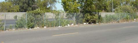

178 Workshop Number One Aesthetic Goals Encourage consistent maintenance 178 Page 65


179 Workshop Number One Aesthetic Goals Design ideas should: Be quality designs that will hold up over time Be compatible with Fulton Avenue Provide character to Auburn Boulevard Include large and small features Not be trendy 179 Page 66


180 Workshop Number One Functional Goals Provide Accessibility and Safety Meet ADA requirements Provide access to bus stop on north side Provide access to driveways Provide bike lanes per the Bikeway Master Plan Provide adequate street lighting Continue detached widened sidewalk 180 Page 67


181 Workshop Number One Functional Goals Improve traffic safety and functionality Provide access for delivery vehicles Allow left turn access into properties Provide U-turn capability at intersections Slow traffic to acceptable speeds Make general navigation more clear 181 Page 68

182 Workshop Number One Planning Goals Encourage variety Design diversity create character Business diversity plan for uses to change Allow flexibility 182 Page 69
183 Workshop Number One Goals of the Special Planning Area Enhance Retail Sales Opportunities Expand Community Services Enhance the portal to the Arden Arcade Community Create a sense of Place/Identity Enhance Traffic Safety 183 Page 70

184 Workshop Number One Planning Goals Streamline approval process SPA Ordinance to provide guidance Architectural design Landscaping Lighting Parking and circulation Design standards will define appropriate design Designs compatible with the design standards will receive accelerated approval process 184 Page 71
185 Workshop Number One Planning Goals Provide Coordination Coordinate public and private projects Avoid duplicating or conflicting projects Coordination between public jurisdictions 185 Page 72

186 Workshop Number One Land Use Mix of land uses Compatibility among uses Supporting and complementary uses Economic viability 186 Page 73


187 Design Response Proposed Streetscape Master Plan and Special Planning Area Front setbacks deep enough to allow visible store fronts Higher buildings toward Auburn Blvd frontage Open up the center of parcels Share parking and driveways Architecture guidelines that emphasize modern style 187 Page 74
188 Design Response Proposed Streetscape Master Plan and Special Planning Area Allow up to 4 stories within 120 feet of street 188 Page 75


189 Design Response Proposed Streetscape Master Plan and Special Planning Area Open up the center of parcels Share parking and driveways 189 Page 76


190 Design Response 190 Page 77


191 Design Response 191 Page 78


192 Design Response 192 Page 79


193 Design Response 193 Page 80


194 Design Response Signage 194 Page 81
195 Design Response Section A 195 Page 82

196 Design Response Section B 196 Page 83
197 Design Response Section C 197 Page 84


198 Design Response Section D 198 Page 85

199 Design Response Section E 199 Page 86


200 Design Response Perspective Page 87


201 Design Response Perspective Page 88

202 The vision to anticipate that which may come to be. The creativity to realize what is envisioned. 202 Page 89
203 203 Page 90
204 204 Page 91
205 205 Page 92
206 206 Page 93


207 Auburn Boulevard Special Planning Area and Streetscape Master Plan Auburn Boulevard Stakeholders Meeting March 29, :00pm Agenda Welcome / Introductions Review of Progress and Outcome of Public Charrette Round Table Discussion Planning Options Streetscape Options Next Steps Adjourn Troy Givans County of Sacramento 700 H Street, Room 7650 Sacramento, CA givanst@saccounty.net Donna Melendez Sacramento Housing and Redevelopment Agency 600 I Street, Ste. 250 Sacramento, CA x1279 dmelendez@shra.org Christine Anderson The HLA Group 1990 Third Street, Ste. 500 Sacramento, CA canderson@hlagroup.com 207 Page 94
208 The HLA Group Landscape Architects & Planners, Inc. Community Design Parks and Recreation Urban Design Land Planning Environmental Design MEETING MINUTES Project Name: Auburn Boulevard Special Planning Area (SPA) & Streetscape Master Plan Auburn Boulevard Stakeholders (ABS) Meeting Project Number: Meeting Date: March 29, 2006 Meeting Time: Attending: Recorded By: See sign in sheet Susan Collopy 1990 Third Street Suite 500 Sacramento, CA fax Summary of Meeting: Divergent Issues, need resolution: Bike lanes and number of traffic lanes Review Design Response/Make some decisions. Shared driveways/shared rear access. Will not be mandated. Building height- up to 4 stories (Can we go higher?). Reaction to higher buildings: Surprised, developer friendly What would be the uses? Bigger Scale, intrigued Consensus on higher building OK to go for it. No negative responses at charrette Setback at Auburn need a standard front setback if buildings move forward, blocks views of existing buildings - don t plan to move the setback forward unlike current urban planning. Need to clarify rear property line compatibility issues One storey only. Slide w/graph shows no buildings at property line plan view shows edge. Landscaping along the setback- liked, could provide identity for the district. Bus stop/median Issues: Move bus stop to Morse Avenue instead of mid-block. Signalize Morse it is on a list to be signalized. Coordinate bus stop locations w/rt. --Median, land width traffic flow issues --Medians trucks need to have access --Medians are along term goal strategically place them Look into 5 years, 10 years down the road? Can t really plan for them right now. Goal: To reduce the number of driveway cuts. cc: Attendees / The HLA Group 208 Page 95
209 The HLA Group Landscape Architects & Planners, Inc. Community Design Parks and Recreation Urban Design Land Planning Environmental Design **Concern that first documents don t show median location, need to be designed later, once street has evolved. Define median. Bike lane Consider 1 wide bike lane with a curb, class 1 bike lane? Bike Master Plan Update pending. This would be the place to address the issue of whether or not to have a bike lane on Auburn Blvd. Consensus: Against the Bike Lane. Bus Stops 1. Existing bus stop at Desert Industries might move to Morse Ave. 2. Bus turn outs would be desirable. K-Rail Main issue to business owners: -Not a priority -if want, development to occur, improve visibility from freeway --accelerate this process, will accelerate development. -Supervisor Peter s office is trying to get proposed landscape improvements on Caltrans ROW to move forward. -5 years out? County & Caltrans are working together to move this forward. K-Rail costs $300 LF x 2.1 miles. Signage -Locations are not finalized yet - Need a timeline for when would it happen -Who would pay for signs? -Transportation fund -Grants Sup. Peters could provide input Any signage should say Auburn Blvd. not just Auburn to avoid confusion with the town of Auburn. Business owners want to signage allowed on the building. Bell Avenue off-ramp Hazardous, no plans to modify interchange, can t correct, note that it is a problem! 2 lanes east of Fulton, lanes go from 2 down to 1 lane, each side of the street, traffic concerns. Proposed plans has: 1 lane each way (many concerns), -Solution is not determined yet Third Street Suite 500 Sacramento, CA fax cc: Attendees / The HLA Group 209 Page 96
210 The HLA Group Landscape Architects & Planners, Inc. Community Design Parks and Recreation Urban Design Land Planning Environmental Design Funding for Project: -Plan first, then review funding options, use plan to help get funding could create TBID **Aware to aesthetics concerns w/k-rail K-Rail if landscaped on bothe sides, then less graffiti Consensus on street monuments and signs? Ok, like signs, the large sign is a bigger priority Third Street Suite 500 Sacramento, CA fax **Primary issues that are not resolved are: concerns about the number of traffic lanes proposed, proposed median locations, and the proposed signage requirements. cc: Attendees / The HLA Group 210 Page 97
211 West Auburn Boulevard Special Planning Area Ordinance and Streetscape Master Plan Approval Document Conditions of Approval 211
212 212
213 213 Page 99
214 214 Page 100
215 215 Page 101
216 216 Page 102
217 217 Page 103
218 A D D E N D U M #1 Control No.: Type: CZB-ZOB For the Agenda of: July 23, 2008 Agenda Item No. 9 TO: FROM: SUBJECT: BOARD OF SUPERVISORS PLANNING AND COMMUNITY DEVELOPMENT DEPARTMENT WEST AUBURN BOULEVARD SPECIAL PLANNING AREA ORDINANCE AND STREETSCAPE MASTER PLAN CONTACT: Troy Givans, Principal Planner, , givanst@saccounty.net Tricia Stevens, Principal Planner, , stevenst@saccounty.net Overview: The West Auburn Special Planning Area (SPA) area is within the Arden Arcade Community Special Sign District and the Interstate-Business Route 80 Special Sign Corridor. The SPA Ordinance currently requires that signage in the SPA area conform to the requirements of both the Special Sign District and Corridor, except for specific exemptions listed in Section Four: M (Signs and Graphics) of the Ordinance. This addendum changes the language to remove the requirement that projects in the SPA area conform to the Special Sign Corridor regulations. Staff believes that these regulations are overly restrictive for this business area. The Special Sign District regulations will provide adequate commercial signage and maintain the requirements for quality monument signage. In addition, a number of other modifications to the document have been made and are included in the attached Errata Sheet (Attachment A ). Of note, Table 3.2 (Permitted Land Uses) now includes a footnote regarding uses not permitted in the Neighborhood Connectivity Zones and one that places additional restrictions on noise related to auto uses. In addition, Table 3.2 now specifies uses that would fall under the General Merchandise category (J) but would not be permitted. These changes are to the September 2006 Public Review Draft contained within the EIR. Staff Recommendations: Staff is recommending APPROVAL of the proposed project as revised. 218 Page 104
219 WEST AUBURN BOULEVARD 06-CZB-ZOB-0695 Various A. Recommended Conditions: These conditions integrate Mitigation Measures from the Draft EIR and will be included as an appendix to the SPA. 1. Widen the northbound and eastbound approaches and re-stripe the westbound approaches to the Auburn Boulevard/Fulton Avenue intersection to provide the following lane configurations: a. One left-turn lane, two-through lanes, and a right-turn lane on the northbound approach; b. Two left-turn lanes, two-through lanes, and a right-turn lane on the eastbound approach; c. One left-turn lane, two through lanes, and a right-turn lane with overlap phasing on the westbound approach. Project Fair Share = 75% of project costs. Trigger- When daily traffic volumes on Auburn Boulevard between Bell Avenue and Fulton Avenue exceed 6,580 ADT and exceed 16,760 ADT on Auburn Boulevard between Fulton Avenue and Business 80 Eastbound Off-ramp (Watt Avenue). 2. Install a traffic signal at the intersection of Auburn Boulevard/Morse Avenue. Project Fair Share = 84% of project costs. Trigger- When daily traffic volumes on Auburn Boulevard between Fulton Avenue and the Business 80 Eastbound Off-ramps (Watt Avenue) exceed 12,900 ADT. 3. Install a traffic signal, northbound left-turn lane, and a southbound right-turn lane at the intersection of Fulton Avenue/Business 80 westbound ramps. The following measures shall be included in the design of the traffic signal: 1. Advanced detection shall be placed on the ramp. 2. Protocols shall be included in the traffic signal to allow for pre-emption of the signal system to clear the ramp when vehicle queues extend to the advanced detectors. Project Fair Share = 42% of project costs. 4. In order to reduce PM 10 /dust emissions to less than significant levels, any/all new construction or improvement projects shall implement level three mitigation as defined by the Sacramento Metropolitan Air Quality Management District, which includes the following measures: a. Keep soil moist at all times; TS:JCB:jcb:jrc ad Page 105
220 WEST AUBURN BOULEVARD 06-CZB-ZOB-0695 Various b. Maintain two feet of freeboard space on haul trucks; c. Use emulsified diesel or diesel catalysts on applicable heavy-duty diesel construction equipment. 13. To ensure compliance with General Plan Noise Element standards of 65 db Ldn or less for residential/transient lodging outdoor activity areas and 45 db Ldn or less for residential/transient lodging interiors, the following measures shall apply: a. Any/all common outdoor activity areas shall be designed and attenuated such that after all applied shielding or buffering mechanisms noise levels are 65 db Ldn or less. b. Any/all new residential/transient lodging construction shall be designed and attenuated such that the interior noise level does not exceed 45 db Ldn. The above measures must be accompanied by an acoustical analysis, prepared by a qualified acoustical consultant and verified by the Department of Environmental Review and Assessment, substantiating that the General Plan Noise Element standards cited above will be met. 14. Table 3.2, Footnote #6 shall be added to all applicable uses that may include service bays, automotive/boat/or motorcycle repair facilities, tire shops, machine shops, or where noise producing machinery is utilized. Additionally, the footnote shall be modified slightly to include car wash facilities and following this, the footnote shall be added to the Car Wash use on Table In order to minimize nuisance noise from loading dock operations on nearby residential receptors the following measures should be required for new construction or redevelopment in the SPA area: Restrict loading dock operations and truck arrivals and departures to the daytime hours. Prohibit engine idling at loading docks. Place noise attenuating barriers and landscaping around loading docks. Or, if a deviations from the above are requested, then Provide an acoustical analysis, completed by a qualified acoustical consultant that demonstrates through noise attenuating measures that the TS:JCB:jcb:jrc ad Page 106
221 WEST AUBURN BOULEVARD 06-CZB-ZOB-0695 Various General Plan Noise Element standards of 65 db Ldn or less for outdoor activity areas and 45 db Ldn or less for interiors is met at nearby residential receivers. 16. Prior to the issuance of any building or grading permits on APN (2300 Auburn Boulevard), APN (2540 Auburn Boulevard), and APN (3000 Auburn Boulevard), applicant shall consult with the Sacramento County Environmental Management Department (EMD), to obtain a site evaluation and to determine the need for a Soil Management Plan or a Health Risk Assessment. If said analyses are required, all site clean-up recommendations, in consultation with EMD, shall be completed prior to the issuance of any building or grading permit, unless EMD approves clearance due to extenuating circumstances. 17. Prior to execution of SMP improvement projects and redevelopment/ development projects within the SPA area, the project proponent(s) shall submit an arborist report for the project impact areas when appropriate habitat exists. The report shall include the species, diameter, dripline, and health of the trees, and shall be prepared by an ISA certified arborist. The report shall include an exhibit that shows the trees and their dripline in proximity to the project improvements. The report shall identify any tree that will be removed and quantify the dripline encroachment from project equipment or facilities. a. With the exception of the trees removed and compensated for through Part B below, all healthy native oak trees that are 6 inches dbh or larger on the project site, all portions of adjacent off-site healthy native oak trees that are 6 inches dbh or larger which have driplines that extend onto the project site, and all off-site healthy native oak trees that are 6 inches dbh or larger which may be impacted by utility installation and/or improvements associated with this project, shall be preserved and protected as follows: (1) A circle with a radius measurement from the trunk of the tree to the tip of its longest limb shall constitute the dripline protection area of each tree. Limbs must not be cut back in order to change the dripline. The area beneath the dripline is a critical portion of the root zone and defines the minimum protected area of each tree. Removing limbs that make up the dripline does not change the protected area. (2) Any protected trees on the site that require pruning shall be pruned by a certified arborist prior to the start of construction work. All pruning shall be in accordance with the American National TS:JCB:jcb:jrc ad Page 107
222 WEST AUBURN BOULEVARD 06-CZB-ZOB-0695 Various TS:JCB:jcb:jrc ad Standards Institute (ANSI) A300 pruning standards and the International Society of Arboriculture (ISA) Tree Pruning Guidelines. (3) Prior to initiating construction, temporary protective fencing shall be installed at least one foot outside the driplines of the protected trees within 100 feet of construction related activities, in order to avoid damage to the tree canopies and root systems. Where encroachment occurs, temporary high visibility protective fencing shall be installed a maximum of one foot outside the work areas in order to minimize damage to the tree canopies and root systems. (4) Any removal of paving or structures (i.e. demolition) that occurs within the dripline of a protected oak tree shall be done under the direct supervision of a certified arborist. To the maximum extent feasible, demolition work within the dripline protection area of the oak tree shall be performed by hand. If the certified arborist determines that it is not feasible to perform some portion(s) of this work by hand, then the smallest/lightest weight equipment that will adequately perform the demolition work shall be used. (5) No signs, ropes, cables (except those which may be installed by a certified arborist to provide limb support) or any other items shall be attached to the protected trees. Small metallic numbering tags for the purpose of preparing tree reports and inventories shall be allowed. (6) No vehicles, construction equipment, mobile home/office, supplies, materials or facilities shall be driven, parked, stockpiled or located within the driplines of protected trees. (7) No grading (grade cuts or fills) shall be allowed within the driplines of protected trees, except for the minimum required for construction and streetscape improvements. (8) Drainage patterns on the site shall not be modified so that water collects or stands within, or is diverted across, the dripline of any protected tree. (9) No trenching shall be allowed within the driplines of protected trees. If it is absolutely necessary to install underground utilities within the dripline of a protected tree, the utility line shall be bored and jacked under the supervision of a certified arborist. 222 Page 108
223 WEST AUBURN BOULEVARD 06-CZB-ZOB-0695 Various (10) The construction of impervious surfaces within the driplines of protected trees shall be stringently minimized. When it is absolutely necessary, a piped aeration system per County standard detail shall be installed under the supervision of a certified arborist. (11) All portions of any masonry wall that will encroach into the dripline protection area of any protected tree shall be constructed using grade beam wall panels and posts set no closer than 10 feet on center. Any wrought iron fencing shall be similarly installed, with posts set no closer than 10 feet on center. Posts shall be spaced in such a manner as to maximize the separation between the tree trunks and the posts in order to reduce impacts to the trees. (12) Trunk protection measures, per Sacramento County standards, shall be used for all protected trees where development/construction activity, including installation of any masonry wall and wrought iron fence, occurs within 10 feet of the trunk of a tree. (13) No sprinkler or irrigation system shall be installed in such a manner that sprays water or requires trenching within the driplines of protected trees. An above ground drip irrigation system is recommended. (14) Landscaping beneath oak trees may include non-plant materials such as bark mulch, wood chips, boulders, etc. The only plant species which shall be planted within the driplines of oak trees are those which are tolerant of the natural semi-arid environs of the trees. A list of such drought-tolerant plant species is available at the Department of Environmental Review and Assessment. Limited drip irrigation approximately twice per summer is recommended for the understory plants. b. To the maximum extent feasible, all on-site healthy native oak trees shall be protected and preserved. Any substantial (>20%) encroachment and/or removal of native oak trees shall be compensated by planting native oak trees (valley oak/quercus lobata, interior live oak/quercus wislizenii, and blue oak/quercus douglasii), equivalent to the dbh inches lost, based on the ratios listed below, at locations that are authorized by the Department of Environmental Review and Assessment. On-site preservation of native oak trees that are less than 6 inches (<6 inches) dbh, may also be used to meet this compensation requirement. Encroachment of over 20 percent within the dripline radius of native trees will require compensatory mitigation based on the percentage of encroachment TS:JCB:jcb:jrc ad Page 109
224 WEST AUBURN BOULEVARD 06-CZB-ZOB-0695 Various multiplied by the dbh. Encroachment over 50 percent will require compensation for the entire tree. Equivalent compensation based on the following ratio is required: one preserved native oak tree < 6 inches dbh on-site = 1 inch dbh one deepot seedling (40 cubic inches or larger) = 1 inch dbh one 15-gallon tree = 1 inch dbh one 24-inch box tree = 2 inches dbh one 36-inch box tree = 3 inches dbh Replacement tree planting shall be completed prior to the issuance of building permits or a bond shall be posted by the applicant in order to provide funding for purchase, planting, irrigation, and 3-year maintenance period, should the applicant default on replacement tree mitigation. The bond shall be in an amount equal to the prevailing rate of the County Tree Preservation Fund. Prior to the approval of Improvement Plans or building permits, a Replacement Oak Tree Planting Plan shall be prepared by a certified arborist or licensed landscape architect and shall be submitted to the Environmental Coordinator for approval. The Replacement Oak Tree Planting Plan(s) shall include the following minimum elements: (1) Species, size and locations of all replacement plantings and < 6-inch dbh trees to be preserved; (2) Method of irrigation; (3) The Sacramento County Standard Tree Planting Detail L-1, including the 10-foot deep boring hole to provide for adequate drainage; (4) Planting, irrigation, and maintenance schedules; (5) Identification of the maintenance entity and a written agreement with that entity to provide care and irrigation of the trees for a 3-year establishment period, and to replace any of the replacement oak trees which do not survive during that period. TS:JCB:jcb:jrc ad Page 110
225 WEST AUBURN BOULEVARD 06-CZB-ZOB-0695 Various (6) Designation of 20-foot root zone radius and landscaping to occur within the radius of oak trees < 6-inches dbh to be preserved on-site. No replacement tree shall be planted within 15 feet of the driplines of existing oak trees or landmark size trees that are retained on-site, or within 15 feet of a building foundation or swimming pool excavation. The minimum spacing for replacement oak trees shall be 20 feet on-center. Examples of acceptable planting locations are publicly owned lands, common areas, and landscaped frontages (with adequate spacing). Generally unacceptable locations are utility easements (PUE, sewer, storm drains), under overhead utility lines, private yards of single family lots (including front yards), and roadway medians. Oak trees <6 inches dbh to be retained on-site shall have at least a 20-foot radius suitable root zone. The suitable root zone shall not have impermeable surfaces, turf/lawn, dense plantings, soil compaction, drainage conditions that create ponding, utility easements, or other overstory tree(s) within 20 feet of the tree to be preserved. Trees to be retained shall be determined to be healthy and structurally sound for future growth, by an ISA Certified Arborist subject to Department of Environmental Review and Assessment approval. If oak tree replacement plantings are demonstrated to the satisfaction of the Environmental Coordinator to be infeasible for any or all trees removed, then compensation shall be through payment into the County Tree Preservation Fund. Payment shall be made at a rate of $ per dbh inch removed but not otherwise compensated, or at the prevailing rate at the time payment into the fund is made. 18. Install bicycle lanes on Auburn Boulevard along the westbound and eastbound sides of the street and provide an access network that links bike lanes to bike parking facilities. 19. Provide bike racks at a minimum of two locations within each block, equally spaced, and ensure that new developments provide patrons and employees with bike storage facilities. 20. Provide a pedestrian access network that connects redevelopment to all existing or planned pedestrian facilities contiguous within the project site. 21. Provide a pedestrian pathway through all parking areas that clearly defines a pathway between transit facilities and building entrances. TS:JCB:jcb:jrc ad Page 111
226 WEST AUBURN BOULEVARD 06-CZB-ZOB-0695 Various 22. Minimize barriers to pedestrian access and interconnectivity. Eliminate, where feasible, physical barriers such as walls or berms and slopes between residential and non-residential uses within the SPA area that impede bicycle or pedestrian circulation. 23. Construct bus shelters along the Boulevard at all transit stops. 24. Orient projects towards existing transit, bicycle or pedestrian corridors and reduce setback distances to below minimum standards. 25. Orient 75 or more percent of new homes and/or buildings to face either north or south (within 30 degrees of N/S). 26. Replace incandescent and mercury vapor street and parking lot lights with energy efficient alternatives and install new energy efficient alternatives where new street or parking lot lights are required. 27. Require sustainable landscaping such that 75% or more of the species within the landscape plan are considered drought tolerant species. 28. Require the installation of low-flow toilets in all new development and, where feasible, redevelopment along the Boulevard. III. ATTACHMENT A. Errata Sheet of Modifications to Auburn SPA Document This addendum report was prepared on July 16, TS:JCB:jcb:jrc ad Page 112
227 West Auburn Boulevard Special Planning Area Ordinance and Streetscape Master Plan Newsletters and Public Mailings 227
228 228


229 ISSUE NO. 1 WINTER 2006 Help Revitalize Auburn Boulevard You can make a difference in the future of Auburn Boulevard by participating in a community planning process that will create a new look for the corridor. Once America s Main Street and a major highway running from San Francisco to Atlantic City, Highway 40 helped defi ne the golden age of the automobile. Art Deco diners and motels enabled cross country drivers to travel comfortably and conveniently. No longer designated as a highway, Auburn Boulevard today shows only hints of its glory days as Highway 40. Now the Sacramento Housing & Redevelopment Agency and Project Area the County of Sacramento are launching a planning and design initiative to shape development on Auburn Boulevard. Streetscapes and land use plans will pave the way for improved traffi c fl ow, create an attractive commercial and community identity, and revitalize the corridor s economy. Residents, businesses and property owners affected by improvements are urged to participate in the planning for Auburn Boulevard by attending the two design charettes described on page 2. Come join the community planning process and help determine Auburn Boulevard s future. 229 IN THIS Issue The Process Storied Past, Bright Future Get in Touch Building Community Page 114


230 Storied Past, Bright Future Zoning Code of Sacramento County The former Dodge City Inn was redeveloped into the 146-unit Ladi Senior Apartments. With renewed private sector investment in new and existing corridor businesses, the future looks bright for Auburn Boulevard. The Streetscape Master Plan and Special Planning Area ordinance are the next critical elements of the corridor s redevelopment. Combined, they will position Auburn Boulevard to attract new investment and to respond quickly to the changing needs of the business community. Vision, smart planning, strategic investment, and the continued partnership among the County, Agency, business and community leadership are the keys to success a safe, attractive, competitive Auburn Boulevard. The Auburn Boulevard Redevelopment Area is a two-mile commercial corridor comprised of 118-acres in the County and City of Sacramento fronting the Capital City freeway. The Redevelopment Area was adopted in October 1992, in response to physical and economic deterioration, and illegal activity. In response to these conditions, the Agency and County successfully partnered with concerned property and business owners, residents, and other agencies to address the pressing health and safety issues. Redevelopment initiatives tackled a number of the physical challenges impacting Auburn Boulevard. For example: ity input process works... GET IN TOUCH In addition to the Auburn Boulevard Streetscape project designed to revitalize the area, the County is undergoing a process of decentralizing many services. The new service model is designed to provide residents and business owners of the Arden Arcade area with additional points of contact within the community and to provide more effi cient public services. To coordinate this effort, the County has appointed a Service Area Manager for the Arden Arcade area to assist the community in accessing public services. To help in these efforts, a partial list of important contacts is listed here: harette is held to present nditions and get ideas from residents, businesses and wners. LAN AREA ORDINANCE es land uses, building heights, quirements, recommended ral styles, and other guidelines community input. Service Area Manager Bobbe Dworkis Sheriff Non-Emergency Abandoned Vehicles/Hazard & Nuisance Hazardous Waste Removal ommunity comments, the am creates a fi nal plan and Sheriff Service Center Curb, Gutter & Sidewalk Maintenance A lack of suffi cient water fl ow prohibited all new development on the corridor. In 2001, two miles of 12-inch water line were installed, funded by $1.2 million of Community Development Block Grant (CDBG) funds; A new 67-room Hampton Inn and Suites replaced the old Rolling Green Motel; and cha rette 230 Graffiti Removal Reporting Sewer Emergencies

231 Sacramento Housing & Zoning Redevelopment Code of Sacramento Agency County 600 I Street, Suite 250 Sacramento, CA Coming Events Charette #1, February 9, 2006 Thursday 6-8 PM Clarion Hotel, Sycamore Room Fulton Avenue & Auburn Boulevard 2600 Auburn Boulevard Sacramento, CA Charette #2, March 23, 2006 Thursday 6-8 PM Community Presentations - Draft Plan, May Approvals, Summer 2006 For More Information call Troy Givans Building Community Exciting changes are happening in your neighborhood and you can be part of them. Your fresh ideas can help determine how Auburn Boulevard between Howe and Watt Avenues can grow and improve. Creating a new Specifi c Plan Area Ordinance and Streetscape Master Plan is intended to: Stimulate job growth Create a new identity Beautify the area Attract a wider variety of businesses Improve safety Stimulate Reinvestment What are your ideas for Auburn Boulevard? Think of other neighborhoods, other cities what do you admire about them? What do you like about your neighborhood? What makes it special? What do you want to change the most? What types of 231 businesses would you like to see? Two community charettes are scheduled so you can learn more about plans to improve Auburn Boulevard. You are invited to attend these meetings and share your opinions on the current conditions and how to improve them: February 9, 2006: See maps, photos and hear some history of the area. Then share your ideas about what you like and what you want for Auburn Boulevard. March 23, 2006: See draft plans for the recreated future of Auburn Boulevard and have a chance to make suggestions for the fi nal plan. Have your voice heard. Join the process to bring positive change to Auburn Boulevard. Page 116

232 232 Page 117

233 233 Page 118
234 Thursday December 15, :00 p.m. Clarion Hotel 2600 Auburn Boulevard Sacramento, CA Auburn BoulevardB Stakeholder Meeting Thursday, December 15, p.m. to 2:30 p.m. Clarion Hotel Fulton Avenue & Auburn Boulevard 2600 Auburn Blvd Sacramento, CA Page 119


235 Thursday February 2nd, :00 PM Clarion Hotel Sycamore Room 2600 Auburn Boulevard Sacramento, CA Stakeholder Meeting Auburn Boulevard c/o The HLA Group 1990 Third Street, Suite 500 Sacramento, CA Thursday, February 2nd, :00 PM to 2:30 PM Clarion Hotel/ Sycamore Room Fulton Avenue & Auburn Boulevard 2600 Auburn Boulevard Sacramento, CA For more information please contact Christine Anderson, 235 Page 120 The HLA Group, Landscape Architects & Planners (916)


236 H a v e Y o u r V o i c e H e a r d PLANNING A UBURN B O ULEVARD J oin Us at a Community Design Workshop uburn oulevard Community Design Workshop A u b urn Boul evard c /o The HLA Group 1990 Third Street, Suite 500 Sacramento, CA Thursday, March 23, 6-8 PM, 2006 Clarion Hotel, Sacramento Fulton Avenue & Auburn Boulevard Auburn Boulevard For more information contact Troy Givans, C ounty of Sacramento Economic Development Department, Page 121
DENVER DESIGN DISTRICT GDP
 DENVER DESIGN DISTRICT GDP Urban Design Standards and Guidelines November 17, 2008 Amended February 3, 2016 City and County of Denver CF Property Management, Inc. C/O Denver Design District - Starboard
City of Farmington. Downtown Plan. Amendment to the 1998 Master Plan Adopted October 11, 2004
 City of Farmington Amendment to the 1998 Master Plan Adopted October 11, 2004 Introduction Planning Background 1 Scope and Components of the Plan Amendment 2 Concept Introduction 3 Plan Concepts 3 Conceptual
Policies and Code Intent Sections Related to Town Center
 Policies and Code Intent Sections Related to Town Center The Town Center Vision is scattered throughout the Comprehensive Plan, development code and the 1994 Town Center Plan. What follows are sections
Table of Contents. Elm Avenue Improvement Plan City of Waco, Texas. Introduction 1. Existing Context 1 Figure 1 2.
 Table of Contents Introduction 1 Existing Context 1 Figure 1 2 Plan Guidelines 3 Future Urban Form 4 The West-End 4 Main Street 6 The East-End 7 Figure 2 9 Public Improvement Recommendations 7 General
4.1.3 LAND USE CATEGORIES
 4.1.3 LAND USE CATEGORIES a. City Center District The City Center District incorporates the existing character and mix of uses in downtown Belmont to encourage redevelopment and new development in keeping
Small Area Plan. South Gateway
 Small Area Plan Adopted May 12, 2008 South Gateway Purpose. The South Gateway Small Area Plan defines the City s expectations for the future of the southern entrance to the City at Interstate 85 and Highway
A. WHAT IS A GENERAL PLAN?
 I. Introduction A. WHAT IS A GENERAL PLAN? A general plan is the planning guideline for the future of a city. It contains goals and policies which regulate urban development, the protection of the natural
Gold Line Bus Rapid Transit Transit Oriented Development (BRTOD) Helmo Station Area Plan
 Helmo Station Area Plan") Appendix F Gold Line Bus Rapid Transit Transit Oriented Development (BRTOD) Helmo Station Area Plan Introduction and Purpose of the Plan The Gold Line Bus Rapid Transit facility is an eleven-mile dedicated
Appendix F Gold Line Bus Rapid Transit Transit Oriented Development (BRTOD) Helmo Station Area Plan Introduction and Purpose of the Plan The Gold Line Bus Rapid Transit facility is an eleven-mile dedicated
CHAPTER 1. Ms. Guajardo s Class - Central Elementary CH 1 1
 INTRODUCTION CHAPTER 1 Ms. Guajardo s Class - Central Elementary CH 1 1 1.1 SETTING South Centre City is a linear corridor south of Downtown Escondido paralleling Centre City Parkway and South Escondido
A BLUEPRINT FOR BROCKTON A CITY-WIDE COMPREHENSIVE PLAN
 A BLUEPRINT FOR BROCKTON A CITY-WIDE COMPREHENSIVE PLAN Public Meeting October 2016 1 Plan Summary and Discussion Public Meeting May 4 2017 City of Brockton Bill Carpenter, Mayor Department of Planning
A. Background Summary of Existing Challenges and Potential Possibilities. 1. Summary of Existing Assets and Potential Opportunities
 A. Background 1 A Main Street Master Plan Study was performed and completed in October of 2007. The study was initiated to review current land uses and development patterns along Main Street, from Parrish
EXHIBIT A. Tax Increment Reinvestment Zone No. 1 (Town Center) First Amended Project Plan 1
 First Amended Project Plan 1") EXHIBIT A Tax Increment Reinvestment Zone No. 1 (Town Center) First Amended Project Plan 1 1 As amended by Resolution No. 2008-02-001(TR1R) of the Tax Increment Reinvestment Zone No.1, and approved to
EXHIBIT A Tax Increment Reinvestment Zone No. 1 (Town Center) First Amended Project Plan 1 1 As amended by Resolution No. 2008-02-001(TR1R) of the Tax Increment Reinvestment Zone No.1, and approved to
Land Use Amendment in Southwood (Ward 11) at and Elbow Drive SW, LOC
 at and Elbow Drive SW, LOC") 2018 November 15 Page 1 of 10 EXECUTIVE SUMMARY This land use amendment application was submitted by Rick Balbi Architect on 2017 August 31 on behalf of Sable Developments Ltd, and with authorization from
2018 November 15 Page 1 of 10 EXECUTIVE SUMMARY This land use amendment application was submitted by Rick Balbi Architect on 2017 August 31 on behalf of Sable Developments Ltd, and with authorization from
hermitage town center
 hermitage town center A Community Vision prepared by Strada for The City of Hermitage and The Mercer County Regional Planning Commission January 2007 table of contents introduction 3 design principles
The transportation system in a community is an
 7 TRANSPORTATION The transportation system in a community is an important factor contributing to the quality of life of the residents. Without a sound transportation system to bring both goods and patrons
Town Center (part of the Comprehensive Plan)
") Town Center (part of the Comprehensive Plan) Mercer Island Town Center Looking North (2014) In 1994, a year-long process culminated in a set of design guidelines and code requirements for the Town Center
Town Center (part of the Comprehensive Plan) Mercer Island Town Center Looking North (2014) In 1994, a year-long process culminated in a set of design guidelines and code requirements for the Town Center
URBAN DESIGN BRIEF New Street Burlington, ON
 3225-3237 New Street Burlington, ON MARCH 2017 Prepared for: Royal Living Development Group Inc. Prepared by: adesso design inc. 218 Locke Street South, 2nd Floor Hamilton, ON L8P 4B4 t. 905.526.8876 3225-3237
TEMPLE MEDICAL & EDUCATION DISTRICT
 City of Temple, Texas TEMPLE MEDICAL & EDUCATION DISTRICT 1 Description. The City of Temple joined in partnership with key public and private entities to jointly promote education and medical activities
THAT the attached Terms of Reference for the Thornhill Centre Street Study be approved.
 COMMITTEE OF THE WHOLE AUGUST 18, 2003 THORNHILL CENTRE STREET STUDY PLANNING FILE: 15.92 Recommendation The Commissioner of Planning recommends: THAT the attached Terms of Reference for the Thornhill
1.0 VISION STATEMENT. December 6, PRINCIPLES
 Vision Statement Lincoln Regional Airport 1.0 VISION STATEMENT 1.1 City LOCATION of AND OVERVIEW The Easton Lincoln Place Land Use Master Plan identifies the principles, goals, policies, and standards
Community Design Plan
 Gardena General Plan 2006 Authority While the is not a required element of a General Plan, it is included because improving the community appearance and image is paramount to the overall quality of life
V. Vision and Guiding Principles
 V. Vision and Guiding Principles The Master Plan for the Powers Ferry Corridor seeks a foundation in the desires of the community. At times, various elements of the community offered opposing viewpoints,
The Five Components of the McLoughlin Area Plan
 The Five Components of the McLoughlin Area Plan This documents contains the complete language of the five components of the McLoughlin Area Plan: The Vision Statement The Values The Guiding Principles
Executive Summary. NY 7 / NY 2 Corridor
 Executive Summary NY 7 / NY 2 Corridor Transportation and Land Use Study December 2005 Prepared for: Town of Colonie Capital District Transportation Committee Prepared by: Introduction: Land use decisions
1.0 Purpose of a Secondary Plan for the Masonville Transit Village
 Report to Planning and Environment Committee To: Chair and Members Planning & Environment Committee From: John M. Fleming Managing Director, Planning and City Planner Subject: Masonville Transit Village
In surveys, Dallas residents say what they want to change most
 NEIGHBORHOODS ELEMENT In surveys, Dallas residents say what they want to change most in the city is its appearance they want it to look beautiful, with trees and pedestrian-friendly neighborhoods. The
Mark-up of the effect of the proposed Bronte Village Growth Area OPA No.18 on the text of section 24, Bronte Village, of the Livable Oakville Plan
 Mark-up of the effect of the proposed Bronte Village Growth Area OPA No.18 on the text of section 24, Bronte Village, of the Livable Oakville Plan Notes: This document is provided for information purposes
ARTICLE 6: Special and Planned Development Districts
 ARTICLE 6: Special and Planned Development Districts 6-10 Traditional Neighborhood Development (TND) District 6-10.10 Purpose and Intent The Traditional Neighborhood Development (TND) District provides
ARLINGTON COUNTY, VIRGINIA
 ARLINGTON COUNTY, VIRGINIA County Board Agenda Item Meeting October 15, 2005 DATE: September 28, 2005 SUBJECT: Request to Advertise the adoption of the 2005 Clarendon Sector Plan C. M. RECOMMENDATION:
John M. Fleming Managing Director, Planning and City Planner. Old East Village Dundas Street Corridor Secondary Plan Draft Terms of Reference
 Report to Planning and Environment Committee To: From: Subject: Chair and Members Planning & Environment Committee John M. Fleming Managing Director, Planning and City Planner Old East Village Dundas Street
Welcome. Walk Around. Talk to Us. Write Down Your Comments
 Welcome This is an information meeting introducing the applications for proposed redevelopment of the Yorkdale Shopping Centre site at 3401 Dufferin Street and 1 Yorkdale Road over the next 20+ years,
URBAN DESIGN BRIEF REPORT
 URBAN DESIGN BRIEF REPORT PREPARED FOR 2568401 ONTARIO INC NEW GASBAR, CONVENIENCE STORE & CARWASH DEVELOPMENT @ 1509 FANSHAWE PARK ROAD WEST LONDON, ONTARIO GAMA ENGINEERING INC. PROJECT NUMBER 1669 PREPARED
FUTURE LAND USE ELEMENT
 FUTURE LAND USE ELEMENT GOAL I: To create and sustain a great place to live, play, and prosper Objective 1: The City of Ocala shall incorporate the principles and strategies of the Ocala 2035 Vision into
Hockessin Community Redevelopment Plan
 Hockessin Community Redevelopment Plan 3.1 Introduction The Community Redevelopment Plan for the Village of Hockessin is the result of the people s vision for a distinct village center that serves as the
THEMES, VISION, + PRINCIPLES
 CHAPTER 2: THEMES, VISION, + PRINCIPLES This page intentionally left blank. 20 VISION DRAFT AUGUST 2018 2 2 THEMES, VISION, + GUIDING PRINCIPLES The Key Themes, Vision, and Guiding Principles presented
Staff Report and Recommendation
 Community Planning and Development Planning Services 201 W. Colfax Ave., Dept. 205 Denver, CO 80202 p: 720.865.2915 f: 720.865.3052 www.denvergov.org/cpd TO: City Council Neighborhoods and Planning Committee
C. Westerly Creek Village & The Montview Corridor
 C. Westerly Creek Village & The VISION Community Vision When the goals of the city are achieved Westerly Creek Village, a distinctive community defined by Montview Boulevard and Westerly Creek, is a strong
Derry Green Corporate Business Park
 Town of Milton Derry Green Corporate Business Park Urban Design Guidelines BMI/Pace - June 2010 Draft 3 Prepared by: Brook McIlroy Planning + Urban Design / Pace Architects Suite 300-51 Camden Street Toronto,
Planning Districts INTRODUCTION
 INTRODUCTION To facilitate detailed examination of development prospects for all areas of the community, Delano has been divided into 14 planning districts. The location of these planning districts is
URBAN DESIGN BRIEF. 2136&2148 Trafalgar Road. Town of Oakville
 URBAN DESIGN BRIEF 2136&2148 Trafalgar Road Town of Oakville Prepared By: METROPOLITAN CONSULTING INC For 2500674 Ontario Inc November 2016 TABLE OF CONTENTS Page No. 1.0 Introduction/Description of Subject
Chapter 1: Introduction
 Chapter 1: Introduction The Penn Avenue Community Works Corridor Vision and Implementation Framework presents an integrated communitybased vision and a coordinated, long-term implementation framework for
Glenborough at Easton Land Use Master Plan
 Implementation 114 9.0 IMPLEMENTATION 9.1 OVERVIEW This chapter summarizes the administrative procedures necessary to implement the proposed land use plan, infrastructure improvements, development standards,
Corridor Vision. 1Pursue Minnehaha-Hiawatha Community Works Project. Mission of Hennepin County Community Works Program
 1Pursue Minnehaha-Hiawatha Community Works Project Minnehaha-Hiawatha Community Works is a project within the Hennepin Community Works (HCW) program. The mission of the HCW program is to enhance how the
ELMVALE ACRES SHOPPING CENTRE MASTER PLAN
 ELMVALE ACRES SHOPPING CENTRE MASTER PLAN Contents 1.0 INTRODUCTION... 2 2.0 LOCATION... 2 3.0 EXISTING CONTEXT... 2 4.0 VISION & GUIDING PRINCIPLES... 2 5.0 LAND USE AND BUILT FORM... 4 5.1 St. Laurent
YONGE STEELES CORRIDOR SECONDARY PLAN. Young + Wright / IBI Group Architects Dillon Consulting Ltd. GHK International (Canada) Ltd.
 Ltd.") PART A: PREAMBLE 1.0 PURPOSE The purpose of this Secondary Plan is to provide a development framework for intensification of the Yonge/ Steeles corridor including the north side of Steeles Avenue West
PART A: PREAMBLE 1.0 PURPOSE The purpose of this Secondary Plan is to provide a development framework for intensification of the Yonge/ Steeles corridor including the north side of Steeles Avenue West
URBAN DESIGN BRIEF URBAN DESIGN BRIEF 721 FRANKLIN BLVD, CAMBRIDGE August 2018
 URBAN DESIGN BRIEF URBAN DESIGN BRIEF 721 FRANKLIN BLVD, CAMBRIDGE August 2018 DESIGN BRIEF CONTENTS PART A 1.0 INTRODUCTION 2.0 DESCRIPTION & ANALYSIS OF SITE CONTEXT 3.0 DESIGN CONSTRAINTS AND OPPORTUNITIES
EXECUTIVE SUMMARY DRAFT CHAPTER 1 INTRODUCTION EXECUTIVE SUMMARY
 CHAPTER 1 EXECUTIVE SUMMARY INTRODUCTION Through the joint efforts of the City of Tulsa planning staff and the Land Services division of Indian Nations Council of Governments (INCOG), the Berryhill Land
Public input has been an important part of the plan development process.
 Lakewood s Comprehensive Plan recognizes that transportation helps shape the community, and that the way the community provides for the safe and efficient movement of people affects the character of the
3.10 LAND USE SETTING PROJECT SITE EXISTING LAND USE DESIGNATIONS AND ZONING. General Plan Land Use Designations.
 This section of the Draft EIR addresses the existing land uses on and adjacent to the project site and discusses the potential impacts of the proposed project on existing land uses. Key issues addressed
CHAPTER 3 VISION, GOALS, & PLANNING PRINCIPLES. City of Greensburg Comprehensive Plan. Introduction. Vision Statement. Growth Management Goals.
 CHAPTER 3 VISION, GOALS, & PLANNING PRINCIPLES Introduction The Greensburg Comprehensive Plan is intended as a working community document. A combination of long and short-term goals, this document is intended
Wadsworth Boulevard S TAT I O N A R E A P L A N
 Wadsworth Boulevard S TAT I O N A R E A P L A N City of Lakewood Adopted November, 2006 The Vision The City of Lakewood s overall vision is to transform the area around the light rail station into a mixed-use
The Lower SaLuda Greenway
 The Lower SaLuda Greenway InITIaTIve a FLourIShInG Greenway. a hub For economic GrowTh. a ConneCTIon BeTween CoMMunITIeS. In April 2017 the Michael J. Mungo Foundation and Lexington County commissioned
7Page 91 CLEMMONS COMMUNITY COMPASS 7 COMMUNITY CHARACTER
 7 Community Character The beauty of Clemmons won t necessarily be a reflection of our past, but our future. This quote from Comprehensive Plan Steering Committee member Wayne Dodson captures the essence
VILLAGE OF BOLTON HERITAGE CONSERVATION DISTRICT PLAN
 Page 1 1. INTRODUCTION AND BACKGROUND 1.1 THE PROJECT VILLAGE OF BOLTON HERITAGE CONSERVATION DISTRICT PLAN TERMS OF REFERENCE The Town of Caledon (Town) is a large, predominantly rural municipality with
I-35 CORRIDOR VISION PLAN INTRODUCTION. Purpose. Background
 INTRODUCTION Purpose The Interstate 35-E Corridor Plan is intended to work conjunctively with the 2010 Red Oak Comprehensive Plan to promote positive and quality development and redevelopment along Interstate
Chapter 2: Vision, Goals and Strategies
 Chapter 2: Vision, Goals and Lake Elmo Today & Tomorrow Comprehensive Plan 2040 2 VISION, GOALS & STRATEGIES - DRAFT 4-6-2018 INTRODUCTION Comprehensive Plan Purpose Perhapse the most important objective
DESIGN REVIEW COMMITTEE AGENDA ITEM
 DESIGN REVIEW COMMITTEE AGENDA ITEM AGENDA DATE: AUGUST 2, 2017 TO: THRU: FROM: SUBJECT: Chair Imboden and Members of the Design Review Committee Anna Pehoushek, Assistant Community Development Director
Chapter 1.0 Introduction
 Chapter 1.0 Introduction 1.1 Background The North Metro commuter rail line is part of the RTD FasTracks regional transit system expansion program to build more than 100 miles of rail transit throughout
URBAN DESIGN BRIEF 181 Burloak Drive, Oakville
 URBAN DESIGN BRIEF 181 Burloak Drive, Oakville February 2017 Our File: 1730B 230-7050 WESTON ROAD / WOODBRIDGE / ONTARIO / L4L 8G7 / T: 905 761 5588/ F: 905 761 5589/WWW.MHBCPLAN.COM TABLE OF CONTENTS
HE VISION. Building a Better Connected Place
 HE VISION Building a Better Connected Place WALK INTO THE FUTURE. Life in Cranberry, 2030 Here s what our residents told us they wanted to see in their community by 2030: The Cranberry of 2030 is a place
MEMORANDUM. DATE: March 15, Chairman and Members Community Redevelopment Agency. Leif J. Ahnell, C.P.A., C.G.F.O. Executive Director
 MEMORANDUM DATE: March 15, 2019 TO: FROM: Chairman and Members Community Redevelopment Agency Leif J. Ahnell, C.P.A., C.G.F.O. Executive Director SUBJECT: Camino Square, IDA No. CRP-16-02, located at 171
Table L-1 Summary Action Strategy. Action Item Timing Status Responsible Agency
 CHAPTER 4: CIRCULATION ELEMENT ISSUE #1: MAJOR THOROUFARES AND TRANSPORTATION ROUTES A balanced transportation system for Fontana is provided that meets the mobility needs of current and future residents
3. Project Description
 3.1 PROJECT LOCATION The Platinum Triangle (herein after also referred to as the Project Area ) is located at the confluence of the Interstate 5 (I-5 Freeway) and the State Route 57 (SR-57 Freeway), in
NOTICE OF SPECIAL MEETING
 NOTICE OF SPECIAL MEETING Pursuant to Section 54956 of the Government Code of the State of California, a Special meeting of the Tracy City Council is hereby called for: Date/Time: Location: Tuesday, April
TRANSIT-ORIENTED DEVELOPMENT POLICY DRAFT. City Planning and Development Department Kansas City, Missouri
 TRANSIT-ORIENTED DEVELOPMENT POLICY DRAFT City Planning and Development Department Kansas City, Missouri What is Transit Oriented Development (TOD)? Development that focuses land uses around a transit
6. DOWNTOWN. The Downtown Element focuses on supporting and expanding the vitality and enhancement of Downtown Chico as the City s central core.
 VISION In 2030, Downtown Chico is the heart of the community and the center of cultural activity. Engaging and active at the street level, it is a multi-story, mixed-use hub, with specialty retail, restaurants,
CHAPTER FIVE COMMUNITY DESIGN
 CHAPTER FIVE COMMUNITY DESIGN CHAPTER FIVE - COMMUNITY DESIGN Assumptions Frazier Park and Lebec have historically developed according to different patterns of spatial form. While both communities are
Long Branch Neighbourhood Character Guidelines Final Report
 STAFF REPORT ACTION REQUIRED Long Branch Neighbourhood Character Guidelines Final Report Date: October 26, 2017 To: From: Wards: Reference Number: Etobicoke York Community Council Director, Community Planning,
Strategic Growth Area #1 Northampton Boulevard Corridor Area
 Strategic Growth Area #1 Northampton Boulevard Corridor Area Description Strategic Growth Area #1 has established itself as a major employment center in Southside Hampton Roads. Opportunities exist to
Sheridan Boulevard S TAT I O N A R E A P L A N S H E R I D A N B O U L E VA R D S TAT I O N A R E A P L A N
 Sheridan Boulevard S TAT I O N A R E A P L A N 1 City of Lakewood Adopted November, 2006 S H E R I D A N B O U L E VA R D S TAT I O N A R E A P L A N The Vision The City of Lakewood s overall vision is
City of Hermosa Beach Administrative Policy #
 City of Hermosa Beach Administrative Policy # SUBJECT: Living Streets Policy Date: Approved by: City Council Authority: Public Works Department & Community Development Department Mayor, PURPOSE The City
SUBJECT: GO Station Mobility Hubs Preferred Concepts: Aldershot GO, Burlington GO and Appleby GO. Planning and Development Committee - Public Meeting
 Page 1 of Report PB-76-17 SUBJECT: GO Station Mobility Hubs Preferred Concepts: Aldershot GO, Burlington GO and Appleby GO TO: FROM: Planning and Development Committee - Public Meeting Planning and Building
TRAFALGAR ROAD
 158-2192 TRAFALGAR ROAD URBAN DESIGN BRIEF PREPARED BY KLM PLANNING PARTNERS INC. FOR DUNPAR DEVELOPMENTS INC. TOWN OF OAKVILLE JUNE 2012 TABLE OF CONTENTS 1 INTRODUCTION 1.1 Project Description...1 1.1.1
Section 9 NEIGHBORHOOD DESIGN
 Section 9 NEIGHBORHOOD DESIGN City of Lancaster Comprehensive Plan D u n k i n, S e f k o & A s s o c i a t e s, I n c. NEIGHBORHOOD DESIGN INTRODUCTION There are many ways in which a neighborhood can
CITY OF COLWICH COMPREHENSIVE PLAN LAND USE LAND USE 1
 LAND USE LAND USE 1 WHAT YOU WILL FIND IN THIS CHAPTER: Discussion of today s conditions and tomorrow s projections Discussion of challenges and opportunities Discussion of the environmental quality goals,
Planning Commission Staff Report June 5, 2008
 Owner/Applicant Taylor Village Sacramento Investments Partners, LP c/o Kim Whitney 1792 Tribute Road #270 Sacramento, CA 95815 Staff Recommendation Planning Commission Staff Report Project: File: Request:
Scope of Services. River Oaks Boulevard (SH 183) Corridor Master Plan
 Corridor Master Plan") Scope of Services River Oaks Boulevard (SH 183) Corridor Master Plan PROJECT AREA The project area consists of the River Oaks Boulevard (SH 183) corridor bounded by SH 199 at the northern end and the Trinity
Scope of Services River Oaks Boulevard (SH 183) Corridor Master Plan PROJECT AREA The project area consists of the River Oaks Boulevard (SH 183) corridor bounded by SH 199 at the northern end and the Trinity
Official Plan Review: Draft Built Form Policies
 PG.30.1 REPORT FOR ACTION Official Plan Review: Draft Built Form Policies Date: May 15, 2018 To: Planning and Growth Management Committee From: Chief Planner and Executive Director, City Planning Division
PLAN ELEMENTS WORKSHOP. April 5, 2016
 PLAN ELEMENTS WORKSHOP April 5, 2016 needs more housing. But there is no one-size fits-all solution. Every neighborhood has its own character. In some places, density is not only appropriate it is badly
Clairtrell Area Context Plan
 Clairtrell Area Context Plan March 2005 Urban Development Services City Planning Contents 1. Introduction... 4 2. Development Structure... 6 2.1 Streets... 7 2.1.1 Sheppard Avenue and Bayview Avenue...
GUIDELINES. Transit Oriented Development. Approved by Edmonton City Council on February 15, 2012 in tandem with City Policy C565
 Transit Oriented Development GUIDELINES Prepared by the City of Edmonton Sustainable Development and Transportation Services Departments Approved by Edmonton City Council on February 15, 2012 in tandem
I. Introduction. Prior Approvals
 Statement of Justification First National Bank 19790 Crystal Rock Drive, Germantown, Maryland Application for Site Plan and Limited Preliminary Plan Amendment I. Introduction DPH Architecture, for First
Introduction. Chapter 1. Purpose of the Comprehensive Plan Plan Organization Planning Process & Community Input 1-1
 Chapter 1 Introduction Lakewood 2025: Moving Forward Together Purpose of the Comprehensive Plan Plan Organization Planning Process & Community Input 1-1 Purpose of the Comprehensive Plan The Comprehensive
McCowan Precinct Plan Study Background & Deliverables
 1 DRAFT & WITHOUT PREJUDICE McCowan Precinct Plan Study Background & Deliverables In September, 2011, City Planning (Scarborough District) began a study of an area within the Scarborough Centre, identified
SUBJECT: Waterfront Hotel Planning Study Update TO: Planning and Development Committee FROM: Department of City Building. Recommendation: Purpose:
 Page 1 of Report PB-23-18 SUBJECT: Waterfront Hotel Planning Study Update TO: Planning and Development Committee FROM: Department of City Building Report Number: PB-23-18 Wards Affected: 2 File Numbers:
SAN RAFAEL GENERAL PLAN 2040 INTRODUCTION AND OVERVIEW
 SAN RAFAEL GENERAL PLAN 2040 INTRODUCTION AND OVERVIEW Steering Committee Presentation February 14, 2018 Purpose of General Plan Guide land use and development decisions Coordinate transportation, infrastructure,
Regency Developments. Urban Design Brief. Holyrood DC2 Rezoning
 Regency Developments Urban Design Brief Holyrood DC2 Rezoning Stantec Consulting Ltd. 7-31-2017 1. Overview Regency Developments intends to rezone the lands located at 8510 and 8511 93 Avenue, within the
SUBCHAPTER 4-B GUIDELINES FOR THE B-3 COMMERCIAL CHARACTER AREA
 1 SUBCHAPTER 4-B GUIDELINES FOR THE B-3 COMMERCIAL CHARACTER AREA Downtown Bozeman should be the location of buildings of greatest height and intensity in the community. The following guidelines apply
EXPO LINE COMMUNITY WORKSHOPS NOVEMBER 27 TH & DECEMBER 3 RD Los Angeles Department of City Planning
 EXPO LINE COMMUNITY WORKSHOPS NOVEMBER 27 TH & DECEMBER 3 RD 2012 Los Angeles Department of City Planning Agenda for Tonight Open House 6:00 to 6:15pm Presentation and Questions 6:15 to 6:50 Small Group
Access Management: An Overview
 Figures 1-5 Below Evolution of development along a highway. In the early stages, land along the road is used for farming with little traffic generated. As time passes, the highway corridor becomes a de
2040 LUP is a part of the Comprehensive Plan and carries the same legal authority. Economic Challenges
 1.1. Guiding Anchorage s Growth Where will new residents settle over the next two decades? Where will people work, shop, and play? Will there be enough room to grow? How will Anchorage look? Will growth
1 October Dear Citizens of Charlotte and Mecklenburg County,
 1 October 2011 Dear Citizens of Charlotte and Mecklenburg County, As co-chairs of the Center City 2020 Vision Plan Steering Committee, we are proud to present the Center City 2020 Vision Plan, which sets
Arlington, Virginia is a worldclass
 EXECUTIVE S U M M A RY Arlington maintains a rich variety of stable neighborhoods, quality schools and enlightened land use policies, and received the Environmental Protection Agency s highest award for
DESIGN REVIEW COMMITTEE AGENDA ITEM
 DESIGN REVIEW COMMITTEE AGENDA ITEM AGENDA DATE: DECEMBER 16, 2015 TO: THRU: FROM: SUBJECT: Chair McCormick and Members of the Design Review Committee Leslie Aranda Roseberry, Planning Manager Kelly Christensen
CONTENTS 8.0 LAND USE 8.1 GENERAL LAND USE 8.2 RESIDENTIAL 8.3 MIXED USE 8.4 COMMERCIAL 8.5 EMPLOYMENT LANDS
 8-2 Land Use 8.0 LAND USE CONTENTS 8.1 GENERAL LAND USE 8.1.1 Uses provided for in all Land Use Designations 8.1.2 Uses prohibited in Hazardous Lands, Hazardous Sites and Special Policy Areas 8.1.3 Uses
Employment and Commercial Review Analysis of Policy Directions
 Employment and Commercial Review Analysis of Policy Directions Appendix A The following analysis is town staff s response to the policy directions provided by the consultants who prepared the Employment
PART 1. Background to the Study. Avenue Study. The Danforth
 The Danforth 1.1/ Study Purpose & Key Municipal Goals 1.2/ The Local Advisory Committee 1.3/ The Project Team 1.4/ Study Process/Summary of Method 1.5/ Summary of Consultation 1.1 Study Purpose and Key
SOUTH NATOMAS COMMUNITY PLAN
 SOUTH NATOMAS Community Plan Part Three : COMMUNITY PLAN AREAS AND SPECIAL STUDY AREAS SACRAMENTO 2030 GENERAL PLAN Contents Community Location... 3-SN-3 Community Vision... 3-SN-4 Community Profile...
TOWN COUNCIL / PLANNING COMMISSION
 Workshop #3 TOWN COUNCIL / PLANNING COMMISSION January 20, 2011 Consultant Team In Attendance Tonight BMS Design Group Nevada City and San Francisco Michael Smiley, AICP, ASLA Partner-in-Charge Nancy L.
About Momentum Midland
 About Momentum Midland Achieving a community s full potential in terms of economic development and quality of life is critically important to its long term sustainability. Core to achieving this is a vibrant