ENVIRONMENTAL ASSESSMENT TERMS OF REFERENCE
|
|
|
- Abigail Simon
- 6 years ago
- Views:
Transcription


1 1
2

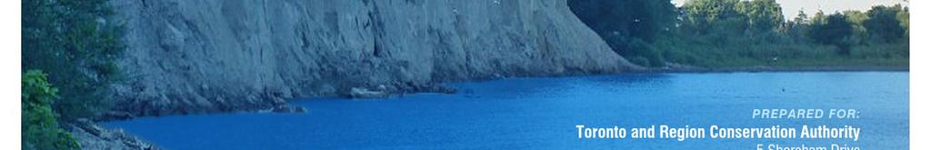
3 ENVIRONMENTAL ASSESSMENT TERMS OF REFERENCE Prepared for: Toronto and Region Conservation Authority 5 Shoreham Drive Downsview, Ontario M3N 1S4 Prepared by: Dillon Consulting Limited 235 Yorkland Blvd., Suite 800 Toronto, Ontario M2J 4Y8 In association with: June
4
5 Table of Contents Table of Contents... i Acronyms and Abbreviations... iv Executive Summary... v 1. Introduction Proponent Project Background Purpose of the Undertaking Planning Context Other Guiding Planning Initiatives Environmental Assessment Framework Provincial EA Requirements Canadian Environmental Assessment Act, Other Approvals Coordinated Planning Process Description and Rationale for the Proposed Undertaking Project Vision and Objectives Study Areas Problem / Opportunity Assessment Temporal Boundaries Description, Evaluation and Rationale for Alternatives To Alternatives To the Undertaking Description, Evaluation and Rationale for Alternative Methods Alternative Methods Development and Evaluation Description of the Environment Physical Environment Physiography Geology Groundwater Conditions and Discharge Bathymetry Coastal Processes, Engineering, and Geomorphology Stormwater Run-Off and Infrastructure and Stream Hydraulics DILLON CONSULTING LIMITED - i
6 7.1.7 Surface Water and Sediment Quality Climate Shoreline and Bluff Erosion Natural Environment Vegetation Communities Vegetation Communities of Concern Flora Species of Concern Wildlife Habitat and Wildlife Wildlife Species of Concern Fish and Fish Habitat Significant Natural Areas Socio-Economic Environment Population and Demographics Infrastructure, Community Services and Recreation Visual Aesthetics Traditional Land Uses and Claims (First Nation and Métis) Cultural Heritage Resources Air Quality Acoustic Environment Potential Effects, Effects Assessment and Mitigation Measures Commitments and Monitoring Commitments Monitoring and Adaptive Management Consultation Highlights of Consultation Completed for the ToR Consultation Plan for the EA References and Works Cited Glossary ii - DILLON CONSULTING LIMITED
7 Figures Figure 1: Project Location within the Context of the City of Toronto... 1 Figure 2: Overview of the Provincial EA Process Figure 3: Project Area and Study Area Figure 4: Shoreline Features, Problems and Opportunities Figure 5: Existing Land Use Photos Figure 6: Existing Access Points to the Waterfront Figure 7: General Land Use Designations in the Project Study Area Tables Table 1: Potential Permits and Approvals Table 2: Preliminary Design Elements for Developing Alternatives Table 3: Parks by Project Area Shoreline Segment Table 4: Correspondence to First Nations and Métis Communities Appendices Appendix A: Comments and Responses on the Draft Terms of Reference Appendix B: Preliminary List of Draft Evaluation Criteria DILLON CONSULTING LIMITED - iii
8
9 Acronyms and Abbreviations AANDC Aboriginal Affairs and Northern Development Canada AD Anno Domini ANSI Area of Natural and Scientific Interest ATRIS Aboriginal and Treaty Rights Information System BC Years Before the Present CEAA Canadian Environmental Assessment Act, 2012 CN Canadian National DFO Fisheries and Oceans Canada Dillon Dillon Consulting Limited EA Environmental Assessment EA Act Environmental Assessment Act, 1990 ECA Environmental Compliance Approval ELC Ecological Land Classification ESA Environmentally Sensitive Area GIS Geographic Information Systems GTA Greater Toronto Area HWN Conseil de la Nation Huronne-Wendat ISMP Integrated Shoreline Management Plan, 1996 Km Kilometres LaMP Lake Ontario Lakewide Management Plan LIO Land Information Ontario Ma Unit of time equal to one million years MAA Ministry of Aboriginal Affairs M Metres Mm Millimetre MMAH Ministry of Municipal Affairs and Housing MNCFM Mississaugas of the New Credit First Nation MNRF Ministry of Natural Resources and Forestry MOECC Ministry of the Environment and Climate Change PVC Polyvinyl Chloride PPS Provincial Policy Statement PSW Provincially Significant Wetland TAC Technical Advisory Committee ToR Terms of Reference TRCA Toronto and Region Conservation Authority TTC Toronto Transit Commission WRT Waterfront Regeneration Trust iv - DILLON CONSULTING LIMITED
10
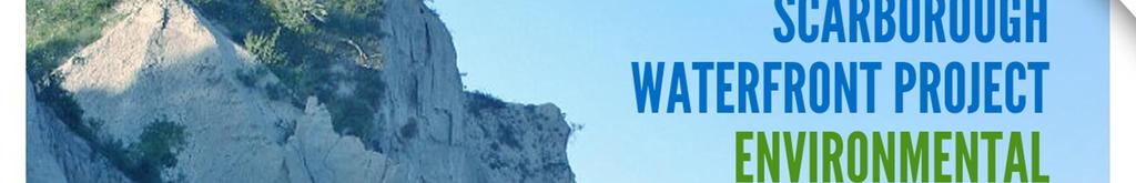
11 Executive Summary Toronto and Region Conservation Authority (TRCA) has initiated an Individual Environmental Assessment (EA) study under the provincial EA Act (1990) to create a system of greenspaces for approximately 11 kilometers (km) along the Lake Ontario shoreline between Bluffer's Park and East Point Park in the City of Toronto, Ontario (the Project). The Scarborough Bluffs are an iconic feature of the Lake Ontario shoreline; however, due to limited access and existing public safety hazards, the water s edge along this section of the waterfront (or shoreline) is not formally accessible to the public. The need and rationale for the Project is supported by planning initiatives previously undertaken by TRCA, including the Integrated Shoreline Management Plan (ISMP), which was developed through extensive consultation with the public, agencies and other stakeholders. The ISMP provided strategic direction on this section of the waterfront, fulfilling the need and rationale for the Project. As such, it is intended that this EA focus on the development and evaluation of Alternative Methods or designs that are consistent with this strategic direction. Building on the ISMP guiding principles, and stakeholder input received through the EA consultation activities to date, the Project vision was developed, "to create a system of greenspaces along the Lake Ontario shoreline which respect and protect the significant natural and cultural features of the Bluffs, enhance the terrestrial and aquatic habitat, and provide a safe and enjoyable waterfront experience". The Project objectives are: Protect and enhance terrestrial and aquatic natural features and linkages; Manage public safety and property risk; Provide an enjoyable waterfront experience; Consistency and coordination with other initiatives; and, Achieve value for cost. The Project will strategically identify areas for: natural habitat enhancement, improved and/or new public access, new greenspace areas that provide recreational opportunities, and address erosion prone sites to minimize risk to public safety and property, along the Scarborough Bluffs. This Terms of Reference (ToR) sets out the framework for preparing the EA including the studies to be undertaken, how the Alternatives will be developed and evaluated, and public consultation activities that will be carried out. The identified Alternatives will be assessed and evaluated on the basis of Evaluation Criteria. Draft Evaluation Criteria are presented in this ToR. A key component of developing the ToR has been public consultation. As documented in this ToR, several opportunities have been provided to stakeholders to provide input to the study objectives, problems/ opportunities, Alternatives development and evaluation approach, and planned EA consultation activities. Overall, the consultation process for the ToR has been positive with significant and valuable input received. Approximately 150 people attended each of the two Public Information Centers that were held, providing input related to the objectives and vision for the Project, natural environment, safety, construction, parks and trails, the overall EA process; and the criteria for evaluating alternatives. A key message from the consultation participants was that this Project should celebrate the natural heritage of the Scarborough waterfront and preserve the natural areas that currently exist. Several ideas were received from the public DILLON CONSULTING LIMITED - v
12 with respect to the ways in which parks, trails and amenities can be enhanced, restored and celebrated. These ideas will be integrated into the development of Alternatives and/or be considered at a future point during the design phase of the Project. Participants also encouraged TRCA to be cognizant of the potential disturbance to the neighborhoods along the waterfront. Feedback received on the Draft Evaluation Criteria and objectives will be used in developing and evaluating Alternatives during the EA. In addition to the public events, the Stakeholder Committee formed for the Project met four times during the ToR phase. This committee was invaluable in assisting the Project team in developing clear and complete messaging and activities for the second Public Information Centre and acting as a sounding board to review the ToR. Input received to date, including input on the draft ToR, has been considered in the development of this ToR and will help to inform the next steps in the EA process. Following a decision by the Minister of the Ministry of Environment and Climate Change (MOECC), the ToR will be used by TRCA to guide the completion of the EA. vi - DILLON CONSULTING LIMITED
 along the Lake Ontario shoreline between Bluffer's Park and East Point Park in the City of Toronto, Ontario (the Project) (Figure 1).")
.")
13 1. Introduction Toronto and Region Conservation Authority (TRCA) has initiated an Individual Environmental Assessment (EA) study under the provincial EA Act (1990) to create a system of public spaces for approximately 11 kilometres (km) along the Lake Ontario shoreline between Bluffer's Park and East Point Park in the City of Toronto, Ontario (the Project) (Figure 1). This Terms of Reference (ToR) has been prepared as the first step of the EA process. The ToR was prepared in accordance with the Code of Practice: Preparing and Reviewing Terms of Reference for Environmental Assessments in Ontario (MOECC, 2014). A draft ToR was released for agency and public comment. Included in Appendix A are the comments received on the draft ToR and TRCA s responses to those comments including, where applicable, a description of the revisions made to the ToR. The need and rationale for the Project is supported by planning initiatives previously undertaken by TRCA, including, but not limited to, the Integrated Shoreline Management Plan (ISMP), which included extensive consultation with the public, agencies and other stakeholders. The Scarborough Bluffs are an iconic feature of the Lake Ontario shoreline; however, due to limited access and existing public safety hazards, the water s edge along this section of the waterfront (or shoreline) is not formally accessible to the public. Note that the terms waterfront and shoreline are used interchangeably in this ToR, and include both the top and toe of the Bluff. The term water s edge refers to the area along the toe of the Bluff only. The Project will strategically identify areas for: natural habitat enhancement, improved and/or new public access, new greenspace areas that provide recreational opportunities, and address risk to public safety and public property (i.e., top of bluff parks), along the Scarborough Bluffs. Figure 1: Project Location within the Context of the City of Toronto DILLON CONSULTING LIMITED - 1
14 1.1 Proponent TRCA is the proponent of the Project and is being supported by a consulting team led by Dillon Consulting Limited. TRCA was formed in the aftermath of Hurricane Hazel and has a strong history in watershed management and leadership in applying sustainability practices. In 2003, TRCA s Board endorsed The Living City, which is firmly based on the four pillars of TRCA s ongoing commitment to healthy rivers and shorelines, greenspace and biodiversity, sustainable communities, and business excellence. TRCA s recently released 10- year Strategic Plan ( ) reconfirms the vision for The Living City, and recognizes that large and interconnected greenspaces offer a wide range of active and passive recreational opportunities, while safeguarding their natural environmental functions and providing suitable habitats for plant and animal species. In support of this, TRCA s 10-year Strategic Plan provides the following direction: Acquire, design, and distribute greenspace and green infrastructure to all communities in an equitable manner; Connect and promote a regional active transportation network that facilitates physical activity and reduces air pollution while creating key linkages between natural areas; and, Develop infrastructure and tools which improve access to and increase use of greenspace, particularly for marginalized populations and new Canadians. In addition to the direction provided by the 10-year Strategic Plan, TRCA provides a number of critical functions along the Lake Ontario waterfront, and is leading the Project for a number of reasons: 1. TRCA is well-versed in the ecological characteristics of the Lake Ontario shoreline; 2. TRCA has regulatory powers to provide input and review of shoreline plans on behalf of municipal partners through Ontario Regulation 166/06; 3. TRCA is a leader of stewardship and restoration of shoreline ecology; 4. TRCA owns, and provides management of, environmentally important areas including high priority waterfront lands; and, 5. TRCA has extensive experience planning and implementing shoreline protection works in the area of the Project. More information on TRCA and the 10-Year Strategic Plan ( ) can be found via the following link: Project Background The Waterfront Plan for the Metropolitan Toronto Planning Area (1967) introduced a shoreline management approach to limit shoreline erosion while creating a number of large parkland areas and public marinas connected by a waterfront trail system. In 1971, TRCA was designated by the Province as the lead implementing agency for the Etobicoke to Ajax shoreline, and as a result of the following recommendations regarding the waterfront, led to the creation of waterfront plans based on an integrated shoreline management approach. In 1992, the Royal Commission on the Future of the Toronto Waterfront (Royal Commission) released its final report entitled Regeneration: Toronto Waterfront and the Sustainable City, which outlined the lack of a coordinated, ecosystem approach to shoreline regeneration. The Royal Commission recommended that a shoreline regeneration plan be prepared to protect and regenerate the Lake Ontario shoreline from the City of Burlington in the west to the community of Newcastle in the east. 2 - DILLON CONSULTING LIMITED
15 To implement this recommendation, the Ontario Government established the Waterfront Regeneration Trust (WRT) in June of To fulfill its mandate, the WRT initiated the creation of a Shoreline Management Strategy for the Lake Ontario shoreline from Burlington Bay to the Trent River. The Shoreline Management Strategy became a component of the overall Lake Ontario Greenway Strategy released by the WRT in May The Lake Ontario Greenway Strategy (1995) recommended that ISMPs be developed to provide a framework for future development and management of the Lake Ontario shoreline. Based on the traditional shoreline hazard management activities undertaken by Conservation Authorities, ISMPs are intended to be more comprehensive in their scope, addressing the need to limit high rates of erosion, while enabling safe public access, and the creation of regional scale parkland and waterfront recreation opportunities. The ISMP for the section of shoreline between Tommy Thompson Park and Frenchman s Bay the Project was released in 1996 and is available online at DILLON CONSULTING LIMITED - 3
16 2. Purpose of the Undertaking The purpose of the Project (the Undertaking ) is to fulfill the strategic direction of the ISMP for the portion of the Scarborough shoreline that is located approximately between Bluffer s Park and East Point Park. Since the release of the ISMP in 1996, TRCA has been undertaking ongoing work to fulfill the strategic direction of the ISMP, including addressing areas of highest risk to loss of life and property due to erosion through the Meadowcliffe Drive, Sylvan Avenue, and South Marine Drive Erosion Projection Projects. In addition, a number of recent studies have further identified opportunities to enhance terrestrial and aquatic environments and public access along this length of shoreline, including the Terrestrial Biological Inventory and Assessment for the Scarborough Shoreline (TRCA, 2012), the Urban Recreational Fisheries Plan (MNRF et al 2014) and the Bikeway Trails Implementation Plan (City of Toronto, 2012). Section 2.1 further describes the ISMP recommendations and provides an overview of the key guiding documents. As such, based on previous planning processes, and City of Toronto Council direction (Resolution PW31.14 adopted on June 10, 2014), the focus of the Project will be to address the remaining risks to public safety and public property and the consideration for the creation of linked public spaces along the shoreline, both along the top and toe of the Bluffs. The Project will strategically identify vulnerable sites to minimize risk to public safety and public property, while integrating new public access, recreational opportunities and benefits to natural habitat along the Scarborough Bluffs. The Project will be further refined during the EA process. 2.1 Planning Context The ISMP provides an ecosystem-based framework to ensure that shoreline management activities result in a clean, green, accessible, diverse, connected, open, affordable, attractive and useable waterfront. The ISMP set out recommendations for shoreline regeneration, public access and safety, natural heritage targets, aquatic habitat restoration, and public use for the shoreline area between Tommy Thompson Park and Frenchman s Bay. As part of the ISMP planning and decision-making process, a public and agency consultation program was designed and carried out from the start of the study to ensure the effective and interactive exchange of information between the study team and the communities throughout the study area. The program was designed to provide adequate and meaningful opportunities for public involvement in the development of the ISMP, to provide the opportunity for the public to contribute to decisions and to provide the public with ready access to information. Activities undertaken to fulfill these objectives and to facilitate an interactive exchange of information and viewpoints included the development and use of electronic mailing lists, meetings with interest groups and non-government organizations, distribution of fact sheets, workshops, open houses, and circulation of ISMP reports. Through the input provided by the consultation activities, recommendations were established for the length of shoreline between Tommy Thompson Park and Frenchman s Bay. Following these recommendations, the shoreline treatment below Sylvan Park and Sylvan Avenue east of the Bellamy Ravine was the first section of the Scarborough waterfront designed using an ecosystem approach, combining shoreline erosion protection works with public accessibility and habitat restoration. In 2010, the 4 - DILLON CONSULTING LIMITED
17 Meadowcliffe Drive Erosion Control Project was undertaken, which also integrated public accessibility and habitat improvements with the shoreline erosion protection works. Recognizing the long history of works within the area, the Project will revisit the following remaining recommendations of the ISMP, but will also explore other ideas and opportunities through the development of Alternatives in the EA including: Developing a beachwalk trail between Bluffer s Park and Bellamy Ravine; Developing Bellamy Ravine as a local gateway with appropriate trailhead infrastructure; Establishing a waterfront trail loop between Bellamy and Guildwood Ravines; Establishing a waterfront trail from Guildwood Parkway to the Highland Creek Trail (at East Point Park); and, Improving aquatic habitat along existing revetments. In developing the Alternatives and mitigation measures in the EA, experiences and lessons learned from past activities in the project area, including available monitoring results will be considered where appropriate and applicable Other Guiding Planning Initiatives There are several other planning initiatives that have been developed, or are currently ongoing, that are relevant to this section of the waterfront in the City of Toronto, and which support the purpose of the Project. While the 1967 Waterfront Plan for the Metropolitan Toronto Planning Area provided the impetus for opening up the waterfront to the public, and set the stage for much of the waterfront work which has occurred and continues to occur, including the development of the ISMP, a number of other studies and initiatives have been developed or are currently ongoing, which recognize the significance of the waterfront for parks and open space. The EA will be coordinated with, and informed by, these other planning initiatives, which generally include the following: Key Guiding Documents Bikeway Trails Implementation Plan (City of Toronto, 2012) Adopted by City of Toronto Council on July 12, 2011, the City of Toronto Bikeway Trails Implementation Plan identified 77 km of new bikeway trails, 30 km of new trail construction projects, and 4 trail feasibility studies to be implemented. The Plan identifies the Scarborough waterfront as a long-term objective for trail development, recognizing the scale and scope of the planning and approvals associated with such development. Specifically, opportunities identified for the section of waterfront which is the subject of this EA, includes: Extension of the existing Waterfront Trail west from Beechgrove Drive to Manse Road along East Point Park/Copperfield Drive; and, A multi-use trail at water s edge from Bluffer s Park to Morningside Avenue, dependent on completion of slope stabilization works. City of Toronto Council adopted the Bikeway Trails Implementation Plan in June, 2012 (Resolution #PW15.2), which recommended, in part, that: DILLON CONSULTING LIMITED - 5
18 [ ] City Council authorize the General Manager, Transportation Services, the General Manager, Parks, Forestry and Recreation, and where appropriate, Toronto and Region Conservation Authority, to undertake and manage any Environmental Assessment Studies required for the new trail connection contained in the Bikeway Trails Implementation Plan and file the Environmental Study Report with the Ministry of the Environment. Scarborough Shoreline Terrestrial Biological Inventory and Assessment (TRCA, 2012) The Lake Ontario shoreline extending from East Point Park west to Bluffer s Park was inventoried to characterize the terrestrial natural heritage features, both locally and within the larger regional context of TRCA s Terrestrial Natural Heritage Program. The study recommended a number of site-specific management strategies, including: Protecting and enhancing existing habitats and features; Managing public use through careful trail planning and strategic use of infrastructure (e.g., fences to direct trail use); and, The control of invasive species. Fish Community Objectives for Lake Ontario (Ministry of Natural Resources and Forestry [MNRF], 2013) The MNRF Fish Community Objectives for Lake Ontario (2013) were created to advance the goals and objectives of the Lake Ontario Lakewide Management Plan (LaMP). The document identified broad targets and indicators for the fish community of Lake Ontario, including: Maintaining, enhancing and restoring self-sustaining Walleye, Yellow Perch, Northern Pike, and Bass fisheries, populations and recruitment in the nearshore; Maintaining, restoring, and increasing the richness and diversity of native fish species in nearshore areas and embayments; and, Maintaining or increasing populations and increasing species diversity of pelagic prey fish including introduced species (Alewife, Rainbow Smelt) and selected native prey fish species (Three Spine Stickleback, Emerald Shiner, Lake Cisco). Urban Recreational Fisheries Plan (2014) The Urban Recreational Fisheries Plan (2014) was created to enhance fishing opportunities, protect and restore fish habitat, promote fishing and support the creation of quality public access to sites along the Lake Ontario north shore. Within the Project Study Area, while opportunities for improved fishing and boating access at Bluffer s Park are identified, the Project provides the opportunity to address the objectives of the Plan across the Project Area shoreline. Toronto Beaches Plan (City of Toronto, 2009) The Toronto Beaches Plan identifies actions to further improve Toronto s Blue Flag swimming beaches, to bring the remaining beaches up to international Blue Flag standard, and to potentially create a new swimming beach. The Plan identifies a number of strategies including: Improve water quality at beach, including the use of Low Impact Development techniques to reduce stormwater runoff from parking lots and other areas; Identifying opportunities to better connect communities to beaches; and, 6 - DILLON CONSULTING LIMITED
19 Improve beach access for accessibility. Metropolitan Waterfront Plan (Metropolitan Toronto Planning Department, 1994) The Plan seeks to achieve a waterfront that is healthy, vibrant and publicly accessible, and was developed through consultation with a wide range of interest groups, governments, agencies, and experts. The Plan identifies a number of objectives and policies, including, but not limited to: Establishing an integrated and continuous greenspace system along the shoreline of Lake Ontario, including the shoreline between East Point Park and Bluffer s Park; Establishing natural greenspace connections between the waterfront and the valley greenspace system; Enhancing waterfront parkland by: o Protecting and enhancing existing topography and vegetation; o Protecting and enhancing views to and from the lake; o Incorporating cultural and natural heritage themes and resources; o Encouraging year-round public use; and, o Encouraging public transit and active transportation. Establishing a continuous Waterfront Trail and connected trail network, either close to the water s edge or in a location that provides frequent lake views, in order to increase public accessibility and enjoyment of the waterfront; and, Protecting and enhancing the Scarborough Bluffs area by: o Allowing natural processes to occur (e.g., regeneration and erosion), where feasible; o Promoting and protecting the natural and cultural heritage and recognizing the educational value of the Bluffs; and, o Improving public accessibility to the Scarborough Bluffs and water s edge, where feasible. Watershed Plan (TRCA, 1980) The Plan included a number of interrelated programs, including the Lake Ontario Waterfront Development Program; Shoreline Management Program; and Erosion and Sediment Control Program. The Plan outlines direction for future waterfront park development. Lake Ontario Greenway Strategy (Waterfront Regeneration Trust, 1995) The Lake Ontario Greenway Strategy identifies the goal of regenerating a healthy and sustainable waterfront that is clean, green, accessible, connected, open, useable, diverse, affordable, and attractive. Other Guiding Documents Management Plan for Guild Park and Gardens (City of Toronto, 2014) Significant community planning has occurred for the Guild Inn property. The Management Plan for Guild Park and Gardens was developed to provide TRCA and the City of Toronto with a comprehensive framework to guide the management of the Guild Park & Gardens site. Four key management themes are identified: Natural Heritage, including protecting and enhancing native biodiversity; managing invasive species; managing public safety, hydrology, and Bluffs erosion; and developing an interpretation strategy; DILLON CONSULTING LIMITED - 7
20 Cultural Heritage, including restoring and protecting the cultural landscape; restoring heritage views; conserving heritage buildings and public art/artifacts; and developing a cultural heritage interpretation strategy; Horticulture/Park, including enhancing the cultural heritage landscape through horticulture; enhancing horticulture quality; improving walkways; managing community programming; and supporting community stewardship; and, Trails, including managing trails to reduce environmental impacts; enhancing user experience; providing accessibility; managing trail hazards and safety; improving connectivity to the waterfront and local community; and designing for sustainability. Sustaining & Expanding the Urban Forest: Toronto s Strategic Forest Management Plan (City of Toronto, 2013) The Strategic Forest Management Plan for the City of Toronto is a functional document that provides regional context, outlines current practices and defines future direction for local urban forest management. The Plan builds on the technical information about the urban forest gathered through the following two studies: Every Tree Counts: A Portrait of Toronto s Urban Forest; and, Assessing Urban Forest Effects and Values, Toronto s Urban Forest. The Plan provides direction with respect to how best to allocate available resources to sustain and expand an urban forest that is healthy and supports all life in the city. The Plan provides direction for forest management over the next 10 years through the vision, strategic goals and a series of actions that address the key management challenges identified for Toronto s urban forest. Parks Plan (City of Toronto, 2013) The Parks Plan will guide the City of Toronto s delivery of service over the next five years. The Parks Plan provides direction and recommends actions aimed to connect people and communities with parks, advance greening and environmental sustainability, improve the quality of parks, and build a legacy park system. The four key themes which form the framework of the Parks Plan include the following: Communicate and connect with users; Preserve and promote nature; Maintain quality parks; and, Improve system planning. This Parks Plan offers a vision of how Toronto can continue to improve in areas that require greater focus, and how to build on its strengths. A key priority in the Parks Plan is to encourage the public s use and involvement in parks, while at the same time preserving these spaces for future generations. Toronto Waterfront Aquatic Habitat Restoration Strategy (Aquatic Habitat Toronto for Waterfront Toronto, 2007) The Strategy strives to create a more sustainable waterfront by using an ecosystem approach to increase ecological integrity, to provide suitable conditions for the maintenance of self-sustaining aquatic communities and to improve ecological connectivity. The Strategy emphasizes conservation design based on native and naturalized species. It takes into account human uses of the shoreline and nearshore waters and it was developed using a consultative, consensus-based approach involving stakeholders and the general 8 - DILLON CONSULTING LIMITED
21 public. The overall goal of the Strategy is "to develop and achieve consensus on an aquatic habitat restoration strategy that will maximize the potential ecological integrity of the Toronto waterfront." Lake Ontario Binational Biodiversity Strategy (Lake Ontario Biodiversity Conservation Strategy Working Group, 2009) Lake Ontario contains a rich and diverse array of species, communities and ecosystems that include aquatic, terrestrial and wetland biomes. The Lake Ontario Biodiversity Strategy identifies biodiversity targets for Lake Ontario. Class Environmental Assessment for Remedial Flood Protection and Erosion Control Projects (Conservation Ontario, 2002) The Class Environmental Assessment for Remedial Flood and Erosion Control Projects (Class EA) establishes a planning and approval process for a variety of remedial flood and erosion control projects that may be carried out by Conservation Authorities. The Class EA was approved on June 26, 2002 through a provincial Order in Council (O.C. 1381/2002), which updated a Class EA process approved in This Class EA sets out procedures and environmental planning principles for Conservation Authorities to follow to plan, design, evaluate, implement and monitor a remedial flood and erosion control project so that environmental effects are considered as required under the EA Act. This planning approach has been a key process used to address the risk to public and property associated with the erosion of the Bluffs between the Meadowcliffe and Grey Abbey areas of the shoreline. DILLON CONSULTING LIMITED - 9
22 3. Environmental Assessment Framework EA is a planning and decision-making process used to promote environmentally responsible decision-making. In Ontario, this process is defined and finds its authority under the EA Act. The purpose of the EA Act is to provide for the protection, conservation and wise management of Ontario s environment. To achieve this purpose, the EA Act promotes responsible environmental decision-making and ensures that interested persons have an opportunity to comment on undertakings that may affect them. In the EA Act, the environment is broadly defined and includes the physical, natural, and socio-economic environments. There are multiple ways in which a proponent can fulfill the requirements of the EA Act using the Individual EA process. TRCA has decided that it will complete a focused EA in accordance with subsections 6(2)(c) and 6.1(3) of the EA Act. The following sections provide the rationale for proceeding with a focused EA, as well as an overview of other approvals that may be required for the Project. 3.1 Provincial EA Requirements The Project is subject to the requirements of an Individual EA under the provincial EA Act. Individual EAs are prepared for large-scale, complex projects with the potential for significant environmental effects. While TRCA typically completes Class EA s for routine flood protection and erosion control projects that have known impacts and that are predictable and manageable, the scope of works and activities anticipated for the Project cannot be covered under the Conservation Ontario Class EA for Remedial Flood and Erosion Control Projects. The first step in the Individual EA process is to prepare and submit a ToR to the Minister of the MOECC (Figure 2). The ToR sets out the framework and work plan for preparing the EA, including the development of Alternatives that will be considered, studies to be undertaken, and public consultation activities that will be carried out. A key component of developing the ToR is public consultation, providing opportunities for the public (including affected stakeholders, public interest groups, and any other interested parties) to learn about and provide input on the Project. This ToR includes a Record of Consultation (provided as a separate document) which describes the consultation undertaken to date and the results of these activities. The public, agencies, interest groups, and landowners have been consulted through the development of the ToR and will continue to be consulted during the preparation of the EA, as per the consultation plan provided in Section 10 of this ToR. Following a decision by the Minister, the ToR will be used by TRCA to guide the completion of the EA to ensure that it meets regulatory requirements. The results of the EA process are then to be documented in an EA Report which, once complete, is submitted to the Minister of the MOECC for review and a decision. The EA Report will document the decision-making approach exercised in determining the Preferred Alternative for the Project, and to minimize potential adverse Project related effects as well as to address any stakeholder concerns related to the proposed work. Other required provincial EA processes have not been identified to-date for this Project. In the event that additional provincial EA processes are identified during the EA process, it is anticipated that these requirements can be met through the individual EA process DILLON CONSULTING LIMITED
 Indicate that the EA will be prepared in accordance with the general requirements in subsection 6.")
23 Figure 2: Overview of the Provincial EA Process EA Approach (focused EA) Subsection 6(2) of the EA Act indicates that the proponent must specify how the EA will be prepared by selecting from the following options: a) Indicate that the EA will be prepared in accordance with the general requirements in subsection 6.1(2); b) Indicate that the EA will be prepared in accordance with such requirements as may be prescribed for the type of undertaking the proponents wishes to proceed with; or, c) Set out in detail the requirements for the preparation of the EA (MOECC, 2014). Proponents are to use subsection 6(2)(c) and 6.1(3) if there is a defined planning process that has already occurred, which provides the rationale for the Project (MOECC, 2014). Subsection 6.1(3) provides an exception that allows the EA to include information other than what is required by subsection (2). As such, TRCA will complete a focused EA in accordance with subsections 6(2)(c) and 6.1(3) of the EA Act. The justification for completing a focused EA is that the strategic direction for this section of the waterfront has been established through: DILLON CONSULTING LIMITED - 11
24 Previous planning processes undertaken for this section of the Scarborough waterfront; in particular the ISMP, City of Toronto Bikeway Trails Implementation Plan, and other key guiding documents, as described in Section 2 of this ToR; Previously completed erosion control projects within the area, as described in Section 2 of this ToR. The Project will build upon these works to further fulfill the strategic direction provided by the ISMP; The 1967 Waterfront Plan which first identified the creation of Bluffer s Park to provide a nodal recreation facility on the waterfront. Building on this plan, the Project will expand this area to function as a regional entrance to a more extensive network of recreational opportunities and activities along the Scarborough waterfront; and, City of Toronto Council direction (Resolution PW31.14 adopted on June 10, 2014) to proceed with the Scarborough Waterfront Access Plan. As such, the strategic direction provided through these previous planning processes, City of Toronto Council decision, and the previous erosion protection works completed within the area, all establish the need and rationale for the Project, and fulfill the EA requirement to consider Alternatives To. The EA will examine the Do Nothing Alternative and Alternative Methods (i.e., alternative ways of carrying out the Project). EA Report The EA Report will be prepared in accordance with the ToR and the MOECC s Code of Practice: Preparing and Reviewing EAs in Ontario (2014a). The EA will include the following: A description of and statement of the rationale for the undertaking as well as the Alternative Methods of carrying out the undertaking; A description of: o the environment that will be affected or that might reasonably be expected to be affected, directly or indirectly, by the undertaking and the Alternative Methods of carrying out the undertaking; o the effects that will be caused or that might reasonably be expected to be caused to the environment, by the undertaking and the Alternative Methods of carrying out the undertaking; o the actions necessary or that may reasonably be expected to be necessary to prevent, change, mitigate or remedy the effects upon or the effects that might reasonably be expected upon the environment, by the undertaking and the Alternative Methods of carrying out the undertaking; An evaluation of the advantages and disadvantages to the environment of the undertaking and the Alternative Methods of carrying out the undertaking; and, A description of any consultation about the Project undertaken by the proponent and the results of the consultation. The EA Report will follow a traceable decision-making process and include the following: An executive summary that will summarize the EA as well as a list of studies and reports, and a wellmarked legible map of the location of the undertaking and the study area; A discussion and refinement (as necessary) of the purpose of the undertaking; An overview of preliminary costs, funding, phasing and timing of the Project (as available); 12 - DILLON CONSULTING LIMITED
25 A discussion of net effects (those that remain following mitigation) and a summary of the evaluation of the advantages and disadvantages to the environment of the proposed undertaking and the alternative methods based on net effects; A table that summarizes all commitments made in the ToR and that identifies which sections of the EA Report satisfy each commitment; and, A discussion on the rationale for the identification of the alternative methods that will be evaluated. It is expected that a draft EA Report will be prepared and made available for public, agency, and First Nation and Métis review. Following the draft review, the EA Report will be formally submitted to the MOECC for public and agency review and decision by the Minister. If the EA is approved, it is anticipated that preliminary detailed design and construction will commence in 2016/2017. The ToR has been developed based on preliminary background studies and baseline data, as well as early consultation input. Should new issues arise during the EA which are within the vision and objectives of the Project, this ToR does not preclude their investigation at the discretion of the Project Team. For this reason, this ToR provides flexibility to address unforeseen circumstances that may arise as the EA study progresses, or input is received through the consultation process. Flexibility is not meant to allow for a significant change of the scope of the Project, but rather to allow for minor adjustments to the EA process without having to restart the ToR/EA process. 3.2 Canadian Environmental Assessment Act, 2012 When a project has the potential to cause environmental effects that are within federal jurisdiction, a federal EA may be required. The Canadian Environmental Assessment Agency created a list, referred to as the Regulations Designating Physical Activities List, which identifies the types of projects that may require a federal EA. As the scope of works for the Project is not on the list, CEAA does not apply to this Project. In the event that the Project is modified and meets the above criteria at a future date, TRCA will notify the Canadian Environmental Assessment Agency accordingly. Although CEAA does not apply to this Project, the Project may still require federal permits and/or approvals. A preliminary list is provided in Table Other Approvals The Project may require municipal, provincial and federal permits and approvals prior to construction. Table 1 provides a preliminary list of potential permits and approvals; however, this list is subject to change as Project design is further developed and refined, and as agency input is received. TRCA will provide a final list of permits and approvals as part of the EA Report. DILLON CONSULTING LIMITED - 13
26 Table 1: Potential Permits and Approvals Federal Agency Environment Canada Fisheries & Oceans Canada (DFO) Transport Canada Provincial Ministry of Environment and Climate Change Ministry of Natural Resources and Forestry Ministry of Tourism, Culture and Sport Potential Permit or Approval A permit would be required under the Species at Risk Act, 2002, should the Project affect species at risk or their habitat within the Project Study Area. A permit would be required under the Migratory Birds Convention Act, 1994, should the Project affect migratory birds listed in the Act. An authorization from DFO would be required under the Fisheries Act, 1985 (amended 2013), if it is determined that the Project will result in serious harm to fish that are part of a commercial, recreational or Aboriginal fishery, or to fish that support such as fishery. Transport Canada will need to be notified of any work, such as new trails or other pathways that cross federally-regulated rail lines as per the Railway Safety Act, Any in-water works and/or shoreline alteration could require authorization under the Navigation Protection Act (amended 2014) and applicable regulations under this legislation (e.g. Navigable Waters Works Regulation). An Environmental Compliance Approval (ECA) may be required should the Project affect stormwater management facilities in the Project Study Area as per the Environmental Protection Act, The Project will need to have regard for any policies developed by Source Protection Committees that address potential threats to Intake Protection Zones under the Clean Water Act, Permit to Take Water as per the Ontario Water Resources Act, 1990, if greater than 50,000 litres per day is moved for construction purposes (if water is taken from a natural source) A work permit may be required as per the Lakes and Rivers Improvement Act, 1990, if the Project includes any onshore or in-water work such as dams, or if it will affect water levels. A work permit may be required if the Project requires the disposition (i.e., release) of Crown land, such as the Lake Ontario lakebed, under the Public Lands Act, A permit under Section 17 of the Endangered Species Act, 2007, may be required if the Project affects any endangered species and/or their habitat in the Project Study Area. An authorization may be required under the Fish and Wildlife Conservation Act, 1997, if the Project affects nesting areas. The Project will require archaeological clearance under the Ontario Heritage Act, 1990, as part of the regulatory process to ensure effects to features of cultural interest are minimized DILLON CONSULTING LIMITED
27 3.4 Coordinated Planning Process In addition to the other municipal, provincial, and federal plans discussed in the previous sections, the Project will also be coordinated with other activities and plans located in and adjacent to the Project Area. As such, other plans to be considered include, but may not be limited to: TRCA and City of Toronto s management plan for the Guild Park and Gardens; Metrolinx Guildwood to Pickering Rail Expansion Transit Project Assessment Process; and, City of Toronto plans for the FJ Horgan Water Treatment Plant. DILLON CONSULTING LIMITED - 15
28 4. Description and Rationale for the Proposed Undertaking The description and rationale for the Project (the Undertaking ) will be further refined as part of the EA process. The description and rationale for the Project will be based on the study Vision and Objectives, recommendations from the ISMP and other guiding plans and initiatives described in Section 2 of this ToR, and will reflect the advantages and disadvantages of the Preferred Alternative once the evaluation is completed in the EA. The Project has the potential to take advantage of existing shoreline infrastructure to provide safe public access to, and along, the waterfront, while respecting the natural and scientific importance of the Scarborough Bluffs. The Project also has the potential to improve terrestrial and aquatic habitat, and create an environmentally sustainable waterfront experience, including sweeping views and vistas, as well as recreational and cultural amenities. 4.1 Project Vision and Objectives The development of the Project Vision and Objectives draws from the strategic direction provided by the ISMP and other guiding initiatives and documents, as described in Section 2 of this ToR. In addition, consultation specifically focused on the Project Vision and Objectives was undertaken as part of the development of the ToR, and feedback helped refine the Vision and Objectives. The Vision and Objectives will help structure the development and evaluation of Alternatives. All Alternatives must meet the Project Vision and Objectives, and will be evaluated based on how well each Alternative meets the Vision and Objectives. As such the Project will be defined, operated, and monitored on the basis of the Project Vision and Objectives. The Project Vision is a high-level, guiding purpose of the Project. The Project Objectives describe what the Project is ultimately trying to achieve if implemented. Arising from the ISMP and stakeholder input received through the ToR consultation activities, the Project Vision is to create a system of greenspaces along the Lake Ontario shoreline which respect and protect the significant natural and cultural features of the Bluffs, enhance the terrestrial and aquatic habitat, and provide a safe and enjoyable waterfront experience. The Project Objectives are to: Protect and enhance terrestrial and aquatic natural features and linkages: Habitat type, health, and sensitivity vary in the Project Study Area. While much of the Project Area lacks aquatic habitat integrity, there exists potential to add to the quality, size, shape and connectivity of this habitat. There may also be opportunities to create new aquatic habitat to complement and enhance recently constructed shoreline works. Regarding terrestrial habitat, there is the potential to improve local and regional connections to and along the shoreline (both at the toe and top of the Bluffs). Alternatives that maximize the enhancement and the creation of new habitat, while minimizing the loss of existing habitat would be preferred DILLON CONSULTING LIMITED
29 Manage public safety and property risk: Previous TRCA initiatives in the Project Area have largely addressed the highest erosion prone risk areas by providing protection to private property. There remains some risk to public safety and public property in the Project Study Area. Remaining public safety risk largely relates to access to/from and along the shoreline and the potential risk from waves and ice to existing and future users of the waterfront. Risk to public property includes some public park space located at the top of the Bluffs that is potentially vulnerable to ongoing Bluff erosion. Existing and future risks will be identified and where reasonable and feasible, mitigation plans developed. Provide an enjoyable waterfront experience: A number of factors contribute to an enjoyable waterfront experience. For example, diversity of experience, including multiple use recreation; views and vistas; multi-season use; trail connections; and education/appreciation of the natural and cultural features of the Bluffs. The Project provides the opportunity to build on existing greenspace areas, including Bluffers Park and Eastpoint Park. A trail along the waterfront (including the top and toe of the Bluffs) to connect these existing greenspaces is recognized as a long term objective within a number of planning initiatives, including the ISMP. The greenspace system needs to be complemented with improved levels of public access, both along the shoreline and between the top and toe of Bluffs. It is also recognized that the Project may provide an opportunity for improved access to cultural heritage resources as appropriate, including cultural heritage landscapes and that this be considered in the development of the Project. Consistency and coordination with other initiatives: Significant community planning has occurred in this area. The Project will be consistent with, and coordinated with, other initiatives, including the Lake Ontario Greenway Strategy, Urban Fish Management Plan, Guild Park and Gardens Management Plan, and other local community initiatives. If possible, the Project needs to build on and complement these other initiatives. Furthermore, the Project needs to be sensitive to community concerns and not create new or additional significant impacts. As an example, there is the potential for increased auto traffic to be attracted to the local area as a result of new greenspace and trail development. The potential for such impacts on the community needs to be considered and managed, if not avoided. This Objective also seeks to integrate the Project with other parallel planning processes that may be ongoing adjacent to the Project Area, including but not limited to, City of Toronto plans related to the FJ Horgan Water Treatment Plant and the Metrolinx Guildwood to Pickering Rail Expansion Transit Project Assessment Process. Achieve value for cost: It is desirable to maximize the benefits achieved through the Project in relation to the estimated Project cost (capital and operations and maintenance costs). The lowest cost alternative is not necessarily preferred but there must be commensurate value for the investment to be made by TRCA and City of Toronto, and potentially other funding partners. 4.2 Study Areas For the purposes of the Project, three study areas will be considered: the Project Area; the Project Study Area; and Regional Study Areas. DILLON CONSULTING LIMITED - 17
30 Project Area Project works (e.g., development of Alternatives) will be focused along the shoreline area, including both the toe and top of the Bluffs. This area is referred to as the Project Area (Figure 3). To help facilitate the Alternatives development and evaluation process, the Project Area has been divided into three Shoreline Segments, defined recognizing the distinct characteristics along each Shoreline Segment: 1. Shoreline Segment 1: Bluffer s Park to Meadowcliffe: Bluffer s Park is located at the foot of Brimley Road and provides a range of active and passive recreational opportunities. A sand beach extends along the eastern portion of the shoreline segment to the Meadowcliffe shoreline segment in the east. 2. Shoreline Segment 2: Meadowcliffe to Grey Abbey: Shoreline protection works exist along the length of this segment. There is no formal public access along the base of the Bluffs. 3. Shoreline Segment 3: Grey Abbey to East Point Park/Highland Creek: While some shoreline protection works exist, the majority of the shoreline consists of a sand beach. East Point Park is located along the tablelands and provides a range of active and passive recreational opportunities. Project Study Area A larger Project Study Area (Figure 3) will also be considered in the EA to provide context for the assessment of potential Project effects. The Project Study Area extends along the Lake Ontario shoreline from Bluffer's Park in the west to the mouth of the Highland Creek in the east (approximately 11 km in length). The northerly boundary is Kingston Road/Lawrence Avenue and the southern boundary is Lake Ontario to a maximum of 1 km offshore. The Project Study Area for the EA reflects the boundaries of the ISMP. The western and eastern boundaries were selected to include shoreline segments identified in the ISMP, namely Bluffer s Park, Scarborough Bluffs East, and East Point Park. The northern boundary of Kingston Road/Lawrence Avenue was selected in the ISMP as it represents a major transportation corridor closest to the Lake Ontario shoreline and constitutes the first significant physical interruption of the corridors and valley systems that traverse the Project Study Area. Regional Study Areas For certain technical disciplines, larger Regional Study Areas may be defined during the EA to identify and assess potential effects at the appropriate scale (i.e., sediment transport and coastal processes, contributing stormwater drainage networks, contributing groundwater catchment areas, socio-economic assessment, archaeology, air/noise quality) DILLON CONSULTING LIMITED


31 Figure 3: Project Area and Study Area 4.3 Problem / Opportunity Assessment The Project represents an opportunity to address some issues that have been identified over the years, including: Erosion and Risk to Public Safety and Property: Shoreline protection works have been undertaken along the toe of the Bluffs for portions of the Project Study Area. There are still areas that are prone to erosion and may potentially create risks to public safety, both to future users of the greenspace along the base of the Bluffs and users of the existing parks along the top of the Bluffs; as well as risks to public property located along the top of the Bluffs. Limited Access to and along the Waterfront: While land exists at the toe of the Bluffs for much of the length of the Project Study Area, due to existing hazards and limited access to and along the waterfront, there are limited opportunities for use and enjoyment by the public. There are some poorly connected greenspace areas along the top of the Bluffs. There is no continuous access along the full length of the waterfront. Further, due to the steep terrain of the Bluffs there is limited public access (pedestrian or vehicular) to the water s edge in the Project Area. Currently, there are four (4) existing access points: Brimley Road to Bluffer s Park; Ravine Drive to Gates Gully/Bellamy Ravine shoreline; Guild Inn to the shoreline; and Beechgrove Drive to East Point Park. Ravine Drive to Gates Gully and Guild Inn to the shoreline are steep pedestrian only routes. TRCA maintains a construction access road at the eastern edge of Guild Park and Gardens, from Guildwood Parkway down to the water s edge. DILLON CONSULTING LIMITED - 19
32 Habitat Integrity: While there are highly functional areas along the shoreline that form very important terrestrial and aquatic habitat; certain areas of the shoreline lack habitat integrity. Much of the shoreline along the Toronto Waterfront was altered in the mid-19 th century as a result of stonehooking activities. This involved the extraction of stone from nearshore areas for use in construction (refer to Section for additional information on stonehooking). In addition to these stonehooking activities, sand was also extracted from beach areas. The extraction of thousands of tonnes of material resulted in significant alteration to aquatic habitat along the shoreline. More recent changes to the shoreline include erosion protection works at the toe and top of bluff, including those undertaken by TRCA to address public and property safety risks, and the development of City infrastructure such as the FJ Hogan water treatment plant. The Project presents an opportunity to enhance the terrestrial and aquatic natural features, while addressing erosion/risk prone areas, and improving access to, and along, the shoreline between Bluffer s Park and East Point Park. The Problems and Opportunities will be further defined by Shoreline Segment in the EA, and will provide the foundation for the development of Alternatives for each Shoreline Segment. The development of Alternatives is described in Section 6. Figure 4 illustrates some of the problems and opportunities that are located within the Project Study area DILLON CONSULTING LIMITED
 Trail C reek 7 East Point Park No shoreline connection east of Bluffer's Park along toe of Bluff, which presents a public access risk.")


 \") A Scarboro ugh Bluf P f s ark Trails 1 Bellamy Ravine Cudia Park Cathedral Bluffs Park Bluffer's Park Scarborough Bluffs Park A B C D OPPORTUNITIES Links to existing trails, such")
33 ") ") ") ") ") ") ") ") ") ") ") ") ") ") ") ") ") ") ") B Doris McCarthy Trail ") 2 ") ") ") ") ") ") ") ") C 3 KINGSTON ROAD ") D South Marine Drive Park 5 4 Guildwood Park ") C ") PROBLEMS 6 Grey Abbey Park Highland ") Trail C reek 7 East Point Park No shoreline connection east of Bluffer's Park along toe of Bluff, which presents a public access risk. Meadowcliffe Drive erosion protection completed in Opportunity to convert the construction access road along the base of the bluffs for pedestrian use. Sylvan Avenue erosion protection has small hard points with an armoured shoreline between them rather than cobble. Potential for aquatic habitat enhancements. Also potential for amenities such as shade structures, piers, and lookouts along the shoreline, where appropriate. Access to toe of bluffs is steep in this area. South Marine Drive revetment currently has limited habitat integrity and could be a candidate site for habitat enhancements. Headlands could be added. Construction access road has not been reinforced. Originally designed as revetment, redesigned with cobble beaches, but never constructed. An access trail to the shoreline from Guild Park and Gardens is steep and in need of repair. Some limited parking exists in this area. Guildwood Parkway western section linear revetment has issues similar to South Marine Drive. A There is no suitable park access along this stretch of Grey Abbey Park. Bluffs are subject to natural erosion processes in this area. There appears to be reasonable width of rough beach on the east side of East Point Park during typical summer water levels. Width for high water level conditions to be confirmed. TORONTO AND REGION CONSERVATION AUTHORITY Scarborough Waterfront Project Individual Environmental Assessment SHORELINE FEATURES, PROBLEMS & OPPORTUNITIES Figure 4 Study Area TRANSPORTATION NETWORK ") Trailhead/ Trail Entrance Local Street Railway Major Trail Links From Kingston Road Waterfront Trail Other Trails Pedestrian Links to Existing Trail Systems NATURAL FEATURES Public Greenspace Watercourse Non-Evaluated Wetland Lake Ontario Sylvan Park/Gates Gully There is generally a lack of access and transit in the area. KINGSTON ROAD ") ") A Scarboro ugh Bluf P f s ark Trails 1 Bellamy Ravine Cudia Park Cathedral Bluffs Park Bluffer's Park Scarborough Bluffs Park A B C D OPPORTUNITIES Links to existing trails, such as the Scarborough Heights Garden Plots Trail and the Martin Goodman Trail in the west, and the Port Union Trail and Waterfront Trail in the east should be explored. Continuity of the trail system in this stretch of shoreline needs to be determined based on numerous factors. There is opportunity to improve access to the shoreline from Kingston Road via Bellamy Ravine and the Doris McCarthy Trail (which is steep). Trail access is off a side street. There are no parking spaces other than on the street. Note that the Doris McCarthy Trail is currently closed to the public and improvements are planned for These areas of the shoreline lack aquatic habitat for long stretches. There is an opportunity to create additional aquatic habitat as well as providing improved pedestrian access along the shoreline while maintaining slope stability. Potential for additional interpretive trails and lookouts approaching the foot of the bluffs in select locations. The Guild Inn site provides an opportunity for a major trailhead, as well as providing parking facilities and other amenities for shoreline and tableland trail networks. There may also be opportunities to coordinate with the Guild Inn and Gardens Master Plan. Could become a transit hub for pedestrians wishing to access the trail system. Opportunities for lookouts will be explored. 1:30, km MAP DRAWING INFORMATION: DATA PROVIDED BY MNR MAP CREATED BY: JL MAP CHECKED BY: DM MAP PROJECTION: NAD 1983 UTM Zone 17N PROJECT: STATUS: DRAFT DATE: 6/1/2015 ²
34
35 4.4 Temporal Boundaries The temporal boundary is defined as the timeframe (timing and duration) being reviewed as part of the EA. Temporal boundaries will be used for the basis of the effects assessment. Final temporal boundaries will be provided in the EA. The temporal boundaries established for the EA include the construction and operation phases of the Project, and are explained below. The construction phase of the Project is anticipated to commence following receipt of required approvals, permits, and funding. Construction activities may include assessing and surveying for legal, engineering and environmental purposes; clearing and grading; path development; and reclamation. The construction phase, including time for permitting and detailed design, is expected to take approximately 5 years. The targeted EA approval date is July The operations phase will commence once project construction and commissioning (open to the public) are completed. The facility is anticipated to exist indefinitely into the future, but is anticipated to require increasing levels of maintenance and repairs beyond its life expectancy of 50 years. The operations phase will include post-construction natural feature establishment monitoring activities. Natural feature monitoring is expected to last up to approximately 15 years following project commissioning. It will identify the need to intervene if naturalization is not self-maintaining DILLON CONSULTING LIMITED
36 5. Description, Evaluation and Rationale for Alternatives To The EA Act requires proponents to assess two types of Alternatives including: Alternatives to the undertaking; and, Alternative methods of carrying out the undertaking (the Project). Alternatives To the undertaking are functionally different ways of addressing or dealing with the problem (i.e., different locations along the waterfront for the project). Alternative Methods (or designs) are the different ways of carrying out the Project. For example, for the Project, this may include consideration of different locations within the Project Area for project components (i.e., trail alignment, shoreline alignment). The following sections describe how Alternatives To and Alternative Methods are to be addressed in the EA. 5.1 Alternatives To the Undertaking As previously noted, TRCA intends to complete a focused EA. The need and justification for the Project has been established through previous planning processes including the ISMP and other key guiding documents as described in Section 2 of the ToR. These studies and plans identify the need for integrating erosion protection works with habitat improvements and improved public access along the section of the Scarborough waterfront between Bluffer s Park in the west and the mouth of the Highland Creek in the east. In addition, the Project builds upon the previous shoreline erosion protection works undertaken in the Project Area. As such, with the exception of the Do Nothing Alternative, the EA will not include an evaluation of Alternatives To. Once identified, the Preferred Alternative (the Project) will be compared against the Do Nothing Alternative to confirm the recommended undertaking. The Do Nothing Alternative includes: Continuation of monitoring activities by TRCA; Implementation of existing plans for the area, including localized shoreline erosion control works and retrofits/maintenance activities of existing shoreline works; Continuation of the natural Bluff erosion process for the unprotected sections; Continued patchwork of formalized, informal and unauthorized public access to the waterfront and its associated risks; and, Ongoing park management by the City of Toronto at Bluffer s Park, East Point Park, and other established park facilities within the Project Area. This comparative evaluation of the Project against the Do Nothing Alternative provides for a final confirmation that proceeding with the Project (the recommended undertaking) is preferred over not proceeding with it. DILLON CONSULTING LIMITED - 23
37 6. Description, Evaluation and Rationale for Alternative Methods The following section describes the steps to be followed in the EA to develop, assess and evaluate the Alternative Methods. As previously noted, Alternative Methods are different ways of carrying out the Project. The Alternative Methods to be developed will address the identified existing problems (i.e., risk from erosion, limited waterfront access, low habitat integrity) and the creation of new opportunities. Furthermore, the Alternative Methods will be developed in a manner that is complementary to the existing natural features of the Project Study Area and is sensitive to the concerns of the local community. The Alternatives will be assessed and evaluated on their ability to achieve the Project Vision and Objectives. Evaluation Criteria and Indicators will also assess the potential for negative environmental effects and will address all components of the environment. The Preferred Alternative will be selected that best meets the overall Project Vision and Objectives. Throughout these steps, there will be opportunities for public input as described further in Section Alternative Methods Development and Evaluation The following outlines the key steps to be followed to develop, assess and evaluate the Alternatives. Step 1 Characterize Baseline Environmental and Social Conditions: A description of existing conditions in the Project Study Area will be prepared which will provide contextual information for the formation of the Alternatives and their evaluation. See Section 7 for an initial description of baseline conditions that will be described in further detail in the EA. Valued community attributes will be considered. Step 2 Confirm Problems and Opportunities by Shoreline Segment: Considering the baseline conditions and community input, the problems and opportunities for each of the three Project Area Shoreline Segments will be confirmed. This will include the preparation of hazard mapping related to public safety and public property. This list will provide the starting point for the development of the Alternatives. Step 3 Develop Alternatives by Shoreline Segment: In keeping with the Project Vision and Objectives, as well as stakeholder input, Alternatives will be developed in two stages: First: Identify where (and in what form) access improvements (non-auto) can be made within the Project Area. Both access along the waterfront (toe and top of Bluff) and to/from the water s edge will be considered. Only access improvements that are technically and cost reasonable will be carried forward. Access improvements that present human safety risks that cannot be reasonably mitigated or managed will not be considered further. Second: Considering the proposed access improvements, create Alternatives to address the problems and fulfill the remaining Project Objectives (i.e., protect/enhance habitat, create an enjoyable waterfront experience). The range of available Alternatives may vary by Project Area Shoreline Segment. For some Shoreline Segments, there may be limited solutions. For other Shoreline Segments, a broader range of Alternatives may be available. The Alternatives will maximize benefits and minimize negative impacts. Table 2 provides a list and description of preliminary design elements that will form the basis for the building of the Alternatives within each Shoreline Segment. The preliminary design elements may be further refined as part of the EA. The Alternatives will be developed as part of the EA DILLON CONSULTING LIMITED
38 Table 2: Preliminary Design Elements for Developing Alternatives Design Elements Enhance aquatic and terrestrial habitat Manage Bluff erosion public safety and property risks Improve existing access Create new shoreline greenspace Create new recreation opportunities Description There is existing terrestrial habitat within the Project Area. Opportunities to enhance and connect habitat will be examined in the development of Alternatives. There is some potential for slope failure within the Project Area. There are different levels of risk associated with specific Bluff sections prone to potential slope failure. The extent to which any of these slope prone areas are addressed will reflect existing and future uses that may be at risk from slope failure. Complete elimination of the risk may not be feasible and/or required. Access along the waterfront and between the toe and top of Bluff is limited within the Project Area. Alternatives to improve access will be examined including improvements to Bellamy Ravine, Guildwood Parkway/TRCA access road and East Point Park and opportunities for improved access along the base of the Bluffs. Access to the park facility by EMS providers will be considered, where appropriate and feasible, in the development of alternatives and refinement of the preferred design. Greenspace is defined as A regional system of natural areas that provides habitat for plants and animal species, improves air quality, and provides opportunities for the enjoyment of nature and outdoor recreation. Previous shoreline improvement activities have created a land base at the toe of the bluffs. This creates an opportunity for the potential creation of new greenspace. Where feasible, new greenspace needs to be connected with existing greenspace areas and be publicly accessible. The potential to attract new users to the waterfront as a result of new greenspace being created with be considered in the EA. One of the Objectives of this Project is to improve the waterfront experience, including opportunities for a range of recreational activities. Opportunities to create new views/vistas both to the Bluffs and along Lake Ontario will be examined. Step 4 Assess Alternatives within Each Shoreline Segment: Alternatives will be described in sufficient detail to distinguish between them for the construction and establishment phases. For each Shoreline Segment that has available Alternatives, these Alternatives will be assessed on the basis of the evaluation criteria and indicators. As the purpose of the comparative evaluation is to identify the Alternative which is best able to meet the Project Vision and Objectives, some of the design elements may only need to be defined at a highlevel (e.g., location and type of access along the shoreline rather than detailed trail designs). A list of Draft Evaluation Criteria to be used to evaluate the Alternative Methods is provided in Appendix B. These Draft Evaluation Criteria will be used to determine which Alternative best meets the Project Vision and Objectives. As such, the criteria are organized by each Project Objective. Rationale for including each criterion is included as part of Appendix B. The Draft Evaluation Criteria will be refined during the course of the EA and may include additions or deletions based on new information that is obtained by the Project Team, including stakeholder input. Detailed indicators will be developed for the criteria. The criteria are at this time considered to all have equal levels of importance; however, it is possible during the course of the EA that different levels of relative DILLON CONSULTING LIMITED - 25
39 importance could be assigned to the criteria. Stakeholders will be provided with the opportunity to review the full evaluation methodology. For each Alternative, mitigative measures to minimize negative effects, or enhance positive benefits will be described. The evaluation method will be further identified in the EA. Step 5 Select the Preferred Alternative: Recognizing that the Alternatives have been developed and assessed within each Project Area Shoreline Segment, the Preferred Alternative for the entire Project Area will then be determined in the following two stages: First Select Preferred Alternative for each Shoreline Segment: Depending on the Shoreline Segment, there may be one (1) to two (2) Alternatives that are best able to address the problems and opportunities for that Shoreline Segment and meet the Project Vision and Objectives. Considering the assessment results (Step 4), comparatively evaluate the advantages and disadvantages of the Alternatives and select the Preferred Alternative(s) within each Shoreline Segment. Second Develop the Overall Preferred Alternative: The Preferred Alternative(s) for each Shoreline Segment will be combined together. Where necessary, design adjustments will be made to ensure integration among the three Shoreline Segments. Depending on the Preferred Alternative(s) within each Shoreline Segment, it may be possible to combine them in different ways to result in more than one full Alternative for the entire Project Area. If this is the case, then a second Alternatives evaluation phase would be undertaken. If only one full Alternative can be built up from the Preferred Alternatives in each Shoreline Segment, then this second evaluation would not be required. Results would be reviewed with stakeholders. Step 6 Refine and Undertake Detailed Assessment of the Preferred Alternative: The Preferred Alternative will be refined more thoroughly in this final assessment step. As noted in Step 4, the Alternatives will only be described in sufficient detail to distinguish between them for the evaluation. As such, it is anticipated that the Preferred Alternative will be refined more thoroughly for the detailed assessment. The refinement will include the development of a phasing plan and the description of construction techniques and associated mitigation measures. This assessment will result in a final discussion of how the Preferred Alternative meets the Project Objectives, a summary of environmental effects and mitigative measures, and an assessment of Project advantages and disadvantages as compared to the Do Nothing Alternative (i.e., not proceeding with the Project) DILLON CONSULTING LIMITED
40 7. Description of the Environment As per the MOECC s Code of Practice: Preparing and Reviewing Terms of Reference for Environmental Assessments in Ontario (2014), this section provides an overview description of the existing physical, natural and socio-economic conditions of the Study Area. The purpose of establishing existing baseline conditions is to obtain an understanding of the area that potentially could be affected by the Project. Baseline conditions provide a benchmark for the effects assessment and future monitoring activities. A preliminary baseline conditions description of physical, natural and socio-economic conditions was prepared for the Project Study Area based on available data and information and is included in this ToR document. The EA will include a more detailed description of baseline conditions by Shoreline Segment and consider additional secondary information sources such as published data, electronic databases, aerial photographs, published literature and journals, and map interpretation. Primary sources such as field reconnaissance and surveys, as well as comments received as part of the consultation process, will also be incorporated to develop a comprehensive description of baseline conditions. Studies anticipated to be completed in support of the EA include the following: 1. Coastal Analysis; 2. Slope Failure Risk Analysis; 3. Natural Heritage Feature Assessment; 4. Stage 1 Archaeological Assessment; 5. Built Heritage and Cultural Heritage Landscapes Assessment; and, 6. Socio-Economic Assessment. 7.1 Physical Environment This section provides an overview of the physical environment in the Project Study Area. The EA will include a thorough review of applicable and available geotechnical and hydrogeological studies available for the Project Study Area. This is expected to include previous slope stability studies, publicly available geotechnical borehole and MOECC water well records, information available from TRCA regarding erosion recession rates, previous permitted works along the Scarborough Bluffs, and publicly available geological maps (such as those available from the Ontario Geological Survey) Physiography The Project Study Area is divided into two distinct physiographic regions, the Iroquois Lake Plain region (adjacent to Lake Ontario) and the South Slope region (directly south of Kingston Road). During the most recent glaciation event, glacial Lake Iroquois was approximately 60 metres (m) higher in elevation than the present Lake Ontario elevation, caused by damming of the outlet to the Atlantic Ocean by glacial ice. The subsequent melting of the ice dam resulted in the sudden lowering of Lake Ontario to its present level. Within the Project Study Area, two ancient shorelines mark the existence of former glacial lakes, the Iroquois Shoreline and Toronto Scarp. Within the Project Study Area, the Iroquois Shoreline is in close proximity to the existing shoreline, briefly merging with the existing shoreline at Cathedral Bluffs Park, where all trace of the former lake level has been lost to extensive erosion through this section. The Toronto Scarp, created by the lower post-glacial Admiralty Lake, runs parallel to the existing shoreline, approximately 2 km to 4 km offshore from Bluffer s Park to just west of Hanlan s Point, forming an underwater Bluff. DILLON CONSULTING LIMITED - 27
41 Landform and topography within the Project Study Area is varied. Elevations range from approximately 75 m above mean sea level, the general level of Lake Ontario, to 184 m above mean sea level south of Kingston Road, near McCowan Road and again near Bellamy and Markham Roads. The maximum relief occurs at the Scarborough Bluffs at Cudia and Cathedral Bluffs Parks where the Bluffs rise approximately 108 m above Lake Ontario at their maximum height. More typically, the Bluffs rise approximately 50 m above mean sea level, and mark the wave created erosional surface of Lake Iroquois (ISMP, 1996). Generally located along the historical Lake Iroquois shoreline, the Lake Iroquois Terrace forms a distinct ridge which varies between 6 m to 10 m in most areas, but reaches 15 m and 45 m between Bluffer s Park and Cudia Park. At the base of the Scarborough Bluffs, and along the eastern portion of the Project Study Area along the Lake Iroquois Terrace, there consists a relatively thin deposit of lake bottom sediment (primarily sand) deposited by Lake Iroquois. The South Slope region directly north of the Iroquois Lake Plain region is generally characterized by surficial flutings and low drumlins, underlain by cohesive glacial tills Geology The bedrock in the Scarborough area consists of the Georgian Bay Formation deposited during the upper Ordovician age approximately 450 Million Years Ago (Ma). The Georgian Bay Formation is a deposit predominantly comprised of laminated to thinly bedded grey shale of Ordovician age. The formation contains interbeds of light grey calcareous shale and limestone which are nominally 50 to 300 millimetre (mm) thick. The bedding of the Georgian Bay Formation is normally flat lying. Along the shoreline, the bedrock has been documented in the order of 10 m or more below the Lake Ontario water level. The exposed geology along the Scarborough Bluffs is believed to span up to 80,000 years back to the early Wisconsinan. The Scarborough Clays form the base of the Bluffs and are some of the oldest exposed deposits. These are believed to be underlain by the older Don Formation sands and York Till, which lay on the bedrock. Above the Scarborough Clays is a sequence of sands known as the Scarborough Sands, which together form the Scarborough Formation. The Scarborough Formation is a deltaic deposit formed by the former glacial lakes. Overlying the Scarborough Formation is the Sunnybrook Till, a silty clay till, which is then overlain by the Thorncliffe Formation, which varies from carved clays to sand and contains at least two intermittent till deposits, the Seminary Till and Meadowcliffe Till. The predominant surface deposit is the late Wisconsinan Halton Till (also known as the Leaside Till), composed of intermediate sand and gravel. The capping of the geological sequence with somewhat erosion resistant tills and the varied texture of the Scarborough and Thorncliffe Formations has led to the formation of the Scarborough Bluffs. The Cathedral and Needles Bluffs sections developed where erosion of silt and sand undercut the till and near vertical faces developed. Along the western portion of the Project Study Area, varying surficial deposits of Meadowcliffe/Halton Till, Thorncliffe Formation and Iroquois Sand is present. Underlying these deposits, and which is near surface in the central portion of the Project Study Area, Sunnybrook Till is present and which is underlain by the Scarborough Formation. Along the eastern portion of the Project Study Area, in proximity to East Point Park, the surficial geology primarily consists of the Lower Leaside Till overlying the clay portion of the Scarborough Formation DILLON CONSULTING LIMITED
42 Underlying the clay portion of the Scarborough Formation along the entire extent of the site, a relatively thin layer of Don Beds (sand) and York Till are present above the surface of the bedrock Groundwater Conditions and Discharge Topography in the Project Study Area generally decreases in elevation towards Lake Ontario, with localized topographic relief within ravine tributaries which collect surface runoff and groundwater discharge and direct it towards Lake Ontario Groundwater flow generally mimics the ground surface topography throughout the Project Study Area with an the overall regional ground water flow direction southerly towards Lake Ontario. Local deflections in groundwater flow direction occur towards river valleys in both shallow and deep aquifers. Direct groundwater discharge to Lake Ontario is relatively low as the deep river valleys generally collect much of the groundwater flow north of the Lake Ontario shoreline. The varying texture of the soils units found along the Bluffs (refer to Section 7.1.2), results in groundwater seepage zones at several elevations well above mean lake level. Piping erosion of the sands above clays and tills is one mechanism which contributes to the many gullies present along the Bluffs, and which are especially apparent on recently failed or eroded bare areas. The Project Study Area is located within the Credit Valley, Toronto and Region and Central Lake Ontario Source Protection Region. The EA will include additional baseline information such as potential source protection plan requirements (identification of vulnerabilities and well head protection areas) and potential effects to municipal drinking water systems (although none is anticipated) Bathymetry A detailed bathymetric survey of the Project Study Area was undertaken in The survey transects extend approximately 1.2 km to 1.3 km offshore, to a maximum depth of approximately 10 m. Additional bathymetric information up to 4 km offshore was obtained from nautical charts published by the Department of Fisheries and Oceans Canada. Bathymetry within the 10 m contour is more variable than outside the contour, reflecting the greater impact of local features and nearshore soil compaction. Bottom contours are uniform and parallel in front of the Bluffer s Park beach and for a section offshore of Morningside Avenue, but irregular over most of the remainder of the Project Study Area. The uniform contours offshore of Morningside Avenue may be an indication of a localized sand deposit. There is a shelf-like feature extending offshore of East Point Park, which is an indication of greater resistance to erosion. That is due to a greater concentration of boulders and cobbles in the till, making the till more erosion resistant as well as providing a protective pavement as the finer material is eroded away. In addition, outside the 10 m contour, extending approximately 2 km offshore, stretches the Toronto Scarp (refer to Section 7.1.1). Here, the water depth increases abruptly at the edge of the underwater Bluff from approximately 20 m to a depth of approximately 60 m Coastal Processes, Engineering, and Geomorphology Coastal analysis will be completed during the EA and will require water level, wave and sediment transport data. Water level data will be obtained from the Canadian Hydrographic Service water level gauge in the Toronto Harbour. Wave and sediment transport data will be derived using numerical models. DILLON CONSULTING LIMITED - 29
43 The coastal analysis will also require wind data, nearshore and offshore bathymetric data and sediment size data. Wind data will be obtained from the Environment Canada and Transport Canada anemometers at the City of Toronto s City Centre Airport. TRCA surveyed nearshore bathymetry within the Project Study Area in 2012 and 2014, with additional soundings to be completed in summer Offshore bathymetric data will be obtained from the Canadian Hydrographic study. Sediment data will be synthesized from a number of past studies which looked at sediment transport between East Point Park and the Toronto Islands. Data will be supplemented with the results of gradation analyses of sand samples collected from the Bluffer s Park beach, if required. Water Levels and Waves Water levels on Lake Ontario fluctuate on a short term, seasonal and long term basis. Seasonal fluctuations reflect the annual hydrologic cycle which is characterized by higher net basin supplies during the spring and early part of summer with lower supplies during the remainder of the year. Seasonal water levels generally peak in the summer (June) with the lowest water levels generally occurring in the winter (December). The average annual water level fluctuation is approximately 0.5 m. Although water levels below chart datum are rare, the lowest monthly mean on record is approximately 0.4 m below chart datum. Short term fluctuations last from less than an hour up to several days, and are caused by local meteorological conditions such as wind speeds and direction. These fluctuations are most noticeable during storm events when barometric pressure differences and surface wind stresses cause temporary imbalances in water levels at different locations on the lake. These storm surges, or wind-setup, are most noticeable at the ends of Lake Ontario, particularly when the wind blows down the length of the lake. Due to the depth of Lake Ontario, storm surge is not as severe as occurs elsewhere on the Great Lakes (such as Lake Erie). Long-term water level fluctuations on the Great Lakes are the result of persistently high or low net basin supplies. More than a century of water level records show that there is no consistent or predictable cycle to the long term water level fluctuations. Some climate change studies that examined the impact of global warming have suggested that long term water levels on the Great Lakes will be lower than they are today. Those changes, however, are expected to have a lesser impact on Lake Ontario than on the upper lakes because the Lake Ontario water levels are regulated. The International Joint Commission has been considering possible changes to those regulations but no final decision has been made. For the time being most approving agencies (such as TRCA) require that the 100-year instantaneous water level be used for the design and assessment of shoreline protection structures. 100-year instantaneous water levels determined by the MNRF are typically used. Wave climate within the Project Study Area is viewed in terms of nearshore and off-shore wave climate. Most nearshore sites are generally subjected to waves of less than 2.5 m. Exceptions include structures that extend lakeward of the natural shoreline (i.e., Bluffer s Park), which are subjected to larger wave heights and associated erosion forces (ISMP, 1996). Shoreline Condition Since the arrival of early European settlers in the late 18 th century, the Project Study Area shoreline has undergone many substantial changes. Not all of the changes are readily evident, and more subtle changes were likely caused by stonehooking (refer to Section 7.1.2). Although this practice was known and identified in the past, its significance to coastal processes and shoreline development was not fully understood until 30 - DILLON CONSULTING LIMITED
44 relatively recently. Records indicate that approximately 1,850,000 m 3 of stone and gravel were removed from the shore for construction and development purposes in Toronto between 1830 and 1930 (Royal Commission, 1992). Although details of locations where material was removed are lacking, there was a reported concentration of activity in Port Credit and along the Scarborough Bluffs. Materials removed from the beach out to depths of 4 m ranged from gravel to boulders, with boulders of 450 mm to 600 mm preferred by trades (ISMP, 1996). Although undergoing erosional processes prior to commencement of the practice of stonehooking, the Bluffs were more stable. The removal of large quantities of gravel and boulders from the nearshore area greatly accelerated the erosional processes. A review of profiles along the Scarborough Bluffs, undertaken as part of the ISMP, indicates that a significant portion of the shoreline consists of convex profiles, which are generally associated with self protecting nearshore shelves formed by cobbles and boulders from eroded material. These profiles exist despite 60 to 160 years of potential downcutting during and since the recorded stonehooking practice. Recognizing the continuously eroding shoreline which is located in close proximity to a highly developed urban area, shoreline treatment is common within the Project Study Area. Approximately 77 percent of the shoreline between Bluffer s Park and East Point Park/Highland Creek has some form of shoreline erosion protection works, which were installed between the 1970s and 2012 (about 85 ha of land area has been created). These structures can be categorized as: Revetments constructed at or very close to the toe of the Bluff; Armourstone headlands with naturally accreting or artificially filled sand or gravel beaches; and, Major lakefilling projects (Bluffer s Park, constructed in the 1970s). The unprotected sections include the sand beach at Bluffer s Park and East Point Park, as well as some privately-owned shoreline to the west of East Point Park. These activities and features have resulted in changes to shoreline erosion rates as compared to poststonehooking rates (refer to Section 7.1.9). For the unprotected sections of the shoreline, the character of the nearshore substrate determines the rate of downcutting of the nearshore bottom that then influences the shoreline erosion rate (refer to Section 7.1.9). The wide sand beach updrift of Bluffer s Park has stopped downcutting, and therefore there is shoreline recession, close to the east headland structure. Further to the east, where the beach is narrow, it has reduced but not eliminated downcutting and Bluff recession. A greater concentration of boulders and cobbles in the till at East Point Park produced a nearshore pavement that reduced erosion to the extent that the point formed. Sediment Loadings Littoral sediments are the sands and gravels found at the water s edge which are transported along the shore by waves and currents. They are important to the coastal zone as they form the material for beach deposits and, if a sufficient volume is present, they can reduce the erosion rate of the backshore Bluffs as discussed above. Sub-littoral sediments which are smaller, finer grained material, tend to be washed offshore and do not play an important role in coastal processes. Littoral and sub-littoral sediments are typically introduced to the nearshore zone through erosion of both shoreline Bluffs and the lakebed close to shore. The Bluffs and nearshore bottom are composed of a mix of DILLON CONSULTING LIMITED - 31
45 clay, sand, gravel and cobble. The littoral sediments (sand and larger) tend to stay near the shoreline and are subsequently transported alongshore, staying near the shoreline. The sub-littoral sediments (silts and clays) stay in suspension and are transported offshore until they settle into deeper water. Sediment introduced via the watercourses that discharge into Lake Ontario is typically fine grained (sub-littoral) and tends to deposit in deeper water offshore of the littoral zone. Some of the sand at the beach at the mouth of Highland Creek may have come down the creek, but most of it is littoral sand originating from Bluff erosion. The majority of the sediment load in Highland Creek will be sub-littoral and therefore lost from the littoral zone. The volume of littoral sediment supplied through erosion and the resulting alongshore transport rates are determined through a process known as a sediment budget. In a sediment budget the shoreline is typically divided into reaches with similar shoreline composition and shoreline protection characteristics. The volume of littoral sediment eroded from each reach is considered to be available for transport in the direction of the net wave energy. Alongshore transport rates are determined by summing the sediment supply rates from adjacent reaches. The sediment budget presented in Shoreplan (2014) divided the shoreline between East Point and Bluffers Park into 12 reaches. East Point is considered to be a divergent node for alongshore transport, meaning that alongshore transport is directed away from the point in both directions, not past the point. Littoral sediment produced through erosion of the Bluffs within most of the study area will be transported in a westerly direction until it is trapped by headland structures such as those at Bluffer s Park, Ashbridges Bay, or by the Leslie Street Spit. Ice and Debris Under typical conditions Lake Ontario is considered to remain ice free overall, allowing wave generation throughout the year. Shore ice, which is ice that forms around the perimeter of the lake, can both protect and damage shorelines, depending upon local conditions. It can reduce the impact damage caused by waves, but it can also scour beach shorelines and crush rigid shoreline structures. Ice has a much greater strength in compression than in bending so there is typically a greater risk of damage to vertical structures like walls than to sloped structures like revetments. Ice that is pushed up a structure slope tends to break due to bending, lessening the amount of damage caused. Ice that forms around objects can also lift or move those objects when the ice itself is lifted by water level fluctuations. This process can lead to ice-jacking of piles and plucking of smaller stones from revetments. Ice inundation can lead to damage along low lying shores when wind events push ice up onto the shore during the spring breakup. The risk of wind induced inundation is highest shortly after breakup when there is open water on the periphery and the main sheet is detached from the shoreline. If significant winds develop and there is sufficient open water available for the ice sheet to build momentum, the floe can exert substantial loads on shorelines. The severity of inundation depends on a number of factors, generally including ice strength, wind/ice speed, and shoreline geometry. The greatest risk of damage occurs on gently sloped shoreline where there are no banks to bend and break the incoming ice sheets. Because most of the study area has protection structures or shoreline banks, ice inundation is not expected to be a serious problem. Wave splash and spray will wet the backshore area, making it vulnerable to ice coating if this happens during freezing conditions. A storm that occur during freezing temperatures, but before the lake itself has frozen, can coat the backshore with significant amounts of ice, causing slipping hazards. A severe storm can send 32 - DILLON CONSULTING LIMITED
46 spray tens of metres inland. If the ice coating is thick enough the weight of the ice could cause damage to small trees and light structures. Debris from various watercourses and sewer systems are typically made up of urban refuse such as plastic bags, water bottles, and take-out containers, as well as woody debris such as sticks and logs. Debris is widely scattered across beach shorelines during storm events and tends to collect against structures that extend out into the lake. The most likely source of shoreline debris within the study area is Highland Creek. Flows in the creek are episodic with large flows occurring after heavy rainfall events. Those larger flows can be expected to produce a greater volume of refuse and debris. Where that material goes once it enters the nearshore will depend upon both wind and wave directions occurring at that time Stormwater Run-Off and Infrastructure and Stream Hydraulics The Project Study Area is located primarily in the Waterfront Watershed. Highland Creek forms the northern (eastern) boundary of the Project Study Area. About 1.5 km of the lower section of the Creek is within the Project Study Area. The Highland Creek drains a primarily urban watershed with a drainage area of about 107 km 2. The Highland Creek has two branches, the west and the east, both of which originate in northern Scarborough. There are no other permanent watercourses in the study area. Being a shoreline watershed that is predominately urbanized, surface runoff is discharged to Lake Ontario via storm sewers. The ISMP identifies seven (7) storm sewer outfalls in the study area (three of which are along the shoreline), plus two outfalls at Bluffers Park. There is also an outfall which extends approximately 500 m offshore and associated with the Highland Creek Wastewater Treatment Plant, located just west of Highland Creek at the northern (eastern) edge of the Project Study Area. One Combined Sewer Outfall discharges into the Project Study Area, the Dunker s Flow Balancing Facility Outfall, located in the western end of Bluffer s Park. The facility was constructed in the mid-1990s to address stormwater and combined sewer outflow issues, and treats stormwater from a 220 ha sewershed area which extends to the west and north of the Project Study Area. Stormwater treatment consists of a series of compartments, or cells, created within Lake Ontario using polyvinyl chloride (PVC) curtains suspended from floating pontoons and reduces loadings to the lake by approximately 80 percent (Aquafor, 2010; City of Toronto, 2008). In addition, the FJ Horgan Water Filtration Plant, located at the eastern end of the Project Study Area (just west of East Point Park) has a water intake pipe which extends 2.96 km offshore. The EA will include a more detailed description of stormwater runoff and streamflow characteristics in the study area Surface Water and Sediment Quality Historically, water quality problems have been identified in the Project Study Area, including high nutrient, trace metals, and bacteria levels; however, water quality conditions have been improving. Generally speaking, point sources of contamination are the primary source of bacterial, nutrient, and total suspended solids loadings along the Project Study Area. These point sources include: DILLON CONSULTING LIMITED - 33
47 Storm and combined sewer outfalls which drain areas significantly larger than the Project Study Area itself; The Highland Creek, which receives urban stormwater runoff and drains an area of approximately 104 km 2 ; and, The Highland Creek Wastewater Treatment Plant. Located at the western end of Bluffer s Park, the Dunker s Flow Balancing Facility Outfall was constructed to manage storm sewer and combined sewer discharges to Lake Ontario (refer to Section 7.1.6), and reduces the total loading to Lake Ontario by approximately 80 percent (Aquafor, 2010). At the western end of the Project Study Area, Bluffer s Park Beach meets Blue Flag beach status. Water quality has historically been poor along this beach; however, after microbial source tracking studies identified wildlife as the primary source of bacterial pollution, intermittent streams draining across the beach were intercepted in 2008 using a constructed dune and wetland system. Examination of nearshore sediments provides a measure of past water quality conditions. Nearshore sediments are derived mainly from shoreline and Bluff erosion, tributary discharges, storm sewer discharges, and discharges from the Highland Creek Wastewater Treatment Plant. Shoreline and Bluff erosion is the major source of sediment, with tributary loadings and treatment plant discharges the next major contributors. Tributary sediment loadings result from urban construction activities and street drainage, and to a lesser extent streambank erosion. In protected embayments outside the influence of lake current, sediments can accumulate Climate Climate affects water levels (through precipitation, evaporation, ice and wind) and storm activity which may result in increased flooding and erosion. Due to the moderating influences of the Great Lakes, the climate of the area is characterized by cold winters and warm summers. The area s moderate temperature is a major influence on the types of terrestrial and aquatic habitat within the Project Study Area (Fenco MacLaren et al, 1996). During the winter months, the influence of the lakes causes constant freezing and thawing periods, resulting in winter storms which cause extensive shoreline damage between the months of November and April. Snow and ice storms impact the shoreline in terms of loss of stabilizing vegetation, and increased runoff causing flooding and erosion during this period. Precipitation affects lake levels, erosion rates and habitat diversity along the shoreline (Fenco MacLaren et al, 1996). Climate change has the potential to increase the frequency and severity of storms and high wind conditions that could impact wave activity and shoreline erosion. The extent of ice coverage along the shoreline is also potentially affected by climate change. The EA will consider climate change in the development and evaluation of Alternatives Shoreline and Bluff Erosion Slope Stability Tableland loss along the Scarborough Bluffs is caused by slope instability and surficial erosion due to the combined result of several processes: 34 - DILLON CONSULTING LIMITED
48 1. Wave erosion, which results in undercutting and over-steepening of the slope toe and eventually causes slope instability; 2. Surface water runoff generated by storm events and groundwater seepage/outcropping, which results in surficial erosion and development of numerous gullies along the face of the slope; and, 3. Exposure of the slope to weathering (freeze-thaw cycles, precipitation, wind, etc.), which results in surficial erosion and frozen soil faces calving along the face of the slope. The primary factor contributing to slope instability along the Scarborough Bluffs is wave erosion at the slope toe. Once this primary factor is eliminated by the use of toe erosion protection applied to the slope toe, the oversteepened slopes eventually self-stabilize to a stable inclination, and re-vegetate naturally. Shoreline Erosion As discussed in Section 7.1.5, shoreline erosion protection activities and features have resulted in changes to shoreline erosion rates, as compared to post-stonehooking rates. In areas where there is no toe erosion protection along the slope toe or the shoreline, average toe recession rates can be as high as 1 m per year. These recession rates vary depending on Lake Ontario wave and sedimentation processes, the exact location along the Scarborough Bluffs, yearly changes in weather and numerous other minor factors. Increases in slope toe erosion rates over time could be explained through more evident and frequent occurrence of extreme climatic events and weather pattern changes, such as unusually heavy rainfall, thick long-lasting snow pack, and more severe droughts. Alleviation of erosion processes at the slope toe (coastal shore protection) permit natural revegetation and slope self-stabilization, and when properly designed, reduces the toe erosion recession rate to effectively 0 m per year. 7.2 Natural Environment This section provides an overview of the natural environment in the Project Study Area. The natural environment includes vegetation, fish and fish habitat, wetlands, wildlife and wildlife habitat, Species at Risk or Species of Concern, and natural heritage areas such as Areas of Natural and Scientific Interest (ANSIs) or Environmentally Sensitive Areas (ESAs) Vegetation Communities The system used to delineate the vegetation communities contained within the Project Study Area was a modified version of the Ecological Land Classification (ELC) for Southern Ontario (Lee. et al., 1998). TRCA's Terrestrial Natural Heritage System Strategy categorizes and assigns an "L-Rank" to flora and fauna species or communities based on the level of conservation concern in the TRCA region. L-Ranks represent a scale of conservation concern that ranges from L1 to L5 (TRCA, 2007): L1 to L3 rankings represent a high level conservation concern on a regional scale; An L4 ranking represents a level of concern within the urban habitat matrix; and, An L5 ranking represents a ranking that is generally secure, although the species/community may be of concern in a few specific situations. Also included is L+, which indicates a non-native species or community which is not ranked in the range. DILLON CONSULTING LIMITED - 35
49 The Project Study Area consists of a blend of Bluff, shoreline, vegetated ravine and tableland areas. It has a total of 126 different ELC vegetation community types. This reflects the range of topographic features including the Lake Ontario shoreline, vegetated and open Bluffs, steep ravines, and tableland forested areas. There are 59 forest communities (41 natural forest, 18 plantation), 15 successional communities, 23 wetlands, 3 vegetated aquatic (plus 1 non-vegetated aquatic), 6 meadows, and 20 dynamic communities. Communities range in age and origin from native mature forests on the tableland and stable slopes down to recently deposited fill placed along the shoreline. In between these extremes are mid-aged stabilized Bluff communities, established plantations and semi-grown over successional types. The wide range of communities also reflects diversity in soil conditions Vegetation Communities of Concern A total of 26 vegetation communities are of regional concern (L1 to L3) and 62 vegetation communities of urban concern (L4) within the Project Study Area. Within the L1 to L3 regional communities of concern, exotic cover ranges from light to severe infestation. Urban communities of concern (L4) have higher levels of exotic plants with more occurrences of severe infestation Flora Species of Concern A total of 96 flora species of regional conservation concern (L1 to L3) have been documented within the Project Study Area. The most significant plant species present include wood betony (Pedicularis canadensis), ragged fringed orchid (Platanthera lacera), both having an L-rank of L1. There are 16 L2-ranked plant species present; these include beach pea (Lathyrus japonicus), fringed gentian (Gentianopsis crinita), Gray's sedge (Carex grayi), interrupted fern (Osmunda claytoniana), marram grass (Ammophila breviligulata), ox-eye (Heliopsis helianthoides), pasture thistle (Cirsium discolor), pink pyrola (Pyrola asarifolia), red pine (Pinus resinosa), rough dropseed (Sporobolus asper), Schweinitz's umbrella sedge (Cyperus schweinitzii), sea rocket (Cakile edentula), seaside spurge (Chamaesyce polygonifolia), shining ladies' tresses (Spiranthes lucida), spike blazing star (Liatris spicata), and white bottle gentian (Gentiana andrewsii f. alba). A total of 126 species of urban concern (L4) haven been recorded in the Project Study Area. The EA Report will include a full list of species known to exist in the Project Study Area Wildlife Habitat and Wildlife The Project Study Area has fairly well-connected wildlife habitat along the Lake Ontario shoreline. This is important for migratory species such as birds and butterflies, and also provides some connectivity for mammals. At the eastern edge of the study area Highland Creek provides fair connectivity to the north. A total of 84 fauna species have been recorded within the study area. Of these observations 16 species are considered of regional conservation concern (L1 to L3), plus an additional 47 species of urban concern (L4). Overall, the number of species observed in the Project Study Area is higher than other areas with TRCA jurisdiction. The EA Report will include a full list of species known to exist in the Project Study Area Wildlife Species of Concern Within the Project Study Area, 12 bird species of regional conservation concern (L1-L3) have been documented including, Bobolink (Dolichonyx oryzivorus), a species listed as threatened under the provincial Endangered Species Act DILLON CONSULTING LIMITED
50 A total of 36 bird species of urban concern (L4) have been documented within the Project Study Area including Bank Swallow (Riparia riparia), Barn Swallow (Hirundo rustica), Chimney Swift (Chaetura pelagica), Eastern Meadowlark (Sturnella magna) and Eastern Wood Pewee (Contopus virens), which are all listed under the provincial Endangered Species Act. No mammal species of regional conservation concern (L1-L3) have been recorded, but several L4 species of urban concern have been documented including beaver (Castor canadensis), eastern cottontail (Sylvilagus floridanus), eastern chipmunk (Tamias striatus), meadow vole (Microtus pennsylvanicus), American mink (Neovison vison), red fox (Vulpes vulpes), red squirrel (Tamiasciurus hudsonicus) and white-tailed deer (Odocoileus virginianus). Herpetiles of regional conservation concern (L1-L3) found within the Project Study Area include yellowspotted salamander (Ambystoma maculatum), northern leopard frog (Lithobates pipiens), Midland painted turtle (Chrysemys picta marginata), and eastern red-backed salamander (Plethodon cinereus). The eastern musk turtle (Sternotherus odoratus), a species of threatened under the provincial Endangered Species Act, has not been recorded since 2003 and is considered locally extirpated. Herpetofauna of urban concern (L4) recorded in the study area include the American toad (Anaxyrus americanus), Dekay s brownsnake (Storeria dekayi), eastern gartersnake (Thamnophis sirtalis sirtalis) and green frog (Lithobates clamitans) Fish and Fish Habitat The Scarborough shoreline is heavily influenced by an offshore abandoned shoreline created by the lower post-glacial Admiralty Lake. The former Admiralty Lake shoreline has left a variety of submerged features including the prominent offshore Bluff, the Toronto Scarp (refer to Section 7.1.1). From the east side of Bluffer s Park to the East Point Park area there is a transition zone from sand to cobble, gravels and boulders. This coarser material originated from the high boulder content of adjacent tills that were eroded from the shore and re-worked as boulder pavement. The aquatic habitat along the Scarborough waterfront has changed dramatically due to the practice of stonehooking (refer to Section 7.1.1). Stonehooking not only exposed the shoreline to accelerated erosion from waves and currents, but destroyed large amounts of valuable aquatic habitat. TRCA has been monitoring the fish community in the Project Study Area since During this time, 49 different species of fish have been caught in the Project Study Area by sampling with both an electrofishing boat and with a seine net. The majority of the fish habitat within the Project Study Area is classified as open coast; the exception being the area within Bluffer s Park Marina which is classified as an embayment. These 49 species of fish include the provincially endangered American Eel and the formerly extirpated Atlantic Salmon. Until its capture in 2012 the last record of American Eel in this area was in 1993; American Eel has since been consistently captured in the Project Study Area in both the embayment and the open coast habitats. The first record of Atlantic Salmon in the 25 years of monitoring occurred last year in the Guild Inn area. Atlantic Salmon has been extirpated from Lake Ontario since 1898 however, Lake Ontario water quality and habitat improvements over the past four decades has been so successful that a program to reintroduce Atlantic Salmon to Lake Ontario was started in DILLON CONSULTING LIMITED - 37
51 The open coast fish community has seen a shift from Alewife as the prey species to Emerald Shiner. Both fish prefer cool, open water habitat. Alewife is a non-native fish species which has contributed to the decline of many native fish species through competition and predation. The Alewife population crashed in the mid- 1990s and the population of the native Emerald Shiner has subsequently increased. The fish community found within the embayment habitat is comprised of fish species typical of this environment including Brown Bullhead, Common Carp, Northern Pike, Pumpkinseed, Rock Bass, White Sucker, and Yellow Perch. The invasive Round Goby was first recorded in 2000 and has been present ever since. The EA Report will include a full list of species known to exist in the Project Study Area Significant Natural Areas ANSIs and ESAs are located within the Project Study Area, and are described below. Areas of Natural and Scientific Interest (ANSIs) Life Science and Earth Science ANSIs have been established provincially to identify a system of natural areas that best represent the full spectrum of vegetation and landform types that occur within Ontario s ecological site districts and physiographic regions. Two ANSIs are located in the Project Study Area: Scarborough Bluffs (Provincially Significant Life Science and Earth Science ANSI): Major features include the Bluffs and associated vegetation and wildlife; and, East Point (Regionally Significant): Major features include rare plants, unique communities, bird migration. The Highland Creek Swamp ANSI (Regionally Significant) is located to the northeast, just outside of the Project Study Area. Major features include the Tamarack swamp with species of northern affinities, with mature tree forest. Environmentally Significant Areas (ESAs) Whereas ANSIs are representative sites, ESAs are sites of ecological significance, which is determined by a set of established criteria. Three ESAs are located within the Project Study Area: ESA #123: Scarborough Bluffs Sequence; ESA #124: Guild Woods; and, ESA #125: East Point. In addition, ESA #74 (Highland Swamp) is located to the northeast, just outside of the Project Study Area. Further, it is noted that the following natural features may also be designated as ESAs pending Council approval of a City of Toronto Official Plan Amendment: Scarborough Bluffs Sequence (expansion of area); Bellamy Ravine/Sylvan Park; Guild Woods (expansion of area); East Point (expansion of area); and, Stephenson's Swamp DILLON CONSULTING LIMITED
52 7.3 Socio-Economic Environment This section provides an overview of the socio-economic conditions in the Project Study Area, including existing and planned land use, population and demographics, infrastructure and community services, economy and local businesses, traditional land uses and cultural resources, and air and noise. The EA Report will document additional baseline information using primary and secondary sources including publicly available documents, mapping and input received from stakeholder consultation. Existing Land Use and Access The Project Study Area is located in three Wards in the City of Toronto: Ward 36 (Scarborough Southwest) for the west portion to approximately Markham Road; Ward 43 (Scarborough East) for the central portion; and Ward 44 (Scarborough East) for the east portion. The main neighbourhoods located in the Project Study Area, from west to east, include Cliffcrest, Scarborough Village, Guildwood Village and Kingston Road/Galloway Road/Orton Park Road (formerly West Hill). Scarborough Village and the Kingston Road/Galloway Road/Orton Park Road neighbourhoods have been designated as Neighbourhood Improvement Areas by the City of Toronto. Neighbourhood Improvement Areas are neighbourhoods identified by the City of Toronto through the Toronto Strong Neighbourhoods Strategy 2020 as having historical underinvestment in community infrastructure to meet social needs. Goals of the program are to build opportunities for residents and to ensure policies and programs improve outcomes in the neighbourhood. Land use is predominantly residential (approximately 70 percent), with some commercial areas (approximately 5 percent) and schools serving the community between Guild Park and Gardens. Commercial areas are concentrated along Kingston Road and the north end of the Project Study Area. There is an industrial area located north of East Point Park including two municipal water servicing plants (Highland Creek Wastewater Treatment Plant and the FJ Horgan Water Treatment Plant). In addition to the large regional parks of Bluffer s Park, Guild Park and Gardens and East Point Park, there are also some small parks located in residential areas. The shoreline in this part of the Project Study Area is characterized by steep Bluffs which create challenging access to the water s edge. Approximately 90% of the water s edge within the Project Study Area is publicly owned. There is no formal access below the Bluffs southwest of Highland Creek and limited construction road access immediately east of Guild Park and Gardens. Figure 5 provides aerial photos of the surrounding land use in the Project Study Area. DILLON CONSULTING LIMITED - 39


53 Figure 5: Existing Land Use Photos Bluffer s Park/ Meadowcliffe Area South Marine/ Sylvan Area East Point Park Area 40 - DILLON CONSULTING LIMITED

. Bluffer s Park via Brimley Road is currently the only vehicular access to the lake for the public.")

54 Public Access The Scarborough Bluffs begin east of Victoria Park Avenue and extend approximately 15 km in a northeasterly direction to Highland Creek. Providing access to the shoreline in this area poses significant challenges, especially within this section of the waterfront which is dominated by the Bluffs. Existing access points to the shoreline are: Bluffer s Park via Brimley Road; Gates Gully/Bellamy Ravine at Ravine Drive; Guild Park and Gardens at Existing access road below Guild Inn/Guildwood Parkway. Guildwood Parkway; and East Point Park via Beechgrove Drive (Figure 6). Bluffer s Park via Brimley Road is currently the only vehicular access to the lake for the public. There is also a former pedestrian access from Guildwood Parkway which is no longer accessible. Informal access points and trails to the waterfront have also been created and have evolved over time. A construction access road via Guildwood Parkway stretches from approximately 600 m west of Bellamy Ravine and continues in an easterly direction to a TRCA construction access road at the eastern edge of the Guild Park and Gardens site. The construction access road, maintained by TRCA, is not a public access route to the shoreline as it has a steep grade and requires additional work to be considered safe for public use. The condition of the pedestrian access points at Bellamy Ravine, Guild Park and Gardens and East Point Park are difficult to use due to the steepness of the slope, and water and erosion processes which have adversely affected the condition of the trail surface. Figure 6: Existing Access Points to the Waterfront Source: Google Earth Pro, 2014 DILLON CONSULTING LIMITED - 41
55 Public Risk Completed shoreline erosion works in the Project Area, including the toe of Bluff protection revetments, have focused on the protection of public and private property along the top of the Bluff. Ongoing erosion, and risk from coastal processes presents potential hazards to public and public property within the Project Area. For example, along the toe of the slope, much of the new land base may be below the lake wave uprush elevations, resulting in a potential hazard to the public if using this area during high wind/storm events. The EA will identify these public safety risk areas and propose Alternatives to address them. Planned Land Use The City of Toronto Official Plan, 2002, Consolidated 2010, generally identifies the Project Study Area as consisting of a mixture of neighbourhoods, parks, natural areas and open space (Figure 7). The Official Plan designates the residential and commercial areas in the north section of the Project Study Area as neighbourhoods (areas that contain residential uses), mixed use areas (areas that contain a variety of land uses such as residential, retail, recreation) and apartment neighbourhoods (areas with rental apartments and condominium buildings). The east end of the Project Study Area, near Highland Creek is designated as an employment area (areas that contain enterprises that offer employment). The shoreline in the Project Study Area is designated as natural heritage system (an area where protecting, restoring and enhancing the natural features and functions should have high priority). The Official Plan also identifies a large block of land in the Project Study Area located between Guildwood Parkway (east of Livingston Road) and the waterfront as Special Policy Area #115. The site is occupied by the Guild Inn. Area specific policies relate to the permitted uses on the site including its private/public sector function. The policy indicates that further development on the property will provide a comfortable fit with the natural setting and be sensitive to the views of Lake Ontario. The policy also states that existing links to the trail system to the east and west of the Guild Inn will be maintained and improved as part of the continuous Waterfront Trail and that appropriate viewpoints overlooking the Bluffs and lake are encouraged DILLON CONSULTING LIMITED
.")
, Tamil (1.6 percent) and Spanish (1.")
, India (3.8 percent) and Philippines (3.7 percent).")
56 Figure 7: General Land Use Designations in the Project Study Area Population and Demographics The Project Study Area has a population of approximately 37,683 residents, or 14,791 households. The area accounts for 0.27 percent of the population and 0.28 percent of households in the Province of Ontario (Environics, 2014). Of Canada's official languages, most residents state that their mother tongue, or first language learned, is English (70.9 percent) while 25.2 percent claim their mother tongue to be other than English or French. Of these unofficial languages, Tagalog (2.8 percent), Tamil (1.6 percent) and Spanish (1.6 percent) are most often cited as a mother tongue (Environics, 2014). New Canadians make up a total of 38.9 percent of the Project Study Area. The most common countries of origin are United Kingdom (4.0 percent), India (3.8 percent) and Philippines (3.7 percent). Of the nonimmigrant population, the majority were born in their province of residence (88.65 percent) (Environics, 2014) Infrastructure, Community Services and Recreation This section provides an overview of infrastructure, community services and recreation in the Project Study Area. The EA Report will provide a more detailed description of existing infrastructure, community services and recreation in the Project Study Area that could potentially be affected by the Project. TRCA is currently DILLON CONSULTING LIMITED - 43
57 consulting with Project stakeholders to better understand potential Project effects to infrastructure, services and recreational activities. Infrastructure The Project Study Area contains a variety of existing infrastructure typical of urban areas, including public roads (residential streets, minor/major arterial roads and collector roads), oil and natural gas pipelines, municipal servicing infrastructure (i.e., water and wastewater utilities, storm sewer) low voltage transmission lines, and a Canadian National (CN) rail line. The rail line is used by both commuter trains (Metrolinx, Via Rail) and CN freight, which services the manufacturing area located in the east section of the Project Study Area. The Project Study Area also includes the Guildwood GO and VIA Rail Station located at the intersection of Kingston Road and Celeste Drive. In addition to the municipal servicing infrastructure, two municipal infrastructure facilities are located within the Project Study Area, the FJ Horgan Water Treatment Plant and the Highland Creek Wastewater Treatment Plant. The FJ Horgan Water Filtration Plant has a water intake pipe which extends 2.96 km offshore; and the Highland Creek Wastewater Treatment Plant has an outfall which extends approximately 500 m offshore. Community Services Several community services were identified in the Project Study Area including those that are publicly provided such as schools and community centres, places of worship, emergency medical services (including police, fire, and ambulance), recreational and fitness facilities, as well as those that are privately provided such as commercial services including hotels and restaurants (primarily along Kingston Road). Transit is also provided in the Project Study Area by the Toronto Transit Commission (TTC), GO Transit, and VIA Rail. TTC provides transit services along Kingston Road and Morningside Avenue as well as along some residential streets such as Barkdene Hills, Brooklawn Avenue, Guildwood Parkway, Coronation Drive, Manse Road, Galloway Road and Beechgrove Drive. GO Transit and VIA Rail operate on the CN rail line that crosses the east end of the Project Study Area. The easterly half of the Project Study Area also has residential sidewalks; however, they are less common in the west half of the Project Study Area. On-street bicycle lanes were not identified in the Project Study Area; however, bicycle routes (including the Waterfront Trail) do extend along existing roads as sharedroadways. Shared roadways (signed bicycle routes) within the Project Study Area include: Copperfield Road, Manse Road, Coronation Drive, Morningside Avenue, Galloway Road, Guildwood Parkway, Westlake Road, Livingston Road, Sylvan Avenue, Hill Crescent, Bellehaven Crescent, Faircroft Boulevard, Fenwood Heights, Sloley Road, Barkdene Hills, and Undercliff Drive (City of Toronto, 2014d). Parking is provided throughout the Project Study Area; however, is limited along the waterfront. The main parking area that services the waterfront is at Bluffer s Park. The parking also services Bluffer s Park Marina. Limited parking is also available at East Point Park. Smaller informal parking areas and roadside parking are also located near the residential areas along the Bluffs including Meadowcliffe Drive (Cudia Park). Recreation Several waterfront parks and open space areas were identified in the Project Study Area at the top and toe of the Bluffs, as well as within residential areas. These areas generally connect with recreational trails and are used by residents for leisurely past times such as dog walking, bird watching, sports, gardens and enjoying 44 - DILLON CONSULTING LIMITED
58 the view of the Bluffs. Parks identified within the Project Study Area and are listed in Table 3. Connections between parks and along the top and toe of the Bluffs are limited. Table 3: Parks by Project Area Shoreline Segment Project Area Shoreline Segment Bluffer s Park to Meadowcliffe Meadowcliffe to Grey Abbey Grey Abbey to East Point Park Park Name Scarborough Bluffs Park (waterfront park at the top of the Bluffs) Bluffer s Park (waterfront park) Cathedral Bluffs Park (waterfront park at the top of the Bluffs) Cudia Park (waterfront park at the top of the Bluffs) Midland Ravine Park Totts Tot Lot Park Barkdene Park Sunnypoint/Neilson Park Sylvan Park (waterfront park at the top of the Bluffs) South Marine Drive Park (waterfront park at the top of the Bluffs) Guildwood Park and Gardens (waterfront park at the top of the Bluffs) Gates Gully (waterfront park at the top of the Bluffs) Elizabeth Simcoe Park Bethune Park Rowatson Park Galloway Park Poplar Park Eastview Park Rosa and Spencer Clark Parkette Guildwood Village Park Grey Abbey Park (waterfront park at the top of the Bluffs) East Point Park (waterfront park at the top of the Bluffs) Peter Secor Park Deekshill Park Grey Abbey Ravine Heron Park Woodgrove Ravine Park Janellan Park Lower Highland Creek Park Manse Road Park Beechgrove Park Formal and informal trails were also identified in the Project Study Area. The main trail is the Waterfront Trail which extends along Lake Ontario from the Niagara River to the Ontario-Quebec border. Within the City of Toronto, the Waterfront Trail provides a recreational amenity and transportation corridor that connects waterfront parks, destinations, and communities. Throughout its length, the Waterfront Trail includes a combination of off-road multi use trails and on-road routes along both residential streets and major arterial roads. Within the Project Study Area the Waterfront Trail is located inland and away from the shoreline and mainly along residential streets and some major arterials (Kingston Road). The steep terrain (Bluffs) and lack of shoreline continuity limit the ability to extend the Trail along the shoreline in the Project Study Area (Waterfront Regeneration Trust, 2014). DILLON CONSULTING LIMITED - 45
59 Other formal and informal trails were identified in Bluffer s Park, Cathedral Bluffs Park, Gates Gully (Doris McCarthy Trail), Sylvan Park, South Marine Drive Park, Guildwood Park and Gardens, Grey Abbey Park and East Point Park. Two sand beach walks were also identified at Bluffer s Park and East Point Park (City of Toronto, 2014e). The western end of the Project Study Area includes Bluffer s Park Marina and private boat clubs. Bluffer s Park Marina is a full service marina and offers boating facilities and amenities including approximately 400 boat slips, a Mercury boat dealer, onsite mechanical shops, and restaurants. The facility is also located adjacent to a sandy beach and the Bluffer s Park Trail (Bluffer s Park Marina, 2014). Private boat clubs that operate at the marina include the Scarborough Bluffs sailing club, the Highland/Cathedral Bluffs Yacht Club as well as the Toronto Sailing School. Over the course of the last several years, it has been brought to the attention of regulators that some areas within the Project Study Area, primarily parks, ravines and other open spaces near the Lake Ontario shoreline, are being used for unauthorized, illicit and inappropriate uses including bush parties and bonfires Visual Aesthetics Land based views of Lake Ontario (i.e., vistas) from the Project Study Area are abundant from the top of the Bluffs; however, due to a lack of access to toe of the Bluff areas (shoreline or waterfront), viewing opportunities of the Bluffs from below are limited in the Project Study Area. The EA will include a characterization of the existing landscape in which the Project will be located using aerial imagery and field visits Traditional Land Uses and Claims (First Nation and Métis) The Project Study Area does not contain any First Nation reserves. However, archaeological evidence gathered in this area shows that the First Nations people established settlements along the Scarborough Bluffs dating back 10,000 years, making this one of the oldest inhabited sites in the City of Toronto. The Project Study Area is located on lands originally surrendered as part of the 1787 Johnson-Butler Purchase. However, in 1794 the Crown acknowledged that the Johnson-Butler Purchase was not valid due to a number of irregularities in the treaty document. The lands within the Project Study Area were therefore not formally surrendered until 1923 as part of the Williams Commission. Specifically, the Project Study Area is found within the Clause 2 Williams Treaty lands. The seven First Nation signatories of the Williams Treaty include the Mississaugas of Scugog Island, the Mississaugas of Alderville, Hiawatha, Curve Lake, Chippewa of Rama-Mnjakaning, the Chippewa of Georgina Island, and Beausoleil First Nations. In addition to the Williams Treaty signatories, other First Nations and Métis may have an interest in the Project, including potential project effects to traditional land and/or treaty rights and land claims. Specifically, Aboriginal and/or treaty rights related to hunting, fishing, and harvesting have the potential to be affected by the Project. Engagement is currently underway with First Nation and Métis communities, as well as applicable regulators, to determine possible interests (refer to Section 10 and Record of Consultation provided as a separate document). TRCA will consider First Nation and Métis interests during the Project planning and design phase, and will provide the results of the consultation program in the EA Report DILLON CONSULTING LIMITED
60 7.3.5 Cultural Heritage Resources This section includes information that relates to cultural heritage resources which includes archaeology (terrestrial and marine) as well as built heritage and cultural heritage landscapes within the Project Study Area. Archaeological features typically consider items such as human remains, pottery and tools, while built heritage features considers items such as houses, bridges and churches. Cultural heritage landscapes can include town squares, scenic landscapes, cemeteries and railways. Cultural heritage resources will be documented in the EA Report and used for planning and design purposes. Further, historical information available from municipal officials and/or other interested stakeholders (i.e., municipal heritage committees) will also be sought and taken into account as part of the EA, as practical. Archaeology Terrestrial A Stage 1 archaeological assessment is currently underway for the Project Study Area to identify areas of archaeological potential. The Stage 1 assessment will provide information about the geography and history of the area, previous archaeological fieldwork and an overview of current land conditions within the Project Study Area. The Stage 1 archaeological assessment will also provide recommendations for addressing areas with archaeological significance that will be affected by the Project, if any are identified. Additional archaeological study (i.e., Stage 2, 3 and 4 assessments) may also be required but will depend on the conclusions made in the Stage 1 archaeological assessment. The EA will generally include archaeological information relating to the following periods: Palaeo-Indian Period - ca. 11,500 to 9,000 BP (BP or years before the present); Archaic Period - ca. 9,000 to 3,000 BP; Initial Woodland Period - ca. 3,000 to 1,300 BP (AD 700) (AD or anno domini); Ontario Iroquoians (Late Woodland Period) - 1,300 to 450 BP (AD 700 to 1651); and, Contact Period - AD 1650 to Archaeology Marine A marine archaeological assessment will be undertaken for the Project Study Area to identify areas of marine archaeological potential. The assessment will consider recent modern day near shore and shoreline activities from approximately the 1900 s to present day, post-colonial near-shore and shoreline activities, and precolonial near-shore and shoreline activities. The assessment will include desktop and archival research to assess whether there are any marine or archaeological heritage resources within the in-water portion of the Project Study Area (approximately 250 m offshore). Based on the results of the desktop study and potential in-water impacts identified by the Alternatives, final areas for in-water surveys will be identified. Should the in-water surveys identify marine archaeological resources, appropriate avoidance or mitigation measures will be developed. Built Heritage and Cultural Heritage Landscapes A Built Heritage and Cultural Heritage Landscapes assessment will be completed for the Project and documented in the EA Report. The main heritage feature in the Project Study Area is the Guild Inn which was DILLON CONSULTING LIMITED - 47
61 built in the early 1900s as a white stucco, arts and crafts style mansion originally surrounded by gardens and woodlands. Furthermore, Doris McCarthy, a renowned Canadian artist, purchased a property at 1 Meadowcliffe Drive in In 1986, Doris McCarthy was interested in conserving a portion of her property located on the bluffs and donated seven acres of her land to TRCA under the Erosion Control Agreement. In 1998, another portion of her property was donated to the Ontario Heritage Trust, which is known as Fool s Paradise and is used for heritage and artistic activities. Fool s Paradise is seen to have a rare combination of natural, archaeological and cultural heritage Air Quality Air quality in the Project Study Area is generally influenced by local sources from the City of Toronto as well as long range transport of contaminants from other regions. Potential air emission sources in the Project Study Area include industrial/commercial operations, as well as vehicular/boating traffic. At a local scale, no significant sources of air pollution exist within the immediate and surrounding Project Study Area. No component of this Project is anticipated to degrade air quality or be influenced by local or regional sources of air pollution (TRCA, 2010). Air quality conditions will be characterized in the Project Study Area based on data collected at the MOECC s air monitoring stations. Air quality criteria, standards and objectives in the Province of Ontario have been established by the MOECC and Environment Canada. The purpose of air quality objectives and standards is to limit impacts from permitted sources on the local airshed. The EA will document baseline conditions for air quality in the Project Study Area using previously published reports (if any) and appropriate air quality monitoring stations. The EA will also include the identification of potential receptors (primarily residences located along the top of the Bluffs) and a review of air quality against regulatory standards, as appropriate Acoustic Environment The Project Study Area contains a range of land uses including the Lake Ontario shoreline, the Bluffs, forest and vegetation, and a combination of residential, commercial and industrial activities. As such, the existing acoustic environment within the Project Study Area is characterized primarily by sounds of nature near the Lake Ontario shoreline, and typical urban noise such as vehicular traffic and residential/commercial/industrial noise towards the west. There are no noteworthy sources of noise located within this section of shoreline. Receptors in the Project Study Area are primarily residential and commercial with those most likely to be affected closer to the Lake Ontario shoreline such as the homes that back onto the lake. The EA will provide baseline conditions for existing noise levels using previously published reports (if any). Noise receptors (primarily residences located along the top of the Bluffs) will also be identified within the Project Study Area as part of the EA and potential noise emissions reviewed against regulatory guidelines, as appropriate. Mitigation measures will be developed as necessary DILLON CONSULTING LIMITED
62 8. Potential Effects, Effects Assessment and Mitigation Measures The EA will examine the potential effects of the Project on the physical, environmental and socio-economic environments. Potential effects can be positive or negative, direct or indirect and short-term or long-term. The EA will also include the actions necessary to change, mitigate, or remedy potential environmental effects. Project Activities and Potential Effects Project activities identified as potentially affecting the environment generally include land clearing and/or filling; equipment and material delivery, staging and stockpiling; construction of access routes, pathways, culverts and bridges; excavating, pouring concrete and backfilling; and, clean up and land reclamation. The majority of potential negative effects are expected to be short-term, transitory and occur primarily during the construction period. Examples of potential construction effects include soil compaction, increased sedimentation, increased noise levels, and potential disruption to recreational activities. A final list of potential effects will be included as part of the EA Report. Potential long-term negative effects could include permanent loss of open coast habitat due to lakefilling, traffic disturbance effects to the local community as a result of increased visitors, disturbance to natural features/areas from better access and increased users, and financial costs for facility monitoring and maintenance. Potential long-term positive effects of the Project include improved or new habitat, reduced public safety risks and the creation of new public recreation opportunities. Effects Assessment Once an evaluation of the Alternatives has been undertaken, an effects assessment of the Preferred Alternative (the Project) will be undertaken. The effects assessment will identify and/or confirm potential positive and negative environmental effects that may occur as a result of the Project and will identify mitigation measures to eliminate, or minimize, the negative effects. The assessment of effects will be clear, logical and traceable and organized based on the physical, natural and socio-economic components provided in Section 7. It may be necessary to further refine some components if new information becomes available during the EA. A final list will be provided in the EA Report. The EA Study will consider cumulative environmental impacts that might reasonably result from the project. The approach for considering cumulative environmental impacts will be determined in the EA Study. Mitigation Measures Mitigation measures will be developed for the Project following the effects assessment to minimize potential adverse Project related effects and described in the EA Report. Mitigation measures will be developed in consultation with Project stakeholders and will be adhered to by TRCA and contractors. Mitigation measures will be based on TRCA and industry best management practices (BMPs). Examples of typical mitigation measures include minimizing the amount of vegetation clearing, dust control (e.g. paved parking surfaces/coniferous plantings), creating sediment traps to reduce runoff discharge, using well established best management practices for erosion and sediment control, leaving vegetation buffers at water crossings and stabilization of streambanks with riprap or other stone to prevent collapse. In the assessment of effects and/or development of mitigation measures TRCA will review and consider the following reference documents (as applicable): DILLON CONSULTING LIMITED - 49
63 Publication NPC-115, Construction Equipment ; Publication NPC-118, Motorized Conveyances City of Toronto Municipal Code Chapter 591; Publication NPC-300, Environmental Noise Guideline, Stationary and Transportation Sources Approval and Planning, Publication NPC-300, August, 2013; Publication NPC-233, Information to be Submitted for Approval of Stationary Sources of Sound, October, 1995; Publication NPC-207, Impulse Vibration in Residential Buildings, November, 1983; Publication NPC-119, Blasting ; City of Toronto Municipal Code Chapter 363; Publication NPC-233, Information to be Submitted for Approval of Stationary Sources of Sound, October, 1995; Appendix A, Basic Comprehensive Certificates of Approval (Air), User Guide, March 2011; Excess Soil Management A Guide for Best Management Practices (MOECC); and, Environment Canada, Best Practices for the Reduction of Air Emissions from Construction and Demolition Activities (Cheminfo Services Inc., March 2005) DILLON CONSULTING LIMITED
64 9. Commitments and Monitoring The Project will be constructed in accordance with TRCA environmental policies and procedures, applicable legislation and industry best management practices. It is TRCA s intent to have the least impact on the physical, natural and socio-economic environments, to the extent possible. 9.1 Commitments The EA Report will include a list of commitments to be fulfilled by TRCA following EA approval. The commitments will relate to the following: Implementation of mitigation measures; Acquisition of outstanding permits and/or approvals (if required); Completion of additional field studies (if required); Implementation of an environmental monitoring program; and, Continued stakeholder consultation and documentation. 9.2 Monitoring and Adaptive Management A construction and post-construction monitoring plan will be developed and included in the EA Report. The primary objective of the monitoring program will include verifying Project related effects and the effectiveness of mitigation measures (effects monitoring); and, determining compliance with applicable environmental legislation, regulations, permits, commitments made during the ToR and EA process and any conditions of EA Act approval (compliance monitoring). The environmental monitoring plan may include information such as worker training programs, targets and corrective action (for both compliance and effects monitoring), monitoring frequency and methods, report submissions procedures, list of commitments made during the ToR/EA process, emergency response plans, roles and responsibilities and the potential use of Environmental Inspectors (if necessary). The monitoring program (for construction and post-construction periods) will also include adaptive environmental management strategies which will allow for the early identification of undesirable environmental effects and the development and implementation of an intervention strategy aimed at addressing such effects before they become major problems. As per the 1972 waterfront agreement it is expected that the City of Toronto will be the responsible agency for the operations and maintenance of the future greenspace, including the operations and maintenance monitoring activities as per the City of Toronto Parks Standards and Parks Plan. DILLON CONSULTING LIMITED - 51
65 10. Consultation 10.1 Highlights of Consultation Completed for the ToR During the development of the ToR, TRCA provided information to increase understanding of the EA study and sought input from agencies, Aboriginal communities, key stakeholders, and the public. In particular, TRCA received input to help refine the Project Vision and Objectives and ensure a fulsome understanding of issues and opportunities in the Project Study Area. Furthermore, consultation activities gathered valuable feedback on whether the draft evaluation criteria captured a comprehensive range of factors and on the approach to developing alternatives that will be used during the EA. During the ToR, the following consultation mechanisms were used: Notice of Commencement published in local newspapers; Development of a stakeholder registry; Formation of a Stakeholder Committee; Formation of a Technical Advisory Committee (TAC); Direct agency engagement; Ongoing communication and briefings with local municipal councillors; Development of a webpage and e-newsletter to improve access to information and updates; Public Information Centres; and, Notice of Submission published in local newspapers and online and ed to the members on the stakeholder registry. For a more fulsome summary of the consultation completed during the ToR phase, please see the Record of Consultation provided as a separate document. Overall, the consultation process for the Project ToR has been positive with significant and valuable input received. Approximately 150 people attended each of the two Public Information Centers that were held providing input related to the objectives and vision for the project, natural environment, safety, construction, parks and trails, the overall EA process; and the criteria for evaluating alternatives. A key message from the consultation participants was that this Project should celebrate the natural heritage of the Scarborough Waterfront and preserve the natural areas that currently exist. Several ideas were received from the public with respect to the ways in which parks, trails and amenities can be enhanced, restored and celebrated. These ideas will be integrated into the development of alternatives and/or be considered at a future point during the design phase of the Project. Participants also encouraged TRCA to be cognizant of the potential disturbance to the neighborhoods along the waterfront. Feedback received on the evaluation criteria and objectives will be used in developing and evaluating alternatives during the EA. The information provided during the consultation process was helpful in the development of the ToR and will help to inform the next steps in the EA process. In addition to the public events, the Stakeholder Committee formed for the Project met four times during the ToR phase. This committee was invaluable in assisting the project team in developing clear and complete messaging and activities for the second Public Information Centre and acting as a sounding board to review the ToR DILLON CONSULTING LIMITED
66 First Nations and Métis Consultation First Nations and Métis communities were engaged for the Project in order to provide opportunities to comment on and participate in the EA. Identification of Potentially Interested First Nations and Métis Communities Prior to the delivery of any notifications, the Aboriginal and Treaty Rights Information System (ATRIS) maintained by Aboriginal Affairs and Northern Development Canada (AANDC) was searched to identify communities with potential or established Aboriginal or treaty rights in the study area. The Ministry of Aboriginal Affairs (MAA) was also contacted for advice and information on the potentially interested Aboriginal communities that should be contacted during the Aboriginal consultation process. Additional Aboriginal community contact lists were also considered, including the lists held by the City of Toronto and TRCA. Confirmation of the suggested community contacts was completed with the MOECC. Communities that were contacted had established or asserted rights and/or interests in the Project Study Area, and are listed below. Beausoleil First Nation; Chippewas of Georgina Island First Nation; Chippewas of Rama-Mnjikaning First Nation; Conseil de la Nation Huronne-Wendat; Curve Lake First Nation; Haudenosaunee Confederacy Chiefs Council c/o Haudenosaunee Development Institute; Hiawatha First Nation; Kawartha Nishnawbe First Nation; Metis Nation of Ontario; Mississaugas of Alderville First Nation; Mississaugas of the New Credit First Nation; Mississaugas of Scugog Island First Nation; Six Nations of the Grand River; and, Williams Treaty First Nation Claims Coordinator. This list will be checked for updates with MOECC during the EA and those Aboriginal communities on the updated list will continue to be engaged. Identification of Aboriginal and Treaty Rights within the Study Area The study area is located on lands originally surrendered as part of the 1787 Johnson-Butler Purchase. However, in 1794 the Crown acknowledged that the Johnson-Butler Purchase was not valid due to a number of irregularities in the treaty document. The lands within the study area were therefore not formally surrendered until 1923 as part of the Williams Commission. Specifically, the study area is found within the Clause 2 Williams Treaty lands. The seven First Nation signatories of the Williams Treaty include the Mississaugas of Scugog Island, the Mississaugas of Alderville, Hiawatha, Curve Lake, Chippewa of Rama- Mnjakaning, the Chippewa of Georgina Island, and Beausoleil First Nations. In addition to the Williams Treaty signatories, other First Nations and Métis may have an interest in the Project related to potential Project effects to traditional land and/or treaty rights and land claims. DILLON CONSULTING LIMITED - 53
67 Specifically, Aboriginal and/or treaty rights related to hunting, fishing, and harvesting have the potential to be affected by this Project. Correspondence with First Nations and Métis Communities Table 4 provides a summary of all documentation sent to identified First Nations and Métis communities. # Notification 1 2 Table 4: Correspondence to First Nations and Métis Communities Notice of Commencement of the EA ToR with a Study Area map (encl. Project background and the Notice of Commencement). Method of Communication Couriered mail and July 21, 2014 PIC #1 Invitation or Phone September 2, 2014 Invitation to join Stakeholder Committee September 16, 2014 Project Status Update (the project vision and objectives Couriered mail and a summary of the public consultation conducted to and date) and PIC #2 Invitation. February 5, Draft ToR Review Notification 4 Final ToR Submission Notification Couriered mail and Couriered mail and April 1, 2015 Date June 3, 2015 (on behalf of MOECC) Following each notification, follow up phone calls or s were conducted to ensure each community received the notification package, and to answer any questions posed about the Project. With respect to the invitation to join the Project Stakeholder Committee ( ed on September 16, 2014), while a number of communities initially expressed interest in joining the committee only one community had a representative commit to join. Summary of First Nations and Métis Comments The Project team received written responses from the following four Aboriginal communities: Conseil de la Nation Huronne-Wendat (HWN), Curve Lake First Nation, Mississaugas of Alderville First Nation, and Mississaugas of the New Credit First Nation (MNCFN). HWN indicated that they would like to be involved in the Project, and requested information about archaeological sites within the study area. Curve Lake requested a statement regarding environmental impacts to Curve Lake's traditional and treaty territory, including impacts to drinking water, animals and plant life, heritage and cultural values and also indicated that Curve Lake must be contacted should burials or archaeological sites be identified. Alderville indicated the Project has a minimal potential to impact their rights, and requested to be kept appraised of archaeological findings, burial sites and environmental impacts. MNCFN inquired into the schedule for the archaeological assessments, and whether a Stage 2 assessment would be required. MNCFN indicated a Field Liaison would be available to participate in the Stage 2 assessment, and requested to be informed of the Stage 2 prior to its commencement to discuss. A more detailed summary of comments provided by First Nations and Métis communities during the ToR, along with a description of how the comments were or will be addressed, can be found in the Record of Consultation provided as a separate document DILLON CONSULTING LIMITED
68 Comments received during the draft ToR pre-submission review period and responses to these comments including how the ToR was revised (if applicable), can be found in Appendix A Consultation Plan for the EA The consultation plan for the EA sets out a framework to inform and obtain input from potentially interested and affected persons. This plan includes information on who will be consulted, how TRCA will inform interested persons about the Project; and consultation opportunities proposed to listen to and learn from interested persons about issues and concerns; and, to work collaboratively to solve problems. Guiding Principles and Objectives The principles of engagement for the Project are to listen; encourage all ideas and promote inclusiveness; respect other opinions; encourage full participation; seek constructive feedback; and provide interesting, informative and timely information. These principles will guide the delivery of all consultation activities. The objectives of the consultation plan are: Meet the consultation requirements under the EA Act; Provide opportunities to participate in the consultation process to anyone interested; Provide clear, concise information to the public in straight-forward language; Create opportunities for meaningful information exchange between TRCA, its consultants, and interested persons; Thoroughly review and consider all feedback and advice received throughout the process and demonstrate how that feedback and advice has influenced the Project; and, Prepare accurate and comprehensive summary reports that capture all feedback and advice received. Consultation Mechanisms The following consultation mechanisms will be used to provide information to and seek input from stakeholders, the public and other interested persons, and will include, but not be limited to, the following: Stakeholder Committee meetings including one charrette style workshop; TAC meetings; Direct agency engagement; Direct engagement with community organizations upon request; Flyer mail-outs, e-newsletters and webpage updates; Public Information Centres; and, Mandatory notifications in local newspapers (Notice of Commencement, Notice of Public Consultation events and Notice of Submission). It is anticipated that the meetings with the Stakeholder Committee, TAC and Public Information Centres will present and obtain feedback on the following information: Alternatives and Evaluation Criteria, Evaluation of Alternatives and Preliminary Preferred Alternative, and Detailed Assessment of Preferred Alternative and Mitigation Measures. Interested Persons Any person who makes themselves known to TRCA will be advised of meeting dates and will be encouraged to take part in the public consultation process. Interested persons include the following: DILLON CONSULTING LIMITED - 55
69 General Public The local and surrounding communities and broader general public include: residents, residential ratepayers associations; community organizations; environmental, recreational, cultural and heritage organizations; businesses; and other interested persons. It is recognized that Bluffer s Park is a regional destination and there may be interests from the community beyond the immediate Project Study Area. The Project team will continue to seek opportunities to engage with the broader community. The public is also represented on the Stakeholder Committee through neighbourhood association and community organization representatives. The Project Team would also offer to meet in person with interested community organizations upon request. Government Agencies TRCA will continue to consult with the appropriate provincial and federal agencies and municipal departments throughout the preparation of the EA to identify and address potential issues early during the process. The following agencies were contacted during the ToR and will continue to be contacted during the EA: City of Toronto (Parks, Forestry and Recreation; Toronto Water; Transportation Services; and City Planning/Waterfront Secretariat); GO Transit/Metrolinx; Ministry of Environment and Climate Change; Ministry of Natural Resources and Forestry; Ministry of Tourism, Culture & Sport; Toronto Transit Commission; and, Transport Canada. This list of agencies to be consulted may be revised during the EA. It is noted that the MAA were contacted for advice and information on the potentially interested Aboriginal communities that should be contacted during the Aboriginal consultation process (see Section 10.1). Included in their response, MAA indicated that they did not wish to be kept informed of the progress of the project and asked to be removed from the mailing list going forward. Landowners Property owners directly affected by the Project have been contacted during the ToR and will continue to be engaged throughout the EA process, as needed. As information becomes known through the development of alternatives, additional property owners who may be identified as directly affected by the Project will be engaged. Businesses and Utilities Businesses located in the Project Study Area and utility companies with infrastructure located in the Project Study Area will be contacted and engaged, as appropriate DILLON CONSULTING LIMITED
70 Aboriginal Communities The objectives of Aboriginal engagement are to identify and address specific concerns relating to traditional territories, heritage and archaeological resources, Aboriginal rights such as traditional hunting or fishing grounds, and/or specific treaty rights. The following communities were contacted during the ToR and will continue to be contacted during the EA: Beausoleil First Nation; Chippewas of Georgina Island First Nation; Chippewas of Rama-Mnjikaning First Nation; Conseil de la Nation Huronne-Wendat; Curve Lake First Nation; Haudenosaunee Confederacy Chiefs Council c/o Haudenosaunee Development Institute; Hiawatha First Nation; Kawartha Nishnawbe First Nation; Metis Nation of Ontario; Mississaugas of Alderville First Nation; Mississaugas of the New Credit First Nation; Mississaugas of Scugog Island First Nation; Six Nations of the Grand River; and, Williams Treaty First Nation Claims Coordinator. This list will be checked for updates with MOECC during the EA and those Aboriginal communities on the updated list will continue to be engaged. In addition to circulating the Notice of EA Commencement and Notice of EA Submission, notices will be sent to all identified potentially affected Aboriginal communities at the following key points via and/or couriered mail: Alternatives & Evaluation Criteria/Indicators; Draft Effects Assessment Criteria; and Detailed Assessment of Preferred Alternative. These key points may be revised during the EA. Invitations to Public Information Centres will be sent to all identified potentially affected Aboriginal communities. Notifications of newly available documents will be circulated to all Aboriginal communities along with electronic access to those documents. Offers will be made to send hard copies or CD ROM/USB drive copies upon request. TRCA will also offer to hold Public Information Centres specifically for any Aboriginal communities that have concerns so that their concerns can be directly addressed. TRCA will offer to meet in person with interested Aboriginal communities about the Project. If an in-person meeting is not possible, meetings via other means will be proposed and discussed with the interested Aboriginal communities. Consultation Focus The consultation plan has been developed to directly identify issues that will inform decision-making throughout the EA process. Public and interested persons have the opportunity to provide feedback and advice through the consultation methods described above. Issues and responses are tracked as part of the Stakeholder Registry. This input will be integrated into the following key components of the EA process: Alternatives and Evaluation Criteria; Evaluation of Alternatives and Preliminary Preferred Alternative; Detailed Assessment of Preferred Alternative and Mitigation Measures; and, DILLON CONSULTING LIMITED - 57
71 Others as comments and issues may arise. The Project team will thoroughly review and consider all feedback and advice received throughout the EA process. The Project team will demonstrate how this feedback and advice has influenced the Project DILLON CONSULTING LIMITED
72
73 11. References and Works Cited Aquafor City of Toronto. Scarborough Waterfront CSO and Stormwater Outfalls Control Class EA and Flood Protection Study. Prepared for City of Toronto by Aquafor Beech Limited. Accessed February 6, administration/public_consultat ion_unit/toronto_water/scarborough_waterfront/files/pdf/esr_exe_v4.pdf Bluffer s Park Marina Accessed December 4, Canadian Environmental Assessment Act (CEAA), Regulations Amending the Regulations Designating Physical Activities. Government of Canada. Retrieved November 26, Chapman, L. J. and Putnam, D.F The Physiography of Southern Ontario, Third Edition. Ontario Geological Survey Special Volume 2. City of Toronto Welcome to the Scarborough Waterfront CSO and Stormwater Outfalls Control Study Class EA Public Information Centre. Accessed February 6, administration/public_consultat ion_unit/toronto_water/scarborough_waterfront/files/pdf/ _posterboards.pdf City of Toronto Official Plan Consolidated Version. Accessed December 5, f89RCRD City of Toronto Memorandum regarding Waterfront Trail Improvements at Bluffer s Park. City of Toronto Bikeway Implementation Plan. Staff Report. City of Toronto Toronto Maps. Accessed December 12, City of Toronto Bikeway Trails New Connections Scarborough Waterfront (Bluffer s Park to Morningside). City of Toronto. 2014a. Bikeway Trails New Connections Scarborough Waterfront (East Point Park/Copperfield Road). City of Toronto. 2014b. Scarborough Bluffs Featured Parks. Accessed December 9, f89RCRD City of Toronto. 2014c. Grey Abbey Park. Accessed December 9, City of Toronto. 2014d. Cycling Map. Accessed December 9, f89RCRD DILLON CONSULTING LIMITED - 59
74 City of Toronto. 2014e. Places to Explore Map, Parks, Forestry and Recreation Strategy. Accessed December 9, pdf/p/parkstrail_back.pdf Fisheries and Oceans Canada (DFO) website Species at Risk. ( Dillon Mapping, Photos and other Dillon published materials. Eakins, R. J Ontario Freshwater Fishes Life History Database. Version On-line database. ( Environics Analytics Executive Trade Area Report Prepared for the Scarborough Bluffs as provided for use by TRCA. Fenco MacLaren Inc., Shoreplan Engineering Ltd., EDA Collaborative Inc., Tarandus Associated Ltd., Ecorp Inc Integrated Shoreline Management Plan. Tommy Thompson Park to Frenchman s Bay. Geocon Ltd Erosion Control Study, Scarborough Bluffs, prepared for the Metropolitan Toronto & Region Conservation Authority. Google Earth Pro Various mapping and aerials. Government of Ontario Environmental Assessment Act. Great Lakes Information Network (GLIN) website Invasive Species in the Great Lakes Region. ( Ministry of Environment and Climate Change Glossary. Terms Commonly Used in Ontario Environmental Assessments. Retrieved November 26, 2014 from: prod_ pdf. Ministry of Environment and Climate Change Code of Practice: Preparing and Reviewing Terms of Reference for Environmental Assessments on Ontario. Ministry of Environment and Climate Change. 2014a. Code of Practice: Preparing and Reviewing Environmental Assessments in Ontario. Ministry of Environment and Climate Change. 2014b. Code of Practice: Consultation in Ontario s Environmental Assessment Process. Ministry of Natural Resources Life Science Areas of Natural and Scientific Interest in Site District 7-4: A Review and Assessment of Significant Natural Areas in Site District 7-4. Ministry of Natural Resources and Forestry Significant Wildlife Habitat Technical Guide. Ministry of Natural Resources and Forestry Natural Heritage Reference Manual. Ministry of Natural Resources and Forestry Significant Wildlife Habitat Ecoregion Criteria Schedules. Ministry of Natural Resources and Forestry. 2012a. Land Information Ontario Database. Ministry of Natural Resources and Forestry Species at Risk Website DILLON CONSULTING LIMITED
75 Ministry of Natural Resources and Forestry. 2013b. Significant Wetlands and the Ontario Wetland Evaluation System. Retrieved November 26, 2014 from: /stdprod_ pdf. Ministry of Natural Resources and Forestry, Central Lake Ontario Conservation Authority, Credit Valley Conservation Authority, Ganaraska Conservation Authority, Toronto and Region Conservation Authority, Halton Region Conservation Authority Draft Lake Ontario North Shore: Urban Recreational Fisheries Plan. Available online: Ministry of Municipal Affairs and Housing (MMAH) Growth Plan for the Greater Golden Horseshoe, Office Consolidation, June Accessed December 5, Ministry of Municipal Affairs and Housing (MMAH) Provincial Policy Statement. Ministry of Municipal Affairs and Housing. Ministry of Northern Developments and Mines Bedrock Geology of Ontario, Southern Sheet. Map Ministry of Northern Developments and Mines. 1991a. Quaternary Geology of Ontario, Southern Sheet. Map Ontario Department of Mines Pleistocene Geology of the Scarborough Area, Counties of York and Ontario. Preliminary Geological Map No P138. Ontario Department of Mines Pleistocene Geology of the Scarborough Area, East Sheet, Southern Ontario. Map Phair, C., Henson, B.L., Brodribb, K.E Great Lakes Conservation Blueprint for Aquatic Biodiversity. Volume 2: Tertiary Watershed Summaries. Nature Conservancy of Canada. 461pp. Senes Consultants, ShorelPlan Engineering, LimnoTech, BrookMciIlroy, DCS, Clare Randall, Parish Geomorphic, Grant Thornton, Morrison Herschfield Lakeview Waterfront Connection EA, Terms of Reference. Shoreplan Ashbridges Bay Erosion and Sediment Control Project Existing Conditions Report. Unpublished report prepared by Shoreplan Engineering Limited for Toronto and Region Conservation Authority. SNC Lavalin Integrated Shoreline Management Plan: Tommy Thompson Park to Frenchman s Bay. Phase I: Characterization of the Shoreline Ecosystem. Terraprobe Inc Geotechnical Review of Slope Stability and Erosion, Meadowcliffe Drive, Scarborough Bluffs, Toronto, prepared for the Toronto & Region Conservation Authority. TRCA Environmental Study Report. The Guild Inn Shoreline Regeneration Project City of Toronto. TRCA Watershed Management Advisory Board Meeting #2/06, June 16, DILLON CONSULTING LIMITED - 61
76 TRCA, City of Toronto, Waterfront Toronto Don Mouth Naturalization and Port Lands Flood Protection Project Amended Environmental Assessment Report, March 2014 TRCA Scarborough Bluffs. Provincial Life Science ANSI Fact Sheet. TRCA Meadowcliffe Drive Erosion Control Project. Environmental Study Report. TRCA Bluffer s Park Recreational Trail and Restoration Opportunities. Public Meeting/Open House Meeting Information Panels. TRCA. 2012a. Bluffer s Park Recreation Trail and Restoration Opportunities. January 2012 Public Meeting Feedback Report. TRCA. 2012b. East Point Park Existing Conditions Report. Prepared for the City of Toronto. TRCA Jurisdiction and Participating Municipalities. Accessed December 3, TRCA, Waterfront Toronto, City of Toronto. 2014c. Don Mouth Naturalization and Port Lands Flood Protection Project. Amended Environmental Assessment Report (March, 2014). Waterfront Regeneration Trust Accessed December 4, /interactive-map DILLON CONSULTING LIMITED
77 Glossary This glossary was adapted from the MOECC s Glossary: Terms Commonly Used in Ontario Environmental Assessments (2010) and the MOECC s Code of Practice: Preparing and Reviewing Terms of Reference for Environmental Assessments in Ontario (2014a) and customized for the purposes of the Project. Term Active Recreation Alternative Methods Alternatives Alternatives To Area of Natural and Scientific Interest (ANSI) Archaeology Archaeological Potential Amourstone Baseline Conditions Bathymetry Bedrock Geology Biodiversity Blue Flag beach Bluff Borehole Built Heritage Description Includes higher impact outdoor recreational activities such as organized sports. Alternative Methods of carrying out the proposed undertaking are different ways of doing the same activity. Alternative Methods could include consideration of one or more of the following: alternative technologies; alternative methods of applying specific technologies; alternative sites for a proposed undertaking; alternative design methods; and, alternative methods of operating any facilities associated with the proposed undertaking. The Alternative Methods and Alternatives To a proposed undertaking. Alternatives To the proposed undertaking are functionally different ways of approaching and dealing with a problem or opportunity. Areas of land and/or water that have unique natural features or landscapes. Includes artifacts, archaeological sites, marine archaeological sites, as defined under the Ontario Heritage Act. The identification and evaluation of such resources are based upon archaeological fieldwork undertaken in accordance with the Ontario Heritage Act. Areas with the likelihood to contain archaeological resources. Methods to identify archaeological potential are established by the Province, but municipal approaches which achieve the same objectives may also be used. The Ontario Heritage Act requires archaeological potential to be confirmed through archaeological work. Large irregular hard rock or coarse aggregate used in hydraulic structures such as lakeshore defences and river bank protection. The current or anticipated future conditions of the environment without the proposed project in place. Baseline conditions provide the benchmark from which to assess the effects of the project. Research or other study relating to the depth and topography of a waterbody such as a lake. Consolidated rock that underlies the Earth s surface. A term describing the variety of species, both flora and/or fauna, contained within an ecosystem. A voluntary eco-label awarded to beaches that meet high environmental and quality standards. A steep bank, high ridge or cliff located near a river or body of water. A narrow, vertical or horizontal hole made in the earth using a drill. One or more significant buildings, structures, monuments, installations or remains associated with architectural, cultural, social, political, economic or military history and identified as being important to a community. These resources may be identified through DILLON CONSULTING LIMITED - 63
78 Term Catchment area Chart Datum Class EA Cohesionless Deposit Combined sewer outfalls Commitment Conservation concern Cultural Heritage Cultural Heritage Landscapes Detailed design Do Nothing alternative Downcutting Drumlins Ecosystem Description designation or heritage conservation easement under the Ontario Heritage Act, or listed by local, provincial or federal jurisdictions. A drainage area or network for which surface water converges to a single point. Water level based on charted water depths displayed on a nautical chart. A type of EA that follows a MOECC pre-approved self-assessment process. Class EAs are generally used for routine projects that have predictable and manageable effects. A free-running soil or other sediment such as sand with varied strength which is based on particle friction. A type of sewer that collects surface water run-off and sewage as part of a single system. Represents a guarantee from a proponent about a certain course of action. Proponents acknowledge these guarantees by documenting obligations and responsibilities, which they agree to follow, in EA documentation (ToR or the EA Report). Once the Minister approves the documents, the commitments within the document are often made legally binding as a condition of approval. Ecologists assess the quality of each habitat patch through an evaluation of size, shape and matrix influence. These criteria are weighted together to determine an average measure of habitat quality that corresponds to a local rank or L-Rank ranging from L1 (the highest quality) to L5 (the poorest quality). Includes archaeological resources, built heritage resources, and cultural heritage landscapes. A defined geographical area that may have been modified by human activity and is identified as having cultural heritage value or interest by a community, including an Aboriginal community. The area may involve features such as structures, spaces, archaeological sites or natural elements that are valued together for their interrelationship, meaning or association. Examples may include, but are not limited to, heritage conservation districts designated under the Ontario Heritage Act; villages, parks, gardens, battlefields, mainstreets and neighbourhoods, cemeteries, trailways, viewsheds, natural areas and industrial complexes of heritage significance; and areas recognized by federal or international designation authorities (e.g. a National Historic Site or District designation, or a UNESCO [United Nations Educational, Scientific and Cultural Organization] World Heritage Site). Engineering design work that is completed on a more refined scale and typically follows design completed at a higher level (referred to as preliminary design). The Do Nothing alternatives needs to be considered as per the EA Act and includes the continuation of the base case which typically would not address the identified problem(s) or take advantage of an opportunity that has been identified. Vertical or downward erosion that deepens a channel by removing underlying material. Small hills. An organic community of plants and animals viewed within its physical environment or habitat, e.g. a freshwater pond, a mixed woodland, or a hedge. An ecosystem can be described as a complex of interacting phenomena, within which there are many 64 - DILLON CONSULTING LIMITED
79 Term Description complicated and often subtle relationships (between climate and vegetation, vegetation and soils, animals and vegetation, and so on). Effect Embayment Environment Environmental Assessment Act, 1990 Environmental Assessment or EA Environmentally Sensitive Area (ESA) Environmental Assessment Report (EA Report) Erosion control Evaluation criteria Fluvial A result or change that a proposed undertaking could potentially have on the environment, either positive or negative, direct or indirect, short or long-term. A coastline that forms a bay. As defined in the EA Act as: (a) air, land or water, (b) plant and animal life, including human life, (c) the social, economic and cultural conditions that influence the life of humans or a community, (d) any building, structure, machine or other device or thing made by humans, (e) any solid, liquid, gas, odour, heat, sound, vibration or radiation resulting directly or indirectly from human activities, or (f) any part or combination of the foregoing and the interrelationships between any two or more of them, in or of Ontario. The EA Act (as amended) is a provincial statute that sets out a planning and decisionmaking process to evaluate the potential environmental effects of a proposed undertaking. Proponents wishing to proceed with an undertaking must document their planning and decision-making process and submit the results from their EA to the Minister of the MOECC for approval. EA is a study, which assesses the potential environmental effects (positive or negative) of a proposed Project. Key components of an EA include consultation; consideration and evaluation of alternatives; and, the management of potential environmental effects. Conducting EAs promotes good environmental planning before decisions are made about proceeding with a proposal. Land and/or water-based areas that contain sensitive natural features that warrant protection. Any report or documentation prepared that describes how the EA was planned to meet the requirements of the EA Act. Preventing water and/or wind erosion in specific areas such as along coastlines. A measure established to evaluate the extent to which alternative solutions meet specific objectives and/or to compare against each other for the purpose of selecting a preferred alternative. Evaluation criteria can be qualitative or quantitative in nature. A term applied in the field of earth sciences to refer to features (morphology) and processes related to flowing water, specifically relating to the rivers, streams, and creeks as it relates to the LWC EA. Fluvial processes, include the movement of sediment due to erosion, transportation and deposition, and the formation of river channel features (morphology) such as (but not inclusive of), sediment bars, banks, channel sinuousity, DILLON CONSULTING LIMITED - 65
80 Term Fluvial Geomorphology Focused EA Geotechnical Glacial Till Greenspaces Groundwater Habitat Hydrology Hydrogeology Hydrologic cycle Invasive species Lakefill Littoral sediments Littoral Zone Longshore Transport Low impact development Minister Ministry (Ministry of Environment and Climate Change) Review Mitigation Measures Description floodplains, pools, riffles, and islands. The fluvial morphology produced by a river is influenced by the interaction of such fluvial processes as sediment transport, stream volume, stream depth, and stream power. In turn, the fluvial processes are also influenced by the interaction with fluvial morphological features. The study of rivers in a natural setting as well as their response to human activity and intervention within the watershed. A scoped EA process that is permitted by the MOECC if there is a defined planning process that has already occurred, which provides the rationale for the Project. The study of soil and rock mechanics in the context of subsurface conditions, slope stability and design earthworks. Unsorted sediment which was deposited (left behind) by glacial ice and activity. A regional system of natural areas that provides habitat for plants and animal species, improves air quality, and provides opportunities for the enjoyment of nature and outdoor recreation. Water located below the earth s surface. A term used in ecology to describe the specific environment of plants and animals, in which they are able to live, feed, and reproduce. The study of the distribution and movement of water. The movement of groundwater in rock and soils. The continuous movement of water around the earth. A species or organism that is considered to be non-native to a particular region. Lakes that have been partially filled in with native and/or non-native material. Natural deposits located in close proximity to a shoreline. The portion of the lake which is in closest proximity to the shoreline. The process which causes the movement of sediment along a coastline. Approach to land development that aims to manage stormwater close to its source. The Minister of the Environment and Climate Change. The Ministry review is a document which is prepared by the Ministry during the review and approval process for the EA. The Ministry review outlines whether the proponent of a project or EA process is in compliance with its approved ToR; how the proponent has met the requirements under the EA Act, including public consultation; and, the Ministry s analysis of public, Aboriginal, and government agency comments received by the Ministry on the EA. Once the Ministry review is published and a notice of completion is issued, all interested parties have a final opportunity to submit their comments to the Ministry. Requests to the Minister to consider sending the application for a hearing on significant outstanding environmental issues can also be submitted at this time. Measures which can avoid or lessen potential negative environmental effects or enhance positive environmental effects. These measures could include construction techniques, compensation or community enhancement DILLON CONSULTING LIMITED
81 Term Monitoring Nearshore Natural Environment Natural heritage Nearshore Net Effects Offshore Passive recreation Physical Environment Physiography Preferred alternative Project objectives Project vision Proponent Provincially Significant Wetland Ravine Record of Consultation Revetment Sediment Shoreline Description The activities carried out during the construction and/or operations of the undertaking to determine the resultant environmental effects ( effects monitoring ). Monitoring can also refer to those activities carried out by the MOECC to ensure that an applicant complies with any conditions of approval. In the water and generally parallel to the shoreline area. Part of the human environment that contains natural components such as vegetation, wetlands, fish and fish habitat, etc. Consists of all of the natural cover in a region. It is often called a "system" because of the interactions and dependencies between and among its parts. Located at, or close to, a shoreline or coast. Negative environmental effects of a project and related activities that are expected to remain after mitigation measures have been applied. In the water and away from the shoreline. Includes lower impact outdoor recreational activities such as swimming, biking and walking. Part of the human environment that contains physical components such as physiography, bedrock, climate, etc. The physical patterns, processes and forces that shaped the surface of the Earth. An alternative that is considered to be preferred when compared to other options based on criteria which may include elements of the natural environment, socio-economic environment, and/or technical aspects (constructability). Project objectives describe what the Project is ultimately trying to achieve if implemented. Project vision is a high-level, guiding purpose of the Project. A person, agency, group or organization who carries out or proposes to carry out an undertaking or is the owner or person having charge, management or control of an undertaking. Those areas identified by the province as being the most valuable. They are determined by a science-based ranking system known as the Ontario Wetland Evaluation System. This MNR framework provides a standardized method of assessing wetland functions and societal values, which enables the province to rank wetlands relative to one another. A landform that is often vegetated and narrow and the result of erosion. A separate document submitted with the ToR that describes the consultation carried out during the preparation of the ToR and results. A reinforced surface using brick, stone or another material, to protect an embankment. A material that occurs naturally and is broken down by the weathering process and often transported by water, wind or ice. The terms waterfront and shoreline are used interchangeably in this ToR and include both the top and toe of the Bluff. The term water s edge refers to the area along the toe of the Bluff only. DILLON CONSULTING LIMITED - 67
82 Term Shoreline treatment Socio-Economic Environment Springing, Dripping and Outcropping Species at Risk Stonehooking Storm Surge Stormwater runoff Supporting Documentation Surficial Flutings Surficial Geology Tablelands Terms of Reference Till the Project Top and toe of Bluffs Topography Trailhead infrastructure Undertaking Waterfront Water s edge Wave uprush Description Various strategies associated with slowing the natural erosion process along a shoreline or coast. Part of the human environment that contains socio-economic components such as land use, population, demographics, economy, etc. The natural ways in which water emerges from the Earth s subsurface. Plant or animal species identified as being of special concern, threatened, or engendered in Ontario. Mining of aggregate and sheets of bedrock from the lakebed for construction purposes conducted in the nearshore areas of Lake Ontario in the 1800s and early 1900s. A coastal flood (rising water) typically associated with low pressure weather systems. Surface water runoff that typically occurs during storm events or other natural processes. The purpose of supporting documentation is to provide more detailed information that will assist the Minister and other persons in understanding the planning process that the proponent underwent in order to arrive at the proposal. The process of weathering which causes a corrugated like surface. The study of landforms and the sediment that is located underneath them. A plateau or other high region sometimes located near a watercourse. A document prepared by the proponent and submitted to the Minister of the MOECC for approval. The ToR establishes the framework for the planning and decision-making process to be followed by the proponent during the preparation of the EA Report. In other words, it is the proponent s work plan for what is going to be studied and includes a consultation plan. If approved, the EA must be prepared according to the ToR. A deposit laid down by a glacier or ice sheet on a land surface. Till is highly variable in character, depending on the precise manner of deposition, but it is generally highly mixed (with particle sizes ranging from clay to boulders) and poorly stratified. Refers to the Scarborough Waterfront Project. Also referred to as the undertaking for the purposes of the ToR and which is to be determined through the EA process. Generally the base of a bluff where it meets the beach and the upper edge of the bluff where it meets land at a higher elevation. The shape of the earth s surface and other surficial features. Rest rooms, maps, information centres, parking and other features associated with the beginning of a trail. An enterprise, activity or a proposal, plan or program that a proponent initiates or proposes to initiate, i.e., the Project. The terms waterfront and shoreline are used interchangeably in this ToR and include both the top and toe of the Bluff. The term water s edge refers to the area along the toe of the Bluff only. An often abrupt and upward movement or burst of water DILLON CONSULTING LIMITED
83 APPENDIX A Comments and Responses on the Draft Terms of Reference
84
85 Scarborough Waterfront Project Environmental Assessment Terms of Reference Appendix A Comments and Responses on the Draft Terms of Reference Toronto and Region Conservation Authority Comments from the Public Date Comment/Question Response 04/03/2015 Can you please just get on with it! While you folks have been talking Durham Region built a wonderful trail across their lakefront. I am 74, and I really really would like to cycle from my house to Bluffers Park before I die. Comment noted; no change required. 04/03/2015 I have reviewed the above draft which contains a key recommendation from the ISMP to develop Bellamy Ravine as a local gateway with appropriate trail head infrastructure. Does the report contain more specific details of the scope of the Bellamy Ravine portion of the Project. I believe that such addition information is essential in order to ensure that any environmental effects caused by the Project are considered before the Project is started. 04/07/2015 I ve very recently been made aware of the TRCA s Scarborough Waterfront Project and have had a chance to read through the Draft EA ToR. I have some comments I wish to provide you and going forward I would very much appreciate receiving regular information on developments as well as how I can become involved on one of the committees. I am quite excited about the TRCA s plan and vision, however I m also equally cautious about the potential impact to the neighbourhood where I live because of the possibility of additional public access to Sylvan Ravine and the Doris McCarthy Trail. Comment noted; no change required. A review of applicable reports will be undertaken during the EA and information will be incorporated as warranted. The EA will consider potential effects of new access and increased public use on existing properties in the Project Study Area. The ToR has been clarified to explain this. What I would like to know please is whether it s possible to expand or clarify in the terms of reference that public safety and property risk also include consideration of the impacts of new access and public use on existing properties and neighbourhoods rather than solely a focus on erosion? This is a long-term issue. Issues such as trails, access to the waterfront and parking and potential impacts on the local community will be further explored as part of the EA process. The comments provided will be considered in the development of the alternatives. Erosion and Risk to Public Safety and Property: Shoreline protection works have been undertaken along the toe of the Bluffs for portions of the Project Study Area. There are still areas that are prone to erosion and may potentially create risks to public safety, both to future users of the greenspace along the base of the Bluffs and users of the existing parks along the top of the Bluffs; as well as risks to public property located along the top of the Bluffs. Dillon Consulting Limited A-1
86 Scarborough Waterfront Project Environmental Assessment Terms of Reference Appendix A Comments and Responses on the Draft Terms of Reference Toronto and Region Conservation Authority Comments from the Public Date Comment/Question Response Also it states on page 43 that: Parking is provided throughout the Project Study Area; however, is limited along the waterfront. The main parking area that services the waterfront is at Bluffer s Park. The parking also services Bluffer s Park Marina. Limited parking is also available at East Point Park. Smaller informal parking areas and roadside parking are also located near the residential areas along the Bluffs including Meadowcliffe Drive (Cudia Park). This is certainly not the case at the Sylvan Ravine/Doris McCarthy Trail which is part of the identified study area (Table 3). Access here at present is provided through a strictly residential neighbourhood which does not have (and likely does not desire) sidewalks. It certainly does not want cues of cars along its private streets. If the EA is considering this as an improved access point (and it appears so), then the study must also more accurately depict its amenities and circumstances in the terms of reference. So in order to reduce negative impacts on the existing properties and neighbourhood, could consideration be given to providing access on the nonresidential side of the ravine (behind the current gas stations instead of off of Ravine Dr) where commercial space may be available for a small parking lot and which brings traffic away from a strictly residential area? 4/27/2015 I have recently had an opportunity to read the draft terms of reference for the proposed EA regarding the Scarborough Waterfront Project. My wife and I have lived in the Scarborough Bluffs area for more than 37 years, and are regular users of many of the parks in the area. Our home is within easy walking distance of Cudia Park, Gates Gully and the Doris McCarthy Trail, and Sylvan Park, and we walk all of them on a regular basis. We also frequently walk the shore between Bluffers Park and the Guild Inn property, and occasionally the shoreline to the east of the Guild. Comments are noted. We strongly support the key objectives of the proposed EA, including in particular the protection of the natural areas that currently exist. Dillon Consulting Limited A-2
87 Scarborough Waterfront Project Environmental Assessment Terms of Reference Appendix A Comments and Responses on the Draft Terms of Reference Toronto and Region Conservation Authority Comments from the Public Date Comment/Question Response I note that the terms of reference state that the EA will explore opportunities for improved access to the shoreline from Kingston Road via the Bellamy Ravine and the Doris McCarthy Trail, and that "improvements are planned for 2015". Can you please advise where I can learn details of the improvements that are planned for this access route for the current year? There is significant interest in the neighbourhood in understanding the details of the planned improvements. Trail improvements planned for 2015 are not part of the EA, but rather required to restore areas that were damaged by storm events. TRCA can be contacted to obtain further information on the restoration work. A local resident recently advised neighbours of a conversation with a TRCA employee who seemed to suggest that Gates Gully and the Doris McCarthy Trail had been surveyed with a view to paving the trail to permit access to the lakeshore by maintenance vehicles. I was very concerned to hear this, and I hope that it is not accurate. I can understand the need to access the ravine with construction machinery to repair sections of the ravine and the trail that have been damaged by erosion, and to develop better drainage in order to protect the trail against future erosion. However, the current shore road access adjacent to the Guild Inn property is clearly the easiest and most sensible route for maintenance vehicles which may need to access the lake shore, or to access lower regions of the Doris McCarthy trail for maintenance or repair. The comments made will be considered in the development of alternatives as part of the EA process. In my view, it is critical to the values articulated in your terms of reference that the trail be maintained as a hiking trail, for pedestrian use only, and that any efforts to enhance the trail itself as an "access point" focus solely on improving it as a hiking/walking trail. To put some context to this, it is important to understand the uniqueness of the trail. Although I do not know this for certain, I believe that the Bluffs, in the area of the Bellamy Ravine (Hill Crescent to the east and Pine Ridge Drive to the west), represent the highest points of land on Lake Ontario. The trail is approximately one kilometre in length and has a total vertical drop, from Kingston road to the lake, of more than 300 feet. I do not think that there is any other hiking trail anywhere on the lake that has comparable topographic characteristics. The trail has spectacular views of the lake, abundant bird and wildlife, and a wide variety of plant life ranging from mature forest at the upper level of the ravine to various grasses and smaller trees in the lower regions. A central feature of the ravine is the watercourse, which was armoured for most Dillon Consulting Limited A-3
88 Scarborough Waterfront Project Environmental Assessment Terms of Reference Appendix A Comments and Responses on the Draft Terms of Reference Toronto and Region Conservation Authority Comments from the Public Date Comment/Question Response of its length several years ago, and which contributes both visual and auditory qualities to the experience of those walking the trail. The overall result is an intimate natural setting that is unmatched in the urban environment of the GTA. The trail is not simply an access point to the lake - the trail is itself a unique natural experience. Every effort should be made to conserve and protect this amazing environment. We support enhancing the trail as a hiking trail, for pedestrian use only, as part of a network of trails that connect along the water's edge to the Guild in the east and Bluffer's Park in the west, and along the top of the Bluffs to each of Cudia Park, Sylvan Park and Cathedral Bluffs Park. We strongly urge that whatever measures are taken to repair and protect the ravine, no portion of the ravine should be paved and there should be no permanent road access to any portion of the ravine. Every effort should be made to preserve and protect the intimacy of the trail as a hiking trail. To the extent that infrastructure, such as public parking, needs to be developed at the trailhead, in order to facilitate greater public use of the trail, the infrastructure should not in any way encroach on the current limits of the trail. Thank you for your interest in our views. We appreciate the opportunity for continued stakeholder involvement in the course of the EA, and we specifically request to be included in all future communications to stakeholders, especially notices of meetings or other opportunities for public consultation. 4/28/2015 As a long-time resident of Bellehaven Crescent I am concerned with the possibility of any expansion to the existing Doris McCarthy walking trail. The influx of road traffic as a result of any expansion would be detrimental to the neighborhood. Currently, we already suffer from increased traffic and roadside parking in what was once a quiet residential area. Individuals who make use of the walking trail park on the road in a haphazard and occasionally dangerous way, blocking drive ways and impeding through traffic. The street cannot support the increased roadside parking that would result from any expansion. In addition, the excessive litter and waste from walkers and off leash dogs has drastically increased in recent years and further expansion to the current trail will only exacerbate these problems. Comment noted. Issues such as trails, access to the waterfront, parking and traffic and impacts on the local community will be further explored as part of the EA. The comments made will be considered in the development of alternatives as part of the EA process. Dillon Consulting Limited A-4
89 Scarborough Waterfront Project Environmental Assessment Terms of Reference Appendix A Comments and Responses on the Draft Terms of Reference Toronto and Region Conservation Authority Comments from the Public Date Comment/Question Response While we oppose expansion, we wish to maintain the current walking trail and make it available for people to enjoy the wild, natural beauty of the ravine. However, any large scale increase of the use of the trail as a means to reach the waterfront will only result in even more traffic problems and increased environmental issues such as littering, destruction of the ravine and the effects these have on the local wildlife and residents. As one of the homeowners who would be most impacted I would like to receive all mailings regarding the changes that are being contemplated. In addition, I would like to receive any reports on the environmental impact of these changes and the proposed solutions to the increased traffic that will follow. 5/4/2015 I am writing on behalf of 16 residents who are in the vicinity of the Doris McCarthy Trail and the possible impact the Terms of Reference Review (ToR) may have upon the residents of Windy Ridge, Bellehaven Cres, Ravine Drive and Pineridge Drive. First we were surprised that the residents of this area didn't receive any notification of an early meeting that was held at Qssis Restaurant in Feb, 2015 when a Discussion Workbook was provided outlying the ToR for the Environmental Assessment. We were only notified by a neighbour on Windy Ridge in April about this project and the ToR. We request that we be included in all future communications to the stakeholders, especially notices of meetings or other opportunities for public consultation. Second we are concerned about the impact the ToR could have upon our neighbourhood in several areas. I've attached a picture today showing cars parked on both sides of Bellehaven leading to the foot path at Doris McCarthy Trail. The access to this trail is south off of Kingston Rd, along a short street, Ravine Dr, where there is a curve in the road where Bellehaven commences and the cars in the picture are parked. TRCA encourages public participation on this project. There was a significant amount of public notification, which is detailed in Section 10.1 of the ToR. As part of the EA, the Project Team will be seeking additional opportunities to engage with the public and agencies. You will be added to the project contact list and will receive any future project-related correspondence. If the other residents noted have an interest in the Project, the Project Team encourages them to sign-up for the project distribution list online at to receive project notifications directly. Your concerns including traffic and improvements to the Doris McCarthy Trail are noted and will be further considered during the EA in the development and evaluation of project alternatives. Dillon Consulting Limited A-5
90 Scarborough Waterfront Project Environmental Assessment Terms of Reference Appendix A Comments and Responses on the Draft Terms of Reference Toronto and Region Conservation Authority Comments from the Public Date Comment/Question Response Cars coming south from Kingston Rd to Ravine Dr can't see the cars travelling west along Bellehaven to get to Kingston Rd because of the curve right at the access to the trail. As shown by the attached picture the parked cars causes ongoing traffic through this residential area to stop and pass one car at a time and increases the likelihood of an accident because of the increased traffic and the blind spot at the access to the trail. This is before reviewing improved access to the shoreline by access to the Doris McCarthy Trail. As well the access from Kingston Rd along Bellehaven through to Guildwood is a recognized bike route (Trail #4 in the Toronto Cycling Map published by the City of Toronto) and used by many groups of bikers 7 days a week. Increased traffic and parked cars also creates additional safety issues for these bikers. The neighbourhood has seen an increase of car traffic in this location over several years as a new Pioneer Gas station was opened at the corner of Kingston Rd and Ravine Dr. Since there is a concrete divide on Kingston Rd the only way to go west on Kingston Rd from this gas station is to exit the gas station onto Ravine Dr. We approached our Councillor Gary Crawford about this matter as there was some concern about the school children who get off the east bond bus at this location to go across Kingston Rd to Bliss Carmen which is on the north side of Kingston Rd. A traffic study was completed and you might request this study from Gary Crawford and incorporate it into the ToR. I've copied Mr Crawford on this to alert him to this matter. The Project Team has obtained a copy of the traffic study noted from the City of Toronto. Environmental: Today there were 3 deer wandering along Bellehaven Cres as they often come up from the ravine. The number of deer and foxes coming up from the ravines in this study area have increased significantly over the years. Several residents can attest to this increase as many people have taken pictures of them on the streets. Dillon Consulting Limited A-6
91 Scarborough Waterfront Project Environmental Assessment Terms of Reference Appendix A Comments and Responses on the Draft Terms of Reference Toronto and Region Conservation Authority Comments from the Public Date Comment/Question Response This increase in various forms of wild life has lead to the implementation of Deer Crossing signs at Hill Cres to warn cars to slow down to protect these animals. Increased traffic - both foot and cars - could force these animals to leave the Bellamy Ravine which would be a shame. Presently there are only garbage bins at the Ravine Dr access point. There are no other bins on the trail down or at the waterfront. The local residents who use this trail pick up the garbage left behind by the present users to keep the trail clear. However this is an issue that needs to be addressed in the ToR as increased foot traffic will most likely led to increased garbage on the trail. While we support TRCA's plan and vision as the trail needs to be improved as several areas of the path have eroded and large culverts half way down the trail have been washed out from their original position and have created a danger area for people using the trail. However it is the view of the majority of the resident in this neighbourhood that it is critical to the values articulated in your ToR the trail be maintained as a hiking trail, for pedestrian use only, and that any efforts to enhance the trail itself as an "access point" focus solely on improving it as a hiking/walking trail. 5/01/2015 I have no idea who (if anyone) is proofreading the so-called SCARBOROUGH WATERFRONT PROJECT DRAFT ENVIRONMENTAL ASSESSMENT TERMS OF REFERENCE -. However, I would like to point out to Nancy Gaffney the apparent inaccuracy of the highlighted section of page 40 (plus similar instances of error/inconsistency in the current document). A construction access road via Guildwood Parkway stretches from approximately 600 m west of Bellamy Ravine and continues in a westerly direction to a TRCA construction access road at the eastern edge of the Guild Park and Gardens site. While the factual aspects of the fauna/flora/environmental details may have been properly researched, one has to wonder whether the individual(s) responsible for the preparation of the Draft actually visited the areas under Comment noted. Section 7.3 of the ToR was revised to read: A construction access road via Guildwood Parkway stretches from approximately 600 m west of Bellamy Ravine and continues in an easterly direction to a TRCA construction access road at the eastern edge of the Guild Park and Gardens site. TRCA is familiar with the area and visits on a regular basis. In addition, initial project-specific site visits were completed by Dillon Consulting Limited A-7
92 Scarborough Waterfront Project Environmental Assessment Terms of Reference Appendix A Comments and Responses on the Draft Terms of Reference Toronto and Region Conservation Authority Comments from the Public Date Comment/Question Response discussion i.e. walking from one end to the other. the EA team (TRCA and consultants) during the ToR phase. Additional site visits are planned during the EA phase. The baseline conditions in the ToR are meant to be a high level overview of the Project Study Area, and a more fulsome existing conditions description will be provided in the EA report. Furthermore, there STILL does not appear to be any firm undertaking in the Draft to actively prevent/mitigate/compensate for damage caused to affected homeowners due to the continuing use by TRCA and its contractors/subcontractors of the Navarre Crescent/Guildwood Parkway lakefront access. 5/06/2015 Thank you for the opportunity to review the Draft Terms of Reference. Here are my suggestions for changes: 1. In Socio-Economic Environment, Section 7.3, page 37, the main neighbourhoods are listed. Cliffside is not one of the neighbourhoods affected, as it is located west of Midland. Cliffcrest is bordered by Midland, Brimley, the rail tracks and Lake Ontario. Scarborough Bluffs Park and Bluffer's Park are both located in Cliffcrest: We acknowledge your concerns regarding past activities in the project area. A ToR is a document that outlines the process to be followed for the EA. Mitigation measures to be proposed cannot be determined until the preferred project is identified in the EA. The EA will include a comprehensive set of mitigation measures that are appropriate for the project. Comment noted. Section 7.3 of the ToR was revised to replace Cliffside with Cliffcrest. (Under Administrative Boundaries, check Neighbourhood) 2. Scarborough Village is designated as a Neighbourhood Improvement Area, in addition to the Kingston Road/Galloway Road/Orton Park Road area (shown on same map, above or see City Council decision: D27.5 ) 05/12/2015 In the last public meeting accessibility was raised as something for consideration but never developed beyond it s initial address. No one was opposed to accessibility within the planning of the SWP it s just that there wasn t anyone present to provide strong advocacy or expertise. Section 7.3 of the ToR was revised to indicate that Scarborough Village has also been designated as a Neighbourhood Improvement Area. The study Technical Advisory Committee (TAC) includes an accessibility representative from TRCA to advise on accessibility issues and concept design considerations. The Project Team will also be engaging with the City of Toronto Dillon Consulting Limited A-8
93 Scarborough Waterfront Project Environmental Assessment Terms of Reference Appendix A Comments and Responses on the Draft Terms of Reference Toronto and Region Conservation Authority Comments from the Public Date Comment/Question Response Disability Issues Committee. Since that meeting I ve found myself coincidentally in contact with innumerable accessibility experts which gave way to further considerations as it pertains to the SWP: 1.The stakeholder committee would benefit from representation in meeting by an accessibility expert, who can make knowledgeable recommendations. Variety Village would likely be a tremendous resource but there are other fantastic resources as well. 2. In the last public meeting special interest groups voiced their wish to preserve and protect the historical, geological, and environmental significance of the Bluffs. In addition, an outdoor activity education center (of sorts) was twice mentioned for consideration. A building that is situated within Bluffer s Park Beach that would provide the educational resourcing for the identified special interest groups may be worth serious consideration. It could serve as a start point or destination for waterfront path users. Educational programs could be made available on a scheduled basis highlighting the concerns articulated by the community. Storage of equipment for quiet beach activities could be available to the public. And chiefly, this structure would be designed specifically around accessibility to the beach. A pathway from the East parking lot currently exists but is only an alternate pathway to the beach area. This design may have mass appeal and universal accessibility would seem like the most considerate of all approaches. 3. In speaking to a staff member at Variety Village who is wheel chair bound his one recommendation was, Just make sure shit is paved man. That comment alone led me to think of the expense of making even a portion of the Bluffs completely accessible. Grant money or corporate donations may figure heavily if the project were to be accommodating the considerations that have already been tabled. Not an easy endeavor but not impossible either. The Project Team will explore opportunities to include community accessibility representation on the Stakeholder Committee. The protection of the Bluffs is important. Included in the draft evaluation criteria is the criterion Extent of change to existing shoreline and bluff character. The Project Team recognizes the interest from members of the community for an outdoor education center. Comments noted by the community during PIC#2, and responses to these comments are available in the Record of Consultation. The City of Toronto and TRCA will seek a range of opportunities for funding, including private and public partnerships. Dillon Consulting Limited A-9
94 Scarborough Waterfront Project Environmental Assessment Terms of Reference Appendix A Comments and Responses on the Draft Terms of Reference Toronto and Region Conservation Authority Comments from Agencies Agency Section Comment/Question Response MOECC EAB MOECC EAB MOECC EAB MOECC EAB MOECC EAB MOECC EAB MOECC EAB MOECC EAB MOECC EAB MOECC EAB 3.1 Provincial EA Requirements 3.1 Provincial EA Requirements 3.1 Provincial EA Requirements 3.1 Provincial EA Requirements 3.1 Provincial EA Requirements 3.1 Provincial EA Requirements 3.1 Provincial EA Requirements 7.1 Description of the Environment 10.1 Consultation Completed for You may wish to consider a commitment in the ToR to include amending procedures in the EA. This is not a requirement, but is a tool to provide you with greater flexibility under this Individual EA process. Please include a commitment that the EA will include an Executive Summary that will include a summary of the EA, a list of studies and reports, and a well-marked legible map of the location of the undertaking and the study area of efforts (O. Reg. 334, Section 2 (1)). Please include a commitment that the EA will discuss and refine the purpose of the undertaking. Please include a commitment that the EA will include information on cost, funding, phasing, and timing. Please include a commitment that the EA will discuss net effects (those remaining after mitigation) and that the EA will evaluate the advantages and disadvantages to the environment of the proposed undertaking and the alternatives methods based on net effects. Please include a commitment that the EA will include a table summarizing all commitments made in the ToR and identifying which section(s) of the EA satisfy each commitment. Please include a commitment that the EA will include the rationale for the identification of the alternative methods that will be evaluated. Please include a commitment that the EA will show traceability of the decision making process. Please include a commitment that the EA will describe the Source Protection plan requirements, any potential vulnerabilities, and any potential impacts to any municipal drinking water systems. Please include a list of Aboriginal communities identified as potentially interested and how they were identified. Comment noted; no change required. Section 3.1 of the ToR provides flexibility to allow for minor adjustments to the EA process without having to restart the ToR/EA process. Comment noted; this information was incorporated into Section 3.1 of the ToR. Comment noted; this information was incorporated into Section 3.1 of the ToR. Comment noted; this information was incorporated into Section 3.1 of the ToR. Comment noted; this information was incorporated into Section 3.1 of the ToR. Comment noted; this information was incorporated into Section 3.1 of the ToR. Comment noted; this information was incorporated into Section 3.1 of the ToR. Comment noted; this information was incorporated into Section 3.1 of the ToR. Comment noted; this information was incorporated into Section of the ToR. Comment noted; this information was incorporated into Section 10.1 of the ToR. Dillon Consulting Limited A-10
95 Scarborough Waterfront Project Environmental Assessment Terms of Reference Appendix A Comments and Responses on the Draft Terms of Reference Toronto and Region Conservation Authority Comments from Agencies Agency Section Comment/Question Response the ToR MOECC EAB MOECC EAB 10.1 Consultation Completed for the ToR 10.1 Consultation Completed for the ToR Please include a list of government agencies, and other groups contacted for information about potentially interested Aboriginal communities. Please include a detailed description of consultation activities conducted with Aboriginal communities, including what documentation they received, what follow-up was conducted, and any meetings. Comment noted; this information was incorporated into Section 10.1 of the ToR. Comment noted; this information was incorporated into Section 10.1 of the ToR. MOECC EAB MOECC EAB MOECC EAB 10.1 Consultation Completed for the ToR 10.1 Consultation Completed for the ToR 10.2 Consultation Plan for the EA Please include a detailed list of concerns raised by Aboriginal communities and how they were addressed. Please include a statement of the nature of any established or asserted aboriginal or treaty right that were identified as potentially negatively impacted by the project. MOECC evaluated your list of Aboriginal communities within the Consultation Plan for the EA who have or may have Aboriginal and/or treaty rights that may be impacted by the project and may otherwise be interested in an negative environmental effects of the project. Please add the additional Aboriginal community to your list to include in all notifications to Aboriginal communities from this point forward: Comment noted; this information was incorporated into Section 10.1 of the ToR. Comment noted; this information was incorporated into Section 10.1 of the ToR. Comment noted; this information was incorporated into Section 10.2 of the ToR. Alderville First Nation PO Box 46 Roseneath ON KOK 2X0 Also, as it is standard practice, please copy correspondence to Williams Treaty First Nations (for this project: Alderville, Curve Lake, Hiawatha, MIssissaugas of Scugog Island) to: Dillon Consulting Limited A-11
96 Scarborough Waterfront Project Environmental Assessment Terms of Reference Appendix A Comments and Responses on the Draft Terms of Reference Toronto and Region Conservation Authority Comments from Agencies Agency Section Comment/Question Response Karry Sandy-McKenzie Williams Treaty First Nation Claims Coordinator 8 Creswick Court Barrie ON L4M 2J& MOECC EAB MOECC EAB MOECC EAB 10.2 Consultation Plan for the EA 10.2 Consultation Plan for the EA Please add more detail: Under the title Aboriginal Engagement, change all Aboriginal groups to all identified potentially affected Aboriginal communities At the introduction to the list of Aboriginal communities, explain that this list will be checked for updates with MOECC, and that those communities on the updated list will be continue to be engaged. After the list of Aboriginal communities, add in details of at what points in the process and how these communities will be engaged. Include that you will send these communities notifications of newly available documents along with electronic access to those documents and offers to send hard copies or CD ROM/USB drive copies upon request. Include that you will notify them of any upcoming Information Centres, and that you will offer to hold Information Centre specifically for any Aboriginal communities that have concerns so that their concerns can be directly addressed. Also that you will offer to meet with an interested Aboriginal community. Please revise your consultation plan to include a list of interested persons, including the public, Aboriginal communities and government that will be consulted with during the EA. In general, prior to submitting your ToR, please be advised that you are also required to provide a Record of Consultation, which should detail consultation on the ToR, any comments recorded, and responses to any comments received from MOECC. As opposed to submitting this Record of Consultation as an appendix to the ToR, it should be submitted as a separate supporting document. Comment noted; this information was incorporated into Section 10.2 of the ToR. Comment noted; this information was incorporated into Section 10.2 of the ToR. Comment noted. The RoC has been removed from the ToR appendix and submitted as a separate document. MOECC General Inconsistency exists in the proposed EA Approval dates/decisions Comment noted. EA Approval dates/decisions have Dillon Consulting Limited A-12
97 Scarborough Waterfront Project Environmental Assessment Terms of Reference Appendix A Comments and Responses on the Draft Terms of Reference Toronto and Region Conservation Authority Comments from Agencies Agency Section Comment/Question Response Central Region Technical Support Section as Page 10 indicates December 2016 and Page 21 states Winter In addition, TRCA provides on Page 21 that construction is to being as early as been revised in Section 3.1 and Section 4.4 of the ToR. MOECC Central Region Technical Support Section MOECC Central Section does not mention what contaminants will be considered for the characterization of the background air quality levels in the project study area. We recommend that the proposed project address the public concerns with respect to traffic impacts and parking in the Bluff neighbourhood, by assessing the impacts at the critical receptors including the criteria air contaminants (CACs) along with selected volatile organic compounds (such as acrolein, acetaldehyde, 1-3 butadiene, formaldehyde and benzene) Section only includes one air quality station, Toronto Downtown, which will be used for characterizing the background Potential effects to air quality are expected to be typical, construction-related effects and are anticipated to be short-term, temporary and transient. The EA will recommend standard best management practices for the mitigation of construction related AQ effects. During the operations period there is the potential for the project to attract greater visitors and vehicles to the project area. The Project Team is aware of the local community concerns regarding this potential impact. Modelling of potential AQ effects from traffic is not proposed as part of the EA scope as it will be difficult to accurately forecast the volume of additional future vehicles (over the future base case) that might be attracted to the local neighbourhoods. The potential for these effects is tied to the provision of new/improved access and/or parking facilities in the project area. The EA will assess qualitatively the potential for such effects and make recommendations to mitigate these effects should it be warranted. This might include design specifications to any new or improved parking areas and/or parking restrictions in certain areas. We also note that the EA will advise on the potential for alternate transportation modes to access the area to reduce the volume of vehicles that might be attracted to the area. The TTC is being engaged as part of the study. The EA will consider other air quality stations in characterizing baseline conditions of the project area. Dillon Consulting Limited A-13
98 Scarborough Waterfront Project Environmental Assessment Terms of Reference Appendix A Comments and Responses on the Draft Terms of Reference Toronto and Region Conservation Authority Comments from Agencies Agency Section Comment/Question Response Region Technical Support Section levels. More stations should be used for baseline data since not all parameters are monitored at Toronto Downtown station. We recommend that the most recent years available (3 to 5 years) for the selection of the maximum 90th percentile is used as a representation for the background air quality levels in the project study area. The ToR should also define the sensitive receptors that will be studied for air quality impact assessment. See above comment. Completion of air quality modeling is not feasible given the nature of the proposed project. MOECC Central Region Technical Support Section MOECC Central Region Technical Support Section MOECC Central 8.0 Section 8.0 does not discuss any dust mitigation measures that will be in place for the proposed undertaking during construction. Typically, during construction significant dust impacts in the local neighborhood can occur if dust mitigation measures are not in place. We recommend that the ToR include dust mitigation measures to minimize dust impacts at the nearest local sensitive receptors. Soil Management Groundwater Anyone engaging in soil management activities is responsible for ensuring excess soil is managed in an environmentally sound manner and according to all regulatory requirements. This includes municipalities, developers and owners of source and receiving sites. As you are aware, a guideline entitled, Excess Soil Management A Guide for Best Management Practices (the guide ) is finalized. These best practices are intended to complement existing approvals under provincial legislation and municipal bylaws. Municipalities and Conservation Authorities are encouraged to consider the concepts set out in the guide when issuing permits or licenses, or establishing soil management bylaws or policies, and to make use of them as appropriate. Soil conservation and management should be integrated into all aspects of the planning and development processes. The ToR includes a brief description of groundwater. It does not state if groundwater will or will not be a concern with this project Reference to the use of Best Management Practices (BMPs) is included in the ToR and examples are included in Section 8 of the ToR. Potential construction effects and mitigation measures to address those effects, including those related to dust, will be addressed in the EA. Other measures will be considered in the EA, as appropriate. Comment noted; The use of Best Management Practices (BMPs) is referenced in the ToR and examples are included in Section 8 of the ToR. The referenced BMP Guide will be considered in the development of the mitigation measures in the EA. Comment noted; this information was incorporated into Section of the ToR. Dillon Consulting Limited A-14
99 Scarborough Waterfront Project Environmental Assessment Terms of Reference Appendix A Comments and Responses on the Draft Terms of Reference Toronto and Region Conservation Authority Comments from Agencies Agency Section Comment/Question Response Region Technical Support Section MOECC Central Region Technical Support Section Surface Water or if any construction activities will have groundwater issues. Groundwater is not used in private or municipal wells in the area. If any construction activities are going to intercept groundwater and dewater more than 50,000 L/day, then a Permit to Take Water Application should be made and address all groundwater concerns. Surface water considerations in the ToR include coastal processes, engineering and geomorphology (including water levels and waves, shoreline conditions, sediment loadings, ice and debris); stormwater runoff and infrastructure and stream hydraulics; surface water and sediment quality; shoreline and bluff erosion; and fish and fish habitat. Groundwater will be further explored as part of the EA process; however, given the nature of the project, it is not anticipated that it will be affected. TRCA will obtain necessary municipal, provincial and federal permits prior to construction as indicated in Section 3.3 of the ToR. While not anticipated to be required, a Permit to Take Water has been added to the list of potential permits and approvals. Comment noted; no change required. These items are discussed in Section 7 of the ToR. MOECC EAB Noise Evaluations in the EA are to include, but are not limited to, a coastal analysis, slope failure risk analysis, and natural heritage feature assessment. The following noise and vibration study items should be considered when preparing the noise and vibration study reports for the Scarborough Waterfront Project s Environmental Assessment, where applicable: Noise (1) Noise Limits: shall comply with: a) Publication NPC-115, Construction Equipment b) Publication NPC-118, Motorized Conveyances c) City of Toronto Municipal Code Chapter 591 d) Publication NPC-300, Environmental Noise Guideline, Stationary and Transportation Sources Approval and Planning, Publication NPC-300, August, 2013 (2) Noise Reports: shall be prepared in accordance with: a) Publication NPC-233, Information to be Submitted Comment noted; no change required. A noise and vibration study is not anticipated to be required for this project; however, TRCA will review the suggested documents as part of the EA process. Noise/vibration effects during construction will be examined in the EA and appropriate mitigation recommended. The recommended reference documents were added to Section 8 of the ToR. Dillon Consulting Limited A-15
100 Scarborough Waterfront Project Environmental Assessment Terms of Reference Appendix A Comments and Responses on the Draft Terms of Reference Toronto and Region Conservation Authority Comments from Agencies Agency Section Comment/Question Response for Approval of Stationary Sources of Sound, October, 1995 b) Appendix A, Basic Comprehensive Certificates of Approval (Air), User Guide, March 2011 MOECC EAB Ministry of Tourism, Culture & Sport Culture Division Vibration The following noise and vibration study items should be considered when preparing the noise and vibration study reports for the Scarborough Waterfront Project s Environmental Assessment, where applicable: (3) Vibration Limits: shall comply with: a) Publication NPC-207, Impulse Vibration in Residential Buildings, November, 1983 b) Publication NPC-119, Blasting c) City of Toronto Municipal Code Chapter 363 (4) Vibration Reports: shall be prepared in accordance with: a) Publication NPC-233, Information to be Submitted for Approval of Stationary Sources of Sound, October, 1995 b) Appendix A, Basic Comprehensive Certificates of Approval (Air), User Guide, March 2011 As part of the Environmental Assessment Act process, the Ministry of Tourism, Culture and Sport (MTCS) has an interest in the conservation of cultural heritage resources including archaeological resources, built heritage resources and cultural heritage landscapes. We have reviewed the April 2015 draft Terms of Reference for the above-referenced project being undertaken by TRCA, and have no concerns at this time. Comment noted; no change required. A noise and vibration study is not anticipated to be required for this project; however, TRCA will review the suggested documents as part of the EA process. Noise/vibration effects during construction will be examined in the EA and appropriate mitigation recommended. The recommended reference documents were added to Section 8 of the ToR. As part of the EA, marine and terrestrial archaeology assessments will be completed. Identified archaeological resources will be protected, or avoided, as appropriate. It may be worth considering enhanced access to cultural heritage resources either as part of an objective in Section 4.1 or as a criterion/indicator within the consistency and coordination with Reference to the potential for improved access to cultural heritage resources, such as the Guild Park and Gardens site, has been added to the definition of the Dillon Consulting Limited A-16
101 Scarborough Waterfront Project Environmental Assessment Terms of Reference Appendix A Comments and Responses on the Draft Terms of Reference Toronto and Region Conservation Authority Comments from Agencies Agency Section Comment/Question Response other initiatives objective as presented in Appendix A. Toronto Transit Commission City of Toronto City of Toronto City of Toronto City of Toronto 2.1 Planning Context Other Guiding Planning Initiatives 4.1 Project Vision and Objectives 4.1 Project Vision The glossary uses a definition of cultural heritage landscape found in the Provincial Policy Statement (PPS) that reads, in part, A defined geographical area of heritage significance which has been modified by human activities and is valued by a community. Please note that the most up-to-date definition found in the 2014 edition of the PPS reads which may have been modified by human activity. The Province recognizes that some landscapes may have cultural heritage value or interest without having been modified, or for reasons not directly related to human modifications. Please note that I have no comments on the draft terms of reference as mentioned in the below. The TTC is however considering operating seasonal service to bluffers Park and would appreciate obtaining park usage data if this is available. Include the monitoring results/conclusions of previously completed Integrated Shoreline Management Plan projects between Tommy Thompson Park and Frenchman s Bay. Other documents to referenced include: City of Toronto Official Plan; City Parks Plan ; Toronto Strategic Forestry Management Plan; City Parks Standards report (anticipated release Q4:2015); and TTC material (routes, schedules, long term visions). The City of Toronto will operate the new TRCA greenspace network as parkland. It is imperative that the greenspace network: a. can be sustainably operated and maintained by the City of Toronto Parks, Forestry & Recreation Division in the short and long term; b. includes features and amenities that are appropriate for the projected number and demographics of the users; c. has a final design that is coherent, unified, multifunctional and inspiring, and that allows for flexibility based on public use changes. Programming of the future greenspace network should be considered at this stage of the EA rather than limited to the objective Provide an enjoyable waterfront experience. Comment noted. The change has been made to the ToR glossary. Comment noted; no change required. The Project Team will pursue additional park user data as part of the EA and will provide to TTC. The ToR includes in Section 2.1 a commitment to consider in the EA available monitoring information where appropriate and applicable. Reference to these reports has been added to the ToR in Section To guide the concept design, the Project Team will consult City and TRCA policies and guidelines regarding sustainable design and other criteria. As part of the Internal Technical Team and Technical Advisory Committee, the City of Toronto will have ongoing input into the planning process. It is understood that programing refers to the consideration of multi-use facilities in the planning of Dillon Consulting Limited A-17
102 Scarborough Waterfront Project Environmental Assessment Terms of Reference Appendix A Comments and Responses on the Draft Terms of Reference Toronto and Region Conservation Authority Comments from Agencies Agency Section Comment/Question Response and Objectives detailed designed phase to ensure that how the greenspace network functions is consistent with the public s needs. new greenspace. The development of the alternatives will consider the potential for flexibility to accommodate multiple uses and perhaps changing future user demands where applicable, reasonable, and appropriate. Details regarding facility flexibility can also be addressed in the subsequent detailed design stage of the project should it be approved. City of Toronto City of Toronto City of Toronto 4.1 Project Vision and Objectives 4.1 Project Vision and Objectives 4.1 Project Vision and Objectives An enjoyable waterfront experience should also include gathering and resting places of various scales. The quantity and scale of these spaces needs to be linked to how the public s use of the space will change with improved/increased access. Local demographics will shape what an enjoyable waterfront should include. Need to link the design of the waterfront network with changing demographics. The project needs to be sensitive to community concerns and manage new impacts. Increased use of the park system will not only generate vehicular impacts, but it will also impact how the trails are experienced (walking or cycling) and the number of incursions into the naturalized areas. To ensure that value for money is maximized over the long term, the preferred design should be coherent, integrate various functions (i.e. ecological, social, aesthetic, etc.) and allow for flexibility based on public use changes. Comment noted and will be considered in the development of alternatives in the EA. The primary goal of the EA is to provide safe public access, protect public property, and shoreline protection. Predicting how user demands might change for a facility with a 50+ year life expectancy is beyond the scope of this EA and would be better determined through a future park management strategy. Nevertheless, consideration will be made for allowing flexibility in the development of the alternatives including new greenspace where appropriate and practical. Comment noted. The potential for impacts from people being attracted to the project area will be considered in the development and evaluation of alternatives. City of Toronto 4.1 Project Vision and Objectives Comment noted. In the development of the alternatives, consideration will be given to accommodate multiple uses and allowing for flexibility in the design of new greenspace where appropriate and practical. Details regarding facility flexibility/ multiple uses can be addressed in the subsequent detailed design stage of the project should it be approved. City of 4.4 Post-construction monitoring should also document: the public s Revisions have been made to Section 9.2 of the ToR to Dillon Consulting Limited A-18
103 Scarborough Waterfront Project Environmental Assessment Terms of Reference Appendix A Comments and Responses on the Draft Terms of Reference Toronto and Region Conservation Authority Comments from Agencies Agency Section Comment/Question Response Toronto Temporal Boundaries use of the space; pathway maintenance; state of good repair for all non-habitat features; vegetation maintenance; shoreline maintenance; trail maintenance; signage maintenance; waste management; activity permits; and grass view strip maintenance. Refinements to programming should be made based on this monitoring. accommodate this request. City of Toronto 5.1 Alternatives To the Undertaking Include in the Do Nothing Alternative: continuation of existing park operations in the area and annual expenditures. There are no on-going park operations/maintenance activities being undertaken by the City for the section of shoreline under study. Revisions have been made to Section 5.1 to reference City operations at established park facilities within the project area. City of Toronto City of Toronto City of Toronto 6.1 Alternative Methods Development and Evaluation 6.1 Alternative Methods Development and Evaluation 6.1 Alternative Methods Development and Evaluation Elaborate on what should be considered as part of baseline conditions. Access improvements should note the needs of EMS providers and place greater emphasis on alternative access/egress points to address extraordinary circumstances. How will greenspace improvements alter public usage? Currently the trail does not have a uniform surface. If the trail is paved from end-to-end this might fundamentally change the volume and capacity of the space. These changes will impact operational costs significantly and need to be comprehensively measured. The Do nothing alternative will be considered in the EA and compared against the preferred alternative to confirm that project advantages exceed any disadvantages. A reference to Section 7 which describes the baseline conditions to be described in the EA has been added to Section 6.1. Reference regarding the need to consider EMS access in the development of alternatives has been added to the ToR (in Table 2). Table 2 of the ToR has been edited to include a reference for the potential for greenspace improvements to alter public usage of the waterfront and that this will be considered in the development and assessment of alternatives in the EA. City of Toronto Significant Natural Areas The Scarborough Bluffs are both Earth Science and Life Science ANSI. Noted. Reference to the Scarborough Bluffs as both Earth Science and Life Science Area of Natural and Scientific Interest (ANSI) has been made in the ToR in Dillon Consulting Limited A-19
104 Scarborough Waterfront Project Environmental Assessment Terms of Reference Appendix A Comments and Responses on the Draft Terms of Reference Toronto and Region Conservation Authority Comments from Agencies Agency Section Comment/Question Response Section City of Toronto Significant Natural Areas Add other ESA s (Bellamy Ravine, Sylvan Park, Stephsons Swamp) and coordinate ESA names and areas with City ESA planning definitions. Reference to these ESA s as being potential ESAs has been made in the ToR in Section City of Toronto Toronto District School Board Appendix B: Record of Consultation 5.2 General Please note that not all identified agencies/departments attended the Technical Advisory Committee meeting on February 12, Requires revision for accuracy. Although we have no substantial comments to offer at this stage, please note that the TDSB has a number of school sites within the study area and given their proximity to the areas under review or identified for improvement, we would appreciate being kept informed of the progress in the study both in terms of the process and the substance of matters under review. This table refers to the final TAC membership. The total number of attendees at the TAC meeting is provided in Table 8 Final TAC Membership in the RoC. This has been clarified in the RoC. Comment noted; no change required. Toronto Catholic District School Board 5/10/2015 Ministry of Natural Resources and Forestry General General Additional feedback will be provided as some engagement with the school communities occurs as required. We have reviewed the Draft Terms of Reference. We have several schools in the vicinity of Kingston Road, within the larger study area, and our primary concern is the safety of our students. We are pleased to hear that the provision of safe public access has been identified as an objective of this project. We have no comments on the draft TOR at this time, but please continue to involve myself in the EA for this project as the lead for Aurora District. I would like to request that the final TOR (and all further documents produced for this EA) be provided to me electronically only. Comment noted; no change required. Comment noted; no change required. Dillon Consulting Limited A-20
105 Scarborough Waterfront Project Environmental Assessment Terms of Reference Appendix A Comments and Responses on the Draft Terms of Reference Toronto and Region Conservation Authority Comments from First Nations First Nation Comment Response 5/5/2015 Mississaugas of Scugog Island First Nation 1) I wanted to forward a comment related to this, the Scarborough Waterfront Project Draft EA Terms of Reference. On page 45 (sec ) related to Traditional Land Uses and Claims (First Nations and Metis) it says One of the main claims in the area of the Project was the Toronto Purchase, which included the surrender of lands in 1787 in the central portion of the City of Toronto by the Mississaugas of the New Credit First Nation to the government (British Crown at the time) This statement is not correct. The eastern boundary of the Toronto Purchase was disputed at the claim s outset, and never ever went as far east as the Scarborough Bluffs Park/Bluffer s Park point of the project area. The Toronto Purchase was concerned with taking up the land encompassing the Toronto Trail or Carrying Place up to Lake Simcoe. The Toronto Purchase, to be specific was a surrender by the Credit Mississaugas, not the New Credit First Nation because New Credit was not founded until the latter 1840s after the Credit Mississaugas were removed there. The lands encompassing the Project Area are what are historically deemed Johnson- Butler Purchase, or Gunshot; however today these lands are Williams Treaty Clause 2 lands, of which the Mississauga First Nations of Alderville, Curve Lake, Hiawatha and Scugog Island are the signatories (The Chippewa signatories to the Williams Treaties are Beausoleil, Georgina Island, and Rama). While First nations use and occupancy boundaries do not reflect treaty boundaries, the fact remains that this project lies within Williams Treaties (clause 2) lands; the clause 2 simply refers to that clause in the Treaty describing this tract of land. In part Clause 2 of the 1923 Williams Treaties says: All that parcel of the land situate in the Province of Ontario and described as parts of the Counties of Northumberland, Durham, Ontario and York, commencing at the point where the Easterly limit of that portion of the lands said to have been ceded in 1787, which was confirmed on the First of August, 1805 of record as Number Thirteen in Volume One of the Book of Surrenders The Easterly limit in this passage above is the eastern boundary of the Toronto Purchase and it does not extend to Scarborough. Comment noted. Section of the ToR has been updated to reflect this new information received. It is TRCA s intent to continue consultation with Aboriginal communities during the EA process to further define interests. Dillon Consulting Limited A-21
106 Scarborough Waterfront Project Environmental Assessment Terms of Reference Appendix A Comments and Responses on the Draft Terms of Reference Toronto and Region Conservation Authority Comments from First Nations First Nation Comment Response 2) I would also like to comment on a desire to reflect the historical presence of the Mississauga Nation along Lake Ontario. And no doubt other First Nations groups too given the long standing aboriginal presence along the lake back to the post-glacial period, which is thousands of years. From my perspective I cannot help but note how fast the degradation of the lakefront ecology occurred after settlement, such as stonehooking for instance and the sheer volume of stone and gravel removed for construction and development purposes in Toronto. The First Nations are too often a footnote in this history along Lake Ontario, I believe because they were encroached upon and forced back off the lake, after the original land purchases failed them as sharing agreements. Out of sight, out of mind, and out of the history books! This project offers an opportunity for the public to reflect on that history, and have it documented so that the public can be made better aware. Dillon Consulting Limited A-22


107 APPENDIX B Preliminary List of Draft Evaluation Criteria
APPENDIX L3. Table of Contents. SWP EA Information Sheets
 E N V I R O N M E N T A L A S S E S S M E N T APPENDIX L3 SWP EA Information Sheets Table of Contents EA Info Sheet 1... L3-1 EA Info Sheet 2... L3-3 EA Info Sheet 3... L3-5 EA Info Sheet 4... L3-7 SCARBOROUGH
Scarborough Waterfront Project
 Scarborough Waterfront Project Public Information Centre #1 Environmental Assessment Terms of Reference September 10, 2014 Agenda Open House Presentation 7:00 to 7:30 pm Presentation 7:30 to 8:15 pm History
Ashbridges Bay Erosion and Sediment Control Project
 Ashbridges Bay Erosion and Sediment Control Project Project Brief Overview Toronto and Region Conservation Authority, in partnership with the City of Toronto, intends to carry out remedial erosion control
CITY OF VAUGHAN EXTRACT FROM COUNCIL MEETING MINUTES OF NOVEMBER 15, 2016
 Item 11, Report No. 38, of the Committee of the Whole, which was adopted without amendment by the Council of the City of Vaughan on November 15, 2016. Regional Councillor Di Biase declared an interest
1. Introduction
 Table of Contents 1. Introduction... 1-1 1.1 Project Background... 1-1 1.2 Project Goals and Objectives... 1-3 1.3 Proponent... 1-5 1.4 The Ontario EA Act... 1-6 1.4.1 Co-ordinated EA Process... 1-9 1.4.2
Rapid Transit Implementation Working Group September 14, 2017
 Rapid Transit Implementation Working Group September 14, 2017 BACKGROUND Council approved the Rapid Transit Master Plan and Updated Business Case on July 25, 2017. Approval of the RTMP confirmed the BRT
THE CORPORATION OF THE CITY OF WINDSOR Office of the City Solicitor Planning Department
 THE CORPORATION OF THE CITY OF WINDSOR Office of the City Solicitor Planning Department REPORT TO THE CITY OF WINDSOR PLANNING ADVISORY COMMITTEE DATE OF REPORT: August 19, 2010 SUBJECT: Official Plan
APPENDIX K WINDSOR OFFICIAL PLAN
 CEAA ENVIRONMENTAL ENVIRONMENTAL IMPACT ASSESSMENT AMBASSADOR BRIDGE ENHANCEMENT PROJECT Replacement Span and Plaza Expansion APPENDIX K WINDSOR OFFICIAL PLAN Avalon Consulting Professionals of Ontario,
~!VAUGHAN NOV Z November 21, Mr. Denis Kelly, Regional Clerk The Regional Municipality of York Yonge Street Newmarket, ON L3Y 6Z1
 ~!VAUGHAN NOV Z 5 2016 November 21, 2016 Mr. Denis Kelly, Regional Clerk The Regional Municipality of York 17250 Yonge Street Newmarket, ON L3Y 6Z1 Dear Mr. Kelly: RE: NEW KIRBY GO STATION IN BLOCK 27
Town of Cobourg Heritage Master Plan. Statutory Public Meeting
 Town of Cobourg Heritage Master Plan Statutory Public Meeting April 25 th 2016 Presentation Overview 1. Introduction 2. Project background and schedule overview 3. Review of strategic direction content
Lower Don River West Remedial Flood Protection Project TABLE OF CONTENTS. Page. Executive Summary
 TABLE OF CONTENTS Page Executive Summary 1.0 INTRODUCTION...1-1 1.1 Purpose of the Undertaking...1-1 1.2 Study Area Description...1-1 1.3 Description of the Undertaking...1-1 1.4 Rationale for the Undertaking...1-2
4. What are the goals of the Kawarthas, Naturally Connected project? 7. What are watersheds and why are they being used as the project boundaries?
 Frequently Asked Questions (FAQs) 1. What are Natural Heritage Systems (NHS)? 2. Why are they important? 3. Which areas of the province have undertaken NHS projects? 4. What are the goals of the Kawarthas,
April 11, 2016 Park Board Chair and Commissioners General Manager Vancouver Board of Parks and Recreation New Brighton Salt Marsh - Preferred Concept
 TO: FROM: SUBJECT: April 11, 2016 Park Board Chair and Commissioners General Manager Vancouver Board of Parks and Recreation New Brighton Salt Marsh - Preferred Concept RECOMMENDATION A. THAT the Vancouver
plan context INTRODUCTION 10 EXISTING SITE CONDITIONS 16 RELATED PLANS & INITIATIVES 10 CONSULTATION 30
 plan context INTRODUCTION 10 RELATED PLANS & INITIATIVES 10 Archaeological Study 10 Hydrologic Study Report 10 Clark Centre for the Arts 10 (Building 191) Scarborough Waterfront Project 11 TRCA Ongoing
SCARBOROUGH SUBWAY EXTENSION. Scarborough Subway Extension. Final Terms of Reference
 Scarborough Subway Extension Final Terms of Reference 1 1.0 Introduction and Background 1.1 Introduction Toronto City Council recently confirmed support for an extension of the Bloor-Danforth Subway from
Central Lake Ontario Conservation Conservation Lands Master Plan
 Conservation Lands Master Plan Top 13 Frequently Asked Questions 1. What are conservation lands? Where are these conservation lands located in the Central Lake Ontario Conservation watershed? Conservation
RECREATION, OPEN SPACE AND GREENWAYS ELEMENT GOALS, OBJECTIVES, AND POLICIES
 RECREATION, OPEN SPACE AND GREENWAYS ELEMENT GOALS, OBJECTIVES, AND POLICIES GOAL R-1: DEVELOP A RECREATION, OPEN SPACE AND GREENWAYS SYSTEM AS AN INTEGRAL COMPONENT OF AN OVERALL, COUNTY-WIDE ECONOMIC
Infrastructure, Development and Enterprise Services. Natural Heritage Action Plan (NHAP) Project Initiation
 Project Initiation") Staff Report To Service Area Committee of the Whole Infrastructure, Development and Enterprise Services Date Monday, March 6, 2017 Subject Natural Heritage Action Plan (NHAP) Project Initiation Report
Staff Report To Service Area Committee of the Whole Infrastructure, Development and Enterprise Services Date Monday, March 6, 2017 Subject Natural Heritage Action Plan (NHAP) Project Initiation Report
Albion Hills Conservation Area Master Plan: Project Summary
 Albion Hills Conservation Area Master Plan- Project Summary December 9, 2014 Albion Hills Conservation Area Master Plan- Project Summary December 9, 2014 Albion Hills Conservation Area Master Plan: Project
One River Environmental Assessment. Welcome!
 One River Environmental Assessment Welcome! One River Environmental Assessment Welcome to the One River Environmental Assessment Public Information Centre. Please explore each presentation area to learn
Shoreline Master Program Town of La Conner, Washington
 Shoreline Master Program Town of La Conner, Washington Department of Ecology approval effective Adopted September 24, 2013 by Town of La Conner Ordinance No.1106 Amended May 13, 2014 by Town of La Conner
2. Purpose of the Undertaking
 2. Purpose of the Undertaking Chapter 2 provides a description of the purpose of the SWP. The description is framed in terms of both the problems and the opportunities that the SWP presents. This discussion
Baselands Trails Master Plan Public Meeting. April 28, 2015 Fire Academy, 895 Eastern Avenue, Toronto 6:30 p.m. to 9:00 p.m.
 Baselands Trails Master Plan Public Meeting April 28, 2015 Fire Academy, 895 Eastern Avenue, Toronto 6:30 p.m. to 9:00 p.m. Baselands Trails Master Plan Meeting Purpose To present and get feedback on:
3-2 Environmental Systems
 3-2 Environmental Systems 3.0 ENVIRONMENTAL SYSTEMS CONTENTS 3.1 GREENWAY SYSTEM 3.1.1 General Policies 3.1.2 Natural Heritage Network 3.1.3 Natural Heritage Network Enhancement Lands 3.1.4 Rouge Watershed
Cherry Beach Shoreline Protection Infrastructure Conceptual Design and Class EA
 Welcome Cherry Beach Shoreline Protection Infrastructure Conceptual Design and Class EA May 3, 2012 Study Area Cherry Beach neighbourhood is located in lower Stoney Creek on Lake Ontario, east of Millen
STEWARDSHIP OF LONG ISLAND SOUND S ECOLOGICAL AND RECREATIONAL RESOURCES
 STEWARDSHIP OF LONG ISLAND SOUND S ECOLOGICAL AND RECREATIONAL RESOURCES Robin Kriesberg, Save the Sound, Inc. Thomas Halavik, US Fish and Wildlife Service Coastal Program An Initiative to Identify, Protect
1 Introduction. Chapter. In this chapter:
 Chapter 1 Introduction In this chapter: 1.1 A Snapshot of the Region 1.2 Towards a Sustainable Region 1.3 The Provincial Context 1.4 Purpose and Organization The Regional Municipality of York Official
TRCA Roles and Responsibilities in Planning and Development
 TRCA Roles and Responsibilities in Planning and Development Regional Watershed Alliance November 14, 2018 Laurie Nelson, MCIP, RPP Associate Director, Planning and Policy Outline Roles and Legislation
Report to: Development Services Committee Report Date: April 24, 2017
 SUBJECT: Cornell Rouge National Urban Park Gateway - Report on Design Charrette and Next Steps PREPARED BY: Lilli Duoba, MES, MCIP, RPP, Manager, Natural Heritage (ext. 7925) REVIEWED BY: Marg Wouters,
TERRESTRIAL NATURAL HERITAGE SYSTEM STRATEGY APPENDIX F: MODEL POLICIES FOR THE IMPLEMENTATION OF THE TARGET TERRESTRIAL NATURAL HERITAGE SYSTEM
 TERRESTRIAL NATURAL HERITAGE SYSTEM STRATEGY APPENDIX F: MODEL POLICIES FOR THE IMPLEMENTATION OF THE TARGET TERRESTRIAL NATURAL HERITAGE SYSTEM C H A P T E R 1 M O D E L P O L I C I E S F O R I M P L
COMMUNITY SUSTAINABILITY AND ENVIRONMENTAL MASTER PLAN IMPLEMENTATION UPDATE
 Attachment 1 COMMUNITY SUSTAINABILITY AND ENVIRONMENTAL MASTER PLAN IMPLEMENTATION UPDATE Priorities and Key Initiatives Committee May 2013 Page E-1 How we grow Goal 2: To ensure sustainable development
SUBJECT: Waterfront Hotel Planning Study Update TO: Planning and Development Committee FROM: Department of City Building. Recommendation: Purpose:
 Page 1 of Report PB-23-18 SUBJECT: Waterfront Hotel Planning Study Update TO: Planning and Development Committee FROM: Department of City Building Report Number: PB-23-18 Wards Affected: 2 File Numbers:
Township of Adjala-Tosorontio Official Plan Review. Natural Heritage
 Township of Adjala-Tosorontio Official Plan Review 13 Natural Heritage Introduction What is an Official Plan? An official plan is a municipal policy document which sets out the community s vision and strategies
10.0 Open Space and Public Realm
 10.0 Open Space and Public Realm 10.0 Open Space and Public Realm The Public Open Space System is comprised of: outdoor spaces available for public use that are either publicly owned (e.g., parks and
TRCA Field Staking Protocol December 2016
 Page 1 of 6 TRCA Field Staking Protocol December 2016 This Protocol describes TRCA staff s current practice for field staking the physical top of bank, the physical toe of slope, and the limit of existing
Vaughan Metropolitan Centre (VMC) Black Creek Renewal CLASS ENVIRONMENTAL ASSESSMENT
 Black Creek Renewal CLASS ENVIRONMENTAL ASSESSMENT") PUBLIC INFORMATION CENTRE Vaughan Metropolitan Centre (VMC) Black Creek Renewal Wednesday, May 10, 2017 6:00 p.m. to 8:00 p.m. Add photo Project Management, Environmental Assessment, Stormwater Management
PUBLIC INFORMATION CENTRE Vaughan Metropolitan Centre (VMC) Black Creek Renewal Wednesday, May 10, 2017 6:00 p.m. to 8:00 p.m. Add photo Project Management, Environmental Assessment, Stormwater Management
THE GREENBELT ACT AND PLAN
 Ontarians have come to value the Greenbelt since it was created in February 2005. It protects 1.8 million acres of environmentally sensitive and agricultural land around the Greater Golden Horseshoe. Growing
Albion Hills Conservation Area Master Plan. Public Information Session
 Albion Hills Conservation Area Master Plan Public Information Session 1 03.25.2014 Meeting Agenda 1. Project Introduction Property History Current Use Master Plan Process 2. Draft Vision Goals and Objectives
An Introduction to the Far North Land Use Strategy
 An Introduction to the Far North Land Use Strategy December, 2013 Ministry of Natural Resources Table of Contents PREFACE... 3 About the Far North... 3 Evolution of Land Use Planning in the Far North...
Public Meeting #3 May 9, 2009 MVVA Team
 Public Meeting #3 May 9, 2009 MVVA Team Welcome to the third Public Meeting for the Lower Don Lands Municipal Class Environmental Assessment (EA) Infrastructure Master Plan and Keating Channel Precinct
Purpose of Open House #3
 Public Meeting #3 May 9, 2009 MVVA Team Purpose of Open House #3 The main purpose of this Open House is to present and seek input on the: Evaluation of transportation and infrastructure design alternatives
The MSII reports for the bridge indicate that the Annual Average Daily Traffic at the bridge is 100. The road can be considered a low volume road.
 Page 1 1 INTRODUCTION 1.1 Background The Bronk Road Bridge is located on Bronk Road about 0.2 km north of Thrasher Road and spans Parks Creek, a tributary of the Moira River. Bronk Road is the road allowance
NORTHEAST RIVER CROSSING FUNCTIONAL PLANNING STUDY
 WELCOME Northeast River Crossing Functional Planning Study Phase 2 Public Meeting 4 to 8 PM Informal drop-in format and discussion tables Meeting Purpose Introduce the Northeast River Crossing Functional
Parks Master Plan Implementation: Phase I Waterfront Use and Design REPORT #: September 7, 2016 File #
 0 'O DI Lan-171-14 1 - THE CORPORATION OF THE TOWN OF COBOURG..,. STAFF REPORT TO: FROM: Mayor and Members of Council Dean A. Hustwick, Director of Recreation and Culture DATE OF MEETING: Committee of
Feasibility Analysis for Expansion of the Provincial Greenbelt Plan Area into Mississauga
 Feasibility Analysis for Expansion of the Provincial Greenbelt Plan Area into Mississauga November 8, 2013 Natural Heritage and Urban Forest Strategy: Draft Discussion Paper #3: Table of Contents 1.0 Introduction...
Services Department B September 10, 2007
 Report To: Development Services Committee Item: Date of Report: DS-07-246 September 5, 2007 From: Commissioner, Development File: Date of Meeting: Services Department B7200-0001 September 10, 2007 Subject:
This page intentionally blank.
 This page intentionally blank. Parks, Recreation, and Open Space Chapter Relationship to Vision Vision Parks, Recreation and Open Space Chapter Concepts County Government. County government that is accountable
CONSULTING SERVICES FOR THE WHITEBELT VISIONING EXERCISE ADDENDUM TO THE GTA WEST LAND USE STUDY WORK PROGRAM
 CONSULTING SERVICES FOR THE WHITEBELT VISIONING EXERCISE ADDENDUM TO THE GTA WEST LAND USE STUDY 1. Introduction WORK PROGRAM The Town of Caledon is a large, local municipality located in the Greater Toronto
RECREATION AND OPEN SPACE ELEMENT GOALS, OBJECTIVES, AND POLICIES
 RECREATION AND OPEN SPACE ELEMENT GOALS, OBJECTIVES, AND POLICIES Goal 7 To provide park facilities, recreation programs, and open space resources that are safe, adequate, and accessible to all City residents,
Rhode Island Shoreline Change Special Area Management Plan
 Rhode Island Shoreline Change Special Area Management Plan Draft Document Outline REVISED 10/12/2017 VOLUME 1 Executive Summary & How to Use this Document (Draft by Dec 2017) 1. Introduction (Revised draft
Introduction. Public Information Package. Project website. Overview. Class Environmental Assessment Process
 1 Introduction Public Information Package Baseline Road Extension between Lambs Road and Bennett Road, Bowmanville Schedule B Municipal Class Environmental Assessment November 6, 2017 Overview The purpose
TERMS OF REFERENCE MALASPINA COMPLEX COASTAL PLAN
 TERMS OF REFERENCE MALASPINA COMPLEX COASTAL PLAN A. RATIONALE Land and Water BC, resource user groups and the Powell River Regional District have requested that the Ministry of Sustainable Resource Management
Environment and Sustainability. Environment and Sustainability
 4 Environment and Sustainability Environment and Sustainability ENVIRONMENT AND SUSTAINABILITY 4.1 CLIMATE CHANGE AND AIR QUALITY... 4-5 4.1.1 OBJECTIVES... 4-6 4.1.2 POLICIES... 4-6 4.2 NATURAL HERITAGE
edmonton.ca/ribbonofgreen #ribbonofgreen
 WHAT IS THE RIBBON OF GREEN? The Ribbon of Green is Edmonton s entire river valley and ravine system. The Ribbon of Green (2018) Project will provide strategic guidance for the southwest and northeast
Second Line West Pedestrian/Cyclist Crossing of Highway 401 Class EA. Second Line West Pedestrian/Cyclist Crossing of Highway 401 Class EA
 1 1 Purpose of Public Information Centre #2 To provide interested and/or potentially affected stakeholders with an opportunity to participate in the planning and decision-making process for this Municipal
Resolution XII NOTING also that with the increasingly rapid urbanization, wetlands are being threatened in two principle ways:
 12 th Meeting of the Conference of the Parties to the Convention on Wetlands (Ramsar, Iran, 1971) Punta del Este, Uruguay, 1-9 June 2015 Resolution XII.10 Wetland City 1 Accreditation of the Ramsar Convention
Public Information Centre #1
 and Highway 401 Interchange Improvements WELCOME Public Information Centre #1 Veterans Memorial Parkway Extension and Highway 401 Interchange Improvements Study May 23, 2012 4 p.m. to 7 p.m. Brief Overview
Preface. Erie. Scranton. Allentown. Pittsburgh. Harrisburg. Philadelphia
 The Southern Alleghenies Region The Southern Alleghenies Region spans the Laurel Highlands and Allegheny Front in the west across the Appalachians to the east. It is comprised of Blair, Bedford, Cambria,
Summary of Changes for the Comprehensive Draft Proposed Official Plan Amendment
 Summary of Changes for the Comprehensive Draft Proposed Official Plan Amendment Note: Due to the broad scope of the Official Plan Review, this list is not exhaustive of the extent of changes in the comprehensive
FURTHER TO EXECUTIVE COMMITTEE MEETING #11/12 To be held on Friday, January 11, 2013
 FURTHER TO EXECUTIVE COMMITTEE MEETING #11/12 To be held on Friday, January 11, 2013 FURTHER TO: Pages EX10. APPLICATION FOR PERMITS UNDER ONTARIO REGULATION 166/06 Development, Interference with Wetlands
CHAPTER 1 Introduction
 CHAPTER 1 Introduction From sea to summit, Lane County covers almost 4,800 square miles of diverse Oregon landscape. Stretching from the Pacific Ocean through the Coastal Range, the Willamette Valley to
Arlington, Virginia is a worldclass
 EXECUTIVE S U M M A RY Arlington maintains a rich variety of stable neighborhoods, quality schools and enlightened land use policies, and received the Environmental Protection Agency s highest award for
Monitoring for Ecological Integrity and State of the Parks Reporting
 Monitoring for Ecological Integrity and State of the Parks Reporting Donald McLennan 1 and Paul Zorn 1 National Monitoring Biologist Parks Canada, Ecological Integrity Branch 25 Eddy Street Gatineau, Québec,
Chapter 6 cultural heritage
 6 Cultural Heritage 6.1 Protecting Vaughan s Cultural Heritage 165 6.1.1 Protecting Vaughan s Cultural Heritage 165 6.1.2 Maintaining a Heritage Inventory 166 6.1.3 Promoting Vaughan s Cultural Heritage
Draft Resolution XII.10
 12 th Meeting of the Conference of the Parties to the Convention on Wetlands (Ramsar, Iran, 1971) Punta del Este, Uruguay, 1-9 June 2015 Ramsar COP12 DR10, Rev. 2 21:45, 8 June Draft Resolution XII.10
MAYFIELD WEST SECONDARY PLAN PHASE 2
 MAYFIELD WEST SECONDARY PLAN PHASE 2 Council Information Workshop February 16, 2010 Draft Preferred Land Use Plan TOWN OF CALEDON PLANNING & DEVELOPMENT DEPARTMENT Workshop Agenda TOWN OF CALEDON 1. Welcome
Toronto Parks Renaissance Strategy
 Toronto Parks Renaissance Strategy Overview, Emerging Themes and Directions Presentation to EDPC, May 4, 2006 Parks Renaissance Strategy Presentation Agenda Project Overview Emerging Themes and Directions
Appendices. Contents. Appendices - Sep 1997 CP-1 AP-1
 Appendices Contents 1. Goals for Protected Areas in British Columbia... AP-3 2. Guiding Principles for Protected Areas... AP-4 3. Resource and Recreation Use Guidelines for Protected Areas... AP-5 4. Aboriginal
Mississauga Waterfront. Parks Strategy - Draft
 Potential configuration for river s edge seating. Boating on Credit River: A regatta Boating on Credit River: Active enjoyment 5.2 Port Credit Memorial Park West Priority Park 5.2.1 Site Opportunities
NORTHERN LANDS NORTHERN LEADERSHIP
 NORTHERN LANDS NORTHERN LEADERSHIP The GNWT Land Use and Sustainability Framework Our Lands, Our Interests, Our Future ii Land is Life MESSAGE FROM THE PREMIER Land is life. It is the link to our past.
APPENDIX F: EXTERNAL APPROVALS
 1.0 RESPONSIBILITIES When the City is constructing the Park or Open Space Development lands (OPTION I), after the subdivision construction process is completed by the Developer, Open Space Development
GEOMETRIC IMPROVEMENTS AND WATERMAIN LOOPING MUNICIPAL CLASS ENVIRONMENTAL ASSESSMENT
 GEOMETRIC IMPROVEMENTS AND WATERMAIN LOOPING MUNICIPAL CLASS ENVIRONMENTAL ASSESSMENT Veterans Way (previously Powerline Road) and Klondike Park Road Wasaga Beach Welcome Please sign in Take a comment
EXHIBIT A CITY OF FORT WALTON BEACH, FLORIDA COASTAL MANAGEMENT & CONSERVATION
 EXHIBIT A CITY OF FORT WALTON BEACH, FLORIDA INTRODUCTION The Coastal Management and the Conservation Elements required by Chapter 9J-5.012 and 5.013, F.A.C., respectively, have been combined into one
Alternative Routes. St. Vital to La Verendrye Station - Southern Loop Transmission Corridor. 20 different segments 4 segments common to all routes
 Alternative Routes St. Vital to La Verendrye Station - Southern Loop Transmission Corridor In a fixed right-of-way St. Vital to Letellier Station 20 different segments 4 segments common to all routes Goal
Lawrencetown Beach & Rainbow Haven Beach
 Lawrencetown Beach & Rainbow Haven Beach Public Engagement Session Wednesday, September 27 th, 2017 6:00pm 8:00pm Cole Harbour Place 51 Forest Hills Pkwy, Dartmouth Agenda Welcome & Introductions Overview
Portage Parkway Environmental Assessment Public Information Centre No. 1
 City of Vaughan Portage Parkway Environmental Assessment Public Information Centre No. 1 November 25, 2015 Welcome to the Public Information Centre This first Public Information Centre (PIC) introduces
2011 ASLA Design Awards. Westside Creeks Restoration Plan Merit Award AECOM, Fort Collins. Planning & Urban Design
 2011 ASLA Design Awards Westside Creeks Restoration Plan Merit Award AECOM, Fort Collins Planning & Urban Design Project Fact Sheet Category of Entry: Rotating Specialty Award: 2011 2011 ASLA Colorado
Master Environmental Servicing Plan & Secondary Plan
 East Side Lands Stage 2 1 Master Environmental Servicing Plan & Secondary Plan Public Information Centre #1 June 16, 2016 Welcome! Today s Agenda Please sign in at the front desk. 5:30 pm 6:30 pm: Open
Burloak Drive Grade Separation
 Burloak Drive Grade Separation Transit Project Assessment Process Public Meeting #1 March 30, 2017 GO Lakeshore West Service Plan Weekday Rush Hour 15-minute, two-way service between Aldershot* and Union
Canyon Lake Master Plan Revision Public Information Meeting March 18, 2016
 Canyon Lake Master Plan Revision Public Information Meeting March 18, 2016 Marcus Schimank Canyon Lake Manager Capital Regional Office U.S. Army Corps of Engineers Fort Worth District US Army Corps of
CITY OF VAUGHAN EXTRACT FROM COUNCIL MEETING MINUTES OF DECEMBER 10, 2013
 Item 1, Report No. 55, of the Committee of the Whole (Working Session), which was adopted without amendment by the Council of the City of Vaughan on December 10, 2013. Regional Councillor Di Biase declared
It is based on: mutual respect between First Nations and the government of Ontario relationship building dialogue
 ONTARIO (FAR NORTH) 1. When did regional planning begin and describe why it began? Answers 1. To help ensure sustainable development, the Ontario government and First Nations are working together on community
Welcome. Walk Around. Talk to Us. Write Down Your Comments
 Welcome This is an information meeting introducing the applications for proposed redevelopment of the Yorkdale Shopping Centre site at 3401 Dufferin Street and 1 Yorkdale Road over the next 20+ years,
NEW REGIONAL OFFICIAL PLAN HIGH LEVEL PROCESS & FRAMEWORK
 NEW REGIONAL OFFICIAL PLAN HIGH LEVEL PROCESS & FRAMEWORK Why A New Official Plan Originally the role of Regionally Planning and content of Regional Official Plan (1970s) primarily focused on protecting
3. VISION AND GOALS. Vision Statement. Goals, Objectives and Policies
 Vision Statement Queen Creek s interconnected network of parks, trails, open spaces and recreation opportunities provide safe and diverse activities and programs that sustain its unique, small town, equestrian
2. Purpose of the Undertaking
 Table of Contents 2. Purpose of the Undertaking... 2-1 2.1 Problem Assessment... 2-1 2.1.1 Ecologically Dysfunctional River Mouth... 2-1 2.1.2 Flood Risk Vulnerability... 2-2 2.1.3 Derelict Waterfront...
SAN RAFAEL GENERAL PLAN 2040 INTRODUCTION AND OVERVIEW
 SAN RAFAEL GENERAL PLAN 2040 INTRODUCTION AND OVERVIEW Steering Committee Presentation February 14, 2018 Purpose of General Plan Guide land use and development decisions Coordinate transportation, infrastructure,
2.0 REGULATORY CONTEXT
 2.0 REGULATORY CONTEXT 2.1 CEAA and BC Parks Cooperation This Environmental Assessment Report (EAR) reflects the Terms of Reference for a Screening Report under the Canadian Environmental Assessment Act
Elfrida Growth Area Study
 Elfrida Growth Area Study Public Information Centre #2 December 6, 2017 6:00-8:30 pm PLANNING & ECONOMIC DEVELOPMENT DEPARTMENT Purpose of the Study The Elfrida Area has been identified as the preferred
Wetland Design Manual. A1: Vision, core outcomes and aspirational outcomes
 Wetland Design Manual A1: Vision, core outcomes and aspirational outcomes Table of contents Introduction 5 Vision 6 Core outcomes 7 Effective pollutant removal and flow management... 7 Community safety...
Toronto Complete Streets Guidelines
 Toronto Complete Streets Guidelines 108 110 7.1 Green Infrastructure Design Principles 112 7.2 Context-Sensitive Green Streets 114 7.3 Key Green Street Elements Green infrastructure refers to natural and
City of Missoula and Missoula County Open Space Planning Open House
 City of Missoula and Missoula County Open Space Planning Open House FEBRUARY 6, 2018 The following slides contain the display board content from the open house. Please use boards to answer questions in
Table of Contents TABLE OF CONTENTS SECTION TITLE PAGE
 TABLE OF CONTENTS SECTION TITLE PAGE 1 INTRODUCTION AND OVERVIEW 1-1 1.1 Purpose and Need 1-1 1.2 Goals and Objectives 1-3 1.3 Overview of the Planning Process 1-5 1.4 Federal and State Requirements and
Managing our Landscapes Conversations for Change
 Managing our Landscapes Conversations for Change Frequently Asked Questions The new State Government is committed to a significant reform program that will change the way natural resources are managed.
AMENDMENT NO. 30 TO THE OFFICIAL PLAN OF THE TOWN OF MILTON
 AMENDMENT NO. 30 TO THE OFFICIAL PLAN OF THE TOWN OF MILTON Subject: Boyne Survey Secondary Plan and Related Official Plan Amendments The following text and schedules constitute Amendment No. 30 to the
Spencer Environmental 3.0 METHODS
 3.0 METHODS 3.1 General Methods Following is a summary of the main steps and activities employed in the preparation of this EISA. These were not necessarily sequential steps; many were iterative. We participated
Town of Peru Comprehensive Plan Executive Summary
 Town of Peru Comprehensive Plan Executive Communities that plan grow by choice, not by chance. A plan makes growth thoughtful, understandable, and predictable. A plan shows that a community is managing
Lake O the Pines Master Plan Revision Public Information Meeting April 25 & 27, 2017
 Lake O the Pines Master Plan Revision Public Information Meeting April 25 & 27, 2017 Presented By Matthew Like, Lake Manager U.S. Army Corps of Engineers Fort Worth District US Army Corps of Engineers
VCA Guidance Note. Contents
 Contents 1. Introduction... 2 2. Who can register a VCA?... 2 3. VCAs and sustainable development... 3 4. Verifying conservation performance... 4 4.1 Transparent, voluntary commitments... 4 4.2 Independent
Planning for Staten. Habitat Restoration and Green Infrastructure. Island s North Shore
 Habitat Restoration and Green Infrastructure Planning for Staten Island s North Shore Community Board 1 March 1, 2018 NYC Parks Forestry, Horticulture, and Natural Resources Funded by the NYS Department