Volume 1 PHASE 2 DESIGN + DEVELOPMENT DOCUMENT
|
|
|
- Gertrude Long
- 6 years ago
- Views:
Transcription
1 January 15, 2009 Volume 1 PHASE 2 DESIGN + DEVELOPMENT DOCUMENT San Francisco Giants, Wilson Meany Sullivan, Kenwood Investments, The Cordish Company, Stockbridge Capital, Farallon Capital Management, L.L.C. in association with Perkins Will BBB Hargreaves Associates Atelier Ten

2
3

4
5 15 January, 2009 Kimberly Brandon, Commissioner Rodney Fong, Commissioner Michael Hardeman, Commissioner Ann Lazarus, Commissioner Stephanie Shakofsky, Commissioner Monique Moyer, Executive Director Port of San Francisco Pier 1, The Embarcadero San Francisco, CA Re: SWL 337 & Pier 48 We are excited about the possibility of working collaboratively with the Port of San Francisco and the community to transform Seawall Lot 337 & Pier 48 into a vibrant mixed-use neighborhood. Our collective team has a long and successful history working effectively with the City and the Port on significant waterfront development projects. In partnership with you, we can deliver another successful project along the waterfront, adding meaningfully to the character, charm and appeal of one of the world s great cities, San Francisco. The Giants successfully worked with the Port and a myriad of other local, regional and state agencies to develop AT&T Park, voted just last year as the best sports facility in the country. Farallon is one of the largest stakeholders in the area, actively engaged in the development of adjacent properties in Mission Bay, including waterfront parks and a substantial network of public infrastructure. Wilson Meany Sullivan presided over the renovation of the Ferry Building and the creation of one of the most compelling urban marketplaces in the nation. Wilson Meany Sullivan is working with the Port to establish the new waterfront home for one of the City s great institutions, the Exploratorium. Along with Wilson Meany Sullivan, Stockbridge Capital and Kenwood are leading participants in the redevelopment of portions of Treasure Island. Cordish has won multiple awards for its urban development projects throughout the country. In the pages that follow, we begin to tell the story of the possibility that awaits. We hope that you decide to embark on this journey with us. We will be good, dedicated and conscientious partners. We hope to create a compelling legacy for future generations at Seawall Lot 337 & Pier 48 while generating substantial revenues for the Port s infrastructure, historic preservation and waterfront open space needs. Sincerely, San Francisco Giants, Wilson Meany Sullivan, Kenwood Investments, The Cordish Company, Stockbridge Capital, Farallon Capital Management, L.L.C.

6 f MISSION ROCK
7 CONTENTS CONTENTS 01 Executive Summary 2 02 Context land use architectural and urban design approach open space sustainability appendix 168
8 executiv summar
9 e y 01 Executive Summary 01


10 WATERFRONT MEETS NEIGHBORHOOD Over the last twenty years, San Francisco has made significant progress in revitalizing its waterfront. In the aftermath of the Loma Prieta Earthquake, San Francisco made the inspired decision to replace the structurally unsound Embarcadero Freeway with a much-celebrated waterfront boulevard, reuniting vast stretches of downtown with the waterfront and creating many of the spectacular views we now take for granted. A few miles down the road from downtown with the Golden Gate Bridge looming in the foreground, Crissy Field was completely renovated, transforming a windswept barren area into one of the most spectacular urban waterfront parks in the world. Gracefully rising at the foot of Market Street, the Ferry Building has been magnificently refurbished and now teems with millions of people enjoying one of the country s great urban marketplaces. Just a few minutes walk down the Embarcadero to the south, the San Francisco Giants now play in a beautiful new ballpark that has attracted almost 30,000,000 people since its opening in Each of these developments has become an instant landmark and source of great civic pride. Above. Ferry Building Above. AT&T Park Above. Crissy Field 2 MISSION ROCK


11 Our collective vision for Seawall Lot 337 & Pier 48 deserves a more inspired and unifying single name and as such we have chosen to refer to it as the Mission Rock District. The name represents more than just a street bordering the southern end of the site. For most of San Francisco s history, Mission Rock was a local landmark, an actual rock formation in the Bay guarding the entrance to Mission Bay and posing a shipping hazard on foggy days. As the shoreline changed and land filled the waters of Mission Bay, Mission Rock was chipped away. Today it sits beneath the foundation of Pier 50. Tomorrow, it will be memorialized in the name of a new, exciting part of town. San Francisco is a special place, bold and innovative, with a progressive vision. In the next twenty years, the effort to transform the waterfront will continue and result in new achievements. From the Exploratorium to Pier 70, from Mission Bay to the Hunters Point Naval Shipyard in the south, the Port and the City are investing considerable resources to energize and increase accessibility to significant parts of the shoreline. Sitting at the juncture between north and south and at the doorstep of the ballpark and Mission Bay, is Seawall Lot 337 & Pier 48. This asphalt parking lot and largely unused pier are calling-out for attention and thoughtful stewardship. Given our team s long and successful history in San Francisco, we recognize the importance of Seawall Lot 337 & Pier 48 within the overall context of the City and its waterfront. Our proposal grandly envisions the opportunity to transform this segment of the shoreline into a vibrant waterfront community that creates a bridge from the more developed northern waterfront to the central and southern waterfronts beyond. Executive Summary 3

12 The Mission Rock District will complete the vision of Mission Bay and improve the most dramatic portion of its shoreline, creating a vibrant new mixed-use community designed to complement the surrounding neighborhood. Mission Rock will feature a dramatic waterfront park and alluring public spaces sure to enrich the San Francisco experience for residents, workers and visitors alike. This proposal sets-forth our vision for Mission Rock, yet we recognize that this marks just the beginning of what we hope to be a fruitful journey. We know that this will be a detailed and interactive process and that our plan will change and evolve due to economic, regulatory and community considerations. We anxiously look forward to the completion of your selection process and if chosen, pledge to be dedicated and visionary partners 4 MISSION ROCK

13 A PLACE WHERE EVERYONE FEELS AT HOME In developing our proposal, we were guided by several principles, the most important of which is to create a welcoming, public-spirited place with a hometown neighborhood character. We envision a community that maximizes public uses while generating significant income to help support the Port s historic preservation, infrastructure and waterfront open space needs. With acres of parkland and open space, along with carefully selected businesses, shops and cafes, pedestrian thoroughfares, shoreline promenades, natural habitat areas, waterfront recreational opportunities, the proposed extension of the historic streetcar line, and significant event and exhibition space, Mission Rock will become another great neighborhood destination in San Francisco. It will achieve a character that promotes the objectives of the long-standing public trust doctrine, an important land use planning concept in California that ensures that waterfronts remain public and accessible places. Executive Summary 5

14 A COMPELLING WATERFRONT NEIGHBORHOOD WITH DRAMATIC VIEWS, PARKS AND CHARACTER Mission Rock will appeal to residents, workers, and visitors. It will have a sensitive combination of uses to keep the neighborhood active and safe throughout each day and into the evening. Our plan strives to optimize views, parks, and open space, the neighborhood will have natural appeal from every corner and enthusiastically embrace its waterfront location. Streets and walkways will help frame and enhance views out to the San Francisco Bay. Interactive uses will line the streets, stimulating community spirit and encouraging people to stroll, linger and communicate with each other. Located immediately adjacent to the emerging Mission Bay neighborhood with its university campus, new hospital, cutting-edge research facilities, residents and parks, and convenient public transit resources, the Mission Rock District will be a compelling urban neighborhood. Mission Rock Site Plan 6 MISSION ROCK

15 Executive Summary 7

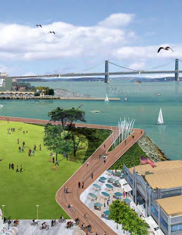
16 A dramatic WATERFRONT PARK FOR OUR FAMILIES. Mission Rock Park will rise gently up along the southern shore of the China Basin Channel across from AT&T Park. The park is multi-faceted with areas catering to active recreational users and others reserved primarily for reflection and passive uses. The park features a spectacular shoreline promenade and an expansive great lawn for family picnics and a myriad of active recreational activities. A terraced seating area is planned along the shoreline overlooking a kayak launch designed for those whose park experience includes getting into the water itself. A small baseball field will keep the park young and populated with families. Along the park s interior will be an array of shopping and outdoor dining opportunities that will activate the open space. Like Crissy Field to the north with its dramatic view of the Golden Gate Bridge, Mission Rock Park will have majestic views of the Bay Bridge and the downtown skyline. 8 MISSION ROCK

 in San")

17 AN INTIMATE NEIGHBORHOOD SQUARE TO MEET FRIENDS. Cozy and inviting, a neighborhood park with an expansive green, attractive landscaping, a grove of evergreen trees, and small food kiosks will anchor the interior of the site. This space is designed to be similar to Sidney Walton Park (otherwise referred to as Jackson Square) in San Francisco and to Bryant Park and Madison Square Park in New York each a unique and restive hamlet within a greater urban setting. The Shake Shack, tucked inside New York s Madison Square Park, has become an afternoon escape for nearby residents, office workers and visitors to the Big Apple. Executive Summary 9

18 PEDESTRIAN-ONLY RAMBLAS WITH HOMEGROWN SHOPS & CAFES. Linking the spectacular waterfront park and the neighborhood square will be a pedestrianonly thoroughfare similar in character to Maiden Lane and Belden Alley in San Francisco and the Ramblas in Barcelona, Spain. Lining the walkway will be an eclectic selection of homegrown shops and cafes, attractive landscaping, trees and outdoor seating serving both the local resident and visitors from afar. 10 MISSION ROCK


19 REVITALIZED HISTORIC PIER TO HOST EVENTS, SHOWS & EXPOSITIONS. Our design for Mission Rock actively embraces Pier 48, framing the historic pier with a view corridor from the Lefty O Doul Bridge, through the spectacular shoreline park. Pier 48 will be activated inside and appropriately refurbished outside to capture the simple elegance of its historic design. We envision that Pier 48 will address an important economic need in San Francisco for exhibition and event spaces for smaller-scale local and cultural programming that are not suited to the large, national convention-type facilities at the Moscone Center complex (e.g., food expositions, art shows, design showcases, traveling museums). Adorned with attractive amenities and significant public art, the Festival Plaza in front of Pier 48 will warmly welcome visitors and accommodate special events and expositions that desire to spill beyond the boundaries of Pier 48 or Mission Rock Park. Executive Summary 11

20 AN ATTRACTIVE AND CONVENIENT PLACE TO LIVE AND WORK. With its spectacular views, unique parks and other public amenities, Mission Rock will be a compelling location to live and work. The mixture of housing and office uses ensures that the neighborhood will be a community during the day and neighborhood in the evening, economically supporting the shops and cafes populating the edge of the waterfront park, the neighborhood square and the Ramblas. In addition, Mission Rock is perfectly situated to capture some of the energy and economic benefit from the surrounding uses the ballpark, the university and Mission Bay. 12 MISSION ROCK

21 THOUGHTFUL, BALANCED AND FUNCTIONAL TRANSPORTATION RESOURCES. Mission Rock will promote the use of public transit and connectivity to the region s extensive public transportation network. We hope to obtain the extension of the historic streetcar line into the project and will embrace the existing MUNI stop along Third Street as the district s own. The community will offer innovative transportation demand programs such as car and bicycle sharing and unbundled residential, office and retail parking. Parking resources will be operated efficiently and in coordination with on- and off-site needs. The project will contain a responsible amount of parking resources so that the ballpark and neighborhood can continue to operate effectively during events. Executive Summary 13

22 ACHIEVING EXCELLENCE IN SUSTAINABLE DESIGN. Mission Rock will be a model community, incorporating green technologies and other sustainable practices to reduce energy consumption, vehicle emissions, and the community s overall carbon footprint. Developed buildings will seek to attain aggressive environmental objectives. Water management systems will reduce the impacts of stormwater runoff and potable water consumption. Neighborhood businesses will be operated in accordance with sustainability standards established as requirements of the Mission Rock District. 14 MISSION ROCK

23 Executive Summary 15

24 16 MISSION ROCK

25 Executive Summary 17

26 18 MISSION ROCK

27 CREATING AND SHARING ECONOMIC RESOURCES Despite all of the development activity in recent years, the effort to transform the waterfront is far from complete. San Francisco s shoreline is still riddled with rotting piers and crumbling buildings. The Port has deferred maintenance obligations that it cannot reasonably fund, forcing piers and waterfront structures to be closed, barricaded, and fenced. Our proposal attacks this problem directly by creating a dynamic new neighborhood that can produce substantial economic resources to the Port though base and participating rent as well as significant tax increment. With these resources, the Port can address many of its troubling infrastructure needs elsewhere along the waterfront. In addition, the project will generate substantial revenues for the City, through business taxes, payroll taxes and parking taxes and create thousands of new jobs. The Mission Rock District will contain a vibrant mix of revenue-generating uses such as housing, retail and office. This mix of uses will provide the Port with a diverse income stream. We have creatively apportioned density to facilitate open space and other public amenity objectives which do not generate economic return but further sound community and urban planning objectives. Executive Summary 19
28 TRUSTWORTHY PARTNERS AND GOOD STEWARDS The San Francisco Giants, Farallon Capital Management and the Cordish Company have joined forces with Wilson Meany Sullivan, Kenwood Investments and Stockbridge Capital to form an experienced, innovative team uniquely qualified to delivering a successful project for the Port of San Francisco. Together with our design and project team, we have a long history of completing award-winning projects in San Francisco and elsewhere. Our team has a long, well-respected track record in San Francisco and specifically along its waterfront. From AT&T Park to the Ferry Building and Pier One. From Crissy Field to Mission Bay. From the Cliff House to Grace Cathedral, Davies Symphony Hall and the Transamerica Pyramid. Our team has left its mark on San Francisco and wants to leave another legacy for future generations. We have a deep-rooted local knowledge of the regulatory and political environment, strong relations with labor, and a demonstrated commitment to diversity and to our greater community. We have financial strength at this time of great economic distress. We will be sophisticated, reliable, and trustworthy partners throughout this journey together and good stewards of the project once it is completed. These important attributes are critical to achieving ultimate success in this difficult and challenging development environment. If selected, we earnestly look forward to working with the Port of San Francisco to achieve another success story along the waterfront. 20 MISSION ROCK

29 Executive Summary 21
30 22 MISSION ROCK
31 Executive Summary 23
32 context
33 02 02 Context

34 Context Seawall Lot & Pier 48 occupy an important and highly visible corner of San Francisco s waterfront. The development plan for this site must respect its context as a waterfront property, a part of the Mission Bay community, and a neighbor of the ballpark. Our proposed plan for Mission Rock is designed to accomplish these necessary goals. 26 MISSION ROCK

35 Context 27

36 28 MISSION ROCK


37 A HISTORY OF SUCCESS WORKING TOGETHER Complicated projects along the waterfront take time and require dedication and teamwork. Our team has worked effectively in partnership with the Port of San Francisco before, achieving great success together and making lasting positive contributions to our City. The ballpark is a good example. In 1995, the Giants were a financially struggling baseball franchise, playing in one of the worst sports facilities in the country. In March of 1996, however, the voters of San Francisco overwhelmingly approved the idea of constructing a new ballpark at China Basin. The vote, however, was only the beginning of the journey. Before any construction could begin, the Giants and the Port had to conduct a comprehensive environmental assessment of the project, assemble different parcels of land, negotiate a complicated real estate transaction, and gain local, regional and state regulatory approvals. Together, the Giants and the Port successfully and efficiently navigated the complicated process required of waterfront development projects. As the project approached final approval, proceeded through construction and opened with celebration, it became more and more popular. One of the hallmarks of our success was involving local residents, businesses and stakeholders in the process, giving them a seat at the table and a voice in the development and operation of the ballpark. As a result, once completed, the ballpark became a source of widespread civic pride. Our work together is now a model of excellence, studied by university students and civic leaders around the country and the world. Above Top. A downtown parade celebrates the arrival of the Giants in San Francisco in Above Center. Giants fans root for a new ballpark to replace Candlestick Park. They are rewarded with the opening of Pacific Bell Park in Above Bottom. The China Basin Channel, a.k.a. McCovey Cove, is filled with boaters participating in the 2007 Home Run Derby, part of the 2007 Major League Baseball All-Star Game in San Francisco. The ballpark opening in 2000 was one of the greatest civic celebrations in recent memory. In the nine years that followed, almost 30,000,000 people have flocked to our little corner of the City, enjoying themselves and sharing special moments together. The ballpark has been on the world stage as host of a World Series and an All-Star Game and has been an enduring source of entertainment and delight for local residents and visitors gathering to take in baseball games, concerts and other special events. People from all corners of the city, state, nation and world are familiar with AT&T Park and its spectacular place on the San Francisco waterfront. Context 29

38 30 MISSION ROCK

39 Context 31


40 REVITALIZING THE WATERFRONT The ballpark, however, represents just one of our team s collective achievements on the San Francisco waterfront. In the aftermath of the 1989 Loma Prieta Earthquake, the City was faced with wide-ranging planning decisions. One of the most important was whether to re-build the structurally unsound Embarcadero Freeway. Fortunately, the City and the Port seized the opportunity to reunite large portions of the City with its waterfront. The removal of the Embarcadero Freeway made it possible to restore the Ferry Building, connecting it with downtown and establishing a graceful waterfront landmark visible down Market Street from the very heart of the City. Wilson Meany Sullivan and key members of our design team were responsible for the restoration of this great landmark and creation of its thriving marketplace. At the foot of the Golden Gate Bridge, our landscape design team transformed Crissy Field from a stark, windswept oversight into one of the great urban waterfront parks in the world. Our goal for Seawall Lot 337 & Pier 48 is to build upon our successful efforts elsewhere and to extend the City s waterfront revitalization to include a neighborhood inspiring in character and offering a clear sense of public invitation. We envision this new community as being a rich part of the local experience, but also an attractive destination within our city for visitors from around the region, state and world. While the site needs to complement the surrounding neighborhood, we believe that it should have a distinct character. In this spirit, we have chosen to refer to Seawall Lot 337 & Pier 48 by a single name, the Mission Rock District. The name represents more than just a street. Mission Rock was a local landmark, an actual rock formation just offshore along the shipping channel linking the northern and southern San Francisco waterfront. As the shoreline changed and land filled the waters of Mission Bay, Mission Rock eventually became part of the shoreline itself and now only exists as the foundation beneath Pier 50. Above Top. The restoration of the Ferry Building and the introduction of the F-Line have been key elements in the rebirth of San Francisco s waterfront. Above Center. Recreating along the shoreline at Crissy Field. Above Bottom. Elegantly lit and refurbished Pier MISSION ROCK

41 Context 33
42 THE EMERGENCE OF MISSION BAY The City struggled for decades before arriving at the right solution for Mission Bay. Until this past century, Mission Bay was a recognized body of water. Mission Creek led inland from Mission Bay, bringing visitors to Mission Dolores, a thought almost inconceivable today. In response to industrial needs of the time, the waters of Mission Bay and much of Mission Creek eventually were filled with construction waste material cut from nearby hills and with debris from the 1906 Earthquake. The waters of Mission Bay and Mission Creek were replaced with a network of rail lines. Rail spurs, piers and sheds were installed at a feverish pace to accommodate the bustling commercial rail activity of the day as cargo flowed freely from the shores of San Francisco by rail to destinations throughout the United States. Generations later, as the rail lines became inactive, the City saw an opportunity to re-use the land for the creation of a new waterfront neighborhood. With Mission Bay, a new form of commerce is taking shape, with a university campus, a hospital, and space for innovative research and development. Thousands of housing units and acres of public parks balance commercial uses, creating a strong self-sustaining community. The Mission Rock District is strategically positioned between two powerful economic engines, the ballpark and Mission Bay. It has the potential to be a distinct destination within the Mission Bay area, a place that complements and adds character to the broader neighborhood as a whole. The Port s public trust findings for the ballpark predicted that the waterfront properties along the access routes to the ballpark would be stimulated by the peak activity generated by ballpark events. Likewise, Mission Rock s proximity to Mission Bay and the UCSF campus provides an everyday market for the retail, entertainment, office and residential components of the Mission Rock District. The development of Seawall Lot 337 and Pier 48 will capitalize on the economic opportunity created by these synergies Above. Mission Bay has evolved over the years, starting as a shallow cove and evolving into an industrial district of railheads and maritime commerce, before slowly morphing into the modern, mixed-use neighborhood now emerging. 34 MISSION ROCK

43 Context 35
44 Continuing the revitalization of the waterfront We have attended and actively participated in all of the community meetings and workshops held regarding the possible development of this site and have carefully listened to and absorbed the comments made by Port staff and members of the public. We appreciate and understand the Port s vision and diverse goals for this site. We know that we are at the beginning of this journey. We have been engaged from the outset and will work diligently to realize our shared goals. We are neighbors and stakeholders; we want this site to be developed thoughtfully and with an insistence on quality and excellence. We believe that our plan delivers. We understand the challenges of waterfront development and recognize the complexities of the diverse regulatory environment. We recognize that construction on this site will be complicated. These land parcels were created by filling marshlands and tidal flats and as such have challenging subsurface conditions. We have assembled a team of consultants and experts who have extensive experience working in the area and with the unique site conditions that typify Seawall Lot 337. Our team has a long, successful history of working together with the Port, the San Francisco Bay Conservation & Development Commission, and the State Lands Commission. We have a thorough appreciation of the requirements of Senate Bill 815, the Public Trust Doctrine, and the Standards for Historic Rehabilitation. We know that a project of this scope will have difficult moments, but we also know that it is worth the effort. Working together, we can fulfill the incredible promise of this opportunity. Create a vibrant and unique mixed-use urban neighborhood focused on a major new public open space at the water s edge. This new neighborhood should demonstrate the best in sustainable development with a mix of public and economic uses that creates a public destination which enlivens the Central Waterfront, celebrates the San Francisco Bay shoreline, and energizes development at Mission Bay. Consistent with enabling state legislation, the development program for the site should generate significant revenues to fund the Port s historic preservation and waterfront open space needs. Opposite. San Francisco s magnificently restored Ferry Building. 36 MISSION ROCK

45 Context 37
46 Land use
47 03 03 Land Use

48 the mission rock district The Mission Rock District combines a variety of uses to ensure the bay shoreline and street scene will be alive and inviting throughout the day and well into the evening. The District features a significantly-expanded and visually dramatic open space that celebrates the waterfront and access to the Bay. The Mission Rock District highlights its history by incorporating Pier 48 and its historic bulkhead and pier sheds. The District will incorporate sustainable best practices so that parks are not the only green elements. We envision the Mission Rock District as a vibrant, dynamic, innovative place. 40 MISSION ROCK

49 First consideration given to public trust-consistent uses. The project will create many public trust-consistent uses, including the following elements: Mission Rock Park: Grand waterfront park. Shoreline promenade with benches. Great lawn for picnics and public gatherings. Water access for kayakers and other small watercraft. Public art. Native habitat. Festival Plaza: An adaptable public plaza greeting visitors to Pier 48. Public art. Markets. Cornerstone of the Blue Greenway. Pier 48: Restored apron to allow public access on all three seaward sides. Temporary berths for ferries, water-taxis, maritime operations, and public access. Public assembly and exhibition space for regional trade shows and festivals. Mission Rock Neighborhood Square: Sheltered public open space one block from the waterfront in the heart of the District, serving as a haven for residents, workers and visitors. Las Ramblas: Connecting Mission Rock Park with the Mission Rock Neighborhood Square is a pedestrian-only, tree-lined thoroughfare of homegrown shops and cafes. Land Use 41

50 42 MISSION ROCK

51 Land Use 43

52 Response to Context Located on a pivotal site within the City, Mission Rock will serve as the gateway to the central and southern waterfronts. It will be uniquely visible, seen from many of the seating areas with AT&T Park and showcased on baseball telecasts broadcast throughout the country. Mission Rock is designed to be complementary to the greater Mission Bay community, enhancing the overall value and appeal of the area. Mission Rock will connect with and expand upon Mission Bay s extensive open space network. Its major waterfront park will continue the shoreline improvements along Mission Creek to the west. The shoreline promenade will become an important segment of the Blue Greenway. The Ramblas will draw pedestrians down through the site to Mission Rock Square. The friendly and verdant streets both pedestrian and vehicular, intimate and urban, residential and retail will connect with the streets and open space of Mission Bay. The featured Mission Rock Park, together with Festival Plaza, will offer unprecedented access to and interaction with the bay and its shoreline, inviting people to play, picnic, kayak, and enjoy cultural and civic events and festivals, or just take in views of the City skyline and Bay Bridge. The Mission Rock District will be a place for everyone. 44 MISSION ROCK
53 Place The intent of the proposed Mission Rock design is the creation of a place unlike any other in San Francisco. This is realized by an urban design decision to strike a sight line from the foot of Lefty O Doul Bridge to the façade of Pier 48, and to hold all buildings south of that line. The nature and scale of this space, with its powerful anchors at either end, the exciting backdrop of the ballpark, and the devotion of the full waterfront edge to public use. AT&T Park Lefty O'Doul Bridge PIER 48 Frame The urban design character of this new public room in the City will be reinforced by the design of the buildings that line the edges of the space, embrace the waterway and historic structures, and animate the open-space areas. The frame begins with the ballpark itself, opening up to the Bay and framing the Port Walk experience with a gracious arcade. At Mission Rock the southern framework will be created by placement and scale of buildings that assure sunlight, and animate the site through building design and program. With its lively public areas, Pier 48 will then extend the frame out into the Bay. Land Use 45
54 Land Use Program The Mixed-Use Concept The mixed-use program is proposed to balance residential, office, retail, exhibition, arts and parking distributed over a network of new city blocks. This mix of uses is likely to change somewhat as this project moves forward to meet market demand and reflect community and regulatory concerns. The project will include: 875 units of apartments and townhouse-style units 1,037,400 square feet of office space 242,375 square feet of retail 181,200 square feet of exhibit/event space (Pier 48) 8.7 acres of public open space (Mission Rock Park/Festival Plaza, Mission Rock Square, Las Ramblas) 2,650 parking spaces 46 MISSION ROCK

55 Land Use 47

56 Mixed Uses and New Public Open Space. The program of residential, office, retail, exhibition, arts and parking will be distributed appropriately throughout Mission Rock. A new public open space Mission Rock Square will be located at the center. 48 MISSION ROCK

57 Lively Ground Floor Spaces. To create a lively sidewalk experience, many of the ground floor spaces will contain shops, building lobbies, or the lower level of multi-story townhouse residential units. Upper levels will contain residential, office and possibly some retail.

58 Housing. In our proposal, most of the housing predominantly consisting of apartment buildings will be clustered at the northern end of the site. Located on Blocks A, C, F, and J, the residential buildings will ascend in height to form a crescent, starting with the short waterfront structure on Block J and climbing to the taller tower on Block A. Housing will line two sides of the new Mission Rock Square. We will explore the possibility of incorporating for-sale condominiums to diversify the mix of housing if this becomes economically feasible. Offices. Office space will be located along parts of the western, eastern and southern boundaries of the site, lining two sides of Mission Rock Square. It is anticipated that many of the office users would be bio-tech or green-tech firms attempting to capture some of the energy and creativity of the university and the city itself. 50 MISSION ROCK

59 Parking. Mission Rock will have a responsible number of parking spaces given its development program and the need for ballpark parking resources. Several of the blocks will contain parking, which will be designed where feasible to minimize its aesthetic impact on the surrounding neighborhood. Block-by-Block Land Use. Please see Appendix J for the block-by-block mix of land uses and proposed construction phasing. Land Use 51


 375 210 230 70 No.")
60 Residential APPENDIX J - PHASED LAND USE & DEVELOPMENT PROGRAM FORM PHASE Phase 1 Phase 2 LAND USE PROGRAM Block A Block B Block C Phase 1 Block D1 Block E Block F Block G Subtotal Residential Square Footage Maximum Building Height (ft.) No. of dwelling units MISSION ROCK

61 Phase 2 Phase Mission Rock Park Phase 3 Phase 4 All Phases Block D2 Block H Block I Block J Phase 3 Phase Pier 48 Subtotal Subtotal Subtotal Subtotal Totals Land Use 53


 21980 21980 12580 1600 54 MISSION")
62 Retail APPENDIX J - PHASED LAND USE & DEVELOPMENT PROGRAM FORM PHASE Phase 1 Phase 2 LAND USE PROGRAM Block A Block B Block C Phase 1 Block D1 Block E Block F Block G Retail Subtotal Public Trust Serving Area (sf) Neighborhood Serving Area (sf) MISSION ROCK

63 Phase 2 Phase Mission Rock Park Phase 3 Phase 4 All Phases Block D2 Block H Block I Block J Phase 3 Phase Pier 48 Subtotal Subtotal Subtotal Subtotal Totals Land Use 55


64 Office APPENDIX J - PHASED LAND USE & DEVELOPMENT PROGRAM FORM PHASE Phase 1 Phase 2 LAND USE PROGRAM Block A Block B Block C Phase 1 Block D1 Block E Block F Block G Office Subtotal Square Footage Maximum Building Height (ft.) MISSION ROCK

65 Phase 2 Phase Mission Rock Park Phase 3 Phase 4 All Phases Block D2 Block H Block I Block J Phase 3 Phase Pier 48 Subtotal Subtotal Subtotal Subtotal Totals Land Use 57

 0 Total")

66 Open Space APPENDIX J - PHASED LAND USE & DEVELOPMENT PROGRAM FORM PHASE Phase 1 Phase 2 LAND USE PROGRAM Block A Block B Block C Phase 1 Block D1 Block E Block F Block G Subtotal Open Space Largest Contiguous Area (acres) 0 Total Site Open Area (acres) 0 Pier 48 Valley & Apron (acres) 0 Public Trust Serving Area 0 Neighborhood Serving Area MISSION ROCK

67 Phase 2 Phase Mission Rock Park Phase 3 Phase 4 All Phases Block D2 Block H Block I Block J Phase 3 Phase Pier 48 Subtotal Subtotal Subtotal Subtotal Totals Land Use 59


 163 163 914")
68 Parking APPENDIX J - PHASED LAND USE & DEVELOPMENT PROGRAM FORM PHASE Phase 1 Phase 2 LAND USE PROGRAM Block A Block B Block C Phase 1 Block D1 Block E Block F Block G Parking Subtotal Square Footage (above grade) Shared Spaces (above grade) MISSION ROCK

69 Phase 2 Phase Mission Rock Park Phase 3 Phase 4 All Phases Block D2 Block H Block I Block J Phase 3 Phase Pier 48 Subtotal Subtotal Subtotal Subtotal Totals Land Use 61


70 Events/Exhibition APPENDIX J - PHASED LAND USE & DEVELOPMENT PROGRAM FORM PHASE Phase 1 Phase 2 LAND USE PROGRAM Block A Block B Block C Phase 1 Block D1 Block E Block F Block G Exhibition Space Subtotal Square Footage 0 62 MISSION ROCK
71 Phase 2 Phase Mission Rock Park Phase 3 Phase 4 All Phases Block D2 Block H Block I Block J Phase 3 Phase Pier 48 Subtotal Subtotal Subtotal Subtotal Totals Land Use 63
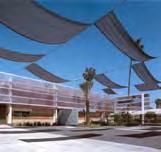
72 Pier 48 Pier 48 is an important element in our plan. It is a clear reminder of the history of the Mission Rock site. Views of Pier 48 are preserved and highlighted in our plan. Mission Rock Park is designed with Pier 48 in mind. As people cross over the Lefty O Doul Bridge from the north and arrive at Mission Rock Park, Pier 48 is in clear view. Directly in front of Pier 48 is Festival Plaza. This public plaza is designed to frame Pier 48 and to accommodate a variety of events that seek to spill outside of the Pier inviting patrons to explore inside. Pier 48 is used now primarily for ballpark parking, the storage of election equipment and for an occasional special event. We believe that if actively marketed, it could attract an array of regional trade shows, designer showcases, art festivals, food and wine gatherings and other special events and exhibitions too small for Moscone Center, but too large for other City venues. Pier 48 can be an effective tool in preserving and attracting businesses to the City and generating important revenues for the hospitality industry. This use is explicitly compatible with the public trust doctrine applicable to this site. In particular, we believe that the northern apron of Pier 48 could be a popular destination for visitors and a busy hub for water taxis, excursion boats, ferries and other vessels. The southern apron of Pier 48 would continue to take on the character of a working waterfront, much like Pier 50 to the south. At first, Pier 48 could be operated with modest capital improvements. Over time, however, the Pier would need more extensive improvements to maximize its economic potential and stake its claim as an energetic contributor to the neighborhood. The Pier would be rehabilitated consistent with to the Secretary of Interior Standards. The existing cargo doors will remain in place, with new operable glass doors added where feasible so that in inclement weather, the interior spaces can take full advantage of natural light and views, and on beautiful days reinforce the indoor-outdoor potential of the public uses inside. Because the last few bays at the far eastern end of the Pier were damaged by a fire and subsequently rebuilt, these portions of the building can be approached more flexibly in terms of their architectural treatment. The eastern end of Pier could be transformed into its own smaller venue, attractive to smaller celebrations, conferences and events. The open portion between Sheds A & B constitute the Valley and can be programmed in conjunction with activities in the indoor spaces. The Valley can be entirely open to the sky or possibly covered with temporary fabric shade structures. We believe that the Valley would be far more attractive and usable if its eastern end could be replaced with transparent glass walls opening up views to the Bay. APPENDIX J - PHASED LAND USE & DEVELOPMENT PROGRAM FORM PHASE Phase 1 Phase 2 LAND USE PROGRAM Block A Block B Block C Phase 1 Block D1 Block E Block F Block G Pier 48 Subtotal Square Footage 0 64 MISSION ROCK

73 Phase 2 Phase Mission Rock Park Phase 3 Phase 4 All Phases Block D2 Block H Block I Block J Phase 3 Phase Pier 48 Subtotal Subtotal Subtotal Subtotal Totals Land Use 65

74 66 MISSION ROCK


75 Land Use 67
76 Phasing The phasing of the project will be informed by the following principles: Maintaining adequate parking spaces on site to meet the needs of AT&T Park. Take advantage of existing infrastructure and site access along Third Street in early phases. Geotechnical improvements, environmental remediation, site grading requirements, new roads and infrastructure backbone to be developed in conjunction with vertical construction. Meeting market demand for different components of the project s mixed uses. Develop the main retail district when the project has achieved sufficient mass to provide adequate retail support. Phase 1 The initial phase of development will focus along Third Street Blocks A, B and C and is expected to take approximately 4 years. Infrastructure will be extended along Third Street, site grading and environmental remediation will occur, and new east-west roads will be constructed as necessary to provide service and access to new buildings. The anticipated uses to be developed include office and residential. As demand dictates, Pier 48 will receive tenant modest improvements necessary for constructive reuse. Ballpark parking demand will be met on-grade in the remainder of the site and in Pier 48. Phase 2 Phase 2 development will see the first parking structure built along with the completion of three interior blocks including Mission Rock Square. By the end of this phase, Las Ramblas will form an active connection between the Ballpark and Mission Rock Square and parking to the south along a realigned Mission Rock Street. A proposed garage in Block D1 will be constructed early in this phase while undeveloped blocks will continue to accommodate on-grade parking. Infrastructure will be extended deeper into the project from Third Street and streets will be completed to service the 4 blocks that comprise this phase. All components of the mixed use district envisioned for Seawall Lot 337 are contemplated for this phase: office, retail, residential, parking, new open space. Pier 48 s development will continue as supported by market demand. The anticipated duration of this phase is 4 years 68 MISSION ROCK

77 Phase 3 The next development phase will see completion of all new development on Seawall Lot 337. Perimeter geotechnical improvements will be undertaken in this phase to allow the construction of Mission Rock Park and development of the westernmost blocks of the project. Following site grading and remediation, the final extensions of infrastructure and streets will be effectuated to accommodate the vertical development program. The parking garage in Block D2 will be constructed early in this phase to accommodate the parking that will be displaced by development of Mission Rock Park and Blocks H, I and J. Other uses in this phase include office, residential and open space. Phase 4 Phase 4 is dedicated to completing the adaptive reuse program of Pier 48. Its apron structure will be repaired in this phase and tenant improvements necessary to support its reuse program will be built. Land Use 69


78 PHASE 1: Years 1-4 PHASE 2: Years 5-8 PHASE 3: Years 9-12 PHASE 4: Years MISSION ROCK
79 Mission Rock MISSION ROCK Project Schedule - PROJECT SCHEDULE ID Task Name Duration Start Finish Q3Q4 Q2Q3Q4 Q2Q3Q4 Q2Q3Q4Q1Q2Q3Q4 Q2Q3Q4 Q2Q3Q4 Q2Q3Q4Q1Q2Q3Q4 Q2Q3Q4 Q2Q3Q4 Q2Q3Q4Q1Q2Q3Q4Q Q Q2Q3Q4 Q2Q3Q4Q1Q2Q3Q4 Q2Q3Q4 Q2Q3Q4 Q2Q3Q4Q1Q2Q3Q4 Q2Q3Q4 Q2 Q3Q4 1 ENA 5.5 mo 1/15/09 7/2/09 2 Port Commission Authorization to Negotiate 1.5 mo 1/15/09 3/2/09 3 Finalize ENA and supporting documents 3 mo 3/3/09 6/2/09 4 Approval of ENA by Port Commission 1 mo 6/3/09 7/2/09 5 Execution of ENA 0 mo 7/2/09 7/2/09 7/2 6 CONCEPTUAL DESIGN AND REVIEW 13 mo 7/3/09 8/6/10 7 Site Due Diligence 3 mo 7/3/09 10/2/09 8 Landplanning and Architecture 4 mo 10/5/09 2/3/10 9 Infrastructure 4 mo 10/5/09 2/3/10 10 Sustainability 4 mo 10/5/09 2/3/10 11 Port and Community Reviews 6 mo 2/4/10 8/6/10 12 TERM SHEET 9 mo 2/4/10 11/8/10 13 Develop Financial Plan 4 mo 2/4/10 6/7/10 14 Develop Other Supporting Plans 4 mo 2/4/10 6/7/10 15 Port and Community Reviews 4 mo 6/8/10 10/7/10 16 Term Sheet Endorsed by Port Commision and City 1 mo 10/8/10 11/8/10 17 SCHEMATIC DESIGN AND REVIEW 10 mo 8/9/10 6/10/11 18 Landplanning and Architecture 4 mo 8/9/10 12/8/10 19 Infrastructure 4 mo 8/9/10 12/8/10 20 Sustainability 4 mo 8/9/10 12/8/10 21 Port and Community Reviews 6 mo 12/9/10 6/10/11 22 MASTERPLANS AND DESIGN DEVELOPMT AND REVIEW 24 mo 6/13/11 6/19/13 23 Landplanning and Architecture 12 mo 6/13/11 6/14/12 24 Infrastructure 12 mo 6/13/11 6/14/12 25 Sustainability 12 mo 6/13/11 6/14/12 26 Port and Community Reviews 12 mo 6/15/12 6/19/13 27 EIR + CEQA 20 mo 6/13/11 2/15/13 28 Consultants Selection Process 2 mo 6/13/11 8/11/11 29 Initial Study and Scoping 3 mo 8/12/11 11/11/11 30 Prelim Draft EIR and Background Studies 6 mo 11/14/11 5/15/12 31 Draft EIR 2 mo 5/16/12 7/16/12 32 Response to Comments and FEIR 3 mo 7/17/12 10/16/12 33 Mitigation and Monitoring Program 2 mo 10/17/12 12/17/12 34 EIR Certification 2 mo 12/18/12 2/15/13 35 LEASE DDA 20 mo 6/13/11 2/15/13 36 Commence Lease DDA Negotiations 12 mo 6/13/11 6/14/12 ID Task Name Duration Start Finish 37 Port Land Use Approvals 18 mo 6/13/11 12/17/12 38 Other City Land Use Approvals 18 mo 6/13/11 12/17/12 MISSION ROCK - PROJECT SCHEDULE Q3Q4 Q2Q3Q4 Q2Q3Q4 Q2Q3Q4Q1Q2Q3Q4 Q2Q3Q4 Q2Q3Q4 Q2Q3Q4Q1Q2Q3Q4 Q2Q3Q4 Q2Q3Q4 Q2Q3Q4Q1Q2Q3Q4Q Q Q2Q3Q4 Q2Q3Q4Q1Q2Q3Q4 Q2Q3Q4 Q2Q3Q4 Q2Q3Q4Q1Q2Q3Q4 Q2Q3Q4 Q2 Q3Q4 Page 1 39 Regional Agencies Land Use Approvals 18 mo 6/13/11 12/17/12 40 Finalize Lease DDA 6 mo 6/15/12 12/17/12 41 Approval of Lease DDA 0 mo 2/15/13 2/15/13 2/15 42 FORMATION OF SPECIAL DISTRICTS 12 mo 2/14/12 2/15/13 43 Form financial use districts 12 mo 2/14/12 2/15/ INFRASTRUCTURE AND PUBLIC AMENITIES 174 mo 2/15/13 10/20/27 46 Commence Infrastructure/Amenities construction 0 mo 2/15/13 2/15/13 Commence Infrastructure/Amenities construction 47 Phase 1 6 mo 2/18/13 8/20/13 48 Phase 2 6 mo 9/7/17 3/9/18 49 Phase 3 6 mo 3/29/22 9/28/22 50 Phase 4 6 mo 4/20/27 10/20/ VERTICAL DEVELOPMENT AND LEASING 204 mo 8/21/13 11/1/30 53 Phase 1 48 mo 8/21/13 9/6/17 54 Phase 2 48 mo 3/12/18 3/28/22 55 Phase 3 60 mo 9/29/22 10/20/27 56 Phase 4 36 mo 10/21/27 11/1/30 Land Use 71
80 APPENDIX J - PHASED LAND USE & DEVELOPMENT PROGRAM FORM PHASE Phase 1 Phase 2 LAND USE PROGRAM Block A Block B Block C Phase 1 Block D1 Block E Block F Block G Subtotal Open Space Largest Contiguous Area (acres) 0 Total Site Open Area (acres) 0 Pier 48 Valley & Apron (acres) 0 Public Trust Serving Area 0 Neighborhood Serving Area Office Square Footage Maximum Building Height (ft.) Retail Public Trust Serving Area (sf) Neighborhood Serving Area (sf) Parking Square Footage (above grade) Shared Spaces (above grade) Residential Square Footage Maximum Building Height (ft.) No. of dwelling units Exhibition Space Square Footage 0 Recreation Square Footage 0 Pier 48 Square Footage 0 72 MISSION ROCK
81 Phase 2 Phase Mission Rock Park Phase 3 Phase 4 All Phases Block D2 Block H Block I Block J Phase 3 Phase Pier 48 Subtotal Subtotal Subtotal Subtotal Totals Land Use 73
82 Architec urban and approac 74 MISSION ROCK
83 tural design h 04 Architectural and Urban Design Approach 04

84 Architectural and Urban Design Approach From the Ferry Building to the ballpark, the bay shoreline has welcomed a string of new public amenities. Our vision for Seawall Lot 337 extends that public realm south, past China Basin and across Lefty O Doul Bridge to Mission Rock, San Francisco s newest neighborhood. 76 MISSION ROCK

85 Architectural and Urban Design Approach 77
86 Fabric Having established place and frame, the urban design strategy moves to lay a pattern of blocks that invites the Mission Bay streets across and into the site and then breaks that pattern into more easily walkable blocks as one approaches the Bay. Echoing the manner in which buildings step down to the Bay in height, the blocks at Mission Rock acquire a finer grain toward the water to add view corridors and pedestrian ways. Referred to as a figure/ground diagram, the map shown here illustrates this fine-grained urban pattern, reminiscent of the pattern of cities celebrated for their walkable characteristics (such as the Portland 200ftby-200ft block). PIER MISSION ROCK
87 Orientation The scale, shape and landscape features of the open space system work together to provide not only a bay edge view, but a sense of regional orientation from all areas of the parks and promenade. The water s edge is treated as a dynamic boardwalk specifically tuned to direct views toward memorable elements such as the Bay Bridge, the ballpark, the downtown skyline, and the Lefty O Doul Bridge. The boardwalk is then linked into the Pier 48 apron where we envision water taxis, ferries, and excursion boats will enliven the edge and invite visitors to walk to the far end of the pier for a full bay panorama. A major intent of the design of the water s edge is to provide the public with a variety of ways to experience the Bay. AT&T Park Downtown McCovey Cove Bay Bridge Lefty O'doul Bridge PIER 48 4th Street Bridge East Bay PIER 50 Architectural and Urban Design Approach 79
88 Form The varied urban form of the Mission Rock neighborhood composed of towers, mid-rise and smaller-scale buildings, a mix of retail, housing, offices, civic uses, vibrant ground-floor spaces, and visually identifiable green features will define the relationship among the public, semipublic, and private realms. The north-south orientation of the blocks and buildings a design element inspired by the rail yards that once occupied the site will ensure that sun will penetrate its public spaces all year round. Historic Rail line Alignment 3rd Street and Terry Francoise Alignment 80 MISSION ROCK
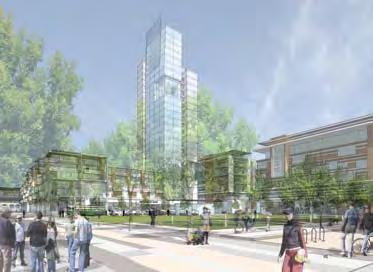
89 Profiles Viewed from the northern edge of the site, Mission Rock Park will be framed by two stories of shops, restaurants, and green terraces with housing above. The gateway to Mission Rock and Mission Bay will be punctuated by the tower. Mission Rock Park will open up to the bay and capture the sensational diagonal view of historic Pier 48. Architectural and Urban Design Approach 81
90 Landmarks City and regional landmarks will be apparent at Mission Rock, with the location, scale and orientation of buildings framing and enabling these views. Highlighted views include those of the San Francisco Bay, the downtown skyline, the Bay Bridge, Oakland, and the working waterfront. The broad areas of park, streets and pedestrian ways will enable views throughout Mission Rock and from the surrounding Mission Bay neighborhood. In addition to pedestrian-level views, the vistas from upper levels of buildings both on- and off-site are an important part of the urban design strategy. Downtown San Francisco Skyline AT&T Park Lefty O'Doul Bridge 82 MISSION ROCK
91 Network Mission Rock s urban design strategies include a network of interconnected, varied open spaces that link with Mission Bay s open space fabric and with the City s larger vision of its emerging waterfront public realm. The plan continues the Bay Trail across Lefty O Doul Bridge, south along the Boardwalk and Esplanade, around Pier 48 s north and south aprons, to connect with the Blue Greenway, Mission Bay Commons and the Bayfront Park beyond. Mission Rock Park also links across Third Street to Mission Creek Park. Channel Street crosses Third Street, passes along the north edge of Mission Rock Square and links Mission Bay and the open water between Piers 48 and 50 and the Blue Greenway. As it passes through the Bosque Gardens, Bosque Street unites Long Bridge Street and Children s Park in Mission Bay with Mission Rock Square, Las Ramblas and Mission Rock Park. Architectural and Urban Design Approach 83

92 84 MISSION ROCK

93 Architectural and Urban Design Approach 85


94 Description The northern part of the Mission Rock neighborhood will be the predominant address for housing, situated in four towers that vary in height and step down to form a north-facing crescent. The first tower will be located on Block A at the intersection of Third Street and Pier 48 Street, the iconic marker of Mission Rock. The second and third towers will be on Blocks C and F, respectively, facing Mission Rock Square at the heart of the project. A fourth very small tower will occupy Block J facing Festival Plaza, near the water s edge. The finely-scaled northern blocks will also contain low- and mid-rise housing situated above ground-floor retail uses. These buildings will also have a north-south orientation, defining the north-south street walls but allowing terraces, green gardens and ample sunshine to penetrate the blocks and spill into the public open spaces below. With the exception of possible loft housing at the parking podia along Bosque and Mission Rock Streets on Blocks D and H, the southern and eastern parts of the site will mainly contain the development s substantial office space program. Office lobbies and buildings will line Third Street between Channel Street, Bosque Street, and Mission Rock Street; the southernmost block between Las Ramblas and Vara Street; and the three blocks of Terry Francois Boulevard that separate Piers 48 and 50 and the seawall lot itself. As in the rest of the neighborhood, the north-south axes will dominate, reinforcing the site s historical form and providing for sunny north-south streets, light-filled public spaces, and a fine-grained urban character. Buildings may also be bifurcated in the north-south direction, allowing natural ventilation to as great a degree as possible. 86 MISSION ROCK

95 Architectural and Urban Design Approach 87


96 Architectural Character. Mission Rock will have an architectural character that is contemporary but timeless, human-scaled, warm, and highly sustainable. While the architecture will be handsomely detailed, its scale will differ from traditional San Francisco neighborhoods like the Marina or the Mission District, built many decades ago and comprised of smaller houses and flats and with occasional larger structures. Mission Rock building forms will include scale-giving, light-gathering elements such as bay windows that are derived from the architecture of the past but reinvented in a contemporary version. Potential building materials include brick, terracotta, stucco, glass, metal, wood, and tile. Natural materials will be used to as great an extent as practical. Roofs will predominantly be flat with special features as the buildings meet the sky. As appropriate, roofs will be green, and some will make use of energy-capturing elements such as solar collectors and photovoltaics. 88 MISSION ROCK

97 Architectural and Urban Design Approach 89

98 90 MISSION ROCK


99 Pedestrian Character. Particularly important is the pedestrian realm and the many storefronts that will define it. A variety of retail spaces of varying sizes will line the blocks of Mission Rock. Where appropriate, such as along the Ramblas, along the edge of Mission Rock Park, and surrounding Mission Rock Square, storefronts will be as diverse in their design as possible; some will open up completely and spill into the street or park, interacting in a dynamic way with the life of the neighborhood. Others will be more traditional but will feature a variety of treatments. All will be highly transparent and open to views, strolling, and window-shopping. Intentionally creating the sense of transparency at the pedestrian level will ensure that the shops, cafes, restaurants, lobbies, and other amenities will activate the neighborhood s public realm, put eyes on the street, and make Mission Rock a safe and vibrant place in which to live, work, and shop. This openness or transparency also will help to establish the urban choreography of coming and going, indoor and outdoor, that characterizes vibrant cosmopolitan life and San Francisco s best streets. The inclusion of housing and public space will ensure that Mission Rock is an active place, 365 days a year. Architectural and Urban Design Approach 91

100 third Street and connection to transit The Mission Rock Plan puts transit first. Three different public transit modes are envisioned serving the site and the plan is structured to make ridership efficient, easy and convenient. From the T line stop at Mission Rock Street, pedestrians can walk a few yards north on Third Street, head east on Bosque Street to Mission Rock Square. With the proposed historic street car stop in the heart of the Mission Rock district on the north side of Mission Rock Square, the extended E line would travel along Channel Street to Terry Francois, looping north to serve Pier 48, the Festival Plaza and Mission Rock Park and returning on Channel Street. The UCSF shuttle would travel along Third Street, entering Mission Rock along Bosque Street to Terry Francois, returning to Third Street along Channel Street and heading north on Third. CHANNEL STREET E T THIRD STREET SQUARE MISSION ROCK STREET TERRY FRANCOIS BOULEVARD E T Proposed MUNI Streetcar MUNI Light Rail Train Muni Stop Mission Rock/Mission Bay/ UCSF Shuttle Pedestrian Path View Corridor 92 MISSION ROCK

101 Architectural and Urban Design Approach 93
102 Mission Rock Building Heights and Massing BLOCK BLOCK AREA (sf) HEIGHTS RESIDENTIAL Du/Acre OFFICE / FAR RETAIL ARTS VENUE / EXHIBITION Block A sf 5 flrs = 60 ft 329 units 0 sf sf 0 sf 1.17 acres 6 flrs = 70 ft 281 du/acre 37 flrs = 380 ft sf Block B sf 3 flrs = 75 ft sf sf 0 sf 1.12 acres 0 0 Block C sf 6 flrs = 70 ft 130 units sf sf 0 sf 0.83 acres 22 flrs = 230 ft 157 du/acre 2.59 :1 FAR sf Block D sf 6 flrs = 70 ft sf sf 0 sf 0.99 acres 20 flrs = 260 ft :1 FAR 0 Block D sf 6 flrs = 70 ft 60 units sf sf 0 sf 1.29 acres 15 flrs = 195 ft 47 du/acre 3.41 :1 FAR sf Block E sf 1 flr = 15 ft 0 0 sf 1600 sf 0 sf 0.92 acres 0 0 Block F sf 6 flrs = 70 ft 249 units 0 sf sf 0 sf 1.24 acres 20 flrs = 210 ft 201 du/acre sf Block G sf 50 units 0 sf sf 0 sf sf Block H sf 4 flrs = 50 ft 13 units sf 0 sf 0 sf 0.77 acres 10 flrs = 130 ft 17 du/acre 4.37 :1 FAR sf Block I sf 5 flrs = 80 ft sf sf 0 sf 0.55 acres 6 flrs = 95 ft :1 FAR 0 Block J sf 5 flrs = 80 ft 44 units sf 8850 sf 0 sf 0.74 acres 14 flrs = 150 ft 59 du/acre 3.5 :1 FAR sf Pier sf 1 flr = 30 ft 0 0 sf 17,625 sf Trust compliant 6.01 acres Totals sf 875 units sf 262,215 sf acres 53 du/acre average sf 101,300 sf Exhibition space 40,975 sf Event space 225,735 sf 94 MISSION ROCK
103 Architectural and Urban Design Approach 95

104 96 MISSION ROCK

105 Tower Structures Height and Bulk. Mission Rock s residential structures will vary in height and bulk. Strategically situated close to transit and downtown, the buildings will have spectacular views of the city, the bay, and the site amenities. The residential towers will step down in both height and bulk as they move toward the water. Block A Tower: 37 stories, 380 feet tall Block A The Esplanade Block A Third Street Architectural and Urban Design Approach 97

106 Tower Structures Block C Tower: 22 stories, 230 feet tall 98 MISSION ROCK


107 Block F Tower: 20 stories, 210 feet tall Block J Tower: 14 stories, 150 feet tall Block C Las Ramblas: Block D1 Tower: 19 stories, 260 feet tall Block D2 Tower: 15 stories, 195 feet tall Block H Tower: 9 stories, 120 feet tall Architectural and Urban Development Design Approach Concept 99

108 Street-Level Views. As in much of the rest of San Francisco, the streets of Mission Rock will also function as view corridors, many of them terminating at the bay. North-south streets will be oriented toward Mission Rock Park, with McCovey Cove, AT&T Park, and the city beyond. East-west streets will terminate at the waterfront: Exposition Street will extend to the valley between Pier 48 s Sheds A and B, Channel Street will end at the open water between Piers 48 and 50, and Bosque Street will terminate at the still busy Pier 50. Together, these east-west streets will celebrate he China Basin Channel, the maritime history and present-day activity of San Francisco s waterfront, bringing the bay to Mission Rock and the city to the bay. Lively storefronts, shops of all kinds featuring local and regional specialties, neighborhood-serving stores, small galleries, cafes and restaurants, residential and office lobbies, individual town homes and single-loaded flats will line the streets. Special attention will be paid to parking garage entrances and loading docks to optimize curb cuts and conflicts among pedestrians, cars, and service vehicles. The vision for the neighborhood is analogous to many wonderful pedestrian-oriented San Francisco retail streets, such as Hayes Street, Fillmore Street, Clement Street, and 24th Street in the Noe Valley. 100 MISSION ROCK


109


110 Along the southern edge of Mission Rock Park, The Esplanade is animated with diverse cafes, restaurants and doubleheight shops. Tables and chairs spill out into the park. The northwest of Mission Rock Square at the corner of Channel Street and Las Ramblas is the intersection of low, mid and high-rise housing with cafes, shops, and transit reflecting the character to this vibrant new neighborhood. Mission Rock Square is a cozy, treelined neighborhood park containing an informal cafe and is surrounded by shops, restaurants, housing and office lobbies, supporting a range of activities, both active and passive, convivial and contemplative. 102 MISSION ROCK

111 Architectural and Urban Design Approach 103


112 Third Street is a lively pedestrian urban street lined with ground floor shops and neighborhood serving retail on the southern blocks, including a possible market on the corner of Channel Street. Pier 48 and the small tower on Block J open up to the Festival Plaza and provide a versatile threshold for Mission Rock Park. Stacked townhomes could provide a friendly residential character on the north side of Mission Rock Street. The Pier 48 valley could be designed as transparent at its end, bringing maritime views all the way through to the new Mission Rock neighborhood. 104 MISSION ROCK

113 Architectural and Urban Design Approach 105

114 Historic Resources Pier 48 Pier 48 is an important element in our overall plan. It is on axis with the diagonal southern edge of Mission Rock Park. After crossing Lefty O Doul Bridge, the park opens up to a view of Pier 48 s Neo-Gothic head house, and the lively northern apron along Shed A. Sheds A and B will be rehabilitated consistent with the Secretary of Interior Standards and will house a variety of changing public uses, such as consumer and trade show exhibitions, slow food demonstrations and markets, and music and art festivals, compatible with the Public Trust and with the open character of the pier buildings. These public oriented uses will allow for the pier s magnificent historic features, such as truss work and elegant head house glazing to be fully experienced by the public. The existing cargo doors will remain in place, with new operable doors added so that during inclement weather, the interior spaces can take full advantage of natural light and views, and on beautiful days reinforce the indoor-outdoor potential of the public uses inside. Because the last few bays at the far end of Pier 48 were damaged by a fire and subsequently rebuilt, renovation of these portions of the building can be approached more flexibly. Along the rebuilt North Apron we envision many maritime activities such as docking areas for smaller vessels and water taxis. Pier 48 faces its own plaza, called Festival Plaza, an open space which serves as an adjunct to the pier and Mission Rock Park that can be used for festivals, farmers markets, small concerts, and other civic gatherings that require a hardscape surface. 106 MISSION ROCK

115 Lefty O Doul Bridge Lefty O Doul bridge was named after baseball player Francis Joseph Lefty O Doul, a native San Franciscan who started his minor league baseball career in San Francisco. His major-league baseball career spanned from 1919 to 1934 during which he set a batting record that stood until After retiring as a player, O Doul became the manager of the San Francisco Seals where he became the most successful manager in the PCL (Pacific Coast League) history, managing such icons as Joe DiMaggio. He is also credited as a key figure in spreading baseball s popularity in Japan. He was inducted into the Bay Area Sports Hall of Fame in 1981 and the Japanese Baseball Hall of Fame in Lefty O Doul Bridge, City of San Francisco Landmark Number 194, is a 75 year old bascule bridge, one of the few of its type still operating in California. Architectural and Urban Design Approach 107

116


117


118

119 Opportunities We envision the possibility of reconstructing the ends of both pier sheds so that they can be used independently of the rest of the pier building, thereby expanding the possible offerings and allowing for a smaller intimate space for weddings and other special gatherings.
120 open spa 112 MISSION ROCK
121 ce 05 Open Space 05

122 Open Space The project will offer three major new open spaces Mission Rock Park, Festival Plaza, and Mission Rock Square connected by the pedestrian-only Las Ramblas. A network of rooftop open spaces will provide another level of activity, along with world-class views. Recognizing the site as a pivotal location in the fabric of city and the larger bayfront, the design approach embraces the opportunity to provide San Francisco and the region with another significant waterfront park. The southern edge of this major new park will connect the two key historic structures that frame the site, Pier 48 to the east and the Lefty O Doul Bridge to the west. The Esplanade, a linear pedestrian promenade along this edge of the park will be energized with shopping, eateries, and views of these two landmarks. 114 MISSION ROCK

123 Connections to Context Blue Greenway & Bay Trail 2. SF Bay Waterfront 3. T Line to Downtown 4. Third Street Rail Mission Rock Station 5. Mission Creek Park Open Space 115

124 116 MISSION ROCK


125 Open Space Overview 1. Great Lawn 2. Festival Plaza 3. Pier 48 Valley 4. Mission Rock Square 5. Las Ramblas 6. 3rd Street Connection Open Space 117
126 Mission Rock Park: A Place for Everyone Size: 5.09 acres Purpose: Signature Waterfront Park Character: Open Dramatic Connected Components: Great Lawn (for over 5,000) Native Habitat Waterfront Boardwalk Kayak Launch and Terraces Junior Giants Baseball Field Willie McCovey Plaza Lefty O Doul Concourse Programs: Festivals, concerts, markets, picnics, Tai Chi classes, field trips, pickup sports, volleyball, Frisbee golf, bocce ball, etc. This premier waterfront park, bordered by the water s edge and the boardwalk on the north and the retail promenade to the south, will become a regional landmark. Located across the China Basic Channel from AT&T Park, the park will make a significant contribution to the waterfront by connecting the northern waterfront open space network with the central waterfronts of Mission Bay, Hunter s Point and Candlestick Point to the south. This dual responsibility as a destination in its own right and as a contribution to the larger open space network will make this park a vital component of the city s eastern edge. Locally, Mission Rock Park will afford the Mission Bay neighborhood numerous outdoor opportunities, in concert with the Mission Commons and the linear waterfront park along Mission Creek. As this area of the city emerges and number of people who live, work and study here grows, Mission Rock Park will have tremendous value to the community and greater San Francisco. The park will offer a range of environments that will appeal to office workers, local residents, and visitors from throughout the region and beyond. The centerpiece will be the Great Lawn, an open green that gently slopes toward the water and will offer families, residents, neighbors and visitors opportunities to enjoy a variety of activities in a dramatic setting. The Great Lawn will be an ideal location for a family outing, a picnic in the park, kiting, and light recreational uses such as volleyball and Tai Chi classes. During festivals and celebrations, the Great Lawn could host major gatherings for performances and firework displays. 118 MISSION ROCK


127 Great Lawn 2. Native Habitat 3. Junior Giants Field 4. Bicycle & Kayak Rental 5. McCovey Cove Terraces 6. Kayak Launch 7. Picnic/Viewing Point 8. Promenade Point 9. Reeds Sculpture 10. Festival Plaza 11. Garden Rooms 12. Restaurant 13. Cafe 14. Water Taxi Open Space 119

128 Complementing the Great Lawn will be other features, such as Willie McCovey Plaza, with its statue of the Giants great first baseman; the Junior Giants ballpark for dreams of the big leagues; a pavilion for bike or kayak rental; garden rooms that will offer a tranquil environment. This versatility will ensure that the park is in nearly constant use, day and evening, throughout the year. At the bay s edge, a dynamic, sinuous boardwalk will offer memorable views of the Bay Bridge, AT&T Park, the downtown skyline, and the Lefty O Doul Bridge. As this promenade undulates along the southern shore of the China Basin Channel, pedestrians will find a terraced cove and dock for launching kayaks and a picnic and viewing platform. As the boardwalk turns south, it will create a dynamic sweep along the water s edge, drawing visitors to the point and its panoramic views. The boardwalk will connect with the Pier 48 apron on the north side and will accommodate water access for water taxis and excursion boats. This water transportation activity will bring new life to the pier and provide a water approach to the site, anchoring this historic pier as a key element in the transformation of the central waterfront. Elements such as the terraced kayak launch, and the water taxi dock will accomplish a major goal of the design for the water s edge: to provide the public with a variety of ways to experience the bay. 120 MISSION ROCK


129 Open Space 121


130 Mission Rock Square: The Heart of the District Size: 1.5 acres Purpose: Neighborhood Square Character: Green Relaxing Comfortable Components: Multi-use park lawn Ribbon Plaza with Interactive Spray Ground Café Pavilion Bosque with retail kiosks Arts Program Site Programs: Passive park activities, café, informal play, sunbathing, strolling At the heart of the district will be Mission Rock Square. This neighborhood-scaled open space will be a soft, grassy center framed by residential and office uses, shopping and dining. The surrounding land use mix will ensure that the square is an active environment seven days a week morning, noon, and night. A plaza, interactive fountain, and pavilion café will line the north edge of the square along Channel Street. The café will offer a destination for light dining, Saturday morning coffee, an evening ice cream or, as it is situated on the sunniest corner of the square, a warm spot for people-watching and taking in the surrounding neighborhood activities. The fountain will also be a reminder of the role of water in the history of the site and the city. The lawn will be a green outdoor living room for the local neighborhood and the adjacent communities and will provide for a diverse set of experiences that, while only blocks from the bay, will be protected from the dominant winds. 122 MISSION ROCK


131 Informal Lawn 2. Spray Ground 3. Park Pavillion 4. Public Art 5. Refreshment Shack 6. Bosque 7. Restaurants 8. Residential Lobby 9. Retail 10. Office Lobby 11. Street Car Stop 12. Bosque Street Garden

132 Las Ramblas A Tree Lined Pedestrian Lane Size: 1.2 Acres Purpose: Pedestrian Retail Passage Character: Connective, Active, Intimate, Urban Components: Flowering Trees Rain Gardens Retail & Café Spill Out Zones Streetscape Kiosks 2 Mass Transit Connections 3 2 Las Ramblas will be a pedestrian, tree-lined lane that connects the signature open spaces of the district. The lane will extend from the Third Street Rail stop, link through Mission Rock Square to Mission Rock Park, ending at the China Basin Channel with grand views out to the Bay. Envisioned as an urban allee, this linear garden plaza will be shaded by colorful flowering locust trees providing dappled light to the active streetscape scene below. Local boutiques and dining patios will frame the lane s edges, activating the Ramblas day and night and providing a peaceful destination for local residents and visitors. Las Ramblas will also serve key storm water treatment functions, filtering and cleansing storm water run off from the streetscape and nearby buildings. Permeable paving systems and linear rain gardens collect and filter the storm water while simultaneously reducing the overall heat island effect Rain Gardens 2. Restaurants 3. Retail 4. Mission Rock Square 5. Office 6. Bosque Street Garden 7. Junior Giants Field 8. Garden Rooms This Page. Plan view of Las Ramblas linking Mission Rock Park with Mission Rock Square and Third Street transit. 124 MISSION ROCK

133 Open Space 125


134 Festival Plaza A Grand Civic Space Size: 1.0 Acres Purpose: Connect Pier 48 with the New Development Character: Civic, Educational, Active, Flexible Components: Pier 48 Arrival Plaza Sculptural Water Features Multi-use Platform Interactive Map of Bay Trail and Blue Greenway Public Arts Program Site Programming: Multi-use plaza for civic festivals, celebrations, school groups, theater and events. Located at the doorstep to Pier 48, the new Festival Plaza will be a great civic space, providing a setting for this important piece of San Francisco s waterfront legacy. The plaza is envisioned as an active urban canvas upon which a wide array of uses will occur, including stage performances, public art shows, exhibits and marketplaces. The Festival Plaza also serves as the urban edge of Mission Rock Park and will operate in concert with large scale events happening on the Great Lawn. During these festivals and events, the plaza and adjoining retail concourse could accommodate tents, vending stands and other supporting program elements. Centrally located between Pier 48, the new development and Mission Rock Park, the plaza and its large vehicular drop off provide universal access to all public amenities. Contributing at the regional scale, the Festival Plaza celebrates the Blue Greenway, a necklace of waterfront open spaces, historic structures and promenades stretching south to the communities of Hunters Point Shipyard and Candlestick Park beyond. To illustrate the importance of this location, one idea is to install a map of the Bay Area into the plaza paving and incorporate creative lighting. Local residents, tourists, and school classes will be attracted to the plaza to learn more about the San Francisco Bay. 126 MISSION ROCK


135 Informal Lawn 2. Festival Plaza 3. Civic Fountains 4. Restaurant 5. Possible Retail Spaces 6. Residential Lobby 7. Pier 48 Valley 8. Exhibit Hall 9. Water Taxi 10. Bay Ferry Stop


136 Mission Rock Roofscape World Class Waterfront Views Size: TBD Purpose: Elevated Landscapes with Spectacular Views Character: Bright, Open, Dramatic, Colorful Components: Green Roofs Photovoltaics Recreation Decks Balconies and Patios Dining Terraces Programming: Stormwater Cleansing Gardens, Elevated Events, Parties and Celebrations, Residential Amenity Areas. The Mission Rock Roofscapes introduce a dynamic new open space opportunity and will capture sweeping views to the water, city skyline and beyond. The roofscapes amplify the north-south grain of the architecture and are oriented to maximize views. Envisioned as a mosaic, the roofscapes are filtered filter throughout the development and support the mixed use building program. Four types of roofscapes could be employed at Mission Rock in support of the residential, office, retail, and sustainability goals of the development. Recreation and Amenity Decks will be paired with residential developments, providing residents with amenities such as sun decks, gardens and patios. Balconies and terraces will support the office uses and allow outdoor setting for office parties, outdoor meetings, and lunchtime dining areas. Located at key view points throughout the district, elevated restaurants and cafes and their balconies and dining patios can provide public access to the incredible views Mission Rock has to offer. Integrated throughout the roofscape are sustainable features such as water cleansing green roofs, photovoltaics, and cool roof systems that support Mission Rock s commitment to progressive sustainability goals and a greener future for San Francisco. 128 MISSION ROCK

137 Open Space 129
 Multi-use Festival Plaza Athletic Fields Strolling Gardens Waterfront")


138 Mission Rock Open Space Recreation Activity through Flexibility Size: 11+Acres Purpose: Provide Vibrant and Much Needed Recreation Space in Mission Bay Character: Flexible, Active/Passive Balance, Scaled for City and Neighborhood Components: Great Lawn (Large-scale Events) Multi-use Festival Plaza Athletic Fields Strolling Gardens Waterfront Promenade Bicycle & Kayak Rental Personal Watercraft Launch Spray Grounds The open spaces of the Mission Rock District are envisioned to provide local residents and visitors with a great diversity of active and passive recreational opportunities. The size and nature of the parks allow for impromptu and organized recreational activities such as kayaking, volleyball, baseball and Frisbee. Mission Rock Park, Festival Plaza and Mission Rock Park could host public gatherings from art festivals, movie nights and fireworks. The shoreline promenade, great lawn, bosque and parkside cafes provide great venues to lounge, read and more passively enjoy the views and open spaces. 130 MISSION ROCK
139 Mission Rock Park 1. Informal Recreation & Events 2. Junior Baseball Field 3. Gardens & Picnic Grounds 4. Bicycle & Kayak Rental 5. Kayak & Canoe Launch 6. Bay Trail -Pedestrian - Wheel Sports (Bicycle, Rollerblade, etc.) Pier Pier 48 Apron Mission Rock Square 8. Spray Grounds 9. Informal Recreation & Events Open Space 131


140 Public Arts Program As emphasized by the San Francisco Arts Commission, the city is committed to the enrichment of the public landscape through the vigorous nurturing of Public Art, a commitment that can be seen throughout our neighborhoods and civic spaces. Mission Rock strives to honor this purpose by defining opportunities for the inclusion of Public and Environmental Art as an integral component of the public realm. The Mission Rock Park promenade, as a continuation of the San Francisco Bay trail, has designated a series of potential sites for art installation. Of immediate note would be the Promenade Point Wind Reeds and the Bay Map on Festival Plaza. In celebration of the natural beauty and power of the Bay s wind, water and light, the proposed Wind Reeds claim a position at the most dramatic turn on the course of the Promenade. The Wind Reeds wave in the wind as they reach up through the walking surface from the water below. Constructed of curving metal poles of varying heights and diameters, the reeds would be hollow and perforated to respond acoustically to the dynamics of the breeze. Reinforcing the importance of the Mission Rock site within the context of the communities that constitute the Bay Area, a map of the region is integrated into the paving as the centerpiece of the Festival Plaza. A particular feature to the map would be the highlighting of both the Bay Trail and the Blue Greenway of which Mission Rock is a key point. Dotting the plaza surface, flush paver lights mark the locations of our cities and towns, and along with labels carved into the plaza, this map will not only be a geography lessons for families and tourists, but also a reminder of the vastness of the larger Bay Area community. 132 MISSION ROCK


141 Promenade Point - Wind Reeds Festival Plaza - Bay Map Pier 48 Valley - Interpretive Art Site Willie McCovey Statue Kayak Launch - Donor Terraces Mission Rock Square - Interpretive Art Site Third Street Gateway - Interpretive Art Site Open Space 133
142 Open space maintenance program The success of our project is largely dependent on our ability to create compelling new public spaces. The Mission Rock network of parks and public open spaces are thus a critical component of our plan and they must be maintained and programmed appropriately in order for us to be able to maximize the District s appeal to office, residential and retail tenants. As a result, we envision all of Mission Rock s public parks and open spaces being privately managed. An Open Space Manager will be assigned to the project. In addition to being responsible for general up-keep and maintenance of all public open spaces, the Open Space Manager will serve as an event coordinator for all of Mission Rock s public outdoor spaces. These spaces will host a variety of public events throughout the year in order to maintain a thriving and active street life throughout the Mission Rock District. The variety of events anticipated for Mission Rock s outdoor spaces include public markets, art shows, festivals, film screenings and holiday events designed to serve local residents, office workers and visitors. The private management of Mission Rock s parks and plazas will assure that spaces are well maintained and the public is able to enjoy the full benefit of the extensive public improvements included in the project. The Mission Rock plan for maintaining public parks and plazas will largely mirror successful management programs recently employed elsewhere in San Francisco and other cities across the country. The private MJM Management Group, for example, maintains and coordinates events at Union Square, Yerba Buena Gardens and Mission Bay. Each of these spaces are well-maintained and provide substantial benefits to the public. Union Square and Yerba Buena Gardens also serve as compelling models of public open spaces with year round programming to serve neighbors and visitors. 134 MISSION ROCK

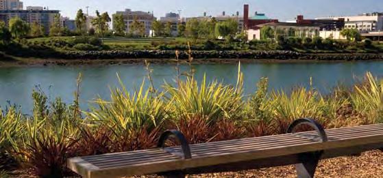

143 Open Space 135

144 136 MISSION ROCK

145 Development Open Concept Space 137
146 sustaina 138 MISSION ROCK
147 bility 06 Sustainability 06

148 Sustainability The sustainable design strategies at Mission Rock will capitalize on the district s mixeduse character. Having a variety of land uses assist in the reduction of demand for energy, water, and other resources. Because each building type and landscape element will need different types of resources at different times, program elements can be paired so that the waste heat or water from one building can help meet the demands of another. With this approach, one building s waste can become another building s resource. 140 MISSION ROCK

149

150 142 MISSION ROCK
151 The convergence of mixed-use planning and sustainable design strives to result in the reduction of critical natural resource depletion within the Mission Rock District, and positions the project as a leader in sustainable design. Mission Rock sustainable design strategies are targeted to achieve the following performance objectives: Annual stormwater runoff - 85% reduction Annual domestic potable water use - 45% reduction Total carbon emissions from buildings and transportation - 52% reduction LEED-ND, LEED-CS and LEED-NC - Gold rating However, Mission Rock is more than just the sum of these ambitious goals the District cultivates a new waterfront neighborhood while restoring essential ecological processes to the site. Safe, walkable streets will encourage shopping and pedestrian traffic. Plaza spaces will be designed to host to an array of civic and cultural events. Open space areas will provide active and passive opportunities for children and adults. Permeable landscape and hardscape surfaces will allow the natural infiltration of water into underground aquifers. These strategies will work in concert to create an ecological asset for the City and contribute to the Bay Area s greater sustainability goals. The diverse activity in and around Mission Rock will not only provide a great opportunity to educate San Franciscans about a sustainable built environment, it will give them the opportunity to experience one first hand. Sustainability 143
152 LEED Framework Due to its diverse set of program types, the Mission Rock District could apply for LEED certification under multiple rating systems. LEED for Neighborhood Development (LEED-ND) would be applied to Mission Rock as a whole, certifying that the large-scale planning of the District regenerates the site while prioritizing sustainability concerns. LEED for Core and Shell Development (LEED-CS) and LEED for New Construction (LEED-NC) could both be applied to individual buildings on the site; the applicable rating system will vary dependent upon product type. TRANSPORTATION CARBON LEED BUILDING ENERGY & CARBON The following pages contain project LEED appraisals for the LEED-ND, LEED-CS, and LEED-NC rating systems. A LEED appraisal is a tool for assessing a project s LEED status quickly and comprehensively. Each LEED credit is listed on the appraisal and is assigned a high, medium or low probability of achievement based on the initial credit review to date. These probabilities are shown in the columns to the left of the credit titles. Points that are not possible for the project are listed in the column marked NP. A final projected score is then compiled and shown at the top. To compile the score, it is assumed that 90% of all high probability points will be earned, 60% of medium probability points, and 10% of all low probability points. A summary of each credit s status is noted on the right side of the appraisal. MATERIALS, IEQ, ETC. WATER & STORMWATER The project is currently projected to earn 65 points, or a LEED Gold rating, under the LEED-ND system. The project s density and strong connections to public transit earn it high scores in the Smart Location & Linkage, and Neighborhood Pattern & Design categories. Under the LEED-CS system the projected total is 42 points and under the LEED- NC system 45 points, a LEED-Gold rating under both systems. LEED- NC & CS systems are similar in content and the project should score well in the Sustainable Sites and Water Efficiency categories, as a result of its high performance landscape and water strategies. The project s emphasis on energy efficiency also garners high marks under Energy & Atmosphere credit MISSION ROCK

153 Sustainability 145

154 Water & Landscape A growing awareness of water and related issues in San Francisco, combined with the visibility and proximity to the Bay, make sustainable water management a priority for Mission Rock. The project will treat water as a valuable and limited resource, using three primary strategies to manage water on-site: low-flow fixtures to conserve potable water, stormwater and greywater reuse to maximize water resources, and natural filtration to release clean water into San Francisco Bay. The landscape design at Mission Rock plays an integral part in its water strategy by infusing invaluable ecosystem services into the urban environment of Mission Bay. Ecosystem services are natural processes, functions, and products like stormwater handling and air filtering which directly benefit people. The landscape at Mission Rock is designed to provide the site with these vital services, thereby saving San Francisco the cost of using already overstressed infrastructure like sewers to perform these services. A set of natural landscape elements distributed throughout the site will aid in stormwater infiltration, provide habitat, create comfortable outdoor microclimates, and reduce the urban heat island effect. Park acreage will more than double from existing condition, providing increased carbon sequestration. 146 MISSION ROCK
155 The stormwater strategies used at Mission Rock also meet the goals and requirements of the forthcoming San Francisco Stormwater Design Guidelines. The Guidelines, jointly issued by the Port of San Francisco and the San Francisco Public Utilities Commission, mandate the use of stormwater best management practices for the City s separate storm sewer areas, which include Mission Bay. The design of the Mission Rock District meets the runoff reductions outlined in the Guidelines and embodies its philosophy of low impact design. The water and landscape strategies at Mission Rock result in dramatic reductions in water use, decreasing the project s reliance on the municipal water supply and sewer infrastructure. These strategies allow the Mission Rock District to achieve: 85% reduction in total annual stormwater runoff 45% reduction in total annual potable water use Ultra Efficient Fixtures Stormwater & Greywater Re-use Landscape Strategies Stormwater Capture/Re-use 100 Typical Development 30% 45% 100 Existing Conditions 41% 85% 80 > 80 > 60 > > Annual Domestic Potable Water Use Reduction 0 Annual Stormwater Runoff Reduction Sustainability 147

156 148 MISSION ROCK
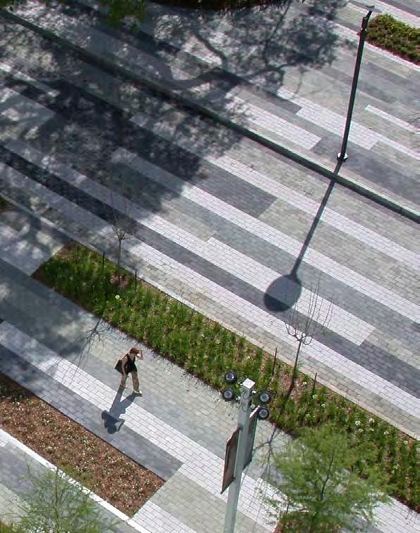
157 Sustainability 149


158 Efficient Energy Systems Thermal Mass Views Radiant Flooring Solar Hot Water/ Photovoltaics Efficienct Lighting and Controls Shading Natural Ventilation High Performance Glazing High Insulation Landscape Shading Green Roof Potential District Energy System SUSTAINABLE MEASURES ENERGY CONSERVATION AND EFFICIENCY INDOOR ENVIRONMENT AND AIR QUALITY Access to Transit Recycled Content FSC Certified Wood Construction Waste Recycling RESOURCE EFFICIENCY Gray Water ReUse Building Commission Plan Mold Prevention Low VOC Emitting Materials Building Maintenance Plan 150 MISSION ROCK
159 High Performance Buildings Residential Each of the residential buildings at Mission Rock will respond to the local microclimate, relying on fundamental architectural massing and design decisions to incorporate passive strategies like daylight and natural ventilation as a critical first step in reducing building energy use. High performance building facades balance the need for daylight with the risk of excessive heat gain and loss through a controlled glazing ratio, insulating glass, and exterior shading elements. Efficient mechanical and lighting systems, accompanied by effective controls, ensure that energy is used efficiently within the residential buildings. Solar hot water systems could provide a renewable source of energy to help reduce the energy used for domestic water heating. Operational measures, such as tenant guidelines and real-time energy use feedback, may further reduce energy use. The residential buildings at Mission Rock showcase high performance design to minimize energy use, reducing carbon emissions by 25-40% over a Title 24 structure. All new residential buildings will be designed to achieve a LEED-NC Gold rating. Passive Design Efficient Mechanical Systems Photovoltaics & District Solar Hot Water Energy System Operations Title 24 Basecase 10-15% > 10% > 3-8% 10-15% 0-3% target: 25-40% reduction > > > 20 0 Residential Building Carbon Reduction Sustainability 151


160 Photovoltaics Efficient Energy Systems Thermal Mass Green Roof Views Natural Ventilation Shading Under Floor Air Efficienct Lighting and Controls High Performance Glazing Landscape Shading Daylighting Potential District Energy System SUSTAINABLE MEASURES ENERGY CONSERVATION AND EFFICIENCY INDOOR ENVIRONMENT AND AIR QUALITY Access to Transit Recycled Content FSC Certified Wood Construction Waste Recycling RESOURCE EFFICIENCY Gray Water ReUse Building Commission Plan Mold Prevention Low VOC Emitting Materials Building Maintenance Plan 152 MISSION ROCK
161 High Performance Buildings Commercial Like the residential buildings, the commercial buildings at Mission Rock utilize fundamental architectural massing strategies to maximize daylight and natural ventilation. Capitalizing upon the relatively consistent outdoor air temperatures, efficient mechanical systems will be able to operate in economizer mode for the majority of the year. Photovoltaic panels contribute clean, renewable electricity to the building s overall energy demand. The impact of the high performance building strategies at Mission Rock reaches beyond the building envelope, affecting not just energy use, but water use as well. Clever economizing in the commercial buildings can greatly reduce the use of cooling towers and the large quantities of water associated with their operation. The commercial buildings at Mission Rock combine passive design with efficient mechanical systems and renewables that take full advantage of the climate. These buildings have the potential to reduce carbon emissions by 20-35% over a Title 24 structure. All new commercial buildings in Mission Rock will be designed to achieve a LEED-CS Gold rating. Passive Design Efficient Mechanical Systems Photovoltaics & Solar HW District Energy System Operations 100 Title 24 Basecase 5-10% > 10-20% 1-3% 10-15% 1% target: 20-35% reduction 80 > > > > 20 0 Commercial Building Carbon Reduction Sustainability 153

162 Sustainable Transportation The environmental impact of the Mission Rock District is not limited to the site alone, but extends into the larger context of the urban environment. The ways in which residents, workers, shoppers, and ballpark attendees get to and from the site plays a huge role in the sustainability of the site. The transportation strategy at Mission Rock is based on reducing vehicle miles travelled by fostering multiple modes of sustainable transportation, emphasizing pedestrian, bicycle, and public transit options. The mixed use nature of Mission Rock s land use program, its rich transit options, and proximity to services ensure that single-occupancy vehicle trips will be limited. Slow speed limits and dense development will ensure safe, pedestrian-friendly streets. The rental of parking spaces in the development will be de-coupled from residential units. Discussions for a possible terminus of the E line streetcar on-site will make public transit even more easily accessible. On-site car share and carpool systems, facilitated by a District transportation coordinator, ensure automobiles are used as efficiently as possible. A District bicycle program could include maps, signage and secure parking to encourage and support cycling in the city. The combination of sustainable transportation strategies used in the Mission Rock District contribute towards the project s goal of a 25% reduction in auto trips and an 18% increase in public transit use. These strategies result in a 24% reduction in carbon emission from transportation, compared to a typical San Francisco development. 154 MISSION ROCK
163 Typical SF Mission Rock Typical U.S. 37% 61% > 40 > 20 0 Transportation Carbon Reduction To BART and Transbay Terminal Circulation - Transit N T E AT&T Park KING STREET THIRD STREET Ballpark Ferry To Marin and East Bay Caltrain Station N FOURTH STREET BERRY STREET China Basin Channel McCovey Cove E Water Taxi PIER 48 To Ferry Building and Norheast Waterfront San Francisco Bay CHANNEL STREET VINTNER'S ALLEY CHANNEL STREET FOURTH STREET THIRD STREET NEW EAST STREET NEW NORTH STREET TERRY FRANCOIS BOULEVARD PIER 50 MISSION ROCK STREET E N T oposed 47MUNI 76 30Streetcar UNI Light Rail Train UNI Bus Routes uni Stop ssion Rock/Mission Bay/ CSF Shuttle ater Taxi/Ferry altrain Heavy Rail Train Proposed MUNI Streetcar MUNI Light Rail Train MUNI Bus Routes Muni Stop Mission Rock/Mission Bay/ UCSF Shuttle Water Taxi/Ferry Caltrain Heavy Rail Train RINCON STREET MISSION BAY BOULEVARD NORTH MISSION BAY BOULEVARD SOUTH Sustainability 155
164 Mission Rock LEED-CS Scorecard Achievability Certified 23 to 27 points Silver 28 to 33 points Gold 34 to 44 points Platinum 45 to 61 points hi med low NP Achievability rating: Hi = 90%, Med = 60%, Low = 10%, NP = not possible Projected Points Prerequisites Standard Y Erosion & Sedimentation Control plan by 2003 EPA Const. Gen. Permit SS Prereq 1 Construction Activity Pollution Prevention or local codes Y Engage indpendant commissioning agent, include Commisisoning Plan in EA Prereq 2 Fundamental Building Systems Commissioning specifications. Y EA Prereq 3 Minimum Energy Performance ASHRAE Energy Standard for Buildings. Y No use of CFC s in HVAC&R equipement OR phase-out of CFC s by end EA Prereq 4 Fundemental Refrigerant Management of construction. Y MR Prereq 5 Storage & Collection of Recyclables Adequate, dedicated materials handling space. Y EQ Prereq 6 Minimum IAQ Performance ASHRAE Ventilation for Acceptable Indoor Air Quality. Y EQ Prereq 7 Environmental Tobacco Smoke (ETS) Control Prohibit or isolate tobacco smoke in the project Sustainable Sites Standard 1 SS Credit 1 Site Selection Site is not farmland, wetland, endangered spp. habitat, near water, or former parkland. 1 SS Credit 2 Development Density and Community Connectivity Project locale has average density of 60,000 sf/acre OR an urban site with local services. 1 SS Credit 3 Brownfield Redevelopment Build on EPA certified Brownfield site. 1 SS Credit 4.1 Alternative Transportation, Public Transportation Locate project within 1/2 mile of rail station or 1/4 mile of 2 lines. Access 1 SS Credit 4.2 Alternative Transportation, Bicycle Storage & Changing Rooms Provide showers and bicycle storage for building occupants depending on building type. 1 SS Credit 4.3 Alternative Transportation, Low-Emitting and Fuel- Efficient Vehicles Preferred parking for 5% of parking spaces or alt-fuel stations for 3% of parking spaces. 1 SS Credit 4.4 Alternative Transportation, Parking Capacity Parking: Do not exceed zoning reqs OR limit capacity OR carpools depending on bldg type. 1 SS Credit 5.1 Site Development, Protect or Restore Habitat Restore 50% remaining open area to indigenous vegetation and animal habitat. 1 SS Credit 5.2 Site Development, Maximize Open Space Open space 25% greater than code OR equal to bldg footprint OR 20% of project site area. 1 SS Credit 6.1 Stormwater Design Quantity Control Rural: flow management plan; Urban: Reduce existing flows by 25%. 1 SS Credit 6.2 Stormwater Design Quality Control Use existing standards or in-place monitors to remove 80% TSS for 90% of avg rainfall. 1 SS Credit 7.1 Reduce Heat Islands, Non-Roof Reduce solar emittance for 50% of hardscape OR locate 50% or more parking underground. 1 SS Credit 7.2 Reduce Heat Islands, Roof High SRI material for 75% of roof OR vegetation for 50% of roof OR combination of both. 1 SS Credit 8 Light Pollution Reduction, controlled exterior lighting IESNA Recommended Practice Manual; no direct-beam illumination leaves the site. 1 SS Credit 9 Tenant Design and Construction Guidelines Tenant Guidelines describe sustainable features and path for Tenants to achieve LEED-CI Water Efficiency Standard 1 WE Credit 1.1 Water Efficient Landscaping, 50% Reduction Reduce potable water used for irrigation by 50%. 1 WE Credit 1.2 Water Efficient Landscaping, No Potable Use or No Irrigation No potable water use, or no permanent irrigation system. 1 WE Credit 2 Innovative Wastewater Technologies Reduce water used for sewage conveyance by 50% OR treat 50% of wastewater. 1 WE Credit 3.1 Water Use Reduction, 20% Reduction 20% reduction against Energy Policy Act of WE Credit 3.2 Water Use Reduction, 30% Reduction 30% reduction against Energy Policy Act of Energy & Atmosphere Standard 2 EA Credit Optimize Energy Performance, 10.5% / 14% ASHRAE Energy Standard for Buildings, calculated by cost. 2 EA Credit Optimize Energy Performance, 17.5% / 21% ASHRAE Energy Standard for Buildings, calculated by cost. 2 EA Credit Optimize Energy Performance, 24.5% / 28% ASHRAE Energy Standard for Buildings, calculated by cost. 2 EA Credit Optimize Energy Performance, 31.5% / 35% ASHRAE Energy Standard for Buildings, calculated by cost. 1 EA Credit 2 Renewable Energy, 1% On-site renewable production, calcuated by cost. 1 EA Credit 3 Enhanced Commissioning Design review, post occupancy review, recommissioning manual. 1 EA Credit 4 Enhanced Refrigeration Management No refrigerants OR limited refrigerant use which reduces global warming potention. 1 EA Credit 5.1 Measurement & Verification - Base Building IPMVP, Options B or D, conveyed in M+V Plan. 1 EA Credit 5.2 Measurement & Verification - Tenant Submetering For Tenant end-uses: IPMVP, Options B or D, conveyed in M+V Plan. 1 EA Credit 6 Green Power Green-e electricity supplies 35% of building power measured by DOE or BOMA methods. 156 MISSION ROCK
165 Achievability Certified 23 to 27 points Silver 28 to 33 points Gold 34 to 44 points Platinum 45 to 61 points hi med low NP Achievability rating: Hi = 90%, Med = 60%, Low = 10%, NP = not possible Projected Points Materials & Resources Standard 1 MR Credit 1.1 Building Reuse, Maintain 25% of Existing Roof, (Calculations based on surface area.) Floors, and Walls. 1 MR Credit 1.2 Building Reuse, Maintain 50% of Existing Roof, (Calculations based on surface area.) Floors, and Walls. 1 MR Credit 1.3 Building Reuse, Maintain 75% of Interior Nonstructural elements. (Calculations based on surface area.) 1 MR Credit 2.1 Construction Waste Management, Divert 50% Develop construction waste management plan at project outset. Track all waste disposal. 1 MR Credit 2.2 Construction Waste Management, Divert 75% Develop construction waste management plan at project outset. Track all waste disposal. 1 MR Credit 3 Materials Reuse, Specify 1% Specify reused/salvaged materials or products, calculated at 1% of total material cost. 1 MR Credit 4.1 Recycled Content, Specify 10% (by cost) Specify materials or products with recycled content, calculated by cost. 1 MR Credit 4.2 Recycled Content, Specify 20% (by cost) Specify materials or products with recycled content, calculated by cost. 1 MR Credit 5.1 Local/Regional Materials, 10% extracted and manufactured (500 miles) Specify materials or products manufactured within 500 miles, calculated by cost. 1 MR Credit 5.2 Local/Regional Materials, 20% extracted and manufactured (500 miles) Specify materials from raw materials harvested within 500 miles, calculated by cost. 1 MR Credit 6 Certified Wood Specify 50% of wood materials and products with FSC certified wood, calculated by cost Indoor Environmental Quality Standard 1 IEQ Credit 1 Outdoor Air Delivery Monitoring Directly monitor airflow using ASHRAE setpoints or monitor CO2 in nat vent bldgs. 1 IEQ Credit 2 Increased Ventilation Increase ventilation 30% over ASHRAE or provide good airflow in nat vent bldgs. 1 IEQ Credit 3.1 Construction IAQ Management Plan, During Construction SMACNA IAQ Guidelines 1995 AND limit moisture damage AND MERV-8 filters in AHU s. 3 pts for 4 below 1 IEQ Credit 4.1 Low-Emitting Materials, Adhesives & Sealants SCAQMD Rule #1168, 2005, adhesives; BAAQMD Reg 8 Rule 51, sealants. 1 IEQ Credit 4.2 Low-Emitting Materials, Paints & Coatings Green Seal GS-11, GC-03, SCAQMD Rule #1113, 2004, Architectural Coatings. 1 IEQ Credit 4.3 Low-Emitting Materials, Carpet CRI Green Label Program requirements, adhesives have less than 50 g/l VOC 1 IEQ Credit 4.4 Low-Emitting Materials, Composite Wood No added urea-formaldehyde resins or binders. 1 IEQ Credit 5 Indoor Chemical & Pollutant Source Control Floor grates at doors, exhaust and negative pressure for chemical areas, MERV-13 filters. 1 IEQ Credit 6 Controllability of Systems, Thermal Comfort Individual control of thermal conditions for 50% occupants and all multioccupant spaces. 1 IEQ Credit 7 Thermal Comfort, Design ASHRAE , Section requirements and tenant build-out capability. 1 IEQ Credit 8.1 Daylight & Views, Daylight 75% of Spaces Achieve 2% daylight factor in spaces with critical visual tasks. 1 IEQ Credit 8.2 Daylight & Views, Views for 90% of Spaces Direct views outside from 90% of regularly occupied areas Innovation & Design Process Standard 1 IDP Credit 1.1 Innovation in Design, tba Pending USGBC judgment. 1 IDP Credit 1.2 Innovation in Design, tba Pending USGBC judgment 1 IDP Credit 1.3 Innovation in Design, tba Pending USGBC judgment 1 IDP Credit 1.4 Innovation in Design, tba Pending USGBC judgment 1 IDP Credit 2 LEED Accredited Professional LEED accredited professional on design team. Sustainability 157
166 Mission Rock LEED-NC Scorecard Achievability Certified 26 to 32 points Silver 33 to 38 points Gold 39 to 51 points Platinum 52 or more points hi med low NP Achievability rating: Hi = 90%, Med = 60%, Low = 10%, NP = not possible Projected Points Prerequisites Standard Y SS Prereq 1 Construction Activity Pollution Prevention Create erosion control plan that meets the 2003 EPA Construction General Permit. Y EA Prereq 1 Fundamental Commissioning of Building Energy Systems Engage commissioning agent, and develop and execute a commissioning plan. Y EA Prereq 2 Minimum Energy Performance Meet ASHRAE Energy Standard for Buildings. Y EA Prereq 3 Fundamental Refrigerant Management Eliminate CFCs in building HVAC&R. Y MR Prereq 1 Storage & Collection of Recyclables Provide space for the collection and storage of paper, cardboard, glass, plastic, and metals. Y IEQ Prereq 1 Minimum IAQ Performance Meet sections 4 through 7 of ASHRAE Y IEQ Prereq 2 Environmental Tobacco Smoke (ETS) Control Prohibit smoking inside building, and locate exterior smoking areas away from building Sustainable Sites Standard 1 SS Credit 1 Site Selection Do not develop sites that are prime farmland, floodplains or wetlands, parkland, or key habitat. 1 SS Credit 2 Development Density and Community Locate project in dense areas or near key community services. Connectivity 1 SS Credit 3 Brownfield Redevelopment Locate project on a remediated brownfield site. 1 SS Credit 4.1 Alternative Transportation: Public Transportation Locate project within 1/2 mile of a rail station or 1/4 mile of two bus lines. Access 1 SS Credit 4.2 Alternative Transportation: Bicycle Storage & Changing Rooms Provide bicycle racks for 5% of occupants and showers for 0.5% of occupants. 1 SS Credit 4.3 Alternative Transportation: Low-Emitting and Fuel- Efficient Vehicles Provide preferred parking for hybrid vehicles for 5% of the project s parking capacity. 1 SS Credit 4.4 Alternative Transportation: Parking Capacity Do not exceed zoning requirements; reserved carpool parking for 5% of parking capacity. 1 SS Credit 5.1 Site Development: Protect or Restore Habitat Restore 50% of site to native or adapted vegetation. 1 SS Credit 5.2 Site Development: Maximize Open Space Exceed zoning open space requirements by 25%. 1 SS Credit 6.1 Stormwater Design: Quantity Control No net increase site runoff, OR, reduce over existing conditions by 25%. 1 SS Credit 6.2 Stormwater Design: Quality Control Develop stormwater plan meeting local best management practice, and removes 80% TSS. 1 SS Credit 7.1 Heat Island Effect: Non-Roof Use open-grid paving, light-colored paving, or provide shade on 50% of all hardscape. 1 SS Credit 7.2 Heat Island Effect: Roof Use light-colored membrane for 75% of roof or vegetated roof for 50% of roof. 1 SS Credit 8 Light Pollution Reduction Design interior and exterior lighting to reduce nighttime illumination below limits set in ASHRAE Water Efficiency Standard 1 WE Credit 1.1 Water Efficient Landscaping: Reduce by 50% Reduce potable water used for irrigation by 50%. 1 WE Credit 1.2 Water Efficient Landscaping: No Potable Use or No Irrigation No potable water use for irrigation, or no permanent irrigation system. 1 WE Credit 2 Innovative Wastewater Technologies Reduce water used for sewage conveyance by 50%. 1 WE Credit 3.1 Water Use Reduction: 20% Reduction Reduce water use by 20% over the Energy Policy Act of WE Credit 3.2 Water Use Reduction: 30% Reduction Reduce water use by 30% over the Energy Policy Act of Energy & Atmosphere Standard 2 EA Credit Optimize Energy Performance: 10.5% / 14% Design building to exceed Appendix G of ASHRAE Energy Standard for Buildings, calculated by cost. 2 EA Credit Optimize Energy Performance: 17.5% / 21% Design building to exceed Appendix G of ASHRAE Energy Standard for Buildings, calculated by cost. 2 EA Credit Optimize Energy Performance: 24.5% / 28% Design building to exceed Appendix G of ASHRAE Energy Standard for Buildings, calculated by cost. 2 EA Credit Optimize Energy Performance: 31.5% / 35% Design building to exceed Appendix G of ASHRAE Energy Standard for Buildings, calculated by cost. 2 EA Credit Optimize Energy Performance: 38.5% / 42% Design building to exceed Appendix G of ASHRAE Energy Standard for Buildings, calculated by cost. 1 EA Credit 2.1 On-Site Renewable Energy, 2.5% Produce renewable energy on-site, calculated by cost. 1 EA Credit 2.2 On-Site Renewable Energy, 7.5% Produce renewable energy on-site, calculated by cost. 1 EA Credit 2.3 On-Site Renewable Energy, 12.5% Produce renewable energy on-site, calculated by cost. 1 EA Credit 3 Enhanced Commissioning Design review, post occupancy review, recommissioning manual. 1 EA Credit 4 Enhanced Refrigerant Management Select refrigerants with low global warming potential and ozone depletion potential. 1 EA Credit 5 Measurement & Verification Develop an M&V plan that meets IPMVP, Options B or D. 1 EA Credit 6 Green Power Purchase Green-e certified electricity supply for 2 years, for 35% of building s electricity demand. 158 MISSION ROCK
167 Achievability Certified 26 to 32 points Silver 33 to 38 points Gold 39 to 51 points Platinum 52 or more points hi med low NP Achievability rating: Hi = 90%, Med = 60%, Low = 10%, NP = not possible Projected Points Materials & Resources Standard 1 MR Credit 1.1 Building Reuse: Maintain 75% of Existing Walls, Maintain 75% of existing structure and envelope in renovation projects. Floors, & Roof 1 MR Credit 1.2 Building Reuse: Maintain 95% of Existing Walls, Maintain 95% of existing structure and envelope in renovation projects. Floors, & Roof 1 MR Credit 1.3 Building Reuse: Maintain 50% of Interior Non- Structural Elements Maintain non-structural elements in 50% of the building area in renovation projects. 1 MR Credit 2.1 Construction Waste Management: Divert 50% from Disposal Recycle and/or salvage 50% of construction waste, and create a construction waste management plan. 1 MR Credit 2.2 Construction Waste Management: Divert 75% from Disposal Recycle and/or salvage 75% of construction waste, and create a construction waste management plan. 1 MR Credit 3.1 Materials Reuse: 5% Use salvaged, refurbished, or reused materials, calculated by cost. 1 MR Credit 3.2 Materials Reuse: 10% Use salvaged, refurbished, or reused materials, calculated by cost. 1 MR Credit 4.1 Recycled Content: 10% (post-consumer + 1/2 post-industrial) Use materials or products with recycled content, calculated by cost. 1 MR Credit 4.2 Recycled Content: 20% (post-consumer + 1/2 post-industrial) Use materials or products with recycled content, calculated by cost. 1 MR Credit 5.1 Regional Materials: 10% Extracted, Processed, and Manufactured Regionally Use materials extracted, processed, and manufactured within 500 miles, calculated by cost. 1 MR Credit 5.2 Regional Materials: 20% Extracted, Processed, and Manufactured Regionally Use materials extracted, processed, and manufactured within 500 miles, calculated by cost. 1 MR Credit 6 Rapidly Renewable Materials Use rapidly renewable materials for 2.5% of construction materials, calculated by cost. 1 MR Credit 7 Certified Wood Use FSC-certified wood for 50% of wood-based materials, calculated by cost Indoor Environmental Quality Standard 1 IEQ Credit 1 Outdoor Air Delivery Monitoring Install monitoring of outdoor air on ventilation systems. 1 IEQ Credit 2 Increased Ventilation Increase ventilation rates by 30% above ASHRAE IEQ Credit 3.1 Construction IAQ Management Plan: During Construction Develop an IAQ plan that meets SMACNA IAQ Guidelines for Occupied Buildings Under Construction. 1 IEQ Credit 3.2 Construction IAQ Management Plan: Before Occupancy Provide air quality testing or building flush-out prior to occupancy. 1 IEQ Credit 4.1 Low-Emitting Materials: Adhesives & Sealants Use Adhesives, Sealants, and Sealant Primers that comply with the SCAQMD Rule # IEQ Credit 4.2 Low-Emitting Materials: Paints & Coatings Use products with VOC levels specified in Green Seal Standard GS-11 and SCAQMD Rule IEQ Credit 4.3 Low-Emitting Materials: Carpet Systems Use carpets and pads that meet the CRI Green Label requirements. 1 IEQ Credit 4.4 Low-Emitting Materials: Composite Wood & Use materials with no added urea-formaldehyde resins or adhesives. Agrifiber Products 1 IEQ Credit 5 Indoor Chemical & Pollutant Source Control Provide floor grates at doors, sufficient exhaust in chemical use areas, and MERV 13 filters. 1 IEQ Credit 6.1 Controllability of Systems: Lighting Provide individual and group lighting controls. 1 IEQ Credit 6.2 Controllability of Systems: Thermal Comfort Provide comfort controls or operable windows for individuals and group spaces. 1 IEQ Credit 7.1 Thermal Comfort: Design Meet ASHRAE , Thermal Comfort Conditions for Human Occupancy. 1 IEQ Credit 7.2 Thermal Comfort: Verification Perform a thermal comfort survey after occupancy, and correct identified problems. 1 IEQ Credit 8.1 Daylight & Views: Daylight 75% of Spaces Achieve 2% glazing factor, or 25 footcandles, in 75% of regularly occupied spaces. 1 IEQ Credit 8.2 Daylight & Views: Views for 90% of Spaces Direct views outside from 90% of regularly occupied spaces Innovation & Design Process Standard 1 IDP Credit 1.1 Innovation in Design, tba Pending USGBC judgment. 1 IDP Credit 1.2 Innovation in Design, tba Pending USGBC judgment 1 IDP Credit 1.3 Innovation in Design, tba Pending USGBC judgment 1 IDP Credit 1.4 Innovation in Design, tba Pending USGBC judgment 1 IDP Credit 2 LEED Accredited Professional LEED accredited professional on design team. Sustainability 159
168 Mission Rock LEED-ND Scorecard Achievability Certified 40 to 49 points Silver 50 to 59 points Gold 60 to 79 points Platinum 80 to 106 hi med low NP Achievability rating: Hi = 90%, Med = 60%, Low = 10%, NP = not possible Projected Points Prerequisites Standard Y SLL Prereq 1 0 points Smart Location Locate project on an infill site OR Locate project so that 50% of buildings are within 1/4 mi. walk of public transit OR Locate project boundary within 1/4 mi. walk of 4 or 1/2 mi. walk of 6 of existing diverse uses OR Reduce VMT of project below average for region Y SLL Prereq 2 0 points Proximity to Water and Wastewater Infrastructure Locate project on a site served by existing water and wastewater infrastructure OR Provide new water and Y SLL Prereq 3 0 points Imperiled Species and Ecological Communities wastewater infrastructure for the project If any endangered species or ecological communities exist on-site, comply with an approved Habitat Conservation Plan OR If no HCP exists, work with scientists to protet the species on-site. Y SLL Prereq 4 0 points Wetland and Water Body Conservation Do not locate project near wetlands or bodies of water OR restore wetlands OR limit percentage of site impact Y SLL Prereq 5 0 points Agricultural Land Conservation Do not locate project on area with more than 25% prime soil OR Use options 1, 2, or 3 of SLL Prereq 1 Y SLL Prereq 6 0 points Floodplain Avoidance Locate project on an infill site and follow NFIP requirements for portions of site within 100-yr floodplain. Y NPD Prereq 1 0 points Open Community Designate all streets and sidewalks for general public use and not gated Y NPD Prereq 2 0 points Compact Development Build any residential areas to at least seven dwelling units per acre AND Build any non-residential uses to at least 0.5 FAR Y GCT Prereq 1 0 points Construction Activity Pollution Prevention Create and implement an erosion and sedimentation plan Smart Location & Linkage Standard 2 SLL Credit 1 2 points Brownfields Redevelopment Locate project on a brownfield site AND remediate site 1 SLL Credit 2 1 point High Priority Brownfields Redevelopment Earn SLLc1 using a high priority brownfield site SLL Credit points Preferred Locations Locate project on an infill or adjacent site AND use a high street network grid density SLL Credit points Reduced Automobile Dependence Locate project on a site with transit service of 20 or more rides per day OR lower VMT to 80% of regional average OR Locate project near vehicle sharing program 1 SLL Credit 5 1 point Bicycle Network Locate project within 3 mi. of four of the diverse services using an existing bike path or planned bike path AND provide bike storage or parking equal to at least 15% of the parking provided for cars 3 SLL Credit 6 3 points Housing and Jobs Proximity Include 25% residential component and within 1/2 mi. walking distance of pre-project jobs OR Include non-residential component of 25% and locate project on an infill site near existing rail service. 1 SLL Credit 7 1 point School Proximity Include 25% residential component AND locate 50% of the project s dwelling units within 1/2 mi walk of an existing or planned school 1 SLL Credit 8 1 point Steep Slope Protection Avoid disturbing portions of the project that have pre-project slopes greater than 15% OR Limit building on slopes greater than 15% 1 SLL Credit 9 1 point Site Design for Habitat or Wetland Conservation Do not disturb existing habitat OR Use native plants for 90% of vegetation OR Conserve 100% of water bodies 1 SLL Credit 10 1 point Restoration of Habitat or Wetlands Restore habitat using only native plants AND set aside and donate open space to conservation trusts 1 SLL Credit 11 1 point Conservation Management of Habitat Create a long-term management plan for habitats and water or Wetlands bodies on-site. 160 MISSION ROCK
169 Achievability Certified 40 to 49 points Silver 50 to 59 points Gold 60 to 79 points Platinum 80 to 106 hi med low NP Achievability rating: Hi = 90%, Med = 60%, Low = 10%, NP = not possible Projected Points Neighborhood Pattern & Design Standard NPD Credit points Compact Development Build the project to achieve high average density 4 NPD Credit points Diversity of Uses Include 25% residential component AND locate 50% of the dwelling units within 1/2 mi. walk distance of at least two diverse uses. 3 NPD Credit points Diversity of Housing Types Include a sufficient variety of housing types in the project, according to the Simpson Diversity Index 1 1 NPD Credit points Affordable Rental Housing At least 15% of total rental units must be priced for households up to 50% of area median income and maintained for 15 years or more 1 1 NPD Credit points Affordable For-Sale Housing At least 10% of for-sale housing must be priced for households up to 80% of area median income 2 NPD Credit 6 2 points Reduced Parking Footprint Locate all off-street parking at side or rear or buildings AND Use no more than 20% of total development footprint for surface parking AND For any non-residential buildings or multifamily buildings, provide bicycle and carpool parking spaces equivalent to 10% of the total automobile parking on site NPD Credit points Walkable Streets Design project to meet requirements of credit. Additional points for meeting additional credit requirements. 2 NPD Credit points Street Network Include bicycle or pedestrian through-connection in at least 50% of cul-de-sacs AND design the project s avereage street network grid density so that it is greater than 20 centerline mi./sq. mi. 1 NPD Credit 9 1 point Transit Facilities Provided a covered and partially enclosed shelter and at least one bench at all transit stops AND Provide signage devoted to providing local transit information at each transit stop. 1 1 NPD Credit 10 2 points Transportation Demand Management Create a transportation demand management program to reduce weekday peak trips OR Subsidize transit passes to 1/2 for the first three years of the project OR Provide transit service (e.g., shuttle busses) to major transit facilities 1 NPD Credit 11 1 point Access to Surrounding Vicinity Include at least one through street at the project boundary every 800 feet 1 NPD Credit 12 1 point Access to Public Spaces Design project so that at least 90% of the buildings are within 1/6 mi. walking distance from a park or square 1/6 acre in area and at least 150 in width AND For projects larger than 7 acres, the sum of all park area should be at least 1/2 acre in size 1 NPD Credit 13 1 point Access to Active Spaces Design project so that an open space facility of at least 1 acre lies within 1/2 mi. walk distance of 90% of the buildings OR design project so that at least 50% of all buildings are located within 1/4 walk distance of multi-use trail of at least 3 mi. in length OR Design project so that at least 90% of all buildings are located within 1/4 mi. walk distance of public recreation center or gym with outdoor facilities 1 NPD Credit 14 1 point Universal Accessibility 20% of each type of residential unit and all paths of travel must comply with the FHAA and Section 504 of the Rehabilitation Act AND Non-residential areas must comply with the ADA guidelines 1 NPD Credit 15 1 point Community Outreach and Involvement Hold public meetings to solicit feedback from the community regarding the design of the project AND take that feedback into account AND Establish ongoing means of communication between the developer and the community during construction of the project 1 NPD Credit 16 1 point Local Food Production Establish CC&Rs that do not prohibit areas for growing produce AND Create permanent neighborhood gardens OR Locate project within 1/4 mi. of an established farmer s market. (continued on next page) Sustainability 161
170 Mission Rock LEED-ND Scorecard (cont.) Achievability Certified 40 to 49 points Silver 50 to 59 points Gold 60 to 79 points Platinum 80 to 106 hi med low NP Achievability rating: Hi = 90%, Med = 60%, Low = 10%, NP = not possible Projected Points Green Construction & Technology Standard 2 1 GCT Credit points Certified Green Buildings Construct or retrofit at least 20% of the project s building square footage to be certified under a LEED rating system 3 GCT Credit points Energy Efficiency in Buildings Design and construct at least 90% of all buildings in the project so that they improve at least 10% on ASHRAE GCT Credit points Reduced Water Use Construct at least 90% of all buildings in the project such that use 20% less water than the EPA 1992 OR Use captured stormwater or greywater for irrigation OR Use plants that require no irrigation 1 GCT Credit points Building Reuse and Adaptive Reuse Incorporate into the project at least one building that maintains at least 50% of the existing building structure 1 GCT Credit 5 1 point Reuse of Historic Buildings Incorporate into the project and rehabilitate at least one building that has been classified as an historic structure 1 GCT Credit 6 1 point Minimize Site Disturbance through Limit all site disturbance Site Design 1 GCT Credit 7 1 point Minimize Site Disturbance during Do not disturb a specified portion of the site Construction 1 GCT Credit 8 1 point Contaminant Reduction in Brownfields Remediation Earn SLLc1 and remediate 100% of the site 4 1 GCT Credit points Stormwater Management Implement a comprehensive stormwater management plan that reuses or infiltrates 90% of the average annual rainfall from at least 20% of the development footprint 1 GCT Credit 10 1 point Heat Island Reduction Provide shade or use pavers of an SRI of at least 29 for 50% of non-roof surfaces OR Use SRI compliant roofing for 75% of the project roofs or install green roofs on 50% of the project roofs 1 GCT Credit 11 1 point Solar Orientation For projects earning NPDc1, orient blocks such that for 75% or more one axis is within 15 degrees of east/west and the east/west length is at least as long, or longer, than the north/ south length OR Orient 75% of the project s buildings so that one axis is 1.5 times longer than the other and this axis is within 15 degrees of the geographical east/west 1 GCT Credit 12 1 point On-Site Energy Generation Deveop on-site energy generation with peak electrical capacity of at least 5% of the projects electrical load OR Develop on-site energy generation with capacity of at least 5% of the project s annual electrical and thermal energy consumption. For both options, CO2 must not exceed national CO2 grid output. 1 GCT Credit 13 1 point On-Site Renewable Energy Sources Incorporate on-site renewable energy generation with generating capacity of at least 5% of project s electrical load 1 GCT Credit 14 1 point District Heating & Cooling Incorporate district heating and cooling into all buildings in the project such that 80% of the total square footage and 80% of the total heating or cooling load for the project is connected 1 GCT Credit 15 1 point Infrastructure Energy Efficiency Achieve a 15% reduction in energy use for all streetlights, water and wastewater pumps and treatment facilities 1 GCT Credit 16 1 point Wastewater Management Divert at least 50% of the wastewater generated by the project 1 GCT Credit 17 1 point Recycled Content in Infrastructure Use specified recycled materials in the project 1 GCT Credit 18 1 point Construction Waste Management Recycle and/or salvage at least 50% of non-hazardous construction and demolition debris 1 GCT Credit 19 1 point Comprehensive Waste Management Include two of the following in the project: A drop off point for recycling hazardous material, A recycling station, A compost station 1 GCT Credit 20 1 point Light Pollution Reduction Do not exceed 80% of specified lighting power densities for exterior lighting in ASHRAE/IESNA Innovation & Design Process Standard 1 ID Credit point Innovation in Design Pending USGBC judgment. 1 ID Credit point Innovation in Design Pending USGBC judgment. 1 ID Credit point Innovation in Design Pending USGBC judgment. 1 ID Credit point Innovation in Design Pending USGBC judgment. 1 ID Credit point Innovation in Design Pending USGBC judgment. 1 ID Credit 2 1 point LEED Accredited Professional LEED accredited professional on design team. 162 MISSION ROCK

171 Sustainability 163

172 164 MISSION ROCK 164 MISSION ROCK
173 Beyond Standards: Sustainable Lifestyle Reaching beyond established sustainability standards for the built environment, the project team will examine opportunities to encourage pedestrian activity as well as business operation measures that promote recycling, minimize waste, and inform residents, workers, visitors, and shopkeepers about environmentally sound choices for living and conducting business within the district. Lifestyle Retail. The retail-tenant mix plays a subtle role in the effort to reduce vehicle trips by residents and workers in a mixed-use district. The inclusion of some lifestyle-retail uses within the district yoga or pilates studios, workout facilities/gyms, wellness practitioners such as chiropractors and acupuncturists, art studios, cooking schools, booksellers, yarn shops can encourage residents and workers to adopt routine health rituals and hobbies within walking distance of home and work. Many such uses have an added social-gathering benefit, an intangible quality that is often missing in newly developed neighborhoods that may offer retail conveniences such as groceries, coffee, or sandwiches, but few opportunities to meet neighbors and foster friendships. Green Choices Every Day. San Francisco has become a national leader on environmental issues, earning its reputation as The City that Knows How through a variety of city-wide programs that promote small changes in individual behavior to achieve larger, collective environmental goals. Taking cues from local environmental programs and groups such as the Green Restaurant Association, the project may establish goals for business operations to promote recycling, composting, pollution prevention through use of non-toxic chemicals and chlorine-free paper, use of sustainable and locally grown food products, and water and energy conservation. Sustainability 165
174 Appendix 166 MISSION ROCK
175 07 07 Appendix
176 APPENDIX J - PHASED LAND USE & DEVELOPMENT PROGRAM FORM PHASE Phase 1 Phase 2 LAND USE PROGRAM Block A Block B Block C Phase 1 Block D1 Block E Block F Block G Subtotal Open Space Largest Contiguous Area (acres) 0 Total Site Open Area (acres) 0 Pier 48 Valley & Apron (acres) 0 Public Trust Serving Area 0 Neighborhood Serving Area Office Square Footage Maximum Building Height (ft.) Retail Public Trust Serving Area (sf) Neighborhood Serving Area (sf) Parking Square Footage (above grade) Shared Spaces (above grade) Residential Square Footage Maximum Building Height (ft.) No. of dwelling units Exhibition Space Square Footage 0 Recreation Square Footage 0 Pier 48 Square Footage MISSION ROCK
177 Phase 2 Phase Mission Rock Park Phase 3 Phase 4 All Phases Block D2 Block H Block I Block J Phase 3 Phase Pier 48 Subtotal Subtotal Subtotal Subtotal Totals Appendix 169

178

179

180 San Francisco Giants 24 Willie Mays Plaza San Francisco, CA Wilson Meany Sullivan 4 Embarcadero Center, Suite 3300 San Francisco, CA Kenwood Investments 100 Spear St # 2100 San Francisco, CA The Cordish Company 601 East Pratt Street, 6th Floor Baltimore, MD Stockbridge Capital 4 Embarcadero Center, Suite 3300 San Francisco, CA Farallon Capital Management, L.L.C. One Maritime Plaza Suite 2100 San Francisco, CA
M i s s i o n B a y W a t e r f r o n t
 114 M i s s i o n B a y W a t e r f r o n t Character of the Area: The Mission Bay Waterfront extends from Pier 48 at China Basin Channel to 18th Street in the Central Basin. This area of the waterfront
1 October Dear Citizens of Charlotte and Mecklenburg County,
 1 October 2011 Dear Citizens of Charlotte and Mecklenburg County, As co-chairs of the Center City 2020 Vision Plan Steering Committee, we are proud to present the Center City 2020 Vision Plan, which sets
PORT OF VANCOUVER WATERFRONT DEVELOPMENT. Concept Development Plan City Center Redevelopment Authority April 20, 2017
 PORT OF VANCOUVER WATERFRONT DEVELOPMENT Concept Development Plan City Center Redevelopment Authority April 20, 2017 Port History PORT ESTABLISHED 1912 TERMINAL 1 ACQUIRED 1925 GWM SIGNS LEASE 1935 HARBOR
City of Farmington. Downtown Plan. Amendment to the 1998 Master Plan Adopted October 11, 2004
 City of Farmington Amendment to the 1998 Master Plan Adopted October 11, 2004 Introduction Planning Background 1 Scope and Components of the Plan Amendment 2 Concept Introduction 3 Plan Concepts 3 Conceptual
SECTION ONE: INTRODUCTION. introduction
 introduction 1 INTRODUCTION Since it was first established in 1843 as a trading post for the Hudson s Bay Company, Victoria has evolved into a Provincial capital city that is recognized across Canada and
PORT OF SAN FRANCISCO
 PORT OF SAN FRANCISCO WATERFRONT LAND USE PLAN Prop H (1990) required a Waterfront Land Use Plan Port property in BCDC jurisdiction Define Acceptable Uses Hotels prohibited on piers Prioritize Maritime
CITYWIDE PLANNING DIVISION
 2014-2019 CITYWIDE PLANNING DIVISION a five-year work program for long-range planning November 2016 TODAY S PRESENTATION 1. Overview 2. Planning Priorities 3. Topics/Focus Areas 5. Essential Practices
Corridor Vision. 1Pursue Minnehaha-Hiawatha Community Works Project. Mission of Hennepin County Community Works Program
 1Pursue Minnehaha-Hiawatha Community Works Project Minnehaha-Hiawatha Community Works is a project within the Hennepin Community Works (HCW) program. The mission of the HCW program is to enhance how the
GAMMAGE SQUARE - RECOMMENDATIONS
 GAMMAGE SQUARE - RECOMMENDATIONS We envision an expanded cultural district surrounding the historic ASU Gammage. Creating a cultural district will enhance the existing historic landmark by activating the
TOWN COUNCIL / PLANNING COMMISSION
 Workshop #3 TOWN COUNCIL / PLANNING COMMISSION January 20, 2011 Consultant Team In Attendance Tonight BMS Design Group Nevada City and San Francisco Michael Smiley, AICP, ASLA Partner-in-Charge Nancy L.
3.1 community vision. 3.3 required plan elements
 Chapter 3 Community Form 3.1 community vision 3.2 Parks & landscaping concepts 3.3 required plan elements D R A F T 20 Community Form Chapter 3 3.0 Community form 3.1 community vision The Specific Plan
Policies and Code Intent Sections Related to Town Center
 Policies and Code Intent Sections Related to Town Center The Town Center Vision is scattered throughout the Comprehensive Plan, development code and the 1994 Town Center Plan. What follows are sections
Draft for Public Review. The Market and Octavia Neighborhood Plan
 Draft for Public Review The Market and Octavia Neighborhood Plan San Francisco Planning Department As Part of the Better Neighborhoods Program December 2002 IOverview Why Plan a Better Neighborhood Here
Ivywild On The Creek PRELIMINARY CREEK DISTRICT MASTER PLAN
 Ivywild On The Creek PRELIMINARY CREEK DISTRICT MASTER PLAN Introduction: Rejuvenating an extraordinary Creekside neighborhood THE CREEKSIDE DISTRICT The Ivywild On The Creek Neighborhood District Master
City Center Neighborhood Plan
 [1] City Center Neighborhood Plan As adopted by Ordinance No. 2014-09-049 and amended by Ordinance Nos. Formerly CBD Neighborhood as adopted by Ordinance No. 8868 and amended by Ordinance Nos. 8946, 9693,
Moving from Vision to Action
 Moving from Vision to Action Photo: John Carvalho What does it mean for a city to move? To see its people belong and connect? To prosper? To become green? Those are the pillars that are helping Mississauga
2.0 THE PLATINUM TRIANGLE VISION
 2.0 THE PLATINUM TRIANGLE VISION The envisions an exciting future for the area surrounding Angel Stadium of Anaheim, the Honda Center and The Grove of Anaheim. 2.1 Planning Principles In order to further
The Master Plan Framework
 The Master Plan Framework The East Harbour Master Plan advances the development of 60 acres of former industrial lands east of the Don River. The Master Plan outlines a vision for a vibrant, transit-oriented
Concord Community Reuse Project Goals and Guiding Principles. Overarching Goals (OG)
") Concord Community Reuse Project Goals and Guiding Principles Overarching Goals (OG) No priority is implied by the order of presentation of the goals and guiding principles. Overarching goals for the Concord
Concord Community Reuse Project Goals and Guiding Principles Overarching Goals (OG) No priority is implied by the order of presentation of the goals and guiding principles. Overarching goals for the Concord
Neighborhood Districts
 NEIGHBORHOOD DISTRICTS SEVEN MAIN DISTRICTS Neighborhood Districts While the Development Plan provides a broad-scale overview of the neighborhood, this section focuses on uses and relationships at the
Bourne Downtown Site Planning
 Prepared for: The Town of Bourne, MA In Cooperation with: Bourne Financial Development Corporation Prepared by:, Inc. June 24, 2009 Table of Contents Introduction and Summary... 1 Site Existing Conditions...
ARISE: The Rock Renaissance Area Redevelopment & Implementation Strategy
 2014 Professional Awards 1 ARISE: The Rock Renaissance Area Redevelopment & Implementation Strategy Janesville, WI Completed December 2014 Analysis & Planning Purpose of Project 2 The purpose of the Rock
Town Center (part of the Comprehensive Plan)
") Town Center (part of the Comprehensive Plan) Mercer Island Town Center Looking North (2014) In 1994, a year-long process culminated in a set of design guidelines and code requirements for the Town Center
Town Center (part of the Comprehensive Plan) Mercer Island Town Center Looking North (2014) In 1994, a year-long process culminated in a set of design guidelines and code requirements for the Town Center
V. Vision and Guiding Principles
 V. Vision and Guiding Principles The Master Plan for the Powers Ferry Corridor seeks a foundation in the desires of the community. At times, various elements of the community offered opposing viewpoints,
IMAGINE CLEARWATER. Community Workshop 3. November 2016
 IMAGINE CLEARWATER Community Workshop 3 November 2016 Imagine Clearwater has been a 6-month community-focused process to re-envision the downtown waterfront. VISIONING FRAMEWORK MASTER PLAN HOW CAN WE
THE NEIGHBORHOOD TODAY
 THE NEIGHBORHOOD TODAY CORE AREA VISION How are we Good Urbanism A Site s DNA thinking about Elements of great Unique elements urban communities embedded in a place the site and design? ELEMENTS LIKE:
SECTION IV: DEVELOPMENT CONCEPT
 80 SECTION IV: DEVELOPMENT CONCEPT Section IV: DEVELOPMENT CONEPT This section provides an overall understanding and rationale for what is envisioned in The Preserve, the intended quality and character
Chapter 4. Linking Land Use with Transportation. Chapter 4
 Chapter 4 Linking Land Use with Transportation Chapter 4 59 Chapter 4 Linking Land Use with Transportation Community Design and Transportation Program Introduction Since the 1950s, the predominant development
DOWNTOWN SAN JOSE STREET LIFE PLAN
 DOWNTOWN SAN JOSE STREET LIFE PLAN PRIVILEGING THE PUBLIC REALM This Downtown San Jose Street Life Plan aspires to many goals: Improves the public realm downtown by developing projects and cultivating
EXISTING COMPREHENSIVE PLAN
 EXISTING COMPREHENSIVE PLAN Town Center Land Use Element: V. LAND USE POLICIES Town Center Mercer Island's business district vision as described in "Your Mercer Island Citizen-Designed Downtown" was an
10.0 Open Space and Public Realm
 10.0 Open Space and Public Realm 10.0 Open Space and Public Realm The Public Open Space System is comprised of: outdoor spaces available for public use that are either publicly owned (e.g., parks and
Public Art Plan. We have elected to submit Public Art Plans before or concurrently with the CSP Submittal per the FDP Manual
 Public Art Plan The intent of the Horizon Uptown Public Arts Program is to create great places that engage the community and leverage the neighborhood development and economic vitality. The Horizon Uptown
SQUAMISH 2010 AND BEYOND COMMUNITY VISION
 Our plan has been imagined and created to be both pragmatic and visionary. At the core of the strategy is a consideration of the highway s role and its impact on the community. First and foremost in creating
This Review Is Divided Into Two Phases:
 Semiahmoo Town Centre Review The purpose of this review: To review the Semiahmoo Town Centre Concept Plan, originally approved in 1993, to ensure that this centre will continue to serve the needs of South
Arlington, Virginia is a worldclass
 EXECUTIVE S U M M A RY Arlington maintains a rich variety of stable neighborhoods, quality schools and enlightened land use policies, and received the Environmental Protection Agency s highest award for
11TH STREET BRIDGE PARK COMPETITION
 11TH STREET BRIDGE PARK COMPETITION DESIGN PRINCIPLES, VALUES AND FACILITIES DESCRIPTION The design principles and list of facilities for a future 11th Street Bridge Park have been gathered through over
CHAPTER 8 ISSUES, CONCERNS, CONSTRAINTS AND OPPORTUNITIES
 CHAPTER 8 ISSUES, CONCERNS, CONSTRAINTS AND OPPORTUNITIES Introduction This River Conservation Plan was developed during a time of tremendous activity and effort in planning the transformation of the Delaware
THEMES, VISION, + PRINCIPLES
 CHAPTER 2: THEMES, VISION, + PRINCIPLES This page intentionally left blank. 20 VISION DRAFT AUGUST 2018 2 2 THEMES, VISION, + GUIDING PRINCIPLES The Key Themes, Vision, and Guiding Principles presented
Market Demand and Land Use
 Market Demand and Land Use Summary 57 Challenges 60-61 Guiding Principles 62 Strategy and Implementation 63-69 Establish a mix of uses that contribute to a vibrant downtown. 58 Summary Historically, downtown
greenprint midtown SUSTAINABILITY ACTION PLAN 2012
 greenprint midtown SUSTAINABILITY ACTION PLAN 2012 MIDTOWN ALLIANCE SOUTHFACE ENERGY INSTITUTE RENAISSANCE PLANNING GROUP SUSTAINABLE ATLANTA PERKINS+WILL 2 GREENPRINT MIDTOWN 1. Introduction Sustainability
José Campos Manager of Planning and Design Review SPUR San José Symposium October 12, 2018
 1 Transbay: Freeways to New Ways José Campos Manager of Planning and Design Review SPUR San José Symposium October 12, 2018 2 Transbay freeway land pre-1989 3 1989 Loma Prieta Earthquake 4 TRANSBAY c.
CITY OF FARGO PARKING RAMP SITE EVALUATION
 CITY OF FARGO PARKING RAMP SITE EVALUATION EXECUTIVE SUMMARY Helenske Design Group (architect) and Carl Walker Inc (Parking Consultant) were retained by the City of Fargo to complete a downtown parking
ELK GROVE GENERAL PLAN VISION
 2-1 CHAPTER 2: 2-2 CREATING OUR The Community Vision for Elk Grove, expressed through a Vision Statement and a series of Supporting Principles, is a declaration of the kind of community that Elk Grove
Town Center. Block 5 Existing multifamily residential units are expected to remain.
 Area Guidelines Germantown s districts should be developed as distinct communities with unique features that are supported through the guidelines. The guidelines not only help distinguish these districts
Developer s Program. The Station at East 54
 Developer s Program The Station at East 54 Existing Conditions The Station at East 54 is proposed for a 1.12 acre site at the northeast corner of Hamilton Road and Prestwick Road, tucked between the East
Visioning Statement and Guiding Principles
 Visioning Statement and Guiding Principles Planning for the Future The General Plan The General Plan represents Woodland's shared vision of the future and defines a path to lead the community toward its
DALY CITY VISIONING PROCESS COMMUNITY WORKSHOP 3 MAY 8, 2008
 DALY CITY VISIONING PROCESS COMMUNITY WORKSHOP 3 MAY 8, 2008 PROCESS General Plan - a statement of the community s values, vision and aspirations for now and into the future... Timeframe LONG TERM - 2030
HE VISION. Building a Better Connected Place
 HE VISION Building a Better Connected Place WALK INTO THE FUTURE. Life in Cranberry, 2030 Here s what our residents told us they wanted to see in their community by 2030: The Cranberry of 2030 is a place
Port Lavaca Future Land Use
 Port Lavaca Future Land Use Introduction The City of Port Lavaca is beginning to see sustained growth, after many years of relative stable population. New single family homes, apartments, and businesses
EXECUTIVE SUMMARY EXECUTIVE SUMMARY
 1 EXECUTIVE SUMMARY EXECUTIVE SUMMARY Penn s Landing is envisioned as a welcoming riverfront green space adjacent to a refurbished civic marina becoming the centerpiece for adjacent development. With a
Official Plan Review: Draft Built Form Policies
 PG.30.1 REPORT FOR ACTION Official Plan Review: Draft Built Form Policies Date: May 15, 2018 To: Planning and Growth Management Committee From: Chief Planner and Executive Director, City Planning Division
WELCOME TO THE CHOUTEAU GREENWAY DESIGN, DEVELOPMENT AND CONSTRUCTION WORKING GROUP!
 WELCOME TO THE CHOUTEAU GREENWAY DESIGN, DEVELOPMENT AND CONSTRUCTION WORKING GROUP! Chouteau Greenway Steering Committee and Working Groups Overview Overview January 9, 2019 Chouteau Greenway will transform
PORT OF SAN FRANCISCO WATERFRONT PLAN UPDATE: PART 3
 Waterfront Planning Timeline WHAT IS THE PORT? The Port of San Francisco manages 7½ miles of the San Francisco waterfront from Fisherman s Wharf in the north to Heron s Head Park in the south. Port properties
1.1 WATERFRONT SEATTLE
 1.1 WATERFRONT SEATTLE Over the past few years, the City of has been actively re-imagining the future of its Central Waterfront. The imminent replacement of the Elliott Bay Seawall and removal of the Alaskan
Sustainability, Health, Safety, Recreation & Open Space Working Group August 3, 2017
 Sustainability, Health, Safety, Recreation & Open Space Working Group August 3, 2017 DOWNTOWN OAKLAND SPECIFIC PLAN WELCOME Sustainability, Health, Safety, Recreation & Open Space Working Group Social
A Vibrant Downtown. Chapter 5 Cary Public Art Opportunities 31
 A Vibrant Downtown Cary s vision for Downtown is a unique, vibrant, dynamic, pedestrian friendly location; a regional destination and a place to live, work, and recreate, according to the 2001 Town Center
CHAPTER 3 VISION, GOALS, & PLANNING PRINCIPLES. City of Greensburg Comprehensive Plan. Introduction. Vision Statement. Growth Management Goals.
 CHAPTER 3 VISION, GOALS, & PLANNING PRINCIPLES Introduction The Greensburg Comprehensive Plan is intended as a working community document. A combination of long and short-term goals, this document is intended
ARLINGTON COUNTY, VIRGINIA
 ARLINGTON COUNTY, VIRGINIA County Board Agenda Item Meeting October 15, 2005 DATE: September 28, 2005 SUBJECT: Request to Advertise the adoption of the 2005 Clarendon Sector Plan C. M. RECOMMENDATION:
The transportation system in a community is an
 7 TRANSPORTATION The transportation system in a community is an important factor contributing to the quality of life of the residents. Without a sound transportation system to bring both goods and patrons
MAIN STREET ECONOMIC DEVELOPMENT STRATEGY
 MAIN STREET ECONOMIC DEVELOPMENT STRATEGY A PATHWAY TO A BETTER POUGHKEEPSIE DRAFT Working Paper #2: Planning Strategies Submitted December 1 st, 2015 to the City of Poughkeepsie LAND USE LAW CENTER PACE
MEMORANDUM. March 10, 2017
 MEMORANDUM March 10, 2017 TO: FROM: MEMBERS, PORT COMMISSION Hon. Willie Adams, President Hon. Kimberly Brandon, Vice President Hon. Leslie Katz Hon. Eleni Kounalakis Hon. Doreen Woo Ho Elaine Forbes Interim
VISION, GOALS & CONCEPT DIAGRAM 2.0
 CHAPTER 2.0 2.1 Vision Creation Process 2.2 City Center Vision Statement, Goals and Objectives 2.3 Individual Zone Visions 2.4 Steps in City Building 2.5 Urban Form Concept Diagram for City Center VISION,
Vision & Land Use. Discussion. Historic Preservation Plan. Foggy Bottom Campus Plan:
 Vision & Land Use Foggy Bottom Campus Plan: 2006-2025 Historic Preservation Plan Discussion Community Meeting Presentation August 2, 2006 Presentation Format Overview Sherry Rutherford, GW Foggy Bottom
The John Bartram Association Action Plan to advance the 10 year Strategic Plan
 The John Bartram Association 2013-2015 Action Plan to advance the 10 year Strategic Plan We are poised to take significant leaps with the opportunities that surround us. In the next three years we are
ELMVALE ACRES SHOPPING CENTRE MASTER PLAN
 ELMVALE ACRES SHOPPING CENTRE MASTER PLAN Contents 1.0 INTRODUCTION... 2 2.0 LOCATION... 2 3.0 EXISTING CONTEXT... 2 4.0 VISION & GUIDING PRINCIPLES... 2 5.0 LAND USE AND BUILT FORM... 4 5.1 St. Laurent
Additional information about land use types is given in Chapter 5. Design guidelines for Centers and Neighborhoods are given in Chapter 7.
 4. Place Types Introduction In Albemarle County s Development Areas, the Neighborhood is the fundamental unit of community planning. The County s Neighborhood Model, an adopted part of the Comprehensive
Queensborough Eastern Neighbourhood Node. Community Open House
 Queensborough Eastern Community Open House The Vision The Queensborough Eastern will become the heart of eastern Queensborough. Through a sensitive mix of viable commercial and residential areas, the neighbourhood
AMITY STATION Revised Concept Plan Review West Rosemary Street Chapel Hill, NC September 27, 2016
 AMITY STATION Revised Concept Plan Review West Rosemary Street Chapel Hill, NC September 27, 2016 DEVELOPER'S PROGRAM Introduction This is a request for review of a Revised Concept Plan by Chapel Hill
Urban Planning and Land Use
 Urban Planning and Land Use 701 North 7 th Street, Room 423 Phone: (913) 573-5750 Kansas City, Kansas 66101 Fax: (913) 573-5796 Email: planninginfo@wycokck.org www.wycokck.org/planning To: From: City Planning
Table of Contents. Elm Avenue Improvement Plan City of Waco, Texas. Introduction 1. Existing Context 1 Figure 1 2.
 Table of Contents Introduction 1 Existing Context 1 Figure 1 2 Plan Guidelines 3 Future Urban Form 4 The West-End 4 Main Street 6 The East-End 7 Figure 2 9 Public Improvement Recommendations 7 General
Highest & Best Use Study Marina Park Lands
 Executive Summary of Report MARCH 2006 TABLE OF CONTENTS 1. Introduction...1 2. Study Process...2 3. Highest And Best Use Program...3 4. Concept Plan...8 5. Public Area Animation...9 6. Marina Park Implementation
PLANNING ADVISORY BOARD AGENDA OCTOBER
 ! City of Langley PLANNING ADVISORY BOARD AGENDA OCTOBER 1, 2014 3-5pm LANGLEY CITY HALL - 112 2 nd Street, Langley WA 1) Call to Order and Roll Call 2) Approval of the Minutes September 10, 2014 3) Public
Beaverton City Council: Work Session. SIDEDistrict. May 6, 2014
 BEAVERTON Beaverton City Council: CREEK Work Session SIDEDistrict May 6, 2014 Tonight s Agenda BEAVERTON CREEK SIDE Brief updates Creekside Vision Scenarios & discussion: Redevelopment & Parking Project
UNION STUDIO Greater Kennedy Plaza!
 April May 2013 UNION STUDIO Greater Kennedy Plaza! It s time: Providence s civic plaza and transit hub is re-imagined as a vibrant urban gathering place 1 Kennedy Plaza Reborn THE TEAM Client: The City
WELCOME and introduction
 1 WELCOME and introduction Mobility Hub Locations within Burlington STUDY OVERVIEW STUDY OBJECTIVES The City of Burlington is developing four Area Specific Plans, one for each of Burlington s Mobility
University of Denver Land Use Plan Update I. Executive Summary
 Executive Summary The task of developing a Land Use Plan for the University of Denver has been an exciting collaborative process that engaged a variety of interested people, including members of the University
WATERFORD Plan of Preservation, Conservation and Development Supplement Part 1 - Policy Element
 WATERFORD 2012 Plan of Preservation, Conservation and Development 2015 Supplement Part 1 - Policy Element Effective June 11, 2015 2015 Plan Update GOAL To respond to the evolving land use needs and continually
EXHIBIT A. Tax Increment Reinvestment Zone No. 1 (Town Center) First Amended Project Plan 1
 First Amended Project Plan 1") EXHIBIT A Tax Increment Reinvestment Zone No. 1 (Town Center) First Amended Project Plan 1 1 As amended by Resolution No. 2008-02-001(TR1R) of the Tax Increment Reinvestment Zone No.1, and approved to
EXHIBIT A Tax Increment Reinvestment Zone No. 1 (Town Center) First Amended Project Plan 1 1 As amended by Resolution No. 2008-02-001(TR1R) of the Tax Increment Reinvestment Zone No.1, and approved to
MALL REVITALIZATION CASE STUDIES
 MALL REVITALIZATION CASE STUDIES DECEMBER 9, 2012 MALL REVITALIZATION OVERVIEW Introduction Sample Case Studies prepared for Lacey Woodland District Steering Committee as it considers strategies to revitalize
Lehigh Acres Land Development Regulations Community Planning Project
 Lehigh Acres Land Development Regulations Planning Effort Summary In July, 2010 Commissioner Frank Mann invited the Lehigh Acres community to start discussing how to achieve their recently adopted community
Midtown Greenway Land Use and Development Plan Executive Summary
 Midtown Greenway Land Use and Development Plan Executive Summary Introduction The Midtown Greenway Land Use and Development Plan sets policy direction for land use and development in the Midtown Greenway
PLAN ELEMENTS WORKSHOP. April 5, 2016
 PLAN ELEMENTS WORKSHOP April 5, 2016 needs more housing. But there is no one-size fits-all solution. Every neighborhood has its own character. In some places, density is not only appropriate it is badly
4- PA - LD - LIVELY DOWNTOWN. LD - Background
 4- PA - LD - LIVELY DOWNTOWN LD - Background The downtown has been the service centre for the community since the city s inception and the area continues to supply people with their personal services,
Courthouse Square Planning & Urban Design Study. Courthouse Square Working Group #13 October 15, 2014
 Courthouse Square Planning & Urban Design Study Courthouse Square Working Group #13 October 15, 2014 1 Courthouse Square Process Working Group Community Courthouse Square Advisory Groups & Civic Associations
The Vision. Photo provided by The Minervini Group. 46 Vision, Objectives & Strategies
 Vision, Objectives & Strategies The is the public framework and guide for future development of the Grand Traverse Commons. The establishes public polices for infrastructure, the preservation of natural
Chinatown. Green Street Demonstration Project. land + water. community
 Chinatown Green Street Demonstration Project land + water community 2 Purpose. Dear Stakeholder, Thank you for your interest in making our neighborhood a greener, more sustainable, and attractive place
Candlestick Point SRA Yosemite Slough Restoration Project. Presented by
 Candlestick Point SRA Yosemite Slough Restoration Project Presented by Yosemite Slough Restoration Project The Center of a Revitalized Waterfront in Southeastern San Francisco The Yosemite Slough Restoration
arts, culture & Entertainment district
 arts, culture & Entertainment district how we got here, and where we are going Creating an East Sherman Avenue Master Plan to revitalize the eastern gateway of the city is a spotlight project of the CDA
2.1 Location and Size
 2.0 Context 7 2.1 Location and Size The Saanich Penninsula The study area is centrally located within the Town boundaries on the east side of Highway 17, which runs through Sidney in a north-south direction.
chapter DESIGN GUIDELINES NEW RIVER MASTER PLAN REPORT
 chapter DESIGN GUIDELINES NEW RIVER MASTER PLAN REPORT .76 DESIGN GUIDELINES An Overview design guidelines NEW RIVER MASTER PLAN Design Guidelines can transform the image of a city. Specific, design-based
2009 Community Excellence Award DOWNTOWN LANGLEY MASTER PLAN
 2009 Community Excellence Award DOWNTOWN LANGLEY MASTER PLAN A Multi-Phased Strategy for Economic, Physical, and Social Growth Category: Leadership & Innovation, Large Community LAND USE AND PLANNING Submitted
JACKsON STREET PIER CONCEPTUAL DESIGN PACKAGE SEPTEMBER 21, 2017
 JACKsON STREET PIER CONCEPTUAL DESIGN PACKAGE SEPTEMBER 21, 2017 JACKsON STREET PIER Process outline DESIGN PROCESS OVERVIEW: Sandusky s Jackson Street Pier Conceptual Design process included input from
2011 ASLA Design Awards. Centennial Park Merit Award Design Concepts CLA, Inc. Design over $500,000 Construction Budget
 2011 ASLA Design Awards Centennial Park Merit Award Design Concepts CLA, Inc. Design over $500,000 Construction Budget 2011 ASLA Colorado Professional Design Awards Project Name: Category: Location: Const.
REGIONAL ACTIVITY CENTER
 DRAFT REGIONAL ACTIVITY CENTER 70 EAST BENCH MASTER PLAN DRAFT 06 Introduction The East Bench Regional Activity center is comprised of large educational, research, medical, and employment centers. These
Town of Peru Comprehensive Plan Executive Summary
 Town of Peru Comprehensive Plan Executive Communities that plan grow by choice, not by chance. A plan makes growth thoughtful, understandable, and predictable. A plan shows that a community is managing
Creve Coeur is well known
 2.0 Vision Creve Coeur is well known throughout the region as a very desirable place for businesses and residents alike. Reinvestment in new homes and large commercial projects demonstrate the strong demand
EcoVerde MADISON TO DOWNTOWN TO BEACH. Legend Highway Major Connection Major Street Local Street Proposed Access. Response to Tropicana Field RFP
 EcoVerde TO BEACH 275 16th Street North 16th Street South 13th Street North 13th Street South 11th Street North 11th Street South 1st Avenue North Central Avenue 1st Avenue South TO DOWNTOWN 2nd Avenue
3.1 Existing Land Use
 3.0 Land Use This strategy has been developed taking into account the position of the Town of Sidney as the economic center of the Saanich Peninsula. It acknowledges existing land use patterns in the downtown
4 C OMMUNITY D ISTRICTS
 4 C OMMUNITY D ISTRICTS N ew development in the Area will include many different types of land uses, including a destination retail area that attracts people from all over the region; recreation opportunities
4.1.3 LAND USE CATEGORIES
 4.1.3 LAND USE CATEGORIES a. City Center District The City Center District incorporates the existing character and mix of uses in downtown Belmont to encourage redevelopment and new development in keeping