Invercargill Inner City Revitalisation
|
|
|
- Todd McKinney
- 5 years ago
- Views:
Transcription

1 Invercargill City Council Invercargill Inner City Working Group Invercargill Inner City Revitalisation Master Plan Report August 2013 Prepared by: Pocock Design Environment Limited
2 Pocock Design Environment Ltd P.O.Box Harewood 8545, Christchurch craig@designenvironment.co.nz
3 Mō tātou, ā, mō ngā uri kei te heke mai For us, and, for the generations to come


4 Message from the Mayor Message from the Mayor After our Council retreat at Te Anau in 2010, providing a proposal for the revitalisation of our inner city emerged as our number one priority for the Council this term. The issues that this plan seeks to address are important to us all because it focuses on the heart of our city. Cities with successful inner city areas blend retail, commerce, arts, entertainment, hospitality, heritage and green spaces. We recognised early in the planning process the need to engage a steering group with real knowledge of the activities in the inner city and I congratulate the steering group on the production of this Master Plan Report. As Chairman of the group Cr orman Elder is to be congratulated for keeping up the momentum and informing Councillors of progress and the major issues involved in this plan. The process has taken some time and involved several rounds of consultation with the community. I would also like to thank the many people who have taken the time and made the effort to help the team shape this plan. This Master Plan provides a vision for our inner city and will be a reference document for investors, the community and the Council. Of course there is still much to do in terms of the detailed design and community engagement around each of the projects outlined in this plan. The plan has already stimulated debate and discussion and we look forward to the involvement of our residents and ratepayers as it evolves. Acknowledgement The Master Planning process and this report could not have been done without the collaboration of many people, who have generously contributed their time, energy and knowledge to the project. Pocock Design Environment would like to sincerely thank the following organisations and people (in no particular order): Invercargill City Council Inner City Working Group ew Zealand Transport Agency Z Police Invercargill Community Patrol Maori Wardens Invercargill Licensing Trust Southern Institute of Technology gai Tahu Southland Vibrant Invercargill Venture Southland Invercargill Youth Council YMCA Invercargill Chamber of Commerce ew Zealand Historical Place Trust Southland Rural Heritage Trust Department of Conservation Southland Museum & Art Gallery Invercargill Musical Theatre Sport Southland Southland Festival of Arts Dan Davin Literary Foundation ew Zealand Automobile Association Special thanks also goes to the following organisations and people: MAYOR TIM SHADBOLT Kathryn Mitchell and the SIT students who help with the consultation Michael Skerrett (gai Tahu Southland) Janette Malcolm (South Alive) Gavin Harris (etwork Electrical Services) icola Martin (Local landscape architecture student) Consultant team Pocock Design Environment Ltd Urbanismplus Ltd OPUS International Consultants Ltd Invercargill HJK Management Ltd F3 Designh Page 4
5 Contents Message from the Mayor 04 Foreword and Executive Summary 06 The Future Master Plan Introduction Project background Project scope Have your say Planning and Context CBD Outline Action Plan review District Plan review Heritage building strengthening Streetscape Streetscape overview Street lighting Footpath surfacing Street furniture Street trees and planting Open Spaces and Laneways Open space overview Wachner Place Bowling Green Market Space Mid-Esk Street Pocket Park Wood Street Park Connection to Green Frame Laneways Community Wellbeing Community facilities CPTED and Safety Circulation and Wayfinding Public art Wayfinding and landmarks Roading and Traffic Roading and traffic overview Right turn into Esk Street Dee and Tay Streets Don Street Two-waying Car parking Precincts Precincts Appendix Public consultation result 100 Page 5

6 Executive Summary Foreword Over the decades city centres, town centres and main streets around ew Zealand have evolved from being community focus meeting places where businesses were proud to be established and where retail crafted and sold their produces. The city centre was a place of pride for the community, the community s living room, gathering place or Marae where they welcomed visitors and returning family, showed off their heritage, remembered their losses and celebrated their achievements. As time moved on the vision of the city heart become less about craft and retail and more about selling mass produced items often produced offshore. The city heart became less about business as business moved on looking for the best corporate return on their dollar and were less focused on civic location. The city plans across ew Zealand allowed the city edge and residential areas to be occupied for small business purposes speeding up business exodus from the Central Business District (CBD). The floors above the main streets that would have been occupied by lawyers, accountants and company offices became empty, reducing landowner s returns and their resolve in the city centre. With less office workers, came less time and money in the city centre leading to a reducing vitality. The city centres are now predominately retail focused centres which struggle with online shopping and competition with big box retail. Car parking availability is often seen as the solution to solve the city centre decline. The Christchurch earthquakes and the associated building issues it brings together with poor redevelopment economics have only made a difficult situation for retailers even more challenging. Invercargill s city centre has made positive strategic decisions such as the encouragement of education within the city centre, the council buildings remaining within the city centre and the encouragement of city events, but the city like most of ew Zealand cities, remains under pressure with empty buildings and business moving out of the city centre. The Invercargill City Council over the recent years has been reviewing the central city performance, which led to the CBD Outline Action Plan The Council is also reviewing the District Plan and creating a Master Plan so that the central city can adapt to the changing times. Executive Summary Invercargill has a walkable compact central city core, interesting heritage buildings and good micro climates and with some editing the existing amenity could be significantly improved. Invercargill can make some quick gains but the most significant gains will take time, money and resolve. The large issues are around vehicle movement, accessibility and amenity for a wider range of city centre users. Invercargill needs to create vitality and amenity that not only draws new people to live in the city but importantly retains the existing families and their children and their children s children. Invercargill needs to go full circle and recreate a city centre with community focus and meeting places, where business are proud to be established and loyal connections are created between the community and the retailers. The following plans, concepts and design briefs focus on people, amenity and creating reasons for the community to re-engage in the city centre such as but not limited to: Family and youth friendly open spaces in Wachner Place, Esk Street, the Bowling Green site and Wood Street. The focus on a flexible Market Space site that incorporates car parking and staging to allow for markets, events and community gatherings. Pocket parks as sheltered places to eat and meet people in Esk and Don Streets. The right turn from Dee Street into Esk Street and the two-waying of Don Street, significantly improves accessibility and way finding. Pedestrian shelters on Tay, Dee, Esk and Don Streets create a city centre experience that is protected from the weather and makes crossing Dee and Tay Streets more comfortable. The reduction of lanes on Dee and Tay Streets makes pedestrian movement across the State Highway significantly more accessible. Increased community facilities such as toilets, street furniture and better lighting makes the city centre a more comfortable place to visit and spend time. Connections to the greater environment give visitors reasons to stay longer while making it easier for the community to access the city centre by walking and cycling. Efficient lighting and safe spaces to move through at night. The plan integrates art into the urban environment and open space helping to connect people across the city centre. The plan also has a strategy for car parking. Each of the eleven main projects has been set up in the report as precincts to give flexibility while considering costs and staging. The report recommends a staging strategy for the eleven projects which has been based on achieving the quick gains and the more significant projects that improve accessible and community amenity early. The accessibility improvements for the city centre focus on the Dee and Tay Streets improvements that create better access into Esk and Don Streets while significantly improving pedestrian access across Dee and Tay Streets. The development of the Bowling Green on Esk Street to create a family and youth focused playground, linked to the proposed market, is also suggested as an early stage because it gives the greatest amenity increase and create a draw for families to come to the CBD. The upgrading of Wachner place and the Wood Street Park have been suggested as later stages because other drivers like buildings or hotel projects may become the catalyst for these come to life. We have listened to the community s advice, concerns and visions and think that the plan represents the community s aspirations and will give community confidence to move forward and invest in itself. I have enjoyed the people I have met and the stories they have shared, thank you for the opportunity to be involved in your community. Craig Pocock Director Pocock Design Environment Page 6


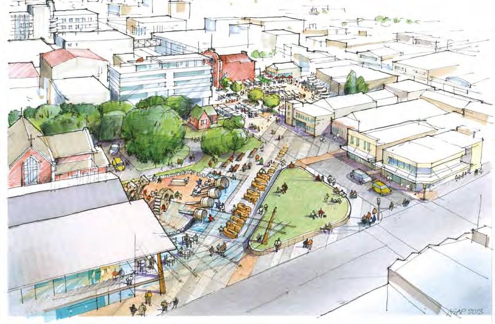
7 Executive Summary Page 7

8 Traffic flow outside core CBD blocks TX TX Coach The Future Master Plan Spey St S Coach Library T Dee St T TX TX C S SIT SIT Arcade Kelvin St Don St Scottish C YMCA Coach C T S S T Cambridge Place Arcade C Esk St ICC T S C Deveron St TX Civic SIT Tay St S Camper van parking Wood St S C SIT Forth Street parking precinct Forth Street parking precinct S Forth Street parking precinct Page 8
9 The Future Master Plan T T TX TX Coach C Commercial development opportunities Existing commercial developments Community development opportunities Existing community facilities Car park buildings Existing parking spaces Urban pocket parks Key open spaces Dee and Tay single laning Market and events space Roading changes High quality footpaths Linear urban parks (pavements to parks) Special weather protection Laneways to be developed Off-road cycle link Major pedestrian connections Gateways Existing public toilets Proposed public toilets Existing taxi stands Proposed taxi stands Proposed coach parking Proposed cycle storage with possible cycle hire The Future Master Plan was developed and continuously updated as a working tool during the consultation and Master Planning process, which allowed us to understand and test the ideas that we were developing. As a working tool it has allowed us to have conversations with many of the parties involved in the process from the Council to community groups and private organisations. These conversations ensured that the process was in line with the long term strategic thinking of the parties invested in the CBD. Comparing the Future Master Plan with other documents such as the District Plan Review (2013) and the Invercargill City Centre Outline Action Plan (2011 and 2013) allowed us to ensure that past and current strategic thinking adopted by the city is in alignment with the Central City Revitalisation process. The Future Master Plan shown on Page 8 was informed by our professional observations gained from three years of working in the Invercargill area, by being part of the CBD Outline Action Plan team and by many community conversations we had both during and after the consultation process. However, this Plan is still a tool for continuing dialogue with stakeholders and community, and will continue to be developed over time in the Design Stage. Page 9

10

11 1.0 Introduction


12 1.1 Project background Project Background The Invercargill CBD has been identified by the Invercargill City Council (ICC) as one of its top priorities and the Inner City Working Group (ICWG) was setup by the Council in February 2011 to lead an investigation into ways to combat the decline of the city centre. In July 2011, Urbanismplus Ltd, William J. Watt Consulting Ltd and Pocock Design Environment Ltd (PDE) were employed by the Council to carry out an urban design-led process in order to identify the actions needed to revitalise the CBD. As a result, in December 2011, the Invercargill CBD Outline Action Plan was produced by Urbanismplus. This report outlined the eight top priorities for the CBD, which were adopted by ICC and set the framework for future design work. In ovember 2012, ICC and ICWG ran a public tendering process in order to find suitable consultants to carry out the design work for the revitalisation of the CBD, which was subsequently won by a team of consultants led by PDE. At the same time the ICC and ICWG decided to re-employ Urbanismplus to oversee the design process to ensure the key findings in the CBD Outline Action Plan are followed through. Upon winning the tender, PDE and team went back to ICC and ICWG and had detailed discussion regarding the delivery of the project. It was agreed that the design process would be broken into two stages: a Master Planning Stage and a Design Stage. This report signals the end of the Master Planning stage, in which the project team consulted all major stakeholders and the general public. The report establishes a detailed scope of works, highlights key projects, delivers preliminary costing estimates and discusses an approach to staging. Once this report is adopted by the ICC and ICWG, it will be used to set out a budget and timeline for specific projects, so that the project team can proceed to the Design Stage. The consultation process The central city revitalisation Master Planning process included an extensive consultation process. This is particularly relevant because of the broad scope of the project, and the impact the Master Plan and future central city development would have on the city and the community. There were two major parts to the consultation process: major stakeholders consultation and public consultation. The major stakeholders were identified jointly by the ICC and PDE and approached by ICC, and consultation was carried out in the form of formal meetings between the project team and the stakeholder representatives. The major stakeholders included a range of business groups, major landowners, music and art organisations, education providers and youth groups. PDE then worked with ICC to develop a public consultation strategy, which resulted in the one day open public consultation workshop, Have your say. The workshop ran on the , where people were invited to come in and record their opinions regarding the future of the CBD. It was estimated that over 400 people participated in Have your say, which gave the project team significant amount of feedback to be incorporated into the Master Planning process and final document. Meeting with ICC Presentation to ICWG Fig. 1-2 CBD Outline Action Plan Public consultation Have your say Page 12

13 1.2 Project scope Fig. 1-1 Project scope map Connection to the Museum The scope of the Master Planning process started from the CBD Outline Action Plan 2011, written by Urbanismplus for ICC. The Plan outlined the eight priorities for the CBD, including: City centre promotion and events. City centre focus in Council policies and actions. Business development and attraction. Heritage protection and enhancement. Car parking. The improved integration of Dee and Tay Streets. Public spaces. Arts and culture and interpretation. Connection to Large format retail During the early stages of the Master Planning process, we met with the ICWG and ICC project control group, and divided the eight priorities into three groups: 1. CBD specific design works to be delivered by our process. 2. Regulatory and planning related works to be delivered by ICC. 3. Projects that cross-over between the above two categories to be delivered jointly by ICC and our team. Dee St Kelvin St Don St Deveron St All the work under Group 1 and part of Group 3 were then confirmed as the actual scope of works for our project. This included core elements in the streetscape, from lighting to street furniture; key open space planning and design; preliminary traffic studies and street concepts and a framework for strategy development, such as art and wayfinding. It is important to note that the work shown in this Master Plan report represents only the first stage of the Central City Revitalisation design process. The purpose of the current work and report is to set clear goals for the upcoming Design Stage. It identifies the key projects and strategies for the revitalisation of the CBD, outlines the preliminary cost estimations and suggests an approach to staging. Connection to the Train Station Esk St Core CBD area covered in scope of works Outside influences and connections Outside influences and connections (location to be confirmed) Key open spaces (to be considered to a conceptual level) Key open spaces (to be considered to a conceptual level, location to be confirmed) Tay St Wood St Connection to the Green Belt (actual location to be confirmed) Connection to SIT Page 13
14 1.3 Have your Say Future Vision Wish List Open Space Space to socialise 38 Youth and family friendly space 19 Skateboard park and playground Shelter Covered mall 35 Covered outdoor space 22 Crossing shelters Amenities More car parks 31 Seating 30 Toilets Entertainment 52 Market 40 Music and gig space 20 Better night life Public arts and culture Sculptures and fountains 17 Street art 9 Art gallery Circulation 43 Pedestrian focused Esk Street 47 Improve connectivity 14 More disabled car parks 5 25 Hospitality Food and food court 24 Cafes 21 Late hour cafes Page 14

15 1.3 Have your Say Future Vision Wish List Branding and Appearance Vibrancy and colour 32 User friendly 7 Clean streets Buildings Buildings Retain heritage characters 20 Fill up second storey 6 Modernise and paint job 6 Vegetation Buildings More trees 17 More ornamental and floral planting 10 More native planting 6 Safety 31 7 Buildings Improve Wachner Place 15 Improve lighting 13 Retail 19 Buildings More retail 9 Better diversity 5 More large format retail 5 One participant recording her CBD Future Vision Goals 13 4 Buildings Bring more people in 8 Smoke free 4 Retain youth 3 Summary of Future Vision and CBD Wishlist The consultation process held in March of 2013 took place over a four-day period and included 30 meetings, a public consultation workshop which interacted with over 500 people. There was a perception that this consultation process would just highlight what was already known, that local people want to park outside the shop and that there needs to be more car parks. Contrary to this perception, the consistent comments that came from the workshop did not centre around car parking but rather family and youth friendly open space, shelter from the elements, pedestrian amenities, the desire to have places to meet and gather, a market space and green open spaces. The wish to have more seats for pedestrians was as equal to the wish to have more car parks. The Have your say diagrams recorded the amount of times a wish was made by different individuals, which was then translated into a bar graph (on this page), so that the decision makers and designers could understand the key issues for improving the CBD. The concepts and guidelines suggested within this report have been generated from the wishlist compiled during the consultation period. Page 15
16

17 2.0 Planning and Context

18 Deveron St Kelvin St Dee St 2.1 CBD Outline Action Plan Review Integration between the 2011 CBD Outline Action Plan and the 2013 Central City Revitalisation Master Planning process For consistency it was important that the 2013 Central City Master Planning process brief came from the Council s existing documents because these documents represent a significant amount of professional work, public consultation and expectation. It was recognised that some central city issues may have evolved between 2011 and 2013 so Urbanismplus were commissioned by the Council to review the CBD Outline Action Plan 2011 and to ensure that the Master Planning project team correctly interpreted the priorities. It was also a chance to review these priorities in light of new information to find out whether they were still correct or needed adjusting. Fig. 2-1 Current Outline Action Plan (2011) summary Don St Strengthening the heart of the city centre Strengthening pedestrian connection Area of streetscape strengthening Strengthening as informal nightlife cluster Esk St Key new public spaces or open space upgrade Wood St Tay St Overcoming State Highway severance Public off-street car parking opportunities Development opportunities Two-waying Don Street Allowing right-turn into Esk Street Existing arcades Figure 2-1: The composite plan from the 2011 Report Invercargill City Centre Outline Action Plan was produced by Urbanismplus and adopted by the Council and ICWG in December The Plan identified eight priorities that the ICC and ICWG should be focusing on in order to revitalise the CBD. Page 18
 summary After the consultations, PDE and Urbanismplus worked together to go through all the information collected in the meetings and examined how this")
19 Deveron St Kelvin St Dee St 2.1 CBD Outline Action Plan Review Overview Fig. 2-2 Updated Outline Action Plan (2013) summary After the consultations, PDE and Urbanismplus worked together to go through all the information collected in the meetings and examined how this information could affect the original thinking in the CBD Outline Action Plan 2011, which would then form the base for all the decisions made within this report. Below are the revision comments associated with the revised CBD Outline Action Plan 2013, written by Urbanismplus. These comments represent Urbanismplus independent view on the matters that affect the future of the CBD. Within Urbanismplus review were strategical comments regarding private developments, which were acknowledged during the Master Planning process but not shown in the actual report itself, due to commercial sensitivity. The Information Centre has also not been located on the Master Plan because it is being reviewed by an independent process separate to our Master Planning process. Don St Esk St Tay St Wood St Figure 2-2: Updated CBD Outline Action Plan 2013 composite plan from Urbanism post the June 2013 consultation. Traffic We still strongly promote the proposed right-turn into Esk Street as indicated in our Outline Action Plan report. We strongly support the two-waying of Don Street, as it would support new investment along Don Street through improved accessibility. In addition, the following wider benefits apply: Improved legibility; Overall savings in vehicle movements in the city centre; Better behaviour of two-way traffic compared to one-way traffic, which benefits the pedestrian; and Improved accessibility. We support the proposed single-laning of Dee and Tay Streets in the indicated locations. The main benefit would be the reduction of severance through the city centre and improved crossing opportunities for pedestrians. There may be a relationship between the proposed single-laning of Dee and Tay Streets on the one hand and the Esk and Don Streets proposals on the other hand. If the single-laning would negatively impact on the feasibility of the proposals for Don and Esk Streets, we would favour the Don and Esk Streets proposals over the singlelaning. This is because we believe that the positive impacts of improvements in Don and Esk Streets on the wellbeing of the city centre would be greater. Information centre location The current location has only limited spin-off effects for the city centre. To establish the Information Centre in a more central location is based on a whole of economy approach, which is to create synergies between enterprises both within as well as outside Invercargill and thus deliver multiple benefits for the region. Page 19
20 2.1 CBD Outline Action Plan Review Criteria for the assessment of location options include the following: Ease of direction finding for traffic by following signage; Ease of access by vehicle; Visibility from passing traffic; Ease of parking and availability of free parking; Ability to generate passing pedestrian retail trade; Centrality within the town centre / proximity to the retail heart; Easy to see and find for pedestrians; Proximity to public plazas and squares and other civic / community facilities; Space for visitors to loiter without disrupting other activities; Proximity to magnet visitor attractions (able to occupy them for 1.5 hours); Security and safety outside normal business hours; Possibility of shared facilities with other public facilities; and Space for expansion, events and display space. If the city centre can hold people for a period greater than 1.5 hours, there is a good chance these visitors will identify a number of reasons to stay longer, including things to do, places to visit, or even staying overnight. Additional tourist experiences could be developed in the city centre around the proposed information centre. Furthermore, the location proposed, is in close proximity of major hotels (existing and proposed), the Civic Theatre, the cinema, H&J Smiths and the Otepuni area, which is part of the city s green belt. The proposed location would require a strong and attractive pedestrian connection across Tay Street. The quality of this crossing and the experience through Cambridge Place and along Kelvin Street will be crucial factors in maximising the benefits of attracting tourists into the city centre. One could argue that additional benefits of the proposed location include: It may provide motivation to improve crossing opportunities across the State Highway. It may encourage more pedestrians through Cambridge Place and therefore help with the viability of the shops in this arcade. just an Information Centre and would ideally be combined with in-house attractions, compatible retail and tourist related businesses such as rental car companies, internet cafes, galleries and souvenir shops. It is proposed that the current information centre will be incorporated as part of the expanded museum. Performance criteria for a building on the western edge of Wachner Place The Outline Action Plan identified several issues with regards to Wachner Place that should be addressed. After the completion of the Outline Action Plan, the Council indicated that it is considering developing a new administration building in a location on the western edge of Wachner Place. This would entail building across Esk Street West, possibly reducing it to a pedestrian-only connection through the building during office hours. Whilst we, in line with best practice urban design principles, are cautious about blocking off streets, we are not sure this would be that much worse than the current situation, especially given the lack of destinations to the west of Wachner Place. Any well-designed building on the western edge of Wachner Place could provide a positive impact, if the building meets the following key criteria: Incorporating a highly activated ground floor that provides passive surveillance over and energises the public open space of Wachner Place; Facilitating a pedestrian connection through to Esk Street West; and Providing positive impacts or being neutral on the micro-climate in Wachner Place and Esk Street between Dee and Kelvin Streets (reducing wind effects, avoiding overshadowing effects, providing shelter etc.). The proposed Information Centre would be located off SH 1 / Tay Street, which should have signs leading to the facility. Additional signs should be placed in strategic locations (in Bluff, 5 km out on SH1 east, 5 km out on SH 6 north). Parking, including campervan parking, could be accommodated in Wood, Forth and possibly ith Streets. This is an opportunity to present visitors to Invercargill with a new, modern, contemporary, purpose built building. The Centre could be more than Page 20

21 2.2 District Plan Review Fig. 2-3 Proposed District Plan - City Centre District Plan Review The District Plan is one of the defining documents for the CBD and it is important that the current thinking and future planning is integrated into the District Plan. In addition to this, the District Plan needs to be incorporated into documents such as the Invercargill City Centre Outline Action Plan 2011 and this planning document. Urbanism Plus, the authors of the CBD Outline Action Plan 2011 and PDE met with the council planning team multiple times to ensure the District Plan and the Central City Revitalisation Master Plan were integrated. Issues such as business zoning, entertainment zoning, the role of historical buildings and what is the defined edge of the CBD zone all came up in these discussions. These issues were then developed to a point where all the above planning documents aligned. Page 21
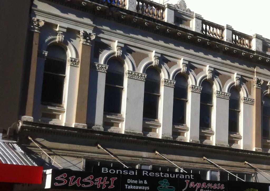
22 2.3 heritage building strengthening Heritage building strengthening Owners of historical buildings are under pressure across ew Zealand to either strengthen or remove their buildings due to the Christchurch earthquakes. In some cases the buildings have been in poor condition for decades and should be removed because they are beyond the point of strengthening and are at a high risk to the public and occupants. For the buildings that can be strengthen, some of are still under pressure for demolition. This is due to a range of reason such as; it is more economical to demolish and rebuild a new building than strengthen the existing building, the historical interior set out or building performance (insulation, lighting, heating, cooling) makes them unpopular for tenants or the building is unable to meet the required fire standards for the upper floors, making any floor above the ground floor untenable. The other lesson Christchurch taught us is that if you knock down most of your historical buildings you lose your sense of place and identity, and the development economics might not be in favour of rebuilding the site. If the development economics do not stack up to rebuild you may end up with an empty main street or CBD sites where the owners land bank the site and wait for better economic times before rebuilding. This will have a detrimental impact on the surrounding buildings, the CBD environment as a whole and peoples confidences in the CBD, as a place to visit and invest. Resulting in business moving out of the CBD to new commercial subdivisions or the surrounding suburban neighbourhoods. Invercargill historical buildings are under pressure from all of the above issues but there is still a high degree of public perceived values to the historical buildings, especially those on Dee Street which are considered as a gateway for the CBD as you head south (refer to Figure 2-4). There is also a high degree of pride in Southland s heritage and the historical buildings are considered to be a part of that heritage on display, and should be retained where possible. Fig. 2-4 Existing landmarks and heritage buildings Spey St Key landmarks as per consultation (buildings, monuments and facades) Class 1 heritage buildings Dee St Kelvin St Don St Esk St Deveron St Tay St Wood St Page 22


23 2.3 heritage building strengthening Civic Theatre Grand Hotel Design Brief: Recommendations and Considerations That ICC and ICWG set up a Historical Building Working Group to review the issues around the increase in the national standards of earthquake strengthening, development economics, planning and policies restrictions that undermined the use and retention of historical buildings. That ICC creates a strategy based on recommendations from the CBD Outline Action Plan 2011 that gives guidance on which key historical buildings should be strengthened and upgraded first. That the ICC set up public/private agreements to strengthen key buildings. The agreements may be financial and/or rates and planning concessions, painting grants for strengthen buildings. That lighting heritage buildings is encouraged with a range of incentives. The ICC reviews planning and building policies that may currently restrict the use of first levels and above on historical buildings and review if changes could be made to increase the use of these floors. South African War Memorial Bank of ew South Wales Railway Hotel Corner of Dee and Don Street Page 23

24

25 3.0 Streetscape


26 3.1 Streetscape Overview Existing streetscape There are four main elements within the streetscape, these include: street lighting, surfacing, street furniture, street trees and planting. We have looked into these four elements separately in order to identify existing issues and come up with design strategies to address these issues. Finally we have also written design outcomes to help the ICC to make decisions in the Design Stage. The key outcomes for the future CBD streetscape design are: A simple, yet functional streetscape with minimal visual clutter that focuses on improving the quality of the pedestrian environment. Efficient streetscapes that minimise maintenance costs. An inviting, safe and comfortable street environment that encourages pedestrians to spend more time in the CBD. High quality streetscapes will be limited to the CBD to reinforce its limits and visually strengthen the its core area. Esk Street looking east Esk Street West looking east Tay Street looking east Dee Street looking north Don Street looking east Dee Street looking south Page 26


27 3.1 Streetscape Overview Street lighting Surfacing Street furniture Street trees and planting Don Street Esk Street Tay Street Esk Street Esk Street Esk Street Tay Street The Crescent Esk Street Dee Street Esk Street Dee Street Page 27


 Painted round pole")


28 3.2 Street Lighting Existing street lighting Main issues with existing street lighting The Strand lamps along Dee and most of Tay Streets have a high output producing good light coverage but resulting in high energy consumption due to inefficient control gears. Currently the fittings that hold the ornamental brackets in need replacement and the maroon coloured paint on these poles has deteriorated. The custom built poles along Don and Kelvin Streets have been placed symmetrically to create a decorative effect, rather than spacing them to provide good light levels. The current placement does not provide effective light coverage nor energy efficiency. Fig. 3-1 Existing street light locations Dee St Kelvin St Key open spaces excluded Painted round pole with strand (Dee & Tay Streets) Painted round pole with strand (Local roads) Painted hex pole with GL600 Galv. hex pole with GL600 Square concrete pole with GL600 Small round pole with ball fittings Pedestrian crossing lighting Other lighting Lighting level on Esk Street between Dee and Kelvin Streets are low because the ball fittings are inefficient in controlling the direction of the light. This resulted in both poor lighting levels, low energy efficiency and a significant amount of light pollution. Don St Dark areas of the pedestrian sidewalk are found throughout the CBD owing to the lack of under verandah lighting and the inability of the street lights to reflect light under verandahs. There are management and maintenance issues with existing under verandah lighting making the current system of lighting the sidewalks ineffective. Esk St Deveron St Tay St Rusted fittings hold the ornamental bracket on custom built pole Ball fittings in Esk Street Custom built pole with Strand Heritage style decorative lighting Road lighting luminaries Page 28


29 Kelvin St 3.2 Street Lighting Fig. 3-2 Existing street lighting performance Illustration Dee St Don St Existing lighting and safety Our consultation with the community found a direct connection between the light level on the sidewalks and perceived safety in the streets and public spaces, even though these perceived safety issue may not be consistent with the reality, for example, Police records do not show high crime rates in low lit areas for Invercargill. Figure 3-2 illustrates the street lighting performance in the CBD. It shows adequate light levels on most of the carriageways except Esk Street between Dee and Kelvin Streets. We have also noted low light level in numerous locations around the CBD making pedestrian movement at night uncomfortable. Esk St Deveron St Tay St Fig. 3-3 Public reaction to CBD safety Esk Street at night Dee Street at night (outside of Reading Cinemas) Unsafe during the day Unsafe at night Page 29


30 Deveron St 3.2 Street Lighting Proposed street lighting Design strategies Dee and Tay Streets Retain existing poles as they are structurally sound and are often attached to existing infrastructure, for example, the planters at base of the pole and cable between poles to support street decoration. Fig. 3-4 Proposed street lighting strategy Key open spaces excluded Proposed lighting upgrade on Dee and Tay Streets (retaining existing poles, retrofit existing lamps) Proposed brand new poles and lamps Existing poles and lighting retained Retrofit Strand lamps with new control gears and improve lamps by cleaning and repainting them. Repaint existing poles, remove existing decorative elements and potentially replace existing lamp arms. Don St Retrofit under verandah lighting onto existing poles Dee St Esk Street, Kelvin Street and Don Street (between Dee and Kelvin) Kelvin St Remove all existing poles and lamps, install new poles and lamps to their optimum locations. Don Street (between Kelvin and Deveron) and Deveron Street o change thus visually limit the core CBD boundary. Esk St Tay St Wood St Simple street lights Back lighting of footpath Multi-use of street light poles Page 30


 to the night sky.")


31 3.2 Street Lighting Landscape lighting integrated into seating Heritage building lighting Proposed street lighting Design outcomes More efficient street lamps to reduce energy consumption, running cost and maintenance cost. Optimum pole locations on Esk and Don Streets for efficient performance. Better lamps that deliver better street lighting while reducing light pollution (spill) to the night sky. Better lighting on footpath to improve safety. Recessive pole and lamp colours to reduce visual clutter in the streetscape. Encourage the uplighting of heritage buildings Integrate feature lighting into the landscape such as under seat and deck lighting. Fig. 3-5 Existing Tay Street lighting Fig. 3-6 Proposed Tay Street lighting Fig. 3-7 Proposed Tay Street lighting at night Fig. 3-8 Existing Esk Street lighting Fig. 3-9 Proposed Esk Street lighting Fig Proposed Esk Street lighting at night Page 31


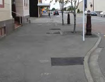
32 3.3 Footpath Surfacing Existing footpath surfacing The existing paved surfaces within the CBD add to the quality of the spaces and streetscape, and have been performing well. The issue is less than half of the core CBD is paved. There are three distinctive types of footpath surfacing in the CBD: Fig Existing footpath surface types Key open spaces excluded Existing clay paving orange Existing clay paving gray Existing concrete paving gray and orange Fully paved, mainly clay paving with cut stone insets. Areas include Esk Street between Dee and Kelvin Streets, also in some pocket parks such as mid-don Street, in front of ICC building and Civic Theatre. Existing concrete surfaces Existing asphalt surfaces Asphalt footpath with areas of decorative clay paving. Areas include Dee and Tay Streets, Kelvin Street and a portion of Don Street. Don St Asphalt footpath. Areas include north side of Esk Street between Kelvin and Deveron Streets and a large section of Don Street and Deveron Street. Dee St Deveron St Main issues with existing footpath surfacing Some existing paved surfaces have started to deteriorate, including broken pavers and uneven surfaces. Current paving design is dated and contributes to the visual clutter in the streetscape. Asphalt surfaces appear tired, dirty and often patched, which decreases the quality of the streetscape. Kelvin St Esk St Tay St Wood St Visual clutter created when surfacing materials meet Fully paved footpath Mostly paved footpath Asphalt footpath with paving strips Asphalt footpath Page 32


33 3.3 Footpath Surfacing Dee St Key open spaces excluded Existing paving retained Proposed paving Painting on existing footpath Existing asphalt retained Don Street Two-waying Don St Deveron St Proposed footpath surfacing Fig Proposed footpath surface types Dee Street single laning Design strategies Retaining all surfacing on Esk Street between Dee and Kelvin Streets, for the short to mid term. Esk Street will eventually be upgraded to match all other streets within the core CBD, but this should be one of the final stages. Retain existing good quality paved surfaces, mainly on the corner of Dee and Tay Streets, corner of Tay and Kelvin Streets. These areas will eventually be upgraded to match all other streets within the core CBD. Upgrade all other streets to paved surfaces as per Figure Areas within specific projects are to be upgraded as part of the proposed projects. Kelvin St Esk St Tay Street single laning Tay St Proposed surfacing Design outcomes Use materials that match the existing clay paving palette within the CBD streetscape, while considering a stone paving material as features. A simple design that speaks to the quality, and reduces visual clutter in the streetscape. High quality paving surfaces should be used to reinforce the core CBD limit. Wood St Clay paving with cut stone paving insets Clean contrast between different paving types Page 33
.")


34 3.4 Street Furniture Existing seating Main issues with existing seating The consultation highlighted a lack of comfortable seating in the CBD, especially along Esk Street (refer to Figure 3-13). Existing steel bench seating is robust in quality but uncomfortable to use, with no back and arm rests. Fig Existing seat locations Key open spaces excluded Steel benches attached to planters Standalone steel benches Heritage style seats Other timber benches and seats Existing colour scheme of maroon and blue contributes to the visual clutter in the streetscape. Red based colours also deteriorate much faster under the ew Zealand sun. Existing stone clad art plinths along Esk Street are often used as informal seating, but they are uncomfortable and like the steel benches, have no back and arm rests. Dee St The few seats with arm and back rest in the CBD, for example, near the Umbrella in Don Street, are deteriorating in quality. Kelvin St Don St Deveron St Fig Public reaction to CBD seating Esk St Tay St Seats needed Wood St Steel bench attached to planters Standalone steel bench Timber seat (Don Street by the Umbrella only) Informal seating space around art pieces Page 34


35 3.4 Street Furniture Proposed seating Fig Proposed seat locations Key open spaces excluded Existing planters retrofitted Existing plinths retrofitted Proposed stand alone seats Existing seating retained Design strategies Remove all existing standalone seats that are in poor condition and / or lack arm and back rests. Install new seats at appropriate locations to ensure sufficient coverage. Kelvin St Retrofit existing planters under light poles on Dee and Tay Streets with better seating options. Don St Retrofit existing art plinth on Esk Street to provide additional seating options. Dee St Deveron St Proposed seating Design outcomes Matching seats across the core CBD. Esk St High quality seats that are ergonomically designed with back and armrests. Recessive style and colour to reduce visual clutter in the streetscape. Ensure there are enough seats within the CBD and provide different seating options to cater to different age and user groups within the community. Limit the distribution of new seats to reinforce the core CBD limit. Tay St Wood St Urban seating Flexible urban seating Page 35


36 3.4 Street Furniture Retrofitting existing planters on Dee and Tay Streets Design outcomes Retain all existing infrastructure, such as cabling and light poles. Provide better quality seating options. Improve opportunities for planting. Keep existing material palette but reduce visual clutter. Introduce potential elements for art and branding. Fig Retrofitted planter concept Existing planter with steel bench on Tay Street Retrofitting existing stone clad art plinths on Esk Street Design outcomes Retain platform for art installation. Provide better seating options. Introduce potential elements for art and branding. Consider the integration of lighting into seating options. Fig Retrofitted art plinth concept Existing art plinth on Esk Street Page 36


37 3.4 Street Furniture Urban platform seating Urban platform seating Urban platform seating Unique urban seating Unique urban seating Urban platform seating Page 37


38 Deveron St Kelvin St 3.4 Street Furniture Existing bins Main issues with existing bins Branded cast iron bins are robust in quality but also expensive to replace. The range of non-matching bins creates a visual clutter within the street. Fig Existing bin locations Key open spaces excluded Branded heritage style bins Steel slate recycle bins Steel slate bins Existing colour scheme of maroon and green also contributes to the visual clutter of the streetscape. Red based colours deteriorate much faster under the ew Zealand sun. ew bin style appears utilitarian and lacks the high quality feel the streetscape needs. Dee St Don St Esk St Tay St Wood St Branded cast iron bin and steel slate recycle bin Steel slate bin Built-in bin (Wachner Place) Page 38


39 3.4 Street Furniture Proposed bins Fig Proposed bin locations Kelvin St Key open spaces excluded Existing branded bins repainted and relocated Existing branded bins repainted and relocated as recycle bins Proposed bins Design strategies Retain existing cast iron bins on Esk Street, repaint with a recessive colour. Remove all other cast iron bins in the CBD and reuse them on Esk Street where necessary as both rubbish bins and recycle bins. Proposed recycle bins Existing bins retained Install new rubbish bins in the core CBD at appropriate locations, with added recycle bins at key locations. Dee St Don St Design outcomes Deveron St Have matching rubbish and recycle bins on Esk Street by utilising existing cast-iron bins, to enhance the heritage feel of the street. Have matching rubbish and recycle bins on all other core CBD streets. Ensure new bins are simple, functional and visually recessive. Introduce potential elements for art and branding. Esk St Limit the distribution of new bins to reinforce the core CBD limit. Tay St Wood St Twin bins Single timber slate bin Bin with city branding Page 39
 Cycle stands (single stand) Most single D shaped cycle racks either lack capacity or are in locations that are")


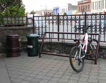
40 3.4 Street Furniture Existing cycle racks Main issues with existing cycle racks are: Existing multi-bay cycle racks appear utilitarian and lack the high quality feel the CBD should have. Fig Existing cycle rack locations Key open spaces excluded Cycle racks (multiple bays) Cycle stands (single stand) Most single D shaped cycle racks either lack capacity or are in locations that are hardly used by cyclists. Existing colour scheme of maroon contributes to the visual clutter in the streetscape. Red based colours also deteriorate much faster under the ew Zealand sun. There is a lack of cycle racks on Don Street, particularly in front of the SIT building. Currently bicycles are parked against street light poles and raised grass plinths. Dee St The multi-bay cycle rack in front of the library is heavily used, but is located in the best micro-climate and associated waiting space. During the consultation it was suggested that this cycle rack be relocated nearby to free up this space for a pocket park. Kelvin St Don St Deveron St Esk St Tay St Wood St Light poles are used as cycle stands on Don Street Multi-bay cycle rack in front of the library Single D shaped cycle rack Page 40


41 Deveron St 3.4 Street Furniture Proposed cycle racks Fig Proposed cycle rack locations Dee St Key open space excluded Existing cycle stands retained Proposed cycle stands (Each dot represents a group of three stand alone cycle stands) Design strategies Remove all existing cycle racks and replace them with simpler more contemporary racks that merge seamlessly with the streetscape. Install additional cycle racks at key locations. C Proposed cycle storage with possible cycle hire Install cycle storage facilities at key locations to encourage bicycle use within CBD. C Don St Introduce small scale cycle rental services to encourage tourists to cycle within the CBD and to other key locations in the city, for example, the Museum and the Green Frame. C Design outcomes C Matching cycle racks across the core CBD. Simple contemporary cycle racks that fulfil the functional needs and reduce visual clutter in the streetscape. C Kelvin St Esk St Improved distribution to encourage cycle use. Limit the distribution of new cycle racks to reinforce the core CBD limit. Tay St Wood St C Unique cycle racks Simple cycle racks Bicycle locker Page 41

 Branded bollards (D180) Other bollards")

42 Dee St Deveron St Kelvin St 3.4 Street Furniture Existing bollards Main issues with existing bollards are: Existing colour scheme of maroon contributes to the visual clutter in the streetscape. Red based colours also deteriorate much faster under the Z sun. Fig Existing bollard locations Key open spaces excluded Branded cast iron bollards (D300) Branded bollards (D180) Other bollards Bollards found on street corners are considered unnecessary as these corners all have proper kerb and channel. Large cast iron bollards work well in front of key heritage buildings however they are expensive to replace. Don St Esk St Tay St Wood St Large bollards on Esk Street to separate traffic and pedestrian Large bollards on street corners Small bollards and chains on street corners Page 42
 retained Branded bollards (D180) retained Other bollards retained Proposed bollards on Don Street Design")

43 Kelvin St 3.4 Street Furniture Proposed bollards Fig Proposed bollard locations Key open spaces excluded Branded cast iron bollards (D300) retained Branded bollards (D180) retained Other bollards retained Proposed bollards on Don Street Design strategies Remove all bollards on street corners where there are kerb and channel. Retain large cast iron bollards in front of key heritage buildings - repaint them so they are integrated into the new streetscape. Design outcomes Dee St Don St Deveron St Reduce visual clutter in the streetscape by removing most of the unnecessary bollards and painting the remaining bollards with a recessive colour. Only use bollards where it is necessary to demarcate pedestrian and vehicle movement. Limit the distribution of new bollards to reinforce the core CBD limit. Esk St Tay St Wood St Simple bollards Simple bollards Page 43


 Pedestrian shelter locations identified during public consultation (Esk Street)")
44 Deveron St Kelvin St Dee St 3.4 Street Furniture Existing pedestrian weather shelters Main issues with existing shelters are: There is a general lack of pedestrian weather shelters in the CBD and most of them are designed to stop wind not rain. Overhead covers appear utilitarian and poorly maintained, which reduces the visual quality of the overall streetscape. Existing colour scheme of maroon contributes to the visual clutter in the streetscape. Red based colours also deteriorate much faster under the ew Zealand sun. Fig Existing pedestrian shelter locations Key open spaces excluded Existing wind shelters Veranda and overhead cover Pedestrian shelter locations identified in CBD Outline Action Plan Pedestrian shelter locations identified during public consultation (intersections) Pedestrian shelter locations identified during public consultation (Esk Street) Don St Esk St Tay St Wood St Fig Public reaction to CBD crossing Wind shelter and barrier on Kelvin Street Overhead cover outside the Cinema on Dee Street Shelter needed Page 44


45 3.4 Street Furniture Proposed pedestrian weather shelters Fig Proposed pedestrian shelter locations Dee St Key open spaces excluded Proposed pedestrian weather shelters Design outcomes Keeping people dry and sheltered from the rain and wind (mostly Southwestlies) at key locations. The shelters should be designed to visually integrate into the existing environment and avoid conflicting with existing buildings and street structures, such as existing buildings, verandahs, traffic lights and street lights. Don St The shelters should be designed to be flexible, so that they can be adapted for use in multiple locations, for example, to fit into a State Highway environment or the mid Esk Street environment. The shelters should be designed to work as a single standalone unit as well as having the ability to be joined in a line to make a long sheltered area. Kelvin St Deveron St eed to fit in the middle of a 7 to 9 metre wide central island on the State Highway. Esk St The shelters could be used within green spaces such as the Bowling Green to create shelter for park users. The shelters should be designed to have the ability to be connected back-to-back or back-to-front to create a rectangular area that could cross a space such as Esk Street, Don Street and the future outdoor market. Wood St Tay St Other design requirements The shelter should integrate lighting design. The shelter should be removable and / or relocatable. The shelter could integrate sound and music. The shelter could integrate live feeds from ICC, event promotion or SIT art. Fig Proposed Esk Street shelter concept Fig Proposed Esk Street shelter concept Page 45


46 3.5 Street Trees and Planting Existing street trees and planting Street trees Existing street trees growth in the CBD have been limited by strong winds. Mature and large established street trees are hard to find within the CBD area. The most significant trees exist within private property such as the St Johns Church on Esk Street. The cherry trees along Esk Street were highlighted during the public consultation as being enjoyed by the community, but people have also voiced the need for more threes and planting in the CBD. Fig Existing street tree locations Kelvin St Key open spaces excluded Street trees in footpath Street trees in road median The existing trees in the central medians along Dee and Tay Streets help to visually reduce the width of the corridor. Don St Planting Existing planting in the CBD is fragmented and lacks uniformed design. Most substantial areas of planting are found in the central medians along Dee and Tay Streets, which is a mix of exotic and native species. Overall there is a general lack of green in the streetscape, especially in pedestrian concentrated areas such as Esk Street. Dee St Esk St Deveron St Tay St Wood St Cherry tree on Esk Street Oak trees in Wachner Place Trees in central median of Tay Street Page 46


47 3.5 Street Trees and Planting Proposed street trees and planting Fig Proposed street tree locations Dee St Kelvin St Don St Key open spaces excluded Retained street trees in footpath Retained street trees in road median Proposed street trees Deveron St Street trees The Invercargill City Council have significant experience in which tree species do well within the CBD s environment, hence it is important that the future designers collaborate with ICC parks officers on the tree and plant selection for street upgrades and open space development. This is an important process because the council staff have to maintain the planting, so it is essential they are involved in all decisions regarding planting, general design and material selection. During the community consultation many comments focused on greening the CBD. The Master Plan responded to these comments and created concept designs that focused on creating green spaces, which include lawn areas for people to gather and meet as well as new street trees and planting. Vine screens and cages Invercargill has laneways with tight spaces, planting areas close to rooflines and services under footpaths that may limit the planting of trees. In these spaces where there is a requirement or interest to have vertical planting that has height and scale, vines can be used. The advantages of vines is that they often grow faster than trees and can work around underground services. They also add colour to the streetscape and need minimal structures to gain significant height. Vine structures could be considered in laneways, around the large cable poles on Dee and Tay Streets. Esk St Wood St Tay St Planting Species Future street planting could focus on creating a planting palette that is unique to the Southland area and visually ties, not only the CBD open spaces and streetscape together, but integrates the CBD into the greater open space environment with a focus on the greenbelt and the coastal environment. These ideas will have to be tested with the Council and the community before being developed further. Vine cage built-in with street light pole Use large trees to visually reduce width of the street Page 47

48

49 4.0 Open Space and Laneways
 safety issues and")


50 4.1 Open Space Overview Existing open space network Currently there is a lack of public open space in the CBD - the only formal public space is Wachner Place, which is not functioning well owing to (perceived) safety issues and poor connection issues. Fig. 4-1 Existing open space network Existing public open space and pocket parks Public open spaces around the edges of the core CBD, such as Otepuni Gardens (the Green Frame ), are too far away from pedestrian concentrated areas and also suffering from perceived safety issues. During our public consultation, Wachner Place was considered as the most disliked open space in the CBD. Esk Street was marked to have the best microclimate in the CBD, which presumably contributed positively to the mid-esk, which received the most liked stickers. Dee St Mid-Don Street Kelvin St Don St Deveron St Esk St Wachner Place Mid-Esk Street ICC Pocket Park Tay St Wachner Place Wood St Fig. Fig Public reaction to to CBD existing crossing open spaces Fig. 4-3 Public reaction to microclimate in the CBD Otepuni Creek (Wood Street) Existing space liked Existing space disliked Best microclimate Page 50
 Major pedestrian")

51 4.1 Open Space Overview Proposed open space network Fig. 4-4 Proposed open space network Dee St S Don St S Key open spaces Urban pocket parks Market and events space Existing community facilities Linear urban parks (pavements to parks) Major pedestrian connections Laneways to be developed Off-road cycle link Proposed wayfinding signs The proposed open space strategy focuses on the development of two new key open spaces, enhancements of urban pocket parks, streetscapes and laneways while creating clear connections between these spaces, the greenbelt and beyond. The strategy on the development and enhancement of these open space was first outlined in the Invercargill City Centre Outline Action Plan This open space strategy was again brought up during the public consultation process as being important to the community. The key issues the community wanted to see address were: Redeveloping Wachner Place to feel safe and friendly. The development of a space that could be used as a market. Creating sheltered connections between spaces. Creating gathering spaces on Esk and Don Streets. Upgrading the space in front of the Courthouse on Don Street. Creating a new type of green space on the Bowling Green site Deveron St Developing interesting and safe connections through the laneway system. Kelvin St Creating a space on Wood Street that connects into the greenbelt and feels safe for the pedestrians passing through from Forth Street to the CBD. S S Esk St S The proposed open space strategy has taken these comments and integrated them into the CBD Master Plan, whilst at the same time looking for synergies between different elements such as but not limited to, traffic flows, existing trees, access to drinking water, microclimate and views, that could be combined to give the best possible outcome. All the concept designs have been developed to deliver a range of functions and flexibility. However, these designs have only been developed for the purposes of creating a design brief and budget, it is important that consultation with the community and other parties continue into the Design Stage. Tay St Fig. Fig Public reaction to to CBD existing crossing open spaces Wood St S S ew space / existing space upgraded Page 51


52 4.2 Wachner Place Wachner Place Introduction Wachner Place is the CBD s only dedicated urban open space of any significant area and size. The original design programme designated this space to be a causal meeting area with trees, grass, seats and concrete. In addition, there is a glazed wall with an integrated clock tower to the west of the site that acts as a wind barrier. A small stage is integrated into the space on the western edge and a public rest room to the northern edge of the space. The public consultation showed that most people felt uncomfortable using Wachner Place. In some cases people were intimidated to walk across the face of the space on the edge of Dee Street even during the day. Regardless of these concerns, the public still unanimously support Wachner Place as being a key public open space and would like to see it upgraded. Fig. 4-6 Existing Wachner Place Fig. 4-7 Location plan Wachner Place Page 52


53 4.2 Wachner Place Fig. 4-8 Proposed Wachner Place concept Concept inspiration The concept and theme for this space needs to be developed during the Design Stage but for this report we integrated the theme of the Southern Aurora into the concept design. This was done because of the strong visual role Wachner Place places in the CBD from both Dee Street and Esk Street. Wachner Place should become both the visual and open space anchor to the western end of the CBD. The proposed weather shelters that focus on light designed around the clock tower would have the strong visual impact that Wachner Place needs. Design Brief: Recommendations 1. Wind shelter from the south and south easterly wind. 2. An active commercial edge on the periphery of the open space can add vibrancy and passive surveillance. 3. Rain shelters across the eastern edge of Wachner Place as well as shelters crossing the space heading north and south along Dee Street. 4. This space has a gateway role from both Dee Street (looking north and south) and looking Esk Street looking (West) so the design has to have a positive visual impact both night and day. 5. Additional seating areas and flexibility in seating locations need to be incorporated into the design. 6. Pedestrian movement should remain through Wachner place to the West into Esk Street West even if the access is through a building, arcade or lane. 7. Pedestrian weather shelters should cross Dee Street from Esk Street into Wachner place to strengthen pedestrian access across Dee Street. Design Brief: Considerations 1. The existing historical clock could be moved to the eastern edge of Wachner place to create a significant visual anchor to Dee Street and Esk Street. 2. The existing stone walls and grass areas on the eastern edge of the Wachner Place should be retained and enhanced. 3. Additional rain shelters should be integrated into the edge of Wachner Place to allow pedestrians to movement along the edges of the spaces. 4. Existing trees should be retained within Wachner Place even if they are transplanted to new locations within the space. Urban shelter Small urban feature art Page 53


54 4.2 Wachner Place The role of the Clock tower Wachner Place currently has the historical clock face from the original post office building inserted into a modern concrete tower. The current position has little visual impact from Dee Street and limited visual impact from Esk. The clock is an important element from Invercargill s pass but in general clock tower have represented the business heart of a community. This proposal re-clads the clock tower in steel and light and relocates it to a more prominent position. This new location at the front of Wachner Place visually anchors the beginning of the Esk Street retail precinct and celebrates the importance of Wachner Place, the CBD and Invercargill s connections to the past. With this concept the lit clock tower acts as one of the centre art pieces that the art strategy suggests. Fig. 4-9 Proposed Wachner Place concept Clock tower Fig Proposed Wachner Place concept Fig Proposed Wachner Place concept Page 54


55 4.2 Wachner Place Proposed Wachner Place and the celebration of light One potential concept for Wachner Place is to develop a lighting design that celebrates the Aurora. The weather shelter roofline is shown as an irregular form and could be set at a range of heights and slopes on the supporting structure, so that the glass roof when lit, looks like a ribbon of light flowing across the space from Esk Street. Lighting could be integrated into the clock tower, the roof of the weather shelters, building façades and around the base of objects in the landscape, such as the seats and walls. Lighting of feature building Lighting of feature building Fig Proposed Wachner Place concept at night Fig Proposed Wachner Place concept at night Page 55


56 4.3 Bowling Green Bowling Green Introduction This site is not currently developed as a public open space but is owned by the Council. It is sited in a strategically important location and is one of the only open green spaces in the CBD. This space is key to the anchoring of the eastern end of Esk Street and the CBD. It is a key space to draw students from the SIT campus into Esk Street and the CBD. It is key as space to link the surrounding civic spaces together and be the conduit linking both architecture and open spaces. It provides an opportunity due to its size and location to create a family friendly space to draw people back into the CBD by offering activities other than retail. Therefore, this site is in a prime location to develop a high quality open space. Fig Existing Bowling Green Fig Location plan Bowling Green Page 56


57 4.3 Bowling Green Fig Artist illustration of the proposed Bowling Green Concept inspiration The concept and theme for this space needs to be developed during the Design Stage but for this report we integrated the theme of innovation into the concept design. There are many stories of innovation within Invercargill from the historical harvesting of mutton birds from Stewart Island, to the story of Burt Munro and his need for speed. For the open space design testing for the Bowling Green site we chose the idea of innovation around Burt Munro, engineering and speed because we wanted the space to be inspiring for the next generation who will be using the playground. Design Brief: Recommendations 1. The innovative play and family gathering space should be developed in conjunction with a commercial building that integrates not only into the physical space but also the function of the space. 2. The proposed building and weather shelters create a positive microclimate for the public space to the north of the building. 3. The building opens on to the public space to the north at the ground level and that the first floor level opens to the north and offers public access, creating passive surveillance of the public space. 4. The public space visually opens to the church land to the west. 5. The public art visually anchors the park to the eastern end of the Esk Street retail corridor. 6. There is a significant amount of seating and grassed open space for gathering. 7. The spatial design and paving create a strong visual connection across Esk Street to the car park/ proposed market space to the orth. 8. The eastern edge of the proposed building should create a weather shelter from the corner of Tay and Deveron Streets to the public open space on the corner of Deveron and Esk Streets. Design Brief: Considerations 1. The weather shelters in the public space should have feature lighting and the playground and open space should be well lit at night. 2. Water play should be considered for this space. 3. The eastern edge of the council building should be developed to allow for passive surveillance of the Bowling Green public space and pedestrian access to the Civic Theatre from Esk Street and the proposed market area. 4. An agreement should be made that allows public access to the lawn and tree area on the Church land, which will increase the arts and cultural precinct. Interactive water feature Innovative play equipment Page 57


58 4.3 Bowling Green Arts and music focused civic precinct The development of the Bowling Green site, the adaption of the existing car park into a flexible market space; which includes the integration of the Scottish Hall and the outdoor performance spaces are all connected by pedestrian links to the Civic Theatre. Creating an arts and music focused precinct. The integration of the council building into the precinct would add value to the surrounding public realm and for the building occupants. The east facing ground floor of the council building has views to the Church s open space. If this ground floor facade was opened up to allow access to the lane that runs down the side of the building, it would encourage the occupants to use the lane and the spaces beyond it. In addition to this, it would offer passive surveillance between Esk Street and the civic space. This lane would require an upgrade including lighting, seating, and paving or art on the ground surface to visually strengthen the link between Esk Street and the Civic Theatre. The development of musical performance spaces (Market Space stage) and the enhancement of existing facilities (Scottish Hall) would create strong connections to the Civic Theatre and allow for a range of performance options, encouraging music groups to establish within this precinct. Having a family and youth focused space on the Bowling Green site, a market space and performance facility within close walking distance to the CBD means that the main retail areas on Esk, Don, Dee and Tay Streets can gain the benefits of having the community come in to the CBD for arts, music and market events, whilst not competing directly for car parking spaces in front of their shops. Fig Artist illustration of proposed Arts and music focused civic precinct Grass plinth in public space Large scale water feature / art installation Page 58


59 4.3 Bowling Green Fig Proposed Arts and music focused civic precinct concept Outdoor events and markets Outdoor events and markets Outdoor events and markets Page 59


60 4.4 Market Space Market Space Introduction This site is not currently developed as a public open space and is partially owned by the Council. It is sited at a strategically important location due to its close proximity to the proposed Bowling Green family space, the Scottish Hall and the Invercargill City Council building. Value can be gained through simple retrofits to this space, whilst at the same time maintaining its current use as a car park. Examples of these retrofits include a small central green park for day to day use and a raised platform with lighting that can be used for music performances. The most important aspect of the design is the flexibility of the car parking surface and the design layout, which allows the space to be used as a market. Depending on the size of the market event, the car park and street design allows flexibility so that a market could extend out into Esk Street. During poor weather there is also the option to use the facilities of the Scottish Hall. The proposed Bowling Green family space would support market activities creating a fun space to visit during the weekends with a range of activities on offer. Fig. 4-1 Existing Fig Aerial Existing Wachner Carpark Place Concept inspiration The concept and theme for this space should be seen as a continuation of the Bowling Green family space so that the two spaces read as one large integrated space that spans across Esk Street. Design Brief: Recommendations 1. The Scottish Hall is a key component of this Market Space development and needs to be integrated into the design approach of this space. 2. The central green parks size and portion is key to efficient car park and Market Space layout. 3. The central raised platform (stage area) should face north and the lighting and movable sound shell is important to creating the flexible uses of this space. 4. A pedestrian link from the northern edge of the space to Don Street would significantly improve access to the Market Space and allow car parking on Don Street to be accessible for market users. 5. Event lighting should be integrated into the space. 6. A raised grass area to the north would allow users a casual resting space during a market event or a viewing space during music events, creating a structure for the car park layout. Design Brief: Considerations 1. A weather shelter for the stage could be considered within the design but has not been shown in this design. Existing council car Park Page 60

61 4.4 Market space Fig Proposed market space used as a car park Fig Proposed market space used as outdoor market Fig Proposed market space used as event space How the space works as a pocket park and car park People working along Esk Street and surrounding Don, Tay and Deveron Streets currently have few choices for outdoor eating spaces. This proposal creates a central green park space that allows for casual eating and a gathering space on lawn. The raised stage platform creates a dry space to eat that is elevated to a height that allows the edge of the stage to act as seating. In addition to this central market space, there is a northern green space within the market area and an upgraded open space outside the council building. There is also the possibility of using the church s shaded lawn area and the proposed Bowling Green area for causal eating and gathering. This combination of spaces will offer high daily amenities, as well as providing key open spaces on market days and weekends. How the space works as a market space On a market day there is enough space to allow stalls to be set up with a central movement corridor and during larger market events stalls can filter out onto Esk Street. The central green space creates an area for families to gather, sit and eat their food. The Scottish Hall has toilet facilities and an indoor space for the market, if required. This indoor space and outdoor stages can be used for music during a market event. How the space works as an outdoor community stage for events The proposed stage is big enough to support a large band with enough space in front, which includes the northern grassed area, to support a large crowd. The proposed stage faces north to gain good solar access without casting shadows across the stage. The stage is set up with two steel structures to supply the support for a moveable wind shelter/sound shell which creates protection for the stage and a visual back drop. The north facing stage means the viewers are not looking into the sun and are protected from the southerly wind. However, in poor weather event organisers have the option of moving the event inside the Scottish Hall without a change of location. Page 61


62 4.5 Mid Esk Street Pocket Park Mid Esk Street Pocket Park Introduction This site is currently developed as a space with bollards protecting the user from vehicle movement but with no dedicated seating or amenity. Its location is central to the pedestrian movement through the arcades and is mid-block, which is an obvious resting and gathering space. The current space has an excellent micro climate with protection from the south easterly wind while gaining excellent access to the afternoon sun. During the public consultation process the community noted that this central location, as well as the south side of Esk Street, were seen as key locations to develop. Fig Existing Esk Street Fig Location plan Mid-block Esk Street looking west Entrance of Cambridge Place (arcade) on Mid-Esk Street Page 62


63 4.5 Mid Esk Street Pocket Park Fig Proposed Mid-Esk Street Pocket Park concept Design Brief: Recommendations 1. That the Pocket Park includes weather shelters that create a significant all weather space and shelter to cross the street. 2. That the Pocket Park includes a significant amount of space for movable seating. 3. That a raised grassed area be created for informal seating. 4. The design creates a safe space from traffic movement which may include walls and bollards. 5. The paving design creates a strong visual connection across Esk Street. 6. That the space is well lit. Design Brief: Considerations 1. The weather shelters in the public space should have feature lighting that create a well-lit space at night. 2. The design should incorporate the existing trees. Urban Pocket Park Flexible urban space Urban Pocket Park and flexible seating Page 63


64 4.5 Mid Esk Street Pocket Park Wind shelters The second biggest issue that came out of the public consultation process was shelter from the weather. The strategic placement of weather shelters that integrate with the existing building awnings could create sheltered outdoor spaces along Esk Street, covering sixty square metres and adding significant amenity to these outdoor spaces. These shelters would become visually strong within the narrow corridor of Esk Street and need careful aesthetic consideration. The aesthetic consideration could have a Southland focus making these structures uniquely Invercargill. Care would have to be taken not to over design these structures so that they don t compete with the streetscape and surrounding architecture. There is a range of amenities that could be integrated into these shelters such as down lighting for the footpath, programmed lighting of the weather proofing panel so that it acts as art. Speakers could be integrated into the structure that allows live streaming of music. Fig Proposed Mid-Esk Street Pocket Park concept without shelters Concept inspiration The concept and theme for this space should be seen as a continuation of the landscape architectural approach across all the CBD streets so that they all read as one large integrated and cohesive street/open space network. Fig Proposed Mid-Esk Street Pocket Park concept with shelters Page 64


65 4.5 Mid Esk Street Pocket Park Fig Cross-section of proposed Mid-Esk Street Pocket Park Fig Proposed weather shelter concept in Mid-Esk Street Pocket Park Flexible seating in urban environment Page 65


66 4.6 Wood Street Park Wood Street Introduction This site offered a significant range of values that lead to the strategic interest in Wood Street as a site for a park upgrade. The values include: The site is on an important pedestrian route between the Forth Street parking precinct and the CBD. It has the most legible and direct connection to the greenbelt and associated amenities. The adjacent Wood Street could be a camper van and bus parking precinct that allows tourist to connect to the CBD and the greenbelt amenities. It is the only location close to the CBD that gives a feeling that Invercargill is a coastal city. It is the only site along the stop bank were the road is the same level as the stop bank, allowing easy access to the water edge and green belt. There are some mature exotic and native trees on the site that could play a significant role in the development of this site. The existing water and topography also add significant value to the sites potential. Each one of these site specific reasons creates an opportunity to develop a gateway that connects the CBD to the Green Frame and the Museum. During the consultation process there was a consistent amount of support for the development of this area. Fig Existing Wood Street Fig Location plan Looking into Wood Street Park from south side of Otepuni Creek Page 66


67 4.6 Wood Street Park Concept inspiration Fig Proposed Wood Street Park concept The concept and theme for this space needs to be developed during the Design Stage but for this report we integrated the theme of the celebration of water and Invercargill s coastal history. The Otepuni Creek that flows through the site at times is saline which is an interesting reminder of how close the coast is to the CBD. Design Brief: Recommendations 1. The open space upgrade has to focus on making a strong visual connection to the Green Belt and the associated amenities. 2. The corner of Wood and Kelvin Streets be developed as a shared spaced for pedestrians and vehicles. 3. The camper van parking spaces be created on Wood Street. 4. An active commercial edge to be encouraged to develop looking south onto the public space to add vibrancy and passive surveillance. 5. The design allows access to the water s edge. 6. Additional seating areas, as well as flexibility seating areas be incorporated into the design. 7. Array of passive and active recreation is catered for on the site such as water play, skating, bike riding, listening to music and people watching. 8. Existing trees should be retained within the design. Design Brief: Considerations 1. The Wood Street storm water is filtered and directed into the Otepuni Creek as part of an educational demonstration of best practice stormwater management. 2. Weather shelters on the site have lighting and speakers integrated that allows for night time use and for users to play music while on the site. 3. The park should have a youth and family focus. Fig Artist illustration of proposed Wood Street Park Flexible open space Skate park Page 67


68 4.7 Connection to green frame Connection into the Green Belt and Amenities beyond Invercargill CBD is framed by a greenbelt but is visually disconnected from this opens space and the associated high value amenities such as the Museums, playgrounds, gardens, tennis courts, walkways and art. The same can be said looking from the other direction, that the Museum, information site, playgrounds and so on are visual disconnected from the CBD making the two biggest draw cards into Invercargill disconnected. The CBD Outline Action Plan stated that a priority should be to connect the greenbelt and the CBD so as to offer CBD users a high quality experience. The Australian economist Derek Kemp talks about the economic value of keeping visitors in the CBD for longer by offering them a variety of activities beyond just retail, in the case of Invercargill there is some significant economic gains that can be made if the CBD and the greenbelt can be successfully connected. The proposed Wood Street Park is a significant part of the greenbelt/cbd connection and involves a range of initiatives from camper van parking to art and wayfinding. One of the key initiatives is the creation of a shared walk and cycleway on top of the north side of the stop bank on the edge of Forth Street. This would deliver a range of positive outcomes beyond connecting the CBD and the Green Belt but one of the key outcomes would be the passive surveillance of the Otepuni Gardens by the cycle way users, making the gardens a safer place to use. The cycleway would also create a positive off road connection to the CBD from South Invercargill for locals including the weekend family cycle trip into the market or the family play ground on the Bowling Green. Fig Proposed road painting concept Fig Proposed shared walk and cycle way concept Painting on footpath Surface painting in streetscape Surface painting in streetscape Page 68
 are important connections between Tay, Esk and Don Streets and are popular with the public due to their weather proof nature.")


69 4.8 Laneways Fig Artist illustration of proposed Grand Hotel Lane Laneways Introduction The CBD has a series of arcades and laneways connecting across the streets and through city blocks. The arcades (Cambridge and the SIT Arcades) are important connections between Tay, Esk and Don Streets and are popular with the public due to their weather proof nature. The laneways (Piccadilly Place and the Grand Hotel Lane ) create ease of movement between Leven Dee, Don and Esk Streets but are less poplar due to their exposure to the weather; lack of interesting edge conditions and lack of passive surveillance, which limits most of their use to daylight hours. The arcades openings onto the streets and laneways create an opportunity for small urban interventions that make these spaces more interesting for users. Art, living walls, decorative lighting, paving, music and hole in the wall cafes and bars could be integrated into small spaces making the most of these urban environments. Out of all these possible interventions for laneways lighting is the most important followed by either art, paving or planting which are required to change the perception of these spaces from being alleyways/no man land to interesting spaces that gain community ownership. Design Brief: Recommendations 1. The early laneway upgrades focus on connecting Leven Street to Dee Street allowing easy pedestrian travel between retail on Leven Street to the retail in the core CBD. 2. At first, laneway development should focus on appropriate lighting of the spaces and then changing at least one element of the lane, this being either the walls or ground surface. 3. Art should be used to draw pedestrians through the laneways and arcades strengthening the visual connections between spaces. 4. o seating areas are created unless they are movable seats associated with a café or bars. Fig Location plan Grand Hotel Lane Design Brief: Consideration 1. An active commercial edge along the laneways is encouraged to add passive surveillance to the spaces. 2. Art activities be considered for these lane spaces, such as temporary art. 3. The laneways have speakers integrated into the design to allow for music to be played within the spaces. This could be a type of interactive art installation for laneway users. Piccadilly Place Urban laneway Page 69

70

71 5.0 Community Wellbeing


72 DP DP BS-MAI TX BS 5.1 Community Facilities Existing community facilities Major issues with current community facilities in the CBD: There are no public toilets on Esk Street. There is a lack of disabled car parking along Esk and Tay Streets, especially close to the Cinema. There is a lack of comfortable seating (refer to Section 3.4). There is no drinking fountain along Esk Street. Fig. 5-1 Existing community facilities TX T BS DP T TX BS DP Existing drinking fountain Existing public toilets Existing taxi parking Existing bus stops Existing disabled parking There are not enough taxi stands close to the bars and restaurants. BS T DP DP DP BS DP DP DP Existing public toilets on Dee Street Drinking fountain in Wachner Place Disable car park on Esk Street Page 72


73 DP BS-MAI TX 5.1 Community Facilities Coach TX TX T TX DP DP DP T BS BS DP T T DP TX Community facilities and accessibility Fig. 5-2 Proposed community facilities T TX DP VA Proposed drinking fountain Proposed public toilets Proposed taxi parking Proposed disabled parking Proposed camper van parking All CBD user groups expect accessible, safe, user friendly environments but ew Zealand s aging population is going to become focused on these values in the near future and the CBD s performance is going to become under more scrutiny. These values of accessibility and safety are not just important to the elderly, but also to many groups within the community from new families with young children to disabled users, which includes the 20% of ew Zealanders who live with a disability (beaccesable.org. nz) and youth groups. It s important all resources, spaces, services and information are accessible for everyone. Future development stages will focus on meeting best practices for all groups to be able to use and enjoy the CBD. DP T T DP Strategy for placement of facilities The main strategy for improving community facilities is to use key public open spaces and the streetscape upgrades to provide access to toilets, seating, shelter, water, information, easy access to transportation (taxi stands, bus stops and disabled car parking) for CBD users. The distribution of proposed streetscape upgrades and open spaces should create an even coverage of facilities throughout the core CBD. These proposed facilities need to be reviewed and staged depending on budgets available and community requirements. Public toilets Coach VA DP DP BS DP DP BS ew public toilets within key public open spaces, including mid-esk Street, the Bowling Green and Wood Street Park. Toilets at the rear of the Scottish Hall will be opened to the public during market days and events. A new public toilet at the intersection of Dee and Don Streets. VA DP T Drinking fountains ew drinking fountains will be located within key public open spaces, including mid-esk Street, the Bowling Green and Wood Street Park. Taxi stands Additional taxi stands at the intersection of Dee and Don Streets will take the pressure off the existing taxi stand on Kelvin Street. (The proposed taxi stand on the northern side of Don Street will be created as part of the Two-waying Don Street project.) An additional night time taxi stand outside the Cinema is proposed. Drinking fountain in urban open space Coach parking Three coach parking spaces along Leven and Liddel Streets. Page 73

 Unsafe spots during the day (public) Unsafe spots at night (public) Existing CCTV Major safety issues (public perception): Wachner place")

74 5.2 CPTED and Safety Existing CPTED (Crime Prevention Through Environmental Design) and safety Perception versus reality The public perception of unsafe spots within the CBD are currently not the same as the Police records. However, we believe public perception is equally as important as the Police records because as we well know, this perception is one of the major factors that stops people from using certain areas. Fig. 5-4 Existing CPTED and safety S S S Unsafe spots (Police) Unsafe spots during the day (public) Unsafe spots at night (public) Existing CCTV Major safety issues (public perception): Wachner place is perceived as unsafe during the day. Esk Street West is perceived as unsafe at night. Wood Street is perceived as unsafe at night. Mid-Esk Street and the car park area to the south are perceived as unsafe at night. The east side of Dee Street between Don and Esk Streets (including intersection of Dee and Don Streets) is perceived as unsafe at night. Umbrella pocket park and the area in front of the court on Don Street are perceived as unsafe during the day. The laneway south of the Grand Hotel is perceived as unsafe during the day and night. Major safety issues (Police record): S S S S S Dee St S S S S S Kelvin St S Don St Esk St Deveron St Dee Street between Don and Esk Streets (including intersection of Dee and Don Streets) at night, especially when bars and restaurants are busy. Esk Street at night, due to poor lighting and the connection to the taxi stand on Kelvin Street (outside of H&J Smith). Taxi stand on Kelvin Street (outside of H&J Smith) at night. South side of Tay Street between Dee and Kelvin Streets at night. orth side of Tay Street from Deveron Street heading east, due to intoxicated people walking towards the taxi depot. CCTV cameras along Dee Street are obstructed by trees. S S S Wood St Tay St S Fig. 5-3 Public reaction to CBD safety Unsafe during the day Unsafe at night Poorly lit laneway ( Grand Hotel Lane ) Poorly lit laneway (Esk Street to car park) Page 74


75 5.2 CPTED and Safety Proposed CPTED and safety Fig. 5-5 Proposed CPTED and safety Dee St Don St Retained CCTV Proposed CCTV Improve lighting Improve laneway safety Improve open space safety Major strategies in managing CBD safety issues: ew CCTV cameras on the northeast corner of Esk and Dee Streets. Add taxi stands at corner of Dee and Don Streets - this will be further facilitated by the Two-waying Don Street. Improve lighting in areas where there is an increase in pedestrians at night. Deveron St Redesign Wachner Place to improve safety and increase interaction and surveillance from surrounding buildings. Kelvin St Redesign Wood Street Park to improve lighting and surveillance on Wood Street and Otepuni Gardens. Esk St Improve laneways, for example, allow for passive surveillance from surrounding buildings, improve lighting and aim to increase the number of users. Wood St Tay St Active building facade provides passive surveillance Active building frontage provides passive surveillance Page 75

76

77 6.0 Art and Wayfinding


78 6.1 Public Art Public Art within the CBD environment Public art has a range of messages that it delivers some challenging, some celebrating, others remembering. The role of this report is to create a set of spatial guidelines for the placement of art, not to create a strategy for choosing art or the role of public art within the public realm. For the purpose of this report our focus is on the role that public art plays in the CBD environment, how it moves people through the streets and spaces and how it connects places and people. The Invercargill CBD has existing art pieces that have been installed over a period of time that have a range of impacts within the urban environment. With few exceptions most of the existing art pieces do not strengthen the CBD s sense of place or help connect places and people but they do add interest and in most cases should remain. One of the key elements of this strategy is making use of key sight lines. This can be achieved by enhancing and building upon the existing urban context, such as the historical buildings and architecture that the community identify with. During the consultation period the issue of art and community identity came up and the following comments were consistent. With the exception of the trooper memorial and the Umbrella, most of the existing art pieces went unnoticed within the CBD s public environment. Urban elements such as the H&J Smith clocks, the historical facades of Dee Street, Wachner Place and the Civic Theatre were seen as the most significant landmarks as users came into the CBD. The observation would be that the most successful and liked art or landmarks are successful not because of their quality, but because of their location and physical presence within the environment. Future art pieces need to be sited on key sight lines and be significant art forms in their own right to be successful in the CBD environment. A public art strategy for the CBD should include not only physical art integrated into spaces and streets but also art based events to connect the community with art and the CBD. These events need to be developed by the community and could focus on an art typology that are partial to Invercargill or Southland. Well-developed art integrated into the CBD and well managed art events could enhance not only Invercargill s sense of character but become a major draw card for the city. Well placed art on significant sight lines could draw State Highway users into the CBD and give visitors a reason to stay and explore the area. The advantages of using art to strengthen Invercargill s sense of character is that art installations do not require significant change to the physical environment to make a visual impact, whether it be art pieces or events within the streets. Art can be a dynamic element within the streetscape and open space network that can be changed seasonally or annually renewing its vitality and this renewal process could be connected to an event. The Southland region is rich with artists who could be approached to create the critical mass of art required to launch this idea. The approach for integrating art into Invercargill s CBD requires areas to be identified where local and national artists may site a piece of art that strategically connects places. A draft plan of where these key spaces maybe are shown on Figure 6-2. Fig. 6-1 Existing CBD art Existing vehicle scale art Existing pedestrian scale art Dee St Deveron St Kelvin St Don St Esk St Tay St Wood St Existing vehicle scale art on the corner of Dee and Tay Streets Existing pedestrian scale art on Esk Street Page 78
79 6.1 Public Art Proposed Art Locations As part of the streetscape analysis, wayfinding portion of this project, we have had an initial effort at identifying the locations of future gateway and art installations. The approach was to create a cohesive art location plan that linked to major sight lines that would direct people off Dee and Tay Streets into the CBD and then visually link them to other key open space locations within the CBD. There is a difference between how people experience art from the street level walking versus in a moving vehicle. The difference of this viewing experience should be considered when thinking about the scale and form of art in all locations. The art location strategy plan is a draft plan of where these key locations should be tested and developed for an overall art strategy. The first step to doing an art strategy review is to set up an Inner City Art Working Group to go over the location strategy and then set up an plan around art selection, funding, staging and events. Fig. 6-2 Proposed CBD art strategy Proposed vehicle scale art Existing vehicle scale art Proposed pedestrian scale art Proposed laneway art Dee St Don St Recommendations Kelvin St Esk St Deveron St An Inner City Art Working Group is created to review the art location strategy and create an plan for the selection, funding and management of public art. It is recommended that the group has a mix of individuals that have an interest and experience in fine art, open space management, contract management, political and media management. The public art pieces get integrated during the stage of the development or upgrade of CBD open spaces and streetscapes. Public accessible spaces within the CBD should be developed to allow for informal art installation with a focus on students and up and coming artist. These installations maybe indoors, outdoors or connected to a proposed or existing art gallery. The Inner City Art Working Group collaborates with events organisations to create an art based event for Invercargill. This event would allow local and national artists to create temporary and or permanent art work in the CBD. Tay St A cohesive banner systems is integrated into the CBD to strengthen art, wayfinding design and community events. Banners could be used as a temporary art canvas to add vibrancy to an art festival. Some of the existing cabling across Dee and Tay Streets be used for community banners or temporary art installations. Wood St Banners and or footpath art be used to connected the CBD to the greenbelt and Museum. Page 79


80 6.2 wayfinding and landmarks Existing wayfinding and landmarks There are elements within the CBD that have some wayfinding values from both a driver and pedestrian perspective. The two blocks of Dee and Tay Streets have signage and banners, as well as across street cabling, which suggest that this area of Dee and Tay Streets is different from the rest of the state highway. Therefore, someone entering the CBD might assume that you just need to turn into Esk or Don Streets to get into the retail heart of the CBD. Unfortunately the current design of Dee Street does not allow a right hand turn into Esk Street and the one-waying of Don Street does not allow a right or left hand turn into the CBD. Ironically the existing art columns on the corner of Esk and Dee Streets work against easy access into the CBD due to their location, preventing any future right hand turn into Esk Street. If you come in from Tay Street and turn into Kelvin Street you still cannot enter Esk Street, instead you have to continue up to Don Street, go around the block and take a left hand turn into Esk Street, which is the core retail area of the CBD. The wayfinding strategy needs to address issues of signage and use art to direct visitors into the CBD. However, the current street design is the first issue that needs to be addressed in order to improve the access into the CBD before dealing with associated wayfinding Fig. 6-3 Existing wayfinding and landmarks Dee St Kelvin St Don St Existing landmarks identified during public consultation Existing wayfinding sign Existing billboard displays Existing banners on light poles Existing street decoration on cables between light poles Deveron St Esk St Tay St Fig. 6-4 Public reaction to CBD landmarks Fig. 6-5 Public reaction to CBD circulation Land marks Key route for entering CBD (vehicle) Existing wayfinding sign on Esk Street Page 80


81 Dee St Deveron St Kelvin St 6.2 wayfinding and landmarks Proposed wayfinding and landmarks Fig. 6-6 Proposed wayfinding and landmarks S S Proposed new decoration on existing cables Proposed banner poles and banners Proposed paintings on footpath to signal connections to the Green Frame Possible opportunities to light key landmarks Proposed planted medians Proposed wayfinding signs The wayfinding strategy should include a range of elements from signs to art in the urban environment to direct visitors and the community to facilities such as car parking, public toilets and points of interest. The wayfinding elements should also make the journey between these points an interesting experience. There are a range of wayfinding options that Invercargill could consider for the CBD but first, street design and vehicle accessibility into the CBD need to be improved. Signage, information boards, interactive digital information systems and banners could all help direct people. The way finding strategy needs to integrate with other urban elements and strategies such as art, planting, enhancement of historical buildings, enhancement of footpath surfacing and lighting to reinforce connections between places. S Don St A detailed wayfinding strategy needs to be developed in conjunction with the CBD art strategy. S S Esk St S Wayfinding signage Tay St S Wood St S S Use banners for wayfinding and events Page 81

82

83 7.0 Roading and Traffic

84 Deveron St 7.1 Roading and Traffic Overview Invercargill s city centre has accessibility issues for vehicle users and pedestrians and was identified as a significant issue by the CBD Outline Action Plan The current design of Dee Street does not allow vehicles heading north to turn into the CBD due to no right turn into Esk Street and Don Street s one way system. Vehicles on Dee Street heading south cannot turn into Don Street either and have to go around the block and in doing so go through three sets of traffic lights. Dee and Tay Street s forty metre width, four lanes and exposure to the weather also create an obstacle for pedestrians. The roundabout at the intersection of Dee and Tay Streets makes the pedestrian crossings at this point dangerous and hard to use. The public consultation once again highlighted the issue of severance that Dee and Tay Streets cause and the need for weather shelters and a more pedestrian friendly environment for city centre users. In Urbanismplus s review of the CBD Outline Action Plan 2011, comments were made on the importance of changing the existing one way system of Don Street because it would not only support new investment along Don Street through improved accessibility and legibility but also create a better pedestrian environment as vehicles tend to reduce their speed on two way streets. Fig. 7-1 Proposed Roading and traffic overview Dee and Tay single laning Right turn into Esk Street (as part of Dee and Tay single laning) Don Street two-waying Traffic flow outside core CBD blocks Dee St Kelvin St Don St Esk St Tay St Page 84


85 7.2 Right turn into Esk street Fig. 7-2 Existing corner of Dee and Esk St layout Fig. 7-3 Proposed corner of Dee and Esk St layout Right turn into Esk Street One of the key improvements that the Dee Street single laning would create is the opportunity to turn right into Esk Street for northbound vehicles. Currently CBD visitors heading north on Dee Street were not able to turn right into Esk Street and the core retail area until reaching Spey Street. They then go around the blocks and down Kelvin Street only to hit a one way system going the wrong direction for entering into Esk Street. This causes significant legibility and accessibility issues for visitors. The CBD Outline Action Plan 2011 has made this one of the highest priorities in terms of improving general CBD legibility and visitor experience. The key improvements of the new intersection at Dee and Esk Streets include: Allows for a safe vehicle turning into Esk Street from Dee Street as they head north. Maintains left turning into Esk Street from Dee Street for southbound traffic. Provides shorter distances for pedestrian to cross Dee Street into Wachner Place on both sides of Esk Street. Incorporates weather shelters to make pedestrian crossings more comfortable. Cross-section of proposed Mid-Esk Street Pocket Park with raised grass plinth and pedestrian weather shelters Page 85

.")

86 7.3 Dee and Tay streets Existing Dee and Tay Streets The modification of Dee and Tay Streets was identified as one of the eight priorities in the CBD Outline Action Plan, for the issues below: Poor pedestrian experience both along and crossing the streets, causing retail quality to drop. The State Highways cause a severance within the city centre, disconnecting the area west and south of the State Highway from the rest of the CBD. Fig. 7-4 Existing Dee Street layout The CBD Outline Action Plan also suggested the following solutions: Enable the right turning into Esk Street (Refer to Section 7.2 of this document). Reduction of travel lanes in favour of car parking in the median. Improve timing changes at pedestrian signals. Improve weather protection for pedestrian crossing the streets. Improve car parking by reducing bus bays on Dee Street. During our consultation process, there was a strong feeling against the suggestion of putting car parking back into the central median, particularly from the Police due to safety concerns. Our design is focusing on using the extra space gained in the central islands to soften the harshness of the wide corridor and improve pedestrian experience both along and crossing the streets. Fig. 7-5 Existing Tay Street layout Dee Street looking south from corner of Dee and Spey Streets Existing crossing of Tay Street at mid-block between Dee and Kelvin Streets Page 86


87 7.3 Dee and Tay streets Fig. 7-6 Proposed Dee Street layout Fig. 7-7 Proposed Tay Street layout Proposed Dee and Tay Streets single laning The key focuses of the proposed Dee and Tay Streets single laning include: Retain kerbs on both sides of the streets to minimise the interruption to the traffic network during the alteration and reduce associated cost. Increase width of the central islands to allow substantial landscaping to visually reduce the width of the streets. Allow generous spaces in the middle of the streets to allow more comfortable pedestrian crossing, incorporating pedestrian weather shelters. Allow better pedestrian connections at key locations, for example, from the end of Esk Street into Wachner Place. Allow the right turning into Esk Street to improve overall network legibility. Improve corner of Dee Street and Don Street to allow future Don Street two-waying (refer to Section 7.4 in this document). Allow the possibility to incorporate pedestrian barriers into the central island to manage pedestrian movement crossing the streets. Proposed crossing of Tay Street at mid-block between Dee and Kelvin Streets Page 87


. Fig.")
88 7.4 Don street two-waying Don Street two-waying Although not included in the CBD Outline Action Plan 2011, the twowaying of Don Street was identified during the consultation process by retailers, Police and planning staff. Resulting in Urbanismplus reviewing and revising their CBD Outline Action Plan (Figure 2-2). The key benefits to the two-waying of Don Street are: Significant improvement to vehicle accessibility into the CBD core retail area. Overall improvement to vehicle network connectivity. Improves Taxi access to shops, bars and restaurants. Improves the quality of the street for both pedestrians and property owners by removing the wide one way road, which will slow down traffic and create a more pedestrian friendly zone. Creates a linear urban park on the south side of Don Street making the best use of the micro climate. Creates a pocket park in the mid-block location at the intersection between the street and SIT (and its arcade). Fig. 7-8 Existing Don St layout Don Street looking west Heritage building on Don Street Opportunity to strengthen the interaction between the street and SIT Opportunity to improve connection into existing SIT arcade Page 88


 Pocket Park in front of the Court Fig.")
89 7.4 Don street two-waying Don Street two-waying The two-waying of Don Street has significant positive effects for both the CBD and greater Invercargill movement network, it could also have significant positive effect on the pedestrian environment depending on the street design. There are several design outcomes possible for the pedestrian space depending on the street design and this needs to be tested in the Design Stage. Each option will have a range of benefits and concessions and the Council and community needs to weigh up the design options. To illustrate the options and for the purpose of cost estimations we have created two concepts that help to illustrate the possible pedestrian environment outcomes with their associated benefits and concessions. Don Street Pocket Park ( the Umbrella ) Pocket Park in front of the Court Fig. 7-9 Proposed Don St layout Option 1 Option one: Two-waying of Don Street and retention of existing Pocket Parks Benefits Retains existing Pocket Parks. Wider foot path width on the south side of the street allows for the development of linear urban park. Additional foot path width allows for weather shelters which creates covered gathering and eating areas. Retains existing street trees Concessions Reduces the number of car parking available on the street. The existing pocket parks may still need some upgrading to make them appealing to a bigger portion of the community. Fig Proposed Don St layout Option 2 Option two: Two-waying of Don Street without retaining the existing pocket parks Benefits Increases the number of car parking available on the street. The existing footpath width remains the same, the paving, street furniture and lighting gets upgraded. Concessions Existing pockets parks and associated investment removed. There is no space for weather shelters and minimal for gathering and eating areas. May not retain existing street trees. Page 89


90 Dee St 7.5 car parking Existing car parking Detailed CBD car parking study During the public consultation, issues with existing car parking were constantly raised. ICC undertook a detailed parking study of the CBD in late 2012 to determine the utilisation of the parking areas within the CBD including on-street parking spaces and off-street parking areas. During the consultation there were discussions about the car parking buildings and their ability to be expanded, the strategy around leased car parks, parking metre rates and the purchase of new spaces for car parking. Camper van and coach parking also came up as an issue due to lack of provision for these vehicles. Fig Existing car parking Kelvin St Deveron St Don St Esk St Tay St Wood St Existing on-street parking on Forth Street ICC owned / leased public car parks Privately owned public car parks On-street car parks On-street car parks (Forth Street) Page 90


91 11:00-17:30 13:30-16: car parking Fig Summary of on-street parking occupancy study 11:30-14:30 South side of Spey Street Core CBD on-street parking occupancy study As part of CBD parking study, all on-street car parks in the core CBD area were analysed to record their occupancy rate. Figure 7-12 is a summary of the occupancy study and shows where the main issues are and at what time the parking shortages may occur. For detailed record and analysis of the CBD parking, refer to Parking Study, Invercargill Central Business District, February East side of Dee Street East side of Dee Street 12:00-15:00 8:00-17:30 orth side of Don Street 13:30-15:00 South side of Don Street West side of Kelvin Street West side of Kelvin Street West side of Kelvin Street 10:00-16:00 11:30-18:00 9:00-17:30 East side of Kelvin Street East side of Kelvin Street East side of Kelvin Street Future car parking strategy As a parallel project to our Master Planning process, the Council is working on a parking strategy which focuses on following strategies: Review the impact of the 100% site coverage and no car park requirement policy and how future car parking will be created for as suggested in the District Plan review. Improve car park signage and indicators so people can be better informed of the availability of car park spaces in the CBD. Investigate and adjust the pricing of on-street car park in the CBD to improve parking patterns. The use of new technology on parking metres can also be employed to allow better cost and timing management. Investigate opportunities to secure land in strategic locations for future car parking. These future car park areas need to relate to proposed areas of development such as key open spaces and destinations, linkage to arcades and laneways. orth side of Esk Street 11:00-17:00 10:30-17:30 South side of Esk Street orth side of Tay Street Low parking pressure Medium parking pressure and the time it occurs High parking pressure and the time it occurssouth side of Tay Street 11:00-14:00 South side of Tay Street Existing angle car parking on Esk Street Page 91
92
93 8.0 Precincts
: Upgrading of street lighting including retrofitting all planters at the base of the light poles.")
94 8.1 Precincts Precinct 1 - Dee and Tay Streets single laning Fig. 8-1 Precinct 1 Main works including (excluding upgrading of streetscape): Upgrading of street lighting including retrofitting all planters at the base of the light poles. Changing of Dee and Esk Streets intersection to allow right turning into Esk Street. Changing of Dee and Don Streets intersection to allow future Twowaying Don Street. Changing of central island layout for single laning including re landscaping. Upgrading of four mid-block pocket parks on Tay Street. Removing of art columns in front of Wachner Place. 2 pieces of vehicle scale art installations, 1 piece of pedestrian scale art and new interpretation signage. Pedestrian shelters along Dee and Tay Streets. Fig. 8-2 Precinct 1a Precinct 1a - Coach and camper van parking Main works including: Changes of road marking on Leven Street to allow coach parking. Changes of road marking on Wood Street to allow camper van parking. Fig. 8-3 Precinct 2 Precinct 2 - Esk Street (between Dee and Kelvin) Main works including: Mid-Esk Street Pocket Park including special pedestrian weather shelter and new surfacing (for area within the pocket park only). Upgrading of street lighting (retained existing stone clad columns at the base of existing lights). ew street furniture. Retrofitting of all stone clad art plinth. 1 piece of pedestrian scale art. ew interpretation signage, banners and banner poles. Page 94
: Demolition of existing building and Bowling Green.")
95 8.1 Precincts Precinct 3 - Bowling Green Fig. 8-4 Precinct 3 Main works including (excluding possible new building at corner of Tay and Deveron Streets): Demolition of existing building and Bowling Green. ew Bowling Green park including a playground focusing on innovation and a large grass plinth. ew surfacing within the park. ew street lighting. ew footpath surfacing. ew street furniture. Upgrading of pocket park in front of ICC building. 1 piece of vehicle scale art. ew interpretation signage, banners and banner poles. Fig. 8-5 Precinct 4 Precinct 4 - Market space Main works including (excluding internal architectural changes to the Scottish Hall): Removing an existing small building. Stage and lighting for events and market. Grass plinths for information gathering. ew pocket park in front of historical facade. ew street furniture. Precinct 5 - Dee and Tay Streets streetscape Fig Precinct 5 Main works including: ew footpath surfacing. ew street furniture including interpretation signage. ew art decorations. Page 95

96 8.1 Precincts Fig. 8-6 Precinct 6 Precinct 6 - Don Street two-waying Main works including: Relocation of existing Umbrella art. Removing and demolition existing pocket park around the umbrella and in front of the court building. Changing of kerb layout, including the corner of Don and Kelvin Streets to allow the two-waying. ew street lighting. ew footpath surfacing. ew street furniture including interpretation signage. 1 piece of pedestrian scale art. Precinct 7 - Kelvin Street (between Don and Esk) Fig Precinct 7 Main works including: ew street lighting. ew footpath surfacing. ew street furniture. Precinct 8 - Connection to Green Frame Fig. 8-9 Precinct 8 Main works including: Art and wayfinding paint on existing asphalt surface. ew banners and banner poles. ew interpretation signage. Page 96
97 8.1 Precincts Fig. 8-7 Precinct 9 Precinct 9 - Esk and Kelvin Streets (between Esk and Tay) and ICC building alteration Main works including: Altering ICC building to open up the east side of ground floor. ew lighting, upgrading of surfacing and landscape around the ICC building connection to Tay Street. ew street lighting on Esk and Kelvin Streets (between Esk and Tay). ew street furniture including banners and banner poles. 1 piece of pedestrian scale art. Precinct 10 - Wachner Place Fig. 8-8 Precinct 10 Main works including (excluding new building at the west end of the space): Demolition of existing clock tower and associated building, retaining existing clock. Demolition existing hard and soft landscaping. ew grass plinths and landscape features. ew clock tower. ew art focused pedestrian shelter. ew surfacing. ew street furniture. Precinct 11 - Wood Street Park Fig Precinct 11 Main works including: Retrofitting existing sub station into public toilets. Retrofitting existing pedestrian bridge. Changing of Wood and Kelvin Street intersection to allow better pedestrian connection cross Wood Street. ew landscape features doubled as adventure playground including an informal skateboard park and change of river bank to improve interaction with water. ew lighting. ew surfacing. ew street furniture including interpretation signage. ew landscaping and planting. ew art paint on footpath, banner and banner poles to strength connection to the Green Frame. Page 97

98

99 9.0 Appendix


100 9.1 public consultation Result Page 100

101 9.1 public consultation Result Page 101

102 9.1 public consultation Result Page 102


103 9.1 public consultation Result Page 103
104 9.1 public consultation Result Page 104

105 9.1 public consultation Result Page 105

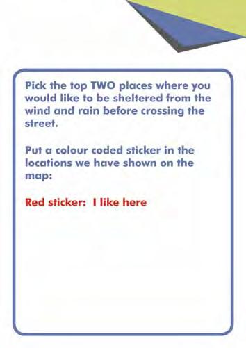
106 9.1 public consultation Result Page 106
3.1 Streetscape Overview
 3.0 Streetscape 3.1 Streetscape Overview Existing streetscape There are four main elements within the streetscape, these include: street lighting, surfacing, street furniture, street trees and planting.
4.0 Open Space and Laneways
 4.0 Open Space and Laneways 4.1 Open Space Overview Existing open space network Currently there is a lack of public open space in the CBD - the only formal public space is Wachner Place, which is not functioning
Market Place Bythell Place Queen Street Park Riverside Park. Public Spaces. Blenheim CBD Streetscape Final Report 36
 37 39 41 43 Market Place Bythell Place Queen Street Park Riverside Park Final Report 36 Market Place Market Place is a key space for Blenheim s street life, it is a meeting place, retail edge and pedestrian
4- PA - LD - LIVELY DOWNTOWN. LD - Background
 4- PA - LD - LIVELY DOWNTOWN LD - Background The downtown has been the service centre for the community since the city s inception and the area continues to supply people with their personal services,
City Centre Plan. Palmerston North SMALL CITY BENEFITS, BIG CITY AMBITION 2018/21. Te Kaunihera o Papaioea Palmerston North City Council
 City Centre Plan Palmerston North SMALL CITY BENEFITS, BIG CITY AMBITION 2018/21 Te Kaunihera o Papaioea Palmerston North City Council Palmerston North City Council City Centre Plan 2 To fulfil the vision
Blood Alley Square/Trounce Alley Redesign
 June 216 Kick-Off Events Questionnaire and Engagement Summary Background The City of Vancouver is redesigning Blood Alley Square and Trounce Alley, important public spaces in the heart of Gastown, which
WEST BLACKHALL STREET PUBLIC REALM + TOWN CENTRE CONNECTIONS Public Exhibition 28 th June 2018
 WEST BLACKHALL STREET PUBLIC REALM + TOWN CENTRE CONNECTIONS Public Exhibition 28 th June 2018 Welcome Introduction Design Your Involvement Thank you for coming Engagement We would like to gather to this
V. Vision and Guiding Principles
 V. Vision and Guiding Principles The Master Plan for the Powers Ferry Corridor seeks a foundation in the desires of the community. At times, various elements of the community offered opposing viewpoints,
Memorial Business Park Site. Proposed Future Development. Design guidelines. August
 Memorial Business Park Site Proposed Future Development Design guidelines August 2014 www.designenvironment.co.nz 0064 3 358 3040 Contents 1.0 Background 1.1 Introduction 3 1.2 Objectives 4 2.0 Context
2.0 Strategic Context 4
 2.0 Strategic Context 4 2.1 The Area Action Plan is a non-statutory plan, which forms a corporate policy document, expressing particular issues and areas of concern while also providing a vision for the
LONG TERM PLAN FEEDBACK FORM
 LONG TERM PLAN 2015-25 FEEDBACK FORM Eastfield submission in support of Council investigating the options for the future of the Civic Administration Building and Ashburton Library COUNCIL WILLS ST Background
Wayfinding. North Gateway: Integrate a vertical gateway marker on the west side of Ward Street at the south corner of Vernon Street.
 3.3.6.2 Wayfinding Existing Conditions Wayfinding signage is important to direct visitors and tourists to different locations in the downtown. A significant part of the wayfinding signage in the downtown
1 October Dear Citizens of Charlotte and Mecklenburg County,
 1 October 2011 Dear Citizens of Charlotte and Mecklenburg County, As co-chairs of the Center City 2020 Vision Plan Steering Committee, we are proud to present the Center City 2020 Vision Plan, which sets
Proposed Stage One Proposed Stage (Pending) Staging. Blenheim CBD Streetscape Final Report 50
 Staging. Blenheim CBD Streetscape Final Report 50") 51 60 Proposed Stage One Proposed Stage (Pending) Final Report 50 Proposed The order of the staging was discussed at length with the project team, community groups, council staff, Marlborough Roads and
51 60 Proposed Stage One Proposed Stage (Pending) Final Report 50 Proposed The order of the staging was discussed at length with the project team, community groups, council staff, Marlborough Roads and
PART AOTEA PRECINCT
 CONTENTS... PAGE AOTEA PRECINCT...4 14.5.1 INTRODUCTION...4 14.5.2 RESOURCE MANAGEMENT ISSUES...4 14.5.3 RESOURCE MANAGEMENT OBJECTIVES AND POLICIES... 4 14.5.4 RESOURCE MANAGEMENT STRATEGY...5 14.5.5
ELK GROVE GENERAL PLAN VISION
 2-1 CHAPTER 2: 2-2 CREATING OUR The Community Vision for Elk Grove, expressed through a Vision Statement and a series of Supporting Principles, is a declaration of the kind of community that Elk Grove
City of Farmington. Downtown Plan. Amendment to the 1998 Master Plan Adopted October 11, 2004
 City of Farmington Amendment to the 1998 Master Plan Adopted October 11, 2004 Introduction Planning Background 1 Scope and Components of the Plan Amendment 2 Concept Introduction 3 Plan Concepts 3 Conceptual
SECTION ONE: INTRODUCTION. introduction
 introduction 1 INTRODUCTION Since it was first established in 1843 as a trading post for the Hudson s Bay Company, Victoria has evolved into a Provincial capital city that is recognized across Canada and
Tauranga City Centre Spatial Framework
 Tauranga City Centre Spatial Framework Stakeholder Engagement Workshop 15 October 2015 Project Design Team Beca & LandLAB Our team Henry Crothers (LandLab) Landscape Architect/Urban Designer Urban and
About Momentum Midland
 About Momentum Midland Achieving a community s full potential in terms of economic development and quality of life is critically important to its long term sustainability. Core to achieving this is a vibrant
Streets for People, Place-Making and Prosperity. #TOcompletestreets
 COMPLETE STREETS FOR TORONTO Streets for People, Place-Making and Prosperity COMPLETE STREETS: A NEW APPROACH A Complete Streets design approach considers the needs of all users people who walk, bicycle,
10 Proposed Redevelopment, Tewkesbury Road, Cheltenham SCHEME EVOLUTION STARBUCKS
 SCHEME EVOLUTION STARBUCKS The proposed Starbucks Drive Thru alongside the proposed food store provides an appropriate mix of uses, suitable for this location. The proposed store is bespoke, designed specifically
97 Lea Bridge Road, Leyton, E10 7QL London Borough of Waltham Forest December 2015
 97 Lea Bridge Road, Leyton, E10 7QL London Borough of Waltham Forest December 2015 Public Realm and Landscape Proposals LEA BRIDGE ROAD, WALTHAMSTOW Public Realm & Landscape Proposals BDP(90)RPT001 December
Next Steps / Development Process. Structure Plan. June submitted to City of Fremantle. Structure Plan. July supported for advertising
 overview What is today about? In July 0, the City of Fremantle resolved that the be advertised for public comment. Today is about: Understanding the history and context of the site Having your say on the
Town Center (part of the Comprehensive Plan)
") Town Center (part of the Comprehensive Plan) Mercer Island Town Center Looking North (2014) In 1994, a year-long process culminated in a set of design guidelines and code requirements for the Town Center
Town Center (part of the Comprehensive Plan) Mercer Island Town Center Looking North (2014) In 1994, a year-long process culminated in a set of design guidelines and code requirements for the Town Center
Topham Mall, Bentham, Pitt and Waymouth Street Place Plan
 The Adelaide City Council invites engagement from the community about Topham Mall, Bentham, Pitt and Waymouth Street Prioritising the top priorities for the area Topham Mall, Bentham, Pitt and Waymouth
THE STORY SO FAR... THE STORY SO FAR...
 THE STORY SO FAR... Levitt Bernstein architects Levitt Bernstein are award winning architects who have designed many successful retail and residential projects. We are specialists in working with local
04Design. Methodology. Future of Jacksons Hill Identifying Potential Uses Building Typology and Adaptability Community Engagement
 Jacksons Hill Adaptive Re-Use Study 25 04Design Methodology Objectives Future of Jacksons Hill Identifying Potential Uses Building Typology and Adaptability Community Engagement Jacksons Hill Adaptive
This Review Is Divided Into Two Phases:
 Semiahmoo Town Centre Review The purpose of this review: To review the Semiahmoo Town Centre Concept Plan, originally approved in 1993, to ensure that this centre will continue to serve the needs of South
Downtown Whitby Action Plan
 Downtown Whitby Action Plan Final Report October 2016 Table of Contents Introduction 1 Public Consultation 2 Walkability 3 Downtown Whitby Walkability Map 4 Vision 5 Goal & Objectives 6 Objective 1 7 Objective
West Blackhall Street Public Realm Public Exhibition
 West Blackhall Street Public Realm Public Exhibition Welcome Introduction Thank you for coming to this public engagement, your input is sought to help to deliver high quality public realm improvements
Vision for Irvine: a self-confident town where people aspire to live and work and which they are proud to call home
 Vision for Irvine: a self-confident town where people aspire to live and work and which they are proud to call home Stunning view out to the harbourside Artist s impression of how the Bridgegate area could
Policies and Code Intent Sections Related to Town Center
 Policies and Code Intent Sections Related to Town Center The Town Center Vision is scattered throughout the Comprehensive Plan, development code and the 1994 Town Center Plan. What follows are sections
Our City Centre is a vibrant, creative and welcoming destination, with a modern business, cultural, shopping, leisure and residential offer
 3. Sheffield in 2034 Our City sits at the heart of a strong, distinctive and internationally successful City Region economy which supports innovation and enterprise Our City Centre is a vibrant, creative
GREENFORD HALL & ADJOINING LAND
 GREENFORD HALL & ADJOINING LAND CONTENTS 1. Introduction 1. Introduction 2. Urban Context 2.1 The Site and Surroundings 2.2 Urban Context Map 2.3 Access and Movement 3. Planning Context 3.1 Planning History
Welcome to the Oakridge Centre Open House
 Welcome to the Oakridge Centre Open House Why is the City hosting this event? This open house is to inform you of a rezoning application submitted to the City of Vancouver to amend the existing CD-1 (Comprehensive
I615. Westgate Precinct
 I615. Westgate Precinct I615.1. Precinct Description The Westgate Precinct is located approximately 18km west of the Auckland city centre. There are seven Sub-precincts in the Westgate Precinct: Sub-precinct
SCHEDULE 12 TO THE DESIGN AND DEVELOPMENT OVERLAY GLEN WAVERLEY ACTIVITY CENTRE STRUCTURE PLAN
 DD/MM/YY Proposed C120 SCHEDULE 12 TO THE DESIGN AND DEVELOPMENT OVERLAY Shown on the planning scheme map as DDO12. GLEN WAVERLEY ACTIVITY CENTRE STRUCTURE PLAN 1.0 Design objectives DD/MM/YY Proposed
LUNDY S LANE COMMUNITY IMPROVEMENT PLAN STUDY
 PUBLIC INFORMATION MEETING #2 October 12, 2016 LUNDY S LANE COMMUNITY IMPROVEMENT PLAN STUDY AGENDA 5:00 to 5:30pm: Open House 5:30 to 6:15pm: Presentation 6:15 to 7:00pm: Individual paced workshop with
PUBLIC RIGHT-OF-WAY IN THIS CHAPTER PUBLIC REALM
 PUBLIC RIGHT-OF-WAY This section provides design guidelines for improvements in the public right-of-way. The public right-of-way refers to streets, sidewalks, non-vehicular thoroughfares, parks and greenways
Waikato Innovation Park Masterplan. 13 NOVEMBER 2015 Prepared for Waikato Innovation Park Limited // Prepared by Beca
 Waikato Innovation Park Masterplan 13 NOVEMBER 2015 Prepared for Waikato Innovation Park Limited // Prepared by Beca Figure 1: Waikato Innovation Park Strategic Context 1 INTRODUCTION 1.1 Waikato Innovation
What We Heard Report: Westmount Architectural Heritage Area Rezoning Drop-in Workshop
 What We Heard Report: Westmount Architectural Heritage Area Rezoning Drop-in Workshop August 2018 What We Heard Report: Westmount Architectural Heritage Area Rezoning Drop-in Workshop Executive Summary
Published in March 2005 by the. Ministry for the Environment. PO Box , Wellington, New Zealand ISBN: X.
 Action Pack Published in March 2005 by the Ministry for the Environment Manatū Mō Te Taiao PO Box 10-362, Wellington, New Zealand ISBN: 0-478-18994-X ME number: 580 This document is available on the Ministry
Appendix H: Easement cross sections
 Appendix H: Easement cross sections SHARED PATH 1.5m FOOTPATH NATURE STRIP 7.3m CARRIAGEWAY 2.7m NATURE STRIP EXISTING PIPELINE 150mm DIA 5.0m (approx.) LOCAL ACCESS ROAD EXISTING PIPELINE 500mm DIA 2.7m
UNIVERSITY TOWN NEIGHBOURHOODS 5.5 HOUSING MELBOURNE CAMPUS MASTER PLAN 2014
 5.5 169 EXISTING CONDITIONS & VISION NEIGHBOURHOOD VISION The provision of on-campus housing into the future will continue to be an important element of the La Trobe University experience. A long-term
WHITELEY TOWN COUNCIL NORTH WHITELEY DEVELOPMENT SEPTEMBER 2014
 WHITELEY TOWN COUNCIL NORTH WHITELEY DEVELOPMENT SEPTEMBER 2014 Dear Resident This Special Edition of the Whiteley Voice which has been prepared in conjunction with the North Whiteley Consortium is to
PART 1. Background to the Study. Avenue Study. The Danforth
 The Danforth 1.1/ Study Purpose & Key Municipal Goals 1.2/ The Local Advisory Committee 1.3/ The Project Team 1.4/ Study Process/Summary of Method 1.5/ Summary of Consultation 1.1 Study Purpose and Key
10.0 Open Space and Public Realm
 10.0 Open Space and Public Realm 10.0 Open Space and Public Realm The Public Open Space System is comprised of: outdoor spaces available for public use that are either publicly owned (e.g., parks and
Schedule of Planning Applications Committee Date: 23 May Reference: 06/17/0726/F Parish: Hemsby Officer: Mr J Beck Expiry Date:
 Schedule of Planning Applications Committee Date: 23 May 2018 Reference: 06/17/0726/F Parish: Hemsby Officer: Mr J Beck Expiry Date: 22-05-2018 Applicant: Proposal: Site: Mr Gillett Change of use to the
Scottish Natural Heritage. Better places for people and nature
 Scottish Natural Heritage Better places for people and nature Contents Summary... 3 SNH approach... 5 Place-making in policy and practice... 6 Developing the contribution of the natural heritage to place-making...
In surveys, Dallas residents say what they want to change most
 NEIGHBORHOODS ELEMENT In surveys, Dallas residents say what they want to change most in the city is its appearance they want it to look beautiful, with trees and pedestrian-friendly neighborhoods. The
THE TOWN OF WASAGA BEACH
 THE TOWN OF WASAGA BEACH Downtown Development Master Plan Committee of the Whole Presentation January 26 th 2017 Uses within this designation should reflect a dependence on tourism as opposed to the permanent
Downtown Streetscape Manual & Built Form Standards
 City of Guelph Downtown Streetscape Manual & Built Form Standards July 2014 Prepared by Brook McIlroy Inc. in association with Unterman McPhail Associates and McCormick Rankin Inc. City of Guelph Downtown
TEMPLE MEDICAL & EDUCATION DISTRICT
 City of Temple, Texas TEMPLE MEDICAL & EDUCATION DISTRICT 1 Description. The City of Temple joined in partnership with key public and private entities to jointly promote education and medical activities
Welcome. Community Consultation Meeting November 28, Review and discuss the Bathurst Quay Neighbourhood Plan Framework
 Welcome Community Consultation Meeting November 28, 2016 Why Are We Here Today? Review and discuss the Bathurst Quay Neighbourhood Plan Framework Review and discuss an Action Plan for Implementation Next
Village Enhancement Scheme Barton under Needwood
 Barton Village Enhancement Scheme Village Enhancement Scheme Barton under Needwood Executive summary May 2014 Village enhancement scheme: executive summary 1 Barton Village Enhancement Scheme Executive
Design Considerations
 Essential to the development of a successful Master Plan for the Park Complex is input from the community that the park will serve. The community outreach component of the planning process included numerous
Chapter 4. Linking Land Use with Transportation. Chapter 4
 Chapter 4 Linking Land Use with Transportation Chapter 4 59 Chapter 4 Linking Land Use with Transportation Community Design and Transportation Program Introduction Since the 1950s, the predominant development
PUTTING THE HEART INTO BATTERSEA. A vision
 PUTTING THE HEART INTO BATTERSEA A vision INTRODUCTION This document is a vision for creating a Battersea that its community can be proud of and it is about putting Battersea on the map. It is being proposed
GREENVALE CENTRAL PRECINCT STRUCTURE PLAN
 76 Conservation area boundary. Low Fence to exclude vehicles but allow pedestrian access Front boundary of allotment 5.0m MINIMUM SETBACK Path providing public access to dwellings fronting Conservation
1.0 Purpose of a Secondary Plan for the Masonville Transit Village
 Report to Planning and Environment Committee To: Chair and Members Planning & Environment Committee From: John M. Fleming Managing Director, Planning and City Planner Subject: Masonville Transit Village
Eastern City District Plan
 OUR GREATER SYDNEY 2056 Revised Draft Eastern City District Plan OVERVIEW Bayside Burwood Canada Bay City of Sydney Inner West Randwick Strathfield Waverley Woollahra Snapshot of the Eastern City District
Land Use Amendment in Southwood (Ward 11) at and Elbow Drive SW, LOC
 at and Elbow Drive SW, LOC") 2018 November 15 Page 1 of 10 EXECUTIVE SUMMARY This land use amendment application was submitted by Rick Balbi Architect on 2017 August 31 on behalf of Sable Developments Ltd, and with authorization from
2018 November 15 Page 1 of 10 EXECUTIVE SUMMARY This land use amendment application was submitted by Rick Balbi Architect on 2017 August 31 on behalf of Sable Developments Ltd, and with authorization from
Welcome. Walk Around. Talk to Us. Write Down Your Comments
 Welcome This is an information meeting introducing the applications for proposed redevelopment of the Yorkdale Shopping Centre site at 3401 Dufferin Street and 1 Yorkdale Road over the next 20+ years,
Chapter 5 Urban Design and Public Realm
 5.1 Introduction Public realm is all areas of the urban fabric to which the public have access. It is where physical interaction takes place between people. It therefore, includes buildings and their design,
38 Queen s University Campus Master Plan Part 1
 38 Queen s University Campus Master Plan Part 1 46 The Campus at the City Scale Chapter 4 The Campus at the City Scale 39 Queen s is an urban University centrally located in Kingston. Decisions made by
Paignton Neighbourhood Plan (Submission version 2017)
") Paignton Neighbourhood Plan (Submission version 2017) Introduction This brief statement covers the views of the TDA, only in relation to its role as adviser to the Council on delivery of town centre regeneration.
Paignton Neighbourhood Plan (Submission version 2017) Introduction This brief statement covers the views of the TDA, only in relation to its role as adviser to the Council on delivery of town centre regeneration.
Ivywild On The Creek PRELIMINARY CREEK DISTRICT MASTER PLAN
 Ivywild On The Creek PRELIMINARY CREEK DISTRICT MASTER PLAN Introduction: Rejuvenating an extraordinary Creekside neighborhood THE CREEKSIDE DISTRICT The Ivywild On The Creek Neighborhood District Master
Town of Cobourg Heritage Master Plan. Statutory Public Meeting
 Town of Cobourg Heritage Master Plan Statutory Public Meeting April 25 th 2016 Presentation Overview 1. Introduction 2. Project background and schedule overview 3. Review of strategic direction content
GREENING THE BOULEVARD Master Plan Concepts for Venice Boulevard between Lincoln and Sawtelle
 GREENING THE BOULEVARD Katherine Spitz Associates Inc. 4212½ Glencoe Avenue Marina Del Rey, CA 90292 310 574 4460 Fax 574 4462 January 2008 Table of Contents Overview Proposed Design Improvements Illustration
Capital works Curtin group centre - central plaza Infrastructure and public space improvements may be
 1 Introduction How is a master plan implemented? When a master plan is finished, the following generally occurs. What is a master plan? A master plan is not a detailed design, but: a process that defines
Proposals for the regeneration of Standard Quay, Faversham, Kent
 Proposals for the regeneration of Standard Quay, Faversham, Kent The purpose of this information is to explain the progress in regenerating Standard Quay and to outline proposals with indicative timescales
PUBLIC REALM STUDY AREA
 WELCOME PUBLIC REALM STUDY AREA WHAT IS PUBLIC REALM? Welcome to the Ballina Town Public Realm public consultation event. Mayo Council is in the process of producing a Public Realm Strategy for Ballina
Sahuarita District & Phase 1 Master Plan. Town Council December 11, 2017
 Sahuarita District & Phase 1 Master Plan Town Council December 11, 2017 Visioning Study Visioning Process Advisory Group Meetings Community Questionnaire Town Center Case Studies Community Analysis The
Port Lavaca Future Land Use
 Port Lavaca Future Land Use Introduction The City of Port Lavaca is beginning to see sustained growth, after many years of relative stable population. New single family homes, apartments, and businesses
WELLINGTON STREET WEST COMMUNITY DESIGN PLAN
 36 3.CDP POLICIES 37 Wellington Street West CDP Vision Statement 38 3.1 Introduction 3.1.1 Purpose The development of buildings and public spaces is influenced by a variety of factors over time. City of
A NEW LOOK FOR THE BISHOP CENTRE. Land Securities. Our environment. Our communities
 Welcome Welcome to this exhibition of our new plans for redeveloping the Bishop Centre. If you have any questions please ask a member of the project team - we look forward to hearing your views. Land Securities
Placemaking Plan. Palmerston North SMALL CITY BENEFITS, BIG CITY AMBITION 2018/21. Te Kaunihera o Papaioea Palmerston North City Council
 Placemaking Plan Palmerston North SMALL CITY BENEFITS, BIG CITY AMBITION 2018/21 Te Kaunihera o Papaioea Palmerston North City Council Palmerston North City Council Placemaking Plan 2 To fulfil the vision
July 12, Columbus City Council City Hall 90 West Broad Street Columbus, OH RE: I-70/71 Columbus Crossroads Project
 OHIO DEPARTMENT OF TRANSPORTATION DISTRICT 6 400 EAST WILLIAM STREET DELAWARE, OHIO 43015 800.372.7714 Columbus City Council City Hall 90 West Broad Street Columbus, OH 43215-9015 RE: I-70/71 Columbus
EXISTING COMPREHENSIVE PLAN
 EXISTING COMPREHENSIVE PLAN Town Center Land Use Element: V. LAND USE POLICIES Town Center Mercer Island's business district vision as described in "Your Mercer Island Citizen-Designed Downtown" was an
Parks Master Plan Implementation: Phase I Waterfront Use and Design REPORT #: September 7, 2016 File #
 0 'O DI Lan-171-14 1 - THE CORPORATION OF THE TOWN OF COBOURG..,. STAFF REPORT TO: FROM: Mayor and Members of Council Dean A. Hustwick, Director of Recreation and Culture DATE OF MEETING: Committee of
WELCOME. Welcome to this public exhibition about the future of the Aylesham Shopping Centre.
 WELCOME Welcome to this public exhibition about the future of the Aylesham Shopping Centre. This exhibition has been organised by Tiger Developments Ltd and members of the project team are available today
SECTION ONE North East Industrial Zone Design Guide Palmerston North City Council June 2004
 SECTION ONE North East Industrial Zone Design Guide Palmerston North City Council June 2004 young heart easy living 1 Preface Industrial areas are a very important component of the economic well-being
A Vibrant Downtown. Chapter 5 Cary Public Art Opportunities 31
 A Vibrant Downtown Cary s vision for Downtown is a unique, vibrant, dynamic, pedestrian friendly location; a regional destination and a place to live, work, and recreate, according to the 2001 Town Center
City of Le Sueur DOWNTOWN MASTER PLAN
 City of Le Sueur DOWNTOWN MASTER PLAN City Council Update 9/11/2017 Hoisington Koegler Group Inc. Presentation Agenda 01 Schedule Update / Tonight s Objectives 02 What We ve Heard - Engagement Comments
PLANNING STATEMENT. Market House Market Place Kingston upon Thames KT1 1JS
 PLANNING STATEMENT To support planning and listed building consent applications for change of use from Class A1 shop and Class A3 cafe to Class A3 restaurant at: Market House Market Place Kingston upon
URBAN DESIGN BRIEF URBAN DESIGN BRIEF 721 FRANKLIN BLVD, CAMBRIDGE August 2018
 URBAN DESIGN BRIEF URBAN DESIGN BRIEF 721 FRANKLIN BLVD, CAMBRIDGE August 2018 DESIGN BRIEF CONTENTS PART A 1.0 INTRODUCTION 2.0 DESCRIPTION & ANALYSIS OF SITE CONTEXT 3.0 DESIGN CONSTRAINTS AND OPPORTUNITIES
Hockessin Community Redevelopment Plan
 Hockessin Community Redevelopment Plan 3.1 Introduction The Community Redevelopment Plan for the Village of Hockessin is the result of the people s vision for a distinct village center that serves as the
Roanoke Rapids Streetscape Master Plan. City Council Presentation
 SCHEDULE: Stakeholder Meeting/Kick off November,2016 Master Planning Phase (November March 2017) Public Meeting #1 December 13, 2016 Review Meeting with Key Stakeholders Refine Concepts Based on Input
Norwich (United Kingdom), 9-10 September 2004
, 9-10 September 2004") THE CONGRESS OF LOCAL AND REGIONAL AUTHORITIES Council of Europe F 67075 Strasbourg Cedex Tel : +33 (0)3 88 41 20 00 Fax : +33 (0)3 88 41 27 51/ 37 47 http://www.coe.int/cplre COLLOQUIES, SEMINARS, FORUMS
THE CONGRESS OF LOCAL AND REGIONAL AUTHORITIES Council of Europe F 67075 Strasbourg Cedex Tel : +33 (0)3 88 41 20 00 Fax : +33 (0)3 88 41 27 51/ 37 47 http://www.coe.int/cplre COLLOQUIES, SEMINARS, FORUMS
LIVEABLE. A diverse and welcoming capital city with an enviable lifestyle and strong community. Liveable City of Adelaide Strategic Plan
 LIVEABLE A diverse and welcoming capital city with an enviable lifestyle and strong community 38 Liveable City of Adelaide 2016-2020 Strategic Plan City of Adelaide 2016-2020 Strategic Plan 39 LIVEABLE
Port Macquarie Town Centre Landscape Architects
 Port Macquarie Town Centre Town Green Master Plan Review Tract Landscape Architects Urban Designers Town Planners A review of the Town Green Master Plan Port Macquarie, New South Wales Prepared by Tract
Urban Design Manual PLANNING AROUND RAPID TRANSIT STATIONS (PARTS) Introduction. Station Study Areas
 Introduction. Station Study Areas") 111111 PLANNING AROUND RAPID TRANSIT STATIONS (PARTS) Introduction The ION rapid transit system will link Waterloo, Kitchener and Cambridge through a central transit corridor (CTC). There are a number
111111 PLANNING AROUND RAPID TRANSIT STATIONS (PARTS) Introduction The ION rapid transit system will link Waterloo, Kitchener and Cambridge through a central transit corridor (CTC). There are a number
Sub-committee on Harbour Plan Review of Harbour-front Enhancement Committee. Ninth Meeting
 Sub-committee on Harbour Plan Review of Harbour-front Enhancement Committee Ninth Meeting Date: 5 October 2005 Time: 3:30pm Venue: Conference Room 15/F, North Point Government Offices, 333 Java Road, North
3.1 community vision. 3.3 required plan elements
 Chapter 3 Community Form 3.1 community vision 3.2 Parks & landscaping concepts 3.3 required plan elements D R A F T 20 Community Form Chapter 3 3.0 Community form 3.1 community vision The Specific Plan
New-Cast Mixed-use Development Proposal King Street West, Newcastle, Ontario
 URBAN DESIGN BRIEF New-Cast Mixed-use Development Proposal King Street West, Newcastle, Ontario TABLE OF CONTENTS: 1.0 Executive Summary 2.0 Creating Vibrant and Sustainable Urban Places: Excerpts from
22.15 OUTDOOR ADVERTISING SIGNAGE POLICY
 22.15 OUTDOOR ADVERTISING SIGNAGE POLICY This policy applies to all land where a planning permit is required to construct or display a sign under the provisions of the Kingston Planning Scheme. 22.15-1
WELCOME and introduction
 1 WELCOME and introduction Mobility Hub Locations within Burlington STUDY OVERVIEW STUDY OBJECTIVES The City of Burlington is developing four Area Specific Plans, one for each of Burlington s Mobility
Section 4 - Public Realm & Landscape proposals Landscape Masterplan. Section 4 52
 - Public Realm & Landscape proposals Landscape Masterplan 52 Proposed Masterplan - Green Infrastructure Strategy District Park 4.33 Ha to provide Passive and active recreation with a large play area which
DOWNTOWN VISIONING FORUM AGENDA JUNE 5, 2014
 DOWNTOWN VISIONING FORUM AGENDA JUNE 5, 2014 Welcome and Introductions Evolution of the Downtown Proposed Downtown Plan Overview and Process Have Your Say! Next Steps Closing Comments 1 WELCOME & INTRODUCTIONS