WATERFRONT LAND USE PLANNING SURVEY FEBRUARY 2014 DRAFT
|
|
|
- Spencer Bennett
- 5 years ago
- Views:
Transcription


1 WATERFRONT LAND USE PLANNING SURVEY FEBRUARY 2014 DRAFT
2 acknowledgments Tija Dirks, Ministry of Transportation Larry Field, Toronto Region Conservation, Waterfront Specialist (Retired) Ken Forgeron, Region of Niagara Planning (Retired) Ruth Marland,Strategic Leader, City Strategy and Innovations Division Anne McIlroy, Principal, Brook McIlroy Bob Short, Planning Director, Town of Whitby Marina Janakovic, Planning Student Volunteer

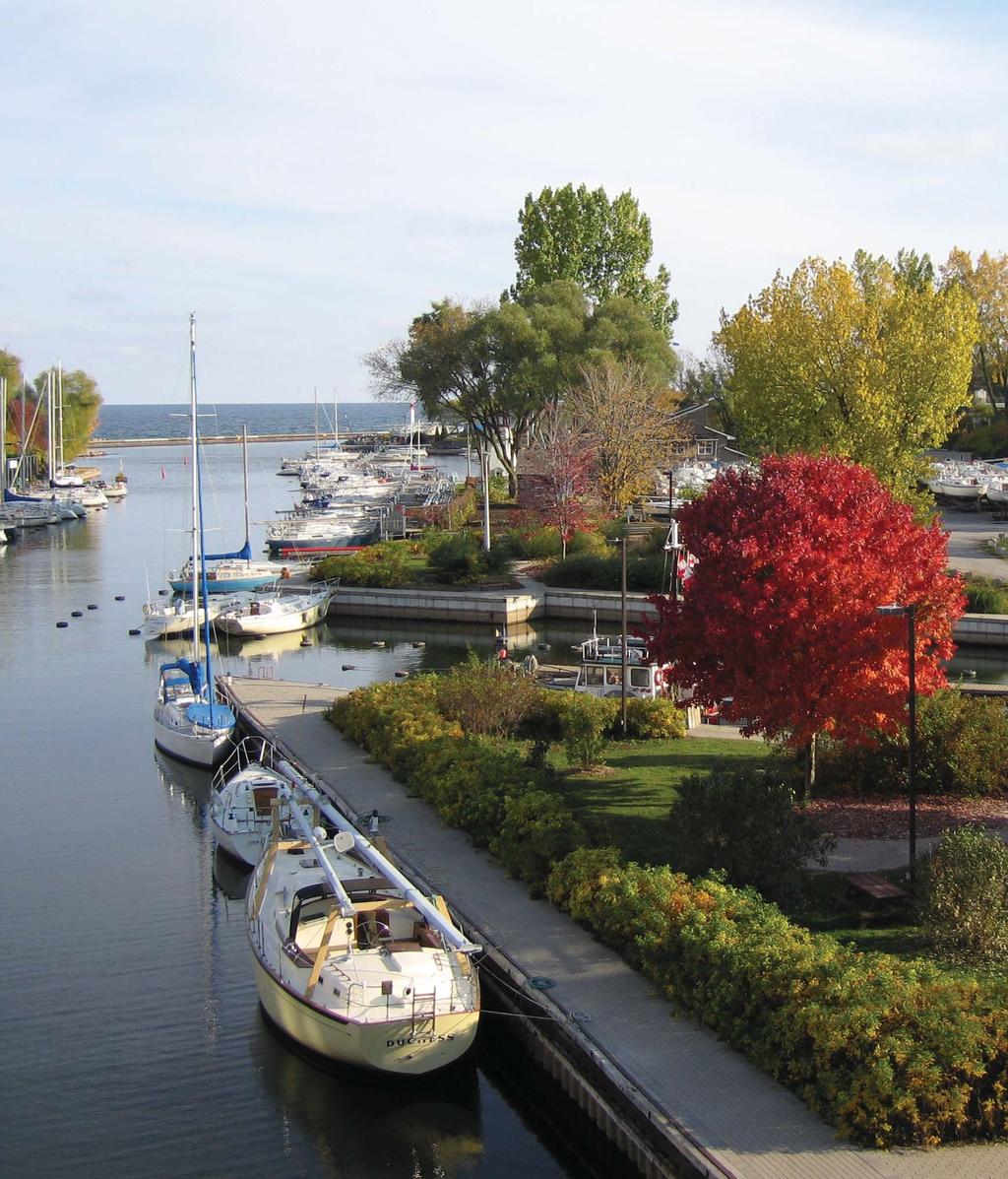
3 Humber Bay Shores

4 table of contents Executive Summary 7 1 Introduction 8 2 Survey Findings 10 3 Lessons Learned 16 4 Conclusion 21 Appendix A: Case Studies 22 Appendix B: Links to Precedent 28 Planning Documents

5 Burlington 6 Waterfront waterfront Regeneration Trust / Brook McIlroy
6 EXECUTIVE SUMMARY The Waterfront Regeneration Trust and Brook McIlroy undertook a Land Use Planning Survey of communities along the Lake Ontario and St Lawrence River waterfronts in December 2013 January In total, 46 community partner planning departments responded to the survey. Of the respondents, 74% represent communities on Lake Ontario and 26% represent communities on the St Lawrence River. In addition, four case studies were conducted of Oshawa, Mississauga, Grimsby and Prescott. Each of these communities has a different experience with waterfront land use planning and policy development, offering lessons for other municipalities. Key findings from the Land Use Planning Survey are summarized below. 1. Waterfront and Trail Visions Waterfront visions continue to emphasize public access and the other principles of the Regeneration report. Municipalities have more commonly articulated a vision for the waterfront and public access as a whole than for the Waterfront Trail specifically. Rural municipalities less commonly have a vision for the waterfront, public access or the Waterfront Trail in place, compared with larger communities. 2. Tools and Processes The most effective and common policies or tools used to realize waterfront and Waterfront Trail objectives are Council Strategic Plans, Official Plans, Zoning and Master Plans. Master Plans are critical to ensuring a balance between community goals for preserving waterfront access and natural heritage with goals for investment and development to create waterfront vitality. Development controls help to enhance public access to the waterfront and extend the trail as close to the water s edge as environmentally feasible. Tools include zoning, setback requirements, parkland dedication, design guidelines, site plan approval, etc. 3. Partnerships Almost all respondents mentioned the importance of partnerships in achieving waterfront objectives. Partnerships with Conservation Authorities, community groups, government agencies and divisions within municipalities are important to furthering waterfront goals and securing/ sharing funding. Landowners may have different mandates for land use and development compared with the municipality, which can prove challenging for the establishment and implementation of a common vision. 4. Funding and Taking Action on Waterfront and Trail Enhancement Major obstacles to waterfront enhancement are lack of funding and staff time. Many municipalities (65%) do not have funding arrangements in place for waterfront planning or projects. Approximately half of communities that have a vision for the Trail are taking action on Trail enhancement. In contrast, action is only being undertaken in 5% of communities that do not have a vision in place. Waterfront Land Use Planning Survey 7
7 1 INTRODUCTION 1.1 The Waterfront Regeneration Trust The Waterfront Regeneration Trust (WRT) was established in 1992 to protect and enhance the waterfronts of Lake Ontario and the St Lawrence River. Its mandate is to implement the recommendations contained in Regeneration, the Final Report of the Royal Commission on the Future of the Toronto Waterfront. This report, released in 1992, sparked a new era of waterfront stewardship and led to municipal action to protect and enhance the waterfront, including the creation of the Waterfront Trail. Regeneration played a significant role in changing planning practices to incorporate an ecosystem approach to watershed management and the WRT s nine waterfront principles: clean, green, connected, open, accessible, usable, diverse, affordable and attractive. From establishment until 2012, the WRT established a 720 km long Waterfront Trail along Lake Ontario and the St Lawrence River, working with 41 municipalities and other partners to implement policies, plans and projects that enhance waterfront sustainability and shoreline health. Though the WRT is now smaller in size than it was when first established, it is embarking on a new era of strategic planning along Ontario s waterfronts. In 2013, the WRT expanded the trail to Lake Erie and Lake St Clair, engaging with 27 new municipalities and extending the Trail by 620 km. The WRT plans to expand to the remaining Great Lakes in the coming years. 1.2 The Waterfront Land Use Planning Survey Purpose The Waterfront Land Use Planning Survey was developed to document and improve understanding of the current policy framework shaping the management and enhancement of our shared waterfront. The intent is to learn lessons to inform the development of new policies or initiatives, especially for new partners. The survey will also share and promote experiences, successes and challenges among partners to strengthen the goal of protecting and enhancing Ontario s waterfronts Scope and Participants This report is based on the survey responses from municipal partners, as well as four case studies conducted on waterfront communities. In total, 46 surveys were completed by community partner planning departments. All respondents are in the Lake Ontario and St Lawrence River segment of the Waterfront Trail, as these communities have the longest history of working with the WRT. Overall, 74% of the respondents are from communities on Lake Ontario, while the remaining 26% of communities are on the St Lawrence River. Planning and land use policies affect both the Waterfront Trail specifically and the broader waterfront area in general, and questions in the survey addressed both. The WRT is interested both in understanding policies and tools that result in general waterfront enhancement and greater public access, and in extension and connection of the Trail as close to the water s edge as environmentally feasible. 8 Waterfront Regeneration Trust / Brook McIlroy
.")
8 1.3 Character of the Waterfront Trail and Waterfront Communities The character of waterfront communities and the Waterfront Trail reflect the diversity of conditions found in Ontario. Waterfront communities range from large urban centres to rural communities, though most are smaller urban centres (Chart 1). Chart 1: Character of Respondent Communities The Waterfront Trail runs through 41 communities on Lake Ontario and the St Lawrence River. Though the goal is to ultimately establish an off-road waterfront trail close to the water s edge, it is currently primarily on a shared road. All communities have a mix of levels of public access along their waterfronts. Small Towns and Urban communities seem to have slightly larger portions of more frequent access to the water s edge than Large Urban or Rural communities. In all communities, the trail traverses both public and private lands. Importantly, in over 50% of communities, % of the trail traverses public lands, offering key opportunities for public access and improvement. Part of the Waterfront Trail is on shared roads, while other sections are on dedicated, off-road paths Waterfront Land Use Planning Survey 9
9 2 SURVEY FINDINGS Survey questions explored municipal visions for the waterfront and Waterfront Trail, tools and processes being used by municipalities, and planned goals and actions for enhancing the waterfront or Trail. Findings are summarized in the following section. Rural communities less commonly have a vision in place for the waterfront, public access or the Waterfront Trail, compared with larger-sized communities. Chart 3 illustrates the percentage of communities, by size, that have visions in place. 2.1 Waterfront Visioning The majority of respondents articulated a vision for the waterfront (82%) and for public waterfront access (89%), while just over half (55%) articulated a specific vision for the Waterfront Trail (Chart 2). Chart 3: Percent of Communities with Waterfront or Trail Visions, by Community Size Percent of Respondents Chart 2: Percent of Respondents with Vision in Place Percent of Respondents 0% 20% 40% 60% 80% 100% Large Urban Centre (pop. >200,000) Urban (pop. 20, ,999) Vision for Waterfront Small Town (pop. 10,000-19,999) Vision for Public Waterfront Access Rural (pop. <10,000) Vision for Waterfront Trail % With Vision for Waterfront % With Vision for Public Access % With Vision for Trail Yes No 10 Waterfront Regeneration Trust / Brook McIlroy

10 Waterfront and Trail vision statements most commonly mention public access as a key objective. They also refer to other principles expressed in the Regeneration report, including: Land/shoreline stewardship protection of water, ecological functions, conservation, etc. Clean and green Continuous and connected Trail for biking and walking Recreational opportunities 2.2 Waterfront Enhancement Tools & Processes Tools & Processes A wide range of tools are used by communities to undertake general waterfront enhancement. The most common tools are the: 1. Official Plan (91% of communities) 2. Council s Strategic Plan or Priorities (60% of communities) 3. Zoning (60% of communities) For the Waterfront Trail, respondents reported that the most commonly used tools are the: 1. Official Plan (86% of communities) 2. Council s Strategic Plan or Priorities (76% of communities) 3. Master Plans (54% of communities) These are also the tools that respondents felt had been most effective in the implementation of waterfront and Trail enhancement goals. A large portion of the Waterfront Trail in Ajax is within waterfront parkland Waterfront Land Use Planning Survey 11

11 Other tools that are less commonly used by communities, but still play an important role include: Secondary Plans Shoreline Management Plans Policies on land acquisition Transportation/Active Transportation Plans Policies on parkland dedication City/town-wide policies related to parks and trails Development controls, design guidelines and public access/easement requirements Presence of strategic partnerships Policies on downtown revitalization or special character areas Creation of Land Trusts for parkland/wildlife reserves Lease agreements for public access/park use on lands not owned by the municipality As the Toronto central waterfront evolves, the Trail is being integrated as a key feature throughout (Trail near Sugar Beach) Case Study: Grimsby The Winston Neighbourhood Secondary Plan provides the planning framework for future development in the west end of Grimsby, along Winston Road. Anticipation of this new development and interest in several large sites in the area is a catalyst for more detailed waterfront master planning. Public access to the waterfront in the west end of Grimsby is currently fragmented. Anticipating future development along the waterfront, Grimsby has identified specific requirements for public access and the Trail through the Winston Neighbourhood Secondary Plan and the Official Plan. It requires a 30m wide promenade along the water s edge, as well as a 5m wide Trail. Much of the waterfront is privately owned, including several large landowners. As a result, when redevelopment occurs, the opportunity for public access is significant. The Town is examining options for appropriate massing and density on these sites to create larger spaces for public access and clearer vistas to the lake. Where land is not expected to be redeveloped, the Town is examining options for a connected Trail. For example, the Town is currently coordinating with the Hamilton Conservation Authority and the Department of National Defence to explore access on their lands. In both cases, extension of the Waterfront Trail is challenged due to the need for controlled or restricted access. Other lands, like those owned by Rogers and the Ukrainian Church, are prime tender fruit and grape lands, which also limits the likelihood that they will be redeveloped. Coordination with these partners to arrange for partial or temporary access will be an important part of strengthening the Waterfront Trail throughout this area. 12 Waterfront Regeneration Trust / Brook McIlroy
12 2.2.2 Funding Respondents reported that few communities had a funding source available for land acquisition or funding from municipal or other levels of government (Chart 4). Chart 4: Percent of Respondents with Funding in Place 65% 35% Partnerships % of Communities with Funding Arrangement % of Communities with No Funding Arrangement Almost all respondents mentioned the importance of partnerships within municipal government, with external agencies or with community groups. In many cases, these partnerships are important for securing or sharing funding for waterfront initiatives. Some key partners include: Conservation Authorities Public agencies/institutions with land holdings Upper tier/lower-tier municipalities where this structure exists St Lawrence Parks Commission Intra-municipal committees Community groups, volunteers and property owners Case Study: Mississauga, Inspiration Lakeview In 2010, the City of Mississauga undertook a Visioning Study for Inspiration Lakeview. The study examines redevelopment opportunities on the provincially-owned former Lakeview Generating Station. The study area is a 245 acre brownfield site that is adjacent to employment lands and other industrial uses. As a result, it has been inaccessible to the public for over 100 years. The site is currently being studied with the aim of transforming it into an accessible green waterfront asset. Community activism has been an important part of the success of Inspiration Lakeview thus far. Momentum for the project began with the community. Lakeview Legacy, a community group, was started in 2006 and argued that with the demolition of a coalfired plant at Lakeview, it should be replaced with alternative uses that provide access and community benefit. The group gained municipal support and provincial political champions, as well as widespread public support, leading the City to direct staff to undertake a Visioning study. Coordination with OPG and the Province has been a key challenge. When visioning for the site began, OPG was not an active partner. In 2010, the City of Mississauga, OPG and the Province began discussions on a Memorandum of Understanding to establish a common approach to planning and development on the site. Both OPG and the City of Mississauga are making a concerted effort to work together to ensure that their respective mandates are fulfilled. Waterfront Land Use Planning Survey 13

13 2.3 Actions to Enhance the Waterfront and Waterfront Trail Though the Waterfront Trail is in place along the St Lawrence River and Lake Ontario, improvements are being made to enhance it and bring it closer to the water s edge. Municipalities are also taking action on a range of capital projects, policy tools and land acquisition initiatives. The majority of respondents indicated that their communities are currently undertaking specific actions to enhance the waterfront (63% of communities) and Waterfront Trail (57% of communities). Chart 5: Percent of Communities Undertaking Actions on Waterfront and Trail Enhancement % of Communities Taking Action on Waterfront Enhancement Percent of Respondents 0% 20% 40% 60% 80% 100% Compared with Large Urban Centres, Urban communities and Small Towns, Rural communities report having fewer plans in place to take action on Trail enhancement (Chart 6). % of Communities Taking Action on Trail Enhancement Yes No Chart 6: Percent of Communities Undertaking Actions on Waterfront Trail Enhancement, by Community Size Percent of Respondents Large Urban Centre (pop. >200,000) Urban (pop. 20, ,999) Small Town (pop. 10,000-19,999) Rural (pop. <10,000) Cranberry Marsh, in Whitby, is part of a large conservation area of the waterfront % Undertaking Specific Action to Enhance Trail 14 Waterfront Regeneration Trust / Brook McIlroy

14 Marina Case Study: Prescott Waterfront Planning for waterfront enhancement in Prescott has required a long-term commitment. In 2005, the Town of Prescott adopted a Downtown Design & Urban Design Guidelines document, which included recommendations for its waterfront. In , a follow-up study focusing on the waterfront was undertaken. As a result of these studies, for the past seven years, the Town has set aside $100,000 per year for waterfront projects that are only now being constructed. The Town has integrated waterfront planning quite closely with downtown planning, and sees the waterfront as an element of downtown revitalization. As a result, the waterfront trail links to parks, attractions and sites to the east and west, as well as north to the downtown. This has benefits for project implementation and funding, as additional budget has been allocated to the waterfront in support of the Town s downtown revitalization objectives. The waterfront is considered a prime location for new development and is part of the Town s plan for growth management. While municipal planning policy does not address the Waterfront Trail specifically, it does provide clear direction for new development on the waterfront. Setbacks along the waterfront are identified in the Official Plan and Zoning By-Law to ensure that any new development includes public access to the waterfront. Although the Trail is not identified in municipal policy, it was included at the water s edge as part of the Waterfront Master Plan because the team considered it a priority. Waterfront Land Use Planning Survey 15

15 Actions communities are undertaking most commonly include: Studies waterfront studies, shoreline management studies, master plans /district plans, etc. Capital projects and trail extension/wayfinding Financial/strategic partnerships Tools for development control Land acquisition Approximately half of the communities that have a Trail vision in place are taking action on Trail enhancement. In contrast, action is only being undertaken by 5% of communities that do not have a vision in place (Chart 7). Communities that are not undertaking action on waterfront enhancement cited an already complete trail, or lack of staff time and financial resources as the key reasons. Respondents from Upper Tier municipalities also noted that Trail construction is the mandate of Lower- Tier governments, which is why they are not undertaking specific actions. Chart 7: Comparison of Communities with and Without Trail Vision and Taking Action on Trail Enhancement Percent of Respondents Communities with Vision and Taking Action 51 Communities with No Vision but Taking Action 5 % of Communities Waterfront Trail in Cornwall 16 Waterfront Regeneration Trust / Brook McIlroy

16 3 LESSONS LEARNED Analysis of survey responses and case studies reveal some important lessons for current and future WRT partners. Waterfront Visioning Regeneration and its vision for Lake Ontario s waterfront has clearly had a lasting impact on waterfront planning and visioning. Public access remains a central objective for waterfront communities. Other common elements of waterfront visions emphasize the need for a continuous and connected trail for biking and walking, a protected shoreline and more recreational opportunities near the water. Though most municipalities have established a vision for their waterfront, just over half have developed a vision specifically for the Waterfront Trail. Importantly, very few communities that do not have a vision for their Trail are taking specific action on Trail enhancement. In spite of this, some communities without a specific vision for the Trail have reflected the WRTs vision for a trail close to the water s edge in their plans and policies. Some survey respondents noted that the Waterfront Trail may instead be embedded within planning documents like Official Plans, Zoning By-Laws and Master Plans. Others noted that staff support for establishing a Trail at the water s edge has resulted in its inclusion in projects and capital planning, even where no explicit vision exists. Beachfront Park in Pickering Waterfront Land Use Planning Survey 17

17 Rural municipalities, in particular, have less commonly established waterfront or Trail visions than their larger counterparts. These findings suggest that rural municipalities may require further support for developing visions for their waterfronts and Trails. As strong policy direction appears to be important in achieving waterfront enhancement goals, the adoption of a specific vision for the Waterfront Trail may help communities strengthen the policy basis for trail development, explicitly formalize trail objectives and result in more action on Trail enhancement. Planning and Policy Framework Embedding waterfront enhancement in high level planning documents and policies has been critical to action on waterfront enhancement. Respondents noted that Official Plans and municipal Strategic Plans were the two most effective and commonly used policies. These documents are endorsed at the highest level of municipal government and provide direction for more specific policy development and implementation, as well as the assignment of funding to related studies and projects. Role of Private Development Many respondents described the importance of private development in realizing goals for waterfront enhancement, public access and trail development. Most communities face the challenge of balancing community goals for preserving waterfront access and natural heritage with goals for investment and development to promote waterfront vitality. The experience of many communities shows that these two objectives can be mutually supportive. In many communities, further action on waterfront enhancement or moving the Trail closer to the water s edge is contingent on property redevelopment. It is important to establish development controls ahead of time to ensure that access will be guaranteed when this redevelopment occurs. Development controls also help to encourage investment, as they provide more certainty and predictability in the development approvals process. Most municipalities use a range of policies and tools to encourage and regulate waterfront investment and enhancement. In addition to polices specifically directed at the waterfront, city- or town-wide policies on parks, cycling infrastructure and trails may also impact waterfront initiatives. A clear, high-level vision helps to ensure that all of these policies are mutually supportive and ensures that resources are directed coherently. 18 Waterfront Regeneration Trust / Brook McIlroy The character of the Waterfront Trail is as diverse as the communities along Lake Ontario and the St Lawrence River

18 Case Study: City of Oshawa The Oshawa Harbour is currently inaccessible to the public. In addition to planning undertaken as part of the Waterfront Master Plan, the Port Authority has also developed a land use plan for the Harbour. However, differing mandates and priorities for waterfront use means that further collaboration to agree on a vision and approach to development is needed. The settlement agreement with the Federal Government that transferred lands to the City requires that the municipality clean up the lands and begin th process of opening access to the public within three years. The City is now embarking on this process. In additional to funding from the Federal Government, Council contributes to a Harbour Development Reserve for future improvements. Master Planning will be key to managing development and achieving the waterfront vision in this area as it develops. Waterfront access also includes naturalized lands in Second Marsh and McLaughlin Bay Wildlife Reserve. The Reserve is owned by General Motors, who manages the land and permits public access. This important collaboration with a large private landowner opens a large segment of natural habitat to the public. The restaurant, outdoor skating and splash pad of the Burlington Waterfront Centre are popular destinations along the Waterfront Trail Waterfront Land Use Planning Survey 19

19 Trail improvements will make Iroquois Beach in Whitby more accessible for year-round enjoyment Processes and tools noted by respondents that ensure that private development supports waterfront objectives include: Undertaking studies waterfront studies, environmental studies, master plans/district plans, etc. Inclusion of the Trail and public access in zoning or other development controls (eg. setback requirements, easements, parkland dedication requirements for public road allowances) and implementation through the site plan approval process Urban design guidelines (eg. limiting residential density and visual impact of structures, ensuring that commercial uses at the waterfront are tourism-oriented) Integrating waterfront planning with other initiatives (eg. parks, downtown revitalization, protection of Character Areas, etc.) Funding and Land Acquisition Availability of funding and staff time are two of the key challenges that respondents face in taking action on waterfront enhancement. Approximately 35% of respondent communities have a funding arrangement for land acquisition or another source of funding in place. 20 Waterfront Regeneration Trust / Brook McIlroy

20 Key financial and acquisition strategies identified by respondents include: Use of Development Charges to fund Trail extension Dedication of waterfront lands or requirements for public access as a condition of land development approvals Land transfers from federal/provincial government Long-term allocation of municipal budgets to build up adequate resources Establishment of a Community Improvement Plan to fund waterfront enhancements, especially on brownfield sites Establishment of long-term acquisition plans for private property Linking waterfront enhancement with other community development goals to share funding - investment in community services and facilities, downtown revitalization, etc Creation of land trusts for parkland/wildlife reserves Lease agreements for public access/park use Partnerships A common theme that emerged in survey responses and case studies was partnerships and their role in achieving waterfront objectives. There are generally three types of partnerships: Community groups, volunteers and property owners including groups dedicated to other natural trail or parks systems (eg. Greenbelt Cycling Route, Durham Trail Coordinating Committee) Government agencies and other levels of government eg. Conservation Authorities, St Lawrence Parks Commission, Province of Ontario, Infrastructure Ontario, Ontario Power Generation, Coast Guard, Upper Tier Municipalities Intra-municipal working groups or committees eg. Municipal Cycling Office, Trails Committee, Waterfront Committee, Planning and Economic Development Committee The Port Union Waterfront Park extends the Waterfront Trail, improves recreational access to the waterfront and enhances shoreline protection and natural habitats Waterfront Land Use Planning Survey 21

21 In some cases, community action and activism has been critical in gaining public and political support for waterfront enhancement. Survey respondents also noted that cooperation with landowners has, in some cases, resulted in agreements to create public access along the waterfront. Nurturing these relationships can strengthen support for waterfront initiatives and alternatives to costly land acquisition. Public-sector partners also play a critical role in places where waterfront lands are publicly held. For example, local and upper tier municipalities may work together to collectively establish parklands or extend the natural heritage system. Collaboration can be challenging, however, where partners may have different mandates and aims than municipalities. Support from public agencies or partners is critical, especially as more waterfront lands become available for redevelopment. Early buy-in and agreement on common waterfront objectives may help to set the stage for successful collaboration. 22 Waterfront Regeneration Trust / Brook McIlroy The marina, restaurant, waterfront piers and proximity to the village main streets contribute to this vital, mixed-use area on the lake in Mississauga

22 4 CONCLUSION Communities along Lake Ontario and the St Lawrence River have been active in waterfront enhancement for over 20 years. The principles first articulated in Regeneration continue to be reflected in local waterfront visions - to create a publicly accessible, clean, green and connected waterfront. Though many municipalities have a vision in place for their waterfronts and public access, they may require additional support in articulating a vision for the Waterfront Trail. Rural municipalities, which are less likely to have visions in place compared with larger counterparts, may require the most support. Embedding waterfront and Waterfront Trail objectives in high-level planning documents is an important first step. Direction from Council leads to the allocation of funding and other support towards relevant studies, policies and projects. Master plans and development controls are among the most important and effective tools that municipalities use to realize waterfront visions, leverage private development to achieve public aims and balance competing interests for waterfront land. Implementation tools, such as zoning and design guidelines, play a key role in regulating development both on private and public lands. They help to balance and codify community goals for preserving waterfront access and natural heritage with goals for investment and development to create waterfront vitality. Finally, they also provide more certainty and predictability in the development process by clearly outlining requirements, expectations and objectives. Almost all respondents mentioned the importance of partnerships in achieving waterfront objectives and securing or sharing funding for waterfront initiatives. Establishment of a common vision and objectives among partners, however, may prove challenging but is crucial to the successful development and implementation of plans. Communities continue to face challenges with adequate resources and staff time to dedicate to waterfront projects, but strong policy direction and partnerships can help to secure or share funding. Linking waterfront development with other strategic goals and developing a long-term plan for funding and land acquisition are critical to the successful implementation of plans. The lessons learned by the first generation of WRT partners are useful as the Trail is extended along Lake Erie, Lake St Clair and the remaining Great Lakes. Collaboration with partners, supportive high-level planning policies and the development of clear visions, objectives and implementation tools will be key to the success of this new wave of communities. The connection with the water is as important as connections with communities Waterfront Land Use Planning Survey 23
23 APPENDIX A: CASE STUDIES Four communities were identified for case studies, based on specific challenges and experiences with waterfront planning and policy development. These case studies offer significant lessons for other waterfront communities. Town of Grimsby Description of Project In September 2013, the Town of Grimsby launched a Master Plan process to develop a vision for the West End Waterfront from Fifty Point Conservation Area to the Regional Pumping Station (see map on opposite page). This process is intended to refine policies contained in the Winston Neighbourhood Secondary Plan, completed in It will recommend a location and design for the Waterfront Trail and waterfront amenities, as well as guidelines for future development on the waterfront. The West End Waterfront Master Plan and Trail Study will be complete in early Key Elements of Waterfront Enhancement The Winston Neighbourhood Secondary Plan anticipates future development in the west end of Grimsby, along Winston Road. Anticipation of this new development, as well as interest in several large sites in the area, acted as a catalyst for more detailed waterfront master planning. The current Master Plan visioning process calls for a connected trail along the water s edge. It also considers protection and enhancement of natural heritage features and habitats, active use of the water s edge and design strategies to ensure high quality development in the public and private realm. Successes and Challenges Public access to the waterfront in the west end of Grimsby is currently fragmented, with limited access points to the water s edge. The largest area of public access today is in Fifty Points Conservation Area. Anticipating future development along the waterfront, Grimsby has identified specific requirements for public access and the Trail through the Winston Neighbourhood Secondary Plan and the Official Plan. The Trail currently runs predominantly on shared roads. For the past decade, however, the Town has required public access along the waterfront when private development occurs, calling for a 30 metre wide promenade along the water s edge, including a 5 metre wide Waterfront Trail. 24 Waterfront Regeneration Trust / Brook McIlroy


24 The Town intends to use Development Charges associated with the Winston Neighbourhood for waterfront and Trail initiatives. The Region of Niagara is also currently finalizing a Lakefront Enhancement Strategy, which may allocate Regional funds for local waterfront enhancement initiatives. Much of the waterfront is privately owned, including several large landowners. As a result, when redevelopment occurs, the opportunity for public access is significant. There are several large sites in West End Grimsby where the Town anticipates future development, including Place Polonaise and the Fifth Wheel Truck Stop. The Town is exploring options for appropriate massing and density on these sites to create larger spaces for public access and clearer vistas to the lake. Where land is not expected to be redeveloped, the Town is examining options for a connected Trail. For example, the Town is currently coordinating with the Hamilton Conservation Authority and the Department of National Defence to explore access on their lands. The Department of National Defence owns a shooting range adjacent to Fifty Point Conservation Area. In both cases, extension of the Waterfront Trail is challenged due to the need for controlled or restricted access. Other lands, like those owned by Rogers and the Ukrainian Church, are prime tender fruit and grape lands, which also limits the likelihood that they will be redeveloped. Coordination with these partners to arrange for partial or temporary access will be an important part of strengthening the Waterfront Trail through this area. Study Area Map for the West End Waterfront Master Plan (Photo Credit: lezumbalaberenjena, flickr) Waterfront Land Use Planning Survey 25

25 City of Mississauga - Inspiration Lakeview Description of Project In 2010, the City of Mississauga undertook a Visioning Study for Inspiration Lakeview. The study examines redevelopment opportunities on the provincially-owned former Lakeview Generating Station. The study area is a 245 acre brownfield site that is adjacent to employment lands and other industrial uses. As a result, it has been inaccessible to the public for over 100 years. The site is currently being studied with the aim of transforming it into an accessible green waterfront asset. The land is owned by Ontario Power Generation (OPG), so planning for the site has involved the Province of Ontario, Infrastructure Ontario and OPG. Community involvement and support was critical in catalyzing the project, gaining political support at the municipal and provincial levels and entrenching the importance of public access in the planning process. As the Visioning Process has completed, the City is now embarking on a more detailed Master Planning process. Key Elements of Waterfront Enhancement The vision for Lakeview centres on the creation of a green public realm along the waterfront. It includes a network of public spaces, a connected Waterfront Trail, a model sustainable community, a mix of uses and densities, and integration of innovative sustainable technology. It envisions the extension of canals and establishment of open space connected with new mixeduse development. A major cultural hub and institutional development are also included on the site of the former generating station. Model developed as part of the Inspiration Lakeview Visioning Study 26 Waterfront Regeneration Trust / Brook McIlroy
26 The City is also working with the Credit Valley and Toronto and Region Conservation Authorities on the Lakeview Waterfront Connection, which is examining the feasibility of using lake-fill to create a new waterfront link along the southern edge of the site to Marie Curtis Park. Successes and Challenges A number of issues to do with planning on this site are relevant for other waterfront communities with major brownfield lands, including coordination with other levels of government and agencies, the role of community partnerships in moving the vision forward, and issues with land use planning and funding. Community activism has been an important part of the success of Inspiration Lakeview thus far. Momentum for the project began with creation of Lakeview Legacy, a community group, in The group argued that the planned demolition of the coal-fired power plant at Lakeview presented an opportunity to use the site in new ways that would provide access and community benefit. The group gained municipal support and provincial political champions, as well as widespread public support, leading Council to direct staff to undertake a Visioning study. Strong direction from City Council and the City s Strategic Plan established a mandate for public access and environmental stewardship in the visioning process. The Official Plan supports extending and enhancing the Waterfront Trail and the City has required public access as part of any new development on the water s edge for the past two decades. As a result, public access and the trail are fully integrated in Inspiration Lakeview. Coordination with OPG and the Province has been a key challenge. When visioning for the site began, OPG was not an active partner. In 2010, the City of Mississauga, OPG and the Province began discussions on a Memorandum of Understanding to establish a common approach to planning and development on the site. Both OPG and the City of Mississauga are making a concerted effort to work together to ensure that their respective mandates are fulfilled. To date, funding for the work has come solely from the City with a grant through the Federation of Canadian Municipalities. At the Vision stage, there was limited environmental information but as the planning has proceeded and agreements have been reached with the Province and OPG, the available environmental information and necessary studies are underway to determine the extent and scale of environmental remediation that may be required as well as what type of development will be environmentally and economically feasible. Issues of jurisdiction will continue to be a challenge through the Master Planning process, as issues of land ownership, land transfer and environmental remediation will arise in the implementation phases. Finally, the City is studying the use and redevelopment of employment lands through the Master Plan process. Redevelopment of older employment lands in close proximity to the waterfront may create the opportunity for more strategic uses in this location. However, Mississauga, like most municipalities, faces the need to balance retention of jobs and employment lands with pressure for revitalization, development and growth management. The City, therefore, will be working to understand how intensification, mixing of uses or re-designation of lands may take place. Waterfront Land Use Planning Survey 27
27 Town of Prescott Description of Project In 2005, the Town of Prescott adopted a Downtown Design & Urban Design Guidelines document, which included recommendations for its waterfront. In , a follow-up study focusing on the waterfront was undertaken. It produced a Master Plan for the waterfront from Sandra S. Lawn Harbour to the Canadian Coast Guard site. Waterfront development was also identified as a priority in the Council s Strategic Plan. The Town is currently embarking on a $2.5 million waterfront park construction, to be completed in Key Elements of Waterfront Enhancement The Master Plan for the Prescott Waterfront focuses on the development of a new park to the west of the existing marina, as well as trail extensions linking with the existing Waterfront Trail along the water s edge. It identifies east-west connections to other parks and key destinations, and north-south connections to the downtown. The plan also includes a new Market Square, a footbridge, refurbishment of a nearby dive site and a new condominium development, called the Mariner s Club. The existence of a large Canadian Coast Guard site on the waterfront has potential for opening up further public access to the waterfront. The site is currently inaccessible to the public, but it is rumoured that the Coast Guard will relocate in the coming years, and future plans for the site are currently unknown. Successes and Challenges Planning for waterfront enhancement has required a long-term commitment in Prescott. For the past seven years, the Town has set aside $100,000 per year for waterfront projects that are now commencing. The Town has integrated waterfront planning quite closely with downtown planning, and sees the waterfront as an element of downtown revitalization. As a result, the waterfront trail links to parks, attractions and sites to the east and west, as well as north to the downtown. This has benefits for project implementation and funding. The waterfront is considered a prime location for new development and is part of the Town s plan for growth management. The Town is actively working to attract new development to the waterfront, with an interest in high-end residential development like the Mariner s Club. Additional budget for construction of the park and trail was allocated by the Town in support of downtown revitalization objectives. Municipal planning policy does not address the Waterfront Trail but it does provide clear direction for new development on the waterfront. Setbacks along the waterfront are identified in the Official Plan and Zoning By-Law to ensure that any new development includes public access to the waterfront. Although the Trail is not identified in municipal policy, it was included at the water s edge as part of the Waterfront Master Plan because the team considered it a priority from the beginning of the process. 28 Waterfront Regeneration Trust / Brook McIlroy


28 Currently, the Town is examining properties it owns on the waterfront and exploring options to create more space for new development and investment along the water s edge, while protecting for public access and green space. For example, the Town is exploring development options for a site north of the marina and has asked interested developers to submit design concepts that accommodate and preserve existing trails. Any new development here or elsewhere would also be required to conform to existing setback and public access requirements. The Town is anticipating a possible closing or down-sizing of the Coast Guard in Prescott. In the event that the site is closed, the Town plans to explore opportunities for development that include public access on the site, as well as attracting new jobs and development. Engagement with the federal government would, therefore, become important to ensure that the Town s objectives on the waterfront are met. Windmill Point Lighthouse overlooking the St Lawrence River (Photo Credit: Dennis Jarvis) Sandra S Lawn Harbour and Marina in Prescott (Photo Credit: lezumbalaberenjena, flickr) Waterfront Land Use Planning Survey 29

29 City of Oshawa Description of Project The City of Oshawa completed a draft preferred Waterfront Master Plan in However, on July 11, 2011, City Council deferred the Waterfront Master Plan pending the finalization of the Land Use Plan by the Oshawa Port Authority. Although the Oshawa Port Authority approved its Land Use Plan in January 2013, the City was still waiting for the federal government to complete further environmental work on the harbour area lands that were to be offered to the City. The last remaining lands to be provided to the City were the former Marina lands. These lands were transferred to the City in February The City will be finalizing the Waterfront Master Plan in the future after a City-wide study on recreation and sports field demand is completed. In the meantime, the City will be determining the future design for the parkland use of the Cityowned harbourfront. The draft preferred Waterfront Master Plan examined the entire Oshawa Waterfront, which includes significant existing parkland and natural features, as well as the Oshawa Harbour and a small section of residential housing. The Master Plan identifies six precincts, each with its own vision and design options. The draft preferred Waterfront Master Plan established a Vision for the Oshawa Waterfront as an Urban Waterfront Jewel, with the intent that the waterfront should be connected, sustainable, distinct, balanced and accessible. The draft preferred Waterfront Master Plan identifies the Waterfront Trail as a key part of the Vision. Its potential to connect waterfront parks has been identified, as well as a need for additional signage and integrated landscaping and hardscaping as future enhancements. 30 Waterfront Regeneration Trust / Brook McIlroy Waterfront near Stone Street Park in Oshawa

30 Successes and Challenges Oshawa has long established public access to much of its waterfront. When urban development along the waterfront first occurred, parkland was protected along the water s edge, even in the absence of development controls and specific policies for public access. With the exception of the residential neighbourhood along Stone Street, the remainder of the water s edge is largely in public ownership. This means that Oshawa now has a number of waterfront parks, natural areas and a continuous Waterfront Trail. The Oshawa waterfront also includes naturalized lands in the Second Marsh, Pumphouse Marsh and the McLaughlin Bay Wildlife Reserve. The Reserve is owned by General Motors, who manages the land and permits public access. This important collaboration with a large private landowner opens a large segment of natural habitat to the public. The Oshawa Harbour is still largely inaccessible to the public. However, the City will be proceeding with additional environmental work and working towards opening up the recently acquired Cityowned Harbour lands for public parkland use within three years. The Precincts within the Master Plan Waterfront Land Use Planning Survey 31
31 APPENDIX B: LINKS TO PRECEDENT PLANNING DOCUMENTS Oshawa Waterfront Master Plan, Oshawa Preliminary Directions and Options Report, and%20options%20report%20january%202011(2).pdf Mississauga Inspiration Lakeview Phase 1 Background Report, Windsor Central Riverfront Implementation Plan Review, Hamilton West Harbour Waterfront Recreation Master Plan, TAH_draft50revisednewlastpage.pdf Whitby Waterfront Parks and Open Space Master Plan, Phase 1, Niagara Lakefront Enhancement Strategy, Early Findings Report, Brockville Downtown & Waterfront Master Plan & Urban Design Strategy, Pickering Frenchman s Bay Waterfront Master Plan, Waterfront Regeneration Trust / Brook McIlroy
32 Waterfront Land Use Planning Survey 33

33
Waterfront Land Use Planning Survey! Celebrating 20 years of Partnership
 Waterfront Land Use Planning Survey! Celebrating 20 years of Partnership Waterfront Land Use Planning Survey! 46 respondents 74% Lake Ontario / 26% St Lawrence River 4 Case Studies: Grimsby, Prescott,
Parks Master Plan Implementation: Phase I Waterfront Use and Design REPORT #: September 7, 2016 File #
 0 'O DI Lan-171-14 1 - THE CORPORATION OF THE TOWN OF COBOURG..,. STAFF REPORT TO: FROM: Mayor and Members of Council Dean A. Hustwick, Director of Recreation and Culture DATE OF MEETING: Committee of
SUBJECT: Waterfront Hotel Planning Study Update TO: Planning and Development Committee FROM: Department of City Building. Recommendation: Purpose:
 Page 1 of Report PB-23-18 SUBJECT: Waterfront Hotel Planning Study Update TO: Planning and Development Committee FROM: Department of City Building Report Number: PB-23-18 Wards Affected: 2 File Numbers:
Report 1.0 BACKGROUND 2.0 INPUT FROM OTHER SOURCES 3.0 ANALYSIS. To: Date of Report:
 Report To: From: Subject: Oshawa Waterfront Coordinating Committee and Development Services Committee Commissioner, Development Services Department Oshawa Waterfront Master Plan Terms of Reference Outline
Central Lake Ontario Conservation Conservation Lands Master Plan
 Conservation Lands Master Plan Top 13 Frequently Asked Questions 1. What are conservation lands? Where are these conservation lands located in the Central Lake Ontario Conservation watershed? Conservation
CITY CLERK. Parkland Acquisition Strategic Directions Report (All Wards)
") CITY CLERK Clause embodied in Report No. 10 of the, as adopted by the Council of the City of Toronto at its meeting held on November 6, 7 and 8, 2001. 10 Parkland Acquisition Strategic Directions Report
CITY CLERK Clause embodied in Report No. 10 of the, as adopted by the Council of the City of Toronto at its meeting held on November 6, 7 and 8, 2001. 10 Parkland Acquisition Strategic Directions Report
A Growing Community Rural Settlement Areas
 Town of Huntsville Official Plan Review - POLICY BACKGROUND PAPER A Growing Community Rural Settlement Areas BACKGROUND: In addition to the fully municipally-serviced Urban Settlement Area and the Hidden
Edward R. Sajecki Commissioner of Planning and Building
 Corporate Report Clerk s Files Originator s Files CD.03.POR DATE: TO: FROM: SUBJECT: Chair and Members of Planning and Development Committee Meeting Date: February 27, 2012 Edward R. Sajecki Commissioner
Table 8-4: Road Classification Local Roads, second table, of Chapter 8 Create a Multi-Modal City, be amended by adding the following:
 1 Port Street East Official Plan Amendment APPENDIX 3 Amendments to Mississauga Official Plan Table 8-4: Road Classification Local Roads, second table, of Chapter 8 Create a Multi-Modal City, be amended
1 Introduction. Chapter. In this chapter:
 Chapter 1 Introduction In this chapter: 1.1 A Snapshot of the Region 1.2 Towards a Sustainable Region 1.3 The Provincial Context 1.4 Purpose and Organization The Regional Municipality of York Official
COMMUNITY SUSTAINABILITY AND ENVIRONMENTAL MASTER PLAN IMPLEMENTATION UPDATE
 Attachment 1 COMMUNITY SUSTAINABILITY AND ENVIRONMENTAL MASTER PLAN IMPLEMENTATION UPDATE Priorities and Key Initiatives Committee May 2013 Page E-1 How we grow Goal 2: To ensure sustainable development
Town of Cobourg Heritage Master Plan. Statutory Public Meeting
 Town of Cobourg Heritage Master Plan Statutory Public Meeting April 25 th 2016 Presentation Overview 1. Introduction 2. Project background and schedule overview 3. Review of strategic direction content
Official Plan Review: Draft Built Form Policies
 PG.30.1 REPORT FOR ACTION Official Plan Review: Draft Built Form Policies Date: May 15, 2018 To: Planning and Growth Management Committee From: Chief Planner and Executive Director, City Planning Division
Summary of Changes for the Comprehensive Draft Proposed Official Plan Amendment
 Summary of Changes for the Comprehensive Draft Proposed Official Plan Amendment Note: Due to the broad scope of the Official Plan Review, this list is not exhaustive of the extent of changes in the comprehensive
The Corporation of the Town of Milton
 Report To: From: Council Barbara Koopmans, Commissioner, Planning and Development Date: May 7, 2018 Report No: Subject: Making it Possible Positioning the Town s Strategy for Growth and Economic Development
Chair and Members of the Planning, Public Works and Transportation Committee. Tara Buonpensiero, Senior Planner Policy, MCIP, RPP
 REPORT TO: REPORT FROM: Chair and Members of the Planning, Public Works and Transportation Committee Tara Buonpensiero, Senior Planner Policy, MCIP, RPP DATE: April 9, 2018 REPORT NO.: RE: PLS-2018-0027
3. Endorse the LRT vision in transforming Surrey into Connected-Complete-Livable communities, and more specifically, the official vision statement:
 CORPORATE REPORT NO: R038 COUNCIL DATE: February 20, 2017 REGULAR COUNCIL TO: Mayor & Council DATE: February 16, 2017 FROM: General Manager, Engineering FILE: 8740-01 SUBJECT: Surrey Light Rail Transit
Arlington, Virginia is a worldclass
 EXECUTIVE S U M M A RY Arlington maintains a rich variety of stable neighborhoods, quality schools and enlightened land use policies, and received the Environmental Protection Agency s highest award for
PART 1. Background to the Study. Avenue Study. The Danforth
 The Danforth 1.1/ Study Purpose & Key Municipal Goals 1.2/ The Local Advisory Committee 1.3/ The Project Team 1.4/ Study Process/Summary of Method 1.5/ Summary of Consultation 1.1 Study Purpose and Key
1 Port Street East: Delivering on the Vision. Andrew Whittemore Director, City Planning Strategies. Ruth Marland. TOPCA May 23, 2017
 1 Port Street East: Delivering on the Vision Andrew Whittemore Director, City Planning Strategies Ruth Marland TOPCA May 23, 2017 Strategic Leader, City Planning Strategies Mary Ellen Bench City Solicitor
APPENDIX L3. Table of Contents. SWP EA Information Sheets
 E N V I R O N M E N T A L A S S E S S M E N T APPENDIX L3 SWP EA Information Sheets Table of Contents EA Info Sheet 1... L3-1 EA Info Sheet 2... L3-3 EA Info Sheet 3... L3-5 EA Info Sheet 4... L3-7 SCARBOROUGH
NEW REGIONAL OFFICIAL PLAN HIGH LEVEL PROCESS & FRAMEWORK
 NEW REGIONAL OFFICIAL PLAN HIGH LEVEL PROCESS & FRAMEWORK Why A New Official Plan Originally the role of Regionally Planning and content of Regional Official Plan (1970s) primarily focused on protecting
CITY OF VAUGHAN EXTRACT FROM COUNCIL MEETING MINUTES OF NOVEMBER 15, 2016
 Item 11, Report No. 38, of the Committee of the Whole, which was adopted without amendment by the Council of the City of Vaughan on November 15, 2016. Regional Councillor Di Biase declared an interest
THE GREENBELT ACT AND PLAN
 Ontarians have come to value the Greenbelt since it was created in February 2005. It protects 1.8 million acres of environmentally sensitive and agricultural land around the Greater Golden Horseshoe. Growing
10.0 Open Space and Public Realm
 10.0 Open Space and Public Realm 10.0 Open Space and Public Realm The Public Open Space System is comprised of: outdoor spaces available for public use that are either publicly owned (e.g., parks and
SUBJECT: Revised proposed new official plan recommended for adoption
 Page 1 of Report PB-04-18 SUBJECT: Revised proposed new official plan recommended for adoption TO: FROM: Planning and Development Committee Department of City Building Report Number: PB-04-18 Wards Affected:
City of Toronto Official Plan Indicators
 City of Toronto Official Plan Indicators Attachment 1 2017 Gladki Planning Associates in association with Hemson Consulting & Studio Jaywall City of Toronto Official Plan Indicators 1 Introduction What
SCARBOROUGH SUBWAY EXTENSION. Scarborough Subway Extension. Final Terms of Reference
 Scarborough Subway Extension Final Terms of Reference 1 1.0 Introduction and Background 1.1 Introduction Toronto City Council recently confirmed support for an extension of the Bloor-Danforth Subway from
Mark-up of the effect of the proposed Bronte Village Growth Area OPA No.18 on the text of section 24, Bronte Village, of the Livable Oakville Plan
 Mark-up of the effect of the proposed Bronte Village Growth Area OPA No.18 on the text of section 24, Bronte Village, of the Livable Oakville Plan Notes: This document is provided for information purposes
The protection of the agricultural resources of the Province;
 PART II INTRODUCTION An Official Plan is a policy document, which is intended to serve as the basis for making land use decisions and managing change in any municipality in Ontario. According to the Planning
13 THORNHILL YONGE STREET STUDY IMPLEMENTATION CITY OF VAUGHAN OPA 669 AND TOWN OF MARKHAM OPA 154
 13 THORNHILL YONGE STREET STUDY IMPLEMENTATION CITY OF VAUGHAN OPA 669 AND TOWN OF MARKHAM OPA 154 The Planning and Economic Development Committee recommends the adoption of the recommendations contained
Edward R. Sajecki Commissioner of Planning and Building. SUBJECT: Draft Lakeview Local Area Plan (January 2014)
") Corporate Report Clerk s Files Originator s Files CD.03.LAK DATE: TO: FROM: Chair and Members of Planning and Development Committee Meeting Date: February 3, 2014 Edward R. Sajecki Commissioner of Planning
Corporate Report Clerk s Files Originator s Files CD.03.LAK DATE: TO: FROM: Chair and Members of Planning and Development Committee Meeting Date: February 3, 2014 Edward R. Sajecki Commissioner of Planning
MAYFIELD WEST SECONDARY PLAN PHASE 2
 MAYFIELD WEST SECONDARY PLAN PHASE 2 Council Information Workshop February 16, 2010 Draft Preferred Land Use Plan TOWN OF CALEDON PLANNING & DEVELOPMENT DEPARTMENT Workshop Agenda TOWN OF CALEDON 1. Welcome
CDAC. Update: Downtown Dartmouth Update: CDAC July 25 th Motion
 CDAC Update: Downtown Dartmouth Update: CDAC July 25 th Motion 2018-10-24 Downtown Dartmouth Plan Open House October 22, 2018 6:00 pm Open House 6:30 pm Presentation + Q&A 7:20 pm Open House 8:30 pm Close
Bourne Downtown Site Planning
 Prepared for: The Town of Bourne, MA In Cooperation with: Bourne Financial Development Corporation Prepared by:, Inc. June 24, 2009 Table of Contents Introduction and Summary... 1 Site Existing Conditions...
PSRC REVIEW REPORT & CERTIFICATION RECOMMENDATION
 PSRC REVIEW REPORT & CERTIFICATION RECOMMENDATION KITSAP COUNTY COUNTYWIDE PLANNING POLICIES July 2, 2012 BACKGROUND A major emphasis of the Washington State Growth Management Act (GMA) is the need to
Director, Community Planning, Toronto and East York District
 Lower Yonge Precinct Plan Update STAFF REPORT ACTION REQUIRED Date: October 16, 2012 To: From: Wards: Reference Number: Toronto and East York Community Council Director, Community Planning, Toronto and
Report to: Development Services Committee Report Date: April 24, 2017
 SUBJECT: Cornell Rouge National Urban Park Gateway - Report on Design Charrette and Next Steps PREPARED BY: Lilli Duoba, MES, MCIP, RPP, Manager, Natural Heritage (ext. 7925) REVIEWED BY: Marg Wouters,
Welcome. Walk Around. Talk to Us. Write Down Your Comments
 Welcome This is an information meeting introducing the applications for proposed redevelopment of the Yorkdale Shopping Centre site at 3401 Dufferin Street and 1 Yorkdale Road over the next 20+ years,
Chairman and Members of the Planning and Development Committee. Thomas S. Mokrzycki, Commissioner of Planning and Building
 LA.09.TOR (Toronto) DATE: TO: FROM: SUBJECT: Chairman and Members of the Planning and Development Committee Thomas S. Mokrzycki, Commissioner of Planning and Building Central Waterfront Secondary Plan
Highest & Best Use Study Marina Park Lands
 Executive Summary of Report MARCH 2006 TABLE OF CONTENTS 1. Introduction...1 2. Study Process...2 3. Highest And Best Use Program...3 4. Concept Plan...8 5. Public Area Animation...9 6. Marina Park Implementation
3. VISION AND GOALS. Vision Statement. Goals, Objectives and Policies
 Vision Statement Queen Creek s interconnected network of parks, trails, open spaces and recreation opportunities provide safe and diverse activities and programs that sustain its unique, small town, equestrian
Corridor Vision. 1Pursue Minnehaha-Hiawatha Community Works Project. Mission of Hennepin County Community Works Program
 1Pursue Minnehaha-Hiawatha Community Works Project Minnehaha-Hiawatha Community Works is a project within the Hennepin Community Works (HCW) program. The mission of the HCW program is to enhance how the
SUBJECT: Proposed Downtown Mobility Hub Precinct Plan and Proposed Official Plan Policies
 Page 1 of Report PB-81-17 SUBJECT: Proposed Downtown Mobility Hub Precinct Plan and Proposed Official Plan Policies TO: FROM: Committee of the Whole Planning and Building Department Report Number: PB-81-17
Niagara GO Hub and Transit Stations Study
 Niagara GO Hub and Transit Stations Study Public Open House #2 June 2017 Study Purpose The purpose of this study is to prepare four key deliverables for each station area: 1. Work with Metrolinx to provide
{Best Practices. Summary of Tools, Strategies and Best Practices from 11 Michigan Case Study Communities
 Case Studies Michigan Coastal Community Working Waterfronts { Summary of Tools, Strategies and from 11 Michigan Case Study Communities Table of Contents Zoning...2 Community and Stakeholder Collaboration
THE CORPORATION OF THE TOWNSHIP OF KING REPORT TO COMMITTEE OF THE WHOLE. The Parks, Recreation & Culture Department respectfully submit the following
 KING THE CORPORATION OF THE TOWNSHIP OF KING REPORT TO COMMITTEE OF THE WHOLE Monday November 2, 2015 Parks, Recreation & Culture Department PRC-2015-44 RE: Public Art Policy 1. RECOMMENDATIONS: The Parks,
Public Open House. Overview of the Downtown Plan Official Plan Amendment April 23, 2018
 Public Open House Overview of the Downtown Plan Official Plan Amendment April 23, 2018 1 A 25-Year Plan for Downtown To ensure growth contributes positively to Toronto s Downtown as a great place to live,
South of Eastern Strategic Direction Status Update
 STAFF REPORT ACTION REQUIRED South of Eastern Strategic Direction Status Update Date: July 10, 2014 To: From: Planning and Growth Management Committee Chief Planner and Executive Director, City Planning
9 CITY OF VAUGHAN OFFICIAL PLAN AMENDMENT NO BOCA EAST INVESTMENTS LIMITED
 9 CITY OF VAUGHAN OFFICIAL PLAN AMENDMENT NO. 631 - BOCA EAST INVESTMENTS LIMITED The Planning and Economic Development Committee recommends the adoption of the recommendations contained in the following
Humber Bay Shores Precinct Plan Final Report
 STAFF REPORT ACTION REQUIRED Humber Bay Shores Precinct Plan Final Report Date: May 21, 2010 To: From: Wards: Reference Number: Etobicoke York Community Council Director, Community Planning, Etobicoke
Official Plan Review
 Official Plan Review Summary Report - The Built Environment August 2014 Part 1: Introduction Planning for a healthy, prosperous and sustainable community is an important goal for our municipality. From
~!VAUGHAN NOV Z November 21, Mr. Denis Kelly, Regional Clerk The Regional Municipality of York Yonge Street Newmarket, ON L3Y 6Z1
 ~!VAUGHAN NOV Z 5 2016 November 21, 2016 Mr. Denis Kelly, Regional Clerk The Regional Municipality of York 17250 Yonge Street Newmarket, ON L3Y 6Z1 Dear Mr. Kelly: RE: NEW KIRBY GO STATION IN BLOCK 27
TORONTO DISTRICT SCHOOL BOARD SCHOOLS WITHIN MIXED USE BUILDINGS: COMMERCIAL AND CONDOMINIUM BUILDINGS. Planning and Priorities Committee
 23 Report No. 15-05-2615 TORONTO DISTRICT SCHOOL BOARD SCHOOLS WITHIN MIXED USE BUILDINGS: COMMERCIAL AND CONDOMINIUM BUILDINGS TO Planning and Priorities Committee 10 June 2015 RECOMMENDATION IT IS RECOMMENDED
Town of Whitby Waterfront Parks and Open Space Master Plan Final Report, January 2016
 CMS 20-16 Attachment #1 Town of Whitby Waterfront Parks and Open Space Master Plan Final Report, January 2016 Table of Contents Waterfront Master Plan Study Overview i Introduction 1 Overall Waterfront
Moving from Vision to Action
 Moving from Vision to Action Photo: John Carvalho What does it mean for a city to move? To see its people belong and connect? To prosper? To become green? Those are the pillars that are helping Mississauga
Derry Green Corporate Business Park
 Town of Milton Derry Green Corporate Business Park Urban Design Guidelines BMI/Pace - June 2010 Draft 3 Prepared by: Brook McIlroy Planning + Urban Design / Pace Architects Suite 300-51 Camden Street Toronto,
Attachment 1 TOWN OF NEW TECUMSETH. Manual for the Preparation of an Urban Design Report
 Attachment 1 TOWN OF NEW TECUMSETH Manual for the Preparation of an Urban Design Report July 2010 TABLE OF CONTENTS Background, Policy Framework and the Preparation of Urban Design Reports 1. Introduction
THE TOWN OF WASAGA BEACH
 THE TOWN OF WASAGA BEACH Downtown Development Master Plan Committee of the Whole Presentation January 26 th 2017 Uses within this designation should reflect a dependence on tourism as opposed to the permanent
Lynn Waterfront Master Plan
 Lynn Waterfront Master Plan Public Meeting #2 December 10th, 2018 1 Project Schedule Update September 26, 2018 December 10, 2018 Development of the Master Harbor Plan Amendment and Revised Waterfront Master
CONSULTING SERVICES FOR THE WHITEBELT VISIONING EXERCISE ADDENDUM TO THE GTA WEST LAND USE STUDY WORK PROGRAM
 CONSULTING SERVICES FOR THE WHITEBELT VISIONING EXERCISE ADDENDUM TO THE GTA WEST LAND USE STUDY 1. Introduction WORK PROGRAM The Town of Caledon is a large, local municipality located in the Greater Toronto
This page has been intentionally left blank.
 This page has been intentionally left blank. Chapter 3 3-2 3. Employment 3.A Niagara Economic Gateway 3.A.1 General The Niagara Economic Gateway comprises: a) The Gateway Economic Zone which includes all
TOWN OF WHITBY REPORT RECOMMENDATION REPORT
 TOWN OF WHITBY REPORT RECOMMENDATION REPORT REPORT TO: Council REPORT NO: PL 95-09 DATE OF MEETING: October 13, 2009 PREPARED BY: Planning/Public Works Joint Report FILE NO(S): N/A LOCATION: N/A REPORT
6 PORT SYDNEY SETTLEMENT AREA
 Section 6 Port Sydney Page 61 6 PORT SYDNEY SETTLEMENT AREA 6.1 Basis and Principles Village of Port Sydney Waterfront Community Existing Services 6.1.1 Port Sydney is an historic settlement that has developed
Fort Wellington National Historic Site
 Fort Wellington National Historic Site DECEMBER 2015 PUBLIC CONSULTATION DOCUMENT Invitation to participate Fort Wellington National Historic Site has begun the process of reviewing its management plan.
Appendix A. Planning Processes. Introduction
 1 Planning Processes Introduction This appendix outlines a number of planning processes which are used in the Auckland Region to support the effective management of development in the region s rural and
TEMPLE MEDICAL & EDUCATION DISTRICT
 City of Temple, Texas TEMPLE MEDICAL & EDUCATION DISTRICT 1 Description. The City of Temple joined in partnership with key public and private entities to jointly promote education and medical activities
Authorization to Study the Distillery District as a potential Heritage Conservation District
 STAFF REPORT ACTION REQUIRED Authorization to Study the Distillery District as a potential Heritage Conservation District Date: March 24, 2014 To: From: Wards: Reference Number: Toronto Preservation Board
Long Branch Neighbourhood Character Guidelines Final Report
 STAFF REPORT ACTION REQUIRED Long Branch Neighbourhood Character Guidelines Final Report Date: October 26, 2017 To: From: Wards: Reference Number: Etobicoke York Community Council Director, Community Planning,
Tāhuhu whakaruruhau ā-taone The sheltering ridge pole
 B2. Tāhuhu whakaruruhau ā-taone - Urban growth and form B2.1. Issues Tāhuhu whakaruruhau ā-taone The sheltering ridge pole Auckland s growing population increases demand for housing, employment, business,
ARISE: The Rock Renaissance Area Redevelopment & Implementation Strategy
 2014 Professional Awards 1 ARISE: The Rock Renaissance Area Redevelopment & Implementation Strategy Janesville, WI Completed December 2014 Analysis & Planning Purpose of Project 2 The purpose of the Rock
1.0 Purpose of a Secondary Plan for the Masonville Transit Village
 Report to Planning and Environment Committee To: Chair and Members Planning & Environment Committee From: John M. Fleming Managing Director, Planning and City Planner Subject: Masonville Transit Village
Lakeview and Port Credit District Policies Review Public Engagement Process
 Lakeview and Port Credit District Policies Review Public Engagement Process Brook McIlroy Planning + Urban Design/PACE Architects MSAi Architects Poulos and Chung Transportation Engineers December 11,
Feasibility Analysis for Expansion of the Provincial Greenbelt Plan Area into Mississauga
 Feasibility Analysis for Expansion of the Provincial Greenbelt Plan Area into Mississauga November 8, 2013 Natural Heritage and Urban Forest Strategy: Draft Discussion Paper #3: Table of Contents 1.0 Introduction...
6 Growth Management Challenges and Opportunities
 6 Growth Management Challenges and Opportunities The Town has established a goal of attaining a 50% participation rate with respect to employment opportunities versus residential population. The Town s
WATERFORD Plan of Preservation, Conservation and Development Supplement Part 1 - Policy Element
 WATERFORD 2012 Plan of Preservation, Conservation and Development 2015 Supplement Part 1 - Policy Element Effective June 11, 2015 2015 Plan Update GOAL To respond to the evolving land use needs and continually
Toronto Waterfront Revitalization
 Toronto Waterfront Revitalization Toronto Waterfront Revitalization Corp. Established 2001 Tripartite - Government of Canada, Province of Ontario, City of Toronto Master developer, comprehensive integrated
Local Growth Planning in North Central Green Line Communities
 2018 April 30 Page 1 of 6 EXECUTIVE SUMMARY This report outlines a high-level scope for local growth planning for north central Green Line communities. The catalyst for this review is the significant investments
Workshop 3. City of Burlington Waterfront Hotel Planning Study. September 14, The Planning Partnership
 Workshop 3 City of Burlington Waterfront Hotel Planning Study September 14, 2017 The Planning Partnership The Waterfront Hotel Planning Study 01 The Brant & Lakeshore Planning Study will establish a Strategic
CITY OF LANGLEY OFFICIAL COMMUNITY PLAN BYLAW, 2005, NO APPENDIX II - REGIONAL CONTEXT MAP
 CITY OF LANGLEY OFFICIAL COMMUNITY PLAN BYLAW, 2005, NO. 2600 APPENDIX II - REGIONAL CONTEXT MAP ± Legend Agricultural Mixed Employment Industrial Conservation & Recreation Regional City Centre Urban Containment
Background Summary Report
 Background Summary Report May 2014 Submitted by Macaulay Shiomi Howson Ltd. In association with AMEC MMM Group Brook McIlroy Inc. Hemson Consulting Ltd. Table of Contents 1. Introduction... 1 2. Why is
Regional Context Statement
 Regional Context Statement REGIONAL CONTEXT STATEMENT 3. REGIONAL CONTEXT STATEMENT In 1995, the Provincial Government passed into law the Growth Strategies Act. The purpose of this provincial initiative
A STRATEGIC PLAN FOR L ARCHE TORONTO
 A STRATEGIC PLAN FOR L ARCHE TORONTO SEPTEMBER 2017 SEPTEMBER 2021 1 Greetings Friends, We are so pleased to share with you L Arche Toronto s Strategic Plan for 2017 2021. This plan was developed in the
Transforming Saint John s Urban Heart -
 Transforming Saint John s Urban Heart - How Innovative Community Engagement Inspires a Bold Municipal Plan for a More Sustainable and Compact Saint John 2012 NNECAPA Conference - Brunswick, ME October
1120 Haist Street - Pelham Arena Community Co-Design Recommendation Report Haist Street - Pelham Arena Community Co-Design Recommendation Report
 1120 Haist Street - Pelham Arena Community Co-Design Executive Summary: In May, 2017 the Town retained the services of The Planning Partnership to undertake a community design charrette process to determine
ONTARIO MUNICIPAL BOARD
 PL 120483 ONTARIO MUNICIPAL BOARD Applicant/Appellant: 2124123 Ontario Limited Subject: OPA, Rezoning and Draft Plan of Subdivision Municipal Address: 3940 Highway 7 East Municipality: City of Markham
City of Tacoma Planning and Development Services
 Agenda Item D-1 City of Tacoma Planning and Development Services To: Planning Commission From: Elliott Barnett, Planning Services Division Subject: Application #2014-08 Open Space Element Update Meeting
Plan Modification to Chapter B2 of the Auckland Unitary Plan(AUP) Operative in part (15 November 2016)
 Operative in part (15 November 2016)") UNITARY PLAN UPDATE REQUEST MEMORANDUM TO FROM Phill Reid Linley Wilkinson DATE 25 September 2018 SUBJECT Plan Modification to Chapter B2 of the Auckland Unitary Plan(AUP) Operative in part (15 November
UNITARY PLAN UPDATE REQUEST MEMORANDUM TO FROM Phill Reid Linley Wilkinson DATE 25 September 2018 SUBJECT Plan Modification to Chapter B2 of the Auckland Unitary Plan(AUP) Operative in part (15 November
1.0 PLANNING MARKHAM S FUTURE CONTENTS
 1-1 Planning Markham s Future 1.0 PLANNING MARKHAM S FUTURE CONTENTS 1.1 THE PURPOSE OF THE OFFICIAL PLAN 1.2 THE MARKHAM CONTEXT 1.3 THE REGULATORY CONTEXT 1.3.1 Province of Ontario 1.3.2 York Region
5 TOWN OF MARKHAM OFFICIAL PLAN AMENDMENT NO. 144 MILLIKEN MAIN STREET SECONDARY PLAN
 5 TOWN OF MARKHAM OFFICIAL PLAN AMENDMENT NO. 144 MILLIKEN MAIN STREET SECONDARY PLAN The Planning and Economic Development Committee recommends the following: 1. The communication from Brendan O Callaghan,
The Rideau Canal Corridor: Planning for a Proud Future. Heather Thomson Heritage Planner Parks Canada
 The Rideau Canal Corridor: Planning for a Proud Future Heather Thomson Heritage Planner Parks Canada Overview What is the Rideau Canal? Planning in the Rideau and Trent-Severn Corridors: Challenges and
COURTICE MAIN STREET COMMUNITY IMPROVEMENT PLAN
 COURTICE MAIN STREET COMMUNITY IMPROVEMENT PLAN Public Meeting #1 April 28, 2016 Birdseye view of the study area PIC #1 AGENDA Agenda and Format 6:30 6:50 Registration 6:50 7:45 Introductions, Presentation
Chapter 6 cultural heritage
 6 Cultural Heritage 6.1 Protecting Vaughan s Cultural Heritage 165 6.1.1 Protecting Vaughan s Cultural Heritage 165 6.1.2 Maintaining a Heritage Inventory 166 6.1.3 Promoting Vaughan s Cultural Heritage
John M. Fleming Managing Director, Planning and City Planner. Old East Village Dundas Street Corridor Secondary Plan Draft Terms of Reference
 Report to Planning and Environment Committee To: From: Subject: Chair and Members Planning & Environment Committee John M. Fleming Managing Director, Planning and City Planner Old East Village Dundas Street
SCHEDULE 'A' TO BY-LAW as Amended by AMENDMENT NO. 90 TO THE WHITBY OFFICIAL PLAN
 SCHEDULE 'A' TO BY-LAW 6413-10 as Amended by 6553-11 AMENDMENT NO. 90 TO THE WHITBY OFFICIAL PLAN SECTION A: GROWTH PLAN CONFORMITY PURPOSE: LOCATION: BASIS: The purpose of this Amendment is to: conform
1. MAKING CHOICES. What kind of city will Toronto be in the 21st century?
 1. MAKING CHOICES Toronto is a great city! It has evolved into a special place that people care about deeply. It is a wonderful city in which to live, offering a diversity and richness of urban life that
150 Eighth Street Zoning By-law Amendment Application Preliminary Report
 REPORT FOR ACTION 150 Eighth Street Zoning By-law Amendment Application Preliminary Report Date: March 27, 2019 To: Etobicoke York Community Council From: Director, Community Planning, Etobicoke York District
Concord Community Reuse Project Goals and Guiding Principles. Overarching Goals (OG)
") Concord Community Reuse Project Goals and Guiding Principles Overarching Goals (OG) No priority is implied by the order of presentation of the goals and guiding principles. Overarching goals for the Concord
Concord Community Reuse Project Goals and Guiding Principles Overarching Goals (OG) No priority is implied by the order of presentation of the goals and guiding principles. Overarching goals for the Concord
This page intentionally blank.
 This page intentionally blank. Parks, Recreation, and Open Space Chapter Relationship to Vision Vision Parks, Recreation and Open Space Chapter Concepts County Government. County government that is accountable
4 Sustainability and Growth Management
 4 Sustainability and Growth Management Introduction Traditionally, has assumed growth and development with limited consideration for the long-term negative social, environmental or economic impacts on