Evolution of Reclamation Practices in NE Alberta
|
|
|
- Jerome Morgan
- 5 years ago
- Views:
Transcription
1 Evolution of Reclamation Practices in NE Alberta Alfred Burk Reclamation and Remediation Coordinator CAPFT Edmonton April 14, 2011
2 Agenda Introduction to Cenovus Energy Reclamation in the Green Zone Forestry in the Patch Landscape Expectations and Reclamation Endpoints Evolution and Innovation in Reclamation Closing

3 Introduction to Cenovus Energy New kid on the block as of Dec 2009 Extensive land base in Green and White zones Large position in NE Alberta Production by SAGD 3500 staff Corporate Commitments Rigourous- do what we say, focus, think ahead, work together and safely Respectful- doing right by the environment and communities where we live and work Ready- embrace fresh thinking and new ideas

4 About Cenovus Energy Canadian oil company, headquartered in Calgary, Alberta Operations include oil sands drilling projects in northern Alberta Established natural gas and oil production in Alberta and Saskatchewan Ownership in two refineries in the United States Cenovus land This graphic is for illustration purposes only. Land as of December 31, 2010.


5 Reclamation in the Green Zone Definition Reclamation: The process of improving disturbed land (soil, vegetation, water) to achieve land capability equivalent to the predisturbed condition or for a specified end land use. Reclamation
6 Reclamation in the Green Zone Land governance SRD, AENV, ERCB, IOGC Under lease as specified land Considerations in development of energy resources How to access the resource Footprint reduction Reclamation techniques for revegetation success Shortening reclamation life cycle
, one recovery Stratigraphic/Oilsands Exploration Wells Delineation of the oil resource Winter drilling and")
7 Reclamation in the Green Zone Change from conventional business Pad wells and SAGD (Steam Assisted Gravity Drainage) Two wells- one hot steam injector (upper well), one recovery Stratigraphic/Oilsands Exploration Wells Delineation of the oil resource Winter drilling and access


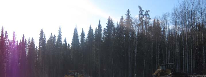
8 Reclamation in the Green Zone SAGD Foster Creek well pad: 9 well pairs on one site of acres Accesses 185 acres underground
9 Forestry in the Patch Role of forest specialists is critical Silviculture, but not entirely based on end-product Some key elements to successful reclamation Know the business Understand your challenge Recognize and live/work within your limitations Know your strengths Be flexible and adaptive Hire competent people with desire and proven track record More development, more green zone reclamation
10 Landscape Expectations- Stakeholders Disposition users and end land use FMA holders First Nations Parks Trappers Other Industrial Consideration for features left in place Well pads Borrow areas Regulation


11 Landscape Expectations- Reclamation Regulation by AENV and SRD (IOGC same as Alberta) Applies to all specified lands under disposition and utilized No Entry MSL MSL PLA LOC
12 Landscape Expectations- Reclamation Reclamation process Assessment Cleanup/remediation Reclamation Regulation Reclamation Criteria Outline provincial expectations Change and updates

13 Landscape Expectations- Reclamation Post reclamation Detailed Site Assessment (peatland or forested) Aerial overview with ground truthing Landscape, soil and vegetation assessment soil depths, placement, quality species composition re-establishment of forest trajectory utilize adjacent areas and control data compatible contour erosion and landscape stability waste management


14 Reclamation Challenge- And Evolution Assessment and Remediation prior to Reclamation Management and remediation of impacted soils or water Closure to AENV Criteria
15 Landscape Expectations- Reclamation Active reclamation of specified lands


16 Reclamation Challenge- And Evolution Regulation Changing construction methods Mulching Seeding grass Reforestation Planting Natural regen


17 Reclamation Challenge- And Evolution Compatible landscapes

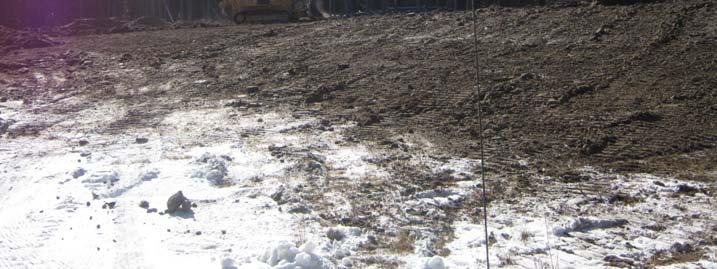
18 Reclamation Challenge- And Evolution Lease that was mulched (~5 yrs)

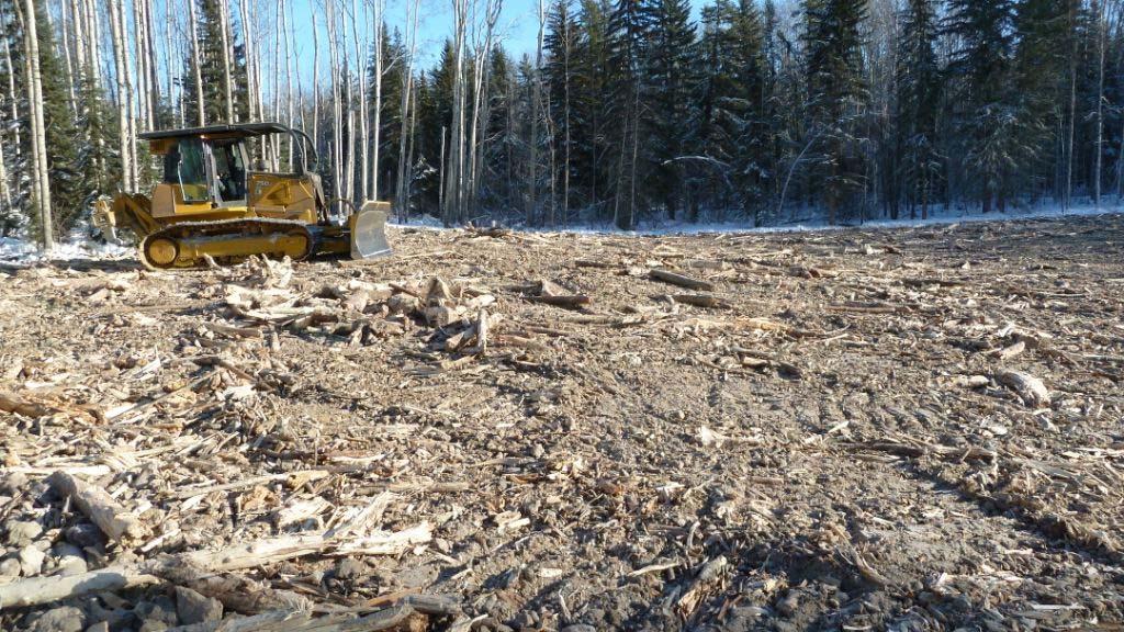
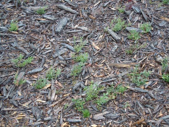
19 Reclamation Challenge- And Evolution Now, aim for more ecologically functional landscape Equivalent capability Encourage natural regeneration of under and overstory species Coarse debris management Seed by seed management zone
20 Reclamation Challenge- And Evolution Encourage surface roughness, lots of rollback and coarse woody debris
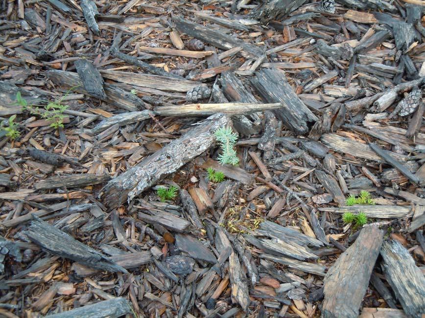
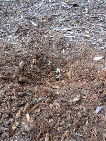
21 Reclamation Challenge- And Evolution Mulch management


22 Reclamation Challenge- And Evolution Mounding Trial for Wet Sites Site prep by mounding/inversion Poorly productive sites

23 CLAWR Soil Mounding Study Tree Planting Soil mounds were planted with black spruce and tamarack A portion of the non-mounded area was planted with the same species

24 CLAWR Soil Mounding Study Data Collection All planted trees were measured for: Stem diameter Seedling height Current annual growth


25 CLAWR Soil Mounding Study Greater seedling survival on mounds Mounding also: Larger stem diameter on mounds Improved wildlife utilization Reduced competition Sites 2 & 3 had more CAG on mounds
26 Reclamation Challenge- And Evolution Ice build Coarse woody debris tracked and broken by CAT
27 Reclamation Challenge- And Evolution Ice-built pad preparation for OSE well drilling for wet/organic/peat land sites Ice cap within and above walked-down trees Ice cap Mineral fringe CAT Walked-down trees Organic/Muskeg
28 Reclamation Challenge- And Evolution Iced lease, post drill, ripped
29 Alternative Access Alternative Access Concept purpose-built trails and roads advance planning and consultation prior, detailed consideration for landscape characteristics reduce soil, water, vegetation and habitat disturbance accelerate deactivation of older, redundant linear features use local knowledge and local trades low impact, sustainable development create a better reclamation ready end product

30 Consideration for landscape characteristics


31 Current paradigm Access subsequent to development Landscape characteristics not considered
32 Aggressive equipment

33 Aggressive equipment photo:
34 Aggressive equipment

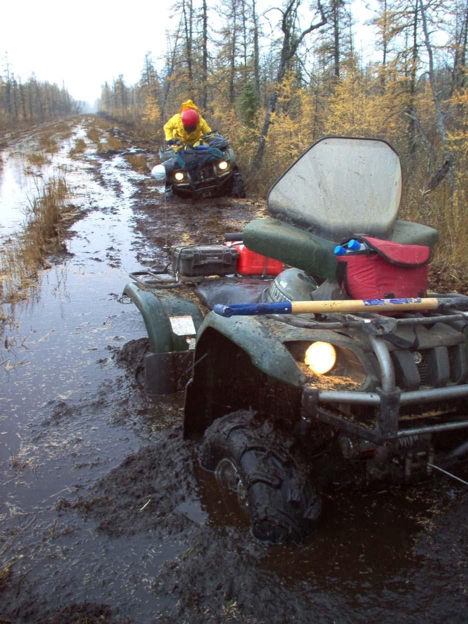
35 Soil, water, and vegetation disturbance
36 Optimized crossing locations
37 Small equipment, local knowledge
38 Beneficial use of trees No mulching

39 Continued innovation Photo courtesy of Highmark 39


40 Reclamation Challenge- And Evolution Heli-portable reclamation
41 Reclamation Challenge- And Evolution Heli-portable reclamation


42 Reclamation Challenge- And Evolution Heli-portable reclamation and purpose-built
43 Closing Lots of good reclamation techniques Work within the setting Innovate by understanding the environmental conditions, pay attention to detail Differentiate indicators of success and leverage opportunities for improvement into best practices
44 Thank you!
Oil Sands Reclamation From the Ground Up : A Suncor Energy Perspective
 Oil Sands Reclamation From the Ground Up : A Suncor Energy Perspective Lelaynia Cox, RPF and Cecilia Jeje, PhD College of Alberta Professional Forest Technologists April 14, 2011 Overview Oil sands mining
Bench-Scale to Bulldozers
 Bench-Scale to Bulldozers Mark Teshima, P.Chem September 13, 2016 Semiamhoo, WA Outline The origins of biosolids in mine reclamation (70s and 80s) Surf: PNW evolution in aggregate mine reclamation (mid
NORTHEAST RIVER CROSSING FUNCTIONAL PLANNING STUDY
 WELCOME Northeast River Crossing Functional Planning Study Phase 2 Public Meeting 4 to 8 PM Informal drop-in format and discussion tables Meeting Purpose Introduce the Northeast River Crossing Functional
Alberta policy and regulations for grassland reclamation criteria, evolution of the criteria from the 1995 version to today
 Alberta policy and regulations for grassland reclamation criteria, evolution of the criteria from the 1995 version to today Jody Spady on behalf of Reclamation Criteria Advisory Group (RCAG) Native Prairie
Reclamation Success Best Management Practices. Pinedale Field Office. Joseph Debebe PhD. Natural Resource Specialist PFO 04/30/2014
 Reclamation Success Best Management Practices Pinedale Field Office Joseph Debebe PhD. Natural Resource Specialist PFO 04/30/2014 Objective Identifying factors necessary for reclamation success at different
Describing the Integrated Land Management Approach
 Describing the Integrated Land Management Approach ISBN No. 978-0-7785-8902-0 (Online Edition) Pub No. I/422 What is Integrated Land Management? Integrated land management (ILM) is the strategic, planned
Chris Powter Executive Director Oil Sands Research and Information Network School of Energy and the Environment University of Alberta
 Chris Powter Executive Director Oil Sands Research and Information Network School of Energy and the Environment University of Alberta www.osrin.ualberta.ca OSRIN Creating and Sharing Knowledge 2 CRR provides
Suggestions. Energy Advisory Board Meeting 09/02/2010
 Reclamation Strategies and Suggestions Energy Advisory Board Meeting 09/02/2010 First thing first: Planning stage Scope of project»group wells/pads in same general area under one project»utilize existing
Aim to Reclaim. Introduction
 Aim to Reclaim Introduction Welcome to Aim to Reclaim, a virtual lab that takes you inside the world of copper mining. You may remember that the mining process involves four important phases: Exploration,
Land Use Regional Planning in Alberta Collaborating with Stakeholders
 Land Use Regional Planning in Alberta Collaborating with Stakeholders Trevor Lema, Land & Integrated Management Planner September 2018 Overview Why Regional Planning? An Integrated Perspective Integrated
Environmental Protection Guidelines for Transmission Lines
 Alberta Environment R&R/11-03 Environmental Protection Guidelines for Transmission Lines GENERAL This Guideline replaces Conservation and Information Letter 95-2 and the 1994 Guide for Transmission Lines.
HOW TO START A COMMUNITY GARDEN IN YOUR NEIGHBOURHOOD
 HOW TO START A COMMUNITY GARDEN IN YOUR NEIGHBOURHOOD What is a community garden? Community gardens are places where groups of people come to create a garden and build community. Can be on private or public
MAIN ROADS Western Australia COALFIELDS HIGHWAY PROJECTS ROADSIDE REVEGETATION MANAGEMENT
 MAIN ROADS Western Australia COALFIELDS HIGHWAY PROJECTS ROADSIDE REVEGETATION MANAGEMENT Presentation - South West Region - Alan Grist, Project Manager, Environment (November 2015) Protecting and enhancing
Slope Stability Management Framework
 Slope Stability Management Framework For the assessment, evaluation, prioritization and mitigation of slope stability concerns. 2013/06/19 The Slope Stability Management Framework provides guidance to
Rule D Wetland and Creek Buffers
 Rule D Wetland and Creek Buffers 1 Policy It is the policy of the Board of Managers to ensure the preservation of the natural resources, recreational, habitat, water treatment and water storage functions
Urban Conservation Practice Physical Effects ESTABLISHMENT, GROWTH, AND HARVEST NUTRIENT MANAGEMENT
 NOT WELL 800 - Urban Stormwater Wetlands A constructed system of shallow pools that create growing conditions for wetland plants to lessen the impacts of stormwater quality and quantity in urban areas.
Non-Metallic Mining Reclamation Checklist
 Eau Claire County DEPARTMENT OF PLANNING AND DEVELOPMENT Eau Claire County Courthouse, Rm. 1510 721 Oxford Avenue Eau Claire, Wisconsin 54703-5481 (715) 839-4741 f Housing & Community Development 839-6240
Wellsite Clay Pad Removal and Peat Inversion
 Wellsite Clay Pad Removal and Peat Inversion TECHNICAL NOTE #24 PEATLAND RESTORATION (JANUARY 2012) UPDATED: JUNE 2017 INTRODUCTION Reclaiming in-situ well pads built in peatland presents many challenges.
Northgate Minerals Corporation Kemess South Mine. Reclamation & Closure Preparation. Minerals North Conference 2009, Fort St. James, B.C.
 Northgate Minerals Corporation Kemess South Mine Reclamation & Closure Preparation Minerals North Conference 2009, Fort St. James, B.C. Harold Bent, P. Geo Environmental Manager Presentation Outline Kemess
Detailed Site Assessment Requirements
 Directive PNG018 November 2015 Revision 1.0 Governing Legislation: Act: The Oil and Gas Conservation Act Regulation: The Oil and Gas Conservation Regulations, 2012 Order: 251/18 Record of Change Revision
Stormwater Standards. Clackamas County Service District No. 1. Planting Guide for Buffers
 Stormwater Standards Clackamas County Service District No. 1 APPENDIX B Planting Guide for Buffers Table of Contents Appendix B - Planting Guide for Buffers... Page B.1 General... 1 B.1.1 Introduction...
Supplementary Information for
 Supplementary Information for Area-based Analysis June 2018 Version 1.3 BC Oil & Gas Commission 1 About the Commission About Us The BC Oil and Gas Commission (the Commission) is the single-window regulatory
My name is Zack Holden, co-instructor for this course. Many people associate severe fire with catastrophic, stand-destroying forest fires.
 My name is Zack Holden, co-instructor for this course. Many people associate severe fire with catastrophic, stand-destroying forest fires. But fire can have profound effects on soils and the below ground
Development of LID Design Guide in Edmonton
 Development of LID Design Guide in Edmonton Xiangfei Li and Fayi Zhou, the City of Edmonton Dan Healy, AMEC Earth and Environmental Philadelphia LID Symposium September 26, 2011 Outline Why LID Why develop
Wetland Restoration In Altered Landscapes
 Wetland Restoration In Altered Landscapes Mike McClure, Wetland Service Biologist, MO Dept. of Conservation Wetland Restoration In Altered Landscapes Do s, Don ts and Things To Think About Assessing the
Surface-Mining Land Reclamation Program KANSAS
 Surface-Mining Land Reclamation Program KANSAS Division of Conservation Responsibilities Administering Surface-Mining Land Conservation & Reclamation Act (SMLCRA) Surface Mining Land Conservation & Reclamation
C ity of Grande Prairie Development Services Department
 C ity of Grande Prairie Development Services Department FAIRWAY DEVELOPMENT OUTLINE PLAN OP 08 09 Approved April 6, 2009 Prepared by: Focus Corporation Table of Contents 1.0. Introduction 2 3 1.1. Plan
ALBERTA TRANSPORTATION POST-DISTURBANCE ASSESSMENT GUIDE FOR BORROW EXCAVATIONS. Dec 2013 Edition
 ALBERTA TRANSPORTATION POST-DISTURBANCE ASSESSMENT GUIDE FOR BORROW EXCAVATIONS Dec 2013 Edition - ii - ACKNOWLEDGEMENTS This guide supersedes the document entitled Alberta Transportation Post-Disturbance
Template for Restoration in a Lake Superior Area of Concern. Template for Restoration in a Lake Superior Area of Concern
 Keith Bowers, Principal Ivette Bolender, Great Lake Bioregion Team Leader Presentation outline: Project background Master planning process Habitat restoration approach Lessons learned Hog Island and Newton
Landfill Closure, Intermediate Cover & Post-Closure Care. Municipal League Meeting
 Landfill Closure, Intermediate Cover & Post-Closure Care Municipal League Meeting 9-7-17 Gated and Closed Landfill Gated means no longer accepting waste. Closed means gated and final cover has been installed
ALBERTA FOREST PROTECTION THERMAL INFRARED PROGRAM
 ALBERTA FOREST PROTECTION THERMAL INFRARED PROGRAM Eleventh Biennial USDA Forest Service Remote Sensing Applications Conference Salt Lake City, Utah April 25 Ken Dutchak, P. Biol. Reconnaissance and Remote
Our experience with vegetated roofs. Shakopee Mdewakanton Sioux Community Prior Lake, Minnesota
 Our experience with vegetated roofs Shakopee Mdewakanton Sioux Community Prior Lake, Minnesota Shakopee Mdewakanton Sioux Community Located in East Central Minnesota 3,000 acres of land at agriculture
Understanding Drainage Options What s Feasible and Legal. February 2019
 Understanding Drainage Options What s Feasible and Legal February 2019 Outline for the Presentation Do you need a permit? Does common law apply? Does local government approve it? Will my neighbor allow
Northeast Anthony Henday Drive Manning Freeway to Whitemud Drive Welcome to this Construction Information Session
 Manning Freeway to Whitemud Drive Welcome to this Construction Information Session Purpose To inform interested residents and businesses about the plans accommodation. Background: The Government of Alberta
City of Grande Prairie Development Services Department KENNEDY DEVELOPMENTS LTD. OUTLINE PLAN OP-09-01
 City of Grande Prairie Development Services Department KENNEDY DEVELOPMENTS LTD. OUTLINE PLAN OP-09-01 July 27, 2009 TABLE OF CONTENTS 1.0 Introduction... 1 1.1 Plan Area Location & Context... 1 1.2 Ownership
Plant Selection: Principles
 Plant Selection, Forms & Sources Warren Gold REN capstone November 7, 2008 This presentation will focus on principles For specific information on species see resources on handout, books, instructors Plant
Rocky Areas Project Guidance HABITAT
 Rocky Areas Project Guidance HABITAT Introduction Rocky habitats are surface areas dominated by exposed rock, such as mountain peaks, inland cliffs, buttes and rocky outcrops. In many cases, rocky areas
LANDSCAPE SCALE PLANNING AND SITING FOR SHALE DEVELOPMENT
 LANDSCAPE SCALE PLANNING AND SITING FOR SHALE DEVELOPMENT An Energy by Design approach to reducing the overall environmental footprint. MICHELLE MCGREGOR SR. OIL & GAS DEVELOPMENT ADVISOR Agenda Introduction
Tom Peters Memorial Mine Reclamation Award. (Industry Trophy)
") Canadian Land Reclamation Association/Ontario Mining Association Tom Peters Memorial Mine Reclamation Award (Industry Trophy) Tom Peters was a founding member of the Canadian Land Reclamation Association
Canadian Land Reclamation Association/Ontario Mining Association Tom Peters Memorial Mine Reclamation Award (Industry Trophy) Tom Peters was a founding member of the Canadian Land Reclamation Association
Welcome. Mill Creek Ravine Pedestrian Bridges Rehabilitation. Public Information Session #1. Thursday, October 27, :00 8:00 p.m.
 Welcome Mill Creek Ravine Pedestrian Bridges Rehabilitation Public Information Session #1 Thursday, October 27, 2016 5:00 8:00 p.m. Tonight you can: Learn about the rehabilitation of 5 pedestrian bridges
Soil Reclamation and Site Reinstatement
 APPENDIX 6 Soil Reclamation and Site Reinstatement Purpose To undertake soil reclamation, erosion protection, Site restoration and reinstatement, taking into account natural processes, operational requirements
Phase I Ecological Network Report Terms of Reference
 Phase I Ecological Network Report Terms of Reference INTRODUCTION In 2007, the City of Edmonton created a new Natural Area Systems Policy (C-531) and a strategic plan, Natural Connections. Together, these
Article 6 Tree Protection
 Article 6 Tree Protection 8.1 Purpose 8.2 Applicability 8.2.1 General Provisions 8.2.2 Exemptions 8.3 Permitting Procedure 8.4 Planting Procedure 8.5 Performance Guarantee Required for Belated Planting
Guide to Naturalizing a Lakefront Shoreline. September 2010
 Guide to Naturalizing a Lakefront Shoreline September 2010 Retaining walls and non-vegetated shorelines are a very common sight on shore-line properties in Alberta. These urbanized shorelines have a huge
Minnesota Department of Natural Resource - Natural Resource Guidance Checklist Conserving Natural Resources through Density Bonuses
 Minnesota Department of Natural Resource - Natural Resource Guidance Checklist Conserving Natural Resources through Density Bonuses NRDB Why Use Density Bonuses & This Checklist Local units of government
Capturing the Snow with Fast Growing Willow Living Snowfences
 Capturing the Snow with Fast Growing Willow Living Snowfences T. A. Volk, L.P Abrahamson, and M. Appleby State University of New York College of Environmental Science and Forestry Syracuse, NY 13224 Outline
VALLEY VIEW POND Q&A. This item will be discussed under the First Reading portion of the agenda at the July 17, 2012 Village Council meeting.
 VALLEY VIEW POND Q&A This item will be discussed under the First Reading portion of the agenda at the July 17, 2012 Village Council meeting. 1. Please provide a history of the pond including Village maintenance
Overview of the Standards for Landfills in Alberta. Donna Chaw, Ph.D Waste Policy Advisor Air, Land, and Strategic Policy Branch Alberta Environment
 Overview of the Standards for Landfills in Alberta Donna Chaw, Ph.D Waste Policy Advisor Air, Land, and Strategic Policy Branch Alberta Environment 1 1 Outline Background Current Status Application of
December 11, December 10, 2015
 December 11, 2015 December 10, 2015 2 Welcome & Introductions Project Overview Discussion Questions Group Insights Key Takeaways Next Steps 3 4 5 6 7 8 9 Governed by multiple layers of policy UNESCO World
What We Heard Public Engagement - Stage 1
 What We Heard Public Engagement - Stage 1 Background Early planning is underway for a potential new river crossing over the North Saskatchewan River, in the northeast part of the Edmonton region. The City
Working together to leverage limited Funds
 Working together to leverage limited Funds ARAPAHOE COUNTY OPEN SPACES 10 County Budget Conference September 20, 2013 The Power of Partnerships 2013 SORP Conference 5/23/2014 Why Talk About Open Space?
The Napa River Flood Protection Project
 The Napa River Flood Protection Project Creating Flood Protection and Restoring Geomorphic and Biological Processes Jeremy Sarrow, Napa County Flood Control & Water Conservation District June 2, 2014.
ATTACHMENT 1 WILSON MINE LECROY AREA SEMIPERMANENT DEWATERING SYSTEM
 ATTACHMENT 1 WILSON MINE LECROY AREA SEMIPERMANENT DEWATERING SYSTEM Reclamation plans for the Wilson Mine Lecroy area were approved by the Arkansas Department of Environmental Quality with a passive barrier
An Introduction to the Far North Land Use Strategy
 An Introduction to the Far North Land Use Strategy December, 2013 Ministry of Natural Resources Table of Contents PREFACE... 3 About the Far North... 3 Evolution of Land Use Planning in the Far North...
A Joined-up Regional Landscape: A Roadmap to connect the parts
 Breaking the Barriers: Engineering Solutions to Ecological Problems A Joined-up Regional Landscape: A Roadmap to connect the parts Associate Professor Darryl Low Choy Urban Research Program Outline Nature
CALIFORNIA NATIVE GRASSES ON LEVEES
 CALIFORNIA NATIVE GRASSES ON LEVEES A Multi-Benefit Solution September 7, 2017 Vance Howard Sr. Restoration Ecologist GEI Consultants ACKNOWLEDGEMENTS Co-authors Peter Buck Former Natural Resources Director
IMPLEMENTATION STRATEGY: GOAL 1: TO SUSTAIN A HEALTHY NATIVE PRAIRIE GRAZING RESOURCE
 IMPLEMENTATION STRATEGY: GOAL 1: TO SUSTAIN A HEALTHY NATIVE PRAIRIE GRAZING RESOURCE Objectives Actions Timetable Lead and Supporting Agencies 1. Maintain or adopt sound rangeland practices that are reflective
2.1 Principles & Objectives
 Designing With The Landform 2.1 Principles & Objectives Land planning which integrates the natural features of a site (i.e., designing with the landform ) into the site design is a major component of the
Working Group Meeting
 April 4,, 2017 Parks Operations Bldg Working Group Meeting Arts Districts Overview Stormwater/RPA/Stream Considerations First Principles Agenda 7:00pm 7:05pm 7:10pm 7:40pm 8:30pm 9:40pm 9:45pm Welcome
An Introduction to Permaculture
 An Introduction to Permaculture A way to work with nature to design a place for humans to live. Its nature based systems design, creating environments with diversity, dynamic stability, and resilience.
Triangle Land Conservancy Conservation Area Monitoring Report Carolina North
 Triangle Land Conservancy Conservation Area Monitoring Report Carolina North Property Name: Bolin Creek West Conservation Area Date of visit: 2.18.13, 2.18.13, 3.13.13, and 6.10.13 County: Orange Property
Table of Contents INTRODUCTION APPLICATION. Document No.: WRG 5A-8 Publication Date: 10/4/2012
 MINNESOTA WETLAND RESTORATION GUIDE PLANTING UPLAND TREES AND SHRUBS TECHNICAL GUIDANCE DOCUMENT Document No.: WRG 5A-8 Publication Date: 10/4/2012 Table of Contents Introduction Application Other Considerations
GUIDE: Restoration Assessment Form Preface Instructions
 GUIDE: Restoration Assessment Form March 24, 2006 Developed by Kerry Hecker and Chet Neufeld Last Mountain Lake National Wildlife Area and Migratory Bird Sanctuary Environment Canada- Canadian Wildlife
Presentation August 20, 2013
 Presentation August 20, 2013 St. Vital Transmission Complex Stakeholder Workshop WELCOME! Manitoba Hydro 9:00am to 1:50pm Purpose of Workshop Share current project information Including outcomes of the
RECONNECTING A COMMUNITY TO THE CREEK
 RECONNECTING A COMMUNITY TO THE CREEK 0 The J.J. Seabrook Stream Restoration, Rain Garden, and Urban Trail Project Kristin K. Pipkin, P.E. Michelle Adlong, EI.T. TXSER/TRA Joint Conference November 2,
Phase 1 Habitat Replacement & Reconstruction
 Phase 1 Habitat Replacement & Reconstruction Marc Greenberg, USEPA greenberg.marc@epa.gov Hudson River EPA s Expectation of Habitat Reconstruction & Replacement provides diverse habitats Plants, plankton,
Galiuro Drilling EA Scenery Debby Kriegel 12/9/16
 Galiuro Drilling EA Scenery Debby Kriegel 12/9/16 INTRODUCTION The 1.7 million acre Coronado National Forest (CNF) is comprised of 12 sky island mountain ranges. CNF visitors have opportunities to sightsee
How do reclamation conditions affect the invasion success of the exotic autumn olive?
 How do reclamation conditions affect the invasion success of the exotic autumn olive? Jacob N. Barney, Morgan Franke Department of Plant Pathology, Physiology, and Weed Science Virginia Tech Introduction:
The Rocky Mountain Arsenal and the Northeast Greenway Corridor Project:
 The Rocky Mountain Arsenal and the Northeast Greenway Corridor Project: Contamination to Collaboration Presented by Howard Kenison Overview of Presentation Rocky Mountain Arsenal Contamination Litigation,
Building Ecological Solutions to Coastal Community Hazards: Guidance and NJ Coastal Community Assistance
 Building Ecological Solutions to Coastal Community Hazards: Guidance and NJ Coastal Community Assistance Stacy Small-Lorenz National Wildlife Federation Restore America s Estuaries Summit New Orleans,
Planning Considerations for Wildlife Passage in Urban Environments. (Prepared by Tony Clevenger, PhD)
") Scope Planning Considerations for Wildlife Passage in Urban Environments. (Prepared by Tony Clevenger, PhD) As urban populations grow and expand into rural areas there are changes in land use patterns
Scope Planning Considerations for Wildlife Passage in Urban Environments. (Prepared by Tony Clevenger, PhD) As urban populations grow and expand into rural areas there are changes in land use patterns
Biodiversity Action Plan Background Information for discussion purposes
 Biodiversity Action Plan Background Information for discussion purposes Our commitment As directed by Council, The City of Calgary has agreed to sign the Durban Commitment, an international agreement on
THE SPATIAL PLAN AND THE LANDSCAPE IN CZECH REPUBLIC
 THE SPATIAL PLAN AND THE LANDSCAPE IN CZECH REPUBLIC 13th ELC Conference, 2 3 October, Cetnjie, Montenegro Ing. Igor Kyselka CSc., Institute for spatial development, Jakubské náměstí 3, 60200 Brno, tel.:
Stormwater BMP and Stream Restoration in a City Park. Jeff Herr P.E., D.WRE Jill Stachura
 Stormwater BMP and Stream Restoration in a City Park Jeff Herr P.E., D.WRE Jill Stachura 770.673.3673 JHerr@BrwnCald.com Project Location Camp Creek in Metro Atlanta 7 sq. mile drainage area at project
Alternative Routes. St. Vital to La Verendrye Station - Southern Loop Transmission Corridor. 20 different segments 4 segments common to all routes
 Alternative Routes St. Vital to La Verendrye Station - Southern Loop Transmission Corridor In a fixed right-of-way St. Vital to Letellier Station 20 different segments 4 segments common to all routes Goal
HIGHLAND LAKES WATERSHED ORDINANCE WATER QUALITY MANAGEMENT TECHNICAL MANUAL
 Effective July 1, 2007 HIGHLAND LAKES WATERSHED ORDINANCE WATER QUALITY MANAGEMENT TECHNICAL MANUAL EFFECTIVE JULY 1, 2007 FIFTH EDITION Lower Colorado River Authority TABLE OF CONTENTS DESIGN SPREADHEET
I ll be talking about the Designing Sustainable Landscapes project today. This is a large integrated modeling effort our group at UMass has been
 1 I ll be talking about the Designing Sustainable Landscapes project today. This is a large integrated modeling effort our group at UMass has been working on for the past 5 years, in close collaboration
Soil Erosion & Sediment Control Plan Requirements for Submittal to the Cape Atlantic Conservation District
 Soil Erosion & Sediment Control Plan Requirements for Submittal to the Cape Atlantic Conservation District The following is a list of the minimum requirements required on Soil Erosion and Sediment Control
VCA Guidance Note. Contents
 Contents 1. Introduction... 2 2. Who can register a VCA?... 2 3. VCAs and sustainable development... 3 4. Verifying conservation performance... 4 4.1 Transparent, voluntary commitments... 4 4.2 Independent
Specification and Construction Plans For: South Bethany Landscaping Improvement Plan Contract Number T
 Specification and Construction Plans For: South Bethany Landscaping Improvement Plan Contract Number T201220010 1 INDEX OF SHEETS Sheet Number Description 1 Title Sheet 2 Index of Sheets 3 Overview 4 General
TOWNSHIP OF LOGAN SOIL & FILL IMPORTATION AND PLACEMENT APPLICATION SUBMITTAL CHECKLIST
 TOWNSHIP OF LOGAN SOIL & FILL IMPORTATION AND PLACEMENT APPLICATION SUBMITTAL CHECKLIST Applications: 5 copies of application - Applicant will reproduce the copies at his/her costs. The Township Clerk
Lawrencetown Beach & Rainbow Haven Beach
 Lawrencetown Beach & Rainbow Haven Beach Public Engagement Session Wednesday, September 27 th, 2017 6:00pm 8:00pm Cole Harbour Place 51 Forest Hills Pkwy, Dartmouth Agenda Welcome & Introductions Overview
Methods, approaches, and procedures to minimize active agricultural land impacts during pipeline construction, surface restoration, and pipeline
 Agricultural Impact Minimization Plan Methods, approaches, and procedures to minimize active agricultural land impacts during pipeline construction, surface restoration, and pipeline operation. PennEast
BOISE HP Inc. CAMPUS PROJECT OVERVIEW
 PROJECT OVERVIEW: ALREADY RECOGNIZED AS A LEADER IN REDUCING THE ENVIRONMENTAL FOOTPRINT AND ENSURING STRONG SOCIOLOGICAL ETHICS; HP INC CONTINUES TO IMPROVE PRACTICES WHICH ALIGN WITH THE COMPANY S CORE
Presentation to Parks and Open Space Advisory. Committee September 22, 2016
 Flood Planning & Preliminary Design Services for South St. Vrain Creek Restoration at Hall Ranch Presentation to Parks and Open Space Advisory Prepared for: Boulder County, Colorado Committee September
APPENDIX L3. Table of Contents. SWP EA Information Sheets
 E N V I R O N M E N T A L A S S E S S M E N T APPENDIX L3 SWP EA Information Sheets Table of Contents EA Info Sheet 1... L3-1 EA Info Sheet 2... L3-3 EA Info Sheet 3... L3-5 EA Info Sheet 4... L3-7 SCARBOROUGH
Study Area Map. Wasatch Hollow Open Space Restoration, Use, & Management Plan. Legend. Harrison Ave East. Roosevelt East.
 Harrison Ave Roosevelt Emerson «4 «5 Rosecrest 1900 East «3 1800 East Wasatch Hollow Open Space Restoration, Use, & Management Plan Study Area Map Legend «2 «1 Potential Access Location Emigration Creek
Tonya Hunter, LLA, CA Environmental Consulting & Technology, Inc.
 Presented to: Michigan Water Environment Association Watershed Seminar December 5, 2013 Tonya Hunter, LLA, CA Environmental Consulting & Technology, Inc. What is Green Infrastructure? Green infrastructure
Welcome THE SITE PHASE 1 EXCLUSION ZONE.
 THE SITE PHASE 1 Aerial view of the whole site with Phase 1 indictated Welcome Barratt London and Hyde Group are working with Pollard Thomas Edwards on redevelopment proposals for Harrow View East, part
WELL & RESERVOIR MONITORING
 WELL & RESERVOIR MONITORING Distributed Temperature Sensing (DTS) AP Sensing: Your reliable partner for well and reservoir monitoring AP Sensing is your global Distributed Temperature Sensing (DTS) provider.
SITE PLAN REVIEW APPLICATION AND CHECKLIST
 SITE PLAN REVIEW APPLICATION AND CHECKLIST PROJECT SUMMARY: Project Name: City/ETA Location: City ETA (Application fee & number of copies needed are based on location) Property Location (Legal Description
Leduc Industrial Outline Plan SE W4
 Leduc Industrial Outline Plan SE 1-50-25-W4 Within the North Leduc Industrial ASP Prepared for: Leduc Energy Park Ltd. Prepared by: Stantec Consulting Ltd. File No. 1161 104655 V5 Table of Contents 1.0
Riparian Restoration Plan for the Quiet Waters Homeowners Association Reach of the Yachats River. Site Overview
 Walama Restoration Project Community Supported Rehabilitation And Native Re-vegetation of our Watersheds PO Box 894 Eugene, OR 97440 541.484.3939 info@walamarestoration.org www.walamarestoration.org Riparian
RAIN GARDEN ILLINOIS URBAN MANUAL PRACTICE STANDARD. (feet) CODE 897 DEFINITION
 CODE 897 DEFINITION") ILLINOIS URBAN MANUAL PRACTICE STANDARD RAIN GARDEN (feet) CODE 897 Source: Kendall County Soil and Water Conservation District DEFINITION Rain gardens are small, shallow, flat bottomed depressions constructed
ILLINOIS URBAN MANUAL PRACTICE STANDARD RAIN GARDEN (feet) CODE 897 Source: Kendall County Soil and Water Conservation District DEFINITION Rain gardens are small, shallow, flat bottomed depressions constructed
Palisades Outline Plan
 NE ¼ 25 36 28 W4 Town of Penhold Approved August 13, 2012 Contents Figures & Tables... 2 Introduction... 1 Overview... 1 Purpose... 1 Development Area... 3 Ownership... 3 Topography... 3 Existing & Surrounding
Cotswolds AONB Landscape Strategy and Guidelines. June 2016
 Cotswolds AONB Landscape Strategy and Guidelines June 2016 Cotswolds AONB Landscape Strategy and Guidelines Introduction The evolution of the landscape of the Cotswolds AONB is a result of the interaction
Surface Coal Mining and Reclamation in ND. Guy Welch ND Public Service Commission
 Surface Coal Mining and Reclamation in ND Guy Welch ND Public Service Commission Surface Coal Mines in North Dakota Approximately 1500 acres are disturbed each year History of Reclamation in ND First surface
Stormwater Retrofitting: The Art of Opportunity. Presented by the Center for Watershed Protection
 Stormwater Retrofitting: The Art of Opportunity Presented by the Center for Watershed Protection What Are Stormwater Retrofits? Retrofits are stormwater management measures inserted in an urban or ultra-urban
Photo 13. Bare soils and damaged vegetation on newly created machine track along recently decommissioned SNSR between lift towers 19 and 20 near the
 Photo 13. Bare soils and damaged vegetation on newly created machine track along recently decommissioned SNSR between lift towers 19 and 20 near the upper Stormin Norman lift terminal on 9/8/13. The newly
What is The Urban Food Systems Program?
 What is The Urban Food Systems Program? Seattle Parks & Recreation s Urban Food Systems Program strives to Provide access to healthy food Promote strong community engagement using equitable and sustainable