Annual lease of the tillable acreage for crops (soybeans and/or corn).
|
|
|
- Alexina Stafford
- 5 years ago
- Views:
Transcription

1 FOR SALE $895, Hill Road, Woodsboro, Maryland Crop Farm with Subdivision Potential PRESENTING Location: Hill Road, Woodsboro, MD acre crop farm with extraordinary views, active stream and agricultural lot subdivision potential. Property Details Fantastic setting for building that dream house 67 acres currently tilled 20 +/- acres of woodland (hunting and timber) Active stream on the property Existing farmhouse in good condition Located just outside Woodsboro, MD Just 12 miles to City of Frederick boundary Legal: Tax Map 0042, Parcel 0012 Zoning: Lot Size: House & Barn: Utilities: Ag Easements: Farm Lease: Subdivision: Frederick County: A The purpose of the Agricultural District (A) is to preserve productive agricultural land and the character and quality of the rural environment and to prevent urbanization where roads and other public facilities are scaled to meet only rural needs acres, more or less 2 story frame farmhouse with 2 full baths, containing 2,018 SF excluding the basement area, built in Large bank barn good condition. No leases in place for the house or barn. Well and Septic There are no Agricultural Easements on the property; however, the farm could be eligible for State or County Programs. Annual lease of the tillable acreage for crops (soybeans and/or corn). Under current Frederick County zoning the property may be subdividable into 3 lots (2 Lots and a Remainder). Contact: Rocky Mackintosh Ashleigh Kiggans Office: ext. 202 Office: ext. 205 Mobile: Mobile: rocky@macroltd.com ashleigh@macroltd.com

2 LOCATION MAP

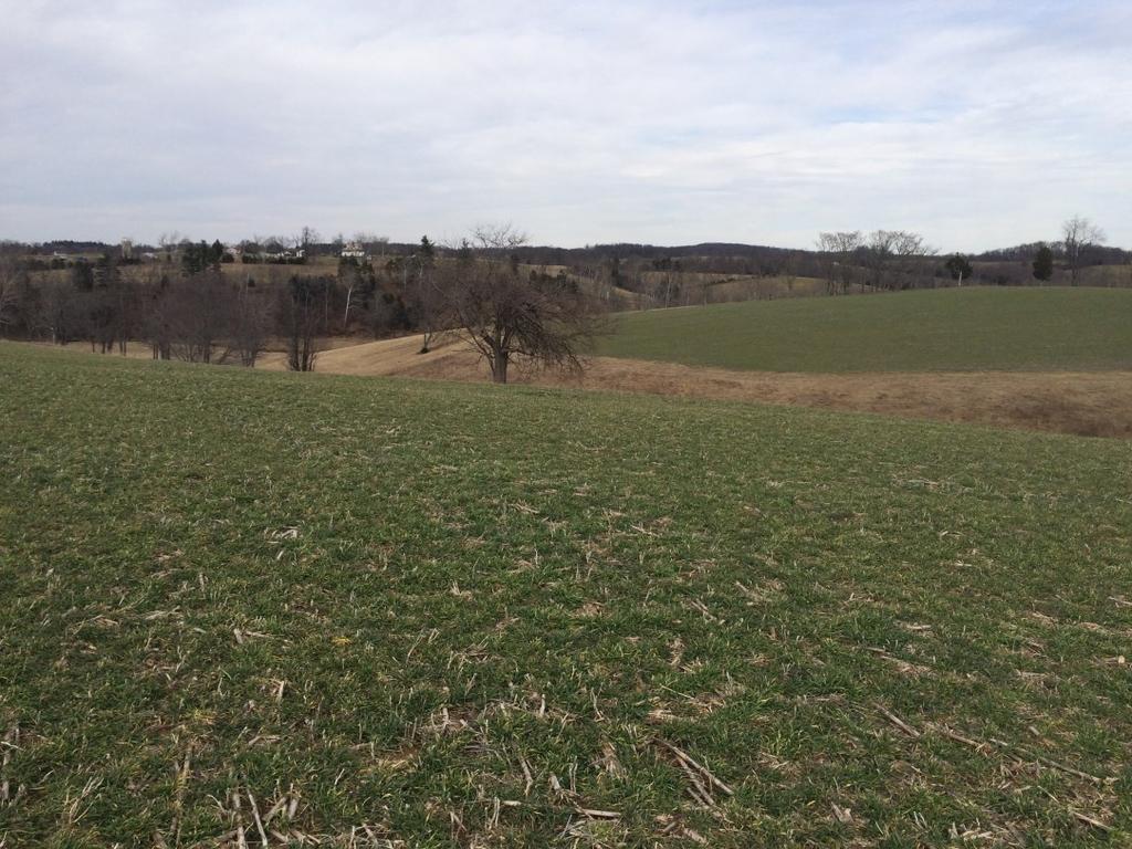
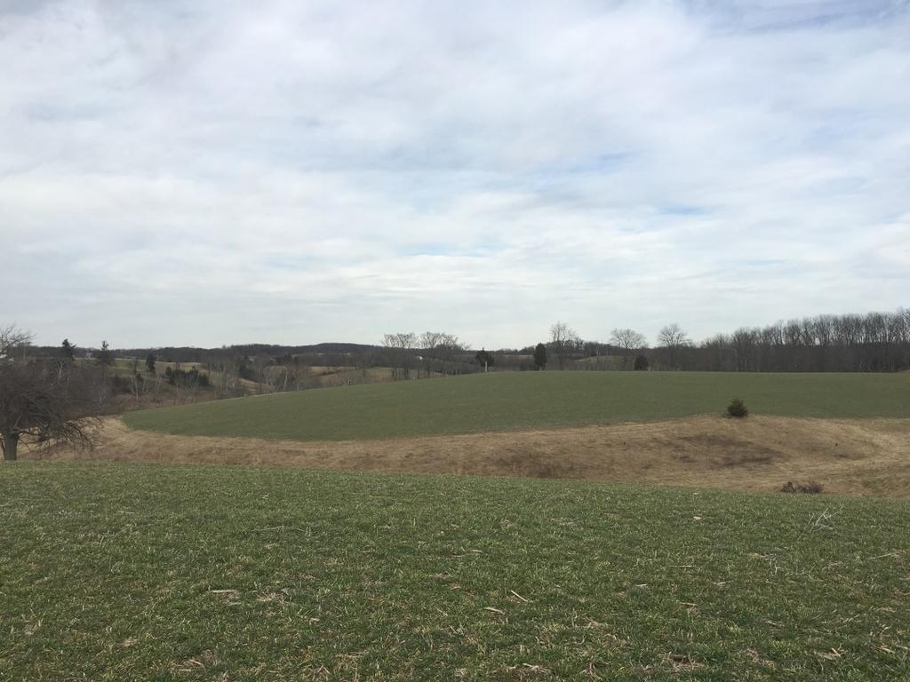
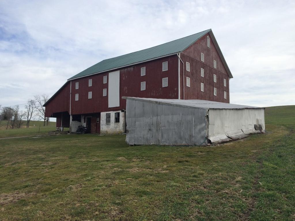
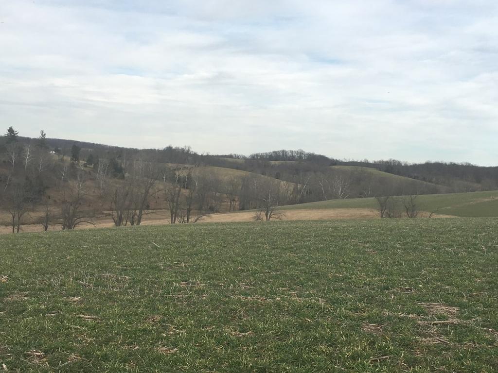
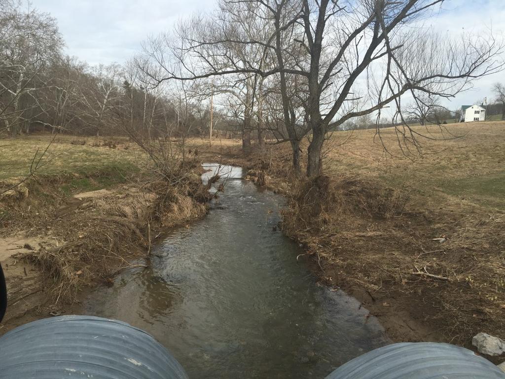
3 PHOTOS
4 BOUNDARY SURVEY Dis- Inforob- from sources deemed to be reliable. However, we make no guarantee, claimer: mation tained
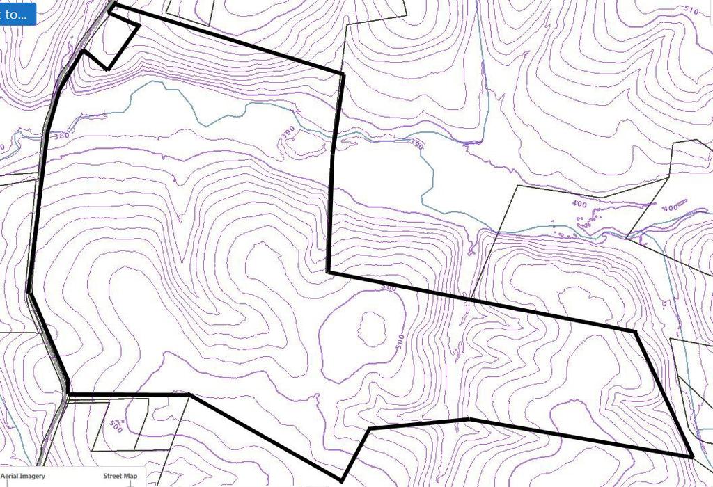
5 TOPOGRAPHY MAP

6 TILLABLE SOILS MAP Total Tillable Acreage

7 SOILS MAP See USDA Soil Descriptions next 2 pages
8 USDA Soil Description MT. AIRY SERIES (MeB) (MeC) The Mt. Airy series consists of moderately deep, somewhat excessively drained, moderately rapid to moderately permeable soils on uplands. They formed in residuum from micaceous crystalline rocks. Slopes range from 0 to 75 percent. Mean annual temperature is 53 degrees F., and mean annual precipitation is about 40 inches. RANGE IN CHARACTERISTICS: The thickness of the solum ranges from 15 to 36 inches; with average being about 26 inches. Depth to bedrock ranges from 20 to 40 inches, but most pedons have bedrock at depths of 36 inches or less. Rock fragment content ranges from 15 to 60 percent by volume in the A horizon and averages about 30 percent. Rock fragment content in the B horizon ranges from 45 to 75 percent by volume and averages about 60 percent. The C horizon averages at least 70 percent by volume of rock fragments and in some places the amount is over 90 percent. There are stony and very stony phases of Mt. Airy soils, and outcrops of the extremely hard schist are fairly common. The soil is strongly to extremely acid throughout the profile unless limed. DRAINAGE AND PERMEABILITY: Somewhat excessively drained. Runoff is rapid to very rapid. Permeability is moderate to moderately rapid. USE AND VEGETATION: General crops, including corn, small grains, and hay. There are some orchards, and large areas are in pasture. There are many, though usually not large, wooded areas, and in places much urban and suburban development. Natural vegetation is of mixed hardwoods, dominated by black oak, chestnut oak, hickory, yellow poplar, and red maple, and having an understory or dogwood, holly, and huckleberry, and some areas with laurel and azalea. BLOCKTOWN SERIES (BhE) The Blocktown series consists of shallow, well drained soils with moderate permeability. They formed in residuum that weathered from phyllite and schist materials in the Piedmont Plateau. Slopes range from 0 to 60 percent. Mean annual temperature is about 51 degrees F and mean annual precipitation is about 40 inches. RANGE IN CHARACTERISTICS: The thickness of the solum ranges from 10 to 20 inches. Depth to the Cr horizon ranges from 10 to 20 inches, and the depth to hard bedrock ranges from 20 to 40 inches. Rock fragments of veined quartz and phyllite range from 15 to 50 percent in the A horizon, and from 35 to 90 percent in the B and C horizons. The fine- earth fraction of the textural control section has greater than 50 percent silt and very fine sand. Soil reaction ranges from medium acid to slightly acid if not limed. DRAINAGE AND PERMEABILITY: Well drained; medium to very rapid runoff; moderate permeability. USE AND VEGETATION: Most of this soil is cropped to corn, small grain, soybeans and hay. A moderate amount is in pasture and woodland. Forested areas consist of black oak, white oak, red oak, hickory, Virginia pine and yellow poplar. DRAINAGE AND PERMEABILITY: Well drained. Permeability is moderate throughout and runoff is medium. USE AND VEGETATION: Used for general crops and pastures. Native vegetation probable was mixed hardwoods, but little if any woodland remains.
9 USDA Soil Description BENEVOLA SERIES (BdC) The Benevola series consists of very deep, well drained, moderately permeable soils formed in residuum from marble. They occupy narrow valley landscape positions within the piedmont plateau surrounded by ridges of phyllite and schist controlled bedrock. Mean annual temperature is about 50 to 54 degrees F, and mean annual precipitation is about 38 to 45 inches. RANGE IN CHARACTERISTICS: Solum thickness ranges from 40 to 60 inches. Depth to bedrock is greater than 5 feet. Rock fragments of marble ranges from 0 to 25 percent throughout. Reaction ranges from strongly acid to neutral. DRAINAGE AND PERMEABILITY: Well drained. Permeability is moderate throughout and runoff is medium. USE AND VEGETATION: Used for general crops and pastures. Native vegetation probable was mixed hardwoods, but little if any woodland remains. GLENVILLE SERIES (GuB) The Glenville series consists of very deep moderately well drained or somewhat poorly drained soils. They formed primarily in colluvium or residuum affected by soil creep that is weathered from phyllite, micaceous schist, granitic gneiss and other acid crystalline rocks. Slopes range from 0 to 15 percent. Saturated hydraulic conductivity is moderately low to moderately high. Mean annual precipitation is 1145 mm (45 inches). Mean annual temperature is 10 degrees C (51 degrees F). RANGE IN CHARACTERISTICS: Solum thickness ranges from 30 to 40 inches. Depth to bedrock is more than 60 inches. Depth to the fragipan is 15 to 30 inches. Rock fragments of phyllite, schist, gneiss or quartzite generally increase with depth, ranging from 0 to 30 percent in the solum and from 5 to 80 percent in the C horizon. Some pedons have flakes of mica that generally increases with depth. Reaction is neutral to very strongly acid in the A horizon, moderately acid to very strongly acid in the B horizon, and moderately or very strongly acid in the C horizon. DRAINAGE AND SATURATED HYDRAULIC CONDUCTIVITY: Moderately well drained or somewhat poorly drained depending on depth to the fragipan. Runoff is negligible to very high. Saturated hydraulic conductivity is moderately high to high above the fragipan, moderately low to high in the fragipan, and moderately high below the fragipan. USE AND VEGETATION: General crops but mostly grain, hay and pasture. Native vegetation consists of mixed hardwoods. Sizable areas are adjacent to community development and urban expansion.
10 USDA Soil Description CARDIFF SERIES (CbF) The Cardiff series consists of deep, well drained soils formed in material weathered from hard quartzitic slate, phyllite, or other fine-grained rock. They are nearly level to steep soils on uplands. Typically these soils have channery silt loam A horizons, and very channery loam Bw horizons over very channery silt C horizons. Hard slate bedrock is below 40 inches. RANGE IN CHARACTERISTICS: Solum thickness ranges from 15 to 35 inches. Depth to bedrock ranges from about 40 to 60 inches. Rock fragments range from 20 to 70 percent in the solum, and average more than 75 percent in the C horizon and 90 percent in the Cr horizon. The fragments consist of gray to light gray slate or other fine-grained rock. Reaction (unlimed) is strongly acid to very strongly acid. DRAINAGE AND PERMEABILITY: Well drained and somewhat excessively drained. Overall permeability is moderate. Runoff ranges from slow to rapid depending on slope. USE AND VEGETATION: Most areas are used for growing general crops and orchards, or for pasture. Steeper areas are commonly wooded. Native vegetation is mixed hardwoods dominated by oaks.
11 ZONING Frederick County Zoning Agricultural District (A) The purpose of the Agricultural District (A) is to preserve productive agricultural land and the character and quality of the rural environment and to prevent urbanization where roads and other public facilities are scaled to meet only rural needs. Possible usage under zoning (permitted and some permitted use subject to site dev. plan approval) includes, but not limited to: Agricultural Activities Apiary Agricultural Value Added Processing Agritourism Expertise Nursery Retail or Wholesale Farm Winery Farm Winery Tasting Room Farm Brewery Farm Brewery Tasting Room Limited/Commercial Roadside Stand Forestry Sawmill Single-Family Detached Two-Family Dwelling Mobile Homes Caretaker Residence in Conjunction with Permitted Use Accessory Apartment Bed and Breakfast Farm Equipment Sales or Service Feed and Grain Mill Communication Towers Limited Landscape Contractor Landscape Contractor Country Inn Agricultural Products Processing School Bus Parking Recreational Vehicle Storage Facility Animal Hospital or Veterinary Clinic Kennel Auction Sales Animals Outdoor Sports Recreation Facility Rodeo Cemetery/Memorial Gardens Shooting Range/Club Trap, Skeet, Rifle, Archery Aircraft Landing and Storage Areas, Private Aircraft Landing and Storage Areas, Private Commercial Use Tent Campground Rustic Retreat/Camp/Outdoor Club Child Care Center/Nursery School Civic Community Center Civic Service Clubs Group Homes, Small Private Group Home, Large Place of Worship Private School Community Fire and Rescue Service Public School Nongovernmental Utility Borrow Pit Operations Industrial Waste Landfill Limited Wood Waste Recycling Facility Sludge Pit And more...
FOR SALE. 3.2-Acres Development Land PRESENTING. $1,390,000 Ballenger Creek Pike, Frederick, Maryland Location:
 FOR SALE $1,390,000 Ballenger Creek Pike, Frederick, Maryland 21703 3.2-Acres Development Land Great location with frontage on Ballenger Creek Pike. These 3.2 acres are situated next to Tuscarora High
FOR SALE 21 acres of Limited Industrial Land 6.4 acres of Commercial Land Baldwin Road West, Monrovia, Maryland 21770
 21 acres of Limited Industrial Land 6.4 acres of Commercial Land, I-70 Frontage and Visibility Established Industrial and Commercial Area PRESENTING LOCATION: Intersection of and Green Valley Road LEGAL:
Horner-McLaughlin Woods: Soil Types
 Horner-McLaughlin Woods: Soil Types Not present at HMW Adrian Muck Conover Loam 0-4% Slopes Houghton Muck Miami Loam 2-6% Slopes Miami Loam 6-12% Slopes Miami Loam 12-18% Slopes t 0 0.125 0.25 Miles Mary
FOR LEASE. Spring Ridge Shopping Center PRESENTING. Call For Pricing Spring Ridge Parkway, Frederick, Maryland Location:
 FOR LEASE Call For Pricing Spring Ridge Parkway, Frederick, Maryland 21701 Spring Ridge Shopping Center Located at the entrance of Spring Ridge Community, the Spring Ridge Shopping Center serves the community
IOWA FFA STATE SOILS CDE SATURDAY, OCTOBER 13, 2007 AMES, IOWA
 IOWA FFA STATE SOILS CDE SATURDAY, OCTOBER 13, 2007 AMES, IOWA 1. Moderately sloping has what percent slope: a. 9-14% b. 2-5% c. 5-9% d. over 14% 2. Which of the following horizons is the loose underlying
Iowa FFA Soil Career Development Event 2008
 Iowa FFA Soil Career Development Event 2008 1. In Iowa, corn suitability ratings for soil mapping units specifies a. natural weather conditions b. surface and subsurface drainage installed where needed
Pits 1 & 3 Questions. 7. Subsurface: Texture (5 pts) A. Coarse B. Moderately course C. Medium D. Fine E. Very Fine
 A. Coarse B. Moderately course C. Medium D. Fine E. Very Fine") Minnesota Soils Scorecard Questions for Pits 1-4 Scantron # 105481 Use your soils scorecard to fill out the answers on your scantron Bubble in the front side of the sheet for Pit 1 (# 1-45) and Pit 2 (#51-95)
Minnesota Soils Scorecard Questions for Pits 1-4 Scantron # 105481 Use your soils scorecard to fill out the answers on your scantron Bubble in the front side of the sheet for Pit 1 (# 1-45) and Pit 2 (#51-95)
Geology & Soils. Appendix B. Geology & Soils
 Appendix B Geology & Soils Geology & Soils A nation that destroys its soils destroys itself. Forests are the lungs of our land, purifying the air and giving fresh strength to our people. Franklin Delano
2018 Iowa FFA Soil Judging CDE Exam 1. Landscape positions characterizes the location of the soil on the landscape and identifies potential risks.
 2018 Iowa FFA Soil Judging CDE Exam 1. Landscape positions characterizes the location of the soil on the landscape and identifies potential risks. Which landscape position is considered the floodplain
2014 Iowa FFA Soil Judging CDE Exam
 2014 Iowa FFA Soil Judging CDE Exam 1. Landscape position is one aspect of evaluating the surface features of a certain tract of land. Identifying the correct landscape position will indicate: a. If the
2016 Iowa FFA Soils Evaluation CDE Exam
 2016 Iowa FFA Soils Evaluation CDE Exam 1. Which of the following is true regarding soil horizons? a. A horizon is darker in color and has more organic matter b. B horizon is darker in color and has more
Area 3 Envirothon Soils Questions Key
 Area 3 Envirothon Soils Questions Key 1. Soil aeration is the exchange of air in soil with air from the atmosphere. When a soil is well aerated, the air within the soil is very similar to the atmosphere
Appendix E Soils Information
 Appendix E Soils Information Soil Information: Dinkey Project The following soil information is developed from project level data published in the Polk County, Tennessee Soil Survey (NRCS, 2003). The Soil
STATE TAX COMMISSION OF MISSOURI ASSESSOR MANUAL
 STATE TAX COMMISSION OF MISSOURI ASSESSOR MANUAL CHAPTER: REVISION DATE: 10/1/2008 Page 1 of 18 7.3 The purpose of this section of the Assessor s Manual is to supplement the State Tax Commission s published
Zoning Rewrite Implementation Worksession #3. Industrial Zones April 11, 2013
 Zoning Rewrite Implementation Worksession #3 Industrial Zones April 11, 2013 1 Industrial Zones Current I-1 942.19 acres 0.33% Current I-2 757.36 acres 0.27% Current I-3 (floating) 970.29 acres 0.34% Current
1. Position (2 pts.) 2. Parent Material (2 pts.) 3. Slope Characteristics (2 pts.) 4. Surface Stoniness or Rockiness (2 pts.)
 2. Parent Material (2 pts.) 3. Slope Characteristics (2 pts.) 4. Surface Stoniness or Rockiness (2 pts.)") Maryland Envirothon SOILS Exam Guidance Information (revised 2017) Objective: To test students' knowledge and awareness of basic soil science and its application in wise land-use planning and therefore
Maryland Envirothon SOILS Exam Guidance Information (revised 2017) Objective: To test students' knowledge and awareness of basic soil science and its application in wise land-use planning and therefore
Land Capability Classifications
 Land Capability Classifications Unit: Soil Science Problem Area: Basic Principles of Soil Science Student Learning Objectives. Instruction in this lesson should result in students achieving the following
Tunbridge. Vermont State Soil. Soil Science Society of America. Introduction. History. What is the Tunbridge Soil?
 Tunbridge Vermont State Soil Soil Science Society of America Introduction Many states have a designated State bird, flower, fish, tree, or rock. And many states also have a State soil one that has significance
2012 FINAL SOILS AREA 2 Envirothon Questions Answer KEY
 2012 FINAL SOILS AREA 2 Envirothon Questions Answer KEY Questions 1-6 to be answered at the soil pit: 1. Soil scientists categorize soils by drainage classes. What is the drainage class of the soil at
2016 Area 3 Envirothon Muskingum County Soils Test ANSWER KEY
 2016 Area 3 Envirothon Muskingum County Soils Test ANSWER KEY 1. The majority of the bedrock in Muskingum County is. a. sedimentary bedrock b. glacial bedrock c. igneous bedrock d. metamorphic bedrock
Soil Survey of San Luis Obispo County, California Paso Robles Area
 United States Department of Agriculture Soil Conservation Service In cooperation with University of California Agricultural Experiment Station Soil Survey of San Luis Obispo County, California Paso Robles
For Sale at $290,000.00
 We are pleased to present Stearns Property 77± Acres Forest Township, Rice County For Sale at $290,000.00 Listing Agent: Charles Wingert Office: 507-345-LAND (5263) Toll Free: 800-730-LAND (5263) Direct:
Soil Survey of Nelson County, Virginia
 United States Department of Agriculture Natural Resources Conservation Service In cooperation with United States Department of Agriculture, Forest Service, and Virginia Polytechnic Institute and State
2017 Iowa FFA Soil Judging CDE Exam
 2017 Iowa FFA Soil Judging CDE Exam 1. Landscape positions vary in soil composition and makeup. What landscape position would be characterized by having strata and lenses of different textures in the profile:
Soil Interpretations Erosion and Sedimentation Control Planning and Design Workshop
 Soil Interpretations Erosion and Sedimentation Control Planning and Design Workshop Presented by Richard Brooks Presentation prepared by Kristin May Resource Soil Scientists USDA-Natural Resources Conservation
2 Older farm homes on the land
 2 Older farm homes on the land LAND RANCHES EXCHANGES This ranch consists of 70 +/_ acres of level farmland. Prime 13700 POWERHOUSE RD POTTER VALLEY agricultural land at an attractive price. This property
FOR LEASE. Downtown Frederick Retail/Office Space for Lease. Property Details PRESENTING
 FOR LEASE $3,500/SF (Modified Gross Lease) 630 North Market Street, 1 st Floor, Frederick, Maryland 21701 PRESENTING Location: 630 North Market Street, 1 st Floor, Frederick, MD 21701 Downtown Frederick
Those uses will be allowed which are compatible with these overall objectives. 4. Public and private parks and playgrounds.
 CHAPTER 500. SECTION 503. ZONING STANDARDS A-C AGRICULTURAL DISTRICT 503.1. Purpose The purpose of the A-C Agricultural District is to preserve the rural and open character of various lands within the
FOR LEASE. Ideal Downtown Frederick Location for Retail, Restaurant or Fitness PRESENTING
 FOR LEASE CALL FOR PRICING 125 East All Saints Street, Frederick, Maryland 21701 Ideal Downtown Frederick Location for Retail, Restaurant or Fitness Here is where the downtown action is today and will
Soils and the Environment. A Summary of RI Envirothon Study Materials Compiled by Sally Paul
 Soils and the Environment A Summary of RI Envirothon Study Materials Compiled by Sally Paul Why Soils Food and water resources Disposing of waste Support for human structures Growing timber and fibers
Soil types of lake county
 Soil types of lake county Ad Adrian muck This deep, level, very poorly drained organic soil is in depressional areas on the lake plain. It is subject to frequent flooding. Slope is generally less than
CB1 Moderately undulating landscape with slight gilgai (few inches) formation: broad ridge tops and upper slopes of moderately shallow grey cracking
 formation: broad ridge tops and upper slopes of moderately shallow grey cracking") CB1 Moderately undulating landscape with slight gilgai (few inches) formation: broad ridge tops and upper slopes of moderately shallow grey cracking clays (Ug5.22 and Ug5.23). Associated are: (i) some
CB1 Moderately undulating landscape with slight gilgai (few inches) formation: broad ridge tops and upper slopes of moderately shallow grey cracking clays (Ug5.22 and Ug5.23). Associated are: (i) some
BISCUIT RUN PARK MASTER PLAN
 BOARD OF SUPERVISORS November 14, 2018 BISCUIT RUN PARK MASTER PLAN COUNTY OF ALBEMARLE ANHOLD ASSOCIATES Contents Project Introduction Property Background County Park Planning Process Existing Site &
Unit II Soil Management
 Unit II Soil Management Lesson 2: Using Soil Survey Manuals Soil survey manuals provide useful information for grassland management. Soil scientists evaluate the soil for chemical and physical properties,
Soil Horizons cont. Oa- highly decomposed Oi-undecomposed
 Soils Soil Basics Soil Horizons Soil Horizons cont. O Horizon: Or organic layer Organic layer of decomposing plant and animal tissue. Wooded upland areas have thin O horizons Wetlands may have thick O
Topoclimate Southland Soil Technical Data Sheet No Waiau
 This Technical Data Sheet describes the typical average properties of the specified soil. It is essentially a summary of information obtained from one or more profiles of this soil that were examined and
DO YOU KNOW YOUR SOILS? (Rev. 10/11)
") DO YOU KNOW YOUR SOILS? (Rev. 10/11) Circle all the correct answers. 1. What is the layer normally present on the surface of the soil in cropped fields? a. O c. Ap e. B g. R b. A d. E f. C 2. Available
DO YOU KNOW YOUR SOILS? (Rev. 10/11) Circle all the correct answers. 1. What is the layer normally present on the surface of the soil in cropped fields? a. O c. Ap e. B g. R b. A d. E f. C 2. Available
Using Land Capability Classifications
 Lesson C7 2 Using Land Capability Classifications Unit C. Plant and Soil Science Problem Area 7. Soil Erosion and Land Management Lesson 2. Using Land Capability Classifications New Mexico Content Standard:
Custom Soil Resource Report for State of Connecticut
 United States Department of Agriculture Natural Resources Conservation Service A product of the National Cooperative Soil Survey, a joint effort of the United States Department of Agriculture and other
Soil Physical Properties
 Soil Physical Properties ESRM 311 SEFS 507 Some examples of mineral soil development eg, Rock Weathering Types of Weathering Physical/Mechanical Chemical Biological Photo by D Vogt CO 2 + H 2 O H 2 CO
SOIL DATA: Avondale. in Allen, TX. This information was taken from NRCS web soil survey of Collin County, Texas.
 SOIL DATA: Avondale in Allen, TX This information was taken from NRCS web soil survey of Collin County, Texas. United States Department of Agriculture Soil Conservation Service in cooperation with Texas
7. Maintaining small animals and fowl for the occupant's use or need only, not to exceed a ratio of twenty (20) per acre.
 per acre.") CHAPTER 500. SECTION 505. ZONING STANDARDS A-R AGRICULTURAL-RESIDENTIAL DISTRICT 505.1. Purpose The purpose of the A-R Agricultural-Residential District is to allow the development of relatively large
CHAPTER 500. SECTION 505. ZONING STANDARDS A-R AGRICULTURAL-RESIDENTIAL DISTRICT 505.1. Purpose The purpose of the A-R Agricultural-Residential District is to allow the development of relatively large
Do Now: From which materials do you think soil is made? Are all soils the same? Think of some ways that they are different?
 Do Now: From which materials do you think soil is made? Are all soils the same? Think of some ways that they are different? Basics Soil is a major component of the biosphere It contains solids, liquids
Team number Page 1 of Canon Envirothon Soils Station Test. Soils and Climate Change
 Team number Page 1 of 9 2006 Canon Envirothon Soils Station Test Soils and Climate Change There are many kinds of soil on the surface of the earth. The kind of soil that is present at a given location
SITE ASSESSMENT AND SEPTIC EVALUATION FOR JASON & JANET THATCHER 201 N. SPRAGUE AVED KINGSTON, PA 18704
 DATE: December 13, 2010 N.H. LICENSED DESIGNER OF SUBSURFACE DISPOSAL SYSTEMS 216 Hill Road Phone & Fax: 934-6206 Franklin, NH 03235 Cell: 393-3085 SITE ASSESSMENT AND SEPTIC EVALUATION FOR JASON & JANET
7. Maintaining small animals and fowl for the occupant's use or need only, not to exceed a ratio of twenty (20) per acre.
 per acre.") CHAPTER 500. SECTION 506. ZONING STANDARDS AR-1 AGRICULTURAL-RESIDENTIAL 506.1. Purpose The purpose of the AR-1 Agricultural-Residential District is to allow the development of relatively large tracts
CHAPTER 500. SECTION 506. ZONING STANDARDS AR-1 AGRICULTURAL-RESIDENTIAL 506.1. Purpose The purpose of the AR-1 Agricultural-Residential District is to allow the development of relatively large tracts
JULIAN HOME SITE PROPERTY REPORT
 ADDRESS: HWY 79, Julian, CA 92036 JULIAN HOME SITE PROPERTY REPORT DESCRIPTION: A rare 3.37+/- acre home site in the Kentwood area of Julian. This site is contiguous with Highway 79, but accessed via Lakeview
The Nature of Soil Soil Conservation Sustainable Ag.
 Chapter 6 & 7 The Nature of Soil Soil Conservation Sustainable Ag. Climate Soil Forming Factors Parent material Organisms Topography Time Value of Soil Soil is under appreciated Condition of soil affects
LAND JUDGING AND SOIL EVALUATION
 LAND JUDGING AND SOIL EVALUATION June 1998 W. J. Edmonds, P. J. Thomas, T. W. Simpson, and J. C. Baker Virginia Polytechnic Institute and State University Department of Crop and Soil Environmental Sciences
TREE REMOVAL PERMIT PACKET
 PERMIT INTAKE HOURS Permit Applications will be accepted between 8:30 am and 4:30 pm. Community Development Engineering Division 38 Hill Street, Suite G-30 Roswell, GA 30075 770-641-3780 www.roswellgov.com
131 ACRES M/L VAN BUREN COUNTY, IOWA LISTING #458 JIM KEDLEY. C: O:
 131 ACRES M/L VAN BUREN COUNTY, IOWA LISTING #458 JIM KEDLEY C: 563-212-5401 O: 563-659-8185 Jimkedley@totalrealtyco.com CWC Holdings LLC, 131 Acres M/L, Van Buren County, IA TOTAL ACRES: 131 MOL PRICE:
Vermont Soil and Land Judging Manual
 Vermont Soil and Land Judging Manual Revised October 5, 2012 Table of Contents Introduction 1 Factors of Soil Formation 1 Parent Material 1 Climate 2 Plant and Animal Life 3 Relief (or Topography) 3 Time
This definition is from the Soil Science Glossary (Soil Science Society of America).
.") What is Soil? This definition is from the Soil Science Glossary (Soil Science Society of America). soil - (i) The unconsolidated mineral or organic material on the immediate surface of the earth that serves
What is Soil? This definition is from the Soil Science Glossary (Soil Science Society of America). soil - (i) The unconsolidated mineral or organic material on the immediate surface of the earth that serves
SOIL SCIENCE 101 FUNCTIONS OF SOIL SOIL FORMATION
 SOIL SCIENCE 101 By Dawn Pettinelli UConn Soil Nutrient Analysis Lab CT Envirothon Training, 2014 dawn.pettinelli@uconn.edu FIVE CRUCIAL ECOLOGICAL ROLES OF SOILS FUNCTIONS OF SOIL Regulate water flow
HICKORY NUT FOREST DESIGN GUIDELINES
 HICKORY NUT FOREST DESIGN GUIDELINES Introduction Hickory Nut Forest is a "net-zero energy", conservation development that is designed to protect and celebrate the property s unique ecology. A conservation
Environmental Protection Ordinances (Performance Zoning) Bedminster Township, Bucks County
 Bedminster Township, Bucks County") Environmental Protection Ordinances (Performance Zoning) Bedminster Township, Bucks County ARTICLE VI. PERFORMANCE STANDARDS Section 600 Compliance All uses, activities, subdivisions and/or land developments
Environmental Protection Ordinances (Performance Zoning) Bedminster Township, Bucks County ARTICLE VI. PERFORMANCE STANDARDS Section 600 Compliance All uses, activities, subdivisions and/or land developments
Section 1. Judging the soil pit (questions 1-4)
") CONNECTICUT ENVIROTHON 2009 SOILS QUESTIONS Please select the best response to the following questions. There are 25 questions; each question is worth 4 points. Section 1. Judging the soil pit (questions
CONNECTICUT ENVIROTHON 2009 SOILS QUESTIONS Please select the best response to the following questions. There are 25 questions; each question is worth 4 points. Section 1. Judging the soil pit (questions
 108 40' 29'' W Soil Map Mesa County Area, Colorado 108 36' 55'' W 39 10' 11'' N 39 6' 31'' N 4331700 4332500 4333300 4334100 4334900 4335700 4336500 4337300 4338100 701100 701900 702700 703500 704300 705100
2014 Envirothon Georgia Soil Study Guide
 2014 Envirothon Georgia Soil Study Guide In addition to materials in this document, 2014 Georgia Envirothon contestants are responsible for materials found in the following documents: From The Surface
Electric (208/120 v 3 phase), Natural Gas, Water & Sewer
, Natural Gas, Water & Sewer") FOR LEASE CALL FOR PRICING 2 East Patrick Street, Frederick, Maryland 21701 Exceptional Frederick Historic Location Located at the corner South Market and East Patrick Streets in Downtown Frederick, this
FOR LEASE CALL FOR PRICING 2 East Patrick Street, Frederick, Maryland 21701 Exceptional Frederick Historic Location Located at the corner South Market and East Patrick Streets in Downtown Frederick, this
173 ACRES - RILEY COUNTY, KS
 Buyers, Sellers & Land Connected PRICE: $690,000 ACRES: 173 COUNTY: RILEY STATE: KANSAS First Class Hunting with Outstanding Income Potential If you have ever dreamed of owning your very own piece of first
Custom Soil Resource Report for State of Connecticut
 United States Department of Agriculture Natural Resources Conservation Service A product of the National Cooperative Soil Survey, a joint effort of the United States Department of Agriculture and other
Auction Location Eagles Club 316 S. 2 nd Street, Aberdeen, SD
 Auction Location Eagles Club 316 S. 2 nd Street, Aberdeen, SD Welcome We would like to invite and welcome you to our public auction! This is an excellent opportunity to add Brown County cropland to your
THE SCORE CARD. Observed Soil Properties. Interpretive Soil Properties
 Rev. 07/18/2008 Jim Doolittle Doug Malo Tom Schumacher Plant Science Department SDSU and Kent Cooley Lance Howe Bruce Kunze Jim Millar Walt Schaefer Dan Shurtliff Steve Winter USDA Natural Resources Conservation
2011 Wisconsin Envirothon Soils and Land Use Exam
 2011 Wisconsin Envirothon Soils and Land Use Exam USE THE OCONTO COUNTY SOIL SURVEY TO ANSWER QUESTIONS 1-4 The Pensaukee River Wetland Complex is a mixture of state (Pensaukee Wildlife Area) and privately
80 ACRES M/L CEDAR COUNTY, IA LISTING #465 DOUGLAS R. YEGGE ALAN MCNEIL. C: O:
 80 ACRES M/L CEDAR COUNTY, IA LISTING #465 DOUGLAS R. YEGGE C: 563-320-9900 O: 563-659-8185 total@totalrealtyco.com ALAN MCNEIL C: 563-321-1125 O: 563-659-8185 alan@totalrealtyco.com Kroemer, 80 Acres
Land Judging in West Virginia
 Guide 406R-LJ Revised 2017 Land Judging in West Virginia A program of WVU Extension Service 4-H and Agriculture and Natural Resources extension.wvu.edu/youth-family/youth-evaluation/landjudging Land Judging
Urban Soils Career Development Event
 Urban Soils Career Development Event Effective August 1, 2014 Important Note: Please thoroughly read the Introduction and General Rules Section at the beginning of this handbook for complete rules and
LAND FOR SALE 314 ACRES M/L BERG, WORTH COUNTY, IOWA LISTING # DOUGLAS R. YEGGE C: O:
 LAND FOR SALE LISTING #13870 314 ACRES M/L BERG, WORTH COUNTY, IOWA DOUGLAS R. YEGGE C: 563-320-9900 O: 563-659-8185 Doug@PeoplesCompany.com ALAN MCNEIL C: 563-321-1125 O: 563-659-8185 Alan@PeoplesCompany.com
Alluvium Bedrock Chemical Weathering Climate Glacial Till Loess Native Vegetation
 1 Alluvium Bedrock Chemical Weathering Climate Glacial Till Loess Native Vegetation Organic Matter Outwash Parent Material Physical Weathering Prairie Soils Timber Soils Topography 2 There are five primary
Secondary Consumer (Carnivore or Omnivore)
") Chapter 8 - Water and Soil Conservation Benefits of Living Organisms for Water and Soil 1. plants break fall of rain and reduce damage to the soil 2. plant materials on the soil provide a rain absorbing
Chapter 8 - Water and Soil Conservation Benefits of Living Organisms for Water and Soil 1. plants break fall of rain and reduce damage to the soil 2. plant materials on the soil provide a rain absorbing
ARTICLE AGRICULTURAL DISTRICTS
 ARTICLE 6 AGRICULTURAL DISTRICTS SECTION 600 Intent The intent of this article is to specifically identify and protect the present and future viability and character of agricultural and rural lands. SECTION
365.8 Acres +/- Brown County, KS February 28, 2019 at 10:30 am Community Building, 511 West Front Street, Fairview, KS
 Farmland Auction February 28, 2019 at 10:30 am Community Building, 511 West Front Street, Fairview, KS This excellent Brown County farm is just North of Fairview, KS and it will be selling in 3 tracts
TAXONOMIC CLASS: Loamy-skeletal, mixed, mesic Vitrandic Durochrepts
 ESRM311/SEFS507 Important Soil Series in Seattle Area ALDERWOOD SERIES The Alderwood series consists of moderately deep, moderately well drained soils formed in glacial till. Alderwood soils are on glacially
Soil Science Society of America. is important to South Carolina. What is Lynchburg Soil?
 Lynchburg South Carolina State Soil Soil Science Society of America Introduction Many states have a designated state bird, flower, fish, tree, rock, etc. And, many states also have a state soil one that
RURAL AREA. It s Our Future
 RURAL AREA www.ourfuturevb.com It s Our Future RURAL AREA STRATEGY... MEANS Preserving Rural Heritage Ensuring Viable Agriculture Protecting Natural Resources Enable Rural Growth RURAL AREA Description
Soil Survey of Cleveland County, North Carolina
 United States Department of Agriculture Natural Resources Conservation Service In cooperation with North Carolina Department of Environment and Natural Resources, North Carolina Agricultural Research Service,
Loam: About 40% sand, 40% silt, 20% clay. Mixture of pore sizes to balance water retention and aeration. Considered the best soil for growing crops.
 Soil Characteristics Soil is formed from a combination of two Primary sources: Weathering of Parent Rock ( ) = material introduced by plants, animals, and decomposers Minor sources: Nutrients incorporated
There are different types of weathering weathering and weathering. Both types work together to change Earth s surface.
 Weathering effects Classifying Sediment The surface processes that break down rock are called. Weathering breaks rock into smaller and smaller pieces. Tiny moss plants, earthworms, wind, rain, and even
NYC Envirothon 2017 Soil Science Review. Richard K Shaw USDA-NRCS
 NYC Envirothon 2017 Soil Science Review Richard K Shaw USDA-NRCS Introduction Who Are We? U.S. Department of Agriculture (1862) Natural Resources Conservation Service (1935) What Do We Do? Provide leadership
A Agricultural Zone.
 Page 1 of 5 5.2 - A Agricultural Zone. 5.20 General description. This zone provides for a wide range of agricultural and related uses as well as residential uses with low population densities and other
TP73 4PTP101 TP45 TP9 TP74 TP46 TP47 TP115 TP48 TP32 TP5 TP31 TP22 TP49 V58 TP57 4F TP50 TP51 3PD 3PD TP80 TP28 TP55
 Figure 2.1-3 - Capability Assessment Map Part of Lots 18 and 19, Concession 3 Township of Russell sified unclas TP72 TP90 TP624P V18 3D TP35 TP73 4PTP101 3D TP45 TP9 TP74 TP89 TP117 V61 V34 TP19 TP20 TP100
SOILS OF THE FREEMAN RANCH, HAYS COUNTY, TEXAS
 Freeman Ranch Publication Series No. 4-2000 July, 2000 SOILS OF THE FREEMAN RANCH, HAYS COUNTY, TEXAS Dee Carson Department of Agriculture Southwest Texas State University San Marcos, Texas 78666 INTRODUCTION
The Whitemarsh Township Greenway Plan. Appendix 5. Supporting Maps 8/16/
 The Appendix 5 Supporting Maps 8/16/2007 56 Wissahickon Natural Resource Network Primary Resources Secondary Resources Map #1 Natural Resource Network Township, FEMA, NWI, PHMC, USGS 04 02 0 04 Miles 276
Soil & Site Evaluator - Need to Know
 Soil & Site Evaluator - Need to Know I. The professional will understand the factors of soil development and demonstrate their importance to site evaluations. A. Topography 1. Landscape & landform description
URBAN SOILS & SEATTLE EXAMPLES
 Class Results - Mystery Soil #1 14 12 10 8 6 4 2 0 Sandy Clay Loam Sandy Loam Silty Loam Class Results - Mystery Soil #2 6 5 4 3 2 1 0 Silty Clay Clay Loam Sandy Sandy Silty Sandy Silty Loamy Loam Clay
Division 9 Southwood Ranch (CR 484/475/475A Corridor-Gateway Development Overlay) Purpose and Intent Applicability.
 Purpose and Intent Applicability.") Division 9 Southwood Ranch (CR 484/475/475A Corridor-Gateway Development Overlay) 5.9.1 Purpose and Intent. The Southwood Ranch Overlay is intended to be a mixed use community with commercial and residential
Division 9 Southwood Ranch (CR 484/475/475A Corridor-Gateway Development Overlay) 5.9.1 Purpose and Intent. The Southwood Ranch Overlay is intended to be a mixed use community with commercial and residential
1300 Peace Haven Road Chapin, South Carolina
 For Sale ±3.6 AC Site 1300 Peace Haven Road Chapin, South Carolina Gerald Steele +1 803 744 9851 gsteele@naiavant.com Property Features ±3.6 Acres for sale in Chapin Sales Price: $90,000 Price per acre:
2.0 Hi s t o r y & Existing Co n d i t i o n s
 2.0 Hi s t o r y & Existing Co n d i t i o n s 2.1 Plan Area History The Lincoln East Specific Plan (Specific Plan) area is a significant part of the history of Sutter County. A 48,000 acre land grant
ASCE - Philadelphia. Soils & Stormwater Management. Matthew C. Hostrander, CPSS, SEO Soil Scientist. Gilmore & Associates, Inc.
 ASCE - Philadelphia Soils & Stormwater Management Matthew C. Hostrander, CPSS, SEO Soil Scientist Gilmore & Associates, Inc. Course Overview COURSE OUTLINE Soil Science Fundamentals Discuss United States
Farmers need to develop an understanding
 Fact Sheet 782 Basics of Soil and Plant Fertility Farmers need to develop an understanding of the basics of soil physiology and the factors that affect plant fertility. Not only is this knowledge essential
WEATHERING AND SOIL FORMATION. 8th Grade- Mr. Stelma
 WEATHERING AND SOIL FORMATION 8th Grade- Mr. Stelma WEATHERING EFFECTS The surface processes that break down rock are called weathering. Weathering breaks rock into smaller and smaller pieces. Tiny moss
SOIL SCIENCE 101. By Dawn Pettinelli UConn Soil Nutrient Analysis Lab CT Envirothon Training, 2015
 SOIL SCIENCE 101 By Dawn Pettinelli UConn Soil Nutrient Analysis Lab CT Envirothon Training, 2015 dawn.pettinelli@uconn.edu Soil is the collection of natural bodies in the earth s surface, in places modified
Custom Soil Resource Report for Pope County, Illinois
 United States Department of Agriculture Natural Resources Conservation Service A product of the National Cooperative Soil Survey, a joint effort of the United States Department of Agriculture and other
3 From Bedrock to Soil
 CHAPTER 10 3 From Bedrock to Soil SECTION Weathering and Soil Formation BEFORE YOU READ After you read this section, you should be able to answer these questions: What is soil? How do the features of soil
Toddington Central Bedfordshire Stage 3 Green Belt Study December 2017
 Toddington Central Bedfordshire Stage 3 Green Belt Study December 2017 Site: ALP086 - Middle Lakes, Toddington Site size (ha): 2.83 Site: ALP086 - Middle Lakes, Toddington Site size (ha): 2.83 Site description
2. Analysis. DRAFT Gerald Richards & Pleasantview Park Master Plan
 DRAFT Gerald Richards & Pleasantview Park Master Plan 19 Historic Features According to the National Register of Historic Places and the National Historic Landmarks Program, there is nothing of national
Development Review Application Fees
 Development Review Application Fees Application Type Historic District Commission (Requires zoning sign- $10) Certificate of Approval Certification of Non-Conforming Use- Residential Use for the property
NRCS Soils Report. Encana Oil & Gas (USA) Inc. C19 Injection Well. OA Project No
 Inc. C19 Injection Well. OA Project No") NRCS Soils Report Encana Oil & Gas (USA) Inc. C19 Injection Well OA Project No. 012-0178 826 21 ½ Road Grand Junction, CO 81505 TEL 970.263.7800 FAX 970.263.7456 United States Department of Agriculture
NRCS Soils Report Encana Oil & Gas (USA) Inc. C19 Injection Well OA Project No. 012-0178 826 21 ½ Road Grand Junction, CO 81505 TEL 970.263.7800 FAX 970.263.7456 United States Department of Agriculture
PREMIER BUILDING SITE
 VALLEY CENTER PREMIER BUILDING SITE PROPERTY REPORT ADDRESS: 15625 Rim of the Valley, Valley Center, CA 92082 DESCRIPTION: 10.56 ACRE premier building site located in the heart of San Diego County s avocado