North San José Area Development Policy Neighborhoods Plan
|
|
|
- Ethelbert Jones
- 5 years ago
- Views:
Transcription
1 North San José Area Development Policy Neighborhoods Plan City of San José
2
3 Table of Contents Vision and Purpose...2 Guiding Principles...3 Neighborhoods Plan Diagram...10 Services and Amenities...12 Retail...12 RetailOpportunities Map 16 Parkland and Open Space..18 Library Services.25 Educational Facilities.27 List of Figures Figure 1 Neighborhoods Plan Diagram...11 Figure 2 Retail Opportunities Map...17 Figure 3 Planned Neighborhood Parks...22 Figure 4 Potential Community Parks...23 Figure 5 Planned Trail Network...24 City of San José North San José Area Development Policy Neighborhoods Plan Page 1
4 Vision and Purpose Vision North San Jose The City of San Jose is committed to the ongoing development of the North San Jose area as an important employment center and as a desirable location for high-tech corporations within San Jose as well as the Bay Area. Managing regional traffic patterns and establishing a framework for smart growth are also important goals of the City. The North San Jose Area Development Policy establishes a framework to meet these goals: Promote Economic Activity Provide additional long-term development capacity to support the creation of up to 80,000 new jobs along the North San Jose First Street corridor. Promote Livability Add new housing and retail development in close proximity to new jobs, amenities and transit infrastructure. Neighborhood retail developments that provide place making and promotes pedestrian activity, walkability and is in close proximity of the residents and employees of North San Jose are a priority for the community. Promote Long-term Vitality - Establish fair-share funding mechanisms for infrastructure improvements necessary to support new development. Purpose of the Neighborhoods Plan The North San Jose Area Development Policy (Policy) Neighborhoods Plan provides supplemental policy and interpretation to further the goals of the Policy, specifically related to the development of amenities to serve future employees and residents that help to achieve the City s overall goals for North San Jose. The City s General Plan and the Policy are the primary documents for guiding future land use decisions for North San Jose while the Neighborhoods Plan provides additional supplemental guidance. Together all of these documents are intended to advance the City s Vision for North San Jose as an international center for innovation, a key employment area for the City, and an excellent place where work, home and community are fully integrated. The Neighborhoods Plan incorporates the Guiding Principles developed by the North San Jose Neighborhoods Planning Taskforce (Taskforce), which provide a vision for how development should occur in North San Jose as well as provide an implementation strategy for the development of retail, schools, and parks. City of San José North San José Area Development Policy Neighborhoods Plan Page 2
5 Guiding Principles These Guiding Principles were unanimously adopted by the North San Jose Neighborhoods Planning Taskforce at their final March 6, 2008 meeting. The City Council directed purpose of the North San José Neighborhoods Planning Taskforce was to actively engage the North San José residential and business communities in a Taskforce to contribute to the preparation of an implementation strategy for the North San José Area Development Policy. The Taskforce was a forum for the residents and stakeholders of the Rincon de Los Esteros Redevelopment Project Area and surrounding neighborhoods to develop recommended Guiding Principles Vision Statement The San Jose of the future is found in North San Jose. Connecting the historic downtown to the refuge afforded by the San Francisco bay and Alviso, North Jose forms a crucible of talent and innovation, and opportunity. This new urban uptown responds to the changing nature of work, creating a place like no other in the City where home, work, and community can be integrated. A world class network of parks and trails that connect to the natural rivers and creeks. Schools that nurture students, preparing them all to lead in the future. Vibrant, interesting and creative places to gather, shop, meet, Opportunities to work outside of the confines of an office, or commute to the office next door on your bicycle. Creative businesses that redefine our daily life with new products and services that we haven t even dreamed of, Neighborhoods that residents are proud to call home. Cross Cutting Guiding Principles A. Urban Form Maintain an Urban design approach to realize the recommended densities and increase available land for economic and public open space uses B. Secure public sites early Prioritize purchase of Public use sites (Parks, Schools, Community Centers, and Library) in early phases of the plan C. Creative financing Apply creative financial strategies to ensure timely development of public use facilities consistent with growth in private sector development (e.g. create mechanisms for making funds available when needed) D. Green Building Emphasize (or encourage) the use of sustainable design principles in new and existing private and public developments. E. Transit Oriented Development- Encourage transit oriented development including pedestrian and bicycle friendly design F. Industrial Growth - Encourage industrial and job growth in North San Jose City of San José North San José Area Development Policy Neighborhoods Plan Page 3
6 1. PARKS AND RECREATION Higher Priority 1.1. Provide a center park/plaza location to create a there there for North San José 1.2. Explore the opportunities for creating a larger central park/central place 1.3. Provide trails and connections to trails 1.4. Provide recreational facilities for area Lower Priority 1.5. Provide sport fields to serve area 1.6. Provide for a mixture of park facilities 1.7. Provide recreational facilities for employees 1.8. Provide passive areas into park system 2. LIBRARIES Higher Priority 2.1. Combine library space with community space/rooms/places 2.2. Library should be urban in form 2.3. Identify priority sites now Think like a retailer, look at opportunities related to larger retail centers Close to transit desirable (especially light rail) main street location with visibility and traffic (e.g. VTA, Moitozo, Agnews) 2.4. Think creatively about financing, i.e. look at multiples sources of funding for multiple uses of library site such as parks and community center funds. Lower Priority 2.5. The library should help create place - Consider Joint Use/synergy as park of Place Making 2.6. Explore creating a retail library space with 1rst floor location, integrated in with retail, and the ability to expand over time 2.7. Should relate to high tech environment 3. SCHOOLS 3.1. Schools should be multi-purpose facilities for school and community use Parks and green space Community Center, homework center, after-school care Libraries 3.2. Schools in North San Jose should be Urban Schools Multi level Smaller footprint Integrated into community 3.3. Take into consideration both existing and new residents Avoid bussing 3.4. School design to be flexible to meet changing needs Should serve multiple audiences and be able to grow and shrink as the population of children fluctuates School design should adapt and respond to the needs of current and future students and the surrounding neighborhood. City of San José North San José Area Development Policy Neighborhoods Plan Page 4
7 Environmentally healthy and sustainable design standards Look at renovation/upgrade of existing sites Provide for college prep Look at all methods for financing school construction Resources must be spent on school construction (not on operations or programs) Have a funding plan in place Purchase sites prior to need/development 4. TRANSPORTATION 4.1. Plan for retail and other land uses that minimize trips out of the area Create a retail places to shop for daily needs 4.2. Create multiple ways in and out of neighborhoods For emergencies Design small walkable blocks Develop a grid system 4.3. Create connection to trails in new and existing neighborhoods Create connections Create a mix of streets and paseos that connect to public uses (such as trails and parks) 4.4. Reconsider parking requirements on residential parking 4.5. Consider the impact on Alviso 4.6. Design flexible, aesthetically pleasing new streets 4.7. Ensure funding is in place before development begins 5. WATER SUPPLY 5.1. Find ways to increase the use of recycled water from the purple pipe, as required by the State water code. 6. RETAIL 6.1. Design Guidelines Criteria Adopt specific Design Guidelines for Amenity, Neighborhood and Regional Retail Projects Encourage the use of design professionals with significant experience in retail development Adopted Design Guidelines should ensure flexible, multi-tenant space that can be refreshed and re-leased over time Design Guidelines should incorporate retail industry standards related to height, configuration, trash enclosures, grease interceptors, loading zones, signage and other key elements necessary for successful retail spaces Encourage well designed, quality community gathering spots and outdoor spaces in conjunction with retail spaces Encourage quality landscaping, site design and building materials Encourage walkability and pedestrian activity Promote range of retail offerings Create a sense of place with retail design City of San José North San José Area Development Policy Neighborhoods Plan Page 5
8 6.2. Retail Site Criteria Preserve Site Opportunities for Neighborhood and Regional Retail that promote market viability Location highly visible, prominent, gateway orientation, immediately adjacent to parking Visibility - visible from pedestrian corridors and roadways when possible Accessibility ease of pedestrian and traffic movement in and out of the site Accessible by public transit whenever possible 6.3. Crosscutting Key Elements For All Retail Uses Encourage walkability and access to public transit Encourage quality site design and landscaping solutions Encourage well designed outdoor gathering spaces Encourage quality architecture and material use 6.4. Key Elements of Amenity Retail Encourage well integrated mixed use development Encourage access to adequate parking within close proximity to retail 6.5. Key Elements of Neighborhood Retail Encourage neighborhood retail according to main street retail concepts Create parking solutions that provide adequate stalls and close proximity but discourages excessive parking near storefronts to promote a pedestrian friendly experience Key Elements of Regional Retail Highway/Freeway Visibility and Access Draws from surrounding communities Healthy parking capacity Multi-modal hub (public transit) Minimal Site Opportunity in North San Jose due to size and location needs 6.7. Promote small business programs to developers and prospective tenants that can assist in small business formulation and support the on-going health of the small business community Encourage non-franchise and family owned businesses as well as national credit tenants Small Business Ambassador Program Financial Assistance Programs Entrepreneur Center Retail Recruitment Permit Assistance 7. CENTRAL PLACE AND PLACE MAKING 7.1. Key sites should be explored as a central place for North San Jose The appropriate site should be centrally located and near existing/future residential neighborhoods 7.3. The City should explore creating incentives for the property owner to develop the site appropriately The site should have a mix of community and neighborhood serving retail stores Community uses could include an City of San José North San José Area Development Policy Neighborhoods Plan Page 6
9 elementary school, a park, a square, a community center and a library Retail stores could include a mixture of shops, stores, cafes and restaurants The Moitozo site should be explored as one of the potential central places, but the Moitozo property should be allowed to remain agricultural as long as the property owners desire. 8. URBAN DESIGN GUIDING PRINCIPLES 8.1. General Guiding Principles Walkability Strive to make North San Jose districts and neighborhoods walkable Pedestrian-Friendly Environment Create an urban environment that is visually attractive, pedestrian- and bike-friendly and designed to the human scale Connectivity Encourage design and development within North San Jose that increases connectivity of uses, transportation and public facilities Mix of Uses Foster a mix of uses within developments and individual buildings (both horizontal and vertical mixed-use) Design Guidelines Develop a clear set of design guidelines for buildings that support the vision for North San Jose (e.g. building heights and buildings at street edges) Identity Ensure that public development in North San Jose contributes to the strengthening of its identity Public Realm - Blocks Establish an interconnected system of streets, in a modified grid pattern, that generates small, walkable and bike able blocks, particularly in residential areas Implement the current street plan developed for the Core Area, and continue development of the same street plan throughout North San Jose Public Realm - Streets Develop a set of street typologies that reflects a distinct character for each typology, and that balances vehicular and pedestrian needs For each typology determine the elements of streetscapes, such as sidewalk width, bike lanes, travel lanes, public transit, planting strips, tree species, easements, setbacks and build-to lines Develop guidelines for streetscape elements such as trees, street furniture (bus shelters, bike racks, lights, benches, etc.), pavement materials, signage and public art Public Realm - Parks Ensure that new parks are part of a larger system, and when possible are connected to plazas and trails being developed in North San Jose. City of San José North San José Area Development Policy Neighborhoods Plan Page 7
10 Create new parks in new housing opportunity areas that are at least three acres in size Place parks within walking distance of new and existing residences In housing areas, encourage park facilities such as children s playgrounds, game courts, and picnic facilities Public Realm - Plazas Develop a system of central gathering places and plazas Integrate plazas into the urban fabric Ensure that plazas are highly visible and accessible Public Realm - Trails Connect trails to the existing trail system, including, but not limited to, Coyote Creek Trail, Guadalupe River Trail, Highway 237 Bikeway, and the River Oaks Trail Wherever possible, trails and public spaces should relate to access points along the two rivers: Guadalupe River and Coyote Creek Create design guidelines for proposed Greenways (street and trail combinations) Private Realm Connectivity and Block Size Connect new developments to the existing and planned public realm Private Realm Block Layout and Mix of Uses Encourage mixed-use development Allow for flexibility in site configurations and in building use over time Private Realm Building Placement Concentrate higher buildings along North First Street and require build-to lines to emphasize North First Street s role as the signature boulevard for the area and to make use of existing public transit Locate the tallest buildings at intersections to create a memorable sequence along the street and to take advantage of pedestrian activity at corners Orient buildings to the street to encourage and support pedestrian activity Private Realm Transitions Carefully design transitions between different heights, scales, and uses of buildings and developments In places where a park is adjacent to buildings, orient buildings towards the park and separate the two with a street or public pathway Private Realm Sustainability Encourage sustainable design practices Encourage Significant Design in Architecture City of San José North San José Area Development Policy Neighborhoods Plan Page 8
11 9. HEALTH CARE 9.1. Health Care Develop plans for health care needs and facilities in North San Jose Include the provision of health care services and facilities in North San Jose in the Envision San Jose 2040 General Plan Update Recommend the establishment of a Joint City-County Taskforce (including all major health care providers) to work collaboratively on health care facilities and hospital services issues that relate to North San Jose and Downtown 10. PUBLIC ART Higher Priority Create landmarks Public art should foster community interaction Showcase the highest level of artistic excellence and creative energy Explore the creation of a North San Jose Art Trail/Iconic System, that would use public art to help create a North San Jose identity (Great Idea) Lover Priority Define and enhance the public realm Respond to North San Jose s broad geographic diversity Priority Locations Edges and Transitions Connecting Places Gathering Places Places where different Uses and activities overlap Create artwork at a variety of scales and sizes Exist in a range of timeframes (art that changes over time) Encourage dynamic large scale art in the core Art should reinforce and create identity in North San Jose Encourage architecture that is public art 11. RINCON SOUTH/ROSEMARY GARDENS Develop and implement a strategy to build out parks in Rincon South (As envisioned in the Specific Plan) Engage the Rincon South/Rosemary Garden s neighborhood in the development of an Action Agenda to address key issues and concerns. City of San José North San José Area Development Policy Neighborhoods Plan Page 9
12 Neighborhoods Plan Diagram The North San Jose Neighborhoods Plan Diagram was developed to incorporate Taskforce input into a proposed land use conceptual plan that meets the neighborhood goal of providing neighborhood and community parks, neighborhood serving retail, potential school sites and other services to support both existing and planned residential, commercial and industrial land uses. The implementation of these services will be tied to either privately initiated development projects or publicly funded projects (e.g. School District, City or Redevelopment Agency). The Neighborhoods Plan Diagram illustrates one approach to achieving the goals set forth in the North San Jose Policy, Guiding Principles and Guidelines. As projects are implemented, they should be reviewed for consistency with each of these documents with the understanding that they may vary from what is illustrated on the Neighborhoods Plan Diagram, but that they should implement the same goals and level of quality in their final form. City of San José North San José Area Development Policy Neighborhoods Plan Page 10
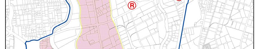
13 Figure 1 Neighborhoods Plan Diagram City of San José North San José Area Development Policy Neighborhoods Plan Page 11
14 Services and Amenities In accord with the North San Jose Area Development Policy and other city policies and ordinances, new services and amenities should be provided concurrent with the development of new employment and residential uses to support the employees who work and residents who live in North San Jose. New services should include additional retail, Neighborhood and Community parklands, trails, recreational facilities, libraries educational facilities and other services as needed. The following policies and implementation guidelines supplement the direction provided within the Policy. Retail As stated in the Guiding Principles, the City s goal is to create places with retail that encourage and strengthen pedestrian activity, and that are closely linked to public transit and other forms of transportation. Retail, and the environment or "place" it creates is recognized as an important amenity for the attraction of business and industry to North San Jose and for the quality of life of employees and residents within the Policy area. New retail development of all types is a critical element for the achievement of the Vision North San Jose goal to create a center of innovation, talent and opportunity where home, work and community are well integrated in a vibrant and attractive urban setting. The community has a particular interest in neighborhood retail to create place making and provide identity. The North San Jose Area Development Policy (Policy) provides capacity for the development of up to 1 million square feet of regional retail dispersed through out the Policy area and 1.7 million square feet of new neighborhood serving retail or similar commercial land use to support the continued growth and expansion of North San Jose. The addition of this type of retail is a deliberate part of a strategy to promote more transit use and pedestrian activity. A retail study for the North San Jose Area shows that North San Jose is currently under retailed and it will be significantly under retailed once the housing and industrial/office developments occurs. The North San Jose Neighborhoods Planning Taskforce developed multiple Guiding Principles that address retail, emphasizing the desire to use retail to promote and to incorporate retail into the development of an attractive, walkable urban environment in North San Jose. These Guiding Principles include design guideline criteria to ensure the development of good quality retail. In addition, the Taskforce assisted in identifying potential sites where retail would be most likely economically viable (refer to the attached Neighborhoods Plan Diagram). The Taskforce recognized the importance of having a long-term vision for retail development and of identifying City of San José North San José Area Development Policy Neighborhoods Plan Page 12
15 retail sites now even though most retail development will not happen until some point in the future when there is adequate market demand to support it The Neighborhoods Plan proposes further measures that the City can take to assure the development of a variety of types of successful retail development in North San Jose to support the local area and the City as a whole. Retail Implementation Guidelines The City should take measures to preserve sites for future neighborhood and regional retail development, including the initiation of amendments to the San Jose 2020 General Plan to establish commercial land use designations. These sites may include but not be limited to the potential retail sites identified in conjunction with the North San Jose Neighborhoods Planning Taskforce. Retail development should be a part of the City s place making strategy for North San Jose, including its incorporation into the development of a central place and the potential development of Main Street style retail, if/when the opportunity arises to establish these types of places at either the Moitozo property, walkable from new or existing residential areas or within the Core Area. The City should work proactively to market the North San Jose Regional and Neighborhood Retail sites an opportunities to retailers, developers and property owners. The City should strongly encourage the inclusion of amenity retail on the ground floor of new residential development in appropriate locations (with visibility, accessibility, appropriate dimensions and nearby market demand) to support retail businesses. The City should encourage the inclusion of amenity retail as part of new industrial development in appropriate locations (with visibility, accessibility, appropriate dimensions and nearby market demand) to support retail businesses. Such retail should be located and designed in a manner to provide an amenity to area employees and to further the vision of North San Jose as a center of innovation. By following the Guiding Principles and the standards set forth in the North San Jose Urban Design Guidelines, new retail development shall be of high quality design and contribute toward the establishment of a pedestrian-oriented environment and help to create a strong sense of place that is competitive with amenities in other high tech employment centers around the globe. City staff should work with developers to pay particular attention to the following preferred retail strategies that create good and flexible retail spaces: ceiling heights, space layout, utilities, servicing and trash, lighting, signage, façade, floor and ceiling structure, sidewalks and parking. City of San José North San José Area Development Policy Neighborhoods Plan Page 13
16 The City should support new retail development within North San Jose as a means of providing important services for residents and employees. Retail sites provide an opportunity for a wide variety of activities, including commercial uses such as restaurants, grocery stores, and medical services and also public uses, such as libraries and community centers. Retail Tools and Incentives The North San Jose Area Development Policy should continue to support Neighborhood and Amenity Retail development by not making it subject to the Traffic Impact Fee. Amenity Retail should continue to be encouraged as part of mixed-use projects. City staff should look for opportunities to maximize development sites of parks, schools, and city facilities like libraries, community centers in conjunction with Neighborhood Retail to create unique quality retail development and place making. City staff should promote the Enterprise Zone to retail businesses and retail developers, which provides special incentives to significantly reduce operating costs, including hiring tax credits, sales and use tax credits, and income tax credits for employees. City staff should promote training and workforce assistance programs to assist retail businesses meet workforce demands and opportunities of a global economy, and refer businesses to the City-sponsored BusinessOwnerSpace.com website so businesses can access additional business development resources. City staff should utilize market studies to convey the retail market opportunities and proactively promote North San Jose for retail development. City staff should market and promote North San Jose at Retail conferences, like the International Council of Shopping Centers, and do proactive broker outreach to retail brokers and developers. City staff should work with developers to ensure that preferred retail strategies are used for retail design and development. City staff should provide expedited review for tenant improvements to ensure a fast and streamlined permitting process. Redevelopment Agency Programs like the Façade Improvement Program and the Sign Grant Program should be utilized to assist retail development. City staff should promote small business programs to developers and prospective tenants that can assist in small business formulation and support the on-going health of the small business community, encourage non-franchise and family owned businesses as well as City of San José North San José Area Development Policy Neighborhoods Plan Page 14
17 national credit tenants, and promote the Small Business Ambassador Program, Financial Assistance Programs, the Entrepreneur Center. Types of Retail The Taskforce also identified four types of retail that could play an important role in supporting new employment and residential growth. These four types are generally defined as follows: 1. Amenity Retail Amenity retail is retail area specifically added as part of a mixed-use development to provide an amenity for the users (employees and/or residents) of the primary use on the site. Amenity retail spaces are typically as much as 20,000 square feet or more in area included as part of a mixed-use development. When well designed and operated, this type of retail can support pedestrian activity, enhance the visual environment and serve to make the overall project more attractive to potential users. 2. Neighborhood Retail Centers Neighborhood Retail Centers can play an important role in North San Jose by providing convenient and economically viable small-scale shopping centers in proximity to North San Jose employees and residents. These centers typically approximately 130,000 square feet of building area constructed in a mixed-use or standalone format. They may have multiple tenants. 3. Regional Shopping Centers Regional Shopping Centers provide an opportunity for larger format retailers that can serve employees and residents of the region. In some cases it may be possible to create clusters of multiple retailers that specialize in a particular type of retail (e.g. building supplies) that also support smaller retail shops. Because the North San Jose area is underserved by retail, the development of new regional shopping centers will benefit North San Jose, and also provide potential revenue for the City. These centers typically include 350,000+ square feet or more of retail space and should be placed at highly visible locations on the edges of North San Jose to maximize their accessibility. Regional retail development should be dispersed through out the Policy area. North San Jose regional retail should have quality design elements, including pedestrian accessibility and lively areas. Regional retail development should complement neighborhood retail development and be a positive contribution to both North San Jose and City retail enhancement. 4. Service Retail Service Retail is a small-scale type of retail that is intended to cater to on-site employees. While such retail may be open to the general public, it typically is not designed in a way to maximize its visibility and may not be economically competitive without some form of subsidy. Service Retail spaces are typically 5,000 square feet or less in area. City of San José North San José Area Development Policy Neighborhoods Plan Page 15
18 Retail Opportunities Map The North San Jose Retail Opportunities Map shows area where Amenity and Neighborhood Retail is supported by the General Plan. These areas include the Core Area and the areas that have a residential overlay designation. The regional retail sites can accommodate large retail tenants over 100,000 square feet and can be complemented with Neighborhood Retail. The concentration of retail uses is important to create synergy and a sense of place. Therefore, staff encourages retail development that offers Neighborhood Retail as part of a Regional Retail concept. City of San José North San José Area Development Policy Neighborhoods Plan Page 16


19 Figure 2 Retail Opportunities Map City of San José North San José Area Development Policy Neighborhoods Plan Page 17
20 Parkland and Open Spaces The City s vision for North San Jose is to provide public parks and recreational facilities in North San Jose, in accordance with the provisions of the North San Jose Area Development Policy, including a center park/plaza that acts as a focal point for the employment and residential communities, one or two larger community parks equaling approximately 30 to 40 acres, trails and trail connections, recreational facilities, sports fields and a mixture of passive and active open space areas for both residents and employees. The North San Jose Area Development Policy and the San Jose 2020 General Plan establish basic goals and policies for the development of parks and recreation facilities. The North San Jose Policy acknowledges that new development in North San Jose will generate the need for several new Neighborhood and Community Parks and includes the following park-related provisions; 1) Residential projects are subject to either the Parkland Dedication Ordinance (PDO) or the Park Impact Ordinance (PIO). Restricted projects for low to extremely low income units are exempt from both the PDO and PIO. Projects of 50 units or less are only required to pay the associated in-lieu fee. Dedication of land for park sites, rather than collection of funds, should be given priority in the implementation of the Parkland Dedication Ordinance and/or Park Impact Ordinance. 2) New parks, schools, community facilities and other supporting uses should be built within the Transit/Employment Residential District. 3) Neighborhood Parks should be at least five acres in size, but if the contiguous acreage of a single Residential Overlay area is less than 20-acres, a three-acre park within that area may be acceptable. 4) New Residential development should be within 1,000 feet of an existing or proposed neighborhood or community park (at least 3-acres in size). A more detailed strategy for the acquisition and development of parks in North San Jose was developed in conjunction with the North San Jose Neighborhoods Planning Taskforce which provides additional direction for the provision of parks and recreational facilities in the North San Jose area. A report on Parks and Recreation Facilities, recommended a strategy which balances PDO/PIO resources between the purchase of park land and the development of recreational facilities. It is anticipated that approximately 77 acres of park land will ultimately be acquired and developed in North San Jose with the use of PDO/PIO revenues (estimated $260 million) as well as with land dedicated and park improvements by residential developers. The proposed park land strategy would result in 1.16-acres of park land per 1,000 residents, when using a population number of 91,000 for both the existing and anticipated residents. This includes the 6 existing acres of parklands (Rosemary Gardens Park and Moitozo Park) and 23 acres associated with City of San José North San José Area Development Policy Neighborhoods Plan Page 18
21 trails (237 Bikeway Trail, Coyote Creek Trail and the Guadalupe River Trail) currently found in the Policy Area. The Taskforce, along with the Parks and Recreation Commission has indicated that the proposed strategy should be viewed as just a starting point for the development of parks and recreational facilities in North San Jose. They would like the City to continue to look for innovative methods to purchase and develop additional parklands above and beyond what can be developed with just PDO/PIO funding. Parks Implementation Guidelines During the early phases of the Policy s implementation, the City will continue to implement the Policy direction that Acquisition of land for park sites, rather than collection of funds, should be given priority in the implementation of the Parkland Dedication Ordinance and/or Park Impact Ordinance. In the later phases of North San Jose development, the collection of PDO/PIO resources should be balanced between the purchase of park land and the development of recreational facilities. The City should aim to develop a minimum of 34 acres of new neighborhood parks within the North San Jose Policy area, distributed amongst, and centrally located within, the new residential areas as portrayed on the Neighborhood Master Plan. The City should aim to develop approximately 43 acres of new community park land and/or major recreational amenities to include: o Community center o Aquatics center, o Sports fields. Projects on sites larger than 15 acres are required to dedicate land on-site for park purposes or purchase and convey to the City property off-site deemed to be appropriately sized and centrally located with respect to planned residential development. The City will collect in-lieu park fees from projects that benefit from either existing or proposed parks by other residential developers. Funds collected will be used to construct recreational or park facilities in North San Jose or to fund the acquisition of at least 35 acres of additional park lands for community facilities like a community center, an aquatic center, and sport fields. PDO/PIO resources should be used to develop a minimum three-acre public Central Park/Plaza, preferably within or in close proximity to the Core Area. The City should explore other potential sources of revenue (to supplement PDO/PIO funds) for the development of additional park lands and/or recreational facilities in North City of San José North San José Area Development Policy Neighborhoods Plan Page 19
22 San Jose in order to increase the ratio of park land to population to a level closer to the San Jose 2020 General Plan goal of 3.5 acres per 1,000 population. The joint use of school grounds for recreational purposes should be encouraged as a way of meeting the recreational needs of existing and future residents in North San Jose. New residential development in the Rincon South area of North San Jose should contribute towards the development of park facilities in accordance with the Rincon South Specific Plan. The City and Redevelopment Agency should look for opportunities to acquire and develop land for park purposes, to meet the needs of residents living within, and in the vicinity of affordable housing developments, exempted from PDO/PIO requirements to pay park in-lieu fees or dedicate park land. The City should explore the purchase of property in the vicinity of the northeast corner of Kerley Drive and Rosemary Drive for the development of a neighborhood park in accordance with the Rincon South Specific Plan. New neighborhood parks should be oriented and designed to meet the needs of nearby residents and active recreational uses should be limited to pick up sports fields in Neighborhood parks of at least 4 acres. The City should complete the Regional Trails in the North San Jose area. The future public parks and recreation facilities proposed in North San Jose should include a skate park, a dog park, and a community garden to serve the residents in the area. A prominently placed community center, of approximately 30, 000 square feet, should be developed in North San Jose, preferably within or adjacent to a retail commercial area. A portion of the Agnews site should be considered as a preferred location for community recreation facilities to include: o Four 225 x 360 soccer fields with a cricket field overlay o Four to six tennis courts o Restroom/concession building o Picnic facilities o Parking for approximately 240 cars. The site at the south west corner of Tasman and Zanker Road should be considered as a preferred location for community recreation facilities to include: o Four softball fields with a cricket field overlay, o Restroom/concession building City of San José North San José Area Development Policy Neighborhoods Plan Page 20
23 o Picnic facilities o Aquatic Center (a 50 meter indoor competitive pool with outdoor recreational pools adjacent to a two court basketball gym) o Community Room (3,600 square feet dividable community room with staff support offices) o Parking for 270 cars. The development of new parks and recreational facilities in the North San José Policy Area will require additional General Fund revenues to off-set the operation and maintenance costs if donations are not provided to underwrite such costs from new developments. Operating and maintenance costs at build-out of the proposed parks and recreational facilities are estimated at $3,625,000 annually in 2008 dollars. With the full build-out of the planned residential development, a significant amount of new retail is anticipated, consistent with the analysis included in the Retail Study prepared by the Office of Economic Development for the Taskforce. This new retail should generate a useful increase in annual sale taxes revenues to the City. The City can also expect additional real estate conveyance taxes collections. The City currently directs 64 percent of the conveyance tax collections to the Department of Parks, Recreation, and Neighborhood Services to augment General Fund revenues for parks maintenance, renovations, acquisitions, and new recreational developments. City of San José North San José Area Development Policy Neighborhoods Plan Page 21

24 Figure 3 Planned Neighborhood Parks City of San José North San José Area Development Policy Neighborhoods Plan Page 22

25 Figure 4 Potential Community Parks City of San José North San José Area Development Policy Neighborhoods Plan Page 23


26 Figure 5 Planned Trail Network City of San José North San José Area Development Policy Neighborhoods Plan Page 24
27 Library Services Library services should be provided within North San Jose as the employee and resident population increases. New library services are anticipated to be provided with a branch library, preferably in a retail or park/plaza that acts as a focal point for the employment and residential communities. Such a site should include the ability to expand the size of the facility based on population growth and funding in order to provide a full level of library services similar to other branches in the San Jose system. Library Services Implementation Guidelines A new library branch should be established when the population hits 25,000. The General Plan sets forth a goal or providing approximately 4 square feet of library space per resident in the service area. Accordingly, a 10,000 square foot library is recommended once the population reaches 25,000 people. Because the population is expected to steadily increase beyond this number, an expandable space is recommended so that an additional 10,000 square feet can be added when the population nears 50,000 with a potential maximum space of 30,000 square feet. The library building design and location should be compatible with the ability its increase physical size. A location within a high-density development is recommended, either in a retail setting or as part of a community center. Such a facility is preferable to a stand alone suburban branch, being more appropriate to the type of urban form planned for North San Jose. Access to adequate parking as well as to transit options, such as light rail or major bus routes, are essential elements. Library services are offered to workers at lunch time and after work as well as to residents during the daytime and evenings. If a retail-centered or community center branch location is not feasible, the City may consider a shared public library branch with a school library. Both Orchard and Santa Clara School Districts have expressed interest. Factors to consider with a joint-type facility like this include: ability to expand size beyond initial construction; access to sufficient parking and transit; governance of library; operations to allow large numbers of possible customers during lunch periods and other times while school is still in session; competing missions; any restrictions on collection or Internet usage by both students and general public; and responsibility for staffing, utilities, and repair. A third option for the provision of library services is to contract with the Santa Clara City Public Library to provide library services to North San Jose residents. Santa Clara City currently has plans to construct a 15,000 square foot branch library in the Riverwalk Development. It is designed to meet their city population City of San José North San José Area Development Policy Neighborhoods Plan Page 25
28 needs and does not currently include expansion plans for a greatly increased service population from North San Jose development. This may be a good alternative until the San Jose population reaches the point where a new branch is justified and funded. Alternatively, as a fourth option, a stand-alone County branch, similar to the Berryessa branch, is a possibility. Currently, the County of Santa Clara has not allocated funding for this branch. There is no General Fund dedicated allocation for this new branch, either for construction or operations. This project would be beyond Measure O, the Library Bond of 2000, which has funded the new construction of 20 branch libraries. The only current sources of revenue would be the Library Parcel Tax, currently expiring in 2014 with a current assessment of about $26 per single unit property, and current allocations from Construction and Conveyance Tax. The library currently receives 14.22% of the C&C tax. Both of these taxes are not used for general operations of a branch library. General Fund revenues from property tax may be affected by areas being within Redevelopment districts. Operating costs for 10,000 square foot branch would be about $740,000 annually in 2008 dollars for staffing, maintenance, collections, beyond initial construction and furnishing, including providing new collections. City of San José North San José Area Development Policy Neighborhoods Plan Page 26
29 Educational Facilities Schools in North San Jose should be multi-use facilities for school and community use, urban in form, located in consideration of both new and existing residents, and designed in a flexible manner to meet changing needs. Four school districts serve the students in North San Jose: Santa Clara Unified School District (K-12), Orchard School District (K-8), Eastside Union High School District (9-12) and San Jose Unified School District (K-12). New residential development is planned within each of these four jurisdictions. Each school district is responsible, independently of the City, for providing educational services including school facilities within its boundaries. Preferred sites for new school facilities are illustrated in the North San Jose Educational Needs Report. The largest growth is anticipated in the Santa Clara Unified and Orchard School districts. A financing agreement has been made with the Santa Clara Unified District. The Orchard District has funding in place to meet the initial growth that will occur within their boundaries. Growth in the East Side Union and San Jose Unified School Districts is expected to be very low in the immediate future and there is no basis to providing new facilities in these Districts at this time. Education Facility Implementation Guidelines Utilize existing capacity: Present plans call for the Santa Clara Unified School District to utilize the capacity at their existing schools until there is sufficient demand for a school in North San Jose. As those surrounding schools fill due to development in both the cities of Santa Clara and San Jose, development will be underway to build a new school in the heart of North San Jose. The first elementary/junior high school site is expected to be at the southwest corner of the Agnews Development Center on Zanker Road. Concurrently work will begin to secure rights to a future high school site in Alviso. San Jose Redevelopment Agency funding: The Redevelopment Agency has committed funding of up to $75 million for school site acquisition and school construction in the Santa Clara Unified District in North San Jose. This funding will pay for the acquisition and development of the Agnews school site and acquisition of the Alviso high school site. Preferred School sites: The following sites have been identified as potential school sites. Two of these sites, the Agnews (1) and Alviso High School (7) are the preferred locations for the first elementary/junior high and high school sites:. 1. Agnews Developmental Center The State of California plans to make this property available in Government agencies, including schools, have first priority for acquiring this site. This site would be ideal for the fifteen acres required for a K-8 school. City of San José North San José Area Development Policy Neighborhoods Plan Page 27
30 2. North River Oaks this property is between the Agnews property and the proposed Irvine development at the old Sony site. This, and the Agnews site, would provide easy access to the majority of the new residential developments in North San Jose. 3. Moitozo This site, lying between Zanker and N. First Street, is currently within Orchard and East Side Union district boundaries and not available for SCUSD schools. It would however, be an ideal site for community facilities, a park, a library and a school. 4. George Mayne School expansion by providing more land to George Mayne School in Alviso, both the school and the park could be expanded. 5. VTA this site, located on the VTA administration site north of Montague and west of N. First Street is a small site that could accommodate an urban style (multistory) school. 6. Baypointe this site, located within the triangle formed by Zanker, N. First Street and Baypointe Drive is a small site that would require an urban style school and because of its location and proximity to planned development would probably be the last site to be developed into a school. 7. Alviso High School There is a 31 acre site located immediately east of the George Mayne School that has been identified as the preferred location for a future high school. City of San José North San José Area Development Policy Neighborhoods Plan Page 28
31 City of San José North San José Area Development Policy Neighborhoods Plan Page 29
The transportation system in a community is an
 7 TRANSPORTATION The transportation system in a community is an important factor contributing to the quality of life of the residents. Without a sound transportation system to bring both goods and patrons
North San José Area Development Policy
 North San José Area Development Policy City of San José Table of Contents 1. Background...3 Policy Area Boundaries...4 Participating Agencies...4 2. Vision and Purpose...4 Core Area...5 Transit/Employment
The Five Components of the McLoughlin Area Plan
 The Five Components of the McLoughlin Area Plan This documents contains the complete language of the five components of the McLoughlin Area Plan: The Vision Statement The Values The Guiding Principles
CHAPTER 7: Transportation, Mobility and Circulation
 AGLE AREA COMMUNITY Plan CHAPTER 7 CHAPTER 7: Transportation, Mobility and Circulation Transportation, Mobility and Circulation The purpose of the Transportation, Mobility and Circulation Chapter is to
3.1 community vision. 3.3 required plan elements
 Chapter 3 Community Form 3.1 community vision 3.2 Parks & landscaping concepts 3.3 required plan elements D R A F T 20 Community Form Chapter 3 3.0 Community form 3.1 community vision The Specific Plan
Chapter 4. Linking Land Use with Transportation. Chapter 4
 Chapter 4 Linking Land Use with Transportation Chapter 4 59 Chapter 4 Linking Land Use with Transportation Community Design and Transportation Program Introduction Since the 1950s, the predominant development
Silverdale Regional Center
 Silverdale Regional Center Vision for Silverdale Regional Center The Silverdale Regional Center Plan (Plan) will guide the evolution of the Silverdale Regional Center from a collection of strip malls and
PLAN ELEMENTS WORKSHOP. April 5, 2016
 PLAN ELEMENTS WORKSHOP April 5, 2016 needs more housing. But there is no one-size fits-all solution. Every neighborhood has its own character. In some places, density is not only appropriate it is badly
The University District envisions, in its neighborhood
 Envisioning the University District Link Light Rail in Seattle s neighborhoods CIY OF SEALE CONCEP-LEVEL SAION AREA PLANNING RECOMMENDAION RESOLUION # 30165 EXHIBI L Vision 08.2000 he University District
REGIONAL ACTIVITY CENTER
 DRAFT REGIONAL ACTIVITY CENTER 70 EAST BENCH MASTER PLAN DRAFT 06 Introduction The East Bench Regional Activity center is comprised of large educational, research, medical, and employment centers. These
2.0 THE PLATINUM TRIANGLE VISION
 2.0 THE PLATINUM TRIANGLE VISION The envisions an exciting future for the area surrounding Angel Stadium of Anaheim, the Honda Center and The Grove of Anaheim. 2.1 Planning Principles In order to further
DALY CITY VISIONING PROCESS COMMUNITY WORKSHOP 3 MAY 8, 2008
 DALY CITY VISIONING PROCESS COMMUNITY WORKSHOP 3 MAY 8, 2008 PROCESS General Plan - a statement of the community s values, vision and aspirations for now and into the future... Timeframe LONG TERM - 2030
Town Center (part of the Comprehensive Plan)
") Town Center (part of the Comprehensive Plan) Mercer Island Town Center Looking North (2014) In 1994, a year-long process culminated in a set of design guidelines and code requirements for the Town Center
Town Center (part of the Comprehensive Plan) Mercer Island Town Center Looking North (2014) In 1994, a year-long process culminated in a set of design guidelines and code requirements for the Town Center
DRAFT Land Use Chapter
 Stevens Creek Urban Village DRAFT 1 18 17 Land Use Chapter INTRODUCTION This Land Use Chapter describes how the Stevens Creek Urban Village will accommodate the growth that is planned for it in the Envision
THE 355/270 CORRIDOR:
 THE 355/270 CORRIDOR: Strategic Ideas for Sustaining a Livable Work Place Project Summary ACCESS LIFE DESIGN HEALTH WORK Montgomery County Planning Department The Maryland-National Capital Park and Planning
4.1.3 LAND USE CATEGORIES
 4.1.3 LAND USE CATEGORIES a. City Center District The City Center District incorporates the existing character and mix of uses in downtown Belmont to encourage redevelopment and new development in keeping
Transportation. Strategies for Action
 Transportation A major priority for the Overlake Neighborhood is to develop a multimodal transportation system. To achieve this system, a balance has to be found among travel, circulation and access needs;
Robbinsdale LRT Station. CDI Development Guidelines. August Overview
 Robbinsdale LRT Station August 2018 Overview The City of Robbinsdale may have the coolest opportunity site along the 13 mile stretch of the Bottineau LRT corridor / Blue Line extension. Located a block
Implementation Guide Comprehensive Plan City of Allen
 Implementation Guide 2030 Comprehensive Plan City of Allen DRAFT 2015 Implementation Guide Allen 2030 Comprehensive Plan INTRODUCTION The Comprehensive Plan serves as a guide for the growth and development
FUTURE LAND USE ELEMENT
 FUTURE LAND USE ELEMENT GOAL I: To create and sustain a great place to live, play, and prosper Objective 1: The City of Ocala shall incorporate the principles and strategies of the Ocala 2035 Vision into
EXHIBIT A. Tax Increment Reinvestment Zone No. 1 (Town Center) First Amended Project Plan 1
 First Amended Project Plan 1") EXHIBIT A Tax Increment Reinvestment Zone No. 1 (Town Center) First Amended Project Plan 1 1 As amended by Resolution No. 2008-02-001(TR1R) of the Tax Increment Reinvestment Zone No.1, and approved to
EXHIBIT A Tax Increment Reinvestment Zone No. 1 (Town Center) First Amended Project Plan 1 1 As amended by Resolution No. 2008-02-001(TR1R) of the Tax Increment Reinvestment Zone No.1, and approved to
Concord Community Reuse Project Goals and Guiding Principles. Overarching Goals (OG)
") Concord Community Reuse Project Goals and Guiding Principles Overarching Goals (OG) No priority is implied by the order of presentation of the goals and guiding principles. Overarching goals for the Concord
Concord Community Reuse Project Goals and Guiding Principles Overarching Goals (OG) No priority is implied by the order of presentation of the goals and guiding principles. Overarching goals for the Concord
CHAPTER 3 VISION, GOALS, & PLANNING PRINCIPLES. City of Greensburg Comprehensive Plan. Introduction. Vision Statement. Growth Management Goals.
 CHAPTER 3 VISION, GOALS, & PLANNING PRINCIPLES Introduction The Greensburg Comprehensive Plan is intended as a working community document. A combination of long and short-term goals, this document is intended
TOD 101 CREATING LIVABLE COMMUNITIES WITH TRANSIT
 1 CREATING LIVABLE COMMUNITIES WITH TRANSIT What are transit Centered Communities? Benefits of Partnerships to Support and Implement What You Will Learn Portland s Pearl District Your Trainers Today Catherine
Sahuarita District & Phase 1 Master Plan. Town Council December 11, 2017
 Sahuarita District & Phase 1 Master Plan Town Council December 11, 2017 Visioning Study Visioning Process Advisory Group Meetings Community Questionnaire Town Center Case Studies Community Analysis The
EXISTING COMPREHENSIVE PLAN
 EXISTING COMPREHENSIVE PLAN Town Center Land Use Element: V. LAND USE POLICIES Town Center Mercer Island's business district vision as described in "Your Mercer Island Citizen-Designed Downtown" was an
3. VISION AND GOALS. Vision Statement. Goals, Objectives and Policies
 Vision Statement Queen Creek s interconnected network of parks, trails, open spaces and recreation opportunities provide safe and diverse activities and programs that sustain its unique, small town, equestrian
RECREATION AND OPEN SPACE ELEMENT GOALS, OBJECTIVES, AND POLICIES
 RECREATION AND OPEN SPACE ELEMENT GOALS, OBJECTIVES, AND POLICIES Goal 7 To provide park facilities, recreation programs, and open space resources that are safe, adequate, and accessible to all City residents,
iii. Visioning framework
 III. VISION iii. Visioning framework III.1 Overview A vision is a clear and succinct description of what an institution and its community should look like after it successfully implements its goals and
Today Land & People. Northeast Nampa Gateway District. Employment. Land Use Characteristics. Demographics. Current Zoning
 Today Land & People Employment Major employers include Saint Alphonsus, the College of Western Idaho, the Auto Mall, Sorrento Lactalis and Walmart. 3,004 jobs in 2010 (COMPASS-CIM 2040 TAZ data) 4,345
THEMES, VISION, + PRINCIPLES
 CHAPTER 2: THEMES, VISION, + PRINCIPLES This page intentionally left blank. 20 VISION DRAFT AUGUST 2018 2 2 THEMES, VISION, + GUIDING PRINCIPLES The Key Themes, Vision, and Guiding Principles presented
Table of Contents. Elm Avenue Improvement Plan City of Waco, Texas. Introduction 1. Existing Context 1 Figure 1 2.
 Table of Contents Introduction 1 Existing Context 1 Figure 1 2 Plan Guidelines 3 Future Urban Form 4 The West-End 4 Main Street 6 The East-End 7 Figure 2 9 Public Improvement Recommendations 7 General
1. Parks & Recreation Neighborhood Parks Community Parks Special Use Sites 2. Open Space 3. Trails
 Appendix A: Park Classifications The intent of parks and recreation classifications is to aid in making acquisition and design decisions for park sites, facilities and the organization of recreation space
ROBBINSDALE LRT STATION CDI DEVELOPMENT GUIDELINES
 August 2018 OVERVIEW The City of Robbinsdale has a prime-opportunity site in the middle of the 13 mile stretch of the Bottineau LRT corridor / Blue Line extension. Robbinsdale offers a prominent, vital,
CHAPTER 1. Ms. Guajardo s Class - Central Elementary CH 1 1
 INTRODUCTION CHAPTER 1 Ms. Guajardo s Class - Central Elementary CH 1 1 1.1 SETTING South Centre City is a linear corridor south of Downtown Escondido paralleling Centre City Parkway and South Escondido
Midtown Greenway Land Use and Development Plan Executive Summary
 Midtown Greenway Land Use and Development Plan Executive Summary Introduction The Midtown Greenway Land Use and Development Plan sets policy direction for land use and development in the Midtown Greenway
Horizon 2035 Land Use and Transportation Element
 CITY OF SUNNYVALE Horizon 2035 Land Use and Transportation Element City Council Study Session March 7, 2017 Overview General Plan Context Mixed Use Villages Transportation Mode & Parking General Plan Policy
Hopkins. Development Guidelines May Overview. Sponsored by: Blake Road Corridor Collaborative City of Hopkins
 Hopkins Blake Road LRT Station Area Development Guidelines May 2015 Sponsored by: Blake Road Corridor Collaborative City of Hopkins Overview Hopkins is a dynamic community of over 17,000 residents located
In surveys, Dallas residents say what they want to change most
 NEIGHBORHOODS ELEMENT In surveys, Dallas residents say what they want to change most in the city is its appearance they want it to look beautiful, with trees and pedestrian-friendly neighborhoods. The
6. DOWNTOWN. The Downtown Element focuses on supporting and expanding the vitality and enhancement of Downtown Chico as the City s central core.
 VISION In 2030, Downtown Chico is the heart of the community and the center of cultural activity. Engaging and active at the street level, it is a multi-story, mixed-use hub, with specialty retail, restaurants,
Additional information about land use types is given in Chapter 5. Design guidelines for Centers and Neighborhoods are given in Chapter 7.
 4. Place Types Introduction In Albemarle County s Development Areas, the Neighborhood is the fundamental unit of community planning. The County s Neighborhood Model, an adopted part of the Comprehensive
TEMPLE MEDICAL & EDUCATION DISTRICT
 City of Temple, Texas TEMPLE MEDICAL & EDUCATION DISTRICT 1 Description. The City of Temple joined in partnership with key public and private entities to jointly promote education and medical activities
S A C R A M E N T O C O U N T Y JACKSON HIGHWAY & GRANT LINE EAST VISIONING STUDY
 JACKSON HIGHWAY & GRANT LINE EAST S A C R A M E N T O C O U N T Y P L A N N I N G D E P A R T M E N T SUMMARY AND WORKBOOK November 19, 2008 History of the Visioning Study Sacramento County has two growth
CHAPTER 12 IMPLEMENTATION
 CHAPTER 12 IMPLEMENTATION The 2010 Town of Denton Comprehensive Plan is intended to capture a vision of the future of Denton. As such, it provides a basis for a wide variety of public and private actions
SECTION ONE: INTRODUCTION. introduction
 introduction 1 INTRODUCTION Since it was first established in 1843 as a trading post for the Hudson s Bay Company, Victoria has evolved into a Provincial capital city that is recognized across Canada and
BROOKLYN PARK / 85TH AVE LRT STATION CDI DEVELOPMENT GUIDELINES DRAFT
 August 2018 Page intentionally left blank The Brooklyn Park Library adjacent to the 85th Ave LRT Station Area. OVERVIEW The Blue Line LRT Extension / Bottineau corridor offers a unique opportunity to leverage
1.0 VISION STATEMENT. December 6, PRINCIPLES
 Vision Statement Lincoln Regional Airport 1.0 VISION STATEMENT 1.1 City LOCATION of AND OVERVIEW The Easton Lincoln Place Land Use Master Plan identifies the principles, goals, policies, and standards
URBAN DESIGN BRIEF URBAN DESIGN BRIEF 721 FRANKLIN BLVD, CAMBRIDGE August 2018
 URBAN DESIGN BRIEF URBAN DESIGN BRIEF 721 FRANKLIN BLVD, CAMBRIDGE August 2018 DESIGN BRIEF CONTENTS PART A 1.0 INTRODUCTION 2.0 DESCRIPTION & ANALYSIS OF SITE CONTEXT 3.0 DESIGN CONSTRAINTS AND OPPORTUNITIES
RECREATION AND OPEN SPACE ELEMENT
 RECREATION AND OPEN SPACE ELEMENT Last amended August 19, 2008 Table of Contents Objective Page 5.1 Park system defined... 5-1 5.2 Access to parks and recreational facilities... 5-2 5.3 Recreation and
Neighborhood Districts
 NEIGHBORHOOD DISTRICTS SEVEN MAIN DISTRICTS Neighborhood Districts While the Development Plan provides a broad-scale overview of the neighborhood, this section focuses on uses and relationships at the
4- PA - LD - LIVELY DOWNTOWN. LD - Background
 4- PA - LD - LIVELY DOWNTOWN LD - Background The downtown has been the service centre for the community since the city s inception and the area continues to supply people with their personal services,
Status Report: MD 355 Project
 Status Report: MD 355 Project OCTOBER 2006 M-NCPPC MONTGOMERY COUNTY PLANNING DEPARTMENT Summary of Community Comments, and break to the Results of the MD 355 Participation Session Brookside Gardens -
SUMMERSIDE / MT. CARMEL REINVESTMENT CORRIDOR COMMUNITY DEVELOPMENT STRATEGY
 SUMMERSIDE / MT. CARMEL REINVESTMENT CORRIDOR COMMUNITY DEVELOPMENT STRATEGY FEBRUARY 2013 I. Location of the Summerside/Mt. Carmel Reinvestment Corridor The Summerside/Mt. Carmel Reinvestment Corridor
Town Center. Block 5 Existing multifamily residential units are expected to remain.
 Area Guidelines Germantown s districts should be developed as distinct communities with unique features that are supported through the guidelines. The guidelines not only help distinguish these districts
CAL POLY MASTER PLAN UPDATE, March 2015
 Some Key Themes in the General Guiding Principles Academic Mission The plan must foremost advance the University s academic mission and student success. Foresight and Adaptability The plan should take
City of Farmington. Downtown Plan. Amendment to the 1998 Master Plan Adopted October 11, 2004
 City of Farmington Amendment to the 1998 Master Plan Adopted October 11, 2004 Introduction Planning Background 1 Scope and Components of the Plan Amendment 2 Concept Introduction 3 Plan Concepts 3 Conceptual
Port Lavaca Future Land Use
 Port Lavaca Future Land Use Introduction The City of Port Lavaca is beginning to see sustained growth, after many years of relative stable population. New single family homes, apartments, and businesses
Planning Board Briefing
 Planning Board Briefing Why Now? The Sector Plan Implementation Chapter States: Before Stage 1 begins, the following must occur: Approval of the Sectional Map Amendment. Approval of the Greater Lyttonsville
Policies and Code Intent Sections Related to Town Center
 Policies and Code Intent Sections Related to Town Center The Town Center Vision is scattered throughout the Comprehensive Plan, development code and the 1994 Town Center Plan. What follows are sections
Chapter 2: Vision, Goals and Strategies
 Chapter 2: Vision, Goals and Lake Elmo Today & Tomorrow Comprehensive Plan 2040 2 VISION, GOALS & STRATEGIES - DRAFT 4-6-2018 INTRODUCTION Comprehensive Plan Purpose Perhapse the most important objective
V. Vision and Guiding Principles
 V. Vision and Guiding Principles The Master Plan for the Powers Ferry Corridor seeks a foundation in the desires of the community. At times, various elements of the community offered opposing viewpoints,
San Jose. Memorandum. s lulls, FROM: Kim Walesh Rosalynn Hughey TO: HONORABLE MAYOR AND CITY COUNCIL
 COUNCIL AGENDA: 5/22/18 FILE: 18-622 ITEM: 10.2 CITY OF San Jose CAPITAL OF SILICON VALLEY TO: HONORABLE MAYOR AND CITY COUNCIL Memorandum FROM: Kim Walesh Rosalynn Hughey SUBJECT: URBAN VILLAGE DATE:
Derry Green Corporate Business Park
 Town of Milton Derry Green Corporate Business Park Urban Design Guidelines BMI/Pace - June 2010 Draft 3 Prepared by: Brook McIlroy Planning + Urban Design / Pace Architects Suite 300-51 Camden Street Toronto,
Developer s Program. The Station at East 54
 Developer s Program The Station at East 54 Existing Conditions The Station at East 54 is proposed for a 1.12 acre site at the northeast corner of Hamilton Road and Prestwick Road, tucked between the East
City of Nogales General Plan
 Open Space, Parks, Recreation and Trails City of Nogales General Plan Residents of Nogales place a high priority in the development of a comprehensive system of open space, parks, recreation and trails
The Vision. Photo provided by The Minervini Group. 46 Vision, Objectives & Strategies
 Vision, Objectives & Strategies The is the public framework and guide for future development of the Grand Traverse Commons. The establishes public polices for infrastructure, the preservation of natural
TRANSIT ORIENTED DEVELOPMENT PINELLAS COUNTY MPO LIVABLE COMMUNITIES INITIATIVE PINELLAS COUNTY COMPREHENSIVE PLAN AMENDMENTS
 PINELLAS COUNTY MPO LIVABLE COMMUNITIES INITIATIVE MODEL LAND DEVELOPMENT CODE TRANSIT ORIENTED DEVELOPMENT PINELLAS COUNTY COMPREHENSIVE PLAN AMENDMENTS MPO Livable Communities Initiative Goal: Improve
A. WHAT IS A GENERAL PLAN?
 I. Introduction A. WHAT IS A GENERAL PLAN? A general plan is the planning guideline for the future of a city. It contains goals and policies which regulate urban development, the protection of the natural
West Ocala Vision & Community Plan City Council Work Session. Presented by West Ocala Community Plan Steering Committee
 West Ocala Vision & Community Plan City Council Work Session Presented by West Ocala Community Plan Steering Committee November 29,2011 Ocala 2035 Vision West Ocala Community Vision & Master Plan West
Comprehensive Plan ADOPTED APRIL 2014
 Comprehensive Plan ADOPTED APRIL 2014 8 8. Outstanding Recreational & Cultural Opportunities We are proud of our community s parks and recreation system. Our community will ensure that the legacy of our
Mark-up of the effect of the proposed Bronte Village Growth Area OPA No.18 on the text of section 24, Bronte Village, of the Livable Oakville Plan
 Mark-up of the effect of the proposed Bronte Village Growth Area OPA No.18 on the text of section 24, Bronte Village, of the Livable Oakville Plan Notes: This document is provided for information purposes
HE VISION. Building a Better Connected Place
 HE VISION Building a Better Connected Place WALK INTO THE FUTURE. Life in Cranberry, 2030 Here s what our residents told us they wanted to see in their community by 2030: The Cranberry of 2030 is a place
DOWNTOWN NORFOLK COUNCIL ACTION PLAN. Strategic Initiatives Focus Area Objectives. Departmental Focus Area Key Objectives
 DOWNTOWN NORFOLK COUNCIL ACTION PLAN FY18 Strategic Initiatives Focus Area Objectives Departmental Focus Area Key Objectives STRATEGIC INITIATIVES FOCUS AREA OBJECTIVE #1: NURTURE A VIBRANT URBAN ENVIRONMENT
Corridor Vision. 1Pursue Minnehaha-Hiawatha Community Works Project. Mission of Hennepin County Community Works Program
 1Pursue Minnehaha-Hiawatha Community Works Project Minnehaha-Hiawatha Community Works is a project within the Hennepin Community Works (HCW) program. The mission of the HCW program is to enhance how the
CHARLES PUTMAN CHARLES PUTMAN AND ASSOCIATES, INC
 MEMORANDUM CHARLES PUTMAN & ASSOCIATES, INC. LAND DEVELOPMENT CONSULTANTS PLANNING ZONING PERMITTING 4722 NW Boca Raton Boulevard, Suite C-106 Boca Raton, Florida 33431 Phone: 561/994-6411 FAX: 561/994-0447
Plano Tomorrow Vision and Policies
 Plano Tomorrow Vision and Policies PLANO TOMORROW PILLARS The Built Environment The Social Environment The Natural Environment The Economic Environment Land Use and Urban Design Transportation Housing
4.9 Mendocino Avenue Corridor Plan Design Guidelines
 4.9 Mendocino Avenue Corridor Plan Design Guidelines The Mendocino Avenue Corridor Plan addresses the area between College Avenue and Steele Lane. Mendocino Avenue is a busy arterial that runs parallel
Complete Neighbourhood Guidelines Review Tool
 Complete Neighbourhood Guidelines Review Tool Prepared By: City of Regina Planning Department October 2014 Page 1 of 14 Community Development Review Checklist for Secondary Plans and Concept Plans The
A BLUEPRINT FOR BROCKTON A CITY-WIDE COMPREHENSIVE PLAN
 A BLUEPRINT FOR BROCKTON A CITY-WIDE COMPREHENSIVE PLAN Public Meeting October 2016 1 Plan Summary and Discussion Public Meeting May 4 2017 City of Brockton Bill Carpenter, Mayor Department of Planning
Visioning Statement and Guiding Principles
 Visioning Statement and Guiding Principles Planning for the Future The General Plan The General Plan represents Woodland's shared vision of the future and defines a path to lead the community toward its
Small Area Plan. South Gateway
 Small Area Plan Adopted May 12, 2008 South Gateway Purpose. The South Gateway Small Area Plan defines the City s expectations for the future of the southern entrance to the City at Interstate 85 and Highway
City of Hermosa Beach Administrative Policy #
 City of Hermosa Beach Administrative Policy # SUBJECT: Living Streets Policy Date: Approved by: City Council Authority: Public Works Department & Community Development Department Mayor, PURPOSE The City
DRAFT. October Wheaton. Design Guidelines
 October 2011 DRAFT Wheaton Design Guidelines 2 Draft - Design Guidelines - Wheaton Sector Plan Contents 04 Section 1: Introduction 06 Section 2: Context 08 Section 3: Design Guidelines 09 Goal 1: Create
ARLINGTON COUNTY, VIRGINIA
 ARLINGTON COUNTY, VIRGINIA County Board Agenda Item Meeting October 15, 2005 DATE: September 28, 2005 SUBJECT: Request to Advertise the adoption of the 2005 Clarendon Sector Plan C. M. RECOMMENDATION:
Pedestrian and Bike Bridge LOGO
 6.2.2 Pedestrian and Bike Bridge The proposed pedestrian and bike crossing re-envisions the existing bridge at Pismo Creek on Cypress Street. The bridge is currently underutilized by vehicular through
2040 LUP is a part of the Comprehensive Plan and carries the same legal authority. Economic Challenges
 1.1. Guiding Anchorage s Growth Where will new residents settle over the next two decades? Where will people work, shop, and play? Will there be enough room to grow? How will Anchorage look? Will growth
QUINCE ORCHARD/FIRSTFIELD CORRIDOR CITY OF GAITHERSBURG MTAP 2017
 QUINCE ORCHARD/FIRSTFIELD CORRIDOR CITY OF GAITHERSBURG MTAP 2017 ULI LEADERSHIP INSTITUTE 2017 The Team Allison Davis, WMATA Daniel Park, Rodgers Consulting Debbie Albert, Arlington County Harry Ross,
K. SMART ASSOCIATES LIMITED
 Planning Justification Report Zoning By-Law Amendment 185 King Street North Waterloo, Ontario April 7th, 2017 Project Reference Number 16-245 K. SMART ASSOCIATES LIMITED CONSULTING ENGINEERS AND PLANNERS
Gold Line Bus Rapid Transit Transit Oriented Development (BRTOD) Helmo Station Area Plan
 Helmo Station Area Plan") Appendix F Gold Line Bus Rapid Transit Transit Oriented Development (BRTOD) Helmo Station Area Plan Introduction and Purpose of the Plan The Gold Line Bus Rapid Transit facility is an eleven-mile dedicated
Appendix F Gold Line Bus Rapid Transit Transit Oriented Development (BRTOD) Helmo Station Area Plan Introduction and Purpose of the Plan The Gold Line Bus Rapid Transit facility is an eleven-mile dedicated
Provide and maintain sufficient public parks, recreation facilities, and open space to meet the recreational needs of County residents and visitors.
 (ROS) Goal Provide and maintain sufficient public parks, recreation facilities, and open space to meet the recreational needs of County residents and visitors. OBJECTIVE ROS.01 The County shall acquire,
Living in Albemarle County s Urban Places
 Living in Albemarle County s Urban Places ALBEMARLE COUNTY, VIRGINIA A Closer Look at Albemarle s Approach to Managing Growth and Creating Quality Urban Environments www.albemarle.org Page 2 Living in
Draft Bergamot Area Plan
 ATTACHMENT 1 Draft Bergamot Area Plan Taskforce on the Environment April 15, 2013 www.bergamotplan.net 1 Overview WHAT IS THE BERGAMOT AREA PLAN? A Community-Based Planning Document Guiding the Future
BROOKHILL NEIGHBORHOOD MODEL ZONING MAP AMENDMENT PREFACE TO APPLICATION
 BROOKHILL NEIGHBORHOOD MODEL ZONING MAP AMENDMENT PREFACE TO APPLICATION June 15, 2015 Revised: August 1, 2016 I. VISION Brookhill is a proposed community based upon the principles of Albemarle County
Diridon Station Area: Framework for Implementation
 Diridon Station Area: Framework for Implementation LAND USE MISSION: The Diridon Station Area is the most significant opportunity for placemaking in San Jose. Development should integrate and expand into
ECONOMIC DEVELOPMENT. Guiding Principles
 ECONOMIC DEVELOPMENT Consistent with the Guiding Principle Make Fort Lupton a comable place for everyone, Fort Lupton will strive to create a sustainable standard of living and high quality of life for
SAN RAFAEL GENERAL PLAN 2040 INTRODUCTION AND OVERVIEW
 SAN RAFAEL GENERAL PLAN 2040 INTRODUCTION AND OVERVIEW Steering Committee Presentation February 14, 2018 Purpose of General Plan Guide land use and development decisions Coordinate transportation, infrastructure,
Arlington, Virginia is a worldclass
 EXECUTIVE S U M M A RY Arlington maintains a rich variety of stable neighborhoods, quality schools and enlightened land use policies, and received the Environmental Protection Agency s highest award for
Civic Center District
 Civic Center District The Civic Center district is the civic and social heart of Warrenville, containing such public buildings as the City Hall, Warrenville Public Library, Police Station, Park District
CHAPTER 6: Community Design and Appearance
 AGLE AREA COMMUNITY Plan CHAPTER 6 CHAPTER 6: Community Design and Appearance Community Design and Appearance How a community is designed and what a community looks like are attributes fundamental to the
OPEN HOUSE. Future. Neighborhood. Thursday April 27, :30 8:30 PM Refreshments provided Discovery Center, 4444 Hadley Avenue North
 OPEN HOUSE Thursday April 27, 2017 6:30 8:30 PM Refreshments provided Discovery Center, 4444 Hadley Avenue North The City Council has ini ated a planning process to guide future development on 206 acres