November 2018 THE DISTRICT AT CLIFTON HEIGHTS
|
|
|
- Owen Garrison
- 5 years ago
- Views:
Transcription


1 November 2018 THE DISTRICT AT CLIFTON HEIGHTS
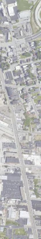


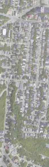


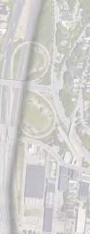


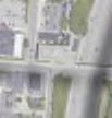

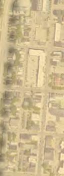


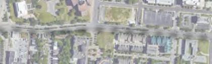

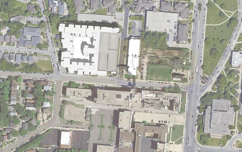
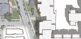
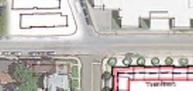
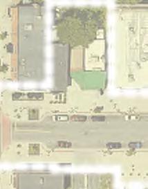
2 University of Cincinnati Enviornmental Protection Agency College of Medicine Martin Luther K in g Dr Clifton Ave Jefferson Av e The Heights Site Straight St 5 MIN (0.25 WALK Miles ) 10 MIN WALK (0.5 Miles) LEGEND d ft R Calhoun St am Willi Ta ard How W McMillan S t Green Spaces University of Cincinnati Ravine St E McMillan S t Clifton Heights Retail Areas Environmental Protection Agency Vi ne Primary Vehicular Route St Highway Secondary Vehicular Route November 20, Torti Gallas + Partners 601 West 5th Street, Suite 600 Los Angeles, California Regional Context 2

3 Regional Context 3

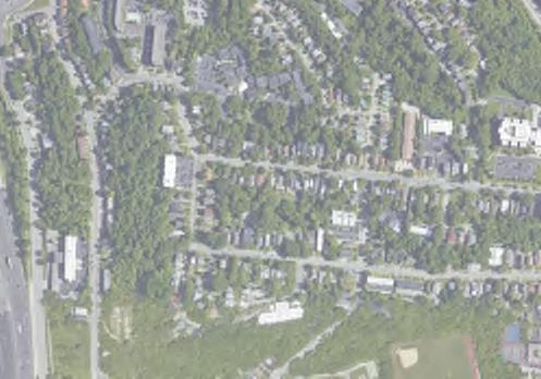
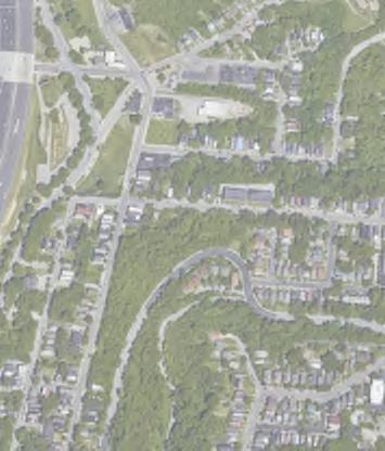
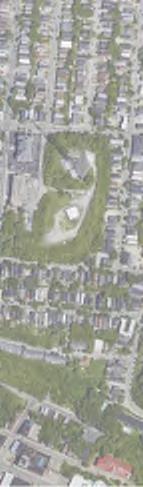
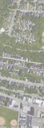
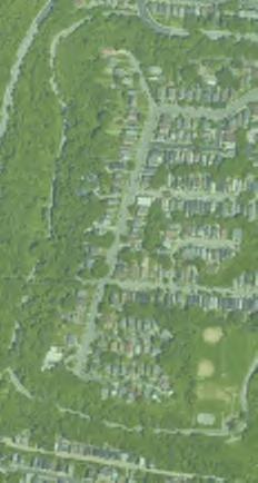
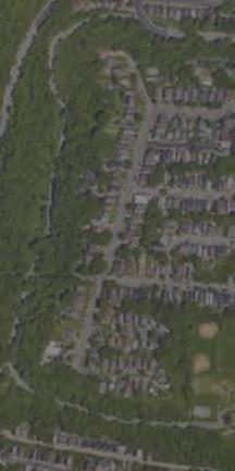
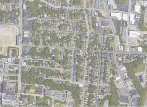
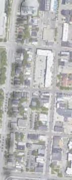
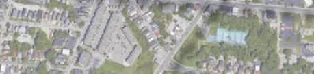
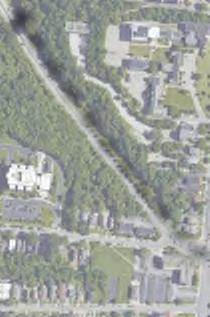
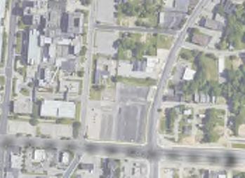
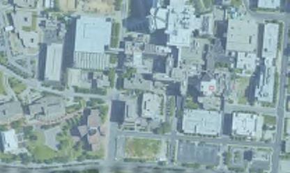
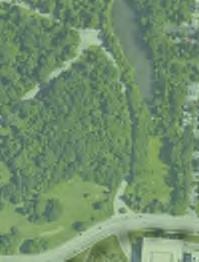
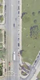
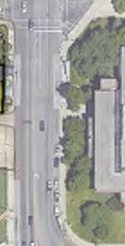
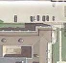
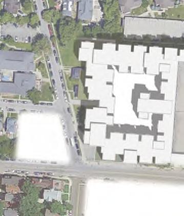
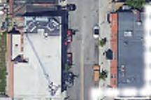
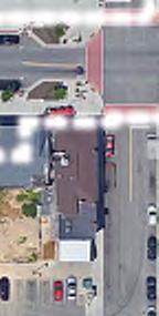
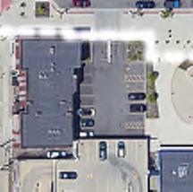
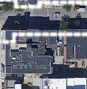
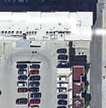
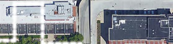
4 Aerial View Looking South West Aerial View Looking North West Aerial View Looking South East Aerial View Looking North East November 20, Torti Gallas + Partners 601 West 5th Street, Suite 600 Los Angeles, California D Context 4


5 Neighborhood Centers Site Area GOALS Retain and promote unique cultural and architectural characteristics of the older urban neighborhoods surrounding the University of Cincinnati. Develop and maintain quality housing. Design and implement a safe and integrated pedestrian network. Manage the overall flow of traffic and encourage other modes of transportation. November 20, Torti Gallas + Partners 601 West 5th Street, Suite 600 Los Angeles, California Guiding Plans 5

6 WHAT WE VE HEARD Make a Great Street Contemporary Architecture Grocery Store Curb Management Respect the architecture of the Hughes H.S. Coordinate with the University of Cincinnati Coordinate with Neighborhood on Residential Parking Permit Incorporate Public Art into the public realm Create market rate apartments that take advantage of views. Rooftop amenities and gardens Taper the density down to University Court Move Taft statue and rename Calhoun into Taft Street November 20, Torti Gallas + Partners 601 West 5th Street, Suite 600 Los Angeles, California What We ve Heard 6
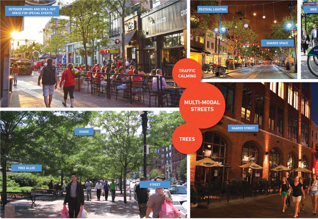
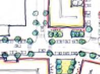
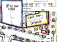
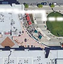
7 Placemaking 7
8 Placemaking 8


9 November 20, Torti Gallas + Partners 601 West 5th Street, Suite 600 Los Angeles, California Initial Ideas 9
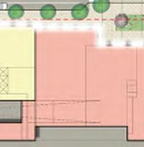
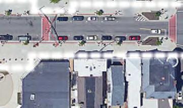
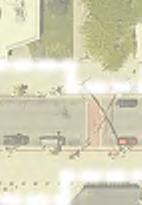
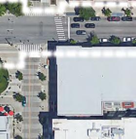
10 Straight Street looking East - Great Street (View 3) 10
 Lobby Retail with Parking/Residential Above Multifamily")
 Residential")


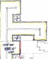
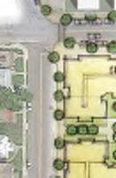
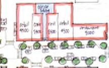
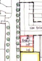
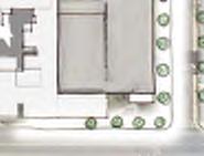
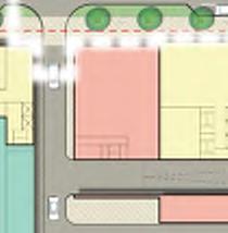
11 SITE PLAN LEGEND Hotel Retail with Cinema Above Cinema Lobby Plaza Residential (High-Rise) Lobby Retail with Parking/Residential Above Multifamily Housing University Ct Stratford Ave Clifton Ave Student Housing- 1,029 Beds Existing Parking Garage- 830 Spaces Hillel House (Existing) Residential 8 9 Existing Parking Garage Retail with Residential Above Townhomes/Parking with Residential Above Entrance to Residential Parking Above Entrance to Retail Parking Below 7 Under Construction SYMBOLS: 1 View Number and Location Straight St Service Road 1 Fairview Ave Herman St Calhoun St N November 20, Torti Gallas + Partners 601 West 5th Street, Suite 600 Los Angeles, California FT Illustrative Site Plan - Ground Level 11
 6 Residential 7 Multifamily")


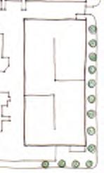
12 SITE PLAN LEGEND 1 Hotel 2 Cinema over Retail 3 Residential over Retail 4 Plaza 5 Residential over Retail (High-Rise) 6 Residential 7 Multifamily Housing University Ct Stratford Ave 6 10 Clifton Ave Student Housing- 1,029 Beds Existing Parking Garage- 830 Spaces Hillel House (Existing) University of Cincinnati Hughes STEM High School Straight St Service Road 12 Fairview Ave Herman St Calhoun St N November 20, Torti Gallas + Partners 601 West 5th Street, Suite 600 Los Angeles, California FT Illustrative Site Plan - Upper Level 12
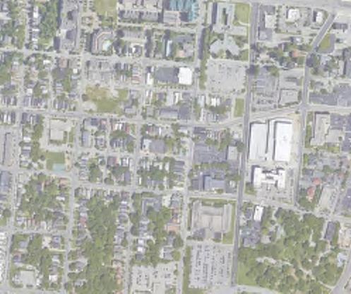
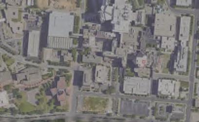
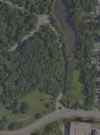
13 Aerial View Looking South West Aerial View Looking North West Aerial View Looking South East Aerial View Looking North East November 20, Torti Gallas + Partners 601 West 5th Street, Suite 600 Los Angeles, California D Existing 13


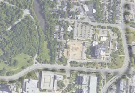
14 Aerial View Looking South West Aerial View Looking North West Aerial View Looking South East Aerial View Looking North East November 20, Torti Gallas + Partners 601 West 5th Street, Suite 600 Los Angeles, California D Proposed 14

15 Looking up Fairview Ave (View 1) 15


16 Clifton Ave Elevation 16

17 Straight Street looking West - Great Street (View 4) 17


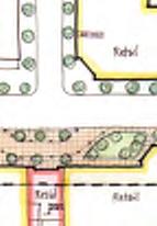
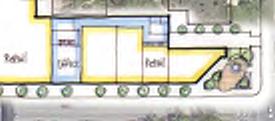
18 Proposed U-Square 14th and Vine Vine Street November 20, Torti Gallas + Partners 601 West 5th Street, Suite 600 Los Angeles, California Public Space Comparison 18

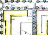
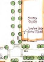
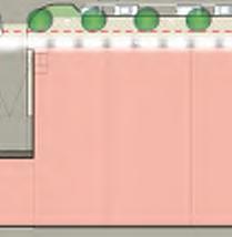
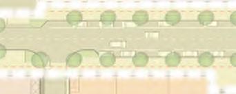
19 Straight Street Landscape Plan 19

20 Straight Street Landscape Plan 20

21 Straight Street Landscape Plan 21

22 Straight Street Landscape Plan 22

23 Straight Street looking East (View 3) 23


24 Existing: April 15 at 2:00pm Proposal: April 15 at 2:00pm November 20, Torti Gallas + Partners 601 West 5th Street, Suite 600 Los Angeles, California Straight St Shadow Comparison 24
25 Proposed Massing 25

26 Proposed Massing - Compared to Existing 26
27 Proposed Massing 27

28 Proposed Massing - Compared to Existing 28
")
29 Aerial along Clifton Ave looking Southwest (View 2) 29
30
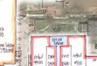
Property Profile 2954 WEST FRANKLIN ROAD MERIDIAN, ID
 082614 FOR SALE > MIXED-USE LAND Franklin & Ten Mile Land 2954 WEST FRANKLIN ROAD MERIDIAN, ID Property Profile > ~38 acres for sale, located on the NE corner of Franklin and Ten Mile > Power and gas running
The West College Avenue Corridor Redevelopment Plan
 The West College Avenue Corridor Redevelopment Plan Proposed dby Educational Property Group, Inc. & Apex Development Project Summary The intent of this proposal is to introduce market-driven mixed-use
PLAN ELEMENTS WORKSHOP. April 5, 2016
 PLAN ELEMENTS WORKSHOP April 5, 2016 needs more housing. But there is no one-size fits-all solution. Every neighborhood has its own character. In some places, density is not only appropriate it is badly
UCSF Parnassus Heights Re-Envisioning Process
 UCSF Parnassus Heights Re-Envisioning Process Community Working Group Meeting #5 February 27, 2019 Agenda Welcome, Introductions, Agenda Overview, and Review of Last Meeting Summary of Community Ideas
LOS ANGELES MISSION COLLEGE MASTER PLAN Master Plan DESIGN & DEVELOPMENT PRINCIPLES
 LOS ANGELES MISSION COLLEGE MASTER PLAN DESIGN & DEVELOPMENT PRINCIPLES 34 Quality Learning Along the Arroyo PROGRAM SUMMARY BY PROJECT The following are program summaries for each of the projects planned
Subareas 9 & 10 Master Plan Updates
 Atlanta BeltLine Subareas 9 & 10 Master Plan Updates Study Group Meeting 4 September 17, 2018 Washington Park Jamboree 1 22 miles, connecting 45 neighborhoods 22 MILES of transit 46 MILES of streetscapes
Parcel 5. Level 1 Application March 12, Design Submittal POST ROAD RESIDENTIAL
 P:\3371 Providence \graphic\meetings and Presentations\2018.03.12_Level 1 Submission/ I-195 Level Redevelopment 1 Design Submission.pdf District Commission Introduction The Level 1 conceptualization of
Future Proposed Development
 Future Proposed Development on and around Link light rail s Capitol Hill Station Meeting September 24, 2012 Tonight s Agenda 6:00 pm Open House 6:30 pm Introductions Richard Conlin, City of Seattle Councilmember/Sound
(DC1) Direct Development Control Provision DC1 Area 4
 Direct Development Control Provision DC1 Area 4") . General Purpose (DC) Direct Development Control Provision DC Area 4 The purpose of this Provision is to provide for an area of commercial office employment and residential development in support of the
. General Purpose (DC) Direct Development Control Provision DC Area 4 The purpose of this Provision is to provide for an area of commercial office employment and residential development in support of the
Lambeth Main Street Streetscape Improvements
 Lambeth Main Street Streetscape Improvements Open House October 5th, 2017 Agenda 1. Introduction 2. Project Background 3. Context 4. Project Objectives 5. Design Principles & Approach 6. Streetscape Design
Blue Line LRT Extension
 v e Noble Pkwy Noble Pkwy Xerxes Ave N Shingle Creek Penn Ave N Penn Ave N Fremont Ave N Lyndale Ave N S Washington Ave University Ave NE Blue Line LRT Extension LIGHT RAIL PLATFORM AND STATION DESIGN
393, 395, 397, 399, 401 and 403 Spring Garden Avenue Official Plan and Zoning By-law Amendment Application Preliminary Report
 STAFF REPORT ACTION REQUIRED 393, 395, 397, 399, 401 and 403 Spring Garden Avenue Official Plan and Zoning By-law Amendment Application Preliminary Report Date: March 29, 2010 To: From: Wards: Reference
LANDMARK CENTER BOSTON CIVIC DESIGN COMMISSION OCTOBER 1, 2013
 BOSTON CIVIC DESIGN COMMISSION OCTOBER 1, 2013 CONTENTS 01 PROJECT SUMMARY 03 PROGRAMMING & URBAN DESIGN 02 PROJECT SITE 04 AERIAL VIEW 05 EMERALD NECKLACE 06 SITE PLAN 07 EXISTING PHOTOS 03 FLOOR PLANS
U T D N o r t h C a m p u s T O D and D o w n t o w n D e n t o n T O D
 U n i v e r s i t y o f T e x a s a t D a l l a s C i t y o f R i c h a r d s o n U T D N o r t h C a m p u s T O D and D o w n t o w n D e n t o n T O D Rick Leisner, AICP Assistant Director of Development
Urban Design & Placemaking
 Urban Design & Placemaking What is Urban Design? Urban Design is the discipline of creating equitable, vibrant, and sustainable places with distinct identities. The profession pulls from other built environment
SITE PLAN REVIEW COMMITTEE MEETING SUMMARY
 DEPARTMENT OF COMMUNITY PLANNING, HOUSING AND DEVELOPMENT Planning Division/Site Plan Review Committee 2100 Clarendon Boulevard, Suite 700, Arlington, VA 22201 TEL 703-228-3525 FAX 703-228-3543 www.arlingtonva.us
NEWTONBROOK PLAZA. Aerial of Site SILVERCORE PROPERTIES INC. Wallman Architects
 Aerial of Site Precedents Legacy at Heron s Hill Don Valley Parkway / Sheppard Avenue West ARC Condominiums Bayview Avenue / Sheppard Avenue West Rhythm Condominium Brampton Yonge / Avondale Community
Courthouse Square Planning & Urban Design Study Working Group Meeting #11 September 2, 2014
 Courthouse Square Planning & Urban Design Study Working Group Meeting #11 September 2, 2014 1 Study Area Courthouse Square DRAFT Design Concepts A B C 3 Public Feedback July 23 Workshop & Online Survey
599 Kennedy Road - Official Plan Amendment and Zoning Amendment Application - Preliminary Report
 STAFF REPORT ACTION REQUIRED 599 Kennedy Road - Official Plan Amendment and Zoning Amendment Application - Preliminary Report Date: March 7, 2017 To: From: Wards: Reference Number: Scarborough Community
BROADWAY-ARBUTUS POLICIES. Adopted by City Council on July 7, NOTE: To be considered in combination with applicable guidelines
 50 City of Vancouver Land Use and Development Policies and Guidelines Community Services, 453 W. 12th Ave Vancouver, BC V5Y 1V4 F 873.7344 fax 873.7060 planning@city.vancouver.bc.ca BROADWAY-ARBUTUS POLICIES
ORDINANCE AN ORDINANCE TO ADD A NEW SECTION 4.N. IN THE ZONING CODE FOR THE TOWN OF MIDDLETOWN, RELATING TO MIXED-USE DEVELOPMENT
 Introduced: November 5, 2018 Approved: ORDINANCE 18-11-01 AN ORDINANCE TO ADD A NEW SECTION 4.N. IN THE ZONING CODE FOR THE TOWN OF MIDDLETOWN, RELATING TO MIXED-USE DEVELOPMENT BE IT ENACTED BY THE MAYOR
Clairtrell Area Context Plan
 Clairtrell Area Context Plan March 2005 Urban Development Services City Planning Contents 1. Introduction... 4 2. Development Structure... 6 2.1 Streets... 7 2.1.1 Sheppard Avenue and Bayview Avenue...
What Does It Take To Create A Town Center?
 What Does It Take To Create A Town Center? Context, Design, and Process The Prince Frederick Master Plan Update 1 Background and Overview A Brief History of Town Centers in Calvert County 2 Background
This Review Is Divided Into Two Phases:
 Semiahmoo Town Centre Review The purpose of this review: To review the Semiahmoo Town Centre Concept Plan, originally approved in 1993, to ensure that this centre will continue to serve the needs of South
Prosperity Hucks Area Plan. Transportation and Planning Committee May 11, 2015
 Prosperity Hucks Area Plan Transportation and Planning Committee May 11, 2015 Presentation Outline 1. Background and Location 2. Community Dialog Process 3. Activity Center Recommendations 4. Wedge Recommendations
Final Master Plan and Development Control Regulations
 1. INTRODUCTION CHECK LIST a. Introduction b. Table of contents c. Definitions. d. scope of works. 2. FINAL OVERALL MASTER PLAN a. SITE ANALYSIS and OVERVIEW: i. Existing and Proposed Site Plan Levels.
Behnke Ranch Property, Pasco County: Master Plan Development Approach
 February 24, 2014 , Pasco County: Master Plan Development Approach Location & Program The (Legacy PUD) is located in southwest Pasco County along State Road 54 approximately 1.5 miles west of the Suncoast
WEST LOOP DESIGN GUIDELINES CHECKLIST
 WEST LOOP DESIGN GUIDELINES CHECKLIST Section 1.0 General Strategies 1.1 DESIGN EXCELLENCE: ENCOURAGE HIGH QUALITY AND INNOVATIVE DESIGN OF NEW BUILDINGS WITHIN THE WEST LOOP WITHOUT BEING PRESCRIPTIVE
Preliminary Design Review. Poudre Garage Mixed Use December 14, 2015
 Preliminary Design Review December 14, 2015 1 Development Review Guide STEP 2 of 8 PRELIMINARY DESIGN REVIEW: APPLICATION General Information Preliminary design review is an opportunity for an applicant
TRANSIT NEIGHBORHOOD PLANS PROGRAM OVERVIEW
 TRANSIT NEIGHBORHOOD PLANS PROGRAM OVERVIEW OCTOBER 2017 Los Angeles Department of City Planning @LATNP and @Planning4LA Outline Introduction Policy Framework The Transit Neighborhood Plans Program Overview:
PINE CURVE REZONING. Property does not meet criteria for open space preservation and is not a candidate for a park
 PINE CURVE REZONING BACKGROUND Purchased as two parcels in 2001 and 2002 Annexed and Zoned Greater Downtown District Historic Center September 25, 2002 and October 7, 2002 WHAT THE PROJECT IS AND IS NOT
WINDSOR GLEN DESIGN GUIDELINES
 WINDSOR GLEN DESIGN GUIDELINES Adopted by Council, 2006 WINDSOR GLEN REDEVELOPMENT DESIGN GUIDELINES August 2006 1.0 Master Plan Organization For this area of the Coquitlam Town Centre, a mix of high,
Pentagon Centre (SP#297) Phase I Site Plan Amendments SPRC #3
 Phase I Site Plan Amendments SPRC #3") Pentagon Centre (SP#297) Phase I Site Plan Amendments SPRC #3 CPHD April 23, 2015 Meeting Agenda Overview of approved Phase I Site Plan Review of relevant design guidelines Presentation of current proposal
Pentagon Centre (SP#297) Phase I Site Plan Amendments SPRC #3 CPHD April 23, 2015 Meeting Agenda Overview of approved Phase I Site Plan Review of relevant design guidelines Presentation of current proposal
PRIMARILY RESIDENTIAL DEVELOPMENT PROJECT VISION TOWER 4 TOWER 2 TOWER 1 TOWER 5
 TOWER 4 RESIDENTIAL 120,000 sq. ft. TOWER 2 RESIDENTIAL 275,000 sq. ft. TOWER 5 RESIDENTIAL 165,000 sq. ft. TOWER 1 RESIDENTIAL 130,000 sq. ft. HOTEL 150,000 sq.ft The proposed redevelopment of Eau Claire
Community Meeting November 18, 2015
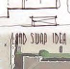
 Top Concerns We ve Heard Use of Urban Road Code Total number of units and effect on schools and transportation Land swaps with Parks Department: how do these benefit the community? Zoning classifications:
ORANGE LINE TRANSIT NEIGHBORHOOD PLANS VAN NUYS NEIGHBORHOOD COUNCIL, PLUM COMMITTEE DEPARTMENT OF CITY PLANNING, CITY OF LOS ANGELES
 Photo: Mission Meridian(Moule & Polyzoides) ORANGE LINE TRANSIT NEIGHBORHOOD PLANS VAN NUYS NEIGHBORHOOD COUNCIL, PLUM COMMITTEE DEPARTMENT OF CITY PLANNING, CITY OF LOS ANGELES JULY 18, 2018 Project partially
[PLANNING RATIONALE] For Site Plan Control and Lifting of Holding Zone By-Law 101 Champagne Avenue. May 23, 2014
![[PLANNING RATIONALE] For Site Plan Control and Lifting of Holding Zone By-Law 101 Champagne Avenue. May 23, 2014](/thumbs/75/71599615.jpg "[PLANNING RATIONALE] For Site Plan Control and Lifting of Holding Zone By-Law 101 Champagne Avenue. May 23, 2014") [PLANNING RATIONALE] For Site Plan Control and Lifting of Holding Zone By-Law 101 Champagne Avenue May 23, 2014 Contents 1.0 Introduction... 2 2.0 Site Context... 2 2.1 Adjacent Uses... 2 Figure 1: Site
[PLANNING RATIONALE] For Site Plan Control and Lifting of Holding Zone By-Law 101 Champagne Avenue May 23, 2014 Contents 1.0 Introduction... 2 2.0 Site Context... 2 2.1 Adjacent Uses... 2 Figure 1: Site
Metro. Activity Center Design Guidelines. Recommendations For Developing Focused, Mixed-Use Commercial/Residential Centers
 Metro Activity Center Design Guidelines Recommendations For Developing Focused, Mixed-Use Commercial/Residential Centers Metro Activity Centers What is a MAC? Legacy, the adopted guide for the future growth
Part 2 Common Elements
 WHITE FLINT SECTOR PLAN Round Table Discussion: Part 2 Common Elements October 8, 2007 The M-NCPPC 1 Role Regional Marketplace North Bethesda s Downtown with a Conference Center District The M-NCPPC 2
MAIN STREET DESIGN GUIDELINES CONTEXT
 MAIN STREET DESIGN GUIDELINES CONTEXT VISION The re-imagining of Main Street offers an unparalleled opportunity to strengthen and link Fredericton North through the integration of local neighbourhoods,
TO: Denver Planning Board FROM: Analiese Hock, Senior City Planner DATE: March 13, 2018 RE:
 Community Planning and Development Planning Services 201 W. Colfax Ave., Dept. 205 Denver, CO 80202 p: 720.865.2915 f: 720.865.3052 www.denvergov.org/cpd TO: Denver Planning Board FROM: Analiese Hock,
Highland Village Green Design Guidelines
 Highland Village Green Design Guidelines Publishing Information Title Highland Village Green Design Guidelins Author The City of Calgary Status DRAFT - Proposed document subject to changes Additional Copies
SECTION TWO: Overall Design Guidelines
 SECTION TWO: Overall Design Guidelines This section provides overall design principles and guidelines for the Gardnerville Mixed-use Overlay. They provide criteria for mixed-use places consisting of residential,
1354 CARLING AVENUE FORMAL RESUBMISSION HOLLOWAY LODGING
 1354 CARLING AVENUE FORMAL RESUBMISSION HOLLOWAY LODGING DECEMBER, 2017 THE SITE 1354 CARLING AVENUE The subject property is at a key gateway to the Carlington Neighbourhood, and when combined with future
SITE PLANNING. USC Village will be a mixeduse urban environment. creating a common ground with the surrounding community. Our planning goals include:
 North University Park West 101 6 5 North University Park East 5 3 North of Jefferson University Village/ Cardinal/Century 4 110 Downtown Los Angeles University Park Academic Core 1 10 60 University Park
3.0 URBAN DESIGN. December 6, OVERVIEW
 Urban Design 3.0 URBAN DESIGN December 6, 2007 3.1 OVERVIEW The highly urban character of Easton Place is defined by the overall design of the community. The following sections provide an overview of the
Subarea 5 Southern Gateway. Vision. Mobility The proposed street network will create developable blocks that are scaled appropriately for the area.
 southern gateway 194 Southern Gateway extends south of I-435 to 123 rd Street and includes the area past the Blue Valley Parkway division. This area is adjacent to major office centers such as the College
Cooper, Robertson & Partners Architecture, Urban Design
 Cooper, Robertson & Partners Architecture, Urban Design Date 5/14/14 To Jason Beske From Rob White Copies to Kris Krider Margaret Rhodes Andrew D huyvetter William Kenworthey Earl Jackson Noor Majeed Memorandum
FUTURE LAND USE ELEMENT
 FUTURE LAND USE ELEMENT GOAL I: To create and sustain a great place to live, play, and prosper Objective 1: The City of Ocala shall incorporate the principles and strategies of the Ocala 2035 Vision into
WHEREAS, after consideration of the evidence presented at the public hearing on January 14, 2010, the Prince George's County Planning Board finds:
 R E S O L U T I O N WHEREAS, the Prince George s County Planning Board has reviewed DDS-600 requesting a departure for the location of two loading spaces without driveway access along Toledo Terrace in
Yonge Eglinton Centre Urban Design Guidelines
 Yonge Eglinton Centre Urban Design Guidelines City Planning Urban Design January 2009 YONGE EGLINTON CENTRE INTRODUCTION.................................................... 1 GENERAL SITE PLAN OBJECTIVES......................................
TEN MILE & FRANKLIN LAND 39± ACRES 2954 WEST FRANKLIN ROAD MERIDIAN, ID
 PROPERTY INMATION HIGHLIGHTS Property Type: Land»» Access points: Three commercial access points on Ten Mile Land Size: 38.99 Acres Parcel: S1211336065 Zoning: RUT: Rural Urban Transition Future Zoning:
3.0 LAND USE PLAN. 3.1 Regional Location. 3.2 Existing Conditions Existing Uses. Exhibit Regional Location Map
 3.0 LAND USE PLAN 3.1 Regional Location The Anaheim Resort Specific Plan (ARSP) area is located in the City of Anaheim, which is 35 miles southeast of downtown Los Angeles and 7 miles northwest of Santa
Courthouse Square Implementation Comment/Response Matrix
 Courthouse Square Implementation /Response Matrix 1 Are open space symbols binding? GLUP No, open space symbols are not binding, as the GLUP is a policy instrument illustrating the County s future vision
WALTER RAND TRANSPORTATION CENTER
 WALTER RAND TRANSPORTATION CENTER PLANNING AND DESIGN STUDY Public Meeting May 25, 2017 TONIGHT S AGENDA Introduction and Welcome Project Objectives The Study Area: WRTC and its Context Circulation Assessment
MURRAY CENTRAL STATION MASTER PLAN Central Station Area of Influence and Site Analysis
 CENTRAL STATION MASTER PLAN Central Station Area of Influence and Site Analysis OVERVIEW Planned Fire Station TAYLORSVILLE A thorough Site Analysis was conducted to ensure planning and design concepts
Section4 Design Vision & Implementation Plan
 Section4 Design Vision & Implementation Plan W Woodschurch Rd 4.1 Design Focus Areas The Framework Plan is simply the starting point for directing the design and implementation of a wide range of transportation
Access to the University of North Carolina at Chapel Hill, UNC Hospitals, and Chapel Hill Transit.
 M 1/ 4 1/ 2 E IL M E IL Station Family: County: City: UNC Hospitals WHY THIS STATION? University Village Orange Chapel Hill Access to the University of North Carolina at Chapel Hill, UNC Hospitals, and
THE COUTURE AT A GLANCE $122 MILLION TOTAL PROJECT COST 44 STORIES / 700,000 SQUARE FEET PUBLIC PLAZAS, PARK & PEDESTRIAN BRIDGES 302 MARKET RATE
 MILWAUKEE THE COUTURE AT A GLANCE $122 MILLION TOTAL PROJECT COST 44 STORIES / 700,000 SQUARE FEET PUBLIC PLAZAS, PARK & PEDESTRIAN BRIDGES 302 MARKET RATE APARTMENTS 54,893 SQUARE FEET OF DESTINATION
COMMUNITY DEVELOPMENT SERVICES PLANNING AND BUILDING DEPARTMENT
 COMMUNITY DEVELOPMENT SERVICES PLANNING AND BUILDING DEPARTMENT http://www.edcgov.us/devservices/ PLACERVILLE OFFICE: 2850 Fairlane Court, Placerville, CA 95667 BUILDING (530) 621-5315 / (530) 622-1708
40 Years of Smart Growth Arlington County s Experience with Transit Oriented Development in the Rosslyn-Ballston Metro Corridor
 40 Years of Smart Growth Arlington County s Experience with Transit Oriented Development in the Rosslyn-Ballston Metro Corridor A presentation by the Arlington County Department of Community Planning,
URBAN DESIGN BRIEF. 2136&2148 Trafalgar Road. Town of Oakville
 URBAN DESIGN BRIEF 2136&2148 Trafalgar Road Town of Oakville Prepared By: METROPOLITAN CONSULTING INC For 2500674 Ontario Inc November 2016 TABLE OF CONTENTS Page No. 1.0 Introduction/Description of Subject
Roosevelt Station: Transit-Oriented Development. Workshop #3 - February 22, 2017
 Roosevelt Station: Transit-Oriented Development Workshop #3 - February 22, 2017 Roosevelt TOD NORTH SITE Central Site Available: Early 2020 Parcel Size + 53,000 SF + 1.22 ac Zoning + NC3P-85 + 5.75 FAR
V. Case Study Sites. Case Study Site Descriptions and Concepts. Case Study #1: Lake Street and Calhoun
 V. Case Study Sites The project area includes a wide variety of neighborhood contexts with diverse development opportunities. To better understand these contexts and how they affect choices concerning
Expo Light Rail Line. Expo Line Community Meeting Phase 2 Design Update November 2011
 Expo Line Community Meeting Phase 2 Design Update November 2011 Meeting Agenda Phase 2 Design Update Meeting Meeting Purpose and Format Project Status Update Overview of Design Progress Next Steps Open
MALL REVITALIZATION CASE STUDIES
 MALL REVITALIZATION CASE STUDIES DECEMBER 9, 2012 MALL REVITALIZATION OVERVIEW Introduction Sample Case Studies prepared for Lacey Woodland District Steering Committee as it considers strategies to revitalize
Executive Summary. May 2014 Page 1
 Executive Summary The Mediterranean Style Design Standards are provided as an incentive to property owners to encourage and expand the creative use of the various architectural styles in association with
Courthouse Square Planning & Urban Design Study. Courthouse Square Working Group #13 October 15, 2014
 Courthouse Square Planning & Urban Design Study Courthouse Square Working Group #13 October 15, 2014 1 Courthouse Square Process Working Group Community Courthouse Square Advisory Groups & Civic Associations
4.1.3 LAND USE CATEGORIES
 4.1.3 LAND USE CATEGORIES a. City Center District The City Center District incorporates the existing character and mix of uses in downtown Belmont to encourage redevelopment and new development in keeping
Stadium District Masterplan
 Stadium District Masterplan Masterplan (noun): an evolving long-term planning document that establishes the framework and key elements of a site. It reflects a clear vision synthesizing developer goals
Penny Flats North Mixed-Use Residential
 Taft Hill Lemay Timberline Penny Flats North Mixed-Use Residential 287 Vicinity Map «1 Douglas 25 Aerial Site Map Mountain Vista Lee Martinez Community Park ^_ 287 Vine Mulberry Prospect Shields Drake
Neighborhood Districts
 NEIGHBORHOOD DISTRICTS SEVEN MAIN DISTRICTS Neighborhood Districts While the Development Plan provides a broad-scale overview of the neighborhood, this section focuses on uses and relationships at the
DESIGN WORKSHOP. November 17, 2015
 DESIGN WORKSHOP November 17, 2015 needs more housing. But there is no one-size fits-all solution. Every neighborhood has its own character. In some places, density is not only appropriate it is badly -
Context Plan and Urban Design Guidelines for the lands west of Provost Drive
 Concord Park Place Context Plan and Urban Design Guidelines for the lands west of Provost Drive Amendment to the Bessarion-Leslie Context Plan October 2013 Concord Park Place Urban Design Guidelines The
Sketch Plan. MNCPPC Plan No: A
 General Notes 1. The Sketch Plan drawings are conceptual only and represent proposed development in an illustrative manner. Final building locations, dimensions, heights, uses and development standards
PLACEMAKING & MOBILITY WORKSHOP. January 27, 2016
 PLACEMAKING & MOBILITY WORKSHOP January 27, 2016 Boston needs more housing. But there is no one-size fitsall solution. Every neighborhood has its own character. In some places, density is not only appropriate
2035 General Plan Update and Belmont Village Specific Plan. Joint Study Session with the City Council and Planning Commission April 12, 2016
 2035 General Plan Update and Belmont Village Specific Plan Joint Study with the City Council and Planning Commission April 12, 2016 Agenda 1. Welcome and Introductions 2. General Plan Update Status of
Policies and Code Intent Sections Related to Town Center
 Policies and Code Intent Sections Related to Town Center The Town Center Vision is scattered throughout the Comprehensive Plan, development code and the 1994 Town Center Plan. What follows are sections
U n i v e r s i t y o f S o u t h C a r o l i n a A i k e n. Land Plan Study
 U n i v e r s i t y o f S o u t h a r o l i n a A i k e n Land Plan Study 06.27.2008 Goals ampus Growth Develop a Land Plan that allows for the orderly expansion of the campus over the next ten years and
AGENDA WESTMINSTER ECONOMIC DEVELOPMENT AUTHORITY SPECIAL MEETING. MONDAY, July 8, 2013 AT 7:00 P.M.
 AGENDA WESTMINSTER ECONOMIC DEVELOPMENT AUTHORITY SPECIAL MEETING MONDAY, July 8, 2013 AT 7:00 P.M. 1. Roll Call 2. Minutes of Previous Meeting (June 24, 2013) 3. Public Hearings and New Business A. Master
40 Years of Smart Growth Arlington County s Experience with Transit Oriented Development in the Rosslyn-Ballston Metro Corridor
 40 Years of Smart Growth Arlington County s Experience with Transit Oriented Development in the Rosslyn-Ballston Metro Corridor A presentation by the Arlington County Department of Community Planning,
IRVINGTON LOFTS 2017 AIA INDIANAPOLIS DESIGN AWARDS
 IRVINGTON LOFTS 2017 AIA INDIANAPOLIS DESIGN AWARDS IRVINGTON LOFTS Category 1: New Building, Greater Than $5 Million Construction Cost Project Type: Multi-Family Affordable Housing Project Address: 5855
SECTION TWO: Urban Design Concepts
 SECTION TWO: Urban Design Concepts The Gardnerville Plan for Prosperity shapes economic opportunities presented by regional growth. The Urban Design Concepts provide policies and concepts for land use,
BROADWAY-ARBUTUS C-3A AND 2000 BLOCK WEST 10TH AVENUE (NORTH SIDE) GUIDELINES. Adopted by City Council on July 7, 2004
 GUIDELINES. Adopted by City Council on July 7, 2004") $3 City of Vancouver Land Use and Development Policies and Guidelines Community Services, 453 W. 12th Ave Vancouver, BC V5Y 1V4 F 873.7344 fax 873.7060 planning@city.vancouver.bc.ca BROADWAY-ARBUTUS C-3A
$3 City of Vancouver Land Use and Development Policies and Guidelines Community Services, 453 W. 12th Ave Vancouver, BC V5Y 1V4 F 873.7344 fax 873.7060 planning@city.vancouver.bc.ca BROADWAY-ARBUTUS C-3A
A. OVERVIEW, GOALS, AND GUIDELINES III - 1 PART THREE FINAL 02/20/13 WALNUT CREEK TRANSIT VILLAGE DESIGN GUIDELINES
 A. OVERVIEW, GOALS, AND GUIDELINES III - OVERVIEW, GOALS, AND GUIDELINES OVERVIEW The Walnut Creek Transit Village Design Guidelines for the Private Realm addresses site-specific urban design recommendations,
NORTHEAST DISTRICT. Description. Opportunities
 VI plan and major recommendations district plans northeast disrict NORTHEAST DISTRICT Description The Northeast District comprises approximately 38 acres. It is bounded by Campus Creek to the north, the
Trinity Uptown - Peripheral Zones University Drive/ Jacksboro Highway Zone March 31, 2008
 Trinity Uptown - Peripheral Zones University Drive/ Jacksboro Highway Zone March 31, 2008 TRINITY UPTOWN CHARACTERISTICS Desirable density Residential and mixed uses Active waterfront Public spaces Pedestrian
SUBCHAPTER 4-B GUIDELINES FOR THE B-3 COMMERCIAL CHARACTER AREA
 1 SUBCHAPTER 4-B GUIDELINES FOR THE B-3 COMMERCIAL CHARACTER AREA Downtown Bozeman should be the location of buildings of greatest height and intensity in the community. The following guidelines apply
Drake Rd & College Ave Spradley Barr Redevelopmentl
 Taft Hill Lemay Timberline Frontage Rd Frontage Rd Drake Rd & College Ave Spradley Barr Redevelopmentl 287 Vicinity Map «1 Douglas Colorado 287 State University 25 Mountain Vista Vine Mulberry Bay Rd Aerial
Town Center. Block 5 Existing multifamily residential units are expected to remain.
 Area Guidelines Germantown s districts should be developed as distinct communities with unique features that are supported through the guidelines. The guidelines not only help distinguish these districts
for a context-sensitive design that connects to its surroundings.
 5 Built Form Figure 5-: Parcels and Buildings 33RD AVE. 5. Block and Building Design Concept Block, parcel, and building design in Little Mountain is based largely on the public realm concept, and the
Be it enacted by the Town Board of the Town of Guilderland that the following new A (Transit Oriented Development (TOD) District) is adopted:
 District) is adopted:") Local Law No. 4 of 2018 (Adoption of 280-18A (Transit Oriented Development District) Be it enacted by the Town Board of the Town of Guilderland that the following new 280-18A (Transit Oriented Development
Local Law No. 4 of 2018 (Adoption of 280-18A (Transit Oriented Development District) Be it enacted by the Town Board of the Town of Guilderland that the following new 280-18A (Transit Oriented Development
Silver Line CPAM UPDATE. Transportation and Land Use Committee October 14, 2016
 Silver Line CPAM UPDATE Transportation and Land Use Committee October 14, 2016 Purpose Recap Project History and Map Changes Provide Overview of CPAM Components Discuss Transportation Impacts Discuss Fiscal
Cobb County Design Guidelines Mableton Parkway & Veterans Memorial Highway Community Design Workshop January 12, 2017
 Community Design Workshop January 12, 2017 Agenda Opening Remarks / Introductions Scope of Work Existing Conditions Key Issues / Opportunities VPS Summary Draft Vision & Goal Statement Implementation Concepts
TSAWWASSEN TOWN CENTRE REDEVELOPMENT BLOCK A 004
 Current Context The context for the project includes storey multi-family residential to the northwest, a TD bank immediately north, highway oriented commercial to the east, a surface parking lot to the
OVERVIEW OF PLANS FOR THE JEFFERSON COUNTY COUNTRYSIDE FARM In the Context of Quality Place Characteristics
 OVERVIEW OF PLANS FOR THE JEFFERSON COUNTY COUNTRYSIDE FARM In the Context of Quality Place Characteristics By Steve Grabow, Professor and Community Development Educator University of Wisconsin-Extension,
4 C OMMUNITY D ISTRICTS
 4 C OMMUNITY D ISTRICTS N ew development in the Area will include many different types of land uses, including a destination retail area that attracts people from all over the region; recreation opportunities
SPRC PRESENTATION MAY 13, 2015
 TABLE OF CONTENTS: 1. EXISTING SITE CONTEXT MAP 2. PHASING DIAGRAM 3. SITE PLAN (PHASE ONE) 4. SITE PLAN (PHASE ONE + CONCEPTUAL PHASE TWO) 5. TRAFFIC MAP 6. SITE PLAN ACCESSIBILITY (PHASE ONE) 7. STREET
DEVELOPMENT CONTROLS MEDICAL DISTRICT
 6.01. GENERAL DESIGN GUIDELINES A. Site Planning B. Architectural Design C. Medical Facility Signage & Lighting D. Exhibit 48. ARCHITECTURAL DESIGN CONCEPTS 6.02. MEDICAL FACILITY STANDARDS & GUIDELINES
Information for File #MVP DAS
 Information for File #MVP201702209DAS Applicant: HyVee, Inc. Corps Contact: David Studenski Address: 1114 South Oak Street, La Crescent, Minnesota 559471560 EMail: david.a.studenski@usace.army.mil Phone: