!!"#$"%&#'()%*$&+)'%),-"%!)'&,,),,.)/$'%)0-%$1' 2"*#$'()%*$&+)'%),-"%!),'3'!"#$"%&#'()%*$&+)' #&/4,!&0),' '
|
|
|
- Howard Park
- 5 years ago
- Views:
Transcription
1 !!"#$"%&#()%*$&+)%),-"%!)&,,),,.)/$%)0-%$1 2"*#$()%*$&+)%),-"%!),3!"#$"%&#()%*$&+) #&/4,!&0),!#&,,)/5*%-/.)/$&#&,,),,.)/$6)&7,$"48 %-&4!%-,,*/+-9(*+(:&8;<;2)$:))/ )#+*/.*##,%-&4&/4=> $( &5)/") 0HCDJHCKLMH1...+HMND#OFOECK 0HCDJHCKGP1
2 !!!"#$"%&#()%*$&+)%),-"%!)&,,),,.)/$%)0-%$ 1"*#$()%*$&+)%),-"%!),2!"#$"%&#()%*$&+)#&/3,!&0),!#&,,)/4*%-/.)/$&#&,,),,.)/$5)&6,$"37 %-&3!%-,,*/+-8(*+(9&7:;:1)$9))/ )#+*/.*##,%-&3&/3<= $( &4)/") 0GBCIGBJKLGM...+GLNC#OEODBJ HPAA/LGDQ,QBGOJIR9IS.OTTOTTINUIV-RDIGOL 0GBCIGBJFSM "RDBGEIR.W0QIOX&TTLWOIDBT (BGODIUB%BTLNGWB.IRIUBEBRD!LRTNXDIRDT A:;%NRRSEBJB%LIJ $LGLRDLV-RDIGOLV.P,HYZ $BXM:<P[ZPP[Z\\\
3 ! TABLE OF CONTENTS Page 1.0 INTRODUCTION Purpose of Report ENVIRONMENTAL ASSESSMENT & CULTURAL HERITAGE RESOURCES Introduction Environmental Assessment Act (EAA) Municipal Class Environmental Assessments (MCEA) Ontario Heritage Act (OHA) Ministry of Tourism, Culture and Sport (MTCS) ASSESSMENT METHODOLOGY Introduction Public Consultation and Heritage Recognition HISTORICAL SUMMARY City of Markham Victoria Square Town of Richmond Hill IDENTIFICATION OF CULTURAL HERITAGE LANDSCAPES AND BUILT HERITAGE RESOURCES Introduction Description of the Existing Environment Description of Identified Cultural Heritage Resources POTENTIAL EFFECTS OF UNDERTAKING ON CULTURAL HERITAGE RESOURCES Introduction Technically Preferred Alternative Potential Impacts MITIGATION FOR THE POTENTIAL IMPACTS Introduction Mitigation Recommendations 33 SOURCES APPENDIX A: Historical Maps
4 LIST OF TABLES Page Table 1. Table 2. Identified Cultural Heritage Landscape (CHL) and Built Heritage Resources (BHR) located within and adjacent to Study Area for the New Road Crossing of Highway 404 between Elgin Mills Road and 19 th Avenue. 17 Potential Impacts and Mitigation Recommendations for the New Road Crossing of Highway 404 between Elgin Mills Road and 19 th Avenue. 34 LIST OF FIGURES Page Figure 1. Map of the study area [MMM Group, 2015]. 1 Figure 2. Figure 3. Location map of the identified built heritage resources and cultural heritage landscapes [Google Earth, 2015]. 16 Technically Preferred Alternative for the Road Crossing of Highway 404 between Elgin Mills Road and 19 th Avenue. The circle indicates the location of the buildings associated with Leslie Street. [MMM Group, June 2015] 30
5 Cultural Heritage Assessment Report: Built Heritage Resources & Cultural Heritage Landscapes Page INTRODUCTION 1.1 Purpose of Report MMM Group Limited retained Unterman McPhail Associates, Heritage Resource Management Consultants, to undertake a cultural heritage resource assessment of the built heritage resources and cultural heritage landscapes 40 years and older in age for the Class Environmental Assessment (Class EA) Road Crossing of Highway 404 Between Elgin Mills Road and 19 th Avenue, York Region Project (Figure 1). Figure 1. Map of the study area [MMM Group, 2015]. In January 2010, York Region, City of Markham and Town of Richmond Hill staff established a working group and identified the next steps to evaluate the Highway 404 mid-block crossings. The working group confirmed the need for a study of the Highway 404 corridor including the mid-block crossings north of Highway 7, north of 16 th Avenue, north of Major Mackenzie Drive and north of Elgin Mills Road, as well as the proposed Highway 404 interchange at 19th Avenue and the northbound ramp extensions at Major Mackenzie Drive and Elgin Mills Road. This study focused on these six main elements of infrastructure in close proximity to Highway 404, with the objective to assess potential effects on the transportation system. In 2012, York Region together with the
6 Cultural Heritage Assessment Report: Built Heritage Resources & Cultural Heritage Landscapes Page 2 City of Markham and the Town of Richmond Hill completed the Highway 404 Mid- Block Crossing Feasibility Study from Highway 7 to 19 th Avenue. This study confirmed the need for a mid-block crossings over Highway 404 to provide network connectivity and flexibility on a broader area basis. The proposed Highway 404 mid-block crossing will be a municipal collector road connecting communities located in the City of Markham on the east with communities located in the Town of Richmond Hill on the west. Based on the identified need, York Region is conducting this Schedule C Class Environmental Assessment Study under the Municipal Class Environmental Assessment process (2000, as amended in 2007 & 2011), which is approved under the Ontario Environmental Assessment Act. The proposed road crossing between Elgin Mills Road and 19 th Avenue will provide an additional link in the existing road network that will help manage increasing traffic levels resulting from continued growth in the area and to better serve automobile, transit, pedestrian and bicycle traffic needs. 2.0 ENVIRONMENTAL ASSESSMENT & CULTURAL HERITAGE RESOURCES 2.1 Introduction The need for the identification, evaluation, management and conservation of Ontarios heritage is acknowledged as an essential component of environmental assessment and municipal planning in Ontario. For the most part, the analysis of cultural heritage resources in the study area addresses those aboveground, person-made heritage resources of 40 years old and older in age. The application of this rolling 40 year principle is an accepted federal and provincial practice for the preliminary identification of cultural heritage resources that may be of heritage value or interest. However, its application does not imply that all built heritage resources or cultural heritage landscapes that are over 40 years old are worthy of the same levels of protection or preservation as heritage resources. 2.2 Environmental Assessment Act (EAA) An environmental assessment provides a decision-making process used to promote good environmental planning by assessing the potential effects and benefits of certain activities on the environment. In Ontario, this process is defined and finds its authority in the EAA. The purpose of the EAA is to provide for the protection, conservation and wise management of Ontarios environment. The EAA applies to all public activities. This includes projects originating from Ontario ministries and agencies, municipalities, public utilities, and Conservation Authorities. Projects subject to the EAA are typically infrastructure developments and
7 Cultural Heritage Assessment Report: Built Heritage Resources & Cultural Heritage Landscapes Page 3 include such things as public roads and highways, transit facilities, waste management facilities, electrical generation and transmission facilities as well as flood protection works. Projects with the potential for significant environmental impacts are subject to an Individual EA process. As a first step, the proponent must prepare terms of reference (ToR), i.e., a plan for completing the EA process. The proponent s next step is to conduct the EA. When preparing both the proposed ToR and the EA, the public must be consulted. The EA process requires formal Ministry of the Environment and Climate (MOEC) review and Ministerial/Cabinet approval. This process may involve the analysis of all transportation alternatives (road, transit, rail and marine) and alternative route locations. The analysis throughout the study process addresses that part of the Environmental Assessment Act, subsection 1(c), which defines environment to include: as well as,...cultural conditions that influence the life of humans or a community; any building, structure, machine or other device or thing made by humans. Infrastructure work and its associated construction activities may potentially affect cultural heritage resources in a number of ways. The effects may include displacement through removal or demolition and/or disruption by the introduction of physical, visual, audible or atmospheric elements that are not in keeping with the character of the cultural heritage resources and, or their setting Municipal Class Environmental Assessment (MCEA) The Municipal Class Environmental Assessment (October 2000, as amended 2007 and 2011) outlines a procedure whereby municipalities must comply with the requirements of the EAA. It identifies potential positive and negative effects of projects such as road improvements, facility expansions or the introduction of a new service. The process includes an evaluation of impacts on the natural and social environment including culture. The Municipal Class EA applies to municipal infrastructure projects including roads, water and wastewater projects. Since projects undertaken by municipalities can vary in their environmental impact, such projects are classified in terms of schedules. Schedule A generally includes normal or emergency operational and maintenance activities wherein the environmental effects of these activities are usually minimal and therefore these projects are pre-approved. A Schedule A+ activity is pre-approved by the MOEC and therefore work can proceed upon public notification of the project. Schedule B generally includes improvements and minor expansions to existing facilities where there is the potential for some adverse
8 Cultural Heritage Assessment Report: Built Heritage Resources & Cultural Heritage Landscapes Page 4 environmental impacts and therefore the municipality is required to proceed through a screening process including consultation with those who may be affected. Lastly, Schedule C generally includes the construction of new facilities and major expansions to existing facilities, and these projects proceed through a five-phased environmental assessment planning process. Part B Municipal Road Projects, Section B.1.1 (4), refers to the consideration of the cultural environment and cultural heritage in the environment for municipal road projects. The definition of cultural heritage resources includes built heritage and cultural heritage landscapes. MTCS is responsible for the administration of the Ontario Heritage Act (OHA) and is responsible for determining policies, priorities and programs for the conservation, protection and preservation of Ontario s heritage that includes cultural heritage landscapes and built heritage. As well, Section B.1.1 (4), states significant cultural heritage features should be avoided, where possible. If they cannot be avoided, then effects should be minimized where possible, and every effort made to mitigate adverse impacts, in accordance with provincial and municipal policies and procedures. Cultural heritage features should be identified early in the process in order to determine significant features and potential impacts. Section B.1.1 (4) defines built heritage resources and cultural heritage landscapes as follows. Built heritage resources is defined as one or more significant buildings, structures, monuments, installations or remains associated with architectural, cultural, social, political, economic military history and identified as being important to a community. These resources may be identified through designation or heritage conservation easements under the Ontario Heritage Act, or listed by local, provincial or federal jurisdictions. Cultural heritage landscapes means a defined geographical area of heritage significance, which has been modified by human activities and is valued by a community. It involves grouping(s) of individual heritage features such as structures, spaces, archaeological sites, and natural elements, which together form a significant type of heritage form, distinctive from that of its constituent elements of parts. Examples may include, but are not limited to, neighbourhoods, cemeteries, trailways, and industrial complexes of cultural heritage value. 2.3 Ontario Heritage Act (OHA) The OHA gives the Ministry of Tourism, Culture and Sport (MTCS) the responsibility for the conservation, protection and preservation of Ontario s culture heritage resources. Section 2 of the OHA charges the Minister with the responsibility to,
9 Cultural Heritage Assessment Report: Built Heritage Resources & Cultural Heritage Landscapes Page 5...determine policies, priorities and programs for the conservation, protection and preservation of the heritage of Ontario. The OHA allows municipalities to designate individual properties (Part IV) and districts (Part V), to list individual properties of cultural heritage value or interest (Part IV, Section 27), and to protect a heritage property with an easement (Part IV). The Ontario Heritage Trust (OHT) may protect a heritage property with an easement (Part II) and the Minister of MTCS, after consultation with the OHT, may designate a property of provincial significance (Part IV, Section 34.5). Heritage attributes, in relation to a property, are defined in the OHA as the attributes of the property that cause it to have cultural heritage value or interest. The Provincial Government has established criteria for determining the cultural heritage value or interest of properties through Ontario Regulation 9/06. For Crown owned property, MTCS has established criteria for determining the cultural heritage value or interest through Ontario Regulation 10/6 and prepared the Standards and Guidelines for the Conservation of Provincial Heritage Properties (July 1, 2012) under OHA, Part III.1. Under subsection 27 (1) of the OHA, a municipal clerk is required to keep a current register of properties of cultural heritage value or interest located in their municipality. The municipal register must include all properties designated by the municipality under Part IV, all heritage conservation districts under Part V of the OHA, and all properties designated by the Minister. Additionally, OHA subsection 27 (1.2) allows a property that is not designated, but considered to be of cultural heritage interest or value by the municipal council, to be placed on the register. This is commonly referred to as listing. In many cases, listed (non-designated properties) are candidates for protection under Section 29 of the OHA. Municipal designation of heritage resources under Part IV of the OHA publicly recognizes and promotes awareness of heritage properties, provides a process for ensuring that changes to a heritage property are appropriately managed and that these changes respect the property s heritage value. This includes protection from demolition. Once a property or district has been designated and notice has been given to the OHT, the property is listed on the provincial register of heritage properties. The alteration process under Section 33 of the OHA helps to ensure the heritage attributes of a designated property, and therefore its heritage value, are conserved. If an owner of a designated property wishes to make alterations to the property that affects its heritage attributes, the owner must obtain written consent from the council. This applies to the alteration of the buildings or structures and to alterations of other aspects of the designated property such as landscape features or natural features that have been identified as heritage attributes. Although, listing non-designated properties does not offer any specific protection under the OHA, Section 27 (3) states if property included in the register under subsection (1.2) has not been designated under Section 29, the owner of the property shall
10 Cultural Heritage Assessment Report: Built Heritage Resources & Cultural Heritage Landscapes Page 6 not demolish or remove a building or structure on the property or permit the demolition or removal of the building or structure unless the owner gives the council of the municipality at least 60 days notice in writing of the owner s intention to demolish or remove the building or structure or to permit the demolition or removal of the building. Provincial heritage properties are not subject to designation by municipalities or the Minister. The amendments to the Act gave the Minister of MTCS the authority to develop standards and guidelines for the conservation of provincial heritage properties. As a result, the province now has the responsibility to establish a comparable standard of identification, protection and care for provincial heritage properties as already exists for private property. 2.4 Ministry of Tourism, Culture and Sport (MTCS) MTCS describes heritage buildings and structures, cultural heritage landscapes and archaeological resources as cultural heritage resources. Since cultural heritage resources may be impacted adversely by both public and private land development, it is incumbent upon planning and approval authorities to consider heritage resources when making planning decisions. MTCS guidelines assist in the assessment of cultural heritage resources as part of an environmental assessment. This includes the Guideline for Preparing the Cultural Heritage Resource Component of Environmental Assessments (October 1992) as well as the Guidelines on the Man-Made Heritage Component of Environmental Assessments (1980). The latter states: When speaking of man-made heritage we are concerned with works of man and the effects of his activities in the environment rather than with moveable human artifacts or those environments that are natural and completely undisturbed by man. The guidelines say one may distinguish broadly between two basic ways of visually experiencing cultural heritage resources in the environment, that is, as cultural heritage landscapes and as built heritage. Cultural heritage landscapes are a geographical area perceived as a collection of individual person-made built heritage resources set into a whole such as historical settlements, farm complexes, waterscapes, roadscapes, railways, etc. They emphasize the interrelationship of people and the natural environment and convey information about the processes and activities that have shaped a community. Cultural heritage landscapes may be organically evolved landscapes as opposed to designed landscapes. Some are continuing landscapes, which maintain the historic use and continue to evolve, while others are relict landscapes where the evolutionary process has come to an end but important landscape or built heritage resources from its historic use are still visible. There are also associative landscapes with religious, artistic, or cultural associations of the natural element rather than material cultural evidence, which may be insignificant or even absent. Built heritage comprises individual, person-
11 Cultural Heritage Assessment Report: Built Heritage Resources & Cultural Heritage Landscapes Page 7 made or modified, parts of a cultural heritage landscape such as buildings or structures of various types including, but not limited to, cemeteries, planting and landscaping structures, etc. The MTCS guidelines for environmental assessment also describe the attributes necessary for the identification and evaluation of any discrete aggregation of person-made features or cultural heritage landscapes and the attributes necessary for the identification and evaluation of built heritage resources for environmental assessments. MTCS provides the Ontario Heritage Toolkit, a series of guides that explain different aspects the Ontario Heritage Act, the Planning Act, the Historic Places Initiative as well as other related programs. It states to conserve a cultural heritage resource a municipality or approval authority may require a heritage impact assessment and/or a conservation plan to guide the approval, modification, or denial of a proposed development. As well, MTCS has produced the Standards and Guidelines for Conservation of Provincial Heritage Properties (April 28, 2010). The Standards and Guidelines state Ministries and prescribed public bodies shall apply the Criteria for Determining Cultural Heritage Value, as set out in the Ontario Regulation 9/06 under the OHA, to determine the cultural heritage value or interest of a property. If the property meets the criteria in Ontario Regulation 9/06, it is a provincial heritage property. If deemed to be a provincial heritage property the Criteria for Determining Cultural Heritage Value of Provincial Significance, set out in Ontario Regulation 10/06 to determine whether or not a property is of provincial significance are to be applied. If the property meets the criteria in Ontario Regulation 10/06, it is a provincial heritage property of provincial significance. Provincial heritage properties are not subject to designation by municipalities or the Minister. The amendments to the Act gave the Minister of MTCS the authority to develop standards and guidelines for the conservation of provincial heritage properties. As a result, the province now has the responsibility to establish a comparable standard of identification, protection and care for provincial heritage properties as already exists for private property. 3.0 ASSESSMENT METHODOLOGY 3.1 Introduction For the purposes of completing this built heritage resource and cultural heritage landscape assessment report, Unterman McPhail Associates undertook the following tasks in 2013: o the identification of major historical themes and activities within the study area o a survey of lands within and adjacent to the study area;
12 Cultural Heritage Assessment Report: Built Heritage Resources & Cultural Heritage Landscapes Page 8 o the identification of cultural heritage landscapes and built heritage resources within and adjacent to the study area through the analysis of major historical themes and activities, historic mapping and site review activities; o the identification of sensitivities for change to built heritage resources and cultural heritage landscapes within and adjacent to the study area; and, o The completion of an Existing Conditions Report in 2013 to inform the study process; o a review of the technically preferred alternative in 2015, its impacts; and o the development of mitigation recommendations for impacts to cultural heritage landscapes and built heritage resources with regard to the technically preferred route alignment. 3.2 Public Consultation and Recognition Heritage staff of the Town of Richmond Hill and the Town of Richmond Hill Inventory of Buildings of Architectural and Historical Importance, Volume 1 (2008) were consulted in July The Town s Inventory includes the following heritage properties. Municipally Designated under Part IV of the OHA o!"#$!%&()*%+,-,% o!!..!%&()*%+,-,% o!!../%&()*%+,-,% o!01"%2)3*4%5*))(%6789% o!0:"%2)3*4%5*))(%6789% Municipally Listed under the OHA o!/"!%!#,; %<=4>% o!$!"%!#,; %<=4>% o!$#"%!#,; %<=4>% o!!/!%!#,; %<=4>% Heritage staff of the City of Markham and the City of Markham s on-line Register of Property of Cultural Heritage Value or Interest were consulted as of July The Register includes the following heritage properties. Municipally Designated under Part IV of the OHA o.:!1%2)3*4%5*))(%6789%28(,% o.:0"%2)3*4%5*))(%6789% o 0"!"%!#,; %<=4>% Municipally Listed under the OHA o!"#:/%?779@*4%<=4>% o!!"0"%?779@*4%<=4>% o!!!0#%?779@*4%<=4>% o!!./!%?779@*4%<=4>%
13 Cultural Heritage Assessment Report: Built Heritage Resources & Cultural Heritage Landscapes Page 9 o!!"##$%&&()*+$,-+*.+$ o "/#0$!0 12 $,-+*.+$ HCD Study in Progress o 3)41&5)6$78.65+$ 4.0 HISTORICAL SUMMARY 4.1 City of Markham The British Government bought land from the Mississaugas in 1783 that stretched from Kingston in the east to Etobicoke Creek in the west. The land associated with the Toronto Purchase was completed in In 1788, Lord Dorchester, Governor of British North America established four districts of Lunenburg, Mecklenburg, Nassau and Hesse west of the Ottawa River. The Constitutional Act was passed in 1791 creating the new province of Upper Canada from the four districts. Lieutenant-Governor Simcoe renamed the districts Eastern, Midland, Home and Western, and in 1792 announced the organization of the counties within the districts including York County. A seventh part of land granted in each township in the counties was to be set aside as Crown reserves. Surveyor-General D. W. Smith developed the Chequered Plan for the location of the Clergy and Crown Reserves, two out of every seven lots set aside. Excluding the lots laid out on either side of Yonge Street, Abraham Iredell surveyed Markham Township in The township was laid out in the Single Front System dividing it, in ten concessions 1! miles apart, running north and south from Yonge Street to the Pickering town Line, and was divided by six sideroads 1! miles apart, running east west. Each concession was divided into 200 acre lots, five of these between every two side roads. 1 The original 200 acre lots in the Township were rectangular in shape with 100 acre parcels referenced as the east and west half. Since Yonge Street was maintained as a military road, the reserve plan was not used on the concession bordering it, and in Markham Township, the reserve lands were redistributed to the rear concessions. The Berczy Settlers arrived in Markham Township in The settlement of German Mills was established on Lot 4, Concession 3. French émigrés arrived in 1798 and settled along Yonge Street. By 1800 the majority of the settlers in Markham Township were situated along or near Yonge Street. After the War of 1812 British and American settlers began to arrive in the Township. 1 Isabel Champion, Markham (Markham Historical Society, 1979) 7.
14 Cultural Heritage Assessment Report: Built Heritage Resources & Cultural Heritage Landscapes Page 10 The second wave of settlers comprised Pennsylvania Germans, including Mennonites, Lutherans and Brethern in Christ from the United States who had escaped religious persecution. The height of the Pennsylvania German Mennonite movement into Markham Township was from The first group of Pennsylvanian Dutch settlers included the Heise family. The Heise family was one of several families from the Brethren in Christ, Tunkards, Dunkards or River Brethren religious group who settled in the northwest section of Markham Township as well as in Vaughan Township before The Markham area became known as Heise Hill. An early congregation was organized and Christian Heise located on Lot 33, Concession 3, was the first Deacon of the Tunker congregation. The meetings of the group were held in their residences until 1877 when the Heise Hill church was built on Lot 32, Concession 3. 2 Jacob Heise bought the entire 200-acre lot, Lot 26, Concession 3, Markham Township, in October Christian Heise remained on the family farmstead and built a red brick residence c on Lot 26, Concession 3 4 and Levi B. Heise built another brick residence on Lot 26, Concession 3 c In the 1820s, after the initial immigration wave of Pennsylvania Germans, British settlers arrived in Markham as well as some Americans and settled throughout the Markham Township. Land was rapidly cleared and given over to farming. Smith s Gazetteer (1846) describes Markham Township in the Home District as follows, This is the second Township in the province, in point of cultivation and amount of ratable property (Dumfries being the first). It is well settled, and contains many excellent and well cultivated farms. The land is generally rolling, and the timber a mixture of hardwood and pine. The village of Markham is situated in the south-east of the township; and the villages of Richmond Hill and Thornhill are partly in the township, being situated on Yonge Street Road. There are eleven grist and twentyfour saw Mills in the Township. Population in 1842, As agricultural development progressed small hamlets and crossroad settlements emerged in the township along with schoolhouses and churches scattered throughout an established grid system of local roads on concessions and sideroads. McPhillips map ( ) shows the established agricultural landscape in the township with Victoria Square at Woodbine Avenue and Elgin Mills Road East. Christian Heise was located on the east part of Lot 26 and Jacob Heise on the west part. The S.S. #4 schoolhouse is shown on the southwest corner of Lot 26 facing onto the Eighteenth Line, now Elgin Mills Road and Leslie Street. Tremaine s map (1860) continues to show a well developed agricultural landscape in the study area. 2 Champion, Marie Jones, Designation Report, The Levi B. Heise House c1887, No Elgin Mills Road, Part Lot 26, Concession 3, prepared for Heritage Markham [nd.]; and Marie Jones, Designation Report, The Christian Heise House c1859, No Elgin Mills Road, Part Lot 26, Concession 3, prepared for Heritage Markham [nd]. 4 Ibid. 5 Jones, Designation Report, The Levi B. Heise House. 6 Wm. H. Smith, Smith s Canadian Gazetteer (Toronto: H. & W. Rowsell, 1846) 111.
15 Cultural Heritage Assessment Report: Built Heritage Resources & Cultural Heritage Landscapes Page 11 The Elgin Mills Plank Road was established in the mid 19 th century as a toll road on the 18 th Line between Lots 25 and 26. It ran east from Yonge Street to Woodbine Avenue, and then south from Victoria Square to Cashel to meet with the Markham and Scarborough Road at Milnesville. Toll gates were located at the 2 nd, 5 th and 8 th Lines. A petition to the Township Council in December 1859 proposed turning over a small section of the road between the 7 th and 8 th lines; the whole sideline was assumed by the Township in th Avenue was opened as an east to west sideline between Lots 30 and 31 in the early 19th century. Leslie Street was opened in the early 19 th century as a north-south concession road between Concession 2 and 3. Woodbine Avenue was opened as a north-south concession road between Concessions 3 and 4 in the early 19 th century. The Illustrated Historical Atlas (1878) continues to show a prosperous agricultural landscape in Markham Township with the hamlet of Victoria Square on Lots 25 and 26, Concession 3. Markham Township remained agricultural in character outside of the incorporated villages and towns into the latter part of the 20 th century. Increased communication led to the demise of the villages and local industries that could not compete with the larger manufacturers and suppliers in Toronto. After World War II parts of the Township came under development pressure as returning veterans and their families looked for areas to live while commuting to work in Toronto. In 1971, the Regional Municipality of York was established and northern portions of Markham Township were annexed to the municipalities of Richmond Hill and Whitchurch-Stouffville. The balance of Markham Township was incorporated into the City of Markham and the present boundaries set. Since the 1970s, Markham s population has increased substantially and urbanization has moved further northward to formerly rural lands. The Town of Markham was incorporated as the City of Markham in Highway 404 was introduced into the Markham landscape in the 1970s as an important freeway corridor connecting Toronto to Newmarket. Highway 404 is essentially a northern extension of the Don Valley Parkway, which had reached Sheppard Avenue, just north of Highway 401 in The Province then decided to build the rest of the highway from Sheppard Avenue northerly to Highway 7 near Richmond Hill and construction began in the early 1970s. The first section of Highway 404 was completed from Highway 401 to Steeles Avenue in 1977; the remainder from Steeles Avenue to Davis Drive in several stages throughout the 1980s Victoria Square The crossroads hamlet of Victoria Square was established in the 1830s on Lots 25 and 26, Concessions 3 and 4 at Elgin Mills Road and Woodbine Avenue. In 1832, the Primitive Methodists met in the Haton house on the northwest corner of the Victoria Square 7 Champion, Bevers.
16 Cultural Heritage Assessment Report: Built Heritage Resources & Cultural Heritage Landscapes Page 12 crossroads. From this meeting, a class was established followed by a church building in the 1830s. An associated cemetery was also established. The Wesleyan Methodists built a second church building in the hamlet south of the crossroads in William Durose received a tavern license in 1849, where William Cantly had previously operated an inn. 9 A post office was established in 1854 under the name of Victoria Square with James Stoutenberg as postmaster. 10 Tremaine s map (1860) shows an inn and Primitive Methodist Church on the northeast corner and shops on the other corners. William Frisby operated a blacksmith shop and a small farm implements shop with wheelwright John Rowbotham. Joseph Hall ran a carriage shop. In 1875, John Rowbotham opened a shop that produced wagons, bobsleds and undertook repair work for Frisby s small farm implements shop. 11 Christian Heise developed a plan of subdivision for eleven village lots facing onto the Elgin Mills Side Road in 1875, and the 3 rd Concession Road. 12 The Wesleyan Methodist Church was unified with the Primitive Methodist Church in 1884, and in the 1920s, it became the United Church. The inn was destroyed by fire in the early 1900s. 13 The post office was closed in Town of Richmond Hill Richmond Hill s beginnings are closely linked to the development of Yonge Street, an inland military road planned by Lieutenant-Governor John Graves Simcoe to run from York to Fort Penetanguishene. Surveying of the road began in early 1794, and the road was opened through Richmond Hill in early Both sides of Yonge Street were surveyed into lots of approximately 200 acres, and, for the most part, British immigrants, United Empire Loyalists and those who had served under the Crown during the American Revolution, settled the lots. In 1794, William Berczy German settlement in Markham Township included the southeast corner of Richmond Hill. Although Berczy himself eventually left the area, most of the settlers remained. A few years later in 1798, French émigrés settlers led by the Comte de Puisaye were assigned lots on both sides of Yonge from Elgin Mills Road to Oak Ridges. This settlement scheme did not thrive and most settlers left Markham a few years later. Around 1801, when Abner Miles, an innkeeper and merchant from York, settled on the lots each side of Yonge Street at Major Mackenzie Drive. He built an inn, store, and 9 Champion, LAC, Philately and Postal History, Post Offices and Postmasters, Victoria Square, York E.R. (Ontario). Access: --< (July 2015). 11 Champion, Jones, Designation Report, The Christian Heise House c Champion, LAC, Philately and Postal History, Post Offices and Postmasters. Victoria Square, York E.R. (Ontario).
17 Cultural Heritage Assessment Report: Built Heritage Resources & Cultural Heritage Landscapes Page 13 ashery. A village began to take form around the Miles buildings between 1810 and James Shaw severed small frontages along Yonge Street for commercial development, on the east side of Yonge north from Major Mackenzie. By 1830, the centre of the community had two inns, two blacksmiths, a general store, a chairmaker, a shoemaker, and possibly a bakery, as well as a church, cemetery and school. Known briefly as Miles Hill and Mount Pleasant, the name of Richmond Hill had become well established by In the 1830 s, Yonge Street frontage on the west side of the village, either side of Centre Street, was developed. The first post office was opened in By 1850, a village stretched from north from Major Mackenzie Drive along Yonge Street. From the 1850s to the 1880s, Richmond Hill experienced years of growth. In 1873, Richmond Hill was incorporated as a village. In the 1870s, economic stagnation affected Richmond Hill, particularly hurting the hotel trade and new industry by-passed the village when the railway was built several miles to the west. Richmond Hills economy rebounded in the 1890s when the radial line up Yonge Street from Toronto was built in the 1890s. In the early 20 th century, greenhouses were built and other florists established themselves in the village; the village became the rose-growing capital of Canada. With the arrival of the automobile and beginnings of commuter travel to Toronto, major change occurred in Richmond Hill with residential subdivision. Building slowed down during the Depression and war years, but after W.W. II suburban growth changed the village. The village had expanded its borders by 1957 to include major subdivisions to the east and had acquired town status. More annexed areas from the surrounding townships permitted residential and industrial growth. In 1971, when the Province implemented a new regional government, Richmond Hill was greatly increased in size. Richmond Hill has continued to grow to the southeast and develop the former rural lands of Markham Township. 5.0 IDENTIFICATION OF CULTURAL HERITAGE LANDSCAPES AND BUILT HERITAGE RESOURCES 5.1 Introduction For the purposes of cultural heritage landscape and built heritage resource identification, this section provides a brief description of the existing environment of the project study area. 5.2 Description of the Existing Environment York Region comprises nine area municipalities, including the City of Markham and the Town of Richmond Hill, and stretches from the boundary of City of Toronto in the south to Lake Simcoe and the Holland Marsh in the north, and bounded by Peel Region in the 15 Ibid.
18 Cultural Heritage Assessment Report: Built Heritage Resources & Cultural Heritage Landscapes Page 14 west and Durham Region in the east. The dominant physical features of the Region are Lake Simcoe and the Oak Ridges Moraine, and east-west rolling topography, including forested areas, significant woodlots, wetlands, and kettle lakes. The Rouge River and a tributary runs southerly from north of 19 th Avenue to south of Elgin Mills Road East to the west of Highway 404 in the Town of Richmond Hill. The study area includes part of the City of Markham to the east of Highway 404 to just east of Woodbine Avenue, and part of the Town of Richmond Hill from Highway 404 to just west of Leslie Street, between 19 th Avenue to the north and Elgin Mills Road East to the south. The crossroads historical settlement of Victoria Square at Woodbine Avenue and Elgin Mills Road East in the City of Markham has experienced growth through the development of urban residential subdivisions. The Woodbine Bypass runs to the west and north of Victoria Square between Elgin Mills Road and Woodbine Avenue. Woodbine Avenue between Elgin Mills Road and 19th Avenue has retained some of its rural character. 19 th Avenue, which runs west from Woodbine Avenue in the City of Markham, across Highway 404, to Leslie Street in the Towns of Richmond Hill, is a local rural road, paved without a centre line, and two lanes wide. Leslie Street from 19 th Avenue south to just north of Elgin Mills Road East is a well travelled, two lane, paved local road that runs north to south along the concession road allowance. The land on either side from 19 th Avenue south to Richmond Green Secondary School is still rural agricultural in character. Within the Town of Richmond Hill, the study area is included in the lands within the North Leslie Secondary Plan Area. In 1974, the Town of Richmond Hill acquired the Boynton property that now contains the Richmond Green Park on the northwest corner of Elgin Mills Road and Leslie Street. It includes the Richmond Green Sports Centre (1985), the Tom Graham Arena Complex and the Richmond Hill Sports Hall of Fame, soccer fields, picnic area, ball diamonds, a basketball court, skate park, a waterplay park, a Rose Garden and other gardens and ponds, an Amphitheatre, and Poultry and Cattle Barns for the Town s Spring Fair. The Thomas Boynton House was incorporated into the park as the Boynton House Art Exhibition Space and the Richmond Hill Train Station was relocated to the park in The lands at the northeast entrance off Leslie Street were added to the Green in Residential with some commercial development has occurred on the southwest corner of the Leslie Street and Elgin Mills Road East intersection. The Elgin Mills Cemetery, Mount Pleasant Group, located at 1691 Elgin Mills Road East, to the east of Leslie Street, almost to Highway 404, was opened in The northeast corner has also been developed for commercial use. A proposed residential development site on the west side of Leslie Street north of Elgin Mills Road includes the properties located at and The York Centre for Children & Families at Leslie Street occupies the site
19 Cultural Heritage Assessment Report: Built Heritage Resources & Cultural Heritage Landscapes Page 15 of the former S.S. #4 schoolhouse, which has been incorporated into the development. A residential development proposal has been prepared for the lands of the former John Hilts Farm, Leslie Street and the former McCague/Bawden Farm at Leslie Street. Agricultural buildings and sheds associated with the two properties have been demolished. 5.3 Description of Identified Cultural Heritage Resources Unterman McPhail Associates undertook a windshield survey of the study area in June 2013 to identify heritage resources older than 40 years of age within and adjacent to the study area for this Class Environmental Assessment Study. Further survey work was completed in July 2015 to update and confirm the 2013 findings. It was confirmed with the City of Markham that the property identified at Woodbine Avenue in the Existing Conditions Report (2013) has been demolished. The project study area includes both active and former agricultural farmland. Although this agricultural lands of the study area is in the process of being transformed into an urban landscape, the grid-like township survey of east to west lots and sideroads and north to south concession roads is still evident in the landscape today. Within the historical agricultural landscape contained within the study area, Table 1 identifies twenty-one individual built heritage resources and cultural heritage landscapes that are within or adjacent to the study area. There is one (1) agricultural landscape represented in both the City of Markham and the Town of Richmond Hill. The City of Markham has ten (10) cultural heritage resources and the Town of Richmond Hill has ten (10) cultural heritage resources. All resources are mapped in Figure 2 and described in Table 1. A site number, resource category, resource type, location, a short description and a current digital photograph, where possible, describe the identified cultural heritage resources included in Table 1. The following explanatory notes provide background material on the information provided. o Sites are numbered and mapped generally from south to north and east to west across the study area. o Resources are identified by category: Cultural Heritage Landscape (CHL) or Built Heritage Resource (BHR) and by type: roadscape, farm complex, cemetery, bridge, residence, church, etc. o The municipal address, when applicable, locates the identified cultural heritage resources. o A brief description of the cultural heritage resource, e.g., notable landscape features, structures on the property, construction period(s), building materials, roof shape, number of storeys, important architectural details, architectural style or influence and alterations/additions, is based upon information gained from the public roadway. o Digital photographs with caption taken from the public roadway are supplied for each resource.

20 Cultural Heritage Assessment Report: Built Heritage Resources & Cultural Heritage Landscapes 16 Figure 2. Location map of the identified built heritage resources and cultural heritage landscapes [Google Earth, 2015]

21 Cultural Heritage Assessment Report: Built Heritage Resources & Cultural Heritage Landscapes Page 17 TABLE 1: IDENTIFIED BUILT HERITAGE RESOURCES (BHR) AND CULTURAL HERITAGE LANDSCAPES (CHL) WITHIN AND ADJACENT TO STUDY AREA FOR THE NEW ROAD CROSSING OF HIGHWAY 404 BETWEEN ELGIN MILLS ROAD AND 19 TH AVENUE Site # Resource Category Resource Type Location Description Heritage Recognition Digital Image/Map 1. CHL Agricultural Active and former agricultural lands within the study area The early 19 th century township survey of east to west lots and north to south concession roads is still evident on the landscape today despite the introduction of Highway 404. Various individual properties associated with active and former farm complexes (See Table 1) have been identified as listed or municipally designated properties by the City of Markham and the Town of Richmond Hill within the study area. Aerial view of original township lots, agricultural fields and wood lots still visible in the landscape west of Highway 404 [Google Earth 2015].


22 Cultural Heritage Assessment Report: Built Heritage Resources & Cultural Heritage Landscapes Page 18 TABLE 1: IDENTIFIED BUILT HERITAGE RESOURCES (BHR) AND CULTURAL HERITAGE LANDSCAPES (CHL) WITHIN AND ADJACENT TO STUDY AREA FOR THE NEW ROAD CROSSING OF HIGHWAY 404 BETWEEN ELGIN MILLS ROAD AND 19 TH AVENUE Site Resource Resource Location Description Heritage Digital Image/Map # Category Type Recognition CITY OF MARKHAM 2. BHR Residential 2718 Elgin Mills Road East, north side (Part Lot 26, Con. 3, geographic Township of Markham) Levi B. Heise House The 1! storey buff brick house was built in 1887 near the crossroads hamlet of Victoria Square. It is of the vernacular Classic Revival style with a cross gable roof with a plain boxed cornice, a fieldstone foundation, T-plan, four bays wide on the front with a verandah with a bellcast roof located in the ell that is supported by decorative turned wood columns with arched brackets. This property is municipally designated under Part IV of the OHA (By-law ) and included on the Markham Register of Property of Cultural Heritage Value or Interest. View northeast to front (south) elevation of residence. 3. BHR Residential 2730 Elgin Mills Road, East north side (Part Lot 26, Con. 3, geographic Township of Markham) Christian Heise House The 1! storey dichromatic brick house was built c for Christian Heise and his wife Leah Rhodes. It is in a vernacular Georgian style with red brick and buff brick highlights as quoins, a belt course and a plinth. A later full length verandah with a red brick piers and square posts supporting a hip roof runs across the front (south) elevation. This property is municipally designated under Part IV of the OHA (By-law ) and included on the Markham Register of Property of Cultural Heritage Value or Interest. View northeast to front (south) elevation of residence.

 Victoria Square This crossroads community was formed in the early nineteenth century at Elgin Mills Road and Woodbine Avenue.")
23 Cultural Heritage Assessment Report: Built Heritage Resources & Cultural Heritage Landscapes Page 19 TABLE 1: IDENTIFIED BUILT HERITAGE RESOURCES (BHR) AND CULTURAL HERITAGE LANDSCAPES (CHL) WITHIN AND ADJACENT TO STUDY AREA FOR THE NEW ROAD CROSSING OF HIGHWAY 404 BETWEEN ELGIN MILLS ROAD AND 19 TH AVENUE Site Resource Resource Location Description Heritage Digital Image/Map # Category Type Recognition 4. CHL Historical Crossroad Hamlet Elgin Mills Road and Woodbine Avenue (Lots 27, 28, Con. 3 and 4, geographic Township of Markham) Victoria Square This crossroads community was formed in the early nineteenth century at Elgin Mills Road and Woodbine Avenue. The first church (Primitive Methodist) was built in 1830s on the east side of 4th Line, where the cemetery is still located. The Wesleyan Methodists built a wood-frame church south of the Victoria Square corner in This was replaced by a red brick building in Victoria Square had an inn in A postoffice was opened in Todays residential development of the area began in the 1990s. Most homes in the area are single-family dwellings. Numerous individual properties within the historic core are listed and/or designated under Part IV of the OHA and included on the Markham Register of Property of Cultural Heritage Value or Interest. In 2014, the City approved an HCD study for Victoria Square. The HCD study is ongoing. Illustrated Atlas of the County of York, BHR Residential Woodbine Avenue, east side (Part Lot 27, Con. 4, geographic Township of Markham) Former Farmhouse This vernacular Classic Revival style house was built c1860. It has a three bay front elevation with a centre door flanked by single window openings. There is decorative brickwork under the cornice and as quoins. This property is listed and included on the Markham Register of Property of Cultural Heritage Value or Interest. Front (west) elevation of Woodbine Avenue.

 Henry Lever Farmhouse The vernacular Georgian style residence is set back a distance on the east side of Woodbine Avenue.")
24 Cultural Heritage Assessment Report: Built Heritage Resources & Cultural Heritage Landscapes Page 20 TABLE 1: IDENTIFIED BUILT HERITAGE RESOURCES (BHR) AND CULTURAL HERITAGE LANDSCAPES (CHL) WITHIN AND ADJACENT TO STUDY AREA FOR THE NEW ROAD CROSSING OF HIGHWAY 404 BETWEEN ELGIN MILLS ROAD AND 19 TH AVENUE Site # Resource Category Resource Type Location Description Heritage Recognition Digital Image/Map 6. BHR Residential Woodbine Avenue, east side (Part Lot 28, Con. 4, geographic Township of Markham) Henry Lever Farmhouse The vernacular Georgian style residence is set back a distance on the east side of Woodbine Avenue. Built c1855, it features a side gable roof, three bay front (west) elevation with centre door and single flanking window openings, clapboard wood siding, and a full width one storey front verandah. This property is listed and included on the Markham Register of Property of Cultural Heritage Value or Interest. View east to front (west) elevation of the residence. 7. BHR Agricultural: Farm Complex Woodbine Avenue, east side (Part Lot 29, Con. 4, geographic Township of Markham) David Hopper House Not visible from the public roadway due to set back distance. This stone house was built c1850 in a vernacular Classic Revival style. It is set a distance back from Woodbine Avenue on the east side with only the frontage within the study area. This property is listed and included on the Markham Register of Property of Cultural Heritage Value or Interest.. Photograph is from the Markham Register of Property of Cultural Heritage Value or Interest.

 Levi Baker House The Markham Register indicates the property includes a house built c1890 for Levi Baker. In the Gothic Revival style.")
25 Cultural Heritage Assessment Report: Built Heritage Resources & Cultural Heritage Landscapes Page 21 TABLE 1: IDENTIFIED BUILT HERITAGE RESOURCES (BHR) AND CULTURAL HERITAGE LANDSCAPES (CHL) WITHIN AND ADJACENT TO STUDY AREA FOR THE NEW ROAD CROSSING OF HIGHWAY 404 BETWEEN ELGIN MILLS ROAD AND 19 TH AVENUE Site # Resource Category Resource Type Location Description Heritage Recognition Digital Image/Map 8. BHR Residential Woodbine Avenue, west side (Part Lot 29, Con. 3, geographic township of Markham) Levi Baker House The Markham Register indicates the property includes a house built c1890 for Levi Baker. In the Gothic Revival style. The Bakers were one of the leading pioneer families in Markham Township. A converted barn is also located on the property. This property is listed and included on the Markham Register of Property of Cultural Heritage Value or Interest. Converted barn at BHR Agricultural: Farm Complex Woodbine Avenue, west side (Part Lot 28, Con. 3., geographic Township of Markham). Silo and outbuildings Location of a former farm complex. Remaining on site is a collection of later 20 th century, metal buildings and a concrete silo. This property is not listed or designated on the Markham Register of Property of Cultural Heritage Value or Interest. View south from 19 th Avenue to silo.


26 Cultural Heritage Assessment Report: Built Heritage Resources & Cultural Heritage Landscapes Page 22 TABLE 1: IDENTIFIED BUILT HERITAGE RESOURCES (BHR) AND CULTURAL HERITAGE LANDSCAPES (CHL) WITHIN AND ADJACENT TO STUDY AREA FOR THE NEW ROAD CROSSING OF HIGHWAY 404 BETWEEN ELGIN MILLS ROAD AND 19 TH AVENUE Site Resource Resource Location Description Heritage Digital Image/Map # Category Type Recognition 10. BHR Residential th Avenue, north side (Part Lot 31, Con. 4, geographic Township of Markham) Former S.S #7 Schoolhouse The first recorded schoolhouse serving this school section was located on Lot 30, Concession 4, at the southeast corner of present day Woodbine and 19th Avenues. The structure has been altered for residential use but retains its original form and structure. Property designated under the OHA (Bylaw ) and included on the Markham Register of Property of Cultural Heritage Value or Interest Front (west) elevation. 11. BHR Residential th Avenue, north side (Part Lot 31, Con. 3, geographic township of Markham) Alfred Read Farmhouse Not visible from the public roadway due to distance and trees. The Markham Inventory describes this c1855 house as a 1! storey brick building with a fieldstone foundation. It is a representative example of a mid 19 th century Southern Ontario farmhouse in the vernacular Georgian architectural tradition with Classic Revival design influences. Property listed on the Markham Register of Property of Cultural Heritage Value or Interest. Photograph is from the Markham Register of Property of Cultural Heritage Value or Interest.


27 Cultural Heritage Assessment Report: Built Heritage Resources & Cultural Heritage Landscapes Page 23 TABLE 1: IDENTIFIED BUILT HERITAGE RESOURCES (BHR) AND CULTURAL HERITAGE LANDSCAPES (CHL) WITHIN AND ADJACENT TO STUDY AREA FOR THE NEW ROAD CROSSING OF HIGHWAY 404 BETWEEN ELGIN MILLS ROAD AND 19 TH AVENUE Site # Resource Category Resource Type Location Description Heritage Recognition Digital Image/Map TOWN OF RICHMOND HILL 12. CHL Agricultural: Farm Complex th Avenue, south side (Part Lot 30, Con. 3, geographic Township of Markham) Bellbourne House This 1! storey buff brick house was built c1901. It features a side gable roof, 3 bay front elevation with a centre door and single flanking window opening and a 1 storey frame addition to the rear. There is a timber frame bank barn to the immediate west of the house. As well, the associated apple orchard is considered to be an important landscape element of the property. This property is listed and included on the Town of Richmond Hill. Inventory of Buildings of Architectural and Historical Importance. View of front (north) elevation. North elevation of the bank barn.


28 Cultural Heritage Assessment Report: Built Heritage Resources & Cultural Heritage Landscapes Page 24 TABLE 1: IDENTIFIED BUILT HERITAGE RESOURCES (BHR) AND CULTURAL HERITAGE LANDSCAPES (CHL) WITHIN AND ADJACENT TO STUDY AREA FOR THE NEW ROAD CROSSING OF HIGHWAY 404 BETWEEN ELGIN MILLS ROAD AND 19 TH AVENUE Site # Resource Category Resource Type Location Description Heritage Recognition Digital Image/Map 13. CHL Residential th Avenue, north side (Part Lot 31, Con. 3, geographic Township of Markham) Willow Creek House This 2 storey brick house was built c1910. It has an irregular plan with a gable roof highlighted by a pent eave. This property is listed and included on the Town of Richmond Hill. Inventory of Buildings of Architectural and Historical Importance. View of front (south) elevation. 14. BHR Residential th Avenue, north side (Part Lot 31, Con. 3, geographic township of Markham) John Nigh House This 1! storey frame house was built c1860. It has a T-shape plan and gable roof; it has been altered. This property is listed and included on the Town of Richmond Hill. Inventory of Buildings of Architectural and Historical Importance. View to front (south) elevation.


29 Cultural Heritage Assessment Report: Built Heritage Resources & Cultural Heritage Landscapes Page 25 TABLE 1: IDENTIFIED BUILT HERITAGE RESOURCES (BHR) AND CULTURAL HERITAGE LANDSCAPES (CHL) WITHIN AND ADJACENT TO STUDY AREA FOR THE NEW ROAD CROSSING OF HIGHWAY 404 BETWEEN ELGIN MILLS ROAD AND 19 TH AVENUE Site Resource Resource Location Description Heritage Digital Image/Map # Category Type Recognition 15. CHL Transportation 19 th Avenue (Between Lots 30 and 31, Con. 3, geographic township of Markham) Rural Road This sideline runs between Lots 30 and 31 in Concession 3 in the study area. Part of the original township survey, the road allowance was opened in the mid 19 th century. It is a two lane, paved rural road with little to no shoulders and grassy ditches, tree lines. This road is not included on Town of Richmond Hill. Inventory of Buildings of Architectural and Historical Importance. East on 19 th Avenue from Leslie Street. 16. BHR Residential th Avenue, south side (Part Lot 30, Con. 3, geographic Township of Markham) Frederick Neigh House Built c1855, this small 1! storey wood frame house with clapboard siding has a gable roof. It is noted considered to be a vernacular example of a Mennonite Georgian style. A timber frame barn located to the immediate east of 1501 has been demolished since initial survey in This property is listed and included on the Town of Richmond Hill. Inventory of Buildings of Architectural and Historical Importance. Front (north) elevation of the residence.

30 Cultural Heritage Assessment Report: Built Heritage Resources & Cultural Heritage Landscapes Page 26 TABLE 1: IDENTIFIED BUILT HERITAGE RESOURCES (BHR) AND CULTURAL HERITAGE LANDSCAPES (CHL) WITHIN AND ADJACENT TO STUDY AREA FOR THE NEW ROAD CROSSING OF HIGHWAY 404 BETWEEN ELGIN MILLS ROAD AND 19 TH AVENUE Site # Resource Category Resource Type Location Description Heritage Recognition Digital Image/Map 17. BHR Institutional Leslie Street, east side (Part Lot 29, Con. 3, geographic Township of Markham) York Centre for Children & Families/formerly S.S. # 4 The c1868 schoolhouse is surrounded by modern additions. It is visible by the front gable roof on the west and from the south. This property is municipally designated (Bylaw 55-07) and included on the Town of Richmond Hill. Inventory of Buildings of Architectural and Historical Importance. This property is municipally designated (Bylaw 20-08) and included on the Town of Richmond Hill Inventory of Buildings of Architectural and Historical Importance. View southeast to Centre. 18. BHR Residential Leslie Street, east side (Part Lot 28, Con. 3, geographic Township of Markham) John McCague House Due to distance from public roadway, a field survey photograph was not taken. Built c1865, this 1! storey buff brick house is designed in the vernacular Georgian style with a gable roof, 5 bay front elevation, main entrance door with a transom and sidelights with tracery detailing. A frame driveshed with a hexagonal belfry is located near the house. The associated barn and sheds have been demolished. Photograph of the house is from the Town of Richmond Hill. Inventory of Buildings of Architectural and Historical Importance.

 Due to distance from public roadway, a field survey photograph was not taken. 20. BHR Public Social and Recreational 1380 Elgin Mills Avenue (Part Lot 26, Con.")
31 Cultural Heritage Assessment Report: Built Heritage Resources & Cultural Heritage Landscapes Page 27 TABLE 1: IDENTIFIED BUILT HERITAGE RESOURCES (BHR) AND CULTURAL HERITAGE LANDSCAPES (CHL) WITHIN AND ADJACENT TO STUDY AREA FOR THE NEW ROAD CROSSING OF HIGHWAY 404 BETWEEN ELGIN MILLS ROAD AND 19 TH AVENUE Site Resource Resource Location Description Heritage Digital Image/Map # Category Type Recognition 19. BHR Residential Leslie Street, John Hilts House This property is east side (Part Lot 27, Con. 3, geographic Township of Markham) Due to distance from public roadway, a field survey photograph was not taken. 20. BHR Public Social and Recreational 1380 Elgin Mills Avenue (Part Lot 26, Con. 2, geographic township of Markham) Built c1840, this 1! storey, vernacular Georgian style house has fieldstone walls and red brick voussoirs, a gable roof with return eaves, verandah with decorative treillage and gable roof dormers. The associated barn and sheds have been demolished. Former Thomas F. Boynton House This c1874, 1! storey, vernacular brick house was built in the Classic Ontario Farmhouse style. It features a centre gable roof, Gothic gable window, dichromatic brickwork with decorative buff quoins and voussoirs bellcast side verandah and 20 th century front verandah. It is owned by the Town of Richmond Hill and used as the Boynton House Art Exhibition Space. municipally designated (Bylaw 19-08) and included on the Town of Richmond Hill. Inventory of Buildings of Architectural and Historical Importance. This property is municipally designated (Bylaw 16-93) and included on the Town of Richmond Hill Inventory of Buildings of Architectural and Historical Importance. Photograph of the house is from the Town of Richmond Hill. Inventory of Buildings of Architectural and Historical Importance. View towards the front elevation of the house.

32 Cultural Heritage Assessment Report: Built Heritage Resources & Cultural Heritage Landscapes Page 28 TABLE 1: IDENTIFIED BUILT HERITAGE RESOURCES (BHR) AND CULTURAL HERITAGE LANDSCAPES (CHL) WITHIN AND ADJACENT TO STUDY AREA FOR THE NEW ROAD CROSSING OF HIGHWAY 404 BETWEEN ELGIN MILLS ROAD AND 19 TH AVENUE Site Resource Resource Location Description Heritage Digital Image/Map # Category Type Recognition 21. BHR Public Social 1370 Elgin Mills Former Richmond Hill CNR/CN Station This property is and Road municipally Recreational (Part Lot 26, Con. 2, geographic township of Markham) Built in 1906 for the Canadian Northern Railway, this railway station building was moved from Station Road to the Richmond Green property in It is owned by the Town of Richmond Hill. designated (Bylaw 17-93) and included on the Town of Richmond Hill Inventory of Buildings of Architectural and Historical Importance. View to front elevation of the station building.
33 Cultural Heritage Assessment Report: Built Heritage Resources & Cultural Heritage Landscapes Page POTENTIAL EFFECTS OF UNDERTAKING ON CULTURAL HERITAGE RESOURCES 6.1 Introduction This section provides an assessment of the potential adverse effects of the Technically Preferred Alternative for the new road crossing of Highway 404 between Elgin Mills Road and 19 th Avenue in the City of Markham and the Town of Richmond Hill. The conservation of cultural heritage resources in planning is considered to be a matter of public interest. Generally, infrastructure improvement projects such as the introduction of a new roadway have the potential to adversely affect cultural heritage landscapes and built heritage resources by displacement and/or disruption during, as well as after construction. Cultural heritage landscapes and/or built heritage resources may experience displacement, or direct impacts, i.e., removal, if they are located within the right-of-way of the undertaking. There may also be potential for disruption, or indirect impacts, to cultural heritage resources by the introduction of physical, visual, audible or atmospheric elements that are not in keeping with their character and/or setting of the resources within the study area or abutting or adjacent to the proposed new road. The potential direct impacts (displacement) and indirect impacts (disruption) for this project are principally associated with the construction of a new road crossing right-ofway. Four alternatives were considered, Alternatives 1A, 1Bi, 1Bii and 2. Alternative 2 was identified as the preferred based on best balance amongst factors in socio-economic environment, cultural environment, natural environment, transportation and cost. For further discussion on the analysis and evaluation refer to Road Crossing of Highway 404 between Elgin Mills Road and 19 th Avenue Environment Study Report, September 2015 by the MMM Group. 6.2 Technically Preferred Alternative The assessment of alternatives and input from the consultation process resulted in the identification of a Technically Preferred Alignment for the route of the new road crossing of Highway 404 between Elgin Mills Road and 19 th Avenue (Figure 3). The proposed Technically Preferred Alignment extends easterly for approximately 600 m from Leslie Street south of the heronry east of the schoolhouse (i.e. approximately 1 km south of 19th Avenue). The location of the mid-block crossing on the Richmond Hill side would be subject to final location per TACC Developments subdivision plan. From approximately 600 m east of Leslie Street and through two 130 m curves, the alignment would swing south and cross the Rouge River Tributary and to cross Highway 404

34 Cultural Heritage Assessment Report: Built Heritage Resources & Cultural Heritage Landscapes 19th Avenue, City of Markham and Town of Richmond Hill, York Region Project Page 30 Figure 3. Technically Preferred Alternative for the Road Crossing of Highway 404 between Elgin Mills Road and 19th Avenue. The circle indicates the location of the buildings associated with Leslie Street. [MMM Group, June 2015]. Unterman McPhail Associates September 2015
35 Cultural Heritage Assessment Report: Built Heritage Resources & Cultural Heritage Landscapes Page 31 (approximately 87 angle). east of Highway 404 and through a 350 m curve, the road would replace and then tie in to the access road currently being constructed by Mobis and would intersect with Woodbine Bypass. Since designated land uses within the Town of Richmond Hills (i.e. residential) is different from that in the City of Markham (i.e. commercial / industrial), the typical cross sections proposed in the respective municipalities are different. Within the Town of Richmond Hill, a 2-lane urban crosssection with an on street bike lane (both directions) is proposed. The travel lane would be at 3.5 m and the on-street bike lane would be at 1.8 m. A 2.0 m sidewalk is proposed on both sides of the road to accommodate pedestrians. Within the City of Markham, a 3-lane urban cross section is proposed (one lane in each direction with a centre turn lane). The centre lane would be at 4.0 m and the outside lanes at 3.75 m. A 3.0 m multi-use path is proposed on both sides of the road to accommodate both cyclists and pedestrians. The structure over Highway 404 serves as a transition of the cross section between the two municipalities. The cross section over the structure would include a 3.5 m, a 1.8 m on street bike lane and a 2.0 m sidewalk in each direction. 6.3 Potential Impacts Direct Impacts There are no identified displacement, or direct impacts, i.e., removal, of heritage resources as a result of the introduction of the proposed Technically Preferred Alternative for the new road crossing of Highway 404 between Elgin Mills Road and 19 th Avenue. Indirect Impacts There is potential for three (3) indirect impacts as a result of the preferred alternative. Table 1: Site #1: Agricultural Landscape The remaining agricultural land identified within the study area, which is undergoing change as a result of development in the Town of Richmond Hill and the City of Markham, will be transformed further due to the introduction of a new physical element, namely the proposed new east to west road that will link their planned road sections. Table 1: Site # 17: Leslie Street There is potential for temporary disruption, or indirect impacts, to this municipally designated heritage resource during construction Potential for the introduction of temporary noise and dust effects in its vicinity due to construction activity associated with the new road that are not in keeping with their character and/or setting.
36 Cultural Heritage Assessment Report: Built Heritage Resources & Cultural Heritage Landscapes Page 32 Table 1: Site #18: Leslie Street This municipally designated property (By-Law 20-08) is located on the east side of Leslie Street in Richmond Hill. The associated bank barn and sheds have been demolished since the 2013 field survey for this project. The one and-a-half storey brick farmhouse and the driveshed remain on site. Alternative 2 generally follows the alignment of the local road developed as part of the proposed residential development by Leslie Elgin Development Inc. It will be located within the property boundaries of the municipally designated property. The alignment for the new road crossing of Highway 404 will not directly impact the McCague House and driveshed. The new alignment will incorporate right and left turning lanes and a centre turn lane, urban curbs and gutters, pedestrian and cyclist provisions, transit facilities and access, potential on-street parking, a new bridge. 7.0 MITIGATION FOR THE POTENTIAL IMPACTS 7.1 Introduction A proposed undertaking should not adversely affect cultural heritage resources and intervention should be managed in such a way that its impact is sympathetic with the value of the resources. When the nature of the undertaking is such that adverse impacts are unavoidable it may be necessary to implement management or mitigation strategies that alleviate the deleterious effects to cultural heritage resource. Mitigation is the process of causing lessening or negating anticipated adverse impacts to cultural heritage resources and may include, but are not limited to, such actions as avoidance, monitoring, protection, relocation, remedial landscaping, documentation of the cultural heritage landscape and/or built heritage resource if to be demolished or relocated, salvage of building materials. Mitigation measures and best management practices will be implemented to address potential impacts. Identified mitigation strategies will be carried through the detailed design as applicable. Refinements and enhancements to the mitigation recommendations will be made as warranted throughout all phases of the project. Table 2: Potential Impacts and Mitigation Recommendations provides a summary of potential impacts and recommended mitigation measures for each of the three (40 cultural heritage sites identified along the proposed Technically Preferred Alternative for the realignment of Highway 17. As well, it includes some commitments to complete cultural heritage evaluation work for those properties of 40 or more years old where direct or indirect impacts have been identified.
37 Cultural Heritage Assessment Report: Built Heritage Resources & Cultural Heritage Landscapes Page Mitigation Recommendations A summation of the potential impacts and mitigation recommendations are found in Table 2. Direct Impacts There are no identified displacement, or direct impacts, i.e., removal, of heritage resources for this project. Indirect Impacts Table 1: Site #1: Agricultural Landscape The existing agricultural landscape is in the process of being transformed to urban use. There are no mitigation recommendations. Table 1: Site # 17: Leslie Street The area abutting and/or adjacent to the municipally designated property located at Leslie Street in the Town of Richmond Hill should not be used for a construction laydown site. Table 1: Site #18: Leslie Street The municipally designated McCague Property at Leslie Street in the Town of Richmond Hill will be affected by the new roadway crossing. A Cultural Heritage Impact Assessment (CHIA) for t his property was prepared by Wayne Morgan, Heritage Planner, in July 2012, for the property owner Leslie Elgin Developments Inc. and provided to the Town of Richmond Hill. This CHIA addressed impacts associated with the proposed residential development plan for the property and provided mitigation recommendations with regard to that project. The Town of Richmond Hill was consulted in July 2015 with regard to this Class EA project. The following mitigation recommendation is provided, o!"#$%&()"*%+,"-./%0"12.3%4%5678%9)3,%#+203%3"%3,%:8%)*%3,%/34)./% /+)(*%2,4+%3"%4//#++%4*;%2"3*3)4.%)12403+%3"%3,%1-*)0)24..;%/+)(*43/%,#)34(%#+"-#0%."043/%43%<<==<%>+.)%?3#3%4+%4%#+-.3%"@%3,%2#"2"+/%*9% #"4/%0#"++)*(%"@%6)(,94;%ABA%C39*%:.()*%D)..+%&"4/%4*/%<E 3, %8F*-G%
38 Cultural Heritage Assessment Report: Built Heritage Resources & Cultural Heritage Landscapes Page 34 TABLE 2: POTENTIAL IMPACTS AND MITIGATION RECOMMENDATIONS FOR THE NEW ROAD CROSSING OF HIGHWAY 404 BETWEEN ELGIN MILLS ROAD AND 19 TH AVENUE Site # Resource Category CHL Resource Type Agricultural land Location Potential Impact Mitigation Recommendations 1. Within the study area, City of Markham and Town of Richmond Hill Indirect Introduction of physical change to the existing agricultural land. No mitigation recommendation BHR CHL Institutional Agricultural: Farm Complex Leslie Street, York Centre for Children & Families/formerly S.S. # 4 Schoolhouse, Town of Richmond Hill Leslie Street, Town of Richmond Hill Indirect Potential for the introduction of temporary noise and dust effects due to construction activity in the vicinity. Indirect Potential for the introduction of temporary noise and dust effects due to construction activity in the vicinity and the introduction of physical change to the remaining character associated with the house and driveshed within the proposed the residential development. This site is a municipally designated property under Part IV of the OHA on the Town of Richmond Hill. Inventory of Buildings of Architectural and Historical Importance. The use of the area abutting and/or adjacent to this heritage property as a construction laydown area should be avoided. This site is a municipally designated property under Part IV of the OHA and included on the Town of Richmond Hill. Inventory of Buildings of Architectural and Historical Importance. The property owners Leslie Elgin Development Inc., completed a CHIA for the Town of Richmond Hill in 2012 with respect to its redevelopment project. York Region should complete a CHIA with respect to the EA for Leslie Street in the detailed design phase to address any potential impacts to the municipally designated heritage resource as a result of the proposed new road crossing of Highway 404 between Elgin Mills Road and 19 th Avenue.
39 Cultural Heritage Assessment Report: Built Heritage Resources & Cultural Heritage Landscapes SOURCES Adam, Graeme Mercer and Mulvany, Charles Pelham. History of Toronto and County of York, Ontario: containing an outline of the history of the Dominion of Canada, a history of the city of Toronto and the county of York, with the townships, towns, villages, churches, schools; general and local statistics; biographical sketches, etc., etc. Volume 1, Toronto, Ont.: C. Blackett Robinson, Champion, Isobel, editor. Markham The Markham and District Historical Society. Markham, Ontario Champion, Mary B., editor. Markham Remembered. The Markham and District Historical Society. Markham, Ontario Environmental Assessment Act RSO 1990, c. E.18. (as am. S.O. 1993, c. 27; 1994, c. 27; and 1996, c. 27). Guideline for Preparing the Cultural Heritage Component of Environmental Assessments. Ontario Ministry of Culture and Communications and Ontario Ministry of the Environment, October Illustrated Historical Atlas of the County of York, Ont. Toronto, Ontario: Miles & Co., Jones, Marie. Designation Report, The Levi B. Heise House c1887 No Elgin Mills Road, Part Lot 26, Concession 3, prepared for Heritage Markham [nd]. Jones, Marie. Designation Report, The Christian Heise House c Elgin Mills Road, Part Lot 26, Concession 3, prepared for Heritage Markham [nd]. McIlwraith, Thomas, F. Looking for Old Ontario. University of Toronto Press. Toronto Municipal Class Environmental Assessment. October 2000, as amended 2007 and Ontario Heritage Act. RSO Ontario Heritage Act Regulation 9/06: Criteria for Determining Cultural Heritage Value or Interest, January 25, 2006 Ontario Ministry of Culture. Heritage Resources in the Land Use Planning Process, Queen s Printer for Ontario, Toronto, 2006.
40 Cultural Heritage Assessment Report: Built Heritage Resources & Cultural Heritage Landscapes Info Sheets: Cultural Landscapes in Ontario. November 27, Eight Guiding Principles in the Conservation of Built Heritage Properties. Spring Listing Cultural Heritage Properties on the Municipal Register. Spring Heritage Conservation Principles for Land Use Planning. Spring Ontario Heritage Act. RSO Robinson, Marney Beck and Clark, Joan M. Later Days in Richmond Hill: A History of the Community from 1930 to Town of Richmond Hill/Richmond Hill Public Library Board, Smith. W. H. Smith s Canadian Gazetteer. Toronto, Ontario: H. & W. Rowsell, Stamp, Robert M. Early Days in Richmond Hill: A History of the Community to1930. Richmond Hill Public Library Board, Town of Richmond Hill. Inventory of Buildings of Architectural and Historical Importance, Weiler, John. Guidelines on the Man-Made Heritage Component of Environmental Assessments. Ontario Ministry of Culture and Recreation, Websites Bevers, Cameron, History of The King s Highway 404. Access: --< Highway404.htm> (July 2015). Library and Archives of Canada (LAC). Philately and Postal History, Post Offices and Postmasters, Victoria Square, York E.R. (Ontario). Access: --< (July 2015). Markham, Business & Development, Planning & Building, Heritage Protection, Markham Register of Property of Cultural heritage Value or Interest. Access: --< (July 2015) Richmond Hill, Town Hall, About the Town, In-Depth History of Richmond Hill. Access:< richmond_hill> (July 2015).
41 Cultural Heritage Assessment Report: Built Heritage Resources & Cultural Heritage Landscapes Maps Google Earth, Guidal Landowners Map of the Townships of Whitchurch-Markham. York County, Province of Ontario, Iredell, Abraham. Survey of the Township of Markham. Signed by William Berczy, Nov. 3, Map of Markham Township. Illustrated Historical Atlas of the County of York, Ontario. Miles & Co Map of the Township of Markham according to a re-survey by George McPhillips, National Topographic Map. Markham M/14, 1922, 1938, 1951, 1979 and Tremaine, George R., Tremaine s Map of York County, Canada West. G. R. & G. M. Tremaine, Toronto, Municipal Contact Matthew Somerville, Heritage Planner, Town of Richmond Hill, July Peter Wokral, Heritage Planner, City of Markham, July 2015.
42 APPENDIX: HISTORICAL MAPS


![McPhillips Map, 1853-54].](/docs-images/88/117542422/images/43-2.jpg "General outline of the study area")
43 Cultural Heritage Assessment Report: Built Heritage Resources & Cultural Heritage Landscapes Appendix General outline of the study area [George McPhillips Map, ]. General outline of the study area [Tremaine s Map of York County, 1860].


44 Cultural Heritage Assessment Report: Built Heritage Resources & Cultural Heritage Landscapes Appendix General outline of the study area [Markham Township. Illustrated Historical Atlas, 1878].


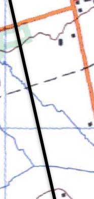
45 Cultural Heritage Assessment Report: Built Heritage Resources & Cultural Heritage Landscapes Appendix General outline of the study area [NTS, Markham M/14, 1922]. General outline of the study area [NTS Markham M/14, 1951].


![M/14, 1994].](/docs-images/88/117542422/images/46-7.jpg)

46 Cultural Heritage Assessment Report: Built Heritage Resources & Cultural Heritage Landscapes Appendix General outline of the study area [NTS Markham M/14, 1979]. General outline of the study area [NTS Markham M/14, 1994].
APPENDIX D - Cultural Heritage Assessment Report
 APPENDIX D - Cultural Heritage Assessment Report "#$%&$'()*'+$&$*'%,"-*,&./$0&1",$&2(","%*/,)"%3 )/0&/,201",$&2("02'+%)2-"% )02%%"'4$,*'5"'&202%%"%%5"'&6"27%&/+8,*2+),*%%$'(*91$(1:28;
Appendix D. Cultural Heritage Assessment Report
 Appendix D Cultural Heritage Assessment Report EXISTING CONDITION REPORT CULTURAL HERITAGE LANDSCAPES & BUILT HERITAGE RESOURCES & CLASS EA STUDY AND PRELIMINARY DESIGN MAVIS ROAD FROM COURTNEYPARK DRIVE
6: 2417 Fourth Line, Sixteen Hollow, Lion Valley Park
 1. Description of Property 6: 2417 Fourth Line, Sixteen Hollow, Lion Valley Park Municipal Address 2417 Fourth Line ame (if applicable) Sixteen Hollow, Lion Valley Park Legal Description CO 1 SDS PT LOTS
CULTURAL HERITAGE ASSESSMENT REPORT BUILT HERITAGE RESOURCES & CULTURAL HERITAGE LANDSCAPES
 CULTURAL HERITAGE ASSESSMENT REPORT BUILT HERITAGE RESOURCES & CULTURAL HERITAGE LANDSCAPES MAIN STREET MARKHAM CLASS ENVIRONMENTAL ASSESSMENT FROM HIGHWAY 407 TO FUTURE DONALD COUSENS PARKWAY May 2010
Mayfield West Phase 2 Secondary Plan
 Town of Caledon Mayfield West Phase 2 Secondary Plan Built Heritage Resources & Cultural Heritage Landscapes Assessment André Scheinman Heritage Preservation Consultant / ENVision The Hough Group Assignment
HERITAGE CONSERVATION STRATEGY REPORT VISION GEORGETOWN SECONDARY PLAN PHASE 3 TOWN OF HALTON HILLS REGIONAL MUNICIPALITY OF HALTON, ONTARIO
 HERITAGE CONSERVATION STRATEGY REPORT VISION GEORGETOWN SECONDARY PLAN PHASE 3 TOWN OF HALTON HILLS REGIONAL MUNICIPALITY OF HALTON, ONTARIO February 2018 Revised May 2018 Prepared for: Meridian Planning
43: 2165 Dundas St. West, Smith-Carrique Barn and Shed
 1. Description of Property Municipal Address Name (if applicable) Legal Description Location of Property Ownership Access Current Use Existing Designation General Description Priority Level 43: 2165 Dundas
CULTURAL HERITAGE ASSESSMENT REPORT CULTURAL HERITAGE LANDSCAPE & BUILT HERITAGE FEATURES
 CULTURAL HERITAGE ASSESSMENT REPORT CULTURAL HERITAGE LANDSCAPE & BUILT HERITAGE FEATURES DUNTROON QUARRY EXPANSION LOT 25 AND PART LOT 26, CONCESSION 12 & PART LOT 25, CONCESSION 12 CLEARVIEW TOWNSHIP
12 AMENDMENT NO. 149, TOWN OF MARKHAM HIGHWAY 404 NORTH SECONDARY PLAN
 12 AMENDMENT NO. 149, TOWN OF MARKHAM HIGHWAY 404 NORTH SECONDARY PLAN The Planning and Economic Development Committee recommends the adoption of the recommendation contained in the following report August
APPENDIX B Exsiting Conditions Report for Built Heritage and Cultural Heritage Landscapes
 APPENDIX B Exsiting Conditions Report for Built Heritage and Cultural Heritage Landscapes EXISTING CONDITIONS REPORT! BUILT HERITAGE RESOURCES & CULTURAL HERITAGE LANDSCAPES! BRITANNIA AVENUE WEST EXTENSION
CULTURAL HERITAGE RESOURCE ASSESSMENT REPORT CULTURAL HERITAGE LANDSCAPES & BUILT HERITAGE
 CULTURAL HERITAGE RESOURCE ASSESSMENT REPORT CULTURAL HERITAGE LANDSCAPES & BUILT HERITAGE CLASS ENVIRONMENT ASSESSMENT NORTH YONGE STREET CORRIDOR PUBLIC TRANSIT AND ASSOCIATED ROAD IMPROVEMENTS TRANSIT
APPENDIX F CULTURAL HERITAGE RESOURCE ASSESSMENT
 APPENDIX F CULTURAL HERITAGE RESOURCE ASSESSMENT TO Katherine Jim, MRC DATE February 28, 2013 (Revised March 6 2013, May 27 2013, June 24 2013) FROM Lindsay Popert, ASI ASI FILE 12EA-084 RE Dundas Street
Chapter 6 cultural heritage
 6 Cultural Heritage 6.1 Protecting Vaughan s Cultural Heritage 165 6.1.1 Protecting Vaughan s Cultural Heritage 165 6.1.2 Maintaining a Heritage Inventory 166 6.1.3 Promoting Vaughan s Cultural Heritage
1.0 INTRODUCTION AND BACKGROUND
 1.0 INTRODUCTION AND BACKGROUND 1.1 INTRODUCTION / BACKGROUND The Regional Municipality of York (hereafter referred to as York Region ) has completed a Municipal Class Environmental Assessment (Class EA)
57: 2031 North Service Road West, Hilton Farm
 1. Description of Property Municipal Address Name (if applicable) Legal Description Location of Property Ownership Access Current Use Existing Designation General Description Priority Level 57: 2031 North
1. Description of Property
 1. Description of Property 39: 2483 Burnhamthorpe Rd. West, Schellenberg Stables Municipal Address 2483 Burnhamthorpe Rd. West ame (if applicable) Schellenberg Stables Legal Description PT LT 30, CO 2
2: Bond Street, I.O.F Orphanage
 1. Description of Property 2: 37-53 Bond Street, I.O.F Orphanage Municipal Address 37-53 Bond Street ame (if applicable) Independent Order of Foresters (I.O.F.) Orphanage Legal Description PT LTS 15 &
2.2.1 Scope of Preliminary Cultural Heritage Landscape Inventory
 Cultural Heritage Landscape and Policy Study Page 7 2.0 CULTURAL HERITAGE LANDSCAPE INVENTORY 2.1 Introduction As part of the City of Vaughan s Official Plan review and associated development of cultural
CULTURAL HERITAGE ASSESSMENT REPORT CULTURAL HERITAGE LANDSCAPES & BUILT HERITAGE RESOURCES
 CULTURAL HERITAGE ASSESSMENT REPORT CULTURAL HERITAGE LANDSCAPES & BUILT HERITAGE RESOURCES EGLINTON CROSSTOWN LRT WEST SECTION JANE STATION TO KEELE STREET CITY OF TORONTO, ONTARIO May 2013 Prepared for:
VILLAGE OF BOLTON HERITAGE CONSERVATION DISTRICT PLAN
 Page 1 1. INTRODUCTION AND BACKGROUND 1.1 THE PROJECT VILLAGE OF BOLTON HERITAGE CONSERVATION DISTRICT PLAN TERMS OF REFERENCE The Town of Caledon (Town) is a large, predominantly rural municipality with
Appendix D. Cultural Heritage Assessment (Unterman McPhail Associates)
") Region of Halton Municipal Class EA for New Forcemain from Fulton Street Pumping Station to Derry Road/Santa Maria Boulevard in the Town of Milton Project File Report April 2018 Appendix D Cultural Heritage
Region of Halton Municipal Class EA for New Forcemain from Fulton Street Pumping Station to Derry Road/Santa Maria Boulevard in the Town of Milton Project File Report April 2018 Appendix D Cultural Heritage
TOWN OF AURORA HERITAGE IMPACT ASSESSMENTS AND CONSERVATION PLANS GUIDE
 PLANNING AND DEVELOPMENT SERVICES Development Planning Division Heritage Planning Section Phone: 905-727-3123 ext. 4226 Fax: 905-726-4736 Email: planning@aurora.ca Town of Aurora 100 John West Way, Box
1.0 PLANNING MARKHAM S FUTURE CONTENTS
 1-1 Planning Markham s Future 1.0 PLANNING MARKHAM S FUTURE CONTENTS 1.1 THE PURPOSE OF THE OFFICIAL PLAN 1.2 THE MARKHAM CONTEXT 1.3 THE REGULATORY CONTEXT 1.3.1 Province of Ontario 1.3.2 York Region
L 2-1 HERITAGE REPORT: REASONS FOR HERITAGE DESIGNATION. Cheyne Family Cemetery. Main Street South
 L 2-1 HERITAGE REPORT: REASONS FOR HERITAGE DESIGNATION Cheyne Family Cemetery Main Street South October 2013 L 2-2 PROFILE OF SUBJECT PROPERTY: Municipal Address Main Street South (Lot 14, Con 1, EHS)
46: 4022 Fourth Line, Ford-Slacer Farm
 1. Description of Property 46: 4022 Fourth Line, Ford-Slacer Farm Municipal Address 4022 Fourth Line Name (if applicable) Ford-Slacer Farm Legal Description PT LT 21, CON 2 TRAFALGAR, NORTH OF DUNDAS STREET,
9 CITY OF VAUGHAN OFFICIAL PLAN AMENDMENT NO BOCA EAST INVESTMENTS LIMITED
 9 CITY OF VAUGHAN OFFICIAL PLAN AMENDMENT NO. 631 - BOCA EAST INVESTMENTS LIMITED The Planning and Economic Development Committee recommends the adoption of the recommendations contained in the following
13 THORNHILL YONGE STREET STUDY IMPLEMENTATION CITY OF VAUGHAN OPA 669 AND TOWN OF MARKHAM OPA 154
 13 THORNHILL YONGE STREET STUDY IMPLEMENTATION CITY OF VAUGHAN OPA 669 AND TOWN OF MARKHAM OPA 154 The Planning and Economic Development Committee recommends the adoption of the recommendations contained
Authority: North York Community Council Item 31.7, as adopted by City of Toronto Council on May 6, 7 and 8, 2014 CITY OF TORONTO. BY-LAW No.
 Authority: North York Community Council Item 31.7, as adopted by City of Toronto Council on May 6, 7 and 8, 2014 CITY OF TORONTO BY-LAW No. 53-2015 To designate the property at 65 Centre Avenue (Alexander
1. Description of Property
 1. Description of Property Municipal Address Name (if applicable) Legal Description Location of Property Ownership Access Current Use Existing Designation General Description Priority Level 34: 1141 Burnhamthorpe
21: Sovereign Street, Streetscape
 1. Description of Property Municipal Address ame (if applicable) Legal Description Location of Property Ownership Access Current Use Existing Designation General Description Priority Level 21: Sovereign
THE REGIONAL MUNICIPALITY OF YORK BY-LAW NO. OP
 THE REGIONAL MUNICIPALITY OF YORK BILL NO. 93 BY-LAW NO. OP-0041-2007-090 A by-law to adopt Amendment 54 to the Official Plan for The Regional Municipality of York The Council of The Regional Municipality
Demolition of a Designated Heritage Property Roncesvalles Avenue
 REPORT FOR ACTION Demolition of a Designated Heritage Property - 421 Roncesvalles Avenue Date: March 8, 2018 To: Toronto Preservation Board Toronto and East York Community Council From: Acting Chief Planner
L 3-1. Heritage Report: Reasons for Heritage Designation. Peter Archdekin Farmhouse Mayfield Road
 L 3-1 Heritage Report: Reasons for Heritage Designation Peter Archdekin Farmhouse 4585 Mayfield Road December 2011 1 L 3-2 Profile of Subject Property Municipal Address 4585 Mayfield Road PIN Number 142250084
APPENDIX C CULTURAL HERITAGE RESOURCE ASSESSMENT REPORT
 Toronto Transit Commission / City of Toronto EGLINTON CROSSTOWN LIGHT RAIL TRANSIT TRANSIT PROJECT ASSESSMENT STUDY ENVIRONMENTAL PROJECT REPORT APPENDIX C CULTURAL HERITAGE RESOURCE ASSESSMENT REPORT
APPENDIX 9 HERITAGE CHARACTER
 APPENDIX 9 HERITAGE CHARACTER Defining attributes and features Perth Official Plan Appendix 9 HERITAGE CHARACTER defining attributes and features This appendix includes a table describing heritage attributes
Cultural Heritage Resource Assessment Review Update of the Mayfield West Phase II Secondary Plan TOWN OF CALEDON, ONTARIO.
 TOWN OF CALEDON, ONTARIO Prepared for: Town of Caledon 6311 Old Church Road Caledon, ON L7C IJ6 File: 17CH-030 May 2017 Archaeological & Providing Cultural Heritage Services 528 Bathurst Street Toronto,
Mark-up of the effect of the proposed Bronte Village Growth Area OPA No.18 on the text of section 24, Bronte Village, of the Livable Oakville Plan
 Mark-up of the effect of the proposed Bronte Village Growth Area OPA No.18 on the text of section 24, Bronte Village, of the Livable Oakville Plan Notes: This document is provided for information purposes
52: 2182 Lakeshore Road East, Horizons
 1. Description of Property Municipal Address Name (if applicable) Legal Description Location of Property Ownership Access Current Use Existing Designation General Description Priority Level 52: 2182 Lakeshore
Summary of Changes for the Comprehensive Draft Proposed Official Plan Amendment
 Summary of Changes for the Comprehensive Draft Proposed Official Plan Amendment Note: Due to the broad scope of the Official Plan Review, this list is not exhaustive of the extent of changes in the comprehensive
5: Cross Avenue Bridge, Sixteen Mile Creek Rail Bridge
 1. Description of Property Municipal Address Name (if applicable) Legal Description Location of Property Ownership Access Current Use Existing Designation General Description Priority Level 5: Cross Avenue
2154 Dundas Street West Intention to Designate under Part IV, Section 29 of the Ontario Heritage Act
 STAFF REPORT ACTION REQUIRED 2154 Dundas Street West Intention to Designate under Part IV, Section 29 of the Ontario Heritage Act Date: February 2, 2009 To: From: Toronto Preservation Board Toronto and
YONGE STEELES CORRIDOR SECONDARY PLAN. Young + Wright / IBI Group Architects Dillon Consulting Ltd. GHK International (Canada) Ltd.
 Ltd.") PART A: PREAMBLE 1.0 PURPOSE The purpose of this Secondary Plan is to provide a development framework for intensification of the Yonge/ Steeles corridor including the north side of Steeles Avenue West
PART A: PREAMBLE 1.0 PURPOSE The purpose of this Secondary Plan is to provide a development framework for intensification of the Yonge/ Steeles corridor including the north side of Steeles Avenue West
Garden District Heritage Conservation District Study
 Garden District Heritage Conservation District Study Community Consultation Meeting September 24 th, 2013 What is a Heritage Conservation District? A defined area of heritage significance and character
Report to: Development Services Committee Report Date: April 24, 2017
 SUBJECT: Cornell Rouge National Urban Park Gateway - Report on Design Charrette and Next Steps PREPARED BY: Lilli Duoba, MES, MCIP, RPP, Manager, Natural Heritage (ext. 7925) REVIEWED BY: Marg Wouters,
HERITAGE REPORT: REASONS FOR HERITAGE DESIGNATION. 62 Union Street. Prepared By:
 L 3-1 1 Brampton Heritage Board Date: January 18, 2011 HERITAGE REPORT: REASONS FOR HERITAGE DESIGNATION 62 Union Street Prepared By: Prepared by: Antonietta Minichillo, Heritage Coordinator Planning,
Access was not granted. Photographed from road, September 16 th, 2015 (AB) Current Use
 Current Use") 1. Description of Property 32: 191 Burnhamthorpe Rd. East, McDuffie Farm Municipal Address 191 Burnhamthorpe Rd. East ame (if applicable) McDuffie Farm (also spelled McDuffe) Legal Description PT LT 14,
1. Description of Property 32: 191 Burnhamthorpe Rd. East, McDuffie Farm Municipal Address 191 Burnhamthorpe Rd. East ame (if applicable) McDuffie Farm (also spelled McDuffe) Legal Description PT LT 14,
Cultural Heritage Resources
 Cultural Heritage Resources An Information Bulletin for Projects Subject to Ontario Regulation 359/09 - Renewable Energy Approvals Ministry of Tourism, Culture and Sport 2011 (updated August 2013) Disclaimer:
Memo. B R A Y H e r i t a g e
 6 1 3. 5 4 2. 3 3 9 3 6 1 3. 5 4 9. 6 2 3 1 c a r l @ b r a y h e r i t a g e. c o m Memo To: Jennifer Murray, Windmill Development Corporation From: Carl Bray, Bray Heritage Date: Monday, June 5, 2017
MINISTRY OF TRANSPORTATION. Environmental Guide for Built Heritage and Cultural Heritage Landscapes
 MINISTRY OF TRANSPORTATION Environmental Guide for Built Heritage and Cultural Heritage Landscapes Version: February 2007 MINISTRY OF TRANSPORTATION Environmental Guide for Built Heritage and Cultural
Purpose of Report...1. Planning Framework Provincial Policy Statement Draft PPS...2. Ontario Heritage Act...3
 Cultural Heritage Policy Discussion Paper November 4 th, 2013 Table of Contents Purpose of Report...1 Planning Framework...1 2005 Provincial Policy Statement...1 2012 Draft PPS...2 Ontario Heritage Act...3
PG: 82B , Nottingham School House, Nottingham Road
 Nottingham (82B-035) Located in southeastern Prince George s County, the community of Nottingham was established when the General Assembly of the Province of Maryland passed the Act for the Advancement
STAGE 1 ARCHAEOLOGICAL ASSESSMENT OF RATHBURN ROAD, FROM DUKE OF YORK BOULEVARD TO SHIPP DRIVE, CITY OF MISSISSAUGA. Submitted to:
 STAGE 1 ARCHAEOLOGICAL ASSESSMENT OF RATHBURN ROAD, FROM DUKE OF YORK BOULEVARD TO SHIPP DRIVE, CITY OF MISSISSAUGA Submitted to: McCormick Rankin Corporation 2655 North Sheridan Way, Suite 280 Mississauga,
10. SOUTH ALBION FARMSTEADS
 10. SOUTH ALBION FARMSTEADS 10.1 HISTORICAL CONTEXT This Candidate area is an organically evolved rural landscape, as described in the Town of Caledon: Criteria for the Identification of Cultural Heritage
DRAFT SECTION 4(f) EVALUATION INTERSTATE 73 FEIS: I-95 to I-73/I-74 in North Carolina
 EVALUATION INTERSTATE 73 FEIS: I-95 to I-73/I-74 in North Carolina") DRAFT SECTION 4(f) EVALUATION INTERSTATE 73 FEIS: I-95 to I-73/I-74 in North Carolina 1.0 INTRODUCTION Section 4(f) of the Department of Transportation Act of 1966, 49 U.S.C. 303, requires that prior to
DRAFT SECTION 4(f) EVALUATION INTERSTATE 73 FEIS: I-95 to I-73/I-74 in North Carolina 1.0 INTRODUCTION Section 4(f) of the Department of Transportation Act of 1966, 49 U.S.C. 303, requires that prior to
Appendix F Study Area Cultural Heritage Assessment (Unterman McPhail Associates)
") Appendix F Study Area Cultural Heritage Assessment (Unterman McPhail Associates) "#$%&$'()*'+$&$*'%,"-*,& $+"'&$.$"+/0$1&2",$&3(","%*0,)"%4 )01&0,312",$&3("13'+%)3-"% )13%%"'5$,*'6"'&313%%"%%6"'&.*, 7*'"8%0/9&,3'%6$%%$*'63$':
Appendix F Study Area Cultural Heritage Assessment (Unterman McPhail Associates) "#$%&$'()*'+$&$*'%,"-*,& $+"'&$.$"+/0$1&2",$&3(","%*0,)"%4 )01&0,312",$&3("13'+%)3-"% )13%%"'5$,*'6"'&313%%"%%6"'&.*, 7*'"8%0/9&,3'%6$%%$*'63$':
13. VANDORF-PRESTON LAKE SECONDARY PLAN 13.1 INTRODUCTION
 13. VANDORF-PRESTON LAKE SECONDARY PLAN 13.1.1 Purpose 13.1 INTRODUCTION The Vandorf-Preston Lake Secondary Plan establishes the principles, objectives and general policies, as well as specific strategies
HERITAGE REPORT: REASONS FOR HERITAGE DESIGNATION. 37 Church Street East. Prepared By:
 L 1-1 1 Brampton Heritage Board Date: February 15, 2011 HERITAGE REPORT: REASONS FOR HERITAGE DESIGNATION 37 Church Street East Prepared By: Prepared by: Antonietta Minichillo, Heritage Coordinator Planning,
Toronto and East York Community Council Item TE34.30, as adopted by City of Toronto Council on August 25, 26, 27 and 28, 2014 CITY OF TORONTO
 Authority: Toronto and East York Community Council Item TE34.30, as adopted by City of Toronto Council on August 25, 26, 27 and 28, 2014 CITY OF TORONTO BY-LAW 1393-2017 To designate the property at 481
ONTARIO MUNICIPAL BOARD
 PL 120483 ONTARIO MUNICIPAL BOARD Applicant/Appellant: 2124123 Ontario Limited Subject: OPA, Rezoning and Draft Plan of Subdivision Municipal Address: 3940 Highway 7 East Municipality: City of Markham
Urban Design Brief Woodland Cemetery Funeral Home 493 Springbank Drive
 Urban Design Brief Woodland Cemetery Funeral Home The Incorporated Synod of the Diocese of Huron April 15, 2016 Urban Design Brief April 15, 2016 TABLE OF CONTENTS Page No. INTRODUCTION... 1 SECTION 1
11. BALLANTRAE-MUSSELMAN LAKE AND ENVIRONS SECONDARY PLAN
 11. BALLANTRAE-MUSSELMAN LAKE AND ENVIRONS SECONDARY PLAN 11.1 PURPOSE The Ballantrae-Musselman Lake and Environs Secondary Plan Area includes two small existing settlement areas, Ballantrae and Musselman
Submitted: July 23, 2009
 Stage I and II Archaeological Assessment Jock River Estates Phase 2 PML Project No. 0801-01 Client: 773804 Ontario Inc. Lot 21, Concession 2 Geographic Township of Goulbourn City of Ottawa Submitted: July
a) buildings, structures and artifacts of historical significance;
 buildings, structures and artifacts of historical significance;") 12.3.2. Definition Heritage Resources: There are two classes of heritage resources: monumental or landmark heritage that is considered to reflect exemplary architecture and style of a particular area or
12.3.2. Definition Heritage Resources: There are two classes of heritage resources: monumental or landmark heritage that is considered to reflect exemplary architecture and style of a particular area or
MEMORANDUM. Future Urban Area Conceptual Master Plan Cultural Heritage Resources
 MEMORANDUM TO: FROM: Heritage Markham Committee Regan Hutcheson, Manager-Heritage Planning DATE: June 14, 2017 SUBJECT: STUDI / PROJECTS Future Urban Area Conceptual Master Plan Cultural Heritage Resources
CULTURAL HERITAGE RESOURCE REPORT BUILT HERITAGE & CULTURAL HERITAGE LANDSCAPES DERRY GREEN CORPORATE BUSINESS PARK SECONDARY PLAN MILTON, ONTARIO
 CULTURAL HERITAGE RESOURCE REPORT BUILT HERITAGE & CULTURAL HERITAGE LANDSCAPES DERRY GREEN CORPORATE BUSINESS PARK SECONDARY PLAN MILTON, ONTARIO March 2008 Prepared for: Macaulay Shiomi Howson Ltd. Prepared
I 1-1 HERITAGE IMPACT ASSESSMENT. OSTRANDER FARM 2378 EMBLETON ROAD Lots 5 and 6, Concession 5 WHS CITY OF BRAMPTON, ONTARIO.
 I 1-1 HERITAGE IMPACT ASSESSMENT Ostrander Farm House 2001 Ostrander Farm House Site, May, 2010 Source: Unterman McPhail OSTRANDER FARM 2378 EMBLETON ROAD Lots 5 and 6, Concession 5 WHS CITY OF BRAMPTON,
50: 1475 Lakeshore Road East, Ryrie Estate
 1. Description of Property 50: 1475 Lakeshore Road East, Ryrie Estate Municipal Address 1475 Lakeshore Road East Name (if applicable) Ryrie Estate Legal Description PT LT 6, CON 3 TRAFALGAR, SOUTH OF DUNDAS
Proposed Water Ski Wakeboard Cable Park (former Cedar Run Horse Park) Kevin Bechard Deputation to Committee of the Whole June 4, 2018
 Kevin Bechard Deputation to Committee of the Whole June 4, 2018") Proposed Water Ski Wakeboard Cable Park (former Cedar Run Horse Park) Kevin Bechard Deputation to Committee of the Whole June 4, 2018 Development Proposal - Comprised of three separate cable systems ;
Proposed Water Ski Wakeboard Cable Park (former Cedar Run Horse Park) Kevin Bechard Deputation to Committee of the Whole June 4, 2018 Development Proposal - Comprised of three separate cable systems ;
Cultural Heritage Assessment Report: Built Heritage Resources and Cultural Heritage Landscapes. Existing Conditions Assessment of Impacts
 Cultural Heritage Assessment Report: Built Heritage Resources and Cultural Heritage Landscapes Existing Conditions Assessment of Impacts Class Environmental Assessment and Preliminary Design for McLaughlin
PennDOT. single spann lanes and 3- mayy need to be to accommodate. any bridge. addition to III. Date: CRP 07/27/2015 CRP.
 (10/27/14) PennDOT Section 106 Field Assessments and Finding Combined Early tification/finding? Yes Concurrence required or requested: Yes MPMS: 51507 ER# (if consultation with PHMC required) ): County:
You Don't Know What You've Got 'til it's Gone. Creative Cities Summit 2012 Victoria, British Columbia Kate Hagerman Cultural Heritage Specialist
 You Don't Know What You've Got 'til it's Gone Creative Cities Summit 2012 Victoria, British Columbia Kate Hagerman Cultural Heritage Specialist Presentation Outline Waterloo Region Research Based Conservation
Derry Green Corporate Business Park
 Town of Milton Derry Green Corporate Business Park Urban Design Guidelines BMI/Pace - June 2010 Draft 3 Prepared by: Brook McIlroy Planning + Urban Design / Pace Architects Suite 300-51 Camden Street Toronto,
CHAIR AND MEMBERS PLANNING & ENVIRONMENT COMMITTEE MEETING ON MONDAY AUGUST 28, 2017 JOHN M. FLEMING MANAGING DIRECTOR, PLANNING AND CITY PLANNER
 TO: FROM: SUBJECT: CHAIR AND MEMBERS PLANNING & ENVIRONMENT COMMITTEE MEETING ON MONDAY AUGUST 28, 2017 JOHN M. FLEMING MANAGING DIRECTOR, PLANNING AND CITY PLANNER REQUEST FOR DEMOLITION OF HERITAGE LISTED
L 4-1. Heritage Report: Reasons for Heritage Designation. Kodors House. 35 Rosedale Avenue West
 L 4-1 Brampton Heritage Board Date: January 17, 2012 Heritage Report: Reasons for Heritage Designation Kodors House 35 Rosedale Avenue West December 2011 1 L 4-2 Profile of Subject Property Municipal Address
HERITAGE IMPACT ASSESSMENT SALEM BRIDGE, COUNTY SITE No. B IRVINE CREEK (LOTS 15 & 16, CONCESSION 11 GEOGRAPHIC TOWNSHIP OF NICHOL)
") HERITAGE IMPACT ASSESSMENT SALEM BRIDGE, COUNTY SITE No. B018050 IRVINE CREEK (LOTS 15 & 16, CONCESSION 11 GEOGRAPHIC TOWNSHIP OF NICHOL) WOOLWICH STREET WEST (WR 18) SALEM, TOWNSHIP OF CENTRE WELLINGTON
HERITAGE IMPACT ASSESSMENT SALEM BRIDGE, COUNTY SITE No. B018050 IRVINE CREEK (LOTS 15 & 16, CONCESSION 11 GEOGRAPHIC TOWNSHIP OF NICHOL) WOOLWICH STREET WEST (WR 18) SALEM, TOWNSHIP OF CENTRE WELLINGTON
Baby Point Heritage Conservation District Study. Kick-off Community Meeting March 27, 2017 Humbercrest United Church
 Baby Point Heritage Conservation District Study Kick-off Community Meeting March 27, 2017 Humbercrest United Church Agenda 7:00 Welcome 7:10 HCD Study Overview and Process 8:00 Interactive Discussion /
NOTE: PLEASE REFER TO CITY PLAN FOR ADDITIONAL CITY-WIDE POLICIES WHICH APPLY TO THIS DISTRICT.
 NOTE: THE POLICIES IN THIS DOCUMENT ARE SPECIFIC TO THE SHERIDAN RESIDENTIAL PLANNING DISTRICT OF, AND MUST BE READ IN CONJUNCTION WITH ALL THE POLICIES OF CITY PLAN PLEASE REFER TO FOR ADDITIONAL CITY-WIDE
11.4 Highway 400 North Employment Lands Secondary Plan APPROVED BY THE ONTARIO MUNICIPAL BOARD ON NOVEMBER 21, 2011
 11.4 Highway 400 North Employment Lands Secondary Plan APPROVED BY THE ONTARIO MUNICIPAL BOARD ON NOVEMBER 21, 2011 11.4.1 General 11.4.1.1. as approved by the Ontario Municipal Board on November 21, 2011,
Brampton. Secondary Plan. Review. Bram West. A New Direction in Planning & Public Consultation
 Brampton Bram West Secondary Plan Review A New Direction in Planning & Public Consultation Introduction The Bram West Secondary Plan Review offers an important opportunity for the community to define a
6 PORT SYDNEY SETTLEMENT AREA
 Section 6 Port Sydney Page 61 6 PORT SYDNEY SETTLEMENT AREA 6.1 Basis and Principles Village of Port Sydney Waterfront Community Existing Services 6.1.1 Port Sydney is an historic settlement that has developed
WELCOME TO THE PUBLIC INFORMATION CENTRE. Please Sign In
 WELCOME TO THE PUBLIC INFORMATION CENTRE Replacement of Oxtongue Lake Narrows Bridge & Oxtongue River Bridge, Highway 60 (G.W.P. 93-89-00 & G.W.P. 5550-04-00) Class Environmental Assessment (Group B) Please
National Character Area 70 Melbourne Parklands
 Summary The are a landscape of rolling farmland, parkland and woodland on the northern flanks of the ridge between Burton upon Trent and Swadlincote. The land slopes down to the River Trent, which borders
Cultural Heritage Assessment Report: Built Heritage Resources and Cultural Heritage Landscapes Existing Conditions
 Appendix G Cultural Heritage Assessment Report: Built Heritage Resources and Cultural Heritage Landscapes Existing Conditions Cultural Heritage Assessment Report: Built Heritage Resources and Cultural
STAGE 1 2 ARCHAEOLOGICAL ASSESSMENT OF YONGE STREET SUBWAY EXTENSION, LOTS 37-41, CONCESSION EYS, TOWNSHIP OF MARKHAM, CITY OF TORONTO, YORK COUNTY
 STAGE 1 2 ARCHAEOLOGICAL ASSESSMENT OF YONGE STREET SUBWAY EXTENSION, LOTS 37-41, CONCESSION EYS, TOWNSHIP OF MARKHAM, CITY OF TORONTO, YORK COUNTY Original License Report Submitted to: Ecoplans Limited
Further input invited as Colchester Growth Strategy nears final phase
 IUE 3 / NOVEMBER 2015 Further input invited as Colchester Growth trategy nears final phase trathcona County is seeking public feedback as it enters the final phase of work on a Growth Management trategy
C h a p t e r 3 E V A L U A T I O N A N D D E S I G N A T I O N. Background
 Part Two GOALS Part 2: Restoration work at Kingston (Historic Site 79-019-13) Upper Marlboro, 2009 C h a p t e r 3 E V A L U A T I O N A N D D E S I G N A T I O N Background The Inventory of Historic Resources
3.10 LAND USE SETTING PROJECT SITE EXISTING LAND USE DESIGNATIONS AND ZONING. General Plan Land Use Designations.
 This section of the Draft EIR addresses the existing land uses on and adjacent to the project site and discusses the potential impacts of the proposed project on existing land uses. Key issues addressed
Background Summary Report
 Background Summary Report May 2014 Submitted by Macaulay Shiomi Howson Ltd. In association with AMEC MMM Group Brook McIlroy Inc. Hemson Consulting Ltd. Table of Contents 1. Introduction... 1 2. Why is
The Evolution of Cultural Heritage Landscapes as a Means of Protecting Heritage Resources
 The Evolution of Cultural Heritage Landscapes as a Means of Protecting Heritage Resources Heritage conservation itself is not a new planning issue. This issue has traditionally been framed primarily as
9: 204 & 240 Front Street, George Street Parkette & Dingle Park. 1. Description of Property. Name (if applicable) Legal Description
 Legal Description") 1. Description of Property Municipal Address Name (if applicable) Legal Description Location of Property Ownership Access Current Use Existing Designation General Description Priority Level 9: 204 & 240
1. Description of Property Municipal Address Name (if applicable) Legal Description Location of Property Ownership Access Current Use Existing Designation General Description Priority Level 9: 204 & 240
Feasibility Analysis for Expansion of the Provincial Greenbelt Plan Area into Mississauga
 Feasibility Analysis for Expansion of the Provincial Greenbelt Plan Area into Mississauga November 8, 2013 Natural Heritage and Urban Forest Strategy: Draft Discussion Paper #3: Table of Contents 1.0 Introduction...
Cookstown Heritage Conservation District Study Public Consultation March 26, 2013
 Public Consultation March 26, 2013 Funded by the Government of Ontario MMM Group Darryl Bird Project Manager, Senior Planner, CAHP Intern Shannon Baker Senior Landscape Architect, CAHP AREA Architects
APPENDIX D: Visual and Aesthetic Conditions for NCCU Station Refinement. Durham-Orange Light Rail Transit Project
 APPENDIX D: Visual and Aesthetic Conditions for NCCU Station Refinement Durham-Orange Light Rail Transit Project October 2016 1. Introduction The Combined FEIS/ROD summarizes the effects of the D-O LRT
Town of Cobourg Heritage Master Plan. Statutory Public Meeting
 Town of Cobourg Heritage Master Plan Statutory Public Meeting April 25 th 2016 Presentation Overview 1. Introduction 2. Project background and schedule overview 3. Review of strategic direction content
City of Toronto. Emery Village Transportation Master Plan
 City of Toronto Emery Village Transportation Master Plan May 2009 Emery Village Transportation Master Plan Toronto, ON May 2009 Consulting Inc. 100 York Blvd., Suite 300 Richmond Hill, ON L4B 1J8 Tel:
Revised License Report
 STAGE 1 2 ARCHAEOLOGICAL ASSESSMENT OF THE EGLINTON CROSSTOWN LIGHT RAIL TRANSIT CORRIDOR, EGLINTON AVENUE FROM JANE STREET TO BRICKNELL STREET, CONCESSION 5, LOT 11, CONCESSION 6, LOT 41, YORK TOWNSHIP,
COLVER ROAD INDUSTRIAL CONCEPT PLAN
 COLVER ROAD INDUSTRIAL CONCEPT PLAN A CONCEPTUAL LAND USE AND TRANSPORTATION PLAN FOR TA-4 AN URBAN RESERVE AREA OF THE CITY TALENT City of Talent Adopted by City Council Resolution No., June, 2015 PART
Cultural Heritage Landscapes Strategy
 Cultural Heritage Landscapes Strategy TABLE OF CONTENTS Executive Summary 1.0 Introduction 1.1 Objectives of the Strategy 2.0 Definition and Identification of Cultural Heritage Landscapes 2.1 Definitions
AGINCOURT SECONDARY PLAN
 1 AGINCOURT SECONDARY PLAN 1. AGINCOURT SECONDARY PLAN The following policies and principles apply to the area herein referred to as Agincourt, as outlined on Map 1-1. 1. GENERAL POLICIES 1.1 This Secondary
CONSULTING SERVICES FOR THE WHITEBELT VISIONING EXERCISE ADDENDUM TO THE GTA WEST LAND USE STUDY WORK PROGRAM
 CONSULTING SERVICES FOR THE WHITEBELT VISIONING EXERCISE ADDENDUM TO THE GTA WEST LAND USE STUDY 1. Introduction WORK PROGRAM The Town of Caledon is a large, local municipality located in the Greater Toronto