JASPER PLACE. Area Redevelopment Plan
|
|
|
- Aubrey Farmer
- 6 years ago
- Views:
Transcription


1 JASPER PLACE Area Redevelopment Plan
2 Executive Summary Jasper Place is an established community where people live, work and play. The Jasper Place Area Redevelopment Plan (ARP) provides a tool to help guide growth and change over the next 15 to 20 years. The ARP supports a safe, livable, and resilient community by providing guidance designed to make the most of the exciting opportunities in the area. Jasper Place is defined as the neighbourhoods of Britannia Youngstown, Canora, Glenwood, West Jasper Place, and a portion of the Stony Plain Road commercial corridor. The ARP highlights redevelopment opportunities in Jasper Place, and provides guidance on future land use and City investment decisions in the area. It sets out land use policies in each of the four neighbourhoods, with additional policies for a Stony Plain Road focus area. It also sets out civic infrastructure policies to guide investment decisions on parks and open space, mobility, and utilities infrastructure. The ARP is intended to help make Jasper Place more livable for existing residents and businesses, and to ensure new community members are welcomed and accommodated in the area to support vibrant neighbourhoods, schools and businesses. How to read this plan The Introduction provides an overview of the ARP process and the existing policy framework. It also summarizes the community input and technical studies that informed the ARP. The Plan Vision sets out the overall vision for Jasper Place and shows how the City policy framework, community input and technical studies have come together to form a set of guiding principles. Objectives and Policies set out land use and civic infrastructure maps and policies to help guide future land use decisions and City investment in Jasper Place. Amendments + Monitoring provides a long term plan for the ARP to ensure it remains up to date and is successfully implemented. The Glossary provides definitions of key terms used in the ARP. Readers Achieving the vision of the ARP depends on a wide variety of stakeholders, and each stakeholder needs different types of information from the ARP to contribute to the success of the plan. Find out what sections may be most relevant to you. Current and future residents The Plan Vision provides an overall vision and guiding principles for Jasper Place. The Objectives and Policies set out specific guidance on the type of buildings, parks and infrastructure that are envisioned for the area. Homeowners, property owners and businesses The Objectives and Policies land use chapter sets out what opportunities may be available on your property. It provides direction for redeveloping your property under existing zoning and opportunities for rezoning. The civic infrastructure chapter also highlights potential infrastructure upgrades that may be needed to support redevelopment. City staff reviewing rezoning or development applications The Objectives and Policies land use chapter provides guidance for rezoning and discretionary development decisions. It also includes civic infrastructure policies that provide guidance on mobility or utility infrastructure requirements that may exist for individual applications. 3.2 Section structure provides important information for interpreting the policies and the process for plan amendments is provided in the Amendments + Monitoring section. City staff responsible for capital projects The Objectives and Policies civic infrastructure chapter sets out priority projects and guidelines to be considered in any related capital projects, subject to Council prioritization and approval of funding Observations and technical studies highlights important information for capital projects. Institutional partners including school boards, emergency services, and utilities companies can find information about the future vision of the area in the Plan Vision and Objectives and Policies sections. Mayor and Council The Plan Vision sets out the intent behind the ARP policies and the guiding principles these policies were based on. 2
3 Table of contents Figures Executive Summary. 2 Figure 1: Plan area Introduction Figure 2: Zoning in Jasper Place (June 2015) Plan area 5 Figure 3: Geographic scales Plan purpose.. 5 Figure 4: Graphic guide Plan Framework Figure 5: Jasper Place existing land use Existing policies Figure 6: Jasper Place proposed land use Community input Figure 7: Britannia Youngstown existing land use Observations and technical studies. 15 Figure 8: Britannia Youngstown proposed land use Plan Vision Figure 9: Canora existing land use Vision 18 Figure 10: Canora proposed land use Guiding Principles 19 Figure 11: Glenwood existing land use Objectives and policies Figure 12: Glenwood proposed land use Strategic approach. 20 Figure 13: West Jasper Place existing land use Section structure. 21 Figure 14: West Jasper Place proposed land use. 57 Land use chapter.. 25 Figure 15: Stony Plain Road focus area existing land use.. 63 Jasper Place. 26 Figure 16: Stony Plain Road focus area proposed land use.. 65 Britannia Youngstown.. 30 Figure 17: Jasper Place existing civic infrastructure.. 73 Canora.. 38 Figure 18: Jasper Place proposed civic infrastructure.. 75 Glenwood.. 46 Figure 19: Britannia Youngstown existing civic infrastructure 77 West Jasper Place. 54 Figure 20: Britannia Youngstown proposed civic infrastructure.. 79 Stony Plain Road focus area. 62 Figure 21: Canora existing civic infrastructure.. 81 Civic infrastructure chapter 71 Figure 22: Canora proposed civic infrastructure.. 83 Jasper Place.. 72 Figure 23: Glenwood existing civic infrastructure 85 Britannia Youngstown.. 76 Figure 24: Glenwood proposed civic infrastructure.. 87 Canora.. 80 Figure 25: West Jasper Place existing civic infrastructure. 89 Glenwood 84 Figure 26: West Jasper Place proposed civic infrastructure. 91 West Jasper Place. 88 Figure 27: Stony Plain Road focus area existing civic infrastructure.. 93 Stony Plain Road focus area.. 92 Figure 28: Stony Plain Road focus area proposed civic infrastructure. 95 Civic infrastructure policy tables 96 Figure 29: Measuring linear transparency Amendments and monitoring Glossary Appendix 1: Jasper Place History

4 Figure 1: Plan area Jasper Place is a common name for a number of neighbourhoods in Edmonton s west end. For the purpose of this ARP, Jasper Place is defined as the four neighbourhoods of Britannia Youngstown, Canora, Glenwood and West Jasper Place, and includes portions of the Stony Plain Road commercial corridor. The boundaries of the plan area are 107 Avenue to the north, 149 Street to the east, 95 Avenue to the south and 170 Street/Mayfield Road to the west. 4
5 1. Introduction Jasper Place is an established community where people live, work and play. The Jasper Place Area Redevelopment Plan (ARP) provides a tool to help guide growth and change over the next 15 to 20 years. It supports a safe, livable and resilient community by providing guidance designed to make the most of the exciting opportunities in the area. The ARP highlights redevelopment opportunities in Jasper Place, and provides guidance on future land use and City investment decisions in the area. The ARP is intended to help make Jasper Place more livable for existing residents and businesses, and to ensure new community members are welcomed and accommodated in the area to support vibrant neighbourhoods, schools, and businesses. Throughout the ARP process, City staff collaborated with internal departments, spoke with Jasper Place community members, and worked with various technical experts to develop the vision and policies of the Jasper Place ARP. In this introductory section of the ARP you can learn about: 1.1 The Plan area and the neighbourhoods included in the ARP. 1.2 The Plan purpose, including what an ARP is, why one was undertaken in Jasper Place, and how to use this plan. 1.3 The Plan framework, including the City policies, community input and technical information that informed the plan. 1.1 Plan area For the purpose of this ARP, Jasper Place is defined as the neighbourhoods of Britannia Youngstown, Canora, Glenwood, West Jasper Place and a portion of the Stony Plain Road commercial corridor. Jasper Place is located in west Edmonton and is bounded by 149 Street to the east, 170 Street to the west, 107 Ave to the North and 95 Ave to the south. 1.2 Plan purpose The Jasper Place ARP is a forward looking document that provides a clear vision of how the area is expected to change and grow over the next 15 to 20 years. The ARP provides current and future residents, businesses, and landowners clarity about what types of change and investments may be expected for their neighbourhoods. The ARP builds on the existing land use assets of the neighbourhood that were identified by community members and technical studies, including its strong walkability and street pattern, access to existing bus transit and future LRT, mix of uses, and sense of openness. The ARP also seeks to enhance other themes that were highlighted throughout the process, including promoting a safe neighbourhood, encouraging more housing choice, supporting vibrant commercial areas, and introducing new open space. The Jasper Place ARP provides opportunities for residents and landowners to capitalize on the potential of the Jasper Place area and to welcome new investment, businesses and residents that will support a vibrant community. The ARP sets out a vision and opportunities that will guide future rezoning decisions and City investment in Jasper Place What is an Area Redevelopment Plan (ARP)? An ARP is a statutory plan that is formally adopted by Council as a bylaw. Once it is adopted, ARPs must be considered by City staff when evaluating rezoning and discretionary development decisions in the plan area. In this way, ARPs play an important role in shaping change and growth in existing areas of the City. An ARP is formally defined by the Municipal Government Act (MGA) of Alberta. The MGA states that an ARP can be used to: Preserve or improve land and buildings Construct, rehabilitate, replace or remove buildings Establish, improve or relocate roads, public utilities or other services Facilitate any other development 5
6 All plans adopted by Council, including ARPs, must be consistent with all other applicable plans, policies and guidelines already approved by Council. This means that the ARP must reflect the policies in documents such as the City s Municipal Development Plan, The Way We Grow, and other plans described in Section 1.3.1: Existing policies. The MGA also requires that opportunities be provided for members of the public, school boards and other affected parties to provide input into the ARP. More information on the consultation activities for the Jasper Place ARP is provided in Section 1.3.2: Consultation. The Jasper Place Area Redevelopment Plan meets the requirements of the MGA Why an ARP in Jasper Place? In 2009 City Council endorsed a Revitalization Strategy for Jasper Place. The Revitalization Strategy was developed through collaboration with the Jasper Place communities, and continues to be supported through the work of local volunteers. The Strategy identified three main priorities for Jasper Place: Feeling Safe in Our Community Connecting with Our Community Building Our Community A series of visions, goals and action items were developed under each of these three priorities. One of the long term action items identified in the Strategy was the creation of an ARP for each of the four Jasper Place neighbourhoods. A series of City wide policies, outlined in Section 1.3.1, and the expansion of Light Rail Transit (LRT) Valley line also led to an ARP being undertaken in Jasper Place. The approved alignment of the LRT route identifies three new LRT stations in Jasper Place. City policy directs that change and growth should be focused around transit and LRT stations, therefore the three new stations are likely to be a catalyst for investment and change in Jasper Place When to use this plan Purchasing, redeveloping or renovating properties The ARP sets out the range of opportunities that exist for each parcel of land, as well as what expectations there may be on site. The ARP also highlights infrastructure investments that may be required as part of redevelopment. It is important to consult the ARP when considering purchasing, redeveloping or renovating properties to ensure the range of opportunities and expectations are known at the outset of a project. Rezoning Applications The ARP sets out a vision and opportunities that will guide future rezoning decisions. Applications to rezone land are processed by City Administration. After accepting a rezoning application in the ARP area, Administration will assess the application against the ARP policies and other relevant plans and policies, determine whether the application conforms to these policies, and indicate to Council whether or not Administration supports the application. The ARP will also be used to develop any Direct Control zones that may be applied for in the area to ensure the provisions meet the objectives of the ARP. The decision to rezone or not rezone is ultimately made by City Council at a public hearing. At the City Council public hearing, members of the public may speak directly to Council about the rezoning application and indicate whether or not they support it. Council assesses each rezoning application on a case by case basis and maintains full jurisdiction and discretion over the ultimate decision. The ARP should therefore be consulted by applicants prior to their application to rezone land, by Administration when assessing a rezoning application, and by interested members of the public. Subdivision Applications Subdivision Applications are made to the Subdivision Authority, which is composed of members of City Administration. Subdivision applications are considered against all relevant policies. 6
7 The ARP should be consulted by applicants, the Subdivision Authority, and interested members of the public when a subdivision application is made. Development Permit Applications Development Permit applications are processed and approved by City Administration. Administration assesses all development permit applications against the regulations of the Edmonton Zoning Bylaw and applicable statutory plans, such as an ARP. The Jasper Place ARP provides direction to both applicants and Administration on development permit applications that involve the use of discretion, also known as Class B development. The ARP is applicable in the following instances: the development permit application is for a discretionary use the development permit will vary one or more Zoning Bylaw regulations the Zoning Bylaw regulations that apply to the proposed development are written such that they are open to interpretation The ARP provides guidance on the appropriate contexts for and extents of variance or discretion, and provides guidance for areas of ambiguity How to read this plan Structure The Introduction provides an overview of the ARP process and the existing policy framework. It also summarizes the community input and technical studies that informed the ARP. The Plan Vision sets out the overall vision for Jasper Place and shows how the City policy framework, community input and technical studies have come together to form a set of guiding principles that shape the ARP policies. Objectives and Policies sets out land use and civic infrastructure maps and policies to help guide future land use decision making and City investment in Jasper Place. It provides information at a range of scales, including Jasper Place as a whole, each of the neighbourhoods, and a Stony Plain Road focus area. Amendments + Monitoring provides a long term plan for the ARP to ensure it remains up to date and is successfully implemented. The Glossary provides definitions of key terms used in the ARP. City projects and investment The Jasper Place ARP provides guidance to City staff who undertake capital projects in the area. The civic infrastructure policies highlight priority projects for Jasper Place and provide guidelines on how these should be implemented. All civic infrastructure recommendations made in the ARP are subject to Council prioritization and funding availability. 7
8 Readers Achieving the vision of the ARP depends on a wide variety of stakeholders, and each stakeholder needs different types of information from the ARP to contribute to the success of the plan. Find out what sections may be most relevant to you. Current and future residents The Plan Vision provides an overall vision and guiding principles for Jasper Place. The Objectives and Policies set out specific guidance on the type of buildings, parks and infrastructure that are envisioned for the area. Institutional partners including school boards, emergency services, and utilities companies can find information about the future vision of the area in the Objectives and Policies section. Mayor and Council The Plan Vision sets out the intent behind the ARP policies and the guiding principles these policies were based on. Homeowners, property owners and businesses The Objectives and Policies land use chapter sets out what opportunities may be available on your property. It provides direction for redeveloping your property under existing zoning and opportunities for rezoning. The civic infrastructure chapter also highlights potential infrastructure upgrades that may be needed to support redevelopment. City staff reviewing rezoning or development applications The Objectives and Policies provides land use guidance for rezoning and discretionary development decisions. It also provides civic infrastructure policies that provide guidance on mobility or utility infrastructure requirements that may exist for individual applications. 3.2 Section Structure provides important information for interpreting the ARP policies and should be consulted by all City staff. The process for plan amendments is provided in the Amendments + Monitoring section. City staff responsible for capital projects The Objectives and Policies civic infrastructure section sets out priority projects and guidelines to be considered in any related capital projects, subject to Council prioritization and approval of funding. 3.2 Section Structure provides important information for interpreting the ARP policies and should be consulted by all City staff Observations and technical studies provides information on the reports that should be consulted when undertaking related capital investment projects. 8

9 1.3 Plan framework The following section provides a summary of the three components that were used to build the ARP, including: Existing policies that apply to Jasper Place Community input gathered through consultation with local stakeholders Observations and technical studies that created a knowledge base of the Jasper Place context Existing policies City wide policies The Way Ahead The Way Ahead, Edmonton s strategic Vision, establishes the intent to create a more compact, sustainable, and livable city. A series of more detailed strategies have been developed to help realize the vision set out in The Way Ahead. These include: The Way We Grow, Edmonton s Municipal Development Plan, outlined further below. The Way We Move, Edmonton s Transportation Master Plan, outlined further below. The Way We Finance, a strategy to ensure Edmonton s financial sustainability. The Way We Live, policies focused on improving the livability of Edmonton. The Way We Green, aimed at preserving and sustaining Edmonton s environment. The Way We Prosper, policies to diversify and strengthen Edmonton s economy. The ELEVATE report, developed by the Community Sustainability Task Force, also articulates a vision for strong, diverse, and sustainable neighbourhoods where Edmontonians can live, learn, work, and play, now and in the future. The Way We Grow (2010) Edmonton s Municipal Development Plan (MDP) is known as The Way We Grow. In support of The Way Ahead, it encourages compact and sustainable communities. In particular, it calls for a greater proportion of new development to occur within mature and established neighbourhoods. In addition, The Way We Grow establishes that medium to higher density residential, employment, and retail development should be focused around LRT stations and Transit Centres. The Way We Grow calls for the implementation of a program for the ongoing preparation of Area Redevelopment Plans and other types of land use plans to guide redevelopment (Policy ). It also notes that the City will support redevelopment and residential infill that contributes to the livability and adaptability of the neighbourhood (Policy ), involve residents in planning processes (Policy ) and determine and address any infrastructure capacity constraints (Policy ). The Way We Move (2009) The City s Transportation Master Plan, The Way We Move, identifies the long term vision for Edmonton s transportation network, including the extension of the LRT network throughout the city. 9
10 In 2012, Council approved the alignment of the LRT Valley Line, which will run from Mill Woods, through downtown to West Edmonton Mall, ending at Lewis Farms. The proposed alignment has the Valley Line entering Jasper Place at Stony Plain Road and 149 Street, where it will continue west along Stony Plain Road to 156 Street before turning south along 156 Street. Three associated LRT stations will be located in Jasper Place at Stony Plain Road and 150 Street, Stony Plain Road and 156 Street, and 156 Street and 95 Avenue. Transit Oriented Development Guidelines (2012) To support the long term viability of the LRT and to achieve the City s vision for a more compact and liveable Edmonton, Council approved Policy C565 Transit Oriented Development and the associated Guidelines (TOD Guidelines) in The TOD Guidelines outline development potential for sites within 400m of LRT stations and transit centres, and identify a variety of LRT station types. The Guidelines also provide a framework for new plans being developed within 800m of future LRT stations and Transit Centres. All three of the Jasper Place LRT stations are identified in the TOD Guidelines as Neighbourhood Stations. Areas around the existing transit centre and future stations are identified for a range of infill development, primarily row houses and duplex housing, as well as apartment housing up to four storeys along arterial and collector roadways and large sites. Retail, restaurants, and professional offices are also encouraged within m of Neighbourhood Stations. Creating pedestrian and cycle friendly streets, parks and open spaces in stations areas are also key elements of the TOD Guidelines. Residential Infill Guidelines (2009) In 2009 Council adopted Policy C551 Residential Infill in Mature Neighbourhoods and the associated Residential Infill Guidelines: A manual of Planning and Design Guidelines for Residential Development in Mature Neighbourhoods (RIGs) in order to provide guidance for residential development in Edmonton s mature neighbourhoods that fall outside of TOD areas, including portions of the four Jasper Place neighbourhoods. The goals of the RIGs can generally be summarized as: Foster residential infill that contributes to ongoing neighbourhood renewal and revitalization, and support liveable and adaptable mature neighbourhoods Encourage residential infill that contributes to the social, economic and environmental sustainability of mature neighbourhoods and the overall sustainability of the City Provide direction on the built form and design of buildings, as well as overall site design and streetscape interface for infill projects. Zoning The Zoning Bylaw controls the use and development of all land in the City of Edmonton. Each parcel of land in Edmonton is designated by a specific zone. Each zone sets out the permitted and discretionary use opportunities and development regulations for a range of development features, including such things as height, size, and setting of buildings as well as access, parking and landscaping. The Zoning Bylaw includes both standard zones that are applied to multiple sites across the city, and Direct Control zones that are generally applied to individual properties or focused areas of Edmonton. The Zoning Bylaw also includes overlays that provide area specific regulations for portions of the city. The map on the following page shows the zoning in place in Jasper Place at the time of passing the ARP in The neighbourhoods also fall within the Mature Neighbourhood Overlay (MNO). The purpose of this overlay is to ensure that low density development in Edmonton s mature residential neighbourhoods is sensitive in scale to existing development and provides opportunity for discussion between applicants for new development and existing community members. 10
 do not")
11 Figure 2: Zoning in Jasper Place (June 2015) do not amend 11
12 Existing local plans, studies & resolutions Stony Plain Road Urban Design Vision Throughout the Revitalization process in Jasper Place, the City held a number of charrettes, working sessions, interviews and open houses that asked local stakeholders about their aspirations for the future of Stony Plain Road. The Urban Design Vision was completed in June 2012 and provided guidance on the future character, land use and urban design considerations for the Stony Plain Road corridor. The Vision was used to inform policies in the Stony Plain Road focus area. 100 Avenue Planning Study The 100 Avenue Planning Study covers the area from 149 Street to 170 Street between 99 Avenue and Stony Plain Road and was approved by Council in It set out land use directions for the area, including areas for single and two family residential, multi unit housing, as well as commercial and mixed use. Britannia / Youngstown Neighbourhood Planning Study The Britannia / Youngstown Neighbourhood Planning Study was undertaken in The study made a number of recommendations, including maintaining apartment development to areas currently zoned RA7, the maintenance of single family houses in the northern portion of the neighbourhood, the rezoning of the southern portion to accommodate RF4 zoning, the use of a vacant site for the expansion of the Westlawn cemetery, and the retention of the 160 Street Park. Canora Neighbourhood Improvement Plan The Canora Neighbourhood Improvement Plan was undertaken in It set out a variety of land use recommendations aimed at balancing new and existing development. The Plan also made recommendations for road closures and new park space. Newman s Resolution Council passed the following resolution, which is referred to as the Newman's Resolution, on September 9, 1980: "Whereas the large majority of home owners have previously expressed a strong desire to remain single family area, therefore, I move that the area from the lane west of 149 Street to the lane east of 156 Street between 95 Avenue and 100 Avenue remain RF 1, which is the equivalent zoning of what presently exists in the area How does the ARP relate to existing policies? In addition to the ARP, future developments in Jasper Place will be guided by all applicable City wide policies, including the Municipal Development Plan (MDP), Residential Infill Guidelines and Transit Oriented Development Guidelines. The ARP has been developed to be consistent with the general intent of these City wide policies. In instances where detailed guidelines differ between the Residential Infill Guidelines (2009), Transit Oriented Development (TOD) Guidelines (2012) and the Jasper Place ARP, the ARP will take precedence. As Edmonton s policy framework continues to evolve, changes to the MDP, Residential Infill Guidelines (2009), and TOD Guidelines (2012) may occur. These amended policies, as well as new policies or initiatives, may be used to guide future amendments to the Jasper Place ARP to ensure it continues to evolve in accordance with the broader City policy framework. The Zoning Bylaw is a living document and the Jasper Place ARP is designed to evolve in step with amendments to the Zoning Bylaw. References to the Zoning Bylaw in the ARP should be interpreted in relation to the contemporary Zoning Bylaw regulations, rather than the Zoning Bylaw in place at the time of adoption of the ARP. The regulations of the Zoning Bylaw take precedence over the ARP for Class A developments where no variances or discretion are applied. The existing local plans and resolutions provide area and site specific guidelines that are comparable to the level of detail provided in the ARP. In order to avoid conflicting land use direction at the local level, these existing neighbourhood plans and policies, specifically the Stony Plain Road Urban Design Vision, 100 Avenue Planning Study, Britannia / Youngstown Neighbourhood Planning Study, Canora Neighbourhood Improvement Plan, and the Newman s Resolution, will no longer be in effect following the adoption of the ARP. This approach will encourage greater certainty and clarity in the decision making process. 12
13 1.3.2 Community input Process summary The City of Edmonton is committed to engaging citizens in decisions that could affect them, as set out in Policy C513: Public Involvement. As such, the City organized a number of activities throughout the ARP process for community members to provide their input on the ARP. Open House #1, held in October 2012, was an opportunity for residents and stakeholders in all four Jasper Place neighbourhoods to learn about the ARP process, ask questions of City staff, and to clarify community priorities for the ARP. In April and May 2013, the City visited each neighbourhood and met with the Stony Plain Road and Area Business Revitalization Zone in a series of Information & Feedback Sessions. The purpose of these sessions was to share preliminary information collected in the first phase of the ARP process, and to receive more detailed feedback about key issues identified by community members in Open House #1, such as neighbourhood character, housing choice, and parks and open space. Staff used this feedback, along with City wide policy, to write a series of draft principles for the ARP. At Open House #2 in June 2013, the City presented a series of draft guiding principles based on the feedback received from the community. Attendees had the opportunity to review and comment on the principles, and identify areas of future change they anticipated in their neighbourhoods. Throughout summer 2013, the City attended a variety of community events to increase awareness of the ARP process, and provide further opportunities for community members to give their feedback about the draft principles for the ARP. At Open House #3 in November 2013, community members shared their ideas about how to implement the guiding principles of the ARP in the Jasper Place neighbourhoods. Participants provided input through comment sheets, interactive displays, conversations with City staff, and workshop exercises about land use, parks and open space, and mobility. City staff used this feedback to inform the draft ARP. In June 2014, the first complete draft of the ARP was launched at Open House #4. Attendees had the opportunity to review display board materials, listen to a presentation by City staff that outlined the key policies and approaches of the ARP, and ask questions in large and small group formats. The first draft of the ARP was then open for community input until October 31, 2014 through , letters, on line surveys, and at a drop in session in September A second draft of the ARP was released in February 2015, along with a summary document that responded to the community feedback received on the first draft. Open House #5 was held in March 2015 to share information and discuss the second draft of the ARP. Information boards were provided and City staff delivered a presentation outlining the second draft and next steps in the process. Community members had the opportunity to provide their input on comment sheets at the open house, through an online survey, and by and phone calls by March 31, Community members also had the opportunity to attend an Executive Committee meeting on May 5, 2015 and share their perspectives on the second draft with members of Council. The input of the community has been essential in identifying the plan priorities and has directly informed the guiding principles and specific policies in the ARP. The City gratefully acknowledges the time dedicated and commitment shown by community members in providing their input and feedback. 13
14 Key consultation themes A number of key themes emerged through the feedback received from residents, businesses and property owners in Jasper Place. The topics that relate directly to land use and civic infrastructure that could be considered in the ARP are highlighted below. Safety Feeling safe in the neighbourhood was highlighted as a key priority, particularly in parks and along Stony Plain Road. Housing choices There was general consensus that Jasper Place should provide housing opportunities for families, singles, and seniors. Some felt that single detached housing should be protected and that other types of housing detracted from neighbourhood character. Others highlighted opportunities for a variety of housing forms to attract families and support local schools. Many expressed a desire for the interior of the neighbourhoods to remain small scale with additional opportunities focused along arterial roads. Design quality & sense of place Many expressed support for infill if it could be guaranteed to be of high design quality. Many valued the sense of space created by front yards and mature trees in their neighbourhoods. Rear garages were noted as a defining feature of the neighbourhoods. Some felt there were opportunities to redevelop older houses into more modern, higher quality buildings. Transit oriented development (TOD) Some felt transit oriented development guidelines were out of scale for the Jasper Place neighbourhoods and applied to too much of the area. Others felt TOD offered a good opportunity to provide activity and add to street life. Stony Plain Road The Stony Plain Road commercial corridor was highlighted as a potential community asset that would be key to the success of the area. Concerns around the quality of buildings along Stony Plain Road were raised and a desire for more diversity of businesses was expressed. Mixed use development along the street was highlighted for its potential to revitalize the street. Parks and open space Parks and open space in Jasper Place are highly valued by community members. Some noted that existing parks would benefit from upgrading to improve the quality and safety of the spaces. The need for more parks and open spaces was highlighted by West Jasper Place residents. Mobility The walkability of the neighbourhoods was highlighted as a valued asset. Limited pedestrian access to key commercial areas, including Mayfield Common and Stony Plain Road, was raised as an issue. The 100 Avenue shared use path was noted as a valuable community asset. It was noted that biking infrastructure could be improved to link across the whole area. Increased pressures on on street parking were highlighted as a key concern associated with infill development. Concerns about the impact of LRT on traffic and transit users parking in the neighbourhoods were also raised. A strong preference for an off street transit centre adjacent to the future LRT station was expressed. Infrastructure Many expressed the importance of ensuring adequate sewer and utility infrastructure to support the local community now and in the future. 14
15 1.3.3 Observations and technical studies The City undertook a number of technical studies that provide a picture of the existing conditions in Jasper Place. This section includes a summary of: Learning Scenarios Housing Assessment Utilities and Sewer Infrastructure Study Parks Assessment Mobility and Transportation Assessment Central Jasper Place Land Use and Transit Study High level Historic Character Area Review Many of the detailed findings of the technical studies have been incorporated directly into the civic infrastructure chapter of the Objectives and Policies section. The full reports are saved in the project file and should be referenced by City staff when undertaking related projects in the future. Learning Scenarios Many important questions were raised by residents and stakeholders in Jasper Place about what redevelopment might mean for their neighbourhoods. The Learning Scenarios were a tool used to help determine the potential impacts and outcomes of different types of redevelopment in Jasper Place, particularly in regard to people and families, housing choices, local businesses, transportation and accessibility, parks and open spaces, and walkability. The City hired consultants to build a computer model that tracked changes to characteristics of the four Jasper Place neighbourhoods under three hypothetical redevelopment scenarios including: Existing land use opportunities with no changes proposed Moderate increases in redevelopment opportunities aligned with existing policies and current trends Major changes with significantly increased opportunities for redevelopment Each scenario considered both a low and high uptake of the development opportunities to reflect the fact that different future market conditions may result in more or less redevelopment. In the low case, it was assumed that 5% of properties redeveloped to the full potential allowed under the scenario. In the high case, it was assumed that 30% of properties redeveloped. The Learning Scenarios were undertaken with the input of a group of community volunteers from the Jasper Place neighbourhoods, including individual residents and business owners, as well as representatives from non profit organizations, Community Leagues and the Revitalization Steering Committee. Their input helped ensure that the scenarios captured issues important to the community, that the findings were consistent and that the process was clearly communicated. Through tracking and comparing the changes seen in the model, a number of key insights were gained: There is significant unused development capacity provided in the existing zoning, particularly in commercial areas. The ARP can create opportunities for redevelopment in policy, but if private land owners choose not to redevelop their properties, not much will change in neighbourhood outcomes. Providing new housing units through apartment development alone will not increase housing choice. Land uses that promote vibrant local businesses need to consider both the supply of commercial space and the number of local residents available to support businesses. Jasper Place is currently very walkable due to the existing street network and mix of land uses. The location of new housing should consider proximity to key community amenities like parks, open space and transit. The open space needs of the population will need to be met now and in the future. Parking may need to be managed to address increased pressure as population and businesses in the area increase. 15
16 Housing Assessment In order to better understand the current housing conditions in the neighbourhoods, the City s Real Estate, Housing and Economic Sustainability Branch appointed an external consultant to undertake a Housing Assessment in Jasper Place. The purpose of the Housing Assessment was to: Develop a descriptive inventory of housing in Jasper Place's four neighbourhoods and a statistical baseline of existing housing conditions Identify initial issues and concerns of Jasper Place s residents, businesses, real estate professionals, and other community stakeholders related to housing A cross tabulation of census data was also undertaken to provide key insights into Jasper Place demographics including: Household composition What types of housing individuals and families live in What types of housing seniors live in The Housing Assessment provided a range of statistics that were incorporated into the Learning Scenarios, and informed the guiding principles and policies of the ARP. Utilities and Sewer Infrastructure Study This study examined whether existing infrastructure in Jasper Place could accommodate additional development, people and businesses in the neighbourhood. The study considered both sanitary and storm water systems, as well as utilities such as water, gas, electricity and phone lines. The study used the population and development projections from the highest hypothetical redevelopment case considered in the Learning Scenarios to understand if the existing infrastructure could perform at a high level of redevelopment intensity. Although it is unlikely that this level of redevelopment will occur over the next years, this high hypothetical scenario was chosen to provide an upper most limit to ensure lower, more likely levels of redevelopment could be accommodated. The study demonstrated that there is currently adequate capacity in the sanitary system to accommodate redevelopment in the future. The study also found that the existing storm water system does not fully meet current 1:5 year storm event requirements, which is typical of Edmonton s mature neighbourhoods. The study noted that redevelopment is unlikely to significantly increase this problem. Since most of the area is already developed, there would not be a major change in the amount of permeable surface in the area with new development and therefore little change to the storm water drainage patterns. The study did highlight the opportunity to incorporate Low Impact Development (LID) measures on redevelopment sites and within the public realm to improve the baseline performance of the neighbourhood. A review by EPCOR also assessed which upgrades to the water distribution system may be needed with future redevelopment. The study used the high hypothetical learning scenario projections to assess fire flow standards against current and potential future zoning requirements. Some areas were identified for upgrades or new infrastructure. Overall, these studies found that the existing infrastructure is not a constraint for future redevelopment and that there is potential for building and site design in redeveloped areas to improve the existing storm water management system. The study identified a number of key upgrades that could be made to improve performance of the utilities system in Jasper Place and may be required at the time of redevelopment. These findings and recommendations are found in the Objectives and Policies section. 16
17 Parks assessment The City's Parks Land Planning Unit undertook an analysis of existing parks and open space in the four Jasper Place neighbourhoods. Following current practice for mature neighbourhoods, three key indicators derived from the Urban Parks Management Plan were used to assess the provision of existing park space, including: Park space per population and area Distance and access to park space Type and diversity of park space The indicators were adapted to reflect the character of the four neighbourhoods. The findings of this study are included on existing civic infrastructure pages in the Objectives and Policies section. Mobility and Transportation assessment The City hired consultants to review the existing mobility conditions of Jasper Place for all modes including walking, cycling, public transit, goods movement and vehicular traffic, as well as on street parking. The purpose of the study was to understand current mobility conditions in the area, and to identify any transportation changes that may be required as a result of potential future redevelopment. The study found that Jasper Place already has a strong multi modal transportation network that will be further improved when the Valley Line LRT is constructed in the area. The study also found that while the LRT is likely to increase traffic congestion in the area, redevelopment anticipated as part of the ARP is not expected to significantly worsen the situation. The study noted the opportunity to address traffic congestion by encouraging a shift to other modes of travel and made a series of recommendations that have been incorporated into the ARP civic infrastructure policies. Central Jasper Place Land Use and Transit Study Sustainable Development and Edmonton Transit Services (ETS) undertook a joint project to consider how the future LRT station at 156 Street and Stony Plain Road could be integrated with the existing transit centre. A consultant group was asked to develop a number of options, and evaluate these against key evaluation measures, including: Put People First Safe, Efficient and Reliable Transit Operations Make this a Great Urban Place Ensure Value for Public Funds Ensure a Phased Approach The final report sets out the process undertaken including internal discussions and public surveys. The report provides a range of options to be considered as the detailed design of the Valley Line LRT moves forward in the future. The report informed a number of key ARP policies that should be considered as the detailed design of this work takes place in conjunction with the delivery of the Valley Line LRT. High level historic character area review The City s Heritage team undertook a high level review of Jasper Place to identify areas in the neighbourhoods where original street character was still evident. The assessment looked for areas where elements such as original dwellings, lot siting and street crosssections were still intact along a block face. A number of areas were identified in Jasper Place and are shown on the proposed land use concepts maps contained in the Objectives and Policies section. The review also recommended that a Historic Resources Inventory covering all four neighbourhoods be completed in the future in order to aid in the specific identification of heritage character areas and individual historic buildings in Jasper Place. 17
18 VISION & GUIDING PRINCIPLES 2. Plan Vision 2.1 Vision The ARP supports enhancing Stony Plain Road to become a vibrant and well used commercial street through pedestrianoriented mixed use development that will enhance the attractiveness of the urban realm and provide increased population to support local businesses. The ARP encourages incremental change to accommodate a variety of housing types in order to increase available housing choices for all. Enhanced opportunities for residential infill are focused around transit, services and amenities. The ARP promotes improved attractiveness and safety by activating neighbourhood edges, street frontages, and areas adjacent to the public realm such as properties bordering parks. The ARP supports enhanced connectivity and walkability through guidance for existing pedestrian and cycling facilities, and by highlighting opportunities for a more continuous network within and beyond the Plan area. The ARP supports neighbourhood livability through investment in parks, amenities and infrastructure. 18
19 2.2 Guiding principles The Guiding Principles are the foundation for the overall plan vision and structure. Housing choices promote vibrant and diverse communities that provide housing opportunities for all individuals and families A mix of uses are provided near transit, and these buildings are scaled to transition into the neighbourhoods This principle responds to community desire for the neighbourhoods to accommodate families, singles, couples and seniors. This also aligns with the City s objectives to ensure neighbourhoods have a range of housing choices to meet diverse needs and create more socially sustainable communities (The Way We Grow 4.4). Evidence from the Learning Scenarios showed that there are few housing choices other than apartments or single detached dwellings in Jasper Place. This principle reflects community feedback that new development should complement existing neighbourhood character and provide transitions in scale. It also echoes City wide policy to promote medium and higher density residential and employment growth around LRT stations and transit centres (The Way We Grow ). Neighbourhood character is enhanced through high quality development that responds to the local context Buildings and open spaces are designed to promote and improve safety Stony Plain Road is a vibrant, well used shopping street with a mix of businesses to serve the local communities Jasper Place is safe and easy to get around, walkability is supported and parking is proactively managed Parks and open spaces meet the needs of residents, contribute to the sense of community and enhance neighbourhood character Adequate servicing infrastructure is provided to accommodate the cumulative outcomes of redevelopment This principle reflects community feedback and City policy (The Way We Grow 5.2) that new development should be safe, attractive, and sensitive to existing neighbourhood character. This principle is informed by community concerns about neighbourhood safety, and City wide policy to ensure that public spaces and the buildings that frame them are inviting and safe (The Way We Grow 5.6.1). This principle reflects community aspirations for the Stony Plain Road commercial corridor, and City objectives to support mixed use, transit supportive and walkable urban areas. (The Way We Grow ). Findings from the Learning Scenarios showed that there is an abundance of commercial space beyond what can be supported by the local population and that additional population in the neighbourhood could help strike a healthier balance. This principle is informed by community feedback that existing walkability should be maintained, streets should be welcoming to pedestrians, and future parking needs addressed proactively. These goals align with City wide objectives to enhance walkability through good urban design (The Way We Grow , 5.6, 5.7). Findings from the Learning Scenarios indicated that Jasper Place currently enjoys a high level of walkability. This principle is informed by community input that green space is important to meeting recreation and social needs, as well as contributing to neighbourhood character. It also reflects City wide policy to serve Edmontonians with accessible and inclusive parks and open spaces (The Way We Grow 4.3.1). A parks assessment also found that the quantity and variety of parks and open space is lower in some neighbourhoods within Jasper Place. This principle is informed by community input around the importance of adequate infrastructure. It also reflects City wide policy to ensure any infrastructure constraints are addressed as redevelopment in mature neighbourhoods occurs (The Way We Grow ). Technical studies found some existing constraints with infrastructure capacity that in some cases could be improved with redevelopment and in other cases may exacerbate problems. 19
20 3. Objectives and policies 3.1 Strategic Approach The Jasper Place ARP facilitates strategic land use change over the medium range time frame of years. The ARP sets out a range of opportunities for growth and change but recognizes that full redevelopment of the area is unlikely in this time frame. In order to ensure realistic expectations and appropriate infrastructure planning, the ARP assumes a maximum redevelopment rate of 30% of existing properties, based on market and redevelopment trends throughout Edmonton and Jasper Place. A number of opportunities are concentrated on Stony Plain Road to establish a community focal point and to generate a catalyst for positive change. As the vision for a vibrant Stony Plain Road is achieved moving forward, consideration for additional opportunities in other portions of the plan area, such as 156 Street, could be considered. changed or is no longer in existence, making it difficult to understand the original intent of the ARP. By providing clear guidance on the objectives of each land use area and the range of building types, instead of referring to specific zones, the ARP provides robust and long lasting direction for the area even if the Zoning Bylaw changes over time. This approach also allows the neighbourhoods to evolve in step with other City wide initiatives undertaken in the Zoning Bylaw. The level of opportunity provided in the Jasper Place ARP has been considered in the wider City context. The ARP supports redevelopment that both contributes to the success of Jasper Place and aims to compliment, rather than compete with, other development opportunity areas within Edmonton, such as Blatchford, Downtown, and other TOD areas. The ARP does not set out City initiated rezonings for properties in Jasper Place. The ARP instead provides guidance on future rezoning and redevelopment decisions. This approach is intended to avoid contributing to existing patterns of development in Jasper Place where many properties are currently not developed to the full allowance permitted under existing zoning. Higher zoning can result in disinvestment as landowners wait to maximize development potential, or can cause land prices to become too high for small scale infill. There are also a variety of zones that can be used to meet the objectives of the ARP and it is not always possible for pre emptive zoning to anticipate exact market requirements. Similarly, the Jasper Place ARP provides guidance on the type and scale of buildings in different areas, but it does not refer to specific zones. This is because there are a number of zones that may meet the objectives of the ARP, and because the Zoning Bylaw is a living document and may change over the time period of the ARP. In the past, there have been instances where an ARP refers to a zone that has 20

21 3.2 Section structure Jasper Place is made up of four unique neighbourhoods, each with separate histories and current conditions. The Jasper Place neighbourhoods also share common features, including the Stony Plain Road commercial corridor, parks and open spaces, mobility networks and utility infrastructure. In order to reflect the individual characteristics of each neighbourhood while also addressing their shared features, the information in the Objectives and Policies section is presented at three scales: Jasper Place as a whole Each of the four neighbourhoods individually Stony Plain Road focus area. The ARP s Objectives and Policies are set out in two chapters: land use and civic infrastructure. Britannia Youngstown Glenwood Figure 3: Geographic scales Canora Stony Plain Road focus area West Jasper Place Land use chapter This chapter relates to the buildings and functions contained within individual parcels of land. In general, these properties are owned by private citizens or businesses. The land use policies provide important information for those looking to: purchase, redevelop or renovate properties in Jasper Place; apply for a rezoning, including Direct Control zones; those undertaking discretionary development in Jasper Place; and City staff responsible for reviewing these applications. The land use chapter provides the following information for each of the three geographic scales: A map and written analysis of current land use conditions A proposed land use map showing the overall concept A detailed land use policy table The land use policy tables include three columns for each of the land use areas identified on the maps: The Purpose of the land use area The Supported built form and locations for different building types The Key policies that guide building and site design features Policies should be referenced by the neighbourhood code and number in the coloured heading for each policy table, followed by a period and the specific policy number. For example, SPR1.1. Interpretation The list of Supported built form provided under the land use area may be permitted or discretionary uses in a variety of zones. When determining the appropriate zones to apply, the purpose of the land use area will be considered against the stated purpose of the zone to ensure consistency and alignment. In instances where a built form is followed by in locations specified by the Zoning Bylaw, this is to be interpreted to mean that if a permitted or discretionary use meets the location regulations of the existing zoning on site, the ARP would support the building type. 21
22 Land use policies are generally focused on the built form of new development. Residential Related Use Classes and Community, Educational, Recreational and Cultural Service Use Classes are supported throughout Jasper Place, provided they are in scale with the relevant land use area, and that any anticipated traffic, noise, or nuisance impacts can be effectively mitigated. When the land use policies use shall, this means that the policy is expected to be followed, with the possibility of exceptions due to valid planning principles or demonstrable hardship. Civic infrastructure chapter This chapter refers to the roads, utilities, parks and open spaces that are part of each neighbourhood. In general, these are owned and controlled by the City of Edmonton or other civic partners such as school boards and utilities companies. The civic infrastructure policies should be referenced to inform City projects and investment. For each geographic scale in the civic infrastructure chapter, there is: A map and written analysis of existing civic infrastructure A map of the proposed civic infrastructure investments Due to the shared nature of these civic infrastructure elements, the civic infrastructure policies are contained in a single policy table for the whole of Jasper Place. Civic infrastructure policies have been divided into four categories: Parks and open space Mobility Infrastructure Historic resources The civic infrastructure policy table includes three main components: The overall purpose of each policy category The key policies that guide investment in civic infrastructure The implementation resources and links to other City initiatives that support delivery of the policies Interpretation When the civic infrastructure policies use shall, this provides direction to City Administration in terms of: Incorporating specific projects into existing funding and prioritization programs, or developing funding packages for consideration by Council. Informing other Administrative decisions such as but not limited to land sales, easement agreements, and project design elements. When civic infrastructure policies use should, this highlights an opportunity that depends on external decisions or other partners for delivery. It is important to note that all civic infrastructure recommendations made in the ARP are subject to Council prioritization and funding availability. The civic infrastructure policies are also long term objectives to be implemented over the full period of the ARP, which is 15 to 20 years. Linkages between land use and civic infrastructure The land use policies are intended to provide guidance to property owners and City staff when considering a site specific application for rezoning or redevelopment. However there are instances where a property may have a related civic infrastructure policy that will need to be taken into consideration. Examples include requirements for walkways, re establishing laneways or making utility upgrades. Policies should be referenced by the category code and number in the coloured heading for each policy table, followed by a period and the specific policy number. For example, PO
23 All applicants and City staff are encouraged to review both the land use and civic infrastructure policies in order to ensure all requirements of a development are being met. EPCOR Water advises that water distribution infrastructure may need to be upgraded in order to support developments within some areas contained within the Jasper Place ARP. These upgrades may include the installation or relocation of fire hydrants, the installation or replacement of water distribution mains, and the abandonment or installation of services. In keeping with EPCOR policy, and as per City of Edmonton Waterworks Bylaw Number 12585, the applicant/owner will be responsible for all costs associated with providing City standards of water supply, including any changes to the existing water infrastructure required by these proposals. All construction must adhere to the most recent version of the City of Edmonton's Design and Construction Standards at the time of construction. EPCOR Water should be contacted in the planning stages of each proposed development to determine what improvements will be required. 23


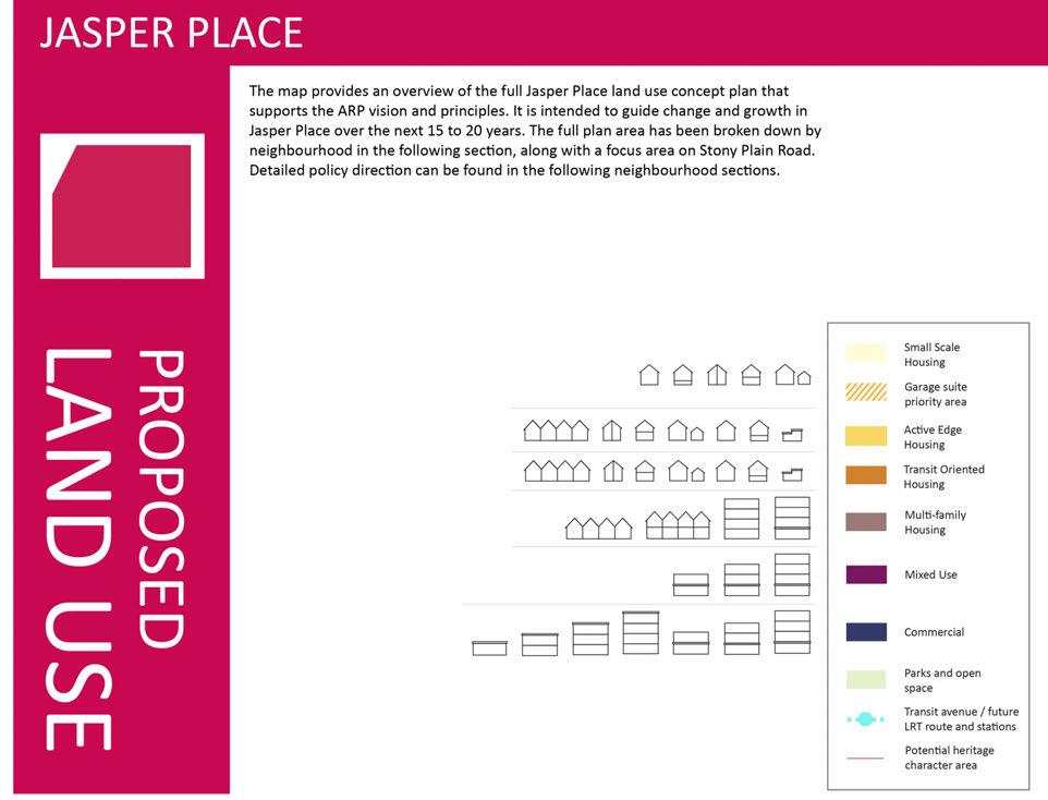
24 Graphic guide The ARP uses a variety of graphics to help navigate and interpret the plan. This page provides an explanation of the graphics you will see in the coming pages. Single detached Secondary suite Garage or garden suite Semi detached Duplex Row housing Small scale commercial Existing condition maps are provided with call out boxes that discuss key features of the area. Proposed maps with corresponding call out boxes then discuss how these conditions are responded to in policy. The call out boxes on the proposed maps for the neighbourhoods and Stony Plain Road focus area provide the policy reference number, the purpose of the policy, and icons showing the key guiding principles that are addressed by the policy as shown on page 19. Each map also has a legend with small icons showing the types of buildings permitted. Figure 4 shows what each icon represents. Stacked row housing Apartment Commercial Mixed use 24 Figure 4: Graphic guide
25 LAND USE CHAPTER 25
26 LAND USE 2014 EXISTING 2014 EXISTING LAND USE 26
27 Figure 5: Jasper Place existing land use 27
28 28
29 Figure 6: Jasper Place proposed land use 29
30 30


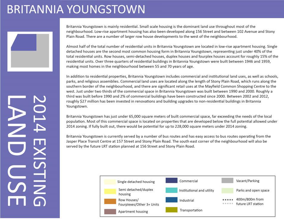
31 Figure 7: Britannia Youngstown existing land use 31
32 32
33 Figure 8: Britannia Youngstown proposed land use 33
34 Small scale housing BY1 Purpose: To allow incremental change over time in established residential areas to provide additional small scale, ground oriented housing choices. Supported built form Single detached houses Secondary suites in locations specified by the Zoning Bylaw Small lot single detached houses Duplexes/semi detached houses in locations specified by the Zoning Bylaw Garage or garden suites Policies When considering discretionary development, the Development Officer shall ensure: 1. Parking access is from the laneway. 2. Variances in regulations for front garages are not granted. 3. Buildings display high quality design meaning, but not limited to, building articulation, no blank facades facing public realm, and window placement on facades facing adjacent properties that considers privacy for adjacent properties. 4. There is one front entrance facing all public roadways for semi detached units on corner properties. 5. Front and side setbacks are not varied except on sides flanking public realm. 6. Mature trees are retained when possible and replaced when not. 7. The incorporation of Low Impact Development (LID) features is considered. 8. City Heritage Officers are consulted on any redevelopment applications in potential Historic Character Areas. 9. Location criteria for different housing forms are not varied. 10. Garden and garage suites are encouraged throughout the area, and strongly supported in priority areas. Active edge housing BY2 Purpose: To support a safe neighbourhood by focusing a variety of ground oriented housing opportunities around parks and open spaces to increase overlook in these areas, and to create strong neighbourhood frontages along key community corridors and across from multi family housing. 34 Supported built form Row houses Duplexes/semi detached houses Garage or garden suites Small lot single detached houses Single detached houses Secondary suites in locations specified by the Zoning Bylaw Small scale commercial with associated residential uses Policies When considering rezoning or discretionary development, the Planner or Development Officer shall ensure: 1. Parking access is from the laneway. 2. Variances in regulations for front garages are not granted. 3. Buildings display high quality design meaning, but not limited to, building articulation, no blank facades facing public realm, and window placement on facades facing adjacent properties that considers privacy for adjacent properties. 4. There is at least one front entrance facing all public roadways for semi detached and row housing located on a corner. 5. Side setbacks are not varied except on sides flanking public realm, and front setbacks are not varied unless fronting a collector or arterial roadway. 6. Mature trees are retained when possible and replaced when not. 7. The incorporation of Low Impact Development (LID) features is considered. 8. City Heritage Officers are consulted on any rezoning or redevelopment applications in potential Historic Character Areas. 9. Developments including commercial components are undertaken using Direct Control zoning, have associated residential uses, small (10m) regularly spaced frontages along the street, and 70% linear transparency at ground level along fronting and flanking streets.
35 Transit oriented housing Purpose: To encourage a range of ground oriented housing options in proximity to services and transit. Supported built form Row houses Duplexes/semi detached houses Garage or garden suites Small lot single detached houses Single detached houses Secondary suites in locations specified by the Zoning Bylaw Small scale commercial with associated residential uses along arterial and collector roads BY3 Policies When considering rezoning or discretionary development, the Planner or Development Officer shall ensure: 1. Parking access is from the laneway. 2. Variances in regulations for front garages are not granted. 3. Buildings display high quality design meaning, but not limited to, no blank facades facing public realm, 50% linear transparency for residential uses at ground level along fronting and flanking streets, and window placement on facades facing adjacent properties that considers privacy for adjacent properties. 4. There is at least one front entrance facing all public roadways for semi detached and row housing units located on a corner. 5. Side setbacks are not varied except on sides flanking public realm. 6. Reduced front setbacks are strongly encouraged in order to support more urban, street oriented buildings. 7. Mature trees are retained when possible and replaced when not. 8. The incorporation of Low Impact Development (LID) features is considered. 9. Developments including commercial components are undertaken using Direct Control zoning, have associated residential uses, small (10m) regularly spaced frontages along the street, and 70% linear transparency at ground level along fronting and flanking streets. 35
36 Multi family housing BY4 Purpose: To provide a range of housing options along main community corridors and on large sites. Supported built form Policies Row and stacked row housing When considering rezoning or discretionary development, the Planner or Development Officer shall ensure: 1. Parking access is from the rear laneways and underground parking is strongly encouraged. Low rise apartment housing 2. Any surface car parking is: located at the back of the building; visually screened from floors above, adjacent properties, and adjacent streets; developed in clusters divided by landscaping including trees; and separated from residential units by landscaped buffers. 3. Increases to Floor Area Ratios and density are provided through Direct Control zoning in instances when underground parking is provided, and standard rear setback requirements are met when sites back onto zones where single detached housing is a permitted use. 4. Ground oriented units including stacked row and row housing are encouraged as the preferred built form. 5. The majority of ground level apartment units with street frontage have individual entrances that front onto a street, and that all other units have access through a front entrance hall fronting onto a street. 6. Buildings display high quality design meaning, but not limited to, building articulation; no blank facades facing public realm; 50% linear transparency for residential uses at ground level along fronting and flanking streets; window, patio and balcony placement that considers privacy for adjacent properties; and landscaping and screening for parking areas. 7. Front setbacks greater than Zoning Bylaw minimums are discouraged, and reduced front setbacks are encouraged in order to support more urban, street oriented buildings. 8. Mature trees are retained when possible and replaced when not. 9. The incorporation of Low Impact Development (LID) features is considered. 10. Building design and site layout take Winter City design guidelines into consideration, including consideration of the micro climate, and use of bright colours and light to animate the building. 11. In addition to the policies above, all large site redevelopments (over 1ha) incorporate the following site layout features and reflect Policy M1.2 where applicable: a. Buildings are arranged in a block form with a clear internal grid/block layout. b. Buildings are oriented towards adjacent streets including both fronting and flanking streets. In addition, the large site between 104 Ave and 105 Ave along Mayfield Road should provide overlook for the laneways to the north and east of the site. c. Direct pedestrian routes are provided through the site and applicable sites provide eastwest pedestrian connections between 104 Avenue, 102a Avenue and 102b Avenue to Mayfield Common. d. No building façade extends greater than 48m in length. e. Surface parking in interior courtyards complies with policy BY4.1 above. f. Storeys above the maximum height allowed in adjacent zones, including properties across laneways, are stepped back on all applicable sides by 2m from the building edge. Balconies may be provided in this stepback. 12. When the intent of the ARP cannot be achieved through conventional zoning, Direct Control zoning is used. 36
37 Commercial Purpose: To encourage more pedestrian friendly commercial nodes that support a walkable neighbourhood. Supported built form Commercial buildings up to 4 storeys Mixed use buildings up to 4 storeys Policies When considering rezoning or discretionary development, the Planner or Development Officer shall ensure: 1. Parking access is from the rear laneways and underground parking is strongly encouraged. 2. Any surface car parking is: located at the back of the building; visually screened from floors above, adjacent properties, and adjacent streets; and developed in clusters divided by landscaping including trees. 3. Mixed use buildings with a combination of commercial, office, retail or residential uses are encouraged. 4. Buildings are street oriented and provide active frontage on all adjacent streets. Setbacks to accommodate raised planters, patios, or other active uses are supported. 5. Buildings display high quality design meaning, but not limited to, building articulation; the appearance of small (10m) regularly spaced frontages along the street; 70% linear transparency at ground level; no blank facades facing public realm; and landscaping and screening for parking areas. 6. The incorporation of Low Impact Development (LID) features is considered. 7. Building design and site layout take Winter City design guidelines into consideration, including consideration of the micro climate, and use of bright colours and light to animate the building. 8. When the intent of the ARP cannot be achieved through conventional zoning, Direct Control zoning is used. BY5 37
38 38


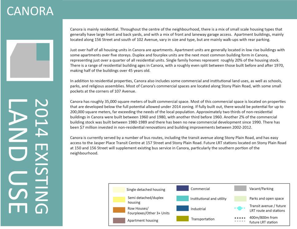
39 Figure 9: Canora existing land use 39
40 40
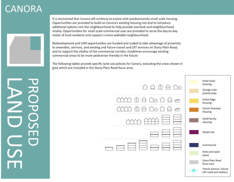
41 Figure 10: Canora proposed land use 41
42 Small scale housing C1 Purpose: To support ongoing incremental change in established residential areas to provide additional small scale, ground oriented housing choices. Supported built form Single detached houses Secondary suites in locations specified by the Zoning Bylaw Small lot single detached houses Duplexes/semi detached houses in locations specified by the Zoning Bylaw Garage or garden suites Policies When considering discretionary development, the Development Officer shall ensure: 1. Parking access is from the laneway. 2. Variances in regulations for front garages are not granted. 3. Buildings display high quality design meaning, but not limited to, building articulation, no blank facades facing public realm, and window placement on facades facing adjacent properties that considers privacy for adjacent properties. 4. There is one front entrance facing all public roadways for semi detached units on corner properties. 5. Front and side setbacks are not varied except on sides flanking public realm. 6. Mature trees are retained when possible and replaced when not. 7. The incorporation of Low Impact Development (LID) features is considered. 8. Location criteria for different housing forms are not varied. 9. Garden and garage suites are encouraged throughout the area, and strongly supported in priority areas. Active edge housing C2 Purpose: To support a safe neighbourhood by focusing a variety of ground oriented housing opportunities around parks and open spaces to increase visibility and overlook in these areas, and to create a strong neighbourhood frontage along key community corridors. Supported built form Row houses Duplexes/semi detached houses Garage or garden suites Small lot single detached houses Single detached houses Secondary suites in locations specified by the Zoning Bylaw Small scale commercial with associated residential uses Policies When considering rezoning or discretionary development, the Planner or Development Officer shall ensure: 1. Parking access is from the laneway. 2. Variances in regulations for front garages are not granted. 3. Buildings display high quality design meaning, but not limited to, building articulation, no blank facades facing public realm, and window placement on facades facing adjacent properties that considers privacy for adjacent properties. 4. There is at least one front entrance facing all public roadways for semi detached and row housing located on a corner. 5. Side setbacks are not varied except on sides flanking public realm, and front setbacks are not varied unless fronting a collector or arterial roadway. 6. Mature trees are retained when possible and replaced when not. 7. The incorporation of Low Impact Development (LID) features is considered. 8. Developments including commercial components are undertaken using Direct Control zoning, have associated residential uses, small (10m) regularly spaced frontages along the street, and 70% linear transparency at ground level along fronting and flanking streets. 42
43 Transit oriented housing C3 Purpose To encourage a range of ground oriented housing options in proximity to services and transit. Supported built form Row houses Duplexes/semi detached houses Garage or garden suites Small lot single detached houses Single detached houses Secondary suites in locations specified by the Zoning Bylaw Small scale commercial with associated residential uses along arterial and collector roads Policies When considering rezoning or discretionary development, the Planner or Development Officer shall ensure: 1. Parking access is from the laneway. 2. Variances in regulations for front garages are not granted. 3. Buildings display high quality design meaning, but not limited to, no blank facades facing public realm, 50% linear transparency for residential uses at ground level along fronting and flanking streets, and window placement on facades facing adjacent properties that considers privacy for adjacent properties. 4. There is at least one front entrance facing all public roadways for semi detached and row housing units located on a corner. 5. Side setbacks are not varied except on sides flanking public realm. 6. Reduced front setbacks are strongly encouraged in order to support more urban, street oriented buildings. 7. Mature trees are retained when possible and replaced when not. 8. The incorporation of Low Impact Development (LID) features is considered. 9. Developments including commercial components are undertaken using Direct Control zoning, have associated residential uses, small (10m) regularly spaced frontages along the street, and 70% linear transparency at ground level along fronting and flanking streets. 43
44 Multi family housing C4 Purpose To encourage a range of housing options along a main community corridor and to provide redevelopment opportunities for smaller properties. Supported built form Row and stacked row housing Low rise apartment housing Policies When considering rezoning or discretionary development, the Planner or Development Officer shall ensure: 1. Parking access is from the rear laneways and underground parking is strongly encouraged. 2. Any surface car parking is: located at the back of the building; visually screened from floors above, adjacent properties, and adjacent streets; developed in clusters divided by landscaping including trees; and separated from residential units by landscaped buffers. 3. Increases to Floor Area Ratios and density are provided through Direct Control zoning in instances when underground parking is provided, and standard rear setback requirements are met when sites back onto zones where single detached housing is a permitted use. 4. Ground oriented units including stacked row and row housing are encouraged as the preferred built form. 5. The majority of ground level apartment units with street frontage have individual entrances that front onto a street, and that all other units have access through a front entrance hall fronting onto a street. 6. Buildings display high quality design meaning, but not limited to, building articulation; no blank facades facing public realm; 50% linear transparency for residential uses at ground level along fronting and flanking streets; window, patio and balcony placement that considers privacy for adjacent properties; and landscaping and screening for parking areas. 7. Front setbacks greater than Zoning Bylaw minimums are discouraged, and reduced front setbacks are encouraged in order to support more urban, street oriented buildings. 8. Mature trees are retained when possible and replaced when not. 9. The incorporation of Low Impact Development (LID) features is considered. 10. Building design and site layout take Winter City design guidelines into consideration, including consideration of the micro climate, and use of bright colours and light to animate the building. 11. When the intent of the ARP cannot be achieved through conventional zoning, Direct Control zoning is used. 44
45 Commercial nodes C5 Purpose To encourage more pedestrian friendly commercial nodes that support a walkable neighbourhood. Supported built form Commercial buildings up to 4 storeys Mixed use buildings up to 4 storeys Policies When considering rezoning or discretionary development, the Planner or Development Officer shall ensure: 1. Parking access is from the rear laneways and underground parking is strongly encouraged. 2. Any surface car parking is: located at the back of the building; visually screened from floors above, adjacent properties, and adjacent streets; and developed in clusters divided by landscaping including trees. 3. Mixed use buildings with a combination of commercial, office, retail or residential uses are encouraged. 4. Buildings are street oriented and provide active frontage on all adjacent streets. Setbacks to accommodate raised planters, patios, or other active uses are supported. 5. Buildings display high quality design meaning, but not limited to, building articulation; the appearance of small (10m) regularly spaced frontages along the street; 70% linear transparency at ground level; no blank facades facing public realm; and landscaping and screening for parking areas. 6. The incorporation of Low Impact Development (LID) features is considered. 7. Building design and site layout take Winter City design guidelines into consideration, including consideration of the micro climate, and use of bright colours and light to animate the building. 8. When the intent of the ARP cannot be achieved through conventional zoning, Direct Control zoning is used. 45
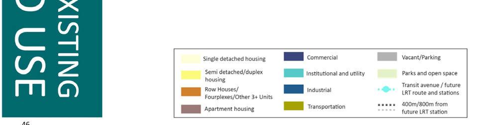
46 46
47 Figure 11: Glenwood existing land use 47
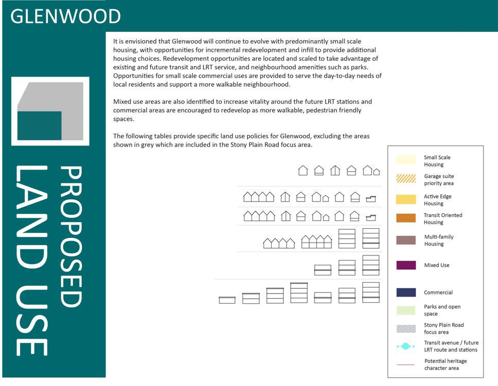
48 48
49 Figure 12: Glenwood proposed land use 49
50 Small scale housing G1 Purpose: To allow incremental change over time in established residential areas to provide additional small scale, ground oriented housing choices. Supported built form Single detached houses Secondary suites in locations specified by the Zoning Bylaw Small lot single detached houses Duplexes/semi detached houses in locations specified by the Zoning Bylaw Garage or garden suites Policies When considering discretionary development, the Development Officer shall ensure: 1. Parking access is from the laneway. 2. Variances in regulations for front garages are not granted. 3. Buildings display high quality design meaning, but not limited to, building articulation, no blank facades facing public realm, and window placement on facades facing adjacent properties that considers privacy for adjacent properties. 4. There is one front entrance facing all public roadways for semi detached units on corner properties. 5. Front and side setbacks are not varied except on sides flanking public realm. 6. Mature trees are retained when possible and replaced when not. 7. The incorporation of Low Impact Development (LID) features is considered. 8. City Heritage Officers are consulted on any redevelopment applcations in potential Historic Character Areas. 9. Location criteria for different housing forms are not varied. 10. Garden and garage suites are encouraged throughout the area, and strongly supported in priority areas. 50 Active edge housing G2 Purpose: To support a safe neighbourhood by focusing a variety of ground oriented housing opportunities around parks and open spaces to increase visibility and overlook in these areas and to create a strong neighbourhood frontage along key community corridors and across from multi family housing. Supported built form Row houses Duplexes/semi detached houses Garage or garden suites in locations specified by the Zoning Bylaw Small lot single detached houses Single detached houses Secondary suites in locations specified by the Zoning Bylaw Small scale commercial with associated residential uses except on 100 Avenue, 96A Avenue and 163 Street Policies When considering rezoning or discretionary development, the Planner or Development Officer shall ensure: 1. Parking access is from the laneway. 2. Variances in regulations for front garages are not granted. 3. Buildings display high quality design meaning, but not limited to, building articulation, no blank facades facing public realm, and window placement on facades facing adjacent properties that considers privacy for adjacent properties. 4. There is at least one front entrance facing all public roadways for semi detached and row housing located on a corner. 5. Side setbacks are not varied except on sides flanking public realm, and front setbacks are not varied unless fronting a collector or arterial roadway. 6. Mature trees are retained when possible and replaced when not. 7. The incorporation of Low Impact Development (LID) features is considered. 8. City Heritage Officers are consulted on any rezoning or redevelopment applications in potential Historic Character Areas. 9. Developments including commercial components are undertaken using Direct Control zoning, have associated residential uses, small (10m) regularly spaced frontages along the street, and 70% linear transparency at ground level along fronting and flanking streets. 10. The consolidation of properties and laneway ends south of the shared use path along 100 Avenue is encouraged in order to support construction of housing facing the shared use path, with rear laneways provided behind the properties running parallel to 100 Avenue, and that the existing green space is maintained.
51 Transit oriented housing G3 Purpose: To encourage a range of ground oriented housing options in proximity to services and transit along a key transit corridor. Supported built form Row houses Duplexes/semi detached houses Garage or garden suites Small lot single detached houses Single detached houses Secondary suites in locations specified by the Zoning Bylaw Small scale commercial with associated residential uses along arterial and collector roads Policies When considering rezoning or discretionary development, the Planner or Development Officer shall ensure: 1. Parking access is from the laneway. 2. Variances in regulations for front garages are not granted. 3. Buildings display high quality design meaning, but not limited to, no blank facades facing public realm, 50% linear transparency for residential uses at ground level along fronting and flanking streets, and window placement on facades facing adjacent properties that considers privacy for adjacent properties. 4. There is at least one front entrance facing all public roadways for semi detached and row housing units located on a corner. 5. Side setbacks are not varied except on sides flanking public realm. 6. Reduced front setbacks are strongly encouraged in order to support more urban, street oriented buildings. 7. Mature trees are retained when possible and replaced when not. 8. The incorporation of Low Impact Development (LID) features is considered. 9. Developments including commercial components are undertaken using Direct Control zoning, have associated residential uses, small (10m) regularly spaced frontages along the street, and 70% linear transparency at ground level along fronting and flanking streets. 51
52 Multi family housing G4 Purpose: To provide a range of housing options along main community corridors and on large redevelopment sites, and to encourage the redevelopment of larges sites in a way that increases neighbourhood connectivity. Supported built form Row and stacked row housing Low rise apartment housing Small scale commercial uses located on the ground floor of residential buildings on 156 Street 52 Policies When considering rezoning or discretionary development, the Planner or Development Officer shall ensure: 1. Parking access is from the rear laneways and underground parking is strongly encouraged. 2. Any surface car parking is: located at the back of the building; visually screened from floors above, adjacent properties, and adjacent streets; developed in clusters divided by landscaping including trees; and separated from residential units by landscaped buffers. 3. Increases to Floor Area Ratios and density are provided through Direct Control zoning in instances when underground parking is provided, and standard rear setback requirements are met when sites back onto zones where single detached housing is a permitted use. 4. Ground oriented units including stacked row and row housing are encouraged as the preferred built form. 5. The majority of ground level apartment units with street frontage have individual entrances that front onto a street, and that all other units have access through a front entrance hall fronting onto a street. 6. Buildings display high quality design meaning, but not limited to, building articulation; no blank facades facing public realm; 50% linear transparency for residential uses at ground level along fronting and flanking streets; window, patio and balcony placement that considers privacy for adjacent properties; and landscaping and screening for parking areas. 7. Front setbacks greater than Zoning Bylaw minimums are discouraged, and reduced front setbacks are encouraged in order to support more urban, street oriented buildings. 8. On 156 Street, a 4m distance is provided from the curb line established by LRT to any site landscaping or building frontages, and that any portion of the 4m distance that falls on private property is hard surfaced and visually incorporated into the sidewalk. 9. Mature trees are retained when possible and replaced when not. 10. The incorporation of Low Impact Development (LID) features is considered. 11. Building design and site layout take Winter City design guidelines into consideration, including consideration of the micro climate, and use of bright colours and light to animate the building. 12. In addition to the policies above, all large site redevelopments (over 1ha) incorporate the following site layout features and reflect Policy M1.2 where applicable: a. Buildings are arranged in a block form with a clear internal grid/block layout. b. Buildings are oriented towards adjacent streets including both fronting and flanking streets. c. Direct pedestrian routes are provided through the site and applicable sites should provide east west pedestrian connections in appropriate locations between 165 Street and 167 Street, in alignment with existing avenues such as 97 Avenue, 98 Avenue, 98a Avenue or 99 Avenue. d. No building façade extends greater than 48m in length. e. Surface parking in interior courtyards complies with policy G4.2 above. f. Storeys above the maximum height allowed in adjacent zones, including properties across laneways, are stepped back on all applicable sides by 2m. Balconies may be provided in this stepback 13. Residential units along 156 Street are constructed to minimize noise and vibration impacts from LRT and roadway traffic. 14. When the intent of the ARP cannot be achieved through conventional zoning, Direct Control zoning is used.
53 Commercial G5 Purpose To encourage more pedestrian friendly commercial nodes that support a walkable neighbourhood. Supported built form Commercial buildings up to 4 storeys Mixed use buildings up to 4 storeys Mixed use hubs Policies When considering rezoning or discretionary development, the Planner or Development Officer shall ensure: 1. Parking access is from the rear laneways and underground parking is strongly encouraged. 2. Any surface car parking is: located at the back of the building; visually screened from floors above, adjacent properties, and adjacent streets; and developed in clusters divided by landscaping including trees. 3. Mixed use buildings with a combination of commercial, office, retail or residential uses are encouraged. 4. Buildings are street oriented and provide active frontage on all adjacent streets. Setbacks to accommodate raised planters, patios, or other active uses are supported. 5. Buildings display high quality design meaning, but not limited to, building articulation; the appearance of small (10m) regularly spaced frontages along the street; 70% linear transparency at ground level; no blank facades facing public realm; and landscaping and screening for parking areas. 6. The incorporation of Low Impact Development (LID) features is considered. 7. Building design and site layout take Winter City design guidelines into consideration, including consideration of the micro climate, and use of bright colours and light to animate the building. 8. When the intent of the ARP cannot be achieved through conventional zoning, Direct Control zoning is used. Purpose: To provide a mix of commercial and residential uses in proximity to transit Supported built form Mixed use buildings up to 4 storeys Policies When considering rezoning or discretionary development, the Planner or Development Officer shall ensure: 1. Parking requirement reductions are, with justification, supported. 2. Parking access is from the rear laneways and underground parking is strongly encouraged. 3. Any surface car parking is: located at the back of the building; visually screened from floors above, adjacent properties and adjacent streets; and developed in clusters divided by landscaping including trees. 4. The ground floors of buildings have active commercial uses. 5. Mixed use buildings with a combination of commercial, office, retail or residential uses are required. 6. Buildings display high quality design meaning, but not limited to, building articulation; the appearance of small (10m) regularly spaced frontages along the street; 70% linear transparency at ground level; no blank facades facing public realm; and landscaping and screening for parking areas. 7. Buildings are street oriented and provide active frontage on all adjacent streets. 8. A 4m distance is provided from the curb line established by LRT to building frontages, and that any portion of the 4m distance that falls on private property is hard surfaced and visually incorporated into the sidewalk. Additional setbacks to accommodate raised planters, patios, or other active uses are supported. 9. The incorporation of Low Impact Development (LID) features is considered. 10. Building design and site layout take Winter City design guidelines into consideration, including consideration of the micro climate, and use of bright colours and light to animate the building. 11. Residential units are constructed to minimize noise and vibration impacts from LRT and roadway traffic. 12. When the intent of the ARP cannot be achieved through conventional zoning, Direct Control zoning is used. 53 G6
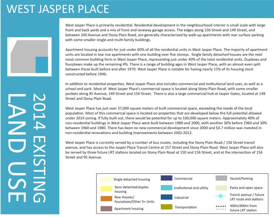
54 54


55 Figure 13: West Jasper Place existing land use 55
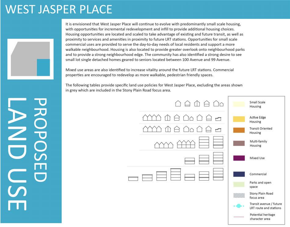
56 56
57 Figure 14: West Jasper Place proposed land use 57
58 58 Small scale housing WJP1 Purpose: To allow incremental change over time in established residential areas to provide additional small scale, ground oriented housing choices. Supported built form Single detached houses Secondary suites in locations specified by the Zoning Bylaw Small lot single detached houses Duplexes/semi detached houses in locations specified by the Zoning Bylaw Garage or garden suites Policies When considering discretionary development, the Development Officer shall ensure: 1. Parking access is from the laneway. 2. Variances in regulations for front garages are not granted. 3. Buildings display high quality design meaning, but not limited to, building articulation, no blank facades facing public realm, and window placement on facades facing adjacent properties that considers privacy for adjacent properties. 4. There is one front entrance facing all public roadways for semi detached units on corner properties. 5. Front and side setbacks are not varied except on sides flanking public realm. 6. Mature trees are retained when possible and replaced when not. 7. The incorporation of Low Impact Development (LID) features is considered. 8. Location criteria for different housing forms are not varied. Active edge housing WJP2 Purpose To support a safe neighbourhood by focusing a variety of ground oriented housing opportunities around parks, open spaces and key walkways to increase visibility and overlook in these areas. Supported built form Row houses Duplexes/semi detached houses Garage or garden suites Small lot single detached houses Single detached houses Secondary suites in locations specified by the Zoning Bylaw Small scale commercial with associated residential uses except on 100 Avenue Policies When considering rezoning or discretionary development, the Planner or Development Officer shall ensure: 1. Parking access is from the laneway. 2. Variances in regulations for front garages are not granted. 3. Buildings display high quality design meaning, but not limited to, building articulation, no blank facades facing public realm, and window placement on facades facing adjacent properties that considers privacy for adjacent properties. 4. There is at least one front entrance facing all public roadways for semi detached and row housing located on a corner. 5. Side setbacks are not varied except on sides flanking public realm, and front setbacks are not varied unless fronting a collector or arterial roadway. 6. Mature trees are retained when possible and replaced when not. 7. The incorporation of Low Impact Development (LID) features is considered. 8. Developments including commercial components are undertaken using Direct Control zoning, have associated residential uses, small (10m) regularly spaced frontages along the street, and 70% linear transparency at ground level along fronting and flanking streets. 9. The consolidation of properties and laneway ends south of the shared use path along 100 Avenue is encouraged in order to support construction of housing facing the shared use path, with rear laneways provided behind the properties running parallel to 100 Avenue, and that the existing green space is maintained.
59 Transit oriented housing Purpose: To encourage a range of ground oriented housing options in proximity to services and transit. Supported built form Row houses Duplexes/semi detached houses Garage or garden suites Small lot single detached houses Single detached houses Secondary suites in locations specified by the Zoning Bylaw Small scale commercial with associated residential uses along arterial and collector roads WJP3 Policies When considering rezoning or discretionary development, the Planner or Development Officer shall ensure: 1. Parking access is from the laneway. 2. Variances in regulations for front garages are not granted. 3. Buildings display high quality design meaning, but not limited to, no blank facades facing public realm, 50% linear transparency for residential uses at ground level along fronting and flanking streets, and window placement on facades facing adjacent properties that considers privacy for adjacent properties. 4. There is at least one front entrance facing all public roadways for semi detached and row housing units located on a corner. 5. Side setbacks are not varied except on sides flanking public realm. 6. Reduced front setbacks are strongly encouraged in order to support more urban, street oriented buildings. 7. Mature trees are retained when possible and replaced when not. 8. The incorporation of Low Impact Development (LID) features is considered. 9. City Heritage Officers are consulted on any rezoning or redevelopment applications in potential Historic Character Areas. 10. Developments including commercial components are undertaken using Direct Control zoning, have associated residential uses, small (10m) regularly spaced frontages along the street, and 70% linear transparency at ground level along fronting and flanking streets. 59
60 Multi family housing WJP4 Purpose: To encourage a range of housing options in proximity to services and transit, and to provide redevelopment opportunities for smaller properties. Supported built form Row and stacked row housing Low rise apartment housing Small scale commercial uses located on the ground floor of residential buildings on 156 Street Policies When considering rezoning or discretionary development, the Planner or Development Officer shall ensure: 1. Parking access is from the rear laneways and underground parking is strongly encouraged. 2. Any surface car parking is: located at the back of the building; visually screened from floors above, adjacent properties, and adjacent streets; developed in clusters divided by landscaping including trees; and separated from residential units by landscaped buffers. 3. Increases to Floor Area Ratios and density are provided through Direct Control zoning in instances when underground parking is provided, and standard rear setback requirements are met when sites back onto zones where single detached housing is a permitted use. 4. Ground oriented units including stacked row and row housing are encouraged as the preferred built form. 5. The majority of ground level apartment units with street frontage have individual entrances that front onto a street, and that all other units have access through a front entrance hall fronting onto a street. 6. Buildings display high quality design meaning, but not limited to, building articulation; no blank facades facing public realm; 50% linear transparency for residential uses at ground level along fronting and flanking streets; window, patio and balcony placement that considers privacy for adjacent properties; and landscaping and screening for parking areas. 7. Front setbacks greater than Zoning Bylaw minimums are discouraged, and reduced front setbacks are encouraged in order to support more urban, street oriented buildings. 8. On 156 Street, a 4m distance is provided from the curb line established by LRT to any site landscaping or building frontages, and that any portion of the 4m distance that falls on private property is hard surfaced and visually incorporated into the sidewalk. 9. Mature trees are retained when possible and replaced when not. 10. The incorporation of Low Impact Development (LID) features is considered. 11. Building design and site layout take Winter City design guidelines into consideration, including consideration of the micro climate, and use of bright colours and light to animate the building. 12. When the intent of the ARP cannot be achieved through conventional zoning, Direct Control zoning is used. 13. Residential units along 156 Street are constructed to minimize noise and vibration impacts from LRT and roadway traffic. 60
61 Commercial Purpose: To encourage more pedestrian friendly commercial nodes that support a walkable neighbourhood. Supported built form Commercial buildings up to 4 storeys Mixed use buildings up to 4 storeys WJP5 Policies When considering rezoning or discretionary development, the Planner or Development Officer shall ensure: 1. Parking access is from the rear laneways and underground parking is strongly encouraged. 2. Any surface car parking is: located at the back of the building; visually screened from floors above, adjacent properties, and adjacent streets; and developed in clusters divided by landscaping including trees. 3. Mixed use buildings with a combination of commercial, office, retail or residential uses are encouraged. 4. Buildings are street oriented and provide active frontage on all adjacent streets. Setbacks to accommodate raised planters, patios, or other active uses are supported. 5. Buildings display high quality design meaning, but not limited to, building articulation; the appearance of small (10m) regularly spaced frontages along the street; 70% linear transparency at ground level; no blank facades facing public realm; and landscaping and screening for parking areas. 6. The incorporation of Low Impact Development (LID) features is considered. 7. Building design and site layout take Winter City design guidelines into consideration, including consideration of the micro climate, and use of bright colours and light to animate the building. 8. When the intent of the ARP cannot be achieved through conventional zoning, Direct Control zoning is used. Mixed use hubs WJP6 Purpose: To provide a mix of commercial and residential uses in proximity to transit. Supported built form Mixed use buildings up to Policies When considering rezoning or discretionary development, the Planner or Development Officer shall ensure: 4 storeys 1. Parking requirement reductions are, with justification, supported. 2. Parking access is from the rear laneways and underground parking is strongly encouraged. 3. Any surface car parking is: located at the back of the building; visually screened from floors above, adjacent properties and adjacent streets; and developed in clusters divided by landscaping including trees. 4. The ground floors of buildings have active commercial uses. 5. Mixed use buildings with a combination of commercial, office, retail or residential uses are required. 6. Buildings display high quality design meaning, but not limited to, building articulation; the appearance of small (10m) regularly spaced frontages along the street; 70% linear transparency at ground level; no blank facades facing public realm; and landscaping and screening for parking areas. 7. Buildings are street oriented and provide active frontage on all adjacent streets. 8. A 4m distance is provided from the curb line established by LRT to building frontages, and that any portion of the 4m distance that falls on private property is hard surfaced and visually incorporated into the sidewalk. Additional setbacks to accommodate raised planters, patios, or other active uses are supported. 9. The incorporation of Low Impact Development (LID) features is considered. 10. Building design and site layout take Winter City design guidelines into consideration, including consideration of the micro climate, and use of bright colours and light to animate the building. 11. Residential units are constructed to minimize noise and vibration impacts from LRT and roadway traffic. 12. When the intent of the ARP cannot be achieved through conventional zoning, Direct Control zoning is used. 61
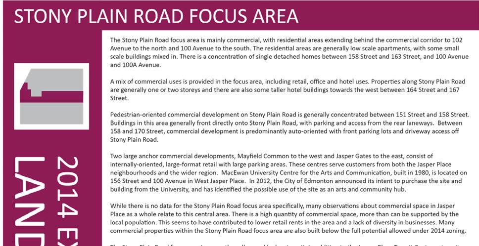
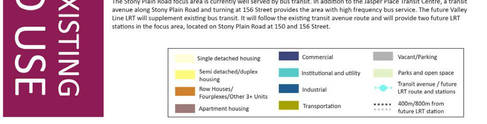
62 62

63 Figure 15: Stony Plain Road focus area existing land use 63
64 64
65 Figure 16: Stony Plain Road focus area proposed land use 65
66 Transit oriented housing r o p o s e SPR1 Purpose: To encourage a range of ground oriented housing options in proximity to services and transit. Supported built form Stacked row houses Row houses Duplexes/semi detached houses Garage or garden suites Small lot single detached houses Single detached houses Secondary suites in locations specified by the Zoning Bylaw Policies When considering rezoning or discretionary development, the Planner or Development Officer shall ensure: 1. Parking access is from the laneway. 2. Variances in regulations for front garages are not granted. 3. Buildings display high quality design meaning, but not limited to, no blank facades facing public realm, 50% linear transparency for residential uses at ground level along fronting and flanking streets, and window placement on facades facing adjacent properties that considers privacy for adjacent properties. 4. There is at least one front entrance facing all public roadways for semi detached and row housing units located on a corner. 5. Zero lot lines may be considered to create a continuous street frontage. 6. Reduced front setbacks are strongly encouraged in order to support more urban, street oriented buildings. 7. Mature trees are retained when possible and replaced when not. 8. The incorporation of Low Impact Development (LID) features is considered. d l a n d s e 66
67 Multi family housing SPR2 Purpose: To provide opportunities for a range of housing options in proximity to services and transit, and to support a vibrant and safe shopping street. Supported built form Row and stacked row housing Low rise apartment housing Policies When considering rezoning or discretionary development, the Planner or Development Officer shall ensure: 1. Parking access is from the rear laneways and underground parking is strongly encouraged. 2. Any surface car parking is: located at the back of the building; visually screened from floors above, adjacent properties, and adjacent streets; developed in clusters divided by landscaping including trees; and separated from residential units by landscaped buffers. 3. Increases to Floor Area Ratios and density are provided through Direct Control zoning in instances when underground parking is provided, and standard rear setback requirements are met when sites back onto zones where single detached housing is a permitted use. 4. Ground oriented units including stacked row and row housing are encouraged as the preferred built form. 5. The majority of ground level apartment units with street frontage have individual entrances that front onto a street, and that all other units have access through a front entrance hall fronting onto a street. 6. Buildings display high quality design meaning, but not limited to, building articulation; no blank facades facing public realm; 50% linear transparency for residential uses at ground level along fronting and flanking streets; window, patio and balcony placement that considers privacy for adjacent properties; and landscaping and screening for parking areas. 7. Front setbacks greater than Zoning Bylaw minimums are discouraged, and reduced front setbacks are encouraged in order to support more urban, street oriented buildings. 8. Mature trees are retained when possible and replaced when not. 9. The incorporation of Low Impact Development (LID) features is considered. 10. Building design and site layout take Winter City design guidelines into consideration, including consideration of the micro climate, and use of bright colours and light to animate the building. 11. When the intent of the ARP cannot be achieved through conventional zoning, Direct Control zoning is used. 12. Applicants on eligible properties should be encouraged to apply for the City s Development Incentive Program. 13. Laneways running parallel to Stony Plain Road are re established as sites are redeveloped between 157 Street and 158 Street in conjunction with Policy M
68 Commercial Purpose: To encourage high quality commercial nodes that support a destination commercial district. Supported built form Commercial buildings up to 4 storeys Mixed use buildings up to 4 storeys SPR3 Policies When considering rezoning or discretionary development, the Planner or Development Officer shall ensure: 1. Parking access is from the rear laneways and underground parking is strongly encouraged. 2. Any surface car parking is: located at the back of the building; visually screened from floors above, adjacent properties, and adjacent streets; and developed in clusters divided by landscaping including trees. 3. No new vehicle access points are allowed along Stony Plain Road and existing access points are closed where possible. 4. Mixed use buildings with a combination of commercial, office, retail or residential uses are encouraged. 5. Buildings are street oriented and provide active frontage on all adjacent streets. Setbacks to accommodate raised planters, patios, or other active uses are supported 6. On Stony Plain Road, a 4m distance is provided from the curb line to any building frontages, and that any portion of the 4m distance that falls on private property is hard surfaced and visually incorporated into the sidewalk. 7. Buildings display high quality design meaning, but not limited to, building articulation; the appearance of small (10m) regularly spaced frontages along the street; 70% linear transparency at ground level; no blank facades facing public realm; and landscaping and screening for parking areas. 8. The incorporation of Low Impact Development (LID) features is considered. 9. Building design and site layout take Winter City design guidelines into consideration, including consideration of the micro climate, and use of bright colours and light to animate the building. 10. In addition to the policies above, all large site redevelopments (over 1ha), including Mayfield Common, incorporate the following site layout features and reflect Policy M1.2: a. Street oriented edges are provided on fronting and flanking streets, particularly Stony Plain Road. b. A landscaped internal street grid is established and aligned with the existing adjacent street pattern. c. Direct pedestrian connections are provided across the site 11. When the intent of the ARP cannot be achieved through conventional zoning, Direct Control zoning is used. 12. Applicants on eligible properties should be encouraged to apply for the City s Development Incentive Program and Façade Improvement Program. 68
69 Mixed use hubs Purpose: To provide an active, mixed use, pedestrian oriented street that is well overlooked and welcoming and that serves as a destination shopping area. Supported built form Mixed use buildings of 2 to 4 storeys Mixed use buildings up to 8 storeys within 100m of future LRT stations Row housing and stacked row housing adjacent to parks and open spaces Transit uses as required Parking structures SPR4 Policies When considering rezoning or discretionary development, the Planner or Development Officer shall ensure: 1. Parking requirement reductions are, with justification, supported. 2. Parking access is from the rear laneways and underground parking is strongly encouraged. 3. Any surface car parking is: located at the back of the building; visually screened from floors above, adjacent properties, and adjacent streets; and developed in clusters divided by landscaping including trees. 4. No new vehicle access points are allowed along Stony Plain Road and existing access points are closed where possible, and drive in or drive through services are not supported. 5. Mixed use buildings with a combination of commercial, office, retail or residential uses are required. 6. The ground floor of the building has active commercial uses and buildings are street oriented and provide active frontage on all adjacent streets. 7. Buildings display high quality design meaning, but not limited to, building articulation; the appearance of small (10m) regularly spaced frontages along the street; 70% linear transparency at ground level; no blank facades facing public realm; and landscaping and screening for parking areas. 8. On Stony Plain Road, a 4m distance is provided from the curb line established by the LRT to any building frontages, and that any portion of the 4m distance that falls on private property is hard surfaced and visually incorporated into the sidewalk. Additional setbacks to accommodate raised planters, patios, or other active uses are supported. 9. Secondary entrances, windows and balconies at the rear of the building are encouraged to provide overlook to the laneways. 10. Buildings greater than four storeys on the south side and greater than six storeys on the north side of Stony Plain Road undertake shadow studies, and incorporate setbacks and stepbacks as necessary to ensure sunlight penetration to the street and surrounding properties. 11. All buildings are stepped back by a minimum 2m after the fourth storey. 12. Any parking structures incorporate active uses at grade along all sides fronting onto streets, particularly Stony Plain Road. 13. Building design and site layout take Winter City design guidelines into consideration, including consideration of the microclimate, and use of bright colours and light to animate the building. 14. The incorporation of Low Impact Development (LID) features is considered. 15. Applicants on eligible properties are encouraged to apply for the City s Development Incentive Program and Façade Improvement Program. 16. Laneways running parallel to Stony Plain Road are re established as sites are redeveloped, particularly the northern portions between 156 Street and 155 Street, and 157 Street and 158 Street in conjunction with Policies M1.4 and M1.5. Continued on following page 69
70 Mixed use hubs SPR4 Policies 17. In addition to the policies above, all large site redevelopments (over 1ha) including Jasper Gates, incorporate the following site layout features and reflect Policy M1.2 a. Street oriented edges and active ground floor uses are provided throughout the development. b. A landscaped internal street grid is established and aligned with the existing street pattern in the area. c. Direct pedestrian access is provided across the site and to and from the LRT station. d. An urban plaza that integrates with the LRT station is provided. e. Maximum height increases are considered if parking is provided underground. f. Transition in scale to adjacent development is provided through stepbacks and other building articulation. 18. Buildings along 149 Street between 102 Avenue and 100 Avenue are setback to accommodate a shared use path parallel to 149 Street in conjunction with Policy M Rezoning, redevelopment, and use changes to support the retention and repurposing of the MacEwan building to house arts, cultural, community and non profit uses, or to facilitate the creation of a public market in Jasper Place are supported. 20. Residential units are constructed to minimize noise and vibration impacts from LRT and roadway traffic. 21. A new bus to bus and bus to LRT exchange is designed as detailed work on the LRT Valley Line proceeds as set out in Policy M4.1, and is accommodated within this area. 22. If the existing transit centre is no longer needed by Edmonton Transit for bus operations, the land is redeveloped for residential or mixed uses in conjunction with Policy M4.2, providing a north south pedestrian mews with groundoriented uses facing onto Butler Park. 23. When the intent of the ARP cannot be achieved through conventional zoning, Direct Control zoning is used. 70

71 CIVIC INFRASTRUCTURE CHAPTER 71
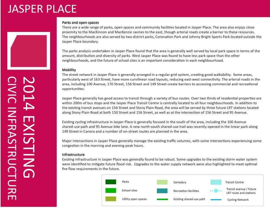
72 72

73 Figure 17: Jasper Place existing civic infrastructure 73
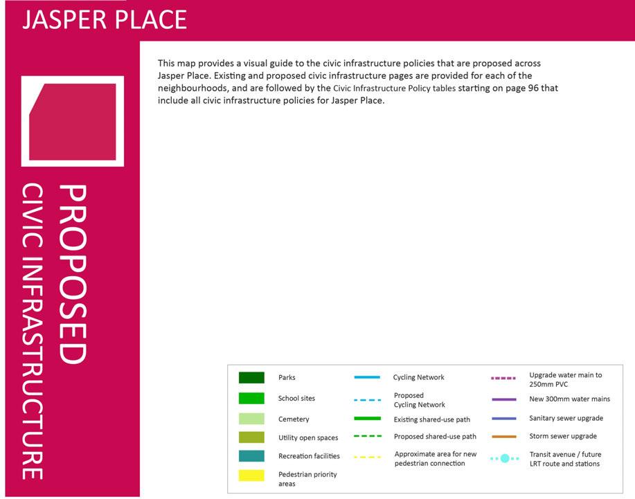
74 74


75 Figure 18: Jasper Place proposed civic infrastructure 75
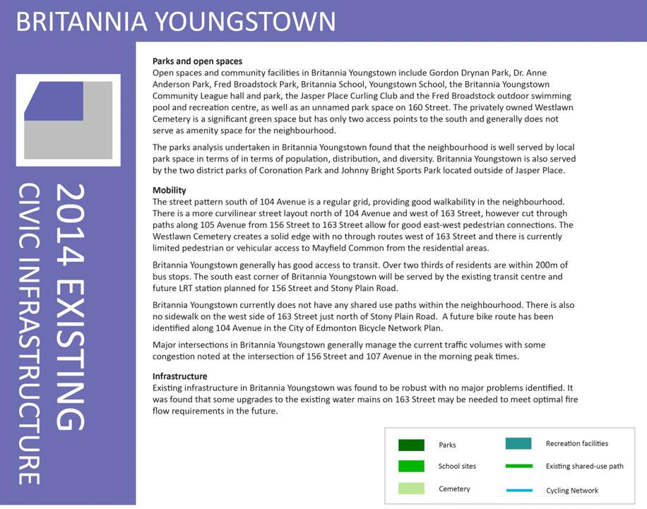
76 76


77 Figure 19: Britannia Youngstown existing civic infrastructure 77
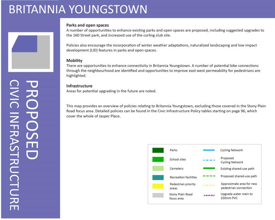
78 78

79 Figure 20: Britannia Youngstown proposed civic infrastructure 79
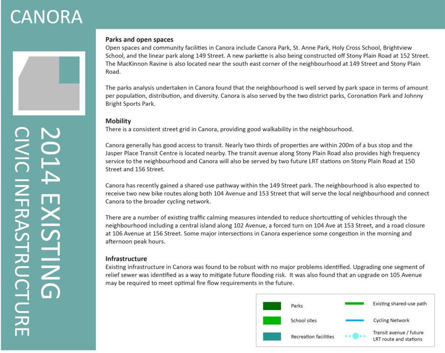
80 80

81 Figure 21: Canora existing civic infrastructure 81
82 82

83 Figure 22: Canora proposed civic infrastructure 83
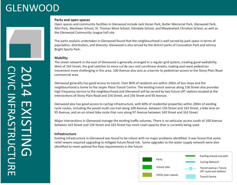
84 84

85 Figure 23: Glenwood existing civic infrastructure 85
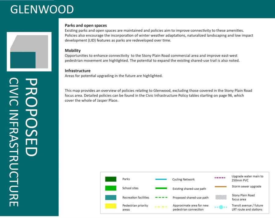
86 86


87 Figure 24: Glenwood proposed civic infrastructure 87
88 88


89 Figure 25: West Jasper Place existing civic infrastructure 89
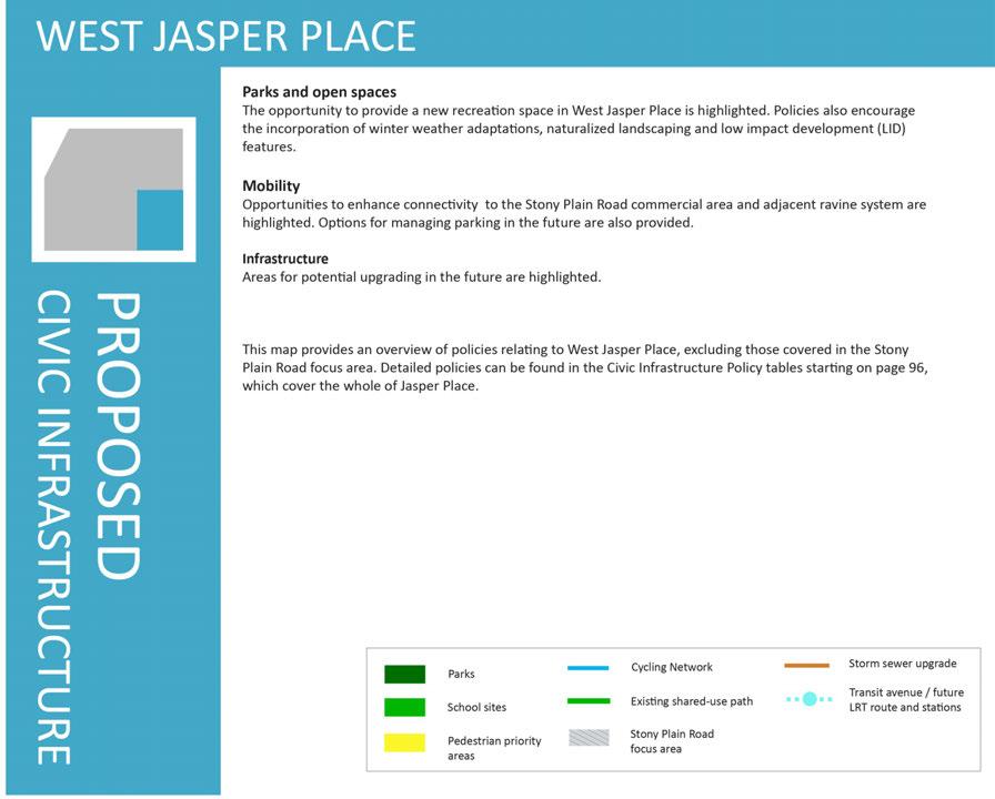
90 90


91 Figure 26: West Jasper Place proposed civic infrastructure 91
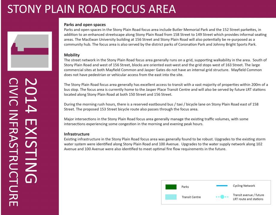
92 92

93 Figure 27: Stony Plain Road focus area existing civic infrastructure 93
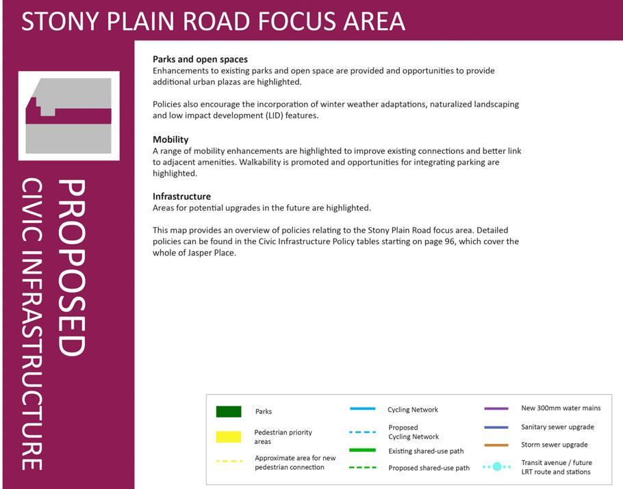
94 94
95 Figure 28: Stony Plain Road focus area proposed civic infrastructure 95
96 Civic infrastructure policy tables Parks and open space PO1 Purpose: To enhance existing parks and open spaces and provide a greater variety of parks and open spaces in Jasper Place. Key policies 1. The City should acquire any available private or public school sites in Jasper Place for park use in the future, prioritizing neighbourhoods where the majority of park space is contained within school sites. Implementation resources & links to other City initiatives This is highlighted as a long term opportunity that will depend on school board decisions. 2. Opportunities to provide additional open spaces and plazas in road rights of way, particularly in side streets adjacent to Stony Plain Road, shall be explored in relation to M2.2. To be incorporated with ongoing streetscape improvements works through Community Services and Transportation Services. 3. Enhancements to Butler Memorial Park shall be considered. To be coordinated through Community Services. 4. Urban plazas shall be provided adjacent to future LRT stations to integrate the platforms with the surrounding area. A town centre plaza space shall be incorporated as part the future LRT station at 156 Street and Stony Plain Road. 5. Based on the findings of the parks assessment, the City shall explore opportunities in conjunction with the community to acquire land to accommodate a passive recreation space in West Jasper Place north of 98 Avenue and south of 100 Avenue. At the time of assembly, a design process shall be undertaken with community members to assess how space can best meet the area s needs. 6. Opportunities to redesign the Canora Community League site to encourage better overlook should be explored. 7. The opportunity to upgrade the existing park in Britannia Youngstown on 160 Street south of 103 Avenue should be explored. To be considered in the design update for the LRT Valley Line in conjunction with Policy M4.4, and coordinated with upgrades to the MacEwan facility after acquisition from the City. The acquisition of parks land in West Jasper Place will align with the direction contained in the forthcoming Open Space Master Plan and will be acquired on an opportunity basis. The acquisition and subsequent development of the land should be coordinated between Sustainable Development and Community Services with community involvement, recognizing some matters of acquisition may require confidentiality. Encourage the Community League to apply for funding from available City funds and programs. Encourage the Community League to apply for funding from available City funds and programs. 96
97 Parks and open space PO1 8. Opportunities to enhance unused land associated with the curling club in Britannia Youngstown at 107 Avenue and Mayfield Road should be explored. This is highlighted as a long term opportunity. Requests from the community and direction from Council would be needed to prioritize this project in the future. 9. Redevelopment of the existing AP parcel owned by the City to connect the laneway at 102b Avenue to 163 Street should be considered in consultation with the Youngstown Elementary School. 10. The parks parcels in Canora along 107 Avenue shall be maintained as a green buffer for this neighbourhood edge. The use of a portion of these parcels to provide a shared use path shall be supported. 11. Where appropriate, park or open space upgrades shall include winter weather adaptations as set out in the Winter City Strategy and associated design guidelines, including consideration of wind protection and solar access. 12. Where appropriate, park or open space upgrades shall incorporate naturalized landscaping features to promote biodiversity and reduced watering requirements. 13. Where appropriate, park or open space upgrades shall explore opportunities to include LID features. This is highlighted as a long term opportunity. Sustainable Development and Community Services to Coordinate with Edmonton Public School Boards through ELEVATE. Transportation Services and Community Services to coordinate the transfer of any necessary portion of park parcels to provide a shared use path as part of any road upgrade works to 107 Avenue in conjunction with Policy M3.3. Community Services to incorporate as part of capital funding source requirements where appropriate. Community Services to incorporate as part of capital funding source requirements where appropriate. Community Services to incorporate as part of capital funding source requirements where appropriate. 97
98 Mobility Purpose: To enhance and promote active modes of transportation and support neighbourhood connectivity for all users. Site specific policies Implementation resources & links to other City initiatives M1 1. Properties along the western edge of 149 Street between 102 Avenue and To be secured by Transportation Services and Sustainable 100 Avenue should be required to provide an easement to accommodate a Development as part of any rezoning or development application future shared use path. process. M 2. Any large site redevelopments shall incorporate street and laneway patterns that align with the existing grid. Particular attention shall be paid to east/west connections across large residential sites in Britannia Youngstown and Glenwood, as well as redevelopment at Mayfield Common and Jasper Gates. 3. All service and parking access for multi family, commercial and mixed use buildings shall be provided from laneways. New mid block vehicle access points shall not be supported for the length of Stony Plain Road and existing mid block access points should be closed where possible. 4. The laneway north of Stony Plain Road in front of the Howard Johnson building between 156 Street and 155 Street shall be re established in conjunction with Policy SPR The laneway north of Stony Plain Road between 157 Street and 158 Street should be re established in conjunction with Policy SPR2.13. The existing midblock lane access could be closed in exchange for the laneway area. 6. Transportation Impact Assessments shall be provided as required by Transportation Services. Stony Plain Road specific policies 1. Opportunities to expand the streetscape improvement program along the full length of Stony Plain Road to create opportunities for new public spaces, plazas and patios, shall be explored. 2. Opportunities to provide new open spaces in road right of way adjacent to Stony Plain Road shall be considered in conjunction with Policy PO Opportunities for on street car parking to support commercial uses shall be provided wherever possible, particularly along side streets adjacent to Stony Plain Road and on Stony Plain road west of 156 Street. 98 To be considered by Transportation Services and Sustainable Development as part of any large site redevelopments in conjunction with BY4.11, G4.12, SPR3.10 and SPR4.17. Connections should be dedicated as road right of way through subdivision. In the absence of subdivision, a public access easement should be provided as part of the rezoning or development permit application process. To be considered by Transportation Services and Sustainable Development as part of any redevelopment proposals, as well as in conjunction with Policies SPR3.1, SPR3.2, SPR3.3, SPR4.2, SPR4.3 and SPR4.4. To be considered by Transportation Services and Sustainable Development as part of any redevelopments proposals related to the property. To be considered by Transportation Services and Sustainable Development as part of any redevelopment proposals related to the property. Transportation Services typically only require TIAs for larger developments, or ones that are expected to be significant traffic generators. Implementation resources & links to other City initiatives M2 This is highlighted as a long term opportunity. Funding and direction from Council would be needed to prioritize this project in the future. Applications to close road right of ways to provide new open spaces should be supported. To be considered by Transportation Services as part of any road upgrade works in conjunction with Policy M5.2.
99 Mobility Active transportation and road upgrade related policies 1. Complete Streets guidelines shall be referenced for all road upgrade works focusing on mode priority and context sensitive design. Where a pedestrian priority area has been identified, particular consideration shall be given to pedestrian realm elements such as treed boulevards. 2. The existing shared use path on 100 Avenue shall be maintained and extended from its current terminus at 163 Street westward to 170 Street. 3. A shared use path shall be provided along 107 Avenue, making use of adjacent park parcels on the south side of the street as needed to accommodate the path. 4. The opportunity to link the existing 100 Avenue and 149 Street shared use paths between 102 Avenue and 100 Avenue shall be explored, including upgrading the concrete slab portion at the east end of 100 Avenue to typical shared use path materials. 5. Pedestrian crossings of 100 Avenue shall be reviewed on an ongoing basis and upgraded as required to ensure safety and connectivity to the Stony Plain Road commercial area. 6. Improved crossings of 149 Street to better connect with the river valley system shall be explored. 7. The opportunity to provide sidewalks on both sides of 163 Street north of Stony Plain Road shall be considered. 8. Existing cut through paths shall be maintained and opportunities to improve feeling of safety through lighting and overlook should be explored. 9. The feasibility of creating a pedestrian connection to link 98 Ave between 162 Street and 163 Street and the potential to extend this linkage west to 164 Street to improve access to the Glenwood Community League Hall and park shall be considered. 10. New bike routes identified on the civic infrastructure map shall be explored for feasibility. Implementation resources & links to other City initiatives M3 Transportation Services to incorporate policy standards as part of any road upgrade works and reflect Policy M5.2 relating to on street parking adjacent to Stony Plain Road. Transportation Services to incorporate as part of any road upgrade works to 100 Avenue. Transportation Services to incorporate as part of any road upgrade works to 107 Avenue in collaboration with Sustainable Development as set out in Policy PO1.10. Transportation Services to incorporate as part of any road upgrade works to 149 Street, including LRT construction, with necessary land secured as part of any rezoning or development application process on adjacent properties in conjunction with Policy SPR4.18. Transportation Services will monitor ongoing redevelopment and ensure that necessary upgrades to pedestrian crossings are provided as warranted. Transportation Services will consider upgrades as part of road renewal works or in relation to LRT construction as per Policy M4.5. Transportation Services to incorporate as part of any road upgrade works to 163 Street. Upgrades to the cut through paths should be incorporated as part of any planned sidewalk upgrade programs. This is highlighted as a long term opportunity. Requests from the community and direction from Council would be required to prioritize this project in the future. This is a long term action item to be considered as part of Transportation Service s Active Transportation program. Identified routes should be incorporated as part of roadway renewal as opportunities arise. M 99
100 Mobility Transit related policies Implementation resources & links to other City initiatives M4 1. A new bus to bus and bus to LRT exchange will be designed as design update work on the LRT Valley Line advances. The future configuration shall reference the Central Jasper Place Land Use and Transit Study (2014) and shall: ensure safe and efficient transit operations and transfers; accommodate a bus transfer facility adjacent to the LRT station; minimize conflicts between modes; prioritize pedestrian movements and safety; maximize transit oriented development opportunities; provide a viable development parcel at the corner of Stony Plain Road and 156 Street; maintain continuous active frontage on Stony Plain Road and 156 Street to support the pedestrian oriented shopping area; provide overlook and animation from adjacent development onto the transit facilities; and ensure adequate access to the MacEwan building. To be developed by Sustainable Development, Edmonton Transit Services, and Transportation Services as the design update for LRT Valley Line proceed in conjunction with Policy SPR4.21. M 2. If the existing transit centre is no longer required by Edmonton Transit for bus operations, the land shall be redeveloped. 3. Minimum 4m sidewalks shall be accommodated adjacent to the LRT along 156 Street and Stony Plain Road, in conjunction with Policies, WJP4.8, G4.8 and SPR4.8. Opportunities to reduce traffic lanes to accommodate expanded sidewalks shall also be considered. 4. Urban plazas shall be provided adjacent to future LRT stations to integrate the platforms with the surrounding area. A town centre plaza space shall be incorporated as part the future LRT station at 156 Street and Stony Plain Road to create a link between the station and the MacEwan building. 5. The reconstruction of the intersection at 149 Street and Stony Plain Road shall ensure direct pedestrian and bicycle connections to improve connectivity to the river valley system. 6. Coordinate necessary utility infrastructure upgrades noted in Policy U1.1 and shown on the civic infrastructure map, particularly the trunk upgrades along Stony Plain Road. To be redeveloped as set out in Policy SPR4.22. To be considered by Transportation Services in the design update for the LRT Valley Line with support from Sustainable Development. To be considered by Transportation Services in the design update for the LRT Valley Line with support from Sustainable Development. To be considered by Transportation Services in the design update for the LRT Valley Line with support from Sustainable Development in conjunction with Policy M3.4 and M3.6. To be coordinated between Transportation Services and Financial Services and Utilities in the design update and phasing of the LRT Valley Line. 100
101 Mobility Parking related policies 1. A balance of on street parking opportunities shall be maintained in Jasper Place to accommodate local residential and commercial parking through the use of a parking management program as the need arises, particularly in areas in proximity to future LRT stations. 2. Expanded on street car parking facilities shall be accommodated on the north south streets between Stony Plain Road and the commercial laneways, and along Stony Plain Road west of 156 Street. 3. The provision of parking structures necessary to support Stony Plain Road shall be considered. Any parking structures should provide active frontage along adjacent public streets and be constructed of high quality materials. Implementation resources & links to other City initiatives M5 To be initiated by residents and businesses as needed and coordinated through Transportation Services. To be incorporated by Transportation Services as part of any road upgrade works in conjunction with Policy M2.3. At the time of construction of the LRT Valley Line, the existing parkade at the MacEwan West building will be replaced. Transportation Services, Sustainable Development and Community Services should consider how the replacement parking facility can support Stony Plain Road as a whole. M 101
102 Utilities U1 Purpose: To encourage adequate utilities infrastructure now and in the future. Key policies 1. The feasibility of undertaking the storm water and water supply upgrades as identified in the technical studies shall be explored. 2. Low impact development features shall be considered as part of City investments in the area. Implementation resources & links to other City initiatives Financial Services and Utilities to incorporate as part of on going City wide utilities and infrastructure planning and prioritization, and coordinate with Transportation Services during the delivery of the LRT Valley Line as noted in Policy M4.6. Applicants located near identified water upgrades should contact EPCOR Water as early as possible to understand potential necessary upgrades. To be incorporated by all Departments as part of any capital funding source requirements. Historic resources HR1 Purpose: To maintain and enhance historic resources. Key policies 1. A Historic Resources Inventory to cover all of Jasper Place shall be undertaken to aid in the specific identification of heritage character areas and individual heritage properties in the area. Implementation resources & links to other City initiatives Sustainable Development should undertake this study. 102
103 4. Amendments + Monitoring This ARP is intended to guide the redevelopment of Jasper Place over the next 15 to 20 years. While this document sets out a general direction and aspiration for the area, it will be important to ensure that the ARP can evolve dynamically in the coming years. To ensure the ARP remains relevant and continues to meet the needs and expectations of residents, land owners and local businesses, it is important to monitor the ARP and amend it as necessary to respond to changing conditions. The following section sets out how amendments should be undertaken and how the plan outcomes should be monitored. 4.1 Amendments No plan can consider all future opportunities or contingencies, and it is important to recognize that there will be new ideas that are not anticipated by this ARP that may be constrained by certain policies within the plan and existing City standards. When new ideas respond to and meet the intent of the objectives of the plan, or offer a creative solution to a particular problem, efforts shall be made to find ways to allow for their implementation through the plan amendment process. Amendments may be triggered by a variety of situations, including: Applications for rezoning or redevelopment Changes or updates in City wide policies and guidelines, including the Municipal Development Plan Changes in transit service provision, including bus route frequency and designated transit avenues Completion of a Historic Resources Inventory Future amendments will generally fall into three categories: Minor amendments A minor amendment would be to make minor text revisions to update terminology, contextual information or accuracy. No consultation or notification is required. Significant amendments These types of amendments would change the area of applicability of different precincts. For example, if a property originally identified for small scale residential was proposed to be changed to active edge housing. In such an instance, notification would need to be made to the Community League and notices sent out to all properties within 60m of the property in question. When considering such amendments, City staff should consider if the amendments are consistent with the Guiding Principles and if there have been any significant changes in conditions of the local area that would undermine the original rationale for precinct designations. Major amendments Major amendments would involve changing the fundamental elements of the plan including amendments to: The Guiding Principles Precinct purpose Precinct building type opportunities Land use or civic infrastructure policies Such amendments would require full notification of all residents and property owners in the affected neighbourhood. An open house must also be held. Any necessary supplementary parks and open space, mobility and infrastructure studies to support amendments should be undertaken as required. It should be noted that any amendments to land use or civic infrastructure maps will need to be done on both the Jasper Place wide scale maps as well as the neighbourhood or Stony Plain Road focus area maps. 103
104 4.2 Monitoring On going assessment of the ARP will help identify potential challenges in implementation, and highlight key success as well. The implementation of the ARP should be monitored through the following indicators as well as others as appropriate: The number of permits granted in the area The proportion of those permits that did and did not require ARP amendments The number of civic infrastructure policies implemented If these indicators suggest that the ARP is not providing adequate guidance, an update of the plan should be considered. Updates may also be needed over time to ensure consistency with: New policy directions and Council priorities Changing road designations, transit service and traffic patterns 104
105 5. Glossary Active frontage means there are windows and doors facing the sidewalk and that the uses encourage people to come and go, for example a retail store or restaurant. Blank facades means that a side of a building has no windows or entrances on it, and is not used for public art such as murals or light installations. Building articulation refers to features on a building that provide interest and reduce the massing and monotony of a long, continuous wall. Civic infrastructure refers to the roads, utilities, parks and open spaces that are part of each neighbourhood. In general, these are owned and controlled by the City of Edmonton or other civic partners such as school boards and utilities companies. Cut through paths are pedestrian and cycle walkways that are typically located in the middle of a long block. They may cross a laneway but are not adjacent to any streets. Discretionary development is development that requires a variance or is for a discretionary use. Approval of discretionary development is at the Development Officer s sole discretion. Direct Control Zoning includes Site Specific Development Control Provision (DC2) and Direct Development Control Provision (DC1) Flanking is the longest side of the property, usually the side of a building. Flanking public realm is where the long side of property is next to a laneway, street, park or open space. As there are no adjacent neighbours that could be impacted by a reduced setback on this side, reduced setbacks are considered acceptable in these locations. Fronting is the direction where the front of the property is facing. The front of a property is defined in Edmonton s Zoning Bylaw. Ground oriented housing are buildings that provide direct street access for each ground floor housing unit. Single detached, semidetached and row housing are typically ground oriented. Apartment buildings can also be ground oriented by providing individual entrances for all ground floor units. Housing type diversity refers to the mix of housing structures in the area. This includes how many types of residential units there are, including single family houses, secondary suites, garage and garden suites, duplexes, semi detached, row houses, stacked row houses, and low and high rise apartment buildings. Land use describes what is located on a property, for example a building or a park. Land use considers broad categories of use, for example residential uses or commercial uses. Land use areas are defined in the land use policy section, and include Small Scale Housing, Active Edge Housing, Transit Oriented Housing, Multi family housing, Commercial and Mixed use areas. LID (Low Impact Development) is an approach to building and landscape design that aims to manage storm water more sustainably, for example rain barrels, green roofs, or bioswales. Linear transparency is a measure of how many doors and windows are provided along a building façade. It is measured by taking the width of each door and window along a building frontage and comparing this to the total length of the frontage. In residential buildings, linear transparency is measured at 1.5m above the building s first finished floor height, and in commercial buildings, linear transparency is measured 1.5m above the finished grade of the adjacent public walkway. See figure 29 on following page. Location criteria are used in the Zoning Bylaw to direct where different buildings types might be located in a zone. For example, a zone might specify certain buildings be located on corner lots or adjacent to commercial properties. 105


106 Open spaces refers to recreation or leisure areas that are publically accessible but are not like typical parks. Examples would include plazas, or the storm drainage area next to Jack Horan Park. Overlook means that there are windows and doors facing onto a space, allowing people to observe an area. This type of eyes on the street or passive surveillance is an important element in creating safe spaces. Permitted development is development that is allowed as of right under the allowances of the Zoning Bylaw. If a permitted use complies with all of the regulations of a zone and all other relevant Zoning Bylaw regulations, the Development Officer must issue a Development Permit for that use. Zoning provides details on land use and identifies the specific permitted and discretionary uses allowed under that zone. It provides regulations regarding the type, size and location of buildings on properties. Zoning in Edmonton is regulated by the Zoning Bylaw Public realm is defined in this plan as any space that is not privately owned property, including streets, laneways, pedestrian cut through paths, shared use paths, and parks and open space. Setback is the distance between the property line and the building. Shared use path is typically a paved pathway that can accommodate a variety of non motorized users including pedestrians and cyclists. In Edmonton, these are typically tarmac pathways with a yellow dividing line. Street fronting means that a building is set towards the front of the property and does not have parking in the front. Utility open space refers to green areas that have some characteristics of a park, but have a primary storm water management space. Park uses, such as seating or play equipment, are more limited in these spaces. Variance is when one or more of the regulations of the Zoning Bylaw are not precisely met in a development permit. Zero lot line is when a building is constructed to the edge of the side property line with no setback. This allows adjacent development to be built immediately next to the building with no gaps. Figure 29: Measuring linear transparency 106
107 Appendix 1 JASPER PLACE HISTORY 107
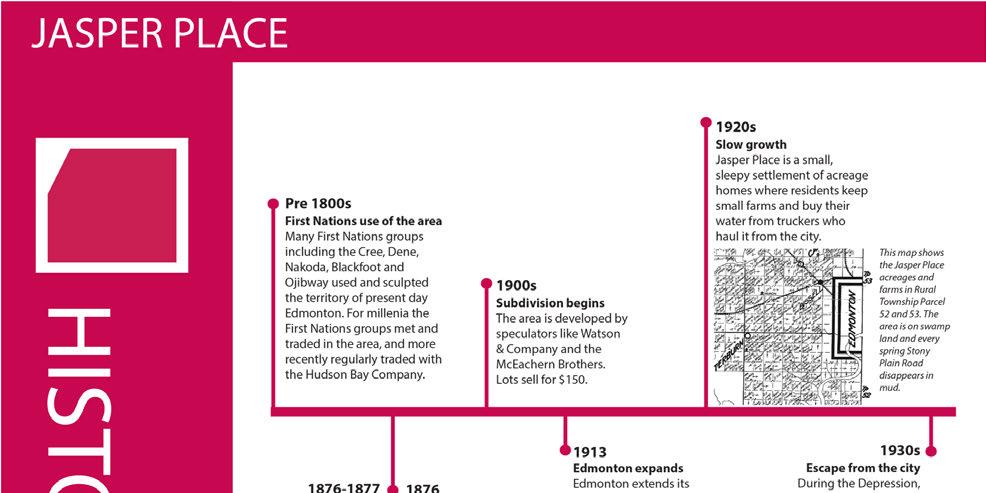
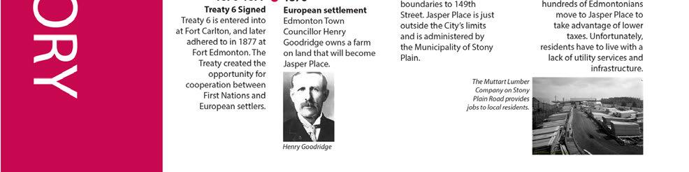
108 108
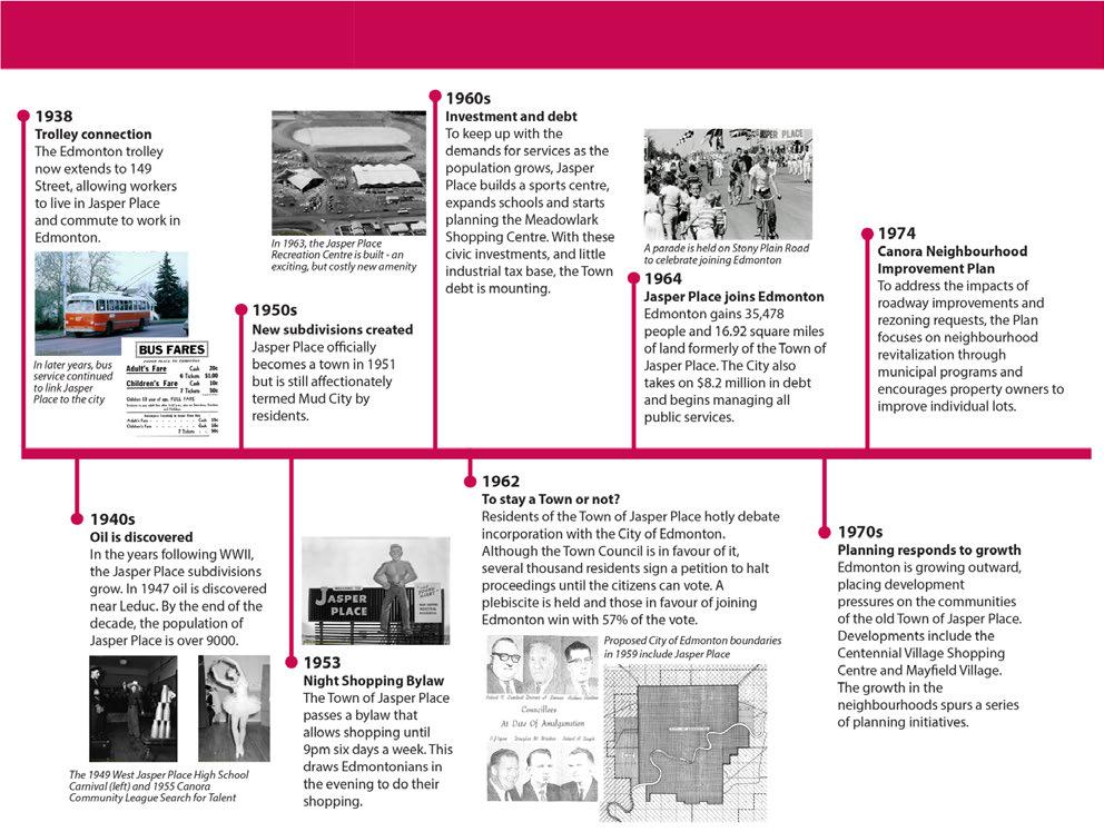
109 109
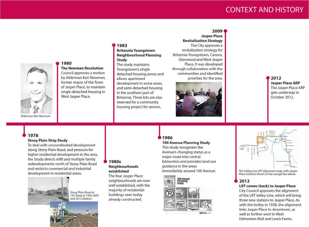
110 110
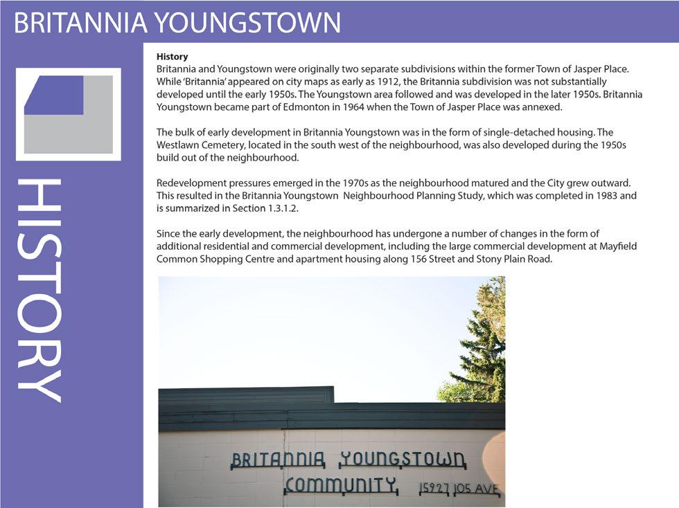
111 111
112 112
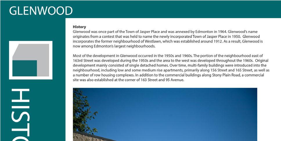

113 113
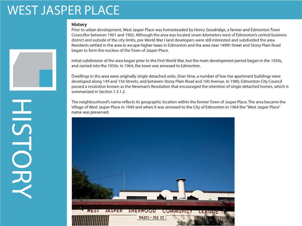
114 114
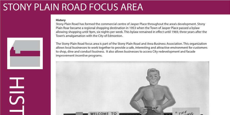
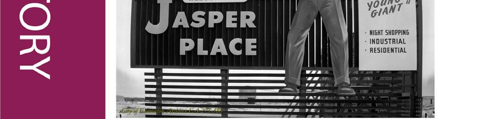
115 115
Land Use Amendment in Southwood (Ward 11) at and Elbow Drive SW, LOC
 at and Elbow Drive SW, LOC") 2018 November 15 Page 1 of 10 EXECUTIVE SUMMARY This land use amendment application was submitted by Rick Balbi Architect on 2017 August 31 on behalf of Sable Developments Ltd, and with authorization from
2018 November 15 Page 1 of 10 EXECUTIVE SUMMARY This land use amendment application was submitted by Rick Balbi Architect on 2017 August 31 on behalf of Sable Developments Ltd, and with authorization from
1.0 Purpose of a Secondary Plan for the Masonville Transit Village
 Report to Planning and Environment Committee To: Chair and Members Planning & Environment Committee From: John M. Fleming Managing Director, Planning and City Planner Subject: Masonville Transit Village
What We Heard Report: Westmount Architectural Heritage Area Rezoning Drop-in Workshop
 What We Heard Report: Westmount Architectural Heritage Area Rezoning Drop-in Workshop August 2018 What We Heard Report: Westmount Architectural Heritage Area Rezoning Drop-in Workshop Executive Summary
ADMINISTRATION RECOMMENDATION(S) 2018 January 25. That Calgary Planning Commission recommend APPROVAL of the proposed Land Use Amendment.
 2018 January 25. That Calgary Planning Commission recommend APPROVAL of the proposed Land Use Amendment.") Page 1 of 9 EXECUTIVE SUMMARY This land use amendment proposes to redesignate a parcel from DC Direct Control District to Multi-Residential Contextual Grade-Oriented (M-CG) District to allow for multi-residential
Page 1 of 9 EXECUTIVE SUMMARY This land use amendment proposes to redesignate a parcel from DC Direct Control District to Multi-Residential Contextual Grade-Oriented (M-CG) District to allow for multi-residential
ROAD CLOSURE AND LAND USE AMENDMENT SILVER SPRINGS (WARD 1) NORTHEAST OF NOSEHILL DRIVE NW AND SILVER SPRINGS ROAD NW BYLAWS 2C2018 AND 29D2018
 NORTHEAST OF NOSEHILL DRIVE NW AND SILVER SPRINGS ROAD NW BYLAWS 2C2018 AND 29D2018") Page 1 of 19 EXECUTIVE SUMMARY This application proposes redesignating two parcels in the community of Silver Springs from Special Purpose Future Urban Development (S-FUD) District and undesignated road
Page 1 of 19 EXECUTIVE SUMMARY This application proposes redesignating two parcels in the community of Silver Springs from Special Purpose Future Urban Development (S-FUD) District and undesignated road
SECTION E. Realizing the Plan
 SECTION E Realizing the Plan 60 DESIGN REGINA - OFFICIAL COMMUNITY PLAN SECTION E Realizing the Plan Design Regina has been an ambitious plan-making exercise, with a high level of community, stakeholder,
Coliseum Station Area Area Redevelopment Plan. Public Engagement #1 June 12, 2017
 Coliseum Station Area Area Redevelopment Plan Public Engagement #1 June 12, 2017 Welcome Engagement Purpose Introduce the project Share information Gather input Project Updates & Newsletter edmonton.ca/coliseumplan
CITY COUNCIL AGENDA REPORT
 CITY COUNCIL AGENDA REPORT Subject: COUNCIL MOTION LRT ALIGNMENT REMOVAL FROM THE TRANSPORTATION MASTER PLAN On February 10, 2016 Councillor Hughes provided notice in accordance with Section 23 of Procedure
POLICY AMENDMENT AND LAND USE AMENDMENT TUXEDO PARK (WARD 9) CENTRE STREET N AND 26 AVENUE NE BYLAWS 36P2017 AND 234D2017
 CENTRE STREET N AND 26 AVENUE NE BYLAWS 36P2017 AND 234D2017") Page 1 of 11 EXECUTIVE SUMMARY This application proposes to redesignate a single parcel of land in the Community of Tuxedo Park from Commercial Corridor 2 (C-COR2 f1h10) District to Mixed Use Active Frontage
Page 1 of 11 EXECUTIVE SUMMARY This application proposes to redesignate a single parcel of land in the Community of Tuxedo Park from Commercial Corridor 2 (C-COR2 f1h10) District to Mixed Use Active Frontage
Local Growth Planning in North Central Green Line Communities
 2018 April 30 Page 1 of 6 EXECUTIVE SUMMARY This report outlines a high-level scope for local growth planning for north central Green Line communities. The catalyst for this review is the significant investments
Official Plan Review
 Official Plan Review Summary Report - The Built Environment August 2014 Part 1: Introduction Planning for a healthy, prosperous and sustainable community is an important goal for our municipality. From
PART 1. Background to the Study. Avenue Study. The Danforth
 The Danforth 1.1/ Study Purpose & Key Municipal Goals 1.2/ The Local Advisory Committee 1.3/ The Project Team 1.4/ Study Process/Summary of Method 1.5/ Summary of Consultation 1.1 Study Purpose and Key
3. Endorse the LRT vision in transforming Surrey into Connected-Complete-Livable communities, and more specifically, the official vision statement:
 CORPORATE REPORT NO: R038 COUNCIL DATE: February 20, 2017 REGULAR COUNCIL TO: Mayor & Council DATE: February 16, 2017 FROM: General Manager, Engineering FILE: 8740-01 SUBJECT: Surrey Light Rail Transit
CITY OF CHARLOTTESVILLE, VIRGINIA CITY COUNCIL AGENDA
 CITY OF CHARLOTTESVILLE, VIRGINIA CITY COUNCIL AGENDA Agenda Date: December 16, 2013 Action Required: Adoption of Resolution Presenter: Staff Contacts: Title: James E. Tolbert, AICP, Director of NDS James
Mill Woods Town Centre Proposed Rezoning LDA
 Mill Woods Town Centre Proposed Rezoning LDA15 0649 The City of Edmonton has received an application for rezoning and an amendment to the Mill Woods Station Area Redevelopment Plan (ARP) for the Mill Woods
Welcome to the Oakridge Centre Open House
 Welcome to the Oakridge Centre Open House Why is the City hosting this event? This open house is to inform you of a rezoning application submitted to the City of Vancouver to amend the existing CD-1 (Comprehensive
LAND USE AMENDMENT CORNERSTONE (WARD 3) 60 STREET NE AND COUNTRY HILLS BOULEVARD NE MAP 26NE BYLAW 22D2017
 60 STREET NE AND COUNTRY HILLS BOULEVARD NE MAP 26NE BYLAW 22D2017") Page 1 of 14 EXECUTIVE SUMMARY This Land Use Amendment application covers an area of 43.76 hectares ± (108.14 acres ±) located in northeast Calgary, bound by Country Hills Boulevard NE to the south and
Page 1 of 14 EXECUTIVE SUMMARY This Land Use Amendment application covers an area of 43.76 hectares ± (108.14 acres ±) located in northeast Calgary, bound by Country Hills Boulevard NE to the south and
POLICY AMENDMENT AND LAND USE AMENDMENT KILLARNEY/GLENGARRY (WARD 8) NW CORNER OF RICHMOND ROAD AND 33 STREET SW BYLAWS 1P2015 AND 7D2015
 NW CORNER OF RICHMOND ROAD AND 33 STREET SW BYLAWS 1P2015 AND 7D2015") Page 1 of 13 EXECUTIVE SUMMARY This application seeks to redesignate an RC-2 (Residential Contextual One/Two Dwelling) parcel to MC-Gd72 (Multi-Residential Contextual Grade-Oriented) to allow for multi-residential
Page 1 of 13 EXECUTIVE SUMMARY This application seeks to redesignate an RC-2 (Residential Contextual One/Two Dwelling) parcel to MC-Gd72 (Multi-Residential Contextual Grade-Oriented) to allow for multi-residential
SUBJECT: Waterfront Hotel Planning Study Update TO: Planning and Development Committee FROM: Department of City Building. Recommendation: Purpose:
 Page 1 of Report PB-23-18 SUBJECT: Waterfront Hotel Planning Study Update TO: Planning and Development Committee FROM: Department of City Building Report Number: PB-23-18 Wards Affected: 2 File Numbers:
Town of Oakville Streetscape Strategy
 Town of Oakville Streetscape Strategy Endorsed by PDC on February 10, 2014 (PD-011-14) Town of Oakville Streetscape Strategy [endorsed by PDC February 10, 2014] 0 Town of Oakville Streetscape Strategy
Municipal Development Plan 2013
 UNIQUELY STONY PLAIN: Municipal Development Plan 2013 Quick Reference Guide What is a Municipal Development Plan (MDP)? The Town s highest-level planning document Sets the long-term vision and key themes
A. WHAT IS A GENERAL PLAN?
 I. Introduction A. WHAT IS A GENERAL PLAN? A general plan is the planning guideline for the future of a city. It contains goals and policies which regulate urban development, the protection of the natural
Introduction. Chapter 1. Purpose of the Comprehensive Plan Plan Organization Planning Process & Community Input 1-1
 Chapter 1 Introduction Lakewood 2025: Moving Forward Together Purpose of the Comprehensive Plan Plan Organization Planning Process & Community Input 1-1 Purpose of the Comprehensive Plan The Comprehensive
Bylaw A Bylaw to amend Bylaw 12800, as amended, The Edmonton Zoning Bylaw Amendment No. 1592
 Bylaw 16322 A Bylaw to amend Bylaw 12800, as amended, The Edmonton Zoning Bylaw Amendment No. 1592 WHEREAS Lot 17, Block 25, Plan 4065AE; located at 11342-64 Street NW, Highlands, Edmonton, Alberta, is
AREA REDEVELOPMENT PLAN THE WAY WE GROW
 AREA REDEVELOPMENT PLAN THE WAY WE GROW Office Consolidation June 2014 Submitted to the City of Edmonton Planning & Development Department By: Edmonton, AB T5G 0Y5 Phone 780 482-4813 Fax 780 488-4566 Email:
North Fair Oaks Community Plan Summary and Information
 North Fair Oaks Community Plan Summary and Information WHAT IS THE NORTH FAIR OAKS COMMUNITY PLAN? The North Fair Oaks Community Plan is part of the San Mateo County General Plan, and establishes policies
Chapter 1.0 Introduction
 Chapter 1.0 Introduction 1.1 Background The North Metro commuter rail line is part of the RTD FasTracks regional transit system expansion program to build more than 100 miles of rail transit throughout
FORMER CANADIAN FORCES BASE (CFB) ROCKCLIFFE SECONDARY PLAN. Official Plan Amendment XX to the Official Plan for the City of Ottawa
 ROCKCLIFFE SECONDARY PLAN. Official Plan Amendment XX to the Official Plan for the City of Ottawa") FORMER CANADIAN FORCES BASE (CFB) ROCKCLIFFE SECONDARY PLAN Official Plan Amendment XX to the Official Plan for the City of Ottawa 1 INDEX THE STATEMENT OF COMPONENTS PART A THE PREAMBLE PAGE Purpose...
FORMER CANADIAN FORCES BASE (CFB) ROCKCLIFFE SECONDARY PLAN Official Plan Amendment XX to the Official Plan for the City of Ottawa 1 INDEX THE STATEMENT OF COMPONENTS PART A THE PREAMBLE PAGE Purpose...
TONIGHT S PURPOSE INFORMATION SESSION CANORA & WEST JASPER PLACE SIDE STREETS CONCEPT PLANNING STUDY. Share draft side streets concept plan
 TONIGHT S PURPOSE Share draft side streets concept plan INFORMATION SESSION Share information and answer questions Tuesday, December 1, 2015 Drop-In 5:30 8:00 PM West Jasper/Sherwood Community Hall TONIGHT
Chapter 2: Vision, Goals and Strategies
 Chapter 2: Vision, Goals and Lake Elmo Today & Tomorrow Comprehensive Plan 2040 2 VISION, GOALS & STRATEGIES - DRAFT 4-6-2018 INTRODUCTION Comprehensive Plan Purpose Perhapse the most important objective
Scope of Services. River Oaks Boulevard (SH 183) Corridor Master Plan
 Corridor Master Plan") Scope of Services River Oaks Boulevard (SH 183) Corridor Master Plan PROJECT AREA The project area consists of the River Oaks Boulevard (SH 183) corridor bounded by SH 199 at the northern end and the Trinity
Scope of Services River Oaks Boulevard (SH 183) Corridor Master Plan PROJECT AREA The project area consists of the River Oaks Boulevard (SH 183) corridor bounded by SH 199 at the northern end and the Trinity
John M. Fleming Managing Director, Planning and City Planner. Old East Village Dundas Street Corridor Secondary Plan Draft Terms of Reference
 Report to Planning and Environment Committee To: From: Subject: Chair and Members Planning & Environment Committee John M. Fleming Managing Director, Planning and City Planner Old East Village Dundas Street
PLAN ELEMENTS WORKSHOP. April 5, 2016
 PLAN ELEMENTS WORKSHOP April 5, 2016 needs more housing. But there is no one-size fits-all solution. Every neighborhood has its own character. In some places, density is not only appropriate it is badly
Edward R. Sajecki Commissioner of Planning and Building
 Corporate Report Clerk s Files Originator s Files CD.03.POR DATE: TO: FROM: SUBJECT: Chair and Members of Planning and Development Committee Meeting Date: February 27, 2012 Edward R. Sajecki Commissioner
LAND USE AMENDMENT DOWNTOWN COMMERCIAL CORE (WARD 7) MACLEOD TRAIL SE AND 5 AVENUE SE BYLAW 254D2017
 MACLEOD TRAIL SE AND 5 AVENUE SE BYLAW 254D2017") Page 1 of 10 EXECUTIVE SUMMARY This Land Use Amendment application seeks to redesignate a full downtown block (currently the YWCA site) from a Direct Control based on the CM-2 District (Land Use Bylaw
Page 1 of 10 EXECUTIVE SUMMARY This Land Use Amendment application seeks to redesignate a full downtown block (currently the YWCA site) from a Direct Control based on the CM-2 District (Land Use Bylaw
Official Plan Review: Draft Built Form Policies
 PG.30.1 REPORT FOR ACTION Official Plan Review: Draft Built Form Policies Date: May 15, 2018 To: Planning and Growth Management Committee From: Chief Planner and Executive Director, City Planning Division
Town of Cobourg Heritage Master Plan. Statutory Public Meeting
 Town of Cobourg Heritage Master Plan Statutory Public Meeting April 25 th 2016 Presentation Overview 1. Introduction 2. Project background and schedule overview 3. Review of strategic direction content
WHAT WE HEARD REPORT - Summary Bonnie Doon Mall Redevelopment Application (LDA )
") WHAT WE HEARD REPORT - Summary Bonnie Doon Mall Redevelopment Application (LDA18-0184) PROJECT ADDRESS: 1 Bonnie Doon Shopping Centre NW, 8420 85 Street NW & 8715 85 Street NW PROJECT DESCRIPTION: Rezoning
WHAT WE HEARD REPORT - Summary Bonnie Doon Mall Redevelopment Application (LDA18-0184) PROJECT ADDRESS: 1 Bonnie Doon Shopping Centre NW, 8420 85 Street NW & 8715 85 Street NW PROJECT DESCRIPTION: Rezoning
GUIDELINES. Transit Oriented Development. Approved by Edmonton City Council on February 15, 2012 in tandem with City Policy C565
 Transit Oriented Development GUIDELINES Prepared by the City of Edmonton Sustainable Development and Transportation Services Departments Approved by Edmonton City Council on February 15, 2012 in tandem
Regency Developments. Urban Design Brief. Holyrood DC2 Rezoning
 Regency Developments Urban Design Brief Holyrood DC2 Rezoning Stantec Consulting Ltd. 7-31-2017 1. Overview Regency Developments intends to rezone the lands located at 8510 and 8511 93 Avenue, within the
CHAPTER 12 IMPLEMENTATION
 CHAPTER 12 IMPLEMENTATION The 2010 Town of Denton Comprehensive Plan is intended to capture a vision of the future of Denton. As such, it provides a basis for a wide variety of public and private actions
Complete Neighbourhood Guidelines Review Tool
 Complete Neighbourhood Guidelines Review Tool Prepared By: City of Regina Planning Department October 2014 Page 1 of 14 Community Development Review Checklist for Secondary Plans and Concept Plans The
Building Great Neighbourhoods. Strathcona
 Building Great Neighbourhoods Strathcona March 21, 2018 Becky Redford Project Manager, Planning & Design Building Great Neighbourhoods Integrated Infrastructure Services Welcome and Purpose To provide
Long Branch Neighbourhood Character Guidelines Final Report
 STAFF REPORT ACTION REQUIRED Long Branch Neighbourhood Character Guidelines Final Report Date: October 26, 2017 To: From: Wards: Reference Number: Etobicoke York Community Council Director, Community Planning,
TOWN OF BRUDERHEIM Report to the capital region board
 TOWN OF BRUDERHEIM Report to the capital region board Introduction to the Town of Bruderheim Municipal Development Plan amendment and Relation to the CRB Evaluation Criteria 02 march 2017 1 Introduction
CHAPTER 3 VISION, GOALS, & PLANNING PRINCIPLES. City of Greensburg Comprehensive Plan. Introduction. Vision Statement. Growth Management Goals.
 CHAPTER 3 VISION, GOALS, & PLANNING PRINCIPLES Introduction The Greensburg Comprehensive Plan is intended as a working community document. A combination of long and short-term goals, this document is intended
SECTION ONE: INTRODUCTION. introduction
 introduction 1 INTRODUCTION Since it was first established in 1843 as a trading post for the Hudson s Bay Company, Victoria has evolved into a Provincial capital city that is recognized across Canada and
Crofton Manor 2803 West 41st Avenue WHAT WE HEARD. Public Consultation: Phase 1
 Crofton Manor 2803 West 41st Avenue WHAT WE HEARD Public Consultation: Phase 1 Background CROFTON MANOR What s Happening The City of Vancouver is undertaking a planning and public engagement process to
CITY OF VAUGHAN EXTRACT FROM COUNCIL MEETING MINUTES OF NOVEMBER 15, 2016
 Item 11, Report No. 38, of the Committee of the Whole, which was adopted without amendment by the Council of the City of Vaughan on November 15, 2016. Regional Councillor Di Biase declared an interest
PUBLIC OPEN HOUSE HURONTARIO-MAIN CORRIDOR SECONDARY PLAN
 PUBLIC OPEN HOUSE HURONTARIO-MAIN CORRIDOR SECONDARY PLAN Tuesday, February 28, 2012 6pm 9pm 1 st Floor Atrium, City Hall 2 Wellington Street West, Brampton 1 POLICY FRAMEWORK The 2006 Provincial Growth
CHAPTER 1. Ms. Guajardo s Class - Central Elementary CH 1 1
 INTRODUCTION CHAPTER 1 Ms. Guajardo s Class - Central Elementary CH 1 1 1.1 SETTING South Centre City is a linear corridor south of Downtown Escondido paralleling Centre City Parkway and South Escondido
Municipal Development Plan Update Urban Service Area and Hamlets
 ENCLOSURE 1 Municipal Development Plan Update Urban Service Area and Hamlets Priorities Committee January 24, 2017 MUNICIPAL DEVELOPMENT PLAN UPDATE SHAPING OUR FUTURE MDP Update - Agenda MDP Update Public
Corridor Vision. 1Pursue Minnehaha-Hiawatha Community Works Project. Mission of Hennepin County Community Works Program
 1Pursue Minnehaha-Hiawatha Community Works Project Minnehaha-Hiawatha Community Works is a project within the Hennepin Community Works (HCW) program. The mission of the HCW program is to enhance how the
Welcome. Walk Around. Talk to Us. Write Down Your Comments
 Welcome This is an information meeting introducing the applications for proposed redevelopment of the Yorkdale Shopping Centre site at 3401 Dufferin Street and 1 Yorkdale Road over the next 20+ years,
Preliminary Plan Framework: Vision and Goals
 Preliminary Plan Framework: Vision and Goals Draft: May 2015 Introduction Since the Town of Milliken s comprehensive plan was last updated in 2010, the community was heavily impacted by the 2013 flood,
A BLUEPRINT FOR BROCKTON A CITY-WIDE COMPREHENSIVE PLAN
 A BLUEPRINT FOR BROCKTON A CITY-WIDE COMPREHENSIVE PLAN Public Meeting October 2016 1 Plan Summary and Discussion Public Meeting May 4 2017 City of Brockton Bill Carpenter, Mayor Department of Planning
ADMINISTRATION RECOMMENDATION 2016 November 03. That Calgary Planning Commission recommends APPROVAL of the proposed Land Use Amendment.
 Page 1 of 12 EXECUTIVE SUMMARY This Land Use Amendment application covers an area of 75.76 hectares ± (187.20 acres ±) located in northeast Calgary, bound by Stoney Trail NE to the north, 128 Avenue NE
1 Introduction. Chapter. In this chapter:
 Chapter 1 Introduction In this chapter: 1.1 A Snapshot of the Region 1.2 Towards a Sustainable Region 1.3 The Provincial Context 1.4 Purpose and Organization The Regional Municipality of York Official
EXHIBIT A. Tax Increment Reinvestment Zone No. 1 (Town Center) First Amended Project Plan 1
 First Amended Project Plan 1") EXHIBIT A Tax Increment Reinvestment Zone No. 1 (Town Center) First Amended Project Plan 1 1 As amended by Resolution No. 2008-02-001(TR1R) of the Tax Increment Reinvestment Zone No.1, and approved to
EXHIBIT A Tax Increment Reinvestment Zone No. 1 (Town Center) First Amended Project Plan 1 1 As amended by Resolution No. 2008-02-001(TR1R) of the Tax Increment Reinvestment Zone No.1, and approved to
4 Sustainability and Growth Management
 4 Sustainability and Growth Management Introduction Traditionally, has assumed growth and development with limited consideration for the long-term negative social, environmental or economic impacts on
Implementation Guide Comprehensive Plan City of Allen
 Implementation Guide 2030 Comprehensive Plan City of Allen DRAFT 2015 Implementation Guide Allen 2030 Comprehensive Plan INTRODUCTION The Comprehensive Plan serves as a guide for the growth and development
ELMVALE ACRES SHOPPING CENTRE MASTER PLAN
 ELMVALE ACRES SHOPPING CENTRE MASTER PLAN Contents 1.0 INTRODUCTION... 2 2.0 LOCATION... 2 3.0 EXISTING CONTEXT... 2 4.0 VISION & GUIDING PRINCIPLES... 2 5.0 LAND USE AND BUILT FORM... 4 5.1 St. Laurent
THAT the attached Terms of Reference for the Thornhill Centre Street Study be approved.
 COMMITTEE OF THE WHOLE AUGUST 18, 2003 THORNHILL CENTRE STREET STUDY PLANNING FILE: 15.92 Recommendation The Commissioner of Planning recommends: THAT the attached Terms of Reference for the Thornhill
Outline Plan in Belvedere (Ward 9) at Street SE, LOC (OP)
 at Street SE, LOC (OP)") 2018 October 04 Page 1 of 12 EXECUTIVE SUMMARY This outline plan application was submitted by B&A Planning Group on 2016 July 15, on behalf of Tristar Communities Inc. for 50.14 hectares (123.89 acres)
2018 October 04 Page 1 of 12 EXECUTIVE SUMMARY This outline plan application was submitted by B&A Planning Group on 2016 July 15, on behalf of Tristar Communities Inc. for 50.14 hectares (123.89 acres)
PRIORITIES COMMITTEE MEETING
 PRIORITIES COMMITTEE MEETING Meeting Date: October 28, 2014 Agenda Item #: 11.1 Mature Neighbourhood Strategy Phase 2 Report Purpose To provide the Priorities Committee with a progress update on the Mature
Urban Planning and Land Use
 Urban Planning and Land Use 701 North 7 th Street, Room 423 Phone: (913) 573-5750 Kansas City, Kansas 66101 Fax: (913) 573-5796 Email: planninginfo@wycokck.org www.wycokck.org/planning To: From: City Planning
The Way We Grow. Draft Municipal Development Plan. Reference Consolidation of approved and proposed amendments to draft Bylaw
 Attachment 1 Appendix 1 The Way We Grow Draft Municipal Development Plan Reference Consolidation of approved and proposed amendments to draft Bylaw 15100 October 23, 2009 Prepared by the Planning & Development
CITY OF PUYALLUP. Background. Development Services
 CITY OF PUYALLUP Development Services 333 South Meridian Puyallup WA 98371 To: City Council From: Katie Baker, AICP, Planning Division Re: South Hill Neighborhood Plan Adoption Date: (Meeting date: February
Don Mills Crossing Study and Celestica Lands Development Application Community Meeting, Open House, and Breakout Discussions
 Consultation Summary Don Mills Crossing Study and Celestica Lands Development Application Community Meeting, Open House, and Breakout Discussions This report is not intended to provide a verbatim transcript
LAND USE AMENDMENT CORNERSTONE (WARD 3) COUNTRY HILLS BOULEVARD AND STONEY TRAIL NE BYLAW 9D2017
 COUNTRY HILLS BOULEVARD AND STONEY TRAIL NE BYLAW 9D2017") Page 1 of 12 EXECUTIVE SUMMARY This Land Use Amendment application covers an area of 54.92 hectares ± (135.71 acres ±) located in northeast Calgary, bound by Country Hills Boulevard NE to the north and
Page 1 of 12 EXECUTIVE SUMMARY This Land Use Amendment application covers an area of 54.92 hectares ± (135.71 acres ±) located in northeast Calgary, bound by Country Hills Boulevard NE to the north and
Downtown Streetscape Manual & Built Form Standards
 City of Guelph Downtown Streetscape Manual & Built Form Standards July 2014 Prepared by Brook McIlroy Inc. in association with Unterman McPhail Associates and McCormick Rankin Inc. City of Guelph Downtown
4.1.3 LAND USE CATEGORIES
 4.1.3 LAND USE CATEGORIES a. City Center District The City Center District incorporates the existing character and mix of uses in downtown Belmont to encourage redevelopment and new development in keeping
Further input invited as Colchester Growth Strategy nears final phase
 IUE 3 / NOVEMBER 2015 Further input invited as Colchester Growth trategy nears final phase trathcona County is seeking public feedback as it enters the final phase of work on a Growth Management trategy
Town Center (part of the Comprehensive Plan)
") Town Center (part of the Comprehensive Plan) Mercer Island Town Center Looking North (2014) In 1994, a year-long process culminated in a set of design guidelines and code requirements for the Town Center
Town Center (part of the Comprehensive Plan) Mercer Island Town Center Looking North (2014) In 1994, a year-long process culminated in a set of design guidelines and code requirements for the Town Center
178 Carruthers Properties Inc.
 178 Carruthers Properties Inc. Planning Rationale for 178 Carruthers Avenue Site Plan Control Application June 2014 Table of Contents 1.0 Introduction 2.0 Overview of Subject Property 3.0 Current Zoning
REZONING GUIDE. Zone Map Amendment (Rezoning) - Application. Rezoning Application Page 1 of 3. Return completed form to
 - Application. Rezoning Application Page 1 of 3. Return completed form to") Zone Map Amendment (Rezoning) - Application COMMUNITY PLANNING & DEVELOPMENT REZONING GUIDE Rezoning Application Page 1 of 3 PROPERTY OWNER INFORMATION* CHECK IF POINT OF CONTACT FOR APPLICATION Property
Zone Map Amendment (Rezoning) - Application COMMUNITY PLANNING & DEVELOPMENT REZONING GUIDE Rezoning Application Page 1 of 3 PROPERTY OWNER INFORMATION* CHECK IF POINT OF CONTACT FOR APPLICATION Property
SUBJECT: GO Station Mobility Hubs Preferred Concepts: Aldershot GO, Burlington GO and Appleby GO. Planning and Development Committee - Public Meeting
 Page 1 of Report PB-76-17 SUBJECT: GO Station Mobility Hubs Preferred Concepts: Aldershot GO, Burlington GO and Appleby GO TO: FROM: Planning and Development Committee - Public Meeting Planning and Building
5 TOWN OF MARKHAM OFFICIAL PLAN AMENDMENT NO. 144 MILLIKEN MAIN STREET SECONDARY PLAN
 5 TOWN OF MARKHAM OFFICIAL PLAN AMENDMENT NO. 144 MILLIKEN MAIN STREET SECONDARY PLAN The Planning and Economic Development Committee recommends the following: 1. The communication from Brendan O Callaghan,
Midtown Greenway Land Use and Development Plan Executive Summary
 Midtown Greenway Land Use and Development Plan Executive Summary Introduction The Midtown Greenway Land Use and Development Plan sets policy direction for land use and development in the Midtown Greenway
SAN RAFAEL GENERAL PLAN 2040 INTRODUCTION AND OVERVIEW
 SAN RAFAEL GENERAL PLAN 2040 INTRODUCTION AND OVERVIEW Steering Committee Presentation February 14, 2018 Purpose of General Plan Guide land use and development decisions Coordinate transportation, infrastructure,
Urban Design Manual PLANNING AROUND RAPID TRANSIT STATIONS (PARTS) Introduction. Station Study Areas
 Introduction. Station Study Areas") 111111 PLANNING AROUND RAPID TRANSIT STATIONS (PARTS) Introduction The ION rapid transit system will link Waterloo, Kitchener and Cambridge through a central transit corridor (CTC). There are a number
111111 PLANNING AROUND RAPID TRANSIT STATIONS (PARTS) Introduction The ION rapid transit system will link Waterloo, Kitchener and Cambridge through a central transit corridor (CTC). There are a number
1120 Haist Street - Pelham Arena Community Co-Design Recommendation Report Haist Street - Pelham Arena Community Co-Design Recommendation Report
 1120 Haist Street - Pelham Arena Community Co-Design Executive Summary: In May, 2017 the Town retained the services of The Planning Partnership to undertake a community design charrette process to determine
4- PA - LD - LIVELY DOWNTOWN. LD - Background
 4- PA - LD - LIVELY DOWNTOWN LD - Background The downtown has been the service centre for the community since the city s inception and the area continues to supply people with their personal services,
Public Open House #1
 Public Open House #1 TONIGHT S AGENDA Welcome Project Overview The Big Picture The Station Area The Analysis Thoughts about Future Change Breakout Group Discussions Summation / Next Steps Project Overview
Plan Overview. Manhattan Area 2035 Reflections and Progress. Chapter 1: Introduction. Background
 Plan Overview The Manhattan Urban Area Comprehensive Plan (the Comprehensive Plan) is a joint planning initiative of the City of Manhattan, Pottawatomie County, and Riley County. The 2014 Comprehensive
1 INTRODUCTION Purpose Project Background PROJECT CONTEXT Background The Capital City Downtown Plan...
 Attachment 3 Contents CONTENTS 1 INTRODUCTION... 3 Purpose... 3 Project Background... 3 2 PROJECT CONTEXT... 9 Background... 9 The Capital City Downtown Plan... 9 The LRT Expansion Plan - LRT Downtown
Municipal Development Plan. Summer Village of ROCHON SANDS. Bylaw #241-18
 Municipal Development Plan Summer Village of ROCHON SANDS Bylaw #241-18 TABLE OF CONTENTS PART ONE: BACKGROUND AND PURPOSE 3 SECTION 1: BACKGROUND 3 SECTION 2: GOALS AND POLICIES 3 PART TWO: PHYSICAL ENVIRONMENT
9 CITY OF VAUGHAN OFFICIAL PLAN AMENDMENT NO BOCA EAST INVESTMENTS LIMITED
 9 CITY OF VAUGHAN OFFICIAL PLAN AMENDMENT NO. 631 - BOCA EAST INVESTMENTS LIMITED The Planning and Economic Development Committee recommends the adoption of the recommendations contained in the following
Bloor St. W. Rezoning - Preliminary Report
 STAFF REPORT ACTION REQUIRED 1638-1644 Bloor St. W. Rezoning - Preliminary Report Date: April 1, 2008 To: From: Wards: Reference Number: Toronto and East York Community Council Acting Director, Community
An amendment to the Bridgeland-Riverside Area Redevelopment Plan is required to allow for the proposed redesignation.
 Page 1 of 12 EXECUTIVE SUMMARY This application proposes to redesignate the subject parcels from Multi-Residential Contextual Grade Oriented (M-CG) District to Commercial Corridor 1 (C-COR1 f4.5h29) District
CONTENTS 8.0 LAND USE 8.1 GENERAL LAND USE 8.2 RESIDENTIAL 8.3 MIXED USE 8.4 COMMERCIAL 8.5 EMPLOYMENT LANDS
 8-2 Land Use 8.0 LAND USE CONTENTS 8.1 GENERAL LAND USE 8.1.1 Uses provided for in all Land Use Designations 8.1.2 Uses prohibited in Hazardous Lands, Hazardous Sites and Special Policy Areas 8.1.3 Uses
Chapter 4. Linking Land Use with Transportation. Chapter 4
 Chapter 4 Linking Land Use with Transportation Chapter 4 59 Chapter 4 Linking Land Use with Transportation Community Design and Transportation Program Introduction Since the 1950s, the predominant development
2 STATUTORY PUBLIC MEETING AND INFORMATION REPORT FOR PUBLIC MEETING ON AMENDMENT NO. 62 TO THE YORK REGION OFFICIAL PLAN
 2 STATUTORY PUBLIC MEETING AND INFORMATION REPORT FOR PUBLIC MEETING ON AMENDMENT NO. 62 TO THE YORK REGION OFFICIAL PLAN Pursuant to Section 17(15) of the Planning Act, as amended, the Regional Planning
PORT WHITBY COMMUNITY
 PORT WHITBY COMMUNITY SECONDARY PLAN UPDATE COMMUNITY IMPROVEMENT PLAN URBAN DESIGN GUIDELINES September 2015 DRAFT PROPOSED AMENDMENT NUMBER # to the Whitby Official Plan PURPOSE: The intent of this Amendment
This application has been applied for with support of an Outline Plan to provide the technical details for the site s development.
 Page 1 of 13 EXECUTIVE SUMMARY This application consists of a Land Use Amendment application proposing redesignation from Special Purpose Future Urban Development (S-FUD) District to an assortment of multiresidential,
TO: Denver Planning Board FROM: Analiese Hock, Senior City Planner DATE: March 13, 2018 RE:
 Community Planning and Development Planning Services 201 W. Colfax Ave., Dept. 205 Denver, CO 80202 p: 720.865.2915 f: 720.865.3052 www.denvergov.org/cpd TO: Denver Planning Board FROM: Analiese Hock,
Chair and Members of the Planning, Public Works and Transportation Committee. Tara Buonpensiero, Senior Planner Policy, MCIP, RPP
 REPORT TO: REPORT FROM: Chair and Members of the Planning, Public Works and Transportation Committee Tara Buonpensiero, Senior Planner Policy, MCIP, RPP DATE: April 9, 2018 REPORT NO.: RE: PLS-2018-0027
URBAN DESIGN BRIEF URBAN DESIGN BRIEF 721 FRANKLIN BLVD, CAMBRIDGE August 2018
 URBAN DESIGN BRIEF URBAN DESIGN BRIEF 721 FRANKLIN BLVD, CAMBRIDGE August 2018 DESIGN BRIEF CONTENTS PART A 1.0 INTRODUCTION 2.0 DESCRIPTION & ANALYSIS OF SITE CONTEXT 3.0 DESIGN CONSTRAINTS AND OPPORTUNITIES
1 Welcome! UBC Okanagan Master Plan Update - Open House
 1 Welcome! UBC Okanagan Master Plan Update - Open House UBC is updating the Master Plan for the Okanagan Campus. The purpose of today s Open House is to: Present the draft 2015 Master Plan Answer any questions
COMMUNITY SUSTAINABILITY AND ENVIRONMENTAL MASTER PLAN IMPLEMENTATION UPDATE
 Attachment 1 COMMUNITY SUSTAINABILITY AND ENVIRONMENTAL MASTER PLAN IMPLEMENTATION UPDATE Priorities and Key Initiatives Committee May 2013 Page E-1 How we grow Goal 2: To ensure sustainable development