Goals & Objectives (best derived from an input
|
|
|
- Tamsin Wilson
- 6 years ago
- Views:
Transcription
1
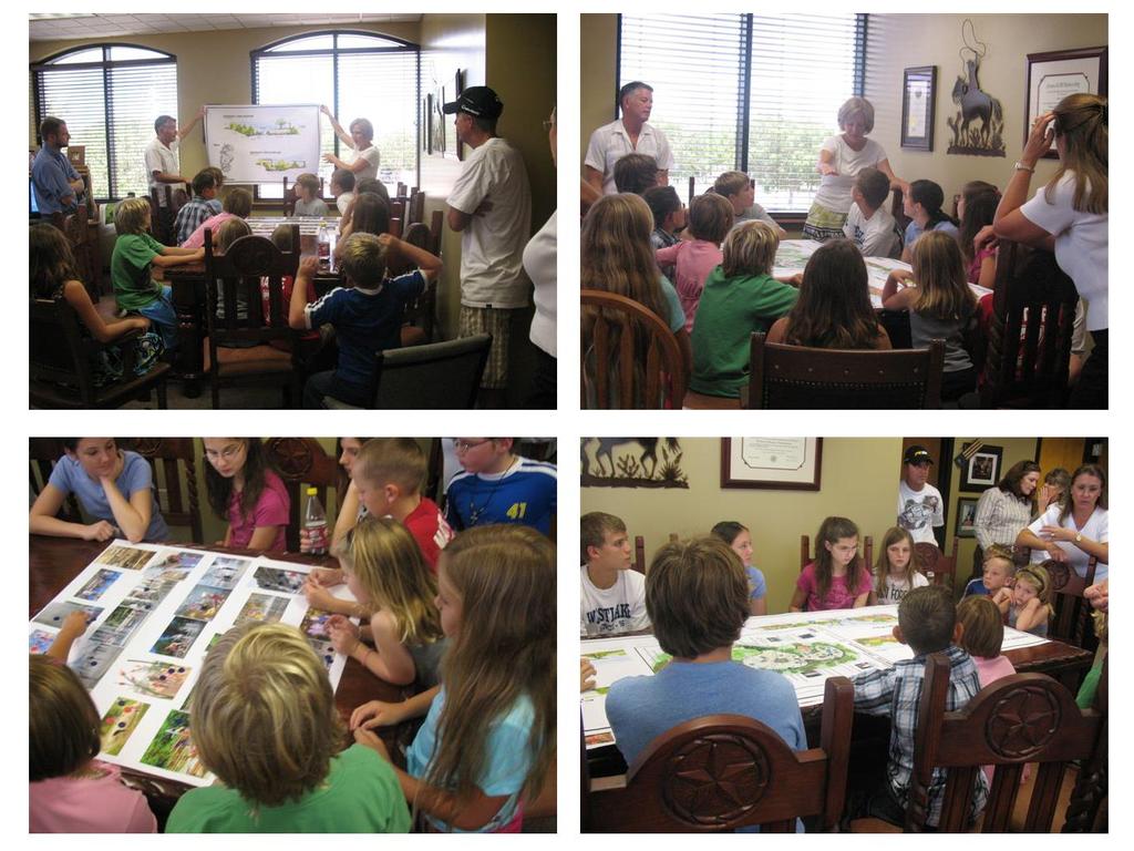
2 Goals & Objectives (best derived from an input process) Goal - sets an intent of the project States the expected result or outcome of the project The trail will provide recreation and transportation opportunities that support a sustainable community. Objectives - specifics that contribute to achieving the goal Statements describe tasks or results to be achieved The trail will provide adequate and accessible connections between neighborhoods, schools and parks. The trail will accommodate multiple non-motorized uses. The trail will provide access to natural areas for recreation and education.
3 1. Inventory - to record and understand the big picture (context) and details of the site and the user(s) and develop a program 2. Analysis - to understand a) what the site offers, b) how uses relate to one another, c) how uses best fit the site 3. Synthesis - to articulate relationships into a functional design (arrangement of parts) and convey it clearly in graphic form.
4 Understanding the Place Site Location and Access traffic volumes, trail access Surrounding Land Uses commercial, schools, residences History of Community & Site Existing Design Elements Northgate has the star, red brick walkways Access Distances How many people within a 10 minute walk or ¼ mile, ½ mile or a 15 minute drive? Understanding the Legal Framework Zoning and Subdivision Regulations Design Standards (e.g., ADA requirements, UDO at Northgate)
 Where are they located? (e.g., neighborhood, district) When are they likely to use the site? (e.g., time of day) Program of activities and related facilities is developed at the end of this step")
5 Understanding the user(s) Who will they be? (e.g., demographic characteristics) What will they want to experience? (e.g., interviews, stakeholder meetings, trends analysis) How will they use the site? (e.g., activity types) Where are they located? (e.g., neighborhood, district) When are they likely to use the site? (e.g., time of day) Program of activities and related facilities is developed at the end of this step
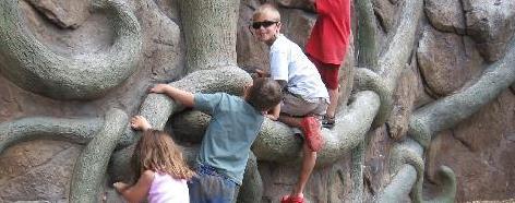
6 Playground Trail for pedestrians Area(s) for contemplation Areas for wildlife viewing Picnicking for different sized groups Place to practice active sports Place for interaction with dogs
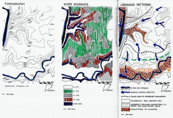
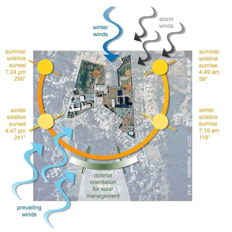
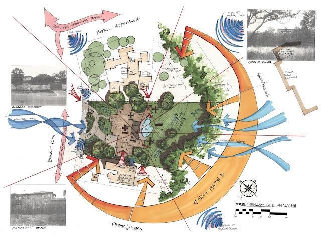
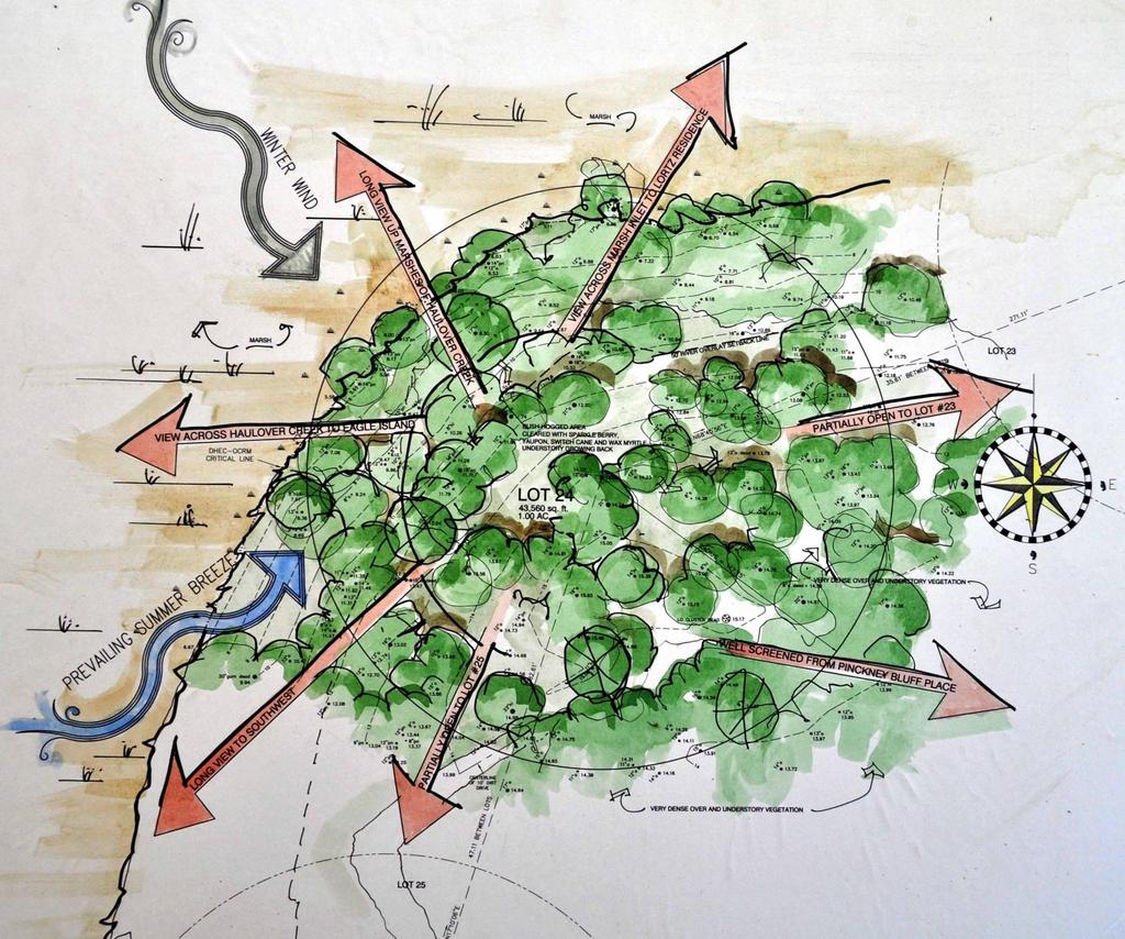
7 Understanding the Site (natural landscape) Topography Elevation (range, above sea level, on site) Ridges & valleys (watershed features) Views (how landform influences creates view out of and into site) Slope orientation (e.g., north vs south) Aspect Microclimate (e.g. prevailing wind-strength and direction) Sun Soils Vegetation Species on-site, special features (natives, invasives) Wetlands and Water bodies Surface drainage, ground water, floodplain Wildlife
8

9
10

11
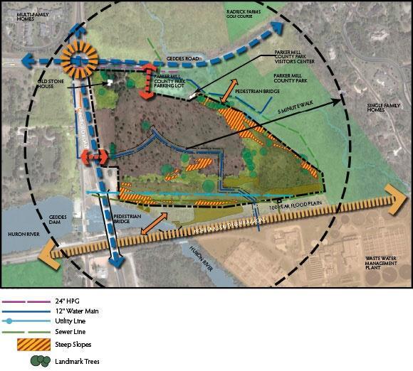
12 Understanding the Site (human-made built environment) Existing on-site structures Transportation patterns Existing auto traffic, access points, existing trails & sidewalks Utilities Sewer and water, electricity, telephone Public service/places Schools Parks or other public open spaces Tourism destination nearby Emergency service Shopping areas & restaurants
13
14
15
16 Begin developing concepts Making plan view sketches of the site with affordances Make bubble diagrams of activity relationships Exploring ideas at various scales: 1"=100 & 1"=400'
17
18
19

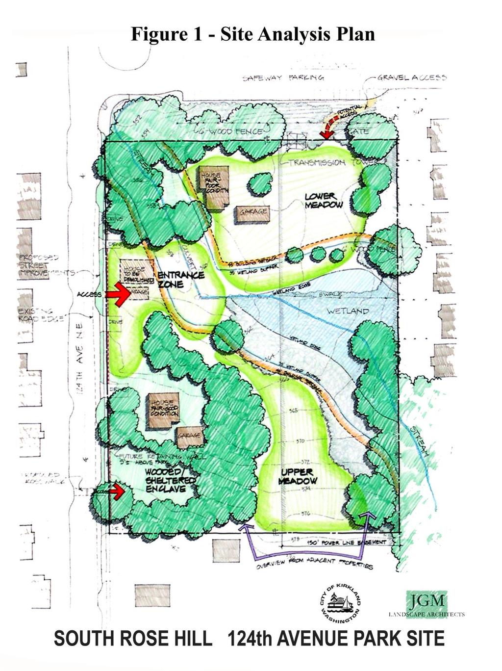
20 topography buffer Interesting flora Example of a site analysis map Good view

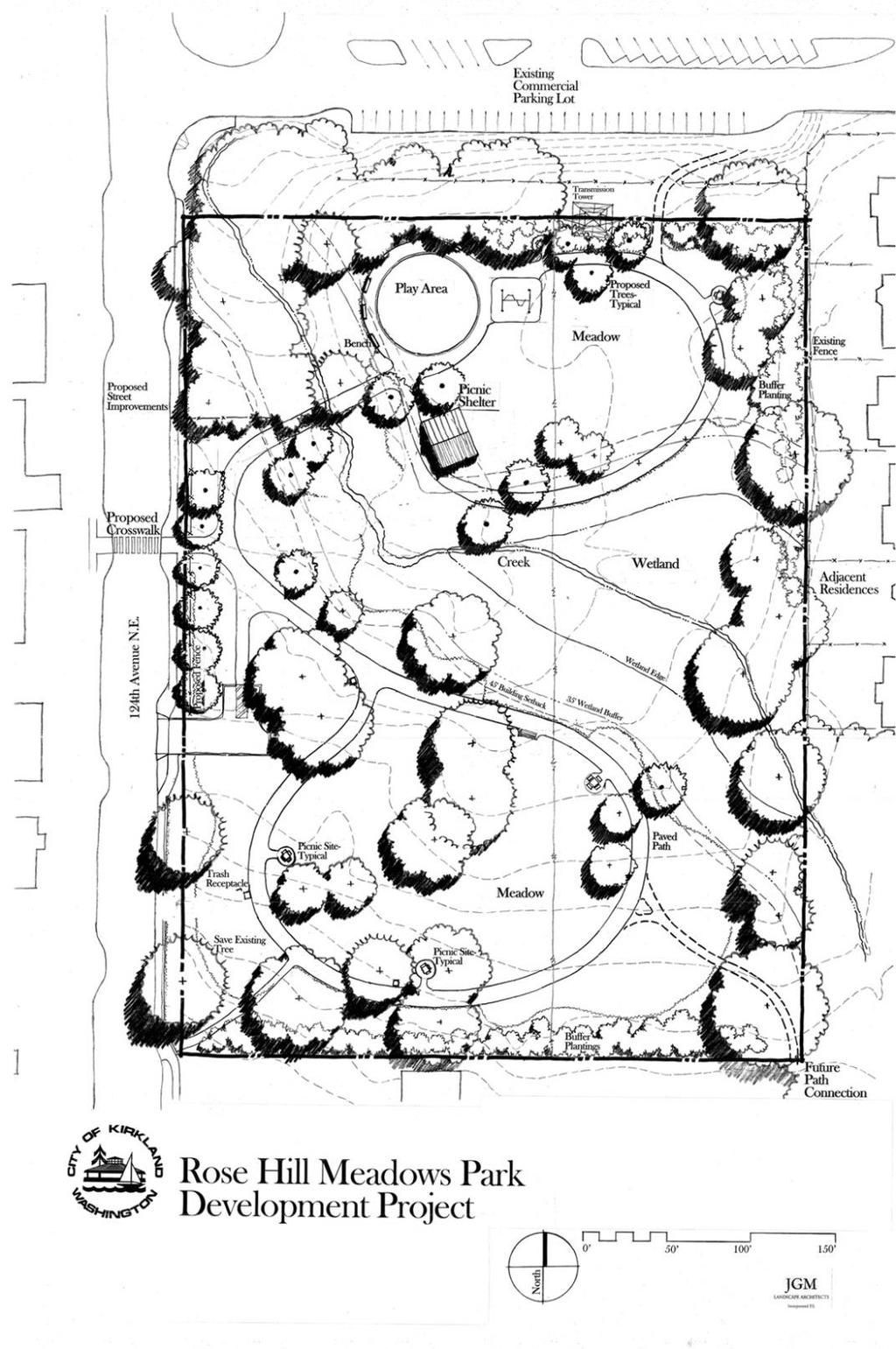
21 Example of analysis of programs on a site. The idea is to situate facilities and activities in a complementary way - also reducing conflict. Process evolves to best set of relationships.
22 Design principles should complement goals & objectives for example: Consider sense of place existing or creating Ecological responsibility The user experience Community access, opportunity Maintenance

23 Design Concept Ideally: A synthesis of site analysis and program analysis

24
25

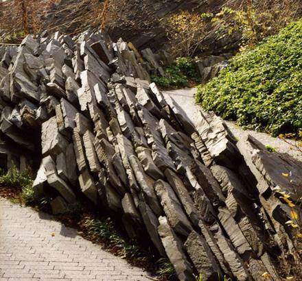
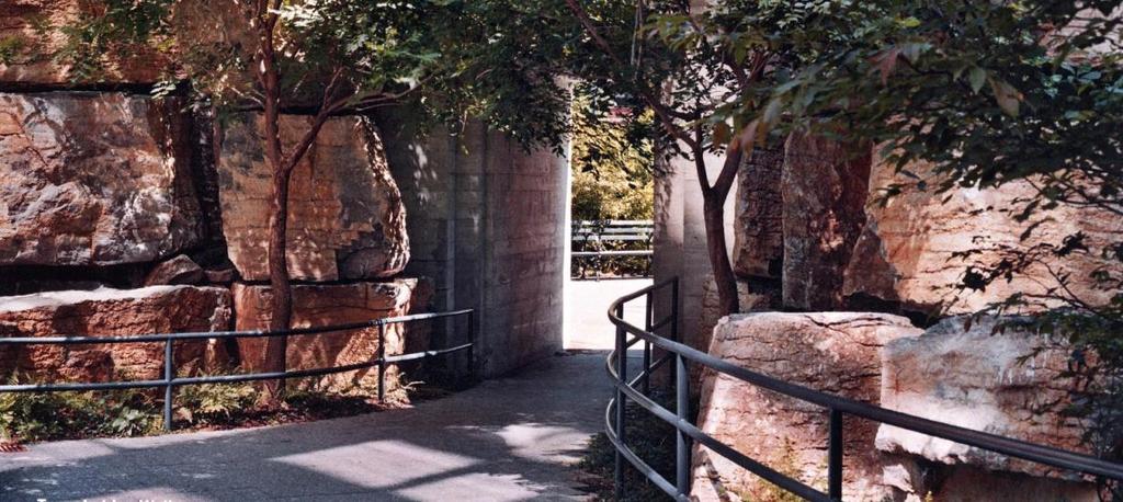
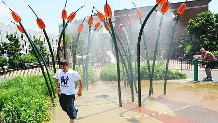
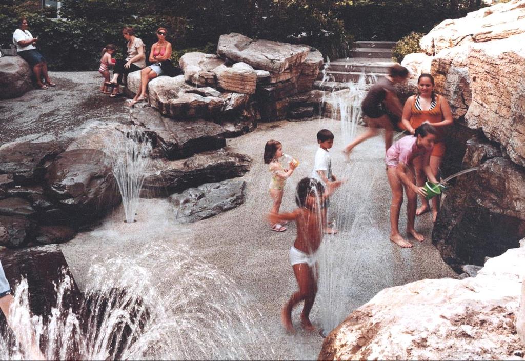
26 Williamson County Splash Pad Three Mile Campground


27 Williamson County Southwest Regional Park Splash Pad

28 Inventory adjacent land uses, site character

29 Inventory - Stakeholder Meeting Splash Pad


30 Location Map Site Analysis Splash Pad
31 Inspiration Splash Pad
32 Inspiration Splash Pad


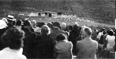
33 Location Map Site Plan Splash Pad


34 The Sandpit Site Plan The Rapids The Quarry Enlargement Splash Pad

35 THE RAPIDS THE QUARRY THE SANDPIT KEY Sections Splash Pad

36 SECTION at THE RAPIDS QUARRY to: MAIN ENTRY KEY SECTION at THE SAND PIT Sections Splash Pad


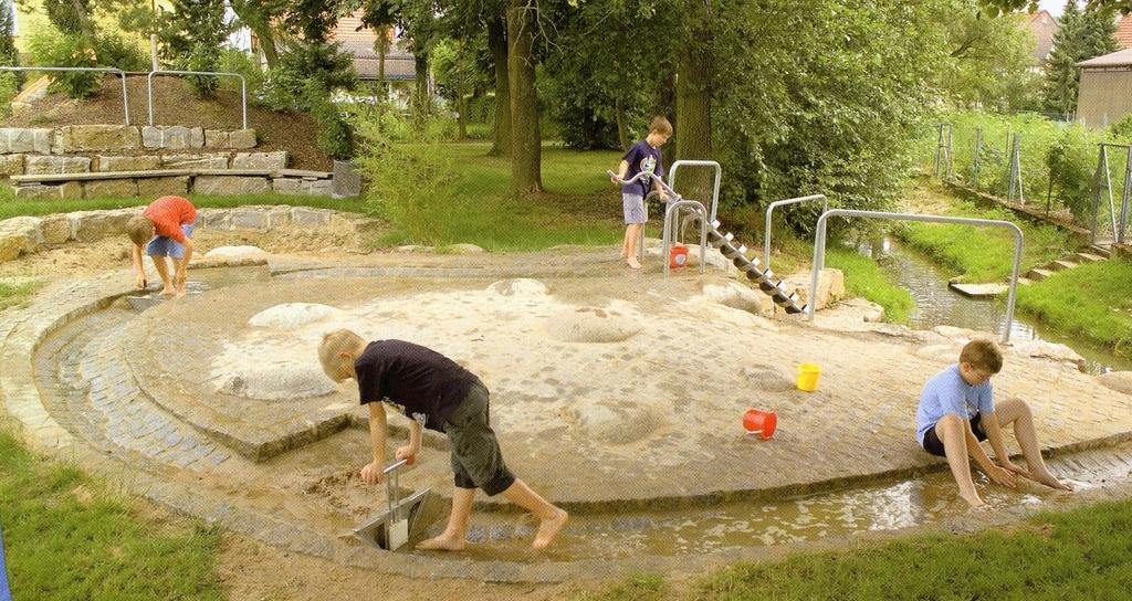
37 The Sandpit Splash Pad
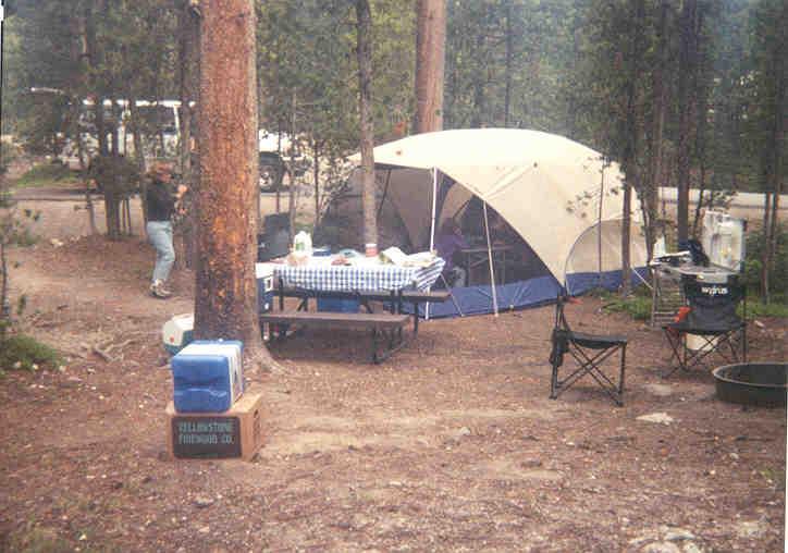
38 Three Mile Campground Understanding Bears & People to create a better Campground Design

39 A problem created

40
41 Bear s injure visitors at a rate of about 1-600,000 There have been 8 human deaths in the Yellowstone region over park s history Approximately 100 bears moved or killed Bear Recovery Plan Mandates Changes
42 Process Inventory site, bear behavior, human behavior Analyze site related to bear & human behavior Synthesize a concept for redevelopment that will help protect campers and bears
43
44 Site Characteristics Existing vegetation Topography Relationship to river/water Human Behavior Sleeping Walking/hiking Cooking Bear behavior Bear pathways Places they search for food

45 Prevailing summer wind Primary Site Inventory

46 Site Analysis
47 Solitary but converge at food sources Some bears habituate to (learn to tolerate) humans Bears search for food Sudden encounters with humans worst Sight distance and distance to water were both short at known confrontation sites Encounters common on trails (bears use trails too)
48 Avoid areas of frequent bear activity Maximize sight distance along trails Make all attractants (e.g., food, trash) unavailable and away from sleeping areas Keep in mind that people are fascinated by bears but vary significantly in their knowledge of proper behavior.
49 Zoned area hard sided campers, tents, outside food/cooking, restrooms Buffer tent area from river with hard sided campers Tents up wind from cooking area and 100 yards from commons area. Managed vegetation to improve sightlines Good lighting to and from toilets Bear details and info about encounters used to remind visitor where they are.

50 Conceptual Site Plan for Three Mile Campground Synthesis
Planned Development Review Revisions (Project No. PLNPCM )
") Planned Development Review Revisions (Project No. PLNPCM2014-00139) Standard residential development Planned Development Example: Smaller lot sizes than what is allowed to create open space amenity. What
Planned Development Review Revisions (Project No. PLNPCM2014-00139) Standard residential development Planned Development Example: Smaller lot sizes than what is allowed to create open space amenity. What
Dowdy Park. Concept Plans TOWN OF NAGS HEAD NORTH CAROLINA. Developed by: Albemarle & Associates, Ltd VHB/ Vanasse Hangen Brustlin, Inc.
 TOWN OF NAGS HEAD NORTH CAROLINA Concept Plans Developed by: Albemarle & Associates, Ltd VHB/ Vanasse Hangen Brustlin, Inc. Site Looking Southeast Dowdy Park Existing Conditions Nags Head Woods Sound Future
Chapter 3 Site Planning and Low Impact Development
 CHAPTER 3 Site Planning and Low Impact Development Chapter 3 Site Planning and Low Impact Development 3.0 Introduction The City of Charleston requires that major residential, large commercial (>1 acre),
BISCUIT RUN PARK MASTER PLAN
 BOARD OF SUPERVISORS November 14, 2018 BISCUIT RUN PARK MASTER PLAN COUNTY OF ALBEMARLE ANHOLD ASSOCIATES Contents Project Introduction Property Background County Park Planning Process Existing Site &
Gold Line Bus Rapid Transit Transit Oriented Development (BRTOD) Helmo Station Area Plan
 Helmo Station Area Plan") Appendix F Gold Line Bus Rapid Transit Transit Oriented Development (BRTOD) Helmo Station Area Plan Introduction and Purpose of the Plan The Gold Line Bus Rapid Transit facility is an eleven-mile dedicated
Appendix F Gold Line Bus Rapid Transit Transit Oriented Development (BRTOD) Helmo Station Area Plan Introduction and Purpose of the Plan The Gold Line Bus Rapid Transit facility is an eleven-mile dedicated
B L A C K D I A M O N D D E S I G N G U I D E L I N E S for Multi-family Development
 B L A C K D I A M O N D D E S I G N G U I D E L I N E S for Multi-family Development Adopted June 18, 2009 This section of the Design and focuses on site planning and design guidance for new multi-family
WARM SPRINGS PARK MASTER PLAN
 TABLE OF CONTENTS page 1.0 Introduction and Overview 1 2.0 Information Gathering 2 3.0 Conceptual Alternative Development 8 4.0 Master Plan Development 14 5.0 Construction Cost Estimates 19 LIST OF FIGURES
Long Branch-Wayne Local Park Renovation Project
 Montgomery Parks Long Branch-Wayne Local Park Renovation Project Community Meeting #2 September 20, 2016 Oak View Elementary School 7:00-9:00 PM Welcome / Team Introductions M-NCPPC (Montgomery Parks)
Community Design Guidelines. Port Wallace DRAFT
 Community Design Guidelines Port Wallace DRAFT Energy 1 2 3 Nature Movement Connections Built Form DRAFT Layout Energy 1 Nature Community Design Guidelines GREAT COMMUNITIES PROTECT, CELEBRATE, AND CONSERVE
Working Group Meeting
 April 4,, 2017 Parks Operations Bldg Working Group Meeting Arts Districts Overview Stormwater/RPA/Stream Considerations First Principles Agenda 7:00pm 7:05pm 7:10pm 7:40pm 8:30pm 9:40pm 9:45pm Welcome
Importance of townhouse design
 Importance of townhouse design Townhouses in the past Townhouses in the past Montco2040 Goals Townhouse Trends in Montco Attached and multifamily housing have become the dominant form of built housing,
East Bench Master Plan Update
 Community & Economic Development Office of the Director East Bench Master Plan Update To: From: Planning Commission Wayne Mills, Senior Planner Date: November 18, 2015 CC: Re: Nora Shepard, City Planning
Preliminary Sketch Plan for Fort Hunter Park
 Preliminary Sketch Plan for Fort Hunter Park Public Presentation November 19, 2009 Dauphin County Parks and Recreation 100 Fort Hunter Road Harrisburg, PA 17110 (717) 599-5188 www.dauphinc.org THOMAS COMITTA
Gather information from online resources covering the following topics:
 Assignment #1: Regional Analysis Project Site Location: Greater Boston Area What comprises a region? The many elements within a region comprise the region as a whole. Natural as well as manmade environmental
Whitemarsh Comprehensive Plan Update: Housing & Land Use. Public Workshop #3: September 20, 2018
 Whitemarsh Comprehensive Plan Update: Housing & Land Use Public Workshop #3: September 20, 2018 Agenda Welcome Process Recap What We ve Heard The Plan Framework Review of Recommended Actions Land Use Housing
Section 4 BUILDING THE MASTER PLAN
 The Master Plan 33 Section 4 BUILDING THE MASTER PLAN Figure 4:1. A collaborative effort characterized the two design workshops sponsored by DISC to create hypothetical Master Plans for the Towers Property
VEHICULAR AND PEDESTRIAN CIRCULATION
 This perspective sketch communicates the intended character and quality of a proposed streetscape design. Locate benches near a major intersection where people tend to gather. Seating and lighting provide
Mitchell Ranch South MPUD Application for Master Planned Unit Development Approval Project Narrative. Introduction
 Mitchell Ranch South MPUD Application for Master Planned Unit Development Approval Project Narrative Introduction Mitchell Ranch South is a proposed single family (detached) residential development on
ECONOMIC DEVELOPMENT DISTRICT MASTER PLAN
 ECONOMIC DEVELOPMENT DISTRICT MASTER PLAN E Orange Ave Legend for the CIT Y OF MOUNT DORA/LAKE COUNT Y County Boundary Wekiva Corridor (Proposed Alignment) Public Land and Parks Park Public CityLimits
Lowe Park Master Plan Update Marion, IA August 25 th, 2011
 Lowe Park Master Plan Update Marion, IA August 25 th, 2011 Lowe Park Master Plan Update Concept Plan - June 1 st, 2011 Agenda 1 - INTRODUCTION Vision Statement Aerial of Existing Condition 2 MASTER PLAN
DRAFT SCOPE OF SERVICES PEER REVIEW OF BAKER PARK. Request for Qualifications (RFQ)
") DRAFT SCOPE OF SERVICES PEER REVIEW OF BAKER PARK Request for Qualifications (RFQ) The following scope of services is presented for consideration and development of firm qualifications submittal. Some
DRAFT SCOPE OF SERVICES PEER REVIEW OF BAKER PARK Request for Qualifications (RFQ) The following scope of services is presented for consideration and development of firm qualifications submittal. Some
4. INDUSTRIAL 53 CASTLE ROCK DESIGN
 4. INDUSTRIAL 53 CASTLE ROCK DESIGN CASTLE ROCK DESIGN 54 4. INDUSTRIAL Overview Well-designed and attractive industrial centers are the product of blending economic realities with both functional and
CITY OF ANN ARBOR MASTER PLAN. Land Use Element
 CTY OF ANN ARBOR MASTER PLAN Land Use Element June 15, 2009 Prepared by the Ann Arbor City Planning and Development Services Unit and the City of Ann Arbor Planning Commission City Master Plan: Land Use
COMMUNITY DESIGN. GOAL: Create livable and attractive communities. Intent
 COMMUNITY DESIGN Intent An attractive, well-designed County will attract quality development, instill civic pride, improve the visual character of the community, and create a strong, positive image for
Miami Valley Regional Planning Commission Regional Land Use Planning
 Miami Valley Regional Planning Commission Regional Land Use Planning This document provides an overall approach on the region-based land use planning process, outlining the major tasks and work elements
II. SINGLE FAMILY RESIDENTIAL
 II. SINGLE FAMILY RESIDENTIAL Castle Rock is made up of numerous individually built houses and subdivision tracts that have been developed during the past century. Some of the tracts are diverse in architectural
South East Sports Complex Phase I
 South East Sports Complex Phase I City of Spokane Design Review Board August 29, 2018 (Revised) Objectives 1. Early discussion and collaboration. 2. Provide framework / catalyst for future improvements
Design Specifications & Requirements Manual
 11 PARKS & OPEN SPACES 11.1 DEFINITIONS... 1 11.1.1 Neighbourhood Parks... 1 11.1.2 District Parks... 1 11.1.3. Sport Parks... 1 11.1.4 Urban Parks... 1 11.1.5 Civic Spaces... 1 11.1.6 Open Space System...
Draft Stillwater 2030 Comprehensive Plan- Goals and Policies
 Draft Stillwater 2030 Comprehensive Plan- Goals and Policies Instructions- Review each goal and policy and discuss with group any changes, deletions for additions to the list using your groups pen. Keep
OVERMOUNTAIN VICTORY TRAIL BURKE CALDELL CORRIDOR FEASIBLITY STUDY REQUEST FOR QUALIFICATIONS CALDWELL COUNTY PATHWAYS
 OVERMOUNTAIN VICTORY TRAIL BURKE CALDELL CORRIDOR FEASIBLITY STUDY REQUEST FOR QUALIFICATIONS CALDWELL COUNTY PATHWAYS Caldwell County Pathways along with our co-partners City of Lenoir, Town of Gamewell,
Charles P. Johnson and Associates. Annapolis Landscape Architects
 Charles P. Johnson and Associates Annapolis Landscape Architects AGENDA Introduction Project Limits and Scope Site Analysis Opportunities & Constraints Program Goals Image Boards Design Alternatives Pros
Chapter 5: Recreation
 Chapter 5: Recreation Introduction and Setting Recreational opportunities within Nevada County are varied, ranging from public parks with intensively used active recreational facilities, to vast tracts
CITY OF KEIZER MASTER PLAN APPLICATION & INFORMATION SHEET
 CITY OF KEIZER MASTER PLAN APPLICATION & INFORMATION SHEET PRE-APPLICATION CONFERENCE Prior to the actual filing of a Master Plan application, it is strongly recommended that the applicant contact Planning
The following principles guide the development of goals and strategies to protect and promote these amenities:
 OPEN SPACE/PARKS/TRAILS/RECREATION GOALS/STRATEGIES Cherry Hills Village is a living environment that offers low density development, open areas, public scenic vistas, public trails and public parks. This
The Five Components of the McLoughlin Area Plan
 The Five Components of the McLoughlin Area Plan This documents contains the complete language of the five components of the McLoughlin Area Plan: The Vision Statement The Values The Guiding Principles
BENJAMIN BANNEKER PARK FRAMEWORK PLAN (PLAN ADOPTION)
") BENJAMIN BANNEKER PARK FRAMEWORK PLAN (PLAN ADOPTION) COUNTY BOARD MEETING DECEMBER 16, 2017 County Board Consideration: Adopt the Benjamin Banneker Park Framework Plan and Design Guidelines Framework
BENJAMIN BANNEKER PARK FRAMEWORK PLAN (PLAN ADOPTION) COUNTY BOARD MEETING DECEMBER 16, 2017 County Board Consideration: Adopt the Benjamin Banneker Park Framework Plan and Design Guidelines Framework
178 Carruthers Properties Inc.
 178 Carruthers Properties Inc. Planning Rationale for 178 Carruthers Avenue Site Plan Control Application June 2014 Table of Contents 1.0 Introduction 2.0 Overview of Subject Property 3.0 Current Zoning
AWH REPORT OF THE PLANNING AND DEVELOPMENT DEPARTMENT FOR APPLICATION FOR REZONING ORDINANCE TO PLANNED UNIT DEVELOPMENT
 AWH REPORT OF THE PLANNING AND DEVELOPMENT DEPARTMENT FOR APPLICATION FOR REZONING ORDINANCE TO PLANNED UNIT DEVELOPMENT MAY 8, 2014 The Planning and Development Department hereby forwards to the Planning
An Ambitious Plan: Transforming the blighted South Platte River and surrounding environment into Denver s greatest natural resource.
 CONNECTING THE PEOPLE TO THEIR RIVER SOUTH PLATTE RIVER VISION IMPLEMENTATION PROGRAM: GRANT-FRONTIER PARK TO OVERLAND POND PARK REACH The South Platte River Vision Implementation Program (River Vision)
TABLE OF CONTENTS 1.0 INTRODUCTION GENERAL OBJECTIVES LAND USE DESIGNATIONS, OBJECTIVES AND POLICIES 4
 Schedule I- Redstone Golf Course Resort Area Sector Plan 1 TABLE OF CONTENTS 1.0 INTRODUCTION 3 2.0 GENERAL OBJECTIVES 3 3.0 LAND USE DESIGNATIONS, OBJECTIVES AND POLICIES 4 4.0 TRANSPORTATION AND ROAD
Toronto Complete Streets Guidelines
 Toronto Complete Streets Guidelines 108 110 7.1 Green Infrastructure Design Principles 112 7.2 Context-Sensitive Green Streets 114 7.3 Key Green Street Elements Green infrastructure refers to natural and
Request for Proposal
 Request for Proposal 10 th Street Corridor Master Plan Department of Planning and Zoning 500 Quartermaster Court Suite 200 Jeffersonville, IN 47130 April 18, 2017 For further information contact: Chad
Design Specifications & Requirements Manual
 11 PARKS & OPEN SPACES 11.1 DEFINITIONS... 1 11.1.1 Neighbourhood Parks... 1 11.1.2 District Parks... 1 11.1.3. Sport Parks... 1 11.1.4 Urban Parks... 1 11.1.5 Civic Spaces... 1 11.1.6 Open Space System...
CHAPTER 8 ISSUES, CONCERNS, CONSTRAINTS AND OPPORTUNITIES
 CHAPTER 8 ISSUES, CONCERNS, CONSTRAINTS AND OPPORTUNITIES Introduction This River Conservation Plan was developed during a time of tremendous activity and effort in planning the transformation of the Delaware
City of Nogales General Plan
 Open Space, Parks, Recreation and Trails City of Nogales General Plan Residents of Nogales place a high priority in the development of a comprehensive system of open space, parks, recreation and trails
Comprehensive Plan. Faribault, Minnesota. Hoisington Koegler Group Inc. Claybaugh Preservation Architecture Inc. Howard R. Green Company Bonz/REA
 Comprehensive Plan Faribault, Minnesota Adopted by the Faribault City Council July 8, 2003 prepared for: prepared by: Hoisington Koegler Group Inc. Claybaugh Preservation Architecture Inc. Howard R. Green
Westwind Developments Ltd. PIONEER LANDS AREA STRUCTURE PLAN - PROPOSED AMENDMENT
 FEBRUARY 2013 TABLE OF CONTENTS 1.0 BACKGROUND... 1 1.1 Amendment... 1 2.0 LOCATION & CONTEXT... 2 2.1 Land Ownership... 2 3.0 POLICY CONTEXT... 3 3.1 Municipal Development Plan... 3 3.2 Capital Region
Kenilworth Station Art and Landscape Committee (KSALC) June 25, 2015
 June 25, 2015") Kenilworth Station Art and Landscape Committee (KSALC) June 25, 2015 1 Today s Topics Welcome and Introductions Appoint Committee Co-Chairs Summary of Community Workshop #1 Kenilworth Channel Bridge Design
Kenilworth Station Art and Landscape Committee (KSALC) June 25, 2015 1 Today s Topics Welcome and Introductions Appoint Committee Co-Chairs Summary of Community Workshop #1 Kenilworth Channel Bridge Design
Call for Artists for: Design and Construction of Environmental Art Activation Story Mill Community Park, Bozeman, MT
 Call for Artists for: Design and Construction of Environmental Art Activation Story Mill Community Park, Bozeman, MT Seeking artists to design, fabricate and install art elements in the nature sanctuary
North Oakville East Parks Facilities Distribution Plan. November, 2009
 North Oakville East November, 2009 POLICY CONTEXT 1) Purpose a) The purpose of this document is to be a guide for the location, configuration, design and development of the parks system for the North Oakville
The West Vaughan Employment Area Secondary Plan Policies
 Part 2: The West Vaughan Employment Area Secondary Plan Policies 2.1 General Policies It is the policy of Council: 2.1.1. That the West Vaughan Employment Area (the WVEA), identified on Schedule 1, will
The Vision. Photo provided by The Minervini Group. 46 Vision, Objectives & Strategies
 Vision, Objectives & Strategies The is the public framework and guide for future development of the Grand Traverse Commons. The establishes public polices for infrastructure, the preservation of natural
CHEBOYGAN COUNTY PLANNING COMMISSION
 CHEBOYGAN COUNTY PLANNING COMMISSION 870 SOUTH MAIN ST. PO BOX 70 CHEBOYGAN, MI 49721 PHONE: (231)627-8489 FAX: (231)627-3646 CHEBOYGAN COUNTY PLANNING COMMISSION MEETING & PUBLIC HEARING WEDNESDAY, NOVEMBER
Hockessin Community Redevelopment Plan
 Hockessin Community Redevelopment Plan 3.1 Introduction The Community Redevelopment Plan for the Village of Hockessin is the result of the people s vision for a distinct village center that serves as the
Arlington, Virginia is a worldclass
 EXECUTIVE S U M M A RY Arlington maintains a rich variety of stable neighborhoods, quality schools and enlightened land use policies, and received the Environmental Protection Agency s highest award for
3. VISION AND GOALS. Vision Statement. Goals, Objectives and Policies
 Vision Statement Queen Creek s interconnected network of parks, trails, open spaces and recreation opportunities provide safe and diverse activities and programs that sustain its unique, small town, equestrian
Town of Rico Three Mile Plan for Annexation
 Town of Rico Three Mile Plan for Annexation 10.20.2010 Adopted by Resolution 2010-2 Produced with funding support from the Colorado Department of Local Affairs 2 Content Guide Introduction. 3 Annexation
Ten Mile Creek Planning Area
 PLANNING AREA POLICIES TEN MILE CREEK Ten Mile Creek Planning Area Location and Context The Ten Mile Creek Planning Area ( Ten Mile Creek area ) is located south of the current Boise AOCI, generally south
Definitions. Average Daily Traffic Demand (ADT): The actual number or projected number of cars that pass a point in a 24-hour period.
: The actual number or projected number of cars that pass a point in a 24-hour period.") Definitions Access Management: A combination of physical techniques and transportation policies used to control the flow of traffic between roads and the surrounding lands. Alternative City Form Scenarios:
Definitions Access Management: A combination of physical techniques and transportation policies used to control the flow of traffic between roads and the surrounding lands. Alternative City Form Scenarios:
CHAPTER 3 VISION, GOALS, & PLANNING PRINCIPLES. City of Greensburg Comprehensive Plan. Introduction. Vision Statement. Growth Management Goals.
 CHAPTER 3 VISION, GOALS, & PLANNING PRINCIPLES Introduction The Greensburg Comprehensive Plan is intended as a working community document. A combination of long and short-term goals, this document is intended
Glenborough at Easton Land Use Master Plan
 Public Facilities 102 7.0 PUBLIC FACILITIES 7.1 OVERVIEW This chapter describes the public facilities that will provide high-quality services in the Glenborough at Easton community, to include three schools,
RPD GEORGE CHRISTOPHER PLAYGROUND COMMUNITY MEETING 1 SEPTEMBER 24, Duncan St
 RPD GEORGE CHRISTOPHER PLAYGROUND COMMUNITY MEETING 1 SEPTEMBER 24, 2015 Duncan St Supervisorial District 8 Supervisor Scott Wiener 1 Agenda Welcome & Introductions Purpose of Meeting Ground Rules Project
5.1 Site Plan Guidelines
 5. Community Core Guidelines Development of the Community Core will take place by plan of subdivision and site plan approval. It will occur in a phased manner that will reflect the timing of residential
RECREATION, OPEN SPACE AND GREENWAYS ELEMENT GOALS, OBJECTIVES, AND POLICIES
 RECREATION, OPEN SPACE AND GREENWAYS ELEMENT GOALS, OBJECTIVES, AND POLICIES GOAL R-1: DEVELOP A RECREATION, OPEN SPACE AND GREENWAYS SYSTEM AS AN INTEGRAL COMPONENT OF AN OVERALL, COUNTY-WIDE ECONOMIC
Arlington County Watershed Retrofits. Greg Hoffmann Center for Watershed Protection
 Arlington County Watershed Retrofits Greg Hoffmann Center for Watershed Protection March 18, 2010 About the Center for Watershed Protection Non-profit 501(c)3, non-advocacy organization Work with watershed
The open space system should provide connective elements, relate to natural resources, and enhance the suburban character of the landscape..
 The open space system should provide connective elements, relate to natural resources, and enhance the suburban character of the landscape.. Mixed-use and infill development should maintain or enhance
7.0 Site Considerations
 7.0 Site Considerations In this chapter we present ideas for site layout and design with particular attention to sustaining and maximizing the natural environment. SITE CONSIDERATIONS 7.1 The School Site
Planned Residential Neighborhoods Land Use Goals
 Planned Residential Neighborhoods Land Use Goals Issue: Guidelines that provide for diverse high quality residential areas that include a variety of housing styles and layouts are needed. Goal 1: Create
HE VISION. Building a Better Connected Place
 HE VISION Building a Better Connected Place WALK INTO THE FUTURE. Life in Cranberry, 2030 Here s what our residents told us they wanted to see in their community by 2030: The Cranberry of 2030 is a place
Washington Park Diagonal
 Public Input Meeting August 3, 2011 Nicole Stahly RLA DPR Project Manager Jesse Clark RLA, LEED Stream Design Paul Thomas RLA Stream Design Kerry White RLA Urban Play Studio Tonight s Agenda 1st Meeting:
Mendota Heights 2040 Comprehensive Plan Draft Vers
 4 Parks and Trails The City of Mendota Heights boasts a variety of recreational and open space opportunities. Few cities can claim access to regional trails, riverside and lakeside parks, scenic bluffs
REZONING APPLICATION MPD SUPPLEMENT
 REZONING APPLICATION MPD SUPPLEMENT For Staff Use Only: DATE/TIMESTAMP: ZA# RECEIVED BY: The intent of the Master Planned District (MPD) designation is to allow flexibility in the design and construction
Daniels Park Master Plan
 Daniels Park Master Plan Prepared for: Douglas County & The City and County of Denver October, 2007 EXHIBIT A Contents Daniels Park Overview 2 Project History & Goals 2-3 Regional Context Map 4 Park Zone
Urban Design Brief Woodland Cemetery Funeral Home 493 Springbank Drive
 Urban Design Brief Woodland Cemetery Funeral Home The Incorporated Synod of the Diocese of Huron April 15, 2016 Urban Design Brief April 15, 2016 TABLE OF CONTENTS Page No. INTRODUCTION... 1 SECTION 1
SAMISH WAY URBAN VILLAGE. Presentation of Draft Concepts and Regulations
 SAMISH WAY URBAN VILLAGE Presentation of Draft Concepts and Regulations February 26, 2009 The Samish Way Urban Village Project Timeline TASK 200 8 JUNE JUlT AUG SEP OCI Putlic Vforlcshopi * 2009 NOV D
T H A T E V E R Y O N E
 B R I N G I N G C H A N G E T H A T E V E R Y O N E C A N F E E L. AT CHW, we survey, plan, design, engineer, administer and inspect with a purpose: to positively transform the communities we serve. From
PART 1: PROJECT SUMMARY. The application is Attachment A. The site plan is Attachment B.
 Belleterre Subdivision Sketch Plan Town Board 8.7.17 Belleterre Subdivision Sketch Plan PART 1: PROJECT SUMMARY Applicant: Bowman Development Project Size: +/- 20.85 acres Parcel Number: 01115104 and 01115121
FOUR MILE RUN VALLEY WORKING GROUP AND CHARGE
 FOUR MILE RUN VALLEY WORKING GROUP AND CHARGE Adopted April 16, 2016 Amended July 19, 2016 Overview of Integrated Effort The overall goal of the Four Mile Run Valley (4MRV) initiative is to develop a comprehensive
WILLAMETTE FALLS LEGACY PROJECT
 OPPORTUNITIES & CONSTRAINTS There are here three falls on a line of rocks extending across the river, which forms the bed of the upper channel. The water is precipitated through deep abrazed gorges, and
O l so n M e morial Highway, S t e , G o l d e n V a l l e y, MN Delano Laketown Homes Concept Plan
 N O R T H W E S T A S S O C I A T E D C O N S U L T A N T S, I N C. 4 1 5 0 O l so n M e morial Highway, S t e. 3 2 0, G o l d e n V a l l e y, MN 5 5 4 2 2 T e l e p h o n e : 7 6 3. 9 5 7. 1 1 0 0 W
SECTION II SECTION II STATEMENT OF GOALS, OBJECTIVES, PRINCIPLES, ASSUMPTIONS, POLICIES AND STANDARDS
 STATEMENT OF GOALS, OBJECTIVES, PRINCIPLES, ASSUMPTIONS, POLICIES AND STANDARDS 1 2 STATEMENT OF GOALS, OBJECTIVES, PRINCIPLES, ASSUMPTIONS, POLICIES AND STANDARDS INTRODUCTION The New Jersey Municipal
Redesigning Vogel Flat Angeles National Forest, California
 Redesigning Vogel Flat Angeles National Forest, California WRPI Watershed Management Internship 2017 Cristina Plemel, Master s of Landscape Architecture California State Polytechnic University, Pomona
5.1.1 The streetscape along US Highway 64 (Brevard Road); and, The built environment within new residential developments; and,
; and, The built environment within new residential developments; and,") Article 5. Landscaping 5.1 Purpose The Town of Laurel Park s landscape standards are designed to create a beautiful, aesthetically pleasing built environment that will complement and enhance community
Article 5. Landscaping 5.1 Purpose The Town of Laurel Park s landscape standards are designed to create a beautiful, aesthetically pleasing built environment that will complement and enhance community
Chapter 5: Natural Resources and Environment
 NATURAL RESOURCES AND ENVIRONMENT 5-1 5 Chapter 5: Natural Resources and Environment BACKGROUND AND INTENT Urban expansion represents the greatest risk for the future degradation of existing natural areas,
97 Lea Bridge Road, Leyton, E10 7QL London Borough of Waltham Forest December 2015
 97 Lea Bridge Road, Leyton, E10 7QL London Borough of Waltham Forest December 2015 Public Realm and Landscape Proposals LEA BRIDGE ROAD, WALTHAMSTOW Public Realm & Landscape Proposals BDP(90)RPT001 December
Improve Neighborhood Design and Reduce Non Point Source Water Pollution
 HOW TO Planning Guide Improve Neighborhood Design and Reduce Non Point Source Water Pollution This document was funded by a grant from the New Hampshire Coastal Program with funding from the National Oceanic
APPENDIX A 6 CONCEPTUAL PRELIMINARY PLAN GUIDE AND CHECKLIST FOR MAJOR SUBDIVISIONS CARRBORO DEVELOPMENT GUIDE APPENDIX A
 6 CONCEPTUAL PRELIMINARY PLAN GUIDE AND CHECKLIST FOR MAJOR SUBDIVISIONS Conceptual Preliminary Guide/Checklist for Major Subdivisions Page 1 FORM: REVIEW DATE: CONCEPTUAL PLAN REVIEW 2000 REVIEWED BY:
A Vision for Walnut Creek
 A Vision for Walnut Creek Photo: City of Clive Walnut Creek Booklet 8 of 8 Greater Des Moines Water Trails and Greenways 1 Table of Contents Booklet 1: Water Trails Strategies and Policies Booklet 2: Beaver
QUEENSTOWN LAKES DISTRICT COUNCIL SUBDIVISION DESIGN GUIDELINES
 Attachment C: Draft QLDC Subdivision Design Guidelines QUEENSTOWN LAKES DISTRICT COUNCIL DESIGN GUIDELINES A DESIGN GUIDE FOR AND DEVELOPMENT IN THE URBAN ZONES QUEENSTOWN OFFICE 10 Gorge Road Queenstown
CHAPTER 22 Rural Open Space Community Developments
 CHAPTER 22 Rural Open Space Community Developments Section 22.1 Description and Purpose The intent of this Chapter is to offer property owners an alternative to traditional zoning requirements for rural
BROOKHILL NEIGHBORHOOD MODEL ZONING MAP AMENDMENT PREFACE TO APPLICATION
 BROOKHILL NEIGHBORHOOD MODEL ZONING MAP AMENDMENT PREFACE TO APPLICATION June 15, 2015 Revised: August 1, 2016 I. VISION Brookhill is a proposed community based upon the principles of Albemarle County
include playgrounds, sports fields, community gardens and picnic areas.
 DEVELOPMENT PLAN OPEN SPACE SYSTEM OPEN SPACE SYSTEM The neighborhood provides for a range of open space types. The Village Square is an important open space in the neighborhood. It serves as a gathering
APPENDIX 4 NEWBURY TOWNSHIP TOWN CENTER MASTER PLAN
 APPENDIX 4 NEWBURY TOWNSHIP TOWN CENTER MASTER PLAN Prepared by the Urban Design Center of Northeast Ohio September, 2008 Newbury Township Land Use Plan A4-1 INDEX Page No. 1 Newbury Township Town Center
The University District envisions, in its neighborhood
 Envisioning the University District Link Light Rail in Seattle s neighborhoods CIY OF SEALE CONCEP-LEVEL SAION AREA PLANNING RECOMMENDAION RESOLUION # 30165 EXHIBI L Vision 08.2000 he University District
Planning Board Briefing
 Planning Board Briefing Why Now? The Sector Plan Implementation Chapter States: Before Stage 1 begins, the following must occur: Approval of the Sectional Map Amendment. Approval of the Greater Lyttonsville
understanding Green Infrastructure In Zoning
 understanding Green Infrastructure In Zoning Purpose Measurable standards can be adopted within municipal zoning codes, and subdivision and stormwater regulations, to promote a comprehensive approach to
Activity Residential Site Planning
 Activity 2.3.7 Residential Site Planning Introduction When a building is designed apart from a specific site, an opportunity is lost to match the design to the strengths and weaknesses of the site. To
APPENDIX C. Architectural and Environmental Design Standards. Environmentally sensitive areas should be protected.
 APPENDIX C Architectural and Environmental Design Standards Environmentally Sensitive Areas Goal A. Environmentally sensitive areas should be protected. Development, such as roads, houses, and other structures,
Yesler Terrace Explorations of Ideas 11 March 2009
 Yesler Terrace Explorations of Ideas 11 March 2009 Exploration of Ideas for Yesler Terrace Where are we in the process? Testing the Yesler Terrace Planning Program 1) How does the new Yesler Terrace feel?
RESPONSES TO PUBLIC CONCERNS AND QUESTIONS
 RESPONSES TO PUBLIC CONCERNS AND QUESTIONS Stations and Summary Questions for Public Meeting #2 June 23, 2015 General Questions / Concerns: 1. Is there any way this development can raise revenue for the