Section. Corridor Context & History
|
|
|
- Loraine Sutton
- 5 years ago
- Views:
Transcription


1 2 Section
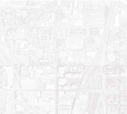
2 National Arboretum Georgetown Downtown H STREET NE CORRIDOR Chinatown RFK Stadium National Mall U.S. Capitol Anascotia River ² Potomac River DC-295
: Typical Single-family Row Houses Surrounding the Corridor (middle right): Union Station (bottom right): H Street NE Corridor circa 1940s (Images: Courtesy of Washington Historical")


, provides pivotal automobile and bus connections to these and other important District locales.")
3 Figure 2.1 (opposite page): Site Context Map Corridor Location Figure 2.2 (top right): Typical Single-family Row Houses Surrounding the Corridor (middle right): Union Station (bottom right): H Street NE Corridor circa 1940s (Images: Courtesy of Washington Historical Society) 2.1 OVERVIEW Spanning across the District s northeast quadrant, H Street NE benefits from its strategic location within the City and region. The Study Area and its surrounding context are shown in Figures 2.1 and 2.2. Surrounded by traditional neighborhoods, including Near Northeast, Stanton Park, Linden, Trinidad, and Kingman Park, among others, the Corridor is located in a dense residential area. The eastern part of the Corridor houses large-box retail stores. The CVS and Hechinger Mall located between 15th and 17 Streets NE attract customers from a large geographic area. Further to the east lies the Anacostia River. The Corridor functions as a vital link between its surrounding neighborhoods and the District s transit network. Union Station, located at the western end of the Corridor with its various rail services, allows many residents and businesses to economically commute to and from other parts of the District and the region via Metrorail, Amtrak, VRE and MARC trains. Similarly, the Greyhound and Peter Pan bus stations, located in the northwest of the Corridor, provide additional transit options for many residents and customers. The soon to be completed New York Avenue Metrorail station, located a few blocks north of the Study Area will further enhance the Corridor s transit accessibility. Metro busses link H Street with other destinations in the District. The Corridor, from its western terminus at North Capitol Street to the Starburst intersection consisting of several major arterials (Benning Road, Florida Avenue, Maryland Avenue, 15th Street, and Bladensburg Road), provides pivotal automobile and bus connections to these and other important District locales. From the Starburst intersection, southbound Maryland Avenue links the Corridor to the U.S. Capitol and the monuments and museums at the National Mall. Continuing west across North Capitol Street, H Street NW provides a short and easy route to the new Washington Convention Center, Chinatown, and the Downtown business district. 15th Street NE connects the Corridor to RFK Stadium and the Anacostia Waterfront area via Independence Avenue and C Street NE. Similarly, Florida Avenue, from its intersection with H Street, traverses the northern quadrants of the District westbound toward Dupont Circle and Georgetown. At the Corridor s eastern end, Benning Road connects with the Anacostia Freeway, which travels north and south along the Anacostia River. North of H Street, Bladensburg Road intersects with New York Avenue/US Route 50, which connects to DC/MD-295 into Prince George s County (northbound) and into Virginia (southbound) via I-95/495. The Corridor s role as a commuter spine, its proximity to other important District destinations, and the surrounding residential density collectively attract a large number of people. Although the Corridor is currently used by a range of commuters pedestrians, bicyclists, transit riders and automobile users vehicular traffic dominates the streetscape and public realm. 2.2 H STREET NE HISTORY Many events over the last century have shaped the current physical characteristics of H Street NE. These events have influenced the rise and decline of the H Street commercial corridor, and defined its newer role within the City. Transportation-related events that have had a significant influence on shaping the Corridor are briefly discussed in the following paragraphs. Figure 2.9 at the end of this section, presents a timeline with major transportation and land use milestones on H Street block 400 block 500 block 800 block 1400 block Maryland & 15th Street Transportation & Streetscape Study


4 2-4 Early History: The neighborhoods of Near Northeast, Stanton Park, and Linden, including the historic H Street NE Corridor, were originally included as part of L Enfant s 1791 plan for the District of Columbia. Boundary Street, now Florida Avenue, was one of the northern boundaries of the City. The areas north of Florida Avenue, including the present day campus of Gallaudet University, were large country estates located outside of the original federal city plan. Although conceptually planned in the late 18th Century, much of the land within the Corridor remained undeveloped until after the Civil War, because many areas were marshy and unsuitable for building. H Street itself was not constructed until 1849, although historical literature reveals that a 90-foot right-of-way was designated for the Corridor as part of L Enfant s plan. The Corridor is the site of some of the first important travel routes connecting Washington to other northeastern cities. In the early 1800s, the Bladensburg turnpike was an important connection between Washington and Bladensburg, Annapolis, and Baltimore. From the time of L Enfant s plan, the intersection of the turnpike with Maryland Avenue (where there once stood a tollgate) was envisioned as a special place and gateway into the City. These routes are also historically significant because the British used them in 1814 when they entered the City and burned down the U.S. Capitol and the White House. The appearance of the railroad into Washington in the 1830s was another important factor that shaped the development of the H Street commercial corridor and its surrounding neighborhoods. The Baltimore and Ohio railroad arrived in 1835, near the site of present day Union Station, and the railroad s proximity to the Near Northeast neighborhood and the jobs it provided played a large role in developing and shaping the surrounding areas into middle class neighborhoods. The 1849 construction of H Street NE preceded the development of most of the other east-west connecting streets in the Corridor. Near the intersection of North Capitol and H Streets, the Swampoodle neighborhood, one of the few pre-civil War neighborhoods that existed in the city, began to develop. Its working class residents were responsible for some of the first developments along the 100 and 200 block of H Street NE. Although many roads within the District were paved shortly after the end of the Civil War, H Street NE was not paved until the year H Street Heyday : The Columbia Railway Company, founded in 1870, established a streetcar line along H Street in The new streetcar spurred both residential and commercial development along the Corridor. This heightened interest in residential development along the Corridor, and many of the residential dwellings in the surrounding neighborhoods were built from the 1870s to the 1920s. The streetcar also had an influence on the location of early commercial buildings within the Corridor, as many businesses concentrated along the H Street line, the intersection of the 8th and H Streets lines, and the streetcar terminus and surrounding car barns located near the intersection of 15th and H Streets. Streetcars ran along H Street until 1949, carrying as many as 3.3 million passengers a month during H Street s heyday (1900s-1940s). As part of the 1901 McMillan Plan for Washington, Union Station was constructed between 1903 and Although this major transportation center within the Corridor further reinforced the railroad s importance and continued to influence the Corridor s development, the rail yard became a physical barrier between H Street NE and the rest of the City s downtown. In the mid 1900s the Corridor served as one of the City s primary commercial hubs. Many chain stores located along the H Street commercial district, including People s Drug, Hechinger s, Giant, and Woolworth s. In 1929, Sears, Roebuck & Company opened its first store in the Washington metropolitan region at the corner of H Street and Bladensburg Road. The Atlas movie theater opened in 1938, with shops and storefronts located to the west of the theater. The Uline Arena, originally built as a home for the Washington Lions hockey team, opened just north of Union Station in The arena was the site of the Beatles first concert in the United States. These buildings and attractions were all part of H Street s once vibrant commercial and entertainment district, where residents could satisfy most all of their shopping, dining, and entertainment needs. Decline: Although the District had been losing population citywide since the end of World War II, including residents from the neighborhoods surrounding H Street, the civil disturbances that followed the assassination of Martin Luther King in 1968 further damaged the City and its neighborhoods. This event, Figure 2.3 (left): H Street NE Underpass with Streetcar c. 1940s (Image Courtesy of Washington Historical Society) Figure 2.4 (middle left): Sears, Roebuck & Co. Opened First DC Store in 1929 at 15th and H Streets (Image Courtesy of Washington Historical Society) Figure 2.5 (below left): 8th and H Streets NE Intersection - Streetcars, Automobiles, and Pedestrians Along A Bustling H Street c. 1940s (Historical Image Courtesy of Leroy O. King Collection/ Near Northeast Citizens Association) H Street NE Corridor
: Hopscotch Bridge, Constructed in 1970s combined with suburban growth and competition, led to population losses within the neighborhoods, and an overall decline in the commercial")

5 Figure 2.6 (right): Atlas Performance Arts Center on 1300 Block, Opened in 1938 (Image Courtesy of Washington Historical Society) Figure 2.7 (below right): Hopscotch Bridge, Constructed in 1970s combined with suburban growth and competition, led to population losses within the neighborhoods, and an overall decline in the commercial corridor. Furthermore, the construction of the Hopscotch Bridge in the 1970s, completed as part of the Federal Highway Administration s inner beltway system for the District, was an added visual and physical barrier between H Street and other downtown neighborhoods, such as Chinatown and Mount Vernon Square. Over the years, H Street s traditional attractiveness to shoppers, bikers, and pedestrians has been degraded due to several factors. The quality and suburban style of recent developments, such as CVS, the H Street Connection shopping center, and Auto Zone have impeded the Corridor s attempt to regain neighborhood retail status by catering to automobiles at the expense of pedestrians. In addition, the heavy volume of automobile through-traffic and prohibition of street parking during peak hours restrict pedestrian access along H Street. The uneven quality of lighting, sidewalks, bus shelters, and other amenities accentuate the lingering perceptions that the street is still an unsafe and unwelcoming place. Revival: The Corridor today is slowly but steadily beginning to feel the impacts from the revitalization efforts initiated by the District and from the infusion of public dollars. The period of change and heightened community interest in transforming H Street NE began in the late 1990s, with several major planning initiatives. In 1998 and 1999, the Comprehensive Plan called for the reassessment of the Corridor s Urban Renewal Plan to address new economic development needs. In 2000 and 2001, during the Strategic Neighborhood Action Plan (SNAP) initiative, over 500 residents, stakeholders, businesses and Advisory Neighborhood Commissions from across the area identified H Street NE as one of the key areas essential for the larger neighborhood s revitalization. The SNAP identified the revitalization of H Street and its transformation into a vibrant commercial corridor as a top priority, and recognized that infrastructure improvements, increased safety, and beautification efforts are key to the revival process. Subsequently, the Corridor received the following commitments from various District and federal agencies: i. The Deputy Mayor for Planning and Economic Development (DMPED) budgeted local funds for the ReStore DC neighborhood commercial revitalization program; ii. The National Trust for Historic Preservation chose H Street NE as one of the few District s Main Streets and hired a full-time Executive Director to spearhead the program; iii. The District Office of Planning (OP) secured and developed Revival: The H Street NE Strategic Development Plan; iv. The District Department of Transportation (DDOT) has earmarked funding to improve transportation elements and the public realm along the Corridor; and v. The DC Commission on the Arts and Humanities budgeted funding for two programs to incorporate aesthetic improvements into the Corridor. The first includes local artists working with businesses to develop commercial signs that incorporate creative design. The second commissioned an artist to work with the Study Team to incorporate artwork into the Corridor s design improvements. 2-5 Transportation & Streetscape Study


6 2.3 FUTURE OPPORTUNITIES The Corridor by itself is well preserved and presents a tremendous opportunity for revival and positive transformation. Generally, the basic urban fabric of the Corridor the buildings, street patterns, and designated land uses is still intact, with only a small percentage of empty lots. The comparative photos in Figures 2.8 and 2.9 show the well-preserved character of the Corridor. Virtually no industrial areas exist along the Corridor, except for small parcels located within Linden Court. The environment of residential areas is improving and more people are occupying the abandoned town homes. Hechinger Mall provides shopping opportunities to local residents, and the H Street Connection shopping center, despite its suburban character, has helped maintain 8th and H Streets as the neighborhood retail corner. In terms of commercial development, the Akridge Company is preparing development plans for the Union Station Air-Rights site. Currently, plans call for a large-scale mixed project to include three office buildings and an intermodal transit facility south of the Hopscotch Bridge, and possibly a hotel and parking facility north of the bridge. These developments, while providing momentum for the Corridor s revival, may generate new traffic and make pedestrian access to H Street NE even more difficult. Striking a balance between the transportation requirements of new and existing developments and promoting the economic and commercial health of the Corridor is one of the primary challenges of this Study. Figure 2.8 (left): 5th and H Streets NE (South) with Streetcar Rail c. 1940s (Image Courtesy of Washington Historical Society) Figure 2.9 (middle left): 5th and H Streets NE Today 2-6 Furthermore, several building renovations, storefront improvements, and upper story conversions central objectives of virtually every Main Street revitalization effort provide other opportunities to restore the Corridor s role as a vibrant community based street, presenting an important foundation for this Study. The H Street Playhouse is attracting patrons from across the region, and proposals for the Atlas Performance Arts Center are raising the community s expectations that positive change is a real short-term possibility. L Enfant s Plan for a Federal City Baltimore & Ohio Railroad arrives in Washington, DC H Street NE constructed Columbia Railway Company (streetcars) founded Streetcar Established along H Street NE, spurring residential development H Street NE paved Union Station Opens Sears opens its first department store in Washington, DC on H Street Atlas Theatre opens Uline Arena opens Streetcar service stops Civil unrest following the assassination of Dr. Martin Luther King, Jr. devastates the corridor Hopscotch Bridge constructed DC s Comprehensive Plan calls for the reassessment of the H Street NE Urban Renewal Plan SNAP: Community prioritizes revitalization of H Street NE commercial corridor H Street NE Strategic Development Plan developed by Office of Planning H Street NE Corridor Transportation Study undertaken by Department of Transportation Short-term Transportation Improvements Long-term Transportation Improvements Early Developments H Street Hey Day Decline Revival (Planned) H Street NE Corridor
New York Avenue Streetscape and Trail Project Public Meeting #1 Summary
 New York Avenue Streetscape and Trail Project Public Meeting #1 Summary I. King Jordan Student Academic Center (SAC) Gallaudet University, Washington, DC February 23, 2017 Table of Contents 1.0 Introduction...
SW Ecodistrict A VISION PLAN FOR A MORE SUSTAINABLE FUTURE June 25, 2013
 Urban Land Institute The Past, Present and Future of Sustainable Urbanism in Southwest DC SW Ecodistrict A VISION PLAN FOR A MORE SUSTAINABLE FUTURE June 25, 2013 Study Area The National Mall DOE FAA FAA
Connecting Key Activity Centers with High Quality Bus Service
 Connecting Key Activity Centers with High Quality Bus Service Lessons Learned from the DC Circulator Transit Development Plan April 15, 2011 1 DC Circulator Transit Development Plan Ten-year plan for development
Table of Contents. Elm Avenue Improvement Plan City of Waco, Texas. Introduction 1. Existing Context 1 Figure 1 2.
 Table of Contents Introduction 1 Existing Context 1 Figure 1 2 Plan Guidelines 3 Future Urban Form 4 The West-End 4 Main Street 6 The East-End 7 Figure 2 9 Public Improvement Recommendations 7 General
Land Use. Hardware Street Vendor Mixed-Use
 Land Use Definition Land Use is the way a piece of real estate is utilized. Existing, proposed, and adopted land uses all play a role in the planning process. Once a land use plan is adopted, the next
PIKE PINE RENAISSANCE: ACT ONE. October 19, 2017
 PIKE PINE RENAISSANCE: ACT ONE October 19, 2017 WATERFRONT SEATTLE PROGRAM PROJECT INTRODUCTION Pike and Pine streets, between First and Melrose avenues Pedestrian and streetscape improvements Budget:
TRANSPORTATION ELEMENT GOALS, OBJECTIVES, AND POLICIES
 TRANSPORTATION ELEMENT GOALS, OBJECTIVES, AND POLICIES GOAL 2 The City shall provide a safe, convenient, effective, and energy efficient multimodal transportation system which is coordinated with the Future
The Village of Shirlington
 The Village of Shirlington Suburban Smart Growth Without Rail Transit July 2018 Agenda History (1940 to present) Attributes and Outcomes Lessons Learned Setting the Stage Arlington County Arlington is
Draft Evaluation of Alignment Alternatives Methodology and Results Report. 3 nd Draft. May 2011(rev June 17, 2011)
") Draft Evaluation of Alignment Alternatives Methodology and Results Report 3 nd Draft May 2011(rev June 17, 2011) Draft Evaluation of Alignment Alternatives Methodology and Results Report Table of Contents
Draft Evaluation of Alignment Alternatives Methodology and Results Report 3 nd Draft May 2011(rev June 17, 2011) Draft Evaluation of Alignment Alternatives Methodology and Results Report Table of Contents
Cottage City (68-096)
") Cottage City (68-096) Cottage City is one of the smallest incorporated towns in Maryland and was established as a latenineteenth-century railroad suburb. The community is located between the Town of Mount
Cottage City (68-096) Cottage City is one of the smallest incorporated towns in Maryland and was established as a latenineteenth-century railroad suburb. The community is located between the Town of Mount
Maryland Historical Trust Inventory No. PG: 71A-006 Maryland Inventory of Historic Properties Form
 Inventory No. PG: 71A-006 Maryland Inventory of 1. Name of Property (indicate preferred name) historic other 2. Location Concrete Railroad Bridge Washington, Baltimore, & Annapolis Electric Railway Bridge
Issues Requiring Future Study
 Issues Requiring Future Study Transportation planning is an ongoing process that tends to identify new issues as it finds solutions for others. Some issues are so complex that a solution to one problem
FUTURE LAND USE ELEMENT
 FUTURE LAND USE ELEMENT GOAL I: To create and sustain a great place to live, play, and prosper Objective 1: The City of Ocala shall incorporate the principles and strategies of the Ocala 2035 Vision into
NORTH COLLEGE PARK. Residential Neighborhood and Neighborhood Center OBJECTIVES EXISTING SITUATION AND ISSUES CONCEPT
 Greenbelt Metro Area Sector Plan - Subarea Design Policies and Guidelines - North College Park 119 NORTH COLLEGE PARK Residential Neighborhood and Neighborhood Center CONCEPT North College Park is envisioned
[PLANNING RATIONALE] For Site Plan Control and Lifting of Holding Zone By-Law 101 Champagne Avenue. May 23, 2014
![[PLANNING RATIONALE] For Site Plan Control and Lifting of Holding Zone By-Law 101 Champagne Avenue. May 23, 2014](/thumbs/75/71599615.jpg "[PLANNING RATIONALE] For Site Plan Control and Lifting of Holding Zone By-Law 101 Champagne Avenue. May 23, 2014") [PLANNING RATIONALE] For Site Plan Control and Lifting of Holding Zone By-Law 101 Champagne Avenue May 23, 2014 Contents 1.0 Introduction... 2 2.0 Site Context... 2 2.1 Adjacent Uses... 2 Figure 1: Site
[PLANNING RATIONALE] For Site Plan Control and Lifting of Holding Zone By-Law 101 Champagne Avenue May 23, 2014 Contents 1.0 Introduction... 2 2.0 Site Context... 2 2.1 Adjacent Uses... 2 Figure 1: Site
PROTECT AND PROMOTE QUALITY OF LIFE AND LIVABILITY FOR THE CITIZENS OF GAINESVILLE THROUGH QUALITY URBAN DESIGN.
 Goals, & Urban Design Element PROTECT AND PROMOTE QUALITY OF LIFE AND LIVABILITY FOR THE CITIZENS OF GAINESVILLE THROUGH QUALITY URBAN DESIGN. GOAL 1 By 2003, the City shall adopt urban design standards
Windsor Locks Transit-Oriented Development Planning Grant Request. Project Background
 Windsor Locks Transit-Oriented Development Planning Grant Request Project Background Downtown Windsor Locks runs along Main Street in the vicinity of the intersection of Routes 159 and 140. The current
Strategic Growth Area #1 Northampton Boulevard Corridor Area
 Strategic Growth Area #1 Northampton Boulevard Corridor Area Description Strategic Growth Area #1 has established itself as a major employment center in Southside Hampton Roads. Opportunities exist to
Subregion 4 Central Avenue-Metro Blue Line Corridor Transit-Oriented Development (TOD) Implementation Project. Community Meeting April 27, 2011
 Implementation Project. Community Meeting April 27, 2011") Subregion 4 Central Avenue-Metro Blue Line Corridor Transit-Oriented Development (TOD) Implementation Project Community Meeting April 27, 2011 Overview Introduction to Subregion 4 TOD Implementation Program
Subregion 4 Central Avenue-Metro Blue Line Corridor Transit-Oriented Development (TOD) Implementation Project Community Meeting April 27, 2011 Overview Introduction to Subregion 4 TOD Implementation Program
Policies and Code Intent Sections Related to Town Center
 Policies and Code Intent Sections Related to Town Center The Town Center Vision is scattered throughout the Comprehensive Plan, development code and the 1994 Town Center Plan. What follows are sections
University of the District of Columbia Van Ness Campus Master Plan Community Open House 3. December 8, 2010
 University of the District of Columbia Van Ness Campus Master Plan Open House 3 December 8, 2010 Introductions Sequence of Work: Campus Master Plan BEGIN: INTRODUCE AND START WORK Project Initiation Team
Washington Union Station s 2nd Century DEVELOPMENT PLAN
 Washington Union Station s 2nd Century DEVELOPMENT PLAN 1 AGENDA Introduction Station Partners The Vision Project Schedule Development Plan 2 Washington Union Station 2 nd Century Introduction 3 Union
Section. Public Realm Framework Plan
 7 Section 7-2 7.1 OVERVIEW The term public realm refers to the area of the urban environment that belongs to the public or community. Building façades are important components that influence the look and
PLAN ELEMENTS WORKSHOP. April 5, 2016
 PLAN ELEMENTS WORKSHOP April 5, 2016 needs more housing. But there is no one-size fits-all solution. Every neighborhood has its own character. In some places, density is not only appropriate it is badly
RESOURCE PACKET River Crossing
 RESOURCE PACKE River Crossing Overall Project Focus: "River Crossing" project is funded through an NEA Our own grant that provides a comprehensive plan for public art and arts experiences that will connect
John M. Fleming Managing Director, Planning and City Planner. Old East Village Dundas Street Corridor Secondary Plan Draft Terms of Reference
 Report to Planning and Environment Committee To: From: Subject: Chair and Members Planning & Environment Committee John M. Fleming Managing Director, Planning and City Planner Old East Village Dundas Street
AGINCOURT SECONDARY PLAN
 1 AGINCOURT SECONDARY PLAN 1. AGINCOURT SECONDARY PLAN The following policies and principles apply to the area herein referred to as Agincourt, as outlined on Map 1-1. 1. GENERAL POLICIES 1.1 This Secondary
I n t e r i m D e v e l o p m e n t P l a n
 I n t e r i m D e v e l o p m e n t P l a n for the West Sector of the Takoma Park/Silver Spring Campus Interim Development Plan for the West Sector of the Takoma Park/Silver Spring Campus Montgomery College
Promoting Economic Development Through Upfront SEPA Review: Lessons from South Downtown Tacoma
 Promoting Economic Development Through Upfront SEPA Review: Lessons from South Downtown Tacoma 1 This session will focus on the City of Tacoma s South Downtown Subarea Plan and associated Non-Project SEPA
Corridor Vision. 1Pursue Minnehaha-Hiawatha Community Works Project. Mission of Hennepin County Community Works Program
 1Pursue Minnehaha-Hiawatha Community Works Project Minnehaha-Hiawatha Community Works is a project within the Hennepin Community Works (HCW) program. The mission of the HCW program is to enhance how the
Port Credit Local Advisory Panel October 20 th Meeting
 Port Credit Local Advisory Panel October 20 th Meeting Focus Of This Evening s Meeting: 1. Hurontario Main Street Higher Order Transit Study 2. Port Credit Mobility Hub & GO Station Parking Structure Study
WALTER RAND TRANSPORTATION CENTER
 WALTER RAND TRANSPORTATION CENTER PLANNING AND DESIGN STUDY Public Meeting May 25, 2017 TONIGHT S AGENDA Introduction and Welcome Project Objectives The Study Area: WRTC and its Context Circulation Assessment
CHAPTER 7: Transportation, Mobility and Circulation
 AGLE AREA COMMUNITY Plan CHAPTER 7 CHAPTER 7: Transportation, Mobility and Circulation Transportation, Mobility and Circulation The purpose of the Transportation, Mobility and Circulation Chapter is to
EcoVerde MADISON TO DOWNTOWN TO BEACH. Legend Highway Major Connection Major Street Local Street Proposed Access. Response to Tropicana Field RFP
 EcoVerde TO BEACH 275 16th Street North 16th Street South 13th Street North 13th Street South 11th Street North 11th Street South 1st Avenue North Central Avenue 1st Avenue South TO DOWNTOWN 2nd Avenue
Downtown Cleveland s Main Avenue Bridge
 Downtown Cleveland s Main Avenue Bridge Underpass Improvement Competition Project Summary Downtown Cleveland Alliance seeks a creative professional or team (architect, designer, artist, engineer, landscape
THE NEIGHBORHOOD TODAY
 THE NEIGHBORHOOD TODAY CORE AREA VISION How are we Good Urbanism A Site s DNA thinking about Elements of great Unique elements urban communities embedded in a place the site and design? ELEMENTS LIKE:
A Vibrant Downtown. Chapter 5 Cary Public Art Opportunities 31
 A Vibrant Downtown Cary s vision for Downtown is a unique, vibrant, dynamic, pedestrian friendly location; a regional destination and a place to live, work, and recreate, according to the 2001 Town Center
VICTORIA DOWNTOWN DEVELOPMENT PLANNING
 VICTORIA DOWNTOWN DEVELOPMENT PLANNING A Vision & Guide for the Future Downtown Victoria thrives as a center for the community, offering a great mix of entertainment, culture, business, and recreational
St. Elizabeths East - 5 Year Anticipated Use Plan
 Agenda 1. Introductions 2. St Elizabeths East Overview 3. Stage One Infrastructure Improvements 1. Role of the D.C. Department of General Services and D.C. Department of Transportation 2. DC Water Tower
Southwest Ecodistrict CREATING A MORE SUSTAINABLE FUTURE ULI/GSA Symposium: Planning the Future of Federal Triangle South March 27 th, 2013
 Southwest Ecodistrict CREATING A MORE SUSTAINABLE FUTURE ULI/GSA Symposium: Planning the Future of Federal Triangle South March 27 th, 2013 Study Area The National Mall DOE FAA FAA Cotton Annex DOE DOE
Highway & Bridge Capabilities
 Highway & Bridge Capabilities Part of a diversified family of solutions www.jmt.com An Employee Owned Company I-95/I-295/I-495 Interchange, Woodrow Wilson Memorial Bridge, Prince George s County, MD Our
REGIONAL ACTIVITY CENTER
 DRAFT REGIONAL ACTIVITY CENTER 70 EAST BENCH MASTER PLAN DRAFT 06 Introduction The East Bench Regional Activity center is comprised of large educational, research, medical, and employment centers. These
Vision & Land Use. Discussion. Historic Preservation Plan. Foggy Bottom Campus Plan:
 Vision & Land Use Foggy Bottom Campus Plan: 2006-2025 Historic Preservation Plan Discussion Community Meeting Presentation August 2, 2006 Presentation Format Overview Sherry Rutherford, GW Foggy Bottom
NoMa GATEWAY TRANSPORTATION STUDY
 NoMa GATEWAY TRANSPORTATION STUDY CREATING A GATEWAY INTO Washington, DC s Center City OCTOBER 2009 2 NoMa GATEWAY CREATING A GATEWAY INTO Washington, Dc s Center city 3 TABLE OF CONTENTS INTRODUCTION
West Ocala Vision & Community Plan City Council Work Session. Presented by West Ocala Community Plan Steering Committee
 West Ocala Vision & Community Plan City Council Work Session Presented by West Ocala Community Plan Steering Committee November 29,2011 Ocala 2035 Vision West Ocala Community Vision & Master Plan West
Community Design Plan
 Gardena General Plan 2006 Authority While the is not a required element of a General Plan, it is included because improving the community appearance and image is paramount to the overall quality of life
DRAFT ROOSEVELT ROAD. District Recommendations. Figure 5.23 The Roosevelt Road Corridor
 CHAPTER 5 Figure 5.23 The Road Corridor Road will develop as a mixed-use corridor, emphasizing regional retail, west of the river and mixed-use development east of the river. KEY RECOMMENDATIONS 1. High
Midtown Greenway Land Use and Development Plan Executive Summary
 Midtown Greenway Land Use and Development Plan Executive Summary Introduction The Midtown Greenway Land Use and Development Plan sets policy direction for land use and development in the Midtown Greenway
PARTNERSHIP FOR COLLABORATIVE INNOVATION
 RESPONDENT TEAM: PARTNERSHIP FOR COLLABORATIVE INNOVATION THORON CAPITAL Phase I redevelopment PRESENTATIONS Saint Elizabeths east campus September 30, 2014 The Team Roles and Responsibilities MASTER DEVELOPER
Northwest commuter rail station US 36 BRT. Westminster Station
 Northwest commuter rail station Westminster Station US 36 BRT Westminster Center US 36 & Church Ranch Broomfield Flatiron/96 th St. US 36 & McCaslin Table Mesa Boulder Junction 13-month effort that will
Silverdale Regional Center
 Silverdale Regional Center Vision for Silverdale Regional Center The Silverdale Regional Center Plan (Plan) will guide the evolution of the Silverdale Regional Center from a collection of strip malls and
Chapter 1.0 Introduction
 Chapter 1.0 Introduction 1.1 Background The North Metro commuter rail line is part of the RTD FasTracks regional transit system expansion program to build more than 100 miles of rail transit throughout
College Park (66-021)
") College Park (66-021) Old Town College Park is a representative example of the many residential subdivisions that emerged as the suburbs of Washington, D.C. expanded with the advent of the streetcar and
College Park (66-021) Old Town College Park is a representative example of the many residential subdivisions that emerged as the suburbs of Washington, D.C. expanded with the advent of the streetcar and
Carlsbad Village Redevelopment Concept Summary of Features
 Carlsbad Village Redevelopment Concept Summary of Features Calthorpe Associates November 5, 2003 The Redevelopment Concept illustrates a vision for the future of Carlsbad Village. The overall vision of
WHAT MAKES A GREAT PLACE?
 ARCHITECTURAL QUALITY ARCHITECTURAL QUALITY IN THE CORRIDOR ARCHITECTURAL QUALITY The Potential of a Multimodal Terminal Would bring provide alternate forms of transportation to Atlanta s major destinations
The transportation system in a community is an
 7 TRANSPORTATION The transportation system in a community is an important factor contributing to the quality of life of the residents. Without a sound transportation system to bring both goods and patrons
Transportation Working Team Duane Diggs, Co-Chair (VOICE Buffalo) Kelly Dixon, Co-Chair (GBNRTC) Paul Ray, Facilitator (UB Regional Institute)
 Kelly Dixon, Co-Chair (GBNRTC) Paul Ray, Facilitator (UB Regional Institute)") towards a more sustainable Buffalo Niagara Transportation Working Team Duane Diggs, Co-Chair (VOICE Buffalo) Kelly Dixon, Co-Chair (GBNRTC) Paul Ray, Facilitator (UB Regional Institute) Agenda Welcome,
towards a more sustainable Buffalo Niagara Transportation Working Team Duane Diggs, Co-Chair (VOICE Buffalo) Kelly Dixon, Co-Chair (GBNRTC) Paul Ray, Facilitator (UB Regional Institute) Agenda Welcome,
Access Management: An Overview
 Figures 1-5 Below Evolution of development along a highway. In the early stages, land along the road is used for farming with little traffic generated. As time passes, the highway corridor becomes a de
The Master Plan Framework
 The Master Plan Framework The East Harbour Master Plan advances the development of 60 acres of former industrial lands east of the Don River. The Master Plan outlines a vision for a vibrant, transit-oriented
Chapter 4. Linking Land Use with Transportation. Chapter 4
 Chapter 4 Linking Land Use with Transportation Chapter 4 59 Chapter 4 Linking Land Use with Transportation Community Design and Transportation Program Introduction Since the 1950s, the predominant development
Executive Summary. NY 7 / NY 2 Corridor
 Executive Summary NY 7 / NY 2 Corridor Transportation and Land Use Study December 2005 Prepared for: Town of Colonie Capital District Transportation Committee Prepared by: Introduction: Land use decisions
PUBLIC REALM DESIGN PLAN APRIL, 2012
 PUBLIC REALM DESIGN PLAN APRIL, 2012 Introduction NoMa is growing quickly. Fueled by transit accessibility, proximity to both Downtown and Capitol Hill and streamlined entitlements, the neighborhood has
Planning Districts INTRODUCTION
 INTRODUCTION To facilitate detailed examination of development prospects for all areas of the community, Delano has been divided into 14 planning districts. The location of these planning districts is
Chapter IV: Development Pattern
 Chapter IV: Development Pattern Introduction The 2002 Prince George s County Approved General Plan designates three growth policy tiers Developed, Developing, and Rural as well as three center designations
Welcome! Please sign-in and participate in the activities in the registration area before finding your seat. Thank you!
 Welcome! Please sign-in and participate in the activities in the registration area before finding your seat. Thank you! Planning Kickoff July 31, 2018 University of Baltimore Public Planning Kick-off Agenda
CHAPTER 6: Community Design and Appearance
 AGLE AREA COMMUNITY Plan CHAPTER 6 CHAPTER 6: Community Design and Appearance Community Design and Appearance How a community is designed and what a community looks like are attributes fundamental to the
EXISTING COMPREHENSIVE PLAN
 EXISTING COMPREHENSIVE PLAN Town Center Land Use Element: V. LAND USE POLICIES Town Center Mercer Island's business district vision as described in "Your Mercer Island Citizen-Designed Downtown" was an
hermitage town center
 hermitage town center A Community Vision prepared by Strada for The City of Hermitage and The Mercer County Regional Planning Commission January 2007 table of contents introduction 3 design principles
Rundel Library Elevated River Terrace Reconstruction City of Rochester, N.Y. Application Number July 2017
 Rundel Library Elevated River Terrace Reconstruction City of Rochester, N.Y. Application Number 75047 July 2017 PROJECT DESCRIPTION The Rundel Library is a nationally registered historic building surrounded
Price Tags. Silver Spring. Washington on Rail 2. Issue 97 / November 7, 2007
 Price Tags Issue 97 / November 7, 2007 Silver Spring Washington on Rail 2 METROHOODS Price Tags 95 explored two Washington neighbourhoods: one shaped by the electric streetcar in the 1890s (Cleveland Park),
Project Overview. Washington s Most Exciting New Destination for Office and Retail PROPERTY GROUP PARTNERS
 Washington s Most Exciting New Destination for Office and Retail PROPERTY GROUP PARTNERS Washington s Most Exciting New Destination for Office and Retail 2.2 Million Square Feet 3 New City Blocks on a
Environmental: Urban land..51 acre wet (.30%); 1.01 acres/.59% within a 100 year floodplain; no other environmental indicators limit development.
; 1.01 acres/.59% within a 100 year floodplain; no other environmental indicators limit development.") A N DOV ER Downtown: Designated a State PDA Land Use: Downtown Andover (171.61 acres) is the Town s traditional central business district. It consists of offices, shops, restaurants, civic and institutional
A N DOV ER Downtown: Designated a State PDA Land Use: Downtown Andover (171.61 acres) is the Town s traditional central business district. It consists of offices, shops, restaurants, civic and institutional
City of Farmington. Downtown Plan. Amendment to the 1998 Master Plan Adopted October 11, 2004
 City of Farmington Amendment to the 1998 Master Plan Adopted October 11, 2004 Introduction Planning Background 1 Scope and Components of the Plan Amendment 2 Concept Introduction 3 Plan Concepts 3 Conceptual
City of Long Beach. creating vibrant and exciting places
 City of Long Beach creating vibrant and exciting places Land Use Element Urban Design Element Overview of the two draft General Plan elements Discuss areas of change Economic goals of the plans Case study
Figure Example of out door dining in the public right-of-way.
 Section 2 Core Area Goal 2.2.1 To maintain and enhance the character of existing streets in the Downtown Area. Character Figure 2.2.1 Example of out door dining in the public right-of-way. A. Provide street
Page 1 of 19 URBAN DESIGN FRAMEWORK FOR BOLTON STREET WATERFORD
 Page 1 of 19 URBAN DESIGN FRAMEWORK FOR BOLTON STREET WATERFORD 1.0 Introduction: The relocation of the City Council stores and depot from Bolton Street creates an exciting opportunity for development
PORT OF VANCOUVER WATERFRONT DEVELOPMENT. Concept Development Plan City Center Redevelopment Authority April 20, 2017
 PORT OF VANCOUVER WATERFRONT DEVELOPMENT Concept Development Plan City Center Redevelopment Authority April 20, 2017 Port History PORT ESTABLISHED 1912 TERMINAL 1 ACQUIRED 1925 GWM SIGNS LEASE 1935 HARBOR
TRANSPORTATION ELEMENT
 TRANSPORTATION ELEMENT GOAL I: To create and maintain a safe, efficient and aesthetic transportation system that encourages multi-modal transportation and promotes the mobility strategies of the Ocala
Living in Albemarle County s Urban Places
 Living in Albemarle County s Urban Places ALBEMARLE COUNTY, VIRGINIA A Closer Look at Albemarle s Approach to Managing Growth and Creating Quality Urban Environments www.albemarle.org Page 2 Living in
Downtown North Las Vegas Demonstration Site Project. Project Update
 Downtown North Las Vegas Demonstration Site Project Project Update 7.16.14 Presentation Overview Project Purpose and Process Planning Context Opportunities and Barriers Summary Community Input Preliminary
Vision Plan Kickoff Meeting Summary Report
 Vision Plan Kickoff Meeting Summary Report October 2018 The Vision Plan With the redevelopment of the Amtrak Property, Penn Station Partners (PSP) seeks to build on the creative talent and entrepreneurial
A P P E N D I X B - O P P O R T U N I T Y S I T E S
 A P P E N D I X B - O P P O R T U N I T Y S I T E S OPPORTUNITY SITES As listed in the Land Use Element, the City has identified 15 Opportunity Sites expected to be the focus of change and revitalization
Study Area. Capitol Way. Greening America s Capitals 11/13/2014. A Greening America s Capitals Project
 Olympia, WA: Greening Capitol Way Supporting Communities move towards sustainability is a priority for the federal government. A Greening America s Capitals Project Office of Sustainable Communities U.S.
THE 355/270 CORRIDOR:
 THE 355/270 CORRIDOR: Strategic Ideas for Sustaining a Livable Work Place Project Summary ACCESS LIFE DESIGN HEALTH WORK Montgomery County Planning Department The Maryland-National Capital Park and Planning
This Review Is Divided Into Two Phases:
 Semiahmoo Town Centre Review The purpose of this review: To review the Semiahmoo Town Centre Concept Plan, originally approved in 1993, to ensure that this centre will continue to serve the needs of South
WELCOME and introduction
 1 WELCOME and introduction Mobility Hub Locations within Burlington STUDY OVERVIEW STUDY OBJECTIVES The City of Burlington is developing four Area Specific Plans, one for each of Burlington s Mobility
Downtown Dubuque...it s a great time.
 Downtown Dubuque...it s a great time. Your timing could not be better to invest in Downtown. With hundreds of millions in public and private investment occurring on the City s downtown waterfront, millions
ROBBINSDALE LRT STATION CDI DEVELOPMENT GUIDELINES
 August 2018 OVERVIEW The City of Robbinsdale has a prime-opportunity site in the middle of the 13 mile stretch of the Bottineau LRT corridor / Blue Line extension. Robbinsdale offers a prominent, vital,
Urban Form Case Studies
 Urban Form Case Studies Elana Horowitz Ontario Growth Secretariat Ministry of Energy and Infrastructure MINISTRY OF ENERGY AND INFRASTRUCTURE 1 Presentation Structure Role of the Ontario Growth Secretariat
West Broadway Transit Study Initial Screening of Alternatives Memo
 West Broadway Transit Study Initial Screening of Alternatives Memo 5/22/2015 Prepared by the SRF Consulting Group Team for Table of Contents Purpose... 1 Methodology... 1 Screening... 5 Screening Criteria...
EXHIBIT A. Tax Increment Reinvestment Zone No. 1 (Town Center) First Amended Project Plan 1
 First Amended Project Plan 1") EXHIBIT A Tax Increment Reinvestment Zone No. 1 (Town Center) First Amended Project Plan 1 1 As amended by Resolution No. 2008-02-001(TR1R) of the Tax Increment Reinvestment Zone No.1, and approved to
EXHIBIT A Tax Increment Reinvestment Zone No. 1 (Town Center) First Amended Project Plan 1 1 As amended by Resolution No. 2008-02-001(TR1R) of the Tax Increment Reinvestment Zone No.1, and approved to
Landover Metro CONCEPT PLAN 2008 Landover Metro
 CONCEPT Landover PLAN Metro 2008 REGIONAL CONTEXT City Boundary PG County REGIONAL CONTEXT AIRPORTS 1 7 8 To Dulles 42,69miles 2 10 3 4 To DCA 14,98 miles 9 To BWI 25,52 miles 11 12 5 6 1. Frederick Municipal
13 THORNHILL YONGE STREET STUDY IMPLEMENTATION CITY OF VAUGHAN OPA 669 AND TOWN OF MARKHAM OPA 154
 13 THORNHILL YONGE STREET STUDY IMPLEMENTATION CITY OF VAUGHAN OPA 669 AND TOWN OF MARKHAM OPA 154 The Planning and Economic Development Committee recommends the adoption of the recommendations contained
Establish a network of streetscaped vehicle and pedestrian routes that connect within and outside the Plan area.
 This Plan s urban design goals are to create an urban scale, walkable community with connections to transit, parks, and services and with amenities and facilities for residents and employees. The 1992
Georgetown Business Improvement District. Request for Proposals. Georgetown Gateways Project
 Georgetown Business Improvement District Request for Proposals Georgetown Gateways Project November 2016 1 Contents Project Overview... 3 Project Goals... 6 Primary Gateway Site Descriptions... 7 Gateway
The University District envisions, in its neighborhood
 Envisioning the University District Link Light Rail in Seattle s neighborhoods CIY OF SEALE CONCEP-LEVEL SAION AREA PLANNING RECOMMENDAION RESOLUION # 30165 EXHIBI L Vision 08.2000 he University District
The Glenn Dale-Seabrook-Lanham communities are served by a number of commercial
 10 Commercial and Employment Areas The Glenn Dale-Seabrook-Lanham communities are served by a number of commercial areas that were developed over the past several decades along arterial roads and at key
Public input has been an important part of the plan development process.
 Lakewood s Comprehensive Plan recognizes that transportation helps shape the community, and that the way the community provides for the safe and efficient movement of people affects the character of the
Mississippi Skyway Preliminary Engineering Report
 EXECUTIVE SUMMARY Mississippi Skyway Preliminary Engineering Report CITY OF RAMSEY, MINNESOTA DECEMBER 2014 City of RAMSEY EXECUTIVE SUMMARY Project Need and Intent The Mississippi Skyway pedestrian bridge
Lambeth Main Street Streetscape Improvements
 Lambeth Main Street Streetscape Improvements Open House October 5th, 2017 Agenda 1. Introduction 2. Project Background 3. Context 4. Project Objectives 5. Design Principles & Approach 6. Streetscape Design