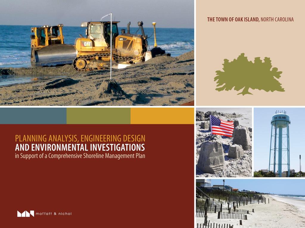
Goals and Strategies. Goals. Strategies. Long-term Beach and Shoreline Management Program
|
|
|
- Cody Lyons
- 5 years ago
- Views:
Transcription
1
2 Goals and Strategies Goals Long-term Beach and Shoreline Management Program Qualify for and Maintain Static-line Exception Qualify for and Maintain FEMA Engineered Beach Lockwoods Folly Inlet Management Plan Davis Creek Area Enhancement Plan Strategies Develop Cost and Time Efficiencies by: Collaborate with USACE on Cape Fear Inlet Management SMP Utilize Available Data from the USACE BCB 50-yr Project Partner with Town of Holden Beach on joint Lockwoods Folly Inlet Management Innovative Permitting Approaches
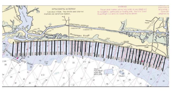
3 Task 1 - Review Existing Data and Identify Field Data Collection Needs Use existing USACE and Town data to the extent possible (USACE, Cleary, etc.) Define representative reaches based on available data (subject to change) Identify data gaps for additional field work needed (topo/bathy surveys, geotechnical data) and likely permitting approaches Task 2 Field Investigations Topo/bathy surveys of representative profiles needed (~40 profiles) Preliminary sediment sampling of native beach also to be completed Above will provide general morphologic understanding of island, basis for limited modeling and compatibility assessment

 Offshore (-12 ft NAVD88 to -20 ft NAVD88) MHW (+1.")
4 Elevation (ft NAVD88) Project Scope of Work Profile Volume Analysis-Profile Calculation Lenses Foredune (Landward Most Dune Crest) Subaerial Beach (Top of Dune to MHW=+1.1 ft NAVD88) Recreational Beach (MHW to -5 ft NAVD88) Offshore (-20 ft NAVD88 to -30 ft NAVD88) Outer Bar (-5 ft NAVD88 to -12 ft NAVD88) Offshore (-12 ft NAVD88 to -20 ft NAVD88) MHW (+1.1 ft NAVD88) Wading Depth (-5ft NAVD88) Outer Bar (-12ft NAVD88) -20 ft NAVD88-30 ft NAVD ,000 1,200 1,400 1,600 1,800 2,000 2,200 2,400 2,600 2,800 3,000 Distance from Baseline (ft)
5
6 Task 3 Coastal Engineering/Geology and Planning Evaluation Analytical analysis to develop preliminary estimates of sand need Build on USACE vulnerability analysis in the GRR and use DCM shoreline and USACE profile change data to develop estimates of sand need Sand source assessment Build on USACE GRR work (including Yellow Banks, inlet and offshore locations) Reassess the potential use of multiple sources Leverage beneficial use as possible (Eastern Channel, Lockwoods Folly Inlet) and complete analytical assessments of these options (increased flushing, water quality improvement, improved navigation) with expanded/optimal permitted dimensions Storm protection assessment Complete SBEACH modeling of representative sections to determine level of protection provided and likely templates needed to provide additional storm protection Short-term and long-term strategies will be developed as well as resulting funding needs/potential funding sources Incorporate static line exception and FEMA engineered beach criteria

7 Volume Change (cy) Task 3 Coastal Engineering/Geology and Planning Evaluation Volumetric Change February 2005 to December Station Total Above -15 ft NGVD Above - 2 ft NGVD
8 Elevation (ft NAVD88) Project Scope of Work Task 3 Coastal Engineering/Geology and Planning Evaluation Profile Volume Analysis-Profile Calculation Lenses Foredune (Landward Most Dune Crest) Subaerial Beach (Top of Dune to MHW=+1.1 ft NAVD88) Recreational Beach (MHW to -5 ft NAVD88) Offshore (-20 ft NAVD88 to -30 ft NAVD88) Outer Bar (-5 ft NAVD88 to -12 ft NAVD88) Offshore (-12 ft NAVD88 to -20 ft NAVD88) MHW (+1.1 ft NAVD88) Wading Depth (-5ft NAVD88) Outer Bar (-12ft NAVD88) -20 ft NAVD88-30 ft NAVD ,000 1,200 1,400 1,600 1,800 2,000 2,200 2,400 2,600 2,800 3,000 Distance from Baseline (ft)

9 Task 3 Coastal Engineering/Geology and Planning Evaluation
10 Task 3 Coastal Engineering/Geology and Planning Evaluation 50-yr
11 Task 3 Coastal Engineering/Geology and Planning Evaluation ` Reach Length (ft) 50-yr -12 ft Trigger (cy) 25-yr -12 ft Trigger (cy) Adjusted 25- yr -12 ft Trigger (cy) Preliminary FEMA -12 ft Trigger (cy) -12 ft 2011 Volume (cy) Bogue Inlet (1-8) 7, Emerald Isle West - West (9-11) 4, Emerald Isle West - Central (12-22) 14, Emerald Isle West - East (23-25) 4, Emerald Isle Central - West (26-32) 10, Emerald Isle Central - East (33-36) 5, Emerald Isle East - West (37-44) 8, Emerald Isle East - East (45-48) 4, Indian Beach/Salter Path - West (49-52) 5, Indian Beach/Salter Path - East (53-58) 7, Pine Knoll Shores - West (59-65) 9, Pine Knoll Shores - East - West (66-70) 6, Pine Knoll Shores East - East (71-76) 8, Atlantic Beach - West (77-81) 5, Atlantic Beach - Central (82-89, 91-96) 13, Atlantic Beach - Circle (90) 1, Atlantic Beach - East (97-102) 6, TOTAL 121,702 AVERAGE Weighted
12 Profile Volume Above -12 ft (cy/ft) Project Scope of Work Task 3 Coastal Engineering/Geology and Planning Evaluation West Profile Volume Above -12 ft NAVD - EI East EI East - West EI East - East Transect East Post-Irene 2012
13 Task 3 Coastal Engineering/Geology and Planning Evaluation
14 Task 3 Coastal Engineering/Geology and Planning Evaluation Environmental planning and permitting evaluation Agency meetings Review of existing data and identify data gaps for future data collection Identify permitting options (USACE GP291, EA, Supplemental EIS to GRR) Assess potential regulatory/mitigation/monitoring requirements Environmental planning and permitting evaluation Draft and final feasibility report NEPA SEPA
15 Task 4 Davis Canal Management Review existing surveys and prior investigations Identify additional data collection efforts needed for design and permitting Bathymetric surveys, water quality and other environmental data Develop conceptual dredging plan and potential funding options Develop permitting path in conjunction with Task 3 Review original permit and investigate USACE GP291 option Assess potential variance for dredging in Primary Nursery Area Investigate/Document historical navigation use Task 5 Project Management Town/Regulatory Coordination, Four (4) Meetings Additional Services Under Separate Authorization Represent Town of Oak Island in USACE SMP, USACE GRR and meetings concerning Lockwoods Folly Inlet Management
16 Project Fee Task 1 Review Data/Identify Data Collection Needs - $12,960 Task 2 Field Investigations - $18,220 Task 3 Coastal Engineering/Environmental Evaluation - $98,230 Task 4 Davis Canal Management - $6,960 Task 5 Project Management - $12,500 Incidentals $1,030 Additional Services Under Separate Authorization TBD TOTAL PROJECT - $149,900
17 Project Schedule Complete by End of 2014/Beginning of Months After Receipt of Available Data from USACE TASK APR MAY JUN JUL AUG SEP OCT NOV DEC JAN 1. Review Data/Identify Data Collection Needs Submit Data Request to USACE and Receive Data Data Collection/Review 2. Field Investigations Topo/Bathy Representative Profile Surveys Sediment Sampling and Reporting 3. Coastal Engineering Environmental Evaluation Analytical Analyses Sand Source Assessment Storm Protection Assessment and Modeling Environmental Planning and Permitting Assessment Draft and Final Report 4. Davis Canal Management Engineering Assessment and Plan Development Environmental Assessment and Planning 5. Project Management Client Coordination Meetings 2014

 Davis Creek Enhancement 4) Determine if Feasible to Move")


18 Current Scope Allows for Tiered Approach A. Complete a Feasibility Level Study to Determine Estimates of Project Needs and Costs ( 65% Answer ) 1) Beach Protection and Shoreline Needs 2) Lockwoods Folly Inlet Management 3) Davis Creek Enhancement 4) Determine if Feasible to Move Forward with a Small Investment B. If Town Desires, Move to Next Steps with a Detailed Study and Documentation Needed to Gain Permit Approval 65% Design Multiple Phased Approach for each Plan Board review and approve next steps Board review and approve next steps Master Plan 100% Design Implement Individual Projects Permit Approvals Plans and Specs Implement Construction
BEACH AND INLET PROJECTS UPDATE
 BEACH AND INLET PROJECTS UPDATE USACE DELTA PROJECT USACE Delta Project Project Extents Elevation Elevation (ft NAVD88) (ft NAVD88) USACE Delta Project Project Cross-Section 20 18 20 16 18 14 16 12 14
NC Coastal Management Program Update. Mike Lopazanski Policy & Planning Section Chief April 3, 2015
 NC Coastal Management Program Update Mike Lopazanski Policy & Planning Section Chief April 3, 2015 NC Coastal Area Management Act (1974) Balances competing coastal pressures through development permitting
NC Division of Coastal Management
 November 14, 2016 NC Division of Coastal Management NCBIWA Update NC Coastal Area Management Act (1974) Balances competing coastal pressures through development permitting and creation of a Coastal Resources
Broward County Shore Protection Project Segment II. Physical Monitoring Plan
 Broward County Shore Protection Project Segment II USACE File No. SAJ-1999-05545 Broward County Shore Protection Project -Segment II Submitted To: Florida Department of Environmental Protection Office
EEA Capital Investment in Green Infrastructure
 EEA Capital Investment in Green Infrastructure Goal: Advance local efforts to implement measures to increase natural storm damage protection, flood control, and community resilience State capital funding
Analogue to Digital Telecare. Technical Advisory Board. 21 st June 2017 Work Stream 3 Procurement
 Analogue to Digital Telecare Technical Advisory Board 21 st June 2017 Work Stream 3 Procurement Euan Kidd Senior Procurement Specialist Euan.kidd@scotland-excel.org.uk 1 Purpose of Work stream 3 - procurement
Port of San Diego Sea Level Rise Ad Hoc Committee Meeting 1 of 3.. September 18, 2018
 Port of San Diego Sea Level Rise Ad Hoc Committee Meeting 1 of 3. September 18, 2018 Agenda Welcome Introductions Rules of the Ad-Hoc Presentation Background Vulnerability Assessment Results Non-Agenda
Improvement of the Atlantic Coast of New York City,
 Improvement of the Atlantic Coast of New York City, Rockaway Inlet to Norton Point Project at Sea Gate Meeting Purpose The U.S. Army Corps of Engineers, the New York State Department of Environmental Conservation,
Welcome. Tannery and Waterworks Parks Shoreline Improvements Environmental Assessment. Public Information Centre #1 November 27, pm to 8 pm
 Welcome Tannery and Waterworks Parks Shoreline Improvements, Environmental Assessment Tannery and Waterworks Parks Shoreline Improvements Environmental Assessment #1 6 pm to 8 pm Why We Are Here Tannery
Lake Nokomis Shoreline Enhancement Project
 Lake Nokomis Shoreline Enhancement Project Community Meeting 2 February 13, 2018 Agenda Current Problems Project Goals Project Status Existing Conditions Community Input Draft Schematic Design Long-term
Southeast Extension to RidgeGate Parkway Scoping Booklet
 Southeast Extension to RidgeGate Parkway Scoping Booklet PUBLIC SCOPING MEETING SCHEDULE Public Scoping Meeting Wednesday, November 2, 2011 6:00pm to 7:30pm City of Lone Tree Recreation Center Willow Room
City of Rockingham. Local Management Practices, Costs and Strategic Coastal Planning
 City of Rockingham Local Management Practices, Costs and Strategic Coastal Planning Decision Making Process Considerations Climate Change Response Action Plan Ongoing observations/major Storm events Ongoing
HOLDEN BEACH EAST END SHORE PROTECTION PROJECT ENVIRONMENTAL IMPACT STATEMENT DRAFT
 HOLDEN BEACH EAST END SHORE PROTECTION PROJECT ENVIRONMENTAL IMPACT STATEMENT DRAFT August 2015 Prepared for: US Army Corps of Engineers, Wilmington District Wilmington, NC and Town of Holden Beach Prepared
4/8/2015 Item #10D Page 1
 MEETING DATE: April 8, 2015 PREPARED BY: Christy Villa, Associate Civil Engineer DEPT. DIRECTOR: Glenn Pruim DEPARTMENT: Public Works CITY MANAGER: Larry Watt SUBJECT: NORTH COAST HIGHWAY 101 STREETSCAPE
Empowering Local Action for Coastal Resilience in Massachusetts. Bruce K. Carlisle MA Office of Coastal Zone Management
 Empowering Local Action for Coastal Resilience in Massachusetts Bruce K. Carlisle MA Office of Coastal Zone Management Context Coastal communities continue to face both chronic and acute storm surge, erosion,
The Effects of Woody Vegetation on Levees
 The Effects of Woody Vegetation on Levees Maureen K. Corcoran Assistant Technical Director, Water Resources Infrastructure Vicksburg, MS 26 February 2010 US Army Corps of Engineers Problem Statement What
Coastal hazard assessments in Victoria
 Coastal hazard assessments in Victoria Viktor Brenners viktor.brenners@delwp.vic.gov.au Future Coasts program 4 year program established in 2007. Outputs included: Coastal Digital Elevation Models Victorian
CHAPTER Committee Substitute for Senate Bill No. 1472
 CHAPTER 2007-99 Committee Substitute for Senate Bill No. 1472 An act relating to beaches and shores; amending s. 161.021, F.S.; amending a definition; amending s. 161.085, F.S.; restricting the use of
edmonton.ca/ribbonofgreen #ribbonofgreen
 WHAT IS THE RIBBON OF GREEN? The Ribbon of Green is Edmonton s entire river valley and ravine system. The Ribbon of Green (2018) Project will provide strategic guidance for the southwest and northeast
MASTER PLAN KICK-OFF Open House #1A, April 28, 2015
 "The beginning is the most important part of the work." Plato, The Republic MASTER PLAN KICK-OFF Open House #1A, April 28, 2015 YOUR CAMPUS PLANNING TEAM Campus Planners Landscape Architects Urban Designers
WLAC Facilities Committee Meeting. May 15, 2017
 Campus Program Report WLAC Facilities Committee Meeting May 15, 2017 Page 1 DSA completed the initial review June 24, 2016 and the Design Builder is proceeding through the back check process. DSA reports
Welcome to the. Open House
 Welcome to the 5th Street to Kinsman Road Open House November 14 5:30 7:00 p.m. Please sign in Project Overview In December 2016, City Council adopted SW 5th Street as the preferred alignment to connect
Sconset Geotextile Tube Update Sconset Bluff, Nantucket. Maria Hartnett, Associate
 Sconset Geotextile Tube Update Sconset Bluff, Nantucket Maria Hartnett, Associate www.epsilonassociates.com Presentation Outline Project Setting & Need for Erosion Control Project Components Geotubes Sand
WLAC Facilities Committee Meeting. September 18, 2017
 Campus Program Report WLAC Facilities Committee Meeting September 18, 2017 Page 1 DSA approved the plans on May 15, 2017. Notice to Proceed was issued June 8, 2017 and the project remains on schedule for
Russ J. Joffrion, P.E. Whitney Thompson, P.E.
 A Case Study and Logistics Review on the Design and Construction of the Bayou Dupont Mississippi River Sediment Marsh Creation Project Jefferson and Plaquemines Parishes, LA Russ J. Joffrion, P.E. Whitney
Broward County Coastal Engineering Consultant Services For Segment III Shore Protection T P1 R. Harvey Sasso, P.E. Danielle Irwin, CFM
 Coastal Systems International, Inc. Broward County Coastal Engineering Consultant Services For Segment III Shore Protection T2112588P1 R. Harvey Sasso, P.E. Danielle Irwin, CFM Experts in Coastal Engineering,
Sierra Club Comments on ACOE Public Notice NAE Re: Proposed Town Neck Beach Project at Sandwich, Massachusetts
 August 27, 2015 US Army Corps of Engineers New England District 696 Virginia Road Concord, MA 01742-2751 Attn: Phillip W. Nimeskern Dear Mr. Nimeskern, Sierra Club Comments on ACOE Public Notice NAE-2014-259
Regional Open Space Conservation Plan. Regional Staff Committee January 18, 2018
 Regional Open Space Conservation Plan Regional Staff Committee January 18, 2018 Schedule We are here Task 1 - Stakeholder Input & Work Plan Dev. v z 2016 2017 2018 Oct Nov Dec Jan Feb Mar Apr May Jun Jul
SECTION 12 LANDSCAPE
 SECTION 12 LANDSCAPE Landscape and Urban Design provides complete landscape architectural services to the Department for transportation projects. The unit produces landscape design plans, specifications
Ashbridges Bay Erosion and Sediment Control Project
 Ashbridges Bay Erosion and Sediment Control Project Project Brief Overview Toronto and Region Conservation Authority, in partnership with the City of Toronto, intends to carry out remedial erosion control
Dauphin Island s East End Beach and Barrier Island Restoration Project. April 16, :00 PM Dauphin Island Sea Lab, Shelby Hall
 Dauphin Island s East End Beach and Barrier Island Restoration Project Town of Dauphin Island, Alabama April 16, 2015 6:00 PM Dauphin Island Sea Lab, Shelby Hall Team Introduction South Coast Engineers
2013 Summer Recap. Rockaway Beach
 2013 Summer Recap and Discussion on Rockaway Beach Reconstruction Tonight s Agenda Summer Beach Update Phase 2 Assumptions, Constraints and Regulations Rebuilding the Boardwalk Coastal Protection Rockaway
Funding, Designing, and (eventually) Building Miles of Shoreline and Acres of Wetlands and Oyster Reefs on an Urbanized River!
 Building Miles of Shoreline and Acres of Wetlands and Oyster Reefs on an Urbanized River!") CW Gaskill City of Norfolk Funding, Designing, and (eventually) Building Miles of Shoreline and Acres of Wetlands and Oyster Reefs on an Urbanized River! Don Cole Brown and Caldwell C. W. Gaskill City
CW Gaskill City of Norfolk Funding, Designing, and (eventually) Building Miles of Shoreline and Acres of Wetlands and Oyster Reefs on an Urbanized River! Don Cole Brown and Caldwell C. W. Gaskill City
Beneficial Use at Deer Island A Decade of Design and Implementation. Mississippi Water Resources Conference Jackson, Mississippi April 3, 2012
 Beneficial Use at Deer Island A Decade of Design and Implementation Presented by Wendell Mears and William Roth Anchor QEA, LLC Mississippi Water Resources Conference Jackson, Mississippi April 3, 2012
Coastal Erosion Protection Strategies Private Works on Public Land
 Coastal Erosion Protection Strategies Private Works on Public Land Arron Broom Coastal Policy Planner Coastal Management Branch, SA DEW Delegate for the Coast Protection Board 2016 Storm Events SA experienced
Natural Resource Adaptation Action Area Addressing Sea Level Rise in Estuarine Ecosystems TO: TOWN OF YANKEETOWN MAY
 Natural Resource Adaptation Action Area Addressing Sea Level Rise in Estuarine Ecosystems TO: TOWN OF YANKEETOWN MAY 6 2013 University of Florida Conservation Clinic Vivek Babbar, Student Associate, J.D.
Pontchartrain Coastal Lines of Defense Program Figure 1 Figure 2 Figure 1
 Pontchartrain Coastal Lines of Defense Program Coastal Sustainability Program February 2006 The Pontchartrain Coastal Lines of Defense Program consists of ten priority project areas within the Pontchartrain
Monitoring and Maintenance Permit Process
 Karen A. Duhring Marine Advisory Scientist Center for Coastal Resources Management Virginia Institute of Marine Science College of William & Mary April 9, 2010 Living Shorelines for Contractors and Project
A. INTRODUCTION B. CUMULATIVE EFFECTS ANALYSIS
 Chapter 4: Cumulative Effects A. INTRODUCTION The New York City Department of Parks and Recreation plans to reconstruct the Rockaway Beach Boardwalk in the borough of Queens, New York City, which Hurricane
City of Norfolk Coastal Flood Mitigation Program. March 13, 2013
 City of Norfolk Coastal Flood Mitigation Program March 13, 2013 Topics Brief overview of Norfolk s Coastal Flood Program Data-driven analysis and decision making City-wide vulnerability, project concepts,
Don t Flood The Rodeo! Preparing for Fort Worth s New Arena
 Don t Flood The Rodeo! Preparing for Fort Worth s New Arena T F M A S P R I N G C O N F E R E N C E APRI L 27 2017 Scott Hubley, P.E., CFM Justin Oswald, P.E., CFM Christopher Johnson, P.E., CFM PHOTO
jmt.com MARINE Part of a diversified family of solutions
 jmt.com MARINE Part of a diversified family of solutions Services Marine & Coastal Engineering Modeling Coastal Initiatives & Techniques Port, Harbor, & Marine Consultancy Small Craft Design Permitting
Peace River Water Use Plan Dinosaur Reservoir Management Plan
 Peace River Water Use Plan Dinosaur Reservoir Management Plan Monitoring Programs and Physical Works Annual Report 2016 Implementation Period: June 2015 to May 2016 GMSMON-14 DNR Tributary Habitat Review
Rt 29 Solutions Hydraulic Planning Advisory Panel. September 14, 2017
 Hydraulic Planning Advisory Panel September 14, 2017 Agenda Item 1: Introductions Hydraulic Planning Advisory Panel members Technical Team members 2 Agenda item 2: Public Interaction and Feedback Live
Highlands Region Stormwater Management Program Guidance
 DRAFT Highlands Region Stormwater Management Program Guidance Release Date: January 2016 Abstract This guidance document provides an overview of the Highlands Stormwater Management Program. It is intended
Design Guidelines for the Enhancement and Creation of Estuarine Habitats in the Middle Reaches of the Lower Columbia River
 Design Guidelines for the Enhancement and Creation of Estuarine Habitats in the Middle Reaches of the Lower Columbia River Astoria, May 16, 2012 1 Outline I. Nature of Project/Background II. Approach to
Chapter PROJECT AUTHORIZATIONS
 Chapter 1 1.1. PROJECT AUTHORIZATIONS The Mississippi River Nine-Foot Channel Navigation Project was originally authorized by the River and Harbor Act of 1930 (Seventy-First Congress, Session 2, Chapter
Coastal Erosion Commission: context, examples, and next steps
 Coastal Erosion Commission: context, examples, and next steps Overview Themes from other national and state level reports 2007 MA Coastal Hazards Commission Best practices and examples Financial i and
Boulder County Comprehensive Drilling Plan Surface Owner Meeting. Thursday, Oct. 19, 2017
 Boulder County Comprehensive Drilling Plan Surface Owner Meeting Thursday, Oct. 19, 2017 Contact Crestone Crestone Peak Resources Quick Facts www.crestonepeakresources.com cdpboulder@crestonepr.com (720)
Sunshine Coast Council Coastal Management Overview. January 2016 edition
 Sunshine Coast Council Coastal Management Overview January 2016 edition Mayor Mark Jamieson Mayor s foreword Our impressive beaches are fundamental to our Sunshine Coast lifestyle, economy and coastal
INEEL (1500) [45] 5.6 C 217 mm 60. Precipitation (mm) Temperature (oc) Month
![INEEL (1500) [45] 5.6 C 217 mm 60. Precipitation (mm) Temperature (oc) Month](/thumbs/91/105194910.jpg "INEEL (1500) [45] 5.6 C 217 mm 60. Precipitation (mm) Temperature (oc) Month") Figure 1. Water balance of a vegetated plot. Plants extract water from throughout the soil profile, to depths that may exceed 2 m in deep soils. In contrast, most water lost by direct evaporation comes
Figure 1. Water balance of a vegetated plot. Plants extract water from throughout the soil profile, to depths that may exceed 2 m in deep soils. In contrast, most water lost by direct evaporation comes
DRAFT ONONDAGA LAKE CAPPING AND DREDGE AREA AND DEPTH INITIAL DESIGN SUBMITTAL H.3 STATIC SLOPE STABILITY ANALYSES
 DRAFT ONONDAGA LAKE CAPPING AND DREDGE AREA AND DEPTH INITIAL DESIGN SUBMITTAL H.3 STATIC SLOPE STABILITY ANALYSES Parsons P:\Honeywell -SYR\444576 2008 Capping\09 Reports\9.3 December 2009_Capping and
City of Kingston. North King s Town Secondary Plan Open House + Workshop #1 February 28, 2018
 City of Kingston North King s Town Secondary Plan Open House + Workshop #1 February 28, 2018 1 event agenda 30 min Panel Review + Discussion 30 min Presentation + Q&A 75 min Workshop Session 15 min Report
Remodeling Market. Kermit Baker. Remodeling Futures Conference November 9, Harvard University JOINT CENTER FOR HOUSING STUDIES
 Remodeling Market Trends and Update Kermit Baker Remodeling Futures Conference November 9, 2010 Remodeling Market Trends 1. Remodeling spending saw significant decline during recession; greatest fall-off
July 22, 2013 REQUEST FOR PROPOSALS TO PROVIDE ENGINEERING DESIGN SERVICES FOR A PROJECT ALONG THE WESTERN SHORE OF MOBILE BAY
 Mobile Bay National Estuary Program 4172 Commanders Drive Mobile, AL 36615 Phone: 251-431-6409 Fax: 251-431-6450 Contact: Tom Herder, Watershed Protection Coordinator Email: therder@mobilebaynep.com July
Scarborough Waterfront Project
 Scarborough Waterfront Project Public Information Centre #1 Environmental Assessment Terms of Reference September 10, 2014 Agenda Open House Presentation 7:00 to 7:30 pm Presentation 7:30 to 8:15 pm History
Adaptive Management Strategies for Resilient Coastlines: A Case Study on the Ft. Pierce, FL Breakwater Project
 Adaptive Management Strategies for Resilient Coastlines: A Case Study on the Ft. Pierce, FL Breakwater Project USACE Workshop November 21 st, 2013 By: Jenna Phillips Emphasis on Green or Nature-Based Engineering
Sustainability, Health, Safety, Recreation & Open Space Working Group August 3, 2017
 Sustainability, Health, Safety, Recreation & Open Space Working Group August 3, 2017 DOWNTOWN OAKLAND SPECIFIC PLAN WELCOME Sustainability, Health, Safety, Recreation & Open Space Working Group Social
TOWN OF NEW CASTLE - Master Plan Update
 Our Presentation Today (1) Recap the Master Planning Process To Date (2) Present the Outline of the Master Planning Work Plan (3) Present the Calendar for the Master Plan (4) Outline the scope of a Downtown
TAPPING THE INGENUITY OF STUDENTS TO DESIGN A RESILIENT TEXAS COAST
 TAPPING THE INGENUITY OF STUDENTS TO DESIGN A RESILIENT TEXAS COAST ASBPA Conference Dr. Kelly A. Burks-Copes, Project Manager US Army Corps of Engineers Galveston District November 1, 2018 The views,
Transfer Station Recycling Update SWANA Technical Session-Waste Diversion 4 2/24/2017 2/28/2017
 Transfer Station Recycling Update SWANA Technical Session-Waste Diversion 4 2/24/2017 1 Todays Outline Roadmap to 70% A look back on how we started.. Vashon yard & food waste Styrofoam & plastic film Resource
APPLICATION SUBMITTAL CHECKLIST LAND USE PERMITS
 730 33rd Avenue NE Woodinville, WA 98072 SEPA/Project Approval Critical Area Determination Critical Area Alteration/ Exception/ Reasonable Use Design Review Application Form Owner Authorization Form Project
Fisher Slough Tidal Marsh Restoration Project Scaling Down the Restoration Planning & Analysis Framework to Evaluate Project Alternatives
 Fisher Slough Tidal Marsh Restoration Project Scaling Down the Restoration Planning & Analysis Framework to Evaluate Project Alternatives Project Sponsor/Partners The Nature Conservancy Dike District #3
SF REC & PARK MOSCONE RECREATION CENTER: EAST SITE. Supervisor Mark Farrell District 2. Project Manager Dan Mauer Recreation and Parks Department
 SF REC & PARK MOSCONE RECREATION CENTER: EAST SITE COMMUNITY WORKSHOP: MEETING #3 WEDNESDAY, FEBRUARY 10, 2016 Supervisor Mark Farrell District 2 Project Manager Dan Mauer Recreation and Parks Department
LOW IMPACT DEVELOPMENT GUIDANCE MANUAL AND LID WORKING GROUP ACTIVITIES. Powerpoint Templates. MS4 Statewide Stormwater Summit June 18, 2013
 LOW IMPACT DEVELOPMENT GUIDANCE MANUAL AND LID WORKING GROUP ACTIVITIES MS4 Statewide Stormwater Summit June 18, 2013 Powerpoint Templates Evan Canfield, Ph.D, P.E. Pima County Regional Flood Control Outline
COMMUNITY OPEN HOUSE. March 28, 2012
 COMMUNITY OPEN HOUSE March 28, 2012 THE CASE FOR URBAN INVESTMENT One of the best things that cities can do to create jobs especially in the private sector is to improve the quality of life of their inhabitants.
A TWENTY YEAR PLAN TO RESTORE NAPLES BAY. Natural Resources Manager
 A TWENTY YEAR PLAN (and visionary guide) TO RESTORE NAPLES BAY Michael R. Bauer, Ph.D. Natural Resources Manager City of Naples City of Naples Natural Resources Division Management Science Restoration
Downtown Area. Draft Vision and Strategies. February 24, 2015 Public Meeting
 Downtown Area Draft Vision and Strategies February 24, 2015 Public Meeting 1 SEA District North Beach Sea and Sky 3 Uptown Opportunity Neighborhoods Hillcrest Assist owner-occupants in negotiating fair
TAC/CAC, TPO Project Update February 2016
 A1A MULTIMODAL CORRIDOR PLANNING AND ENGINEERING ANALYSIS Florida Department of Transportation TAC/CAC, TPO Update February 2016 PRESENTATION FOOTERT Meeting Agenda What We Plan To Discuss Background New
City of Newburyport Plum Island Beach Management Plan. Presented by:
 City of Newburyport Plum Island Beach Management Plan Presented by: PLAN PURPOSE To establish appropriate public policy pertaining to the operation, maintenance and preservation of Plum Island including
There is an ongoing regulatory concern that
 FWRJ Alternatives for Beach Stormwater Outfalls: Preliminary Assessment for City of Naples Reshma Thummadi, Ronald Cavalieri, Andy Holland, and Gregg Strakaluse There is an ongoing regulatory concern that
Public Visioning City of Kelso Planning Commission
 Shoreline Master Program Update Public Visioning City of Kelso Planning Commission November 13, 2012 Schedule Jurisdiction Inventory Analysis Visioning Topics Process Governing Principles Structure of
Severn River Sub-Watershed: BMP 09-Retrofit
 Project ID: BMP_09 Total Treated Drainage Area: 4.57 acres Total Treated Impervious Area: 2.9 acres Total Water Quality Volume (WQv): ~10,300 cubic feet; 0.236 acre-foot Rainfall Depth Treated (Pe): 1
Restoring Water Ecosystems in NYC Parks
 Restoring Water Ecosystems in NYC Parks Hooked on our Waters Con October 19, 2013 - CUNY Graduate Center Marit Larson NYC Parks Landscape and ecosystem focus Watershed Streams Freshwater wetlands Tidal
RESOLUTION NO. R Refining the route, profile and stations for the Downtown Redmond Link Extension
 RESOLUTION NO. R2018-32 Refining the route, profile and stations for the Downtown Redmond Link Extension MEETING: DATE: TYPE OF ACTION: STAFF CONTACT: Capital Committee Board PROPOSED ACTION 09/13/2018
Snail Lake Overflow/Grass Lake Optimization Studies. May 2, Ramsey-Washington Metro Watershed District.
 Snail Lake Overflow/Grass Lake Optimization Studies May 2, 2018 Ramsey-Washington Metro Watershed District. Purpose Purpose: 1. Summarize what s been done 2. Update board on cost vs. benefits of various
Preliminary Regulatory and Engineering
 Preliminary Regulatory and Engineering Overview For the Isle of Palms, South Carolina Prepared by: Applied Technology & Management, Inc. 941 Houston Northcutt Boulevard, Suite 201 Mount Pleasant, South
Green or Grey Solutions? Why not both? Lessons from the Mid-Atlantic on Hybrid Living Shorelines
 Green or Grey Solutions? Why not both? Lessons from the Mid-Atlantic on Hybrid Living Shorelines Proactive By Design. Our Company Commitment Jesse Baldwin Coastal Geologist Project Manager GZA GeoEnvironmental,
Auburn University Basketball Arena:
 Auburn University Basketball Arena: How Building Data Analytics Achieved Energy and O&M Savings While Improving Comfort and Sustainability Eric Moore, PE, CEM, Auburn University Hadas Webb, CEM, Cimetrics
Agenda Parks Committee CITY of ROELAND PARK Wednesday, February 13th, 2019; 6:00pm-8:00pm Roeland Park City Hall
 Agenda Parks Committee CITY of ROELAND PARK Wednesday, February 13th, 2019; 6:00pm-8:00pm Roeland Park City Hall Committee: Cory Coe Emily Hage Jared Luebe Jennifer Provyn Kathleen Whitworth Laura Yankoviz
SHORE PROTECTION ACT STAFF S FINDINGS & RECOMMENDATIONS
 SHORE PROTECTION ACT STAFF S FINDINGS & RECOMMENDATIONS TO: FROM: APPLICANT: AGENT: Shore Protection Committee: Commissioner Mark Williams, Chairman Mr. Richard Gardner Mr. Henry Morgan Mr. Zach Harris
Rhode Island Shoreline Change Special Area Management Plan
 Rhode Island Shoreline Change Special Area Management Plan Draft Document Outline REVISED 10/12/2017 VOLUME 1 Executive Summary & How to Use this Document (Draft by Dec 2017) 1. Introduction (Revised draft
SOUTHEND CARELINE ANNUAL REPORT
 SOUTHEND CARELINE ANNUAL REPORT 2015-2016 Meet some of the CareLine Team Southend Careline TSA accredited 2015-2016 Southend Careline offers reassurance and peace of mind to our service users their family
A New Plan For The Calgary Region June calgary.ca call 3-1-1
 A New Plan For The Calgary Region June 2009 calgary.ca call 3-1-1 Introduction Since January 2006, The City of Calgary has been actively participating with the member municipalities of the Calgary Regional
RESILIENCY, ADAPTATION, & SUSTAINABILITY AT THE CITY OF ST. AUGUSTINE
 RESILIENCY, ADAPTATION, & SUSTAINABILITY AT THE CITY OF ST. AUGUSTINE PROGRAM UPDATE JANUARY 14, 2019 MICHAEL G. CULLUM, P.E. DIRECTOR, PUBLIC WORKS PROGRESSION OF PLANNING FOR RESILIENCY / ADAPTATION
NYC DEP s Approach to Flood Mitigation: The Local Flood Analysis (LFA) Process
 Process") NYC DEP s Approach to Flood Mitigation: The Local Flood Analysis (LFA) Process Milone & MacBroom, Inc. Jenabay Sezen, EIT Connecticut Association of Floodplain Managers October 25, 2016 Agenda Introduction
NYC DEP s Approach to Flood Mitigation: The Local Flood Analysis (LFA) Process Milone & MacBroom, Inc. Jenabay Sezen, EIT Connecticut Association of Floodplain Managers October 25, 2016 Agenda Introduction
Please read the entire document
 projects impacting the waterfront revitalization area. The waterfront revitalization area of the town will have to subareas to the west and east of the village. Page 6 of 6 Wayfinding master plan create
MEASURED PERFORMANCE DATA FOR
 MEASURED PERFORMANCE DATA FOR HOUSE #4 INVERNESS GARDENS MILLER HOMES FEBRUARY 2013 Submitted to: NYSERDA 17 Columbia Circle Albany, NY 12203 Submitted by: HOMEPIC Team CDH Energy Corp. PO Box 641 Cazenovia,
Date of Advertisement: January 14, 2019 Deadline for Receipt of Qualification Statements and Priced Proposal: February 12, :00 pm.
 MARYLAND COASTAL BAYS PROGRAM REQUEST FOR PROPOSALS TO PROVIDE PROFESSIONAL ENGINEERING AND TECHNICAL SERVICES FOR TIZZARD ISLAND COASTAL RESILIENCY PLANNING AND DESIGN Date of Advertisement: January 14,
Boulder County Comprehensive Drilling Plan Surface Owner Meeting. Thursday, Nov. 2, 2017
 Boulder County Comprehensive Drilling Plan Surface Owner Meeting Thursday, Nov. 2, 2017 Contact Crestone Crestone Peak Resources Quick Facts www.crestonepeakresources.com cdpboulder@crestonepr.com (720)
Planning and New Starts Development Committee. February 25, 2016
 Planning and New Starts Development Committee February 25, 2016 VB TRANSIT EXTENSION 2 Status of VBTES DEIS No Federal Environmental Decision Document Decision to build project with only State and City
New Development Stormwater Guidelines
 New Development Stormwater Guidelines CITY OF MOUNTLAKE TERRACE Table of Contents Introduction... 2 Ecology s Minimum Requirements for stormwater management... 2 Description of the 9 Minimum Requirements...
After the Storms: Planning for Louisiana s Future. Larry Ardoin Coastal Protection and Restoration Authority Integrated Planning Team
 After the Storms: Planning for Louisiana s Future Larry Ardoin Coastal Protection and Restoration Authority Integrated Planning Team Today s Presentation Background Objectives Draft Master Plan Upcoming
The Remodeling Market
 The Remodeling Market Kermit Baker Remodeling Futures Program International Builders Show January 21, 2010 www.jchs.harvard.edu Remodeling Market Issues 1. Where do we stand in the remodeling cycle at
Shoreline Master Program Town of La Conner, Washington
 Shoreline Master Program Town of La Conner, Washington Department of Ecology approval effective Adopted September 24, 2013 by Town of La Conner Ordinance No.1106 Amended May 13, 2014 by Town of La Conner
Draft Rhode Island Stormwater Design and Installation Standards Manual
 Draft Rhode Island Stormwater Design and Installation Standards Manual Summary The May 2009 Public Review Draft version of the RI Stormwater Design and Installation Standards Manual consists of approximately
Continuous Commissioning: A Valuable Partner to Retrofit Projects
 Continuous Commissioning: A Valuable Partner to Retrofit Projects Yeqiao Zhu Aamer Athar Kenneth Banks Ph.D. PE, CEM PE, CEM Energy Systems Laboratory Sempra Energy Solutions Sempra Energy Solutions Charles
UO North Campus Conditional Use Permit Project
 UO North Campus Conditional Use Permit Project Project Overview and Background November 2017 Campus Planning, CPFM Project Boundary Previous Conditional Use Permit: 1988 to 2012 Site History Statement
Lawrencetown Beach & Rainbow Haven Beach
 Lawrencetown Beach & Rainbow Haven Beach Public Engagement Session Wednesday, September 27 th, 2017 6:00pm 8:00pm Cole Harbour Place 51 Forest Hills Pkwy, Dartmouth Agenda Welcome & Introductions Overview
LEASEHOLD YEARLY PROPERTY SCHEDULE
 This Yearly Property Schedule is simply a guide to managing your Facility. Please reallocate duties as they suit the management of your Facility, however, note that all tasks should be listed on the schedule