BIG ROSSLYN HIGHLANDS PARK + COORDINATED OPEN SPACES PLAN 4. RECREATION AMENITIES
|
|
|
- Lorraine Bond
- 5 years ago
- Views:
Transcription


1 KEY BVD. APAH QUEENS COURT 5-12 ND PAYGROU QUINN ST. 18 ST. AWN 2 3 I PICNIC / GR C 4 B MUTI-USE COURT FIED 5 BASKETBA BATMINTON PANTING CHESS NEW ST. PAY PENZANCE RESIDENTIA TOWERS PAY TERRACE NEW FIRE STATION #10 PICNIC PAY 6 PENZANCE ER OFFICE TOW A OO WISON SCH PANTING 7 EEVEN. D V ON B WIS N PIERCE 1
.")
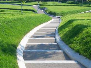
2 A 1.MAJOR PEDESTRIAN CIRCUATION 2. MAJOR ACTIVE AMENITIES 3. OPTIMA SPORT COURT ORIENTATION 4. RECREATION AMENITIES The major circulation path goes through the site, connecting Wilson Blvd with 18th street (and the Key Blvd Community Garden beyond). Rosslyn Highlands Park and Wilson School are situated along this main procession. The major active amenities are a basketball court on the terrace of Wilson School (public outside of school hours), a large open field for Wilson School, a multipurpose court for Rosslyn Highlands Park, and adjacent 0-5 and 5-12 play areas for the Queens Court open space. The Rosslyn Highlands Park multi-use court is rotated 45o to optimize sunlight direction, so that players will not be blinded by the sun even during the afternoon when the sun casts its harshest rays. The adjacent play areas are rotated similarly. The remaining passive spaces host recreational amenities, including seating, grilling, plantings, and tree canopies. 2

3 B 5. ACCESS AND ACCESSIBIITY 6. TOPOGRAPHY / SOI DEPTH MITIGATION 7. ANDSCAPING / HARDSCAPING STRATEGIES 8. The major pedestrian path from Wilson Blvd to 18th St bends to create an entrance for Wilson School and an entrance to the Rosslyn Highlands Park multi-use court. This bending creates enough area for the path to serve as an inherent accessible path from 180 (Wilson Blvd) to 170 (18th St). All offshoot paths are also ADA accessible. The pockets of recreational amenities lift to create seating and soil volume for plantings and trees. A play hill is also created adjacent to the multi-use court. On the edges of the lifted program pockets is further opportunity for benches, which act as an civic interface between the paths and the greenery. Here, users can become spectators, watch their children, eat lunch, or chat over the latest novel. The activated park. Users range from high school students and faculty, residents of new residential towers nearby (including Penzance and APAH). These inhabitants vary in age and profession, and the Park offers a wide range of active and passive amenities to host these users. 3

4 C 1 FU COURT / 4 HAF-COURT BASKETBA FUTSA FOURSQUARE VOEYBA / BATMINTON 4


 climb, Both active and passive elements can be")
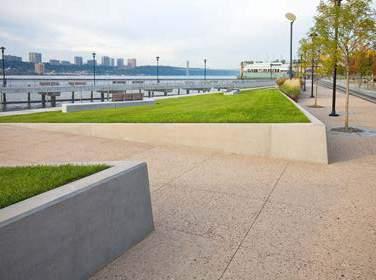
5 1 2 ADJACENT TOT-OT & SCHOO-AGE PAYGROUND The adjacent 2-5 and 5-12 play areas involve custom play structures like the precedents below. Climbing cubes and nets, slides, see-saws, and swings would be custom designed to create an integrated look for Queens Court open space. Design considerations will include color, shape, modular ability, and safety to ensure the space relates well to the rest of the plan. To deal with the possible extremet differences in grade a terraced seating feature is proposed. This terracing creates natural seating opportunities for parents to be able to supervise their children in both play areas. PAY STRUCTURE 4 SOPED GREEN AWN Wherever possible, trees and plantings will act as permeable fencing. Intermittent fencing will be The multi-use court can be vibrantly colored using rubber, special rubber-like sports flooring, or painted stainless steel or other materials of similar look and durability. Fences and railings will be designed concrete. The Wilson Field will be artificial turf, common to many parks, play field, and public quads. to maximize public safety and management of field events without obstructing views or blocking walkways. COORED SAFETY SURFACES FENCING & PANTING AS BOUNDARY 5 PICNIC & GRIING AREA 3 PANTED / PERMEABE BOUNDARY BETWEEN FIED AND PATH PANTING AS BOUNDARY MUTI-USE COURT WITH STRIPING 6 INFORMA PAY HI NON-RECTANGUAR ARTIFICA TURF FIED ACTIVATED PATH This passive region integrates picnic and grilling areas for nearby residents. Elements can integrate The play hill or mound is a exciting, multi-use element. During recess, students can (actively) climb, Both active and passive elements can be integrated along an activated pathway, with plantings, trees, vibrant coloring as accents to the clear, modern material palatte of warm concrete, wood, and steel. cartwheel, dance, or (passively) chat, read, sit, watch. Residents may spectate; workers may eat lunch. picnic areas, and climbing structures interspersed playfully. The mound also allows for larger trees to be planted at its peak. COMMUNITY PICNIC AREA SOPED PANTED PANE SEATING AONG SOPED SURFACE ARTIFICIA EARTHEN MOUND ADJACENT ACTIVE AND PASSIVE AMENITIES PATH THROUGH PANTED AREA 5


6 UNIFYING DESIGN CONCEPTS RHP+ will employ contemporary design aesthetics. Through the use of modern materials, synthetic in-filled turf, reinforced earth and other technologies, RHP+ will engage contemporary forms, geometries, and uses. To ensure a cohesive solution is developed in the further design specific elements of the plan have been highlighted as unifying design concepts and are intended to be integrated in all sites in the plan. CIRCUATION ROTATION OF CENTRA EEMENT SOPED REGIONS PAY PRECEDENTS Pathways are an integral design strategy of RHP+. Circulation routes diverge and converge around active amenities and reflect the natural procession of pedestrians, residents, and overall users from point to point, destination to destination. These routes in turn create programmable regions. The central active element is rotated for optimal sunlighting, and along with natural circulation routes, defining subsequent passive regions. These passive regions are lifted to created sloped areas for park users to watch a game, read a book, eat lunch, or relax. The added soil volume allows for trees to be planted along the edge of the region. Edges also integrate benches, creating more opportunities for passive use. Play areas will be colorful and vibrant areas for users to climb, slide, swing, and discover. Play elements will be designed with a focus on materiality, modular size, lighting, and safety. Swings, see-saws, slides, and climbing structures will be integrated. The designs should allow for year-round use. PEDESTRIAN SAFETY & ACCESSIBIITY RHP+ will require accessibility to all persons of all abilities in compliance with the Americans with Disabilities Act (ADA) and County policies. ADA accessibility is a design priority, and all pathways are accessible for wheelchairs and strollers with year-round usability. Maximum priorty is given to pedestrian safety, with all pathways ADA accessible and the integrated benches acting as clear demarcations between landscape and pathway. +3 3' PANTING SOI The site is relatively flat, and consideration will be made so as to mitigate drastic changes in topography for pathways. Fencing will also be integrated selectively along the edges of active elements such as the Wilson School field and RHP multi-purpose court. Pathways will be friendly to all users, and they will provide space for people to sit, stand, picnic, watch games and events, and enjoy the scenery. MAXIMUM HEIGHT OF PASSIVE EEMENTS ifted Passive elements are not to exceed 4 or natural eye level. This is to ensure maximum safety and visibility throughout the park and surrounding areas. RHP+ is to be an inviting, vibrant space for play and rest open to all inhabitants. IGHTING ZONES IGHTING ighting will provide safe and quality use of the park, and is designated into four different zones: the Queens Court Play area, Wilson School field, RHP pathway, and RHP multi-purpose court. RAISED CROSSWAK RAISED CROSS WAK Continuing the pathway connecting 18th street and Wilson Blvd a raised mid-block crosswalk will be implemented to improve pedestrian safety. PAINTED STREET STREET GRAPHICS To further designate this portion of 18th street as a zone where vehicular traffic should be especially careful a graphic along the street will be developed. TREE CANOPY COVERAGE Tree OPEN canopy SPACE coverage NEW is a design priority for RHP+ and the tree canopy design goals are from 10 to 20% depending on the specific site. In the latest concept plan, tree canopy for the open spaces is projected at around 20%. This will be further developed during the detailed design and will be subject to review by various county authorities. TREE TYPE COUNT 20 YR CANOPY COVERAGE WITH BONUS, SF TOTA CANOPY COVERAGE, SF SMA MEDIUM MEDIUM-ARGE ARGE TOTA PERCENTAGE, TOTA OPEN SPACE (81,368 SF) 20.1% EXISTING TREES ON SITE The study area contains an array of both mature and healthy, and trees that are either in poor health of susceptible to insect damage and disease. APAH For the APAH site, tree canopy is projected at around 20%. WISON SCHOO For the Wilson School site, tree canopy is projected at around 10%. ARINGTON COUNTY + PENZANCE For the Arlington County and Penzance site, tree canopy is projected at around 12%. OPEN SPACE EXISTING TREE TYPE 20 YR CANOPY COVERAGE TOTA CANOPY COUNT WITH BONUS, SF COVERAGE, SF 6 SMA
 will")


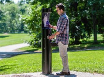


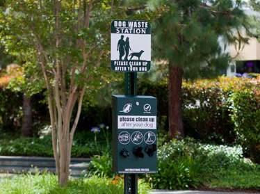


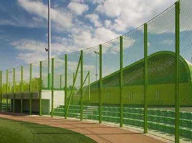


7 PANTING All trees and plantings (listed in the following page) will be native to the region of Arlington to ensure natural values and sustainability. RHP+ strives to be an urban oasis and model of responsible environmental thought. Tree canopy coverage is also a design priority, and all green areas will prioritize native trees with medium to large canopy coverage. The target canopy coverage for the combined open spaces will be around 20%. As the park is located over parking garages, soil volume will be a strategic design strategy. Green terraces and hills will be used to plant trees but also as benches and spaces for users to sit, read, or watch. PANTING PAN ARGE TREES arge trees to be used include Red Maple, Red Oak, Scarlet Oak, Shumardii Oak, Swamp White Oak, Willow Oak, and Black Gum. These species are all native, and they provide substantial projected canopy coverage of 250 to 315 SF each. arge Trees Medium-Small Trees Groundcover Flowers SMA-MEDIUM ORNAMENTAS Small to medium ornamental trees to be used include American Holly, Dogwood, Ironwood, Redbud, Staghorn Sumac, and Sweetbay Magnolia. These species are also all native, and they provide projected canopy coverage of 50 to 175 SF each. GROUND COVER & FOWERS Some ground cover plants to be used include Fragrant Sumac, Oakleaf Hydrangea, and Fothergilla. Oakleaf Hydrangea and Fothergilla flower white and are to be integrated among trees and other greenery. Other flowering plants will also be integrated, adding color, fragrance, and beauty to the park s passive elements. EQUIPMENT & FURNISHINGS All site furnishings such as furniture, kiosks, marker signs, and other items that enhance the user experience will be designed or chosen to fit the design aesthetic as well as sustainable design intent. Materials will be durable and low-maintenance, selected using a criteria of durability, quality, user experience, appearance, and functionality as well as long-term cost-effectiveness. Park furniture provides respite for users to sit, eat, relax, or play. Play structures and climbing structures will be integrated throughout the master plan as unobtrustive opportunities of play for all ages. These structures will be designed or chosen to fit within the design aesthetic. PAYGROUND MUTI-USE COURT SIGNAGE STREET IGHT, COPENHAGEN PANTEN UN BOMEN GRI GARBAGE BIN BOTTE FIING WATER FOUNTAIN DOG WASTE STATION META MESH FENCE Public drinking fountains should be provided whenever possible and in accessible locations. Fences and railings will be designed to provide for safety and management of field events without obstructing views or blocking pathways. WYDE MOUNTAIN BIKE TRAI INTEGRATED SEATING / PANTER INTEGRATED SEATING MATERIA Materiality further reflects the playful, vibrant nature of RHP+ amongst the clear, contemporary aesthetic. The multi-use court will use contemporary rubber-like material to ensure year-round, all-weather traction; color becomes a design element and will reflect the dynamic use of the court. COMBINED GRANITE POISHED YEOW STEE BRUSHED BACK STEE COOR PEBBED MAT AGGREGATE CONCRETE GOW-IN-DARK AGGREGATE ARICE WOOD WARM CONCRETE COOR RUBBER MAT PERMEABE PAVING WEBNET FENCE TEXTURED CROSSWAK Stainless steel and materials of similar look and durability contribute to the park s modern design. Warm and light-colored concrete and similar paving materials will be paired with warm wood and steel accents. 7
Rosslyn Highlands Park + Coordinated Open Spaces Plan (Plan Adoption) County Board Meeting September 24, 2016
 County Board Meeting September 24, 2016") Rosslyn Highlands Park + Coordinated Open Spaces Plan (Plan Adoption) County Board Meeting September 24, 2016 BACKGROUND The County Board shall consider adoption of the proposed Rosslyn Highlands Park
Rosslyn Highlands Park + Coordinated Open Spaces Plan (Plan Adoption) County Board Meeting September 24, 2016 BACKGROUND The County Board shall consider adoption of the proposed Rosslyn Highlands Park
Highland Village Green Design Guidelines
 Highland Village Green Design Guidelines Publishing Information Title Highland Village Green Design Guidelins Author The City of Calgary Status DRAFT - Proposed document subject to changes Additional Copies
Throughout. square. (Crystal City Vision Plan 2050)
") 1: Terms related to the PSMP document 1 public space (see also public realm, civic space) An open space designated on the regulating plan, accessible to all, including Plazas, Mini Parks, and Neighborhoods
1: Terms related to the PSMP document 1 public space (see also public realm, civic space) An open space designated on the regulating plan, accessible to all, including Plazas, Mini Parks, and Neighborhoods
Figure 3-1: Public Realm Plan
 3 Public Realm Figure 3-1: Public Realm Plan 3.1 Public Realm Concept The public realm concept for the Little Mountain site integrates a clear and accessible movement network with public spaces for social
Open Space Considerations
 Open Space Considerations Department of Parks & Recreation WESTERN ROSSLYN AREA PLANNING STUDY WORKING GROUP MEETING OCTOBER 9, 2014 1 Purpose of the Presentation Provide context of the Rosslyn park and
3.1 community vision. 3.3 required plan elements
 Chapter 3 Community Form 3.1 community vision 3.2 Parks & landscaping concepts 3.3 required plan elements D R A F T 20 Community Form Chapter 3 3.0 Community form 3.1 community vision The Specific Plan
THE LANDMARK PROJECT: ST. GEORGE CAMPUS BEFORE AND AFTER
 THE LANDMARK PROJECT: ST. GEORGE CAMPUS BEFORE AND AFTER The Landmark Project will reimagine the historic core of the St. George campus by creating dynamic, open spaces where students, faculty and the
July 23, 2014 Wilson School. Working Group Meeting #3 Preliminary Site Analysis School Siting Considerations Guiding Principles
 July 23, 2014 Wilson School Working Group Meeting #3 Preliminary Site Analysis School Siting Considerations Guiding Principles Agenda Follow-Up from Meeting #2: WG & community feedback Presentations /
DESIGN GUIDELINES. Seattle Children s Major Institution Master Plan. Approved May 7, 2010
 Approved May 7, 2010 Contact: Todd Johnson, todd.johnson@seattlechildrens.org, (206)987-5259 A. MASTER PLAN... 3 A1.0 Context... 3 A1.1 Purpose of Design Guidelines... 3 A1.2 Design Guidelines... 4 B....
4 Semi-Private & Private Open Spaces
 4 Semi-Private & Private Open Spaces 4.1 Semi-private Open Space 4.1.1 Common Courtyards The common courtyards for each complex will be designed and programmed for the typical owners living there. They
Policies and Code Intent Sections Related to Town Center
 Policies and Code Intent Sections Related to Town Center The Town Center Vision is scattered throughout the Comprehensive Plan, development code and the 1994 Town Center Plan. What follows are sections
VEHICULAR AND PEDESTRIAN CIRCULATION
 This perspective sketch communicates the intended character and quality of a proposed streetscape design. Locate benches near a major intersection where people tend to gather. Seating and lighting provide
INDOOR SPORTS COMPLEX PROJECT BRIEF
 a PROJECT BRIEF 1.0 INTRODUCTION This Project consists of designing and built of an Indoor sports complex which will become the first building developed in Hulhumale solely for indoor sports and recreational
ANCHORAGE PARK REPORT CARD Assessing A Park s Appearance, Function, & Condition
 ANCHORAGE PARK REPORT CARD Assessing A Park s Appearance, Function, & Condition Park Name: Is Your Park an A or an F? Your Name: Contact Information Optional: Date: General Instructions: Phone: Email:
B L A C K D I A M O N D D E S I G N G U I D E L I N E S for Multi-family Development
 B L A C K D I A M O N D D E S I G N G U I D E L I N E S for Multi-family Development Adopted June 18, 2009 This section of the Design and focuses on site planning and design guidance for new multi-family
PUBLIC RIGHT-OF-WAY IN THIS CHAPTER PUBLIC REALM
 PUBLIC RIGHT-OF-WAY This section provides design guidelines for improvements in the public right-of-way. The public right-of-way refers to streets, sidewalks, non-vehicular thoroughfares, parks and greenways
The open space system should provide connective elements, relate to natural resources, and enhance the suburban character of the landscape..
 The open space system should provide connective elements, relate to natural resources, and enhance the suburban character of the landscape.. Mixed-use and infill development should maintain or enhance
WINDSOR GLEN DESIGN GUIDELINES
 WINDSOR GLEN DESIGN GUIDELINES Adopted by Council, 2006 WINDSOR GLEN REDEVELOPMENT DESIGN GUIDELINES August 2006 1.0 Master Plan Organization For this area of the Coquitlam Town Centre, a mix of high,
Rotary Park / Railroad Lake
 Rotary Park / Railroad Lake Park Location: 600 NW Vesper St. Park Land Established: 1975 Park Size: 12 acres Developed Acres: 12 acres Undeveloped Acres: 0 acres Park Type: Community Park Amenities: 2
13. New Construction. Context & Character
 13. New Construction Context & Character While historic districts convey a sense of time and place which is retained through the preservation of historic buildings and relationships, these areas continue
Site Planning. 1.0 Site Context. 2.0 Pedestrian Circulation Systems. Pag e 2-23
 The following photographs from throughout the country illustrate key urban design principles. Photographs are provided to illustrate the overall urban design concepts described in Chapter 1 of the Downtown
Dowdy Park. Concept Plans TOWN OF NAGS HEAD NORTH CAROLINA. Developed by: Albemarle & Associates, Ltd VHB/ Vanasse Hangen Brustlin, Inc.
 TOWN OF NAGS HEAD NORTH CAROLINA Concept Plans Developed by: Albemarle & Associates, Ltd VHB/ Vanasse Hangen Brustlin, Inc. Site Looking Southeast Dowdy Park Existing Conditions Nags Head Woods Sound Future
Design Guidelines. Roosevelt. Mike Podowski DPD Design Guidelines Ordinance ATT 13 August 13, 2012 Version #1
 Roosevelt Design Guidelines The Roosevelt Neighborhood Design Guidelines apply within the Neighborhood Boundary. Map 1 2 Map 2 3 Map 3 4 CS1 Natural Systems and Site Features Citywide Guideline: Use natural
Town Center Design Guidelines
 Adopted by City Council on September 18, 2018 Design Theme The Draper Town Center Design Theme is defined as encompassing those architectural design styles that were prevalent in the construction of civic
Community Mixed Use Zone Districts (CMU)
") 18.28.500 Community Mixed Use Zone Districts (CMU) The Community Mixed Use Zone Districts (CMU) are intended to help implement the land use goals and strategies found in the Golden Vision 2030 values,
18.28.500 Community Mixed Use Zone Districts (CMU) The Community Mixed Use Zone Districts (CMU) are intended to help implement the land use goals and strategies found in the Golden Vision 2030 values,
Long Branch-Wayne Local Park Renovation Project
 Montgomery Parks Long Branch-Wayne Local Park Renovation Project Community Meeting #2 September 20, 2016 Oak View Elementary School 7:00-9:00 PM Welcome / Team Introductions M-NCPPC (Montgomery Parks)
WEST LOOP DESIGN GUIDELINES CHECKLIST
 WEST LOOP DESIGN GUIDELINES CHECKLIST Section 1.0 General Strategies 1.1 DESIGN EXCELLENCE: ENCOURAGE HIGH QUALITY AND INNOVATIVE DESIGN OF NEW BUILDINGS WITHIN THE WEST LOOP WITHOUT BEING PRESCRIPTIVE
Comment NATURAL ELEMENTS & PLANTINGS
 Park at Gables N. Rolfe Public Meeting, 4/09/14 Public Comments by Topic Location of Comment Comment NATURAL ELEMENTS & PLANTINGS #1 [Like] The preservation of nature [Like] The large amount of green [Like]
Sierra Springs Regional Commercial Master Site Plan Airdrie, Alberta Hopewell Development Corporation Project No May 26, 2010
 Sierra Springs Regional Commercial Master Site Plan Airdrie, Alberta Hopewell Development Corporation Project No. 205-077 May 26, 2010 TABLE OF CONTENTS Purpose... 2 Master Site Plan Guidelines... 3 Overall
1. Parks & Recreation Neighborhood Parks Community Parks Special Use Sites 2. Open Space 3. Trails
 Appendix A: Park Classifications The intent of parks and recreation classifications is to aid in making acquisition and design decisions for park sites, facilities and the organization of recreation space
Terrace View Park. Master Plan
 Terrace View Park Master Plan Table of Contents Terrace View Park Master Plan Page Executive Summary 1 Project Background 3 Master Planning Process Existing Conditions Master Plan 9 Park Zones and Amenities
for Master Planned Development Framework Design Standards & Guidelines
 B L A C K D I A M O N D DE S I G N G U I D E L I N E S for Master Planned Development Framework Design Standards & Adopted June 18, 2009 Introduction and Purpose The Master Planned Development (MPD) Framework
Mixed Use Centres Development Permit Guidelines
 1 Mixed Use Centres Development Permit Guidelines Area Commercial or Mixed Use development occurring in City Centre, Urban Centre, Neighbourhood Centre, or Institutional Complex land use designations is
Building and Site Design Standards
 Commercial Design Standards All Business and Industrial Uses as Described in Section 2234 Requiring Special Permit Review Except Large-Scale Ground Mounted Solar Photovoltaic Installations and Wireless
Multi family Residential Development Permit Area
 City of Kamloops KAMPLAN Multi family Residential Development Permit Area PURPOSE The purpose of this Development Permit Area (DPA) is to establish objectives and provide guidelines for the form and character
FREEWAY/TOURIST DISTRICT
 FREEWAY/TOURIST DISTRICT DESIGN STANDARDS FOR THE CITY OF MOUNTLAKE TERRACE March, 2014 MOUNTLAKE TERRACE FREEWAY/TOURIST DESIGN STANDARDS March, 2014 1 TABLE OF CONTENTS Introduction...1 Design Site Design
R STREET CORRIDOR NEIGHBORHOOD Site Plan and Design Review Supplemental Guidelines Checklist
 R STREET CORRIDOR NEIGHBORHOOD Site Plan and Design Review Supplemental Guidelines Checklist Applicant s Name: Project Address: Phone: Email: Applicant shall fill out the design guidelines checklist for
Preci nct P l ans Figure 56 Campus Aerial Photo, 2008 CAL STATE EAST BAY, HAYWARD CAMPUS MASTER PLAN
 9 Precinct Plans This section contains a detailed discussion of the planning and design concepts for specific areas or precincts of the Cal State East Bay Hayward campus. The Precinct Plans pertain to
/05 Architectural Response
 /05 Architectural Response 5.1 Inspiration Stacked Boxes (Artist : Rachael Whiteread) Cubism ( Architect : Le Corbusier) 52 1133 Melville Rezoning Submission Patterns ( Textile Artist : Annie Albers) Overlapping
Project purpose. advise. The purpose of the Beaumaris Lake Open Space Rehabilitation project is to: + Develop a Functional Program Concept
 Project purpose owns Road Beaumaris Road The purpose of the Beaumaris Lake Open Space Rehabilitation project is to: + Develop a Functional Program Concept + Guide Rehabilitation of Landscape and Community
Woods Chapel Park. Park Amenities: Playground, basketball court, single table shelter, small pond and multi-use trail.
 Woods Chapel Park Park Location: 3925 NW Dogwood Park Land Established: 1979 Park Size: 10 acres Developed Acres: 6 acres Undeveloped Acres: 4 acres Park Type: Neighborhood Park Amenities: Playground,
MIAMI 21 PUBLIC HEARING-FIRST READING 2009
 General Principles Public access waterfront walkways shall: 1. Feel public. No one should feel as if he or she is intruding on private property. The public should feel welcome and at ease to move along
V. Gateways GATEWAYS / V-1
 V. GATEWAYS / V-1 Many of Chesapeake s gateways are located on highways and call for bold and attractive designs that motorists can understand, appreciate, and enjoy. can also take the form of natural
Bernie Dahl and Donald J. Molnar, Anatomy of a Park, 3rd edition, (Long Grove, IL: Waveland Press, 2003), 151.
, 151.") 6 Design Counts Good design is essential to making the most of a park system, especially in urban areas. Good design creates highly functional, environmentally sensitive, and durable parks that also bring
6 Design Counts Good design is essential to making the most of a park system, especially in urban areas. Good design creates highly functional, environmentally sensitive, and durable parks that also bring
Division VI Community Mixed Use (CMU) Architectural Guidelines and Standards
 Architectural Guidelines and Standards") Division VI 18.40.800 Community Mixed Use (CMU) Architectural Guidelines and Standards 18.40.810 Guidelines The goals of the Comprehensive Plan include a focus on pedestrian safety, amenities and aesthetics
Division VI 18.40.800 Community Mixed Use (CMU) Architectural Guidelines and Standards 18.40.810 Guidelines The goals of the Comprehensive Plan include a focus on pedestrian safety, amenities and aesthetics
REZONING APPLICATION MPD SUPPLEMENT
 REZONING APPLICATION MPD SUPPLEMENT For Staff Use Only: DATE/TIMESTAMP: ZA# RECEIVED BY: The intent of the Master Planned District (MPD) designation is to allow flexibility in the design and construction
Ivywild On The Creek PRELIMINARY CREEK DISTRICT MASTER PLAN
 Ivywild On The Creek PRELIMINARY CREEK DISTRICT MASTER PLAN Introduction: Rejuvenating an extraordinary Creekside neighborhood THE CREEKSIDE DISTRICT The Ivywild On The Creek Neighborhood District Master
Neighborhood Districts
 NEIGHBORHOOD DISTRICTS SEVEN MAIN DISTRICTS Neighborhood Districts While the Development Plan provides a broad-scale overview of the neighborhood, this section focuses on uses and relationships at the
HIGHLAND VILLAGE GREEN URBAN DESIGN PRINCIPLES/GUIDELINES
 URBAN DESIGN GUIDING PRINCIPLES/GUIDELINES CONTEXT/CHARACTER The City of Calgary s Municipal Development Plan (MDP), Transit-Oriented Development (TOD) Policy Guidelines and Main Street/Corridor policy
SITE FURNISHINGS STANDARDS MANUAL
 University Planner's Office Architecture, Engineering & Construction University of Michigan January, 2011 http://www.umaec.umich.edu/ Table of Contents Introduction page 3 Campus Landscape Design Elements
WRAPS Site Studies. Cooper, Robertson & Partners. December 8, Page 1
 WRAPS Page 1 Realigned N. Pierce Street & Extension Base 1 FOR PRESENTATION TOTAL GSF OFFICE 346,000 RESIDENTIAL 795,000 POTENTIAL RETAIL 40,000 TOTAL 1,181,000 795 DU Open Space (Development Parcels)
boyd park draft concept plan CITY ROAD BALSTON STREET KINGS WAY KAVANAGH STREET CITY OF MELBOURNE BOYD COMMUNITY HUB MULTIPURPOSE COURT NORTH LAWN
 draft concept plan CITY ROAD NORTH LAWN MULTIPURPOSE COURT BOYD COMMUNITY HUB SCHOOLYARD KINGS WAY FOREST GARDEN BALSTON STREET VILLAGE GREEN FUTURE DEVELOPMENT PICNIC & PLAY TERRACE PARK EXPANSION KAVANAGH
Greater East Wenatchee Urban Growth Area. Design Standards & Guidelines
 Greater East Wenatchee Urban Growth Area Design Standards & Guidelines November 30, 2006 Table of Contents General Guidelines for All Development Site Design - - - - - - - - - - - - - - - - - - - - - -
FLORIN ROAD CORRIDOR Site Plan and Design Review Guidelines Checklist
 FLORIN ROAD CORRIDOR Site Plan and Design Review Guidelines Checklist Applicant s Name: Project Address: Phone: Email: Applicant shall fill out the design guidelines checklist for all guidelines applicable
Design Alternatives Workshop. Hilfiker Park Master Plan Workshop #2
 Design Alternatives Workshop Hilfiker Park Master Plan Workshop #2 Agenda for Tonight Staff Presentation (40 min) Introduction Master Plan Process Planning Context What We ve Heard So Far Design Alternatives
Public Workshop. November 8, 2014 Key Elementary School
 Public Workshop November 8, 2014 Key Elementary School Agenda: I. Opening Remarks II. Overview of Study III. Review of Concept Plans IV. Q&A V. Break VI. Table Exercises VII. Wrap Up VIII. Adjournment
Appendix A COMMUNITY IMPROVEMENT PLAN DESIGN GUIDELINES
 Appendix A COMMUNITY IMPROVEMENT PLAN DESIGN GUIDELINES INTRODUCTION The continuous and desirable improvement of Arnprior requires a clear understanding of what is envisioned for the Town. These Design
WRAPS Guiding Principles Working Group Survey Responses September 2014
 WRAPS Guiding Principles Working Group Survey Responses September 2014 # Question Q.1 Uses / Use Mix / Density / Affordable Housing Ideas 1 Develop with densities that reflect study area as extension of
RA1.01. Project Description:
 Project Description: Designed around a philosophy of "healthy building for healthy bodies," the University s recreation center inspires personal health and wellness. As the University s campus continues
97 Lea Bridge Road, Leyton, E10 7QL London Borough of Waltham Forest December 2015
 97 Lea Bridge Road, Leyton, E10 7QL London Borough of Waltham Forest December 2015 Public Realm and Landscape Proposals LEA BRIDGE ROAD, WALTHAMSTOW Public Realm & Landscape Proposals BDP(90)RPT001 December
OVERVIEW PROJECT SUMMARY
 OVERVIEW These five houses on Ridge View Crescent form an important part of the wider Anslemi Ridge development. They are the backdrop to the lake that is the community heart of the nieghbourhood, and
The Vision. Photo provided by The Minervini Group. 46 Vision, Objectives & Strategies
 Vision, Objectives & Strategies The is the public framework and guide for future development of the Grand Traverse Commons. The establishes public polices for infrastructure, the preservation of natural
Eastcreek Farm. Planned Development Standards September, 2014
 Eastcreek Farm Planned Development Standards September, 2014 ekfarm Contents 01. General Standards 02. Residential Development Standards 03. Architectural Design Standards 04. Landscape Design Standards
CHAPTER 7 I NDUSTRIAL
 CHAPTER 7 I NDUSTRIAL PURPOSE... 7:1 ORGANIZATION... 7:1 APPLICABILITY AND USE TYPES... 7:1 Light Industrial Development... 7:2 Heavy Industrial Development... 7:3 SITE DESIGN... 7:4 Circulation... 7:6
VILLAGE OF SKOKIE Design Guidelines for Mixed-Use Districts NX Neighborhood Mixed-Use TX Transit Mixed-Use CX Core Mixed-Use
 VILLAGE OF SKOKIE Design Guidelines for Mixed-Use Districts NX Neighborhood Mixed-Use TX Transit Mixed-Use CX Core Mixed-Use TABLE OF CONTENTS CHAPTER 1 SITE DESIGN Purpose 1 CHAPTER 2 SITE DESIGN Streetscape
100 Dix Drive Conceptual Master Plan. Wyatt Thompson, PLA, ASLA, Assistant Director Lindsay Stucki, Intern Park Planner
 100 Dix Drive Conceptual Master Plan Wyatt Thompson, PLA, ASLA, Assistant Director Lindsay Stucki, Intern Park Planner Final Draft Prepared August 2018 Introduction On September 20, 2016, the City of Manhattan
Martin Pastucha, Director of Public Works Karen Ginsberg, Director of Community and Cultural Services
 Information Item Date: August 11, 2015 To: From: Subject: Mayor and City Council Martin Pastucha, Director of Public Works Karen Ginsberg, Director of Community and Cultural Services Reed Park Improvement
LUBBER RUN COMMUNITY CENTER BUILDING CONCEPT DESIGN ARLINGTON, VA JULY
 LUBBER RUN COMMUNITY CENTER BUILDING CONCEPT DESIGN SHEET: 284 JULY.21.2017 Concept Scheme Lovely (on perspective from forest wing peel up) I like the west wing as is Love the multipurpose space with windows
3.0 master plan concept
 3.0 master plan concept 3.1 introduction The purpose of the Huron Church Road Master Plan Concept is to provide an overview of the Master Plan design process, identify preliminary streetscape installations
open house 3 CITY OF SALEM Downtown Streetscape Plan
 open house 3 Streetscape concepts CITY OF SALEM Downtown Streetscape Plan analysis concepts we are here refined concepts & document Feb 13th 1 2 3 apr 18th KICKOFF OPEN HOUSE Streetscape Work Group Walking
FRASER LANDS CD-1 GUIDELINES (BLOCKS 68 AND 69) Adopted by City Council April 1989
 Adopted by City Council April 1989") $1 City of Vancouver Land Use and Development Policies and Guidelines Community Services, 453 W. 12th Ave Vancouver, BC V5Y 1V4 F 604.873.7344 fax 873.7060 planning@city.vancouver.bc.ca FRASER LANDS CD-1
$1 City of Vancouver Land Use and Development Policies and Guidelines Community Services, 453 W. 12th Ave Vancouver, BC V5Y 1V4 F 604.873.7344 fax 873.7060 planning@city.vancouver.bc.ca FRASER LANDS CD-1
Arlington County. Courthouse Square Community Outreach Workshop. 23 April 2014
 Arlington County Courthouse Square Community Outreach Workshop 23 April 2014 Cooper, Robertson & Partners Architecture, Urban Design with Buro Happold, HR&A, Kimley Horn, Nelson Nygaard, & Tactical Aesthetics
LELAND & VISITACION PARK COMMUNITY MEETING
 LELAND & VISITACION PARK COMMUNITY MEETING July 16th, 2016 SAN FRANCISCO RECREATION AND PARK GLS LANDSCAPE ARCHITECTURE BAYSIDE DEVELOPMENT LLC MEETING OBJECTIVES 1. FEEDBACK ON LELAND / BAYSHORE CORNER
Appendix 1. Private Projects with Respective On Site PUS and Public Parks in the Silver Spring CBD
 Appendix 1 Private Projects with Respective On Site PUS and Public Parks in the Silver Spring CBD Green Space Guidelines for the Silver Spring Central Business District montgomery county planning board,
Blood Alley Square/Trounce Alley Redesign
 June 216 Kick-Off Events Questionnaire and Engagement Summary Background The City of Vancouver is redesigning Blood Alley Square and Trounce Alley, important public spaces in the heart of Gastown, which
ATTACHMENT A. SILVERDALE DESIGN STANDARDS Amendments to the Waaga Way Town Center Chapter
 ATTACHMENT A SILVERDALE DESIGN STANDARDS Amendments to the Waaga Way Town Center Chapter Chapter 10. Waaga Way Town Center 10.1 Physical Identity Elements & Opportunities The Waaga Way Town Center includes
Park Types and Attributes
 02 APPENDIX B APPENDIX B s and s 194 APPENDIX B 04 Size Level of Service Any privately owned park, of any size, is a neighborhood park Primary Service Area - 1/2 mile or within 15 minutes walking distance
COMMERCIAL & INDUSTRIAL DESIGN GUIDELINES CITY OF RANCHO CUCAMONGA PLANNING DIVISION
 COMMERCIAL & INDUSTRIAL DESIGN GUIDELINES CITY OF RANCHO CUCAMONGA PLANNING DIVISION INTRODUCTION These guidelines were prepared in response to the needs of many users: developers, property owners, architects,
MASTER PLAN QUEEN ST. WEST BIA
 QUEEN ST. WEST BIA MASTER PLAN QUEEN ST. WEST BIA EXECUTIVE COMMITTEE IN ASSOCIATION WITH PMA LANDSCAPE ARCHITECTS LTD. SWEENY STERLING FINLAYSON & CO ARCHITECTS INC. FUGITIVE GLUE MARCH 2013 4.5.4 PLAZA
City of Langley, WA, Request for Qualifications (RFQ) Seawall Park Design
 Seawall Park Design") City of Langley, WA, Request for Qualifications (RFQ) Seawall Park Design INTRODUCTION The City of Langley, WA is soliciting submissions from qualified designers/design teams for a design to improve the
City of Langley, WA, Request for Qualifications (RFQ) Seawall Park Design INTRODUCTION The City of Langley, WA is soliciting submissions from qualified designers/design teams for a design to improve the
DRAFT. 10% Common Open Space
 % OF CHARLOTTE IS CATEGORIZED AS A. LAND USES : Placeholder map displaying location of Place Type GOALS: Accommodate XX% of future growth. Provide a concentration of primarily commercial and civic activity
Georgeson Botanical Garden Master Plan
 Georgeson Botanical Garden Master Plan Alaska Chapter 2018-03-12 This Master Plan was developed by volunteers representing the Alaska Chapter of the American Society of Landscape Architects. Eliza Bober
EXISTING CONDITIONS 41. Existing Conditions
 EXISTING CONDITIONS 41 Existing Conditions The Existing Analysis phase of the planning process involved a study of the existing conditions on the campus in order to identify key planning issues to be addressed
Gateway commercial MIXED USE MASTER SITE PLAN. CITILAND AIrDRIE GATEWAY VENTURE INC. airdrie GATEWAY COMMERCE CENTRE. airdrie, ALBERTA FEBRUARY 2012
 Gateway commercial MIXED USE MASTER SITE PLAN 1914 CENTRE STREET NORTH CALGARY, AB CANADA T2E 2S8 T. 403.264.7177 F. 403.264-7175 WWW.CITILAND.CA CITILAND AIrDRIE GATEWAY VENTURE INC. airdrie GATEWAY COMMERCE
11 GUIDING PRINCIPLES:
 11 GUIDING PRINCIPLES: CATEGORIES FIVE GUIDING PRINCIPLE CATEGORIES The Policy Statement will contain a set of Guiding Principles to inform the urban design and sustainability objectives for the site.
RPD GEORGE CHRISTOPHER PLAYGROUND COMMUNITY MEETING 1 SEPTEMBER 24, Duncan St
 RPD GEORGE CHRISTOPHER PLAYGROUND COMMUNITY MEETING 1 SEPTEMBER 24, 2015 Duncan St Supervisorial District 8 Supervisor Scott Wiener 1 Agenda Welcome & Introductions Purpose of Meeting Ground Rules Project
Corridor Identity. Section 9. Introduction. Corridor Guiding Principles
 Corridor Identity An attractive and healthy community is a critical element of a quality place, and the design of quality places is a balance between environmental, economic, and social considerations.
Commercial Development Permit Area
 City of Kamloops KAMPLAN Commercial Development Permit Area PURPOSE The purpose of this Development Permit Area (DPA) is to establish objectives and provide guidelines for the form and character of commercial
This chapter contains the design standards and guidelines for development and improvement of office and industrial buildings and
 CHAPTER 4: INDUSTRIAL AND OFFICE This chapter contains the design standards and guidelines for development and improvement of office and industrial buildings and projects. Applicants should discuss specific
CENTERS AND CORRIDORS
 INITIAL DESIGN STANDARDS AND GUIDELINES for CENTERS AND CORRIDORS City of Spokane Planning Services Third Floor, City Hall 808 W. Spokane Falls Blvd. Spokane, WA 99201-3329 (509) 625-6300 www.spokaneplanning.org
Moreno Valley College: Conceptual Master Planning - Site Analysis Lasselle Street, Moreno Valley, CA 92551
 Master Plan Architect School Name Moreno Valley College District Riverside Community College District Architecture and Urban Design 5898 Blackwelder Street Ground Floor Culver City, CA 90232 T: 310.559.5720
Wilbur Young Park. Park Land Established: Developed Acres: 15 acres Undeveloped Acres: 25 acres
 Wilbur Young Park Park Location: 1100 SE Adams Dairy Parkway Park Land Established: 1987 Park Size: 40 acres Developed Acres: 15 acres Undeveloped Acres: 25 acres Park Type: Community Park Amenities: Shelter
appendix and street interface guidelines
 appendix five: building and street interface guidelines appendix 5 building and street interface guidelines BOULEVARDS Boulevards are generally characterized by higher levels of traffic movement at higher
AS ADOPTED - JULY 2012
 TBLE OF CONTENTS General Principles Public access waterfront walkways shall: 5 Bulkheads or Seawalls 5 Natural Shorelines 6 Design Standards for Bulkheads or Seawalls 6 Design Standards for Waterfront
Design Guidelines Checklist
 Design Guidelines Checklist A quick reference to the City of Vista Design Guidelines City of Vista Community Development Department Planning Division 600 Eucalyptus Avenue Vista, CA 92084 760.639.6100
4.9 Mendocino Avenue Corridor Plan Design Guidelines
 4.9 Mendocino Avenue Corridor Plan Design Guidelines The Mendocino Avenue Corridor Plan addresses the area between College Avenue and Steele Lane. Mendocino Avenue is a busy arterial that runs parallel
Westwind Developments Ltd. PIONEER LANDS AREA STRUCTURE PLAN - PROPOSED AMENDMENT
 FEBRUARY 2013 TABLE OF CONTENTS 1.0 BACKGROUND... 1 1.1 Amendment... 1 2.0 LOCATION & CONTEXT... 2 2.1 Land Ownership... 2 3.0 POLICY CONTEXT... 3 3.1 Municipal Development Plan... 3 3.2 Capital Region
Design Considerations
 Essential to the development of a successful Master Plan for the Park Complex is input from the community that the park will serve. The community outreach component of the planning process included numerous
M E M O R A N D U M February 21, 2018
 M E M O R A N D U M February 21, 2018 Project: Action Requested: Background Information: CP18-001, Ordinance No. 1060-A, Amendment to the City of Southlake Parks, Recreation & Open Space / Community Facilities
Community Design Guidelines. Port Wallace DRAFT
 Community Design Guidelines Port Wallace DRAFT Energy 1 2 3 Nature Movement Connections Built Form DRAFT Layout Energy 1 Nature Community Design Guidelines GREAT COMMUNITIES PROTECT, CELEBRATE, AND CONSERVE