AMENDMENT NO. 38 TO THE CITY OF BARRIE OFFICIAL PLAN SALEM SECONDARY PLAN. June 2014
|
|
|
- Camilla Floyd
- 5 years ago
- Views:
Transcription
1 AMENDMENT NO. 38 TO THE CITY OF BARRIE OFFICIAL PLAN SALEM SECONDARY PLAN June 2014
2

3
4
5 AMENDMENT NO. 38 TO THE OFFICIAL PLAN OF THE BARRIE PLANNING AREA
6 TABLE OF CONTENTS Page Introduction 1 Part A - The Preamble Purpose 2 Location 2 Basis 2 Part B - The Amendment Details of the Amendment 4 Implementation and Interpretation 4 Part C - The Appendix Minutes of the General Committee Public Meeting Staff Report Council Resolution
7 Page 1 INTRODUCTION PART A - THE PREAMBLE does not constitute part of this amendment. PART B - THE AMENDMENT, consisting of the following text and schedules constitutes Amendment No. 38 to the. Also attached is PART C - THE APPENDIX, which does not constitute part of this amendment. This appendix contains the Public Meeting Minutes associated with this amendment.
8 Page 2 PART A - THE PREAMBLE Purpose The purpose of this amendment is to amend the to add to the Official Plan the. Location The amendment to the applies to lands generally described as the 2010 Annexed Lands West which have an area of approximately 1,470 hectares with boundaries as follows: North Mid concession in the block bounded by Mapleview Drive West to the north, Veterans Drive to the east, Salem Road to the south and Simcoe County Road 27 to the west; and, Salem/Lockhart Road between 5 th and 10 th Sideroads. East Huronia Road South Mid concession south of McKay Road between Huronia Road and Simcoe County Road 27 West Simcoe County Road 27 Basis The City is required to conform to the Provincial Growth Plan, and be consistent with the Provincial Policy Statement, The City recently carried out a Section 26 Official Plan Review and amended its Plan to conform to the Provincial Growth Plan. The City has undertaken a strategic planning process to address how the population and employment growth in accordance with the Growth Plan will be accommodated. This includes the population of 210,000 and employment of 101,000 for 2031 for Barrie in Schedule 7 of the Growth Plan (Amendment No. 1). The process was initiated with the preparation of the Growth Management Strategy. The Growth Management Strategy is the foundation for land use planning, infrastructure plans, business plans and budgets. In addition, Official Plan Amendments including Secondary Plans for the Annexed Lands which became part of the City of Barrie in January 1, 2010, and related general amendments were prepared. The process included detailed background technical analyses as well as the consideration of land use options and the endorsement of a preferred Concept Plan by Council as a basis for the preparation of the Secondary Plans. The background analysis included the following reports: City of Barrie Annexed Lands: Background and Options Report; Existing Conditions Report Built Heritage & Cultural Heritage Landscapes, Annexed Lands; Intensification and Annexed Lands Aboriginal Engagement Program and Stage 1 Archaeological Resource Assessment for the Annexed Lands; Agricultural Impact Assessment; Annexed Lands Natural Heritage System Framework; Annexed Lands Natural Heritage System Report; Annexed Lands: Background and Options Report; and, Staff Report IDC Annexed Lands Secondary Plan Preferred Concept Plan. A Fiscal Impact Assessment was also part of this process. In addition, Infrastructure Master Plans were prepared for the entire City, as well as updated plans and studies for Fire, Solid Waste, Parks and Recreation and Transit. Master Plans are long range plans which integrate infrastructure requirements for existing and future land use with environmental assessment planning principles.
9 Page 3 The preparation of the general Official Plan Amendments, Secondary Plans and Infrastructure Master Plans was conducted in accordance with both the Planning Act and Phases 1 and 2 of the Municipal Class Environmental Assessment. This process included an extensive public consultation program including a vision workshop in March 2011; a combined Master Plan Public Information Centre (PIC #1)) and Land Use Option Workshop on September 13, 2011, a combined Growth Management Strategy and Master Plan PIC#2 on April 25, 2012, consideration of the preferred Concept Plan report at a public meeting of Development Services Committee in May 8, 2012 and at General Committee on June 11, 2012, and a Preliminary Draft Secondary Plans Annexed Lands Public Information Centre on September 27, 2012, which also provided an update on the Infrastructure Master Plans. Finally, a combined Statutory Public Open House and Master Plan Public Information Centre (PIC#3) was held on March 6, 2013 and a Statutory Public Meeting on March Council also considered the Secondary Plan Consultant Team Response to Stakeholders Submissions Report at a public meeting of General Committee on December 9, 2013 and released revised plans on December 30, This Official Plan Amendment which incorporates the for the 2010 Annexed Lands West, together with the Official Plan Amendment which incorporates the Hewitt s Secondary Plan for the 2010 Annexed Lands East, as well as an Official Plan Amendment which incorporates related changes to the Official Plan, have been developed based on the results of a detailed evaluation including input from the public and stakeholders received as part of the public process and through written submissions.
10 Page 4 Part B The Amendment Details of the Amendment The Official Plan is amended as follows: 1. By adding to the Table of Contents a new Section 8.0 entitled (2010 Annexed Lands) 2. By adding a new Section 8.0 and related schedules and appendices as set out in Schedule 1 to this amendment. Implementation and Interpretation The provisions of the Official Plan, as amended from time to time, shall apply in regard to this Amendment.
11 SCHEDULE 1 TO OFFICIAL PLAN AMENDMENT NO. 38
12 SECTION 8.0: SALEM SECONDARY PLAN (2010 Annexed Lands West)
13 TABLE OF CONTENTS 8.1 INTRODUCTION COMMUNITY VISION AND STRUCTURE NATURAL HERITAGE SYSTEM COMMUNITY AND SUSTAINABLE DESIGN STRATEGY LAND USE STRATEGY COMMUNITY SERVICES STRATEGY DEVELOPMENT REVIEW AND GROWTH MANAGEMENT IMPLEMENTATION AND INTERPRETATION... 56
14 Page INTRODUCTION PURPOSE OF THE SECONDARY PLAN SALEM SECONDARY PLAN The establishes a detailed planning framework for the future urban development of the Secondary Plan Area. The Area is comprised of two industrial/business park districts and four residential districts as identified on Schedule 8A, Community Structure Plan (Salem Community Structure Plan) LOCATION The lands which are the subject of the are shown on Schedule B, Planning Areas of the Official Plan, and Schedule 8A Salem Community Structure Plan and are bounded by: a) North: Mid concession in the block bounded by Mapleview Drive West to the north, Veterans Drive to the east, Salem Road to the south and Simcoe County Road 27 to the west; and, Salem/Lockhart Road between Veterans Drive and Huronia Road; b) East: Huronia Road; c) South: Mid concession south of McKay Road between Huronia Road and Simcoe County Road 27; and, d) West: Simcoe County Road FORMAT OF THE SECONDARY PLAN The Secondary Plan text consists of the following sections: a) Section 8.2 Community Vision and Structure; b) Section 8.3 Natural Heritage System c) Section 8.4 Community and Sustainable Design Strategy d) Section 8.5 Land Use Strategy; e) Section 8.6 Community Services Strategy; f) Section 8.7 Development Review and Growth Management; and, g) Section 8.8 Implementation and Interpretation. The Plan also includes the following schedules: a) Schedule 8A Community Structure b) Schedule 8B Natural Heritage System Components c) Schedule 8C Land Use Plan d) Schedule 8D1 Transportation Plan e) Schedule 8D2 Street Widening Plan f) Schedule 8E Development Phases
15 Page COMMUNITY VISION AND STRUCTURE PURPOSE The Community Vision and Planning Principles provide the general framework for the development of the 2010 Annexed Lands, including the Area and the Hewitt s Secondary Plan Area. The Community Structure establishes the planning context for the Area, including general land use, the planning period, population and employment forecasts, average density and housing mix. The directions in this section with respect to Vision, Principles and Community Structure represent an expression of general intent and are not to be interpreted as direct statements of planning policy; rather they form a basis for the policies in the. In particular, it is not proposed that the directions in this section be applied directly in the evaluation of any development or redevelopment application VISION Salem and Hewitt s Secondary Plan Areas will be gateways to the City of Barrie, providing a range of employment, housing, and a mix of other uses that allow residents to live, work and play in their community. These areas will be developed based on an interconnected natural heritage system, open space network and transportation system that seamlessly incorporates the Salem and Hewitt s Secondary Plan Areas into the Barrie community, and encourages active transportation and transit PLANNING PRINCIPLES The following principles are intended by Council to guide future development in the Salem and Hewitt s Secondary Plan Areas: a) That the City of Barrie continues to apply the principle that growth pays for growth to the greatest extent possible within the law. b) That municipal services like parks, fire services, streets, water, and wastewater be built at the same time or in advance of the issuance of occupancy permits. c) That all new neighbourhoods and business areas be designed to support resource conservation and environmental stewardship to the greatest extent feasible and include the best practices in the use of district energy, water conservation/recycling and sustainable community planning. d) That the City of Barrie continues to plan new neighbourhoods with basic services and shops, including corner stores and/or local commercial areas. e) That new neighbourhoods draw on the strengths of historic neighbourhoods: grid street patterns, public spaces, pedestrian-friendly street design (buildings close to street, tree-lined streets, on-street parking, hidden parking lots, garages in rear lane, narrow and slow speed streets).
16 Page 3 f) That the City of Barrie continues to develop satellite service locations for municipal services in the south end of Barrie to ensure easier access for residents. g) That the City of Barrie continues to provide a diversity of housing types in new neighbourhoods. h) That the City of Barrie continues to place a high priority on supporting active transportation (walking and cycling) and on accessibility to public transit in all new growth areas. i) That all planning efforts for new growth areas occur through extensive consultation with the public, community stakeholders and with the business and development communities. j) That the growth in working age residents in the City of Barrie not be allowed to outpace the growth of jobs to ensure the City of Barrie stays a strong economic centre, repatriates employment opportunities for residents and minimizes out-commuting COMMUNITY STRUCTURE Community Structure Plan Schedule 8A, Community Structure Plan, establishes the key components that define the general arrangement of land use and activity for the Salem Secondary Plan Area. Each component has its own function which is described in the following sections Natural Heritage System The Natural Heritage System is a linked system of natural core areas which includes key natural and hydrological features or groupings of features, together with buffers and adjacent lands intended to protect the function of these features and ensure long term sustainability of the System within the urban context. Linkage areas include areas which link the core areas together to maintain and enhance their environmental sustainability Industrial/Business Park Area The Industrial/Business Park Area accommodates development which is comprised of predominately employment generating uses including a wide range of industrial and office uses. Some limited retail and service commercial uses generally located in central locations and designed primarily to service the businesses and employees will also be permitted Mixed Use Nodes and Corridors The Mixed Use Nodes and Corridors are the most urban component of the Salem Secondary Plan Area providing for the most dense development and highest order of activities including medium and high density residential, retail and service commercial, business, live-work,
17 Page 4 institutional and cultural uses. Mixed use development is encouraged, but development may also occur in single purpose buildings. The primary focus of this form of development is along Essa Road. Two other areas are identified on McKay Road. These act as focal points for several residential neighbourhoods. They will be predominately medium and high density residential in character, however, a range of other uses will also be permitted including retail and service commercial use, live-work and institutional uses. Provision for retail and service commercial uses shall be encouraged on the ground floor of residential, office or institutional buildings Residential Area Residential areas permit a range of low and medium density residential uses which will be predominately ground related development. In addition, related uses such as parks, schools, places of worship, special needs housing, and home occupations will also be located in Residential Areas. Residential areas will be organized such that residents are generally within a 5 minute walk of parks facilities. In addition, the City will work to ensure that access to other community facilities, particularly elementary schools, is maximized Special Rural Area and Open Space Area The Special Rural Area and the Open Space Area include lands outside the lands planned for development to 2031 and the natural heritage system. The Special Rural Area will continue to be used for rural land uses as permitted by the Zoning By-law including agriculture, existing aggregate operations and other existing uses, and the Open Space Area will continue to be used as a golf course or other similar open space use until such time as urban expansion is justified as part of municipal comprehensive review in accordance with the policies of Section of the Official Plan. The Open Space Area will continue to be used as a golf course in accordance with the policies of Section of this Secondary Plan Transportation System The community will be developed based on a modified grid street system and related off-street pathway system, designed to provide for a full range of transportation options with a focus on maximizing the potential for transit service and active transportation PLANNING PERIOD The planning period for the is from 2013 to 2031 and it shall be reviewed a minimum of every five years. The Plan does not reflect the ultimate plan for the Salem Secondary Plan Area; however it has been prepared in the context of a potential ultimate plan which is found in Appendix 8A to the. The potential ultimate plan provides a framework for consideration of future urban development in the Salem Secondary Plan Area as part of any review of the and a municipal comprehensive review in accordance with the policies of Section of the Official Plan. In any municipal comprehensive review with respect to employment lands, priority will be given to consideration of employment development on lands in the vicinity of the railway to maximize the use of this critical freight carrying facility. Further, if development proposals for employment
18 Page 5 uses are made for lands in the vicinity of the railway, the City will as a priority undertake a municipal comprehensive review and address any other requirements for expediting consideration of such development POPULATION The population growth forecast for Area is approximately 14,850 by The total population growth forecast for the Salem and Hewitt s Secondary Plan Areas will reflect the population growth forecast for both the Plan Areas combined EMPLOYMENT Growth forecast for Area is 6,270 by The total employment growth forecast for the Salem and Hewitt s Secondary Plan Areas will reflect the employment growth forecast for both the Plan Areas combined DENSITY The average density for population and employment for the Salem and Hewitt s Secondary Plan Areas is 50 persons and jobs per hectare which reflects the density for both the developable Plan Areas combined HOUSING Housing Mix Target The housing mix target for the Salem and Hewitt s Secondary Plan Areas will reflect the housing mix target for both the Plan Areas combined and is: a) 83% low and medium density ground related; and, b) 17% medium and high density non-ground related Affordable/Special Needs Housing The City will support the development of affordable housing in conformity with the provisions of Section 3.3, Housing of the Official Plan.
19 Page NATURAL HERITAGE SYSTEM PURPOSE The purpose of the Natural Heritage System, the majority of which is intended to be in public ownership, is to protect, preserve, and where appropriate, enhance the natural environment. The focus of the System is on the protection of important natural heritage and hydrological features and functions, including key features, to ensure their long term sustainability in an urban context, while recognizing and maintaining linkages between natural area features. The Natural Heritage System also contributes to the enhancement of air and water resources and aesthetics, and provides for limited, passive recreational needs. Related to the Natural Heritage System, but subject to separate policy direction, are natural hazard areas NATURAL HERITAGE SYSTEM COMPONENTS The Natural Heritage System designation on the Schedules is comprised of the following key components as designated on Schedule 8B, Natural Heritage System Components Natural Core Area a) The Natural Core Area designation on Schedule 8B includes important natural heritage, hydrological and hydrogeological features or groupings of such features, including key natural heritage features and key hydrologic features, together with required buffers and adjacent lands intended to protect the function of the features and ensure the long term sustainability of the Natural Heritage System within an urban context. The key natural heritage features in the Natural Core Areas include significant habitat of endangered species, threatened species and special concern species; fish habitat; wetlands; significant valleylands, significant woodlands, significant wildlife habitat; sand barrens, and savannahs. The key hydrologic features included in the Natural Core Areas include permanent and intermittent streams; seepage areas and springs and wetlands. b) A core area approach focuses on protecting not only the features, but their ecological functions as well. The core areas were delineated based on an evaluation which considered a series of broad general ecological principles in conjunction with a range of site specific factors. The factors are based on both features and functions and the boundaries include a 30 metre buffer from the edge of the wetlands and watercourses within the Natural Core Areas, a 30 metre buffer from the dripline of significant woodland features in the Lake Simcoe watershed, a 10 metre buffer from the dripline of woodland features in the Nottawasaga River watershed, and a 5 metre buffer where the boundary of the Natural Core Area is an existing meadow or thicket. c) The general ecological principles considered included: i) Diversity Areas of diverse habitats and/or supporting a rich assemblage of species; ii) Size Sufficient size to protect interior habitat; iii) Contiguity Designed to create contiguous units;
20 Page 7 iv) Connectivity The unit can be linked to other units; v) Significance The areas support significant species or habitats; and, vi) Overall watershed functionality including hydrologic processes which protect the flow regime of receiving streams Natural Linkage Area a) The primary function of the Natural Linkage Area designation on Schedule 8B is to connect two or more Natural Core Areas, or to connect a Natural Core Area to habitats outside the Area. Linkages are important for a variety of plants and wildlife, facilitating daily and seasonal movements, as well as gene flow. In most cases, the Natural Linkage Areas also provide available habitat. b) The Natural Linkage Areas are primarily associated with stream corridors that connect two or more Natural Core Areas. In order to sustain potential movement between the Natural Core Areas, a minimum linkage width of 100 metres was established. In addition, a number of linkage-specific criteria reflecting site-specific characteristics formed the basis for the establishment of the Natural Linkage Area designation which is generally 100 metres in width or greater as designated on Schedule 8B High Constraint Stream Corridor Area High Constraint Stream Corridor Areas as designated on Schedule 8B include identified watercourses with associated riparian lands, and the Corridor Area shall include buffers measured from stable top-of-bank. These areas are located within Natural Core and Natural Linkage Areas. They must be protected in their existing locations for hydrogeological and ecological reasons in accordance with the directions established in the City of Barrie, Drainage and Stormwater Management Master Plan, Intensification and Annexed Lands, Medium Constraint Stream Corridor Area a) Medium Constraint Stream Areas as designated on Schedule 8B include identified watercourses and adjacent riparian lands, including buffers measured from stable topof-bank. These areas are also located within Natural Core and Natural Linkage Areas. They must be protected for hydrogeological and ecological reasons in accordance with the directions established in the City of Barrie, Drainage and Stormwater Management Master Plan, Intensification and Annexed Lands, 2013 (Drainage and Stormwater Master Plan). However, they may be modified and/or relocated and consolidated with other watercourses provided that the watercourse feature, as well as the function of the watercourse, is maintained in accordance with the directions in the Drainage and Stormwater Management Master Plan, as well as Federal, Provincial and Conservation Authority regulations. In addition, the principles of natural channel design and bioengineering shall be considered as part of the process. b) Where a Medium Constraint Stream Corridor Area in a Natural Linkage Area designation is relocated, the land use designation on the abutting lands on Schedule 8C, Land Use Plan, shall apply to the lands from which the Corridor and Natural Linkage Area designation is relocated.
21 Page Low Constraint Stream Corridor Area a) Low Constraint Stream Areas as designated on Schedule 8B include identified watercourses and adjacent riparian lands, including buffers measured from stable topof-bank. These areas are also located within Natural Core and Natural Linkage Areas. They must be protected for hydrogeological and ecological reasons in accordance with the directions established in the City of Barrie, Drainage and Stormwater Management Master Plan, Intensification and Annexed Lands, 2013 (Drainage and Stormwater Master Plan). However, they may be modified and/or relocated and consolidated with other watercourses or removed provided that the watercourse feature, as well as the function of the watercourse, is maintained in accordance with the directions in the Drainage and Stormwater Management Master Plan, as well as Federal, Provincial and Conservation Authority regulations. In addition, the principles of natural channel design and bioengineering shall be considered as part of the process. b) Where a Low Constraint Stream Corridor Area in a Natural Linkage Area designation is relocated or removed, the land use designation on the abutting lands on Schedule 8C, Land Use Plan, shall apply to the lands from which the Corridor and Natural Linkage Area designation is relocated NATURAL HERITAGE SYSTEM BOUNDARIES Natural Core and Natural Linkage Areas and High Constraint Stream Corridor Areas a) The boundaries of the Natural Core Area, Natural Linkage Area and High Constraint Stream Corridor Area designations on Schedule 8B, Natural Heritage System shall be maintained generally in accordance with the designations on Schedule 8B. b) Minor modifications may be considered to the boundaries of these designations when the boundary is surveyed as part of the development review process to reflect differences in scale and level of detail. However, such minor modifications shall not negatively impact the Natural Heritage System as determined by the City, in consultation with the applicable Conservation Authority, nor shall such minor modifications result in any significant decrease or increase in the size of the Natural Heritage System. Further, any minor modification which might result in a change to the boundary of a Provincially Significant Wetland shall require approval of the Ministry of Natural Resources based on the submission of studies required by that Ministry High (S), Medium and Low Constraint Stream Corridor Areas a) The location and boundaries of the Medium Constraint Stream Corridor Area designations in Natural Core Areas shall be maintained generally in accordance with the designations on Schedule 8B. Minor modifications may be considered in accordance with the provisions of Section b). b) The location and boundaries of the High (S), Medium and Low Constraint Stream Corridor Area designations outside of Natural Cores on Schedule 8B shall be
22 Page 9 determined in accordance with the directions in the Drainage and Stormwater Management Master Plan, as well as Federal, Provincial and Conservation Authority regulations during the preparation of a Subwatershed Impact Study required by Section of this Plan. In addition, the principles of natural channel design and bioengineering shall be considered as part of the process PERMITTED USES, BUILDINGS AND STRUCTURES Development or site alteration shall be prohibited in the Natural Heritage System except in relation to the following permitted uses: a) forest, fish and wildlife management; b) stewardship, conservation, restoration and remediation undertakings including the deepening, relocation or consolidation of Medium and Low Constraint Stream Corridor Areas in accordance with the policies of Section ; c) existing uses and accessory uses, buildings and structures to the existing uses; d) flood or erosion control projects, but only if the projects have been demonstrated to be necessary in the public interest after alternatives have been considered; e) retrofits of existing stormwater management works (i.e. improving the provision of stormwater services to existing development in the watershed where no feasible alternative exists); f) infrastructure, including tunneling of underground services, subject to the policies of Section 8.3.5, but only if the need for the project has been demonstrated through an Environmental Assessment, including a Class Environmental Assessment or other similar environmental approval and there is no reasonable alternative; g) low-intensity recreational uses that require very little terrain or vegetation modification and few, if any buildings or structures, and which are located to maximize protection of features such as wetlands, streams and wooded areas, including, but not limited to, non-motorized trail/pathway use, natural heritage appreciation, and unserviced camping on public or institutional land; h) stormwater management facilities subject to the policies of Section 8.3.6; and, i) grading for permitted uses such as lots, streets and public facilities located outside of, but adjacent to the Natural Heritage System, in the Natural Heritage System buffer in accordance with the directions established in the relevant Subwatershed Impact Study, and any applicable Federal, Provincial policies and regulations and Conservation Authority regulations and through the preparation of an Environmental Impact Study(EIS) required by Section of this Plan, provided that upon completion of the grading the buffer shall be planted and maintained as natural self-sustaining vegetation for lands subject to the Lake Simcoe Protection Plan.
23 Page INFRASTRUCTURE a) Streets and related utilities, with the exception of any provincial infrastructure facilities, located in the Natural Heritage System shall: i) use non-standard cross-sections designed to minimize impacts on the natural environment and be kept to the minimum width possible; ii) generally only cross the Natural Heritage System in the general areas of the street designations on Schedules 8C and 8D1 and 8D2 or, as defined through an Environmental Assessment, including a Class Environmental Assessment, using low impact construction methods such as tunneling/directional drilling for underground services; iii) be designed to minimize grading; iv) be located outside key natural heritage and key hydrologic features to the maximum extent possible; v) provide for the safe movement of wildlife in the design and construction of the street as much as feasible; and, vi) be designed to keep any related structures or parts of structures outside the High Constraint Stream Corridor Area to the maximum extent possible, or as defined through an Environmental Assessment, including a Class Environmental Assessment, and shall use low impact construction methods such as tunneling/directional drilling for underground services. b) Other infrastructure including waste water and water facilities, and gas pipelines shall be located whenever possible in conjunction with street rights-of-way or existing infrastructure corridors. Where infrastructure is required to be located in alternative locations it shall generally satisfy the applicable criteria in Section a) and shall use low impact construction methods such as tunneling/directional drilling for underground services. c) Federally regulated telecommunication towers or similar facilities may not be located on lands within the Natural Heritage System, unless deemed necessary and appropriate. Locations within the Natural Heritage System may be considered only if co-location or other site options have been determined not to be feasible. Where telecommunications facilities are propose, the proponent shall prepare an Environmental Impact Statement satisfactory to the City to identify and mitigate any impacts on natural heritage features and functions STORMWATER MANAGEMENT FACILITIES Location Stormwater management facilities shall be established in accordance with the directions in the Drainage and Stormwater Management Master Plan, provided that the final number, size and configuration of such facilities shall be determined through required Subwatershed Impact and Functional Servicing Studies and such facilities and the use of Low Impact Development Design Standards shall, with respect to the Natural Heritage System as designated on Schedule 8B be located:
24 Page 11 a) outside the Natural Core Area designation with the exception of any related buffer; b) outside any High or Medium Constraint Stream Corridor Areas with the exception of any related buffer; and, c) in Natural Linkage Areas as designated conceptually on Schedule 20B, provided that the facility does not occupy more than 50% of the width of the Natural Linkage Area. Notwithstanding the foregoing, facilities are to be located outside the floodline, meanderbelt allowance, erosion/access allowance and any confined valley and there shall be no loss of flood storage or conveyance. Further, retrofits of existing stormwater management works (ie. improving the provision of stormwater services to existing development in the watershed where no feasible alternative exists) shall be permitted, but notwithstanding the foregoing, no new stormwater management facility shall be permitted in the Lake Simcoe Watershed in any key natural heritage feature, key natural hydrologic feature or related vegetation protection zone Design Any stormwater management facility fully or partially located in the Natural Heritage System shall be designed to: a) be naturalized and unfenced, except where the facility abuts private property; b) be as small as feasible; c) have the minimum required access for maintenance; and, d) incorporate natural self-sustaining vegetation LAKE SIMCOE WATERSHED Notwithstanding any other policies of this Secondary Plan, the relevant policies of the Lake Simcoe Protection Plan (LSPP) shall apply to lands in the Lake Simcoe Watershed including the following: a) development in or adjacent to a permanent or intermittent streams shall be subject to the LSPP policies 6.8-DP to 6.11-DP inclusive; b) the Natural Heritage System incorporates the key natural heritage features and key hydrologic features which shall be protected in accordance with the applicable policies of this Plan, in particular Section 8.3.2; and, c) an application for major development as defined by the LSPP within a significant groundwater recharge area subject to LSPP policies 6.36-DP and 6.4 DP. The policies of Sections 6.21-DP to 6.26-DP of the LSPP, have been addressed in the Secondary Plan through the establishment of the Natural Heritage System.
25 Page NATURAL HERITAGE SYSTEM SECUREMENT Ownership The designation of lands as part of the Natural Heritage System does not imply that the lands will be purchased by the City or a public agency or that they are free or open to the public. Notwithstanding the foregoing, the City recognizes that public securement of the lands in the Natural Heritage System will provide opportunities for enhanced management of the System. The City shall investigate all options for the securement of the lands in the Natural Heritage System. Once lands are in public ownership, the City will maintain the lands in public ownership to protect the System Parkland Dedication Lands in the Natural Heritage System shall not be acceptable as parkland dedication under the Planning Act unless: a) The lands can be used without impact on the environmental quality and function for some passive open space/recreational use such as a trail use or interpretative display; and, b) The City is satisfied that sufficient land has been dedicated, or cash-in-lieu provided, to satisfy the City s requirements for active parkland for development FLOODPLAIN MANAGEMENT, EROSION, HAZARDOUS SITES AND FILL CONTROL The policies of Section of the Official Plan shall apply to floodplain management, erosion, hazardous sites and fill control. Schedule 8B identifies the Regulatory Floodline based on current available information. The precise boundaries of flood and erosion hazard areas and associated setbacks shall be established, to the satisfaction of the City, in consultation with the applicable Conservation Authority, through the Drainage and Stormwater Master Plan and as part of the review of specific development applications without further amendment to this Plan. Changes to the boundaries may include any reductions such as those due to the introduction of additional or larger culverts downstream. Development in flood and erosion hazard areas determined through this process shall be subject to the policies of the Natural Heritage System regardless of their designation. In addition, the applicable Conservation Authority shall be satisfied with respect to its own legislative and regulatory powers. Development in lands which are established to be outside flood and erosion hazard areas shall be in conformity with the underlying or adjacent land use designation on Schedule 8C SURFACE WATER AND GROUND WATER PROTECTION Surface water and ground water shall be protected in accordance with the applicable recommendations of the Drainage and Stormwater Management Master Plan. In addition, major development, given the potential for significant groundwater recharge areas, will require submission of an Environmental Impact Study, Risk Management Assessment and/or Plan, and Hydrogeological Study as required by Section 6.11 that demonstrates that the quality and
26 Page 13 quantity of the groundwater and the function of any identified recharge areas will be protected, improved or restored.
27 Page COMMUNITY AND SUSTAINABLE DESIGN STRATEGY PURPOSE The objective of the, as set out in the Vision and Planning Principles for the Salem and Hewitt s Secondary Plan Lands, is the creation of a complete community providing a range of employment, housing, and a mix of other uses that allow residents to live, work and play in their community. High quality and sustainable community design is a key to the achievement of this objective and the policies of this section establish general design policies for the Salem Plan Area COMMUNITY FORM a) The is based on a conceptual design which inherently maximizes the potential for the creation of a complete community and sustainable development through the efficient use of land and infrastructure including such features as the Natural Heritage System; the land use arrangement including mixed use nodes and corridors, provision of live-work opportunities and a mix of housing and employment opportunities; a modified grid street system which enhances the opportunity to provide transit and active transportation facilities; neighbourhoods with parks and schools as their focal points within a five minute walk of most residents; and measures designed to maintain the natural hydrologic cycle and function of the watersheds and protect ground and surface water quantity and quality. Schedule 8A, Community Structure illustrates this conceptual design, together with Schedule 8C, Land Use Plan and Schedule 8D1, Transportation Plan. b) The Salem Master Plan in Appendix 8B is intended to illustrate graphically the design of the Area, and how the policies and Schedules of the Plan are to be implemented. c) Prior to the commencement of any phase of development in accordance with the phasing policies of Section , or a specific neighbourhood within a phase, or a sub-area of a General Industrial or Highway 400 Industrial/Business Park Area, the City shall determine, after consultation with all affected landowners in the general area to which the Application or Applications apply, whether proposed plans of subdivision or other development plans for the affected lands are generally consistent with the Master Plan in Appendix 8B. Where such plans are determined to be generally consistent with the Master Plan, development may be permitted to proceed without the preparation of an area design plan. d) The City shall require the preparation of an area design plan for one or more of the areas identified in subsection c), to the satisfaction of the City, prior to draft plan approval or approval of other development plans in a specific area identified in subsection c), where: i) proposed plans of subdivision or other development plans for the area are not generally consistent with the Master Plan in Appendix 8B; and/or,
28 Page 15 ii) the City, after consultation with all affected landowners, determines that an area design plan is required to address coordination issues between the landowner s plans. A proposed plan of subdivision or other development plan shall be considered to be inconsistent with the Master Plan if it is deemed by the City not to conform to the Design and Sustainable Development Policies Directions in Section The following shall not generally be considered to be inconsistent with the Master Plan, provided that the City determines that the plan of subdivision or other development plan conforms to the Secondary Plan: i) modifications to, or relocations of, portions of the street or trail pattern; ii) modifications to Medium and Low Constraint Stream Corridors; iii) relocation of public facilities and parks; iv) relocation, deletion or other modifications to stormwater management facilities; or, v) reconfiguration of land use categories and lot depths provided the overall minimum density of development and population and/or employment forecasts are maintained. e) Where required, an area design plan shall be prepared in conformity with the policies and schedules of the and will provide detailed direction with respect to, but not limited to the following: i) a street and pathway pattern, including local streets and a pedestrian and cycling system and transit routes; ii) specific boundaries of land use categories and designations, including the density and distribution of housing types where applicable; iii) the location, size and general configuration of public facilities including parks, village square and schools; iv) the location, size and general configuration of stormwater management facilities; v) the surveyed boundary of the Natural Heritage System in accordance with Section ; vi) the location, alignment and boundaries of Medium and Low Constraint Stream Corridor Areas; vii) the location and distribution of ancillary commercial and service facilities in Industrial Areas; viii) ix) provision for potential commercial facilities in neighbourhood mixed use nodes; co-ordination, including provision for street and pathway connections, with adjacent existing and proposed development. f) Such area design plans shall be prepared in accordance with terms of reference approved by the City and the applicant(s), by the City or a consultant retained by the City at the applicant s cost. The approval of an area design plan by the City shall not require an amendment to this Plan.
29 Page URBAN DESIGN AND SUSTAINABLE DEVELOPMENT GUIDELINES Urban Design and Sustainable Development Guidelines shall be prepared by the City as part of the Salem and Hewitt s Secondary Plans Implementation Strategy. All development applications and City facilities shall be evaluated by the City to ensure that they are consistent with the Guidelines, in addition to the policies of the Secondary Plan DESIGN AND SUSTAINABLE DEVELOPMENT POLICIES Development in the Salem Plan Area shall also be evaluated in accordance with the following policies: Official Plan General Design Guidelines The policies of Section , General Design Guidelines of the Official Plan, with the exception of subsection (c) and (d) iii), v), and vi), shall apply in the Salem Secondary Plan Area Community Design a) All development, particularly in the Mixed Use Nodes and Corridors identified on Schedule 8A, shall be designed to be compact and have a pedestrian and transit oriented built form. Building densities and land uses shall be designed at densities which are transit supportive. b) Each residential neighbourhood will have distinctive characteristics, but also a number of common features including: i) a central focal point including a Neighbourhood Park, and where required an elementary school or schools, and related facilities such as day care and central mail pickup facilities, within a five minute walk of most residents; ii) a character which is primarily residential, but which will also include a range of uses including live-work, institutional and open space uses; iii) a range of lot sizes, building types, architectural styles and price levels to accommodate a diverse population; and, iv) a variety of open space including parks, Village Squares, and private open space in accessible locations which can act as meeting places for residents. c) A hierarchy of institutional, commercial and open space uses shall be established with: i) major facilities in locations which form part of, or in the case of institutional uses, are adjacent to Mixed Use Nodes and Corridors, to allow them to serve as focal points for the Salem Plan Area and its neighbourhoods and employment areas; ii) elementary schools and neighbourhood parks, and other uses which are primarily designed to serve neighbourhoods including day care facilities and recreation clubs located to serve as focal points for neighbourhoods within a five minute walk of most dwelling units;
30 Page 17 iii) Village Squares located to serve subneighbourhoods which are generally more than a five minute walk from a neighbourhood park, while urban squares are located in mixed use areas to contribute to a vibrant streetscape and provide a meeting place for residents and visitors. d) The Area has a number of barriers to connectivity and accessibility, both internally and externally including Highway 400, limited street connections to surrounding areas, the Trans Canada Pipeline corridor, the width of arterial streets, and the Natural Heritage System. To address this issue, development shall be based on: i) a modified grid street system generally as identified on Schedule 8D1, with an interconnected networks of streets which is also designed to disperse and reduce the length of vehicular trips and support the early integration and sustained viability of transit service, as well as supporting walking and cycling. In addition, a pathway system will be provided for walking and cycling; ii) a local street system which will also be designed as a modified grid system including regular access points to the arterial and collector street system and recognition of topography and the Natural Heritage System. Cul-de-sacs will generally only be permitted when warranted by site conditions; iii) street and pathway crossings of the Natural Heritage System, Highway 400, and the railway and utilities and connections to adjacent areas generally as identified on Schedule 8D1; iv) street cross sections for all streets, and access and parking provisions which reflect the abutting land uses (e.g. context sensitive design) and will reduce the barrier effects of the street, and encourage a pedestrian, bicycle and transit friendly environment; and, v) connections will be made to other parts of the City whenever possible through street, pedestrian and bicycle links to ensure the community functions in an integrated manner. e) The Natural Heritage System is a central feature of the Planning Area and the development form should reflect this fact including: i) a system of trails/pathways which are designed to require very little terrain or vegetation modification and few, if any, buildings or structures, and which are located to maximize protection of features such as wetlands, streams and wooded areas, and are limited to non-motorized use and located generally in accordance with the pathway system on Schedule 8D1; and, ii) provision for views and accessibility, both physically and visually to the System through a range of approaches including, but not limited to, single loaded streets, crescent streets, and locating public open space and other public facilities and/ or high density residential and employment uses adjacent to the System generally as shown on the Master Plan. f) Views and accessibility to other public facilities, particularly recreation centres, schools and parks which will serve as meeting places for residents, are also important with the total linear perimeter distance around recreation centres, schools and parks being in the order of 50% of the perimeter bounded by streets and open space as generally
31 Page 18 identified in the Master Plan. g) The integration of existing uses in the Secondary Plan Area, where they are anticipated to remain in the long term, will be considered in the design of development. Where new development abuts existing development it will be designed to be generally compatible with the existing development, while maintaining options for future redevelopment Cultural Heritage Conservation Cultural heritage resources and proposed development and site alteration on lands adjacent to protected heritage properties shall be subject to the policies of Section 3.4 of the Official Plan, Cultural Heritage Conservation. In addition, the assessment and conservation of significant archaeological resources and areas of archaeological potential shall also be subject to the policies of Section 3.4 of the Official Plan Streetscape Design The streetscape consists of streets and public frontages. The streets provide for traffic and parking capacity, as well as cycling facilities. The public frontage provides for pedestrian circulation and contributes to the character of the streetscape. The design of the streetscape is defined by the type of sidewalk, curbing, planters, street trees and other street furniture, as well as features such as centre medians. The policies of Section8.6.3 provide direction with respect to the standards for typical streets, while the Urban Design and Sustainable Development Guidelines will provide detailed direction for public frontages and other design treatments which reflect the following directions; a) General Street Design Objectives Five types of streets are established, although variations may be considered by the City based on circumstances such as topography, proposed abutting land use, relationship to the Natural Heritage System and open space uses and achievement of other design objectives: i) Arterial Streets are high capacity streets which serve as major gateways to the City. A balance must be achieved between their transportation function, including the accommodation of transit and cycling, and their ability to provide access to flanking land uses and to provide a socially vibrant public space. It will also be important to minimize their barrier effect. To assist in achieving this balance, these streets will have the highest standard of design including features such as wide sidewalks, centre medians, special tree and feature planting, street furniture, paving, lighting and signage particularly in Mixed Use Nodes and Corridors. Consideration may be given to permitting on-street parking in Mixed Use Nodes and Corridors, particularly at off-peak periods and parking bays may also be provided; ii) Major and Minor Collector Streets connect neighbourhoods to each other and to other parts of the community. These streets will have a high standard of design which will be achieved through tree planting, lighting and signage and will permit on-street parking particularly in off-peak periods. The design will complement the
32 Page 19 planned abutting land uses, including wider sidewalks and street furniture such as benches, in Mixed Use Nodes and Corridors. iii) iv) Local Streets support local transportation needs, as well as providing an attractive environment for pedestrians and cyclists through the provision of sidewalks and appropriate tree planting. Lanes/Service Streets will be considered where direct driveway access from a street is not appropriate, or in response to special design features such as development fronting directly onto open space. Window streets may also be considered in limited circumstances. Such streets shall be designed to provide access for public maintenance and emergency vehicles; and to maximize safety and security. b) Pedestrian/Cyclist Comfort Pedestrian/cyclist comfort and safety will be a priority in streetscape design: i) In Mixed Use Nodes and Corridors, in particular, an enhanced streetscape and sidewalk environment will be provided, in addition more frequent signalization may be considered; ii) Sidewalks shall generally be provided on both sides of all streets with the exception of the following where sidewalks shall only be required on one side of the street: Local streets in industrial areas; Residential streets with less than ten dwelling units or cul-de-sacs; Window streets; and, A street flanking the Natural Heritage System or a public park. iii) The City may also give consideration to permitting one sidewalk on some additional Local Streets where the City is satisfied through the submission of a pedestrian circulation plan that only one sidewalk is necessary and provided that the street is not a transit route, does not provide direct access to a school, shopping area, park or Village Square, and the street has a maximum right-ofway width of 18 metres. The geographic extent of the pedestrian circulation plan shall be sufficient to demonstrate how the above conditions are met, as well as the relationship of the area to the transit system, community facilities and shopping areas. iv) The length of a residential or mixed use development block makes a significant difference in creating a pedestrian and transit friendly environment. Blocks should be short and regular, generally a maximum of 250 metres in length, to make walking efficient and allow for variation in routes. Where it is impossible or undesirable to provide short blocks, a wide public mid-block pathway should be provided to shorten walking distances. v) Provision for cyclists to travel either on the street or on pathways separated from the street system, which may or may not include a designated lane, shall be recognized in the design of all arterial and collector streets. In addition, bicycle parking standards for other than freehold, ground related housing, shall be prepared and implemented through the zoning by-law. vi) A system of pathways will be developed primarily in the Natural Heritage System based on the conceptual system on Schedule 8D1. The pathway system shall
33 Page 20 be subject to further study to the satisfaction of the City, in consultation with the applicable conservation authority and the land owners. c) Street Frontage The following policies relate to the relationship between the street and abutting land uses: i) Reverse Lotting will not be permitted unless the City is satisfied that there is no other alternative due to topographic or other physical site constraints. A range of alternatives will be used to ensure a high quality streetscape including lanes, service streets and window streets. If there is no alternative to reverse lotting, it will be kept to the minimum and landscaping, as well as site and landscape design, will be used to mitigate the impact on the streetscape. ii) Noise sensitive properties will be buffered through mechanisms such as restrictions on the type of land use, building design, building location on the lot, location of outdoor living space and through the provision of landscaping such as enhanced planting of street trees. Buffering such as noise fences, berms and rear lotting, with the exception related to rear lotting identified in sub section i) above, and where side yards flank arterial streets, which restrict visual and physical access to the street shall generally not be utilized. iii) Buildings, structures and landscaping shall be designed to provide visual interest to pedestrians, as well as a sense of enclosure to the street. The heights of buildings should be related to street widths to create a more comfortable pedestrian environment, so that generally the wider the street, the higher the building height; iv) Parking Buildings on corner lots on Arterials and Collectors should be sited and massed toward the intersection v) In residential areas, garages shall be designed so they are not the dominant feature in the streetscape in particular, attached garages should not generally project beyond the façade of the building or any porch and the percentage of the dwelling occupied by the garage will be limited in the zoning by-law. Options to replace at-grade parking areas will be encouraged, particularly in Mixed Use Nodes and Corridors, including on-street parking, municipal parking lots and parking garages. In addition, as many buildings as possible shall be encouraged to be located at the street line. Where at-grade off-street parking areas are provided they shall be designed to reduce their visual impact on the adjoining streetscape and people using the facility by: a) Screening the parking lot at the street and adjacent to residential or mixed use development with a residential component through the use of features such as low fences, walls and/or landscaping, and in a manner which reflects the safe community design policies of Section ; b) Locating the parking lot to the side or rear of the main building and prohibiting parking, or permitting only minimal parking generally occupying not more than 10% of the front yard, in front of the main building or buildings in Mixed Use Nodes and Corridors and Residential Areas. However, where large retail stores are proposed, design
34 Page 21 alternatives will be considered, including the location of large retail stores in the interior of the development with smaller stores located abutting the public street; or lining the frontage of the large store with smaller stores with multiple building entrances while prohibiting parking in front of buildings. However, where ground related housing such as stacked townhouses and townhouses are proposed where there is direct access to the street, front yard parking may be permitted in accordance with zoning requirements for such residential development. c) Generally limiting parking areas between the street and buildings in industrial and business park areas to a double row of parking, however, design alternatives will be considered related to the use and size of the site. d) Providing pedestrian walkways in parking areas adjacent to buildings, between building clusters and to provide access from the building to transit stops, public sidewalks and other developments. These walkways may be required to cross parking lots, particularly larger lots, to provide required access and to ensure the safety and comfort of pedestrians Landscaping The City shall establish specific landscaping requirements in the Urban Design and Sustainable Development Guidelines to ensure: a) the provision of landscape features which contribute to the definition of the public realm, framing of views and focal points, direction of pedestrian movement and demarcation of areas with different functions; b) the enhancement of pedestrian comfort and scale of development; and, c) water efficient, drought resistant landscaping including the use of native plants Safe Community Design The City shall work with the Barrie Police Service to promote safety and security and accessibility to all development and public areas based on the principles of Crime Prevention through Environmental Design (CPTED) Sustainable Development Sustainable development requires a balance of a healthy environment, economy and society which can be achieved by creating development which is adaptive and resilient. The Urban Design and Sustainable Development Guidelines will encourage infrastructure and development which is based on sustainable technologies, resource efficiency and responsible consumption related to factors such as energy efficiency, water conservation and management, and, material resources and solid waste within the framework of the following directions: a) The policies of Section to of the Official Plan inclusive with respect to energy conservation and renewable energy systems shall be applicable to the Salem
35 Page 22 Secondary Plan Area. b) Development will be encouraged to be designed in a manner which: i) promotes green building and site design practices; ii) maximizes the efficient use and management of water resources, including the use of Low Impact Development (LID) stormwater management practices; iii) minimizes the use of material resources and reduces solid and hazardous waste; iv) controls, and to the extent practical, eliminates, water, soil, noise and air pollution; and, v) encourages innovative design which will achieve enhanced sustainability. c) The City will consider the potential to establish a district energy system within the for the employment lands in the vicinity of Highway 400 and McKay Road and adjacent areas. Such a system shall be subject to a feasibility assessment and funding partnerships with other public and/or private organizations. The City will also consider the establishment of standardized guidelines and technical standards to encourage the establishment of such a system Gateways Gateways are designated on Schedule 8A. They are recognized as key points of entry to the City which require special design treatment of both the street allowance and any development adjacent to the street allowance including enhanced landscaping and building design which creates a potential landmark. In addition, it is recognized that the railway also serves as a gateway to the City, and consideration will be given to the design of any development along the tracks to minimize its visual impact Public Utilities Careful consideration will be given to the location of public utilities within the public rights-ofway, as well as on private property in accordance with the policies of Section Accessibility and Visitability The principles of universal design will be generally applied to all public spaces and within new developments to ensure access and visitability for all individuals, while recognizing the need for balance where cultural heritage resources are involved. Regard shall also be given to the Ontarians with Disabilities Act, Ontario Building Code, and any City cultural heritage policies or guidelines Public and Community Facilities All public facilities including City and school facilities, shall be designed to contribute to the achievement of the policies of the including the creation of compact neighbourhoods through the use of multi-storey buildings, joint use of buildings, joint use of parking areas, joint use of open space, use of adjacent roads for visitor parking and other means to reduce land requirements.
36 Page MIXED USE NODES AND CORRIDORS: INTERIM AND ULTIMATE DEVELOPMENT Development in Mixed Use Nodes and Corridors identified on Schedule 8A is intended to provide primarily for mixed use development. However, it is recognized that the initial development will not necessarily reflect the ultimate built form, although the City will work to ensure that the density target of Section is achieved. To ensure that the ultimate development is not constrained by the interim land uses, the following principles will form the basis for development: a) The initial development shall be planned on the basis that intensification will occur, either in future phases of development, or by intensification or redevelopment, or both. Nevertheless, except for minor buildings and structures, buildings and other facilities will be viewed as if they are permanent (i.e. potentially remaining for the long term). Accordingly, buildings shall be located on the site to the urban standards set out in this section and in the Urban Design and Sustainable Development Guidelines, and planned so future phases of intensification are not restricted. b) Development shall be planned to be pedestrian, bicycle and transit friendly from the outset with a pattern of streets and blocks which encourage pedestrian circulation even where the streets in large developments may initially be privately owned and maintained. In particular, development shall be oriented to the street and designed to promote a vital and safe street life and to support the early provision of transit. However, where large retail stores are proposed, design alternatives will be considered, in accordance with the provisions of Section b).
37 Page LAND USE STRATEGY PURPOSE The land use designations on Schedule 8C establish the planned land use pattern in the Salem Secondary Plan Area. The policies for these designations are set out in this section GENERAL The following land uses shall be permitted in all land use designations with the exception of lands in the Natural Heritage System, including areas where Medium and Low Constraint Stream Corridor Areas may be ultimately relocated, which shall be subject to the policies of Section 8.3. In addition, any development proposed within flood and erosion hazard lands and associated setbacks shall be subject to the policies of Section 8.3.9: a) accessory uses to permitted uses; b) replacement of existing uses, as well as additions and other modifications to existing uses in conformity with the policies of Section of the Official Plan. Such modifications may include the addition of accessory uses, buildings and structures; c) forest, fish and wildlife management; d) stewardship, conservation, restoration and remediation undertakings including the deepening, relocation or consolidation of Medium and Low Constraint Stream Corridor Areas in accordance with the policies of Section ; e) flood or erosion control projects; f) infrastructure including utilities; g) stormwater management facilities in accordance with the directions established in the Drainage and Stormwater Master Plan; h) educational facilities, including public and private elementary and secondary schools, community colleges, universities, day care and day nursery uses subject to the regulations of the zoning by-law, provided that elementary and secondary school uses will not be permitted in the Highway 400 Industrial/Business Park and the General Industrial designations unless they are related to, or supportive of, an employment use, and no educational facilities will be permitted in the Special Rural Area designation other than day care or day nursery uses in existing buildings; i) home occupations in any legally established residential unit, subject to the regulations of the zoning by-law; j) group homes and emergency housing subject to the regulations of the zoning by-law provided that such uses are located in existing buildings or structures or additions thereto;
38 Page 25 k) uses owned by the federal, provincial or municipal government or their agencies excluding elementary and secondary schools, but including fire, ambulance, police and any other emergency service facilities, hospitals or satellite health services facilities, transit terminals and other transit related facilities, works yards, parks, libraries, and recreational facilities provided that the uses are designed and constructed to enhance compatibility with adjacent uses, and with the exception that such uses shall not be permitted in the Special Rural Area designation except those uses regulated by other legislation; and ; l) a secondary suite as provided in Section of the Official Plan; m) alternative energy systems and renewable energy systems in accordance with the policies of Section 3.7 of the Official Plan; n) adaptive reuse of designated or listed heritage sites, buildings and structures that cannot fulfill their existing role provided that the reuse is designed and constructed to enhance compatibility with adjacent uses. o) archaeological activities; p) community mail boxes; q) bed and breakfast and farm vacation uses with the exception of the Highway 400 Industrial/Business Park and the General Industrial designations; r) community gardens; and, s) garden suite as provided in Section of the Official Plan NATURAL HERITAGE SYSTEM Goals a) To create, protect, preserve, and where appropriate, enhance, a linked natural heritage system to ensure the long term sustainability of the system within the urban context. b) To work with the landowners to achieve public ownership of the natural heritage system. c) To design the natural heritage system so that it contributes to the enhancement of air and water resources. d) To provide the opportunity for passive recreation uses, including pathways, in the natural heritage system, if such uses occur in a manner which is compatible with the long term sustainability of the system within the urban context.
39 Page Permitted Uses, Buildings and Structures The uses, buildings and structures permitted in the Natural Heritage System designation on Schedule 8C, Land Use Plan, shall be in accordance with the policies of Section Land Use Policies The policies for the lands in the Natural Heritage System designation shall be in accordance with the policies of Section Defined Policy Area Natural Heritage System The Natural Heritage System designation identified as a Defined Policy Area on Schedule 8C in the Extractive Industrial designation is an overlay designation. The overlay designation recognizes that the lands which are the subject of the overlay designation are subject to the Extractive Industrial designation and policies until such time as the mineral aggregate operation is no longer licensed under the Aggregate Resources Act. At that time the policies of the Natural Heritage System designation shall be applicable to the lands which are subject to the Defined Policy Area designation HIGHWAY 400 INDUSTRIAL/BUSINESS PARK Goals a) To ensure that lands in the vicinity of Highway 400, a key gateway to Barrie, are developed as a showcase for the strength of the City s economy and its commitment to a high quality business environment. b) To ensure that the area develops primarily for industrial, research and development and office uses which can maximize the benefits of the proximity to Highway 400 and the planned McKay Road interchange Permitted Uses, Buildings and Structures Permitted uses may include: a) industrial operations in enclosed buildings including manufacturing, assembling, processing, fabricating, repairing, warehousing, distribution and wholesaling; b) office based uses such as information processing, call centres, computer based services, design studios and similar uses; c) research and development facilities; and, d) hotel and related convention, conference and banquet facilities.
40 Page Commercial Uses The zoning by-law will establish specific limitations on commercial development to ensure that it is clearly ancillary or accessory to the primary use of the site in function and floor space occupancy. Permitted commercial uses shall include only: a) accessory retail sales of products produced, assembled, fabricated and/or repaired on the premises as part of an industrial use; b) the accessory retail sale of products which are being distributed as part of a distribution use; c) limited commercial uses such as restaurants and service establishments including print shops, financial institutions and personal service establishments subject to the following criteria: i) located on the ground floor of an industrial, office or research and development building at a key street intersection; and, ii) the commercial use is clearly ancillary to the primary use; and, d) automotive related uses provided such uses shall not be located at the intersections of arterial roads with other arterial roads, with the exception of automobile sales operations, and subject to a detailed design review based on the directions in the Urban Design and Sustainable Development Guidelines and an amendment to the zoning by-law Place of Worship and Funeral Home Uses Applications for place of worship and funeral home uses may be considered in the Highway 400 Industrial/Business Park designation on properties fronting on Veteran s Drive or McKay Road West subject to an amendment to the zoning by-law and the submission of an evaluation that demonstrates the use can satisfy the Ministry of Environment separation guidelines and a traffic impact analysis Land Use Policies a) Development abutting Highway 400 or any related service roads shall be designed so that: i) all elevations facing the Highway or a street present an attractive, articulated elevation and are designed as one of the main faces of the building; ii) trees, berms and landscaping screen elements such as parking, service and loading areas; and, iii) service, outdoor storage and loading facilities will not generally be permitted in any yard facing Highway 400 and, regardless of location, will be screened from Highway 400. b) McKay Road and Veterans Drive represent major access/gateway routes into and through the community. The City will ensure that they are designed with an enhanced
41 Page 28 and co-ordinated approach to landscaping, street tree planting, sidewalks, lighting, private/public utilities, bike paths and boulevards in accordance with the Urban Design and Sustainable Development Guidelines, and subject to any required Environmental Assessment. Further, the City shall, through the subdivision, zoning by-law, and site plan control processes, control development along these roads to ensure both a high quality of site design and use. In particular: i) buildings shall be oriented to the street and designed to foster an urban character, with the scale and placement contributing to the pedestrian orientation of the street. Buildings shall have a minimum height of 6 metres and shall be encouraged to exceed one storey in height; ii) high profile buildings will be encouraged to locate adjacent to the interchange and the intersection of McKay Road and Veterans Drive, and commercial uses such as automotive related uses and restaurants shall be prohibited unless they are located on the ground floor or an office or industrial building; iii) parking will be at least partially screened by low walls and fences and iv) landscaping, service and loading facilities will not generally be permitted in any yard facing these streets and, regardless of location, will be screened from these streets shall not be permitted in ; and, v) careful consideration will be given to ensure that safe and functional vehicular and pedestrian access is provided. c) Development abutting the Natural Heritage System shall be designed to ensure that buildings and other uses not only capitalize on their location, but that they are sensitive to impacts on the Natural Heritage System. In particular, careful consideration shall be given to the design of impervious surfaces and other factors that impact on stormwater management and lighting should be designed to minimize impacts on the System. d) No minimum or maximum development density or height is established, but the City s objective with respect to the lands in the Highway 400 Industrial/Business Park designation is to maximize the use of these lands. To achieve this objective, through the development review process and in the Zoning By-law, the City will specify measures such as minimum and maximum building setbacks, innovative stormwater management controls, siting arrangements, minimum and maximum parking requirements and other measures to encourage the most efficient use of these lands GENERAL INDUSTRIAL The policies of Section 4.4.1, Goals; Section , General Policies and Section , General Industrial, shall apply to the lands in the General Industrial designation on Schedule 8C. In addition, the following policies shall also apply Commercial Uses The zoning by-law will establish specific limitations on commercial development to ensure that it is clearly ancillary or accessory to the primary use of the site in function and floor space occupancy. Permitted commercial uses shall include only:
42 Page 29 a) accessory retail sales of products produced, assembled, fabricated and/or repaired on the premises as part of an industrial use; b) the accessory retail sale of products which are being distributed as part of a distribution use; c) limited commercial uses such as restaurants and service establishments including print shops, financial institutions and personal service establishment subject to the following criteria: i) located on the ground floor of an industrial, office or research and development building at a key street intersection; and, ii) the commercial use is clearly ancillary to the primary use; d) automotive related uses, provided such uses shall not be located at the intersections of arterial roads with other arterial roads with the exception of automobile sales operations, and subject to a detailed design review based on the directions in the Urban Design and Sustainable Development Guidelines and an amendment to the zoning bylaw; and, e) one commercial development at the intersection of Salem Road and Veterans Drive including automotive service facilities subject to detailed design considerations including buildings oriented to the street and designed to foster an urban character, with the scale and placement contributing to the pedestrian orientation of the street. Buildings shall have a minimum height of 6 metres and shall be encouraged to exceed one storey in height Land Use Policies a) Veterans Drive represents a major access/gateway route into and through the community. Development along this street shall be subject to the policies of Section b) Development abutting the Natural Heritage System shall be designed to ensure that buildings and other uses not only capitalize on their location, but that they are sensitive to impacts on the surrounding natural systems. In particular careful consideration shall be given to the design of impervious surfaces and other factors that impact on stormwater management EXTRACTIVE INDUSTRIAL The Extractive Industrial designation on Schedule 8C recognizes an existing extractive operation. The site shall be zoned to recognize the use legally existing as of January 1, The policies of Section 4.4.1, Goals; and Section , Extractive Industrial, shall also apply to the lands in the Extractive Industrial designation on Schedule 8C. Any application for a significant expansion of the existing use shall require a zoning by-law amendment. The following information shall be submitted to assist the City in consideration of such an application:
43 Page 30 a) Effect on the Natural Heritage System designation within 120 metres of the subject lands through the preparation of an Environmental Impact Study, a hydrogeology study and stormwater management study; b) A rehabilitation plan; c) A site development plan; d) Haulage routes proposed and a traffic impact study; e) Evaluation of impacts on adjacent development related to noise, dust and vibration; and, f) A Planning Assessment Report. The City shall require a development agreement with the proponent prior to the required rezoning, which agreement shall not conflict with the license requirements under the Aggregate Resources Act. The agreement shall address matters such as arrangements for specific rehabilitation of the subject lands; haulage routes; timing of operations; arrangements for visual buffering and noise mitigation and provision that no polluted water shall be discharged into a watercourse MIXED USE NODES AND CORRIDORS Goals a) To create mixed use nodes and corridors with medium and high density residential, special needs housing, institutional and commercial facilities as a focus of community and neighbourhood activity. b) To create a meeting place for residents which is designed to be pedestrian friendly and maximize the use of public transit Permitted Uses, Buildings and Structures The Mixed Use Nodes and Corridors designation on Schedule A means that the main uses permitted shall include a variety of residential, institutional and office uses and community facilities in single use and mixed use buildings including single use commercial buildings. Specific permitted uses include: a) High and medium density residential uses such as stacked townhouses, back to back townhouses, street townhouses and apartments; b) Senior citizen housing and assisted and special needs housing for seniors and people requiring supportive housing; c) Live-work developments;
44 Page 31 d) Office uses; e) Institutional uses; f) Retail and service commercial uses which will be primarily located on the ground floor of mixed use buildings but which may also be located in stand-alone buildings; and, g) Automotive related uses subject to a detailed design review based on the directions in the City s Urban Design Guidelines and an amendment to the zoning by-law Land Use Policies The design of development within the Mixed Use Nodes and Corridors shall be guided by the following policies: a) Land assembly to create larger viable holdings and facilitate comprehensive development shall be encouraged. The boundaries of the Nodes and Corridors are conceptual and may be expanded through the development review process where required to better achieve the City s goals for this area without an Official Plan Amendment. Other minor alterations in the boundaries, including minor reductions, may also be considered by the City to reflect the results of detailed development review; b) A variety of building heights and forms is encouraged with the highest buildings being oriented to the major intersection; c) Height minimum 5 metres for commercial buildings and three storeys for other development, provided that where Mixed Use Nodes or Corridors are located on a collector road internal to a residential area or with frontage on Lockhart Road, the minimum height shall be 2 storeys; d) Density Minimum FSI of 0.5, with the exception of automotive service uses, and a maximum FSI of 2.5; e) Residential Density Minimum of 50 units per net hectare and maximum of 120 units per net hectare f) Buildings should be located on or close to the street line and massed at intersections to establish a strong street edge; g) Provision shall be made in the design of development to encourage pedestrian traffic generating activities, wherever feasible, particularly retail commercial uses and restaurants, at grade level, with residential, office and similar uses encouraged in upper storey locations, throughout nodes and corridors, but particularly at key intersections of arterial roads and other arterial streets and collector streets;
45 Page 32 h) Recognizing that at least in the initial development, the provision of surface parking will generally be necessary, the amount of surface parking should be minimized and located away from the street frontage and shall not generally be permitted in front of buildings. The Zoning By-law shall establish maximum parking standards and joint accesses shall be encouraged; and, Development shall be designed to facilitate access to public transit Interim Uses Where the minimum density standards are not proposed to be achieved with the initial development proposals, the applicant shall be required to submit an intensification plan demonstrating how the ultimate density and other objectives for the site can be achieved. The intensification plan shall address: a) The provision of local roads and small blocks; b) The means to achieve a pedestrian and transit friendly streetscape with the initial uses; c) The siting and orientation of buildings within the block and to the street for the initial development and longer term intensification; d) The siting and orientation of parking for the initial development and changes to parking to accommodate the intensification process; and, e) The ability to achieve both shorter term and longer term intensification, the former potentially through intensification around initial buildings or reserved sites, and the latter through potential redevelopment of the initial buildings. Based on this submission, the City will consider a reduction in the minimum density on specific sites to 0.3 FSI provided the development also generally complies with the design policies of Section 6.5 and any applicable Secondary Plan ESSA/SALEM MIXED USE NODE Lands in the Essa/Salem Mixed Use Node designation shall be developed in accordance with the policies of Section 8.5.7, Mixed Use Nodes and Corridors, provided that: a) retail and commercial uses shall generally not exceed a combined total gross floor area of 4000 square metres for the lands in the Mixed Use Node designation. A market impact study will not be required unless this maximum is proposed to be exceeded by 25% or more; b) automotive related uses shall not be permitted at the intersection of arterial streets with other arterial streets; and, c) A minimum residential density of 45 units per net hectare shall be permitted.
46 Page 33 Based on this submission, the City will consider a reduction in the minimum density on specific sites to 0.3 FSI provided the development also generally complies with the design policies of Section NEIGHBOURHOOD MIXED USE NODE Lands in the Neighbourhood Mixed Use Node designation shall be developed in accordance with the policies of Section 8.5.7, Mixed Use Nodes and Corridors, provided that: a) retail and commercial uses shall generally not exceed a combined total gross floor area of 3000 square metres for the lands in the Mixed Use Node designation. A market impact study will not be required unless this maximum is proposed to be exceeded by 25% or more; b) automotive related uses shall not be permitted at the intersection of arterial streets with other arterial streets; and, c) A minimum residential density of 40 units per net hectare shall be permitted RESIDENTIAL AREA Goals a) To develop a residential community with its own character, while providing for a diverse range of housing options as well as live-work opportunities, and transitsupportive development patterns and densities. b) To develop residential districts and neighbourhoods that each have a sense of place created by the design of the development, including the pedestrian orientation of the streetscape, and the provision of community facilities, particularly parks and village squares which are designed as meeting points for the immediate area Permitted Uses, Buildings and Structures The Residential designation on Schedule 8C is intended to accommodate a range of low and medium density residential development. The permitted uses shall also include the following where such uses are located on major collector and arterial roads: a) High density and medium density residential uses such as stacked townhouses and apartments at a maximum density of 100 units per net hectare; b) Senior citizen housing and assisted and special needs housing for seniors and people requiring supportive housing; c) Live-work developments; d) Day-care facilities;
47 Page 34 e) Places of worship; and, f) Local convenience commercial facilities Residential Land Use Policies Low and medium density development shall be guided by the following policies: a) A mix of housing types shall be permitted at the following densities and heights: i) Minimum Density 20 units per net hectare for low density development and 30 units per net hectare for medium density development; ii) Maximum Density 40 units per net hectare for low density and 70 units per net hectare for medium density development; iii) Maximum Height 3 storeys for low density development and 6 storeys for medium density development b) The City shall require that a variety of residential building types and densities be developed throughout the Residential designation in each residential district, including a mix of low and medium density development designed to achieve a target for the Area of 20% medium density and 80% low density development. The City shall be satisfied as to how this target will be achieved for each phase of development prior to the approval of draft plans of subdivision in any phase. c) The location of the building types shall be controlled through the Master Plan process referred to in Section 8.4.2, and the zoning by-law. In this context, notwithstanding the minimum density, the City may give consideration to limited areas of housing at a minimum density of 12 units per net hectare in areas abutting the Natural Heritage System, balanced by areas of residential development with a maximum density of 60 units per net hectare elsewhere in the subdivision. However, the City shall be satisfied that the total number of units and population for the subdivision is the same as, or greater than, that would be developed if the minimum density were applied to the entire development; Land Use Policies for Other Permitted Uses The other permitted uses in the Residential designation will be guided by the following policies: a) The location of the individual uses shall be controlled through the development review process including plan of subdivision, zoning by-law and site plan control; b) which may include fencing and landscaping; and, c) Development will be oriented to the arterial or collector road.
48 Page SECONDARY SCHOOL AND RECREATION CENTRE/COMMUNITY PARK Goals a) To locate required publicly funded secondary schools and recreation centres with related Community Park facilities where required adjacent to or in the Mixed Use Nodes to contribute to the achievement of the goals for the nodes, in particular to creating a meeting place for adjacent neighbourhoods which is designed to be pedestrian friendly and maximize the use of public transit. An elementary school may also be developed as part of a Recreation Centre/Community Park complex Permitted Uses, Buildings and Structures a) The permitted uses in the Recreation Centre/Community Park designation on Schedule 8C shall include a recreation centre with the full range of indoor recreation facilities including arenas, swimming pools, gymnasiums and meeting rooms, as well as related facilities such as day care, libraries, and a police substation. In addition, a related Community Park with outdoor active and passive recreation uses shall be permitted ranging from sports fields, splash pads, and tennis courts to play equipment and passive recreation uses including nature viewing. Accessory uses may include illumination related to the specific uses and ancillary commercial uses. An elementary school may also be developed as part of the Recreation Centre/Community Park complex. b) The permitted use in the Secondary School designation on Schedule 8C shall be a publicly funded secondary school as well as related facilities such as day care, libraries and a police substation Land Use Policies a) The Recreation Centre/Community Park and Secondary School designations on Schedule 8C are conceptual and are intended to identify general potential locations for these facilities. The exact location and configuration of these facilities will be established in conformity with the policies of this Plan through the development review process. b) The size and configuration of the secondary school and elementary school locations shall be determined in consultation with the Boards of Education, but shall generally be a maximum of 6 hectares for secondary schools and 2.42 hectares for elementary schools adjacent to parks. Wherever possible elementary schools shall be encouraged adjacent to parks, however, where such a location is not possible, elementary school sites shall be encouraged to be no greater than 2.5 hectares in size. Further, the size and configuration of each school site shall be consistent with the policies and requirements of the respective School Board, while recognizing the need to make the most efficient and effective use of land possible in conformity with Provincial and City policy. c) Where a recreation centre, community park, secondary school or elementary school is
49 Page 36 not developed on all or a portion of a particular site, the uses in the underlying or adjacent land use designation on Schedule 8C shall be permitted. All recreation centre, community park and school blocks will be zoned to allow alternative uses permitted by the underlying land use designation including other institutional and residential uses. As part of the approval of a plan of subdivision, a lotting plan shall be submitted to demonstrate that these blocks are configured in a manner which will permit future development for residential uses. d) The size and configuration of the recreation centre/community park shall be consistent with the policies of the City s Leisure and Recreation Master Plan. e) A key consideration in the design of both the Recreation Centre/Community Park and the Secondary School designations and the surrounding street and pathway system will be ensuring efficient and effective use of land and encouraging residents to walk or cycle or to use transit to access the facilities. To achieve this objective consideration will be given to the establishment of maximum on-site parking requirements; use of lay-by facilities for drop-off/pick-up for school buses as well as general use; use of onstreet parking for the facilities; requirements for wider sidewalks and bike lanes on key access routes to the Recreation Centre/Community Park and Secondary School sites; and location on transit routes. f) To minimize impacts on adjacent residential development, the Recreation Centre/Community Parks and Secondary Schools will be encouraged to be located wherever possible adjacent to non-residential uses or in Mixed Use designations, and designed to minimize light and noise through measures such as separation distances within the parks and school sites, directional lighting, landscaping and fencing SCHOOL/NEIGHBOURHOOD PARK AREA Goals a) To develop Neighbourhood Parks which provide a variety of outdoor recreational experiences as a focal point for one or more neighbourhoods. b) To locate Neighbourhood Parks within a five minute walk for most residents of a neighbourhood. c) To locate elementary schools where required adjacent to Neighbourhood Parks to maximize the use of both facilities and create a neighbourhood hub with a range of facilities and services Permitted Uses, Buildings and Structures The permitted uses in the School/Neighbourhood Park Area designation on Schedule 8C include: a) Neighbourhood Park and the full range of active and passive recreation uses appropriate to such a scale of park ranging from sports fields, splash pads, tennis
50 Page 37 courts, seating areas to play equipment and passive recreation uses including nature viewing. Accessory uses may include a park building with washrooms, seating areas and illumination related to the specific uses. b) Public or privately funded elementary schools; c) Day-care facilities; and, d) Neighbourhood oriented clubs including meeting and recreation facilities Land Use Policies a) The School/Neighbourhood Park Area designation on Schedule 8C is conceptual and is intended to identify general potential locations for these facilities. The exact location and configuration of both parks and school sites will be established in conformity with the policies of this Plan through the development review process. b) The size and configuration of publicly funded elementary school locations shall be determined in consultation with the Boards of Education, but shall generally be a maximum of 2.42 hectares for elementary schools adjacent to parks. Wherever possible elementary schools shall be encouraged adjacent to parks, however, where such a location is not possible, elementary school sites shall be encouraged to be no greater than 2.5 hectares in size. Further, the size and configuration of each school site shall be consistent with the policies and requirements of the respective School Board, while recognizing the need to make the most efficient and effective use of land possible in conformity with Provincial and City policy. c) Where an elementary school is not developed on all or a portion of a particular site, the uses in the underlying land use designation on Schedule 8C shall be permitted. All school blocks will be zoned to permit alternative uses permitted by the underlying land use designation including other institutional and residential uses. As part of the approval of a plan of subdivision, a lotting plan shall be submitted to demonstrate that the school block is configured in a manner which will permit future development for residential uses. d) The size and configuration of each park shall be consistent with the policies of the City s Leisure and Recreation Master Plan. e) A key consideration in the design of the School/Neighbourhood Park Area designation and the surrounding street and pathway system will be ensuring efficient and effective use of land and encouraging residents to walk or cycle or to use transit to access the facilities. To achieve this objective consideration will be given to the establishment of maximum on-site parking requirements; use of lay-by facilities for drop-off/pick-up by school buses as well as general use; use of on-street parking during the key school pickup/dropoff time periods; requirements for wider sidewalks and bike lanes on key access routes to the School/Neighbourhood Park Area; and location on transit routes. f) To minimize impacts on adjacent residential development, Neighbourhood Parks and
51 Page 38 schools will be located adjacent to non-residential uses, and designed to minimize light and noise through measures such as separation distances within the parks and school sites, directional lighting, landscaping and fencing VILLAGE SQUARE Goals a) To develop Village Squares, which are small parkettes, to provide recreation facilities and serve as meeting points for subneighbourhoods which are not within a five minute walk of a Neighbourhood Park, or for which access to a Neighbourhood Park is difficult because of barriers like the need to cross a major collector or arterial road Permitted Uses, Buildings and Structures The permitted uses in the Village Square designation on Schedule 8C include: a) A range of active and passive recreation uses including playgrounds, gazebos, seating areas, splash pad and passive nature viewing, a well as areas for unorganized recreational and leisure activities. These facilities shall generally not be illuminated. b) Neighbourhood oriented clubs including meeting and recreation facilities Land Use Policies a) The Village Square designation on Schedule 8C is conceptual and is intended to identify general potential locations for these facilities. It is intended that approximately six Village Squares will be provided in the Area, with the total number related to the areas requiring service and the ultimate size of the individual facilities. The exact location and configuration of the Village Square will be established in conformity with the policies of this Plan through the development review process. b) Where a Village Square is not developed on all or a portion of a particular site, the uses in the underlying land use designation on Schedule 8C shall be permitted. c) Village Squares shall generally meet the following criteria: i) walk to facilities; and, ii) approximately 0.3 hectares in size but may be larger or smaller depending on the location and facilities accommodated, but will have a maximum area of 0.5 hectares SPECIAL RURAL AREA Goals a) To recognize and protect lands which are anticipated to remain in agricultural production during the planning period, but which may ultimately be developed for urban uses.
52 Page 39 b) To recognize and protect lands which are currently used or proposed to be used for major open space recreational uses Permitted Uses, Buildings and Structures The permitted uses in the Special Rural Area designation on Schedule 8C include: a) A full range of agricultural uses, agricultural related uses and on-farm diversified uses; b) Ancillary agricultural uses including farm gate sales, home businesses and an additional residential structure for farm help; and, c) One serviced playing field complex, including limited accessory buildings and structures such as washrooms and equipment storage facilities. Development of the serviced playing field complex must proceed by way of an official plan amendment supported by a recreation water use plan in accordance with Section , and which demonstrates: i) the land does not compromise a specialty crop area; ii) the proposed use complies with the minimum distance separation formulae; iii) there is an identified need within the planning horizon of the official plan for additional land to be designated to accommodate the serviced playing field complex; iv) alternative locations have been evaluated, and 1. there are no reasonable alternative locations which avoid prime agricultural areas; and 2. there are no reasonable alternative locations in prime agricultural areas with lower priority agricultural lands; and, v) impacts on surrounding agricultural operations and lands are to be mitigated to the extent feasible Land Use Policies a) Normal farm practices shall be permitted and encouraged. However, new permitted land uses, consents and expanding livestock operations shall comply with the Province s Minimum Distance Separation Formulae. b) Ancillary uses shall be permitted subject the regulations of the zoning by-law, and provided that a consent to sever such uses and related structures is generally prohibited. c) The City will discourage the removal of top soil in the Special Rural Area designation and will control filling by enacting appropriate by-laws under the Municipal Act. d) Major open space recreational uses shall be permitted subject the regulations of the zoning by-law and the policies of Section of the Official Plan.
53 Page WASTE DISPOSAL ASSESSMENT AREA Goals To minimize the potential risks to public health and safety from the off-site impacts associated with former waste disposal sites Waste Disposal Impact Assessment a) Waste Disposal Assessment Areas include former waste disposal sites and a 500 metre surrounding area as designated on Schedule 8C. b) No development shall be permitted in a Waste Disposal Assessment Area unless it can be demonstrated to the satisfaction of the appropriate approval authority that there will be no adverse impacts to persons and property from the former waste disposal site. a study of possible impacts and mitigation measures shall be required prior to the approval of any development proposal or the issuance of any building permit affecting lands in the area shown on Schedule 8C. These study(ies) shall be conducted by qualified professionals and shall have regard for the legislation and guidelines of the Ministry of Environment. The detail, extent and study area boundaries shall be scoped through terms of reference established in consultation with the City. c) To ensure appropriate consideration is given, lands within a Waste Disposal Assessment Area shall be the subject of a holding zone in the zoning by-law. The holding zone shall require the study(ies) in Section b) to be completed before consideration can be given to lifting the holding provision. The holding provision shall not apply to interior alterations or exterior alterations which do not expand the footprint of an existing structure, new structures or alterations to existing structures which are not habitable and where such structures do not prevent the free movement of air into the atmosphere, and any structure which does not require a building permit Open Space The policies of Section 4.6, Open Space, of the Official Plan shall apply to the lands in the Open Space designation on Schedule 8C.
54 Page COMMUNITY SERVICES STRATEGY PURPOSE The Community Services Strategy provides direction with respect to the provision of transportation, water, wastewater, stormwater management, waste management, recreation, utilities and other services to the Area GENERAL The policies of Section 5.0 Servicing and Transportation are generally applicable to the Salem Secondary Plan Area with the exception that: a) Existing development in the Special Rural Area designation, and limited new uses approved by the City through a zoning by-law amendment, shall be permitted on individual on-site services until municipal services are extended, including expansions or additions to existing development; and, b) The street classification for City streets shall be in accordance with the policies of this section TRANSPORTATION General a) City streets shall be planned and developed as multi-modal transportation corridors that are designed within an urban cross section to safely accommodate pedestrian, bicycle, transit and vehicular movement for people of all ages and abilities, as well as complying with the City s streetscaping design policies in Section Such facilities shall generally be designed to conform to the following standards and the other applicable policies of this Plan. Transportation facilities shall also be consistent with the recommendations of the City of Barrie Multi-Modal Active Transportation Master Plan (Transportation Master Plan). i) Arterials Vehicular Travel Lanes 7 maximum; Right-of-Way 41 metres maximum; High degree of access control for individual properties with access being via collector or local streets wherever possible; Intersections with arterial, collector and local streets non-signalized intersections permitted generally no more frequently than every 100 metres; Intersections with arterial, collector and local streets signalized intersections permitted generally no more frequently than every 350 metres, but closer signal spacing may be considered in mixed use areas and for transit stops; and, On street parking may be permitted in off peak hours particularly in Mixed Use Nodes and Corridors and parking bays may also be provided.
55 Page 42 ii) iii) iv) Major Collectors Major Collector Vehicular Travel Lanes 4 maximum; Right-of-Way 27metres maximum; Direct access from individual properties except adjacent to intersections or in areas such as adjacent to schools requiring access control, but access via local and collector streets encouraged wherever possible; Local streets intersections permitted as required, but generally no more frequently than every 100 metres; and, On street parking permitted in off peak hours. Minor Collectors Vehicular Travel Lanes 2 maximum Right-of-Way 24 metres maximum; Direct access from individual properties except adjacent to intersections or in areas such as adjacent to schools requiring access control; and, Local streets intersections permitted as required On street parking permitted. Local Streets Vehicular Travel Lanes 2 maximum; Right-of-Way 20 metres maximum with the exception of industrial and business park areas where the maximum shall be 23 metres; Direct access from individual properties; and, On street parking permitted. v) Window Road Vehicular Travel Lanes 2 maximum; Right-of-Way 16 metres maximum; Direct access from individual properties; and, On-street parking permitted. vi) Lane/Service Road Vehicular Travel Lanes 2 maximum; Right-of-Way 7.5 metres maximum with a 0.75 setback for residential properties and 12 metres with a 1 m setback for commercial/industrial properties; Direct access for individual properties; and, No on street parking b) Major transportation corridors are designated on Schedule 8D1, Transportation Plan. The location of major transportation corridors shall generally conform to the designations on Schedule 8D1, recognizing that development of transportation infrastructure may be subject to an Environmental Assessment, in addition to the Master Transportation Plan which satisfies Phases 1 and 2 of the Environmental Assessment process. Regardless, the proposed locations are conceptual and will only be finally determined upon completion of any required Environmental Assessments
56 Page 43 which may be completed as a component of the subdivision review process. No amendment shall be required to the Secondary Plan as a result of changes to the road alignments. c) Potential street widening to existing streets are identified on Schedule 8D2. The identified widenings represent the maximum potential widening. The City will use its best efforts to reduce or delay required widening. The City shall require as a condition of approval of any new development or redevelopment that sufficient lands be conveyed to the City to provide the right-of-way width established on Schedule 8D2. For alignment locations on existing roads, where not defined by an Environmental Assessment, the land will generally be conveyed equally on either side of the centre line of the original road allowance, except for boundary roads. d) In addition to securing the rights-of-way in accordance with the requirements of Schedule 8D2, the City may require additional lands at intersections to provide for exclusive turning lanes, bus queue jump lanes, and transit stop amenities, and other special treatments including the construction of bridges, overpasses and depressed sections of roadways, as well as lay-by parking zones adjacent to schools. Such additional right-of-way requirements shall be kept to a minimum and shall be determined at the time of the design of the transportation facilities and will become part of the required right-of-way. e) The reconstruction of the existing roads to an urban cross section and the construction of the remainder of the transportation facilities will be planned as part of the development review process, recognizing that where applicable, municipal road projects and transit facilities may be subject to Environmental Assessment Approval requirements. Potential grade separations are designated on Schedule 8D1. The design of development should protect for the eventual construction of the potential grade separations based on projected traffic volumes,as well as, where applicable, possible increases in future rail traffic and the potentially limited crossings of the rail lines Transit a) The City shall work to ensure that development proceeds in a manner which will be supportive of the early provision of transit services. b) The City shall plan transit facilities and service, development and facilities for pedestrians so that the majority of residents and employees are within a 400 metre walking distance of a transit stop. As part of the development review process, consideration will be given to the existing and/or proposed transit network and documentation of walking distances Pedestrian/Cyclist Facilities A Pedestrian/Bicycle System shall be developed in accordance with the provisions of Section b) of this Plan.
57 Page Travel Demand Management a) The City recognizes the potential role that Travel Demand Management can play in promoting the efficient use of transportation infrastructure, making the use of private vehicles more sustainable and encouraging increased transit use. The City shall encourage businesses and other organizations to develop transportation demand management strategies including staggered work hours, car pooling, priority parking for car pool vehicles and energy efficient vehicles. b) The City will consider reduced minimum parking standards for developments which develop a travel demand management plan, and also for high density mixed use developments Parking a) The City shall require as a condition of development that adequate parking and loading facilities be provided, however, the City may also establish maximum parking standards particularly in mixed use areas to encourage the use of alternative transportation modes. This will generally include parking for bicycles in major nonresidential and non-ground related residential development. Such parking may be considered to include on-street parking and municipal parking facilities. b) In accordance with the provisions of options to replace at-grade parking areas will be encouraged. c) The City may at its discretion enter into an agreement with an owner or occupant of a building, in an area where a municipal parking lot or garage is or will be established to provide payment of cash-in-lieu of parking for all or part of the zoning by-law requirements for off-street parking. In addition, the City at its discretion may exempt heritage properties or other uses considered of significance to the City from all or a portion of the parking requirements and the payment of cash-in-lieu of parking. d) The design of surface parking lots, including municipal parking facilities, shall be in accordance with the provisions of Section WATER AND WASTEWATER SERVICES a) All new urban development in the Area shall be connected to municipal water and wastewater systems, with the exception of development as noted in Section b) Prior to the approval of new urban development in the Area the following City-wide plans shall be completed and approved: i) Wastewater Collection Master Plan and Municipal Class Environmental Assessment (Class EA); ii) Wastewater Treatment Master Plan and Class EA (Phases 1 and 2); iii) Water Storage and Distribution Master Plan; and, iv) Water Supply Master Plan Update Class EA (Phases 1 and 2).
58 Page 45 c) The provision of water and wastewater services shall also relate to the phasing of development as set out in Section of this Plan and the Master Plans and Class EAs identified in Section b) STORMWATER MANAGEMENT a) All new development shall comply with the recommendations of the Drainage and Stormwater Management Master Plan with respect to stormwater management, including the use of Low Impact Development Design Standards which will be encouraged. No amendments to the Secondary Plan shall be required to implement the directions in the Master Plan, for changes to the number or location of stormwater management facilities or where the Plan supports the realignment or other modifications to streams or changes in the locations of drainage facilities. b) Subwatershed Impact Studies for Sub-watershed Impact Areas are a submission requirement for a complete application. The study areas can be modified or consolidated subject to the approval of the City, in consultation with the applicable conservation authority. The goal of the Subwatershed Impact Studies will be to achieve a greater level of detail in the integration of land use, servicing and stormwater management. The objectives of the studies will be: i) identification of a final preferred servicing plan (including public/private utilities); ii) identification of a final preferred road layout; iii) integration of stormwater management facilities; iv) exploration of opportunities to integrate recreation opportunities with stormwater management; v) phasing and cost sharing in areas of multiple ownership; vi) validation of fisheries mitigation and compensation; and, vii) the survey of the boundary of Natural Heritage System UTILITIES a) Prior to approval of development within the Area, all interested telecommunications providers and required utilities providers shall work with the landowner(s) and the City to confirm their plans for services to support the proposed development. The City shall work with the providers to determine appropriate locations for large equipment or cluster sites. b) All telecommunications services and utilities should be located within an initial common trench, whenever possible, to avoid unnecessary digging and disruption on municipal rights of way. c) Consideration shall be given to the location of telecommunication facilities and utilities within public rights of way as well as on private property. Utilities and telecommunications facilities shall be grouped/clustered or combined where possible and feasible to maximize the use of land and, where applicable, to minimize visual impact. Utilities and telecommunications facilities shall be placed in such a manner so as to not visually detract from the streetscape. The City shall encourage utility and
59 Page 46 telecommunications providers to consider innovative methods to make these facilities less noticeable including containing such services on or within streetscape features such as gateways, light standards, bulk water meters and transit shelters where it is feasible. d) The City will encourage the development of TransCanada s right-of-way for passive parkland or open space purposes subject to TransCanada s easement rights. Development occurring adjacent to the TransCanada Pipeline easement shall be required to maintain an appropriate setback for all permanent structures and excavations. Specific standards will be included in the City s Zoning By-law PARKLAND Parkland Classification The parkland classification system for the Area includes facilities which provide the full range of active and passive recreation activities as follows: a) Sports Field Complex; b) Community Park; c) Neighbourhood Parks; and, d) Village Squares. Policies with respect to these uses are found in Sections , and , respectively. The locations of these areas are designated conceptually on Schedule 8C. In addition, the City will encourage the development of TransCanada s right-of-way for passive parkland or open space purposes subject to TransCanada s easement rights Parkland Standard The City shall plan for parkland in the Area within the context of the current City-wide standard of parkland established in Section of the Official Plan which is 4.7 hectares per 1,000 population in accordance with the following: a) 3 hectares/1,000 population for Regional Parks which would include the sports field complex; b) 1 hectare/1000 population for Community Parks; and, c) 0.7 hectares/1,000 population for Neighbourhood Parks and Village Squares Parkland Acquisition a) In order to ensure that the City s parkland standard is maintained the City shall, as a condition of development, require the conveyance of land for parkland or other public recreational purposes based on the parkland conveyance provisions of the Planning Act, specifically: i) in the case of land proposed for development or redevelopment for commercial or industrial purposes, 2 percent of the land proposed for development or redevelopment or within a plan of subdivision as the case may be; and,
60 Page 47 ii) 5 percent of the land in all other cases, provided that in the case of land proposed for development or redevelopment for residential purposes for densities greater than fifteen units per net hectare, the City may require that land be conveyed instead at a rate of up to one hectare for each 300 dwelling units, unless the City has entered into an agreement providing otherwise. b) The City may, at its discretion, request cash payment in lieu of land for park purposes to the value of the land otherwise required to be conveyed; such cash will be be expended in accordance with the provisions of the Planning Act. Cash-in-lieu shall be calculated and paid at the time of issuance of building permits or earlier as agreed by the City and development proponent. The City may also exchange lands, or accept lots-in-lieu. The proceeds may be applied to the needs of a coordinated parkland system. c) To ensure orderly and timely conveyance of the parkland contemplated by this Plan, the City may enter into a Master Parkland Agreement with the landowners who propose to develop their lands within the Plan. The Master Parkland Agreement would provide for conveyance to the City of the parkland contemplated by this Plan, and would provide for cooperation among the landowners within the Plan in compensating each other for over-dedications and under-dedications of parkland, without the City having to assemble parkland using its right to collect cash in lieu of parkland. All landowners within the area of the Plan who would otherwise be required to convey parkland or convey cash in lieu of such parkland to the City in the manner set out in Sections a) and b) above, and the relevant provisions of the Planning Act, will generally be required to execute the Master Parkland Agreement as a condition of draft plan of subdivision approval, or as a condition of approval of any other application under the Planning Act respecting the proposed development or redevelopment of their lands. Those landowners who execute the Master Parkland Agreement and comply with its terms will not be required to convey land or pay cash in lieu of such land to the City in the manner set out in Sections a) and b) above. d) The City shall not accept as part of the parkland conveyance referred to in Section a), lands required for drainage purposes, stormwater management facilities, connecting walkways, land susceptible to flooding, steep valley slopes, hazard lands, wetlands, associated buffer areas including top-of-bank and meander belt setbacks, lands which form part of the Natural Heritage System with the exception of lands identified in Section , or other lands unsuitable for development. e) All parkland conveyed to the City shall be conveyed in a physical condition satisfactory to the City and in accordance with the policies, practices and guidelines of the City Joint Facilities The City shall explore opportunities to share the use of open space and outdoor recreational facilities with public and private organizations including the School Boards, other institutional organizations and employment uses.
61 Page RECREATION CENTRES AND OTHER INDOOR RECREATION FACILITIES a) In addition to parkland, the City recognizes the need to provide for indoor recreation and meeting facilities. One recreation centre is proposed in the Salem Secondary Plan Area in association with a Community Park. This facility may also include other uses including a library. b) The City shall also actively seek to expand the supply of recreation and leisure facilities through partnerships with other groups and agencies, including public/private partnerships. c) Lands acquired for a recreation centre or other indoor recreation facilities shall be in accordance with the City s policies, practices and guidelines LIBRARIES a) The City has an active library system. An additional library branch may be considered for the Area. Such a facility would be located in conjunction with other municipal facilities and/or in a Mixed Use Node Area. b) Lands and/or space acquired for library purposes shall be in accordance with the Library s policies, practices and guidelines PUBLICLY FUNDED SCHOOLS a) The City will work with the Boards of Education to ensure the reservation of an adequate number and distribution of school sites in the general locations identified on Schedule 8C. b) School sites shall generally be developed in accordance with the respective policies, practices and guidelines of the School Boards taking into account Provincial and municipal planning policies which encourage efficient use of land as directed by this Plan including Section c) The City shall encourage the reservation and ultimate location of sites for publicly funded schools adjacent to parks and recreation centres to allow shared use of facilities. The City shall work with the Boards of Education to continue to maximize public use of school facilities. d) The City recognizes that not all sites identified as school sites will be required for school development. Where a school is not developed on all or a portion of a particular site, the uses in the underlying land use designation on Schedule 8C shall be permitted without amendment to this Plan. All school blocks will be zoned to permit alternative uses permitted by the underlying land use designation including other institutional and residential uses. As part of the approval of a plan of subdivision, a lotting plan shall be submitted to demonstrate that the school block is configured in a manner which will permit future development for residential uses.
62 Page COMMUNITY FACILITIES a) Community facilities include facilities designed to meet the social and cultural needs of the residents including places of worship, day care facilities, and the facilities of community organizations such as cultural and arts groups. The City recognizes the important role such groups play, and the contributions they make, to building socially sustainable and complete communities. b) The City shall permit and encourage the location of such uses throughout the Salem Secondary Plan Area, in Mixed Use Nodes and Corridors and Residential Areas provided that: i) the size, height, massing and scale of the use is compatible with the character of adjacent development; ii) a maximum site size of 0.6 hectares is permitted in the Residential Area without a rezoning; iii) sites are located on arterial or major collector streets, with public transit routes; and, iv) opportunities for the joint use of parking lots with adjacent uses in order to reduce land requirements is encouraged. c) The City will work actively with community organizations, including faith groups, and landowners to facilitate the establishment of community facilities through the planning process. In particular, the City shall: i) establish policies for City owned facilities which make them accessible for use by such organizations; ii) iii) encourage landowners to make sites available for these organizations; and, encourage other public agencies to make their facilities accessible to these organizations HEALTH SERVICES The City shall work with Royal Victoria Regional Health Centre (RVH), and appropriate government and service agencies and the community to assist in providing accessible health service to the community. In particular, the City will work with RVH to develop a satellite health service facility in the Salem or Hewitt s Secondary Plan Areas EMERGENCY SERVICES a) The City shall work to ensure efficient and effective allocation of Fire and Ambulance Station sites, and Police services to serve the Area as it develops, in consultation with the City s Fire and Emergency Services Department, County of Simcoe Paramedic Services and Barrie Police Services. This may include the location of facilities which serve a City wide function such as a fire training facility. b) The City shall consult with the City s Fire and Emergency Services Department, County of Simcoe Paramedic Services and Barrie Police Services with respect to the specific locations of required facilities and the design of the street system to ensure that response time is minimized. Such facilities shall have convenient access to arterial
63 Page 50 roads, a close relationship to the intended service area, and shall be integrated with surrounding development including appropriate architectural design, siting and landscaping. c) Development proposals shall be reviewed to ensure they are designed to accommodate emergency vehicles and other safety considerations. d) Lands and/or space acquired for emergency services purposes shall be in accordance with the respective policies, practices and guidelines of the City or agency.
64 Page DEVELOPMENT REVIEW AND GROWTH MANAGEMENT PURPOSE All development applications in the Area shall be subject to review in accordance with the policies of this section and the other applicable policies of the Salem Secondary Plan. Development shall also be subject to the growth management policies of this section DEVELOPMENT APPLICATION SUBMISSION REQUIREMENTS In order for a development application to be considered complete, reports and studies shall be prepared in accordance with Section 6.11 of the Official Plan and in addition, the City may require the following reports or studies be prepared to the City s satisfaction: a) A Subwatershed Impact Study in accordance with the provisions of Section and which also takes into consideration the Master Plan; b) An area design plan in accordance with the provisions of Section 8.4.2; c) A pedestrian circulation plan in accordance with the provisions of Section b); d) Delineation of the Regulatory floodplain, to be completed at the planning/design stages of development and supplemented with a detailed topographic survey of the watercourse and floodplain; e) Geotechnical study for natural hazards including slope and soil stability; f) Waste Disposal Impact Assessment for any lands designated Waste Disposal Assessment Area. The requirement to prepare studies in accordance with this policy shall be satisfied when the relevant studies are submitted to the City, addressing all matters set out in approved terms of reference where applicable, but shall not require such studies to be reviewed or approved by staff or Council in order for a development application to be considered complete. In accordance with Section 6.11, the need for any or all of the studies listed in this section or Section 6.11 shall be determined by the City of Barrie following consultation between the City and the applicant. In addition, development and site alteration shall not be permitted in significant wildlife habitat unless it is demonstrated that there will be no negative impacts on the natural features or their ecological functions. Further, development and site alteration shall not be permitted in the habitat of endangered or threatened species, except in accordance with provincial and federal requirements. The City will require an Environmental Impact Statement prepared to the City s satisfaction in accordance with any provincial and federal requirements to determine the location of significant wildlife habitat and the habitat of endangered and threatened species. The Environmental Impact Statement will also, as applicable:
65 Page 52 a) demonstrate, where significant wildlife habitat is identified, that there are no negative impacts on the natural features or their ecological functions; and, b) demonstrate, with respect to the habitat of endangered or threatened species, that development and site alteration can be permitted in accordance with provincial and federal requirements. Provincial and federal requirements for these purposes means legislation and policies administered by the provincial government or federal government, where applicable, for the purpose of protecting species at risk and their habitat GROWTH MANAGEMENT Requirements Prior to Development In order to implement the policies of the, and apply the principle of financial sustainability and the principle that growth pays for growth to the greatest extent possible within the law, applications for development in the Area can be processed, but shall only be finally approved including the registration of subdivisions, and development shall only proceed in accordance with the phasing policies of Section , and when: a) Council for the City of Barrie has satisfied itself that future growth can proceed in a financially sustainable manner, as demonstrated in its Long-Term Fiscal Impact Assessment of Growth, (FIA) prepared by Watson & Associates Economists Ltd. as adopted by Council, or as updated through the City s Long Range Financial Plan (LRFP). The purpose of the FIA is to establish an affordable and sustainable financing plan for development in all areas of the City, including the, over the planning period. Development must be consistent with the assumptions and findings of the FIA as it provides the City with the financial tools to ensure that the required infrastructure, including internal and external transportation infrastructure, and community services can be delivered in a timely and fiscally responsible manner. As such, it is an essential requirement that all such development applications be evaluated and found to be consistent with the assumptions of the FIA. In the event that Council determines at any time during a development review process that the assumptions of the FIA are not being adhered to, it is understood that the Council may determine that it is premature to grant approvals until suitable funding is put in place which is consistent with the assumptions of the FIA. Notwithstanding the provisions of this section, once a landowner(s) has entered into an agreement with the City in accordance with this subsection c), their application shall be deemed to be consistent with the assumptions of the FIA and will not be deemed to be premature; b) The City has in full force and effect, and not subject to appeal, a Development Charges By-law(s) enacted under the Development Charges Act, 1997 or any successor legislation, identifying and imposing charges applicable to the lands in the Salem and Hewitt s Secondary Plan Areas;
66 Page 53 c) Landowners in the Area have entered into an agreement or agreements with the City or shall be required to enter into an agreement or agreements with the City including development agreements in accordance with Section of the Official Plan, or have made other satisfactory arrangements with the City for the provision of funds or the provision of services or both in accordance with the policies of this Plan, recognizing that: i) in order to reflect particular circumstances that may apply to an individual phase or phases of development within the Secondary Plan Area, the City may require a separate agreement or agreements with the landowners within each phase or phases; and, ii) landowners who are not parties to the original agreements referred to in subsections c) and c)i) herein shall enter into agreements assuming all the rights and obligations of the agreements as applicable, as if they had been original signatories to that agreement; Notwithstanding the provisions of this Section such agreements shall not be required to be entered into prior to approval of draft plans of subdivision and rezoning, provided that a condition of approval has been imposed requiring such agreements to be entered into prior to final approval; d) Landowners have entered into a Master Parkland Agreement for the Salem Secondary Plan Area with the City where required in accordance with the provisions of Section of this Plan; e) Landowners in the Area have entered into a cost sharing agreement, prior to the approval of any draft plan of subdivision or condominium or rezoning by the City, to establish the means by which each developer/owner will share in the provision of community facilities and services as well as common amenities (e.g. collector roads, municipal water and wastewater services, parkland) for the Secondary Plan Area; and, f) Any additional requirements of the City are satisfied including consideration of provisions for the public ownership of the Natural Heritage System where it forms part of lands proposed for development Phasing a) Development in the residential and mixed areas of the Area shall proceed in three phases as designated on Schedule 8E. Prior to the commencement of development in each phase, the policies of Section shall be satisfied, required Subwatershed Impact Studies shall be completed, the availability of water and wastewater services confirmed, the availability of internal and external transportation infrastructure to support the level of development proposed shall be confirmed, and the City shall be satisfied that development can be undertaken in a financially responsible manner in conformity with the principle that growth pays for growth to the greatest extent possible within the law. In addition, commencing with Phase 2, 60% of the land which is available for development in the previous phase
67 Page 54 must be in draft plans of subdivision or approved site plans prior to commencement of development in the subsequent phase; and, b) Notwithstanding the foregoing, in no case will one owner or group of owners be allowed to unreasonably delay the normal progression of growth. Where unreasonable delay is occurring, as determined at the City s sole discretion, the phasing may be reevaluated to the satisfaction of the City and having regard for the policies of the Salem Secondary Plan. In such circumstances, the City may, at its sole discretion, through an amendment to this Plan, revise the phasing provided that the City has determined that there will be no unacceptable impacts to the City. c) The City will plan the provision of municipal services, including internal and external road infrastructure, in a coordinated manner with land use approvals including plans of subdivision, plans of condominium and site plans, as well as with the City s LRFP, Transportation Master Plan, and Infrastructure Master Plan, to ensure services, and roads infrastructure, are available prior to occupancy. In particular, final development approvals shall only be issued in accordance with the requirements of Section and of this Plan, and in accordance with the requirements for the provision of services established in any required Functional Servicing Plans, and roads infrastructure established in any required Traffic Impact Studies. In particular, development approvals in the Area will require that the following criteria, in addition to any other requirements, are satisfied: i) Stormwater management facilities shall be constructed and dedicated as a condition of draft plan approval or site plan approval, provided that the City may approve the use of temporary stormwater facilities where it is not possible or financially feasible to construct the permanent facilities, and provided that provision has been made, to the satisfaction of the City through the payment of financial securities or other safeguards, for the construction of the permanent facilities; ii) Lands required for large utility structures shall be shown as block(s) on a draft plan of subdivision and the location shall be confirmed as a condition of draft plan approval or site plan approval, to the satisfaction of the utility provider and the City; iii) Any required Community Parks, Neighbourhood Parks and Village Squares are prepared to an acceptable base condition as determined through the City s Parkland Standards and conveyed to the City, prior to the occupancy of development serviced by such parks; and iv) Required roads infrastructure is constructed or is secured to be constructed. To achieve the objectives in this subsection, the City may where necessary use mechanisms such as holding zones and conditions in subdivision agreements including staging of development within plans of subdivision.
68 Page Public Facilities Notwithstanding the foregoing policies of Section 8.7.3: a) Federal, Provincial, County and City owned and/or operated public infrastructure and services such as, but not limited to, parks, emergency response services (.e.g ambulance, fire, police), stormwater management facilities, water and waste water facilities including pumping stations and above or below ground utilities such as gas lines or telecommunications facilities may proceed in any designation, at any time even if the precise requirements of Section above have not been met; and, c) The City may, at its sole discretion, but subject to confirmation of available water and wastewater servicing, determine that a regionally or locally-significant employment development proposal within the Secondary Plan that falls outside of Phase 1 can proceed, even if the precise requirements of Section above are not fully met, if it can be demonstrated to the City that such a proposal is in accordance with the general purpose and intent of the general goal and objectives of the Salem Secondary Plan, and if there are no unacceptable negative impacts to the City as determined by Council at its sole discretion MONITORING All development shall be monitored to ensure that: a) The overall progression is in accordance with the Vision and Planning Principles of the Plan; b) The forecasts and targets of the Plan are being achieved; c) The health of the Natural Heritage System is being maintained and enhanced; and, d) The implementation of the Plan is being carried out in an appropriate, fiscally prudent manner in accordance with the principles of the FIA. Reports to City Council outlining the results of the monitoring program and updates on the Long Range Financial Plan (LRFP) will be submitted to Council on an annual basis. The reporting will include the status of the Development Charges fund, variances between planned and actual, and recommendations to address issues of concern. Notwithstanding the annual monitoring reports, once a landowner(s) has entered into an agreement with the City in accordance with subsection c), their application shall be deemed to be consistent with the assumptions of the FIA and may not be deemed to be premature.
69 Page IMPLEMENTATION AND INTERPRETATION GENERAL The implementation and interpretation of the shall generally be in accordance with the provisions of Section 6, Implementation and Section 7, Interpretation of the Official Plan with the exception of Section 6.4 of the Plan, and the policies of this Section. In addition, in implementing the, the City will have regard to: a) City of Barrie, Drainage and Stormwater Master Plan, Intensification and Annexed Lands 2013; b) City of Barrie, Wastewater Collection Master Plan and Class Environmental Assessment (EA), Intensification and Annexed Lands 2013; c) City of Barrie, Wastewater Treatment Master Plan and Class EA (Phases 1 and 2), Intensification and Annexed Lands 2013; d) City of Barrie, Water Supply Master Plan Update Class EA (Phases 1 and 2), Intensification and Annexed Lands e) City of Barrie, Multi-modal Active Transportation Master Plan, Intensification and Annexed Lands 2013; f) City of Barrie Fire Station Location Study,2012; g) City of Barrie, Plan for Transit, 2012; h) City of Barrie, Parks and Recreation Growth Strategy, 2013; i) City of Barrie Sustainable Waste Management Strategy, 2012; and, j) City of Barrie Financial Plan, Intensification and Annexed Lands, Prior to final approval of development in the Area, including registration of subdivisions, the City shall have undertaken and completed, in consultation with stakeholders, within one year of approval of the Plan, an update to the City s Zoning By-law or the preparation of a development permit by-law for all or portions of the Area which establish regulations consistent with the intent of the, and Urban Design and Sustainable Development Guidelines for the Salem and Hewitt s Secondary Plan Areas ZONING BY-LAW The may be implemented by appropriate amendments to the City s Zoning By-law. In this regard, the bonus provisions of Section 6.8 of the Official Plan shall be applicable. In addition, the City may recognize in the zoning by-law an existing land use which is not permitted in accordance with the provisions of the Secondary Plan, and may provide for
70 Page 57 its expansion and enlargement, where such are deemed by the City to not adversely affect the implementation of the policies of the Secondary Plan, and the use is, or can be made, compatible with adjacent proposed uses CONSENTS Subdivision of land shall generally take place by plan of subdivision. However, consents may be permitted in accordance with: a) The provisions of Section of the Official Plan; b) Any applicable provisions of the ; and, c) Provided that the consent does not prejudice the implementation of the Secondary Plan PUBLIC AGENCIES It is an objective of this Plan to achieve the agreement of all public agencies involved in any aspect of development in the Area to comply with the policies of this Plan, the regulations of the Zoning By-law or development permit by-law, other regulations and guidelines, in order to achieve the implementation of the policies of the Plan RELATIONSHIP TO OFFICIAL PLAN This Plan should be read in conjunction with Sections 1 to 7 of the Official Plan, which are also applicable to the Area. However the provisions of the Salem Secondary Plan shall prevail over the provisions of the in the event of conflict INTERPRETATION The Appendices do not form part of the Secondary Plan DEFINITIONS Agricultural Uses The growing of crops, including nursery and horticultural crops; raising of livestock; raising of other animals for food, fur or fibre, including poultry and fish; aquaculture; apiaries; agroforestry; maple syrup production; and associated on farm buildings and structures including accommodation for full-time farm labour where the size and nature of the operation requires additional employment Agricultural-Related Uses Those farm-related commercial and industrial uses that are small in scale, related to the farm operation and required in close proximity to the farm operation.
71 Page Agricultural Use, Secondary Uses secondary to the principal use of the property including, but not limited to, home occupations, home industries, and uses that produce value-added agricultural products from the farm operations on the property and, may also utilize products from other farm operations Developable Area/ Net Developable Area Developable area includes all lands available for development for both public and private uses, including residential and employment uses, open space and infrastructure. Developable area excludes: a) Environmental features identified in Places to Grow; b) The Natural Heritage System; c) Key natural heritage and key hydrologic features: d) Infrastructure rights-of-way ( 400 series highways, expansions of same including proposed interchanges, utility rights-of-way and railways; e) Existing uses; Net Developable Area includes only the lot Existing Existing uses are legally existing uses as of the date of adoption of the Secondary Plan Floor Space Index The ratio of gross floor area of a building to its respective lot area Guidelines A document which is non-statutory and non-mandatory that is intended to provide guidance in the implementation of the policies of this Plan Home Business A business which is carried on in accordance with the provisions of the Zoning By-law as a small scale accessory use to a single detached dwelling or agricultural operation including the production of custom or artisanal products, or a service.
72 Page Net Hectare Shall be calculated based on the area of the lot excluding all other areas with exception of one half of the local road on which the lot fronts Window Streets Local streets which are parallel or adjacent to arterial streets and permit buildings to face the arterial without requiring direct access to the arterial street.
73 5 R\a 4 W ] V M J Za D N L W V M J Za B TJ V 4 W ] V M J Za D N \\TN U N V \ 3 ZN J 4 W ] V M J Za <V M ] [ \ZRJ T*4 ] [ RV N [ [ B J ZS 6 R[ \ZRL \ C N [ RM N V \RJ T 6 R[ \ZRL \ 7 ` R[ \RV P B J ZL N T 8 J K ZRL C J RT_ J a 7 ` R[ \RV P J V M B ZW X W [ N M C W J M [ * ; _ a W ZZRM W Z 8 ] \] ZN <V \N ZL Q J V P N B J \Q _ J a D a [ \N U E ZJ V [ 5 J V J M J B RX N TRV N 7 J [ N U N V \ ; a M ZW 5 W ZZRM W Z 9 J \N _ J a [ D \ZN J J \] ZJ T ; N ZR\J P N D a [ \N U <V M ] [ \ZRJ T*4 ] [ RV N [ [ B J ZS? R` N M F [ W M N [ J V M 5 W ZZRM W Z[ C N [ RM N V \RJ T 3 ZN J D X N L RJ T C ] ZJ T 3 ZN J A X N V D X J L N + +)/, +)-/ S U D L Q N M ] TN >85=?.=;>2=>;4 5 R\a W O 4 J ZZRN D J TN U D N L W V M J Za B TJ V? J a -+,0
74 EOMYXNK\c CVKX5Y_ XNK\c 8bS]^SXQ CK\MOV9KL\SM DKSVa Kc E^\OKW 8bS]^SXQ KXN C\YZY]ON DYKN]* <SQ Ra Kc /+ + 6 Y\\SNY\ 9_ ^_ \O =X^O\MRKXQ O F\KX]6 KXKNK CSZOVSXO 8K]OW OX^ <cn\y 6 Y\\SNY\?KU O ESW MYO C\Y^OM^SYXCVKX5Y_ XNK\c AK^_ \KV6 Y\O 4\OK AK^_ \KV?SXU KQ O 4\OK <SQ R 6 YX]^\KSX^ E^\OKW 6 Y\\SNY\4\OK <SQ R &E' 6 YX]^\KSX^ E^\OKW 6 Y\\SNY\( EZOMSKV EMRON_ VO 35 AK^_ \KV<O\S^KQ O Ec]^OW 6 YW ONS_ W 6 YX]^\KSX^E^\OKW 6Y\\SNY\4\OK?Ya 6 YX]^\KSX^ E^\OKW 6 Y\\SNY\4\OK 6 S^c YP5K\\SO EKVOW EOMYXN K\c CVKX DOQ _ VK^Y\c 9VYYNZVKSX ' '&* ( Kc -+,1
75 5R\a 4W]VMJZa DNLWVMJZa BTJV 4W]VMJZa DN\\TNUNV\ 3ZNJ 4W]VMJZa 7`R[\RVP BJZLNT 8JKZRL CJRT_Ja D\ZNJU >JSN DRULWN BZW\NL\RWV BTJV 4W]VMJZa 9NW\NLQVRLJT D\]Ma 3ZNJ BJ\Q_Ja Da[\NU 7`R[\RVP JVM BZWXW[NM CWJM[* ;_a.++ 5WZZRMWZ 8]\]ZN <V\NZLQJVPN EZJV[5JVJMJ BRXNTRVN 7J[NUNV\ ;amzw 5WZZRMWZ! D\WZU_J\NZ?JVJPNUNV\ 8JLRTR\a D\WZU_J\NZ?JVJPNUNV\ 8JLRTR\a &AX\RWVJT' HJ[\N 6R[XW[JT 3[[N[[UNV\ 3ZNJ 8WZUNZ HJ[\N 6R[XW[JT ;NZR\JPN Da[\NU CN[RMNV\RJT 3ZNJ 9NVNZJT <VM][\ZRJT ;RPQ_Ja.++ <VM][\ZRJT* 4][RVN[[ BJZS 7`\ZJL\R^N <VM][\ZRJT DXNLRJT C]ZJT 3ZNJ AXNV DXJLN 6NORVNM BWTRLa 3ZNJ $# DNLWVMJZa DLQWWT!" CNLZNJ\RWV 5NV\ZN*5WUU]VR\a BJZS*DLQWWT BJZS 3ZNJ 0 GRTTJPN DY]JZN + +)/, +)-/ SU.42=598 *&)&' &( DLQNM]TN 25,183 /< R\a WO 4JZZRN DJTNU DNLWVMJZa BTJV?Ja -+,0
76 EOMYXNK\c CVKX5Y_ XN K\c 8bS]^SXQ CK\MOV9KL\SM DKSVa Kc E^\OKW C\Y`SXMSKV<SQ Ra Kc 9_ ^_ \O =X^O\MRKXQ O AK^_ \KV<O\S^KQ O Ec]^OW 4\^O\SKV CY^OX^SKV; \KNO KTY\6 SXY\6 YVVOM^Y\ CK^Ra Kc Ec]^OW ' '&* ( '&)*,- EMRON_ VO 37(, F\KX]ZY\^K^SYXCVKX 6 S^c YP5K\\SO EKVOW EOMYXN K\c Kc -+,1
77 EOMYXNK\c CVKX5Y_ XNK\c 8bS]^SXQ CK\MOV9KL\SM DKSVa Kc E^\OKW C\Y`SXMSKV<SQ Ra Kc KTY\6 SXY\6 YVVOM^Y\ CK^Ra Kc KbSW _ W I SN^R &W ' /, -2 -/ 9_ ^_ \O =X^O\MRKXQ O AK^_ \KV<O\S^KQ O Ec]^OW CY^OX^SKV; \KNO EOZK\K^SYX ' '&* ( '&)*,- EMRON_ VO 37(- E^\OO^ I SN OXSXQ CVKX 6 S^c YP5K\\SO EKVOW EOMYXN K\c Kc -+,1
78 6 S^c 5Y_ XNK\c EOMYXNK\c CVKX5Y_ XNK\c CK^Ra Kc Ec]^OW 8bS]^SXQ KXN C\YZY]ON DYKN ]* <a c /+ + 6 Y\\SNY\ E^\OKW I K]^O 7S]ZY]KV4]]O]]W OX^4\OK AOSQ RLY_ SbON G ]O AYNO ; OXO\KV=XN _ ]^\SKV EO^^VOW OX^4\OK 5Y_ XNK\c 9Y\W O\I K]^O 7S]ZY]KVES^O <SQ Ra Kc /++ =XN _ ]^\SKV* 5_ ]SXO]] CK\U 8bS]^SXQ CK\MOV9KL\SM F\KX]6KXKNK CSZOVSXO 8K]OW OX^ AK^_ \KV<O\S^KQ O Ec]^OW 8b^\KM^S`O =XN_ ]^\SKV DKSVa Kc <cn\y 6 Y\\SNY\ CRK]O 5Y_ XNK\c DO]SNOX^SKV4\OK EZOMSKVD_ \KV4\OK?KU O ESW MYO C\Y^OM^SYX CVKX5Y_ XNK\c ; OY^OMRXSMKVE^_ N c 4\OK 9_ ^_ \O =X^O\MRKXQ O! E^Y\W a K^O\@ KXKQ OW OX^9KMSVS^c E^Y\W a K^O\@ KXKQ OW OX^9KMSVS^c &BZ^SYXKV' SbON G ]O AYNO BZOXEZKMO $# EOMYXNK\c EMRYYV!" DOM\OK^SYX6 OX^\O*6 YW W _ XS^c CK\U * EMRYYV EMRYYV*AOSQ RLY_ \RYYN CK\U 4\OK & HSVVKQ O E[_ K\O 7OPSXON CYVSMc 4\OK ' '&* ( '&)*,- EOM^SYX 3)0).)/ EMRON_ VO 38 7O`OVYZW OX^ CRK]O] 6 S^c YP5K\\SO EKVOW EOMYXN K\c Kc -+,1
79 FPNZYOL]d DWLY 6Z`YOL]d 9cT^_TYR DL]NPW ;LM]TN ELTWbLd F_]PLX <L_PbLd^ 9cT^_TYR LYO D]Z[Z^PO EZLO^+ =bd 0,, 7Z]]TOZ] ;`_`]P >Y_P]NSLYRP DL_SbLd Fd^_PX G]LY^7LYLOL DT[PWTYP 9L^PXPY_ =do]z 7Z]]TOZ] BL_`]LW =P]T_LRP Fd^_PX EP^TOPY_TLW 5]PL ATcPO H^P BZOP^ LYO 7Z]]TOZ]^ >YO`^_]TLW+6`^TYP^^ DL]V C[PY F[LNP & FPNZYOL]d FNSZZW EPN]PL_TZY 7PY_]P+7ZXX`YT_d DL]V+FNSZZW 7ZXX`YT_d DL]V FNSZZW+BPTRSMZ`]SZZO DL]V 5]PL ITWWLRP F\`L]P H^P & G]LY^[Z]_L_TZY 7ZYNP[_ DWLY bt_s B=F H[OL_P^ ' '&* ( '&)*,- 5[[PYOTc 45 7T_d ZQ 6L]]TP FLWPX FPNZYOL]d DWLY ALd.,-2
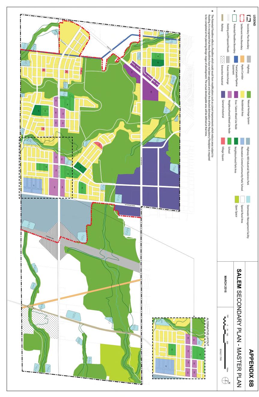
80
AMENDMENT NO. TO THE CITY OF BARRIE OFFICIAL PLAN HEWITT S SECONDARY PLAN
 AMENDMENT NO. TO THE CITY OF BARRIE OFFICIAL PLAN HEWITT S SECONDARY PLAN OFFICIAL PLAN FOR THE CITY OF BARRIE Amendment No. Amendment No. to the was prepared by the Barrie General Committee and was recommended
AMENDMENT NO. 30 TO THE OFFICIAL PLAN OF THE TOWN OF MILTON
 AMENDMENT NO. 30 TO THE OFFICIAL PLAN OF THE TOWN OF MILTON Subject: Boyne Survey Secondary Plan and Related Official Plan Amendments The following text and schedules constitute Amendment No. 30 to the
The West Vaughan Employment Area Secondary Plan Policies
 Part 2: The West Vaughan Employment Area Secondary Plan Policies 2.1 General Policies It is the policy of Council: 2.1.1. That the West Vaughan Employment Area (the WVEA), identified on Schedule 1, will
11.4 Highway 400 North Employment Lands Secondary Plan APPROVED BY THE ONTARIO MUNICIPAL BOARD ON NOVEMBER 21, 2011
 11.4 Highway 400 North Employment Lands Secondary Plan APPROVED BY THE ONTARIO MUNICIPAL BOARD ON NOVEMBER 21, 2011 11.4.1 General 11.4.1.1. as approved by the Ontario Municipal Board on November 21, 2011,
BRAMPTON FLOWERTOWN SECONDARY PLAN Area 6
 BRAMPTON FLOWERTOWN SECONDARY PLAN Area 6 October 2018 EXPLANATORY NOTES Brampton Flowertown Secondary Plan Area 6 General i. Secondary plans form part of the Official Plan and are to be read in conjunction
13. VANDORF-PRESTON LAKE SECONDARY PLAN 13.1 INTRODUCTION
 13. VANDORF-PRESTON LAKE SECONDARY PLAN 13.1.1 Purpose 13.1 INTRODUCTION The Vandorf-Preston Lake Secondary Plan establishes the principles, objectives and general policies, as well as specific strategies
Official Plan Amendment Number 272
 Official Plan Amendment Number 272 to the Official Plan of The Corporation of the Town of Oakville NORTH OAKVILLE EAST SECONDARY PLAN Town of Oakville Official Plan Amendment 272 Part 1, Constitutional
The lands identified as Residential Areas on Schedule A1, Urban Structure, represent the areas that provide for stable residential communities.
 Livable Oakville Part D: Land Use Designations and Policies 11. RESIDENTIAL 11.1 General The lands identified as Residential Areas on Schedule A1, Urban Structure, represent the areas that provide for
A Growing Community Rural Settlement Areas
 Town of Huntsville Official Plan Review - POLICY BACKGROUND PAPER A Growing Community Rural Settlement Areas BACKGROUND: In addition to the fully municipally-serviced Urban Settlement Area and the Hidden
North Oakville East Parks Facilities Distribution Plan. November, 2009
 North Oakville East November, 2009 POLICY CONTEXT 1) Purpose a) The purpose of this document is to be a guide for the location, configuration, design and development of the parks system for the North Oakville
and services The protection and conservation of environmentally significant and sensitive natural heritage features and functions.
 6. Land Use 6.0 Preamble A healthy and livable city is one in which people can enjoy a vibrant economy and a sustainable healthy environment in safe, caring and diverse neighbourhoods. In order to ensure
11.4 Highway 400 North Employment Lands Secondary Plan
 11.4 Highway 400 North Employment Lands Secondary Plan APPROVED BY THE ONTARIO MUNICIPAL BOARD ON NOVEMBER 21, 2011 11.4.1 General 11.4.1.1. The following policies and Schedules A - I form Official Plan
Complete Neighbourhood Guidelines Review Tool
 Complete Neighbourhood Guidelines Review Tool Prepared By: City of Regina Planning Department October 2014 Page 1 of 14 Community Development Review Checklist for Secondary Plans and Concept Plans The
Mark-up of the effect of the proposed Bronte Village Growth Area OPA No.18 on the text of section 24, Bronte Village, of the Livable Oakville Plan
 Mark-up of the effect of the proposed Bronte Village Growth Area OPA No.18 on the text of section 24, Bronte Village, of the Livable Oakville Plan Notes: This document is provided for information purposes
CONTENTS 8.0 LAND USE 8.1 GENERAL LAND USE 8.2 RESIDENTIAL 8.3 MIXED USE 8.4 COMMERCIAL 8.5 EMPLOYMENT LANDS
 8-2 Land Use 8.0 LAND USE CONTENTS 8.1 GENERAL LAND USE 8.1.1 Uses provided for in all Land Use Designations 8.1.2 Uses prohibited in Hazardous Lands, Hazardous Sites and Special Policy Areas 8.1.3 Uses
FORMER CANADIAN FORCES BASE (CFB) ROCKCLIFFE SECONDARY PLAN. Official Plan Amendment XX to the Official Plan for the City of Ottawa
 ROCKCLIFFE SECONDARY PLAN. Official Plan Amendment XX to the Official Plan for the City of Ottawa") FORMER CANADIAN FORCES BASE (CFB) ROCKCLIFFE SECONDARY PLAN Official Plan Amendment XX to the Official Plan for the City of Ottawa 1 INDEX THE STATEMENT OF COMPONENTS PART A THE PREAMBLE PAGE Purpose...
FORMER CANADIAN FORCES BASE (CFB) ROCKCLIFFE SECONDARY PLAN Official Plan Amendment XX to the Official Plan for the City of Ottawa 1 INDEX THE STATEMENT OF COMPONENTS PART A THE PREAMBLE PAGE Purpose...
PORT WHITBY COMMUNITY
 PORT WHITBY COMMUNITY SECONDARY PLAN UPDATE COMMUNITY IMPROVEMENT PLAN URBAN DESIGN GUIDELINES September 2015 DRAFT PROPOSED AMENDMENT NUMBER # to the Whitby Official Plan PURPOSE: The intent of this Amendment
11. BALLANTRAE-MUSSELMAN LAKE AND ENVIRONS SECONDARY PLAN
 11. BALLANTRAE-MUSSELMAN LAKE AND ENVIRONS SECONDARY PLAN 11.1 PURPOSE The Ballantrae-Musselman Lake and Environs Secondary Plan Area includes two small existing settlement areas, Ballantrae and Musselman
DAVENPORT VILLAGE SECONDARY PLAN
 27 DAVENPORT VILLAGE SECONDARY PLAN 27. DAVENPORT VILLAGE SECONDARY PLAN 1. VISION FOR THE DAVENPORT VILLAGE SECONDARY PLAN Davenport Village, municipally known as 830, 940, 980 and 1100 Lansdowne Avenue,
OFFICIAL PLAN FOR THE TOWN OF NEW TECUMSETH
 OFFICIAL PLAN FOR THE TOWN OF NEW TECUMSETH Approved by Simcoe County- March 10, 2010 TABLE OF CONTENTS PAGE# 1.0 TITLE AND COMPONENTS... 5 2.0 INTRODUCTION... 6 2.1 Purpose... 6 2.2 Organization of the
OFFICE CONSOLIDATION SECONDARY PLAN AREA 22 THE BRAMALEA SOUTH INDUSTRIAL SECONDARY PLAN
 OFFICE CONSOLIDATION SECONDARY PLAN AREA 22 THE BRAMALEA SOUTH INDUSTRIAL SECONDARY PLAN November 2010 EXPLANATORY NOTES (Secondary Plan Area 22) General (pertaining to all secondary plan office consolidations)
DRAFT Northeast Quadrant of Kipling Avenue and Highway 7 DRAFT AUGUST 29, Goals Land Use. The goals of this Plan are to:
 AUGUST 29, 2017 12.15 Northeast Quadrant of Kipling Avenue and Highway 7 12.15.1 Goals 12.15.2 Land Use The goals of this Plan are to: 12.15.2.1 General Provisions: a) Ensure the development of a compact
Sustainable Growth. Sustainable Growth
 2 Sustainable Growth Sustainable Growth SUSTAINABLE GROWTH 2.1 COMMUNITY VISION... 2-5 2.2 THE CITY SYSTEM... 2-7 2.2.1 AREAS... 2-7 2.2.2 CITY-WIDE SYSTEMS... 2-8 2.2.3 PROVINCIAL PLAN BOUNDARIES AND
3-2 Environmental Systems
 3-2 Environmental Systems 3.0 ENVIRONMENTAL SYSTEMS CONTENTS 3.1 GREENWAY SYSTEM 3.1.1 General Policies 3.1.2 Natural Heritage Network 3.1.3 Natural Heritage Network Enhancement Lands 3.1.4 Rouge Watershed
6 Growth Management Challenges and Opportunities
 6 Growth Management Challenges and Opportunities The Town has established a goal of attaining a 50% participation rate with respect to employment opportunities versus residential population. The Town s
HURON COMMUNITY PLAN
 CITY OF KITCHENER DEPARTMENT OF DEVELOPMENT AND TECHNICAL SERVICES PD 94/7 HURON COMMUNITY PLAN Recommended by Planning and Economic Development Committee: October 31, 1994 Adopted by Kitchener City Council:
KING CITY COMMUNITY PLAN
 KING CITY COMMUNITY PLAN TOWNSHIP OF KING JANUARY 27, 2000 AMENDMENT NO. 54 to the OFFICIAL PLAN for the TOWNSHIP OF KING PLANNING AREA THE COMMUNITY PLAN TABLE OF CONTENTS PAGE PART 1 INTRODUCTION 1.1
THE GARDEN CITY PLAN. City of St. Catharines Official Plan. City of St. Catharines
 THE GARDEN CITY PLAN City of St. Catharines Official Plan City of St. Catharines August 2010 APPROVAL INFORMATION This Official Plan of the City of St. Catharines Planning Area, known as the Garden City
6 PORT SYDNEY SETTLEMENT AREA
 Section 6 Port Sydney Page 61 6 PORT SYDNEY SETTLEMENT AREA 6.1 Basis and Principles Village of Port Sydney Waterfront Community Existing Services 6.1.1 Port Sydney is an historic settlement that has developed
Environment and Sustainability. Environment and Sustainability
 4 Environment and Sustainability Environment and Sustainability ENVIRONMENT AND SUSTAINABILITY 4.1 CLIMATE CHANGE AND AIR QUALITY... 4-5 4.1.1 OBJECTIVES... 4-6 4.1.2 POLICIES... 4-6 4.2 NATURAL HERITAGE
COMMUNITY, DISTRICT AND SPECIAL STUDY AREA PLANS
 1.8 RIVER OAKS COMMUNITY - FIGURE "O" a) Background The River Oaks Community is bounded by Dundas Street on the north; the Sixteen Mile Creek on the west; Upper Middle Road on the south; and Trafalgar
Table 8-4: Road Classification Local Roads, second table, of Chapter 8 Create a Multi-Modal City, be amended by adding the following:
 1 Port Street East Official Plan Amendment APPENDIX 3 Amendments to Mississauga Official Plan Table 8-4: Road Classification Local Roads, second table, of Chapter 8 Create a Multi-Modal City, be amended
Township of Adjala-Tosorontio Official Plan Review. Natural Heritage
 Township of Adjala-Tosorontio Official Plan Review 13 Natural Heritage Introduction What is an Official Plan? An official plan is a municipal policy document which sets out the community s vision and strategies
NEW REGIONAL OFFICIAL PLAN HIGH LEVEL PROCESS & FRAMEWORK
 NEW REGIONAL OFFICIAL PLAN HIGH LEVEL PROCESS & FRAMEWORK Why A New Official Plan Originally the role of Regionally Planning and content of Regional Official Plan (1970s) primarily focused on protecting
C.10 Boyne Survey Secondary Plan
 C.10 Boyne Survey Secondary Plan SECONDARY PLAN July 2017 C.10 BOYNE SURVEY SECONDARY PLAN C.10.1 C.10.1.1 GENERAL PURPOSE The purpose of the Boyne Survey Secondary Plan is to establish a more detailed
THE CITY OF VAUGHAN BY-LAW BY-LAW NUMBER A By-law to adopt Amendment Number 1 to the Official Plan of the Vaughan Planning Area.
 THE CITY OF VAUGHAN BY-LAW BY-LAW NUMBER 015-2014 A By-law to adopt Amendment Number 1 to the Official Plan of the Vaughan Planning Area. NOW THEREFORE the Council of the Corporation of the City of Vaughan
OFFICE CONSOLIDATION SECONDARY PLAN AREA 48. CHAPTER 48(b) COUNTRYSIDE VILLAGES SECONDARY PLAN
 COUNTRYSIDE VILLAGES SECONDARY PLAN") OFFICE CONSOLIDATION SECONDARY PLAN AREA 48 CHAPTER 48(b) COUNTRYSIDE VILLAGES SECONDARY PLAN October 2016 TABLE OF CONTENTS (Part II, Chapter 48(b)) Purpose. 1.0 Location 2.0 Effect of this Chapter and
OFFICE CONSOLIDATION SECONDARY PLAN AREA 48 CHAPTER 48(b) COUNTRYSIDE VILLAGES SECONDARY PLAN October 2016 TABLE OF CONTENTS (Part II, Chapter 48(b)) Purpose. 1.0 Location 2.0 Effect of this Chapter and
SECTION E. Realizing the Plan
 SECTION E Realizing the Plan 60 DESIGN REGINA - OFFICIAL COMMUNITY PLAN SECTION E Realizing the Plan Design Regina has been an ambitious plan-making exercise, with a high level of community, stakeholder,
AMENDMENT NO. 42 TO THE OFFICIAL PLAN OF THE TOWN OF GRIMSBY
 AMENDMENT NO. 42 TO THE OFFICIAL PLAN OF THE TOWN OF GRIMSBY INITIATED BY TOWN OF GRIMSBY TABLE OF CONTENTS PART I: THE CERTIFICATION Certification Page Adopting By-law of the Town of Grimsby PART II:
3 Development Process 3.1 Stage One page Stage Two page Stage Three page CENTRAL PICKERING DEVELOPMENT PLAN
 3 Development Process 3.1 Stage One page 24 3.2 Stage Two page 25 3.3 Stage Three page 28 22 CENTRAL PICKERING DEVELOPMENT PLAN The Central Pickering Development Plan establishes the key elements of new
THE CITY OF WINNIPEG BY-LAW NO. 4/2013. A By-law of THE CITY OF WINNIPEG to adopt a Secondary Plan for the Waverley West Southwest Neighbourhood.
 THE CITY OF WINNIPEG BY-LAW NO. 4/2013 A By-law of THE CITY OF WINNIPEG to adopt a Secondary Plan for the Waverley West Southwest Neighbourhood. THE CITY OF WINNIPEG, in Council assembled, enacts as follows:
OFFICE CONSOLIDATION CHAPTER 47 HIGHWAY 427 INDUSTRIAL SECONDARY PLAN
 OFFICE CONSOLIDATION CHAPTER 47 HIGHWAY 427 INDUSTRIAL SECONDARY PLAN NOTE: This Secondary Plan is partially in effect. Highlighted sections are under appeal. August 2017 1 EXPLANATORY NOTE Office Consolidation
The protection of the agricultural resources of the Province;
 PART II INTRODUCTION An Official Plan is a policy document, which is intended to serve as the basis for making land use decisions and managing change in any municipality in Ontario. According to the Planning
Portage Parkway Environmental Assessment Public Information Centre No. 1
 City of Vaughan Portage Parkway Environmental Assessment Public Information Centre No. 1 November 25, 2015 Welcome to the Public Information Centre This first Public Information Centre (PIC) introduces
AGINCOURT SECONDARY PLAN
 1 AGINCOURT SECONDARY PLAN 1. AGINCOURT SECONDARY PLAN The following policies and principles apply to the area herein referred to as Agincourt, as outlined on Map 1-1. 1. GENERAL POLICIES 1.1 This Secondary
MORNINGSIDE HEIGHTS COMMUNITY SECONDARY PLAN
 3 MORNINGSIDE HEIGHTS COMMUNITY SECONDARY PLAN 3. MORNINGSIDE HEIGHTS COMMUNITY SECONDARY PLAN The following policies and principles apply to the area referred to as the Morningside Heights Community,
Report to: Development Services Committee Report Date: September 11, 2017
 ~RKHAM Report to: Development Services Committee Report Date: September 11, 2017 SUBJECT: PREPARED BY: Conceptual Master Plan for the Future Urban Area - Community Structure Plan and Key Policy Direction
URBAN DESIGN BRIEF URBAN DESIGN BRIEF 721 FRANKLIN BLVD, CAMBRIDGE August 2018
 URBAN DESIGN BRIEF URBAN DESIGN BRIEF 721 FRANKLIN BLVD, CAMBRIDGE August 2018 DESIGN BRIEF CONTENTS PART A 1.0 INTRODUCTION 2.0 DESCRIPTION & ANALYSIS OF SITE CONTEXT 3.0 DESIGN CONSTRAINTS AND OPPORTUNITIES
THE CORPORATION OF THE TOWN OF OAKVILLE BY-LAW NUMBER
 THE CORPORATION OF THE TOWN OF OAKVILLE BY-LAW NUMBER 2017-120 A by-law to adopt an amendment to the Livable Oakville Plan, Official Plan Amendment Number 20 (Downtown Oakville Growth Area) WHEREAS the
THE STRUCTURE OF THE PLAN...
 TABLE OF CONTENTS THE STRUCTURE OF THE PLAN... 1 A1 THE COMMUNITY VISION... 3 A2 GOALS AND OBJECTIVES... 3 A2.1 THE NATURAL ENVIRONMENT... 3 A2.1.1 Goal... 3 A2.1.2 Objectives... 3 A2.2 GROWTH AND SETTLEMENT...
TERRESTRIAL NATURAL HERITAGE SYSTEM STRATEGY APPENDIX F: MODEL POLICIES FOR THE IMPLEMENTATION OF THE TARGET TERRESTRIAL NATURAL HERITAGE SYSTEM
 TERRESTRIAL NATURAL HERITAGE SYSTEM STRATEGY APPENDIX F: MODEL POLICIES FOR THE IMPLEMENTATION OF THE TARGET TERRESTRIAL NATURAL HERITAGE SYSTEM C H A P T E R 1 M O D E L P O L I C I E S F O R I M P L
OFFICIAL PLAN of the TOWN of BRADFORD WEST GWILLIMBURY Adopted February 15, 2000
 OFFICIAL PLAN of the TOWN of BRADFORD WEST GWILLIMBURY Adopted February 15, 2000 OFFICE CONSOLIDATION (Consolidated to October 1, 2002) J. Ross Raymond & Associates Ltd Gravenhurst, Ontario Building Community
1.0 PLANNING MARKHAM S FUTURE CONTENTS
 1-1 Planning Markham s Future 1.0 PLANNING MARKHAM S FUTURE CONTENTS 1.1 THE PURPOSE OF THE OFFICIAL PLAN 1.2 THE MARKHAM CONTEXT 1.3 THE REGULATORY CONTEXT 1.3.1 Province of Ontario 1.3.2 York Region
Official Plan Review
 Official Plan Review Summary Report - The Built Environment August 2014 Part 1: Introduction Planning for a healthy, prosperous and sustainable community is an important goal for our municipality. From
Leonard s Beach Secondary Plan (Alcona North) Official Plan Amendment
 Official Plan Amendment") Leonard s Beach Secondary Plan (Alcona North) Official Plan Amendment Public Meeting Presentation August 14, 2013 Note: This document is for presentation purposes only. Please see Staff Report DSR-135-13
Leonard s Beach Secondary Plan (Alcona North) Official Plan Amendment Public Meeting Presentation August 14, 2013 Note: This document is for presentation purposes only. Please see Staff Report DSR-135-13
Uptown Rideau Street Secondary Plan [Amendment #166, January 12, 2016]
![Uptown Rideau Street Secondary Plan [Amendment #166, January 12, 2016]](/thumbs/76/73760497.jpg "Uptown Rideau Street Secondary Plan [Amendment #166, January 12, 2016]") [Amendment #166, January 12, 2016] The policies of this Secondary Plan are in effect, save and except for the property at 560 Rideau Street, for which there remains a site specific appeal to this Secondary
[Amendment #166, January 12, 2016] The policies of this Secondary Plan are in effect, save and except for the property at 560 Rideau Street, for which there remains a site specific appeal to this Secondary
a) recognize agriculture as the primary activity and land use; b) maintain and preserve the agricultural resource base of the Town;
 recognize agriculture as the primary activity and land use; b) maintain and preserve the agricultural resource base of the Town;") PA RT E E1 AGRICULTURAL AREA E1.1 OBJECTIVES It is the objective of this designation to: a) recognize agriculture as the primary activity and land use; b) maintain and preserve the agricultural resource
PA RT E E1 AGRICULTURAL AREA E1.1 OBJECTIVES It is the objective of this designation to: a) recognize agriculture as the primary activity and land use; b) maintain and preserve the agricultural resource
CONTENTS 6.1 URBAN DESIGN
 6-2 Urban Design and Sustainable Development 6.0 URBAN DESIGN AND SUSTAINABLE DEVELOPMENT CONTENTS 6.1 URBAN DESIGN 6.1.1 General Policies 6.1.2 The Public Realm 6.1.3 Streets and Blocks 6.1.4 Streetscapes
URBAN DESIGN BRIEF. 2136&2148 Trafalgar Road. Town of Oakville
 URBAN DESIGN BRIEF 2136&2148 Trafalgar Road Town of Oakville Prepared By: METROPOLITAN CONSULTING INC For 2500674 Ontario Inc November 2016 TABLE OF CONTENTS Page No. 1.0 Introduction/Description of Subject
CONTENTS 2.0 A FRAMEWORK FOR SUSTAINABLE GROWTH 2.1 MANAGING SUSTAINABLE GROWTH THE VISION TO GOALS AND OBJECTIVES 2.3 MARKHAM STRUCTURE
 2 A Framework for Sustainable Growth 2.0 A FRAMEWORK FOR SUSTAINABLE GROWTH CONTENTS 2.1 MANAGING SUSTAINABLE GROWTH THE VISION TO 2031 2.2 GOALS AND OBJECTIVES 2.2.1 Protecting the Natural Environment
Bressa Developments Limited. Planning Justification Report. Revised Draft Plan of Subdivision and Zoning By-Law Amendment
 Bressa Developments Limited Revised Draft Plan of Subdivision and Zoning By-Law Amendment Planning Justification Report Part of Lots 7 & 8 Concession 1, North of Dundas Street Town of Oakville September,
THE CORPORATION OF THE TOWN OF OAKVILLE BY-LAW NUMBER
 THE CORPORATION OF THE TOWN OF OAKVILLE BY-LAW NUMBER 20012-08530 A by-law to adopt an amendment to the Official Plan of the Oakville Planning Area (Official Plan Amendment 198) Land North of Dundas Street.
ARTICLE 6: Special and Planned Development Districts
 ARTICLE 6: Special and Planned Development Districts 6-10 Traditional Neighborhood Development (TND) District 6-10.10 Purpose and Intent The Traditional Neighborhood Development (TND) District provides
Municipal Development Plan Update Urban Service Area and Hamlets
 ENCLOSURE 1 Municipal Development Plan Update Urban Service Area and Hamlets Priorities Committee January 24, 2017 MUNICIPAL DEVELOPMENT PLAN UPDATE SHAPING OUR FUTURE MDP Update - Agenda MDP Update Public
APPENDIX K WINDSOR OFFICIAL PLAN
 CEAA ENVIRONMENTAL ENVIRONMENTAL IMPACT ASSESSMENT AMBASSADOR BRIDGE ENHANCEMENT PROJECT Replacement Span and Plaza Expansion APPENDIX K WINDSOR OFFICIAL PLAN Avalon Consulting Professionals of Ontario,
TOWN OF BRUDERHEIM Report to the capital region board
 TOWN OF BRUDERHEIM Report to the capital region board Introduction to the Town of Bruderheim Municipal Development Plan amendment and Relation to the CRB Evaluation Criteria 02 march 2017 1 Introduction
AMENDMENT NUMBER ## TO THE VAUGHAN OFFICIAL PLAN 2010 FOR THE VAUGHAN PLANNING AREA
 AMENDMENT NUMBER ## TO THE VAUGHAN OFFICIAL PLAN 2010 FOR THE VAUGHAN PLANNING AREA The following text and schedules "1", 2, 3, 4 and 5 constitute Amendment Number ## to the Official Plan of the Vaughan
QUEEN-RIVER SECONDARY PLAN
 34 QUEEN-RIVER SECONDARY PLAN 34. QUEEN RIVER SECONDARY PLAN 1. INTRODUCTION The Queen-River area is approximately 6.4 hectares and is located at the eastern edge of the Downtown as shown on Map 34-1.
Master Environmental Servicing Plan & Secondary Plan
 East Side Lands Stage 2 1 Master Environmental Servicing Plan & Secondary Plan Public Information Centre #1 June 16, 2016 Welcome! Today s Agenda Please sign in at the front desk. 5:30 pm 6:30 pm: Open
OFFICIAL PLAN OF THE TOWN OF WASAGA BEACH
 OFFICIAL PLAN OF THE TOWN OF WASAGA BEACH Adopted September 9, 2003 Approved by County of Simcoe June 22, 2004 OFFICE CONSOLIDATION FEBRUARY 29, 2016 (Includes Official Plan Amendment Nos. 1 through 38)
NOTE: PLEASE REFER TO CITY PLAN FOR ADDITIONAL CITY-WIDE POLICIES WHICH APPLY TO THIS DISTRICT.
 NOTE: THE POLICIES IN THIS DOCUMENT ARE SPECIFIC TO THE SHERIDAN RESIDENTIAL PLANNING DISTRICT OF, AND MUST BE READ IN CONJUNCTION WITH ALL THE POLICIES OF CITY PLAN PLEASE REFER TO FOR ADDITIONAL CITY-WIDE
*** DRAFT 2 FOR PUBLIC REVIEW ***
 6.7 The area is generally bounded by the Red Hill Valley Parkway to the west, Lake Avenue to the east, the Queen Elizabeth Way (QEW) to the north, and by the properties just south of Queenston Road to
Secondary Plan for the Samac Community
 Secondary Plan for the Samac Community (Section 6.2 of the Official Plan of the former Planning Area of the City of Oshawa) Office Consolidation Copy of the Secondary Plan for the Samac Community This
Dufferin Street and Centre Street Area Specific Policies
 12.XX 12.XX.1 12.XX.1.1. 12.XX.2. 12.XX.2.1. 12.XX.2.2 Dufferin Street and Centre Street Area Specific Policies Goals The goal of this Plan is to provide the necessary land use and development policies
[PLANNING RATIONALE] For Site Plan Control and Lifting of Holding Zone By-Law 101 Champagne Avenue. May 23, 2014
![[PLANNING RATIONALE] For Site Plan Control and Lifting of Holding Zone By-Law 101 Champagne Avenue. May 23, 2014](/thumbs/75/71599615.jpg "[PLANNING RATIONALE] For Site Plan Control and Lifting of Holding Zone By-Law 101 Champagne Avenue. May 23, 2014") [PLANNING RATIONALE] For Site Plan Control and Lifting of Holding Zone By-Law 101 Champagne Avenue May 23, 2014 Contents 1.0 Introduction... 2 2.0 Site Context... 2 2.1 Adjacent Uses... 2 Figure 1: Site
[PLANNING RATIONALE] For Site Plan Control and Lifting of Holding Zone By-Law 101 Champagne Avenue May 23, 2014 Contents 1.0 Introduction... 2 2.0 Site Context... 2 2.1 Adjacent Uses... 2 Figure 1: Site
Welcome. Walk Around. Talk to Us. Write Down Your Comments
 Welcome This is an information meeting introducing the applications for proposed redevelopment of the Yorkdale Shopping Centre site at 3401 Dufferin Street and 1 Yorkdale Road over the next 20+ years,
MAYFIELD WEST SECONDARY PLAN PHASE 2
 MAYFIELD WEST SECONDARY PLAN PHASE 2 Public Open House #3 February 25, 2010 Draft Preferred Land Use Scenario TOWN OF CALEDON PLANNING & DEVELOPMENT DEPARTMENT Open House Agenda TOWN OF CALEDON 1. Welcome
2.0 A FRAMEWORK FOR SUSTAINABLE GROWTH CONTENTS
 2-2 A Framework for Sustainable Growth 2.0 A FRAMEWORK FOR SUSTAINABLE GROWTH CONTENTS 2.1 MANAGING SUSTAINABLE GROWTH THE VISION TO 2031 2.2 GOALS AND OBJECTIVES 2.2.1 Protecting the Natural Environment
Tremaine Dundas Secondary Plan (Draft May 2017)
") PB-52-17 Appendix A Tremaine Dundas Secondary Plan (Draft May 2017) Page 2 Tremaine Dundas Secondary Plan (Draft May 2017) This page has been left blank intentionally Page 3 Tremaine Dundas Secondary Plan
PB-52-17 Appendix A Tremaine Dundas Secondary Plan (Draft May 2017) Page 2 Tremaine Dundas Secondary Plan (Draft May 2017) This page has been left blank intentionally Page 3 Tremaine Dundas Secondary Plan
Planning for the Future Urban Area. in north Markham. Update. Development Services Committee. December 9, De Development Services Committee
 Planning for the in north Markham 1 Update De December 9, 2014 Overview - Growth Management Strategy and new Official Plan 2014 Status - Official Plan 2014 and ROPA3 Update - Planning for the Future Urban
MAYFIELD WEST SECONDARY PLAN PHASE 2
 MAYFIELD WEST SECONDARY PLAN PHASE 2 Council Information Workshop February 16, 2010 Draft Preferred Land Use Plan TOWN OF CALEDON PLANNING & DEVELOPMENT DEPARTMENT Workshop Agenda TOWN OF CALEDON 1. Welcome
Brampton. Secondary Plan. Review. Bram West. A New Direction in Planning & Public Consultation
 Brampton Bram West Secondary Plan Review A New Direction in Planning & Public Consultation Introduction The Bram West Secondary Plan Review offers an important opportunity for the community to define a
Niagara Region Official Plan. Table of Contents
 Niagara Region Official Plan Table of Contents This page has been intentionally left blank. Table of Contents ii Niagara Region Official Plan Niagara Region Official Plan - Table of Contents Chapter 1
Background Summary Report
 Background Summary Report May 2014 Submitted by Macaulay Shiomi Howson Ltd. In association with AMEC MMM Group Brook McIlroy Inc. Hemson Consulting Ltd. Table of Contents 1. Introduction... 1 2. Why is
MILTON HEIGHTS COMMUNITY January 2006 Revised February 2015 Revised November 2015
 REVISED DRAFT MILTON HEIGHTS COMMUNITY January 2006 Revised February 2015 Revised November 2015 Urban Design Guidelines Milton Heights Landowners Group This page has been intentionally left blank. Contents
6.0 Land Use Policies for Rural Settlements. 6.1 Rural Settlement Strategy
 6.0 Land Use Policies for Rural Settlements 6.1 Rural Settlement Strategy INTRODUCTION AMENDMENT NO. 131 PURPOSE Designated rural settlements comprise Rural Clusters, Villages and Serviced Villages as
YONGE STEELES CORRIDOR SECONDARY PLAN. Young + Wright / IBI Group Architects Dillon Consulting Ltd. GHK International (Canada) Ltd.
 Ltd.") PART A: PREAMBLE 1.0 PURPOSE The purpose of this Secondary Plan is to provide a development framework for intensification of the Yonge/ Steeles corridor including the north side of Steeles Avenue West
PART A: PREAMBLE 1.0 PURPOSE The purpose of this Secondary Plan is to provide a development framework for intensification of the Yonge/ Steeles corridor including the north side of Steeles Avenue West
APPENDIX 1. Long Range Planning and the Vision for the Future of the Town
 APPENDIX 1 Long Range Planning and the Vision for the Future of the Town Long Range Planning and the Vision for the Future of the Town Given the requirements of the Provincial Policy Statement and Growth
9 CITY OF VAUGHAN OFFICIAL PLAN AMENDMENT NO BOCA EAST INVESTMENTS LIMITED
 9 CITY OF VAUGHAN OFFICIAL PLAN AMENDMENT NO. 631 - BOCA EAST INVESTMENTS LIMITED The Planning and Economic Development Committee recommends the adoption of the recommendations contained in the following
2.0 A FRAMEWORK FOR SUSTAINABLE GROWTH CONTENTS
 2-2 A Framework for Sustainable Growth 2.0 A FRAMEWORK FOR SUSTAINABLE GROWTH CONTENTS 2.1 MANAGING SUSTAINABLE GROWTH THE VISION TO 2031 2.2 GOALS AND OBJECTIVES 2.2.1 Protecting the Natural Environment
This page has been intentionally left blank.
 This page has been intentionally left blank. Chapter 3 3-2 3. Employment 3.A Niagara Economic Gateway 3.A.1 General The Niagara Economic Gateway comprises: a) The Gateway Economic Zone which includes all
Clairtrell Area Context Plan
 Clairtrell Area Context Plan March 2005 Urban Development Services City Planning Contents 1. Introduction... 4 2. Development Structure... 6 2.1 Streets... 7 2.1.1 Sheppard Avenue and Bayview Avenue...
TOWN OF SAUGEEN SHORES OFFICIAL PLAN
 TOWN OF SAUGEEN SHORES OFFICIAL PLAN Adopted by Council: December 10, 2012 Approved by County of Bruce: March 26, 2014 (Office Consolidation September 2014) Town of Saugeen Shores 1 Table of Contents Saugeen
COMMUNITY DESIGN. GOAL: Create livable and attractive communities. Intent
 COMMUNITY DESIGN Intent An attractive, well-designed County will attract quality development, instill civic pride, improve the visual character of the community, and create a strong, positive image for
TABLE OF CONTENTS INTRODUCTION PLAN CONCEPT... 3
 TABLE OF CONTENTS BY-LAW NO. Z-1 INTRODUCTION... 1 1.0 PLAN CONCEPT... 3 1.1 Mission... 3 1.2 A Future Vision for Fredericton... 3 1.3 Growth Strategy Goals... 5 National Context... 5 Provincial Context...
McKay Road Interchange and Salem / Lockhart Crossing
 McKay Road Interchange and Salem / Lockhart Crossing The McKay Road Interchange Class EA has two components: 1. A new MacKay Road Interchange at Highway 400; and 2. A new bridge crossing of Highway 400
Draft Urban Hamilton Official Plan. Amendment No. XX
 1 of 75 The following text, together with: Draft Appendix A Appendix B Volume 1, Schedule E-1 Urban Land Use Designations Appendix C Volume 1, Appendix A Parks Classification Map Appendix D Volume 1, Appendix
DRAFT. & Secondary Plan Study. East Side Lands- Stage 2. Planning Rationale Report
 East Side Lands- Stage 2 Master Environmental SERVICING Plan & Secondary Plan Study Planning Rationale Report Draft April 24, 2018 QUALITY MANAGEMENT Issue/Revision First Issue Revision 1 Revision 2 Remarks
Report to: Development Services Committee Report Date: April 24, 2017
 SUBJECT: Cornell Rouge National Urban Park Gateway - Report on Design Charrette and Next Steps PREPARED BY: Lilli Duoba, MES, MCIP, RPP, Manager, Natural Heritage (ext. 7925) REVIEWED BY: Marg Wouters,
NEWMARKET URBAN CENTRES SECONDARY PLAN
 Official Plan Amendment #10 to the Town of Newmarket Official Plan NEWMARKET URBAN CENTRES SECONDARY PLAN CONSOLIDATED WITH OMB APPEALS Adopted by the Council for the Corporation of the Town of Newmarket: