APPENDIX D. Potential Snow Disposal Sites
|
|
|
- Louisa Mason
- 5 years ago
- Views:
Transcription
1 APPENDIX D Potential Snow Disposal Sites
2


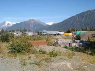
3 Site 1, Auke Bay Elementary Map Page 2 Zoning map/wetlands/creek Site Photos
4 Site 1, Auke Bay Elementary Map Page 2 Ownership: CBJ Size: acres Zoning: D3/GC (Low Density Residential/General Commercial) Current Use: Contains schools, undeveloped portion used for recreation Adjacent Uses: Elementary School to the east; RV Park, Church, Residential to the south; Undeveloped to the west and north Access: None currently, would require new access that would likely be in proximity to school or residences Environmental Issues: Possibly some wetlands on-site Other considerations: The topography on this site is steeper than most other sites evaluated, resulting in a need for extensive site work and drainage design. New access would need to be constructed and would likely be adjacent to residential or school uses. The large size of the site would provide room for buffering of the site itself from adjacent uses. The site is located the farthest away from the Mendenhall Valley main snow hauling areas, resulting in a significant increase in hauling costs and a decrease in snow removal efficiency. Recommendation: Do not carry forward


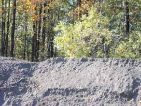
5 Site 2, Montana Creek Pit Map Page 3 Zoning map/wetlands Site Photos
6 Site 2, Montana Creek Pit Map Page 3 Ownership: Private, Assessed Value <$30K/acre Size: acres Zoning: D1/D3 (Low Density Residential) Current Use: Gravel Pit Adjacent Uses: Residential to southeast; Recreational use to northwest; Undeveloped to northeast and southwest Access: Existing access is good Environmental Issues: Developed site, pits are filled with water Other considerations: This gravel pit has large excavated areas that are filled with water, could require significant fill for use as a land disposal site. Nearby residential areas have raised concerns with drainage in the past. The access road is on the edge of a residential area. The site would result in a significant increase in hauling costs and a decrease in snow removal efficiency. Recommendation: Do not carry forward


7 Site 3, Wren Dr / Steelhead St Map Page 4 Zoning map/wetlands Site Photos
8 Site 3, Wren Dr / Steelhead St Map Page 4 Ownership: CBJ Size: 4.49 acres Zoning: D3 (Low Density Residential) Current Use: Conservation area adjacent to Class A wetlands Adjacent Uses: Residential on north, east and west; Undeveloped on south Access: Access on local residential road Environmental Issues: Wetlands Other considerations: This site is marginal in terms of size. The location is poor as it lies at the end of a residential road between developed residential areas. It would increase haul distance and decrease snow removal efficiency. There are wetlands on site and it is adjacent to a preserved area of Class A wetlands. Recommendation: Do not carry forward


9 Site 4, Riverside Church Map Page 4 Zoning map/wetlands/river Site Photos
10 Site 4, Riverside Church Map Page 4 Ownership: Private, Assessed value >$145,000/acre Size: 2.65 acres Zoning: D15 (Multi-family Residential) Current Use: Contains schools, undeveloped portion used for recreation Adjacent Uses: Residential to north, east and south; River to west Access: Access from Riverside Drive through residential area Environmental Issues: Adjacent to Mendenhall River Other considerations: This site is smaller than desired. Access is through a residential area and residential uses are adjacent to the site on three sides and the size of the site limits the potential for any buffering. The site was used for snow disposal in the past and was closed due to the high nuisance impacts. The site would increase the haul distance somewhat and would likely decrease snow removal efficiency due to the access being through residential areas on lower speed roads. The site would need to be rezoned to allow a snow disposal site of over ½-acre. Recommendation: Do not carry forward


11 Site 5, Melvin Park Map Page 5 Zoning map/river Site Photos
12 Site 5, Melvin Park Map Page 5 Ownership: CBJ Size: 7.72 acres Zoning: D5 (Low Density Residential) Current Use: Recreation, ball fields Adjacent Uses: Residential to north, east and south; River to west Access: Access from Riverside Drive or Division Street through residential area Environmental Issues: Proximity to Mendenhall River Other considerations: Although this site meets the size criteria, there is little area outside the developed recreation areas. Access is through a residential area and residential uses are adjacent to the site on three sides. The site s use for recreation would be impacted by use for snow disposal. The site is located in an area that would reduce the haul distance slightly but would likely decrease snow removal efficiency due to the access being through residential areas on lower speed roads. The site would need to be rezoned to allow a snow disposal site of over ½-acre. Recommendation: Do not carry forward


13 Site 6, Thunder Mountain Map Page 6 Zoning map/wetlands/creeks Site Photos
14 Site 6, Thunder Mountain Map Page 6 Ownership: CBJ Size: acres Zoning: D15 (Low Density Residential) Current Use: Undeveloped Adjacent Uses: Residential to west and northwest; Undeveloped to south and east Access: None, access would need to be constructed through a residential area Environmental Issues: Headwater of Jordan Creek, Wetlands, potential avalanche risk Other considerations: This site is large enough to provide development flexibility to address buffering from residential uses and treatment design. Access would need to be constructed and would likely impact residential uses. The site is at the bottom of Thunder Mountain and near an avalanche hazard area. The site would decrease haul distance and has the potential to increase snow removal efficiency if good access were constructed. The site would need to be rezoned to allow a snow disposal site of over ½-acre. Recommendation: Do not carry forward


15 Site 7, Dimond Park Map Page 7 Zoning map/wetlands/river Site Photos
16 Site 7, Dimond Park Map Page 7 Ownership: CBJ Size: acres Zoning: D5 (Low Density Residential) Current Use: Contains schools, developed recreation areas, CBJ Parks Facility Adjacent Uses: Residential to north and east; School to south; River to west Access: Access from Riverside Drive through school area Environmental Issues: Adjacent to Mendenhall River Other considerations: Although this site is large, there is little area outside the developed recreation and school areas. Access is through the schools and/or recreation fields. The site s use for recreation and education would be impacted by use for snow disposal. The site is located in an area that would reduce the haul distance slightly but would likely decrease snow removal efficiency due to the access being through school areas. The site would need to be rezoned to allow a snow disposal site of over ½- acre. Recommendation: Do not carry forward


17 Site 8, Cinema Dr #1 Map Page 7 Zoning map/wetlands/creek Site Photos
18 Site 8, Cinema Dr #1 Map Page 7 Ownership: Private, Assessed Value >$55,000/acre Size: 20 acres Zoning: D15 (Multi-Family Residential) Current Use: Undeveloped Adjacent Uses: Residential to west, south and east; Commercial to north Access: No access currently; access could be constructed off Mendenhall Loop Road Environmental Issues: Duck Creek along eastern portion of parcel Other considerations: This site is large, providing an opportunity to buffer the site from nearby residential uses. Access would not be through residential areas. The site is located in an area that would reduce the haul distance and would likely increase snow removal efficiency. The site is privately owned and may have a higher and better use as medium-density housing. The site would need to be rezoned to allow a snow disposal site of over ½-acre. Recommendation: Carry forward as a potential disposal site for the Mendenhall Valley


19 Site 9, Cinema Dr #2 Map Page 7 Zoning map/wetlands/creek Site Photos
20 Site 9, Cinema Dr #2 Map Page 7 Ownership: Private, Assessed Value >$145,000/acre Size: 4.64 acres Zoning: D15 (Multi-family Residential) Current Use: Undeveloped Adjacent Uses: Commercial to north; Undeveloped to south; Residential to east and west Access: Access from Cinema Drive off Mendenhall Loop Road Environmental Issues: Duck Creek is on site Other considerations: This site is small, especially as it contains Duck Creek along the eastern edge. Access is not through residential area. The site is located in an area that would reduce the haul distance and would likely increase snow removal efficiency. If the site were combined with the parcel to the south, there would be sufficient access and room for buffering from residential uses and Duck Creek. The site would need to be rezoned to allow a snow disposal site of over ½-acre. Recommendation: Do not carry forward except possibly in combination with Cinema Drive #1


21 Site 10, Allison Pond Map Page 7 Zoning map/wetlands/creek Site Photos
22 Site 10, Allison Pond Map Page 7 Ownership: Private, Assessed Value >$85,000/acre Size: 1.7 acres Zoning: D15 (Multi-family Residential) Current Use: Undeveloped Adjacent Uses: Residential to north, northwest, east and south; Pond/wetlands to southwest Access: No existing access, access would need to be constructed through a residential area Environmental Issues: Adjacent to Duck Creek and Pond Other considerations: This site is very small and has no access. The site size would not accommodate any buffering from the adjacent residential uses. Access options are limited as developed residential parcels surround the site. The site is located in an area that would reduce the haul distance and could increase snow removal efficiency if access were constructed. The site would need to be rezoned to allow a snow disposal site of over ½-acre. Recommendation: Do not carry forward


23 Site 11, Nancy St Wetland Map Page 7 Zoning map/wetlands/creek Site Photos
24 Site 11, Nancy St Wetland Map Page 7 Ownership: Private, Assessed Value Not Available Size: 1.88 acres Zoning: D5 (Low Density Residential) Current Use: Recreational Trail Adjacent Uses: Residential to west, east and south; Pond/Wetland to north Access: Access from Nancy Street off Mendenhall Loop Road Environmental Issues: Conservation wetlands adjacent, Duck Creek adjacent Other considerations: This site is small with no potential to buffer the disposal site from residential uses or from open water. Access is not through residential area. The site is located in an area that would not significantly change haul distance or snow removal efficiency. The site would need to be rezoned to allow a snow disposal site of over ½-acre. Recommendation: Do not carry forward


25 Site 12, Industrial Boulevard #1 Map Page 8 Zoning map/wetlands/creek Site Photos
26 Site 12, Industrial Boulevard #1 Map Page 8 Ownership: CBJ Size: acres Zoning: I (Industrial) Current Use: Undeveloped, Previously used for sludge disposal Adjacent Uses: Industrial uses; Undeveloped land Access: Access from Crazy Horse Drive or Sherwood Lane Environmental Issues: Wetlands, Casa del Sol Creek is on the site Other considerations: This site is large enough to allow for development of water quality treatment prior to discharge of melt-water. Access is through commercial/industrial areas. The site would increase haul distance and decrease snow removal efficiency. The site is zoned appropriately for the use. Recommendation: Carry forward as a potential Mendenhall Valley disposal site


27 Site 13, AT&T Map Page 8 Zoning map/wetlands/creek Site Photos
28 Site 13, AT&T Map Page 8 Ownership: Private, Assessed Value >$77,000/acre Size: acres Zoning: I (Industrial) Current Use: Commercial Facility, Partially Undeveloped Adjacent Uses: Commercial/Industrial to west and east; Undeveloped to north and south Access: Access from Jensine Street/Bentwood Place Environmental Issues: Wetlands Other considerations: This site is partially developed but has sufficient room available to develop a snow disposal site with treatment. Adjacent uses are commercial and/or industrial. Access is through commercial/industrial area. The site is located in an area that would increase haul distance and reduce snow removal efficiency. The site is appropriately zoned. Recommendation: Do not carry forward


29 Site 14, Industrial Boulevard #2 Map Page 8 Zoning map/wetlands/creek Site Photos
30 Site 14, Industrial Boulevard #2 Map Page 8 Ownership: Private, Assessed Value $580,000 Size: 7 acres Zoning: I (Industrial) Current Use: Vacant Adjacent Uses: Commercial/industrial to north, east and south; Undeveloped to west Access: Access from Barrett Ave/Camden Place Environmental Issues: Conservation wetlands adjacent Other considerations: This site contained wetlands but has already been filled. Adjacent uses are commercial and industrial and access is through commercial and industrial areas. The site is located in an area that would increase haul distance and decrease snow removal efficiency. The site is properly zoned. Recommendation: Carry forward as a secondary site for Mendenhall Valley snow disposal


31 Site 15, Williamson Property Map Page 8 Zoning map/wetlands/river Site Photos
32 Site 15, Williamson Property Map Page 8 Ownership: Private, Assessed Value >$35,000/acre Size: 2.71 acres Zoning: I (Industrial) Current Use: Undeveloped Adjacent Uses: Commercial/Industrial to east, west and south; Undeveloped to north Access: Access from Bentwood Place Environmental Issues: Wetlands Other considerations: This site is small and some portion may be wetlands. Access is through commercial/industrial area. The site is located in an area that would increase haul distance and decrease snow removal efficiency. The site zoning would allow snow disposal. Recommendation: Do not carry forward


33 Site 16, Bahai Map Page 9 Zoning map/wetlands/creek Site Photos
34 Site 16, Bahai Map Page 9 Ownership: Private, Assessed Value >$300,000/acre Size: 2.91 acres Zoning: LC (Limited Commercial) Current Use: Undeveloped Adjacent Uses: Residential to west; Residential/Institutional to south, Commercial to north; Industrial to east Access: Access from Egan Drive Environmental Issues: Category C Wetlands Other considerations: This site is small with no potential to buffer the disposal site from residential uses, especially given the wetlands on site. The site would need to be combined with adjacent sites to provide buffering and treatment areas. Access is off a major road and not through residential area. The site is located in an area that would not significantly change haul distance or snow removal efficiency. The site would need to be rezoned to allow a snow disposal site of over one acre. The site is one of the most expensive sites. Recommendation: Carry forward in combination with DNR site


35 Site 17, State DNR Map Page 9 Zoning map/wetlands/creek Site Photos
36 Site 17, State DNR Map Page 9 Ownership: State Size: 7.17 acres Zoning: LC (Limited Commercial) Current Use: Material Storage, Undeveloped Adjacent Uses: Commercial to north; Undeveloped to east; Residential to west and south Access: Access from Egan Drive Environmental Issues: Wetlands, Duck Creek on site Other considerations: This site is currently used by DOT&PF for material storage. The site has sufficient room for a disposal site and treatment, especially if combined with portions of adjacent parcels. Access is from a major road and not through residential areas. Residential uses to south are not directly adjacent. The site is located in an area that would not significantly change haul distance or snow removal efficiency. The site would need to be rezoned to allow a snow disposal site of over one acre. Recommendation: Carry forward in combination with Bahai or Faith Lutheran Church sites


37 Site 18, Faith Lutheran Church Map Page 9 Zoning map/wetlands/creek Site Photos
38 Site 18, Faith Lutheran Church Map Page 9 Ownership: Private, Assessed Value >$450,000/acre Size: 6.08 acres Zoning: LC (Limited Commercial) Current Use: Church, Undeveloped Adjacent Uses: Residential to west, east and south; Undeveloped to north Access: Access from Del Rae Road Environmental Issues: None known Other considerations: This site is partially developed with a church and the remaining area has low potential for buffering from nearby residential uses. Access is through a residential area. The site is located in an area that would not significantly change haul distance or snow removal efficiency. The site would need to be rezoned to allow a snow disposal site of over one acre. The site is one of the most expensive sites although the raw land value may be lower if structure value is removed. Recommendation: Do not carry forward except in combination with DNR site

39 Site 19, Skate Park Map Page 9 Zoning map/wetlands/creek Site Photo
40 Site 19, Skate Park Map Page 9 Ownership: CBJ Size: 4.81 acres Zoning: D5 (Low Density Residential) Current Use: Recreation Facility, Undeveloped Adjacent Uses: Residential to east; commercial to north and south; Undeveloped to west Access: Access from Mendenhall Loop Road Environmental Issues: None known Other considerations: This site contains the CBJ Covered Skating Facility. The undeveloped portion of the parcel is located primarily to the east between the facility and residential areas. This provides little opportunity to incorporate buffering from these uses. Access is from a major road and not through a residential area. The site is located in an area that would not significantly change haul distance or snow removal efficiency. The site would need to be rezoned to allow a snow disposal site of over ½-acre. Recommendation: Do not carry forward


41 Site 20, Mental Health Trust Lemon Creek Map Page 10 Zoning map/wetlands Site Photos
42 Site 20, Mental Health Trust Lemon Creek Map Page 10 Ownership: State Size: 30.7 acres Zoning: D5 (Low Density Residential) Current Use: Undeveloped Adjacent Uses: Residential to south, Undeveloped Access: No access currently, Access would be developed from Egan Drive Environmental Issues: Steep topography Other considerations: This site is relatively steep and is located uphill from residential uses which could result in difficulty in designing the site and treatment. Access would need to be constructed through or adjacent to the residential area. The site is located in an area that would significantly increase haul distance and decrease snow removal efficiency. The site would need to be rezoned to allow a snow disposal site of over ½-acre. Recommendation: Do not carry forward


43 Site 21, Public Works Facility Map Page 10 Zoning map/wetlands Site Photos
44 Site 21, Public Works Facility Map Page 10 Ownership: CBJ Size: 11 acres Zoning: I (Industrial) Current Use: Public Works Consolidated Operations Facility, Undeveloped Adjacent Uses: Residential to west and south; Institutional to east; Undeveloped to north Access: Access from Glacier Highway Environmental Issues: Steep Terrain Other considerations: This site is partially developed with the City s new public works consolidated operations facility. The undeveloped area is steeper and would be difficult to design for a snow removal site and treatment. The site has residential uses adjacent to the west. Access is good. The site is located in an area that would significantly increase haul distance and decrease snow removal efficiency. The site would not need to be rezoned. Recommendation: Do not carry forward


45 Site 22, CBJ Landfill Map Page 11 Zoning map/wetlands/creek Site Photos
46 Site 22, CBJ Landfill Map Page 11 Ownership: Private, Assessed Value >$110,000/acre Size: acres Zoning: I (Industrial) Current Use: City Landfill Adjacent Uses: Commercial/Industrial Access: Access from Short Street or Tonsgard Court Environmental Issues: Landfill Leachate Other considerations: This site is used as the CBJ landfill. Siting a snow disposal site on this area would significantly increase leachate issues and treatment systems for this site would be extremely difficult to design. Access is sufficient. The site is located in an area that would significantly increase haul distance and decrease snow removal efficiency. The site would not need to be rezoned to allow a snow disposal site. Recommendation: Do not carry forward


47 Site 23, Lemon Creek Gravel Pit Map Page 12 Zoning map/wetlands/creek Site Photos
48 Site 23, Lemon Creek Gravel Pit Map Page 12 Ownership: CBJ Size: acres Zoning: I (Industrial) Current Use: Gravel extraction Adjacent Uses: Commercial/Industrial to southwest, Undeveloped Access: Access from Anka Street Environmental Issues: Proximity to Lemon Creek Other considerations: This site is large and is in an industrial/commercial area with no incompatible uses in the vicinity. Access is through a commercial and industrial area. The site is located in an area that would significantly increase haul distance and decrease snow removal efficiency. The site would not need to be rezoned to allow a snow disposal site. Recommendation: Do not carry forward except as a possible emergency use site


49 Site 24, AJ Mine Site Map Page 13 Zoning map Site Photos
50 Site 24, AJ Mine Site Map Page 13 Ownership: Private, Assessed Value >$35,000/acre Size: 17.3 acres Zoning: MU (Mixed Use) Current Use: Undeveloped, Previously mined site Adjacent Uses: Marine industrial to south and southwest; Undeveloped to north and east Access: Access from South Franklin Street Environmental Issues: Steep topography Other considerations: This site is steeper than most other sites considered. This complicates the design and could require extensive site work. The site is located in an industrial area and has good access. The site is located in an area that would significantly change haul distance and snow removal efficiency. The site would need to be rezoned to allow for a snow disposal site of any size. Recommendation: Do not carry forward


51 Site 25, Rock Dump Map Page 13 Zoning map/creek Site Photos
52 Site 25, Rock Dump Map Page 13 Ownership: Private, Assessed Value > $400,000/acre Size: 2.53 acres Zoning: I (Industrial) Current Use: Undeveloped Adjacent Uses: Industrial to north, south, east and west Access: Access from Mount Roberts Street Environmental Issues: None known Other considerations: This site is small and surrounded by industrial uses, which makes site design challenging. The adjacent areas are industrial and there are no incompatible uses in the vicinity. Access is good. The site is located in an area that would increase haul distance and decrease snow removal efficiency. The site would not need to be rezoned to allow a snow disposal site. Recommendation: Do not carry forward


53 Site 26, Juneau Douglas Wastewater Treatment Plant Map Page 13 Zoning map Site Photos
54 Site 26, Juneau Douglas Wastewater Treatment Plant Map Page 13 Ownership: CBJ Size: acres Zoning: I/WI/RR (Industrial/Waterfront Industrial/Rural Residential) Current Use: Undeveloped, formerly used as a disposal site Adjacent Uses: Industrial to northwest; Undeveloped Access: Access from South Franklin Street/Thane Road Environmental Issues: Marine site Other considerations: This site is large and could be designed as either a land or marine disposal site. It is located in an industrial area with no incompatible uses in the vicinity. Access is good. The site is located in an area that would increase haul distance and decrease snow removal efficiency. The site would not need to be rezoned. Recommendation: Carry forward as preferred disposal site for Downtown operations


55 Site 27, Tlingit & Haida Regional Housing Map Page 14 Zoning map/creek Site Photos
56 Site 27, Tlingit & Haida Regional Housing Map Page 14 Ownership: Private, Assessed Value >$65,000 Size: acres Zoning: D18 (High Density Residential) Current Use: Undeveloped, Former material excavation site Adjacent Uses: Residential to northeast; Undeveloped Access: Access from Crow Hill Drive Environmental Issues: Drainage may be challenging Other considerations: This site is located south of Douglas and has been excavated so that there is a bluff between it and the residential development to the north. Access is fairly steep and through residential areas. The site is located in an area that would significantly increase haul distance and decrease snow removal efficiency. The site would need to be rezoned to allow a snow disposal site of over ½- acre. Recommendation: Carry forward as a potential Douglas area disposal site


57 Site 28, Crow Hill Map Page 14 Zoning map/creek Site Photos
58 Site 28, Crow Hill Map Page 14 Ownership: CBJ Size: acres Zoning: D5 (Low Density Residential) Current Use: Undeveloped Adjacent Uses: Residential to northeast; Undeveloped Access: Access from Crow Hill Road Environmental Issues: Drainage, Bear Creek Other considerations: This site is located south of Douglas and contains fairly steep terrain. A portion of the site could be used in conjunction with the Tlingit-Haida site. Access is fairly steep and through residential areas. The site is located in an area that would significantly increase haul distance and decrease snow removal efficiency. The site would need to be rezoned to allow a snow disposal site of over ½-acre. Recommendation: Carry forward as possible Douglas area disposal site in combination with Tlingit Haida site


59 Site 29, Glacier State Pit Map Page 17 Zoning map/creek Site Photos
60 Site 29, Glacier State Pit Map Page 15 Ownership: Private, Assessed Value $442,000 Size: acres Zoning: RR(T)D15/LC (Rural Residential to Multi-family Residential/Limited Commercial) Current Use: Gravel Pit Adjacent Uses: Undeveloped Access: Access from North Douglas Highway Environmental Issues: None known Other considerations: This site has no incompatible uses adjacent and has good access. The site is located in an area that would significantly increase haul distance and decrease snow removal efficiency. The site may need to be rezoned. Recommendation: Do not carry forward


61 Site 30, Fish Creek Parking Map Page 16 Zoning map/wetlands/creeks Site Photos
62 Site 30, Fish Creek Parking Map Page 16 Ownership: CBJ Size: 7.91 acres Zoning: RR (Rural Residential) Current Use: Parking Area for Recreation Use Adjacent Uses: Undeveloped Access: Access from North Douglas Highway Environmental Issues: Adjacent to surface water, Fish Creek Other considerations: This site has no incompatible uses nearby and has good access. Use for snow disposal could adversely impact the recreation use of the site. The site is located in an area that would significantly increase haul distance and decrease snow removal efficiency. The site would not need to be rezoned to allow a snow disposal site. Recommendation: Do not carry forward


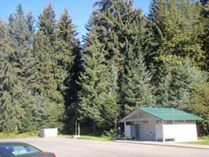
63 Site 31, USFS Glacier Parking Site Map Page 17 Zoning map Site Photos
64 Site 31, USFS Glacier Parking Site Map Page 17 Ownership: Federal Size: 7 acres Zoning: RR (Rural Residential) Current Use: Parking area, snow disposal site Adjacent Uses: USFS Visitor Center north; Undeveloped south, east and west Access: Access from Glacier Spur Road Environmental Issues: Wetlands Other considerations: This site has historically been used for snow disposal in winter and for tour bus parking in the summer. Snow loads have occasionally made it difficult for tour bus operations at the beginning of the season. The site is adjacent to wetlands but there are also some uplands near the site. The site has good buffering for incompatible uses. Access is good. The site is located in an area that provides good snow removal efficiency. The site is appropriately zoned for snow disposal. Recommendation: Carry forward as preferred snow disposal site for Mendenhall Valley operations


65 Site 32, J-D Bridge - North Map Page 18 Zoning map/creek Site Photos
66 Site 32, J-D Bridge - North Map Page 18 Ownership: CBJ Size: 10 acres Zoning: WI (Waterfront Industrial) Current Use: Commercial/Industrial (Utility) Adjacent Uses: Commercial/Industrial west and south; Undeveloped Access: Access from North Douglas Highway Environmental Issues: Marine Other considerations: This site is adjacent to existing industrial uses and access would be off a major road. The site is located in an area that would not significantly change haul distance or snow removal efficiency. The site is appropriately zoned for the use. Recommendation: Carry forward as a potential disposal site for Downtown/West Juneau operations


67 Site 33, J-D Bridge - South Map Page 18 Zoning map/creek Site Photos
68 Site 33, J-D Bridge - South Map Page 18 Ownership: CBJ Size: 10 acres Zoning: D5 (Low Density Residential) Current Use: Undeveloped Adjacent Uses: Commercial to south and southeast; Undeveloped Access: None currently, Access would have to be constructed from Douglas Highway Environmental Issues: Marine Other considerations: This site is adjacent to a commercial site. The site has no access and access would be difficult to design and construct without impacting nearby residential areas. The site is located in an area that would not significantly change haul distance or snow removal efficiency. The site would need to be rezoned to allow a snow disposal site of over ½-acre. Recommendation: Do not carry forward


69 Site 34, Miller Honsinger Pond Map Page 10 Zoning map/wetlands/pond Site Photos
70 Site 34, Miller Honsinger Pond Map Page 10 Ownership: Private, Assessed Value $642,900 Size: 50 acres Zoning: RR (Rural Residential) Current Use: Pond, Undeveloped Adjacent Uses: Commercial/Industrial to north, south and west; Undeveloped to east Access: Access from Maplesden Way Environmental Issues: Pond, Wetlands Other considerations: This site is made up of a pond and wetlands. The site would be difficult to design for treatment. The site is on or adjacent to the airport and most adjacent uses are commercial or industrial. The access is through a commercial/industrial area and there are no nearby residential areas. The site is located in an area that would increase haul distance and reduce snow removal efficiency. The site would not need to be rezoned. Recommendation: Do not carry forward


71 Site 35, Cope Park Map Page 18 Zoning map/creek Site Photos
72 Site 35, Cope Park Map Page 18 Ownership: CBJ Size: acres Zoning: RR/D10 (Rural Residential/Multifamily Residential) Current Use: Park/Recreation Adjacent Uses: Residential to north, east and south; Undeveloped to west Access: Access from Cope Park Road Environmental Issues: Proximity to Gold Creek, Drainage Other considerations: This site contains developed park facilities and winter recreation areas with little vacant land for snow disposal. Use of the site for snow disposal would adversely affect its recreation use. There are residential uses nearby and access is through residential streets with significant slopes. Drainage design would be difficult due to steep slopes around the site; site would drain to Gold Creek. The site is located in an area that would not substantively increase haul distance or decrease snow removal efficiency. The site would need to be rezoned to allow a snow disposal site of over ½-acre. Recommendation: Do not carry forward


73 Site 36, Old Public Works Downtown Shop Map Page 18 Zoning map/creek Site Photos
74 Site 36, Old Public Works Downtown Shop Map Page 18 Ownership: CBJ Size: 1 acre Zoning: LC (Limited Commercial) Current Use: Old Public Works Downtown Shop, material storage Adjacent Uses: Residential to northeast; Office to east; Undeveloped Access: Access from West 8 th Street Environmental Issues: Marine Other considerations: This site contains the CBJ s old public works downtown shop and material storage. The facility would need to be removed to provide room for design of a disposal site with treatment. The site is in downtown in an area of mixed residential, commercial and office use. The CBJ has plans for redevelopment of the site as a waterfront park and seawalk. Access is through developed office areas. The site is located in an area that provides for high snow removal efficiency. The site would need to be rezoned to allow a snow disposal site of over one acre. Recommendation: Do not carry forward


75 Site 37, Mayflower Causeway Map Page 14 Zoning map Site Photos Site 37, Mayflower Causeway
76 Site 37, Mayflower Causeway Map Page 14 Ownership: CBJ Size: NA Zoning: WI (Waterfront Industrial) Current Use: Transportation, Undeveloped Adjacent Uses: Public Facilities to north and west; Undeveloped Access: Access from Savikko Road Environmental Issues: Marine Other considerations: This site is small with little room for maneuvering or for installation of treatment systems. Access is through recreation area which is just southeast of the site. The site is located in an area that would not significantly change haul distance or snow removal efficiency. The site would not need to be rezoned. Recommendation: Carry forward as a potential Douglas area disposal site


77 Site 38, Dock St Map Page 14 Zoning map/creek Site Photos
78 Site 38, Dock St Map Page 14 Ownership: CBJ Size: 1 acre Zoning: WI (Waterfront Industrial) Current Use: Undeveloped Adjacent Uses: Commercial/Industrial Access: Access from Dock Street Environmental Issues: Marine Other considerations: This site could be designed as a marine site with treatment. The site has previously been used for snow disposal but this was cited as a nuisance by residential uses in the vicinity. The site is located in an area that would not significantly change haul distance or snow removal efficiency. The site is appropriately zoned. Recommendation: Carry forward as a potential Douglas area disposal site
Stormwater Outfall Inventory and Mapping City and Borough of Juneau
 Stormwater Outfall Inventory and Mapping City and Borough of Juneau Date of field work: 5/08-9/08 Purpose of Project: The intent of the project was to inventory and assess existing outfalls along impaired
UNIVERSITY OF MICHIGAN:
 Chapter Eight UNIVERSITY OF MICHIGAN: North Campus I. Introduction The University of Michigan currently owns approximately 800 acres of land in the northeast section of Ann Arbor. North Campus refers to
Recommended changes to the Comprehensive Plan Land Use designation
 Recommended changes to the Comprehensive Plan Land Use designation Purpose of Comprehensive Plan land use designations The designation provides a long term vision of the use/ density/ intensity of neighborhoods
LEMON CREEK AREA PLAN. Steering Committee Meeting April 27, 2017
 LEMON CREEK AREA PLAN Steering Committee Meeting April 27, 2017 Agenda Roll Call (6:00pm) Approval of Minutes April 20, 2017 (5 minutes) Review and Approve the Natural Resources & Recreation Chapter, Goals,
Auke Bay Area Plan. Complete List of Goals and Policies for the Auke Bay Area Plan
 Auke Bay Area Plan Complete List of Goals and for the Auke Bay Area Plan Recreation Goals & Pedestrian Access Goal 1: Link the Auke Bay area with an accessible system for recreation and transportation.
THE PLANNING AREA 2.1 PLANNING AREA LOCATION
 2. The Planning Area Brisbane Baylands Specific Plan 21 2 THE PLANNING AREA 2.1 PLANNING AREA LOCATION The Baylands is located approximately midway between San Francisco s central business district and
Town of Rico Three Mile Plan for Annexation
 Town of Rico Three Mile Plan for Annexation 10.20.2010 Adopted by Resolution 2010-2 Produced with funding support from the Colorado Department of Local Affairs 2 Content Guide Introduction. 3 Annexation
A. Selma Park, Davis Bay and Wilson Creek
 A. Selma Park, Davis Bay and Wilson Creek This waterfront neighbourhood consists of three separate community areas, linked by Highway 101, but with different character, land use patterns and future potential.
SHEFFIELD PARK Paulding County, GA DRI #588
 SHEFFIELD PARK Paulding County, GA DRI #588 Supplemental Information for RDC s DRI (Form 2) Review August 16, 2004 Prepared for: Mr. David Howerin Coosa Valley RDC 1 Jackson Hill Drive Rome, GA 30161 P.O.
Staff Report CONDITIONAL USE
 Staff Report PLANNING DIVISION COMMUNITY & ECONOMIC DEVELOPMENT To: From: Salt Lake City Planning Commission Daniel Echeverria, (801) 535-7165, daniel.echeverria@slcgov.com Date: May 21, 2015 Re: PLNPCM2015-00139
AWH REPORT OF THE PLANNING AND DEVELOPMENT DEPARTMENT FOR APPLICATION FOR REZONING ORDINANCE TO PLANNED UNIT DEVELOPMENT
 AWH REPORT OF THE PLANNING AND DEVELOPMENT DEPARTMENT FOR APPLICATION FOR REZONING ORDINANCE TO PLANNED UNIT DEVELOPMENT MAY 8, 2014 The Planning and Development Department hereby forwards to the Planning
3.10 LAND USE SETTING PROJECT SITE EXISTING LAND USE DESIGNATIONS AND ZONING. General Plan Land Use Designations.
 This section of the Draft EIR addresses the existing land uses on and adjacent to the project site and discusses the potential impacts of the proposed project on existing land uses. Key issues addressed
Planning Districts INTRODUCTION
 INTRODUCTION To facilitate detailed examination of development prospects for all areas of the community, Delano has been divided into 14 planning districts. The location of these planning districts is
Central and East Neighbourhoods - Hermitage Outline Plan
 Central and East Neighbourhoods - Hermitage Outline Plan Office Consolidation September 2013 Prepared by: Planning and Policy Services Branch Planning and Development Department City of Edmonton The Central
CHAPTER 10. LAND USE
 CHAPTER 10. LAND USE Land use policies implement important decisions relating to community form, housing, economic and community development, natural resource protection and hazards prevention. They also
2 PLANNING AREA DESCRIPTION
 2 PLANNING AREA DESCRIPTION 2.1 LOCATION Hecker Pass is located within the City of Gilroy near the western city limit. Figure 2-1 illustrates the regional location of the Hecker Pass Area. Figure 2-1:
POCKET COMMUNITY PLAN
 POCKET COMMUNITY PLAN Part Three : COMMUNITY PLAN AREAS AND SPECIAL STUDY AREAS CONTENTS Community Location... 3-P-3 Community Vision... 3-P-4 Community Profile... 3-P-4 Community Issues... 3-P-6 Land
11: Good Design - Boor Site
 Rural Design Workbook: 11: Site Introduction: A dairy and feed farm of over 450 acres in the town of Horseheads (Chemung County), David Boor s property has a number of notable features. The site is nearly
4.8 LAND USE AND PLANNING
 4.8 LAND USE AND PLANNING 4.8.1 INTRODUCTION This section describes existing and planned land uses at the Hayward campus and analyzes the impact of implementation of the proposed Master Plan on land uses
Southeast Quadrant Plan
 Southeast Quadrant Plan Southeast Quadrant Distinctive Features Land Use The Southeast Quadrant includes all the area within the planning area that is east of Interstate 5 and south of State Route 44.
McKay Road Interchange and Salem / Lockhart Crossing
 McKay Road Interchange and Salem / Lockhart Crossing The McKay Road Interchange Class EA has two components: 1. A new MacKay Road Interchange at Highway 400; and 2. A new bridge crossing of Highway 400
NEWBRIDGE SPECIFIC PLAN PROJECT DESCRIPTION SEPTEMBER 24, 2012
 PROJECT DESCRIPTION SEPTEMBER 24, 2012 Project Location The NewBridge Specific Plan project area consists of 1,095.3 acres south of Mather Airport between Kiefer Boulevard and Jackson Road, west of Sunrise
Northeast Quadrant Plan
 Northeast Quadrant Plan Northeast Quadrant Distinctive Features Land Use The Northeast Quadrant includes all the area within the planning area that is east of Interstate 5 and to the north of State Route
Gold Line Bus Rapid Transit Transit Oriented Development (BRTOD) Helmo Station Area Plan
 Helmo Station Area Plan") Appendix F Gold Line Bus Rapid Transit Transit Oriented Development (BRTOD) Helmo Station Area Plan Introduction and Purpose of the Plan The Gold Line Bus Rapid Transit facility is an eleven-mile dedicated
Appendix F Gold Line Bus Rapid Transit Transit Oriented Development (BRTOD) Helmo Station Area Plan Introduction and Purpose of the Plan The Gold Line Bus Rapid Transit facility is an eleven-mile dedicated
6 PORT SYDNEY SETTLEMENT AREA
 Section 6 Port Sydney Page 61 6 PORT SYDNEY SETTLEMENT AREA 6.1 Basis and Principles Village of Port Sydney Waterfront Community Existing Services 6.1.1 Port Sydney is an historic settlement that has developed
APPENDIX C SPECIAL PLANNING AREAS
 SPECIAL PLANNING AREAS There are five Special Planning Areas (SPAs) on the Land Use Diagram (Figure LU-2). The SPAs are areas with significant new growth potential that require more detailed subsequent
5.2 LAND USE AND ZONING
 5.2 LAND USE AND ZONING This section describes the land use and zoning of the project site and surrounding area, followed by an analysis of the potential for incompatibility or adverse impact on prevailing
ACKNOWLEDGEMENTS CONTENTS
 ACKNOWLEDGEMENTS Development of the 2003 Long Range Waterfront Plan has been a complex task involving the vision, determination, and patience of many people over the past year. The Planning Team is indebted
III. PROJECT DESCRIPTION
 III. PROJECT DESCRIPTION A. PROJECT LOCATION Regional Setting The project site is located in the southeast quadrant of the City of Chico in Butte County, California and is comprised of four parcels totaling
Rural Land Use Designations Kittitas County December 6, 2007 Draft
 KITTITAS COUNTY COMMUNITY DEVELOPMENT SERVICES 411 N. Ruby St., Suite 2, Ellensburg, WA 98926 CDS@CO.KITTITAS.WA.US Office (509) 962-7506 Fax (509) 962-7682 Rural Land Use Designations Kittitas County
Elm Fork Land Use. Trinity River Corridor Project Committee May 13, 2013
 Elm Fork Land Use Trinity River Corridor Project Committee May 13, 2013 Purpose Discuss Trinity River planned Land Use and Appropriate Compatible Uses, particularly with respect to the Elm Fork Area 2
Nob Hill Pipeline Improvements Project EIR
 Section 3.1 Aesthetics This section addresses the visual aspects that may affect the views experienced by the public, including the potential to impact the existing character of each area that comprises
O l so n M e morial Highway, S t e , G o l d e n V a l l e y, MN Delano Laketown Homes Concept Plan
 N O R T H W E S T A S S O C I A T E D C O N S U L T A N T S, I N C. 4 1 5 0 O l so n M e morial Highway, S t e. 3 2 0, G o l d e n V a l l e y, MN 5 5 4 2 2 T e l e p h o n e : 7 6 3. 9 5 7. 1 1 0 0 W
2. Analysis. DRAFT Gerald Richards & Pleasantview Park Master Plan
 DRAFT Gerald Richards & Pleasantview Park Master Plan 19 Historic Features According to the National Register of Historic Places and the National Historic Landmarks Program, there is nothing of national
DRAFT. Waterfronts and Open Spaces. 10 The Riverfront Open Space System
 CHAPTER 4 Waterfronts and Open Spaces 10 The Riverfront Open Space System 12 Planned, proposed and envisioned riverfront recommendations. Figure 4.3.23 The riverfront will become a major new public amenity
2.0 Hi s t o r y & Existing Co n d i t i o n s
 2.0 Hi s t o r y & Existing Co n d i t i o n s 2.1 Plan Area History The Lincoln East Specific Plan (Specific Plan) area is a significant part of the history of Sutter County. A 48,000 acre land grant
Juneau Watershed Partnership
 Juneau Watershed Partnership Native Plant Resource Center Final Report A Partners for Fish and Wildlife Project Prepared for: U.S. Fish and Wildlife Service For Grant #F11C00552 Prepared by: The Juneau
WEST HILL BUSINESS PARK AREA STRUCTURE PLAN
 MUNICIPAL DISTRICT OF PEACE NO. 135 WEST HILL BUSINESS PARK AREA STRUCTURE PLAN Prepared by: TABLE OF CONTENTS 1.0 Introduction... 1 1.1 Purpose of Plan........ 1 1.2 Plan Area..... 1 1.3 Existing Conditions...
IV.B. VISUAL RESOURCES
 IV.B. VISUAL RESOURCES ENVIRONMENTAL SETTING Existing Visual Character Project Site The project site is located at 17331-17333 Tramonto Drive in the Pacific Palisades community of the City of Los Angeles
The impacts examined herein take into account two attributes of aesthetic values:
 IV. ENVIRONMENTAL IMPACT ANALYSIS This section addresses the potential impacts to views and aesthetics as a result of the proposed Project at the Project Site and the development scenarios analyzed for
Town of Portola Valley General Plan. Nathhorst Triangle Area Plan
 Town of Portola Valley General Plan Amended December 10, 1997 Table of Contents Introduction... 1 Planning Area... 1 Objectives... 2 Principles... 2 Standards... 4 Description... 4 Community Commercial...
Exhibit A Comprehensive Plan Amendments
 Exhibit A Comprehensive Plan Amendments May 2010 Draft Chapter One - Introduction Chapter One INTRODUCTION NOTE: For brevity and ease in viewing the proposed changes, portions of chapter one that are not
Glenbrooke North. New Westminster s Neighbourhoods Identifying Historical Contexts. Historical Neighbourhood Context Statements 2008
 Historical Neighbourhood Context Statements 2008 Glenbrooke North Fifth Street: wide boulevard, with garden median at south end 1950s subdivision character along much of Eighth Avenue and east of Fourth
CHAPTER 11. COMPREHENSIVE PLAN LAND USE MAPS
 10.13.3. Amend the Land Use Code to create new zoning districts for CBJ-owned lands designated for Parks, Natural Areas and Resource Protection uses and map those districts on CBJ lands designated for
HAZARD MITIGATION GOALS AND OBJECTIVES
 SEWRPC Community Assistance Planning Report No. 282, 2nd Edition CITY OF MILWAUKEE ALL HAZARDS MITIGATION PLAN UPDATE Chapter IV HAZARD MITIGATION GOALS AND OBJECTIVES [NOTE: Throughout this plan update
Chapter 5: Natural Resources and Environment
 NATURAL RESOURCES AND ENVIRONMENT 5-1 5 Chapter 5: Natural Resources and Environment BACKGROUND AND INTENT Urban expansion represents the greatest risk for the future degradation of existing natural areas,
Irongate Neighborhood Plan
 Plan As adopted by Ordinance No. 2010-12-068 and amended by Ordinance 2015-11-044 Mt. Baker Neighborhood - As adopted by Ordinance No. 8868 and amended by Ordinances 8946, 8995, 9174, 9271, 9601, 9697,
3. THE LONG RANGE WATERFRONT PLAN
 3. THE LONG RANGE WATERFRONT PLAN Good plans shape good decisions. That's why good planning helps to make elusive dreams come true. 3.1 LONG RANGE PLAN OVERVIEW Lester R. Bittel The long range vision for
TABLE 5-3. EXISTING AND PROPOSED YAKIMA GREENWAY FACILITIES
 TABLE 5-3. Selah Recreation Area (Proposed) Greenway Pathway: Multi-use, recreational pathway Gravel Pit Ponds: Boating, canoeing, fishing, swimming Selah Boat Landing: To serve as northernmost river access
BUILDER LOTS FOR SALE
 BUILDER LOTS FOR SALE NORTHERN CULPEPER - 135 ACRES RESIDENTIAL DEVELOPMENT 1256 Old Bridge Road, Amissville, VA 20106 SALE PRICE: $995,000 LOT SIZE: 135+ Acres APN #: Tax Map 2 Parcel 23 ZONING: R-1 ACCESS:
McCormick Pit Category 1 Class A License, Pit Below Water For Blueland Farms Limited. Visual Impact Assessment Report February 2013
 McCormick Pit Category 1 Class A License, Pit Below Water For Blueland Farms Limited Visual Impact Assessment Report February 2013 TABLE OF CONTENTS EXECUTIVE SUMMARY... v 1.0 BACKGROUND... 1 Figure 1.
Chapter 10 IMPLEMENTATION RECOMMENDATIONS
 Chapter 10 IMPLEMENTATION RECOMMENDATIONS The recommended land use plan presented in the previous chapter provides a design for the attainment of the urban and rural development and open space preservation
Town of Vershire Road Erosion Inventory Report
 Town of Vershire Road Erosion Inventory Report Taylor Valley Road. Photo taken by TRORC staff. Prepared by: 128 King Farm Road Woodstock, VT 05091 Inventory and report funded by the Vermont Agency of Transportation
Genex Kidston Connection Project: Draf t Environmental Assessment Report Powerlink Queensland
 : Draf t Environmental Assessment Report Powerlink Queensland Chapter 14 \\autsv1fp001\projects\605x\60577456\6. Draft Docs\6.1 Reports\4. Compiled draft 17 September\Covers\Chapters\Ch 14.docx Rev ision
KY 55 Bypass & KY 61 Small Area Plan
 CHAPTER TEN EXECUTIVE SUMMARY The construction of a new road has the power to improve or damage the quality of life for a community. With proper planning and development, a street or road can compliment
NORTH BETHANY ELEMENTARY SCHOOL SITE ASSESSMENT
 NORTH BETHANY ELEMENTARY SCHOOL SITE ASSESSMENT Prepared for: Prepared by: October 10, 2014 Page 2 Introduction and Purpose This report provides an assessment of two potential sites for a new elementary
Project Narrative For Fruita RV Resort Conditional Use Permit
 Project Narrative For Fruita RV Resort Conditional Use Permit Date: November 18, 2016 Prepared by: Robert W. Jones, II, P.E. Vortex Engineering & Architecture, Inc. 2394 Patterson Rd., Ste. 201 Grand Junction,
HAMLET OF KINGMAN AREA STRUCTURE PLAN
 HAMLET OF KINGMAN AREA STRUCTURE PLAN Prepared by: Austrom Consulting Ltd. Page 1 of 19 Table of Contents TABLE OF CONTENTS... 2 1. BACKGROUND... 3 1.1 PLAN AREA... 3 1.2 PLAN PURPOSE... 3 1.3 LEGISLATIVE
Department of Community Development. Planning and Environmental Review Division Revised Notice of Preparation
 Department of Community Development Michael J. Penrose, Acting Director Divisions Building Permits & Inspection Code Enforcement County Engineering Economic Development & Marketing Planning & Environmental
Obey Creek July 17, Vicinity Map. Concept Plan Submittal. No
 15/501 Fordham Blvd. 15/501 By-Pass To Downtown Chapel Hill Vicinity Map 0 1000 2000 FT Arlen Park DR. Bennett Road Mt. Carmel Church Rd. Southern Village Parkside Circle Market St. 15/501 Founder's Ridge
Proposed Water Ski Wakeboard Cable Park (former Cedar Run Horse Park) Kevin Bechard Deputation to Committee of the Whole June 4, 2018
 Kevin Bechard Deputation to Committee of the Whole June 4, 2018") Proposed Water Ski Wakeboard Cable Park (former Cedar Run Horse Park) Kevin Bechard Deputation to Committee of the Whole June 4, 2018 Development Proposal - Comprised of three separate cable systems ;
Proposed Water Ski Wakeboard Cable Park (former Cedar Run Horse Park) Kevin Bechard Deputation to Committee of the Whole June 4, 2018 Development Proposal - Comprised of three separate cable systems ;
C. Westerly Creek Village & The Montview Corridor
 C. Westerly Creek Village & The VISION Community Vision When the goals of the city are achieved Westerly Creek Village, a distinctive community defined by Montview Boulevard and Westerly Creek, is a strong
BROOKHILL NEIGHBORHOOD MODEL ZONING MAP AMENDMENT PREFACE TO APPLICATION
 BROOKHILL NEIGHBORHOOD MODEL ZONING MAP AMENDMENT PREFACE TO APPLICATION June 15, 2015 Revised: August 1, 2016 I. VISION Brookhill is a proposed community based upon the principles of Albemarle County
Introduction Environmental Setting. Visual Character. Surrounding Land Uses. Regional Setting. Project Site
 Contra Costa County Tassajara Parks Project Recirculated Draft EIR Aesthetics, Light, and Glare 3.1 - Aesthetics, Light, and Glare 3.1.1 - Introduction This section describes the existing aesthetics, light,
Appendix G Response to Comments
 Appendix G Response to Comments This appendix contains the comments received during the public circulation and comment period (May 27, 2008 to July 11, 2008). The comments have been numbered (Comment Set
7 May 9, 2012 Public Hearing APPLICANT AND PROPERTY OWNER: COASTAL ENTERPRISES, LLC
 7 May 9, 2012 Public Hearing APPLICANT AND PROPERTY OWNER: COASTAL ENTERPRISES, LLC REQUEST: Variance to Section 5B of the Site Plan Ordinance (Floodplain Regulations) ADDRESS / DESCRIPTION: 601 Sandbridge
GENERAL PLAN CONSISTENCY ANALYSIS
 GENERAL PLAN CONSISTENCY ANALYSIS Prepared by Planning Staff 10/28/2013 APPLICABLE GOALS, POLICIES AND PROGRAMS FROM the LAND USE CHAPTER Goal LU-1 Policy LU-1.1 Policy LU-1.2 Goal LU-2 Protect the character
HURSTPIERPOINT SAYERS COMMON PARISH COUNCIL
 HURSTPIERPOINT SAYERS COMMON PARISH OFFICE TRINITY ROAD HURSTPIERPOINT HASSOCKS WEST SUSSEX BN6 9UY TEL: 01273 833264 FAX: 01273 834976 E-MAIL: HURSTPIERPOINT.PC@BTINTERNET.COM WEB SITE: WWW.HURSTPIERPOINT-PC.ORG.UK
River Corridor Overlay Zone (RCOZ) Article 5
 Article 5") River Corridor Overlay Zone (RCOZ) Article 5 The site is in one of two designated districts. The first is the CBD (central business district) River District, which recognizes the urban character and unique
River Corridor Overlay Zone (RCOZ) Article 5 The site is in one of two designated districts. The first is the CBD (central business district) River District, which recognizes the urban character and unique
Appendix A Basin Inventory Summary
 Appendix A Basin Inventory Summary Surface Water Management Element A-1 BASIN INVENTORY SUMMARY Pinellas County is divided into 52 individual watersheds. The following Basin Inventory Summary includes
2.0 PROJECT DESCRIPTION
 2.0 PROJECT DESCRIPTION 2.1 PROJECT LOCATION The proposed Arboretum project (hereafter referred to as the proposed project ) is located on 1,349 acres within the Grant Line North Planning Area of the City
01 PROJECT DESCRIPTION
 01 PROJECT DESCRIPTION PROJECT LOCATION The proposed Barrett Ranch East project (the Project) site is in northern Sacramento County in the Antelope community, north of the intersection of Don Julio Boulevard
Stormwater in the Lower Jordan Creek Watershed
 Stormwater in the Lower Jordan Creek Watershed Stormwater maps and recommendations for managing stormwater to improve habitat and water quality in Jordan Creek U.S. Fish and Wildlife Service, Juneau November
APPENDIX J PERFORMANCE STANDARDS FOR GRAVEL MINE, PIT MINE, OR QUARRY
 APPENDIX J PERFORMANCE STANDARDS FOR GRAVEL MINE, PIT MINE, OR QUARRY A. Purpose: 1. Regulatory Requirement and Use Mitigation: The purpose of this appendix is to provide a regulatory context (standards)
ADDENDUM TO BIOLOGICAL SCOPING SURVEY REPORT, BOTANICAL SURVEY AND WETLAND DELINEATION
 ADDENDUM TO BIOLOGICAL SCOPING SURVEY REPORT, BOTANICAL SURVEY AND WETLAND DELINEATION FOR AVALON INN (APN 069-241-27 & -04) 1201 & 1211 NORTH MAIN STREET FORT BRAGG, CA MENDOCINO COUNTY prepared for:
Rapid City Planning Commission Rezoning Project Report
 Rapid City Planning Commission Rezoning Project Report April 5, 2018 Item # 4 Applicant Request(s) Case # 18RZ008 Rezoning request from General Agricultural District to Low Density Residential District
What We Heard Public Engagement - Stage 1
 What We Heard Public Engagement - Stage 1 Background Early planning is underway for a potential new river crossing over the North Saskatchewan River, in the northeast part of the Edmonton region. The City
Staff Report and Recommendation
 Community Planning and Development Planning Services 201 W. Colfax Ave., Dept. 205 Denver, CO 80202 p: 720.865.2915 f: 720.865.3052 www.denvergov.org/cpd TO: City Council Neighborhoods and Planning Committee
Director, Community Planning, Toronto and East York District
 Lower Yonge Precinct Plan Update STAFF REPORT ACTION REQUIRED Date: October 16, 2012 To: From: Wards: Reference Number: Toronto and East York Community Council Director, Community Planning, Toronto and
NORTH BAY RECREATION AND NATURAL AREA
 HUDSON NORTH BAY RECREATION AND NATURAL AREA City of Hudson, New York Prepared by the Columbia Land Conservancy North Bay: from forgotten waterfront to dynamic public park The proposal for the North Bay
COLVER ROAD INDUSTRIAL CONCEPT PLAN
 COLVER ROAD INDUSTRIAL CONCEPT PLAN A CONCEPTUAL LAND USE AND TRANSPORTATION PLAN FOR TA-4 AN URBAN RESERVE AREA OF THE CITY TALENT City of Talent Adopted by City Council Resolution No., June, 2015 PART
Developer s Program. The Station at East 54
 Developer s Program The Station at East 54 Existing Conditions The Station at East 54 is proposed for a 1.12 acre site at the northeast corner of Hamilton Road and Prestwick Road, tucked between the East
ENVIRONMENTAL SETTING
 II. ENVIRONMENTAL SETTING EXISTING CONDITIONS The 208.87-acre Project site is located in the western portion of the City (refer to Figures II-1 and II-2). The Project site comprises Assessor s Parcel Number
EXHIBIT B PROJECT NARRATIVE POULSBO MEADOWS
 EXHIBIT B PROJECT NARRATIVE POULSBO MEADOWS Name of Project: Poulsbo Meadows; A Planned Residential Development (PRD)/Plat Applicants Name: PBH Group LLC/Byron Harris PO Box 1010 Silverdale, WA 98038 Description
Site Option 3: Te Matai
 Site Option 3: Te Matai Location Napier Drain looking south east Description The Te Matai growth option is located between the existing residential boundary (Ruamahanga Crescent) Napier Road (State Highway
Glenn Highway MP DSR. Landscape Narrative
 Glenn Highway MP 34-42 DSR Landscape Narrative Project Landscape Goals The Glenn Highway MP 34-42 Project extends through a variety of landscape types typical to the Matanuska-Susitna Valley. In general,
SCHOOLS, PARKS AND TRAILS
 Schools, Parks, and Trails Page 1 of 12 SCHOOLS, PARKS AND TRAILS BACKGROUND Public Schools in the Clifton-Fruitvale Community include Clifton Elementary, Rocky Mountain Elementary, Grand Mesa Middle,
LAND USE PLAN 7. Housing
 21 LAND USE PLAN While the land uses that have historically dominated the Corridor itself have been industrial/commercial, the Master Plan proposes a shift to mixed-use redevelopment, complimented by a
A Growing Community Rural Settlement Areas
 Town of Huntsville Official Plan Review - POLICY BACKGROUND PAPER A Growing Community Rural Settlement Areas BACKGROUND: In addition to the fully municipally-serviced Urban Settlement Area and the Hidden
Section 3 INVENTORY OF RECREATION LAND AND FACILITIES
 Photo of Juan Bautista de Anza Park Section 3 INVENTORY OF RECREATION LAND AND FACILITIES Summary of Findings Park Definitions Summary of Recreation Facilities Other Recreation Facilities Nearby Recreation
7.0 SOCIAL, ECONOMIC, AND ENVIRONMENTAL ISSUES
 7.0 SOCIAL, ECONOMIC, AND ENVIRONMENTAL ISSUES The following list of social, economic, and environmental issues have been identified based on a preliminary inventory of resources in the project area, an
DRAFT ALDER CREEK FARM MASTER PLAN
 DRAFT ALDER CREEK FARM MASTER PLAN Lower Nehalem Community Trust Mission: To preserve land and nurture conservation values in partnership with an engaged community in the Nehalem region of the Oregon Coast
ACCESS PLAN. SD 11/SPLITROCK BOULEVARD Brandon, SD. Prepared by South Dakota Department of Transportation City of Brandon
 ACCESS PLAN SD 11/SPLITROCK BOULEVARD Brandon, SD Prepared by South Dakota Department of Transportation City of Brandon June, 2003 ACCESS PLAN SD 11/Splitrock Boulevard Brandon, SD PREPARED BY South Dakota
Rapid City Planning Commission Comprehensive Plan Amendment Project Report
 Rapid City Planning Commission Comprehensive Plan Amendment Project Report June 7, 2018 Applicant Request(s) Item #3 Case # 18CA001 Comprehensive Plan Amendment to change the future land use from Mixed-
Drexel, Barrell & Co.
 Drexel, Barrell & Co. June 18, 2018 Engineers/Surveyors Boulder Colorado Springs Greeley 3 South 7 th Street Colorado Springs, Colorado 80905-1501 719 260-0887 719 260-8352 Fax El Paso County Planning
City of Chickasaw Land Use Comprehensive Plan 2030 Chapter5-Draft(2)Public review_
Public review_") Land Use Land Use refers to the activity or development characteristics of a given parcel of land. The Land Use Plan presented in the following pages, represents the City of Chickasaw s official position
Land Use Land Use refers to the activity or development characteristics of a given parcel of land. The Land Use Plan presented in the following pages, represents the City of Chickasaw s official position
Draft Master Plan for Franklin Park
 Draft Master Plan for Franklin Park Metro Parks Tacoma with SiteWorkshop November 2009 I. overview & background Process & History Master Plan Process The Master Plan is based on a community involvement
Northeast Suburban Area Plan Update Recommendations
 Northeast Suburban Area Plan Update Recommendations General policies from Legacy 2030 provide the framework for recommendations in all area plans. Specific recommendations for the Northeast Suburban Area
Section 2 Study Area
 Study Area Section 2 Study Area 2-1 Purpose This section describes the study area of the Update and discusses the existing and future land uses within the study area. 2-2 Location The study area, as shown
Draft Environmental Assessment
 Draft Environmental Assessment CASCADE PARK Orem City, Utah A conversion of land protected under Section 6(f)(3) of the Land and Water Conservation Fund Act, Public Law 108-98 September 2017 For information,