Heritage Impact Assessment York Road Environmental Design Study City of Guelph, Ontario APPENDIX A FIGURES. Project Number TP115100
|
|
|
- Claud Owen
- 5 years ago
- Views:
Transcription
1 Heritage Impact Assessment York Road Environmental Design Study City of Guelph, Ontario APPENDIX A FIGURES Project Number Appendix A


2 m C:\Users\cara.howell\Desktop\York.dwg(fig1)*cara.howell* LEGEND Study area NOTES: THIS DRAWING SHOULD BE READ IN CONJUNCTION WITH THE AMEC ENVIRONMENT & INFRASTRUCTURE REPORT No.. Conditions encountered in the field may be different from the interpreted information presented on this figure. SOURCE: Canadian Topographic maps matm/index.html?site=make_a_ Topographic_Map&viewer=MATM&locale =en-us CLIENT: CITY OF GUELPH Drawn By: CH Checked By: SA Revision N : 01 Scale: 1: 20,000 N W E S PROJECT N : DATE: HERITAGE IMPACT ASSESSMENT York Road Environmental Design Study Location of the Study Area 07 Mar 2017 Amec Foster Wheeler Environment and Infrastructure 505 Woodward Ave., Hamilton, ON L8H 6N6 tel: FIGURE: 1


3 m C:\Users\cara.howell\Desktop\York.dwg(fig2)*cara.howell* LEGEND Study area NOTES: THIS DRAWING SHOULD BE READ IN CONJUNCTION WITH THE AMEC ENVIRONMENT & INFRASTRUCTURE REPORT No.. Conditions encountered in the field may be different from the interpreted information presented on this figure. SOURCE: Bing Maps CLIENT: CITY OF GUELPH Drawn By: CH Checked By: SA Revision N : 01 Scale: 1: 10,000 N W E S HERITAGE IMPACT ASSESSMENT York Road Environmental Design Study Aerial Photograph Showing the Location of the Study Area PROJECT N : DATE: 07 Mar 2017 Amec Foster Wheeler Environment and Infrastructure 505 Woodward Ave., Hamilton, ON L8H 6N6 tel: FIGURE: 2


4 m C:\Users\cara.howell\Desktop\York.dwg(fig3)*cara.howell* LEGEND Study area NOTES: THIS DRAWING SHOULD BE READ IN CONJUNCTION WITH THE AMEC ENVIRONMENT & INFRASTRUCTURE REPORT No.. Conditions encountered in the field may be different from the interpreted information presented on this figure. SOURCE: Canadian Topographic maps matm/index.html?site=make_a_ Topographic_Map&viewer=MATM&locale =en-us CLIENT: CITY OF GUELPH Drawn By: CH Checked By: SA Revision N : 01 Scale: 1: 10,000 N W E S HERITAGE IMPACT ASSESSMENT York Road Environmental Design Study Topographic Map Showing the Location of the Study Area PROJECT N : DATE: 07 Mar 2017 Amec Foster Wheeler Environment and Infrastructure 505 Woodward Ave., Hamilton, ON L8H 6N6 tel: FIGURE: 3


5 m C:\Users\cara.howell\Desktop\York.dwg(fig4)*cara.howell* LEGEND Study area NOTES: THIS DRAWING SHOULD BE READ IN CONJUNCTION WITH THE AMEC ENVIRONMENT & INFRASTRUCTURE REPORT No.. Conditions encountered in the field may be different from the interpreted information presented on this figure. SOURCE: 1858 Tremaine Map of the County of Wellington countymaps/wellington/index.html CLIENT: CITY OF GUELPH Drawn By: CH Checked By: SA Revision N : 01 Scale: 1: 20,000 N W E S 1861 Tremaine Map of the County of Wellington Showing the Location of the Study Area PROJECT N : DATE: HERITAGE IMPACT ASSESSMENT York Road Environmental Design Study 07 Mar 2017 Amec Foster Wheeler Environment and Infrastructure 505 Woodward Ave., Hamilton, ON L8H 6N6 tel: FIGURE: 4


6 m C:\Users\cara.howell\Desktop\York.dwg(fig5)*cara.howell* LEGEND Study area NOTES: THIS DRAWING SHOULD BE READ IN CONJUNCTION WITH THE AMEC ENVIRONMENT & INFRASTRUCTURE REPORT No.. Conditions encountered in the field may be different from the interpreted information presented on this figure. SOURCE: 1877 Illustrated Historical Atlas of the County of Wellington CLIENT: CITY OF GUELPH Drawn By: CH Checked By: SA Revision N : 01 Scale: 1: 20,000 N W E S 1877 Illustrated Historical Atlas of the County of Wellington Showing the Location of the Study Area PROJECT N : DATE: HERITAGE IMPACT ASSESSMENT York Road Environmental Design Study 07 Mar 2017 Amec Foster Wheeler Environment and Infrastructure 505 Woodward Ave., Hamilton, ON L8H 6N6 tel: FIGURE: 5


7 C:\Users\cara.howell\Desktop\York.dwg(Fig 6)*cara.howell* LEGEND Indicated Above NOTES: THIS DRAWING SHOULD BE READ IN CONJUNCTION WITH THE AMEC ENVIRONMENT & INFRASTRUCTURE REPORT No.. Conditions encountered in the field may be different from the interpreted information presented on this figure. SOURCE: City of Guelph, Official Plan, Appendix A: Guelph Innovation District Secondary Plan, heritage CLIENT: CITY OF GUELPH Drawn By: CH Checked By: SA Revision N : 01 Scale: 1: 25,000 N W S E PROJECT N : DATE: HERITAGE IMPACT ASSESSMENT York Road Environmental Design Study Guelph Innovation District, Secondary Plan, Heritage 07 Mar 2017 Amec Foster Wheeler Environment and Infrastructure 505 Woodward Ave., Hamilton, ON L8H 6N6 tel: FIGURE: 6


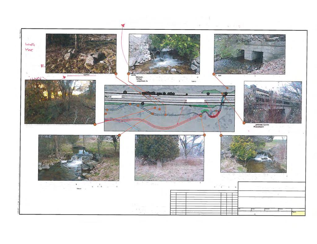
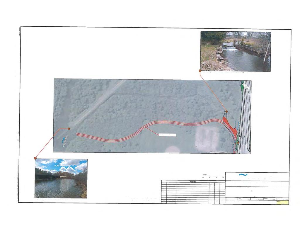
8 m C:\Users\cara.howell\Desktop\York.dwg(fig7 c)*cara.howell* LEGEND Study area Proposed realignment Clythe Creek # Cultural heritage feature/structure NOTES: THIS DRAWING SHOULD BE READ IN CONJUNCTION WITH THE AMEC ENVIRONMENT & INFRASTRUCTURE REPORT No.. Conditions encountered in the field may be different from the interpreted information presented on this figure. SOURCE: Bing Maps CLIENT: CITY OF GUELPH Drawn By: CH Checked By: SA Revision N : 01 Scale: 1: 5,000 N W E S PROJECT N : DATE: HERITAGE IMPACT ASSESSMENT York Road Environmental Design Study Cultural Heritage Features/Structures within the Study Area 07 Mar 2017 Amec Foster Wheeler Environment and Infrastructure 505 Woodward Ave., Hamilton, ON L8H 6N6 tel: FIGURE: 7a


9 m C:\Users\cara.howell\Desktop\York.dwg(fig7 b)*cara.howell* LEGEND Study area Proposed realignment Clythe Creek # Cultural heritage feature/structure NOTES: THIS DRAWING SHOULD BE READ IN CONJUNCTION WITH THE AMEC ENVIRONMENT & INFRASTRUCTURE REPORT No.. Conditions encountered in the field may be different from the interpreted information presented on this figure. SOURCE: Bing Maps CLIENT: CITY OF GUELPH Drawn By: CH Checked By: SA Revision N : 01 Scale: 1: 5,000 N W E S PROJECT N : DATE: HERITAGE IMPACT ASSESSMENT York Road Environmental Design Study Cultural Heritage Features/Structures within the Study Area 07 Mar 2017 Amec Foster Wheeler Environment and Infrastructure 505 Woodward Ave., Hamilton, ON L8H 6N6 tel: FIGURE: 7b


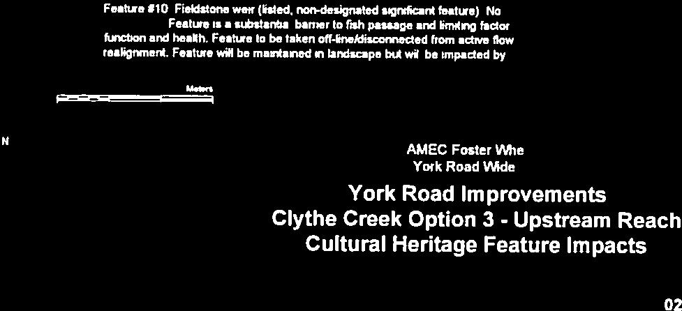
10 m C:\Users\cara.howell\Desktop\York.dwg(fig7)*cara.howell* LEGEND Study area Proposed realignment Clythe Creek # Cultural heritage feature/structure NOTES: THIS DRAWING SHOULD BE READ IN CONJUNCTION WITH THE AMEC ENVIRONMENT & INFRASTRUCTURE REPORT No.. Conditions encountered in the field may be different from the interpreted information presented on this figure. SOURCE: Bing Maps CLIENT: CITY OF GUELPH Drawn By: CH Checked By: SA Revision N : 01 Scale: 1: 5,000 N W E S PROJECT N : DATE: HERITAGE IMPACT ASSESSMENT York Road Environmental Design Study Cultural Heritage Features/Structures within the Study Area 09 Mar 2017 Amec Foster Wheeler Environment and Infrastructure 505 Woodward Ave., Hamilton, ON L8H 6N6 tel: FIGURE: 7c
11 Heritage Impact Assessment York Road Environmental Design Study City of Guelph, Ontario APPENDIX B PHOTOGRAPHS OF HERITAGE RESOURCES Project Number Appendix B


12 APPENDIX B - PHOTOGRAPHIC RECORD PROJECT NO. PROJECT HIA York Rd. Environmental Design Study LOCATION Guelph, Ontario ENCLOSURE 1 PHOTOGRAPH 1 Ashlar Stone Culvert Potential BHR PHOTOGRAPH 2 Reinforced concrete road bridge railing (remnant)


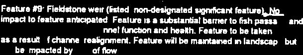
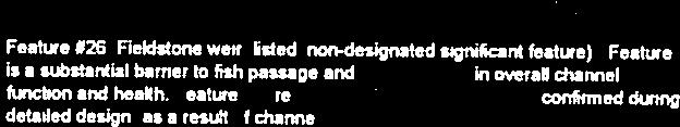
13 APPENDIX B - PHOTOGRAPHIC RECORD PROJECT NO. PROJECT HIA York Rd. Environmental Design Study LOCATION Guelph, Ontario ENCLOSURE 2 PHOTOGRAPH 3a Fieldstone weir PHOTOGRAPH 3b Fieldstone steps


14 APPENDIX B - PHOTOGRAPHIC RECORD PROJECT NO. PROJECT HIA York Rd. Environmental Design Study LOCATION Guelph, Ontario ENCLOSURE 3 PHOTOGRAPH 3c Fieldstone sentinel stones PHOTOGRAPH 4 Fieldstone garden wall with sentinel stones


15 APPENDIX B - PHOTOGRAPHIC RECORD PROJECT NO. PROJECT HIA York Rd. Environmental Design Study LOCATION Guelph, Ontario ENCLOSURE 4 PHOTOGRAPH 5 Fieldstone weir PHOTOGRAPH 6 Fieldstone steps


16 APPENDIX B - PHOTOGRAPHIC RECORD PROJECT NO. PROJECT HIA York Rd. Environmental Design Study LOCATION Guelph, Ontario ENCLOSURE 5 PHOTOGRAPH 7 Large boulder Potential BHR PHOTOGRAPH 8 Fieldstone weir


17 APPENDIX B - PHOTOGRAPHIC RECORD PROJECT NO. PROJECT HIA York Rd. Environmental Design Study LOCATION Guelph, Ontario ENCLOSURE 6 PHOTOGRAPH 9a Fieldstone weir at gabion baskets PHOTOGRAPH 9b Fieldstone weir


18 APPENDIX B - PHOTOGRAPHIC RECORD PROJECT NO. PROJECT HIA York Rd. Environmental Design Study LOCATION Guelph, Ontario ENCLOSURE 7 PHOTOGRAPH 9c Fieldstone weir PHOTOGRAPH 10 Fieldstone weir beside gambion baskets


19 APPENDIX B - PHOTOGRAPHIC RECORD PROJECT NO. PROJECT HIA York Rd. Environmental Design Study LOCATION Guelph, Ontario ENCLOSURE 8 PHOTOGRAPH 11a Fieldstone weir, steps and ashlar stone terrace wall PHOTOGRAPH 11b Fieldstone weir, steps and ashlar stone terrace wall


20 APPENDIX B - PHOTOGRAPHIC RECORD PROJECT NO. PROJECT HIA York Rd. Environmental Design Study LOCATION Guelph, Ontario ENCLOSURE 9 PHOTOGRAPH 12 Ashlar cut limestone terrace wall PHOTOGRAPH 13 Confluence of creek and intermittent stream Potential BHR


21 APPENDIX B - PHOTOGRAPHIC RECORD PROJECT NO. PROJECT HIA York Rd. Environmental Design Study LOCATION Guelph, Ontario ENCLOSURE 10 PHOTOGRAPH 14 Fieldstone weir PHOTOGRAPH 15a Fieldstone entrance wall


22 APPENDIX B - PHOTOGRAPHIC RECORD PROJECT NO. PROJECT HIA York Rd. Environmental Design Study LOCATION Guelph, Ontario ENCLOSURE 11 PHOTOGRAPH 15b Fieldstone entrance wall, curved with sentinel stones PHOTOGRAPH 16 Fieldstone entrance wall, curved with sentinel stones


23 APPENDIX B - PHOTOGRAPHIC RECORD PROJECT NO. PROJECT HIA York Rd. Environmental Design Study LOCATION Guelph, Ontario ENCLOSURE 12 PHOTOGRAPH 17 Stone and concrete road bridge PHOTOGRAPH 18 Fieldstone steps


24 APPENDIX B - PHOTOGRAPHIC RECORD PROJECT NO. PROJECT HIA York Rd. Environmental Design Study LOCATION Guelph, Ontario ENCLOSURE 13 PHOTOGRAPH 19 Entrance sign, ashlar, rock-faced limestones with jack arch Potential BHR PHOTOGRAPH 20 Ashlar dry stone wall


25 APPENDIX B - PHOTOGRAPHIC RECORD PROJECT NO. PROJECT HIA York Rd. Environmental Design Study LOCATION Guelph, Ontario ENCLOSURE 14 PHOTOGRAPH 21 Willowbank Hall PHOTOGRAPH 22 Fieldstone weir


26 APPENDIX B - PHOTOGRAPHIC RECORD PROJECT NO. PROJECT HIA York Rd. Environmental Design Study LOCATION Guelph, Ontario ENCLOSURE 15 PHOTOGRAPH 23a Fieldstone weir and culvert PHOTOGRAPH 23b Fieldstone weir and culvert


27 APPENDIX B - PHOTOGRAPHIC RECORD PROJECT NO. PROJECT HIA York Rd. Environmental Design Study LOCATION Guelph, Ontario ENCLOSURE 16 PHOTOGRAPH 24a Fieldstone weir and culvert PHOTOGRAPH 24b Fieldstone weir and culvert

28 APPENDIX B - PHOTOGRAPHIC RECORD PROJECT NO. PROJECT HIA York Rd. Environmental Design Study LOCATION Guelph, Ontario ENCLOSURE 17 PHOTOGRAPH 25 Fieldstone weir PHOTOGRAPH 26 Fieldstone weir
29 APPENDIX B - PHOTOGRAPHIC RECORD PROJECT NO. PROJECT HIA York Rd. Environmental Design Study LOCATION Guelph, Ontario ENCLOSURE 18 PHOTOGRAPH 27 Arched concrete and metel pedestrian bridge with stone abutments Potential BHR PHOTOGRAPH 28 Limestone pillars with wood board fencing leading to main entrance Potential BHR

30 APPENDIX B - PHOTOGRAPHIC RECORD PROJECT NO. PROJECT HIA York Rd. Environmental Design Study LOCATION Guelph, Ontario ENCLOSURE 19 PHOTOGRAPH 29 Limestone pillars with wood board fencing leading to main entrance Potential BHR PHOTOGRAPH 30 Limestone pillars with wood board fencing leading to main entrance Potential BHR


31 APPENDIX B - PHOTOGRAPHIC RECORD PROJECT NO. PROJECT HIA York Rd. Environmental Design Study LOCATION Guelph, Ontario ENCLOSURE 20 PHOTOGRAPH 31 Metal and wood pedestrian bridge Potential BHR PHOTOGRAPH 32 Metal and wood pedestrian bridge Potential BHR


32 APPENDIX B - PHOTOGRAPHIC RECORD PROJECT NO. PROJECT HIA York Rd. Environmental Design Study LOCATION Guelph, Ontario ENCLOSURE 21 PHOTOGRAPH 33 Metal and wood pedestrian bridge Potential BHR PHOTOGRAPH 34 Confluence of Clythe Creek and Hadati Creek Potential BHR


33 APPENDIX B - PHOTOGRAPHIC RECORD PROJECT NO. PROJECT HIA York Rd. Environmental Design Study LOCATION Guelph, Ontario ENCLOSURE 22 PHOTOGRAPH 35 Concrete and stone weir Potential BHR PHOTOGRAPH 36 GJR railroad bridge Potential BHR
34 Heritage Impact Assessment York Road Environmental Design Study City of Guelph, Ontario APPENDIX C ONTARIO HERITAGE TRUST, ENTITLED PRELIMINARY HERITAGE EASEMENT ASSESSMENT BY ONTARIO HERITAGE TRUST STAFF Project Number Appendix C
35
36
37
38
39
40
41
42 Heritage Impact Assessment York Road Environmental Design Study City of Guelph, Ontario APPENDIX D FROM ONTARIO HERITAGE TRUST Project Number Appendix D
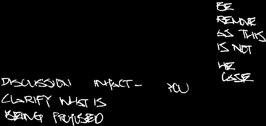
43 From: Kiki Aravopoulos Sent: February :26 PM To: Chipps, Steve Cc: Jennifer Henshaw Axford, Linda Subject: Guelph Correctional - Option 3 - OHT Comments Hi everyone, Thanks again for the useful discussion last week and for providing a rationale for the preferred option. It appears that Option 3 is trying to balance both the cultural and natural heritage interests of the site which can be challenging. The Trust is supportive of this option but would like to see the cultural heritage features retained in situ with no or minimal impacts to them. While it is understood that some of the features will need to be altered to accommodate the road widening there needs to be a better understanding of which features will be impacted and the exact nature of these alterations. I have provided some additional comments below concerning the preferred option. Proposed Alterations I have attached a copy of the drawings for Option 3 with some comments. There needs to be greater clarity around the terms used in the drawings to understand exactly which features will be altered and to what extent. I believe some of this was discussed on the phone but it also needs to be reflected in the drawing. Can you please update and revise the Option 3 drawings to accurately reflect the proposed impacts to the cultural heritage features. Where no impacts are anticipated it should be clearly stated. For example if a feature is to be retained in situ with no other impact than the loss of flow it should be clearly stated. Where the term modified is used there should be a clear understanding of what that modification entails. Interpretation It was discussed how the creek realignment and the proposed trail can provide enhanced opportunities for interpretation. The interpretation of the site should play a role in the mitigation strategy for the proposed alterations to the cultural heritage features. The interpretation should communicate the cultural heritage value of the property to visitors and in particular reflect the importance of the inmates work as tangible evidence supporting the ideals surrounding prison reform and rehabilitation at the time. I believe it was mentioned that an interpretation strategy would be part of the HIA that is currently being prepared. This strategy should identify themes to be interpreted and methods of interpretation. Trees Stephen mentioned the City would be interested in knowing which trees are to be impacted and how by the road widening. The Trust would also like to have this information as the trees are part of the cultural heritage landscape. Please let me know if you have any questions/concerns regarding these comments. Thank you. Kiki Aravopoulos I Easements Program Coordinator Ontario Heritage Trust 10 Adelaide Street East, Suite 202, Toronto, Ontario, Canada M5C 1J3
44 Telephone: I Fax: kiki.aravopoulos@heritagetrust.on.ca Ontario Heritage Trust bringing our heritage to life, one story at a time. Discover Ontario s stories at: Please consider the environment before printing this


45


46


47


48

49
50 Heritage Impact Assessment York Road Environmental Design Study City of Guelph, Ontario APPENDIX E ASSESSOR QUALIFICATIONS Project Number Appendix E

51 Heritage Impact Assessment York Road Environmental Design Study City of Guelph, Ontario Linda Axford, M.L.A., Senior Heritage Specialist - Ms. Axford has completed cultural heritage studies, including heritage overviews, built heritage and cultural heritage landscape assessments and heritage impact studies in Ontario. These projects have been part of larger environmental studies in support of applications for major road widening, gold mines, and a wind farm; federal designation of a heritage canal system corridor and university campus master plan. Ms. Axford has been working in cultural resource management in Ontario since 2001 and is the Senior Heritage Specialist at Amec Foster Wheeler Environment and Infrastructure in Hamilton. Ms. Axford specializes in Built Heritage and Cultural Landscape Assessments in Ontario. She has worked in heritage for both regional governments and the university sector. She has conducted heritage studies, including built heritage and cultural heritage landscape evaluation in a variety of environments including gold mines and a heritage study of the Welland Canals Corridor. Shaun Austin, Ph.D., Associate Archaeologist Dr. Austin is the Senior Advisor to Amec Foster Wheeler s Cultural Heritage Resources group in Ontario and is based in the Hamilton Office. He has been working in Canadian archaeology and heritage since 1976 and as an archaeological and heritage consultant in Ontario since He is a dedicated consultant with repeated success guiding projects through to completion to the satisfaction of the development proponent, First Nations communities and cultural heritage stakeholder groups. His areas of interest and expertise include pre-contact Aboriginal lithics and ceramics. Dr. Austin holds a Professional Archaeology Licence (P141) issued by the Ontario Ministry of Tourism, Culture and Sport, is MTO RAQs certified in Archaeology/Heritage and is a member of the Ontario Association of Professional Archaeologists. Cara Howell B.A., Staff Archaeologist Ms. Howell holds a B.A. Degree in Anthropology and Classical Archaeology from McMaster University and has been working in the field of archaeological consulting since She holds a Research Archaeological License (R180) in archaeology from the Ontario Ministry of Tourism, Culture and Sport and possesses a full range of archaeological skills. As a result of her specialized interest in the historic Euro-Canadian period, she has become an authority on early Euro-Canadian artifacts and historic period background research. As the archaeology Laboratory Director for Amec Foster Wheeler s Cultural Heritage Resources Group, she developed and implements a computerized cataloguing system for artifacts and other resources. Ms. Howell also serves as lead liaison with First Nations communities. Project Number: Appendix C
52 Heritage Impact Assessment York Road Environmental Design Study City of Guelph, Ontario APPENDIX F STANDARD LIMITATIONS Project Number Appendix F
53 Heritage Impact Assessment York Road Environmental Design Study City of Guelph, Ontario LIMITATIONS 1. The work performed in the preparation of this report and the conclusions presented are subject to the following: (a) (b) (c) (d) The Standard Terms and Conditions which form a part of our Professional Services Contract; The Scope of Services; Time and Budgetary limitations as described in our Contract; and, The Limitations stated herein. 2. No other warranties or representations, either expressed or implied, are made as to the professional services provided under the terms of our Contract, or the conclusions presented. 3. The conclusions presented in this report were based, in part, on visual observations of the Study Area. Our conclusions cannot and are not extended to include those portions of the Study Area which were not reasonably available, in Amec Foster Wheeler s opinion, for direct observation. 4. The potential for heritage resources, and any actual heritage resources encountered, at the Study Area were assessed, within the limitations set out above, having due regard for applicable heritage regulations as of the date of the inspection. 5. Services including a background study and property inspection were performed. Amec Foster Wheeler s work, including archival studies and a site visit were conducted in a professional manner and in accordance with the Ministry of Tourism and Culture s guidelines. It is possible that unforeseen and undiscovered heritage resources may be present at the Study Area. 6. The utilization of Amec Foster Wheeler s services during the implementation of any further heritage work recommended will allow Amec Foster Wheeler to observe compliance with the conclusions and recommendations contained in the report. Amec Foster Wheeler s involvement will also allow for changes to be made as necessary to suit field conditions as they are encountered. 7. This report is for the sole use of the parties to whom it is addressed unless expressly stated otherwise in the report or contract. Any use which any third party makes of the report, in whole or in part, or any reliance thereon, or decisions made based on any information of conclusions in the report, is the sole responsibility of such third party. Amec Foster Wheeler accepts no responsibility whatsoever for damages or loss of any nature or kind suffered by any such third party as a result of actions taken or not taken or decisions made in reliance on the report or anything set out therein. 8. This report is not to be given over to any third-party other than a governmental entity, for any purpose whatsoever without the written permission of Amec Foster Wheeler, which shall not be unreasonably withheld. Project Number:
TOWN OF AURORA HERITAGE IMPACT ASSESSMENTS AND CONSERVATION PLANS GUIDE
 PLANNING AND DEVELOPMENT SERVICES Development Planning Division Heritage Planning Section Phone: 905-727-3123 ext. 4226 Fax: 905-726-4736 Email: planning@aurora.ca Town of Aurora 100 John West Way, Box
MONITORING STRATEGY. CRM Lab Archaeological Services
 CRM Lab Archaeological Services MONITORING STRATEGY Archaeological Monitoring and Mitigation Strategy submitted to City Planning - for project 587-599 Yonge Street, 7 & 9 Gloucester Street, 4 Dundonald
STAGE 1 ARCHAEOLOGICAL ASSESSMENT OF RATHBURN ROAD, FROM DUKE OF YORK BOULEVARD TO SHIPP DRIVE, CITY OF MISSISSAUGA. Submitted to:
 STAGE 1 ARCHAEOLOGICAL ASSESSMENT OF RATHBURN ROAD, FROM DUKE OF YORK BOULEVARD TO SHIPP DRIVE, CITY OF MISSISSAUGA Submitted to: McCormick Rankin Corporation 2655 North Sheridan Way, Suite 280 Mississauga,
Heritage Property 70 Liberty Street (Central Prison Chapel)
") STAFF REPORT ACTION REQUIRED Alteration of a Designated Heritage Property 70 East Liberty Street (Central Prison Chapel) Date: October 9, 2012 To: Toronto Preservation Board Toronto East York Community
STAFF REPORT ACTION REQUIRED Alteration of a Designated Heritage Property 70 East Liberty Street (Central Prison Chapel) Date: October 9, 2012 To: Toronto Preservation Board Toronto East York Community
GUIDELINES FOR CULTURAL HERITAGE IMPACT ASSESSMENTS
 GUIDELINES FOR CULTURAL HERITAGE IMPACT ASSESSMENTS Purpose A Cultural Heritage Impact Assessment (CHIA) is a study to identify and evaluate built heritage resources and cultural landscapes in a given
Cultural Heritage Resources
 Cultural Heritage Resources An Information Bulletin for Projects Subject to Ontario Regulation 359/09 - Renewable Energy Approvals Ministry of Tourism, Culture and Sport 2011 (updated August 2013) Disclaimer:
GUIDELINES FOR CULTURAL HERITAGE IMPACT ASSESSMENTS
 GUIDELINES FOR CULTURAL HERITAGE IMPACT ASSESSMENTS Purpose The purpose of undertaking a Cultural Heritage Impact Assessment, which is provided by the applicant, is to identify and evaluate cultural heritage
Curtis Sealock, District Manager, Municipal Licensing and Standards
 STAFF REPORT June 27, 2006 To: From: Subject: Etobicoke York Community Council Curtis Sealock, District Manager, Municipal Licensing and Standards Application for Encroachment Agreement Erection of a 6.1
240 and 242 Finch Avenue West Zoning By-law Amendment Application Preliminary Report
 REPORT FOR ACTION 240 and 242 Finch Avenue West Zoning By-law Amendment Application Preliminary Report Date: March 1, 2019 To: North York Community Council From: Director, Community Planning, North York
Alterations to a Designated Heritage Property and Authority to Amend a Heritage Easement Agreement Queen's Park
 REPORT FOR ACTION Alterations to a Designated Heritage Property and Authority to Amend a Heritage Easement Agreement - 100 Queen's Park Date: April 27, 2017 To: Toronto Preservation Board Toronto and East
Elfrida Growth Area Study
 Elfrida Growth Area Study Public Information Centre #2 December 6, 2017 6:00-8:30 pm PLANNING & ECONOMIC DEVELOPMENT DEPARTMENT Purpose of the Study The Elfrida Area has been identified as the preferred
MUNICIPALITY OF NORTH GRENVILLE. PROPOSED WATERFRONT TRAILS AND PEDESTRIAN BRIDGE ON THE SOUTH BRANCH OF THE RIDEAU RIVER Kemptville, Ontario
 MUNICIPALITY OF NORTH GRENVILLE PROPOSED WATERFRONT TRAILS AND PEDESTRIAN BRIDGE ON THE SOUTH BRANCH OF THE RIDEAU RIVER Kemptville, Ontario MUNICIPAL CLASS ENVIRONMENTAL ASSESSMENT, SCHEDULE B Project
Bostwick Road. Municipal Class Environmental Assessment. October 13, City of London. Bostwick Road Municipal Class Environmental Assessment
 Bostwick Road Municipal Class Environmental Assessment October 13, 2016 Welcome! Welcome to the first Public Information Centre for the Bostwick Road Municipal Class Environmental Assessment. Representatives
c. DTAH Toronto Complete Streets Guidelines
 c. DTAH Toronto Complete Streets Guidelines 164 166 C.1 Project Delivery Process 168 C.5 This section provides a summary of the overarching process for delivering street projects in Toronto. The conclusion
THE REGIONAL MUNICIPALITY OF YORK BYLAW NO A bylaw to adopt Amendment No. 6 to the Official Plan for The Regional Municipality of York
 THE REGIONAL MUNICIPALITY OF YORK BILL NO. 13 BYLAW NO. 2014-13 A bylaw to adopt Amendment No. 6 to the Official Plan for The Regional Municipality of York WHEREAS the Planning Act, R.S.O. 1990, c.p.13,
Lower Don River West Remedial Flood Protection Project TABLE OF CONTENTS. Page. Executive Summary
 TABLE OF CONTENTS Page Executive Summary 1.0 INTRODUCTION...1-1 1.1 Purpose of the Undertaking...1-1 1.2 Study Area Description...1-1 1.3 Description of the Undertaking...1-1 1.4 Rationale for the Undertaking...1-2
GLEN ROAD PEDESTRIAN BRIDGE ENVIRONMENTAL ASSESSMENT STUDY PUBLIC INFORMATION CENTRE #2 OCTOBER 24, 2017
 GLEN ROAD PEDESTRIAN BRIDGE ENVIRONMENTAL ASSESSMENT STUDY PUBLIC INFORMATION CENTRE #2 OCTOBER 24, 2017 Glen Road Pedestrian Bridge Class Environmental Assessment 1 WELCOME! Welcome to the second Public
CHARLES COUNTY GOVERNMENT RFP NO POPES CREEK RAIL TRAIL DESIGN
 CHARLES COUNTY GOVERNMENT Department of Fiscal and Administrative Services Purchasing Division Telephone: 301-645-0656 July 7, 2015 RFP NO. 16-02 POPES CREEK RAIL TRAIL DESIGN ADDENDUM NUMBER ONE TO: All
Better Cycling. The City will update the cycling master plan (London ON Bikes) based on the approved BRT network.
 based on the approved BRT network.") Better Cycling Dedicated bike facilities will be constructed along BRT corridors where space is available. Nearby bike routes will also be upgraded to ensure a complete network is available for cyclists.
Better Cycling Dedicated bike facilities will be constructed along BRT corridors where space is available. Nearby bike routes will also be upgraded to ensure a complete network is available for cyclists.
Case Study Presentation of the Downtown Brampton Flood Protection Class EA
 Case Study Presentation of the Downtown Brampton Flood Protection Class EA Presented by: Kenneth M. Dion, Project Director Port Lands Integration, Waterfront Toronto (formerly Senior Manager, TRCA) At:
Ontario Municipal Board Commission des affaires municipales de l'ontario
 PL150128 Ontario Municipal Board Commission des affaires municipales de l'ontario PROCEEDING COMMENCED UNDER subsection 34(11) of the Planning Act, R.S.O. 1990, c. P. 13, as amended Applicant and Appellant:
Building the transportation network we need for the future
 Building the transportation network we need for the future WHO IS METROLINX? Metrolinx was created in 2006 by the Province of Ontario with a mandate to create greater connection between the communities
Cultural Landscape Heritage Impact Statement Terms of Reference
 Culture Division Community Services Department City of Mississauga 201City Centre Dr, Suite 202 MISSISSAUGA ON L5B 2T4 www.mississauga.ca Leading today for tomorrow Cultural Landscape Heritage Impact Statement
2.0 REGULATORY CONTEXT
 2.0 REGULATORY CONTEXT 2.1 CEAA and BC Parks Cooperation This Environmental Assessment Report (EAR) reflects the Terms of Reference for a Screening Report under the Canadian Environmental Assessment Act
Rapid Transit Implementation Working Group September 14, 2017
 Rapid Transit Implementation Working Group September 14, 2017 BACKGROUND Council approved the Rapid Transit Master Plan and Updated Business Case on July 25, 2017. Approval of the RTMP confirmed the BRT
Summary of Heritage Input
 Summary of Heritage Input Commonwealth is providing services to the City of Ottawa, as heritage expert in the Lansdowne Revitalization project recognizing not only that Lansdowne accommodates designated
Commissioners Road West Realignment Environmental Assessment
 City of London Commissioners Road West Realignment Environmental Assessment Public Information Centre No. 1 March 30, 2017 Welcome to the Public Information Centre This first Public Information Centre
Don Mills Crossing Study and Celestica Lands Development Application Community Meeting, Open House, and Breakout Discussions
 Consultation Summary Don Mills Crossing Study and Celestica Lands Development Application Community Meeting, Open House, and Breakout Discussions This report is not intended to provide a verbatim transcript
Mavis Road Class Environmental Assessment
 Mavis Road Class Environmental Assessment Public Information Centre #2 Wednesday November 9, 2016 6:00 to 8:00 p.m. Please sign in and complete a comment sheet Review the displays on your own or join in
Official Plan Amendment Setbacks from Railway Operations
 Official Plan Amendment Setbacks from Railway Operations August 12, 2015 Send your comments to: Krista Libman, Planner City of Ottawa Planning and Growth Management Tel: 613-580-2424 ext. 27893 E-mail:
ORIGINAL REPORT: STAGE 1 & 2 ARCHAEOLOGICAL ASSESSMENT PART OF LOT 9, CONCESSION 4, COUNTY OF WELLINGTON, NOW IN 233 JANEFIELD AVENUE, GUELPH, ONTARIO
 ORIGINAL REPORT: STAGE 1 & 2 ARCHAEOLOGICAL ASSESSMENT PART OF LOT 9, CONCESSION 4, COUNTY OF WELLINGTON, NOW IN 233 JANEFIELD AVENUE, GUELPH, ONTARIO Submitted to: Rockwater Group PO Box 38017 256 King
South of Eastern Strategic Direction Status Update
 STAFF REPORT ACTION REQUIRED South of Eastern Strategic Direction Status Update Date: July 10, 2014 To: From: Planning and Growth Management Committee Chief Planner and Executive Director, City Planning
Elevated Water Storage Facility and Pumping Station Municipal Class EA for Pressure District 7: PIC # 1 Summary
 Memorandum DATE: March 14, 2018 TO: FROM: CC: OUR REF.#: SUBJECT: Winston Wang, M.A.Sc., P.Eng Project Manager, City of Hamilton Jennifer Whittard, B.E.S., PMP Shelley Kuan, Jessica Mollo WM16-0435 Elevated
Chapter 8: Cultural Heritage Assessment
 Chapter 8: Cultural Heritage Assessment Cultural Heritage Assessment 8. Cultural Heritage Assessment... 2 8.1 Introduction... 2 8.2 Baseline Assessment... 2 8.3 Results / Assessment Findings... 3 8.4 Mitigation...
MINISTRY OF TRANSPORTATION. Environmental Guide for Built Heritage and Cultural Heritage Landscapes
 MINISTRY OF TRANSPORTATION Environmental Guide for Built Heritage and Cultural Heritage Landscapes Version: February 2007 MINISTRY OF TRANSPORTATION Environmental Guide for Built Heritage and Cultural
Intention to Designate under Part IV, Section 29 of the Ontario Heritage Act 844 Don Mills Road and 1150 Eglinton Avenue East
 STAFF REPORT ACTION REQUIRED Intention to Designate under Part IV, Section 29 of the Ontario Heritage Act 844 Don Mills Road and 1150 Eglinton Avenue East Date: September 7, 2016 To: From: Toronto Preservation
Scarborough Waterfront Project
 Scarborough Waterfront Project Public Information Centre #1 Environmental Assessment Terms of Reference September 10, 2014 Agenda Open House Presentation 7:00 to 7:30 pm Presentation 7:30 to 8:15 pm History
A Guide to Open Space Design Development in Halifax Regional Municipality
 A uide to Open Space Design Development in Halifax Regional Municipality May 2007 1 Introduction Pursuant to Section 3.5 of the Regional Municipal Planning Strategy (RMPS), subdivision of land may proceed
North York Centre South Service Road
 North York Centre South Service Road Municipal Class Environmental Assessment Addendum Potential Changes to Doris Avenue, Bonnington Place & Tradewind Avenue Study Summary (June 11, 2015) toronto.ca/nyc-south-road.
Welcome. Mill Creek Ravine Pedestrian Bridges Rehabilitation. Public Information Session #1. Thursday, October 27, :00 8:00 p.m.
 Welcome Mill Creek Ravine Pedestrian Bridges Rehabilitation Public Information Session #1 Thursday, October 27, 2016 5:00 8:00 p.m. Tonight you can: Learn about the rehabilitation of 5 pedestrian bridges
OVERMOUNTAIN VICTORY TRAIL BURKE CALDELL CORRIDOR FEASIBLITY STUDY REQUEST FOR QUALIFICATIONS CALDWELL COUNTY PATHWAYS
 OVERMOUNTAIN VICTORY TRAIL BURKE CALDELL CORRIDOR FEASIBLITY STUDY REQUEST FOR QUALIFICATIONS CALDWELL COUNTY PATHWAYS Caldwell County Pathways along with our co-partners City of Lenoir, Town of Gamewell,
The Capital Design Advisory Committee St. Mary s College of Maryland & Historic St. Mary s City
 The Capital Design Advisory Committee St. Mary s College of Maryland & Historic St. Mary s City Welcome April 21, 2010 Capital Design Advisory Presentation: Relocating Margaret Brent Hall Traffic Calming
Municipal Heritage Bridges Cultural, Heritage and Archaeological Resources Assessment Checklist Revised April 11, 2014
 Municipal Heritage Bridges Cultural, Heritage and Archaeological Assessment Checklist Revised April 11, 2014 This checklist was prepared in March 2013 by the Municipal Engineers Association to assist with
3 Development Process 3.1 Stage One page Stage Two page Stage Three page CENTRAL PICKERING DEVELOPMENT PLAN
 3 Development Process 3.1 Stage One page 24 3.2 Stage Two page 25 3.3 Stage Three page 28 22 CENTRAL PICKERING DEVELOPMENT PLAN The Central Pickering Development Plan establishes the key elements of new
Corridor Enhancements
 Corridor Enhancements Safety is MoDOT s first priority in widening and rebuilding I-70 across the state of Missouri. MoDOT also understands that the interstate - and its interchanges and overpasses - are
CURRICULUMVITAE. Pierre Chauvin, BSc(Agr.), MA, MCIP, RPP PROFESSIONAL ASSOCIATIONS
, MA, MCIP, RPP PROFESSIONAL ASSOCIATIONS") EDUCATION 1997 Masters of Arts, Regional Planning and Resource Development University of Waterloo 1993 Bachelor of Science in Agriculture University of Guelph Pierre Chauvin joined the firm as a Planner
EDUCATION 1997 Masters of Arts, Regional Planning and Resource Development University of Waterloo 1993 Bachelor of Science in Agriculture University of Guelph Pierre Chauvin joined the firm as a Planner
Demolition of a Designated Heritage Property Roncesvalles Avenue
 REPORT FOR ACTION Demolition of a Designated Heritage Property - 421 Roncesvalles Avenue Date: March 8, 2018 To: Toronto Preservation Board Toronto and East York Community Council From: Acting Chief Planner
Feasibility Analysis for Expansion of the Provincial Greenbelt Plan Area into Mississauga
 Feasibility Analysis for Expansion of the Provincial Greenbelt Plan Area into Mississauga November 8, 2013 Natural Heritage and Urban Forest Strategy: Draft Discussion Paper #3: Table of Contents 1.0 Introduction...
STAGE 1 2 ARCHAEOLOGICAL ASSESSMENT OF YONGE STREET SUBWAY EXTENSION, LOTS 37-41, CONCESSION EYS, TOWNSHIP OF MARKHAM, CITY OF TORONTO, YORK COUNTY
 STAGE 1 2 ARCHAEOLOGICAL ASSESSMENT OF YONGE STREET SUBWAY EXTENSION, LOTS 37-41, CONCESSION EYS, TOWNSHIP OF MARKHAM, CITY OF TORONTO, YORK COUNTY Original License Report Submitted to: Ecoplans Limited
Leaside to Main Infrastructure Refurbishment Project
 N6667_Leaside to Main Panels Feb 2016_Clarington Panels 16-02-01 3:22 PM Page 1 Leaside to Main Infrastructure Refurbishment Project Strengthening the transmission system in your neighbourhood N6667_Leaside
OTC ENVIRONMENTAL ASSESSMENT WORKSHOP
 OTC ENVIRONMENTAL ASSESSMENT WORKSHOP JULY 18, 2018 Black Creek Pioneer Village 1000 Murray Ross Pkwy North York, ON Register online at: www.otc.org/events Ontario Traffic Council 204-47 Colborne St.,
AMENDMENT NO. 30 TO THE OFFICIAL PLAN OF THE TOWN OF MILTON
 AMENDMENT NO. 30 TO THE OFFICIAL PLAN OF THE TOWN OF MILTON Subject: Boyne Survey Secondary Plan and Related Official Plan Amendments The following text and schedules constitute Amendment No. 30 to the
Chapter 19: Cultural Resources
 Chapter 19: Cultural Resources Introduction and Setting Traditionally the term "cultural resources" has been used rather narrowly to refer to archaeological remains and to historical structures. Archaeologists,
Mississauga Waterfront. Parks Strategy - Draft
 Potential configuration for river s edge seating. Boating on Credit River: A regatta Boating on Credit River: Active enjoyment 5.2 Port Credit Memorial Park West Priority Park 5.2.1 Site Opportunities
AN ARCHAEOLOGICAL SURVEY FOR THE RICHARDS, TEXAS FARM-TO-MARKET ROAD 149 FIBER OPTIC CABLE PROJECT IN MONTGOMERY COUNTY, TEXAS
 AN ARCHAEOLOGICAL SURVEY FOR THE RICHARDS, TEXAS FARM-TO-MARKET ROAD 149 FIBER OPTIC CABLE PROJECT IN MONTGOMERY COUNTY, TEXAS Antiquities Permit 6097 By William E. Moore Brazos Valley Research Associates
TERRESTRIAL NATURAL HERITAGE SYSTEM STRATEGY APPENDIX F: MODEL POLICIES FOR THE IMPLEMENTATION OF THE TARGET TERRESTRIAL NATURAL HERITAGE SYSTEM
 TERRESTRIAL NATURAL HERITAGE SYSTEM STRATEGY APPENDIX F: MODEL POLICIES FOR THE IMPLEMENTATION OF THE TARGET TERRESTRIAL NATURAL HERITAGE SYSTEM C H A P T E R 1 M O D E L P O L I C I E S F O R I M P L
1.0 Purpose of a Secondary Plan for the Masonville Transit Village
 Report to Planning and Environment Committee To: Chair and Members Planning & Environment Committee From: John M. Fleming Managing Director, Planning and City Planner Subject: Masonville Transit Village
1215 Shields Street Development PDR
 1215 Shields Street Development PDR Vicinity Map 287 Aerial Site Map Douglas 1 «V U 25 14 Mountain Vista Vine Mulberry Drake Lemay Shields Taft Hill Prospect Horsetooth Timberline _ ^ 287 University Ave
PennDOT. single spann lanes and 3- mayy need to be to accommodate. any bridge. addition to III. Date: CRP 07/27/2015 CRP.
 (10/27/14) PennDOT Section 106 Field Assessments and Finding Combined Early tification/finding? Yes Concurrence required or requested: Yes MPMS: 51507 ER# (if consultation with PHMC required) ): County:
APPENDIX 1: SCOPED ENVIRONMENTAL IMPACT STATEMENT (EIS) FORM
 FORM") APPENDIX 1: SCOPED ENVIRONMENTAL IMPACT STATEMENT (EIS) FORM This form is intended for use by applicants (primarily private landowners) who need to conduct a Scoped EIS in support of minor development
APPENDIX 1: SCOPED ENVIRONMENTAL IMPACT STATEMENT (EIS) FORM This form is intended for use by applicants (primarily private landowners) who need to conduct a Scoped EIS in support of minor development
Cultural Heritage Landscape Heritage Impact Statement Terms of Reference
 Community Services Department City of Mississauga 201City Centre Dr, Suite 900 MISSISSAUGA ON L5B 2T4 www.mississauga.ca Leading today for tomorrow Cultural Heritage Landscape Heritage Impact Statement
The Manager of Urban Design and Cultural Heritage recommends:
 HERITAGE VAUGHAN COMMITTEE FEBRUARY 17, 2016 1. PROPOSED RENOVATIONS AND ADDITION TO 8006 KIPLING AVENUE IN WOODBRIDGE HERITAGE CONSERVATION DISTRICT, REVISIONS TO PREVIOUS PROPOSAL WARD 2 - VICINITY OF
The West Vaughan Employment Area Secondary Plan Policies
 Part 2: The West Vaughan Employment Area Secondary Plan Policies 2.1 General Policies It is the policy of Council: 2.1.1. That the West Vaughan Employment Area (the WVEA), identified on Schedule 1, will
ENBRIDGE GAS DISTRIBUTION INC. Proposed Relocation for Ninth Line, Markham and Whitchurch-Stouffville. Environmental Screening Report
 Page 1 of 18 ENBRIDGE GAS DISTRIBUTION INC. Proposed Relocation for Ninth Line, Markham and Whitchurch-Stouffville Environmental Screening Report July 2011 Page 2 of 18 Table of Contents 1.0 INTRODUCTION
Purpose of Report...1. Planning Framework Provincial Policy Statement Draft PPS...2. Ontario Heritage Act...3
 Cultural Heritage Policy Discussion Paper November 4 th, 2013 Table of Contents Purpose of Report...1 Planning Framework...1 2005 Provincial Policy Statement...1 2012 Draft PPS...2 Ontario Heritage Act...3
Urban Design Review Panel Terms of Reference
 Urban Design Review Panel Terms of Reference 1. Background The City of Brampton is initiating an Urban Design Review Panel (UDRP) on a pilot basis for two years starting March 2018, following the endorsement
HERITAGE IMPACT ASSESSMENT SALEM BRIDGE, COUNTY SITE No. B IRVINE CREEK (LOTS 15 & 16, CONCESSION 11 GEOGRAPHIC TOWNSHIP OF NICHOL)
") HERITAGE IMPACT ASSESSMENT SALEM BRIDGE, COUNTY SITE No. B018050 IRVINE CREEK (LOTS 15 & 16, CONCESSION 11 GEOGRAPHIC TOWNSHIP OF NICHOL) WOOLWICH STREET WEST (WR 18) SALEM, TOWNSHIP OF CENTRE WELLINGTON
HERITAGE IMPACT ASSESSMENT SALEM BRIDGE, COUNTY SITE No. B018050 IRVINE CREEK (LOTS 15 & 16, CONCESSION 11 GEOGRAPHIC TOWNSHIP OF NICHOL) WOOLWICH STREET WEST (WR 18) SALEM, TOWNSHIP OF CENTRE WELLINGTON
CULTURAL HERITAGE IMPACT ASSESSMENT TERMS OF REFERENCE
 CULTURAL HERITAGE IMPACT ASSESSMENT TERMS OF REFERENCE The Corporation of the Town of Whitby Planning and Development Department 575 Rossland Road East, Whitby Ontario, L1N 2M8 Telephone: 905-430-4306
KING-SPADINA COMMERCIAL HERITAGE CONSERVATION DISTRICT PLAN COMMUNITY CONSULTATION MEETING #1
 KING-SPADINA COMMERCIAL HERITAGE CONSERVATION DISTRICT PLAN 1 TUESDAY, APRIL 21, 2015 METRO HALL, ROOM 308/309 55 JOHN STREET, TORONTO 6:30 7:00 Open House 7:00 7:15 Remarks Councillor Cressy Heritage
REQUEST FOR PROPOSAL RFP PRESERVATION MASTER PLAN FOR THE ELAM MARTIN FARMSTEAD CITY OF WATERLOO RIM PARK TERMS OF REFERENCE
 REQUEST FOR PROPOSAL RFP-01-28 PRESERVATION MASTER PLAN FOR THE ELAM MARTIN FARMSTEAD CITY OF WATERLOO RIM PARK TERMS OF REFERENCE The City of Waterloo is requesting proposals for the development of a
Historic Yonge Street HCD Plan Community Consultation October 14, 2015
 Historic Yonge Street HCD Plan Community Consultation October 14, 2015 Archaeological Services Inc. Philip Goldsmith Architect BRAY Heritage Historic Yonge Street HCD Plan Agenda: 6:30 Open House 7:30
June 22, 2018 Project No /2100
 June 22, 2018 Project No. /2100 Riotrin Properties (Gloucester 3) Inc. c/o Riocan Management Inc. Riocan Yonge Eglinton Centre 2300 Yonge Street, Suite 500 Toronto, Ontario M4P 1E3 PHASE I ENVIRONMENTAL
FROM Henry Cary HERITAGE IMPACT ASSESSMENT SUPPORTING INFORMATION AND RESPONSES TO COMMENTS HAMMOND REEF GOLD PROJECT
 TECHNICAL MEMORANDUM DATE July 7, 2016 PROJECT No. 1656263 (DOC001_Rev 0) TO Sandra Pouliot Canadian Malartic Corporation CC Adam Auckland, Carla Parslow, Ken De Vos FROM Henry Cary EMAIL Henry_Cary@golder.com
Summary of Changes for the Comprehensive Draft Proposed Official Plan Amendment
 Summary of Changes for the Comprehensive Draft Proposed Official Plan Amendment Note: Due to the broad scope of the Official Plan Review, this list is not exhaustive of the extent of changes in the comprehensive
Strachan Ave. Overpass Community Design Update. October 26, 2010 Stephen Lipkus Executive Director Georgetown South Project GO Transit
 Strachan Ave. Overpass Community Design Update October 26, 2010 Stephen Lipkus Executive Director Georgetown South Project GO Transit Welcome Program Overview 6:30 8:30 p.m.: Storyboard Review Project
Commissioners Road West Realignment Environmental Assessment
 City of London Commissioners Road West Realignment Environmental Assessment Public Information Centre No. 2 November 29, 2017 Welcome to the Public Information Centre This 2 nd Public Information Centre
Bostwick Road. Municipal Class Environmental Assessment. Public Information Centre #2 June 14, City of London
 Bostwick Road Municipal Class Environmental Assessment Public Information Centre #2 June 14, 2017 Welcome! Welcome to the 2 nd Public Information Centre for the. Representatives from the and the consulting
Report to: Development Services Committee Report Date: April 24, 2017
 SUBJECT: Cornell Rouge National Urban Park Gateway - Report on Design Charrette and Next Steps PREPARED BY: Lilli Duoba, MES, MCIP, RPP, Manager, Natural Heritage (ext. 7925) REVIEWED BY: Marg Wouters,
Active Transportation, Public Realm, and Streetscape Design Services
 Active Transportation, Public Realm, and Streetscape Design Services 01 Delivering World Class Solutions Locally With the acquisition of MMM Group Limited, WSP now has an even larger portfolio of award-winning
CAN/ULC S Integrated Systems Testing of Fire Protection and Life Safety Systems and Fire Protection Commissioning
 CAN/ULC S1001-11 Integrated Systems Testing of Fire Protection and Life Safety Systems and Fire Protection Commissioning Presentation To: Canadian Fire Alarm Association (CFAA) National Capital Region
Clay Street Bridge Replacement Project
 Clay Street Bridge Replacement Project Frequently Asked Questions (FAQs) No. 2 April 4, 2018 The project is located in downtown Placerville on Clay Street between US Highway 50 and Main Street and Cedar
CONSULTING SERVICES FOR THE WHITEBELT VISIONING EXERCISE ADDENDUM TO THE GTA WEST LAND USE STUDY WORK PROGRAM
 CONSULTING SERVICES FOR THE WHITEBELT VISIONING EXERCISE ADDENDUM TO THE GTA WEST LAND USE STUDY 1. Introduction WORK PROGRAM The Town of Caledon is a large, local municipality located in the Greater Toronto
CHAIR AND MEMBERS PLANNING & ENVIRONMENT COMMITTEE GEORGE KOTSIFAS MANAGING DIRECTOR, DEVELOPMENT & COMPLIANCE SERVICES & CHIEF BUILDING OFFICIAL
 TO: CHAIR AND MEMBERS PLANNING & ENVIRONMENT COMMITTEE FROM: SUBJECT: GEORGE KOTSIFAS MANAGING DIRECTOR, DEVELOPMENT & COMPLIANCE SERVICES & CHIEF BUILDING OFFICIAL APPLICATION BY: 2261531 ONTARIO LIMITED
CULTURAL HERITAGE ASSESSMENT REPORT CULTURAL HERITAGE LANDSCAPE & BUILT HERITAGE FEATURES
 CULTURAL HERITAGE ASSESSMENT REPORT CULTURAL HERITAGE LANDSCAPE & BUILT HERITAGE FEATURES DUNTROON QUARRY EXPANSION LOT 25 AND PART LOT 26, CONCESSION 12 & PART LOT 25, CONCESSION 12 CLEARVIEW TOWNSHIP
Project Output Indicators for Federal Gas Tax Investments
 Municipalities are required to report results achieved through the investment of federal Gas Tax funds under the Municipal Funding Agreement. AMO uses the indicators listed below to capture the outputs
Introduction. Public Information Package. Project website. Overview. Class Environmental Assessment Process
 1 Introduction Public Information Package Baseline Road Extension between Lambs Road and Bennett Road, Bowmanville Schedule B Municipal Class Environmental Assessment November 6, 2017 Overview The purpose
Glen Road Pedestrian Bridge Environmental Assessment
 Glen Road Pedestrian Bridge Environmental Assessment Presentation to Design Review Panel July 18, 2017 Glen Road Pedestrian Bridge Class Environmental Assessment STUDY AREA Bloor Street East Streetscape
9 CITY OF VAUGHAN OFFICIAL PLAN AMENDMENT NO BOCA EAST INVESTMENTS LIMITED
 9 CITY OF VAUGHAN OFFICIAL PLAN AMENDMENT NO. 631 - BOCA EAST INVESTMENTS LIMITED The Planning and Economic Development Committee recommends the adoption of the recommendations contained in the following
You Don't Know What You've Got 'til it's Gone. Creative Cities Summit 2012 Victoria, British Columbia Kate Hagerman Cultural Heritage Specialist
 You Don't Know What You've Got 'til it's Gone Creative Cities Summit 2012 Victoria, British Columbia Kate Hagerman Cultural Heritage Specialist Presentation Outline Waterloo Region Research Based Conservation
CITY OF CHARLOTTESVILLE, VIRGINIA CITY COUNCIL AGENDA
 CITY OF CHARLOTTESVILLE, VIRGINIA CITY COUNCIL AGENDA Agenda Date: December 16, 2013 Action Required: Adoption of Resolution Presenter: Staff Contacts: Title: James E. Tolbert, AICP, Director of NDS James
LOCATION IS EVERYTHING
 GROW WITH US Your future is here. We ve planned for it. Our Economic Development Strategy Prosperity 2020 - embraces diverse opportunities, built within a framework supported by by a skilled and educated
Beckett Bridge PD& E Study. Presentation to: Board of County Commissioners
 Beckett Bridge PD& E Study Presentation to: Board of County Commissioners October 22, 2013 Introduction Study Began January 2012 Alternatives Presented to Commission October 2013 Alternatives Presented
8 Oak Street - Official Plan and Zoning By-law Amendment Application - Preliminary Report
 STAFF REPORT ACTION REQUIRED 8 Oak Street - Official Plan and Zoning By-law Amendment Application - Preliminary Report Date: March 17, 2014 To: From: Wards: Reference Number: Planning and Growth Management
City of Toronto. Emery Village Transportation Master Plan
 City of Toronto Emery Village Transportation Master Plan May 2009 Emery Village Transportation Master Plan Toronto, ON May 2009 Consulting Inc. 100 York Blvd., Suite 300 Richmond Hill, ON L4B 1J8 Tel:
Brampton. Secondary Plan. Review. Bram West. A New Direction in Planning & Public Consultation
 Brampton Bram West Secondary Plan Review A New Direction in Planning & Public Consultation Introduction The Bram West Secondary Plan Review offers an important opportunity for the community to define a
Cultural Heritage Resources
 Cultural Heritage Resources An Information Bulletin for Projects Subject to Ontario Regulation 359/09 - Renewable Energy Approvals DRAFT Ministry of Tourism, Culture and Sport 2011 (updated September 2012)
I. Scope: II. Environmental Health and Safety Fire Alarm System Impairment Program - Guideline Revision Date: April, 2018
 Environmental Health and Safety Fire Alarm System Impairment Program - Guideline Revision Date: April, 2018 Prepared by: EH&S The probability of casualties and major structural damage increases when fire
112 College Street Zoning Amendment Application Preliminary Report
 ~TORONTO REPORT FOR ACTION 112 College Street Zoning Amendment Application Preliminary Report Date: January 25, 2019 To: Toronto and East York Community Council From: Director, Community Planning, Toronto
Staybridge Suites. Aerial Site Map CCR POL. 1 inch = 17,493 feet. 1 inch = 250 feet. Vicinity Map. Zoning Map RL.
 Staybridge Suites Aerial Site Map 1 «2nd St 1st St 14 Vine Mulberry _ ^ U V Drake Lemay Prospect Shields Mountain Vista Buckingham Park Taft Hill Douglas Horsetooth Timberline 3rd St Vicinity Map E Lincoln
Municipal Class EA Study Public Information Centre No. 1 December 13, :00 pm 7:00 pm. Please sign in so we can keep you updated on this study
 Reconstruction of Regional Road 45 (Creek Road) Between Regional Road 27 (River Road) and Regional Road 63 (Canborough Road) in the Township of Wainfleet Municipal Class EA Study Public Information Centre