CHARLES COUNTY GOVERNMENT RFP NO POPES CREEK RAIL TRAIL DESIGN
|
|
|
- Alice Ashlynn Gibson
- 5 years ago
- Views:
Transcription
1 CHARLES COUNTY GOVERNMENT Department of Fiscal and Administrative Services Purchasing Division Telephone: July 7, 2015 RFP NO POPES CREEK RAIL TRAIL DESIGN ADDENDUM NUMBER ONE TO: All Offerors Please be advised of the following modification(s) & information related to Request for Proposal (RFP) These modifications, comments, and attachments are hereby made a part of the solicitation documents to the same extent as if bound therein. The due date for questions has passed and due date for proposals remains the same as stated in the solicitation. I. Changes, Additions, and Modifications to the RFP A. Changes 1. Part I, Section 1.3 Proposal Content (page I-2) Delete d. Offeror s Experience Form; from the list under Original Proposal package. B. Attachments 1. Attachment A Pre-Proposal Meeting Sign-In Sheet 2. Attachment B Right of Way Survey II. Pre- Proposal Meeting Notes DATE: June 29, 2015 TIME: 10:00 am ATTENDEES: See Attachment A A. Introduction Good morning, and welcome to the pre-proposal meeting for RFP 16-02, POPES CREEK RAIL TRAIL DESIGN. My name is Shanna Reese, Assistant Chief of Purchasing for Charles County Government. Also with us today is Mr. Tom Roland, Chief of Parks & Grounds. The intent of this work is to provide design services for construction of a trail over the former Pope s Creek rail corridor from U.S. Route 301 to the Pope s Creek waterfront. 1
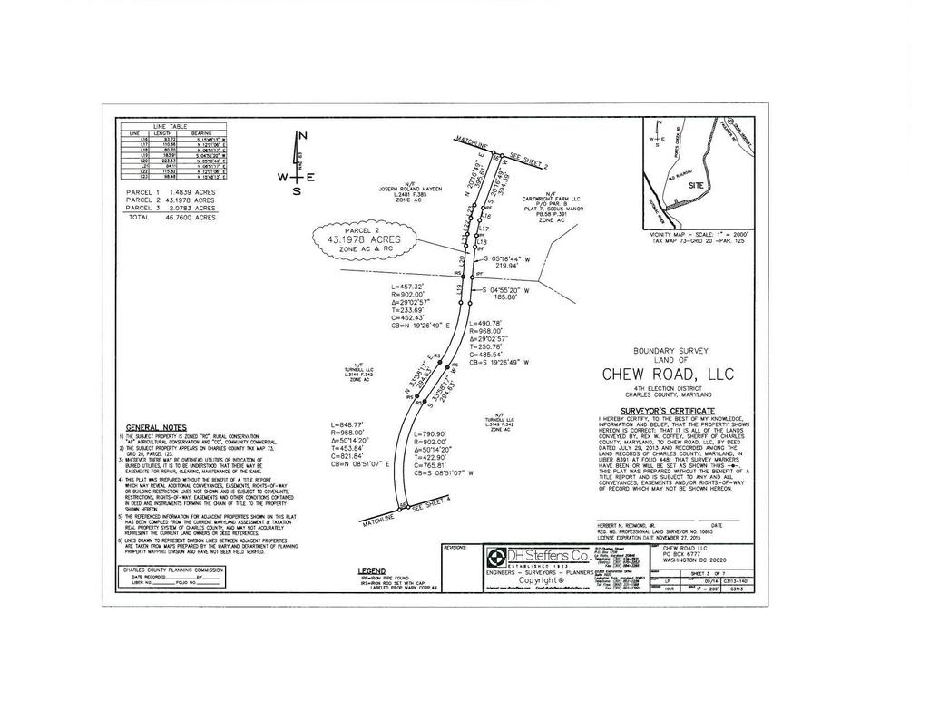
2 This meeting will be conducted in two parts. I will first review selected portions of the Request for Proposals within the RFP. Items not reviewed should not be construed as being less important than those reviewed. No information will be presented that is not already contained within the RFP. The meeting will then be turned over to Mr. Roland who will discuss technical aspects of the project. B. Procurement Discussion All solicitation documents may be found on the Charles County Bid Board. Ensure all required forms and any other information required is complete and in your proposal package. A complete proposal package is explained on page I-1 and I-2. Incomplete proposals may be rejected. Questions concerning the RFP should be directed to me in writing via the contact information provided in the RFP on page I-3. No information obtained from any source other than the solicitation documents found on the County Bid Board, or from myself or Mr. Roland during this meeting, may be considered to be accurate. Proposals must be valid for 120 days from the due date (page I-2). There is an aspirational 25% MBE goal for this solicitation. This RFP is subject to the County s Small Local Business Enterprise Program. If your firm is a Charles County registered SLBE and you want to take advantage of the SLBE preference, please complete the SLBE program forms located on page I-24 to I-26 of the solicitation. All Charles County small businesses are encouraged to apply. The protest policy is on page I-7. The County may reject any and all proposals for any reason it deems necessary, and may waive any irregularities and/or informalities, and make award in any manner that is in the best interest of the County. By submitting a proposal in response to this solicitation, the offeror certifies that their firm is not debarred, suspended, or otherwise ineligible for participation in government procurement by the federal government, the State of Maryland, or any other state, county, or municipal government. C. Technical Discussion This will be the County s 2 nd rail trail and has been in the County s possession for approximately 6 months. The County has also acquired the old SMECO building off Popes Creek Road as part of this area. The County is working to acquire a property located adjacent to the trail at US-301. Unlike the Indian Head rail trail, Pope s Creek does not have an elevated rail bed. The trail starts in Faulkner at US-301 and proceeds 2.7 miles to Popes Creek Road. The trail will be composed primarily of a stone dust material approximately 4 inches above a geotextile and an 1800-foot boardwalk near the pond. There is also a trestle bridge that requires repair. Short boardwalk segments may be an option. There will be a 66-foot right-of-way. The maximum trail size is 10 feet, but the County s preference is for an 8-foot wide trail. As part of the scope, the Design Engineer will need to make recommendation for how the material is moved into place. US Fish & Wildlife Services (FWS) will review and approve the construction plans per grant funding requirements. FWS has also approved a small overlook platform with the location to be determined. The preferences is also to leave as many existing trees as possible in the design. Parts of the trail are impacted by severe erosion. The Design Engineer shall be responsible for determining grades of where culverts need to go. The contract term considers the time for permit acquisition. 2
3 This is a priority project for the County. D. Questions Received Question 1 Question: Can you walk over the bridge right now? Response: This is not suggested for safety reasons. Rotten ties are on top. Steel structures are expected to be in good shape. Question 2 Question: Can you use Popes Creek Road to haul? Response: Yes. Question 3 Question: Will the US Army Corps of Engineers be based out of Baltimore? Response: Yes. Question 4 Question: Any base information available? Right of way plats? Response: We only have right of way plats. See Attachment B. Question 5 Question: County have topographical maps for this? Response: The County will provide these to the awardee. Question 6 Question: Was stormwater management required on the 14 mile trail just completed? Response: No, this was elevated feet. Question 7 Question: Railroad right of way abandoned for 35 years? Response: Nothing has run on it since the early 1960s. Approximately 1980, a salvage company removed most of the metal components from the trail. Question 8 Question: Based on the aerial, there is no existing parking area for this? Response: No, the County is currently trying to acquire the property. No parking design is included with this project. Question 9 Question: Difficult walk? Response: No, the County has cleared the top section. Below the bridge, you are walking on the rail bed. Trying to access from Popes Creek Road, the rail-bed is completely overgrown. Question 10 Question: Is there a minimum tree size that FWS has determined should be kept on the trail? Response: The minimum size has not been determined nor have the trees been identified to be saved. Question 11 Question: What is the relationship between the County and U.S. Fish and Wildlife Service (FWS)? Response: The County used FWS funds to purchase the property, which includes conservation easement. 3
4 Question 12 Question: Was 1800 boardwalk determined by FWS? Response: This was approved by FWS based on flooding. Question 13 Question: What permits is the contractor going to be responsible for? Response: The Contractor will be responsible for all permits, which may include Critical Area Commission, Maryland Department of the Environment (MDE), U.S. Army Corps of Engineers, U.S. FWS, and other various State and County permits. Question 14 Question: Has the County met with MDE or the U.S Army Corps of Engineers on site? Response: No. Question 15 Question: Will the boardwalk require U.S. Army Corps of Engineers approval? Response: This is anticipated. Question 16 Question: When talking about going around trees, how wide is the easement? Response: 66 feet. Written Questions Received through 07/02/2015 Question 17 Question: Can you provide general project budget figures, as related to state and federal grants, that will be utilized for this project? Specifically, as follows; o The trail segment over the former Pope s Creek rail corridor from U.S. Route 301; o The trail segment that traverses through wetlands and the Chesapeake Bay Critical Area (CBCA) which is intended to be constructed of an elevated boardwalk system; o The existing rail bridge. Response: Obviously design will allow the County to get a better handle on estimated construction costs. Our preliminary estimate is between $300K - $400K per mile. Question 18 Question: For the portion of the trail within wetlands, wetland buffers, and the CBCA, which the U.S. Department of Fish and Wildlife is providing grant money; o Can you provide the name and contact information for the USF&W person that is the primary contact for the Charles County for this project? Response: The name and contact information for the US FWS contact will be provided to the Contractor selected to perform the work. Question 19 Question: The RFP states that the design consultant shall work with the USF&W structural engineer, geotechnical engineer, and others of their team for the design of said boardwalk. Can you provide any initial design parameters, specifications, technical notes/references which the USF&W have provided to the county at this point in time? Response: The intent here is for the design consultant to provide a preliminary boardwalk design concept for USF&W review. They will be most concerned with location, height and verifying that length/width restrictions are followed. There are no specifications at this point. Question 20 Question: From the map provided, there appears to be several potential access points on "roads" or 4
5 "paths" from the Pope's Creek Road. Does the county own any of the land in those areas with such access and/or have permission or potential permission from adjacent land owners to the trail project corridor accessing from the Pope Creek Road? Response: Other than one access road off of South Faulkner Road, the only access to the property is at the trail terminus (each end: Rte.301 and also Popes Creek Road). Question 21 Question: Penn Trails LLC is working under a five year requirements contract # with Howard County, Maryland, for Trail Design and Planning Services. All potential work tasks that would be involved with the Charles County project could directly relate to those contained in the Howard County contract # Penn Trails intends to work as a Sub-Contractor to Skelly & Loy (Prime Contractor) for your RFP The question is, can Penn Trails / Howard County's contract be utilized by Charles County as part of the MID-ATLANTIC PURCHASING TEAM? OR, would Penn Trails have to be the Prime Contractor for your office to access the Howard County contract's pricing, terms and conditions? Response: Charles County has issued this solicitation for the design work stated. The County has decided not to pursue this work by utilizing another government entity s contract. In order to utilize another government entity s contract, the County will only work with the Prime Contractor awarded the Contract. Question 22 Question: In regard to the referenced RFP, the Offeror s Experience Form referenced in Section 1.3 (d) on p. I-2 could not be located in the RFP package. Will this form be issued in an addendum? Response: See Item I.A.1 above for this change. Question 23 Question: Will there be trail heads? Will trail heads have parking? If so, where will they be located and how many parking spaces are required? Will there be a trail head at each end of the trail? Are the design of such trail heads and parking part of the scope of this contract? Response: Trailhead parking areas are not included in this RFP. Question 24 Question: Will a Traffic engineering study be required if there is parking provided at trail heads or elsewhere or for any other reason? Response: Traffic Study is not part of this RFP. Question 25 Question: The existing rail bridge might be determined as inadequate for continued use for a trail by the analyses conducted as part of this contract. If so, options will be to either a) design a new bridge and remove the existing one, or b) design remediation to use the existing bridge in a rehabilitated state. Should we assume that the work of a new bridge design or remediation design, if needed, will be negotiated as an addition to the scope of this contract? Response: We are assuming that the existing trestle bridge will be adequate for conversion into a pedestrian/bike bridge. We are looking for the consultant to make design recommendations to rehabilitate the existing structure. Question 26 Question: Some areas of forest appear to be required for clearing from the point where the trail departs the cleared rail corridor, and goes in a westerly direction toward the terminus of Pope s Creek near the Potomac River. Removal of significant portions of trees might trigger the need for a bird or other animal study. Construction might take place during nesting periods of migratory or other birds. Construction of the boardwalk portion of the trail will be through the wetlands and marshes of the 5
6 western reaches of Pope s Creek, and that area might contain fish or other vertebrae animals. Will a bird and/or other wildlife impact study be required for the project? Response: We are assuming that no wildlife impact study will be required. Question 27 Question: Are information kiosks or signage or other trail identifiers, way finders, or amenities contemplated as part of the scope of the project? Response: Information kiosks, signage and other amenities will not be included in this project. Question 28 Question: Will a landscape planting plan for plants not associated with storm water management practices be part of the scope of this contract? Response: No. Question 29 Question: What if any survey information does the County possess that it will make available to the selected consultant? i.e. Deeds, Plats, Property surveys, topographic surveys, forest delineations, wetland delineations, floodplain studies, stream studies, aerial photography, etc. Response: Property survey and topographical surveys. Question 30 Question: Have historical resources been identified as part of the site or in close proximity? Will a historical resources study be required? Will an archaeological study be required? Response: Historical and archaeological studies are required. Question 31 Question: Can you review or describe the access that may be afforded from 301? Is there property near there that may be available for access and storage? Response: At this time, access is limited. We assume that a temporary entrance could be considered at Rte.301. We are also in negotiation with the owner of the adjacent parcel at this location. There is also an access option off of South Faulkner Road. 6
7 ATTACHMENT A 7
8 8
9 9
10 ATTACHMENT B 10
11 11
12 12
13 13
14 14
15 15
16 ***END OF ADDENDUM*** 16
CHARLES COUNTY GOVERNMENT RFP NO PORT TOBACCO COURTHOUSE GREEN PRELIMINARY DESIGN
 CHARLES COUNTY GOVERNMENT Department of Fiscal and Administrative Services Purchasing Division Telephone: 301-645-0656 March 21, 2017 RFP NO. 17-24 PORT TOBACCO COURTHOUSE GREEN PRELIMINARY DESIGN ADDENDUM
RFP REQUEST FOR PROPOSALS CITY OF PORTSMOUTH, NH. DESIGN ENGINEERING SERVICES North Mill Pond Trail and Greenway
 RFP 61-18 REQUEST FOR PROPOSALS CITY OF PORTSMOUTH, NH DESIGN ENGINEERING SERVICES North Mill Pond Trail and Greenway Sealed Requests for Proposals, plainly marked RFP 61-18 Design Engineering Services
ANNE ARUNDEL COUNTY OFFICE OF PLANNING AND ZONING - DEVELOPMENT DIVISION. Site Development Plan Submittal Application Requirements
 ANNE ARUNDEL COUNTY OFFICE OF PLANNING AND ZONING - DEVELOPMENT DIVISION Site Development Plan Submittal Application Requirements Project Name: Project Site Plan # C: Date: Instructions: All submissions
Development Reviews. An overview of the Commission s review process, primarily in Klickitat County. March 13, 2018
 Development Reviews An overview of the Commission s review process, primarily in Klickitat County March 13, 2018 Who should a landowner work with? Oregon Counties Washington Counties Multnomah County Land
The Illinois Department of Transportation and Lake County Division of Transportation. Route 173, including the Millburn Bypass
 The Illinois Department of Transportation and Lake County Division of Transportation welcome you to this Public Hearing for U.S. Route 45 from Illinois Route 132 to Illinois Route 173, including the Millburn
WASHINGTON COUNTY OREGON
 WASHINGTON COUNTY OREGON LONG RANGE PLANNING DIVISION North Bethany Subarea Stream Corridors: Existing Regulations In Oregon, there is a distinct difference between the land use rules that apply in rural
OVERMOUNTAIN VICTORY TRAIL BURKE CALDELL CORRIDOR FEASIBLITY STUDY REQUEST FOR QUALIFICATIONS CALDWELL COUNTY PATHWAYS
 OVERMOUNTAIN VICTORY TRAIL BURKE CALDELL CORRIDOR FEASIBLITY STUDY REQUEST FOR QUALIFICATIONS CALDWELL COUNTY PATHWAYS Caldwell County Pathways along with our co-partners City of Lenoir, Town of Gamewell,
Capital Projects in and near Odenton Town Center
 Capital Projects in and near Odenton Town Center Map ID Anne Arundel County Department of Public Works This project provides for the design, right of way acquisition, and construction of approximately
DESIGN CRITERIA PACKAGE
 RFQ: 17-C-00003 DESIGN-BUILD SERVICES FOR THE DESIGN CRITERIA PACKAGE PREPARED BY: JAMES E. JACKSON, JR. AIA CITY ARCHITECT CONTRACT ADMINISTRATION DEPARTMENT and INTERFLOW ENGINEERING, L.L.C DESIGN CRITERIA
ADDENDUM TO BIOLOGICAL SCOPING SURVEY REPORT, BOTANICAL SURVEY AND WETLAND DELINEATION
 ADDENDUM TO BIOLOGICAL SCOPING SURVEY REPORT, BOTANICAL SURVEY AND WETLAND DELINEATION FOR AVALON INN (APN 069-241-27 & -04) 1201 & 1211 NORTH MAIN STREET FORT BRAGG, CA MENDOCINO COUNTY prepared for:
PROJECT BACKGROUND. Preliminary Design Scope and Tasks
 PROJECT BACKGROUND Preliminary Design Scope and Tasks The purpose of this Study is the development of preliminary designs for intersection improvements for Trunk Highway (TH) 36 at the intersections of
7.0 SOCIAL, ECONOMIC, AND ENVIRONMENTAL ISSUES
 7.0 SOCIAL, ECONOMIC, AND ENVIRONMENTAL ISSUES The following list of social, economic, and environmental issues have been identified based on a preliminary inventory of resources in the project area, an
ANNE ARUNDEL COUNTY OFFICE OF PLANNING AND ZONING - DEVELOPMENT DIVISION. Final Plan Submittal Application Requirements.
 ANNE ARUNDEL COUNTY OFFICE OF PLANNING AND ZONING - DEVELOPMENT DIVISION Final Plan Submittal Application Requirements Subdivision Name: Subdivision # S: Project # P: Date: Instructions: All submissions
Historic Ottawa Beach Waterfront Walkway Park Township
 Historic Ottawa Beach Waterfront Walkway Park Township Project Description: Public access improvements to the shoreline of Lake Macatawa are the final steps in completing the park master plan for the Historic
PURPOSE: The purpose is to provide commercial facilities in the Vancouver and Clark County vicinity.
 US Army Corps of Engineers Seattle District Joint Public Notice Application for a Department of the Army Permit and a Washington Department of Ecology Water Quality Certification and/or Coastal Zone Management
Grand River Ravines Georgetown Township
 Grand River Ravines Georgetown Township Project Description: The Grand River Ravines County Park property is composed of the 68-acre former Fillmore at the Bend Open Space purchased in 1999 and two more
Pittsburgh District Pittsburgh, PA Notice No Closing Date: May 29, 2015
 Public Notice U.S. Army Corps In Reply Refer to US Army Corps of Engineers, Pittsburgh District of Engineers Notice No. below 1000 Liberty Avenue Pittsburgh District Pittsburgh, PA 15222-4186 Application
M E M O R A N D U M. DATE: July 19, Patrick D. O Keeffe, City Manager. Economic Development & Housing
 M E M O R A N D U M DATE: July 19, 2011 TO: FROM: Patrick D. O Keeffe, City Manager Economic Development & Housing SUBJECT: Resolution of the City Council of the City of Emeryville Approving the Application
Poisoned Park? How Exide s Lead Contamination Risks Frisco s Grand Park
 Frisco City Hall has big plans to transform Stewart Creek into a Grand Park with lots of water features for kids to play in. Poisoned Park? How Exide s Lead Contamination Risks Frisco s Grand Park But
Town of Borden-Carleton
 Town of Borden-Carleton 20 Dickie Road Borden-Carleton, PEI C0B 1X0 Phone (902) 437-2225 Request for Proposals Architectural, Engineering and Landscape Architectural Design Services The Town of Borden-Carleton
Public Hearing. Charlotte County-Punta Gorda MPO - Meeting Rooms A and B March 14, open house at 4 p.m., formal presentation at 5 p.m.
 Public Hearing Charlotte County-Punta Gorda MPO - Meeting Rooms A and B March 14, 2019 open house at 4 p.m., formal presentation at 5 p.m. Welcome to the Public Hearing for the Harborview Road (CR 776)
ANNE ARUNDEL COUNTY OFFICE OF PLANNING AND ZONING - DEVELOPMENT DIVISION FINAL PLAN - SUBMITTAL APPLICATION REQUIREMENTS.
 ANNE ARUNDEL COUNTY OFFICE OF PLANNING AND ZONING - DEVELOPMENT DIVISION FINAL PLAN - SUBMITTAL APPLICATION REQUIREMENTS Subdivision Name: Subdivision # S: Project # P: Date: Instructions: All submissions
STREAM BUFFERS
 88-415 STREAM BUFFERS 88-415-01 PURPOSE In the Kansas City region and throughout the nation, vegetated stream buffers have been clearly shown to protect stream stability and related infrastructure, improve
Call for Artists for: Design and Construction of Environmental Art Activation Story Mill Community Park, Bozeman, MT
 Call for Artists for: Design and Construction of Environmental Art Activation Story Mill Community Park, Bozeman, MT Seeking artists to design, fabricate and install art elements in the nature sanctuary
COUNTY COUNCIL OF PRINCE GEORGE'S COUNTY, MARYLAND SITTING AS THE DISTRICT COUNCIL 2010 Legislative Session. Council Members Dernoga and Olson
 DR- COUNTY COUNCIL OF PRINCE GEORGE'S COUNTY, MARYLAND SITTING AS THE DISTRICT COUNCIL 00 Legislative Session Bill No. CB--00 Chapter No. Proposed and Presented by Introduced by Co-Sponsors The Chairman
AMENDMENT NO. 30 TO THE OFFICIAL PLAN OF THE TOWN OF MILTON
 AMENDMENT NO. 30 TO THE OFFICIAL PLAN OF THE TOWN OF MILTON Subject: Boyne Survey Secondary Plan and Related Official Plan Amendments The following text and schedules constitute Amendment No. 30 to the
SECTION 4(f) DE MINIMIS DOCUMENTATION
 DE MINIMIS DOCUMENTATION") SECTION 4(f) DE MINIMIS DOCUMENTATION Illinois Route 60/83 IL 176 to the intersection of IL 60 (Townline Road) Lake County P-91-084-07 Mundelein Park and Recreation District Project Limit SECTION 4(f)
SECTION 4(f) DE MINIMIS DOCUMENTATION Illinois Route 60/83 IL 176 to the intersection of IL 60 (Townline Road) Lake County P-91-084-07 Mundelein Park and Recreation District Project Limit SECTION 4(f)
Pennsy Greenway Trail
 Town of Schererville Pennsy Greenway Trail DES. #s: 0401062, 1173595 & 1382661 Construction of Pennsy Greenway Trail beginning at Wilhelm Street and continuing northwest along the former Penn Central railroad
Transportation Committee
 Transportation Committee Business Item No. 2013-286SW Meeting date: October 14, 2013 For the Metropolitan Council meeting of October 16, 2013 Subject: Southwest Light Rail Transit (Green Line Extension):
Draft Rhode Island Stormwater Design and Installation Standards Manual
 Draft Rhode Island Stormwater Design and Installation Standards Manual Summary The May 2009 Public Review Draft version of the RI Stormwater Design and Installation Standards Manual consists of approximately
Capital Projects impacting Odenton Town Center
 Capital Projects impacting Odenton Town Center 1 2 E549700 W801600/ W801602 Anne Arundel County Department of Public Works Manor View Elementary School Transmission Main - MD 32 @ Meade Phase 2 $34,399,000
DRAFT SCOPE OF SERVICES PEER REVIEW OF BAKER PARK. Request for Qualifications (RFQ)
") DRAFT SCOPE OF SERVICES PEER REVIEW OF BAKER PARK Request for Qualifications (RFQ) The following scope of services is presented for consideration and development of firm qualifications submittal. Some
DRAFT SCOPE OF SERVICES PEER REVIEW OF BAKER PARK Request for Qualifications (RFQ) The following scope of services is presented for consideration and development of firm qualifications submittal. Some
NORTHEAST RIVER CROSSING FUNCTIONAL PLANNING STUDY
 WELCOME Northeast River Crossing Functional Planning Study Phase 2 Public Meeting 4 to 8 PM Informal drop-in format and discussion tables Meeting Purpose Introduce the Northeast River Crossing Functional
Letter of Notification For East Lima Station Expansion Project
 Letter of Notification For East Lima Station Expansion Project PUCO Case No. 18-0906-EL-BLN Submitted to: The Ohio Power Siting Board Pursuant to Ohio Administrative Code Section 4906-6-05 Submitted by:
RECREATION, OPEN SPACE AND GREENWAYS ELEMENT GOALS, OBJECTIVES, AND POLICIES
 RECREATION, OPEN SPACE AND GREENWAYS ELEMENT GOALS, OBJECTIVES, AND POLICIES GOAL R-1: DEVELOP A RECREATION, OPEN SPACE AND GREENWAYS SYSTEM AS AN INTEGRAL COMPONENT OF AN OVERALL, COUNTY-WIDE ECONOMIC
IOWA HIGHWAY 57 / WEST 1 ST STREET STUDY PUBLIC INFORMATIONAL MEETING APRIL 22, 2014
 IOWA HIGHWAY 57 / WEST 1 ST STREET STUDY PUBLIC INFORMATIONAL MEETING APRIL 22, 2014 INTRODUCTION The City of Cedar Falls and the Iowa Department of Transportation are conducting a Public Informational
Longmeadow Parkway Fox River Bridge Corridor. August 6, 2015
 Longmeadow Parkway Fox River Bridge Corridor August 6, 2015 Longmeadow Parkway Bridge Corridor 5.6 miles from Huntley Road to IL 62 Unique municipal/county/state/federal partnership Links Randall Road
METROPOLITAN COUNCIL 390 North Robert Street, St. Paul, MN Phone (651) ; TDD (651)
 ; TDD (651)") DATE: December 20, 2011 METROPOLITAN COUNCIL 390 North Robert Street, St. Paul, MN 55101 Phone (651) 602-1000; TDD (651) 291-0904 TO: Metropolitan Parks and Open Space Commission FROM: Tori Dupre, Senior
DATE: December 20, 2011 METROPOLITAN COUNCIL 390 North Robert Street, St. Paul, MN 55101 Phone (651) 602-1000; TDD (651) 291-0904 TO: Metropolitan Parks and Open Space Commission FROM: Tori Dupre, Senior
METROPOLITAN COUNCIL 390 North Robert Street, St. Paul, MN Phone (651) ; TDD (651)
 ; TDD (651)") DATE: October 24, 2012 METROPOLITAN COUNCIL 390 North Robert Street, St. Paul, MN 55101 Phone (651) 602-1000; TDD (651) 291-0904 TO: Metropolitan Parks and Open Space Commission FROM: Tori Dupre, Senior
DATE: October 24, 2012 METROPOLITAN COUNCIL 390 North Robert Street, St. Paul, MN 55101 Phone (651) 602-1000; TDD (651) 291-0904 TO: Metropolitan Parks and Open Space Commission FROM: Tori Dupre, Senior
QUESTIONS AND ANSWERS Windsor Woods, Princess Anne Plaza & The Lakes Combined Drainage Project
 QUESTIONS AND ANSWERS Windsor Woods, Princess Anne Plaza & The Lakes Combined Drainage Project PROJECT OVERVIEW Windsor Woods, Princess Anne Plaza and The Lakes are neighborhoods located in what was once
AGENDA ITEM: IOWA. west] that were not FISCAL IMPACT. the City of Clive. STAFF REVIEW. Resolution II. Amendment PREPARED BY: REVIEWED BY:
![AGENDA ITEM: IOWA. west] that were not FISCAL IMPACT. the City of Clive. STAFF REVIEW. Resolution II. Amendment PREPARED BY: REVIEWED BY:](/thumbs/93/112428810.jpg "AGENDA ITEM: IOWA. west] that were not FISCAL IMPACT. the City of Clive. STAFF REVIEW. Resolution II. Amendment PREPARED BY: REVIEWED BY:") AGENDA ITEM: CITY OF WAUKEE, IOWA CITY COUNCIL MEETING COMMUNICATION MEETING DATE: March 7, 2016 AGENDA ITEM: Consideration of approval of a resolution approving Engineering Services Amendment No. 1 with
AGENDA ITEM: CITY OF WAUKEE, IOWA CITY COUNCIL MEETING COMMUNICATION MEETING DATE: March 7, 2016 AGENDA ITEM: Consideration of approval of a resolution approving Engineering Services Amendment No. 1 with
RECREATION AND OPEN SPACE ELEMENT GOALS, OBJECTIVES, AND POLICIES
 RECREATION AND OPEN SPACE ELEMENT GOALS, OBJECTIVES, AND POLICIES Goal 7 To provide park facilities, recreation programs, and open space resources that are safe, adequate, and accessible to all City residents,
Northern Branch Corridor SDEIS March 2017
 Northern Branch Corridor SDEIS March 2017 15. 15.1. Chapter Overview 15.1.1. Introduction This chapter discusses changes to the Preferred Alternative resulting in the potential for project improvements
WELCOME! 8 8:30 6: TH STREET IMPROVEMENTS. Open House. Presentation & Q&A
 WELCOME! 168 TH STREET IMPROVEMENTS 6:30 Open House 7 8 Presentation & Q&A 8 8:30 Open House WELCOME Todd Pfitzer City of Omaha Engineer Bob Stubbe City of Omaha Public Works Director Jon Meyer Project
PROJECT SCOPE OF WORK CITY OF TOWN AND COUNTRY STORMWATER PROGRAM
 PROJECT SCOPE OF WORK CITY OF TOWN AND COUNTRY STORMWATER PROGRAM Project Name: 362 Featherstone Dr Project ID Number: 27-3 Problem: Anecdotal evidence suggests a natural spring exists in the backyard
ERIE-ATTICA RAILROAD BRIDGE AND TRAIL FEASIBILITY STUDY
 ERIE-ATTICA RAILROAD BRIDGE AND TRAIL FEASIBILITY STUDY Prepared for: Village of Avon 74 Genesee Street Avon, New York 14414 Prepared by: 2165 Brighton-Henrietta Townline Road Rochester, New York 14623
ST. MARY S SOIL CONSERVATION DISTRICT (SMSCD) AND DPW&T CONCEPT EROSION AND SEDIMENT CONTROL AND STORMWATER MANAGEMENT GUIDELINES AND CHECKLIST
 AND DPW&T CONCEPT EROSION AND SEDIMENT CONTROL AND STORMWATER MANAGEMENT GUIDELINES AND CHECKLIST") St. Mary s Soil Conservation District 26737 Radio Station Way, Suite B Leonardtown, MD 20650 Phone: 301-475-8402 ext. 3 Fax: 301-475-8391 www.stmarysscd.com St. Mary s County Government Department of Public
St. Mary s Soil Conservation District 26737 Radio Station Way, Suite B Leonardtown, MD 20650 Phone: 301-475-8402 ext. 3 Fax: 301-475-8391 www.stmarysscd.com St. Mary s County Government Department of Public
Goal 1 To establish and follow land use patterns for the long-range development of the campus.
 ELEMENT 4 FUTURE LAND USE Goal 1 To establish and follow land use patterns for the long-range development of the campus. Objective 1A Correct existing incompatible campus land uses. Policy 1A-1 Reduce
North Metro Natural Gas Pipeline Project Routing Study. Exhibit I: Comment and Response Document
 North Metro Natural Gas Pipeline Project Routing Study Exhibit I: Comment and Response Document North Metro Natural Gas Pipeline Project Routing Study This page intentionally left blank. North Metro Natural
SOUTH MAIN RIVER COMMUNITY REINVESTMENT PROJECT AREA PLAN DATED AUGUST 31, 2018
 SOUTH MAIN RIVER COMMUNITY REINVESTMENT PROJECT AREA PLAN DATED AUGUST 31, 2018 Redevelopment Agency of the City of Logan, Utah South Main River Community Reinvestment Project Area - 1 - INTRODUCTION 1.
North Carolina Department of Transportation Project Development and Environmental Analysis Branch
 North Carolina Department of Transportation Project Development and Environmental Analysis Branch Citizens Informational Workshop I-85, from I-485 to NC 73 Mecklenburg and Cabarrus Counties October 30,
Alternatives Development Three conceptual alternatives were developed for the Race Road/Jessup Village Planning Study and are described below:
 Race Road/Jessup Village Planning Study (H550601) Project Newsletter Spring 2015 Project Description The Study Team, consisting of staff from Anne Arundel County (Department of Public Works and Department
Town of Florence Florence County, WI DRIVEWAY ORDINANCE
 Town of Florence Florence County, WI 08-10-09 DRIVEWAY ORDINANCE 1.01 PURPOSE The purpose of this Ordinance is to regulate the establishment, construction, improvement, modification or reworking of a driveway
DRAFT MAP AMENDMENT FLU 04-4
 DRAFT MAP AMENDMENT FLU 04-4 SW 24 TH AVENUE ROADWAY CORRIDOR The University of Florida participates with the Metropolitan Transportation Planning Organization (MTPO) in its responsibilities for the continuing,
Public Information Centre. Welcome
 Transportation Improvements from the Beaver Creek Bridge to the Entrance of Santa s Village District of Muskoka Municipal Class Environmental Assessment Welcome Please sign in Take a comment sheet Staff
2.4 FUTURE LAND USE ELEMENT Goals, Objectives and Policies
 GOAL 1: To create developmental patterns that direct future growth to appropriate areas on campus, in a manner that promotes the educational mission of the University, the protection of environmentally
Drexel, Barrell & Co.
 Drexel, Barrell & Co. June 18, 2018 Engineers/Surveyors Boulder Colorado Springs Greeley 3 South 7 th Street Colorado Springs, Colorado 80905-1501 719 260-0887 719 260-8352 Fax El Paso County Planning
The following principles guide the development of goals and strategies to protect and promote these amenities:
 OPEN SPACE/PARKS/TRAILS/RECREATION GOALS/STRATEGIES Cherry Hills Village is a living environment that offers low density development, open areas, public scenic vistas, public trails and public parks. This
Citizen Information Meeting
 Prince William County Government Citizen Information Meeting Vint Hill Road Extension May 11, 2016 Benefits: Route 28 Corridor Improvement Program Estimated significant cost savings versus bidding these
Checklists. Project Name: Location: File Number: Date of Submittal: Reviewer: Date: Applicant: Contact Name: Phone Number:
 Applicant: Contact Name: Phone Number: Email: Project Name: Location: File Number: Date of Submittal: Reviewer: Date: Concept Plan Requirements: I. General Project Information 1. Address or parcel number
TREE REMOVAL PERMIT PACKET
 PERMIT INTAKE HOURS Permit Applications will be accepted between 8:30 am and 4:30 pm. Community Development Engineering Division 38 Hill Street, Suite G-30 Roswell, GA 30075 770-641-3780 www.roswellgov.com
QUESTIONS AND ANSWERS Windsor Woods, Princess Anne Plaza & The Lakes Combined Drainage Project
 QUESTIONS AND ANSWERS Windsor Woods, Princess Anne Plaza & The Lakes Combined Drainage Project Project Overview... 2 Thalia Creek (Windsor Woods) Tide Gate... 6 Club House Road Drainage Project... 9 Updated
BASS PONDS, MARSH, & WETLAND HABITAT RESTORATION PROJECT
 FACT SHEET BASS PONDS, MARSH, & WETLAND HABITAT RESTORATION PROJECT MINNESOTA VALLEY NATIONAL WILDLIFE REFUGE, MINNESOTA ENVIRONMENTAL MANAGEMENT PROGRAM LOCATION Three areas located on the Minnesota Valley
RFP DRAINAGE OUTFALL DESIGN AND PERMITTING. Mandatory Meeting for Proposers August 15, 2015
 RFP 2018-02 DRAINAGE OUTFALL DESIGN AND PERMITTING Mandatory Meeting for Proposers August 15, 2015 IMPORTANT DATES August 15 th, 2:00pm August 17 th, 5:00pm August 22 nd, 5:00pm September 5 th, 2:00pm
TOWNSHIP OF LOGAN SOIL & FILL IMPORTATION AND PLACEMENT APPLICATION SUBMITTAL CHECKLIST
 TOWNSHIP OF LOGAN SOIL & FILL IMPORTATION AND PLACEMENT APPLICATION SUBMITTAL CHECKLIST Applications: 5 copies of application - Applicant will reproduce the copies at his/her costs. The Township Clerk
Drexel, Barrell & Co.
 Drexel, Barrell & Co. December 21, 2018 Engineers/Surveyors Boulder Colorado Springs Greeley 3 South 7 th Street Colorado Springs, Colorado 80905-1501 719 260-0887 719 260-8352 Fax El Paso County Planning
UNIVERSITY OF NORTHERN IOWA
 UNIVERSITY OF NORTHERN IOWA Municipal Separate Storm Sewer System September 2008 Report Permit Number 07-09-0-04 August 2008 Prepared by: University of Northern Iowa Environmental Health and Safety Office
Plat Requirements CHECKLIST FOR SITE PLAN REVIEW
 This checklist is to be used as a guide for complying with the Town of Hollis Site Plan Regulations. It is to be used for each individual site plan review application submitted. Applicants are encouraged
7th Avenue Creek Master Plan Development Project. City of St. Charles, IL. IAFSM CONFERENCE March 14, 2018 MARKET
 7th Avenue Creek Master Plan Development Project MARKET City of St. Charles, IL IAFSM CONFERENCE March 14, 2018 7 TH AVENUE CREEK PROJECT AREA 2 2008 RAIN EVENT 3 RESIDENTIAL STRUCTURE FLOODING COMMERCIAL
Final Design Activity Descriptions July, 2017
 Final Design Activity Descriptions July, 2017 Check the Capital Project Delivery website to ensure this is the current version. Table of Contents Final Design Final Design Initiated (4000)... 7 Initiate
Pre-Bid Meeting Minutes 2018 A & E RFP February 6, :00 a.m.
 Attendees: Pre-Bid Meeting Minutes 2018 A & E RFP February 6, 2019 10:00 a.m. Anthony Shomin Sue Martin Architectural & Engineer Professionals KCKHA Modernization Coordinator KCKHA Modernization Admin.
Yadkin River Greenway Feasibility Study Fact Sheet Village of Clemmons, Town of Lewisville, Town of Bermuda Run
 Fact Sheet Village of Clemmons, Town of Lewisville, Town of Bermuda Run Project Background The Yadkin River Greenway Feasibility Study is a joint project with the Village of Clemmons, the Town of Bermuda
Stormwater Regulations & Considerations Morse Study Area. Pam Fortun, P.E. CFM Senior Stormwater Treatment Engineer Engineering Services Division
 Stormwater Regulations & Considerations Morse Study Area Pam Fortun, P.E. CFM Senior Stormwater Treatment Engineer Engineering Services Division Stormwater Regulations Development Considerations Floodplain
Request for Proposals
 Request for Proposals Charlestown Navy Yard Infrastructure Assessment Engineering Services The Boston Redevelopment Authority ( BRA )/Economic Development Industrial Corporation ( EDIC ) is issuing a Request
WOONASQUATUCKET RIVER WATERSHED COUNCIL REQUEST FOR PROPOSALS DESIGN OF GREENWAY PALETTE, SIGNAGE AND AMENITIES
 WOONASQUATUCKET RIVER WATERSHED COUNCIL REQUEST FOR PROPOSALS DESIGN OF GREENWAY PALETTE, SIGNAGE AND AMENITIES PROJECT BACKGROUND The Woonasquatucket River Watershed Council (WRWC) is a 501(c)3 organization
Wisconsin downtown action council Downtown project case study profile
 Wisconsin downtown action council Downtown project case study profile Project Name Onalaska Waterfront Project Location City of Onalaska Project Type (check all that apply) g Residential g Commercial g
We provide exceptional solutions to help our clients achieve success.
 We provide exceptional solutions to help our clients achieve success. We began as a small, two-person surveying firm called M.E. Berry & Associates in Hollywood, Florida. Known today as Calvin, Giordano
AMENDMENT NUMBER 2 TO AGREEMENT FOR PROFESSIONAL SERVICES BETWEEN URS CORPORATION GREAT LAKES AND THE CITY OF ANN ARBOR
 AMENDMENT NUMBER 2 TO AGREEMENT FOR PROFESSIONAL SERVICES BETWEEN URS CORPORATION GREAT LAKES AND THE CITY OF ANN ARBOR The City of Ann Arbor, a Michigan municipal corporation, with offices at 301 E. Huron
SEMSWA s Role in the Land Development Process
 SEMSWA s Role in the Land Development Process One of SEMSWA s responsibilities is to ensure that any new development or redevelopment within its service area is designed and constructed in compliance with
Meeting Purpose: Date and Time: Location: Attendance: Handouts:
 Meeting Purpose: Date and Time: Location: Attendance: Handouts: PA Turnpike / I-95 Interchange Project Design Advisory Committee (DAC)/Public Officials Meeting #8 April 12, 2012 at 1:30 p.m. Project Office,
STATE OF TENNESSEE DEPARTMENT OF TRANSPORTATION ENVIRONMENTAL DIVISION
 STATE OF TENNESSEE DEPARTMENT OF TRANSPORTATION ENVIRONMENTAL DIVISION Suite 900 - James K. Polk Building 505 Deaderick Street Nashville, Tennessee 37243-0334 MEMORANDUM TO: FROM: Files Joe W. Matlock,
Carson Street Streetscape Improvements. Request for Proposals
 Carson Street Streetscape Improvements Request for Proposals Complete Design Services for a Landscape/Streetscape Plan for Carson Street (Pioneer Boulevard to Norwalk Boulevard) Submittal Deadline: October
City of Waco Stormwater Management Regulations
 1.0 Applicability: City of Waco Stormwater Management Regulations These regulations apply to all development within the limits of the City of Waco as well as to any subdivisions within the extra territorial
Transportation Enhancements TE-2012-US Fish and Wildlife Service Quality of Life. Type of Improvement
 Transportation Enhancements 2012 Quality_of_Life Type of Improvement Infrastructure Bikeway Pedestrian Safety Quality of Life Purpose Primary project purpose is for constructing new bikeways (e.g. bike
Planning for and Managing Open Space and Natural Areas
 Planning for and Managing Open Space and Natural Areas Increasingly, development proposals in Delaware include large amounts of open space and natural areas. While open space is important as a community
THREE-STEP DESIGN PROCESS FOR OPEN SPACE SUBDIVISIONS
 00216106.DOC NMA/RRK 1/30/14 THREE-STEP DESIGN PROCESS FOR OPEN SPACE SUBDIVISIONS Open space subdivisions, sometimes called cluster developments, maintain a significant portion of a development site in
Westwood Shopping Center Sketch Plan, Plan # February 23, 2017 Item # 9
 Westwood Shopping Center Sketch Plan, Plan # 320170010 February 23, 2017 Item # 9 Westwood II Site 64,111 s.f. Manor Care site: vacant two story building HOC-Westwood Towers, 15 story tower To be considered
CPA , Bristoe Station and Kettle Run Preservation Study Comprehensive Plan Amendment
 Bristoe Station and Kettle Run Battlefields Special Study Area Introduction and Background The Bristoe Station Battlefield consists of approximately 9,410 acres. This battle on October 14, 1863, was the
CITY OF BEACON NOTICE TO LANDSCAPE ARCHITECTS GENERAL INFORMATION AND REQUEST FOR PROPOSALS
 CITY OF BEACON NOTICE TO LANDSCAPE ARCHITECTS GENERAL INFORMATION AND REQUEST FOR PROPOSALS The City of Beacon (the CITY) is issuing this Request for Proposals (RFP) for the selection of a landscape architect
West Dennis Center: Bass River to Old Main Street. West Dennis Business District: Old Main Street to Dennis Commons
 West Dennis Center: Bass River to Old Main Street West Dennis Business District: Old Main Street to Dennis Commons Dennisport Center: Dennis Commons to Division Street Main Street Project Goals Project
Fall 2017 Construction Update
 Fall 2017 Construction Update Ward 4 Southeast Engineering Department Riverwalk Red Multi-Use Trail Bridge Rehabilitation The Riverwalk Red Multi Use Trail Bridge was awarded to Cramer and Associates,
SOUTHWEST CORRIDOR EXTENSION. Environmental Evaluation and Basic Engineering Results PUBLIC MEETING/OPEN HOUSE November 18, 2009
 SOUTHWEST CORRIDOR EXTENSION Environmental Evaluation and Basic Engineering Results PUBLIC MEETING/OPEN HOUSE November 18, 2009 AGENDA I. Welcome/Introductions II. Project Review and Status III. Environmental
Working together to leverage limited Funds
 Working together to leverage limited Funds ARAPAHOE COUNTY OPEN SPACES 10 County Budget Conference September 20, 2013 The Power of Partnerships 2013 SORP Conference 5/23/2014 Why Talk About Open Space?
Dauphin Island s East End Beach and Barrier Island Restoration Project. April 16, :00 PM Dauphin Island Sea Lab, Shelby Hall
 Dauphin Island s East End Beach and Barrier Island Restoration Project Town of Dauphin Island, Alabama April 16, 2015 6:00 PM Dauphin Island Sea Lab, Shelby Hall Team Introduction South Coast Engineers
Northern Branch Corridor SDEIS March 2017
 14. Water Quality 14.1. Chapter Overview 14.1.1. Introduction This section discusses changes to the potential for activities associated with the development and operation of the Preferred Alternative to
I. INTRODUCTION SITE DESCRIPTION
 Request for Proposals Design Services for the Visitor Access and Engagement Project at Roy s Redwoods Open Space Preserve Marin County Parks & Open Space Preserve Woodacre, Marin County, CA November 12,
Application for Site Plan Review
 Application for Site Plan Review City of Pontiac Office of Land Use and Strategic Planning 47450 Woodward Ave, Pontiac, MI 48342 T: 248.758.2800 F: 248.758.2827 Property/Project Address: Sidwell Number:
CITY OF ST. AUGUSTA STEARNS COUNTY MINNESOTA ORDIANCE NO AN ORDINANCE ESTABLISHING REGULATIONS FOR STORMWATER MANAGEMENT
 CITY OF ST. AUGUSTA STEARNS COUNTY MINNESOTA ORDIANCE NO. 2017-05 AN ORDINANCE ESTABLISHING REGULATIONS FOR STORMWATER MANAGEMENT In the interest of the health, safety, and welfare of its citizens, the
To qualify for federal Transportation Enhancement (TE) funds a project must meet two basic federal requirements:
 funds a project must meet two basic federal requirements:") Eligibility Requirements To qualify for federal Transportation Enhancement (TE) funds a project must meet two basic federal requirements: 1) Relate to surface transportation and 2) Be one of the 12 designated
Eligibility Requirements To qualify for federal Transportation Enhancement (TE) funds a project must meet two basic federal requirements: 1) Relate to surface transportation and 2) Be one of the 12 designated
BYLAW C A Bylaw of Rocky View County to amend Land Use Bylaw C
 BYLAW C-7720-2017 A Bylaw of Rocky View County to amend Land Use Bylaw C-4841-97. The Council of Rocky View County enacts as follows: PART 1 TITLE This Bylaw shall be known as Bylaw C-7720-2017. PART 2