West Dennis Center: Bass River to Old Main Street. West Dennis Business District: Old Main Street to Dennis Commons
|
|
|
- Teresa Wilkinson
- 5 years ago
- Views:
Transcription


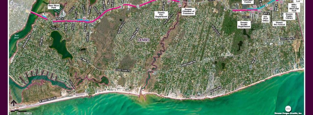
1 West Dennis Center: Bass River to Old Main Street West Dennis Business District: Old Main Street to Dennis Commons Dennisport Center: Dennis Commons to Division Street
2 Main Street Project Goals Project Goals 1. Achieve State & Federal Accessibility Standards ( AKA: Complete Streets) 2. Construct Sustainable Infrastructure 3. Improve bicycle accommodations and safety 4. Establish aesthetically pleasing pedestrian environment especially in Village center
3 Project Development Objectives Existing Conditions Assessment Establish Project Priorities Develop Pedestrian Streetscape Walk Concepts Develop Mitigation for Challenging Areas and Issues Solicit State Funding Assistance For Construction
4 Existing Conditions Assessment Identify Study Areas Existing Sidewalk Network Connectivity within Project Area Schools Libraries Business Centers Municipal Buildings Public Parking Town Parks

5
6 Potential State and Federal Funding Transportation Enhancement (TE) Program for Funding through the Cape Cod TIP: Comply with Acceptable Program Activities Design and Permitting: Town Obligation Federal Highway Administration (FHWA) requires that MassDOT oversee the TE Projects MassDOT District 5 Office Must Review and Approve TE Application. MassDOT to Program Project Construction Costs into Cape Cod TIP year. State and Federal Funds pay for all construction costs.
7 Transportation Enhancement: 12 Program Eligible Activities Eligible Activities (1 4) 1. Pedestrian and bicycle facilities. 2. Pedestrian and bicycle safety and educational activities 3. Acquisition of scenic or historic easements and sites 4. Scenic or historic highway programs including tourist and welcome center
8 Transportation Enhancement: 12 Program Eligible Activities Eligible Activities (5 8) 5. Landscaping and scenic beautification Historic preservation 6. Historic preservation 7. Rehabilitation and operation of historic transportation buildings, structures or facilities 8. Conversion of abandoned railway corridors to trails
9 Transportation Enhancement: 12 Program Eligible Activities Eligible Activities (9 12) 9. Inventory, control, and removal of outdoor advertising 10. Archaeological planning & research 11. Environmental mitigation of runoff pollution and provision of wildlife connectivity 12. Establishment of transportation museums
10 Program Eligible Activities That Apply to Route Pedestrian and bicycle facilities Sidewalks, walkways or curb ramps; bike lane striping, wide paved shoulders, bike parking and bus racks; offroad trails; bike and pedestrian bridges and underpasses. 5. Landscaping and scenic beautification Improvements such as street furniture, lighting, public art and landscaping along travel corridors.

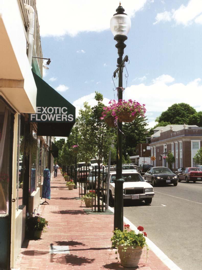
11 Main Street: Falmouth

12 Gathering Area

13 Decorative Crosswalks

14 Memorial Park
15 Streetscape Walks

16 Brick Walk Patterns

17 Brick Feature Strip


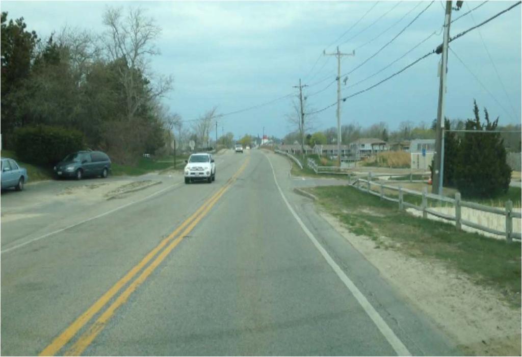
18 West Dennis Center Study Area

19 Old Main Street Intersection

20 Christmas Tree Shops

21 School Street Intersection

22 Church Street Intersection

23 Fisk Street

24 Uncle Barney s Road Intersection
25 Typical Sections
26 Design Considerations Handicap Accessibility Plantings Street Furniture Street Lighting Entrance Thresholds Building Materials Utilities Right of Way Constructability Safety
27 Design Considerations Handicap Accessibility Design of Pedestrian Ramps Access to buildings Horizontal Clearances Vertical Clearances Longitudinal and Transverse Slopes Cross Walks Markings Point Obstruction
28 Design Considerations Plantings Trees Tree Grates Planters Green Space Opportunities
29 Design Considerations Street Lightings High Type Lights/Large Spacing Box Fixture vs. Cobra Ornamental post and lamp Luminaire with Cut off Fixtures Lighting Levels/Average Illumination Type of light (High Pressure Sodium/ Halogen/Metal Halide/Mercury Vapor/LED)
30 Design Considerations Street Furniture Benches Trash Receptacles Bus Stop Kiosk Informational Kiosk Bike Racks Bollards Banners and Supports
31 Design Considerations Building Materials Brick & Concrete Pavers Concrete Hot Mix Asphalt Granite Curbing Cross Walk Imprint
32 Design Considerations Constructability State Mandated Summertime Construction Moratorium June 15 th to Labor Day Short Term Impacts to Business Access Short Term Impacts to Curb Side Parking Removal of Private Signs in State Highway Public Property Improvements Only Utility Pole and Hydrant Relocations Traffic Management Short Term Detours Parking Lane Closures

33 Dennis Port Business Center

34 Dennis Port Business Center
35 Program Development Stages Completed 1. Kick Off Meeting (2/24/2011) 2. Establish Downtown and Urban Walk Concepts 3. Evaluate Project Costs and Limits of Work 4. Prepare Draft Project Notification Form 5. Submit PNF to MassDOT District 5 6. Schedule Site walk with MassDOT Project Development Engineer 7. Refine Project Details 8. Prepare and Submit Project Initiation Form (PIF) 9. District 5 Presents Program to MassDOT Review Committee 10. Survey
36 Program Development Stages Future Public Hearing to Determine Desirability Town Meeting to Fund Design Hire Consultant to submit 25% drawing to MassDOT Once MassDOT approves plans they will hold 25% Design Public Hearing in Dennis MassDOT will program funding for project into a future Cape Cod TIP fiscal year Right of way acquisition 100% Design and Construction Bid Construction costs paid for with State & Federal Funds
37 Misc. Project Data Project Length approximately 6,000 ft. Typical road x section 5.5 / 5 / 11 / 11 / 5 / 5.5 with 5.5 / 11 / 11 / 8 / 5.5 in center Design and permitting cost: $620,00 (Town) Construction cost: $4.4 million (State & Fed) Development timeline: 3 to 4 years (minimum) Construction timeline: 2 years (no summer work)
To qualify for federal Transportation Enhancement (TE) funds a project must meet two basic federal requirements:
 funds a project must meet two basic federal requirements:") Eligibility Requirements To qualify for federal Transportation Enhancement (TE) funds a project must meet two basic federal requirements: 1) Relate to surface transportation and 2) Be one of the 12 designated
Eligibility Requirements To qualify for federal Transportation Enhancement (TE) funds a project must meet two basic federal requirements: 1) Relate to surface transportation and 2) Be one of the 12 designated
Main Street Reconstruction From Ninth Line to Stouffer Street. Town of Whitchurch-Stouffville. Public Information Centre
 Main Street Reconstruction From Ninth Line to Stouffer Street Town of Whitchurch-Stouffville Public Information Centre November 23, 2016 4:30 to 6:00 pm & 7:00 to 8:00 pm 6240 Main Street, Stouffville
COMPLETE GREEN STREET CHECKLIST
 COMPLETE GREEN STREET CHECKLIST This document was developed to dissect the structure of an urban street and explore opportunities to make our streets more complete while also integrating green street strategies.
BUSINESS DISTRICT DESIGN GUIDELINES
 Des Plaines, Illinois Prepared for the City of Des Plaines by: The Lakota Group Laurie Marston, AICP March 2005 Section 5: Streetscape Elements Business District Design Guidelines STREETSCAPE ELEMENTS
2017 General Obligation Bond
 2017 General Obligation Bond Presentation of Public and Council Projects to the Transportation & Mobility Stakeholder Committee April 13, 2017 Agenda Deferred Maintenance Project Development Process Projects
Parapet/Formliner/Fencing
 Parapet/Formliner/Fencing Cross Parapet/Formliner/Fencing Street Aesthetic Features Context The I-290 Phase I study is evaluating improvements along 13 miles of the Eisenhower Expressway, from west of
Shell Beach Road Streetscape Frequently asked Questions
 Shell Beach Road Streetscape Frequently asked Questions General What is the Shell Beach Road Streetscape Improvements Project? The overall goal of the Shell Beach Road Streetscape Improvement project is
Project Goal. RRRC Living Towns Planning Workshp. Town of Halifax Revitalization Project. Dynamic Planning & Management Duo: July 12, 2006
 Project Goal Town of Halifax Revitalization Project RRRC Living Towns Planning Workshp July 12, 2006 Town of Halifax Halifax County *** Revitalization Project Goal*** To create Economic Opportunity and
Transportation Enhancements TE-2012-US Fish and Wildlife Service Quality of Life. Type of Improvement
 Transportation Enhancements 2012 Quality_of_Life Type of Improvement Infrastructure Bikeway Pedestrian Safety Quality of Life Purpose Primary project purpose is for constructing new bikeways (e.g. bike
WELCOME! 8 8:30 6: TH STREET IMPROVEMENTS. Open House. Presentation & Q&A
 WELCOME! 168 TH STREET IMPROVEMENTS 6:30 Open House 7 8 Presentation & Q&A 8 8:30 Open House WELCOME Todd Pfitzer City of Omaha Engineer Bob Stubbe City of Omaha Public Works Director Jon Meyer Project
Jewel. Platte. of the. Plattsmouth Main Street Landscape Architecture by HDR
 Jewel of the Platte Plattsmouth Main Street Landscape Architecture by HDR Plattsmouth, Nebraska is a historic community of 6,500 residents located along the west bank of the Missouri River, just south
Landscape and Streetscape Design 2.5
 Landscape and Streetscape Design 2.5 2.5.1 Goals 2.5.2 Planting 2.5.3 Sidewalks and Pavement 2.5.4 Furnishings 2.5.5 Walls 2.5.6 Lighting 2.5.7 Stormwater 2.5.8 Street Cross Sections 2.5 LANDSCAPE AND
Sidewalks Street Lights
 Boston Complete Streets Guidelines 013 Boston Transportation Department Sidewalks Introduction 17 Sidewalk Design Principles 18 Sidewalk Zones 0 Sidewalk Zones Widths Preferred and Minimum Widths for Sidewalk
SOUTH UNIVERSITY Street Design Setting a Direction for Schematic Design
 1 SOUTH UNIVERSITY Street Design Setting a Direction for Schematic Design Meeting Agenda 2 1. Project Scope 2. Design Direction 3. Design Details 4. Schedule and Construction Logistics 3 SOUTH UNIVERSITY
VEHICULAR AND PEDESTRIAN CIRCULATION
 This perspective sketch communicates the intended character and quality of a proposed streetscape design. Locate benches near a major intersection where people tend to gather. Seating and lighting provide
The Illinois Department of Transportation and Lake County Division of Transportation. Route 173, including the Millburn Bypass
 The Illinois Department of Transportation and Lake County Division of Transportation welcome you to this Public Hearing for U.S. Route 45 from Illinois Route 132 to Illinois Route 173, including the Millburn
Maplewood Avenue Downtown Complete Street Project
 Maplewood Avenue Downtown Complete Street Project Second Public Meeting January 24, 2018 Welcome and Introduction of Project Team City Planning and Public Works Staff City of Portsmouth Juliet Walker Planning
City of Plattsburgh DRI: Downtown Streetscapes & Riverfront Access. Downtown Streetscape and Riverfront Access Design
 City of Plattsburgh DRI: Downtown Streetscapes & Riverfront Access Welcome Thank you for coming this evening. Agenda PART I - Project Context The Downtown Revitalization Program Our DRI Projects Other
AESTHETIC APPEARANCE. Design Guidelines for Grade-Separated Pedestrian, Cyclist and Equestrian Structures
 III. AESTHETIC APPEARANCE The aesthetic qualities of a grade-separated structure are as important as the specific design criteria. For example, a structure may be constructed to the exact criteria set
I-70/71 Innerbelt Project
 I-70/71 Innerbelt Project Project Progress Meeting and Design Enhancement Update November 9, 2009 Ohio Department of Transportation MS Consultants MSI Design Overview of Presentation 1. Recap Recent Project
COMMUNICATION URBAN DESIGN REVIEW BOARD CITY OF DES MOINES, IOWA MAY 16, 2017 MEETING
 COMMUNICATION URBAN DESIGN REVIEW BOARD CITY OF DES MOINES, IOWA MAY 16, 2017 MEETING Subject: Recommendation Prepared by: PRELIMINARY DESIGN REVIEW OF LOCUST STREET BRIDGE CONSTRUCTION & COURT AVENUE,
Chapter 7: Streetscape & Design Elements
 OVERVIEW Chapter 7: Streetscape & Design Elements During the public input phase of The Dixie Fix, the area of streetscape generated much interest. While safety and traffic flow are primary objectives of
SOUTH UNIVERSITY Street Design Alternatives in Progress
 1 Alternatives in Progress 2016.01.20 Meeting Agenda 2 1. Progress & Schedule 2. Utilizing the Street Design Manual 3. Site Characteristics and Input Received 4. Street Geometry What can we accomplish
MAIN STREET RECONSTRUCTION PROJECT PRE-CONSTRUCTION PUBLIC INFORMATION SESSION AGENDA
 MAIN STREET RECONSTRUCTION PROJECT PRE-CONSTRUCTION PUBLIC INFORMATION SESSION 7:00 P.M. TO 8:30 P.M. NOVEMBER 21 st, 2017 PENETANGUISHENE MEMORIAL COMMUNITY CENTRE BRIAN ORSER HALL (61 Maria Street) 1.
July 12, Columbus City Council City Hall 90 West Broad Street Columbus, OH RE: I-70/71 Columbus Crossroads Project
 OHIO DEPARTMENT OF TRANSPORTATION DISTRICT 6 400 EAST WILLIAM STREET DELAWARE, OHIO 43015 800.372.7714 Columbus City Council City Hall 90 West Broad Street Columbus, OH 43215-9015 RE: I-70/71 Columbus
Design Guidelines and Standards for Sight Triangles. Sight Triangle MANUAL
 Design Guidelines and Standards for Sight Triangles Sight Triangle MANUAL Table of Contents 1.0 Introduction..............................................7 1.1 Key Terms..............................
City of Burlington Downtown Street Design & Construction Standards
 City of Burlington Downtown Street Design & Construction Standards Adopted April 16, 2018 b City of Burlington Downtown Street Design Standards CITY OF BURLINGTON, VT The Great Streets Initiative is a
Streets Vision
 streets 86 2.9 Vision : The Most Prevalent and Important Public Spaces Fixed routes of human travel have served as corridors for commerce and places for human interaction from the earliest trails and foot
Johnson Street Bridge Public Realm Update
 Johnson Street Bridge Public Realm Update August 20, 2015 Background Johnson Street Bridge Replacement Project impacts a diverse range of stakeholders In addition to a new bridge, the project also includes
Bethlehem Pike Streetscape Master Plan
 Bethlehem Pike Streetscape Master Plan Prepared for Springfield Township October 2008 By Michael Baker Jr., Inc. Carter Van Dyke Associates Table of Contents 1. Introduction 3 2. General Corridor Wide
appendix and street interface guidelines
 appendix five: building and street interface guidelines appendix 5 building and street interface guidelines BOULEVARDS Boulevards are generally characterized by higher levels of traffic movement at higher
Conceptual Design. Main Street Enhancement and Extension Project. Bothell, Washington. June 11, 2009
 Conceptual Design Main Street Enhancement and Extension Project Bothell, Washington June 11, 2009 Berger/ABAM Engineers and Cascade Design Collaborative, Inc For Main Street Bothell to succeed it must
Design Guidelines for the Route 30 Corridor Master Plan: Subdivision and Land Development Elements
 Design Guidelines for the Route 30 Corridor Master Plan: Subdivision and Land Development Elements East Whiteland Township- Chester County, PA Prepared by: Draft: May 7, 2018 Design Guidelines for the
The open space system should provide connective elements, relate to natural resources, and enhance the suburban character of the landscape..
 The open space system should provide connective elements, relate to natural resources, and enhance the suburban character of the landscape.. Mixed-use and infill development should maintain or enhance
Onondaga County Sustainable Streets Project. Onondaga County Planning Federation June 7, Onondaga County Sustainable Streets Project 1
 Onondaga County Sustainable Streets Project Onondaga County Planning Federation June 7, 2012 Onondaga County Sustainable Streets Project 1 Sustainable Streets 1. Introduction to the SMTC 2. Sustainable
Town of Peru Comprehensive Plan Executive Summary
 Town of Peru Comprehensive Plan Executive Communities that plan grow by choice, not by chance. A plan makes growth thoughtful, understandable, and predictable. A plan shows that a community is managing
V. Gateways GATEWAYS / V-1
 V. GATEWAYS / V-1 Many of Chesapeake s gateways are located on highways and call for bold and attractive designs that motorists can understand, appreciate, and enjoy. can also take the form of natural
The Center Street Project
 The Center Street Project Mission Statement To develop a vision of how we, the citizens of Folly, want Center Street to be transformed into the Gateway to our city. Then deliver this vision to the City
Project Overview. Get Involved. Public Information Meeting. Contact Information
 Get Involved VDOT representatives will review and evaluate information received as a result of this meeting. Please fill out the comment sheet provided in this brochure if you have any comments or questions.
4.9 Mendocino Avenue Corridor Plan Design Guidelines
 4.9 Mendocino Avenue Corridor Plan Design Guidelines The Mendocino Avenue Corridor Plan addresses the area between College Avenue and Steele Lane. Mendocino Avenue is a busy arterial that runs parallel
GREENING THE BOULEVARD Master Plan Concepts for Venice Boulevard between Lincoln and Sawtelle
 GREENING THE BOULEVARD Katherine Spitz Associates Inc. 4212½ Glencoe Avenue Marina Del Rey, CA 90292 310 574 4460 Fax 574 4462 January 2008 Table of Contents Overview Proposed Design Improvements Illustration
NEW JERSEY DEPARTMENT OF TRANSPORTATION TRANSPORTATION ENHANCEMENT PROGRAM
 NEW JERSEY DEPARTMENT OF TRANSPORTATION TRANSPORTATION ENHANCEMENT PROGRAM Chris Christi Governor James Simpson Commissioner NEW JERSEY DEPARTMENT OF TRANSPORTATION DIVISION OF LOCAL AID AND ECONOMIC DEVELOPMENT
The Capital Design Advisory Committee St. Mary s College of Maryland & Historic St. Mary s City
 The Capital Design Advisory Committee St. Mary s College of Maryland & Historic St. Mary s City Welcome April 21, 2010 Capital Design Advisory Presentation: Relocating Margaret Brent Hall Traffic Calming
Chapter 14 Streetscape Improvements
 This chapter presents streetscape design concepts for key streets and gateways in the Downtown Specific Plan area. This chapter is organized as follows: 14 Streetscape Improvements 14.1 Streetscape Treatments
Project Consulting Team:
 THE DOWNTOWN CHERRYVILLE LAND USE + STREETSCAPE MASTER PLAN WAS FUNDED THROUGH THE GENEROUS DONATIONS OF THE FOLLOWING: The Community Foundation of Gaston County ElectriCities of North Carolina The Cherryville
Roanoke Rapids Streetscape Master Plan. City Council Presentation
 SCHEDULE: Stakeholder Meeting/Kick off November,2016 Master Planning Phase (November March 2017) Public Meeting #1 December 13, 2016 Review Meeting with Key Stakeholders Refine Concepts Based on Input
DESIGN GUIDELINES FOR LARGE SIDEWALK PATIOS ON CITY PROPERTY AND SAMPLE DRAWINGS
 DESIGN GUIDELINES FOR LARGE SIDEWALK PATIOS ON CITY PROPERTY AND SAMPLE DRAWINGS For additional information: Phone: 3-1-1 (outside Vancouver, 604-873-7000) E-mail: street.activities@vancouver.ca or Visit
DESIGN PUBLIC HEARING MAY 10, 2018 GRANBY TOWN HALL FIRST FLOOR CONFERENCE ROOM 10 WEST STATE STREET GRANBY, MASSACHUSETTS 7:00 PM FOR THE PROPOSED
 DESIGN PUBLIC HEARING MAY 10, 2018 AT GRANBY TOWN HALL FIRST FLOOR CONFERENCE ROOM 10 WEST STATE STREET GRANBY, MASSACHUSETTS 7:00 PM FOR THE PROPOSED Reconstruction of Granby Road/West State Street (Route
Fifth and Detroit Street Design/South University Update Capital Improvement Committee Meeting
 1 Fifth and Detroit Street Design/South University Update Capital Improvement Committee Meeting Kick-off Meeting Agenda 2 1. Introductions 2. Update on South University 3. Fifth and Detroit-project scope
Broadway Avenue Streetscape Project City of Albert Lea. Streetscape Design Committee Meeting October 29, 2012
 Broadway Avenue Streetscape Project City of Albert Lea Streetscape Design Committee Meeting October 29, 2012 1 Presentation Outline Street Widths, Sidewalk Widths and Bump-Out Configuration Decorative
TREE GUARDS AND EDGING
 CUSTOM BENCHES TREE GUARDS AND EDGING DETECTABLE WARNING PLATES Custom Bench with Rail Spikes (inset into concrete, wood bench seat) Custom Bench with Rail Wheel (inserted into end of bench) Tree guards
ROCKTON DOWNTOWN STREETSCAPE MASTER PLAN. Plan Commission Presentation April 10, 2018 Teska Associates Christopher Burke Engineering
 ROCKTON DOWNTOWN STREETSCAPE MASTER PLAN Plan Commission Presentation April 10, 2018 Teska Associates Christopher Burke Engineering AGENDA 1. Project Scope & Schedule 2. Steering Committee & Community
d Escoto, M. City of Chicago Streetscape and Urban Design Program, Chicago Department of Transportation. (2003). Streetscape Guidelines.
. Streetscape Guidelines.") WORKS CITED McCann, B., & Rynne, S. Planning Advisory Service, (n.d.). Complete streets: Best policies and implementation strategies (559). Retrieved from American Planning Association website: http://www.smartgrowthamerica.org/documents/cs/resources/cs-bestpractices-chapter5.pdf
WORKS CITED McCann, B., & Rynne, S. Planning Advisory Service, (n.d.). Complete streets: Best policies and implementation strategies (559). Retrieved from American Planning Association website: http://www.smartgrowthamerica.org/documents/cs/resources/cs-bestpractices-chapter5.pdf
Dover Landscape Master Plan
 Final Report October 2012 Prepared for: Final Report For the Town of Dover, Vermont October 2012 Table of Contents I. Introduction...1 A. Overview... 1 B. Project Purpose... 2 C. Study Process... 2 II.
PARKLET PROPOSAL PACKAGE & PROCESS
 500.3 I PARKLETS The term parklet refers to a small temporary constructed seating or community gathering area over an on-street parking space or an extension of the sidewalk into the operating State highway
AGENDA ACTION ITEMS INFORMATION ITEMS
 NOACA Bicycle and Pedestrian Advisory Council Meeting Friday, March 21 st, 2014 10:30 a.m. NOACA Office 1299 Superior Avenue Cleveland, Ohio 44114 Phone: (216) 241-2414; website: www.noaca.org AGENDA ACTION
open house 3 CITY OF SALEM Downtown Streetscape Plan
 open house 3 Streetscape concepts CITY OF SALEM Downtown Streetscape Plan analysis concepts we are here refined concepts & document Feb 13th 1 2 3 apr 18th KICKOFF OPEN HOUSE Streetscape Work Group Walking
Fifth and Detroit Street Design May 2017 Capital Improvements Committee. DOWNTOWN Street Design
 1 Fifth and Detroit Street Design May 2017 Capital Improvements Committee Agenda 2 Review Street Configuration Prior Meeting Review Outreach Synopsis Functional Street Design Refinements Curb Edge, Turning
180 ZONING 180. ARTICLE XLII STREETSCAPE ENHANCEMENT OVERLAY ( SEO ) DISTRICT [Added Ord. No. 1086]
![180 ZONING 180. ARTICLE XLII STREETSCAPE ENHANCEMENT OVERLAY ( SEO ) DISTRICT [Added Ord. No. 1086]](/thumbs/75/72360049.jpg "180 ZONING 180. ARTICLE XLII STREETSCAPE ENHANCEMENT OVERLAY ( SEO ) DISTRICT [Added Ord. No. 1086]") 180 ZONING 180 ARTICLE XLII STREETSCAPE ENHANCEMENT OVERLAY ( SEO ) DISTRICT [Added 4-6-2016 Ord. No. 1086] 180.145. SEO DISTRICT 180.145.1. Intent. The SEO DISTRICT Regulations are intended to address
180 ZONING 180 ARTICLE XLII STREETSCAPE ENHANCEMENT OVERLAY ( SEO ) DISTRICT [Added 4-6-2016 Ord. No. 1086] 180.145. SEO DISTRICT 180.145.1. Intent. The SEO DISTRICT Regulations are intended to address
FDOT D4 Complete Streets
 FDOT D4 Complete Streets Context Sensitive Solutions Directs that complete street solutions will complement the context of the community. Collaborative approach to decision making, project development,
City of Dallas Complete Streets Program. SAME Infrastructure Forum February 2, 2018
 City of Dallas Complete Streets Program SAME Infrastructure Forum February 2, 2018 Complete Streets Design Manual Adopted by City Council January 27, 2016 JANUARY 27, 2016 2 What are Complete Streets?
Cleveland Park Streetscape and Drainage Improvement Project 1
 Cleveland Park Streetscape and Drainage Improvement Project 1 Urban Context Washington, D.C. Connecticut Avenue Cleveland Park Streetscape and Drainage Improvement Project 2 Neighborhood Context Contributing
GUIDELINES FOR PERMEABLE SIDEWALK-LANDSCAPING PERMIT
 GUIDELINES FOR PERMEABLE SIDEWALK-LANDSCAPING PERMIT Green spaces are vital to San Francisco s quality of life as they provide a range of environmental benefits and bring beauty to our neighborhoods and
Clay Street Bridge Replacement Project
 Clay Street Bridge Replacement Project Frequently Asked Questions (FAQs) No. 2 April 4, 2018 The project is located in downtown Placerville on Clay Street between US Highway 50 and Main Street and Cedar
City of Richmond. Engineering Design Specifications
 City of Richmond Design Specifications June 2008 CITY OF RICHMOND ENGINEERING DESIGN SPECIFICATIONS JUNE 2008 THIS DOCUMENT DETAILS THE MINIMUM STANDARDS TO BE USED FOR THE DESIGN OF ENGINEERING PROJECTS
CHARLOTTESVILLE. Streetscape ENTRANCE CORRIDOR DESIGN GUIDELINES. Amendments adopted by City Council March 7, Design Principles...
 CHARLOTTESVILLE ENTRANCE CORRIDOR DESIGN GUIDELINES Amendments adopted by City Council March 7, 2011 2 Streetscape A. B. C. D. E. F. G. H. I. Design Principles...5 Plantings & Open Space...6 Pedestrian
Hayesville Downtown Improvement Projects Martha Eberle DCA Intern Summer 2010
 Downtown Improvement Projects Martha Eberle DCA Intern Summer 2010 Project 1: Trail etwork Downtown Trail Hia wa ssee Clay County Health Dept Spikebuck Mound and Village Site July 14, 2010 July 14, 14,
GYPSUM PARKWAY CORRIDOR ENHANCEMENT Gypsum, Colorado. Schematic Design January 2015
 GYPSUM PARKWAY CORRIDOR ENHANCEMENT Gypsum, Colorado Schematic Design January 2015 1 2 3 4 5 6 7 8 9 DESIGN WORKSHOP Landscape Architecture Land Planning Urban Design Tourism Planning Asheville Aspen Austin
Nuts and Bolts (or Gravel and Asphalt) of the Main Street Project
 of the Main Street Project") Nuts and Bolts (or Gravel and Asphalt) of the Main Street Project What is the Main Street Project? The Main Street Project is a roadway project that addresses pavement, infrastructure and safety issues
Nuts and Bolts (or Gravel and Asphalt) of the Main Street Project What is the Main Street Project? The Main Street Project is a roadway project that addresses pavement, infrastructure and safety issues
TRANSPORTATION & STREET DESIGN
 TRANSPORTATION & STREET DESIGN Review of Goals Connect neighborhoods to Square Enable access to the river Improve pedestrian environment Reorient road network to local use Three Specific Areas of Intervention
Technical Advisory Committee
 CULVER DOWNTOWN STREETSCAPE PLAN STREETSCAPE IDEAS REPORT 01.08.2008 Project Team Matt Crall, Transportation and Growth Management Quick Response Program Donna McCormack, City of Culver Darrell Newton,
BEMIDJI CITY COUNCIL Work Session Agenda Monday July 9, 2012
 BEMIDJI CITY COUNCIL Work Session Agenda Monday July 9, 2012 City Hall Conference Room 5:30 p.m. 1. CALL TO ORDER / ROLL CALL 2. REVIEW PARK PLANS FOR PAUL BUNYAN PARK, LIBRARY PARK AND SOUTH SHORE BAUER
Abingdon Urban Path System
 Abingdon Urban Path System Transportation Enhancement Program Application (FY 2012-2013) Submitted by: Town of Abingdon,Virginia P. O. Box 789 133 West Main Street Abingdon, VA, 24212 November 1, 2011
Open House RIVER DES PERES GREENWAY: LANSDOWNE SHREWSBURY METROLINK TO FRANCIS R. SLAY PARK
 Open House 10.12.16 RIVER DES PERES GREENWAY: LANSDOWNE SHREWSBURY METROLINK TO FRANCIS R. SLAY PARK MEETING AGENDA Great Rivers Greenway and Project Partners River des Peres Greenway Overview Project
Edenfield Avenue Green Street Demonstration Project Neighborhood Meeting
 Edenfield Avenue Green Street Demonstration Project Neighborhood Meeting Edenfield Avenue Green Street Demonstration Project Neighborhood Meeting Road Reconstruction Elements Grant Background What is a
LOCATION AND DESIGN DIVISION
 VIRGINIA DEPARTMENT OF TRANSPORTATION LOCATION AND DESIGN DIVISION INSTRUCTIONAL AND INFORMATIONAL MEMORANDUM GENERAL SUBJECT: Landscape Architecture Program NUMBER: SPECIFIC SUBJECT: Integration of Landscape
Whitemarsh Comprehensive Plan Update: Housing & Land Use. Public Workshop #3: September 20, 2018
 Whitemarsh Comprehensive Plan Update: Housing & Land Use Public Workshop #3: September 20, 2018 Agenda Welcome Process Recap What We ve Heard The Plan Framework Review of Recommended Actions Land Use Housing
SAN MARTIN BOULEVARD OVER RIVIERA BAY PROJECT DEVELOPMENT & ENVIRONMENT (PD&E) STUDY
 STUDY") KICK-OFF PRESENTATION SAN MARTIN BOULEVARD OVER RIVIERA BAY PROJECT DEVELOPMENT & ENVIRONMENT (PD&E) STUDY PROJECT IDENTIFICATION NUMBER (PID): #001036A May 13, 2015 1 2 PROJECT LOCATION PROJECT HISTORY
KICK-OFF PRESENTATION SAN MARTIN BOULEVARD OVER RIVIERA BAY PROJECT DEVELOPMENT & ENVIRONMENT (PD&E) STUDY PROJECT IDENTIFICATION NUMBER (PID): #001036A May 13, 2015 1 2 PROJECT LOCATION PROJECT HISTORY
Welcome! to Keller Town Hall
 Welcome! to Keller Town Hall Keller Town Center Planning a New Downtown What is Keller Town Center? A new, growing downtown district planned as an urban village A combination of retail and office spaces,
Pipeline Trail Master Plan Preliminary Concept Design. O Connor Mokrycke Consultants May 14, 2015 meeting
 Pipeline Trail Master Plan Preliminary Concept Design O Connor Mokrycke Consultants May 14, 2015 meeting 1 Purpose of the Meeting: - Share information regarding traffic studies - Present ideas arising
SDOT DPD. SDOT Director s Rule DPD Director s Rule DCLU DR SED DR of 7 CITY OF SEATTLE
 SDOT SDOT Director s Rule 2-07 DPD Applicant: CITY OF SEATTLE Page 1 of 7 Supersedes: DCLU DR 11-93 SED DR 93-4 Seattle Department of Transportation (SDOT) Department of Planning and Development (DPD)
D ESIGN REVIEW COMMITTEE
 CVDRC STAFF REPORT C REATIVE VILLAGE D ESIGN REVIEW COMMITTEE March 14, 2017 Case Number LDC2017-00035 Applicant AGENDA ITEM 1 CREATIVE VILLAGE STREETSCAPE DESIGN GUIDELINES AMENDMENT Craig Ustler, Manager
Route 9 Gateway Project. October 9, 2014 Informational Meeting
 Route 9 Gateway Project NYS DOT P.I.N. 1759.67 Town of Lake George, New York October 9, 2014 Informational Meeting Open House 3:00-3:30 Presentation 3:30-4:15 Introductions Town Representatives Dennis
Note: Staff reports can be accessed at Special Permit Application No.
 The Maryland-National Capital Park and Planning Commission Prince George's County Planning Department Development Review Division 301-952-3530 Note: Staff reports can be accessed at www.mncppc.org/pgco/planning/plan.htm.
Potential Green Infrastructure Strategies May 6, 2015 Workshop
 Potential Green Infrastructure Strategies May 6, 2015 Workshop Background The City of Cortland is developing the Tioughnioga Urban Headwaters Green Infrastructure Action Plan with funding from the National
DOWNTOWN VISION FALL 2012
 CITY OF LEAD, SOUTH DAKOTA DOWNTOWN VISION FALL 2012 Tallgrass Landscape Architecture, L.L.C. 25138 Little Italy Road Custer, SD 57730 605-517-1899 / 605-440-2254 info@tallgrasslandscapearchitecture.com
Ballston Station Multimodal Study. Stakeholder Meeting October 5, 2010
 Ballston Station Multimodal Study Stakeholder Meeting October 5, 2010 Agenda Welcome and Introductions Update on Short Term Improvements Update on the Multimodal Study Recap of Goals and Key Issues Working
Public Hearing. Charlotte County-Punta Gorda MPO - Meeting Rooms A and B March 14, open house at 4 p.m., formal presentation at 5 p.m.
 Public Hearing Charlotte County-Punta Gorda MPO - Meeting Rooms A and B March 14, 2019 open house at 4 p.m., formal presentation at 5 p.m. Welcome to the Public Hearing for the Harborview Road (CR 776)
Section 4: Goals, Objectives, and Strategies
 99 Section 4: Goals, Objectives, and Strategies Goal 1 Resource Protection, Maintenance, Preservation, and Enhancement Protect, preserve, maintain, and enhance the natural, recreational, archaeological,
Atlanta Downtown Improvement District (ADID) h 2009 Stimulus Package
 h 2009 Stimulus Package") Atlanta Downtown Improvement District (ADID) h 2009 Stimulus Package Previously Funded Projects 1. Marietta Street and Centennial Olympic Park Drive Streetscape 2. Simpson Street and West Peachtree Street
Atlanta Downtown Improvement District (ADID) h 2009 Stimulus Package Previously Funded Projects 1. Marietta Street and Centennial Olympic Park Drive Streetscape 2. Simpson Street and West Peachtree Street
Small Area Plan. South Gateway
 Small Area Plan Adopted May 12, 2008 South Gateway Purpose. The South Gateway Small Area Plan defines the City s expectations for the future of the southern entrance to the City at Interstate 85 and Highway
Laberge Group. Town of Coeymans. Draft Comprehensive Plan. Overview of Planning Process
 Draft : Presentation of Goals & Strategies Laberge Group Benjamin H. Syden, A.I.C.P., E.D.P Director in Charge Nicole Allen, A.I.C.P. Senior Planner Anjali Malhotra Planner Presentation Outline Introductions
TOWN OF CORNELIUS STREET/SIDEWALK LIGHTING POLICY. Adopted by the Cornelius Board of Commissioners on March 15, Amended on January 22, 2013
 TOWN OF CORNELIUS STREET/SIDEWALK LIGHTING POLICY Adopted by the Cornelius Board of Commissioners on March 15, 1999 Amended on January 22, 2013 I. Purpose The Purpose of this policy is to promote safety
A larger version of this map is located on the last page of this PDF.
 MAP Committee Input McLoughlin Area Draft Vision Map A larger version of this map is located on the last page of this PDF. 1. The map above is intended to portray a vision for the McLoughlin area. It highlights
The Project. In 2013, construction was completed between 100 Street and 102 Street.
 The Project Jasper Avenue New Vision (JANV) is a major catalyst project identified in the Capital City Downtown Plan (2010) between 92 Street and 109 Street, including the streets half a block north and
ROCKTON DOWNTOWN STREETSCAPE MASTER PLAN. Village Board Presentation May 8, 2018 Teska Associates Christopher Burke Engineering
 ROCKTON DOWNTOWN STREETSCAPE MASTER PLAN Village Board Presentation May 8, 2018 Teska Associates Christopher Burke Engineering AGENDA 1. Project Scope & Schedule 2. Steering Committee & Community Outreach
Route 1 Corridor Study
 Route 1 Corridor Study Westbrook, Connecticut A Vision for the Connecticut Shoreline Public Informational Meeting July 28, 2015 Lower Connecticut River Valley Council of Governments Fitzgerald & Halliday,
CARVER COUNTY DIVISION OF PUBLIC WORKS LANDSCAPE POLICY. Adopted by the Carver County Board of Commissioners March 3, 2015
 CARVER COUNTY DIVISION OF PUBLIC WORKS LANDSCAPE POLICY Adopted by the Carver County Board of Commissioners March 3, 2015 Policy Statement Goals It is the goal of Carver County Public Works to provide
7.0 SOCIAL, ECONOMIC, AND ENVIRONMENTAL ISSUES
 7.0 SOCIAL, ECONOMIC, AND ENVIRONMENTAL ISSUES The following list of social, economic, and environmental issues have been identified based on a preliminary inventory of resources in the project area, an
FROM DUPONT CIRCLE NORTH TO CALIFORNIA STREET, NW. Welcome!
 FROM DUPONT CIRCLE NORTH TO CALIFORNIA STREET, NW Welcome! Meeting Agenda 6:00 PM Open House 6:30 PM Presentation 7:00 PM Open House / Q&A at the Boards Project Design Team Connecticut Avenue, NW Project