International Business Gateway
|
|
|
- Eustacia Tyler
- 5 years ago
- Views:
Transcription


1 International Business Gateway Phase One Masterplan Design and Access Statement December 2015

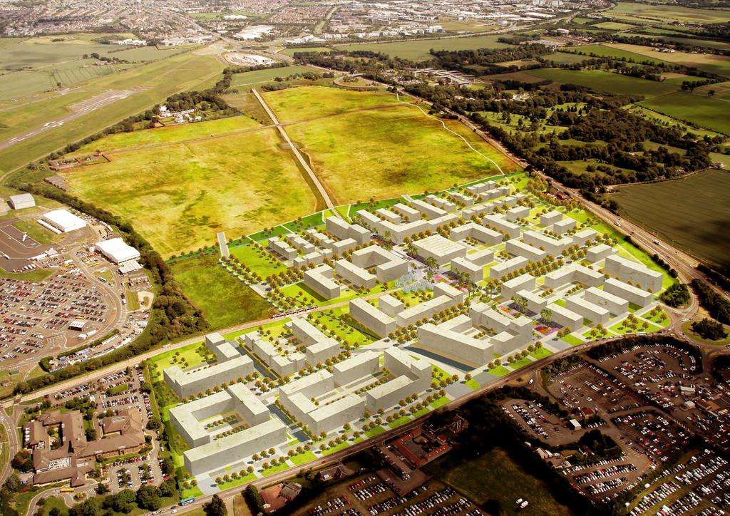
2 2 Phase One within the wider International Business Gateway development
3 Preface This Design and Access Statement supports an application for Planning Permission in Principle for 211,511m 2 (2,276,704 sqft) of mixed use development on a Hectare site within Edinburgh s International Business Gateway. The masterplan has been developed on behalf of the IBG Stakeholders, New Ingliston Limited, Murray Estates Lothian Limited and FSH Airport (Edinburgh) Services Limited, to coordinate development between their respective landholdings and bring forward the placemaking objectives of the City of Edinburgh s West Edinburgh Strategic Design Framework. 3

 Services Limited 2nd Floor, Prince Frederick House")

4 Client Group Project Team The International Business Gateway Stakeholders New Ingliston Limited Gogar Mains House Gogar Mains Road Edinburgh EH12 9BP Masterplan Architects 7N Architects 83 Princes Street Edinburgh EH2 2ER Murray Estates Lothian Limited 26 Charlotte Square Edinburgh EH2 4ET Planning Consultants GVA James Barr Quayside House 127 Fountainbridge Edinburgh EH3 9QG FSH Airport (Edinburgh) Services Limited 2nd Floor, Prince Frederick House Maddox Street London, W1S 2PP FSH Shareholders: Transportation, Engineering and Environment Landscape Architects WSP 7 Lochside View Edinburgh Park Edinburgh EH12 9DH Horner + Maclennan 6 Darnaway Street Edinburgh EH3 6BG h m
5 Contents 00 International Business Gateway Executive Summary 06 Parameters, Guidance and Principles Introduction Project Background 12 Project Timeline 14 West Edinburgh Landscape Framework 16 The Vision 18 The Brief Site Context Existing Condition 24 Connections 26 Site Topography 28 Existing Infrastructure 29 Views of Site Masterplan Framework Approach 34 Principles 36 Landscape Framework 40 Plot Framework 41 Movement and Access 42 Mixed Use Development 43 Massing and Height 44 Site Approach 45 Views from the Site 46 Sustainability Plot Parameters Introduction 56 Development Parameters 57 Height Parameters 58 Use Parameters Development Guidance Development Guidance 62 Material and Landscape Palette 63 Tram Square 64 Avenue 68 Distributor Roads 72 Eastfield Road 74 North Square 75 Southern Parkland 76 Linear Park 78 Outline Specification 80 Landscape Management Principles Plot Principles Introduction 92 Illustrative Development 93 Illustrative Heights 94 Illustrative Uses 95 Commercial Plots 96 Building Guidance 100 Residential Plots 102 Building Guidance 106 Park and Ride Plot Principles 108

6 Executive Summary International Business Gateway Phase One The masterplan builds on the City of Edinburgh s 2010 design guidance policy document, the West Edinburgh Strategic Design Framework, with an approach to placemaking as the principal stimulus to cultivating quality development. It also develops on the principles established by the 2011 implementation plan, which was endorsed by members of the West Edinburgh Project Board including the Scottish Government, Scottsh Enterprise, City of Edinburgh Council, Edinburgh Airport, Transport Scotland, New Ingliston Ltd., Murray Estates and the Royal Highland and Agricultural Society of Scotland. It establishes a framework for high quality public realm and landscape that connects the place to its context and creates a mixed use, flexible, business-led urban environment that is well connected, green in character and spacious. The public realm defines a flexible framework for development that can accommodate a wide range of occupier requirements and allows a flexible response to changing needs, utilising building typologies that can readily be delivered as low energy buildings that facilitate efficient space planning. Key Features: An urban extension to Edinburgh, founded on a strong placemaking and landscape framework. A development of international prominence with excellent links to local, national and international transport infrastructure. A mixed-use, business led masterplan comprising: - 122,158 sqm office development - 1,150 hotel rooms residential units (to be a mix of build to sale, build to rent and affordable housing) - 5,439 sqm ancillary retail and leisure development 6 6 View of central public square and tram stop

7 This project presents an opportunity to create a distinctive arrival experience for visitors to the City of Edinburgh, which will be of benefit to the nation as a whole, as well as all West Edinburgh stakeholders. It will announce clearly that visitors have now arrived in Scotland s capital city, whether journeying by air, road or train. This is an opportunity to enhance the city s identity and create a strong gateway to one of the world s great capitals. West Edinburgh Landscape Framework, City of Edinburgh Council, June

. It is envisaged that the AMSCs will be submitted in phased sub sections within the overall site over a longer period of time.")


8 Hierarchy of Design Information Parameters, Guidance and Principles The primary purpose of the masterplan for Phase One of the International Business Gateway is to support the submission of the PPP, which will provide an appropriate level of certainty on a set of general parameters to be observed over its longer term development. In addition, its purpose is to support future subsequent planning applications for the Local Planning Authority s Approval of Matters Specified in Conditions (AMSCs - the reserved detail matters). It is envisaged that the AMSCs will be submitted in phased sub sections within the overall site over a longer period of time. Therefore, this masterplan has a mix of fixes, guidance and overall design approaches which can help to guide the AMSC submissions in due course. The information has therefore been structured in a hierarchy of specific provisions across parameters and guidance which will provide a mix of fixed and flexible development principles: Plot Parameters and Estate Infrastructure: These are submitted with the PPP in a series of formal drawings setting out a series of critical parameters, where the developer encourages the planning authority to approve these drawings. They define the location and extents of the development plots and common estate infrastructure, with specific parameters for each plot that govern the extent of development, use classes, building heights and frontage treatments. The parameter drawings are intended to be observed through subsequent AMSCs. In this regard, the following have been submitted: L(PA)02 Estate Infrastructure L(PA)03 Development Parameters L(PA)04 Height Parameters L(PA)05 Use Parameters Plot Parameters and Estate Infrastructure Development to be substantially in accordance Development Guidance Development to be generally in accordance 8 Development is expected to be substantially in accordance with these plans. Development Guidance: This defines the outline proposals and outline specifications for the design of the common estate areas, landscape and infrastructure, where it is expected that the AMSCs will be submitted to generally accord with the development guidance. The development guidance controls requirements for the appearance, quality and character of this common estate, which will bind the individual plots together. The Illustrative Masterplan and Plot Principles: These set a quality benchmark for the scale, character and quality envisaged for the built development over the longer term and demonstrates how development plots should be implemented within the framework of parameters and development guidance. The illustrative masterplan includes a suite of supporting design graphics to help to guide the quality and character of design envisaged for later submissions under the AMSCs. Essentially, this is intended as an overall indication of the levels of design quality, public realm frontages, landscape etc, and it accords with the general approach laid down in the West Edinburgh Strategic Design Framework. Illustrative Masterplan and Plot Principles Design approach and quality benchmark

9 View of avenue space
10
11 01 Introduction

12 International Business Gateway Phase One Project Background The masterplan proposals have been developed in parallel with City of Edinburgh Council s evolving planning frameworks and design guidance which have been based on extensive exploration of the wider development and landscape contexts. The International Business Gateway initiative was originally instigated by the Scottish Government who saw the site as a strategically important location for attracting inward business investment, given its proximity to Edinburgh Airport. The City of Edinburgh Council (CEC) commissioned a strategic masterplanning study by Urban Initiatives in 2007, with subsequent work by 7N Architects in 2009 to develop a spatial planning framework for future development that was integrated with the evolving proposals for the tram network which runs through the site. The 2010 West Edinburgh Strategic Design Framework (WESDF) evolved from this work and remains the current design framework in policy terms. This is supplemented by CEC s 2011 West Edinburgh Landscape Framework, which sets out landscape framework guidance for the whole WESDF area. The Landscape Framework was prepared for CEC by 7N Architects, Horner + Maclennan and WSP. The WESDF covers the western corridor from the Gogar roundabout to Newbridge which also includes the Royal Highland Showground and Edinburgh Airport. Both of these organisations have developed masterplans, although the airport plan remains strategic at this time. The overall West Edinburgh initiative has a governance forum in the form of the West Edinburgh Project Board. The members of the board, which include the Scottish Government, Scottish Enterprise, City of Edinburgh Council, Edinburgh Airport, Transport Scotland, New Ingliston Ltd, Murray Estates and the Royal Highland and Agricultural Society of Scotland, have given their support to an Implementation Plan which was prepared in International Business Gateway Phase One The Vision for West Edinburgh - West Edinburgh Strategic Design Framework, May
13 Title City Centre Gogar Interchange Gogarburn Tram Stop Ingliston Park and Ride Edinburgh Airport International Business Gateway Phase One Route of Edinburgh Tram 13

 CEC")


14 Project Timeline Planning Framework and Project Development Planning Framework The Scottish Government identifies West Edinburgh as a national development asset in the West Edinburgh Planning Framework (WEPF) West Edinburgh is highlighted as a key priority location for internationally competitive business development in National Planning Framework 2 (NPF2) CEC publish the West Edinburgh Stategic Design Framework (WESDF) which establishes development principles for the land identified in WEPF and NPF2 An alteration to the Rural West Edinburgh Local Plan (RWELP) recommends that land identified in WEPF and NPF2 for international business development is removed from the greenbelt CEC augment the WESDF with the West Edinburgh Landscape Framework (WELF), prepared by the IBG Phase One design team Project Development An implementation plan for Edinburgh International: Scotland s Global Hub is launched by the West Edinburgh Development Partnership An outline masterplan for Phase One of the International Business Gateway is designed by 7N Architects on behalf of CEC and members of the IBG Stakeholders

 to Scottish")


15 Scottish Ministers approve the first South East Scotland Strategic Development Plan (SESplan) which identifies West Edinburgh as a Strategic Development Area The Scottish Government withdraws the WEPF on the basis that it has served its purpose and the IBG has been established as a national priority within NPF3 and recognised as such within SESplan and the ELDP CEC submit the second Proposed Local Development Plan (LDP2) to Scottish Ministers for examination. The IBG is identified as a Special Economic Area of national or strategic importance Anticipated adoption of LDP2 by CEC following reporter s recommendations A Proposal of Application Notice for IBG Phase One is submitted on behalf of the IBG Stakeholders. Two public consultation events are held in September Edinburgh Trams Launch. The Ingliston Park & Ride stop is located within the IBG Phase One site. Technical assessment and application preparation continues A series of design workshops are undertaken with Architecture + Design Scotland IBG Phase One application for Planning Permission in Principle (PPP) submitted 15


16 Site Context West Edinburgh Landscape Framework In 2011, 7N Architects, WSP and Horner + Maclennan of the IBG Phase One design team were commissioned by City of Edinburgh Council to develop a landscape framework for West Edinburgh, focused around the A8 corridor and the development areas identified in the West Edinburgh Strategic Design Framework. The resulting guidelines, the West Edinburgh Landscape Framework (WELF), set out a series of key objectives for the study area: Enhance biodiversity throughout the WELF site where possible Specific areas of the site offer the potential to increase and enhance the existing biodiversity value of the area, whilst minimising the risk of increased bird strike at the airport. Areas of wildflower meadow, wet scrubland and managed hedgerows are habitat types which can increase biodiversity in the area without unduly increasing bird strike risk. Forth Road Bridge Forth Rail Bridge 16 - Build on existing Policy Landscape character in surrounding area - Establish and strengthen identity of A8 road experience - Enhance biodiversity throughout the WELF site where possible - Develop new pedestrian/cycle connections from Gogar to the airport within IBG designed landscape - Improve Gogar Burn landscape - Initiate green infrastructure elements to structure the evolving development proposals for West Edinburgh The following text, taken from the West Edinburgh Landscape Framework. expands on the key design concepts that will deliver these objectives. Build on existing Policy Landscape character in surrounding area The existing Policy Landscapes in the West Edinburgh area have been identified as strong existing resources. The framework seeks to strengthen and extend these areas through identifying areas, where new individual tree planting and structural woodland blocks that tie into existing woodland, might be positioned. Establish and strengthen identity of A8 road experience The A8 road experience is currently poor and does not presently give a coherent or particularly positive image of arrival to Edinburgh. The framework proposes designed landscape interventions along the length of the corridor, drawing from a coherent and consistent palette of treatments, which will over time allow a specific West Edinburgh identity to develop. Develop new pedestrian/cycle connections from Gogar to the airport within IBG designed landscape The current core path network between Gogar roundabout and the airport is inconsistent and unattractive to pedestrian and cyclists. The WESDF identifies a route within the fringe of the IBG area and the framework proposes that this fringe is developed as a parkland zone to support this missing core path component at the earliest opportunity. The design concept is for a thin strip of parkland which can accommodate the pedestrian/ cycle route, but also allows informal recreation activities to occur. As the IBG is developed over time, this strip can grow to the edge of built form and become a significant parkland resource. Initiate green infrastructure elements to structure the evolving development proposals for West Edinburgh There is a growing understanding that the integration of green infrastructure into new development can offer benefits on many levels, from economic and environmental improvements to providing healthy places for people. As well as being natural assets, green infrastructure supports multiple functions which can be combined to offer enhanced value. These elements are embedded across the framework to allow a new natural network to form a setting and framework for development, supporting growth, stimulating investment and improving the identity and character of the area. These principles have been implemented in the International Business Gateway Phase One masterplan. Bings Pentlands Pentlands Arthur s Seat Key Long Distance Views Visual Boundaries West Edinburgh key structuring views Existing habitat network

17 Title Establish and strengthen identity of A8 road experience Initiate green infrastructure elements to structure the evolving development 3 - Form buffers and sacrificial landscape areas along key internal boundaries 4 - Improve Gogar Burn landscape 5 - Create and support habitat connections outwith WELF site 6 - Develop new pedestrian / cycle connections from Gogar to the airport within IBG designed landscape 7 - Build on existing Policy Landscape character in surrounding area 17


18 The Vision An International Business Gateway The development forms part of a public/private partnership initiative to designate the area as Edinburgh International, Scotland s Global Hub. Partners include The Scottish Government, Scottish Enterprise, the City of Edinburgh Council, Edinburgh Airport, RHASS, Murray Estates, New Ingliston Ltd. and Transport Scotland. The following text, which is an extract from the Foreword to the 2011 Implementation Plan produced by the partners, explains the objectives of the initiative: Scotland has ambition to increase the impact of its role in the global economy and Edinburgh is a successful and growing city, with great potential to be an even stronger engine for Scotland s sustainable economic growth. Chiswick Park, London Schiphol, Amsterdam Orestad, Copenhagen It is against this context that we are all firmly committed to the long term future success of Edinburgh International and have worked intensively to reach realistic consensus on the detail of how it should develop over time. The highest priority will be afforded to furtherance of global connectivity. This will be achieved through Edinburgh Airport, by enhancing the quality of the gateway into Edinburgh and Scotland, and through the establishment of the area as an even more prominent hub for transport and international business. All of this will be facilitated by the phased delivery of an initial scheme of transport, water, power and landscape infrastructure works over the next 10 years. This is a long-term project which is expected to span a number of economic cycles. Whilst the pace of the delivery of the various component parts such as additional transport infrastructure and airport capacity, the development of a new International Business Gateway and the regeneration of the National Showground will undoubtedly be influenced by underlying economic conditions and the availability of finance, the strategic importance and direction of travel of the project as a whole will not. Dublin Edinburgh Oslo Stockholm Copenhagen Amsterdam Berlin London Brussels Prague Paris Berne Helsinki Malmo Messestadt Riem, Munich We have a determination to continue to work together and with the complete range of stakeholders in the project, to help co-ordinate action and investment, and to support the delivery of the various actions that are listed in the Implementation Plan. 18 Step by step, the aim is to make this bold and ambitious vision for the future development of Edinburgh International a reality. European competitors and benchmarks Science City, Zurich


19 The Vision A Mixed Use Place A place to do business A place to live An extension of the city Connected to its setting A global place A place to enjoy A place to stay 19

20 Development Brief Land Ownership The Phase One site is under the ownership of the IBG Stakeholders (the applicants) and includes land owned by City of Edinburgh Council (CEC). The land held by the Stakeholders is presently in agricultural use, although it is not currently being worked. The land under ownership by CEC consists of the following: - The tram line, including the Ingliston Park and Ride tram stop Public realm proposals to the edge of the tram line form part of this proposal. - The Ingliston Park and Ride facility, including a road that will provide the primary access to the southern section of the IBG. - A gap site of undeveloped land immediately to the east of the Park and Ride. Redevelopment of the existing Ingliston Park and Ride site, owned by City of Edinburgh Council, is part of the wider strategy for the area, described in the West Edinburgh Strategic Design Framework. An illustrative approach to the future development of the gap site and Park and Ride facility have been demonstrated in this document but do not form part of the application. Application Boundary New Ingliston Ltd. Murray Estates Lothian Ltd. FSH Airport (Edinburgh) Services Ltd. City of Edinburgh Council 20
21 Development Brief Development Quantum The application proposals seek Planning Permission in Principle for Phase One of the International Business Gateway, Edinburgh. This comprises the development of new buildings to provide mixed use development including: - Business and employment uses (class 4), (class 6); Use Area (m²) Area (sqft) Percentage of Development Area Class 4 Business 122,158 m² 1,207,259 sqft 58% - Hotels (class 7) - Residential institutions (Class 8), residential (Class 9), nonresidential institutions (Class 10) and sui generis flatted development - Ancillary uses including retail (Class 1), financial and professional services (Class 2), food and drink (Class 3), assembly and leisure (Class 11) - Other related associated works including car parking, servicing, access arrangements and public realm Class 7 Hotel Approx Rooms Class 9 Residential Approx. 396 homes inc 25% affordable Class 1, 3, 11 Ancillary Uses: Retail, Food & Drink, Assembly & Leisure 40,338 m² 434,195 sqft 19% 43,576 m² 469,048 sqft 21% 5,439 m² 58,545 sqft 2% The mix of uses and quantum of development is as set out in the table opposite. This has been tested in the form of an illustrative masterplan and informed a series of parameters plans and accompanying design principles. Total 211,511 m² 2,276,704 sqft 21
22
23 02 Site Context
 and national (Scottish")

24 Site Context Existing Condition The application boundary covers a site of 36.7 Hectares to the west of Edinburgh city centre, adjacent to Edinburgh International Airport. This land has been identified as the location for Phase One of the International Business Gateway in a range of policy documents at local (City of Edinburgh Council) and national (Scottish Government) level. It occupies a location that is extremely well connected to a range of transport modes within the West Edinburgh area, including the public transport interchange at Ingliston Park and Ride that provides access to the tram to the airport and the city centre and bus routes. The site is predominantly open agricultural fields, although not currently in use. However several policy landscapes in the surrounding area provide distinctive, mature features to the periphery of the site and offer opportunities to strengthen them through new landscape features within the International Business Gateway. The site is therefore well positioned, strategically and geographically, to take advantage of its setting and potential for development. Many of the surrounding land uses have already harnessed this unique location and have an international dimension or appeal, such as Edinburgh Airport, The Royal Highland Centre and The Royal Bank of Scotland. Further to the east, Edinburgh Park and The Gyle provide an established business presence in this part of the city. 1 - View South towards A8 2 - View East towards site of proposed IBG West 3 - View North towards Airport 4 - View West across Ingliston Park and Ride 24

25 Title Aerial view of the site looking east towards Edinburgh City Centre 25

26 Site Context Regional Connections The Edinburgh Tram network runs through the site, with the Ingliston Park and Ride stop located within the site boundary. The tram provides access to the airport within 2 minutes, with journey times to the city centre approximately 35 minutes. The tram currently interchanges with the national rail network at Edinburgh Park (approximately 16 minutes) and Haymarket (approximately 23 minutes). Due to open in 2016, The Gogar Interchange will provide further rail connectivity with the tram network. The 35 bus route currently stops at the Park and Ride facility, which serves the airport, Edinburgh Park and Edinburgh City Centre. The National Cycle Network runs along the A8 to the south of the site, with connections to Edinburgh City Centre, the Lothians and north to Queensferry and Fife. The site is well connected to major road infrastructure north to Stirling, Aberdeen and Dundee, west to Glasgow and to the south. M9 Stirling Edinburgh Airport International Business Gateway Phase One A8 Dundee & Aberdeen Gogar Interchange (Opens 2016) South Gyle Station National Cycle Network Glasgow and the West M8 Edinburgh City Centre Edinburgh Park Station Union Canal Ratho City bypass 26
 4 min (320m) Sources: Tram & Bus: Transport for Edinburgh Car: AA Route Planner Cycle: CycleStreets 3 min (240m) 2 min (160m) Tram Stop Edinburgh Park and City Centre")
27 Site Context Local Connections Destination Tram Bus Car Cycle Edinburgh Airport 3 mins 4 mins 2 mins 3 mins Airport Edinburgh Park 10 mins 10 mins 7 mins 19 mins Edinburgh City Centre 32 mins 25 mins 25 mins 55 mins 5 min (400m) 4 min (320m) Sources: Tram & Bus: Transport for Edinburgh Car: AA Route Planner Cycle: CycleStreets 3 min (240m) 2 min (160m) Tram Stop Edinburgh Park and City Centre Ingliston P&R Provision for Future Tram Stop within IBG Phase Two The West Edinburgh Park and City Centre Walking Distance (Tram Stop - As Indicated) Walking Distance (Bus Stop - 400m) Tram Line & Stops Road Connections & Bus Stops National Cycle Network Connections 27
28 Site Analysis Topography The site slopes down at a relatively even gradient, from the A8 to the southern boundary with the Gogar Burn and Hilton Hotel to the north. There is approximately 18m change in height across the site. There are some areas with more pronounced localised changes in level, such as where the existing watercourses cross the site. The tram line enters the site from the city centre direction at grade, allowing level access to the Ingliston Park and Ride tram stop. As it turns to continue towards the airport the gradient of the tram line is less than the surrounding area and as a result forms an embankment that bisects the northern half of the site. The embankment rises to approximately 3m above the adjacent ground level. +28m +30m +32m +34m Tram Level +32m Tram Level +34m +36m +38m +40m Tram Level +36m Tram Level +38m Tram Level +40m +42m +44m +46m +48m +50m 28 2m contour Tram Line +52m +54m

29 Site Analysis Existing Infrastructure Existing infrastructure within the site boundary creates a number of parameters and constraints: - Route of existing tram line and land safeguarded for future extension to Newbridge. - Existing watercourses on site, to be maintained as part of the development and incorporated as landscape features. - An existing gas main that runs across the site. Buildings should not be located above this. - An area of land identified within the West Edinburgh Strategic Design Framework as safeguarded for Airport expansion. Development plots should sit outwith this area, although other infrastructure may be located within it. - Vehicle access to the site will be via the two junction locations identified. Provision for vehicle access across the tram line, which provides access for development plots in the north east corner of the site, is provided at the location identified. - It is understood that City of Edinburgh Council s Ingliston Park and Ride will remain in operation at this time although it has been identified for future redevelopment in the WESDF. Tram Line Future Tram Extension Existing Watercourses Existing Gas Main Airport Expansion Vehicle access points Provision for vehicle access over Tram Line 29

30 Site Analysis Views Surrounded by distinctive landscapes and landmarks, the site benefits from expansive views to the Ochills and Pentland Hills, punctuated by views of the Forth Bridges to the north, Arthur s Seat and Costorphine Hill to the east and the post-industrial Bings to the west. Preserving and enhancing views from within and through the site were key drivers for the West Edinburgh Landscape Framework. The framework has been structured to form strong visual connections and mitigate the impact of the development on surrounding context through diverse massing and the preservation of significant sightlines. 30 Aerial view of the site looking south towards the Pentlands
 - View North West Below Craigie Farm -")

31 Site Analysis Views Site Extents Site Extents RBS Bridge (A8) - View North West Below Craigie Farm - View South Site Extents Site Extents Kirkliston - View South East Corstorphine Hill - View South West 31
32
33 03 Masterplan Framework


34 Masterplan Approach The primary purpose of the masterplan for Phase One of the International Business Gateway is to support the submission of the PPP, which will provide an appropriate level of certainty on a set of general parameters to be observed over its longer term development. In addition, its purpose is to support future subsequent planning applications for the Local Planning Authority s Approval of Matters Specified in Conditions. The approach to the masterplan adopts the following key principles: - Creating a mixed use, business led, environment with an urban character, using the buildings to define streets and public spaces - Establishing a flexible framework for development within a coherent network of high quality public realm - Implementing a range of public parks, landscape spaces and green edges, that integrate with and enhance the urban business environment - Creating a hierarchy of routes, streets and spaces which concentrate footfall around key public areas - Integrating pedestrian and cycle movement patterns within the site with connections to existing public transport connections, future developments and the surrounding area - Limit parking numbers and encourage public transport use through regulated parking ratios for both commercial and residential developments 34

35 Phase One within the wider International Business Gateway development 35


36 Masterplan Concept Growing the Place Forth Rail Bridge Bings Forth Road Bridge Arthur s Seat Pentlands Pentlands Growing a new place around the tram infrastructure that will become the principal arrival point for business visitors Setting up distant views to connect the place to its wider context Organising the masterplan around a landscape framework to structure development that is embedded in its setting 36


37 Creating thresholds of public space at the intersections between the landscape framework Establishing active street spaces designed to prioritise pedestrians and cyclists with efficient vehicular movement Developing a long term framework for placemaking which will enhance Scotland s global profile as a place to do business. 37


38 Illustrative Masterplan Summary The masterplan is structured around an integrated network of streets and public spaces to create a framework of green landscape which embeds the new place in its setting. These spaces are designed around pedestrians and cyclists, with green/blue SUDS infrastructure integrated with the public realm Tram Square Tram Corridor 3-Avenue Linear Park Along Burn 5-Landscape Edges

39 Illustrative Masterplan Wider Context 39

40 Illustrative Masterplan Landscape Framework The landscape framework forms the network of public realm and shared landscape which defines the common estate areas and the primary structure of the masterplan. It comprises a series of separate components which collectively combine and integrate to create the setting for the Phase One development. A range of public open spaces of varying scales are located throughout the development, providing spatial variety to the overall development pattern. These range from larger scale green corridors along sections of the tram line and the tributary burn to the Gogar Burn, to pocket parks and hard landscape spaces, separating building blocks or occupying corner plots, which provide incident and interest to the overall streetscape character. This landscape strategy is extended throughout the public realm, with varied tree species, ornamental grass, shrubs and swale, integrated into the development s network of streets and cores. The landscape strategy continues and develops the strategic landscape proposals for the International Business Gateway development, included in the West Edinburgh Landscape Framework, to establish an appropriate setting and character for the development through the provision of high quality public realm and green spaces. The key principles of the landscape strategy comprise the following components: - A parkland frontage to the A8 corridor and to the east of the development, with fingers of parkland extending into the development pattern. - A pattern of north-south and east-west green infrastructure features extending through the site. - A sequence of public hard and green spaces of varied scale spread throughout the development. - Public realm spaces related to the tram corridor and stop. - A vehicular and pedestrian/cycle circulation hierarchy defined by variations in floorscape treatments and plant selections. 40

41 Illustrative Masterplan Plot Framework The development plots are defined by the landscape framework of the estate to establish a secondary hierarchy of development zones spaces. Through the application of Development Parameters and a toolkit of Plot Principles, a Plot Framework of shared hard spaces, communal landscape features and private gardens define the locations of buildings within each plot. The Plot Principles comprise the following key components: - A shared space principle applied to plot access and circulation. - Pedestrian and cycle connections to the wider estate landscape. - Screened parking courts, defined by business / commercial development blocks. - Shared surface residential streets with private communal residential green spaces. - The use of green buffers and extension of fingers of green landscape into development plots at frontages with estate landscape features. - A high quality urban edge at the interface with Eastfield Road. 41

42 Illustrative Masterplan Movement and Access Cycle/ Foot Path Network Primary Routes (Distributor Roads) Secondary Routes (Avenues) Access Roads Residential Shared Streets The masterplan is designed to be a primarily pedestrian and cycle priority environment to facilitate active streets and public spaces, building on the existing public transport infrastructure of the tram stop at Ingliston Park and Ride. The access and movement strategy balances this priority with the need to provide legible and efficient vehicle access to the development plots and sufficient parking. The primary space is the public square around the tram stop and the corridor that bisects the site from east to west. This square is pedestrian and cycle priority, with limited vehicle access. Vehicle priority routes generally run east / west along Distributor Roads from the junctions on Eastfield Road, either side of the Tram Square. The Avenues are the primary north-south access routes. These have a range of context specific characters that fall into two primary categories: Vehicle Priority On street parking, segregated cycle lanes and pedestrian pavements integrated within a landscaped avenue of trees. These are located closest to the distributor roads and provide easy access to plots. Pedestrian and Cycle Priority A more informal variety of shared spaces and landscaping, with limited on street parking. These are located close to the central Tram Square and development edges where vehicle movement is reduced. Vehicle access within plots is laid out along shared space principles, incorporating landscaped parking courtyards for commercial plots and on street parking for residential plots. 42
43 Illustrative Masterplan A Mixed Use Place The International Business Gateway will be an urban business environment that represents a move forward from the mono-use, business park model to a mixed use, 24 hour place. Although it will primarily be Class 4 business space, it will also include hotels and residential development. This will ensure that a critical mass of movement and activity is retained outside of office hours. Ancillary mixed leisure and retail uses will meet the everyday needs of workers, visitors and residents. Business space and hotels will be focused around key civic nodes with public transport infrastructure, and along primary street frontages. Active ground floor uses will be encouraged at strategic points to provide ancillary uses. Residential developments will be integrated throughout the site. The location of these plots will capitalise on views and connections to the extensive landscape infrastructure. Business Led Development Business Led Development with Active Ground Floor Hotel Led Development Hotel Led Development with Active Ground Floor Residential Led Development Civic Development 43

44 Massing and Heights Strategy The West Edinburgh Strategic Design Framework states that development at the International Business Gateway should be predominantly four storeys with higher buildings at strategic locations and gateways. This has formed the basis of the approach to the massing of the illustrative masterplan, and has been developed further on the following principles: - The development nestles into the overall landscape pattern, backed by the landscape beyond. - The built profile to the development is varied in height, comprising a diverse roofline profile which assists in breaking up the overall scale of the development. - The scale of the development is punctuated and penetrated by a series of openings / spaces between buildings, which reduces the extent and appearance of the development within its wider landscape context. - There is a clearly expressed sequence of the projection and recession of individual buildings along the edges of the development, equating with the principles of green fingers of open space which characterise the edges of the development. - The landscape framework softens the overall extent of built development through the introduction of intervening landscape elements in front of the visible facades to buildings. 44 View from LVIA: Proposed view from Corstorphine Hill


45 Massing and Heights Site Approach Site massing and illustrative building heights have been structured to reflect infrastructure nodes, highlight key access points and take advantage of site topography to create a diverse townscape and flexible framework for development. Whilst the prevailing building height is generally a maximum of 22m (equivalent to four storeys of commercial development), important frontages to primary spaces and routes, such as the Tram Corridor, Eastfield Road and the North Square, are structured to accommodate the equivalent of five or six storeys of development. Key strategic access points, such as from Eastfield Road (view 1), the A8 roundabout (view 4) and adjacent to the Tram Stop, have been identified as gateway nodes and possible locations for buildings of up an equivalent of eight storeys. Development addressing the peripheral parklands to the south and east provide opportunity to form a mixed-use four to five storey zone, stepping the development building height of the gateway nodes with protruding and recessed massing that blends into the parkland landscape. These principles have been tested in series of illustrative views, from both key approach routes to the site and within the site to the existing landscape beyond. 1 - Eastfield Road - Illustrative Northern Approach 2 - Edinburgh Tram - Illustrative Eastern Approach View Position A8 - Illustrative Eastern Approach 4 - A8 - Illustrative Western Approach 45


46 Massing and Heights Views from Site View Position Corstorphine Hill Arthur s Seat Corstorphine Hill Arthur s Seat Views to East Tram Corridor The Tram corridor forms the central civic space that preserves east / west axial views through the site. As people move through the space, views to landmarks such as Corstorphine Hill and Arthur s Seat are framed by the development. Tram Corridor - Illustrative View East 46

47 Massing and Heights Views from Site View Position Castle Gogar with Costorphine Hill beyond The Pentlands Costorphine HIll Castle Gogar Views to East Distributor Road North The Distributor Roads provide east / west vehicular access and preserve axial views through the site. Approaching from Eastfield Road, the northern distributor road provides views across the open parkland, that follow the existing watercourse, and east towards Castle Gogar and the landscape beyond. Distributor Road North - Illustrative View East 47


48 Massing and Heights Views from Site View Position Riccarton Hills Views to West Distributor Road South The Distributor Roads provide east / west vehicular access and preserve axial views through the site. From within the site, views west to the existing landscape are framed by the new development. As the junction with Eastfield Road is approached, the views open out to encompass The Bings and distant landscape such as the Riccarton Hills Distributor Road South - Illustrative View West 48


49 Massing and Heights Views from Site View Position Gogarburn Policy Landscpae Gogarburn Policy Landscpae Views to South Avenues The Avenues are the primary north/south access routes through the site and preserve axial views through the site. Looking south from the avenues, the topography of the site shields the A8 and focusses on the mature Gogarburn Policy Landscape and distant views beyond. Avenue - Illustrative View South 49


50 Massing and Heights Views from Site View Position Forth Road Bridge Forth Rail Bridge Forth Rail Bridge Views to North Avenues The Avenues are the primary north/south access routes through the site and preserve axial views through the site. Looking north from the eastern avenue, views across the airport to the landscape beyond are framed by the development. In places, landmarks such as the Forth Rail Bridge and Forth Road Bridge will become visible. Eastern Avenue - Illustrative View North 50


51 Massing and Heights Views from Site View Position Views to North Avenues The Avenues are the primary north/south access routes through the site and preserve axial views through the site. The western avenue terminates in a view of the existing Hilton Hotel and Edinurgh Airport multistorey car park, which has not been deemed important to preserve. The alignment of the avenue in this location is staggered to screen this view with new, higher quality development within the International Business Gateway. Western Avenue - Illustrative View North 51
52 Sustainability SUDS A Sustainable Urban Drainage Strategy (SUDS) has been implemented within the masterplan, developing on the recommendations of the West Edinburgh Landscape Framework. Detailed technical information can be found within the Environmental Statement that accompanies the application. The principles applied are outlined below. Source Control: Source control measures deal with the first flush surface water flows. These features include: - Permeable Surface Drainage: Porous or permeable block paving to hard surface areas such as car parks and shared surface circulation within Development Plots - Bioretention: Shallow landscaped depressions which are typically underdrained and use vegetation to reduce runoff volumes and remove pollutants. These have been implemented into the design guidance for the Distributor Roads and Avenues. Site Control: Site control features manage the runoff from site control measures, typically through the use of landscape swales and detention beds. Consideration has been given to the extent and location of these features with regards to Airport Safeguarding and the discouragement of hazardous birds. Treated and attenuated runoff from these features will be discharged into existing watercourses. Existing Watercourse Permeable Surface Drainage Swale/ Linear Wetland Bio-retention Beds - North / South 52 Bio-retention Beds - East / West
53 Sustainability District Heating Provision has been made within the masterplan framework for the implementation of a district heating network. The layout will provide an efficient and logical route for district heating infrastructure to serve each development plot. Strategic locations have been identified for District Energy Centres that will initially allow networks to be developed within boundaries of land ownership. Over the course of the full build out of the International Business Gateway, there will be opportunities for site wide connections and pooling of resources. District Heating Network District Energy Centre 53
54
55 04 Plot Parameters

56 Introduction Plot Parameters As the International Business Gateway will be a long term development that is realised over a number of years, a series of Plot Parameters are provided to ensure that flexibility can be accommodated within a masterplan framework that preserves visual quality and coherence. The Plot Parameters define the location and extents of the development plots and common estate infrastructure, with specific parameters for each plot that govern the extent of development, use classes, building heights and frontage treatments. The diagrams in this document are reproduced from the following application drawings for approval, subject to conditions: L(PA)02 Estate Infrastructure L(PA)03 Development Parameters L(PA)04 Height Parameters L(PA)05 Use Parameters The parameter drawings are intended to be observed through subsequent AMSC. Development is expected to be substantially in accordance with these plans. Development Guidance for the design of the common estate areas and Plot Principles for the built development are provided in subsequent sections. The Illustrative Masterplan demonstrates an integrated approach to the implementation of the Plot Parameters, Development Guidance and Plot Principles for the level of development proposed for Phase One of the International Business Gateway. 56 Estate Infrastructure and Development Plots
57 Development Plots Development Parameters The Development Parameters for each plot establish a flexible framework to accommodate a range of building scales and uses. Defined frontages and edge treatments ensure successful placemaking and visual coherency across the site, as well as integration with the landscape framework. The following parameters have been defined: Build Zone: Area in which Building Development is permitted. Primary Frontage: These address streets, avenues and civic spaces. A 3m zone to the edge of plots defines where the primary frontage of development should be located. In order to create an urban character frontages should be continuous except for plot access points. Green Edge: These address green spaces and parkland on the edges of the development. Frontages should not be continuous, with buildings orientated perpendicular to the adjacent landscape to allow fingers of green to extend into the site. Landscape Buffer: Building Development is not permitted in these areas, which should be predominantly green landscape areas as a continuation of estate parkland. Hard landscaping pathways for pedestrian / cyclist connections will be permitted. Build Zone Primary Frontage Green Edge Landscape Buffer Refer to application drawing L(PA)03 Development Parameters for scaled version of this diagram 57
58 Development Plots Height Parameters The prevailing building height should be four storeys with some higher landmark buildings and lower building heights adjacent to structural green spaces International Business Gateway Development Principles, Edinburgh Local Development Plan, June 2014 The height parameters have been developed in accordance with the LDP guidance and provide a varied and interesting roofscape. A general development height of 22m above adjacent ground level has been set as the baseline for all plots. This allows for a notional commercial building of four storeys, including an extended ground floor for active uses and rooftop plant space. Proposals that are significantly below this baseline development height will need to demonstrate a contribution to the creation of a successful urban townscape. Frontages to primary nodes, spaces and routes, such as the Tram Corridor, Eastfield Road Frontage and and North Square, increase this maximum to allow developments of up to five or six storeys. Key gateway nodes at access points along Eastfield Road and opposite the Tram Stop have been identified as possible sites for buildings of up to eight storeys. Maximum 38m Maximum 30m Maximum 26m Maximum 22m 58 Refer to application drawing L(PA)04 Height Parameters for scaled version of this diagram
59 Development Plots Use Parameters International business development and ancillary uses, hotel and conference facilities, housing as an integrated component of business-led mixed use proposals International Business Gateway Development Principles, Edinburgh Local Development Plan, June 2014 The proposed uses for the development plots have been allocated in order to achieve an attractive mixed use place to live, work and visit, based on the following principles: - Provide a flexible framework for delivering a range of occupier requirements. - Focus office and hotel development around key public spaces and routes. - Create centres of activity with active ground floor ancillary uses at key locations. - Integrate residential led development throughout the site, adjacent to public parkland or green edges. Business / Hotel Led Development Residential Led Development Active Ground Floor Zone: Leisure / Retail Development Refer to application drawing L(PA)04 Use Parameters for scaled version of this diagram 59
60
61 05 Development Guidance

62 Introduction Development Guidance Adopting an integrated approach to placemaking, the public realm strategy responds to the creation of an urban extension to Edinburgh in an urban edge context. This is achieved through the treatment of its public realm and open spaces, with the incorporation of extensive green infrastructure comprising parkland, tree avenues, public realm spaces, SUDs features and pocket parks throughout the development. This approach reinforces the primary and secondary vehicular and non-vehicular hierarchy throughout the development, whilst establishing areas of distinctive and varied public realm and open space character. The landscape proposals, are coordinated with the architectural and urban design approach for the development and seek to create an overall quality of placemaking appropriate for a business, commercial and residential development of international prominence. The tree and planting species have been selected to conform to the guidance provided by the Civil Aviation Authority on bird hazard avoidance. The redevelopment of the land currently occupied by the Ingliston Park and Ride facility, owned by City of Edinburgh Council, is part of the long term strategy for the area described in the West Edinburgh Strategic Design Framework. Although it does not form part of this application, as the land is not within the the applicant s ownership, the illustrative masterplan and plot principles set out guidance on how it should be developed as a co-ordinated part of the overall masterplan. This section defines the outline proposals and outline specifications for the design of the common estate areas, landscape and infrastructure, where it is expected that the AMSCs will be submitted to generally accord with this development guidance. The development guidance controls requirements for the appearance, quality and character of this common estate, which will bind the individual plots together. 62 Illustrative Masterplan


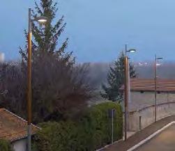
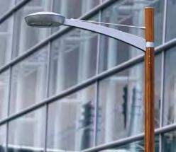
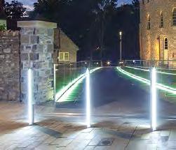
63 Public Realm Material and landscape palette Hardscape Landscape Key Public Spaces Textured concrete paving blocks, mix of greys Example Product: Charcon Andover Textured Cycleway Resin bound gravel paving, buff Example Product: Sureset Resin Bound Paving Tram Space Pine Trees Pinus nigra austriaca - Semi mature Austrian pines, set randomly throughout area Meadow spaces within Parkland Range of colour-themed perennial meadow mixes Key Vehicle / Pedestrian Intersections Small unit concrete sett paving, silver grey Example Product: Charcon Countrysett Landscape Paths Resin bound gravel paving, light grey Example Product: Sureset Resin Bound Paving Avenue Trees Gingko biloba - Single or double tree avenue, depending on location Raised Plant Beds to Tram Edge Corten edged raised plant beds. Range of perrenials and ornamental grasses. Kerbs Wide top textured concrete kerb, silver grey Example Product: Charcon Countryside Classic Public Realm Benches Hardwood slats on concrete base Distributor Road Trees Corylus colurna - Single tree avenue to each side of road. Bioretention Rain Garden Range of hardy perennial grasses Edge to Tram Corridor Random Caithness stone horonizing Example Project: An t-eilean, Inverness Campus Public Realm Feature Lighting Example Product: Santa + Cole Area Lighting Beacon Street Lighting Simple, contemporary design lighting column Example Product: We-ef RBL660 Column Footpath Lighting Flexible, bi-directional, contemporary fitting Example Product: Vekso Addo L95 Mini Bollard 63

64 Public Realm Tram Square The Tram Square is a predominantly hard landscape space that forms the key public realm space of the development. Located around the existing tram stop and extending along the tram corridor, it acts as a key arrival and departure point for workers, residents and visitors to the development, whilst also providing a central venue for regular temporary events, such as street markets and outdoor exhibitions. The floorscape comprises a simple contemporary concrete paving material, laid in a range of large to small module sizes, which provide a transition across the space, from large module units nearest the buildings to small scale units adjacent towards the tram line, and at defined crossing points of the tram line. Semi-mature pine trees are distributed throughout the paved area, creating a distinctive character, with their single clear trunks and broad canopies. Corten steel tree grilles, with geometric cut-outs surround each tree, and in places provide continuous bands across the paved area. As the tram route enters the public realm space, this important transition is defined by a sequence of rows of tall stainless steel rods, forming a threshold between informal parkland to the north whilst providing a distinctive and punctuating feature along the overall tram experience. 64 View of Tram Square


65 Public Realm Tram Corridor The High Line, New York To safeguard the line of the tram route, a sequence of low raised planting beds of mixed perennials, grasses and ground covers flank the edge of the route, acting as a barrier to uncontrolled pedestrian crossings of the line whilst providing year-round interest through seasonal variations of colour, form and texture. The varied arrangement of the raised beds creates a rhythm of projections and recesses which define areas for seating. The floor treatment to the spaces created by these planters is formed in random Caithness stone horonizing to create a contrasting texture to the main space. Illustrative Axonometric: Tram Corridor 65


66 Public Realm Tram Square Retail Retail Illustrative Axonometric: Tram Square Hotel / Bar / Restaurant Retail Retail Retail Mixed Use Civic Retail Tram Stop at centre of main civic space 2 - Active frontages to ground floors on to Tram Square 3 - Low raised plant beds of mixed perrenials, grasses and ground cover. Flanked with random Caithness stone horonizing. 4 - Copses of semi-mature Austrian pine trees within paved areas 5 - Contemporay concrete paving material laid in transitioning sizes across tram space 6 - Field of stainless steel rods form threshold between Tram Square and parkland to North 66


67 Public Realm Tram Corridor Living Wall, O2 London Illustrative Plan: Full Corridor with Tram Extension and Park and Ride redeveloped The tram corridor treatment will continue to accommodate the proposed extension of the Edinburgh Tram west to Newbridge and the redevelopment of the Park and Ride facility, in accordance with the full extent of the West Edinburgh Strategic Design Framework. In the short term, partial planting treatment and hard surfacing will be applied in conjunction with a living wall to shield the Park and Ride from the development. Illustrative Plan : Temporary Treatment with Living Wall 67

68 Public Realm Avenue The Avenues form a key component of the development s circulation hierarchy, extending from the distributor roads into the development zones and providing both vehicular and nonvehicular access. They incorporate substantial green infrastructure features to define their character and differentiate them from other parts of the access network, with avenues of trees, planted verges and bio-retention rain gardens. The road is flanked by a combination of parallel and 90 degree car parking areas, interspersed with tree and ground cover planting areas. Bio-retention rain garden areas flank sections of the road, collecting and attenuating stormwater run-off whilst providing amenity value through their planting, with a range of hardy perennials. Single and double avenues of tree planting reinforce the formal alignments of much of the avenues, becoming more informal in arrangement where the avenues meet the central tram space or transition into the southern parkland character. Key intersections, junctions and thresholds along the avenues are identified by small unit contemporary concrete blocks to define their importance within the overall circulation hierarchy. 68 View of Avenue


69 Public Realm Avenue Footway Avenue Trees Footway Parking Bays Carriageway Bio-Retention Avenue Trees Cycle Lane Footway Commercial Frontage Commercial Frontage 3m 3.5m 1.5m 2.5m 6m 2m 5m 2.5m 2.5m Plot development parameters require primary frontages to address the avenues directly and to create an urban character to these spaces. Commercial plots should address streets directly with a continuous line of development to create an urban character frontage to the avenues. Where on street parking is provided, it should be incorporated within the landscaped edges, with regular breaks for trees and planting. Typical Plan and Section through Avenue 69


70 Public Realm Avenue Footway Avenue Trees Footway Parking Bays Carriageway Residential Parking Footway Cycle Lane Footway Plot Boundary Commercial Frontage Residential Frontage 3m 3.5m 1.5m 2.5m 6m 5m 2m 2.5m 2.5m Plot development parameters require primary frontages to address the avenues directly and to create an urban character to these spaces. Where residential developments front the avenues, use of small front gardens or defensive planting are encouraged to provide privacy for ground floor occupants. Where on street parking is provided, it should be incorporated within the landscaped edges, with regular breaks for trees and planting. 70 Typical Plan and Section through Avenue with residential frontage


71 Public Realm Avenue Footway Raised Planting Shared Surface Tree Avenue Bio-Retention Cycle Lane Raised Planting Footway Civic Frontage Commercial Frontage 3m 5m 6m 3m 2m 2.5m 5m 2.5m As the Avenues approach the Central Tram Square and other areas where vehicle movements are reduced, pedestrian and cyclist usage will become more prevalent. The layout and character of the avenues at these interfaces gradually changes to incorporate a more informal variety of shared spaces and landscaping, with limited on street parking. Typical Plan and Section through Avenue at interface with public space 71


72 Public Realm Distributor Roads The Distributor Roads provide the main east-west vehicular access routes into the development from Eastfield Road and will link eastwards to development of the International Business Gateway beyond Phase One. As primary vehicular circulation routes, they have a simple landscape treatment, comprising of single avenues of trees set within a verge of ornamental grasses and a bio-retention rain garden, which separate the footpaths from the main road carriageway. Key intersections with the tram route and the avenues are defined by small unit contemporary concrete blocks to highlight their location and importance within the development as key thresholds. Footway Avenue of Trees Carriageway Bio-Retention Avenue of Trees Footway Plot Boundary The southern distributor road follows the route of the existing access to Ingliston Park and Ride, extending it further into the site. It is characterised by urban frontages, with a mix of residential and commercial development. Commercial Frontage Residential Frontage 4m 4m 6m 2m 3m 3m 2.5m 72 Typical Plan and Section through southern Distributor Road


73 Public Realm Distributor Roads Grass Meadow Footway Planted Verge Carriageway Planted Verge Footway Parkland Swale Plot Boundary 3m 4.3m 7.3m 4.3m 3m The route of the northern distributor road is governed by the location of the vehicular tram crossing that provides access to the north eastern plots. It forms the boundary between the more formal parkland that flanks the existing watercourse and the meadow planting to the north, on land which has been safeguarded for future airport expansion. The 7.3m carriageway anticipates the extra capacity required for access to developments outwith Phase One in the eastern section of the International Business Gateway. Typical Plan and Section through northern Distributor Road 73


74 Public Realm Eastfield Road Eastfield Road provides the western boundary to the International Business Gateway. As the principle vehicle access route to Edinburgh International Airport, it is an important frontage and will be the first impression of the IBG for many visitors to the city. Eastfield Road Sacrificial Landscape Planted Verge Shared Surface Planted Verge Footway Vehicle access to the site from Eastfield Road is limited to the two junctions leading to the north and south distributor roads. A network of shared-surface hard landscaping, with vehicle, pedestrian and cycle access runs parallel with Eastfield Road, enabling development to address this important frontage An ornamental grass verge, with hedges and an avenue of trees, act as a green buffer between cyclist and pedestrian movement and the main carriageway. A section of sacrificial landscape allows for upgrading of Eastfield Road should additional capacity be required in the future. The area of sacrificial landscape required will vary to accomodate the specific design of road upgrades, however setting out should allow for a minimum 3m retained planted verge between the upgraded Eastfield Road and the edge of the shared surface. 10.5m Varies Min. 3m 10m 2m 7m 74 Typical Plan and Section through Eastfield Road

75 Public Realm North Square The North Square acts as a key development threshold, containing views to the north of adjacent unsympathetic developments. Movement is redirected towards the Eastfield Road frontage, where pedestrian and cycle connections beyond the site are made. Secondary spurs provide access to adjacent plots and active frontages create amenity uses for this area of the development. The square has a shared surface treatment of contemporary concrete paving, with integrated planting at the centre featuring a mix of perennial and ornamental grasses. Feature trees provide visual interest and create a focal point to the space Central shared space square with planting and feature trees 2 - Avenue approach from south 3 - Views to north contained by development and landscape 4 - Access to Eastfield Road frontage 5 - Secondary access spurs Illustrative Axonometric: North Square 75

76 Public Realm Southern Parkland The Southern Parkland contributes towards the provision of a continuous parkland frontage to the IBG development along the A8 corridor, and the creation of habitat and landscape connectivity with the Gogar policy landscape to the south-east. This parkland corridor provides the setting for the strategic footpath/cycle route linking IBG West to Gogar, a green space buffer between the built development and the A8. The cycle / footpath acts as the boundary between the estate parkland and the development plots. The northern edge of the footpath forms a kerb / seating detail that delineates this boundary. Development parameters for these plots requires an extension of the landscape buffer and a series of fingers of green space which penetrate northwards into the development pattern, resulting in a staggered and varied built edge to the development along this important frontage. Large blocks of colour-themed perennial meadow mixes, selected for prolonged seasonal colour and interest, extend throughout the area. Informal groups of parkland trees flank the footpath/ cycleway, becoming more formal in layout as they extend towards and into the fringes of the built development, where they meet the avenue and street landscape treatments. In places, small blocks of mixed woodland enliven the spatial sequence. 76 Illustrative Plan: Southern Parkland

 3m")


77 Public Realm Southern Parkland Development Zone Grass Meadow Plot Boundary Ped/cycle path Wildflower Meadow A8 Carriageway 25m (Varies) 3m 35m (Varies) Pre cast concrete retaining / seating detail Ped/cycle path Lighting bollard Detail through plot boundary interface Typical Plan and Section through Southern Parkland 77


78 Public Realm Linear Park The Linear Park forms the major element of green infrastructure. Its north-south alignment focuses views towards the Forth Bridges and the Pentland Hills, aiming to fulfil a significant role in integrating open space parkland, public access, informal recreation and habitat creation and connectivity through the adoption of a contemporary designed landscape approach. The parkland focuses on the line of the existing burn, where blocks of marginal planting are introduced along its length. A direct north-south footpath provides a strategic connection between the Southern Parkland edge with the northern section of the site, whilst linking the various east-west connections across the park. Informal tree avenues aligned along the north-south footpath reinforce its alignment within the parkland and help to structure views to the north and south. Development parameters for plots fronting these spaces require fingers of green space to penetrate into the development pattern, resulting in a varied built edge to the development along this parkland frontage. Residential developments fronting the parkland will use planting or low level hardscaping to define private gardens and communal space. Significant barriers to visual and pedestrian connections, such as high fencing or walls, should be avoided. 78 Illustrative Plan: Linear Park


79 Public Realm Linear Park Plot Boundary Wildflower Meadow Marginal Planting Existing Burn Wildflower Meadow Ped/Cycle Path Residential Frontage Dimensions Vary 3m Typical Plan and Section through Linear Park 79
80 Public Realm Outline Specification Tram Square Element Materials / Product Sizes Colour Notes Paving Textured concrete paving blocks 600mm x 200mm 400mm x 200mm 300mm x 100mm 100mm x 100mm All 80mm depth Light Grey Silver Grey Midnight Grey 45% / 45% / 10% Mix Paving type to be a single or closely related products available in a range of coordinated size modules and grey colour variations. 50% of total paved area to use 600 x 200mm module. Paving to be laid in aligned courses perpendicular to building facades, with random transition from larger units adjacent to buildings to small scale modules towards tram line crossing points. Paving laid to 1:80 crossfall. Example Product: Charcon Andover textured concrete paving. Linear slot drain system - Galvanised Linear slot drainage channels introduced at intervals to collect surface water run-off, with in-built fall to base unit to facilitate drainage connections. Example Product: Marshalls Slot Drain Duo/Mono Random caithness stone horonizing Random sizes, predominantly linear modules with some triangular sections Dark - light grey Randomly laid linear strips of stone, generally aligned in a north-south orientation, variable width 25mm minimum - 150mm maximum, sawn sides and cropped ends, c.80mm depth with joints filled with flush pointed mortar. Extent of area to extend around raised plant beds and seating areas. Example Project: An t-eilean, Inverness Campus Trees Species: Pinus nigra austriaca Minimum 7x transplanted Canopy width cm Height cm - Semi mature pines set randomly throughout area, minimum separation distances 5m, maximum 7m, each planted in proprietary underground load bearing crate system or equal equivalent to provide uncompacted tree rooting zone capable of supporting paving type. Irrigation/aeration system and underground guying to be incorporated. Tree Grille 1.8 x 1.8m minimum to each tree. Corten steel Geometric cut out design to tree grid. 25% of trees to be connected with corten strip grids within paving area. Black gravel mulch below tree grid over full extent of tree pit. 2no recessed LED uplighters per tree set into surrounding paving. Example product: Streetlife Corten tree grid/strip - Matrix. Edging to each planting bed set level. Planting beds set at varying levels above finished paving level minimum 100mm, maximum 250mm. Edging bolted to concrete foundation. Raised Plant Beds Corten steel as edging to plant beds. 10mm thick x c.300mm height L Shape Section Corten steel Black gravel mulch to plant beds 50mm depth. Minimum 400mm depth imported topsoil on minimum 200m depth subsoil on free draining granular material. 80
81 Public Realm Outline Specification Tram Square Element Materials / Product Sizes Colour Notes Perennial Planting Example species: - Sedum Ruby Glow - Salvia x sylvesrtis Mainacht - Lavandula angustifolia Munstead - Rudbeckia fulgida sullivantii Goldsturm - Imperata cylindrica Rubra - Festuca glauca Elijah Blue - Bergenia cordifolia - Stachys byzantina Silver Carpet - Ophiopogon planiscapus Nigrescens Minimum 2l pot Varied Mix of perennial, ornamental grasses and ground cover plants in combinations of single species and mixed planting beds. Plants to be planted at 5-9 plants per m 2 dependent on species habit/mature size. Linear Benches Corten steel and hardwood Variable lengths to suit layout c50cm width c45cm height above paving level Individual Benches Hardwood slats on concrete base 2.0m / 2.4m / 3.0m lengths to suit locations on plan. Hardwood slats for individual seating components Corten steel to seat strip Hardwood slats Light grey pre-cast concrete base unit Overall lengths achieved by combining various standard module lengths. Incorporate variable lengths of hardwood slat seat. Incorporate areas of integral bicycle parking into layout, with associated corten steel bicycle racks. Example Product: Streetlife Corten seat strip and bicycle rack. Slats, c57mm width x 35mm depth set in aligned rows on solid light grey pre-cast concrete base unit, smooth acid etched finish. Located in combination with raised plant beds. Size selection and orientation related to plant bed layout. Benches set level. Example Product: Streetlife Woodtop system on Plean Precast base unit Feature Lighting In-ground luminaire Linear module: c1000mm x 90mm Stainless steel cover LED lighting unit Located in proximity to seating areas and to assist in delineating circulation routes. Example Product: Santa + Cole Area Lighting Beacon Bollard light Height c. 1.0m Corten steel Set in 4no bands across either side of tram line at northern entrance to tram space. Each band to contain minimum 3no rows, each set 0.5m apart, random spacing of rods within each rows with maximum spacing within rows of 0.5m. Entrance Feature Stainless steel rods 25mm diameter. Vertical height above ground level 3.5m - 4.0m Polished finish Set in 4no bands across either side of tram line at northern entrance to tram space. Each band to contain minimum 3no rows, each set 0.5m apart, random spacing of rods within each rows with maximum spacing within rows of 0.5m. 81
82 Public Realm Outline Specification Avenues Element Materials / Product Sizes Colour Notes Road Surface Hot rolled asphalt - - To CEC standard specification. Road Kerbs Wide top textured concrete kerb 914mm x 205mm x 290mm Silver grey Laid with 100mm upstand to road surface or as flush kerb adjacent to parking bays and at junctions/crossings. Select product type with range of coordinated sizes/shapes to suit kerb requirements throughout the avenues. Example Product: Charcon Countryside classic wide top kerb and associated products Parking Bays Permeable concrete blocks 200mm x 100mm x 80mm Charcoal or midnight/ dark grey to parking bays, with light grey blocks to delineate bay divisions Select product to have close match in terms of colour/texture with tram space paving material. Permeable concrete blocks laid in stretcher bond with offset joints perpendicular to direction of parking bays. Example Product: Charcon Andover Textured Infiltra concrete blocks Intersections/ Junctions Small unit concrete sett paving c100mm x 100mm x 100mm Silver grey Laid in stretcher bond with offset joints perpendicular to main direction of travel along avenue. Example Product: Charcon Countrysett Footpaths Textured concrete paving blocks 300mm x 100mm Light Grey Paving to be laid in aligned courses perpendicular to building facades. Paving laid to 1:80 crossfall. Example Product: Charcon Andover textured concrete paving. Cycleway Resin bound gravel paving 6mm aggregate, finished depth 16mm Natural aggregate. Cream/ buff/ brown colour spectrum Construction specification for urban pedestrian locations. Laid with constant crossfall towards bio-retention strip. Cycleway logo incorporated at ends to sections of cycleway, inlaid directly into cyclepath using resin bound gravel, colour to provide visual contrast with general cycleway surface, aggregate size 3mm. Product Example: Sureset resin bound paving colour references Barley Beach with Midnight inlay for cycle logo. Edging to Footpath / Cycleway Heavy duty steel edge restraint 10mm x 150mm Galvanised Used as edging to adjacent bio-retention strip, laid flush with adjacent paving level. Example Product: Exceledge Hi Grade steel edge restraint Street Lighting Contemporary style lighting column with LED fitting Column height as advised by lighting engineer Die cast aluminium cylindrical column Simple, contemporary design lighting column and fitting, with high level of energy efficiency, capable of lighting road, footpath and cycle route from single column location. Mid-dark grey Example Product: iguzzini U.F.O. Street Optic, large body 82
83 Public Realm Outline Specification Avenues Element Materials / Product Sizes Colour Notes Trees Ginkgo biloba Rootball, 20-25cm girth semimature, 5-5.5m height. - Single or double tree avenue depending on location. Plant into continuous planting trench over full length and width of verge, comprising 300mm depth topsoil overlaid on 450mm depth sandy subsoil on 150mm depth clean stone overlaid on well broken up sub-grade. Allow for underground guying system and aeration/irrigation pipe per tree, and with upvc perforated land drain with connections to bio-retention drainage pipe. 1.2m square black gravel surround to each tree, formed with heavy duty steel edge restrain, 6 x 150mm, galvanised finish. Verge - Flowering lawn seeding at 3gms per m2. Install continuous vertical root barrier to both sides of planting trench. Example Products: Exceledge HiGrade steel edge restraint. Scotia Seeds Flowering Lawn mix Bio-retention Strip Range of hardy perennial grasses example species: - Nasella tenuissima - Deschampsia cespitosa - Sporobolus heterlepsis - Molinea caerulea Pot grown minimum 30-45cm height - Located between footpath and cycleway. Detailed construction make-up and drainage connections to drainage engineers design. 300mm depth topsoil set 125mm below level of adjacent edgings to provide stormwater storage capacity. Planting to be suitable for periodic inundation by surface water run-off. Plant in 2 species per individual section, randomly mixed at 50% each, in rows at 300mm centres. Vary species selction between individual sections of bio-retention strip. Cover planting area with minimum 25mm depth, 10mm nominal size black free draining angular gravel chippings as planting mulch. Bio-retention rain garden Range of hardy perennial grasses example species: - Nasella tenuissima - Deschampsia cespitosa - Sporobolus heterlepsis - Molinea caerulea Pot grown minimum 30-45cm height - Located between road and tree avenue verge. Alternate sections of adjacent road kerb laid flush to allow stormwater ingress. Heavy duty steel edge restrain, 6 x 150mm, galvanised finish to edge adjacent to tree avenue verge. Detailed construction make-up and drainage connections to drainage engineers design. 300mm depth topsoil set 125mm below level of adjacent edgings to provide stormwater storage capacity. Planting to be suitable for periodic inundation by surface water run-off. Plant in 4 species per individual section, randomly mixed at 25% each, planted at 300mm centres. Cover planting area with minimum 25mm depth, 10mm nominal size black free draining angular gravel chippings as planting mulch. Seating Areas - Individual Benches Small unit concrete blocks c100mm x 100mm x 100mm Silver grey Laid in stack bond of aligned courses, random distribution of colours. Example Product: Charcon Andover Textured Small unit concrete blocks Seating - hardwood slats on concrete base 2.0m / 2.4m / 3.0m lengths to suit locations on plan. Hardwood slats, 57mm width x 35mm depth set in aligned rows on solid light grey pre-cast concrete base, smooth acid etched finish. Size selection and orientation related to overall layout of avenue. Position at key pedestrian intersections and crossing areas. Benches set level. Example Product: Streetlife Woodtop system on Plean Precast base unit 83
84 Public Realm Outline Specification Distributor Roads Element Materials / Product Sizes Colour Notes Road Surface Hot rolled asphalt - - To CEC standard specification. Road Kerbs Wide top textured concrete kerb 914mm x 205mm x 290mm Silver grey Laid with 100mm upstand to road surface or as flush kerb adjacent to parking bays and at junctions/crossings. Select product type with range of coordinated sizes/shapes to suit kerb requirements throughout the avenues. Example Product: Charcon Countryside classic wide top kerb and associated products Footpaths Textured concrete paving blocks 300mm x 100mm Light Grey Paving to be laid in aligned courses perpendicular to building facades. Paving laid to 1:80 crossfall. Example Product: Charcon Andover textured concrete paving. Edging to Footpath Heavy duty steel edge restraint 10mm x 150mm Galvanised Used as edging to adjacent bio-retention strip, laid flush with adjacent paving level. Example Product: Exceledge Hi Grade steel edge restraint Trees in Verge Corylus colurna CG or RB 20-25cm girth semi mature, 5-5.5m height Verge Nasella tenuissima Pot grown minimum 30-45cm height - Single tree avenue to each side of distributor road. Trees planted at 5m centres. Plant into continuous planting trench over full length and width of verge, comprising 300mm depth topsoil overlaid on 450mm depth sandy subsoil on 150mm depth clean stone overlaid on well broken up sub-grade. Allow for underground guying system and aeration/irrigation pipe per tree. - Ornamental grass planting to full extent of road verge. Plant in linear rows, 300mm apart at 300mm centres, offset between rows. Landscape Swale Hemerocallis varieties - Corky, Cream Drop, Bright Spangles and Crimson Pirate 2L Pot grown, fully rooted - Located to northern side of northerly distributor road only. Planting restricted to side slopes only, at 3 plants per m2 in random drifts of 9-15 plants per species. Central 1m width base of swale finished in black pebbles. Filter drain/pipe system to engineer s details. Street Lighting Contemporary style lighting column and luminaire Column height as advised by lighting engineer Die cast aluminium cylindrical column Simple, contemporary design lighting column and fitting, with high level of energy efficiency, capable of lighting road and footpath from single column location. Mid-dark grey Example Product: We-ef street lighting column reference RBL660 with single or double head fitting as required. 84
85 Public Realm Outline Specification Eastfield Road Element Materials / Product Sizes Colour Notes Eastfield Road Trees Ginkgo biloba Rootball, 20-25cm girth semimature, 5-5.5m height. - Single or double tree avenue depending on location trees planted at 5m centres. Plant into continuous planting trench over full length and width of verge, comprising 300mm depth topsoil overlaid on 450mm depth sandy subsoil on 150mm depth clean stone overlaid on well broken up sub-grade. Allow for underground guying system and aeration/irrigation pipe per tree, and with upvc perforated land drain with connections to bio-retention drainage pipe. 1.2m square black gravel surround to each tree, formed with heavy duty steel edge restrain, 6 x 150mm, galvanised finish. Verge - Flowering lawn seeding at 3gms per m2. Install continuous vertical root barrier to both sides of tree planting trench. Example Products: Exceledge HiGrade steel edge restraint. Scotia Seeds Flowering Lawn mix Bio retention rain garden To be implemented following upgrade of Eastfield Road Range of hardy perennial grasses example species: - Nasella tenuissima - Deschampsia cespitosa - Sporobolus heterlepsis - Molinea caerulea Pot grown minimum 30-45cm height - Located between road and tree avenue /verge. Alternate sections of adjacent road kerb laid flush to allow stormwater ingress. Detailed construction make-up and drainage connections to drainage engineers design. 300mm depth topsoil set 125mm below level of adjacent edgings to provide stormwater storage capacity. Planting to be suitable for periodic inundation by surface water run-off. Plants randomly mixed at 25% each throughout extent of area, planted at 300mm centres. Cover planting area with minimum 25mm depth, 10mm nominal size black free draining angular gravel chippings as planting mulch. Hedge Fagus sylvatica Purpurea CG hedge plants Minimum 60cm -80cm height Purple beech Used as edging to adjacent bio-retention strip, laid flush with adjacent paving level. Example Product: Exceledge Hi Grade steel edge restraint Sacrificial Verge Perennial meadow mixes - - Range of colour-themed perennial meadow mixes selected for prolonged seasonal colour and interest. Prepare seeding area and sow as per suppliers instructions. Mixes to be sown in single mix geometric blocks, each block related to staggered layout to adjacent shared surface areas. Example Products: Pictorial Meadows Golden Summers, Native Meadow and Purple Haze perennial mixes. Street Lighting Contemporary style lighting column and luminaire Column height as advised by lighting engineer Die cast aluminium cylindrical column Simple, contemporary design lighting column and fitting, with high level of energy efficiency, capable of lighting road and footpath from single column location. Example Product: We-ef street lighting column reference RBL660 with single or double head fitting as required. 85
86 Public Realm Outline Specification North Square Element Materials / Product Sizes Colour Notes Road Paving Small unit concrete sett paving Pot grown, multi-stemmed, minimum cm height. Charcoal Laid in stack bond in aligned courses. Wide top kerb to road edge. Example Product: Charcon Countrysett Feature Trees Eucalyptus gunnii Pot grown, multi-stemmed, minimum cm height. - Feature tree planting within central island of square. Minimum 3no trees. Central Island Planting Range of hardy perennial grasses and feature plants example species: - Imperata cylindrical Red Baron - Pennisetum setaceum Rubrum - Unicinia rubra - Phormium Maori Maiden - Ophiopogon planiscapus Nigrescens - Miscanthus sinensis November Sunset Pot grown minimum 30-45cm height - Mix of perennial, ornamental grasses and feature plants with predominantly red characteristics, in combinations of single species and mixed planting beds. Plants to be planted at 5-9 plants per m2 dependent on species habit/mature size. Linear Park Element Materials / Product Sizes Colour Notes Marginal Planting to Burn/Ditch Example Species: - Persicaria affinis Superba - Astilbe Snowdrift - Chasmanthium latifolium - Uncinia rubra - Nepeta Six Hills Giant - Lythrum salicaria Blush - Carex elata Aurea Minimum 2L pot - Planted in single species, geometric blocks along western edge of burn/ditch, forming staggered edge to adjacent lawn areas. 400mm minimum depth topsoil over whole of planting area. Plants to be planted at 3-5 plants per m2 dependent on species habit/ mature size. Carex to be planted as linear band along edge of burn/ditch. Incorporate Leucanthemum vulgare seeds into grass seed mix as a 50/50 mix and undersow at 3gms per m2 throughout whole of planting areas. Boundary hedges Fagus sylvatica Purpurea CG hedge plants Minimum 60cm -80cm height Purple beech Hedges aligned in random length, staggered arrangement, set parallel or perpendicular to building layout as boundary to adjacent public realm, semi- private green spaces or private gardens. Planted in double row, 400mm centres between plants and offset between rows. Bridges over Burn/Ditch Pedestrian access bridge linking east and western section of linear park. 3m width, span length to suit existing ground levels to either side of burn. Galvanised steel and FSC hardwood Located at all footpath crossings of burn/ditch. Bridge form to comprise of level, rather than curved, deck, set horizontal or to a maximum gradient of 1:40. Example Product: Streetlife Country Bridge Low with Streetdeck 40 medium grey decking. 86
87 Public Realm Outline Specification Southern Parkland Element Materials / Product Sizes Colour Notes Footpaths Resin bound gravel paving with steel edging 6mm aggregate, finished depth 16mm Natural aggregate Bream/buff/brown colour spectrum Alignments to adopt simple, geometric straight alignments between key points. Construction specification for urban pedestrian locations. Example Product: Sureset resin bound paving Colour reference: Barley Beach Footpath Lighting Bollard luminaire c.1m height Galvanised Simple contemporary fitting with ability to light in different directions, set at specified intervals along footpaths and at key intersections. Example Product: Vekso Addo L95 Mini Bollard Edging to Footpath Heavy duty steel edge restraint 6mm x 150mm Galvanised Laid flush with adjacent paving level to both sides of footpath. Example Product: Exceledge HiGrade steel edge restraint Meadows Perennial meadow mixes - - Range of colour-themed perennial meadow mixes selected for prolonged seasonal colour and interest. Prepare seeding area and sow as per suppliers instructions. Mixes to be sown in large single mix blocks, oversown into each other to form naturalistic transitions between mixes. Example Products: Pictorial Meadows Golden Summers and Purple Haze perennial mixes. Mixed Parkland Tree Planting Mixed deciduous and coniferous parkland trees Example Species: - Pinus nigra austriaca - Betula utilis jacquemontii - Populus tremula - Nothofagus antarctica - Aesculus hippocastanum Baumannii - Cedrus deodora - Fagus sylvatica Purpurea Range of advanced nursery stock/semi-mature plants, rootballed or container grown. Minimum height 3.5m. - Range of mixed tree planting predominantly located towards edges of linear park, to retain central section open in character. Overall planting pattern to be generally arranged in informally arranged linear lines of trees rather than informal clumps. Coniferous species to represent 25% of overall mix. Trees to be planted no closer than 4m centres. Plant into individual planting pits, comprising 300mm depth topsoil overlaid on 450mm depth sandy subsoil on 150mm depth clean stone overlaid on well broken up subgrade. Allow for underground guying system and aeration/irrigation pipe per tree. Woodland Blocks Mixed deciduous and coniferous woodland trees and shrubs. Example Species: - Fraxinus excelsior - Betula pendula - Pinus sylvestris - Quercus robur - Corylus avellana Range of Standard and Feathered trees, transplants and shrubs to suit species - Character, scale and pattern of woodland blocks to relate to Gogarburn policy landscape. Enclose bocks with rabbit proof fencing. Total plant numbers calculated on 1 plant per 1.5m centres. Trees planted at 5m average centres but no closer than 4m. All plants randomly mixed throughout planting area, in groups of 7-11 plants per species. 87
88 Public Realm Outline Specification Linear Park Element Materials / Product Sizes Colour Notes Footpaths Resin bound gravel paving with steel edging 6mm aggregate, finished depth 16mm Natural aggregate Bream/buff/brown colour spectrum Alignments to adopt simple, geometric straight alignments between key points. Construction specification for urban pedestrian locations. Example Product: Sureset resin bound paving colour reference: Barley Beach Footpath Lighting Bollard luminaire c.1m height Galvanised Simple contemporary fitting with ability to light in different directions, set at specified intervals along footpaths and at key intersections. Example Product: Vekso Addo L95 Mini Bollard Edging to Footpath Heavy duty steel edge restraint 6mm x 150mm Galvanised Laid flush with adjacent paving level to both sides of footpath. Example Product: Exceledge HiGrade steel edge restraint Amenity Lawns Amenity grass mix - - General purpose amenity grass seed mix with low growth characteristics. Example Product: grogreen Lo Grow lawn mix Meadows Perennial meadow mixes - - Range of colour-themed perennial meadow mixes selected for prolonged seasonal colour and interest. Prepare seeding area and sow as per suppliers instructions. Mixes to be sown in large single mix blocks, oversown into each other to form naturalistic transitions between mixes. Example Products: Pictorial Meadows Golden Summers and Purple Haze perennial mixes. Mixed Parkland Tree Planting Mixed deciduous and coniferous parkland trees Example Species: - Pinus nigra austriaca - Betula utilis jacquemontii - Populus tremula - Nothofagus antarctica - Aesculus hippocastanum Baumannii - Cedrus deodora - Fagus sylvatica Purpurea Range of advanced nursery stock/semi-mature plants, rootballed or container grown. Minimum height 3.5m. - Range of mixed tree planting predominantly located towards edges of linear park, to retain central section open in character. Overall planting pattern to be generally arranged in informally arranged linear lines of trees rather than informal clumps. Coniferous species to represent 25% of overall mix. Trees to be planted no closer than 4m centres. Plant into individual planting pits, comprising 300mm depth topsoil overlaid on 450mm depth sandy subsoil on 150mm depth clean stone overlaid on well broken up subgrade. Allow for underground guying system and aeration/irrigation pipe per tree. 88

89 Public Realm Landscape Management Principles The primary landscape framework comprises of a range of separate hard and soft landscape components which collectively combine and integrate to create the setting for Phase One of the Internationl Business Gateway development. Establishing a process for the long term landscape maintenance and management of these components is crucial to: - Protect the investment made in the delivery of the primary landscape framework - Ensure the primary landscape framework establishes and develops in order to provide a quality setting and environment for businesses, residents and visitors, and therefore maintaining a good appearance and image to the development. In order to provide a consistency of approach to, and standards of, the maintenance and management of the primary landscape framework, it is considered that this would be best achieved by being undertaken for the overall development by a single body or entity, rather than by different bodies having responsibility in different parts of, or for different components, of the primary landscape framework. There are various specialist landscape maintenance and management companies who would be capable of undertaking the range of works which would be required. The involvement of such companies could either be on the basis of: - A contract administered by, or on behalf of, the land owners. - Transfer of land ownership of the areas concerned to a landscape management company. With either option, the landscape management company would be responsible for the long term maintenance and management of the public realm areas, undertaking a specified series of works to an agreed specification and programme. Business and home owners would be responsible for contributing on an equitable basis to the overall costs of the landscape management of the hard and soft public realm spaces through an Annual Management Charge. Plot titles would require to contain a condition reflecting the role and financial conditions related to the landscape management process. The details of this process would require to be finalised prior to any land or property being sold. Illustrative Plan: Southern Parkland 89
90
91 06 Plot Principles
92 Plot Principles Introduction The International Business Gateway will be a long term development that is realised over a number of years. The Development Plots provide a flexible framework for development through the use of Plot Parameters. To supplement these parameters, and to preserve the visual quality and coherence of the development, a series of Plot Principles have been established to provide a guidance framework. These describe a best practice approach to implementing the plot parameters guidance, as demonstrated in the illustrative masterplan. In addition, building guidance provides precedents and material palettes that establish a quality benchmark for buildings that will deliver the ambitions of the International Business Gateway initiative. Finally, although it does not form a part of this application, principles for the future development of the Ingliston Park and Ride site are outlined in accordance with the wider aims of the West Edinburgh Strategic Design Framework. Detailed proposals for the development should make reference to the Plot Principles set out in this section and the quality benchmark established by the Illustrative Masterplan. 92 Illustrative Masterplan
93 Plot Principles Illustrative Development Within the defined plot parameters, the illustrative masterplan demonstrates how the level of development proposed for Phase One of the International Business Gateway can be delivered within the guidance provided by the Plot Principles. A building typology of linear blocks of approximately 15m floorplate depth has been utilised to illustrate an efficient plan form that can accommodate a wide range of uses and facilitate natural ventilation and good daylighting. Redevelopment of the existing Ingliston Park and Ride facility, owned by City of Edinburgh Council, is part of the wider strategy for the area, described in the West Edinburgh Strategic Design Framework. Although it does not form part of this application, for the purposes of the illustrative masterplan, the Park and Ride has been shown as redeveloped, with a suggested layout that continues the principles of the development parameters. Primary Frontage Green Edge Landscape Buffer Illustrative Building Development Landscape Fingers Plot Access and Circulation Illustrative Masterplan: Development 93
94 Plot Principles Illustrative Heights The illustrative masterplan demonstrates a distribution of heights for the Phase One development that sits within the defined height parameters. Due to typical floor to floor heights typically employed in residential developments, it is assumed that these will generally be lower than an equivalent commercial building. Redevelopment of the existing Ingliston Park and Ride facility, owned by City of Edinburgh Council, is part of the wider strategy for the area, described in the West Edinburgh Strategic Design Framework. Although it does not form part of this application, for the purposes of the illustrative masterplan, the Park and Ride has been shown as redeveloped, with a suggested distribution of heights. 8 Storey Business / Hotel Development 6 Storey Business / Hotel Development 94 5 Storey Business / Hotel Development 6 Storey Residential Development 4 Storey Business / Hotel Development 5 Storey Residential Development 4 Storey Residential Development Illustrative Masterplan: Heights

95 Plot Principles Illustrative Uses The illustrative masterplan demonstrates the mix of uses proposed for the Phase One development that sits within the defined use parameters. Redevelopment of the existing Ingliston Park and Ride facility, owned by City of Edinburgh Council, is part of the wider strategy for the area, described in the West Edinburgh Strategic Design Framework. Although it does not form part of this application, for the purposes of the illustrative masterplan, the Park and Ride has been shown as redeveloped for business led development, with active ground floors. A landmark civic building addressing the central tram square has been indicated within the Park and Ride redevelopment. This location is currently land in CEC ownership that is undeveloped and offers an opportunity to bring this element of the Park and Ride redevelopment forward at an earlier stage. Business Led Development Business Led Development with Active Ground Floor Hotel Led Development Hotel Led Development with Active Ground Floor Residential Led Development Civic Development Illustrative Masterplan: Uses 95

96 Commercial Plots Plot Principles Commercial plots, for office and hotel developments, are focused around key public spaces and routes. Primary frontages should address streets and provide active ground floor uses in areas of particular importance, as defined by the Plot Parameters. Parking provision for the residential plots has been illustrated in accordance with City of Edinburgh Council minimum parking standards for the West Edinburgh Major Growth Area, which encompasses the International Business Gateway. 1 - Offices: 1 space per 180m 2 gross floor area - Hotels: Assessed on merit (maximum 1 space per 2.5 rooms) For the purposes of the illustrative masterplan, hotels have been allocated a ratio of 1 space per 5 rooms, in line with the wider ambition to encourage public transport use and reduce vehicle movements within the International Business Gateway Illustrative Plan: Typical Commercial Plot 1 - Hard edges define street frontages 2 - Parking courtyards screened with tree and hedge planting set back from landscape edges 3 - Discrete landscape edge defines plot and estate boundaries without walls or fences 4 - Buildings oriented perpendicular to park edges with green landscape extending into the plots between buildings

97 Commercial Plots Building Typologies The masterplan plots can readily accommodate a range of building types and uses. A proposed building typology of linear blocks of approximately 15m floorplate depth has been demonstrated in the illustrative masterplan as an efficient way to achieve accordance with the development parameters. These building typologies that can readily be delivered as shallow floorplate, naturally ventilated, low energy buildings, with good daylighting, that facilitate efficient and flexible spaceplanning. Simple, flexible, buildings of high design quality with low running costs. 15m 4.5m office zone 1.5m circulation 3m desk zone 1.5m circulation 4.5m office zone Space planning 15m daylighting artificial lighting natural ventilation Daylighting and ventilation 15m 18m 18m 45m 45m Fire strategy A flexible framework for a range of building typlogies 97


98 Commercial Plots Plot Principles Primary frontages and active uses to streets and public spaces Integrated landscape framework Shared street principles for access and circulation Landscaped parking courtyards contained between buildings Primary frontages should address the main streets, avenues and public spaces to create a dense, urban character. These frontages should be aligned with the plot boundary and be continuous, except for plot access points, to maintain a cohesive development. Active ground floor uses are encouraged at key locations, as identifed by the Plot Parameters. Where plots address public parkland and green edges, the development line should be broken to allow fingers of green infrastructure to project into the site. This will integrate the plots with the overall landscape framework, providing amenity spaces and views for workers and visitors. This also creates a varied edge to the development, lessening its impact on the wider landscape. Access and circulation within plots should laid out as shared surface areas, to encourage pedestrian movement and reduce vehicle speeds. On street parking should be integrated within these shared streets, with blocks of spaces broken up with planting and landscaping. Variations in small unit paving patterns will assist in defining building entrances and emphasising thresholds between different parts of the street. Parking courtyards, for business users and visitors, should either be fully enclosed by surrounding commercial blocks, or by a combination of business blocks and landscape edges. Where plots address public parkland, parking courtyards should be located away from these frontages to allow integration with the wider landscape. Small unit paving blocks laid in differing patterns define circulation, parking and footpath areas, whilst formal hedges and tree lines break down the scale of the courts, filter views to parked cars and define edges to adjacent public realm spaces. 98

99 Commercial Plots Plot Principles Illustrative Axonometric: Typical Commercial Plot 1 - Landscaped Parking Courtyards 2 - Shared surface access routes 3 - Primary frontages to perimeter with main circulation routes 4 - Varying heights and massing in accordance with height parameters 5 - Open orientation to estate landscape areas 6 - Green Fingers extend into Plot 7 - Discrete, soft edge to park boundary 99


100 Building Guidance Commercial Plots Commercial plots should be developed as a family of robust buildings firmly rooted in landscape yet distinctively urban in character. The buildings should be of high design quality, but generally simple in form, with a limited palette of natural materials to create a high quality backdrop to the public spaces and urban edge setting. More expressive forms, colours and materials can be considered at the key nodes and spaces, to reinforce the special nature of these spaces with controlled variety. These images are intended as reference principles rather than a prescriptive range of building typologies and materials, however the key attributes and principles for commercial plot building development illustrated through these examples are: Simple and Robust Forms - Simple, robust and cohesive forms. - Active ground floors encouraging connections between buildings and the surrounding public realm. - A palette of a range of natural materials to create a varied streetscape. Active Ground Floors - Active landscapes integrated into development plots. - Modulation to elevations to give depth to facades and to accentuate contrast of light and shade. 100 Modulated Facades Integrated Landscape


101 Building Guidance Material Palette Naturally weathered metal panels White concrete Dark grey anodised metal panels Palette of brick 101

102 Residential Plots Plot Principles The residential plots are located adjacent to public parkland or green edges. These plots are laid out to orientate entrance frontages towards the street with private and shared communal gardens addressing green spaces. Access and circulation is laid out along shared space principles, with all parking provided on street. Elements of the public parkland and green edges extend into the plots, creating a strong connection with the wider landscape framework. Parking provision for the residential plots has been illustrated in accordance with City of Edinburgh Council minimum parking standards for the West Edinburgh Major Growth Area, which encompasses the International Business Gateway Housing for private sale (1-3 bedroom flats): 1 space per dwelling - Affordable housing for rent (1-3 bedroom flats): 0.25 spaces per dwelling Hard edges define street frontages with setbacks for front gardens 2 - Discrete landscape edge defines plot and estate boundaries without walls or fences Shared surface home zone spaces for vehicle access and parking. Hard paved spaces with mature street trees 4 - Private green amenity space to ground floor dwellings with irregular saggered, hedge boundaries to shared green space 102 Illustrative Plan: Typical Residential Plot 5 - Buildings oriented perpendicular to park edges with green landscape extending into the plots between buildings
103 Residential Plots Building Typologies Entry Street Frontage Entry For this first phase of the International Business Gateway, it is envisaged that the demand for residential properties will primarily be for ancillary usage to the business developments and international connections that the airport provides. The building typologies proposed are therefore flatted developments of four to five storeys that can accommodate units of 1-3 bedrooms. This ensures that the density and urban nature of the commercial plots is carried through to the residential areas, creating a cohesive, mixed use place. The notional model used for the illustrative masterplan is based around shared cores with deck access, which allow a range of unit types and sizes to achieve dual aspect living. These broadly rectilinear blocks complement the typologies established for the commercial plots and allow similar principles of long street frontages and open edges to the landscape framework. 1 Bed 1 Bed 1 Bed Core 2 Bed 2 Bed 2 Bed 2 Bed Deck Access Example Residential Typology: 1 and 2 bed unit mix Deck Access Garden Frontage Deck Access Core 1 Bed Deck Access Entry Street Frontage Entry Studio Studio Studio Studio Core Core 3 Bed 3 Bed 3 Bed 3 Bed Deck Access Deck Access Deck Access Deck Access Garden Frontage Example Residential Typology: Studio and 3 bed unit mix 103


104 Residential Plots Plot Principles Privacy gardens to street frontages with on street parking Private and communal gardens that connect to wider landscape framework Shared surface principles for access and circulation Extension of landscape framework into plot Where residential developments front streets, use of small front gardens or defensive planting are encouraged to provide privacy for ground floor occupants. On street parking should be provided adjacent to residential developments where they front the Avenues. It should be incorporated within the landscaped edges, with regular breaks for trees and planting. Shared and individual private garden spaces are formed to the rears of the blocks, defined by a sequence of staggered hedge lines which form the boundary to a communal semi-private green space shared between adjacent blocks. The staggered hedge lines provide small scale spaces for seating areas, decking and barbecue areas which encourage use of the space. These communal green spaces connect into the wider adjacent parkland to the east and south. Streets should laid out as shared surface areas, where varied carriageway widths and staggered alignments coupled with the strategic positioning of street trees and other areas of landscape create a more informal street character to the adjacent avenues. On street parking should be integrated within these shared streets, with blocks of spaces broken up with planting and landscaping. Variations in small unit paving patterns will assist in defining building entrances and emphasising thresholds between different parts of the street. Residential developments fronting the parkland to the edges of the development will use planting or low level hardscaping to define private gardens and communal space. Significant barriers to visual and pedestrian connections, such as high fencing or walls, should be avoided. 104

105 Residential Plots Plot Principles Illustrative Axonometric: Typical Residential Plot 1 - Onstreet parking 2 - Shared surface access routes 3 - Primary frontages to perimeter with main circulation routes 4 - Open Orientation to landscape areas 5 - Green Fingers extend into Plot 6 - Shared garden spaces defined with planting 7 -Private frontages 8 - Soft edge between plot and estate landscape 105


106 Building Guidance Residential Plots Residential development plots should continue the use use of simple and robust forms, with a prescribed range of natural materials that integrate with their landscape setting. Landscape design should be carefully considered with relation to the positioning and orientation of building frontages to allow peripheral landscape to blend within the plots. These images are intended as reference principles rather than a prescriptive range of building typologies and materials, however the key attributes and principles for residential plot building development illustrated through these examples are: - Simple and robust, cohesive forms - Refined material palette - Integration within the wider landscape framework Simple and Robust Forms - Defined thresholds around buildings Integrated Landscape 106 Refined Material Palette Defined Thresholds


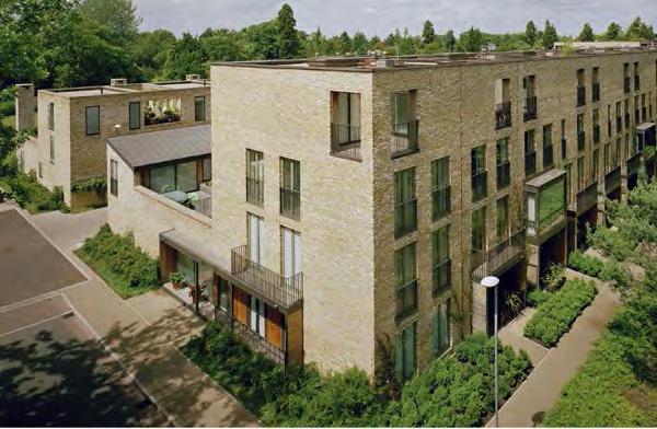
107 Building Guidance Material Palette Primary material: Palette of brick Details: Naturally weathered metal panels Details: White concrete, naturally weathering timber, grey metal panels 107


108 Park and Ride Plot Principles The Ingliston Park and Ride site, under the ownership of City of Edinburgh Council, lies within the redline boundary of the application. It currently consists of the following land uses: - The Ingliston Park and Ride facility, including a road that will provide the primary access to the southern section of the IBG. - A gap site of undeveloped land immediately to the east of the Park and Ride. In the short term it is understood that the Park and Ride will remain in operation, and proposals for redevelopment do not form part of this application. However, redevelopment of the site is part of the wider strategy for the area, described in the West Edinburgh Strategic Design Framework. In order to ensure that this redevelopment forms a cohesive part of the wider International Business Gateway, an illustrative approach to the future development of the gap site and Park and Ride facility has been demonstrated. Illustrative Plan: Park and Ride undeveloped 108 Existing Park and Ride Existing Bus Interchange

109 Park and Ride Plot Principles The approach to the illustrative masterplan for the Park and Ride has been planned to allow phased redevelopment: Eastern Gap Site Development of this currently unoccupied plot of land is seen as an important placemaking addition to the International Business Gateway. The plot has a key frontage onto the tram square, for which it is suggested proposals for a major civic development should be brought forward. The illustrative proposals allow for this plot to be developed whilst the Park and Ride remains in operation. Western Park and Ride Site Full redevelopment of the Park and Ride is the longer term strategy for the International Business Gateway. The northern part of the site lies within the safeguarded route for the proposed tram extension to Newbridge, and the public realm treatment for the tram corridor should be extended along this axis. The remainder of the site should be redeveloped for business led development, applying the guidance and priniciples established for Phase One of the development. Illustrative Plan: Gap site developed Business Led Development Business Led Development with Active Ground Floor Hotel Led Development Hotel Led Development with Active Ground Floor Residential Led Development Civic Development Illustrative Plan: Full Park and Ride redeveloped 109
Chapter 2: OUTLINE PLANNING APPLICATION PROPOSALS. A New Garden Neighbourhood Matford Barton 17
 Chapter 2: OUTLINE PLANNING APPLICATION PROPOSALS A New Garden Neighbourhood Matford Barton 17 2.1. SUMMARY AND STATUS OF THE PROPOSALS 2.1.1. The parameter plans and associated wording in this chapter
Colchester Northern Gateway Master Plan Vision Review Draft. July 2016
 Colchester Northern Gateway Master Plan Vision Review Draft July 2016 Contents Introduction 4 Context 8 Purpose of the Report 8 Strategic Position 9 Overview of the Process 11 2012 Master Plan Vision 12
8.0 Design and Form of Development 43/
 42/ 8.0 Design and Form of Development 43/ Rothwells Farm, Golborne/ Development Statement Figure 7. Site Constraints Key 44/ Site Boundary 360 Bus Route/Stops Existing Trees Underground Water Pipe Sensitive
BRIDGE OF DON MASTERPLAN & PLANNING SUMMARY
 BRIDGE OF DON MASTERPLAN & PLANNING SUMMARY SITE LOCATION The site of the existing AECC lies in an area of predominately residential and business use in Bridge of Don and extends approximately 50 acres.
Newcourt Masterplan. November Exeter Local Development Framework
 Newcourt Masterplan November 2010 Exeter Local Development Framework Background The Exeter Core Strategy Proposed Submission sets out the vision, objectives and strategy for the development of Exeter up
New Homes at Winton East
 View toward Winton East from Caerketton Hill Aerial photograph of South Edinburgh: Winton East Site Location Indicative proposal Welcome Thank you for coming to the Winton East public exhibition. We would
LITTLE FRANCE PARK, EDINBURGH
 LITTLE FRANCE PARK, EDINBURGH INTEGRATING ACTIVE TRAVEL ROUTES WITHIN A MASTERPLAN FROM THE OUTSET Location: Implemented: Edinburgh, Scotland 2016 - ongoing CASE STUDY The Little France Park cycling and
edge of gas line corridor setback edge of gas line corridor aligned with Schlumberger building 37.0 m AOD 33.0 m AOD max
 7. Heights and Street Frontage: In accordance with the approved heights parameters, heights to along Western Access Road must respond to the existing low density character in this location. Heights are
WELCOME. Land North of STEVENAGE. We would like to thank you for attending our public exhibition today.
 WELCOME We would like to thank you for attending our public exhibition today. The purpose of this event is to share our proposals and hear your thoughts on our ideas. Members of the project team are on
3.1 The hybrid planning application proposes the following description of development:
 CHAPTER 3: PROPOSED DEVELOPMENT 3.1 The hybrid planning application proposes the following description of development: Hybrid (part-outline/part-full) planning application for a single composite development
Site 5 Development Brief
 Union Street Crichton Street South Crichton Street Thomson Avenue (Northern Boulevard) Site 5 South Union Street Earl Grey Place West Site 6 Riverside Esplanade (Southern Boulevard) South Crichton Street
Schedule of Planning Applications Committee Date: 23 May Reference: 06/17/0726/F Parish: Hemsby Officer: Mr J Beck Expiry Date:
 Schedule of Planning Applications Committee Date: 23 May 2018 Reference: 06/17/0726/F Parish: Hemsby Officer: Mr J Beck Expiry Date: 22-05-2018 Applicant: Proposal: Site: Mr Gillett Change of use to the
2.0 Strategic Context 4
 2.0 Strategic Context 4 2.1 The Area Action Plan is a non-statutory plan, which forms a corporate policy document, expressing particular issues and areas of concern while also providing a vision for the
Housing development on the edge of Forres
 Project Reference Dallas Dhu Details Housing development on the edge of Forres Location Forres, Moray Use Type Housing / Masterplan Client/Developer Sir Alastair Gordon-Cumming, Altyre Estate Lead Designers
WELCOME GYPSY LANE. Wider Site Location plan. Proposals for the development of LAND OFF FOXLYDIATE LANE WEBHEATH. Proposals for the development of
 WELCOME The developers are preparing an outline planning application for a residential led development and need the community s views in order to develop the proposals further WHAT IS PROPOSED? A high
Welcome. Site/11/04. Site/11/03. Proposed Site. 11,400 new homes needed in east Cambs
 Welcome Welcome to our consultation on our proposals for new homes on land north east of Soham Road, Fordham. Members of the project team are available to answer any questions you have and listen to feedback.
Page 1 of 19 URBAN DESIGN FRAMEWORK FOR BOLTON STREET WATERFORD
 Page 1 of 19 URBAN DESIGN FRAMEWORK FOR BOLTON STREET WATERFORD 1.0 Introduction: The relocation of the City Council stores and depot from Bolton Street creates an exciting opportunity for development
1.0 INTRODUCTION. Brantham Industrial Area Regeneration - Factory Lane - Brantham
 1.0 INTRODUCTION Welcome to this exhibition of our proposals for the regeneration of the Brantham Industrial Area located off Factory Lane in Brantham. This presentation will give you an opportunity to
97 Lea Bridge Road, Leyton, E10 7QL London Borough of Waltham Forest December 2015
 97 Lea Bridge Road, Leyton, E10 7QL London Borough of Waltham Forest December 2015 Public Realm and Landscape Proposals LEA BRIDGE ROAD, WALTHAMSTOW Public Realm & Landscape Proposals BDP(90)RPT001 December
PHASE III: Reserved Matters Submission
 Statement of Compliance with the outline approval for the proposed residential development of land at: BURGES LANE, WIVELISCOMBE PHASE III: Reserved Matters Submission Foreword Contents: This Statement
Memorial Business Park Site. Proposed Future Development. Design guidelines. August
 Memorial Business Park Site Proposed Future Development Design guidelines August 2014 www.designenvironment.co.nz 0064 3 358 3040 Contents 1.0 Background 1.1 Introduction 3 1.2 Objectives 4 2.0 Context
Planning Appraisal. Land Adjacent to Norton House Hotel, Edinburgh. May 2017
 Planning Appraisal Land Adjacent to Norton House Hotel, Edinburgh May 2017 Clarendon Planning and Development Ltd Introduction Clarendon Planning and Development Ltd have been requested to provide a summary
HS2 Interchange Station Design
 Working on behalf of HS2 Interchange Station Design October 2018 www.hs2.org.uk 1 Interchange Station, Solihull Introduction In February 2018, HS2 Ltd appointed Arup to take forward the design of Interchange
Former North Works, Lickey Road, Longbridge, Birmingham
 Committee Date: 14/11/2013 Application Number: 2013/06431/PA Accepted: 27/08/2013 Application Type: Full Planning Target Date: 26/11/2013 Ward: Longbridge Former North Works, Lickey Road, Longbridge, Birmingham
Urban Design Guidelines
 Urban Design Guidelines These Urban Design Guidelines comprise the Key Design Objectives below, the Roads Design Guidelines overleaf and Neighbourhood Framework Plans. Together with Section 3: Urban Design
elbridge Core Strategy
 C elbridge Core Strategy Celbridge is designated as a Moderate Growth Town in the RPGs. The County Development Plan reinforces this designation in its settlement strategy. Moderate Growth Towns within
Peckham Peckham Area Vision Map
 Area Vision Map PNAAP13 PNAAP8 Sumner Road Surrey Canal Walk Bird in Bush Park Key: NSP Site Allocations PNAAP Allocations Greenspace Low Line Cycle Network Primary Shopping Areas Square Surrey Canal Walk
4 RESIDENTIAL ZONE. 4.1 Background
 4 RESIDENTIAL ZONE 4.1 Background The residential areas within the City are characterised by mainly lowrise dwellings sited on individual allotments. Past architectural styles, settlement patterns and
Response to the London Bridge Area Vision and Site Allocations within the New Southwark Plan
 1 Melior Place London SE1 3SZ 020 7407 4701 teamlondonbridge.co.uk info@teamlondonbridge.co.uk 28 April 2017 Response to the London Bridge Area Vision and Site Allocations within the New Southwark Plan
WELCOME TO THE NEW WILTON PARK
 WELCOME TO THE NEW WILTON PARK VISION HISTORY OF WILTON PARK TOWARDS A PLANNING APPLICATION Our objective is to create a truly outstanding environment at Wilton Park. At the heart of our proposals is a
DESIGN & ACCESS STATEMENT
 DESIGN & ACCESS STATEMENT January 2016 Contents Introduction section 1 Section 1 - Introduction Section 2 - Assessment Section 3 - Involvement Section 4 - Evaluation Section 5 - Design Section 6 - Layout
The journey so far. The new masterplan for Dargavel Village
 The journey so far Our vision for Dargavel Village began over ten years ago when the original masterplan for transforming the former Royal Ordnance Factory site into a thriving community was established.
A VISION FOR BLAIRGOWRIE
 Welcome to the Westpark Partnership and Lidl UK GmbH Community Presentation. The purpose of this presentation is for you to view and comment upon the revised and updated proposals for the allocated development
Place Brief. National Collections Facility (NCF site)
") Place Brief. National Collections Facility (NCF site) Contents 1.0 Purpose 2.0 Location and Proposal 3.0 Vision and Aim 4.0 Placemaking Principles 5.0 Conclusion Plan 1 Location Plan Plan 2 Placemaking
Place Brief. National Collections Facility (NCF site) Contents 1.0 Purpose 2.0 Location and Proposal 3.0 Vision and Aim 4.0 Placemaking Principles 5.0 Conclusion Plan 1 Location Plan Plan 2 Placemaking
COURTHOUSE CAMPUS BARNSLEY Executive Summary March 2010
 COURTHOUSE CAMPUS BARNSLEY Executive Summary March 2010 Estell Warren Cartwright Pickard Buro Happold King Sturge BWA Barnsley Metropolitan Borough Council introduction Courthouse Campus is the last major
Welcome to our exhibition
 Welcome to our exhibition housing development A46 Wildmoor Alcester Road Canal Quarter A422 Town Centre housing development Warwickshire-based IM Properties, one of the UK s largest privately owned property
1. Local Plan Context
 1. Local Plan Context WHY ARE YOU HERE? ABOUT US PLANNING APPLICATION CONSULTATION Stewart Milne Homes are in the process of preparing a detailed planning application for a development of approximately
GREENFORD HALL & ADJOINING LAND
 GREENFORD HALL & ADJOINING LAND CONTENTS 1. Introduction 1. Introduction 2. Urban Context 2.1 The Site and Surroundings 2.2 Urban Context Map 2.3 Access and Movement 3. Planning Context 3.1 Planning History
5. Bankside and The Borough 5.1. Bankside and The Borough Area Vision
 5. 5.1. Area Vision 5.1.1. are: A globally significant central London business district which is home to international business headquarters; At the heart of the commercial and cultural life of the capital
Woodbrook - Shanganagh
 Section 4: Key Sites Framework Strategy Woodbrook - Shanganagh Local Area Plan 2017-2023 4. Site Framework Strategies The Master Plans shall have regard to the thematic objectives under the LAP Development
Local Development Plan for Glasgow
 Local Development Plan for Glasgow Forbes Barron Head of Planning & Building Control Services Context and Process for LDP NPF 3 Principles An 80% reduction in emissions by 2050. Achieving the aims of the
Kibworth Harcourt. Introduction. Introduction
 Introduction Introduction Welcome to this public exhibition on the proposals for the delivery of new homes on land at The Kibworths. The purpose of today s exhibition is to give you the opportunity to
UDF PLANS AND GUIDELINES
 UDF PLANS AND GUIDELINES 5 Land Use Land Use Development Plan Plan no. 3 Land Use Development Mixed Use Retail / Leisure Residential Civic and Institutional Proposed Zoning Table Development Edges Plan
SECTION ONE North East Industrial Zone Design Guide Palmerston North City Council June 2004
 SECTION ONE North East Industrial Zone Design Guide Palmerston North City Council June 2004 young heart easy living 1 Preface Industrial areas are a very important component of the economic well-being
design & access statement Proposed Erection of 68 Bedroom Hotel and Restaurant with Associated Landscaping
 Proposed Erection of 68 Bedroom Hotel and Restaurant with Associated Landscaping Promenade, design & access statement lawrencemcphersonassociates 6 new road, ayr, ka8 8ex On Behalf of July 2015 CONTENTS
0 9 Areas of Change 59
 09 Areas of Change 59 09 Areas of Change This section explores seven areas of change within Solihull Town Centre which provide practical interventions in order to deliver the emerging concepts outlined
heuston gateway: sections heuston gateway: regeneration strategy and development framework plan
 B B1 A B1 B C A heuston gateway: sections B B1 C 117 4.3.3 Zoning The station is the central hub of the area and this function must be preserved and developed. However large areas of the Heuston Station
COMMUNITY DESIGN. GOAL: Create livable and attractive communities. Intent
 COMMUNITY DESIGN Intent An attractive, well-designed County will attract quality development, instill civic pride, improve the visual character of the community, and create a strong, positive image for
HARDWICK GREEN, King s Lynn. Welcome to our Exhibition. What are your views? Introduction to the site and proposals. About us
 HARDWICK GREE, King s Lynn Welcome to our Exhibition Welcome to our exhibition, which is being held to provide you with the opportunity to understand and comment upon our proposals for new residential
Longbridge Town Centre Phase 2 Planning Application
 Longbridge Town Centre Phase 2 Planning Application Non-Technical Summary of the Environmental Statement December 2013 Introduction A full application for Planning Permission has been submitted to Birmingham
Welcome to our public exhibition
 About our development Welcome to our public exhibition This exhibition gives you the chance to view and comment on our proposals for a new residential development of 165 high-quality homes, along with
4.00 STAKEHOLDERS. urbanprojects
 4.00 STAKEHOLDERS 94 heuston gateway: regeneration strategy and development framework plan 95 The Heuston Gateway presents one of the greatest concentrations of brown field development sites located adjacent
Derry Green Corporate Business Park
 Town of Milton Derry Green Corporate Business Park Urban Design Guidelines BMI/Pace - June 2010 Draft 3 Prepared by: Brook McIlroy Planning + Urban Design / Pace Architects Suite 300-51 Camden Street Toronto,
Welcome. Walk Around. Talk to Us. Write Down Your Comments
 Welcome This is an information meeting introducing the applications for proposed redevelopment of the Yorkdale Shopping Centre site at 3401 Dufferin Street and 1 Yorkdale Road over the next 20+ years,
Scottish Natural Heritage. Better places for people and nature
 Scottish Natural Heritage Better places for people and nature Contents Summary... 3 SNH approach... 5 Place-making in policy and practice... 6 Developing the contribution of the natural heritage to place-making...
vision & process willowburn, tarves community engagement 04/18
 vision & process Historic Conservation area Scotia intend to create a high quality residential development based upon best practice urban design principles. This will include a contemporary reinterpretation
Consultation Response to Lisburn and Castlereagh City Council LDP Preferred Options Paper (POP)
") Consultation Response to Lisburn and Castlereagh City Council LDP Preferred Options Paper (POP) Retail NI welcomes the opportunity to respond to the Council s Preferred Options Paper (POP) consultation
Consultation Response to Lisburn and Castlereagh City Council LDP Preferred Options Paper (POP) Retail NI welcomes the opportunity to respond to the Council s Preferred Options Paper (POP) consultation
ELMVALE ACRES SHOPPING CENTRE MASTER PLAN
 ELMVALE ACRES SHOPPING CENTRE MASTER PLAN Contents 1.0 INTRODUCTION... 2 2.0 LOCATION... 2 3.0 EXISTING CONTEXT... 2 4.0 VISION & GUIDING PRINCIPLES... 2 5.0 LAND USE AND BUILT FORM... 4 5.1 St. Laurent
Site 2 Development Brief
 a South Marketgait Site 2 b Union Street c Site 2 Development Brief Thomson Avenue (Northern Boulevard) Dundee Riverside Drive Discovery Plaza South Union Street Station Earl Grey Place West Site 5 Site
Poolbeg West SDZ Draft Planning Scheme
 Poolbeg West SDZ Draft Planning Scheme Introduction/vision Housing Community Economy/Employment Movement/transport Infrastructure green infrastructure /open space Land-use and phasing Public Realm Urban
BETTER PUBLIC TRANSPORT PROJECT WATERBEACH TO SCIENCE PARK AND EAST CAMBRIDGE CORRIDORS
 Report To: Greater Cambridge Partnership Joint Assembly 20 th September 2018 Lead Officer: Peter Blake GCP Director of Transport BETTER PUBLIC TRANSPORT PROJECT WATERBEACH TO SCIENCE PARK AND EAST CAMBRIDGE
University Park, Worcester Non Technical Summary December 2011
 University Park, Worcester Non Technical Summary December 2011 Introduction UW Wrenbridge LLP, a Joint Venture Company of the University of Worcester and Wrenbridge Land Ltd (the Applicants ) intend to
Public Consultation. Land at Monks Farm, North Grove. Welcome
 Welcome Welcome to our public exhibition for development on Land at Monks Farm, orth Grove. Gallagher Estates and Gleeson Strategic Land are preparing an outline planning application for new homes, open
CORNUBIA RETAIL PARK- PLANNING REPORT REVERT 3
 CORNUBIA RETAIL PARK- PLANNING REPORT 19.04.2013 REVERT 3 1 FOR: BY: 28 DEVONSHIRE AVENUE GLENWOOD DURBAN 4001 P.O. BOX 17390 CONGELLA 4013 T +27 31 202 9550 F +27 31 202 9551 1st FLOOR THE MEDIA MILL
Neighbourhood Planning Local Green Spaces
 Neighbourhood Planning Local Green Spaces Introduction... 2 1. Why green space is important... 4 2. Neighbourhood plans and green space... 6 3. Evidence... 8 Statutory designations... 9 Green space audit...
McCowan Precinct Plan Study Background & Deliverables
 1 DRAFT & WITHOUT PREJUDICE McCowan Precinct Plan Study Background & Deliverables In September, 2011, City Planning (Scarborough District) began a study of an area within the Scarborough Centre, identified
ARLINGTON COUNTY, VIRGINIA
 ARLINGTON COUNTY, VIRGINIA County Board Agenda Item Meeting October 15, 2005 DATE: September 28, 2005 SUBJECT: Request to Advertise the adoption of the 2005 Clarendon Sector Plan C. M. RECOMMENDATION:
Unity Square, Nottingham Environmental Statement Non Technical Summary December 2013
 Unity Square, Nottingham Environmental Statement Non Technical Summary December 2013 in association with 1. Introduction Peel Holdings is applying to Nottingham City Council (NCC) for Outline planning
Design Guidance. Introduction, Approach and Design Principles. Mauritius. November Ministry of Housing and Lands. .. a
 sig evelo r D Mauritius s. Utilities.. Individu a s. er itects.to ls chpers.po e Public. T. h rban D Sc U e me Promot e h ners. A Design Guidance o.h Planne rs n w iticians r l useholde National Development
Chapter 5 Urban Design and Public Realm
 5.1 Introduction Public realm is all areas of the urban fabric to which the public have access. It is where physical interaction takes place between people. It therefore, includes buildings and their design,
Carterton Construction Ltd is bringing forward plans for up to 85 new family homes and extra care facilities on land east of Burford.
 Welcome Carterton Construction Ltd is bringing forward plans for up to 85 new family homes and extra care facilities on land east of. We are at the early stages of designing our proposals and have a number
Background Information
 Background Information view at site entrance THE LONDON BOROUGH OF SUTTON As the strategic local authority the Council is working with a range of partners to take forward various development sites in Hackbridge.
Horwood Map of London, Westminster & Southwark First edition
 Barratt London is developing plans in tandem with Southwark Council and TfL to transform the southern end of Blackfriars Road. The residential-led, mixed-use scheme will deliver new private and affordable
Green Networks in Planning Policy and Management
 Promoting green networks in the Lothians & Fife delivering economic, social & ecological benefits in partnership, as part of the Central Scotland Green Network funded by: Green Networks in Planning Policy
City of Farmington. Downtown Plan. Amendment to the 1998 Master Plan Adopted October 11, 2004
 City of Farmington Amendment to the 1998 Master Plan Adopted October 11, 2004 Introduction Planning Background 1 Scope and Components of the Plan Amendment 2 Concept Introduction 3 Plan Concepts 3 Conceptual
Welcome to our exhibition
 Welcome to our exhibition The Homes & Communities Agency (HCA) welcomes you to this public exhibition explaining our proposals for the redevelopment of the former Lea Castle Hospital site. About the Homes
Droitwich Spa 6. Reasoned Justification
 87 Droitwich Spa 6 Reasoned Justification 6.1 Droitwich Spa is identified in the settlement hierarchy (Policy SWDP1) as a main town being the largest settlement in Wychavon District with an estimated population
Elderberry Walk. Developer HAB Housing
 Case studies Elderberry Walk Developer HAB Housing Development of 161 new homes on the former Dunmail Primary School site, focused around a central green street, with retained trees, new multifunctional
INTRODUCTION NORTH HEYBRIDGE GARDEN SUBURB
 INTRODUCTION This event is being hosted by the promoters of the proposed North Heybridge Garden Suburb who are working with Maldon District Council and other key stakeholders on the preparation of a comprehensive
A new park will be delivered as part of the Elephant Park regeneration.
 A new park will be delivered as part of the Elephant Park regeneration. The exhibition boards presented here introduce the first phase of the new park that is scheduled to open in spring 2017 that has
6 Site Framework Strategies
 6 Site Framework Strategies 6.1 Introduction Section 6 identifies a number of specific areas which are considered to be key sites within the Plan area and which may have potential for development / redevelopment.
WELLINGTON HOSPITAL DESIGN GUIDE TABLE OF CONTENTS
 WELLINGTON HOSPITAL DESIGN GUIDE TABLE OF CONTENTS 1.0 Introduction Page 2 The Place of Wellington Hospital 2 The Future of the Hospital 2 2.0 The Intention of the Design Guide 3 3.0 Analysis 4 General
BLETCHLEY PARK AREA - DEVELOPMENT FRAMEWORK
 ANNEX A To Item 9 REVISED TEXT: additions shown bold and underlined, deletions in (brackets and in italics). BLETCHLEY PARK AREA - DEVELOPMENT FRAMEWORK This framework sets out the key objectives and requirements
LDF. Local Development Framework. Manor House Area Action Plan. Adopted January 2013 PJ50811
 LDF Local Development Framework Manor House Area Action Plan Adopted January 2013 PJ50811 CONTENTS PART A Introduction, Baseline and Options 1. Introduction 4 1.1. Why prepare an Area Action Plan? 4 1.2.
Euston Area Plan - Examination: Statement in response to the Inspector s Matters, Issues and Questions
 1 Euston Area Plan - Examination: Statement in response to the Inspector s Matters, Issues and Questions Sydney and London Properties Limited June 2014 2 3 This document is the Statement in response to
NORTH CIRCULAR ROAD - REGENERATION IN ACTION
 NORTH CIRCULAR ROAD - REGENERATION IN ACTION Notting Hill Housing is a social enterprise which has been at the forefront of vibrant urban regeneration since 1963. Notting Hill has over 25,000 homes across
Tāhuhu whakaruruhau ā-taone The sheltering ridge pole
 B2. Tāhuhu whakaruruhau ā-taone - Urban growth and form B2.1. Issues Tāhuhu whakaruruhau ā-taone The sheltering ridge pole Auckland s growing population increases demand for housing, employment, business,
Perth and Kinross Council Development Management Committee 8 June Pre-Application Report by Development Quality Manager
 Perth and Kinross Council Development Management Committee 8 June 2016 5(3)(i) 16/259 Pre-Application Report by Development Quality Manager Residential development at St Martins Road, Land 120 metres West
Wallingford Neighbourhood Plan
 Wallingford Neighbourhood Plan Introduction What is neighbourhood planning? Neighbourhood planning was introduced by the Localism Act 2011 to give local people more influence over how development comes
4.0 URBAN DESIGN FRAMEWORK. The vision for the future development of the plan area is to:
 4.0 The vision for the future development of the plan area is to: Create a new neighbourhood that focuses on the highly valued natural and aesthetic features of the lands and provides good quality homes,
The Proposed Auckland Unitary Plan (notified 30 September 2013)
") 3 Business zones Introduction There are 10 business zones in the Unitary Plan: City Centre Metropolitan Centre Town Centre Local Centre Neighbourhood Centre Mixed Use General Business Business Park Light
3 Business zones Introduction There are 10 business zones in the Unitary Plan: City Centre Metropolitan Centre Town Centre Local Centre Neighbourhood Centre Mixed Use General Business Business Park Light
16. Peckham Peckham Area Vision
 16. 16.1. Area Vision 16.1.1. is: A lively town centre providing a range of daytime and night time activities on Rye Lane including a Library, a Leisure Centre and many independent retailers which specialise
Keystone Business Park Precinct Structure Plan North East Industrial Precinct. Part 2 Design Principles
 Keystone Business Park Precinct Structure Plan North East Industrial Precinct Part 2 Design Principles Context Issues Services Landform Issues Geotech and contamination Ecology Traffic and access Issues
Story Homes. Land at Thirsk Road, Kirklevington. An Introduction to Story Homes. Our Foundations. Commitment to Consultation.
 Story Homes An Introduction to Story Homes Founded by Fred Story in 1987, Story Homes has a long and successful reputation of building high quality and high specification homes. The family owned business
Section 4 - Public Realm & Landscape proposals Landscape Masterplan. Section 4 52
 - Public Realm & Landscape proposals Landscape Masterplan 52 Proposed Masterplan - Green Infrastructure Strategy District Park 4.33 Ha to provide Passive and active recreation with a large play area which
Taking forward the All London Green Grid
 Taking forward the All London Green Grid Foreword Earlier this year, the Mayor published the All London Green Grid Supplementary Planning Guidance to the London Plan which set the vision, and framework,
GREENBANK DEVELOPMENT MASTERPLAN
 DEVELOPMENT MASTERPLAN POTENTIAL TRAIN STATION COMMUNITY CENTRE Greenbank will be a connected masterplanned community providing easy access to local and surrounding amenity. Affordable quality homes, green
Rochford District Council Allocations Development Plan Document: Discussion and Consultation Document Sustainability Appraisal
 Option SWH1 Balanced Communities Option SWH1 1 To ensure the delivery of high quality sustainable communities where people want to live and work Will it ensure the phasing of infrastructure, including
WHITELEY TOWN COUNCIL NORTH WHITELEY DEVELOPMENT SEPTEMBER 2014
 WHITELEY TOWN COUNCIL NORTH WHITELEY DEVELOPMENT SEPTEMBER 2014 Dear Resident This Special Edition of the Whiteley Voice which has been prepared in conjunction with the North Whiteley Consortium is to
Urban Design Manual PLANNING AROUND RAPID TRANSIT STATIONS (PARTS) Introduction. Station Study Areas
 Introduction. Station Study Areas") 111111 PLANNING AROUND RAPID TRANSIT STATIONS (PARTS) Introduction The ION rapid transit system will link Waterloo, Kitchener and Cambridge through a central transit corridor (CTC). There are a number
111111 PLANNING AROUND RAPID TRANSIT STATIONS (PARTS) Introduction The ION rapid transit system will link Waterloo, Kitchener and Cambridge through a central transit corridor (CTC). There are a number