Form Syntax as a contribution to geodesign: a method to measure urban form quantitatively and assist urban design
|
|
|
- Berniece O’Connor’
- 5 years ago
- Views:
Transcription


1 Form Syntax as a contribution to geodesign: a method to measure urban form quantitatively and assist urban design YU YE Anthony G. O. Yeh Jianzheng Liu; Tian Lan Akkelies van Nes Henrik Harder
2 introduction: A new direction of applying geodesign approach into urban design SECTION

.")

.")
3 01.1 geodesign & urban design Geodesign is a design method based on geographic contexts to create design proposals (Flaxman, 2010). Urban design is a design effort to analyse, organise and shape urban form to create lively urban space (Buchanan, 1988; Mumford, 2009). Apparently, the geodesign could be an important help for urban design practices.

 NOT based on urban form - the key issue of urban design 2) NOT follow")
4 01.1 geodesign & urban design However, the applying of geodesign is limited in the urban design field although many tools have provided a lot of help for landscape and urban planning. 1) NOT based on urban form - the key issue of urban design 2) NOT follow traditional urban design thinking


5 O1.2 URBAN DESIGN CALLS FOR NEW ANALYITCAL TOOLS Meanwhile, urban design is changing toward more analytical considerations to handle multiple challenges. Analysis and evaluation tools are calling by practitioners, especially the tools able to focus on urban form and can be understood by designers.


6 O1.3 TOOLS DEVELOPED BY DESIGNERS THEMSELVES provide a new direction New morphological analysis tools have provided quantitative ways to describe many aspects of urban form. As proposed by designers and morphologists, they can easily be accepted and used into design process. SPACE SYNTAX Measuring street network configuration. SPACEMATRIX Measuring building density and building types MXIED USE INDEX (MXI) Measuring the degree of functional mixture AMENITIES BIFUNCTIONAL MIXED 80 MONOFUNCTIONAL WORKING HOUSING These improvements raise a new direction of extending geodesign approach into urban design. In this context, Form Syntax is proposed as a quantitative method to analyse urban form based on urban morphology tradition and able to follow urban design thinking.
7 Form Syntax as a quantitative description of urban form SECTION
8 02.1 The theoretical foundations of Form Syntax Conzen s "town-plan analysis" includes: (1) town plans (streets, plots, and buildings), (2) patterns of building form, (3) patterns of land use UNDERSTANDINGING URBAN FORM FROM ITS ESSENTIAL PROPERTIES LAND USE MIX MIXED USE INDEX (MXI) The essential properties of urban form can be regarded as: (1) the street system, (2) the building system (plots and the buildings located on it) (3) the land use pattern. DENSITY & BUILDING TYPES Spacematrix STREET NETWORK CONFIGURATION Space syntax

9 02.2 Three related spatial analysis tools: space syntax, Spacematrix & MXI The space syntax includes a set of techniques for analysing the street network configuration. Although applying only space syntax to describe the whole built environment contains some problems, the potential of integrating street network analysis with other layers of data to reveal the urban form has been well recoginzed.


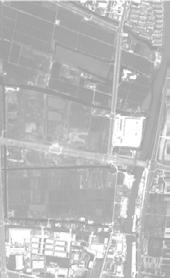
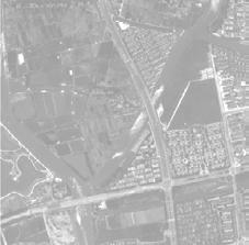
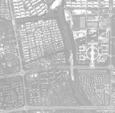
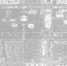
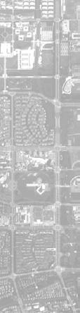
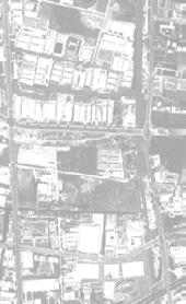
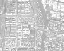
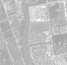
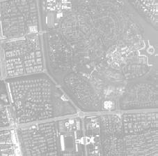
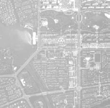
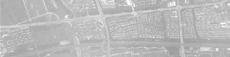
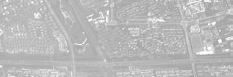
10 02.2 Three related spatial analysis tools: space syntax, Spacematrix & MXI + = Converting topological analysis from Depthmap into ArcGIS The combination of metric analyses L = Low, M = Middle, H = High METRIC/ANGULAR 3*3 TYPES Metric L, Angular M Metric L, Angular L Metric L, Angular H Metric M, Angular L Metric M, Angular M Metric H, Angular L Metric M, Angular H Metric H, Angualr M Metric H, Angular H Example of spatial integration analyses ANGULAR ANALYSIS WITH TOPOLOGICAL RADII FOR SONGJIANG NEW AND OLD TOWN Space Syntax analyses High level Middle level Low level Angular analyses with topological radii High level Middle level High level Middle level High level Low level Middle level Low level Low level Angular analyses with metric radii High level High level Middle level Middle level Low level High level Low level Middle level Low level Converting metric analysis from Depthmap into ArcGIS PRINCIPLES OF COMBINATION: SPACE SYNTAX ANALYSES

11 02.2 Three related spatial analysis tools: space syntax, Spacematrix & MXI The spacematrix method contributes to co-present building density and building types at the same time.


12 02.2 Three related spatial analysis tools: space syntax, Spacematrix & MXI High level: E; F; I Middle level: C; D; G; H Low level: A; B
13 02.2 Three related spatial analysis tools: space syntax, Spacematrix & MXI The mixed use index (MXI) is developed by van den Hoek (2008, 2009) to measure various degrees of multifunctionality of land use: "housing"; "working" and "amenities" HOUSING HOUSING BIFUNCTIONAL TRIPLE-FUNCTIONAL 40 BIFUNCTIONAL 60 HIGHLY MIXED INDUSTRIAL PARKS/OFFICES 20 MIXED 80 COMMERCIAL AMENITIES AMENITIES MONOFUNCTIONAL INDUSTRIAL/OFFICAL PARKS PUBLICA SERVICE AMENITIES

14 02.2 Three related spatial analysis tools: space syntax, Spacematrix & MXI
 LAND USE mix transfer SPACEMATE ArEA based With the help of GIS,")
15 02.3 FORM SYNTAX: COMBINING THE THREE TOOLS TO QUANTIFY URBAN FORM essential properties of urban form based on grids Space syntax street network CONFIGURATION transfer linear based + combined spatial properties representing urban FORM Spacematrix building density & types transfer overlapping ArEA based + MIXED USE INDEX (MXI) LAND USE mix transfer SPACEMATE ArEA based With the help of GIS, different spatial properties can be transfered into grid-based data, and then combined together to quantify urban form. 1 High Low rise suburban point 2 Low rise Suburban stripe 3 Low Low rise potential block 4 Middle Middle rise potential point 5 Middle High rise potential stripe 6 Middel rise Urban block 7 High High rise point Urban 8 High rise stripe SPACE SYNTAX & MXI & SPACEMATRIX High Sururban suburban Low urban Low Low poten pote Middle

16 02.4 building a spatial classification of urban form via form syntax Defining high, medium and low values in the three measurements and then combining them together to classify urban form.
17 02.4 building a spatial classification of urban form via form syntax Classifying urban form into seven categories and three groups??
18 Form Syntax as a morphological reflection of urbanity SECTION
19 03.1 what is urbanity? The Concept of Urbanity For urban sociologists: socio-economic activities & the culture of cities For architects and urban designers: a spatial quality provided by design An emerging combined viewpoint: socio-economic performance influenced by urban form It is possible to measure urbanity from morphological perspective

 and Lefebvre (1968), as the gathering of large population")

20 03.2 GPS tracking on human behaviours as a reflection of urbanity from a social perspective GPS tracking of pedestrain movements GPS tracking of taxi pick-up and drop-off points If urban life is, according to Wirth (1938) and Lefebvre (1968), as the gathering of large population size, high population density and heterogeneity, then human behaviour record can be used to represent as one socio-economic aspect of urbanity.


21 03.3 pedestrian activities V.s. Form Syntax analysis in Aalborg

 Between Groups Within Groups Total Sum of Squares 2.720E7 3.152E7 5.871E7 df 6 251 257 Mean Square 4532784.518 125565.193 F 36.099 Sig. (2-tailed).")
22 03.4 taxi pick-up and DROP-off points v.s. Form Syntax analysis in wuhan ANOvA between the groups of assumed degree of urbanity and numbers of of taxi pick up and drop off points in each grid Correlations between assumed degree of urbanity and levels of density of taxi pick up and drop off points (including car-free areas) Correlations between assumed degree of urbanity and levels of density of taxi pick up and drop off points (excluding car-free areas) Between Groups Within Groups Total Sum of Squares 2.720E E E7 df Mean Square F Sig. (2-tailed).000 Assumed degree of urbanity Levels of density of taxi pick up and drop off points Assumed degree of urbanity Levels of density of taxi pick up and drop off points Pearson Correlation ** Sig. (2-tailed) N Pearson Correlation Sig. (2-tailed) N.691 ** **. Correlation is significant at the 0.01 level (2-tailed). Assumed degree of urbanity Levels of density of taxi pick up and drop off points Assumed degree of urbanity Levels of density of taxi pick up and drop off points Pearson Correlation ** Sig. (2-tailed) N Pearson Correlation Sig. (2-tailed) N.716 ** **. Correlation is significant at the 0.01 level (2-tailed).

23 03.5 Form Syntax as a measurement of urbanity from morphological perspective
24 Making A spatial exploration of unbalanced areas with Form Syntax SECTION
25 O4.1 THE UNBALANCED AREA IS THE KEY A set of towns in Netherlands are chosen to study the changing percentages of various balance" & "unbalance" groups. POPULATION DENSITY, INHABITANT PER KM2 EMPLOYMENT DENSITY, INHABITANT PER KM2 POPULATION DIVERSITY, BASED ON HOUSEHOLD INCOME POPULATION PERCENTAGE OF YOUTH AND TEENAGER PERSENTAGE OF THE CREATIVE CLASS THEATER CAPACITY, THEATER CHAIR PER 1,000 INHABITANT LELYSTAD LELYSTAD LELYSTAD HAARLEM ALMERE HAARLEM ALMERE HAARLEM ALMERE ZOETERMEER ZOETERMEER ZOETERMEER LEGEND LOW HIGH LEGEND LOW HIGH LEGEND LOW HIGH OFFICE SPACE AVAILABLE IN M2 PER 100 INHABITANT CAFETERIAS, PER 1000 INHABITANT RESTAURANTS, PER 1000 INHABITANT RETAIL SURFACE AREA IN M2 PER 1000 INHABITANT LELYSTAD LELYSTAD LELYSTAD HAARLEM ALMERE HAARLEM ALMERE HAARLEM ALMERE ZOETERMEER ZOETERMEER ZOETERMEER LEGEND LOW HIGH LEGEND LOW HIGH LEGEND LOW HIGH 'Haarlem > Zoetermeer > Almere > Lelystad' The ranking of urbanity Historical city Well developed new town Poor developed new town
26 O4.1 THE UNBALANCED AREA IS THE KEY With the increase of urbanity, there are two routes exist at the same time: 1) from "balanced with low value" to both "unbalanced" and "banlaced with high value" 2) from "unbalanced" to "banlaced with high value". The second route: transforming unbalanced areas toward balanced with high values are more important: 1) it is much easier to promot unbalanced areas towards balanced with high value areas 2) "balanced with low values" is not a negative description

27 O4.2 UNDERSTANDING interrelationship between street network, density and mix What kind of interventions should be proposed for developing the unbalanced groups? To answer this question needs a further study on the interrelationship between the three morphological properties. Street networks: Buildings: Functions: thousands of years about 100 years changing constantly Spatial integration tends to be the foundation supporting the other two properties. Likewise, density & building types influence functional mix as well.
28 O4.3 identifying various potentials in unbalanced groups We can classify the "unbalanced group" and identify various kinds of potentials based on the interrelationship of three properties
29 Form Syntax as a tool to assist urban design SECTION

30 05.1 HOW FORM SYNTAX ABLE TO ASSIST URBAN DESIGN The Form Syntax provides a new way to help the three key processes of urban design: site analysis, idea evaluation and solution evaluation

31 05.2 THE EXAMPLE OF site analysis Pointing out where potential areas are and what kinds of interventions should be given for seeking a higher degree of urbanity.

32 05.3 THE EXAMPLE OF IDEA EVALUATION Predicting the assumed impacts of design ideas on urbanity

33 05.3 THE EXAMPLE OF IDEA EVALUATION Predicting the assumed impacts of design ideas on urbanity


34 05.4 THE EXAMPLE OF solution EVALUATION o4.7 the strategies in songjiang new town Judging the impacts of design interventions by illustrating a before-and-after situation t he version of interventions ENCOURAGING FUNCTIONAL MIXTURE STRONG FUNCTIONAL IMPROVEMENT SOFT FUNCTIONAL IMPROVEMENT SLIGHT FUNCTIONAL IMPROVEMENT NEW ENTRANCES EXISITNG ENTRANCES NEW ROADS EXISITNG ROADS MATION RULES AND INTERVENTIONS IN DESIGN EXAMPLE AREA NEW ROADS & ENTRANCES LINK oads & entrances onal implantation GROUND FLOOR CHANGINGS MIX PATCH nd floor functional ging MIX Strong functional improvement NEW BUILDINGS PATCH Soft functional improvement Slight functional improvement

35 05.4 THE EXAMPLE OF solution EVALUATION Judging the impacts of design interventions by illustrating a before-and-after situation

36 05.5 A GIS ADD-IN: FORM SYNTAX TOOL The first three windows are used for street network configuration analysis, building density and types analysis, and functional mixture analysis. The last window can combine the results of three analyses for measuring urbanity and making urban diagnosis. Street Network Configuration Analysis Building Density & Types Analysis Functional Mixture Street Network Configuration Analysis Building Density & Types Analysis Field of Topological analyses with low radius Functional Mixture Field of Metric analyses with high and low radii
37 CONCLUSION SECTION
38 06.1 ADVANTAGES OF FORM SYNTAX Form Syntax applies quantitative geo-techniques following traditional, intuitivebased urban design processes: It is easy to be understood by designers. Many phases of the urban design which traditionally inspired by intuition can now be assisted by a scientific-grounded method. Form Syntax'S DATA INPUT is limited and overlaps with current design analyses. Designers do not need to waste extra time for collecting data because the data required by Form Syntax is also used in other analyses. Form Syntax provides knowledge on urban morphology, which in turn can assist BETTER urban design: Further research of internal spatial evolving logic of urban form, especially the interrelationship between the three essential properities, can help to produce better design.
39 06.2 shortcomings & FUTURE DIRECTION THE SHORTCOMING: Form syntax as a grid-based analysis might cause distortions in describing urban form which is actually based on blocks and plots. Form Syntax works well if appropriate grid size has been chosen FUTURE DEVELOPMENT: FORM SYNTAX AS A grid-based analysis can combine other socioeconomic data
40 Thanks For Your Attention
WHAT DEFINES A NATIONAL PARK CITY
 WHAT DEFINES A NATIONAL PARK CITY Article 3 What Constitutes the attributes that define a National Urban Park (Photo: Venice Caitlin McCarthy 2016) Neil McCarthy Deputy Chair World Urban Parks Chair Advocacy
Study of the Relationship between Building Arrangement and Visibility of Open Spaces Based on a Simplified Area Evaluation
 Journal of Civil Engineering and Architecture 10 (2016) 1364-1372 doi: 10.17265/1934-7359/2016.12.007 D DAVID PUBLISHING Study of the Relationship between Building Arrangement and Visibility of Open Spaces
GeoPlanner SM for ArcGIS : An Introduction
 GeoPlanner SM for ArcGIS : An Introduction Greg Pleiss Robert Stauder Esri UC 2014 Technical Workshop Agenda Application Overview Specific Capabilities - Configuration - Avaliable Data - Spatial Analysis
A Network Theory Framework for Urban Cultural Heritage Conservation. Manal Ginzarly LEMA, Université de Liège
 A Network Theory Framework for Urban Cultural Heritage Conservation Manal Ginzarly LEMA, Université de Liège Objective Develop an ecological approach to the integration of heritage conservation and urban
Activity Patterns in Public Space: a tool for assessing city centres Tracking Pedestrians in the Historic City Centre of Delft
 Activity Patterns in Public Space: a tool for assessing city centres Tracking Pedestrians in the Historic City Centre of Delft Spek, Stefan Christiaan van der MSc PhD Assistant professor Urban Design Delft
Living - Working - Shopping in Delft Central Station
 Living - Working - Shopping in Delft Central Station Introduction This article analyses the potential of large urban infrastructure project in the city of Delft as a future place for living, working and
Gather information from online resources covering the following topics:
 Assignment #1: Regional Analysis Project Site Location: Greater Boston Area What comprises a region? The many elements within a region comprise the region as a whole. Natural as well as manmade environmental
Delft University of Technology
 Delft University of Technology Strategies for integrated densification with urban qualities Combining Space Syntax with building density, land usage, public transport and property rights in Bergen city
Measuring the urban private-public interface
 Measuring the urban private-public interface Akkelies van Nes Section of Spatial Planning and Strategy, Faculty of Architecture, Delft University of Technology Abstract In contemporary urban policy making,
Lecture: Landscape Ecology
 Borderland: Border Landscapes Across Europe 2013 Lecture: Landscape Ecology Dr Iwona Markuszewska Department of Landscape Ecology iwmark@amu.edu.pl Presentation schedule: Landscape ecology as a scientific
DESCRIBING TRENDS IN URBAN DESIGN. Claire Jamieson and Professor Robert Adam for ADAM Urbanism
 DESCRIBING TRENDS IN URBAN DESIGN Claire Jamieson and Professor Robert Adam for Urban design, in common with all other design disciplines, is a constantly evolving phenomenon. Developments in the discipline,
Measuring the urban private-public interface
 The Sustainable City V 389 Measuring the urban private-public interface A. van Nes Section of Spatial Planning and Strategy, Faculty of Architecture, Delft University of Technology, The Netherlands Abstract
Abstract. Introduction. Keywords: Urban space; tourism image; space syntax; Barcelona
 City s imaginary / imaginary for the city. The paradigm of the commercial image in the tourist city. Barcelona Case. Felipe Lazo Mella UPC Barcelona TECH, School of Architecture of Barcelona, Av. Diagonal,
Accessibility and Integration Study of Part of the Abu Dhabi 2030 Master Plan by Using Space Syntax
 Journal of Civil Engineering and Architecture 11 (2017) 81-90 doi: 10.17265/1934-7359/2017.01.009 D DAVID PUBLISHING Accessibility and Integration Study of Part of the Abu Dhabi 2030 Master Plan by Using
NATIONAL SURVEY OF DOMESTIC MANAGEMENT OF ORGANIC WASTE
 NATIONAL SURVEY OF DOMESTIC MANAGEMENT OF ORGANIC WASTE Abstract September 2008 Study realised for ADEME by INDDIGO and LH2 National survey of domestic management of organic waste Stéphane OLIVIER et Agnès
Approximations of Landscape
 Approximations of Landscape Geodesign. Approximations of a catchphrase 1. Geodesign Approaches and a typologies 2. Spatial Scenario Design Models for Geodesign 3. Collaboration as a challenge 4. Conclusions
SOCIO-ECONOMIC MOVEMENT ENVIRONMENT INFRASTRUCTURE TOWN PLANNING
 Table 7: SWOT Analysis SWOT ANALYSIS SOCIO-ECONOMIC MOVEMENT ENVIRONMENT INFRASTRUCTURE TOWN PLANNING STRENGTHS HIGH COMMUTER POPULATION DENSITY MAJORITY OF POPULATION BETWEEN AGE OF 15 & 34 LARGE AVAILABLE
The Mitigation of UHI Intensity through an Improved Land-Use Plan in the Urban Central Area: Application to Osaka City, Japan
 Academic Article Journal of Heat Island Institute International Vol.7-2 (2012) The Mitigation of UHI Intensity through an Improved Land-Use Plan in the Urban Central Area: Application to Osaka City, Japan
SQUAMISH 2010 AND BEYOND COMMUNITY VISION
 Our plan has been imagined and created to be both pragmatic and visionary. At the core of the strategy is a consideration of the highway s role and its impact on the community. First and foremost in creating
Youngchul Kim The University of Michigan, Architecture, Ann Arbor, United States
 Difference of Place Vitality in Two Ref 056 Central Plazas A Comparison of the Diag on the Central Campus and the Lurie Bell Tower Plaza on the North Campus of the University of Michigan Youngchul Kim
URBAN SMS Soil Management Strategy
 URBAN SMS Soil Management Strategy Baseline scenario analysis Modeling future urban sprawl in pilot cities A. Łopatka, G. Siebielec, A. Żurek, M.Głuszynska, H. van Delden & T. Stuczynski December, 2010
ANALYSIS AND EVALUATION OF NATURE SPACE POTENTIAL IN PERI-URBAN SPACES USING REMOTE SENSING DATA AND GIS
 ANALYSIS AND EVALUATION OF NATURE SPACE POTENTIAL IN PERI-URBAN SPACES USING REMOTE SENSING DATA AND GIS Ellen BANZHAF UFZ-Centre for Environmental Research Leipzig-Halle, Permoserstr. 15, D-04318 Leipzig
Christof Schremmer (ÖIR), Vienna, Austria Dominic Stead (OTB), Delft, Netherlands
, Vienna, Austria Dominic Stead (OTB), Delft, Netherlands") 5 th Urban Research Symposium Cities and Climate Change: Responding to an Urgent Agenda Sunday, June 28, 2009 Towards Energy Efficient Cities: Gaining Traction on the Ground FP 7 Research Project: SUME
5 th Urban Research Symposium Cities and Climate Change: Responding to an Urgent Agenda Sunday, June 28, 2009 Towards Energy Efficient Cities: Gaining Traction on the Ground FP 7 Research Project: SUME
Specification of urban planning regulation in a sustainable city
 Sustainable Development and Planning III 165 Specification of urban planning regulation in a sustainable city E. Salehi Faculty of Environment, University of Tehran, Iran Abstract The city form is shaped
FACULTY OF BUILDING SERVICES. Eng. Marilena Pușa MĂIEREAN. PhD THESIS SYNOPSIS LIGHTING OF URBAN PUBLIC SPACES SCIENTIFIC COMMITTEE
 FACULTY OF BUILDING SERVICES Eng. Marilena Pușa MĂIEREAN PhD THESIS SYNOPSIS LIGHTING OF URBAN PUBLIC SPACES Scientific Adviser Prof. Florin Radu POP, PhD., Eng. SCIENTIFIC COMMITTEE CHAIRMAN: MEMBERS:
Comparing the Design of Two Yaletown Open Spaces:
 Comparing the Design of Two Yaletown Open Spaces: An Evaluation of Design Elements and the Physical Environment Copyright Andrew Sherstone, 2011 A report submitted to the School of Urban and Regional Planning
The architectural adaptation of urban economic life: Location, use and form of the commercial-residential building in Cardiff
 The architectural adaptation of urban economic life: Location, use and form of the commercial-residential building in Cardiff Laura Narvaez Space Syntax Laboratory, Bartlett School of Architecture, UCL
Study on Greenway Network Planning Based on Big Data Social Behavior and Urban Potential Space Framework
 Proceedings of the Fábos Conference on Landscape and Greenway Planning Volume 6 Adapting to Expanding and Contracting Cities Article 58 2019 Study on Greenway Network Planning Based on Big Data Social
Selling Mixed Use in a Low Density Suburban Community The Burr Ridge Experience
 Selling Mixed Use in a Low Density Suburban Community The Burr Ridge Experience Burr Ridge Demographics: Population: 10,408 (Y2K) Projected Maximum Population: @16,000 Median Annual Household Income: $129,507
Creating a Walkability Surface for Maricopa County
 Creating a Walkability Surface for Maricopa County Parul Singh and Madison Davis ASU MAS-GIS students Co-Authors: Marc Adams, Jane Hurley, Lu Hao Funding Source #: R01CA198915 Overview Background on Walkability
Ecography. Supplementary material
 Ecography E7519 García, D., Martínez, D., Herrera, J. M. and Morales, J. M. 2012. Functional heterogeneity in a plant frugivore assemblage enhances seed dispersal resilience to habitat loss. Ecography
Required total credit : 43 All graduate students must register one of RES 501, RES 502 or RES 503, RES 504 or RES 505, RES 506 or RES 509, RES 510.
 İZMİR INSTITUTE OF TECHNOLOGY GRADUATE SCHOOL OF ENGINEERING AND SCIENCES DEPARTMENT OF ARCHITECTURAL RESTORATION CURRICULUM OF THE M.S. PROGRAM IN ARCHITECTURAL RESTORATION (NON-THESIS) Fall Semester
THE LANDSCAPE ECOLOGICAL ASSESSMENT MODEL AND ITS APPLICATIONS
 The 5 th International Conference of the International Forum on Urbanism (IFoU) 2011 National University of Singapore, Department of Architecture Global Visions: Risks and Opportunities for the Urban Planet
Mobility and urban planning for 21st century: learnings from self organising informal settlements in cities
 Mobility and urban planning for 21st century: learnings from self organising informal settlements in cities Geetam Tiwari Indian Institute of Technology Delhi Club of Vienna, 22 October, 2015 The Urban
01.1 ALL THAT MEETS THE EYE
 P ROCEEDINGS VOLUME I SPACE SYNTAX TODAY ALL THAT MEETS THE EYE Overlapping isovists as a tool for understanding preferable location of static people in public squares Maria Beatriz de Arruda Campos University
"Porte des Alpes" Urban Development
 GENERAL INFORMATION PETUS description of tool in use Name of the case Name of the tool Country City / region Total area (km2) Population Density (people/km2) "Porte des Alpes" Urban Development Combination
Suitability analysis of heritage corridor based on GIS and Remote Sensing Case study of region along the Zhangzhou ancient post road
 289-Paper Suitability analysis of heritage corridor based on GIS and Remote Sensing Case study of region along the Zhangzhou ancient post road 1 Huagui Guo and *Qingming Zhan Abstract It s insufficient
environmental factors, population occupancy on fire incidents a case study of South-West Division of Delhi, India
 Case Study International Research Journal of Environmental Sciences ISSN 2319 1414 Exploring the effects of environmental factors, population density and occupancy on fire incidents a case study of South-West
The University of Sheffield
 The University of Sheffield School of Architecture Critical Reflective Essay for ARC 6989: Reflections on Architectural Design (MAAD) Name: Ding Li, MAAD Registration No: 110204279 Abstract The site, where
QUANTIFYING THE IMPACT OF ACCESS MANAGEMENT ON URBAN PLANNING. A. Bosdikou, B. Psarianos, C. Antoniou, Nat l Techn. Univ. Athens
 QUANTIFYING THE IMPACT OF ACCESS MANAGEMENT ON URBAN PLANNING A. Bosdikou, B. Psarianos, C. Antoniou, Nat l Techn. Univ. Athens QUALITY OF PLANNING & DESIGN OUTCOME? TRANSPORTATIO N ENGINEERING Urban Planning
Blueprint Denver A BLUEPRINT FOR AN INCLUSIVE CITY. Executive Summary
 Blueprint Denver A BLUEPRINT FOR AN INCLUSIVE CITY Executive Summary PUBLIC REVIEW DRAFT 2 1/7/2019 DENVERIGHT BLUEPRINTDENVER Blueprint Denver: A Blueprint for an Inclusive City An Equitable City Planning
SUSTAINABLE TRANSPORT & INTEGRATED LAND USE PLANNING
 SUSTAINABLE TRANSPORT & INTEGRATED LAND USE PLANNING UNESCAP Capacity Building Workshop, Colombo Integrated Land use and Urban Transport Planning : Principles and Practices 31st October 2017 ACTIVE TRANSPORTATION
STUDY OF URBAN SMART GROWTH APPROACH BASED ON THE PRINCIPLES AND GUIDELINES FOR NEW PLANNING
 www.arpapress.com/volumes/vol23issue2/ijrras_23_2_05.pdf STUDY OF URBAN SMART GROWTH APPROACH BASED ON THE PRINCIPLES AND GUIDELINES FOR NEW PLANNING Abbas Matloubi Technical and constructive assistant,
Sustainable Smart City Development Strategies and Practices Based on Regional Characteristics.
 4 th ITU Green Sustainable City Development Strategies and Practices Based on Regional Characteristics. Dr. TIAN Ye FiberHome Technologies Group Introduction: Rapid Urbanization Rapid urban population
heuston gateway: sections heuston gateway: regeneration strategy and development framework plan
 B B1 A B1 B C A heuston gateway: sections B B1 C 117 4.3.3 Zoning The station is the central hub of the area and this function must be preserved and developed. However large areas of the Heuston Station
Road Ecology in Practice: Building Resiliency of Urban Ecosystems through Informed Road Network Planning
 Road Ecology in Practice: Building Resiliency of Urban Ecosystems through Informed Road Network Planning Outline What is road ecology? Why is road ecology important? TRCA and road ecology application Peel
Methods to Simulate the Impact of BMPs
 LA221 Project Ortega Watershed Demonstration Area, Quito Ecuador Ricardo da Cruz e Sousa Master of Landscape Architecture & Environmental Planning University of California, Berkeley December 2011 Ortega
Land at Fiddington Hill Nursery, Market Lavington
 Land at Fiddington Hill Nursery, Market Lavington Briefing Report for Market Lavington Parish Council Persimmon Homes (Wessex) April 2016 Background This brief report has been prepared following the Market
VENTILATIVE COOLING CONTROL STRATEGIES APPLIED TO PASSIVE HOUSE IN ORDER TO AVOID INDOOR OVERHEATING
 VENTILATIVE COOLING CONTROL STRATEGIES APPLIED TO PASSIVE HOUSE IN ORDER TO AVOID INDOOR OVERHEATING Rebeca Barbosa 1, Martin Barták 1, Jan L. M. Hensen 1, 2, Marcel G. L. C. Loomans 2 1 Czech Technical
RECOMMENDATION ON THE HISTORIC URBAN LANDSCAPE
 RECOMMENDATION ON THE HISTORIC URBAN LANDSCAPE PREAMBLE Considering that historic urban areas are among the most abundant and diverse manifestations of our common cultural heritage, shaped by generations
Toronto Complete Streets Guidelines
 c. DTAH 58 60 3.1 70 3.2 Performance Measurement 71 3.3 Exceptions Chapter 3 describes the five general steps in the street design process. Not all projects follow these steps, as the number of steps and
Blood Alley Square/Trounce Alley Redesign
 June 216 Kick-Off Events Questionnaire and Engagement Summary Background The City of Vancouver is redesigning Blood Alley Square and Trounce Alley, important public spaces in the heart of Gastown, which
Appendix F PENNSYLVANIA LOCAL PARKS AND THE COMMUNITIES THEY SERVE
 Appendix F PENNSYLVANIA LOCAL PARKS AND THE COMMUNITIES THEY SERVE August 8, 2014 By The Center for Rural Pennsylvania Profile Data Profiles and Analysis Introduction To assist in the development of the
The Five Components of the McLoughlin Area Plan
 The Five Components of the McLoughlin Area Plan This documents contains the complete language of the five components of the McLoughlin Area Plan: The Vision Statement The Values The Guiding Principles
A Cure For Obesity. Professor Terry Young Parks and Protected Areas GEO 435. Aaron Gire
 A Cure For Obesity Professor Terry Young Parks and Protected Areas GEO 435 Aaron Gire A Cure for Obesity Introduction: Many cities in Los Angeles County have an ever-growing population affected by obesity
Chapter 6. Conclusions and Recommendations
 Chapter 6 Conclusions and Recommendations The research hypothesized that not all American New Urbanism principles need adaptation to fit in the Egyptian physical and social context. Generally, principles
LANDSCAPE VISUAL QUALITY ASSESSMENT IN WASHTENAW COUNTY, MI
 LANDSCAPE VISUAL QUALITY ASSESSMENT IN WASHTENAW COUNTY, MI Jiawei Huang Advisor: Oliver Kiley School of Natural Resources and Environment University of Michigan, Ann Arbor Visual Quality Visual Quality
Creating Community: Future Models Heads of Planning Conference
 Creating Community: Future Models Heads of Planning Conference 23 June 2017 Need and Targets Election, June 2017 (affordable) housing high on the political agenda Scottish Government 50,000 affordable
A Study on the Characteristics of Planning within Analyzing of Exterior Space in Mixed-use Development 1
 , pp.25-29 http://dx.doi.org/10.14257/astl.2014.47.06 A Study on the Characteristics of Planning within Analyzing of Exterior Space in Mixed-use Development 1 Lee-yong Sung Division of architecture, Mokwon
The Interlace. Winner Urban Habitat Award. Singapore
 190 Winner Urban Habitat Award The Interlace Singapore It is difficult to think of a more appropriate winner for the inaugural Urban Habitat Award than The Interlace. The project demonstrates brilliantly
ROLE OF GREEN SPACE IN SUSTAINABLE URBAN ENVIRONMENT: A CASE OF TEHRAN (IRAN)
") ROLE OF GREEN SPACE IN SUSTAINABLE URBAN ENVIRONMENT: A CASE OF TEHRAN (IRAN) Ali Asadi (Ph.D) Assistant Professor of Tehran University Iran aasadi@ut.ac.ir 1 Abstract: Green spaces can improve the urban
ROLE OF GREEN SPACE IN SUSTAINABLE URBAN ENVIRONMENT: A CASE OF TEHRAN (IRAN) Ali Asadi (Ph.D) Assistant Professor of Tehran University Iran aasadi@ut.ac.ir 1 Abstract: Green spaces can improve the urban
Lisbon s Green Plan Actions: Towards a Green City
 Lisbon s Green Plan Actions: Towards a Green City Abstract of the presentation on Cost Action 1201 "Urban Allotment Gardens in European Cities - Future, Challenges and Lessons Learned" at LNEC 20 th March
Transit-supportive development and city-building
 Photo: Michael Hiemstra (CC BY 2.0) Transit-supportive development and city-building Brief 3: Tools for building infrastructure and policy conditions Building the policy and infrastructure conditions Municipalities
Landscape functional mosaics
 Klasyfikacja krajobrazu. Teoria i praktyka. Problemy Ekologii Krajobrazu. 2008, t. XX. 135-141. Landscape functional mosaics Burhard Meyer 1, Gábor Mezősi 2 1 University of Dortmund, Department of Landscape
AROUND THE BLOCK INSIDE OUT
 AROUND THE BLOCK INSIDE OUT APPROACH TO THE SITE The Badel block is one of the largest blocks of the lower town of Zagreb, but in contrast to the other blocks, it is not accessible for public purposes.
Create Streets We can help you make better places
 Create Streets We can help you make better places contact@createstreets.com www.createstreets.com Green wedges - are there alternatives to greenbelts? Mingfei Ma asks if there is a half-way house between
Smoke Alarm Response Time:
 Smoke Alarm Response Time: Examining the Relationship Between Working Smoke Alarms, Fire Service Response Times and Fire Outcomes Joseph Clare, Charles Jennings, Len Garis November 2018 Executive Summary
WELCOME. Welcome to our second public exhibition on proposals for the redevelopment of the Paddington Central Management Office.
 WELCOME Management Office Paddington Central Welcome to our second public exhibition on proposals for the redevelopment of the Paddington Central Management Office. Following feedback from meetings with
A DEVELOPER S INTUITION
 A DEVELOPER S INTUITION a conversation with Frank van Beek (developer) PLINTHS AS AN INSTRUMENT The vision of our company Lingotto is to realise good city districts. We do not have a specific strategy
Ref 079 Analysis of Space Attribute and Tourist Behavior Pattern on Chinese Private Gardens restructuring the spatial argument
 Short Paper Ref 079 Analysis of Space Attribute and Tourist Behavior Pattern on Chinese Private Gardens restructuring the spatial argument Ye Chen Shanghai Jiao Tong University, Department of Architecture,
Assessing the impact of smallscale wind energy proposals on the natural heritage
 Scottish Natural Heritage Assessing the impact of smallscale wind energy proposals on the natural heritage Guidance March 2016 Version 3 1 Contents 1. Introduction. 3 2. Encouraging a spatial approach
Colchester Growth Management Strategy. Open House Meeting October 1, 2015
 Colchester Growth Management Strategy Open House Meeting October 1, 2015 6:00 View panels and meet the consultant team 6:30 Presentation and Q&A 7:30 Informal discussion and fill out comment sheets The
Do agri-environment schemes benefit bats and their insect prey?
 Do agri-environment schemes benefit bats and their insect prey? Elisa Fuentes-Montemayor Dr. Kirsty Park Prof. Dave Goulson Agricultural intensification and expansion: INTRODUCTION 76% of UK is agricultural
Scientific conference in the University of Lodz: EcoCity. Knowledge and Competences for the Needs of sustainable Urban Development
 Scientific conference in the University of Lodz: EcoCity. Knowledge and Competences for the Needs of sustainable Urban Development My contribution: The role of urban planners in order to achieve sustainable
Cambie Corridor Planning Program Phase Two Draft Plan. Standing Committee on City Services and Budgets May 5, 2011
 Cambie Corridor Planning Program Phase Two Draft Plan Standing Committee on City Services and Budgets May 5, 2011 Cambie Corridor Program Terms of Reference approved July 2009 Land Use Transportation Energy
Webinar: Economic Impacts from Bicycle and Pedestrian Street Improvements
 Portland State University PDXScholar TREC Webinar Series Transportation Research and Education Center (TREC) 4-25-2017 Webinar: Economic Impacts from Bicycle and Pedestrian Street Improvements Jenny H.
WELCOME. Welcome to this public exhibition about the future of the Aylesham Shopping Centre.
 WELCOME Welcome to this public exhibition about the future of the Aylesham Shopping Centre. This exhibition has been organised by Tiger Developments Ltd and members of the project team are available today
HARTENBOS NORTH (population: Census 2011)
") 5.8 HARTENBOS NORTH (population: + 184 Census 2011) Figure 5.8.1.1 Hartenbos North: Aerial photograph CNdV africa (Pty) Ltd DRAFT CONCEPTUAL DEVELOPMENT FRAMEWORK REPORT page 439 5.8.1 SPATIAL ANALYSIS,
5.8 HARTENBOS NORTH (population: + 184 Census 2011) Figure 5.8.1.1 Hartenbos North: Aerial photograph CNdV africa (Pty) Ltd DRAFT CONCEPTUAL DEVELOPMENT FRAMEWORK REPORT page 439 5.8.1 SPATIAL ANALYSIS,
Historic Asset Management A Decision Support Process for Balanced Consideration of Mission Utility, Historic Value, and Facility Condition
 Historic Asset Management A Decision Support Process for Balanced Consideration of Mission Utility, Historic Value, and Facility Condition Joe Lockerd; Cardno TEC Kurt Schweigert; Cardno TEC Adriane Fowler
Urban Design Manual PLANNING AROUND RAPID TRANSIT STATIONS (PARTS) Introduction. Station Study Areas
 Introduction. Station Study Areas") 111111 PLANNING AROUND RAPID TRANSIT STATIONS (PARTS) Introduction The ION rapid transit system will link Waterloo, Kitchener and Cambridge through a central transit corridor (CTC). There are a number
111111 PLANNING AROUND RAPID TRANSIT STATIONS (PARTS) Introduction The ION rapid transit system will link Waterloo, Kitchener and Cambridge through a central transit corridor (CTC). There are a number
Birmingham. Summer study!!
 Birmingham Summer study!! Urban Change in the UK - Birmingham - Part 1 Location / Facts - Birmingham is located in the centre of England - It is the 2nd largest city with a population of around 1 million
Design Guidance. Introduction, Approach and Design Principles. Mauritius. November Ministry of Housing and Lands. .. a
 sig evelo r D Mauritius s. Utilities.. Individu a s. er itects.to ls chpers.po e Public. T. h rban D Sc U e me Promot e h ners. A Design Guidance o.h Planne rs n w iticians r l useholde National Development
INCREMENTAL CHANGE AREA REVIEW March 2015 Page 1
 INCREMENTAL CHANGE AREA REVIEW March 2015 Page 1 Table of Contents Introduction... 3 Background to Review... 3 Comparison of the Schedules to the General Residential Zone... 7 Methodology... 7 Policy Context...
ANALYSIS ON EFFECTS OF SEOUL METROPOLITAN SUBWAY STATION BY USING GIS AND RS
 ANALYSIS ON EFFECTS OF SEOUL METROPOLITAN SUBWAY STATION BY USING GIS AND RS I.T. Yang, S.Y. Lee, S.I. Baek & J.H. Park E-Mail :intae@kangwon.ac.kr Lab. Of Surveying & Geospatial Information Department
12600 S Existing Conditions
 STUDY AREA BOUNDARY Study Area Boundary Study Area Context The District Riverton Meadows Vista Station Mountain View Village Market Center 2 Mile Radius 12600 S Existing Conditions 12600 S is a river of
Articulating planning, urban design and mobility policy
 Articulating planning, urban design and mobility policy 1 29 Km Presentation of the Greater Nantes - competences Inter-municipal cooperation body and urban transport organising authority created in 2001
UDF PLANS AND GUIDELINES
 UDF PLANS AND GUIDELINES 5 Land Use Land Use Development Plan Plan no. 3 Land Use Development Mixed Use Retail / Leisure Residential Civic and Institutional Proposed Zoning Table Development Edges Plan
Neighbourhood Planning Site Assessment Pro-forma and Guide Version 2
 Neighbourhood Planning Site Assessment Pro-forma and Guide Version 2 September 2014 Site HNP 006 Land East of Stanbridge Road and North of Lower Road 1. Background information Site location and use Site
Parametric design approach to space syntax methodology for designing a master layout
 R.H. Crawford and A. Stephan (eds.), Living and Learning: Research for a Better Built Environment: 49 th International Conference of the Architectural Science Association 2015, pp.953 963. 2015, The Architectural
CHAPTER 2 URBAN PLANNING AND DEVELOPMENT IN INDIA AND THE CASE CITY OF CHENNAI
 9 CHAPTER 2 URBAN PLANNING AND DEVELOPMENT IN INDIA AND THE CASE CITY OF CHENNAI This chapter gives a background of urban development in India in general and describes in detail the urban planning and
Urban Development and Upgrading of Unplanned Districts of Jeddah, Saudi Arabia. Bani-Malek East Al-Boughdadiyah. 10th October 2012
 Urban Development and Upgrading of Unplanned Districts of Jeddah, Saudi Arabia Bani-Malek East Al-Boughdadiyah 10th October 2012 Presentation Overview Introduction Effat Team Principle of Sustainable urbanism
Using AutoCAD Civil 3D and ESRI ArcGIS to meet LEED-ND (Neighborhood Development) Requirements NDIA O Brien & Gere. All Rights Reserved.
 Requirements NDIA O Brien & Gere. All Rights Reserved.") Using AutoCAD Civil 3D and ESRI ArcGIS to meet LEED-ND (Neighborhood Development) Requirements NDIA 12457 1 Using AutoCAD Civil 3D and ESRI ArcGIS to meet LEED-ND (Neighborhood Development) Requirements
Using AutoCAD Civil 3D and ESRI ArcGIS to meet LEED-ND (Neighborhood Development) Requirements NDIA 12457 1 Using AutoCAD Civil 3D and ESRI ArcGIS to meet LEED-ND (Neighborhood Development) Requirements
The Hague: pedestrians in residential areas
 The Hague: pedestrians in residential areas Ir. Enno B. Ebels Department of Urban Planning City of The Hague Postbus 12655 2500 DP Den Haag the Netherlands enno.ebels@denhaag.nl Abstract The city of The
CALIBRATING AXIAL LINE MAPS
 CALIBRATING AXIAL LINE MAPS 090 Bernd Eisenberg Institute for Landscape Planning and Ecology, University of Stuttgart Keywords: Axial line map Hamburg Stuttgart Location related measure Bernd Eisenberg
A Study on Hierarchy of Spatial Configuration in Outpatient Department of General Hospital
 , pp.56-60 http://dx.doi.org/10.14257/astl.2015.100.13 A Study on Hierarchy of Spatial Configuration in Outpatient Department of General Hospital Sangwon Oh 1, Heangwoo Lee 2, Yongseong Kim 3 1 Speed-yooh@hanmail.net
TEHRAN LONG TERM URBAN RAIL PLAN
 TEHRAN LONG TERM URBAN RAIL PLAN Introduction and Methodology Introduction Greater Tehran is currently one of the most populated mega cities in the world with an estimated population of 14 million inhabitants
Hybrid Building Msc 3 / AR3AUH20 Research by design into the Dutch City / P2 Presentation / Amsterdam zuidas
 Amsterdam zuidas Geographic situation ASSIGNMENT Railway stations in Europe, and specially those related with the High Speed Train (HST), are embracing greater areas than the building itself. Some of these
IaN+ "the Italian renaissance of the late nineties." multidisciplinary architectural agency
 via fermo corni, 6 00156 Rome Italy multidisciplinary architectural agency tel/fax 0039.6.86896131 e-mail ian@pronet.it "interactive architecture--a kind of architettura participata" "the Italian renaissance
General Manager, Planning and Development; General Manager, Parks, Recreation and Culture. Proposed Mini-Park and Plaza Designations
 Corporate NO: R106 Report COUNCIL DATE: June 16, 2008 REGULAR COUNCIL TO: Mayor & Council DATE: June 12, 2008 FROM: SUBJECT: General Manager, Planning and Development; General Manager, Parks, Recreation
the perfect space guide to workspace fitouts and refurbishments
 the perfect space guide to workspace fitouts and refurbishments Outline Design is a leading commercial interior design firm, specialising in designs and fitouts for workspaces within the corporate, hospitality,