A c k n o w l e d g e m e n t
|
|
|
- Darleen Byrd
- 5 years ago
- Views:
Transcription
1
2 A C K N O W L E D G E M E N T A c k n o w l e d g e m e n t We would like to acknowledge the effort and commitment of the Local Advisory Committee (LAC) and City of Toronto staff whose contribution and dedication to this study was invaluable. Thank you to: LAC Members: Sofia Abaza Paget Blaza Hussein Darouiche Bradely Edwards Robert Givelas Raphael Gomez Tom Lyons Gerard Panossian Jose Rhodes John Wadman City of Toronto: Councillor Michael Thompson Ihor Wons Victor Gottwald - Project Manager Russell Crooks Ed Watkins Robert Stephens Carolyn Johnson Study Team: Young + Wright Architects Ronji Borooah Jane Yiqun Kuang Darlene Broderick GHK International (Canada) ltd. John Gladki Andrew Davidge Kelly Skeith Dillion Consulting Ltd. Mike Walters J.C. Williams Group Ltd. John Archer MARCH 2008 DILLON CONSULTING LTD. - J.C. WILLIAMS GROUP ltd.
3
4 T A B L E O F C O N T E N T S L A W R E N C E A V E N U E E A S T T a b l e o f c o n t e n t s Executive Summary 1 Section 1.0 Study Background Purpose of the Study Study Process 12 Section 2.0 Policy Context Provincial Policy Statement, Places to Grow: Growth Plan for the Greater Golden Horseshoe Official Plan for the City of Toronto Existing Zoning Bylaws City of Toronto Bike Plan 25 Section 3.0 Study Context: Existing Conditions The Study Area and Surroundings Existing Street Character Existing Parks and Open Space Existing Community Services and Facilities Street Hierarchy and Transit 39 Section 4.0 Summary of Public Consultation Local Advisory Committee (LAC) Summary of Strengths Weaknesses Opportunities Constraints (SWOT) Workshop Strengths Weaknesses Opportunities Summary of Design Charrette Summary of Public Open House Issues Vision and Planning Principles Future Redevelopment by Sub Area 45 Section 5.0 Policy and Zoning Bylaw Recommendations Policy Framework Proposed Rationale for New Zoning Bylaw Changes Zoning Bylaw: Summary of Recommendations 55 MARCH 2008 DILLON CONSULTING LTD. - J.C. WILLIAMS GROUP ltd.
5 C I T Y O F T O R O N T O T A B L E O F C O N T E N T S Section 6.0 Transportation Improvements Improved Pedestrian Realm Improved Cycling Facilities Additional Signalized Intersections Landscaped Median Transit Improvements Consolidating Driveway Access Parking Transportation Improvements: Summary of Recommendations 62 Section 7.0 Urban Design Guidelines Streetscape Improvements Streetscape Elements Special Treatment at Major Intersections Landscape Median extend Streetscape Elements Along Side Streets (north and south of Lawrence Avenue) Private Realm Improvements: Landscaping Public Realm Improvements: Landscaing Streetscape Improvements: Summary of Recommendations Parks and Open Space New Public Parkette on Hydro Corridor Land Parks and Open Space Linkages Potential New Trail Potential New Parks Potential New Urban Spaces Parks and Open Space Improvements: Summary of Recommendations Built Form Guidelines Mid-rise Buildings Tall Buildings Ground Floor and Ground Level Treatment Landscaping at Rear of Development Parcels Renovation/Addition/Conversion of Existing Buildings 77 Section 8.0 Next Steps Multi-year Phasing Plan Priority Projects 81 APPENDIX A : Demonstration Sites 83 APPENDIX B Design Charrette Summary 95 DILLON CONSULTING LTD. - J.C. WILLIAMS GROUP LTD.
6 L I S T O F F I G U R E S L A W R E N C E A V E N U E E A S T L i s t o f F i g u r e s : L a w r e n c e A v e n u e S t u d y SECTION 1.0: Study Background 1.0 Study Area Map 1.1 Study Process SECTION 2.0: Policy Context 2.1 Toronto Official Plan Map 2: Urban Structures 2.2 Toronto Official Plan Map Toronto Official Plan Map 8A (partial) 2.4 Existing Zoning bylaws 2.5 Toronto Bike Plan District 4 Proposed Bikeway Network SECTION 3.0: Study Context : Existing Conditions 3.1 Figure Ground 3.2 Lot Depths 3.3 Characteristics of Sub Area Characteristics of Sub Area Characteristics of Sub Area Existing Building Heights 3.7 Lawrence Street Section at Pharmacy Avenue, Looking East 3.8 Street Character 3.9 Existing Parks, Open Space and Tree Coverage 3.10 Existing Community Services and Facilities 3.11 Street Hierarchy Lawrence Avenue East Bus Route SECTION 5.0 : Policy and Zoning Bylaw Recommendations 5.1 Angular Plane 5.2 Impact of Lot Depth on Maximum Building Height Lots with Depth of metres 5.3 Impact of Lot Depth on Maximum Building Height Lots with Depths of metres 5.4 Impact of Lot Depth on Maximum Building Height in Sub Area 1 and including Midblocks Lots with a Depth of more than 80 metres in Sub Area Impact of Lot Depth on Maximum Building Height - Lots with a Depth of more than 80 metres in Sub Area Proposed Building Heights and Densities 5.7 Axonometric View of Zoning Recommendations MARCH 2008 DILLON CONSULTING LTD. - J.C. WILLIAMS GROUP ltd.
7 C I T Y O F T O R O N T O L I S T O F F I G U R E S SECTION 6.0: Transportation Improvements 6.1 Typical Street Section with Landscaped Median 6.2 Traffic, Circulation and Parking 6.3 Proposed Location of Intermittent Landscaped Median SECTION 7.0: Urban Design Guidelines 7.1 Selected Images of Coordinated Street Furniture 7.2 Typical Treatment of Major Intersections 7.3 Typical Street Section with Landscaped Median 7.4 Extended Street Section with Landscaped Median 7.5 Recommendations to Achieve Immediate Improvements 7.6 A New Urban Parkette at Hydro Corridor 7.7 Park and Open Space Linkages 7.8 Photo 7.9 Photo 7.10 Photo 7.11 Photo 7.12 Photo 7.13 Photo 7.14 Photo 7.15 Photo 7.16 Photo 7.17 Photo 7.18 Photo 7.19 Photo 7.20 Photo 7.21 Photo SECTION 8.0: Next Steps 8.1 Typical Street Section with Landscaped Median APPENDIX A : Demonstration Sites Demonstration Site 1 Demonstration Site 2 Demonstration Site 3 Demonstration Site 4 Demonstration Site 5 APPENDIX B: Design Charrette Summary DILLON CONSULTING LTD. - J.C. WILLIAMS GROUP LTD.


8 E X E C U T I V E S U M M A R Y L A W R E N C E A V E N U E E A S T Ex e c u t i v e s u m m a r y March 2008 DILLON CONSULTING LTD. - J.C. WILLIAMS GROUP ltd.

9 C I T Y O F T O R O N T O E X E C U T I V E S U M M A R Y The Avenues will be transformed incrementally. They will change building-by-building over a number of years. The framework for new development on each Avenue will be established by a new zoning bylaw and design guidelines created in consultation with the local community. EXECUTIVE SUMMARY Lawrence Avenue East from Victoria Park Avenue to east of Birchmount Road has been identified as an Avenue in the City of Toronto Official Plan. The Plan describes Avenues as important corridors along major streets which offer opportunities for reinvestment for new housing and employment and an improved public realm. The Plan acknowledges that reurbanization will be an incremental process, and that a high quality, pedestrian-focused, transit-supportive public realm is an important aspect of creating successful Avenues. The Study Area includes all the properties fronting onto Lawrence Avenue East between Victoria Park Avenue to east of Birchmount Road (see Figure A). This 2 kilometre stretch is comprised of mainly low rise and mid-rise residential buildings towards the western end, a commercial hub in the central area, and the Wexford Employment District bordering the eastern edge of the study corridor. The established low density Wexford Heights neighbourhood surrounds the Study Area. The purpose of the study is to determine: a policy framework and a set of recommended changes to the Zoning Bylaw for the area; a set of Urban Design Guidelines to address public realm improvements and guide development on privately owned lands; criteria for introducing mixed-use mid rise and tall buildings; Proposals for creating public open spaces and improving existing parks; and recommendations for optimizing the use of the road allowance and enhancing transit, walking and cycling. Existing Conditions The urban environment in the area is characterized by low to mid-rise 1950 s era apartment buildings in the western portion of the corridor, single-storey retail buildings in the central area, and low rise industrial and retail buildings to the east. The commercial area is diversified and largely distinguished by the multi-ethnic identity of many of the retailers. -- Toronto Official Plan Figure A: Study Area DILLON CONSULTING LTD. - J.C. WILLIAMS GROUP LTD.
10 E X E C U T I V E S U M M A R Y L A W R E N C E A V E N U E E A S T Lawrence Avenue East includes a wide expanse of pavement to accommodate seven lanes of traffic. Some stretches of the road, particularly along the 1 kilometre commercial/retail stretch between Pharmacy Avenue and Warden Avenue, are without signalized intersections. Public realm components include some dispersed street tree planting and limited street furniture. Numerous driveways interrupt the sidewalk and large areas are devoted to surface parking in front of buildings along the edge of the sidewalk, contributing to an auto-oriented character for the street. The surrounding area is identified as parks deficient in the City s Official Plan. There are also some deficiencies in existing community services and facilities throughout the Study Area. Study Process The Lawrence Avenue East Study was based on an extensive consultation process with City staff and stakeholders, structured around a series of meetings and workshops. A Local Advisory Committee (LAC) was formed to guide the study and assist with identifying issues and generating development options. The LAC consisted of City staff and neighbourhood stakeholders. A series of community meetings and workshops were also held in the area to discussed preferred solutions. Issues The issues that emerged from the public consultation process established a framework for the formulation of a vision, study principles and recommendations. The issues are summarized as follows: The width of street, extensive surface parking areas, and empty spaces between buildings on either side of Lawrence Avenue East, result in an environment that is more car oriented than pedestrian friendly; low intensity development is out of scale with the street-width; Buildings are generally unattractive; Boulevards lack amenities such as trees and street furniture and contribute to an inhospitable pedestrian environment; The area is deficient in parks and open spaces; a large number of driveways exit directly onto Lawrence Avenue East, causing breaks in the sidewalk and resulting in unsafe road conditions for vehicles exiting and entering onto Lawrence Avenue East; There are few opportunities for pedestrians to cross Lawrence Avenue East; and Many vehicles travel in excess of the posted speed limit causing safety concerns. March 2008 DILLON CONSULTING LTD. - J.C. WILLIAMS GROUP ltd.
11 C I T Y O F T O R O N T O E X E C U T I V E S U M M A R Y The vision for Lawrence Avenue is to strengthen and improve its diverse multicultural retail, residential and mixed-use character by creating a more intimate street that enhances the pedestrian and cycling experience; adds greenery and street trees; increases the amount of urban open space and parks; and produces excellence in urban design. Study Vision and Principles Vision The values and priorities of the community are outlined in a summary vision for the study corridor that will serve as a guide to private sector redevelopment and provide a cohesive framework for coordinated public sector investment. Principles The vision informs a set of planning principles that will guide recommended policy and zoning changes to assist City staff with evaluating development applications to ensure transformation of the corridor into a vibrant, mixed use, transit-oriented community that meets the needs of its population through appropriate intensification and provision of community services. The planning principles are comprised of the following: Improve pedestrian environment and cycling opportunities; Encourage attractive, well designed buildings; Promote active, street-related uses; Provide for mid-rise, street-related buildings at mid-block and higher buildings at key locations; Create a beautiful streetscape; Provide for a new open space and establish a green trail focus at the Hydro corridor; Improve connections between the residential neighbourhoods to the north and south of Lawrence Avenue; and Implement initiatives to achieve immediate improvements. Recommendations Change along Lawrence Avenue East will not occur overnight but will evolve over an extended period of time. This incremental change will be structured to best capture the unique qualities of the community while addressing the corridor s weaknesses and overcoming its constraints. The recommendations identified below respond to the issues identified by area stakeholders and City staff and consist of recommended official plan and zoning changes, supported by a set of urban design guidelines and transportation improvements. Policy Recommendations: The diverse residential and retail character of Lawrence Avenue East between Victoria Park Avenue and Birchmount Road can be strengthened and improved through the following: 1. New housing and employment uses will be encouraged in mixed-use developments that are contained within well-designed mid-rise or tall buildings at appropriate locations, provided among other planning matters the objectives pertaining to public realm improvements, outlined below, are met. DILLON CONSULTING LTD. - J.C. WILLIAMS GROUP LTD.
12 E X E C U T I V E S U M M A R Y L A W R E N C E A V E N U E E A S T 2. Improvements to the public and private realms shall be designed to create: A high quality streetscape; an enhanced environment for pedestrians and cyclists; Additional greenery and street trees; and More open spaces and parks. 3. New buildings shall generally be located in keeping with the Built Form policies of the Official Plan. In addition, all new developments shall be designed to: animate the pedestrian realm by locating active street-related retail uses at grade, where feasible; create a comfortable experience for pedestrians along Lawrence Avenue East and adjacent cross streets, through design features such as pedestrian scaled, street-related podium buildings that are, at a minimum, two storeys high with taller elements stepped back from the podium structures; respect privacy and overlook conditions for adjacent Neighbourhoods, by adhering to appropriate angular plane standards; and Minimize wind impacts along the public realm on Lawrence Avenue East and adjacent open spaces and maximize opportunities for sunlight exposure on the public realm. 4. The tallest buildings shall be located adjacent to the Employment Areas, west of Birchmount Road; 5. Buildings located along Lawrence Avenue East between its intersections with Victoria Park, Pharmacy Avenue, Warden Avenue and Birchmount Road shall be scaled to reflect a mid-rise form of development, generally consistent with a one-to-one relationship between building height and the width of the public right-of-way; and 6. Improvements to the public realm, including parks and open spaces, will be implemented through a combination of: City capital funding; section 37 contributions from developments that result in increased heights and densities; cooperative initiatives amongst the City, local business association(s) and local residents; and Improvements to the public realm adjacent to private development, including street tree planting and opportunities to provide publicly accessible private open spaces secured through Site Plan Agreements. Zoning Recommendations: It is recommended that the Zoning Bylaw be amended for properties in the Study Area fronting on Lawrence Avenue East between Victoria Park Avenue and to the east of Birchmount Road to incorporate the following (see Figure 5.1 Angular Plane on page 49) 1. A list of permitted uses that incolude: a wide range of residential, retail, commercial, institutional and community service uses, with the exception of detached houses, semi-detached houses, and auto related uses ; 2. Maximum permitted building heights and densities in accordance with Figure 5.6 Proposed Building Heights and Densities on page 54, with tall buildings above a height of 27 metres, where appropriate as per the Tall Building Guidelines not exceeding a floor plate of 800 square metres; March 2008 DILLON CONSULTING LTD. - J.C. WILLIAMS GROUP ltd.
13 C I T Y O F T O R O N T O E X E C U T I V E S U M M A R Y 3. Minimum building heights of 8 metres or 2 storeys; 4. Buildings located adjacent to properties designated as Neighbourhoods in the Official Plan to be subject to a 45 degree angular plane measured from the property line; 5. Buildings to be setback a minimum of 7.5 metres from the rear property line; 6. A 1.5 metre landscaped buffer strip along the rear property line; 7. Buildings to be setback a minimum of 2 metres from the Lawrence Avenue East, Birchmont Road, Victoria Park Avenue, Pharmacy Avenue and Warden Avenue; 8. Buildings to be located within a 2 metre build-to zone, beyond the front yard setback; 9. Building face to extend along a minimum of 70 percent of the frontage of each lot over 30 metres wide along Lawrence Avenue East and a minimum of 60 percent of the frontage of each lot that is 30 metres wide or less; 10. Any buildings above 20 metres to be subject to a stepback of 2 metres from the front building face; 11. Minimum facing distance of 15 metres for all buildings with walls that contain principal windows; and 12. Mechanical penthouse to be step back 6 metres from the front of the building and to cover no more than 50 percent of the roof area and extend to a height of no more than 6 metres. Transportation Recommendations It is recommended that the following transportation improvements be implemented along Lawrence Avenue East in the Study Area (see Figure 6.1 Street Section on page 58): 1. Locate additional signalized intersections at Elinor Avenue and Tower Drive; 2. Maintain 26 metre pavement width and curb but revise traffic lanes to create a central left-turn lane or planted median, and two through traffic lanes, a curb lane and a signed bike lane in each direction; 3. Reduce through traffic lanes to 3.2 metres; 4. Reduce curb lane to 3.3 metres which can function as a bus and/or HOV lane in future; 5. Locate signed bike lane, next to curb, at 1.7 metres wide; 6. Provide a landscaped centre median whenever possible, which should be expanded over time as driveways can be consolidated. At intersections, a 3.0 metre wide left turn lane and a minimum 1.0 metre wide concrete median island should be provided mid block. The landscaped median should be at least 3.2 metres wide; 7. Encourage the consolidation of driveways as redevelopment occurs, towards achieving a standard of no less than a distance of 80 metres between driveways; 8. Increase the number of transit stops to provide greater convenience for transit users; DILLON CONSULTING LTD. - J.C. WILLIAMS GROUP LTD.
14 E X E C U T I V E S U M M A R Y L A W R E N C E A V E N U E E A S T 9. Review parking requirements for uses along Lawrence Avenue East with a view to reducing these requirements as part of a strategy to encourage greater transit use; 10. In reviewing applications for redevelopment, encourage owners to locate parking facilities below grade, wherever feasible; 11. If surface parking is to be provided, encourage such parking to be located at the rear of buildings or incorporated into the architectural design of buildings, wherever feasible; and 12. Encourage the provision of car-share facilities located within developments with a corresponding reduction of parking requirements equal to approximately ten required parking spaces for every one car share space. Urban Design Guidelines It is recommended that the following streetscape improvements be implemented in the Study Area (see Figure 7.3, Typical Street Section on page 67): 1. Minimum 2.0 metre wide sidewalks; 2. Minimum 2.5 metre wide boulevard strip between curb and sidewalk to contain street trees planting and street furniture; 3. Street tree planting in continuous soil trenches of sufficient width and depth, as required by the City s Urban Forestry Department. Street tree trenches should be long enough to contain at least two trees. The surface of the tree trench should be permeable and consist of low maintenance ground cover and/or permeable paving; 4. Pedestrian scale street lighting fixtures, attached to existing street lighting standards, combined with additional light standards between existing standards, to improve light levels on sidewalks; 5. All light standards and utility poles to be designed to carry banners and flower baskets; 6. Benches at intersections and transit stops, with additional benches on north side of Lawrence Avenue East between Pharmacy Avenue and Warden Avenue; 7. Information kiosks at major intersections and key locations; 8. Bicycle racks and storage lockers near transit stops, intersections and strip plazas; 9. Recycling and trash bins at transit stops and intersections and elsewhere, as required; 10. Special streetscape treatment at intersections, as illustrated in Figure 7.2, Typical Treatment of Major Intersections on page 66; 11. Landscaped medians to be located wherever possible where centre left-turn lanes are not required. Medians to be a minimum of 3.0 metres wide and have low maintenance and drought-resistant planting and landscaping; March 2008 DILLON CONSULTING LTD. - J.C. WILLIAMS GROUP ltd.
15 C I T Y O F T O R O N T O E X E C U T I V E S U M M A R Y 12.Landscape screening to be provided at the street edge of properties with front yard parking lots. Screening to consist of dense vegetation with a minimum height of 1.2 metres and may also include decorative elements such as hanging flower baskets. Design, installation and maintenance to be co-ordinated in association with local BIAs; and 13. Streetscape elements to be extended along Victoria Park, Pharmacy, Warden, Birchmount, both north and south of Lawrence Avenue and where appropriate along other local side streets. Parks and Open Space Improvements: It is recommended that the following Parks and Open Space Improvements be implemented in the Study Area: 1. A new public park at the Hydro Corridor on the north side of Lawrence Avenue East; 2. A new multi-use pathway and trail on either side of Lawrence Avenue East along the Hydro Corridor to connect with existing open spaces and trails in the community; 3. A potential new multi-use pathway along the north-south rail line easement east of Ellington Drive; 4. As development proceeds, staff should explore opportunities to locate publicly accessible park space in the Study Area to be achieved as part of the development approval process; 5. A potential new pocket park at the south-east corner of Lawrence Avenue East and Ellington Drive, incorporating the creek; and 6. New urban spaces such as seating areas and alcoves off the sidewalk, entrance plazas for buildings, wider publicly accessible front yards at transit stops and intersections secured as part of the development process for new development or additions to existing development. Built Form Guidelines These guidelines should be used in conjunction with the Zoning Bylaw, as a further interpretation of the bylaw. They are meant to offer a reference point for new development, while allowing flexibility in design to achieve a high level of design excellence and diversity in built form (see Section 5.0, Policy and Zoning Bylaw Recommendations and figure 5.3). Mid-rise Buildings (Up to 8 Storeys) Mid-rise buildings should express a clear distinction amongst three components: base, middle, and top as follows: Building Base (at-grade): commercial at-grade with a minimum ceiling height of 4.5 metres; and Ground floor should maximize clear glazing along its Lawrence Avenue frontage. Building Middle: consists of the 2nd to 6th floors at a maximum height of 20 metres, and forms the main part of the streetwall; and should generally contain different materials and fenestration treatment from the base. DILLON CONSULTING LTD. - J.C. WILLIAMS GROUP LTD.
16 E X E C U T I V E S U M M A R Y L A W R E N C E A V E N U E E A S T Building Top: Including the 7th and 8th floors to a total height of 27 metres, should be stepped back 2 metres. This will lower the visual impact of the streetwall at the sidewalk level; and In addition to its stepback, should incorporate the mechanical penthouse into its design. Tall Buildings Tall buildings should have regard for the City s Tall Buildings Guidelines and be designed as point towers with a maximum footprint limited by the zoning bylaw to 800 square metres, to create a slim silhouette and minimize shadows. Tall buildings at major intersections will provide opportunities for landmarks and view terminations and should: Have a high quality of design; and acknowledge their location and role through design features, façade treatment, materials, and in the silhouette created by their rooflines. Ground Floor and Ground Level Treatment The following elements summarize the recommended approach for the ground floor and the adjacent areas to the ground floors of buildings: special treatment for ground floor, including weather protection elements such as awnings and front yard street-related activities such as patios; The ground floor treatment should be extended around the corner from Lawrence Avenue East to the side streets at major intersections such as Victoria Park, Pharmacy, Warden, and Birchmount. Pedestrian-orientated signage; streetscape improvements along the public rightof-way adjacent to the property in accordance with the Streetscape Recommendations; creating a landscape screen between existing front yard parking lots and the sidewalk; and in accordance with the Streetscape Recommendations; consolidation of driveways where feasible or appropriate in accordance with Transportation Recommendations; and Underground parking where feasible (see Transportation Recommendations). Landscaping at Rear of Development Parcels New development should include landscape treatment consisting of a screen of trees and/or shrubs along the rear property lines of sites fronting onto Lawrence Avenue East and backing onto low density residential properties. Renovation/Addition/Conversion of Existing Buildings Redevelopment along Lawrence Avenue will take many forms. While most of the guidelines have been prepared for new development, many existing sites and buildings may undergo minor change, such as renovation, conversion and addition. It is recommended that the guidelines for redevelopment be applied to renovations, conversions and addition, where applicable, and that minimum and maximum building heights for mid-rise buildings apply to additions (see Zoning Bylaw Recommendations); Next Steps The transformation of Lawrence Avenue from its current condition to a more pedestrian-friendly, transit-supportive, mixeduse Avenue will likely take many years. The redevelopment of sites will be a gradual and incremental process, based on many factors, including land ownership patterns, market demand and economic cycles. March 2008 DILLON CONSULTING LTD. - J.C. WILLIAMS GROUP ltd.
17 C I T Y O F T O R O N T O E X E C U T I V E S U M M A R Y It is recommended that the City prepare a multi-year phasing plan in order to undertake the following initiatives: Narrowing traffic lanes; re-striping the existing public right-of-way to add a bicycle lane in both directions; Adding planted medians; Widening sidewalks; adding landscaping including street trees in the public right-of-way; and Installing pedestrian scale lighting. It is further recommended that the City work with the local BIA and property owners along Lawrence Avenue East in the Study Area to: Reclaim encroachments of the public right-ofway; consolidate driveways, where appropriate and feasible; encourage the planting of trees in private realm along the property line; encourage landscaping in front of surface parking areas along the street; and Implement a co-ordinated streetscape and signage program with the local BIA. Although several of the initiatives listed as Next Steps will take a multi-year co-ordinated program to achieve a perceivable impact along the Study Area, there are some initiatives that have already started, or can be initiated relatively quickly to achieve success in a relatively short time frame. These initiatives have been identified as Priority Projects and include the following: create new signalized intersections at Elinor Avenue and at Tower Drive; Create a new parkette at the Hydro Corridor; Initiate a street tree planting program; and Work with the BIA to identify and secure funding for a location for a demonstration pilot project (for example, a one block section between Pharmacy Avenue and Warden Avenue) to include many of the improvements proposed for the public and private realms including: landscape screening of parking lots; removing encroachments onto the public right-of-way, and initiating recommended streetscape improvements. 10 DILLON CONSULTING LTD. - J.C. WILLIAMS GROUP LTD.

18 S e c t i o n PURPOSE OF THE STUDY 1.0 S T U D Y B A C K G R O U N D 1.2 STUDY PROCESS March 2008 DILLON CONSULTING LTD. - J.C. WILLIAMS GROUP ltd. 11
.")
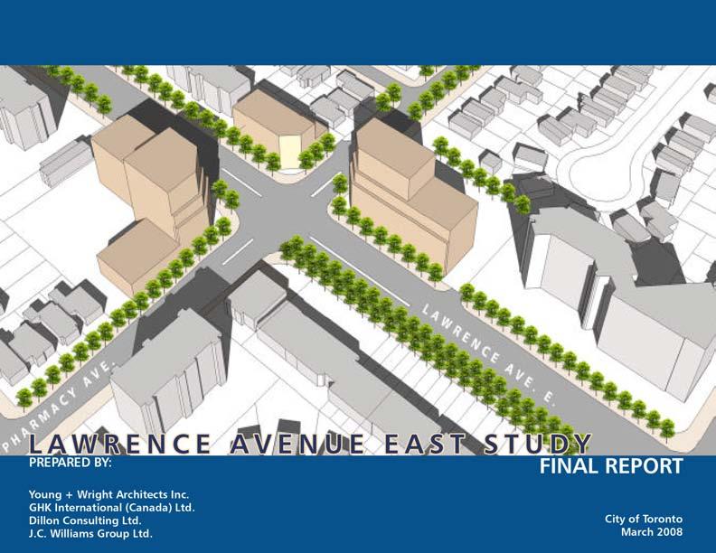
19 C I T Y O F T O R O N T O S e c t i o n STUDY BACKGROUND 1.1 Purpose of the study Lawrence Avenue East from Victoria Park Avenue to east of Birchmount Road has been identified as an Avenue in the City of Toronto Official Plan (see Figure 1.0 Study Area). The Plan describes Avenues as important corridors along major streets which offer opportunities for reinvestment for new housing and employment and an improved public realm. The Plan acknowledges that reurbanization will be an incremental process, and that a high quality, pedestrian-focused, transit-supportive public realm is an important aspect of creating successful Avenues. The purpose of the study is to determine: a policy framework and a set of recommended changes to the Zoning Bylaw for the area; a set of Urban Design Guidelines to address public realm improvements and guide development on privately owned lands; criteria for introducing mixed-use mid rise and tall buildings; Proposals for creating public open space and improving existing parks; and recommendations for optimizing the use of the road allowance and enhancing transit, walking and cycling. 1.2 Study Process The Lawrence Avenue East Study Area was based on an extensive consultation process with City staff and stakeholders, structured around a series of meetings and workshops. A Local Advisory Committee (LAC) was formed to guide the study and assist with identifying issues and generating development options. The LAC consisted of City staff and neighbourhood stakeholders. A series of community meetings and workshops were also held in the area to discuss preferred solutions. The study was conducted in the following three phases: Phase 1: Background Research and Analysis Phase 1 consisted of investigating relevant background data, reviewing the planning policy context, and developing an understanding of the Study Area and VICTORIA PARK AVE. Figure 1.0: Study Area Map PHARMACY AVE. HYDRO CORRIDOR WARDEN AVENUE Crockford BOULEVARD BIRCHMOUNT ROAD 12 DILLON CONSULTING LTD. - J.C. WILLIAMS GROUP LTD.
20 S e c t i o n 1 its surroundings. An inventory of site conditions and a review of constraints and opportunities were completed through a series of techniques, including mapping, analysis of precedents, photography and three-dimensional computer modeling of the existing built form character of the Study Area. The background analysis of the Study Area was presented at a LAC meeting on May 1, An analysis of the Strengths, Weaknesses, Opportunities and Threats (SWOT) of the Study Area was presented at a LAC meeting on May 14, The first public meeting consisted of a Strengths Weaknesses Opportunities Threats (SWOT) workshop held on May 29, The outcome was a set of draft planning principles derived from the opportunities identified at the workshop. These were used to guide the discussions at the second public meeting, the Design Charrette. A summary of the SWOT workshop is provided in Section 4. Phase 2: Design Exploration A Design Charrette was held on June 16, 2007 to explore various design and development options for the Study Area. The Charrette was organized around the issues and opportunities identified in Phase 1 through the SWOT workshop and focused on the following topics: built form, streetscape, open space and transportation improvements. Built form options were studied through the use of three-dimensional physical models and blocks that could be configured by participants to explore various alternative scenarios. A summary of the Charrette is contained in Appendix B. Phase 3: Conclusions and Recommendations The conclusions and recommendations phase consolidated the insights and outcomes from the Design Charrette and the analysis carried out by the consultant team to create a preferred development framework for the Study Area. The result was a set of recommendations for achieving the development framework, including preliminary urban design guidelines. Draft versions of the recommendations and Urban Design Guidelines were presented at a LAC meeting on September 13, 2007, and again at a public open house on September 25, These were subsequently refined, based on feedback generated at the meetings, discussions with staff and further analysis. A description of the recommendations and urban design guidelines is contained in Sections 5 through 8. A chart illustrating the study process can be found in Figure 1.1, Study Process. March 2008 DILLON CONSULTING LTD. - J.C. WILLIAMS GROUP ltd. 13

21 C I T Y O F T O R O N T O S e c t i o n 1 Avenue Studies will involve extensive public and stakeholder consultation in order to determine the appropriate scale and intensity of development to be reflected in the zoning for the Mixed Use Areas along the Avenue. Figure 1.1: Study Process -- Toronto Official Plan 14 DILLON CONSULTING LTD. - J.C. WILLIAMS GROUP LTD.

22 S e c t i o n PROVINCIAL POLICY STATEMENT, 2005 (PPS) 2.2 PLACES TO GROW 2.3 TORONTO OFFICIAL PLAN 2.4 EXISTING ZONING BylawS 2.0 Policy context 2.5 CITY OF TORONTO BIKE PLAN March 2008 DILLON CONSULTING LTD. - J.C. WILLIAMS GROUP ltd
23 C I T Y O F T O R O N T O S e c t i o n POLICY CONTEXT Ontario s long-term prosperity, environmental health and social wellbeing depend on wisely managing change and promoting efficient land use and development patterns. Efficient land use and development patterns support strong, livable and healthy communities, protect the environment and public health and safety, and facilitate economic growth. -- Provincial Policy Statement, 2005 Redevelopment along Lawrence Avenue East between Victoria Park Avenue and Birchmount Road is subject to the Provincial Policy Statement (PPS), the Growth Plan for the Greater Golden Horseshoe and the Official Plan of the City of Toronto. The following sections briefly summarize this policy context as it applies to Lawrence Avenue East. 2.1 Provincial Policy Statement, 2005 The PPS establishes the policy foundation for regulating the development and use of land in Ontario. The PPS acknowledges that Ontario s long-term prosperity, environmental health and social well-being is conditional on the ability to wisely manage change and promote efficient land use and development patterns. Section 1.0, Building Strong Communities, outlines the policies which will shape growth in Ontario. Key points include: Growth will be focused on settlement areas, either through intensification and redevelopment, or if necessary, by developing designated growth areas; The emphasis of the PPS is clearly the promotion of intensification and redevelopment as the preferable means to manage growth. Planning authorities are to promote the reuse of existing building stock, the redevelopment of brownfields, and the creation of compact urban form to these ends; Growth should feature densities and a mix of land uses that efficiently use land, resources, infrastructure and public service facilities, and support the use of alternative transportation modes and public transit; Planning authorities are to promote a range of housing types and densities, while establishing minimum targets for the provision of housing which is affordable to low and moderate income households; Public streets, spaces and facilities should be planned to be safe and meet the needs of pedestrians and other non-motorized movement; A land use pattern, density and mix of uses should be promoted that minimizes the length and number of vehicle trips and supports the development of viable choices and plans for public transit. Transportation and land use considerations shall be integrated into all stages of the planning process; The preservation and reuse of abandoned corridors for purposes that maintain the corridor s integrity and continuous linear characteristics should be encouraged wherever feasible; and Land use patterns should minimize the negative impacts on air quality and climate change, and promote energy efficiency. To these ends, land use and development patterns should promote compact urban form, a structure of nodes and corridors, promote the use of public transit, improve the mix of employment and housing to decrease transportation congestion, and promote design which maximizes the use of alternative or renewable energy and the mitigating effects of vegetation. 16 DILLON CONSULTING LTD. - J.C. WILLIAMS GROUP LTD.
24 S e c t i o n 2 The proposed policy framework to guide redevelopment along Lawrence Avenue East must be consistent with the PPS s vision of growth management in Ontario. It should provide an example of the kind of intensification and redevelopment envisioned under this planning regime. 2.2 Places to Grow: Growth Plan for the Greater Golden Horseshoe Established under the Places to Grow Act (Bill 136), the objectives of the Growth Plan are to effectively manage growth and develop stronger communities in the Province of Ontario. The Greater Golden Horseshoe (GGH) is identified as one of the fastest growing regions in North America. The Growth Plan aims to create the conditions that will allow the region to experience the benefits of growth, while avoiding its possible negative aspects. Urban sprawl is identified as a development pattern that will hurt the GGH s competitiveness in the longterm. As an alternative to sprawl, the Plan outlines a growth management regime, with emphasis on intensification and the efficient use of infrastructure. In the context of the City of Toronto, the key elements include: Directing a significant portion of new growth to the existing built-up area through intensification; Better use of infrastructure through compact urban form; Reducing dependence on the automobile through the development of mixed-use, transitsupportive, pedestrian-friendly urban environments; Using transit infrastructure to shape growth, and planning for high residential and employment densities that ensure the efficiency and viability of existing and planned transit service levels; Providing convenient access to intra- and intercity transit; and Planning and investing for a balance of jobs and housing in communities with a diverse mix of land uses, a range and mix of employment and housing types, high quality public open space and easy access to local stores and services. In Schedule 4 of the Growth Plan, the entire City of Toronto, including this stretch of Lawrence Avenue East, is shown as an existing Built up Area which is considered the primary location for intensification. The plan also recognizes that urban growth centres, intensification corridors and major transit station areas will be the key focus for development to accommodate intensification. Intensification corridors are defined in the Plan as areas along major roads, arterials or higher order transit corridors that have the potential to provide a focus for higher density mixed-use development consistent with planned transit service levels. By virtue of its designation as an Avenue in the City of Toronto Official Plan, March 2008 DILLON CONSULTING LTD. - J.C. WILLIAMS GROUP ltd. 17
25 C I T Y O F T O R O N T O S e c t i o n 2 The revitalization of urban growth centres is particularly important, not only because they can accommodate additional people and jobs, but because they will increasingly be regional focal points. They are meeting places, locations for cultural facilities, public institutions, major services, and transit hubs -- Places to Grow, 2006 the City has signaled that it considers Lawrence Avenue an Intensification Corridor, for the purposes of the Growth Plan. 2.3 Official Plan for the City of Toronto Adopted by City Council in November 2002, the majority of the new Official Plan for the amalgamated City of Toronto was largely brought into effect on issuance of an order by the Ontario Municipal Board on July 6, The following polices are relevant to guide development for Lawrence Avenue East. Shaping the City The strategic direction for growth management underlying the new plan is reurbanization. The focus of this approach is to improve and make more efficient use of existing infrastructure and services, while being consistent with the planned urban structure and land use designations. The Official Plan makes efforts to link land use and transportation planning in order to decrease car dependency while increasing transit use. The Official Plan indicates that the majority of growth will be directed to Centres, Avenues, Employment Districts and the Downtown. These Centres and corridors will be connected by an integrated regional transportation system whose hallmark is fast and efficient public transit. The stable residential neighbourhoods that make up the majority of the City, including the properties that abut those properties fronting on either side of Lawrence Avenue East in the Study Area (with the exception of the Employment Lands west of Birch- mount), are expected to see slower growth. Section 2.1 Structuring Growth in the City: Integrating Land Use and Transportation, Policy 2 details the objectives of directing growth in this manner: Growth will be directed to the Centres, Avenues, Employment Districts and the Downtown as shown on Figure 2.1 in order to: a) Use municipal land, infrastructure and services efficiently; b) Concentrate jobs and people in areas well served by surface transit and rapid transit stations; c) create assessment growth and contribute to the City s fiscal health; d) Promote mixed-use development to increase opportunities for living close to work and to encourage walking and cycling for local trips; e) Offer opportunities for people of all means to be affordably housed; f) Facilitate social interaction, public safety and cultural and economic activity; g) Improve air quality, energy efficiency and reduce greenhouse gas emissions; h) Improve surface and groundwater quality and restore the hydrological function and habitat of streams and wetlands; and i) Protect neighbourhoods, green spaces and natural heritage features and functions from the effects of nearby development. 18 DILLON CONSULTING LTD. - J.C. WILLIAMS GROUP LTD.
, N.T.S. March 2008 DILLON CONSULTING LTD.")
26 S e c t i o n 2 Study Area Figure 2.1: Toronto Official Plan - Map 2: Urban Structure (Partial Map), N.T.S. March 2008 DILLON CONSULTING LTD. - J.C. WILLIAMS GROUP ltd. 19
27 C I T Y O F T O R O N T O S e c t i o n 2 As an Avenue, the Lawrence East Study Area is subject to policies contained in section of the Official Plan which outline the nature of the studies that will be carried out in these areas in order to guide incremental change over time and to focus public investments as appropriate to accommodate and enhance the transformation of these corridors. The studies are to engage area residents, businesses and other local stakeholders, as was done in this instance, in order to provide guidance in two broad areas: 1) community improvements including streetscape improvements, transportation improvements, parks and open space improvements and upgraded sewer and water infrastructure; and 2) zoning and other land use regulations to guide future development including heights and densities, massing, scale, siting and organization of buildings, transition to adjacent areas, restrictions on at-grade parking and driveways and transit supportive measures. Land Use Designation The Study Area is designated as Mixed Use Areas on Map 20 of the new Official Plan (see Figure 2.2). Mixed Use Areas consist of residential, commercial, institutional and recreational uses, to create complete neighbourhoods where people can live, work and shop and depend less on their cars and more on public transit, walking and cycling. The Official Plan lays out the framework for Mixed Use Areas to absorb most of Toronto s retail, office and service employment growth, as well as a significant portion of new housing. In Section 4.5 Mixed Use Areas: Policy 2, the Plan details the criteria that will shape development in Mixed-Use Areas: In Mixed-Use Areas development will: a) Create a balance of high quality commercial, residential, institutional and open space uses that reduces automobile dependency and meets the needs of the local community; b) Provide for new jobs and homes for Toronto s growing population on underutilized lands in the Downtown, the Central Waterfront, Centres and Avenues and other lands designated Mixed-Use Areas creating and sustaining well-paid, stable, safe and fulfilling employment opportunities for all Torontonians; c) Locate and mass new buildings to provide a transition between areas of different development intensity and scale, as necessary to achieve the objectives of this Plan, through means such as providing appropriate setbacks and/or a stepping down of heights, particularly towards lower scale Neighbourhoods; d) Locate and mass new buildings so as to adequately limit shadow impacts on adjacent Neighbourhoods, particularly during the spring and fall equinoxes; e) Locate and mass new buildings to frame the edges of streets and parks with good proportion and maintain sunlight and comfortable wind conditions for pedestrians on adjacent streets, parks and open spaces; 20 DILLON CONSULTING LTD. - J.C. WILLIAMS GROUP LTD.
28 S e c t i o n 2 f) Provide an attractive, comfortable and safe pedestrian environment; g) Have access to schools, parks, community centres, libraries and childcare; h) Take advantage of nearby transit services; i) Provide good site access and circulation and an adequate supply of parking for residents and visitors; j) Locate and screen service areas, ramps and garbage storage to minimize the impact on adjacent streets and residents; and k) Provide indoor and outdoor recreation space for building residents in every significant multi-unit residential development. Parks and Open Spaces Map 8A (see Figure 2.3) of the Official Plan shows the location of parks just beyond the Study Area. This is based on different levels of provision of parkland expressed as hectares of local parkland per 1,000 people. The entire area north of Lawrence Avenue East, between Victoria Park and Warden Avenue, is shown on this Map as having the lowest amount of parkland provision of the five categories shown on the Map. In addition, Map B shows the area south of Lawrence Avenue East, between Warden Avenue and Birchmount Road, also as an area with the lowest amount of parkland provision. As such, these areas should be targeted for strategic parkland acquisitions in order to address the low level of parkland provision. The Study Area has been identified as an area where a new alternative parkland rate will apply. Building a Successful City The Official Plan contains numerous built form and urban design policies in order to achieve development that is located and organized to fit into its existing or planned context. To this end, the Plan contains policies that promote massing to frame adjacent streets and open spaces, creating appropriate transitions in scale to neighbouring or planned buildings, locating main building entrances so they are visible from the public sidewalk, and organizing vehicular parking so as to minimize its impact on the property and surrounding area including providing underground parking where appropriate. March 2008 DILLON CONSULTING LTD. - J.C. WILLIAMS GROUP ltd. 21

29 C I T Y O F T O R O N T O S e c t i o n 2 Figure 2.2: Toronto Official Plan - Map 20: Land Use Map, N.T.S. 22 DILLON CONSULTING LTD. - J.C. WILLIAMS GROUP LTD.
30 S e c t i o n 2 DON MILLS DVP VICTORIA PK WARDEN BIRCHMOUNT KENNEDY HWY 401 ELLESMERE LAWRENCE EGLINTON Study Area ST.CLAIR Note: For information purposes only Not to Scale Extract from the Local Parkland Provision - Map B Hectares of local parkland per 1,000 people 0 to to to to Areas with less than 300 people Figure 2.3: Toronto Official Plan - Map 8A (Partial): City Parkland, N.T.S. March 2008 DILLON CONSULTING LTD. - J.C. WILLIAMS GROUP ltd. 23

31 C I T Y O F T O R O N T O S e c t i o n VICTORIA PARK AVENUE LAWRENCE AVENUE EAST PHARMACY AVENUE WARDEN AVENUE CROCKFORD BOULEVARD LEGEND Figure 2.4: Existing Zoning Bylaws, N.T.S Single-Family Residential Multi-Family Residential Apartment Residential Commercial/Residential Highway Commercial Neighbourhood Commercial Industrial District Commercial Industrial Commercial Institutional Place of Worship School Public Utility 2.4 Existing Zoning Bylaws The Study Area is subject to the in-force Wexford Community Zoning Bylaw, the Dorset Park Community Zoning Bylaw, and the Employment Districts Zoning Bylaw - Wexford Employment District Bylaw. The current zoning permits a range of uses which are outlined in Figure 2.4 and which do not fully reflect the Mixed-Use Areas designation in the Official Plan. 6 Community Commercial 13 Industrial Note: Figure 2.5 is based on in-force Wexford Community Bylaw, 1961; Dorset Park Community Bylaw, 1961; Wexford Employment District Bylaw, Park 24 DILLON CONSULTING LTD. - J.C. WILLIAMS GROUP LTD.

32 S e c t i o n City of Toronto Bike Plan The Toronto Bike Plan consists of a comprehensive bikeway network, as well as a set of integrated principles, objectives and recommendations regarding safety, education and promotional programs. Lawrence Avenue has a proposed bike lane in the Bike Plan. The proposed network is expected to be completed by 2011, and will cover 1,000 kilometres of several types of bikeways. The network will serve both commuter and recreational cycling, with signed bike lanes, shared roadway routes, and multi-use off-road pathways. Figure 2.5 identifies the bike network in the Study Area. Study Area LAWRENCE LEGEND Existing Bike Lane Proposed Bike Lane Existing Signed Route Proposed Signed Route Existing Off-Road Proposed Off-Road Public Parkland Cemeteries Watercourse Figure 2.5 Toronto Bike Plan - District 4 Proposed Bikeway Network Source: index.htm March 2008 DILLON CONSULTING LTD. - J.C. WILLIAMS GROUP ltd. 25
33 26 DILLON CONSULTING LTD. - J.C. WILLIAMS GROUP LTD.

34 s e c t i o n THE STUDY AREA AND SURROUNDINGS 3.2 EXISTING STREET CHARACTER 3.3 EXISTING PARKS AND OPEN SPACE 3.4 EXISTING COMMUNITY SERVICES AND FACILITIES 3.5 STREET HIERARCHY AND TRANSIT 3.0 study context: existing conditions March 2008 DILLON CONSULTING LTD. - J.C. WILLIAMS GROUP ltd. 27
.")
35 C I T Y O F T O R O N T O S E C T I O N STUDY CONTEXT: EXISTING CONDITIONS 3.1 The Study Area and Surroundings The Study Area includes all the properties fronting onto Lawrence Avenue East between Victoria Park Avenue to east of Birchmount Road (see Figure 3.1). This stretch of Lawrence Avenue is approximately 2 kilometres long and is designated as a Mixed-Use Area in the Official Plan. The Study Area is surrounded by the Wexford Heights neighbourhood, which is a stable, low-density residential area. The Official Plan designates these residential lands as Neighbourhoods. The Wexford Employment District is located at the east end of the Study Area, running north-south between Crockford Boulevard and Birchmount Road and Howden Road and Birchmount Road. These lands are designated as Employment Areas in the Official Plan which are described as large districts that can accommodate substantial growth in jobs and meet the needs of some of the key economic clusters that are the focus of the City s Economic Development Strategy. For the purpose of this study, the Study Area has been divided into three sub areas, each with somewhat different characteristics: SUB AREA 1 SUB AREA 2 SUB AREA 3 Figure 3.1: Figure Ground, N.T.S. 28 DILLON CONSULTING LTD. - J.C. WILLIAMS GROUP LTD.

36 s e c t i o n 3 Sub Area 1: From Victoria Park Avenue to Pharmacy Avenue; Sub Area 2: From Pharmacy Avenue to Crockford Boulevard; and Sub Area 3: From Crockford Boulevard to east of Birchmount road Each of these is briefly described in the following sections. Sub Area 1: Western Residential Mixed Use Neighbourhood Sub Area 1 is located along the western stretch of the Study Area from Victoria Park Avenue to Pharmacy Avenue. This sub area consists primarily of mid- and low-rise apartment buildings built in the 1950 s and 1960 s. One-storey retail buildings are located at the main intersections of Victoria Park Avenue and Pharmacy Avenue (Figure 3.3). On the north side of the road, LEGEND < 40 Metres from Lawrence Avenue Metres from Lawrence Avenue Metres from Lawrence Avenue Metres from Lawrence Avenue > 80 Metres from Lawrence Avenue SUB AREA 1 SUB AREA 2 SUB AREA 3 Figure 3.2: Lot Depths, N.T.S. March 2008 DILLON CONSULTING LTD. - J.C. WILLIAMS GROUP ltd. 29

37 C I T Y O F T O R O N T O S E C T I O N 3 West Lawrence Avenue East: North Elevation Left: Existing Condition Bird s Eye View from Southwest East Figure 3.3: Characteristics of Sub Area 1, N.T.S. Lawrence Avenue East: South Elevation 30 DILLON CONSULTING LTD. - J.C. WILLIAMS GROUP LTD.

38 s e c t i o n 3 the majority of lots are shallow in depth, whereas on the south side, lots are deeper (60-75 metres) (Figure 3.2). The residential blocks tend to be oriented eastwest, with larger frontage and fewer access points to Lawrence Avenue. The east-west orientation of the residential blocks results in many low rise residential backyards abutting the property lines of lots fronting onto Lawrence Avenue East which may constrain future development. Sub Area 2: Central Commercial Neighbourhood The central stretch of the Study Area between Pharmacy Avenue and Crockford Boulevard is the commercial hub of the community. It has a wide range of retail commercial uses, with very diverse multi-ethnic businesses. The multi-ethnic diversity includes Lebanese, Syrian, Iranian, Egyptian, Afghan, Korean, Tamil, Indian and Chinese business establishments. The lot depths vary along this sub-area, with generally shallow lots located on the south side of Lawrence Avenue and more varied but deeper lots on the north side of Lawrence Avenue. In general, the north side also has few residential backyards abutting the rear property lines (Figure 3.4). Photos: Business Signages Reflect Ethnic Diversity March 2008 DILLON CONSULTING LTD. - J.C. WILLIAMS GROUP ltd. 31
 Figure 3.4: Characteristics of Sub Area 2, N.T.S. 32 DILLON CONSULTING LTD. - J.C. WILLIAMS GROUP LTD.")
39 C I T Y O F T O R O N T O S E C T I O N 3 West Lawrence Avenue East: North Elevation (Partial) Existing Condition Bird s Eye View from Southwest East Lawrence Avenue East: South Elevation (Partial) Figure 3.4: Characteristics of Sub Area 2, N.T.S. 32 DILLON CONSULTING LTD. - J.C. WILLIAMS GROUP LTD.


40 s e c t i o n 3 Lawrence Avenue between Pharmacy Avenue and Warden Avenue has no signalized intersections. The street represents a barrier between the two neighbourhoods to the north and south, partly because of its width, its lack of pedestrian amenity and lack of signalized intersections. Sub Area 3: Eastern mixed-use neighbourhood The eastern stretch of the Study Area, between Crockford Boulevard to east of Birchmount Road, contains the Wexford Employment District. This north-south belt of industrial lands creates a break between the residential neighbourhoods to the west and the east, and in the retail character of Sub Area 2. This sub-area is comprised of primarily low-rise industrial and retail buildings, with the exception of a high-rise apartment building at Birchmount Road (Figure 3.5). There are also several auto-related uses in this sub area. The lots fronting on Lawrence Avenue are large and typical of industrial land parcels, and back on to other industrial properties. Photos: Auto-related uses in Sub Area 3 March 2008 DILLON CONSULTING LTD. - J.C. WILLIAMS GROUP ltd. 33

41 C I T Y O F T O R O N T O S E C T I O N 3 West Lawrence Avenue East: North Elevation Existing Condition Bird s Eye View from Southwest East Lawrence Avenue East: South Elevation Figure 3.5: Characteristics of Sub Area 3, N.T.S. 34 DILLON CONSULTING LTD. - J.C. WILLIAMS GROUP LTD.

42 s e c t i o n 3 Figure 3.6: Existing Building Heights, N.T.S. LEGEND 1-3 Storey 4-5 Storey 6-8 Storey 9-13 Storey March 2008 DILLON CONSULTING LTD. - J.C. WILLIAMS GROUP ltd. 35
 and a seventh, centre-turn lane.")
43 C I T Y O F T O R O N T O S E C T I O N Existing Street Character The current pavement width of Lawrence Avenue is about 26 metres, accommodating 6 travel lanes (three each way) and a seventh, centre-turn lane. Each of these lanes is at least 3.5 metres wide, with the curb lanes a bit wider. There are six signalized intersections along the length of Lawrence Avenue East between Victoria Park Avenue and Birchmount Road, providing limited pedestrian crossing opportunities, particularly along the 1 kilometre commercial/retail stretch between Pharmacy Avenue and Warden Avenue. There is little or no consistent street tree planting or street furniture within the right-of-way to create pedestrian amenity or visual containment for the street. Overhead high voltage hydro wires and auto oriented street lighting contribute to creating a generally auto-focused character on the street. The lane widths, along with the few signalized pedestrian crossings, the lack of buildings along the street edge, the lack of street tree planting and high speed traffic contribute to an inhospitable environment for pedestrians (see Figures 3.7 and 3.8). Figure 3.7: Lawrence Street Section at Pharmacy Avenue looking East (N.T.S.) Figure 3.8: Street Character 36 DILLON CONSULTING LTD. - J.C. WILLIAMS GROUP LTD.
.")
44 s e c t i o n 3 LEGEND City Parklands Open Space - School Yards Open Space - Hydro Corridors 3.3 Existing Parks and Open Space McGregor Park, located east of the Study Area, is the closest major park facility containing a community centre and library within the Study Area (Figure 3.9). Otherwise, parks and open spaces are scarce along Lawrence Avenue East and located far from the Study Area. There are no pedestrian linkages from Lawrence Avenue East to the larger trail system or greenways in the wider community. As already mentioned, all of the area north of Lawrence Avenue East and the area south of Lawrence Avenue East, between Warden Avenue and Birchmount Road, is defined as a park-deficient area in the City s Official Plan. EAST MCGREGOR PARK Figure 3.9: Existing Parks, Open Space and Tree Coverage, N.T.S. March 2008 DILLON CONSULTING LTD. - J.C. WILLIAMS GROUP ltd. 37

45 C I T Y O F T O R O N T O S E C T I O N Existing Community Services and Facilities Existing community services and facilities are shown in Figure The City completed a Community Services and Facilities Review in August 2007 for the Study Area. A summary of the findings include: A general lack of child care facilities; All three secondary schools serving the Study Area, including the one Toronto Catholic District School Board(TCDSB), are operating over capacity. Eleven of the eighteen Toronto District School Board elementary schools are also operating over capacity. Six of the seven TCDSB elementary schools are operating over capacity. A need for more recreation services, youth services, family counseling and ESL courses; a general lack of community program space; and A need for rent-geared to income, independent apartments for seniors. LEGEND Public Primary School Public Secondary School Separate Primary School Library McGregor Park Recreation Centre Church Seniors Housing Funeral Home Ministry of Health Office Ministry of Community Safety & Correction Services TCDSB LINK Centre WARDEN AVENUE Figure 3.10: Existing Community Services and Facilities, N.T.S. 38 DILLON CONSULTING LTD. - J.C. WILLIAMS GROUP LTD.
. The Study Area is very well served by public transit.")
46 s e c t i o n Street Hierarchy and Transit Lawrence Avenue East, Victoria Park Avenue and Warden Avenue are major arterials. Pharmacy Avenue and Birchmount Road are minor arterials. Crockford Boulevard and Underwriters Road are collector roads. The remaining streets are identified as local streets (see Figure 3.11). The Study Area is very well served by public transit. All the arterials are served by TTC operated buses. The 24 hour Lawrence Avenue East bus (Number 54) operates on a 6-10 minute headway during the day and up to 30 minutes at night. This service offers links to the Yonge Subway and the Scarborough Rapid Transit. The 24 bus travels along Victoria Park Avenue, the 67 bus provides service along Pharmacy Avenue, the 68 bus provides service along Warden Avenue and the 17 bus along Birchmount Road. All of these buses provide similar frequency of service to the 54 bus along Lawrence Avenue East and connect to the Bloor-Danforth subway line (see Figure 3.12) LEGEND Major Arterial Minor Arterial Collector Local Street Figure 3.11: Street Hierarchy, N.T.S. March 2008 DILLON CONSULTING LTD. - J.C. WILLIAMS GROUP ltd. 39

47 C I T Y O F T O R O N T O S E C T I O N 3 Figure 3.12: Bus Route 54 Lawrence Avenue East 40 DILLON CONSULTING LTD. - J.C. WILLIAMS GROUP LTD.

48 S E C T I O N LOCAL ADVISORY COMMITTEE (LAC) 4.2 SUMMARY OF SWOT WORKSHOP 4.3 SUMMARY OF DESIGN CHARRETTE 4.4 SUMMARY OF OPEN HOUSE 4.5 ISSUES 4.6 VISION AND PLANNING PRINCIPLES 4.7 FUTURE REDEVELOPMENT BY SUB AREA 4.0 summary of public consultation MARCH 2008 DILLON CONSULTING LTD. - J.C. WILLIAMS GROUP ltd. 41
49 C I T Y O F T O R O N T O S E C T I O N SUMMARY OF PUBLIC CONSULTATION The Lawrence Avenue study was a community consultation-based process that engaged stakeholders through several forums. These included meetings with the Local Advisory Committee and informal discussions with stakeholders during the background research and analysis phase. The consulting team also attended two meetings of the Lawrence Avenue Streetscape Study, which included participants from the City of Toronto and the Wexford Heights Business Improvement Area (BIA). Finally, the general public were engaged in consultation through a number of public events including: an initial kick-off meeting, a workshop for Strengths Weaknesses Opportunities Constraints (SWOT), a Design Charrette, and a Public Open House on recommendations for urban design improvements. 4.1 Local Advisory Committee (LAC) The community consultation process was guided in part by the LAC. Members were selected by the City and included representation from the Wexford Heights BIA, area businesses, neighbourhood residents, City Planning staff and Councillor Michael Thompson s office. The consulting team met with the LAC prior to each public event, i.e. SWOT Workshop, Design Charrette and Open House, to review materials that were to be presented at these events and report on the status of work completed. The LAC was instrumental in shaping the direction of the study and its findings. 4.2 Summary of Strengths Weaknesses Opportunities Constraints (SWOT) Workshop The SWOT Workshop was held on May 29, SWOT participants included LAC members, local business owners, neighbourhood residents, and City staff. The consulting team facilitated the workshop to address the strengths, weaknesses and opportunities of the area. The participants comments are summarized below: Strengths diverse residential demographic with stable residential base and specialized housing Universal retail and multi-cultural business from around the world Easy access to public transit Human-scale buildings Sufficient open space that allows streetscaping Good accessibility and proximity to major highways and downtown Well-kept historical building that provides character, good design and visual presence Ease of parking Safe environment Weaknesses Poor architectural appearance Under-utilized properties Pedestrian unfriendly streets that lack safe pedestrian crossings, sufficient street furniture and greenery Too many auto-related businesses 42 DILLON CONSULTING LTD. - J.C. WILLIAMS GROUP LTD.


50 S E C T I O N 4 Large expanses of asphalt, roads and parking lots. No parks and little green space, and limited use of Hydro Lands Opportunities Develop Hydro Lands for parks and open space screen strip plaza parking lots with extensive landscaping Consolidate driveways Improve street landscaping Promote appropriate building heights Encourage façade improvements Introduce planted medians The outcome of the SWOT workshop was the development of a number of principles that subsequently provided guidance for the Design Charrette. These are discussed below. 4.3 Summary of Design Charrette The design charrette was a full-day, hands-on interactive session held on June 16, Participants included members of the LAC, local businesses, land owners, neighbourhood residents, Councillor Thompson s office We have to take advantage of what we have here. We need WOW factor. Lovely plants make a street corner like heaven even though traffic is passing by. -- LAC Members Photos: SWOT Workshop Activities MARCH 2008 DILLON CONSULTING LTD. - J.C. WILLIAMS GROUP ltd. 43

51 C I T Y O F T O R O N T O S E C T I O N 4 and City staff. Charrette participants were asked to develop solutions guided by the principles from the SWOT workshop, with a focus on: Land use Built form Open space Streetscape Traffic Pedestrian safety and accessibility The participants were divided into two groups. Group 1 examined the western half of the Study Area, from Victoria Park Avenue to Warden Avenue. Group 2 studied the eastern half, from Warden Avenue to east of Birchmount Road. A summary of recommendations from each group is outlined in the Appendix. the Hydro Corridor and the interface between low rise residential neighbourhoods and the properties fronting Lawrence Avenue East. 4.5 Issues A number of issues emerged from the analysis of existing conditions and public consultation. This provided a framework for the formulation of the vision, planning principles and recommendations. The issues can be summarized as follows: The width of street, extensive surface parking 4.4 Summary of Public Open House At a public meeting held on September 25, 2007, the consultant team presented a series of recommendations derived from an analysis and the public consultation process to date. The participants were invited to comment on the recommendations and to make additional suggestions. Participants expressed their approval for the general direction of the recommendations. Some issues were raised with respect to the details concerning proposed adjustments to the public right-of-way, the proposed location for a traffic control signal in the vicinity of 44 DILLON CONSULTING LTD. - J.C. WILLIAMS GROUP LTD.
52 S E C T I O N 4 areas, and empty space between buildings on either side of Lawrence Avenue East results in an environment that is more car dominated than pedestrian friendly; low intensity development is out of scale with the street-width; Buildings are generally unattractive; Boulevards lack amenities such as trees and street furniture that contribute to an inhospitable pedestrian environment; Inadequate parks and open spaces; A large number of driveways that exit directly onto Lawrence Avenue East cause breaks in the sidewalk and result in unsafe road conditions for pedestrians and for vehicles exiting and entering onto Lawrence Avenue East; A lack of opportunities for pedestrians to cross Lawrence Avenue East; and Vehicle movement in excess of the posted speed limit causing safety concerns. 4.6 Vision and Planning Principles The values and priorities of the Lawrence Avenue East community are summarized in a vision that provides guidance for private sector redevelopment and coordination of public sector investment throughout the Study Area. The following planning principles provide guidance for the formulation of policies, and recommendations outlined in the remainder of the report. Improve pedestrian environment and cycling opportunities; Encourage attractive, well designed buildings; Promote active, street-related uses; Provide for mid-rise, street-related buildings at mid-block and higher buildings at key locations; Create a beautiful streetscape; Provide for a new open space and establish a green trail focus at the Hydro corridor; Improve connections between the residential neighbourhoods to the north and south of Lawrence Avenue; and Implement initiatives to achieve immediate improvements. 4.7 Future Redevelopment by Sub Area The vision outlined above will be achieved in different ways depending on the character of each sub area. The proposed development strategy for each sub area is outlined below. Sub Area 1: Western Residential Neighbourhood The residential character of this sub area should be maintained. The properties at Victoria Park Avenue and Pharmacy Avenue contain low-rise retail uses that offer the potential for redevelopment. The main focus for this sub area should be to build on its predominantly residential character, while improving the streetscape. The vision for Lawrence Avenue is to strengthen and improve its diverse multicultural retail, residential and mixed-use character by creating a more intimate street that enhances the pedestrian and cycling experience; adds greenery and street trees; increases the amount of urban open space and parks; and produces excellence in urban design. MARCH 2008 DILLON CONSULTING LTD. - J.C. WILLIAMS GROUP ltd. 45
53 C I T Y O F T O R O N T O S E C T I O N 4 Sub Area 2: Central Commercial Neighbourhood The multi-cultural retail character of this sub area should be reinforced. Streetscape improvements should be introduced to create a more pedestrian friendly retail experience, and to improve pedestrian linkages along the side streets to better connect the residential neighbourhoods on either side to Lawrence Avenue. Where lot dimensions permit, street-related, mixed-use, mid-rise development should be encouraged. Higher density development at key locations on large lots should be encouraged. Sub Area 3: Eastern Mixed-Use Neighbourhood The existing low-rise industrial, auto related and retail sites in this sub area should be redeveloped to create a new mixed-use neighbourhood that will connect with the neighbourhoods to the east and west. Due to the lot sizes and their location next to industrial lands, this sub area may have the potential to accommodate development that has the most density and height in the Study Area. New development should be street-related and pedestrian friendly, with commercial uses along the ground floor and perhaps commercial office uses on the second floor to reinforce the diverse multicultural character of the area and to animate the street. 46 DILLON CONSULTING LTD. - J.C. WILLIAMS GROUP LTD.

54 S E C T I O N POLICY FRAMEWORK 5.2 RATIONALE FOR PROPOSED NEW ZONING BYLAW 5.3 ZONING BYLAW: SUMMARY OF RECOMMENDA- TIONS 5.0 Policy and Zoning bylaw recommendations MARCH 2008 DILLON CONSULTING LTD. - J.C. WILLIAMS GROUP ltd. 47
55 C I T Y O F T O R O N T O S E C T I O N POLICY AND ZONING Bylaw RECOMMENDATIONS This section provides a framework for the renewal of Lawrence Avenue East and is intended to inform Official Plan and Zoning Bylaw amendments. The recommendations emerge from the study s vision, developed in consultation with the community, LAC, members of the public, local councillors, and City staff. The policy framework outlined below, could form the basis for an area specific Official Plan statement should this be deemed appropriate. The zoning rationale outlines the reasoning for the recommended zoning changes. Section 6 contains urban design guidelines that are intended to further implement the intent behind the policy and zoning recommendations. 5.1 Policy Framework It is recommended that the following policy framework guide development and public improvements along Lawrence Avenue between Victoria Park and Birchmount Road. The diverse residential and retail character of Lawrence Avenue East between Victoria Park Avenue and Birchmount Road shall be strengthened and improved through the following: 1. New housing and employment uses will be encouraged in mixed use developments that are contained within well-designed mid-rise or tall buildings at appropriate locations, provided that the objectives pertaining to public realm improvements, outlined below, are met; 2. Improvements to the public and private realms shall result in: A high quality streetscape; An enhanced environment for pedestrians and cyclists; Additional greenery and street trees; and more open spaces and parks. 3. New buildings shall generally be located in keeping with the Built Form policies of the Official Plan. In addition, all new developments shall be designed to: Animate the pedestrian realm by locating active street-related retail uses at grade, where feasible; Create a comfortable experience for pedestrians along Lawrence Avenue East and adjacent cross streets, through design features such as pedestrian scaled, streetrelated podium buildings that are, at a minimum, two storeys high with taller elements stepped back from the podium structures; Respect privacy and overlook conditions for adjacent Neighbourhoods, by adhering to appropriate angular plane standards (refer to page 49); and Minimize wind impacts along the public realm on Lawrence Avenue East and adjacent open spaces and maximize opportunities for sunlight exposure on the public realm. 48 DILLON CONSULTING LTD. - J.C. WILLIAMS GROUP LTD.

56 S E C T I O N 5 LEGEND 5 2M Stepback 1. Minimum 2 metre setback from Lawrence Avenue degree angular plane from rear property line 3 3. Minimum height of 4.5 metres for ground floor to allow for commercial use 7.5M Setback 4 Figure 5.1 Angular Plane 4. Landscape buffer with a width of 1.5 metres consisting of trees and/or fencing adjacent to residential properties 5. Minimum stepback of 2.0 metres above a building height of 20 metres. MARCH 2008 DILLON CONSULTING LTD. - J.C. WILLIAMS GROUP ltd. 49
57 C I T Y O F T O R O N T O S E C T I O N 5 4. Buildings located along Lawrence Avenue East between its intersections with Victoria Park, Pharmacy Avenue, Warden Avenue and Birchmount Road shall be scaled to reflect a mid-rise form of development, generally consistent with a one-to-one relationship between building height and the width of the street right-of-way; and 5. Improvements to the public realm, including parks and open spaces will be implemented through a combination of: City capital funding; section 37 contributions from developments that result in increased heights and densities; Cooperative initiatives amongst the City, local business association(s) and local residents; and Improvements to the public realm adjacent to private development, including street tree planting and opportunities to provide publicly accessible private open spaces secured through Site Plan Agreements. 5.2 rationale for Proposed new Zoning Bylaw The study recommends creating a new zoning bylaw to guide development in the Lawrence Avenue East corridor. The recommended zoning changes are summarized in section 5.3. The key principles behind the creation of new zoning provisions are outlined in the proposed policy framework for the area in section 5.1. The main rationale for the zoning bylaw changes is outlined below. Diversity of Uses The new zoning bylaw should provide for a mix of residential and commercial uses that results in an active public realm with buildings that are appropriately scaled to reflect the width of the street including restrictions on car related uses and single unit dwellings fronting onto Lawrence Avenue East. Appropriate Intensification Appropriate intensification that respects adjacent neighbourhoods and creates a high quality public realm should be emphasized. Heights and densities of buildings, therefore, should be based on: Minimizing overlook and privacy impacts on adjacent Neighbourhoods by applying a 45 degree angular plane from the rear property lines; Providing for adequate light and view for new buildings by applying a minimum 7.5 metre setback from the rear property line of sites fronting on Lawrence Avenue East (Figure 5.1); Relating redevelopment capacity to lot depth while meeting angular plane and sunlight standards (see Figures 5.2 to 5.5 Impact of Lot Depths on Building Height, which show the implications of applying the setbacks and angular plane provisions on properties with differing depths); and Providing opportunities for taller buildings at key locations and adjacent to the Employment Areas west of Birchmount Road in slim towers that will minimize wind impacts on the public realm and on open spaces while maximizing opportunities for sunlight in these areas, while still respecting adjacent Neighbourhoods (See Figure 5.6 for Proposed Building Heights). 50 DILLON CONSULTING LTD. - J.C. WILLIAMS GROUP LTD.
: Impact of Lot Depth on Maximum Building Height - Lots with A Depth of 40-49m.")
58 S E C T I O N 5 LEGEND 1. Minimum 2m setback from Lawrence Avenue degree angular plane from rear property line 3. Minimum height of 4.5 metres for ground floor to allow for commercial use 4. landscape buffer of trees and/or fencing adjacent to residential properties Figure 5.2 (Right): Impact of Lot Depth on Maximum Building Height - Lots with A Depth of 40-49m. MARCH 2008 DILLON CONSULTING LTD. - J.C. WILLIAMS GROUP ltd. 51

 7 7. Maximum floor plate above 27 metre building height is 800 square metres 8.")
59 C I T Y O F T O R O N T O S E C T I O N 5 LEGEND 1. Minimum 2m setback from Lawrence Avenue degree angular plane from rear property line 3. Minimum height of 4.5 metres for ground floor to allow for commercial use 4. landscape buffer of trees and/or fencing adjacent to residential properties with a width of 1.5 metres 5. Minimum 2 metre stepback above 20 metres 6. Base buildings no more than 8 storeys 27 metres Figure 5.3 (Left): Impact of Lot Depth on Maximum Building Height - Lots with A Depth of 50-75metres. (exemptions: northeast corner of Victoria Park/Lawrence; northeast corner and southwest corner of Pharmacy/Lawrence) 7 7. Maximum floor plate above 27 metre building height is 800 square metres 8. Minimum 7.5 metre rear yard setback 27 metres metre transition zone with maximum height of 10 metres or 3 storeys for lots deeper than 80 metres Figure 5.4: Impact of lot depth on Maximum Building Height in Sub Area 1 and Sub Area 2, including mid-block Lots with a depth of more than 80 metres in Sub Area DILLON CONSULTING LTD. - J.C. WILLIAMS GROUP LTD.

60 S E C T I O N 5 LEGEND 1. Minimum 2m Setback from Lawrence Avenue Degree Angular Plane from Rear Property Line 3. Minimum height of 4.5 metres for ground floor to allow for commercial use 27 metres landscape buffer of trees and/or fencing adjacent to residential properties 5. Minimum 2 metre step-back above 20 metres Figure 5.5: Impact of Lot Depth on Maximum Building Height - Lots with a depth of more than 80 metres in Sub Area Base buildings no more than 8 storeys (see page 54) 7. Maximum floor plate above 27 metre building height is 800 square metres 8. Minimum 7.5 metre rear yard setback metre transition zone with maximum height of 10 metres or 3 storeys for lots deeper than 80 metres MARCH 2008 DILLON CONSULTING LTD. - J.C. WILLIAMS GROUP ltd. 53

61 C I T Y O F T O R O N T O S E C T I O N 5 Built Form Massing and built form should result in a continuous street edge, interesting places and a safe environment for pedestrians based on: Buildings aligned along a build-to zone parallel to the street to create a street wall effect; Buildings that extend over a minimum frontage along Lawrence Avenue East to discourage gaps and surface parking at the street edge; A minimum setback for buildings from the property line along Lawrence Avenue to provide adequate space within the combined right-ofway and setback strip for tree planting, terraces, street furniture, and restaurant patios; A minimum height of two storeys for new buildings to create a sense of enclosure, and a minimal building mass to address the relatively wide right-of-way of Lawrence Avenue East; A building podium of approximately six storeys, with a noticeable stepback above, to create a pedestrian-scale built form along the street edge (Refer to Figure 5.5); and Building height above this level should be stepped back and located on a floor plate of no more than 800 square metres to ensure that buildings aligned along the street do not overpower pedestrians and that tall buildings are built to minimize shadow impacts. LEGEND 10 Metres/3 Storeys/ 1.0 F.S.I. 20 Metres/6 Storeys/ 2.0 F.S.I. 27 Metres/8 Storeys/ 2.5 F.S.I. 38 Metres/12 Storeys/ 3.0 F.S.I. 38 Metres/ 12 Storeys or Higher/ 3.5 F.S.I. 48 Metres/ 15 Storeys or Higher/ 3.5 F.S.I. Q Designated Heritage Building Figure 5.6 Proposed Building Heights and Densities 54 DILLON CONSULTING LTD. - J.C. WILLIAMS GROUP LTD.
62 S E C T I O N Zoning Bylaw: Summary of Recommendations Based on the above, it is recommended that the Zoning Bylaw be amended for properties in the Study Area fronting on Lawrence Avenue East between Victoria Park Avenue and Birchmount Road to incorporate the following (as illustrated in Figure 5.7): 1. A list of permitted uses that include: a wide range of residential, retail, commercial, institutional and community service uses, with the exception of detached houses, semi-detached houses, and auto related uses ; 2. Maximum permitted building heights and densities in accordance with Figure 5.6, Proposed Building Height and Densities, with tall buildings above a height of 27 metres not exceeding a floor plate of 800 square metres; 8. Building face to extend along a minimum of 70 percent of the frontage of each lot over 30 metres wide along Lawrence Avenue East and for 60 percent of the frontage of each lot that is less than 30 metres wide; 9. Any buildings above 20 metres to be subject to a stepback of 2 metres along streets; and 10. Minimum facing distance of 15 metres for all buildings with walls that contain principal windows. 11. Mechanical penthouse to be set back 6 metres from the front of the building and to cover no more than 50 percent of the roof area and extend to a height of no more than 6 metres. 3. Minimum building heights of 8 metres (2 storeys); 4. Buildings located adjacent to properties designated as Neighbourhoods in the Official Plan to be subject to a 45 degree angular plane measured form the rear property lines; 5. Buildings to be setback a minimum of 7.5 metres from the rear property line; 6. Buildings to be setback a minimum of 2 metres from the Lawrence Avenue East right-of-way; 7. Buildings to be located within a 2 metre build-to zone, beyond the setback; MARCH 2008 DILLON CONSULTING LTD. - J.C. WILLIAMS GROUP ltd. 55

63 C I T Y O F T O R O N T O S E C T I O N 5 LEGEND Building to extend along a minimum of 70 Percent of the frontage along Lawrence Avenue East; 2 2. Minimum building height of 8 metres; 3. Buildings above 20 metre height to be subject to a step-back of 2 metres 1 1 LAWRENCE AVENUE 2 4. Slab buildings to be no more than 8 storeys in height; 5. Any floor located above a height of 27 metres shall not exceed a floorplate of 800 square metres. 6. Mechanical Penthouse 6 metres from the front of the building and to cover no more than 50% of the roof area Figure 5.7 Axonometric View of Zoning Recommendations (NTS) 56 DILLON CONSULTING LTD. - J.C. WILLIAMS GROUP LTD.

64 S E C T I O N IMPROVED PEDESTRIAN REALM 6.2 IMPROVED CYCLING FACILITIES 6.3 ADDITIONAL SIGNALIZED INTERSECTIONS 6.4 Landscaped Median 6.5 Transit Improvements 6.6 consolidating Driveway Access 6.7 Parking 6.8 Transportation Improvements: Summary of Recommendations 6.0 Tr a n s p o r t a t i o n I m p r o v e m e n t s MARCH 2008 DILLON CONSULTING LTD. - J.C. WILLIAMS GROUP ltd. 57

65 C I T Y O F T O R O N T O S E C T I O N TRANSPORTATION IMPROVEMENTS One of the major objectives of this study is to create a pedestrian and cycling friendly environment along Lawrence Avenue East. The recommendations contained in this Section, and in Section 7.0, Urban Design Guidelines, are intended to achieve this objective, while at the same time maintaining traffic flow and safety. Over the course of the study process, many options were considered for turning Lawrence Avenue East into a pedestrian friendly street, including improving sidewalks, planting trees, reducing the number of traffic lanes, widening the boulevard, adding signalized crossings, introducing onstreet parking, adding a landscaped where appropriate median and providing bicycle lanes. After evaluating these options, it was concluded that the recommended improvements should be contained within the existing curbs, thus keeping the potential cost of road reconstruction to a minimum by maintaining existing storm gutters and storm sewer lines, and avoiding the need to relocate overhead streetlights and hydro-poles. Specific recommendations for each transportation related element are described below (see Figure 6.1 Typical Street Section with a landscaped median for the proposed re-design of the public right-of-way). New Development Setback Sidewalk Planted Bike Traffic Lane Traffic Lane Traffic Lane Planted Median Traffic Lane Traffic Lane Traffic Lane Bike Planted Sidewalk Existing Parking Lot Blvd. Lane Lane Blvd. Figure 6.1: Typical Street Section with a Landscaped Median, N.T.S. (all measurements in metres) 58 DILLON CONSULTING LTD. - J.C. WILLIAMS GROUP LTD.


66 S E C T I O N Improved Pedestrian Realm For the most part, recommendations regarding an improved pedestrian realm are contained in Section 7.0 Urban Design Guidelines. These include widening the boulevard, providing for tree planting, improved landscaping adjacent to surface parking lots, providing additional street furniture, particularly benches and aligning the buildings to provide a sense of enclosure and comfort along the sidewalk. A number of these elements are also dealt with in the recommended Zoning Bylaw changes outlined in Section Improved Cycling Facilities The Hydro corridor which crosses Lawrence Avenue East at roughly the mid-point between Pharmacy Avenue and Warden Avenue offers a good opportunity to provide a pedestrian/cycling link between Lawrence Avenue East and the Wexford Park pedestrian/cycling trails. Such a link would provide access to and from adjacent east-west streets crossing the corridor to Lawrence Avenue East as well as to the proposed community park in the Hydro corridor at Lawrence Avenue East (see Section for more detail). The Toronto Bike Plan recommends that Lawrence Avenue East accommodate bicycle lanes. To accomplish this, it is recommended that traffic lanes be reduced to a width of 3.2 metres, with the curb lane at 3.3 metre, and a bicycle lane at 1.7 metres within the existing pavement width. (see Figure 6.1) 6.3 Signalized Intersections A number of the recommendations in this report are intended to slow down the traffic along Lawrence Avenue East to make it more comfortable for pedestrians, particularly in the long stretch between Pharmacy Avenue and Warden Avenue since this section represents the commercial/retail heart of the Study Area, with potentially many pedestrian orientated stores. As a result of volume and speed of traffic and the lack of signalized intersections, this is one of the least pedestrian friendly stretches within the Study Area. To address this, a new signalized intersection has been proposed by City staff at the intersection of Lawrence Avenue East and Elinor Avenue. A new signalized traffic light at this location would not only serve the retail/ commercial establishments but also provide a relatively convenient crossing point for pedestrians and cyclists using the proposed trail along the Hydro corridor. A number of design challenges still need to be resolved to provide continued access to successful retail operations on the south side, just east of Wexford Boulevard, for this initiative to be implemented. This study also recommends that a signalized traffic intersection be added at Tower Drive, east of the Hydro corridor. Like the traffic light at Elinor, this additional signal would improve pedestrian safety by providing better access for pedestrians to retail establishments, the Hydro corridor and TTC stops (see Figure 6.2). Photos: Mixed-use developments create animated streets MARCH 2008 DILLON CONSULTING LTD. - J.C. WILLIAMS GROUP ltd. 59

67 C I T Y O F T O R O N T O S E C T I O N 6 LEGEND Parking Area Entrance/ Access Points Traffic Control Signal TTC Shelter/Stop Proposed Additional Signalized Intersections 6.4 Landscaped Median The centre landscaped median is recommended to be located at strategic points along the Lawrence Avenue East corridor. Because of the restricted area within the pavement width, the median is proposed to be between metres wide, which is generally below the minimum required for street tree planting but would accommodate other types of plants. Lane markings will need to be adjusted at intersections to accomodate 3.0 metre left turn lanes and a 1 metre concrete median. Further detail on landscaping in the median is contained in section 7.1.3, Landscaped Medians. The recommended re-alignment of traffic lanes, and the creation of bicycle lanes, as well as a planted centre median where possible, are shown Figure 6.1, Typical Street Section with a Landscaped Median and Figure 6.3, Proposed Location of Intermittent Landscaped Median. 6.5 Transit Improvements As outlined in section 3.5, the Study Area is very well served by transit. There is frequent 24 hour service, connecting to rapid transit along Lawrence Avenue East, as well as frequent service along the north south arterial roads that cross Lawrence Avenue. Transit service can be further enhanced in the future by providing additional transit stops spaced more closely together as well as potential bus and/or HOV lanes along the 3.3 metre wide curb lanes, which are shown as part of the re-aligned pavement area. Elinor Avenue Tower Road Figure 6.2: Traffic, Circulation and Parking, N.T.S. (Provided by EDA Collaborative Inc.*) *Note: eda Collaborative Inc. has completed Wexford Heights Business Improvement Area Streetscape Master Plan Design Study. The study provides guidance to the BIA on future improvements to public right-of-way of the same stretch of Lawrence Ave.E. victoria park ave. Pharmacy avenue Figure 6.3: Proposed Location of Intermittent Landscaped Median warden avenue birchmount avenue 60 DILLON CONSULTING LTD. - J.C. WILLIAMS GROUP LTD.
68 S E C T I O N Consolidating Driveway Access Like many major arterials in suburban locations, there are a large number of driveways intersecting with Lawrence Avenue East to allow access to retail and surface parking areas on individual lots. This results in many turning movements at mid-block locations, creating safety issues for traffic and disrupting pedestrian movement. These safety and pedestrian concerns could be addressed by consolidating driveways wherever possible and by getting abutting owners to agree to share common access to more than one property. This will not be straightforward, nor immediately achievable, since it will require the City to use its powers of Site Plan Control as development applications are submitted to get private owners to reach agreements with other owners to mutually provide rights-of-way access over private lands to their properties. This will likely result in incremental change over time, with few visible results in the short term. Nevertheless, it is an initiative that should be pursued to achieve long term improvements. Another option might involve a reduction in parking requirements based on an analysis that examines parking demand and policy research that would encourage greater transit use. Although a parking analysis was not conducted as part of this study, it would be useful to determine how the current parking requirements in the Zoning Bylaw for this area could be revised, to reflect the shift in City policy from auto dependency to encouraging transit use and cycling as an alternative to auto use. To do this properly will require a separate, more detailed, parking study, which is currently being undertaken by the Zonig Bylaw Project Team. A further reduction could be considered if the development were to include car share facilities within the premises. Studies have shown that in some locations in the City each car share facility can reduce parking demand by 10 spaces. In other jurisdictions within the GTA, driveways leading to major arterial roads must be less than 80 metres apart. A similar standard could be used by the City as a basis for reviewing development applications and encouraging owners to consolidate existing driveways. 6.7 Parking The current parking requirements for this area have resulted in large tracts of land being used for surface parking lots contributing to the visually unappealing and disconnected appearance of the street. To address this, one option could be to encourage underground parking facilities in association with new development. MARCH 2008 DILLON CONSULTING LTD. - J.C. WILLIAMS GROUP ltd. 61
69 C I T Y O F T O R O N T O S E C T I O N Transportation Improvements: Summary of Recommendations It is recommended that the following transportation improvements be implemented along Lawrence Avenue East in the Study Area (see Figure 6.1 Typical Street Section): 1. Install additional traffic control signals at Elinor Avenue and Tower Drive; 2. Maintain the 26.0 metre pavement width along Lawrence Avenue East and the existing curbs but revise traffic lanes to create a central left-turn lane/planted median, and two through traffic lanes, a curb lane and a signed bike lane in each direction; 3. Reduce through traffic lanes to a width of 3.2 metres; 4. Reduce curb lane to a width of 3.3 metres which can function as a bus and/or HOV lane in future; 5. Locate a signed bike lane, next to the curb, at 1.7 metres wide; 6. Provide a landscaped centre median at 3.2 metres wide on average, located wherever possible, increasing with driveway consolidations over time. Adjust the lane markings at intersections to accommodate a 3.0 metre left turn lane and a minimum 1.0 metre wide concrete median; standard of no less than 80 metres distance between driveways; 8. Increase the number of transit stops to provide greater convenience for transit users; 9. Review parking requirements for uses along Lawrence Avenue East with a view to reducing these requirements as part of a strategy to encourage greater transit use; 10. In reviewing applications for redevelopment, encourage owners to locate parking facilities below grade, wherever feasible; 11. If surface parking is to be provided, encourage such parking to be located at the rear of buildings or incorporated into the architectural design of buildings, wherever feasible; and 12. Encourage the provision of car share facilities located within developments with a corresponding reduction of parking requirements equal to approximately ten required parking spaces for every one car share space. 7. Encourage the consolidation of driveways as redevelopment applications are submitted through Site Plan Control towards achieving a 62 DILLON CONSULTING LTD. - J.C. WILLIAMS GROUP LTD.

70 S E C T I O N STREETSCAPE IMPROVEMENTS STREETSCAPE ELEMENTS SPECIAL TREATMENT AT MAJOR INTERSECTIONS PLANTED MEDIAN EXTENDED STREETSCAPE ELEMENTS ALONG SIDE STREETS PRIVATE REALM IMPROVEMENTS-LANDSCAPING Public REALM IMPROVEMENTS-LANDSCAPING STREETSCAPE IMPROVEMENTS: SUMMARY OF RECOMMENDATIONS 7.2 Parks and Open Space New public parkette on hydro corridor land P ARks and open space linkages Potential new trail Potential new parks Potential new urban spaces Parks and open space improvements: summary of recommendations 7.3 Built Form Guidelines Mid-rise buildings TALL BUILDINGS Ground floor and ground level treatment LANDSCAPING AT REAR OF DEVELOPMENT PARCELS RENOVATION/ADDITION/CONVERSION OF EXISTING BUILDINGS 7.0 U r b a n d e s i g n g u i d e l i n e s MARCH 2008 DILLON CONSULTING LTD. - J.C. WILLIAMS GROUP ltd. 63
71 C I T Y O F T O R O N T O S E C T I O N 7 The sidewalks are where people become Torontonians. The public realm allows us to come together as citizens, residents, and visitors to enjoy, discover and appreciate this wonderful city. The Coordinated Street Furniture program will not only improve, but elevate and celebrate Toronto s urban beauty. -- Mayor David Miller 7.0 URBAN DESIGN GUIDELINES The Urban Design Guidelines outlined below are divided into three sections: Streetscape improvements (including both public and private realm elements), Parks and Open Space Enhancements and Built Form. Together with the recommended policy and zoning direction provided in Section 5.0, the Urban Design Guidelines assist with articulating implementation of the study vision and provide a reference for public and private sector initiatives throughout the corridor. 7.1 Streetscape Improvements Lawrence Avenue East has a wide range of building types, heights, setbacks, design and appearance, and a variety of streetscape treatments. There is a need for a common streetscape plan that will provide a unified appearance to the Study Area, and create a pedestrian friendly environment. The elements that form part of such a streetscape plan may include wider sidewalks, street trees, pedestrian-scale street lighting, banners, benches, information kiosks, transit stops, bicycle racks, recycling bins, and signage Streetscape Elements The proposals outlined in this section are intended to occur within the existing public right-of-way (R.O.W) to improve the level of pedestrian comfort and improve unity along the street (for illustration purposes, refer to Figure 6.1). Sidewalk The existing sidewalks are approximately 1.5 metres wide and are generally located too close to the curb to allow for street tree planting. The current, narrow sidewalk should be replaced with a significantly wider sidewalk, located far enough away from the curb to allow for sufficient space for street tree planting. Landscaping/Street Tree Planting within Public Right-of-Way Landscaping, which includes street tree planting, is critical to changing the character and appearance of Lawrence Avenue East. Since many existing buildings are low-rise and set back from the street, the containment of the street will be accomplished mainly by street trees, at least until properties are redeveloped. Street trees should be planted in the boulevard between the curb and the sidewalk. Pedestrian Scale Street Lighting The existing street lighting pattern is designed for automobiles, not pedestrians, and the existing light standards are spaced significantly far apart from each other. There is a need for pedestrian scale street lighting along the sidewalks, particularly in areas of high volume pedestrian traffic. Banners Banners can provide a unified identity to the streetscape. Banners can be themed and carry a range of messages during the year, including BIA logos, seasonal messages and special events, images of the history of Wexford, and the multicultural and diverse character of the area. 64 DILLON CONSULTING LTD. - J.C. WILLIAMS GROUP LTD.


72 S E C T I O N 7 Benches Benches are an important component of making the area pedestrian friendly. Benches should be provided at key locations and transit stops. Information Kiosks Information kiosks are useful for pedestrian way finding, maps of local business and institutions, information on the history, natural and cultural heritage of the area and the network of pedestrian trails. Bicycle Racks/Recycling bins Bicycle racks should be provided near transit stops, street intersections and strip plazas. Recycling and trash bins should also be located in these areas, and elsewhere as required. Figure 7.1: Selected Images of Coordinated Street Furniture (Source: MARCH 2008 DILLON CONSULTING LTD. - J.C. WILLIAMS GROUP ltd. 65

73 C I T Y O F T O R O N T O S E C T I O N 7 LEGEND 1. Wide 2 m. Minimum 2. Enhanced Pedestrian Crosswalk 3. Seating Node with Benches, Kiosks, Media Boxes etc. 4. Flowering Tree in Trench 5. Specialty Paving 6. Preferred Furnishing/ Planting Zone Special Treatment at Major Intersections There are several key locations and major intersections along Lawrence Avenue East at Victoria Park, Pharmacy Avenue, Warden Avenue and Birchmount Road, which are signalized, and include transit stops. These intersections should be designed to be more pedestrian friendly and offer a place of rest while waiting for transit or waiting to cross the street. Figure 7.2 Intersection Treatment illustrates a typical treatment of an intersection. 7. Mass Planting of Shrubs under Trees 7 8. Flowering Tree in Turf Area of Planting Bed 8 PLAN Above: Detail Plan for Major Intersections (Based on Streetscape Study by EDA) Bottom: Key Map - Streetscape Master Plan (Provided by EDA) victoria PARk ave. Pharmacy AVenue KEY PLAN Figure 7.2: Typcial Treatment of Major Intersections, N.T.S. warden AVenue birchmount AVenue 66 DILLON CONSULTING LTD. - J.C. WILLIAMS GROUP LTD.
74 S E C T I O N Landscaped Median As described in Section 6.4, landscaped medians can act as traffic calming devices as well as areas of pedestrian refuge. They also provide opportunities for signage and public art. Landscaped medians should be located at signalized intersections, stretches of road that do not require a centre left-turn lane, at the Hydro corridor and at locations such as Elinor Avenue as this is a preferred location for a traffic signal. Figure 7.3 Street Section within shows an example of landscaped median and shows a typical street section. All landscaped medians should consider native plant materials that require minimal irrigation. Medians should be a minimum of 3 metres in width, contain a soil trench, be mechanically irrigated and include a budget for their operation and maintenance. Landscaped medians at major intersections (see bottom portion of Figure 7.2) should be increased in number over time, as driveway consolidations occur along the Lawrence Avenue East frontage Extend Streetscape Elements Along Side Streets (North and South of Lawrence Avenue) Streetscape elements should be extended from Lawrence Avenue East along the major north-south streets such as Victoria Park, Pharmacy, Warden and Birchmount, as well as the residential north-south side streets, in order to encourage pedestrian connections to the retail and other uses along Lawrence Avenue East (see Figure 7.4). New Development Setback Sidewalk Planted Bike Traffic Traffic Traffic Planted Median Traffic Traffic Lane Traffic Bike Planted Sidewalk Existing Parking Lot Blvd. Lane Lane Lane Lane Lane Lane Lane Blvd. Figure 7.3: Typical Street Section with a Landscaped Median, N.T.S. Photos: landscaped Median Examples MARCH 2008 DILLON CONSULTING LTD. - J.C. WILLIAMS GROUP ltd. 67


75 C I T Y O F T O R O N T O S E C T I O N Private Realm Improvements: Landscaping Most retail establishments along Lawrence Avenue have front yard parking that extends to the property line and, in some locations, encroaches into the public right-of-way. Often such encroachments compromise the attractiveness of the public realm. Where such encroachments occur, the City should actively seek to require those businesses to refrain from encroaching into the public right-of-way. The City should also use its powers under property standards to improve these areas Public Realm Improvements: Landscaping The City should also encourage property owners to incorporate landscaping along the property line between the parking lots and the public sidewalk. Landscaping in these areas should include decorative and seasonal elements such as hanging flower baskets. These elements should be coordinated through the local BIA. These recommendations are illustrated in Figure Streetscape Improvements: Summary of Recommendations It is recommended that the following streetscape improvements be implemented in the Study Area: (refer also to figure 7.3 Typical Street Section) 1. Minimum 2.0 metre wide sidewalks; 2. Minimum of 2.5 metres of boulevard strip between curb and sidewalk to contain street trees and street furniture; 3. Street tree planting in continuous soil trenches of sufficient width and depth, as required by the City s Urban Forestry Department. Street tree trenches should be long enough to contain at least two trees. The surface of the tree trench should be LEGEND Potential Redevelopment Existing Buildings Extended Landscape Figure 7.4: Extended Streetscape Elements Along Side Streets Photo: existing Condition Showing Strip Mall on the South Side of Lawrence Avenue East, East of Pharmacy Avenue 68 DILLON CONSULTING LTD. - J.C. WILLIAMS GROUP LTD.

76 S E C T I O N 7 7 LEGEND 1. Widen sidewalk 2 2. Plant street trees on public right-of-way 6 3. Implement pedestrian seating area, including pedestrian scale lighting Reclaim encroached public right-of-way 5. Consolidate driveways Figure 7.5: Recommendations to Achieve Immediate Improvements 1 6. Landscape screening in front of the existing parking lot 7. Plant trees on private realm MARCH 2008 DILLON CONSULTING LTD. - J.C. WILLIAMS GROUP ltd. 69
77 C I T Y O F T O R O N T O S E C T I O N 7 permeable and consist of low maintenance ground cover and/or permeable paving; 4. Pedestrian scale street lighting fixtures, attached to existing street lighting standards, combined with additional light standards between existing standards to improve light levels on sidewalks; 5. All lighting standards and utility poles to be designed to carry banners and flower baskets; edge of properties with front yard parking lots. Screening to consist of dense vegetation and also include decorative elements such as hanging flower baskets. Design, installation and maintenance to be co-ordinated through local BIA; and 13. Streetscape elements to be extended for at least one block on north and south sides of Victoria Park, Pharmacy, Warden, Birchmount, and other local side streets. 6. Benches at intersections and transit stops, with additional benches on north side of Lawrence Avenue East between Pharmacy Avenue and Warden Avenue; 7. Information kiosks at major intersections and key locations; 8. Bicycle racks near transit stops, intersections and strip plazas; 9. Recycling and trash bins at transit stops and intersections and elsewhere, as required; 10. Special streetscape treatment at intersections; 11. Landscaped medians to be located wherever possible where centre left-turn lane not required. Medians to have low maintenance and low water planting and landscaping that require minimal irrigation. 12. Landscape screening to be provided at the street 70 DILLON CONSULTING LTD. - J.C. WILLIAMS GROUP LTD.

78 S E C T I O N Parks and Open Space Currently, there are no parks that front onto Lawrence Avenue East, or are located in close proximity to Lawrence Avenue East. The Study Area does not have sufficient parks and/or green spaces. Several options are available to add more parks and open space, and improve linkages to the neighbourhood network of parks, school playgrounds, other existing open space and community trails. These are outlined below. 2 LEGEND 1. Urban Parkette 2. Pedestrian/Cyclist Path New Public Parkette on Hydro Corridor Land The Hydro corridor should become a focal point for the Study Area in terms of new open space and linkages. It should also contain a pedestrian path/bicycle trail to connect with existing open spaces to the north (see Figure 7.7. The Hydro corridor lands south of Lawrence Avenue East currently contain a parking lot. A pedestrian path/bicycle trail through the parking lot should be constructed to connect further south with existing trails just north of Eglinton Avenue. A public parkette should be constructed on a portion of the Hydro Corridor lands that front on Lawrence Avenue East on the north side of the street. The parkette should include a childrens playground. Figure 7.6: A New Urban Parkette at Hydro Corridor on North Side of Lawrence Avenue East (Based on Streetscape Study by EDA) MARCH 2008 DILLON CONSULTING LTD. - J.C. WILLIAMS GROUP ltd. 71

79 C I T Y O F T O R O N T O S E C T I O N Parks and Open Space Linkages There are no parks fronting on Lawrence Avenue and the closest major park and community centre is located just east of Birchmount Road (McGregor Park, Community Centre and Library). Improving pedestrian linkages from Lawrence Avenue East to existing parks and open spaces in the surrounding neighbourhood is important. Creating a trail along the Hydro Corridor will achieve some of this, but additional measures could be taken to create intensively landscaped streets with attractive sidewalks to emphasize linkages to parks. See Figure 7.7 parks and open space linkages, for locations of these linkages Potential New Trail The City should consider acquiring or leasing the railway track east of Ellington Drive and creating a multiuse pathway that connects to surrounding open space and community amenities such as community centres. LEGEND City Parklands Open Space - School Yards Open Space - Hydro Corridors 4 4 New Hydro Land Urban Parkette Potential Joint Public/ Private Urban Parkette Improved Linkages 10 Minutes Walk Circle (800 metres) Connect to Existing Wexford Park Trail Figure 7.7: Park and Open Space Linkages 72 DILLON CONSULTING LTD. - J.C. WILLIAMS GROUP LTD.


80 S E C T I O N Potential New Parks As development occurs, there may be opportunities for creating new parks. There are several large land parcels that are suitable for development in Sub Area 3, between Ellington Drive and the eastern edge of the Study Area. Redevelopment of these parcels could incorporate public parks and open spaces wherever possible. These parks need not be located necessarily on Lawrence Avenue East but should be easily visible and accessible from the street, so that they act as part of the public open space system along Lawrence Avenue. The creek on the south side of Lawrence at Ellington should be incorporated into a new pocket park. The City should use its park dedication funds acquired through the development process and additional funds that may be generated though the application of Section 37 of the Planning Act to assist in the creation and design of quality park space in this area Potential New Urban Spaces As intensification occurs along Lawrence Avenue East, there will be several opportunities to weave new urban spaces into new development. These urban spaces can take a variety of forms including welcoming alcoves off the sidewalk, entrance plazas to buildings, a wider public realm at street intersections, and at transit stops. These spaces can accommodate various open space needs of pedestrians, shoppers, workers, and residents along the street. While many of these spaces may remain in private ownership, public accessibility should be secured through the development review process. Such new urban spaces should be easily visible from, and connected to, the sidewalk, and act as extensions of the sidewalk zone, to be successful. In particular, these should be encouraged to be located in areas that maximize sunlight access, and provide seating areas as well. An example of a potential urban space would be at the existing strip malls, where an outdoor seating area can improve the store entrance or storefront sidewalk, and act as a connecting pedestrian passage to the public realm. Other examples of new urban space include entrance plazas and wider sidewalk zones and alcoves through the development of new buildings, located strategically along Lawrence Avenue, or at intersections and side streets. These may not be categorized as parks by the City, but should be encouraged as spaces to add variety to the public realm Parks and Open Space Improvements: Summary of Recommendations It is recommended that the following Parks and Open Space Improvements be implemented in the Study Area: 1. A new public park on the Hydro corridor lands on north side of Lawrence Avenue East; (Source: (Source: (Source: Photos: Examples of small urban parkettes MARCH 2008 DILLON CONSULTING LTD. - J.C. WILLIAMS GROUP ltd. 73
81 C I T Y O F T O R O N T O S E C T I O N 7 2. A new multi-use pathway and trail on either side of Lawrence Avenue East along the Hydro corridor to connect with existing open spaces and trails in the community; 3. A potential new multi-use pathway along the north-south rail line easement east of Ellington Drive; 4. As development proceeds, staff should explore opportunities to locate publicly accessible park space in the Study Area to be achieved as part of the development approval process; 5. A potential new pocket park at south-east corner of Lawrence Avenue East and Ellington Drive, incorporating the creek; and 6. New urban spaces such as seating areas and alcoves off the sidewalk, entrance plazas for buildings, wider publicly accessible front yards at transit stops and intersections secured as part of the development process for new development or additions to existing development. 7.3 Built Form Guidelines The Built Form Guidelines presented here will provide a reference point for developers considering the City s intent regarding appropriate change in the Study Area. They will also provide City staff with a reference for reviewing development applications. These guidelines should be used in conjunction with the Zoning Bylaw, as a further interpretation of the bylaw. They are meant to offer a reference point for new development, while allowing flexibility in design response to achieve a high level of design excellence and diversity in built form (see Figure 5.7) Mid-Rise Buildings Mid-rise buildings should express a clear distinction amongst three components: base, middle, and top. The building base is the commercial ground floor, which should have a minimum height of 4.5 metres to allow for a range of commercial uses. The building middle consists of the 2nd to 6th floors to a maximum height of 20 metres, and forms the main part of the streetwall (see Figure 7.8). The building top, including the 7th and 8th floors to a total height of 27 metres, should be stepped back 2 metres, to lower the visual impact of the streetwall at the sidewalk level. 74 Figure 7.8 These buildings illustrate a distinctive base, middle and top including street related ground floor commercial space. DILLON CONSULTING LTD. - J.C. WILLIAMS GROUP LTD.
82 S E C T I O N 7 The three components of the mid-rise building should have distinct but unified architectural treatment and expression. In particular, the ground floor should maximize glazing along its Lawrence Avenue frontage to create transparency and connection to the street. The middle should contain different materials and fenestration treatment from the base. The top, in addition to its stepback, should incorporate the mechanical penthouse into its design (see Figure 7.9). Figure 7.9 Through the use of materials, this building has a distinctive base, middle and top. The mechanical penthouse is also incorporated into the architectural design Tall Buildings Tall buildings should have regard for the City s Tall Buildings Guidelines and be designed as point towers with a maximum footprint limited by the zoning bylaw to 800 square metres, to create a slim silhouette and minimize shadows. The locations of the tall buildings at major intersections will provide opportunities for landmarks and view terminations. Buildings in these locations should have a high quality of design, and should acknowledge their location and role through design features, façade treatment, and materials, and in the silhouette created by their rooflines (see Figure 7.10) Ground Floor and Ground Level Treatment The ground floors of buildings along Lawrence Avenue East should have special treatment to increase pedestrian amenity and reinforce the public realm. Measures include high quality materials, attractive and welcoming storefronts, appropriate signage scaled and located for pedestrian visibility rather than for cars, and the use of front yard setbacks for outdoor patios and other forms of street-related activity. Weather protection for pedestrians should be encouraged through canopies, awnings, inset entrances and colonnades. The ground floor treatment should be extended around the corner from Lawrence Avenue East to the side streets at major intersections such as those with Victoria Park, Pharmacy, Warden, and Birchmount. The following elements summarize the recommended approach for the ground floor and the adjacent areas to the ground floors of buildings: Figure 7.10 Example of an iconic tall building MARCH 2008 DILLON CONSULTING LTD. - J.C. WILLIAMS GROUP ltd. 75
; special treatment for ground floor, including weather protection elements such as awnings, colonades, and front yard street-related activities such as patios (see Figures 7.12, 7.13, 7.14, 7.")
83 C I T Y O F T O R O N T O S E C T I O N 7 Maximizing clear glazing of ground floor frontage along Lawrence Avenue (see Figure 7.11); special treatment for ground floor, including weather protection elements such as awnings, colonades, and front yard street-related activities such as patios (see Figures 7.12, 7.13, 7.14, 7.15); Pedestrian-orientated signage (see Figure 7.16); streetscape improvements along the public right-of-way adjacent to the property in accordance with the recommendations in section (see Figures 7.17, 7.18); Creating a landscape screen between existing front yard parking lots and the sidewalk; and in accordance with the recommendations in section (see Figures 7.19, 7.20); Consolidation of driveways where feasible or appropriate in accordance with section 6.6; and Underground parking where feasible (see section 6.7) (see Figure 7.21) Landscaping at Rear of Development Parcels New development should include landscape treatment consisting of trees and/or shrubs along the rear property lines of sites fronting onto Lawrence Avenue East and backing onto low density residential buildings. This will provide a screen and privacy between existing residences north and south of Lawrence Avenue East and the new development on Lawrence Avenue East. Fig 7.12 An outdoor patio animates the street. Fig 7.14 Several patios overlook the street as well as an interesting urban parkette. Fig 7.11 On Yonge Street, all ground floor units have glazing to animate the street and provide interaction with pedestrians and passing traffic. Fig 7.13 This street related patio with weather protection is integrated into the streetscape. Fig 7.15 A colonnade provides architectural detail as well as weather protection. 76 DILLON CONSULTING LTD. - J.C. WILLIAMS GROUP LTD.

84 S E C T I O N 7 Fig 7.16 The signage is at a pedestrian scale and is complimentary to the architectural design of the buildings. Fig 7.17 Architectural pavers Renovation/Addition/Conversion of Existing Buildings Redevelopment along Lawrence Avenue East will take many forms. While most of the guidelines have been prepared for new redevelopment, many existing sites and buildings may undergo minor change, such as renovation, conversion and addition. It is recommended that the guidelines for redevelopment be applied to renovations, conversions and additions, where applicable. For example, building location and minimum frontage zoning requirements will clearly not apply to renovations, but the elements identified in section 7.3 listed above will apply including minimum and maximum height for mid-rise buildings (see Zoning Bylaw Recommendations - Section 5.3); Fig 7.18 The furniture of this small urban seating area defines the theme of the community and ties in with the local architecture. Fig 7.19 Dense evergreen planting provides an effective visual screen of the parked cars from the street. Fig 7.20 A low masonry brick wall provides an attractive visual screen of parked cars year round and also ties into the architectural detailing of the building. Fig 7.21 This underground parking garage is discreetly tucked into the architectural design of the building and does not visually disrupt the streetscape. MARCH 2008 DILLON CONSULTING LTD. - J.C. WILLIAMS GROUP ltd. 77
85 78 DILLON CONSULTING LTD. - J.C. WILLIAMS GROUP LTD.

86 S E C T I O N MULTI-YEAR PHASING PLAN 8.2 PRIORITY PROJECTS 8.0 Next steps MARCH 2008 DILLON CONSULTING LTD. - J.C. WILLIAMS GROUP ltd. 79
87 C I T Y O F T O R O N T O S E C T I O N NEXT STEPS The transformation of Lawrence Avenue East from its current condition to a more pedestrian-friendly, transitsupportive, mixed-use Avenue will likely take many years. The redevelopment of sites will be gradual and incremental, based on many factors, including land ownership patterns, market demand and economic cycles. While private sector lands may redevelop gradually and at a slow pace, there are several areas of change that can be pursued by the City during this transition period. Many of these initiatives either involve elements in the public realm, or involve elements in the private realm, and can be accomplished without constraining current operations on private lands. Most of these recommended changes relate to the public realm, including changes to the pavement from curb to curb, the boulevards on either side of the street and the edges of the public right-of-way. Some changes are being recommended to the front yards of private lands. 8.1 Multi-year Phasing Plan It is recommended that the City prepare a multi-year phasing plan in order to undertake the following initiatives (see Figure 8.1): Narrowing traffic lanes; Restriping the existing public right-of-way to add a bicycle lane in both directions; Adding landscaped medians; Widening sidewalks; Adding landscaping including street trees in the public right-of-way; and Installing pedestrian scale lighting. It is further recommended that the City work with the local BIA and property owners along Lawrence Avenue East in the Study Area to: Reclaim encroachments of the public right-of-way; Consolidate driveways, where appropriate and feasible; encourage the planting of trees in private realm along property line; Encourage landscape screening in front of parking areas along the street; and Implement a co-ordinated streetscape and signage program with the local BIA. 80 DILLON CONSULTING LTD. - J.C. WILLIAMS GROUP LTD.
88 S E C T I O N Priority Projects Although several of the initiatives listed as Next Steps will take a multi-year co-ordinated program to achieve an impact along the Study Area, there are some initiatives that have already started, or can be initiated relatively quickly to achieve success in a relatively short time frame. These initiatives have been identified as Priority Projects. It is recommended that the following be considered Priority Projects for immediate action by the City: Adopt the recommendations set forth in this Study; Create new signalized intersections at Elinor Avenue and at Tower Drive; Create a new parkette at the Hydro corridor; Initiate a street tree planting program; and Work with the BIA to identify and secure funding for a location for a demonstration pilot project (for example, a one block section between Pharmacy Avenue and Warden Avenue) to include many of the improvements proposed for the public and private realms including: a) Landscape screening of parking lots; b) Removing encroachments onto the public boulevard; and c) Initiating recommended streetscape improvements. New Development Setback Sidewalk Planted Bike Traffic Traffic Traffic Planted Median Traffic Traffic Traffic Bike Planted Sidewalk Existing Parking Lot Blvd. Lane Lane Lane Lane Lane Lane Lane Lane Boulevard Figure 8.1: Typical Street Section with a Landscaped Median, N.T.S. MARCH 2008 DILLON CONSULTING LTD. - J.C. WILLIAMS GROUP ltd. 81
89 82 DILLON CONSULTING LTD. - J.C. WILLIAMS GROUP LTD.

90 A P P E N D I X A POTENTIAL REDEVELOPMENT SITES RELATIVELY LARGE SINGLE-OWNER SITES CORNER SITES UNDER-UTILIZED SITES SITES FOR EASY ASSEMBLY DEMONSTRATION SITE 1 DEMONSTRATION SITE 2 DEMONSTRATION SITE 3 DEMONSTRATION SITE 4 DEMONSTRATION SITE 5 A P P E N D I X a : D E M O N S T R A T I O N S I T E S MARCH 2008 DILLON CONSULTING LTD. - J.C. WILLIAMS GROUP ltd. 83
91 C I T Y O F T O R O N T O A P P E N D I X A APPENDIX A: DEMONSTRATION SITES The proposed zoning regulations, urban design guidelines and recommendations for streetscape and park improvements were tested on a few selected demonstration sites in the Study Area. The demonstration sites were chosen based on a process that analyzed a range of existing sites to identify typical redevelopment opportunities. These sites are illustrated in this section. Potential Redevelopment Sites Existing sites in the Study Area were analyzed in order to assess the possible type, extent, location and timing of redevelopment that may be expected along Lawrence Avenue East. This analysis was the basis for identifying potential sites and evaluating the implications of development on their adjacent residential neighbourhoods. Built form analysis of redevelopment scenarios on these sites was used to refine urban design guidelines and zoning bylaw recommendations regarding built form, height and massing. Relatively Large Single-Owner Sites There are many large single owner sites in the Study Area, including those in the industrial zone between Crockford and Birchmount. These sites have a long frontage along Lawrence Avenue East and depths of 60 metres or more. As a result, they can accommodate significant density and a range of building heights with minimal impact on nearby residential neighbourhoods. Corner Sites Corner sites are those with frontages on both Lawrence Avenue East and a side street. The side street allows for vehicular parking service/loading access, so that a streetwall building can be located close to Lawrence without the need for dedicating any frontage for driveways. Even small sites become more attractive for development if they are corner sites. Under-Utilized Sites All sites that contain very low density single use buildings represent under-utilized sites. There are many examples of these sites in the Study Area in both the commercial and industrial zones. They often have single storey buildings and have existing densities of less than 1.0 FSI. Sites for Easy Assembly There are a few sites that have the potential to be assembled more easily that other sites. These are either large sites adjacent to a small corner site, or a few sites facing Lawrence Avenue East with at least one corner site. Examples of these sites are scattered throughout the Study Area. 84 DILLON CONSULTING LTD. - J.C. WILLIAMS GROUP LTD.
92 A P P E N D I X A Demonstration Site 1: Northeast Corner of Victoria Park and Lawrence Avenue East Demonstration Site 2: Southeast Corner of Victoria Park Avenue and Lawrence Avenue East These sites are located at the western edge of the Study Area and represent several characteristics that are key to potential redevelopment: relatively large, under-utilized and corner sites. The existing sites contain one-storey retail buildings on a metre lot (Demonstration Site 1) and metre and metre lots (Demonstration Site 2) with adjacent low-rise residential backyards abutting the property line. The corner location provides options for locating a building that will define the street edge and allow for access from Victoria Park Avenue. Some built form options for these sites are illustrated in the Demonstration Site 1 and Demonstration Site 2 figures on the following pages. Photos show the existing site conditions of the sites. The built form potential is illustrated as follows: Building location is outlined in plan; Height and massing is presented in 3D view; and The section illustrates the relationship to the street. MARCH 2008 DILLON CONSULTING LTD. - J.C. WILLIAMS GROUP ltd. 85

93 C I T Y O F T O R O N T O A P P E N D I X A Northeast Northest Corner of of Victoria Park Park and Avenue Lawrence and Avenue Lawrence East Avenue East 86 DILLON CONSULTING LTD. - J.C. WILLIAMS GROUP LTD.

94 A P P E N D I X A Southeast Corner of Victoria Park Avenue and Lawrence Avenue East MARCH 2008 DILLON CONSULTING LTD. - J.C. WILLIAMS GROUP ltd. 87
95 C I T Y O F T O R O N T O A P P E N D I X A Demonstration Site 3: Southwest Corner of Pharmacy Avenue and Lawrence Avenue East Demonstration Site 4: Northeast Corner of Pharmacy Avenue and Lawrence Avenue East The lands at the corners of the Lawrence and Pharmacy intersection at the west end of the Study Area, were chosen as Demonstration Sites 3 and 4. These sites contain a number of properties that illustrate several characteristics influencing redevelopment: small sites, shallow lot depth, corner lots, larger and deeper lots, and adjacency to low-rise, stable residential neighbourhoods. The sites at the northwest and southeast corners represent the shallowest and the smallest properties in this area. The largest and deepest site is at the southwestern corner. The next largest site is located at the northeast corner. Existing building heights and relationships, and potential development massing based on the urban design guidelines, are shown on the drawings. 88 DILLON CONSULTING LTD. - J.C. WILLIAMS GROUP LTD.

96 A P P E N D I X A Southwest Corner of Pharmacy Avenue and Lawrence Avenue East MARCH 2008 DILLON CONSULTING LTD. - J.C. WILLIAMS GROUP ltd. 89

97 C I T Y O F T O R O N T O A P P E N D I X A Northeast Corner of Pharmacy Avenue and Lawrence Avenue East 90 DILLON CONSULTING LTD. - J.C. WILLIAMS GROUP LTD.
98 A P P E N D I X A Demonstration Site 5: Northwest Corner of Birchmount Road and Lawrence Avenue East Demonstration Site 5 is located at the east end of the Study Area at the intersection of Birchmount Road and Lawrence Avenue East. These lands are designated industrial and the lots fronting on Lawrence Avenue East are mixed-use. a) The northwest corner has a car dealership and a small bank building; and b) The southwest corner has a 13 storey mixed-use building. These lands have the following characteristics: lots in single ownership which are large, wide and deep, and lands that can be easily assembled. West of Birchmount, the northwest corner lot also illustrates the development potential of lots between Crockford and Birchmount backing onto the industrial zone, thereby not requiring the angular plane limitations of lots adjacent to neighbourhoods. The built form potential of these lots, upon application of the urban design guidelines, is illustrated in the Demonstration Site 5 figure that follows on the next page: the potential site plan and location of buildings; the site with existing buildings and height and massing of new buildings in cross-section. MARCH 2008 DILLON CONSULTING LTD. - J.C. WILLIAMS GROUP ltd. 91

99 C I T Y O F T O R O N T O A P P E N D I X A Northwest Corner of Birchmount Road and Lawrence Avenue East 92 DILLON CONSULTING LTD. - J.C. WILLIAMS GROUP LTD.


100 A P P E N D I X B SUMMARY OF DISCUSSION VICTORIA PARK AVE. TO WARDEN AVE. SUMMARY OF DISCUSSION: WARDEN AVE. TO BIRCHMOUNT RD. A P P E N D I X B : D e s i g n C H A R R E T T E D I S C U S S I O N S U M M A R Y MARCH 2008 DILLON CONSULTING LTD. - J.C. WILLIAMS GROUP ltd. 93
101 C I T Y O F T O R O N T O A P P E N D I X B Appendix B: Design Charrette Discussion Summary On June 16, 2007, the Consultant Team, City staff, members of Local Advisory Committee (LAC), and members of the community participated in a full day Design Charrette to explore and develop land use and urban design options for Lawrence Avenue East from Victoria Park Avenue to Birchmount Road. The all day Charrette began with a welcome speech by Councillor Thompson. Following the speech, the Consultant Team summarized the project to date, presented a Strengths, Weaknesses, Opportunities, Threats (SWOT) Workshop summary, and discussed design principles that emerged from research and consultation with the Local Advisory Committee (LAC) and the community. The Consultant Team also introduced planning tools that should be considered when determining appropriate built form, and provided topics to be considered during the charrette. These discussion topics included land use, built form, open space, streetscape, traffic, and pedestrian safety and accessibility. The Study Area was divided into the following two geographical sub-areas: Sub-area 1, from Victoria Park Avenue to Warden Avenue; Sub-area 2, from Warden Avenue to the eastern boundary of the Study Area (east of Birchmount Road). The participants were also divided into two groups, each of which worked on one of the sub-areas. The groups spent most of the morning and part of the afternoon engaged in a design exploration exercise using 3-dimensional physical models, 3-dimensional computerized models, and public realm visualization. At the conclusion of the Charrette, a representative from each group reported back to all participants on key findings. Summary of Discussion: Victoria Park Avenue to Warden AvenuE SUB AREA 1 Hydro Lands Treat this location as a focal point for the whole area. On the south side of Lawrence Avenue East, provide a dedicated passage for both pedestrians and cyclists across the existing parking lot to connect to east-west trails just north of Eglinton Avenue ensuring that this pathway is designed to distinguish it from the existing parking lot, with decorative paving materials, shrubs etc. On the north side of Lawrence Avenue, design an inviting green space with seating areas and include a pedestrian/cycling corridor that connects to the green trail to the north. Improve the design of the Toronto Parking Authority (TPA) parking lot to be attractive with by implementing landscaping and other features. Parks and Open Space Provide a children s playground in the district north west of the hydro corridor.(see figure on page 97). 94 DILLON CONSULTING LTD. - J.C. WILLIAMS GROUP LTD.

102 A P P E N D I X B Stoplight Location (Elinor, Hydro Corridor) either locate a new stoplight at Elinor if it does not interfere with the entrance to ARZ bakery, or alternatively (and preferably) locate it at the Hydro corridor to connect the trails on either side of Lawrence Avenue East with a paving treatment that signifies the importance of this crossing as part of a green corridor and an alternative pedestrian route. Create a unique signature design for the street lights that celebrates the area history and/or modernist design influences. Create a major gateway feature at Victoria Park perhaps through signage, art, or built form. This may be an opportunity for a public art installation through a public art competition. Streetscape Improvements Reduce number of through lanes to 6. Use space created by 7th lane to create a boulevard area on both sides of the road for landscaping and tree planting. Use part of the existing right-of-way between private property and the public sidewalks for a green strip with landscaping and a double row of deciduous trees. Proposed street section: metre setback on private development; 2.5 metre landscaped area extending from private property to the public sidewalk; 3.0 metre wide public sidewalk ; 2.5 metre landscaped boulevard between the sidewalk and the road edge pavement; a pavement width of 21 to 23 metres. No on-street parking (revisit 20 years from now). Plan for deciduous street trees along the street edge to create a green street wall. Provide benches for seniors with a plan for more on the north side of the street than on the south side, since this is where the majority of seniors facilities are located. Parks and Open Space Linkage. N.T.S. MARCH 2008 DILLON CONSULTING LTD. - J.C. WILLIAMS GROUP ltd. 95
103 C I T Y O F T O R O N T O A P P E N D I X B Summary of Discussion: Warden Ave to Birchmount Rd. sub area 2 Private Property Improvements encourage landscape improvements to surface parking lots locate in front of buildings, particularly areas that will stay for along time without being redeveloped i.e. the plaza on the south side of Lawrence Avenue just east of Pharmacy. explore incentives with the BIA to encourage owners to improve the peripheries of their parking lots. Encourage owners to design and build an at tractive kiosk at the NE corner of Lawrence and Warden to accommodate temporary or seasonal market activity. Buildings and Land Use At major intersections such as Warden, Pharmacy and Victoria Park, examine the potential of 15 storey slim towers tapering down to 8 storeys for the remainder of the strip. Provide for a stepback at the sixth storey for buildings located at the street frontage. Provide for a 45 degree angular plane from residential properties to the north and south of Lawrence Avenue frontages. Allow for buildings with front courtyards, if possible. Provide for a 1.0 to 3.0 metre setback from the property line. Provide for landscaping at the rear of properties to create a green buffer with existing residential. PUBLIC REALM Parks and Open Space Linkage Many streets that feed onto Lawrence Ave. do not have streetscape. Improve these connections through vegetation and / or tree planting; Provide pedestrian links from cul-de-sacs to Lawrence Ave.; Turn the strip of land east of Ellington Dr. into a trail that connects to the surrounding open spaces and community amenities, such as the Greek Community Centre and the Ellesmere Community Centre. The trail can connect to form a loop with the Hydro corridor. Streetscape Improvements Improve the public realm with public or BIA funds and encourage the private sector to follow the example; Create a better environment for pedestrians by providing wider sidewalks and pedestrian-related lighting; Vegetation along Lawrence Ave. is an important element. Improvement must strike a balance between improving the attractiveness of the environment and visibility in front of strip malls. Vegetation should be low enough to beautify while maintaining visibility to signage. Alternatively, deciduous-canopy trees can be used to ensure ground level visibility; 96 DILLON CONSULTING LTD. - J.C. WILLIAMS GROUP LTD.
104 A P P E N D I X B Work within the existing public right-of-way and pavement width to incorporate on-street parking, a bike lane, High Occupancy Vehicle (HOV) lane, etc.; Provide kiosks for pedestrian wayfinding, map of local businesses, and information on the area. private realm Existing Private Realm Improvements Improvement must strike a balance between maintaining the area s character and promoting redevelopment; Provide outside fairs and markets for small entrepreneurs with a low cost entry point. Provide incentives for improved signage, parking and building facades; Apply signage regulations to help move things in the right direction; The major impediment to improvement is the fractured ownership of the strip malls; therefore, it is crucial to create a mechanism for making common improvement. Integrate new mixed-use development into the existing communities along Lawrence Ave. west of the Hydro Lands, enhancing and strengthening the existing retail activities; Buildings can have an eight-storey base, stepped back at the sixth storey. Thin towers can be located above the eighth storey. The building height should be justified by good design. New Developments: Land-Use & Built Form Encourage mixed-use along Lawrence Ave. E.; encourage new mixed-use development between Hydro Lands and Birchmount Rd. that could result in creating a new community, taking advantage of the fact that this stretch of Lawrence Ave. has fewer constraints than the rest of the study area; The new community will form the link between the residential community west of Warden Ave. and the residential community east of Birchmount Rd.; MARCH 2008 DILLON CONSULTING LTD. - J.C. WILLIAMS GROUP ltd. 97

105
C I T Y O F T O R O N T O L A W R E N C E A V E N U E E A S T S T U D Y. Northwest Corner of Birchmount Road and Lawrence Avenue East
 C I T Y O F T O R O N T O A P P E N D I X A Northwest Corner of Birchmount Road and Lawrence Avenue East 92 DILLON CONSULTING LTD. - J.C. WILLIAMS GROUP LTD. APPENDIX B LAWRENCE AVENUE EAST STUDY SUMMARY
Clairtrell Area Context Plan
 Clairtrell Area Context Plan March 2005 Urban Development Services City Planning Contents 1. Introduction... 4 2. Development Structure... 6 2.1 Streets... 7 2.1.1 Sheppard Avenue and Bayview Avenue...
Official Plan Review: Draft Built Form Policies
 PG.30.1 REPORT FOR ACTION Official Plan Review: Draft Built Form Policies Date: May 15, 2018 To: Planning and Growth Management Committee From: Chief Planner and Executive Director, City Planning Division
599 Kennedy Road - Official Plan Amendment and Zoning Amendment Application - Preliminary Report
 STAFF REPORT ACTION REQUIRED 599 Kennedy Road - Official Plan Amendment and Zoning Amendment Application - Preliminary Report Date: March 7, 2017 To: From: Wards: Reference Number: Scarborough Community
Bloor St. W. Rezoning - Preliminary Report
 STAFF REPORT ACTION REQUIRED 1638-1644 Bloor St. W. Rezoning - Preliminary Report Date: April 1, 2008 To: From: Wards: Reference Number: Toronto and East York Community Council Acting Director, Community
QUEEN-RIVER SECONDARY PLAN
 34 QUEEN-RIVER SECONDARY PLAN 34. QUEEN RIVER SECONDARY PLAN 1. INTRODUCTION The Queen-River area is approximately 6.4 hectares and is located at the eastern edge of the Downtown as shown on Map 34-1.
DRAFT DRAFT DRAFT DRAFT
 # 19 EXPAND GREEN AND OPEN SPACES AND COMMUNITY FACILITIES IN TANDEM WITH NEW DEVELOPMENT The role of Eglinton will change in the coming years, along with the intensity of activity and land uses. As more
Welcome. Walk Around. Talk to Us. Write Down Your Comments
 Welcome This is an information meeting introducing the applications for proposed redevelopment of the Yorkdale Shopping Centre site at 3401 Dufferin Street and 1 Yorkdale Road over the next 20+ years,
CONTENTS 8.0 LAND USE 8.1 GENERAL LAND USE 8.2 RESIDENTIAL 8.3 MIXED USE 8.4 COMMERCIAL 8.5 EMPLOYMENT LANDS
 8-2 Land Use 8.0 LAND USE CONTENTS 8.1 GENERAL LAND USE 8.1.1 Uses provided for in all Land Use Designations 8.1.2 Uses prohibited in Hazardous Lands, Hazardous Sites and Special Policy Areas 8.1.3 Uses
Urban Design Manual PLANNING AROUND RAPID TRANSIT STATIONS (PARTS) Introduction. Station Study Areas
 Introduction. Station Study Areas") 111111 PLANNING AROUND RAPID TRANSIT STATIONS (PARTS) Introduction The ION rapid transit system will link Waterloo, Kitchener and Cambridge through a central transit corridor (CTC). There are a number
111111 PLANNING AROUND RAPID TRANSIT STATIONS (PARTS) Introduction The ION rapid transit system will link Waterloo, Kitchener and Cambridge through a central transit corridor (CTC). There are a number
DRAFT Northeast Quadrant of Kipling Avenue and Highway 7 DRAFT AUGUST 29, Goals Land Use. The goals of this Plan are to:
 AUGUST 29, 2017 12.15 Northeast Quadrant of Kipling Avenue and Highway 7 12.15.1 Goals 12.15.2 Land Use The goals of this Plan are to: 12.15.2.1 General Provisions: a) Ensure the development of a compact
YONGE STEELES CORRIDOR SECONDARY PLAN. Young + Wright / IBI Group Architects Dillon Consulting Ltd. GHK International (Canada) Ltd.
 Ltd.") PART A: PREAMBLE 1.0 PURPOSE The purpose of this Secondary Plan is to provide a development framework for intensification of the Yonge/ Steeles corridor including the north side of Steeles Avenue West
PART A: PREAMBLE 1.0 PURPOSE The purpose of this Secondary Plan is to provide a development framework for intensification of the Yonge/ Steeles corridor including the north side of Steeles Avenue West
ELMVALE ACRES SHOPPING CENTRE MASTER PLAN
 ELMVALE ACRES SHOPPING CENTRE MASTER PLAN Contents 1.0 INTRODUCTION... 2 2.0 LOCATION... 2 3.0 EXISTING CONTEXT... 2 4.0 VISION & GUIDING PRINCIPLES... 2 5.0 LAND USE AND BUILT FORM... 4 5.1 St. Laurent
178 Carruthers Properties Inc.
 178 Carruthers Properties Inc. Planning Rationale for 178 Carruthers Avenue Site Plan Control Application June 2014 Table of Contents 1.0 Introduction 2.0 Overview of Subject Property 3.0 Current Zoning
PART 1. Background to the Study. Avenue Study. The Danforth
 The Danforth 1.1/ Study Purpose & Key Municipal Goals 1.2/ The Local Advisory Committee 1.3/ The Project Team 1.4/ Study Process/Summary of Method 1.5/ Summary of Consultation 1.1 Study Purpose and Key
URBAN DESIGN BRIEF. 2136&2148 Trafalgar Road. Town of Oakville
 URBAN DESIGN BRIEF 2136&2148 Trafalgar Road Town of Oakville Prepared By: METROPOLITAN CONSULTING INC For 2500674 Ontario Inc November 2016 TABLE OF CONTENTS Page No. 1.0 Introduction/Description of Subject
Uptown Rideau Street Secondary Plan [Amendment #166, January 12, 2016]
![Uptown Rideau Street Secondary Plan [Amendment #166, January 12, 2016]](/thumbs/76/73760497.jpg "Uptown Rideau Street Secondary Plan [Amendment #166, January 12, 2016]") [Amendment #166, January 12, 2016] The policies of this Secondary Plan are in effect, save and except for the property at 560 Rideau Street, for which there remains a site specific appeal to this Secondary
[Amendment #166, January 12, 2016] The policies of this Secondary Plan are in effect, save and except for the property at 560 Rideau Street, for which there remains a site specific appeal to this Secondary
East Bayshore Road Neighbourhood
 East Bayshore Road Neighbourhood Northridge Property Management Urban Design Brief 3195 East Bayshore Road City of Owen Sound January 2016 East Bayshore Road Neighbourhood Northridge Property Management
1296 Kennedy Road - Zoning Amendment Application - Preliminary Report
 STAFF REPORT ACTION REQUIRED 1296 Kennedy Road - Zoning Amendment Application - Preliminary Report Date: January 15, 2016 To: From: Wards: Reference Number: Scarborough Community Council Acting Director,
Regency Developments. Urban Design Brief. Holyrood DC2 Rezoning
 Regency Developments Urban Design Brief Holyrood DC2 Rezoning Stantec Consulting Ltd. 7-31-2017 1. Overview Regency Developments intends to rezone the lands located at 8510 and 8511 93 Avenue, within the
New-Cast Mixed-use Development Proposal King Street West, Newcastle, Ontario
 URBAN DESIGN BRIEF New-Cast Mixed-use Development Proposal King Street West, Newcastle, Ontario TABLE OF CONTENTS: 1.0 Executive Summary 2.0 Creating Vibrant and Sustainable Urban Places: Excerpts from
WELCOME and introduction
 1 WELCOME and introduction Mobility Hub Locations within Burlington STUDY OVERVIEW STUDY OBJECTIVES The City of Burlington is developing four Area Specific Plans, one for each of Burlington s Mobility
K. SMART ASSOCIATES LIMITED
 Planning Justification Report Zoning By-Law Amendment 185 King Street North Waterloo, Ontario April 7th, 2017 Project Reference Number 16-245 K. SMART ASSOCIATES LIMITED CONSULTING ENGINEERS AND PLANNERS
Eglinton Avenue East & 50 Thermos Road - Official Plan Amendment Application Preliminary Report
 STAFF REPORT ACTION REQUIRED 1966 2050 Eglinton Avenue East & 50 Thermos Road - Official Plan Amendment Application Preliminary Report Date: March 15, 2016 To: From: Wards: Reference Number: Scarborough
30 and 44 Zorra Street - Zoning By-law Amendment Application - Preliminary Report
 STAFF REPORT ACTION REQUIRED 30 and 44 Zorra Street - Zoning By-law Amendment Application - Preliminary Report Date: March 14, 2016 To: From: Wards: Reference Number: Etobicoke York Community Council Director,
Welcome to the Oakridge Centre Open House
 Welcome to the Oakridge Centre Open House Why is the City hosting this event? This open house is to inform you of a rezoning application submitted to the City of Vancouver to amend the existing CD-1 (Comprehensive
1071 King Street West Zoning Amendment Application - Preliminary Report
 STAFF REPORT ACTION REQUIRED 1071 King Street West Zoning Amendment Application - Preliminary Report Date: August 9, 2012 To: From: Wards: Reference Number: Toronto and East York Community Council Director,
Mark-up of the effect of the proposed Bronte Village Growth Area OPA No.18 on the text of section 24, Bronte Village, of the Livable Oakville Plan
 Mark-up of the effect of the proposed Bronte Village Growth Area OPA No.18 on the text of section 24, Bronte Village, of the Livable Oakville Plan Notes: This document is provided for information purposes
5.1 Site Plan Guidelines
 5. Community Core Guidelines Development of the Community Core will take place by plan of subdivision and site plan approval. It will occur in a phased manner that will reflect the timing of residential
*** DRAFT 2 FOR PUBLIC REVIEW ***
 6.7 The area is generally bounded by the Red Hill Valley Parkway to the west, Lake Avenue to the east, the Queen Elizabeth Way (QEW) to the north, and by the properties just south of Queenston Road to
Urban Design Brief. Watson Parkway North & Watson Road North Guelph, Ontario. Prepared by Coletara Development
 Urban Design Brief Watson Parkway North & Watson Road North Guelph, Ontario Prepared by Coletara Development December, 2013 Urban Design Brief, Coletara Development 1 Introduction This Urban Design Brief
Bank Street Secondary Plan
 1.1 Introduction The is a guide to the long term design and development of the portion of Bank Street between Riverside Drive and Ledbury Park, and provides direction on land use, built form, design, parking,
150 Eighth Street Zoning By-law Amendment Application Preliminary Report
 REPORT FOR ACTION 150 Eighth Street Zoning By-law Amendment Application Preliminary Report Date: March 27, 2019 To: Etobicoke York Community Council From: Director, Community Planning, Etobicoke York District
URBAN DESIGN BRIEF URBAN DESIGN BRIEF 721 FRANKLIN BLVD, CAMBRIDGE August 2018
 URBAN DESIGN BRIEF URBAN DESIGN BRIEF 721 FRANKLIN BLVD, CAMBRIDGE August 2018 DESIGN BRIEF CONTENTS PART A 1.0 INTRODUCTION 2.0 DESCRIPTION & ANALYSIS OF SITE CONTEXT 3.0 DESIGN CONSTRAINTS AND OPPORTUNITIES
Workshop 3. City of Burlington Waterfront Hotel Planning Study. September 14, The Planning Partnership
 Workshop 3 City of Burlington Waterfront Hotel Planning Study September 14, 2017 The Planning Partnership The Waterfront Hotel Planning Study 01 The Brant & Lakeshore Planning Study will establish a Strategic
PORT WHITBY COMMUNITY
 PORT WHITBY COMMUNITY SECONDARY PLAN UPDATE COMMUNITY IMPROVEMENT PLAN URBAN DESIGN GUIDELINES September 2015 DRAFT PROPOSED AMENDMENT NUMBER # to the Whitby Official Plan PURPOSE: The intent of this Amendment
13 THORNHILL YONGE STREET STUDY IMPLEMENTATION CITY OF VAUGHAN OPA 669 AND TOWN OF MARKHAM OPA 154
 13 THORNHILL YONGE STREET STUDY IMPLEMENTATION CITY OF VAUGHAN OPA 669 AND TOWN OF MARKHAM OPA 154 The Planning and Economic Development Committee recommends the adoption of the recommendations contained
Sustainable Growth. Sustainable Growth
 2 Sustainable Growth Sustainable Growth SUSTAINABLE GROWTH 2.1 COMMUNITY VISION... 2-5 2.2 THE CITY SYSTEM... 2-7 2.2.1 AREAS... 2-7 2.2.2 CITY-WIDE SYSTEMS... 2-8 2.2.3 PROVINCIAL PLAN BOUNDARIES AND
Official Plan Review
 Official Plan Review Summary Report - The Built Environment August 2014 Part 1: Introduction Planning for a healthy, prosperous and sustainable community is an important goal for our municipality. From
Trafalgar Road Corridor Planning Study Open House
 Trafalgar Road Corridor Planning Study Open House June 24, 2013 6:30-8:30 p.m. Oakville & Trafalgar Rooms Overview The Livable Oakville Plan identifies the lands along Trafalgar Road, between the QEW and
Agenda. 7 Wright Crescent Urban Design Study. Public Meeting and Urban Design Workshop. 1 INTRODUCTION AND BACKGROUND (City of Kingston)
") Urban Design Study Public Meeting and Urban Design Workshop October 02, 2013 Agenda 1 INTRODUCTION AND BACKGROUND (City of Kingston) 2 URBAN DESIGN STUDY PRESENTATION (Antonio Gomez-Palacio, DIALOG) 3
Urban Design Study Public Meeting and Urban Design Workshop October 02, 2013 Agenda 1 INTRODUCTION AND BACKGROUND (City of Kingston) 2 URBAN DESIGN STUDY PRESENTATION (Antonio Gomez-Palacio, DIALOG) 3
1.3 TRANSIT VISION 2040 FROM VISION TO ACTION THEME 1: PUTTING TRANSIT AT THE CENTRE OF COMMUNITIES. Fully integrate transit with community planning
 TRANSIT VISION 2040 FROM VISION TO ACTION TRANSIT VISION 2040 defines a future in which public transit maximizes its contribution to quality of life with benefits that support a vibrant and equitable society,
The West Vaughan Employment Area Secondary Plan Policies
 Part 2: The West Vaughan Employment Area Secondary Plan Policies 2.1 General Policies It is the policy of Council: 2.1.1. That the West Vaughan Employment Area (the WVEA), identified on Schedule 1, will
City of Toronto Official Plan Indicators
 City of Toronto Official Plan Indicators Attachment 1 2017 Gladki Planning Associates in association with Hemson Consulting & Studio Jaywall City of Toronto Official Plan Indicators 1 Introduction What
770 Don Mills Road and 805 Don Mills Road - Official Plan Amendment and Zoning By-law Amendment Application Preliminary Report
 REPORT FOR ACTION 770 Don Mills Road and 805 Don Mills Road - Official Plan Amendment and Zoning By-law Amendment Application Preliminary Report Date: To: From: Wards: June 22, 2018 North York Community
FORMER CANADIAN FORCES BASE (CFB) ROCKCLIFFE SECONDARY PLAN. Official Plan Amendment XX to the Official Plan for the City of Ottawa
 ROCKCLIFFE SECONDARY PLAN. Official Plan Amendment XX to the Official Plan for the City of Ottawa") FORMER CANADIAN FORCES BASE (CFB) ROCKCLIFFE SECONDARY PLAN Official Plan Amendment XX to the Official Plan for the City of Ottawa 1 INDEX THE STATEMENT OF COMPONENTS PART A THE PREAMBLE PAGE Purpose...
FORMER CANADIAN FORCES BASE (CFB) ROCKCLIFFE SECONDARY PLAN Official Plan Amendment XX to the Official Plan for the City of Ottawa 1 INDEX THE STATEMENT OF COMPONENTS PART A THE PREAMBLE PAGE Purpose...
2655 Lawrence Ave East - Rezoning Application - Preliminary Report
 STAFF REPORT ACTION REQUIRED 2655 Lawrence Ave East - Rezoning Application - Preliminary Report Date: June 17, 2008 To: From: Wards: Reference Number: Scarborough Community Council Director, Community
4- PA - LD - LIVELY DOWNTOWN. LD - Background
 4- PA - LD - LIVELY DOWNTOWN LD - Background The downtown has been the service centre for the community since the city s inception and the area continues to supply people with their personal services,
SCHEDULE 'A' TO BY-LAW as Amended by AMENDMENT NO. 90 TO THE WHITBY OFFICIAL PLAN
 SCHEDULE 'A' TO BY-LAW 6413-10 as Amended by 6553-11 AMENDMENT NO. 90 TO THE WHITBY OFFICIAL PLAN SECTION A: GROWTH PLAN CONFORMITY PURPOSE: LOCATION: BASIS: The purpose of this Amendment is to: conform
Queen Street West - Zoning Amendment Application - Preliminary Report
 STAFF REPORT ACTION REQUIRED 944-952 Queen Street West - Zoning Amendment Application - Preliminary Report Date: February 6, 2013 To: From: Wards: Reference Number: Toronto and East York Community Council
Downtown Streetscape Manual & Built Form Standards
 City of Guelph Downtown Streetscape Manual & Built Form Standards July 2014 Prepared by Brook McIlroy Inc. in association with Unterman McPhail Associates and McCormick Rankin Inc. City of Guelph Downtown
Urban Design Brief to 1557 Gordon Street & 34 Lowes Road West
 Urban Design Brief 1533 to 1557 Gordon Street & 34 Lowes Road West Reid s Heritage Homes Ltd. & 883928 Ontario Ltd. and RHH Property Management Ltd. City of Guelph Zoning By-law Amendment November 2017
DAVENPORT VILLAGE SECONDARY PLAN
 27 DAVENPORT VILLAGE SECONDARY PLAN 27. DAVENPORT VILLAGE SECONDARY PLAN 1. VISION FOR THE DAVENPORT VILLAGE SECONDARY PLAN Davenport Village, municipally known as 830, 940, 980 and 1100 Lansdowne Avenue,
CONTENTS 6.1 URBAN DESIGN
 6-2 Urban Design and Sustainable Development 6.0 URBAN DESIGN AND SUSTAINABLE DEVELOPMENT CONTENTS 6.1 URBAN DESIGN 6.1.1 General Policies 6.1.2 The Public Realm 6.1.3 Streets and Blocks 6.1.4 Streetscapes
38 Queen s University Campus Master Plan Part 1
 38 Queen s University Campus Master Plan Part 1 46 The Campus at the City Scale Chapter 4 The Campus at the City Scale 39 Queen s is an urban University centrally located in Kingston. Decisions made by
John M. Fleming Managing Director, Planning and City Planner. Old East Village Dundas Street Corridor Secondary Plan Draft Terms of Reference
 Report to Planning and Environment Committee To: From: Subject: Chair and Members Planning & Environment Committee John M. Fleming Managing Director, Planning and City Planner Old East Village Dundas Street
King-Spadina Secondary Plan Community Consultation Meeting. Michelle Knieriem, City Planner October 11, 2017
 King-Spadina Secondary Plan Community Consultation Meeting Michelle Knieriem, City Planner October 11, 2017 Agenda 6:30 Welcome 6:35 Presentation 7:15 Question and Answer Session 8:15 Closing Remarks HOW
and Richmond Street West - Official Plan Amendment Application - Preliminary Report
 STAFF REPORT ACTION REQUIRED 822-838 and 860-862 Richmond Street West - Official Plan Amendment Application - Preliminary Report Date: August 14, 2017 To: From: Wards: Reference Number: Toronto and East
Public Consultation Summary: Lakeview Place Making Workshop January 30, 2008.
 Page 1 of 11 Public Consultation Summary: Lakeview Place Making Workshop January 30, 2008. 1.0 Introduction: On January 30, 2008 the City of Mississauga, in conjunction with the consulting team of Brook
THE CITY OF VAUGHAN BY-LAW BY-LAW NUMBER A By-law to adopt Amendment Number 1 to the Official Plan of the Vaughan Planning Area.
 THE CITY OF VAUGHAN BY-LAW BY-LAW NUMBER 015-2014 A By-law to adopt Amendment Number 1 to the Official Plan of the Vaughan Planning Area. NOW THEREFORE the Council of the Corporation of the City of Vaughan
GO Station Mobility Hubs: Draft Precinct Plans. Committee of the Whole July 12, 2018
 GO Station Mobility Hubs: Draft Precinct Plans Committee of the Whole July 12, 2018 Purpose of this Workshop Present Draft Precinct Plans for the 3 GO Station Mobility Hubs Continue the conversations that
Hockessin Community Redevelopment Plan
 Hockessin Community Redevelopment Plan 3.1 Introduction The Community Redevelopment Plan for the Village of Hockessin is the result of the people s vision for a distinct village center that serves as the
4.0 Design Guidelines For The Village Centre. South fields Community Architectural Design Guidelines Town of Caledon
 4.0 Design Guidelines For The Village Centre 4.0 Design Guidelines for the Village Centre The Village Centre is the focal point of the entire South Fields Community and is designed as a traditional commercial
St. Lawrence Neighbourhood Focused Area - Official Plan Amendment Status Report
 STAFF REPORT ACTION REQUIRED St. Lawrence Neighbourhood Focused Area - Official Plan Amendment Status Report Date: May 21, 2015 To: From: Wards: Reference Number: Toronto and East York Community Council
ONTARIO MUNICIPAL BOARD
 PL 120483 ONTARIO MUNICIPAL BOARD Applicant/Appellant: 2124123 Ontario Limited Subject: OPA, Rezoning and Draft Plan of Subdivision Municipal Address: 3940 Highway 7 East Municipality: City of Markham
appendix and street interface guidelines
 appendix five: building and street interface guidelines appendix 5 building and street interface guidelines BOULEVARDS Boulevards are generally characterized by higher levels of traffic movement at higher
Broadview Avenue Zoning Amendment Application Final Report
 STAFF REPORT ACTION REQUIRED 796-802 Broadview Avenue Zoning Amendment Application Final Report Date: May 26, 2017 To: From: Wards: Reference Number: Toronto and East York Community Council Director, Community
DOWNTOWN GEORGETOWN PLANNING STUDY
 DOWNTOWN GEORGETOWN PLANNING STUDY Community Workshop #3 Thursday, May 4, 08 The Planning Partnership OVERVIEW OF STUDY, PROCESS & MILESTONES We are here PURPOSE OF THE STUDY To develop a clear vision
240 and 242 Finch Avenue West Zoning By-law Amendment Application Preliminary Report
 REPORT FOR ACTION 240 and 242 Finch Avenue West Zoning By-law Amendment Application Preliminary Report Date: March 1, 2019 To: North York Community Council From: Director, Community Planning, North York
NEW REGIONAL OFFICIAL PLAN HIGH LEVEL PROCESS & FRAMEWORK
 NEW REGIONAL OFFICIAL PLAN HIGH LEVEL PROCESS & FRAMEWORK Why A New Official Plan Originally the role of Regionally Planning and content of Regional Official Plan (1970s) primarily focused on protecting
[PLANNING RATIONALE] For Site Plan Control and Lifting of Holding Zone By-Law 101 Champagne Avenue. May 23, 2014
![[PLANNING RATIONALE] For Site Plan Control and Lifting of Holding Zone By-Law 101 Champagne Avenue. May 23, 2014](/thumbs/75/71599615.jpg "[PLANNING RATIONALE] For Site Plan Control and Lifting of Holding Zone By-Law 101 Champagne Avenue. May 23, 2014") [PLANNING RATIONALE] For Site Plan Control and Lifting of Holding Zone By-Law 101 Champagne Avenue May 23, 2014 Contents 1.0 Introduction... 2 2.0 Site Context... 2 2.1 Adjacent Uses... 2 Figure 1: Site
[PLANNING RATIONALE] For Site Plan Control and Lifting of Holding Zone By-Law 101 Champagne Avenue May 23, 2014 Contents 1.0 Introduction... 2 2.0 Site Context... 2 2.1 Adjacent Uses... 2 Figure 1: Site
Bel-Air Lexus Automobile Service Station
 Bel-Air Lexus Automobile Service Station Design Brief 443-447 McArthur Avenue Ottawa April 30, 2015 14-1299-MCA Site Details Application: Site Plan Control Legal Description and Municipal Addresses: 443
2136 & 2148 Trafalgar Road Town of Oakville Region of Halton
 PLANNING JUSTIFICATION REPORT 2136 & 2148 Trafalgar Road Town of Oakville Region of Halton Zoning By-Law Amendment Application 2500674 Ontario Inc. November 2016 Table of Contents Page 1.0 Location/Summary
Community Design Plan
 Gardena General Plan 2006 Authority While the is not a required element of a General Plan, it is included because improving the community appearance and image is paramount to the overall quality of life
TALL BUILDING GUIDELINES
 TALL BUILDING GUIDELINES Urban Design Guidance for the Site Planning and Design of Tall Buildings in Milton May, 2018 A Place of Possibility Contents 1.0 INTRODUCTION 1 1.1 What is a Tall Building? 2
Create Policy Options Draft Plan Plan Approval. Public Consultation Events. Phase 2
 Background Grandview-Woodland Community Plan In the spring of 2012, the City of Vancouver embarked on a comprehensive community planning program in the Grandview-Woodland neighbourhood. The process has
Town Center (part of the Comprehensive Plan)
") Town Center (part of the Comprehensive Plan) Mercer Island Town Center Looking North (2014) In 1994, a year-long process culminated in a set of design guidelines and code requirements for the Town Center
Town Center (part of the Comprehensive Plan) Mercer Island Town Center Looking North (2014) In 1994, a year-long process culminated in a set of design guidelines and code requirements for the Town Center
Courtice Main Street Study Community Vision Workshop PLANNING SERVICES DEPARTMENT
 Courtice Main Street Study Community Vision Workshop PLANNING SERVICES DEPARTMENT July 22, 2009 Tonight s Meeting 7:00 pm Introduction David Crome, Director of Planning 7:05 Presentation Stasia Bogdan,
Figure 1- Site Plan Concept
 Figure 1- Site Plan Concept Parking will be provided underground on three levels at rate of 1.0 space/ unit; this rate includes all visitors parking. MMM Group has prepared a parking assessment (April,
60-64 Queen Street East and Church Street - Zoning Amendment Application - Preliminary Report
 STAFF REPORT ACTION REQUIRED 60-64 Queen Street East and 131-135 Church Street - Zoning Amendment Application - Preliminary Report Date: March 15, 2018 To: From: Wards: Reference Number: Toronto and East
Mid-Rise Buildings on Toronto s Avenues Responding to the Public Realm Andrea Oppedisano, City of Toronto
 Mid-Rise Buildings on Toronto s Avenues Responding to the Public Realm Andrea, City of Toronto Introduction The Avenues and Mid-Rise Buildings Study explores opportunities to encourage a built form that
SUBJECT: GO Station Mobility Hubs Preferred Concepts: Aldershot GO, Burlington GO and Appleby GO. Planning and Development Committee - Public Meeting
 Page 1 of Report PB-76-17 SUBJECT: GO Station Mobility Hubs Preferred Concepts: Aldershot GO, Burlington GO and Appleby GO TO: FROM: Planning and Development Committee - Public Meeting Planning and Building
1.0 Purpose of a Secondary Plan for the Masonville Transit Village
 Report to Planning and Environment Committee To: Chair and Members Planning & Environment Committee From: John M. Fleming Managing Director, Planning and City Planner Subject: Masonville Transit Village
Complete Neighbourhood Guidelines Review Tool
 Complete Neighbourhood Guidelines Review Tool Prepared By: City of Regina Planning Department October 2014 Page 1 of 14 Community Development Review Checklist for Secondary Plans and Concept Plans The
Report to: Development Services Committee Report Date: April 24, 2017
 SUBJECT: Cornell Rouge National Urban Park Gateway - Report on Design Charrette and Next Steps PREPARED BY: Lilli Duoba, MES, MCIP, RPP, Manager, Natural Heritage (ext. 7925) REVIEWED BY: Marg Wouters,
Midtown Greenway Land Use and Development Plan Executive Summary
 Midtown Greenway Land Use and Development Plan Executive Summary Introduction The Midtown Greenway Land Use and Development Plan sets policy direction for land use and development in the Midtown Greenway
(DC1) Direct Development Control Provision DC1 Area 4
 Direct Development Control Provision DC1 Area 4") . General Purpose (DC) Direct Development Control Provision DC Area 4 The purpose of this Provision is to provide for an area of commercial office employment and residential development in support of the
. General Purpose (DC) Direct Development Control Provision DC Area 4 The purpose of this Provision is to provide for an area of commercial office employment and residential development in support of the
URBAN DESIGN BRIEF 181 Burloak Drive, Oakville
 URBAN DESIGN BRIEF 181 Burloak Drive, Oakville February 2017 Our File: 1730B 230-7050 WESTON ROAD / WOODBRIDGE / ONTARIO / L4L 8G7 / T: 905 761 5588/ F: 905 761 5589/WWW.MHBCPLAN.COM TABLE OF CONTENTS
DRAFT. October Wheaton. Design Guidelines
 October 2011 DRAFT Wheaton Design Guidelines 2 Draft - Design Guidelines - Wheaton Sector Plan Contents 04 Section 1: Introduction 06 Section 2: Context 08 Section 3: Design Guidelines 09 Goal 1: Create
SUBJECT: Waterfront Hotel Planning Study Update TO: Planning and Development Committee FROM: Department of City Building. Recommendation: Purpose:
 Page 1 of Report PB-23-18 SUBJECT: Waterfront Hotel Planning Study Update TO: Planning and Development Committee FROM: Department of City Building Report Number: PB-23-18 Wards Affected: 2 File Numbers:
Attachment 1 TOWN OF NEW TECUMSETH. Manual for the Preparation of an Urban Design Report
 Attachment 1 TOWN OF NEW TECUMSETH Manual for the Preparation of an Urban Design Report July 2010 TABLE OF CONTENTS Background, Policy Framework and the Preparation of Urban Design Reports 1. Introduction
Complete Street and the EA Process. Queen Street Corridor- Brampton Golden Mile
 Complete Street and the EA Process. Queen Street Corridor- Brampton Golden Mile Contents A. Vision B. Overview of Existing Conditions C. Queen Street Complete Street Criteria D. A quick look at the Queen
SCARBOROUGH SUBWAY EXTENSION. Scarborough Subway Extension. Final Terms of Reference
 Scarborough Subway Extension Final Terms of Reference 1 1.0 Introduction and Background 1.1 Introduction Toronto City Council recently confirmed support for an extension of the Bloor-Danforth Subway from
Local Growth Planning in North Central Green Line Communities
 2018 April 30 Page 1 of 6 EXECUTIVE SUMMARY This report outlines a high-level scope for local growth planning for north central Green Line communities. The catalyst for this review is the significant investments
The Five Components of the McLoughlin Area Plan
 The Five Components of the McLoughlin Area Plan This documents contains the complete language of the five components of the McLoughlin Area Plan: The Vision Statement The Values The Guiding Principles
Sheppard Avenue East Zoning Amendment Application Refusal Report
 STAFF REPORT ACTION REQUIRED 179-181 Sheppard Avenue East Zoning Amendment Application Refusal Report Date: January 4, 2017 To: From: Wards: Reference Number: North York Community Council Director, Community
and services The protection and conservation of environmentally significant and sensitive natural heritage features and functions.
 6. Land Use 6.0 Preamble A healthy and livable city is one in which people can enjoy a vibrant economy and a sustainable healthy environment in safe, caring and diverse neighbourhoods. In order to ensure
401/Keele Provincial Campus Ontario Realty Corp.
 1.0 INTRODUCTION 1.1 Site Location and Description The study area consists of approximately 74 acres (30 ha) located in the Keele Street and Wilson Avenue area. It is bounded by Wilson Avenue to the north,
Toronto Complete Streets Guidelines
 Toronto Complete Streets Guidelines 108 110 7.1 Green Infrastructure Design Principles 112 7.2 Context-Sensitive Green Streets 114 7.3 Key Green Street Elements Green infrastructure refers to natural and
PLANNING JUSTIFICATION REPORT
 PLANNING JUSTIFICATION REPORT 55 DELHI STREET CITY OF GUELPH PREPARED FOR: VESTERRA PROPERTY MANAGEMENT PREPARED BY: LABRECHE PATTERSON & ASSOCIATES INC. SCOTT PATTERSON, BA, CPT, MCIP, RPP PRINCIPAL,