25 Westwood Avenue Community Planning
|
|
|
- Susan Sparks
- 5 years ago
- Views:
Transcription
1 _ BU BURGIS ASSOCIATES, INC. COMMUNITY PLANNING AND DEVELOPMENT CONSULTANTS 25 Westwood Avenue Community Planning Westwood, New Jersey Land Development and Design Phone (201) Landscape Architecture Fax (201) MASTER PLAN UPDATE BOROUGH OF WOODCLIFF LAKE BERGEN COUNTY, NEW JERSEY ADOPTED DECEMBER 9, 2002 PREPARED FOR BOROUGH OF WOODCLIFF LAKE PLANNING BOARD BA # The original document was appropriately signed and sealed on September 6, 2002 in accordance with Chapter 41 of Title 13 of the State Board of Professional Planners. Revised December 9, 2002 Joseph Burgis, AICP, P.P. Donna Holmqvist, AICP, P.P. Professional Planner #2450 Professional Planner #4844
2 MEMBERS OF THE WOODCLIFF LAKE PLANNING BOARD Kenneth Glemby, Chairman George Fry, Vice Chairman Honorable Josephine Higgins, Mayor John Vogel, Councilman Joseph LaPaglia Rosemary Levin Bruce Mautz Scott Miller Chet Rubackin Diana DiGirolomo, Alternate Member I Gregory Scott, Alternate Member II Planning Board Secretary Mary Verducci Planning Board Attorney Thomas Van Dam, Esq. Kevin Funabashi, Esq. Planning Board Engineer Thomas Skrable, P.E. Planning Consultants Donna Holmqvist, AICP, P.P. Joseph Burgis, AICP, P.P. 1 Cover photograph: Woodcliff Lake s first train station built by Nicholas B. Ackerman.
3 TABLE OF CONTENTS SECTION 1.0 INTRODUCTION Community Overview Legal Requirements for Planning PREVIOUS PLANNING EFFORTS Master Plan Master Plan Reexamination Reports Housing Element and Fair Share Housing Plan...8 PART 1: BACKGROUND DATA AND ANALYSIS 3.0 OVERVIEW OF BACKGROUND STUDIES EXISTING LAND USES...12 Residential Land Use...13 Commercial Land Use...13 Office Land Use...14 Reservoir and United Water Property...14 Public Land Use...14 Religious Institutions...15 Open Space and Recreation...15 Vacant Land POPULATION CHARACTERISTICS Historic Trends Age and Sex Characteristics Births and Deaths Household Size HOUSING CHARACTERISTICS Number of Housing Units Housing Age Occupancy Characteristics & Type Additional Housing Data DEVELOPMENT ACTIVITY..25 Residential Development 25 Projection of Woodcliff Lake s Housing Stock Non-Residential Development EMPLOYMENT CHARACTERISTICS Historic Employment Trends Employment Characteristics & Occupation Patterns INCOME CHARACTERISTICS PHYSICAL FEATURES Introduction Topography and Slope Flood Plains and Flood Hazard Area Wetland Areas Soils INFRASTRUCTURE ii
4 Sanitary Sewerage System Water System HISTORIC SITES COMMUNITY FACILITIES REGIONAL PLANNING FRAMEWORK..41 Introduction...41 Zoning in Adjoining Municipalities County Plan State Development and Redevelopment Plan PART 2: LAND USE PLAN 5.0 LAND USE PLAN General Objectives Goals and Policies Land Use Plan Classifications Planning Recommendations SIDEWALK ANALYSIS OF WOODCLIFF AVENUE 70 ii iii
5 LIST OF TABLES TABLE TITLE PAGE 1 Rate of Population Growth Age Characteristics, 1990 and Births and Deaths Average Household Size Housing Characteristics, 1980, 1990 and Year Structure Built, Units in Structure for Year-Round Housing Units, 1990 & Number of Bedrooms in Housing Unit, 1980 & Number of Building & Demolition Permits Issued, Number of Residential Lots Created or Approved, Non-Residential Development Site Plan Approvals, Covered Employment, Employed Persons 16 and Over by Industry, 1990 & Employed Persons 16 and Over by Occupation, 1990 & Household Income 1989 and Soil Constraints Historic Sites...39 LIST OF MAPS MAP LU EC SO HP LUZP SW1 SW2 SW3 TITLE Existing Land Uses Environmental Constraints Illustrative Soils Historic Properties Land Use Plan and Proposed Zoning Sidewalk Improvements Woodcliff Avenue Between Werimus Road and Learning Lane Sidewalk Improvements Woodcliff Avenue Between Learning Lane and Fairview Avenue Sidewalk Improvements Woodcliff Avenue Between Fairview Avenue and Pascack Road APPENDIX Yard Definitions Sheds, Decks and Cabanas; Home Profession; Development Fees; Projections and Encroachments Yard Diagrams Permitted Uses in the B-1, B-2 and B-3 District Building Height Estimated Population Increase iii
6 1.0 INTRODUCTION 1.1 Community Overview The Borough of Woodcliff Lake occupies 3.6 square miles and is located in the northwest portion of Bergen County, approximately 24 miles from New York City. There is bus service and train service to New York. The community is bisected by the Garden State Parkway, a major regional highway connecting southernmost New Jersey to New York State. As with most suburban communities, Woodcliff Lake s land development accelerated with construction of the railroad. The Hackensack and New York Rail Company finished construction of a 21 mile rail line between Jersey City and Hillsdale in This construction was accompanied by increased real estate development and business in proximity to the rail line. A leading businessman, named Nicholas B. Ackerman encouraged the extension of the rail line and on May 29, 1871, a rail extension to Nanuet was open and included Pascack (Woodcliff) on the line. The first Woodcliff Lake train station was constructed directly across from Mr. Ackerman s store and mill. The popularity of rail travel continued to increase and by 1928, there were 55 trains operating daily through Pascack Valley. The borough was incorporated in 1894 as the Borough of Woodcliff in response to the provisions of the Township School Act of 1894 which sought to equalize educational opportunities by confining school districts to geographic community borders. The act permitted boroughs to establish their own school systems and subsequently the Woodcliff Lake School opened on September 9, It is the oldest continually operating school building in Bergen County. Settlement in the borough continued as new dwellings were constructed in the 1920 s and residential roadways were constructed, creating some of the community s existing neighborhoods. The road known as Broadway was renamed as such in the 1930 s and became a major shopping route along a bus line running between the Park Ridge and Westwood. One of the most significant physical features of Woodcliff Lake s landscape is the Woodcliff Lake 1
7 reservoir, located between Broadway and Pascack Road. The reservoir occupies 185 acres and is the source of the community s name. The Woodcliff Lake Reservoir essentially divides Woodcliff Lake into an east and west side, and was constructed in The Pascack Brook traversed the middle of the property when it was acquired by the Hackensack Water Company (currently United Water Resources). A dam was built and one road, now known as the causeway, was constructed to connect the east and west sides of town at the train station. In Spring 1905, the reservoir was completed and the town name was changed from Pascack to Woodcliff Lake. The reservoir serves as a reference point within the center of the community as well as a regional landmark. Development of the municipality continued after World War II and the Garden State Parkway construction in 1957 effectively bisected the community. Overlook Drive was constructed to serve the area west of the Parkway and construction of Exit 171, in the 1980 s, provided an interchange within the borough. Until the 1990 s, there were two widely known farms in existence in Woodcliff Lake, known as the Van Riper Farm and Tice Farm. The original Van Riper Farm was established in 1791 and was located on the east side of Chestnut Ridge Road, north of Glen Road. The Tice Farm was located on the west side of Chestnut Ridge Road, north of County Road. The Tice farm was established in For more than 100 years these establishments drew customers from throughout Bergen County for seasonal purchases of farm grown produce, including pumpkins, cider, and vegetables. The properties formerly occupied by these agrarian enterprises have since redeveloped with a variety of land uses including commercial, retail and office projects. 1.2 Legal Requirements for Planning The Municipal Land Use Law establishes the legal requirements and criteria for the preparation of a master plan, which may be adopted or amended by the planning board at a public hearing. The plan must be reviewed by the planning board at least once every six years. The MLUL requires that a master plan contain the following elements: 2
8 - A statement of goals, objectives and policies upon which the proposals for the physical development plan for the community is based; - A land use element which takes into account the physical features of the land, identifies the existing and proposed location, extent and intensity for development, and states the relationship of the land use plan to the proposed zone plan and zoning ordinance. - A housing plan and recycling plan. The borough has adopted a recycling plan and a housing plan. The community was granted substantive certification by the Council on Affordable Housing, which expires November 6, The adoption of a master plan provides the community with a legal basis to guide development. The recommendations of the master plan form the basis for the adoption of development regulations designed to implement the municipality s land use plan. The Woodcliff Lake Land Use Plan enumerates a detailed set of goal and policy statements regarding the community s existing and future land use arrangement. While recognizing that the community is essentially fully developed, the plan seeks to protect the developed character of Woodcliff Lake and identify areas requiring modifications in planning and zoning. Additionally, the plan sets forth recommendations for revisions to the borough s land use development ordinances. The 2002 Master Plan Update is part of the continuing comprehensive planning effort that has been undertaken within the Borough over the last two decades. The Woodcliff Lake Planning Board has adopted a number of master plan reports and documents since the adoption of the borough's 1985 comprehensive master plan. Since 1985, the borough has engaged in a continuing planning process that has been the subject of periodic review and reexamination. A Periodic Reexamination Report was adopted in Each of these reports and amendments were designed to guide the future development of the community in a manner consistent with sound planning and statutory requirements. Adopting a new comprehensive Master Plan Update is necessary to ensure that Woodcliff Lake s 3
9 planning policies and practices remain current and up-to-date. It is also necessary to ensure that the borough s Master Plan and zoning ordinance are consistent with the applicable provisions of the state s Municipal Land Use Law (MLUL) which mandates that all local zoning regulations be substantially consistent with a regularly revised and updated land use plan element. As presented herein, the 2002 Master Plan Update constitutes the official guide for future growth and development within the borough. It is to be used by the Planning Board, Governing Body, Zoning Board of Adjustment and the citizens of the Woodcliff Lake in making land use planning and policy decisions that will protect the character of the community. The current land use plan does not radically depart from the land use development goals and objectives set forth in the previous planning studies. It does, however, enumerate a more detailed and definitive set of goals and policy statements regarding the borough's existing and future development. It recognizes that the municipality is essentially developed, with little opportunity for future growth and development. Given the established development pattern of the borough, the plan sets forth a planning approach that is designed to protect and support the established residential character of the community, while identifying those areas warranting an upgraded planning and zoning approach. In addition, the plan contains recommendations for modifications to the borough s zoning ordinance and development regulations where conditions warrant it. The Master Plan Update is comprised of the following two principal sections: 1. Background Data and Analysis. This background data base includes information on Woodcliff Lake's regional location, land use, population, housing, environmental features, utilities, a review of planning in adjoining communities, and an assessment of the State Development and Redevelopment Plan recommendations pertaining to the borough. 2. Land Use Plan. This section is comprised of several sub-sections. There is an enumeration of planning goals, objectives, and policy statements, followed by the Land Use Plan which identifies a proposed distribution of land use and intensities-of-use. The specific policy objectives corresponding to each land use category are enumerated. The land use plan also contains a number of specific zoning recommendations that are designed to implement the 4
10 plan. In summary, the 2002 Master Plan Update is a culmination of Woodcliff Lake s efforts to establish a comprehensive plan to guide the future development of the borough. The recommendations contained herein are the result of an assessment of the above noted background data and include specific goals and objectives regarding the future land use development of the borough. The plan is intended to serve as a basis for growth management for at least the next six-year period in accordance with the provisions of the Municipal Land Use Law. The 2002 Master Plan Update should be reviewed in conjunction with the borough's Housing Element and Fair Share Plan, which was adopted by the Planning Board on July 20, Certification by the New Jersey Council on Affordable Housing (COAH) has been granted. 5
11 2.0 PREVIOUS PLANNING EFFORTS Master Plan The Borough of Woodcliff Lake adopted a comprehensive Master Plan on March 25, The 1985 plan included an analysis of existing land uses, infrastructure, circulation and physical characteristics of Woodcliff Lake. Based on this analysis, a land use plan for the future development of the borough was proposed and adopted, including the location of community facilities and services. The plan also included a population projection, as well as land use policies and programs of the borough. While many of the underlying assumptions of the original 1985 plan have changed in the last 16 years, and some of the specific land use designations contained in the plan have been modified by subsequent actions of the Planning Board and Governing Body, its basic vision of the borough remains relatively intact. That vision, as carried forward through subsequent updates and amendments, proposes that Woodcliff Lake remain primarily a low density residential community with higher intensity uses limited to the Chestnut Ridge Road and Broadway corridors. 2.2 Master Plan Reexamination Reports The borough adopted a Periodic Reexamination Report and Land Use Element Update on August 14, The 1995 report included an existing land use map and a statement of the recommended development intensity for the borough. A recycling plan element was previously adopted in The 1995 Reexamination Report reaffirmed the basic framework of the borough s previously adopted land use plan and identified goals and objectives that had been achieved as part of prior planning efforts. At the same time, the report noted areas where the underlying premises and planning framework had changed since the adoption of the original 1985 plan, including changes at the state and regional level. Consequently the 1995 Reexamination Report noted that the land use plan was in need of updating. Among the recommendations, were several relating to the 6
12 compatibility of land uses. The reexamination contained the following goals: 1. Preserve and enhance sound residential neighborhoods. 2. Provide for non-residential uses, compatible with a residential community, to broaden the tax base in order to provide for municipal services needed by residents and taxpayers. 3. Provide for adequate buffering of residential areas form non-residential areas. 4. Provide adequate community facilities to serve Woodcliff Lake s residents in terms of schools, parks and playgrounds, fire houses, and other municipal buildings. 5. Provide adequate community services for Woodcliff Lake s residents and business firms in terms of police and fire protection, street maintenance, garbage disposal, recreation programs and health services. 6. Provide for safe and efficient traffic circulation throughout the community. 7. Preserve and enhance the quality of the environment. 8. Encourage good design in terms of street layouts, building construction and proper landscaping. 9. Conduct the borough s planning program within the framework of a regional setting and fully cognizant of the needs and rights of the neighboring municipalities and of Bergen County. 10. Require stormwater management controls for all new development. 11. Promote the conservation of energy through the use of planning practices designed to reduce energy consumption and to provide for maximum utilization of renewable energy resources. 7
13 The updated Land Use Plan Element addresses these recommendations, identifies the current land use problems and issues in Woodcliff Lake and establishes new goals and objectives for borough. 2.3 Housing Element and Fair Share Plan In July 1999, Woodcliff Lake adopted its current Housing Element and Fair Share Plan. The 1999 Housing Element and Fair Share Plan updates and amends the borough's previous court approved housing plan and addresses the borough's low and moderate income housing needs as established by the New Jersey Council on Affordable Housing (COAH). The 1999 Housing Element and Fair Share Plan was prepared in accordance with COAH s current substantive and procedural rules, as well as the statutory requirements of the MLUL. The borough was granted substantive certification on November 6, 2002 by COAH. Pursuant to COAH regulations, the borough is entitled to a vacant land adjustment that establishes its current affordable housing need or realistic development potential (RDP) at 82 units. It is also entitled to credits for affordable units that have been constructed in the borough and transferred as a result of its court approved compliance plan. A more detailed discussion of the affordable housing sites and other components of the borough s Housing Element and Fair Share Plan are incorporated within the 1999 Housing Element and Fair Share Plan. 8
14 PART 1: BACKGROUND DATA AND ANALYSIS
15 3.0 OVERVIEW OF BACKGROUND STUDIES The Municipal Land Use Law requires all municipal master plans to include a substantial amount of background information in order to ensure that, as part of the preparatory process, there is a firm understanding of the community's historic growth patterns, influences, etc. The MLUL consequently mandates that municipal plans take into account a community's physical features, land use arrangements, and social and economic development. This background data is presented at the end of this report. The following summarizes some of the more significant facts which are detailed in that section of this document. The borough is a fully developed municipality, with over 90% of its land area occupied by buildings and improvements. The only vacant and developable land remaining in the borough consists mostly of small individual lots scattered throughout the community. Approximately 95% of the housing units in Woodcliff Lake are single-family detached dwellings. Multi-family development is limited to affordable housing sites. There is one assisted living facility in the borough, as well. The current population of the borough is estimated to be 5,745 persons. The pace of population growth in the borough increased in the 1990s, primarily as the result of inmigration resulting from development. This reversed the population decline recorded in the 1980s. The number of children under the age of five has increased from 315 children or 5.9% of the population in 1990 to 406 children or 7.2% of the borough's population in The borough's proportionate increase in the number of children under age five, as per the 2000 Census, may have future impacts on the need for recreation and related facilities. Persons age 65 and older increased from 590 persons or 11.1 percent of the population in 1990 to 768 persons or 13.4 percent of the population in The aging population and -10-
16 increase in seniors is typical of the national trend toward an increase in the aged population. The analysis of the community's land use pattern reveals some changes are recommended to accommodate age-restricted housing and provide the opportunity for some additional affordable housing. A new zone is recommended to more closely reflect the developed character of the recently constructed Tice s Corner retail center. An additional property, known as the Hatheway site, is recommended for acquisition to serve municipal open space and recreation needs. The plan also indicates that the Broadway business corridor linkage to the train station and the reservoir causeway warrants further study. Woodcliff Lake s Zone Plan is substantially consistent with the zoning designations in surrounding municipalities. Only minor discrepancies exist that do not warrant a change in the borough s zone plan. Woodcliff Lake s land use policies are also consistent with the Bergen County Master Plan and the State Development and Redevelopment Plan. -11-
17 3.1 EXISTING LAND USES The analysis of a community's present development pattern represents one of the fundamental steps in the preparation and formulation of a land use plan element of a master plan. The analysis of existing land use is designed to identify both the extent of development in the community and the amount and location of vacant land remaining in the municipality. Additionally, land use studies are utilized to study evolving development patterns in the community and the relationship of various land uses. In this manner, potential conflicts between disparate land uses can be identified. An existing land use survey can also identify areas where there is an underutilization or lack of proper utilization of property that may more fully contribute the economic well being of the community. This data, in association with an analysis of available open space and recreation facilities, environmental features and natural resources, community facilities and other factors, including regional land use and economic trends, is used to assess the community's full development potential and its ability or inability to properly accommodate additional growth. This, in turn, serves as the basic premise of the land use plan which sets forth the future distribution and intensities of land uses within the community. This may include areas where new zoning approaches or redevelopment efforts may be appropriate. To conduct the survey, land use data from the tax office was first recorded on the borough tax maps. The data was then field verified to ensure accuracy, and subsequently recorded in mapped form as the accompanying existing land use map. (See Map LU Existing Land Use Map.) A total of 12 separate land use categories were used in this survey. These include three residential categories, four public and quasi-public categories and separate categories for commercial, office and reservoir uses. The final category identifies the remaining vacant land in the borough. -12-
18 The Borough of Woodcliff Lake is located in the northwest portion of Bergen County, adjacent to five other municipalities. Bordering with the Boroughs of Montvale and Park Ridge to the north, Woodcliff Lake adjoins Upper Saddle River and Saddle River to the west, and the Borough of Hillsdale to the east and south. Woodcliff Lake occupies an area of approximately 2,313 acres, equivalent to 3.61 square miles. In terms of area, it is a moderate sized community as compared to other municipalities in Bergen County. Woodcliff Lake is essentially a fully developed community. Less than two percent of the borough's total land area is classified as vacant land. A detailed analysis of each category of land use is set forth in the following sections. Residential Land Use The character of the Woodcliff Lake is primarily defined by its residential land uses, with over 57 percent of the borough's total acreage devoted to residential development. Nearly all of borough's residential development consists of single family detached dwellings on lots averaging 15,000 square feet or greater. Multi-family residential development constitutes only a small portion of the borough s total housing stock and is concentrated in two affordable housing developments constructed in accordance with the borough s obligation. Two existing multi-family development sites containing affordable housing are located in the borough. These include the 18 unit Broadway Village affordable housing site located on Broadway and the 22 unit Hill development on Centennial Way. An 85 unit assisted living facility was also recently constructed in the borough. Commercial Land Use Commercial land use comprises a small portion of the existing developed areas within Woodcliff Lake. Commercial activity accounts for approximately 2 percent of the borough s land area. These uses include retail and commercial uses. Most commercial uses in Woodcliff Lake, with few -13-
19 exceptions, are located along Broadway, in the east portion of the borough, or Chestnut Ridge Road, in the west portion of the borough. Office Land Use Office development occupies 6.5 percent of the land in the borough. The major developments are located along Chestnut Ridge Road and Tice Boulevard and are home to significant corporate entities such as BMW and Ingersoll Rand. Smaller office development exists along the Broadway corridor, in the eastern portion of town. There are no industrial land uses in the borough. Reservoir and United Water Property Of particular interest is the fact that a large reservoir, known as Woodcliff Lake, occupies approximately 8 percent of the borough s area and is located west of the railroad. This reservoir is located in the central portion of the community and essentially bisects Woodcliff Lake since there is only one major vehicular crossing over the reservoir to connect the east and west sides of town. In association with the reservoir, various parcels in the community are owned by United Water Resources. These properties are generally concentrated along the Broadway corridor, and around the reservoir. However, there are parcels elsewhere in town owned by the water company. Public Land Use This use category includes both municipally owned sites such as the municipal complex on Pascack Road and various borough owned property used in conjunction with recreation, sewers and drainage. Borough owned property occupies slightly more than 1 percent of the community s land area. -14-
20 Religious Institutions Woodcliff Lake has five houses of worship. Temple Emanuel is located in the western portion of the borough on Overlook Road, just north of Springhouse Road. Farther east, on the south side of Woodcliff Avenue, is Our Lady Mother of the Church. Christ Lutheran Church is located on the southeast corner of Pascack Road and Church Road. Two other houses of worship are opposite one another at the intersection of Woodcliff Avenue and Pascack Road. These are the Apostolic Christian Church (on the northwest corner) and Jehovah s Witness Assembly Hall (on the southwest corner). Open Space and Recreation There are two large concentrations of open space and recreational land in the borough. A large County Park, known as Wood Dale Park, occupies 55 acres in the far eastern portion of the borough. The park is located on both the north and south sides of Prospect Avenue. The northerly portion has a pond, children s playground and tennis courts. The land on the south side of Prospect Avenue is in its natural state and is undeveloped. Municipally owned recreation and open space is concentrated on the west side of Werimus Road. The Old Mill Complex contains a swimming area and athletic fields and is located opposite the terminus of Woodcliff Avenue. -15-
21 Vacant Land The borough contains only a limited amount of undeveloped vacant land. In general, these consist of small individual properties which are distributed throughout the borough. Many of these lots are constrained due to lack of access or environmental features such as flood plains, wetlands and steep slopes. Some of the properties are classified as farm qualified land. Privately owned vacant land and farm qualified land occupies approximately 4.6 percent of the borough s land area. -16-
22 3.2 POPULATION CHARACTERISTICS Historic Trends Table No. 1 illustrates population growth in Woodcliff Lake from 1940 to The borough was a relatively sparsely populated rural community until the 1950s when suburban growth impacted the community. In 1940 the borough's population stood at 1,037 persons. By 1950, the population grew modestly to 1,420 residents. From 1960 to 1970, the community experienced its greatest level of development, resulting in a two-fold increase in population to 5,506 residents. Continuing growth brought the population to 5,644 in The 1980 Census revealed a slow down in the community's growth pattern in the 1980s as the borough began to mature, there was a population decline to 5,303 residents in The borough s decline in population in 1990 primarily resulted from limited development, a nation-wide baby bust and a declining household size. This trend has reversed in the 1990's. For 2000, the U.S. Census indicates that the borough's population increased by 442 persons to 5,745 residents. TABLE NO. 1 RATE OF POPULATION GROWTH WOODCLIFF LAKE, NEW JERSEY YEAR POPULATION CHANGE(NO.) CHANGE(%) , , ,742 1, ,506 2, , , , Source: : U.S. Census of Population. -17-
23 Age and Sex Characteristics Data concerning characteristics of the borough's population by age and sex is presented in Table No. 2. The Census data shows an increase in the number of young residents and an increase in those aged 75 years and greater. During the 1990 s the borough experienced a significant increase in the proportion of the population under the age of 5, as it increased from 5.9 percent in 1990 to 7.2 percent in Those aged 5 to 9 also increased from 7.4 percent of the population in 1990 to 9.5 percent of the population in The data indicates a sharp increase in the proportion of residents aged 75 years and older occurred during the 1990 s. The proportion in this age cohort went from 4.6 percent of the population to 6.5 percent of the population during the decade from 1990 to AGE GROUP TABLE NO. 2 AGE CHARACTERISTICS WOODCLIFF LAKE, NEW JERSEY 1990 and TOTAL PERCENT TOTAL PERCENT Under , Total 5, , Median Source: U.S. Census of Housing Detailed Housing Characteristics, STF-3A; 1990 and
24 As a result of these trends, the median age of the borough increased from 35 years in 1980 to 38.8 years in It continued to increase during the 1990 s and by 2000, the median age of the community s population was 40.7 years. Births and Deaths As shown in Table No. 3, birth and death statistics for the Borough of Woodcliff Lake indicate a natural net population increase between 1988 and 1998 of 235 persons, or approximately 23 persons per year. Consequently, the increase in the borough s population is not entirely due to natural population increases, but is also likely the result of in-migration due to additional residential development within the borough. TABLE NO. 3 NUMBER OF BIRTHS AND DEATHS WOODCLIFF LAKE, NEW JERSEY YEAR BIRTHS DEATHS NET INCREASE (3) TOTAL Source: State of New Jersey, Department of Health, New Jersey Health Statistics. Data for 1999 and beyond is not available. -19-
25 Household Size Mitigating the impact of continued residential development on the borough s population is the concurrent decline in household size exhibited over the last several decades. Woodcliff Lake s household size has generally declined throughout the past twenty year period, as shown in the accompanying table. In 1970, Woodcliff Lake had an average household size of 3.9 persons. By 1990 the average household size had declined to 3.15 persons per household. It is noted that the change in household size is not unique to Woodcliff Lake. Declines have been registered in most municipalities in Bergen County. Bergen County's total average household size, for example, decreased steadily from 3.39 persons per household in 1950 to 2.64 in The borough's trend in household size reflects the changing socio-economic characteristics of the population. It is a function of an aging population, younger households with fewer children, and older households remaining in their single-family dwellings after their children have left to form their own households elsewhere. At the same time, the increasing size of single-family dwellings and number of bedrooms per dwelling in the borough may reverse this trend in the future. However, data from the 2000 Census indicates that the average number of persons per household has decreased further to 3.12 persons per unit. TABLE NO. 4 AVERAGE HOUSEHOLD SIZE WOODCLIFF LAKE, NEW JERSEY YEAR POPULATION NUMBER OF DWELLINGS HOUSEHOLD SIZE ,506 1, ,644 1, ,303 1, ,745 1, Source: Compiled by Bergen County Department of Planning & Economic Development -20-
26 3.3 HOUSING CHARACTERISTICS Number of Housing Units The 1980 U.S. Census recorded a total of 1,646 housing units in the borough, all of which were identified as year-round units. The number of dwellings included 32 vacant units, representing a 1.9 percent vacancy rate. As of 1990, the total number of housing units in the borough had increased by 57 units to 1,703 units, or a 3.5 percent increase. This included 55 vacant units, accounting for a 3.2 percent vacancy rate. This and associated occupancy data is presented in Table No. 5. TABLE NO. 5 HOUSING CHARACTERISTICS WOODCLIFF LAKE, NEW JERSEY 1980, 1990 and 2000 CHARACTERISTICS CHANGE Total Units 1,646 1,703 1, Total Year-Round Units 1,646 1,694 1, Total Seasonal Units Total Vacant Units Total Occupied Units 1,614 1,648 1, Owner-Occupied 1,525 1,557 1, Renter-Occupied Source: U.S. Census of Housing, 1980,1990 and 2000; General Housing Characteristic, STF-3A. The U.S. Census indicates that by 2000, the borough s housing stock has increased by 141 housing units to a total of 1,844 units. The number of units classified as seasonal units has declined over the last 10 years to 4 units. The number of vacant units has remained stable over the last decade. It is anticipated that the borough s housing stock will increase slightly over the next several years. -21-
27 Housing Age Table No. 6 identifies the relative age of housing in the borough, as reported in the 2000 U.S. Census. As can be seen from this table, the age of the borough s housing stock is relatively young. It is interesting to note that almost all of the housing units in Woodcliff Lake, approximately 88 percent, have been constructed since 1940, with almost two-thirds (64.5 percent) constructed since Only 652 dwellings were constructed prior to The greatest amount of growth in the borough s housing supply occurred in the 1960s, when 610 units were constructed. This accounts for approximately 33 percent of the borough s current housing stock. As the borough reached its development capacity, these rates of development have declined. Only 173 new units were constructed in 1990s, while approximately 8 units have been constructed between 1999 and March As remaining infill development continues, it is anticipated that the median age of housing in the borough will continue to decline. TABLE NO. 6 YEAR STRUCTURE BUILT WOODCLIFF LAKE, NEW JERSEY 2000 YEAR CONSTRUCTED NUMBER PERCENT 1999 To March To To To To To To or earlier Total 1, Median Year 1962 Source: U.S. Census of Housing, General Housing Characteristic, STF-3A;
28 Occupancy Characteristics and Types Tables No. 7 and No. 8 provide additional data concerning housing stock in Woodcliff Lake. Analysis of the number of housing units in structures is provided in Table No. 7. This data indicates the vast majority of the municipality's housing stock consists of single-family detached dwellings. In 1990, a total of 1,680 units were single-family detached structures, representing 98.6 percent of the total housing stock. This figure increased to 1,740 units, but comprised only 94.5 percent of the housing stock, in Construction of affordable housing units in the mid 1990 s introduced attached dwellings to the borough s housing stock and increased the amount of multifamily units significantly. By 2000, the number of attached dwellings totaled 35 units and other multifamily units had increased to 67 dwelling units. It is not anticipated that the number of multi-family dwellings will increase and the borough s housing stock is expected to continue to consist almost entirely of single family detached dwellings in the future. TABLE NO. 7 UNITS IN STRUCTURE FOR YEAR ROUND HOUSING UNITS WOODCLIFF LAKE, NEW JERSEY 1990 & UNITS IN STRUCTURE NUMBER PERCENT NUMBER PERCENT One Unit Detached 1, , One Unit Attached to 4 Units to to or More Total 1, , Source: U.S. Census of Housing, General Housing Characteristics, STF-3A; 1990 &
29 Table No. 8 identifies the number of bedrooms per dwelling unit in the community. In 1980, a total of 531dwellings contained three bedrooms and 664 contained four bedrooms while only 156 units contained two bedrooms. A total of 15 units contained one bedroom. The 1990 data indicates a substantial increase, to 24.7 percent, in homes with five bedrooms. Given the nature of recent development activity in the borough, it is anticipated that this trend will continue and the number of bedrooms per dwelling unit will remain at the large end of the spectrum. This may also have a commensurate impact on the household size in the borough. BEDROOMS TABLE NO. 8 NUMBER OF BEDROOMS IN HOUSING UNITS WOODCLIFF LAKE, NEW JERSEY 1980 & Number Percent Number Percent None One Two Three Four Five or More TOTAL 1, , Median (No. of bedrooms) 4 4 Source: U.S. Census of Housing, Detailed Housing Characteristics, STF-3A; 1980 & The U.S. Census has not published figures for 2000 yet. Additional Housing Data The 1999 Borough of Woodcliff Lake Housing Element/Fair Share Plan contains additional housing data, including information on housing condition, cost and affordability. That information is incorporated by reference and, as such, the Housing Element and Fair Share Plan should be referred to in conjunction with any review of this document. The 2000 census indicates that the median home value of dwellings in Woodcliff Lake is $451,000 and has increased from $401,100 in
30 Median rents have increased from $585 in 1990 to $1,260 in DEVELOPMENT ACTIVITY Residential Development Table No. 9 provides data concerning building permits issued in Woodcliff Lake during the ten years from 1990 to From 1990 to 2000, a total of 208 building permits were issued, all of which were for single-family residences. During the same time period, 16 demolition permits were issued for a net gain of 192 dwellings or approximately 19 dwellings per year. YEAR ISSUED SINGLE TABLE NO. 9 NUMBER OF BUILDING AND DEMOLITION PERMITS ISSUED WOODCLIFF LAKE, NEW JERSEY RESIDENTIAL BUILDING PERMITS TWO TO FOUR MULTI TOTAL DEMOLITION PERMITS NET GAIN TOTAL Source: New Jersey Residential Building Permits, New Jersey Department of Labor,
31 During this same period, the borough approved subdivisions that resulted in the creation of 107 new single-family residential lots, or approximately 10 lots per year (See Table No.10). Together this data suggests that Woodcliff Lake may experience an increase in housing stock by approximately 15 units annually through TABLE NO. 10 NUMBER OF RESIDENTIAL LOTS CREATED/APPROVED MAJOR AND MINOR SUBDIVISIONS WOODCLIFF LAKE, NEW JERSEY YEAR RESIDENTIAL LOTS CREATED ISSUED SINGLE TWO TO MULTI TOTAL FOUR * TOTAL Source: Bergen County Planning Board *Through August 2001 Projection of Woodcliff Lake's Housing Stock Based on recent building trends, it is anticipated that over the next several years, the borough s single-family housing stock may continue to increase at approximately 15 units per year. However, this rate may decline as the last remaining vacant parcels are developed. A summary of approved and pending residential developments is provided in the appendix of this report. Accounting for the potential future development of residentially zoned property, and recent subdivision approvals, it is anticipated that the borough s housing stock may total approximately 2,000 units within the next several years. -26-
32 Non-Residential Development During the period between 1990 and 2001, the borough granted site plan approvals for the addition, alteration and new construction of approximately 351,000 square feet of nonresidential development, primarily along Chestnut Ridge Road and Tice Boulevard. The large square footage approved in 2000 reflects construction of the Tice s Corner retail center on Chestnut Ridge Road. TABLE 11 NON-RESIDENTIAL DEVELOPMENT SITE PLAN APPROVALS IN 1,000's SQUARE FEET WOODCLIFF LAKE, NEW JERSEY YEAR COMMERCIAL OFFICE INDUSTRY TOTAL TOTAL Source: New Jersey State Department of Community Affairs; Bergen County Planning Board In summary, the majority of future construction in the borough is likely to consist of single family dwellings. The lack of vacant land in the borough is a significant limitation for future development. -27-
33 3.5 EMPLOYMENT CHARACTERISTICS Historic Employment Trends Table No. 12 provides employment data from 1989 to This data indicates that the number of jobs in Woodcliff Lake has fluctuated during the 1990 s. The number of jobs peaked in 1993 at 4,595. The amount of jobs declined thereafter until 1997 when the trend reversed. By 1998, the amount of jobs in the borough had increased to 4,411. It declined slightly in 1999 to 4,216. TABLE NO. 12 COVERED EMPLOYMENT WOODCLIFF LAKE, NEW JERSEY YEAR WOODCLIFF LAKE NUMBER OF JOBS WEEKLY WAGE ,331 $ ,338 $ ,492 $ ,919 $ ,595 $ ,195 $ ,969 $ 1, ,963 $ 1, ,116 $ 1, ,411 $ 1, ,216 $ 1,359 Source: State of New Jersey State Data Center Municipal annual covered employment and weekly wage data is not available after 1999 from -28-
34 the State of New Jersey. Employment Characteristics and Occupations Patterns of the Community's Residents Table No. 13 and No. 14 describe employment characteristics and occupational patterns of Woodcliff Lake residents. Table No. 13 indicates that more than one quarter (29.3 percent) of all jobs in Woodcliff Lake for 1990 were concentrated in professional and related services. In 2000, this sector of employment increased to 40 percent. INDUSTRY Agriculture, Forestry, Fisheries, Mining TABLE 13 EMPLOYED PERSONS 16 AND OVER BY INDUSTRY WOODCLIFF LAKE NEW JERSEY 1990 & NUMBER PERCENT NUMBER PERCENT Construction Manufacturing Transportation, Warehousing and Utilities Information Wholesale Trade Retail Trade Finance, Insurance, Real Estate Business and Other Service Personal, Entertainment, Recreation Professional and Related Service: Public Administration , TOTAL 2, , Source: U.S. Census of General Social and Economic Characteristics; 1990 &
35 Table No. 14 identifies resident employment by occupation for employed persons over the age of sixteen. Information outlined in this table indicates that in 1990, 85.6 percent of the resident employment was concentrated in two categories; managerial/professional specialty and technical/sales/administrative support. The figure for the same two categories increased to 88 percent in TABLE NO. 14 EMPLOYED PERSONS 16 AND OVER BY OCCUPATION WOODCLIFF LAKE, NEW JERSEY 1990 & INDUSTRY NUMBER PERCENT NUMBER PERCENT Managerial and Professional Specialty: 1, , Technical, Sales, Administrative Support: Service; Private Household; Protective Services; Service Occupation Farming, Forestry, Fishing Construction, Extraction and Maintenance Occupations Production, Transportation and Material Moving Occupations TOTAL 2, , Source: U.S. Census of General Social and Economic Characteristics, 1990 &
36 3.6 INCOME CHARACTERISTICS Table No. 15 provides data for household income by income category. The median Woodcliff Lake household income for 1989 was $88,670; by 1999 this number increased to $123,022, a greater than one-third increase. Comparable data for Bergen County indicates that the median household income was $49,249 in 1989 and $55,000 in INCOME CATEGORY TABLE NO. 15 HOUSEHOLD INCOME WOODCLIFF LAKE, NEW JERSEY 1989 & HOUSEHOLDS 1999 HOUSEHOLDS NUMBER PERCENT NUMBER PERCENT <$10, $10,000-$14, $15,000-$24, $25,000-$34, $35,000-$49, $50,000-$99, $100, $149,999 $150, Total 1, , Median $88,670 $123,022 Source: U.S. Census of Population and Housing, STF-3A; 1990 &
37 3.7 PHYSICAL FEATURES Introduction An analysis of the borough's physical characteristics is important in determining the developability of the community's remaining vacant undeveloped acreage. Additionally, information on physical features is useful in assessing sites being considered for redevelopment. This data enables a clearer assessment of the community's development potential, and assists in establishing projections for future population growth. The principal environmental features which are typically assessed within the framework of a master plan include topography, soils, wetlands and flood plain characteristics. Each of these are described below. Given the developed nature of the community, it is not anticipated that the borough s environmental features will dramatically impact its overall development pattern or established character. However, an understanding of the physical features and environmental factors are best reviewed on a site by site basis as development applications are submitted to the borough s local review agencies. The environmental data is provided in Map EC Environmental Constraints Map and Map SO Illustrative Soils Map. Topography and Slope The Borough of Woodcliff Lake is characterized by a varied topography, including areas of moderate to steep slopes. Elevations range from 96 feet above sea level in the Woodcliff Lake Reservoir basin to a maximum of 400 feet at the southwestern edge of the borough. In general, the borough s topography elevations in the eastern portion range from a 100 feet to 200 feet. While not impeding the overall development of the borough, slopes must be considered on a site by site basis in analyzing development proposals and subdivision requests. Development in areas where slopes are 15 percent or greater require designs that limit disturbance and prevent soil erosion or excessive stormwater runoff. The borough has a Steep Slope Ordinance which regulates the amount of disturbance on a lot characterized by steep slopes. -32-
38 Flood Plains & Flood Hazard Areas A flood hazard area is defined as the flood plain consisting of the floodway and the flood fringe area. The floodway is defined as the channel of a natural stream or river and portions of the flood plain adjoining the channel, which are reasonably required to carry and discharge the floodwater or flood flow of any natural stream or river. There are several floodway and flood hazard areas in Woodcliff Lake. These are concentrated in the areas of the Woodcliff lake Reservoir, the Musquapsink Brook, and Bear Brook. Flood hazard areas in Woodcliff Lake correspond to the Musquapsink Brook, Pascack Brook, Bear Brook and Woodcliff Lake Reservoir. The Pascack Brook is a tributary of the Hackensack River. The Woodcliff Lake Reservoir is situated in the east central portion of the borough and is divided by a causeway (Woodcliff Avenue) connecting land on both sides of the reservoir. The reservoir occupies the floodway, while the 100 year and 500 year floodplains extend outward from the reservoir. The Musquapsink Brook traverses the central portion of the borough in a north-south direction. The main channel of the brook is located within the floodway, while the 100 year and 500 year floodplains extend east and west of the brook. The Bear Brook is located northwest of the Woodcliff Lake Reservoir and extends northward to the municipal boundary. Similar to the Musquapsink Brook, the stream channel is within the floodway and the 100 year and 500 year floodplains extend along both sides of the brook. As with steep slopes, the location of flood hazard areas must be considered on a site by site basis in analyzing development proposals and subdivision requests. Wetland Areas The National Wetlands Inventory, prepared by the United States Department of the Interior, Fish and Wildlife Service, provides an inventory of all wetland areas for Woodcliff Lake as well as other municipalities in the State of New Jersey. The wetlands data was prepared by the federal government -33-
39 utilizing stereoscopic analysis of high altitude aerial photographs. The wetland delineations were based upon vegetation, visible hydrology and geography in accordance with acknowledged source data pertaining to wetlands classification. This data has been mapped by the New Jersey Department of Environmental Protection and is illustrated in Map EC. As indicated in the accompanying map, there are scattered wetland areas throughout the borough of Woodcliff Lake. They are generally of the Palustrine ecological system, although there are areas classified as Lacustrine and Riverine. Wetland areas are associated with the flood plains of the various brooks in town, as well as the reservoir. However, other areas of wetlands are located in the vicinity of Wood Dale Park in the eastern portion of the borough. Soils The United States department of Agriculture Soil Conservation Service compiles data on soils throughout the nation. A majority of the fieldwork for the soil surveys was completed in 1980 and the soil names and descriptions were approved in The Borough of Woodcliff Lake is comprised of twenty-three individual soil types. Each of these soils has different characteristics and limitations which affect the way land is developed. The soil table details each of the soil types existing in Woodcliff Lake and their limitations on development. The limitations are considered slight if soil properties and site features are generally favorable for the indicated use and limitations are minor and easily overcome; moderate if soils properties or site features are not favorable for the indicated use and special planning design, or maintenance is needed to overcome or minimize the limitations; and severe if soil properties or site features are so unfavorable or so difficult to overcome that special design, significant increase in construction costs, and possibly increased maintenance are required. Special feasibility studies may be required where soil limitations are severe. The soils map provides a visual representation of the soil types throughout the borough. The information shown on the accompanying Soils Map and chart was obtained from the Soil Survey of Bergen County, New Jersey as prepared by the Soils Conservation Service of the United States Department of Agriculture. This is the most recent detailed soil survey available for the borough. All soils within the -34-
40 borough are identified by a classification symbol. The twenty-three different soil types in the borough can be grouped into ten general soil series. Each of these series are described below. Carlisle Series This soil series consists of very deep, very poorly drained soils that formed in organic deposits derived primarily from woody plants. These soils are in low areas with slopes of 0 to 2 percent. Dunellen Series The Dunellen series consists of very deep, well drained soils that formed in acid stratified material. They are present on outwash plains and stream terraces. Slopes range from 0 to 25 percent. Fluvaquents This series consists of very deep, somewhat poorly drained to very poorly drained soils usually in flood plains and subject to flooding. Slopes range from 0 to 3 percent. Haledon Series This series consists of very deep, somewhat poorly drained soils that formed in glacial till. These soils are in long, narrow drainageways or oval depressions on upland till plains and the broader till ridges. Slopes range from 3 to 8 percent. Hasbrouck Series This series has very deep, poorly drained soils that formed in acid glacial till deposits capped with 2 to 3 feet of alluvial material. These soils are generally at the lower end of drainage ways or in roughly oval depressions on till plains. Slopes range from 0 to 3 percent. Otisville Series The Otisville series consists of very deep, excessively drained soils that formed in glacial outwash. These soils are predominately located on small, low rounded hills on outwash plains east of the Saddle River. Slopes range from 15 to 35 percent. Preakness Series This soil series consists of very deep, poorly drained and very poorly drained soils that formed in sand and gravel deposits from glacial outwash capped with finer textured material from local alluvial deposits. These soils are in broad depressions on outwash plains and on flood plains along major streams. Slopes range from 0 to 3 percent. Riverhead Series The Riverhead series consists of very deep, well drained soils that formed in glacial outwash deposits of sand, silt and some gravel. Slopes range from 0 to 15 percent. -35-
41 Weathersfield Series The Weathersfield series consists of very deep, well drained soils that formed in glacial till deposits dominated by red sandtone and basalt or diabase. Slopes range from 3 to 50 percent. Udorthents This soil series consists of deep and very deep, well drained and moderately well drained soils that formed in material transported by human activity or in the original soils. Slopes are usually 0 to 3 percent, but in some areas can be gently sloping to very steep. A summary of soil constraints is provided in Table No
42 TABLE NO. 16 SOIL CONSTRAINTS-WOODCLIFF LAKE, NEW JERSEY Soil Soil Series % Slope Development Constraints Symbol Dwellings with Basement Lawns and Landscaping Erosion Hazard Ca Carlisle Muck Not Applicable Severe; flooding, ponding Severe; flooding, ponding Slight DVA Dunellen-Urban Nearly level Variable Variable Variable Complex, DVB Dunellen-Urban Undulating Variable Variable Variable Complex, DVC Dunellen-Urban Rolling Moderate; slope Moderate; slope Moderate Complex, HaB Haledon gravelly loam 3-8 Severe, wetness Moderate to slow Severe; wetness HUB Haledon urban land Undulating Severe; wetness Severe; wetness Slight complex HvA Hasbrouck loam 0-3 Severe; wetness Severe; wetness Slight OtD Otisville gravelly loamy Severe Severe Slight sand OtE Otisville gravelly loamy Severe Severe Slight sand Pr Preakness silt loam Not Applicable Severe; flooding, wetness Severe; flooding, wetness Slight RaA Riverhead sandy loam 0-3 Slight Slight Slight RaB Riverhead sandy loam 3-8 Slight Slight Slight RaC Riverhead sandy loam 8-15 Moderate; slope Moderate; slope Moderate WeB WeC WeD WeE WUB WUC Weathersfield gravelly loam Weathersfield gravelly loam Weathersfield gravelly loam Weathersfield gravelly loam Weathersfield Urban land complex Weathersfield Urban land comlex 3-8 Severe; slope Severe; slope Slight to moderate 8-15 Moderate; wetness, slope Moderate; wetness, slope Moderate Severe; slope Severe; slope Severe Severe; slope Severe; slope Severe Undulating Moderate; wetness Moderate; small stones Moderate Gently rolling Moderate wetness; slope Moderate; small stones; slope Moderate WUD Ua Weathersfield Urban land complex, hilly Udorthents, loamy Hilly Severe; slope Severe; slope Severe Areas of this unit have been filled or smoothed or otherwise extensively disturbed to a depth of 3 feet or more. Because of the variability of the soil material, onsite investigation is needed to determine the suitability of individual areas for any use. Ue Udorthents, wet substratum Uf Udorthents, wet substratum, urban land complex Variable constraints UR Urban land This unit consists of areas that have been cut and filled or areas in which more than 85 percent of the surface is covered by paved surfaces or buildings and other structures. Source: Soil Survey of Bergen County; USDA Soil Conservation Service ; March
43 3.8 INFRASTRUCTURE Sanitary Sewerage System Woodcliff Lake has sanitary sewer service. Sewage from the borough is transported to the treatment facilities of the Northwest Bergen Utilities Authority through a collection system. The borough should review its interconnections and agreements with other municipalities and plan the upgrading of Woodcliff Lake s existing pump stations, wherever possible. The municipality should also complete an assessment of current sewer capacity so that future improvements are identified and prioritized based on the most critical areas. Efforts should be made to minimize infiltration and inflow in accordance with the Bergen County Utilities Authority recommendations. Water System Potable water is provided primarily by the Park Ridge Utility Company. There is a well system that serves both Woodcliff Lake and Park Ridge. It is likely that the number of wells in Woodcliff Lake will need to be increased, and sites selected and acquired to house the wells, based on future water demand. 3.9 HISTORIC SITES There are historically significant buildings in Woodcliff Lake which are listed on the National Register of Historic Places. The 1966 National Historic Preservation Act established the national Register of Historic Places to include sites of historical, archeological, cultural, scenic or architectural interest. The Woodcliff Lake properties designated on the National Register are generally private residences with architectural significance from the period The following table summarizes their locations, and periods of significance. -38-
44 TABLE NO. 17 HISTORIC SITES WOODCLIFF LAKE, NEW JERSEY Name Address Date Listed Area of Significance Period of Significance Cadmus House 264 Glen Road 1984 Architecture ; Crim-Tice House (1) 16 County Road 1983 Architecture Westervelt- Werimus and 1983 Architecture Lydecker House Old Mill Roads Wortendycke- 168 Pascack 1983 Architecture Frederick House Road Wortendycke- 445 Chestnut 1983 Architecture Jacob House Peter P. Post House (1) Demolished. Ridge Road 259 Pascack Road 1983 Architecture Given the current use of these sites, and the surrounding land uses, it is unlikely that there will be significant future impacts on their continued historic designation. However, if at some future date it appears likely that land use changes may impact these sites, the borough may want to consider preservation through a local historic preservation ordinance. Consideration may also be given, at that time, to preparing a full historic preservation plan element including an analysis of land use impacts on the preservation of these historic sites. The existing sites are identified on Map HP Historic Properties Map -39-
45 4.0 COMMUNITY FACILITIES Since the last master plan reexamination, there have been additions to the borough s community facilities resources. They are described below: Senior Center/Community Center. In conjunction with development of the Tice s Corner retail center on Chestnut Ridge Road, an existing structure was retained and renovated to serve as Woodcliff Lake s Community Center. A garden area in the rear yard of the site is currently being designed. The community center occupies an 18,000 sf parcel and is identified as Block 301 Lot 6. Driscoll Property. The Borough of Woodcliff Lake acquired an existing dwelling on the southwest corner of Werimus Road and Old Mill Road for community use. The 2.9 acre parcel is occupied by an historic dwelling and is identified as Block 1401 Lot 2 on municipal tax records. Municipal Building. The existing municipal building recently underwent renovation to create barrier free access and a modest expansion. Firehouse. A new firehouse was recently constructed just south of the existing municipal building. Department of Public Works. Plans are underway for an addition and reconfiguration of the existing DPW facility at the Old Mill area. -40-
46 4.1 REGIONAL PLANNING FRAMEWORK Introduction The Municipal Land Use Law requires municipalities to incorporate within their master plans a specific policy statement indicating the relationship of the proposed development of the municipality as set forth in the master plan to the master plans of contiguous municipalities and the State Development and Redevelopment Plan. Zoning in Adjoining Municipalities The Borough of Woodcliff Lake is bordered by five other Bergen County municipalities. The northern portion of the borough adjoins the boroughs of Montvale and Park Ride. The south and east sides of the community is bounded by the Borough of Hillsdale. To the west is Saddle River and Upper Saddle River A review of the existing zone plans of these municipalities concludes that Woodcliff Lake s existing zone plan is substantially consistent with the zone plans of these adjacent municipalities. The borough s single family residential zones abut all adjoining communities except for Montvale and Saddle River. The borough of Montvale adjoins the Chestnut Ridge Road business corridor, while Saddle River adjoins the borough s B-2 District. The commercial and office development along Chestnut Ridge Road in Wooodliff Lake adjoins similar land uses to the north in Montvale. Property in Saddle River, at the southwest intersection of County Road is to be developed with townhouses. The higher density housing is compatible with the development in this portion of Woodcliff Lake. However, proper development of the site is essential to avoid adverse traffic impacts in Woodcliff Lake. -41-
47 County Plan The latest Bergen County Master Plan was adopted in In June 2000, the County adopted an Open Space and Recreation Plan. The plan identifies Wood Dale Park as an existing county park. No sites are designated within the borough for acquisition to serve county recreation needs. State Development and Redevelopment Plan The New Jersey State Planning Commission adopted the first State Development and Redevelopment Plan (SDRP) on June 12, The State Planning Commission adopted a new SDRP on March 1, The SDRP s main objective is to guide future development and redevelopment within New Jersey to ensure the most efficient use of the state s existing infrastructure. Additional goals and objectives promote development that is designed to protect the state s environment and natural resources, while contributing to the fiscal and economic well being of the state and its communities. To this end the SDRP promotes development within centers or compact forms of development, and establishes four different types of "Planning Areas" that are regional in scale. Generally, the SDRP attempts to curb development in rural areas and in those parts of New Jersey where development has only recently begun, encourages new development along transportation corridors, in older cities and in suburbs that have the necessary infrastructure to accommodate it, and concentrates development in rural areas around selected centers. Planning and zoning decisions remain the province of the municipality. However, the State is expected to use the SDRP as a guide in determining the distribution of funds for infrastructure improvements and within that framework its recommendations will be implemented as a growth management tool. The borough is located in the Metropolitan Planning Area (PA-1). The Metropolitan Planning Area (PA-1) encompasses both large urban centers and developed suburban areas. These areas are generally fully developed with significant investment in existing infrastructure systems. There is little vacant land available for development and, as such, much of the development activity is infill -42-
48 development or redevelopment. The SDRP states that public and private investment in PA-1 should be the "principle priority" of state, regional and local planning agencies, with the intent being to direct development and redevelopment into these portions of the State. Within this framework, the recommended policy objectives for PA-1 are summarized to include the following: C Land Use: Guide new development and redevelopment in PA-1 in a manner which ensures an efficient use of remaining vacant parcels and existing infrastructure. C Housing: Preserve the existing housing stock through a program of maintenance and rehabilitation. Provide a variety of housing choices through new development and redevelopment. C Economic Development: Promote economic development by encouraging redevelopment, infill development, public-private partnerships, and infrastructure improvements. C Transportation: Encourage the use of public transit and alternative modes of transportation. C Natural Resource Conservation: Reclaim environmentally damaged sites and mitigate impacts on remaining environmental and natural resources, including wildlife habitats. Special emphasis should be on air quality, preservation of historic sites, the provision of open space and recreation. C Recreation: Maintain existing parks and open space and expand the system through redevelopment and additional land dedications. C Historic Preservation: Integrate and reconcile historic preservation with new development and redevelopment efforts. C Public Facilities and Open Space: Complete, repair or replace existing infrastructure systems to enable future development and redevelopment. -43-
49 C Intergovernmental Coordination: Provide for regionalization and intergovernmental coordination of land use and development policies. The borough's master plan is consistent with the statewide goals and objectives of the SDRP and the policy objectives of the various planning areas. -44-
50 PART 2: LAND USE PLAN -45-
51 5.0 LAND USE PLAN ELEMENT The Borough of Woodcliff Lake Land Use Plan and Land Use Plan Map describes and delineates the proposed location, extent and intensity of development of land to be used in the future for various types of residential, commercial and office uses. The Land Use Plan consists of two sections. The first section sets forth a series of general planning objectives guiding Woodcliff Lake s growth and development along with borough-specific planning goals and policy statements. These objectives, goals and policy statements form the basis for the land use recommendations, which comprise the second part of this section of the document. This satisfies the MLUL requirement that all municipal master plans set forth a statement of goals, principles, assumptions, policies and standards upon which the master plan recommendations are based. The second part of the Land Use Plan describes the individual land use categories delineated in the Land Use Plan Map. The land use categories enumerate the type and intensity of residential and non-residential land uses that are recommended for the borough. The purposes and intent of each land use category are described in relation to the overall goals and objectives of the plan. The Land Use Plan is intended to guide future development in Woodcliff Lake for the next six year period in accordance with the applicable provisions of the MLUL, in a manner that protects the public health, safety and general welfare of the borough. The Land Use Plan is also designed to serve as the foundation for revisions to the borough s zoning and land use ordinances. The land use recommendations included herein are intended to support and reaffirm the established development pattern that characterizes most of the borough, and, in particular, its residential neighborhoods. In general, the plan does not substantially alter the municipality s previous land use plan as depicted in prior master plan reports, although some modifications are suggested. It is recommended that a new Retail Center (RC) zone be created to acknowledge the Tice s Corner retail shopping center development on Chestnut Ridge Road. The scale and character of this development -46-
52 is unique and regulations should be established to preserve its upscale quality. An age restricted multifamily housing overlay is proposed for a site on Chestnut Ridge Road to provide a housing option which currently does not exist in the borough. An additional modification is the recommendation for an affordable housing overlay for a site along the Broadway business corridor in conjunction with the borough s housing plan General Objectives 1. To encourage borough actions to guide the appropriate use, development or redevelopment of all lands in Woodcliff Lake which will promote the public health, safety, morals and general welfare. 2. To secure from fire, flood, panic and other natural and man made disasters. 3. To provide adequate light, air and open space. 4. To ensure development within the borough does not conflict with the development and general welfare of neighboring municipalities, Bergen County and the state as a whole. 5. To promote the establishment of appropriate densities and concentrations that will contribute to the well being of persons, neighborhoods, communities and regions and preservation of the environment. 6. To encourage the appropriate and efficient expenditure of public funds by the coordination of public development with land use policies. 7. To provide sufficient space in appropriate locations for a variety of uses and open space, both public and private, in a manner compatible with the character of the borough and the environment. 8. To encourage the location and design of transportation routes which will promote the free flow of traffic while discouraging the location of such facilities and routes which would result in congestion, blight or unsafe conditions. -47-
53 9. To promote a desirable visual environment through creative development techniques and good civic design and arrangements. 10. To promote the conservation of historic sites and districts, open space, energy resources and valuable natural resources, and to prevent urban sprawl and degradation of the environment through improper use of land. Goals and Policy Statements Goal 1 To reaffirm and enhance the existing residential character of the municipality which consists primarily of detached single family residential development. The intent of the plan is to preserve and protect the existing residential densities by restricting incompatible land uses from established residential areas. Policy Statement: The borough s land use plan seeks to protect and reinforce the developed single family residential character of Woodcliff Lake. Residential densities are limited to those prescribed by the plan. Goal 2 To limit multi-family development to only those sites serving as part of the borough s housing plan. Policy Statement: The borough is developed primarily with single family residential development. Consequently, the policy is to acknowledge and reinforce the pattern. The borough has addressed its affordable housing obligation and has been granted substantive certification from COAH regarding the housing plan. Goal 3 To ensure that development within the borough preserves the natural features of the land to the greatest extent possible. -48-
54 Policy Statement: All new development in Woodcliff Lake should be sensitive to the land s natural physical characteristics. The plan supports appropriate regulations to protect environmentally sensitive areas, such as steep slopes, tree preservation and soil movement. The borough s regulations on development in areas with slopes of 15 percent and greater preserves existing vegetation and the regulations should be adhered to for all development. Goal 4 To preserve mature vegetation and wooded areas in Woodcliff Lake, which is an integral part of the aesthetic character of the community. Policy Statement: The wooded areas of Woodcliff Lake contribute to the desirability of the community. The planning board recommends that the governing body adopt a tree preservation ordinance that encourages the retention of natural wooded areas. Goal 5 To encourage uniform landscaping in new subdivisions where the rear yard of a lot has frontage on an existing roadway. Policy Statement: Recent subdivisions in Woodcliff Lake have involved the creation of new residential lots with the rear yard of the house exposed to an existing roadway. These lot configurations have raised issues of the aesthetics associated with back yard appearances along the main roadway since they may contain an uncoordinated array of planting or fencing. The planning board s policy has been to require the developers of subdivisions with dual frontage to provide uniform landscaping, including berms, along the rear frontage of the parcels to enhance the view of the subdivision from the existing roadway. This policy was implemented most recently for subdivisions on Winthrop Road and Bliss Court. The planning board reaffirms this policy and will continue to encourage a comprehensive and unified landscape program for residential subdivisions in the borough. The planning board encourages new dwellings to face existing roadways (not new roadways) whenever possible. Additionally, attention should also be given to enhancing the appearance of the rear dwelling facade, in cases where it faces an existing roadway. The planning -49-
55 board intends to evaluate methods of prohibiting the creation of through lots with dual roadway frontage at the front and rear of the dwelling. Potential ideas to be evaluated include increasing the rear yard setback by 50 percent where the new lot has a dwelling with the rear of the house facing an existing street. Goal 6 To encourage improvements to the Broadway business district and strengthen its linkage to the Woodcliff Lake train station. Policy Statement: The borough seeks to enhance and upgrade the appearance of the Broadway business district and reaffirm its linkage with the Woodcliff Lake train station. Proposed improvements for sites in the corridor should be reviewed in a coordinated manner and incorporate a comprehensive planning approach regarding site access, circulation, parking and building design. Potential strategies to be utilized by the borough could include the following methods: (1) enhanced design standards for development or redevelopment in the Broadway business corridor or; (2) implementation of overlay and zoning incentives to encourage private redevelopment efforts. Design standards should include such features as architectural design and building massing, parking lot layout, on-site circulation, ingress and egress, building materials, signage, decorative lighting and landscaping. These features could extend to include the train station and adjoining office district to create physical and visual linkage between the areas. Goal 7 To improve the appearance of the causeway across the Woodcliff Lake reservoir and acknowledge its unique feature as the east-west link to public rail transportation and the Broadway business corridor. Policy Statement: The causeway (Woodcliff Avenue) is the only east-west roadway connection located wholly within the Borough of Woodcliff Lake. Although some beautification efforts have been successfully implemented (such as planters, street trees and lighting), and others are planned, there is more potential to enhance this area for the public. There are circulation and safety issues associated with the causeway since the easterly terminus of Woodcliff Avenue bisects the parking -50-
56 area for the New Jersey Transit rail station, traverses the railroad right of way and intersects Broadway at a substandard offset opposite Highview Avenue. The borough will endeavor to investigate planning solutions to improve the existing conditions in this area. To advance this policy, the borough intends to pursue available governmental programs, funding and grants to address the aesthetic, land use and circulation issues associated with this vital area. Goal 8 To encourage improvements to New Jersey Transit s Woodcliff Lake train station. Policy Statement: The existing train station parking area is bisected by Woodcliff Avenue. The existing parking lot layout and design could be improved. The amount of parking for commuters in the lots should be evaluated to see if there is the possibility to increase the number of spaces through revised design. Consideration should be given to utilizing the topographic changes existing north of the train station to possibly allow a dual level parking arrangement to increase parking capacity. It is anticipated that ridership and the demand for commuter parking by Woodcliff Lake residents may increase in the future as a result of ongoing New Jersey Transit capacity improvements. As part of the continuing planning process, the borough intends to pursue governmental programs and seek available funding to improve the existing conditions in this area. Goal 9 To evaluate whether there are appropriate sites for age restricted housing in the borough. Policy Statement: Based on the increase in the senior population, the borough should evaluate whether there are sites suitable for development or redevelopment with age restricted housing in Woodcliff Lake. One appropriate site is the property associated with The Rink, on Chestnut Ridge Road. The Rink property is located in both Montvale and Woodcliff Lake. Since this type of housing does not currently exist in the borough, any future development should serve as an example of fine architecture and enhanced site design amenities complementing the existing high standards of residential development within Woodcliff Lake. -51-
57 Goal 10 To continue the process for recreation planning in the borough and develop an action plan to prioritize the recreation and open space needs of Woodcliff Lake s residents. The development of bike path linkages is encouraged by the planning board. Policy Statement: The borough has an active recreation program and utilizes existing recreation areas to the maximum. However, it is anticipated that the recreation needs of residents will continue to increase and planning is underway to identify potential sites within Woodcliff Lake for acquisition as open space. Goal 11 To encourage the preservation of the Woodcliff Lake reservoir as a desirable physical and visual amenity for borough residents. Policy Statement: The reservoir occupies a significant area and its location near the New Jersey Transit rail station and along the causeway affords it visual prominence. There are many existing residences in the borough with views of this water body, but most importantly, it is a component of the water supply system for many Bergen County residents. The borough recognizes the need to preserve the environmental quality of the reservoir, and its surrounding lands. Borough officials will continue to work with the appropriate agencies to preserve the integrity of the area. Goal 12 To update the borough s land use ordinances so that they are consistent and current. They should strive to maintain the character of the community and protect the health, safety and welfare of the borough s residents. Policy Statement: The borough s zoning ordinance has been amended over the years to address land use issues. This has resulted in separate amendments which supplement the existing zoning code. For example, the steep slopes ordinance and regulations for fences and signs are separate -52-
58 amendments. The borough will evaluate the propriety of undergoing recodification of its ordinances to combine these different amendments into one unified zoning code. At the time of comprehensive zoning review, other issues can be reviewed and evaluated, such as height regulations, regulations to ensure that the size and location of new residences complements an existing neighborhood, parking standards and the inclusion of diagrams to supplement definitions within the code. Goal 13 To adequately address stormwater runoff impacts from development. Policy Statement: Portions of the borough experienced flooding and damage in 1999 as a result of Hurricane Floyd. Stormwater management is a key concern as more development occurs within the borough. In order to address these issues, the community should develop a stormwater management plan and adopt a stormwater management ordinance consistent with NJDEP requirements. Goal 14 To encourage a thorough roadway design in new residential developments to ascertain the most appropriate design given the unique features of sites within the community. Policy Statement: The remaining sites for development and redevelopment within the community are scattered and each have unique characteristics since, for the most part, they are surrounded by existing development and roadway networks. Unique features of the site should be sufficiently reviewed during the site plan and subdivision approval stages to determine safety factors. In some locations, it may be appropriate to encourage roadway connections to the existing network, while in others it may be preferable to encourage cul de sac design. The planning board will endeavor to evaluate each site individually and ascertain the most appropriate roadway design for the community. Goal 15 To encourage the construction of sidewalks along appropriate roads within the Borough of Woodcliff Lake where a compelling safety issue exists, and examine those roads where a reduction in speed limits could improve safety for pedestrians. -53-
59 Policy Statement: Recent statistics indicate a rise in pedestrian injuries and fatalities within Bergen County. This pattern is related to increased development and vehicular trips throughout the county. In order to promote safety for pedestrians within Woodcliff Lake, it is the policy of the planning board to require sidewalks for developments along county roads. The borough is considering a municipal program to install sidewalks on the northern side of Woodcliff Avenue, between Werimus Road and the reservoir. Woodcliff Avenue is a critical location for sidewalks due to its direct linkage with the borough s schools. The borough may evaluate other locations which may be appropriate for the installation of sidewalks. Goal 16 To promote the protection of water quality and address water capacity issues. Policy Statement: Periodic droughts in New Jersey have brought to the forefront issues pertaining to water quality and water capacity, particularly for drinking water. The borough currently participates with the municipality of Park Ridge regarding the drinking water supply for the vast majority of residents in Woodcliff Lake. The borough recognizes the need for two additional well sites and will continue to evaluate methods of meeting increased demand for water supply in the community. Goal 17 To support the overall philosophy of the State Development and Redevelopment Plan (SDRP) to provide growth management on a statewide basis while retaining the principles of home rule. Policy Statement: The general intent of the SDRP is to manage growth within the framework of available infrastructure capabilities. The SDRP s planning area designation for Woodcliff Lake represents a reasonable approach to growth management. Land Use Plan Classifications The borough plan is based on twenty-three (23) land use categories for development. They do not substantially alter the community s previous land use plan, as depicted in prior master plan reports, -54-
60 although some modifications are suggested. 1. Low Density Residential (R-30). The low density residential land use category encompasses a significant amount of land located west of the Garden State Parkway. The land use category corresponds to a density of 1.45 dwelling units per acre. The minimum lot area for building lots in this category is 30,000 sf. The land use category is primarily a single residential classification but permits municipal governmental uses such as parks, playgrounds and municipal services. 2. Low/Medium Density Residential (R-22.5). This residential land use category encompasses virtually all land in the central portion of the borough bounded by the Garden State Parkway to the west, the Woodcliff Lake Reservoir to the east, the municipal boundary of Park Ridge to the north and the municipal boundary of Hillsdale to the south. This area is characterized by single family residential development on minimally 22,500 sf lots and the purpose of the category is to acknowledge the existing developed land use pattern. The low/medium density category defines a housing density of 1.9 dwelling units per acre. 3. Medium Density Residential (R-15). This land use category is the prevalent land use category for property in the eastern portion of the community. Generally, it encompasses almost all land east of Broadway to the municipal boundaries of Hillsdale and Park Ridge. The residential density associated with this category is 2.9 dwelling units per acre. 4. Modified Medium Density Residential (R-15 II). This land use category was developed in conjunction with a Developer s Contribution Agreement as part of the borough s affordable housing litigation. The category encompasses land on the southerly side of Woodmont Drive, developed as single family residences along Taryn Court. The minimum lot area for single family dwellings in this area is 15,000 sf which represents a residential density of 2.9 dwelling units per acre. 5. High Density Residential Development (R-8.5). This residential land use category is situated in the northwest portion of the community. It adjoins the municipal boundary of Saddle River to the south and affordable housing and executive office zones to the north. The minimum lot size for single family detached dwellings in this area is 8,150 sf and the recommended density is
61 dwelling units per acre. 6. Affordable Housing 1 (AH-1). This land use category is in the northwest portion of the municipality and is developed with attached single family housing. The development was originally referred to as the Hill site and is now known as Centennial Way. The site occupies 2.47 acres and has 22 affordable housing units for sale to low and moderate income residents. The developed density is 9 dwelling units per acre. 7. Affordable Housing 2 (AH-2). Another affordable housing category in the community is the Affordable Housing 2 classification. This land use category encompasses an existing affordable housing development known as Broadway Village. The total land area in this classification is acres and the development has a total of 18 units (12 age restricted and 6 family rental units). The developed density of this site is 17 dwelling units per acre. 8. Affordable Housing Overlay (AHO). This designation occupies property on the westerly side of Broadway, north of Coles Crossing Road. The property is identified as Block 2303 Lots 6 and 7. The property contains acres and is recommended for a density of 18 dwelling units per acre. The purpose of this overlay is to provide an opportunity to address the unmet need for affordable housing in the community per the direction of the state s Council on Affordable housing. 9. Age Restricted Housing Overlay (ARHO). This designation encompasses 3.6 acres of property on the east side of Chestnut Ridge Road, adjoining the Borough of Montvale. The site is currently vacant but adjoins an active indoor recreational roller skating facility known as The Rink, located in Montvale. Multifamily housing, with an age restriction is proposed as an overlay for this property. The recommended intensity has not been determined. 10. Broadway Business (B-1). This land use category occupies land east of the reservoir, with frontage on Broadway. The Broadway corridor is developed with a mix of office and commercial land uses. Currently, the zoning ordinance permits retail and service uses, offices, banks and financial institutions, nursery schools and day care centers, and wholesale storage and sale of farm products within the confines of a building. Among the uses currently prohibited are restaurants and -56-
62 residential uses. As noted in the planning recommendations of this report, the permitted and prohibited uses should be evaluated. The plan seeks to permit development in this corridor with commercial uses on lots occupying minimally 10,000 sf. 11. Chestnut Ridge Road Business (B-2). This land use category encompasses land on the west side of Chestnut Ridge Road. The northern portion of the Chestnut Ridge Road area encompasses land on the west side of Chestnut Ridge Road, between Woodmont Avenue and 50 Tice Boulevard. This area is developed with offices and a nursing home. It is recommended that the existing bank at the southwest corner of Tice Boulevard and Chestnut Ridge Road be included in the Chestnut Ridge Road Business land use classification. Another area encompassed by this category is an existing gasoline station at the northwest corner of Chestnut Ridge Road and County Road. Gasoline stations are not a permitted use in the business zones of Woodcliff Lake. Since the majority of this land use classification is occupied by office development it is recommended that the permitted uses in this land use category be limited to offices and financial institutions. 12. Chestnut Ridge Road Commercial (B-3). This land use category encompasses land on the east side of Chestnut Ridge Road, from a point approximately opposite Tice Boulevard, north to the municipal boundary of Montvale. The land use pattern is a mix of retail, commercial and office development. The northernmost portion includes vacant land which is part of The Rink, a recreational roller skating rink partially located in Montvale. As noted in the planning recommendations, the permitted uses in the zoning ordinance district should be evaluated to better reflect the developed character of the area. This land use classification corresponds to the B-3 District. 13. Retail Center (R-C). This land use category encompasses the newly constructed Tice s Corner retail center, on the southwest corner of Chestnut Ridge Road and Tice Boulevard. The purpose of this land use category is to acknowledge the unique developed character of the site as an upscale retail shopping center. The shopping center is occupied by a mix of upscale apparel shops and boutiques carrying high quality merchandise. The physical design of the center is sophisticated with pedestrian amenities, such as wide paver sidewalks, benches, plantings and decorative lighting, -57-
63 which distinguish the site from a typical strip shopping center. The permitted uses recommended in this area consist only of retail sales and would specifically prohibit personal services, commercial amusements, discount stores, big box retail stores, and cleaning, repair, alteration or servicing of apparel or other merchandise. The area is currently in the B-2 District, but it is recommended that a new zone be created with an RC Retail Center designation. Currently, the existing bank at the northeast corner of the site is located on a leased portion of the property. If the bank site is subdivided in the future, it would be appropriate for the bank parcel to remain in the B-2 classification. 14. Broadway Office (S-O). This land use category corresponds to land on the east side of Broadway, between Prospect and Highview Avenue. It is developed primarily with office uses on lots occupying minimally 25,000 sf. It is recommended that the permitted uses in the classification be designated as office, banking and financial institutions to acknowledge the developed character of the area. The current zoning ordinance permits only professional, business, or administrative office buildings. The existing zoning map does not clearly delineate the zoning boundaries of this district along a portion of the easterly boundary, as it bisects Block 2701 Lot 3. The land use plan map contains a note indicating that the line bisects this lot 215 feet west of the eastern lot line and maintains the existing split designation for this particular property. It is recommended in a subsequent section of this report that all zone boundaries be clearly delineated to follow lot lines, or provide dimensions as to the location of the zone boundary relative to an adjoining lot line. 15. Special Office (SO-II). This land use category encompasses land on the east side of Chestnut Ridge Road, from Glen Road north to the A & P shopping center. The permitted uses in the area are offices, day care centers, banks as accessory to an office building, specialized housing for the elderly, senior day care, health and wellness centers, health and fitness centers as an accessory to an office building, and US Post Office serving Woodcliff Lake. The minimum lot area for development in this zone is 65,000 sf. The area is developed with a child care center, assisted living facility and offices. Two dwellings at the southern end of the area are occupied by dwellings and may be redeveloped in the future. This land use category corresponds to the borough s SO-II District. 16. Executive Office (EO) This classification corresponds to the majority of corporate office and -58-
64 hotel development along both sides of Tice Boulevard. This area is almost fully developed and includes such corporate tenants as Sony and the Woodcliff Lake Hilton. Other land in this category is on the east side of Chestnut Ridge Road, south of Glen Road and is occupied by BMW headquarters and Ingersoll Rand to the south. The minimum lot size for development is 20 acres. The category permits executive and administrative offices, hotels, farms and food service as an accessory use for feeding and training of guests and employees. The land use designation corresponds to the borough s EAO District. 17. Executive Office I (EO-I). This land use category encompasses land on the south side of Tice Boulevard, between the Woodcliff Lake Hilton and Tice s Corner retail marketplace. The site has been approved for development of a 206,000 sf office building in accordance with a Developer s Contribution Agreement associated with the borough s affordable housing litigation. The minimum lot size for development in this category is 13 acres (inclusive of area dedicated for roadway purposes) and correlates to the borough s EAO II District. 18. Executive Office II (EO-II). This land occupies 20 acres and is currently an orchard owned by BMW. The land is located between the existing BMW headquarters and the Ingersoll Rand campus. The land is part of a Developer s Contribution Agreement associated with the borough s affordable housing litigation. The minimum lot size for development in this area is 19.5 acres. The category permits executive and administrative offices and planned office development containing not more than two buildings. It corresponds to the EAO III District. 19. Recreation and Open Space. All existing park and recreation uses are recommended to be continued. The plan also identifies one proposed site for open space acquisition. The site is south of the Old Mill area, on the west side of Werimus Road, and is known as the Hatheway property (Block 1401 Lot 6). The site occupies 3.55 acres and adjoins land to the north and south which is already owned by the Borough of Woodcliff Lake. The designation of this parcel for open space completes a link in an extensive area of open space which already totals 27 acres and parallels the eastern side of the garden State Parkway. 20. Board of Education. This land use designation encompasses the borough s two public -59-
65 schools which are located in the central portion of the community. The schools occupy a acre tract at the northwest corner of Woodcliff Avenue and Rose Avenue, which extends northward to Dorchester Road. The tract contains a significant amount of open space and provides a recreational amenity for the community. 21. Public. The public land use category encompasses borough owned land, the municipal complex and two newly acquired sites used for community purposes. The former Harriet Tice Residence (Block 301 Lot 6) on the west side of Chestnut Ridge Road, adjoining the Tice s Corner retail center, has been acquired by the borough. The existing structure has been renovated and expanded to serve as a meeting center for senior citizens and other community groups. Another recently acquired site included in this land use classification is the Driscoll Residence (Block 1401 Lot 2). The site contains 2.9 acres and is occupied by an historic Dutch sandstone residence. The site is located on the southwest corner of Old Mill Road and Werimus Road. This building is envisioned as providing a secondary meeting location for community groups. 22. Quasi-Public. The quasi-public land use category encompasses the five existing houses of worship in the community. The purpose of this land use designation is to acknowledge these existing uses. 23. Reservoir Lands. The land holdings of United Water Resources are designated as reservoir lands and are anticipated to remain as open space owned by the water company. Planning Recommendations The review of land use issues undertaken as part of the master plan update indicates that some modifications to the borough s land use policies and regulations are necessary. The planning recommendations are set forth below: 1. Recommended Zoning Amendments. The following zoning changes are recommended to reflect current land use policies: -60-
66 a. Create a New Overlay District to Permit Age-Restricted Housing. The site recommended for the age restricted housing overlay occupies 3.6 acres and is located on the east side of Chestnut Ridge Road, opposite Woodmont Drive. The site adjoins The Rink property in Montvale. The Woodcliff Lake property is identified as Block 202 Lots 1, 2 and 3. The Chestnut Ridge Road corridor in Montvale and Woodcliff Lake contains a mix of land uses including a hotel, offices, commercial development, a nursing home, child care center and assisted living facility. A low intensity use, such as age-restricted multi-family development would provide additional housing choice for older residents of the community while creating minimal impacts. It is recommended that the underlying B-3 zoning remain in effect for this property, but an Age- Restricted Housing Overlay (ARHO) zone be created to enable redevelopment of the site with agerestricted multi-family housing. Development with an age restricted housing use is envisioned as a contiguous development occupying land in both Montvale and Woodcliff Lake, with shared amenities, shared parking and circulation and a cohesive, attractive and unified site design. b. Designate an Affordable Housing Overlay District. As part of mediation with an objector to the borough s Housing Element and Fair Share Housing Plan, the borough amended its housing plan to designate an affordable housing overlay district for a 0.53 acre site on the northwest corner of Broadway and Coles Crossing Road. The property is identified Block 2303 Lots 6 and 7 and is currently occupied by a commercial use with on-site parking. The Affordable Housing Overlay (AHO) District will permit the underlying B-1 Business District zoning to remain in effect but permits an opportunity to redevelop the site with affordable housing. The recommended density for the site is 18 dwelling units per acre. The architectural features and elements of any redevelopment on this site should complement and be compatible with the Broadway Village affordable housing development located north of this site. Similar building materials and design are envisioned to unify the area s visual character. The topographic characteristics of the site may permit required parking below the structure. c. Create a Retail Center District to Encompass the Tice s Corner Shopping Center. The purpose of the proposed Retail Center (RC) District is to acknowledge the unique character of the -61-
67 newly constructed Tice s Corner retail center. This site has unique features, such as extremely wide pedestrian sidewalks, benches, decorative lighting fixtures, paver accents and an upscale appearance. The following zoning standards are proposed to ensure the site s continued upscale retail occupancy and appearance. Permitted uses: Conventional retail sales (excluding appliances, hardware and home improvement and office supplies), computer stores, restaurants (excluding carry out/take out and fast food restaurants), coffee and tea cafés, municipal senior centers. Retail sales shall not be interpreted to include the following uses: convenience stores, personal services, commercial amusements, discount club, discount stores, superstores, big box retail stores or the cleaning, repair, alteration or servicing of apparel or other merchandise. The following definitions do not exist in the current Woodcliff Lake zoning ordinance and should be added: CONVENIENCE STORES Any retail establishment (such as 7-11 or Quick Check type stores) offering for sale convenience goods, such as prepackaged food and beverage items, tobacco, lottery tickets, periodicals and newspapers, groceries or other household items. CONVENTIONAL RETAIL The sale of goods to ultimate consumers for personal and household consumption. This shall not mean the bulk sale of goods to customers engaged in the business of reselling goods. Conventional retail uses do not utilize warehouse stack storage techniques. Goods are available for immediate purchase and removal from the premises by the purchaser. PERSONAL SERVICE - An establishment or place of business primarily engaged in the provision of frequent or recurrent needed services of a personal nature. Typical uses include, but are not limited to beauty salons, shoe repair and tailor shops. COMMERCIAL AMUSEMENT The provision of entertainment or games to the general public for a fee. Typical uses include game rooms and video arcades. -62-
68 DISCOUNT CLUB A discount store/warehouse for the sale of goods to ultimate consumers for personal or household consumption and/or the bulk sale of goods to customers engaged in the business of reselling goods. Generally, the building utilizes stack storage techniques on the sales floor area. A variety of goods is available, including food, clothing, tires and appliances. Many items are sold in bulk. The patronage for a discount club may be restricted by a membership requirement. DISCOUNT STORE - Discount stores offer a variety of customer services, centralized cashiering, and a wide range of products. They typically maintain long store hours. They may be the only store on a site, or may be found in mutual operation with a related or unrelated retail uses, a supermarket and/or a garden center. BIG BOX RETAIL STORE - A retail use that stocks inventory of goods in large quantities for the purpose of selling retail from a building in which the goods are held and which utilizes warehouse stack storage techniques on the sales floor area. Big box retail is open to the general public and its patronage is not restricted by a membership requirement. Big box retail buildings generally have an industrial-style with large footprints. Although the buildings are usually one story, they are typically 30+ feet in height to allow for the vertical stacking of merchandise. SUPERSTORE Similar to discount stores, but they also contain a full service grocery department under the same roof which shares entrances and exits with the discount store area. RESTAURANT An establishment where food and beverages are sold for consumption on the premises to patrons seated within an enclosed building, from a menu during stated business hours and prepared to order. No restaurant shall serve customers in a motor vehicle through a drive-up and/or walk-up window. COFFEE AND TEA CAFÉ An informal restaurant primarily serving coffee, tea and other nonalcoholic beverage refreshments, and limited menu meals. FAST FOOD RESTAURANT Any establishment (such as McDonald s, Burger King and Taco -63-
69 Bell type establishments) where the principal method of operation includes all, or most of, the following characteristics: 1) a permanent menu board is provided from which to select and order food; 2) customer orders occur at a counter; 3) most main course food items are prepackaged rather than made to order; 4) customers pay for food before consuming it; 5) a self service condiment bar is provided; and, 6) trash receptacles are provided for self service bussing. CARRY OUT/TAKE OUT RESTAURANT Establishments where food is usually ordered by telephone and prepared on premises principally for consumption off the premises. The establishment may deliver food to the customer, or the customer may pick up food. The following area and bulk requirements are recommended for the RC Retail Center District: Min. Lot Area (acres) 12 Min. Lot Width (ft) 700 Min Front Yard (ft) 45 Min. Side Yard (ft) 50 Min Rear Yard (ft) 45 Max. Building Coverage (%) 30 Max. Impervious Coverage (%) 80 Max Building Height (ft) 36 As previously noted in this report, if the existing bank at the northeast corner of the retail center site is subdivided in the future, it should remain in the B-2 District classification. d. Residential Properties Adjoining Ingersoll Rand (Block 802 Lots 3 through 6). These properties are located on the north side of Saddle River Road, just east of the Chestnut Ridge Road intersection. They adjoin a 42 acre parcel occupied by Ingersoll Rand s world headquarters building. Currently, detached residential dwellings are located on Lots 4 and 5, while lots 3 and 6 are vacant. Ingersoll Rand, through a subsidiary, has acquired all of these parcels in anticipation of integrating these properties into a future expansion of office development in this location. These properties are currently in the R-30 residential district. However, since they are now owned by Ingersoll Rand, it is appropriate to recommend that Block 802 Lots 3 through 6 be designated for inclusion in the Executive Office land use category, rather than the R-30 land use category. -64-
70 2. Long Range Improvements to Train Station, Causeway and Linkage to Broadway Business District. A coordinated study should be undertaken to evaluate funding mechanisms and design considerations for a more effective linkage between the causeway, train station and Broadway Business District. The following is noted: a. Broadway Business District Enhancement. Some of the buildings in the Broadway Business District exhibit small town charm and attractive landscaping while others are devoid of attractive features and have complications with parking layout and circulation. The borough should consider undertaking a streetscape improvement study to establish design parameters for future development in this unique business district. Such requirements for future site plan applications could include distinctive lighting, paver sidewalks or accents, street trees, specific signage requirements, shared parking and other enhancements to create a unique identity and streetscape for the Broadway business district. It is noted that current zoning regulations prohibit restaurants and residential uses. However, permitting these uses, in conjunction with retail use, may provide an incentive for redevelopment in this area, provided sufficient parking is available. b. Woodcliff Lake Train Station. The circulation and parking at the Woodcliff Lake train station could be vastly improved through a revised layout. With an addition to the existing Department of Public Works facility at the Old Mill, the existing structure occupying the parking area north of the train station may be removed, thereby creating the opportunity for reconfigured parking and circulation. Grade differentials in this area may allow for dual parking levels. There should be consideration given to initiating a redesign of circulation, parking and pedestrian improvements which would create a better link to the causeway, immediately to the west, and the Broadway Business District, immediately to the east. Available funding for this program should be pursued. c. Reservoir Causeway Improvements. A Beautification Committee has undertaken preliminary planning for the aesthetic enhancement of the reservoir causeway. The preliminary plans call for new street lamps, additional plantings and a paver sidewalk along the causeway to create a more interesting visual and pedestrian environment. Consideration should be given to safe speed limits for the protection of the public. Consideration should be given to examining the -65-
71 availability of funding to create more substantive improvements to link this area to the Woodcliff Lake train station, Broadway Business District and the residential area to the west. A unified theme and pedestrian treatment for this area, combined with improved parking and circulation would create more of a town center environment and borough identity. 3. Future Planning Considerations. The following items are identified as future planning considerations. a. Sidewalks On Woodcliff Avenue. The borough has initiated the process for planning the installation of sidewalks on the north side of Woodcliff Avenue, between Werimus Road and the reservoir causeway. A preliminary cost estimate has been completed by the borough engineer and a grant has been applied for to fund the project. It is anticipated that the borough will authorize a survey of the study area to enable a formal design to be completed. b. Acquire Hathaway Site. The Hathaway property is identified as Block 1401 Lot 6 and occupies 3.5 acres. It is currently occupied by a dwelling. The site adjoins existing municipal open space and recreation lands to the north and south on Werimus Road. The acquisition of this property would complete a linkage between existing municipal recreation lands on the west side of Werimus Road and supplement the amount of existing open space in the borough. d. Residential Properties at the Northeast Corner of Glen Road and Chestnut Ridge Road (Block 402 Lots 4 and 5). These properties are located at the intersection of Chestnut Ridge Road and Glen Road and are each occupied by a single family dwelling. The parcels adjoin the Garden State Parkway to the east. They have a combined land area of approximately 4 acres and are currently located in the SO-II District. The zone permits several uses including office and assisted living facilities. Other uses, such as banks and health/fitness centers are permitted only as accessory uses to office buildings. The planning board believes additional uses may be appropriate for this site. Due to its location at a busy intersection, traffic impacts associated with any alternative uses on this site should be evaluated. 4. Recommended Amendments to Land Use Regulations. The borough s zoning ordinance -66-
72 and design standards should be reviewed. There are inconsistencies and organizational difficulties associated with the current ordinance. The code should include an index to facilitate locating information, a detailed administrative section indicating the manner in which applications are processed and an application checklist. It is recommended that a table of uses be provided. This type of table, similar to the area and bulk regulations, greatly simplifies the use of the ordinance. The definitions in the ordinance should be reviewed, particularly as they relate to various yards, and bulk dimensions such as lot width and lot depth. More detailed design standards should be considered, particularly for the Broadway Commercial area. These design standards may include such elements as building massing, orientation, spatial relationships and arrangement; site design; architectural themes and elements, streetscape design; landscaping and signage features. The following specific amendments are recommended at this time: a. Establish the Zoning Map on a Lot Line Base Map. The current zoning map for the borough does not have lot lines designated on it. Generally, the boundaries of zone districts within the community do follow the lot lines of properties within the area, however, this is not always the case. For example, the eastern boundary of the SO Special Office District on Broadway does not follow the lot lines of Block 2701 Lot 3. Adding further complication is the fact that no dimension is provided on the existing map indicating the distance between the zone line and the lot line. It is recommended that zone lines be delineated on a lot line base map to clearly indicate their boundaries, and that in cases where the zone line bisects a property, the distance in feet from the lot line be provided on the map. For further clarification, the zoning map available for sale to the public should be at a legible size, such as 11 x 17 minimally, so that the street names are clear. b. Yard Definitions and Illustrative Diagrams. The borough would benefit from revising the current definitions of yards to clarify the language and incorporate diagrams illustrating the yard configuration for irregularly shaped lots to avoid confusion and aid in consistency. For example, the current zoning ordinance contains two different definitions for yard, front and front, yard. There are also conflicting sections regarding the determination of yards on corner lots. Proposed definitions are provided in the appendix, along with diagrams. -67-
73 c. Distinguish Permitted Uses for B-1, B-2 and B-3 Districts. The developed character of the B-1, B-2 and B-3 Districts is very distinct from one another, yet the current zoning ordinance permits the same uses in each of the three districts. The B-1 district encompasses land on Broadway and is developed with small scale neighborhood commercial land uses. The B-2 district encompasses office development and a nursing home on the western side of the Chestnut Ridge Road corridor, while the B-3 district includes the A& P shopping center, office development and The Rink site on the east side of the Chestnut Ridge Road corridor. The list of permitted uses should be tailored to more closely reflect the developed character of these individual business districts. Recommended uses for each zone are set forth in the appendix. d. Undertake a Comprehensive Review of Zoning and Design Standards. The current land development regulations for the borough include several ordinance amendments which should be codified into the comprehensive regulations. It s recommended that the borough undertake a thorough review of all development regulations, particularly to identify inconsistencies and areas of concern. e. Floor Area Ratio. Concern has been expressed that older homes are demolished and replaced with dwellings occupying too much of the lot. A floor area ratio regulation should be considered to regulate the amount of square footage permitted on a residential lot. To determine the regulations appropriate for neighborhoods in Woodcliff Lake, it is recommended that a study of existing residential floor area ratios be undertaken. A range of 0.25 to 0.35 is typical single family detached dwellings. f. Building Height. The residential zone districts in Woodcliff Lake limit the building height to a maximum of 30 to 37 feet measured as the vertical distance from the average natural grade of the lot adjacent to the perimeter of the building to the highest point of the building. The current regulations require that the average natural grade be calculated by averaging the natural grade adjacent to the building at points ten feet apart. Discussions have indicated that the measurement and 30 foot height can be problematic and the regulation should be reviewed. An alternative building height definition is provided in the appendix to this report. -68-
74 g. Minor Subdivision. The borough s definition of minor subdivision should be amended to specify the number of lots comprising a minor subdivision, since the current definition references a number of lots specifically permitted by ordinance. Typically, communities limit minor subdivisions to two or three lots. 5. Traffic and Circulation Improvements. The following intersections are identified as locations which could be enhanced by safety improvements. a. Werimus Road and Saddle River Road. This T-intersection is controlled by a stop sign for eastbound Saddle River Road traffic. An existing commercial use located on the southwest corner of the intersection does not have controlled ingress and egress. Consequently, conflicting movements occur between through traffic and vehicles entering and leaving the commercial site. There should be consideration given to studying the possibility of improvements at the intersection, particularly if there is additional development at the Ingersoll Rand site, which is located west of this intersection. b. Chestnut Ridge Road/Glen Road/County Road. A townhouse development is proposed at the southwest corner of Chestnut Ridge Road and County Road. The majority of this site is in Saddle River, but a small portion is in Woodcliff Lake. Construction of this project is likely to require traffic control modifications at these intersections. Since all residential development proposed for the site is in Saddle River, access and egress should be located within Saddle River. c. Chestnut Ridge Road and Saddle River Road. Previous traffic studies indicated the potential need for improvements at this intersection. The modifications previously identified called for widening the westbound Saddle River Road approach and providing a westbound channelized right turn lane. Signage and pavement striping upgrades were also recommended. A signal was recommended if warrants were met. There is a potential for additional non-residential development on the east side of Chestnut Ridge Road, north of Saddle River Road, which may trigger the need for traffic improvements at this location. d. Saddle River Road and Overlook Road. Previous traffic studies recommended traffic signal -69-
75 installation, if warranted. The studies also highlighted the difficulties with sight distance at Overlook Road to the east along Saddle River Road. Any additional development at the Ingersoll Rand site is likely to impact this location. It is noted that the maps included in this report show a right of way connection between Apple Ridge and the Chestnut Ridge Road/Saddle River Road intersection. The maps in this report are based on the borough s tax maps which delineate the right of way as shown herein. However, in actuality, the northern portion of the existing Apple Ridge right of way is unimproved and the northern terminus of the roadway is a dead end with no vehicular connection to Chestnut Ridge Road/Saddle River Road. There are no plans to improve the northern portion of the Apple Ridge right of way to connect to the Chestnut Ridge Road/Saddle River Road intersection. Apple Ridge currently serves as an exclusively residential roadway and a through connection is neither contemplated, nor encouraged. 6.0 SIDEWALK ANALYSIS OF WOODCLIFF AVENUE As part of the master plan, the borough opted to commence the planning process for the installation of sidewalks on Woodcliff Avenue. The consensus was that the northerly side of the road was the most appropriate location for sidewalks since the borough s schools are located on the north side of the roadway. Safer pedestrian access to and from the schools via Woodcliff Avenue was a primary motivation in initiating the sidewalk study. The sidewalk study encompassed the north side of Woodcliff Avenue, between Werimus Road and Pascack Road. A survey had not been authorized by the municipality at the time of master plan preparation. Therefore, no specific information was available regarding the precise location of the right of way and other features related to sidewalk design. A conceptual sidewalk location plan was prepared based on a field inspection and analysis of the existing conditions in the study area by Burgis Associates personnel. The analysis included the approximate location of utility poles, fire hydrants, trees, drainage facilities and sidewalks. -70-
76 The existing conditions identified by field inspection were schematically mapped. The conceptual sidewalk was incorporated onto the existing conditions field map. The location represents the most minimal disturbance and encroachment onto existing properties. The maps showing a conceptual sidewalk location are provided at the end of this report. The actual location of the future sidewalk will be dependent upon the specifications acceptable to Bergen County, since Woodcliff Avenue is a county road and must satisfy county requirements for lane width and curb locations. The schematic maps are intended to serve as a starting point for discussion of the possible placement of sidewalks in this area, they do not represent a formal plan since a survey must be completed for formal planning to go forward on this issue. The study indicates the following: 1. Woodcliff Avenue, between Werimus Road and Learning Lane. a. There is an existing sidewalk that was constructed in conjunction with a new subdivision known as Bliss Estates. This sidewalk exists along the entire site frontage. b. The remainder of the Woodcliff Avenue frontage, between Bliss Estates and Arcadia Road, does not have a sidewalk. The field inspection indicates that there are approximately four large trees located within the right of way. One utility pole and one fire hydrant also appear to be located within the right of way. A handicapped curb cut would be required at the northwest corner of Woodcliff Avenue and Arcadia Road. c. Between Arcadia Road and Learning Lane, there is no existing sidewalk. The field study did not locate any trees within the right of way in this section. A fire hydrant is within the right of way. It appears that the sidewalk could be located as shown with minimal disturbance to adjoining properties. 2. Woodcliff Avenue, between Learning Lane and Fairview Avenue. a. There is an existing sidewalk between Learning Lane and Rose Avenue. This sidewalk is -71-
77 located in front of the Board of Education property. The field study indicates that there are two trees, three utility poles and a fire hydrant located within the right of way along this segment of Woodcliff Avenue. Handicapped curb cuts are required at the northwest and northeast corners of Rose Avenue. b. No sidewalk exists between Rose Avenue and Fairview Avenue. Other features in this section are an increased vertical curvature for Woodcliff Avenue which affects sight distance, and changes in elevation between the roadway and adjoining properties. The field study indicates a number of obstructions are located within the Woodcliff Avenue right of way along this section of roadway. Handicapped curb cuts would be required at both corners of Fairview Avenue. 3. Woodcliff Avenue, between Fairview Avenue and Pascack Road a. There is no existing sidewalk between Fairview Avenue and South Carnot Avenue. The existing features of this area include vertical roadway curvature, significant topographic differences between adjoining properties and the roadway, and several obstructions within the right of way. Handicapped curb cuts will be required at the South Carnot Avenue intersection with Woodcliff Avenue. b. Only a small section is without a sidewalk between South Carnot Avenue and Pascack Road. The field study indicates that a sidewalk could be installed linking the existing sidewalk to South Carnot Avenue with minimal impacts to adjoining property. In summary, the field study and conceptual sidewalk study indicate that a sidewalk can be installed along the majority of the frontage with minimal impacts to adjoining property owners. The section of Woodcliff Avenue between South Carnot Avenue and Rose Avenue will present greater issues due to the vertical curvature of the roadway and the varied topographic differences between the roadway and adjoining properties. The municipality will need to authorize and complete a survey of the study area to continue the planning process for the installation of sidewalks along Woodcliff Avenue. Close interaction with Bergen County officials will also be important during the planning process since the improvements will occur along a county road. -72-
78 MAPS -73-


79


80


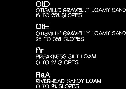
81
82


83

84

85
86
87 APPENDIX -74-
88 YARD DEFINITIONS The existing Woodcliff Lake Zoning Ordinance has the following definitions for front yard: Front Yard That unoccupied portion of a lot, tract or parcel of land which fronts upon a public street between the street line and the parts of the principal building nearest thereto measured parallel to and at right angles to the front lot line. In the event that such lot, tract or parcel is bounded by a public street on more than one (1) side, the front yard shall be deemed to be the street on which the building faces, whether or not containing the front entrance to such building, and if none, then, the side of such public street which shall have the longest length. Yard, Front The unoccupied area extending across the width of the lot and lying between the street line of the lot and the parts of the principal building nearest thereto, measured parallel to the front property line. This conflicts with B regarding corner lots which requires the front yard setback to be met on each street and reads: Corner lot (front and side yards). Any building to be constructed on a lot fronting on two (2) streets, commonly known as a corner lot, shall on each street be setback the number of feet required for a front yard on each street, it being the intention of this chapter that the side of a building on any corner lot shall be aligned with the front yard setback for a building located on an interior lot. A proposed definition for consideration is as follows: FRONT YARD Open space extending across the full width of a lot between the front lot line or the proposed front street line and nearest line of any building or structure or any enclosed portion thereof. The depth of such yard is the shortest horizontal distance between the front lot line or proposed front lot line or proposed front street line and the nearest point of the building or any enclosed portion thereof and the nearest point of the building Similarly, the existing definition for side yard could be improved. The existing definition in the current zoning ordinance is as follows: Yard, Side The unoccupied area between the side line of the lot and the parts of the building nearest thereto extending from the front yard to the rear yard or, in the absence of either of such yard, to the front or rear lot line, as may be appropriate, measured parallel to the side lot line. A proposed alternative to the existing definition is as follows: SIDE YARD - A yard between any building or structure and side lot line, extending from the front yard to the rear yard, or front lot line to rear lot line where no front yard or rear yard is required. The width of the required side yard shall be measured horizontally from the nearest point of the side lot line to the nearest part of the building. A-1
89 The accompanying yard diagrams should be incorporated into the borough s zoning ordinance to eliminate confusion regarding the determination of yards on irregular and corner lots. Also, definitions of front, side and rear yards should refer to principal building and/or structures. SHEDS, DECKS AND CABANAS Section D(1) should be amended to provide that all patios and decks up to 12 inches high can be located 20 feet from the property line (similar to pool decks and pool patios). Cabanas should be permitted to be a maximum 100 square feet in floor area and a maximum of 10 feet high, otherwise they are determined to be a structure D(2) regarding sheds should be amended to permit a maximum height of 10 feet, in lieu of the current 8 foot limit, to allow residents to purchase prefabricated units which commonly exceed the 8 foot height. HOME PROFESSION C(2) regulates incidental home professions and currently permits only residents to be employed. The borough should consider allowing the employment of one non-resident. There should also be a requirement that adequate off-street parking be provided at all times. DEVELOPMENT FEES Requires development fees in the residential zone districts. The ordinance should be amended to exclude residential additional or alterations. PROJECTIONS AND ENCROACHMENTS E regulates projections and encroachments. The code should increase the current 4 inch eave projection to 16 inches. A-2

90

91
INTRODUCTION. b. The extent to which such problems and objectives have been reduced or have increased subsequent to such date.
 INTRODUCTION INTRODUCTION The Municipal Land Use Law directs a Planning Board to prepare a Periodic Reexamination Report every six years that identifies and describes the following: a. The major problems
Chapter 10 IMPLEMENTATION RECOMMENDATIONS
 Chapter 10 IMPLEMENTATION RECOMMENDATIONS The recommended land use plan presented in the previous chapter provides a design for the attainment of the urban and rural development and open space preservation
AWH REPORT OF THE PLANNING AND DEVELOPMENT DEPARTMENT FOR APPLICATION FOR REZONING ORDINANCE TO PLANNED UNIT DEVELOPMENT
 AWH REPORT OF THE PLANNING AND DEVELOPMENT DEPARTMENT FOR APPLICATION FOR REZONING ORDINANCE TO PLANNED UNIT DEVELOPMENT MAY 8, 2014 The Planning and Development Department hereby forwards to the Planning
SECTION 1 Introduction...1. SECTION 2 Regional Context Criteria for Planning Districts Description of Planning District...
 Table of Contents SECTION 1 Introduction...1 SECTION 2 Regional Context...2 2.1 - Criteria for Planning Districts...2 2.2 - Description of Planning District...2 SECTION 3 Goals & Objectives...5 SECTION
INTRODUCTION PLANNING HISTORY
 INTRODUCTION The Upper Rock Creek Master Plan Area lies in the east central part of Montgomery County. The Master Plan Area is adjacent to the City of Rockville to the south, the Olney Planning Area to
12 January 12, 2011 Public Hearing APPLICANT: TAILWIND DEVELOPMENT GROUP,LLC PROPERTY OWNER: CITY OF VIRGINIA BEACH
 12 January 12, 2011 Public Hearing APPLICANT: TAILWIND DEVELOPMENT GROUP,LLC PROPERTY OWNER: CITY OF VIRGINIA BEACH STAFF PLANNER: Faith Christie REQUEST: Conditional Change of Zoning (from PD-H1 Planned
CITY OF COLWICH COMPREHENSIVE PLAN LAND USE LAND USE 1
 LAND USE LAND USE 1 WHAT YOU WILL FIND IN THIS CHAPTER: Discussion of today s conditions and tomorrow s projections Discussion of challenges and opportunities Discussion of the environmental quality goals,
Planning Districts INTRODUCTION
 INTRODUCTION To facilitate detailed examination of development prospects for all areas of the community, Delano has been divided into 14 planning districts. The location of these planning districts is
Land Use Amendment in Southwood (Ward 11) at and Elbow Drive SW, LOC
 at and Elbow Drive SW, LOC") 2018 November 15 Page 1 of 10 EXECUTIVE SUMMARY This land use amendment application was submitted by Rick Balbi Architect on 2017 August 31 on behalf of Sable Developments Ltd, and with authorization from
2018 November 15 Page 1 of 10 EXECUTIVE SUMMARY This land use amendment application was submitted by Rick Balbi Architect on 2017 August 31 on behalf of Sable Developments Ltd, and with authorization from
LAND USE TANGLEWILDE/THOMPSON PLACE PLANNING AREA. C. Identified Neighborhood Groups and Homeowner s Associations
 LAND USE TANGLEWILDE/THOMPSON PLACE PLANNING AREA I. Profile of Tanglewilde/Thompson Place Planning Area (Revised 3/5/02) A. Location The Tanglewilde/Thompson Place Planning Area is located just east of
SECTION UNIFIED DEVELOPMENT ORDINANCE SECTION Part 1 Ordinance. ARTICLE 1 Zoning Districts
 SECTION 1-100 UNIFIED DEVELOPMENT ORDINANCE SECTION 1-300 Part 1 Ordinance SECTION 1-100. Introduction. ARTICLE 1 Zoning Districts Crystal Lake strives to maintain a balance of various land uses for a
3.10 LAND USE SETTING PROJECT SITE EXISTING LAND USE DESIGNATIONS AND ZONING. General Plan Land Use Designations.
 This section of the Draft EIR addresses the existing land uses on and adjacent to the project site and discusses the potential impacts of the proposed project on existing land uses. Key issues addressed
Baumgarten MPUD. Exhibit 3 Evaluation Criteria
 Pursuant to LDC subsections 10.02.13 B, 10.02.08 F and Chapter 3 G. of the Administrative Code, staff s analysis and recommendation to the Planning Commission, and the Planning Commission s recommendation
REPORT OF THE PLANNING AND DEVELOPMENT DEPARTMENT FOR APPLICATION FOR REZONING ORDINANCE TO PLANNED UNIT DEVELOPMENT AUGUST 18, 2016
 REPORT OF THE PLANNING AND DEVELOPMENT DEPARTMENT FOR APPLICATION FOR REZONING ORDINANCE TO PLANNED UNIT DEVELOPMENT AUGUST 18, 2016 AWH The Planning and Development Department hereby forwards to the Planning
PLANNED UNIT DEVELOPMENT & SUBDIVISION STAFF REPORT Date: May 18, 2017
 & PUD-0000102-2017 PLANNED UNIT DEVELOPMENT & SUBDIVISION STAFF REPORT Date: May 18, 2017 NAME SUBDIVISION NAME Dauphin Creek Estates Subdivision Dauphin Creek Estates Subdivision LOCATION CITY COUNCIL
UNIVERSITY OF MICHIGAN:
 Chapter Eight UNIVERSITY OF MICHIGAN: North Campus I. Introduction The University of Michigan currently owns approximately 800 acres of land in the northeast section of Ann Arbor. North Campus refers to
CHAPTER 12 IMPLEMENTATION
 CHAPTER 12 IMPLEMENTATION The 2010 Town of Denton Comprehensive Plan is intended to capture a vision of the future of Denton. As such, it provides a basis for a wide variety of public and private actions
TOWNSHIP OF MONTGOMERY MASTER PLAN MASTER PLAN AND DEVELOPMENT REGULATIONS PERIODIC REEXAMINATION REPORT December 5, 2008
 TOWNSHIP OF MONTGOMERY MASTER PLAN MASTER PLAN AND DEVELOPMENT REGULATIONS PERIODIC REEXAMINATION REPORT December 5, 2008 INTRODUCTION The Township of Montgomery is situated in the southeastern corner
Gold Line Bus Rapid Transit Transit Oriented Development (BRTOD) Helmo Station Area Plan
 Helmo Station Area Plan") Appendix F Gold Line Bus Rapid Transit Transit Oriented Development (BRTOD) Helmo Station Area Plan Introduction and Purpose of the Plan The Gold Line Bus Rapid Transit facility is an eleven-mile dedicated
Appendix F Gold Line Bus Rapid Transit Transit Oriented Development (BRTOD) Helmo Station Area Plan Introduction and Purpose of the Plan The Gold Line Bus Rapid Transit facility is an eleven-mile dedicated
2.7 ac park. TOTAL 5,403 DU 1,297,900 sf 1,105,450 sf 3.87 ac 5,563 DU 1,121,200 sf 1,105,450 sf 3.87 ac
 PLAN AMENDMENT 2013-I-B1: SEVEN CORNERS SPECIAL STUDY Summary of Pre-staffing Comments Planner: Bernard Suchicital bsuchi@fairfaxcounty.gov (703) 324-1254 Background On October 29, 2013, the Board of Supervisors
Staff Report and Recommendation
 Community Planning and Development Planning Services 201 W. Colfax Ave., Dept. 205 Denver, CO 80202 p: 720.865.2915 f: 720.865.3052 www.denvergov.org/cpd TO: City Council Neighborhoods and Planning Committee
Gloucester County s Comprehensive Plan. The Community Connection
 Gloucester County s Comprehensive Plan The Community Connection Current Comp Plan Adopted in 1991 with a 20 year planning horizon Updated in 1995 with Part V- Implementation Recommendations and Appendix
NEW CASTLE COUNTY S ZONING DISTRICTS
 NEW CASTLE COUNTY S ZONING DISTRICTS This is general information about New Castle County s zoning districts. The information included is by no means exhaustive or complete. Before designing plans to develop
2.0 Hi s t o r y & Existing Co n d i t i o n s
 2.0 Hi s t o r y & Existing Co n d i t i o n s 2.1 Plan Area History The Lincoln East Specific Plan (Specific Plan) area is a significant part of the history of Sutter County. A 48,000 acre land grant
Comprehensive Plan. Faribault, Minnesota. Hoisington Koegler Group Inc. Claybaugh Preservation Architecture Inc. Howard R. Green Company Bonz/REA
 Comprehensive Plan Faribault, Minnesota Adopted by the Faribault City Council July 8, 2003 prepared for: prepared by: Hoisington Koegler Group Inc. Claybaugh Preservation Architecture Inc. Howard R. Green
CITY OF PUYALLUP. Background. Development Services
 CITY OF PUYALLUP Development Services 333 South Meridian Puyallup WA 98371 To: City Council From: Katie Baker, AICP, Planning Division Re: South Hill Neighborhood Plan Adoption Date: (Meeting date: February
Staff Report. Conditional Use PLANNING DIVISION COMMUNITY & ECONOMIC DEVELOPMENT. Salt Lake City Planning Commission
 Staff Report PLANNING DIVISION COMMUNITY & ECONOMIC DEVELOPMENT To: From: Salt Lake City Planning Commission Maryann Pickering, Principal Planner (801) 535-7660 Date: December 10, 2014 Re: Church of Scientology
4 RESIDENTIAL ZONE. 4.1 Background
 4 RESIDENTIAL ZONE 4.1 Background The residential areas within the City are characterised by mainly lowrise dwellings sited on individual allotments. Past architectural styles, settlement patterns and
ROAD CLOSURE AND LAND USE AMENDMENT SILVER SPRINGS (WARD 1) NORTHEAST OF NOSEHILL DRIVE NW AND SILVER SPRINGS ROAD NW BYLAWS 2C2018 AND 29D2018
 NORTHEAST OF NOSEHILL DRIVE NW AND SILVER SPRINGS ROAD NW BYLAWS 2C2018 AND 29D2018") Page 1 of 19 EXECUTIVE SUMMARY This application proposes redesignating two parcels in the community of Silver Springs from Special Purpose Future Urban Development (S-FUD) District and undesignated road
Page 1 of 19 EXECUTIVE SUMMARY This application proposes redesignating two parcels in the community of Silver Springs from Special Purpose Future Urban Development (S-FUD) District and undesignated road
POLICY AMENDMENT AND LAND USE AMENDMENT KILLARNEY/GLENGARRY (WARD 8) NW CORNER OF RICHMOND ROAD AND 33 STREET SW BYLAWS 1P2015 AND 7D2015
 NW CORNER OF RICHMOND ROAD AND 33 STREET SW BYLAWS 1P2015 AND 7D2015") Page 1 of 13 EXECUTIVE SUMMARY This application seeks to redesignate an RC-2 (Residential Contextual One/Two Dwelling) parcel to MC-Gd72 (Multi-Residential Contextual Grade-Oriented) to allow for multi-residential
Page 1 of 13 EXECUTIVE SUMMARY This application seeks to redesignate an RC-2 (Residential Contextual One/Two Dwelling) parcel to MC-Gd72 (Multi-Residential Contextual Grade-Oriented) to allow for multi-residential
OP Council Resolution June 16, Planning and Development Services
 OP-08-01 Council Resolution June 16, 2008 Planning and Development Services Kingsgate Landing Outline Plan Table of Contents 1.0 Introduction 1 1.1 Purpose of Plan 1 1.2 Plan Area Location 1 1.3 Ownership
9 CITY OF VAUGHAN OFFICIAL PLAN AMENDMENT NO BOCA EAST INVESTMENTS LIMITED
 9 CITY OF VAUGHAN OFFICIAL PLAN AMENDMENT NO. 631 - BOCA EAST INVESTMENTS LIMITED The Planning and Economic Development Committee recommends the adoption of the recommendations contained in the following
Welcome. Comprehensive Plan & Transportation Plan Open House November 7, 2012
 Welcome Comprehensive Plan & Transportation Plan Open House November 7, 2012 Agenda Proposed future land use plan Comprehensive Plan strategies Traffic forecasts Future traffic operations Possible future
EXHIBIT A. Tax Increment Reinvestment Zone No. 1 (Town Center) First Amended Project Plan 1
 First Amended Project Plan 1") EXHIBIT A Tax Increment Reinvestment Zone No. 1 (Town Center) First Amended Project Plan 1 1 As amended by Resolution No. 2008-02-001(TR1R) of the Tax Increment Reinvestment Zone No.1, and approved to
EXHIBIT A Tax Increment Reinvestment Zone No. 1 (Town Center) First Amended Project Plan 1 1 As amended by Resolution No. 2008-02-001(TR1R) of the Tax Increment Reinvestment Zone No.1, and approved to
Request for Statement of Interest in Implementation of the Roosevelt Road Redevelopment Plan
 425 Hillside Avenue Request for Statement of Interest in Implementation of the Roosevelt Road Redevelopment Plan I. INTRODUCTION The is seeking the services of a qualified consulting firm to prepare plans
OFFICE CONSOLIDATION SECONDARY PLAN AREA 22 THE BRAMALEA SOUTH INDUSTRIAL SECONDARY PLAN
 OFFICE CONSOLIDATION SECONDARY PLAN AREA 22 THE BRAMALEA SOUTH INDUSTRIAL SECONDARY PLAN November 2010 EXPLANATORY NOTES (Secondary Plan Area 22) General (pertaining to all secondary plan office consolidations)
Town of Clinton. New Jersey Highlands Water Protection and Planning Council. January Prepared for the Town of Clinton by:
 Clarke Caton Hintz Architecture Planning Landscape Architecture Town of Clinton Module 3: Addendum 100 Barrack Street Trenton NJ 08608 clarkecatonhintz.com Tel: 609 883 8383 Fax: 609 883 4044 New Jersey
USA Addition of South & East Side Residential Parcels. USA Deletion of a Town of Christiana Parcel. Conversion from USA to Limited Service Area
 Village of Rockdale Village of Rockdale 148 Water Street Cambridge, WI 53523 Phone 608.423.1497 Fax 608.423.9694 Urban Service Area (USA) Amendment USA Addition of South & East Side Residential Parcels
Chapter 13: Implementation Plan
 Implementation A. Introduction The Implementation Plan, in table form on the following pages, provides a summary of all the Action Items recommended in Chapters 2 through 12. The table also indicates which
This chapter describes the purpose of the Plan, introduces how the Plan is organized and provides contextual background for the Plan.
 Chapter 1: INTRODUCTION Purpose of a Comprehensive Plan The 2040 Comprehensive Plan establishes Medina s vision as a community and sets goals and objectives which guide future decisions and policies. The
Mitchell Ranch South MPUD Application for Master Planned Unit Development Approval Project Narrative. Introduction
 Mitchell Ranch South MPUD Application for Master Planned Unit Development Approval Project Narrative Introduction Mitchell Ranch South is a proposed single family (detached) residential development on
IMPLEMENTATION STRATEGIES. In This Chapter. Goals & Strategies 182 Project List 183 Future Land Use 186 CHAPTER 11 IMPLEMENTATION STRATEGIES
 In This Chapter Goals & Strategies 182 Project List 183 Future Land Use 186 11 IMPLEMENTATION STRATEGIES NORTH AUGUSTA, SC 2017 COMPREHENSIVE PLAN 179 Individual commitment to a group effort that is what
Urban Development Areas Bedford County
 5 Urban Development Areas Bedford County UDA Needs Profile: All UDAs Bedford County has designated two UDAs: areas just outside the Bedford City Limits (generally to the south and east of the city) and
Strategic Growth Area #1 Northampton Boulevard Corridor Area
 Strategic Growth Area #1 Northampton Boulevard Corridor Area Description Strategic Growth Area #1 has established itself as a major employment center in Southside Hampton Roads. Opportunities exist to
6 PORT SYDNEY SETTLEMENT AREA
 Section 6 Port Sydney Page 61 6 PORT SYDNEY SETTLEMENT AREA 6.1 Basis and Principles Village of Port Sydney Waterfront Community Existing Services 6.1.1 Port Sydney is an historic settlement that has developed
LOS ANGELES CITY PLANNING DEPARTMENT STAFF REPORT
 LOS ANGELES CITY PLANNING DEPARTMENT STAFF REPORT LOS ANGELES CITY PLANNING COMMISSION CASE NO: CPC 2006-9374 CRA CEQA: Exempt DATE: December 21, 2006 Location: Valley Plaza and Laurel Plaza TIME: after
D3 January 14, 2015 Public Hearing
 D3 January 14, 2015 Public Hearing APPLICANT: DONALD J. BOUCHER, JR. PROPERTY OWNER: D.J.B. SERVICE CENTER, LLC STAFF PLANNER: Kristine Gay REQUEST: A. Conditional Change of Zoning (I-1 to B-2) B. Conditional
City Of Sparks Planning Commission Item
 Page 1 of 12 City Of Sparks Planning Commission Item Meeting Date: May17, 2012 Subject: PCN12009, Public Hearing, Consideration and possible action on a Master Plan Amendment and Rezoning request to change
The transportation system in a community is an
 7 TRANSPORTATION The transportation system in a community is an important factor contributing to the quality of life of the residents. Without a sound transportation system to bring both goods and patrons
ARLINGTON COUNTY, VIRGINIA
 ARLINGTON COUNTY, VIRGINIA County Board Agenda Item Meeting October 15, 2005 DATE: September 28, 2005 SUBJECT: Request to Advertise the adoption of the 2005 Clarendon Sector Plan C. M. RECOMMENDATION:
TREASURE COAST REGIONAL PLANNING COUNCIL M E M O R A N D U M. To: Council Members AGENDA ITEM 5H
 TREASURE COAST REGIONAL PLANNING COUNCIL M E M O R A N D U M To: Council Members AGENDA ITEM 5H From: Date: Subject: Staff October 17, 2008 Council Meeting Local Government Comprehensive Plan Review Draft
LAND USE AMENDMENT CORNERSTONE (WARD 3) COUNTRY HILLS BOULEVARD AND STONEY TRAIL NE BYLAW 9D2017
 COUNTRY HILLS BOULEVARD AND STONEY TRAIL NE BYLAW 9D2017") Page 1 of 12 EXECUTIVE SUMMARY This Land Use Amendment application covers an area of 54.92 hectares ± (135.71 acres ±) located in northeast Calgary, bound by Country Hills Boulevard NE to the north and
Page 1 of 12 EXECUTIVE SUMMARY This Land Use Amendment application covers an area of 54.92 hectares ± (135.71 acres ±) located in northeast Calgary, bound by Country Hills Boulevard NE to the north and
S o u t h C e n t r a l O u t l i n e P l a n. Leduc Business Park. North Leduc Industrial Area Structure Plan C it y of Led u c.
 Leduc Business Park North Leduc Industrial Area Structure Plan C it y of Led u c Prepared for Farm Air Properties Inc. January, 2007 Table of Contents Page Number 1.0 Purpose of Plan and Definition of
Kirtland, Ohio - Comprehensive Plan Update 2022
 Kirtland, Ohio - 2022 Comprehensive Plan Update November 2012 INTRODUCTION City of Kirtland Officials... 1 Update: Preface... 2 City Charter Requirement: Purpose & Process... 3 THE PLAN Comprehensive Update:
September 25th, 2018 $2000 fee pd CC
 2.7267 acres 2018I-00075 September 25th, 2018 $2000 fee pd CC Rezoning Review Criteria Analysis - Map Amendment Application Number: 2018I-00075 805 W. 38 th Avenue October 19, 2018 (amd.) September 17,
SECTION II SECTION II STATEMENT OF GOALS, OBJECTIVES, PRINCIPLES, ASSUMPTIONS, POLICIES AND STANDARDS
 STATEMENT OF GOALS, OBJECTIVES, PRINCIPLES, ASSUMPTIONS, POLICIES AND STANDARDS 1 2 STATEMENT OF GOALS, OBJECTIVES, PRINCIPLES, ASSUMPTIONS, POLICIES AND STANDARDS INTRODUCTION The New Jersey Municipal
ALBEMARLE COUNTY CODE CHAPTER 18 ZONING SECTION 20A NEIGHBORHOOD MODEL - NMD
 CHAPTER 18 ZONING SECTION 20A NEIGHBORHOOD MODEL - NMD Sections: 20A.1 PURPOSE AND INTENT 20A.2 STATUS AS A PLANNED DEVELOPMENT DISTRICT 20A.5 CODES OF DEVELOPMENT 20A.6 PERMITTED USES 20A.7 RESIDENTIAL
LAND USE AMENDMENT CORNERSTONE (WARD 3) 60 STREET NE AND COUNTRY HILLS BOULEVARD NE MAP 26NE BYLAW 22D2017
 60 STREET NE AND COUNTRY HILLS BOULEVARD NE MAP 26NE BYLAW 22D2017") Page 1 of 14 EXECUTIVE SUMMARY This Land Use Amendment application covers an area of 43.76 hectares ± (108.14 acres ±) located in northeast Calgary, bound by Country Hills Boulevard NE to the south and
Page 1 of 14 EXECUTIVE SUMMARY This Land Use Amendment application covers an area of 43.76 hectares ± (108.14 acres ±) located in northeast Calgary, bound by Country Hills Boulevard NE to the south and
C ity of Grande Prairie Development Services Department
 C ity of Grande Prairie Development Services Department FAIRWAY DEVELOPMENT OUTLINE PLAN OP 08 09 Approved April 6, 2009 Prepared by: Focus Corporation Table of Contents 1.0. Introduction 2 3 1.1. Plan
ADMINISTRATION RECOMMENDATION 2016 November 03. That Calgary Planning Commission recommends APPROVAL of the proposed Land Use Amendment.
 Page 1 of 12 EXECUTIVE SUMMARY This Land Use Amendment application covers an area of 75.76 hectares ± (187.20 acres ±) located in northeast Calgary, bound by Stoney Trail NE to the north, 128 Avenue NE
GENERAL INFORMATIONaaaaaaaaaaaaaaaaaaaaaaaaaaaaaaaa
 To: Planning and Zoning Commission From: City Staff Date: November 15, 2016 Re: Case #16026 Raymore Activity Center Site Plan GENERAL INFORMATIONaaaaaaaaaaaaaaaaaaaaaaaaaaaaaaaa Applicant/ Property Owner:
EXHIBIT B PROJECT NARRATIVE POULSBO MEADOWS
 EXHIBIT B PROJECT NARRATIVE POULSBO MEADOWS Name of Project: Poulsbo Meadows; A Planned Residential Development (PRD)/Plat Applicants Name: PBH Group LLC/Byron Harris PO Box 1010 Silverdale, WA 98038 Description
City of Grande Prairie Development Services Department
 City of Grande Prairie Development Services Department ROYAL OAKS NORTH OUTLINE PLAN OP-07-03 NW 35-71-6 W6M May 7, 2007 Royal Oaks North Outline Plan TABLE OF CONTENTS 1.0 INTRODUCTION........ 3 1.1 Purpose
Planning Commission Staff Report June 5, 2008
 Owner/Applicant Taylor Village Sacramento Investments Partners, LP c/o Kim Whitney 1792 Tribute Road #270 Sacramento, CA 95815 Staff Recommendation Planning Commission Staff Report Project: File: Request:
5.0 VILLAGE AREAS. February 2008 Municipality of West Elgin ~ Official Plan 5-1
 5.0 VILLAGE AREAS This section of the Official Plan deals with the villages of Rodney and West Lorne being the two largest and only fully serviced settlement areas in West Elgin and the most logical and
A. WHAT IS A GENERAL PLAN?
 I. Introduction A. WHAT IS A GENERAL PLAN? A general plan is the planning guideline for the future of a city. It contains goals and policies which regulate urban development, the protection of the natural
Ten Mile Creek Planning Area
 PLANNING AREA POLICIES TEN MILE CREEK Ten Mile Creek Planning Area Location and Context The Ten Mile Creek Planning Area ( Ten Mile Creek area ) is located south of the current Boise AOCI, generally south
E O L A F I V E. Location Map SUMMARY G M P Z O N I T E M S # 1 A. & B.
 N. Eola Drive Staff Report to the Municipal Planning Board August 18, 2015 G M P 2 0 1 5-0 0 0 1 9 Z O N 2 0 1 5-00016 I T E M S # 1 A. & B. A N X 2 0 1 2-0 0 0 0 5 G M P 2 0 1 2-0 0 0 0 6 Z O N 2 0 1
City of Grande Prairie Development Services Department KENNEDY DEVELOPMENTS LTD. OUTLINE PLAN OP-09-01
 City of Grande Prairie Development Services Department KENNEDY DEVELOPMENTS LTD. OUTLINE PLAN OP-09-01 July 27, 2009 TABLE OF CONTENTS 1.0 Introduction... 1 1.1 Plan Area Location & Context... 1 1.2 Ownership
CHAPTER 4 FUTURE LAND USE AND URBAN SERVICES DISTRICTS
 CHAPTER 4 FUTURE LAND USE AND URBAN SERVICES DISTRICTS Introduction This chapter discusses how Benzie County should grow and change in the future. A community can grow and change in many different ways.
PLANNED UNIT DEVELOPMENT Date: April 5, 2018
 PLANNED UNIT DEVELOPMENT Date: April 5, 2018 DEVELOPMENT NAME SUBDIVISION NAME LOCATION Robert Myers Robert Myers 2955 and 2989 Dauphin Street (Southeast corner of Dauphin Street and Sage Avenue) CITY
Background Summary Report
 Background Summary Report May 2014 Submitted by Macaulay Shiomi Howson Ltd. In association with AMEC MMM Group Brook McIlroy Inc. Hemson Consulting Ltd. Table of Contents 1. Introduction... 1 2. Why is
Appendix A. Planning Processes. Introduction
 1 Planning Processes Introduction This appendix outlines a number of planning processes which are used in the Auckland Region to support the effective management of development in the region s rural and
2. Form and Character. 2.1 Introduction. 2.2 The Downtown Addition Plan. 2.1 Introduction
 2.1 Introduction 2.1 Introduction This section of the Specific Plan describes and illustrates the desired form, character and uses of the Downtown Addition and explains the underlying design principles.
WEST WESTFIELD AVENUE REDEVELOPMENT PLAN I BOROUGH OF ROSELLE PARK
 Prepared For: DRAFT Borough of Roselle Park 110 East Westfield Avenue Roselle Park, New Jersey 07204 2016 WEST WESTFIELD AVENUE REDEVELOPMENT PLAN I BOROUGH OF ROSELLE PARK Prepared By: Neglia Engineering
ESTABLISH AN EFFICIENT TOWN CENTER
 ESTABLISH AN EFFICIENT TOWN CENTER 4 Overview Lisbon residents are proud of the history of Newent and at the same time recognize its current importance as a centralized location for a variety of municipal
CITY OF ZEELAND PLANNING COMMISSION
 APPLICATION FOR SITE PLAN REVIEW AND SPECIAL LAND USE Date City Official App. Filing Fee Rec'd ($350) NOTE TO APPLICANT: Please submit this application for Site Plan Review along with twenty (20) copies
ARTICLE 6: Special and Planned Development Districts
 ARTICLE 6: Special and Planned Development Districts 6-10 Traditional Neighborhood Development (TND) District 6-10.10 Purpose and Intent The Traditional Neighborhood Development (TND) District provides
Rural Land Use Designations Kittitas County December 6, 2007 Draft
 KITTITAS COUNTY COMMUNITY DEVELOPMENT SERVICES 411 N. Ruby St., Suite 2, Ellensburg, WA 98926 CDS@CO.KITTITAS.WA.US Office (509) 962-7506 Fax (509) 962-7682 Rural Land Use Designations Kittitas County
CHAPTER 7: VISION AND ACTION STATEMENTS. Noble 2025 Vision Statement
 CHAPTER 7: VISION AND ACTION STATEMENTS This chapter presents the vision, policy and action statements that transform the comprehensive planning study, an analysis of Noble s past, future trends and community
COLVER ROAD INDUSTRIAL CONCEPT PLAN
 COLVER ROAD INDUSTRIAL CONCEPT PLAN A CONCEPTUAL LAND USE AND TRANSPORTATION PLAN FOR TA-4 AN URBAN RESERVE AREA OF THE CITY TALENT City of Talent Adopted by City Council Resolution No., June, 2015 PART
Chesapeake Bay Critical Area Conservation Plan
 The Maryland-National Capital Park and Planning Commission Prince George s County Planning Department Development Review Division 301-952-3530 Note: Staff reports can be accessed at www.mncppc.org/pgco/planning/plan.htm.
ARTICLE VI: SITE PLAN REVIEW
 Section 6.01 - Site Plan Review (All Districts) ARTICLE VI: SITE PLAN REVIEW Site plans give the Planning commission an opportunity to review development proposals in a concise and consistent manner. The
STORM WATER UTILITY FREQUENTLY ASKED QUESTIONS
 STORM WATER UTILITY FREQUENTLY ASKED QUESTIONS In 2007, the City Council adopted Ordinance No. 1155 establishing a storm water utility in the City. No fee structure was adopted at that time. The idea of
APPENDIX C SPECIAL PLANNING AREAS
 SPECIAL PLANNING AREAS There are five Special Planning Areas (SPAs) on the Land Use Diagram (Figure LU-2). The SPAs are areas with significant new growth potential that require more detailed subsequent
PART 1: PROJECT SUMMARY. The application is Attachment A. The site plan is Attachment B.
 Belleterre Subdivision Sketch Plan Town Board 8.7.17 Belleterre Subdivision Sketch Plan PART 1: PROJECT SUMMARY Applicant: Bowman Development Project Size: +/- 20.85 acres Parcel Number: 01115104 and 01115121
QUEEN-RIVER SECONDARY PLAN
 34 QUEEN-RIVER SECONDARY PLAN 34. QUEEN RIVER SECONDARY PLAN 1. INTRODUCTION The Queen-River area is approximately 6.4 hectares and is located at the eastern edge of the Downtown as shown on Map 34-1.
Right-of-Way Acquisitions and Relocations Technical Memorandum
 Right-of-Way Acquisitions and Relocations Technical Memorandum Southeast Extension Project Lincoln Station to RidgeGate Parkway Prepared for: Federal Transit Administration Prepared by: Denver Regional
6 March 9, 2011 Public Hearing APPLICANT: OLD DOMINION SOCCER CLUB
 REQUEST: Conditional Use Permit (outdoor recreational facility soccer fields) 6 March 9, 2011 Public Hearing APPLICANT: OLD DOMINION SOCCER CLUB PROPERTY OWNER: CALVARY ASSEMBLY OF GOD STAFF PLANNER: Leslie
4 January 11, 2012 Public Hearing APPLICANT:
 . 4 January 11, 2012 Public Hearing APPLICANT: MID-ATLANTIC AUTO PROPERTY OWNER: DZR, LLC STAFF PLANNER: Leslie Bonilla REQUEST: Conditional Use Permit (truck rental, automobile service, and automotive/bulk
Review of Opportunity Area C Draft Comprehensive Plan and Draft BOS Follow-On Motions. Special Working Group Meeting March 4, 2015
 Review of Opportunity Area C Draft Comprehensive Plan and Draft BOS Follow-On Motions Special Working Group Meeting March 4, 2015 The slides that follow identify where the draft Comprehensive Plan has
Glenborough at Easton Land Use Master Plan
 Implementation 114 9.0 IMPLEMENTATION 9.1 OVERVIEW This chapter summarizes the administrative procedures necessary to implement the proposed land use plan, infrastructure improvements, development standards,
City of Chickasaw Land Use Comprehensive Plan 2030 Chapter5-Draft(2)Public review_
Public review_") Land Use Land Use refers to the activity or development characteristics of a given parcel of land. The Land Use Plan presented in the following pages, represents the City of Chickasaw s official position
Land Use Land Use refers to the activity or development characteristics of a given parcel of land. The Land Use Plan presented in the following pages, represents the City of Chickasaw s official position
Subject: City of Richfield Cedar Avenue Corridor Plan Comprehensive Plan Amendment, Review File No
 Committee Report Business Item No. 2017-21 Community Development Committee For the Metropolitan Council meeting of January 25, 2017 Subject: City of Richfield Cedar Avenue Corridor Plan Comprehensive Plan
DEPARTURE FROM DESIGN STANDARDS DDS-586
 The Maryland-National Capital Park and Planning Commission Prince George s County Planning Department Development Review Division 301-952-3530 Note: Staff reports can be accessed at www.mncppc.org/pgco/planning/plan.htm.
6. Consistency with Local Plans
 6. Consistency with Local Plans 6.1. Chapter Overview 6.1.1. Introduction This section presents the goals, objectives and policies of municipal, county and state planning entities, as well as known development/redevelopment
Chapter 7: Land Use Plan
 Chapter 7: Land Use Plan The intended purpose of the Land Use Plan is to guide the future physical development of Wall Township by designating proposed land use categories including proper location and
HAZARD MITIGATION GOALS AND OBJECTIVES
 SEWRPC Community Assistance Planning Report No. 282, 2nd Edition CITY OF MILWAUKEE ALL HAZARDS MITIGATION PLAN UPDATE Chapter IV HAZARD MITIGATION GOALS AND OBJECTIVES [NOTE: Throughout this plan update
2010 Plan of Conservation and Development
 2010 Plan of Conservation and Development Wilton Planning and Zoning Commission Adopted November 2, 2009 Effective January 1, 2010 WILTON 2010 PLAN OF CONSERVATION & DEVELOPMENT PARTICIPANTS Planning &
9 th Street Sub Area Plan
 9 th Street Sub Area Plan In the 1990 s, when the Township prepared the last Master Plan, the 9 th Street corridor was studied as part of a larger 9 th Street Focus Area that included the West Main Street