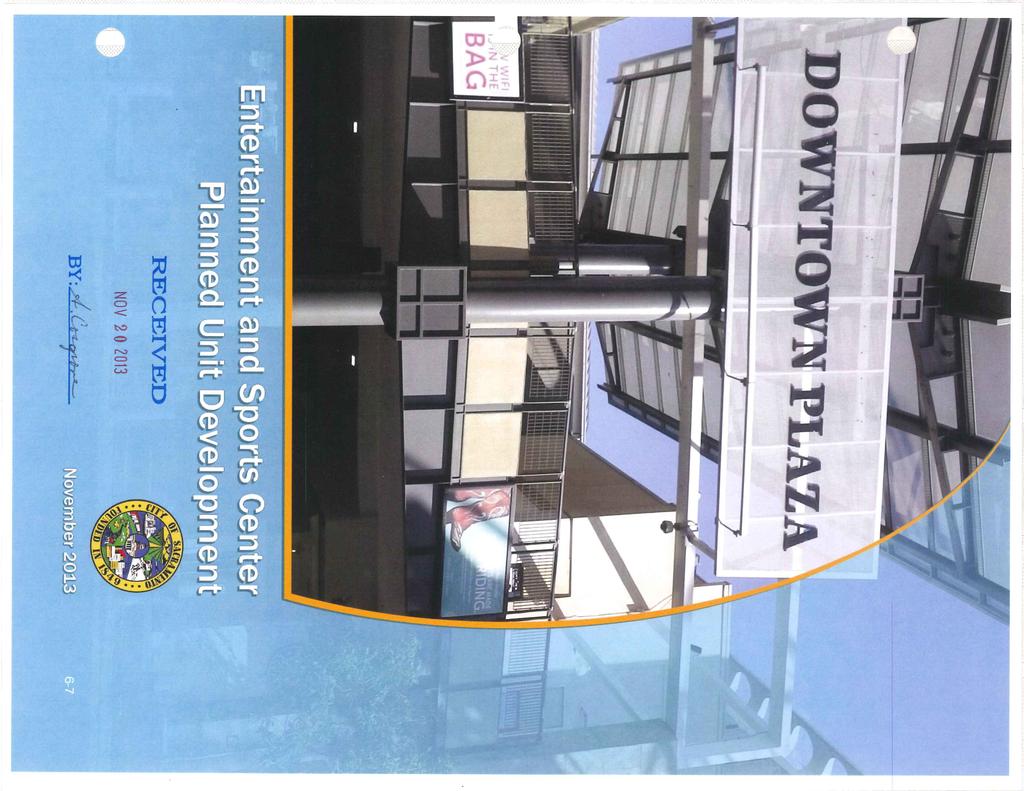
Introduction Plan Overview Performance and Development Standards Design Guidelines
|
|
|
- Sophie Evans
- 5 years ago
- Views:
Transcription
1
2
3 TABLE OF CONTENTS Introduction Plan Overview Performance and Development Standards Design Guidelines
4 6-10 This page is intentionally left blank.
5 6-11
6
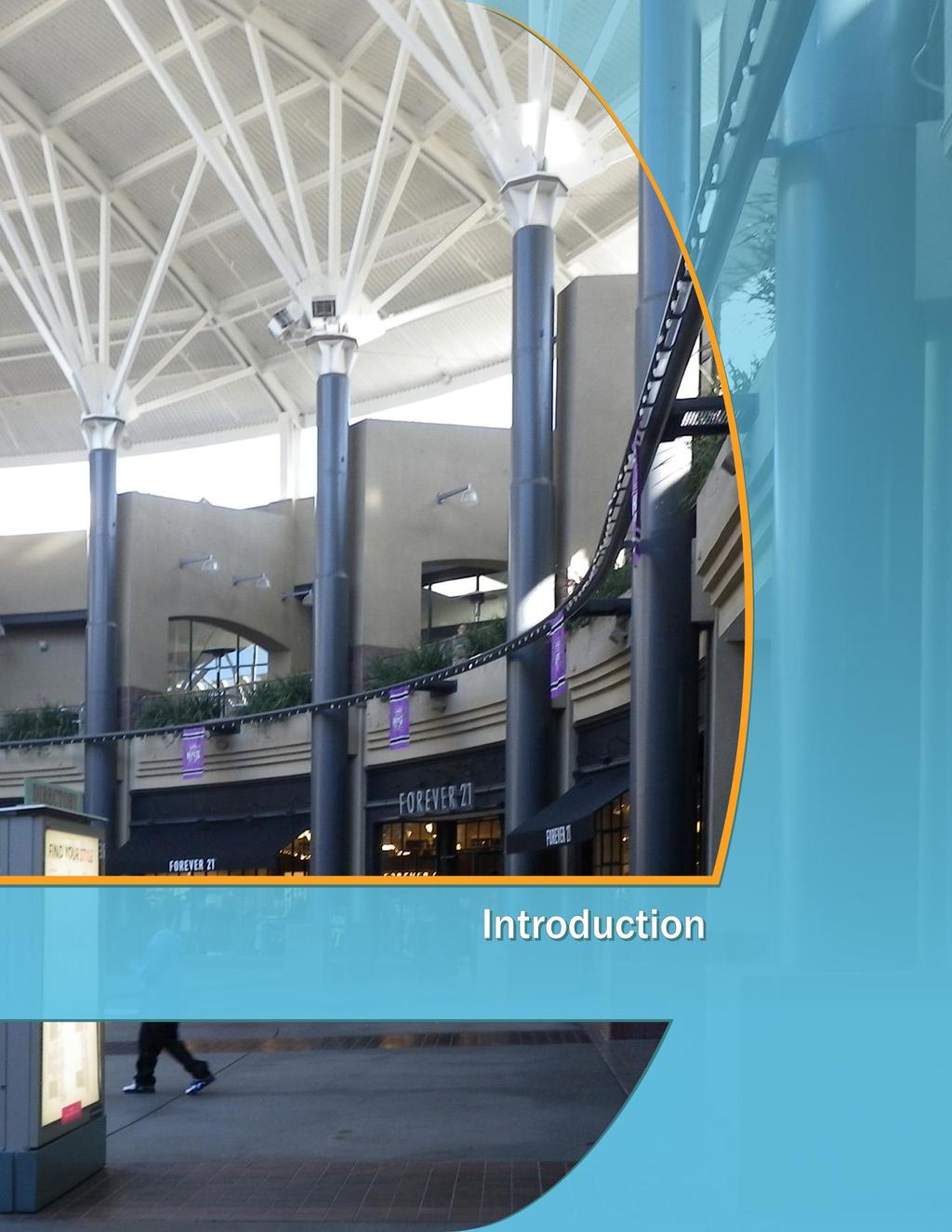
7 INTRODUCTION This chapter presents an overview of the mixeduse Entertainment and Sports Center Planned Unit Development (ESC-PUD) site and also describes the overall vision and goals of the ESC-PUD, the purpose and organization of this document, and the administration and implementation of the ESC- PUD in cooperation with the Special Planning District (ESC-SPD) zoning designation. PROJECT LOCATION The ESC-PUD site is located in downtown Sacramento, which is a major transportation hub, government and employment center; cultural, recreation, and entertainment center; and, increasingly, a place where people live. The city is bisected by several major interstate and state highways, including Interstate 5 (I-5), which traverses the state north- south; Interstate 80 (I-80), which provides an east-west connection between San Francisco and Reno; U.S. Highway 50, which provides an east-west connection between Sacramento and South Lake Tahoe, and State Route 99, which traverses north-south through the Central Valley. Refer to Figure 1, Regional Context. The ESC-PUD site is generally bound by 3rd Street on the west, J Street on the north, 7th Street on the east, and borders the Entertainment and Sports Center (ESC) site on the south (refer to Figure 2, ESC-PUD Site Location). EXISTING CONDITIONS The site is comprised of several existing parcels on approximately 8.35 acres of land, primarily located on the northern three blocks of the six block Downtown Plaza area. A pedestrian walkway is located along its southern boundary, between 4th and 5th Street and continues through and connects with the ESC property. The Travelers Building (southwest corner of 5th and J Streets), and the Ramona Building, restored as the Church of Scientology (at the southeast corner of 6th and J Streets) are not part of the ESC-PUD. The existing Macy s property is also excluded from the ESC-PUD site. 1 Of the streets surrounding the ESC-PUD site, 4th and 6th Streets were previously abandoned and no longer function as City streets. 5th Street, between J and L Streets, passes below grade and under the developed uses on K Street. K Street is a pedestrian-only public space. K Street connects the ESC-PUD with Old Sacramento to the west and the K Street Mall (the Kay ) to the east. West of 4th Street, K Street descends below grade under 3rd Street and Interstate 5 and returns to street grade where K Street intersects 2nd Street in Old Sacramento. 1 Referred to as Macy s West to distinguish the original Macy s property at the west end of Downtown Plaza from the former Weinstock s department store at the east end that Macy s occupied but subsequently vacated in October


8 Figure 1: Regional Context The CBD includes a mixture of retail, office, governmental, entertainment and visitor-serving uses, built on a formal framework of streets and park spaces laid out for the original Sutter Land Grant in the 1840s. The vision for the CBD is a vibrant downtown core that will continue to serve as the business, governmental, retail, and entertainment center for the city and the region. A significant element in the future CBD includes new residential uses. Increasing the residential population will add vitality to the CBD by extending the hours of activity and the built-in market for retail, services, and entertainment. Existing entrance to Downtown Plaza from K St. 6-14


, the Jade, Navin s Custom Clothiers (324 K Street), the Holiday Inn Sacramento Capitol Plaza (300 J Street) and the proposed ESC")
9 Downtown Plaza comprises a number of retail and office buildings, including the Downtown Plaza theater, the adjacent food court, 24 Hour Fitness, an array of small in-line retail and restaurant spaces, and the office buildings along L Street and J Street. The Macy s West store is under separate ownership. As described in Table 2-1, Downtown Plaza currently contains approximately 1,190,443 total square feet (s.f.) of retail/commercial and office space, including the 332,500 s.f. Macy s building, not proposed as part of the proposed project. Several buildings that are currently located within the contiguous property, bound by 3 rd, 7 th, J, and L Streets are not part of the proposed project and would remain unchanged. In addition to the Macy s West building, these properties include the California Fruit Building (at 4 th and J Street), the Traveler s Hotel (428 J Street), the Ramona Hotel (1007 6th Street), the 630 K Street Office Building, Hotel Marshall ( th Street), the Jade, Navin s Custom Clothiers (324 K Street), the Holiday Inn Sacramento Capitol Plaza (300 J Street) and the proposed ESC located immediately south of the ESC-PUD area. Existing interior public plaza/access Existing tunnel-bridge over 5 th St. Existing view of Downtown Plaza property from J St. 6-15

10 Figure 2: ESC-PUD Site Location 6-16
11 PROJECT PURPOSE AND OBJECTIVES The ESC-PUD site proposes a mixed-use development that focuses on a specific mix of uses that will work in a coordinated fashion with the ESC immediately to the south The proposed uses will be regulated pursuant to the ESC-SPD, as established in Chapter of the Planning and Development Code, which will establish use and process procedures for development in the site. The following are project objectives for development within the ESC-PUD site: Develop up to 1.5 million square feet of mixed-use development (office, hotel, retail, and residential). Develop property in a manner to respond to the unique site conditions and adjacency to the ESC. Chapter 3: Performance and Development Standards includes new development standards specific to the ESC-PUD site and references to the Planning and Development Code for all other standards that will apply. Chapter 4: Design Guidelines outlines all the design guidelines specific to the ESC-PUD site and cite reference to other guidelines in the Central City Urban Design Guidelines that will apply. Chapter 5: Signage includes guidance regarding signs that will be allowed within the ESC-PUD site. ADMINISTRATION Uses within the ESC-PUD site will be regulated by the requirements of Chapter , Entertainment and Sports Center Special Planning District, in the Planning and Development Code. Ensure on-site architectural design themes are compatible with the surrounding City of Sacramento properties. Support mixed-use development to encourage public transportation use, nonvehicular modes of transportation, and reduce on-site parking needs. Provide a mix of uses that encourage 24- hour activities to liven up the streetscape, and incorporated uses. ORGANIZATION OF THE DOCUMENT This ESC-PUD document has been organized into the following chapters: Chapter 1: Introduction describes an overview of the ESC-PUD site location, existing conditions, project purpose and objectives, and how the ESC- PUD will be regulated. Chapter 2: Plan Overview describes the project plans design concept, framework, permitted uses and development phasing. 6-17
12
13 6-19
14

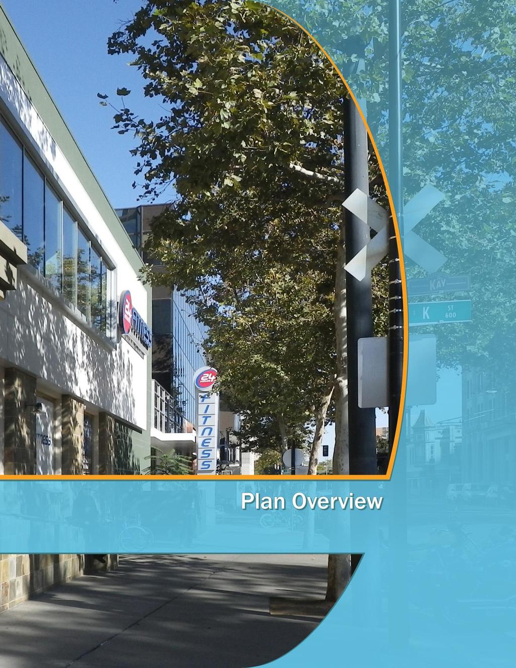
15 PLAN OVERVIEW This chapter describes the project plan s design concept, land use and circulation framework, potential development phasing, and contemplated uses in the ESC-PUD site. DESIGN PRINCIPLES The following design principles were considered to develop the schematic land use map, development standards and design guidelines for the ESC-PUD site: 1. Regional Visibility: The ESC-PUD site will be adjoining the future Entertainment and Sports Center (ESC) building and therefore has prime visibility in accentuating a regional destination through appropriate architectural design. 2. Location Efficiency: The ESC-PUD site is ideally located within the City s Central Business District (CBD) and benefits from easy multimodal access to freeways, public transit ways (including Amtrak, light rail and regional transit bus ways) and compatible surrounding land uses. DESIGN FRAMEWORK The following pages include diagrams that create the design framework for the Schematic Land Use Map for the ESC-PUD site. Land use framework is guided by zoning classifications. The design framework utilizes the City s Central City Urban Design Guidelines and develops them to respond to the unique role and position of the ESC-PUD properties. The circulation framework is guided by the existing road network and access to public transit. The public-private realm diagram, below, explains how the public and private realm is defined in this document and set the basis for the areas that will be addressed in the Design Guidelines chapter. Plazas and interior common open spaces (not shown in the diagram below) shall be addressed within the public realm. 3. Cultural Significance: An appropriate mix of uses within the ESC-PUD site would help to create a 24-hour activity node at a primary entryway to the City s downtown. 4. Architectural Response: The architectural scale and massing of buildings within the ESC- PUD site should respond both to the character of surrounding Downtown buildings, along with the contemporary design, and massing of the future adjacent ESC building. Figure 3: Public-Private Realm Diagram 6-21

16 Figure 4: Land Use Framework 6-22

17 Figure 5: Circulation Framework 6-23
18 LAND USE DEVELOPMENT The properties within the ESC-PUD area provide unique development opportunities to integrate and connect with the neighboring ESC and surrounding urban fabric. The ESC-PUD site is generally organized as 3 development areas, named A, B and C; each of which may be subdivided into one or more parcels. The project is planned to be phased although not necessarily in the sequence suggested by the names. The following is a description of a potential land use program for the ESC-PUD site. Refer also to Figure 6, Schematic Land Use Map. Retail/Commercial Retail/commercial uses would largely be constructed on the first floor of buildings on the site. Retail/commercial uses would include retail stores, theaters, fitness or athletic centers, restaurants, nightclubs, and other similar uses, as per Section of the ESC-SPD chapter. Up to approximately 350,000 square feet of retail/commercial uses would be developed within the ESC-PUD area. Office The ESC-PUD site would include up to approximately 475,000 square feet of office space. The ESC-PUD will not prescribe where on the site the office space will be developed, nor any minimum amount of office space to be built, but it is currently anticipated that the office space built as part of the project would largely be constructed in one or more buildings located generally in the northern portion of the site, along J Street. Hotel The ESC-PUD site would include up to approximately 250 hotel rooms. The hotel would include space for lobbies, meeting rooms, in-hotel retail and restaurants, and other support uses. The ESC-PUD will not prescribe the specific location or configuration of the hotel uses, but it is currently anticipated that the hotel would be part of the larger development. One possible configuration would be for the hotel entrance to be located along J Street with some below-grade parking and reception area on the first floor. Second floor uses could include meeting rooms and other complementary uses such as in-hotel retail and restaurant, business center, and hotel offices. Hotel rooms would potentially be located on upper floors. The hotel may also include an outdoor swimming pool and associated open space. Residential The ESC-PUD site will include construction of up to 550 multi-family residential units, likely in two or more towers on the site. The proposed ESC-PUD does not prescribe the unit types or sizes. Like other uses within the development, the residential uses would be designed and built to meet market conditions. At this time, one- and two-bedroom units are anticipated. It is also anticipated that the total residential square footage would be approximately 500,000 square feet, including residential units, common area, and mechanical and other support spaces. Open Space Areas The ESC-PUD site would include plazas, pedestrian circulation, and other open spaces that would be designed to seamlessly integrate with the plazas and courtyards of the adjacent ESC building site. Over time, the development of mixed-use buildings in the ESC-PUD site could alter the open space that currently exists west of 5 th Street between Macy s and the Downtown Plaza cinemas. Common open space plazas may accommodate pedestrian flow and access to the ESC building, and surrounding retail/commercial and other mixed uses. Open space areas would be activated by retail and restaurant storefronts, sidewalk cafes, retail kiosks, and small scale performance venues. It is anticipated that these areas could be occasionally used for small outdoor concerts, cultural performances or other community activities. The ESC-PUD area plazas and open spaces would be comprised of hardscape and landscaped areas. USES Refer to section Uses, in the Planning and Development Code for permitted and conditional uses allowed within the ESC-PUD site. 6-24

19 Figure 6: Schematic Land Use Map 6-25
20
21 6-27
22
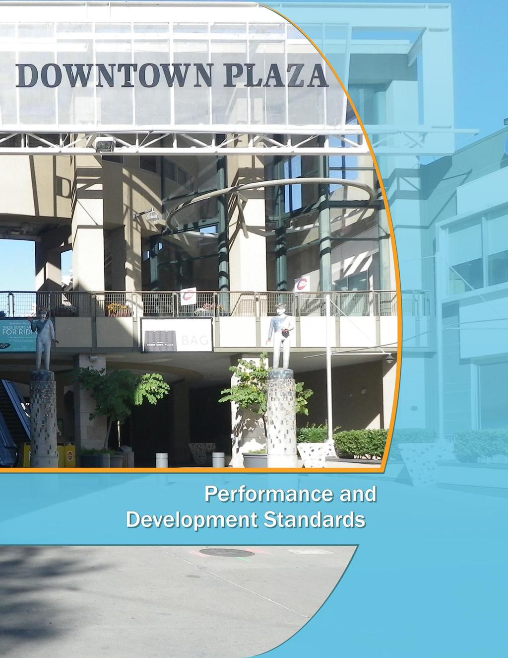
23 PERFORMANCE AND DEVELOPMENT STANDARDS This chapter includes the development standards that will guide the ESC-PUD design and development. The following development standards build off of the City s Planning and Development Code, and adjust them to facilitate the goals and objectives of the ESC-PUD. In general, the standards set forth under Article VIII. C-3 Zone Central Business District Zone (Planning and Development Code, Section ) and the Central City Urban Design Guidelines apply, except as modified herein and by the ESC-SPD. RATIONALE Pursuant to the requirements of Chapter Entertainment and Sports Center Special Planning District (ESC-SPD), in the City of Sacramento s Planning and Development Code, the development standards that are specific to the site have been cited in the sections below. BUILDING SITING Purpose: The intent of building siting standards is to provide guidance on lot coverage, setbacks and tower stepbacks. Standards: Refer to Section C-3 zone (Lot size, width, and depth) and C-3 zone (Setbacks and stepbacks), in City of Sacramento s Planning and Development Code for all standards and definitions that apply, except as recommended below and shown in Figure 7, Building Footprint Diagram: Interior Side and Rear Setbacks: There is no minimum interior side or rear setback requirement. However, a clear-zone determined through the Site Plan and Design Review process for pedestrian access shall be maintained along the eastwest axis of the rear lot line Rear Tower Setbacks: The maximum rear tower setback for residential, commercial and mixed-use towers will be 10 feet from the rear lot line. If the rear lot line is adjacent to an alley, the setback is measured to the centerline of the alley. All other requirements under Section and apply.

24 Figure 7: Building Footprint Diagram 6-30

25 BUILDING MASSING AND SCALE Purpose: The intent of building massing and scale standards is to provide guidance on building height, development intensity and building separation requirements to accommodate proposed development while creating an interesting urban skyline, and a variety of indoor and outdoor spaces with sufficient solar and wind access. Standards: Refer to Section C-3 zone (Height, density, lot coverage, and floor area ratios) and Section C-3 zone (Setbacks and stepbacks), in the City of Sacramento s Planning and Development Code for all standards and definitions that apply, except residential density standards established in ESCSPD and definition of building base as below: The provision of small public spaces serving residents and patrons is encouraged. Building base and street wall shall refer to the first 85 feet of building height, which has been increased to generally match the higher building height of adjacent ESC and maintain a street height consistency in the block. SMALL PUBLIC SPACES Purpose: The intent of small public spaces standards is to provide guidance on outdoor areas, plazas and courtyards requirements to create onsite outdoor spaces for residents and visitors. Standards: Refer to Section (Open Space for multi-unit dwellings), in the City of Sacramento s Planning and Development Code for all standards and definitions that apply. 6-31
, Section 17.")
26 ON-SITE CIRCULATION, LOADING AREAS AND PARKING Purpose: The intent of on-site circulation standards is to provide guidance on loading areas and non-vehicular areas to promote efficient circulation for all types of transportation modes. Standards: Refer to Section (Parking), Section Recycling and Solid Waste Disposal Regulations in the City of Sacramento s Planning and Development Code for all standards and definitions that apply. LANDSCAPING AND PAVING Purpose: The intent of landscaping and paving standards is to provide guidance on paving, lighting, planting and irrigation, and maintenance to promote well-maintained and well-lit landscaped and paved areas. Standards: Refer to Section (Landscaping and Paving Regulations) and Section (Wall, Fence and Gate Regulations) in the City of Sacramento s Planning and Development Code for all standards and definitions that apply. Landscaping in the PUD shall be well maintained and lit. 6-32
27 6-33
28
29 DESIGN GUIDELINES This chapter includes the design guidelines that will guide design and development within the ESC-PUD site. The following design guidelines build off of the City s Central City Urban Design Guidelines, and adjust them to facilitate the goals and objectives of the ESC-PUD. In general, the design guidelines set forth in the Central City Urban Design Guidelines, Chapter 3-Public Realm and Chapter 4-Private Realm apply, except as modified herein and by the ESC-SPD. RATIONALE Pursuant to the requirements of Chapter Entertainment and Sports Center Special Planning District (ESC-SPD), in the Planning and Development Code of the City, the design guidelines that are specific to the ESC-PUD site have been cited in the sections below. DG 1: PUBLIC REALM Purpose: The intent of public realm guidelines is to provide design criteria for how the public areas (including streets, alleys, outdoor plazas, open space, and sidewalks) within the site should be developed in a manner to enhance user experience and create a vibrant streetscape. Refer to the Central City Urban Design Guidelines, Chapter 3 Public Realm for design guidance, along with additional guidelines as highlighted in the subsections below. Where design guidelines in the subsections below contradict guidelines in the Central City Urban Design Guidelines, the guidelines noted below will supersede. DG 1.1 Streets and Intersections Refer to design guidelines in Chapter 3: Public Realm, Section 3.B.1 (Street Types) of the Central City Urban Design Guidelines for design guidelines that apply along with the ones cited below Corridor Streets : J and 5th Streets are considered corridor streets that serve as arterials through downtown Sacramento that are intended to provide efficient circulation and connect freeways and regional highways. J Street abuts the northern boundary of the site. 5th Street dips down below the surrounding streets and a pedestrian bridge over 5th Street connects the eastern parcels and western parcels of Downtown Plaza. One-way Transit Street : 7th Street along the eastern edge of the site is considered a one-way transit street. Guidelines: Tall street trees with wide canopies should be planted at regular intervals, where feasible, to provide adequate shade along the sidewalk. DG1.1. Neighborhood Retail Street : 4th and 6th Streets provide vehicular access from the northern edge of the site but are not through streets. Guidelines: 4th Street right-of-way may be adjusted to increase the available site for the potential expansion of the cinema/theater. DG1.2. On-Site Alleys (Future): On-site alleys may be designed for access to emergency vehicles, loading and service areas. Guidelines: On-site alleys should be designed with no more than 28-foot right-of-way. DG1.3. Refer to Central City Urban Design Guidelines, Chapter 3, and Section B Alleys: Shared-Use Alleys for recommended design guidelines. DG1.4.
 and Section 3.")
30 Sidewalks and Building Interface Area Street Furnishings and Amenities The quality of sidewalks including width, paving, and its maintenance lend to a comfortable and pedestrian experience in an urban environment and is critical to providing a complimentary interface with the ESC and the surrounding plaza. Refer to design guidelines in Chapter 3: Public Realm, Section 3.C.1 (Sidewalks) and Section 3.C.2 (Functional Zones) of the Central City Urban Design Guidelines for design guidelines that apply along with the ones cited below. High-quality and durable street furnishings and amenities (such as bicycle racks, transit stops, street lighting, drinking fountains, wayfinding signage, kiosks and restrooms, seating, bollards, trash and recycling receptacles, and tree grates) are important in creating the look and feel of public spaces and streetscapes. Refer to design guidelines in Chapter 3: Public Realm, Section 3.C.3 (Street Furnishings and Amenities) of the Central City Urban Design Guidelines for design guidelines that apply along with the ones cited below. Guidelines: Guidelines: Sidewalks should be at least 10 feet wide, if abutting outdoor seating areas, with a minimum 6-foot clear zone for pedestrians at all times. DG1.7. Sidewalk paving material, for streets surrounding the ESC-PUD site, should be chosen in a manner to create a distinctive identity for the block, reduce urban heat island effect, and provide stormwater management. DG1.8. DG1.5. DG1.6. The design and specifications of street furnishings and amenities on the ESC-PUD and ESC building should be coordinated to create a uniform and attractive look for the whole block. On-street bicycle racks may be integrated in the design of the amenity zone on all streets surrounding the site, especially within clear visibility of pedestrian-oriented daytime ground floor retail uses. Bus-pull out areas should be integrated within the design of the pedestrian zone at suitable locations determined during Site Plan and Design Review process. DG1.9. DG1.10. Street lighting should consider having fixtures at two different levels to address adequate lighting on both pedestrian realm and travelway realm, while reducing glare into the adjoining buildings. Provide generous sidewalk spaces to serve pedestrian needs/uses. DG1.11. Outdoor plazas for large gathering of people should consider installation of drinking fountains, and public restrooms near seating areas. 6-36

31 Landscaping On-street and on-site landscaping with canopy trees and climate appropriate plants will help to complement the paved urbanscape, create comfortable pedestrian environment and reduce urban heat island effect. Refer to design guidelines in Chapter 3: Public Realm, Section 3.D (Landscape) of the Central City Urban Design Guidelines for design guidelines that apply along with the ones cited below. Guidelines: Guidelines: DG1.13. Small public spaces and outdoor seating areas should be integrated within pedestrian zones to encourage attractive street-level uses and punctuations along the building face. DG1.14. A public space/entry corridor from the northern edge (along J Street, between 5th and 6th Street) of the ESC-PUD site to the ESC building should be provided. a This public space/entry corridor should serve as a northerly connection to the ESC plaza and should be designed as a common open space, shared by both mixed-use buildings and the ESC building. The public space may also provide loading access during off-peak hours and non-event times. b Limit street furnishings and amenities towards the edges of the right-of-way to preserve maximum clear zone for pedestrians and vehicles. c Provide adequate street lighting and security cameras to encourage public safety at all times. d Encourage street-level windows, active uses and façade articulation for buildings along the public space corridor to encourage eyes-on-street and create an interesting and dynamic pedestrian experience. DG1.12. Landscaping palette should be coordinated between the ESC-PUD and the ESC building to create a continuity and theme among plant species within the block. Public Spaces Careful location and attractive design of outdoor sitting areas, plazas and small public spaces help in promoting pedestrian activity. Refer to design guidelines in Chapter 3: Public Realm, Section 3.E (Small Public Places) and Chapter 4: Private Realm, Section 4.a (Open Space Small Public Spaces) of the Central City Urban Design Guidelines for design guidelines that apply along with the ones cited below. Public Art Refer to the design guidelines in Chapter 3: Public Realm, Section 3.F (Public Art) of the Central City Urban Design Guidelines, in addition to the ones cited below. Integrate outdoor seating areas and public space within the pedestrian zone along J and 7th Street. Guidelines: DG1.15. Coordinate and integrate public art design and location with the themes of the adjoining ESC building property. 6-37
 within the site should be developed to create attractive building design that respond architecturally to the City s image as appropriate given the unique characteristics of the ESC-PUD")
32 DG 2: PRIVATE REALM Purpose: The intent of private realm guidelines is to provide design criteria for how the private areas associated with buildings (including types, bulk controls, façade treatment) within the site should be developed to create attractive building design that respond architecturally to the City s image as appropriate given the unique characteristics of the ESC-PUD area. Refer to the Central City Urban Design Guidelines, Chapter 4 Private Realm for design guidance, along with additional guidelines as highlighted in the sub-sections, below. Where Design Guidelines in the subsections, below, contradict with guidelines in the Central City Urban Design Guidelines, the guidelines noted below will supersede. Siting and Orientation The intent of siting and orientation guidelines is to provide design criteria for how the buildings should be setback in the ESC-PUD from the streets and alleys. Refer to design guidelines in Chapter 4: Private Realm, Section 4.B.1 through 4.B.7 of the Central City Urban Design Guidelines for all design guidelines that apply, in addition to the ones provided below. Guidelines: DG2.1. New buildings should be located on build-tolines with some breaks along the building base to break a monotonous wall surface. Locate buildings on build-to-lines with breaks along the building base DG2.2. Residential towers should be oriented in a manner to optimize solar, wind access, and units. DG2.3. Encourage access to building loading, utilities and services in the subterranean level to minimize visual impact at street level. Building Massing and Scale Building massing and scale guidelines describe how the street wall and building base height, tower separation, and height differentiation concepts should be integrated within the architectural design of the buildings. In additional to the guidelines provided below, refer to Residential High-rise and Commercial High-rise design guidelines under Chapter 4: Private Realm, Section C Building Types and Section D Massing and Building Configuration for all applicable design guidelines. Guidelines: DG2.4. Encourage a street-wall height of 85-foot for both residential high-rise and commercial highrise buildings. All bulk control standards described below will apply above the street-wall height. DG2.5. Above 85-foot height, there should be a 10% bulk reduction for the top 20% of residential, mixed use and commercial buildings.

 of the Central City Urban Design Guidelines for design guidelines that apply, in addition to the ones cited below.")

33 Street wall heights should be no greater than 85 feet for residential or commercial frontages. DG2.6. For all types of buildings: a Maximum average tower floor plate will be 25,000 sq. ft. b No maximum plan dimension required c No maximum diagonal dimension required Building Façade Treatment Building façade guidelines provide design guidance regarding the ground level uses, building fenestration/transparency, materials, colors, and canopies/awnings. Refer to design guidelines in Chapter 4: Private Realm, Section 4.D.4 (subsections a through l) of the Central City Urban Design Guidelines for design guidelines that apply, in addition to the ones cited below. Articulate the street wall façade of residential and commercial buildings. Building Façade Lighting Refer to design guidelines in Chapter 4: Private Realm, Section 4.D.4.j of the Central City Urban Design Guidelines for design guidelines that apply, in addition to the one cited below. Guidelines: DG2.8. Building façade lighting may be used tastefully to create public art displays on surfaces. Guidelines: DG2.7. Façade articulation of street wall is encouraged with no more than 60 feet of unbroken length of façade in residential and commercial buildings. Building façade lighting may create public art. 6-39
Policies and Code Intent Sections Related to Town Center
 Policies and Code Intent Sections Related to Town Center The Town Center Vision is scattered throughout the Comprehensive Plan, development code and the 1994 Town Center Plan. What follows are sections
PUBLIC RIGHT-OF-WAY IN THIS CHAPTER PUBLIC REALM
 PUBLIC RIGHT-OF-WAY This section provides design guidelines for improvements in the public right-of-way. The public right-of-way refers to streets, sidewalks, non-vehicular thoroughfares, parks and greenways
FRUITVALE TRANSIT VILLAGE (Phase 2) Residential Project
 Residential Project") FRUITVALE TRANSIT VILLAGE (Phase 2) Residential Project DEVELOPER: SIGNATURE PROPERTIES ARCHITECT: HKIT ARCHITECTS April 23, 2010 TABLE OF CONTENTS 3 Vision 4 Description of Site 5 Guiding Concepts 6
FRUITVALE TRANSIT VILLAGE (Phase 2) Residential Project DEVELOPER: SIGNATURE PROPERTIES ARCHITECT: HKIT ARCHITECTS April 23, 2010 TABLE OF CONTENTS 3 Vision 4 Description of Site 5 Guiding Concepts 6
Sierra Springs Regional Commercial Master Site Plan Airdrie, Alberta Hopewell Development Corporation Project No May 26, 2010
 Sierra Springs Regional Commercial Master Site Plan Airdrie, Alberta Hopewell Development Corporation Project No. 205-077 May 26, 2010 TABLE OF CONTENTS Purpose... 2 Master Site Plan Guidelines... 3 Overall
FLORIN ROAD CORRIDOR Site Plan and Design Review Guidelines Checklist
 FLORIN ROAD CORRIDOR Site Plan and Design Review Guidelines Checklist Applicant s Name: Project Address: Phone: Email: Applicant shall fill out the design guidelines checklist for all guidelines applicable
Buildings may be set back to create small plazas provided that these setbacks do not substantially disrupt the street wall s continuity.
 6-22 Community Design Street Walls and Street-front Setbacks The siting of buildings will play a critical role in establishing the character and sense of place for the District. Siting buildings at the
DRAFT. 10% Common Open Space
 % OF CHARLOTTE IS CATEGORIZED AS A. LAND USES : Placeholder map displaying location of Place Type GOALS: Accommodate XX% of future growth. Provide a concentration of primarily commercial and civic activity
3.0 URBAN DESIGN. December 6, OVERVIEW
 Urban Design 3.0 URBAN DESIGN December 6, 2007 3.1 OVERVIEW The highly urban character of Easton Place is defined by the overall design of the community. The following sections provide an overview of the
1.0 VISION STATEMENT. December 6, PRINCIPLES
 Vision Statement Lincoln Regional Airport 1.0 VISION STATEMENT 1.1 City LOCATION of AND OVERVIEW The Easton Lincoln Place Land Use Master Plan identifies the principles, goals, policies, and standards
4.9 Mendocino Avenue Corridor Plan Design Guidelines
 4.9 Mendocino Avenue Corridor Plan Design Guidelines The Mendocino Avenue Corridor Plan addresses the area between College Avenue and Steele Lane. Mendocino Avenue is a busy arterial that runs parallel
WEST LOOP DESIGN GUIDELINES CHECKLIST
 WEST LOOP DESIGN GUIDELINES CHECKLIST Section 1.0 General Strategies 1.1 DESIGN EXCELLENCE: ENCOURAGE HIGH QUALITY AND INNOVATIVE DESIGN OF NEW BUILDINGS WITHIN THE WEST LOOP WITHOUT BEING PRESCRIPTIVE
CITY OF MERCER ISLAND DESIGN COMMISSION STAFF REPORT
 CITY OF MERCER ISLAND DESIGN COMMISSION STAFF REPORT Agenda Item: 2 March 9, 2011 Project: Description: Applicant: DSR11-004 The applicant is requesting approval to replace the existing exterior wood framed
The transportation system in a community is an
 7 TRANSPORTATION The transportation system in a community is an important factor contributing to the quality of life of the residents. Without a sound transportation system to bring both goods and patrons
[PLANNING RATIONALE] For Site Plan Control and Lifting of Holding Zone By-Law 101 Champagne Avenue. May 23, 2014
![[PLANNING RATIONALE] For Site Plan Control and Lifting of Holding Zone By-Law 101 Champagne Avenue. May 23, 2014](/thumbs/75/71599615.jpg "[PLANNING RATIONALE] For Site Plan Control and Lifting of Holding Zone By-Law 101 Champagne Avenue. May 23, 2014") [PLANNING RATIONALE] For Site Plan Control and Lifting of Holding Zone By-Law 101 Champagne Avenue May 23, 2014 Contents 1.0 Introduction... 2 2.0 Site Context... 2 2.1 Adjacent Uses... 2 Figure 1: Site
[PLANNING RATIONALE] For Site Plan Control and Lifting of Holding Zone By-Law 101 Champagne Avenue May 23, 2014 Contents 1.0 Introduction... 2 2.0 Site Context... 2 2.1 Adjacent Uses... 2 Figure 1: Site
Highland Village Green Design Guidelines
 Highland Village Green Design Guidelines Publishing Information Title Highland Village Green Design Guidelins Author The City of Calgary Status DRAFT - Proposed document subject to changes Additional Copies
MIXED-USE VILLAGE OVERLAY FLOATING DISTRICT
 MIXED-USE VILLAGE OVERLAY FLOATING DISTRICT Zoning regulations developed by committee to the Planning Board for the Town of DeWitt, NY Issue date: 13 July 2017 revised 3/12/2018, revised 4/26/2018, 5/9/2018
chapter DESIGN GUIDELINES NEW RIVER MASTER PLAN REPORT
 chapter DESIGN GUIDELINES NEW RIVER MASTER PLAN REPORT .76 DESIGN GUIDELINES An Overview design guidelines NEW RIVER MASTER PLAN Design Guidelines can transform the image of a city. Specific, design-based
5.1 Site Plan Guidelines
 5. Community Core Guidelines Development of the Community Core will take place by plan of subdivision and site plan approval. It will occur in a phased manner that will reflect the timing of residential
THE NEIGHBORHOOD TODAY
 THE NEIGHBORHOOD TODAY CORE AREA VISION How are we Good Urbanism A Site s DNA thinking about Elements of great Unique elements urban communities embedded in a place the site and design? ELEMENTS LIKE:
Landscape and Streetscape Design 2.5
 Landscape and Streetscape Design 2.5 2.5.1 Goals 2.5.2 Planting 2.5.3 Sidewalks and Pavement 2.5.4 Furnishings 2.5.5 Walls 2.5.6 Lighting 2.5.7 Stormwater 2.5.8 Street Cross Sections 2.5 LANDSCAPE AND
Urban Design Manual PLANNING AROUND RAPID TRANSIT STATIONS (PARTS) Introduction. Station Study Areas
 Introduction. Station Study Areas") 111111 PLANNING AROUND RAPID TRANSIT STATIONS (PARTS) Introduction The ION rapid transit system will link Waterloo, Kitchener and Cambridge through a central transit corridor (CTC). There are a number
111111 PLANNING AROUND RAPID TRANSIT STATIONS (PARTS) Introduction The ION rapid transit system will link Waterloo, Kitchener and Cambridge through a central transit corridor (CTC). There are a number
Table of Contents. Elm Avenue Improvement Plan City of Waco, Texas. Introduction 1. Existing Context 1 Figure 1 2.
 Table of Contents Introduction 1 Existing Context 1 Figure 1 2 Plan Guidelines 3 Future Urban Form 4 The West-End 4 Main Street 6 The East-End 7 Figure 2 9 Public Improvement Recommendations 7 General
appendix and street interface guidelines
 appendix five: building and street interface guidelines appendix 5 building and street interface guidelines BOULEVARDS Boulevards are generally characterized by higher levels of traffic movement at higher
B. Blocks, Buildings and Street Networks
 B. Blocks, Buildings and Street Networks Figure IV.4 A rational block pattern with connected streets Introduction The single most important element in the physical and functional integration of mixed use
Regency Developments. Urban Design Brief. Holyrood DC2 Rezoning
 Regency Developments Urban Design Brief Holyrood DC2 Rezoning Stantec Consulting Ltd. 7-31-2017 1. Overview Regency Developments intends to rezone the lands located at 8510 and 8511 93 Avenue, within the
4. INDUSTRIAL 53 CASTLE ROCK DESIGN
 4. INDUSTRIAL 53 CASTLE ROCK DESIGN CASTLE ROCK DESIGN 54 4. INDUSTRIAL Overview Well-designed and attractive industrial centers are the product of blending economic realities with both functional and
R STREET CORRIDOR NEIGHBORHOOD Site Plan and Design Review Supplemental Guidelines Checklist
 R STREET CORRIDOR NEIGHBORHOOD Site Plan and Design Review Supplemental Guidelines Checklist Applicant s Name: Project Address: Phone: Email: Applicant shall fill out the design guidelines checklist for
Be it enacted by the Town Board of the Town of Guilderland that the following new A (Transit Oriented Development (TOD) District) is adopted:
 District) is adopted:") Local Law No. 4 of 2018 (Adoption of 280-18A (Transit Oriented Development District) Be it enacted by the Town Board of the Town of Guilderland that the following new 280-18A (Transit Oriented Development
Local Law No. 4 of 2018 (Adoption of 280-18A (Transit Oriented Development District) Be it enacted by the Town Board of the Town of Guilderland that the following new 280-18A (Transit Oriented Development
VILLAGE OF SKOKIE Design Guidelines for Mixed-Use Districts NX Neighborhood Mixed-Use TX Transit Mixed-Use CX Core Mixed-Use
 VILLAGE OF SKOKIE Design Guidelines for Mixed-Use Districts NX Neighborhood Mixed-Use TX Transit Mixed-Use CX Core Mixed-Use TABLE OF CONTENTS CHAPTER 1 SITE DESIGN Purpose 1 CHAPTER 2 SITE DESIGN Streetscape
Complete Neighbourhood Guidelines Review Tool
 Complete Neighbourhood Guidelines Review Tool Prepared By: City of Regina Planning Department October 2014 Page 1 of 14 Community Development Review Checklist for Secondary Plans and Concept Plans The
Clairtrell Area Context Plan
 Clairtrell Area Context Plan March 2005 Urban Development Services City Planning Contents 1. Introduction... 4 2. Development Structure... 6 2.1 Streets... 7 2.1.1 Sheppard Avenue and Bayview Avenue...
(DC1) Direct Development Control Provision DC1 Area 4
 Direct Development Control Provision DC1 Area 4") . General Purpose (DC) Direct Development Control Provision DC Area 4 The purpose of this Provision is to provide for an area of commercial office employment and residential development in support of the
. General Purpose (DC) Direct Development Control Provision DC Area 4 The purpose of this Provision is to provide for an area of commercial office employment and residential development in support of the
Bayshore Boulevard Home Improvement District Design Guidelines
 Bayshore Boulevard Home Improvement District Design Guidelines guidelines for New construction projects and major alterations IN the bayshore boulevard home improvement special use DISTRICT SAN FRANCISCO
Community Mixed Use Zone Districts (CMU)
") 18.28.500 Community Mixed Use Zone Districts (CMU) The Community Mixed Use Zone Districts (CMU) are intended to help implement the land use goals and strategies found in the Golden Vision 2030 values,
18.28.500 Community Mixed Use Zone Districts (CMU) The Community Mixed Use Zone Districts (CMU) are intended to help implement the land use goals and strategies found in the Golden Vision 2030 values,
ARTICLE 6: Special and Planned Development Districts
 ARTICLE 6: Special and Planned Development Districts 6-10 Traditional Neighborhood Development (TND) District 6-10.10 Purpose and Intent The Traditional Neighborhood Development (TND) District provides
B L A C K D I A M O N D D E S I G N G U I D E L I N E S for Multi-family Development
 B L A C K D I A M O N D D E S I G N G U I D E L I N E S for Multi-family Development Adopted June 18, 2009 This section of the Design and focuses on site planning and design guidance for new multi-family
INSTITUTIONAL USE DESIGN COMPATIBILITY TECHNIQUES
 INSTITUTIONAL USE DESIGN COMPATIBILITY TECHNIQUES INTRODUCTION Community institutions are an important part of the character and vitality of neighborhoods in Forsyth County. Institutional uses include
Westwind Developments Ltd. PIONEER LANDS AREA STRUCTURE PLAN - PROPOSED AMENDMENT
 FEBRUARY 2013 TABLE OF CONTENTS 1.0 BACKGROUND... 1 1.1 Amendment... 1 2.0 LOCATION & CONTEXT... 2 2.1 Land Ownership... 2 3.0 POLICY CONTEXT... 3 3.1 Municipal Development Plan... 3 3.2 Capital Region
ELK GROVE TOWN CENTER DESIGN GUIDELINES
 ......... ELK GROVE TOWN CENTER DESIGN GUIDELINES LAGUNA RIDGE SPECIFIC PLAN... June 2008 ............ DESIGN GUIDELINES Table of Contents Contents Section A: Town Center Overview...1 A.1. Purpose and
The Village. Chapter 3. Mixed Use Development Plan SPECIFIC PLAN
 The Village SPECIFIC PLAN Chapter 3 3.1 INTRODUCTION 3.1.1 Purpose This Chapter describes the development regulations applicable to the Mixed-Use and Transit Center Planning Areas. These form-based regulations
OPPORTUNITY SITES. A. Introduction. Chapter 5
 OPPORTUNITY SITES A. Introduction As described in Chapter 2, the land use framework establishes an organizing structure for where and how growth within the plan area will occur. The land use framework
DRAFT. October Wheaton. Design Guidelines
 October 2011 DRAFT Wheaton Design Guidelines 2 Draft - Design Guidelines - Wheaton Sector Plan Contents 04 Section 1: Introduction 06 Section 2: Context 08 Section 3: Design Guidelines 09 Goal 1: Create
Town Center. Block 5 Existing multifamily residential units are expected to remain.
 Area Guidelines Germantown s districts should be developed as distinct communities with unique features that are supported through the guidelines. The guidelines not only help distinguish these districts
CHAPTER 3. Design Standards for Business, Commercial, Industrial, Recreational and Institutional Uses
 CHAPTER 3 Design Standards for Business, Commercial, Section Number Title Ordinance Number Date of Ordinance 16-3-1 Applicability 2006-11 2008-04 07-01-08 16-3-2 Uniform Standards for Architectural Design
REZONING APPLICATION MPD SUPPLEMENT
 REZONING APPLICATION MPD SUPPLEMENT For Staff Use Only: DATE/TIMESTAMP: ZA# RECEIVED BY: The intent of the Master Planned District (MPD) designation is to allow flexibility in the design and construction
URBAN DESIGN BRIEF URBAN DESIGN BRIEF 721 FRANKLIN BLVD, CAMBRIDGE August 2018
 URBAN DESIGN BRIEF URBAN DESIGN BRIEF 721 FRANKLIN BLVD, CAMBRIDGE August 2018 DESIGN BRIEF CONTENTS PART A 1.0 INTRODUCTION 2.0 DESCRIPTION & ANALYSIS OF SITE CONTEXT 3.0 DESIGN CONSTRAINTS AND OPPORTUNITIES
Gateway commercial MIXED USE MASTER SITE PLAN. CITILAND AIrDRIE GATEWAY VENTURE INC. airdrie GATEWAY COMMERCE CENTRE. airdrie, ALBERTA FEBRUARY 2012
 Gateway commercial MIXED USE MASTER SITE PLAN 1914 CENTRE STREET NORTH CALGARY, AB CANADA T2E 2S8 T. 403.264.7177 F. 403.264-7175 WWW.CITILAND.CA CITILAND AIrDRIE GATEWAY VENTURE INC. airdrie GATEWAY COMMERCE
DENVER DESIGN DISTRICT GDP
 DENVER DESIGN DISTRICT GDP Urban Design Standards and Guidelines November 17, 2008 Amended February 3, 2016 City and County of Denver CF Property Management, Inc. C/O Denver Design District - Starboard
ARLINGTON COUNTY, VIRGINIA
 ARLINGTON COUNTY, VIRGINIA County Board Agenda Item Meeting October 15, 2005 DATE: September 28, 2005 SUBJECT: Request to Advertise the adoption of the 2005 Clarendon Sector Plan C. M. RECOMMENDATION:
Rosslyn Plaza PDSP (SP #422) SPRC Staff Presentation
 SPRC Staff Presentation") Rosslyn Plaza PDSP (SP #422) SPRC Staff Presentation ote Guiding Principles included in this document are taken from the latest working draft of the Guiding Principles dated. The illustrations included
Rosslyn Plaza PDSP (SP #422) SPRC Staff Presentation ote Guiding Principles included in this document are taken from the latest working draft of the Guiding Principles dated. The illustrations included
6. DOWNTOWN. The Downtown Element focuses on supporting and expanding the vitality and enhancement of Downtown Chico as the City s central core.
 VISION In 2030, Downtown Chico is the heart of the community and the center of cultural activity. Engaging and active at the street level, it is a multi-story, mixed-use hub, with specialty retail, restaurants,
BUSINESS DISTRICT DESIGN GUIDELINES
 Des Plaines, Illinois Prepared for the City of Des Plaines by: The Lakota Group Laurie Marston, AICP March 2005 Section 5: Streetscape Elements Business District Design Guidelines STREETSCAPE ELEMENTS
North Oakville East Parks Facilities Distribution Plan. November, 2009
 North Oakville East November, 2009 POLICY CONTEXT 1) Purpose a) The purpose of this document is to be a guide for the location, configuration, design and development of the parks system for the North Oakville
public review draft Key objectives for this chapter are:
 5 - parks & open space Providing a rich collection of outdoor places for informal gathering and recreation, as well as planned promotional activities and community events, is a key concept for Midtown.
Courthouse Square Planning & Urban Design Study. Courthouse Square Working Group #13 October 15, 2014
 Courthouse Square Planning & Urban Design Study Courthouse Square Working Group #13 October 15, 2014 1 Courthouse Square Process Working Group Community Courthouse Square Advisory Groups & Civic Associations
Walnut Creek Transit Village Design Guidelines. Part Three III - 25
 C. General Design Criteria Part Three DRAFT 0/6/ III - 5 Frontage Types Frontage is a semi-public transition zone at the ground level where public and private realms meet. An understanding of various frontage
Design Guidelines. Roosevelt. Mike Podowski DPD Design Guidelines Ordinance ATT 13 August 13, 2012 Version #1
 Roosevelt Design Guidelines The Roosevelt Neighborhood Design Guidelines apply within the Neighborhood Boundary. Map 1 2 Map 2 3 Map 3 4 CS1 Natural Systems and Site Features Citywide Guideline: Use natural
North Downtown Specific Plan MEMORANDUM
 North Downtown Specific Plan MEMORANDUM MEETING DATE: November 13, 2017 TO: Members of the North Downtown Specific Plan Advisory Committee FROM: Jeanine Cavalli, Senior Planner SUBJECT: Materials for the
New-Cast Mixed-use Development Proposal King Street West, Newcastle, Ontario
 URBAN DESIGN BRIEF New-Cast Mixed-use Development Proposal King Street West, Newcastle, Ontario TABLE OF CONTENTS: 1.0 Executive Summary 2.0 Creating Vibrant and Sustainable Urban Places: Excerpts from
Planning Board Briefing
 Planning Board Briefing Why Now? The Sector Plan Implementation Chapter States: Before Stage 1 begins, the following must occur: Approval of the Sectional Map Amendment. Approval of the Greater Lyttonsville
2.0 AREA PLANS. Lakeside Business District. Lakeside Business District Land Use Categories:
 Lakeside Business District Lakeside Business District Land Use Categories: Campus Commercial Campus Commercial means a mixture of uses which includes corporate offices, office parks, hotels, commercial,
Lehigh Acres Land Development Regulations Community Planning Project
 Lehigh Acres Land Development Regulations Planning Effort Summary In July, 2010 Commissioner Frank Mann invited the Lehigh Acres community to start discussing how to achieve their recently adopted community
SECTION TWO: Overall Design Guidelines
 SECTION TWO: Overall Design Guidelines This section provides overall design principles and guidelines for the Gardnerville Mixed-use Overlay. They provide criteria for mixed-use places consisting of residential,
The Master Plan Framework
 The Master Plan Framework The East Harbour Master Plan advances the development of 60 acres of former industrial lands east of the Don River. The Master Plan outlines a vision for a vibrant, transit-oriented
PC RESOLUTION NO ARCHITECTURAL CONTROL (AC)
") PC RESOLUTION NO. 16-07-26- ARCHITECTURAL CONTROL (AC) 15-035 A RESOLUTION OF THE PLANNING COMMISSION OF THE CITY OF SAN JUAN CAPISTRANO, CALIFORNIA APPROVING ARCHITECTURAL CONTROL (AC) 15-035, INN AT
PC RESOLUTION NO. 16-07-26- ARCHITECTURAL CONTROL (AC) 15-035 A RESOLUTION OF THE PLANNING COMMISSION OF THE CITY OF SAN JUAN CAPISTRANO, CALIFORNIA APPROVING ARCHITECTURAL CONTROL (AC) 15-035, INN AT
ELMVALE ACRES SHOPPING CENTRE MASTER PLAN
 ELMVALE ACRES SHOPPING CENTRE MASTER PLAN Contents 1.0 INTRODUCTION... 2 2.0 LOCATION... 2 3.0 EXISTING CONTEXT... 2 4.0 VISION & GUIDING PRINCIPLES... 2 5.0 LAND USE AND BUILT FORM... 4 5.1 St. Laurent
City Council Presentation November 6, 2017
 City Council Presentation November 6, 2017 Paul Jensen Recap Downtown Vision Key issues 3-D simulation exercise (CivicKnit - Breeze Kinsey) Planning Commissioner Larry Paul Elements of good design Next
Uptown Rideau Street Secondary Plan [Amendment #166, January 12, 2016]
![Uptown Rideau Street Secondary Plan [Amendment #166, January 12, 2016]](/thumbs/76/73760497.jpg "Uptown Rideau Street Secondary Plan [Amendment #166, January 12, 2016]") [Amendment #166, January 12, 2016] The policies of this Secondary Plan are in effect, save and except for the property at 560 Rideau Street, for which there remains a site specific appeal to this Secondary
[Amendment #166, January 12, 2016] The policies of this Secondary Plan are in effect, save and except for the property at 560 Rideau Street, for which there remains a site specific appeal to this Secondary
AWH REPORT OF THE PLANNING AND DEVELOPMENT DEPARTMENT FOR APPLICATION FOR REZONING ORDINANCE TO PLANNED UNIT DEVELOPMENT
 AWH REPORT OF THE PLANNING AND DEVELOPMENT DEPARTMENT FOR APPLICATION FOR REZONING ORDINANCE TO PLANNED UNIT DEVELOPMENT MAY 8, 2014 The Planning and Development Department hereby forwards to the Planning
Mixed Use Centres Development Permit Guidelines
 1 Mixed Use Centres Development Permit Guidelines Area Commercial or Mixed Use development occurring in City Centre, Urban Centre, Neighbourhood Centre, or Institutional Complex land use designations is
3.1 community vision. 3.3 required plan elements
 Chapter 3 Community Form 3.1 community vision 3.2 Parks & landscaping concepts 3.3 required plan elements D R A F T 20 Community Form Chapter 3 3.0 Community form 3.1 community vision The Specific Plan
VISION AND GUIDING DESIGN PRINCIPLES
 pleasure point commercial corridor VISION AND GUIDING DESIGN PRINCIPLES Public Draft November 26, 2018 County of Santa Cruz with assistance from MIG CONTENTS PART I: INTRODUCTION AND VISION... 3 Community
Urban Design Brief December 23, 2015 Southside Construction Group Official Plan & Zoning By-Law Amendment
 Urban Design Brief Proposed Official Plan & Zoning By-Law Amendment 3244, 3263 and 3274 Wonderland Road South Southside Group December 23, 2015 TABLE OF CONTENTS Page No. INTRODUCTION... 1 SECTION 1 LAND
Future Five. Design/ Development Guidelines. January 2008 Amended June 08 per City Council motion
 Future Five Design/ Development Guidelines January 2008 Amended June 08 per City Council motion 5-Points Design Guidelines Table of Contents I. Introduction 3 II. Area boundaries 4 III. Review Process
Harmony Technology Park Third Filing, Second Replat Custom Blending, Project Development Plan/Final Development Plan - FDP #130021
 ITEM NO FDP #130021 MEETING DATE July 23, 2013 STAFF Pete Wray ADMINISTRATIVE TYPE I HEARING STAFF REPORT PROJECT: APPLICANT: OWNER: Harmony Technology Park Third Filing, Second Replat Custom Blending,
Cha p t e r 2: Ge n e r a l De s i g n Gu i d e l i n e s
 Downtown Ann Arbor Design Guidelines Cha p t e r 2: Ge n e r a l De s i g n Gu i d e l i n e s This chapter presents general design guidelines for new site plan or PUD projects in downtown Ann Arbor. The
EXISTING COMPREHENSIVE PLAN
 EXISTING COMPREHENSIVE PLAN Town Center Land Use Element: V. LAND USE POLICIES Town Center Mercer Island's business district vision as described in "Your Mercer Island Citizen-Designed Downtown" was an
Residential Commons at Barry s Corner. Boston civic design commission February 5, 2013
 Residential Commons at Barry s Corner Boston civic design commission February 5, 2013 TABLE OF CONTENTS project summary 3 PROJECT site 4 PLANNING APPROACh 6 Parcel Diagams 6 Design Principles 8 Street
lot flankage Y street 16m 6m landscape strip for large site 3m landscape strip for small medium site
 Commercial General Commercial Objectives Create developments compatible with adjacent land uses in scale, function and character Define a consistent and attractive street edge with quality landscaping,
Chapter PEDESTRIAN COMMERCIAL (PC) ZONING DISTRICT
 ZONING DISTRICT") Chapter 11-17 PEDESTRIAN COMMERCIAL (PC) ZONING DISTRICT Sections: 11-17-01 GENERAL PURPOSE 11-17-02 PERMITTED BUILDING TYPES 11-17-03 USES PERMITTED WITH DESIGN REVIEW 11-17-04 USES PERMITTED BY CONDITIONAL
Chapter 11-17 PEDESTRIAN COMMERCIAL (PC) ZONING DISTRICT Sections: 11-17-01 GENERAL PURPOSE 11-17-02 PERMITTED BUILDING TYPES 11-17-03 USES PERMITTED WITH DESIGN REVIEW 11-17-04 USES PERMITTED BY CONDITIONAL
Town Center (part of the Comprehensive Plan)
") Town Center (part of the Comprehensive Plan) Mercer Island Town Center Looking North (2014) In 1994, a year-long process culminated in a set of design guidelines and code requirements for the Town Center
Town Center (part of the Comprehensive Plan) Mercer Island Town Center Looking North (2014) In 1994, a year-long process culminated in a set of design guidelines and code requirements for the Town Center
DESIGN REVIEW COMMITTEE AGENDA ITEM
 DESIGN REVIEW COMMITTEE AGENDA ITEM AGENDA DATE: AUGUST 2, 2017 TO: THRU: FROM: SUBJECT: Chair Imboden and Members of the Design Review Committee Anna Pehoushek, Assistant Community Development Director
DESIGN 4 Design Guide
 4 Design Guide DESIGN Introduction 86 Introduction Design guide FOR ROUND ROCK This guide attempts to realize high-quality design on an individual project basis by setting forth recommendations for architecture
Urban Design 9Identity
 Urban Design 9Identity URBAN DESIGN IDENTITY Urban design is about connecting people to their places through the built environment, nature, and overall urban form. Done well, it creates a memorable space
Tel: (705) Fax: (705)
 Fax: (705)") 521 and 525 Essa Road City of Barrie Tel: (705) 812-3281 Fax: (705) 812-3438 Email: INFO@IPSCONSULTINGINC.com 1 5 0 D U N L O P S T R E E T E A S T, S U I T E 2 0 1, B A R R I E O N T A R I O L 4 M 1 B
521 and 525 Essa Road City of Barrie Tel: (705) 812-3281 Fax: (705) 812-3438 Email: INFO@IPSCONSULTINGINC.com 1 5 0 D U N L O P S T R E E T E A S T, S U I T E 2 0 1, B A R R I E O N T A R I O L 4 M 1 B
3.0 LAND USE PLAN. 3.1 Regional Location. 3.2 Existing Conditions Existing Uses. Exhibit Regional Location Map
 3.0 LAND USE PLAN 3.1 Regional Location The Anaheim Resort Specific Plan (ARSP) area is located in the City of Anaheim, which is 35 miles southeast of downtown Los Angeles and 7 miles northwest of Santa
SCHEDULE 12 TO THE DESIGN AND DEVELOPMENT OVERLAY GLEN WAVERLEY ACTIVITY CENTRE STRUCTURE PLAN
 DD/MM/YY Proposed C120 SCHEDULE 12 TO THE DESIGN AND DEVELOPMENT OVERLAY Shown on the planning scheme map as DDO12. GLEN WAVERLEY ACTIVITY CENTRE STRUCTURE PLAN 1.0 Design objectives DD/MM/YY Proposed
Neighborhood Districts
 NEIGHBORHOOD DISTRICTS SEVEN MAIN DISTRICTS Neighborhood Districts While the Development Plan provides a broad-scale overview of the neighborhood, this section focuses on uses and relationships at the
Urban Design Brief Proposed Residential Development 5219 Upper Middle Road City of Burlington
 Urban Design Brief Proposed Residential Development 5219 Upper Middle Road City of Burlington Prepared by Weston Consulting Prepared for BLOOMFIELD DEVELOPMENT INC. Date: March 2017 Table of Contents 1.
1. General Purpose. 3. Uses
 1. General Purpose The purpose of this DC1 Provision is to facilitate the development of a pedestrian friendly Community Commercial Centre that may accommodate a range of commercial, residential, office,
Community Design Plan
 Gardena General Plan 2006 Authority While the is not a required element of a General Plan, it is included because improving the community appearance and image is paramount to the overall quality of life
SUBJECT: PREDEVELOPMENT PLAN REVIEW OF PROJECT LOCATED AT E. COLORADO BOULEVARD (PASEO COLORADO)
") TO: FROM: Honorable Mayor and City Council Planning & Community Development Department SUBJECT: PREDEVELOPMENT PLAN REVIEW OF PROJECT LOCATED AT 260-400 E. COLORADO BOULEVARD (PASEO COLORADO) RECOMMENDATION:
TO: FROM: Honorable Mayor and City Council Planning & Community Development Department SUBJECT: PREDEVELOPMENT PLAN REVIEW OF PROJECT LOCATED AT 260-400 E. COLORADO BOULEVARD (PASEO COLORADO) RECOMMENDATION:
ORDINANCE WHEREAS, this Ordinance is consistent with the City of Winter Garden Comprehensive Plan; and
 ORDINANCE 17-06 AN ORDINANCE OF THE CITY COMMISSION OF THE CITY OF WINTER GARDEN, FLORIDA, CREATING ARTICLE XIV OF CHAPTER 118 OF THE CITY OF WINTER GARDEN CODE OF ORDINANCES PROVIDING FOR THE EAST PLANT
Chapter 3: Office & Office Mixed-Use Project Types
 Chapter Contents Purpose... 3-2 Applicability and Use Types...3-3 (1) Site Design...3-4 Building Placement and Orientation...3-5 Circulation and Vehicle Parking...3-6 Bicycle/Pedestrian Amenities...3-8
PROPOSED WATERFRONT DISTRICT DESIGN STANDARDS
 PROPOSED WATERFRONT DISTRICT DESIGN STANDARDS 20.25 DESIGN REVIEW. 20.25.080 WATERFRONT DISTRICT A. Purpose. This section is intended to implement The Waterfront District Subarea Plan by: 1. Creating a
Pedestrian and Bike Bridge LOGO
 6.2.2 Pedestrian and Bike Bridge The proposed pedestrian and bike crossing re-envisions the existing bridge at Pismo Creek on Cypress Street. The bridge is currently underutilized by vehicular through
Mark-up of the effect of the proposed Bronte Village Growth Area OPA No.18 on the text of section 24, Bronte Village, of the Livable Oakville Plan
 Mark-up of the effect of the proposed Bronte Village Growth Area OPA No.18 on the text of section 24, Bronte Village, of the Livable Oakville Plan Notes: This document is provided for information purposes
Sheridan Boulevard S TAT I O N A R E A P L A N S H E R I D A N B O U L E VA R D S TAT I O N A R E A P L A N
 Sheridan Boulevard S TAT I O N A R E A P L A N 1 City of Lakewood Adopted November, 2006 S H E R I D A N B O U L E VA R D S TAT I O N A R E A P L A N The Vision The City of Lakewood s overall vision is
WATERFRONT DISTRICT DESIGN STANDARDS
 WATERFRONT DISTRICT DESIGN STANDARDS 20.25.080 WATERFRONT DISTRICT A. Purpose. This section is intended to implement The Waterfront District Subarea Plan by: 1. Creating a safe, vibrant mixed-use urban
Cit of Kitchener Ur 6 an Design Manual PARTA. Desi n for _--::
 Cit of Kitchener Ur 6 an Design Manual Date PARTA Year ) Desi n for k Nodes Corridors _--:: Section Page 01 of 12 2 INTRODUCTION Purpose & Application Nodes and Corridors have been identified as key intensification