RESTORATION DRAFT COPY A VISION BOOK
|
|
|
- Annabelle Phillips
- 6 years ago
- Views:
Transcription
1 A Copyright 2007 Canin Associates, Inc. All rights reserved. No part of this publication may be reproduced or transmitted by any means without written permission from Canin Associates, Inc. DRAFT COPY
2 COMMUNITY VISION

3 COMMUNITY VISION RESTORING LIFE Every day, throughout Florida, suburban sprawl not only degrades the human environment, but ignores the issues facing the sensitive ecology of the area. The entire wetland network is often compromised because of the lack of systematic planning in many conventional subdivision developments. We recognize the importance of the ecological systems and the native species that lie within the wetlands network. But appreciating the true value of the environment means more than merely protecting it it also entails restoring it when appropriate. At Restoration, restoring the integrity of the major wetland and natural habitat systems is a priority. Restoration approaches environmentalism on many levels, from the preservation of sensitive environments to the restoration of diminished ones, and by providing residents with multiple opportunities for interaction with conservation areas, in both education and recreation. The master plan for Restoration utilizes an environmentally sensitive, compact development pattern that restores the natural connections of the significant wetlands and creates new natural areas that act as buffers between the built and natural environments. Restoration is a restorative human habitat as well. Not only is the balance between environmental and human habitats restored; in the built environment, the idea of a traditional neighborhood, with gracious neighbors, welcoming open spaces and inviting neighborhood streets is a key design theme. The neighborhoods within Restoration are more than just the physical structures and public facilities. Neighborhoods consist of people, who share a strong sense of collective appreciation and who are able to build deep roots within the community based on the friendships created and the sense of place fostered within the land-uses, open spaces and amenities provided. Filled with truly loved places, Restoration allows for reflection, meaningful relationships with other people and an appreciation of the surrounding natural environment. Restoration presents a form of development that is environmentally conscious and in support of our human nature as social beings, where residents are able to make meaningful connections within both the natural and social environments finding in these places sources of livelihood, energy, sustenance, healing, recreation and merriment 3


4 COMMUNITY VISION KEY DESIGN PRINCIPLES The Master Plan for Restoration contains neighborhoods and amenities that appeal to a broad spectrum of people who place a high value on social interaction, natural beauty, recreational activities and purposeful architecture. Restoration is an authentic place, with a variety of densities, land-use types and open spaces that fit into the natural landscape while enhancing the quality of life for residents. Residential, commercial, recreational and civic uses not only exist in harmony, but create meaningful places for social interaction and connection. The focus of development has been on creating a place that fits into the landscape while enhancing the quality of life for residents and improving the future of the natural environment. The urban transect is rooted in environmental studies, originally providing a tool for analyzing and categorizing different habitats, ecologies and species. The New Urbanist transect invites human settlement patterns into the model, allowing us to think of human and natural environments not in conflict with each other, but as systems that are able to harmoniously interact through mutual sustainability. One of the key concepts of Restoration is to create an authentic community that is true to the local character. The transect helps to further this goal by determining the main qualities of the environment and identifying development patterns that fit with the natural characteristics already present. Following this process ensures that rural and urban elements exist in a proper balance with environmental systems. The result is a development where high-quality places exist at every point in the continuum from rural to urban, putting an end to sprawl conditions and enhancing the human relationship with the natural world. AUTHENTICITY Restoration is designed to be an extension of the two cities it is a part of. It is been carefully designed with authenticity and urbanisim in mind and with the goal of creating a dynamic integration of the existing and new communities in an attractive and urban setting. Using the concept of the urban transect, Restoration provides a natural settlement pattern to new development, giving the entire community the sense that the neighborhoods, village center, commercial district and open spaces have naturally evolved over time to the current configuration. Similar to the urban areas that have evolved over time, every aspect of the Restoration community provides a functional use. Streets are pedestrian-friendly, providing connections between residential neighborhoods, commercial areas and open spaces. Waterways provide beautiful vistas, water management and sports venues. Natural areas are focused preservation as well as opportunities for recreation and education, through restorative environmentalism, nature trails, and an environmentally-focused educational center. In this way, authenticity occurs not only in the development pattern, but in the reality of the place. DIVERSITY Within Restoration, residents are provided with choices that affect every aspect of life, from housing preferences, to varying methods of social interaction and a plethora of leisure-time activities. People from all stages of life, with a variety of incomes and a number of interests can build roots within the community because of the housing choices and amenities that are organized throughout the Master Plan. From apartments, townhomes and condominiums to single-family and duplex homes situated on a variety of lot sizes, residents are able to choose the housing type and architectural style that best suits their needs and aesthetic taste. The Key Addresses provided throughout the community give residents the opportunity to enjoy a diverse range of amenities, natural features and programmed open spaces close to home. Overall, the choices afforded residents provide connections to the community, allowing residents to feel rooted in the place of the neighborhood. 4


5 COMMUNITY VISION KEY DESIGN PRINCIPLES SENSE OF PLACE Throughout Restoration, residents are able to build deep roots within the community based on the land-uses, open spaces and amenities provided to them. Walkable streets, livable neighborhood and village centers and usable open spaces give residents the opportunity to build community-wide connections. Residents of Restoration share a sense of identity and togetherness, and a deep connection with the existing cities, their residential neighborhoods and their neighbors. WELLNESS OF SPIRIT AND BEING Neighborhoods and communities should nourish the soul. Truly loved places allow for reflection, meaningful relationships with other people and an appreciation of the tranquility found through living in oneness with people and nature. Restoration presents a form of development that is desirable, healthful and in support of our human nature as social beings, by providing occasions for social interaction and connection. SMART GROWTH When a development is labeled as Smart Growth it implies that the concepts of environmental conservation, sustainable economics, a decrease in transportation demand, civic responsibility and creating a sense of place are all considered as an integral part of the development process. Smart Growth initiatives are proactive in that impending growth is planned for in an intelligent way before it occurs, creating positive solutions to a broad range of community issues that can enhance and optimize the quality of life for both current and future residents. Restoration will be an economically sustainable addition to the existing cities, through the implementation of a balanced mix of land-uses, including residential units, employment centers, retail shopping and civic uses. Current and future residents will be afforded the opportunity to live, work and play within the community, decreasing the transportation demand beyond the project boundaries as well as the overall vehicular miles driven on a daily basis. Pressure will be taken off of existing roadways, and both air pollution and energy consumption will be successfully managed through many initiatives including the use of traffic-calming devices such as roundabouts. Restoration is a development that embodies the best practices of land-use, community development, preservation, transportation and economic sustainability, making Restoration, a highly regarded model of Smart Growth and community planning for the state and the nation. PRESERVATION OF AND ACCESS TO NATURAL HABITATS At the heart of sustaining significant plant and wildlife is the management of preserved wetlands, uplands and buffer zones. Nearly half of the site remains preserved as natural, yet managed, open space. The result of the master planning process is to retain the integrity of the land and embrace its natural beauty. Restoration not only preserves these significant natural areas, but restores conservation areas that are visually pleasing and emotionally rewarding. Buffer zones have been created to protect adjacent natural areas and critical habitats from the impact of development, to provide open space connections between wetlands, preserve areas and developed areas, and to provide natural vegetation as a habitat for a diversity of wildlife. Devoted open space and recreational lands further extend the natural environment into the built environment. Dedicated green spaces and waterways serve dual roles within the community, as both environmental tools and community building blocks. At their core, green spaces and waterways provide the resources necessary to meet fundamental environmental requirements, yet they are much more than this. The open space network provides a connection between buildings, people and the natural environment. Green spaces and waterways will provide experiences that not only enhance people s lives, but that create a real sense of value and place. 5
6 LOT CONDITIONS


7 LOT CONDITIONS SITE PLANNING PRINCIPLES Principles for Siting the Lot: The way buildings are placed on a lot greatly affects the design of the community pattern. Within each lot, zones have been identified for the main body of house, the architecture of the façade and the landscaping elements. The distances between the structures, the streets and the alleys have all been considered to create an authentic and appealing neighborhood. Building Coverage: For each lot, an appropriate building coverage figure has been identified. Building coverage, or the percentage of the lot that can be occupied by an enclosed structure, is important to the overall feel and functionality of the residential district. The allowable building coverage varies by Transect, adding to the transitional nature of the Restoration development. Facade Zone: The extends from the rear boundary of the toward the face of the main structure. The is to contain the primary façade(s) of the building and main entrances must open directly into the. A primary façade is defined as any and all exterior walls, external elements and architectural features that either face a frontage line or are within the, including stoops, porches, bay windows, balconies, cornices and other signifying architectural elements. Rear and Interior s: Principal and ancillary buildings are to be set off the rear and interior side property lines according to the Rear and Interior s described on the lot type pages. No buildings are to be located within the Rear and Interior s. : The is the area between the frontage line(s) and the, to be the width specified for each lot type. All property lines that are adjacent to public rights-of-way or open spaces are to be considered frontage lines. On lots with both a front and side frontage line, the width of the Front Yard Setback is measured from both the frontage lines. The is to contain only plantings, walkways and other landscaping features, as defined in the Landscape and Site Design section of this pattern book. No architecture is to be located within the Front Yard Setback. Ancillary Buildings: Ancillary buildings are separate, enclosed structures that contain secondary uses. Ancillary buildings are to be subsidiary to the primary structure. Parking: Each dwelling unit must be provided 1.5 parking spaces. Both on-street and off-street parking shall count towards the fulfillment of the parking requirement. Any on-street parking shall be provided along the frontages of the corresponding lot unless otherwise noted. Specific Plan Ancillary Building Building Coverage Frontage Line Interior Primary Façade Rear Setback DEFINITIONS AT A GLANCE Typical Lot Diagram Separate, enclosed structures that contain secondary uses. The percentage of the total square footage of the lot that is occupied by the footprint of an enclosed building. Property lines that are adjacent to public rights-of-way or open spaces. The area between the frontage line(s) and the ; contains plantings, walkways and other landscaping features. Extends from the Front Yard building setback toward the face of the main structure. The distance that all structures must be from the interior side property line. Any and all exterior walls, external elements and architectural features that street the. The distance that all structures must be from the rear property line. 7


8 LOT CONDITIONS 24 LOT CONDITIONS 50 LOT CONDITIONS Ancillary Building Zone Ancillary Building Zone 25 Lot Conditions 25 Lot Building Placement 50 Lot Conditions 50 Lot Building Placement Rear-Loaded 50 Lot Building Placement Front-Loaded 8


9 LOT CONDITIONS 60 LOT CONDITIONS 70 LOT CONDITIONS Ancillary Building Zone Ancillary Building Zone 60 Lot Conditions 60 Lot Building Placement Rear-Loaded 60 Lot Building Placement Front-Loaded 70 Lot Conditions 70 Lot Building Placement 9


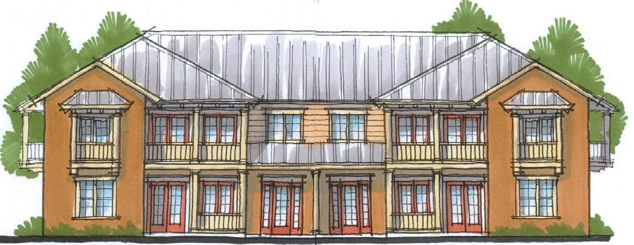
10 LOT CONDITIONS 90 LOT CONDITIONS COACH HOME LOT CONDITIONS Ancillary Building Zone 90 Lot Conditions 90 Lot Building Placement Coach Lot Conditions Coach Lot Building Placement 10
11 KEY ADDRESSES


12 KEY ADDRESSES KEY ADDRESSES The Master Plan for Restoration creates a rich and meaningful place that is expansive in its natural wilderness, open spaces, commercial uses, civic areas and housing offerings. It is, in reality, a contemporary extension of the existing cities of Edgewater and New Smyrna Beach where residents can live, work and play. In keeping with the vision, Restoration contains a variety of venues providing unique and valuable experiences to both residents and visitors, known as Key Addresses. The Key Addresses range from beautiful natural habitats, conservation areas and active neighborhood parks, to quaint residential streets and lively village and neighborhood centers. Restoration hosts a number of amenities and public places with enjoyable features that meet the needs of residents and the people within the surrounding communities. These amenities include athletic fields, a school site, town squares with retail and entertainment options, and an active bike path and trail. MASTER PLAN TO BE INSERTED HERE New Smyrna Beach Edgewater The public spaces, commercial districts, conservation areas and natural features exist in harmony with the residential addresses. Development has been sculpted to minimize negative environmental impacts while highlighting the opportunities that lie in the interplay between the natural and built environments. The result is a community made of exceptional key addresses that utilize the best features of the Master Plan. The amazing natural features, the valuable public spaces and the multitude of programmatic elements encourage residents to interact with each other and the environment. It is the key addresses of the Master Plan that give the neighborhoods an identity and a sense of place, provide a range of opportunities for a variety of interests and allow residents to build roots within the community. N 12


13 KEY ADDRESSES MEW ADDRESS The term mew originally applied to the service streets of London, lined with stables and servant quarters. During the eighteenth and nineteenth centuries, these addresses contained stables and carriage houses on the ground floors and servants living accommodations above. Over time, these service buildings were converted into flats and private homes, still overlooking the grassy, horse-oriented lanes. The popularity of these homes was brought to North America during the early twentieth century, and can be found in historic cities across the United States. Part of the open space network, the Mew Address contains houses that front on small, quiet open spaces an alternative to frontage on residential streets. In the Restoration Master Plan, the Mew Address serves the purpose of easily connecting residents to the community and the environment. This particular type of housing to open space interplay is celebrated in several locations throughout Restoration. Private houses and townhomes face onto public open space, which includes sidewalks and various park amenities. The entrances to these homes face the mew, while the garages are placed in the rear of the lot on a service way. The green streets of the mew address replace automobile pavement with usable open space, encouraging pedestrian connectivity to open spaces and the community s natural features. Mew Address Detail Plan Lots on the mew address face unique lot requirements. All houses must have primary entrances and facades facing the green space. Front yard setbacks and façade zones are primarily oriented toward the mew. Mews must always be a practical length, allowing all front entries to be visible from the abutting streets. Measuring mews in this way both allows visitors and deliveries easy access to the residential units and provides security to the most interior units. The mew itself contains a stabilized base that can support emergency vehicles if necessary. If onstreet parking is utilized, it can be located anywhere along the block. Mew Address Section Mew 13


14 KEY ADDRESSES NEIGHBORHOOD PARK ADDRESS Restoration has been designed to maximize the spaces between the buildings, making them feel as if they are an extension of the living space. Neighborhood parks are located throughout Restoration, as part of the larger open space network. The neighborhood parks act as important public gathering spaces, where families and individuals connect to each other and build roots within the community. Most residential units will be within a 1/4 of a mile from a park, turning the parks into active spaces as well as community building blocks. The neighborhood parks are valuable spaces, providing a range of activities and amenities for both active and passive recreation. In a traditional neighborhood setting, external public gathering spaces are critical to the welfare of the community. These spaces will be continually alive with activity, as people will choose to live close to the parks that provide amenities which they enjoy. Community gardens, picnic areas, tot lots, pavilions, dog parks, community pools and meeting halls will all be programmatic elements provided within the neighborhood park system. Neighborhood Park Address Detail Plan Neighborhood Park Address Section Street Amenity Center Street 14


15 KEY ADDRESSES WATERWAY ADDRESS Within Restoration s neighborhoods, waterways are valuable public amenities that provide pristine vistas, active recreational opportunities and connections to the natural environmental areas. Throughout the Master Plan, a variety of housing types and public spaces face onto the natural amenity provided by canals and lakes, allowing full access by both residents and visitors. Truly a unique and beautiful feature of the Restoration Master Plan, the waterways are also functional, providing opportunities for natural wildlife habitat found in the conservation areas. The waterway address offers experiences that not only enhance the lives of residents, but create an authentic sense of place. Waterway Address Detail Plan 15


16 KEY ADDRESSES NATURAL HABITATS & CONSERVATION AREAS One of the main themes of Restoration is providing a balance between the natural and human habitats. Restoring the integrity of the wetlands, plant life and wildlife are a top priority and the importance of the ecological systems that support life must be recognized. Part of fulfilling this goal is through the implementation of conservation easements and preservation areas. These natural areas will not only remain pristine and untouched, but will also be supported through the dedication of land towards conservation easements. Protected conservation areas and natural habitats are public amenities for the entire community. This address provides residents with the opportunity to enjoy natural vistas of the wetlands while safeguarding these sensitive areas from future development. The residential units that look onto conservation areas are the embodiment of the urban transect, where development patterns exist in harmony with environmental concerns and human beings are able to meaningfully interact with nature. Conservation easements are one of the most powerful and effective tools available for the permanent conservation of Florida s natural resources. As a legally binding agreement that prevents development from occurring in sensitive areas, the conservation easement serves to protect the beautiful, natural habitats that exist throughout Restoration. Many of the conservation easements occur at the rear setbacks of private lots. Great care should be taken in siting and landscaping homes along the conservation easements. The homes are pulled close to the street, with garages located near the main body of the house, allowing the natural vegetation to extend past the property boundary. The selection of landscaping and plant materials must coincide with the natural species, so that the transition from the rear yard to the easement is gradual. Homes should appear to rest thoughtfully within the landscape, as if the natural environment grew around the structure over a long period of time. Conservation Area Detail Plan Conservation Area Section Street Conservation 16


17 COMMUNITY AMENITY CENTER The following illustrates planning principles that guide the fevelopment of a community amenity center. Built with the most active families in mind, residents of Restoration will enjoy master planned recreational facilities, filled with outdoor activities as well as clubhouses with ample space for indulging a healthy and relaxing lifestyle. The amenity center will be a signature feature of the community, and residents will enjoy a fitness center, bathrooms, lockers, a multi-purpose room, business center and conference room. Surrounding the amenity center is a large park green, continuing the open space network that runs throughout the community. A variety of housing scales and types face onto the green, allowing direct access to the amenity center and the open space. The houses are served by a rear alley, providing access and parking. Community Amenity Center Detail Plan Amenity Center Section Street Amenity Center Street 17


18 KEY ADDRESSES TRAIL ADDRESS What would it take for all Americans to be able to go out their front doors and within fifteen minutes be on trails that winds through their cities, towns, or villages and brings them back without retracing steps? Along the way they could pass shops and restaurants, go to work, school or a park, visit an historic site or a zoo, and experience the great outdoors without car or bus. -Nation Park Service, 1990 At Restoration, the preservation of wildlife and the restoration and preservation, is the foremost theme for the entire development. 60 percent of the site will be dedicated to this vision. A hierarchy of trails, each with its own character and experience will provide people convenient access to these habitats with the opportunity for recreation, exercise, transportation, learning, relaxation, and communion with nature. Three types of trails will be available to serve the needs of the people with different interests and who enjoy different types of outdoor activity: Exercise and Travel Trails, Nature Trails, and Destination Trails. communities will have several Nature Trails to ensure easy access for all residents. The trails also provide an opportunity for light exercise and for outdoor education programs. This trail system will allow people to walk out their front doors and in minutes be enjoying the restored natural ecosystems and native wildlife that give Restoration its name. Destination Trails The Destination Trails will provide people the opportunity to visit some of the unique natural features of the Restoration project site. These trails may take visitors to see an ancient specimen tree. When visitors arrive at their destination, an informational kiosk will provide them with biologically and historically interesting facts about the natural phenomenon they are observing. While enroute to the destination, visitors will enjoy a relaxing stroll along a nature trail winding through the restored natural systems of Restoration. These Destination Trails will provide an excellent opportunity for environmental educational and highlight some interesting aspects of the conservation areas. Exercise and Travel Trails Exercise and travel trails in the Restoration community will be designed for bikers, roller-bladers, joggers or anyone who needs a level, consistent path. As their name implies, these trails will serve two primary purposes; exercise opportunities in a safe and park-like setting and the opportunity to travel on foot or bike throughout the area while enjoying nature. The system will form a loop connecting all five development areas and running alongside the main roads. The exercise and travel trails system will allow people to enjoy exercising outdoors while traveling within or between communities and amenities without ever having to start the engine of an automobile. Nature Trails The Nature Trails will give people the opportunity to stroll through the restored natural ecosystems of Restoration and to enjoy observing the native wildlife and plants found in these conservation areas. The primary purpose of these unimproved trails is to offer walks that give people the opportunity to enjoy the natural beauty of Florida from trail heads located within a short walk of their front door. Many of the five Trail Address Detail Plan 18
ELK GROVE GENERAL PLAN VISION
 2-1 CHAPTER 2: 2-2 CREATING OUR The Community Vision for Elk Grove, expressed through a Vision Statement and a series of Supporting Principles, is a declaration of the kind of community that Elk Grove
3.1 community vision. 3.3 required plan elements
 Chapter 3 Community Form 3.1 community vision 3.2 Parks & landscaping concepts 3.3 required plan elements D R A F T 20 Community Form Chapter 3 3.0 Community form 3.1 community vision The Specific Plan
Nader Obied Abd al raheem hathat. Dr. Farid S. Al-Qeeq
 Submit from Nader Obied Abd al raheem hathat Submit to Dr. Farid S. Al-Qeeq DEC. 2010 NEW URBANISM : is the most important planning movement this century, which emerged during the late 1980s and early
B L A C K D I A M O N D D E S I G N G U I D E L I N E S for Multi-family Development
 B L A C K D I A M O N D D E S I G N G U I D E L I N E S for Multi-family Development Adopted June 18, 2009 This section of the Design and focuses on site planning and design guidance for new multi-family
Behnke Ranch Property, Pasco County: Master Plan Development Approach
 February 24, 2014 , Pasco County: Master Plan Development Approach Location & Program The (Legacy PUD) is located in southwest Pasco County along State Road 54 approximately 1.5 miles west of the Suncoast
Neighborhood Districts
 NEIGHBORHOOD DISTRICTS SEVEN MAIN DISTRICTS Neighborhood Districts While the Development Plan provides a broad-scale overview of the neighborhood, this section focuses on uses and relationships at the
Policies and Code Intent Sections Related to Town Center
 Policies and Code Intent Sections Related to Town Center The Town Center Vision is scattered throughout the Comprehensive Plan, development code and the 1994 Town Center Plan. What follows are sections
Improve Neighborhood Design and Reduce Non Point Source Water Pollution
 HOW TO Planning Guide Improve Neighborhood Design and Reduce Non Point Source Water Pollution This document was funded by a grant from the New Hampshire Coastal Program with funding from the National Oceanic
Throughout. square. (Crystal City Vision Plan 2050)
") 1: Terms related to the PSMP document 1 public space (see also public realm, civic space) An open space designated on the regulating plan, accessible to all, including Plazas, Mini Parks, and Neighborhoods
1: Terms related to the PSMP document 1 public space (see also public realm, civic space) An open space designated on the regulating plan, accessible to all, including Plazas, Mini Parks, and Neighborhoods
GUIDING PRINCIPLES IN THIS CHAPTER
 GUIDING PRINCIPLES The guiding principles and design concepts in this chapter work together with the Chapel Hill 2020 Comprehensive Plan to support new public places that can be enjoyed by all while also
URBAN DESIGN BRIEF. 2136&2148 Trafalgar Road. Town of Oakville
 URBAN DESIGN BRIEF 2136&2148 Trafalgar Road Town of Oakville Prepared By: METROPOLITAN CONSULTING INC For 2500674 Ontario Inc November 2016 TABLE OF CONTENTS Page No. 1.0 Introduction/Description of Subject
New-Cast Mixed-use Development Proposal King Street West, Newcastle, Ontario
 URBAN DESIGN BRIEF New-Cast Mixed-use Development Proposal King Street West, Newcastle, Ontario TABLE OF CONTENTS: 1.0 Executive Summary 2.0 Creating Vibrant and Sustainable Urban Places: Excerpts from
5.1 Site Plan Guidelines
 5. Community Core Guidelines Development of the Community Core will take place by plan of subdivision and site plan approval. It will occur in a phased manner that will reflect the timing of residential
New Street Proposed Redevelopment Architecture & Urban Design Brief
 2130 2136 New Street Proposed Redevelopment Architecture & Urban Design Brief Prepared By: Cynthia Zahoruk Architect Inc. 3077 New Street, Burlington, ON, L7N 1M6 TABLE OF CONTENTS Background and Objective
Ivywild On The Creek PRELIMINARY CREEK DISTRICT MASTER PLAN
 Ivywild On The Creek PRELIMINARY CREEK DISTRICT MASTER PLAN Introduction: Rejuvenating an extraordinary Creekside neighborhood THE CREEKSIDE DISTRICT The Ivywild On The Creek Neighborhood District Master
Metro. Activity Center Design Guidelines. Recommendations For Developing Focused, Mixed-Use Commercial/Residential Centers
 Metro Activity Center Design Guidelines Recommendations For Developing Focused, Mixed-Use Commercial/Residential Centers Metro Activity Centers What is a MAC? Legacy, the adopted guide for the future growth
Lehigh Acres Land Development Regulations Community Planning Project
 Lehigh Acres Land Development Regulations Planning Effort Summary In July, 2010 Commissioner Frank Mann invited the Lehigh Acres community to start discussing how to achieve their recently adopted community
Arlington, Virginia is a worldclass
 EXECUTIVE S U M M A RY Arlington maintains a rich variety of stable neighborhoods, quality schools and enlightened land use policies, and received the Environmental Protection Agency s highest award for
East Bayshore Road Neighbourhood
 East Bayshore Road Neighbourhood Northridge Property Management Urban Design Brief 3195 East Bayshore Road City of Owen Sound January 2016 East Bayshore Road Neighbourhood Northridge Property Management
II. SINGLE FAMILY RESIDENTIAL
 II. SINGLE FAMILY RESIDENTIAL Castle Rock is made up of numerous individually built houses and subdivision tracts that have been developed during the past century. Some of the tracts are diverse in architectural
4 C OMMUNITY D ISTRICTS
 4 C OMMUNITY D ISTRICTS N ew development in the Area will include many different types of land uses, including a destination retail area that attracts people from all over the region; recreation opportunities
DRAFT. 10% Common Open Space
 % OF CHARLOTTE IS CATEGORIZED AS A. LAND USES : Placeholder map displaying location of Place Type GOALS: Accommodate XX% of future growth. Provide a concentration of primarily commercial and civic activity
178 Carruthers Properties Inc.
 178 Carruthers Properties Inc. Planning Rationale for 178 Carruthers Avenue Site Plan Control Application June 2014 Table of Contents 1.0 Introduction 2.0 Overview of Subject Property 3.0 Current Zoning
Planned Residential Neighborhoods Land Use Goals
 Planned Residential Neighborhoods Land Use Goals Issue: Guidelines that provide for diverse high quality residential areas that include a variety of housing styles and layouts are needed. Goal 1: Create
Clair-Maltby Community visioning
 Clair-Maltby Community visioning workshop #1 Summary April 27th, 2017 Table of Contents INTRODUCTIon 1 PURPOSE 1 CONSULTATION STRUCTURE 2 PARTICIPANT FEEDBACK 3 VISIONING EXERCISE 8 ONLINE SURVEY RESULTS
URBAN DESIGN BRIEF URBAN DESIGN BRIEF 721 FRANKLIN BLVD, CAMBRIDGE August 2018
 URBAN DESIGN BRIEF URBAN DESIGN BRIEF 721 FRANKLIN BLVD, CAMBRIDGE August 2018 DESIGN BRIEF CONTENTS PART A 1.0 INTRODUCTION 2.0 DESCRIPTION & ANALYSIS OF SITE CONTEXT 3.0 DESIGN CONSTRAINTS AND OPPORTUNITIES
The Village. Chapter 3. Mixed Use Development Plan SPECIFIC PLAN
 The Village SPECIFIC PLAN Chapter 3 3.1 INTRODUCTION 3.1.1 Purpose This Chapter describes the development regulations applicable to the Mixed-Use and Transit Center Planning Areas. These form-based regulations
Unique. Livable. Connected. Sustainable. Anticipate and Manage Change. Variety of Housing Choices. Enhanced Arterial Corridors
 Neighborhood Vision The Old Town Neighborhoods are Unique, Livable, Connected, and Sustainable. As mature, established neighborhoods, many of the ideas and opportunities expressed by stakeholders in support
AMITY STATION Revised Concept Plan Review West Rosemary Street Chapel Hill, NC September 27, 2016
 AMITY STATION Revised Concept Plan Review West Rosemary Street Chapel Hill, NC September 27, 2016 DEVELOPER'S PROGRAM Introduction This is a request for review of a Revised Concept Plan by Chapel Hill
RESIDENTIAL DISTRICTS
 RESIDENTIAL DISTRICTS The residential district standards have been revised to reflect on-the-ground conditions, while continuing to respect the use patterns established within the neighborhoods. This will
EXISTING COMPREHENSIVE PLAN
 EXISTING COMPREHENSIVE PLAN Town Center Land Use Element: V. LAND USE POLICIES Town Center Mercer Island's business district vision as described in "Your Mercer Island Citizen-Designed Downtown" was an
SQUAMISH 2010 AND BEYOND COMMUNITY VISION
 Our plan has been imagined and created to be both pragmatic and visionary. At the core of the strategy is a consideration of the highway s role and its impact on the community. First and foremost in creating
Port Lavaca Future Land Use
 Port Lavaca Future Land Use Introduction The City of Port Lavaca is beginning to see sustained growth, after many years of relative stable population. New single family homes, apartments, and businesses
V. Vision and Guiding Principles
 V. Vision and Guiding Principles The Master Plan for the Powers Ferry Corridor seeks a foundation in the desires of the community. At times, various elements of the community offered opposing viewpoints,
Complete Neighbourhood Guidelines Review Tool
 Complete Neighbourhood Guidelines Review Tool Prepared By: City of Regina Planning Department October 2014 Page 1 of 14 Community Development Review Checklist for Secondary Plans and Concept Plans The
2.0 THE PLATINUM TRIANGLE VISION
 2.0 THE PLATINUM TRIANGLE VISION The envisions an exciting future for the area surrounding Angel Stadium of Anaheim, the Honda Center and The Grove of Anaheim. 2.1 Planning Principles In order to further
PUBLIC PARKS AND FACILITIES, SERVING NEIGHBORHOOD RECREATIONAL AND COMMUNITY EVENTS BUILDINGS BUILT TO THE LINE AND ORIENTED TOWARD THE STREET
 BUILDINGS BUILT TO THE LINE AND ORIENTED TOWARD THE STREET PUBLIC PARKS AND FACILITIES, SERVING NEIGHBORHOOD RECREATIONAL AND COMMUNITY EVENTS CONNECTED & COMPLETE STREETS AND STREET GRID VIEW SHEDS GROUND
City of Farmington. Downtown Plan. Amendment to the 1998 Master Plan Adopted October 11, 2004
 City of Farmington Amendment to the 1998 Master Plan Adopted October 11, 2004 Introduction Planning Background 1 Scope and Components of the Plan Amendment 2 Concept Introduction 3 Plan Concepts 3 Conceptual
MIXED-USE VILLAGE OVERLAY FLOATING DISTRICT
 MIXED-USE VILLAGE OVERLAY FLOATING DISTRICT Zoning regulations developed by committee to the Planning Board for the Town of DeWitt, NY Issue date: 13 July 2017 revised 3/12/2018, revised 4/26/2018, 5/9/2018
Wide asphalt driveway abutting school property. garage built with incompatible materials, too close to park. incompatible fencing materials
 Wide asphalt driveway abutting school property incompatible fencing materials garage built with incompatible materials, too close to park Lack of plantings as a buffer between private property and open
Calumet Town of New Market, Frederick County Maryland
 Community Design Guidelines Bowman Consulting Group, Ltd. - October 2015 Community Founders: Survey, Engineering and Environmental Miller and Smith Bowman Consultingn Group, Ltd. 8401 Greensboro Drive,
SECTION IV: DEVELOPMENT CONCEPT
 80 SECTION IV: DEVELOPMENT CONCEPT Section IV: DEVELOPMENT CONEPT This section provides an overall understanding and rationale for what is envisioned in The Preserve, the intended quality and character
Aesthetics and Design
 University of Connecticut Department of Geography Urban and Regional Planning Lecture 8. Adjunct Lecturer: Donald J. Poland, MS, AICP E-mail: don@donaldpoland.com Web: www.donaldpoland.com Aesthetics and
Chapter 6: Community Character
 Chapter 6: Community Character The term "community character" covers a broad spectrum of concerns. First and foremost, community character is a visual concept. In Long Grove, however, community character
2040 LUP is a part of the Comprehensive Plan and carries the same legal authority. Economic Challenges
 1.1. Guiding Anchorage s Growth Where will new residents settle over the next two decades? Where will people work, shop, and play? Will there be enough room to grow? How will Anchorage look? Will growth
Town Center (part of the Comprehensive Plan)
") Town Center (part of the Comprehensive Plan) Mercer Island Town Center Looking North (2014) In 1994, a year-long process culminated in a set of design guidelines and code requirements for the Town Center
Town Center (part of the Comprehensive Plan) Mercer Island Town Center Looking North (2014) In 1994, a year-long process culminated in a set of design guidelines and code requirements for the Town Center
CHAPTER 3 VISION, GOALS, & PLANNING PRINCIPLES. City of Greensburg Comprehensive Plan. Introduction. Vision Statement. Growth Management Goals.
 CHAPTER 3 VISION, GOALS, & PLANNING PRINCIPLES Introduction The Greensburg Comprehensive Plan is intended as a working community document. A combination of long and short-term goals, this document is intended
Welcome to the Neighborhood! COPPERLEAF NEIGHBORHOOD GUIDE
 Welcome to the Neighborhood! COPPERLEAF NEIGHBORHOOD GUIDE 2017 At Copperleaf, feeling at home just comes naturally. Not surprising when you take a look around at the abundance of resources we offer to
HE VISION. Building a Better Connected Place
 HE VISION Building a Better Connected Place WALK INTO THE FUTURE. Life in Cranberry, 2030 Here s what our residents told us they wanted to see in their community by 2030: The Cranberry of 2030 is a place
Westwind Developments Ltd. PIONEER LANDS AREA STRUCTURE PLAN - PROPOSED AMENDMENT
 FEBRUARY 2013 TABLE OF CONTENTS 1.0 BACKGROUND... 1 1.1 Amendment... 1 2.0 LOCATION & CONTEXT... 2 2.1 Land Ownership... 2 3.0 POLICY CONTEXT... 3 3.1 Municipal Development Plan... 3 3.2 Capital Region
INSTITUTIONAL USE DESIGN COMPATIBILITY TECHNIQUES
 INSTITUTIONAL USE DESIGN COMPATIBILITY TECHNIQUES INTRODUCTION Community institutions are an important part of the character and vitality of neighborhoods in Forsyth County. Institutional uses include
PROPOSED REDEVELOPMENT OF THE GLEN ABBEY GOLF CLUB. STREETSCAPE DESIGN STUDY (excerpt from the Urban Design Brief) TOWN OF OAKVILLE.
 TOWN OF OAKVILLE.") PROPOSED REDEVELOPMENT OF THE GLEN ABBEY GOLF CLUB STREETSCAPE DESIGN STUDY (excerpt from the Urban Design Brief) TOWN OF OAKVILLE OCTOBER, 2016 for 2.4.2 STREETS Streets are the single largest component
PROPOSED REDEVELOPMENT OF THE GLEN ABBEY GOLF CLUB STREETSCAPE DESIGN STUDY (excerpt from the Urban Design Brief) TOWN OF OAKVILLE OCTOBER, 2016 for 2.4.2 STREETS Streets are the single largest component
4.1.3 LAND USE CATEGORIES
 4.1.3 LAND USE CATEGORIES a. City Center District The City Center District incorporates the existing character and mix of uses in downtown Belmont to encourage redevelopment and new development in keeping
Figure 3-1: Public Realm Plan
 3 Public Realm Figure 3-1: Public Realm Plan 3.1 Public Realm Concept The public realm concept for the Little Mountain site integrates a clear and accessible movement network with public spaces for social
EXISTING TOWNHOUSE. What s working & What s not?
 What s working & What s not? Distance from the sidewalk/street to the building Landscape vs. Hardscape in front of the building Porches, stoops, steps, and entries Residential vs. contemporary character
Chapter 6--Urban Design
 6.1 Introduction... 6-1 6.1.1 Background & Scope... 6-1 6.1.2 Relationship to State Law... 6-2 6.1.3 Relationship to Other General Plan Chapters... 6-2 6.2 Guiding Principles... 6-2 6.3 Urban Design Guidelines...
4- PA - LD - LIVELY DOWNTOWN. LD - Background
 4- PA - LD - LIVELY DOWNTOWN LD - Background The downtown has been the service centre for the community since the city s inception and the area continues to supply people with their personal services,
DRAFT Land Use Chapter
 Stevens Creek Urban Village DRAFT 1 18 17 Land Use Chapter INTRODUCTION This Land Use Chapter describes how the Stevens Creek Urban Village will accommodate the growth that is planned for it in the Envision
North Oakville East Parks Facilities Distribution Plan. November, 2009
 North Oakville East November, 2009 POLICY CONTEXT 1) Purpose a) The purpose of this document is to be a guide for the location, configuration, design and development of the parks system for the North Oakville
Shared Principles and Emerging Plan Directions
 Shared Principles and Emerging Plan Directions Introduction Since the Fairfield Neighbourhood planning process launched in June 2016, we have heard from many residents, businesses, groups and other people
CHAPTER 7: Transportation, Mobility and Circulation
 AGLE AREA COMMUNITY Plan CHAPTER 7 CHAPTER 7: Transportation, Mobility and Circulation Transportation, Mobility and Circulation The purpose of the Transportation, Mobility and Circulation Chapter is to
A citizen s guide to the. Comprehensive Plan. City of Lakeville, Minnesota 1
 A citizen s guide to the Comprehensive Plan 2008 City of Lakeville, Minnesota 1 Introduction The City of Lakeville completed an update of its Comprehensive Plan in 2008. A comprehensive plan is a tool
City of Heath. Town Center Concept
 In the give-and-take of getting projects designed, financed, and approved, the famous refrain from the film Field of Dreams is heard often: if you build it, they will come. From the perspective of the
for Master Planned Development Framework Design Standards & Guidelines
 B L A C K D I A M O N D DE S I G N G U I D E L I N E S for Master Planned Development Framework Design Standards & Adopted June 18, 2009 Introduction and Purpose The Master Planned Development (MPD) Framework
EAST QUADRANT INTRODUCTION TRANSECT THEORY DRAFT IN PROGRESS
 EAST QUADRANT THE TRANSECT AND THE FORM-BASED CODING RURAL I I I I I I I I I I TRANSECT I I I I I I I I I I URBAN NATURAL TRANSECT ZONES URBAN TRANSECT ZONES T1 NATURAL T3 SUB-URBAN T2 RURAL DISTRICTS
LOW DENSITY RESIDENTIAL
 LOW DENSITY RESIDENTIAL Corner lots with coach houses to increase diversity, provide unity to the streetscape and increase eyes on the street. Garages and ancillary units accessed via rear lanes. Parking
Subarea 4 Indian Creek. Vision The combination of park networks and transportation amenities make Subarea 4 the greenest hub in the Corridor.
 indian creek 180 extends south from 101st Street to I-435. The I-435 and Metcalf intersection is one of the primary intersections in the Kansas City Metro Area. The area includes several residential neighborhoods
Section 9 NEIGHBORHOOD DESIGN
 Section 9 NEIGHBORHOOD DESIGN City of Lancaster Comprehensive Plan D u n k i n, S e f k o & A s s o c i a t e s, I n c. NEIGHBORHOOD DESIGN INTRODUCTION There are many ways in which a neighborhood can
6. BUILDINGS AND SPACES OF HUMAN SCALE
 The Neighborhood Model: Building Block for the Development Areas Design Approaches 79 6. BUILDINGS AND SPACES OF HUMAN SCALE There are many elements of buildings and spaces that contribute to the creation
Economy Vision Statements: Social Wellbeing Vision Statements: Natural Environment Vision Statements:
 Economy Vision Statements: 1. Our business environment makes us a region of choice for new employers as we encourage entrepreneurship and have a vibrant, diversified and resilient regional economy. 2.
Courthouse Square Planning & Urban Design Study. Courthouse Square Working Group #13 October 15, 2014
 Courthouse Square Planning & Urban Design Study Courthouse Square Working Group #13 October 15, 2014 1 Courthouse Square Process Working Group Community Courthouse Square Advisory Groups & Civic Associations
IMAGINE CLEARWATER. Community Workshop 3. November 2016
 IMAGINE CLEARWATER Community Workshop 3 November 2016 Imagine Clearwater has been a 6-month community-focused process to re-envision the downtown waterfront. VISIONING FRAMEWORK MASTER PLAN HOW CAN WE
BROOKHILL NEIGHBORHOOD MODEL ZONING MAP AMENDMENT PREFACE TO APPLICATION
 BROOKHILL NEIGHBORHOOD MODEL ZONING MAP AMENDMENT PREFACE TO APPLICATION June 15, 2015 Revised: August 1, 2016 I. VISION Brookhill is a proposed community based upon the principles of Albemarle County
Colchester Northern Gateway Master Plan Vision Review Draft. July 2016
 Colchester Northern Gateway Master Plan Vision Review Draft July 2016 Contents Introduction 4 Context 8 Purpose of the Report 8 Strategic Position 9 Overview of the Process 11 2012 Master Plan Vision 12
Dwelling Units Max 12 dwelling units per acre/min 8 dwelling units per acre. Development Mix 80% non residential/20% residential
 13. OSTEEN LOCAL PLAN Background: The Osteen Local Plan area is located in southwest Volusia County along the SR 415 corridor between Lemon Bluff Road and Acorn Lake Road and includes 3,990 acres. The
2136 & 2148 Trafalgar Road Town of Oakville Region of Halton
 PLANNING JUSTIFICATION REPORT 2136 & 2148 Trafalgar Road Town of Oakville Region of Halton Zoning By-Law Amendment Application 2500674 Ontario Inc. November 2016 Table of Contents Page 1.0 Location/Summary
PORT WHITBY COMMUNITY
 PORT WHITBY COMMUNITY SECONDARY PLAN UPDATE COMMUNITY IMPROVEMENT PLAN URBAN DESIGN GUIDELINES September 2015 DRAFT PROPOSED AMENDMENT NUMBER # to the Whitby Official Plan PURPOSE: The intent of this Amendment
FLORIN ROAD CORRIDOR Site Plan and Design Review Guidelines Checklist
 FLORIN ROAD CORRIDOR Site Plan and Design Review Guidelines Checklist Applicant s Name: Project Address: Phone: Email: Applicant shall fill out the design guidelines checklist for all guidelines applicable
Living in Albemarle County s Urban Places
 Living in Albemarle County s Urban Places ALBEMARLE COUNTY, VIRGINIA A Closer Look at Albemarle s Approach to Managing Growth and Creating Quality Urban Environments www.albemarle.org Page 2 Living in
SECTION II SECTION II STATEMENT OF GOALS, OBJECTIVES, PRINCIPLES, ASSUMPTIONS, POLICIES AND STANDARDS
 STATEMENT OF GOALS, OBJECTIVES, PRINCIPLES, ASSUMPTIONS, POLICIES AND STANDARDS 1 2 STATEMENT OF GOALS, OBJECTIVES, PRINCIPLES, ASSUMPTIONS, POLICIES AND STANDARDS INTRODUCTION The New Jersey Municipal
Supplemental Design Guidelines
 Supplemental Design Guidelines 65 SUPPLEMENTAL DESIGN GUIDELINES As a supplemental reference to the project, the following diagrams are included to illustrate the site planning approaches that were followed
CITY OF KEIZER MASTER PLAN APPLICATION & INFORMATION SHEET
 CITY OF KEIZER MASTER PLAN APPLICATION & INFORMATION SHEET PRE-APPLICATION CONFERENCE Prior to the actual filing of a Master Plan application, it is strongly recommended that the applicant contact Planning
Re: 1110 Fisher Avenue Proposed Residential Development Revised Proposal File D PLANNING RATIONALE ADDENDUM
 October 23, 2014 Prestige Design & Construction 50 Camelot Drive Ottawa, ON K2G 5X8 Attention: Mr. Enzo DiChiara Dear Mr. DiChiara Re: 1110 Fisher Avenue Proposed Residential Development Revised Proposal
Silverdale Regional Center
 Silverdale Regional Center Vision for Silverdale Regional Center The Silverdale Regional Center Plan (Plan) will guide the evolution of the Silverdale Regional Center from a collection of strip malls and
[PLANNING RATIONALE] For Site Plan Control and Lifting of Holding Zone By-Law 101 Champagne Avenue. May 23, 2014
![[PLANNING RATIONALE] For Site Plan Control and Lifting of Holding Zone By-Law 101 Champagne Avenue. May 23, 2014](/thumbs/75/71599615.jpg "[PLANNING RATIONALE] For Site Plan Control and Lifting of Holding Zone By-Law 101 Champagne Avenue. May 23, 2014") [PLANNING RATIONALE] For Site Plan Control and Lifting of Holding Zone By-Law 101 Champagne Avenue May 23, 2014 Contents 1.0 Introduction... 2 2.0 Site Context... 2 2.1 Adjacent Uses... 2 Figure 1: Site
[PLANNING RATIONALE] For Site Plan Control and Lifting of Holding Zone By-Law 101 Champagne Avenue May 23, 2014 Contents 1.0 Introduction... 2 2.0 Site Context... 2 2.1 Adjacent Uses... 2 Figure 1: Site
10.0 Open Space and Public Realm
 10.0 Open Space and Public Realm 10.0 Open Space and Public Realm The Public Open Space System is comprised of: outdoor spaces available for public use that are either publicly owned (e.g., parks and
DALY CITY VISIONING PROCESS COMMUNITY WORKSHOP 3 MAY 8, 2008
 DALY CITY VISIONING PROCESS COMMUNITY WORKSHOP 3 MAY 8, 2008 PROCESS General Plan - a statement of the community s values, vision and aspirations for now and into the future... Timeframe LONG TERM - 2030
The Vision. Photo provided by The Minervini Group. 46 Vision, Objectives & Strategies
 Vision, Objectives & Strategies The is the public framework and guide for future development of the Grand Traverse Commons. The establishes public polices for infrastructure, the preservation of natural
Staff Report to the North Ogden City Planning Commission
 Staff Report to the North Ogden City Planning Commission SYNOPSIS / APPLICATION INFORMATION Application Request: Concept review on a legislative application to rezone land located at approximately 1750
IMAGE AND DESIGN. Guiding Principles
 Building competitive cities means building more than just places to live and work. It s about creating places that inspire, places with character, places that draw people with a personal sense of identity.
Wasatch CHOICE for 2040
 Wasatch CHOICE for 2040 Economic Opportunities We Can Choose a Better Future We enjoy an unparalleled quality of life along the Wasatch Front. People from all over the world are drawn to our stunning scenery,
Heart of the Triad A Dynamic Plan for the Future. Steering and Technical Meeting April 27, 2006
 Heart of the Triad A Dynamic Plan for the Future Steering and Technical Meeting April 27, 2006 The Week in Review Specific Group Findings There Was Uniform Agreement the Time Was Right Growth is Imminent
The Village at Loomis. Long-Envisioned A Wonderful Place to Call Home
 at Loomis Long-Envisioned A Wonderful Place to Call Home The Vision Implementing the Town s Plans and Goals Years ago, the Town established the vision for The Village at Loomis in plans and EIRs approved
CONTENTS 8.0 LAND USE 8.1 GENERAL LAND USE 8.2 RESIDENTIAL 8.3 MIXED USE 8.4 COMMERCIAL 8.5 EMPLOYMENT LANDS
 8-2 Land Use 8.0 LAND USE CONTENTS 8.1 GENERAL LAND USE 8.1.1 Uses provided for in all Land Use Designations 8.1.2 Uses prohibited in Hazardous Lands, Hazardous Sites and Special Policy Areas 8.1.3 Uses
TRANSIT ORIENTED DEVELOPMENT PINELLAS COUNTY MPO LIVABLE COMMUNITIES INITIATIVE PINELLAS COUNTY COMPREHENSIVE PLAN AMENDMENTS
 PINELLAS COUNTY MPO LIVABLE COMMUNITIES INITIATIVE MODEL LAND DEVELOPMENT CODE TRANSIT ORIENTED DEVELOPMENT PINELLAS COUNTY COMPREHENSIVE PLAN AMENDMENTS MPO Livable Communities Initiative Goal: Improve
ELMVALE ACRES SHOPPING CENTRE MASTER PLAN
 ELMVALE ACRES SHOPPING CENTRE MASTER PLAN Contents 1.0 INTRODUCTION... 2 2.0 LOCATION... 2 3.0 EXISTING CONTEXT... 2 4.0 VISION & GUIDING PRINCIPLES... 2 5.0 LAND USE AND BUILT FORM... 4 5.1 St. Laurent
Sahuarita District & Phase 1 Master Plan. Town Council December 11, 2017
 Sahuarita District & Phase 1 Master Plan Town Council December 11, 2017 Visioning Study Visioning Process Advisory Group Meetings Community Questionnaire Town Center Case Studies Community Analysis The
E. RURAL COMMERCIAL/INDUSTRIAL PARK MODEL
 E. RURAL COMMERCIAL/INDUSTRIAL PARK MODEL 1. PURPOSE The purpose of the Rural Commerce/Industrial Park Model is to provide parameters within which a grouping of business buildings with parking, loading
FORMER CANADIAN FORCES BASE (CFB) ROCKCLIFFE SECONDARY PLAN. Official Plan Amendment XX to the Official Plan for the City of Ottawa
 ROCKCLIFFE SECONDARY PLAN. Official Plan Amendment XX to the Official Plan for the City of Ottawa") FORMER CANADIAN FORCES BASE (CFB) ROCKCLIFFE SECONDARY PLAN Official Plan Amendment XX to the Official Plan for the City of Ottawa 1 INDEX THE STATEMENT OF COMPONENTS PART A THE PREAMBLE PAGE Purpose...
FORMER CANADIAN FORCES BASE (CFB) ROCKCLIFFE SECONDARY PLAN Official Plan Amendment XX to the Official Plan for the City of Ottawa 1 INDEX THE STATEMENT OF COMPONENTS PART A THE PREAMBLE PAGE Purpose...
REPORT BACK BROADSHEET 3 May 2016
 Paddington Place REPORT BACK BROADSHEET May 06 Architects and planners should work with the community first and then thinking about developers profits second. - Quote from participant at Paddington Place