Defusing Landowner/Conservation Conflicts:
|
|
|
- Clifton Floyd
- 6 years ago
- Views:
Transcription
1 Defusing Landowner/Conservation Conflicts: Protecting Habitat for Endangered Species and Other Wildlife with Conservation Design MACC Annual Environmental Conference March 2, 2013 E. Heidi Ricci Senior Policy Analyst Mass Audubon Eve N. Schluter Endangered Species Review Biologist Mass Natural Heritage and Endangered Species Program

2 Shaping the Future of Your Community Outreach and Assistance Program Helping communities understand, adopt and implement tools and techniques for smart growth and sustainable development

3 Development and Conservation can occur at the same time if your community s bylaws allow it! Open Space Design provides flexibility that reduces conflicts between landowner development interests and protection of natural resources such as rare species habitat, wetlands and waterways, and forests and farmlands.


4 April 13, 2009 Losing Ground: Beyond the footprint

5 Land Use Change

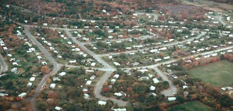
6 Bigger Houses on Bigger Lots = More Sprawl 47,000 acres of natural land was developed between % of the land lost was due to residential development Kathy Sferra


7 Costs of Sprawl Infrastructure maintenance: - Pavement maintenance - Stormwater Long commutes, shopping trips Energy intensive Community and quality of life issues Water quality and recharge Loss of forests and farmlands


8 Residential Development & Habitat Loss

9 Will the Expanding Cycle of Sprawl Repeat Again?

10 You get what you zone for Boards Must Issue Permits if a Project Meets Minimum Requirements

11 Three Main Planning Tools in a Community: Master Plans Open Space Plans Zoning Maps and Regulations


12 Open Space Planning Focus land conservation on areas most critical for long-term persistence of rare and other native species, exemplary natural communities and a diversity of ecosystems Align local plans and zoning Look beyond parcel and municipal boundaries Protect the biodiversity of MA in the context of projected effects of climate change.

13 Charting a More Sustainable Approach Prioritize Protection: Important habitat and Green Infrastructure Prioritize Development: Concentrate near infrastructure and away from important natural resources Regional Plans Toolkit for Implementing Priority Protection Areas Priority Development Areas


14 Charting a More Sustainable Approach Protect important land and water resources through zoning and regulations - Don t have to buy all the open space that needs protection - Provides landowner with more flexibility - Attractive and marketable results

15 Traditional Cookie-cutter Subdivision Design Driven by dimensional requirements e.g. minimum lot size, frontage, setbacks Result is geometric configuration of lots irrespective of natural features and consuming nearly entire property

16 1. Identify Conservation Value Areas. Remove these from the developable area.

17 2. Place houses in the remaining area in a way that would maximize residents enjoyment of these areas by providing access to open space and preserving views.

18 3. Align roads and trails on the site to provide pedestrian and vehicle access.

19 4. Draw lot lines around the homes.
20 Open Space Design Saves $$ - while enabling both development and conservation to work in harmony Decreasing the necessity for and cost of installing and maintaining conventional infrastructure Decreases site development costs by designing with the terrain Higher property values resulting from the increased site amenities including open space, views, and preservation of historic resources
21 Massachusetts Division of Fisheries & Wildlife Natural Heritage & Endangered Species Program A Division of the Department of Fish and Game in the Executive Office of Energy and Environmental Affairs


22 Massachusetts Natural Heritage & Endangered Species Program (NHESP) Established in Part of the Massachusetts Division of Fisheries & Wildlife since 1983 Protection of the state s native biological diversity Highest priority: state-listed rare species Rare Species Bridle Shiner - SC Karsten Hartel 176 animals 256 plants Purple Milkweed - E Species officially listed as: Endangered Threatened Special Concern

23 NHESP Conservation Tools: Land Protection Plan and select land for protection by the Division of Fisheries & Wildlife Advise Conservation Partners, Towns, etc.


24 NHESP Conservation Tools: Habitat Management & Ecological Restoration Prescribed burning of fire-adapted habitats Invasive exotic plant removal Kampoosa Bog ACEC, Stockbridge Removing invasive exotic plants from rare limestone wetland
25 NHESP Conservation Tools: Education

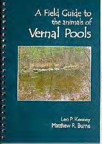
26 NHESP Conservation Tools: Data Management & Analysis Track current and historical observations of state-listed species, and watch-list species Maintain information on natural communities Maintain information on certified vernal pools Database contains thousands of geographically-referenced records
 Certified Vernal Pool (1996) Example of information contained in NHESP")
27 Blue-spotted Salamander SC (2006) American Bittern E (1990) Mystic Valley Amphipod Delisted (1997) Certified Vernal Pool (1996) Certified Vernal Pool (1996) Example of information contained in NHESP database


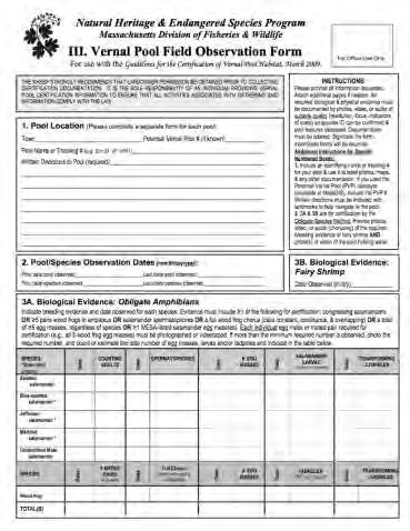
28 NHESP Data Submittal Forms

29 Online Vernal Pool/Rare Species Information System (VPRS) Set up User Profile Establish Electronic Signature Online mapping tools Manage and submit reports to NHESP Direct communication between User and NHESP

30 Mobile Application Allows basic information to be captured while in the field Android application
 MA Wetlands Protection Act (WPA) MA Environmental Policy Act (MEPA) MA Forest Cutting Practices")
31 NHESP Conservation Tools: Regulatory Review Review of proposed projects and activities for impacts to rare species under: MA Endangered Species Act (MESA) MA Wetlands Protection Act (WPA) MA Environmental Policy Act (MEPA) MA Forest Cutting Practices Regulations


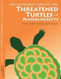
32 M.G.L. c. 131A. The MA Endangered Species Act (MESA) & 321 CMR MESA Regulations Prohibits take - means to harm, kill, disrupt the nesting, breeding, feeding or migratory activity. Disruption of nesting, breeding, feeding or migratory activity may result from, but is not limited to, the modification, degradation or destruction of Habitat. Defines Priority Habitat Outlines Priority Habitat Delineation Process


33 How do we delineate Priority Habitat? Example: Marbled Salamander (Ambystoma opacum) - T Observation Review by Biologist Acceptance into Database Map extent of possible habitat Refine mapping quality exclude development Bill Byrne
 is a sub-set of Priority Habitat; based on the geographical extent of habitat of statelisted rare wetlands wildlife (no plants); codified under the Wetlands Protection")
34 Review of Estimated & Priority Habitats Priority Habitat (PH) is the known geographical extent of habitat for all state-listed rare species, both plants and animals, and is codified under MESA Estimated Habitat (EH) is a sub-set of Priority Habitat; based on the geographical extent of habitat of statelisted rare wetlands wildlife (no plants); codified under the Wetlands Protection Act
 www.nhesp.")
35 How do I know if my property/project is in Estimated and/or Priority Habitat? Priority & Estimated Habitat maps available: NHESP Atlas, CD, online viewer, MassGIS Local Conservation Commission (EH) Responsibility of the land owner / project proponent to determine if within EH and/or PH

36 What does it mean if my property is in Estimated and/or Priority Habitat? Unless otherwise exempt, Projects or Activities need to be reviewed by NHESP pursuant to MESA (and WPA) Eastern Spadefoot Toad -T


37 NHESP Project Review Blanding s Turtle - T Project or Activity Species and Habitat NHESP Determination
 (FY12) Consult with NHESP staff to: Redesign project to avoid Take Redesign project to meet Conservation & Management Permit")
38 NHESP Responses under MESA No Take (~78.2%) Take avoided with conditions (~18.2%) Take (~3.6%) (FY12) Consult with NHESP staff to: Redesign project to avoid Take Redesign project to meet Conservation & Management Permit (CMP) standards New England Blazing Star- SC

39 If project = Take of state-listed species Can project meet standards for Conservation & Management Permit? Assessment of alternatives to minimize impacts Project will impact an insignificant portion of the local population Applicant agrees to carry out a Conservation & Management Plan than provides a long-term net-benefit to impacted species. 321 CMR Marbled Salamander -T

40 Net-benefit Conservation Plan Proportionate to harm Long-term net benefit to the conservation of the impacted species may include: On and/or off-site conservation restrictions to permanently protect rare species habitat On and/or off-site habitat restoration / management Scientific research designed to enhance conservation efforts to protect rare species Melsheimer s Sack Bearer Cincinnus melsheimeri Threatened Better off


41 Example Project Proposed commercial development on an approximately 92 acre parcel Within mapped Estimated & Priority Habitat for the Wood Turtle and the Eastern Box Turtle Photo by Mike Jones Photo by Liz Willey Wood Turtle Glyptemys insculpta Special Concern Eastern Box Turtle Terrapene carolina Special Concern

42 NHESP required habitat assessment

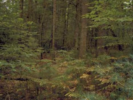
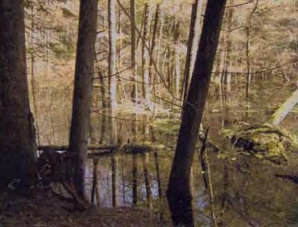
43 Good Habitat!


44 Original Proposal Proposal to develop approximately 60% of site (all of upland areas) Work within 200 Riverfront area and 100 Buffer Zone

45 Final Plan / Outcome No work within Riverfront Area & Buffer Zone Total disturbance = ~27 acres (30% of site); building envelopes Remaining area in a CR= ~ 65 acres Long-term management of ~ 10 acres of early successional fields; oversight by qualified biologist
46 Saving Land and Money Through Innovative Zoning: An Introduction to the State s the New Open Space Design / Natural Resource Protection Zoning Model Bylaw E. Heidi Ricci Mass Audubon Shaping the Future of Your Community Program With appreciation and credit to Kurt Gaertner Massachusetts Executive Office of Energy and Environmental Affairs For leadership in producing the model Open Space Bylaw and developing this presentation

47 47
48
49 Problems with many existing Open Space bylaws Open Space Design Best Practices New Model Special Permit Required Discretionary Process often cumbersome, long, & expensive Large parcel size requirements Insufficient amount of land protected Less than ideal land conservation Rigid dimensional standards By Right/Mandatory Formulaic and quick No minimum lot size [60%] of land area protected Strategic protection via Conservation Analysis & Findings Flexible Design Standards lot size, frontage, setbacks, roads, etc.

 Addresses process questions raised by the Wall Street v.")
50 New Model Open Space Design Bylaw/Ordinance Based on Natural Resource Protection Zoning Accompanied by subdivision regulations & special permit regulations for density bonuses and shared driveways Will replace the current OSRD model in EEA s Smart Growth/Smart Energy Toolkit Addresses problems with application of Cluster, OSRD, Conservation Subdivision zoning Formatted to be easily customized, though municipal counsel should be consulted Interaction with other local regulations must be considered (esp. Board of Health) Addresses process questions raised by the Wall Street v. Westwood decision

51

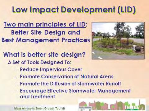
52 Subdivision Regulations Low Impact Development
53 Model Zoning Structure: Bracketed & highlighted text indicates a local choice Alternatives & guidance are provided in boxes and italicized Open Space Design shall mean a process for the development of land that: (a) calculates the amount of development allowed up-front by formula; (b) requires a Conservation Analysis to identify the significant natural, cultural, and historic features of the land; (c) concentrates development, through design flexibility and reduced dimensional requirements, in order to preserve those features; and (d) permanently preserves at least [sixty] percent of the land in a natural, scenic or open condition or in agricultural, farming or forest use. Alternative: [50-90%] Fifty percent is generally accepted as the minimum for Open Space Designs and similar zoning measures. Based on local circumstances - such as the nature of the natural resources to be conserved and the amount/pattern of existing development - communities should consider a range of [50-90%]. A percentage at the higher end of the range is often warranted to protect particularly sensitive natural resources or attain a prominent local conservation objective. The amount of open space applicants are required to protect can be varied by zoning district, as is done for required square footage per unit in the Unit Count Calculation section of this model zoning.

 0 Equals:")
54 Yield: Allowable Residential Units Units calculated by dividing the net acreage by the allowed density Net acreage calculation accounts for sitespecific development limitations Example Dwelling Units: Gross Project Area 100 Minus constrained land 32 Equals Net Project Area 68 Divided by required acreage (1 per 2 acres) Equals: Base # of Units 34 Preserved Land Land Area 100 Multiple by required percentage [60%] 60 Add additional land from bonuses (if any) 0 Equals: Minimum preserved land 60 acres


55 Practical & Political Considerations: Equity should be a consideration for political if not legal reasons o Yield (# of houses) under OSD vs. prior yield should be understood o Alright to reduce yield; unreasonable to build current zoned units in some communities o Zoning may not be the critical factor; other regulations may result in reduced yield OSD applied to <1 acre lots with individual lot well and septic a particular concern
56 Applicability: Allowed by right permitted via subdivision or site plan review Conventional subdivisions require special permit Local choice as to which districts and which housing types Can also be applied to non-residential development


![vehicular access [10] foot setback to property lines & [20] feet between principal](/docs-images/78/77723286/images/57-3.jpg "structures Enforcement: Monumentation clearly delineating the open space required to")
57 Dimensional Requirements: Goal: Make it as easy as possible to conserve land and natural resources by arranging units/lots in as unconstrained a manner as practicable No required minimum lot size, but water or wastewater needs or other regulations may limit No numerical frontage required, rather legally and practically adequate vehicular access [10] foot setback to property lines & [20] feet between principal structures Enforcement: Monumentation clearly delineating the open space required to ease enforcement
![Open Space: Permanently conserves [60%] of land area, must be contiguous to extent possible and based](/docs-images/78/77723286/images/58-0.jpg "on Conservation Analysis Protection under Article 97 or a permanent Conservation Restriction")
, conservation non-profit or state agency, conservation commission, or homeowners association")

58 Open Space: Permanently conserves [60%] of land area, must be contiguous to extent possible and based on Conservation Analysis Protection under Article 97 or a permanent Conservation Restriction Allowable and Prohibited Uses addressed in CRs Ownership options: private owner (e.g. farm), conservation non-profit or state agency, conservation commission, or homeowners association (HOA) o Unless held by the conservation commission a CR & access easement with inspection and enforcement provisions are required Maintenance standards included in permit; enforcement provision, including potential property tax lien


59 Open Space Plans should guide land conservation in subdivisions

60 Special Permit Provisions: Language provided for measures that can t be readily included in by-right zoning Density Bonuses Additional units for voluntary: Provision of public access to the open space; Construction of permanently affordable housing; Conservation of open space beyond that required; or Preservation of historic structures. Shared Driveways


61 Hopkinton - Olde North Mill Open Space & Landscape Preservation Development 34 lots on 100 acres 52% of the parcel protected


62 Bellingham - Woodbury Ridge 6 developed acres 10.4 protected acres LID stormwater practices Reduced impervious surfaces 1. OSRD Plan 1. Conventional Plan

63 Local Zoning & MESA Often difficult to achieve best possible outcome for rare species because of local zoning Types of challenges: Large minimum lot size Wide minimum road widths Double sidewalks Vertical curbing Tools such as OSD/OSRD can: Reduce habitat fragmentation & maintain connectivity Protect key habitat features
 Key Threats: habitat loss & degradation habitat fragmentation road mortality Original project proposal = fragmentation of large")
64 Example Project ~185 acre site with in Blanding s Turtle Habitat Habitat Requirements: variety of wetland & terrestrial habitats large tracts of land (travel long distances) Key Threats: habitat loss & degradation habitat fragmentation road mortality Original project proposal = fragmentation of large landscape

65 Before

66 Reduction of fragmentation emergency access rd Land Protection ~ 75 acres to Town ~ 70 acres in CR $60K conservation funding After

67 Note: fictitious example Example Project
68 Standard Plan - 12 houses, 30% open-space Open space Note: fictitious example
69 Good Conservation - 15 houses, 70% open-space Open space Note: fictitious example
70 Good Conservation through Habitat Protection Early Succ. +Shrub Matrix nesting Mixed or Deciduous Forest Note: fictitious example


71 Beyond Residential OSD principles can be applied elsewhere Larger community planning projects Industrial parks Green energy projects


72 Example Project ~218 acres within Bluespotted Salamander Habitat Habitat Requirements: vernal pools forested upland Key Threats: habitat loss & degradation habitat fragmentation road mortality Blue-spotted Salamander- SC
73 Final Plan/Outcome ~ 56 acres of new development ~30 acres for solar ~ 26 acres for future development (use?) Proposed net benefit: ~ 108 acres protected vernal pools ~22 acres credit Outcome allows for development & also protects rare species, habitats, and other natural resources
) Joint Town / Division MESA planning and review")

74 Town-Wide Comprehensive MESA Permits for Certain Municipalities (10.16(b)) Joint Town / Division MESA planning and review process Local mitigation bank and/or pre-permitting of building envelopes within designated development areas. Barrens Buck Moth - SC
 Try")
75 Final Thoughts for Rare Species Conservation Utilize available conservation tools in concert with land protection /community planning Local OSD bylaws, BioMap2 maps &Town Reports Flexibility in project design can greatly improve the outcome for rare species & habitats Consult early with NHESP when designing a project in Priority/Estimated Habitat Submit observations (rare species & VPs) Try VPRS!
76 For More Information Sustainable Neighborhood Road Design LID Guidebook

77 Shaping the Future of Your Community Outreach and Assistance Program
Planning for and Managing Open Space and Natural Areas
 Planning for and Managing Open Space and Natural Areas Increasingly, development proposals in Delaware include large amounts of open space and natural areas. While open space is important as a community
Exhibit A. 8:9 Scuffletown Rural Conservation District
 Exhibit A 8:9 Scuffletown Rural Conservation District 8:9.1 Intent and Purpose The Scuffletown Rural Conservation (SRC) District is intended to provide for residential development that supports the development
Minnesota Department of Natural Resource - Natural Resource Guidance Checklist Conserving Natural Resources through Density Bonuses
 Minnesota Department of Natural Resource - Natural Resource Guidance Checklist Conserving Natural Resources through Density Bonuses NRDB Why Use Density Bonuses & This Checklist Local units of government
TERRESTRIAL NATURAL HERITAGE SYSTEM STRATEGY APPENDIX F: MODEL POLICIES FOR THE IMPLEMENTATION OF THE TARGET TERRESTRIAL NATURAL HERITAGE SYSTEM
 TERRESTRIAL NATURAL HERITAGE SYSTEM STRATEGY APPENDIX F: MODEL POLICIES FOR THE IMPLEMENTATION OF THE TARGET TERRESTRIAL NATURAL HERITAGE SYSTEM C H A P T E R 1 M O D E L P O L I C I E S F O R I M P L
understanding Green Infrastructure In Zoning
 understanding Green Infrastructure In Zoning Purpose Measurable standards can be adopted within municipal zoning codes, and subdivision and stormwater regulations, to promote a comprehensive approach to
Brockton. Produced in This report and associated map provide information about important sites for biodiversity conservation in your area.
 CONSERVING THE BIODIVERSITY OF MASSACHUSETTS IN A CHANGING WORLD Brockton Produced in 2012 This report and associated map provide information about important sites for biodiversity conservation in your
IV. Development in the Rural Overlay District
 Intracoastal Waterway Route 17 Route 168 Great Dismal Swamp VIRGINIA NORTH CAROLINA IV. Development in the Rural Overlay District IV-1 Route 17 in Chesapeake s Rural Overlay District affords distant views
Metropolitan Area Planning Council 60 Temple Place, Boston, Massachusetts fax
 Metropolitan Area Planning Council 60 Temple Place, Boston, Massachusetts 02111 617-451-2770 fax 614-482-7185 www.mapc.org Serving the 101 Cities and Towns in the Metropolitan Boston Region MEMORANDUM
APPENDIX A 6 CONCEPTUAL PRELIMINARY PLAN GUIDE AND CHECKLIST FOR MAJOR SUBDIVISIONS CARRBORO DEVELOPMENT GUIDE APPENDIX A
 6 CONCEPTUAL PRELIMINARY PLAN GUIDE AND CHECKLIST FOR MAJOR SUBDIVISIONS Conceptual Preliminary Guide/Checklist for Major Subdivisions Page 1 FORM: REVIEW DATE: CONCEPTUAL PLAN REVIEW 2000 REVIEWED BY:
Major Subdivision Sketch Plan Checklist
 This checklist provides specific requirements that are apart of the Sketch process. The entire process is described by the Huntersville Subdivision Review Process which details all the submittal and resubmittal
Green Infrastructure Policies and Ordinances
 Green Infrastructure Policies and Ordinances October 23, 2013 By Karen Firehock, Green Infrastructure Center 2013 Georgia Urban Forest Council s 23 rd Annual Conference The mission of the nonprofit Green
Town of Washington Master Plan & Regulatory Audit: Interim Results
 Town of Washington Master Plan & Regulatory Audit: Interim Results May 20, 2008 Presented by: 30 Bank Street Lebanon, NH 03766 www.uvlsrpc.org Introduction & Purpose Compare the Master Plan to the regulations
Biodiversity Conservation
 Biodiversity Conservation and Site Plan Review Biodiversity conservation principles Threats to biodiversity Location of development Reviewing site plans Lunch Reviewing site plans (continued) LEED and
Approved 8/18/94 Revised 3/21/02 Revised 5/14/09
 Approved 8/18/94 Revised 3/21/02 Revised 5/14/09 Guidelines for Calculation and Provision of Open Space in Developments of Regional Impact Technical Bulletin 94-001, as Amended Contents Introduction...2
A. General Information
 Important: When filling out forms on the computer, use only the tab key to move your cursor - do not use the return key. Massachusetts Department of Environmental Protection A. General Information 1. Project
Procedures IV. V. Rural Road Design Option
 i IV. Procedures A. All applicants required to prepare a Conservation Design Subdivision shall provide the Planning Board with a conceptual conventional subdivision design as well as a proposed layout
Making Data Work for You: Free Mapping Tools for Prioritization and Property Research
 Making Data Work for You: Free Mapping Tools for Prioritization and Property Research Ariel Maiorano amaiorano@massaudubon.org Abby Hardy-Moss abby@ecga.org Essex County Open Space Conference March 25,
THREE-STEP DESIGN PROCESS FOR OPEN SPACE SUBDIVISIONS
 00216106.DOC NMA/RRK 1/30/14 THREE-STEP DESIGN PROCESS FOR OPEN SPACE SUBDIVISIONS Open space subdivisions, sometimes called cluster developments, maintain a significant portion of a development site in
Town of Peru Comprehensive Plan Executive Summary
 Town of Peru Comprehensive Plan Executive Communities that plan grow by choice, not by chance. A plan makes growth thoughtful, understandable, and predictable. A plan shows that a community is managing
RECREATION AND OPEN SPACE ELEMENT GOALS, OBJECTIVES, AND POLICIES
 RECREATION AND OPEN SPACE ELEMENT GOALS, OBJECTIVES, AND POLICIES Goal 7 To provide park facilities, recreation programs, and open space resources that are safe, adequate, and accessible to all City residents,
Mill Conversion Overlay District Zoning Bylaw Amendment
 Mill Conversion Overlay District Zoning Bylaw Amendment To see if the Town will vote to amend the Zoning By-Law by adding a new Section 13, Mill Conversion Overlay District, and by amending Sections 2.1,
LAND USE ELEMENT. Purpose. General Goals & Policies
 LAND USE ELEMENT Purpose This Land Use Element contains the goals and policies necessary to support the City s responsibility for managing land resources and guiding development through implementing regulations,
Riparian Buffer on the Bushkill Creek. Policies
 Riparian Buffer on the Bushkill Creek Riparian buffers provide numerous benefits to landowners and the community by protecting groundwater recharge areas, providing flood control, providing stormwater
Innovative Land Use Techniques
 Innovative Land Use Techniques A Handbook for Sustainable Development Eric Williams, Assistant Administrator, NHDES Carolyn Russell, Principal Planner, NHDES Cliff Sinnott, Executive Director, RPC Jill
DRAFT Open Space Technical Bulletin
 DRAFT Open Space Technical Bulletin This guidance is intended to clarify how the Open Space Goal and Objectives of the Regional Policy Plan (RPP) are to be applied and interpreted in Cape Cod Commission
STEWARDSHIP OF LONG ISLAND SOUND S ECOLOGICAL AND RECREATIONAL RESOURCES
 STEWARDSHIP OF LONG ISLAND SOUND S ECOLOGICAL AND RECREATIONAL RESOURCES Robin Kriesberg, Save the Sound, Inc. Thomas Halavik, US Fish and Wildlife Service Coastal Program An Initiative to Identify, Protect
Metropolitan Area Planning Council 60 Temple Place, Boston, Massachusetts fax
 Metropolitan Area Planning Council 60 Temple Place, Boston, Massachusetts 02111 617-451-2770 fax 614-482-7185 www.mapc.org Serving the 101 Cities Towns in the Metropolitan Boston Region MEMORANDUM TO:
OPEN SPACE CHAPTER 7: OVERVIEW. Preserve open space to protect natural resources, enhance character and provide passive recreation opportunities
 CHAPTER 7: OPEN SPACE OVERVIEW Ridgefield has made tremendous progress permanently preserving areas of town as open space. Open space preservation can serve many important purposes, including: protect
Conservation Development
 Acknowledgements RIDEM: Scott Millar Anthony Lachowicz-Planning and Zoning Consultant Director of Planning 1 : a creative land use technique that allows a community to guide growth to the most appropriate
ARTICLE 6: Special and Planned Development Districts
 ARTICLE 6: Special and Planned Development Districts 6-10 Traditional Neighborhood Development (TND) District 6-10.10 Purpose and Intent The Traditional Neighborhood Development (TND) District provides
Deb Grube, Sr. Zoning Officer
 Deb Grube, Sr. Zoning Officer Wisconsin Department of Natural Resources Administrative Code NR 115 under the authority of Wisconsin Statute 59.692, establishes and provides that shoreland zoning regulations
CONSERVATION SUBDIVISIONS & SITE DESIGN
 CONSERVATION SUBDIVISIONS & SITE DESIGN A Presentation for the 2008 Tennessee Farmland Legacy Conference By the Tennessee Local Planning Assistance Office Department of Economic and Community Development
DEVELOPMENT PERMIT SENSITIVE ECOSYSTEMS
 DEVELOPMENT PERMIT SENSITIVE ECOSYSTEMS What is the Sensitive Ecosystem Development Permit Area (SEDPA)? Surrey s SEDPA is made up of two distinct classifications of the natural environment: Streamside
Nick Sigmund, Sr. Zoning Officer
 Nick Sigmund, Sr. Zoning Officer Wisconsin Department of Natural Resources Administrative Code NR 115 under the authority of Wisconsin Statute 59.692, establishes and provides that shoreland zoning regulations
GENERAL PLAN UPDATE ISSUES MEETING. January 21, 2010 City Hall Mitchell Room 6:00 pm 9:00 pm
 GENERAL PLAN UPDATE ISSUES MEETING January 21, 2010 City Hall Mitchell Room 6:00 pm 9:00 pm WELCOME! Introductory Comments Continued Review of Quality of Life Standards, Growth Management, Proposition
APPENDIX A. Proposed Guidance and LID checklists for UConn and Town of Mansfield
 APPENDIX A. Proposed Guidance and LID checklists for UConn and Town of Mansfield 22 Guidance Document for Low Impact Development Best Management Practices for UConn June, 2011 In 2007, the Connecticut
AMENDMENT NO. 30 TO THE OFFICIAL PLAN OF THE TOWN OF MILTON
 AMENDMENT NO. 30 TO THE OFFICIAL PLAN OF THE TOWN OF MILTON Subject: Boyne Survey Secondary Plan and Related Official Plan Amendments The following text and schedules constitute Amendment No. 30 to the
STREAM BUFFERS
 88-415 STREAM BUFFERS 88-415-01 PURPOSE In the Kansas City region and throughout the nation, vegetated stream buffers have been clearly shown to protect stream stability and related infrastructure, improve
DRAFT SCOPE FOR THE DRAFT ENVIRONMENTAL IMPACT STATEMENT FOR HUDSON HIGHLANDS RESERVE TOWN OF PHILIPSTOWN, NEW YORK June 5, 2018
 DRAFT SCOPE FOR THE DRAFT ENVIRONMENTAL IMPACT STATEMENT FOR HUDSON HIGHLANDS RESERVE TOWN OF PHILIPSTOWN, NEW YORK June 5, 2018 Project Name: Project Location SEQRA Classification of Project: Lead Agency:
Conservation Commissions & Invasive Plants
 Conservation Commissions & Invasive Plants Photo from A Landowner s Guide to Invasive Plan Management, Westfield River Watershed Invasive Species Partnership Fall 2015 MA Envirothon Coach & Team Workshop
Dedham. Produced in This report and associated map provide information about important sites for biodiversity conservation in your area.
 CONSERVING THE BIODIVERSITY OF MASSACHUSETTS IN A CHANGING WORLD Dedham Produced in 2012 This report and associated map provide information about important sites for biodiversity conservation in your area.
INTEGRATING NATURAL RESOURCES INTO A DEVELOPMENT, PUBLIC AND PRIVATE ROLES
 INTEGRATING NATURAL RESOURCES INTO A DEVELOPMENT, PUBLIC AND PRIVATE ROLES Why? Integrating natural resources into a development can increase its market value, enhance the quality of life for those who
AREASTRUCTURE PLAN AMENDMENT COCHRANE NORTH
 AREASTRUCTURE PLAN AMENDMENT COCHRANE NORTH In order to implement the vision outlined in the Conceptual Scheme, the following three amendments to the Cochrane North ASP are proposed: 1. Allow commercial
TOWN OF BETHLEHEM OPEN SPACE CONSERVATION PLAN PUBLIC MEETING: OCTOBER 12, 2017
 TOWN OF BETHLEHEM OPEN SPACE CONSERVATION PLAN PUBLIC MEETING: OCTOBER 12, 2017 Welcome and Agenda 6:00 6:45: Open House, Part One 6:45 7:15: Presentation and Questions 7:15 8:00: Open House, Part Two
Dwelling Units Max 12 dwelling units per acre/min 8 dwelling units per acre. Development Mix 80% non residential/20% residential
 13. OSTEEN LOCAL PLAN Background: The Osteen Local Plan area is located in southwest Volusia County along the SR 415 corridor between Lemon Bluff Road and Acorn Lake Road and includes 3,990 acres. The
Glenborough at Easton Land Use Master Plan
 Implementation 114 9.0 IMPLEMENTATION 9.1 OVERVIEW This chapter summarizes the administrative procedures necessary to implement the proposed land use plan, infrastructure improvements, development standards,
Central and East Neighbourhoods - Hermitage Outline Plan
 Central and East Neighbourhoods - Hermitage Outline Plan Office Consolidation September 2013 Prepared by: Planning and Policy Services Branch Planning and Development Department City of Edmonton The Central
Implementation Vision
 Introduction The implementation chapter is the how to portion of the plan. It describes the actions necessary to realize the visions presented in this document through the goals, objectives, and policies
Chapter 13: Implementation Plan
 Implementation A. Introduction The Implementation Plan, in table form on the following pages, provides a summary of all the Action Items recommended in Chapters 2 through 12. The table also indicates which
Your town s subdivision or land use ordinance standards should reference the following street standards, for example:
 Your town s subdivision or land use ordinance standards should reference the following street standards, for example: Streets shall be designed to move traffic safely and in a way that minimizes environmental
CHAPTER 4 FUTURE LAND USE AND URBAN SERVICES DISTRICTS
 CHAPTER 4 FUTURE LAND USE AND URBAN SERVICES DISTRICTS Introduction This chapter discusses how Benzie County should grow and change in the future. A community can grow and change in many different ways.
Conservation Corridor Planning and Green Infrastructure Themes
 Conservation Corridor Planning and Green Infrastructure Themes Prepared by the Green Infrastructure Center Inc. and the Northern Virginia Regional Commission February 22, 2011 Brief Overview Project Background
CHAPTER 22 Rural Open Space Community Developments
 CHAPTER 22 Rural Open Space Community Developments Section 22.1 Description and Purpose The intent of this Chapter is to offer property owners an alternative to traditional zoning requirements for rural
Chapter 5: Natural Resources and Environment
 NATURAL RESOURCES AND ENVIRONMENT 5-1 5 Chapter 5: Natural Resources and Environment BACKGROUND AND INTENT Urban expansion represents the greatest risk for the future degradation of existing natural areas,
I615. Westgate Precinct
 I615. Westgate Precinct I615.1. Precinct Description The Westgate Precinct is located approximately 18km west of the Auckland city centre. There are seven Sub-precincts in the Westgate Precinct: Sub-precinct
Environmental Protection Ordinances (Performance Zoning) Bedminster Township, Bucks County
 Bedminster Township, Bucks County") Environmental Protection Ordinances (Performance Zoning) Bedminster Township, Bucks County ARTICLE VI. PERFORMANCE STANDARDS Section 600 Compliance All uses, activities, subdivisions and/or land developments
Environmental Protection Ordinances (Performance Zoning) Bedminster Township, Bucks County ARTICLE VI. PERFORMANCE STANDARDS Section 600 Compliance All uses, activities, subdivisions and/or land developments
Planned Development Review Revisions (Project No. PLNPCM )
") Planned Development Review Revisions (Project No. PLNPCM2014-00139) Standard residential development Planned Development Example: Smaller lot sizes than what is allowed to create open space amenity. What
Planned Development Review Revisions (Project No. PLNPCM2014-00139) Standard residential development Planned Development Example: Smaller lot sizes than what is allowed to create open space amenity. What
Toronto Complete Streets Guidelines
 Toronto Complete Streets Guidelines 108 110 7.1 Green Infrastructure Design Principles 112 7.2 Context-Sensitive Green Streets 114 7.3 Key Green Street Elements Green infrastructure refers to natural and
Collaborating on Environmental Conservation
 Pace University DigitalCommons@Pace Pace Law Faculty Publications School of Law 4-17-2002 Collaborating on Environmental Conservation John R. Nolon Elisabeth Haub School of Law at Pace University, jnolon@law.pace.edu
Improve Neighborhood Design and Reduce Non Point Source Water Pollution
 HOW TO Planning Guide Improve Neighborhood Design and Reduce Non Point Source Water Pollution This document was funded by a grant from the New Hampshire Coastal Program with funding from the National Oceanic
PUBLIC NOTICE. us Anny Corps CENAE-R-A FILE NO. NAE
 CENAE-R-A FILE NO. NAE-2007-02926 PUBLIC NOTICE us Anny Corps of Engineers s. New England District 696 Virginia Road Concord, MA 01742-2751 Comment Period Begins: January 15, 2019 Comment Period Ends:
October 26,2006 CERTIFICATE OF THE SECRETARY OF ENVIRONMENTAL AFFAIRS ON THE ENVIRONMENTAL NOTIFICATION FORM
 - - Mil7 ROMNEY GOVERNOR KERRY HEALEY LIEUTENANT GOVERNOR Tel. (617) 626-1000 Fax. (617) 626-1 181 http://www.mass.govlenvir ROBERT W. GOLLEDGE, JR. SECRETARY October 26,2006 CERTIFICATE OF THE SECRETARY
LAMPREY RIVER SUBWATERSHED
 LAMPREY RIVER SUBWATERSHED PISCATAQUA REGION ENVIRONMENTAL PLANNING ASSESSMENT 05 Lamprey River Subwatershed, including: Candia, Deerfield, Epping, Newmarket, Northwood, Nottingham, Raymond www.prepestuaries.org
Appendix I. Checklists
 Appendix I Checklists Town of Greenwich Drainage Manual Department of Public Works - Engineering Division Town Hall - 101 Field Point Road, Greenwich, CT 06836-2540 Phone 203-622-7767 - Fax 203-622-7747
Shoreland Zoning. Kay Lutze Shoreland Zoning Policy Coordinator
 Shoreland Zoning Kay Lutze Shoreland Zoning Policy Coordinator Kay.Lutze@wisconsin.gov Purposes of shoreland zoning include Prevent and control water pollution Protect spawning grounds, fish and aquatic
VCA Guidance Note. Contents
 Contents 1. Introduction... 2 2. Who can register a VCA?... 2 3. VCAs and sustainable development... 3 4. Verifying conservation performance... 4 4.1 Transparent, voluntary commitments... 4 4.2 Independent
CONSERVATION ELEMENT GOALS, OBJECTIVES, AND POLICIES
 CONSERVATION ELEMENT GOALS, OBJECTIVES, AND POLICIES Goal 4 To conserve, manage, appropriately use and protect the natural resources of the City ensuring continued resource availability and environmental
PART 1: PROJECT SUMMARY. The application is Attachment A. The site plan is Attachment B.
 Belleterre Subdivision Sketch Plan Town Board 8.7.17 Belleterre Subdivision Sketch Plan PART 1: PROJECT SUMMARY Applicant: Bowman Development Project Size: +/- 20.85 acres Parcel Number: 01115104 and 01115121
Countywide Green Infrastructure
 Montgomery County s Countywide Green Infrastructure F U N C T I O N A L M A S T E R P L A N The Maryland National Capital Park and Planning Commission INFRASTRUCTURE An underlying base or foundation especially
COUNTY COUNCIL OF PRINCE GEORGE'S COUNTY, MARYLAND SITTING AS THE DISTRICT COUNCIL 2010 Legislative Session. Council Members Dernoga and Olson
 DR- COUNTY COUNCIL OF PRINCE GEORGE'S COUNTY, MARYLAND SITTING AS THE DISTRICT COUNCIL 00 Legislative Session Bill No. CB--00 Chapter No. Proposed and Presented by Introduced by Co-Sponsors The Chairman
Rule D Wetland and Creek Buffers
 Rule D Wetland and Creek Buffers 1 Policy It is the policy of the Board of Managers to ensure the preservation of the natural resources, recreational, habitat, water treatment and water storage functions
Community Conservation Workshop. Lake Placid
 Community Conservation Workshop Lake Placid 2 Community Conservation Program Welcome! We have designed a Community Conservation Program that listens to the needs of community members. We are conducting
National Association of Conservation Districts. Kris Hoellen Vice President, Sustainable Programs The Conservation Fund September 19, 2013
 National Association of Conservation Districts Kris Hoellen Vice President, Sustainable Programs The Conservation Fund September 19, 2013 Our Mission The Conservation Fund forges partnerships to conserve
Article 6 Tree Protection
 Article 6 Tree Protection 8.1 Purpose 8.2 Applicability 8.2.1 General Provisions 8.2.2 Exemptions 8.3 Permitting Procedure 8.4 Planting Procedure 8.5 Performance Guarantee Required for Belated Planting
Protecting Massachusetts Vernal Pools. Leo Kenney Matt Burne Moderated by Marc Bergeron
 Protecting Massachusetts Vernal Pools Leo Kenney Matt Burne Moderated by Marc Bergeron Protecting Massachusetts Vernal Pools Overview of protection available Strategies for implementing existing protection
The West Vaughan Employment Area Secondary Plan Policies
 Part 2: The West Vaughan Employment Area Secondary Plan Policies 2.1 General Policies It is the policy of Council: 2.1.1. That the West Vaughan Employment Area (the WVEA), identified on Schedule 1, will
Landscaping and Biodiversity: Conserving Biodiversity in Urban Planning and Development
 Landscaping and Biodiversity: Conserving Biodiversity in Urban Planning and Development Audio Options TO USE YOUR COMPUTER'S AUDIO: When the Webinar begins, you will be connected to audio using your computer's
One County s Success in Linking Watershed Protection and Land Use Planning
 One County s Success in Linking Watershed Protection and Land Use Planning Bob Thompson Porter County Plan Commission March 28, 2012 Indiana Watershed Leadership Academy Population 160,000 Approximately
City of Langford Green Development Checklist
 City of Langford Green Development Checklist The following Green Development Checklist creates a sustainability standard for all comprehensive development within the City of Langford. The commitments made
ARTICLE V PLANNED UNIT DEVELOPMENT DISTRICT
 ARTICLE V PLANNED UNIT DEVELOPMENT DISTRICT A. Purpose and Objective The Planned Unit Development (PUD) procedure provides a flexible land use and design regulation through the use of performance criteria
Community Conservation Workshop. Saranac River Basin Communities
 Community Conservation Workshop Saranac River Basin Communities 2 Community Conservation Program Welcome! We have designed a Community Conservation Program that listens to the needs of community members.
CALGARY: City of Animals Edited by Jim Ellis
 CALGARY: City of Animals Edited by Jim Ellis ISBN 978-1-55238-968-3 THIS BOOK IS AN OPEN ACCESS E-BOOK. It is an electronic version of a book that can be purchased in physical form through any bookseller
Town of Brookfield Master Plan Implementation Matrix Action
 1 Econ Dev 1 Establish Economic Development Commitee Econ Dev 2 Develop streamlined permitting process Econ Dev 3 Increase economic development in town center Econ Dev 4 Revise town bylaws/zoning for commercial/industrial
Master Plan Objectives and Policies
 Master Plan Objectives and Policies Introduction This chapter identifies the Park issues and recommended policies established by this Master Plan. The issues were identified through meetings with staff,
2.4 FUTURE LAND USE ELEMENT Goals, Objectives and Policies
 GOAL 1: To create developmental patterns that direct future growth to appropriate areas on campus, in a manner that promotes the educational mission of the University, the protection of environmentally
Post - Construction Hydromodification Development Requirements
 Condensed Version - Interim Low Impact Development / Hydromodification Guidelines, City of Lompoc 1 Post - Construction Hydromodification Development Requirements I. PURPOSE A. The purpose of these requirements
3. VISION AND GOALS. Vision Statement. Goals, Objectives and Policies
 Vision Statement Queen Creek s interconnected network of parks, trails, open spaces and recreation opportunities provide safe and diverse activities and programs that sustain its unique, small town, equestrian
EXHIBIT B PROJECT NARRATIVE POULSBO MEADOWS
 EXHIBIT B PROJECT NARRATIVE POULSBO MEADOWS Name of Project: Poulsbo Meadows; A Planned Residential Development (PRD)/Plat Applicants Name: PBH Group LLC/Byron Harris PO Box 1010 Silverdale, WA 98038 Description
ORDINANCE NO. City of Bellingham City Attorney 210 Lottie Street Bellingham, Washington INFILL HOUSING ORDINANCE Page 1
 ORDINANCE NO. AN ORDINANCE RELATING TO LAND USE PLANNING AND ZONING, CREATING A NEW BMC CHAPTER 20.28 INFILL HOUSING, AND NEW SUBSECTION BMC 20.12.030.E, GREEN FACTOR LANDSCAPING STANDARDS, AND AMENDING
3-2 Environmental Systems
 3-2 Environmental Systems 3.0 ENVIRONMENTAL SYSTEMS CONTENTS 3.1 GREENWAY SYSTEM 3.1.1 General Policies 3.1.2 Natural Heritage Network 3.1.3 Natural Heritage Network Enhancement Lands 3.1.4 Rouge Watershed
2. Would the proposed project comply with the Land Use map? 3. Would the proposed project require a rezoning? 4. What is the proposed zoning district?
 TOWN OF CHAPEL HILL Planning and Sustainability Department 405 Martin Luther King Jr. Blvd. Chapel Hill, NC 27514 www.townofchapelhill.org phone (919) 968 2728 Concept Plans are intended to be an opportunity
4. To assure that adequate screening and buffering will be provided between the planned project and contiguous properties;
 CHAPTER V. SITE PLAN REGULATIONS 5.1. Purpose and intent/applicability. 5.2. Procedures for review of site plans. 5.3. Required submittals. 5.1. Purpose and intent/applicability. 5.1.1. Purpose and intent.
4 Sustainability and Growth Management
 4 Sustainability and Growth Management Introduction Traditionally, has assumed growth and development with limited consideration for the long-term negative social, environmental or economic impacts on
CHAPTER 12 IMPLEMENTATION
 CHAPTER 12 IMPLEMENTATION The 2010 Town of Denton Comprehensive Plan is intended to capture a vision of the future of Denton. As such, it provides a basis for a wide variety of public and private actions
COASTAL CONSERVANCY. Staff Recommendation June 5, 2008 SAN DIEGO RIVER TRIBUTARY CANYONS PROJECT. File No Project Manager: Megan Johnson
 COASTAL CONSERVANCY Staff Recommendation June 5, 2008 SAN DIEGO RIVER TRIBUTARY CANYONS PROJECT File No. 08-059 Project Manager: Megan Johnson RECOMMENDED ACTION: Authorization to disburse an amount not
TOWN OF SPRINGFIELD, NEW HAMPSHIRE
 TOWN OF SPRINGFIELD, NEW HAMPSHIRE NATURAL RESOURCES INVENTORY EXECUTIVE SUMMARY March 2008 Prepared by: Watershed to Wildlife, Inc. Natural Resource Consultants 42 Mill Street, Suite 3 Littleton, NH 03561
Green Infrastructure Mapping Exercise
 Green Infrastructure Mapping Exercise One Water Summit March 3, 2017 Mead Mier Sustainability Coordinator, Watershed Planning Lead Josh Pope GIS Manager Pima Association of Governments Outline What is
RECREATION, OPEN SPACE AND GREENWAYS ELEMENT GOALS, OBJECTIVES, AND POLICIES
 RECREATION, OPEN SPACE AND GREENWAYS ELEMENT GOALS, OBJECTIVES, AND POLICIES GOAL R-1: DEVELOP A RECREATION, OPEN SPACE AND GREENWAYS SYSTEM AS AN INTEGRAL COMPONENT OF AN OVERALL, COUNTY-WIDE ECONOMIC
A Guide to Open Space Design Development in Halifax Regional Municipality
 A uide to Open Space Design Development in Halifax Regional Municipality May 2007 1 Introduction Pursuant to Section 3.5 of the Regional Municipal Planning Strategy (RMPS), subdivision of land may proceed
APPENDIX 1: SCOPED ENVIRONMENTAL IMPACT STATEMENT (EIS) FORM
 FORM") APPENDIX 1: SCOPED ENVIRONMENTAL IMPACT STATEMENT (EIS) FORM This form is intended for use by applicants (primarily private landowners) who need to conduct a Scoped EIS in support of minor development
APPENDIX 1: SCOPED ENVIRONMENTAL IMPACT STATEMENT (EIS) FORM This form is intended for use by applicants (primarily private landowners) who need to conduct a Scoped EIS in support of minor development